The Kingdom? No, we didn’t go to Britain – we went to Kerry. It’s always been called the Kingdom, possibly based on ancient Irish precedents, although other theories abound. Many people think it’s because of the sheer magnificence of the scenery, and I wouldn’t disagree.
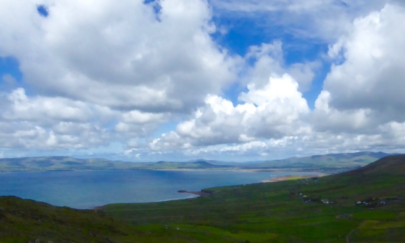
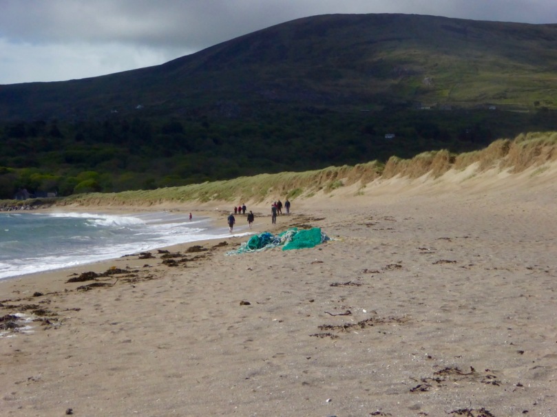
Ballinskelligs Bay. The first photograph is also Ballinskelligs Bay, with a glimpse of the famous Skelligs Islands in the background – subject of a future post, we hope!
Our journey took us on the Ring of Kerry, along the south side of the Iveragh Peninsula, by the sea. This is prime tourist territory – bus after bus passed us and every lay-by was thronged with camera-wielding tourists, including us. We came back through the middle of the peninsula, through deep valleys and high mountain passes.
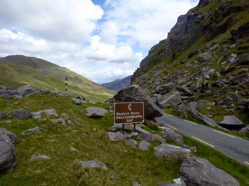
Not for the tour busses!
These are not roads that busses can manoeuvre through, so we had it mostly to ourselves, the locals, and a few tourists armed with small cars and good maps. I love this Iveragh backcountry. It’s where I spent my student days, conducting my research. I even recognised the place where I crashed my Honda 50 into a bog.
Although it seems totally mountainous, vast sheltered valleys occupy some of the hinterland of the Iveragh Peninsula
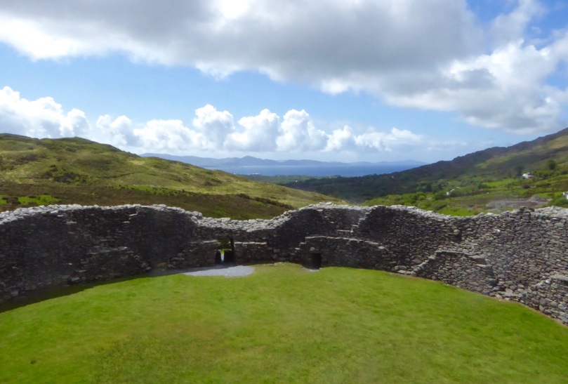
We visited two stone forts, the mighty Staigue and the lesser-known Loher, and of course some rock art. Staigue Fort is generally reckoned to be Iron Age (about 250AD), while Loher, although very similar, was built later, around the 9th Century.
Staigue Fort (upper), at the head of a long valley, commands views to the sea. Loher is also strategically sited with extensive views all around.
We toured Daniel O’Connell’s House at Derrynane and took the Nature Trail walk along the dunes, using the app developed by local man Vincent Hyland.
Wild flowers a-plenty on the dunes at Derrynane. Top: Sea Pinks and Sea Sandwort. Bottom: Pyramidal Orchid and Kidney Vetch
We searched in vain for the holy well devoted to Saint Crohane, patron saint of Caherdaniel – we’ll have to go back with Amanda to help us find it.
We didn’t find St Crohane’s well but when we finished our search, in twilight, this is what was waiting for us. The mountain range in the background is the Beara Peninsula in Cork
In fact, the primary purpose of our trip was to re-connect with cousins that I haven’t seen for about 45 years. The last time I saw Annie and her siblings they were kids, and we were all piled on to a donkey and cart in a vain attempt to get from Lamb’s Head to Staigue Fort. It’s a long story, but suffice it to say that the donkey came out the winner. Most of the family still live around Caherdaniel, in jaw- dropping surroundings, and we were accommodated and hosted with true Kerry hospitality.
Top: The view from Annie’s house, across to Lamb’s Head where the family grew up
Along the way we saw a house shaped like a ship (Robert has more – much more – about this!), had our first experience of bottle-feeding a lamb, and we watched Rex the sheepdog gently herd a flock of chickens into their pen for the night. We visited my cousin Betty’s grave – she died a few months ago, the heart of the family, much mourned. It was, we hope, the first of many visits, back and forth.
Abbey Island, Betty’s last resting place, must be one of Ireland’s most beautiful graveyards. To access it, you must walk across the sand and keep an eye out for high tides. The original monastic site was founded by St Finian in the sixth Century, although the ruined church, Ahamore Abbey, probably dates from the 10th Century.
This post is to give you a flavour for our neighbouring county and to show you why it is justly famous for its history and archaeology, but most of all for what is surely some of the most spectacular scenery in the world.
 Scarrif and Deenish are the two islands out from Derrynane Bay. Uninhabited for 40 years, they are the site of salmon farms now. We walked down Lamb’s Head to get a better view of them.
As in West Cork, everywhere in Kerry you can see the traces of tiny settlements. Abandoned long ago, possibly after the famine, each field may have provided enough potatoes for one family. Now only the sheep graze peacefully.
We headed home through the Ballaghbeama Gap. On the south side is Ireland’s greatest concentration of prehistoric rock art. We wrote about this in our post Derrynablaha Expedition.


What stunning pictures, Finola! I love Kerry too, but my time there has been family beach holidays. I’ve never visited any of the ancient sites, sadly. One day! I still can’t get over your beautiful images, have to keep going back for another look lol! How can anyone not fall in love with Ireland when they have stood in those places and witnessed such views? She grabs hold of our hearts and we are forever lost…
LikeLike
Thanks so much, Ali, and also for the share on Facebook. I am certainly forever lost.
LikeLiked by 1 person
You’re very welcome. I was so enthralled by your post. Btw I never received notification of a holy Wells of Cork post this week. Did I somehow miss it, do you know?
LikeLike
Amanda and Peter are in the Orkneys, having a wonderful time, so there have been no posts for over a week.
LikeLiked by 1 person
Ah… lucky them! Hope they have a fab time! I don’t trust wp sometimes… I have lost notifications etc before.
LikeLike
Talk about the you can’t eat the scenery. Just stunning, but what a hard life.
LikeLike
Yes, it certainly was hard scrabble. But not any more, thank goodness.
LikeLike
I always feel disloyal when praising Kerry 🙂 but it is truly awesome. Love Derrynane.
LikeLike
I know what you mean!
LikeLike
I’m from Limerick, not Kerry but still your photos made me lonesome for home!
LikeLiked by 1 person
Thank you, Mary. Glad you enjoyed it. Limerick has some lovely places too!
LikeLike
Finola, I just love your peaceful countryside, your pictures look like beautiful landscapes.
LikeLike
Hard to take a bad picture in Kerry, Lydia! Xx
LikeLike
Superb images Finola and great to hear of the re-connection with family.
How do manage to arrange the excellent lighting and cloud formations?
John
LikeLiked by 1 person
I had a word with the Special Effects Dept.
LikeLike