The Fassaroe-Type Crosses – How Old Are They?

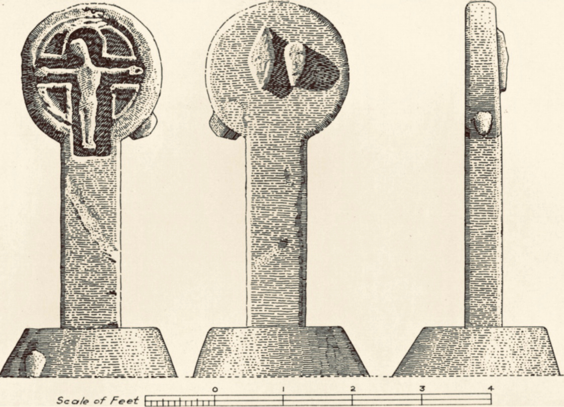
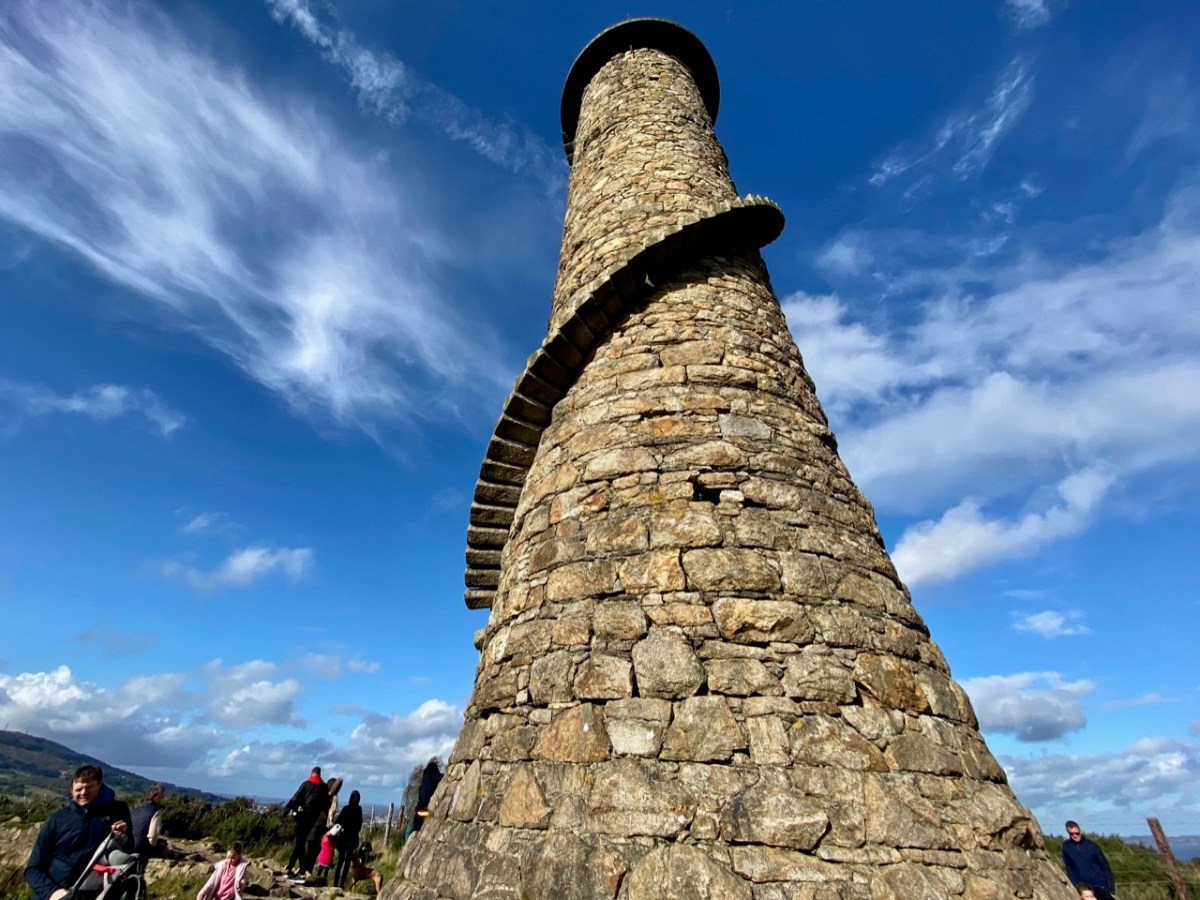
This is Part 2 of my examination of the Fassaroe Crosses of South County Dublin. In the first post I described the four crosses that comprise the Fassaroe-Type group, so well described and drawn by Pádraig Ó hÉailidhe. In this one, given that some authorities have claimed they may be of a relatively recent 17th century date, I will look at a probable dating horizon for those crosses, based on analogies with other Irish examples. 

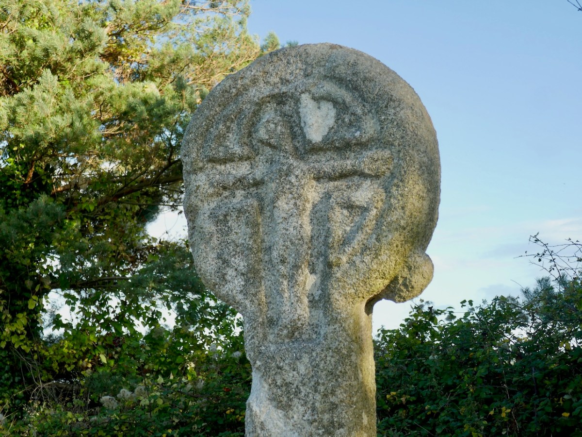
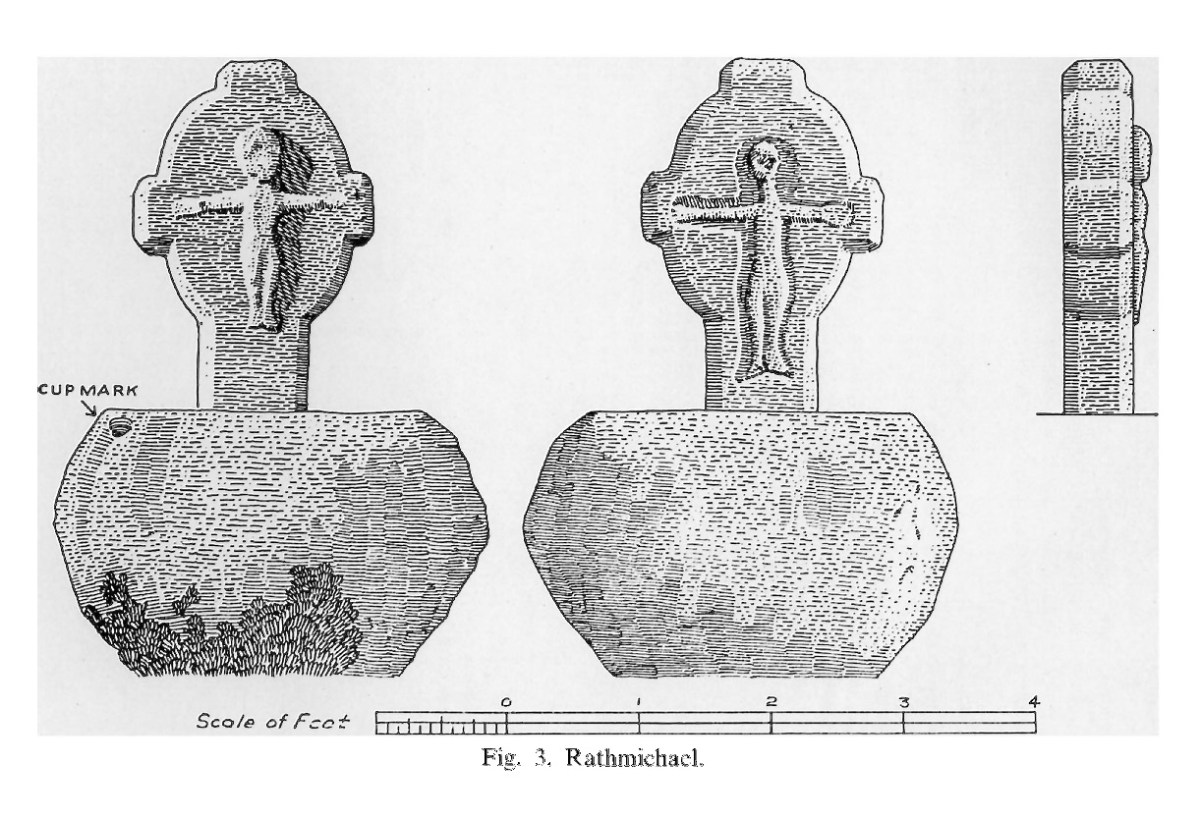
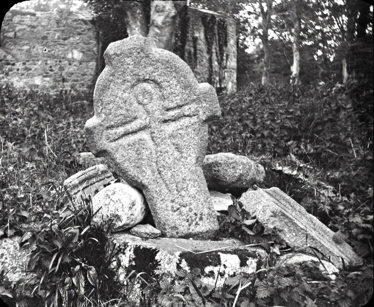
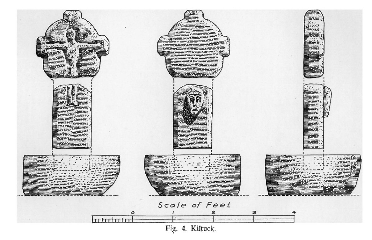
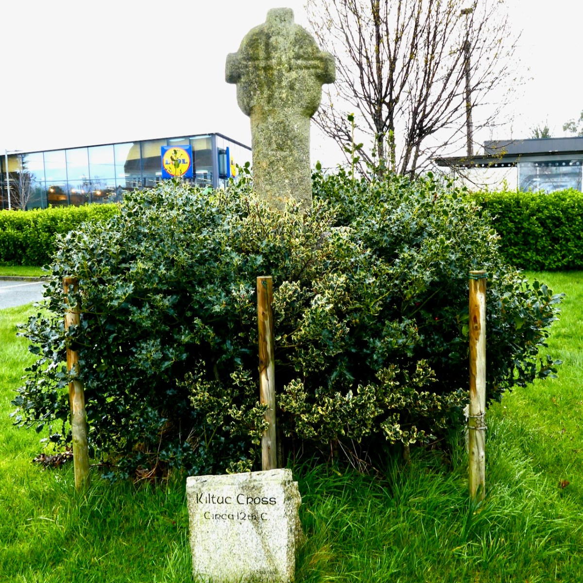
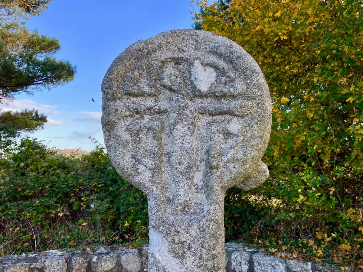
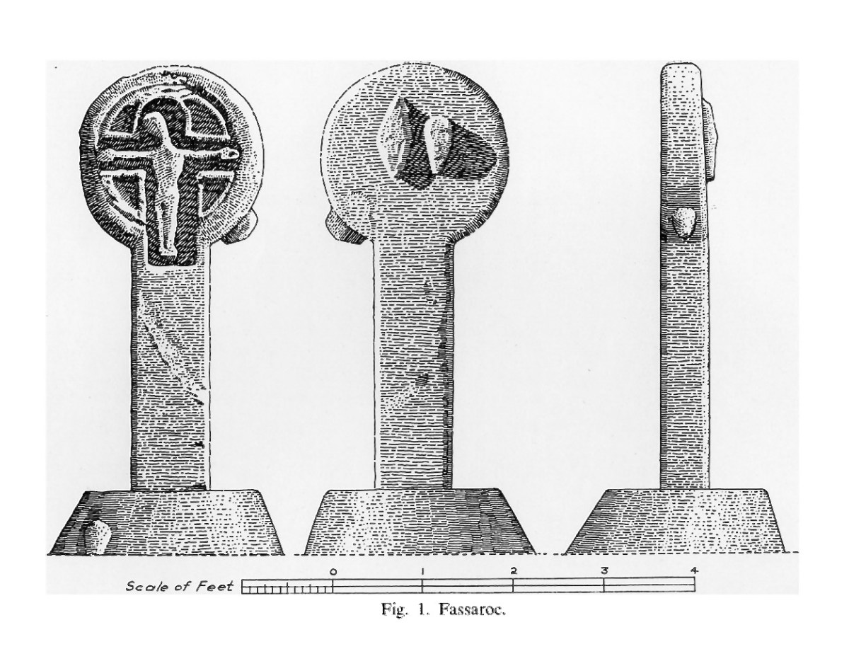
Let’s look first at the figure of the crucified Christ on the crosses at Fassaroe, Rathmichael and Kiltuck. It is immediately obvious that they are similar to each other in the slender shape and in the head, which is inclined or tilted to the right, and in the fact that the figure is recessed (although Rathmichael also has a figure in relief with no incline to the head). That tilt is pronounced on the Fassaroe cross but slightly less so on the figures on the Kiltuck example and the back of the Rathmichael Cross. 

In the Kerry County Museum (the photo above is taken, with thanks, from their Facebook page) is a bronze figure, about 10cm long, probably once attached to a cross. It is dated to C1150 (I am not sure by what method since I cannot access the 1980 Journal article) and comes from Skellig Michael. The tilt of the head and the elongated figure are both clearly analogous to the Fassaroe-type figures.

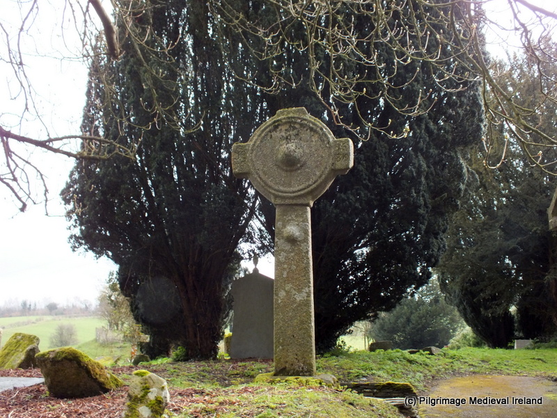
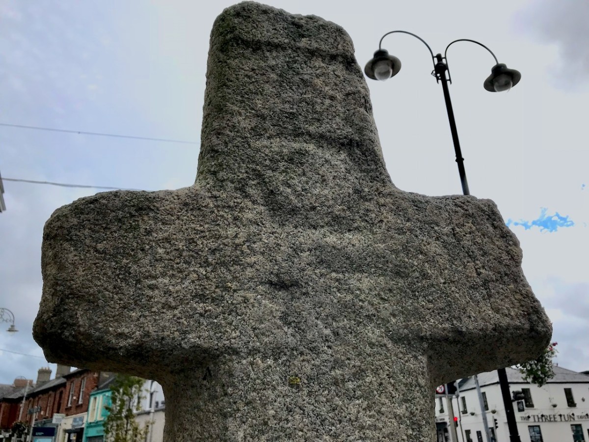
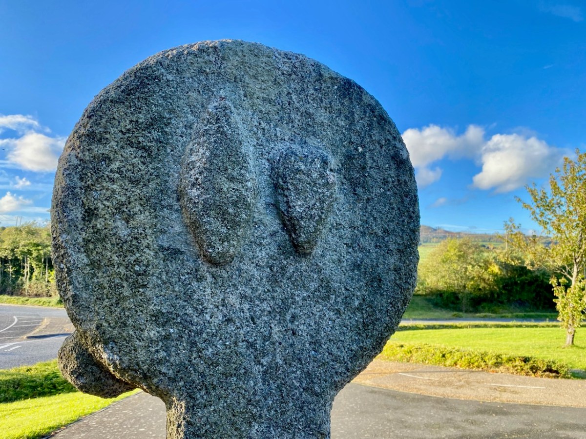
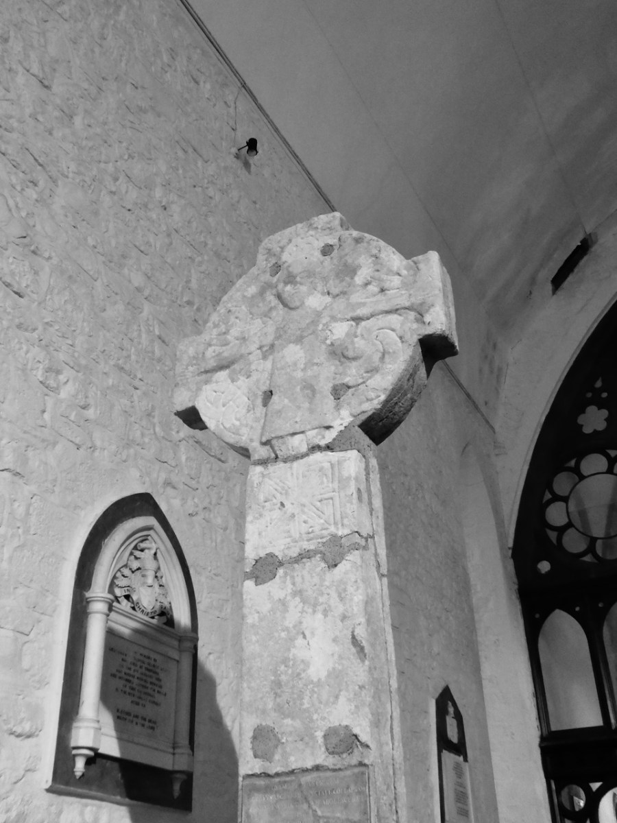
What about the shape of the cross-head? In Fassaroe this is a simple disc, while Rathmichael and Kiltuck have very short projecting arms. None of the South County Dublin examples have pierced heads, as in the classic Irish High Cross. We find similar crosses, in fact, in Ballymore Eustace (see this post in Pilgrimage in Medieval Ireland for more on that example – this image is from that post, with thanks), Kilfenora and Killaloe.

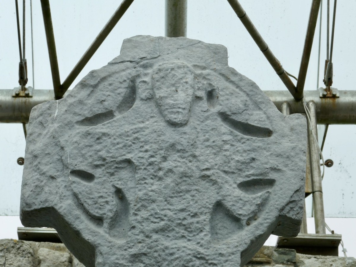
The Killaloe Cross, above, which actually came originally from Kilfenora, is perhaps the closest, and is dated to the 11/early 12th century. I have rendered my photograph in black and white as it is easier to make out that way,

There are several crosses in Kilfenora, associated with the 12th century church. Although they are more highly carved than the Fassaroe-type crosses, the unpierced disc form with the short arms can be seen on the back of the Doorty Cross (above). 

The back face of the Tuam High cross, below, captured from a 3D image* although pierced, has a simple figure with an elongated and tilted head.

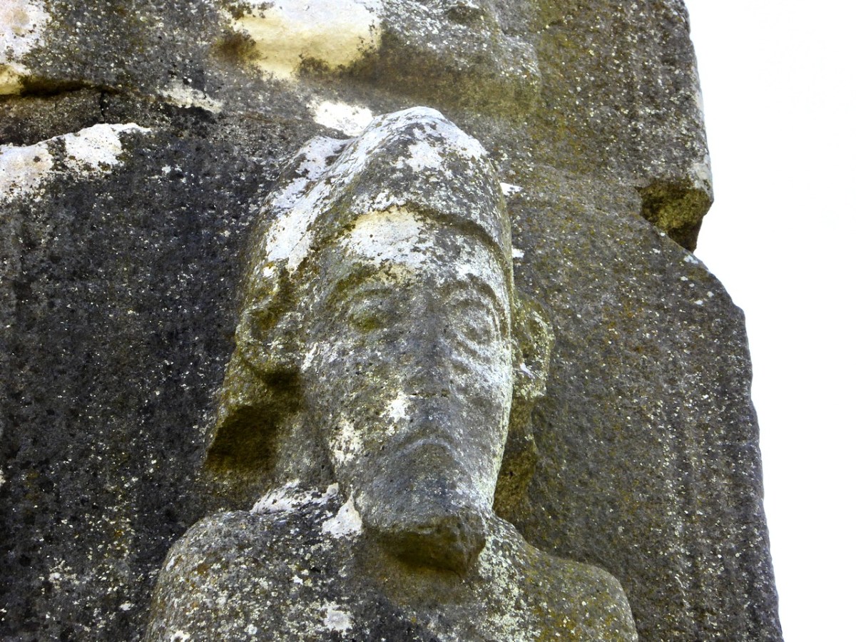
The Dysert O’Dea high cross (below) has several features of interest to us here. First, the conical mitre may be analogous to the Fassaroe head.

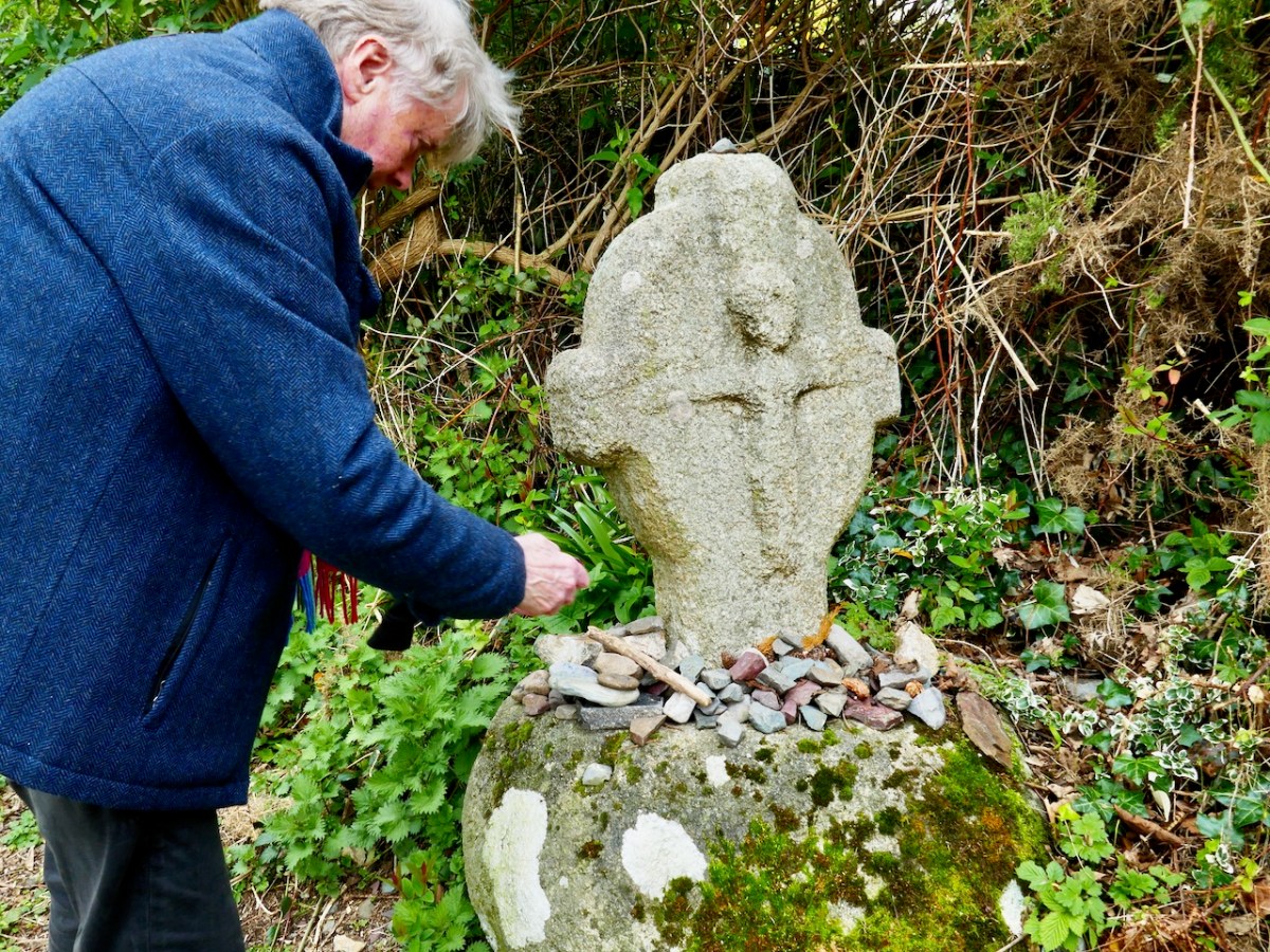
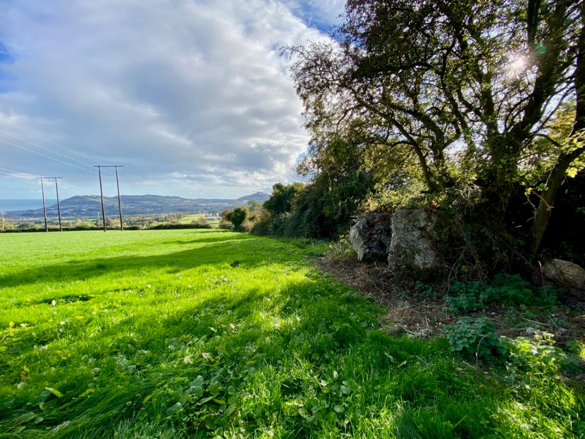
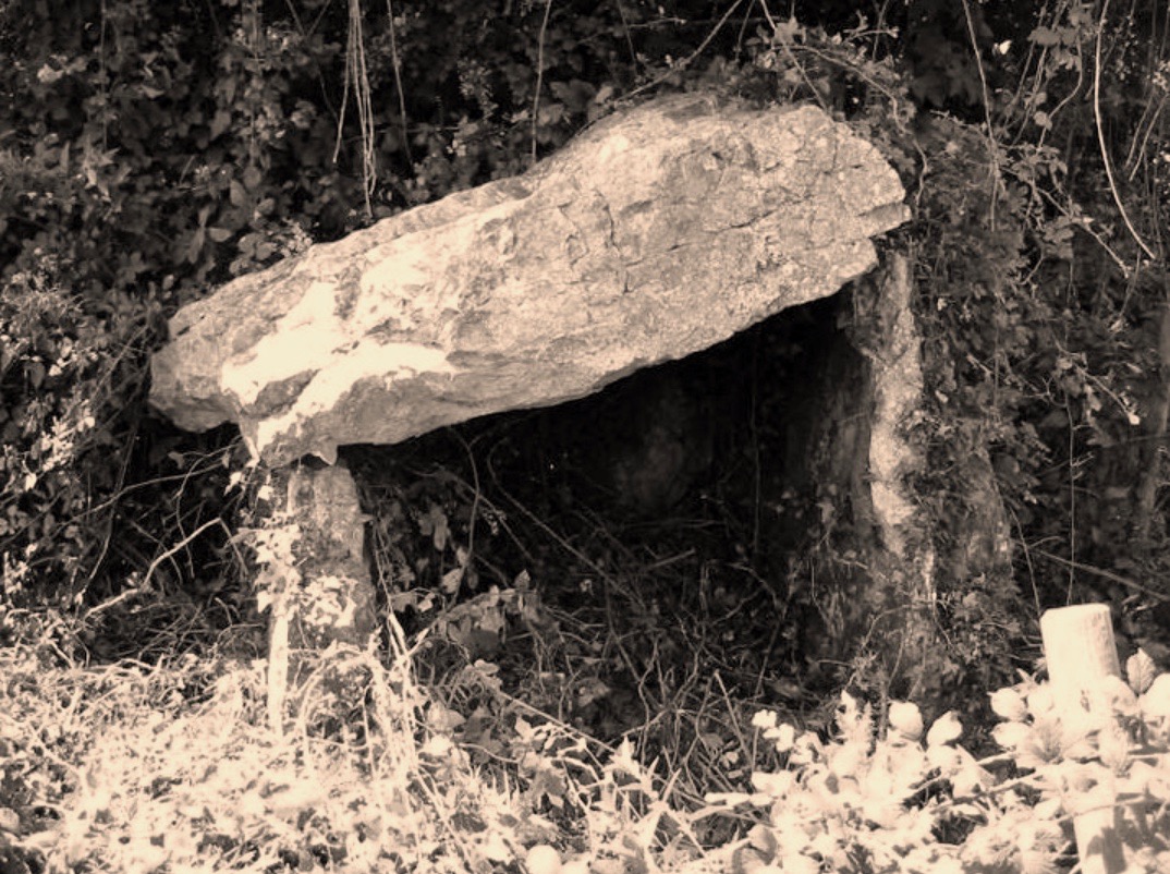
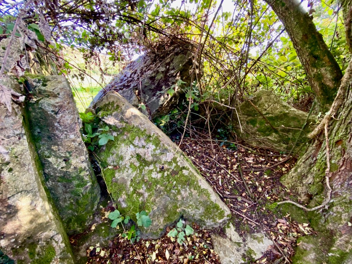
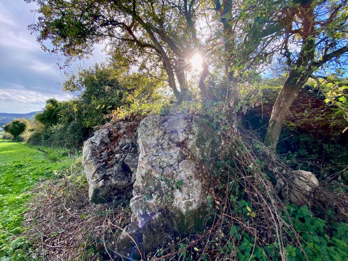
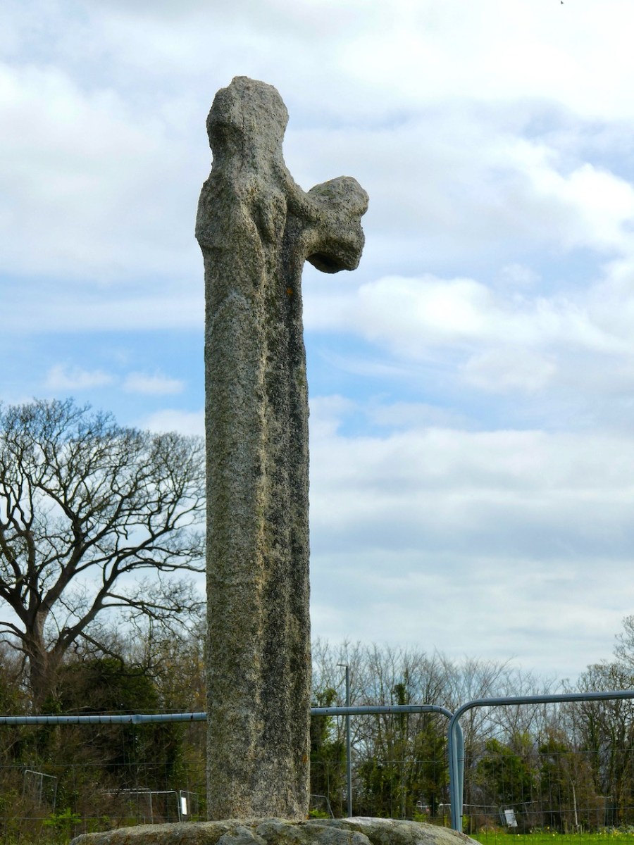
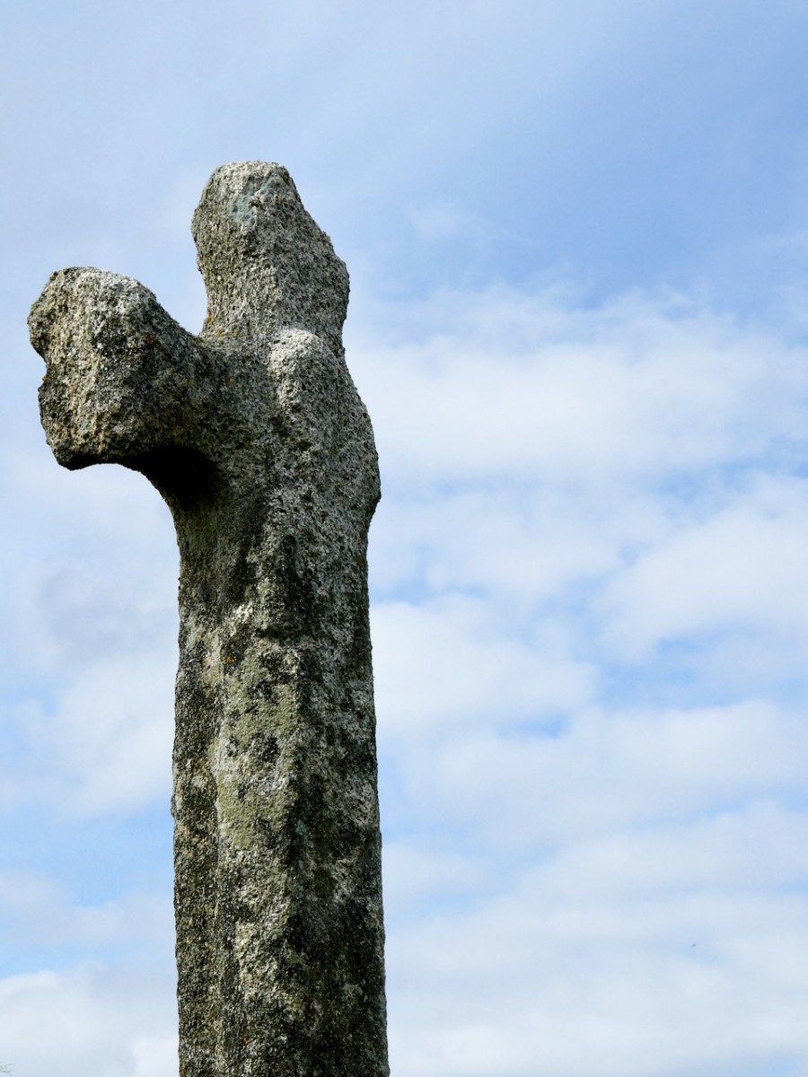
But it also points us to another monument close to the Fassaroe crosses – the Loughanstown Cross, below, now marooned in a new housing estate and very badly damaged. The form of the cross, however, looks quite similar to that of the Dysert O’Dea crosses while the projecting head (on one side) and the long figure (on the other) is also reminiscent.

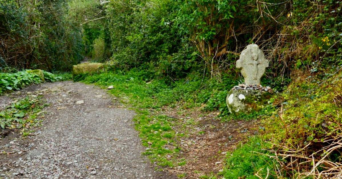
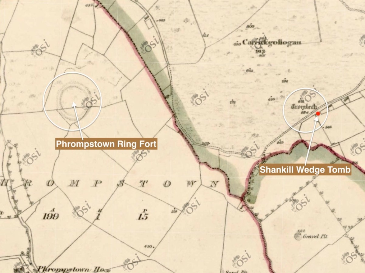
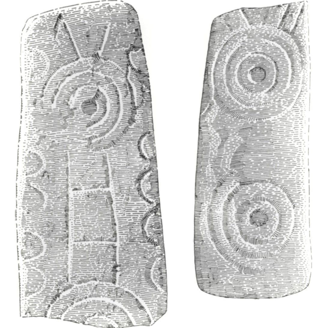
There is one more cross in the South County Dublin group which was situated in Killegar, about 4kms north-west of Fassaroe. It’s fragmentary, with only the disc-head remaining, containing on one side a simple crucified figure, with the head straight. In a piece for the JRSAI in 1947, Ó Ríordáin describes the other side as a cup-and-circle. This may mean that this cross was carved on the back of a piece of prehistoric rock art, but more likely that it relates it to the Rathdown Slabs, and brings us back full circle to the Rathmichael graveyard that Robert wrote about in his post Viking Traces.

The Rathdown Slabs slabs (also described and drawn by Pádraig Ó hÉailidhe, below) use that cup-and-circle form as part of their decorative technique, and are generally dated to the Viking period, or anything from the 9th to the 12th century.

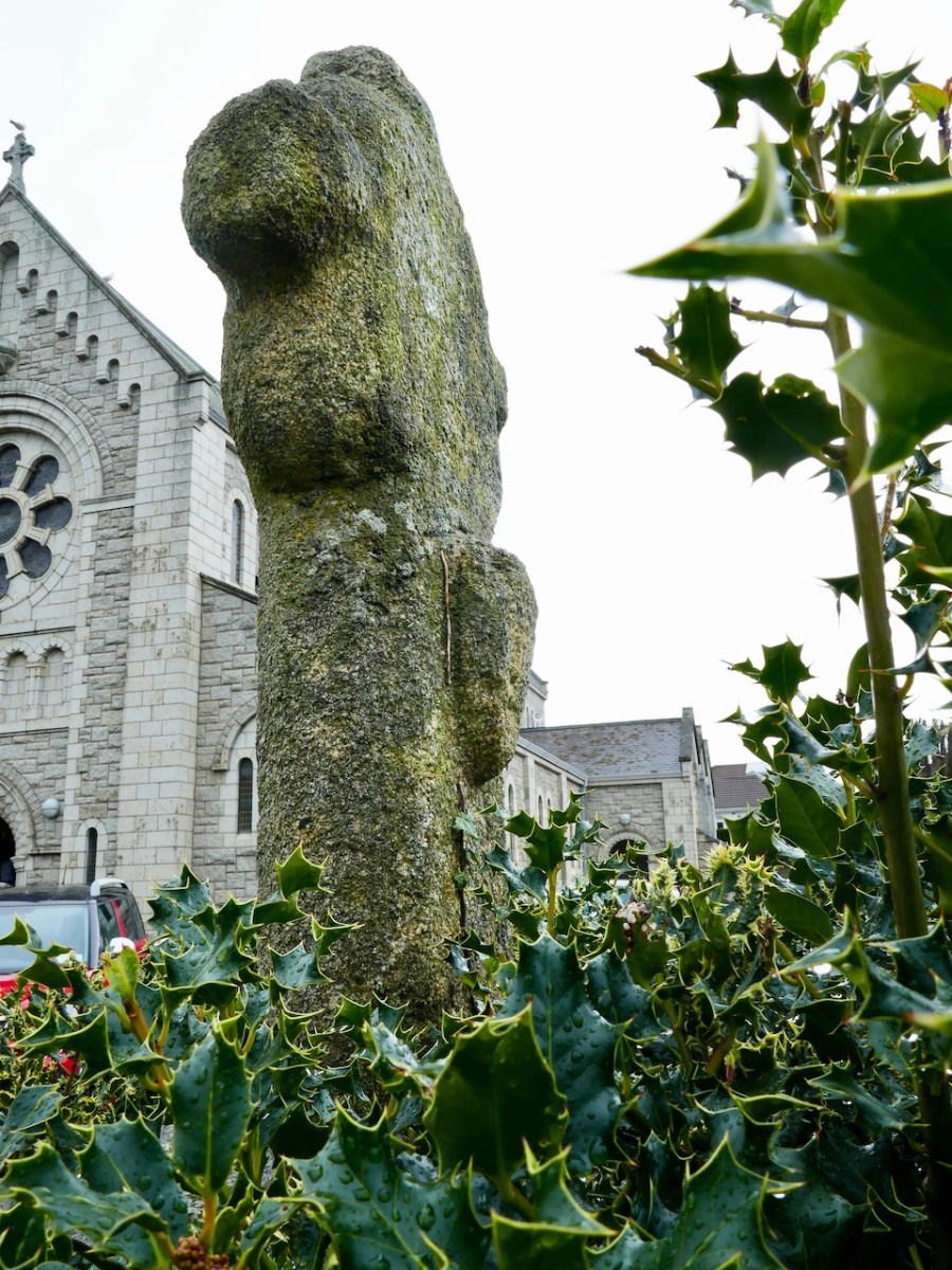
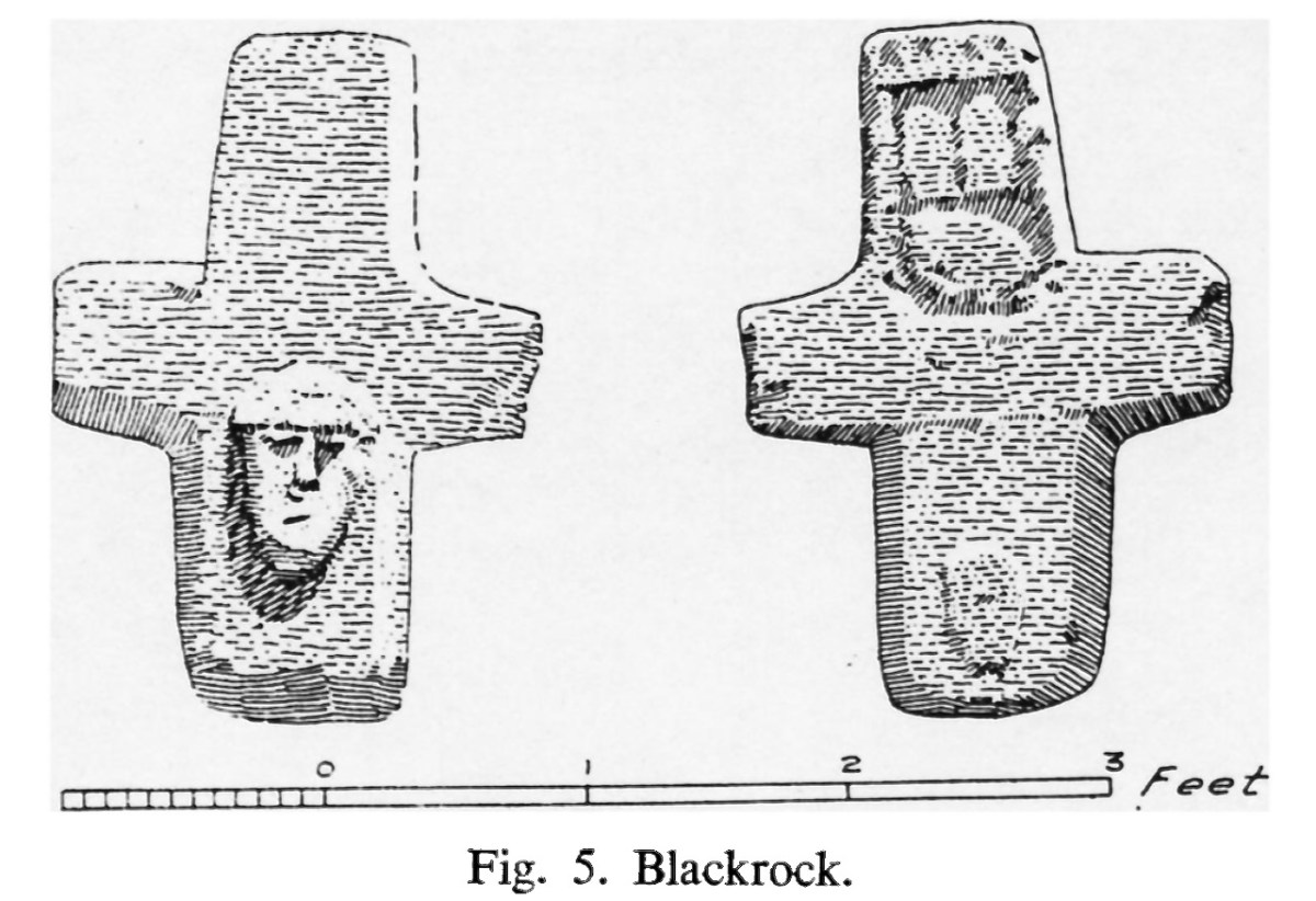
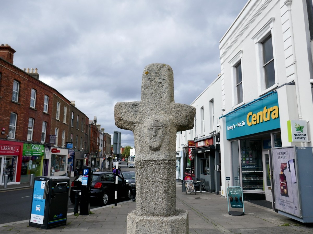
That leaves us with the Blackrock cross, different in form from the others, except for that projecting head . The only analogy I can find among my own photographs ties it firmly to the Romanesque period (12th century) – that cross is at Kilmalkedar in Kerry (below). 

So – all of the evidence through association connects these crosses into a 12th century (or earlier), cross-carving tradition in Ireland. But Ó hÉailidhe also drew analogies with a group of very similar crosses from Cornwall, often referred to as ‘wheel-headed’. Their date? They were assigned to ‘very early Romanesque’ by Andrew Langdon, the authority on Cornish crosses over a century ago, and this assessment had been upheld by the august editors of the Corpus of Anglo Saxon Stone Sculpture in their 2015 Volume Early Cornish Sculpture. They state: The relationship of the Cornish sculpture to monuments in Wales, Ireland and Western Britain is of particular interest given Cornwall’s position as a peninsula jutting into the western seaways. In this context, the potential role of Scandinavian influence is considered against the absence of evidence for Scandinavian settlement in Cornwall.

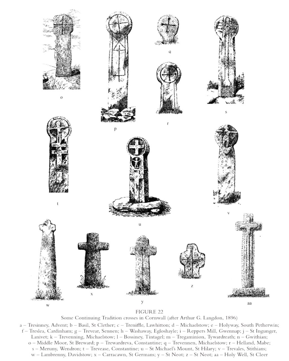
Langdon’s illustration (above) will amply demonstrate how similar in form these crosses are both to the Fassaroe-type and to the Blackrock cross.

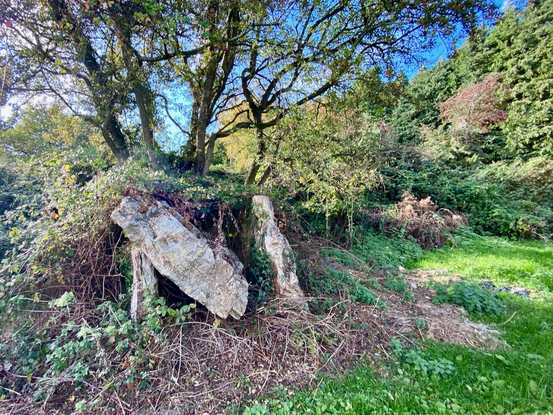
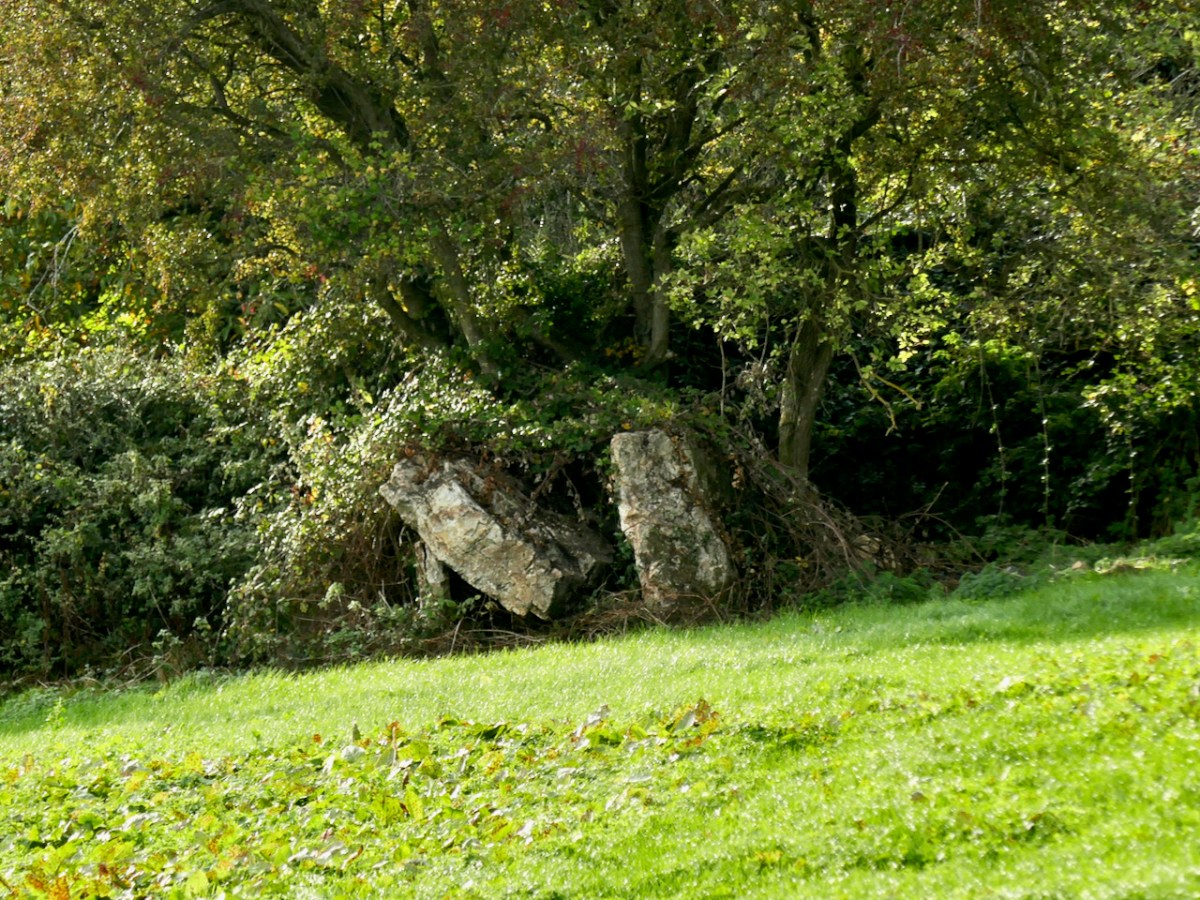
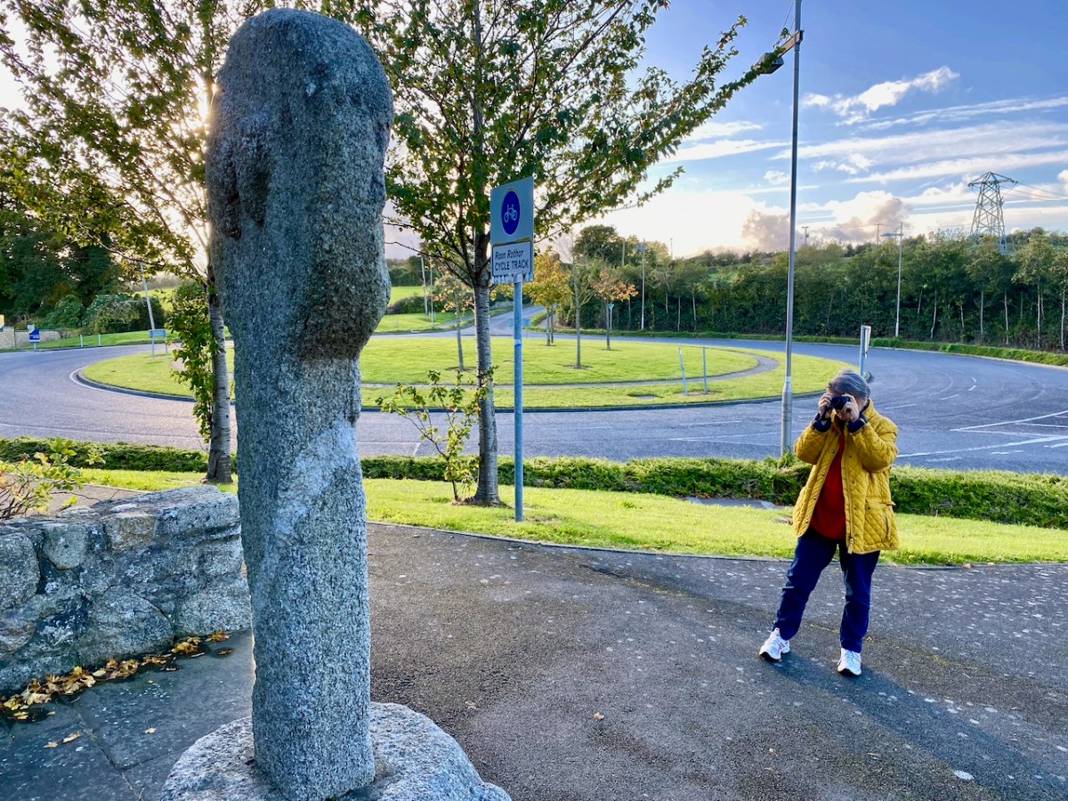
I will finish with a photograph of the Laughinstown Cross, behind its chain-link barrier in an under-developed park in a new housing estate. Behind me as I took this photograph is an equally beleaguered church (called Tully Church) of early medieval origins with associated graveyard. It is all but consumed by encroaching apartments, and clinging perilously to a cliff that is being dug out for yet more building. Although it’s clear we need more housing, it makes me sad that not more is being done to celebrate the heritage that still exists in this part of Dublin.

*In the public domain, but thanks to Digital Heritage Age and to the funding bodies: The Community Monuments Fund Awarded by The National Monuments Service, Department of Housing, Local Government and Heritage. Supported by Old Tuam Society, Galway County Council, TheHeritage Council and Galway Community Archaeology Project.

The Fassaroe-Type Crosses of South County Dublin

The Fassaroe Cross (also know as St Valery Cross, below) is familiar to me from childhood, but I hadn’t realised until recently that it is part of a concentration of four crosses in south County Dublin, all still extant*. We have visited them all now, and this first post will look at these remarkable examples of surviving Irish Early Medieval crosses. In the second post I will study their possible dates, established mainly through association with similar examples from elsewhere in Ireland.

In using the term Fassaroe-type, I am following Padraig Ó hÉailidhe (better known as Paddy Healy) who, in 1958, published Fassaroe and Associated Crosses in the Journal of the Royal Society of Antiquaries of Ireland (available on JSTOR). Not only did he lay out what was known about these four crosses at the time, but he included his own wonderful and accurate pen and ink drawings.

Robert included the Fassaroe Cross in his post East Coast Archaeology, so I refer you to that for additional photographs of the cross in its context. It’s easy to see why this cross would have become the diagnostic ‘type’, since it is the most complete. 

Standing incongruously at the edge of a traffic roundabout, the cross is an arresting sight. According to Ó hÉailidhe, It was brought from ‘a glen’ some distance away. He also states:

When O’Curry visited the site in 1838,4 he saw, in addition to the cross, a font, pedestal, and quern, which are still extant, a cross shaft which is now missing and part of a baptismal font which had been removed along with another quern to the farmhouse beside Fassaroe Castle. He was furthermore informed that a circular crosshead had also been removed, and that human bones had been dug up on the south side.

The cross has a circular head on a straight shaft which is set into a semi-conical base. On its front face its a crucifixion image, head tilted to the right. The crucified Christ is surrounded by four wedge-shaped quadrants, as if to indicate the hole-and-circle we associate with high crosses. A carved head occupies a space on the outer circle on the lower right.

The back of the circle has two carved heads. Although very worn, Ó hÉailidhe felt their elongated shape pointed to long beards and a mitre. The base has yet one more head. You can view the cross in 3D here, a project of the Medieval Bray Group.

The second Cross is in Rathmichael, just outside Shankill, at the start of a woodland walk. It’s my lead photograph, which shows the context. It was moved here from the ruins of Kiltuck Church which once stood, with its associated graveyard, in what is now the housing estate of Castle Farm on the Bray to Shankill road. 

Old photographs taken by Thomas Mason (see Roberts post for more about this photographer) show it before it was moved, in a jumble of stones at Kiltuck.

The two Mason photographs above are from the Mason collection at the National Library of Ireland, and used under license from them.

Apparently the shaft was in the present location and when the cross was re-united with it – it fit! The front of the cross has the crucifixion image carved in relief, while on the back the image is recessed. Like Fassaroe, the recessed head  is slightly tilted to the right. Unlike Fassaroe, in which the top of the cross was circular, this one has very short arms. 

The base has a small cupmark. Since walkers regularly use this route, some have taken to leaving small offerings, and it’s good to see this cross as valued and respected.

There were two crosses at Kiltuck, and the second one was removed by the Parish Priest of the newly-built Church of St Anne in Shankill in the early 1930s. In recent time the Rathmichael Historical Society, an active local group, sponsored its erection in its current location in front of the church, on a stone plinth.

The front face has a recessed crucifixion image, head slightly tilted to the right. The photograph below was taken in the church yard and shows the urban environment of this cross.

The back of the cross has a head, with the pointed chin such as we saw at Fassaroe. The head of the cross has the same short arms as the Rathmichael cross. 

Our final cross is in a most unexpected location – right in the middle of Blackrock. It may have been used in the 15th century as a boundary marker to separate one medieval Dublin ‘franchise’ from another. Here’s what Ó hÉailidhe has to say on his decision to include it with the others: 

The newly erected cross at Blackrock (Fig. 5)26 has been included in this group, because it has several features in common with that of Kiltuck, i.e. a human head in exactly the same position on the shaft and some rather irregular chamfering. This cross does not possess any artistic or architectural merits.

The chamfering is most obvious on the Kilmichael cross, while the head is similar to that at Kiltuck. The shape of the cross, however, is entirely different: rather than the head of the cross being circular, this one is, well, cross-shaped.

It’s impossible to make out what’s on the back on the cross, although Ó hÉailidhe tries manfully to illustrate it. 

Ó hÉailidhe includes one more cross, from Killegar in Wicklow, now in the National Museum, but I will deal with that one in the next post, when I will review the literature about similar crosses and come to a conclusion about likely dates. Spoiler alert: although there have been claims that these crosses may be as late as 17th century, as you will see, I agree with most authorities that they are 12th century. As such, they represent a very important monument group.

* Thanks to Chris Corlett for pointing me in the direction of resources for this post

East Coast Archaeology

We often find time to visit the east side of the country – where we see everything from a different perspective! But we are just as interested in history and archaeology over there as we are here in our own West Cork. Today I am bringing together three sites from three different eras – all equally fascinating, and all within a stone’s throw of each other, hovering on the borders of South County Dublin and County Wicklow.

From the high ground in these two counties you find stunning views to the north out across Dublin Bay, with Howth in the distance. The twin striped chimneys on the right of this picture are protected historic structures: they date from 1971 and were built to serve the Poolbeg electricity generating station. At 270m they are amongst the tallest artificial structures in Ireland and are a visible feature on the skyline from many parts of the city. The power station closed in 2010.

The first site we are visiting in this little tour is the wedge tomb in Shankill townland, County Dublin. It lies below Carrickgollogan hill, and commands distant views to the two distinctive Sugar Loaf peaks, which are situated in County wicklow. Or – let’s say – it should command those views, but it now reposes in a rather neglected state, engulfed by a modern hedge boundary, which you can see below.

The picture above is taken a little to the west, to show the full skyline profile. The monument is not in good shape: the photo below (courtesy Ryaner via The Modern Antiquarian) shows the tomb in 2006, when the capstone remained intact on its supports. In less than two decades the capstone has fallen, as you can see from our photos taken a few days ago.

It is quite difficult to penetrate the undergrowth to see what remains of this structure, which probably dates from between 4,000 to 5,000 years ago. It seems a shame that such an ancient survival is not cared for in any significant way by our State. The tomb was recorded (as a ‘dolmen’) by the archaeologist William Borlas in 1897. Just over a century later, it has significantly deteriorated. The extract (below( from the first edition 6″ OS map gives it the title ‘Cromlech’ – and also shows nearby a substantial ring-fort: there is no trace of that remaining today.

We leap forward about three thousand years for our next archaeological site, but we are only a short distance away as the crow flies – in Fassaroe, Co Wicklow, less than half a kilometre. This was a great discovery for me: a very fine carved cross, likely to date from the 12th century. Although it has been moved from its original site, it is cared for, and easily found right beside a strangely deserted modern traffic roundabout with little sign of habitation nearby.

The granite cross face is carved with a crucifixion, but there are also ‘bosses’ on the back, sides and base stone. These are believed to be heads, well worn now but in good light some features can be seen: a pointed ‘ceremonial’ head-dress, and beards.

The clearest view of the carvings (above) is illustrated in The Journal of the Royal Society of Antiquaries of Ireland, Volume 88, 1958. An article by P Ó hÉailidhe discusses this cross and others nearby. The carving is popularly known as St Valery’s Cross as it purportedly came from the nearby demesne of that name. Some archaeologists theorize that it was originally brought to that estate from elsewhere.

This extract from the first edition of the 6″ Ordnance Survey map (c1840) shows the location of the cross, not far from St Valery.

It’s about 7km from the Fassaroe Cross to the last stop on our journey. We have to head north on a road that takes us through The Scalp.

. . . Within an easy drive of Bray is a wild ravine known as the Scalp. The road runs over a shoulder of Shankhill Mountain and through this ravine; it presents a very wild appearance, enormous masses of granite being heaped up in grand and picturesque confusion on either side. It looks as if nature, in order to spare man the trouble of blasting a road, had by some mighty convulsion torn a rent through the mountain just wide enough for a high road . . .

Irish Pictures Drawn with Pen and Pencil, Richard Lovett, 1888

The view above accompanies Richard Lovett’s 1888 account. In spite of the topological interest of the Scalp road, our journey took us on and forward a few hundred years to our last stop – the lead workings on Carrickgollogan hill, Ballycorus townland. The hilltop mine chimney which forms our header picture is a well-known landmark in this part of the country.

The mine was established in the early nineteenth century. Many of the lead works buildings remain today in the valley below the landmark chimney, mainly converted to modern dwellings: the photo above (courtesy Joe King via Wiki Commons) shows a distant view of the converted buildings and ‘shot tower’. The ‘Shot Works’ can be seen on the 25″ OS extract, above. This also show the location of the Lead Mine flue and chimney, which was the destination of our archaeological journey. That’s us (below) climbing the hill towards the chimney that’s on the 220m contour line, and offers views towards Dublin Bay.

Open-cast mining commenced in 1807. The Mining Company of Ireland took over the site in 1826 and began to carry out underground extraction. A 2 km long flue (shown in red on the map above) was laid out from the smelting facilities to the great chimney at the summit of the hill. You might think this was an acknowledgment of the poisonous fumes which lead working released, and an attempt to divert those fumes from the main site – but no!

. . . A process had been discovered in the 1770s whereby additional quantities of lead could be extracted from the fumes emitted by reverberatory furnaces if the vapours could be trapped long enough to precipitate the lead. To this end a flue 2 kilometres long running from the lead works and terminating at a chimney near the summit of Carrickgollogan was constructed in 1836. The precipitated lead deposits were scraped out of the flue by hand and many of the workers subsequently died of lead poisoning, giving the surrounding area the nickname “Death Valley”. . .

Wikipedia

The lead mine chimney remains – although a brick upper section was removed in the twentieth century for safety reasons (see lower picture) – and so does much of the enclosed flue. A public trail follows its course to the top of the hill. The remaining chimney is a fine granite structure, in reasonably good condition. It’s certainly much visited: Finola – who grew up in Bray – has fond memories of cycling out there with her two brothers, and finding ways to climb part way up the spiral staircase which accessed a viewing platform, in spite of key parts of the stair structure being missing!

All three examples of archaeology we have studied today have one thing in common: they are constructed of local granite. Thousands of years separate the oldest and the most recent, but the inherent strength of the material has ensured survival, at least in part. As with West Cork and all other parts of Ireland, the temporal history is rich, and much of it is largely intact. We have so much more to explore!