Sheep’s Head Stone Circle Revived!

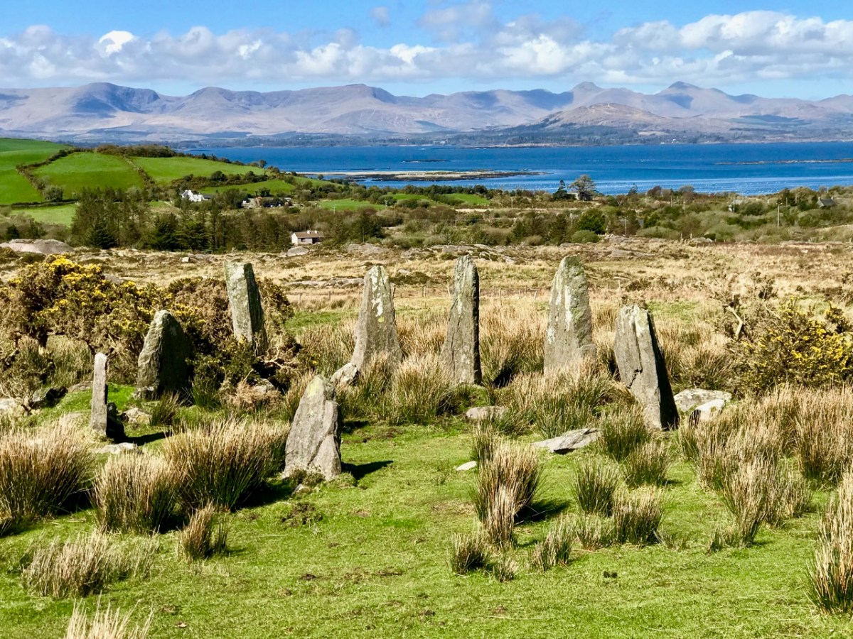
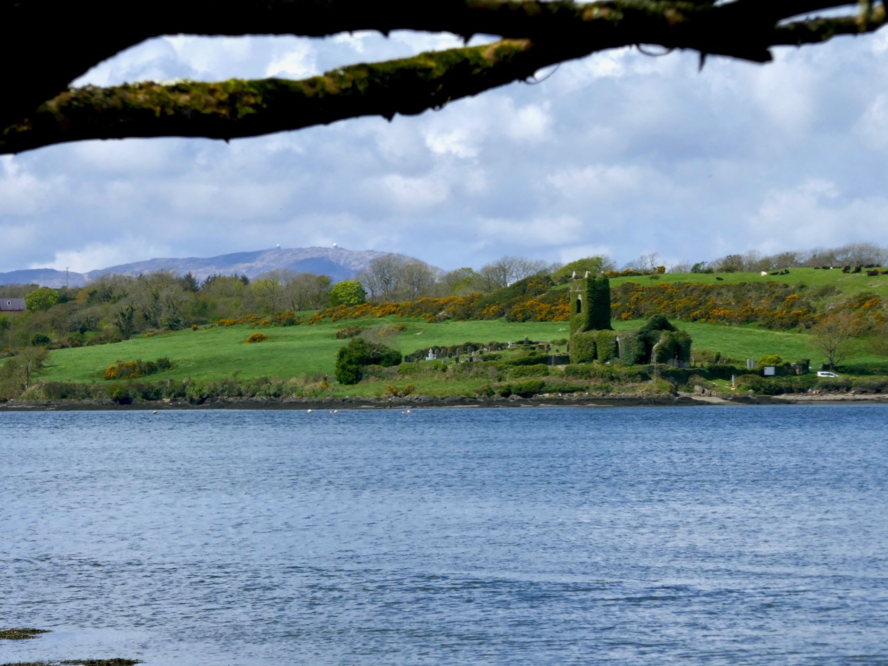
Gorteanish Stone Circle, near Ahakista on the Sheep’s Head Peninsula, is singular because it lacks ancient history. It doesn’t appear on the early Ordnance Survey maps and – to the best of my knowledge – no local stories or folklore have been recorded about it. It is a Bronze Age archaeological site, but it has apparently been overlooked until comparatively recent times.

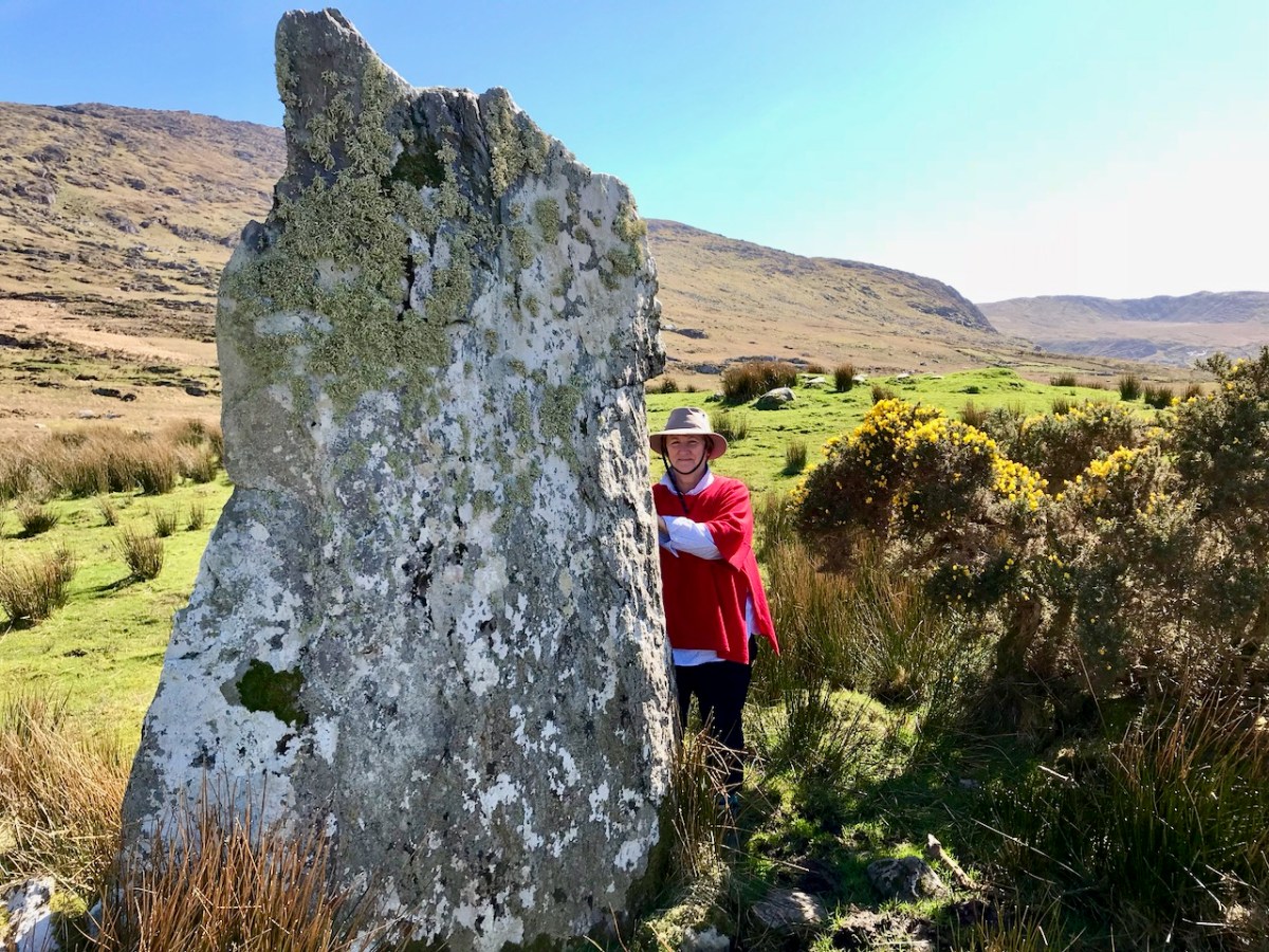
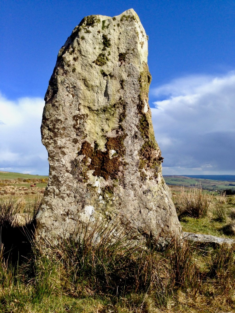
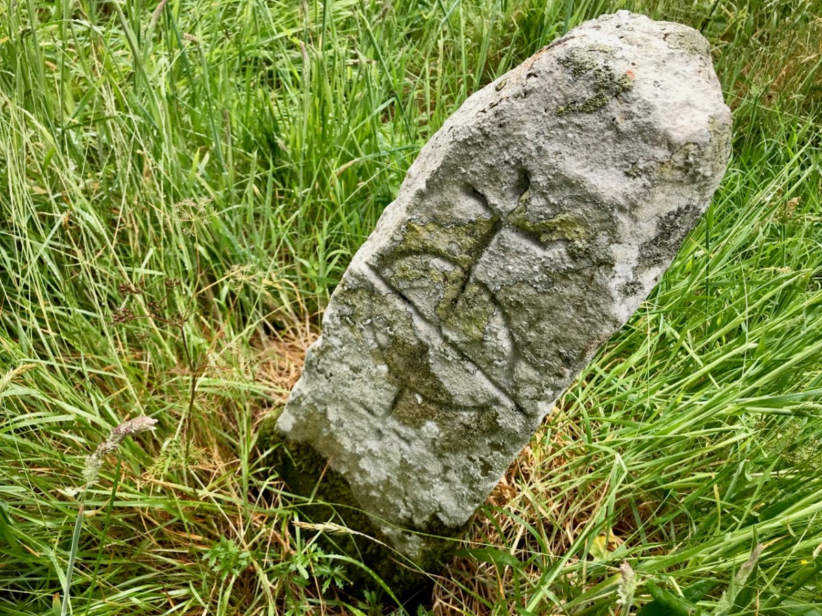
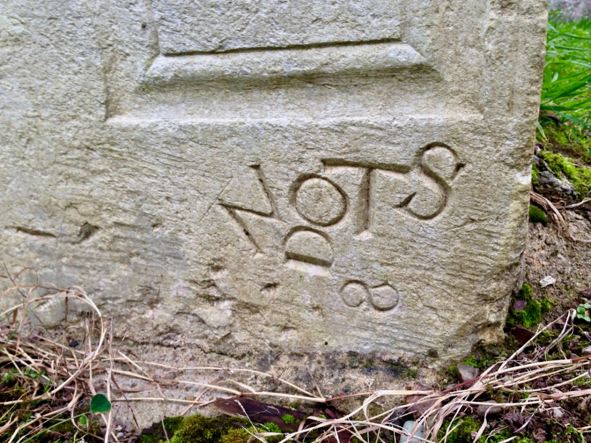
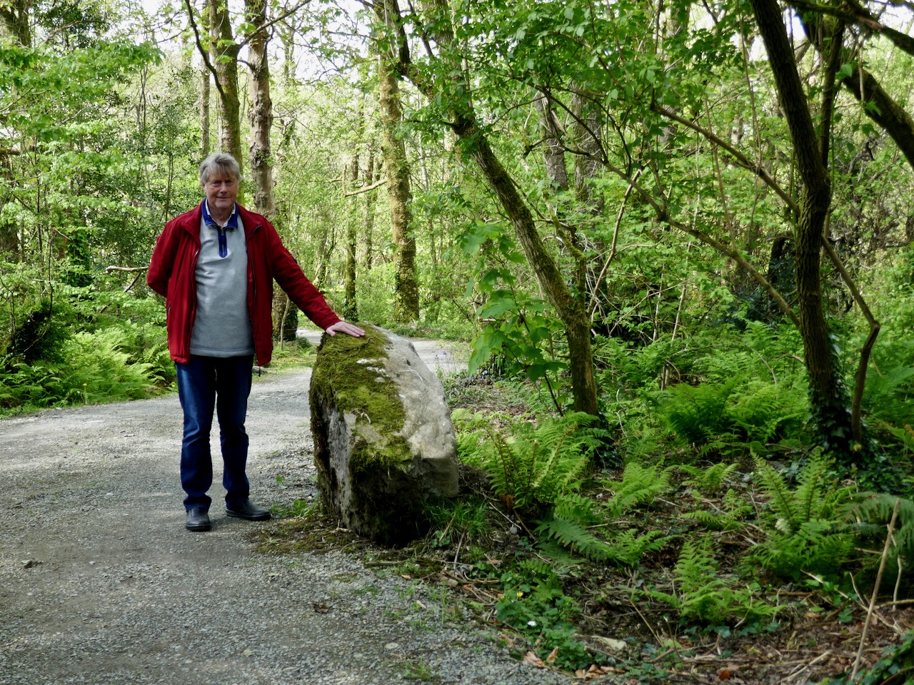
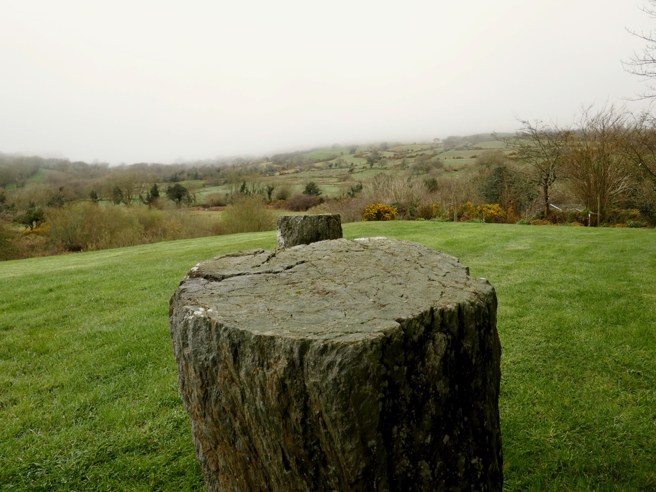
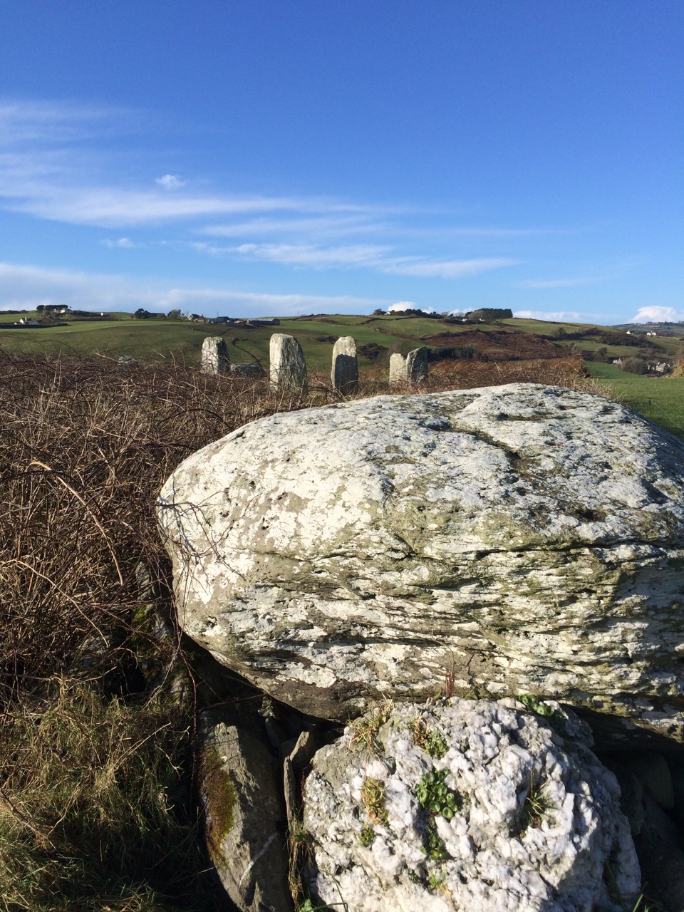
It’s a short walk to the west out of Ahakista to the site of the stone circle. The way is marked by the stone above. Atha Tomais means ‘Tomais’s Place, and refers to Tom Whitty from Philadelphia, who settled on the Sheep’s Head in the 1980’s with his wife Suzanne and family. He is credited with having come up with the idea of establishing The Sheep’s Head Way – a series of footpaths covering the peninsula, and the project was put in hand by Tom and a local farmer, James O’Mahony, completed in (remarkably) just 18 months and formally opened by President of Ireland Mary Robinson in July 1996. During clearance work for the Ahakista footpath the remains of the stone circle at Gorteanish were discovered. It has since been suggested that there were stories of ‘old stones’ being hidden in the undergrowth. A footpath giving access to the stones from the nearby lane was duly completed and opened, and the inscribed stone marks this occasion.

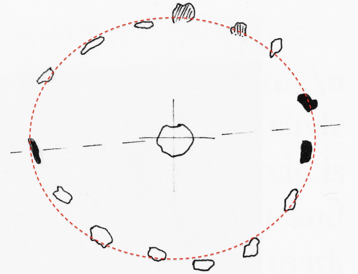
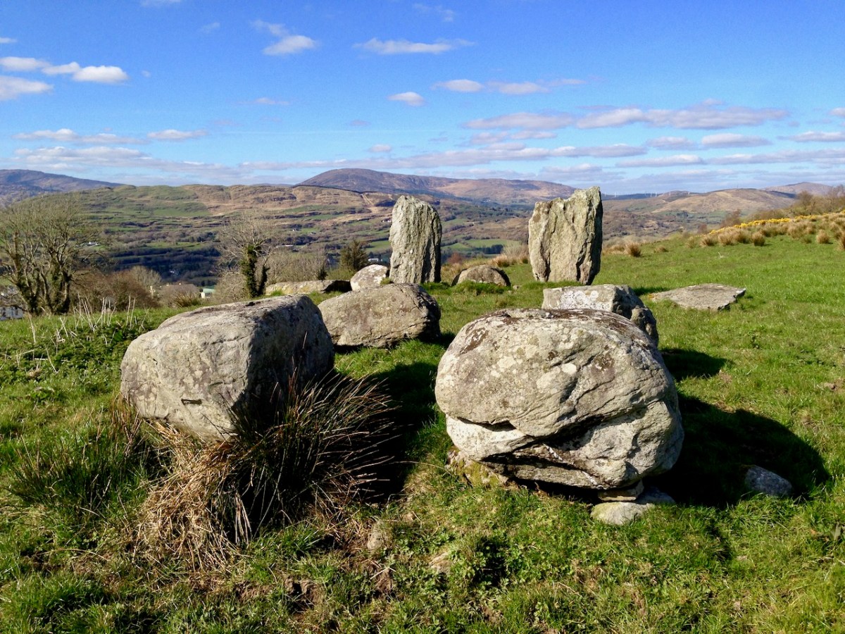
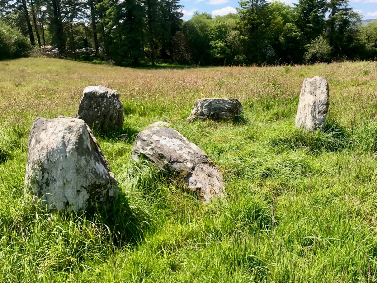
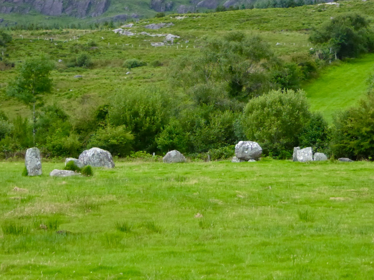
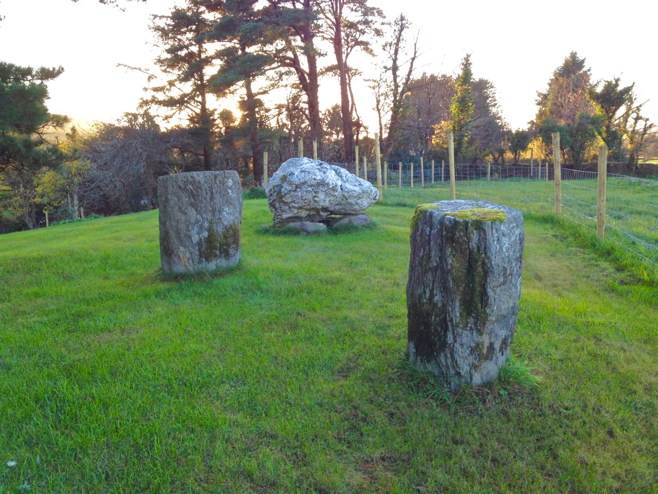
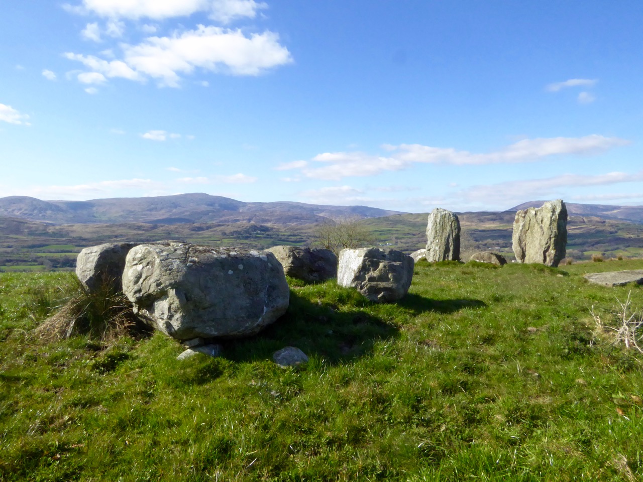
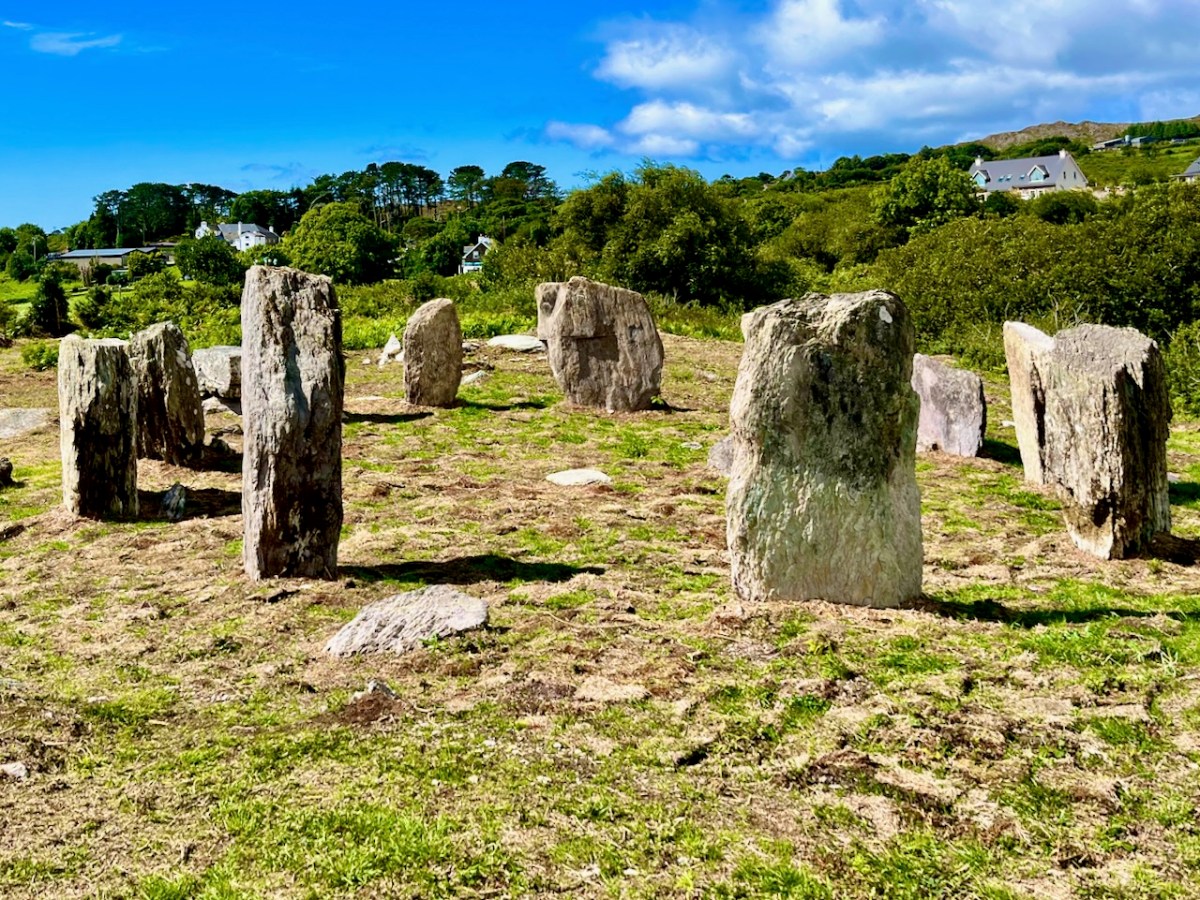
This photograph shows the circle more or less as it was found in the 1990s. Four stones are standing, and others are lying prostrate.

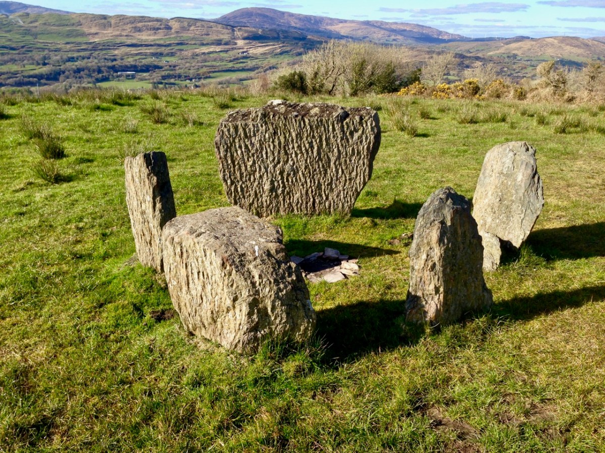
Earlier this year, the decision was taken by Professor of Archaeology at University College Cork, William O’Brien, together with a group of students, to extensively study the site at Gorteanish. Their mission was to excavate the site where necessary to establish which of the stones had been standing and to see how feasible it might be to restore these standing stones in their original sockets, using only traditional methodology. A significant area around the whole site would also be examined to search out any evidence of human occupation and activity – and hopefully to provide a reasonably accurate dating for the circle.

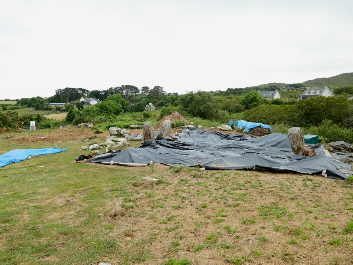
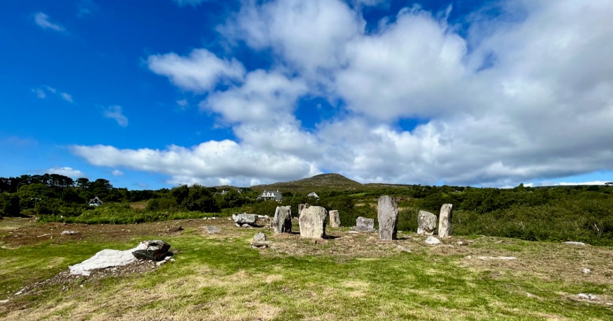
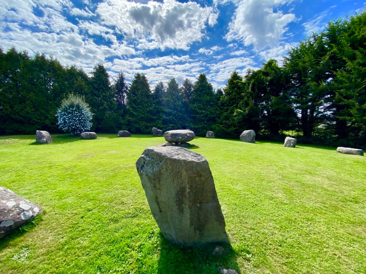
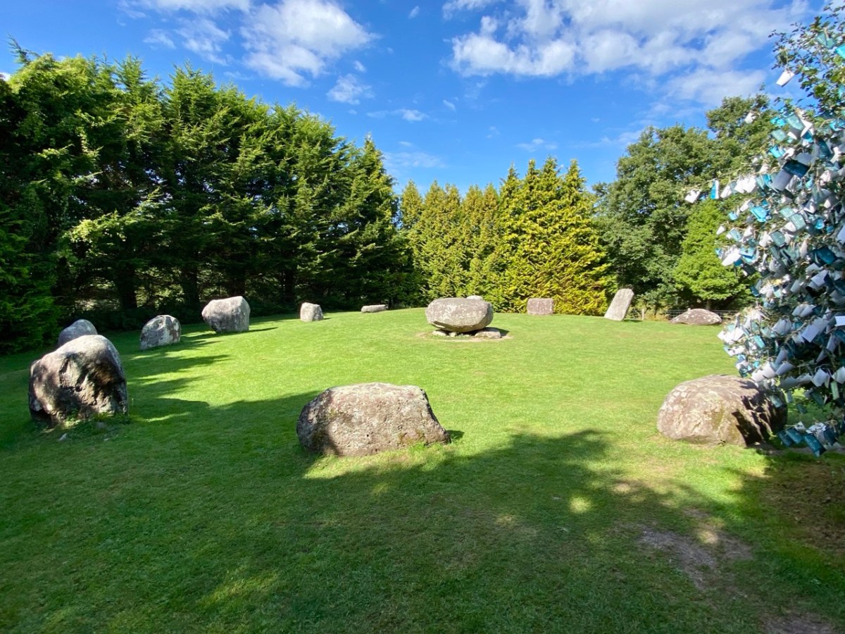
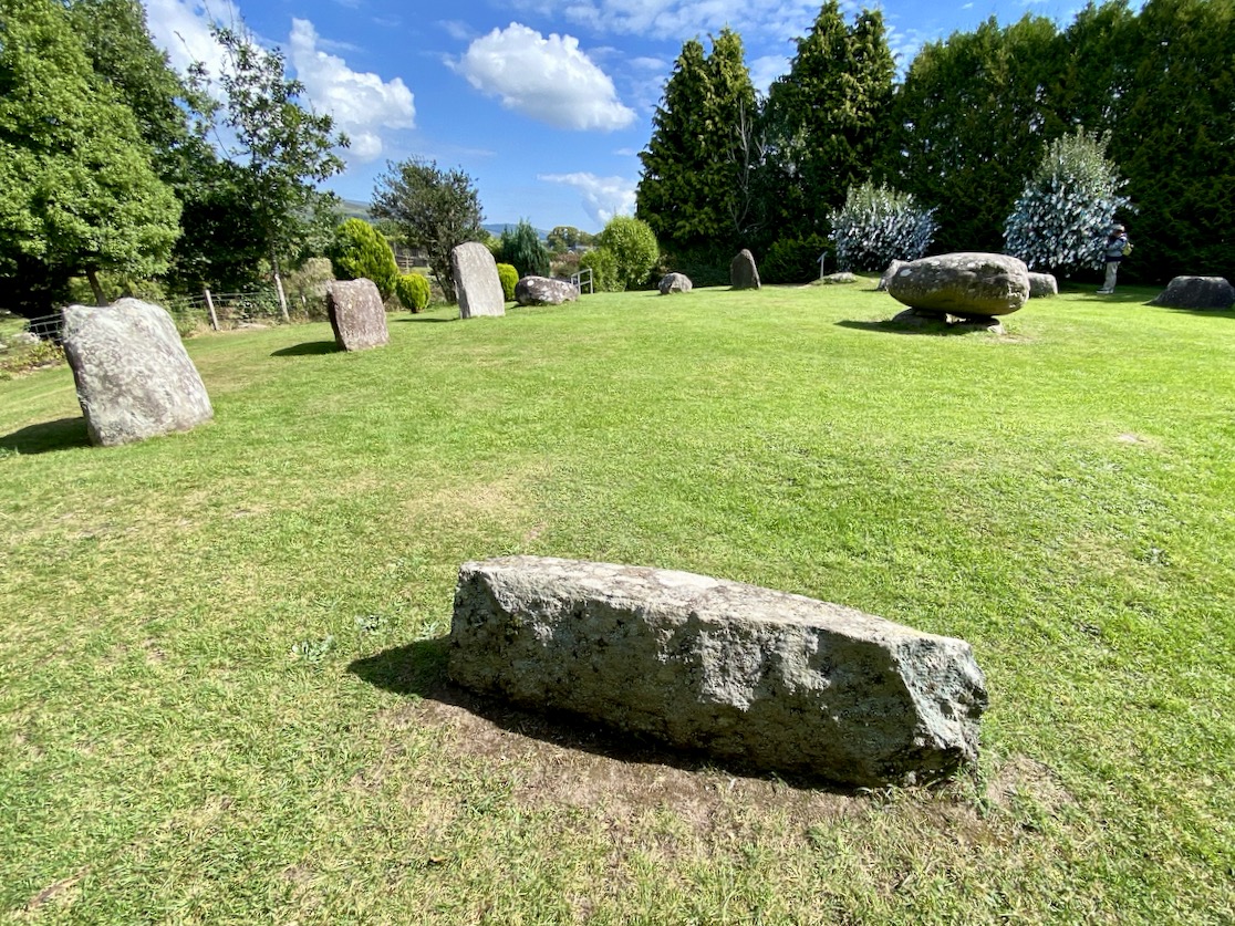
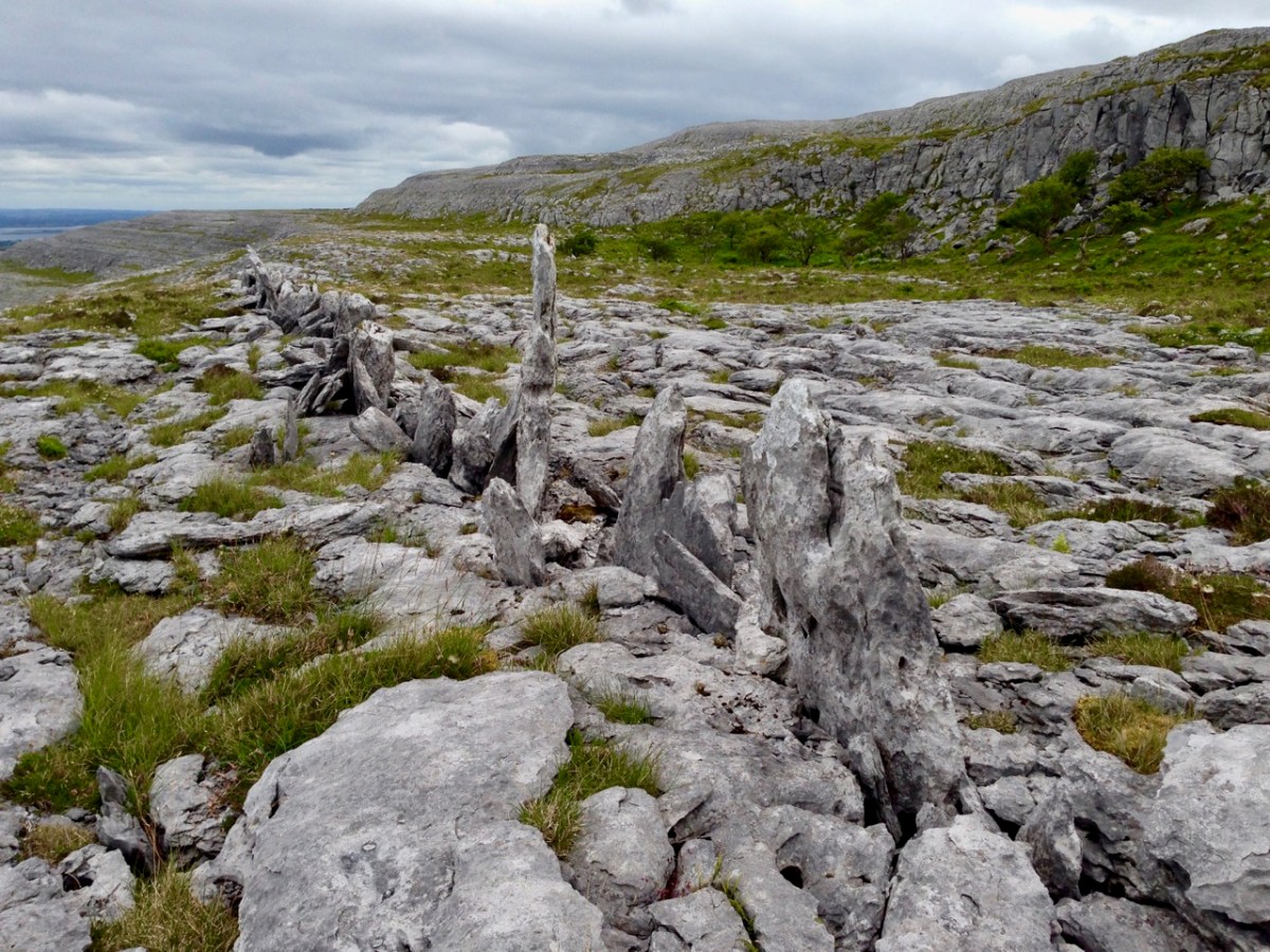
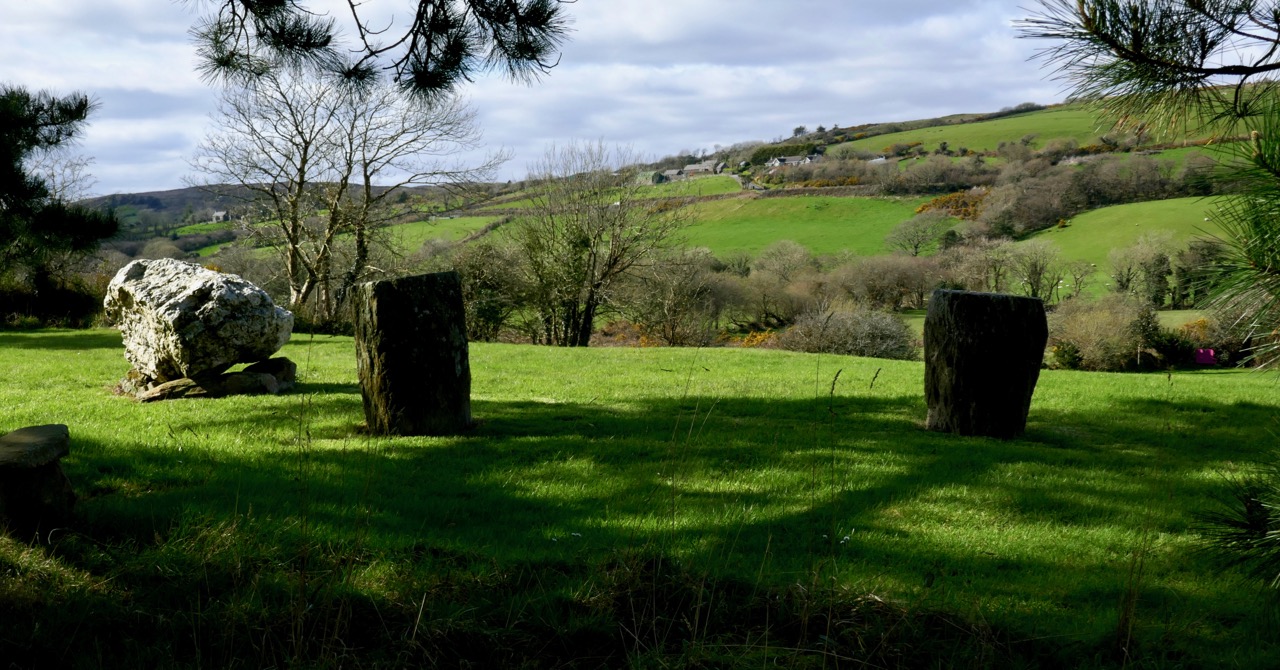
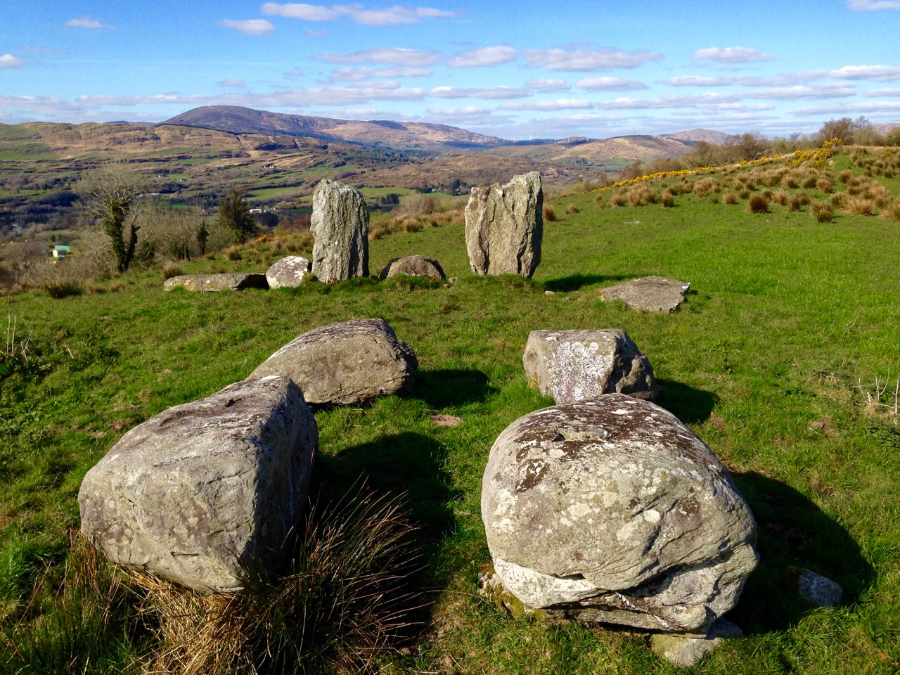
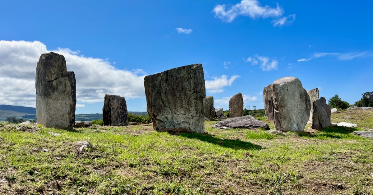
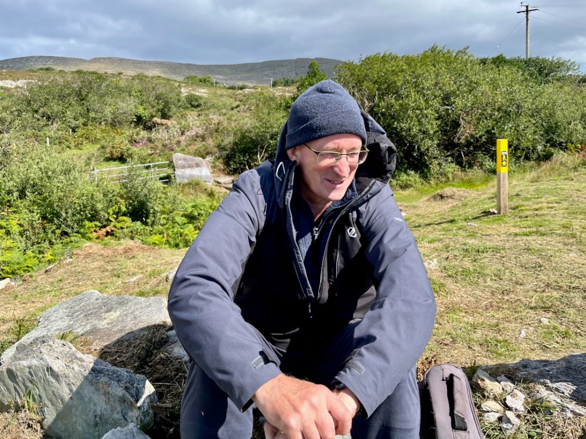
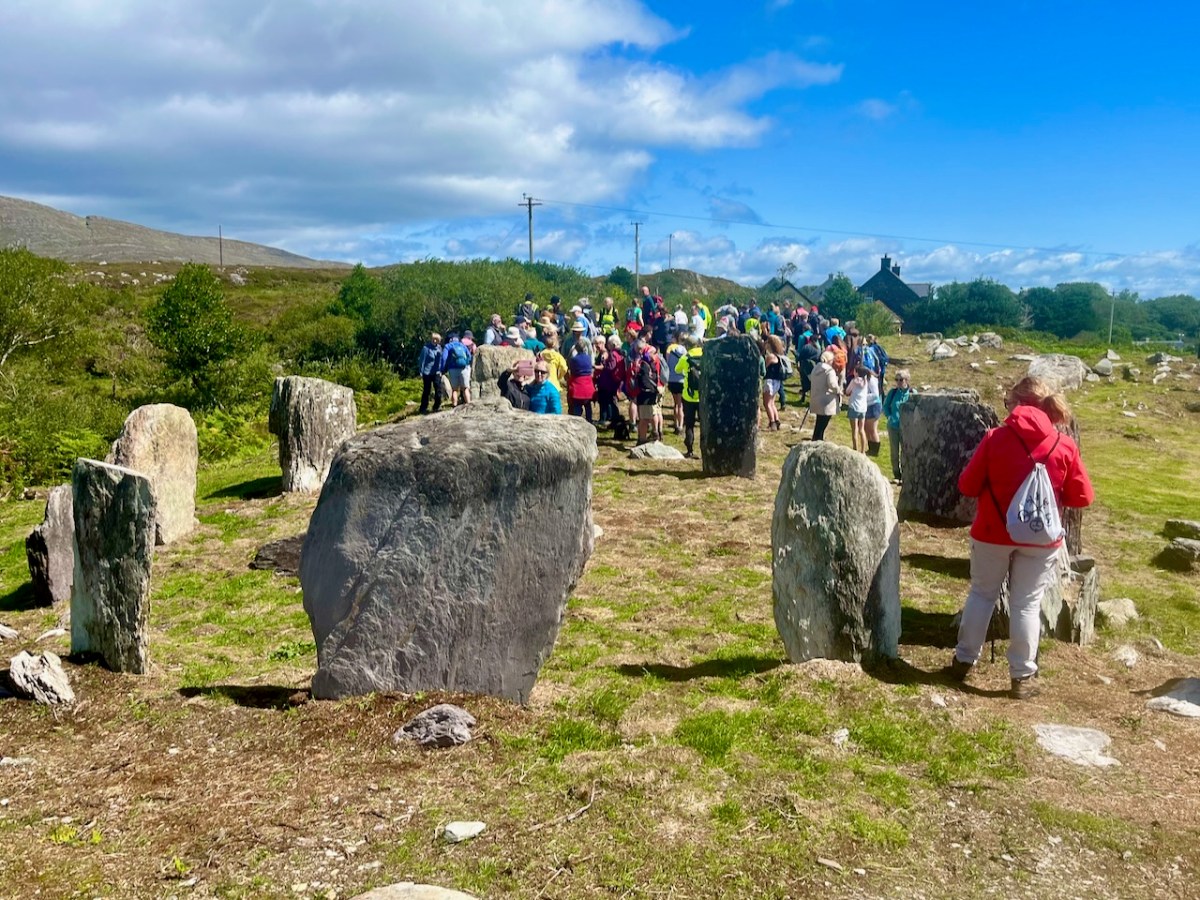
Finola and I visited the site while the archaeological works were progressing (above). Yesterday (5 August 2023) Billy O’Brien (below) was on hand to give a detailed talk on the excavation and restoration work, and we could see, for the first time in many generations, the circle restored to its complete state: it now has all eleven stones standing.

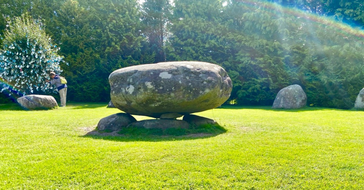
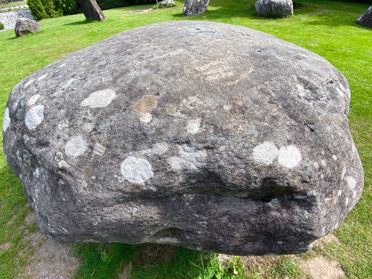
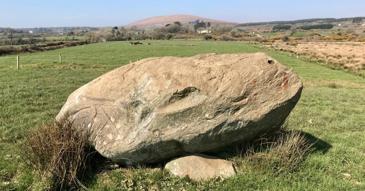
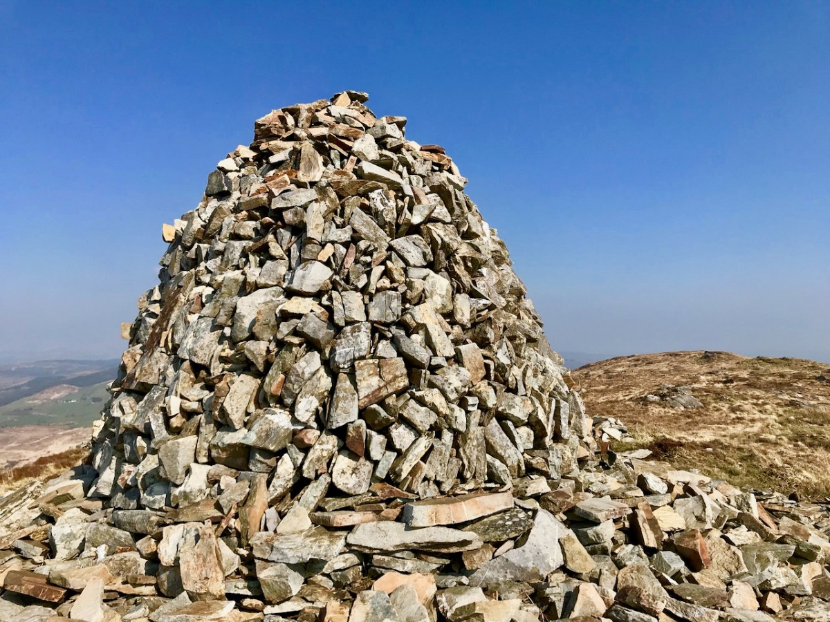
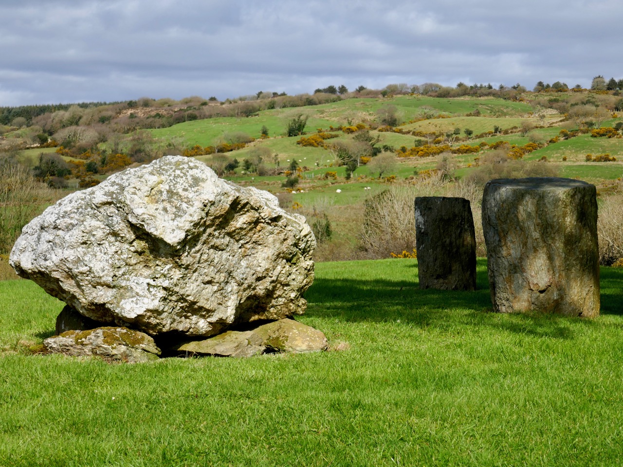
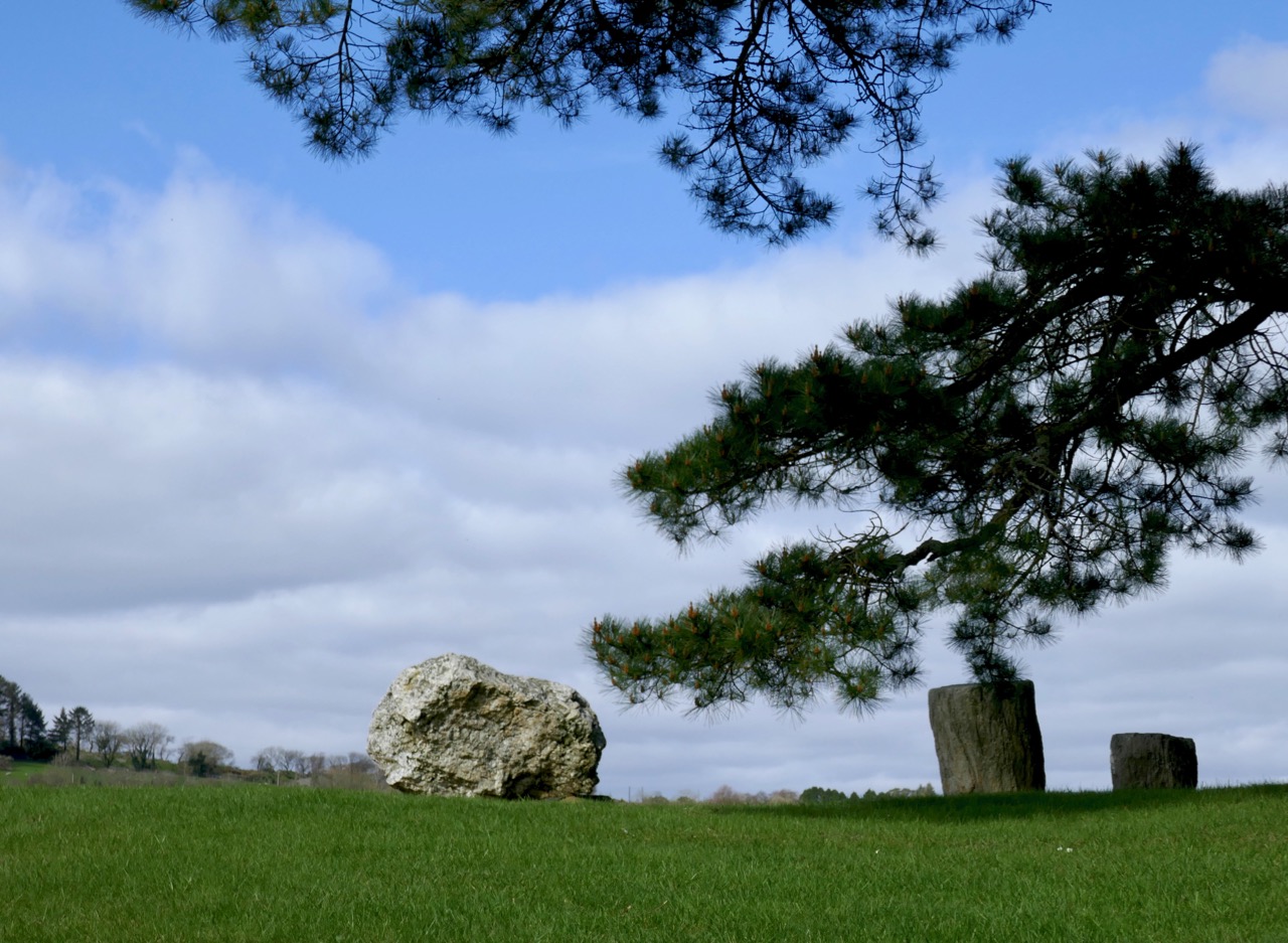
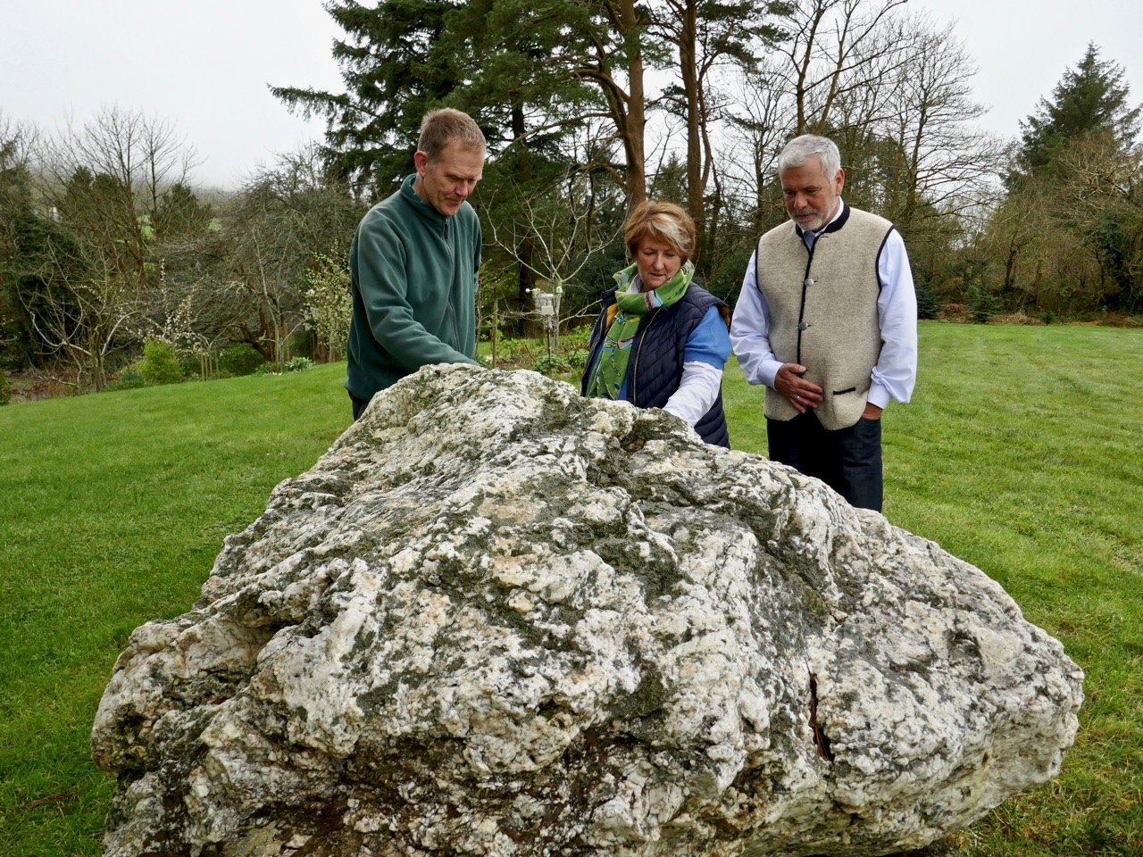
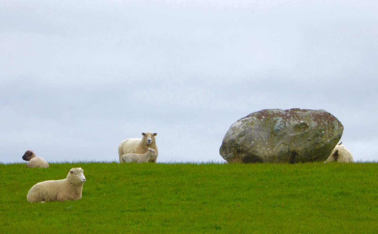
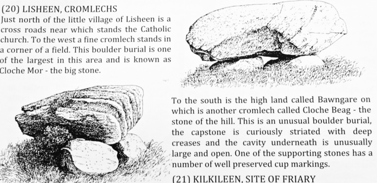
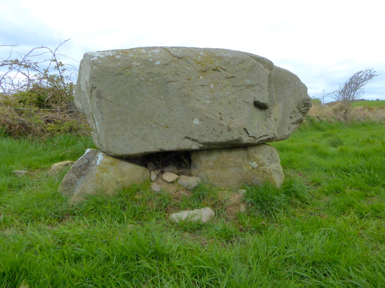
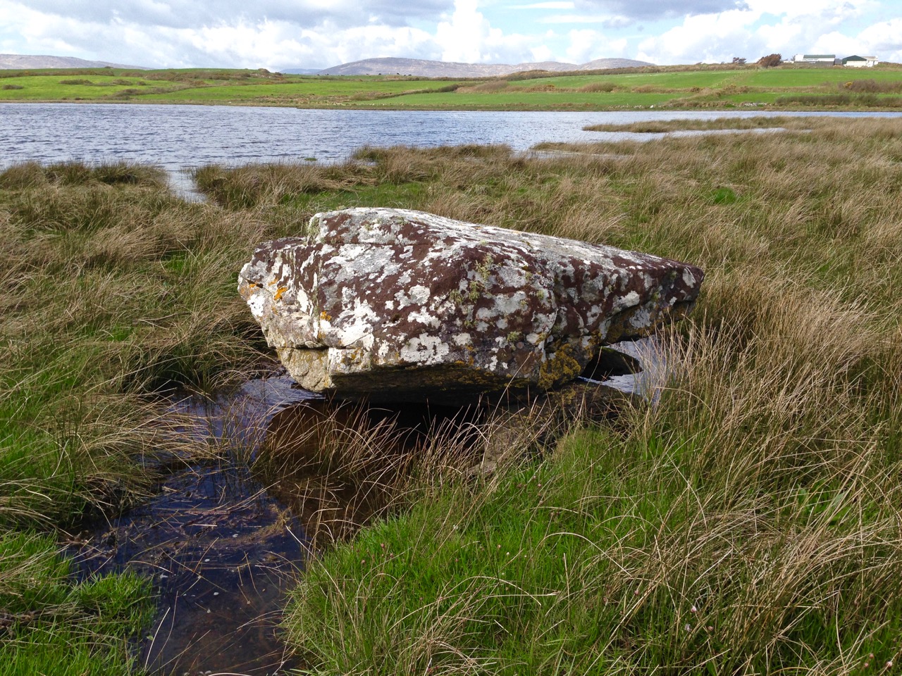
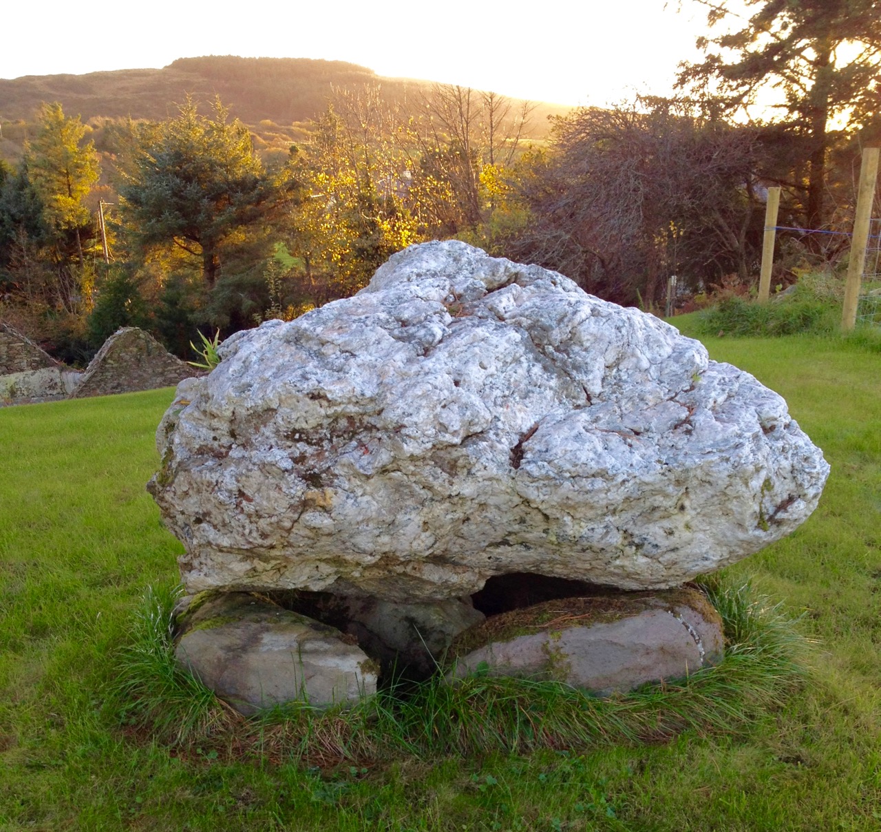
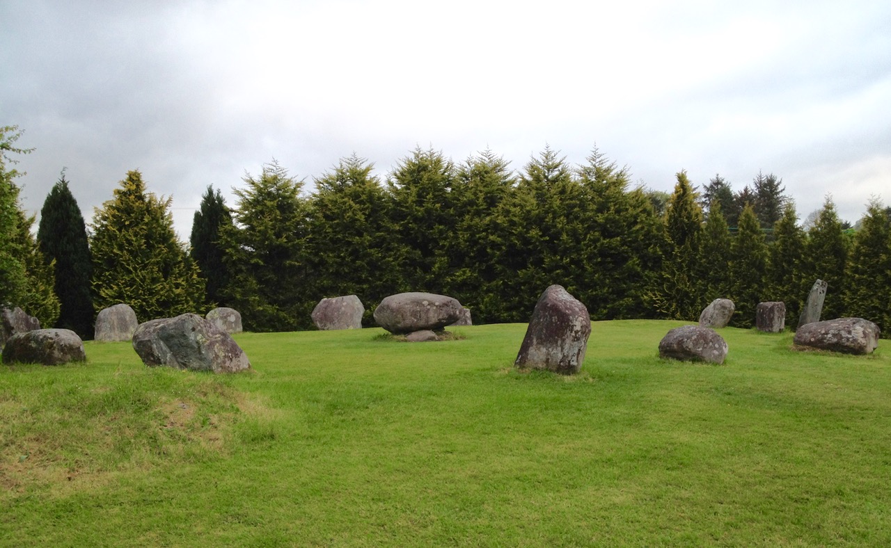
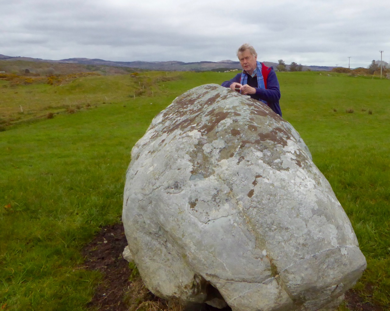
The view above shows a boulder burial monument situated to the south-west of the main circle. This has always been a visible feature of the site. A boulder burial (once called a boulder dolmen) is peculiar to Ireland. In fact it is found only in Counties Cork and Kerry. Finola has written comprehensively on this subject, here. It is usually a substantial raised stone supported on a bed of smaller stones:

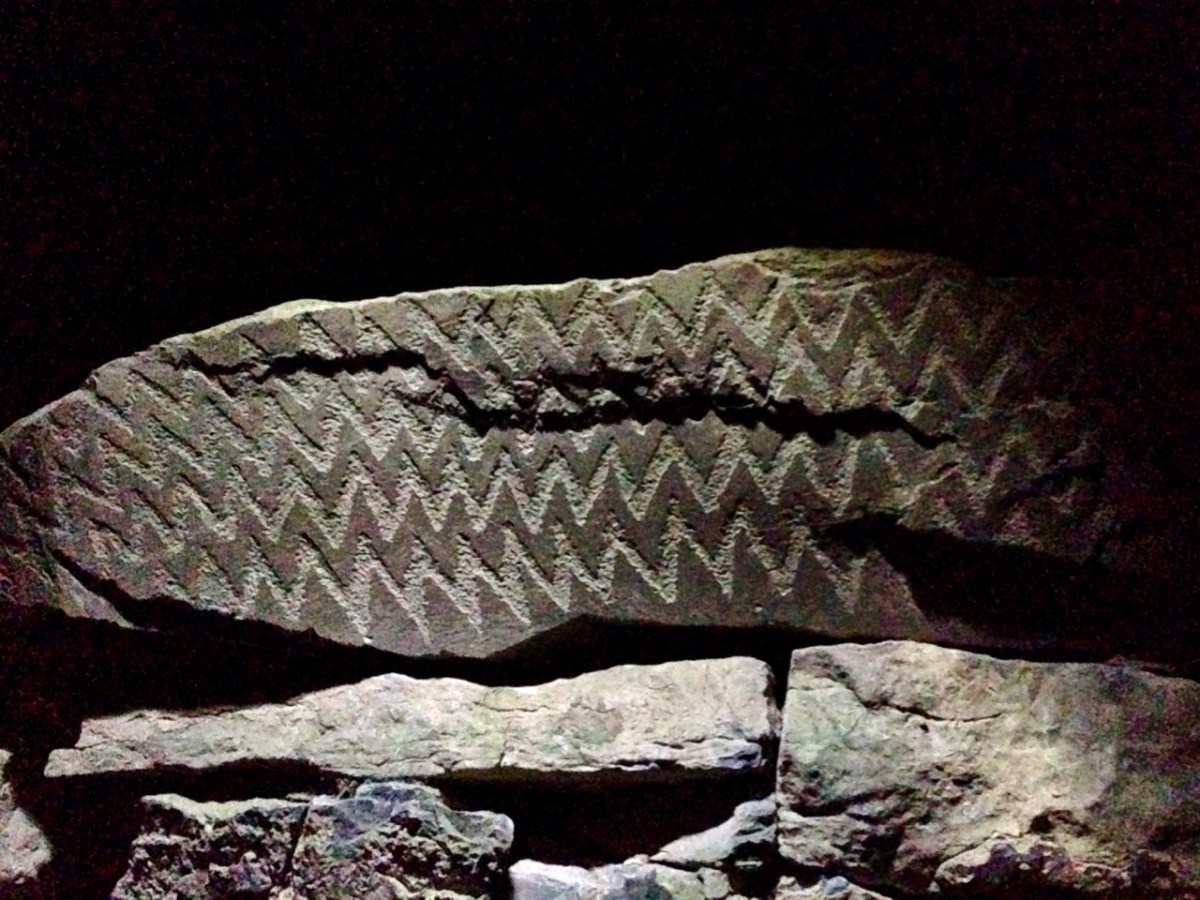
. . . Boulder-burials are a group of prehistoric stone monuments of megalithic proportions, whose distribution is largely confined to south-west Ireland. Some 84 examples have been identified, 72 of these in Co Cork and the remainder in Co Kerry, where they occur both singly or in small groups of between two and four. They consist of a large boulder erratic supported by an arrangement of smaller stones, with no covering cairn or tumulus. Several examples are known which are centrally placed within stone circles . . .


Boulder-burials: A Later Bronze Age Megalithic Tradition in South-West Ireland
William O’Brien Dept of Archaeology, UCG 1992

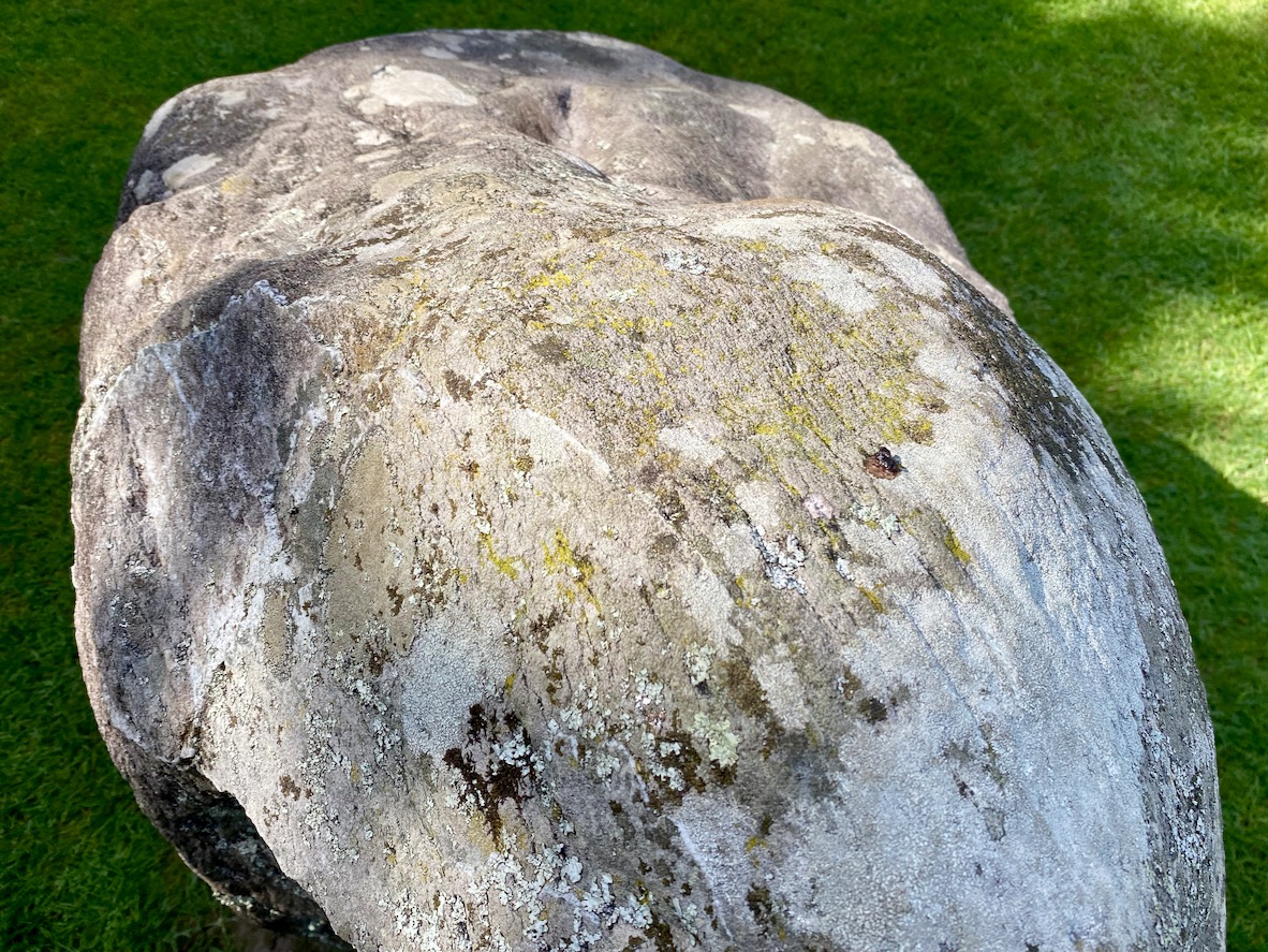
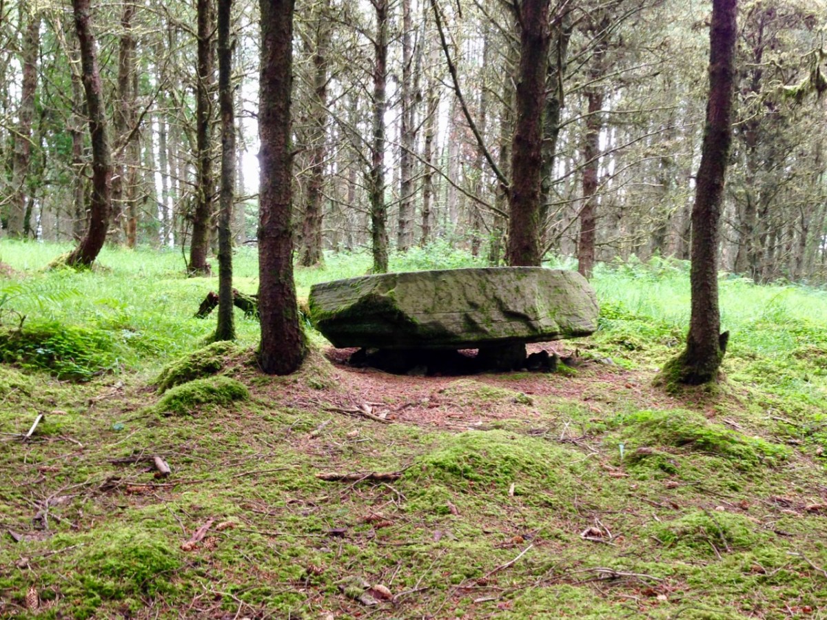
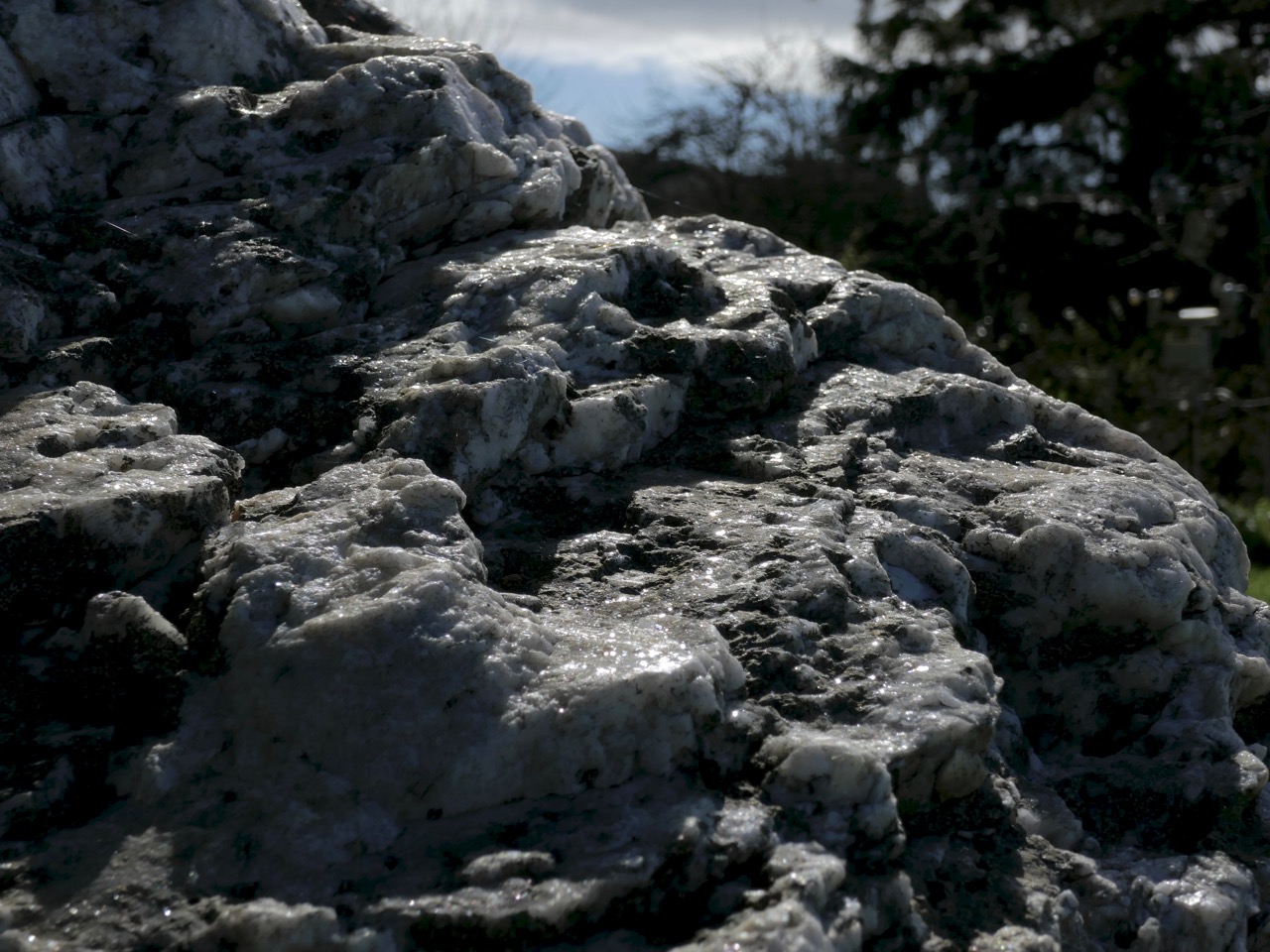
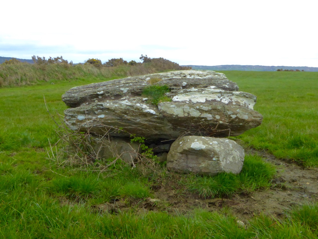
A closer view of the boulder-burial at Gorteanish: it can be seen that the main ‘boulder’ element has split in two through the ravages of time. In the main circle, all the standing stones have been restored to their original (relatively shallow) sockets, and fixed using rammed small stones, following the evidence gained during excavation.

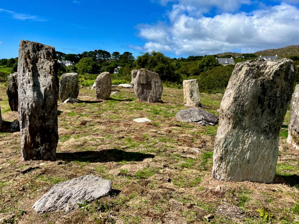
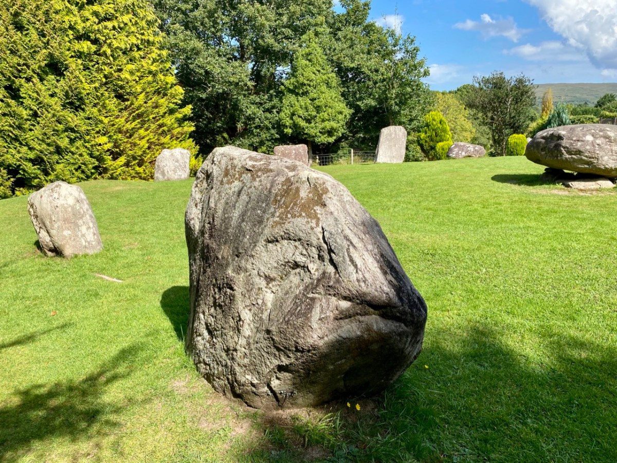
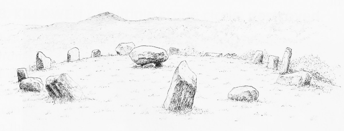
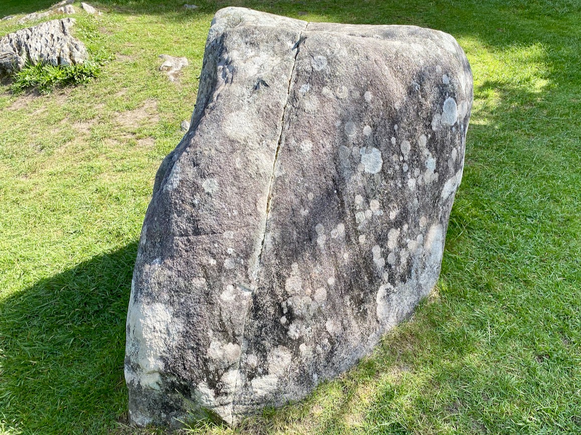
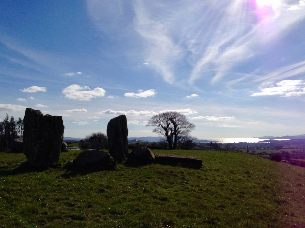
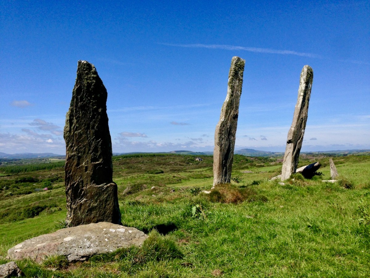
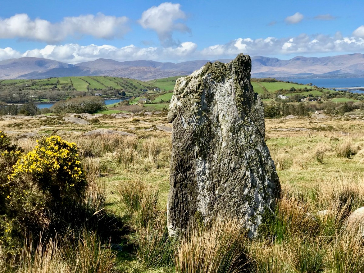
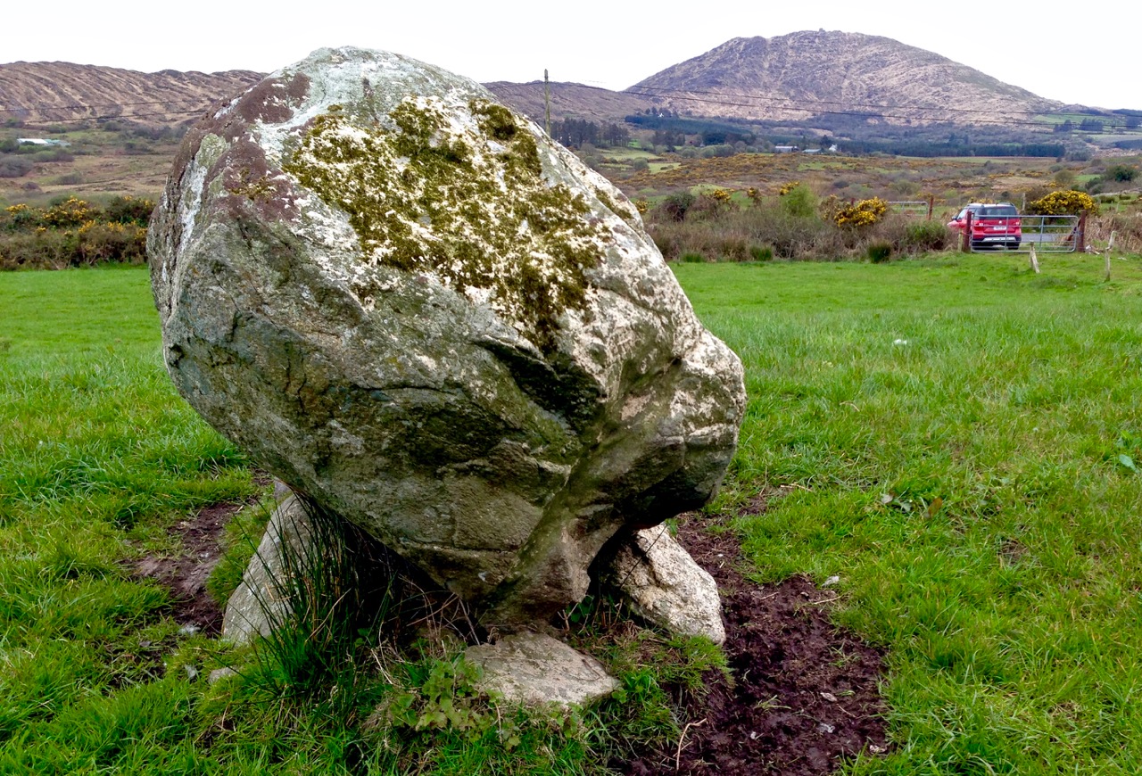
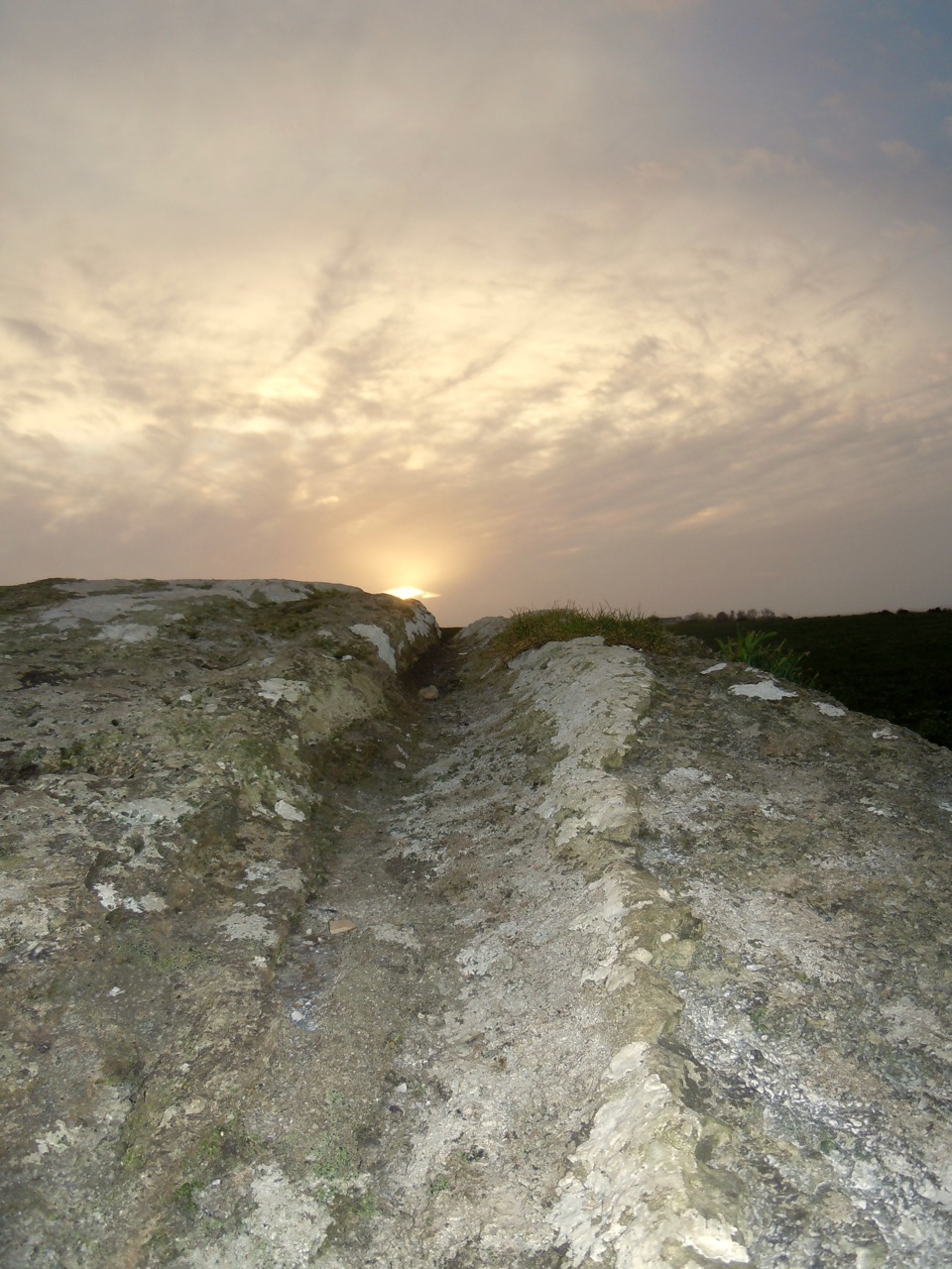
Most stone circles have a specific orientation. This can be seen by the shaping of the stones around the circle. In this case there are two clear ‘portal stones’ on the east side, directly opposite an axial stone on the far side (above). More usually, the stone opposite the portals is flatter, when it is known as the ‘recumbent’. In this case it is a substantial stone with a shaped top (detail, below).Perhaps this points to a feature on the horizon? Our calculations show that the orientation of this circle is towards the winter solstice sunset – just as at Drombeg Circle, not too far from here.

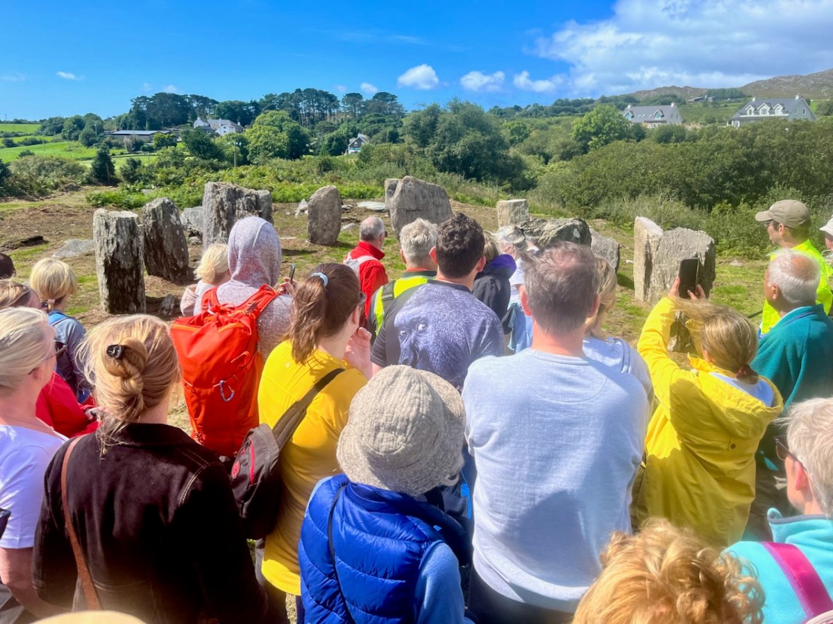
Yesterday’s event attracted a substantial crowd, eager to hear Professor O’Brien talking about this project. Many were no doubt surprised to see the site returned so faithfully to its original state. But – with stones standing – it has now become an iconic piece of archaeology. We are delighted that it is on our doorstep. If you want to read a deeper discussion on stone circles and their historical contexts, look at Finola’s post here – one of many that include the subject.

Another thing that Billy pointed out was the significant ancient stone wall that runs across the site; you can see traces of this above. In this view you can also see an elongated large rock apparently lying on its side. Some local commentators have suggested that this was once a very tall standing stone. If so, at about nine metres, it would have been spectacular! But the excavation confirmed O’Brien’s view that it was never standing, and has always been part of the landscape in its current position.

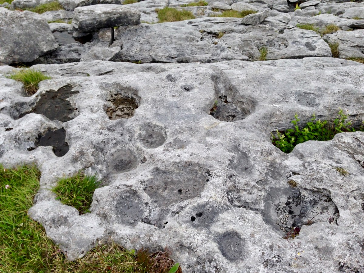
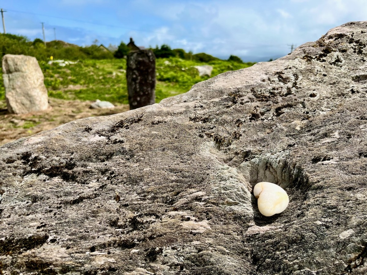
Also, an area of flat ground to the east above the site was closely examined, in case it revealed traces of any human use, but none was found. In fact, there were no signs of any notable human activity. However, one point that I found particularly interesting was that, in the centre of the circle, is a pit containing quartz stones. Quartz, that glinting reflective material that faces the much older main chamber at Newgrange (you can see a pic of it in this post), certainly catches the attention; it’s fascinating that the Gorteanish people – whoever they were – gave it an aura of importance by burying it at the focal point of this circle. The quartz has been replaced in the pit, after the excavation. Its position is marked by the only ‘alien’ element that has been introduce here – a pale coloured flat stone:

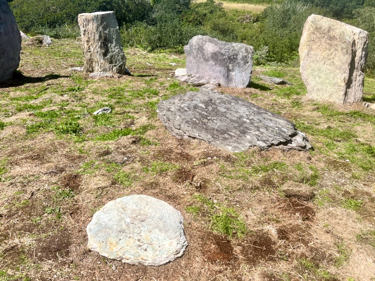
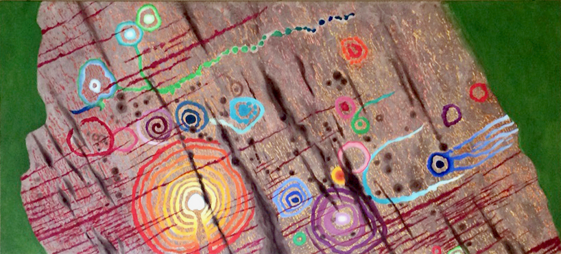
The larger earth-fast stone beyond this new addition has always been there: the site might have been constructed around it. It’s always interesting to see how people are going to react to a circle like this – here is someone’s recent contribution, also giving importance to the ‘magical’ quartz:

All in all, our day was exciting. It’s pretty special to see something ancient faithfully restored – and open for all to access. The seven fallen stones probably collapsed because of cattle rubbing up against them over centuries. That has been prevented now. We hope you will all appreciate – and enjoy – this new West Cork experience.

Kenmare Stone Circle

The significant stone circle at Kenmare is an unusual monument in several respects. It is said to be the largest stone circle in the south west of Ireland, oval in shape and measuring 17.4 x 15.8m. It seems intact: I found no record of any intervention or ‘improvement’ to the circle, which consists of an oval ring of 15 stones with a central ‘boulder burial’. Although situated very close to the main streets of this Kerry town, it has often been described as ‘hard to find’. I can remedy that – here’s a present-day location map:

The site is just a few minutes’ walk from the centre of Kenmare and now has its own dedicated car park beside it. The circle is very ‘tidy’ and well looked after. A nominal entrance fee is requested, the funds being put towards the maintenance of the area.

While the circle is fairly well enclosed nowadays by a ring of tall trees, the vista would previously have been more open with extensive views. Quarrying has taken place in the vicinity in past years. Here is the historic 6″ OS map showing the site as it was around the late nineteenth century.

The archaeology.ie Historic Environment Viewer gives a brief, sober description of the site:

. . . In level pasture, on the SW outskirts of Kenmare town. A subcircular area (17m E-W; 15m N-S) is enclosed by fifteen stones (L 0.8-1.6m; T 0.2-0.7m; H 0.3-1.2m), two of which are prostrate. The axial stone is the lowest and is a regular flat-topped slab contrasting with most of the other stones, which with one or two exceptions, are of boulder type. A boulder-burial (KE093-032002-) occupies the centre of the stone circle. (Ó Nualláin 1984a, 26, no. 41) . . .

Archaeology.ie KE093-032001

I was disappointed in my search for an antiquarian’s account of this circle: Ó Nualláin (quoted above) and others have included it in general lists of such monuments. I was hoping for some speculation on its significant size, and on the large central boulder, itself a slightly unusual feature within a stone circle.

Finola has comprehensively speculated on boulder burials, however, in her Roaringwater Journal post from a few years ago. (She has also written on stone circles generally here). The Kenmare example is visually very much in line with the overall archaeology.ie Monument Class description:

. . . Boulder Burial – A large boulder or capstone of megalithic proportions, resting on a number of supporting stones, usually three or four in number, which, in most cases, do not form a recognisable chamber structure. Excavations suggest a Bronze Age date for this burial monument (c. 2400-500 BC) . . .

Archaeology.IE Monument Classification

Finola has pointed out, however, that there is no conclusive evidence for assuming that these ‘boulder burials’ are – well – principally burials.

. . . William O’Brien [Professor of Archaeology UCC] excavated three boulder burials in the late 1980s and found no evidence of burials. In his book, Iverni, he comments in an understated way, “The absence of human remains at Cooradarrigan and Ballycommane does pose some questions as to their use.” His findings dated the sites to the Middle Bronze Age, between 3000 and 3,500 years ago . . .

Finola Finlay, Roaringwater Journal

So, should we perhaps call them ‘elevated stones’? Visually, they are certainly always striking. This one at Kenmare is said to weigh around 7 tons. Bearing in mind the stones in this circle are likely to originate some few miles distant, we can imagine the efforts required to assemble them. O’Brien dates the boulder burials he studied to 1000 or 1500 BC. This would tie in with the general thinking that stone circles were Bronze Age also.

The two drawings above are from Jack Roberts. On his survey (top) I have superimposed an oval template which confirms the suggestion that the Kenmare ‘circle’ is egg-shaped. In the lower sketch view – probably dating from the 1980s – the stones appear to be out in the open, free from the present-day tree shielding.

While it is generally implied that all the stones in this monument were placed at the same time, there is always the possibility that there might have been an evolution in its construction. By that I mean that we could speculate that the ‘boulder burial’ stone was placed first and the circle came afterwards – perhaps to enhance its setting. Or vice versa.

This photograph clearly shows the recumbent stone. Many of the circles in south west Ireland are known as axial circles, where a ‘recumbent’ stone (seemingly placed on its long edge) may provide a horizon viewing point when observed from a ‘portal’ of two stones at the opposite side. The orientation axis created by this observation is usually from north east towards south west (as is the case here). Where a stone circle has a clear horizon (such as Drombeg, in West Cork) it has been noted that this alignment faces the setting sun at midsummer solstice.

As you can see from these close studies of some of the individual stones (above) there are quite significant differences in their shape and character within the circle. It has been suggested (elsewhere) that the shapes and the relative placing of the stones is significant. ‘Male’ and ‘female’ stones have been suggested – but this is yet more speculation.

As far as we can see there are no ancient markings on the stones at Kenmare (except for a possible single cup-mark on the upper surface of the boulder burial), but I am fascinated by the lichen shapes and textures on one particular stone (above). This is ‘nature’s art’, of course.

It’s impossible to ignore the two ‘fairy’ hawthorn trees that have been established within the vicinity of the stones. In my opinion it was an inspiration to exploit the idea of visitors purchasing ‘message cards’ from the site kiosk and writing down their own thoughts and personal wishes, which are then tied on to the branches. That’s Finola, above, being affected by the rainbow fairy vibes. She has written her own post today specifically on this aspect of the place. My favourite message is this one, below:

Stones Alone

Over the years we have written a lot about stone. That’s not surprising, because our interests in Irish archaeology involve stones: standing stones, stone circles, rock art, gravestones . . . It’s what the surviving history of our earliest dwellers on this island is all about. So I thought it would be a good idea to sift through our Roaringwater Journal photographic library – which goes back a decade – and turn up some pictures and stories which I have never used before: all of them involving stones. That header pic, above, is a boulder burial at Rathruane, just outside our West Cork village of Ballydehob.

Here’s another boulder burial, a long way away in Co Cavan, now surrounded by trees which are probably relatively recent. Finola wrote about this monument type six years ago, and pointed out that they are not well named: when examined archaeologically, very few of these stones have been associated with buried human remains. They are said to have been positioned between 1,500 and 1,000 years BC, a time we refer to as the ‘Bronze Age’. So, by then, humans were already aware of the use of metal for tools, weapons and decorative adornments. But imagine the time before that – when people only had natural materials to hand – wood, vegetation and, of course – if you wanted to create something permanent – stone: we call these times Neolithic – and generally that covers the period of habitation of Ireland from 6,000 BC onwards.

Here is another West Cork site: Breeny More, to the north of Bantry. There’s a whole lot of stones here including, unusually, four ‘boulder burials’ arranged in a square. There are also further stones in this grouping which were once part of a stone circle. The site is magnificently located, with distant views west across to Bantry Bay (below).

We are all familiar with groups of stones arranged in a circle. Here is the ‘stone circle’ at Ardgroom, County Cork: it’s on the Beara Peninsula. As with the Boulder Burials, these monument types are generally thought to date from the Bronze Age.

These modestly sized ‘five stone’ stone circles are also in County Cork. The National monuments Survey of Ireland lists 53 ‘five stone’ circles in the county, while a further 41 ‘multiple stone’ circles are noted. There are also some anomalies which defy definition, such as ‘The Fingers’ at Knockdrum, West Cork, just outside Castletownshend:

This appears to have been, originally, an alignment of five tall standing stones. One has fallen and broken, while the fifth is now missing. It is reasonable to assume, from the number of stone ‘monuments’ all around us in West Cork (and in many other parts of Ireland), that these sites were of great significance to the populations who constructed them. But we don’t know for sure why they are there – although theories abound.

I am fascinated by the number of single standing stones we come across in our travels. It’s impossible to say how many there are in Ireland – probably thousands. And they can range in size from the large stones – above – in West Cork, to individual examples in moorland or fields, or on roadsides – below.

The Irish word ‘carn’ means a heap or pile of stones, Cairn monuments are mounds of stones, often marking the summit of a significant hill or mountain. They may or may not be ancient, and we have seen them change significantly over time. On Mount Corrin, not far from us in West Cork, there were two cairns only a few years ago. Now there is a single, significant cairn (top pic below): this implies a deliberate ‘re-ordering’ of what was there before. Regardless of their history, they can be visually impressive.

The centre pic above is a small cairn on a Sheep’s Head summit, while the enormous one above is in The Burren, County Clare. The Burren is an extraordinary landscape of exposed limestone. The limestone formed as sediments in a tropical sea which covered most of Ireland approximately 350 million years ago. Today, the Burren supports a remarkable assortment of wild flowers: over 70% of Ireland’s species of flowers are found there, among the ubiquitous stone surfaces.

Ever since humans set foot on Irish soil, they have embraced the stones – both for practical uses such as shelter or enclosure, but also as a means of marking and communicating. Readers will be familiar with our particular interests in Prehistoric Rock Art:

This is an important example of Ireland’s Rock Art, from West Cork, perhaps dating from 5,000 years ago: it was discovered in comparatively recent times. The painting is by Keith Payne, and is an interpretation of this same rock outcrop. We have no evidence that the carvings were ever coloured – or pigmented.

Today we are very familiar with the use of stone as a building material: this practice is likely to have been current since very early times. In Ireland we have many examples of ancient – but undateable – stone buildings. The ‘Oratory’ at Gallurus is a good example of a built enclosure (walls and roof) made entirely from stone. A present day view of it, top, shows this remarkably preserved structure; archaeologists and historians have long debated its age and likely use. The print above dates from 1756.

Over the centuries, crafstpeople (like Séamus Murphy – see last week’s post) have used stone as a medium for memorials – the message is likely to survive beyond lifetimes. If only we knew what some of the messages should spell out to us! Our last – striking – image is from Fourknocks – a decorated chambered cairn within the Boyne Valley complex which we visited in 2016. This carved decoration was probably made 5,000 years ago: we can only wonder at its meaning and its authors . . .

Inish Beg Estate: Ancient Woods and New Discoveries

Craving a woodland walk, we took ourselves to Inish Beg this week – and found a lot more than bluebells!

This is a cillin, down beside the river. There are lots of stories associated with it

Inish Beg abounds in both the wild and the tame. That’s not such an easy balance to maintain and it’s a real tribute to the team on the ground that manages and nurtures the estate. Mostly, of course, it’s down to the vision and hard work of Paul and Georgiana Keane who bought the place in 1997 when it was crumbling and neglected. The house, Georgie told us, was close to collapse and had to be completely re-done – new roof, plumbing, electrics and a complete re-furbishment. It’s hard to believe now, when you see the beautiful place it has become.

Paul and Georgie run it now as a hotel and wedding venue and it is totally set up for it. In fact it must be one of the most romantic venues in Ireland, ideally situated on an island on the Ilen River, accessible by an old stone bridge. It was originally O’Driscoll territory, but owned by the McCarthy family. When James Morrogh inherited it from a McCarthy relative in the 1830s he changed the family name to McCarthy Morragh – such stipulations were not unusual then.

In the 1890s the family built the grand house, and it is this house that is associated with its most famous inhabitant, Kay Summersby. A noted beauty, she was Eisenhower’s secretary in London during the war, and may (or may not) have had an affair with him.

She describes her early life at Inish Beg thus:

Our home, Inish Beg, was a somewhat run-down estate on a small but lovely emerald island in a river in County Cork. Our favourite pastime (I had a brother and three sisters) was to sail down that river four miles, to the Atlantic. There was a succession of governesses, hunts, spatting parents, riding in the fields and along the long avenue fringed with old trees . . . the usual pattern of life in that obsolete world.

The ‘usual pattern’ for some, perhaps – to me it sounds like a life of breathtaking privilege. However, like many such estates, it became difficult to sustain and by time the Keanes took it over it desperately needed their infusion of enthusiasm and capital. And what a magnificent job they have done with not only the house but the grounds as well.

There’s a walled garden (above) that’s full of organic goodies for the estate kitchens, and also features an indoor swimming pool! Tony O’Mahony, the head gardener, practises an organic philosophy and does not feel the need to eliminate wildness from the garden, which results in a delightful mix of plant life.

But we were here mainly for the woodland walks and we were certainly not disappointed. You could spend several hours wandering the trails here and right now the undergrowth is glorious. Bluebells were in abundance along with every wildflower that contributes to that colourful spring carpet that is so dear to our senses.

There are trails for the kids – pirates and a wildlife search are part of the system, as well as little fairy houses here and there.

There are lovely views (above) across the Ilen to the ruined church at Aughadown – burial place of the Tonsons that I wrote about in New Court Bridge – a Hidden Wonder. Surprisingly, beyond the church, you can see Mount Gabriel. I mention this because of its significance with our next find – a previously unrecorded cupmarked stone!

Regular readers know of our involvement with Prehistoric Rock Art – Neolithic or Bronze Age carvings on open air boulders and outcrops. The cupmark is the basic motif of all Irish Rock Art – a semi-spherical cup-shaped hollow (see more about Rock Art here and here and specifically about cupmarks here). Robert has an amazing eye for slight differences in rock surfaces and has developed a habit of examining every stone we come across for cupmarks. This time he struck gold! At least four cupmarks on the back of a stone along one of the trails.

We like to warn people that rock art can be a little underwhelming. I know these cupmarks don’t look like much, but they were probably carved several thousand years ago as part of a ritual we now know nothing about

The stone has been moved there from somewhere on the estate and the Keanes will try to track down where this was. It’s always important to see a rock like this in its context, of corse, but we are also curious to know if Mount Gabriel was visible from the location, as it is from so many of our West Cork Rock Art sites. We will be returning to do a proper record and see if we can add more information to the story before we send it in to be included in the National Monuments database.

There’s also a boulder burial on the estate, visible as you are leaving. It’s a pretty tumbledown affair, but still recognisable, and we found cupmarks on the capstone too. These may be already recorded, but we will let National Monuments know in case they aren’t.

Fabulous woodland walks, my fill of wildflowers, lovely vistas across the Ilen – and a new archaeological find. Too much excitement for one day!

Local Heroes: Ballycommane Gardens – and Bronze Age Site!

This week we were privileged to meet with Andy Stieglitz and Ingolf Jungmann at their home, Ballycommane House, between Durrus and Bantry. We’d been once before, several years ago, when we had met Andy, then busily engaged in renovating one of the sheds. Now the house has been extended and modernised, along with various outbuildings. Andy and Ingolf, both retired and living here full time, are running the house as a bed and breakfast, with an adjacent self-catering cottage, and have opened their garden to the public.

I don’t know the names of most of these flowers, although the one above is from one of their heritage-variety fruit trees

They have taken a few acres of scrubland and pasture – and turned it into a little piece of paradise! Both keen gardeners, they have been working now for fifteen years to develop their arboretum and lay out different areas of the garden connected by meandering paths. Here and there open spaces invite you to lounge and simply take in the sights and the scents.

This Gunnera is, thankfully, the non-invasive variety

Or you can keep strolling and discovering. They specialise in plants from the Azores, where they like to winter, and have discovered that many Azorean species flourish in this mild climate. Of course they have had to learn to deal with the wind, as parts of the site are quite exposed, and with the unpredictable Irish climate.

But Andy and Ingolf value all plants and also celebrate the humble wildflowers that are my special interest. Ingolf has learned to propagate the wild primroses and the colourful borders he has created are a joy.

Wild Primroses are generally pale yellow, but pink varieties also occur. Ingolf tells me the pink ones are a little harder to propagate 

Wild spurges mix with the Azorean ones – the Euphorbia genus is one of the largest and most variable on earth, and while we know it mainly from our wild Spurge varieties they can range from tiny to huge and from colourful (Poinsettias!) to shades of green.

A native Euphorbia (top) is flourishing while below an Azorean import looks very comfortable also. Note the tiny native spurge that has sprung up underneath it – a study in contrasts

Now in March, the garden hasn’t quite come into its own yet. Nevertheless, there is plenty to see and surprising hits of colour here and there. Wherever you look, the eye is caught.

Above: We decided it was an Azorean daisy. Below: I think it’s Green Alkanet, a garden escape that has naturalised widely in Ireland

Ballycommane House is part of the marvellous West Cork Garden Trail and is open from March to October. Andy and Ingolf love to welcome visitors so plan a trip to see this treasure. And when you do, there’s a surprise in store – Ballycommane is also home to a Bronze Age Boulder Burial and Standing Stone Pair!

Andy (left), Ingolf and I contemplate the boulder burial

Regular readers of this blog will know that Robert and I worry about loss of and damage to our ancient monuments due to neglect, lack of knowledge, and occasional wilfulness. That’s why I am calling this post Local Heroes because Andy and Ingolf, quite apart from the enormous work involved in developing their house and garden, have embraced the challenge of celebrating and safeguarding these monuments for all of us.

The Boulder Burial is a large erratic of quartz. Quartz was highly prized in prehistory and was used in various ways. Not surprising, given how it gleams and sparkles in the sun. This one is visible from across the valley

Today was the official unveiling of their Visitor Centre – a converted piggery now in use to display a set of explanatory posters developed by Prof Billy O’Brien and Nick Hogan of UCC. Billy has excavated this site and two other Boulder Burial sites and is more responsible than any other researcher for what we know about the age and possible functions of Boulder Burials. You can read my posts, Boulder Burials: a Misnamed Monument? and Standing Stone Pairs: A Visit to Foherlagh for more about these kinds of monuments.

The standing stone pair is of the local slatey sandstone, chosen to be flat on top – no doubt this served some kind of purpose

Billy was there to do the honours and to give us a talk on the site. When he excavated here in 1989 it rained, he told us, every day of the dig. Although no carbon-datable material turned up he was confident in assigning a mid-to-late Bronze Age date – it’s about 3,000 years old.

Cutting the ribbon to officially open the Visitor Centre

He asked us (there was quite a crowd!) to consider the setting of the boulder burial and standing stone pair in the landscape, and spoke about their use to memorialise high-status individuals and to mark locations from which sunrises and sunsets might be observed at solstices and equinoxes.

Unfortunately tree plantings have obscured the view from the boulder burial, but this is what it looks like. You can see all the way down the Sheep’s Head to Seefin Mountain

Ballycommane is a very special place indeed and we are very fortunate that Andy and Ingolf are committed to being good stewards of the prehistory they have inherited. Thank you, Andy and Ingolf – and for that yummy cake too!


Boulder Burials: a Misnamed Monument?

Rathruane Boulder Burial

The term boulder burial was coined in the 1970s by Sean O’Nualláin, an archaeologist with the Ordnance Survey, to describe a class of monument that was quite prevalent in the south west, consisting of a single large boulder sitting on three or four support stones. The support stones lift the boulder off the ground and provide a small chamber-like area under the stone. Previously, this type of monument was known as a dolmen, a boulder dolmen or a cromlech, but O’Nualláin was convinced that the main purpose of these boulders was to mark a burial.

Lisheen Cromlechs by Jack Roberts

Illustrations from Jack Robert’s book Exploring West Cork

He based this belief partly on his extensive experience with other megalithic monuments, but also on the findings of the excavation of the Bohonagh complex, where Fahy found fragments of cremated bone in a pit under the boulder.

Bohonagh Boulder Burial
The Bohonagh complex includes a multiple-stone circle, a boulder burial and a cup-marked stone. A standing stone stood close by but has disappeared. Note the quartz support stone

However, William O’Brien excavated three boulder burials in the late 1980s and found no evidence of burials. In his book, Iverni, he comments in an understated way, “The absence of human remains at Cooradarrigan and Ballycommane does pose some questions as to their use.” His findings dated the sites to the Middle Bronze Age, between 3000 and 3,500 years ago.

Lisheen Lower boulder Burial

A boulder burial from Lisheen Lower

What is unquestioned, though, is that they are predominantly found in the south west, especially in Cork, and that, while most occur alone, they are often found in groups, and/or in association with stone circles or standing stones.

rathruane boulder

This one is at Rathruane More, close to a significant rock art site and with views of Mount Gabriel and Mount Corrin

A boulder burial is a striking and unmistakable sight. Often situated on a high point or ridge it can be seen silhouetted against the sky – a large glacial erratic standing proud in the landscape. There are lots of examples around us here and most of them command extensive and often panoramic views. These are monuments that were built to be seen and to see from.

dunmanus boulder burial

An exception to the high ground location is found at Dunmanus on the north side of the Mizen Peninsula. This boulder-burial is so low-lying, in fact, that one can only reach it at low tide

Ballycommane Bouder Burial quartz

Ballycommane – the boulder is of white quartz

William O’Brien has pointed out that quartz is a feature of West Cork prehistoric sites and this is particularly evident in the case of boulder-burials. At Bohonagh, for example, some of the support stones are of gleaming white quartz, while at Ballycommane, Cooradarrigan and Cullomane the boulder itself is quartz. The sun was low in the sky when we visited Ballycommane and the sight of the quartz boulder gently gleaming was truly memorable.

Mill Little Complex 2

The Mill Little complex

Boulder burials often occur in groups and in association with other monuments. Mill Little is a good example of this: three boulder burials are in a line with a standing stone pair at one end and a five-stone circle at the other. See our post Family-Friendly Archaeology Day for more photos of the Mill Little Complex.

Cullomane boulder burial

This photograph shows the Cullomane boulder burial in the foreground, and a ‘penitential station’, in the background. This ‘station’ was part of a pilgrim round that involved prayer and penance – see Holy Wells of Cork for more detail on this site

At the Cullomane site, east of Bantry, the quartz boulder is surrounded by a variety of other monuments: a small stone circle, an ‘anomolous’ group of stone, a stone row, and standing stones all lie within a few fields of each other. Intriguingly, this site has seen continued ritual use through the millennia – there are also ring forts, burial grounds, a holy well and a ‘penitential station’ within the same small area.

Ballycommane boulder burial and standing stone pair

The Ballycommane boulder is in close proximity to a standing stone pair

Breeny More 4

At Breeny More, near Kealkill, four boulder burials in a square pattern lie inside what remains of a large multiple-stone circle. This is an awe-inspiring site – you feel you are on top of the world with mountains all around and stunning views out to the end of the Beara and Sheep’s Head Peninsulas. See Robert’s post Walking the Past for a sense of what this site offers.

Kenmare Stone Circle and boulder burial

The Kenmare stone circle, above, has a boulder burial in the middle of it, while the Gorteanish stone circle on the Sheep’s Head, below, has at least one and possibly two boulder burials

Gorteanish

So – if they weren’t tombs, or weren’t solely tombs – what was the purpose of these striking boulders? Their association with stone circles and rows provide evidence that they fit the calendrical pattern that we find in so many monuments of this era. Mike Wilson, the archeo-astronomer of the Mega-What site, has surveyed many of the West Cork boulder burials and has this to say: This survey shows that boulder-monuments were functional objects marking astronomically important places in the landscape. They cannot generally define an azimuth as accurately as a stone row or circle but capstone shape and orientation are usually significant, helping to indicate directions of interest.

Breeny More

At Breeny More the square layout of the four boulder burials within the stone circle provide many possible alignments

In several of the boulder burials we have observed, capstone shape and direction certainly seem to be a deliberate feature of the monument.

Rathruane boulder Burial Orientation

Robert checks the orientation of the long axis of the capstone at Rathruane More

But perhaps the best example we have of how a boulder burial can have an orientation was drawn to our attention by local historian Brigid O’Brien – and she even sent us the evidence! If you stand at Bawngare, your attention is immediately drawn to the spectacular views to the west and north west – views that include Mount Gabriel, Mount Corrin and between them, faraway Hungry Hill on the Beara Peninsula, as well as the Sea in Roaringwater Bay. Interestingly, one of the support stones has several small shallow cupmarks (cupmarks are found on the capstones of several boulder burials).

Barngare Boulder Burial and view

The view west from Bawngare boulder burial

However the capstone with its distinctive long furrow holds the real secret, and Brigid’s persistence in braving the cold to visit at exactly the right time has unlocked that secret for us now.

Bawngare boulder burial general

From the other side the long furrow can be seen running the length of the capstone

Brigid visited it last year at the winter solstice and took this photograph of the setting sun. It seems the capstone was deliberately positioned to mark this alignment.

Bawngare boulder burial winter solstice sunset

Brigid’s photograph, taken on December 21st, 2015

Perhaps it’s time to go back to calling them something other than burials – I rather fancy the old term boulder dolmens. What do you think?