The Castles of Ivaha: ‘Fragmentary Remains’

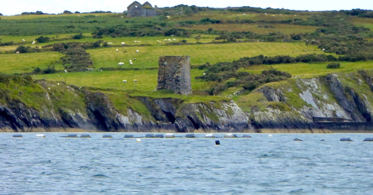
What can you say about a castle where only fragments remain of the original structure? Turns out – a surprising amount!

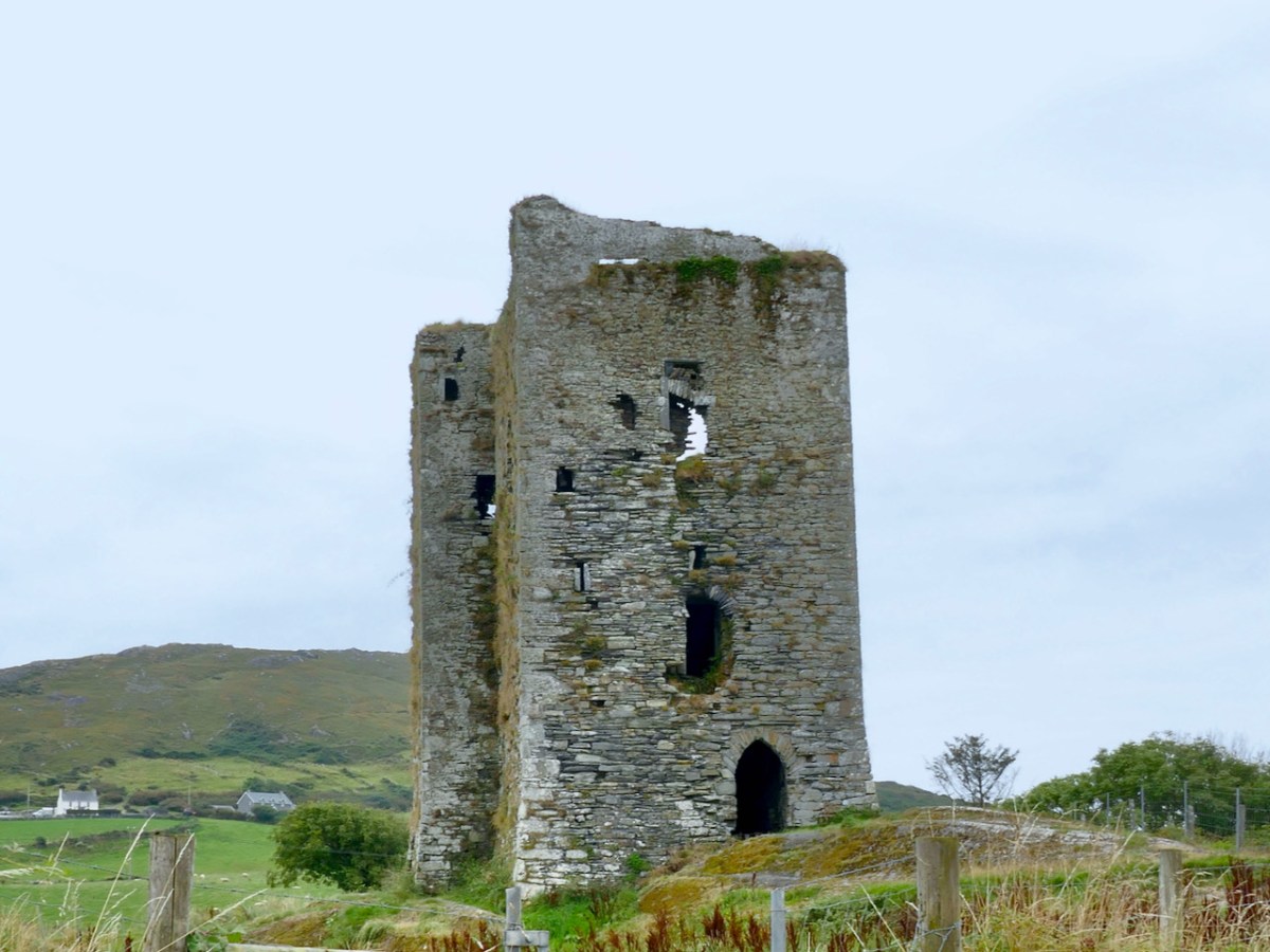
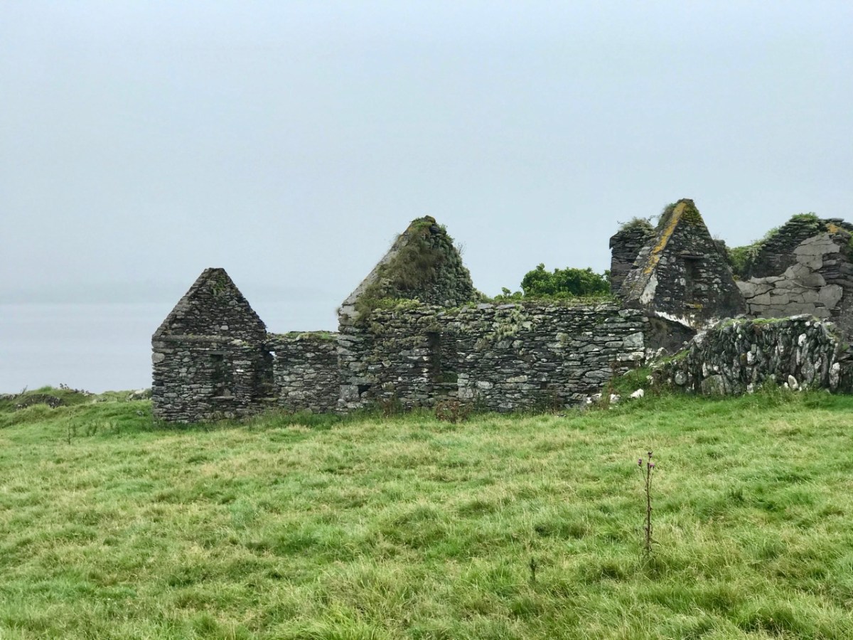
Fragmentary remains is the phrase used in the National Monuments record to describe the two castles which are the subject of this post – Dunbeacon and Castle Island. In each case only enough is still standing to confirm that it was indeed a medieval tower house. Fortunately, in the case of Dunbeacon, there is also historical evidence. 

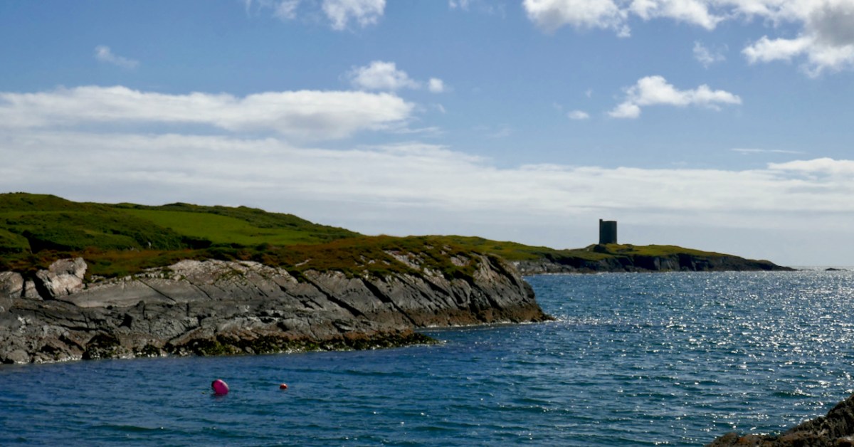
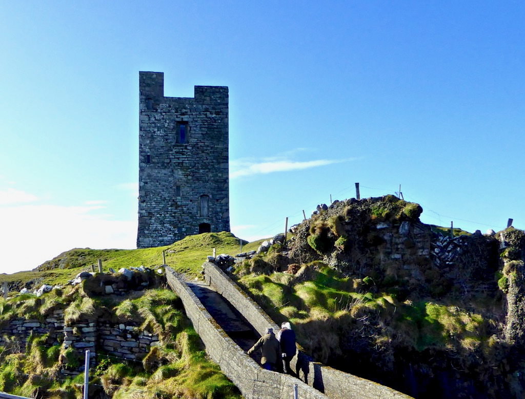
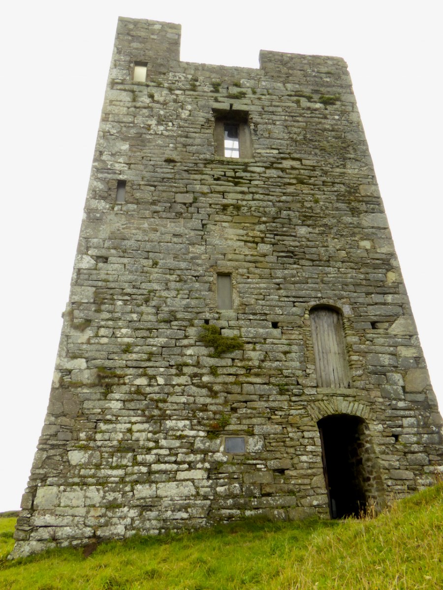
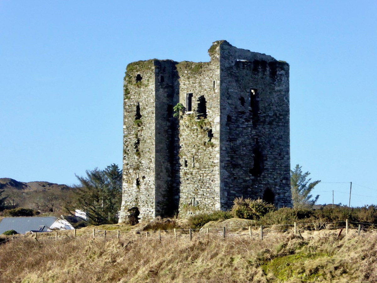
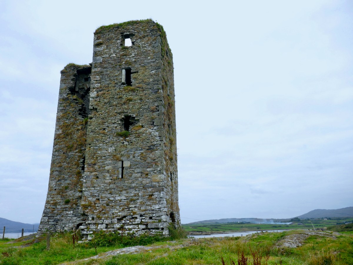
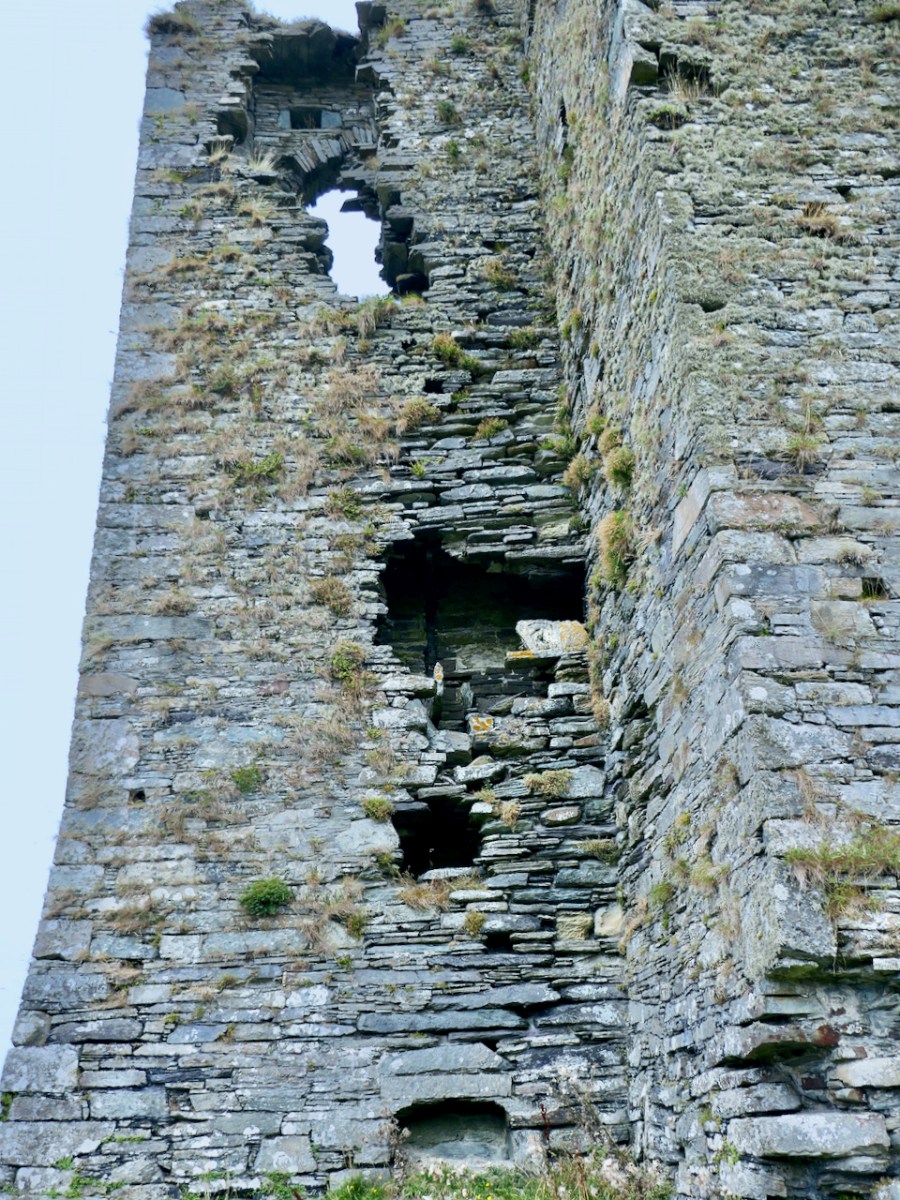
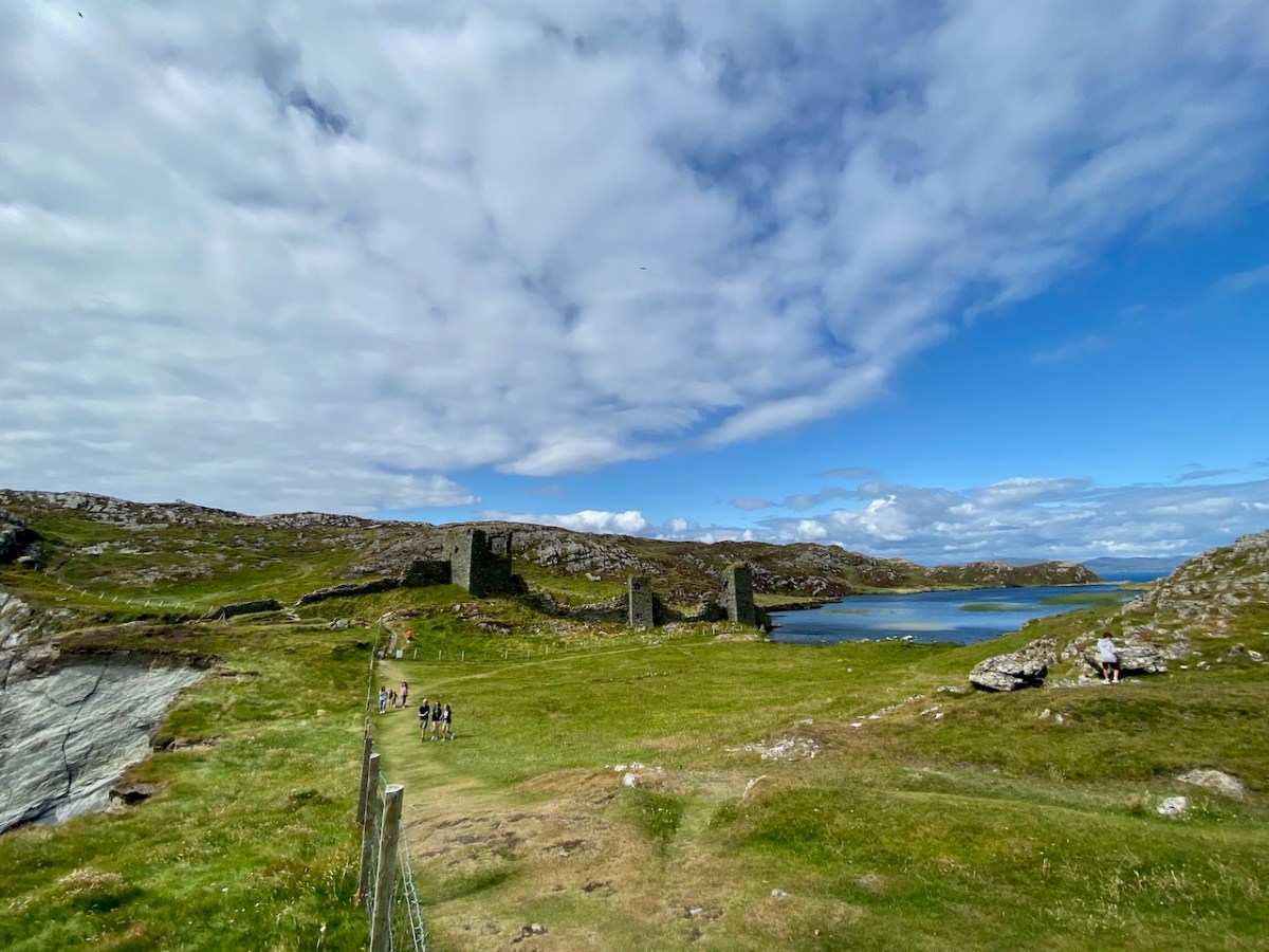
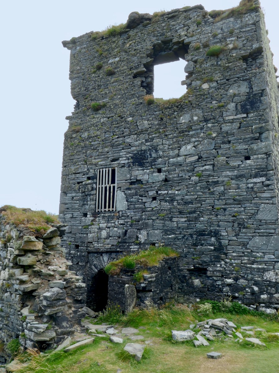
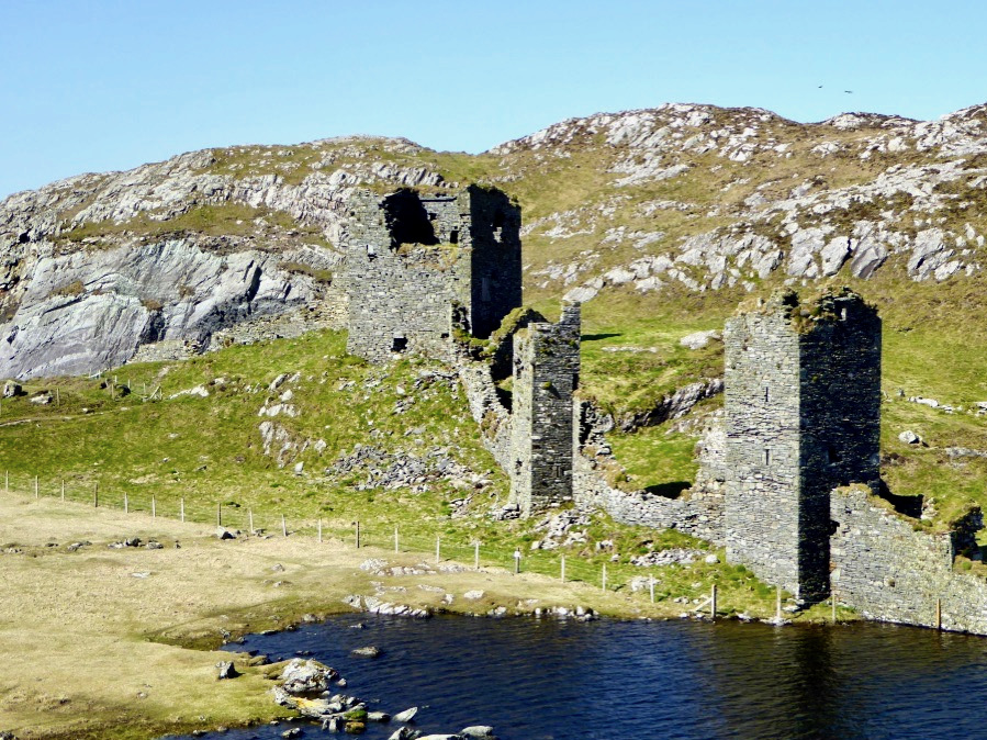
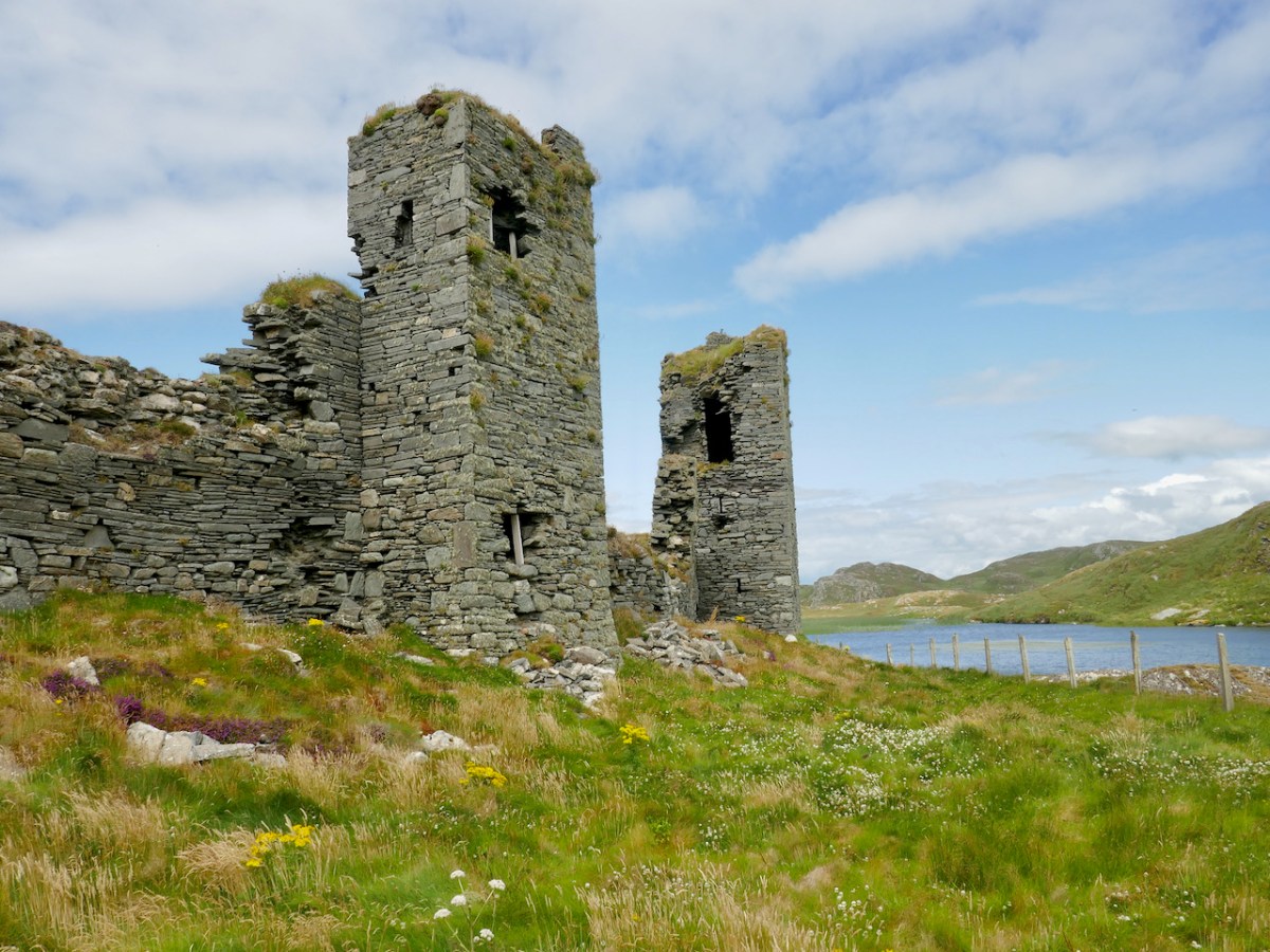
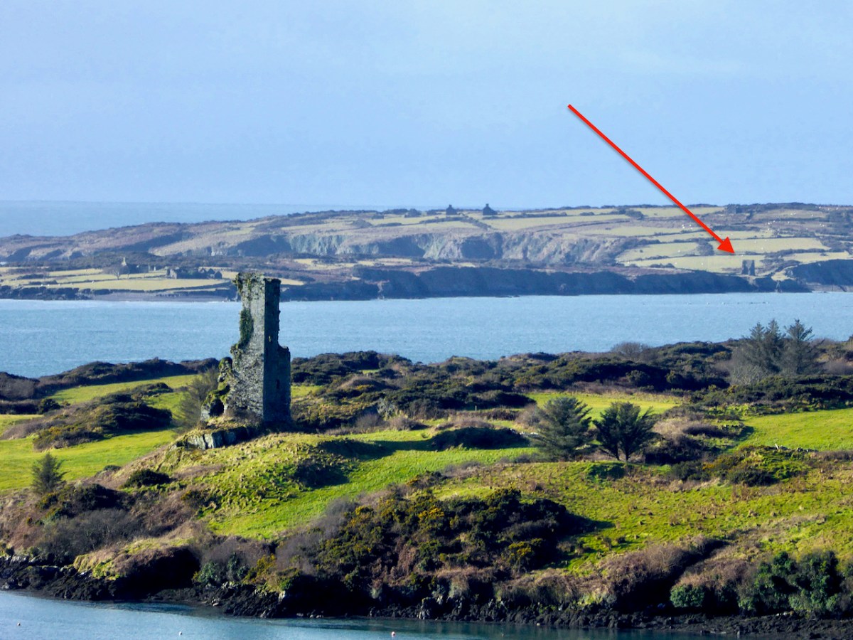
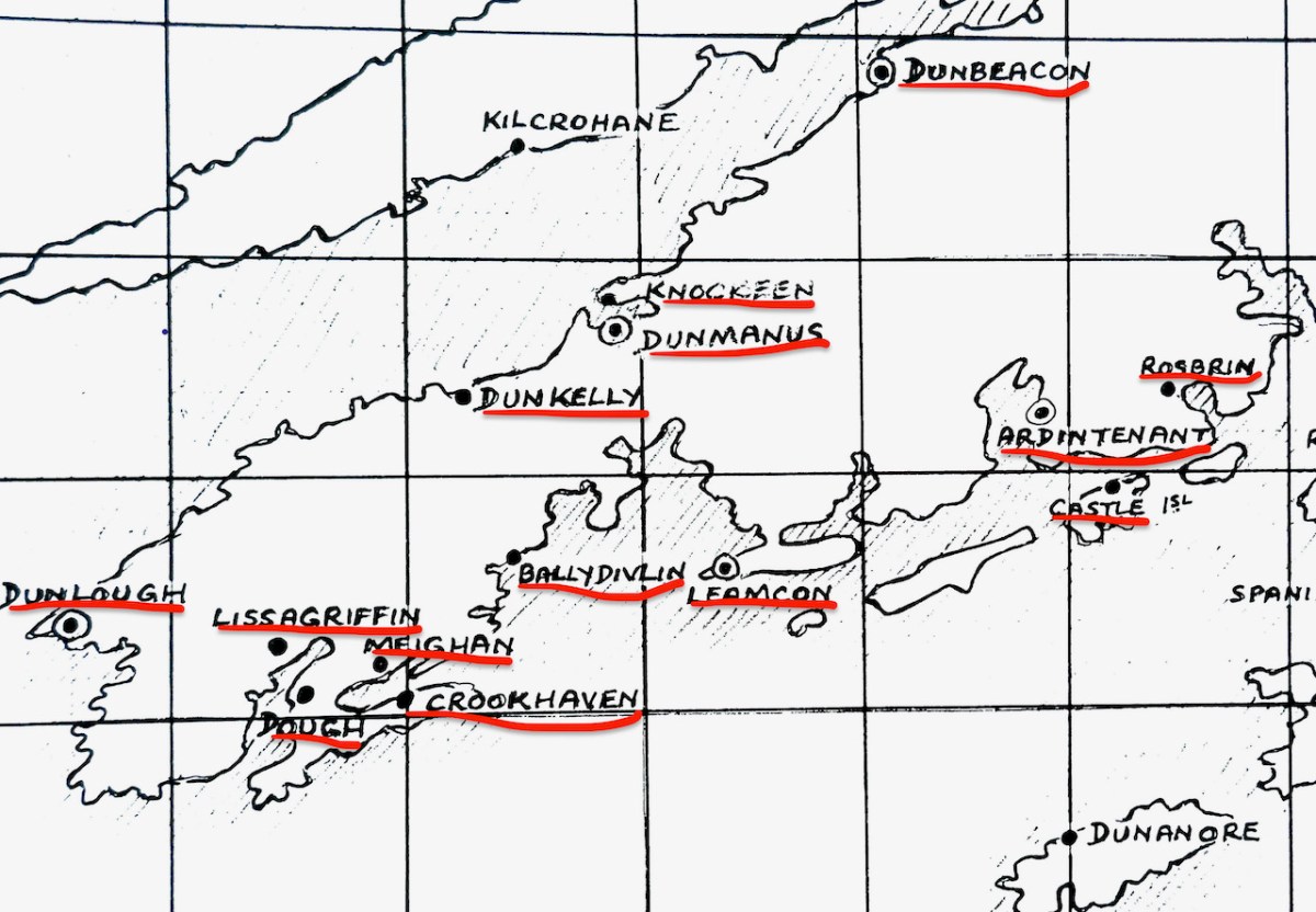
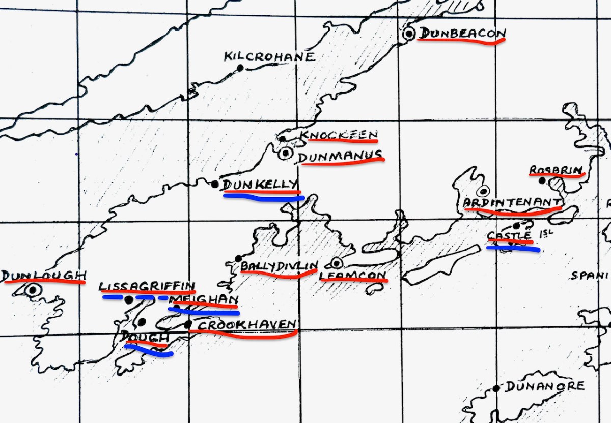
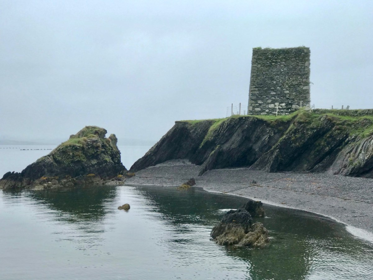
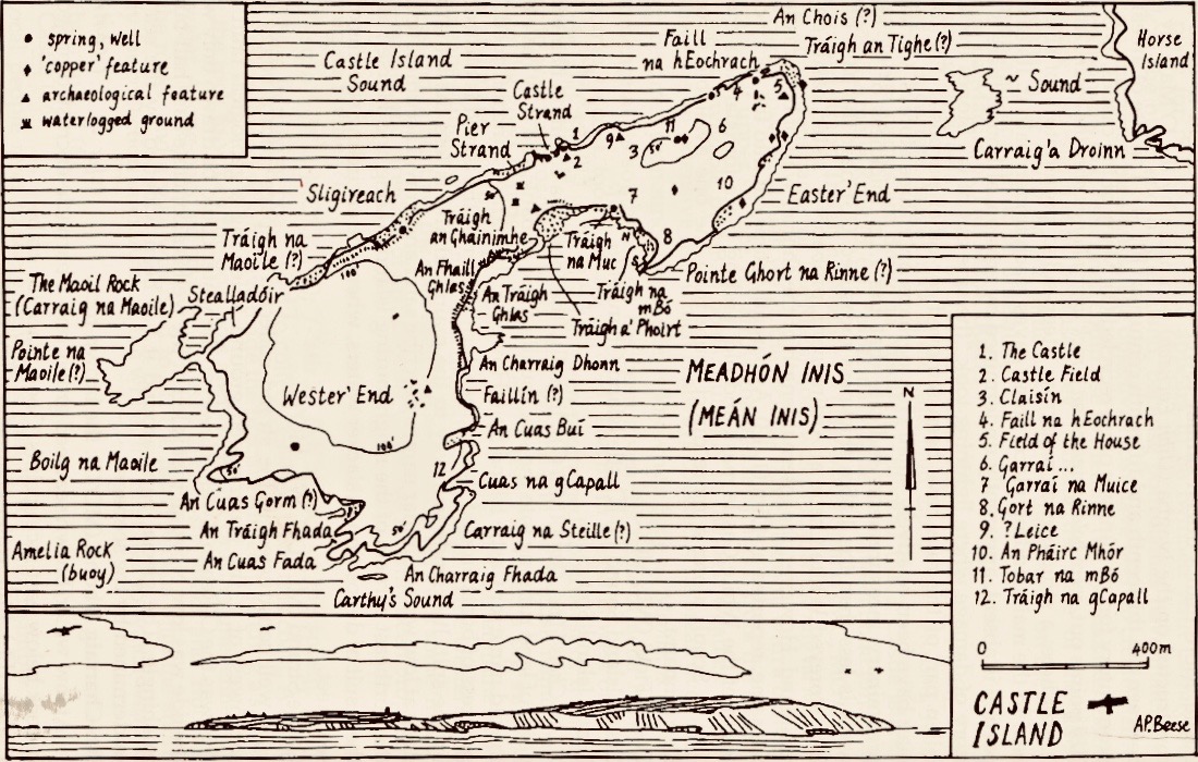
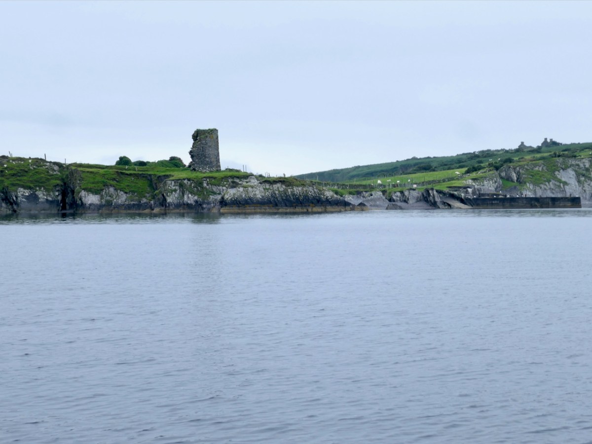
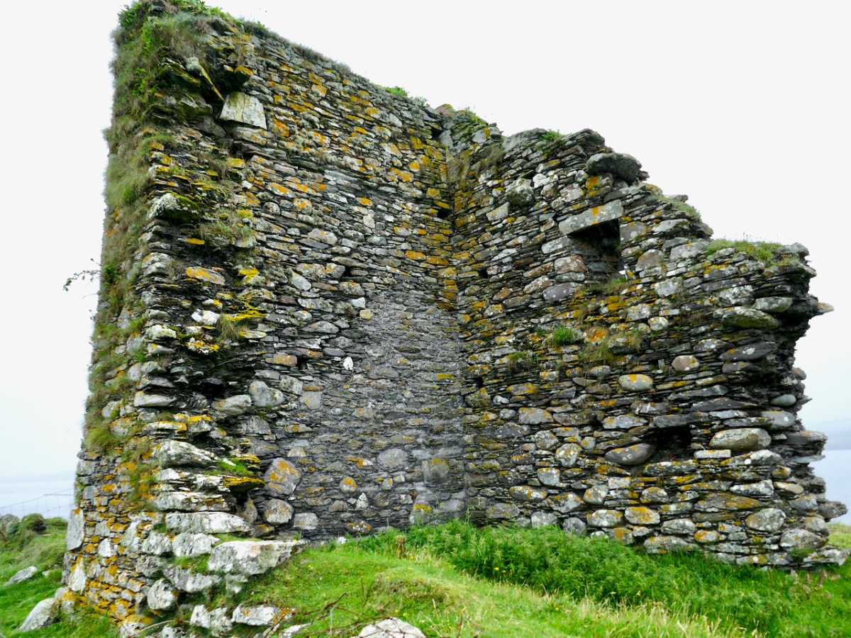
Let’s look at Castle Island first, and begin with the name. Samuel, in his thesis on The Tower Houses of West Cork, tells us that it was known locally as Castleduff, or Caisleán Dubh, the Black Castle. However, this was the name more commonly applied to Black Castle/Leamcon, so he says there might be some confusion there. There is no other name in the historical records – no mention, indeed, at all. Perhaps it was too insignificant to merit a mention – a fortified outpost rather than the high-status residence of one of the ruling O’Mahonys. 

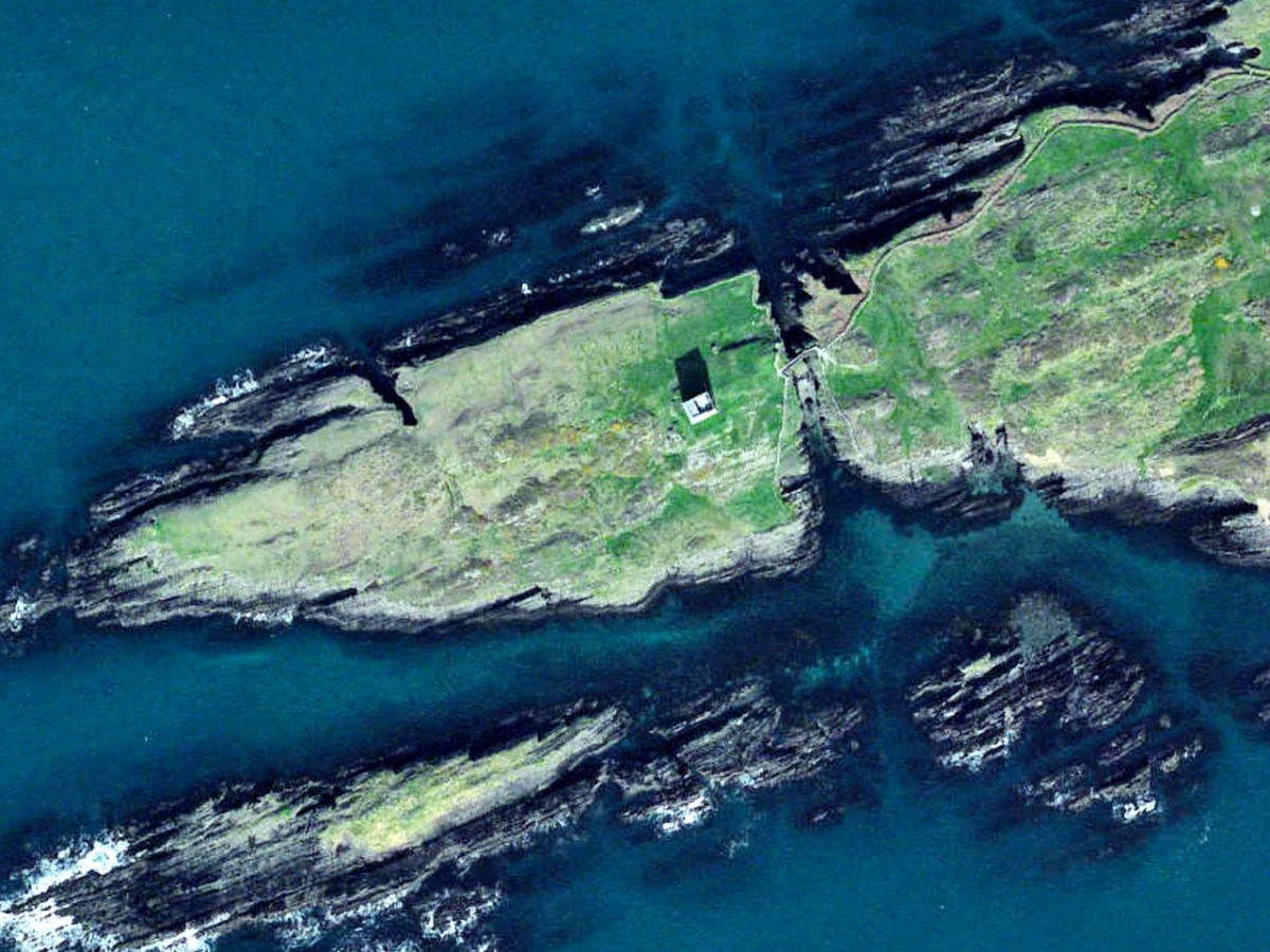
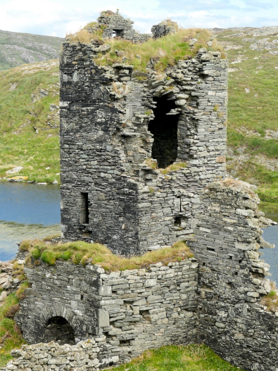
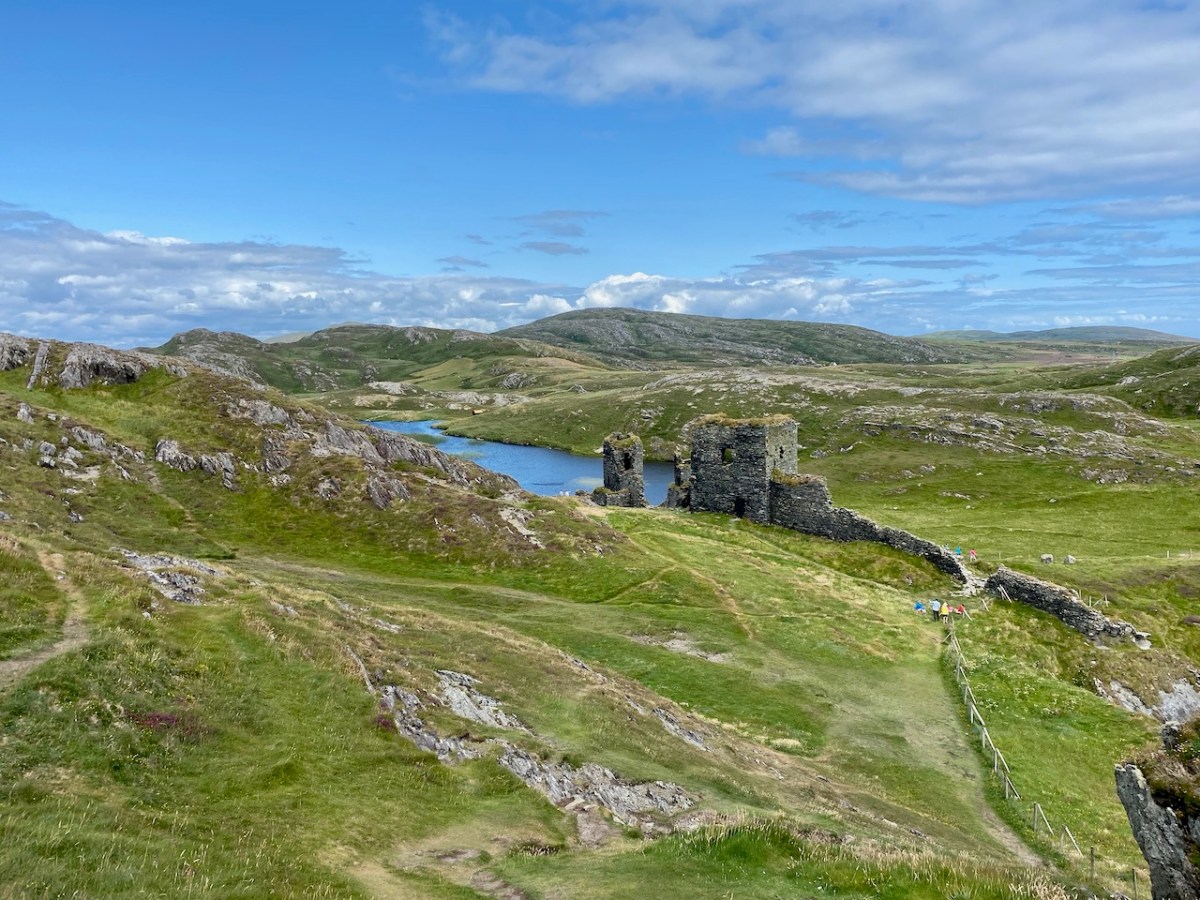
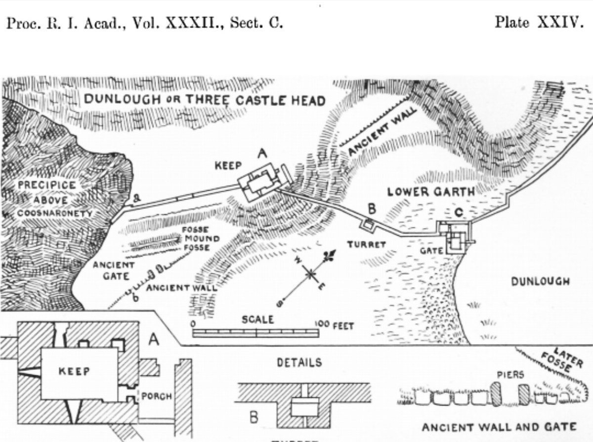
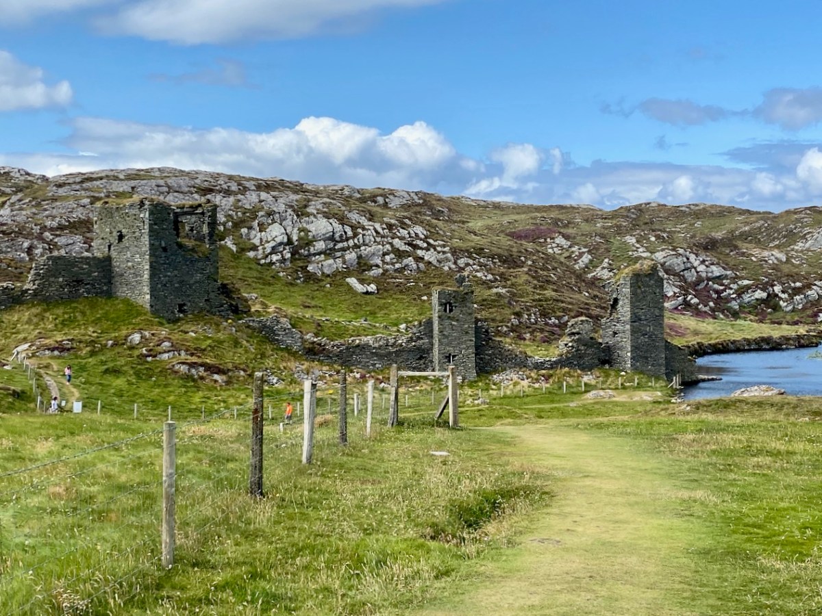
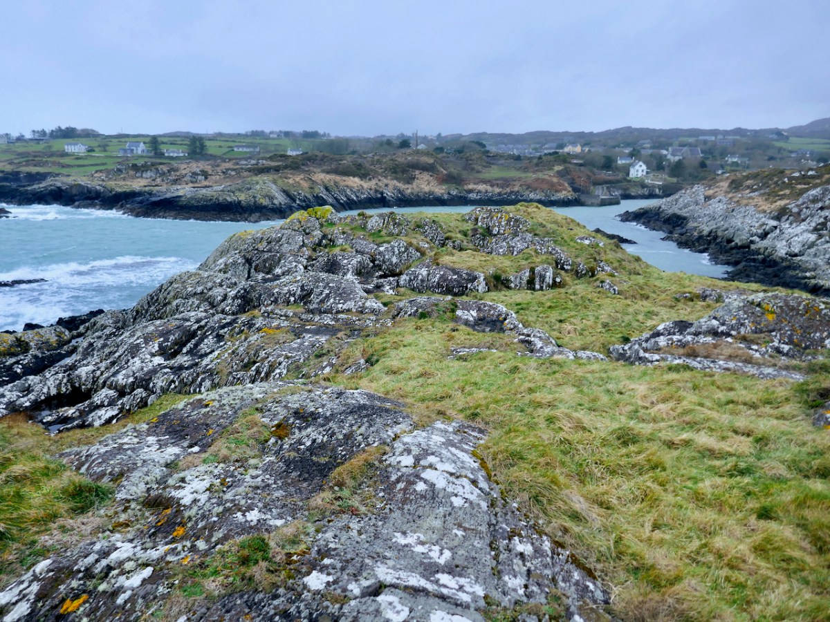
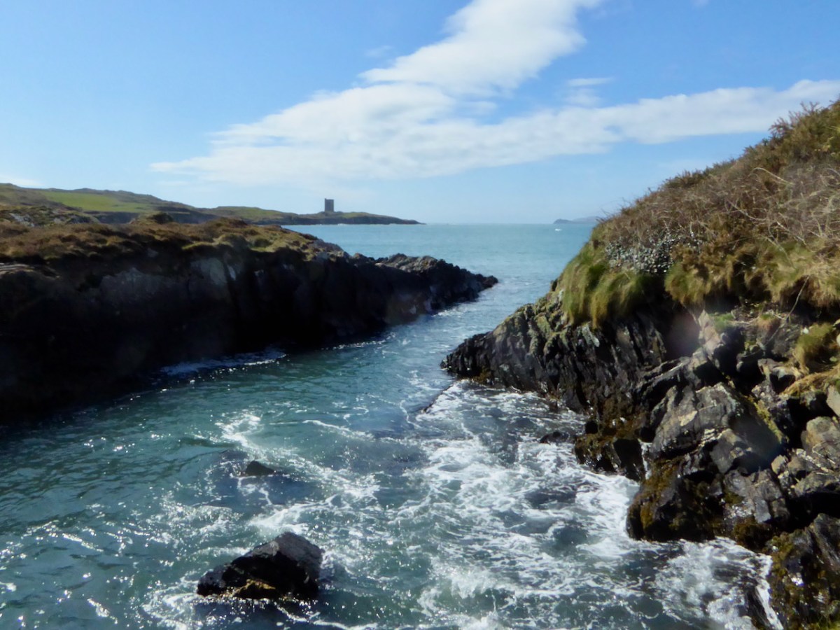
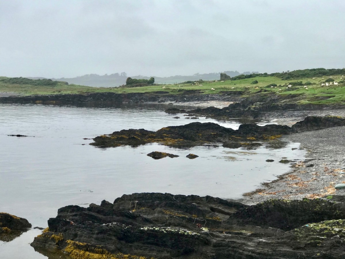
We have noted with other of the O’Mahony castles that they were built on the site of a ring fort (Ardintenant) or a promontory fort (Dunlough). The National Monuments records notes a promontory fort at this site, although it is not obvious on the ground any more. There are, in fact several promontory forts noted on Castle Island, perhaps indicating that this was the preferred type of fortified dwelling here, since there are no ringforts.

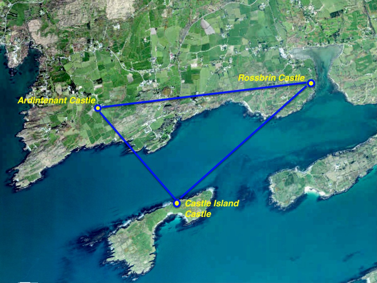
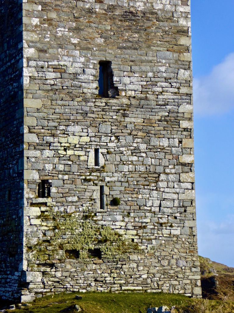
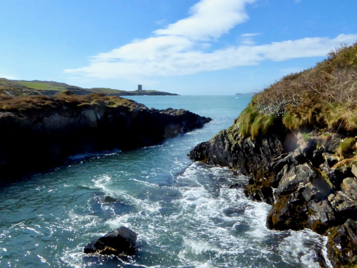
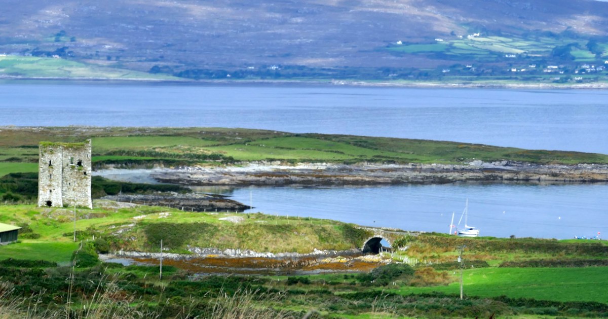
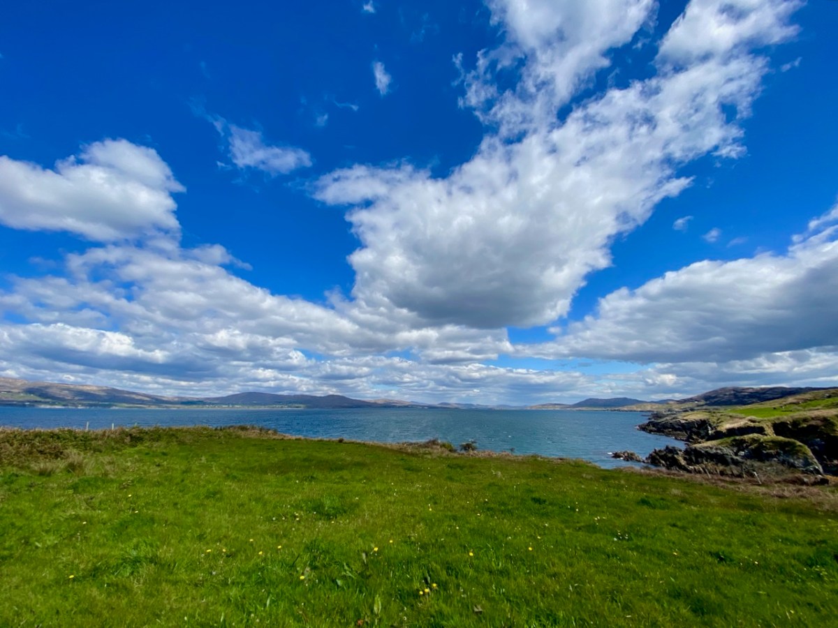
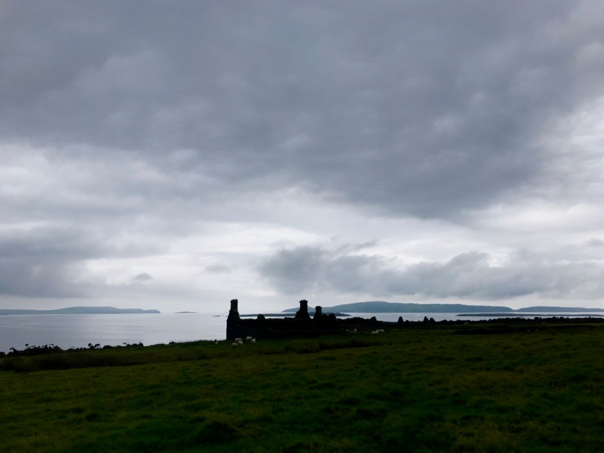
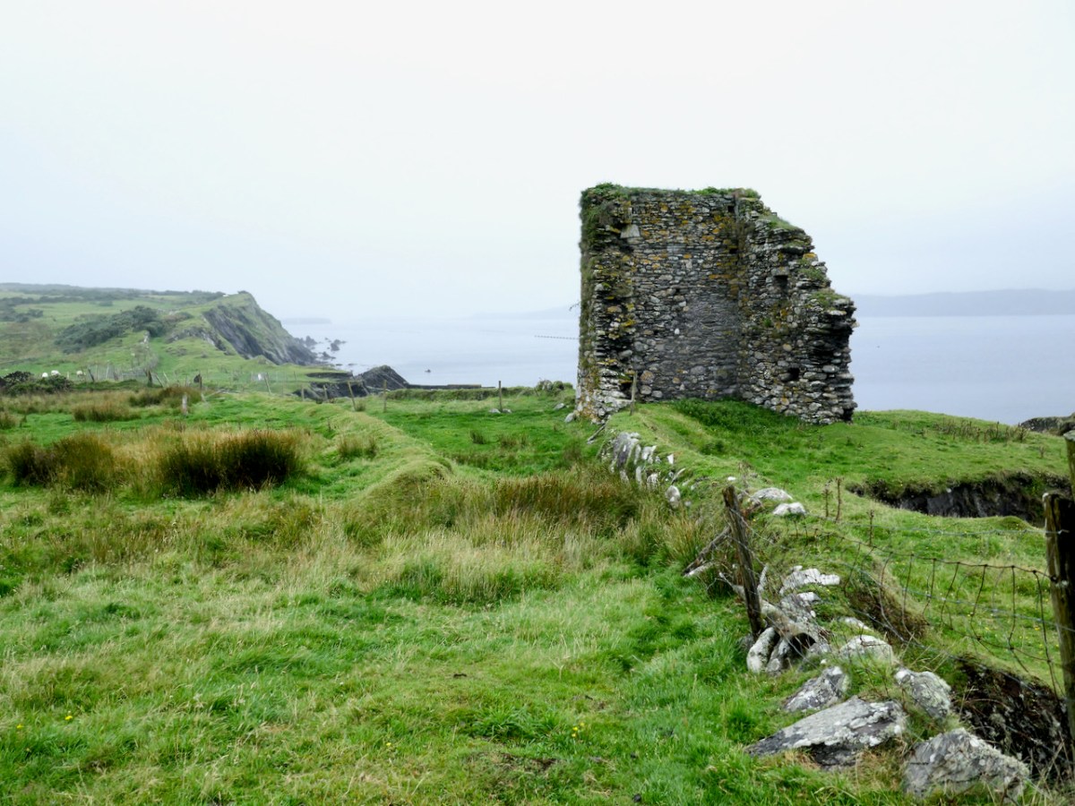
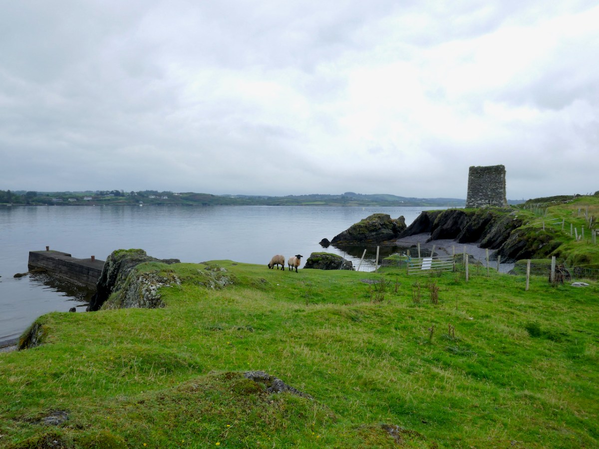
Like all the O’Mahony castles, it was strategically sited – it was beside the waters that separates the island from the mainland, and within sight of two other castles – Rossbrin and Ardintenant. The three form a triangle that overlooked and guarded the sheltered waters of Castle Island Channel. But also, from the top of the castle, there would have been a clear view south across the low land in the centre of the island, out to Roaringwater Bay.

We know that these waters would have been crowded with Spanish, French, Portuguese and British fishing boats, coming in to salt their catches in the fish palaces along the coast and to replenish their supplies. For all of these services and for permission to fish around Roaringwater Bay they paid hefty fees to the O’Mahonys, who got fabulously wealthy as a result. 

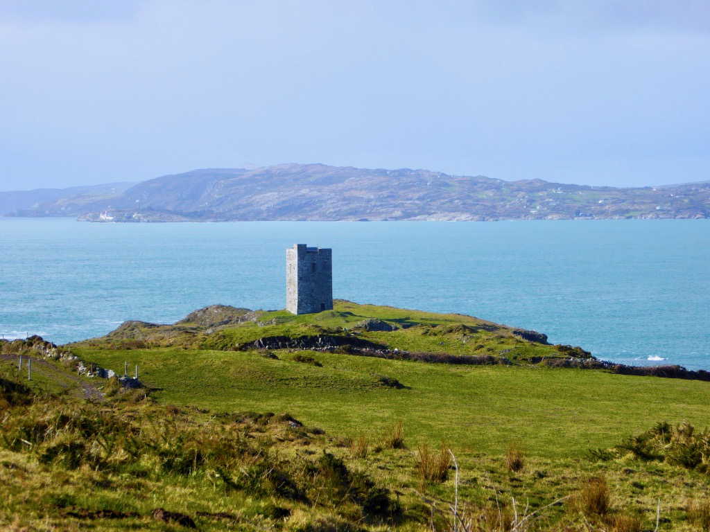
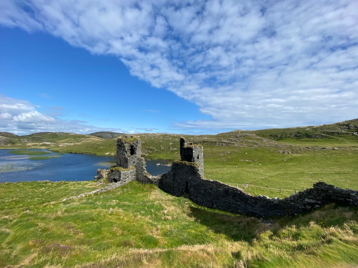
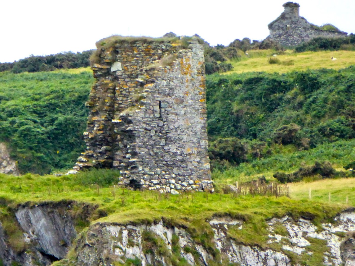
The castle was much smaller than all the others. Samuel says, 

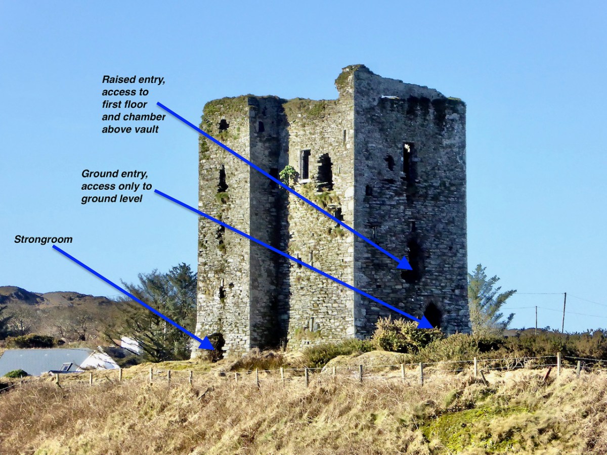
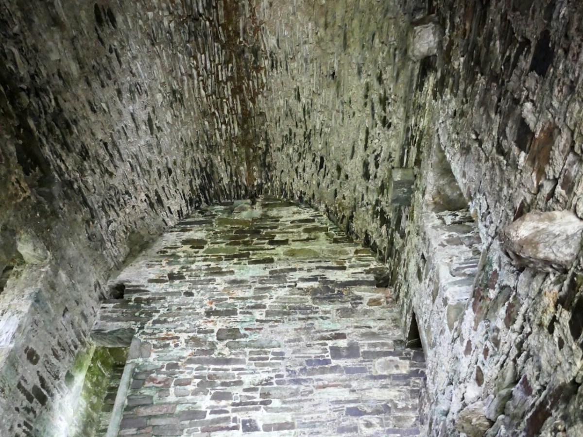
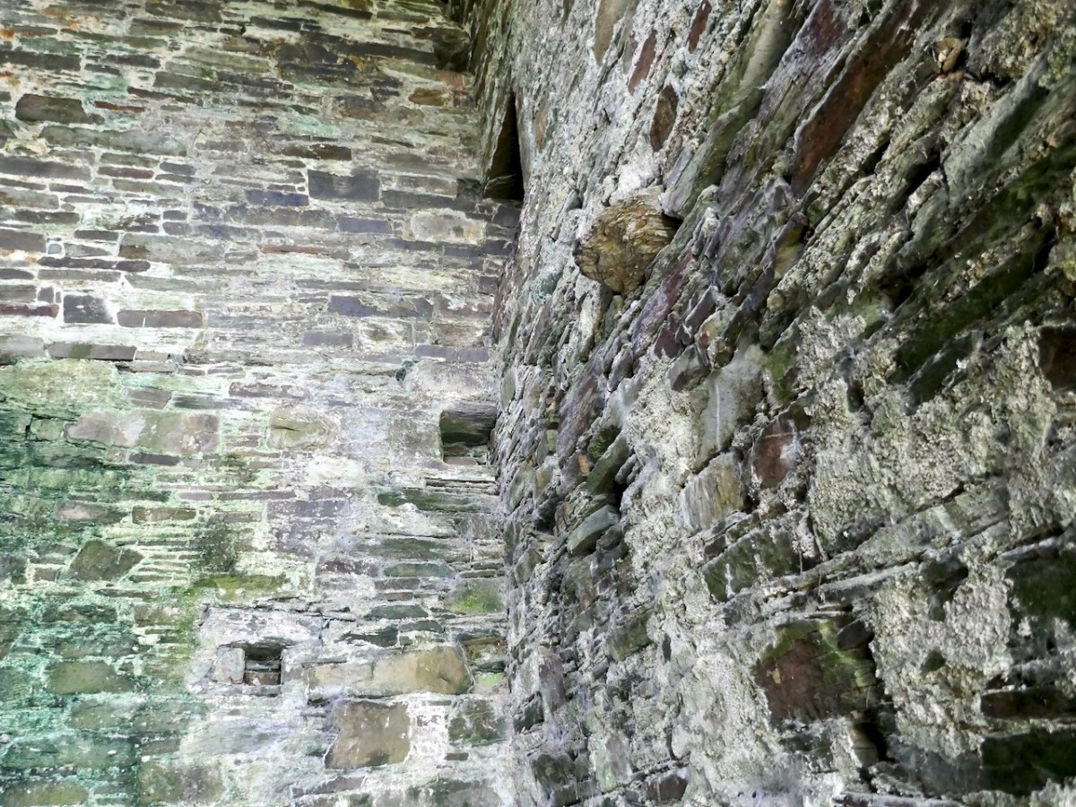
Working on the assumption that Castleduff was an RE tower house [i.e Raised entry], its smallness is striking. The surviving ‘end wall’ makes possible a reasonably accurate estimate of the plan’s original length. It is assumed that like its neighbours, its plan had a length-to-breadth ratio of 3:4 to 4:5; the ratios suggest a length of 7.96-7.46m (measures above the base-batter). The surviving north wall probably represents the full length of the ground-floor chamber.

Mark Wycliffe Samuel
the tower houses of west cork

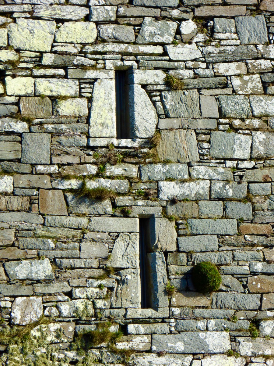
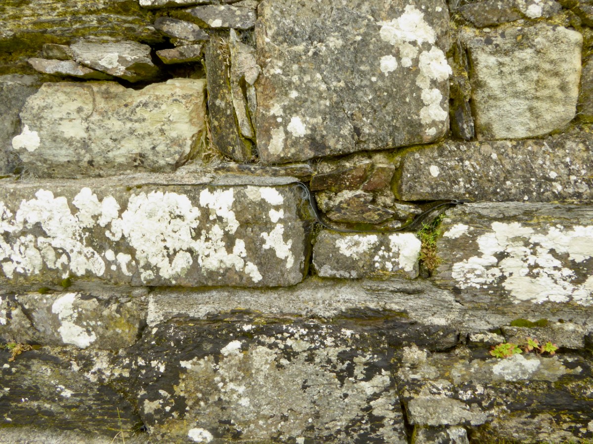
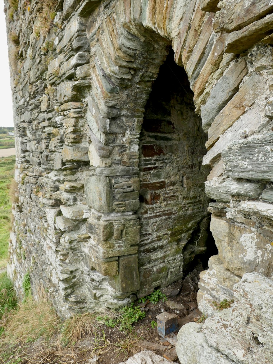
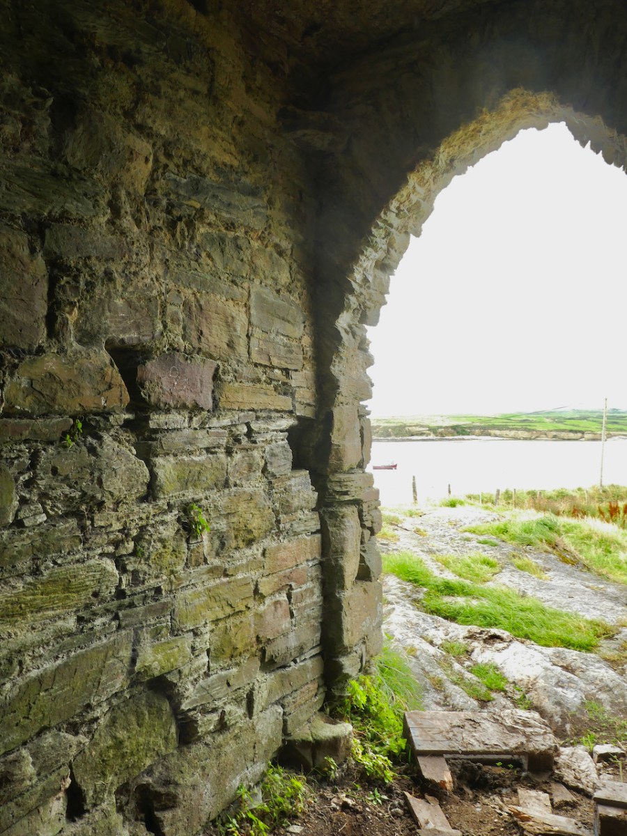
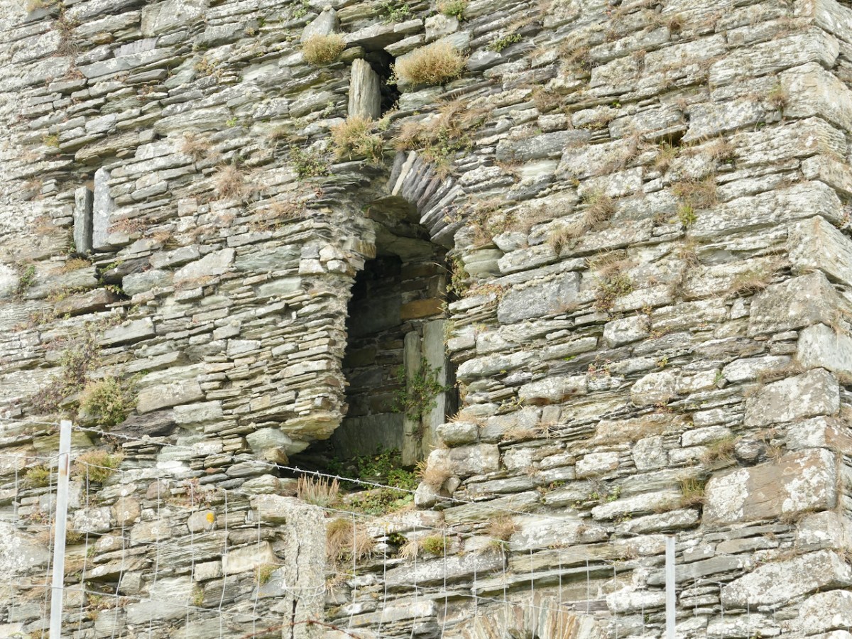
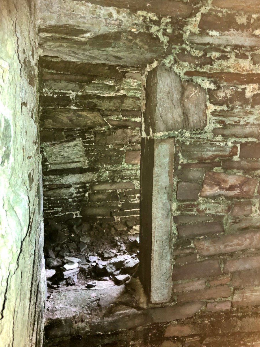
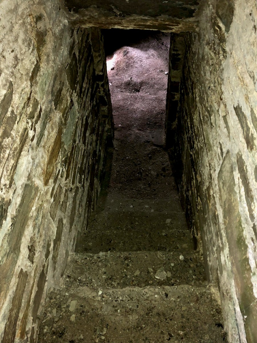
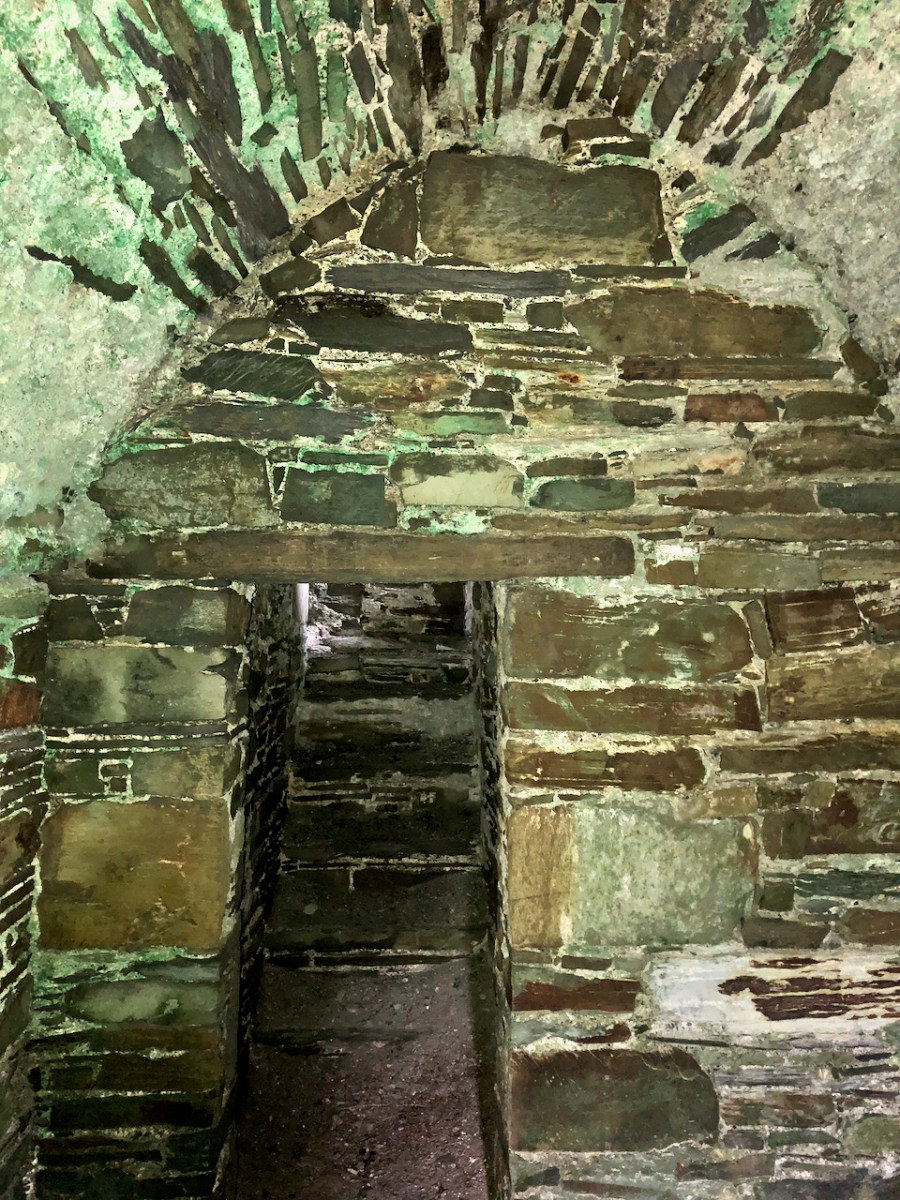
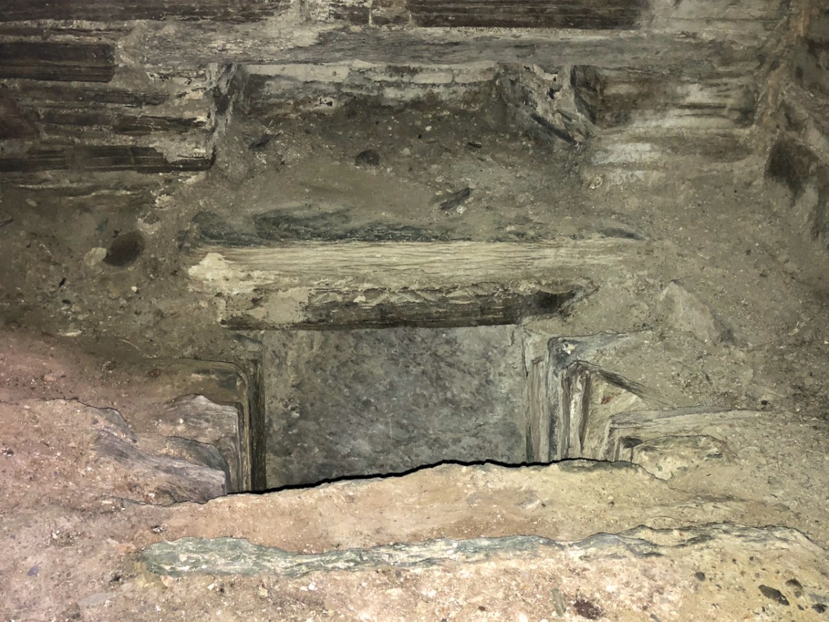
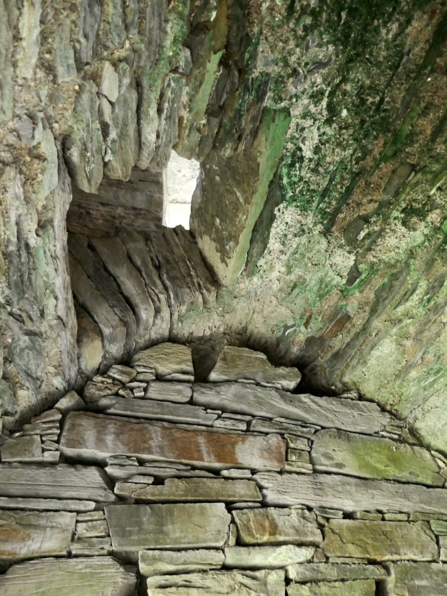
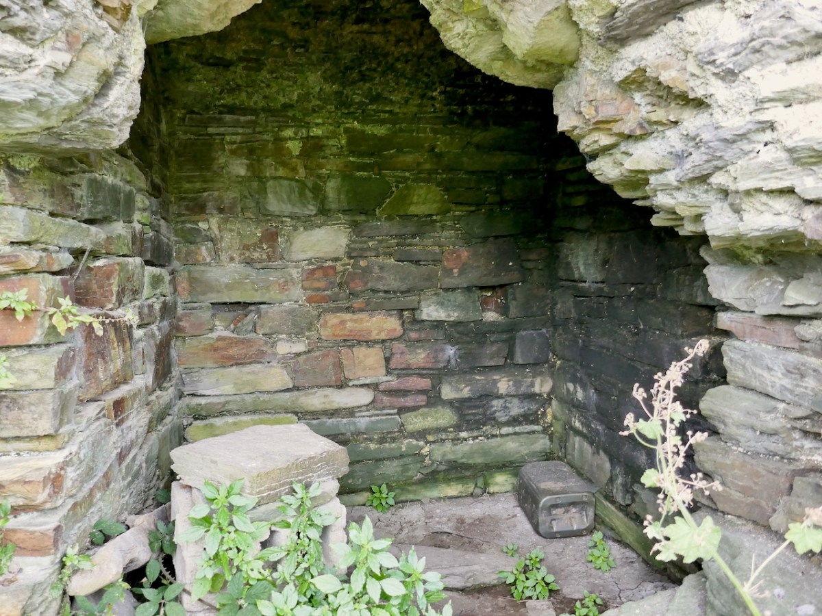
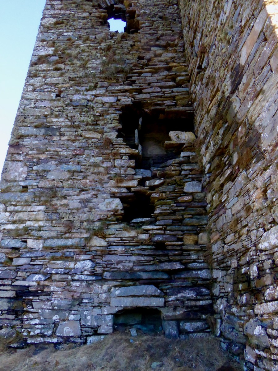
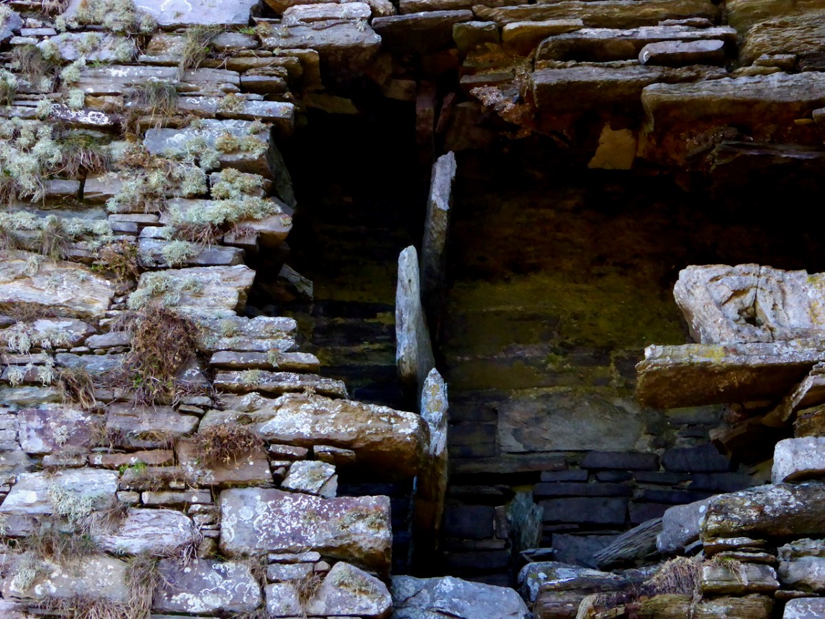
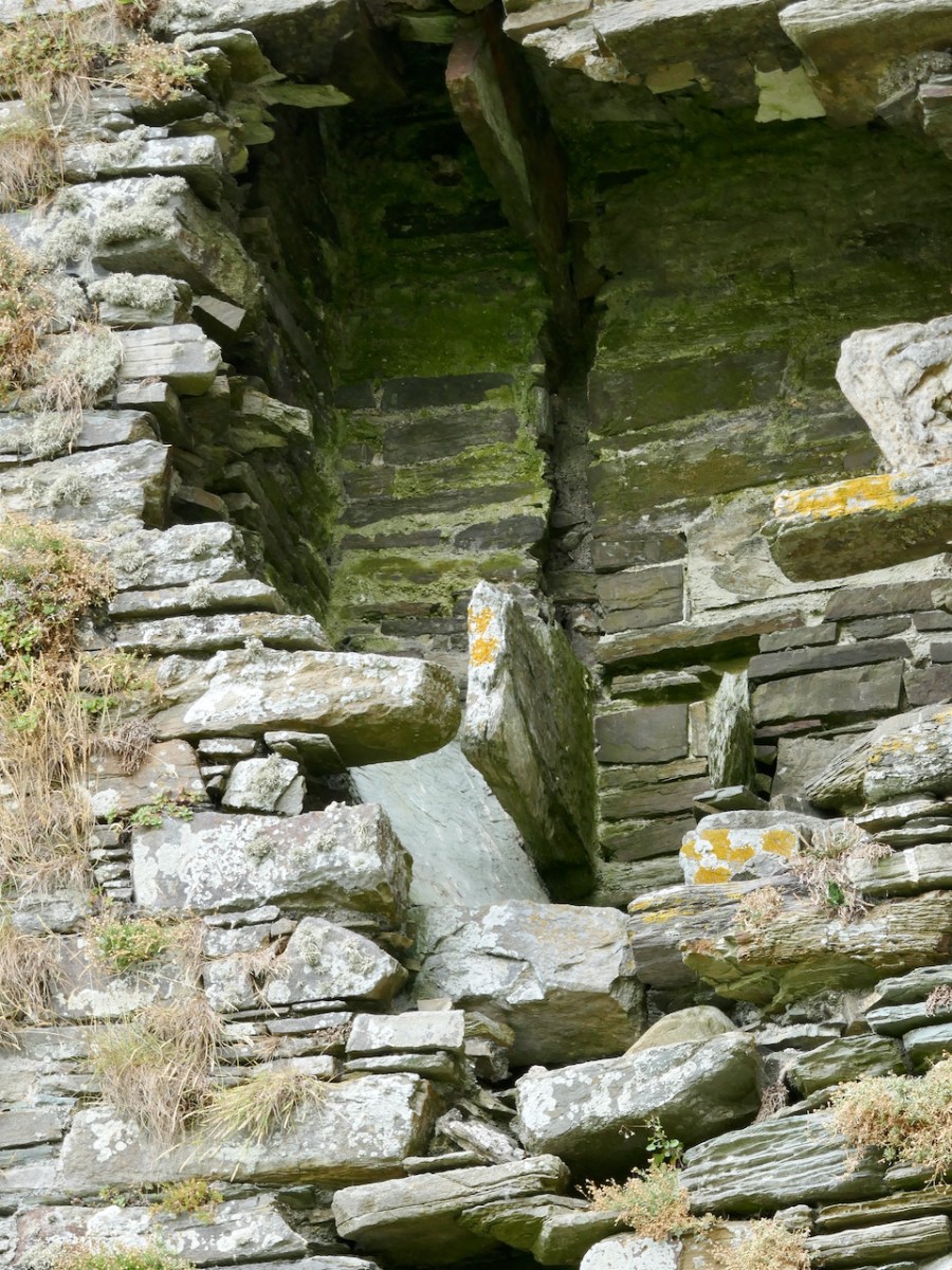
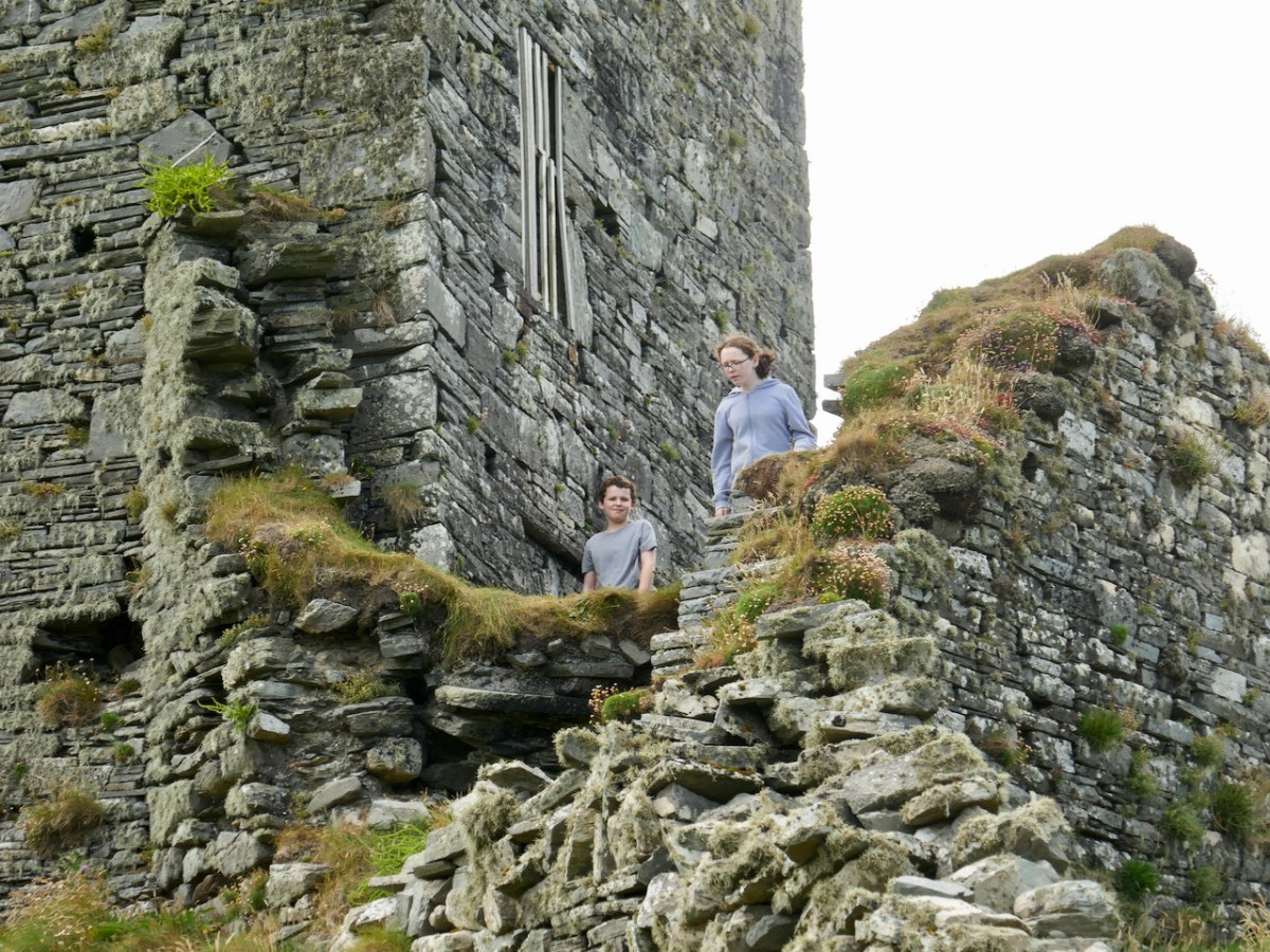
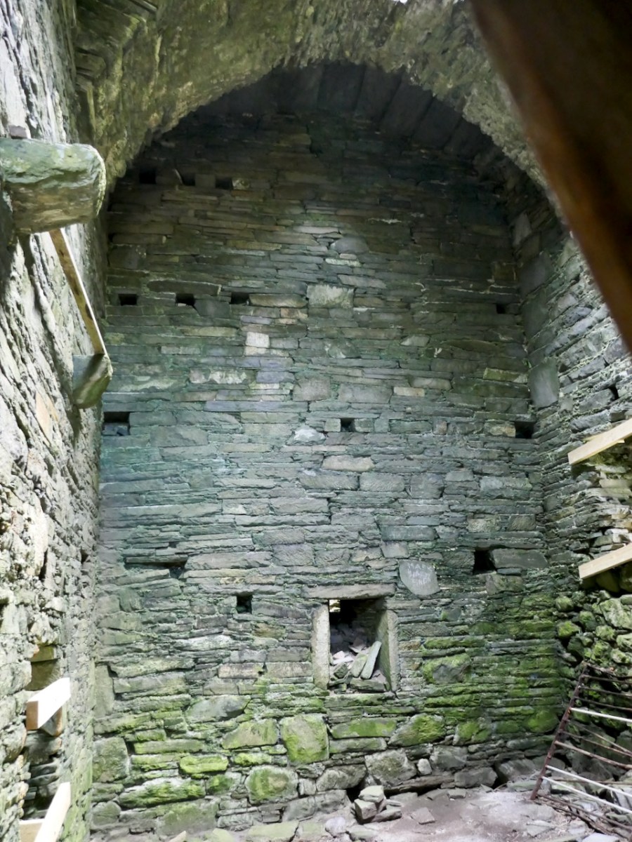
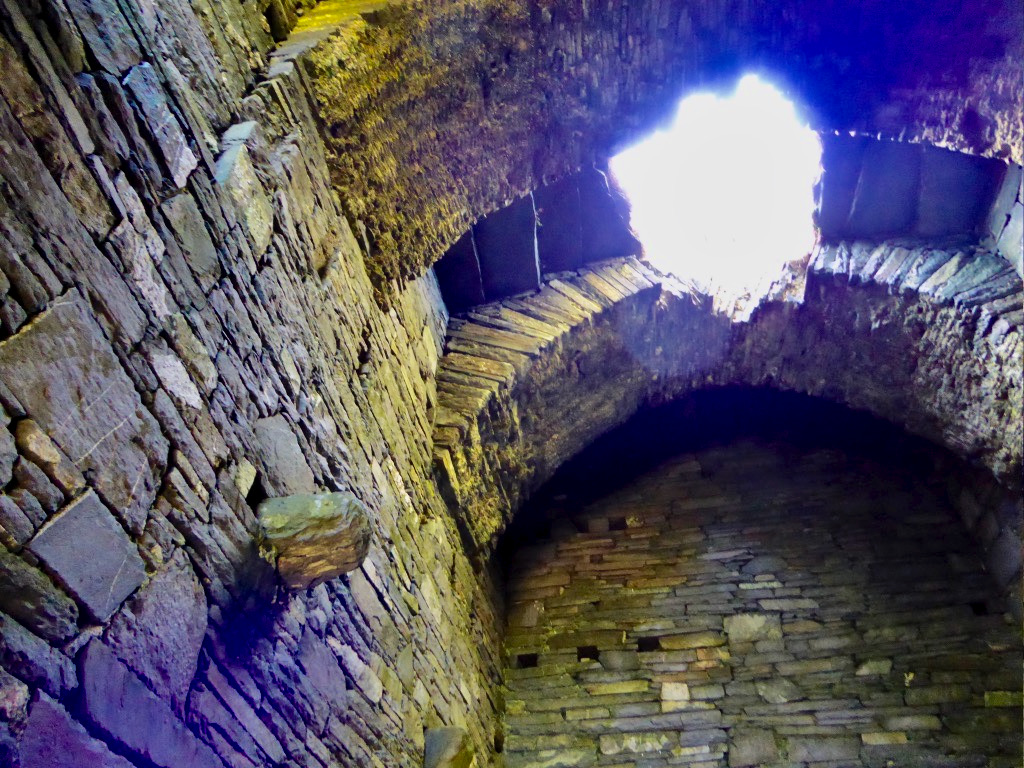
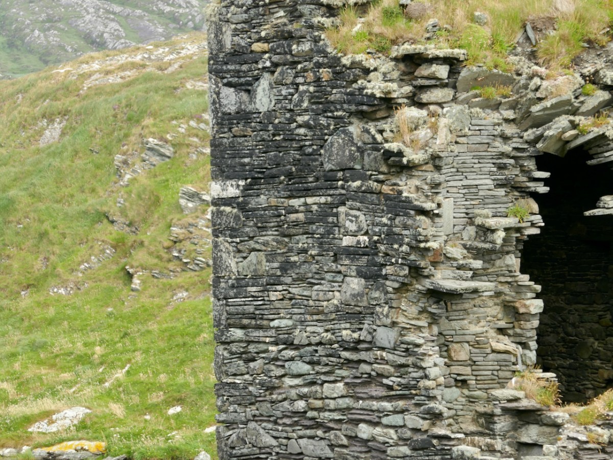
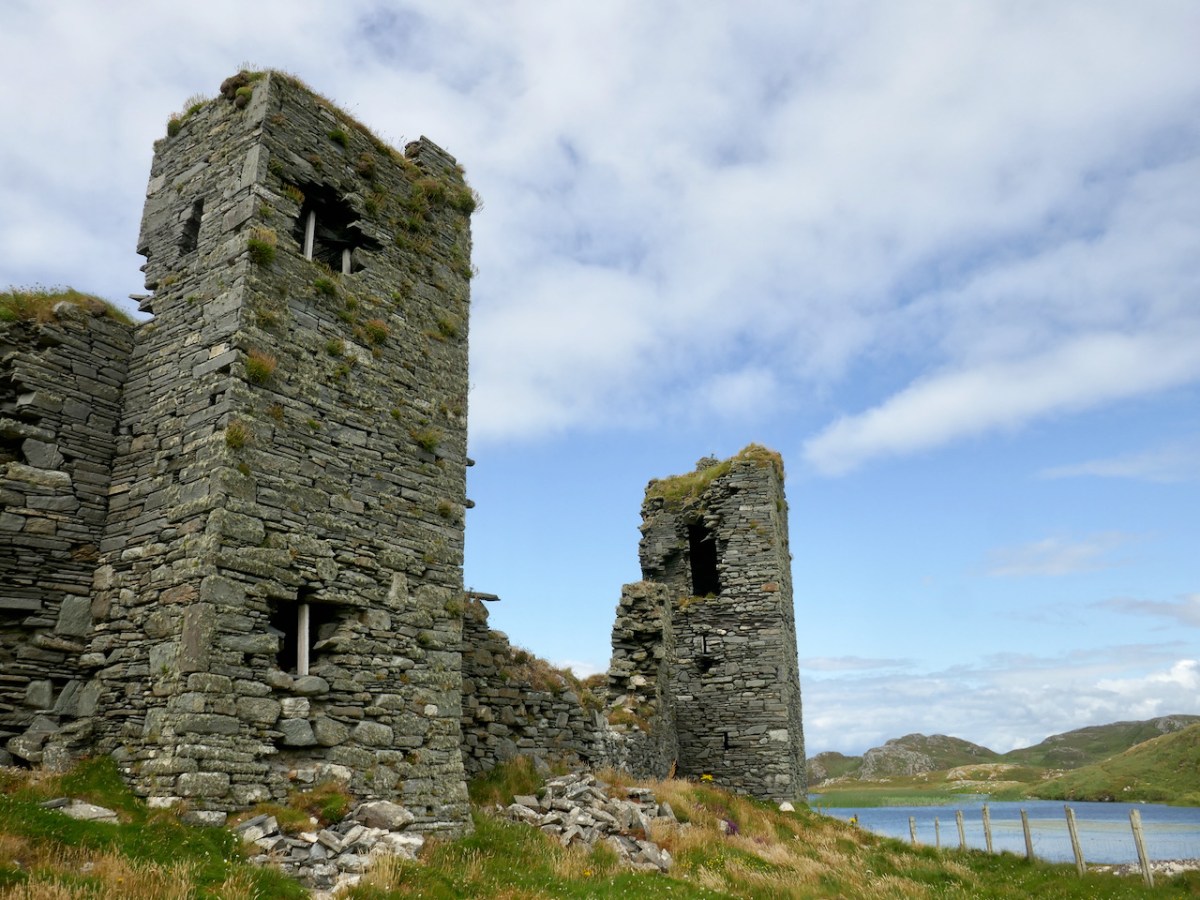
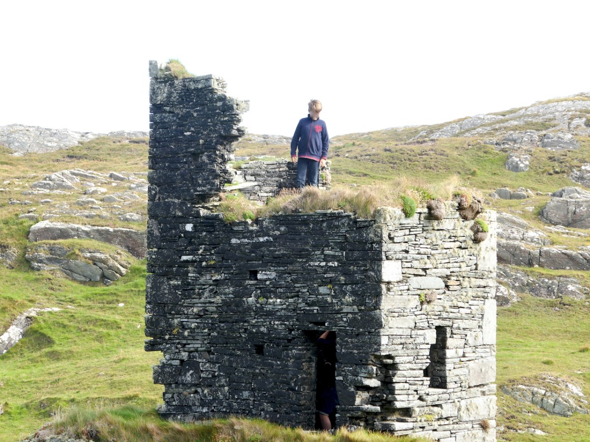
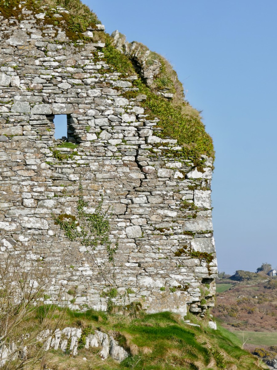
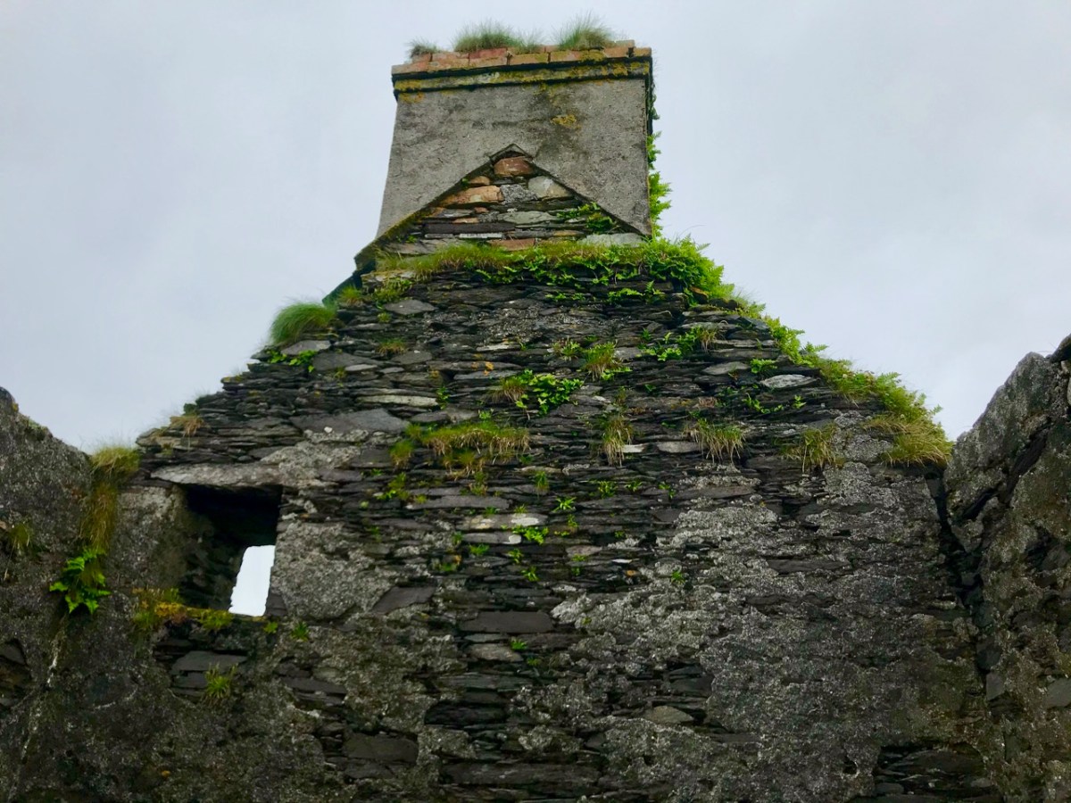
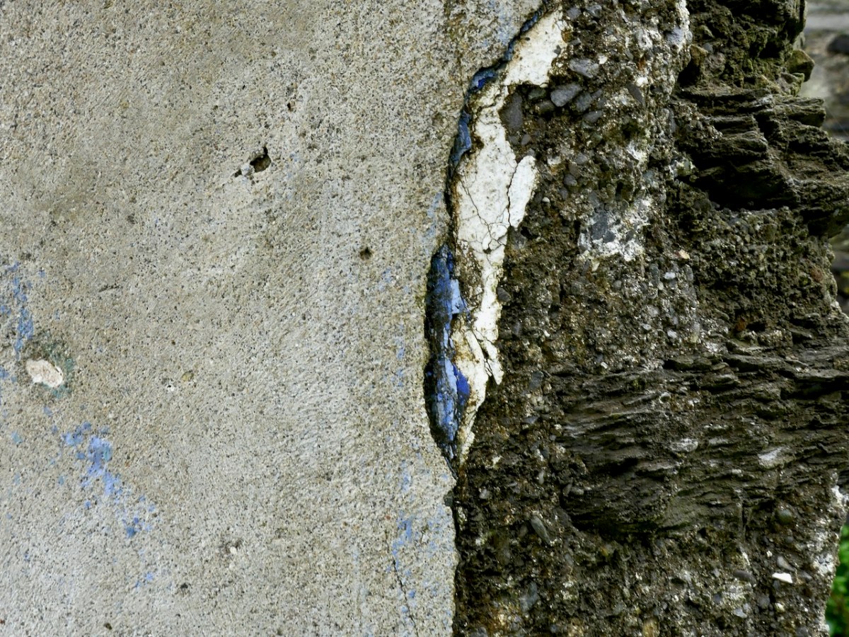
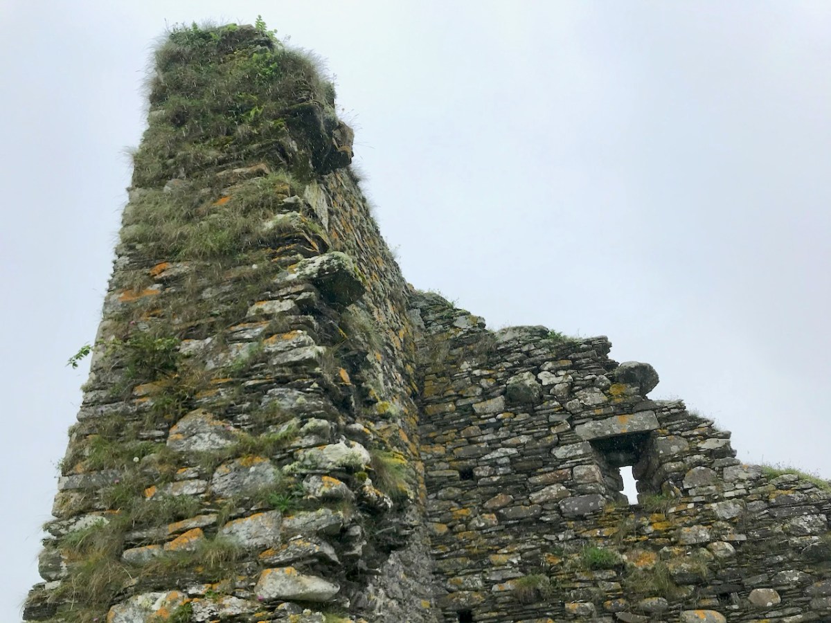
The only surviving opening is a loop in one wall, and a row of corbels that would have supported the first floor is still visible. There is no trace of anything that might suggest a vault, so it is possible that this small tower was unvaulted – Samuel thinks that the walls are noticeably thinner than the other castles, implying that this was a much simpler and shorter tower.

Samuels concludes his study of this tower by saying:

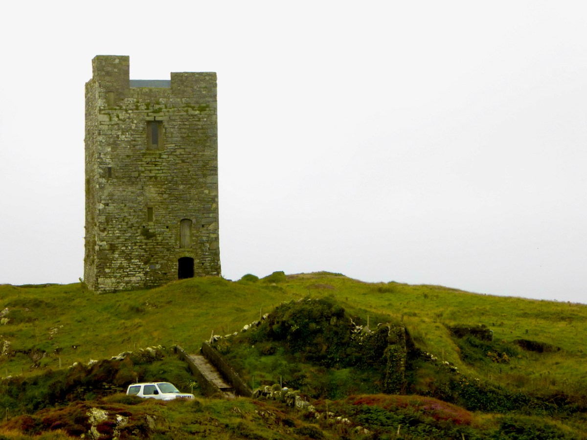
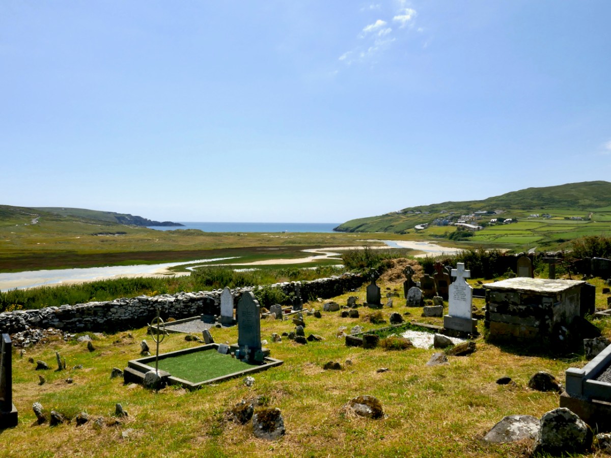
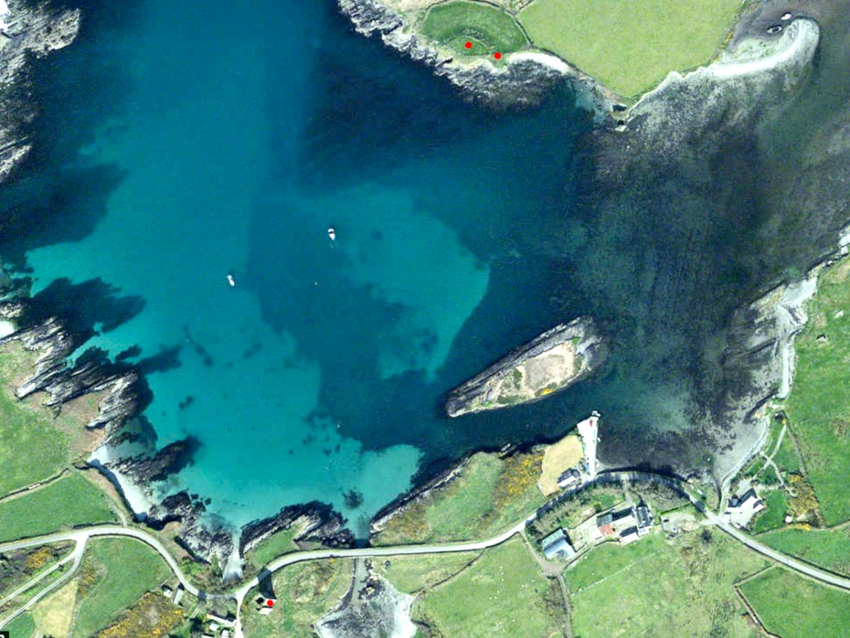
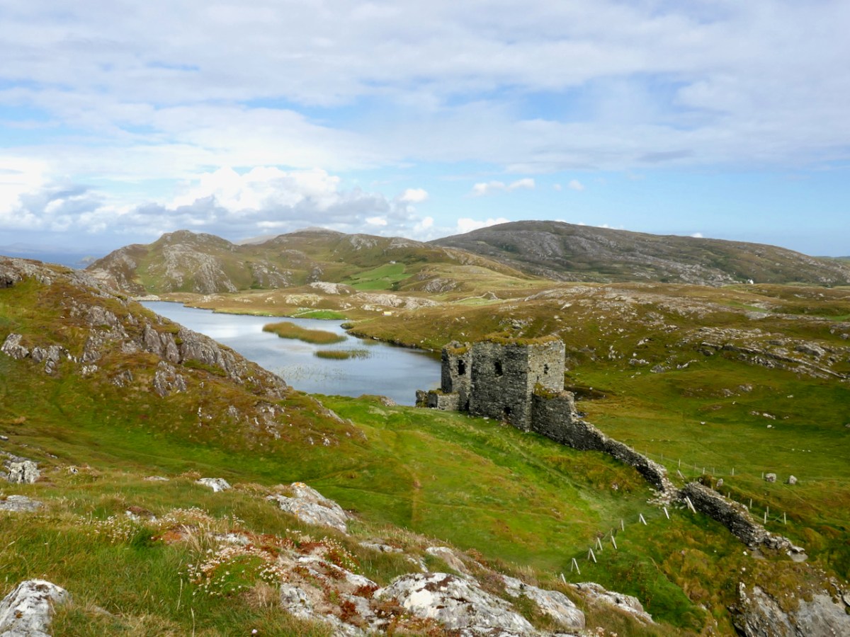
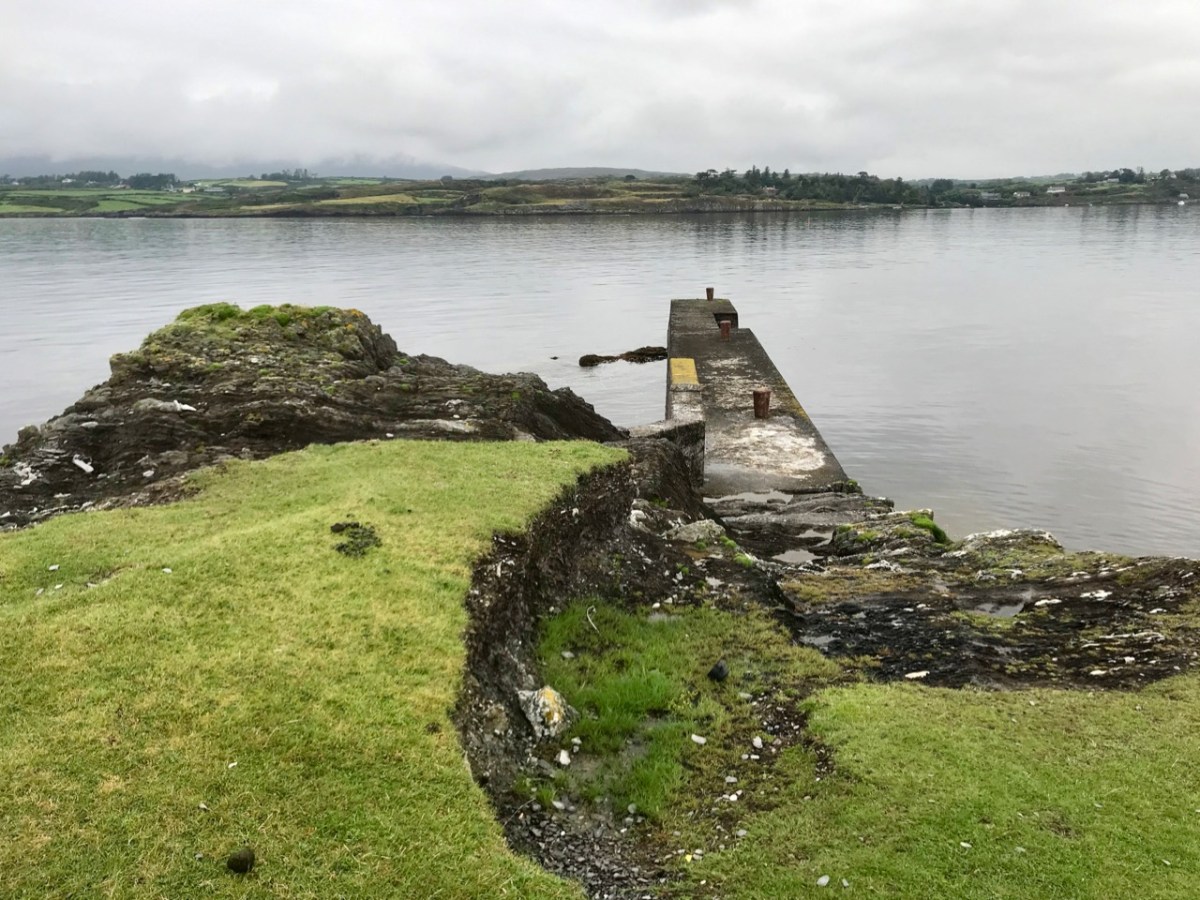
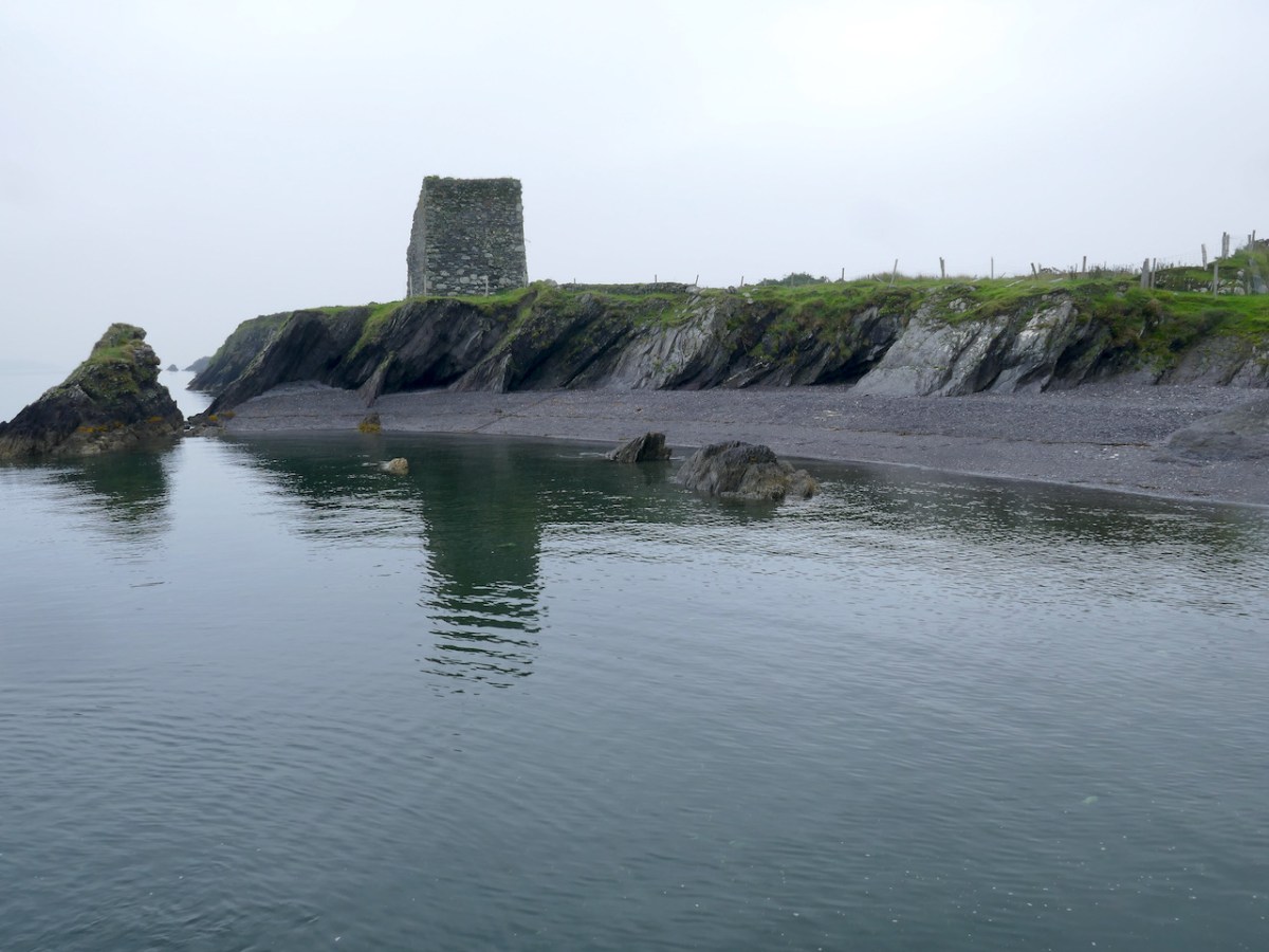
The jetty is modern, but the beach that it is laid upon was the best natural landing point on the island, well sheltered from the Atlantic swell. The landing clearly determined the siting of the tower house and was an important resource to the family that built the tower house. It is tempting to see a direct continuity between the recent settlement and a settlement around the tower house. Only excavation could determine if this was the case.

Mark Wycliffe Samuel
the tower houses of west cork

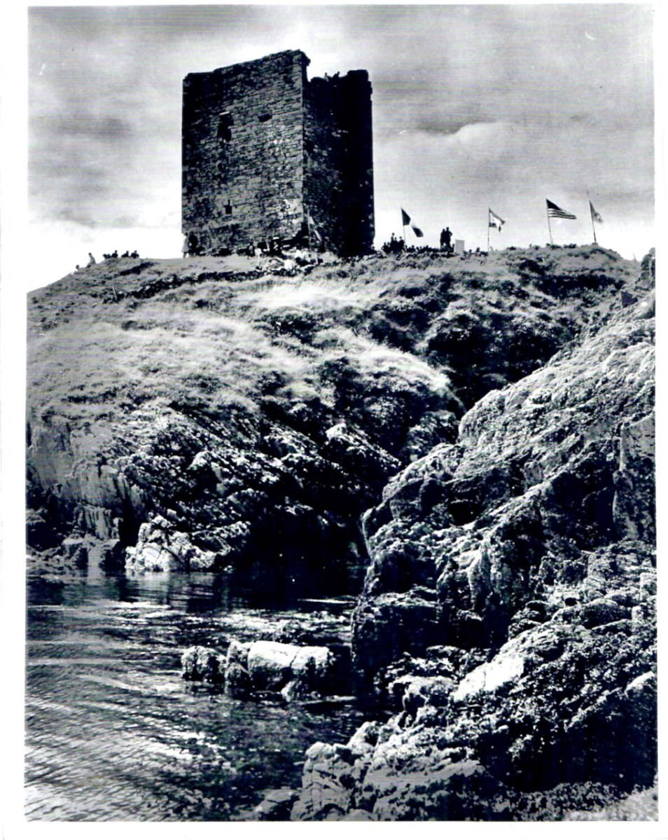
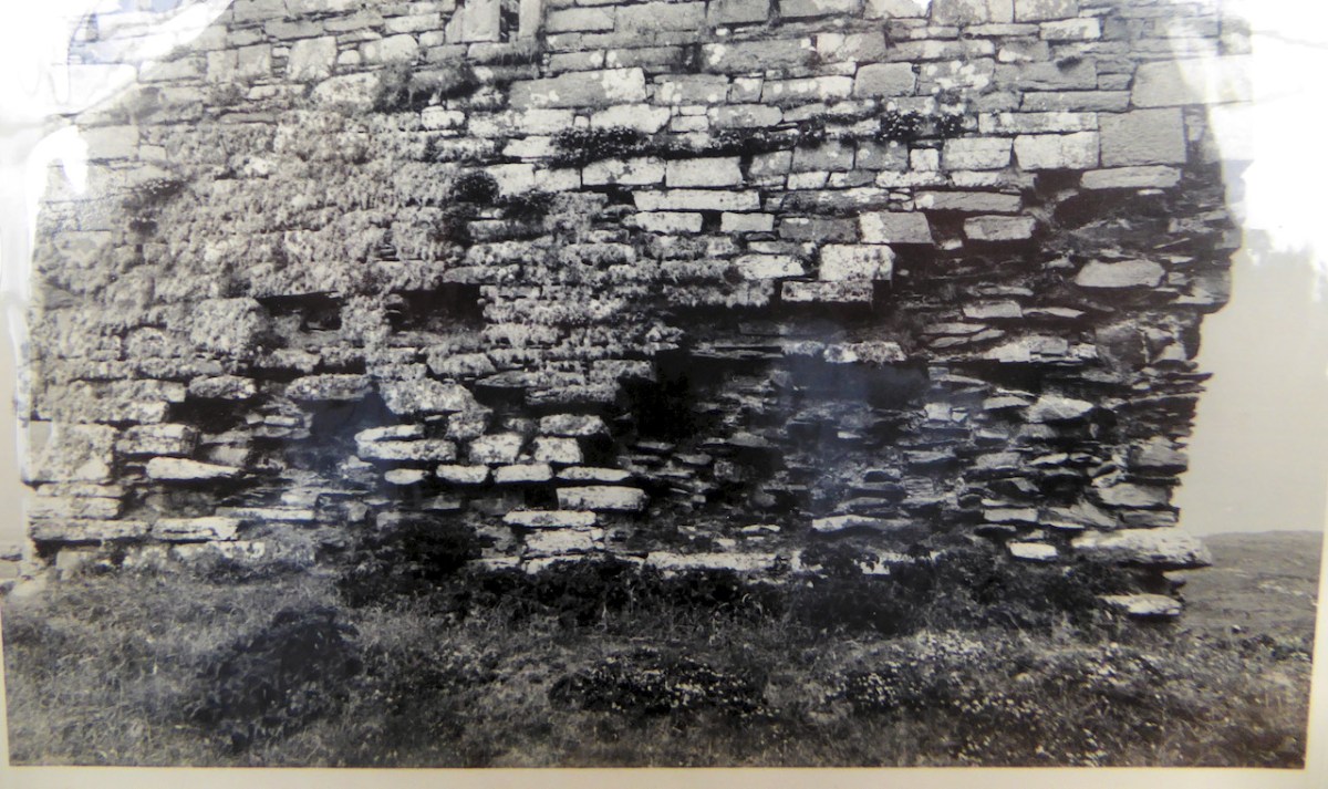
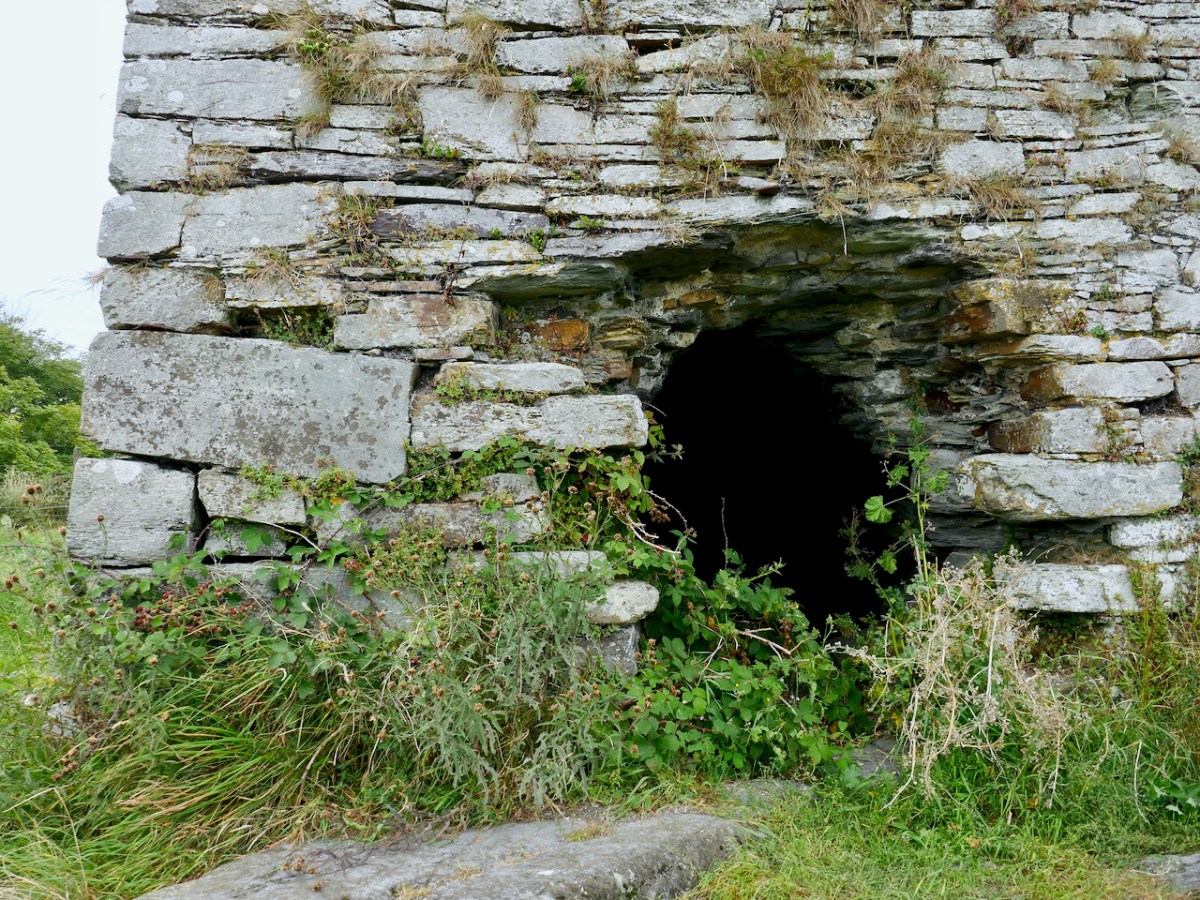
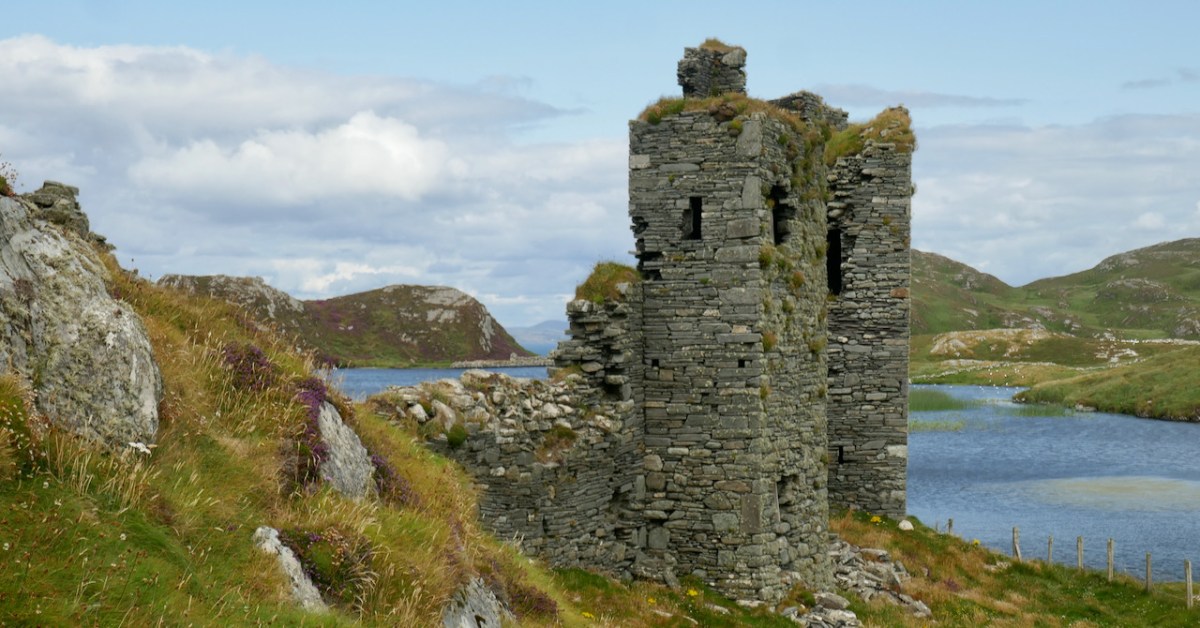
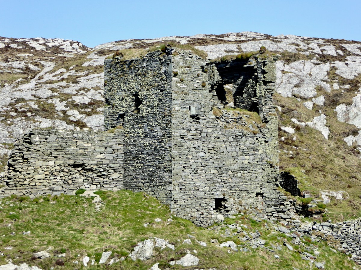
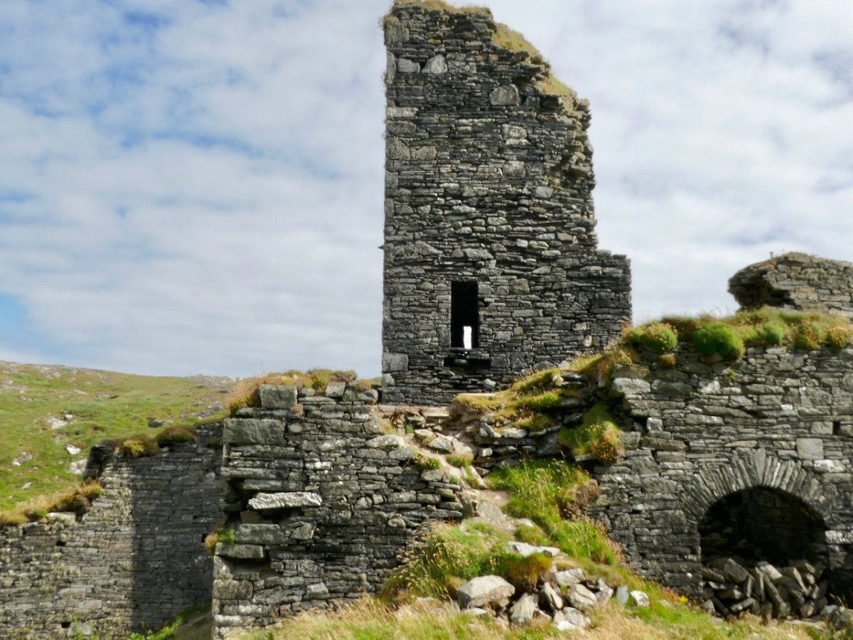
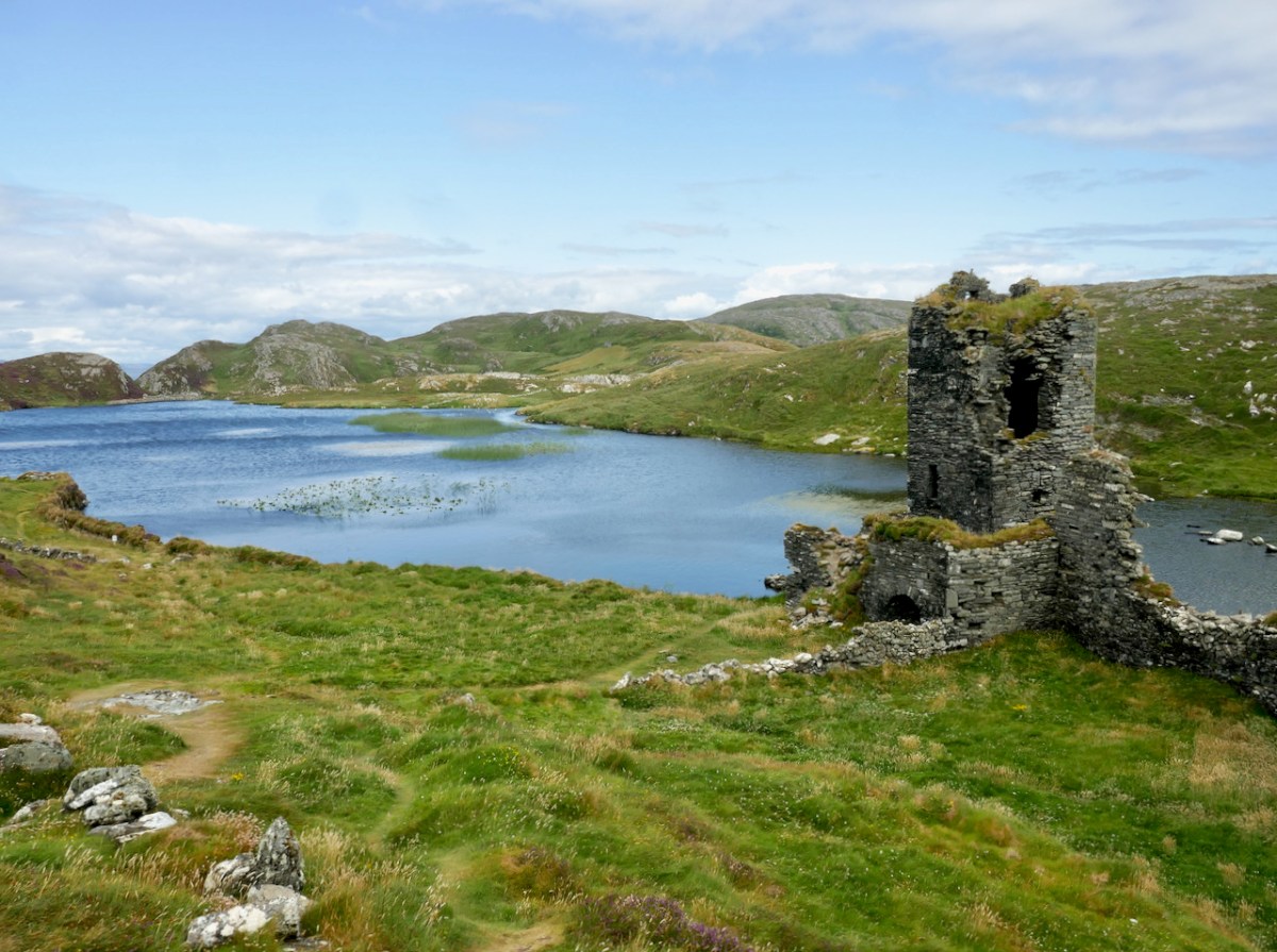
Dunbeacon (images below) is even more vestigial than Castle Island, but fortunately we do have some historical evidence for it. The name could mean Fort of Beacan – where Beacan is the name of a chieftain. However, it could also mean The Fort of the Mushrooms – since the Irish word for mushroom is beacán. I like to think of the chieftain and his lady chowing down on a plate of eggs and mushrooms for breakfast.

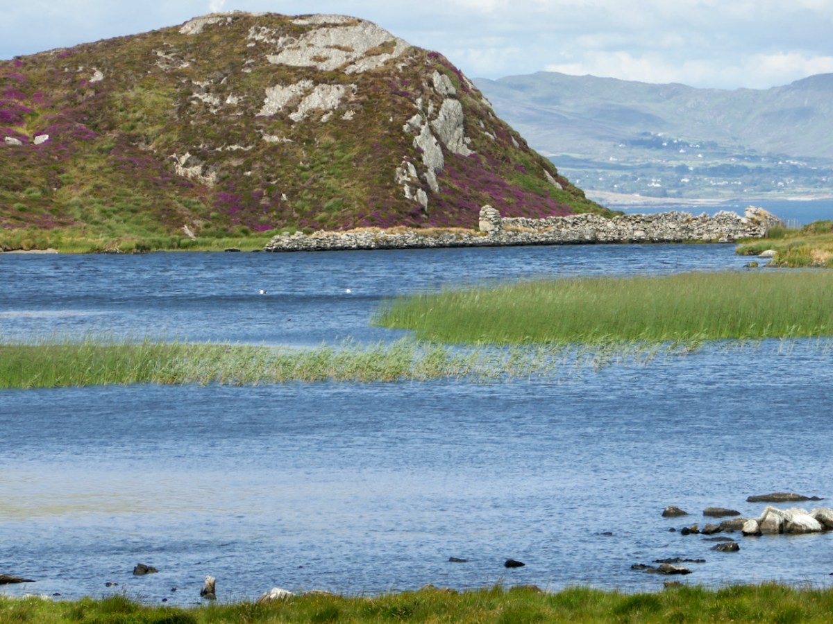
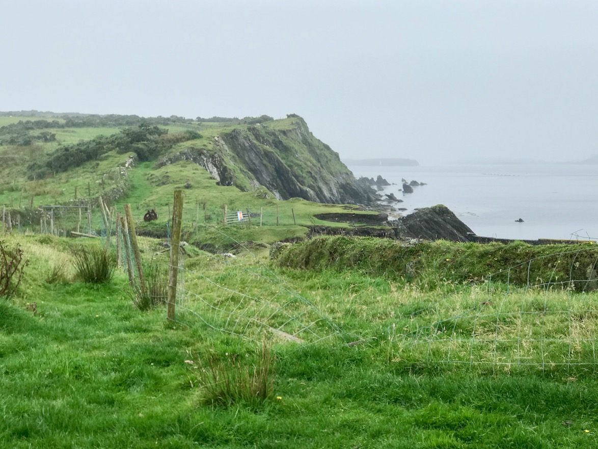
As with Castle Island, there are signs that the castle was built within a former promontory fort, also underscored with the name Dún, which means fortress. A fosse, or ditch, cut through the rock, is all that remains of the fortifications of that promontory fort.

The majority of the O’Mahony tower houses in Ivagha were built by or for the sons of Conchobar Cabach. Dunbeacon castle was allegedly built by his brother Dohmnall. This seems to be a traditional rather than documented attribution. If it is assumed that Dohmnall was born c. 1400, he may have built the tower house at any date during his adult life (c.1420 to c.1470).

Mark Wycliffe Samuel
the tower houses of west cork

The siting is magnificent. From it, there is a clear view of the whole of Dunmanus Bay, right to the end of the Ivaha (Mizen) and Sheep’s Head Peninsulas. This, of course, also meant that it bore the responsibility, along with Dunmanus, of defending O’Mahony territory from attack or incursion on the north side of Ivaha. The pro-English Owen O’Sullivan of Beara, for example, is known to have conducted cattle raids on the lands surrounding Dunbeacon.

Samuel tells us that the chief of Dunbeacon, Domhnall O’Mahony, forfeited his lands as a result of his participation in the Desmond Rebellion, and it became a ruin – beautifully captured in Brian Lalor’s sketch, above.

The tower house and four ploughlands were confiscated, and passed into the possession of an English settler who probably built a timber house to the east. The O’Mahonys did not attempt to reconquer the lost part of their pobol; instead they contented themselves with attacking and burning the tower house, an event recorded in a letter written by an English judge in 1588. The tower house probably remained a ruin.

Mark Wycliffe Samuel
the tower houses of west cork

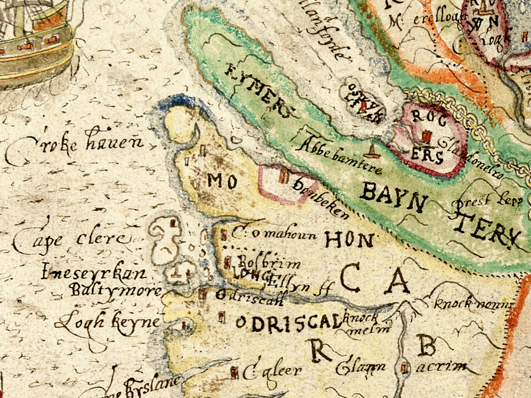
The O’Mahonys regained possession of their Dunbeacon lands but lost them again when they were granted to an English settler. See my post Planning a Plantation: Jobson’s 1589 Map of Munster Part 1 and Part 2 for how the land was mapped preparatory to the Plantation of Munster. As you can see above, Dunbeacon (or Donbeken) was clearly marked out for colonisation. William Hull came to own it at one point, and even the conniving ‘lawyer’ Walter Coppinger laid claim to it – as he did with much of the O’Mahony and O’Driscoll territory.

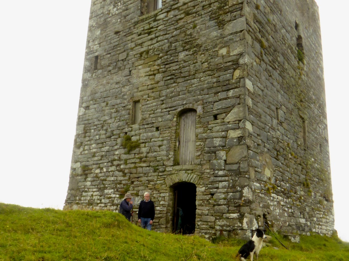
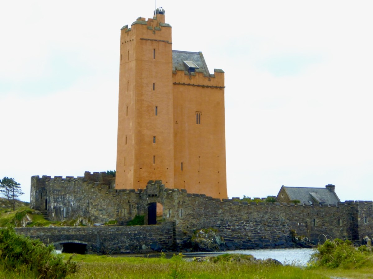
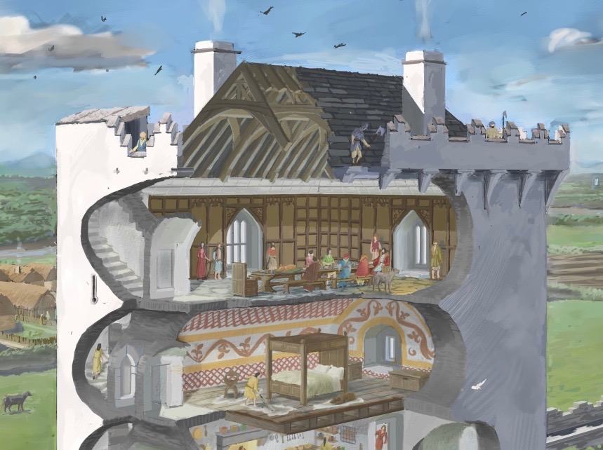
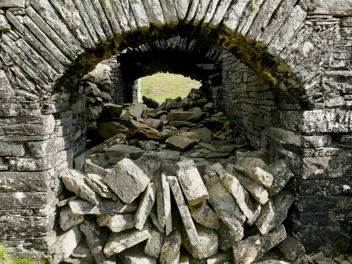
Although so little remains, Samuel’s careful analysis indicates that Dunbeacon was probably a typical raised entry tower house, with a vault supporting the third floor which held the principle private chamber. See my posts on Ardintenant  and Black Castle for what it may have looked like.

It’s hard to look at ‘fragmentary remains’ and think of them as vibrant centres of life. Yet, these two castles were once part of the mighty O’Mahony federation – a large network of connected families that ruled Ivaha and the surrounding seas. Sic Transit Gloria Mundi

Black Castle, or Leamcon

This is the fourth castle in my series The Castles of Ivaha, and the final one which is intact enough to be able to describe in detail (although I may have more to say about those which are more vestigial). Not just intact, though – Black Castle has been superbly stabilised and saved for future generations by its owner, Niall Hyde. 

Niall, by the way, thinks the the term Black Castle is more historically accurate. He points out that there is, in fact, in the townland of Leamcon, about 2km to the northeast, another ‘turret’ marked on the old OS maps, which is the remains of a castle built by the notorious Sir William Hull. Black Castle is in the townland of Castlepoint, and its name neatly distinguishes it from White Castle, AKA Ardintenant. Both were built by the O’Mahonys.

James Healy’s drawing of Black Castle from his wonderful book The Castles of County Cork, Mercier Press, 1988

As I said in my post on Ardintenant Conor Cabaicc succeeded his father in 1427 and remained Taoiseach for 46 years, embarking on an ambitious program of construction to provide castles for his sons and brothers. This included Black Castle, which he built for his second son, Finín Caol (pronounced Fineen Kale), or Finín the Slender. This means that Black Castle was built in the period before Conor Cabaicc (Conor the Talkative) died, in 1473. This accords well with its architectural details, which place it among the fifteenth century ‘raised entry’ castles, similar to Ardintenant, Dunmanus and Dunlough

The best source material for all the castles of Ivaha is the thesis The Tower Houses of West Cork by Mark Samuel. Here’s what Samuel says about the location of Black Castle, which he refers to throughout as Leamcon. Leamcon, by the way, means Hound’s Leap, which Samuel suggests may refer to a legend about the gully across which you must pass to get to the castle.

The western part of the Ivagha peninsula, the territory of O’Mahony Fionn, is now sparsely populated. Away from the formidable Mizen Head, the ice-sculpted land meets the sea with low, rocky cliffs. In this part of the Survey region, the strike of the rock is almost south-west/northeast, the layers being tipped close to the vertical, the shore tends to be sculpted into long peninsulas and islands running along the strike. Exposed to the Atlantic, it is a wild treeless shore. The fields once densely fanned prior to the famine, are now mostly given over to pasture. The tower house stands far from any road at the west end of a long narrow peninsula. Erosion has nearly severed the tip of the peninsula; only a precarious natural bridge, now reinforced with concrete, joins it to the mainland. The island is large, the ruins cover only a small fraction of its area. The tower house stands towards the island’s east end at its highest point. The promontory is for the most part gentle in relief, being covered by grass-grown ‘drift’ deposits.

THE TOWER HOUSES OF WEST CORK
MARK WYCLIFFE SAMUEL, 1998

When Niall bought the property the bridge consisted of a few planks. It must have been a hairy business getting across to it until he built the concrete walkway you see today. Niall and his family spent their summers at the castle – can you imagine, as a child, what it must have been like to have your own castle to play and live in? Magical! Although I do think about what it must have been like for Dorothy, who spent the weeks there with the children while Niall worked in Dublin. How did she manage to feed them and keep them safe? A heroine, indeed.

Like the others I have described in detail, Leamcon is a raised entry castle. To recap – the ground floor entry gave access to the ground floor, and possibly by means of a ladder to the second floor and mezzanine. The raised entry gave access to the second floor, and then, by means of a strait mural staircase, the the floors above the vault. Take a look at the cut-away diagram in Illustrating the Tower House: A Guest Blog to see what I am talking about here. Thus, the upper floors could only be accessed by one staircase, a defence feature, and being above the vault provided security from fire in the lower floors. Given that there were no fireplaces, and that braziers were lit in the middle of the floor, with smoke escaping however it could, this was probably a good idea.

Another defensive feature was the small opes, or windows, through which no attacker could climb and little light could penetrate

As regards defence, the castle was attacked by Carew’s forces after the Siege of Dunboy in 1602. According to Samuel:

Sir George Carew reported, on 13th July 1602, that his lieutenant, Captain Roger Harvy, had taken several castles strongly seated on rocks and necks of land. All were so ‘neere unto the sea where ships may safely ride, and fit places for an enemy to hold as, namely Leamcon, Donnegall’ and others. The decision was taken to burn these tower houses. Conor, the head of the sept, received quarter with his men and migrated to Spain immediately afterwards. He was subsequently pardoned but seems never to have returned.

THE TOWER HOUSES OF WEST CORK
MARK WYCLIFFE SAMUEL, 1998

Black Castle wasn’t burned and it subsequently was reclaimed for a time by the O’Mahonys, although the clan forfeited all or most of their lands after the rebellions of the 1640s, and the castle was abandoned from at least the 1690s. Such was the state of it when the O’Mahony Reunion took place here in 65 or 66.

All those years of neglect had resulted in a castle in a perilous state of dereliction and Niall and his builders set about stabilising it before they could make it habitable. The base batter – the broad foundation that give the walls a strong base – had first to be repaired. This called for great skill and the results are impressive. Niall has left a band of membrane to indicate where the old and new stone work meets.

The castle was built to align with the strike of the rock, a feature of most of the Ivaha tower houses. The strike is the compass direction in which the rock bed is running and for West Cork that is mainly in a northeast to south west direction. The builders chose a prominent and solid rocky platform, still easily discernible, and probably prepared it by digging away any soil and loose rock and may have laid down a layer of mortar to help bind the lowest slabs to the rock surface. 

At Black Castle, the quality of the masonry varies, leading me to think that not all stone masons were as skilled, or perhaps as careful, as others. See the variation in the image below. The quoins (corner stones) were made of fine-grained sandstone that can be freely dressed in any direction (called Freestone), while the stones used to dress the outer layer were carefully chosen (or deliberately shaped) to be smooth and even, lending a pleasingly sheer surface to the castle exterior, sometimes called  an “ashlar finish.”

The raised entry, in the case of Black Castle, is directly about the ground-level entry, similar to Ardintenant, but unlike Dunmanus where the entries are staggered. The entrance to the upper door would have been by means of a wooden staircase, possible from the small rocky knoll across from the entrance.

In his conversion of the castle to provide habitable space, Niall concentrated on the upper floors. There is a living room, kitchen dining area and bedrooms, along with a toilet and shower which are situated in the original garderobe space. 

By roofing and waterproofing the building, Niall has kept further deterioration at bay. It is a joyous thing to sit and look over the countryside with a cup of tea on hand, or to climb up to the wall walk and gaze over the wild and rugged peninsula, imagining Carew’s forces advancing across the sea.

Niall Hyde has managed, on a limited budget, to salvage Black Castle and indeed turn it into a space that his family enjoyed. We should all be grateful to him, and to others who have taken on such tasks with vision and courage. Without the Niall Hydes of this world, we would all be the poorer.

Dunmanus Castle 2: The Castle

Dunmanus Castle stands guard over a natural harbour on the north side of The Mizen Peninsula and is one of the largest of the still-standing Castles of Ivaha.

All of the O’Mahony castles (or tower houses as the archaeologists prefer to call them) were the raised entry type, where the door that gave access to the living quarters of the chief was on the first, rather than the ground floor. There is an entrance on the ground floor, but it allowed access only to the lowest level. While at some of the castles of Ivaha, the raised entry was immediately above the ground-floor entry, at Dunmanus, it is above and to the left of the ground-floor entry: this offset placement probably allowed easier access to the lower entrance.

Dunmanus is the only O’Mahony Castle (as far as we know – several have disappeared) to have an additional turret, this one located at the south west corner. In fact the only other castle like it in this part of West Cork is Kilcoe Castle – see my post about its Magnificent Reconstruction. Jeremy Irons’ restoration also allows us to see what Dunmanus Caste would have looked like in its heyday. 

After the false start at Knockeens (see Dunmanus Castle 1: The Cliff-Edge Fort) the tower house was constructed on the site of an earlier fortification probably called Dún Manus, or the Fort of Manus. It was built by Donagh Mór, a chief of the O’Mahony Fionn (the Fair-Haired) sept, sometime in the 15th century. Donagh Mór had been elected Táiniste (next in line to become Taoiseach, or Chief) but he had to wait over 40 years, until 1473, for his brother to die before he succeeded, and then he only lived two more years. This timeframe fits with the architecture of the castle, which is firmly fifteenth century gothic – the window style below is typical.

Like all the O’Mahonys at this time he was very wealthy, riches that came from his control of both the fisheries in Dunmanus Bay and the resources of the hinterland behind his castle. He could therefore afford to indulge his taste for a high-status residence. While the castle may not have been warm or bright (no fireplaces and small windows) it was certainly a statement in the landscape, designed to impress upon all who saw it that this was the centre of power in this part of the world.

The Castle originally had two floors (ground and first) and a mezzanine under a vault in the main tower. Above this was the principle chamber and above that were the roof and battlements. The floors of the turret (foreground, above) did not line up with the floors of the main tower, but were offset and reached by a series of stairs.

The ground floor was probably used for storage and perhaps public business. It had a wooden ceiling that formed the floor of the room above it (first floor). You can also see the corbels that supported the beams that formed the base for the floor, as well as the large sockets into which the beams were set. If this castle followed the pattern of others, there was no access from the ground floor to any floor above it – no stairway or ladder.

Still visible are the bar holes for the door as well as the spud stone and hanging eye – this was how the door was hung and how it turned. Can you make them out just to the left of the arch above – the spud stone is close to the ground and the hanging eye is level with the top of the arch.

The first floor was a more complex room and it had a mezzanine (you can see the corbels for it) under the vault. From the outside, a set of steps ascended to the raised entry and once you were at this door you could go straight ahead into the first floor room, or turn left and ascend a mural staircase to the floor above the vault. That staircase became spiral further up.

In this first floor room were two other doorways. The first (above), on the west side, was to a mural chamber that included the first floor garderobe or toilet (fifteenth century indoor plumbing!) – more on that later. The second (below) gave onto a short flight of steps leading downward to a vaulted chamber in the turret.* 

This chamber is one of the most interesting features of Dunmanus Castle, because in the floor is a hatch or trap-door which is the only access to yet another small, vaulted windowless cell below.

We know about this cell because there’s a hole in the wall that allows us to see into it – and even go into it. 

Once you’re inside, you realise that originally you would have been in the pitch black and that the only way in or out was the trapdoor in the ceiling. Was this a dungeon? An oubliette? It certainly could have functioned as such, and there are historic accounts of prisoners being confined in such spaces in Irish castles. 

But there are other possible explanations. Mark Samuels, in his Tower Houses of West Cork, speculates that this is in fact a cistern, fed from below, filled in over the years with debris so that it is now impossible to see how deep it went. There are identical features, he says, at Kilcoe and Monteen tower houses. It would have been a significant advantage, especially during a siege, to have a source for water.

However, the best evidence for the use of rooms like this comes from the excavations of Barryscourt Castle, near Carrigtwohill, east of Cork City. Here’s what the authors of this section of the report, Dave Pollock and Conleth Manning conclude about its function.

The ground floor, originally accessed only through a trapdoor in its vault, has in the past been regarded as a prison or dungeon. The more likely explanation is that it was a safe vault or basement strongroom, where cash and records were kept securely, and could be accessed with the aid of a ladder when required. The room above this, referred to variously in other cases as the accounting room or counting house, was where an officer of the Manor called the receiver or cofferer worked. He documented all produce and commodities coming into the castle and made payments as necessary. At Barryscourt this room was only accessible through a small external doorway . . . It is interesting that good examples of accounting rooms with basement strong rooms under them, accessed through trap doors, are found in some late 14th century great towers in England such as Bolton Castle and Warkworth Castle.


Barryscourt Castle Co Cork, Archaeology, History and Architecture, Dave Pollock, ED.
Published by the National Monuments Service, 2017,

There is, of course, no access nowadays to the upper floors of Dunmanus Castle, but we know that the top floor was the ‘solar’ – the largest and most commodious chamber reserved for the Chief and his family. It was also where he entertained, and there are accounts of the lavishness with which guests were received. Take a look at my post, Illustrating the Tower House: A Guest Blog (sort of) to see how the brilliant artist JG O’Donoghue, has managed to show us the internal layout of a tower house. Here is his image of the upper floors and wall walk.

From that chamber, a set of stair led up to the battlements, where a wall walk would have surrounded the pitched roof. The wall walk was protected by a set of stepped merlons and crenels in the style known as Irish Crenellations – Kilcoe gets these exactly right.

My final note is on the garderobe, or rather, garderobes, since there was one off the first floor and another at the level of the solar. The chute which served both of them, was divided down the middle by a set of perpendicular slabs set into the inner wall (above and below). 

When I photographed Dunmanus in 2016 these perpendicular slabs were in place. However, as you can see below, by five years later two of them have fallen.

While these particular slabs may not be integral to the cohesion of the building, every stone that falls or slips weakens the overall structure and is another step towards ruination. It would be very sad indeed if Dunmanus Castle is not here in its current state for future generations.

*I am grateful to a friend who shall remain nameless (but who is a relative of Spiderman) for the photographs of the turret room and staircase. Do not attempt to access these spaces.

Dunlough, or Three Castle Head

It’s actually amazing that in all the years we’ve been writing Roaringwater Journal (since 2012), we’ve never written before about Three Castle Head in detail, although we’ve mentioned it lots and visit it often. I consider it to be one of the most beautiful places in West Cork, perhaps in Ireland, and certainly one of the most interesting. It’s one of The Castles of Ivaha.

To come over the brow of the hill on a sunny day and catch your first glimpse of Three Castle Head is breathtaking, so let’s describe first what you actually see in front of you. Instead of three distinct castles, what you see is a long wall, known as a curtain wall, punctuated by three towers. The wall stretches from a precipitous cliff on the south west to a lake on the north east end, and it is this lake that gives this place its Irish name of Dunlough (from Dún Loch, or Fort of the Lake).

The lake may have been held back at one point at the north east end where it drains into the sea – a long wall stretches partly across it here – or this wall may have been part of the fortification system for the whole promontory. 

The curtain wall would have constituted a formidable defence for the area behind it – the cliff makes it impregnable on the west side, while the lake forms a barrier on the east. Our old friend Thomas J Westropp visited Dunlough in about 1914, when there was more to see on the ground of the pre-curtain wall fortifications, wrote up his observations, and supplied a drawing.* More on his conclusions later. For convenience, I will use his terminology for the three towers, although they are not necessarily what a modern medieval historian would use. He called the largest tower, located more or less in the middle of the wall, the Keep; the one immediately to the east the Turret, and the one closest to the lake the Gatehouse. You might like to have a good read of the posts Tower House Tutorial Part I and Part II to help you make sense of what follows.

The wall and the three towers are very finely built, using the rubble construction method, where both sides of the wall are shaped with stones carefully chosen for their straight edges, and the interior is filled with rubble. Mark Samuels, in his discussion of the construction of this tower says:

A proper lime mortar, quite hard, white and capable of adhering to the stones was used in the basebatter. However, at second-floor level, the mortar was little more than earth and the building stands entirely by virtue of the careful laying of the stones. The unusual drystone construction gives it a ‘vernacular’ air which is a peculiarity of this stronghold.

The Tower Houses of West Cork by Mark Wycliffe Samuel, 1998

There is evidence of little mortar being used where the interior of the curtain walls can be seen, so this was a very skilful job indeed of ‘dry stone’ construction. Where mortar is discernible, however, it appears to be the local blue till, rendered into a kind of mud, rather than limestone-based mortar, and this has robbed the walls of some cohesion, so that they crumble more quickly once they start deteriorating. For a fairly thorough outline of what’s involved, see my post Building a Stone Wall. The curtain wall is likely to have had a rampart or wall walk, but no sign of this remains. Our budding archaeologist companions on our recent visit are taking a good look at the construction, below.

The Keep is the kind of tower house that the O’Mahonys were building all over Ivaha (The Mizen) in the 15th century and is typical of those towers, with a few interesting variations. There are two entrances, one above the other, denoting that this was, in common with all the other O’Mahony tower house, a ‘Raised Entry’ castle. However, unlike the others, the entries are surrounded by a small forecourt. Typically, the ground-level entry gave access only to the ground and first floors and there was no access to the upper, or residential floors (those above the vault) from it. The residential floors were accessed by means of a staircase inside the raised entry: it runs inside the wall to the right of the doorway.

Above that floor is the vault, which would have separated the lower floors from the upper floors where the household of the chieftain lived or where they would have entertained visitors. Some of the O’Mahony Castles, where they survive sufficiently to asses them, had a continuous vault, such as the one at Dunmanus. However, in others, and this is the case in the Keep at Dunlough, the Vault is formed by archways, upon which great slatey slabs have been laid to form the floor above. In the Keep, you can still see the impression in the mortar overlaying the arches of the wicker used to build these wicker-centred arches.

There would have been at least one and probably two more floors above the arch/vault – the residential floors. These were not comfortable dwellings – there were no fireplaces and the windows, although bigger than the lower floors, would not have let in much light. Above the top floor, a wall walk would have patrolled by look-outs. 

Westropp christened the middle tower (below) the Turret as it is the slimmest of the three. There is no evidence of a stairway so the floors were reached by means of ladders. Unlike the other two towers, which were built straddling the curtainwall, this one has three of its sides outside the wall, with the entrance through the wall on the north side.

The gatehouse is perhaps the most complex of the three towers. At its base is an arched passageway, now with the collapse of ages completely blocking it.

Because it’s difficult to really see this tower now, I will give you Westropp’s description of it from his 1914 visit:

The entrance had inner and outer arches, which were closed and barred from the inside, I presume lest anyone should get into the enclosed hill, hide till night, and then open the gate treacherously. The outer gate is 6 feet 10 inches wide, the inner, 6 feet 3 inches and 9 feet 8 inches apart ; they have slightly pointed arches. From the interspace a small door opens into a little court, or rather passage, round the other two sides of the gate tower. This turret has a vaulted basement 9 feet by 9 feet 9 inches, and walls 4 feet thick, with a loophole, commanding the outer face of the gate. There are two stories or lofts, reached by a ladder through a trap-door and under another vault. The second floor has slits in each face ; the third, one to the south, and a torn gap westward above the gate. Over the upper vault is a little gabled attic, with an ope overlooking the lake. A small stair runs spirally up the north-west corner. The walls having been very thin there, have fallen, or been broken, down to the basement vault. A short wall runs from the gatehouse out into the lake. 

Westropp, 1915 (see footnote)

The small spiral staircase can be clearly see where the outer wall has fallen away (above).

Several sources tell us that this is the oldest of the O’Mahony Castles, built in 1207 by Donagh the Migratory O’Mahony – there are references in Annals to a ‘castle at Dun Locha’. Modern scholarship on castles tends to agree that there were structures called castells before the coming of the Normans, but it is clear that they did not look like these tower houses. It may be that the reference in the annals is to Dunloe in Kerry, but it may also be that there was indeed a castell here in 1207. If there was, it was not what we are looking at now: any analysis of its construction places it firmly in the fifteenth century. 

Once again, we turn to Westropp. When he  visited Dunlough in about 1914 there was more to see on the ground of the pre-curtain wall fortifications, and he wrote up his observations, and supplied a drawing (above). This was an ancient promontory fort, he said, dating to well before the  castle-building era, and he traced the line of the fort bank through the remains of fosses, or ditches, vestigial but still visible. The next phase was the building of a wall, and this may well have been the castell of 1207. It follows a line south-west to north-east, at a different angle to the curtain wall. He was able to make out a gate feature near the cliff. This was demolished, he said, to build the curtain wall we see today.

I agree with the broad strokes of Westropp’s analysis. Yes this is an old stronghold of the O’Mahony clan – and what you are looking at today was not built in 1207, but built on top of the 1207 fortifications. The O’Mahonys went on a castle-building spree in the 1400s and the Dunlough curtain wall and towers, in terms of their architecture and their similarity with all the other O’Mahony castles, fits with that timeframe. 

But all of that is dry as dust – who can worry about a dating timeframe when what presents itself to your view is so beautiful, so perfectly situated and so hopelessly romantic? So let’s take a vote – is this Ireland most beautiful castle? Hands up who agrees with me!

One last word – for many years Three Castle Head was off limits as a private farm. In recent years the owners have been welcoming visitors and this is gratefully acknowledged. However, the increased footfall is coming with a cost in wear and tear. Look at the walls above – these are fragile ruins: knocking off one loose stone can have a catastrophic effect on the building envelope.

It’s also dangerous to go clambering over unstable ruins like this. So, a heartfelt plea – if you visit, and I hope you do, PLEASE STAY OFF THE WALLS! I was pleased to see a new notice up about this on our most recent visit, and indeed visitors seemed more respectful than they had when I was last there (above). If we stay away from the walls, hopefully they will stand to delight us for more generations to come.

*Fortified Headlands and Castles in Western County Cork. Part I. From Cape Clear to Dunmanus Bay by Thomas Johnson Westropp Source: Proceedings of the Royal Irish Academy: 1914 – 1916, Vol. 32 pp. 249-286, (accessed at: https://www.jstor.org/stable/25504178

The Castles of Ivaha

Ivaha was the name for the West Cork peninsula that was the traditional territory of the O’Mahonys. The modern name for the peninsular – the Mizen – appeared on maps as early as the 17th century but it is unclear how the name change came about. Ivaha (sometimes Ivahagh or Ivagha) is a corruption of Uibh Eachach Múmhan (pronounced Iv Ahok Moo-en), the Clan Eochy of Munster. Eochy Mac Erc was one of the mythical High Kings of Ireland, from whom the clan claimed descent, acquiring the name O’Mahony from Mahon, son of Cian, an eleventh century chieftain.

Ardintenant Castle was built on/within an existing ringfort

This expansive territory with its complex coastline was defended and controlled by a series of raths (earthen ring-forts), cashels (stone ring forts), cliff-edge and promontory forts until the 15th century, when wealthy chieftains and high-status individuals (such as bards and brehons) adopted the new style of stone fortification which we now call tower houses, or simply castles.

Rossbrin Castle. The arrow points to the location of the remaining wall of the tower house on Castle Island

And the O’Mahonys were certainly wealthy. Control of maritime resources was ensured by castles commanding all harbours and with sight-lines out to sea and to other castles, as well as by fleets of ships. The waters around Ivaha teemed with herring and pilchards, one of the staples of the Medieval European diet, once salted and processed in ‘palaces’ owned by the chieftains. Fishing dues were a lucrative source of income, as were exports of fur and wool and control of vast herds of swine which fed on the mast in the all-surrounding forests.

Several of the castles deserve an individual post (all in good time, although Robert has certainly written often about Rossbrin, see for example here and here) but for this introduction I want to lay out exactly how many O’Mahony Castles there were and how many we can see in the landscape now. Let’s start with the total number, each one underlined in red.

As you can see, there are fourteen locations indicated on the map*. Some of these may be familiar to you from previous posts we have written about the history and archaeology of West Cork, and some of them may look strange.  Dough? I hear you say – Never heard of it! Not to mention Knockeen, or Meighan.

The castles underlined in blue are certainly in O’Mahony territory, but may not have been built, or owned or occupied by O’Mahonys. There is some suggestion, and some local belief, that the tower on Castle Island may have been owned by the O’Driscolls, built for the purpose of keeping an eye on their neighbours. However, on the whole this seems highly implausible, since it is so deep within O’Mahony lands  and indeed within sight and easy reach of both Ardintenant, where the clan chieftain, (or Taoiseach) resided and Rossbrin, where the next-in-line to the chieftaincy, (known as the Táiniste) had his stronghold. 

This is the site of the graveyard and ancient church at Lissagriffin – the castle would have a short distance to the west but with the same commanding view

Lissagriffin, Castlemehigan and Doagh Castle may have been built for or by the Mehigans, the traditional bards to the O’Mahonys. According to John O’Mahony,** A well-endowed hereditary family of Bards was considered to be an indispensable appendage of every considerable Chieftain’s establishment. Canon O’Mahony goes on to say

In process of time, if not from the beginning of the new chieftaincy, the western O’Mahony employed another Bardic family, that of O’Mehigan, and endowed them with some three hundred acres of land in Kilmoe (as appears from the Inquisition of Dermod O’Mehigan taken in 1623), and with the wardership of a castle―Castle Mehigan―built by the Chieftain, as, of course, it could not have been built from their own limited resources.

Other authorities posit that the O’Mehigans had not one but three castles of their own. The arrow below indicates the approximate location of Castle Mehigan.

Finally, there is Dunkelly. This one is traditionally associated with the pirate, Canty, and you can read all about him and his exploits in Robert’s post, Canty.

The view from where Dunkelly Castle was sited, looking up Dunmanus Bay

Some of these castles may be unfamiliar to those of you who already know most of these sites. That’s because there is nothing left of them. Besides the O’Mehigan and Canty castles, which have totally disappeared, there is now no longer any trace of the O’Mahony castes at Knockeen, Ballydivlin and Crookhaven. Knockeen, across the bay from Dunmanus Castle, may never have been completed. According to ‘Finnerty’ writing in the Southern Star in 1935, a ‘wise stranger’ came along as the castle was being built and warned that it would fall into the sea – so all operations were moved across the bay to the current location of Dunmanus Castle.

The two red dots on the north side of Dunmanus Harbour mark the site of Knockeen Castle, which was built (or started) on an existing cliff-edge fort. The red dot on the south side is Dunmanus Castle

Ballydivlin, sometimes called Ballydesmond,  was still standing, according to Healy, until the middle of the nineteenth century when it was demolished and its stones used for road making. Likewise, Bishop Dive Downes, visiting Crookhaven in 1700 described the walls of an old castle in the middle of what is now the village. Both Crookhaven and Ballydivlin (the photograph below shows where it was) followed the pattern of strategic siting to dominate the entrances to harbours.

Of those we have left, Dunbeacon and Castle Island are vestigial – only parts of one or two walls remain. Dunbeacon is my lead photograph – you can see not only how little is left, but also how strategically sited it was, with views right down Dunmanus Bay.

Rossbrin is in a perilous state, having been battered by storms over the years and with cracks and holes in its walls (above). And so we are left with seven of the original fourteen castles – the ones underlined in green, below.

But the final four castles of Ivaha – Ardintenant (White Castle), Dunmanus, Leamcon (Black Castle) and Dunlough (Three Castle Head) are all relatively intact, and Leamcon (below) has been stabilised and preserved by its dedicated owner. 

Future posts will describe the defining characteristics of the Castle of Ivaha and explore what we can learn from those that can still yield information.

Three Castle Head

*map, and information where noted, based on James N Healy’s The Castles of County Cork, Mercier Press, 1988

**A History of the O’Mahony Septs of Kinelmeky and Ivagha, Rev Canon John O’Mahony, Glenville, Crookstown, Journal of the Cork Archaeological and Historical Society, various issues, 1906-10

For posts on individual Castles see:

Ardintenant Castle

Dunmanus Castle 1: The Cliff-Edge Fort

Dunmanus Castle 2: The Castle

Dunlough, or Three Castle Head

Black Castle, or Leamcon

Castle Island – Facts and Fictions

That’s Castle Island, above, beyond Gaelic Lord Finnin O’Mahony’s dilapidated realm at the entrance to Rossbrin Cove, in Roaringwater Bay. In the fifteenth century there would have been a hive of activity at Rossbrin: quays alive with fishing activity, boats being repaired and prepared, houses, stores and cellars – all full. Castle Island itself would also have been inhabited in those days, as were many of Carbery’s Hundred Isles. Skeam West – to the east of Castle, and roughly in the centre of all the islands of Roaringwater Bay, has the remnants of a church said to date from the ninth century (Fahy – Journal of the Cork Historical and Archaeological Society, Volume 67, 1962).

Upper – Castle island with its close neighbours in Roaringwater Bay; lower – the ancient church on nearby Skeam West, drawn by Fahy in 1962 (courtesy Cork Historical and Archaeological Society). Fahy suggested a ninth century date for this structure, although other commentators have suggested an earlier origin, possibly even before St Patrick’s time

We set foot on Castle Island for the first time in August of last year – during a reprieve in the Covid lockdown measures. Those days seem halcyon now, compared to our current scourge and severe restrictions. We have not been able to return, but I am setting out to bring my reporting a bit more up to date, as I have been provided with further information from a range of sources.

Approaching Castle Island in 2020: upper – view of the island from the shore in Rossbrin townland; centre – proceeding to the island from Rossbrin Cove; lower – the quay on Castle Island, reportedly built in the early 20th century by the Congested Districts Board: “…the beach that it is laid upon was the best natural landing point on the island, well sheltered from the Atlantic swell …” (Mark Wycliff Samuel – The Tower House of West Cork, UCL 1998)

The history of the population of Castle Island is enigmatic and somewhat contradictory. Here is a quotation copied from the Ireland Byways site but uncredited and undated; I can find no other link containing the same information, but it must originally have been written when the island was still inhabited:

. . . Castle Island (Meadhon Inis – “middle island”) lies about 2km offshore, east of the mouth of Schull Harbour on the Mizen Peninsula. The island derives its English name from a ruined C14th Tower House, one of 12 built by the powerful O’Mahony clan in the area. The 1837 census recorded 89 people living on the island. At present there are fewer than 30 permanent residents, who make their living from farming . . .

quoted by ireland byways.co.uk

You will find some accounts which suggest that Castle Island was inhabited only up to the 1870s. These are incorrect: there is no doubt that the island was the home to a number of families in the 1890s as they suffered evictions then. It also seems questionable that the expense of constructing a substantial pier could have been justified only for the benefit of those who might run their cattle and sheep on a deserted island (as happens today). It is possible, therefore, that regular population of the island continued into the early years of the 20th century.

The remains of substantial houses exist on Castle island today: some do not seem to be as ruinous as would be expected if they had been unoccupied for well over 100 years

Recently, my attention was drawn to a Land Register folio recording the title for one of the parcels of land comprising Castle Island: ” . . . a burden, dated April 14, 1904, indicates that the property was transferred at that time subject to the right of . . . Jeremiah Regan to be supported clothed and maintained in the dwellinghouse on the said lands . . . ” That would imply, for sure, that there was at least one person who had the right to live on the island in the twentieth century.

Details from the ruined houses at the settlement of Wester, Castle Island: upper – brick and render chimney stack in reasonable condition; centre – elements from timber window frames still in existence; lower – traces of paint on an internal rendered wall

Accounts of the evictions which occurred on Castle Island have been well summarised in a Mizen Journal article by Liam O’Regan in Volume 6, 1998. The article is much too long to be included here, but it’s worth anyone’s while ferreting it out to get a vividly descriptive picture of the island in the 1890s.

Here’s a brief summary of the eviction story: the villain is on the left, above – he is Thomas Henry Marmion JP, principle landlord of Castle Island. He lived from 1839 to 1921 and – incidentally – his father (who had the same name) was said to have been responsible for providing the ‘soup kitchen’ at the Steam Mill, Skibbereen during the Great Famine of the 1840s. Notwithstanding this, recorded history does not have much that’s good to say about the Marmions, who in the eighteenth century had been land agents for the Bechers and Townsends. At the beginning of March 1890 (as reported, somewhat floridly, in the Cork County Eagle):

. . . A few days ago, the sheriff’s officer from Skibbereen made his appearance in Schull, surrounded by a force of police, on an evicting expedition. After a short delay, they proceeded to the water’s edge where their galleys were found to await them and the sheriff’s representative having secured himself in one of the crafts, the whole party proceeded to sea for a distance of some three miles when they landed on Castle island. This wild and sea-washed home of a few small farmers and fishermen is the property of Mr Thomas Henry Marmion . . . whose interest in recent years appears more of an incumberance or embarrassment than any advantage as the poor creatures who live in it (misnamed farmers) and on the many islands surrounding it, have to live chiefly on the profits of the sea. The fortification of Jerry Nugent was the first laid siege by the invading army, Jerry’s offence being that he owed a few years’ rent which he found impossible to pay and he was, therefore, sent adrift on the sea-washed rocks where he had a full view of the passing emigrant ships which will probably bear him away to seek out a livelihood in the land of the stranger . . .

Cork County Eagle, march 7th, 1890

There’s much more – and it’s a harrowing story – not untypical, of course, of what was happening all over Ireland during the nineteenth century. In the portrait gallery, above, the figure in the middle is a ‘hero’: he is William O’Brien MP, a founder of the National League who, in September 1890 visited West Cork and held a meeting on Middle Calf island to support the case of tenants evicted from Castle Island and the Calves. On the right is James Gilhooly, MP, Bantry, who was chairman of the ‘All for Ireland League’ and who strongly supported the Castle Island tenants and attended many official meetings on their behalf. Matters rumbled on laboriously into the mid 1890s: eventually, it seems that the introduction of new land purchase acts (benefitting tenants), enabled six tenants to return to, and continue to occupy, Castle Island. As yet I have found no further records to help us establish how long occupation of this sparse rocky outcrop in Roaringwater Bay continued into the twentieth century.

The Mizen Journal, Volume 5 1997, has published a study by Anthony Beese of the place-names on Castle Island. I have been unable to locate this article online, but here is Anthony’s excellent map, above.

When we visited the island on a brooding August day we sensed its many ghosts, perhaps including those who returned over a hundred years ago and, possibly, lived out their working lives there. I have called this post ‘Facts and Fictions’ . . . You have had the facts. After I wrote my first post, last year, I received a communication from a writer: William Wall. I was delighted to learn that he had written a book – Grace’s Day – published in 2018, part of which is set on Castle Island. I obtained the book and read it avidly: it has opened up for me a new dimension in the story of the island – and it’s thoroughly believable.

. . . A long time ago I had two sisters and we lived on an island. There was me and Jeannie and Em. They called me Grace, but I have never had much of that. I was an awkward child. I still am all these years later. Our house had two doors, one to the south, one to the north. Its garden looked towards the setting sun. It was a garden of apple trees and fuchsia and everything in it leaned away from the wind. Dry stone walls encircled it and sheep and children broke them down. My mother lived there with us. Boats came and went bringing food and sometimes sheep, and there were times when we lived by catching fish and rabbits, though we were not so good at either . . .

Grace’s Day – a novel by William Wall, published by new island books 2018

William Wall is familiar with West Cork: he has stayed here many times, and has visited Castle Island. It’s not just the island, but the whole story of 1960s West Cork that has been his inspiration. Readers of this Journal will be aware of my own interest in the days when Ballydehob became the hub of an artists’ community: I have helped to set up the Ballydehob Arts Museum, which has celebrated this era and is now in ‘suspended animation’ due to the Covid outbreak. I also look after a website for the Museum. Grace’s Day is set in this era, and follows the unconventional lives of a family who is ‘getting away from it all’ and trying to survive following the then prevalent bible of self-sufficiency. It’s perfectly feasible that an abandoned island in Roaringwater Bay could be the setting for such a romantic pursuit of ideals. I won’t give away any spoilers, but one more extract could help to persuade you that this book is for you. You should find it in all good bookshops: please support them in these tricky times.

. . . One day on our island my sister Jeannie ran in to say that she had seen a whale in the sound and I ran out after her, my mother calling me: Grace, it’s your day, take Em. But I was too excited. And there were three fin whales making their way into the rising tide. We heard their breathing. It carried perfectly in the still grey air, reflected back at us now by the low cloud. The sea was still and burnished. We ran along the rocks watching for their breaching. We decided it was a mother, a father and a calf. They were in no hurry. When we reached the beacon, a small unlit concrete marker indicating the western edge of the island, we watched them breaching and diving into the distance until we could see them no more. But they left behind their calmness and the unhurried but forceful sound of their blows . . .

GRACE’S DAY – A NOVEL BY WILLIAM WALL, PUBLISHED BY NEW ISLAND BOOKS 2018
Our own view of Castle Island in the distance, surreally shadowed by the full moon’s glimmer, while the Fastnet Lighthouse winks away on the horizon