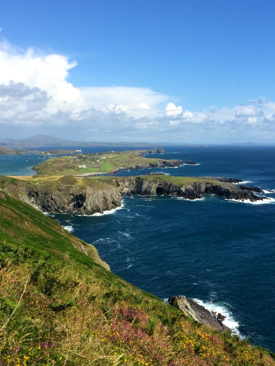
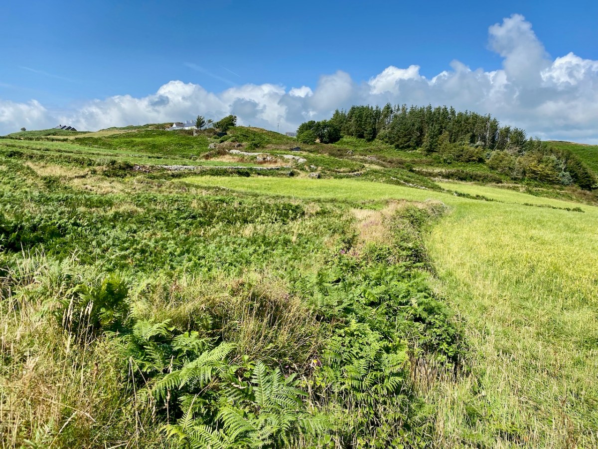
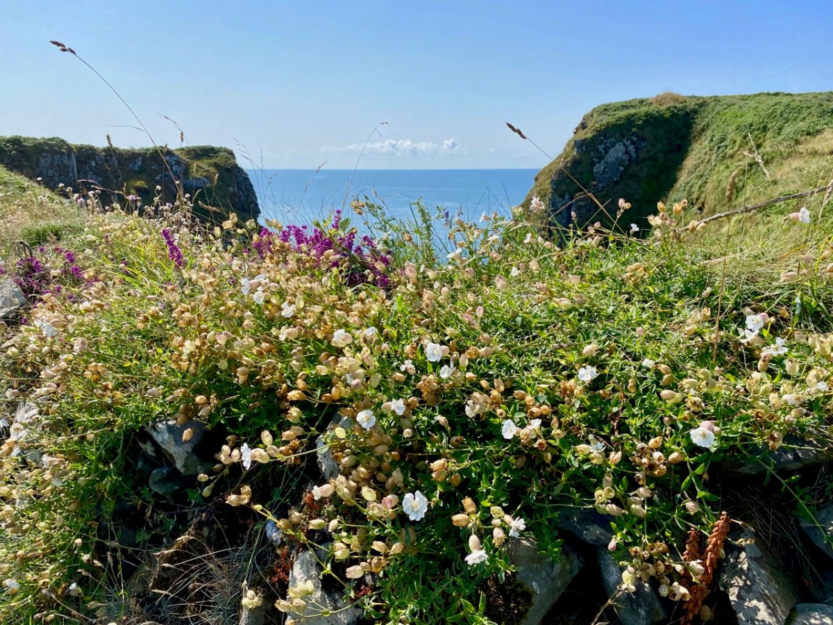
The Mizen is slightly over 35 kms long, and the last five km or so contain a wealth of sites and places that beg to be explored and experienced. These include our signature tourist attraction, Mizen Head Signal Station, our spectacular white sand beach, Barley Cove, and picturesque Crookhaven, but also some lesser known spots that are equally worthy of inclusion in our Mizen Magic list.
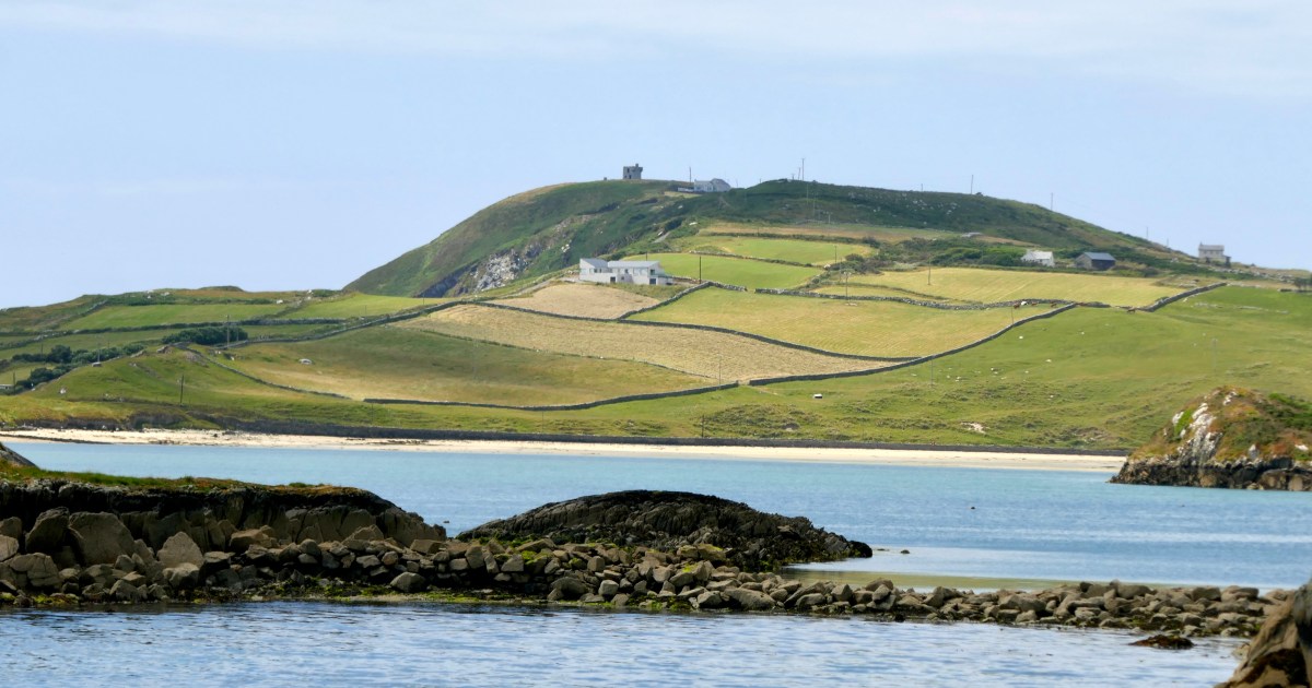
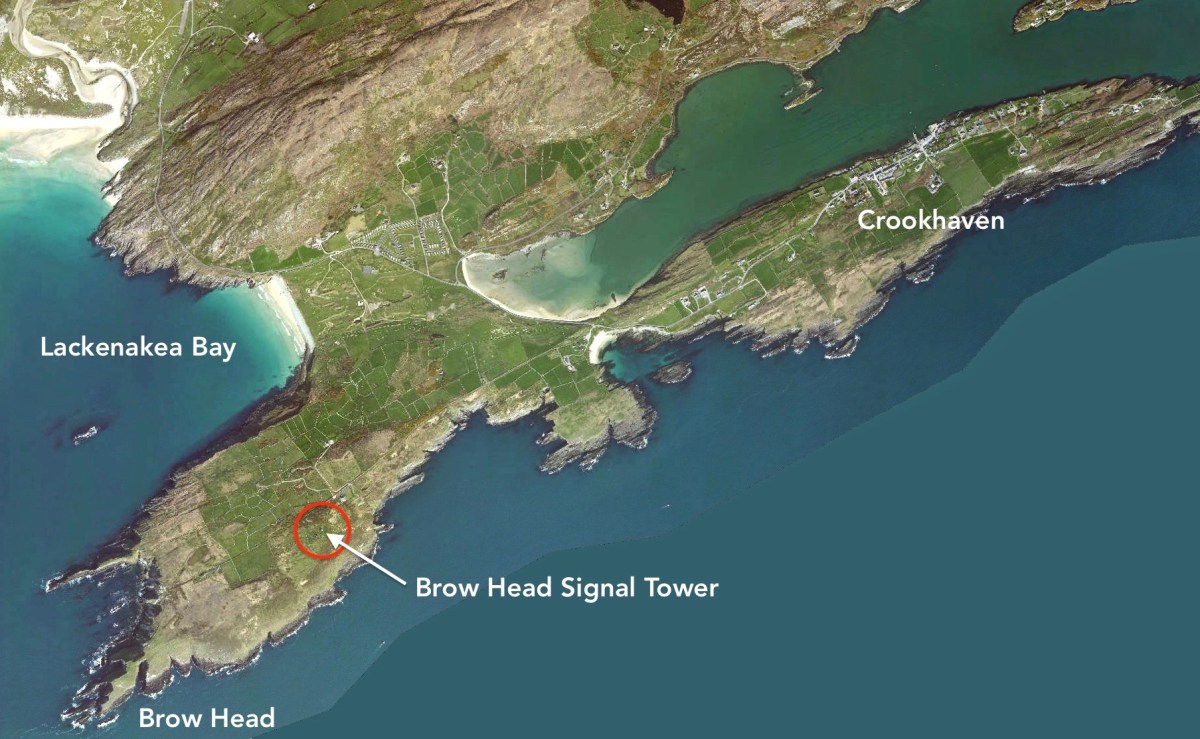
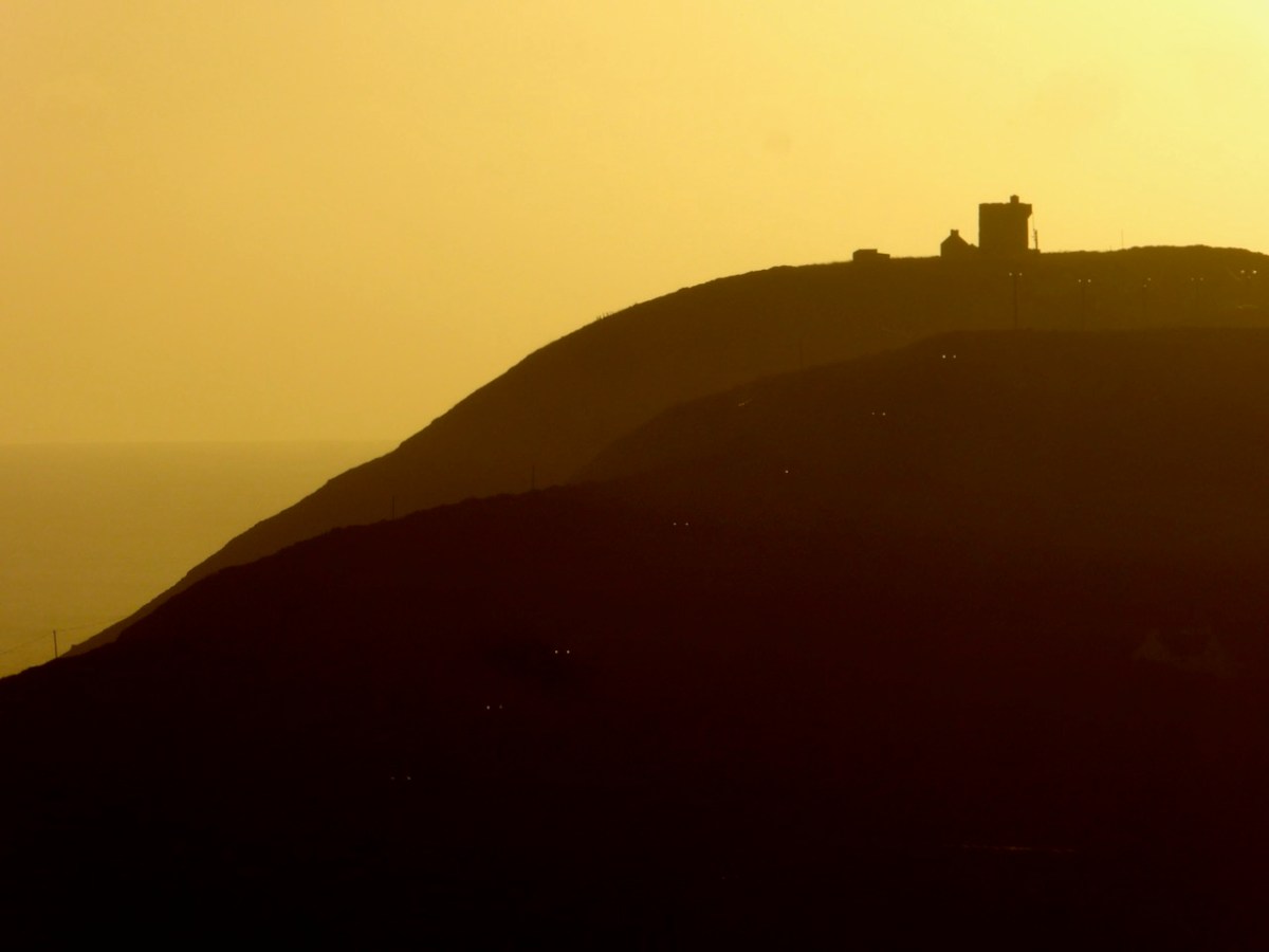
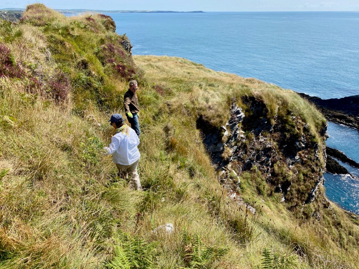
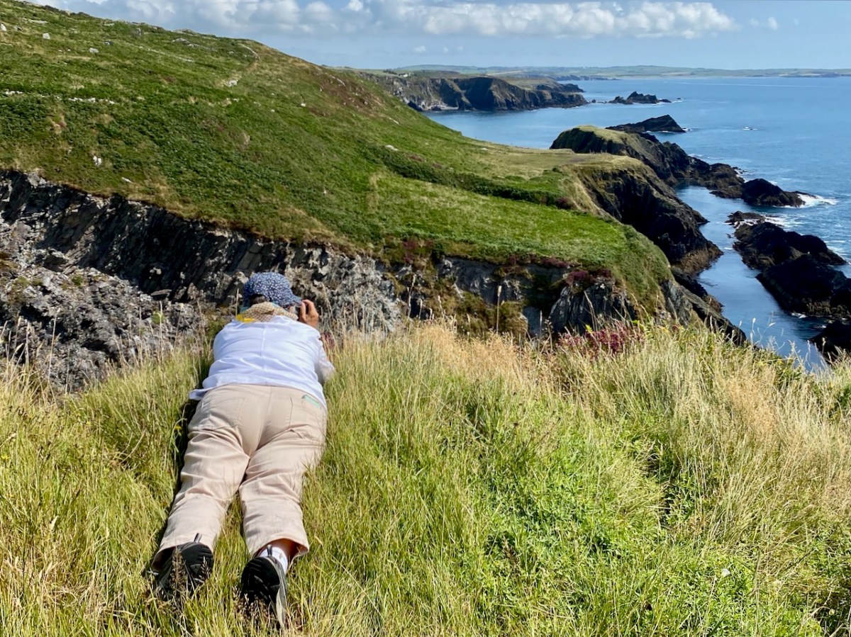
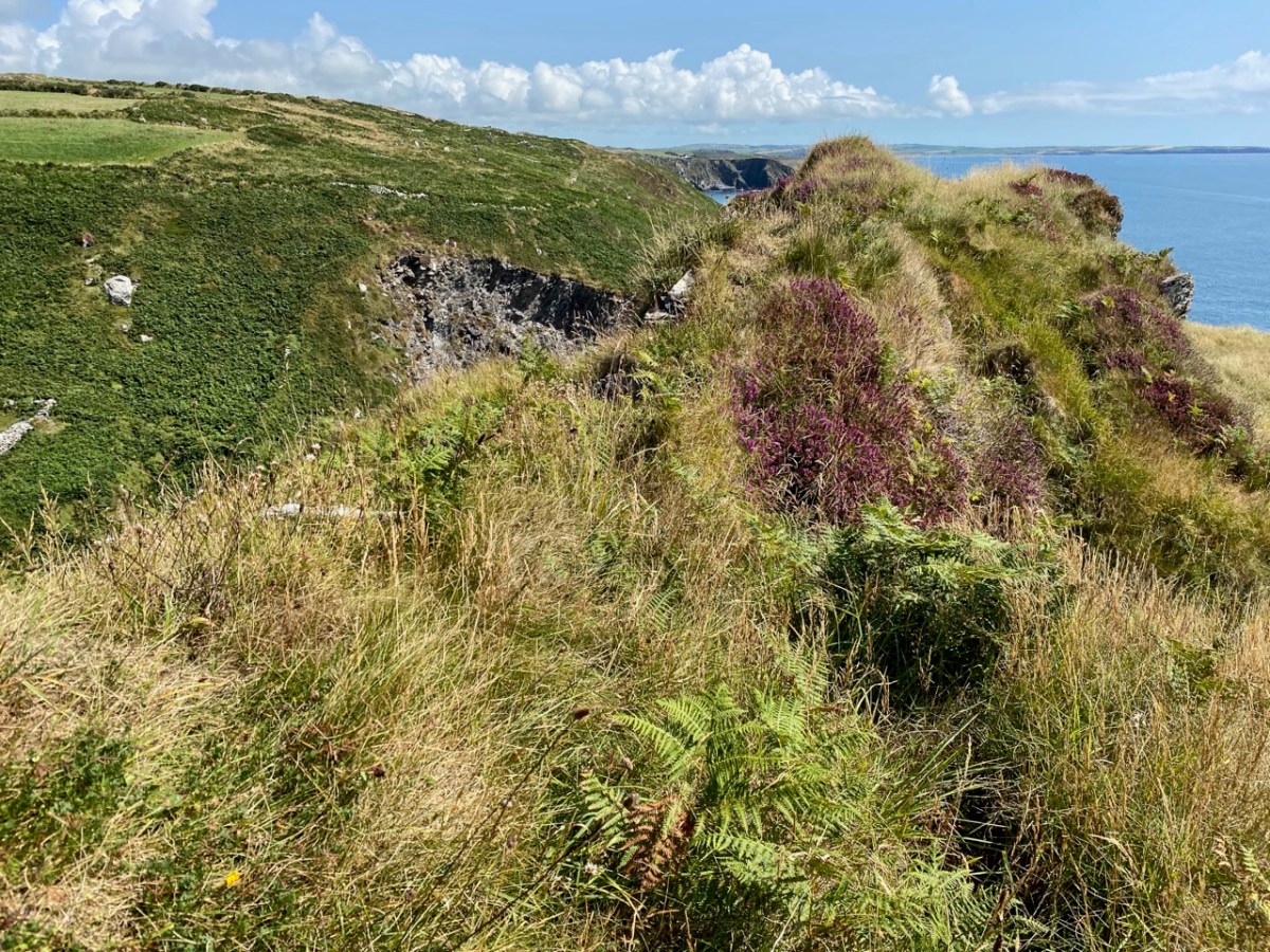
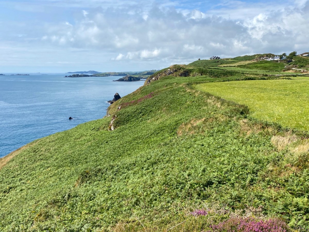
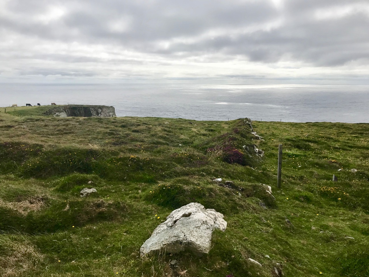
Despite the hype about Mizen Head, the actual southernmost tip of Ireland is Brow Head. In our post about it we said: Brow Head doesn’t have the same profile as Mizen Head: many people have never heard of it. But it’s magnificent, steeped in history, wonderfully scenic and best of all, totally walkable.
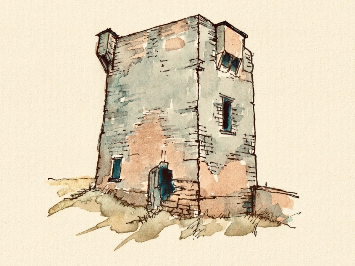
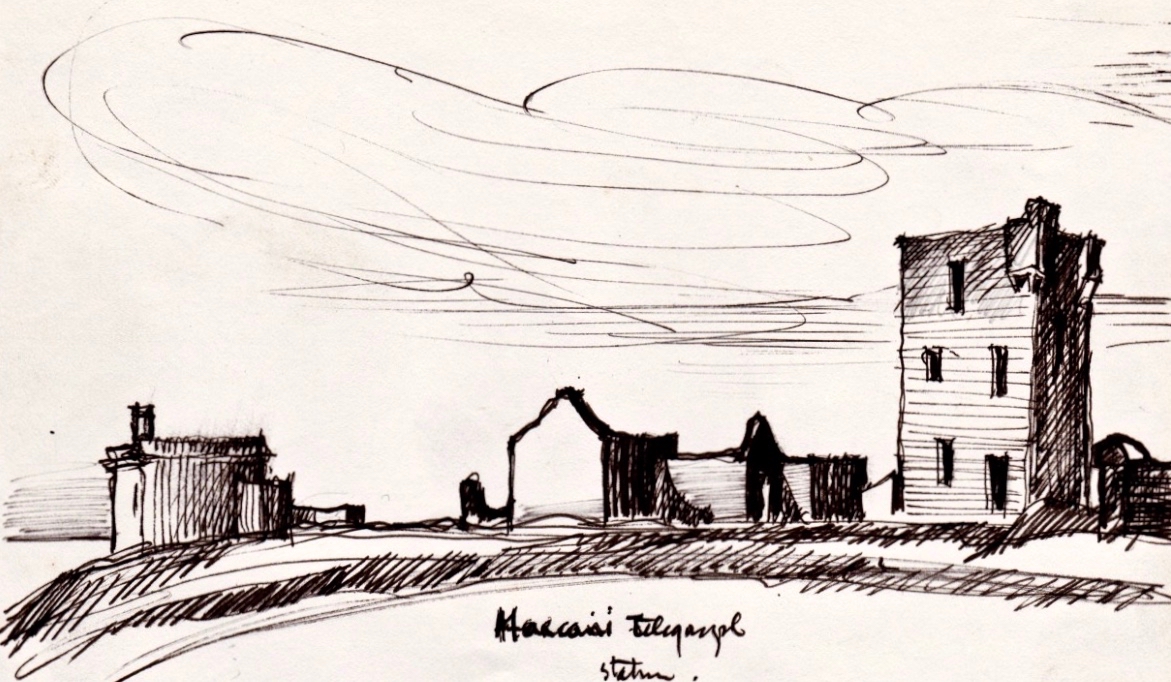
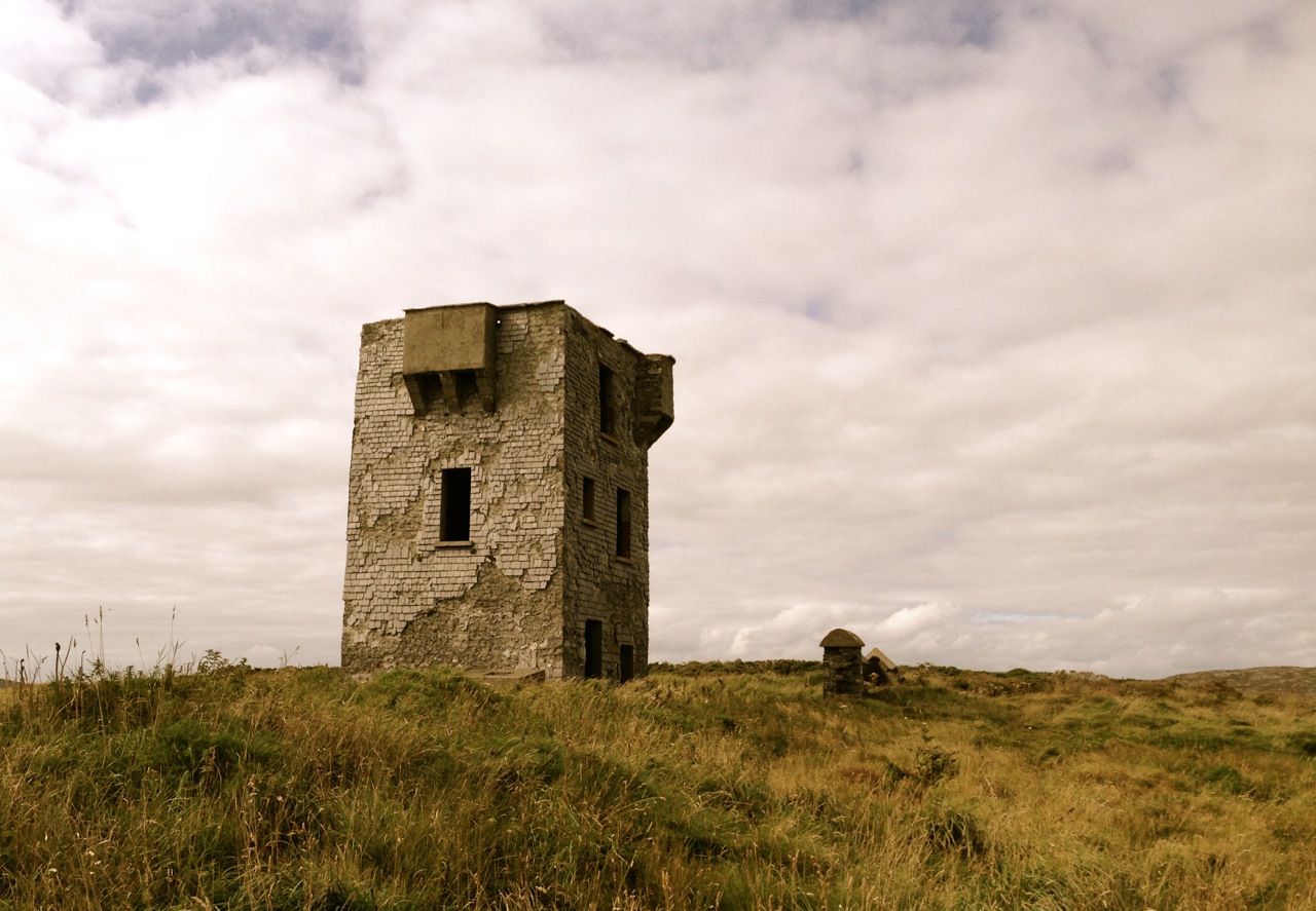
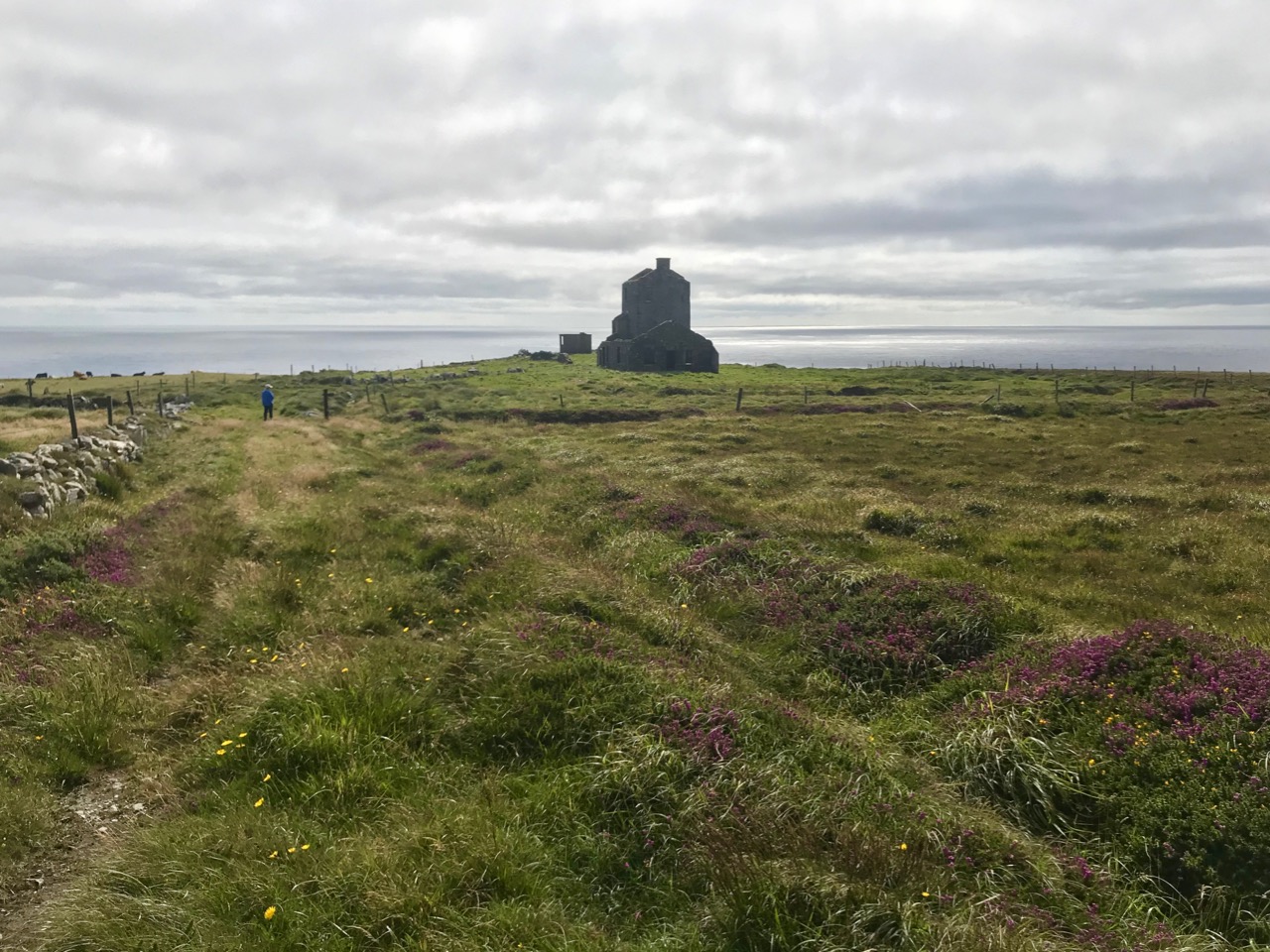
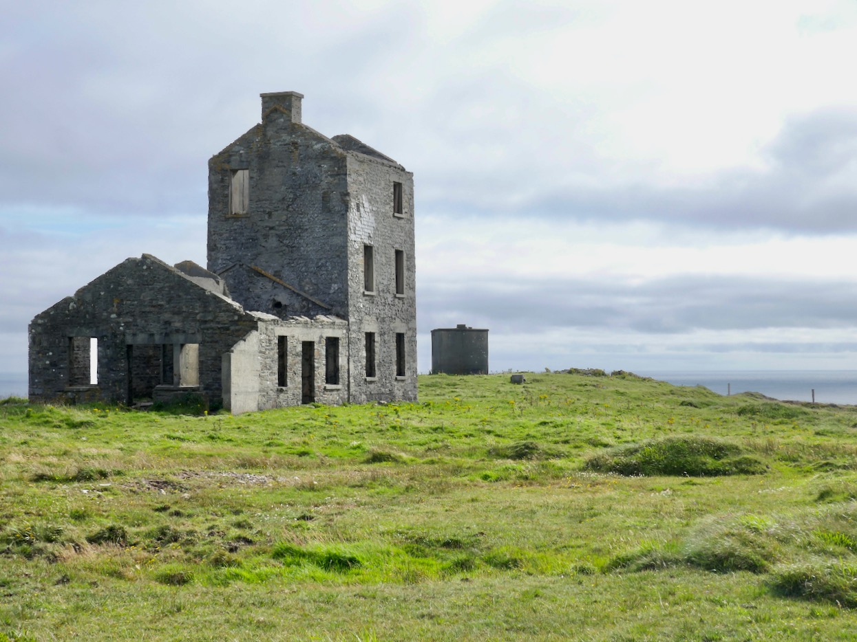
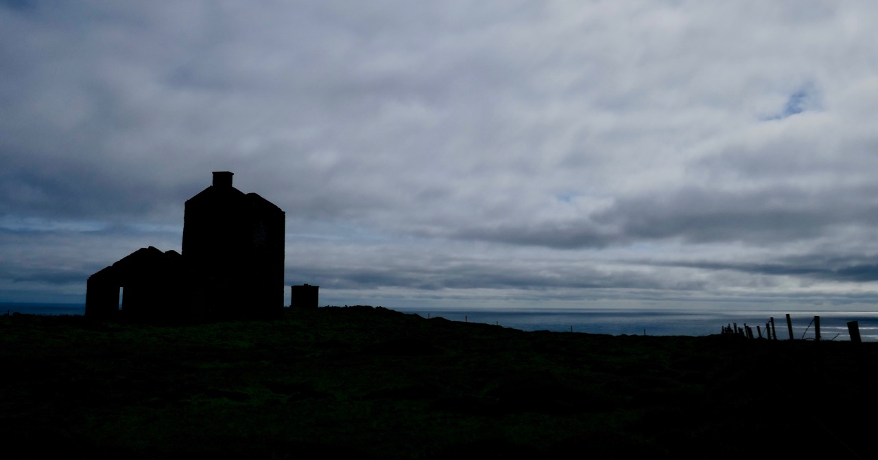
Brow head boasts not only a Marconi Telegraph Station, but also a Napoleonic-era Signal Tower. For a good overview read Mizen Magic 3: Brow Head, but we know you will want to know a lot more about Marconi, the telegraph pioneer, so take a look at In Search of Ghosts for more abut him and his operations on Brow Head. And for two takes on Marconi’s station, there is Peter Clarke’s drawing above and Brian Lalor’s below.
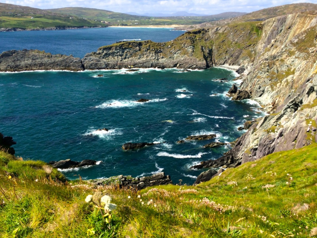
Brow Head looks back to Barley Cove (above) and Crookhaven (below) – some of the most spectacular views on the Mizen are seen descending from the head.
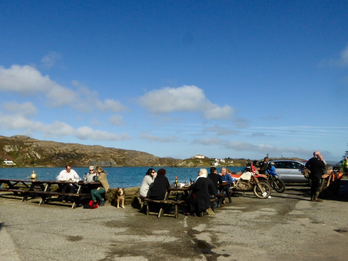
We took a dander around the Harbour and wrote about it in Mizen Magic 22: Crookhaven Harbour. Do the same, and don’t forget to stop at O’Sullivan’s for their excellent chowder and famous crab sandwich.
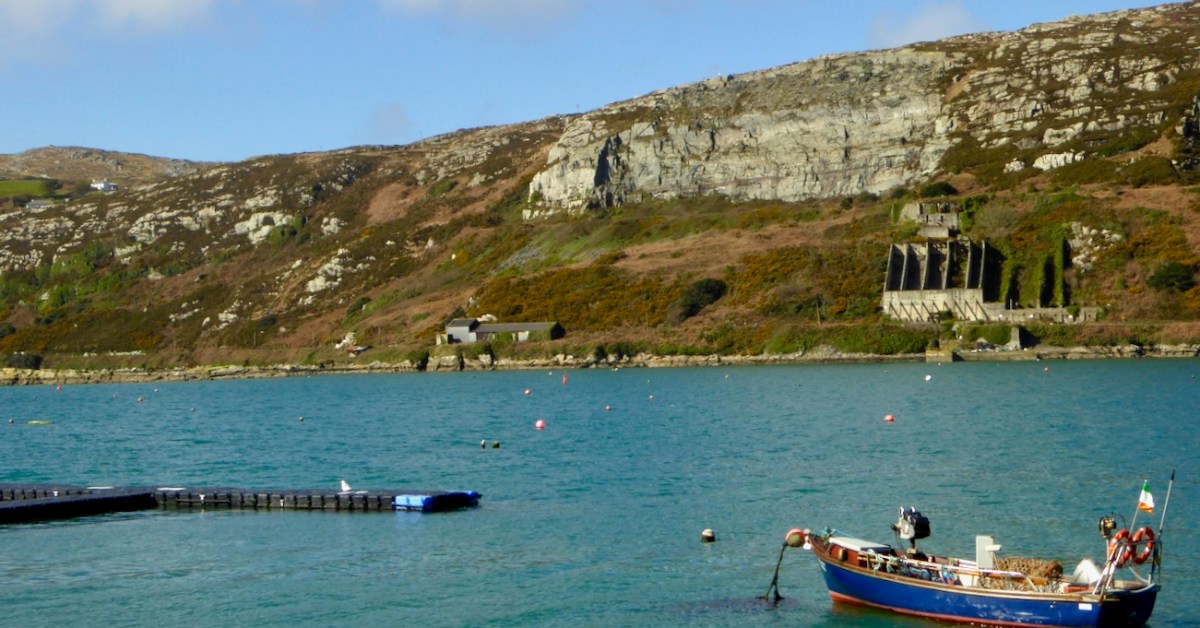
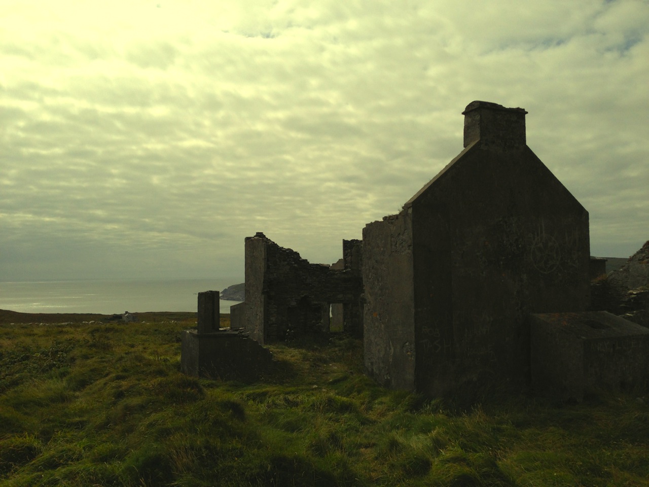
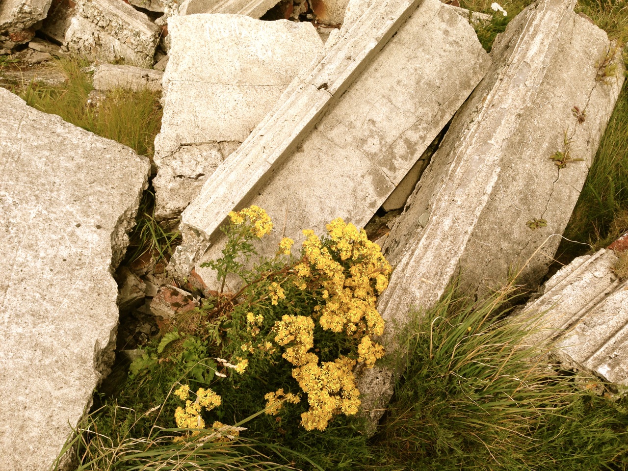
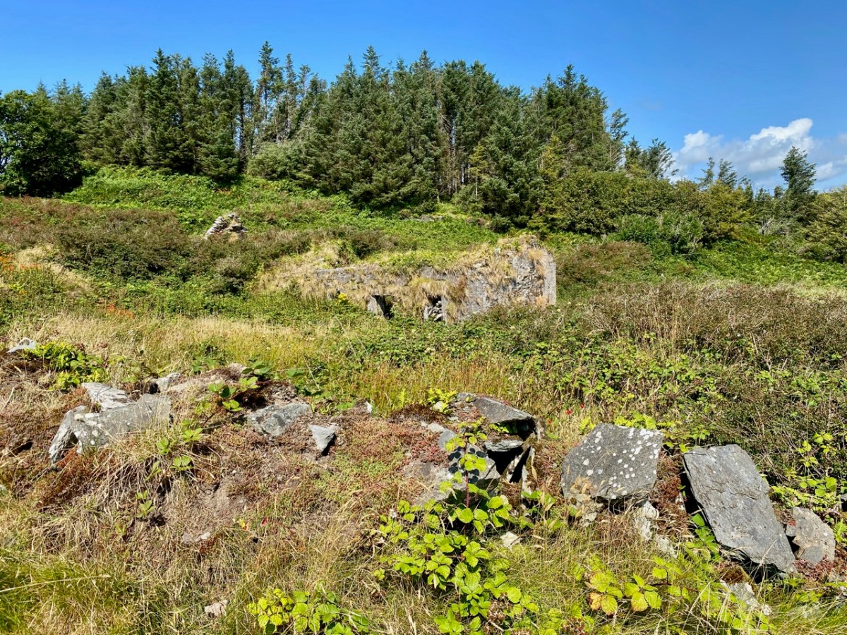
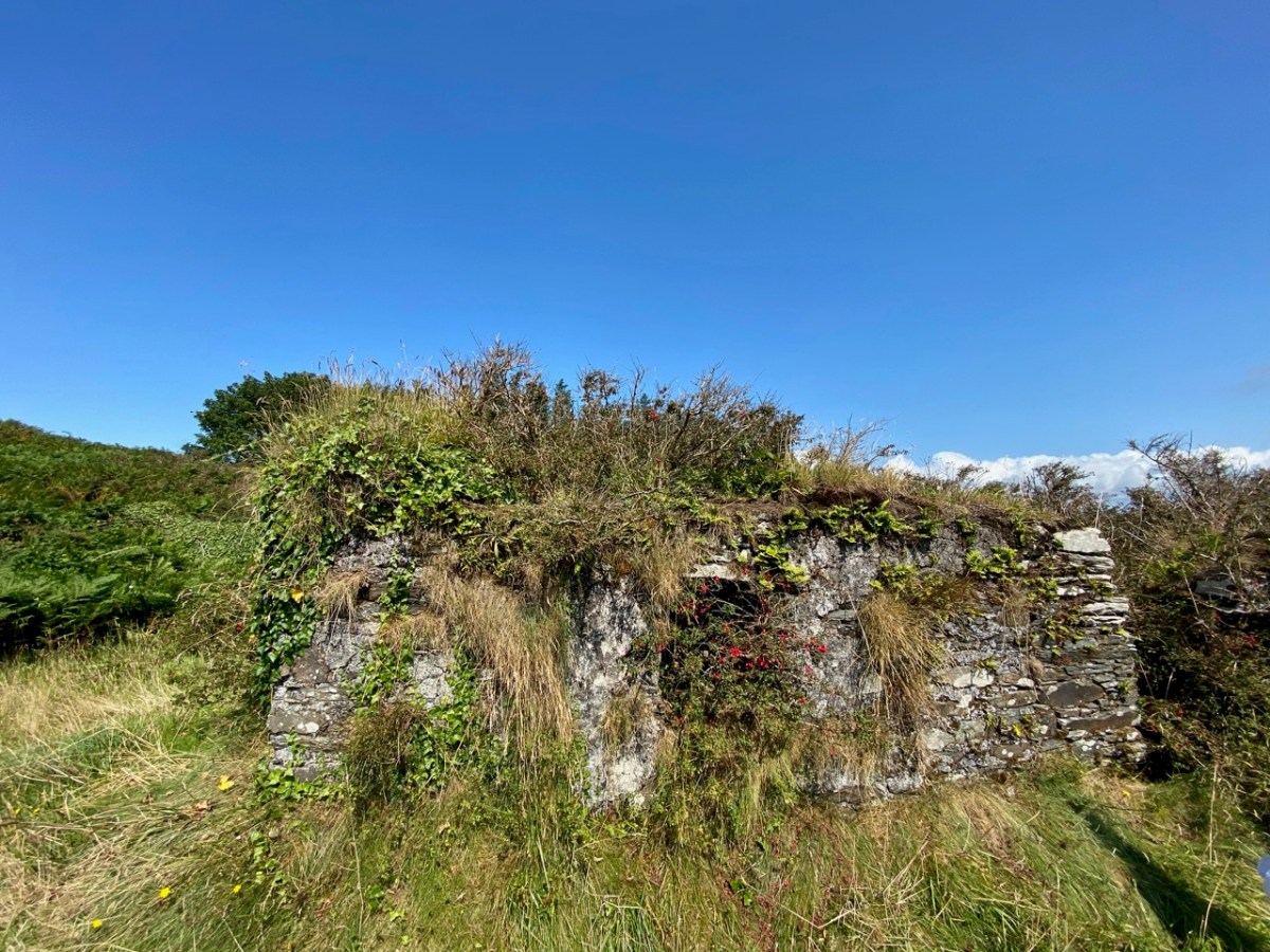
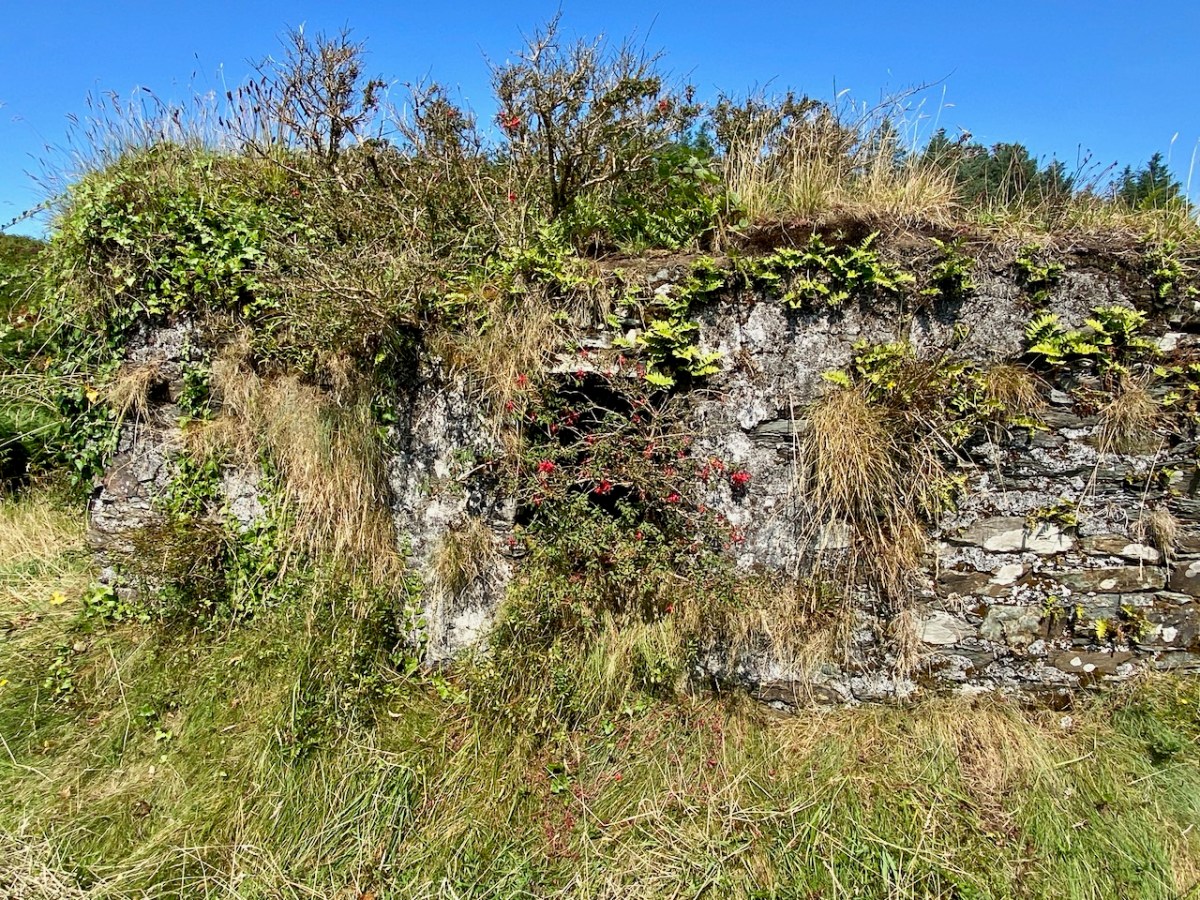
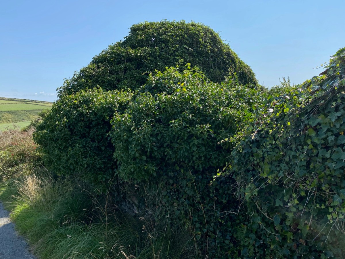
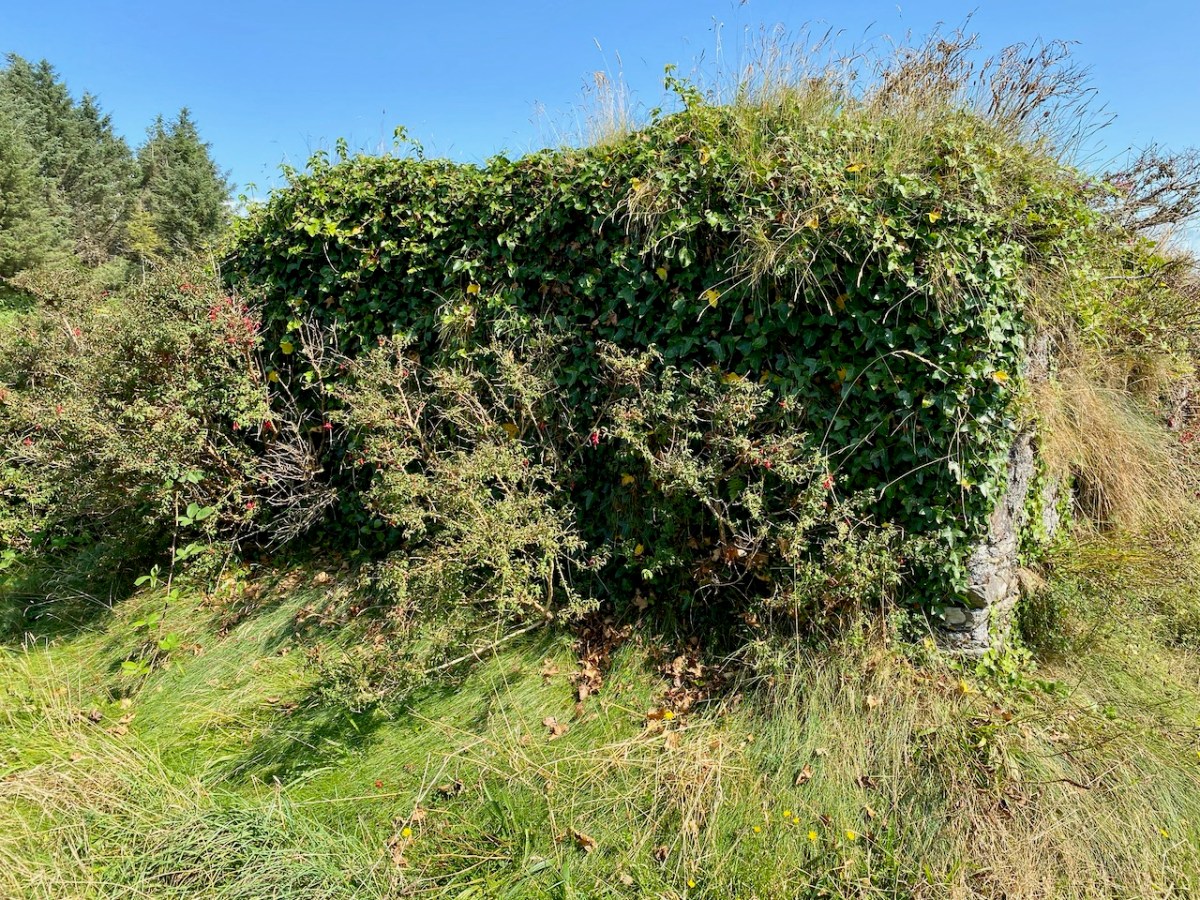
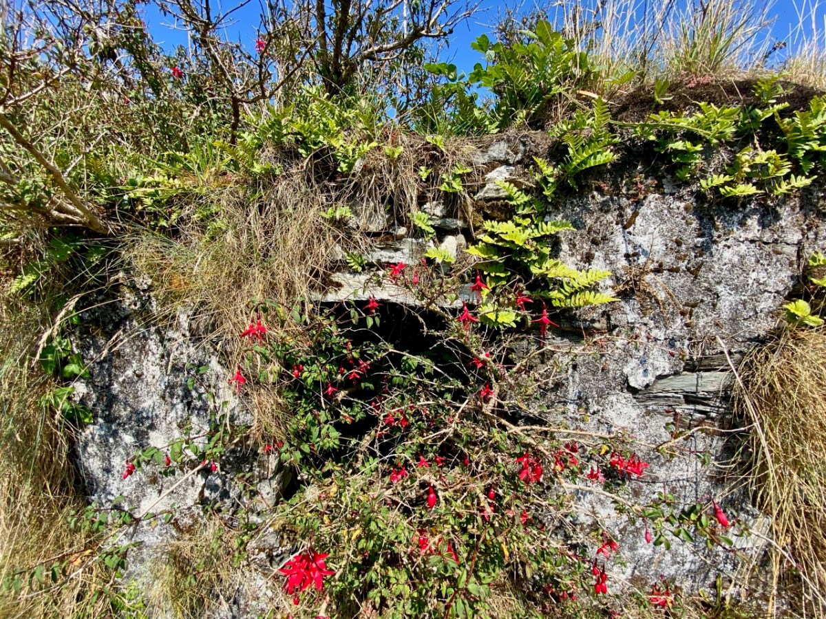
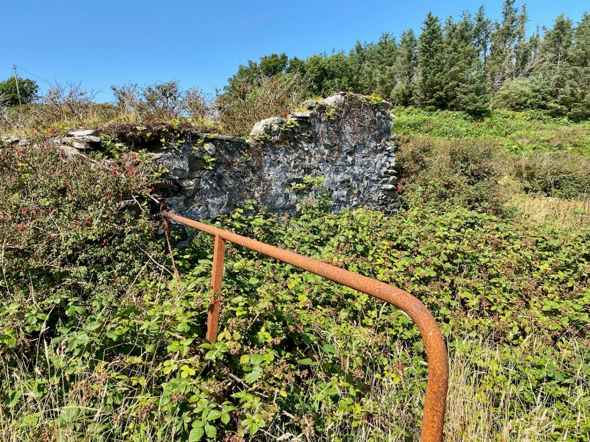
And while you’re sitting outside, savouring your chowder, look across at some Industrial Archaeology in Crookhaven. These imposing remains are all that’s left of a once-thriving stone quarry supplying road material until the late 1930s.
Of course there is much more to the Far End of the Mizen – I’ll continue this in the next post.
WordPress, to my dismay, has now labelled all the content on this blog as ‘by Finola’. This is due to the necessity, for various reasons, of adjusting ‘ownership’ and management parameters. It’s a bit heartbreaking, though, as it’s no longer easily discernible which of the posts (approx half of the 1,132 posts so far) were written by Robert. So every now and then I thought it would be good to highlight one of his older posts. So here is his wonderful account, written originally in 2014, and titled In Search of Ghosts, of the spirits that haunt Brow Head.
Lonely and wild – Brow Head is the most southerly point on the mainland of Ireland. There are ghosts here: ghosts of ancient people who created the stone monuments, perhaps 5000 years ago, that are now inundated by every tide in the bay at Ballynaule below this Irish ‘Lands End’; ghosts of early farmers who began to lay out field boundaries criss-crossing this windswept promontory; ghosts of the defenders of an empire who feared a French invasion that never happened; ghosts of the prospectors who sunk two shafts – now barely protected by rusting wire – during the nineteenth century copper mining era; and, lastly, ghosts of the pioneers of our own digital age, represented in the brooding ruins that crown the hilltop here above West Cork’s remotest village, Crookhaven.*
Brow Head – haunt of ghosts
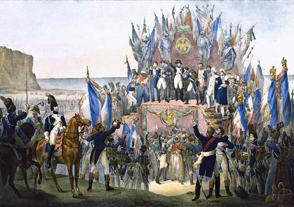
Napoleon setting his sights on the British Empire 1804 (Charles Motte)
Facing up to Napoleon: Brow Head Signal Tower, built in 1804 in anticipation of a French invasion
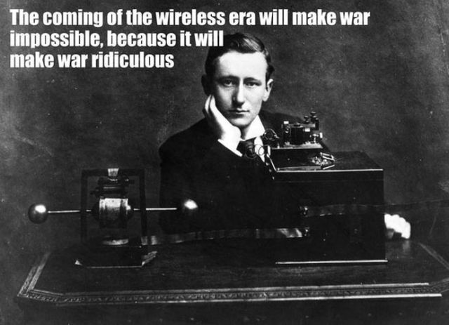
We can be very specific about one ghost: Guglielmo Marconi – born at Bologna, Italy, on April 25, 1874 to Giuseppe Marconi, an Italian country gentleman, and Annie Jameson, daughter of Andrew Jameson of Daphne Castle, Enniscorthy, County Wexford, Ireland. The Jamesons were and are renowned distillers of Irish Whiskey. It’s reasonable to say that Marconi was an ‘Irish Italian’, and that heritage was reinforced when in 1905 he married Beatrice O’Brien, daughter of the 14th Baron Inchiquin. Marconi’s fame is that he pioneered the commercial application of electromagnetic waves – or Radio.
Marconi – wishful thinking!
At the age of twenty one, Marconi was able to demonstrate to his father how, without any visible physical link (without wires), he could transmit dots and dashes through the rooms of their home in Pontecchio. “…When I started my first experiments with Hertzian waves…” he is quoted as saying, “…I could scarcely believe it is possible that their application to useful purposes could have escaped the notice of eminent scientists…” His parents used their influence to help him travel to England to meet the Engineer-in-Chief of the British Post Office with the result that in 1896 Marconi obtained the first ever patent in wireless telegraphy.
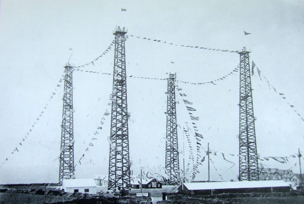
Signal Station at Poldhu, Cornwall, 1914
Marconi’s ambitions started in a room in Italy: by December 1901 he was able to send messages from Poldhu, Cornwall, to St John’s, Newfoundland, a distance of 2100 miles – an historic achievement. In his attempts to bridge the Atlantic with Radio waves he had explored the west coasts of Britain and Ireland for suitable telegraphic locations. One of his destinations was Crookhaven, which he visited many times – using the Flying Snail en route!
The Marconi Wireless Telegraph Station at Brow Head – exactly 100 years ago
Brow Head was one of a number of transmitting stations set up by Marconi and it got off to a flying start soon after opening in 1901 when, in the presence of Marconi himself, Morse signals were received from Poldhu, 225 miles away. The fact that the Atlantic gap was conquered only a few months after this shows the rapid pace of developments at that time.
Calling America…
The village of Crookhaven had long been the first and last port of call for ships going between Northern European ports and America. Over the centuries ships stocked up here with provisions before tackling the open sea. Because of this, the major shipping lines had agents here. Reuters and Lloyds had flag-signalling and semaphore equipment on Brow Head to communicate with the maritime traffic, superseded by the telegraph station. At the end of the 19th Century it was said that “…you could cross the harbour on the decks of boats…” Up to 700 people are reputed to have lived in the area at that time: now, Crookhaven has a permanent population of no more than 40. An article written by one of the telegraph operators in 1911 summarises:
…As Crookhaven is the first station with which the homeward bound American liners communicate it is naturally a busy station. By the aid of wireless all arrangements are made for the arrival of the ships, the landing and entraining of the passengers and mails, whilst hundreds of private messages to and from passengers are dealt with. Messages are also received from the Fastnet Lighthouse, which is fitted with wireless, reporting the passing of sailing ships and steamers. These messages are sent by vessels not fitted with wireless by means of signals to the Fastnet, thence by wireless to Crookhaven, whence they are forwarded to Lloyds and to the owners of the vessels…
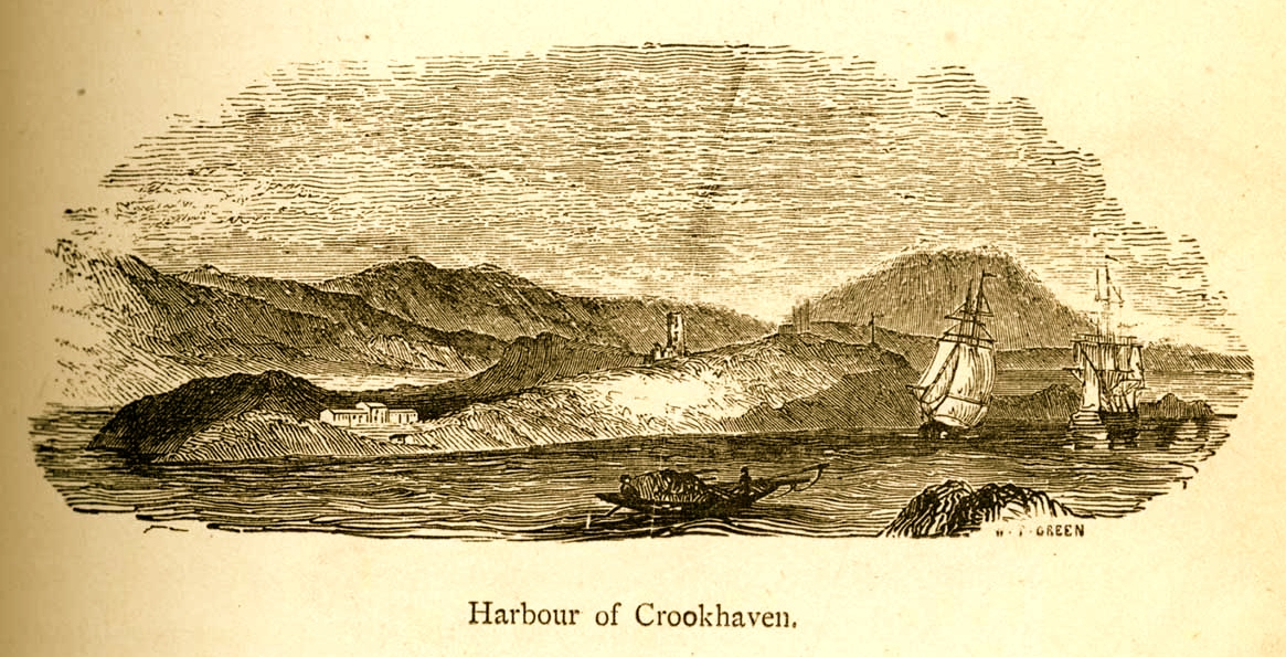
Engraving by Mary Francis Cusack, 1875
We have some first hand accounts of the workings of the signal station in its heyday from the handwritten log books of Arthur Nottage – for many years landlord of the Welcome Inn at Crookhaven – who died aged 90 in 1974. In 1904 he arrived in West Cork (from England) to work on a shift basis with one other man as Marconi telegrapher at Brow Head. Until 1914 he operated the Morse code apparatus with a salary – generous for the time – of £1 per week.
Arthur Nottage of Crookhaven
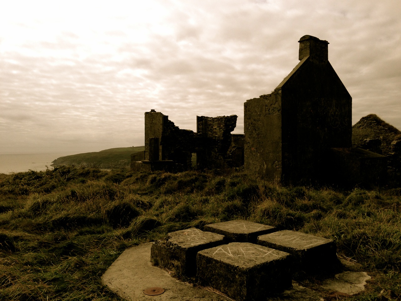
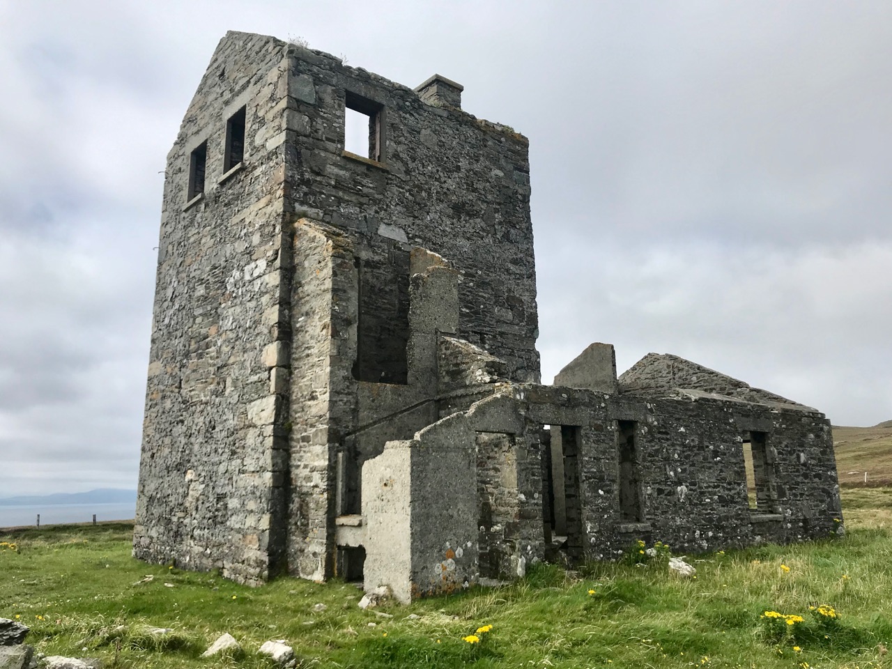
A hundred years ago telegraphy had advanced to such a stage that it was no longer necessary for stations to operate close to the shipping lanes, and small, isolated sites such as Brow Head were closed down. Legend has it that in 1922 the Irregulars destroyed the buildings during the Civil War.
Becoming archaeology: the ruins on Brow Head today
Finola and I have both been inspired by the landscape and atmosphere of this Atlantic frontier. It’s a place we will return to. All West Cork landscapes are impressive, but this is a place apart. If you want to feel at the end of the world, walk here: you won’t meet many others, even in the height of the visitor season. Perhaps that’s because it’s haunted – but in the best possible way. Like so much of Ireland the world has come here – a mark has been made – memories have been left behind. Now, you hear the ghosts in the ever-present currents of wind and surf.
Base of Marconi’s mast at Brow Head
*I am grateful to Michael Sexton and the Mizen Journal (Number 3 1995) for many fascinating items on the Crookhaven Telegraph Station not recorded elsewhere.
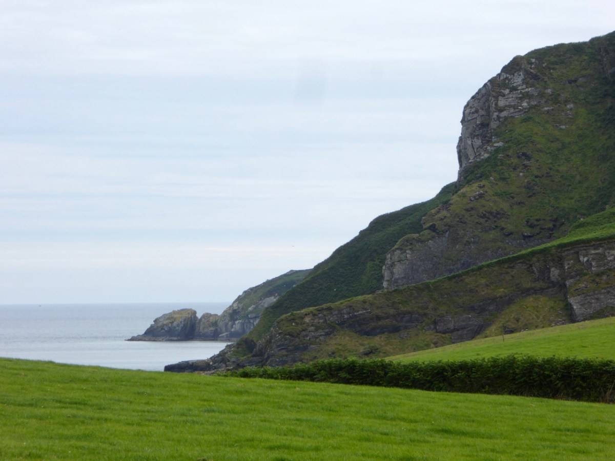
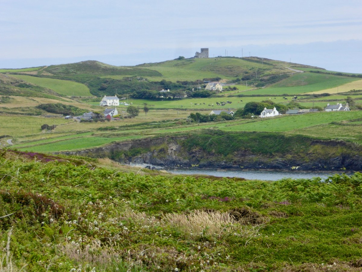
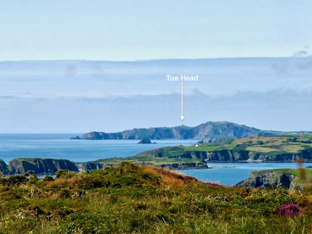
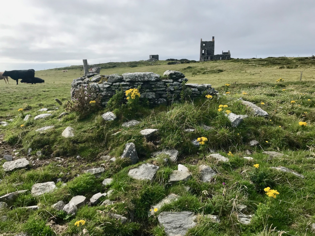
Here’s the latest episode in our series about Napoleonic-era signal towers in West Cork. There are links to the earlier posts at the bottom of this one. That’s Toe Head above – in the far distance, and that view is taken from the signal tower site at Kedge Point, Spain, to the east of Baltimore.
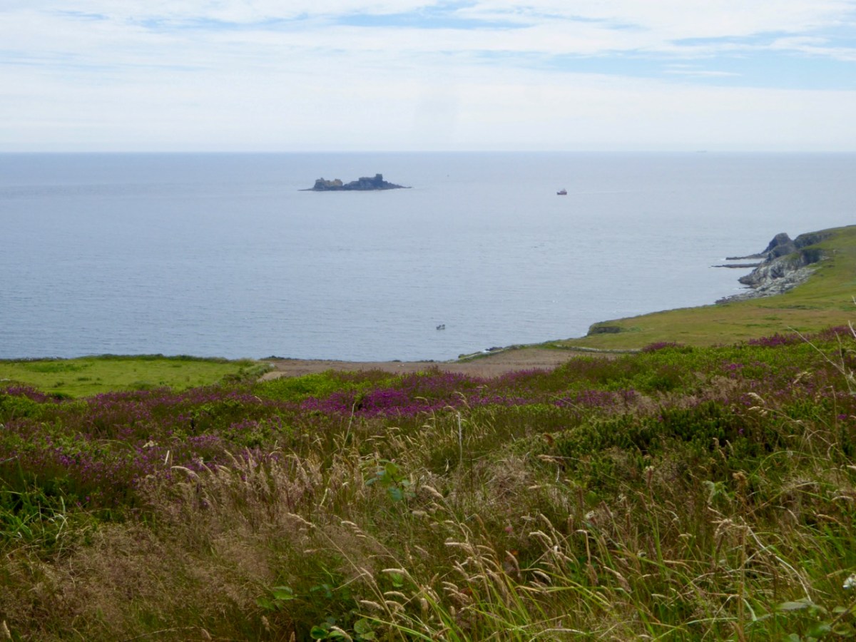
Toe Head itself is a spectacular setting in West Cork: the views, above, show the nature of the terrain, the boreens, and the seascape in the area. So far I have written accounts of nine signal towers: this is the tenth. I’d like to tell you how many of these structures are in West Cork, but that would mean that I would have to geographically define ‘West Cork’. I can’t do that, as there is officially no such area: we are all part of County Cork! All I can do is to let you know that there are nineteen signal tower sites located in the whole County. I have another nine to cover, after this one. But I assure you – Toe Head is definitely in our West Cork!!
Here’s the Toe Head tower – in a sea of black bales. If you have followed the series so far, you will have noticed that each tower is fairly basic, and generally offers the appearance of a medieval castle. But they were all built at the very beginning of the nineteenth century, to provide a system of surveillance and signalling around the coast of Ireland, from Malin Head in the north to Pigeon House Fort, Dalkey, on the east coast. Each signal tower is within view of one – or two – others, depending where it lies on the chain. In the first post in the series, here, I explain the logic and geometry of the project.
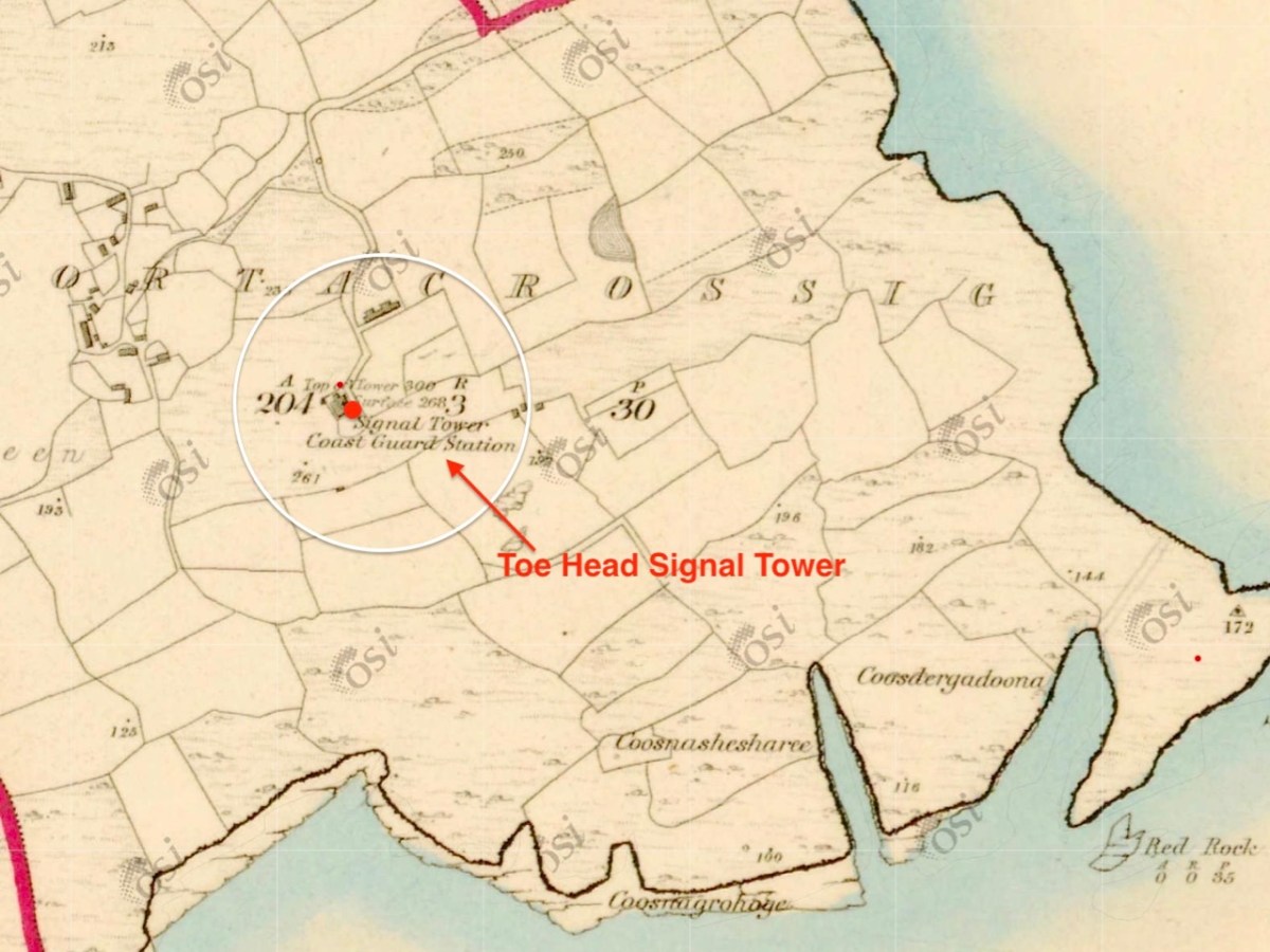
The 6″ Ordnance Survey map extract in the upper picture dates from 1842. By this time the use of the tower for signalling had ceased – the Napoleonic invasion threat lasted only through the first few years of the century: many towers became disused after this and some have vanished altogether, although many ruins do remain because of their remote locations. In the case of Toe Head, the building was adapted to incorporate a Coast Guard Station. I am assuming that, originally, the tower was a simple square structure , and the extension to the rear was added to provide additional accommodation for the Coast Guard service. The current aerial view shows newer farm buildings and an access road close by.
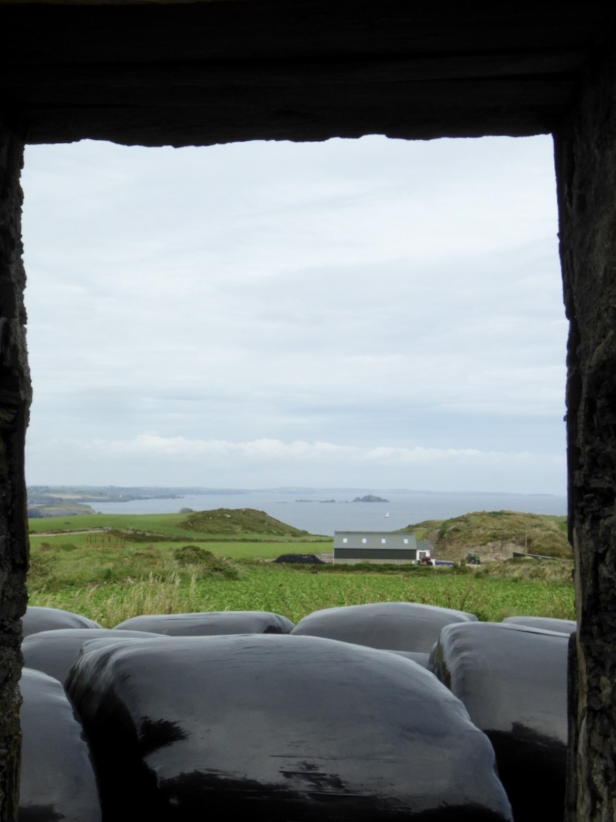
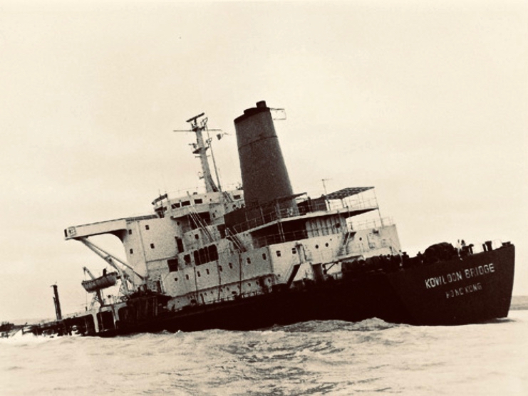
If you look at previous posts in this series, you will see that the Toe Head tower is architecturally simpler, with no bartizans or other ornamentation – it’s more like a small Anglican church tower than a ‘castle’. Like many others, it’s clear to see that this building was slate-hung: this form of weather-proofing was probably added at a later date – possibly when the Coast Guard service took it over. At the centre of the view from the window above you can see the Stag Rocks which in the 1980s became the graveyard of the 900ft long Kowloon Bridge, a bulk cargo carrier travelling from Quebec. The ship was disabled by a storm and then abandoned, drifting on to the Stags. A detailed account of the event was posted in the Irish Examiner 30 years later.
The abandoned Wreck of the Kowloon Bridge close by the Stags in November, 1986 (centre picture). The lower picture shows the wreck underwater today (courtesy Aquaventures.ie): she drifted out of control towards the rocks before running aground on the reef. The resulting fuel spill spread out over the Irish coastline causing extensive damage to local wildlife, and financial losses for the local fishing fleet. Apparently, no-one was ever held to account for the environmental disaster.
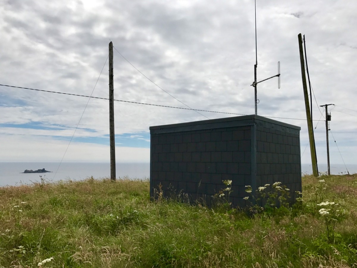
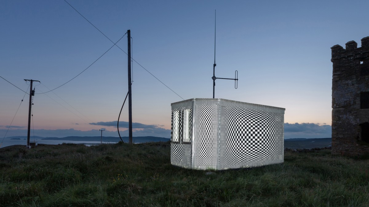
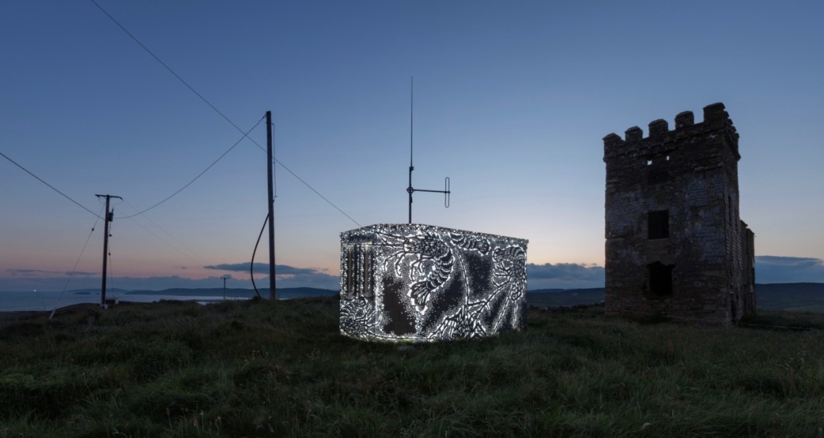
The Stag Rocks can be seen in my picture above, which shows the current incarnation of a World War II Lookout Post that was put in place close by the older signal tower in 1942. You can read more about these lookouts in this post: they were designed by Howard Cooke RIBA of the Irish Office of Public Works at the outbreak of that war (during which Ireland remained neutral). I mentioned in that same previous post an art installation project carried out in 2014 by Tim Schmelzer of Vienna. His work at Toe Head is particularly impressive, and here are some still shots to illustrate the nature of the artworks, which were created on-site using high-powered projection equipment.
The signal tower ruin today is gaunt and desolate. Nevertheless it’s an atmospheric place to visit. On the slopes below the building is an EIRE sign (officially number 28), also dating from the World War II years, when Irish neutrality had to be spelled out to the warring powers flying overhead. I came across an interesting comment from Anne Wilkinson in 2018, giving a slightly different take on the EIRE signs:
. . . These EIRE signs were also to alert German Pilots and crew who were conscientious objectors and who had overflown the UK, to ditch and parachute to safety. Many airmen lived at the Curragh Camp. They were allowed freedom during the day, eg. they often cycled the lanes and roads to enjoy the peace and quiet and then returned to the Curragh Camp for their curfew hour . . .
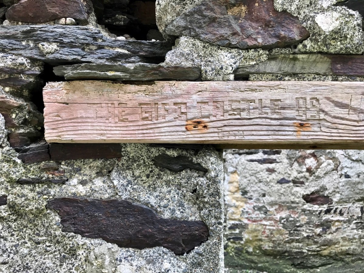
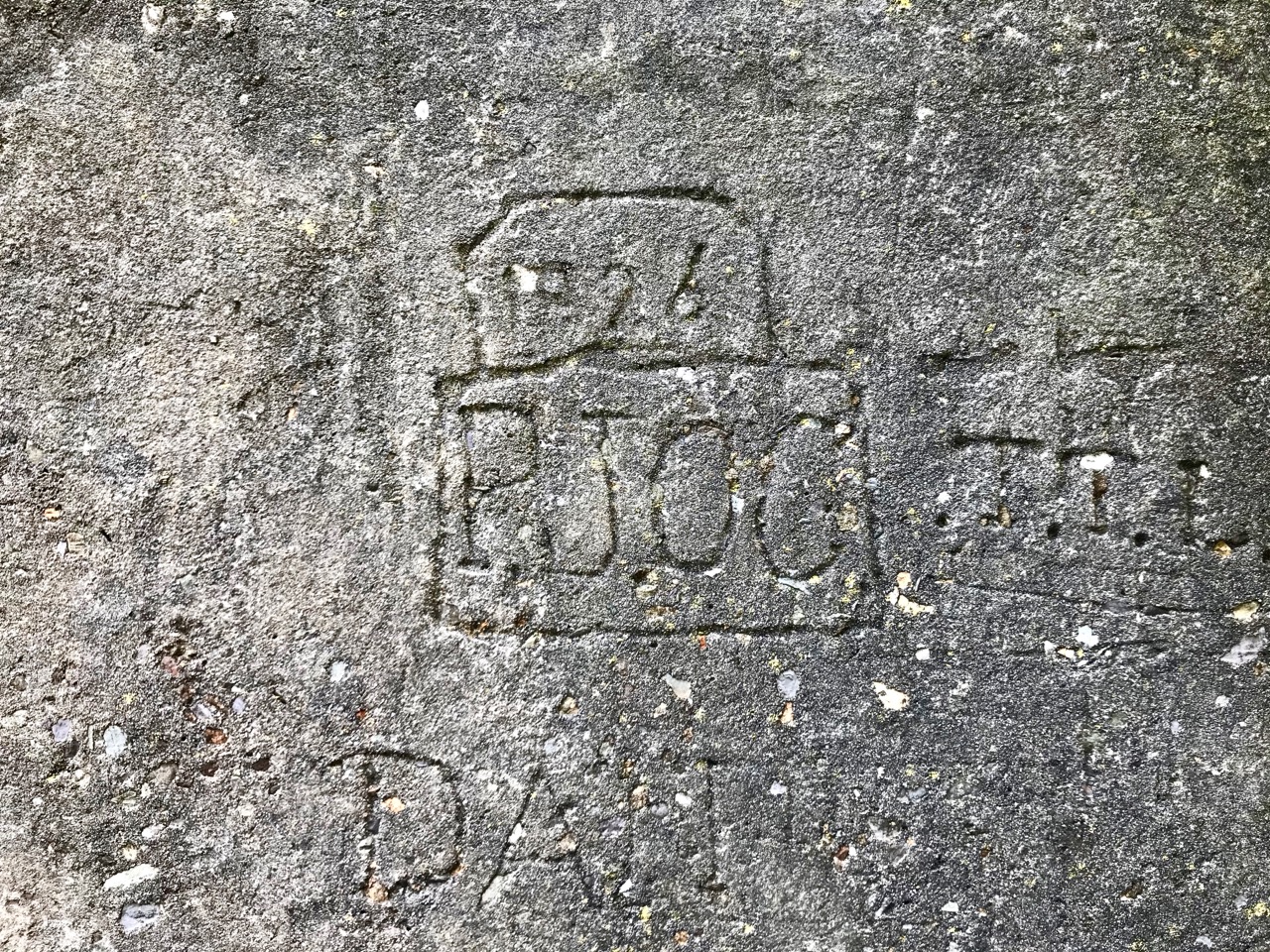
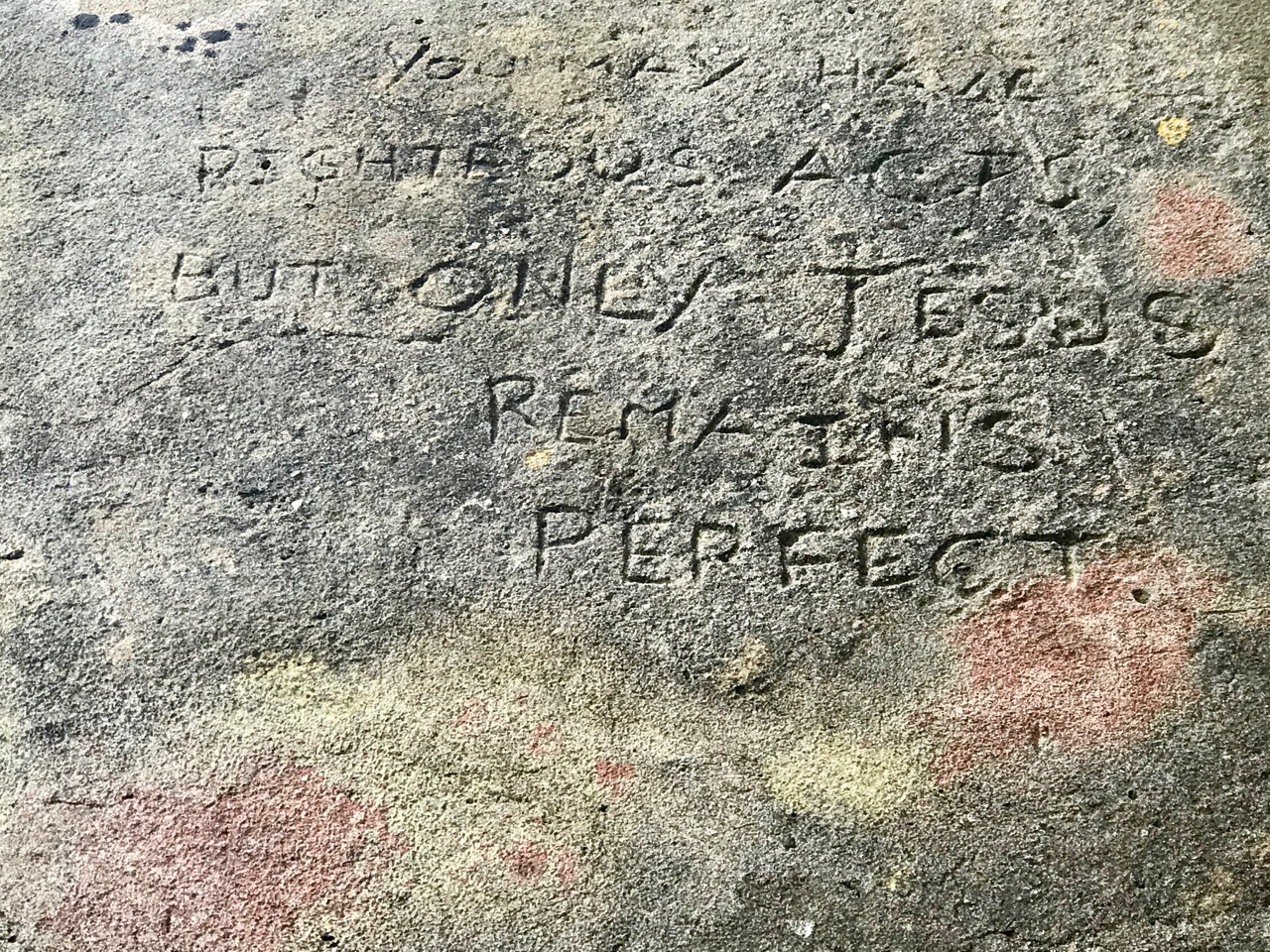
And here’s a little enigma to finish off the post (above). It’s graffiti carved on a timber lintel over one of the openings of the signal tower buildings. It’s probably quite recent – dating from ’89 or’99 – but what does it spell out? And why is it here? It’s tempting to say THE GIFT CASTLE but that ‘T‘ after the GIF doesn’t ring true . . . There’s a story there somewhere: perhaps one of our readers can give us a clue! Finally, here’s a distant view of the signal tower, looking across Toe Head.
The previous posts in this series can be found through these links:
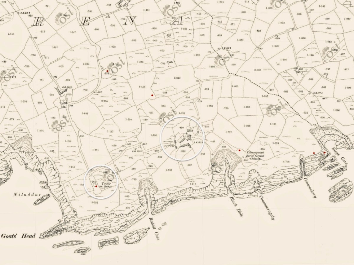
This is a bit of an epilogue to my Signal Success in Irish Engineering series (although that is not yet complete!). Here is the site of a Napoleonic-era Signal Tower in West Cork – but the tower itself has completely vanished! It’s no 28 on the map which accompanies Bill Clements’ book – Billy Pitt Had Them Built – Napoleonic Towers in Ireland (The Holliwell Press 2013) and it is given the name Glandore Head. We recently visited friends who have a house in the townland of Reenogrena, which is south-east of the village of Glandore and its extensive natural harbour. The topography of the area is soul-stirring – that’s probably an understatement: look at the view of the coastline there, above, and the distant views both west and east, below.
We were fortunate with the day we had. The benign weather gave us a possibly false sense of security as we explored a wild, riven coastline. We could well imagine how exposed we might feel there in one of West Cork’s severe storms: our climate-changing extremes are becoming ever more prevalent. But on this occasion we were confident enough to venture to the very edges of the land, always conscious that humans had settled in these remote places many generations before us.
There is nothing left of the signal tower at Glandore Head, which would have been constructed between 1801 and 1804. The site has now been taken over by a recently built house which enjoys the excellent views in all directions. In the picture below it seems that the tower was located in the area of the earth-sheltered garage. We know more or less where it was because it appears on the earliest Ordnance Survey maps from around 1840. Even by then the structure itself had lost its original function, as the threat of Napoleonic invasion had passed, but it is labelled as a ‘Telegraph’. On the later 25″ map – dating from the late 1800s – the site is marked as ‘Tower in ruins’.
Centre – the earliest 6″ OS map; lower – the later – and far more detailed – 25″ OS map. It’s interesting to compare the two versions. The accuracy of the later map in terms of topographical detail and humanly constructed features – buildings, trackways etc is very noticeable. Below is the contemporary aerial view. 50 years separate the two OS maps, while the satellite image is 100 years later again.
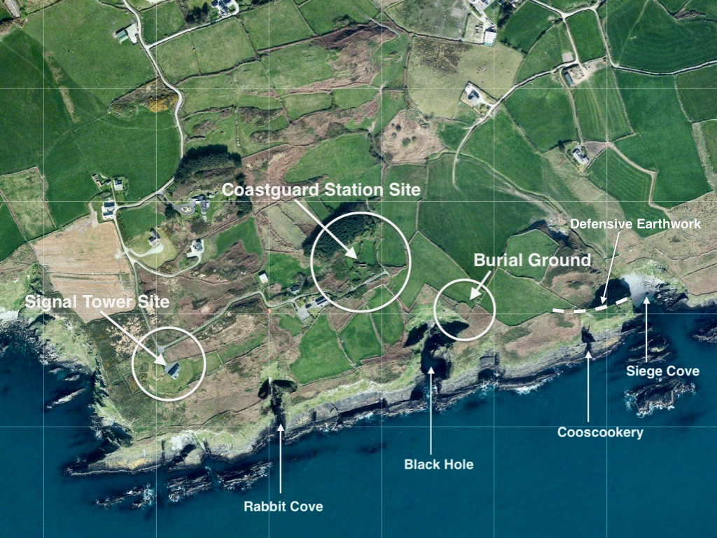
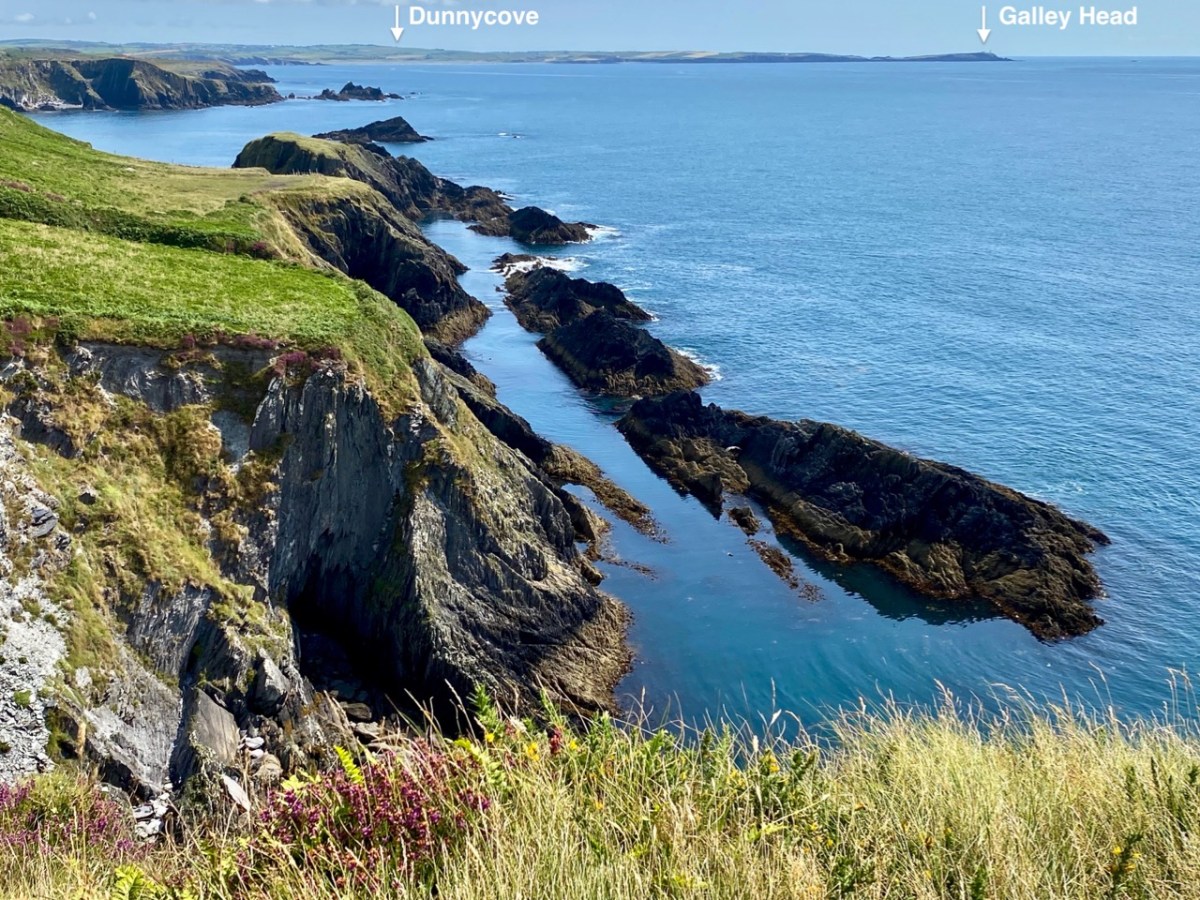
The reason why I like to examine and compare the mapped information is my interest in reading the history of a place through its landscape, and this particular vignette of West Cork is a prime example of the process. Firstly, the signal tower location was chosen because of visibility to other significant places on the coastline which are in view: the towers at Toe Head to the west and Galley Head (Dunnycove) to the east (below).
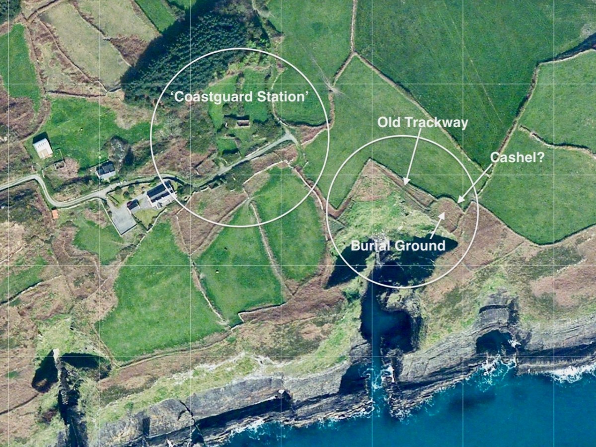
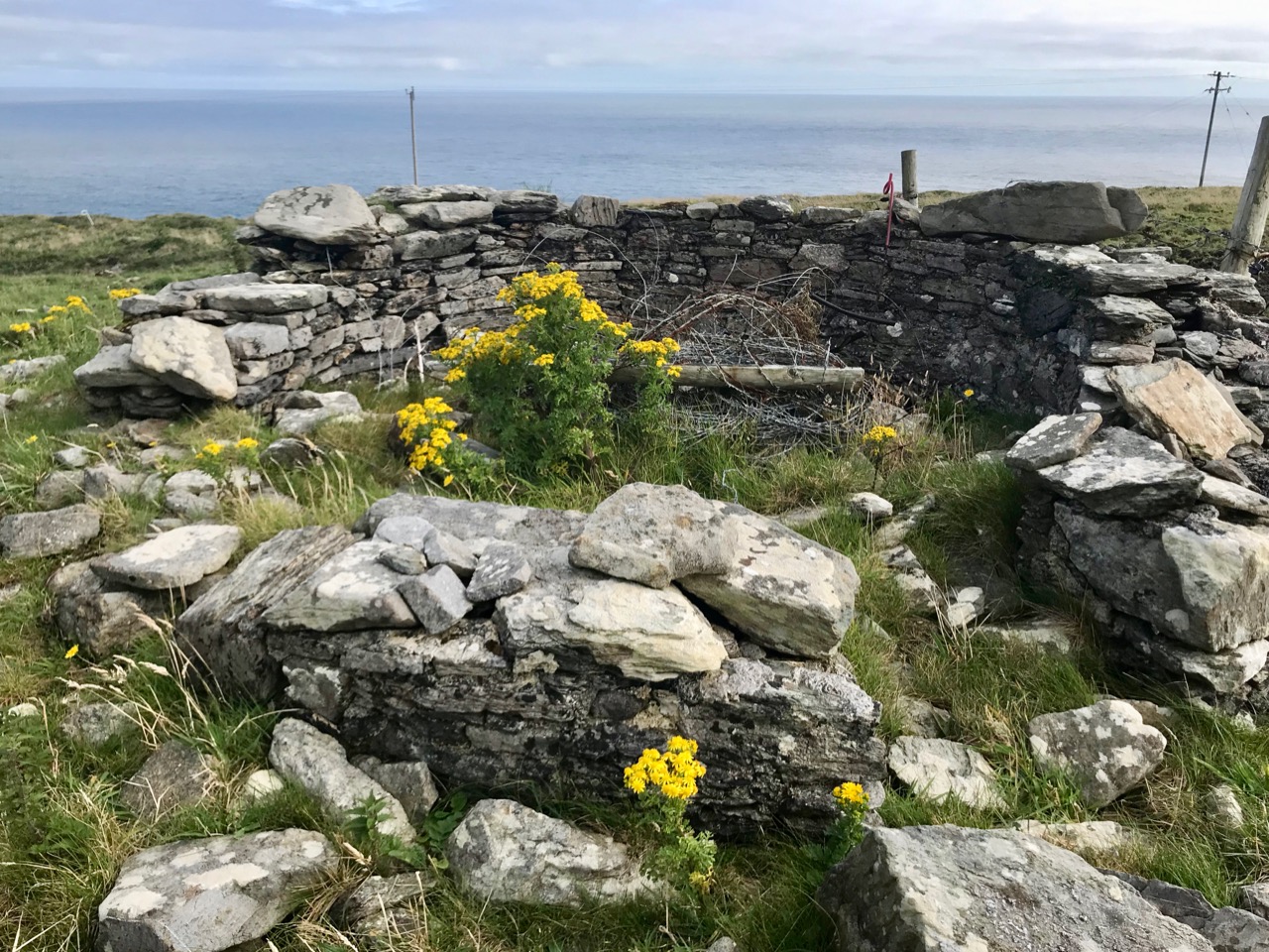
Next, look at the ‘Coastguard Station’ site. This is marked on the c1840 OS map, but not on the later 25″ map. But that later map does show a number of buildings on that site. As you can see from the aerial view, there are only the remnants of buildings now. Also the older map shows no roadway or track accessing the ‘Coastguard Station’ – it could only be reached by crossing fields. Here’s a closer look at this group of ruined buildings today, followed by some of our photos.
While it is likely that there are old coastguard buildings amongst these ruins, it seemed to us equally possible that we were also looking at the earlier remains of a settlement – cottages and cabins. Records of the area are scant. There’s nothing we found – apart from the OS maps – to give any further light on what we were scrutinising. Surprisingly, very little information is available on the early years of the Irish Coast Guard service, other than its establishment as the Water Guard, or ‘Preventative Boat Service’ in 1809, initially under Navy control but from 1822 part of the Board of Customs. From this we might assume that its purpose was to intercept smuggling operations, rather than to give any assistance to seafarers. Incidentally, it is important to note that in Ireland the name has always been two words: Coast Guard.
It’s easy to see that this hostile coastline – which would not be benign to small fishing boats – would nevertheless attract subversive landings. The only nearby access to the water is Siege Cove, to the east of the Coast Guard site. The upper photo depicts the curiously named Cooscookery inlet – not a good landing point, while the lower is Siege Cove – itself a difficult climb to the fields from sea level. The names of the topographical features would be a good study in themselves – and might reveal some hidden history: Coosnacragaty, Black Hole, Rabbit Cove, and Niladdar. The small burial ground is known as Kilcarrignagat (it means the ‘church at the rock of the cat’). That’s the overgrown trackway leading to it, below. It is of particular interest – partly because you wonder what communities it served, but also because it seems to have been established in a previously existing ring-fort or cashel.
Further yet to the east, and directly above Siege Cove, are the distinct remains of a defensive structure, partly taking in natural outcrops but also built up with stone. This is likely to be indications of the first habitation in this area – perhaps a thousand years ago. There seems to be at least one promontory fort here, and Finola will take up that subject in this locality in future posts (she has already tackled examples elsewhere). It seems to me that this whole coastal region would be worthy of a detailed archaeological study – UCC take note! Meanwhile, we can only express our gratitude to friends Michael and Jane for introducing us to the many wonders of their own territory.
Addendum: After I had published this post I discovered an excellent photograph of Siege Cove and the coastline in this area taken from the sea. I cannot find a contact for the photographer. I do know his name is Tim, and that he publishes an occasional diary of his journeys in a boat (an Ilur based, I believe, In Glandore). I hope he won’t mind me publishing this and including a link to his website.
This has been a banner year for Roaringwater Journal – we passed the milestone of a million views and had our most viewed post ever (see below). Most of all, though, it’s been a year in which we feel privileged to have been able to keep bringing you our weekly blog in the teeth of this global pandemic. We won’t lie, there have been moments when it all seemed too hard, weeks when we couldn’t do the sort of travelling around and photographing that are so essential to our research, and days when the sense of underlying dread and distraction made it hard to concentrate on writing. Through it all, you kept us going, cheering and encouraging us with your likes, your views and your comments. So a huge THANK YOU to you, our dear readers! We hope that our little efforts have provided to you, in turn, some notes of sunshine in the dark – like our view, above, from Nead an Iolair, taken just before we hit Publish. Herewith, keeping with the tradition of our usual year-end round up, your (and our!) favourite posts of 2020.
Finola’s Favourites
That most-viewed post of all time? Of course it was Beautiful West Cork in Picture and Song. Colum Cronin’s song – and that voice! – paired with the incredible West Cork Scenery. A perfect fit. Here it is again, in case you missed it first time around, or just to enjoy it once more.
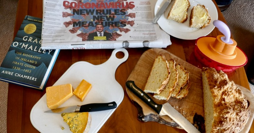
Amazingly, our second most popular post this year was a recipe! We all got into baking during lockdown, and Roaringwater Journal was no exception. The main attraction with this Savoury Soda Bread is how easy it is – in ten minutes you can have bread in the oven filling your house with the aroma of virtue. It’s also a great base recipe which can be varied to make it more like a tea-time treat to serve with jam.
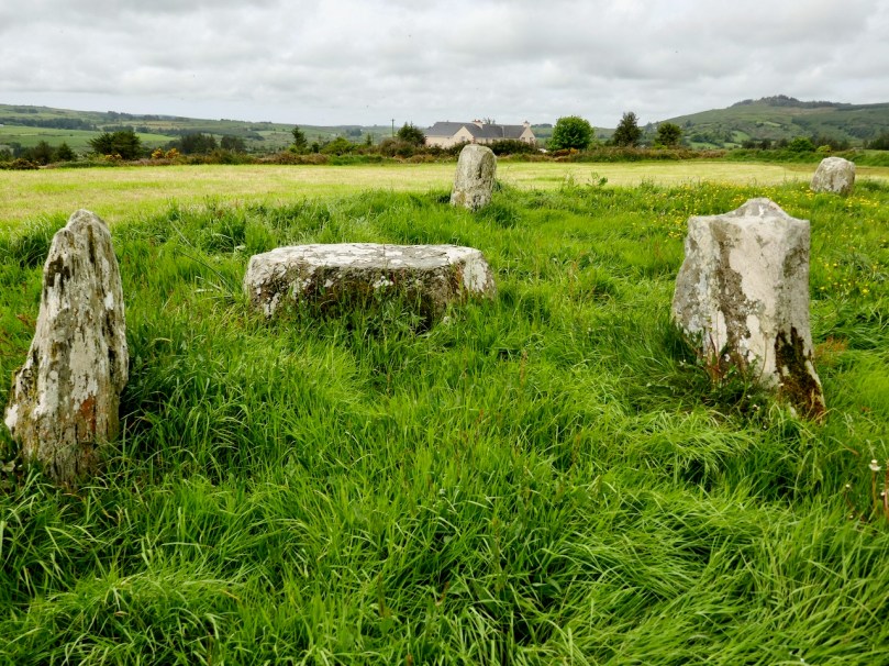
I’ve been wanting for a long time to do a proper treatment of the prehistoric Stone Circles that dot our West Cork landscape. When you write about archaeology there is no substitute for on-the-ground observation. Only by spending time at each monument do you become more alive to their presence in the landscape, their orientations, their similarities and differences. Travel restrictions this year made field trips more challenging and there are still a few on my list to see, but most of the ones we saw are so isolated and in such spectacular settings that it was a joy to plan and write this series. That’s Glanbrack Stone circle below, with a pair of stone outliers (taken in a big hurry as a slurry tank was heading into the field). You can start with The Stone Circles of West Cork: An Introduction (written in 2019), and move one to Multiple Stone Circles, Five-Stone Circles and finally the Discussion.
Readers will know my stained glass obsessions and this year I devoted three posts to a group of mid-century artists and craftspeople producing unique and accomplished windows under the name Murphy Devitt Studios (links to all three parts on this page). I confined myself to their Cork windows and a marvellous journey of discovery it was to see how a young and energetic group set out to test how the ancient traditions of stained glass could be influenced by modern movements in art and design.
Finally, a post about a place that totally captured me – Monaincha, The Isle of the Living, in Co Tipperary. This is a site that takes a little effort to find and get to, but once you’ve been, you might agree with my opening statement that There are places on this island that seep into your soul. You come away with a sense of having visited another world, of having passed through a portal and been lucky enough to come back to tell the tale.
It’s been hard to limit myself to five (and as you can see I did cheat a bit) and indeed I could as easily have chosen others. Over to Robert now.
Robert’s Favourites
As Finola has set out, we are each reviewing favourite posts of this year: 2020. It has been a year unlike any other for both of us – and for everyone else, of course. At times we have been very limited as to where we can travel – no more than 5km from home for weeks at a time, for example. It’s not surprising, therefore, that our immediate environs have come into close focus for us. In one of my posts – from 26 January this year (and before Covid) – our own Rossbrin Cove was my subject, and I saw it partly through the eyes of others, including some local artists. The photo above was taken by our friend and neighbour Julian van Hasselt in 2010 – that’s a year before we arrived. It’s more or less our own view of Rossbrin’s medieval castle. Our winters so far haven’t been so ‘Christmassy’, but – who knows – there may be something waiting for us around the corner. . . The following photo, also from this post, was taken in January this year and shows how contrasting our weather patterns can be.
This beautifully atmospheric view of Rossbrin castle also includes another castle across the water in the distance: that’s the one that gives Castle Island its name. One of the highlights of the year for me was a visit to that island, courtesy of another neighbour: thank you, Dietrich, for giving us a ride out there on your handsome classic fishing boat ‘Barracuda’ (and for bringing us back)! We look out to the island from Nead an Iolair, and it has always had a sense of mystery for us: it has a number of dwellings on it, all now deserted and in ruins (have a look at the picture below). My post Castle Island Explored – Part 1 tells of our exploration but also sets out a little of the history of the place. Since our visit I have discovered more about the island and its story, and I really will get on with the long overdue second instalment in 2021 – that’s a promise!
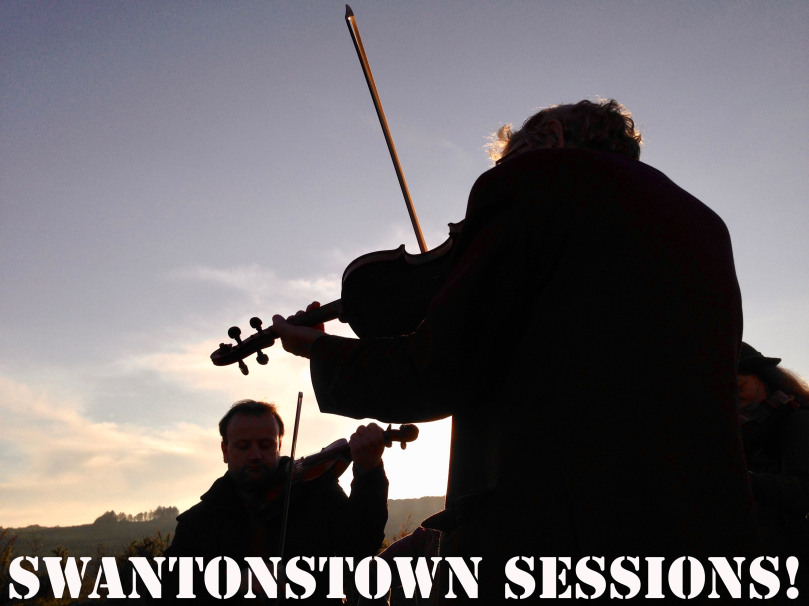
In March this year, our lives changed: the pandemic was upon us, and I realised that one of my favourite pastimes – playing in the live music sessions in the Ballydehob pubs every Friday evening throughout the year – would not be happening for a while. To compensate, I started a new blog giving our musicians the opportunity to put up recordings of tunes and sings online to try and keep up our spirits as Covid progressed. ‘A while’ became a very long time and, in fact, music sessions have been out of the question ever since. The way things are looking as I write, it’s unlikely that they will start again until well into the coming year. I introduced the Swantonstown Sessions blog with a Roaringwater Journal post. Why ‘Swantonstown’? Because Ballydehob carried that name for a time in its history: many Swantons once lived here, and some still do today. As a musical interlude for this post, here’s me playing a tune by Turlough O’Carolan which I recorded for Swantonstown Sessions on my anglo concertina – Planxty Maggie Brown:
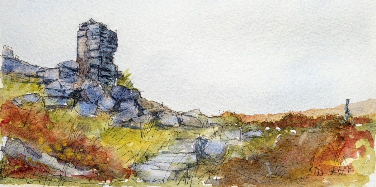
This year I discovered – and wrote about – signal towers in Ireland built at the time of the threat of a Napoleonic invasion in the very early years of the nineteenth century. One post turned into a series of seven posts, as – in spite of travel restrictions – we were able to explore most of the sites of these structures in County Cork, including the restored example at The Old Head of Kinsale (above). All the others are impressive but gaunt ruins dotted around the coastline, each one in sight of two further ones, and signals were passed between them using flags and – sometimes – beacons. If I had opened the series to include the whole Irish coastline there could have been 81 posts! That many were built in a period of just a few years. I called the series A Signal Success in Irish Engineering: you will find them all by following that link. Here’s a picturesque rendering by our friend, Peter Clarke, of the very vestigial tower remains at Ballyroon Mountain on the Sheep’s Head:
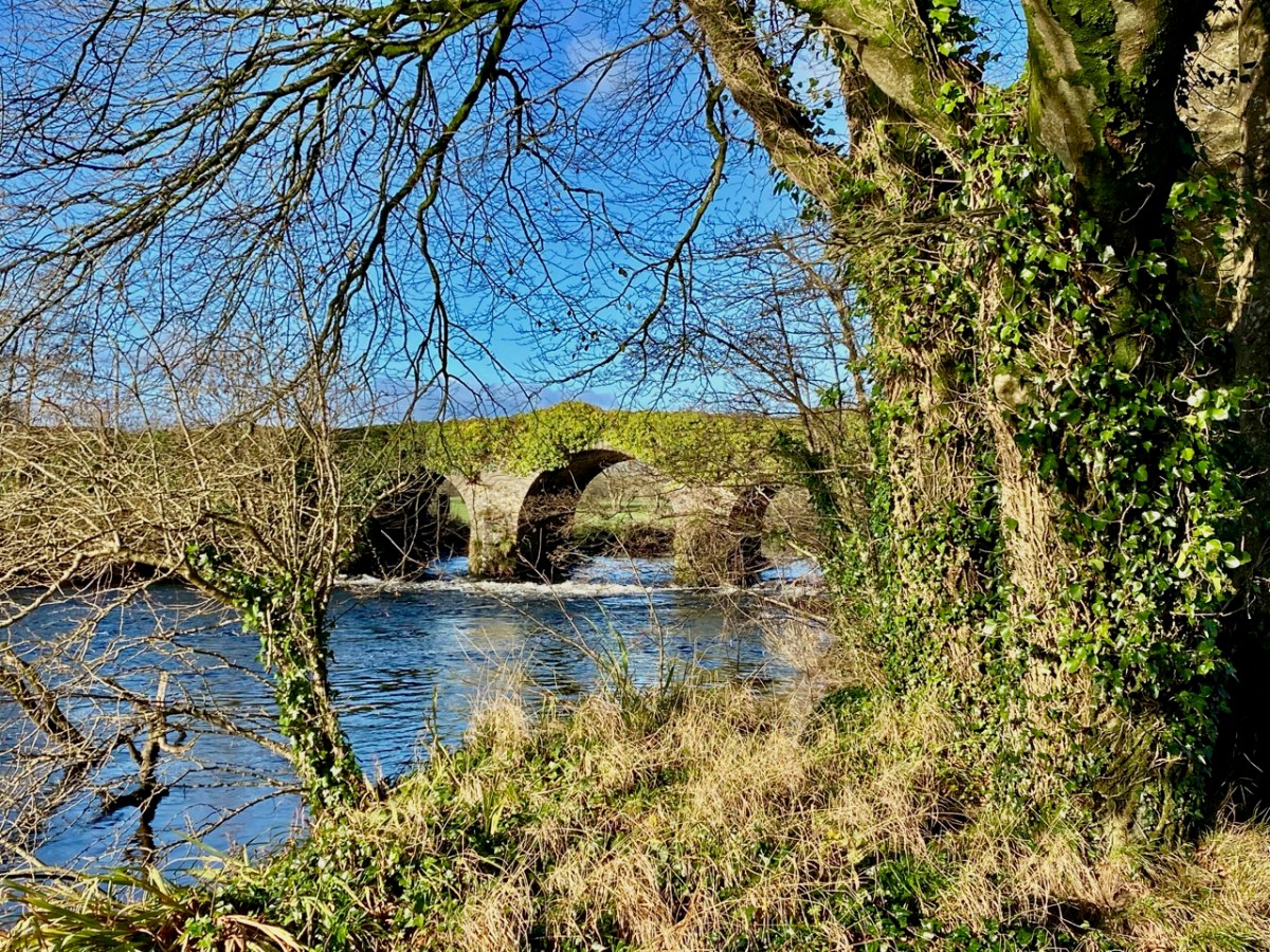
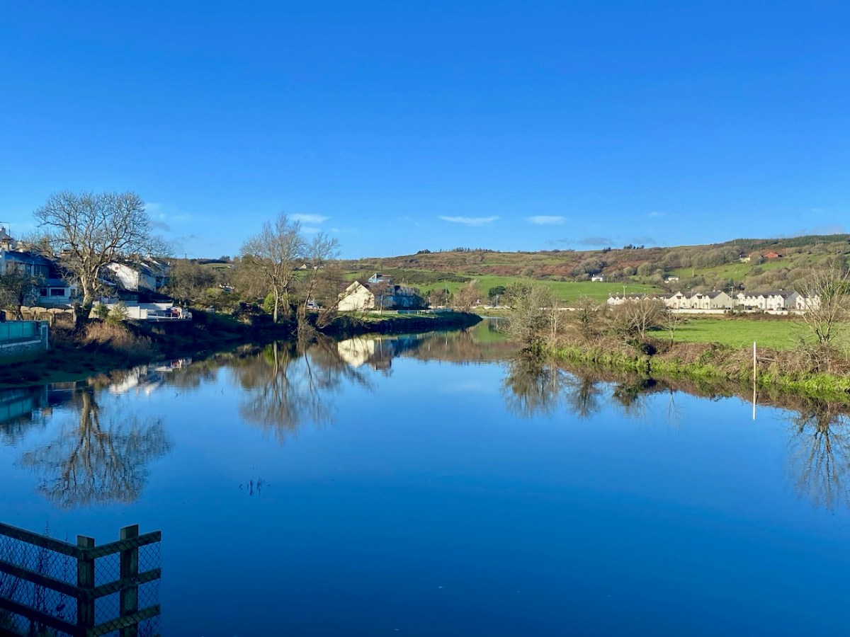
Another project which I started towards the end of the year is the exploration of our major West Cork river – the Ilen. That’s Ballyhilty Bridge, above. My series – Sweet Ilen – will continue into next year. There have been three posts to date: here is the most recent – Sweet Ilen Part 3. At the end of that one you will find links to the other two. It’s a magnificent waterway, rising in the summit of Mullagmesha Mountain and taking a lazy, winding course down to meet the Atlantic at Baltimore. I’m really looking forward to getting to that mountain source, when circumstances permit – and to the mouth. In the meantime there is plenty to to keep you busy in these posts, and all the others I have mentioned above. Enjoy your own celebrations and I hope the new year will bring us all renewal. Here is Sweet Ilen close to its tidal limit at Skibbereen:
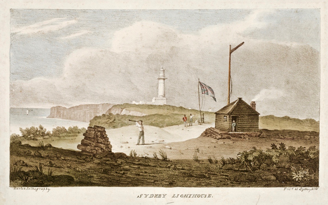
It’s a long way from West Cork, Ireland, to Sydney, Australia! And I’m not suggesting that signals could travel that far in the early 19th century . . . But I couldn’t resist putting up this engraving when I found it while researching signal towers generally as it is in fact an exemplary view with which to head up this – the seventh of our explorations into a fascinating subject. It has everything: the signal station itself, built on a prominent headland with a lighthouse nearby; a ‘telegraph’ mast and a flag mast for signalling; a man with a telescope looking out for a signal coming in – and a pile of logs with which to make a beacon fire to communicate urgently at night! The only difference, in fact, between the Irish stations and this ‘colonial’ one on the other side of the world is the building material. In Terra Australis (the name used for that continent until 1824, and meaning ‘southern land’) it was timber, whereas in Ireland the towers were of masonry and constructed with elements resembling medieval tower houses.
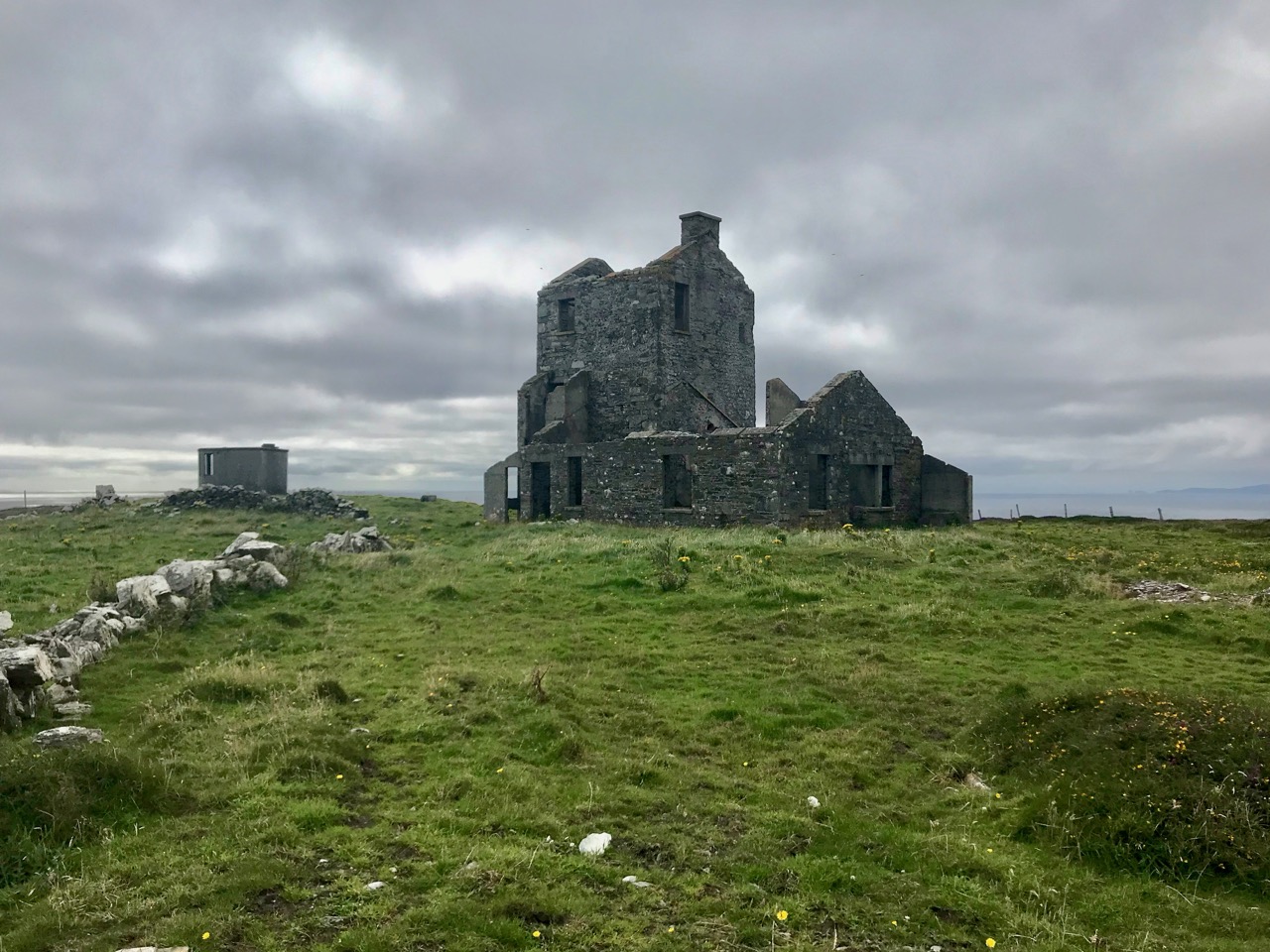
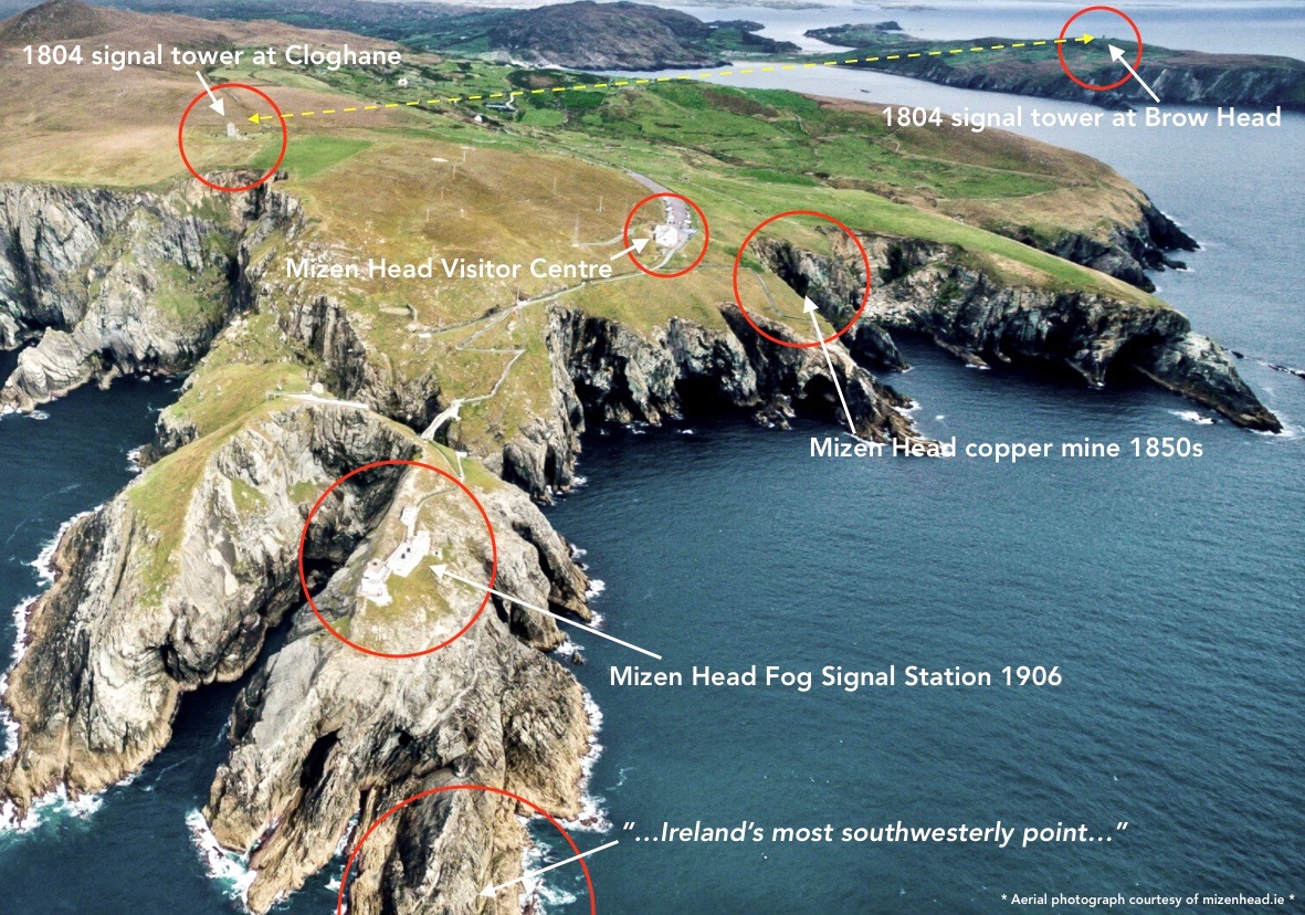
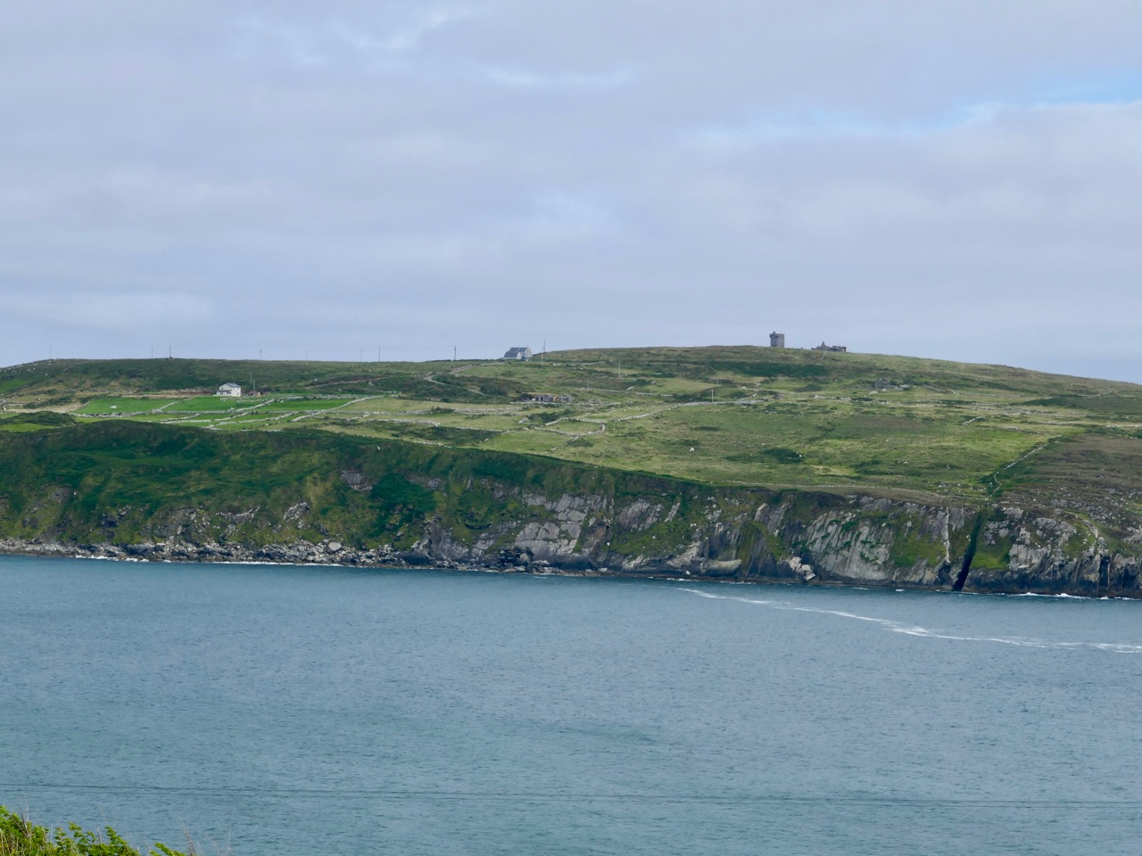
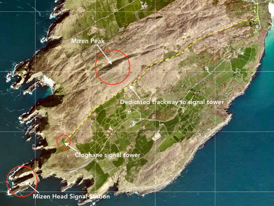
But it’s fair to say that today’s foray into the story of the Irish Napoleonic-era signal towers also has everything. Perched on Ireland’s most southwesterly point – Mizen Head in the townland of Cloghane – this site is one part of a craggy, indented promontory which is scattered with historical elements.
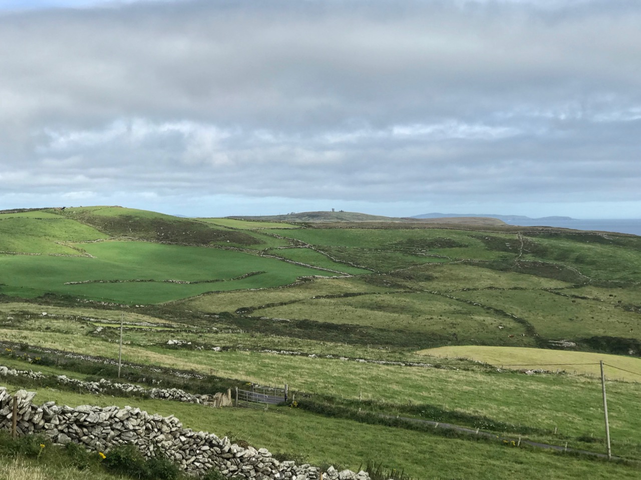
I have tried to illustrate a history time-line graphically by superimposing some of the significant sites on an aerial view (above – courtesy of mizenhead.ie), although even this does not tell the full story. Apart from an undated promontory fort in the north of the townland the signal towers are the earliest elements, specifically dating from 1804 and part of the network of 81 towers around the whole coast of Ireland which we have been charting in our posts. Interestingly, the two towers shown on the top of this view – at Cloghane and Brow Head – are the closest together of any around the coast, being only 3.8 km apart. The average distance between towers is 13.5 km, while the maximum distance is 36.9 km (between Ballydavid and Kerry Head in Co Kerry): we have not yet explored those sites. Here are two views from Cloghane across to the signal tower at Brow Head:
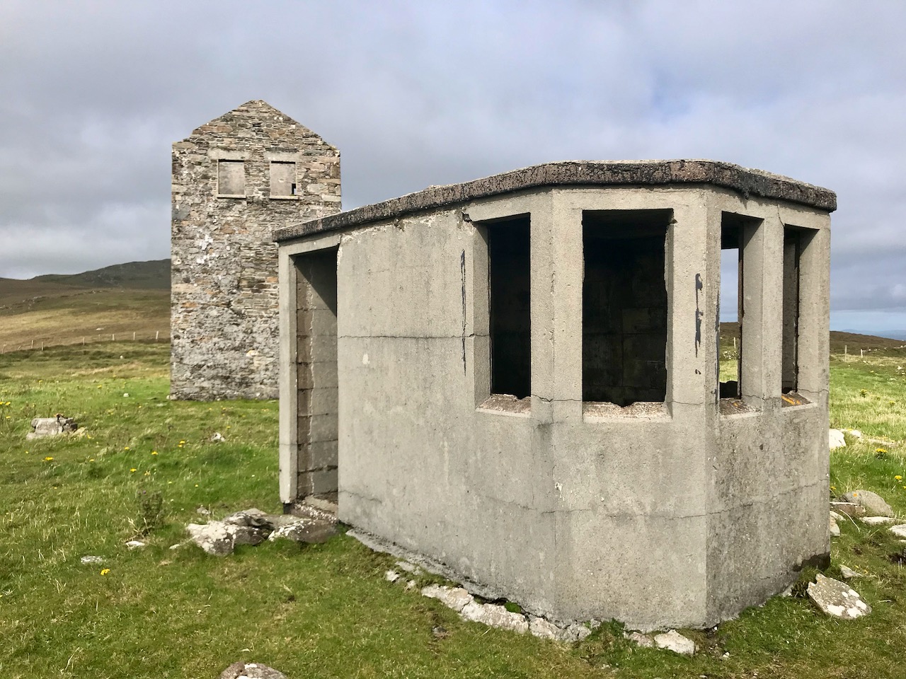
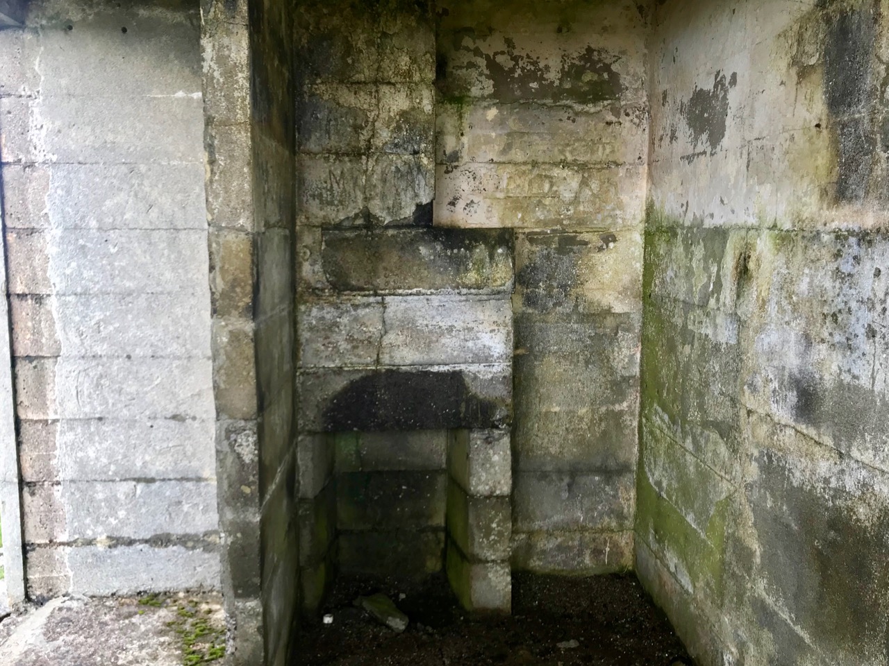
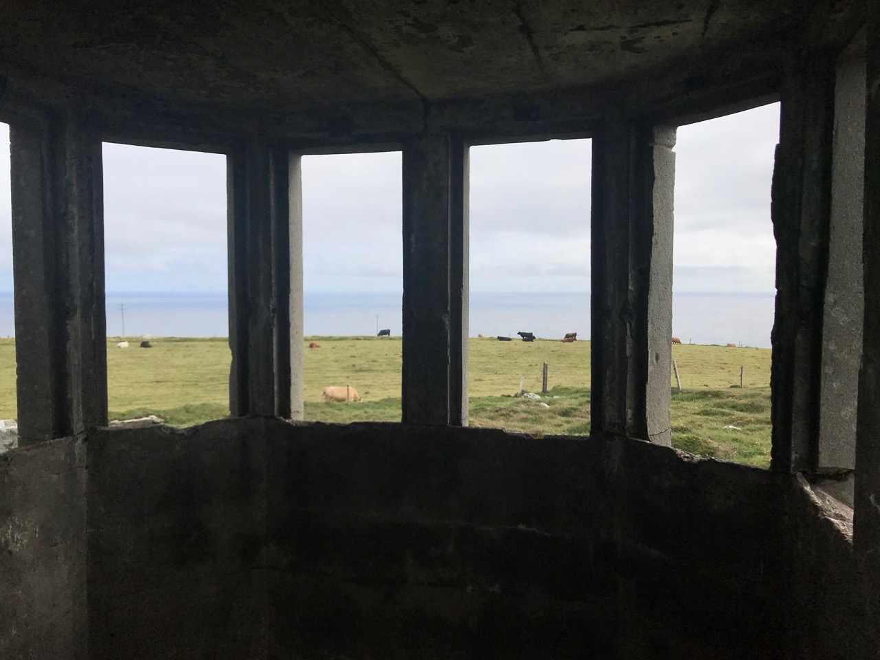
A feature at Cloghane which doesn’t show up on the aerial view is this Second World War lookout post, built close to the early signal tower around 1942. 83 of these structures were built by the Irish Defence Force to monitor activity at sea, many of them relating to Napoleonic-era sites for obvious reasons: these locations had already been selected for their inter-visibility and the panoramic views which they commanded. We have encountered these ‘Emergency-era’ posts previously at Kedge Point, Baltimore, and Ballyroon Mountain, Sheep’s Head (see the full list of links at the end of this post). We shouldn’t get diverted, but if you want to know more about these here is an excellent creative presentation on them carried out in 2014 by Tim Schmelzer of Vienna – particularly, I recommend that you view the first of the videos: it’s wonderful! The LOPs were designed by Howard Cooke RIBA of the Irish Office of Public Works in 1939 and I was fascinated to see that the design achieved recognition (‘posthumously’) from the National Inventory of Ireland Buildings Archive. The posts were cramped, damp and minimal, but apparently at least equipped with small fireplaces:
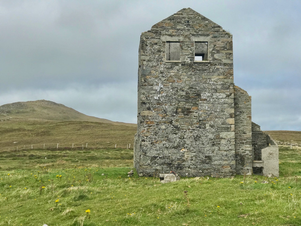
Mizen Head has drama: there is no land beyond this place until you reach America. And, if you are approaching Ireland from the south or west, Cloghane will be your first landfall. But it’s a dangerous coastline, particularly in stormy weather or at times of poor visibility. Hardly surprising, then, that a fog signal station was established on the furthest point in the early 20th century, under the jurisdiction of the Fastnet Rock Lighthouse. This was initially only a foghorn, powered by explosives: a light was not placed there until 1959.
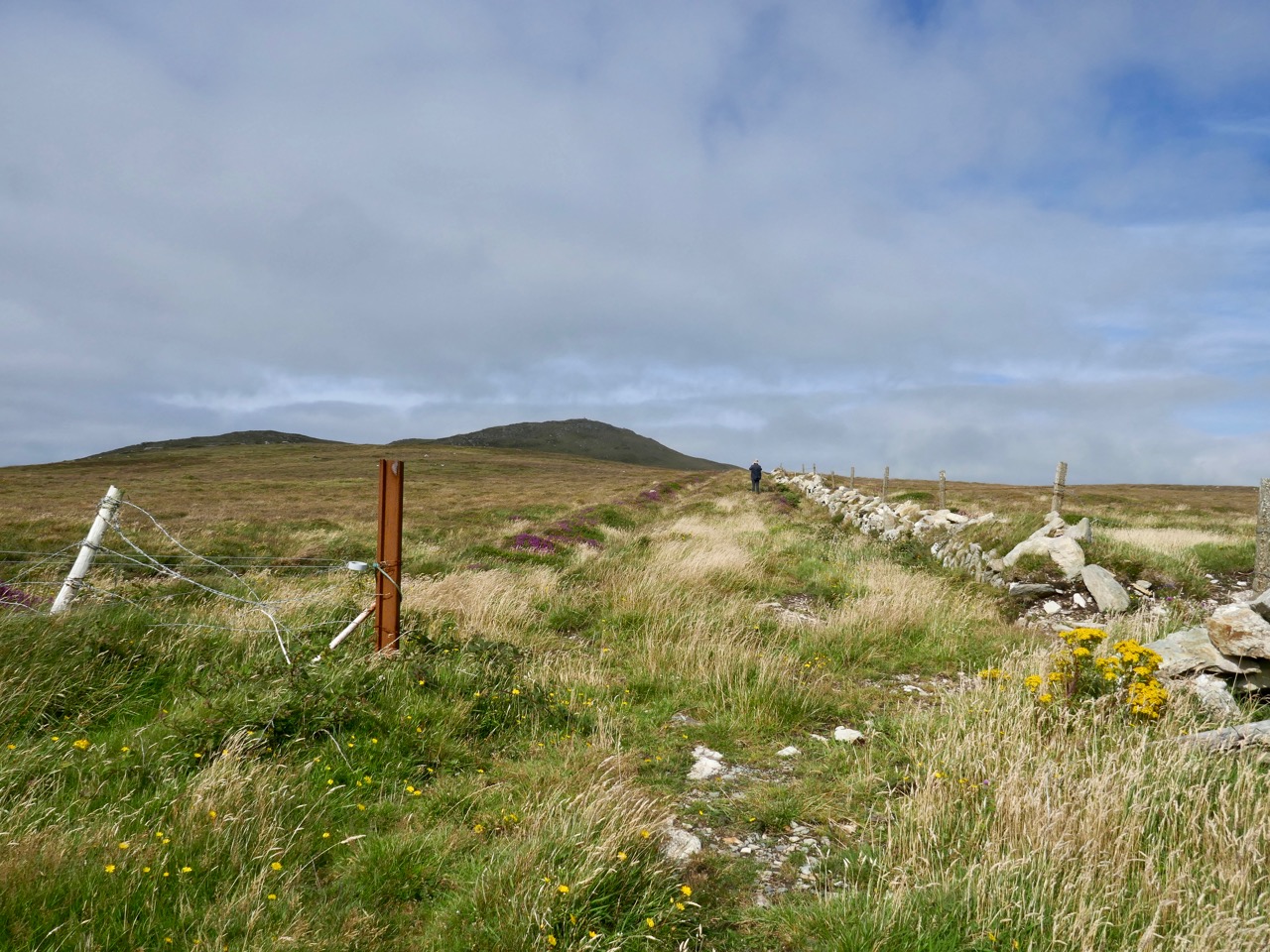
That this signal tower is the virtually identical ‘twin’ of the one we explored at Robert’s Head must be significant, as both are unlike the general pattern we have seen elsewhere: a simple ‘defensible’ structure some 6m square with flat roof, parapets, machicolations and bartizans. My conclusion at Robert’s Head was that the tower had been substantially rebuilt to incorporate upgraded accommodation, perhaps for use by the Coast Guard which was formally established in 1822. Comparing it now with the Cloghane structure it seems more likely that these might both have originated as larger, better appointed buildings. I wonder if this could be because of the relative remoteness of both sites, which would not be easy to populate and service from any nearby community. It was a long trek to Cloghane: the original dedicated trackway, some 2.7 km long is still defined on the landscape, and passes under the 232m high Mizen Peak.
The signal tower at Cloghane is in reasonable condition considering its age and the long period of abandonment (many of the towers went out of use after 1812 although some – possibly including this one – were revived and adapted for use by the Coast Guard). Many visitors have left their marks over the years, and some of the graffiti is intriguing! There is also some vestige of the timber casement frame remaining in one of the window openings: surprising considering the level of exposure to severe storms at this remote site.
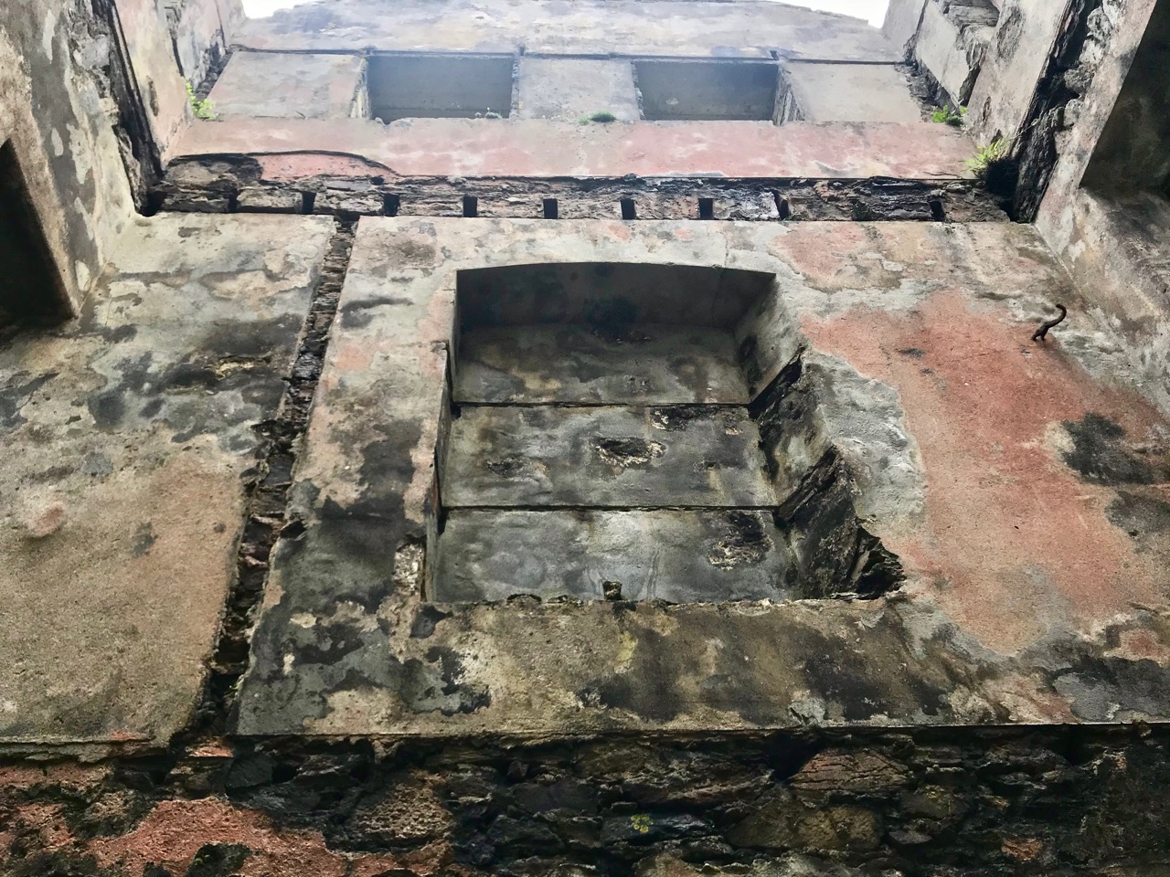
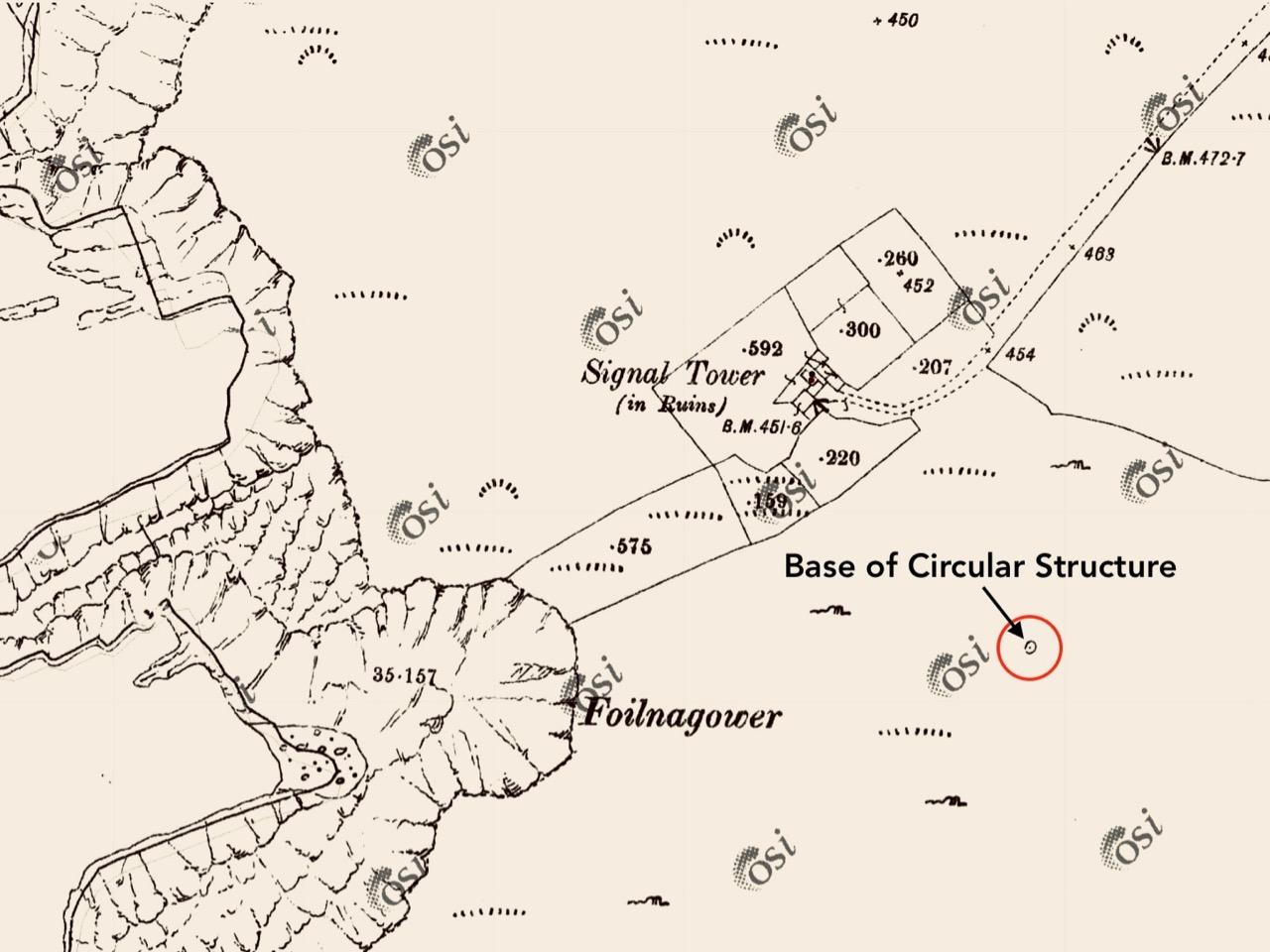
There’s a conundrum at this site that I want to share with you. A little distance to the south of the signal station building is a grouping of stones which are easy to miss at first glance, Have a closer look:
It’s the base of a circular building, or enclosure – a few metres in diameter. Archaeologists amongst you might think in terms of round towers but we can discount that in this desolate location. It does not seem to relate to the signal station buildings, either in terms of architecture (it gives the impression of being rougher and, perhaps, earlier) or usage. With regard to its age, it shows up as a feature on the early 6″ Ordnance Survey map:
What might it be? A mine chimney? But the Mizen Head Copper Mine was a long way from here (refer to the annotated aerial view). The size and shape resemble a gunpowder magazine which we came across at Dhurode Mine, on the north side of the peninsula. The only reason for having a gunpowder store at a signal station would be for a fog signal operated by explosives, as was the case at the Fog Signal Station lower down the Head, built in the early twentieth century. This is clearly much earlier. The dreamer in me pictures, rather, a hut lived in by a medieval hermit, supported by a local monastic settlement to keep beacons burning on Ireland’s headlands in perpetuity. Like the round towers, these were signals to travellers in ancient times that here might be found a haven. For seafarers, perhaps, this one signalled the gateway to a fertile land of enlightenment.
The previous posts in this series can be found through these links:
Welcome to the UCD Library Cultural Heritage Collections blog. Discover and explore the historical treasures housed within our Archives, Special Collections, National Folklore Collection and Digital Library