Garrane Mass Rock

Would we like to see a Mass Rock? The question came from Oliver, and the answer was an enthusiastic YES! (The phrase Is the Pope Catholic may have been employed.) This particular mass rock has been re-discovered in recent times, but its origins are a bit of a mystery. It’s not listed on the National Monuments Record of Sites, and some elements are clearly dated to the early 1950s. There is no defined trail and it would be very easy to get lost, so we were very grateful indeed to our guides, Oliver Farrell and Tracey Daly (above), who live close by and use the trails frequently with their sons. Rio the Wonder Dog accompanied us.

Garrane (it’s Garrane on the OS maps, but often spelled Gurrane, especially locally, and it means ‘grove’) is a townland in the area between Ballydehob and Caheragh. The area is managed by Coillte, and starts among tall trees. As you ascend, though, you emerge into rocky scrub territory that was cleared in more recent times, leaving interesting stumps here and there, like stubby totems.

It’s a lovely hike up (although I’m not sure I could find it by myself again) and soon we were enjoying panoramic vistas across the countryside and over to Roaringwater Bay and Cape Clear beyond. Rio led the way, occasionally disappearing into the bushes but always coming back to his humans to make sure we were keeping up.

At this time the hills are covered in Western Gorse and heathers and butterflies were flitting through the shrubs as we ascended, attracted by the blooming Ling.

When Oliver said we’d arrived, I didn’t see anything except what looked like a pile of stones.. The bracken was everywhere, including within the mass rock itself. Oliver set to work and soon it was revealed – a flat, altar-like surface, with a niche in which a small shrine had been placed.

The shrine – a concrete box containing a statue of the Blessed Virgin Mary, was dated 1954. This marks it as having been inserted into the niche during the Marian Year. Most of the grottoes we see in every village and town across Ireland date to 1954 – for more on this see my post Mary Mary. It’s possible, perhaps, that the mass rock itself was refurbished during this time, to make it suitable to contain the shrine.

What exactly is a mass rock, I hear my non-Irish readers ask. Take a look at my post Were you at the Rock, or go to the wonderful Find a Mass Rock, an excellent site maintained by Dr Hilary Bishop of Liverpool University. 

So we had found the mass rock, but there was more. Tracey and Oliver led us higher still to a spot overlooking the mass rock to a concrete cross. Although much battered, it retained much of the original decoration – glass, clear and coloured, and a small crucifix. Exploring this area, their sons had discovered the mass rock a few years earlier – it had likely been hidden for 50 years by forestry.

We wondered if this was erected at the same time as the shrine had been inserted in the mass rock, in 1954, or whether perhaps it had been erected in 1950, the Holy Year. And all around Ireland in 1950 villages and towns erected hilltop crosses – see my post Sanctifying the Landscape for more about the Holy Year and the Vatican directive that sent Irish communities up their local mountains to set up huge (and in this case not so huge) concrete crosses.

So – this spot was obviously the focus of devotional activity on the early 50s, most likely chosen because of the already existing mass rock. The memory of the mass rock was still held in the community, making it the perfect location for the Holy Year and Marian Year memorials. As we often do, we turned to the Schools Folklore Collection to see if we could find references to a mass rock in the record for the old primary school, now long closed, at Garrane. Here’s what we found:

That’s all, and frustratingly opaque, referring to the mass rock being in a ‘field.’ I would be interested in hearing from local people who might know more about the history of this particular mass rock, so that we can get it listed as a National Monument. If you know anything, please comment below, or get in touch via our contact page.

Rio led us back down the mountain, pausing occasionally to do something I had never see a dog do before – eat blackberries right off the brambles. He beat us to some of the best ones too as we headed down to the tall trees.

The Gurrane and Ballybane Trails Development Group is working on a plan for trails in the area, including this one – good news!

The Mass Rock – revisited

This post was originally published way back in 2014 but I have updated it with a few new photographs and edited the text slightly.

An raibh tú ag an gCarraig? / Were You at the Rock?

nó a’ bhfaca tú féin mó grá / Or did you yourself see my love,

nó a’ bhfaca tú gile, / Or did you see a brightness,

finne agus scéimh na mná? / The fairness and the beauty of the woman?

This beautiful song speaks to a revered tradition in Irish history and folk custom – the mass rock. During the period of the Penal Laws (late 17th and first half of 18th Century) when the practice of Catholicism was outlawed, parishioners would gather at a secret location to attend mass. The priest travelled from community to community in disguise, a lookout was posted, and mass was celebrated on a lonely rock far from the reach of the law. The song encodes the message that the people still find ways to attend mass, despite the harsh prohibition against it.

Mass rocks are often in remote locations, such as this one in Kerry, or the lead image on the Beara

Dr. Hilary Bishop, in her excellent website Find a Mass Rock says, As locations of a distinctively Catholic faith, Mass Rocks are important religious and historical monuments that provide a tangible and experiential link to Irish heritage and tradition. She also points out that, because of the imperative for secrecy, mass rocks are difficult to find.

This stained glass window shows mass at a mass rock, with a lookout posted to keep an eye out for the redcoats

We certainly experienced this when we set out for a day of mass rock hunting. Working from a list generated from the National Monuments Service database we spent a day on the Sheep’s Head and the Mizen and had trouble finding all the rocks on the list. One, if it was still there, had disappeared under impenetrable layers of gorse. A second rock was last recorded in the 1980s: residents were no longer familiar with it.

One of our favourite holy wells, at Beach on the Sheep’s Head, also incorporates a mass rock. Mass is celebrated here every August

Knowledge of mass rocks has passed down from generation to generation. In the deep countryside, the sites maintain a mystique and a sense of the sacred. We’ve written about the mass rock and holy well at Beach, where Mary conjured up a blanket of fog to confuse the English soldiers and allow the priest to escape. At Beach and at our first stop, the mass rock at Glanalin on the Sheep’s Head Way, mass is still celebrated.

The Glanalin rock (above), and the one we visited on the Beara Peninsula, are good examples of the remote locations typical of many mass rocks, high on a hillside or hidden in an isolated valley. You can picture the procession of worshippers, in ones and twos, slipping silently through the bracken, pausing to make sure they are not being watched, climbing higher, following an overgrown trail, arriving at the meeting place where the hushed crowd awaits the arrival of the priest.

One of the rocks we found (above) looked for all the world like a fallen standing stone – and that’s probably what it was. (I wonder if I should go to confession, though – I’m sure that sitting on a mass rock would qualify as at least a venial sin.)

A mass rock that is easily visited is the one at Cononagh Village (above), right at the side of the main road into West Cork, the N71. This site is beautifully maintained – Cononagh is obviously proud of its heritage: signage and flowers invite the passerby to take a closer look.

The mass rock we visited last year, at Foherlagh, has a commanding view of the surrounding countryside. This one even had a small scoop-out in the rock, identified as a holy well

Another easily accessible site is Altar, at Toormore. This is a wedge tomb, probably over 4,000 years old and excavated in 1989. It remained in use through the Bronze Age and into the Iron Age. Dr. William O’Brien, in Iverni, says of this site: …over time this tomb came to be regarded as a sacred place, housing important ancestral remains in what was a type of community shrine. How fitting, then, that the flat capstone of the Altar wedge tomb became, in the Penal Days, a mass rock. And how intriguing to think of the continuation of this sacred space over the course of thousands of years.

But perhaps our favourite of all the mass rocks we have visited is the one at Castlemehigan. We wrote about it here. It started out life as a cupmarked stone perhaps in the Neolithic, then probably got converted into a bullaun stone in the Early Medieval period, before finally serving as a mass rock – and it has all the stories to go with its long history.


Saints and Soupers: the Story of Teampall na mBocht (Part 2, The Catholics)

Most of what we think we know about traditional Catholic practice in the period leading up to the famine is wrong. The religious environment of the first half of the nineteenth century in Ireland was very different from what we experience today, and different too from what we understand as ‘traditional’ Catholicism and Protestantism in Ireland. In imagining this period we have been over-conditioned by our own experiences of Ireland in the twentieth century – a country in which each town or village was dominated by a large Catholic church, in which the priest was a man of great influence, the population (90% Catholic) went to mass every Sunday and participated in sodalities, novenas and retreats regularly, and in which children attended schools where Catholic Doctrine was integrated into the curriculum. It’s a picture of a devout, disciplined, orderly and mono-cultural society. Meanwhile, the Protestants attended a mysterious ‘service’ (mysterious because it was a sin to go inside a Protestant church), practised birth control, often spoke in a different accent from us, and appeared to us not to take their religion as seriously as we did. None of this, it turns out, was the norm in most of Ireland, and definitely not in the isolated parishes of West Cork, in the period leading up to the famine. Let’s look at the situation for Catholics first, as we lead up to the story of Teampall na mBocht (link to Part 1 at the bottom of this post).

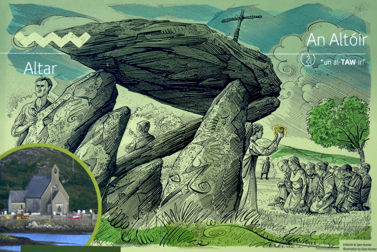
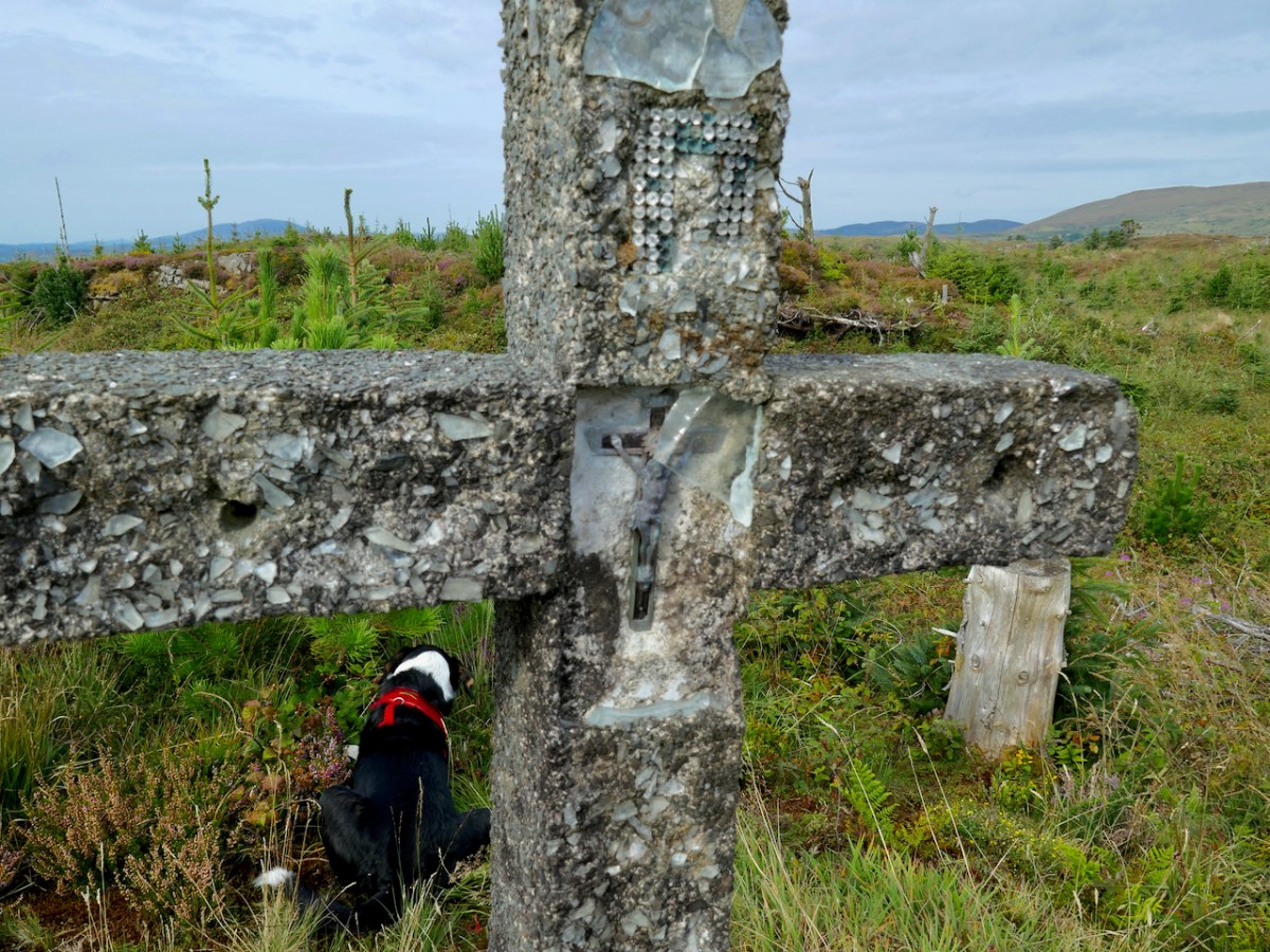
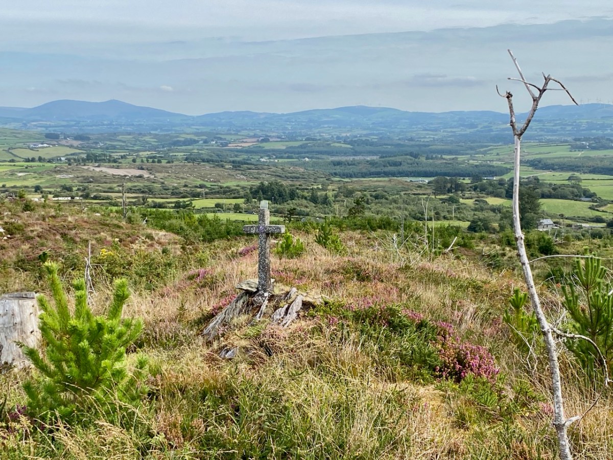
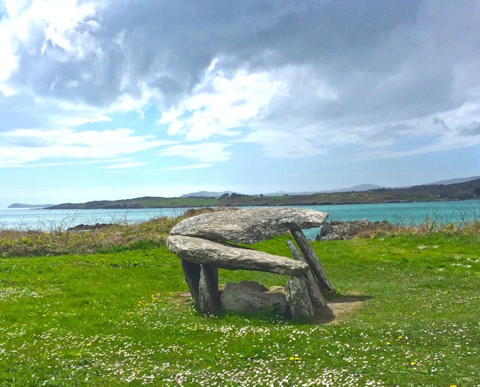
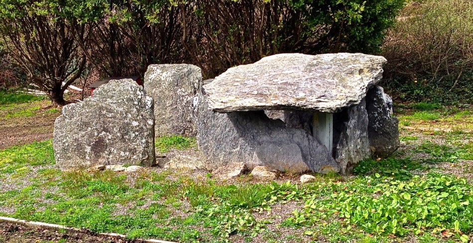
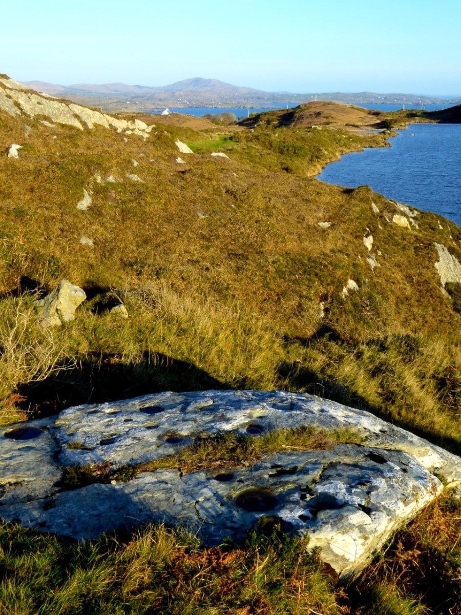
The Information post for the Bronze Age wedge tomb at Altar shows a scene in which the wedge tomb has been repurposed as a mass rock

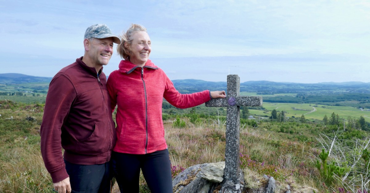
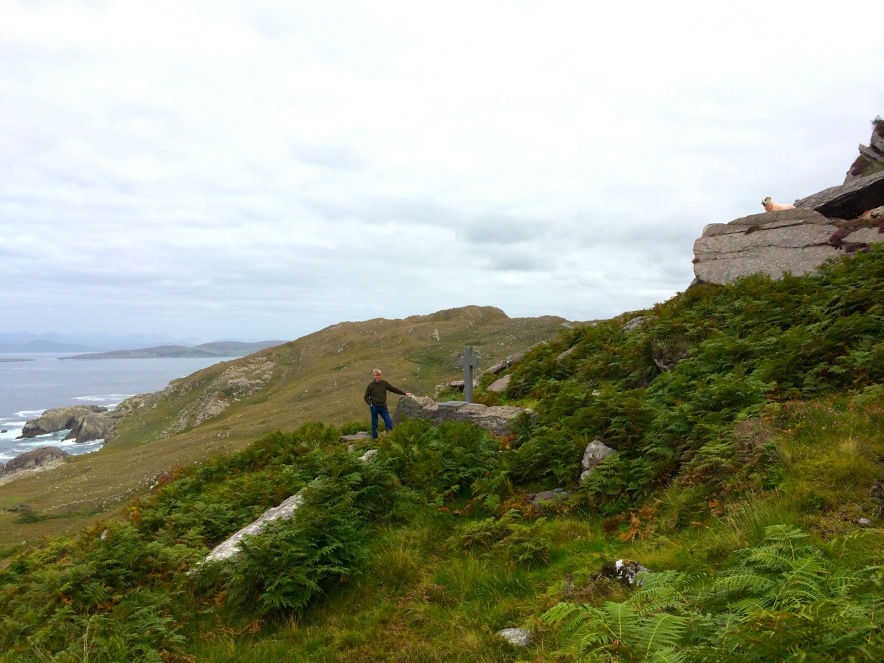
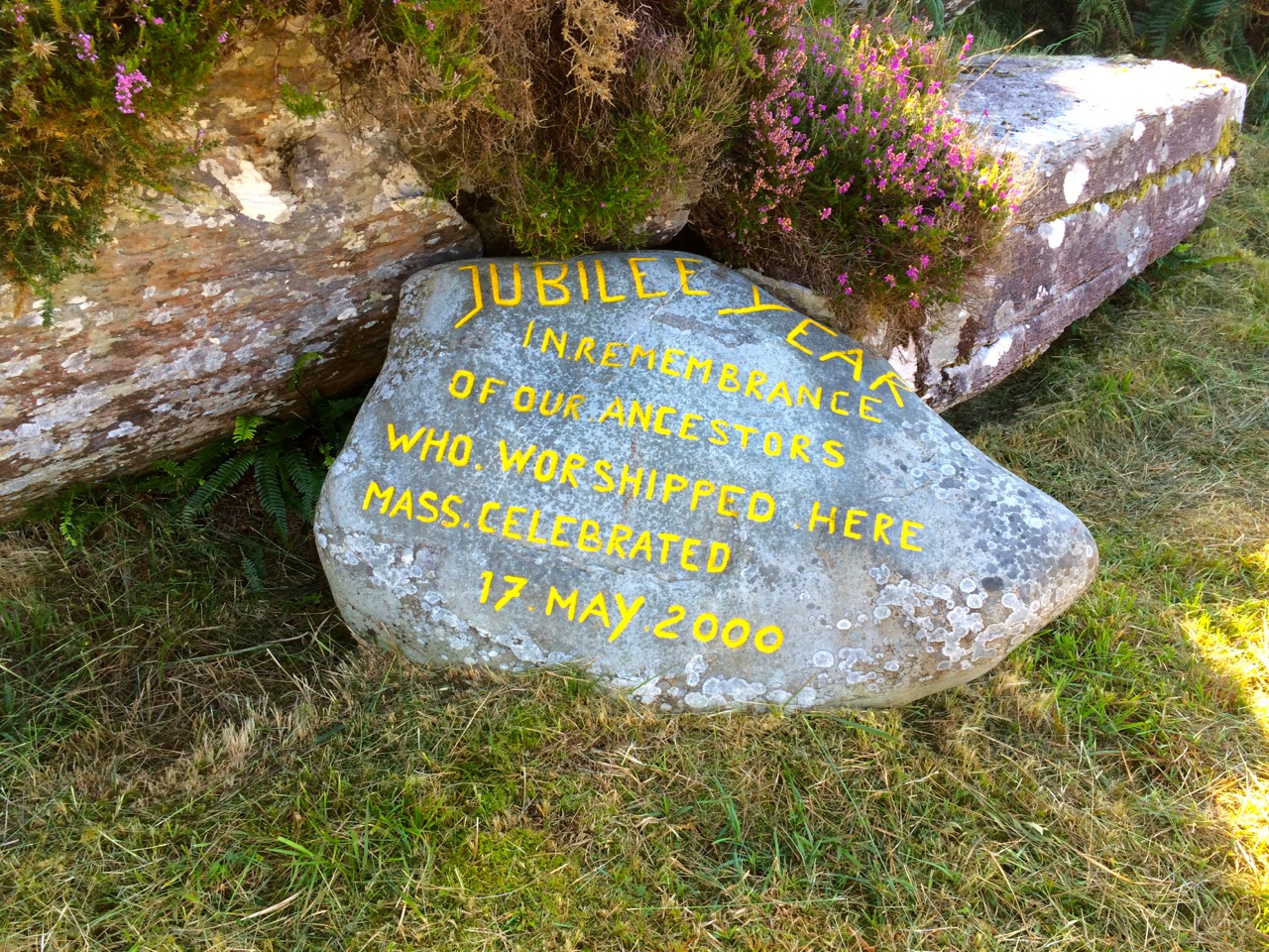
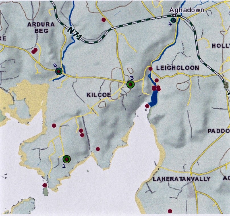
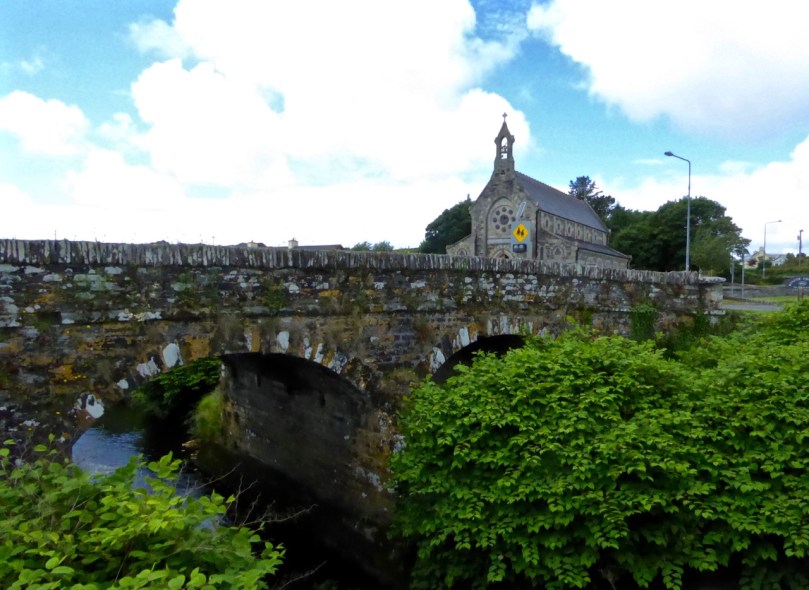
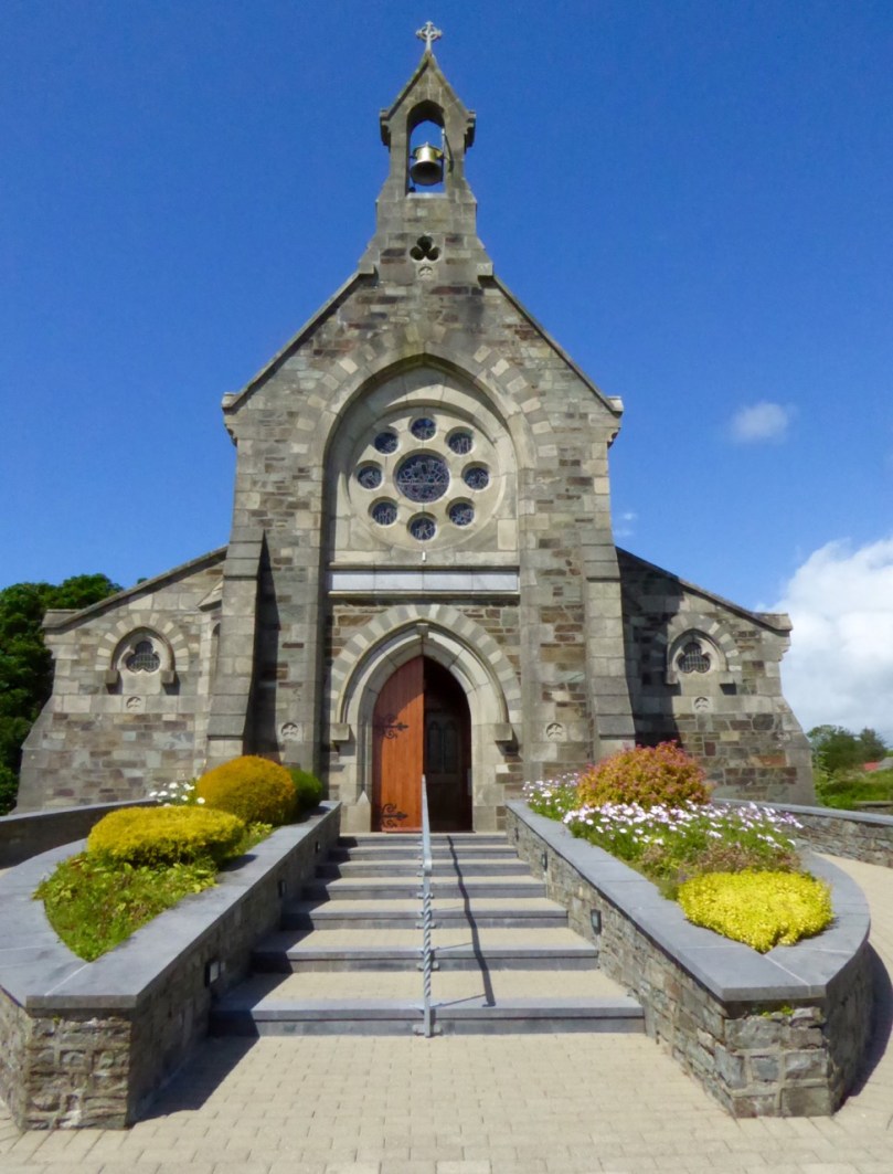
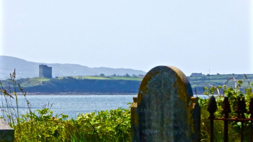
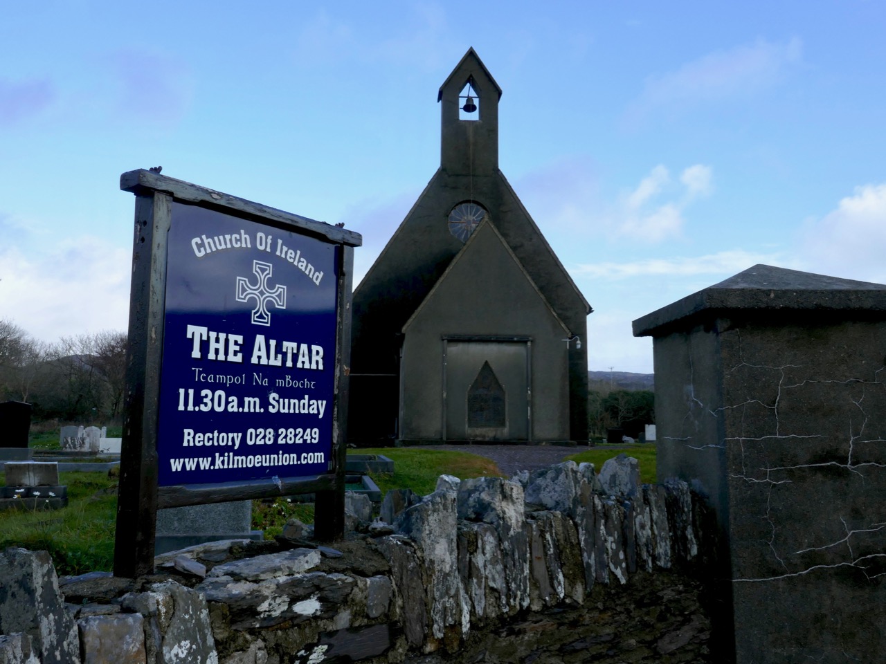
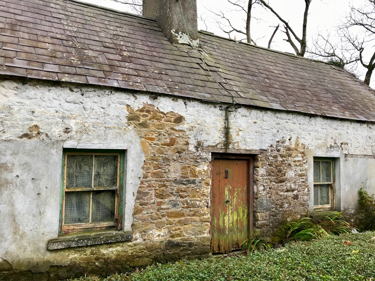
Catholic Emancipation, won by Daniel O’Connell in 1829, finally lifted the numerous legal restrictions under which Catholics in Ireland lived their lives since the enactment of the first and subsequent Penal Laws from the early seventeenth century. The legacy of those laws was fully and poignantly alive in Kilmoe Parish – the townland in which Teampall na mBocht was built is called Altar, after a prehistoric wedge tomb across the road from the church which had served as a Mass Rock. It was a powerful symbol, a reminder that Protestants had been free to build churches and hold services under shelter, while Catholics were not. An alternate name for Teampall na mBocht is The Altar Church (see lead image)

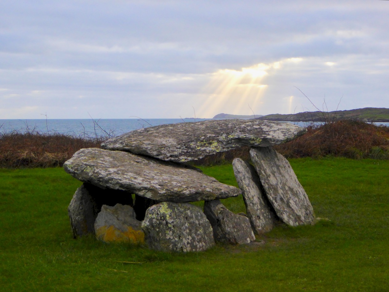
The Bronze Age wedge tomb known as The Altar

While some of the worst constraints of the Penal Laws had been lifted in practice during the 18th century, the Church of Ireland remained the official Established Church. This meant that the whole population was required to support it through ‘tithing’ – everyone, no matter their religion, had to pay a tax equal to one tenth of their earnings. Especially after Catholic Emancipation, the inequity of this led to several years of conflict known as the Tithe Wars. In 1838 an Act of Parliament changed the way tithes were collected. While this had the effect of dampening the worst of the conflict, it increased rents, since tithes were passed on to landlords.

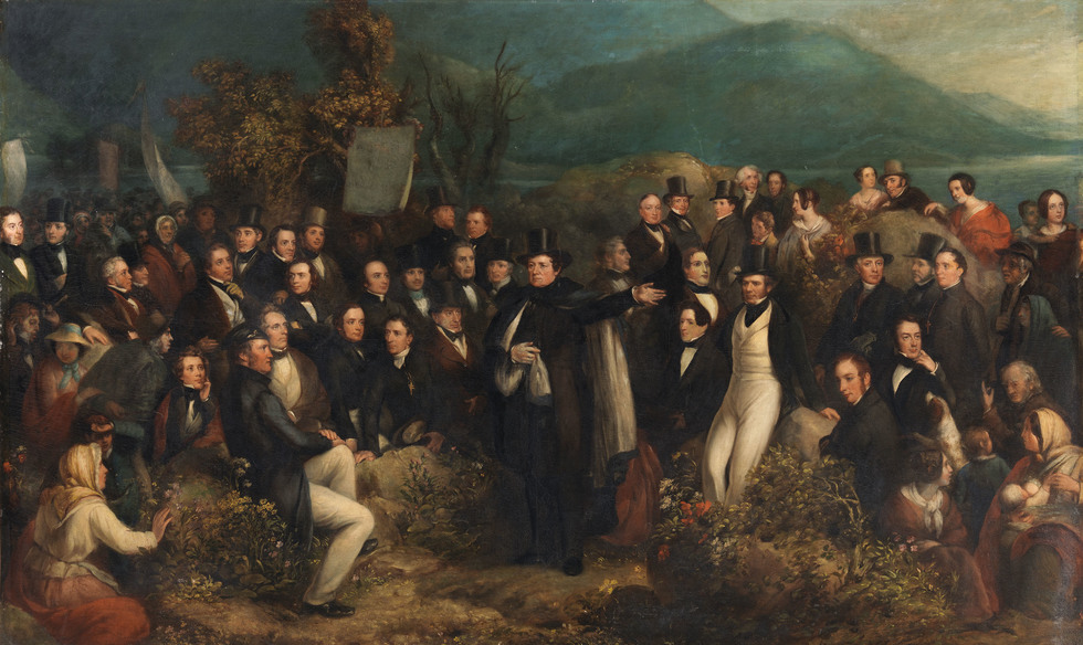
Daniel O’Connell campaigned vigorously against Tithing – here he is depicted at one of his Monster Meetings

The fact that the Church of Ireland was predominantly the church of the ruling classes, the landlords, the government officials and the wealthier sections of society served to underscore and deepen sectarian divisions and mistrust between the communities. The uneven distribution of wealth was stark – while there were certainly poor Protestants, and wealthy Catholics, Catholics in general were vastly over-represented, as a percentage of the overall population, in the ranks of the impoverished.

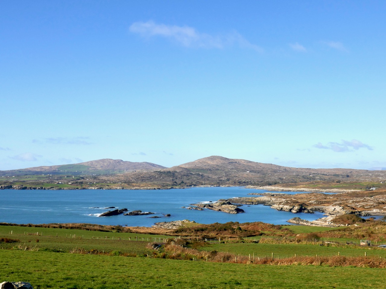
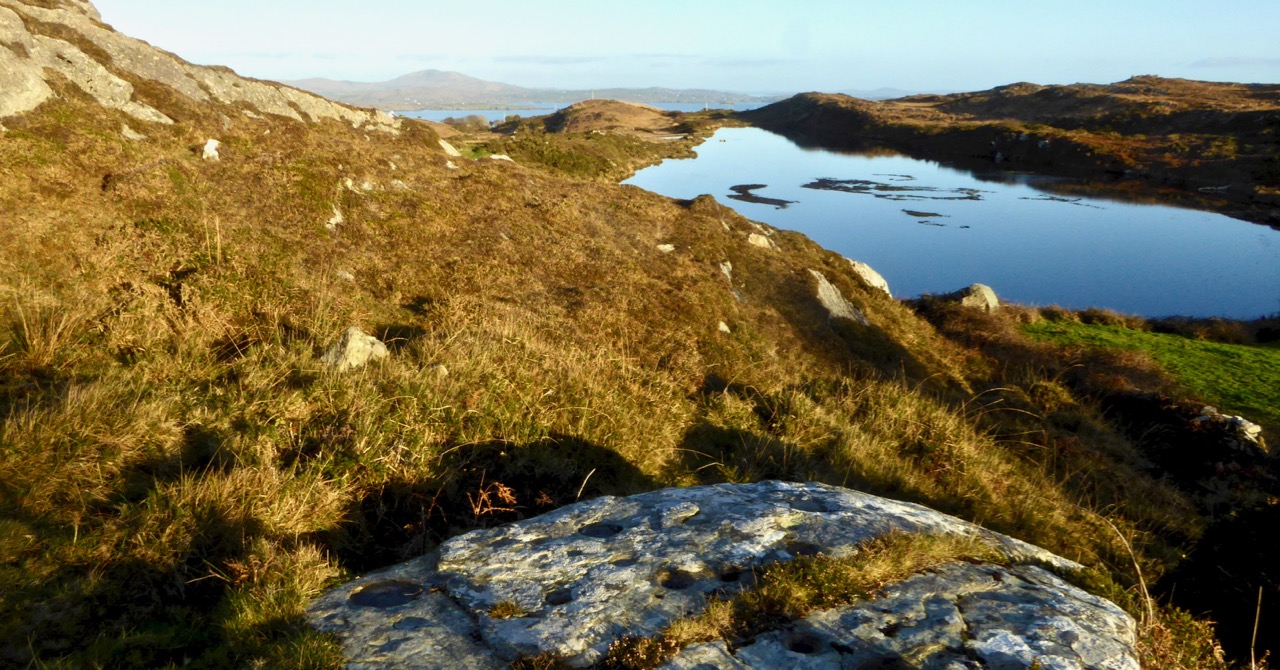
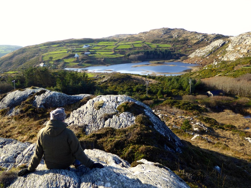
Toormore Bay, the scene of the action of this story. This photograph illustrates well how much of the land was rocky and barren

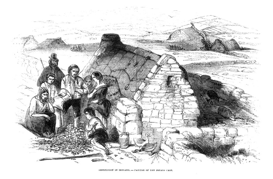
Poverty was, perhaps, the defining condition of the majority of the Catholic population of the Mizen Peninsula in the period leading up to the famine. There were few proper churches and few priests. Accounts exist of open air masses, attended by great numbers, kneeling reverentially in the mud and rain (see final image). Others crowded into whatever miserable huts or mass houses there were. Most stayed away – mass attendance hovered between fifteen and forty percent. Stories abound of those who could not go because the family did not have enough clothes between them to send even one person.

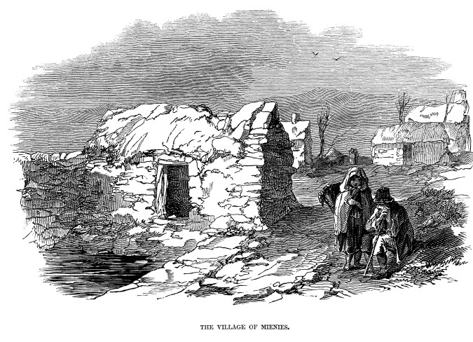
James Mahony’s drawing of the Village of Mienies, near Drimoleague, showing the extreme destitution of the inhabitants

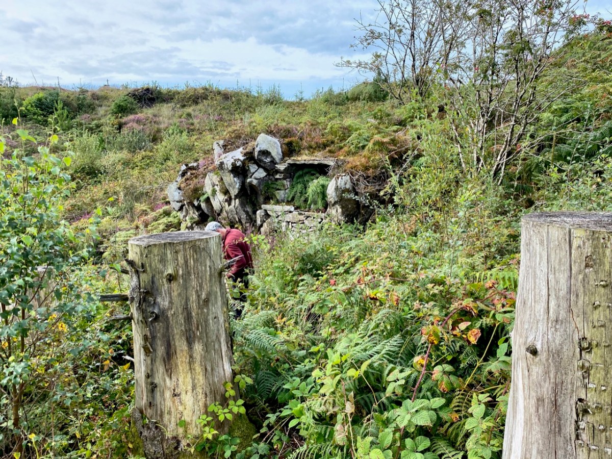
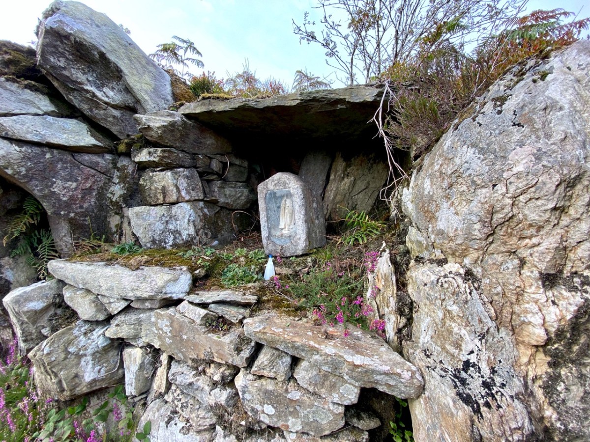
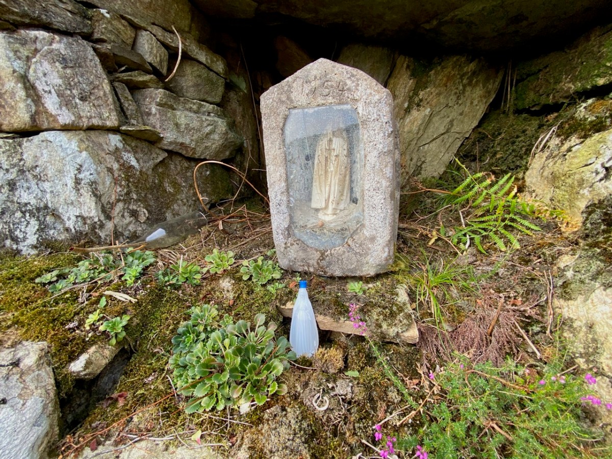
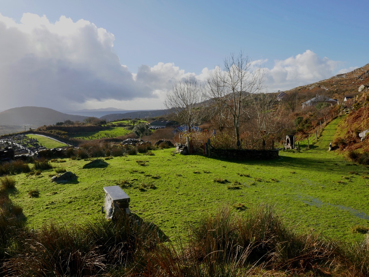
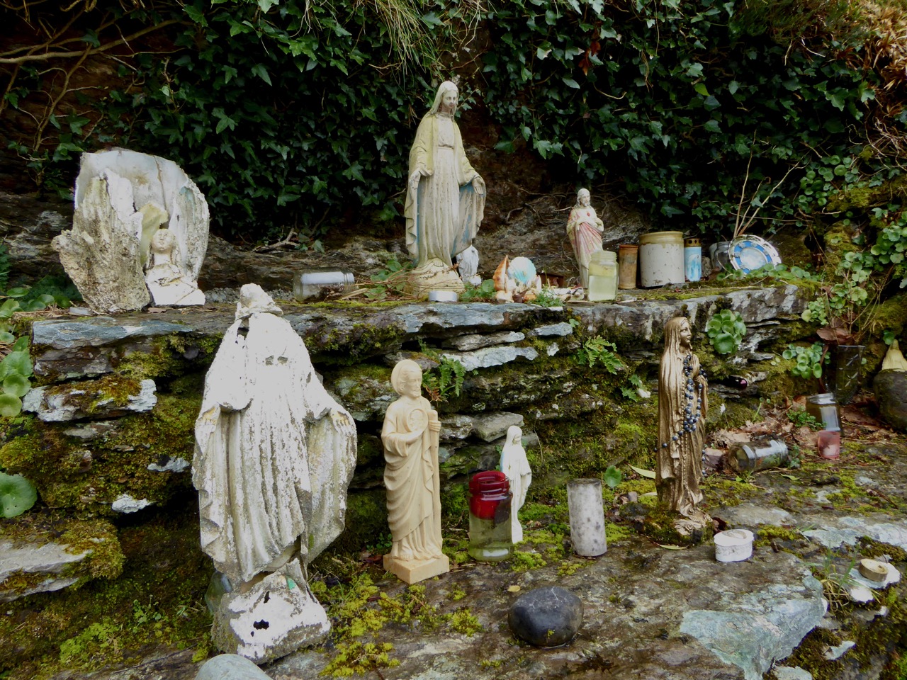
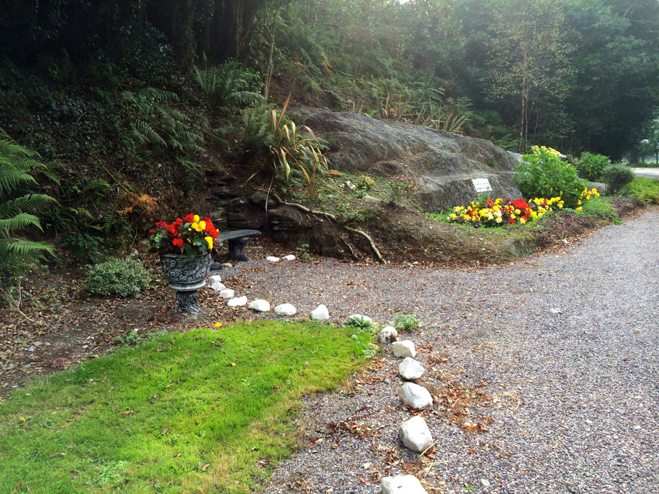
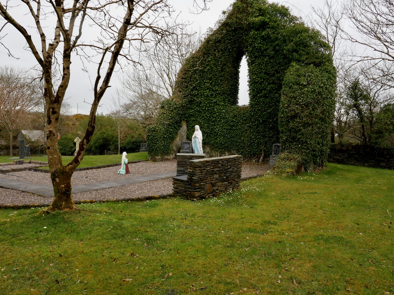
Despite this, new Catholic churches were starting to be built, some where none had existed before and some to replace tumbledown structures. Because of lack of money to erect buildings to withstand the elements, some, in turn, became unfit for purpose fairly quickly, such as this one (below) near Roaringwater Pier, now reimagined as a grotto.

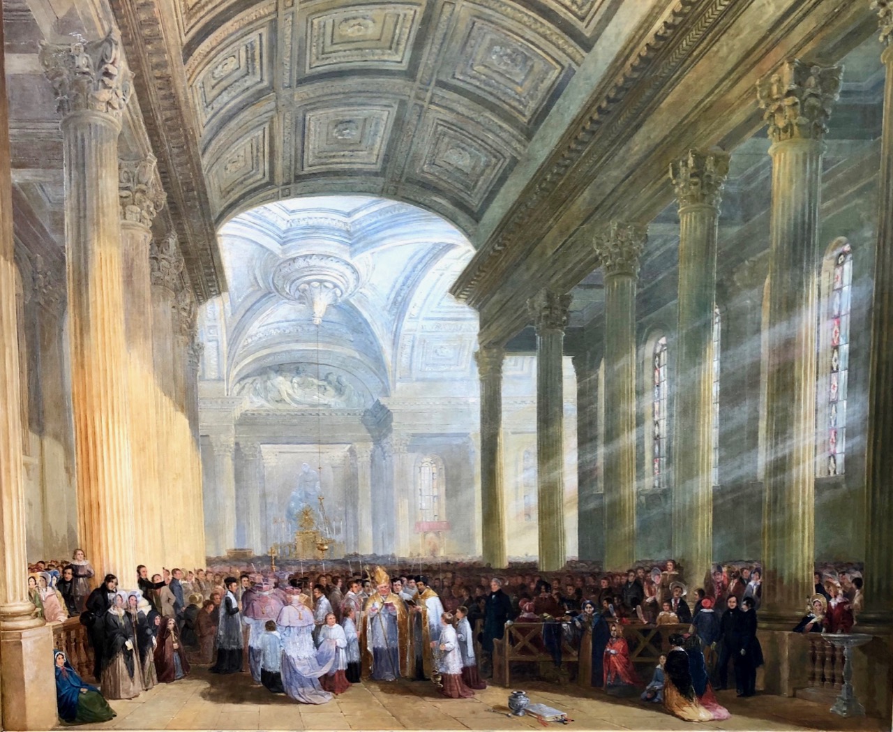
Wealthy Catholics in Cork City built the magnificent Church of St Mary on Pope’s Quay in Cork, opened with great fanfare in 1839. James O’Mahony, who became known later for his harrowing sketches of the famine in West Cork, painted the opening in all its magnificence (below). This work was exhibited in Skibbereen as part of the Art and the Great Hunger Exhibition this summer.

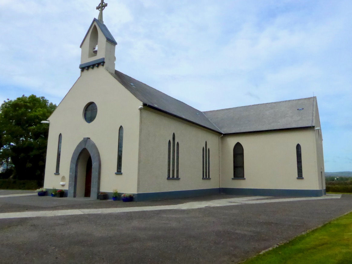
But most Catholic churches erected during this period were far simpler. Five were built in all on the Mizen. St Brigid’s in Ballydehob is a good case in point. Begun in 1825, before Emancipation, it was funded through a Herculean collection and subscription effort, with much of the money coming from local landlords who were not themselves Catholics. While the presence of a church increased mass attendance, levying an entrance charge was customary, both to repay loans for building the church and to maintain the priest. Many could not afford to pay this entrance fee so either stood outside for the duration of the mass, or stayed away.

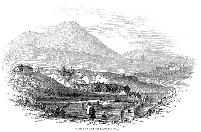
Ballydehob in the 1840s showing the Catholic Church on the hill. Construction was solid enough that the church remains to this day, little changed (see next image)

In far-flung areas ‘dues’ were also to be paid to priests who rode in at Easter and Christmas on horseback to say mass and hear confessions. Fr Hickey in Famine in West Cork refers to the account of Father Michael Collins of Skibbereen: Many confessed but paid nothing…In brief he was admitting that the priests were losing contact with some of their flock, especially the poor who could not afford a half penny for Sunday Mass.

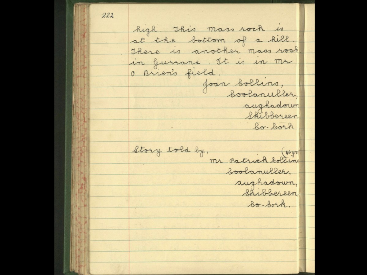
So if poor rural Catholics were not always able to attend mass, how did they stay connected to their idea of themselves as Catholics and how did they participate in religious observances? The answer appears to lie in a host of practices that centred on feast days, such as St Patrick’s Day, May Eve or Halloween, in ‘patterns’ (the complex customs that accompanied a visit to a shrine or holy well), in ritualised wakes and funerals, and in a vast set of semi-religious/semi-folk beliefs (often based in pre-Christian traditions) that influenced daily actions. Many of these beliefs and practices continue to resonate today, especially in country areas – just take a quick browse through Holy Wells of Cork.

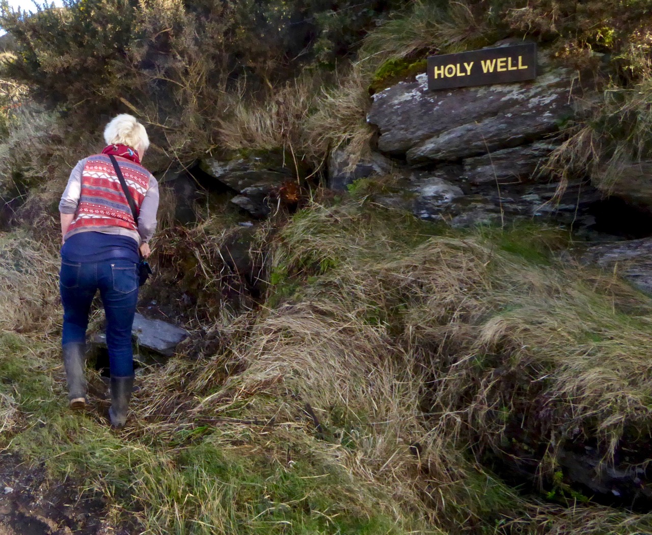
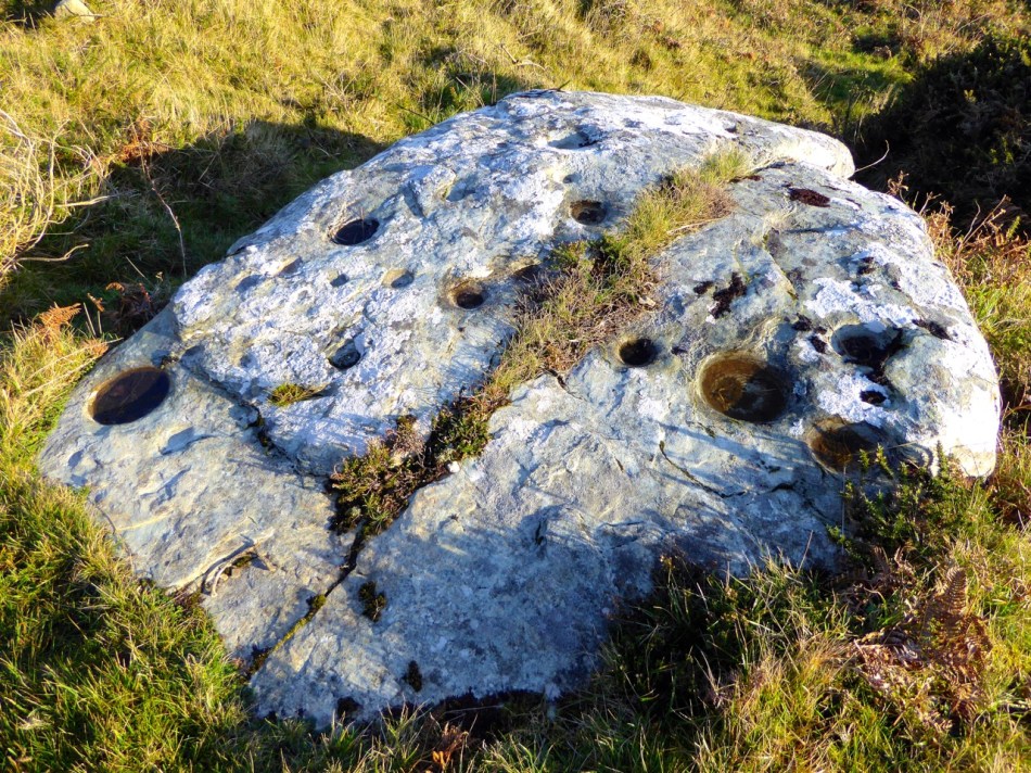
This holy well, being inspected by Amanda for her blog, is at Callarus Oughter on the Mizen

At the same time, National Schools were slowly replacing the hedge schools to provide basic instruction to the children of Ireland. The National School System was established in the aftermath of Catholic Emancipation to provide education to all children, regardless of religion – it was emphatically and specifically non-denominational in its intent. However, it didn’t work out that way. Herein lies one of the great tragedies of Irish history – the failure to establish a non-sectarian national education system.

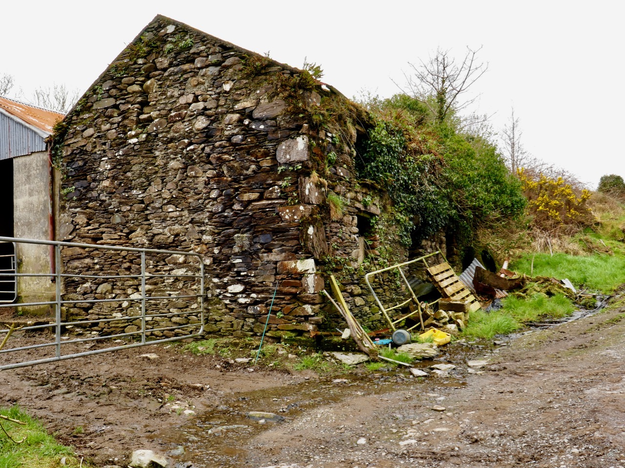
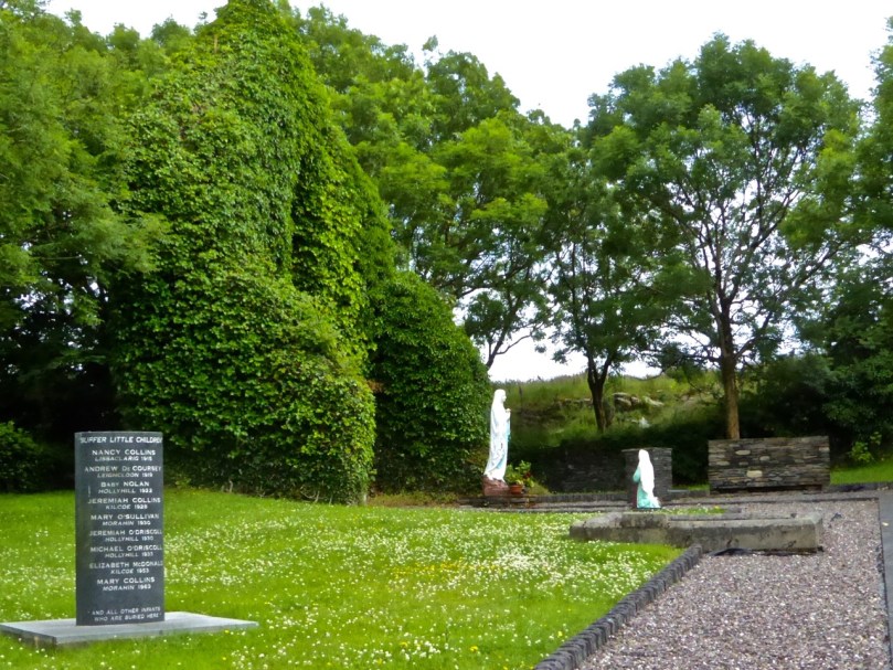
All that’s left of the Boys’ School at what was once the thriving community of Roaringwater

While Catholics, on the whole, seized upon the opportunities provided and threw themselves enthusiastically into the task of raising money and building schools (to be open to all religious persuasions), Protestants went into near-panic in their opposition, mainly focussed on the prohibition of teaching the Bible as part of the curriculum. Opposition rallies and meetings were held all over the country and several organisations were established to provide alternate education – but more about this in Part 3. Since parents had to pay to send their children to the schools (there was no guaranteed external source of funding to cover all costs) the schools benefited mostly the better-off and the poorest children did not receive the education they so badly needed.

This school at Clonmeen, near Banteer in North Cork, was built in 1837 to replace the previous hedge school. It served as both a dwelling for the teacher and a school. Few of these original very early schools have survived

What we see in the Mizen in the first half of the nineteenth century, then, is the antithesis of that disciplined and orderly ‘traditional’ Catholic society that I described in the first paragraph. Among the poor people of the Mizen (and the majority were poor) illiteracy rates were high; vast numbers lived on the knife-edge of starvation and could afford neither mass nor school; Catholicism, although fiercely adhered to, was for most people a haphazard collection of beliefs and customs. But the happenings at Teampall na mBocht (yes, we’re still getting to that) were one of the catalysts for change in the Catholic Church, change that led to what we now think of as the ‘traditional’ Catholicism which is very much a post-famine phenomenon in Ireland.

The Protestant Churches, too, had experienced some seismic shifts in philosophy and practice in the same period. In Ireland, those changes in direction set them on an inexorable collision course with their Catholic neighbours. The ultimate catalyst for this clash was the famine. As some clergymen saw it, those impoverished, ignorant, superstitious, underserved, non-church-going slaves of ‘popery’ were in need of salvation as much as food. Next week, we’ll get to know what was going on with that side of things.

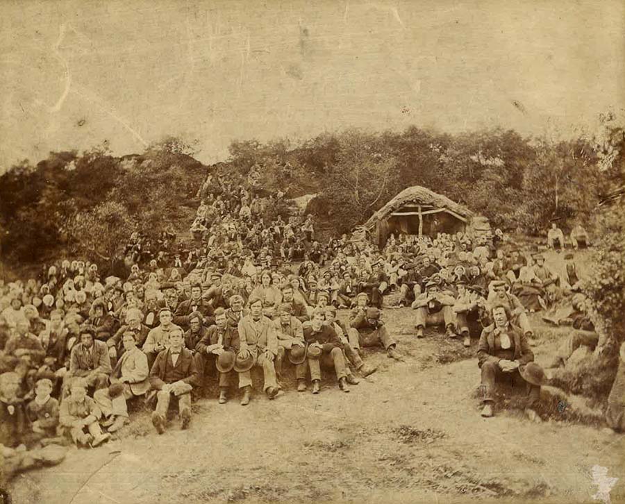
People gathered for an outdoor mass in the 1860s in Donegal. Apart from the decent clothing, this scene may have come from the 1840s on the Mizen

This link will take you to the complete series, Part 1 to Part 7

A Tale of Four Churches

Kilcoe Medieval Church

Kilcoe Medieval Church

Kilcoe is a magical place. The story of its four churches leads us from the dawn of Christianity in Ireland through turbulent times and many centuries when religious differences and sectarian strife marked all aspects of life in Ireland.

The four churches: 1, Kilcoe Medieval Church  2, Mass Rock 3, Kilcoe 19th Century Church 4, Kilcoe Modern Church of the Most Holy Rosary

The four churches: 1, Kilcoe Medieval Church. 2, Mass Rock. 3, Kilcoe 19th Century Church. 4. Kilcoe Modern Church of the Most Holy Rosary

We love going down to the Medieval church at Kilcoe or wandering the boreens along the Roaringwater River. Those boreens are now part of the Fastnet Trail Network and last weekend, at the Launch, we were treated to a talk about the locality from Fr Patrick Hickey, Parish Priest of Timoleague and a noted scholar of West Cork History. This blog post was inspired by that talk – thank you, Fr Hickey!

Inside the church, showing the ogival windows, the altar, piscina or stoup, and a small recessed cupboard

Inside the church, showing the ogival windows, the altar, piscina or stoup, and a small recessed cupboard

Kilcoe gets its name from St Coch, a nun said to be a colleague of St Ciarán of Cape Clear, who preached Christianity in Ireland before St Patrick, in the 5th Century. It is possible she founded a church here, but what we do know is that one was built in Medieval times – a building that still exists although the ivy is doing its best to take it over.

It’s a beautiful and atmospheric place, on the water, overlooking Roaringwater Bay. Two castles are in view: Kilcoe and Rincolisky, a McCarthy and an O’Driscoll Castle respectively. Each has a fascinating history that deserves a post of its own sometime. Some special features remain in this ruined church – windows with carved ogees, a lovely arched doorway, a piscina (for washing vessels) or stoup (for washing hands), a recess for storing vessels and the remains of a possible altar.

We don’t know exactly when this church was built or by whom, but we do know it was in ruins by 1615. Perhaps it was destroyed by the same forces that laid siege to Kilcoe Castle after the Battle of Kinsale in 1601 – a period that marked the end of the Old Gaelic Order in West Cork.

The Medieval church, with Kilcoe Castle in the background.

The Church, with Kilcoe Castle in the background

The rise of the Protestant Ascendancy class in the aftermath of that fateful battle privileged the Church of Ireland (transplanted Anglicanism) over the Catholic faith and a series of new laws, gradually getting harsher, were designed to suppress ‘Romanism’. This culminated in the enactment, in 1695, of the infamous Penal Laws. While attendance at mass was initially tolerated, churches could only be built from wood and away from roads. Eventually, priests were expelled from Ireland and after that mass had to be held in secret, with priests moving from hiding place to hiding place. At Roaringwater Pier Fr Hickey talked of the typical cargo of the smuggling ships that plied their trade from there: each ship to arrive from France would be carrying tobacco, brandy – and a priest!

From this period we find the Mass Rocks scattered around rural Ireland, identified on the basis of local tradition. The one at Ardura Beg is just up from a tiny pier that would have offered possibility of a quick escape. Many stories have come down of lookouts warning of the approach of the ‘red coats’ and the miraculous ways in which priests would make their escape. (See here and here for examples.)

Sheona and Amanda examine the mass rock at Ardura Beg

Sheona and Amanda examine the mass rock at Ardura Beg

Places of worship must be located where they are accessible and the first two are close by the sea, which afforded the easiest travel routes in Ireland for most of its history. However, roads were constructed eventually and the next two churches were located along these new routes. The first one, we’ll call it the Old Church, was built along the new road that led from Skibbereen to the Beara Peninsula. After 1778 the anti-Catholic laws were gradually relaxed, although it was not until 1829 that full Catholic Emancipation was won by Daniel O’Connell. The Old Church was probably built around 1800 and was a simple ‘barn-style’ edifice which served an impoverished and famine-stricken populace for a hundred years.

Left, the Old Church near Roaringwater Pier. Right, an example of a simple ‘barn style’ church in West Cork

By the turn of the 20th Century it was deemed unfit for purpose. Nowadays it is a gentle green space, lovingly tended and in use as a grotto. Children were buried there – it was not a cillín, but a consecrated graveyard – and a memorial remembers them now.

Grotto and Chirdren Memorial. A place for contemplation

Grotto and Children’s Memorial. A place for contemplation

Catholic Emancipation ushered in a long period of church building by the newly-confident Catholic majority. The new road from Skibbereen to Ballydehob was constructed at the end of the 19th century and the New Church was built there in 1905, right beside the bridge over the Roaringwater River.

Kilcoe Church and Bridge

Bridge over Roaringwater River

The two styles of churches common at the time were Neo-Gothic, Influenced by continental cathedrals, and Hiberno-Romanesque which took its inspiration from the Early Medieval Romanesque style of Old Ireland and featured wonderful doorways and round towers. The Kilcoe New Church, the Church of the Most Holy Rosary, was built in the Neo-Gothic style, with a large rose window at the eastern end.

Kilcoe, Church of the Most Holy Rosary

Kilcoe, Church of the Most Holy Rosary

Originally the side-aisles did not have seats – poorer people could stand there for mass, while those who could afford a penny would occupy the pews. As the church fund grew, thought was put into ornamentation and stained glass was commissioned for several windows. The rose window was executed by the Harry Clarke Studios in 1943 and shows scenes from the life of Christ and of Mary.

The Rose Window, by the Harry Clarke Studio

The Rose Window, by the Harry Clarke Studio

The Altar and side windows were the work of Sarah Purser’s Tower of Glass. The choice of stained glass – from Dublin-based Celtic Revival artists rather than the English or Continental firms that supplied most church glass at the time –  was a choice that demonstrates the nationalistic feelings that were rife in West Cork at the time.

Irish History is written large on her landscape. In this one small area – these sites are within a couple of kilometres of each other – we see encapsulated sixteen hundred years of history, starting with St Coch and ending with the latest incarnation of a church at Kilcoe. Their beauty and their peaceful settings have been hard won. They should serve to remind us that peace and tolerance must always be cherished and safeguarded.

Rincolisky Castle from Kilcoe Medieval Church

Rincolisky Castle from Kilcoe Medieval Church

Wedge Tombs: Last of the Megaliths

Altar Wedge Tomb on The Mizen Peninsula

Altar Wedge Tomb on The Mizen Peninsula

In Ireland, the tradition of building megalithic (mega=large, lithos=stone) structures that included chambers to house the dead (such as the Boyne Valley Passage Grave complex, or the Court Tomb of Creevykeel) belongs to the Neolithic period, which ended around 2500 BC. About this time, a new style emerged of stone ‘galleries’, oriented towards the setting sun. Their distinctive shape – narrower and shorter at the eastern end – gives them their common name, wedge tombs. This tradition appears to have flourished for about 500 years.

Altar, side view

Altar, side view

In other areas of Ireland wedge tombs were often covered by a mound, but there is little evidence for this in West Cork. The closest parallel to wedge tombs outside of Ireland are in Brittany where allées couvertes date from this period. They are associated in some parts of Ireland (although once again not in West Cork) with Beaker pottery, a distinctive kind of vessel widely distributed across Western Europe. This was a time in which the population was expanding, farming practices were intensifying and a brand new technology was being introduced – it was the dawn of the Copper Age. Thus, we can speculate that wedge tombs mark the confluence of two forces: the new continental technologies of pottery and metalworking and the indigenous tradition of erecting megalithic chambered tombs.

Wedge tombs occur mostly in the western half of Ireland, including many in County Clare such as the Parknabinnia tomb pictured below.

 The largest wedge tomb in Ireland is near Fermoy, north of Cork City. It is typical of many Irish wedge tombs in featuring double walling, evidence of a surrounding cairn, and a sealed end chamber. Interestingly its name, Labbacallee, means the Hag’s Bed – the hag, or wise woman crops up frequently in Irish mythology.

In contrast to Labbacallee, wedge tombs in West Cork are generally smaller and simpler, comprising only one chamber and lacking a covering cairn. However, the distinctive wedge shape is preserved along with one other defining feature: wedge tombs are invariably oriented towards the setting sun. The funerary rite was that of cremation. Votive offerings of white quartz pebbles and small deposits of metal have been found in excavations.

Toormore wedge tomb,  now in someone's garden

Toormore wedge tomb, now in someone’s garden

Prof William O’Brien has excavated wedge tombs in West Cork and studied them, and the culture in which they were built, extensively. Here’s what he has to say, in his book, Iverni, about the society that produced them:

Whereas monuments like Newgrange could only have been built with a large organised input of labour over a long period, the building of wedge tombs was undertaken by small kin groups…This was a small scale society, comprised of local, clan-like groupings…The tomb was a type of shrine, sanctified by an association with ancestors and used for periodic offering and sacrifice to supernatural powers.

A striking aspect of Neolithic, Chalcolithic (Copper Age) and Bronze Age monuments in West Cork is their consistent orientation towards solar events such as sunrise and sunsets on the equinoxes, solstices and cross-quarter days (see our post on Bohonagh stone circle, for example). In this regard, wedge tombs are remarkably consistent in being oriented towards the West. Here’s O’Brien again:

Wedge tombs served as funnel-shaped openings to the Otherworld, facing the descending or setting sun to emphasise the symbolic dualism of light/life and darkness/death.

Toormore, side view

Toormore, side view

Looking for a wedge tomb closer to home, we set out yesterday to find the nearby Kilbronogue site, using the information from the National Monuments Service as a guide. We have found in the past that the mapping of sites is not always accurate and after an hour or two of tramping through a large and very muddy area with a helpful neighbour and his son we had to admit defeat – either the map was wrong, or the monument had disappeared in the recent fieldwork by a digger. Desperately hoping it was the former and not the latter, we found out who owned the land and went to call on him today. Stephen Lynch turned out to be a friendly, cheerful and very knowledgeable organic farmer – he assured us that the tomb would never be damaged in any way and not to worry, he would take us to it. Whew! Half an hour later we were trudging up a path that Stephen had had cut through his ash plantation – on we went and suddenly there it was in front of us – a classic wedge tomb, oriented to the west, built with large slabs that may have been cut from the rock face behind it.

Kilbronogue wedge tomb with its guardian, Stephen Lynch

Kilbronogue wedge tomb with its guardian, Stephen Lynch

Stephen told us the tomb had been used as a mass rock in penal times and that the Protestant farmers who owned all the farms that bordered on the rock had cooperated in allowing the masses to take place – an indication, Stephen said, of the long tradition of friendship between Catholic and Protestant farming families in this area. As with the Altar wedge tomb, also used as a mass rock, we marvelled at how a sacred site, built at least four thousand years ago, would retain its aura of veneration over the millennia, to be used again for religious purposes in the historic period.

Kilbronogue, side view

Kilbronogue, side view

Perhaps the most spectacularly situated wedge tomb we have been to is high on a hill overlooking Bantry. This one is known as Queen Medb’s Tomb and from it there are expansive views of the Beara, Sheep’s Head and Mizen Peninsulas. Climb up to it on a clear day, as the sun is sinking into the sea: in the presence of such awe-inspiring scenery you will find yourself contemplating how the mysteries and the wonders of Irish history and prehistory are written on its landscape.

Queen Medb's Tomb

Queen Medb’s Tomb

Mizen Mission

Tooreen Lake

Tooreen Lake

A joint post by Robert and Finola…

Finola

According to the forecast today could be the last fine day of 2014, so we decided to make the most of it and set off on a mission. And what a day it was! Cold, yes, but with that brilliant light that only happens on crisp winter days.

Looking across Roaringwater Bay

Looking across Roaringwater Bay

Our mission? it was to find a piece of prehistoric rock art I had last visited over 40 years ago in the townland of Castlemehigan, near the end of the Mizen Peninsula. But once in the vicinity of Castlemehigan we couldn’t resist continuing to the end of the tiny road, which climbed up the rocky hills on the northern side of Crook Haven. Parking the car, we climbed to the highest point we could find. We’re used, by now, to the jaw-dropping views around here, but even by Mizen standards, this was something special. 

Crookhaven Village

Crookhaven Village

South of us, across the Haven was the village of Crookhaven nestled in its protective harbour. Looking north we could see across the Sheep’s Head to where the unmistakeable outline of Hungry Hill loomed on the Beara Peninsula. To the west was the White Strand and Brow Head, crowned by the historic Marconi telegraph station and to the east was the whole of Roaringwater Bay: Cape Clear Island, Sherkin, Baltimore, and the ring of hills that run down to the water.

Back in the vicinity of the rock we knocked on the door of a farmhouse to ask directions and permission. Often when we do this we are met with a blank look – not every ancient monument location has survived in the folk memory of the local residents. But this time we hit it lucky, with Florence O’Driscoll – ah yes, he knew it – the mass rock is what we were looking for. I showed him a picture of the rock and he confirmed that was the one, it was on his land and he would take us there.

Castlemehigan Rock

Castlemehigan Rock

My write-up and drawing of the time brought back some memories of an unusual rock with very large depressions, almost more basins than cupmarks. I also had a very clear recollection of being taken to the site by Bernard O’Regan, a local (and well-remembered) amateur archaeologist who was very helpful to me at the time. Because the rock was very overgrown, he had arranged to have it cleaned for me and when we arrived there were two men on top of the rock hacking away the gorse and heather. Nowadays, rock art specialists abide by an ethic of zero surface contact – no clearing or scrubbing allowed!

Castlemehigan rock surface

Castlemehigan rock surface

Although this rock lacks any of the circles, grooves and lines that add interest and appeal to many panels of rock art, it is special in other ways. Several of the cupmarks are unusually large, and one is basin-shaped (that is, with straight sides and a flat bottom).

Oriented to Mount Gabriel to the east

Mount Gabriel clearly visible

Some cupmarks appear to run in rows and the rows run in specific directions – one line of cupmarks run directly east/west pointing at the lake that lies about 100 meters away at the bottom of the field. Another line pointed to Mount Gabriel, about 15 kms away on the distant horizon. The two large basin-like depressions are directly north/south of each other.

row of cupmarks

Row of cupmarks

What could be a standing stone is located a few metres away.

Standing stone?

Standing stone?

In comparing my original drawing, done 42 years ago, there wasn’t much I would change. Some cupmarks appear to have pecked areas between them which conjoin them in a dumb-bell motif. My original decision was that there were two dumb-bells, but perhaps now I would be tempted to say there were three or even four. However, this just illustrates the subjective nature of the recording process. Especially where lichen obscures the surface, decisions like this come down to professional judgement and experience: drawings can differ from one recorder to another, or even from one visit to another when lighting conditions show up more or less of the carving detail.

Original drawing, updated by Robert

Original drawing, updated by Robert

Robert

This earthfast boulder is a beautiful object – not least because of its setting. I love these Mizen landscapes – they have a very particular character. Large areas of rock outcrop are interspersed with the tiniest fields, tracks and bog. Here there are lakes close by – once natural features, they have been turned into reservoirs to serve local communities. The marked rock overlooks one of these – this one supplying nearby Goleen.

Mount Gabriel clearly visible from the Derreennaclogh stones

Mount Gabriel clearly visible from the Derreennaclogh rock

This example reminds me in some ways of the Derreennaclogh rock – it’s of similar size and shape. Also, at Derreennaclogh Mount Gabriel is prominent on the western horizon, and we’ve been told that the setting sun towards the short end of the year appears to ‘roll’ down the slope of the hill at times. At Castlemehigan the rock also looks out to Mount Gabriel – this time to the east. This is a relatively isolated piece of rock art: the nearest recorded example is at Cooradarrigan, on the far side of Schull. It’s tempting to think that the flat, table-like surfaces of both Derreennaclogh and Castlemehigan were considered significant to those ancient people – who made them notable by marking them – because of their settings which relate to unmistakable landscape features. Otherwise, one might question why large areas of flat rock surface in the immediate vicinities – ideal for carving – have apparently been left untouched.

Florence and Finola

Florence and Finola

Florence O’Driscoll, our guide on this expedition, proved to be a fund of information. He had farmed the land which had been his father’s before him. Finola must have met his father when she explored the rocks over forty years ago. Florence carried the stories of the rock from his father’s generation, and probably from generations before that. He told us that the rock had been used as a mass rock in penal times – and that the hill above it was known as Cnocan an Aifreann (the hill of the mass): there is what certainly appears to be a cross carved into the rock surface, close to the large basin (Finola did not record this in her original drawing – she will add it when we update the records). Florence told of the time that the ‘Tans’ (the Black-and-Tans) caught red-handed the Priest celebrating the mass: the Priest threw the crucifix into the lake below the rock (the lake was then smaller than it is now). Ever since then, says Florence, the lake has never run dry – and never will.

Look for the possible cross carving on the right

Look for the possible cross carving on the right

It’s interesting that stories carried through local tradition pay no heed to time or history. They don’t need to: the ‘story’ is a part of the rock, as much as the carvings are. Florence told the tales as if they had happened yesterday. I hope they will continue to be told as long as the rock continues to display its enigmas.

Mass in penal times (Maggie Land Blanck Collection)

Mass in penal times (Maggie Land Blanck Collection)