Mizen Megaliths 3: Wedges in Hedges

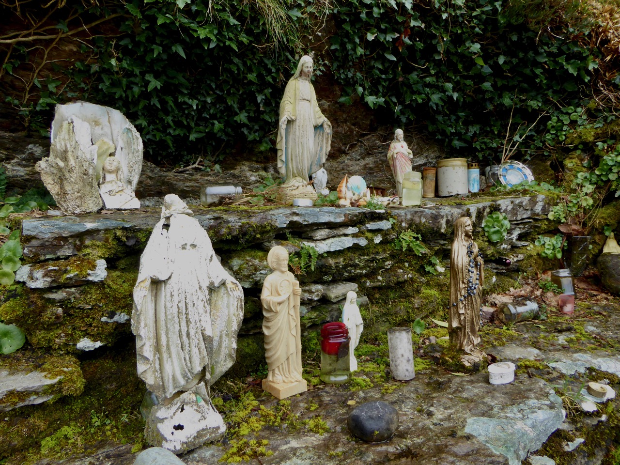
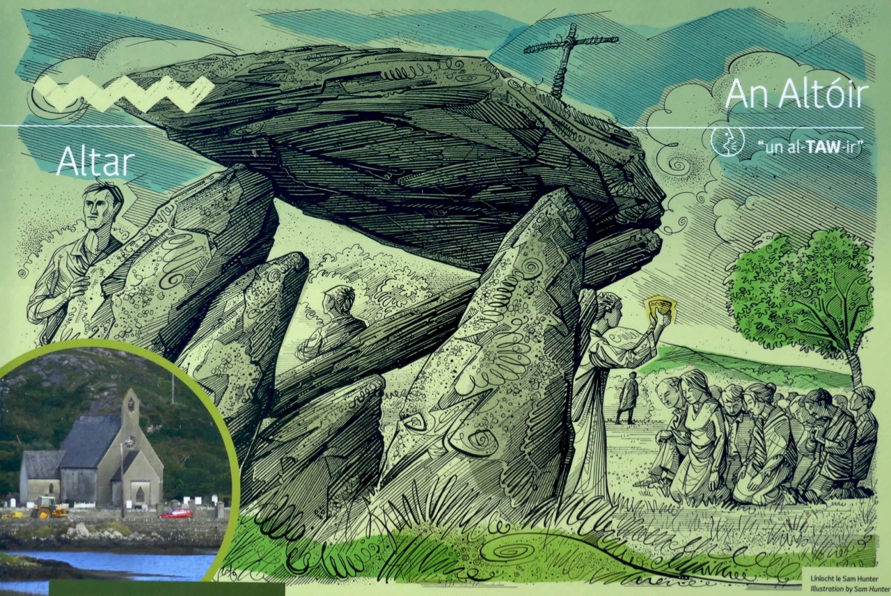
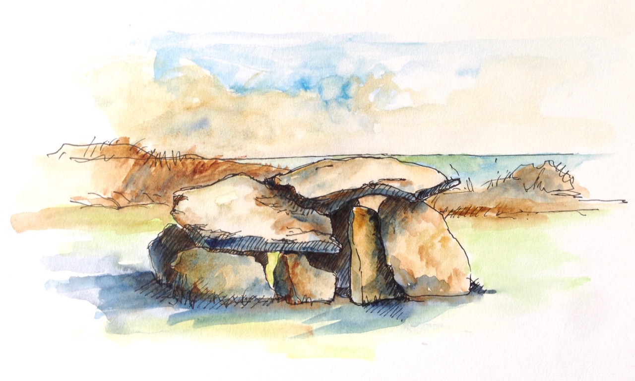
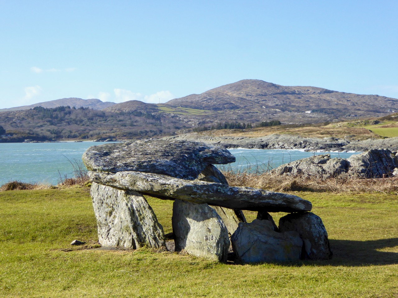
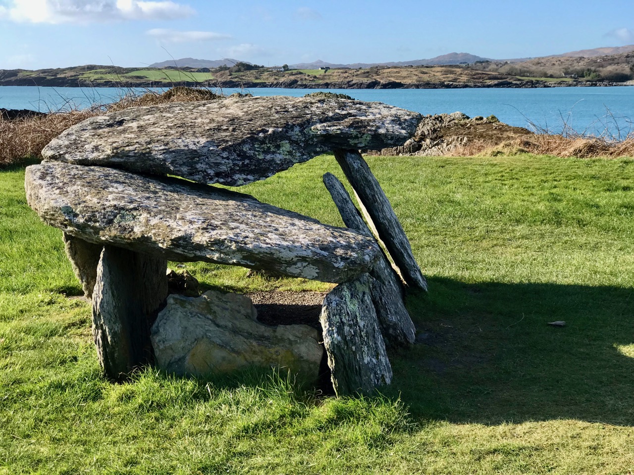
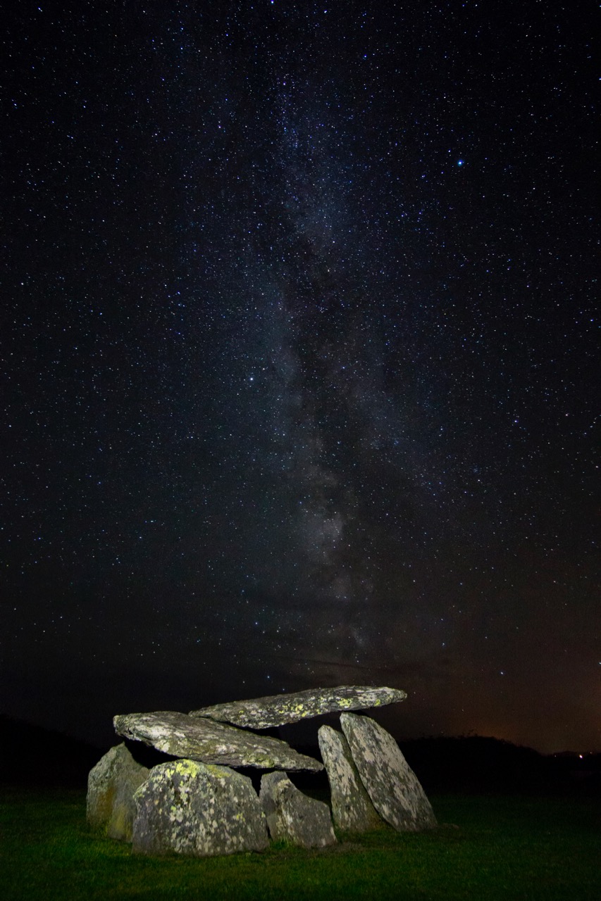
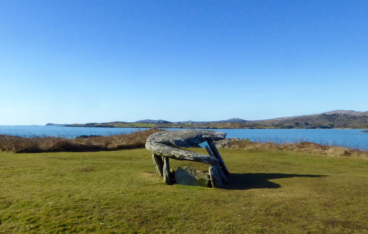
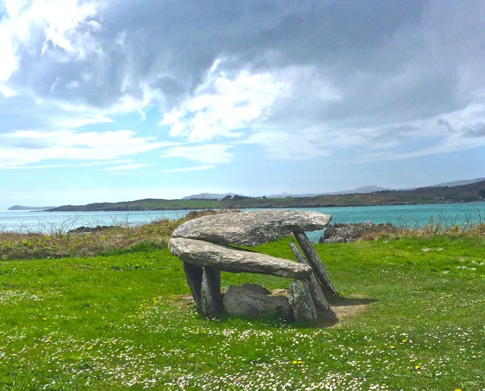
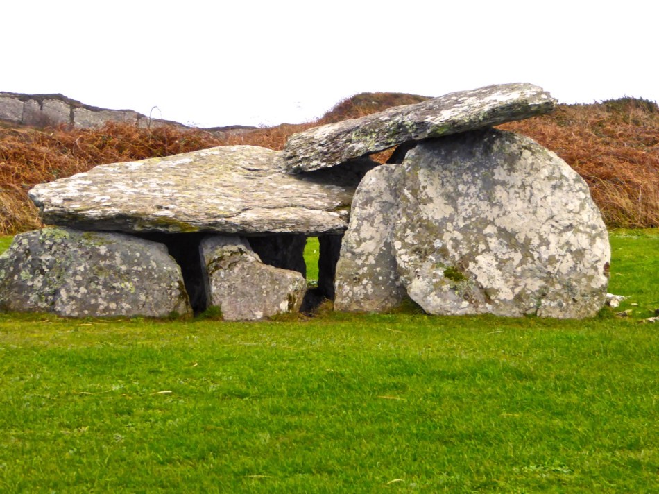
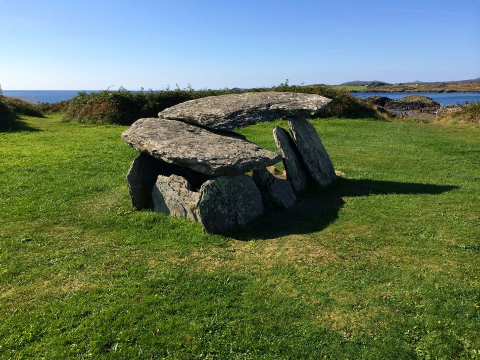
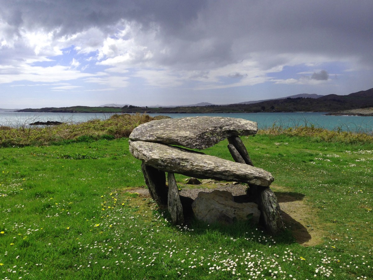
Wedge Tombs belong to the Bronze Age, starting about 2500BC. Of the 115 examples known in Cork, 12 occur on the Mizen, of which the best known is Altar (below).

All wedge tombs share the same basic wedge shape – broader and taller at the western end, which is assumed to be the entrance. All are oriented towards the western sky. To refresh yourself on the essentials of wedge tombs, take a quick read of my post Wedge Tombs: Last of the Megaliths, and then come back here.

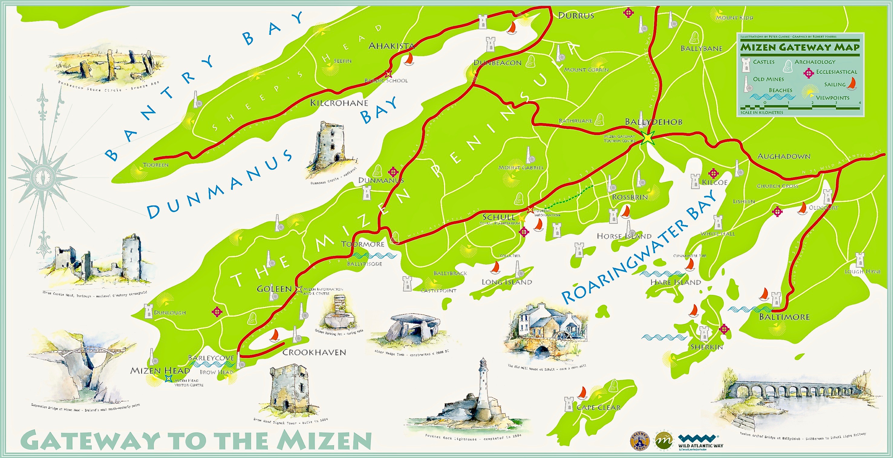
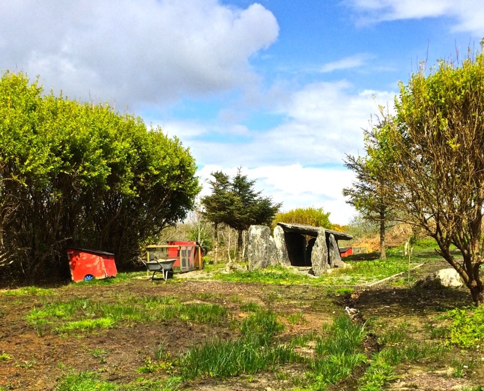
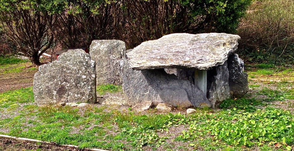
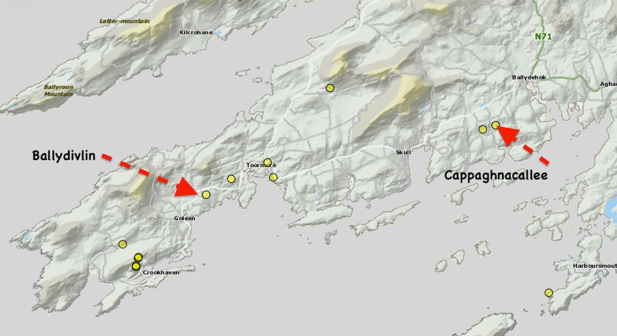
For my series Mizen Megaliths, we are trying to visit all the megaliths of the Mizen Peninsula (like our closest one at Kilbronoge, above), so today, I want to concentrate on two we visited this year, both of which are incorporated into field boundaries, Cappaghnacallee and Ballydivlin.

Cappaghnacallee – the name is interesting, the tillage field of the Cailleach. The Cailleach was the wise woman, the Hag of Irish mythology, the bringer of winter, the veiled one. Many placenames include a reference to her, including the largest and most impressive of the Cork wedge tombs, Labbacallee, the Bed of the Cailleach: here’s Robert’s post on this most impressive monument.

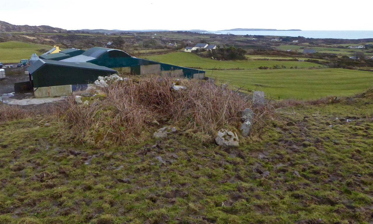
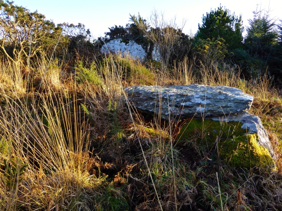
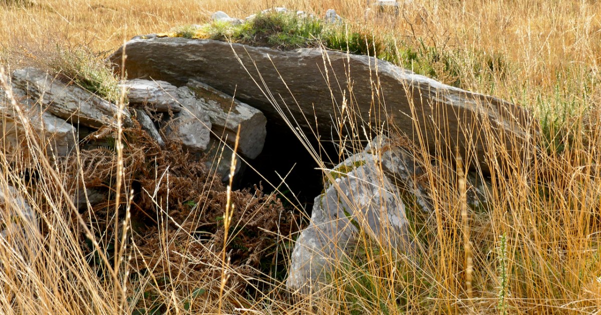
It is possible that the presence of the wedge tomb in this townland is the origin of the place name Cappaghnacallee. But if it was once an important local site, the focus of legend and ritual, it’s not easy to recapture that sense of it now. It’s hard to find, hidden in a field boundary (above), overgrown with brambles and long grass. We visited in 2015 and again this year and it’s more overgrown now.

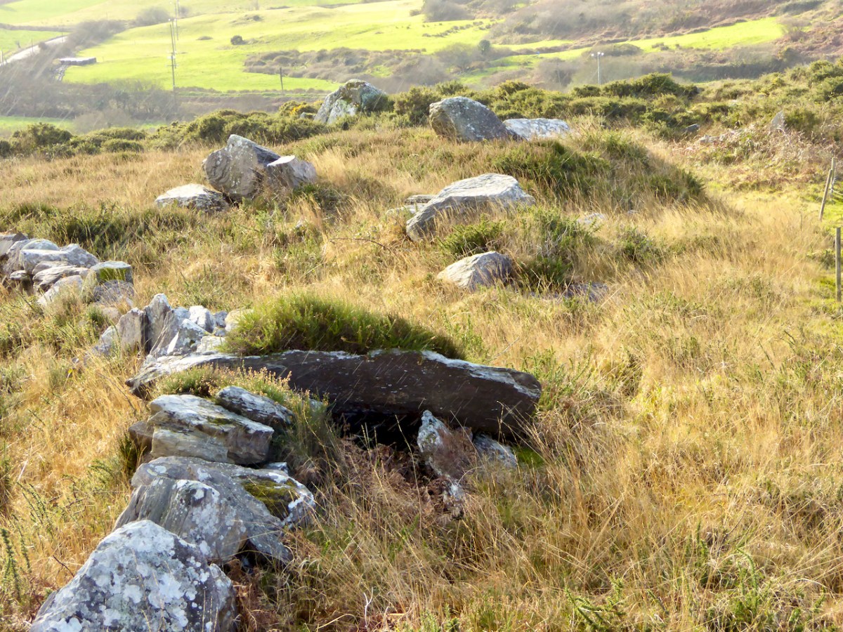
Once you do find it, it is recognisable as a wedge tomb. Here’s what the National Monuments record says about it, and I couldn’t put it better myself.

The monument, incorporated in a stone field wall, consists of a gallery. . . aligned NE-SW. The W end of the monument has collapsed and is obscured by the roofstone and field-clearance material. The S side forms part of the field wall and is represented by three stones that rise in height to the W. Only the E stone of the N side survives and there is no evidence for a backstone. The roofstone. . . rests on the two opposing sidestones forming the E end of the gallery and slopes downwards to the entrance area where it is covered by field-clearance material. The monument appears to have collapsed in antiquity as there is a layer of peat on top of the roofstone below the field-clearance material.

https://maps.archaeology.ie/HistoricEnvironment/

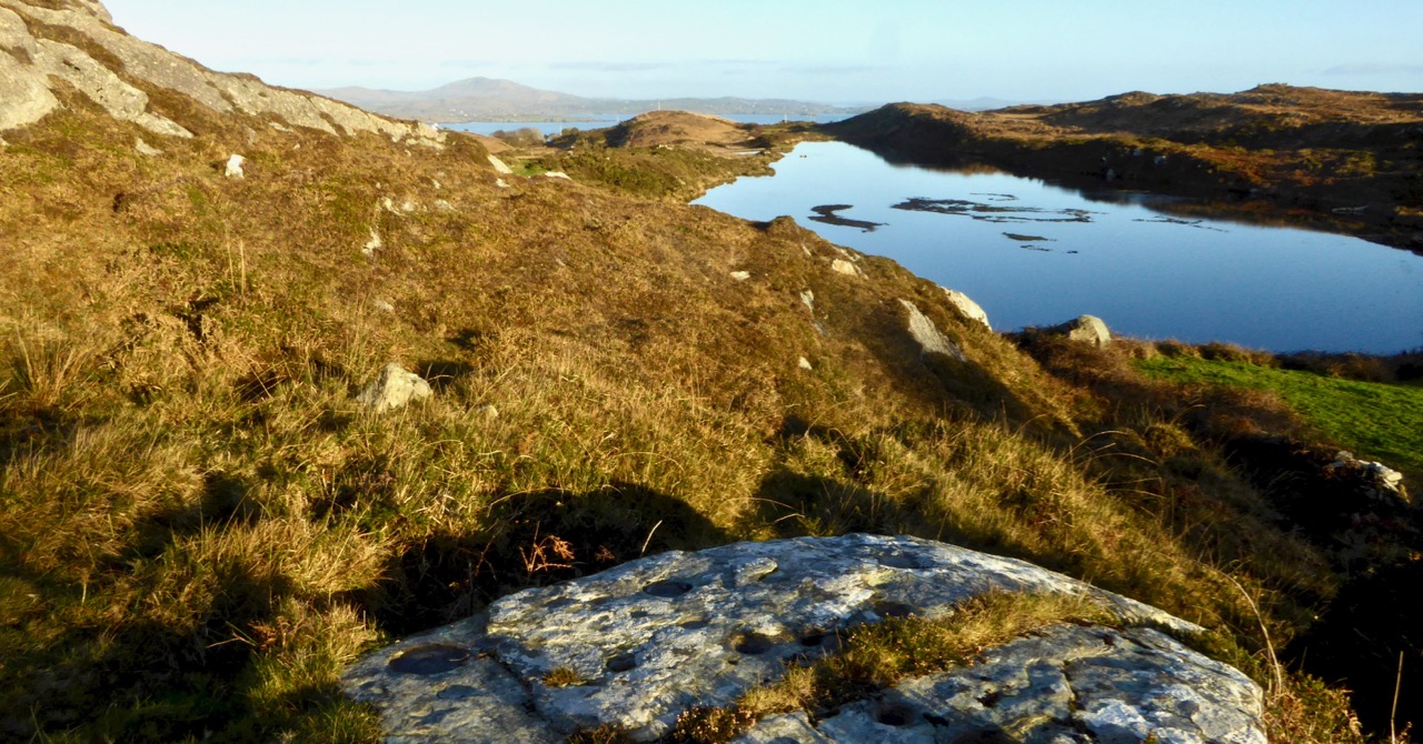
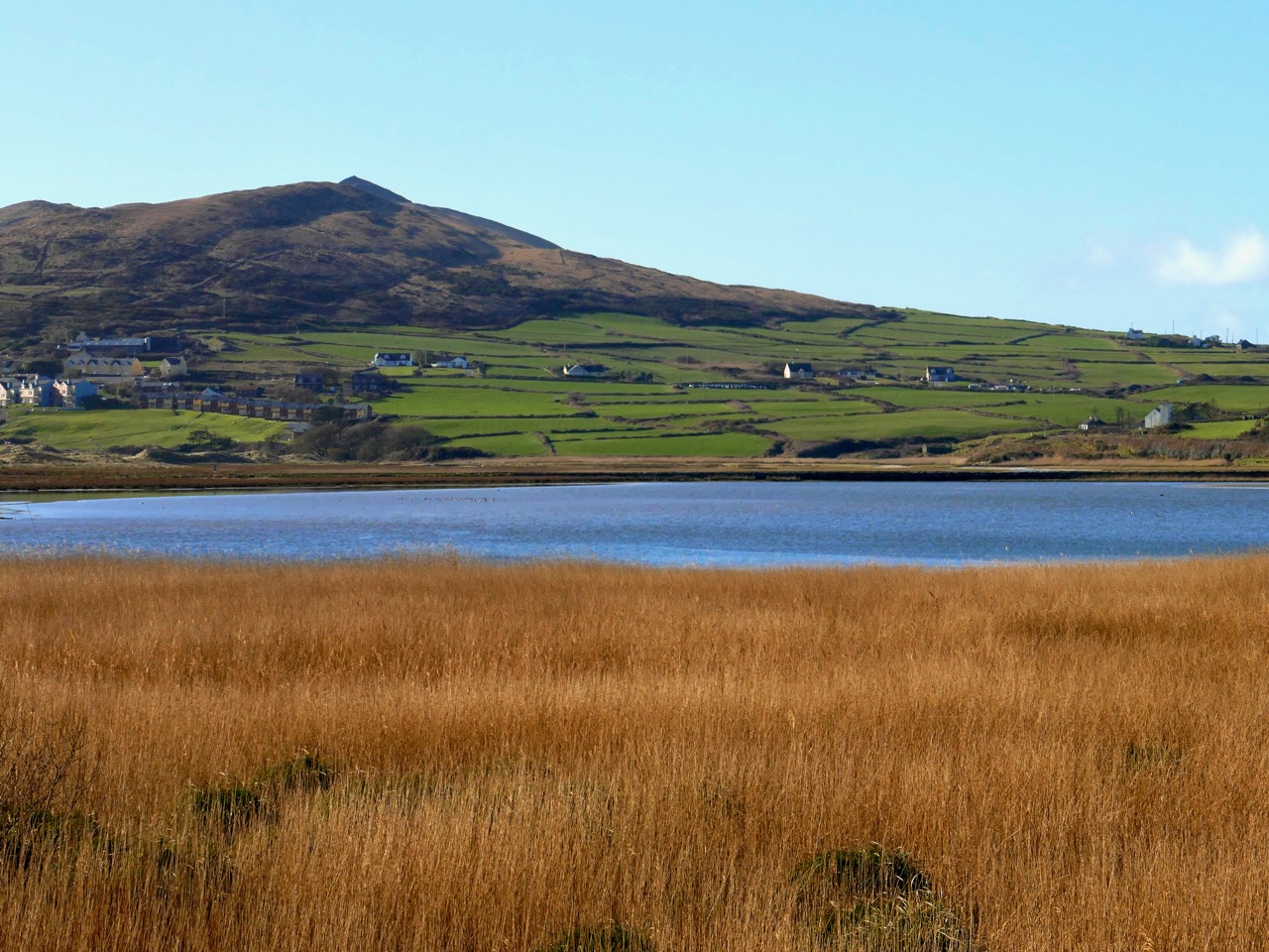
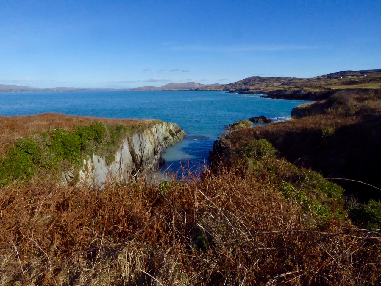
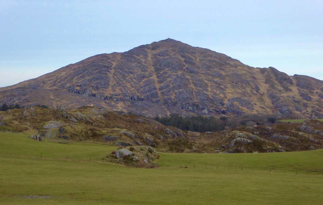
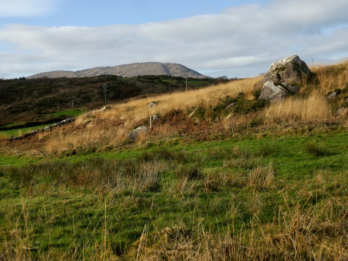
There are views from the site down to Roaringwater Bay, but also to Mount Gabriel (below). We are constantly amazed when we visit prehistoric sites to find that Mount Gabriel is in view and are more and more convinced that it was a sacred mountain.

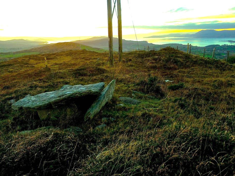
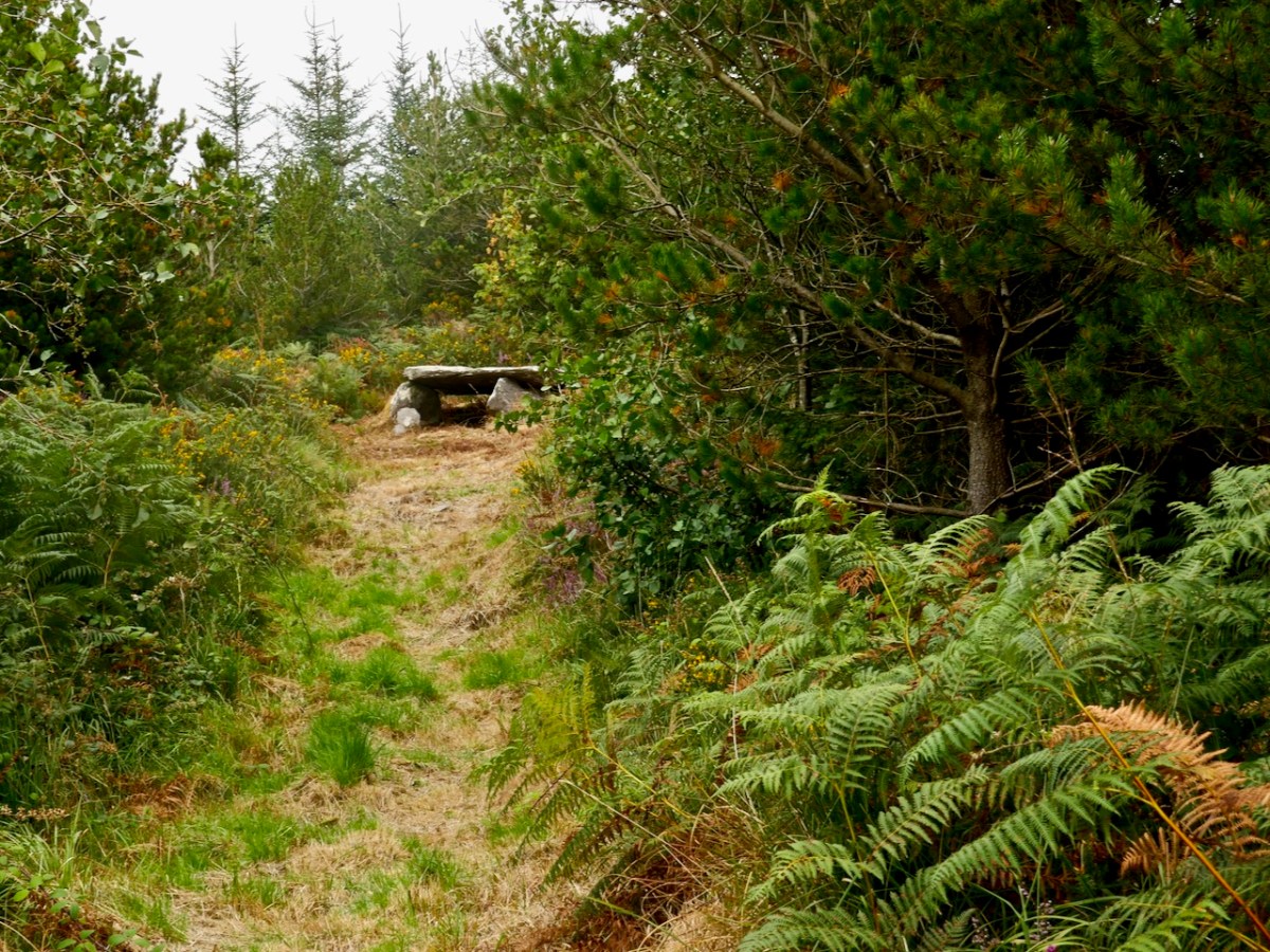
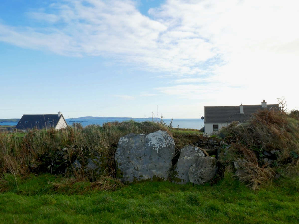
The second Mizen wedge tomb I’m including in this post is in Ballydivlin, not far from Goleen. Once again, this is a partially collapsed tomb, perhaps in slightly better shape than Cappaghnacallee, but the similarities of situation are striking. Like Cappaghnacallee, this wedge tomb is incorporated into a field boundary or hedge (although locally it would likely be called a ‘ditch.’ 

Here’s the NM description:

Tomb incorporated in fence; gallery. . . aligned NE-SW. Three erect sidestones on N side; one erect stone, one fallen sidestone on S; backstone visible at E end and another stone closes W end gallery. Stone partly covering W end gallery may be displaced roofstone. No indications of surrounding mound.

This wedge tomb is situated in such a way that it has views of both Mount Gabriel (below) to the east , Mizen Peak (the pyramid-shaped mountain that is the focus of the Altar Wedge orientation) to the west and, in the nearer distance, of Knockaphuca to the north. There are also clear views across the sea to Cape Clear (above). 

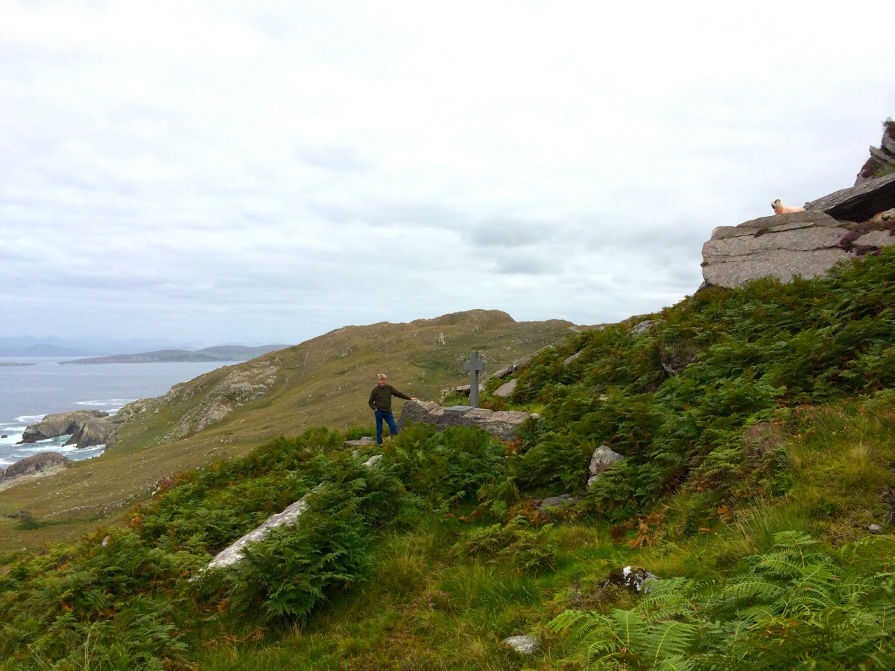
Setting out to find these obscure wedge tombs is a great way to spend a day on the Mizen. We did it in the winter, when undergrowth is not so luxurious and the ground is hard underfoot, and were blessed with fine weather each time.

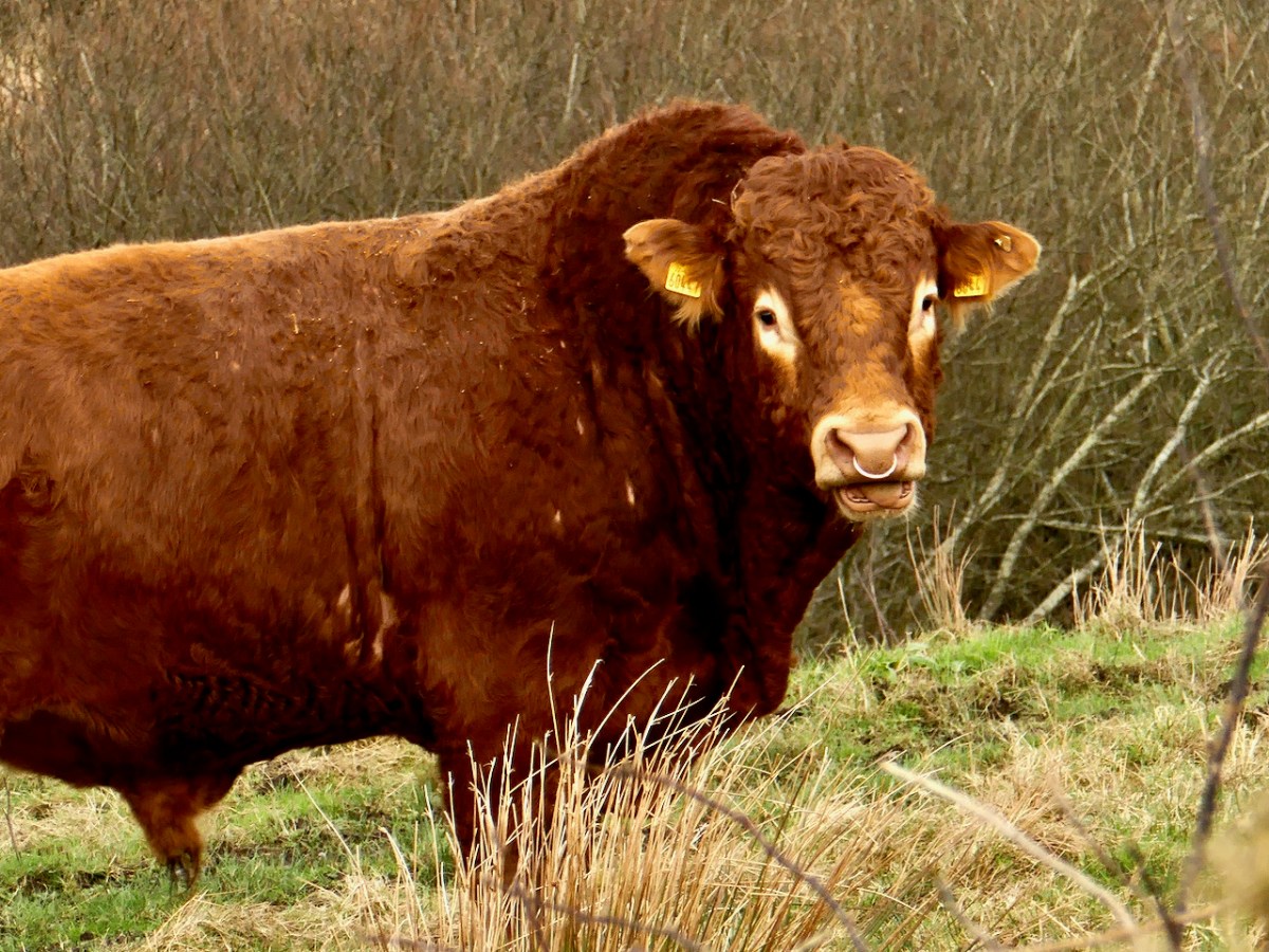
We were also blessed with a fine bull at Ballydivlin – fortunately one field over and more interested in his cows that in us.

The Mass Rock – revisited

This post was originally published way back in 2014 but I have updated it with a few new photographs and edited the text slightly.

An raibh tú ag an gCarraig? / Were You at the Rock?

nó a’ bhfaca tú féin mó grá / Or did you yourself see my love,

nó a’ bhfaca tú gile, / Or did you see a brightness,

finne agus scéimh na mná? / The fairness and the beauty of the woman?

This beautiful song speaks to a revered tradition in Irish history and folk custom – the mass rock. During the period of the Penal Laws (late 17th and first half of 18th Century) when the practice of Catholicism was outlawed, parishioners would gather at a secret location to attend mass. The priest travelled from community to community in disguise, a lookout was posted, and mass was celebrated on a lonely rock far from the reach of the law. The song encodes the message that the people still find ways to attend mass, despite the harsh prohibition against it.

Mass rocks are often in remote locations, such as this one in Kerry, or the lead image on the Beara

Dr. Hilary Bishop, in her excellent website Find a Mass Rock says, As locations of a distinctively Catholic faith, Mass Rocks are important religious and historical monuments that provide a tangible and experiential link to Irish heritage and tradition. She also points out that, because of the imperative for secrecy, mass rocks are difficult to find.

This stained glass window shows mass at a mass rock, with a lookout posted to keep an eye out for the redcoats

We certainly experienced this when we set out for a day of mass rock hunting. Working from a list generated from the National Monuments Service database we spent a day on the Sheep’s Head and the Mizen and had trouble finding all the rocks on the list. One, if it was still there, had disappeared under impenetrable layers of gorse. A second rock was last recorded in the 1980s: residents were no longer familiar with it.

One of our favourite holy wells, at Beach on the Sheep’s Head, also incorporates a mass rock. Mass is celebrated here every August

Knowledge of mass rocks has passed down from generation to generation. In the deep countryside, the sites maintain a mystique and a sense of the sacred. We’ve written about the mass rock and holy well at Beach, where Mary conjured up a blanket of fog to confuse the English soldiers and allow the priest to escape. At Beach and at our first stop, the mass rock at Glanalin on the Sheep’s Head Way, mass is still celebrated.

The Glanalin rock (above), and the one we visited on the Beara Peninsula, are good examples of the remote locations typical of many mass rocks, high on a hillside or hidden in an isolated valley. You can picture the procession of worshippers, in ones and twos, slipping silently through the bracken, pausing to make sure they are not being watched, climbing higher, following an overgrown trail, arriving at the meeting place where the hushed crowd awaits the arrival of the priest.

One of the rocks we found (above) looked for all the world like a fallen standing stone – and that’s probably what it was. (I wonder if I should go to confession, though – I’m sure that sitting on a mass rock would qualify as at least a venial sin.)

A mass rock that is easily visited is the one at Cononagh Village (above), right at the side of the main road into West Cork, the N71. This site is beautifully maintained – Cononagh is obviously proud of its heritage: signage and flowers invite the passerby to take a closer look.

The mass rock we visited last year, at Foherlagh, has a commanding view of the surrounding countryside. This one even had a small scoop-out in the rock, identified as a holy well

Another easily accessible site is Altar, at Toormore. This is a wedge tomb, probably over 4,000 years old and excavated in 1989. It remained in use through the Bronze Age and into the Iron Age. Dr. William O’Brien, in Iverni, says of this site: …over time this tomb came to be regarded as a sacred place, housing important ancestral remains in what was a type of community shrine. How fitting, then, that the flat capstone of the Altar wedge tomb became, in the Penal Days, a mass rock. And how intriguing to think of the continuation of this sacred space over the course of thousands of years.

But perhaps our favourite of all the mass rocks we have visited is the one at Castlemehigan. We wrote about it here. It started out life as a cupmarked stone perhaps in the Neolithic, then probably got converted into a bullaun stone in the Early Medieval period, before finally serving as a mass rock – and it has all the stories to go with its long history.


Mizen Magic 8: The Altar

Here’s the Mizen Peninsula shown on a map drawn by Robert for the Bank House tourism centre in Ballydehob and embellished with Peter Clarke‘s exquisite watercolour sketches of just some of the places that should not be missed by visitors to West Cork . . .

. . . And here is another rendering from Peter of one of the ancient sites that everyone goes past when travelling to the far west: possibly one of the most accessible pieces of archaeology on this section of the Wild Atlantic Way. It’s the Altar Wedge Tomb at Toormore Bay.

It’s early February, and Imbolc has passed. That means that Springtime has officially started here in Ireland. Sure enough, we looked out over a sunlit Roaringwater Bay this morning: soon we were heading out towards Goleen, Barley Cove and all points west. We stopped at The Altar and had it all to ourselves. You can see here that it’s orientated towards the Mizen Peak – that sharp little pyramid which is right on the centre of the picture – and lies to the west. For me, there’s a perfectly natural symbolism about placing the dead in a tomb that is aligned on the rising and the setting of the sun: that’s something we still do, several thousand years on!

The upper picture, taken on the Winter Solstice, shows the Mizen stretching away from the heights of Mount Gabriel: the Mizen Peak is the little pointed blip just left of centre. The lower picture looks across the wetlands behind the sand dunes at Barley Cove, and was taken today in the Spring sunlight: the Peak is clearly visible as the highest point. I believe that our forebears attached great importance to high places, as many stone monuments and Rock Art often seem to be placed in the landscape with commanding views towards hilltops. Mike Wilson’s site Mega-What sets out his detailed studies of the orientation of ancient sites within the natural landscape. Here is his analysis of the setting of the Altar Wedge Tomb.

I am always alert for the ways in which our special sites are interpreted for us. I created a bit of a storm a while back when I commended the signage which has been put in place along the Wild Atlantic Way using visually strong corten steel elements (above left) supplemented more recently by (in my opinion) very well designed information boards. The image on the right above is from an earlier OPW board which explains the possible early use of the wedge tomb, while the images below show the new signage, which features the later use of the tomb as a Christian altar during the Penal times (hence the name: The Altar), with a drawing by Sam Hunter. I am struck by the way this monument has been a focal point for differing rituals spanning countless generations.

When writing about archaeological subjects I am always on the lookout for the way that antiquarians saw the sites which we are familiar with today. I had hoped that George Victor du Noyer – the subject of an excellent recent exhibition in Cork’s Crawford Gallery – might have drawn this wedge tomb when he travelled the country for the Ordnance Survey during the early nineteenth century: he may well have done, but the annotation and cataloguing of his vast legacy of work has yet to be completed and I have not found such a record. His drawings below are not of The Altar, but a portal tomb, Ballybrittas in County Wexford. Portal tombs (sometimes known as dolmens) share similarities with wedge tombs, but are earlier, dating from between 3000 BC to 2000 BC, while wedge tombs tend to be associated with the Bronze Age, which followed this period.

Cremated remains were found in Altar Wedge Tomb when it was excavated in 1989 by Dr William O’Brien, now Professor of Archaeology at UCC. We can never know exactly what the significance of these impressive structures was to those who built them. For me, I’m pretty sure that it was connected with their relationships to, and respect of, the landscapes which they inhabited, and which they invested with meaning. They must certainly have paid heed to the passing of the seasons and the continual cycles of nature, and their closeness to all of this must have given them an inherent knowledge of the paths of the sun, moon and stars. Above all, our ancestors had to understand and appreciate the environment around them, and make it work for them. In a practical sense, certainly, but also in terms of the stories they might pass on about the meaning of places.

Above – the magical landscape of the Mizen: we will never tire of it

The tailpiece picture, which is from Wikimedia Commons, attributed to Lukeoc88, is a remarkable timeless view of a human construction in the setting of our Universe: Altar Wedge Tomb under the Milky Way.

Mizen Mud: Recipe for a February Exploration Day

Muddy Boots

It’s been a wet, wet winter, but when the sun shines in February (which it does, honestly!), we are out exploring. This particular day our companions were Jessie, Brandon, Amanda and Peter and our accompaniment was MUD, and lots of it.

Explore Group

Amanda took the photo of the group, and the one of my muddy boots

We had goals – Amanda was after some elusive holy wells and Robert wanted to find the pirate steps at Canty’s Cove for his talk on William Hull and the Leamcon Pirates’ Nest, part of the Ballydehob spring lecture series, ’Talks at the Vaults.’ Jessie is a professional tour guide, wanting to learn more about the Mizen. Finally, I wanted us to swing by Dunmanus Castle so I could check out a few construction details.

Dunmanus Castle and bridge

Dunmanus Castle on its knoll, surrounded by water

You don’t actually need goals like this to go out exploring, but it helps. It gets you into places you wouldn’t normally go, down tiny boreens, into farmyards and across fields. You end up knocking on doors and meeting people who know all about the well, or the old stones, or the legends of the place, or who owns what field and whether he minds people tramping through it. On this occasion we met, for the first time, the near-legendary Pat McCarthy, one of the writers of Northside of the Mizen, and a huge authority on this area. We’ve promised ourselves a return visit with him as we weren’t able to stay long enough for a good talk.

Budds

The best way to start a day like this is with excellent coffee, in Budds of Ballydehob, where we assembled with our map to plot our course. It was off then to Toormore and the Altar wedge tomb. On this occasion we weren’t actually after the wedge tomb (although I can never resist a photo of it) but the little holy well across the road.

Altar Wedge Tombe

Our next stop was Dunmanus, to take a good walk around the castle with the camera, looking for details I had missed on previous visits.

Dunmanus Castle ground floor entrance details: The bar-hole for barring the door once inside; the spud stone and the hanging eye. The hollows are for the pole that the door swings on

And then on to Canty’s Cove. You can read Robert’s post, Canty, for more about this place and its association with Canty the Pirate. Finding the steps wasn’t easy and it was a big thrill when we finally figured out where to look.

from Canty's House

This is the inlet with the pirate steps. Photographing them involved hanging over the edge with someone holding on to your ankles

Pirate Steps

How would you like to climb up these with a keg on your back?

By then we were starving – this exploring is hungry work – so we repaired to O’Sullivan’s of Crookhaven for one of their famous crab sandwiches. Even at that early date the sunshine was so inviting that people were sitting outside with their sandwiches and their pints.

water pump at Crookhaven

Crookhaven Pier

From Crookhaven it’s a quick trip to Lissagriffin, where there’s a medieval church and a bullaun stone doing double duty as a holy well/wart well. The church has a panoramic view over the salt marshes behind Barley Cove Beach as well as interesting architectural features.

Lissagriffin Doorway

Our next holy well was right by the side of the road a couple of miles further east – labelled so we couldn’t mistake it.

Callorus Oughter

Amanda inspects Tobareenvohir – or Tobairín an Bhóthar, the Little Well of the Road

The final one was harder to find and necessitated negotiations of some seriously muddy fields. Tobairín Brón (Little Well of Brone) was in the general vicinity of where we ended up, along with a small monastic site – all very brambly and hard to decipher. But what a place – a view clear out to the Fastnet Rock, with Knockaphuca looming behind us. Cnoc an Phúca means the Hill of the Mischievous Spirit – it’s been tamed, presumably, by the large cross erected on its peak.

Monastic site

Knockaphuca

Fastnet Rock

Read Amanda’s post for her take on the four wells we visited that day.

By then the sun, so warming earlier in the day, had been overtaken by high cirrus clouds, and we were donning jackets and gloves and remembering that it was only February after all. As if to make up for its lack of warmth, it treated us to a magnificent solar halo (I’ve always called them sun dogs)  as we made our way back to the cars.

Sun dog

We were never much more than 30 kms (or about 40 minutes) from home but in that distance we managed to see heritage sites dating from the bronze age through the medieval period up to the recent past, surrounded all the time by the magnificent scenery of the Mizen. You can do this anywhere in Ireland. Using the Historic Environment Viewer of the National Monuments Service, define the area you want to explore, pick your fancy (ring forts? medieval churches? cross slabs? megalithic tombs? castles? rock art?), and off you go.

Peter and Amanda in a holy well

A holy well looks back at Amanda and Peter

Now, if you’ll excuse me, I’m off to buy some wellies…

Wedge Tombs: Last of the Megaliths

Altar Wedge Tomb on The Mizen Peninsula

Altar Wedge Tomb on The Mizen Peninsula

In Ireland, the tradition of building megalithic (mega=large, lithos=stone) structures that included chambers to house the dead (such as the Boyne Valley Passage Grave complex, or the Court Tomb of Creevykeel) belongs to the Neolithic period, which ended around 2500 BC. About this time, a new style emerged of stone ‘galleries’, oriented towards the setting sun. Their distinctive shape – narrower and shorter at the eastern end – gives them their common name, wedge tombs. This tradition appears to have flourished for about 500 years.

Altar, side view

Altar, side view

In other areas of Ireland wedge tombs were often covered by a mound, but there is little evidence for this in West Cork. The closest parallel to wedge tombs outside of Ireland are in Brittany where allées couvertes date from this period. They are associated in some parts of Ireland (although once again not in West Cork) with Beaker pottery, a distinctive kind of vessel widely distributed across Western Europe. This was a time in which the population was expanding, farming practices were intensifying and a brand new technology was being introduced – it was the dawn of the Copper Age. Thus, we can speculate that wedge tombs mark the confluence of two forces: the new continental technologies of pottery and metalworking and the indigenous tradition of erecting megalithic chambered tombs.

Wedge tombs occur mostly in the western half of Ireland, including many in County Clare such as the Parknabinnia tomb pictured below.

 The largest wedge tomb in Ireland is near Fermoy, north of Cork City. It is typical of many Irish wedge tombs in featuring double walling, evidence of a surrounding cairn, and a sealed end chamber. Interestingly its name, Labbacallee, means the Hag’s Bed – the hag, or wise woman crops up frequently in Irish mythology.

In contrast to Labbacallee, wedge tombs in West Cork are generally smaller and simpler, comprising only one chamber and lacking a covering cairn. However, the distinctive wedge shape is preserved along with one other defining feature: wedge tombs are invariably oriented towards the setting sun. The funerary rite was that of cremation. Votive offerings of white quartz pebbles and small deposits of metal have been found in excavations.

Toormore wedge tomb,  now in someone's garden

Toormore wedge tomb, now in someone’s garden

Prof William O’Brien has excavated wedge tombs in West Cork and studied them, and the culture in which they were built, extensively. Here’s what he has to say, in his book, Iverni, about the society that produced them:

Whereas monuments like Newgrange could only have been built with a large organised input of labour over a long period, the building of wedge tombs was undertaken by small kin groups…This was a small scale society, comprised of local, clan-like groupings…The tomb was a type of shrine, sanctified by an association with ancestors and used for periodic offering and sacrifice to supernatural powers.

A striking aspect of Neolithic, Chalcolithic (Copper Age) and Bronze Age monuments in West Cork is their consistent orientation towards solar events such as sunrise and sunsets on the equinoxes, solstices and cross-quarter days (see our post on Bohonagh stone circle, for example). In this regard, wedge tombs are remarkably consistent in being oriented towards the West. Here’s O’Brien again:

Wedge tombs served as funnel-shaped openings to the Otherworld, facing the descending or setting sun to emphasise the symbolic dualism of light/life and darkness/death.

Toormore, side view

Toormore, side view

Looking for a wedge tomb closer to home, we set out yesterday to find the nearby Kilbronogue site, using the information from the National Monuments Service as a guide. We have found in the past that the mapping of sites is not always accurate and after an hour or two of tramping through a large and very muddy area with a helpful neighbour and his son we had to admit defeat – either the map was wrong, or the monument had disappeared in the recent fieldwork by a digger. Desperately hoping it was the former and not the latter, we found out who owned the land and went to call on him today. Stephen Lynch turned out to be a friendly, cheerful and very knowledgeable organic farmer – he assured us that the tomb would never be damaged in any way and not to worry, he would take us to it. Whew! Half an hour later we were trudging up a path that Stephen had had cut through his ash plantation – on we went and suddenly there it was in front of us – a classic wedge tomb, oriented to the west, built with large slabs that may have been cut from the rock face behind it.

Kilbronogue wedge tomb with its guardian, Stephen Lynch

Kilbronogue wedge tomb with its guardian, Stephen Lynch

Stephen told us the tomb had been used as a mass rock in penal times and that the Protestant farmers who owned all the farms that bordered on the rock had cooperated in allowing the masses to take place – an indication, Stephen said, of the long tradition of friendship between Catholic and Protestant farming families in this area. As with the Altar wedge tomb, also used as a mass rock, we marvelled at how a sacred site, built at least four thousand years ago, would retain its aura of veneration over the millennia, to be used again for religious purposes in the historic period.

Kilbronogue, side view

Kilbronogue, side view

Perhaps the most spectacularly situated wedge tomb we have been to is high on a hill overlooking Bantry. This one is known as Queen Medb’s Tomb and from it there are expansive views of the Beara, Sheep’s Head and Mizen Peninsulas. Climb up to it on a clear day, as the sun is sinking into the sea: in the presence of such awe-inspiring scenery you will find yourself contemplating how the mysteries and the wonders of Irish history and prehistory are written on its landscape.

Queen Medb's Tomb

Queen Medb’s Tomb

Were You at the Rock?

Mass rock along the Beara Way (see the look out above)

Mass rock along the Beara Way (see the lookout above)

An raibh tú ag an gCarraig? / Were You at the Rock?

nó a’ bhfaca tú féin mó grá / Or did you yourself see my love,

nó a’ bhfaca tú gile, / Or did you see a brightness,

finne agus scéimh na mná? / The fairness and the beauty of the woman?

This beautiful song speaks to a revered tradition in Irish history and folk custom – the mass rock. During the period of the Penal Laws (late 17th and first half of 18th Century) when the practice of Catholicism was outlawed, parishioners would gather at a secret location to attend mass. The priest travelled from community to community in disguise, a lookout was posted, and mass was celebrated on a lonely rock far from the reach of the law. The song encodes the message that the people still find ways to attend mass, despite the harsh prohibition against it.

Mass rocks are often in remote locations

Mass rocks are often in remote locations

Dr. Hilary Bishop, in her excellent website Find a Mass Rock says, “As locations of a distinctively Catholic faith, Mass Rocks are important religious and historical monuments that provide a tangible and experiential link to Irish heritage and tradition.” She also points out that, because of the imperative for secrecy, mass rocks are difficult to find. We certainly experienced this when we set out for a day of mass rock hunting recently. Working from a list generated from the National Monuments Service database we spent a day on the Sheep’s Head and the Mizen and had trouble finding all the rocks on the list. One, if it was still there, had disappeared under impenetrable layers of gorse. A second rock was last recorded in the 1980s: residents were no longer familiar with it.

Beach Holy Well and mass rock

Beach holy well and mass rock

Knowledge of mass rocks has passed down from generation to generation. In the deep countryside, the sites maintain a mystique and a sense of the sacred. Last year we wrote about the mass rock and holy well at Beach, where Mary conjured up a blanket of fog to confuse the English soldiers and allow the priest to escape. At Beach and at our first stop, the mass rock at Glanalin on the Sheep’s Head Way, mass is still celebrated occasionally.

The Glanalin rock, and the one we visited on the Beara Peninsula, are good examples of the remote locations typical of many mass rocks, high on a hillside or hidden in an isolated valley. You can picture the procession of worshippers, in ones and twos, slipping silently through the bracken, pausing to make sure they are not being watched, climbing higher, following an overgrown trail, arriving at the meeting place where the hushed crowd awaits the arrival of the priest.

Beara mass rock

Beara mass rock

One of the rocks we found looked for all the world like a fallen standing stone – and that’s probably what it was. (I wonder if I should go to confession, though – I’m sure that sitting on a mass rock would qualify as at least a venial sin.)

Fallen standing stone?  Mass rock? Both?

Fallen standing stone? Mass rock? Both?

A mass rock that is easily visited is the one at Cononagh Village, right at the side of the main road into West Cork, the N71. This site is beautifully maintained – Cononagh is obviously proud of its heritage: signage and flowers invite the passerby to take a closer look.

Another easily accessible site is Altar, at Toormore. This is a wedge tomb, probably over 4,000 years old and excavated in 1989. It remained in use through the Bronze Age and into the Iron Age. Dr. William O’Brien, in his book on the archaeology of County Cork, Iverni, says of this site: “…over time this tomb came to be regarded as a sacred place, housing important ancestral remains in what was a type of community shrine.” How fitting, then, that the flat capstone of the Altar wedge tomb became, in the Penal Days, a mass rock. And how intriguing to think of the continuation of this sacred space over the course of thousands of years.

Altar Wedge Tomb, later used as a mass rock

Altar Wedge Tomb, later used as a mass rock