Mizen Magic 24: Lissagriffin Loop (Fastnet Trails)

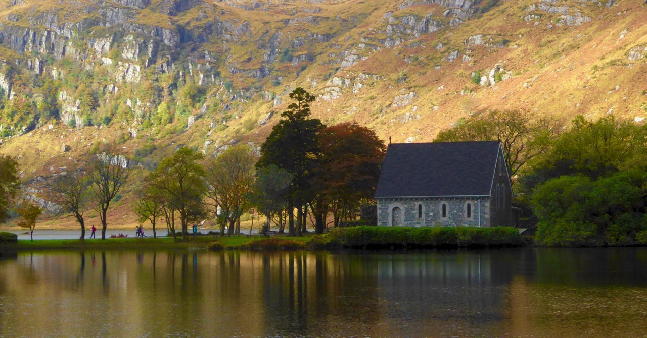
The energetic Fastnet Trails team is marching westward along the Mizen, developing new trails. They do this on a purely volunteer basis and we are all the beneficiaries – so a huge thank you to them! Work on their website is ongoing, and it should be up and running soon. This week we explored one of their recent additions – the Lissagriffin Loop. I have written a previous LIssagriffin post in the Mizen Magic series (number 14), but that one was mainly about the medieval church and the graveyard around it, as well as the history and archaeology in its vicinity. 

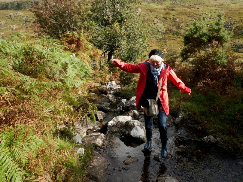
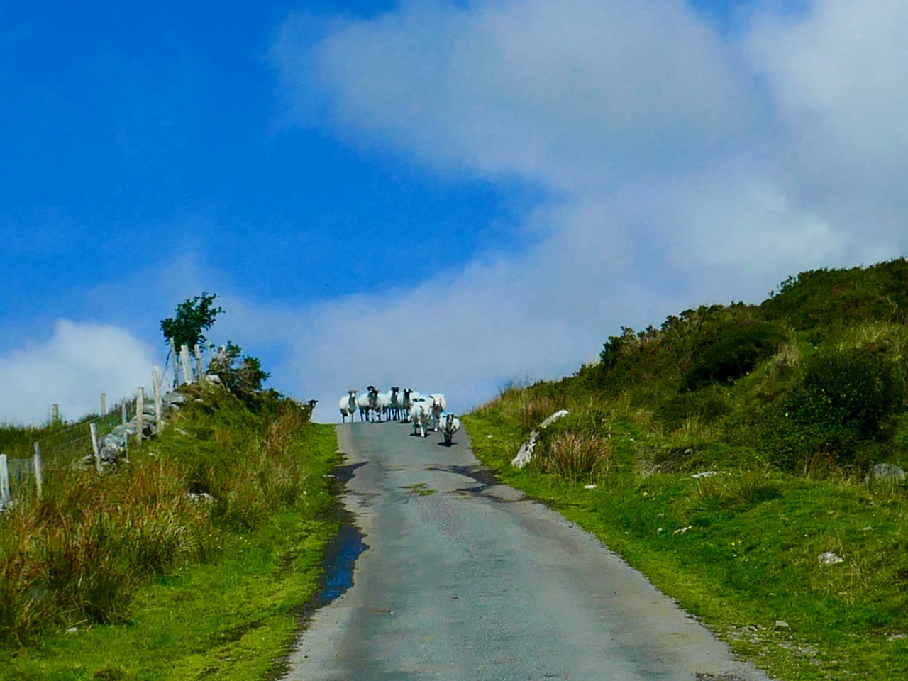
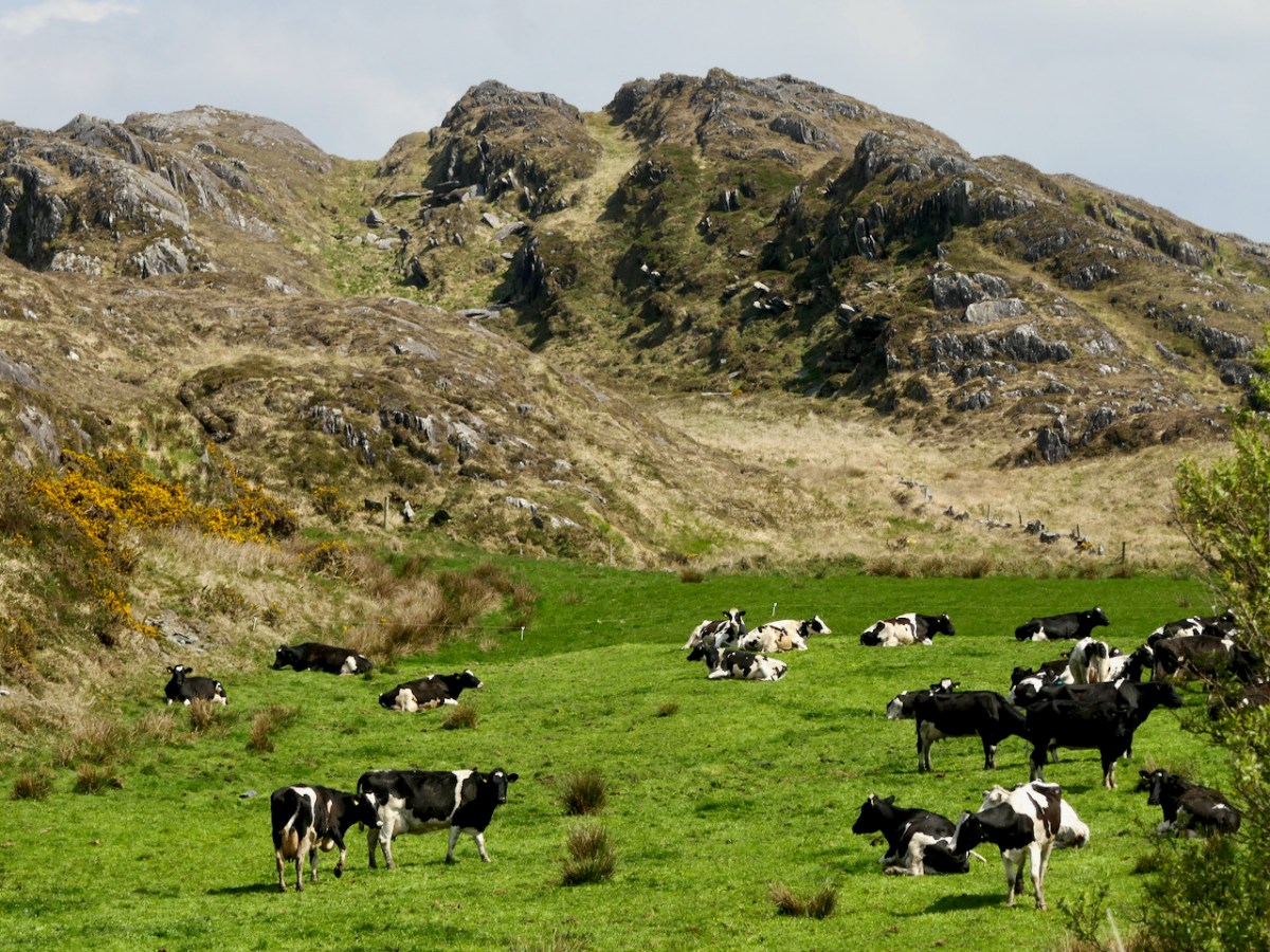
This walk starts and ends in Goleen and is a 10k walk with lots of ups and downs. You’re climbing100m (about 320’) on the first half of the loop and 120m (about 400’) on the second half, so this is a good workout. As with any of these walks, it’s possible to do stretches of them by leaving a car at one point and walking back and forth, or go with friends and leave a car at either end. Wear good shoes and bring water and snacks. It’s all on quiet back roads, so the dog is welcome too, but use the lead if you encounter cattle or sheep (we met both). And there are a couple of surprises along the way.

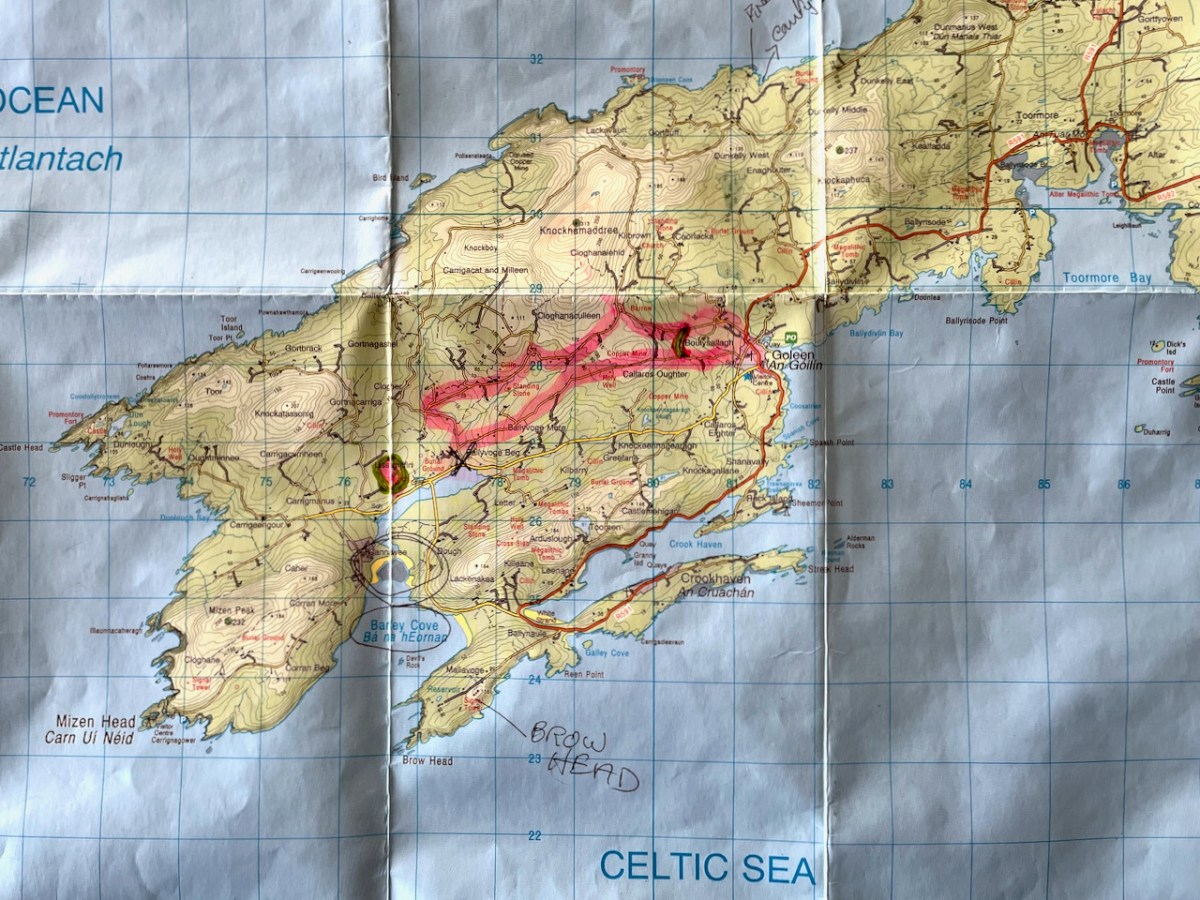
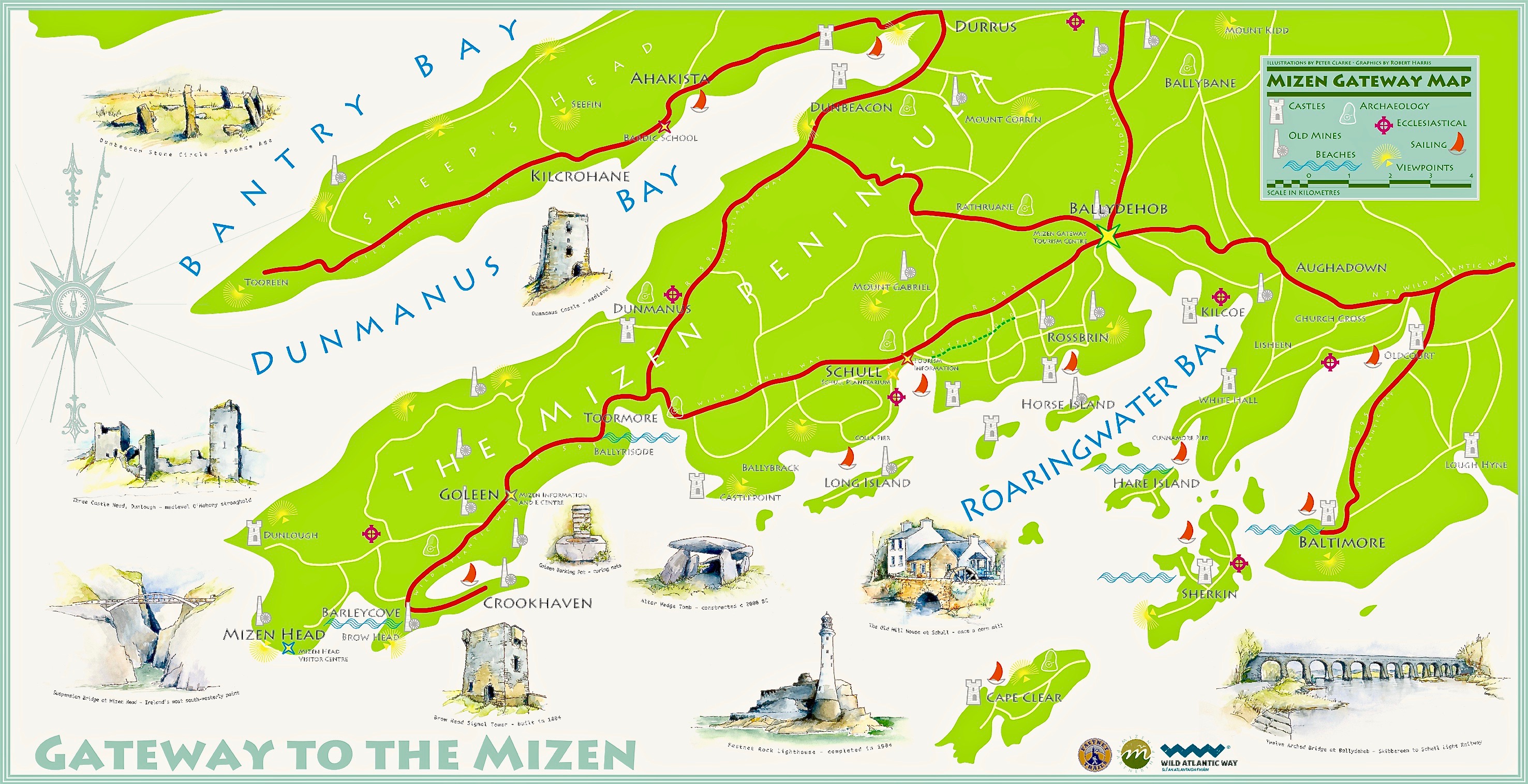
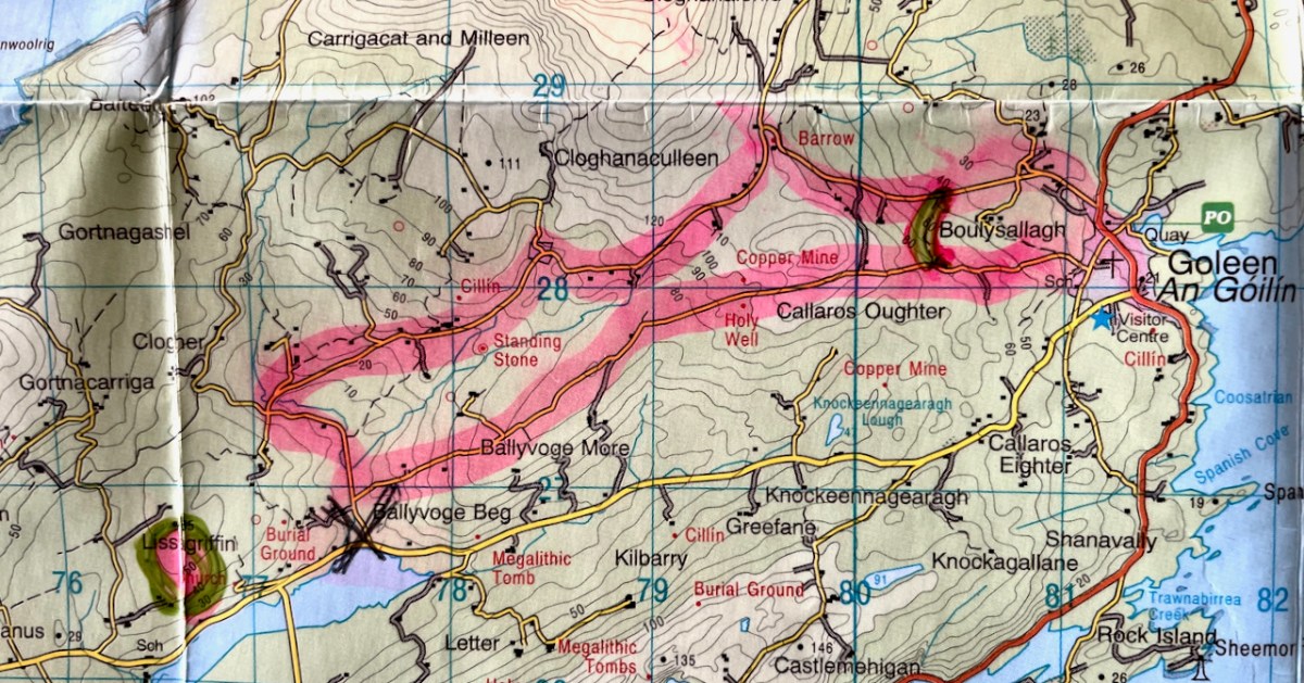
I’ve included a map (above) to show you where you are on the Mizen Peninsula, and a close-up (below) to show the route you’re following. The pink blob within the green circle at the lower left is Lissagriffin Medieval Church in case you have the inclination for a little side trip.

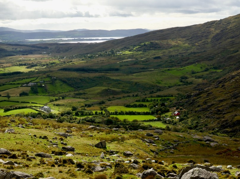
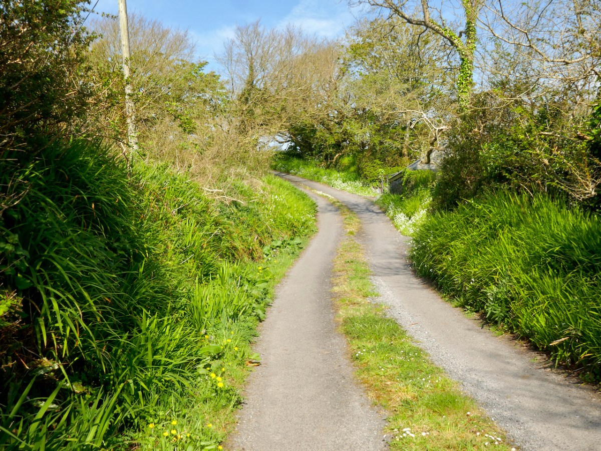
Walk up to Goleen Catholic Church, take a sharp right and you’re on your way. This first part will involve some huffing and puffing, but you’re on a country boreen fringed with wildflowers (wild garlic at this time of year) and with expansive views back to the sea and across a valley to Knockaphuca Mountain (another brilliant trail!) and to Mount Gabriel beyond.

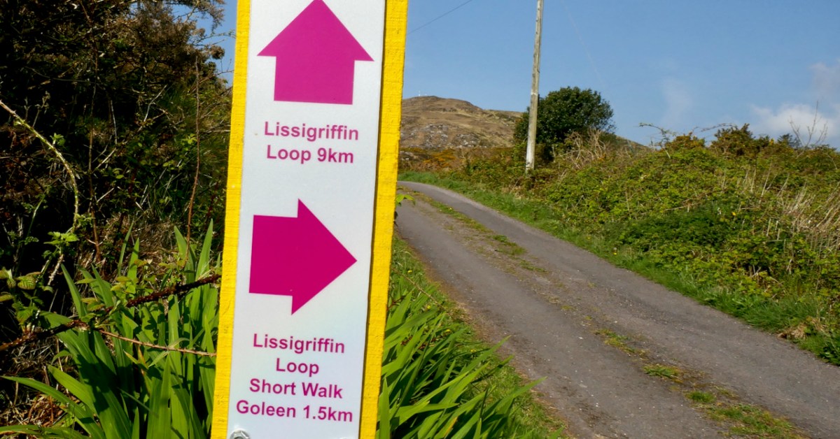
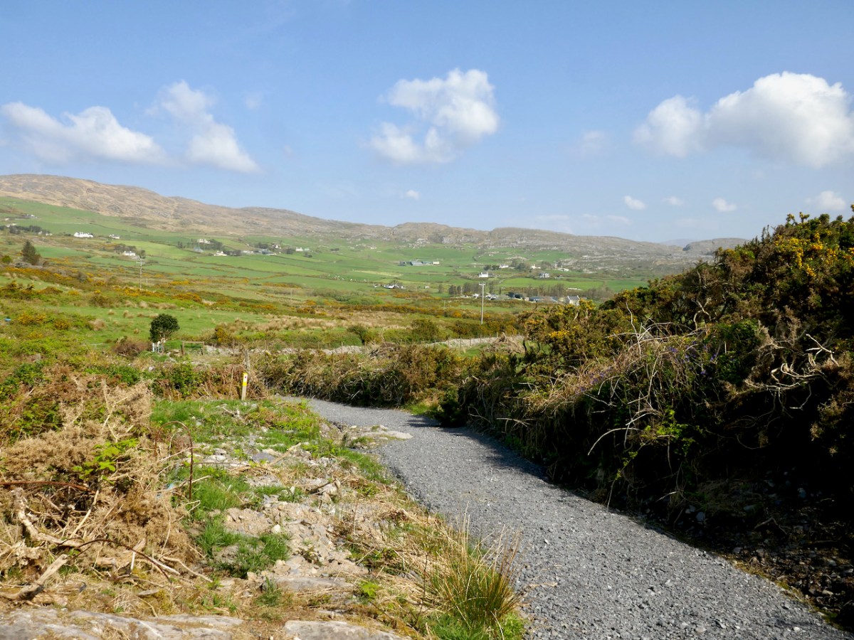
If you don’t have the time or inclination for a long walk, look out for a sign to the shortcut. It’s the curved green line on the lower of the two maps above. It will bring you back to the village, initially via a well-maintained gravel path (below), and then by road, for a 2km walk in all. 

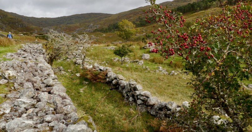
If you decide to carry on, it’s uphill now for quite a stretch, but the views across to Knocknamadree and to Knockaphuca are worth the effort. Later in the year, the route will be dripping with Fuchsia and Montbretia, but right now the Navelwort is starting to sprout and stitchwort is rampant. 

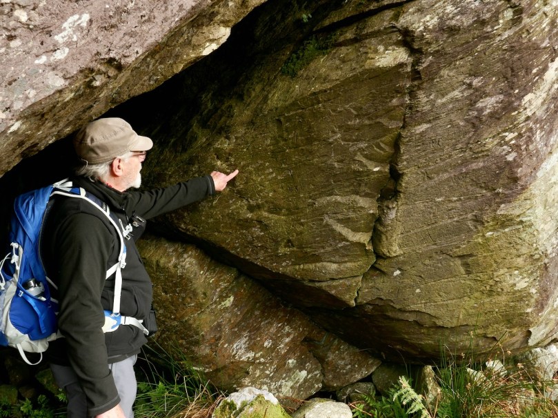
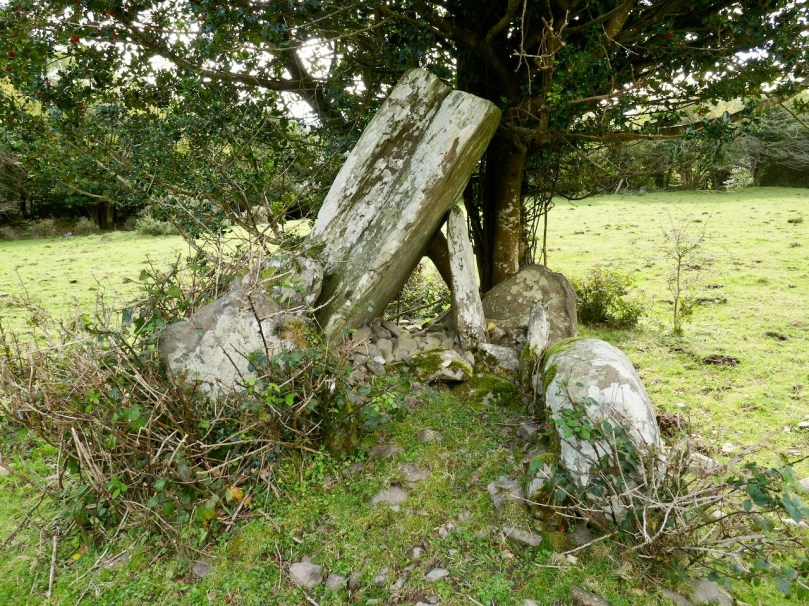
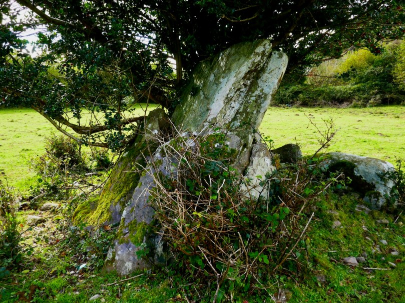
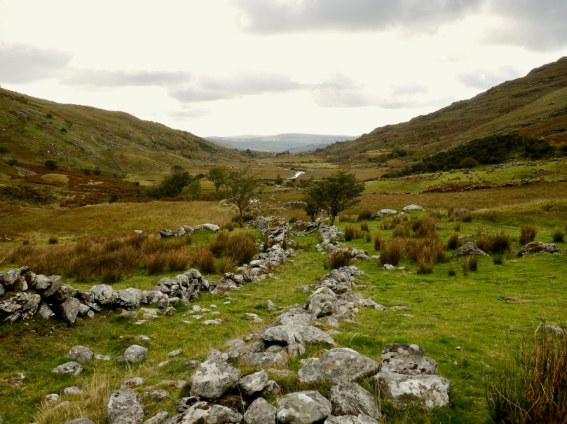
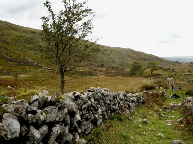
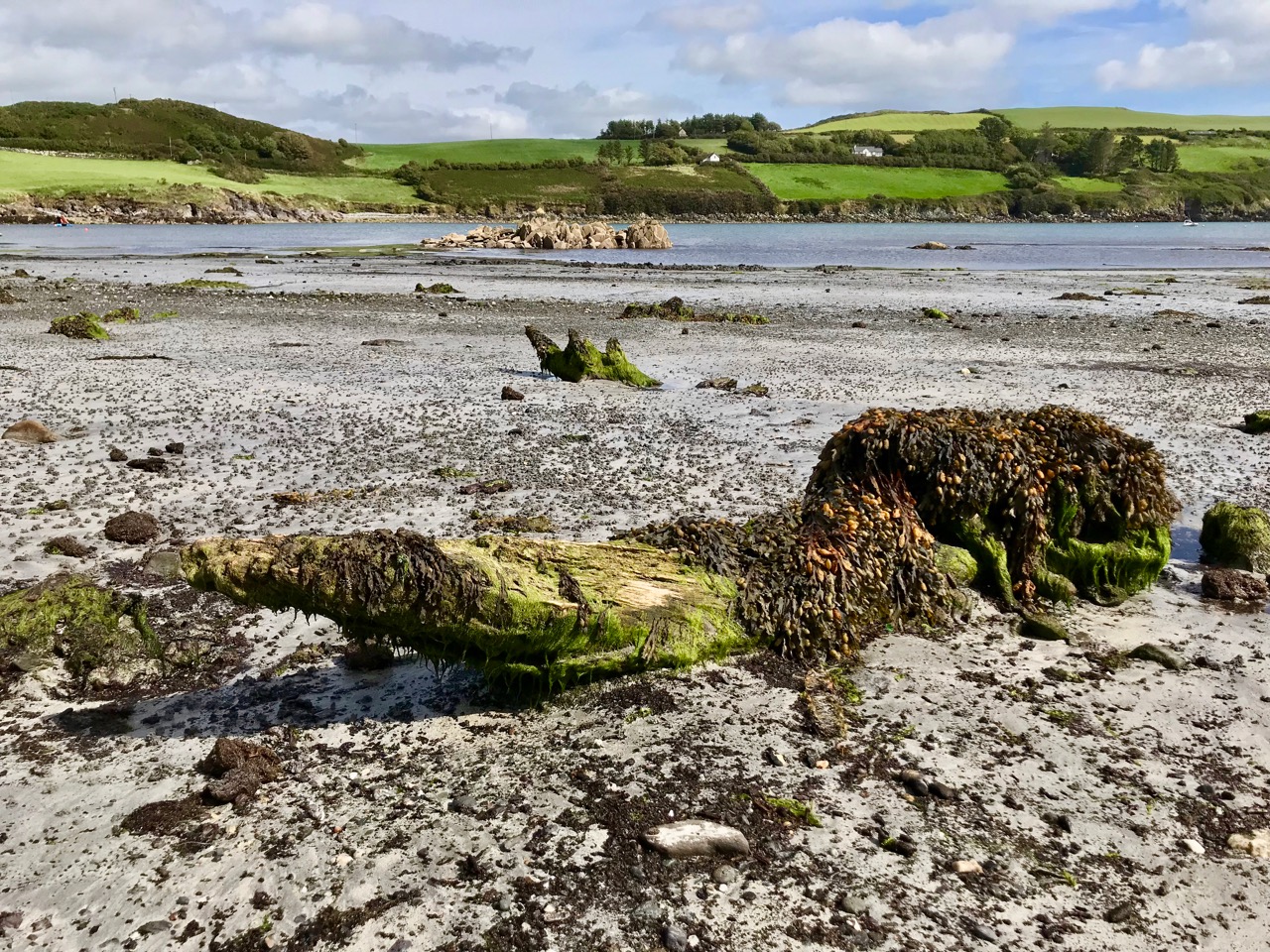
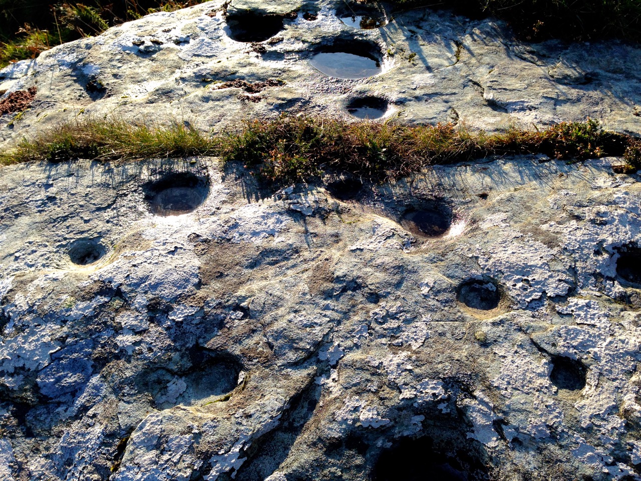
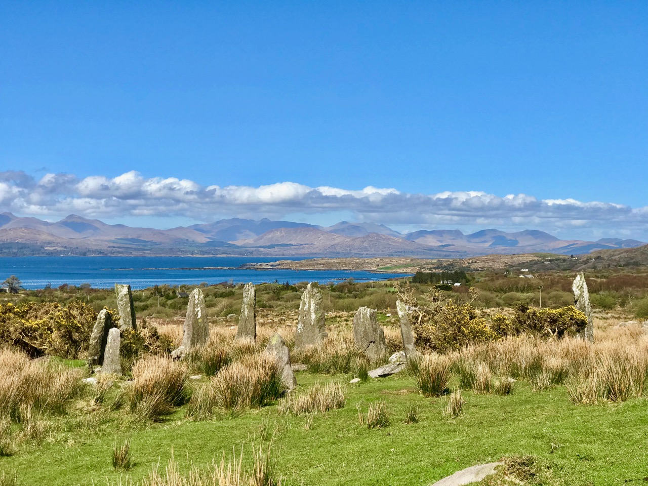
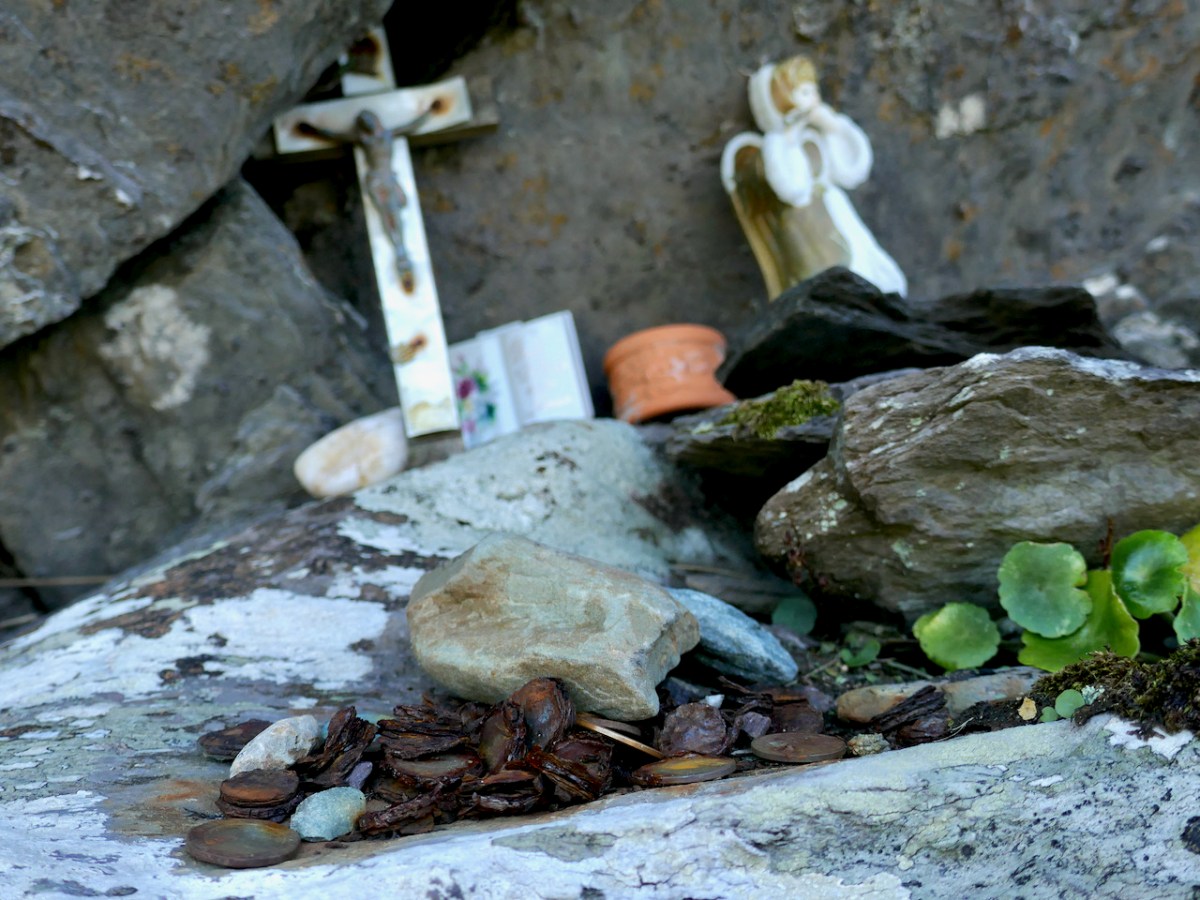
Once you’re up the hill the road levels out, the going is easy, and the views are now to the sea on your left and towards the distant Mizen Peak. And here’s the first surprise for you – a mass rock. Mass rocks, of course, were used in Penal times, when the saying of mass was outlawed and people met with their priest in faraway locations.

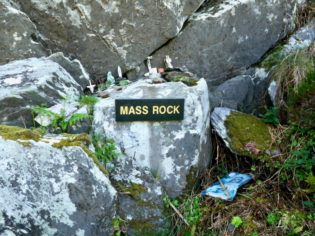
This one still lives in folk memory, and is still visited, by the evidence of various offerings left on the ledge. Some of the coins are so old they are peeling apart, while others look of more recent vintage.

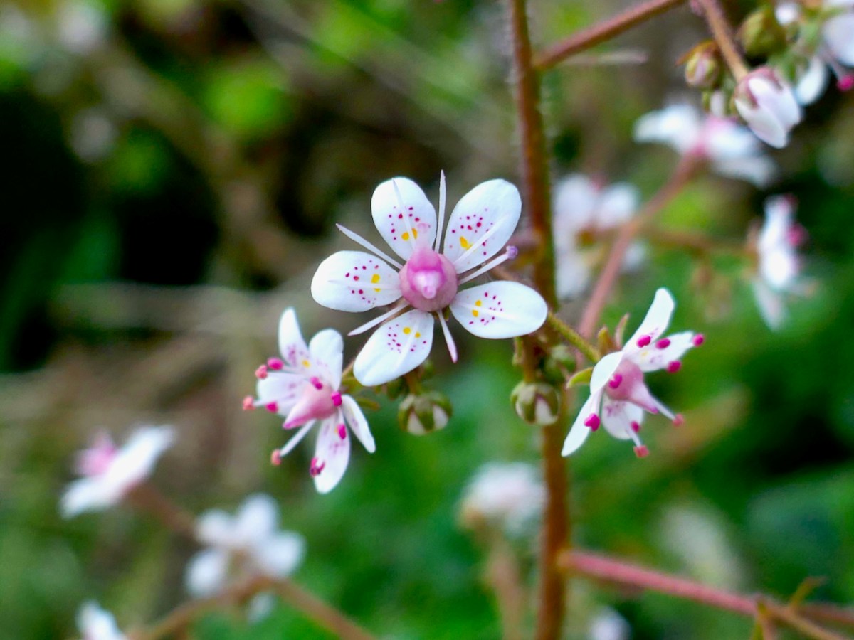
St Patrick’s Cabbage Is just starting to bloom. This is a native plant and part of a curious set known as the Lusitanian Flora which only occur in southwestern and western Ireland and in the Iberian Peninsula.

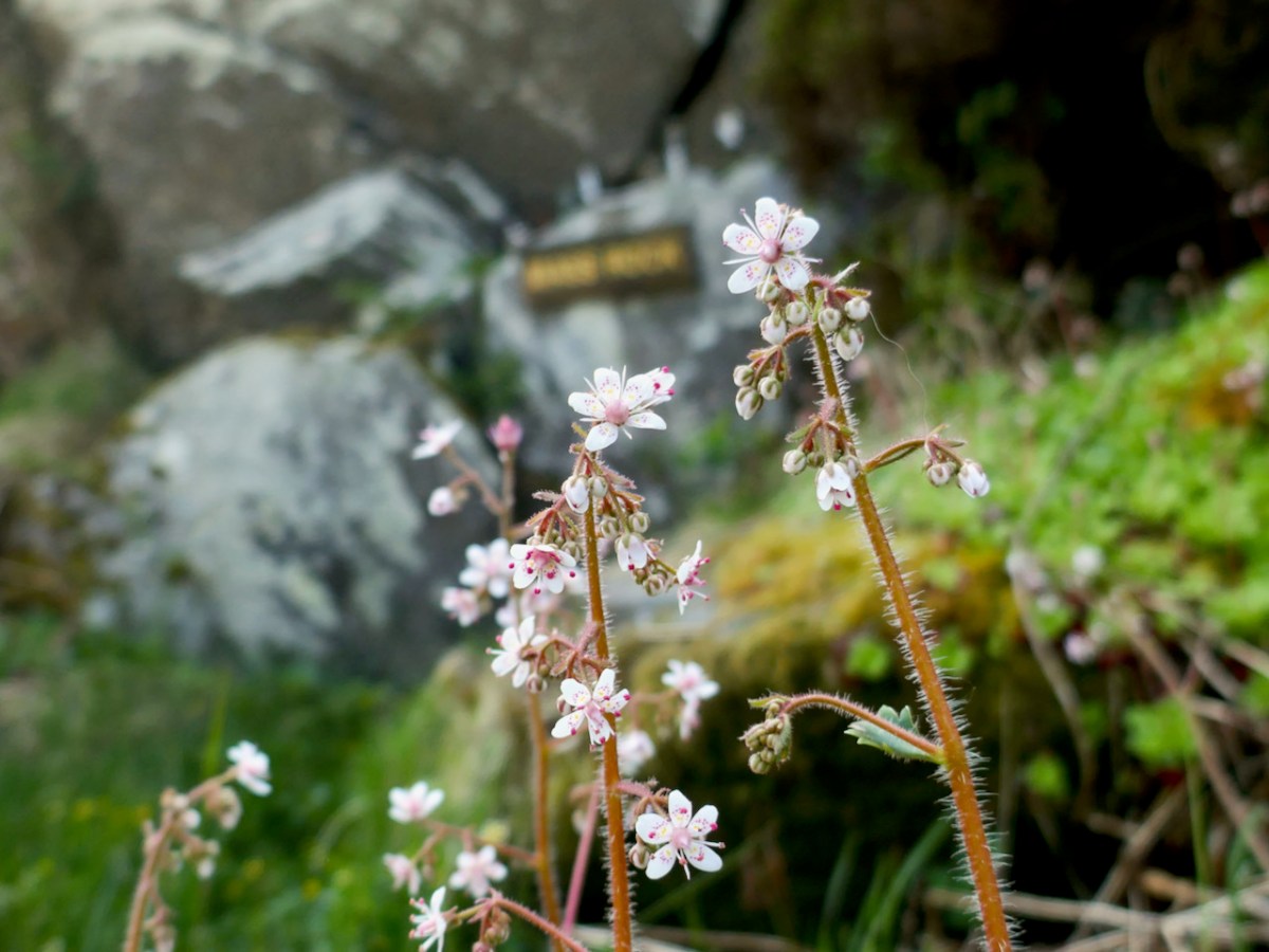
This one rewards a close look – the flowers are white but the petals have pink and yellow dots and the anthers are a startling deep rose colour. A domestic hybrid known as London Pride is grown in many gardens.

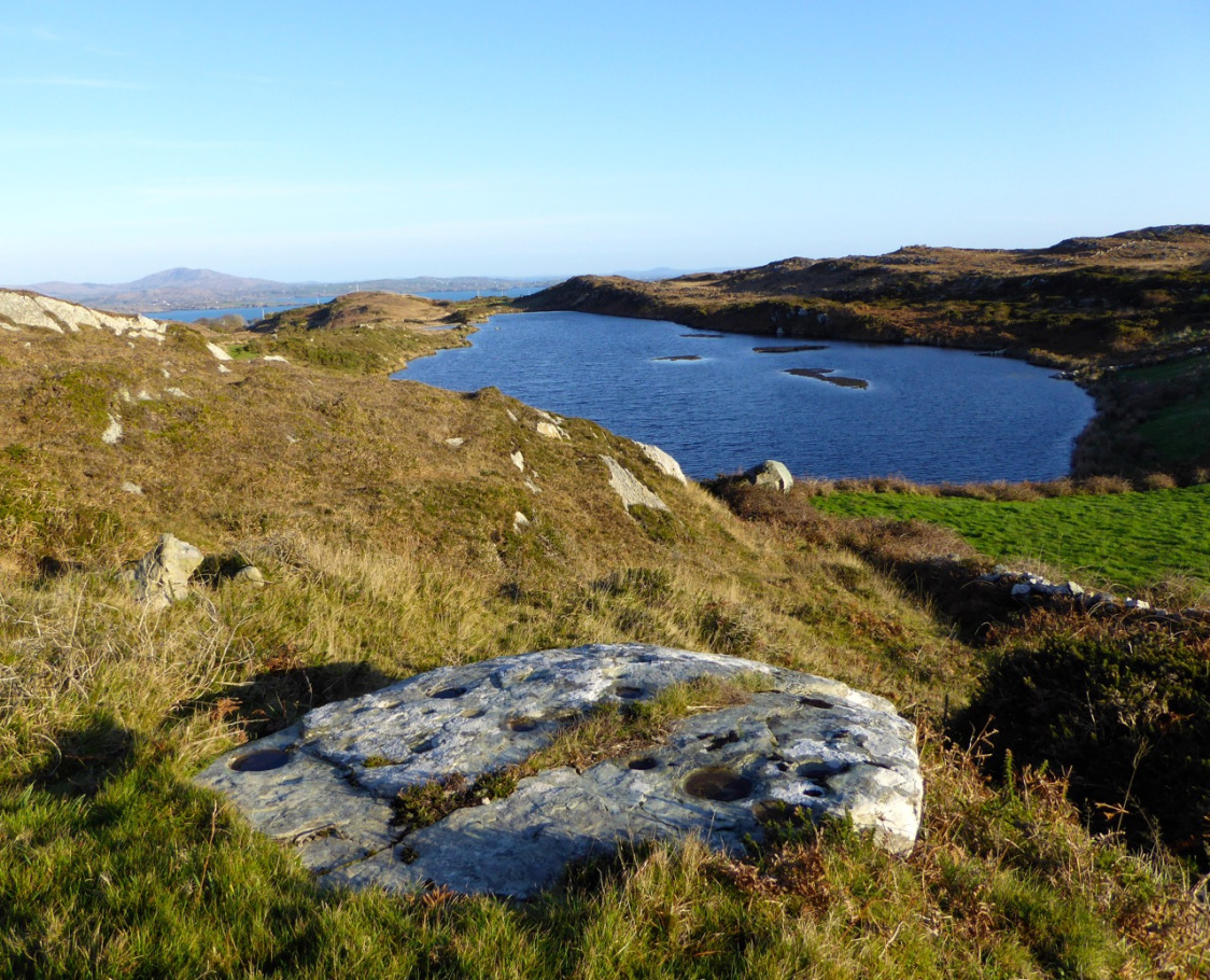
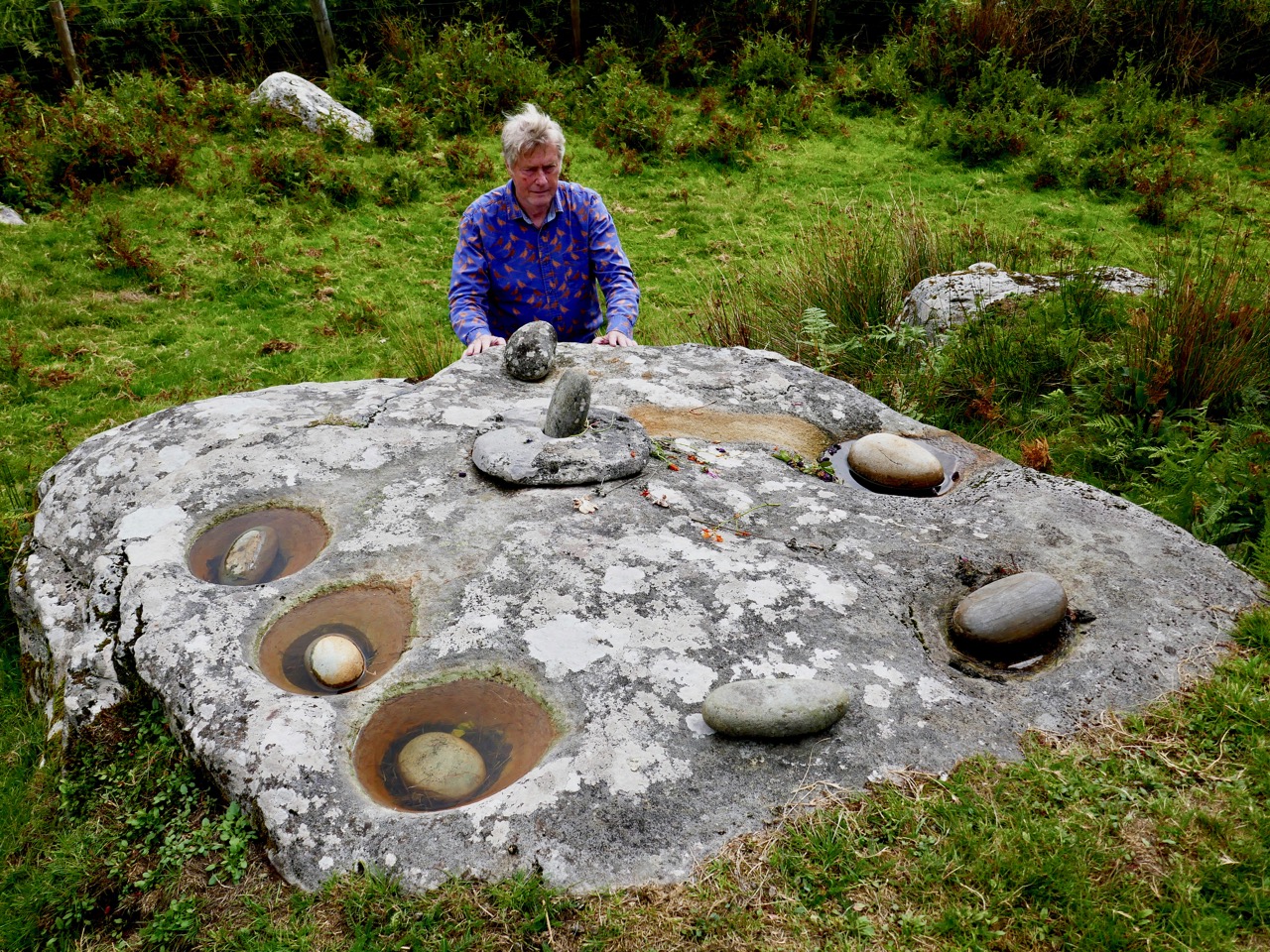
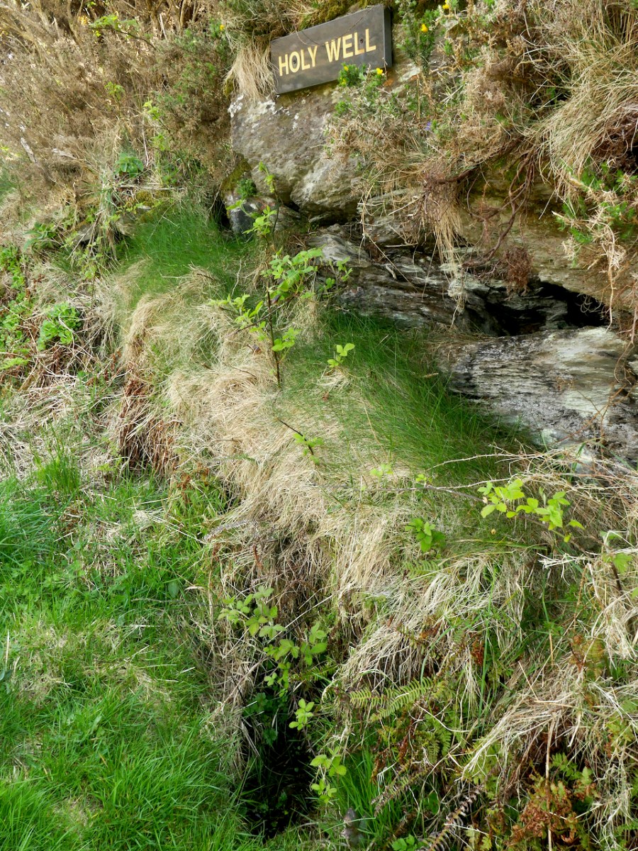
The second surprise is a holy well, just a little further along. It’s not a very impressive sight – looks like a ditch, in fact, although there’s a bit more going on under all that grass and brambles. The location is marked but there are no indications that anyone has visited in many years. No offerings here, no cups or rag trees, no statues or prayer cards. But nothing deters Amanda, and she has written about the well here, including the fact that its name is Tobairin a ‘Bhothair – small well of the road – and that it was once revered.

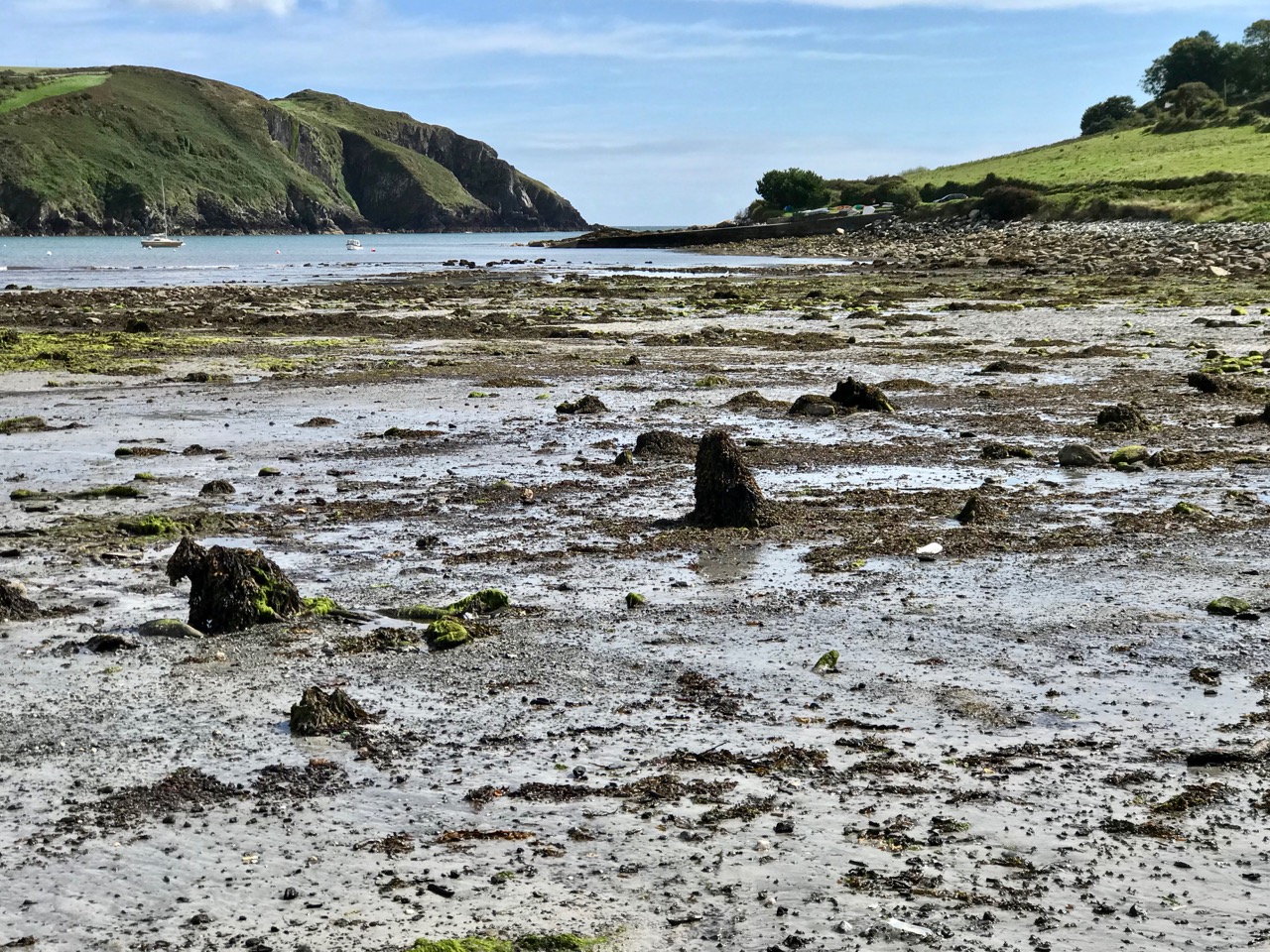
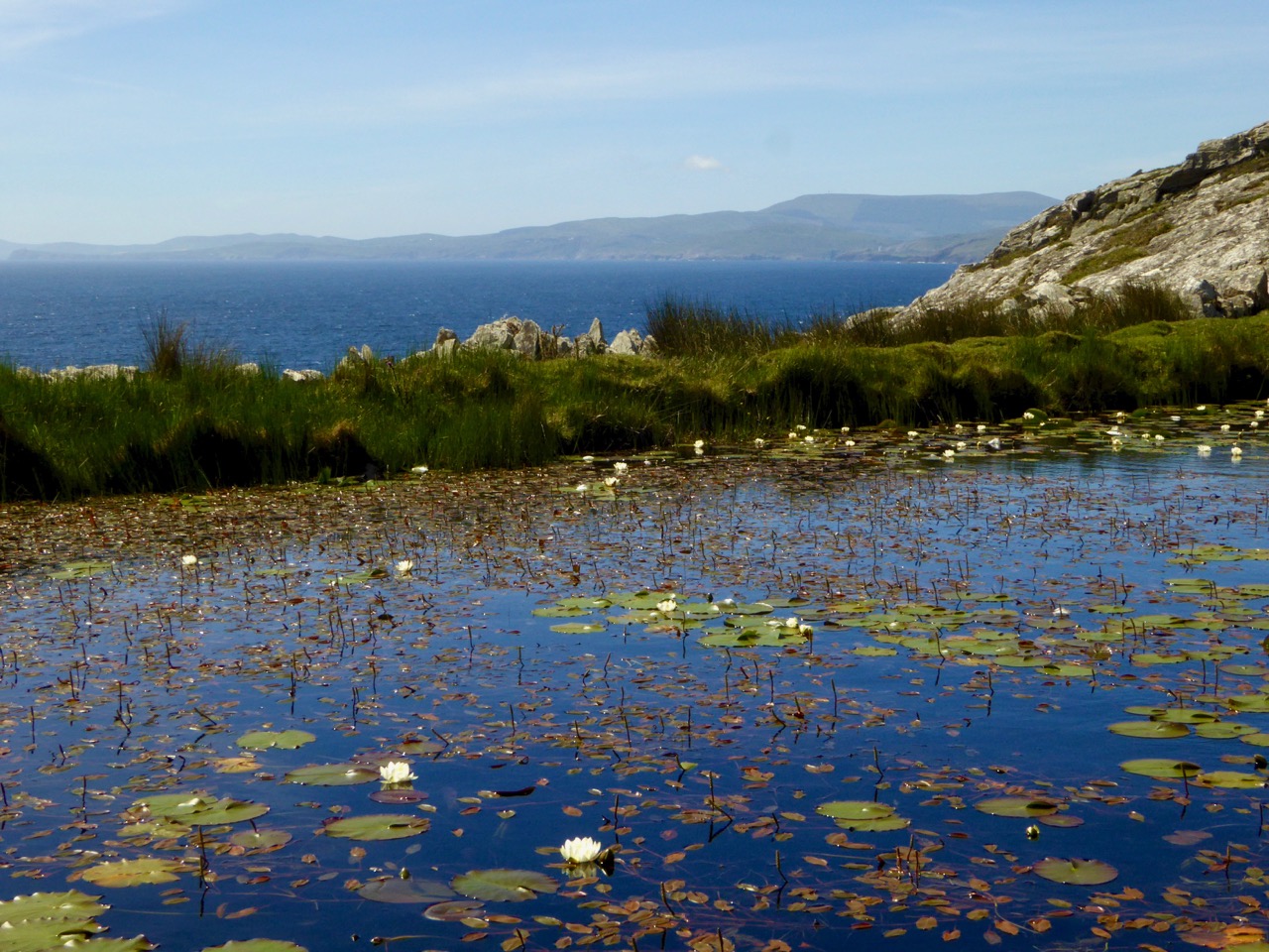
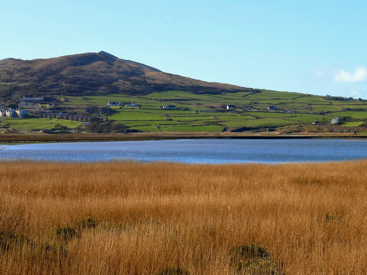
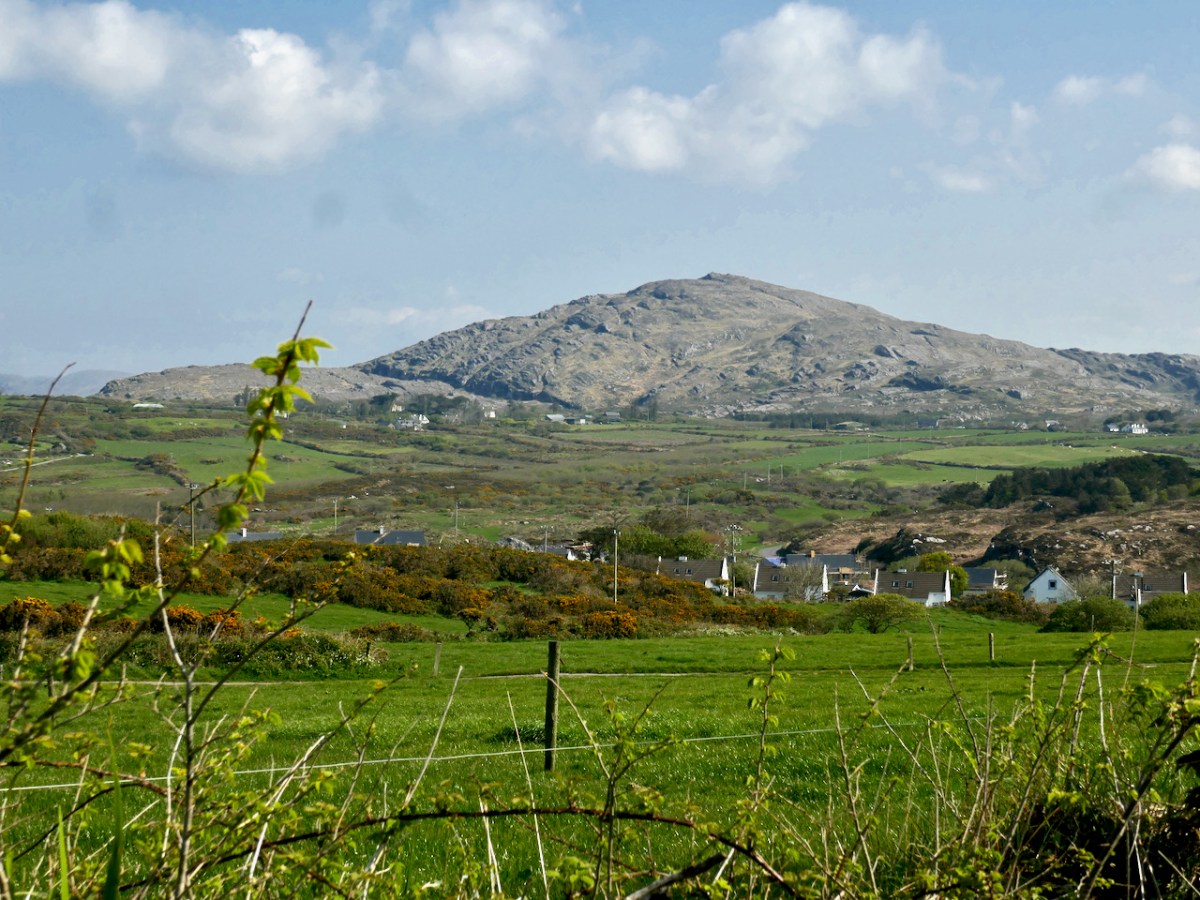
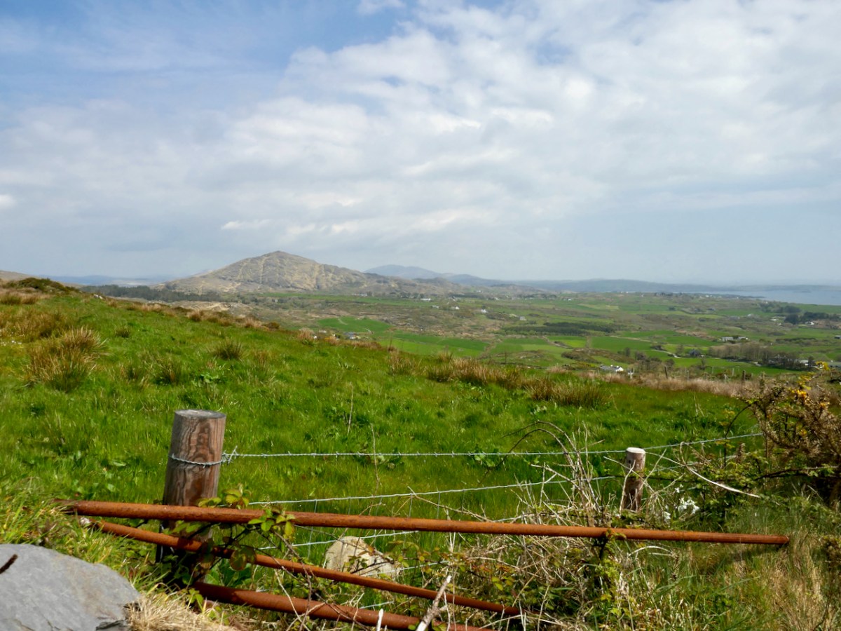
From the holy well keep going westwards and the reward is an immense view to the end of the Peninsula and the Mizen Peak (below). It’s a gentle downhill all the way until you get close to the main Goleen – Crookhaven road.

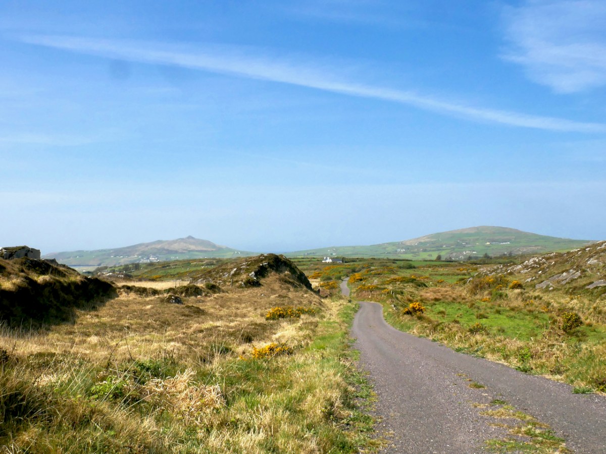
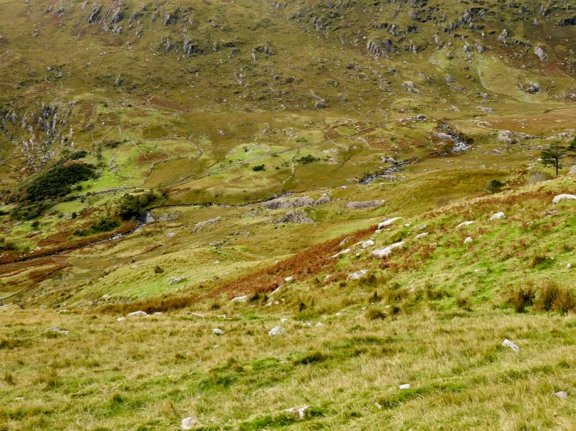
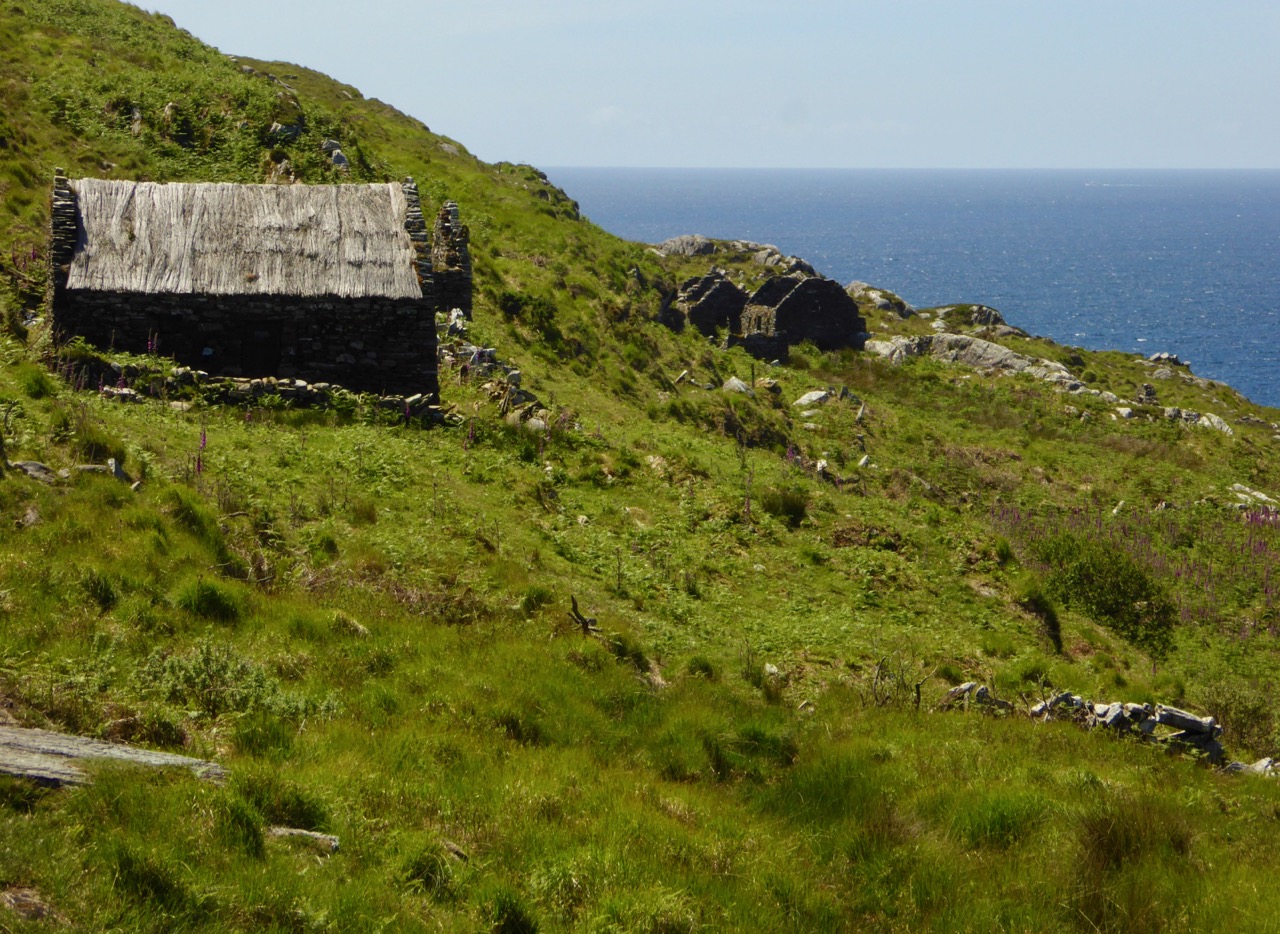
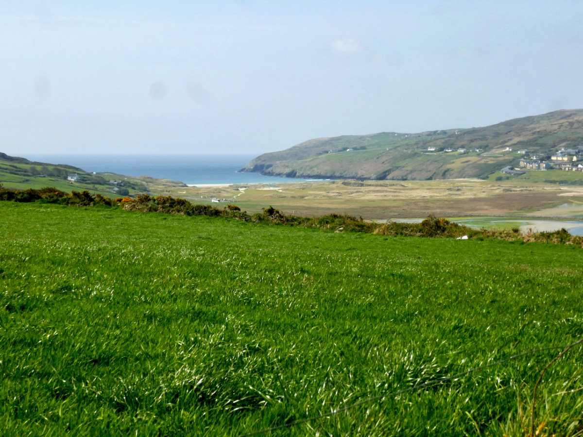
At this point, nobody could blame you for retreating to the snug at O’Sullivan’s Bar in Crookhaven for a pint coffee and a crab sandwich, but of course you are only half way through the walk if you want to do the full loop. So turn right and then right again, and start climbing as the road heads back to Goleen over the hills and away from Barley Cove (below)

The views don’t really start until you’re quite high up, but the road is peaceful and rural – a good time for contemplation, perhaps.

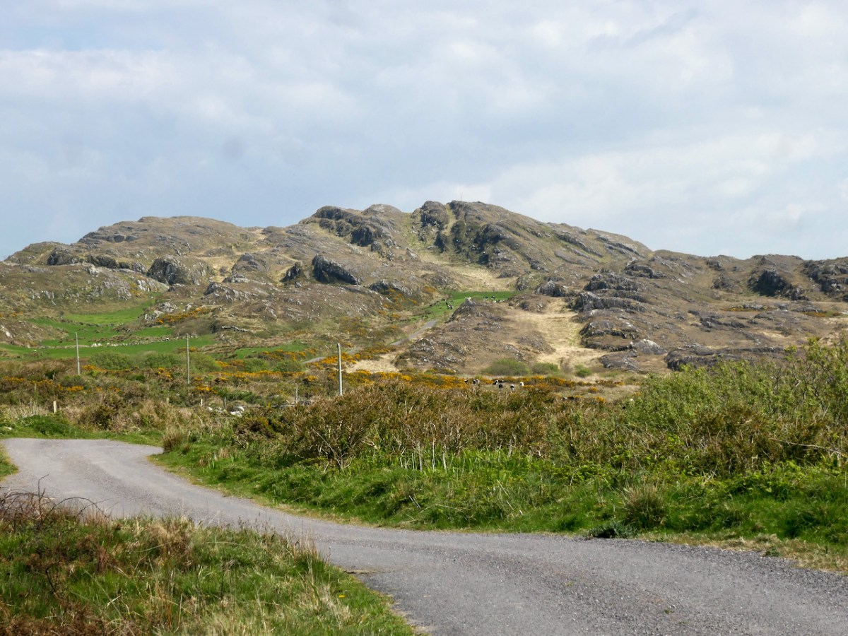
Once you’re on the downhill stretch you are facing east and once again have those glorious views across to Knockaphuca, with Mount Gabriel behind.

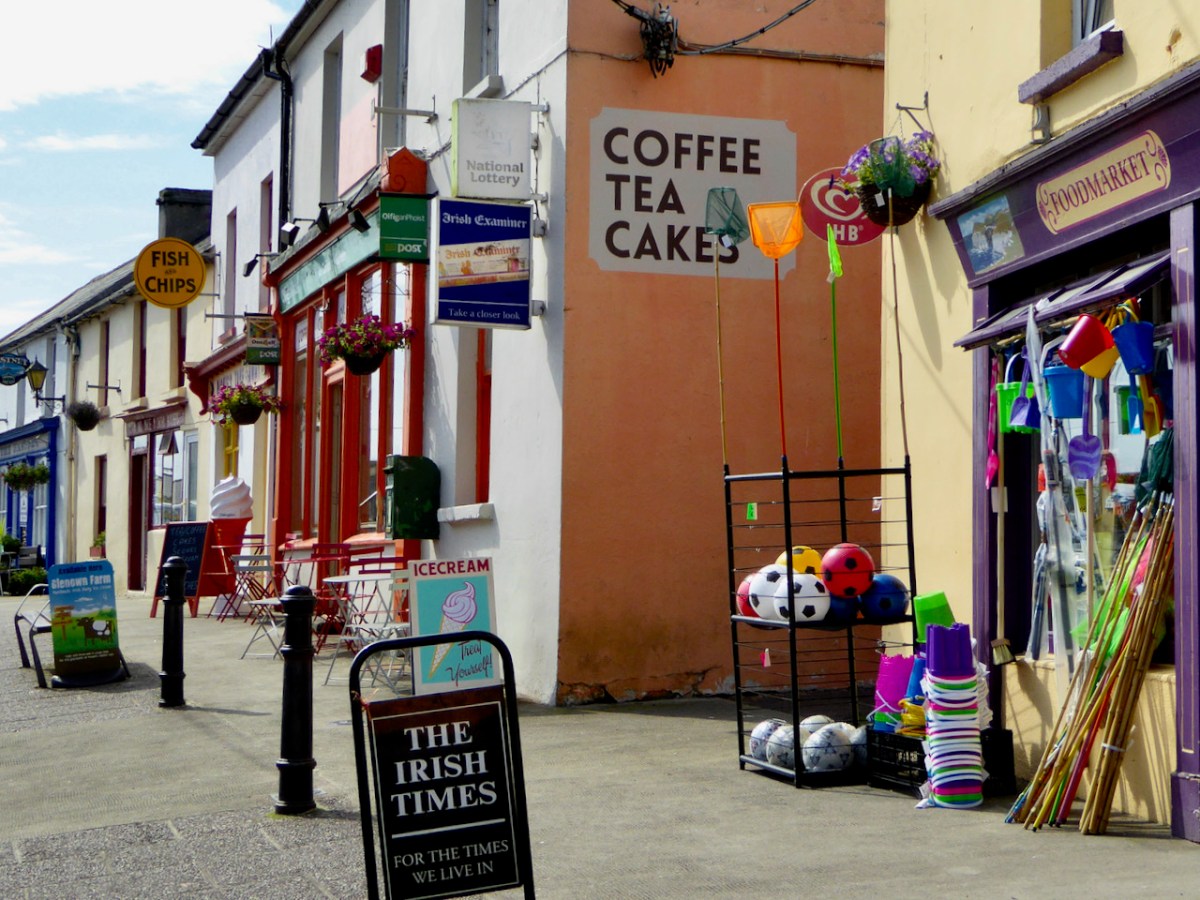
And when you hit Goleen – go on, you deserve it, have some ice cream!

Back to The Bealick

Yesterday we went back to the Bealick – back to the valley of Cooleenlemane that so entranced Robert and me that both of us wrote about the experience last year. I concentrated on the Bealick (pronounced Bay-lick) – the ‘caves’ containing ancient rock scribings and my post was called Witches’ Marks and Lovelorn Shepherds: Inscribed Rock Art in a Remote Valley. Robert wrote about the valley itself, through geological and historical time in his post, Cooleenlemane – A Walk Into History. What more could we have to say about this impossibly beautiful place? Lots, it turns out.

The red house at the bottom right marks our starting off point. In the distance is Bantry Bay and Whiddy Island

We took the walk in the company of our favourite travelling companions, Peter (of the Hikelines Blog) and Amanda (Holy Wells of Cork and Kerry). We had been missing them badly as they had been in New Zealand when the pandemic struck, unable to get home for six months. It felt really good to be out and about with them again.

Amanda fords one of the many streams (it was a wet walk!) and Peter points out some of the scribings in the Bealick

Apart from the jaw-dropping scenery and the sheer pleasure of a hike into a relatively untouched valley, this time I found myself drawn to the evidence of occupation over time, starting in the Bronze Age. At the entrance to the valley and right beside a ford across the river stands what is described in the National Monuments inventory as a ‘Megalithic Structure. . .the exact nature of which is unknown.”

It’s in the middle of a small clearing, with a Hawthorn tree growing out of it – altogether a magical sight. It could be what remains of a wedge tomb – see my post Wedge Tombs: Last of the Megaliths to learn more about this type of monument. 

I wondered how ancient the ford might be. For most of the length of the Cooleenlemane River as it runs down the valley it is easy to cross with the help of a stone or two, but in this spot it widens. Although no longer in use now, this type of crossing place is often of considerable antiquity – indeed one of the most common place names in Ireland contain the word áth (pronounced awe) which means ‘ford.’

Leaving the megalith, we followed the course of the stream up the valley, mostly trying to select higher and slightly dryer ground, and trying not to get too distracted by the oh-so-photographical scenery all around us. Ruins of small stone cottages dotted the landscape, and a tiny cart track runs the length of the valley almost to the Bealick.

The National Monuments inventory also lists a cashel, two enclosures, and two hut sites in the valley. We passed the Cashel half way between Furze Hill and the Bealick, although we actually obtained the best views of it from the Priests Leap Road afterwards.

The upper photograph shows Furze Hill, the dark patch on the left, and the Bealick just above the bend in the river. The cashel is half way between them. The lower photograph is a closer look at the cashel

Cashels are ring forts made of stone rather than earthen banks. They are considered to be the farmhouse enclosures of high-status individuals (you can see an exceptionally good example at Knockdrum – see Robert’s post Knockdrum Stone Fort to understand how they functioned). This one is clear but very ruined, circular in plan, about 17m across.

It probably dates either to the late Iron Age or the Early Medieval Period – anywhere in the first millennium AD. Like other cashels, it has clear sight-lines down the valley and was built to be visible and a statement of status and power.

We didn’t hike up to the enclosures or hut sites further up the valley – a walk for another day. I think Peter (above) is already plotting his course up there. The most southerly of the enclosures sounds interesting, with an entrance marked by upright stones and a levelled interior. There is no way of knowing how old these are, of course, but taken with the megalithic structure and the cashel, they do indicate that this valley has been lived in and worked for thousands of years. 

And then there’s the Bealick itself – the three ‘caves’ formed by massive rocks leaning against each other, two of which contain the rock scribings. In the way of such unique places they become special features of the landscape and take on a mantle of history. In this case, the Bealick was a Mass Rock, a home, a sheep-shelter, and a mysterious repository of enigmatic markings. 

On our walk yesterday we became aware that we were not the only ones in the valley. Along came Mary, with four very well-behaved dogs, on the look-out, she told us, for her brother’s cattle.

From the top: a field enclosed with stone walls runs up the steep slope; lazy beds in an old field; a ruined cottage surrounded by tiny haggards (a haggard is a small enclosure beside a house)

She explained that the land was commonage and that it hadn’t been lived in, in living memory – probably abandoned not long after the Famine, she thought. She pointed out locations of what she called ‘cowlocks’ or small homestead here and there, with their associated potato patches recognisable by the lazy bed ridges still visible in the small fields. She told us the prominent knoll we had passed was called Furze Hill. 

She pointed to a cliff above the Bealick (both images above) and named it as `Carrignasprogue’. A direct transliteration from Irish, this is Carraig na Spioróg, or Rock of the Sparrowhawks. It’s a particularly dangerous place for sheep, she said, as they tend to get trapped at the bottom of the sheer part and have to be rescued. Every field, every bend on the river and every prominent rock would have had its own name, enabling those who lived in the valley to know exactly what part was being referred to. 

Nowadays, several families share the valley, grazing sheep and cattle in it and for the most part leaving them to their own devices. The grazing has kept the valley relatively clear – we saw little evidence of overgrowth of gorse or bracken and none of the rhododendron invasions that plague the Killarney National Park not so far away. One hesitates to use the word pristine nowadays, but the sense I have is of a remote place that hasn’t changed much in hundreds of years. Long may it remain so.

We drove home a circuitous route, up over the Priests Leap Road into Kerry and back over the Caha Pass into Cork. We were delighted to find Molly Gallivan’s open and serving tea and scones. There’s a tiny cottage attached, reconstructed in the style of the traditional Irish farmhouse and I was especially struck by this bedroom – it could have been in one of those tiny Cowlocks we passed by in the valley earlier.

West Cork Obscura – Robert’s Choices

‘Hidden West Cork’ and ‘off the beaten track’ have been oft-used phrases in our posts – and that’s part of our mission with Roaringwater Journal: exploration of some of the more secret places, and researching and recording their stories. Finola has looked out her own favourites; my current choices are here – although, with 569 posts written to date between us, we could have picked out so many.

Header and above – one of the discoveries which made a great impression on me during the year was Tralong Bay, out beyond Glandore and Drombeg: it’s a beautiful piece of the coastline, at the end of a cul-de-sac and – it seemed to us – very little visited. But to visit is to transport yourselves back thousands of years as, on the beach and exposed at low tide, are the remains of an ancient forest. Here is the post.

A quirky discovery, not too far away from Tralong, was the pyramid-shaped mausoleum in the old burial ground at Glandore. For us, ancient graveyards are treasure troves of local history. This one – a peaceful and secluded place well worth a visit anyway – conceals an enigma: find the story here.

The Rock Art at Castlemehigan in its spectacular setting (above). Below is a close view of some of the markings on the rock

Delving back a few years, I found this December post on a visit to a spectacular example of Rock Art at the far end the Mizen Peninsula: Castlemehigan. The cupmarks on this earthfast boulder are impressive and the view from it is spectacular, especially on the clear winter day that we were blessed with. The rock was also in use as a Mass Rock during penal times, and there is evidence of this on the surface. We were told a story about those times by Florence O’Driscoll, whose land the rock is on. Make sure you have permission to visit if you go!

Finola managed to combine her consuming interest in wildflowers with industrial history and an account of a very special walk on the Sheep’s Head. It’s one of the marked trails on that peninsula – and takes in the deserted settlement of Crimea where a cottage has been partially restored (picture above) – finishing at the abandoned mine workings at Gortavallig, perched precariously on the very edge of a cliff (below). Here is the link to Finola’s post.

Here am I trying to get my head around the enigmatic ‘Rolls of Butter’ (above). I have to admit they are in Kerry (only just), but involved us travelling one of our all-time favourite roads, much of which is actually in West Cork: that’s the Priest’s Leap Road which runs over the mountains from Bantry (more or less) to Kenmare (more or less). We go out of our way to use this road because of the superb views – and a special piece of folklore – but, if you give it a try, be prepared for a narrow and steep journey (below)! Here is the post.

Archaeology dictates many of our outings. One of the less well-known monuments is Ardgroom Outward Stone Circle (pictured above and below) on the Beara Peninsula. This year, following a harsh winter, the weather turned sublime, and we have travelled extensively to make the most of it. We find ourselves often drawn to the Beara (much of which is in West Cork). This post describes an expedition which included stone monuments, colourful villages, stained glass – and ice cream! Have a look.

It was almost five years ago that we first reported on one of our perenially favourite West Cork locations: Gougane Barra (above). It’s a holy place – an alluringly beautiful lake sited in the Shehy Mountains, close to the source of Cork’s special River Lee. Here, in the sixth century, Saint Finbarr set up a collection of cells for his monastic community on an island. Here, also, lived the couple ‘The Tailor and Ansty’, immortalised in a book written in 1942 by Eric Cross. It’s a not entirely happy story as the book was banned because of its down-to-earth portrayal of the facts of life, and storyteller Tim Buckley (‘The Tailor’) was forced to burn his copy of it in front of the local priests: the incident led to an abrasive debate in Seanad Éireann on censorship. This story is, perhaps, one of the less well-known historical aspects of West Cork (and Ireland), but visit Gougane Barra for its beauty – and make sure you find the gravestone of ‘The Tailor & Ansty’: it was carved by their friend Seamus Murphy and bears the inscription . . .  A Star Danced And Under That Was I Born . . .

We hope that, between us, we might have given you some good ideas for exploration of our wonderful West Cork landscapes and – perhaps – encourage you off the highways and on to the byways: there are so many adventures to be had, summer or winter. Travel Well!

Mizen Magic 8: The Altar

Here’s the Mizen Peninsula shown on a map drawn by Robert for the Bank House tourism centre in Ballydehob and embellished with Peter Clarke‘s exquisite watercolour sketches of just some of the places that should not be missed by visitors to West Cork . . .

. . . And here is another rendering from Peter of one of the ancient sites that everyone goes past when travelling to the far west: possibly one of the most accessible pieces of archaeology on this section of the Wild Atlantic Way. It’s the Altar Wedge Tomb at Toormore Bay.

It’s early February, and Imbolc has passed. That means that Springtime has officially started here in Ireland. Sure enough, we looked out over a sunlit Roaringwater Bay this morning: soon we were heading out towards Goleen, Barley Cove and all points west. We stopped at The Altar and had it all to ourselves. You can see here that it’s orientated towards the Mizen Peak – that sharp little pyramid which is right on the centre of the picture – and lies to the west. For me, there’s a perfectly natural symbolism about placing the dead in a tomb that is aligned on the rising and the setting of the sun: that’s something we still do, several thousand years on!

The upper picture, taken on the Winter Solstice, shows the Mizen stretching away from the heights of Mount Gabriel: the Mizen Peak is the little pointed blip just left of centre. The lower picture looks across the wetlands behind the sand dunes at Barley Cove, and was taken today in the Spring sunlight: the Peak is clearly visible as the highest point. I believe that our forebears attached great importance to high places, as many stone monuments and Rock Art often seem to be placed in the landscape with commanding views towards hilltops. Mike Wilson’s site Mega-What sets out his detailed studies of the orientation of ancient sites within the natural landscape. Here is his analysis of the setting of the Altar Wedge Tomb.

I am always alert for the ways in which our special sites are interpreted for us. I created a bit of a storm a while back when I commended the signage which has been put in place along the Wild Atlantic Way using visually strong corten steel elements (above left) supplemented more recently by (in my opinion) very well designed information boards. The image on the right above is from an earlier OPW board which explains the possible early use of the wedge tomb, while the images below show the new signage, which features the later use of the tomb as a Christian altar during the Penal times (hence the name: The Altar), with a drawing by Sam Hunter. I am struck by the way this monument has been a focal point for differing rituals spanning countless generations.

When writing about archaeological subjects I am always on the lookout for the way that antiquarians saw the sites which we are familiar with today. I had hoped that George Victor du Noyer – the subject of an excellent recent exhibition in Cork’s Crawford Gallery – might have drawn this wedge tomb when he travelled the country for the Ordnance Survey during the early nineteenth century: he may well have done, but the annotation and cataloguing of his vast legacy of work has yet to be completed and I have not found such a record. His drawings below are not of The Altar, but a portal tomb, Ballybrittas in County Wexford. Portal tombs (sometimes known as dolmens) share similarities with wedge tombs, but are earlier, dating from between 3000 BC to 2000 BC, while wedge tombs tend to be associated with the Bronze Age, which followed this period.

Cremated remains were found in Altar Wedge Tomb when it was excavated in 1989 by Dr William O’Brien, now Professor of Archaeology at UCC. We can never know exactly what the significance of these impressive structures was to those who built them. For me, I’m pretty sure that it was connected with their relationships to, and respect of, the landscapes which they inhabited, and which they invested with meaning. They must certainly have paid heed to the passing of the seasons and the continual cycles of nature, and their closeness to all of this must have given them an inherent knowledge of the paths of the sun, moon and stars. Above all, our ancestors had to understand and appreciate the environment around them, and make it work for them. In a practical sense, certainly, but also in terms of the stories they might pass on about the meaning of places.

Above – the magical landscape of the Mizen: we will never tire of it

The tailpiece picture, which is from Wikimedia Commons, attributed to Lukeoc88, is a remarkable timeless view of a human construction in the setting of our Universe: Altar Wedge Tomb under the Milky Way.