Ballycummisk Archaeology

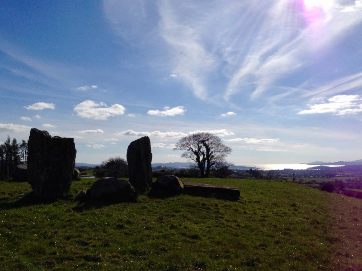
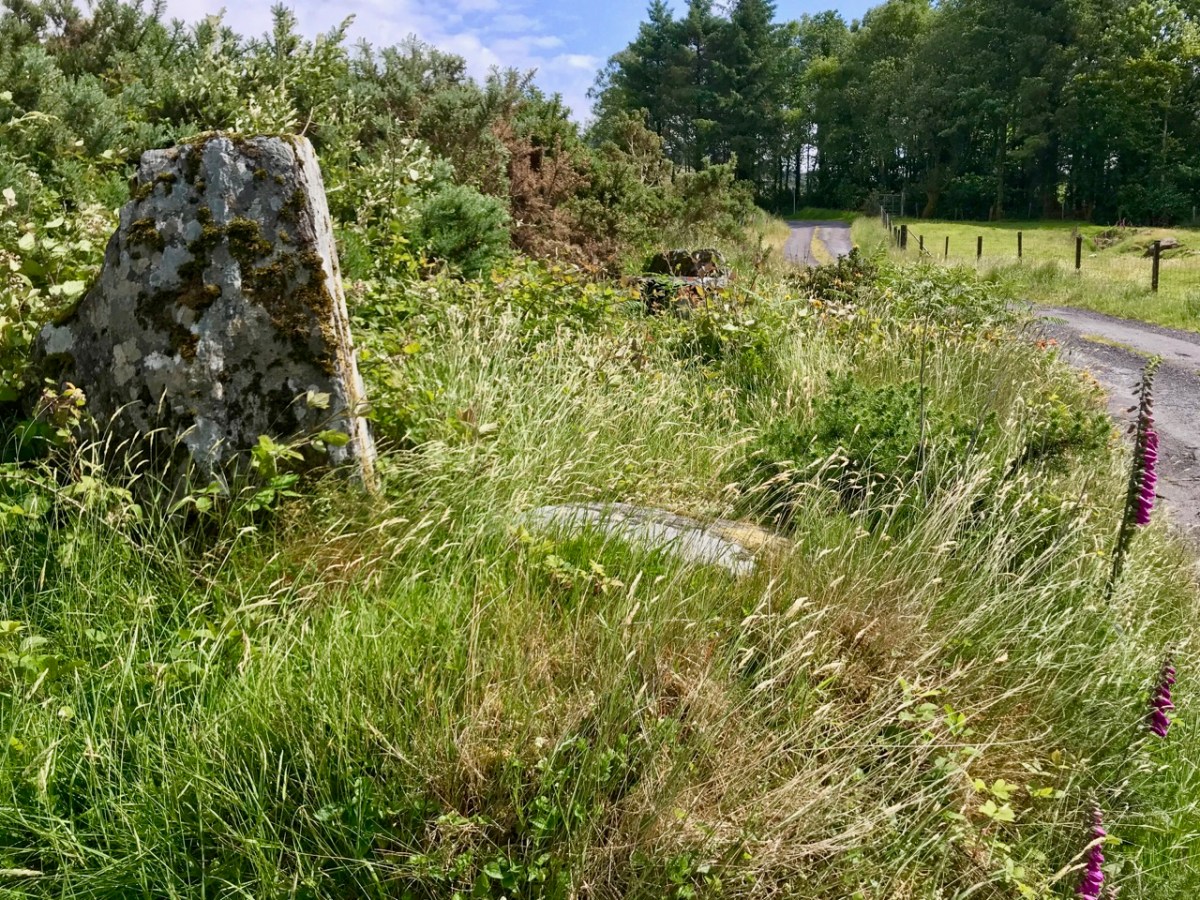
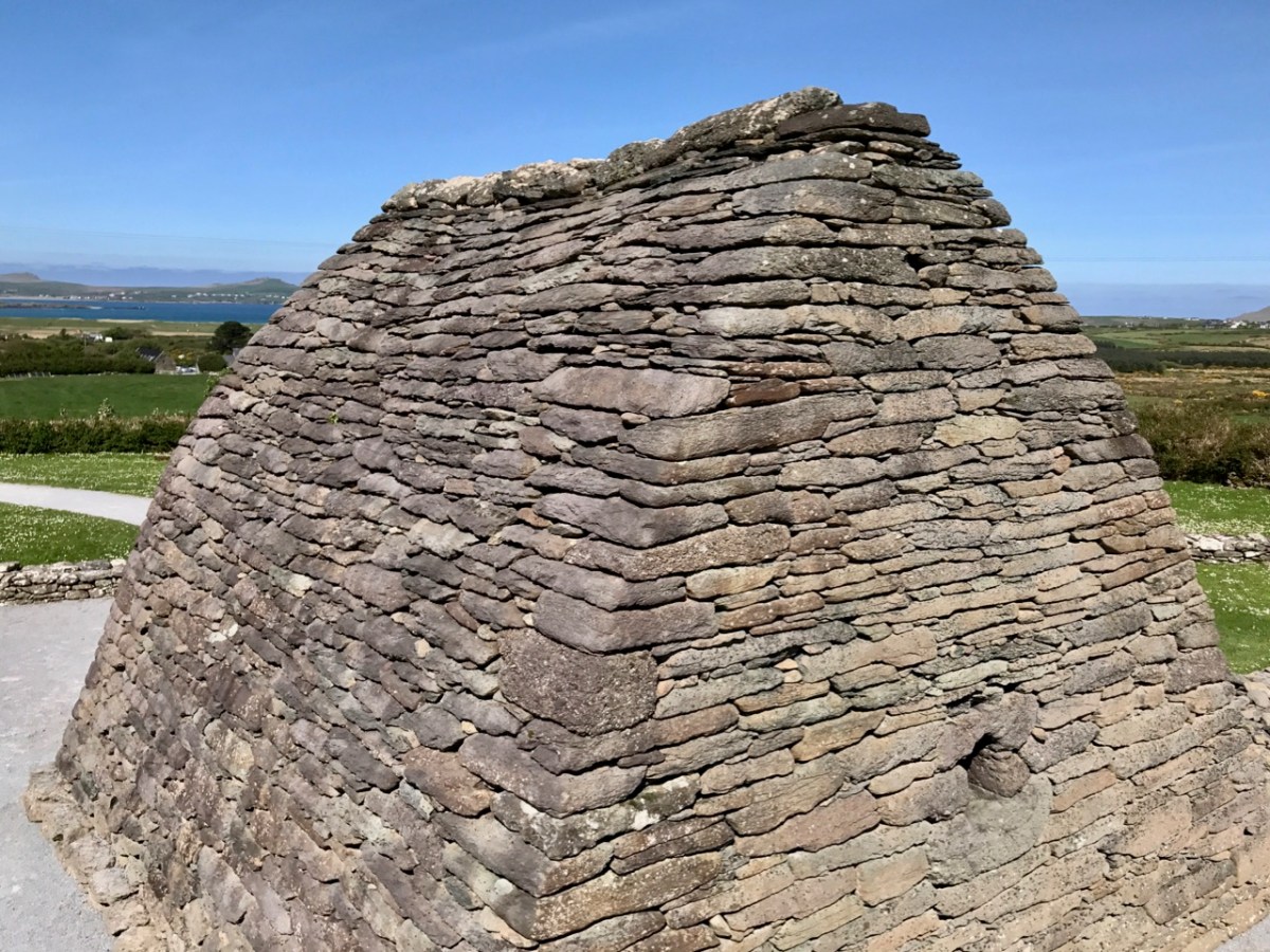
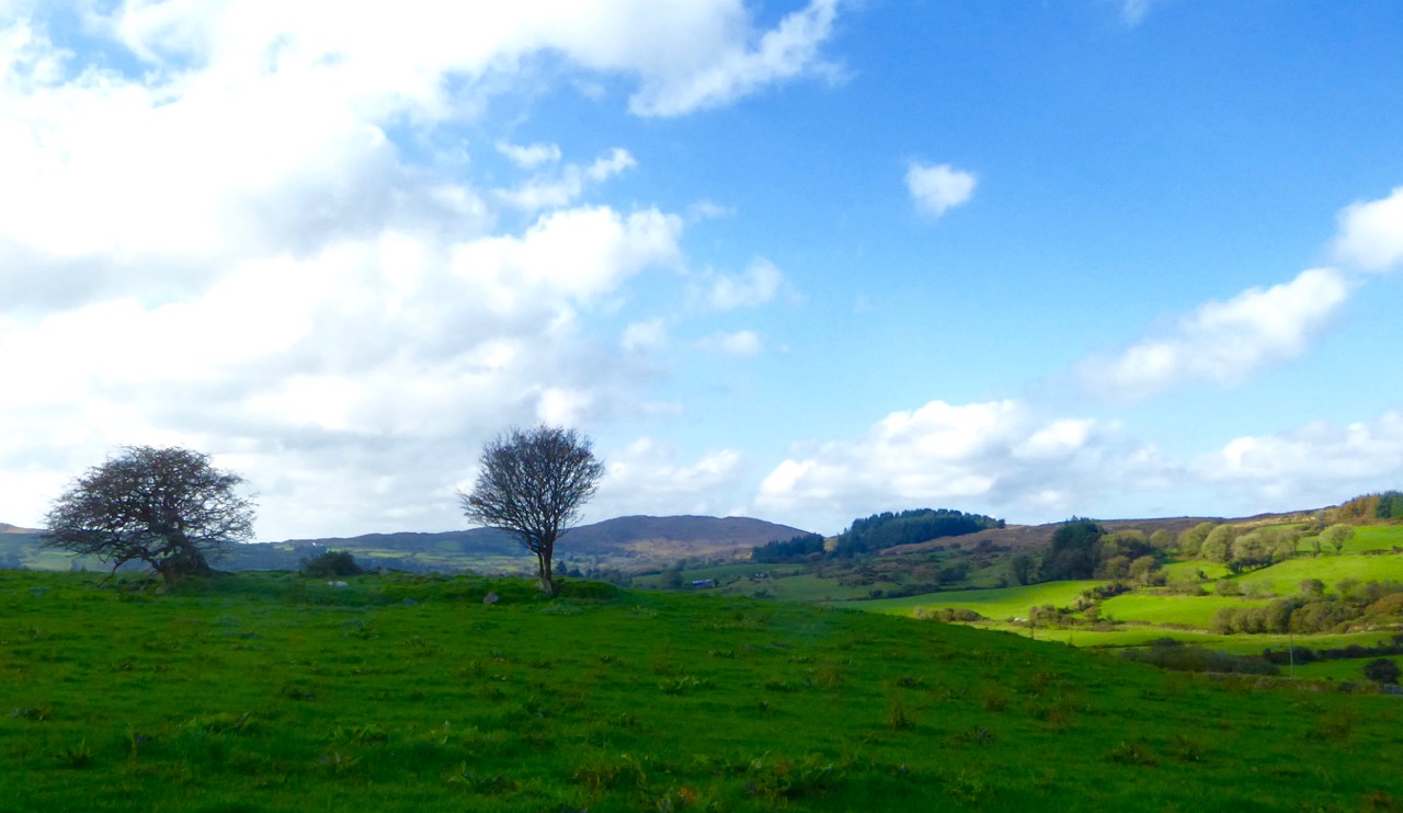
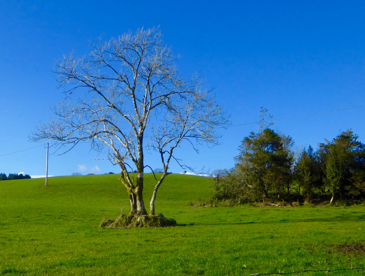
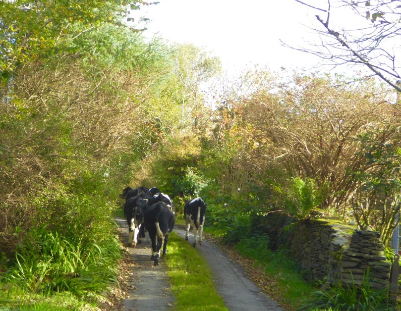
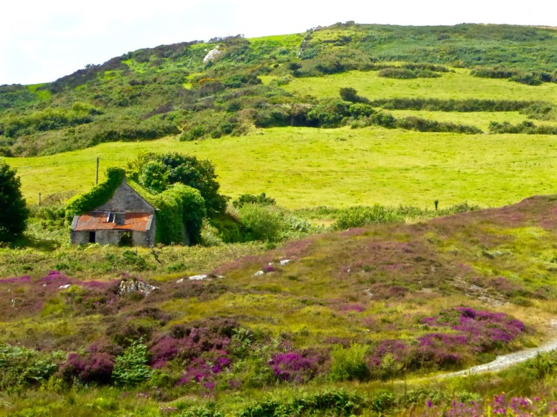
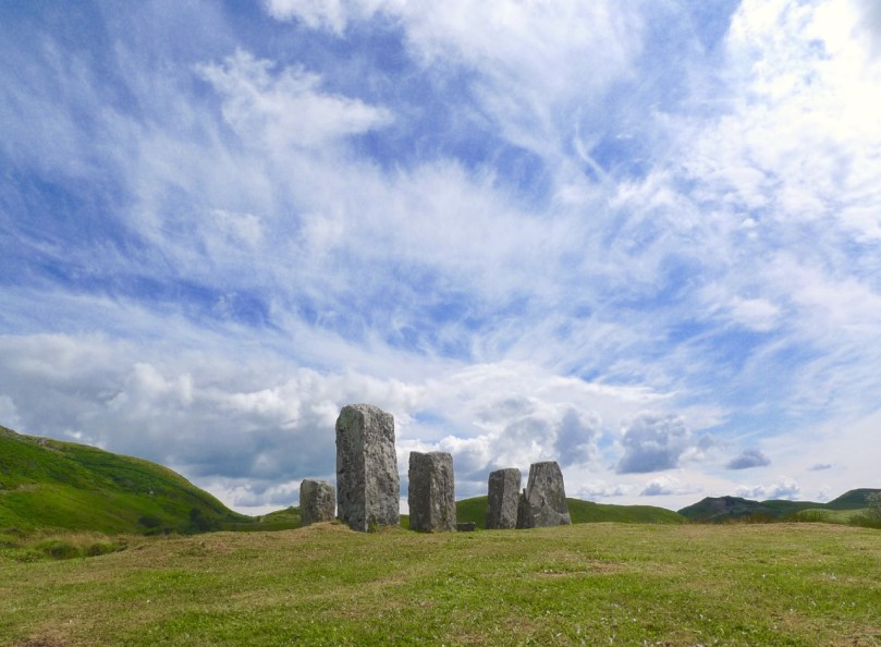
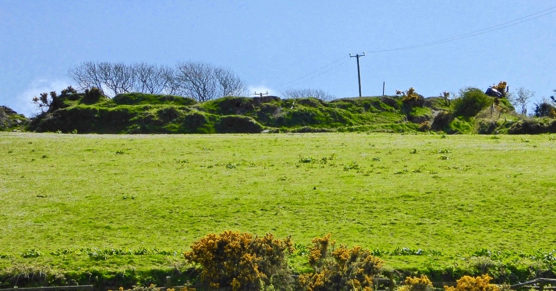
There’s a fine ringfort just over the hill from us – in the townland of Ballycummisk. A definition of a ‘ringfort’ in archaeological terms is given here:

. . . Many people lived in enclosed farmsteads known as ringforts in the Early Christian/Early Medieval period. Second to fulachta fiadh, they are the most common field monument surviving in Ireland with up to 60,000 examples, most dating to between 550-900AD. Ringforts are circular areas, measuring c24-60m in diameter, usually enclosed with one or more earthen banks, often topped with a timber palisade. In the west of Ireland the ringfort was often enclosed by a stone wall, with stone huts in the interior. Traces of iron and bronze working have been recovered suggesting some ringforts had very specific uses while others were multifunctional . . .

HeritageCouncil.ie
Significant Unpublished Irish Archaeological Excavations 1930-1997

A simpler definition comes from the monumental 1200-page Volume 1 of the ‘New History of Ireland’ series published in 2005 and edited by Dáibhí Ó Cróinín: “archaeologists are agreed that the vast bulk of them are the farm enclosures of the well-to-do of early medieval Ireland”.

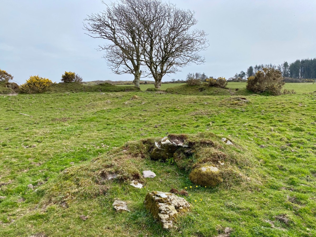
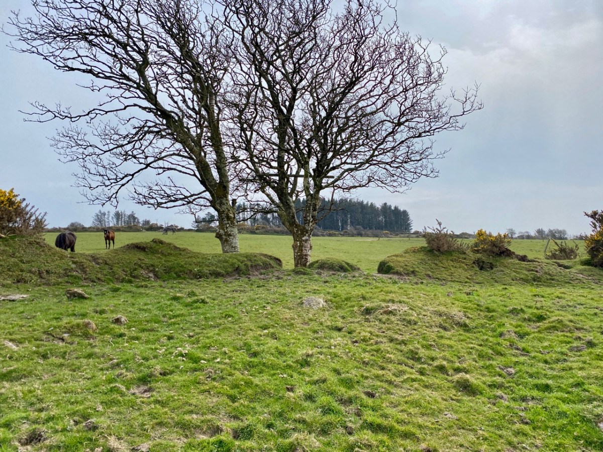
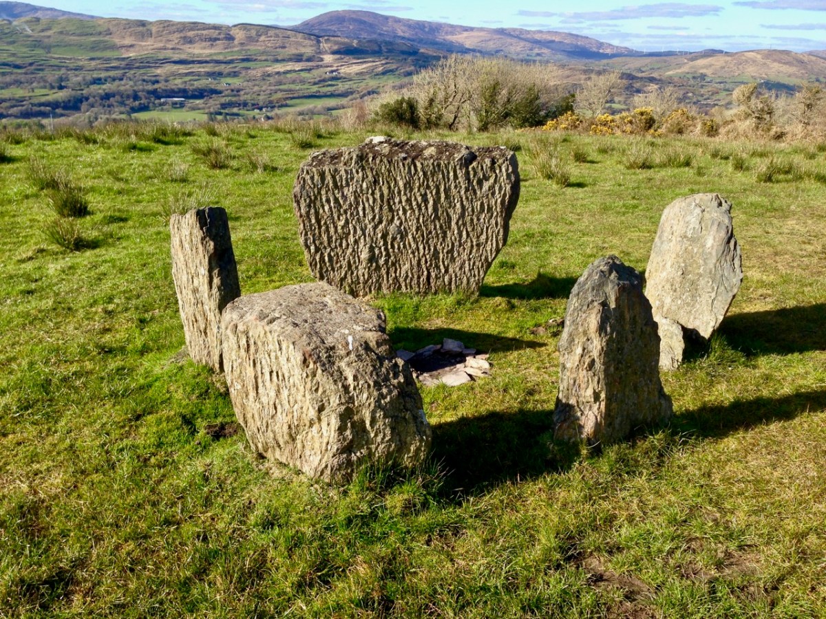
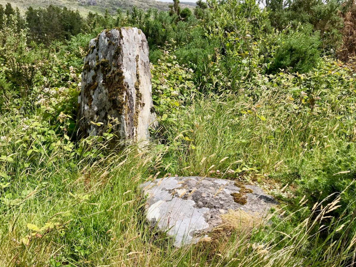
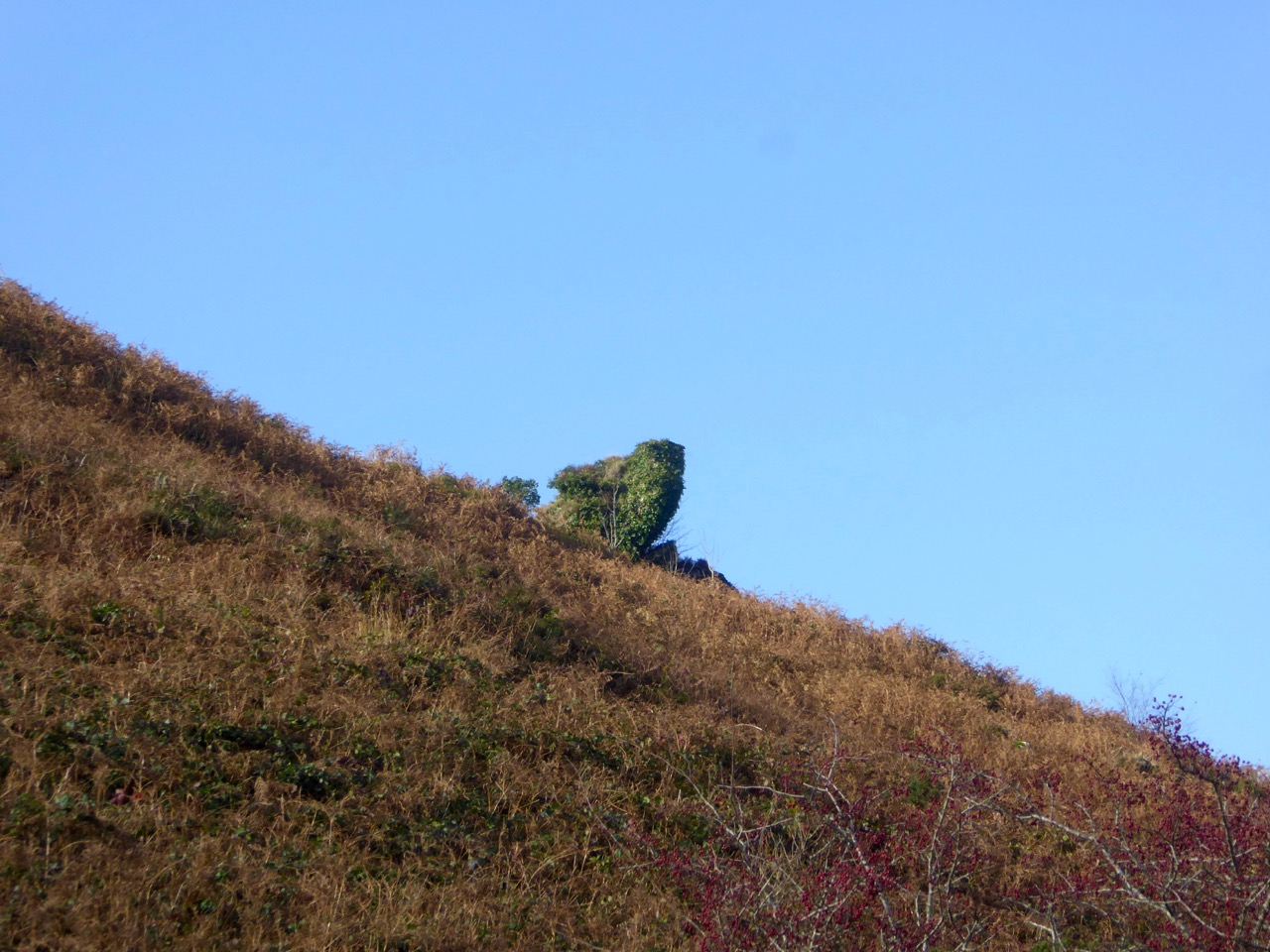
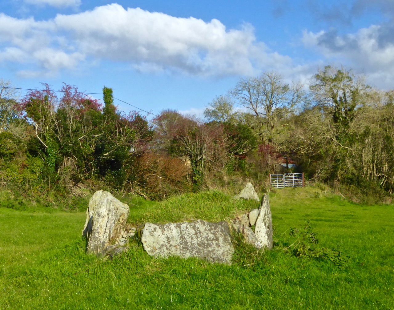
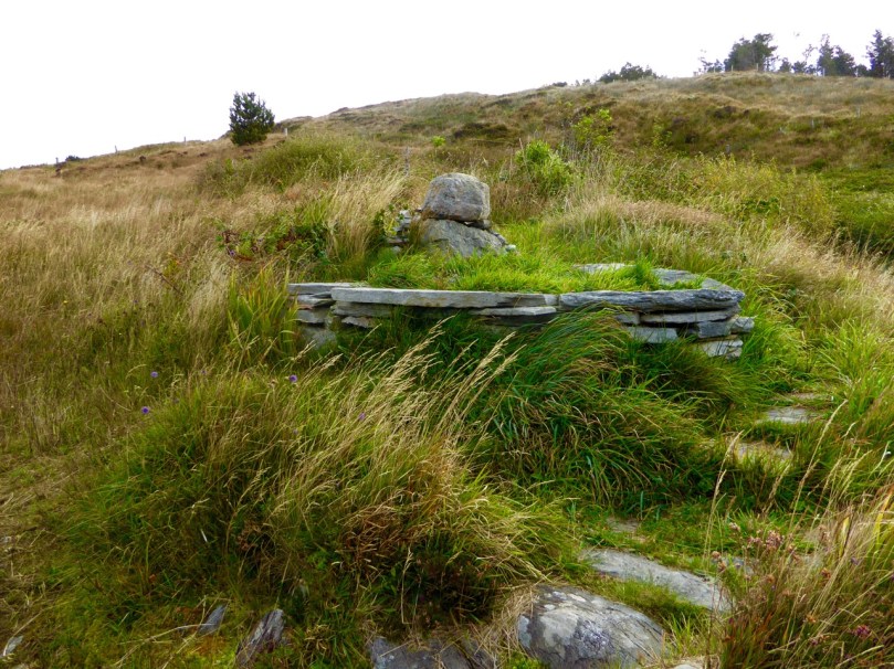
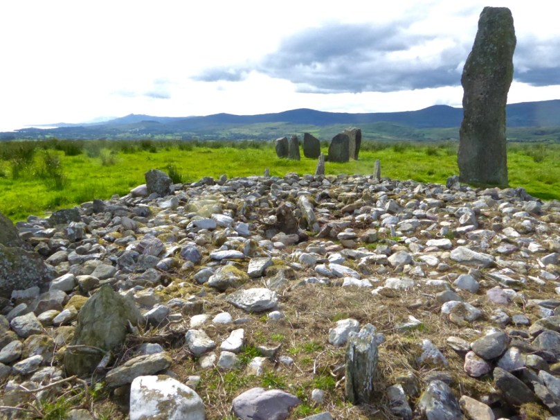
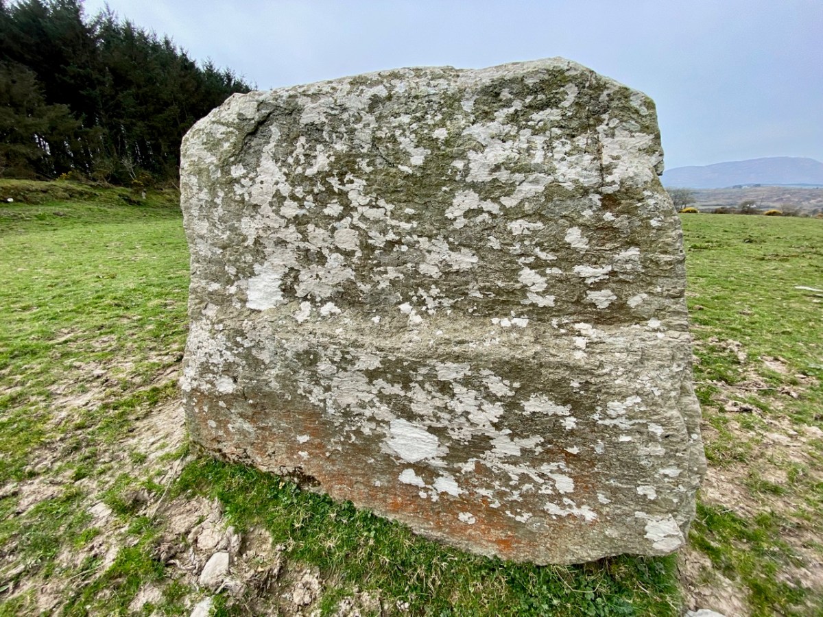
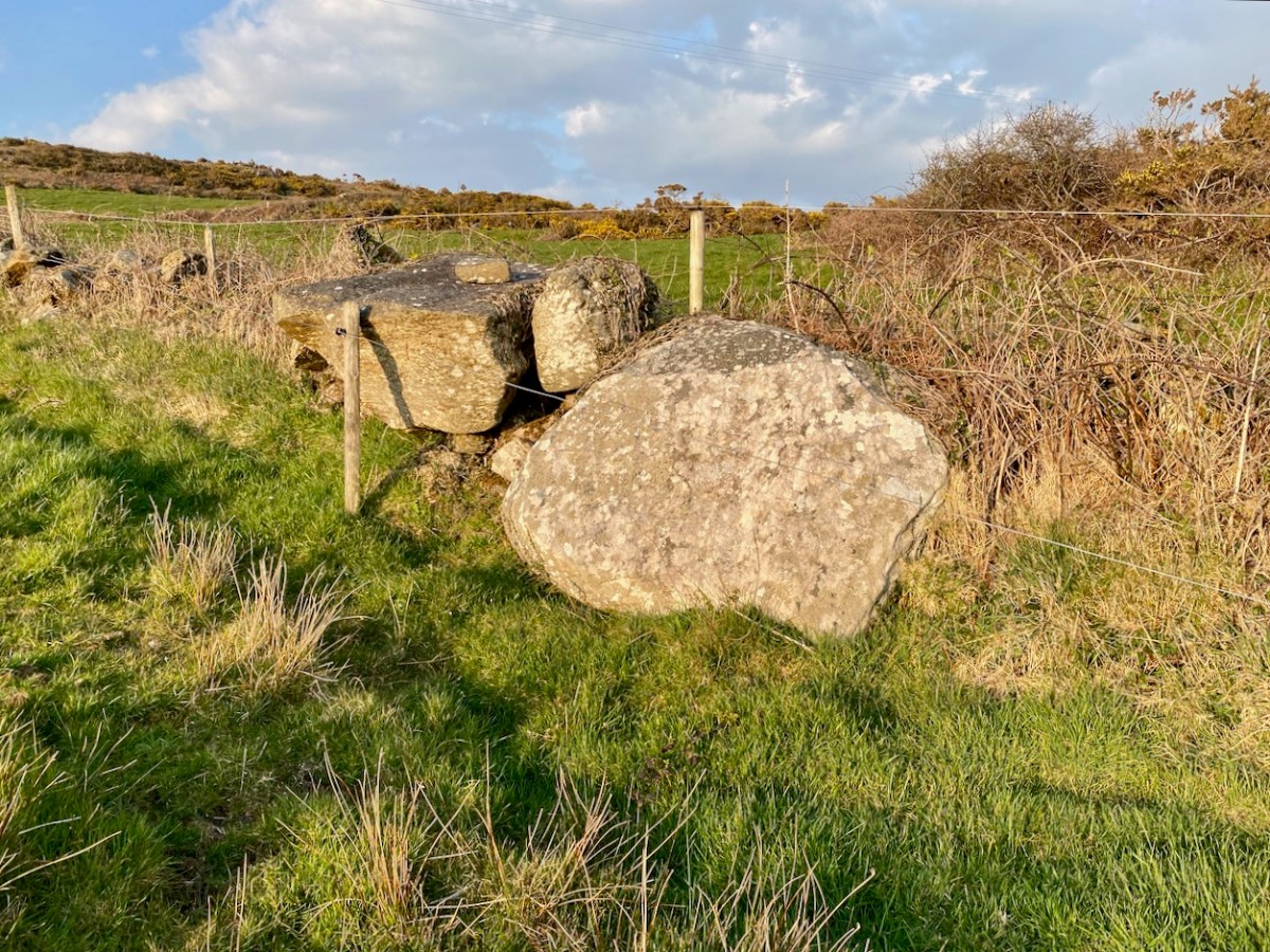
The upper picture is taken from within the ringfort enclosure; the north bank of the fort can be seen beyond a small stone outcrop which is said to be the site of a souterrain. Time for another definition:

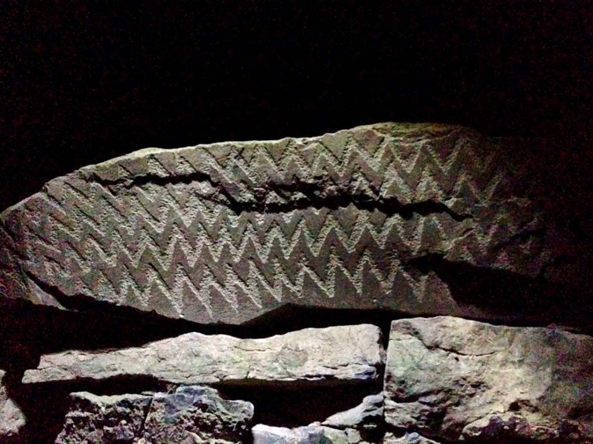
. . . Souterrain: an underground structure consisting of one or more chambers connected by narrow passages or creepways, usually constructed of drystone-walling with a lintelled roof over the passages and a corbelled roof over the chambers. Most souterrains appear to have been built in the early medieval period by ringfort inhabitants (c. 500 – 1000 AD) as a defensive feature and/or for storage . . .

archaeology.ie/HistoricEnvironment

You can see more about souterrains – including some illustrations – in my post from four years ago about Knockdrum Fort, south of Skibbereen.

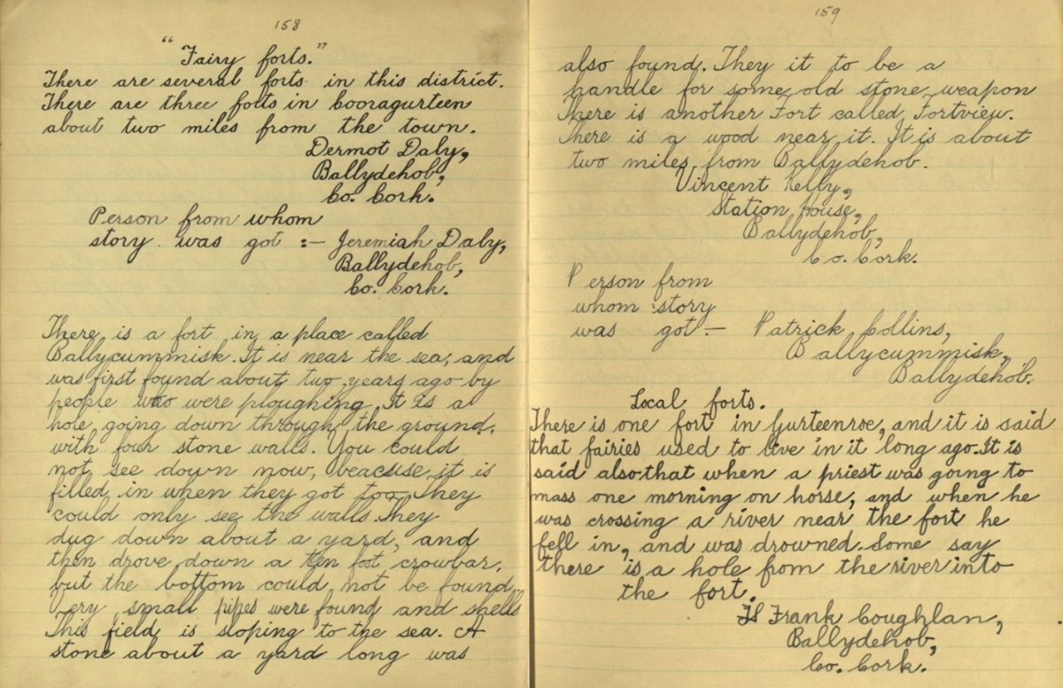
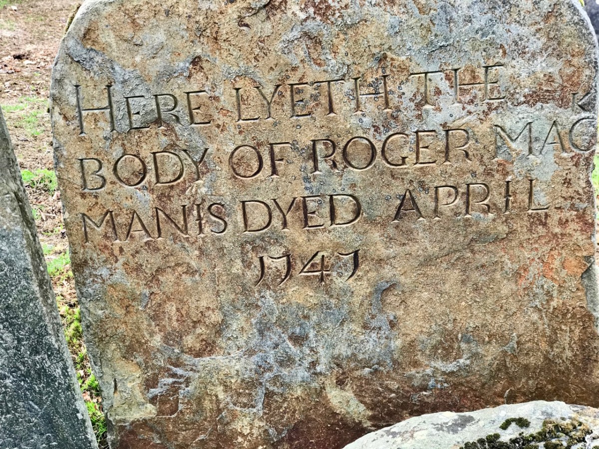
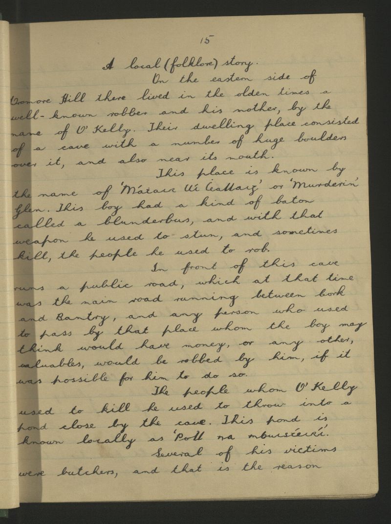
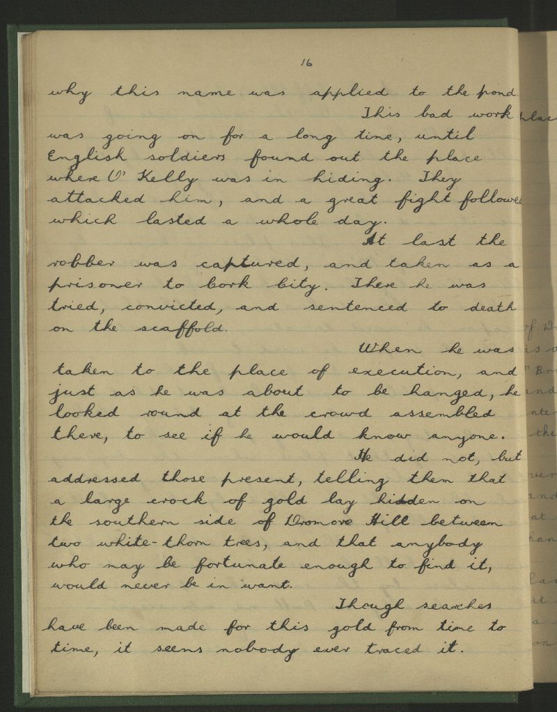
The Schools Folklore Collection is an important source of local beliefs and traditions – if not exactly historical information. The stories were collected in the 1930s but were remembered through family traditions which could go back through several generations. The example pages above – dating from 1936 – describe the Ballycummisk fort. Here is a transcription of the paragraph:

. . . There is a fort in a place called Ballycummisk. It is near the sea, and was first found about two years ago by people who were ploughing. It is a hole going down through the ground, with four stone walls. You could not see down now, because it was filled in when they got to it. They could only see the walls. They dug down about a yard, and then drove down a ten foot crowbar, but the bottom could not be found. Very small pipes were found and shells This field is sloping to the sea. A stone about a yard long was also found. They thought it to be a handle for some old stone weapon . . .

Schools Folklore Collection
Frank coughlan Ballydehob

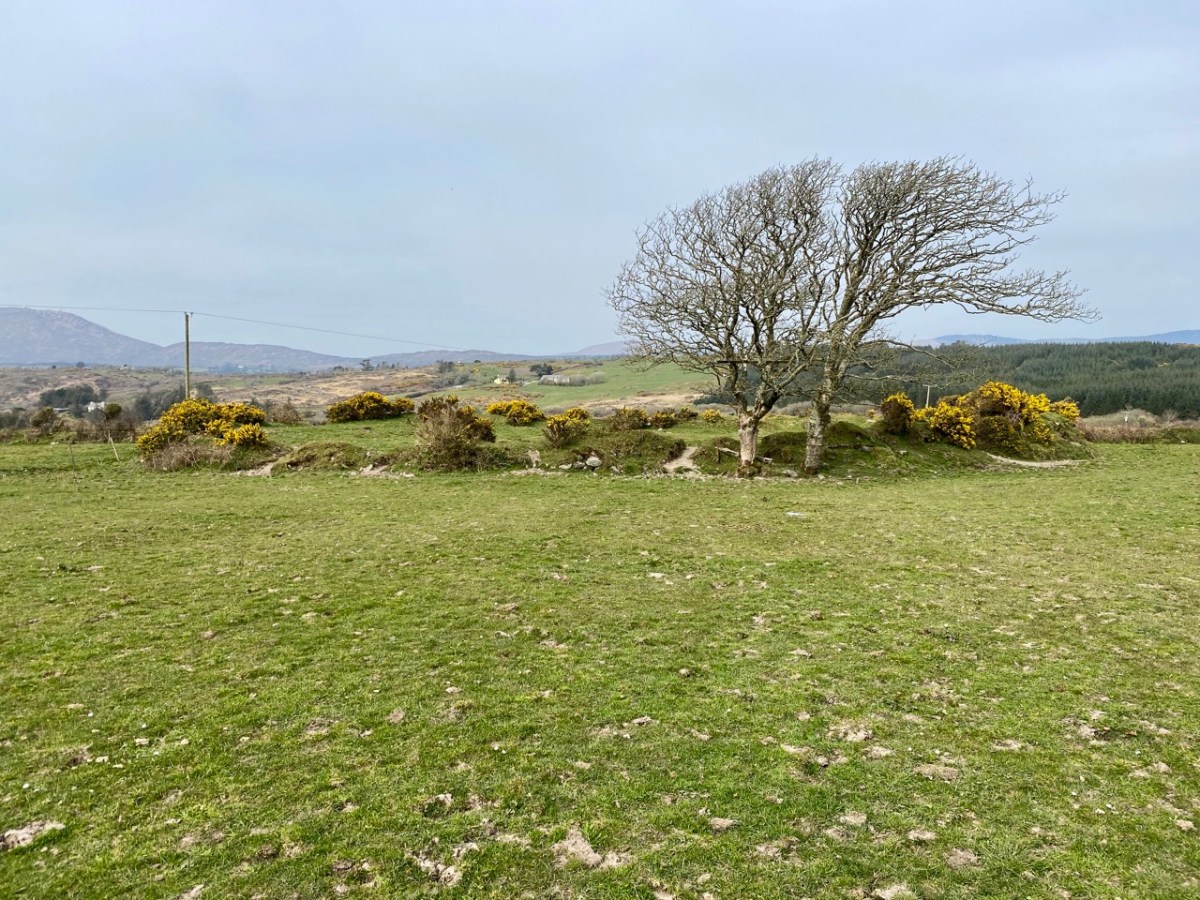
Frank Coughlan’s description almost certainly refers to the discovery of a souterrain. It doesn’t quite ring true as he says that “the field is sloping down to the sea”. In fact, the fields containing the ringfort are sloping southwards away from the sea, which is not visible at all from the site.

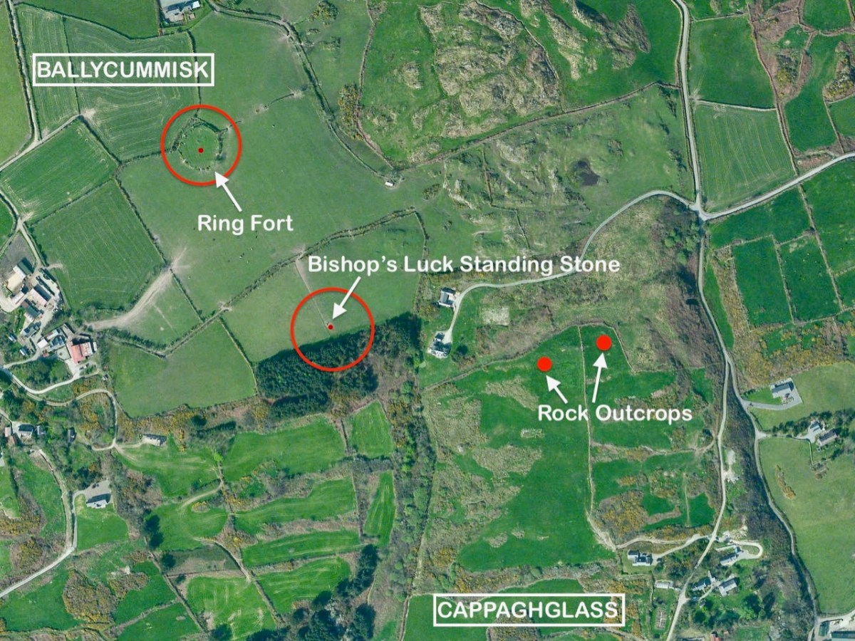
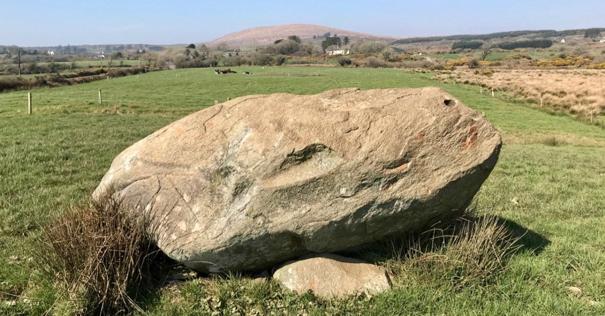
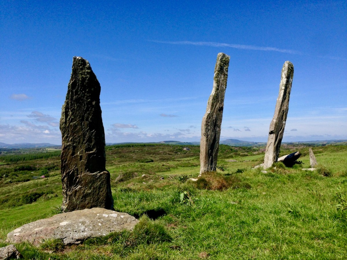
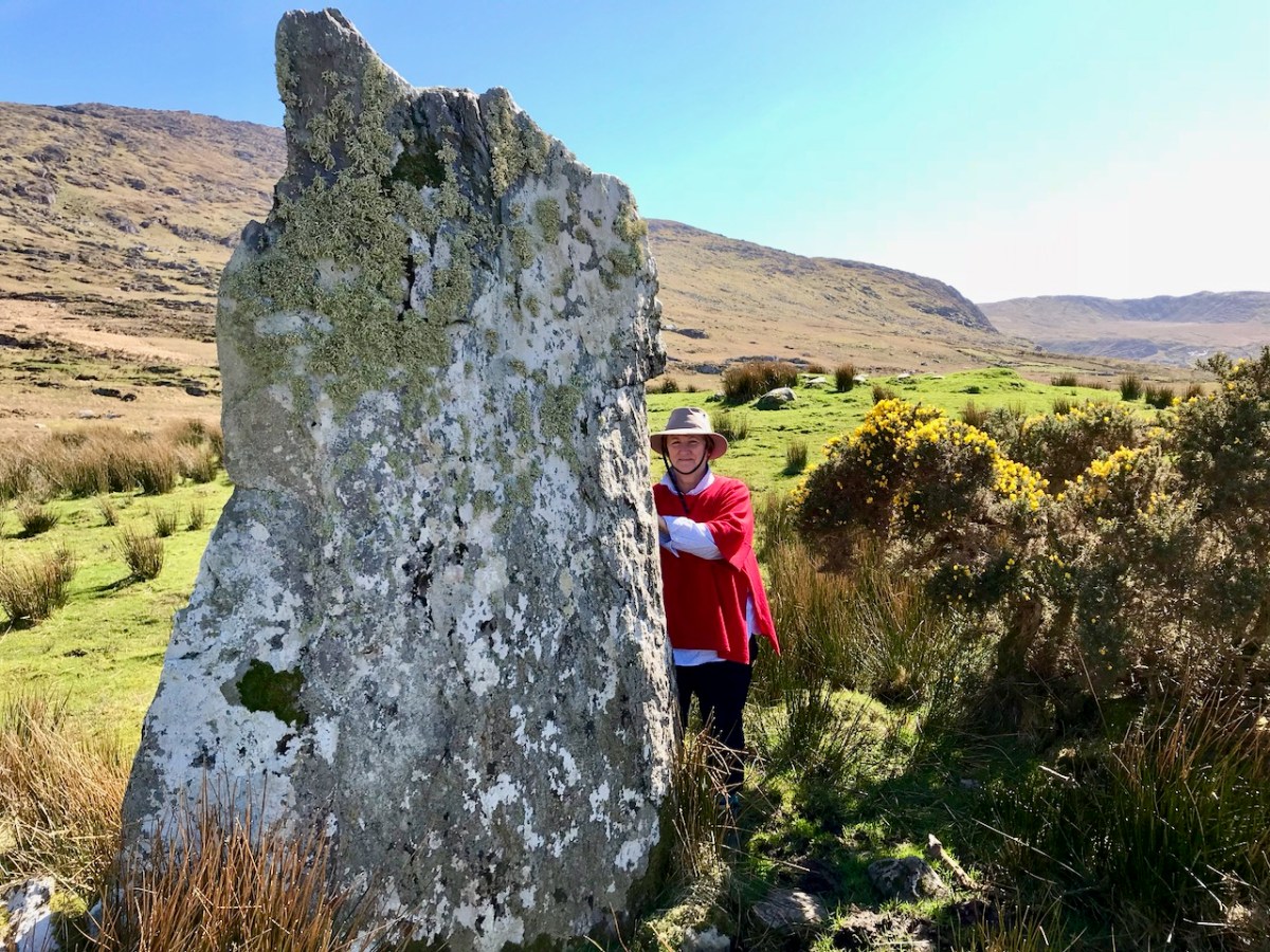
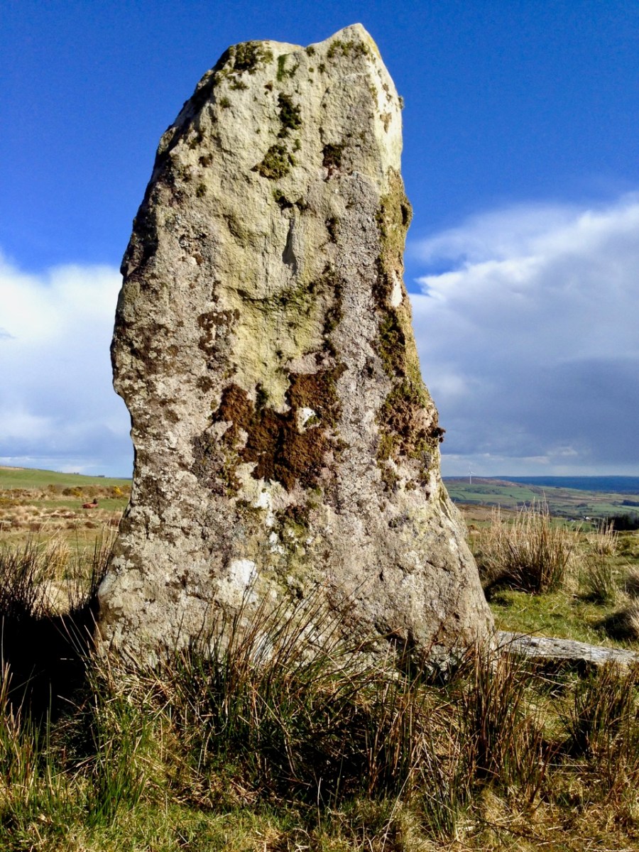
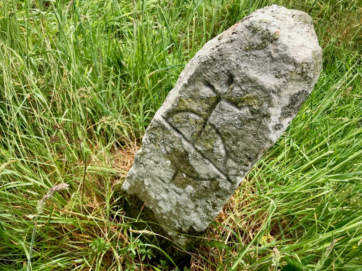
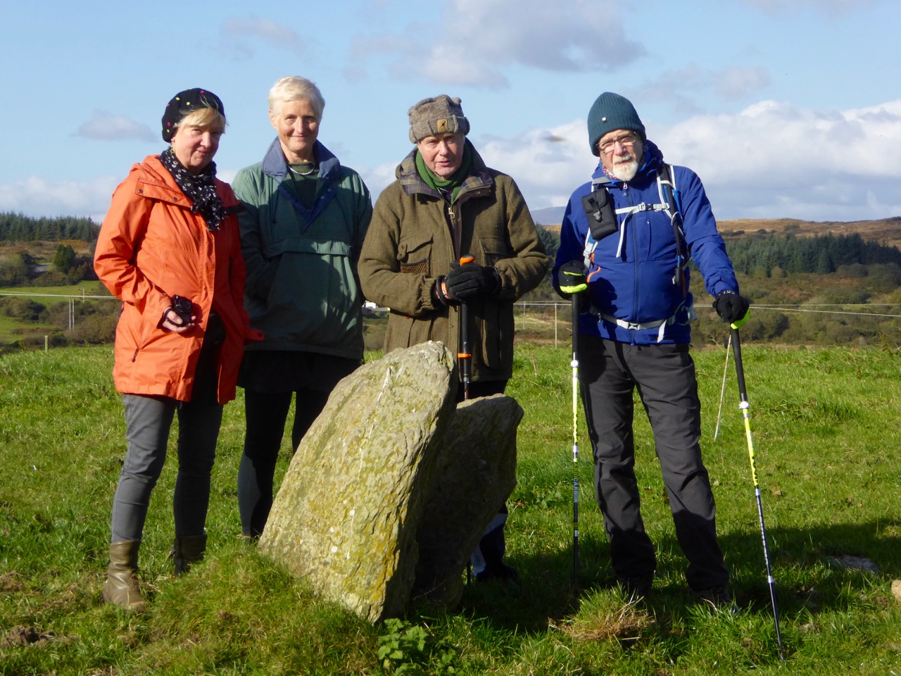
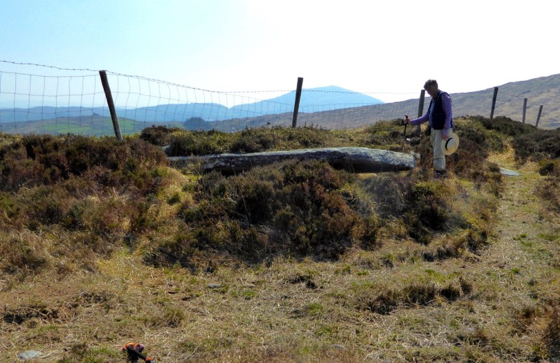
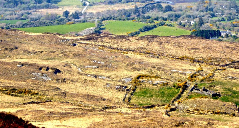
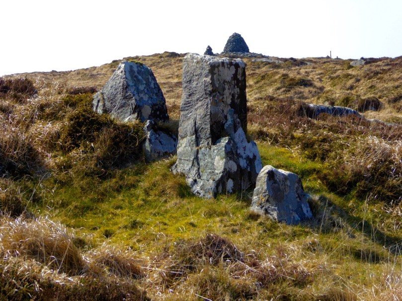
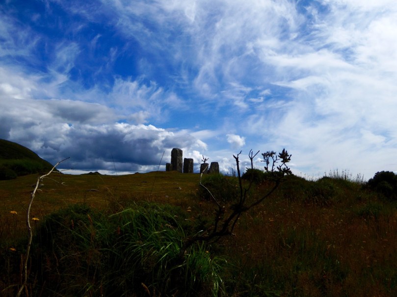
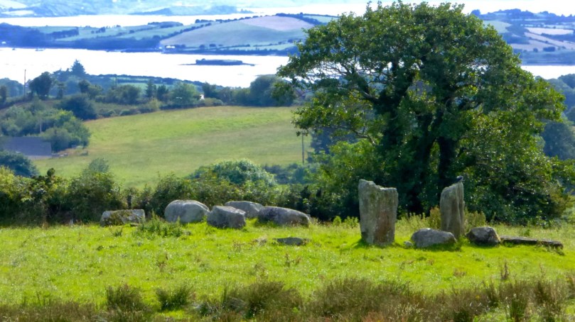
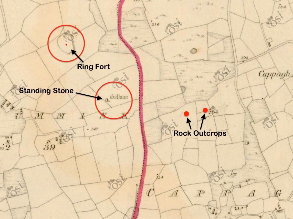
This aerial view shows parts of the townlands of Ballycummisk and Cappaghglass. The ringfort is marked. Another nearby feature – also shown – is a large standing stone, known as ‘Bishop’s Luck’.

The stone is 1.6m high, 2.05m in length, and 0.45m in width: tall and wide in one direction, and relatively narrow in the other. It is also worth noting that the ‘long’ orientation is exactly North-South. This stone has been in this position for at least 180 years as it appears in the earliest edition of the 6″ Ordnance Survey (1830s), marked as ‘Gallaun’ – and even given a little illustration!

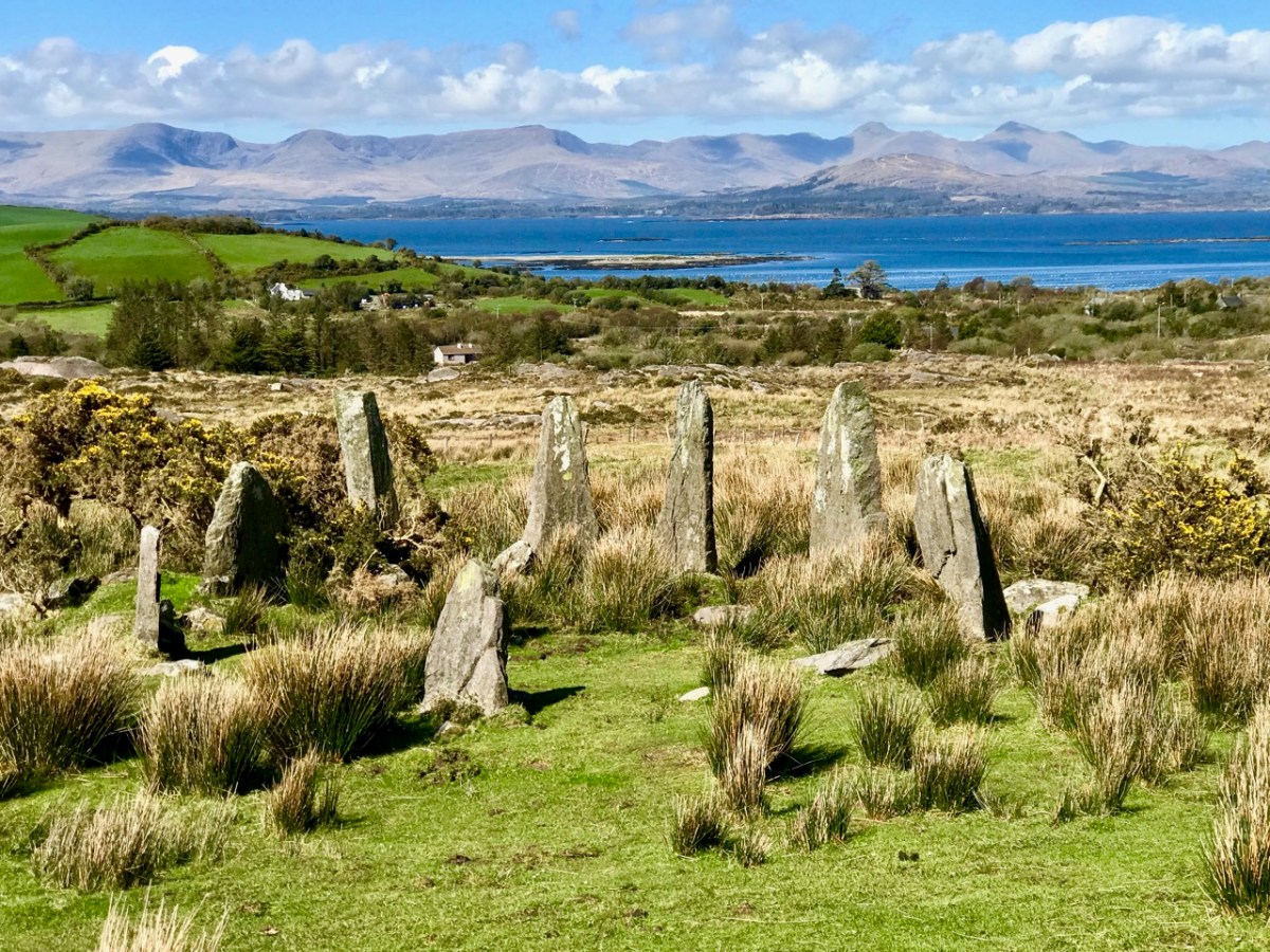
The standing stone is not far from the ringfort: perhaps there is a connection, although standing stones are generally reckoned to date from earlier times than the forts. Here is an extract from a recent article in Archaeology Ireland: Vol 34 No 1 (Spring 2020) pp 26-29, Wordwell Ltd:

. . . The classic standing stone surviving from the Bronze Age in Ireland is a rough-hewn or unshaped pillar, known as a gallaun (from the Irish gallán), generally oblong or oval in cross-section and up to 3m or more in height. Stones presumed to belong within this class vary considerably in height, from as little as 1m to as much as 6-7m in exceptional cases, the majority probably falling in the 1.5-2m range. Seán Ó Nualláin noted many years ago that in his experience the axis is generally aligned north-east/south-west. This is by no means a universal rule. Gallauns are by far the most numerous of all pre-Christian standing stones in Ireland. Approximately 600 are known in Cork and Kerryb alone. Beyond this region, examples are to be found extensively throughout the Irish countryside and many of them have attracted folk explanations . . .


Lone Standing Stones by Muiris O’Sullivan and Liam DowneY
Archaeology Ireland 2020

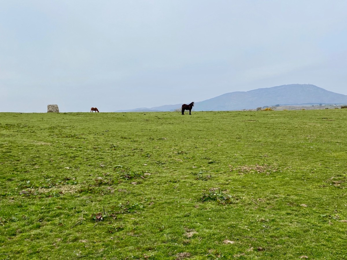
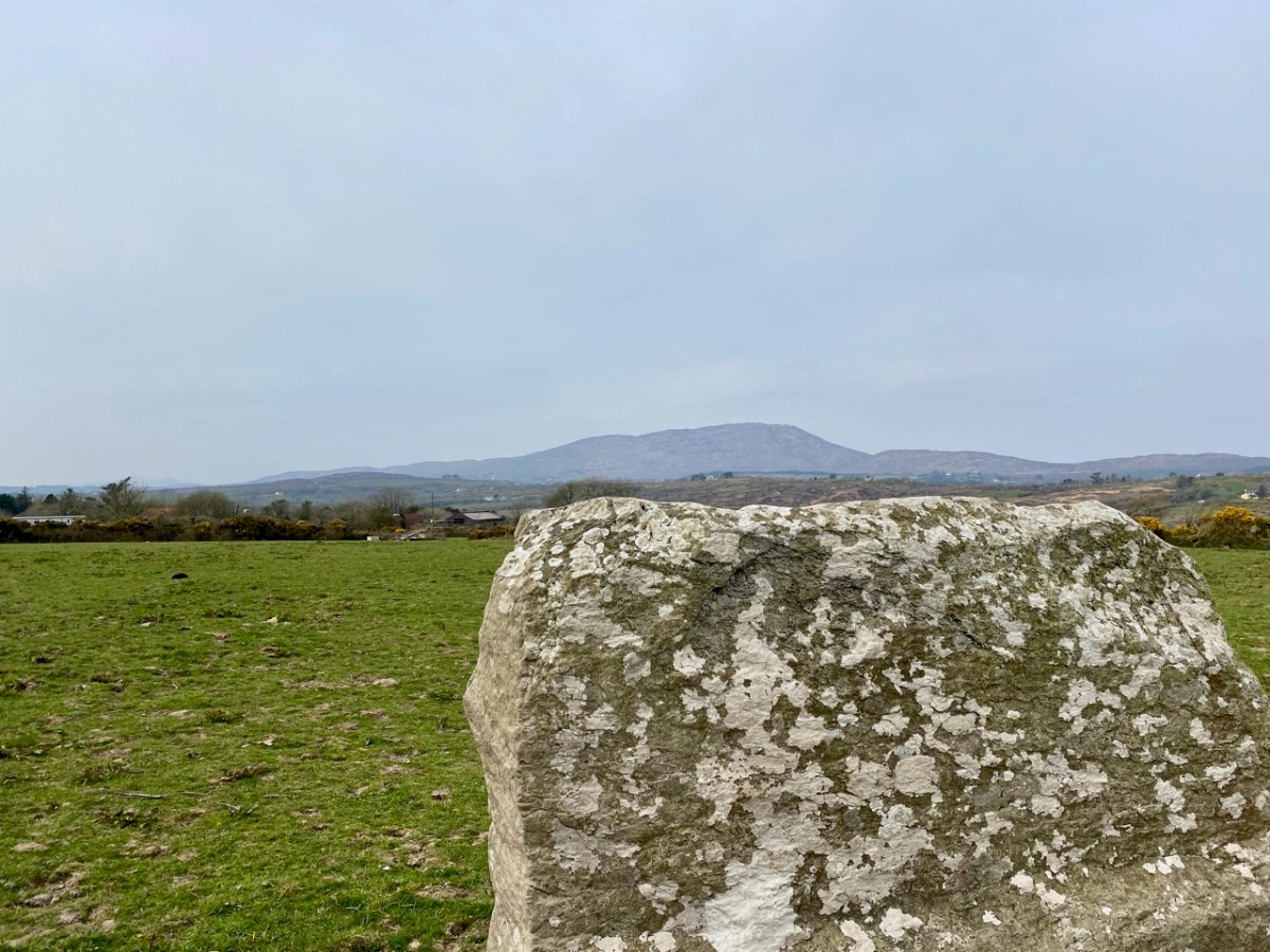
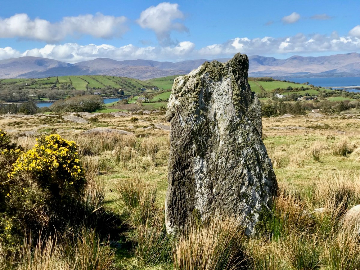
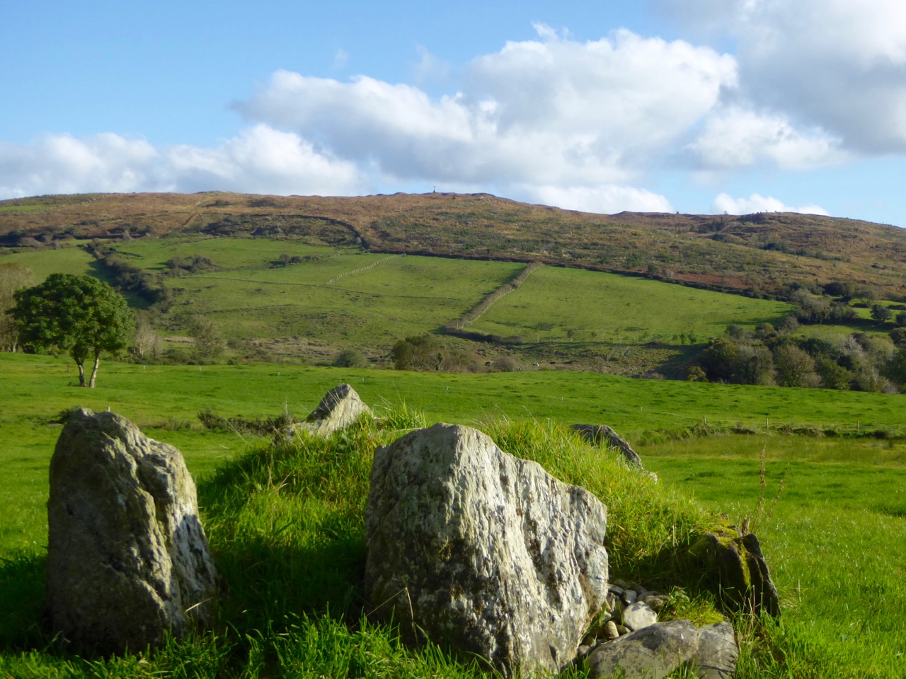
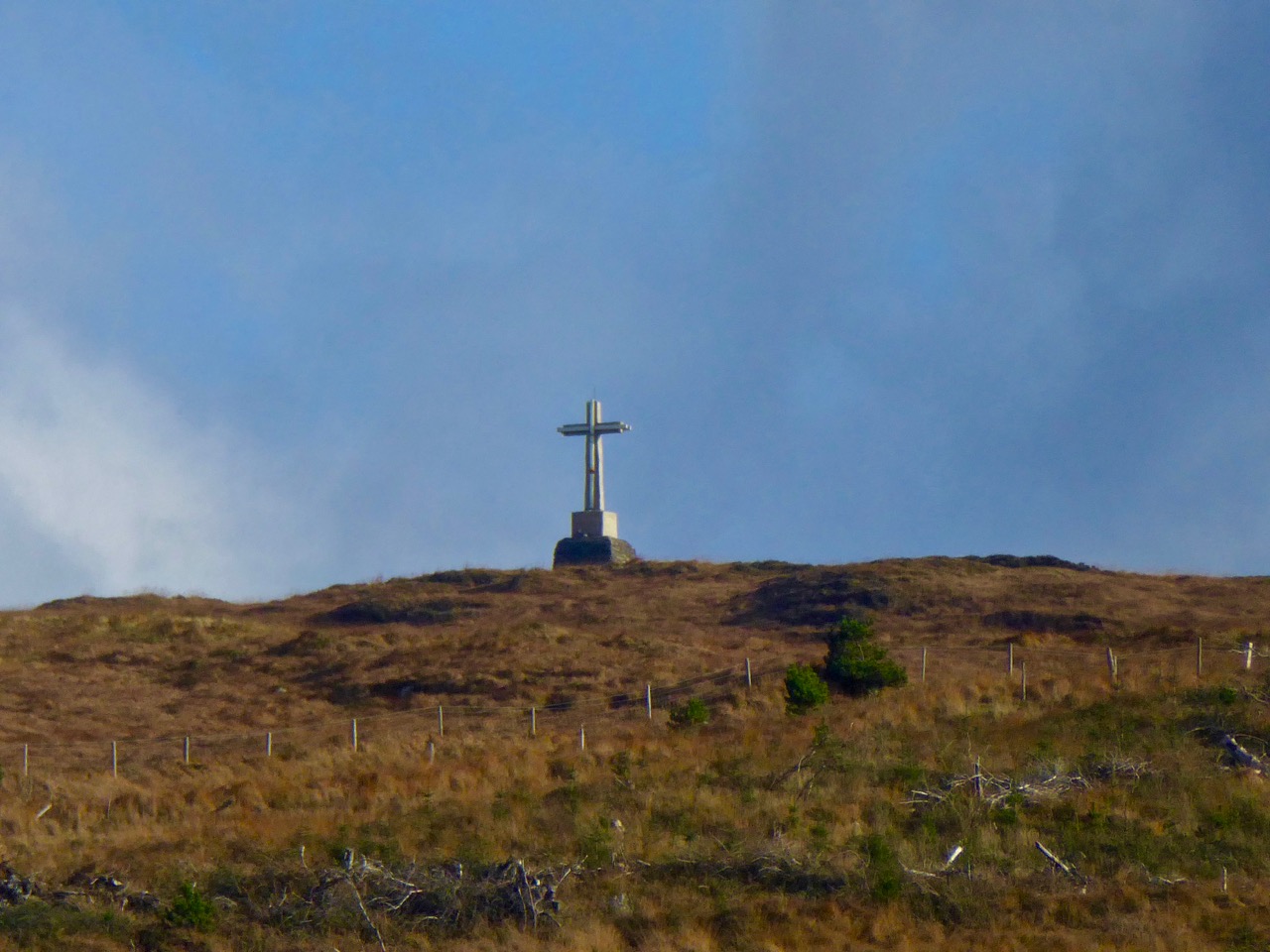
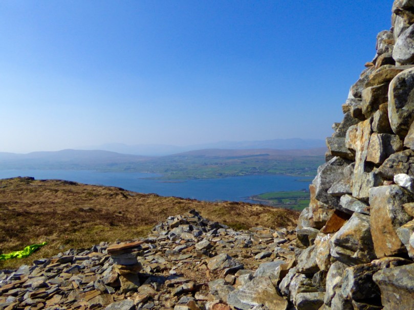
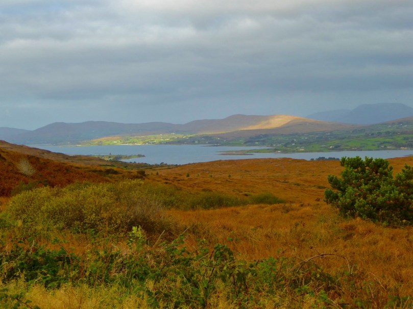
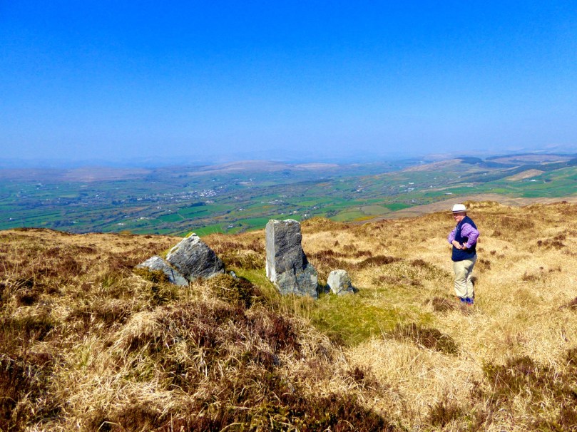
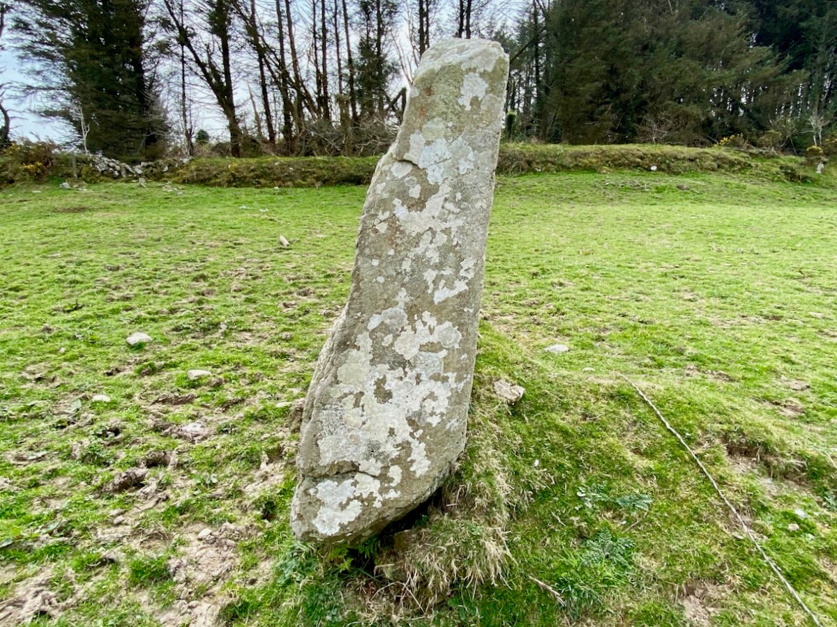
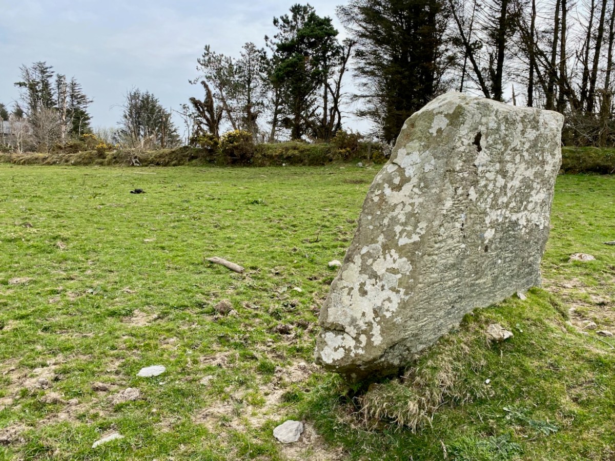
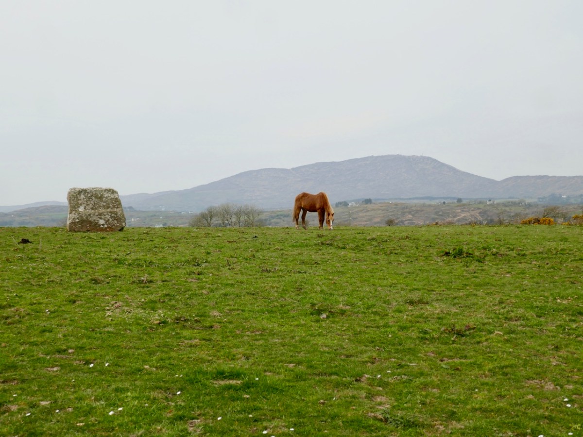
In these two pictures you can see the striking profile of the Bishop’s Luck standing stone against the skyline which features Mount Gabriel – the highest piece of land in the immediate area. Gabriel was an important place in prehistoric times as the centre of a significant copper mining industry – yet no artefacts have ever been found on the summit. In the lower picture you can see how the western edge of the standing stone ‘echoes’ the distant profile of Gabriel on the horizon. This is a phenomenon that has been noted a few times with regard to stones standing in the landscape. Here is Gabriel seen from the ringfort:

Finola has written comprehensively about standing stones in this Journal: here and here. O’Sullivan and Downey mention (above) that examples have attracted folk explanations. This doesn’t seem to be the case here: no mention is made of the stone in the Schools Folklore Collection. But surely there must be significance in the name: Bishop’s Luck?

But – hang on! There is ‘Bishop’ folklore associated with a site not very far away – in the neighbouring townland of Stouke. Finola recorded this in her 2016 post here. It’s a simple tale: The story goes that during the time of the penal laws a Bishop was confirming children nearby when the redcoats got wind of his activities and came to arrest him. He was beheaded. A bullaun stone in the graveyard at Stouke is supposed to be his head. If our possibly Bronze Age stone in Ballycummisk had anything to do with this, it should surely be known as Bishop’s Bad Luck?

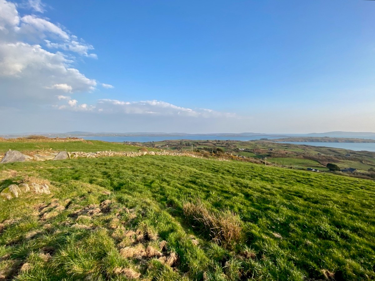
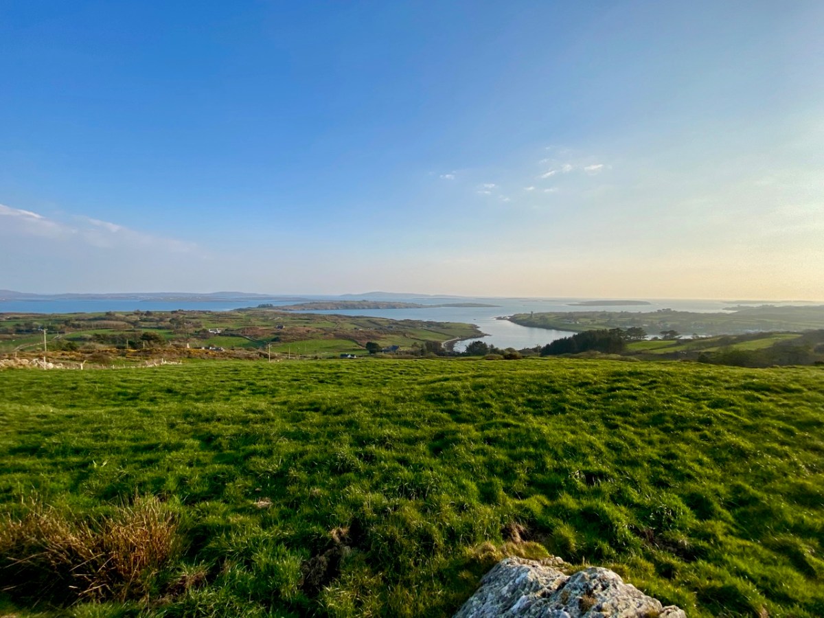
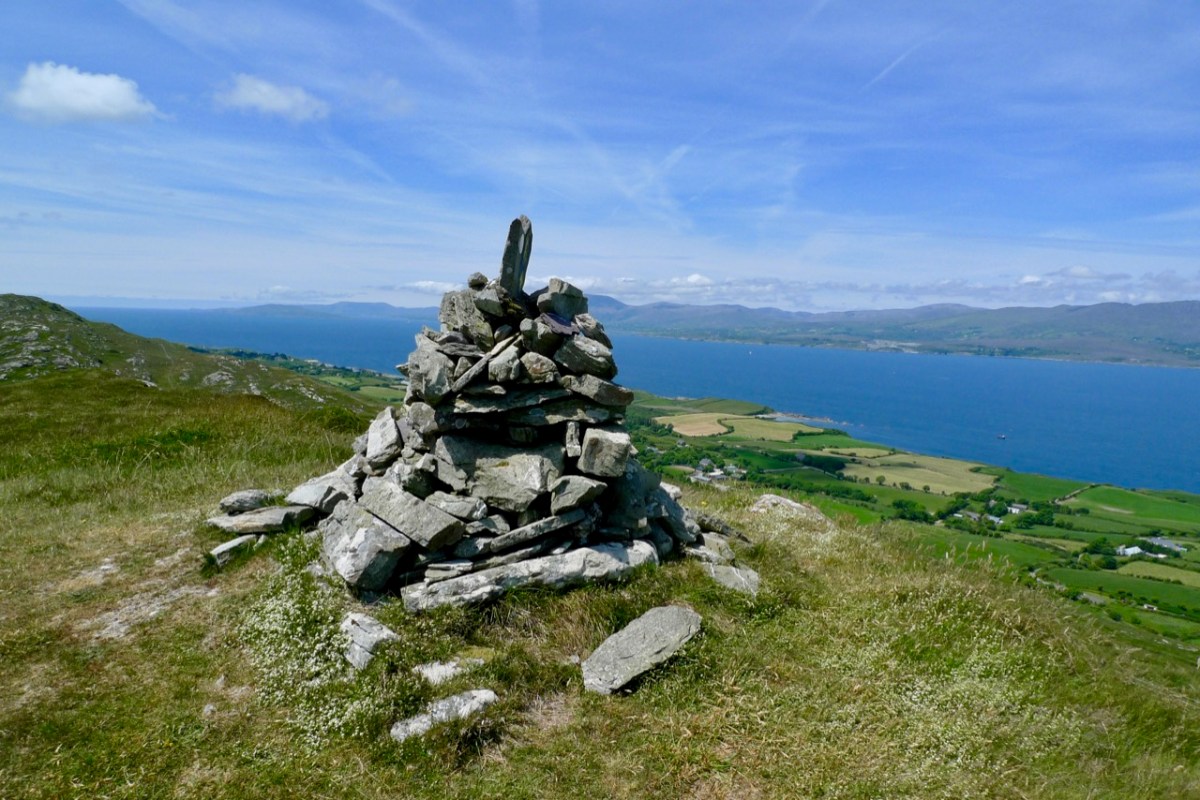
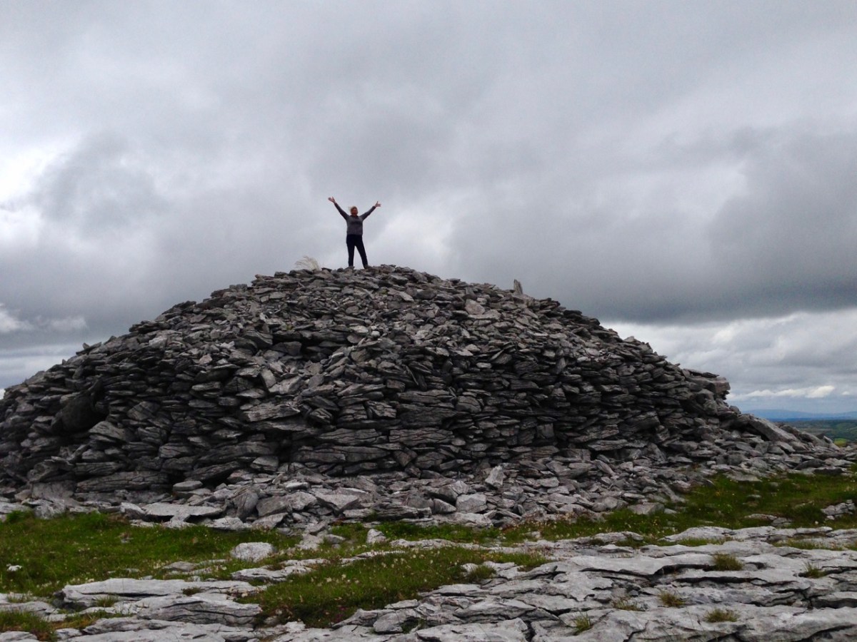
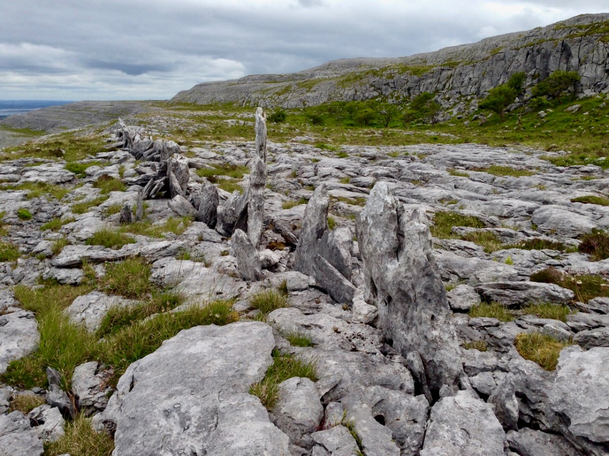
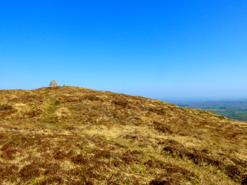
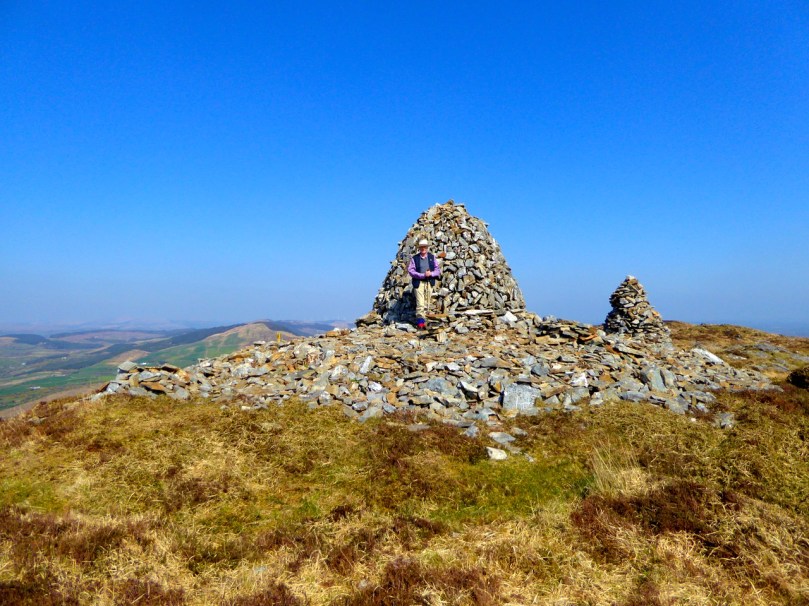
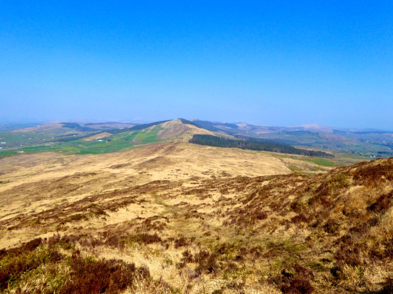
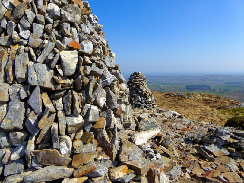
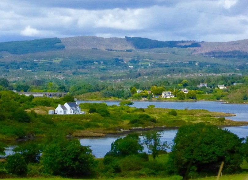
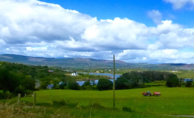
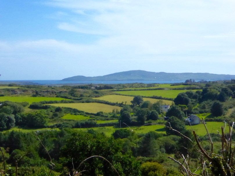
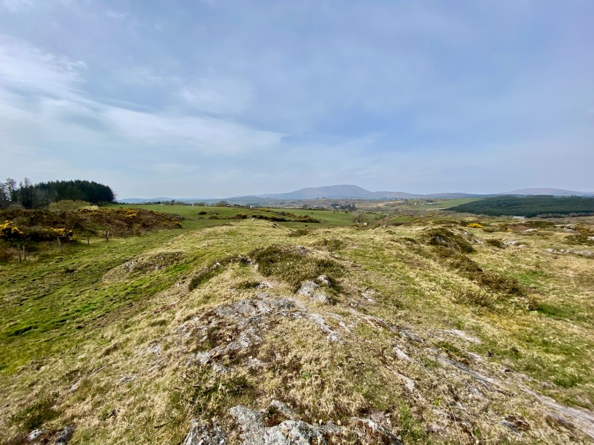
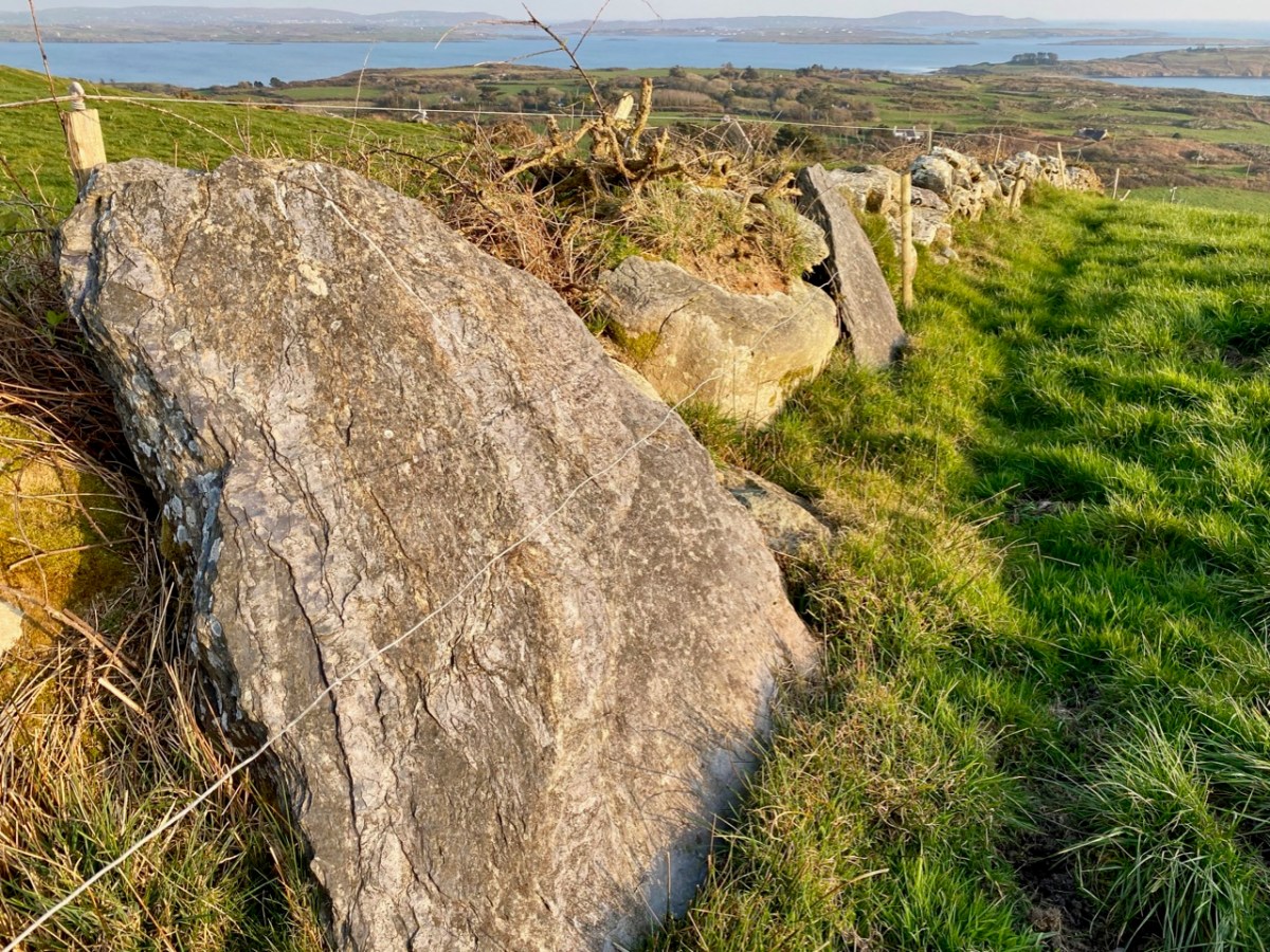
One further place that’s worth a mention here is the top of the hill to the south of the ringfort and standing stone. It doesn’t have a name, but it does have a magnificent view across to Rossbrin Harbour, with Cape Clear on the horizon in the far distance. There is a passage grave on the high point of Cape Clear. There seems to be some evidence for the inter-visibility of ancient sites, which makes me wonder whether there was ever any early structure on this hilltop. There are rocky outcrops there in the present day, and field clearance is evidenced by the presence of large slabs in the nearby field boundaries.

These are just thoughts, but I don’t mind thinking them! West Cork (and most of rural Ireland) must have much to reveal in terms of its ancient history. One point to remember: if you ever go searching yourself for archaeology or old sites, don’t forget that you will probably be entering private land. It is courteous to always seek permission: most owners are agreeable and – perhaps – may have stories to tell themselves.

Stones Alone

Over the years we have written a lot about stone. That’s not surprising, because our interests in Irish archaeology involve stones: standing stones, stone circles, rock art, gravestones . . . It’s what the surviving history of our earliest dwellers on this island is all about. So I thought it would be a good idea to sift through our Roaringwater Journal photographic library – which goes back a decade – and turn up some pictures and stories which I have never used before: all of them involving stones. That header pic, above, is a boulder burial at Rathruane, just outside our West Cork village of Ballydehob.

Here’s another boulder burial, a long way away in Co Cavan, now surrounded by trees which are probably relatively recent. Finola wrote about this monument type six years ago, and pointed out that they are not well named: when examined archaeologically, very few of these stones have been associated with buried human remains. They are said to have been positioned between 1,500 and 1,000 years BC, a time we refer to as the ‘Bronze Age’. So, by then, humans were already aware of the use of metal for tools, weapons and decorative adornments. But imagine the time before that – when people only had natural materials to hand – wood, vegetation and, of course – if you wanted to create something permanent – stone: we call these times Neolithic – and generally that covers the period of habitation of Ireland from 6,000 BC onwards.

Here is another West Cork site: Breeny More, to the north of Bantry. There’s a whole lot of stones here including, unusually, four ‘boulder burials’ arranged in a square. There are also further stones in this grouping which were once part of a stone circle. The site is magnificently located, with distant views west across to Bantry Bay (below).

We are all familiar with groups of stones arranged in a circle. Here is the ‘stone circle’ at Ardgroom, County Cork: it’s on the Beara Peninsula. As with the Boulder Burials, these monument types are generally thought to date from the Bronze Age.

These modestly sized ‘five stone’ stone circles are also in County Cork. The National monuments Survey of Ireland lists 53 ‘five stone’ circles in the county, while a further 41 ‘multiple stone’ circles are noted. There are also some anomalies which defy definition, such as ‘The Fingers’ at Knockdrum, West Cork, just outside Castletownshend:

This appears to have been, originally, an alignment of five tall standing stones. One has fallen and broken, while the fifth is now missing. It is reasonable to assume, from the number of stone ‘monuments’ all around us in West Cork (and in many other parts of Ireland), that these sites were of great significance to the populations who constructed them. But we don’t know for sure why they are there – although theories abound.

I am fascinated by the number of single standing stones we come across in our travels. It’s impossible to say how many there are in Ireland – probably thousands. And they can range in size from the large stones – above – in West Cork, to individual examples in moorland or fields, or on roadsides – below.

The Irish word ‘carn’ means a heap or pile of stones, Cairn monuments are mounds of stones, often marking the summit of a significant hill or mountain. They may or may not be ancient, and we have seen them change significantly over time. On Mount Corrin, not far from us in West Cork, there were two cairns only a few years ago. Now there is a single, significant cairn (top pic below): this implies a deliberate ‘re-ordering’ of what was there before. Regardless of their history, they can be visually impressive.

The centre pic above is a small cairn on a Sheep’s Head summit, while the enormous one above is in The Burren, County Clare. The Burren is an extraordinary landscape of exposed limestone. The limestone formed as sediments in a tropical sea which covered most of Ireland approximately 350 million years ago. Today, the Burren supports a remarkable assortment of wild flowers: over 70% of Ireland’s species of flowers are found there, among the ubiquitous stone surfaces.

Ever since humans set foot on Irish soil, they have embraced the stones – both for practical uses such as shelter or enclosure, but also as a means of marking and communicating. Readers will be familiar with our particular interests in Prehistoric Rock Art:

This is an important example of Ireland’s Rock Art, from West Cork, perhaps dating from 5,000 years ago: it was discovered in comparatively recent times. The painting is by Keith Payne, and is an interpretation of this same rock outcrop. We have no evidence that the carvings were ever coloured – or pigmented.

Today we are very familiar with the use of stone as a building material: this practice is likely to have been current since very early times. In Ireland we have many examples of ancient – but undateable – stone buildings. The ‘Oratory’ at Gallurus is a good example of a built enclosure (walls and roof) made entirely from stone. A present day view of it, top, shows this remarkably preserved structure; archaeologists and historians have long debated its age and likely use. The print above dates from 1756.

Over the centuries, crafstpeople (like Séamus Murphy – see last week’s post) have used stone as a medium for memorials – the message is likely to survive beyond lifetimes. If only we knew what some of the messages should spell out to us! Our last – striking – image is from Fourknocks – a decorated chambered cairn within the Boyne Valley complex which we visited in 2016. This carved decoration was probably made 5,000 years ago: we can only wonder at its meaning and its authors . . .

The Murdering Glen

On the walk

The long valleys that run eastwards from Bantry are filled with antiquities – Discovery Map 85 is dotted with red circles of places we want to tramp around. We have been particularly intrigued by the ‘Murdering Glen’, labelled on the map: can you see it?.

Murdering Glen Map

Today we got a chance for a thorough exploration of the Murdering Glen, on the invitation of our friend Bridget, who lives there and is a keen explorer herself. After a wonderful lunch supplied mainly from her garden we set out up the road towards the Glen, with Bridget assuring us that the place appeared peaceful enough these days and not to worry.

Murdering Glen

The Glen is indeed dramatic, with steep sides and an enormous overhanging rock – just the kind of place for a brigand to lurk. In this case the brigand (and his mother) were locals, by the name of O’Kelly, who would lay in wait for travellers and murder them for their gold, before throwing them into the Butcher’s Pool.

Murder Rock

In  the 1930s schoolchildren in every National School in Ireland were asked to write down the stories they heard at home and these were recorded, in their own writing, by the National Folklore Commission. Here is the outline of the project, as presented on Duchas, the website that now stores that collection:

For the duration of the project, more than 50,000 schoolchildren from 5,000 schools in the 26 counties of the Irish Free State were enlisted to collect folklore in their home districts. This included oral history, topographical information, folktales and legends, riddles and proverbs, games and pastimes, trades and crafts. The children recorded this material from their parents, grandparents, and neighbours. The scheme resulted in the creation of over half a million manuscript pages, generally referred to as ‘Bailiúchán na Scol’ or ‘The Schools’ Collection’.

To my delight, I was able to find the original story in the collection – and here it is, in the handwriting of schoolboy Michael Keohane from Dromore National School. I think you will agree he has done a magnificent job of telling the local legend.

murdering-glen

murdering-glen-page-2Before we left the murderous spot Bridget led us up to the mass rock, on a ledge on the side of the valley. It was a block of sparkling quartz, with holes to collect water, into which you can dip your warts in hopes of a cure.

Bridget shows us the mass rock

We  walked then towards the Trawlebane Bridge, where Robert and I had joined the walk two years ago to honour and remember Chief O’Neil. Robert’s post, The Chief, will take you back to that day and show you the spot where, before we started the walk, participants decided to put on an impromptu display of Crossroads Dancing, just as local people would have done on a fine summer evening in the old days.

Trawlebane Crossroads

There was more, much more to see, just in the immediate neighbourhood. We spent time in a Cillín first, in the middle of a field, with a magnificent blackthorn tree to mark the lonely spot where unbaptised children were traditionally buried. Read more about this practice in my post Unknown Souls.

Cillín

Blackthorn TreeA little five-stone circle was next – a classic of its kind, with four stones set on edge and a recumbent stone marking the axial alignment. (See more examples of them in my post Family-Friendly Archaeology). Besides three sites in nearby Kerry, these small stone circles are only found in Cork. They mirror exactly the larger multiple-stone circles, just with fewer stones – an efficient variation requiring fewer resources to erect but accomplishing the same outcomes.

Five stone circle

Unfortunately, this five-stone circle has been filled with field debris, creating the appearance of a mound

We also passed numerous ringforts and several standing stones. Looming over us as we walked was Dromore hill, on top of which was erected, in the Marian Year of 1954, an enormous cross, now rather improbably lit up at night. The cross is clearly visible from the stone circle and the standing stones, presenting opportunities to ponder on the juxtaposition of what is considered sacred in its own day, and what communities will expend precious resources to erect at different times over millennia.

Cross above circle

CrossOn  our trip to Sligo recently Robert and I were sensitised to the phenomenon of monuments seemingly echoing or imitating the topography behind them – see his post Discovering Carrowmore for more about this. I was struck by one of the standing stones – the top did seem to echo the hill behind it. Coincidence?

Standing Stone shape

October in West Cork can feature some of the best weather and walking conditions of the year. Today did not disappoint, with blue skies and crisp air.

Tree

Thank you, Bridget, and our other exploring companions Amanda and Peter, for a marvellous day of Murder, Mythology and Megaliths.

At the rabbit ears

Mount Corrin Walk

View from the cairn, Mount Corrin

View from the cairn, Mount Corrin

Walks that get you up to high places with panoramic views are terrific – especially when you don’t have to start at sea level! One such West Cork walk is Mount Corrin. Despite being on The Mizen, it’s part of the Sheep’s Head Walks system, which means it’s accessible and perfectly waymarked.

P1150782

The whole Mount Corrin loop walk is a 17km marathon and definitely not for the faint-hearted. But faint-hearted is exactly what we are, so we have chosen an option that can be easily accomplished on a pleasant afternoon – about a 5 km round trip. Some of these photographs are from a spring walk, and some from a fine autumn day.

From the trail - the Sheep's Head

From the trail – looking across at the Sheep’s Head

Wear good boots and bring a camera but leave the dog at home as no dogs are allowed on the Sheep’s Head Way. And if you do want to do the Big Walk, we highly recommend you pick up a copy of Walking the Sheep’s Head Way by Amanda Clarke. She and Peter have brought out a Second Edition that includes all the loop walks and they do a fabulous job of describing the whole route and provide wonderful photographs of what you can expect.

This curious little monument is right beside the parking spot

This curious little monument is right beside the parking spot

Our starting point is at a high point about half way between Durrus and Ballydehob. Drive out of Ballydehob via the road between Antonio’s Restaurant and Vincent Coghlan’s pub – that’s the Rathruane Road. About 3 km along this road you will come to a crossroads – turn right. Take the first turn left on that road and it will bring you up to the top of a hill. Once you cross over the top and start the descent on the other side you will see the waters of Dunmanus Bay ahead and to the left and a pull-out for parking on the right.

One of West Cork's most scenic parking spots

One of West Cork’s most scenic parking spots

This is your starting point – look back and you will see the way marked trail about 50ms back up the hill, running alongside a forestry plantation. It’s also your ending point: our walk will take you up to the summit and back.

P1150787

If you’re approaching from Durrus, take the R591 out of the village. Take the first turn left then the first right and follow the road to the summit. These are small country roads – be prepared to pull over or even reverse when you encounter other traffic.

Example of 'other traffic'

Example of ‘other traffic’

Once you set out, the first point of interest is what is described in the National Monuments inventory as a ‘megalithic structure’ and which looks likely to be a wedge tomb, although it is hard to be definitive about it. Whatever it is, it’s man made and intriguing.

A wedge tomb?

A wedge tomb?

You can see the cairn ahead – your destination.

P1040223

Before you get to it there is a row of standing stones. These ones are not marked on the NM inventory but it’s difficult to see what they could be other than a stone alignment. A final push now gets you to the cairn and to those panoramic views we mentioned.

P1040203

The first thing you’ll notice about the cairns (there are two of them) is the size of the large one and the scatter of stones all around them. The consensus seems to be that there has been a cairn on Mount Corrin since ancient times and that the current cairn, a more modern construction, sits on top of an older one.

The cairn on Mount Corrin is visible from this panel of rock art at Rathruane

The cairn on Mount Corrin is visible from this panel of rock art at Rathruane

We have certainly noted that the top of Mount Corrin, like the top of Mount Gabriel, is visible from several prehistoric sites and a cairn would have enhanced that visibility. The most persistent story about the cairn, though, links it to Lord Bandon.

P1040210

The Bernards, Earls of Bandon, are associated with Durrus, having laid out the town in the eighteenth century and having used Durrus Court as a summer residence. They had many interests in the area, including mining, and the always-interesting Durrus History blog gives us this information about Mount Corrin:

Mary Catherine Henrietta Bernard of Castle Bernard daughter of Lord Bandon married Colonel Aldworth on the 30th July 1863 and an address and copy of ‘God’s Holy Word’ was sent by Rev Freke and the tenantry of Durrus to which she returned thanks.  At Dreenlomane Mine (operating until c1920) owned by Lord Bandon, Captain Thomas set tar barrels alight on Mount Corrin which illuminated the sky all night and the 150 miners and their wives were treated to refreshments and similar celebrations were held in Carrigbui.

P1040197

The views from the cairn are stupendous, taking in the West Cork Peninsulas and the hinterland across to the Kerry mountains. Take a while to wander around the top – see if you can spot the collapsed walls of ancient hut sites.

P1040217

Making your way back, look down towards the farms on the northern slope of the mountain. You can still make out the unmistakeable signs of lazy beds, used to grow potatoes, and the ruins of houses abandoned long ago. It’s a poignant reminder that this land was once densely populated by people whose sole nutrition came from potatoes and who fled this area in the aftermath of the Great Famine.

P1040194 - Version 2

There now – that wasn’t gruelling at all, was it? And so rewarding. But still, a bit of effort required so you definitely deserve a coffee and cake at Budd’s, or a pint in Rosie’s. Tell them Roaringwater Journal sent you.

P1040200

Fastnet Trails: Rossbrin Loop, Part 1

A joint post by Robert and Finola

In Robert’s post about the Fastnet Trails, we introduced you to this new trail system, and in particular to one of the delightful walks – the Lisheenacrehig Loop. Today’s post is about another of the walks – the Rossbrin Loop. This walk is all on country boreens, so you can wear your ordinary walking shoes and take the dog if you like but keep him on a leash and stick to the road. You will pass other dogs on the way, as well as fields of livestock.

The high road

You can do this whole walk as laid out in the brochure. It’s just under 12km and will take you at least three hours, but probably more if you like to stop to explore, take pictures, have a chat along the way. Oh, and see where it says ‘easy grade’? Take that with a pinch of salt – this walk will give you a good work out as it takes you from sea level to 70m (230ft) and back again.

Rossbrin Trail 1

But we know that many of you like to take an easier pace and, like us, might find a 12km loop a bit intimidating, so we’ve decided to give you another option. We will lay out a 2-walk option for you, beginning with Walk 1 now, and we will do Walk 2 in a future post. We provide our time estimate for a meander rather than a march. And – a disclaimer: our suggestions depart slightly from the official Fastnet Trail and have not been sanctioned by that group. Where you depart from the marked trail, you walk at your own risk.

Walk 1: Ballydehob, Greenmount, Foilnamuck, Cappaghglass, Ballydehob

Time: 2 to 2.5 hours (with diversion)

Level: Easy but some steep stretches

Take: Binoculars and camera

Twelve Arch Bridge

Park in the Ballydehob car park just east of the river estuary and start by taking the lovely nature walk that takes you over the 12 Arch Bridge. This beautiful structure was once part of the West Carbery Tramway and Light Railway. A train ran across this bridge from 1886 to 1947 – Robert has written about The Flying Snail that traversed West Cork, but for a real flavour of what it was like read Poisson d’Avril in Somerville and Ross’s The Irish R.M. Here’s the first paragraph:

The Irish R.M.The atmosphere of the waiting-room set at naught at a single glance the theory that there can be no smoke without fire. The stationmaster, when remonstrated with, stated, as an incontrovertible fact, that any chimney in the world would smoke in a south-easterly wind, and further, said there wasn’t a poker, and that if you poked the fire the grate would fall out. He was, however, sympathetic, and went on his knees before the smouldering mound of slack, endeavouring to charm it to a smile by subtle prodding with the handle of the ticket-punch. Finally, he took me to his own kitchen fire and talked politics and salmon-fishing, the former with judicial attention to my presumed point of view, and careful suppression of his own, the latter with no less tactful regard for my admission that for three days I had not caught a fish, while the steam rose from my wet boots, in witness of the ten miles of rain through which an outside car had carried me.

Ballydehob Quay saw brisk trade in the days before the Bay silted up. The lovely old Pier House once functioned as a coal warehouse. 

Greenmount Stream

Following the walkway, you emerge by the school and turn left on to the Greenmount Road. This can be a busy stretch, so be careful along here. Once you get to the turquoise shed, turn left. Here you find yourself beside a burbling stream that empties into Ballydehob Bay at a small and picturesque pier. This and others like it were busy piers in the old days, serving the fishing boats as well as the sand boats that worked these waters, dredging sand to be used as fertiliser and building material. Nowadays this little inlet seems hardly navigable and the same blue and white boat has been moored here for a long time.

Greenmount Quay

The road climbs steadily up now past working farms. Looking back towards Ballydehob you can see the Bay and even the 12 Arch Bridge in the distance.

Pastoral

As you round a corner your view changes  and Kilcoe Castle comes into view. Now home to Jeremy Irons, who has restored it beautifully from a complete ruin, it was a classic 15th century tower house owned by the McCarthy Clan. So well was it situated and defended that the inhabitants were able to hold out for two years in the aftermath of the Battle of Kinsale (1601). Situated on a tiny island and glowing a soft amber colour, it is a beloved landmark in these parts.

Kilcoe Castle from Greenmount

Below you is a shallow bay that is a haven for shorebirds and seals. If the tide is out linger a while and use your binoculars to see what you can pick out along the tidal flats below you. If you’re lucky the seals might be out along the rocks, sunning themselves. Once underway again, you’ll pass an old cottage on the left. A recently-dug pond in its garden is already full of water lillies.

Water lillies

Continue now along the narrow boreen and brace yourself for the climb to the highest point  of the walk. No longer on leafy lanes, you are now walking on a bare plateau with panoramic views in all directions. The whole of Roaringwater Bay gleams before you. To the east, towards Kilcoe, lie the mussel beds that now dot this part of the Bay. Sherkin Island and Cape Clear are on the horizon, as is the Fastnet Rock. Ahead of you is the looming shape of Mount Gabriel, dominating the skyline as it does in so many parts of West Cork.

Fields of Cappaghglass

If you look carefully here you will see that the gorse and bracken barely conceals the outline of tiny field walls. There was a large population around here once and a thriving industry. Read Robert’s piece, Copper Country, for more about the mining activities of Cappaghglass. There are a few clues left – the stump of a large chimney that once provided a prominent landmark but that was felled by lightning can still be seen.

Rust and heather

Don’t turn left here (as the trail map wants you to) but instead continue straight on and turn right at the T junction and descend to the crossroads. From the crossroads you can go right and follow the road back to Ballydehob. But if you still have the energy and want to prolong the walk a little, there a diversion here that is worth considering. Turn left and climb the hill until the road flattens out. About 500m from the crossroads look up and to your left and you will see the silhouette of a large ring fort. A tiny green lane leads up to it between some houses but it is on private land.  

Ballycummisk Ring Fort

Irish ring forts generally date to the Early Medieval period – this one may be between 1500 and 1000 years old and would have been the enclosure of a farm house. A wooden fence on top of the earthworks would have kept wolves out and animals in. But the prominent position of this one also meant that it would have been a high-status dwelling. There are hints of a fosse (an outer ditch), which was a defensive feature, and reports of a souterrain, or underground passage, situated in the middle. The ridges of lazy beds – the traditional potato-growing grooves – cross the interior of the fort, indicating that this ground was used to feed a family until the area was de-populated in the aftermath of the famine. There is a large standing stone, known locally as Bishop’s Luck, above the ring fort. This could be Bronze Age or even older.

Textures

It’s an easy walk, downhill all the way, back to Ballydehob. You’ll be more than ready for a coffee and cake in Budds or a lovely bowl of soup in the Porcelain Room by the time you get there. Tell them the Roaringwater Journal sent you.

Wall E lurking

See you next time for Walk 2.

Family-Friendly Archaeology

Dramatic Skies over Maughanasilly Stone Row

Dramatic Skies over Maughanasilly Stone Row

West Cork is crammed with prehistoric monuments but many are not really accessible for all family members because of the terrain. Others are on private land where the landowner is reluctant to grant permission, or where frisky bullocks make traversing a field a bit risky. So we’ve done some homework on easy-to-reach sites and planned a route for you in which you can have a) a Grand Day Out and b) a tour through some of the best West Cork Bronze Age sites and one Medieval Castle.

The Kealkill complex: one of the sites you'll visit today

The Kealkill complex: one of the sites you’ll visit today

Load the kids and Grandma into the car, stick Discovery Map 85 in your pocket (or use the one we’ve provided in this post), wear boots or wellies, and off you go! By the way, we strongly advise leaving the dog at home when on a field trip like this. If you must bring him, please keep him on a leash, since you will be on private farmland at each site except Carriganass.

This slideshow requires JavaScript.

Oh – and the frisky cattle? Keep an eye out – they weren’t around when we did our reconnaisance but you never know when that can change. These two photos are by Amanda Clarke, used with permission.

Kealkill Monuments

Our starting point is Ballylicky – here’s your opportunity to pick up a picnic at the marvellous Manning’s Emporium. And if you like your day today, consider signing up for one of their Culture Kitchen tours – an innovative mix of history, prehistory and artisan food that will lead you still further into the prehistoric (and culinary) hinterland of West Cork.

Mill Little Group of Munuments

Mill Little Group of Monuments

1. Mill Little Complex

From Ballylicky, head west along the scenic seaside road towards Glengarriff for a couple of kilometres and take the first turn right at Snave. You’ll be following the Coomhola Rive as it tumbles down between high hills. Once you’ve crossed Snave Bridge continue for about a km, take the second left and then immediately right. One km on, take a left and then the next right. Park along here and the Mill Little complex is in a field on the left.

Stone Pair

Stone Pair

This is a complicated site, comprising a stone pair (don’t be confused by the other stones around the pair, which have been piled here), three boulder burials, and a small five-stone circle. All these monuments probably date from around the same time – the Bronze Age, about three to four thousand years ago. A particular feature of West Cork archaeology is that boulder burials, standing stones (single, in pairs, or in rows) and stone circles are often found together. Stone circles and stone rows are oriented towards significant solar events, such as the rising solstice sun or the setting sun at an equinox. At a site like this, it is possible that all the features formed a large observational arena, with the stone row, boulder burial and stone circle providing multiple alignment possibilities and marking both solar and lunar events.

Boulder burial showing support stones. Five-stone circle in the background

Boulder burial showing support stones. Five-stone circle in the background

The boulder burial nearest the stone circle is the most classic in appearance – a large glacial erratic sitting on top of three support stones. Excavations at boulder burials in West Cork, however, haven’t really yielded evidence of actual burials – perhaps the term is a misnomer!

Three boulder burials at Mill Little

Three boulder burials at Mill Little

2. Carriganass Castle

Retrace your steps back towards Ballylicky and take the road to Kealkill – or try an overland route using the map. At Kealkill take the left fork signposted to Gougane Barra and you will see Carriganass Castle almost right away.

Carriganass Castle

Carriganass is an excellent example of the medieval tower house – take a look at this post for more about these structures in West Cork. There’s easy parking around the back and lots of explanatory signs around the castle. This is a good place for a picnic, or you can wait until after you’ve been to Maughanasilly, since you will come back this way. If it’s a hot day (don’t laugh – it can happen!) the kids will enjoy a dip in the river here. There are also some looped walks starting from here – mark them for a future expore.

3. Maughanasilly Stone Row

Continue past the back of the castle. At the first junction take the left fork and continue until you see a small lake on your left. Shortly after you will come to a cross roads. Turn right and park – the stone row is in the field on your right.

Maughanasilly Stone row. Note the row forms a slight arc

Maughanasilly Stone row. Note the row forms a slight arc

This is a good example of a multiple stone row and occupies a very dramatic setting on a knoll overlooking the lake. Note that, instead of being straight, the stones form a slight arc. This is deliberate, as is the placement of the stone lying flat on the ground. According to one expert, this stone “is placed so that anyone walking up to it and standing with toes touching its edge is looking straight at the equinox.” This stone row also appears to have been an important one for lunar observations. It takes the moon over 18 years to complete its cycle and from this site observations of the lunar maximums (the most extreme northerly and southerly moonrises) were likely made.

The stone row with recumbent stone

The stone row with recumbent stone

Ponder on the sophistication of our Bronze-Age ancestors: much of the knowledge they built up so that they could keep track of time and seasons had to be re-learned by later people.

Maughanasilly Stone row  - a lunar observatory?

Maughanasilly Stone row – a lunar observatory?

4. Kealkill Stone Circle

Back you go to Carriganass (picnic now, if you haven’t done so already) and on to the village of Kealkill – a pretty and well-kept village (and home to a famous St Patrick’s Day parade). The stone circle is signposted from the village – just follow the steep and winding road that runs up from the church. After a sharp bend to the right, take the first left turn. There’s enough room to park at a small pull-out. The walk across the field to the circle is invariably muddy and squelchy so make sure to wear your boots here.

Kealkill standing stone pair, stone circle and radial cairn

Kealkill standing stone pair, stone circle and radial cairn

This is yet another complicated site. There is a standing stone pair, a five-stone circle and a radial cairn. But perhaps the first thing you will notice is the spectacular view. From this spot you can see all the way down the spine of both the Sheep’s Head and the Beara Peninsula to the South-West, and across the valley to the Shehy Range to the North and East.

From the Kealkill Site

From the Kealkill Site

One of the stone pair is over 4m high. But it’s broken – and may originally have stood over 6m high.  Imagine the difficulty of erecting this!

The first thing you notice - that standing stone!

The first thing you notice – that standing stone!

The radial cairn is a mysterious monument – nobody is quite sure of its function – and relatively rare. Once again, these cairns are often found in conjunction with other monuments – stone alignments or stone circles. This one was excavated, but nothing conclusive was found to help determine its function. Note the small upright projecting stones that look like the face of a clock among the cairn stones.

Kealkill radial cairn

Kealkill radial cairn

5. Breeny More Stone Circle and Boulder Burials

This is just a little way up from the Kealkill circle and on the other side of the road. We haven’t had time to visit it properly yet, so my photograph was taken from near the road. There’s a multiple stone circle here, with four boulder burials within it. There’s not much left of the stone circle, but the portal stones and recumbent remain, so the alignment can be discerned. The boulder burials are laid out in square formation in the centre – a very unusual occurrence, since boulder burials are normally outside the circle. The site is on a natural ridge, with similar spectacular views to the Kealkill Stone Circle. One writer has speculated that if trees were removed it would be possible to see the tall standing stone at Kealkill from this site.

Breeny More complex from the road

Breeny More complex from the road

We hope you enjoy your day! Let us know how you got on.