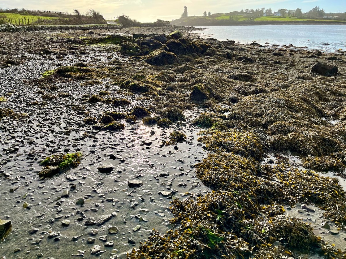
The weather so far this year is breaking records for coldness, wetness and evapotranspiration – while Earth as a whole continues to get warmer. In simple terms that means it’s not pleasant to wander too far from home. I decided to walk down to the shoreline of Rossbrin Cove – all of ten minutes – and see what the winter storms may have washed up: often an interesting diversion.
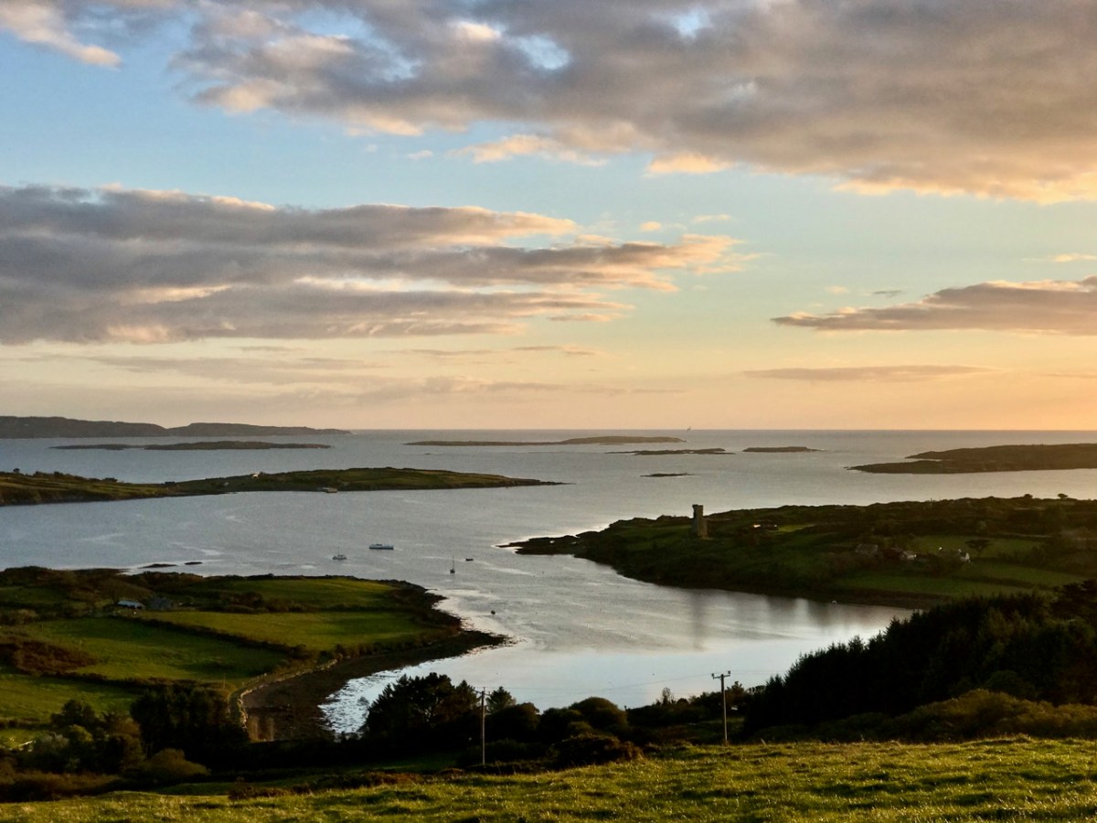
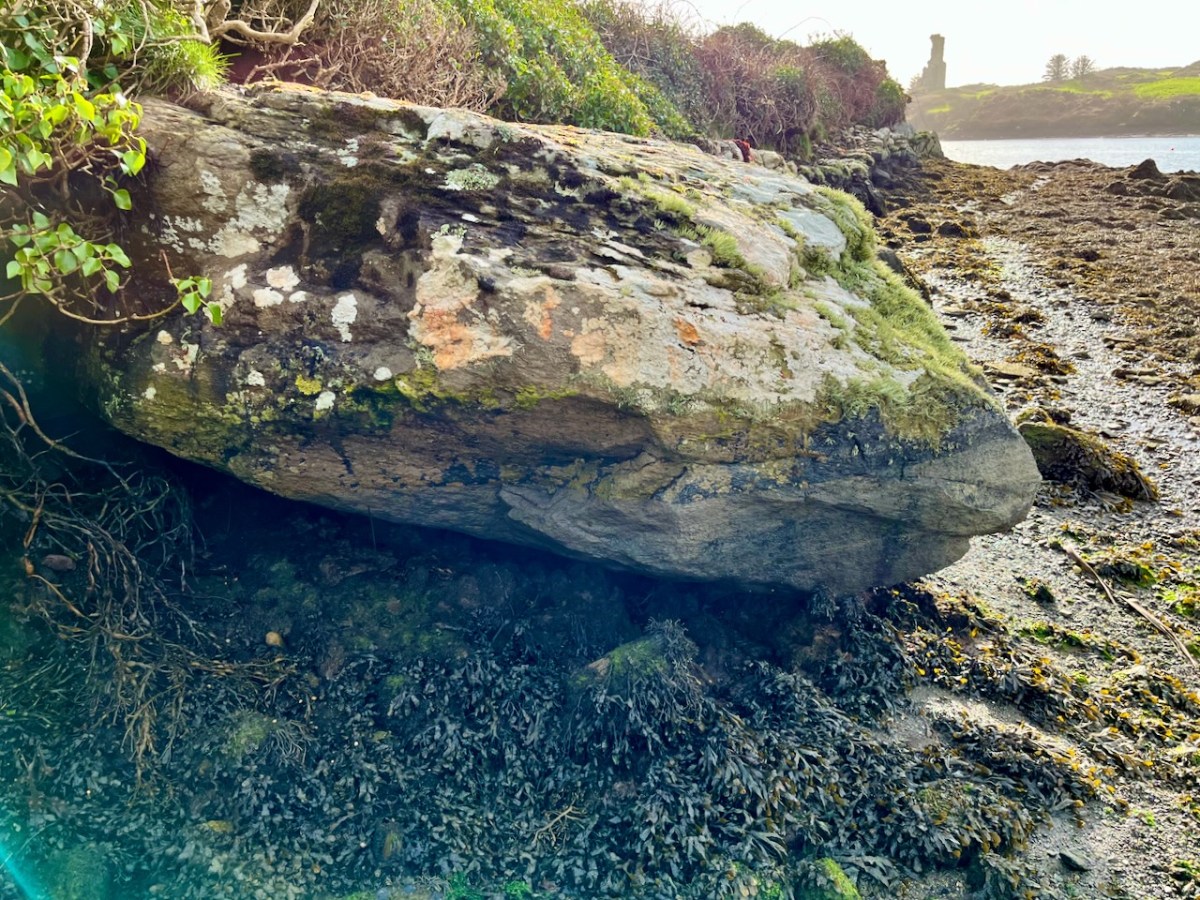
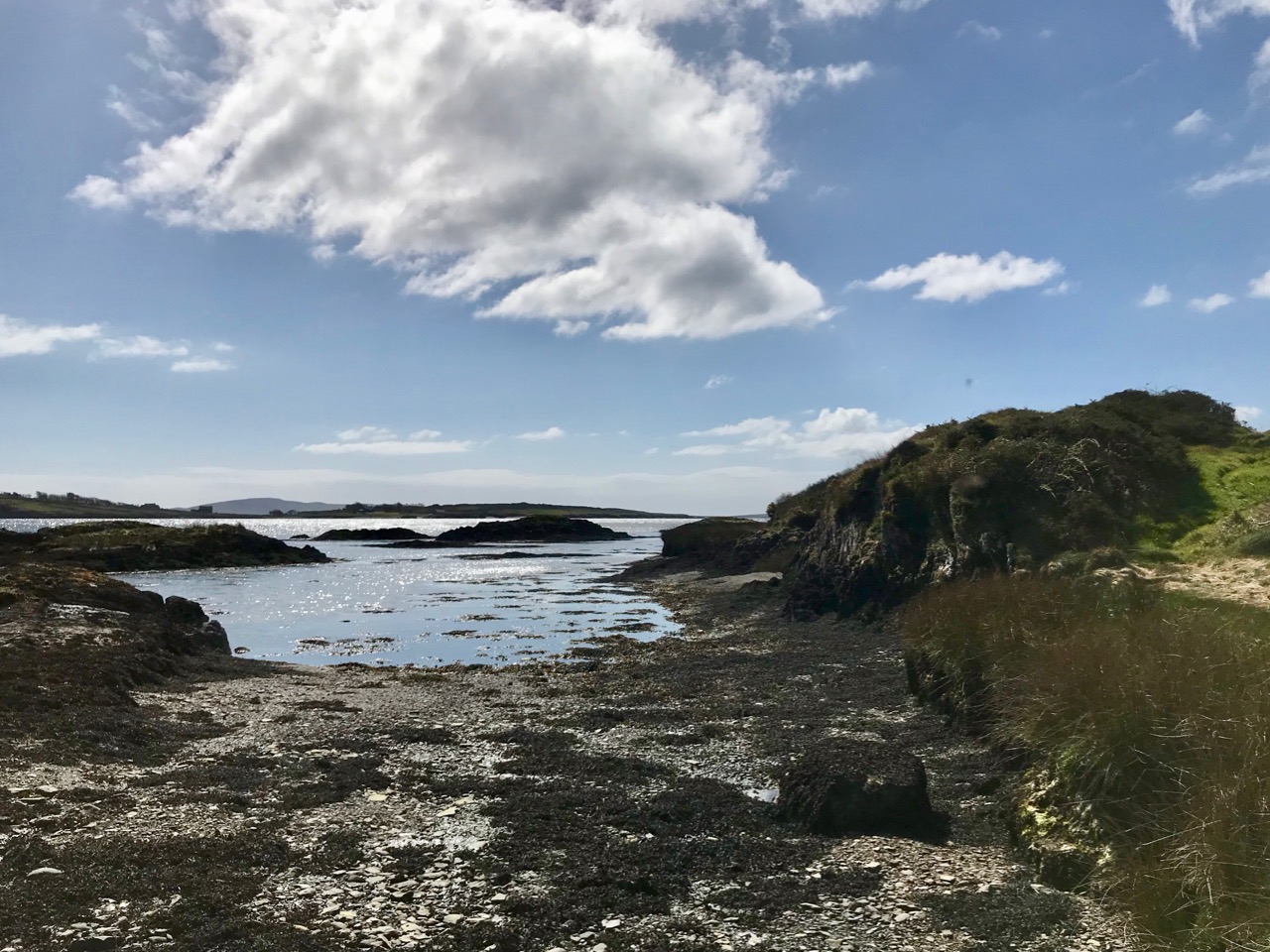
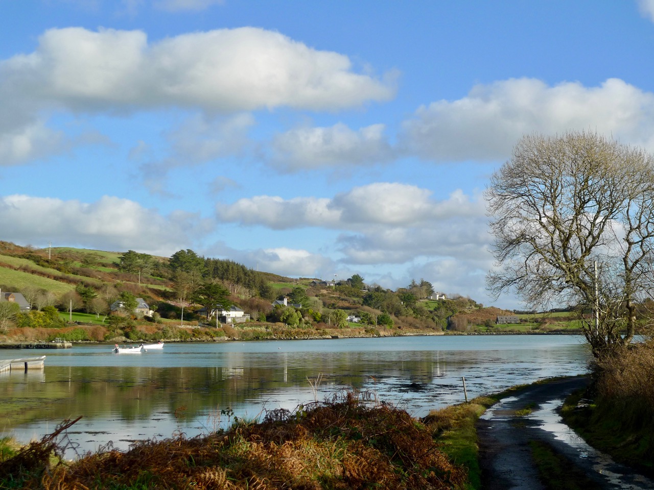
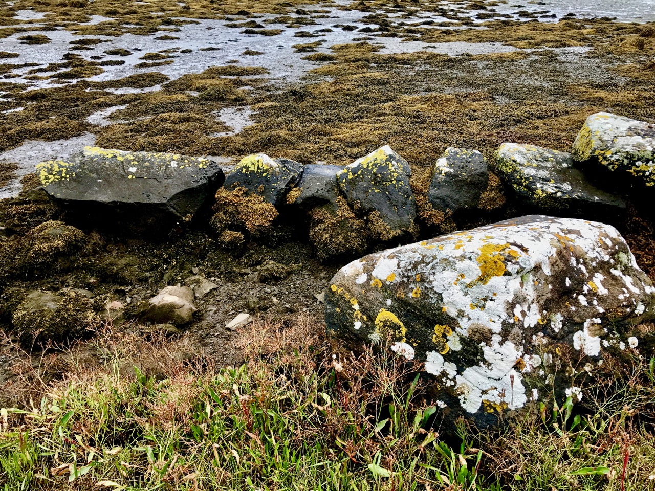
Above: looking down on Rossbrin Cove with some of the islands of Roaringwater Bay beyond. It is a natural harbour, and there is a thriving boatyard at the western end of it. The difference between low and high tides is around 2.5 metres on average, and much of the inlet dries out when it is at an extreme low. I timed my walk to arrive when the tide was fully down, as I wanted to explore the exposed mud-flats, with hopes of finding intriguing detritus.
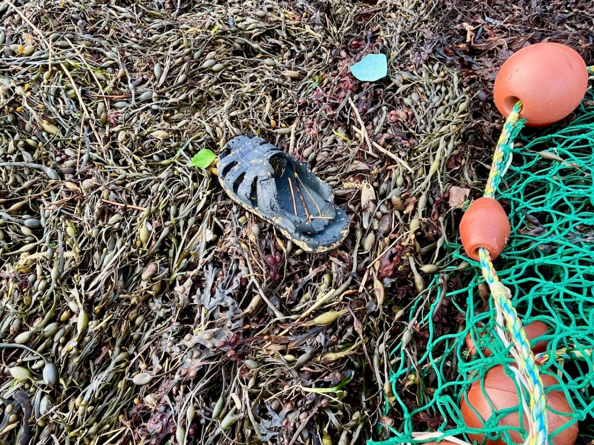
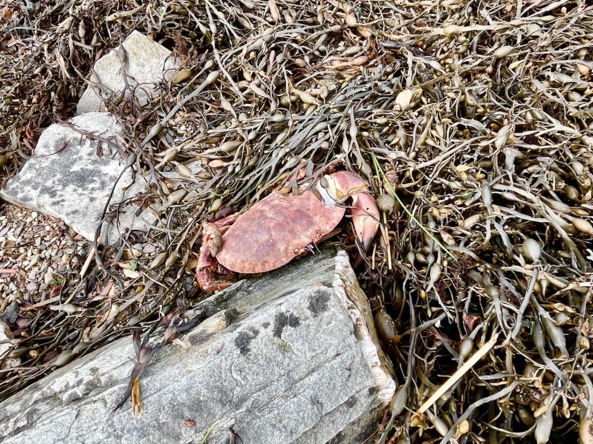
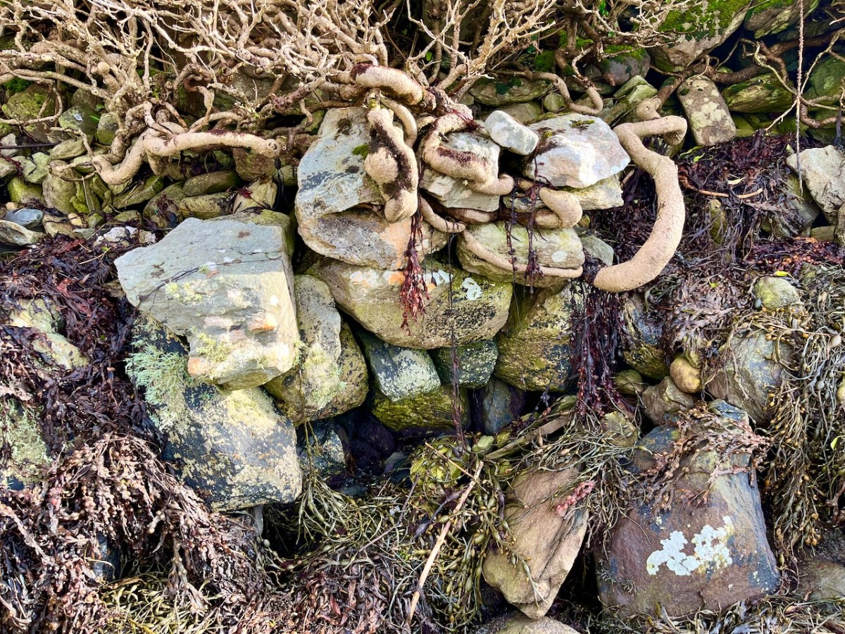
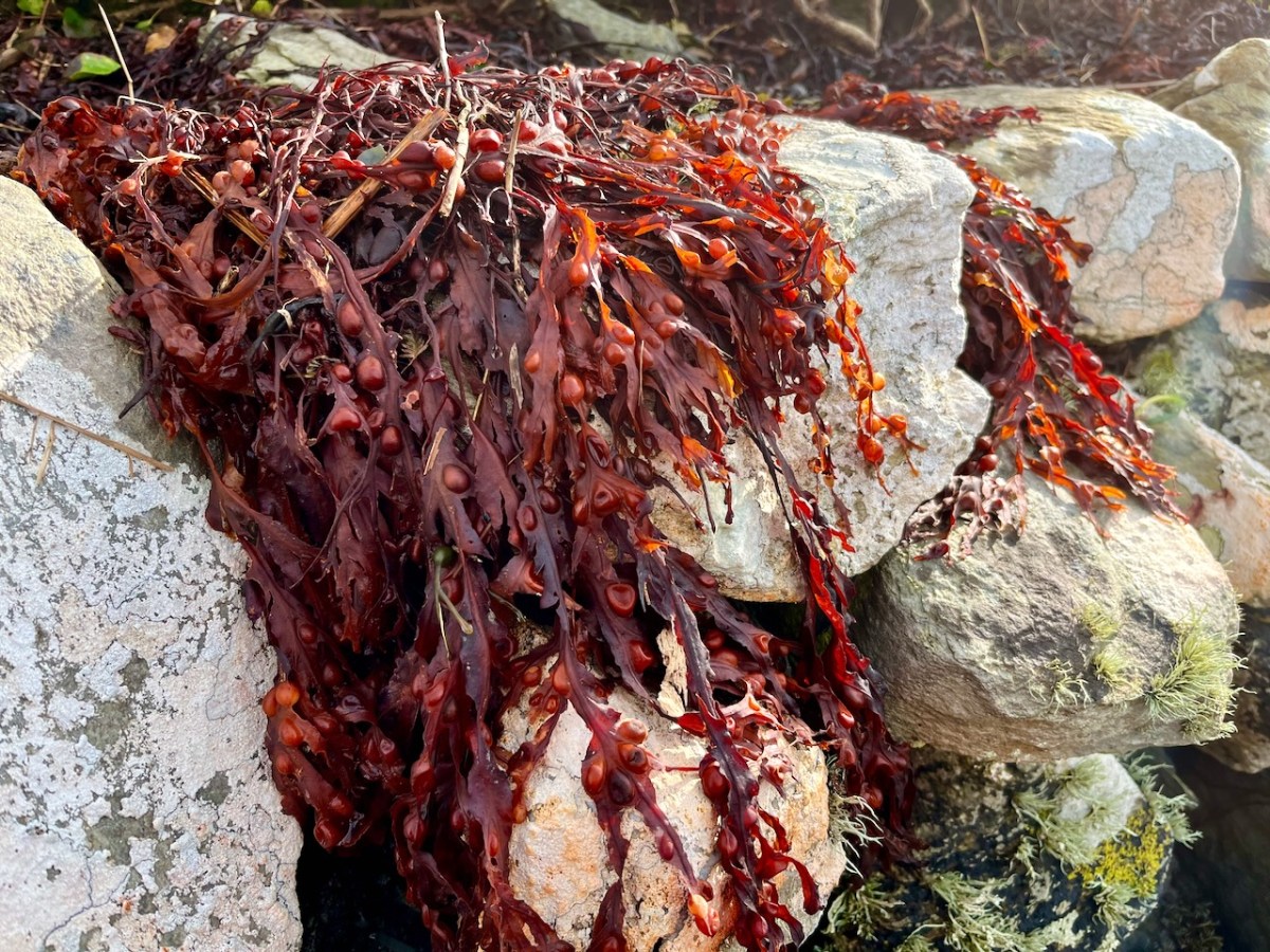
Not an inspiring start! In fact, as I continued my review, I noted that there was very little other than the natural environment – weather-worn boulders, skeletal shells and masses of seaweed – to disturb the order of things in Rossbrin on this February day. If our harsh storms had been of some positive effect it was perhaps to flush out any washed-up debris that might have accumulated in the winter – being now past St Brigid’s Day I consider it appropriate to call the season spring.
No matter that the exploration was superficially disappointing, the magic of this little bit of West Cork soon took over, and my mind was filled with the enormity of its history. There was a university here in medieval times: manuscripts were written here in the castle that has become a crumbling pile. Ravens and seabirds now rule over the stronghold. I walked on.
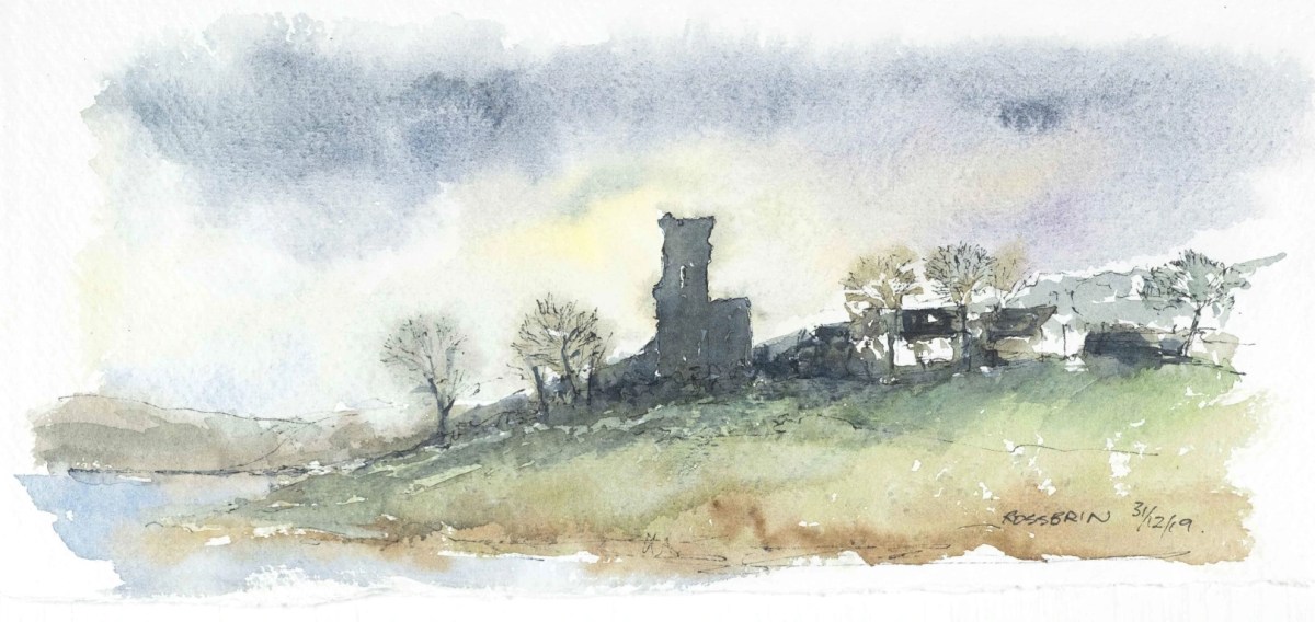
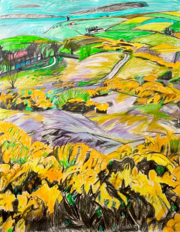
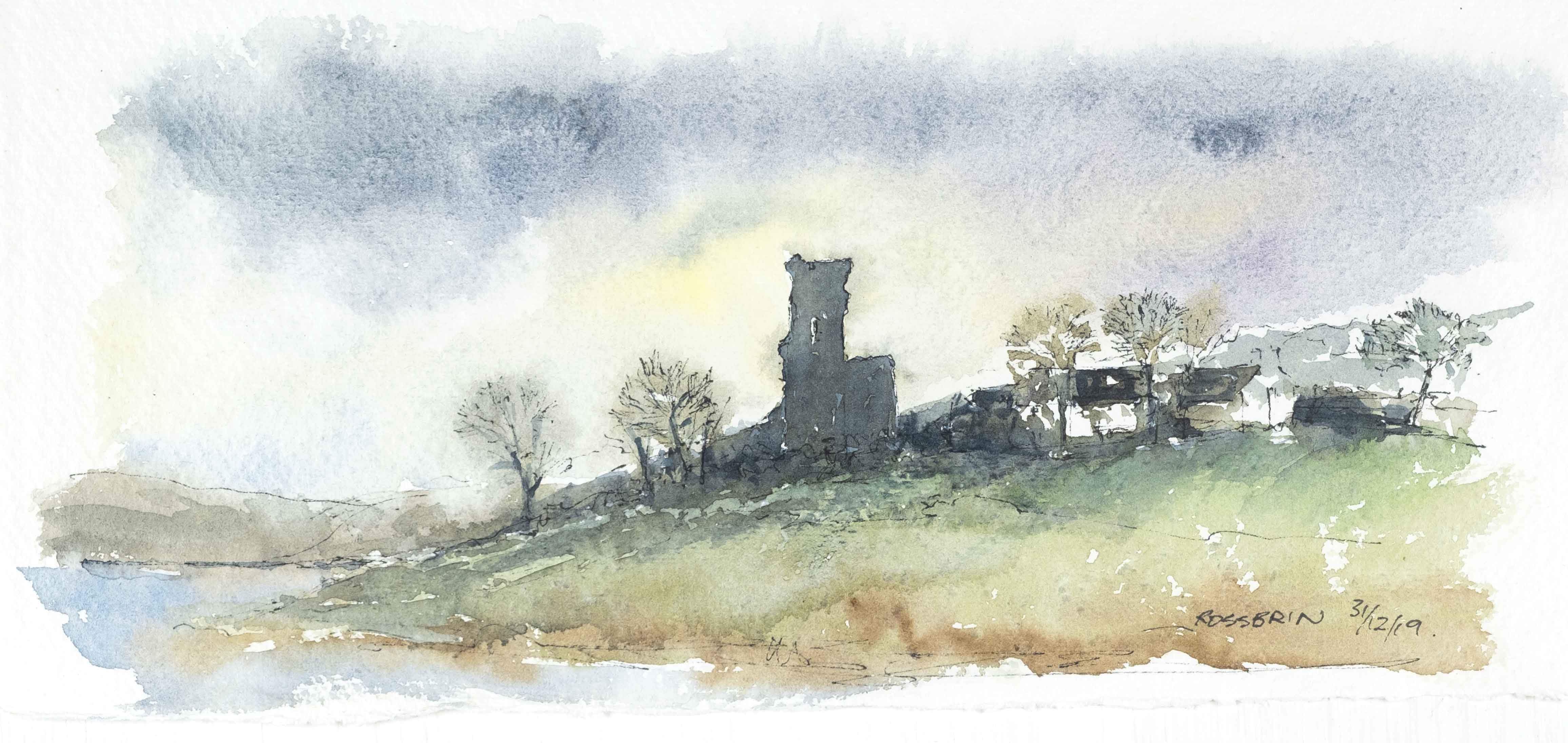
The margins of the cove are lined with ancient banks. At every turn there is a composition which a maestro could frame: I make do with a camera. Rossbrin inspired our artist friend Peter Clarke . . . Thank you, Peter!
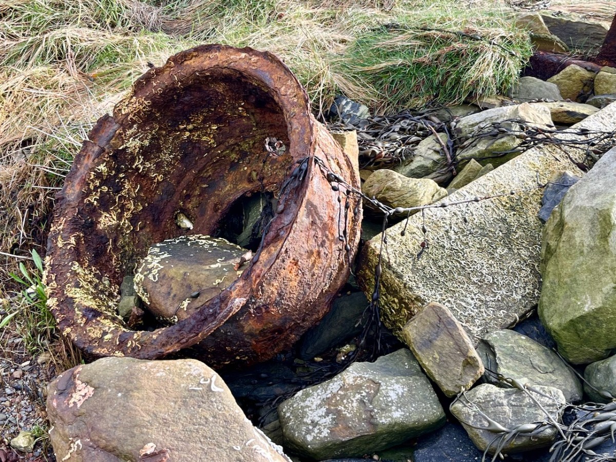
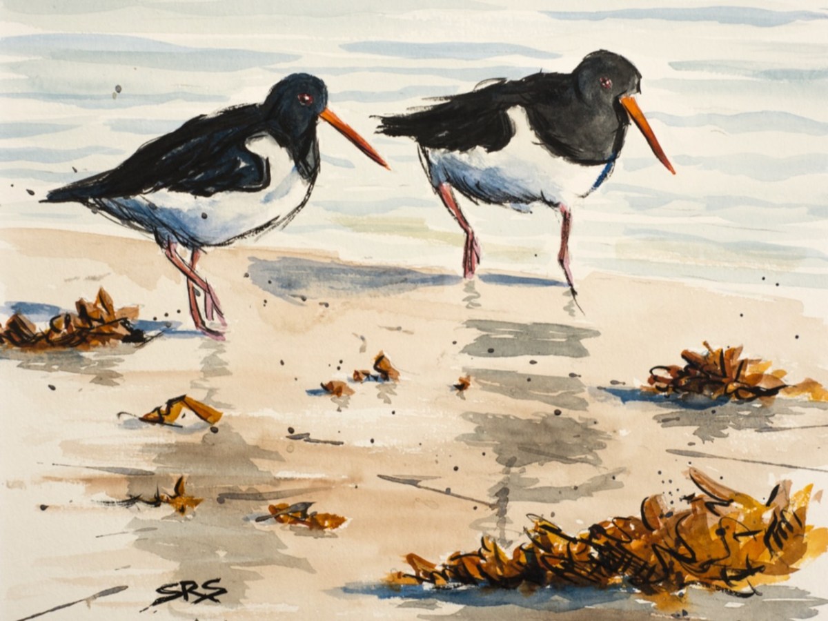
Evidence of more recent history: possibly a pot which was used in the process of tarring a clinker boat hull. No doubt vessels were built on these shores – and used to make basic livings. There is still fishing activity in and around the cove; mussel beds thrive in Roaringwater Bay; seaweed collection happens also. In summer months the deeper waters of Rossbrin are occupied by leisure orientated sailing craft. I enjoy the calm days of winter when there is hardly anything on the water. I watched a small flock of oystercatchers scurrying and foraging with their brilliant beaks, and then I turned for home.
The Rossbrin oystercatchers were uncooperative, and wouldn’t let me photograph them. Instead I have imported this wonderfully atmospheric painting by Cornish based artist Steve Sherris. Thank you, Steve
We have posted extensively about Rossbrin Cove, its history and its people. Have a look at these:
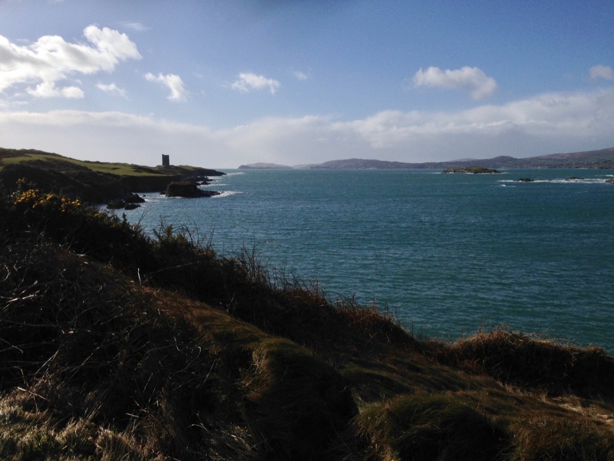
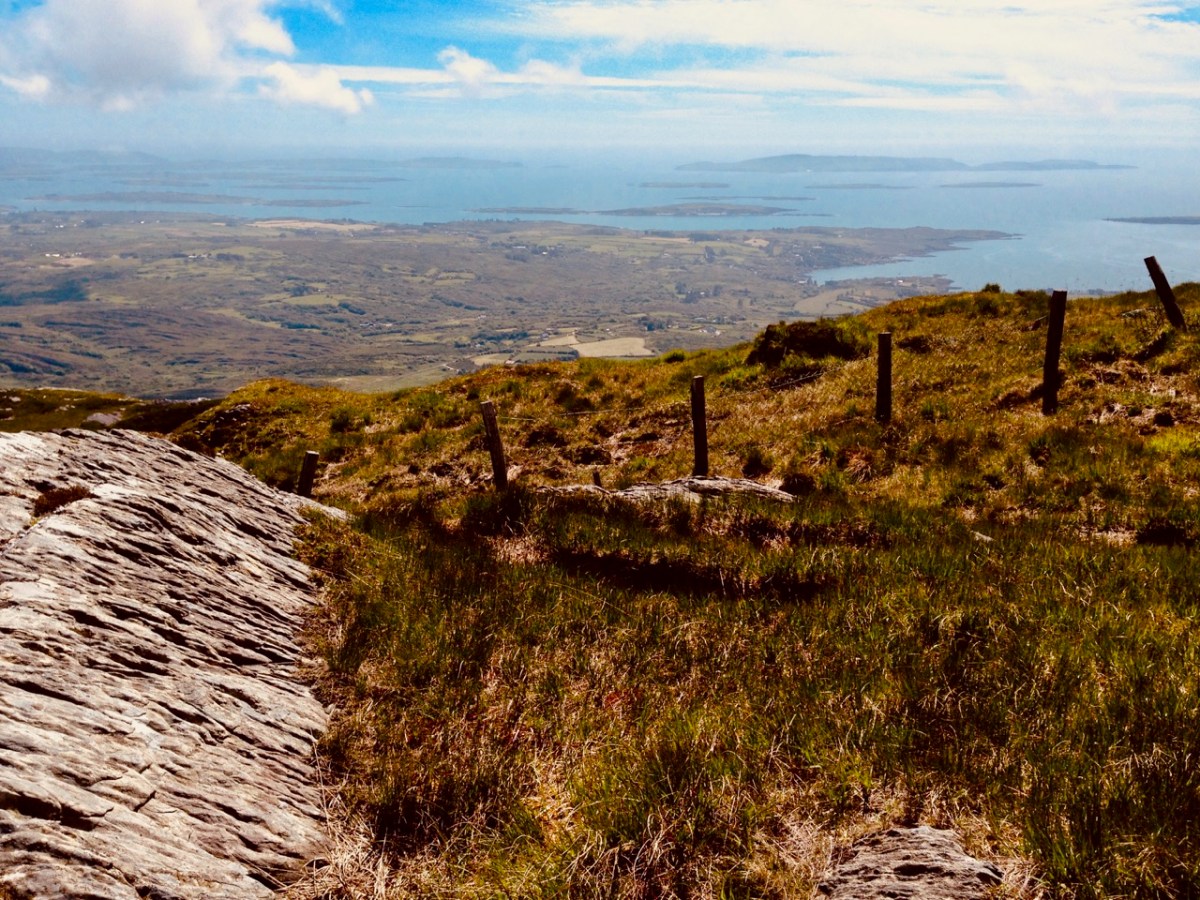
Roaringwater Bay must be so familiar to you, if you are a regular reader of this Journal. It’s a land- and sea-scape of hidden coves, inlets, islands, mountains and castles: a treasure trove for explorers and historians. That’s Black Castle at Castlepoint, Leamcon, above – said to have been built by Connor O’Mahony in the mid fifteenth century. Probably the best place to get an overview of the coastline is to climb to the top of Mount Gabriel (407m) and have a look down. You will see stretched out the archipelago of ‘Carbery’s Hundred Isles’ – seen here in autumnal hue – Cape Clear is the distant remote landfall over on the right:
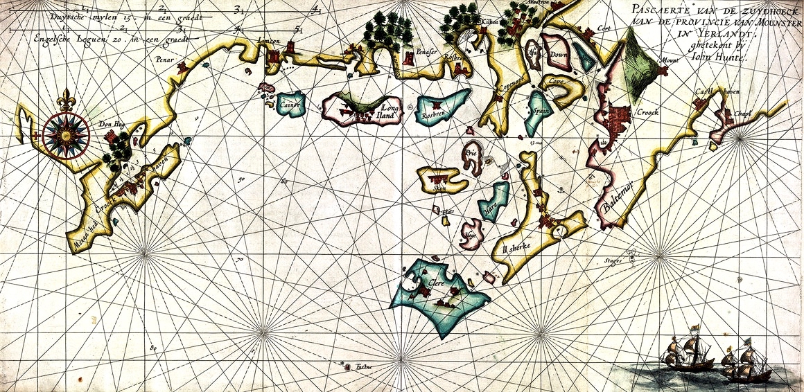
We always have a sizeable pile of books waiting to be pored over. Currently at the top is this study, The Alliance of Pirates, written by Connie Kelleher and just published (2020) by Cork University Press. We have yet to consume every detail, but we do assure you that it’s full of fascinating historical information – not just about pirates, but about life and culture in the west of Ireland in the late sixteenth and early seventeenth centuries. Connie is an ‘underwater archaeologist’ and we have followed her over many years, lecturing and presenting original information which she has gathered together on her subject. We couldn’t fail to be hooked on everything she says, illustrates and writes about, as the focus is on our own doorstep. One linchpin of this book is a map which is dated to 1612. This article from Atlas Obscura explains the map and Kelleher’s approach. It’s worth reading: note that you may be required to register on the Atlas Obscura website (it’s free) in order to access it.
The purpose of today’s post is to examine the 1612 map in detail and attempt to identify and relate to many of the places which are named and illustrated. Before that, though – let’s consider how such a chart came to be made. Finola has written previously about how West Cork as a whole was being mapped in the sixteenth and seventeenth centuries here and here. The thing that sets the 1612 map apart, however, is that it was made in secret, and largely from surveys only carried out at sea. Also, it was specifically intended to enable a Dutch fleet to assail the pirate strongholds which became numerous around the area from Baltimore to Crookhaven, centred on Roaringwater Bay and ideal for forays into the wider Atlantic trade routes.
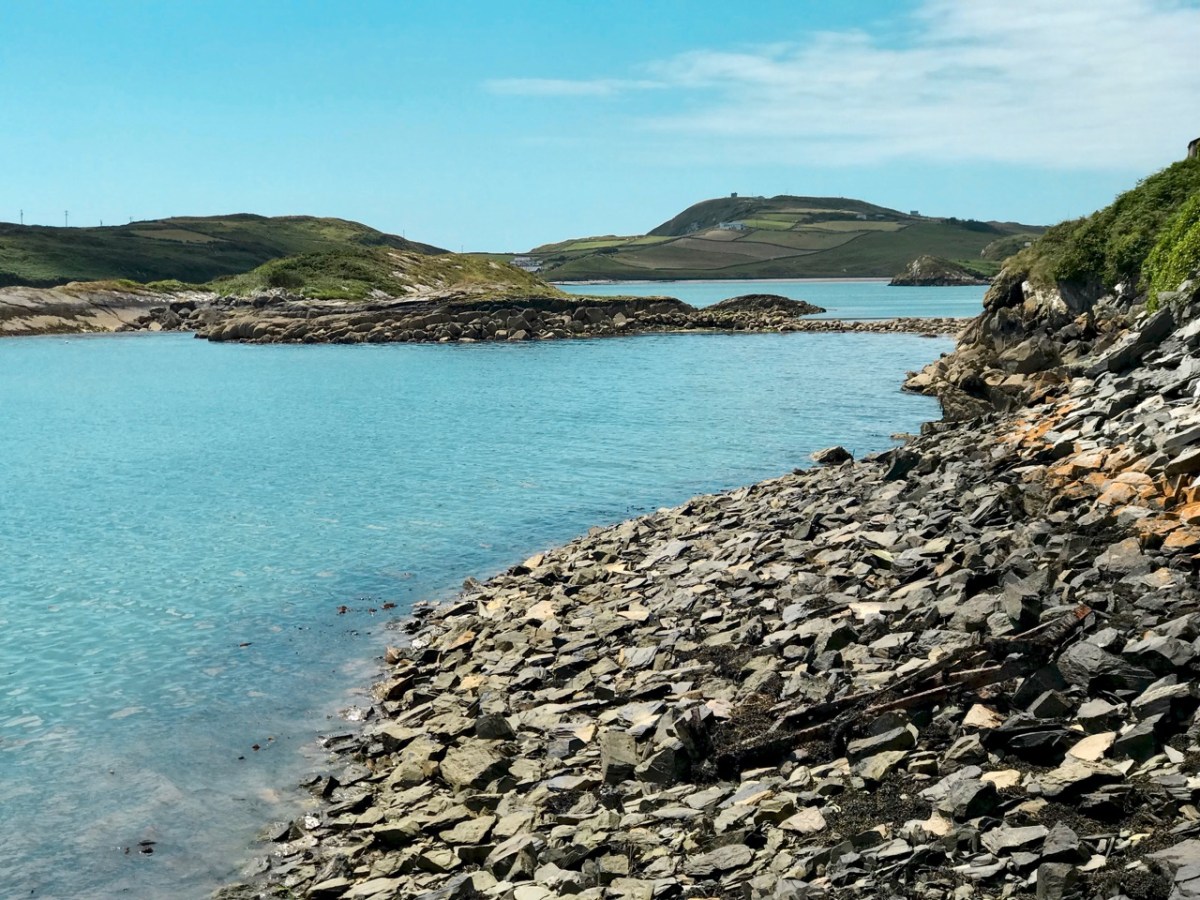
The sheltered waters of Crook Haven – an important recognised centre for careening and victualling ships operating legitimately on the Atlantic trade routes: ships that would become prime targets for the pirates based in secret ‘nests’ along the same coastline
. . . In 1612, having grown tired of the ongoing pirate harassment, the Dutch government lobbied James I for permission to enter the harbours of southwest Ireland to attack the pirates themselves. James I agreed, but only under the conditions that the pirates would be captured alive and handed over, along with captured goods, to the Kings’ ships to be transported for trial by the Admiralty in England.
To prepare their ships for the attacks, Dutch hydrographer Hessel Gerritszoon was tasked with mapping the Irish coastline with a special focus on the “pirate coast” of southwestern Ireland. A large task in front of him, Gerritszoon engaged English cartographer John Hunt to assist. . .
Atlas Obscura
The leeskarte which the hydrographers produced still exists, and has been housed since the mid 1700s in the library at the University of Göttingen in Germany, which acquired it in the mid 1700s. During her researches, Connie Kelleher travelled to Göttingen to examine and document the map, which is a wonderful resource for enlightening us on some aspects of our local history.
. . . It is a type of ‘treasure map’ informing on the heritage within the landscape at the time, which could potentially help us identify other pirate-related locations, including archaeological sites . . .
Connie Kelleher
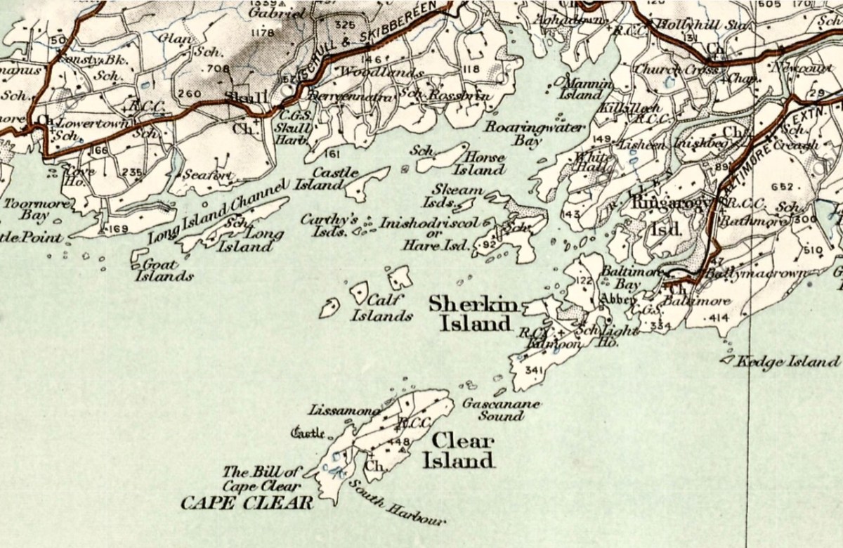
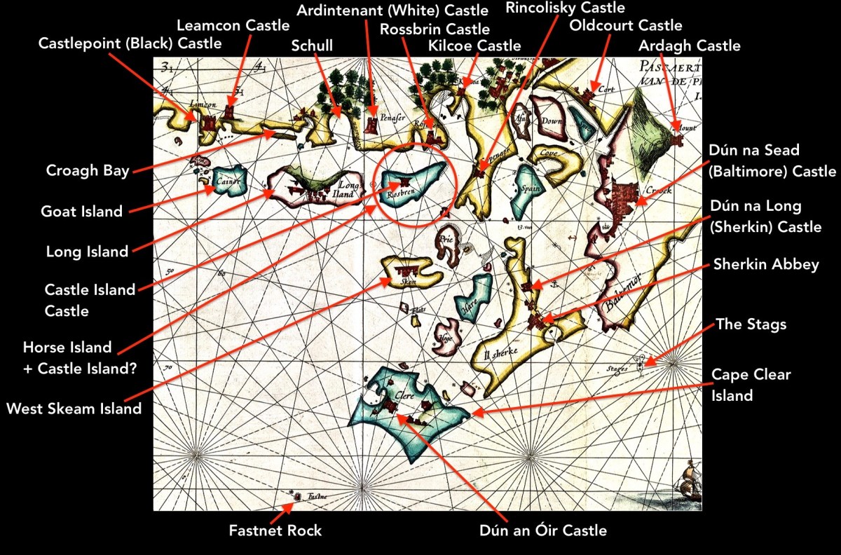
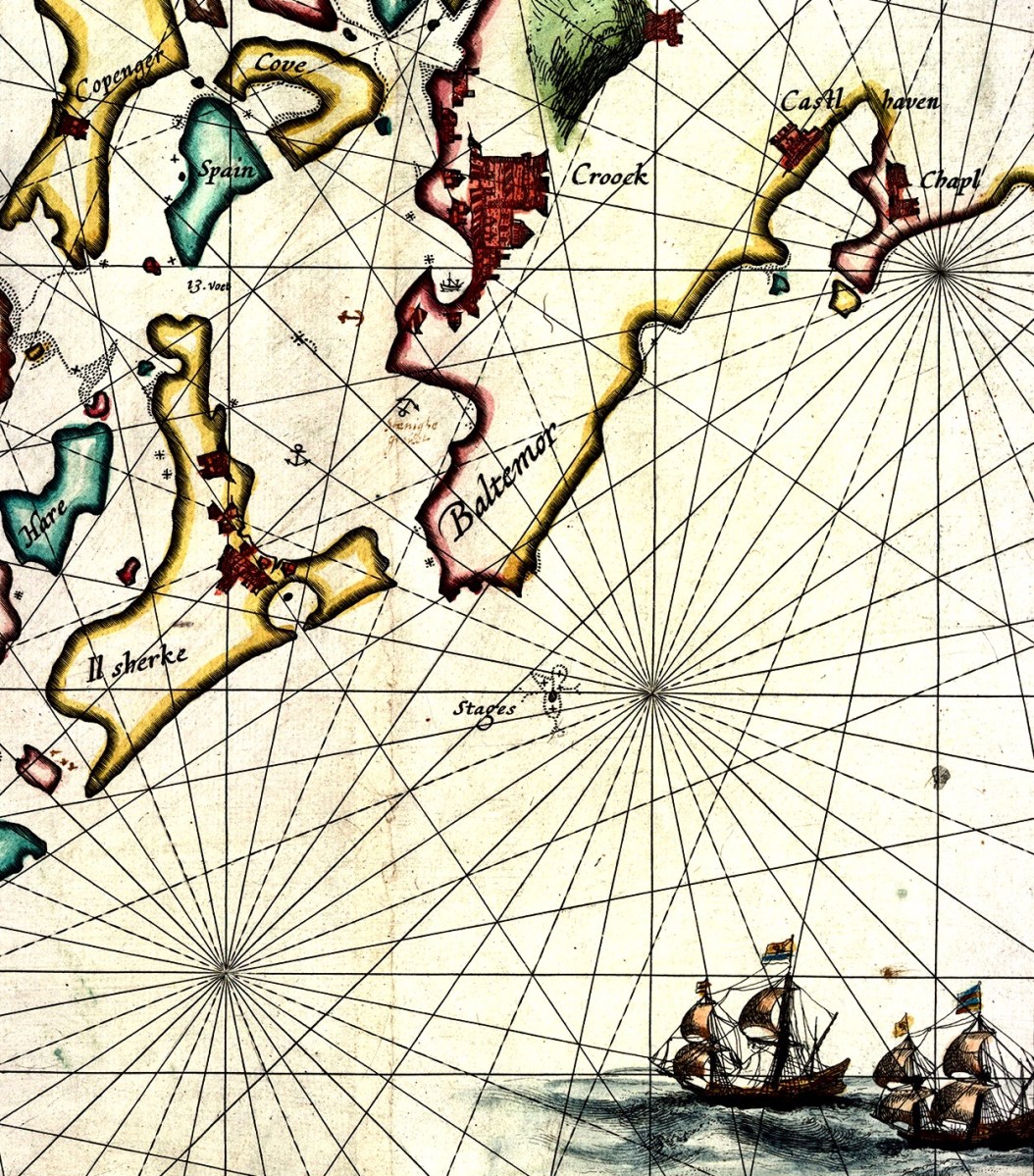
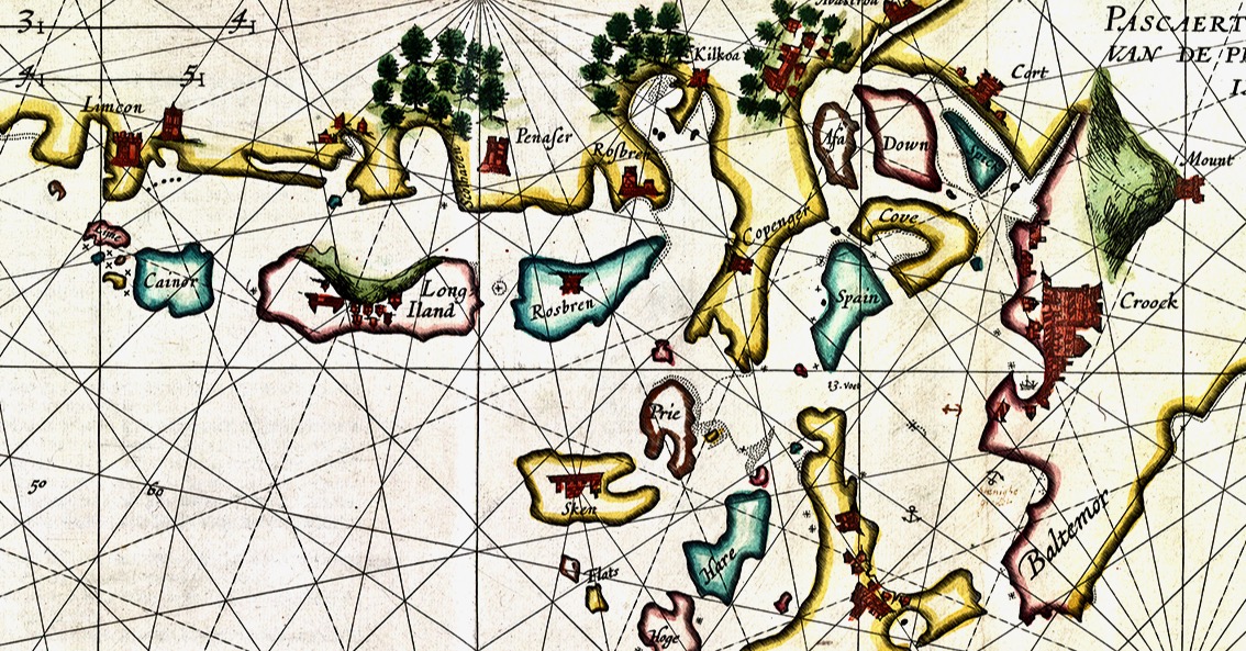
In this extract from the 1612 map I have focussed on our immediate area – the environs of Roaringwater Bay itself. Many names will ring bells with us (Clere, Baltemor, Rossbren for example); others won’t. For a simple comparison I have chosen a version of the historical 6″ Ordnance Survey map, dating from the late nineteenth century – it’s probably the clearest and best annotated example of what we would recognise around us today in terms of place-names:
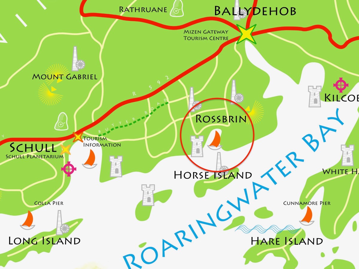
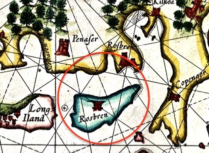
Here I have located and labelled our environs, as shown in 1612. It is remarkable that every castle and many significant features are clearly shown. Now, have a look at my red circle around ‘Horse Island + Castle Island’.
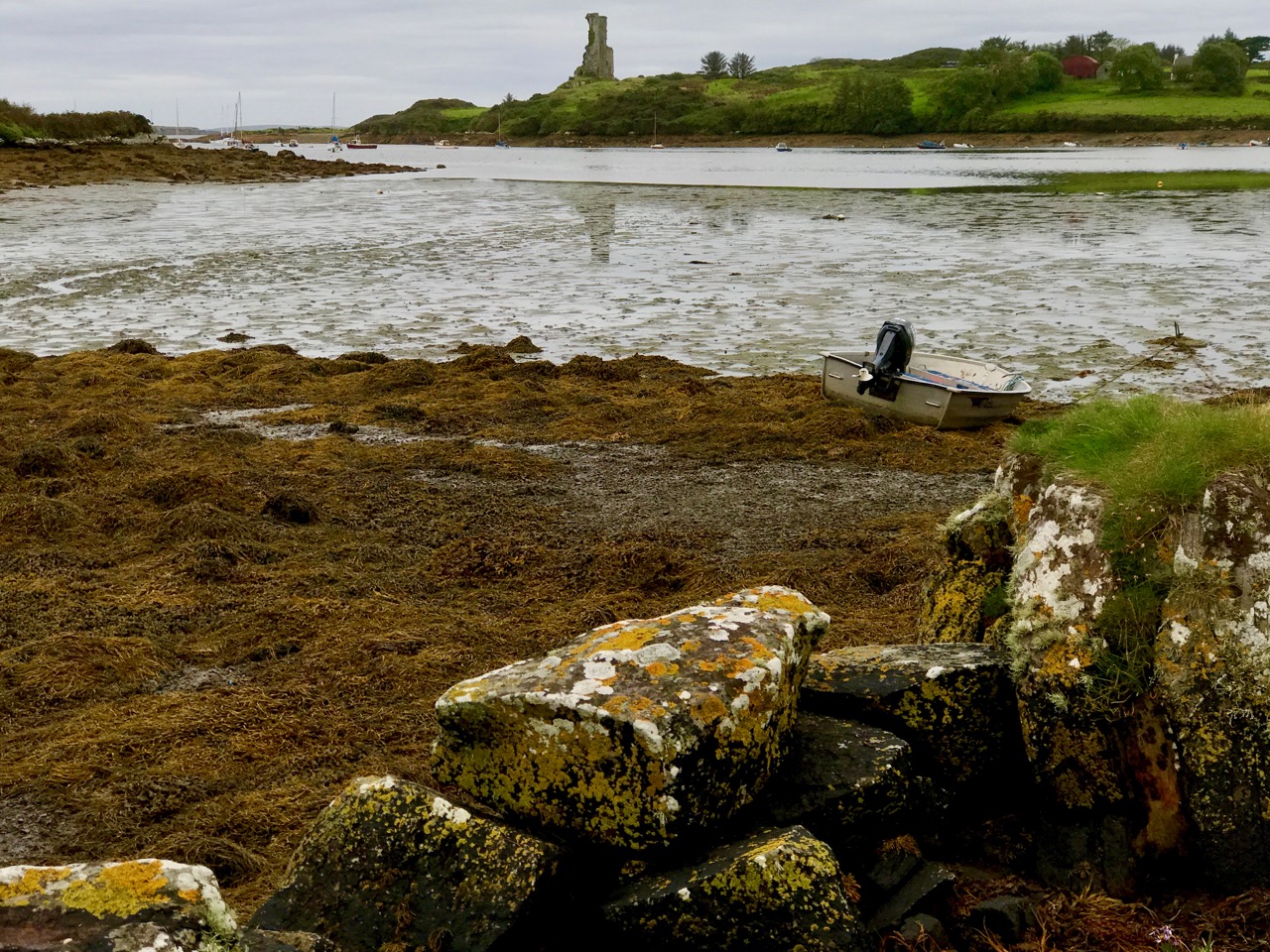
There’s an island missing! Opposite ‘Rossbren’ on the mainland is shown a single island: Rosbren. Next to it is Long Island. In fact, there are two islands here – Horse Island and Castle Island. On the 1612 map there is a castle shown on the Rosbren island, but the castle is actually on Castle Island. Somehow, the surveyors have missed this detail: perhaps the visual information which could be got offshore was confusing. What is interesting, though, is that the dotted lines at the east end of Rosbren on the 1612 map seem to mark the line of a causeway, the vestiges of which do appear today at very low tides and the feature exists in local folk memory. That level of detail on a chart, produced in the limited circumstances of its, time is remarkable! You can read more about Castle Island here.
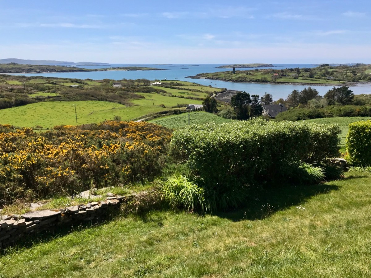
Our view across Rossbrin Cove with its O’Mahony castle and, beyond Rossbrin Castle, Castle Island. On the left of the picture is Horse Island
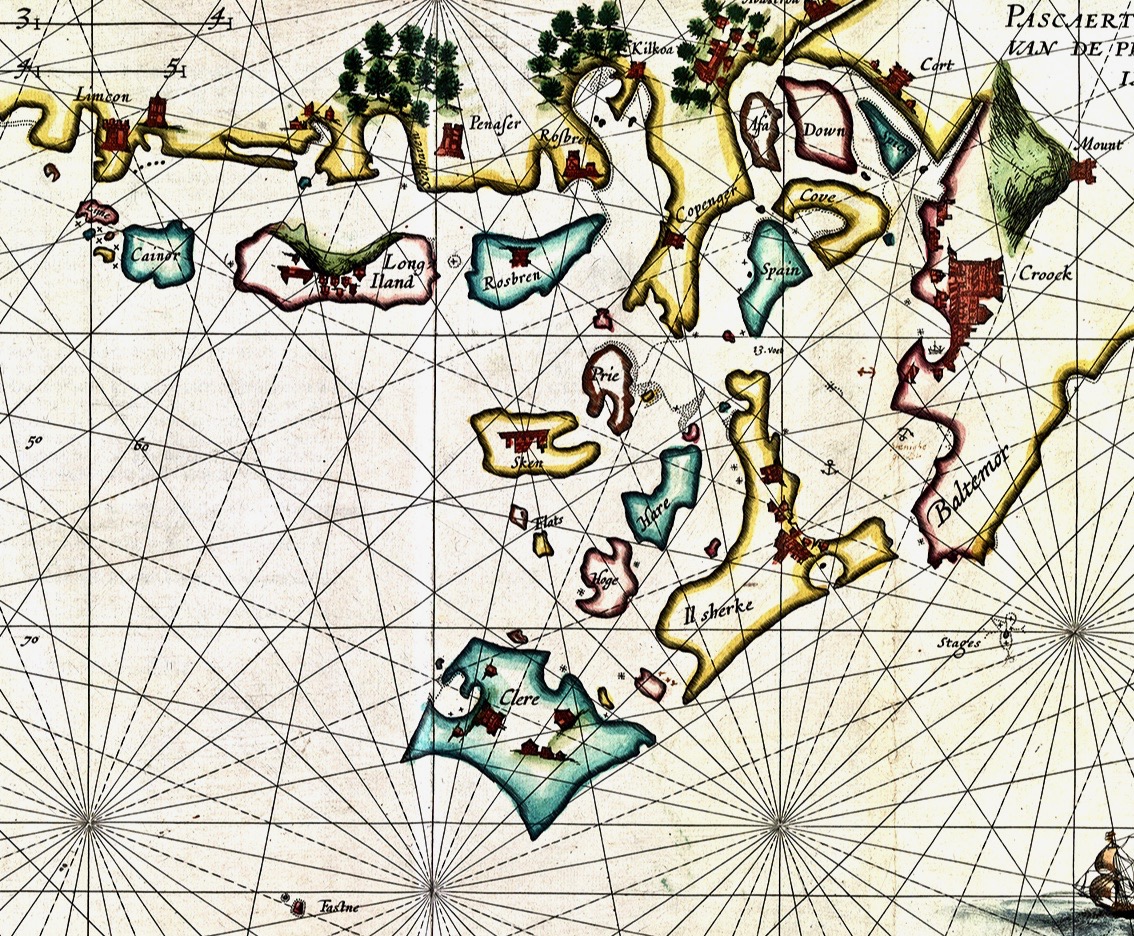
I want to show you some further details from the 1612 leeskarte. Firstly, here’s a close-up of Crookhaven (Croock haven on the map). Note the scales in Dutch miles and English leagues, and ‘Limcon’ – in fact Leamcon – which was one of the major pirate centres and also the territory of Sir William Hull, a Vice Admiral of Munster from 1609. His job description involved rooting out the plague of pirates in Roaringwater Bay but in fact entailing a lot of profitable collaboration with them. Also of interest here is the depiction of Goat Island – named ‘Cainor’ and a castle – ‘Penar’ which is likely to be Ballydevlin, at the mouth of Goleen harbour; also ‘Don Hog’, which we believe refers to Castlemehigan. There is no trace remaining of either of these two.
Another detail from the map (above) shows Spain Island, Sherkin and ‘Baltemore’. the depiction of galleons in full sail is a fine ornamental ‘illumination’. Also, note the small anchor symbols. In some places on the whole map, anchorage depths are shown: another remarkable factor highlighting the observation skills of the surveyors. Additionally on this detail, note the name ‘Croock’ – Thomas Crook, an Englishman, took a lease on Baltimore Castle in 1605. The ‘Chapl’ below Castlehaven is probably the now ruined church at Myross, detailed in my post here.
Our photograph of old (possibly ancient) steps carved into the rocks at Dereenatra. Connie Kelleher highlights the physical remains that can be found today in many of the former pirate strongholds around the coast of West Cork. Several are in the form of frequently hidden away steps and tying-up points in remote locations. I have included references to ‘pirate steps’ in a previous post. For the full picture, don’t forget to get hold of Connie’s book: it will make an ideal Christmas present for the archaeologists and pirate enthusiasts among you!
Main Street, Ballydehob: 4 April 2020. You’ve never seen it like this before on a Saturday morning. We are only out because we have urgent shopping to do. We are permitted to go to the shops, the dispensary and the dump (we live too far out of town to have any waste collections). Oh, and we can exercise within a two kilometre radius of home (here’s Finola’s account of that). It’s a strange life – but we are gratefully alive…
We completed our last ‘long’ walk on Friday 27 March – to the summit of Mount Corrin, for my Mizen Mountains post. On that evening the government announced the ‘lockdown’ and we are now isolated in Cappaghglass for the foreseeable future, although the 2km restriction will allow us to trespass into our adjacent townlands of Stouke, Cappanacallee, Foilnamuck, Rossbrin, Ballycummisk and Kilbronogue, provided we keep our distance from other walkers. We see very few.
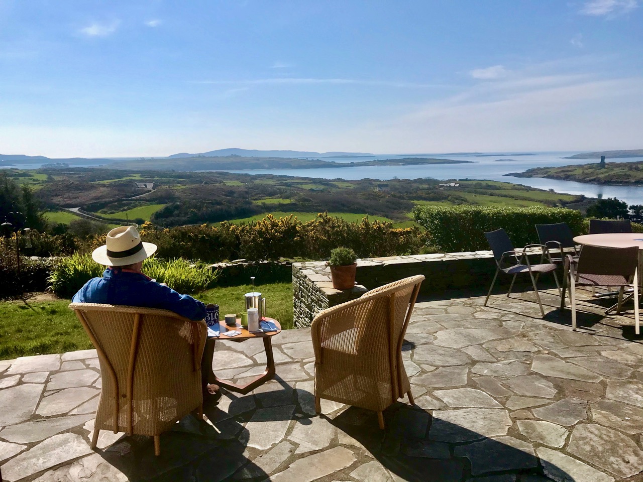
When the sun is shining, there’s no better place to be than home – looking out over Roaringwater Bay! We have plenty to occupy us. Not least, keeping up with this journal and my new venture Swantonstown Sessions – compensation for the enforced adjournment of the weekly traditional music meetings in Ballydehob. It’s an online forum for sharing tunes, songs and related ‘chat’. Please join in!
There’s not much activity in Schull, our other centre for essential supplies, either. The main street (upper) and pier (above) are deserted on Saturday morning, when it’s normally buzzing. All the businesses in our villages and towns rely on customers: we hope for their sakes (and ours) that the situation doesn’t last too long, although we do all understand how necessary the restrictions are.
Join us for one of our walks – along to Rossbrin – to look at the water and the always changing scenery as spring gets under way. That’s the boreen leading down to it, above.
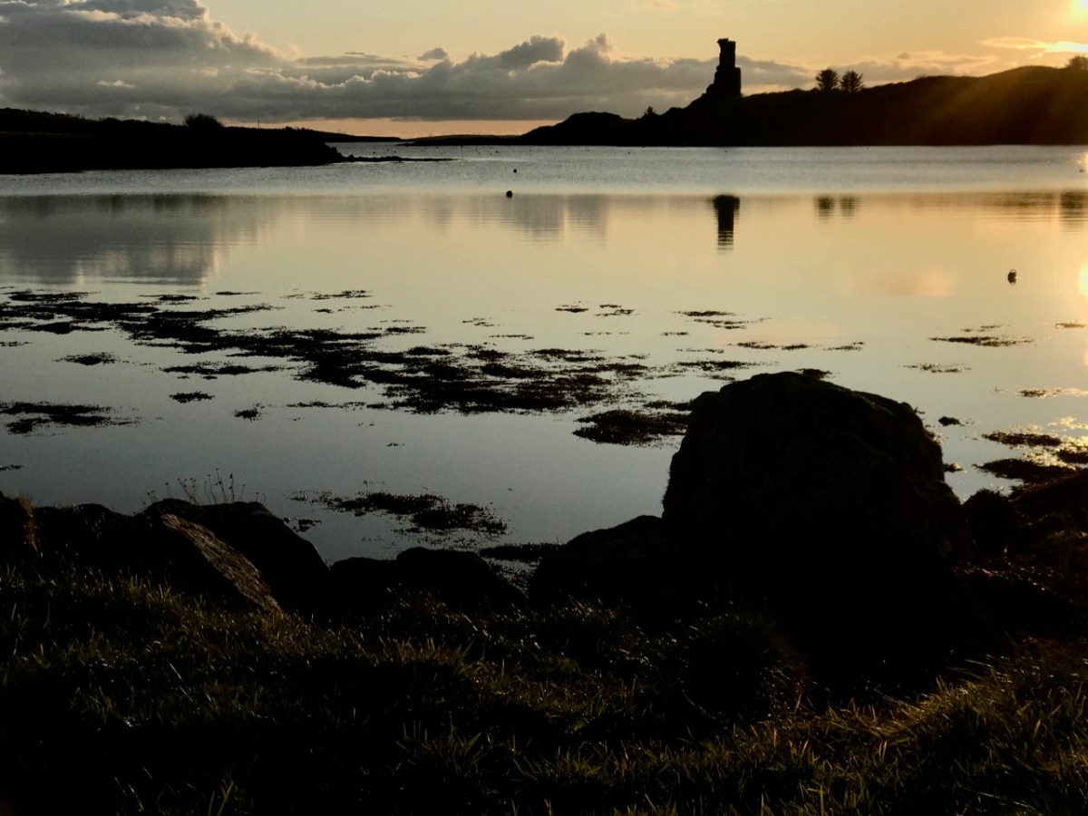
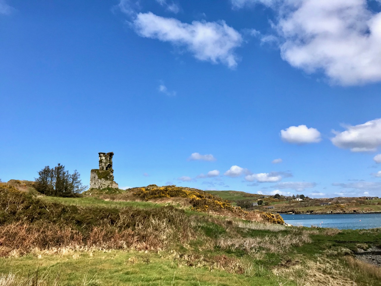
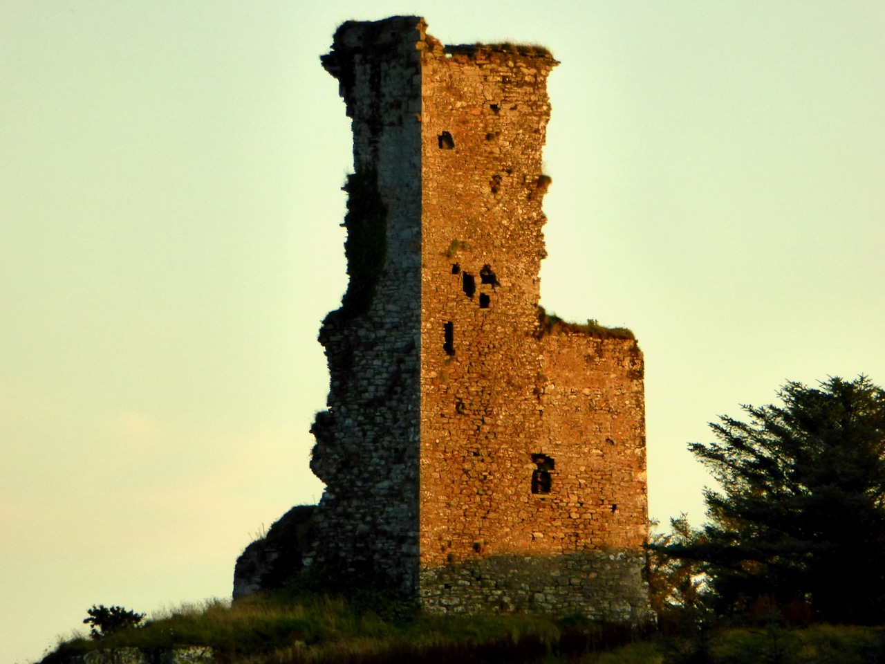
Rossbrin Castle, the home of the ‘Scholar Prince’ Finghinn O’Mahony in medieval times, is the local landmark which always draws us towards the Cove. It has stood for centuries, although very gradually returning to nature: parts of it will remain for generations to come, and will intrigue those who chance upon it, as I first did some thirty years ago. It is on private land, remember, but it can be seen from many accessible vantage points.
It’s no hardship to be ‘marooned’ out here in rural Ireland. The one thing we miss above all else is meeting and chatting with friends and neighbours: that’s unnatural. But we will survive it. After our walks there’s always the road home to look forward to (do you see the celandines lining the way?):
Roaringwater Journal wishes to heartily thank all those in our communities who are supporting the rural population through these abnormal times: medical teams, pharmacies, shopkeepers, producers and suppliers . . . All who keep our facilities and utilities going . . . They are helping us to stay healthy and upbeat in times of disquiet. We appreciate all of you.
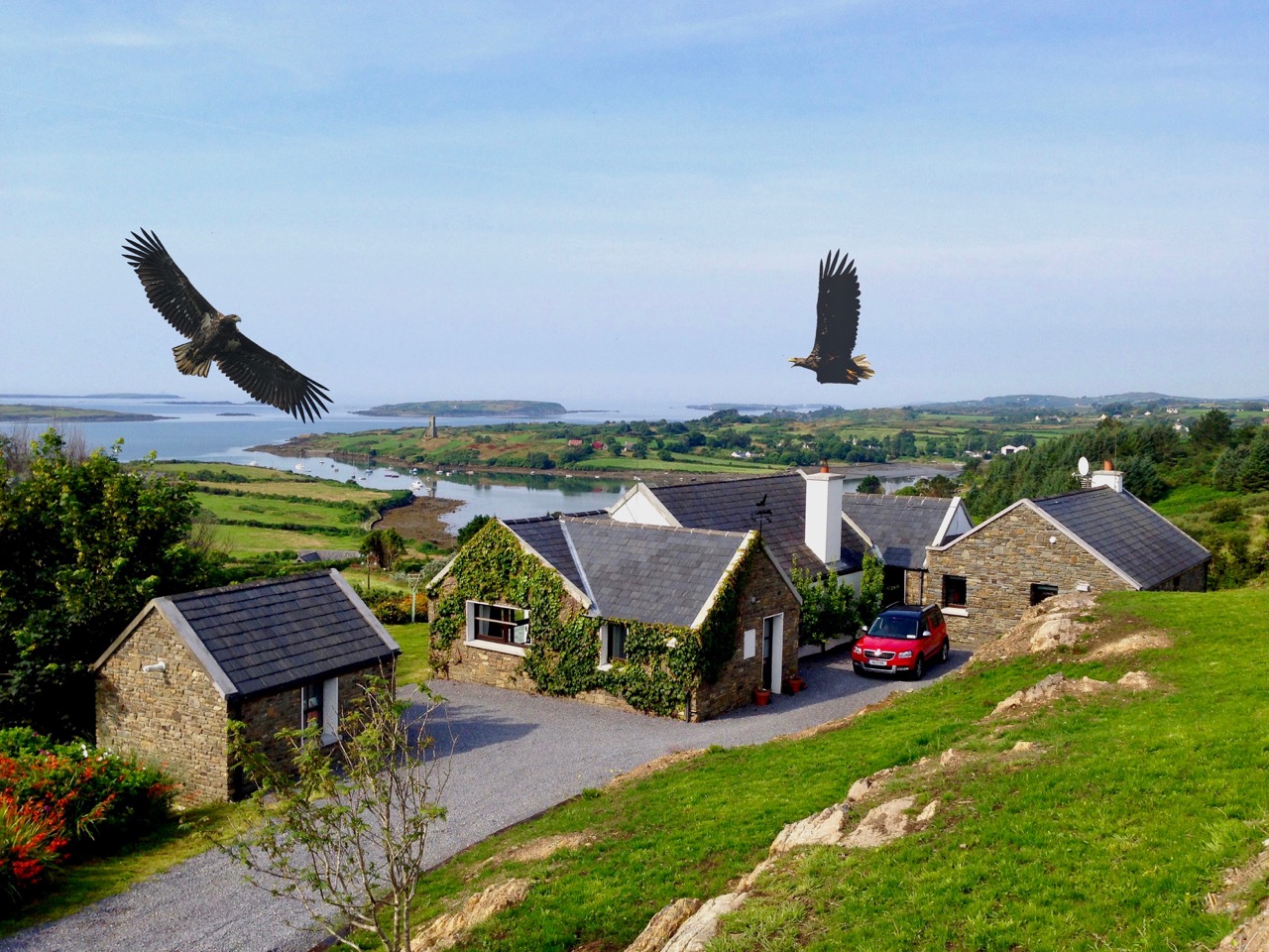
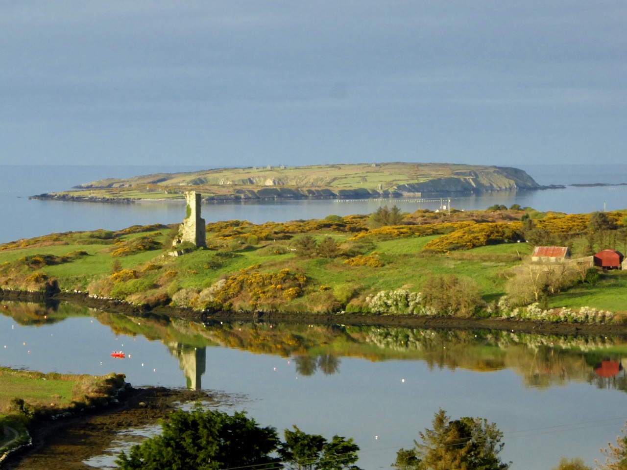
Last week we talked a little about the history of Rossbrin’s medieval castle, and the importance of this natural inlet as a historical centre of fishery, scholarship and European culture. Rossbrin Cove stills serves as an anchorage and refuge for sailing boats on the edge of Roaringwater Bay, but is now a peaceful haven, with only the sounds of the shore birds and slapping masts to lightly disturb an overriding tranquility that gives the place a very particular atmosphere. Our photograph (above) is taken on the boreen going to the castle; on the skyline in the centre is a wind turbine, and just below that is Nead an Iolair (Irish for Eagle’s Nest). The picture below shows the eagles wheeling over our house, with Rossbrin Castle and our view to the Cove beyond.
I have been exploring images of the Cove and its castle – some historic photographs and a few artists’ impressions. As it’s right on our doorstep, we have taken many pictures of Rossbrin during our years here. I am also sifting through a few of these.
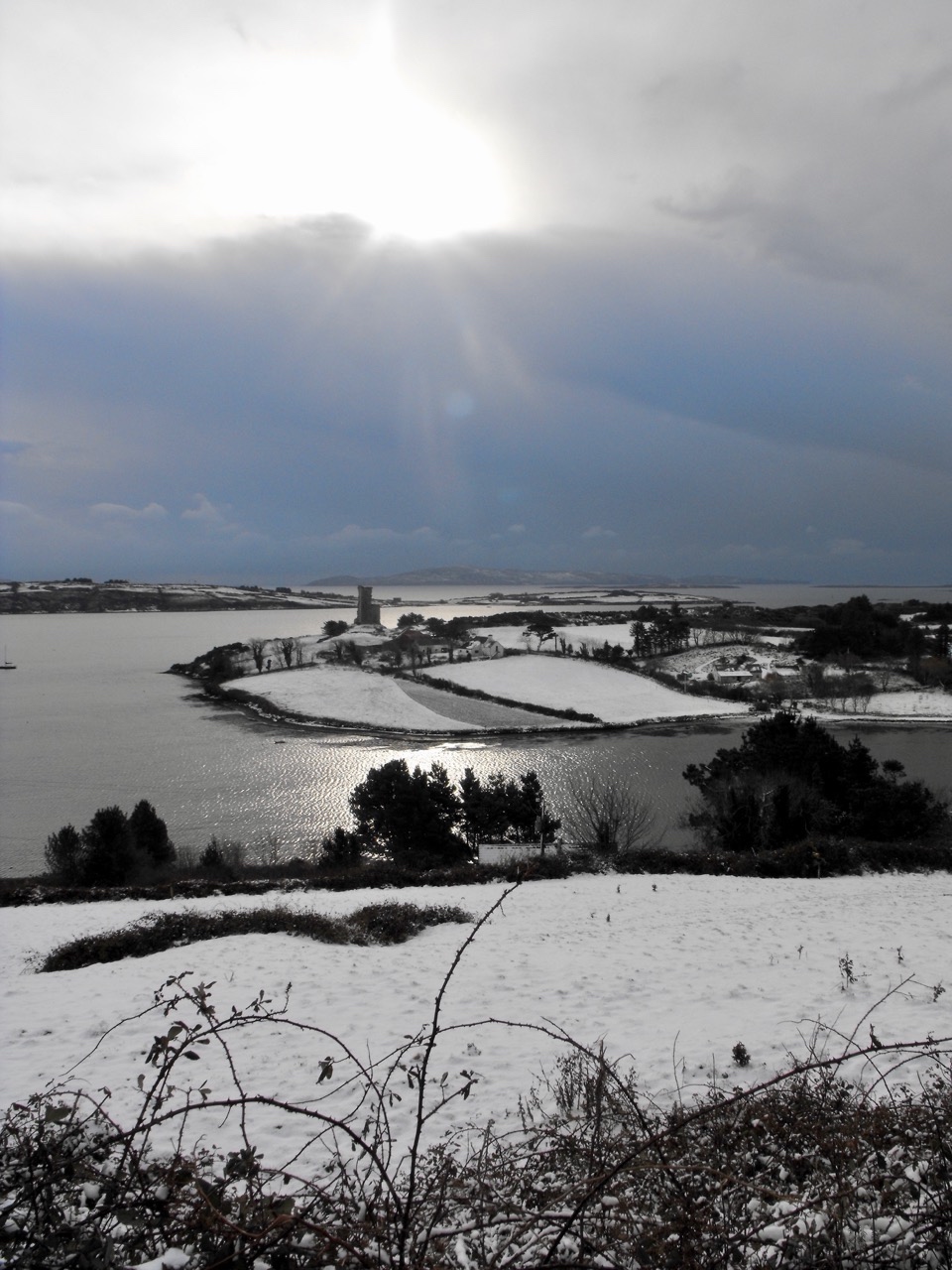
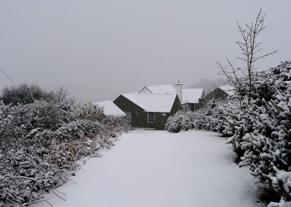
Ten years ago, the west of Ireland experienced an exceptional snowfall, and above is a photograph taken by our near neighbour, Julian van Hasselt, before we arrived. Mostly, our weather is relatively mild due to the effects of the gulf stream on the south-western coast. The castle can clearly be seen here, beyond the fields of Castle Farm. This view of our house (below) was also taken in 2010 by our neighbours Dietrich and Hildegard Eckardt:
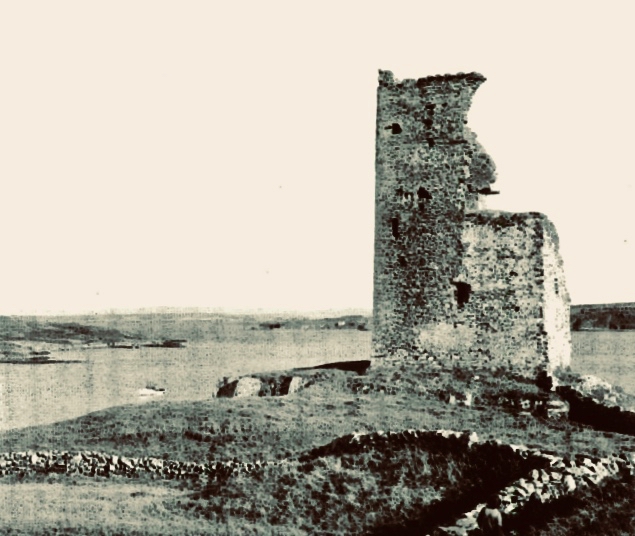
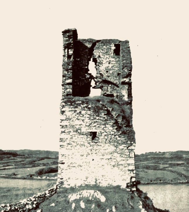
I showed a couple of early photographs of the castle last week. Here are two more taken before a substantial part of the ruined structure was toppled by a storm in the 1970s:
It’s good to see a bit of context, so here is another winter view of the castle on its rock with Castle Island behind. That island was also part of the O’Mahony territory. It is farmed by its present owner but no-one lives there now. You can make out the ruined castle on the island by the shore, just to the right of centre; it’s one of many that can be seen on, or close to, the shores of the Bay.
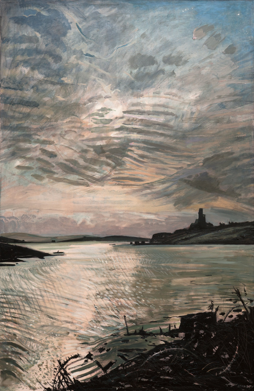
Let’s have a look at some of the art works that feature the Cove and the Castle. Jacqueline Stanley was one of many artists who was attracted to the beauty of West Cork. Now in her nineties, she moved from England to Ireland in the mid 1970s and purchased the old School House at Rossbrin as a country retreat: it has only recently changed hands.Here are two of her works, depicting Rossbrin. You can find more on her website.
I particularly like this view (above) which was painted by Jackie from the vantage point above the high road going down to the Cove, close to the remains of the copper mine at Ballycumisk. Last week I showed a painting by Geraldine van Hasselt, Julian’s mother, also from the 1970s. Every painting or photo is a historical document – and important to retain, in view of the fragile nature of the structure today.
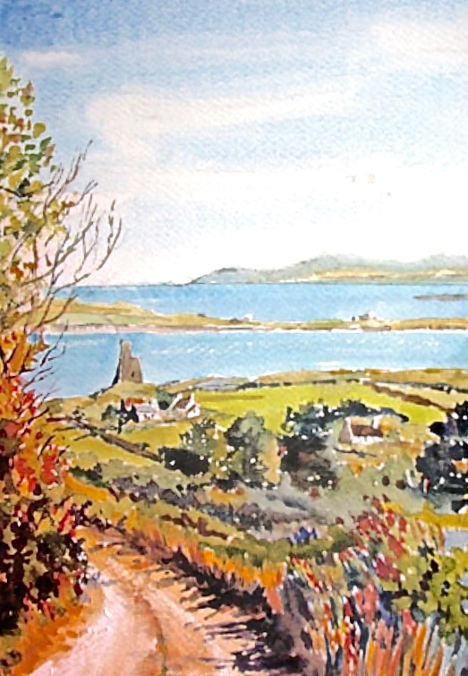
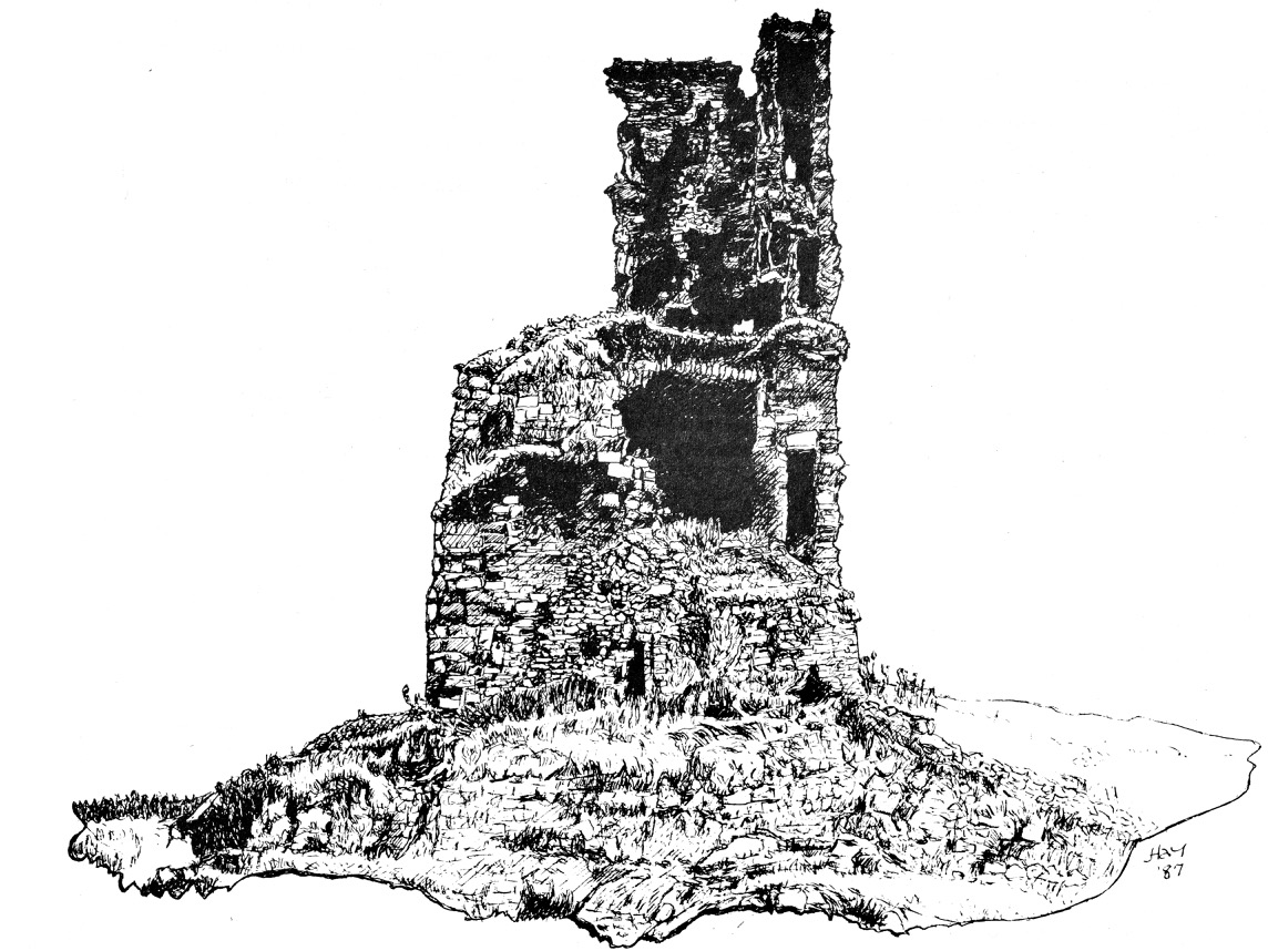
Our friend Peter Mabey is an architect and artist. He has lived in West Cork for a long time: he and I were at college together in Kingston, Surrey, and were surprised to meet each other by chance in Skibbereen market a good few years ago now. Above is one of his attractive watercolours looking down towards the Cove. The vantage point looks remarkably like the one chosen by Jackie Stanley. Below is a drawing of Rossbrin from the monumental work The Castles of County Cork by the late James N Healy, published in 1988 by Mercier:
The ruin is a romantic reminder of past times, enhanced by the changing weather moods of Roaringwater Bay. This photograph, by Finola, emphasises the character of the place:
I can’t resist finishing this little two-part foray into the medieval remnants of our historically significant ‘centre of culture and learning’, which now languish on the edge of the waters below us with an artist whose work we admire: Peter Clarke, who writes and illustrates the Hikelines blog. His watercolour sketches are exquisite and always atmospheric. He has kindly allowed me to use his portrayal of Rossbrin Castle as my tailpiece. Thank you, Peter – and thank you to all the other artists who have been inspired by this remote and beautiful part of Ireland.
We are fortunate to live in a rural idyll: our immediate environment is immersed in the natural world. In fact, I suppose it is ‘Nature tamed’ – as we have pasture all around us as well as banks of gorse and rock: even a few trees which manage to cling on to the shallow soil all through the winter gales and (occasional) summer droughts. As the years go by we feel we become more closely entwined with the cycle of everything around us – we get to know personally the fox, pheasants and rabbits that pass by our window, and the myriad of birds that feed here, forage in the Cove or just show themselves to us on memorable occasions – Spioróg the Sparrowhawk is so handsome when she is resting on our terrace wall while on her deadly missions, and our choughs frequently perform wild dances in the air to entertain us. This year was special for me because, for the first time, I saw a hare amble around the house, alert with erect ears, before loping off into the next door field.
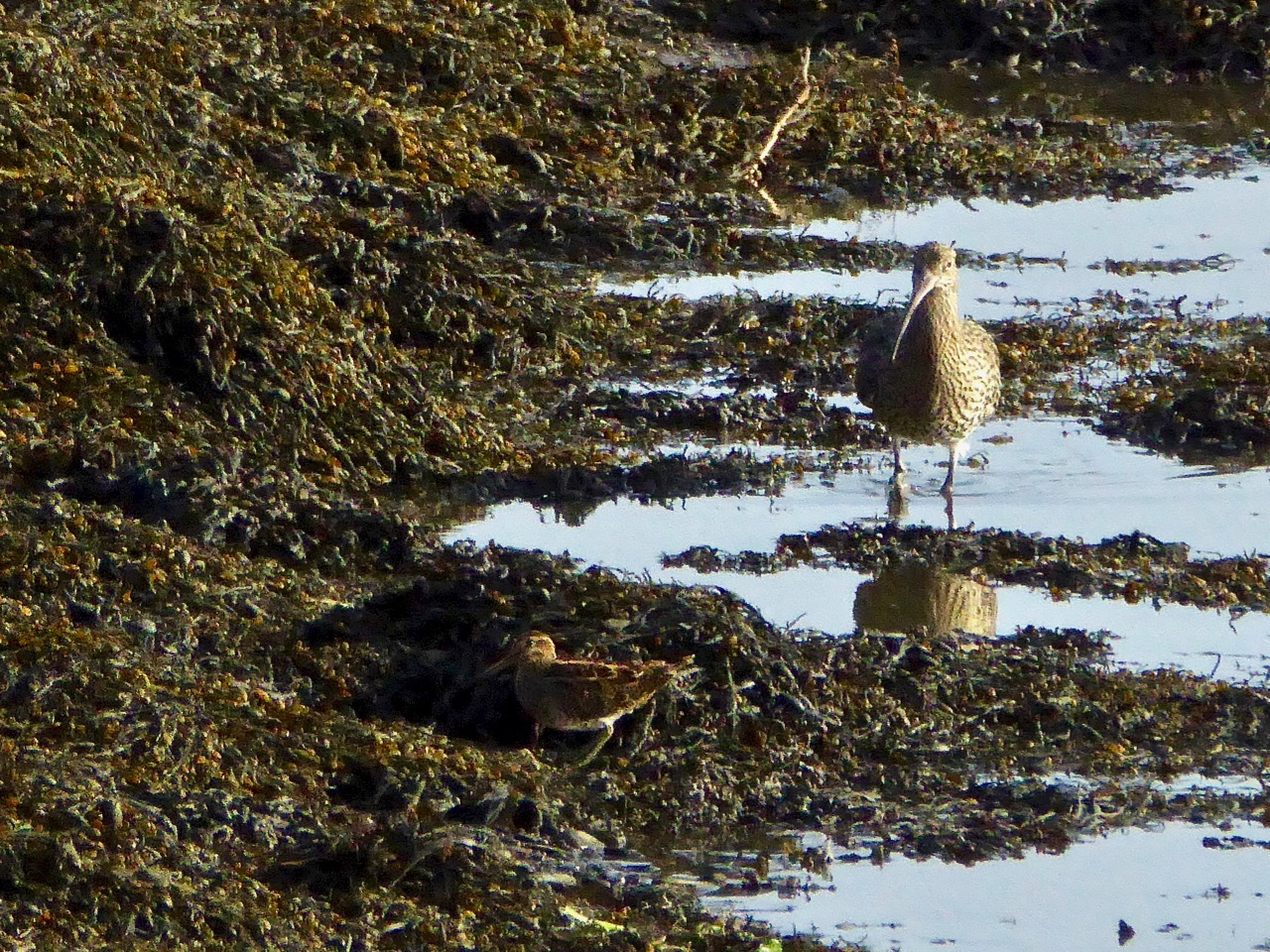
I have written about Rossbrin Cove many times before: look at A Moment in Time, Tide’s Out and Words on Roaring Water, for example. That sheltered natural harbour and the old mine road up on the hill above probably give us the most pleasure because we visibly see the year change and turn every time we walk there. Just now the days are rapidly shortening, and the autumnal influx of wading birds is returning. One we keep a particular eye out for is the curlew – a threatened breeding species here in Ireland. We see many on and close to the water, particularly at low tide, but these are probably migrants rather than resident breeders.
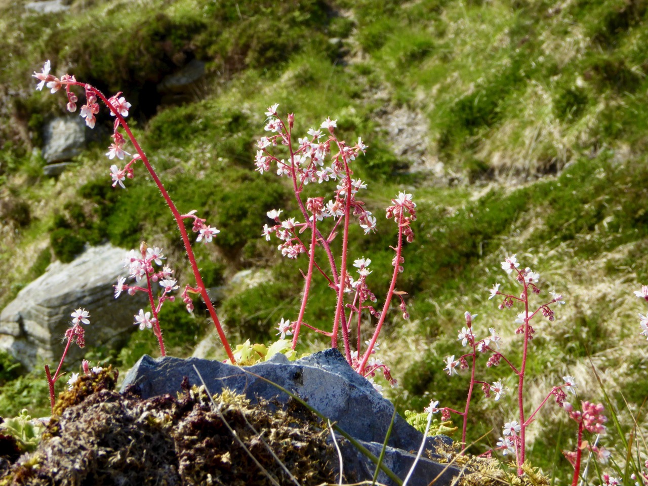
The year is turning – from late summer into early autumn, and the colours are changing from rich reds and purples – fuschia and heathers – to the more sombre yet equally attractive yellows and browns of furze and fern. Finola has closely followed the wildflowers right through from the spring – she is still finding and identifying every imaginable species – it’s a complete world of its own!
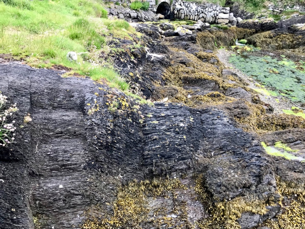
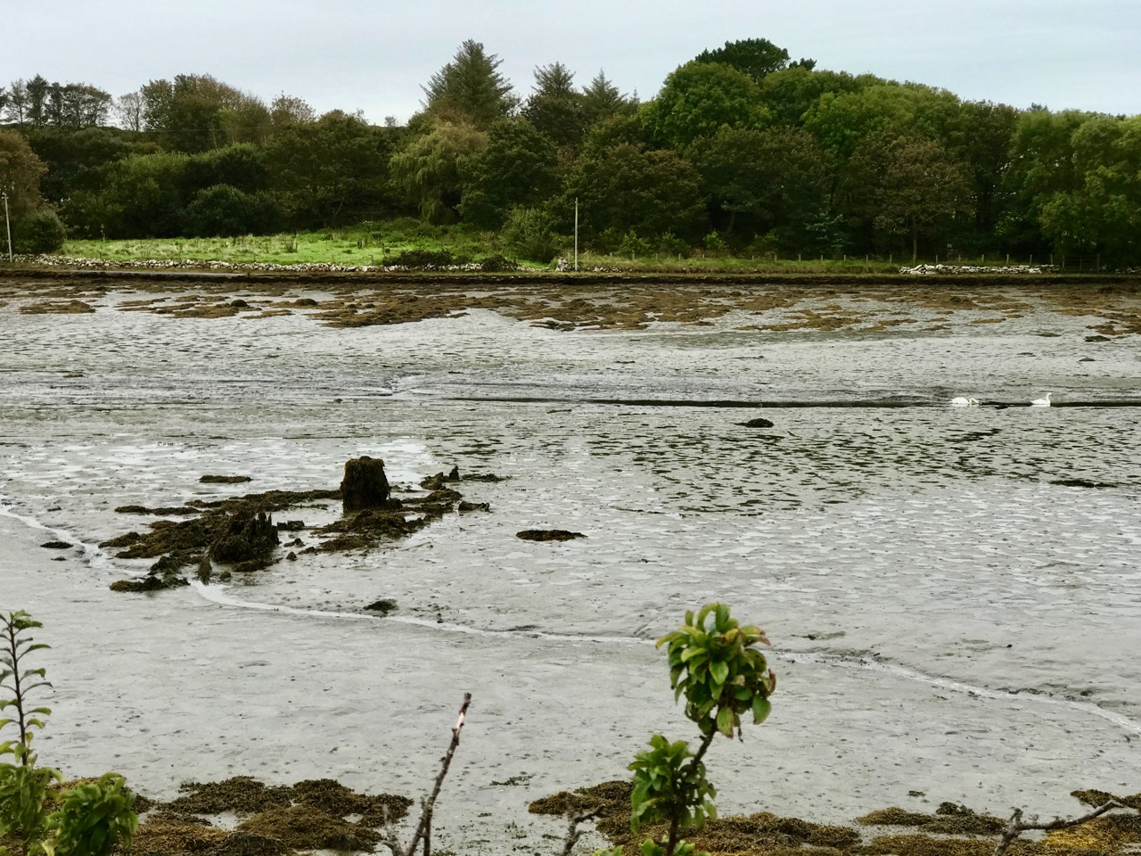
We have been seeing some exceptionally high and low tides here in Rossbrin. I’m always fascinated to see the mud-flats revealing bits of discarded history, while I am convinced that the huge remnants of dressed stonework on the north-east shore are the vestiges of once-busy quays, dating either from the medieval period, when Sir William Hull and the Great Earl of Cork owned the lands around here and set up thriving fish-processing ‘palaces’, or – at the latest – when the copper mines were active up on our hills and on Horse Island in the nineteenth century.
The real turning point comes at the end of October – Samhain – when the old calendar enters the ‘dark year’ (the ‘light year’ begins on May 1st – LáBealtaine). We know we have long, dark nights to come – time to huddle down by the stove – but there will be bright days as good as any in the year for walking, exploring and breathing in the Atlantic breezes. And the Rossbrin sunsets will be magnificent!
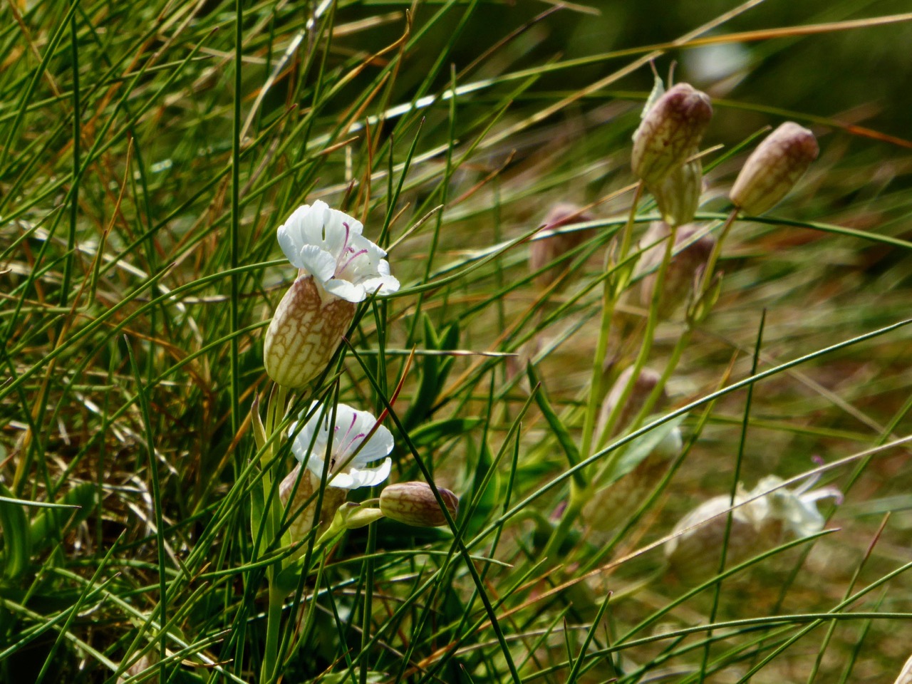
Wildflowers are a spectacular part of our environmental heritage in West Cork. Many of us are aware of them in the background, although we couldn’t name more than half a dozen. It’s only when visitors come along and swoon over the abundance of colour in the hedges that we realise what an incredible natural resource we have on our doorstep. We have a little patch of bog beside us, for example, and a few days ago Bog Cotton and Bog Bean (above) were merrily blooming side by side there. I had never realised how attractive they were until I lingered for close observation.
St Patrick’s Cabbage is part of the Lusitanian Flora we wrote about in our post Into the Woods. It grows abundantly on the North Side of the Mizen.
We at Roaringwater Journal are exceptionally pleased to have been involved with developing West Cork’s first ever Wildflower Trail System – it launches this Tuesday, but it’s been a while in the planning. The Trail System and its associated brochure is an educative tool that helps us appreciate and learn more about the wildflowers that surround us.
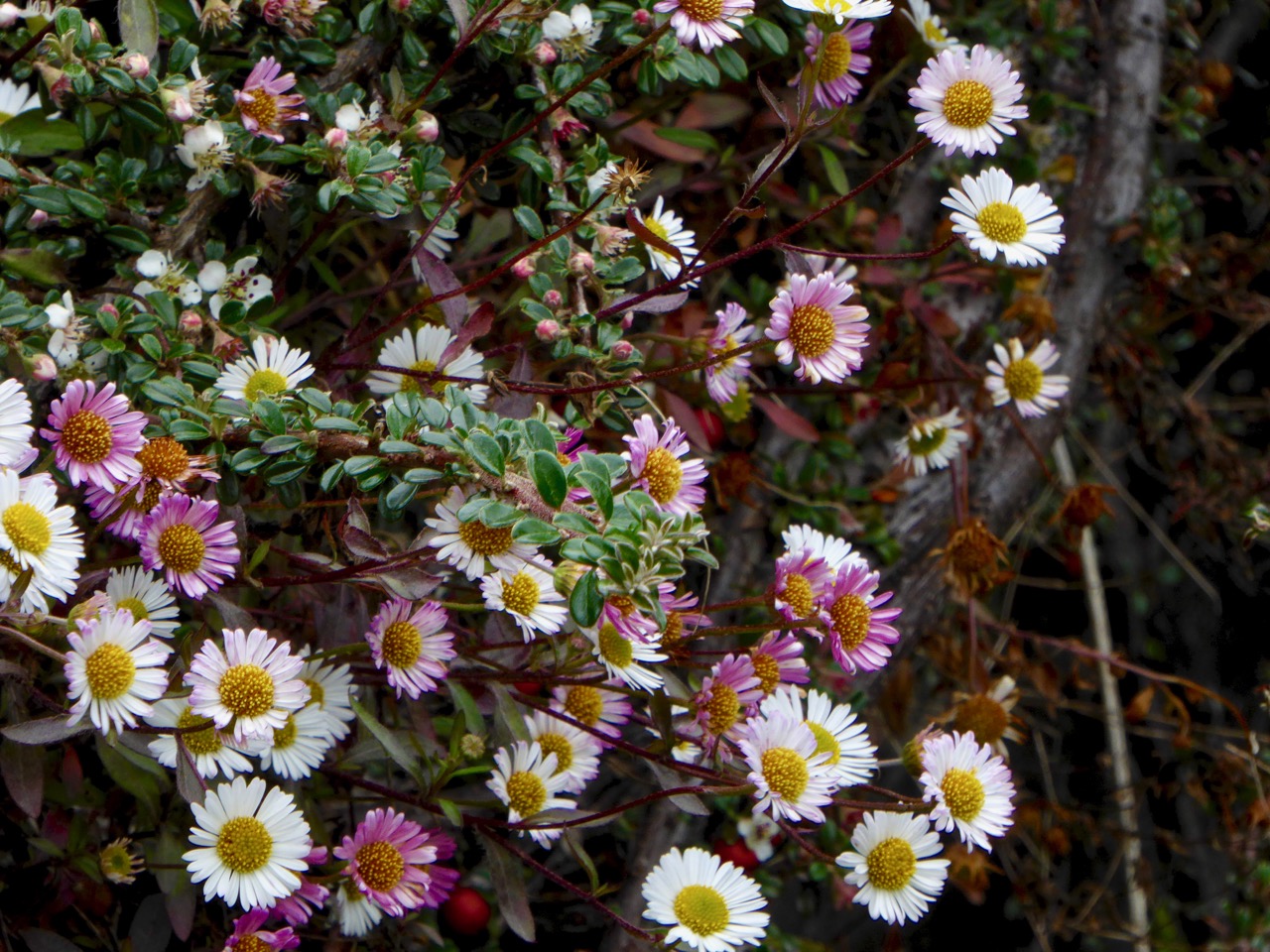
These little beauties are called Mexican Fleabane, but also known as Wall Daisies. The opposite of lawn daisies, they go pink as they age, rather than when they emerge. They’re an introduced species but have naturalised widely. These ones are on the wall of the stream that runs through Drimoleague.
We are particularly happy to welcome Zoë Devlin to do the honours of launching the trails. When I first got interested in wildflowers our friend Amanda (yes, she of Holy Wells of Cork fame) gave me a copy of Zoë’s book, The Wildflowers of Ireland, and it instantly became my bible. It’s laid out by colour, you see, and then by form (four petals, five petals, round clusters, etc) so it’s easy to navigate and to find what you’re after. The illustrations are clear and there’s lots of information about each plant to help you figure out what you’re looking at.
Better still, there’s Zoë’s website. Because it’s constantly updated, it has even more flower species in it, and more information on each one – including herbal uses, folklore references, and details on whether it is native or alien. And finally, there’s her Facebook page where she posts news, recent finds or currently blooming flowers, using her own superb images.
This is Yarrow. I didn’t recognise it at first because I thought Yarrow was always white, but apparently it can be this colour too. In addition, it’s supposed to like dry ground, but this one was overhanging a stream
The Wildflower Trail builds on the fact that there is already a system of waymarked trails around Ballydehob and the Mizen. Robert wrote about the Fastnet Trails in our post Closer Encounters – Fastnet Trails, and I followed up with a two-part post on the Rossbrin Loop Trail, here and here.
Sea Campion, a native plant adapted to a coastal habitat. It often occurs in drifts.
Using the specially-designed brochure, walkers can identify wildflowers along their chosen trail, then return to the Tourist Office and add their finds to the Master List on the wall. The Tourist Centres at Ballydehob and Schull will have resources available to help them identify any other flowers they have found. If you can’t pick up a brochure, you can find a link to it here.
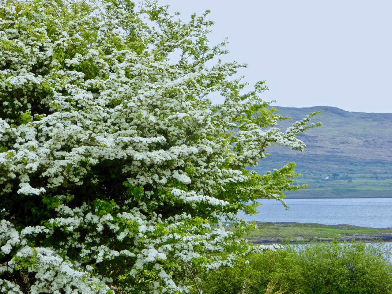
May belongs to the May Tree – AKA the Hawthorn or Whitethorn. Online forums this year reveal it has been an exceptional year for Hawthorn right across the country
To support the Trails we have started a new Facebook Page – Wildflowers of West Cork– where we will post updates and images of what’s in bloom and what to look out for. If you’re a Facebook user, head over and give us a Like and a Share.
Water Cress, seen on the Colla Road just beyond Schull. Wild Water Cress is edible but you have to be very careful where you gather it as it can be infected with parasites
Everyone is welcome to the Launch – 5PM at the Rossbrin Boatslip on Tuesday the 23rd – and to join Zoë afterwards on a Wildflower Walk. If you can’t make the launch, we hope you’ll go for a stroll along one of the trails soon, brochure in hand, and try your luck at identifying a few wildflowers. Our trails are spectacular right now and will only get better as the summer advances.
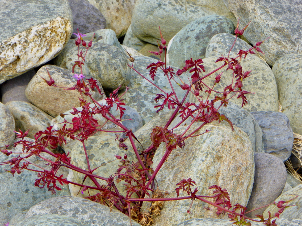
Herb Robert – I love those red stems and leaves as much as the little pink flower. Hard to believe there’s enough soil between those rocks to nourish a plant
But you don’t even need to walk a trail – in West Cork the wildflowers are everywhere. Here’s a photo taken right by Fields of Skibbereen – just look over the fence at the stream.
Red Valerian and yellow Monkeyflower. Both are introduced species but obviously right at home on the walls of the Caol Stream in Skibbereen
All the other images were taken in May, all in West Cork, and many of them in unpromising places such as waste ground, urban streams, old walls and rocky shores. Every day, we walk right by a wealth of beauty without really stopping to look.
Mouse-ear Hawkweed and Ivey-leaved Toadflax on the wall containing a stream in Drimoleague. Below in the water is Stream Water-crowfoot
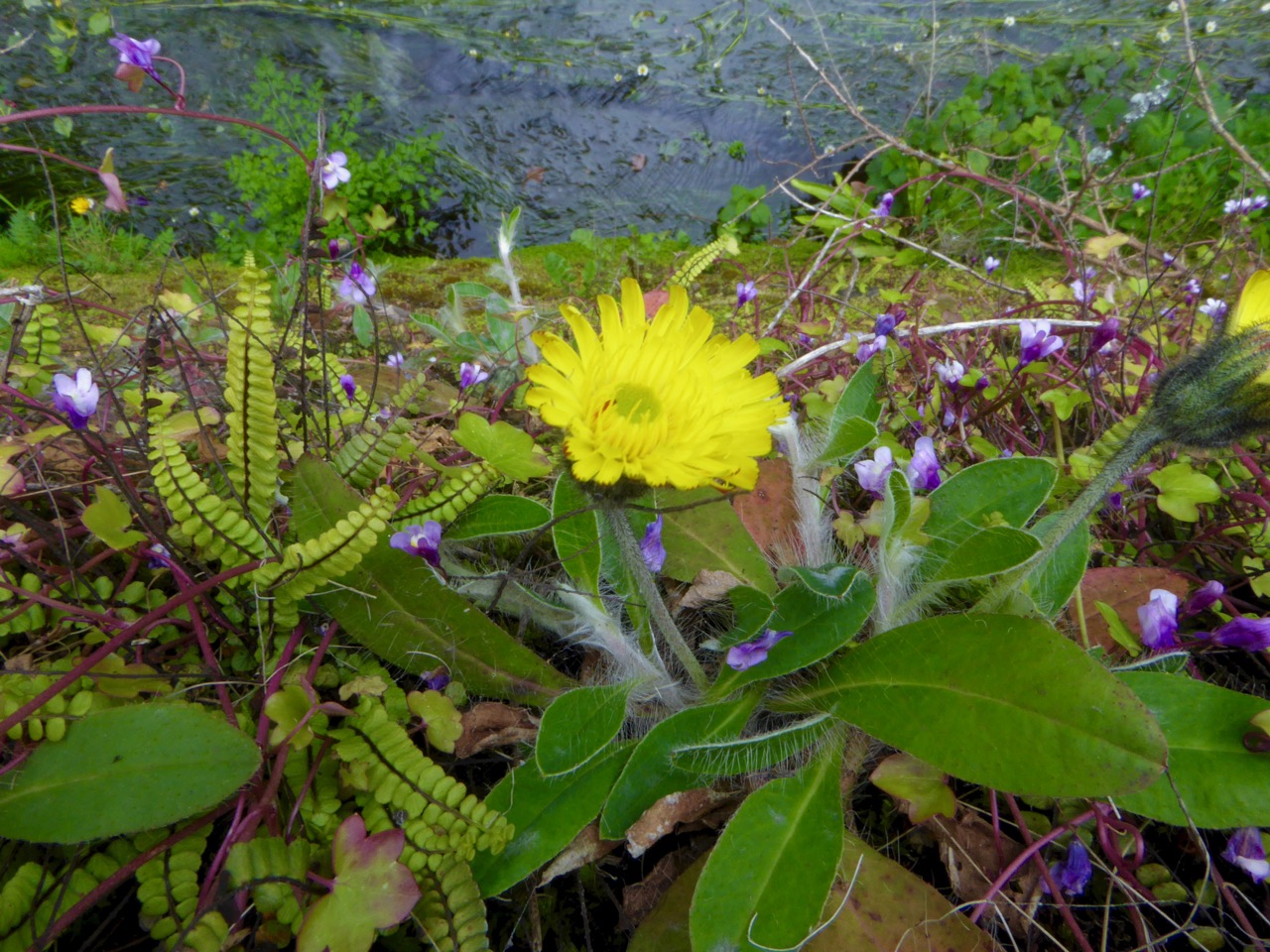
Happy wildflowering! (Start by seeing how many kinds of flowers you can see in the image below – photo taken at Lake Faranamanagh on the Sheep’s Head.)
Welcome to the UCD Library Cultural Heritage Collections blog. Discover and explore the historical treasures housed within our Archives, Special Collections, National Folklore Collection and Digital Library