Dunmanus Castle 2: The Castle

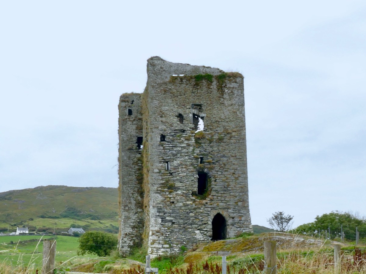
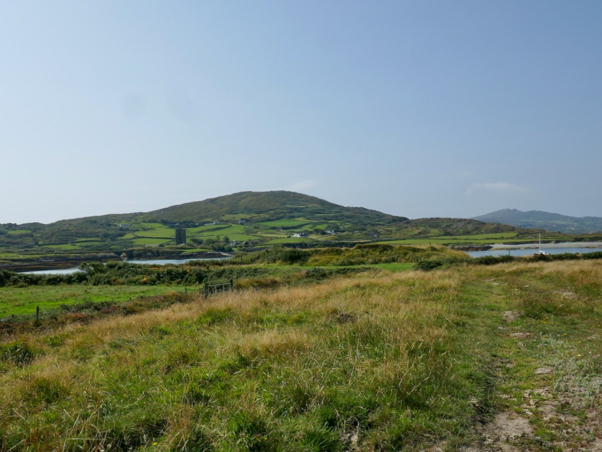
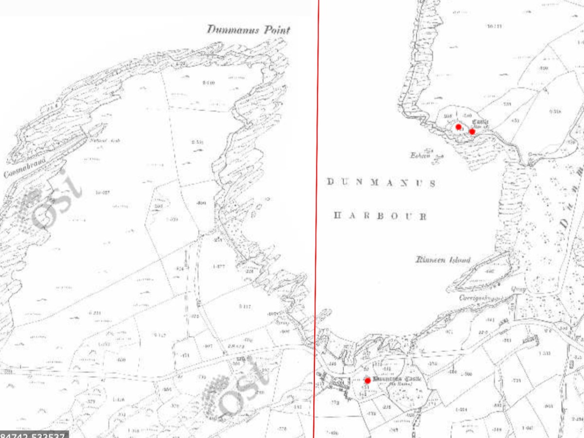
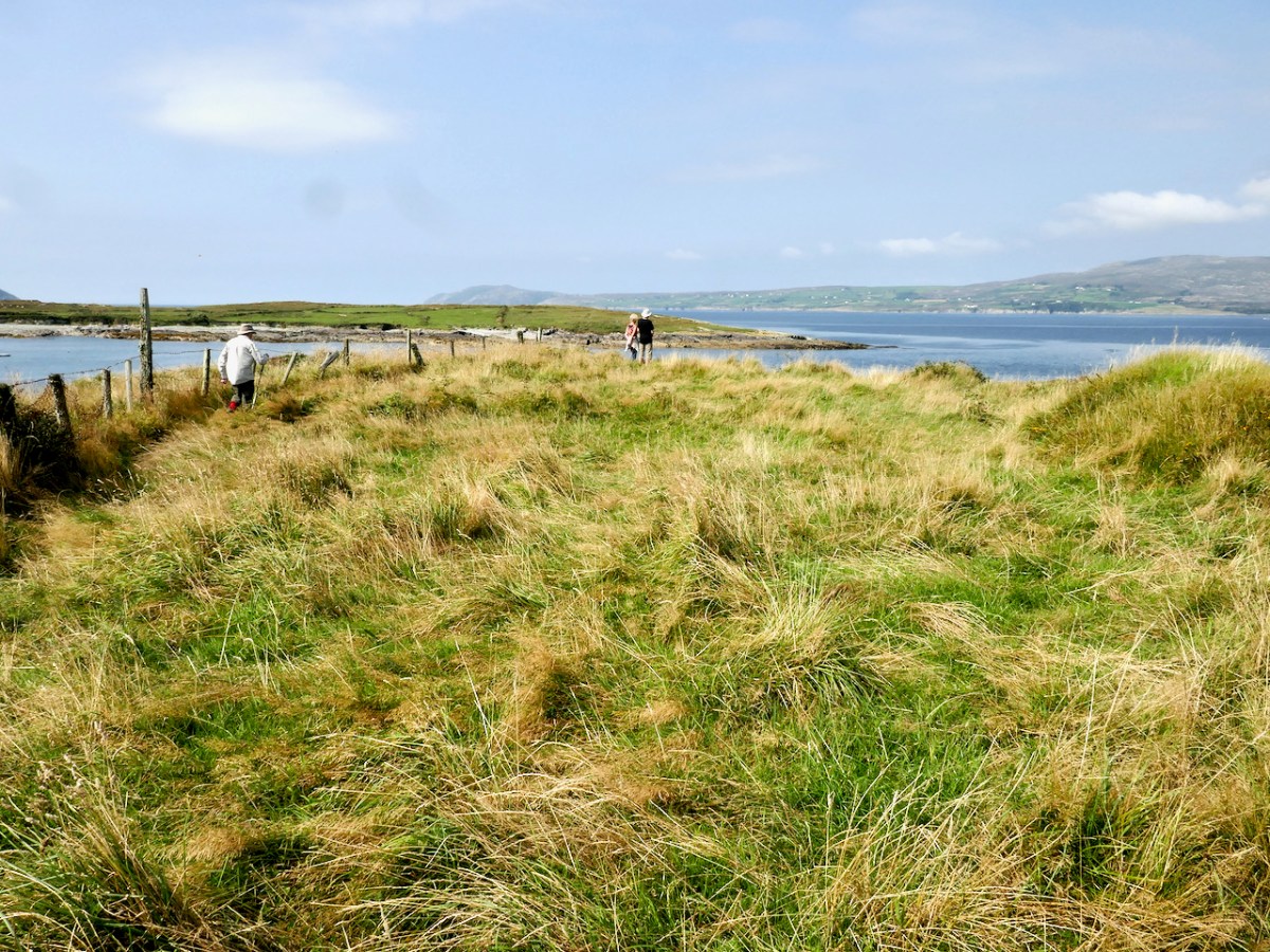
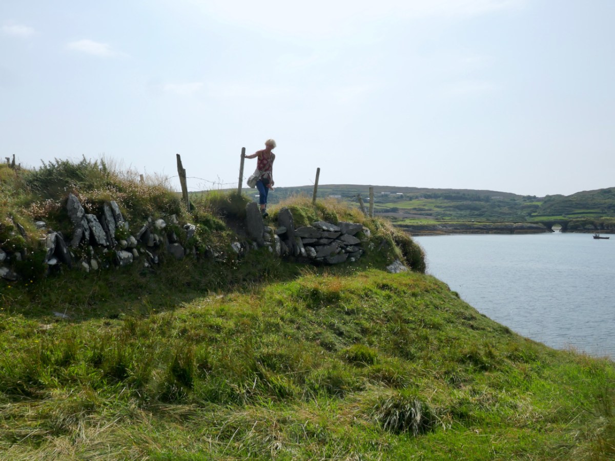
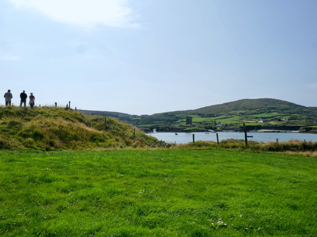
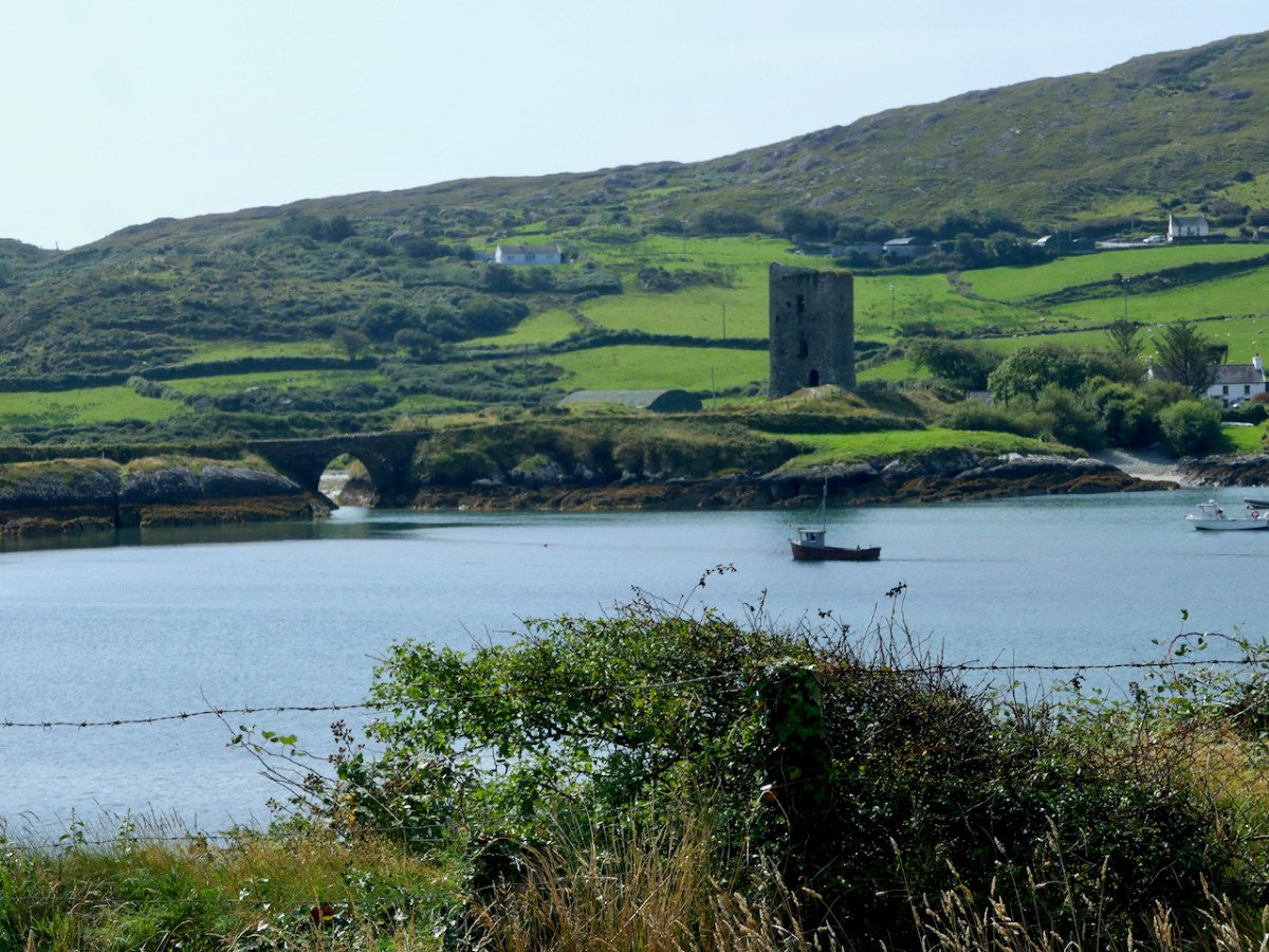
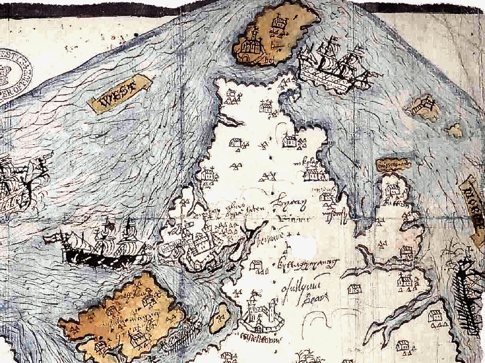
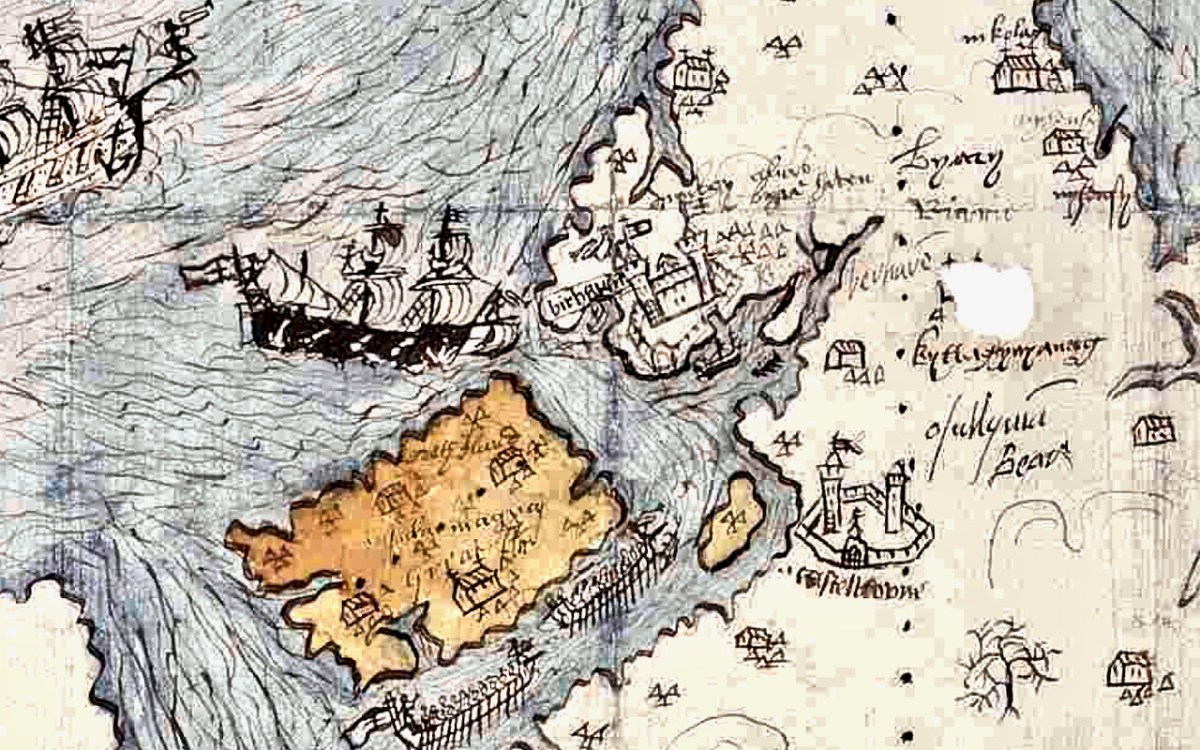
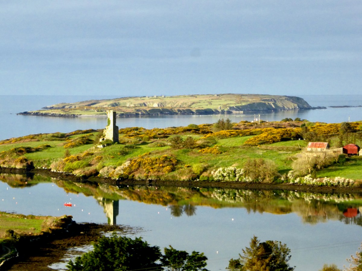
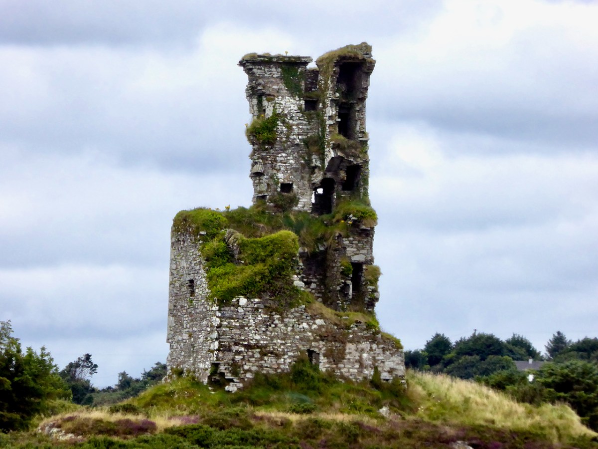
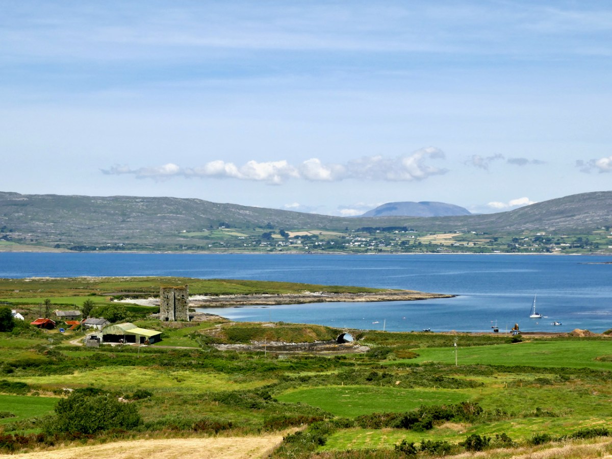
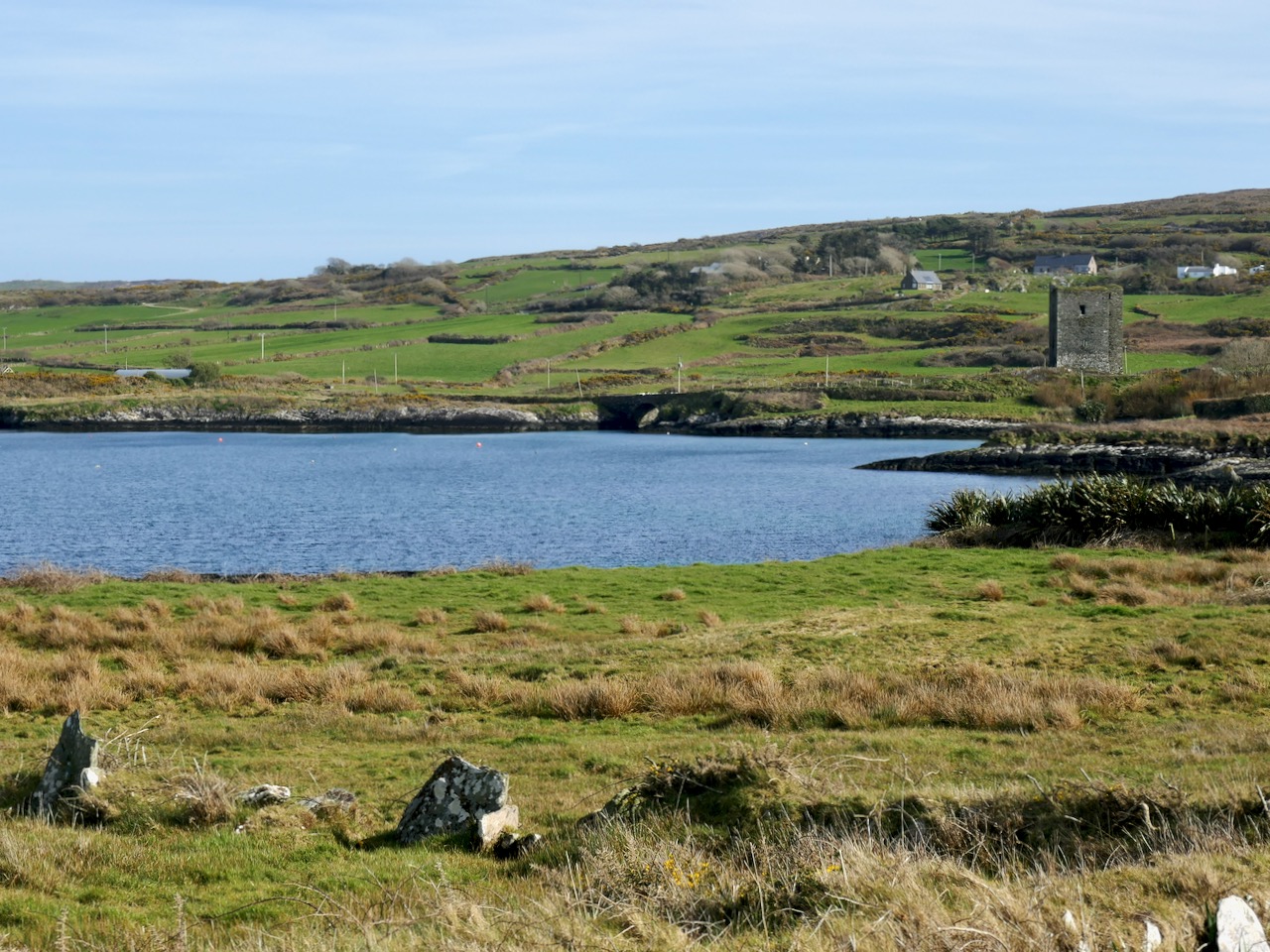
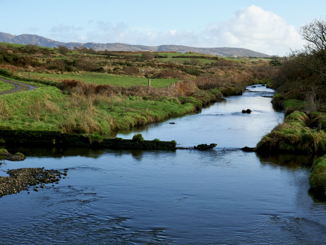
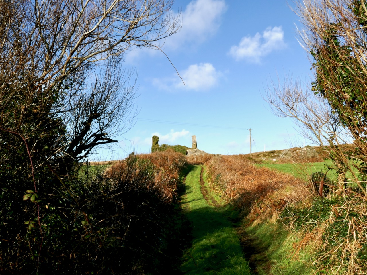
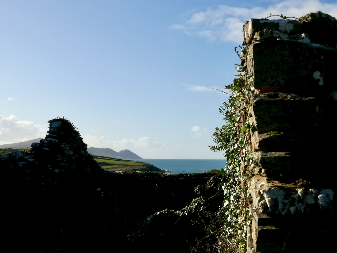
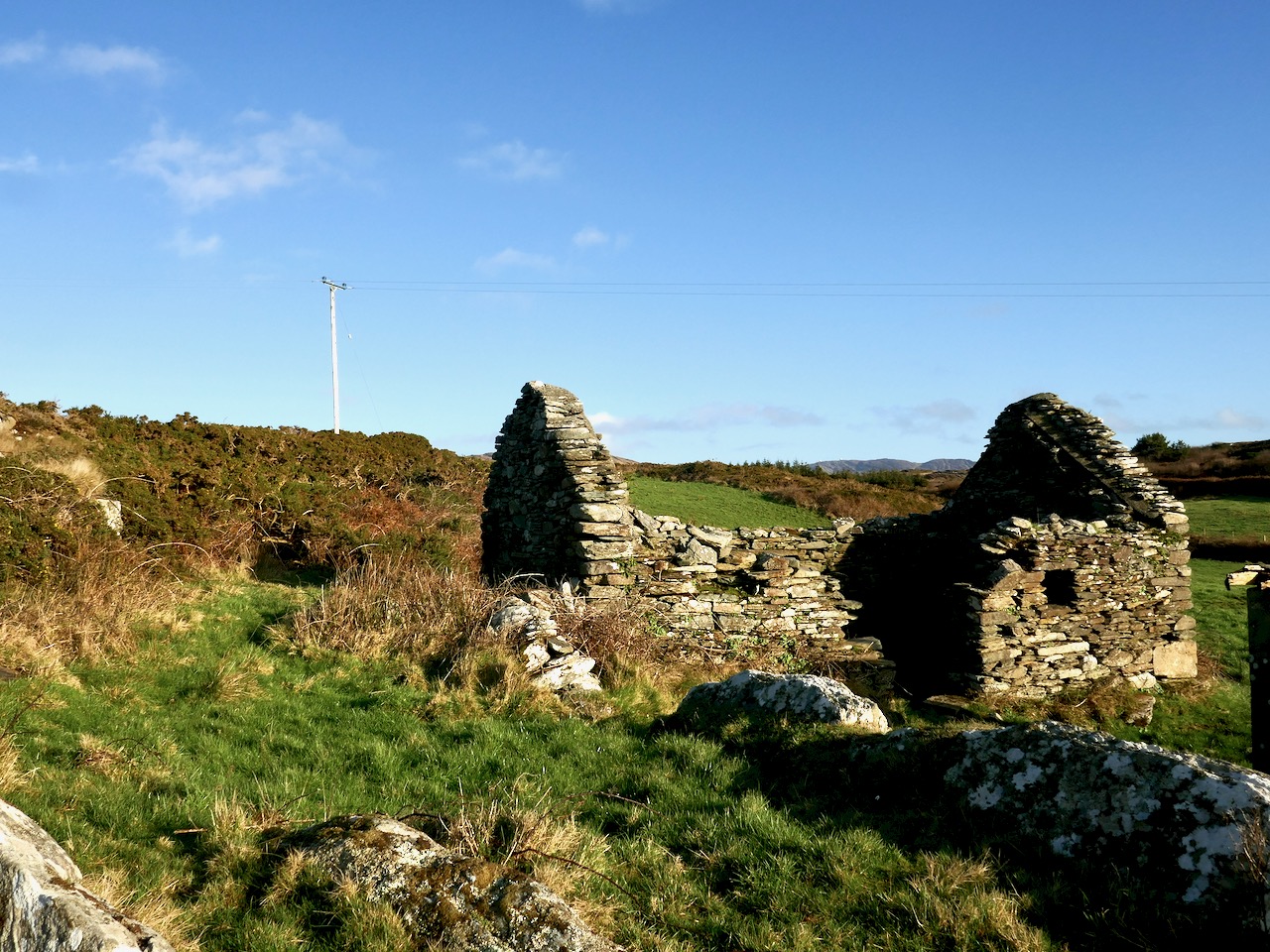
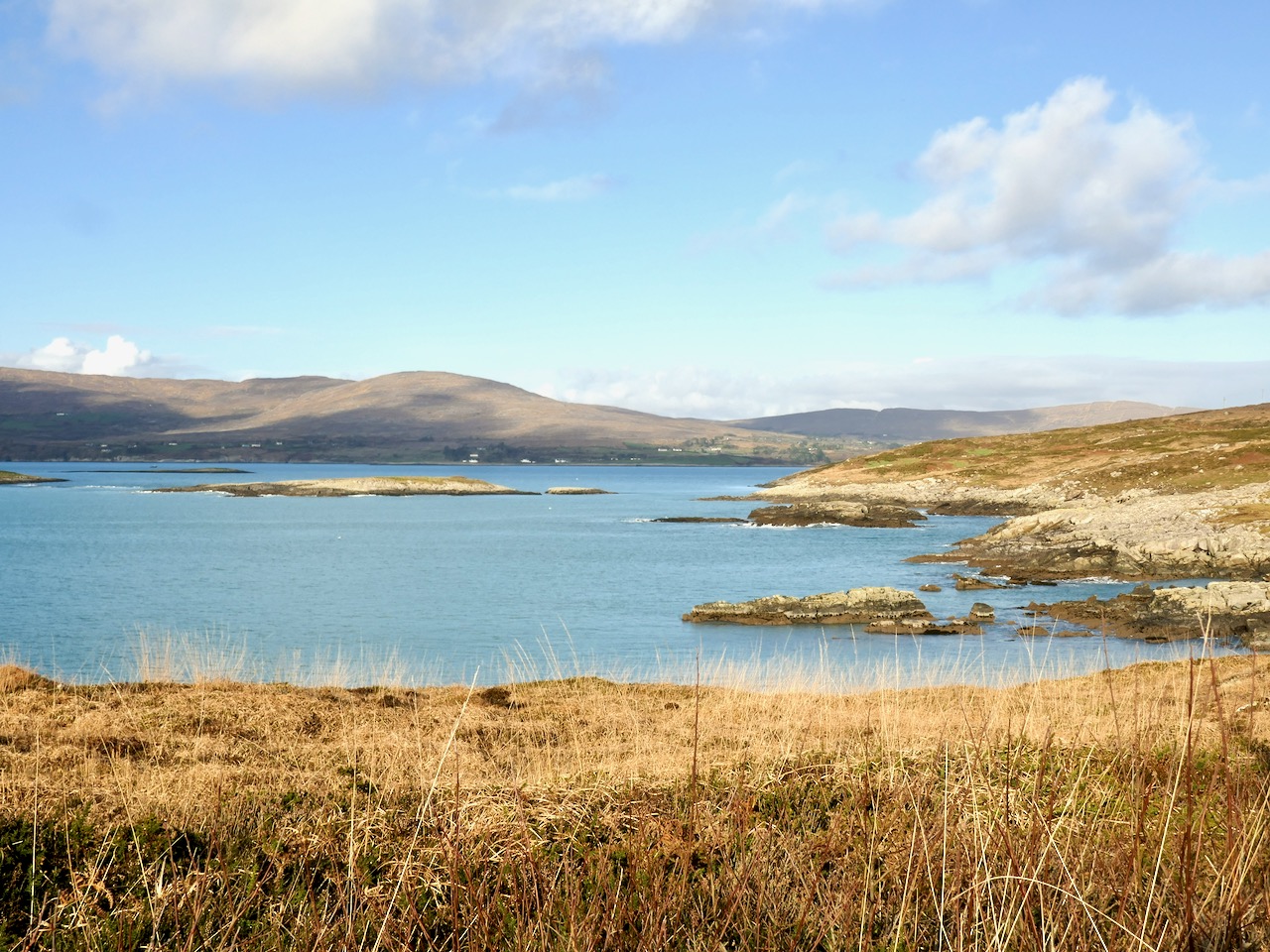
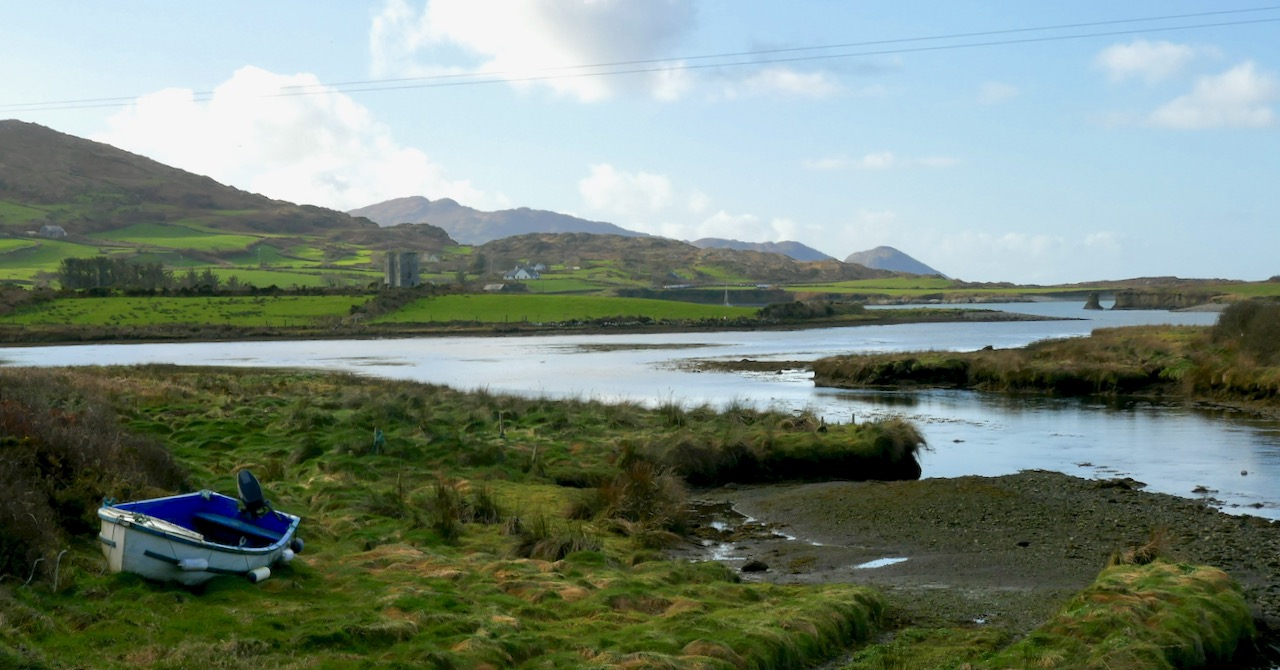
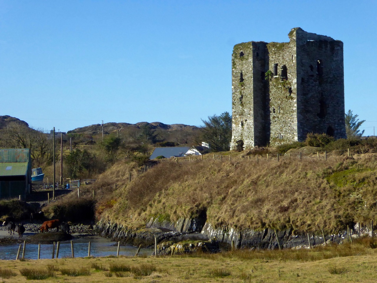
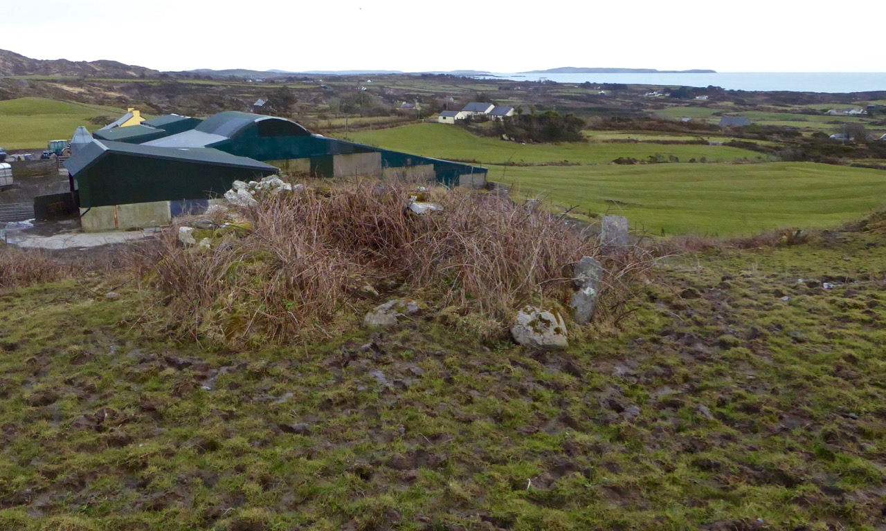
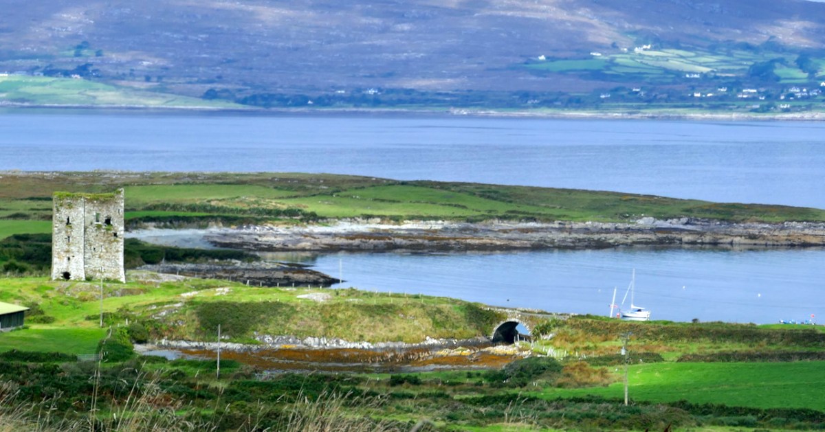
Dunmanus Castle stands guard over a natural harbour on the north side of The Mizen Peninsula and is one of the largest of the still-standing Castles of Ivaha.

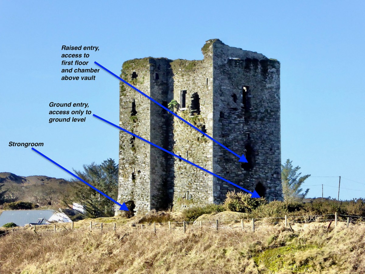
All of the O’Mahony castles (or tower houses as the archaeologists prefer to call them) were the raised entry type, where the door that gave access to the living quarters of the chief was on the first, rather than the ground floor. There is an entrance on the ground floor, but it allowed access only to the lowest level. While at some of the castles of Ivaha, the raised entry was immediately above the ground-floor entry, at Dunmanus, it is above and to the left of the ground-floor entry: this offset placement probably allowed easier access to the lower entrance.

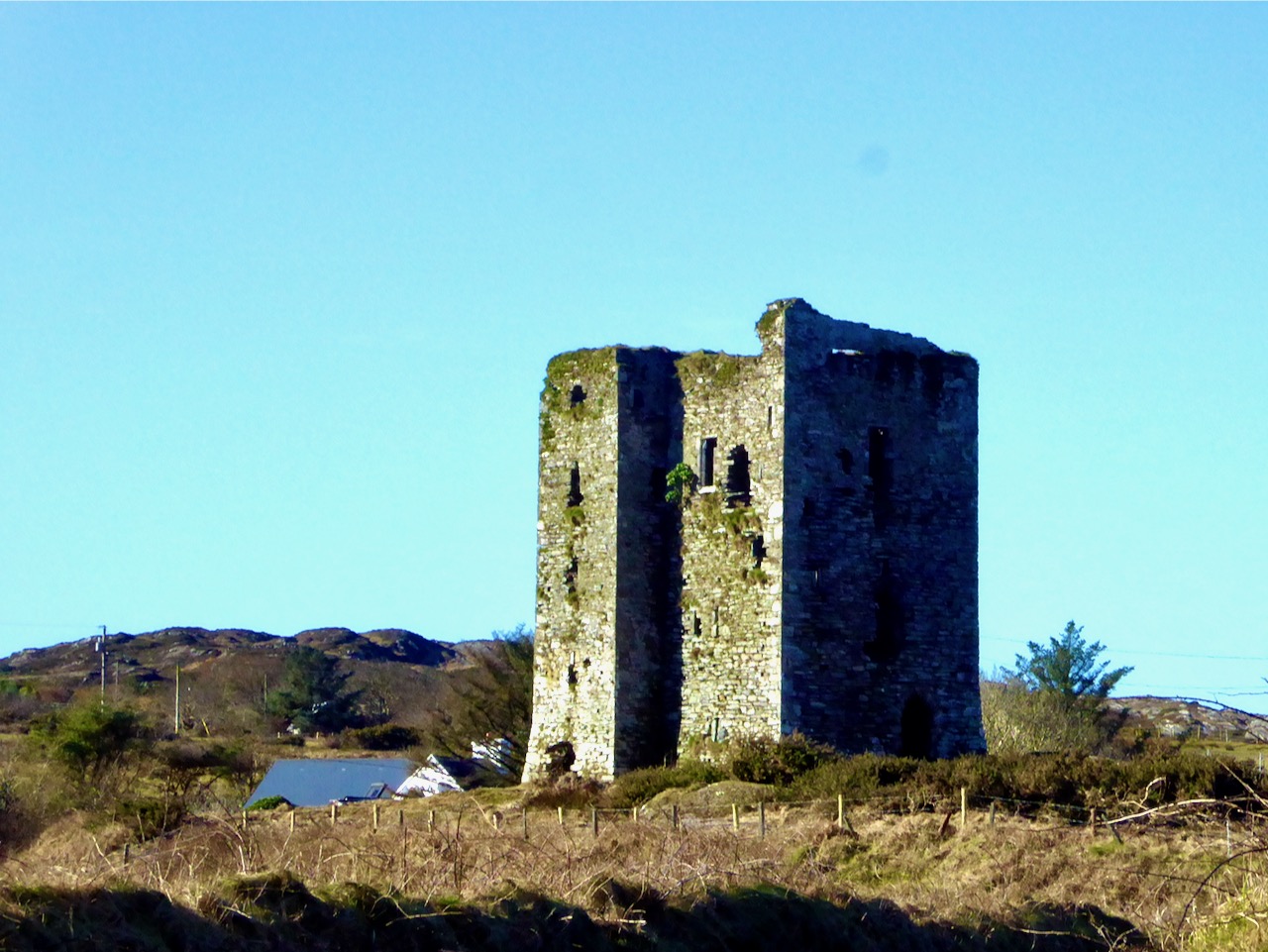
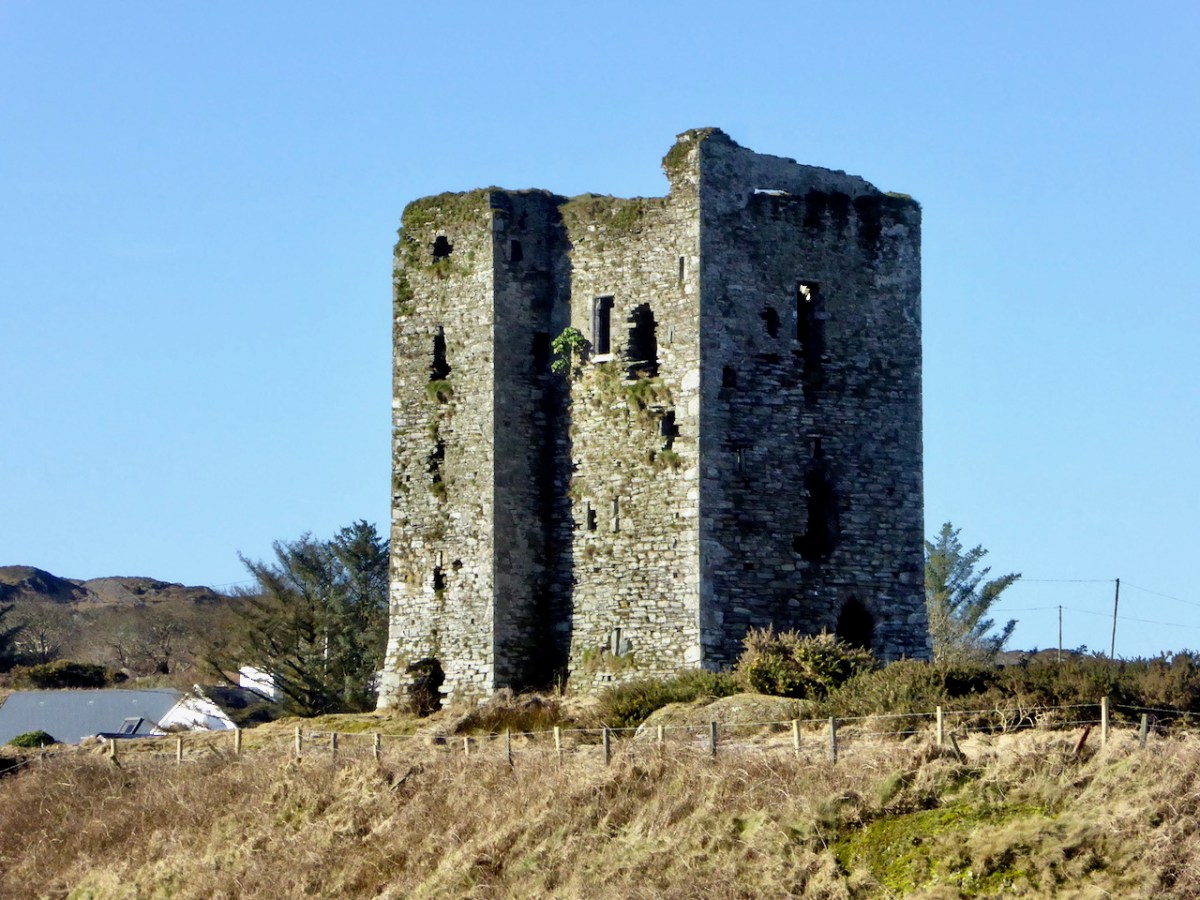
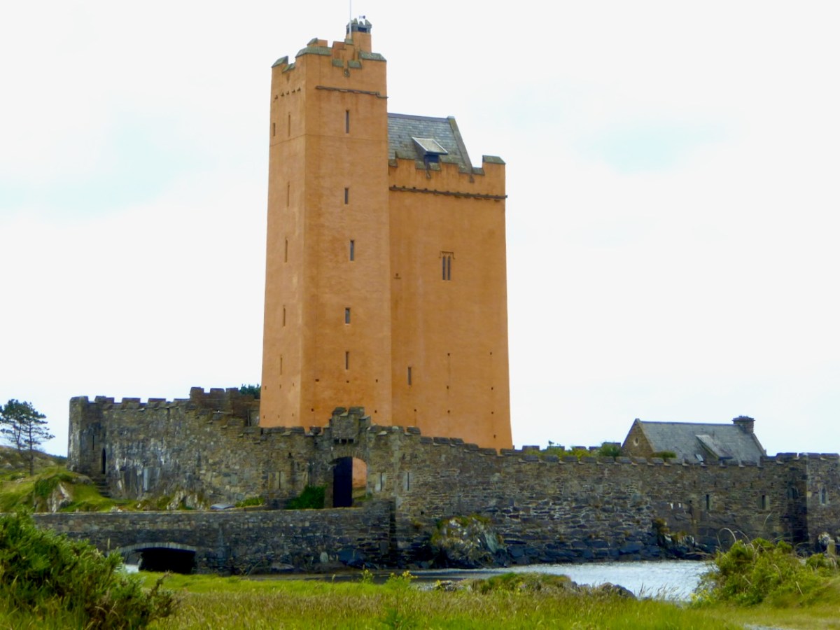
Dunmanus is the only O’Mahony Castle (as far as we know – several have disappeared) to have an additional turret, this one located at the south west corner. In fact the only other castle like it in this part of West Cork is Kilcoe Castle – see my post about its Magnificent Reconstruction. Jeremy Irons’ restoration also allows us to see what Dunmanus Caste would have looked like in its heyday. 

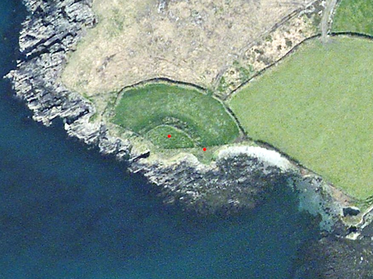
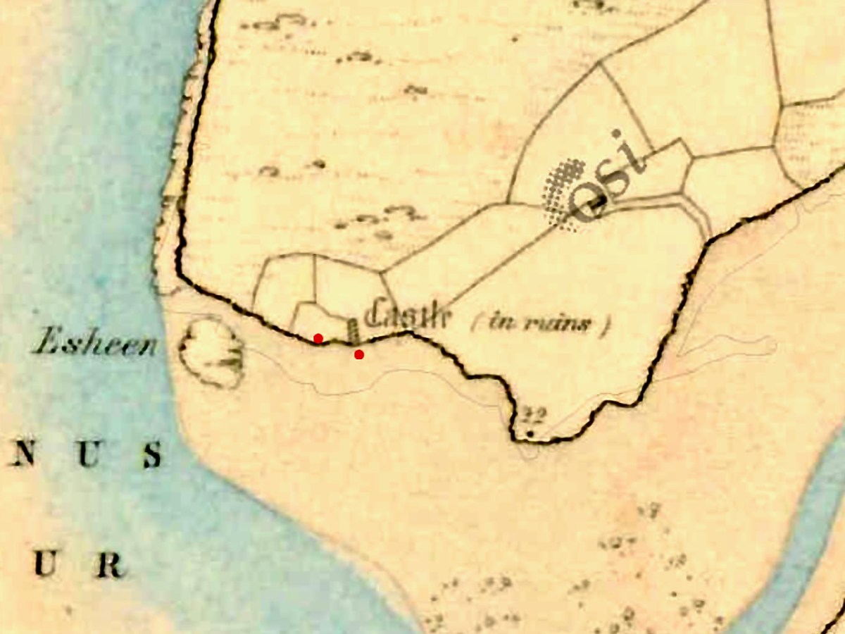
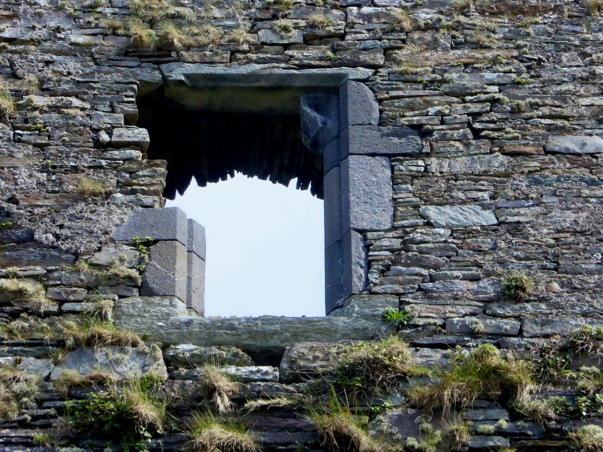
After the false start at Knockeens (see Dunmanus Castle 1: The Cliff-Edge Fort) the tower house was constructed on the site of an earlier fortification probably called Dún Manus, or the Fort of Manus. It was built by Donagh Mór, a chief of the O’Mahony Fionn (the Fair-Haired) sept, sometime in the 15th century. Donagh Mór had been elected Táiniste (next in line to become Taoiseach, or Chief) but he had to wait over 40 years, until 1473, for his brother to die before he succeeded, and then he only lived two more years. This timeframe fits with the architecture of the castle, which is firmly fifteenth century gothic – the window style below is typical.

Like all the O’Mahonys at this time he was very wealthy, riches that came from his control of both the fisheries in Dunmanus Bay and the resources of the hinterland behind his castle. He could therefore afford to indulge his taste for a high-status residence. While the castle may not have been warm or bright (no fireplaces and small windows) it was certainly a statement in the landscape, designed to impress upon all who saw it that this was the centre of power in this part of the world.

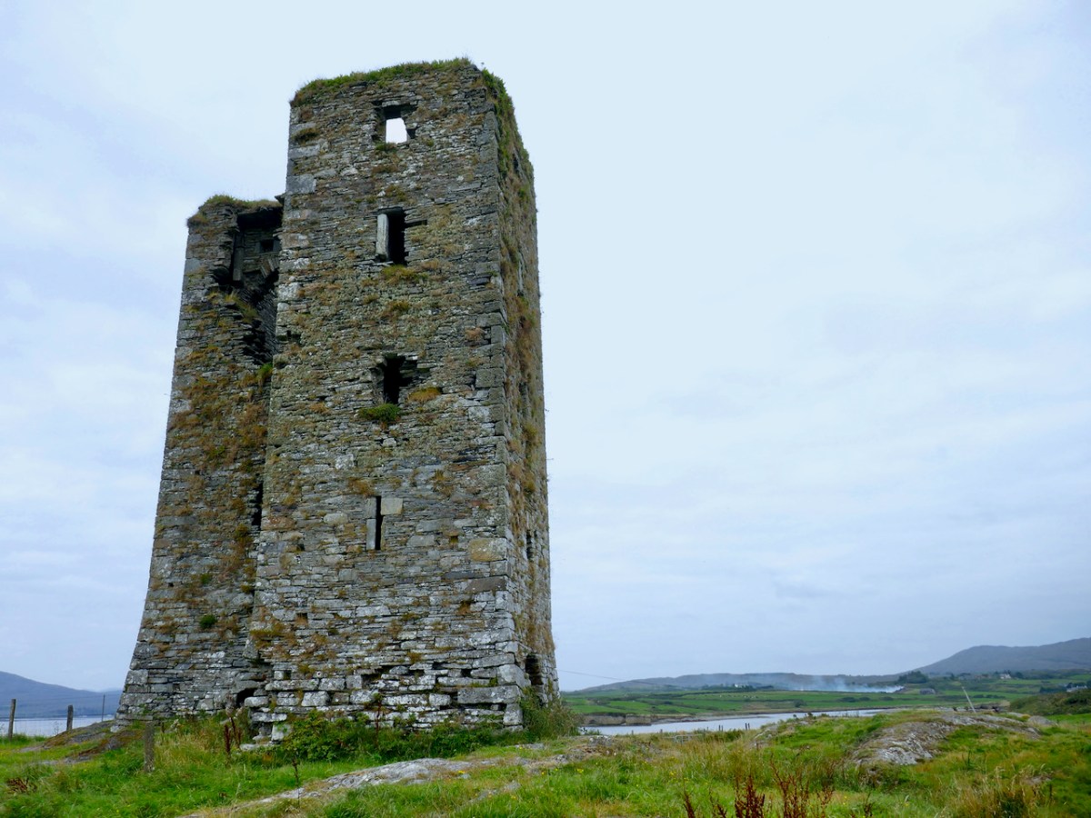
The Castle originally had two floors (ground and first) and a mezzanine under a vault in the main tower. Above this was the principle chamber and above that were the roof and battlements. The floors of the turret (foreground, above) did not line up with the floors of the main tower, but were offset and reached by a series of stairs.

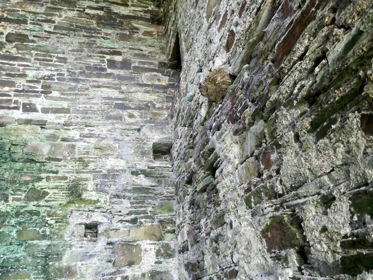
The ground floor was probably used for storage and perhaps public business. It had a wooden ceiling that formed the floor of the room above it (first floor). You can also see the corbels that supported the beams that formed the base for the floor, as well as the large sockets into which the beams were set. If this castle followed the pattern of others, there was no access from the ground floor to any floor above it – no stairway or ladder.

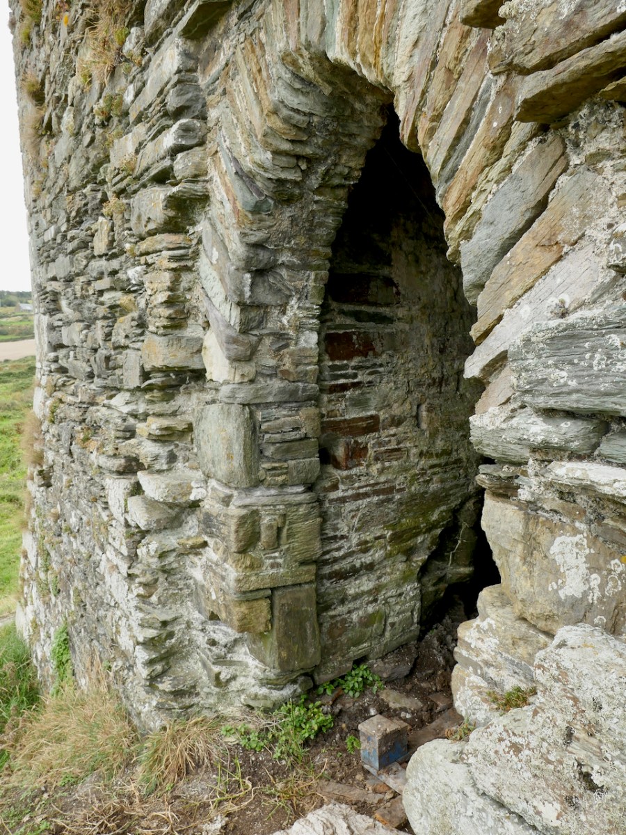
Still visible are the bar holes for the door as well as the spud stone and hanging eye – this was how the door was hung and how it turned. Can you make them out just to the left of the arch above – the spud stone is close to the ground and the hanging eye is level with the top of the arch.

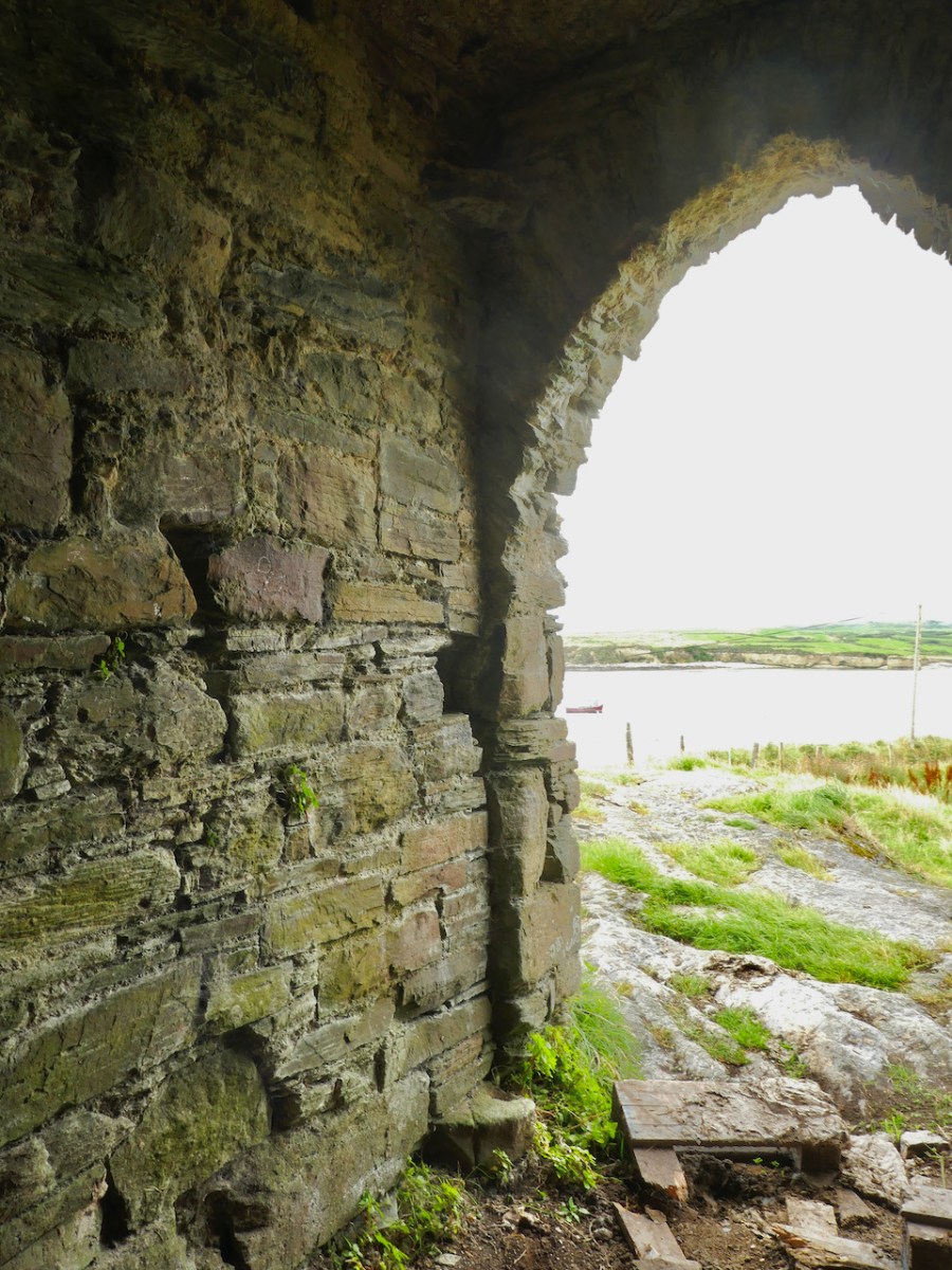
The first floor was a more complex room and it had a mezzanine (you can see the corbels for it) under the vault. From the outside, a set of steps ascended to the raised entry and once you were at this door you could go straight ahead into the first floor room, or turn left and ascend a mural staircase to the floor above the vault. That staircase became spiral further up.

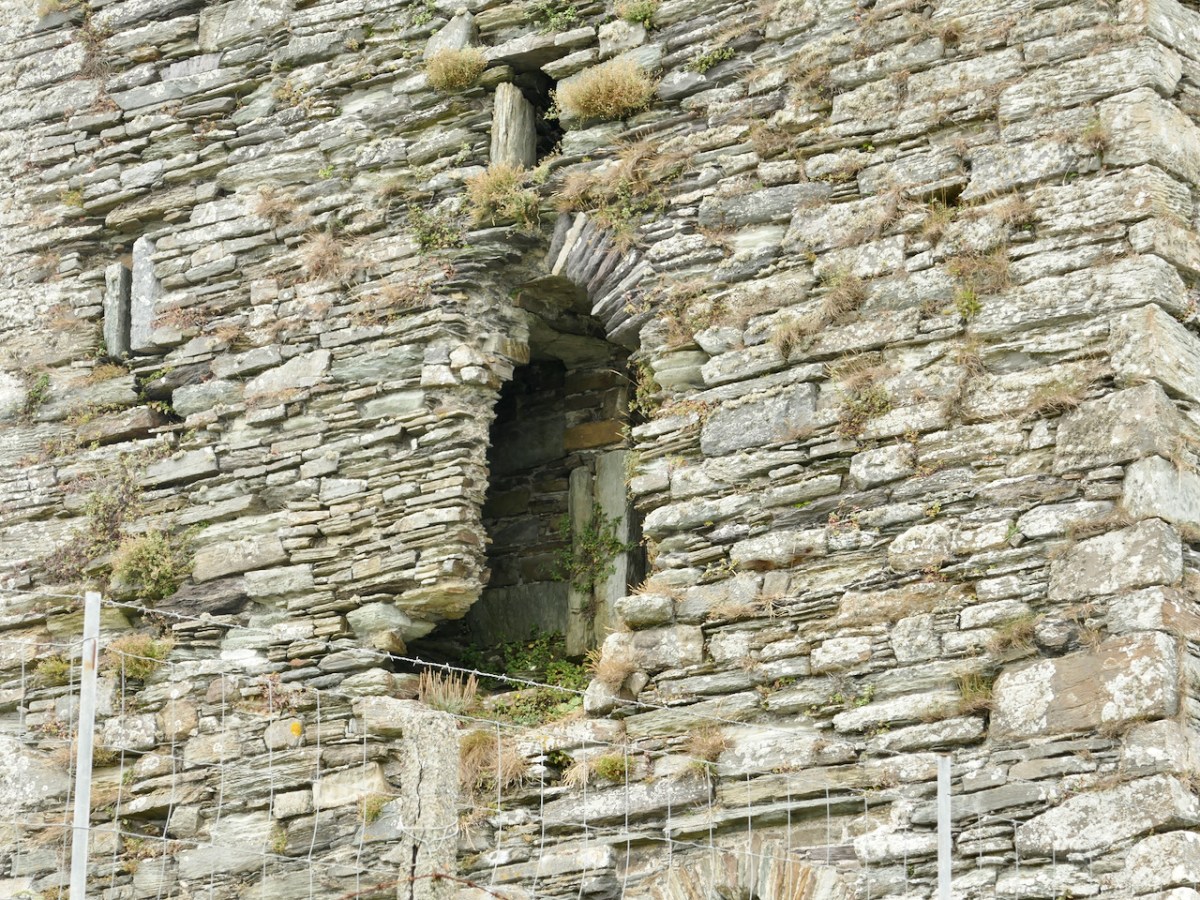
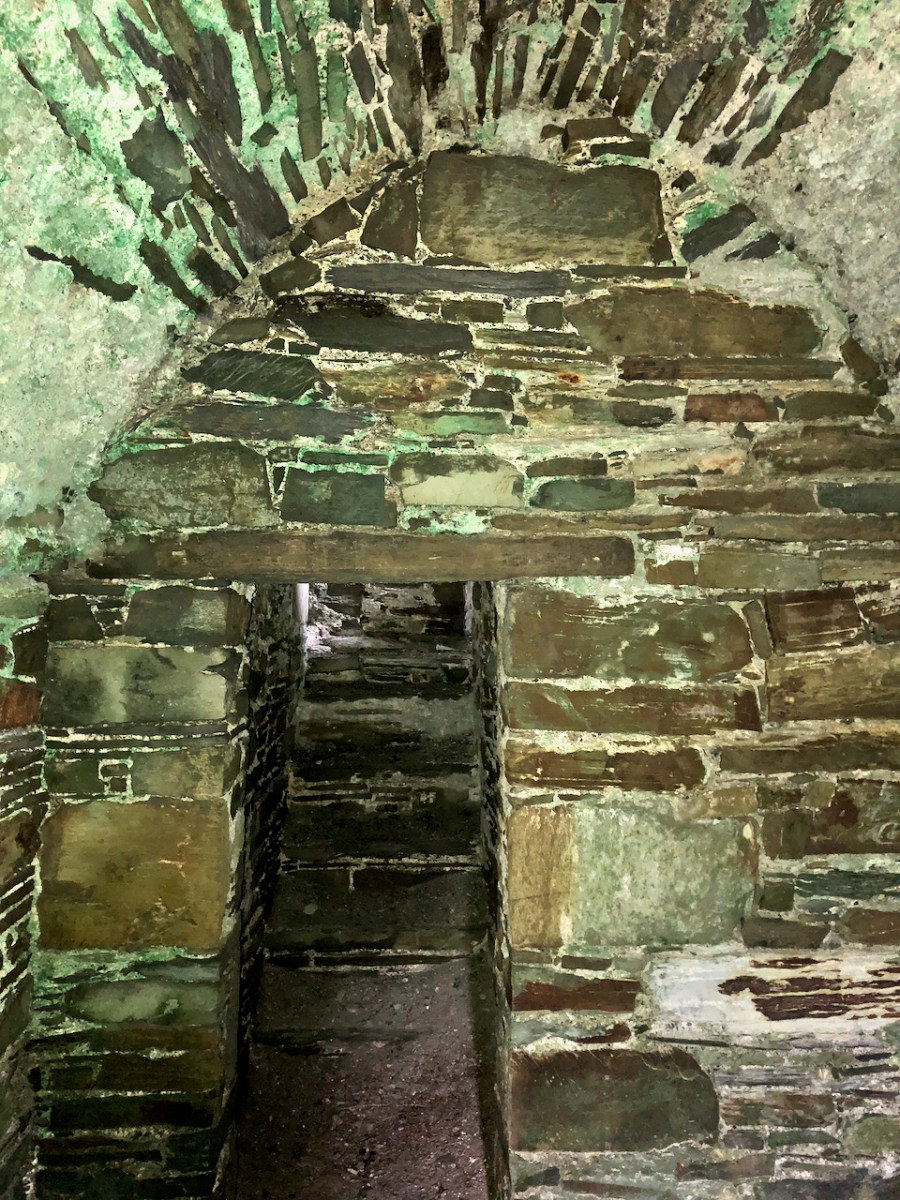
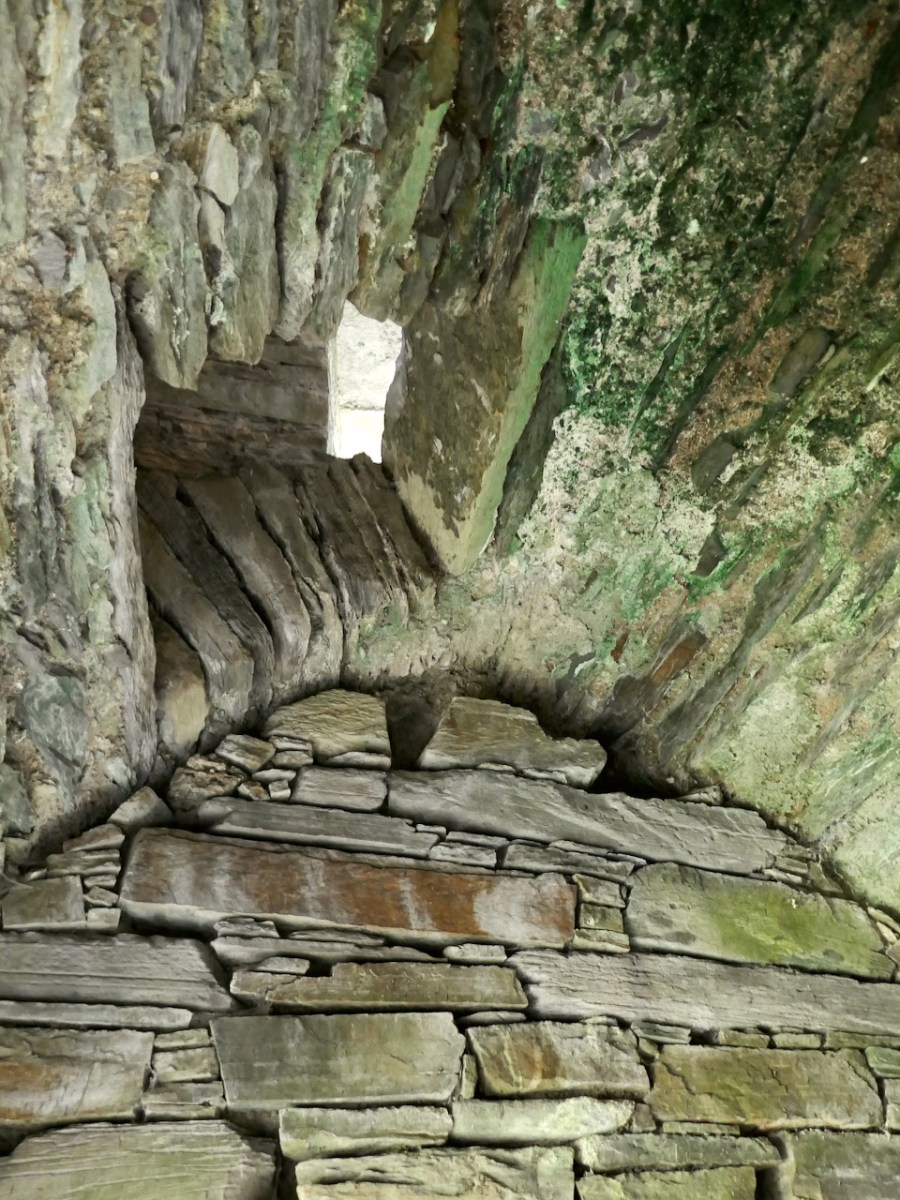
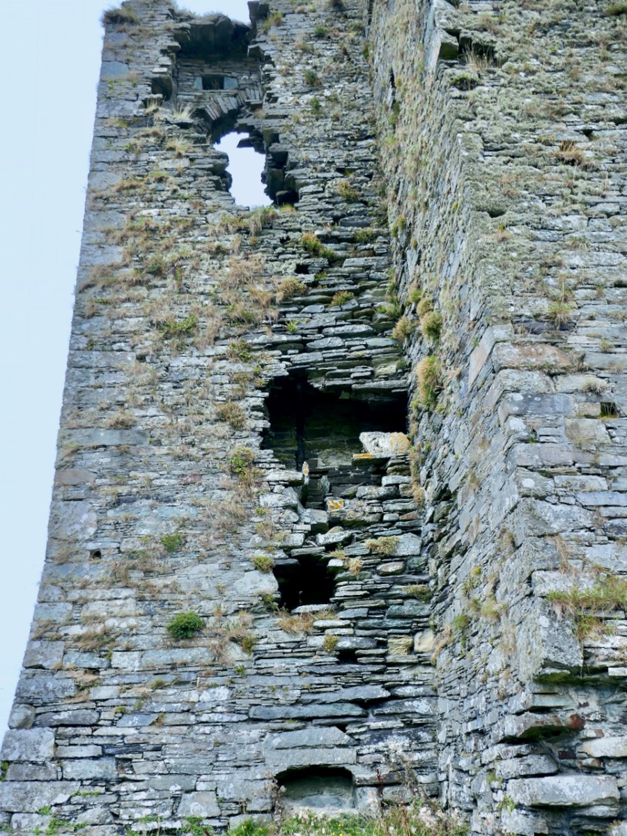
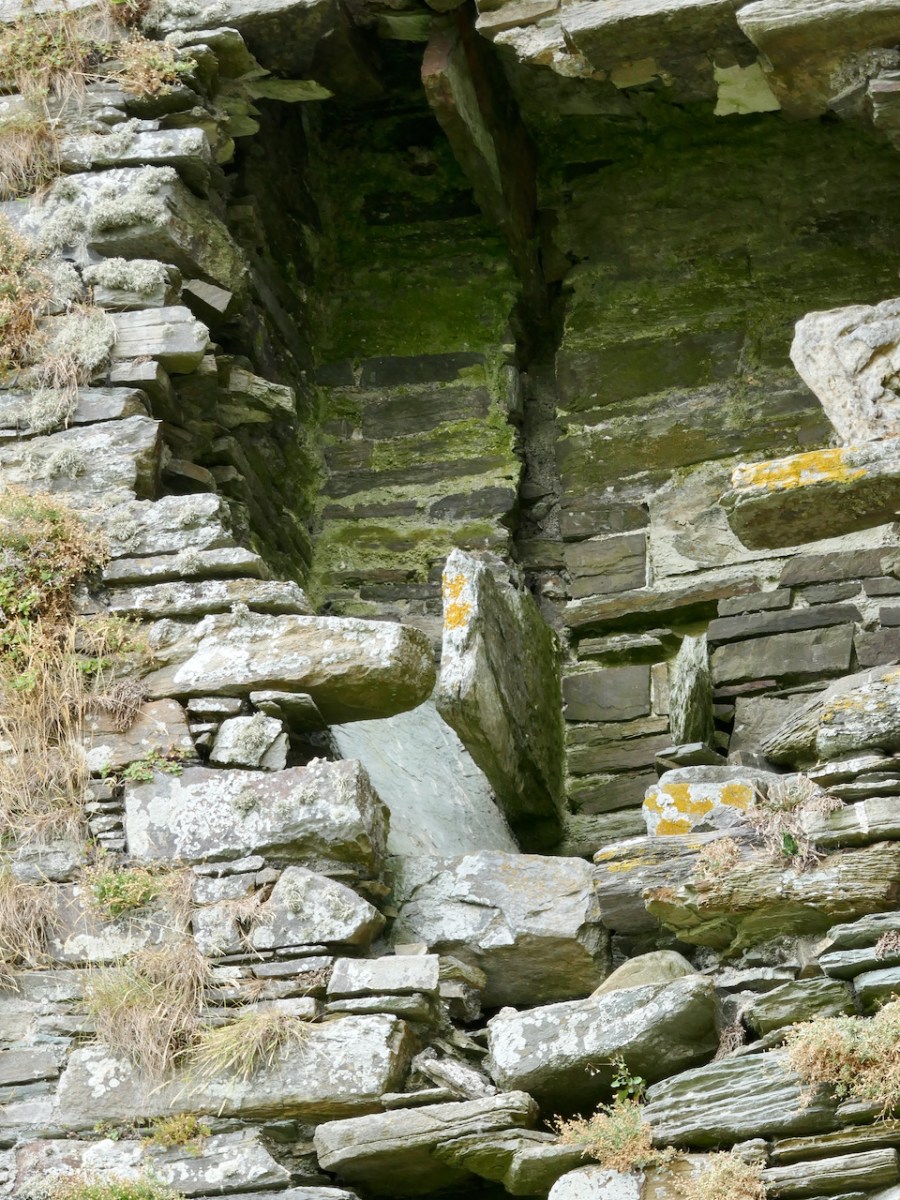
In this first floor room were two other doorways. The first (above), on the west side, was to a mural chamber that included the first floor garderobe or toilet (fifteenth century indoor plumbing!) – more on that later. The second (below) gave onto a short flight of steps leading downward to a vaulted chamber in the turret.* 

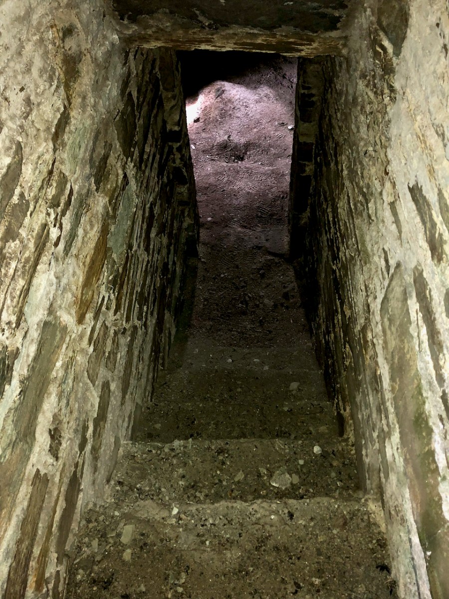
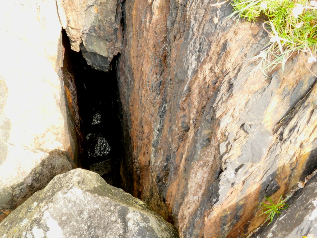
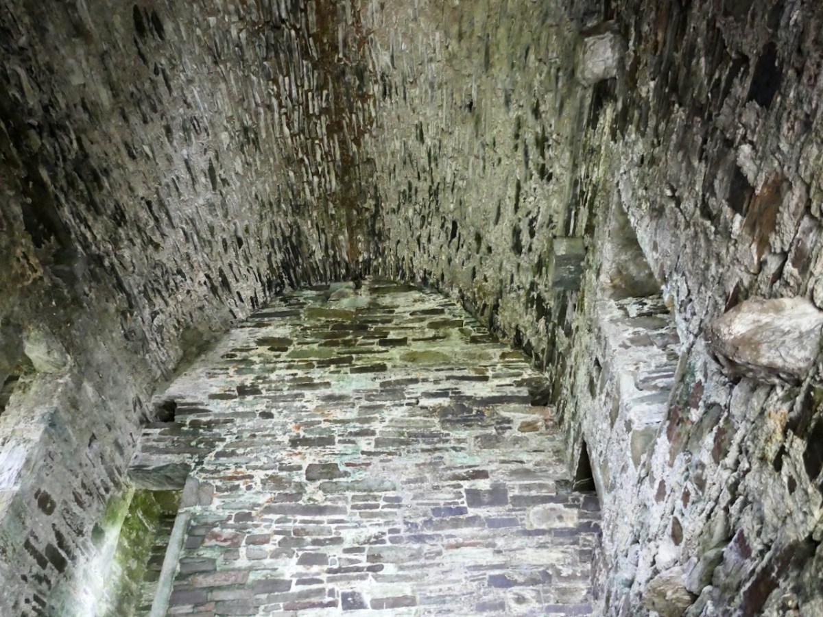
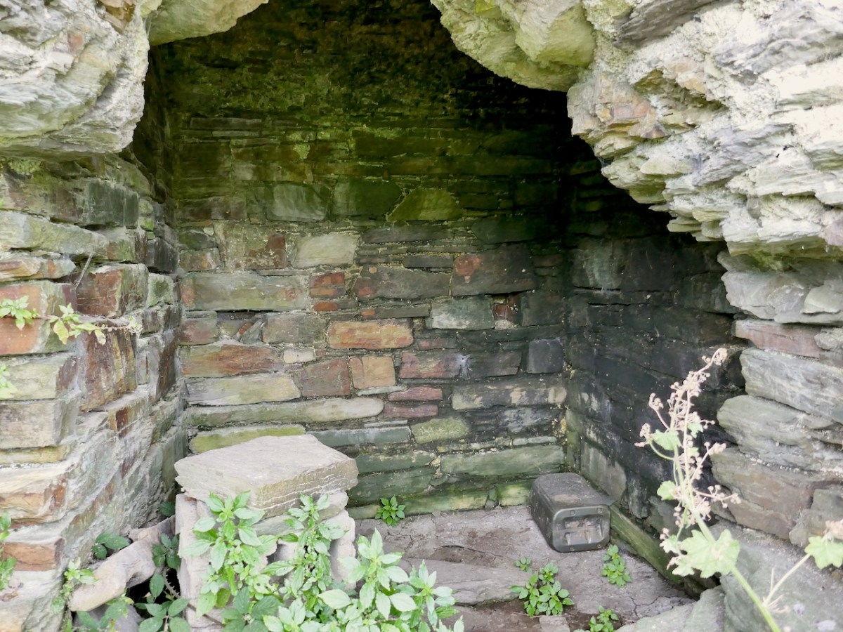
This chamber is one of the most interesting features of Dunmanus Castle, because in the floor is a hatch or trap-door which is the only access to yet another small, vaulted windowless cell below.

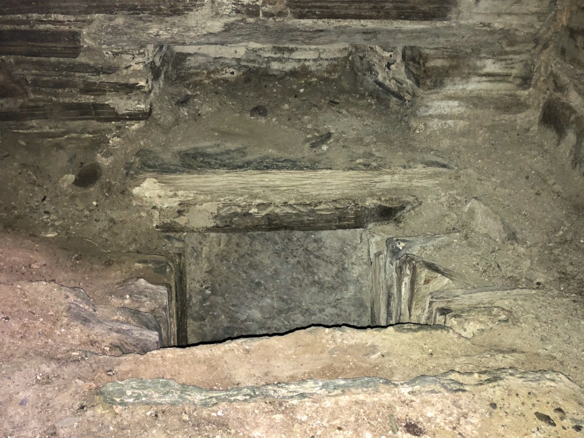
We know about this cell because there’s a hole in the wall that allows us to see into it – and even go into it. 

Once you’re inside, you realise that originally you would have been in the pitch black and that the only way in or out was the trapdoor in the ceiling. Was this a dungeon? An oubliette? It certainly could have functioned as such, and there are historic accounts of prisoners being confined in such spaces in Irish castles. 

But there are other possible explanations. Mark Samuels, in his Tower Houses of West Cork, speculates that this is in fact a cistern, fed from below, filled in over the years with debris so that it is now impossible to see how deep it went. There are identical features, he says, at Kilcoe and Monteen tower houses. It would have been a significant advantage, especially during a siege, to have a source for water.

However, the best evidence for the use of rooms like this comes from the excavations of Barryscourt Castle, near Carrigtwohill, east of Cork City. Here’s what the authors of this section of the report, Dave Pollock and Conleth Manning conclude about its function.

The ground floor, originally accessed only through a trapdoor in its vault, has in the past been regarded as a prison or dungeon. The more likely explanation is that it was a safe vault or basement strongroom, where cash and records were kept securely, and could be accessed with the aid of a ladder when required. The room above this, referred to variously in other cases as the accounting room or counting house, was where an officer of the Manor called the receiver or cofferer worked. He documented all produce and commodities coming into the castle and made payments as necessary. At Barryscourt this room was only accessible through a small external doorway . . . It is interesting that good examples of accounting rooms with basement strong rooms under them, accessed through trap doors, are found in some late 14th century great towers in England such as Bolton Castle and Warkworth Castle.


Barryscourt Castle Co Cork, Archaeology, History and Architecture, Dave Pollock, ED.
Published by the National Monuments Service, 2017,

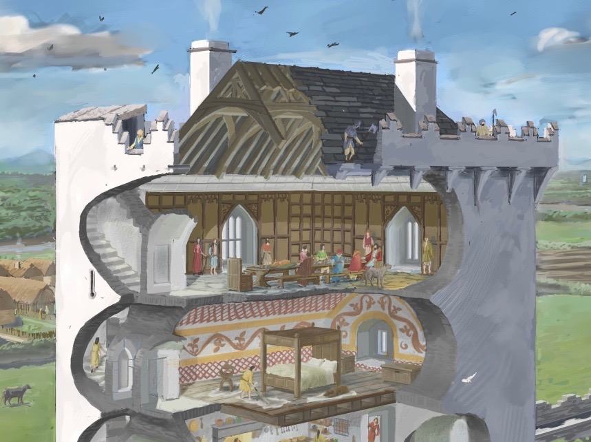
There is, of course, no access nowadays to the upper floors of Dunmanus Castle, but we know that the top floor was the ‘solar’ – the largest and most commodious chamber reserved for the Chief and his family. It was also where he entertained, and there are accounts of the lavishness with which guests were received. Take a look at my post, Illustrating the Tower House: A Guest Blog (sort of) to see how the brilliant artist JG O’Donoghue, has managed to show us the internal layout of a tower house. Here is his image of the upper floors and wall walk.

From that chamber, a set of stair led up to the battlements, where a wall walk would have surrounded the pitched roof. The wall walk was protected by a set of stepped merlons and crenels in the style known as Irish Crenellations – Kilcoe gets these exactly right.

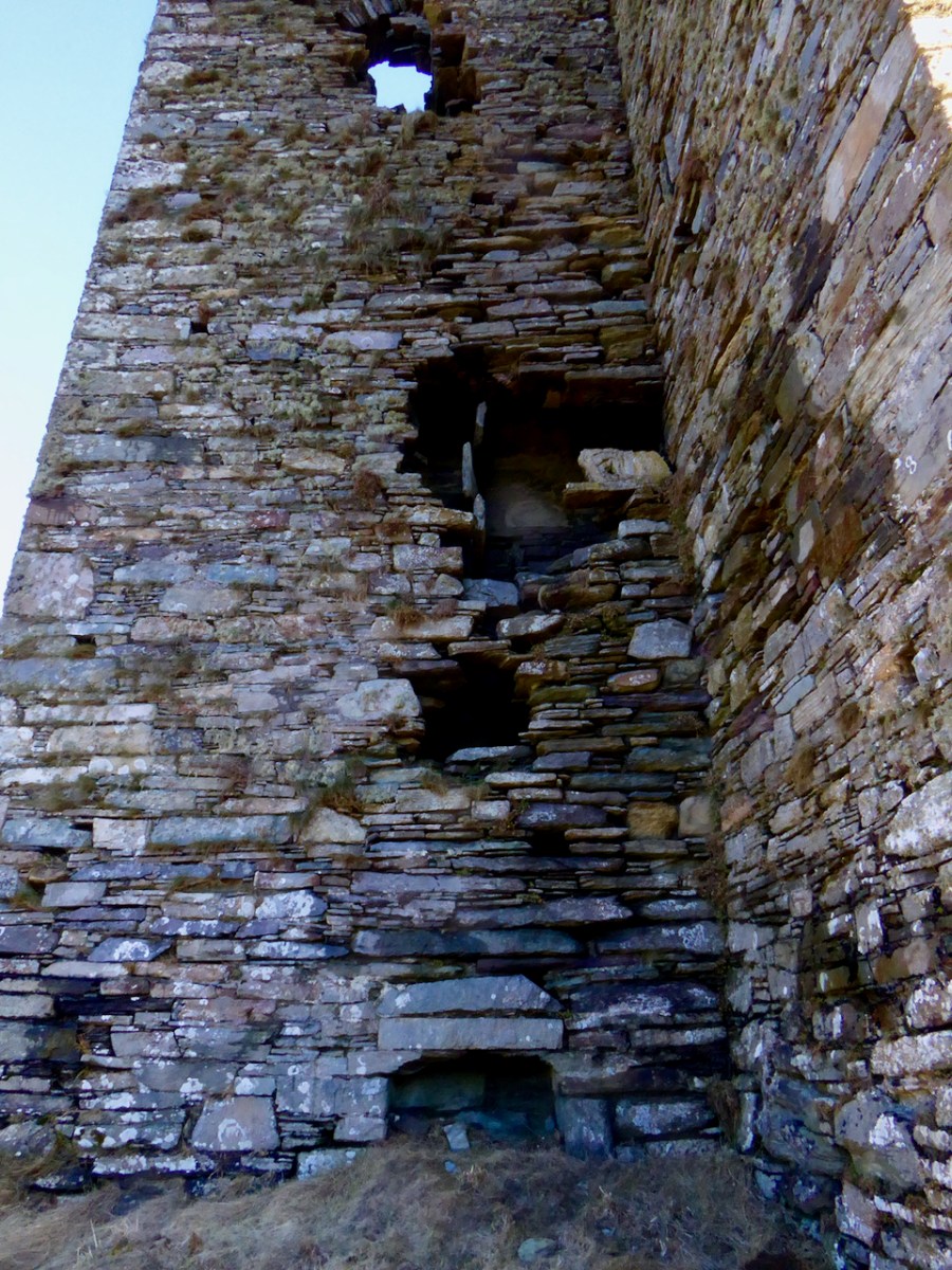
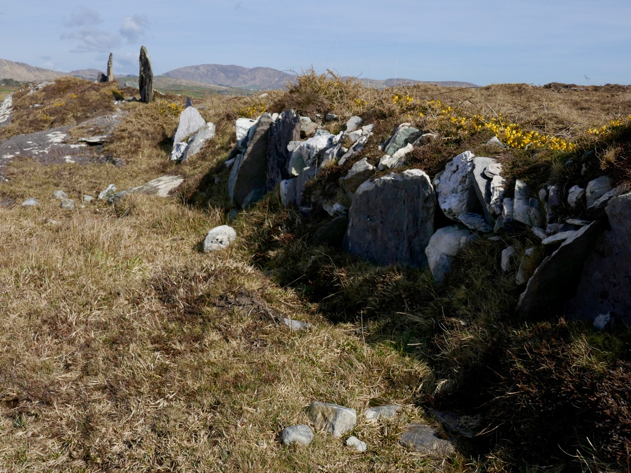
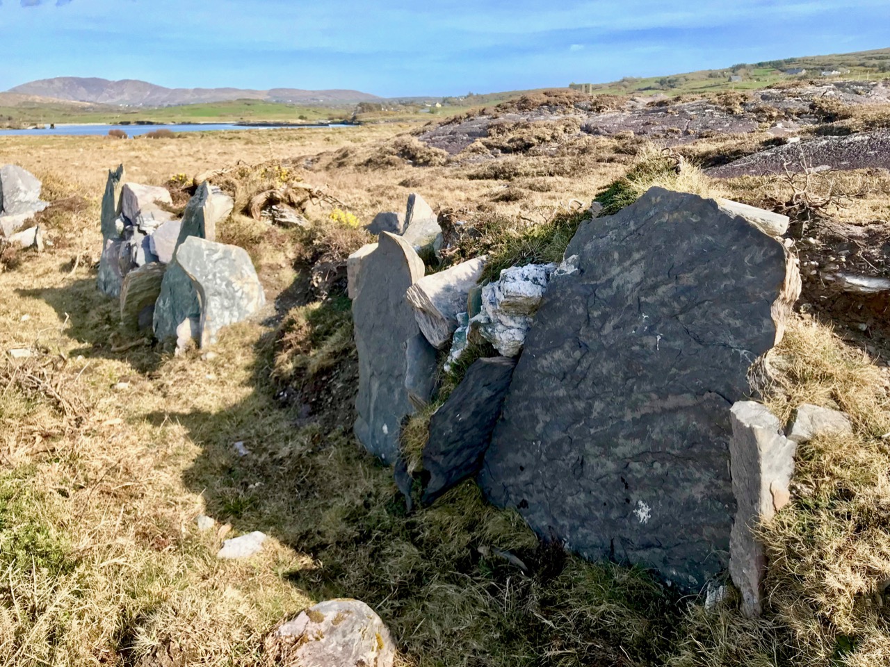
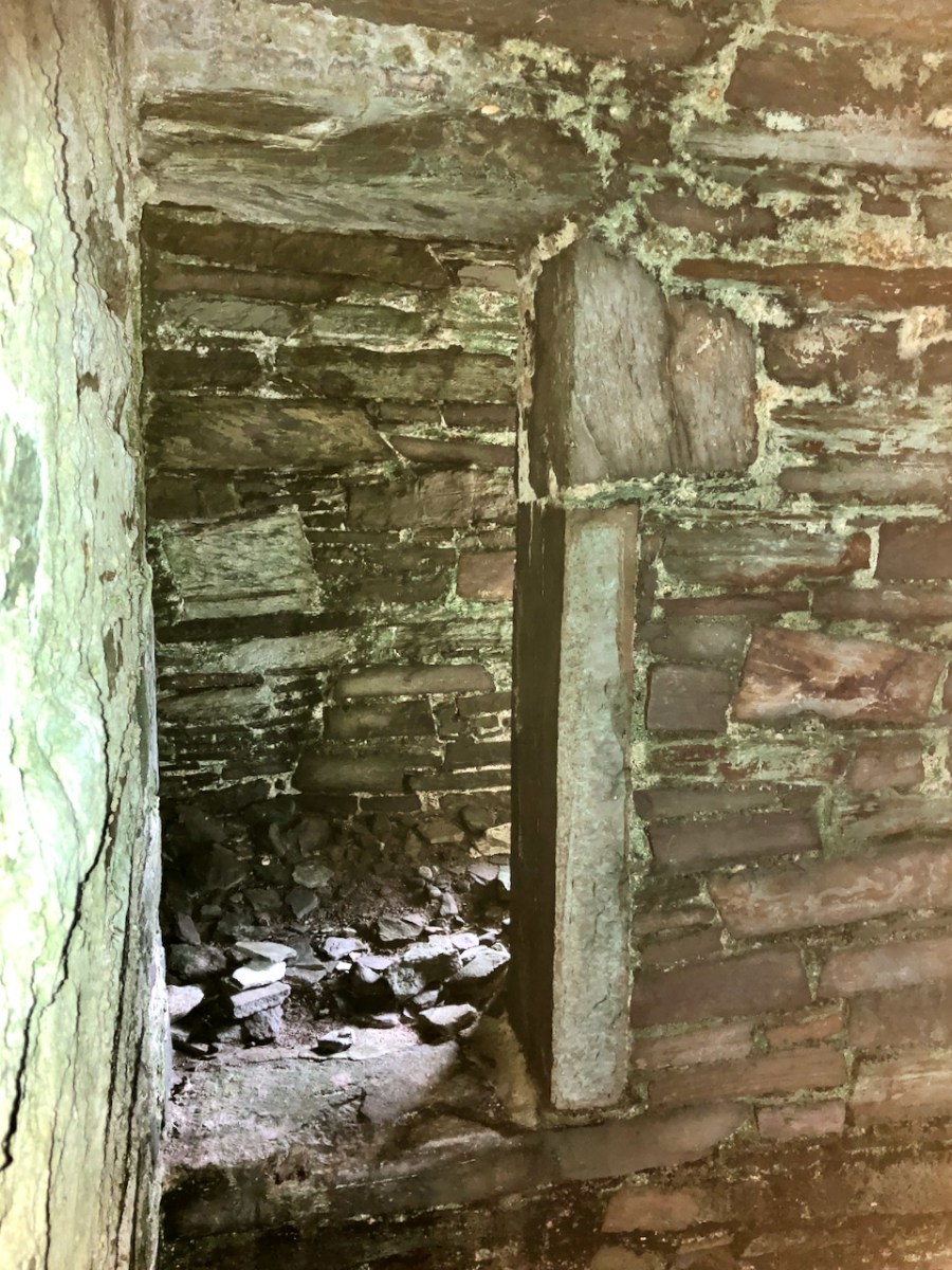
My final note is on the garderobe, or rather, garderobes, since there was one off the first floor and another at the level of the solar. The chute which served both of them, was divided down the middle by a set of perpendicular slabs set into the inner wall (above and below). 

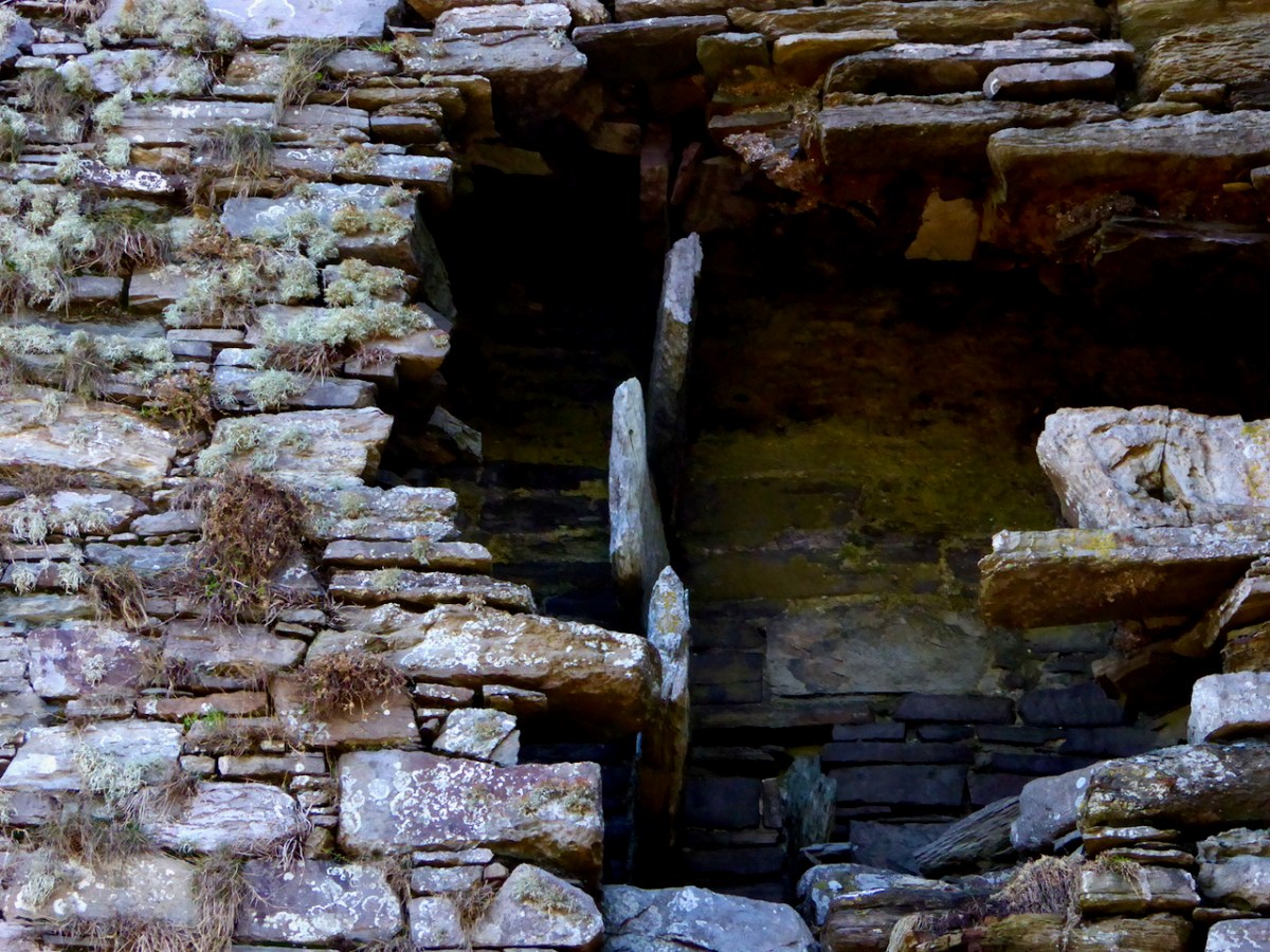
When I photographed Dunmanus in 2016 these perpendicular slabs were in place. However, as you can see below, by five years later two of them have fallen.

While these particular slabs may not be integral to the cohesion of the building, every stone that falls or slips weakens the overall structure and is another step towards ruination. It would be very sad indeed if Dunmanus Castle is not here in its current state for future generations.

*I am grateful to a friend who shall remain nameless (but who is a relative of Spiderman) for the photographs of the turret room and staircase. Do not attempt to access these spaces.

Dunmanus Castle 1: The Cliff-Edge Fort

There is a strong local tradition on the Mizen, or Ivaha as I prefer to call it, that Dunmanus Castle is not the original. No – the first site for Donagh Mór O’Mahony’s Castle, the stories say, was in Knockeens, across Dunmanus Harbour from the present site. We set out to investigate.

This is the site, directly across the bay from Dunmanus Castle, and it’s what is labelled in the National Monuments records as a Cliff-Edge Fort. According to their definition that’s A penannular enclosure which utilises a cliff-edge to form one or more sides as an enclosing element. They date from the late Bronze Age up to the medieval period (c. 1800 BC – 16th century AD).

Perhaps the best known cliff-edge fort in Ireland is Dun Aonghasa on the Aran Islands (above) – it’s certainly the most spectacular. (Photo courtesy of Heritage Ireland) There are 20 examples of cliff-edge forts in Cork, of which only 6 are coastal, the rest are on ridges or steep slopes above rivers.

The problem is that some of these may genuinely be a specific type of fortification that uses the cliff-edge as an impregnable barrier – as promontory forts do, for example. Some of them, however, and this may apply to Knockeens, may have been circular ring forts, built on prominent locations to command views of land and sea, but which may have been eroded by sea-action until what is left is clinging on to the edge of a cliff. In the photo above, you can see the obvious erosion at Knockeens. Instead of a circular ring fort, what remains looks D-shaped.

In the 25″ OS map, done in the late 1800s, the site shows ‘Castle in Ruins’

There is plenty of evidence that the Irish clan chieftains built their castles on the sites of their former strongholds – ring forts, cashels and promontory forts (see my post on Three Castle Head, for example). If there was indeed a castle at Knockeens, there is not much evidence of it now, although there are tell-tale signs of some kind of masonry construction.

But whatever Knockeens was – a cliff-edge fort or a ring fort – it’s unusual and impressive. It consists now of a raised platform of earth, probably originally circular, and an outer wall (above). There may have been a radial wall once (see the map below), but it has been ploughed out and is no longer visible on the surface, although it shows up faintly in aerial photographs. There may have been a fosse, or ditch around the outer wall also – slight traces of this also remain.

The raised platform is an imposing spectacle. We approached it from the landward side and were unprepared for how tall it is. The interior sits high above the surrounding land – an extraordinary feat of engineering and one which could only be accomplished by a chieftain with the ability to command the labour of many people. 

If indeed most of it has been swept away by the sea, it is now, of course, only a portion of what it once was. It certainly accomplished several objectives: commanding the entrance to the sheltered harbour, allowing visibility up Dunmanus Bay, and being a dominating force on the landscape – in other words a high-status statement residence and fortification. 

The outer wall appears to have been stone-built or stone-lined (see image below), and it, or the raised platform may have had a palisade around the top – these were common in ring forts. 

Although we could not find a way to get at it from the stony beach below the cliff edge, we could just about make out, from Dunmanus Pier across the bay, a cross-section of stone wall where the platform meets the cliff. In one of the older maps, this is marked as a “Castle in Ruins” although all that is shown is a portion of wall. So there may well be a solid basis for the belief that this was the original site of Dunmanus Castle. 

Michael Healy tells it this way:

It is related locally that before he finally decided on Dunmanus as a site for his castle, Donagh Mór O’Mahony, early in the 15th century, had selected a site on the other side of the inlet and had set his men to work. While they were working a stranger came by and said that they should not build a castle in that place as the sea would come and wash it away. They did not see him again but the project was abandoned and Dunmanus was built on its present site.

The Castles of County Cork,

Michael J Carroll in repeats the assertion that this was intended as the site of the castle but introduces a nuance:

The workmen  noted, however, that the heavy winter seas rose up over the site. The project was abandoned and the stones removed for use in Dunmanus.

The Castles and Fortified Houses of West Cork,

I said at the beginning that there is a ‘strong local tradition’ that this was the original site. What we have learned to do in these cases is go to the Dúchas Folklore Collection, for the stories collected by schoolchildren in the 1930s – and there it was, written by an anonymous students in Kilcomane School (possibly Bridie Kennedy of Lissacaha). Here’s what she wrote:

When O’Mahoney was building his castles he had one for each of his sons. When he was building Dunmanus castle it was in the Knockeen’s side he laid the foundation. There is a part of it still remaining. It goes by the name of the old castle. A half fool one day was passing by and he saw them at work. He told O’Mahoney it was a foolish place to build a castle, that the swells of the ocean and the river from the mountain would eat the foundation from it.

O’Mahoney then asked him where would he build it and the fool showed him a rock at the opposite side of the river called the mount. Then O’Mahoney considered himself and found he had a mistake made, so he took the fool’s advice and built the biggest castle of all the rest on the mount.

https://www.duchas.ie/en/cbes/4921594/4882831/5147738

The sea stack above shows clear evidence of the amount of erosion that has happened over the centuries as well some kind of stone construction at the top level of the stack.

What are Amanda and Peter looking at? It’s a blow hole! Further evidence of how the sea can rage against this cliff.

So there you go – O’Mahony took the advice and built his castle where we see it today – the subject of a future post.

Please note that this site is on private land, used for cattle, and we were granted access by the kind permission of the owner. Our grateful thanks to him.

Elizabethan Map of a Turbulent West Cork 2: The Story

Last week we took a look at this intriguing map and picked out many of its features. This week we want to see what is actually being depicted in this extraordinary document. By the way, before we get on with that – what is that strange construction beside the Bantry Abbey? A drying rack? A Gallows?

The main source I am using is the article written by P.O’Keeffe (this may have been Paddy O’Keeffe of Bantry – if anyone can confirm this I would be grateful). It was published in the Journal of the Cork Historical and Archaeological Society in 1958. It’s a brilliant piece of analysis based on a close reading of the map, cross-referencing with the Pacata Hibernia, and a deep dive into the few other sources for medieval West Cork History.

The Passage of the Army – an illustration from the section of Pacata Hibernia dealing with the Siege of Dunboy

First, a very brief background – a slightly more detailed version can be found in Robert’s 2019 post, An Excursion to Dunboy. After the Battle of Kinsale, where a combined force of Irish and Spanish were defeated by the British, Donal Cam O’Sullivan Beare retreated to Dunboy. Having forcibly taken it back from the Spanish commander whom he had left in charge and who was prepared to surrender it, he strengthened its fortifications and leaving it in charge of a deputy, he departed for Ardea Castle to meet a Spanish ship bringing reinforcements and supplies.

While he was absent the British made their way, by land and sea, to the Beara, attacked and destroyed Dunboy (with some assistance from Donal Cam’s cousin, Owen O’Sullivan of Carriganass), killing or subsequently hanging (in Castletownbere) all the defenders and inhabitants. The also murdered all those who has sought refuge on Dursey Island. This all happened in June 1602.

The campaign that marked the end of the Nine Year’s War was chronicled in a book called Pacata Hibernia, (Ireland appeased and reduced; or, an historie of the late warres of Ireland), written by Sir Thomas Stafford and dedicated to Elizabeth I (above) and to his boss (and possible father), George Carew, the President of Munster (below). Stafford lays out the course of each battle, siege and engagement, illustrated with maps and drawings.

Seen as glorious victories by the British, the Battle of Kinsale and destruction of Dunboy spelled the death-knell of the power of the old Gaelic lordships in West Cork and ushered in the large-scale takeover of Munster by the new planter class who arrived to a devastated and depopulated landscape. A visit to Dunboy (below) nowadays does not in any way convey the seismic effect this siege had on Irish history.

Because a previous historian had assigned this map to the 1550s, O’Keeffe goes to great pains to demonstrate that what is depicted here is indeed the Siege of Dunboy.

Thus, the movement against Dunboy, in its initial stages, was entirely a naval action, ships playing a vital role in ferrying troops, guns and supplies, firstly to Bear Island and secondly to Dinish Island, thirdly, to the mainland and into strategic creeks about Dunboy, and, finally, to the Dursey. The principal islands mentioned in the Pataca  report are Whiddy, Great Island (Bear Island) Doughe Insh (Dinish Island) and Dursey, and each one of these played a vital part in the attackers’ plans. Can it be coincidence that these islands are specially emphasised in our map by colour washes? Troops were ferried from Muintervarry to Bear – the map shows two galleys being rowed up the Bear Island Sound. Boats ran the fire of Dunboy into the Creeks about the castle. The map shows boats in precisely similar positions.

A Spanish ship came to Kenmare Bay carrying Bishop McEgan and Turlough O’Brien with supplies and money. The map shows a Biscayner being rowed out of Kenmare Bay. A pinnace and three other boats went to capture the Dursey – a ship is shown clearing the Dursey Sound. Finally, the boundary line on the Muintervarry Peninsula, and the dotted ‘scale’ embrace the specific region mentioned on the Pacata Hibernia. Can the occurrence of all these features be purely coincidental? It seems unlikely, and unless serious arguments can be advanced to the contrary, we must consider that the map was used to illustrate the events of Dunboy in 1602.

O’KEEFfe, P., A Map of Beare and Bantry,
Journal of the Cork HISTORICAL and Archaeological Soc
1958, Vol 63, No 167

Very convincing. What remains a puzzle, however, is the castle that is being besieged on the Mizen Peninsula. O’Keeffe has deciphered two words above the castle as ‘Kastell’ and ‘Omahons’ and the inscription below as ‘the kastell of rosebry . . . wer  . . . by the m . . .  of the Cytty of . . .’  The drawing may show that the tower inside the bawn has already been destroyed by the cannon outside the walls, being fired by a soldier in a plumed hat. Troops are shown with muskets, crossbows and axes. The bawn wall has at least one corner tower and a substantial gatehouse. 

The inscription appears to verify that this is Rossbrin, and we do know that the Rossbrin O’Mahonys took part, on the Irish side, in the Battle of Kinsale, so it makes sense that their castle would come in for the same treatment as Dunboy. However, only one authority (Smith*) states that Rossbrin was besieged by Carew in 1602, while others assert that it was not, and that the tower was substantially intact up to comparatively recent times. There is no mention of actions against Rossbrin in Pacata Hibernia. O’Keefe speculates that what is being illustrated may be the recorded siege of Rossbrin in1562 when “the authorities in Cork fitted out an expedition to capture the castle from the O Mahonys” or in 1571 “when Perrott attacked and captured the castle.” 

However, this calls for some chronological sleight of hand – in order to establish that what is depicted on the map is a siege of the 1550s, O’Keefe postulates that this map was produced in the 1550s and then later modified to include the Siege of Dunboy. Not very likely, given that his rationale for assigning it to 1602 is so clear, and the map has all the unified appearance of being done at one time and by one hand. What’s left of Rossbrin now can be seen above and below.

The other possibility is that the castle of the Mizen being besieged is not Rossbrin. In this case, the likeliest candidate would be Dunmanus (below), which was captured by Owen O’Sullivan of Carriganass. While the castle under siege on the map is on the correct side of the Mizen for Rossbrin, and not Dunmanus, we have already seen in Part 1 that Ardea Castle is located on the wrong side of the Kenmare River, so perhaps the cartographer was a little more approximate with some locations than others, or perhaps the boundaries of the paper available for the map forced a couple of castles to be squeezed in, even if the location wasn’t totally accurate.

I have yet another resource to consult, but I don’t have access to it yet, so it is possible that there is more, and better, analysis of this map. If so, I will either write a future post, or revise this one. Meantime, I would be interested in anyone else’s take on The Story.

*Smith, Charles, 1893, The Ancient and Present State of the County and City of Cork (available here)

Mizen Magic 17: Delights of Dunmanus

As we often do, we set out on a sparkling day last month to explore a part of the Mizen we aren’t familiar enough with yet. Our plan consisted of pouring over the OS Number 88 map and having an AHA! moment of realising that we haven’t been to a particular spot. This time, the dart landed on an area just northeast of Dunmanus Castle (seen above from Mount Gabriel), where it looked like there was a trail running along the water that would afford magnificent views of Dunmanus Bay and the Sheep’s Head. Things didn’t go quite as planned. . .

Red line: the trail we wanted to walk. Blue line, the trail we actually walked.
Arrows – yellow, Dunmanus Castle; pink, boulder burial; blue, Killhangel Church

We’ve written about this area before – specifically, in Mizen Magic 13 Robert described the promontory immediately to the northwest of the castle, with its ancient stone walls and its spectacular sea arches. This area has recently been re-fenced and isn’t as easy to access as it was.

The Castle and bridge from the promontory

The Castle, of course, is the most prominent landmark in this area. Built by the O’Mahony’s in the 15th century, it is a classic early ‘raised entry’ type of tower house, with complicated internal architecture that allows restricted access to different parts of the building at different levels – including to an oubliette. My post When is a Castle..? has a good description of these kinds of castles, typical of West Cork.

But today we were heading away from the Castle, towards the townland of Knockeens, where, on the map, we could see this promising trail. But you can’t just go right there – a little meandering is always in order when you’re in countryside this beautiful and this interesting.

So we stopped to admire the Dunmanus boulder burial (it’s the rock in the lower left of the photograph above). Boulder burials are Bronze Age monuments, although they may have been used for purposes other than to mark burials. See my post Boulder Burials: a Misnamed Monument? for more about this intriguing group of archaeological sites, more widespread in West Cork than other parts of the country, and often associated with stone circles or standing stones. This one is unusual in that it is low-lying (most are in more commanding positions) and the base gets covered at high tides.

Crossing over an unnamed stream that rises on Mount Gabriel and empties into the sea here, we arrive at the point where we can leave the car and proceed on foot.

A short walk up an old boreen leads us to a clachán – a tiny settlement of houses, now all in ruins. The residents had magnificent views back down to the bay in their day, but as people say around here, you can’t eat scenery and the families who lived here are long gone to a better life elsewhere.

Just beyond the clachán we ran into our roadblock – an enormous puddle extended over the path. It was too deep to walk through and the boreen was fringed with thick gorse bushes we couldn’t push past. Stymied, we decided to climb up above the path and look for a way around. Easier said than done – between stands of gorse, boggy patches to go around (or sink into), sheep paths that went nowhere, we spent an hour or so wandering around the hillside and finally admitted defeat.

It wasn’t wasted time though – it was wonderful to be out in the crisp air, surrounded by all the magnificence of the Mizen, thinking about the generations who had wrested a subsistence out of that unpromising land. When we finally got back to the car we decided to see if we could approach the trail from the other side, and set off in that direction.

Looking across to the Sheep’s Head

Along the way we had a quick stop at the ruined late-medieval Kilheangul Church (Church of the Angels). It’s a special little spot that deserves a post of its own someday, so I won’t say much about it now. This photograph of it was taken in the summer.

By the time we arrived at the other end of the trail, beside a small pier, it was starting to get dark, as befits a January afternoon, so discretion dictated that we leave the rest of the adventure to another day. 

The day started out to be about walking the trail – it ended up being about everything around it. That’s the thing about the Mizen – the journey is the destination. 


Mizen Magic 13: Dunmanus Promontory

It’s geologically and archaeologically fascinating – a substantial natural promontory just to the north of Dunmanus Castle: well worth an exploration. But, do be warned – there are cliff edges, exposed fissures, ankle-wrenching undulations and bogs to overcome. Also – it’s private, so please seek permission before crossing the land.

The west side of this shark’s fin-shaped promontory is wildly exposed to the ocean and its gales. You can see from the aerial views, above, how the rock bed is bare and visible, and the vestigial fields which occupy – or once occupied – the east side peter out, and the walls and banks which once formed them fade away altogether over on the left. In fact, these Google Earth images give a better impression of the oddly shaped enclosures than can be seen on the ground.

Three examples of many varied boundary features on the promontory are shown above. Each is differently constructed and they range from a series of vertically-set slabs to rocks-and-rubble and a raised bank reinforced with stones. In the picture below, follow with your eye the boundary as it traverses the scrub and makes a large S-bend on to the ridge facing the distant horizon.

Ireland – especially the west of it – is a huge stone landscape. Wherever people have settled, they have moved the stone and used it. To make fields, or any enclosures, they have had to clear the land. The stone taken from the land is used – sometimes to build shelter, often to build myriad walls to define the holdings. Here’s a striking example from the Aran Islands:

Nothing is recorded on the National Monuments Survey about these land boundaries at Dunmanus – or the significance of the promontory as a whole. Was it once a promontory fort? There are others on this coast. It could easily have been defended along the line of the present road running across the south. However, the land is flat and low, and there is no shelter.

Flat stone surfaces – of old red sandstone – remind us of the Burren landscape in Clare, and we can suppose that the present windswept bog and scrub could once have supported agriculture. But when? In medieval times, perhaps, when the nearby Dunmanus tower house was a thriving centre of occupation and, probably, commerce. In the shelter of the bay the little quay at Dunmanus survives and is still used by small boats searching out shellfish and scallops.

In some places the old walls seem to have a prehistoric feel: the use of slabs embedded vertically like standing stones is quite unusual in West Cork. The presence of large quartz rocks, too, is reminiscent of ancient sites, although they are natural geological occurrences here.

Other natural features on the peninsula include two ‘sea arches’ – bridges formed through erosion of the rocks and chasms by the ocean.

It’s a landscape of vestigial fields, sea – and stones. Nothing more. But I find it a mesmeric place; partly because we can see that it bears the marks of human toil, and we want to know more about who was there and how they lived. It’s a remote piece of Ireland to call ‘home’. Those marks remain after how many years – hundreds, thousands? They intrigue us, and compel us to explore.

Mizen Mud: Recipe for a February Exploration Day

Muddy Boots

It’s been a wet, wet winter, but when the sun shines in February (which it does, honestly!), we are out exploring. This particular day our companions were Jessie, Brandon, Amanda and Peter and our accompaniment was MUD, and lots of it.

Explore Group

Amanda took the photo of the group, and the one of my muddy boots

We had goals – Amanda was after some elusive holy wells and Robert wanted to find the pirate steps at Canty’s Cove for his talk on William Hull and the Leamcon Pirates’ Nest, part of the Ballydehob spring lecture series, ’Talks at the Vaults.’ Jessie is a professional tour guide, wanting to learn more about the Mizen. Finally, I wanted us to swing by Dunmanus Castle so I could check out a few construction details.

Dunmanus Castle and bridge

Dunmanus Castle on its knoll, surrounded by water

You don’t actually need goals like this to go out exploring, but it helps. It gets you into places you wouldn’t normally go, down tiny boreens, into farmyards and across fields. You end up knocking on doors and meeting people who know all about the well, or the old stones, or the legends of the place, or who owns what field and whether he minds people tramping through it. On this occasion we met, for the first time, the near-legendary Pat McCarthy, one of the writers of Northside of the Mizen, and a huge authority on this area. We’ve promised ourselves a return visit with him as we weren’t able to stay long enough for a good talk.

Budds

The best way to start a day like this is with excellent coffee, in Budds of Ballydehob, where we assembled with our map to plot our course. It was off then to Toormore and the Altar wedge tomb. On this occasion we weren’t actually after the wedge tomb (although I can never resist a photo of it) but the little holy well across the road.

Altar Wedge Tombe

Our next stop was Dunmanus, to take a good walk around the castle with the camera, looking for details I had missed on previous visits.

Dunmanus Castle ground floor entrance details: The bar-hole for barring the door once inside; the spud stone and the hanging eye. The hollows are for the pole that the door swings on

And then on to Canty’s Cove. You can read Robert’s post, Canty, for more about this place and its association with Canty the Pirate. Finding the steps wasn’t easy and it was a big thrill when we finally figured out where to look.

from Canty's House

This is the inlet with the pirate steps. Photographing them involved hanging over the edge with someone holding on to your ankles

Pirate Steps

How would you like to climb up these with a keg on your back?

By then we were starving – this exploring is hungry work – so we repaired to O’Sullivan’s of Crookhaven for one of their famous crab sandwiches. Even at that early date the sunshine was so inviting that people were sitting outside with their sandwiches and their pints.

water pump at Crookhaven

Crookhaven Pier

From Crookhaven it’s a quick trip to Lissagriffin, where there’s a medieval church and a bullaun stone doing double duty as a holy well/wart well. The church has a panoramic view over the salt marshes behind Barley Cove Beach as well as interesting architectural features.

Lissagriffin Doorway

Our next holy well was right by the side of the road a couple of miles further east – labelled so we couldn’t mistake it.

Callorus Oughter

Amanda inspects Tobareenvohir – or Tobairín an Bhóthar, the Little Well of the Road

The final one was harder to find and necessitated negotiations of some seriously muddy fields. Tobairín Brón (Little Well of Brone) was in the general vicinity of where we ended up, along with a small monastic site – all very brambly and hard to decipher. But what a place – a view clear out to the Fastnet Rock, with Knockaphuca looming behind us. Cnoc an Phúca means the Hill of the Mischievous Spirit – it’s been tamed, presumably, by the large cross erected on its peak.

Monastic site

Knockaphuca

Fastnet Rock

Read Amanda’s post for her take on the four wells we visited that day.

By then the sun, so warming earlier in the day, had been overtaken by high cirrus clouds, and we were donning jackets and gloves and remembering that it was only February after all. As if to make up for its lack of warmth, it treated us to a magnificent solar halo (I’ve always called them sun dogs)  as we made our way back to the cars.

Sun dog

We were never much more than 30 kms (or about 40 minutes) from home but in that distance we managed to see heritage sites dating from the bronze age through the medieval period up to the recent past, surrounded all the time by the magnificent scenery of the Mizen. You can do this anywhere in Ireland. Using the Historic Environment Viewer of the National Monuments Service, define the area you want to explore, pick your fancy (ring forts? medieval churches? cross slabs? megalithic tombs? castles? rock art?), and off you go.

Peter and Amanda in a holy well

A holy well looks back at Amanda and Peter

Now, if you’ll excuse me, I’m off to buy some wellies…