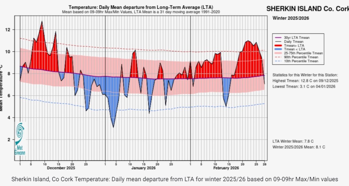
It’s not my imagination – we did indeed have more than average rainfall this winter, according to Met Éireann. It felt relentless and it just stopped the other day.
I am, apparently, wrong that the winter was also colder – above average temperatures resulted in the 20th mildest winter since 1990. It didn’t feel like that, though: looking at this chart from Sherkin Island shows lots of below-average spells, while Dublin airport had its ‘dullest’ winter since 1994.
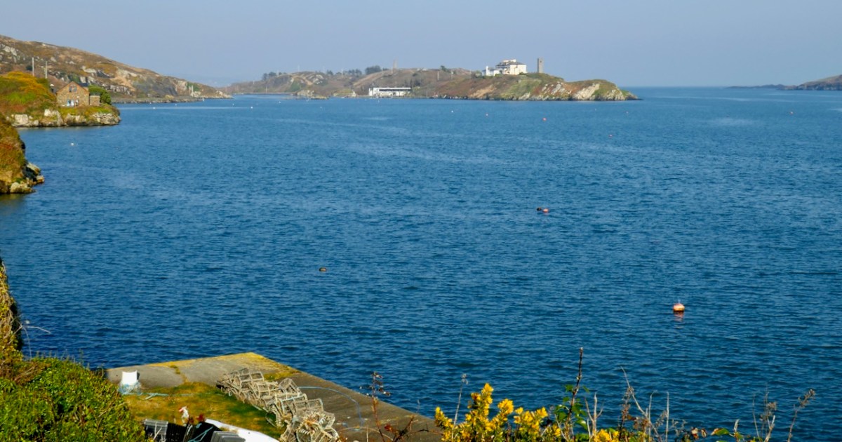
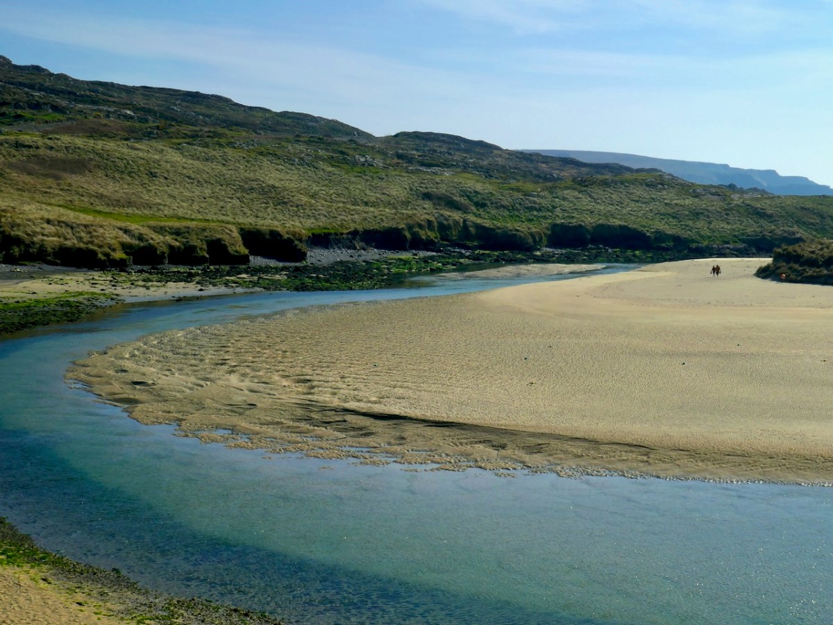
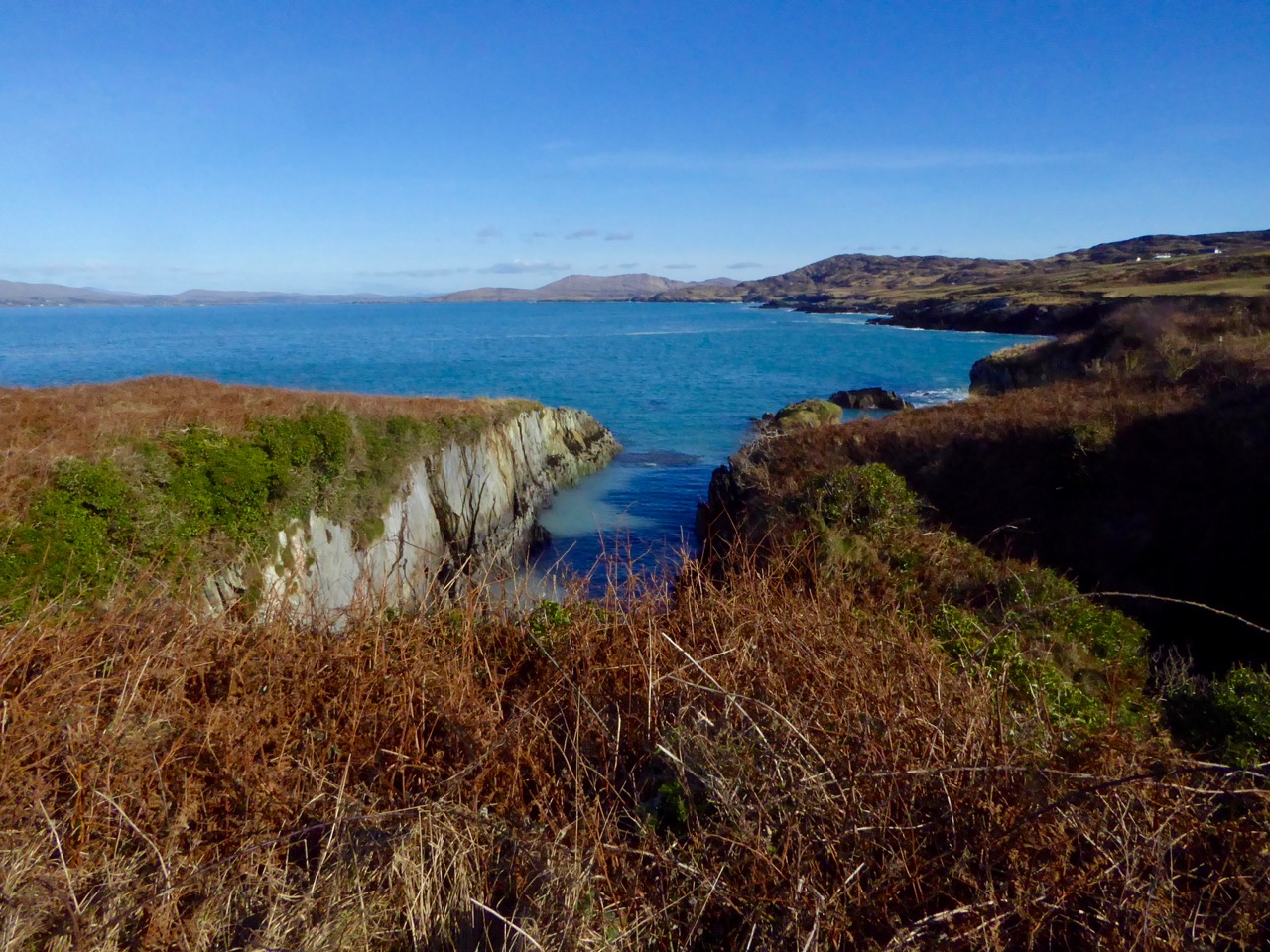
So on Friday when my forecast app showed sunshine all day I headed out into this unexpected and most welcome balmy weather, pointing my car towards the end of the Mizen. As I drove I couldn’t help thinking of the story by Ray Bradbury, All Summer in a Day. It’s set on a colonised Venus where it rains constantly, and the sun emerges for only one hour every seven years. You can read it here, if you don’t know it, or watch it here, but be warned it’s very sad.
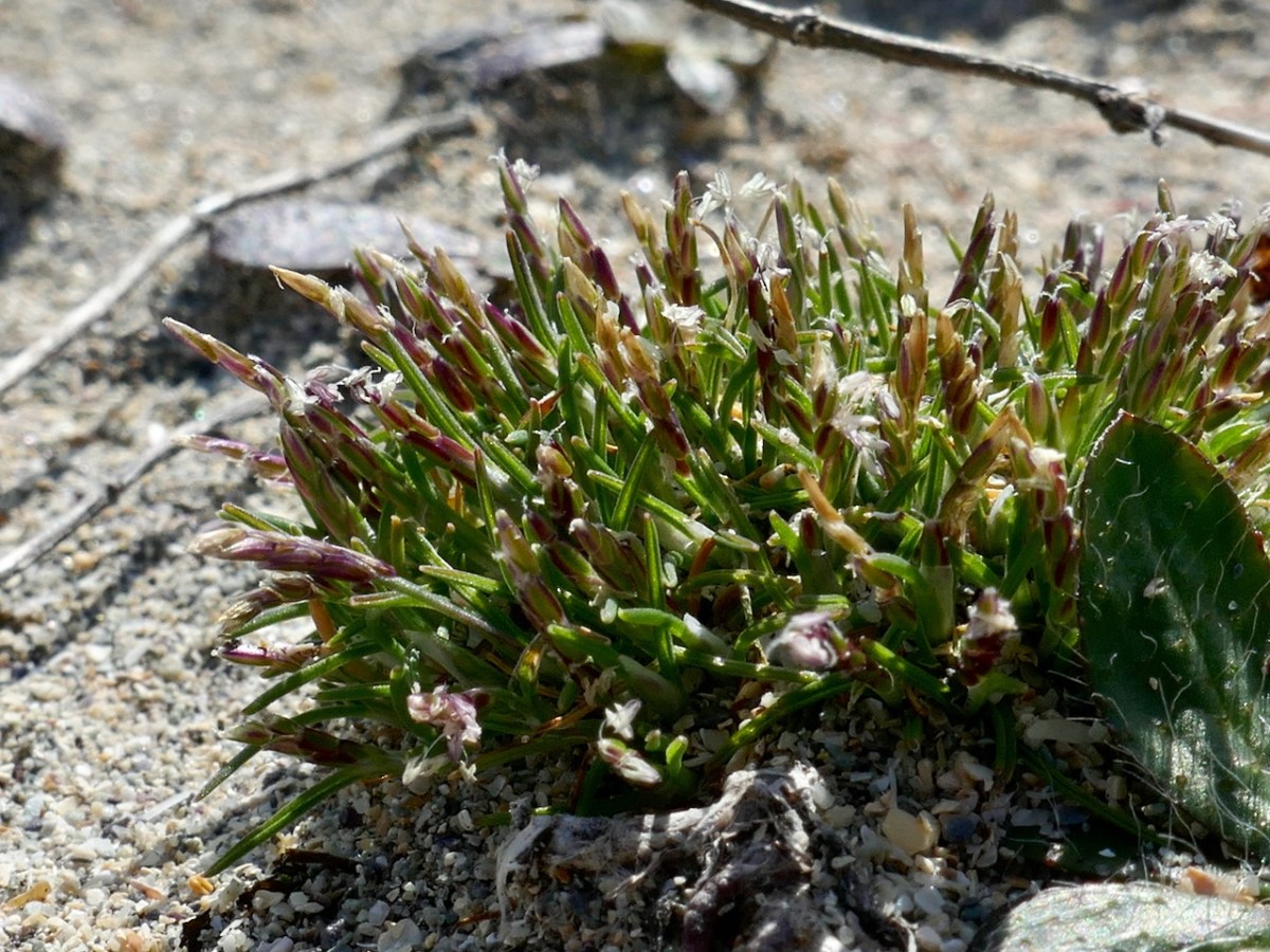
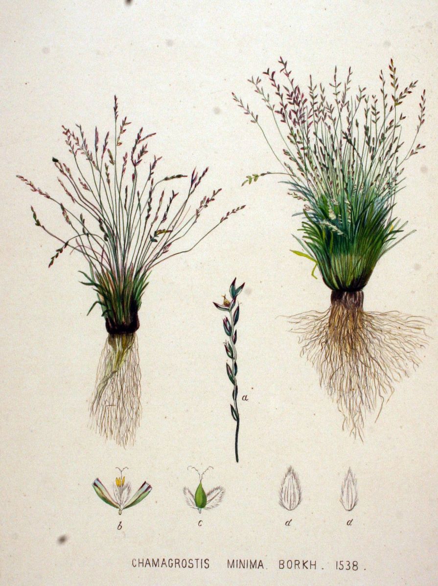
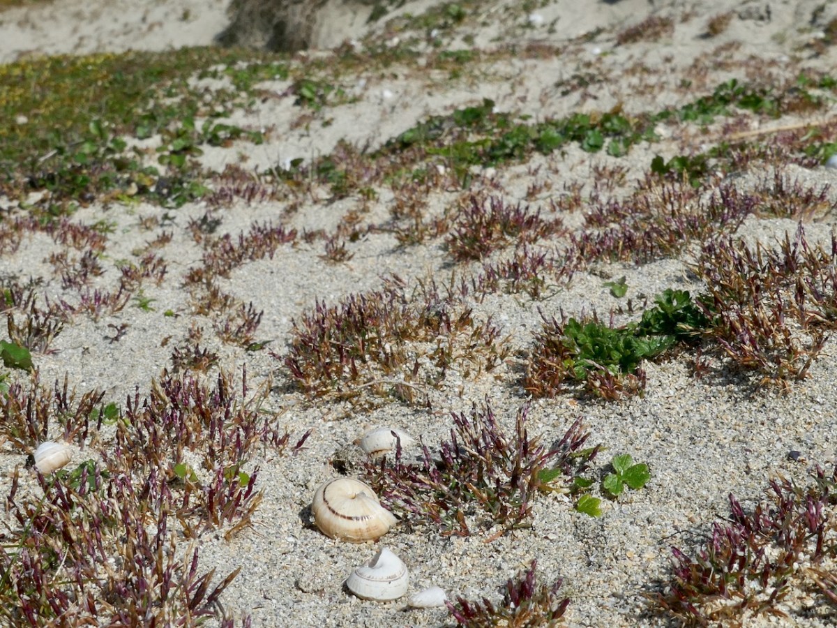
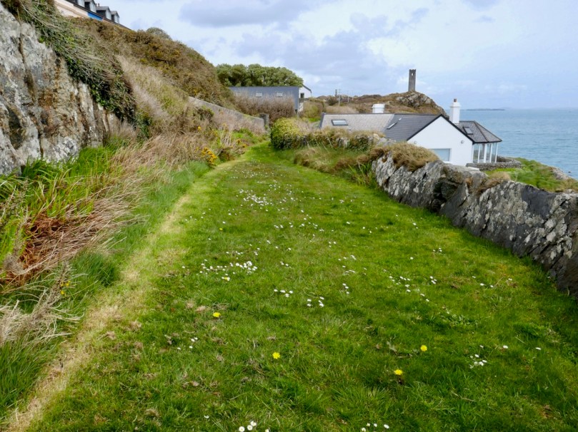
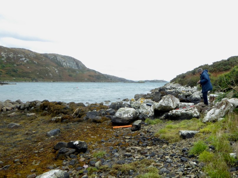
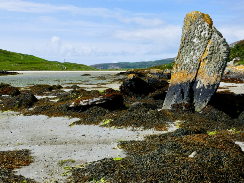
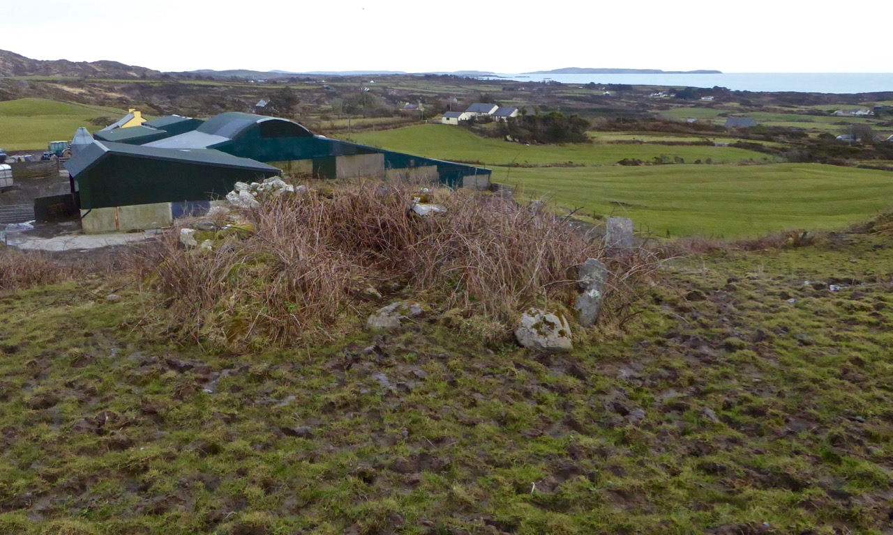
My immediate goal was to do my rare plant count. As I have related before, I monitor several rare plants for the Biodiversity Data Centre, and the one that comes up earliest is the least visually exciting. In fact, it would be hard to imagine a more homely little plant than Early Sand-grass (Mibora minima for the true botanists among you), although this illustration makes it look quite attractive*.
Spelled several different ways (one word, two words, hyphenated) this is one of the smallest, if not the smallest, grasses in the world, it is only found in Ireland in the dunes at Barley Cove and on Bull Island off the coast of Dublin. I volunteered to count it in 2022. So this is my 5th year observing it and I can say that it is holding its own and perhaps even expanding its range slightly each year.
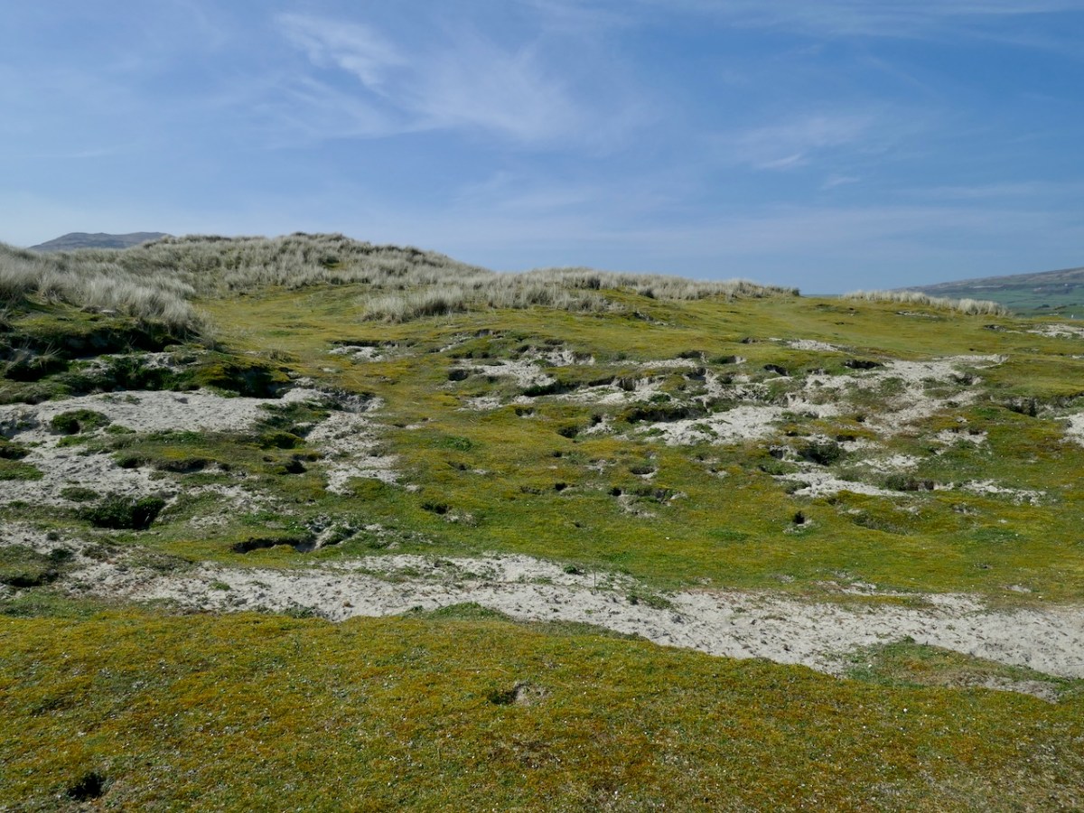
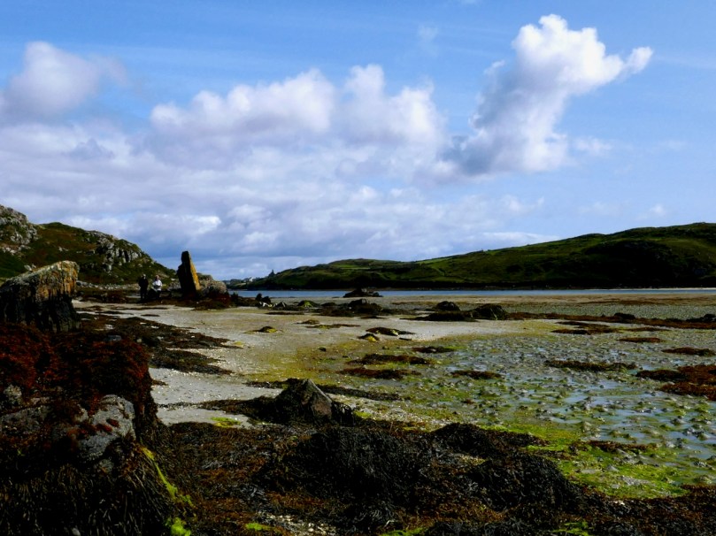
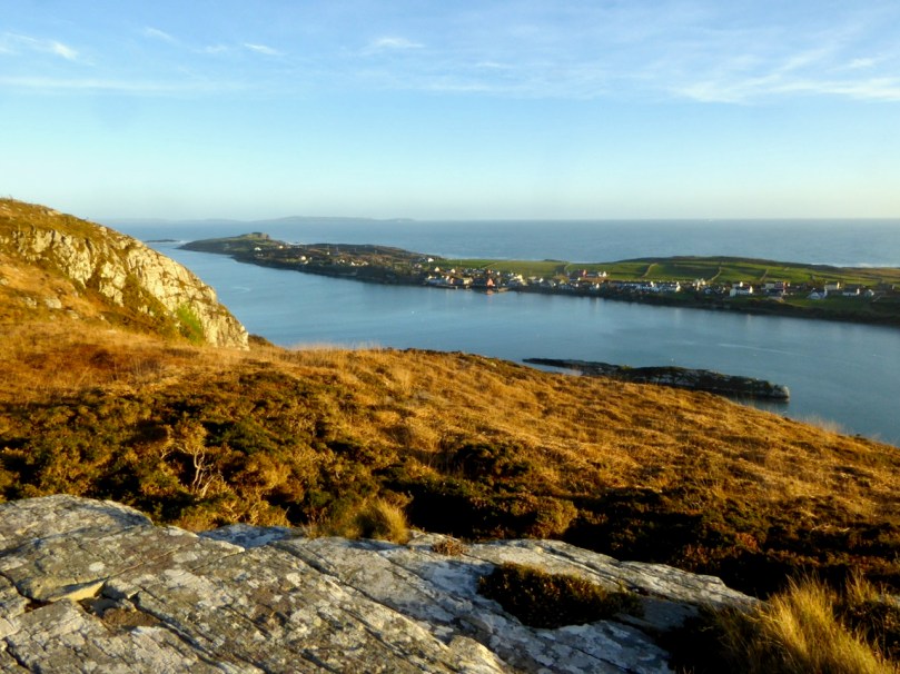
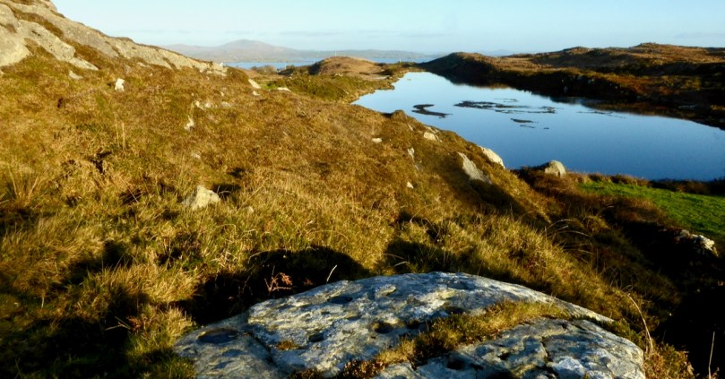
Seeking the plant involves walking slowly through the dunes with eyes always down and when I finally came up for air it was to realise that I had one of those days that often happen after extended periods of bad weather when the colours seem to spark off each other and the land and the sea provided a glorious panorama of hues and contrasts.
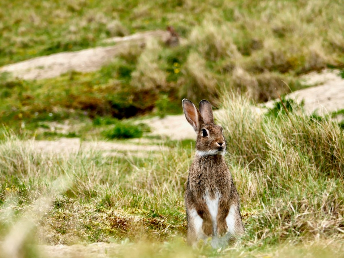
I also noticed what I think was quite an increase in rabbit activity on the area of the dunes I was traversing. Rabbits are both a blessing and a curse for dunes – see my post The Bunnies of Barley Cove for what I mean by that. The warrens can destabilise the dunes but on the positive side for my plant specifically, rabbit grazing keeps competitive grasses and coarser vegetation down, which can favour low-growing specialists that would otherwise be shaded out. Their burrowing also kicks up new patches of sand to host the Sand-grass.
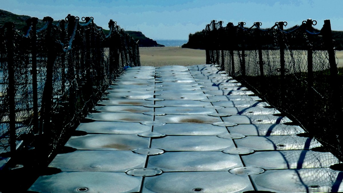
The path from the car park (I was the only car there today for a time) ends in an innovative pontoon footpath that allows access across the backchannel to the front dunes.
The pontoon is pulled up all winter and it hasn’t been re-set yet. There’s another way down, though, from the hotel at the far end, and it was good to see a couple enjoying the sensation that only walking on a beach barefoot provides.
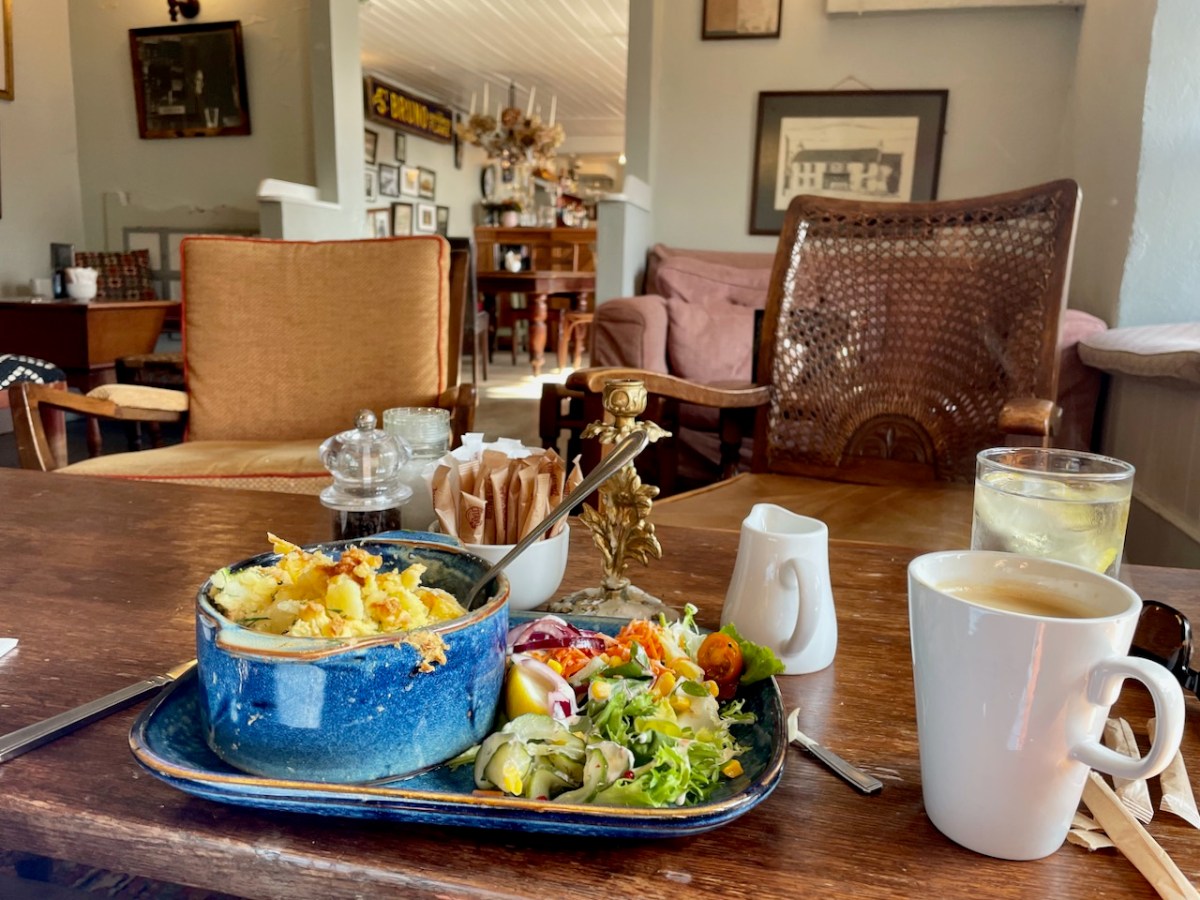
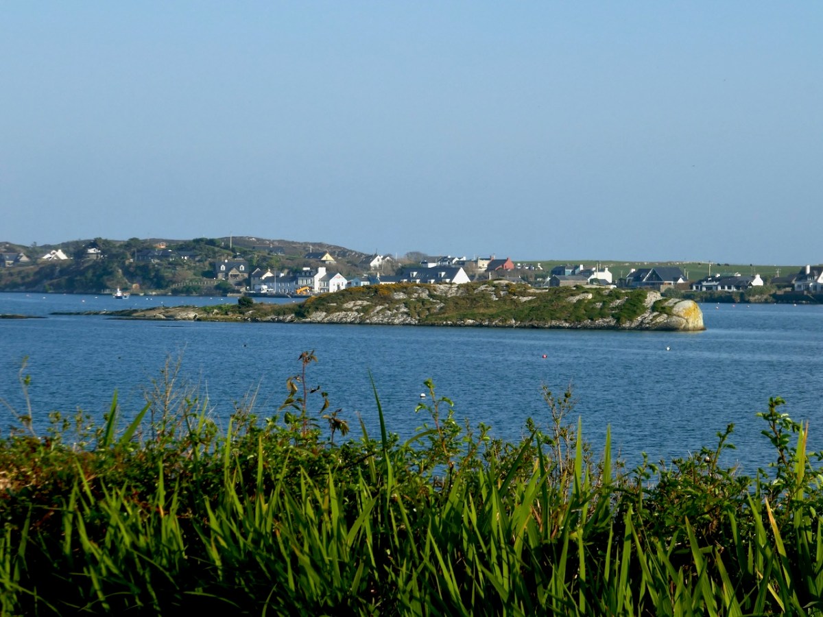
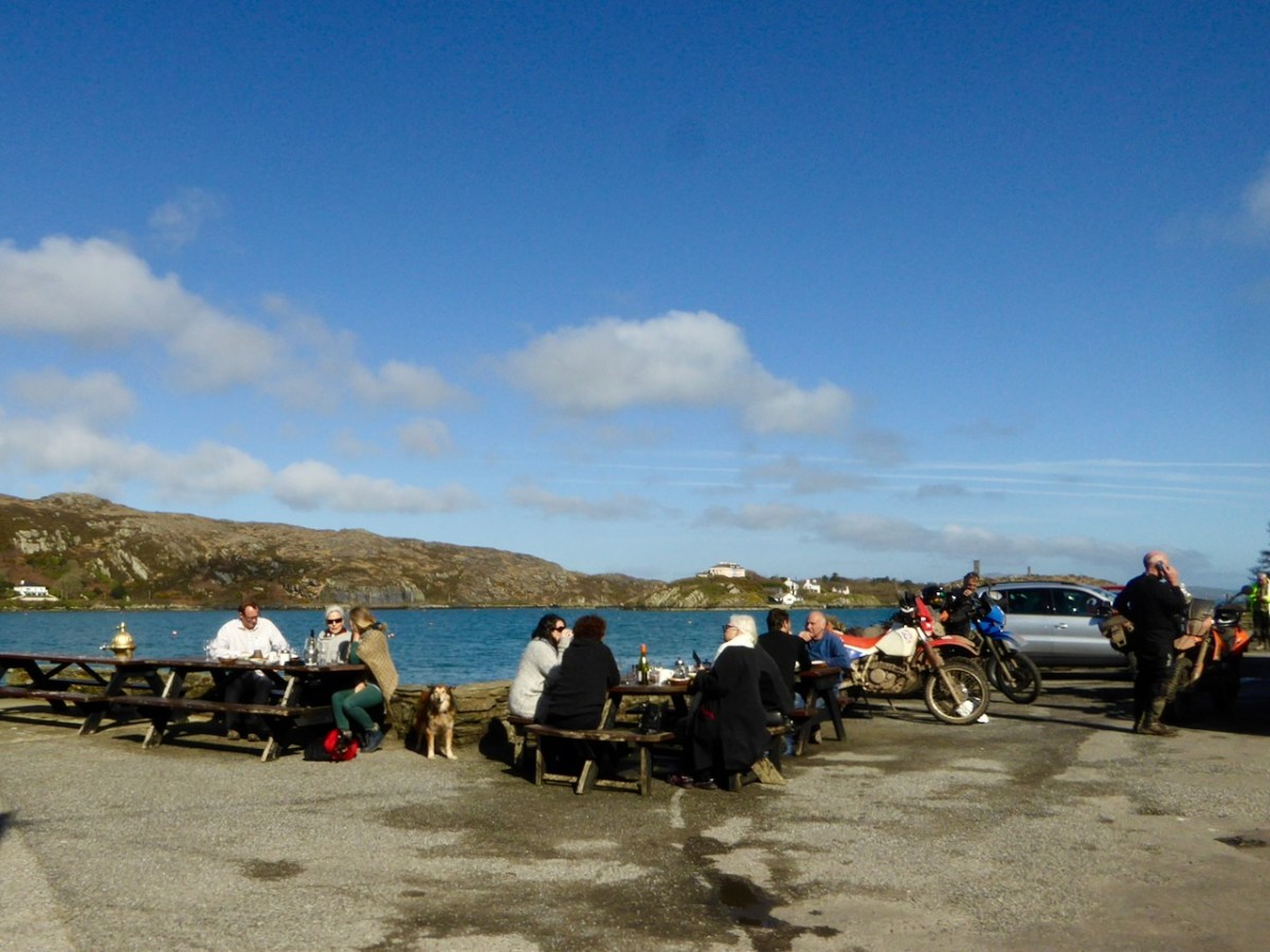
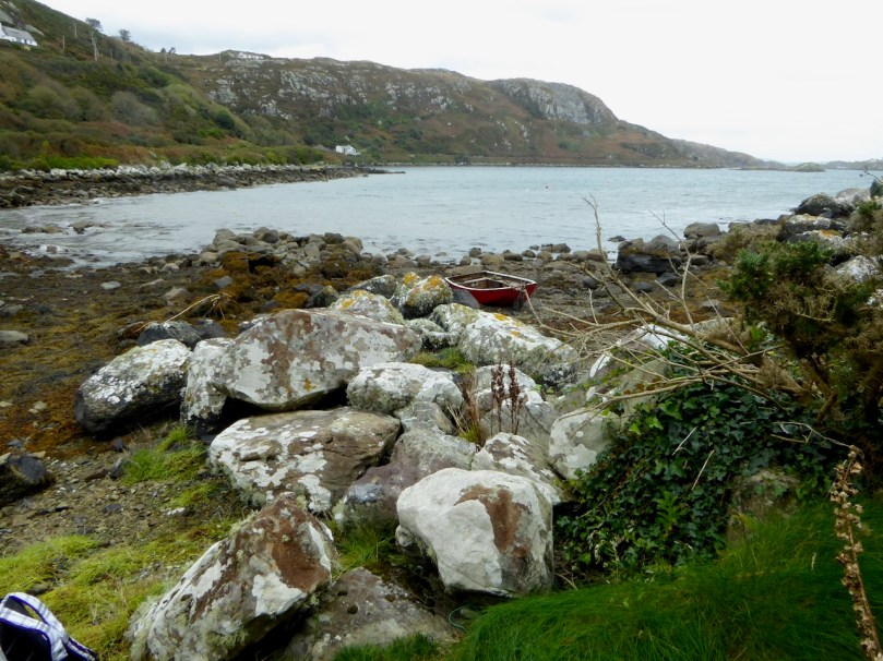
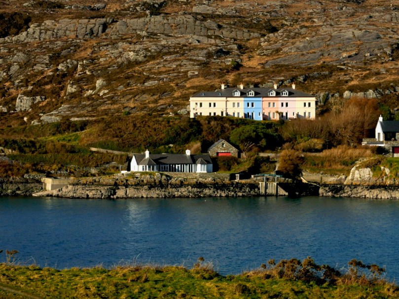
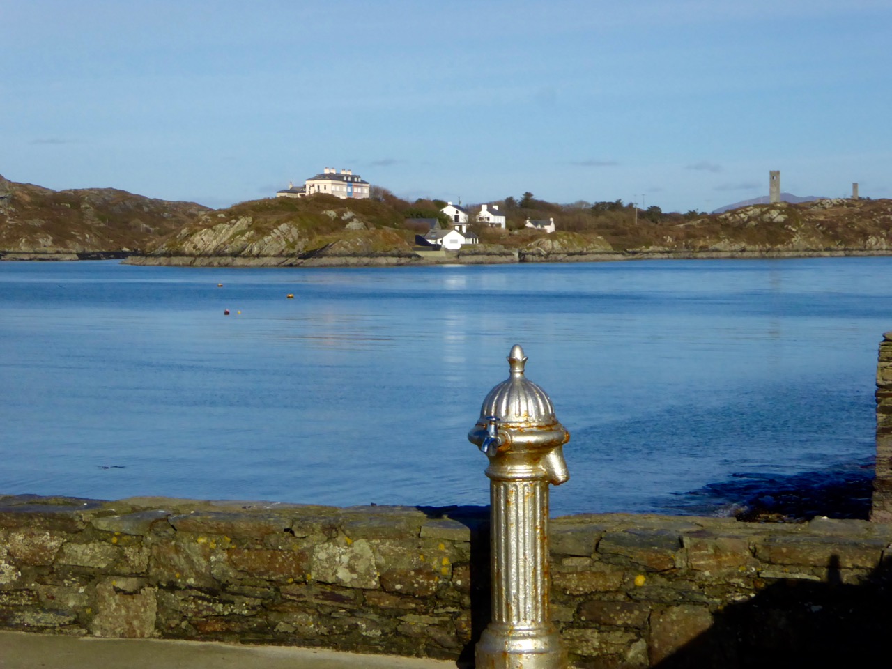
Having finished my count, I drove around then to Crookhaven and since it was lunchtime of course I had to stop at the iconic O’Sullivans pub, currently undergoing renovations and operating out of Nottage’s. (Fish pie to die for and a large americano, if you must know.)
Surely this is one of the most scenic villages in Ireland. Hard to believe that it was once so busy that it was said you could walk across the harbour from ship to ship.
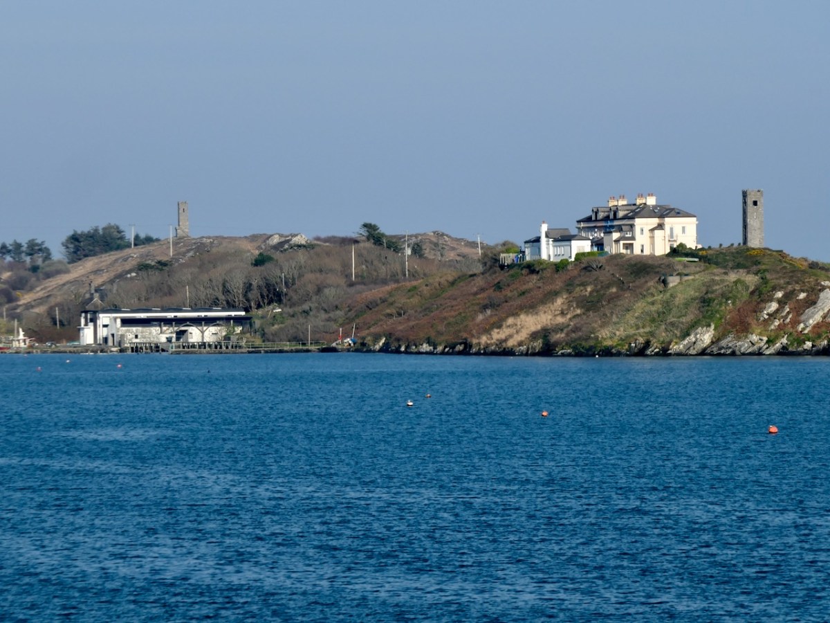
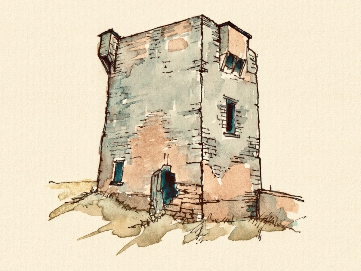
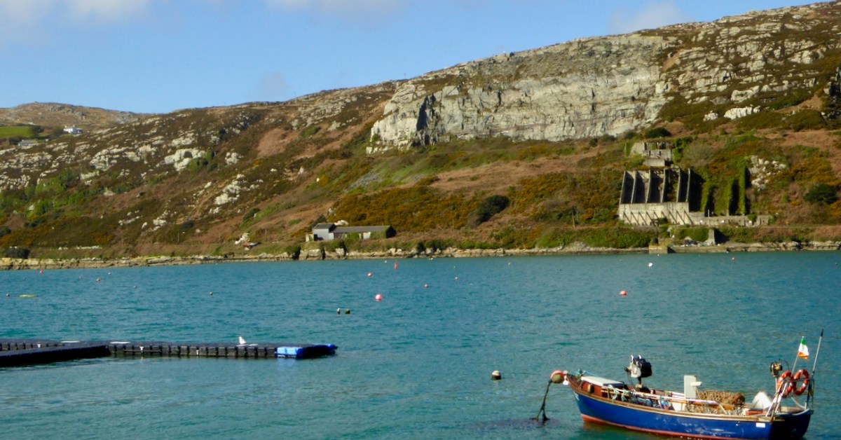
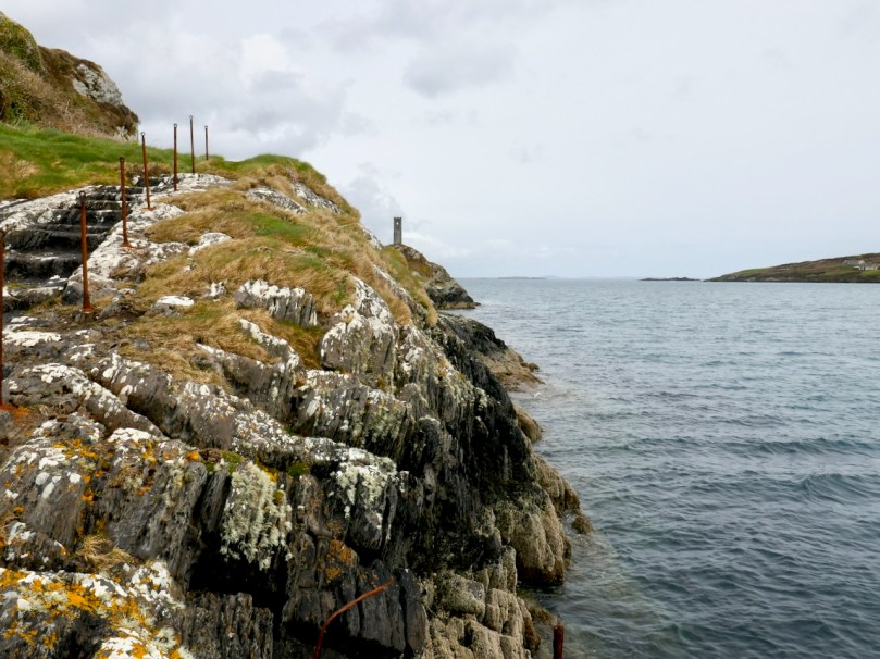
The two tall skinny towers on Rock Island are testament to that – this was where pilots could get a good view out to sea so they could send their boats out to guide ships safely into harbour. They may also have been used, according to one authority, for reporting ship movements to Lloyd’s of London for insurance purposes.
Rock Island is as full of history as Crookhaven – way back in 2018 we spent a day with Aidan Power getting the expert account of this tiny island where once over a hundred people lived and worked. It deserves another post one of these days.
I admit this post is a bit ‘light’ today – nothing much happened, I wandered around, took photographs, and enjoyed this wonderful part of the world. It’s what Robert always called a “then we went home for tea” type of post. But my last few posts have been pretty dense, so I hope you all forgive this dalliance with triviality.
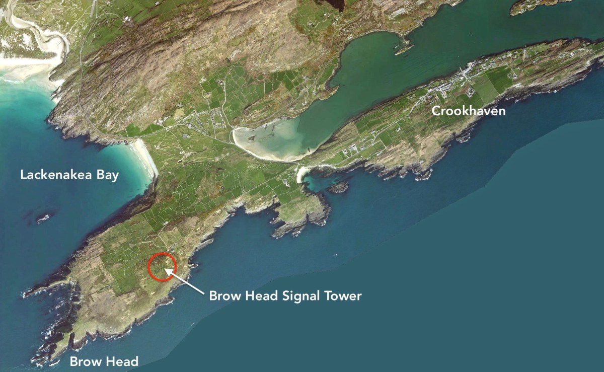
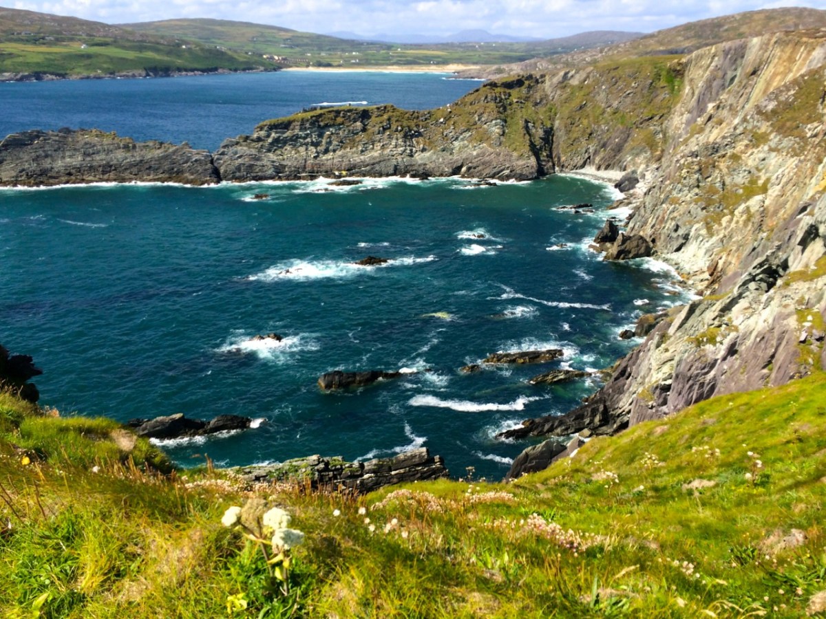
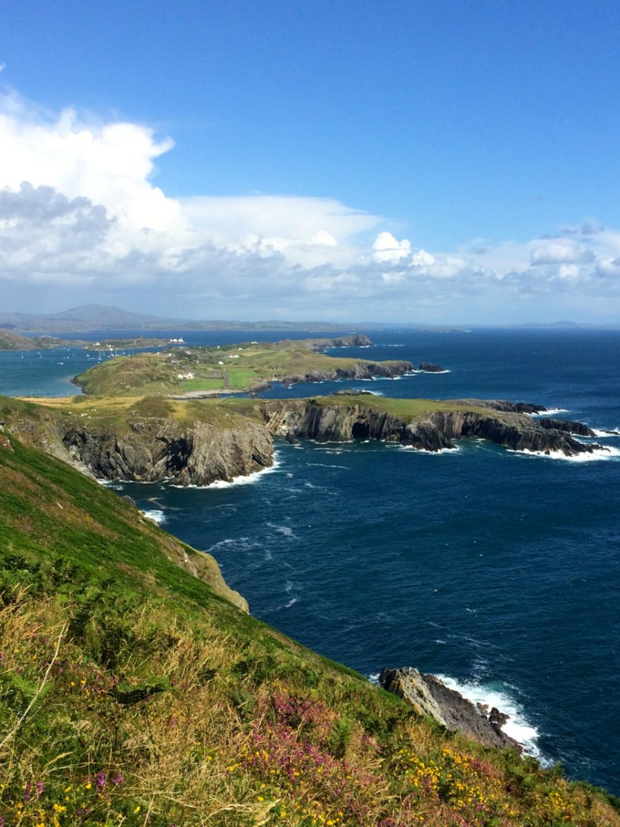
The Mizen is slightly over 35 kms long, and the last five km or so contain a wealth of sites and places that beg to be explored and experienced. These include our signature tourist attraction, Mizen Head Signal Station, our spectacular white sand beach, Barley Cove, and picturesque Crookhaven, but also some lesser known spots that are equally worthy of inclusion in our Mizen Magic list.
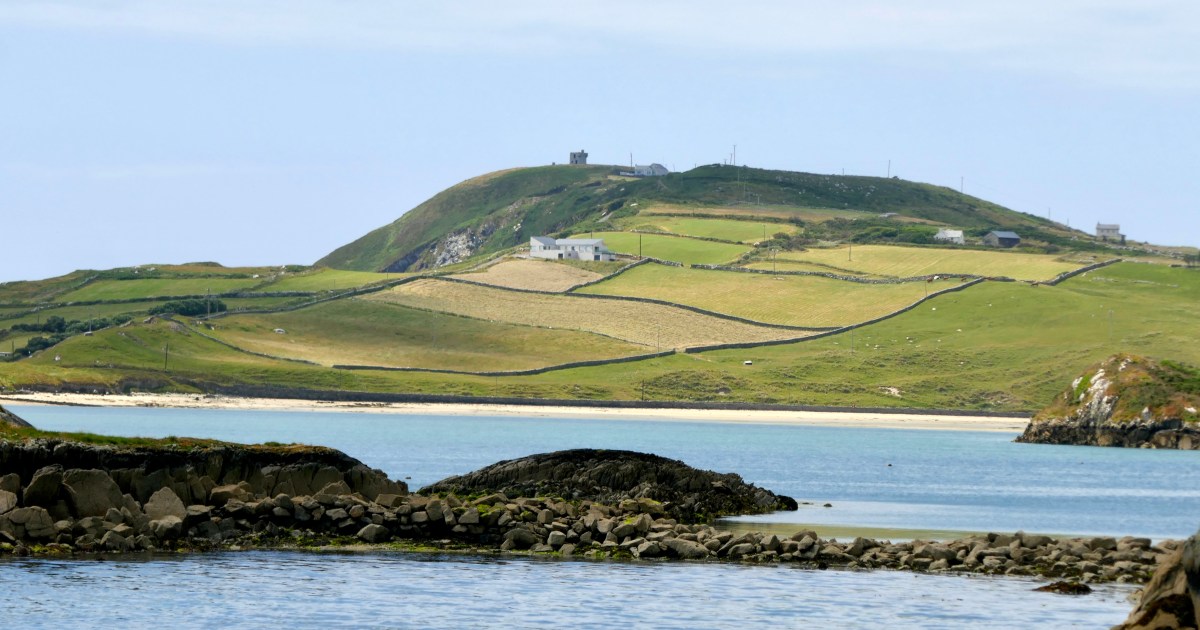
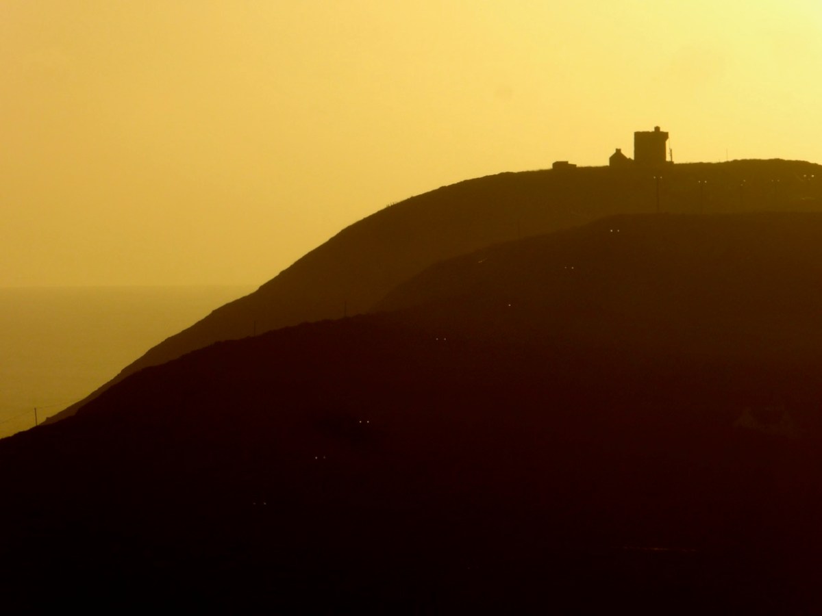
Despite the hype about Mizen Head, the actual southernmost tip of Ireland is Brow Head. In our post about it we said: Brow Head doesn’t have the same profile as Mizen Head: many people have never heard of it. But it’s magnificent, steeped in history, wonderfully scenic and best of all, totally walkable.
Brow head boasts not only a Marconi Telegraph Station, but also a Napoleonic-era Signal Tower. For a good overview read Mizen Magic 3: Brow Head, but we know you will want to know a lot more about Marconi, the telegraph pioneer, so take a look at In Search of Ghosts for more abut him and his operations on Brow Head. And for two takes on Marconi’s station, there is Peter Clarke’s drawing above and Brian Lalor’s below.
Brow Head looks back to Barley Cove (above) and Crookhaven (below) – some of the most spectacular views on the Mizen are seen descending from the head.
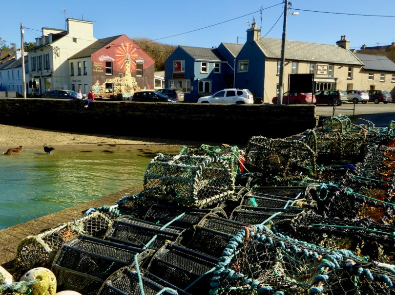
We took a dander around the Harbour and wrote about it in Mizen Magic 22: Crookhaven Harbour. Do the same, and don’t forget to stop at O’Sullivan’s for their excellent chowder and famous crab sandwich.
And while you’re sitting outside, savouring your chowder, look across at some Industrial Archaeology in Crookhaven. These imposing remains are all that’s left of a once-thriving stone quarry supplying road material until the late 1930s.
Of course there is much more to the Far End of the Mizen – I’ll continue this in the next post.
This is a Guest Post by our friend Brian O’Riordan, a native of Charleville, now residing in London
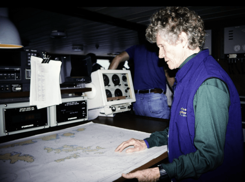
In 1995. as I was crossing Drake Passage between Antarctica and South America, I met a lady with a strange story. I was on a small Russian expedition ship, the Professor Multanovskiy. We experienced increasingly bad weather, encountering a force 12 gale as we rounded Cape Horn. We were not permitted to go out on deck but the ship operated an open-bridge policy. That was where I spoke to Mary Harper as we both studied the ship’s chart of Cape Horn.
She seemed to be the oldest passenger on board but had no difficulty making her way around the ship in the rough weather. We were experiencing waves of over 40ft at this time. She told that she had made the Trans-Atlantic crossing from Nova Scotia to Ireland, singlehanded, the previous year. She did not tell her family but left a letter with her solicitor to be opened 6 weeks after she set out, if she had not been heard from. When she arrived in Ireland, she was feted; it was Regatta time and she was asked to present some of the prizes.
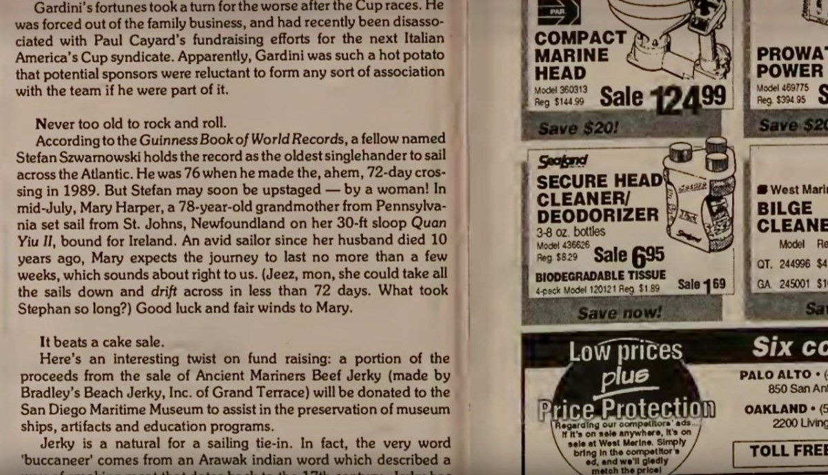
Our conversation was interrupted by an almighty wave which shook the ship so I went below to check on Valerie, my wife, in our cabin, to find her injured. I was not able to speak to Mary Harper again as we landed the next day, but resolved to research her voyage to Ireland when I got back to my home in the UK. Strangely, I could find nothing out about her exploits on the Internet. Eventually I tackled the search by looking for her as a person who sailed out of Nova Scotia and there I was in luck as it had been reported that Mary Harper had set out to cross the Atlantic but had to be rescued as she sustained fractured ribs in a storm; but that was in 1993 and she told me it was in 1994. Turns out she did try in 1993, but had to abandon the trip: Latitude Magazine recorded her intentions (below)
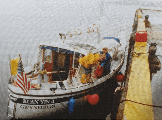
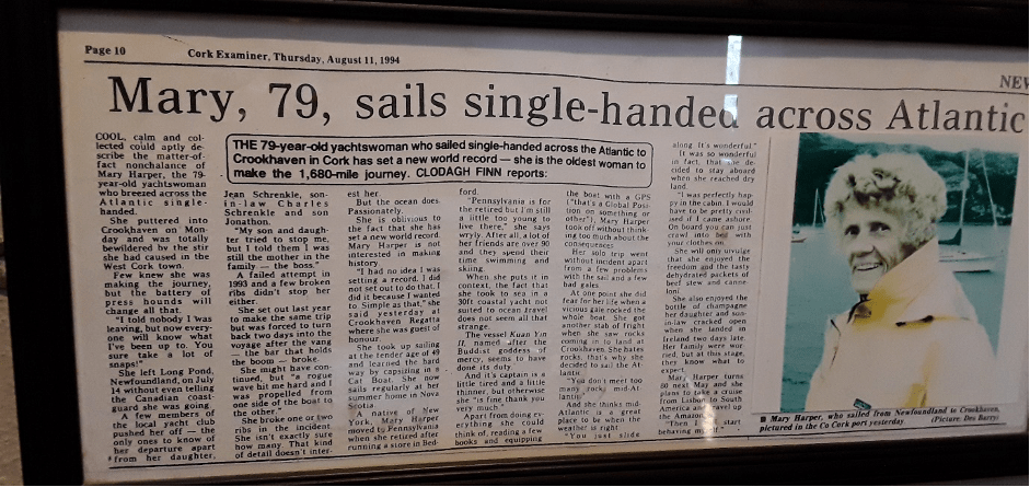
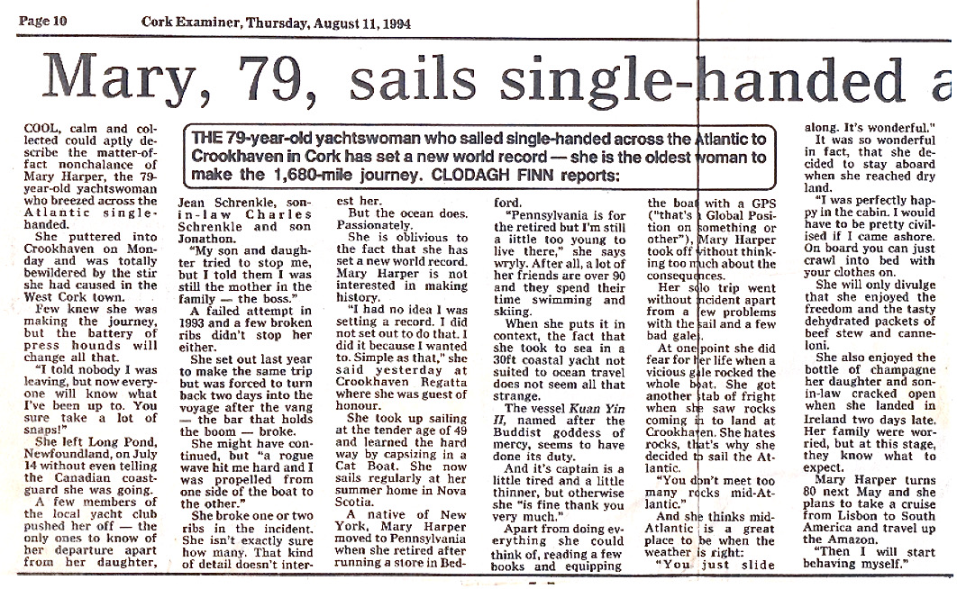
I then came across Roaringwater Journal written every week by Finola Finlay and Robert Harris. Since Roaringwater Bay is one of the nearest landfalls for Trans-Atlantic sailors I felt they should know about Mary Harper. They did not, but set in motion an enquiry (special thanks to Florence Newman for this lead) which eventually took me to the iconic O’Sullivan’s Bar in Crookhaven run by Dermot and Linda O’Sullivan. Linda e-mailed me a framed press cutting which hung on the wall of the pub with all the other nautical memorabilia. The cutting was from the Cork Examiner of 11th August 1994 and was an interview with Mary Harper, aged 79, who landed in Crookhaven on 8th August on her 30ft sloop, Kuan Yin II, named after the Buddhist Goddess of Mercy and patroness of sailors and seafarers. Bingo! I now had evidence of Mary’s crossing.
Shortly after, a notice appeared on the Web of a book launch in Nova Scotia entitled My Sailing Adventures with Mrs. Mary Harper by Jacinta MacKinnon. I contacted Jacinta who sent me a copy of the book which contained stories of sailing around the inner islands of Cape Breton. Importantly, however, she had also had access to a summary made by Mary of the log book of her solo Atlantic crossing.
On July 1st 1994 Mary Harper left Baddeck, sailing alone, on a coastal cruise northwards towards St Johns on the Eastern tip of Newfoundland where she had a rendezvous with friends at the Royal Newfoundland Yacht Club in Long Pond. She called in to a number of friends on the way, so it started out as a leisurely cruise although Jacinta MacKinnon had an inkling that she would attempt the Atlantic crossing again as did her friends in Long Pond. After all, the boat was ready having been modified for the crossing the previous year. On reaching Long Pond she must have provisioned for the crossing and she finally decided to attempt the Trans-Atlantic crossing as she sailed out into Conception Bay on July 14th. Crucially, she had not told the Coastguards or Harbour Master of her intentions.
The first two days she dodged huge icebergs coming down “Iceberg Alley” from the glaciers in Greenland. She had to weather a number of storms, one of which shook the boat so severely that she was surprised it survived. On some stormy days she was driven off course and backwards but on August 6th, she sighted land and gannets flying overhead.
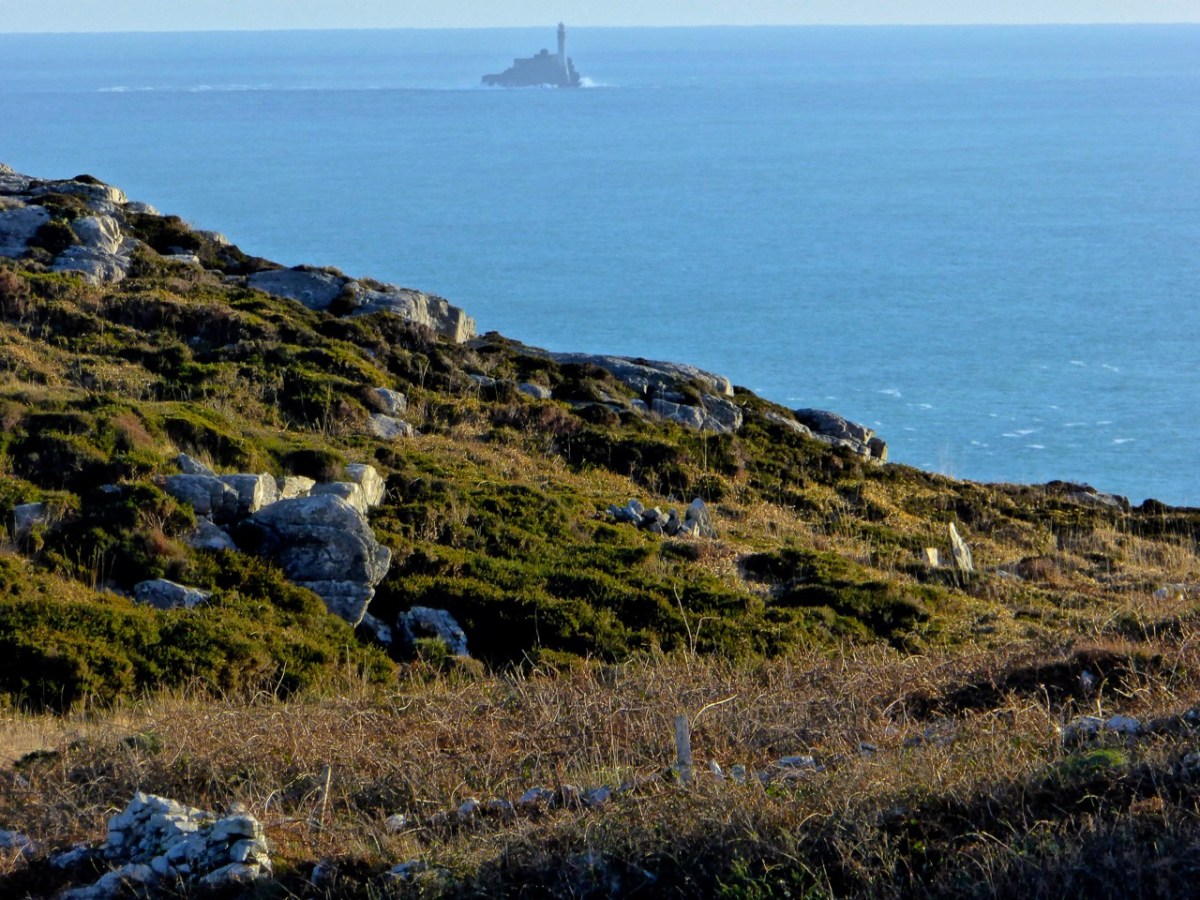
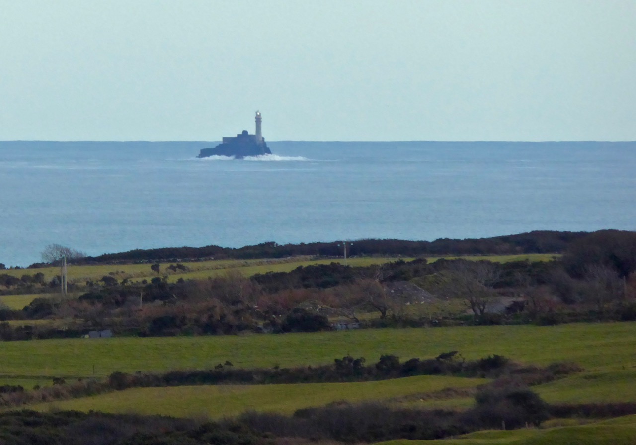
Some fuel had been used up tacking and she would need the engine running as she came in shore to avoid rocks and other obstacles. She put out a call through the Irish Coastguards for anyone who could sell her fuel. The Valentia lifeboat answered the call and indicated they would reach her within 2 to 3 hours. She was very embarrassed when they arrived as the lifeboat crew found the fuel tank nearly full. Mary had used the handle of a mop as a dipstick not realising that there was a bend in the inlet pipe. However, the crew gave her 5 gallons of fuel and returned late with another 5 gallons so that she could safely negotiate her landing. She was heading for Baltimore, in West Cork, as she got a radio message that her daughter and son-in-law were awaiting her arrival there. Coming near land the wind and tide were driving her westward: she was unable to pass Fastnet Rock after three or four attempts. Three other boats in the vicinity had the same trouble.
She decided to head for Crookhaven which was now 10 miles west of her position (the photo of the Fastnet Rock above was taken from near Crookhaven) and managed to find the opening of the harbour which was hidden from her view. Two young French men came out from the pier in front of O’Sullivan’s Bar and helped her anchor before she stepped ashore and had the Champagne held in storage from the first aborted attempt the year previously.
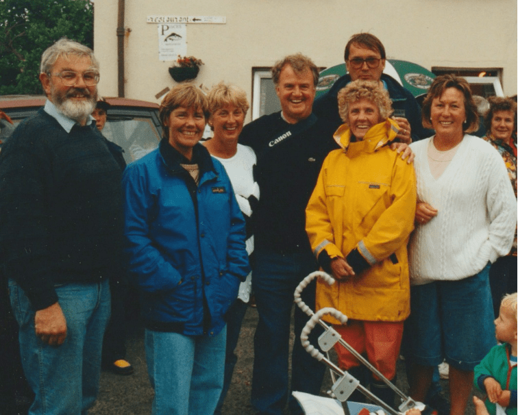
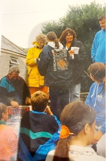
News spread that a solo Trans-Atlantic sailor landed at Crookhaven. Her arrival was greeted with enthusiasm but also incredulity that a sailor so old could have made that journey. It was the time of the regatta with races nearly every day. Mary became the guest of honour and was invited to present some of the prizes (above) with Norma O’Keeffe (Commodore at the Crookhaven regatta) and Jason Fitzgerald. In the lead photograph at the beginning of the post, she is shown surrounded by well-wishers in Crookhaven.
The then proprietors of O’Sullivan’s Bar (that’s a recent photo above, although the mural has now changed), Billy and Angela O’Sullivan, were very impressed by her and, of course, framed and mounted the Cork Examiner interview published that week.
There was much talk of Mary entering the Guinness Book of Records as the oldest person to make the solo crossing of the Atlantic at the age of 79. Mary said she was not interested in the record, she just wanted to meet the challenge of the crossing. Later when her journey was not credited as a record she commented “I did not officially leave Newfoundland and I did not officially enter Ireland” as she did not register her journey with the Harbour Masters or Coastguards. This, of course, was why I had such difficulty tracing her achievement. It had taken her 23 days to make the crossing which is 1680 nautical miles but because of the difficult sailing conditions and being blown off course had lengthened considerably to 2150 nautical miles (approx).
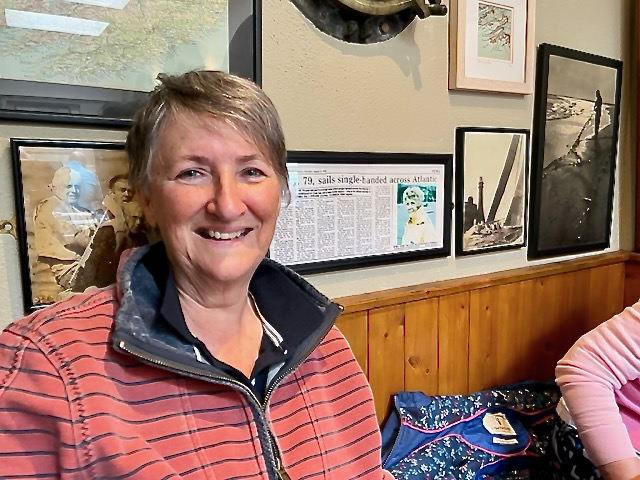
The summary she wrote of her journey stops in Crookhaven (Finola sent me this photo of herself beside the press cutting) but Billy O’Sullivan told me that she stayed in Crookhaven for a week and MacKinnon knows that she sailed eastwards along the South coast of Ireland, up the Irish Sea, through the Caledonian Canal in Scotland and across the North Sea to Sweden where she met up with some friends, Christer Arakangas and his wife who sailed with her in Nova Scotia. She then sailed around the picturesque Stockholm archipelago. Kuan Yinn II suffered some damage on the rocks (she hated rocks!) so when it was repaired, she sold the boat and on her return to Baddeck bought another boat and named it Kuan Yinn III. She continued to sail with Jacinta MacKinnon until finally ending her sailing days in 2004.
When asked about her memories of her Trans-Atlantic journey she replied “It was a great trip, the ocean, the sky, the waves which you can only appreciate from a small boat when you are between them, the sun and the clouds, all clean and free of pollution, so beautiful” and about sailing in general she is quoted as saying that as soon as she set sail, she felt that the whole world was hers to play in: “I feel like a free spirit”. Mary Harper died on December 17th 2008 at the age of 92.
Jacinta, with Ferris Asaph, has written and performed “A Sea Ballad for Mrs. Mary Harper”. Some of the photos on this piece are from that video. Take a look.
Postscript: Mary Harper was originally from New York but after her marriage to Harry H Harper Jnr. who became the Vice President and Executive Editor of the Reader’s Digest she moved to Pennsylvania and opened a sports shop for women. Both enjoyed going to Canada and having their vacation in Baddeck on the island of Cape Breton where they had a boat.
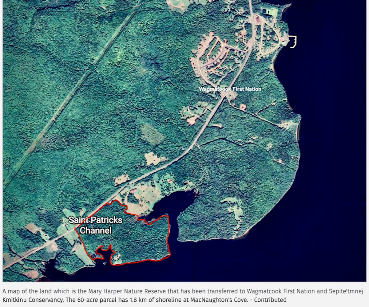
This island had two special features: a large tidal lake named Bras d’Or and the house and laboratory of Alexander Graham Bell where he conducted his telephone experiments as well as aeronautical experiments being involved in the first heavier than air flight over Bras d’Or Lake. In 1993 Mary Harper donated 24.3 hectares (approx. 60 acres) on the shore of Bras d’Or Lake as a nature reserve, now named after her.
Mary Harper was an intrepid sailor. She has not entered the Guinness Book of Records because of a technicality but her exploits must not be forgotten.
Acknowledgements: To Finola Finlay for getting me on the first rung of the ladder in seeking out the Irish end of Mary Harper’s story and in hosting me on Roaringwater Journal. To Jacinta MacKinnon for her book “My Sailing Adventures with Mrs. Mary Harper” and for providing me with additional information, and to the O’Sullivan family, Bill, Dermot and Linda for their hospitality and the all-important press cutting. To Mary Daunt who took the photographs of Mary Harper presenting the prizes, being surrounded by well-wishers, and the detailed view of the press cutting
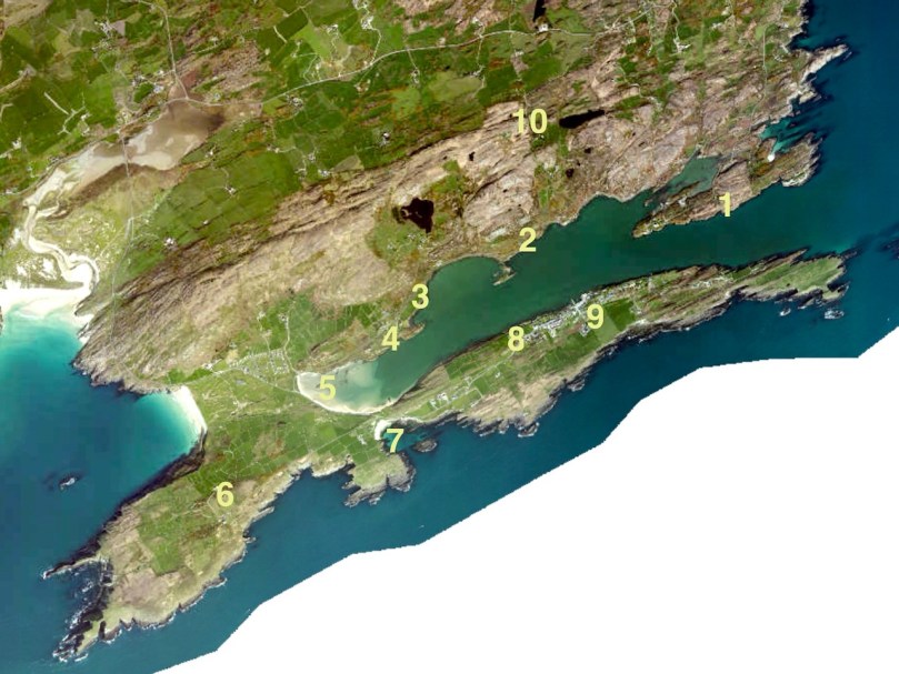
It’s just the day for a Sunday drive, so come along with us as we explore the shore around Crookhaven Harbour. It’s turned cold all of a sudden, so we won’t do too much hiking or climbing today, just some gentle pottering around some spectacular scenery, with a hearty lunch in the middle of it all.
We’ve provided a map but you probably won’t need it as it’s a relatively small area and easy to see where you are at all times.
We’re starting off at Rock Island (1 on the map) – you remember what an interesting day we had there with Aidan Power? You can read that post as you wander around the island, either by car or on foot, and it will help to orient you to where you are.
Driving off the island we turn left, along the road that hugs the water. We pass several sites along the way that date from various times in Crookhaven’s history. The first is the stone quarry that Robert wrote about in Industrial Archaeology in Crookhaven(2). It’s impossible to miss, looming above the road like an abandoned fortress wall. When he researched it, he drew a blank but one of our readers, John d’Alton from Schull, wrote to tell us of the background to the Granite Company Lt.
Once you’ve passed the old quarry workings, keep an eye on some small field coming up on the sea side. You will make out the ruins,(3) much overgrown, of some buildings near the water’s edge. This is all that’s left of a fish palace, originally built in 1616 by Richard Boyle, Great Earl of Cork, and his business partner in this area, the notorious Sir William Hull – read all about it in Robert’s post, Pilchards and Palaces.
The next site is on private land and not really visible from the road so here we are letting you into a little secret. At 4 on the map there’s what seems to be an old quay. There are really only a few rocks left, but one of those rocks is a piece of archaeology – a cupmarked stone. The cupmarks were probably hammered out thousands of years ago and the rock was probably transported here from close by to help build the quay. If you’re not too sure what a cupmarked stone is, take a look at this post, The Complex Cupmark. That’s Robert, below, taking a photo of the cupmarked stone.
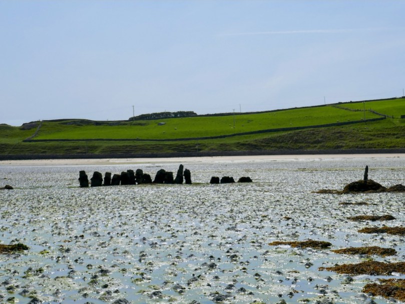
We’ve arrived at the long beach at the head of the Harbour and we’re going to leave the car here and, because the tide’s out, walk on the white strand out towards a curious row of stones sticking out of the sand (5).
The Dúchas Folklore Schools Collection tells us these were known locally as The Blacks, and it was believed that some black sailors who drowned at sea were buried there. Indeed they do look like grave markers, but in fact they are part of an ancient field wall system that dates to when the tide was lower.
There’s an enormous upright stone here too – tempting to think that it may be a standing stone, deliberately erected, but archaeologists think this is a natural feature. In fact, it may have landed in this position after tumbling from the hill above, or perhaps it’s a left-over glacial erratic.
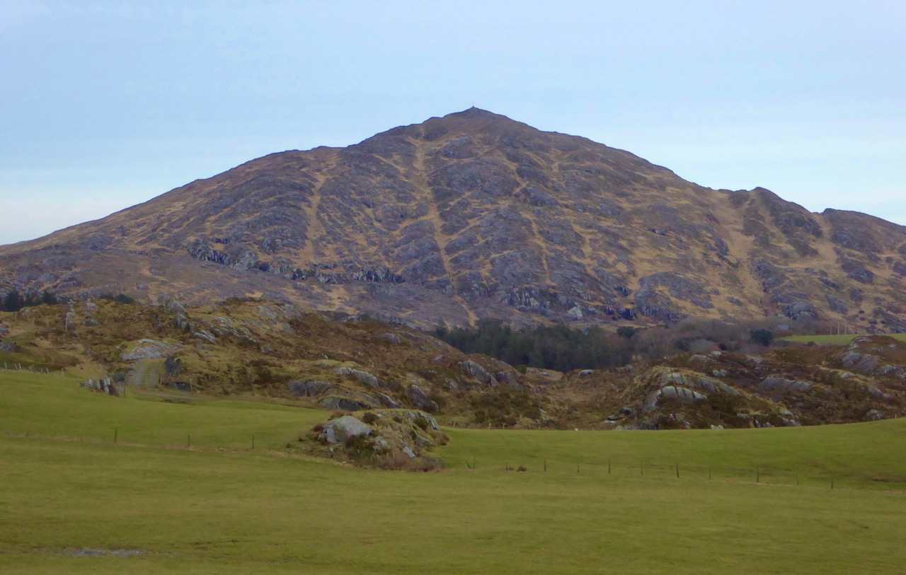
There are wonderful views from here back to Rock Island and across to Crookhaven, but let’s make our way back to the road now and wander down to Galley Cove. If you’ve a mind to, walk or drive up the road to Brow Head a little way (6), just for the incredible views across the whole of the Harbour and all the way to Mount Gabriel. We’ve written about Brow Head before, way back in 2014, and you can take a look at that post now, although it really deserves an update (one of these days).
Back down at the small parking lot at the base of the Head, you’ll find yourself at the beautiful Galley Cove (7). Since it’s December, you’ll have it all to yourself.
Linger to read the plaques that go along with the statue of Marconi (see Robert’s post on him here). There are several statues of Marconi around the world, and this one may be the quirkiest. It’s actually a witty take on the Washington DC statue – a mixture of the head of Marconi and the female figure of electricity – take a look here to see what I am talking about.
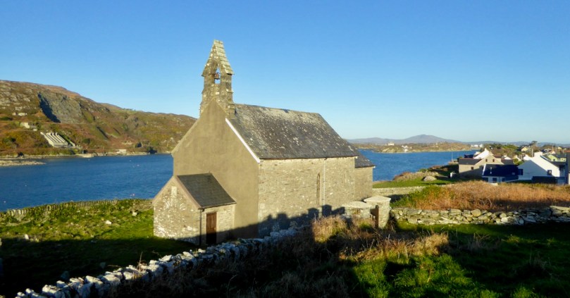
Are you gasping for lunch? Could you, as they say around here, murder a crab sandwich and a pint (or a coffee, since you’re driving)? You are in luck, as you WILL find O’Sullivan’s pub open and they do the best crab sandwiches on the Mizen. On the way, take a look at St Brendan’s Church of Ireland (8), possibly the only old church in the area that still doesn’t have electricity. Nobody quite knows how old it is, but there has been a church on this spot since at least the 1600s.
Don’t be surprised to find O’Sullivan’s (9) heaving – this is a very popular spot and we have never been there when it’s not busy. If possible, have your lunch sitting outside. In summer, you’ll be fighting for a table and surrounded by folk in sailing gear.
Time to head for home, with one last little detour on the way, through Castlemehegan. As you drive back the way you came, take a road that angles off to the left at number 4 on the map. It will take you back to Goleen over the hills and you’ll be wowed by the views from up there (10).
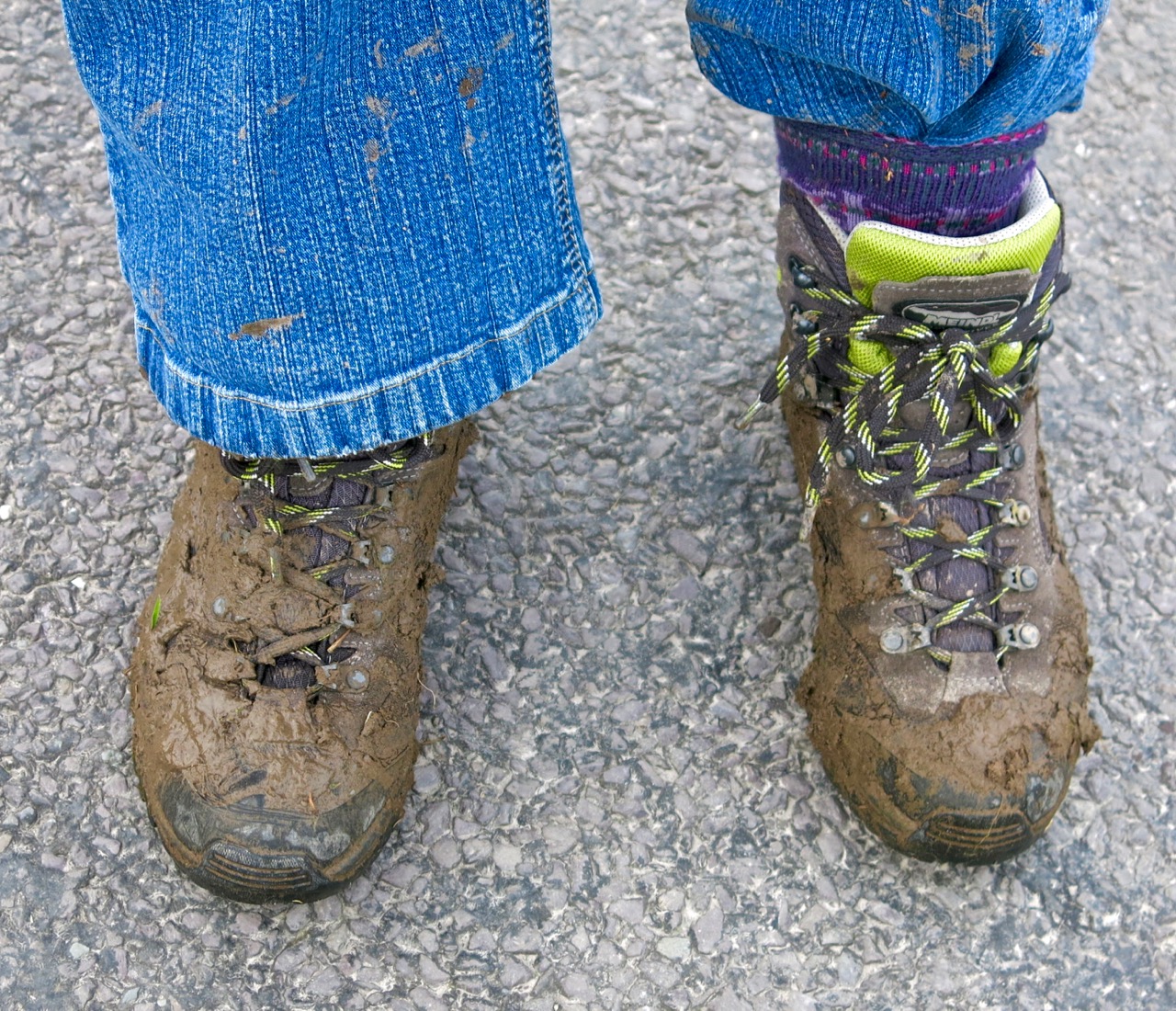
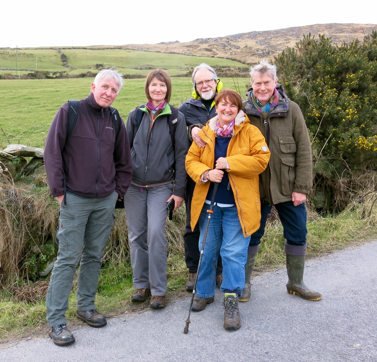
It’s been a wet, wet winter, but when the sun shines in February (which it does, honestly!), we are out exploring. This particular day our companions were Jessie, Brandon, Amanda and Peter and our accompaniment was MUD, and lots of it.
Amanda took the photo of the group, and the one of my muddy boots
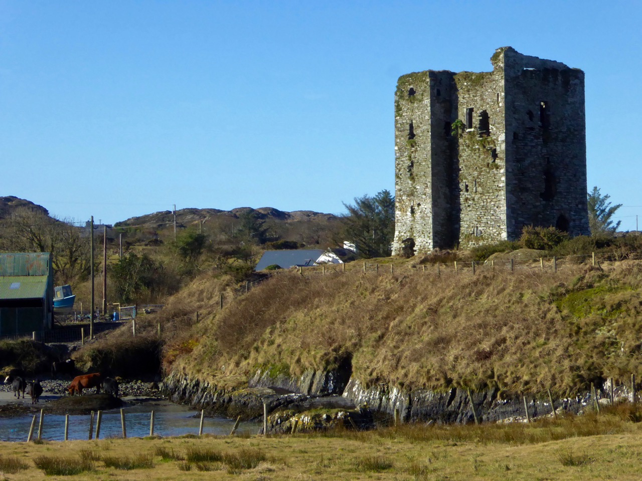
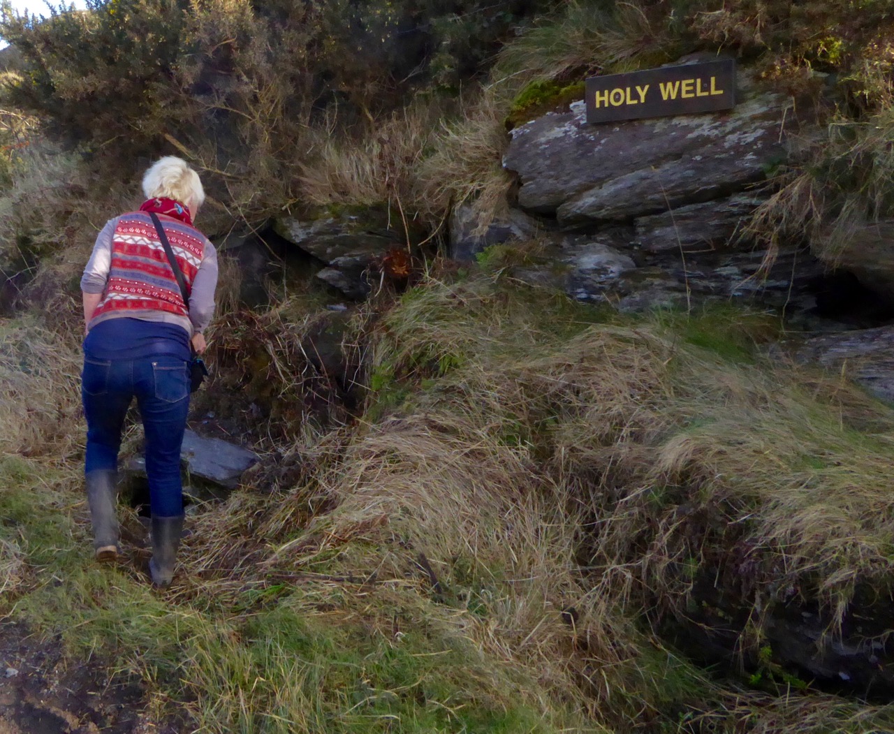
We had goals – Amanda was after some elusive holy wells and Robert wanted to find the pirate steps at Canty’s Cove for his talk on William Hull and the Leamcon Pirates’ Nest, part of the Ballydehob spring lecture series, ’Talks at the Vaults.’ Jessie is a professional tour guide, wanting to learn more about the Mizen. Finally, I wanted us to swing by Dunmanus Castle so I could check out a few construction details.
Dunmanus Castle on its knoll, surrounded by water
You don’t actually need goals like this to go out exploring, but it helps. It gets you into places you wouldn’t normally go, down tiny boreens, into farmyards and across fields. You end up knocking on doors and meeting people who know all about the well, or the old stones, or the legends of the place, or who owns what field and whether he minds people tramping through it. On this occasion we met, for the first time, the near-legendary Pat McCarthy, one of the writers of Northside of the Mizen, and a huge authority on this area. We’ve promised ourselves a return visit with him as we weren’t able to stay long enough for a good talk.
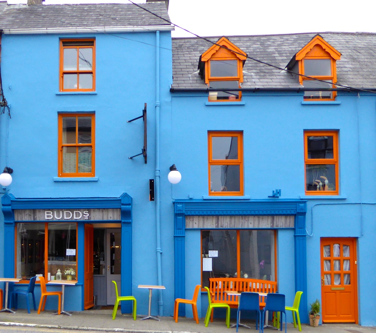
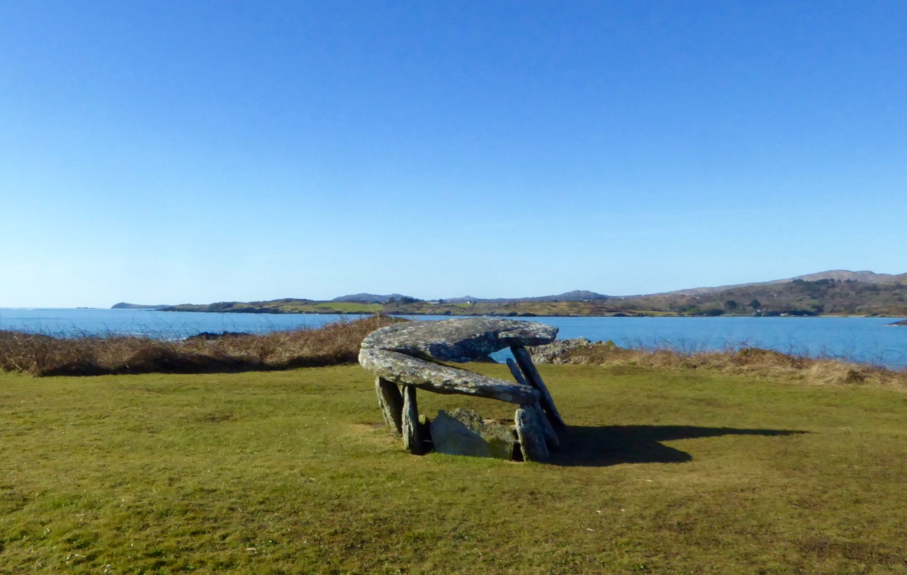
The best way to start a day like this is with excellent coffee, in Budds of Ballydehob, where we assembled with our map to plot our course. It was off then to Toormore and the Altar wedge tomb. On this occasion we weren’t actually after the wedge tomb (although I can never resist a photo of it) but the little holy well across the road.
Our next stop was Dunmanus, to take a good walk around the castle with the camera, looking for details I had missed on previous visits.
Dunmanus Castle ground floor entrance details: The bar-hole for barring the door once inside; the spud stone and the hanging eye. The hollows are for the pole that the door swings on
And then on to Canty’s Cove. You can read Robert’s post, Canty, for more about this place and its association with Canty the Pirate. Finding the steps wasn’t easy and it was a big thrill when we finally figured out where to look.
This is the inlet with the pirate steps. Photographing them involved hanging over the edge with someone holding on to your ankles
How would you like to climb up these with a keg on your back?
By then we were starving – this exploring is hungry work – so we repaired to O’Sullivan’s of Crookhaven for one of their famous crab sandwiches. Even at that early date the sunshine was so inviting that people were sitting outside with their sandwiches and their pints.
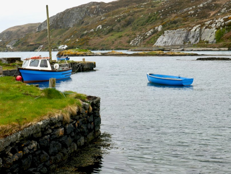
Crookhaven Pier
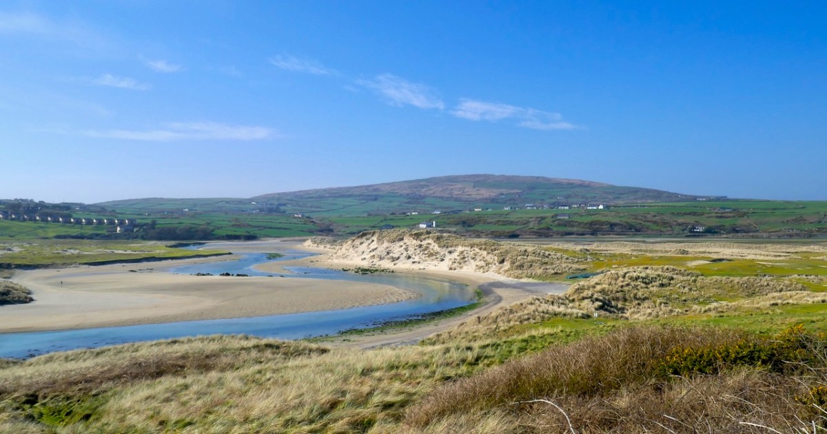
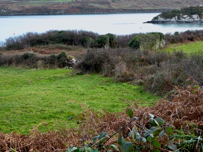
From Crookhaven it’s a quick trip to Lissagriffin, where there’s a medieval church and a bullaun stone doing double duty as a holy well/wart well. The church has a panoramic view over the salt marshes behind Barley Cove Beach as well as interesting architectural features.
Our next holy well was right by the side of the road a couple of miles further east – labelled so we couldn’t mistake it.
Amanda inspects Tobareenvohir – or Tobairín an Bhóthar, the Little Well of the Road
The final one was harder to find and necessitated negotiations of some seriously muddy fields. Tobairín Brón (Little Well of Brone) was in the general vicinity of where we ended up, along with a small monastic site – all very brambly and hard to decipher. But what a place – a view clear out to the Fastnet Rock, with Knockaphuca looming behind us. Cnoc an Phúca means the Hill of the Mischievous Spirit – it’s been tamed, presumably, by the large cross erected on its peak.
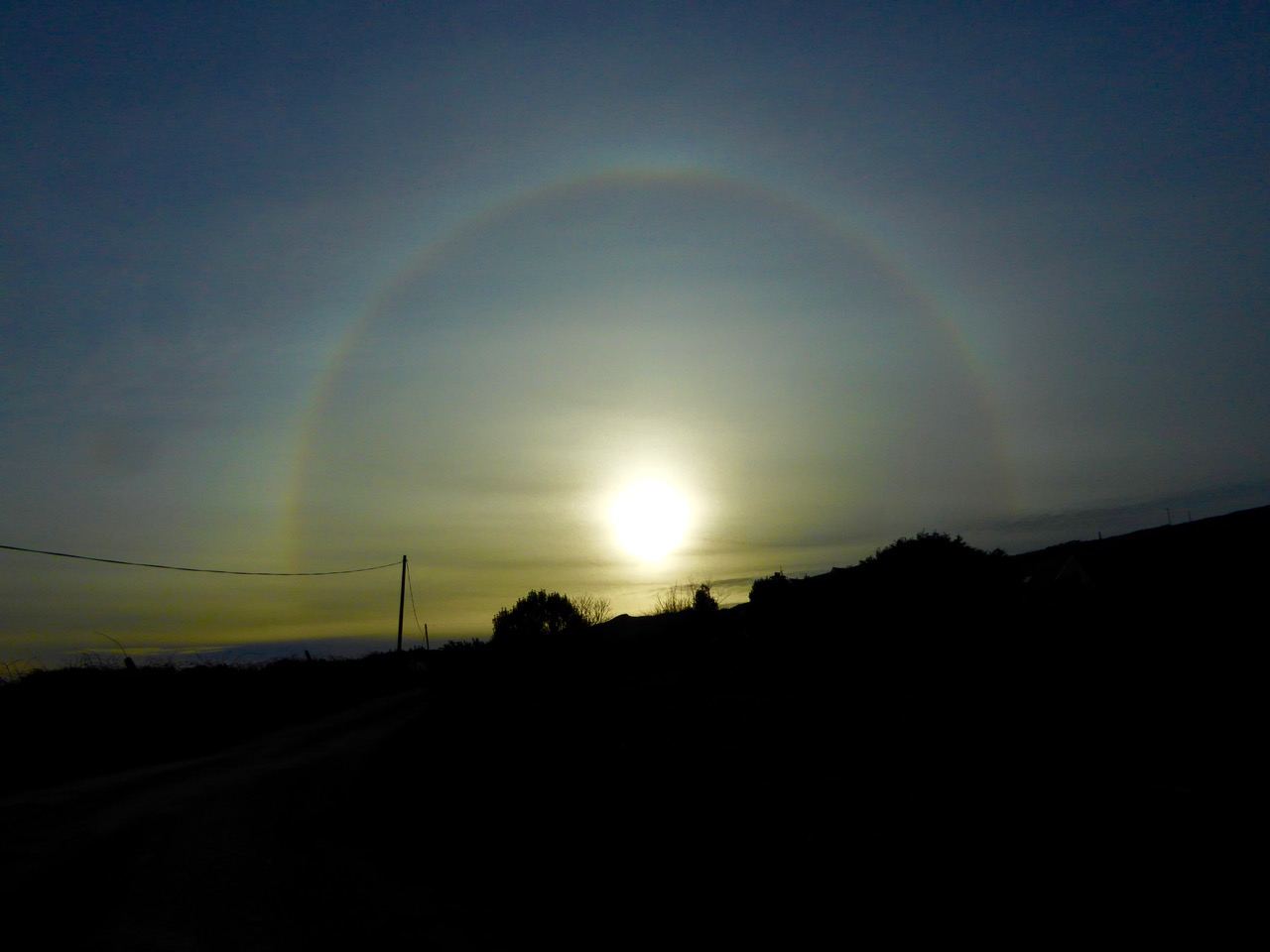
By then the sun, so warming earlier in the day, had been overtaken by high cirrus clouds, and we were donning jackets and gloves and remembering that it was only February after all. As if to make up for its lack of warmth, it treated us to a magnificent solar halo (I’ve always called them sun dogs)as we made our way back to the cars.
We were never much more than 30 kms (or about 40 minutes) from home but in that distance we managed to see heritage sites dating from the bronze age through the medieval period up to the recent past, surrounded all the time by the magnificent scenery of the Mizen. You can do this anywhere in Ireland. Using the Historic Environment Viewer of the National Monuments Service, define the area you want to explore, pick your fancy (ring forts? medieval churches? cross slabs? megalithic tombs? castles? rock art?), and off you go.
A holy well looks back at Amanda and Peter
Now, if you’ll excuse me, I’m off to buy some wellies…
Welcome to the UCD Library Cultural Heritage Collections blog. Discover and explore the historical treasures housed within our Archives, Special Collections, National Folklore Collection and Digital Library