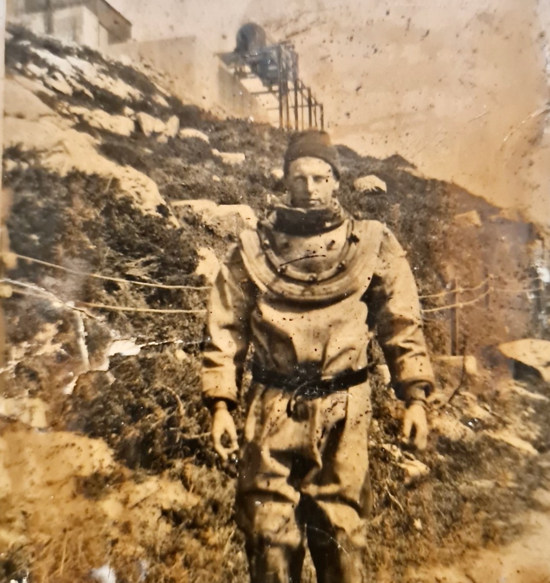
I’ve had the most marvellous emails from James Goggin – thank you James! Three of his grandparents came from Crookhaven – and the fourth, well that’s him in this spectacular photograph. Yes, he’s in a diving suit. James tells me: His name was Allen G Tyson, and he had come from Wales to work at the Crookhaven Quarry, seconded from Flintshire council in North Wales. Aggregates from the quarry were sent to North Wales amongst other places. He was a tall man and brilliant mathematician and civil engineer and lived with us in later life until his death in ’79. He designed the first dual carriageway in N.Wales and worked on the blue jubilee bridge in Queensferry (similar to and at the same time as Sydney and Newcastle bridges).
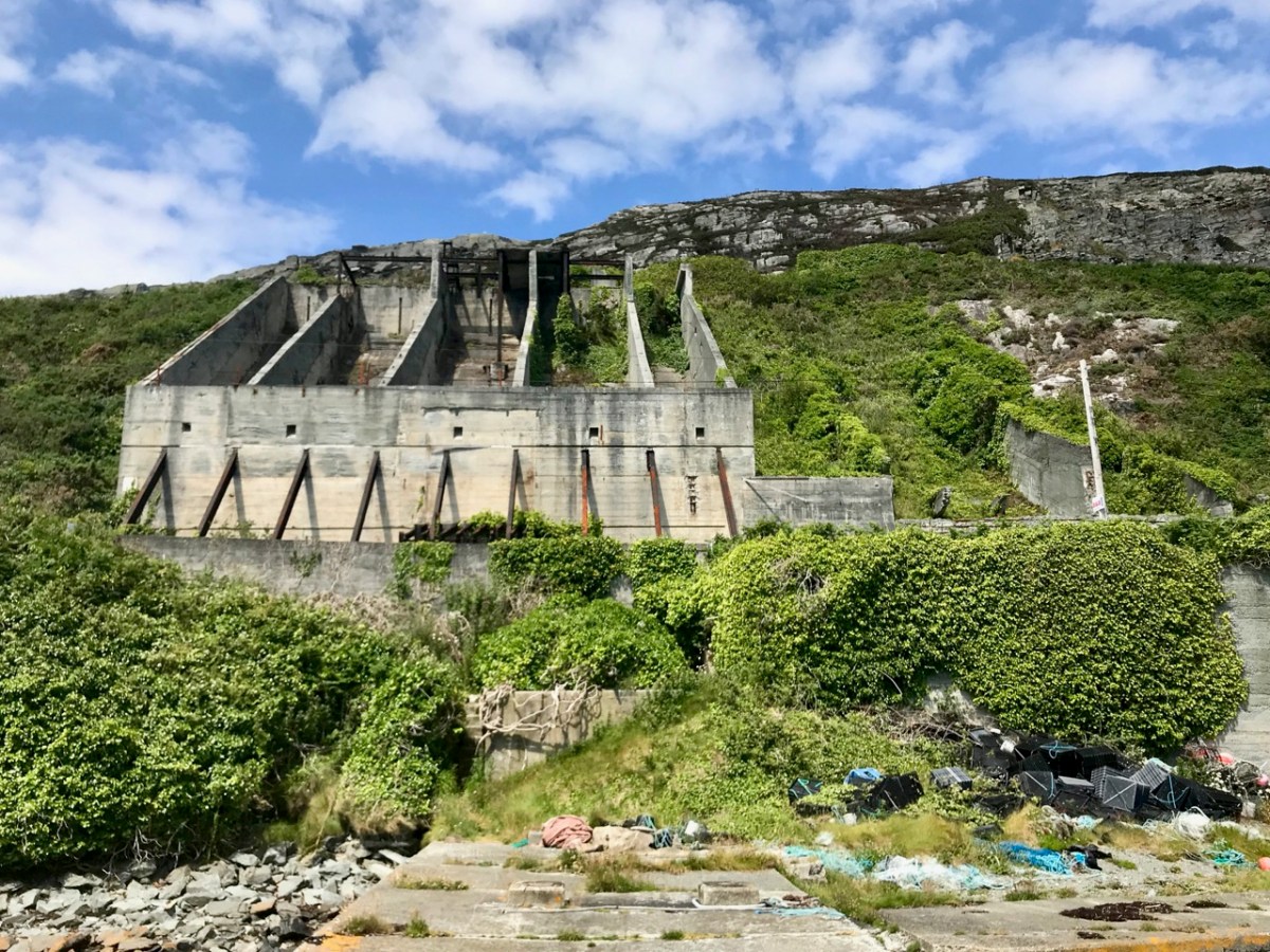
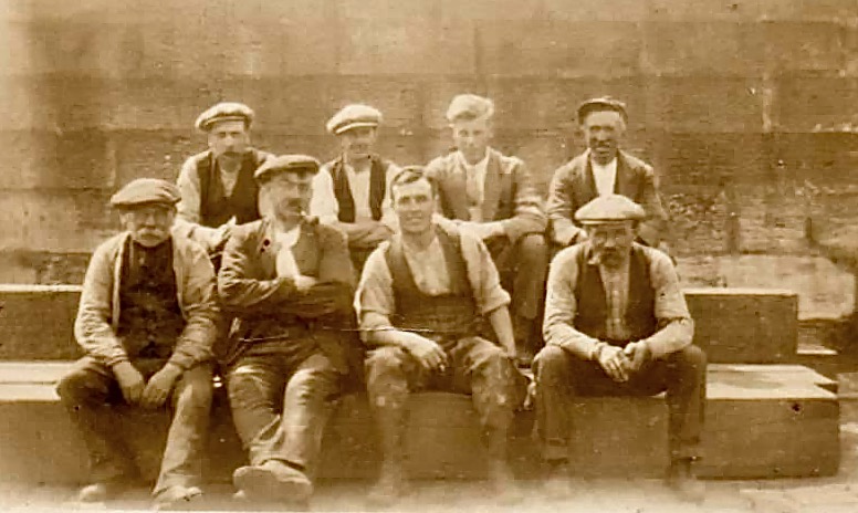
The quarry, of course, is the monumental structure, above, that Robert wrote about in his post Industrial Archaeology in Crookhaven, one of our most popular posts. It seems that anyone who has ever been to Crookhaven has wondered about that wall of concrete across the bay. James also sent me this shot of a group of men who worked at the quarry. Cloth caps and moustaches were the order of the day – except for Allen Tyson – he’s the suited and coiffed individual in the back row.
Once in Crookhaven, Allen met and married Bridget O’Driscoll. They had 5 children, including James’s mother Phyllis, who married Joe Goggin. Joe died not too long ago at the age of 91 and still has a sibling in Clonakilty, James remembers happy family holidays in his Nana’s house, the old Barracks next to the Marconi House in the village. He is full of stories and precious memories.
My father used to row coal to the Fastnet for a shilling or two. He told me of an uncle who used to shoot the sea mines ( like prickly conkers) with a .303 from Carrigeen cliffs off Rock Street. Nana would climb down to the sea for driftwood for the fire into her 70s. I remember the sacred heart picture and light, and the lights would flicker as I believe there was a generator in the village for power. A large old transistor radio in the kitchen with all the valves visible. Cold cupboard (a safe) under the stairs. Soda bread (and marmalade daily made in the range.
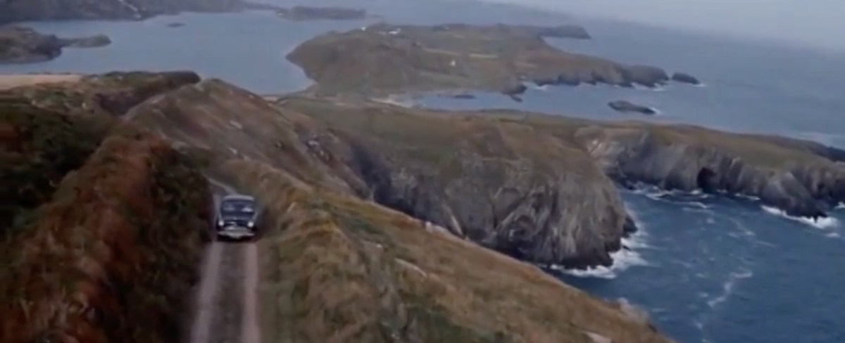
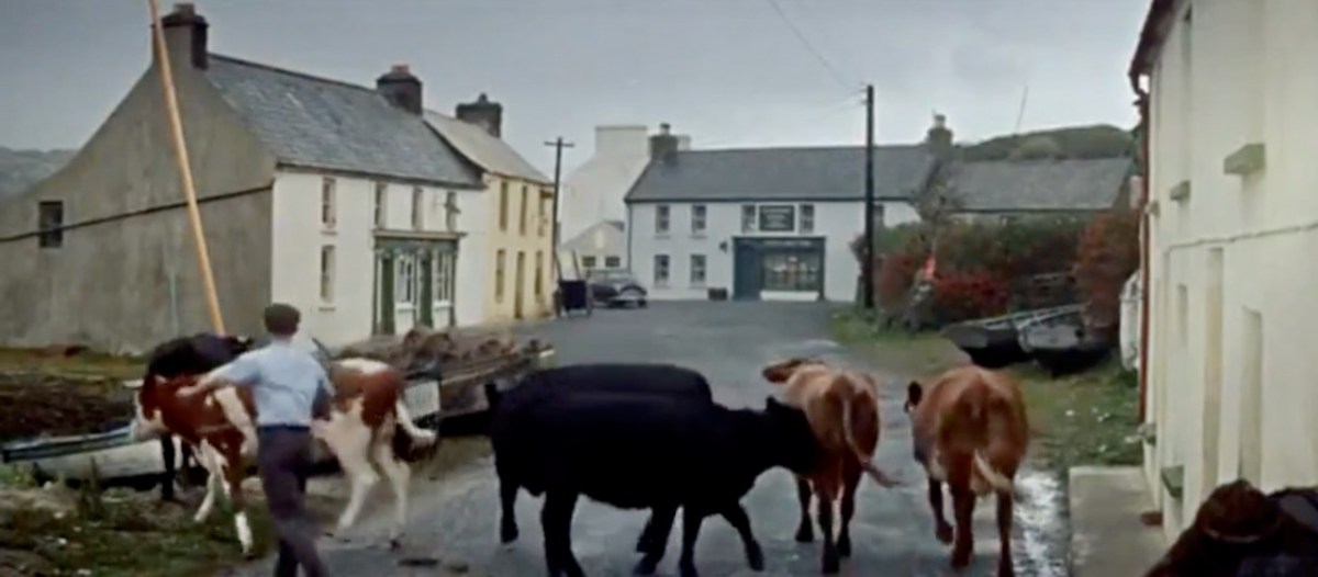
James told me several other stories about his father, whom he admired and loved. But he also sent me another gem! A link to a movie, I Thank a Fool, made partly in Crookhaven, and released in 1962. You can watch it here – the Crookhaven parts start around the 1:09 mark and it is a complete nostalgia fest for those of us who love this part of the world. Here are some screen captures.
The village is still totally recognisable.
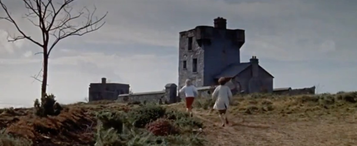
The 1804 Brow Head Signal Station is used as a ‘house’ where some of the action takes place. You can see Marconi’s Wireless Telegraph station in the background. For more on these structures go here for Marconi and here for the Signal Station.
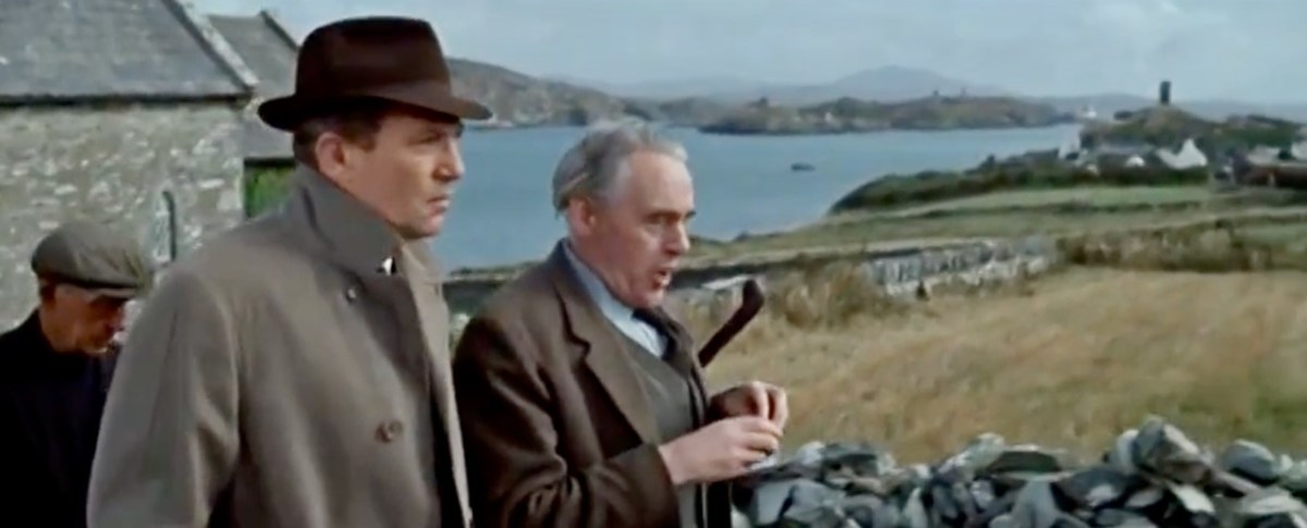
There is also a funeral at St Brendan’s Church. The procession gives us a marvellous opportunity to see back to Crookhaven and the mining magazine that was once clearly visible behind the town, but which is no longer a mark on the landscape. I’ve used that as my feature image at the top of the post, but here’s another take. That’s Peter Finch as the leading man.
I love it when this kind of serendipity happens – thanks again, James. I know that anyone who loves Crookhaven, as we do, will really like this walk through past times.
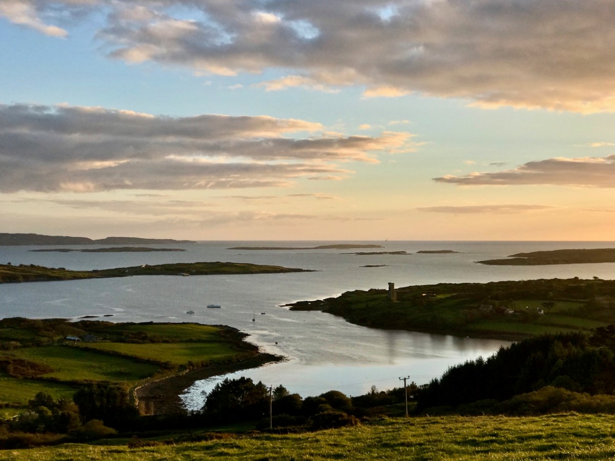
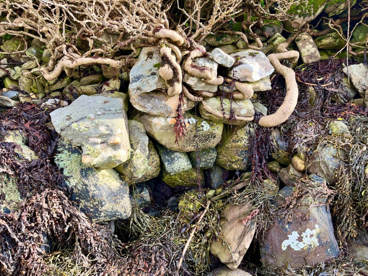
The weather so far this year is breaking records for coldness, wetness and evapotranspiration – while Earth as a whole continues to get warmer. In simple terms that means it’s not pleasant to wander too far from home. I decided to walk down to the shoreline of Rossbrin Cove – all of ten minutes – and see what the winter storms may have washed up: often an interesting diversion.
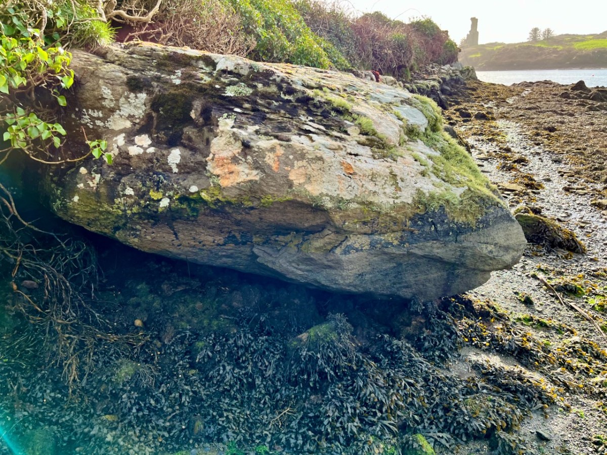
Above: looking down on Rossbrin Cove with some of the islands of Roaringwater Bay beyond. It is a natural harbour, and there is a thriving boatyard at the western end of it. The difference between low and high tides is around 2.5 metres on average, and much of the inlet dries out when it is at an extreme low. I timed my walk to arrive when the tide was fully down, as I wanted to explore the exposed mud-flats, with hopes of finding intriguing detritus.
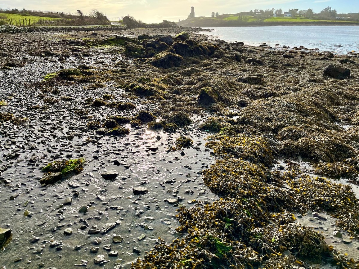
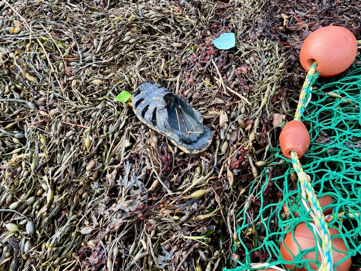
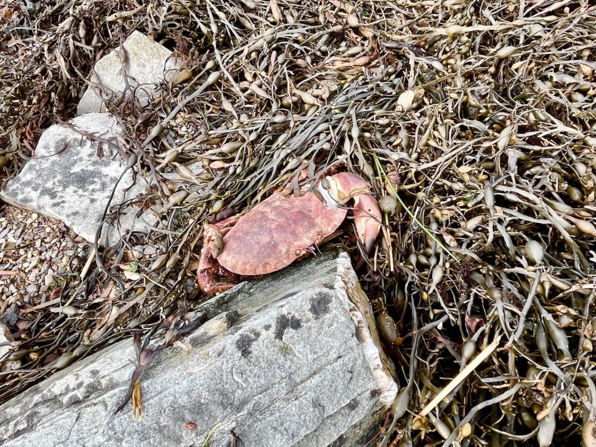
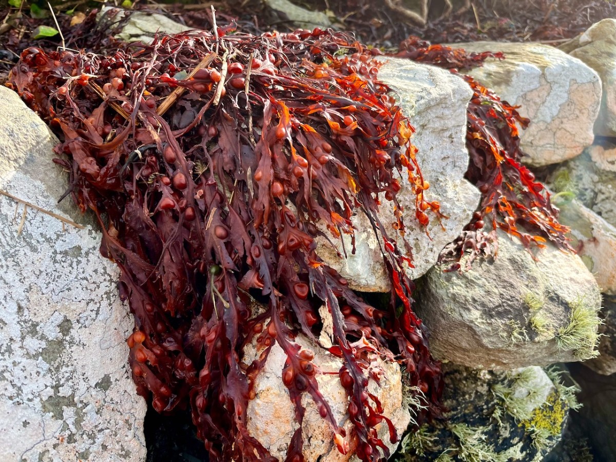
Not an inspiring start! In fact, as I continued my review, I noted that there was very little other than the natural environment – weather-worn boulders, skeletal shells and masses of seaweed – to disturb the order of things in Rossbrin on this February day. If our harsh storms had been of some positive effect it was perhaps to flush out any washed-up debris that might have accumulated in the winter – being now past St Brigid’s Day I consider it appropriate to call the season spring.
No matter that the exploration was superficially disappointing, the magic of this little bit of West Cork soon took over, and my mind was filled with the enormity of its history. There was a university here in medieval times: manuscripts were written here in the castle that has become a crumbling pile. Ravens and seabirds now rule over the stronghold. I walked on.
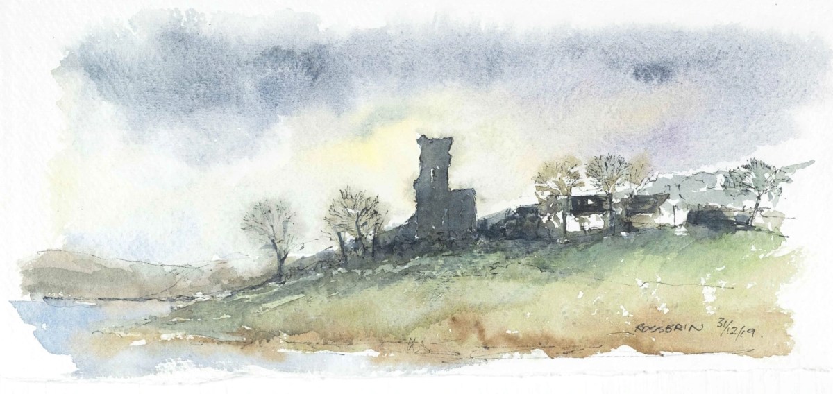
The margins of the cove are lined with ancient banks. At every turn there is a composition which a maestro could frame: I make do with a camera. Rossbrin inspired our artist friend Peter Clarke . . . Thank you, Peter!
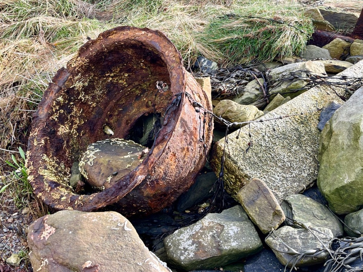
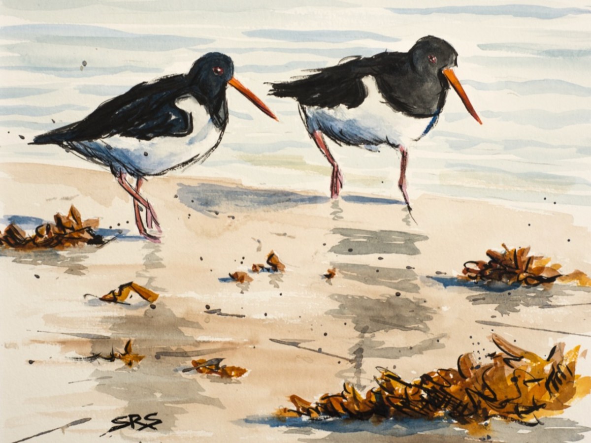
Evidence of more recent history: possibly a pot which was used in the process of tarring a clinker boat hull. No doubt vessels were built on these shores – and used to make basic livings. There is still fishing activity in and around the cove; mussel beds thrive in Roaringwater Bay; seaweed collection happens also. In summer months the deeper waters of Rossbrin are occupied by leisure orientated sailing craft. I enjoy the calm days of winter when there is hardly anything on the water. I watched a small flock of oystercatchers scurrying and foraging with their brilliant beaks, and then I turned for home.
The Rossbrin oystercatchers were uncooperative, and wouldn’t let me photograph them. Instead I have imported this wonderfully atmospheric painting by Cornish based artist Steve Sherris. Thank you, Steve
We have posted extensively about Rossbrin Cove, its history and its people. Have a look at these:
It was a big day in Ballvourney yesterday: the public unveiling of two replicas of the 800 year old wooden figure that has been central to observances of St Gobnait on her day for as long as anyone can remember – we must be talking centuries! If you are not familiar with St Gobnait – or her celebrations – read my post here.
It’s actually St Gobnait’s Day today: the eleventh of February. As I write this, the congregation in the saint’s church will be venerating the 13th century wooden figure by ‘measuring’ her with ribbons. But also, for the first time, they will be able to view the two copies of that figure which have been made over the last few months. That exercise has been undertaken so that the figure itself could be fully studied because it is of great historical interest. There are other medieval carved wooden figures of saints surviving elsewhere in Ireland, but this is the only one that is still in regular active use.
. . . A medieval wooden image of Gobnait, kept traditionally in a drawer in the church during the year, is venerated in the parish church on this day. The devotion is known as the tomhas Gobnatan . People bring a ribbon with them and ‘measure’ the statue from top to bottom and around its circumference. This ribbon is then brought home and is used when people get sick or for some special blessing. The statue is thought to belong to the 13th c. A second pattern in honour of Gobnait was traditionally celebrated in Baile Bhúirne at Whit . . .
The above citation is taken from The Diocese of Kerry website, which sets out a comprehensive review of the saint and the activities which honour her. Here’s the measuring taking place a few years ago:
National Heritage Week 2023 explains the purpose of the project to replicate the carving:
. . . As patron saint of the parish, the statue provides a tangible link to the saint but importantly represents the long-standing living devotion to Gobnait. The wooden figure carved out of oak clearly depicts a female monastic. It was guarded over the centuries by the O’Herlihy clan, who were the ruling Gaelic lords of the Ballyvourney area during the medieval and late-medieval periods. It remained in the safe-keeping of members of the O’Herlihy family until they handed it over to the local parish priest in the late-19th century and it has been protected and kept secure by the Ballyvourney Church Committee ever since. The 3D project will comprise the digital scanning of the statue which in turn will enable a 3D generated wooden print out. A second replica will be hand carved as an integrative representation of how the statue would have looked originally before the centuries aged and tarnished it. The replicas will then be placed permanently on display in the Parish Church with information signage . . .
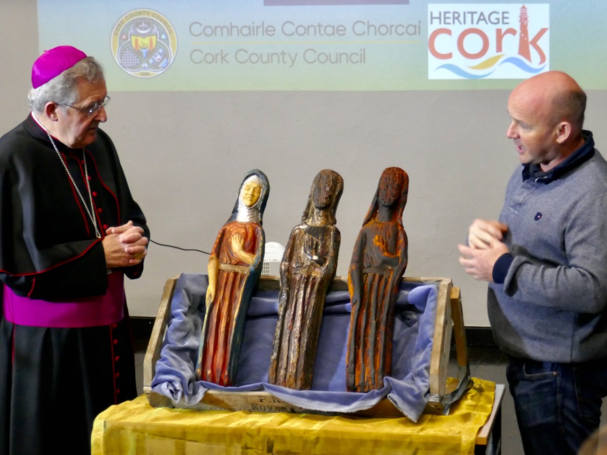
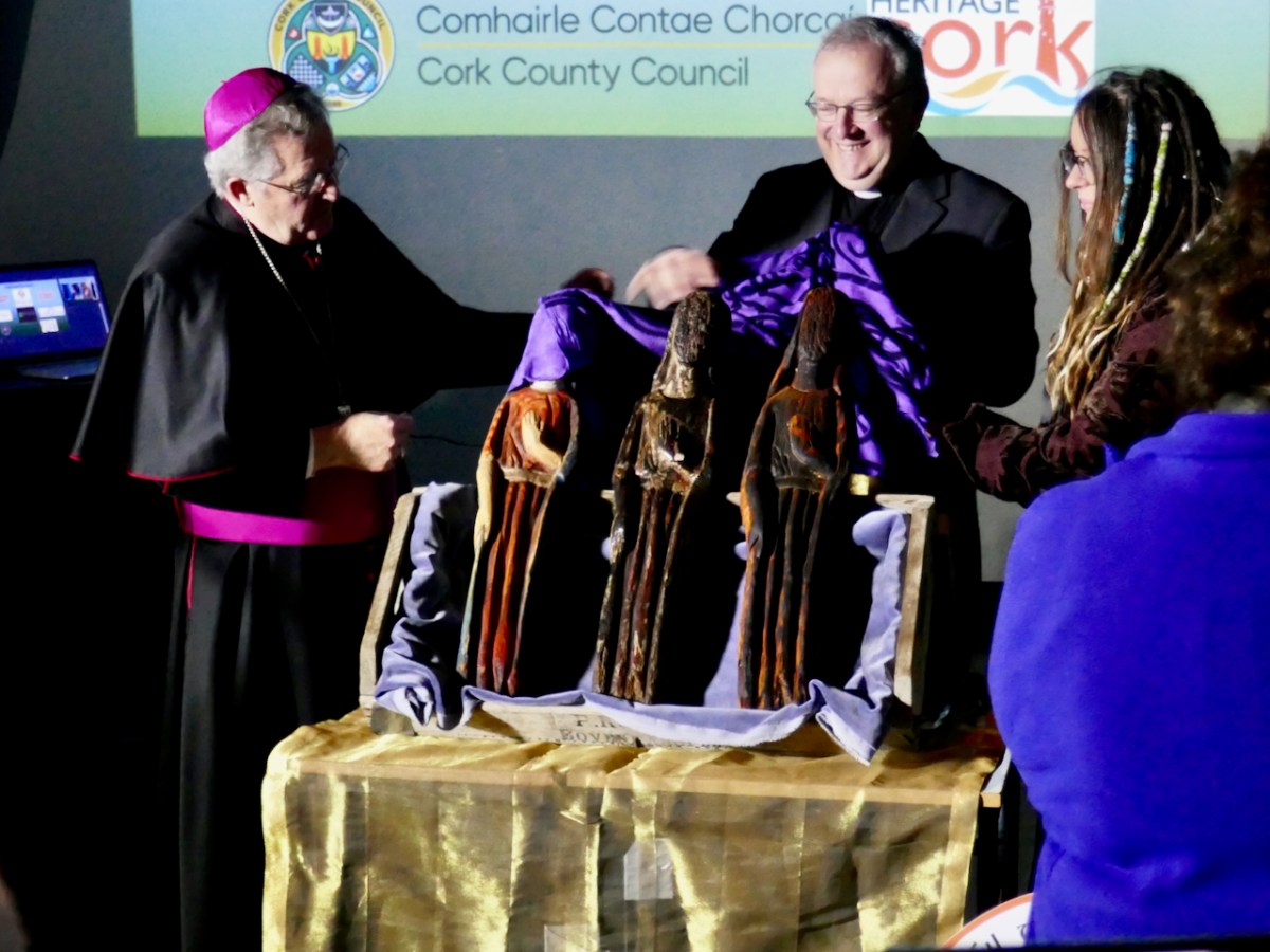
Above is a view of the original carving (in the centre) with the replica of that on the right. On the left is the ‘integrative representation’ – that is the carver’s interpretation of what the figure might have looked like when she first saw the light of day in the 1300s. On the left is Bishop William Crean – Bishop of Cloyne since 2013: he presided over the unveiling of the two replicas yesterday. On the right is John Hayes, of Special Branch Carvers in Fenor, Co Waterford. He was responsible for the carving project and has made an excellent job!
John gave us a presentation yesterday, after the unveiling ceremony, and we learned how he closely examined the original statue, taking detailed measurements and a full photographic survey. This enabled a Sketchfab 3D rendering to be produced: this became the basis for his work. During the examination he was able to find traces of paint, which enabled him to render the interpretative version with – very likely – a high degree of fidelity to the original.
I got the chance to talk to John and ask him about the timbers used for the original and the replicas. The original is of oak, and we don’t have a way of knowing where this came from. The replicas are of ash: this is a good material for stability and longevity. John had access to a good source of seasoned wood.
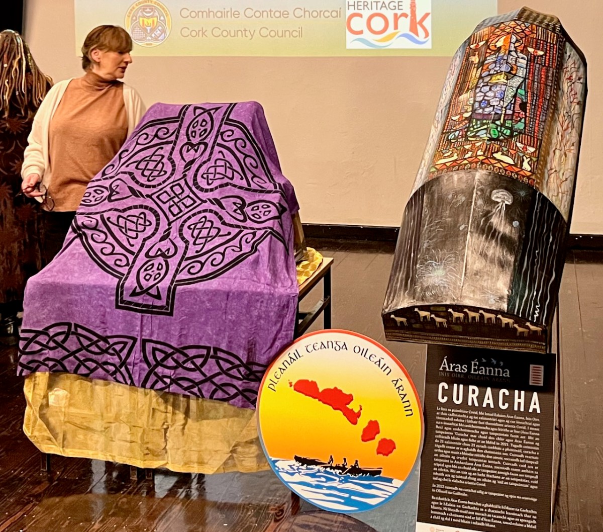
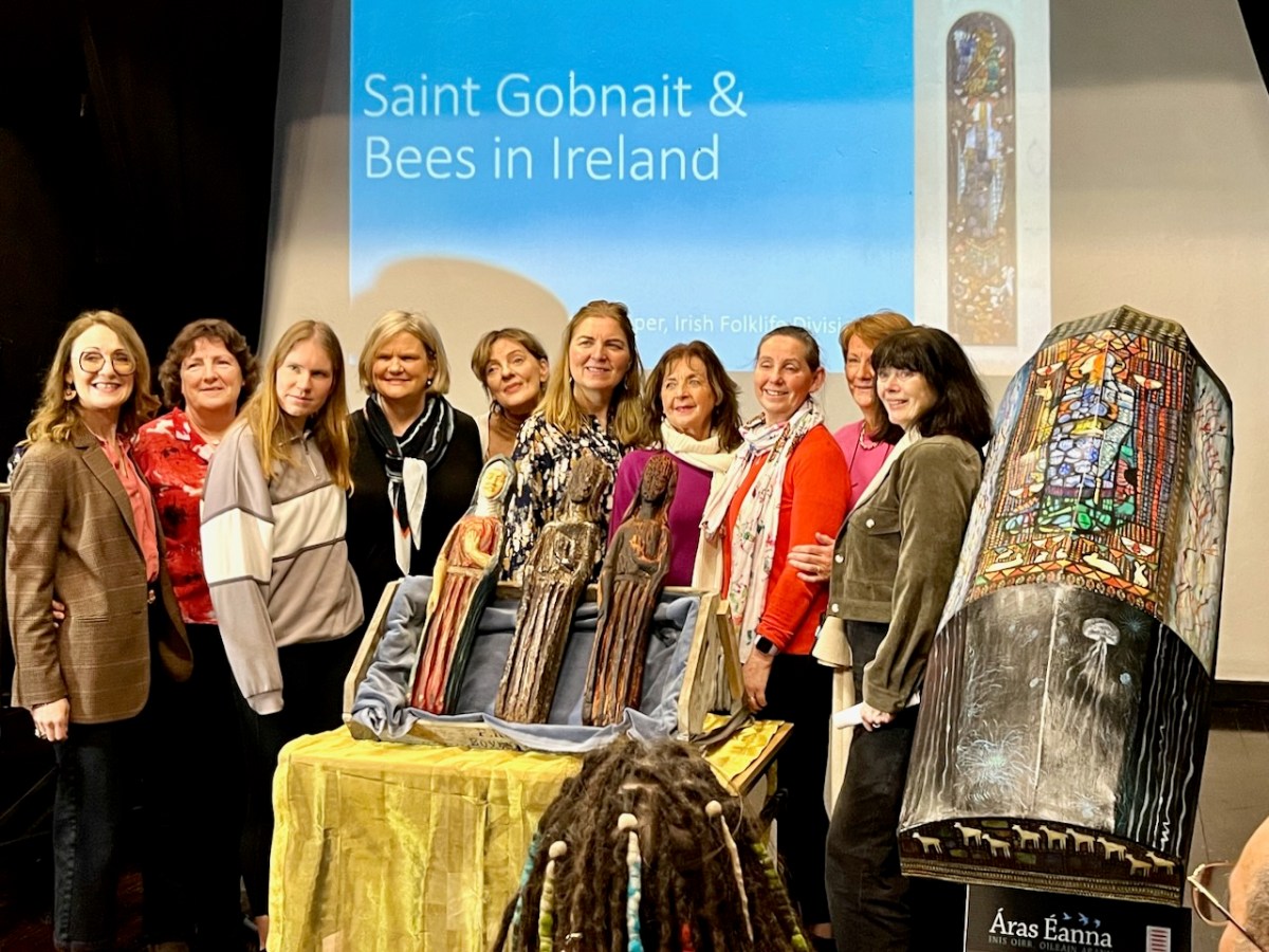
The day was a study day for St Gobnait, and encompassed a whole lot more than the unveiling of the replicas (they are waiting under the cloth- above – to be revealed)! Note the currach in the pic also: that’s another project – to establish a Camino tracing the route which Gobnait took as she travelled around Ireland from the Co Galway Aran Island of Inisheer, having been told by an angel that her life would be fulfilled when she saw nine white deer. She spent time in Dun Chaoin and Kilgobinet in Kerry, Ballyagran in Limerick, Kilgobinet in Waterford, and Abbeyswell and Clondrohid in Cork, before finally finding the deer in Ballyvourney. You can see those deer on the stern of the currach, above. There are at least eight holy wells in Ireland dedicated to the saint. Amanda has written extensively about Gobnait’s travels and – of course – about her wells.
There was also an excellent series of talks about Gobnait. Events took place in Ionad Cultúrtha an Dochtúir Ó Loinsigh, which is a great facility in the community. Here we are – together with our good friends Peter and Amanda (you have met them frequently on the pages of this Journal), - waiting for proceedings to begin:
This is the moment of unveiling: the Bishop is accompanied by the Parish Priest – Very Reverend John McCarthy SP – and archaeologist Dr Connie Kelleher, National Monuments Service: she has played a significant role in this Ballyvourney project.
The decoration on the hull of the Camino Currach is based on the depiction of Saint Gobnait in the Harry Clarke window from the Honan Chapel, UCC. The bee image on the right reminds us that Gobnait is the patron saint of bees and beekepers. We enjoyed a comprehensive talk on bees by Peadar Ó Riada – who has first hand experience of the subject:
There were many more dimensions to the day. One of my favourites was when the audience was requested to produce anyone named Gobnait to be photographed with the carved figures. That included the variations of the name: Library Ireland (1923) (Rev Patrick Woulfe) gives these as Gobinet, Gobnet, Gubby, Abigail, Abbey, Abbie, Abina, Deborah, Debbie, and Webbie. Ten candidates stood up to be counted:
Thank you to Finola for providing many of these photos
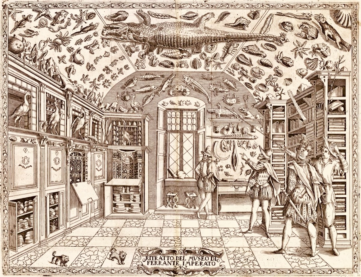
The forerunners of the museums that we visit today were known as ‘Cabinets of Curiosities’. Starting – just about – at the very end of the sixteenth century – we find mentioned and illustrated collections of objects gathered from exotic places: things that a gentleman might be unfamiliar with; things that could expand our knowledge and cause wonder. Curiosities, undoubtedly. Here’s one collection illustrated in 1599:
This is an engraving from Ferrante Imperato’s Dell’Historia Naturale (Naples 1599), the earliest illustration of a ‘natural history cabinet’ (courtesy Oxford University). It shows a room fitted out to display imported paraphernalia: (hopefully mounted) creatures, dried specimens, fossils – also books and illustrations. The collector here takes on the role of educator – perhaps showman. Here you might encounter unicorn horns, a dragon’s blood, mermaid scales as well as the full sized alligator hanging from the ceiling.
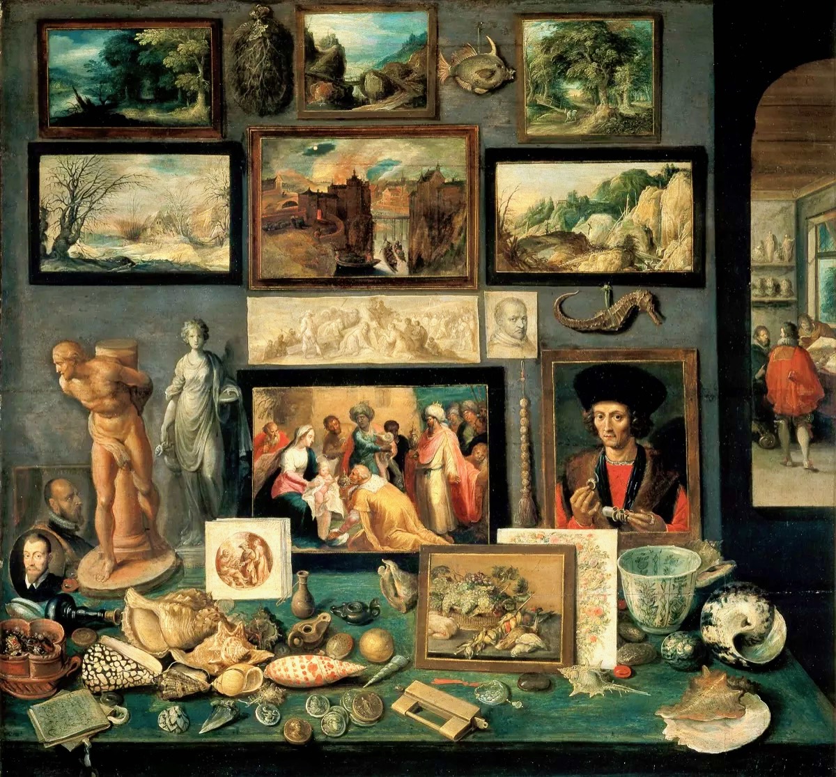
Frans Francken the Younger, Chamber of Art and Curiosities, 1636 above (Public Domain). Another selection of paintings intermixed with fish, carved beads, sculptures, with on the table exotic shells, gem-stones mounted with pearls, coins and medals.
Rathfarnham Castle (above) is a good example of an Irish Fortified Manor House. This mainly seventeenth century building type would have been the relatively comfortable home of an aspiring clan – perhaps a titled family with church or merchant connections: Finola has written about a West Cork example. Austin Cooper – a tax collector who indulged his hobbies of sketching and writing while travelling through Ireland in the performance of his duties – wrote of Rathfarnham:
. . . What renders this a Place of any Note is the Cas. belonging to the E. of Ely. This Cas. is square, with a large square Tower at each corner – on the S. side in the Center is a semicircular Tower . . . The hall is but low, at the same time exquisitely elegant . . . The gallery is a beautiful room, at the far end is a curious cabinet of Tortoise Shell & Brass containing some most extraordinary Work in Ivory . . .
Austin Cooper’s Notes, rathfarnham Castle
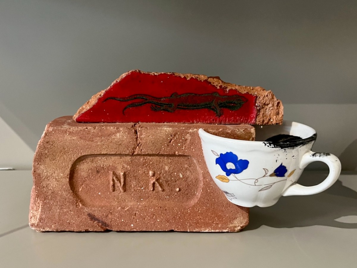
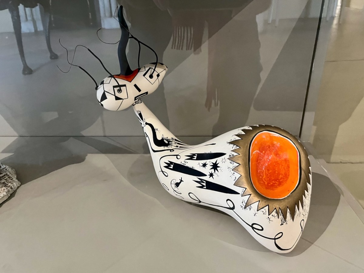
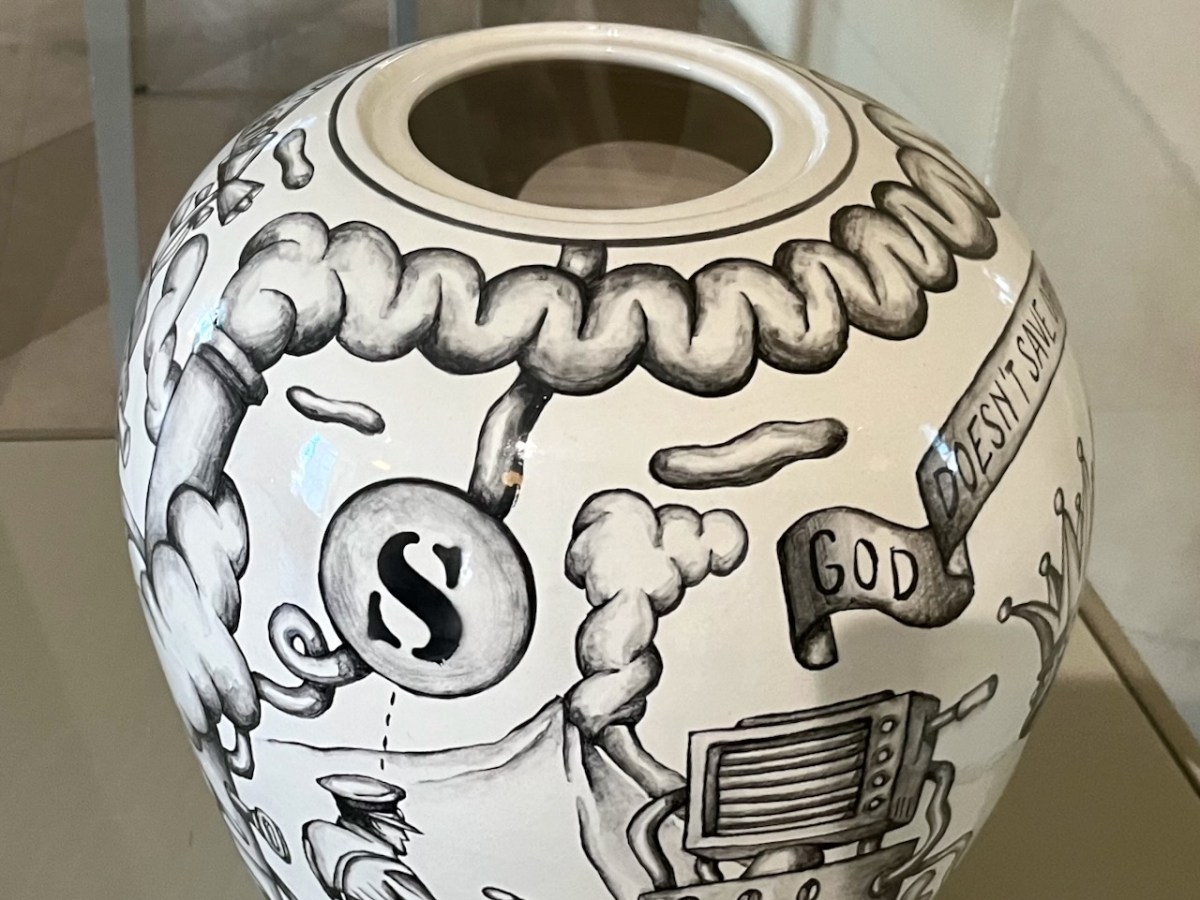
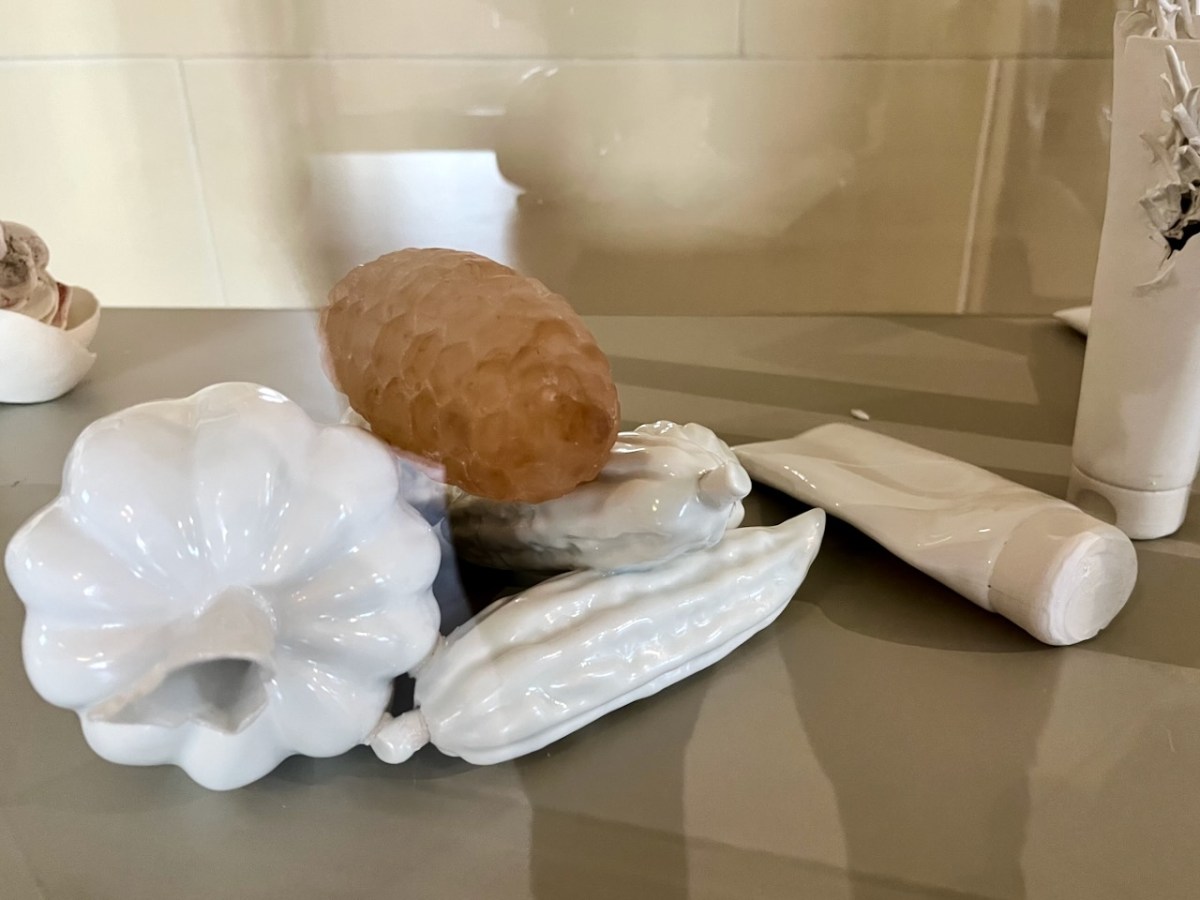
Rathfarnham Castle has, in modern times, a distinguished continuing association with contemporary ceramicists and in 2015 established a modern Cabinet of Curiosities which continues the tradition of displaying ‘extraordinary work’, and provides excellent material for a Sunday morning post!
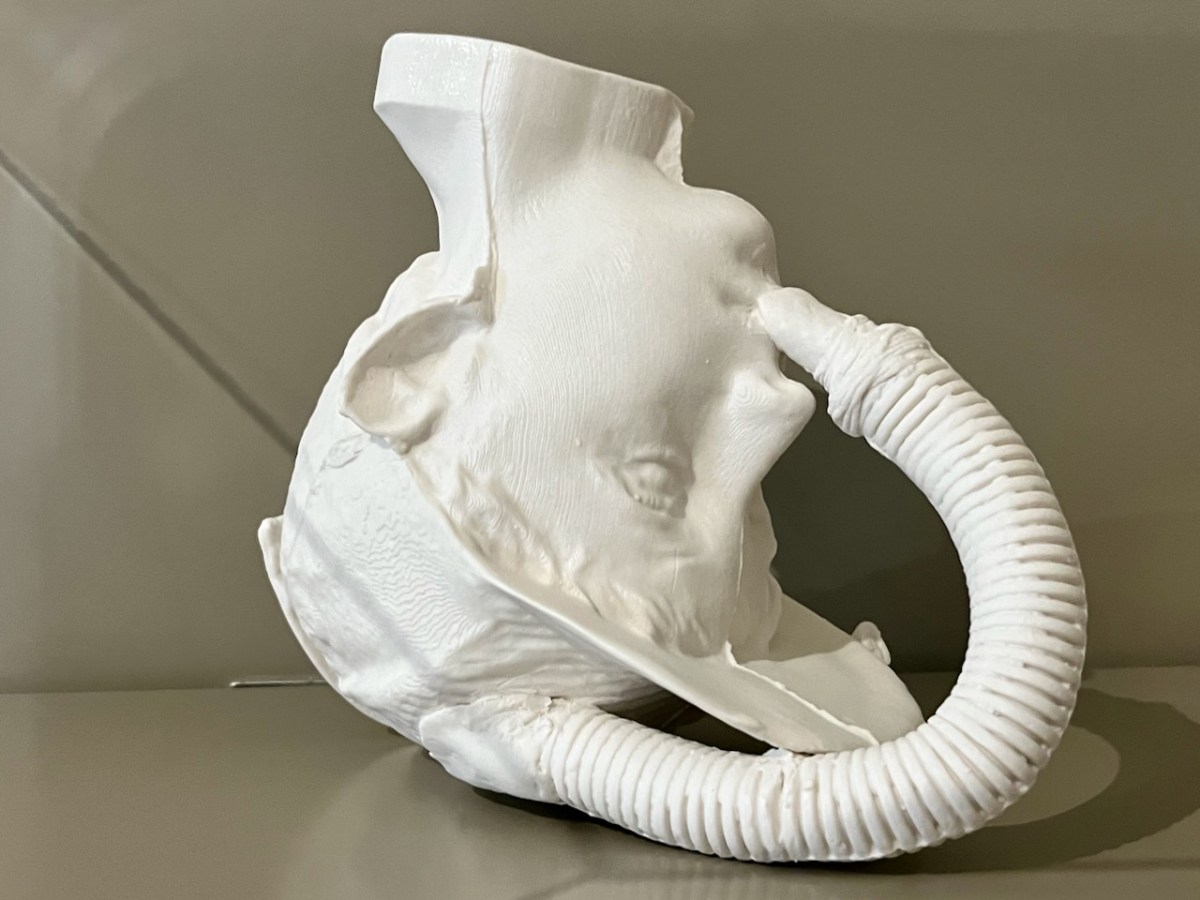
The curiosities are not labelled – and nor are their creators. Peter Bagshaw, OPW at Rathfarnham, has kindly provided me with a list – thank you, Peter – attached at the end of this piece. I cannot necessarily individually identify each item: I will leave you to work out which might be which . . .
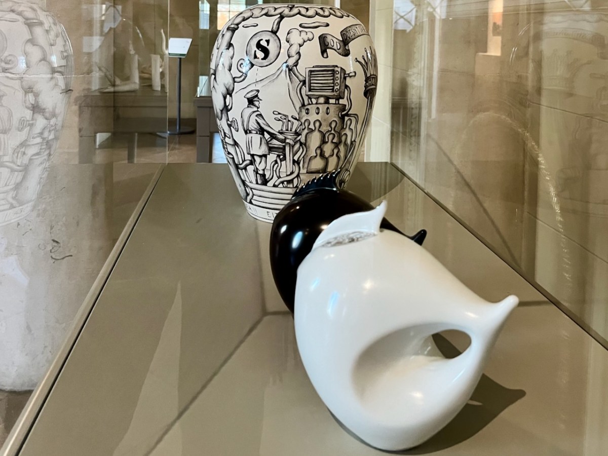
This eye-pot looks great when you pan out a bit . . .
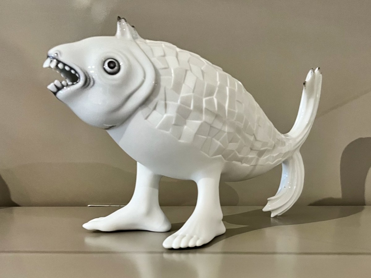
This one certainly harks back to some of those manufactured creatures that turned up in cabinets of old.
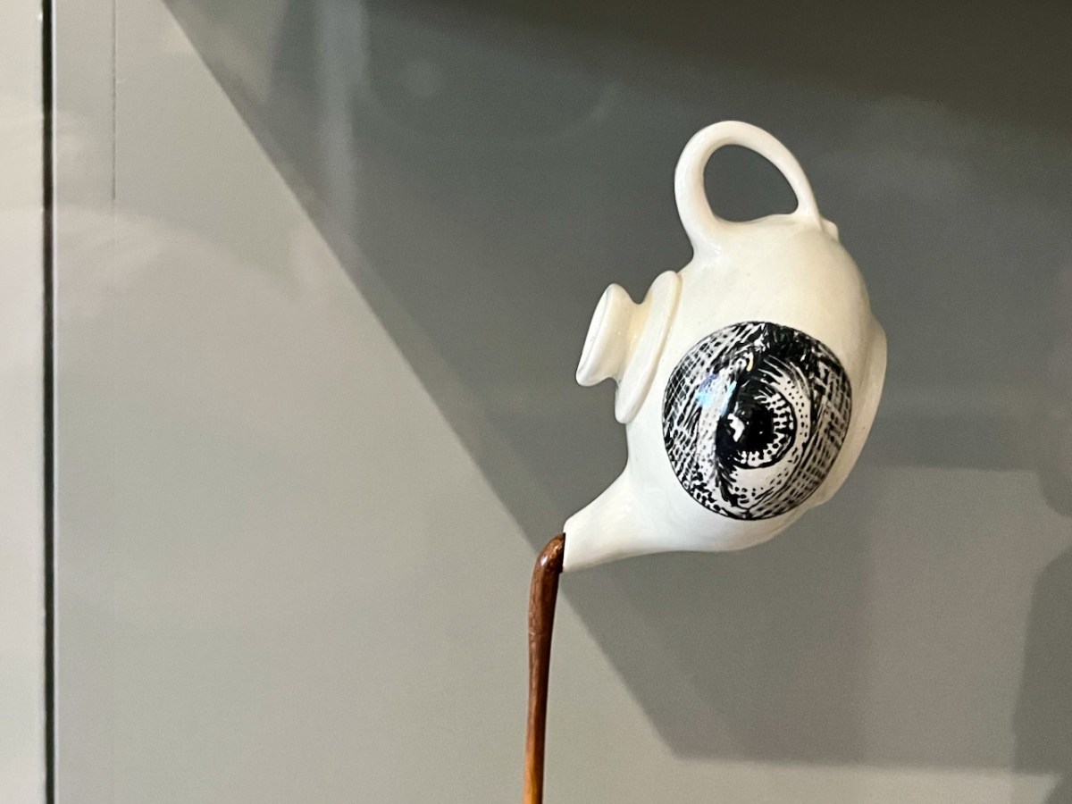
Leather teapot – a fashion item, perhaps?
I think the final image might be my favourite: a young person clutching an angel’s wing? Could this be The Sequestrator?
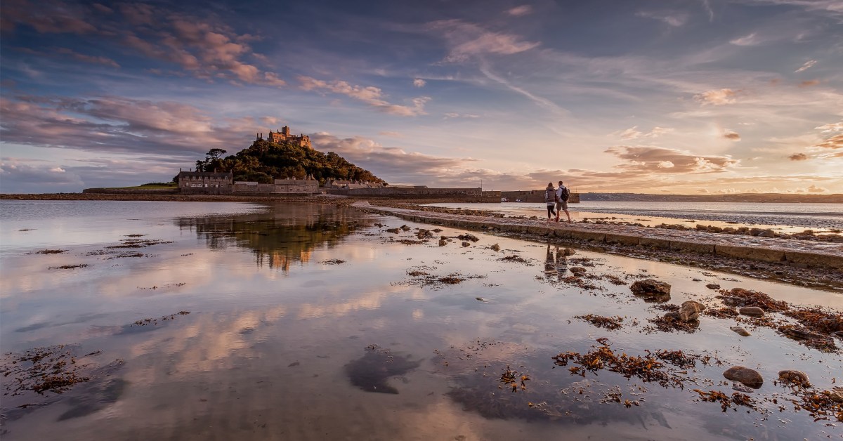
For a part of my life I lived in the west of Cornwall, looking out over St Michael’s Mount (above). Back in the 5th century, the Archangel himself appeared to fishermen on that rock. Legend has it that the Mount was constructed by giants and, also, King Arthur battled and defeated a giant there. As you all know, we have just passed Michaelmas – the day of the saint – September 29th.
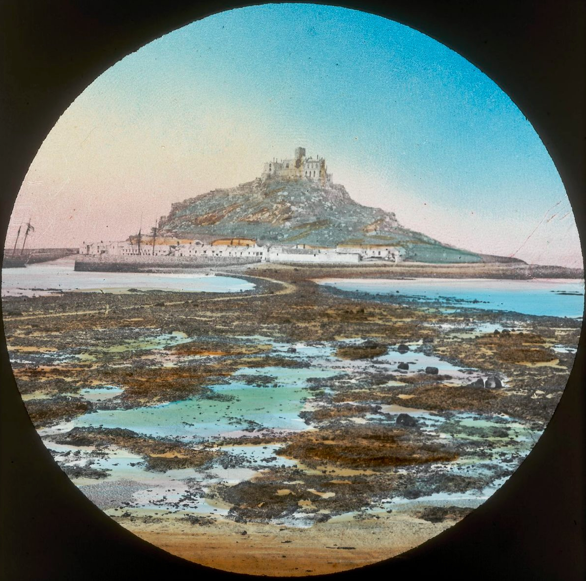
There is another ‘St Michael’s Mount’ on the coast of Brittany: Mont St Michel (above, from an old lantern slide). I have mixed memories of that place, having gone there on a school trip when I was twelve: I had all my hard-saved pocket money stolen from me in one of the little winding lanes that goes up to the summit. Michael is the patron saint of high places, so expect to find him on pinnacles.
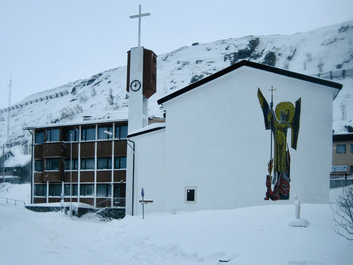
This St Michael’s church is certainly in a high place. It’s at Hammerfest in Norway, and has the distinction of being geographically the highest church in the world! (image by Manxruler)
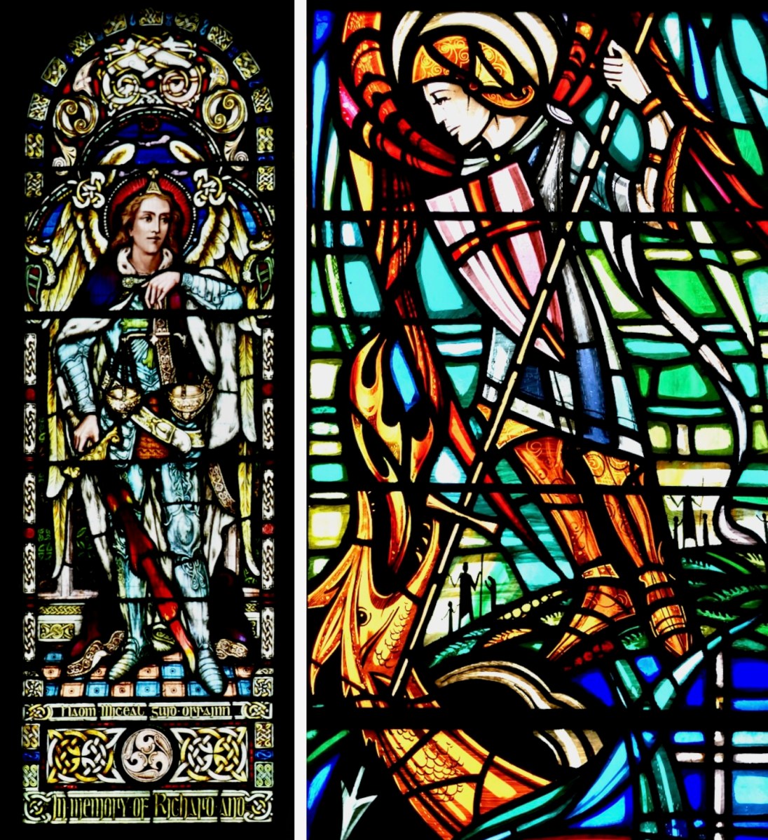
I asked Finola if there was very much in the way of St Michael imagery in Irish stained glass. There’s a fair bit: on the left, above, is a Watsons of Youghal image of the Archangel in his role as weigher of souls. He stands at the gates of Heaven waiting for you on Judgment Day with his scales in his hand. Often, beside him, angels hold up two books: the smaller one records the names of the blessed, while the larger book is a list of the damned… On the right is our friend George Walsh’s depiction of Michael defeating Satan, who here takes the form of an impressive dragon.
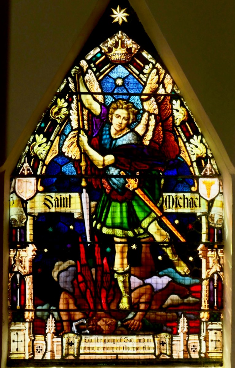
This St Michael is very local to us: it’s in Teampall Church at Toormore, and is by Clokey of Belfast (Finola’s photo). Look carefully and you’ll see the Saint pinning down the fire-breathing Devil.
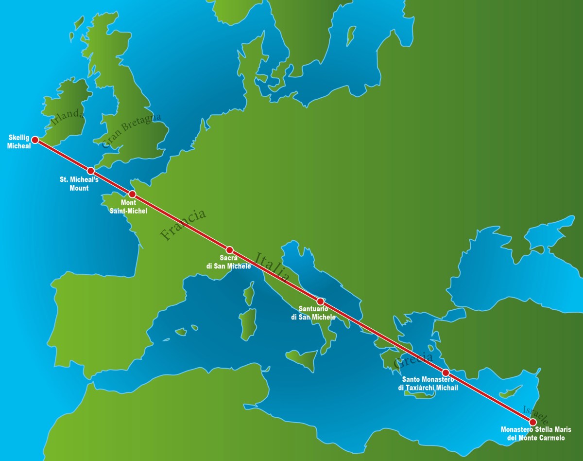
Also in my distant youth I was an ephemeral chaser of ley-lines: I have since thought better of it, but the idea of a straight line starting in Ireland and connecting seven St Michael sites while traversing Europe and Greece was attractive, and fleetingly convincing. Of course, there are many more Michael sites scattered around the Christian world which don’t fall anywhere near this line.
. . . As with other ley lines, no scientific evidence indicates that the alignment was planned and meaningful, making the claim pseudoscientific, but commonly reported at these sites. Physicist Luca Amendola noted that the deviation of these sites from the loxodrome that allegedly connects them ranges between 14 km and 42 km. According to legend the Sacred Line of Saint Michael the Archangel represents the blow the Saint inflicted the Devil, sending him to hell. Some also say that it is a reminder from Saint Michael that the faithful are expected to be righteous, walking the straight path . . .
Wikipedia
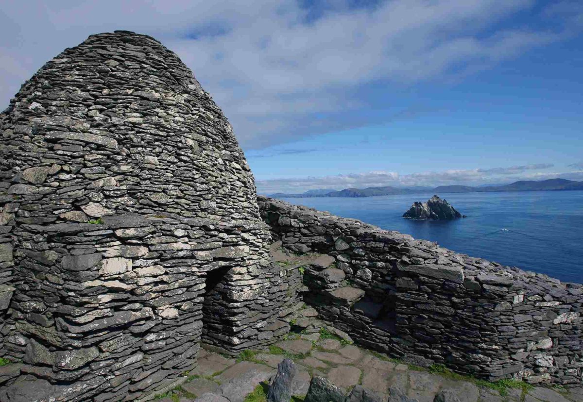
It’s nice to see that the phenomenon starts (or finishes) at Skellig Micheal, off the coast of Kerry (pic below courtesy of OPW):
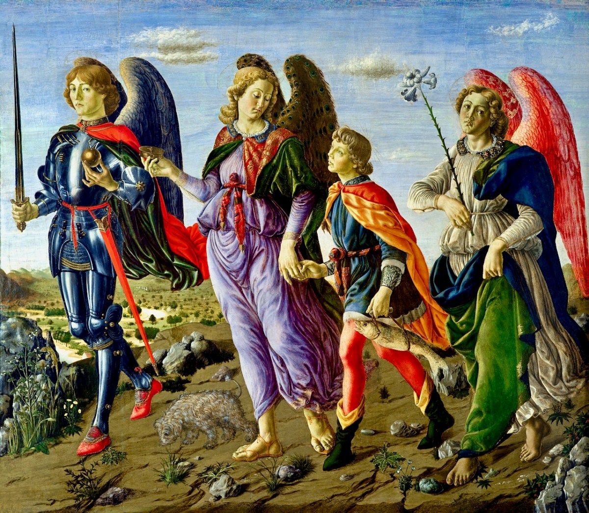
Here’s an interesting view of the three somewhat feminine Archangels painted by Francesco Botticini in 1470. Michael is on the left. With them is Tobias who, in the popular Biblical tale, overcomes obstacles as he and his heavenly guardians set out to discover a cure for his father Tobit’s blindness. They are successful, for Tobias returns with a cure for his father as well as a wife!
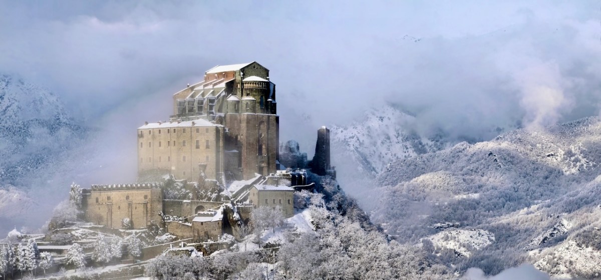
I couldn’t resist this wonderful image of a St Michael’s site (from Wikipedia). It is the tenth-century Sacra di San Michele on Mount Pirchiriano in Italy. It also happens to be on the Saint’s ley-line!
I’ll finish this little review of St Michael where I started – off the coast of Cornwall. This 1920s postcard of the Mount, from a painting by A R Quinton, sums up the romantic image which I still carry from my days lived on that coast.
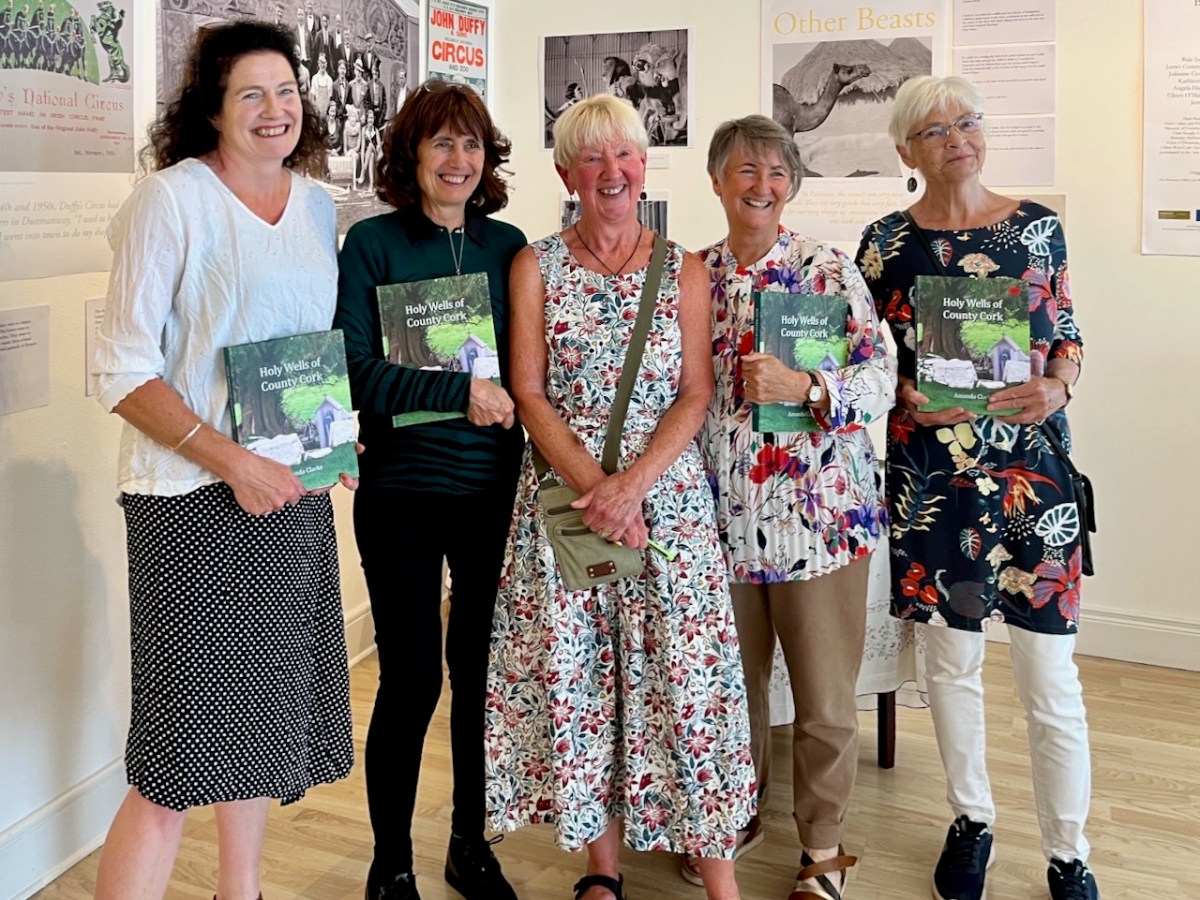
This was the scene in the Working Artist Studios, Ballydehob, on Friday evening. It was the launch of a brand new book by our friend Amanda Clarke: Holy Wells of County Cork. That’s Amanda, above, in the centre, with Finola on her left. Regular readers will know that we share many adventures with Amanda and Peter, and we were so pleased to see the successful fruition of her years of research with this outstanding volume, exquisitely designed by Peter, now available to purchase online, and in bookshops. Finola wrote about this venture last week. I thought I would indirectly celebrate it today by reviving a Roaringwater Journal post from five years ago, about one of our own expeditions that included a visit to a holy well.
Once again we followed in the footsteps of Amanda and Peter: they had visited the Glen of Aherlow in County Tipperary and pointed us to St Berrehert’s extraordinary site at Ardane which I described in this post. Not far away is another site, equally remarkable, and related to St Berrehert’s Kyle in that they were both restored by the Office of Public Works in the 1940s. They are also both very easily accessible in a few minutes from the M8 motorway at Cahir.
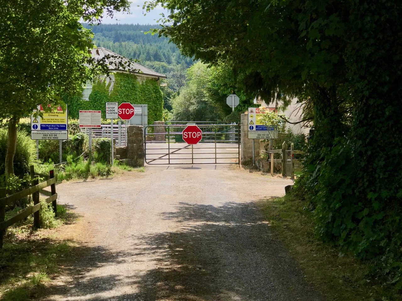
We were delighted to be travelling again through the beautiful Glen in the shadow of the Galtee Mountains (above) as we searched out a boreen that led us down to the railway. We parked and crossed at the gate, watching out carefully as this is the Waterford to Limerick Junction line used by two trains a day (except on Sundays!)
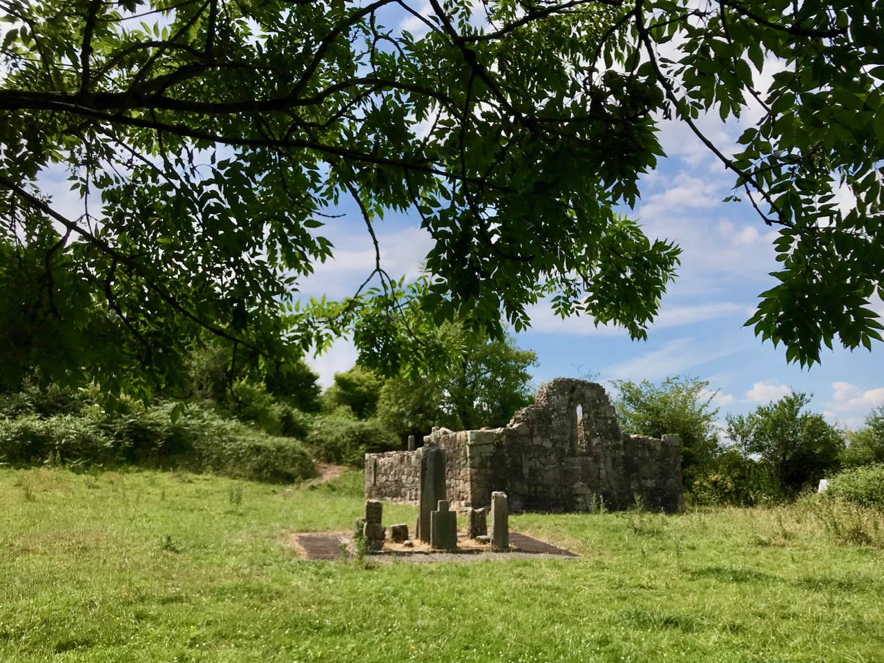
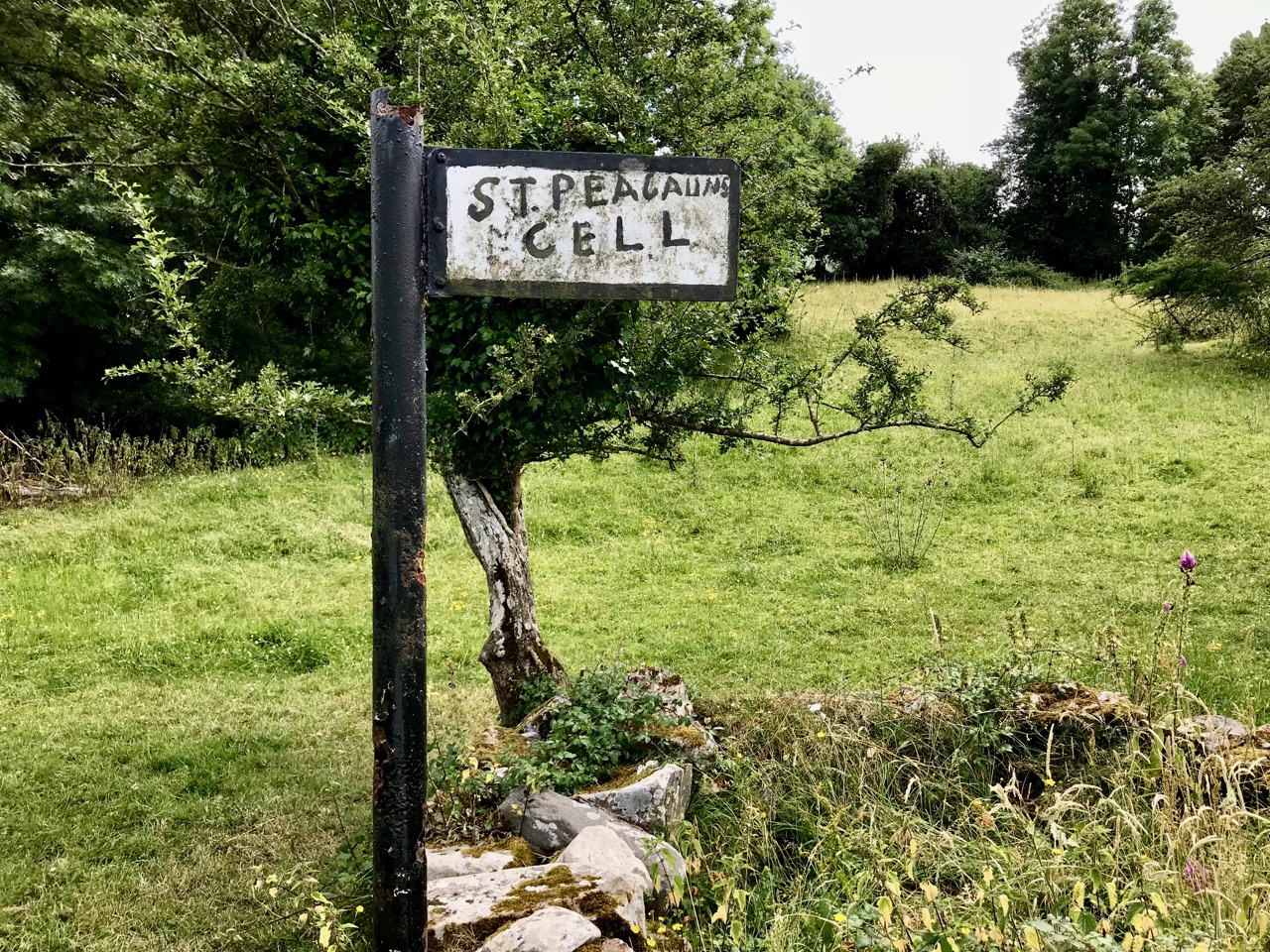
Once across, we were in an idyll. It’s a private lane, running alongside a gentle stream, but the Bourke family allow visitors to walk (as they have done for centuries) to the old church, the cell and the holy well of Saint Péacáin. Ancient stone walls line the way, and trees overhang, shading the dappled sunlight in this most exceptional of Irish seasons. We met Bill Bourke, who regaled us with tales of his life spent mostly far away from this, his birthplace – but who returned to rebuild the family home and to enjoy perpetual summer in what is, for him, the most beautiful setting in the world. He also told us of the crowds who used to come to celebrate St Péacáin at Lughnasa – 1st August – paying the rounds and saying the masses.
In her monumental work (it runs to over 700 pages) The Festival of Lughnasa – Oxford University Press 1962 – Máire MacNeill points out the harvest feast day was such an important ancient celebration that it survives as the focus of veneration of many local saints who would otherwise have been known for their own patron day, and she particularly mentions Tobar Phéacáin in this regard: a place well away from any large settlement where the great agricultural festival was so critical to the cycle of rural life.
The rural setting of St Péacáin’s Cell can be seen above, just in front of the trees; the church and the well are nearby. MacNeill provides a description of Tobar Phéacáin and includes some variant names:
. . . Tobar Phéacáin (Peakaun’s Well), Glen of Aherlow, Barony of Clanwilliam, Parish of Killardry, Townland of Toureen . . . On the northern slope of the Galtee Mountain at the entrance to the Glen of Aherlow and about three or four miles north-west of Caher there is a well and ruin of a small church. About a mile beyond Kilmoyler Cross Roads a path leads up to it . . . In 1840 O’Keefe, of the Ordnance Survey team, reported that the old church was called by the people Teampuillin Phéacáin, or just Péacán . . .
. . . The well, which he described as lying a few perches south-east of the church was called Peacan’s Well or Tobar Phéacáin. It was surrounded by a circular ring of stonework. He stated: ‘The pattern-day still observed at this place falls on the 1st of August, which day is, or at least until a few years since, has been kept as a strict holiday.’ Devotions were also, he said, performed there on Good Friday . . .
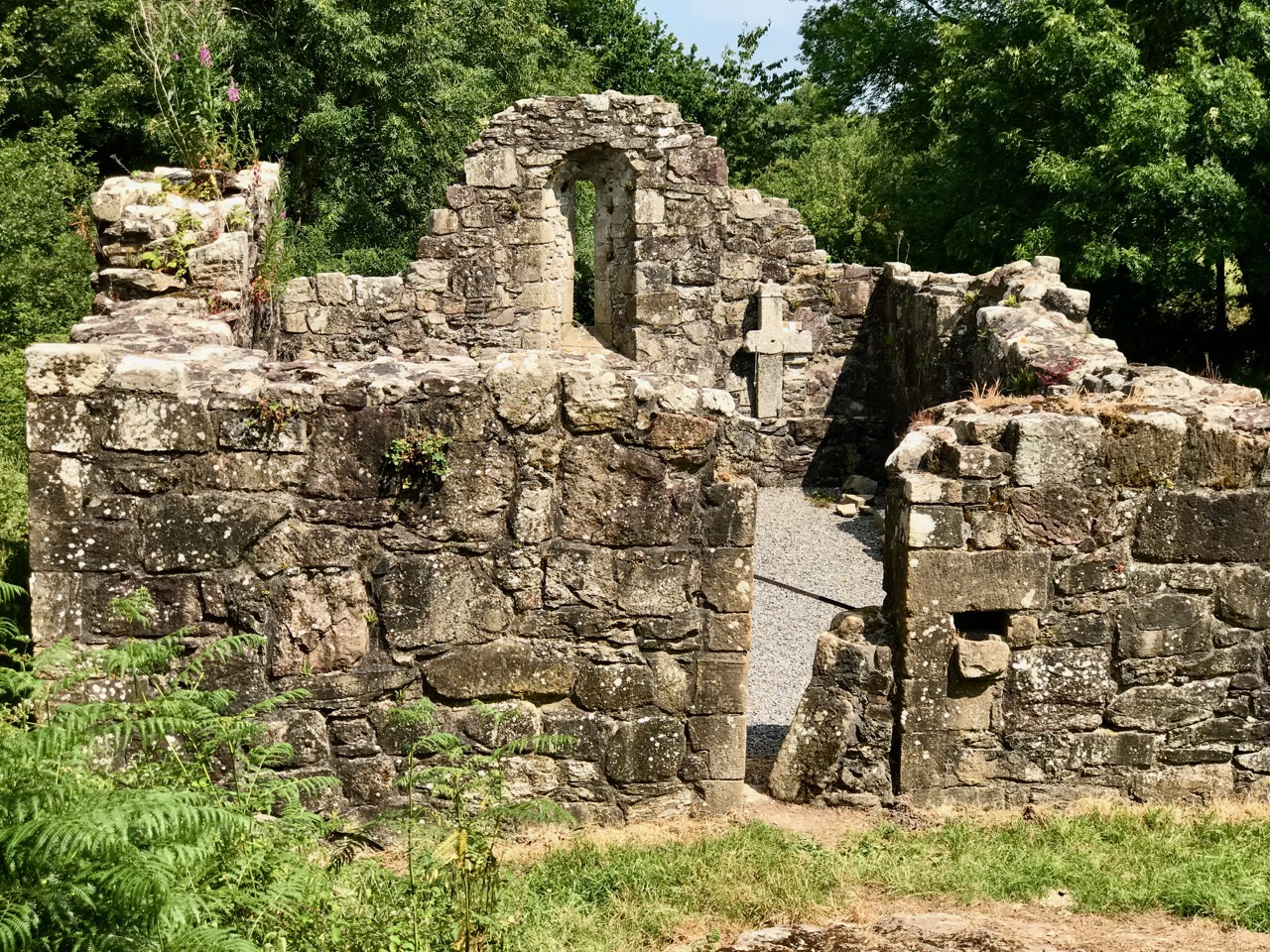
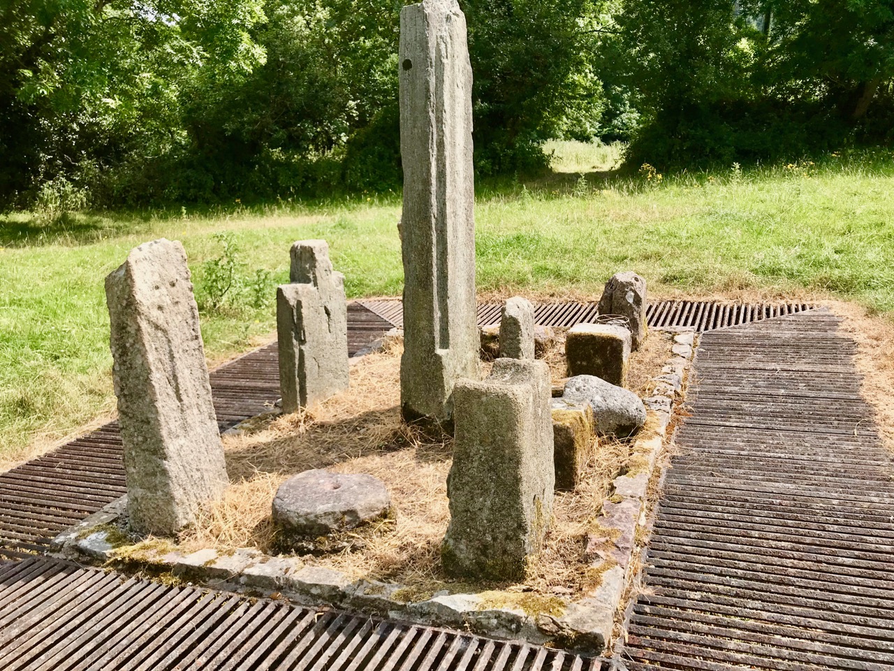
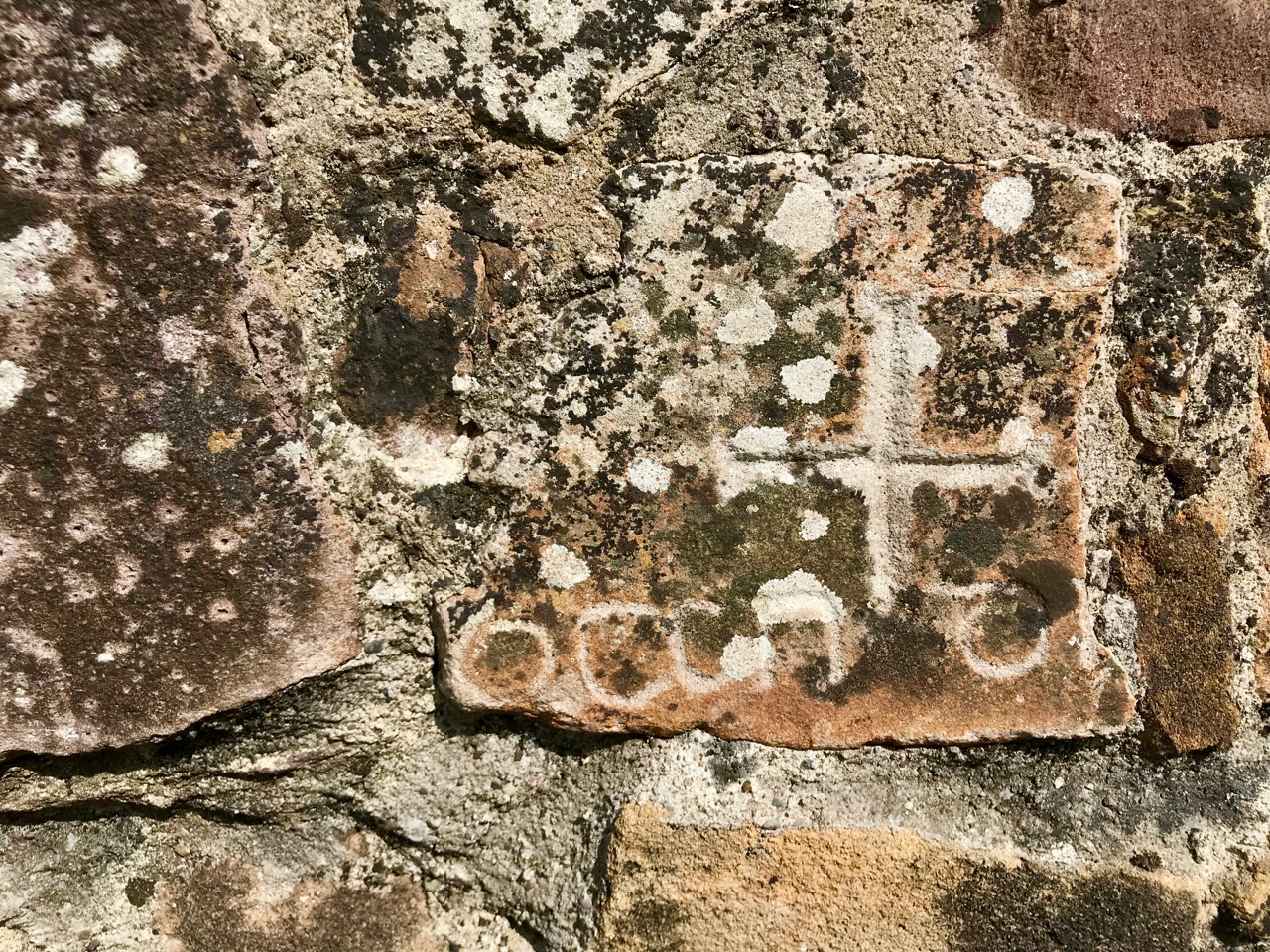
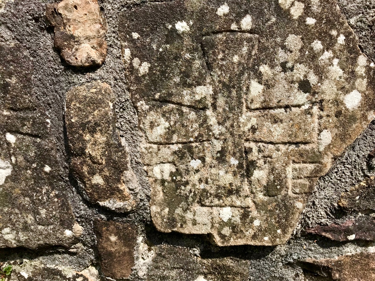
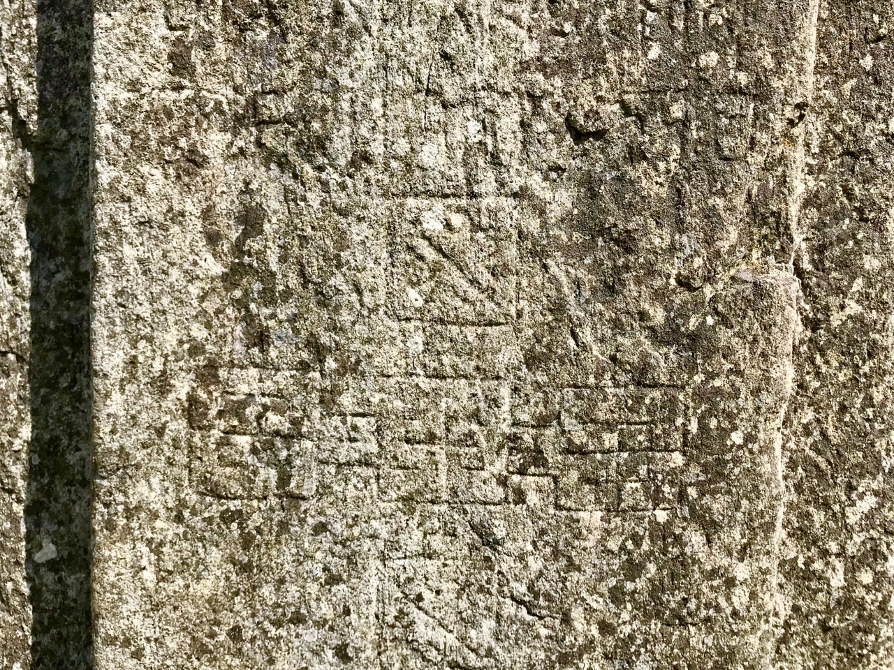
A hundred years after O’Keefe wrote this, the church ruins were tidied up by the Office of Public Works. As at St Berrehert’s Kyle, it seems there were numerous carved slabs on the site and remnants of high crosses, implying a significant ecclesiastical presence here. All these have been fixed in and around the church ruin for safekeeping, and in an intelligent grouping. It’s wonderful to be able to see such treasures in the place they were (presumably) made for, and to experience them in such a remote and peaceful ambience.
McNeill continues:
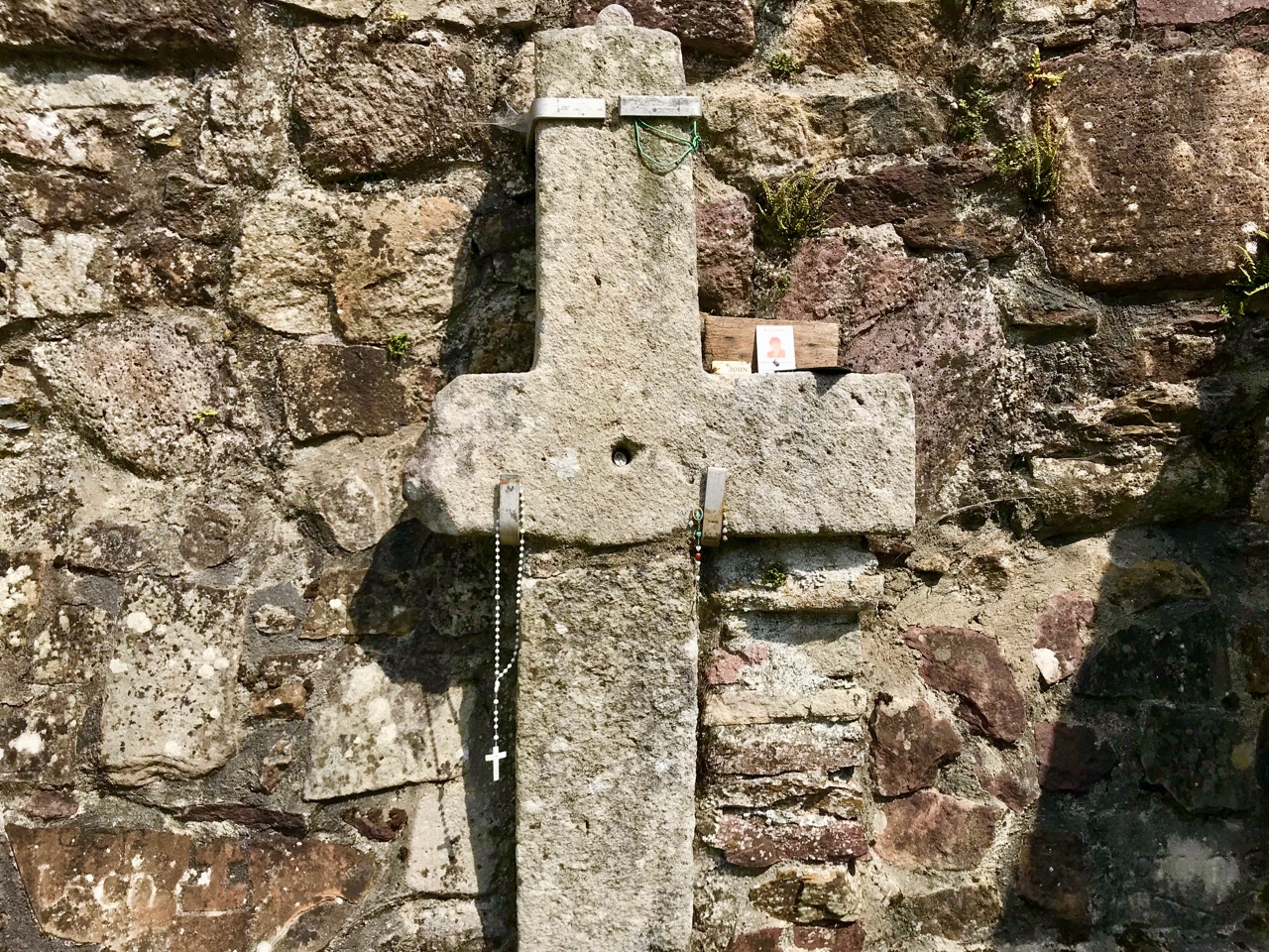
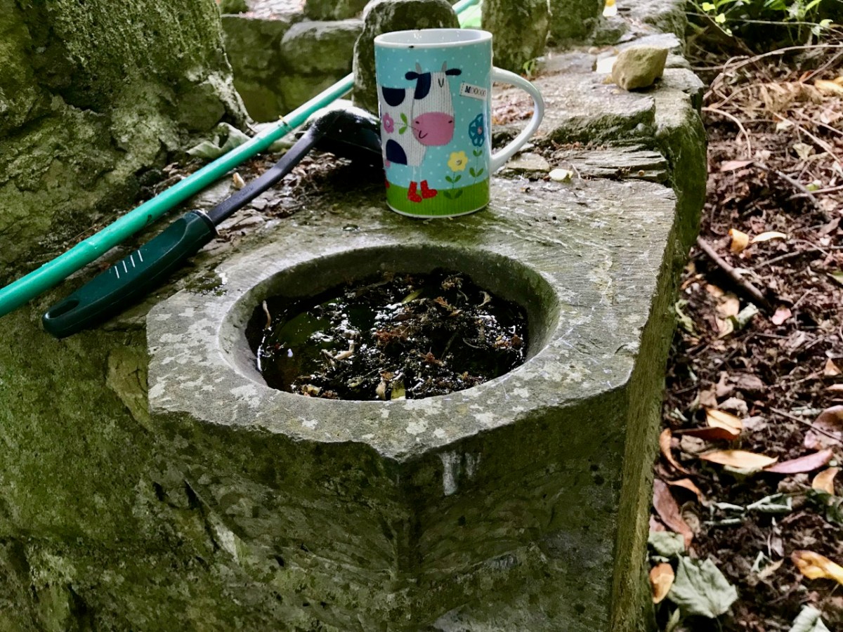
. . . Nearby is the shaft of a cross which tradition avers was broken in malice by a mason who was then stricken with an inward pain and died suddenly as a punishment for his sacrilege . . . O’Keefe was told a story of a small stone, 6 or 7 inches long and 4 or 5 in depth, having ten little hollows in it and resting in a hollow of the ‘altar’ of the old church. Christ, or according to others St Péacán, asked a woman, who had been churning, for some butter; she denied having any and when the visitor departed she found the butter had turned into stone which retained the impression of her fingers . . . Nuttall-Smith speaks also of a cave where the saint used to practice austerities . . .
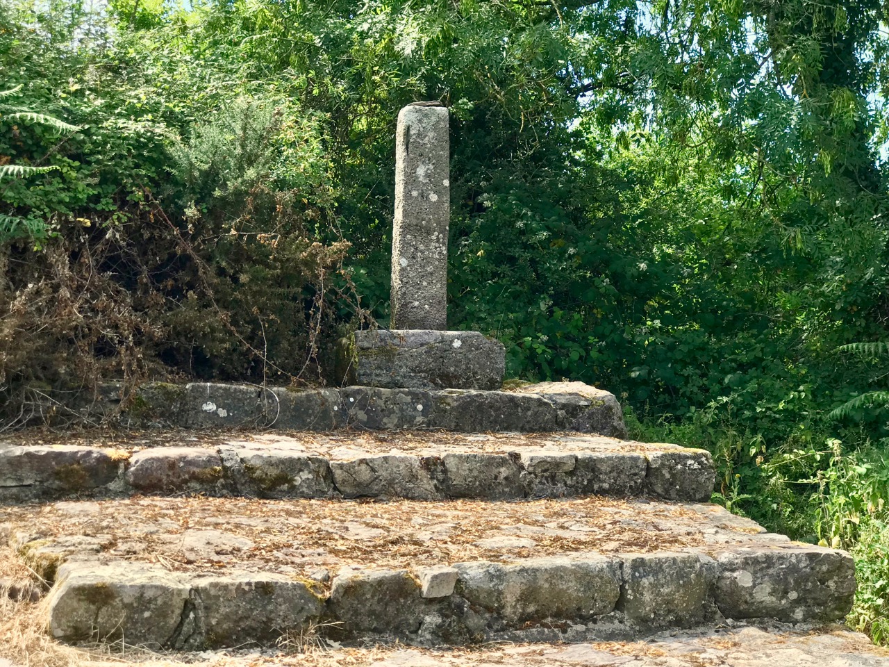
The carved fragments are quite remarkable and are in all likelihood well over a thousand years old. I have yet to see anywhere in Ireland – outside of museums – which has such an extensive collection of fascinating medieval antiquities as these sites in the Glen of Aherlow. Here you can also see cross slabs and a sundial said to date from the eighth century.
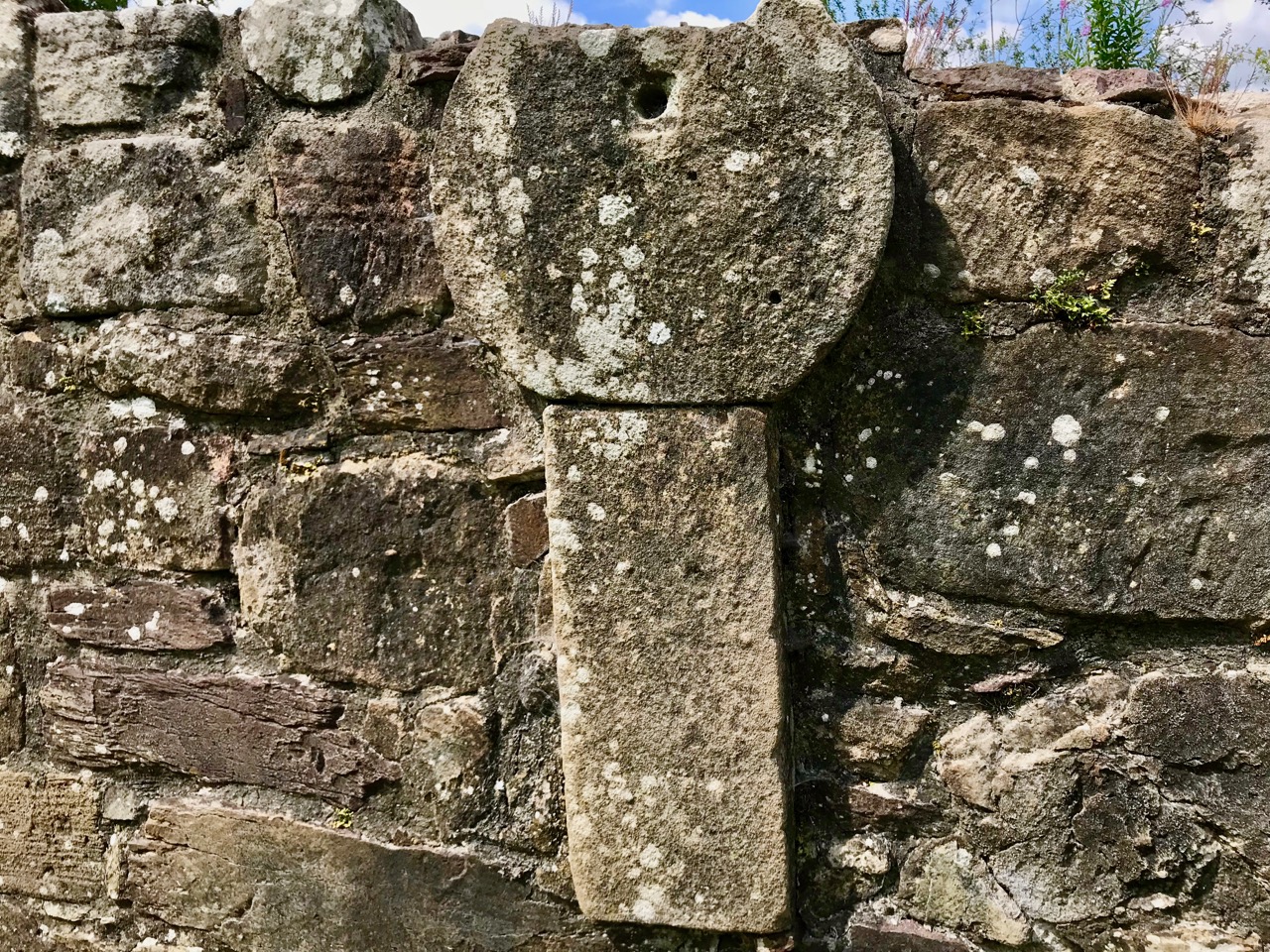
Nuttall-Smith’s ‘cave’ – quoted by MacNeill above – is likely to be St Péacáin’s Cell, set in a field on the far side of the river. This was probably a clochán, or beehive-hut, of the type once used by anchorites. It is protected by a whitethorn tree, but was quite heavily overgrown on the day of our visit. We could make out the ballaun stones inside, said to be the knee prints of the Saint who made his constant devotions there. Amanda – in her post on the holy well – reports that Péacáin would also stand daily with arms outstretched against a stone cross, chanting the psalter.
McNeill discusses the significance of weather at the August celebrations:
. . . Paradoxically for a day of outing so fondly remembered, no tradition of the Lughnasa festival is stronger than that which says that it is nearly always rainy. No doubt this has been only too often experienced. Saint Patrick’s words to the Dési: ‘Bid frossaig far ndála co bráth’ (Your meetings shall always be showery) must be as well proved a prophecy as was ever made. Still there must be more significance in the weather beliefs than dampened observation. Certainly it was expected that rain should fall on that day, and sayings vary as to whether that was a good or bad sign . . . There are a few interesting beliefs about thunder, which was also expected on that day: the loud noise heard at Tristia when the woman made rounds there to have her jealous husband’s affection restored; the prophecy that no-one would be injured by lightning at Doonfeeny, a promise also made by St Péacán . . .
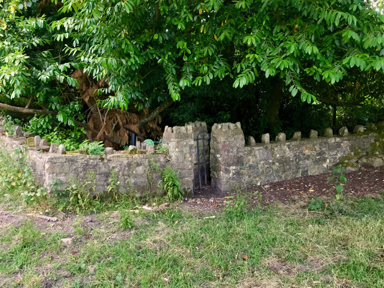
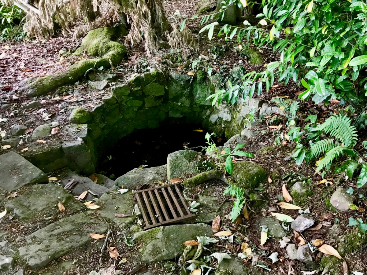
The holy well is tucked away in a stone-walled enclosure hidden under the trees on the edge of the field which contains the Saint’s cell. It is also a tranquil place, obviously still much visited: the water is crystal clear, refreshing and will ensure protection from burns and drowning. This is a magical setting to complete our day’s travels in the beautiful Glen of Aherlow.
Welcome to the UCD Library Cultural Heritage Collections blog. Discover and explore the historical treasures housed within our Archives, Special Collections, National Folklore Collection and Digital Library


