Péacáin Revisited

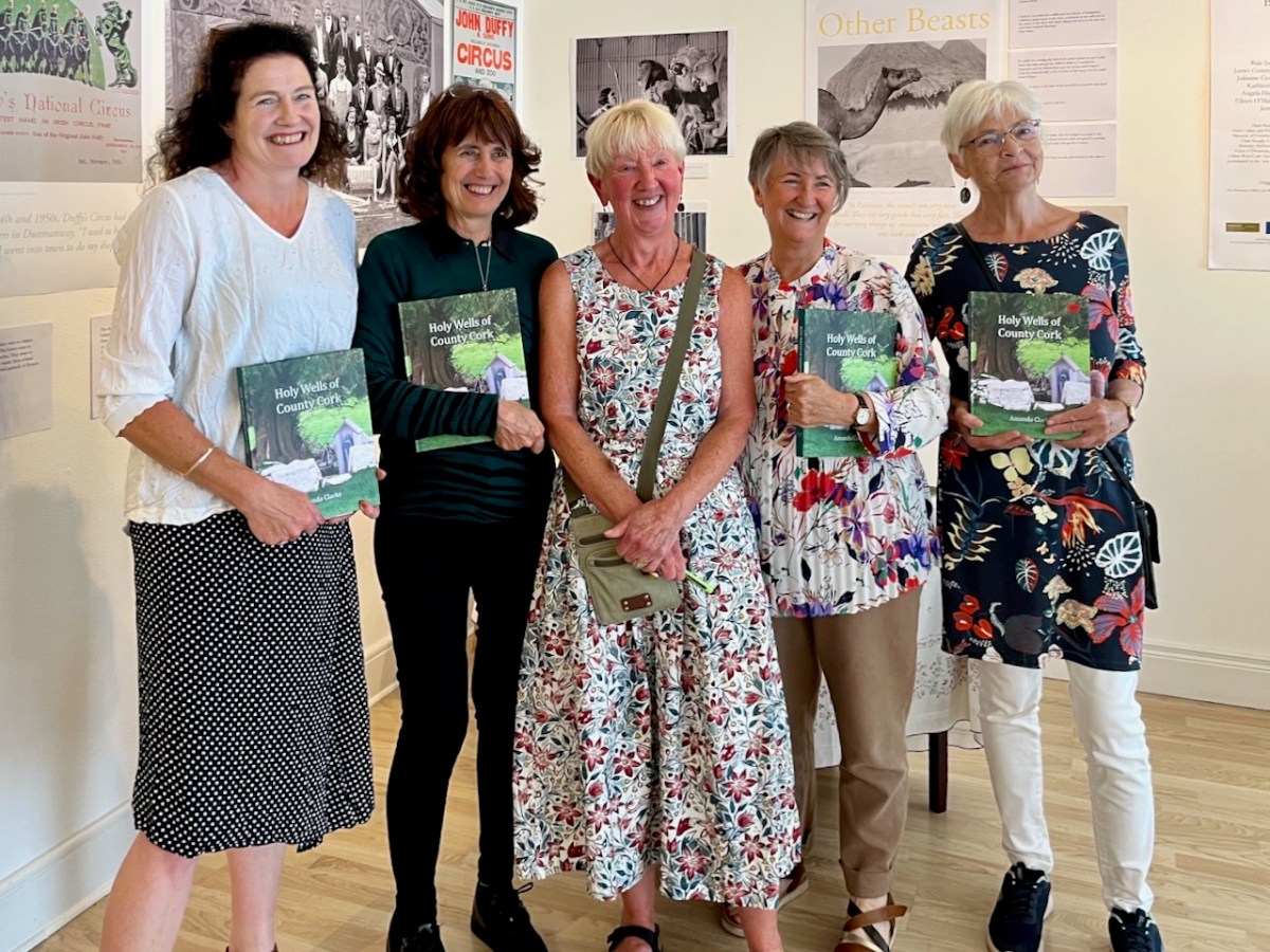
This was the scene in the Working Artist Studios, Ballydehob, on Friday evening. It was the launch of a brand new book by our friend Amanda Clarke: Holy Wells of County Cork. That’s Amanda, above, in the centre, with Finola on her left. Regular readers will know that we share many adventures with Amanda and Peter, and we were so pleased to see the successful fruition of her years of research with this outstanding volume, exquisitely designed by Peter, now available to purchase online, and in bookshops. Finola wrote about this venture last week. I thought I would indirectly celebrate it today by reviving a Roaringwater Journal post from five years ago, about one of our own expeditions that included a visit to a holy well.

Once again we followed in the footsteps of Amanda and Peter: they had visited the Glen of Aherlow in County Tipperary and pointed us to St Berrehert’s extraordinary site at Ardane which I described in this post. Not far away is another site, equally remarkable, and related to St Berrehert’s Kyle in that they were both restored by the Office of Public Works in the 1940s. They are also both very easily accessible in a few minutes from the M8 motorway at Cahir.

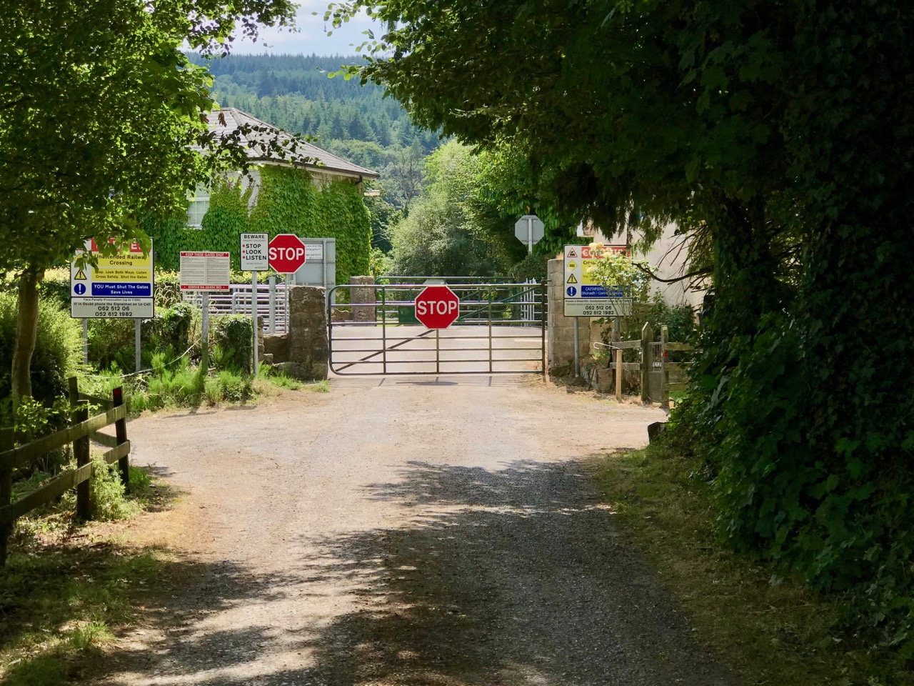
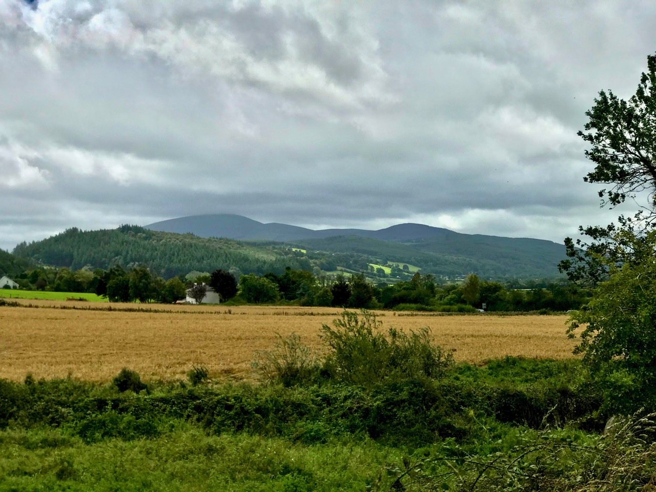
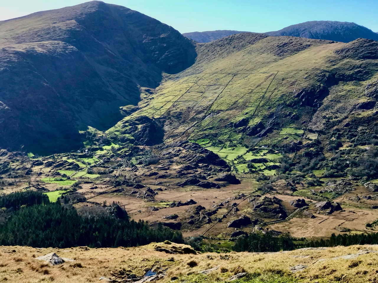
We were delighted to be travelling again through the beautiful Glen in the shadow of the Galtee Mountains (above) as we searched out a boreen that led us down to the railway. We parked and crossed at the gate, watching out carefully as this is the Waterford to Limerick Junction line used by two trains a day (except on Sundays!)

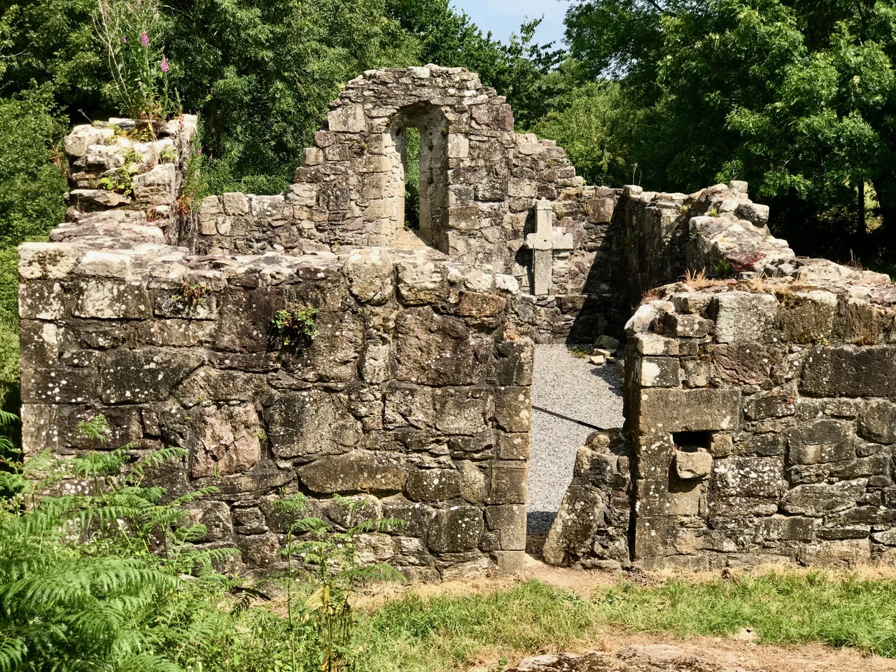
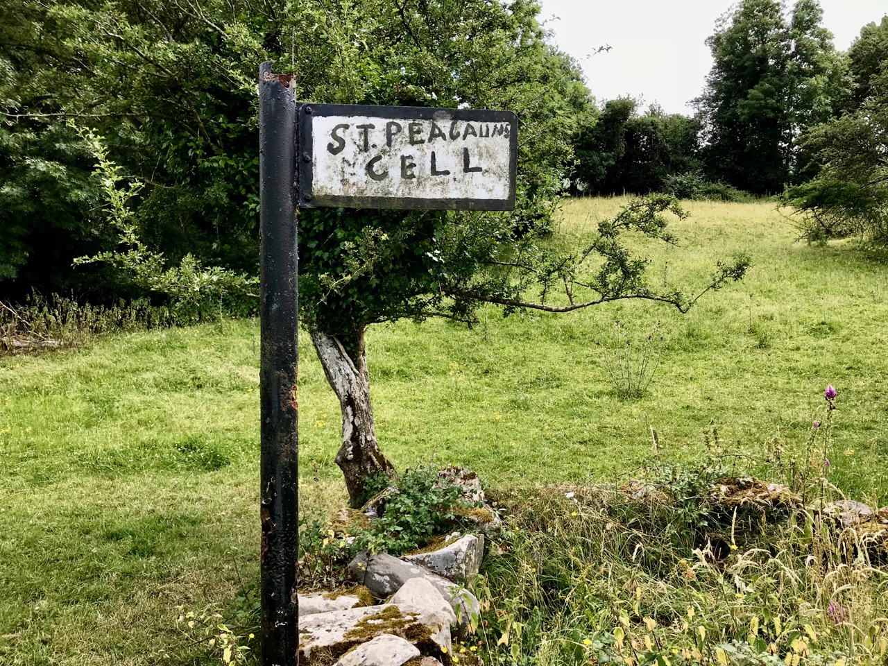
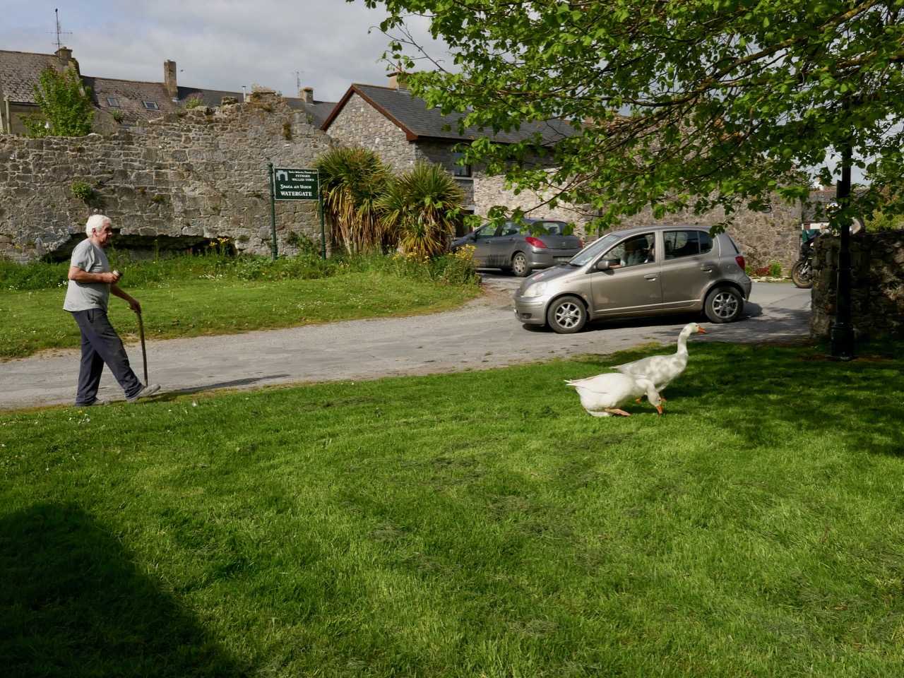
Once across, we were in an idyll. It’s a private lane, running alongside a gentle stream, but the Bourke family allow visitors to walk (as they have done for centuries) to the old church, the cell and the holy well of Saint Péacáin. Ancient stone walls line the way, and trees overhang, shading the dappled sunlight in this most exceptional of Irish seasons. We met Bill Bourke, who regaled us with tales of his life spent mostly far away from this, his birthplace – but who returned to rebuild the family home and to enjoy perpetual summer in what is, for him, the most beautiful setting in the world. He also told us of the crowds who used to come to celebrate St Péacáin at Lughnasa – 1st August – paying the rounds and saying the masses.

In her monumental work (it runs to over 700 pages) The Festival of Lughnasa – Oxford University Press 1962 – Máire MacNeill points out the harvest feast day was such an important ancient celebration that it survives as the focus of veneration of many local saints who would otherwise have been known for their own patron day, and she particularly mentions Tobar Phéacáin in this regard: a place well away from any large settlement where the great agricultural festival was so critical to the cycle of rural life.

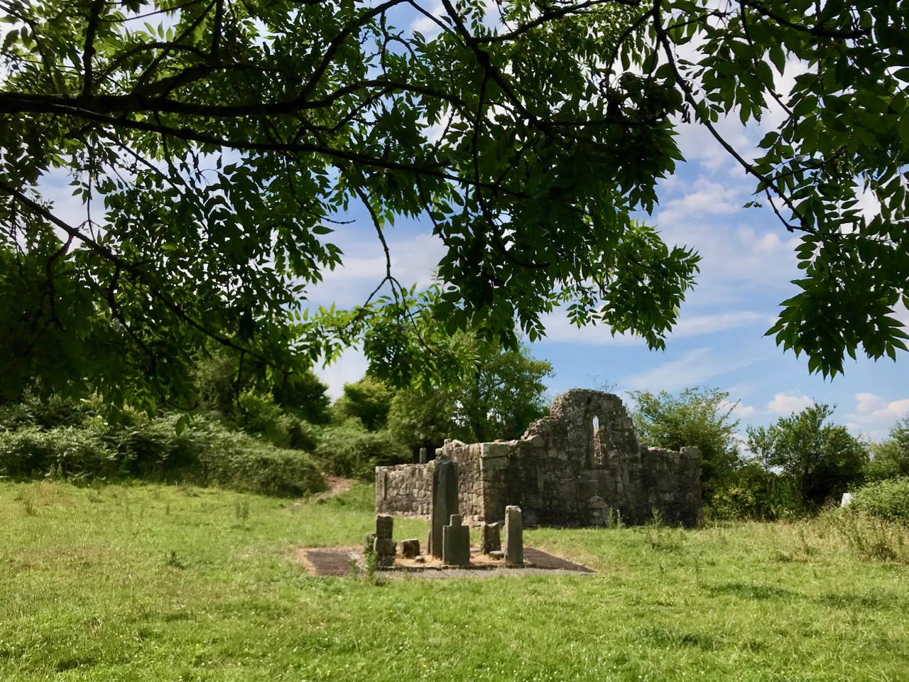
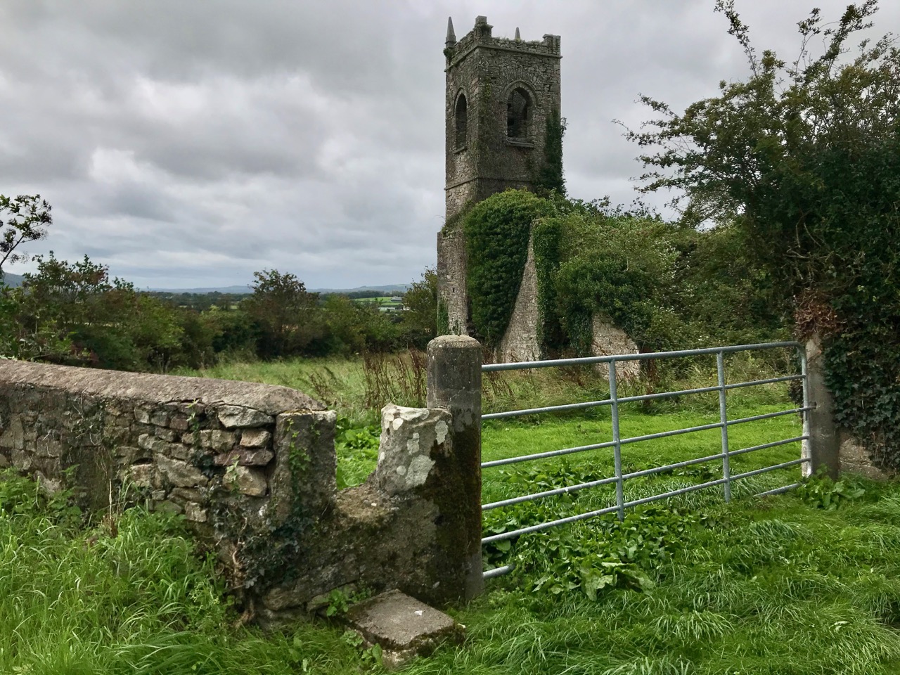
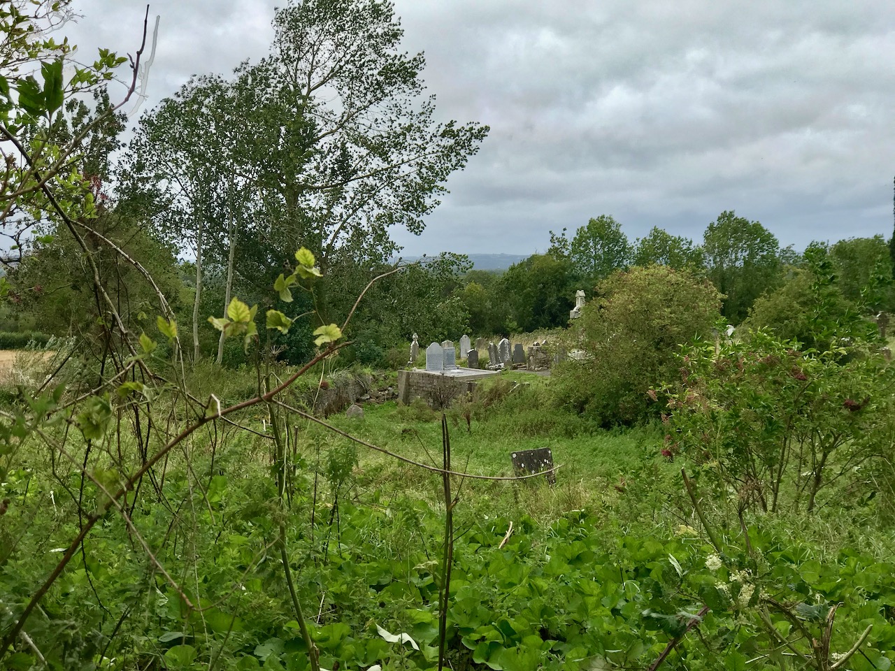
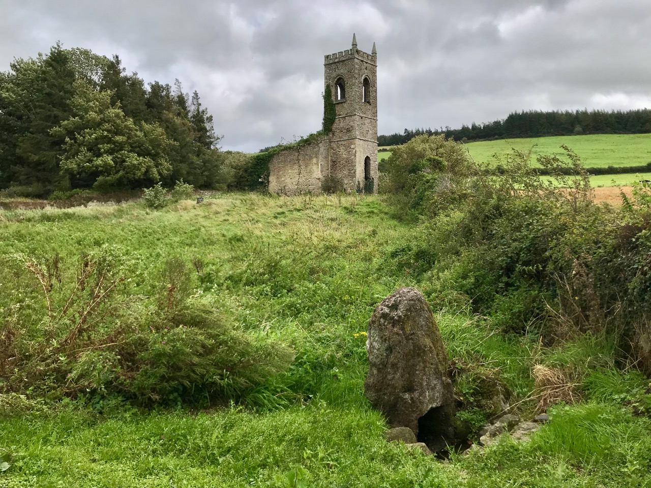
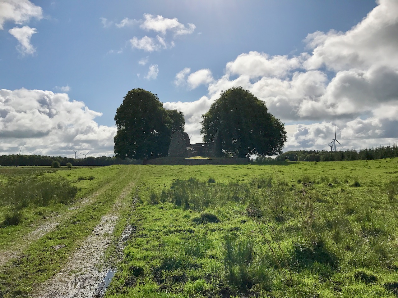
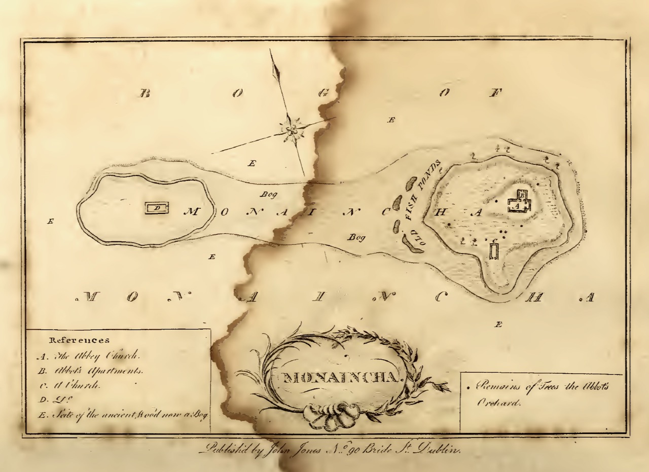
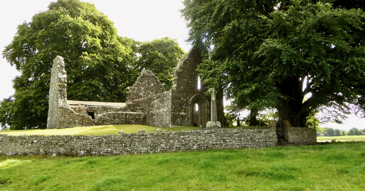
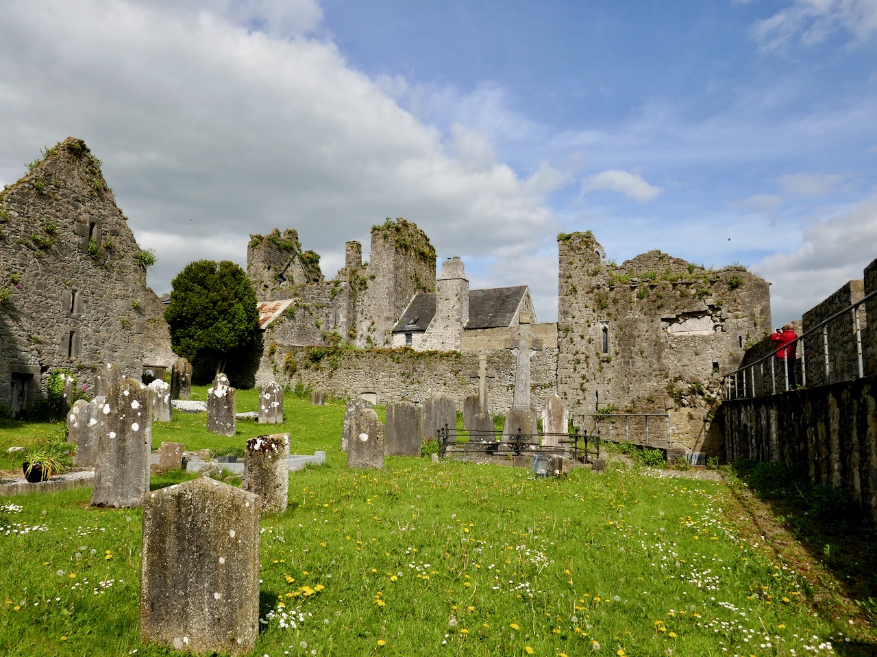
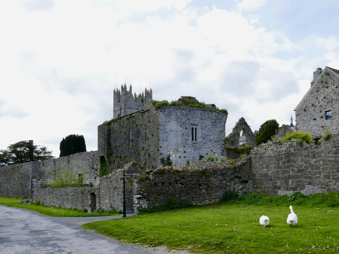
The rural setting of St Péacáin’s Cell can be seen above, just in front of the trees; the church and the well are nearby. MacNeill provides a description of Tobar Phéacáin and includes some variant names:

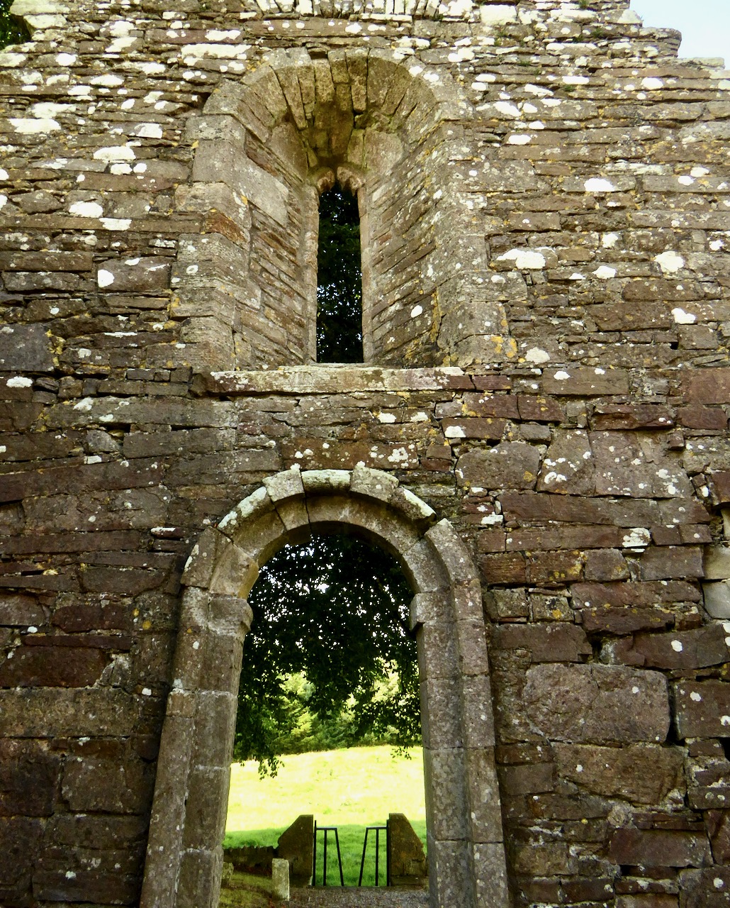
. . . Tobar Phéacáin (Peakaun’s Well), Glen of Aherlow, Barony of Clanwilliam, Parish of Killardry, Townland of Toureen . . . On the northern slope of the Galtee Mountain at the entrance to the Glen of Aherlow and about three or four miles north-west of Caher there is a well and ruin of a small church. About a mile beyond Kilmoyler Cross Roads a path leads up to it . . . In 1840 O’Keefe, of the Ordnance Survey team, reported that the old church was called by the people Teampuillin Phéacáin, or just Péacán . . .

. . . The well, which he described as lying a few perches south-east of the church was called Peacan’s Well or Tobar Phéacáin. It was surrounded by a circular ring of stonework. He stated: ‘The pattern-day still observed at this place falls on the 1st of August, which day is, or at least until a few years since, has been kept as a strict holiday.’ Devotions were also, he said, performed there on Good Friday . . .

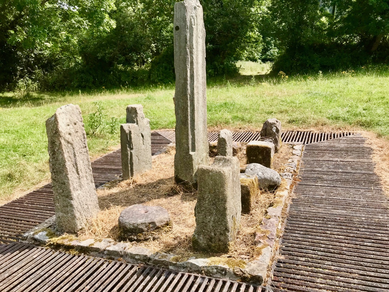
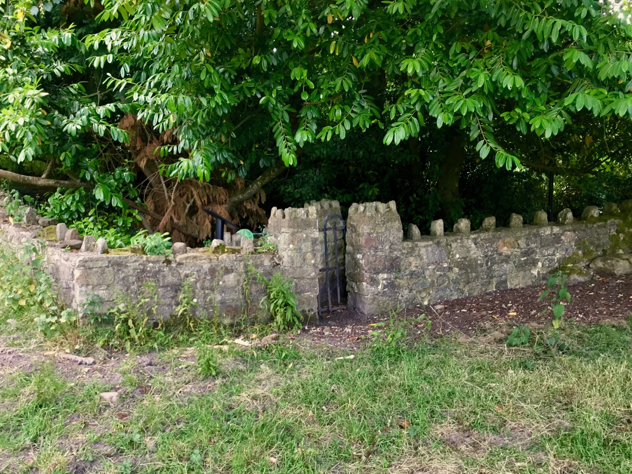
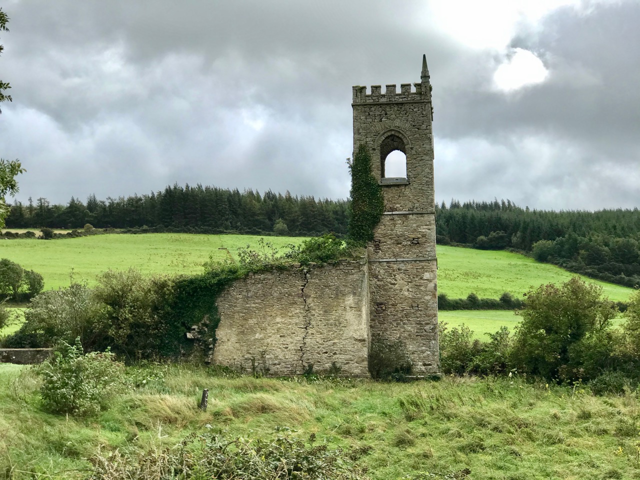
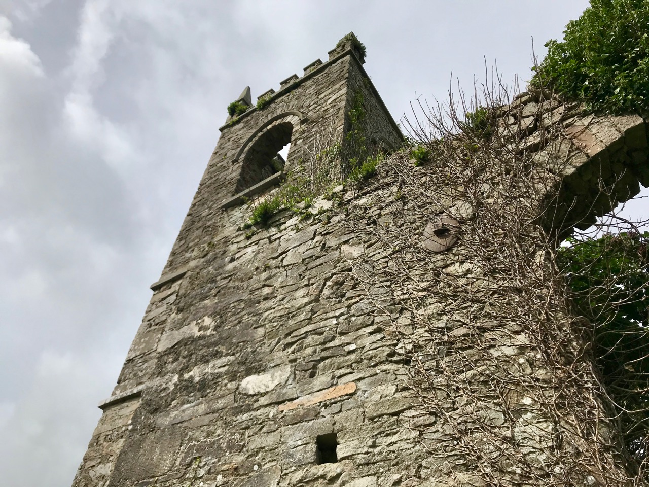
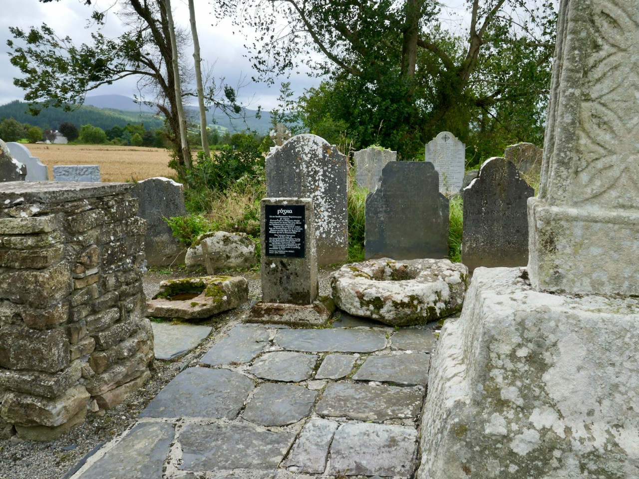
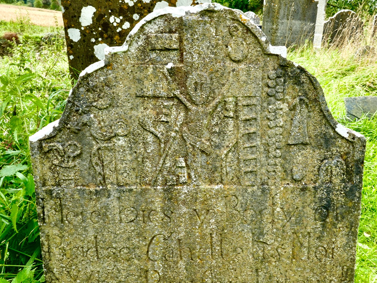
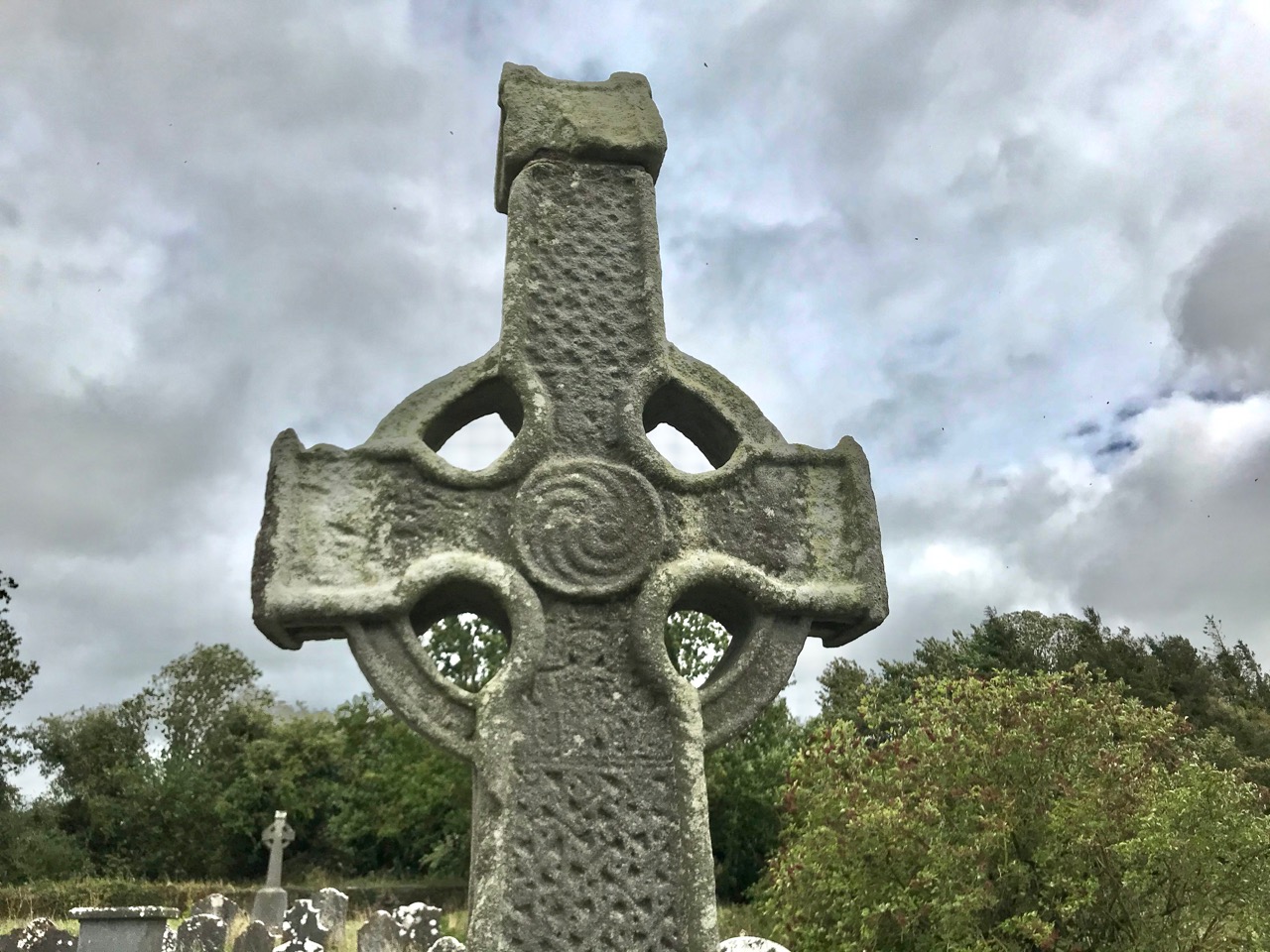
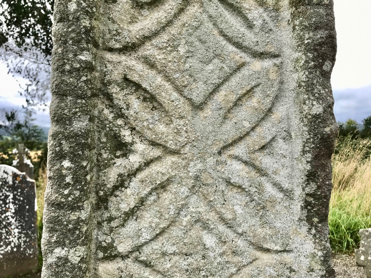
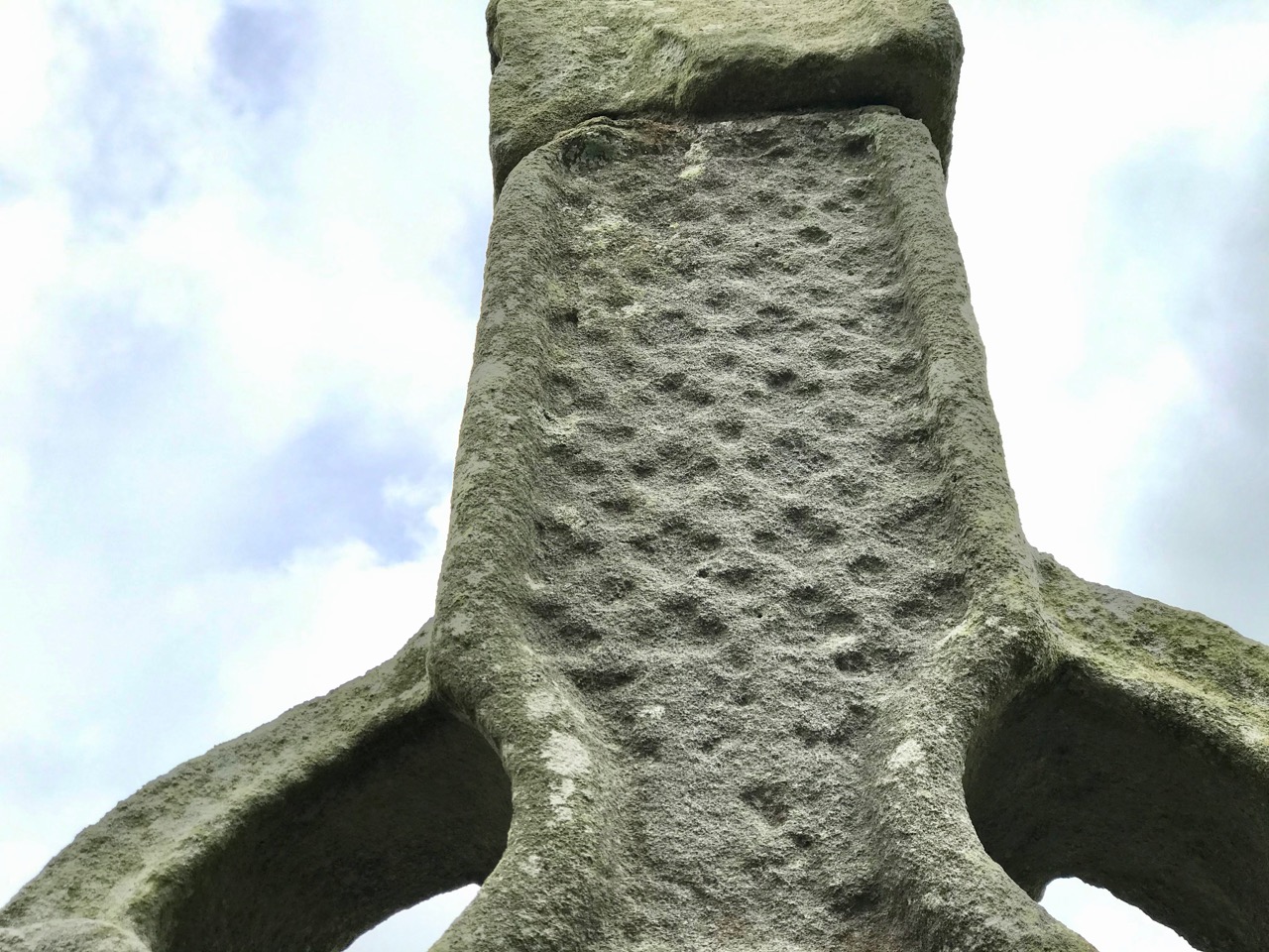
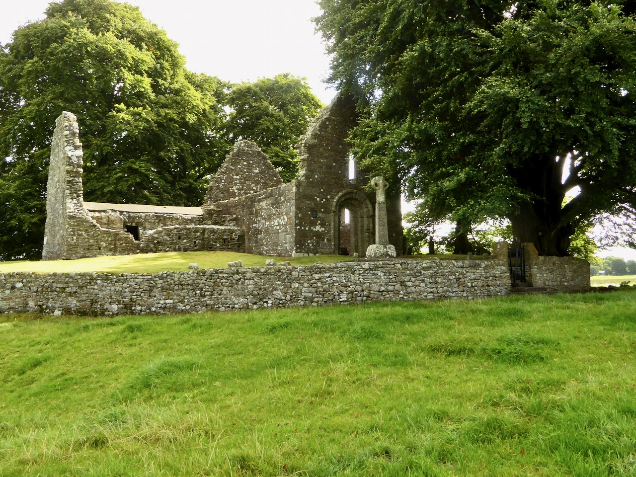
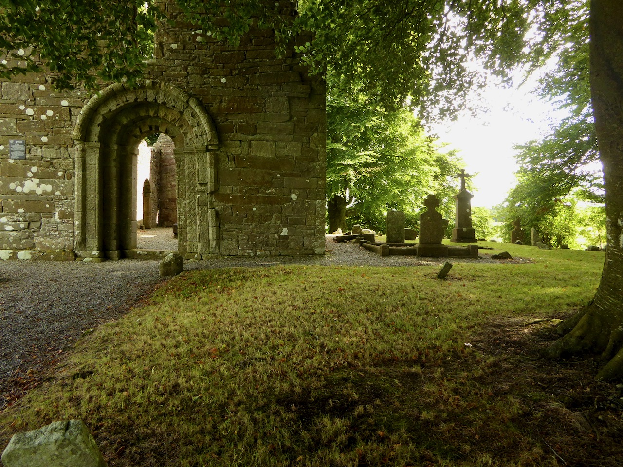
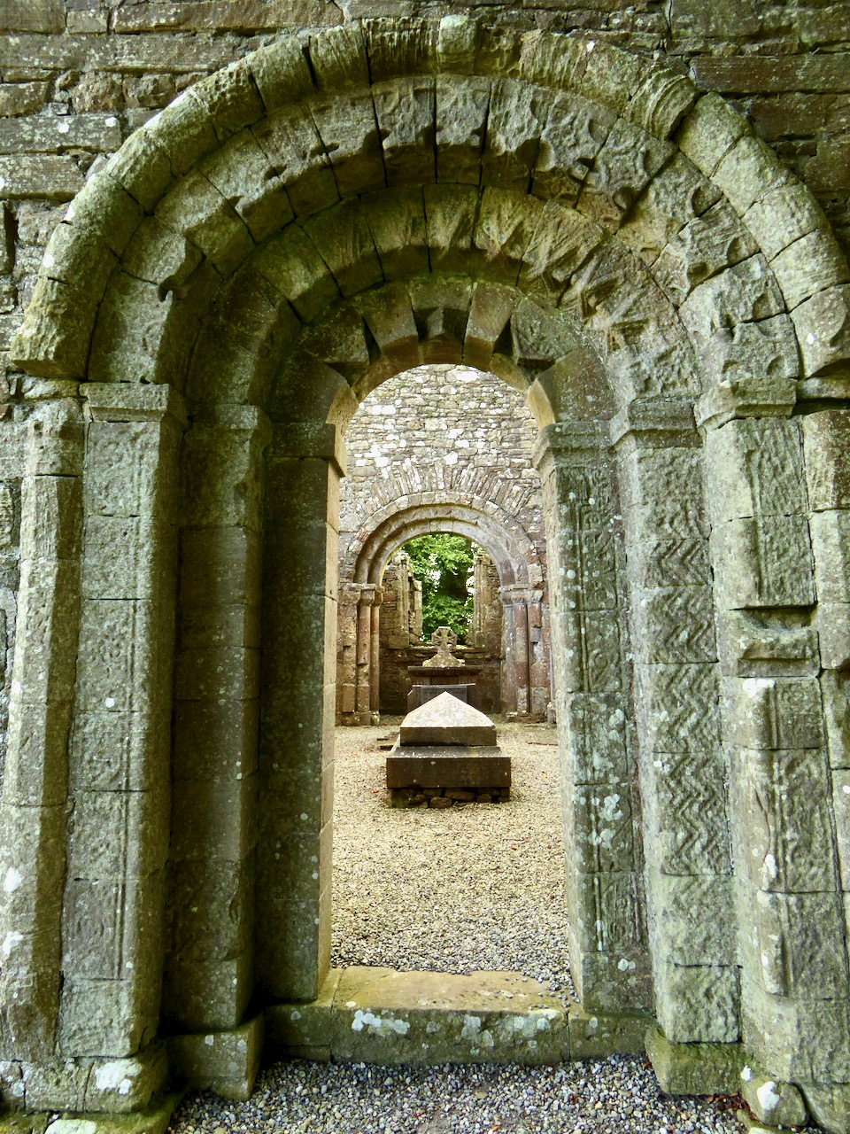
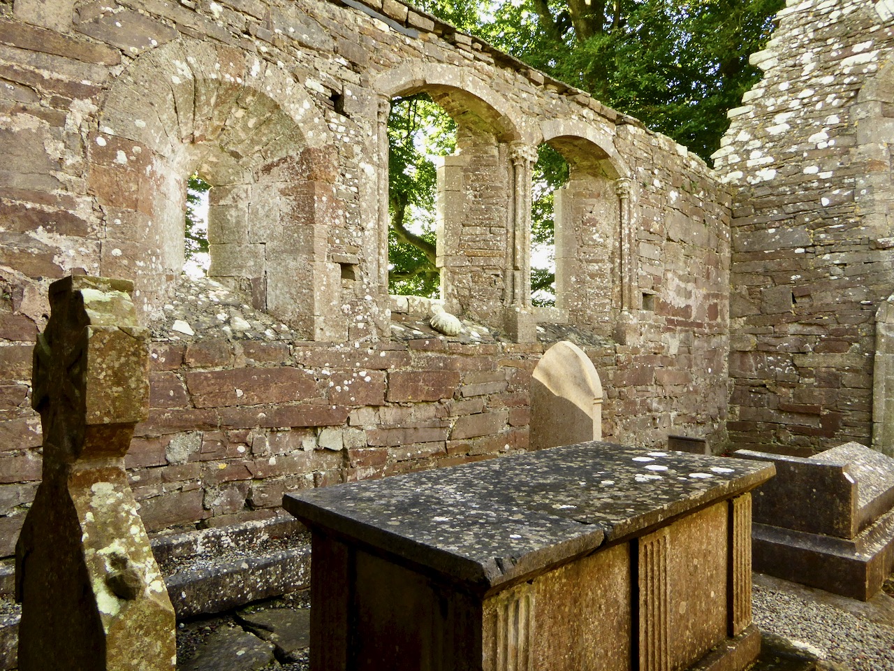
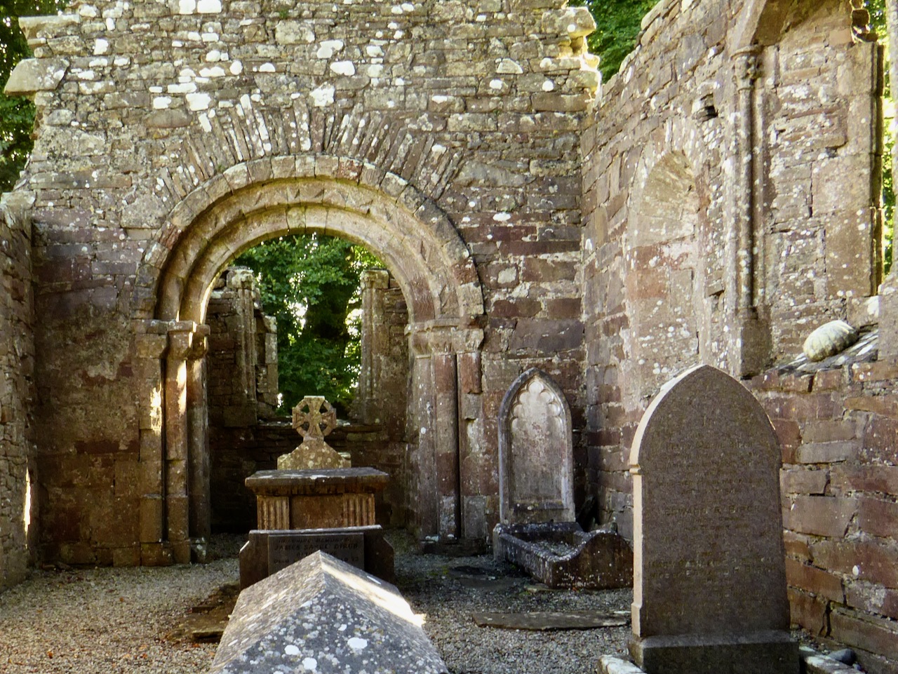
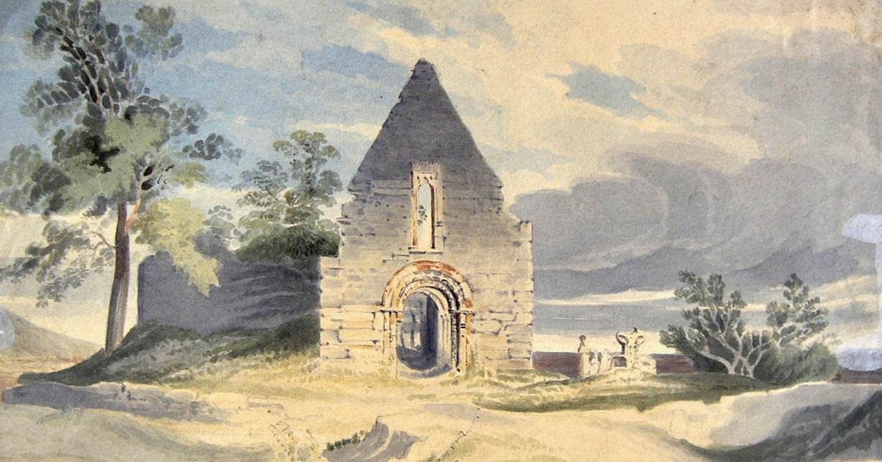
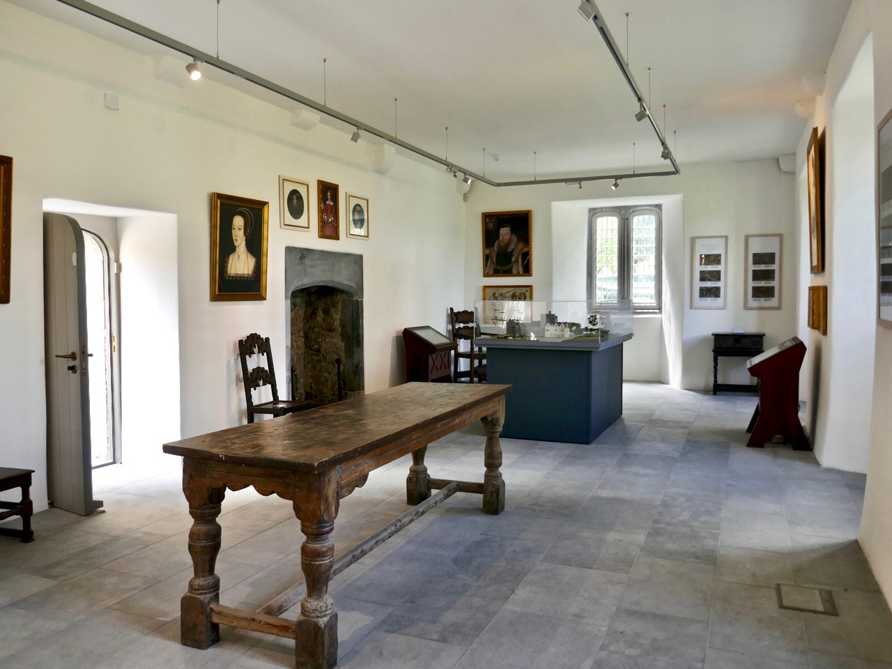
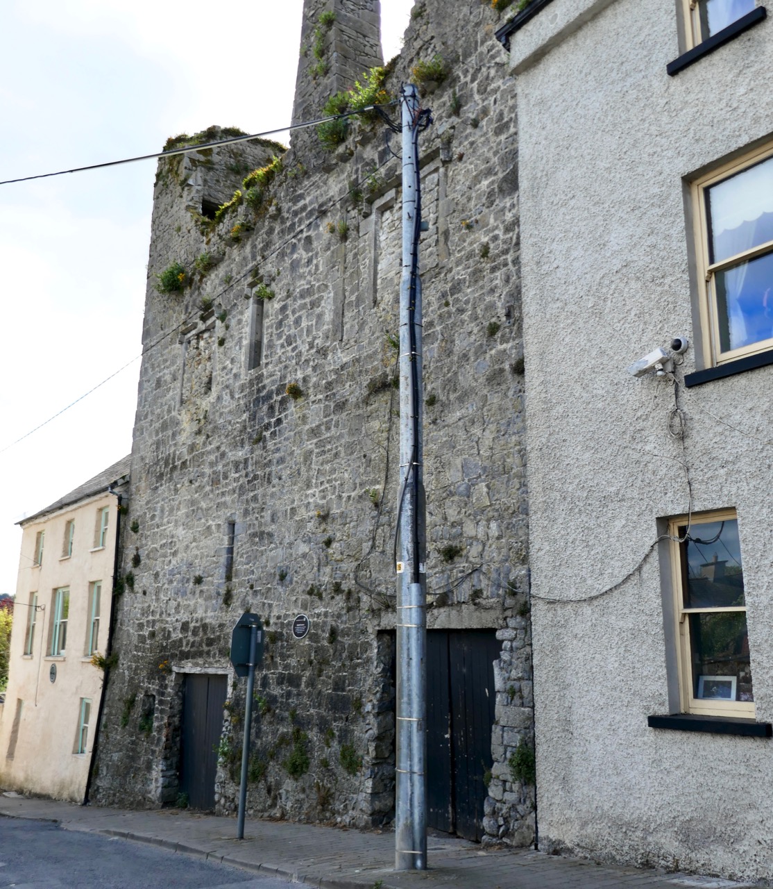
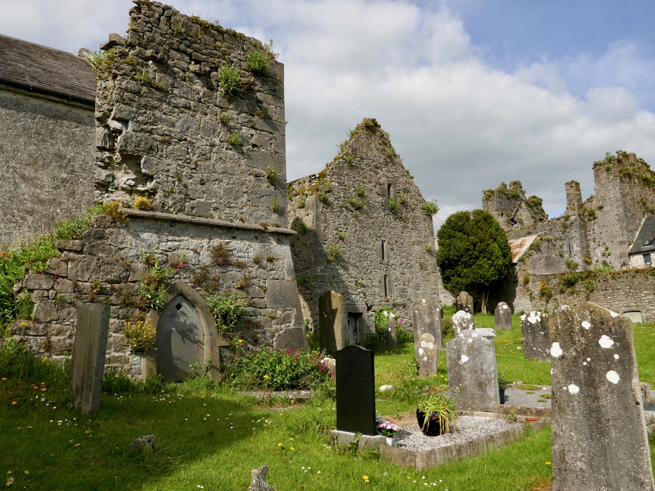
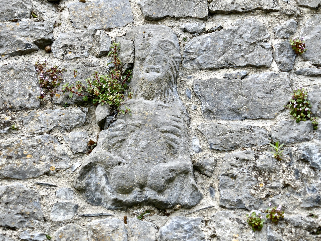
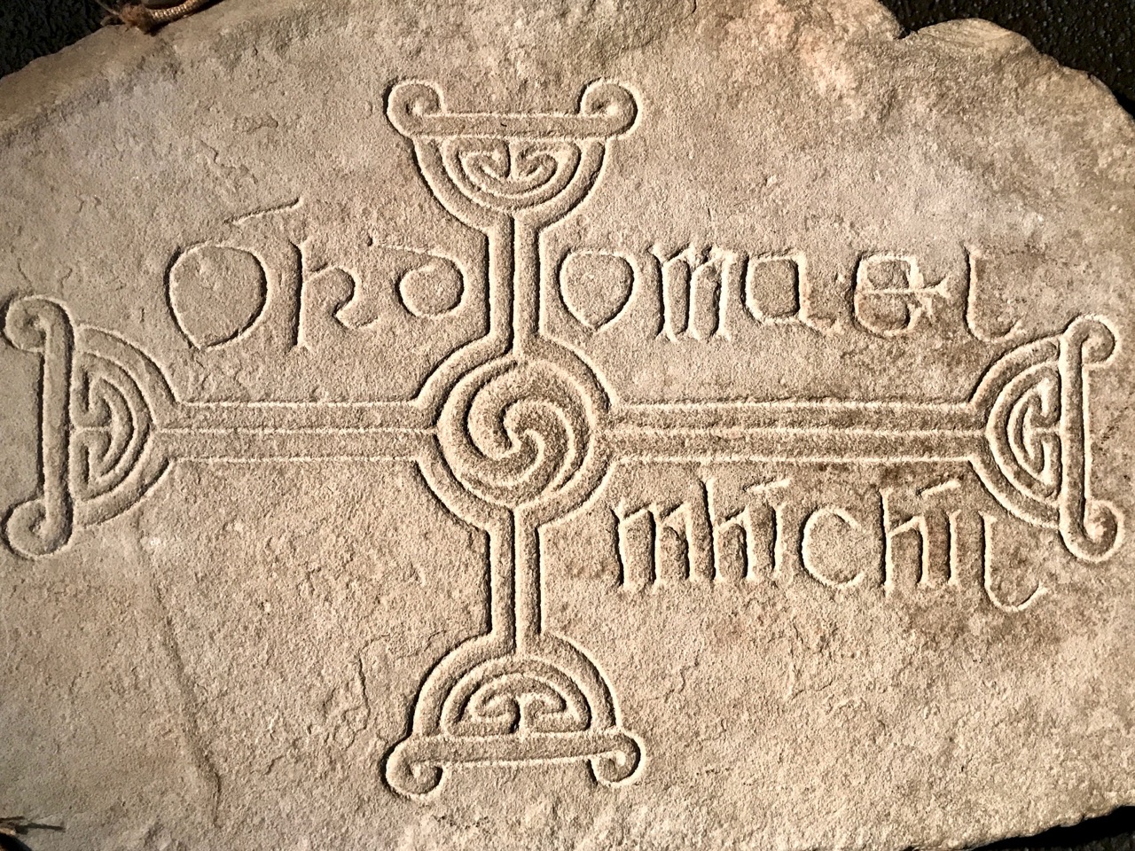
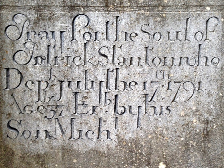
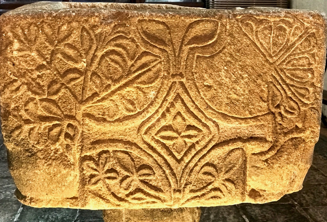
A hundred years after O’Keefe wrote this, the church ruins were tidied up by the Office of Public Works. As at St Berrehert’s Kyle, it seems there were numerous carved slabs on the site and remnants of high crosses, implying a significant ecclesiastical presence here. All these have been fixed in and around the church ruin for safekeeping, and in an intelligent grouping. It’s wonderful to be able to see such treasures in the place they were (presumably) made for, and to experience them in such a remote and peaceful ambience.

McNeill continues:

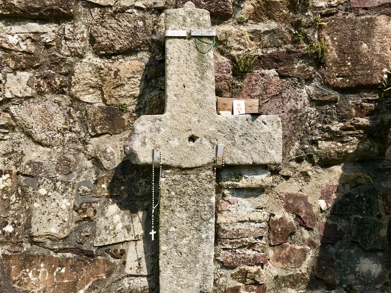
. . . Nearby is the shaft of a cross which tradition avers was broken in malice by a mason who was then stricken with an inward pain and died suddenly as a punishment for his sacrilege . . . O’Keefe was told a story of a small stone, 6 or 7 inches long and 4 or 5 in depth, having ten little hollows in it and resting in a hollow of the ‘altar’ of the old church. Christ, or according to others St Péacán, asked a woman, who had been churning, for some butter; she denied having any and when the visitor departed she found the butter had turned into stone which retained the impression of her fingers . . . Nuttall-Smith speaks also of a cave where the saint used to practice austerities . . .

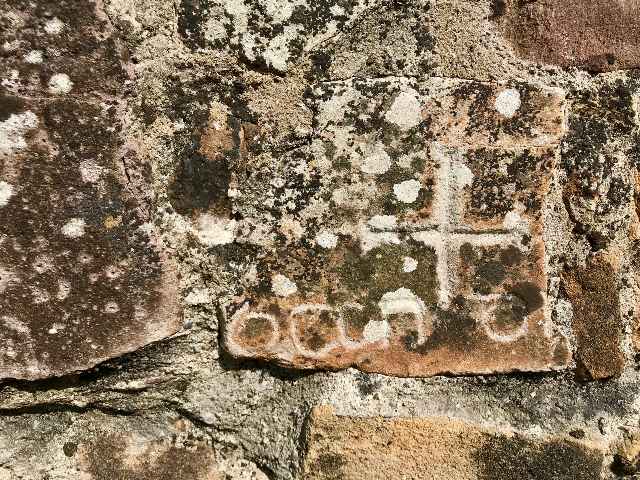
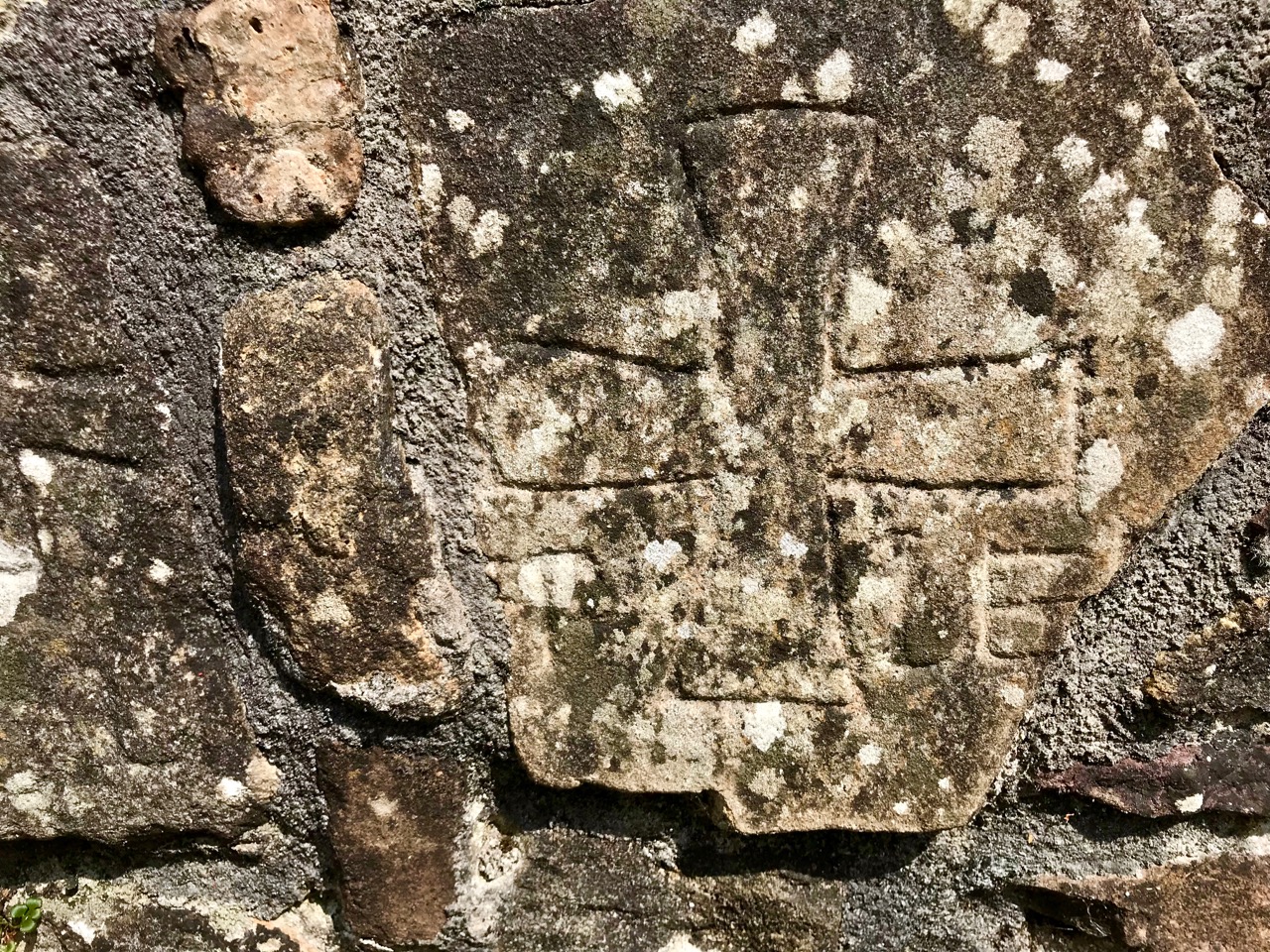
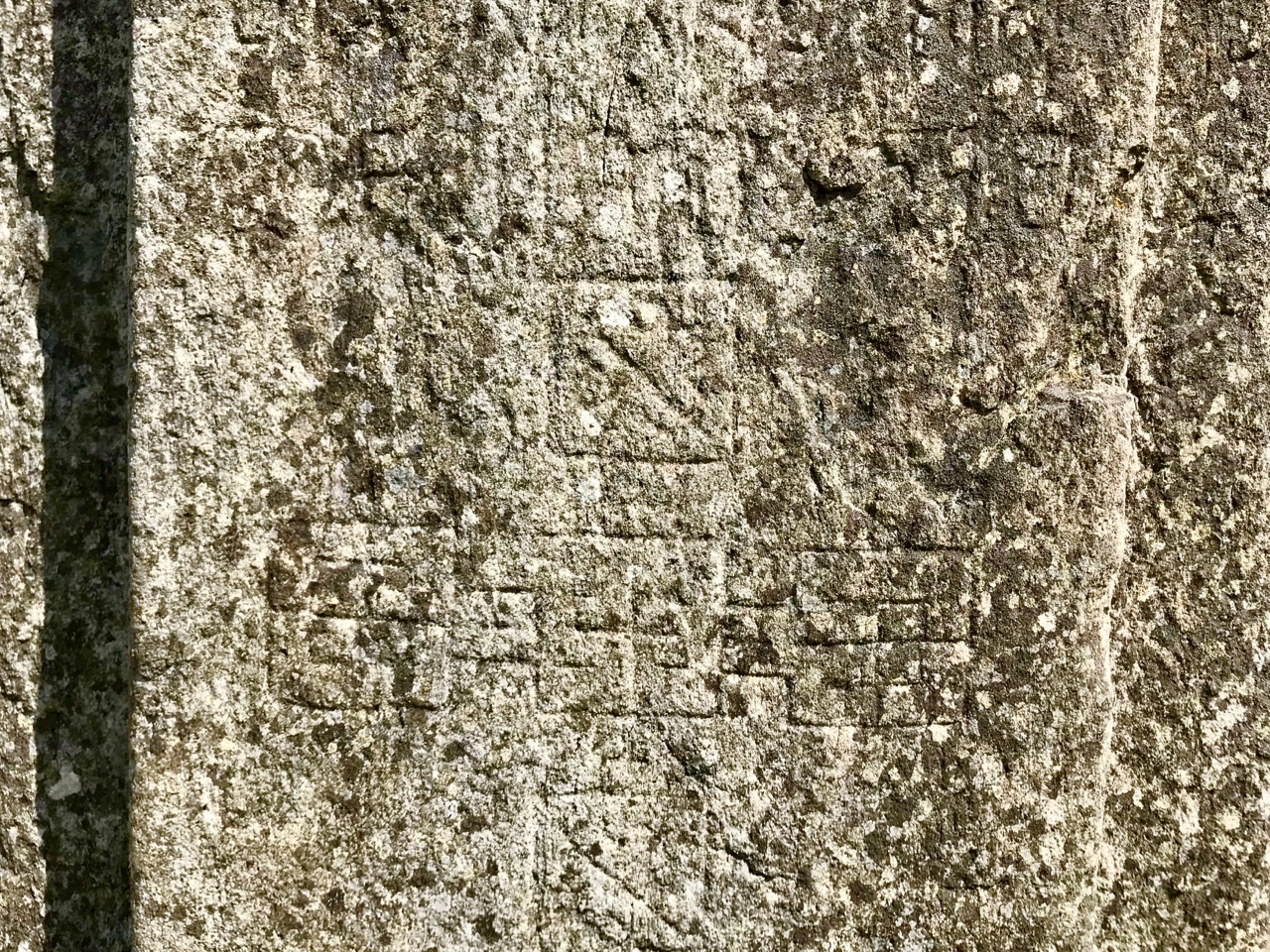
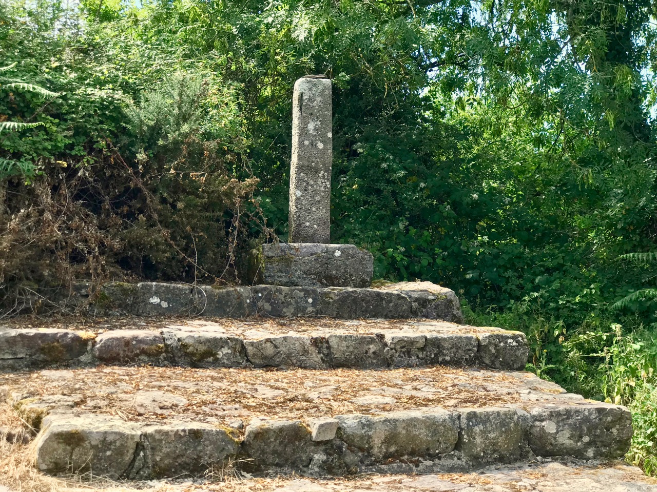
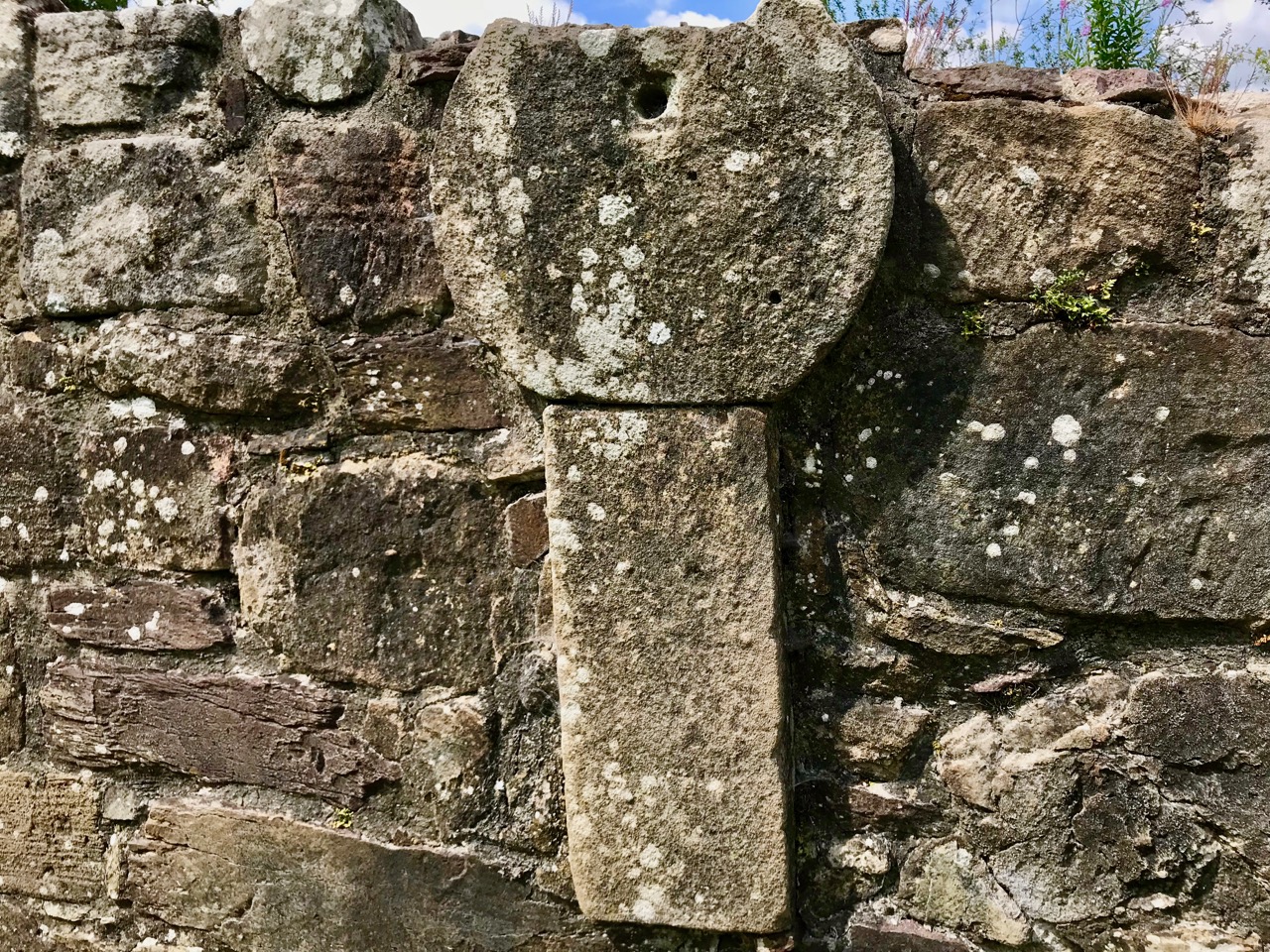
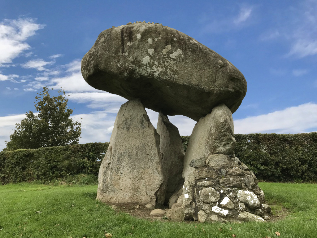
The carved fragments are quite remarkable and are in all likelihood well over a thousand years old. I have yet to see anywhere in Ireland – outside of museums – which has such an extensive collection of fascinating medieval antiquities as these sites in the Glen of Aherlow. Here you can also see cross slabs and a sundial said to date from the eighth century.

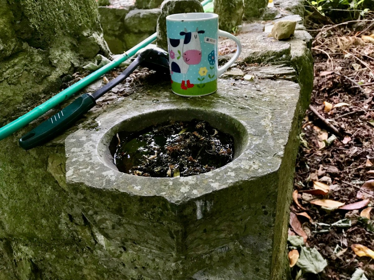
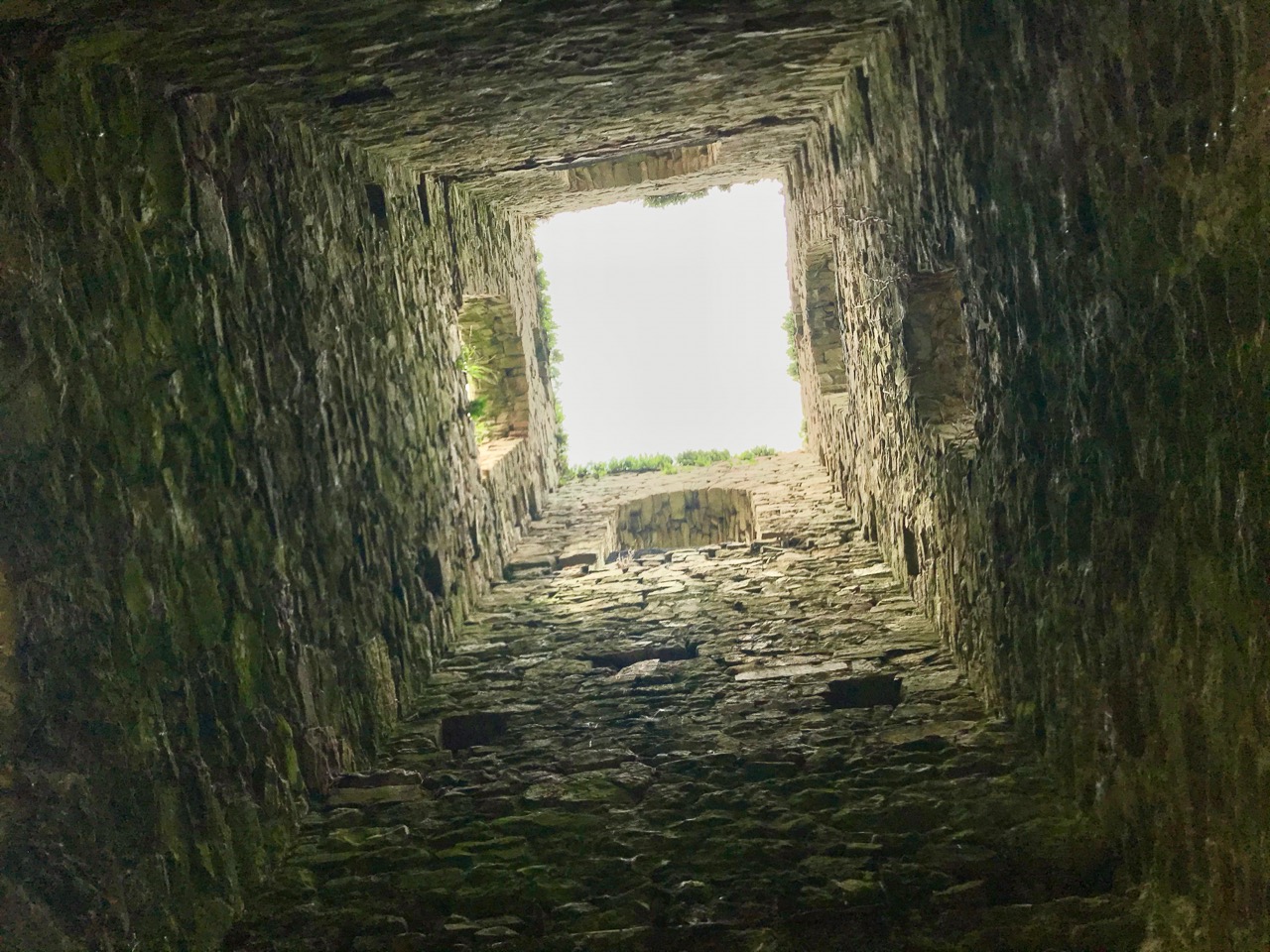
Nuttall-Smith’s ‘cave’ – quoted by MacNeill above – is likely to be St Péacáin’s Cell, set in a field on the far side of the river. This was probably a clochán, or beehive-hut, of the type once used by anchorites. It is protected by a whitethorn tree, but was quite heavily overgrown on the day of our visit. We could make out the ballaun stones inside, said to be the knee prints of the Saint who made his constant devotions there. Amanda – in her post on the holy well – reports that Péacáin would also stand daily with arms outstretched against a stone cross, chanting the psalter.

McNeill discusses the significance of weather at the August celebrations:

. . . Paradoxically for a day of outing so fondly remembered, no tradition of the Lughnasa festival is stronger than that which says that it is nearly always rainy. No doubt this has been only too often experienced. Saint Patrick’s words to the Dési: ‘Bid frossaig far ndála co bráth’ (Your meetings shall always be showery) must be as well proved a prophecy as was ever made. Still there must be more significance in the weather beliefs than dampened observation. Certainly it was expected that rain should fall on that day, and sayings vary as to whether that was a good or bad sign . . . There are a few interesting beliefs about thunder, which was also expected on that day: the loud noise heard at Tristia when the woman made rounds there to have her jealous husband’s affection restored; the prophecy that no-one would be injured by lightning at Doonfeeny, a promise also made by St Péacán . . .

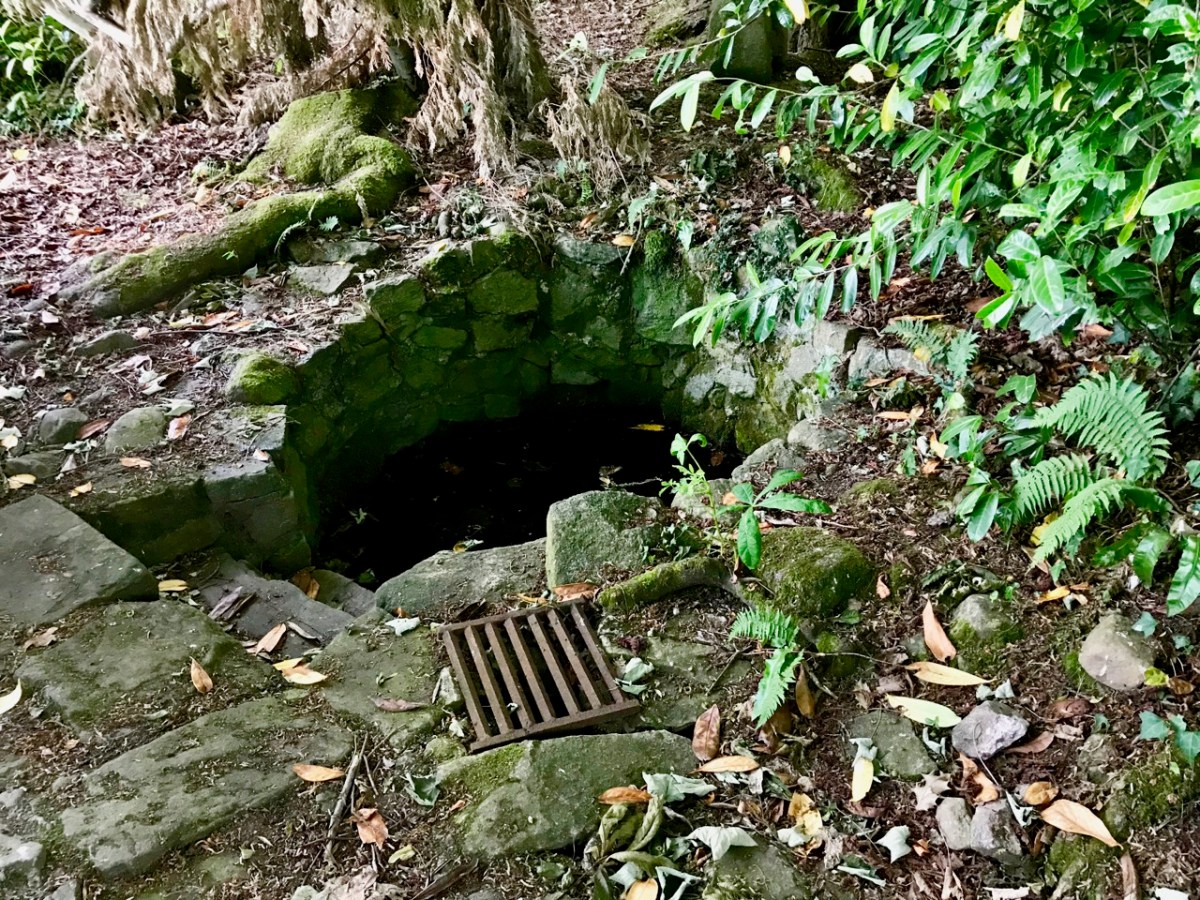
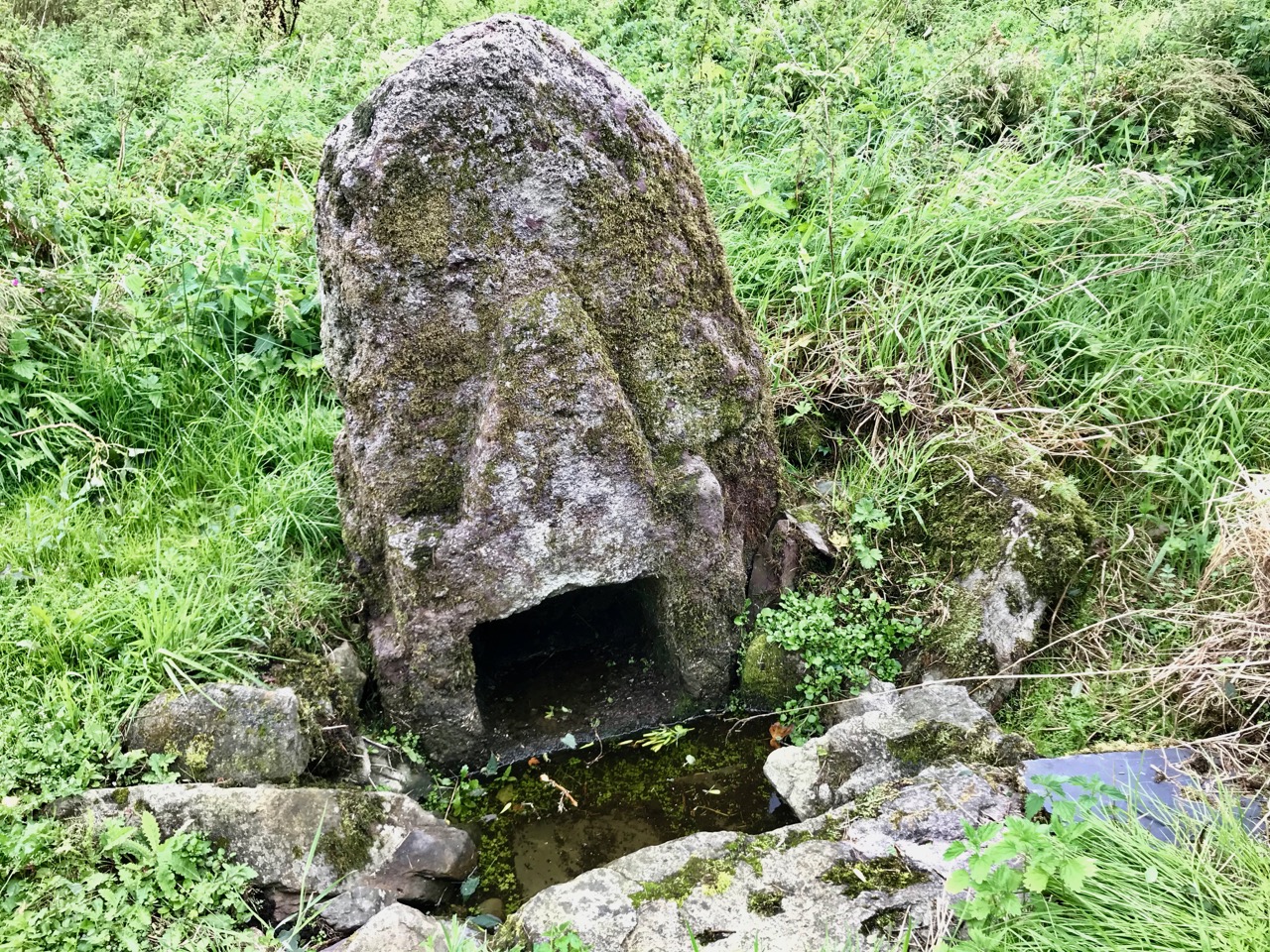
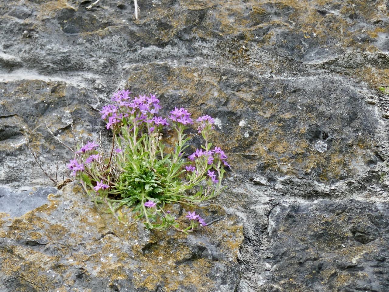
The holy well is tucked away in a stone-walled enclosure hidden under the trees on the edge of the field which contains the Saint’s cell. It is also a tranquil place, obviously still much visited: the water is crystal clear, refreshing and will ensure protection from burns and drowning.  This is a magical setting to complete our day’s travels in the beautiful Glen of Aherlow.

Off the M8 – A High Cross and a Complex Saint

We haven’t had an ‘Off the M8’ for quite some time. You remember that, on our journeys from West Cork to Dublin, we would go (literally) off the beaten track to find new places of interest to visit – making a ‘grand day out’ of every trip. However, the unexpected arrival of the Covid19 pandemic severely curtailed our travelling – and everyone else’s – for many months. Covid is by no means over, even now, but we are slowly venturing further afield and, last week, made the trip up to the Dublin area, following all the guidelines. Nevertheless, we couldn’t resist trying out a fresh route which adds about 40 minutes to the overall journey but which takes in a new (for us) medieval stone cross and a historic site with thought-provoking associations. It is situated with fine views of the Slieveardagh Hills to the west.

We followed the normal route as far as Cahir, on the M8, then headed off east on the N24 and N76 towards Callan. Just after Ninemilehouse (Ireland has some wonderful place names!) you cross from County Tipperary into County Kilkenny and, within a few minutes (watch carefully), you’ll see a small signpost directing you off to the right down a tiny boreen to Killamery High Cross.

The first thing you’ll see, at the end of this lane, is the ruin of a significant church. Some distance beyond it you’ll make out the distinctive shape of the large, carved stone cross but also many other treasures including old grave slabs, bullaun stones and a very fine holy well dedicated to Saint Nicholas.

The site is associated with an Irish holy man, as you would expect: Saint Gobhan, Gobán Fionn, Gobban – or even Gobanus – who lived from c560 to c639AD. Foundations associated with this saint were many, including Portadown, Co Armagh, in the north; also as Abbot to the monastery of Old Leighlin, County Carlow, where in 633AD he presided over a great Synod held to debate the timing of Easter (we seem to remember only the later Synod of Whitby – 664AD – which also set out to regularise the date but which led to irreconcilable disagreement between the Irish and Roman factions). Latterly, Gobhan was linked to the Kingdom of Kerry – near Tralee, but we are interested today in the monastery he set up by a holy well in Killamery. He had a thousand monks with him and it is said that an army of angels helped build the walls.

The angels must also have helped to eradicate that monastery as there is now no trace of Gobhan’s foundation in County Kilkenny, just a lonely 19th century church, the well (pictured above), a burial ground and this very fine High Cross. The cross is well worth a visit: some say it’s the oldest of the Western Ossory high crosses, which are themselves considered to be a distinct group. I have looked previously at the Kilkieran examples. Here at Killamery there is just the one cross and, perhaps for that reason, it stands out in the memory. Some scholars reckon it could be 8th century, but most attribute it to the 9th. It’s ancient by any standard, certainly, and it’s probably unavoidable that the carving is so weathered.

The Duchas signboard (above) describes the scenes depicted on the various elements of the cross,  but most of what we can decipher today is limited to geometrical patterns – very much in the ‘Celtic’ tradition. There may have once been other visible motifs: the large plinth stone is completely worn on all surfaces.

The cross certainly predates any of the other artefacts, bullauns and stone markers which surround it today, but it is likely that the adjacent holy well is even more ancient: it is dominated by an intriguing, large shaped monolith.

Among the artefacts which have arrived at this site is a fine 17th century (probably) cross slab and a memorial to the United Irishmen who lost their lives at nearby Carrigmoclear in 1798 – both shown below.

The origins of Gobhan himself merit some consideration. He has associations with metalworkers and, of course, we know that Saint Gobnait was their patron saint. Could there be some fusion of names in folk history and oral tradition? Like Gobhan, Gobnait is revered at many sites around Ireland and undertook diverse travels around the island in search of the nine white deer which set her destiny.

There’s nothing more Irish than the experience of finding references to hundreds of years of history hiding down a lonely boreen to nowhere in the rural heart of this land. More than anything, it makes us want to know more. What is real? What is myth – although made to seem logical and credible through stories which are still told? Of course, we can never know the reality, but we can share in the spirit of the stories, and wonder at a piece of stone beautifully carved, perhaps, thirteen hundred years ago . . .

Once you have visited this fascinating site, find your way across to the M9 (it’s straightforward enough) and you’ll be up to the big city in a jiffy!

Irish Romanesque 3 – Monaincha, the Isle of the Living

There are places on this island that seep into your soul. You come away with a sense of having visited another world, of having passed through a portal and been lucky enough to come back to tell the tale. Such a place is Monaincha in Tipperary.

We made this trip because I was studying Irish Romanesque architecture and Monaincha is a fine example, but we had no real idea what to expect and it caught us off guard. An ancient signpost directed us down a rough track through the trees and then by foot across the fields. Our first glimpse was of what looked like an island in the middle of flat land.

We weren’t wrong – this had been an island, called Inchanambeo (Incha na mBeó) which translates as Island of the Living. Curious name, but of course, this being Ireland, there’s a story to it. Here it is from Dúchas, the School’s Folklore Collection, collected by a 12 year old in the 1930s:

On this lake were two islands; the Island of the living which was the smaller of the two was a place to where saints went who wanted to live alone – with God. It was called the Island of the Living because it was said that no one could die who went on this island. Of course this is not to say that their bodies could not die – it meant that their souls could not die, because Our Lord said “He that eateth of this bread shall live for ever”. No woman could go on the large island because she would die. This was often experimented, when men brought female animals on the island but they dropped dead the moment their feet touched the island.

Hmmm – as a woman, perhaps I did indeed go through some kind of portal, since I managed to live through the experience. That explains the Otherworldly feeling!

The top image and this one are from Ledwich’s Antiquities of Ireland, published in 1790. His map clearly shows that both islands were still there at that time, with a building still in place on the small island, while the first illustration shows the second building on the large island, no longer there

For this and more Duchas stories about Monaincha, go to this link on the Dúchas website. You will see that Cromwell sacked the monastery, that the woman who gave away the monks’ location was turned to stone along with her cake of bread, that the lake contains hidden treasure, that the water if used improperly would not boil, that many miracles were associated with the saints who lived on Monaincha, and that a white lady roamed the area until banished by a priest but not before she left her mark on him (read the story).

And here it is – the cake of bread that was turned to stone

One of those saints was St Canice, who came on retreat to this sacred spot:

He did not let anyone know where he was but he got letters and messages each day by means of the Garnawn Bawn. This was the White Horse which passed each day without a guide from Agherloe to Monahinche.

St Canice (second from right) in good company with Sts Patrick, Brigid and Eugene. He’s holding his cathedral. The window is in St Eugene’s church in Derry

But it was St Cronan who built the church:

St Cronan and his monks sought a place where they could build a residence. They proceeded to the parish of Bourney to a place called Bogawn  but looking towards Monahincha they saw the sun shining on it and so fixed the site of their future home on Monahincha. St Cronan lived for a long time in Monahincha and while he was there he prayed a great deal and performed many miracles.

For a more academic history of Monaincha we turn to the bible of all things Romanesque, the Corpus of Romanesque Sculpture. From it we learn that:

Originally known as Inis Loch Cré, the name Mona Incha was only given to the site in the in later centuries. The earliest monastery here was founded by St Cainneach of Aghaboe in the 7thc as a hermitic settlement. Column Mac Fergus died on Inis CrÈ in 788 as did Elarius, anchorite and scribe, in 807. The latter was St Elair, or Hilary who was patron of the monastery in which the Culdees were instituted in around the 10thc. In 902 Flaithbertach, King of Cashel, came here on pilgrimage. An Augustinian community was established at Mona Incha during the mid-12thc.

In 1397 the monastery, containing a prior and eight canons, was taken under the Pope’s protection and released from paying Episcopal dues because of its extreme poverty. At about the same time the Book of Ballymote described Mona Incha as the 31st wonder of the world! In c.1485 the prior and convent finally moved to Holy Cross at Corbally, as the canons found the vapours from the marshes surrounding the island unhealthy. Following the Dissolution the church was used as a penal chapel. 

Much of this is based on the erudition and scholarship of Harold Leask, whose three volume book Irish Churches and Monastic Buildings has a section on Monaincha. He also authored, along with C MacNeil, an article in the Journal of the Royal Society of Antiquaries of Ireland which is a very comprehensive account of all that can be gleaned from annals and hagiographies of the history of Monaincha*.

Leask’s plan of the ruins at Monaincha

He cites Gerald Barry’s (better known as Giraldus Cambrensis) Topographia Hibernia (written in 1188), to show how ancient is the tradition of the Isle of the Living.

There is, he says, a lake in North Munster containing two islands, a greater and a less. The greater has a church of an ancient religious order and the less has a chapel served by a few celibates whom they call Celicolae or Colidei [Culdees – an ancient hermetic order]. No woman or animal of the female sex could enter the greater island without dying immediately. This has been put to the proof many times by means of dogs, cats, and other animals of that sex, which have often been brought to it as a test, and have died at once. As regards the birds of the district, it is wonderful how, when the males settle at random on the bushes of the islands the hen birds fly past and leave the males there and avoid that island like a plague, as if well aware of its natural power.  No one ever died or could die in the smaller island, whence it is called the Isle of the Living; yet from time to time persons are afflicted with deadly ailments and suffer agonies to their last breath. When they feel there is no longer any hope of really living, and by the increase of their disease they are in the end so distressed that they would rather dies outright than continue in living death, they have themselves brought at last in a boat to the greater island, and they give up the ghost as soon as they touch the land.

Leask and MacNeill go on to state that the place had been the site of pilgrimage formerly and some stations were still visible in 1848, and that the proprietor of the place had drained the lake in the 1820s or so and forbade all access to the church either for burial or pilgrimage, destroyed tombstones and erected round the church a circular mound, composed, the people say, of the mortal remains of the hundred generations deposited in that favourite churchyard.

What was once the larger island (there is no sign now of a second one) is still, as Leask described in the 1920s, a circular raised platform, due to the draining of the surrounding land, but there is still very much a sense of travelling across an open expanse to get to it. Marooned in the middle of a large field, the island is visible as a group of very tall trees and it’s not until you get close to it that you begin to see the structures.

As with many such sites in Ireland, the graveyard surrounding the ruined church, despite what Leask asserts, appears to be still intact. This adds to the reverential feeling of the place, as do the enormous trees, which must be hundreds of years old. A partly reconstructed high cross stands at the entrance – Robert wrote about this one in his post Fading Treasures.

The church is a Romanesque gem. (For more about Irish Romanesque architecture, I have provided a list of previous posts at the bottom of this post.) Dating to the twelfth century, it is a nave and chancel church, fairly typical of the time. There is a later addition on the north side, referred to as a sacristy in Leask’s plan. The sacristy is shown in the Ledwich drawing (first image at top of post), which dates from the 1790s.  As could be seen also in Ledwich’s site map, there was much more to the whole site than there is now.

The main door has three (or four, depending on who’s counting) orders, each one carved in the Romanesque fashion with chevrons, zigzags, pellets, floral motifs within lozenges, and some scrollwork. Although weathered, most of the the carvings are still clear to see and very attractive. There are hints of animal heads but they are difficult to discern.

One of the pleasure of Leask’s accounts is his wonderful line drawings. In his plan of the door M stands for ‘modern’ – the doorway was repaired, probably by the Office of Public Works, at some time before his visit

The door is much plainer on the inside, with only one order and no visible carvings. This is normal in Romanesque buildings – the difference between the elaborate entrance and the unadorned exit is often quite startling.

Above the door is a narrow window that was modified in the 15th century by adding an ogee head to the top of the frame

Inside, the nave has some fine windows, although not all of them bear scrutiny as original to the 12th century period of construction.

Only the smallest window is recognisably Romanesque

But it is the chancel arch that dominates the space. It separates the small chancel – the area where the altar would have been and mass would have been celebrated – from the nave where the monks and the faithful would have gathered.

Photograph taken in 2017 and drawing done in 1790. In Ledwich’s drawing the entry to the vaulted sacristy (probably 15th century) is on the left

The arch is characteristic – three orders with carvings on both the arch and on the jambs, which are slightly inclined. The capitals are scalloped. The decoration is similar to that on the main door, indicating it was probably carved at the same time and maybe by the same hands.

The experts at the Corpus compare the carvings to the Nun’s Chapel at Clonmacnoise and say, The squared patrae on the outer order of the doorway find an almost identical parallel at Clonfert (Galway), although at Clonfert the floral decoration of the motif does not vary. The closest comparisons to the chevron ornament are found at Killaloe and Tuamgraney (Clare). These comparisons suggest a construction date of c.1180, perhaps to coincide with the establishment of the Augustinian canons at the site.

Another view of the chancel arch, this time from Archiseek

The ground floor of the sacristy is vaulted and contains tombs. This one memorialises A Sincere Friend and An Humble Christian and dates from 1832

The vaulted sacristy was added in the 15th century (Leask comments on the inferiority of its construction) and several other later modifications are visible to windows. There are  now no other buildings on the island, and of course no trace of the second island or of any other structures that one would associate with a 12th century monastic settlement, such as a round tower or an enclosing circular wall.

No matter – what is there is magical. We spent so long at Monaincha that the light was declining as we were leaving. It added to the atmospheric feeling of the place, and a sense that we were travelling back to ordinary life from the storied Isle of the Living.

In this, I share the emotion with Harold Leask, whose love of this site shines out in his writing. In his book he states, Perhaps no other church ruin in Ireland is so attractive in site, interesting detail and appearance. . .  In the Architectural Notes that follow the JRSAI history he writes, I first saw it. . . upon the afternoon of a summer, its walls golden in the rays of the westering sun, the little green mound with its circling wall and groups of beech trees forming a perfect setting in the level bogland, bright with ragweed and and bordered in the distance by woods. The whole effect was very suggestive of a Petrie water-colour sketch, with just that delicacy and precision which is the great charm of his work.

Leask may have been thinking of this very sketch by our old friend George Victor Du Noyer from a drawing by Petrie. It is marked ‘unfinished’ and indeed the sacristy is entirely missing**

*McNeill, C., and Harold G. Leask. “Monaincha, Co. Tipperary. Historical Notes.” The Journal of the Royal Society of Antiquaries of Ireland, vol. 10, no. 1, 1920, pp. 19–35. JSTOR, www.jstor.org/stable/25514550. Accessed 16 Feb. 2020

**George Victor Du Noyer, “Ideal Irish Church from a colour drawing by Geo: Petrie. Monaincha. Unfinished,” Royal Society of Antiquaries of Ireland, accessed February 16, 2020

More about Irish Romanesque Architecture:

Irish Romanesque – an Introduction

Irish Romanesque 2 – Doorways

Cormac’s Chapel: The Jewel in the Crown (Part 1)

Cormac’s Chapel: The Jewel in the Crown (Part 2)

Off the M8 – Kilree Monastic Site

Off the M8: Ormond Castle – Fit for a Queen!

It will add an hour to your journey (plus whatever time you spend exploring) if you are on the M8 between Cork and Dublin. Well worth it to visit Ireland’s most splendid Tudor manor house. If you are coming from Cork, leave the M8 at Cahir and go straight across to Carrick-on-Suir. From there you can rejoin the motorway by going north to Urlingford. Vice-versa, of course, if your journey is in the other direction.

Thomas Butler, 10th Earl of Ormonde, 3rd Earl of Ossory, Viscount Thurles is the key player in our story. He grew up with Elizabeth, daughter of Ann Boleyn, whose paternal grandmother was of the Ormond dynasty in Ireland. It’s a bit confusing when researching Ormond history, as the ‘e’ on the end seems to have been added after 1628. Cousins Thomas and Elizabeth had a close friendship: some say that they were lovers. It’s certainly the case that In 1588 the Queen bestowed on Ormond what a poet described as áirdchéim Ridireacht Gáirtéir, ainm nár ghnáth é ar Éirionnach (“the high honour of the Knighthood of the Garter, a title unusual for an Irishman”). And Thomas built his new Tudor styled house on his estates at Carrick-on-Suir, Co Tipperary, as a gift for the Queen: a place for her to be royally entertained when she visited Ireland. (For more on the Butlers in Ireland, read this)

The evolution of a castle – 1. In 1328 the Ormond family stronghold was a fortified house and bawn accessed from the river via a watergate – seen in the foreground (and shown in the model, below, although from a later period). Note the walled garden and estate cottages, town walls and gate tower beyond.

The evolution of a castle – 2. By 1450 the castle has been extended with the addition of two large tower houses, the ruins of which are evident today (below).

The evolution of a castle – 3. This sketch shows more or less what you will see today: Thomas Butler’s 16th century Tudor mansion has been built in front of the tower houses, creating a courtyard behind. Fragments of the earlier structures remain on the river elevation (below).

The Tudor house was magnificent (and continues to be impressive in its partially restored state, maintained by the OPW). It was unlike anything else that had been seen in Ireland previously. Notable features include plaster ceilings and cornices, which are being faithfully restored over time. Because of the delicate nature of the fabric, photography is not permitted within the house at present. The view below is of the museum section, which contains some early features and artefacts.

These photographs (from the museum) show the house in its dilapidated condition prior to being taken over by the Office of Public Works in 1947. Full restoration is an ongoing ‘work in progress’. Although that progress might seem slow, it is being carried out to the highest standards, and the castle is a great historical asset for Ireland.

Another early archive photograph, showing the house prior to restoration

In fact the story behind Ormond Castle is a poignant one. Thomas Butler’s admiration for his childhood companion who became his Queen could well have been unrequited passion. Elizabeth planned to visit Thomas at Carrick-on-Suir on several occasions, but each time affairs of state detained her. She died in March 1603, having never visited Ireland, but leaving in her wake the dreadful effect of generations of martial law and embittered feelings which continued into modern times.

In the hallway of Ormond Castle the depictions of Thomas Ormond and Queen Elizabeth hang facing each other – what should we read into the symbolism of this? Perhaps the model in the museum (below) depicts the imagined meeting that Thomas had always hoped for?

Off the M8: Fethard Walled Town

Fethard is nestled snugly in Tipperary’s Golden Vale, famously rich agricultural land, and is nowadays well-known for raising legendary race horses. But it also happens to be the town in Ireland with the most intact set of medieval walls. The map above (taken from Fethard’s Conservation and Management Plan) shows how the town would have looked in the 1850s when George Victor du Noyer came through.

We drive the M8 often and we’re always looking for ways to vary the journey, so this post is part of our ‘Off the M8’ series. Fethard is an easy detour: if you’re heading north, leave the M8 at Exit 10 just after Cahir and re-join it at Horse and Jockey or at Urlingford. You’ll be travelling along lovely quiet roads parallel to the motorway and depending on how much time you spend in Fethard, the whole detour should add a couple of hours (or maybe three) to your journey.

Fethard also happens to have some lovely old shop fronts. This one dates to 1770

We started off at the visitor centre in the old Tholsel, or Town Hall. It’s been nicely restored and features an excellent audio-visual presentation, and upstairs many colourful explanatory panels. The staff was friendly and very informative, with an obvious passion for their town and its history.

From the Tholsel Visitor Centre, you look down over Trinity Church and the walls

The town was founded around 1200, and walled soon after, when Edward I granted the right to raise money through what was known as ‘murage grants’. This continued over the next couple of centuries, in fact most of the walls were built (or rebuilt) in the 15th century. We tend to think of town walls as primarily for defensive purposes, and indeed the town was attacked on more than one occasions. But walls were also important demarcations of commerce. The market was held within the walls and according to Tadhg O’Keefe (in the Irish Historic Towns Atlas):

The walls were a barrier through which those wishing to trade in Fethard had to enter, so they articulated, especially with guarded gateways, the differences of privilege and opportunity between those who lived within and those who entered from without.

There is only one gate left, the North Gate, which we actually didn’t see. But when our old friend Du Noyer came through in the 1850s there was still a gate at the west end of the town (below). It guarded the entrance at the bridge known as Madam’s Bridge and had what O’Keefe describes as a rare type of Gate incorporating a three story fifteenth century tower house.

Despite the walls, the town was attacked and burned on several occasion – but not (unlike so many Irish towns) by Cromwell! In fact, the town surrendered, under terms, and was spared the violent destruction that the Parliamentary army visited on so many other Irish towns. This doesn’t exactly make Cromwell popular in Fethard, in fact there is still a tradition in the town that ‘people will not go out the way that Cromwell came in’ so that funerals, for example, take a circuitous route to the cemetery to avoid retracing his tracks.

Like Youghal, the other Irish town with a significant extent of wall, there were tower houses along the wall, and within the town there were fortified town houses. Some are obvious and some are hidden behind more modern facades. Court Castle is one of the obvious ones, but the house next to it, known as the Watergate House, has a base batter that marks it out as fifteenth century (both images, below).

Within the walls and behind the Tholsel is Trinity Church. Because there is so much going on in and around it, I will quote the Buildings of Ireland summary in full:

Like the Town Hall and the Augustinian Abbey, the medieval parish church is a multi-period building of outstanding architectural, archaeological and historical importance. The church stands at the heart of the medieval walled town and the focus for the extraordinary number of late medieval structures arranged around the sides of the graveyard with rear entrances allowing direct access to the graveyard. The size and design of the church reflect Fethard’s prosperity in the medieval and early modern periods, the different types of windows, from different eras, emphasise the continuity of use. The impressive tower, that is highly visible for a considerable distance, is a particularly important and dramatic example of fifteenth-century craftsmanship, and is especially evocative of the medieval era as it stands picturesquely and appropriately inside the almost entirely intact medieval town wall and close to a impressively rare grouping of late medieval houses and almshouses. The interior has a finely crafted timber screen to the vestibule, and at the east end a stained-glass window with Eucharistic motifs, both highly decorative, and showing care and attention in the design as well as the execution. The recently timber roof to the nave, recently dated to of c.1489, is of exceptional importance as it is one of a small number of medieval roofs surviving in Ireland and is almost entirely intact.

Trinity, the graveyard and medieval church remains on the left and the town walls on the right

Unfortunately, the church itself was closed when we were there. It’s still very much in use, though, and there was some tidying up taking place in the graveyard. I’d like to go back for another poke around sometime.

Down by the Watergate we came across one of Fethard’s two Sheela-na-gigs. (See this post for more about the Sheelas). This one is typical – a female figure displaying her genitalia, but unusual in her emaciated form with ribs clearly shown, staring eyes and a grimace. We didn’t have time to see the other one, which means a) you (yes, you, Dear Reader) have to, and let us know and b) we have to go back.

We also met Fethard’s famous geese down here too, along with their owner. They are pets, he told us, but don’t go too near the male as he is guarding the female carefully at the moment as she is just taking a little break from sitting on eggs.

The walls are extensive, with long stretches very much intact. Edmund’s Castle and a mural tower known as Fethard Castle punctuate the wall on the river side.

I was fascinated by the flowers growing all over the walls. I expected Ivy-leaved Toadflax and Wallflowers, but it was fun to see Fairy Foxglove also: it’s an alpine plant and so it likes high rocky places. The only other place I have seen it here is on the Martello Tower at Illnacullen/Garnish Island, off Glengarriff.

Upper: Fethard Tower, with Trinity Church bell tower behind the wall. Lower: Fairy Foxglove growing high on the wall

Because it also happens to be the end wall of people’s gardens, the wall is breached here and there by entries to residences – not something I was expecting to see, and probably not something that would be allowed nowadays.

The wall is part of a living town, so it has not always been considered untouchable

We rounded out our visit with an excellent lunch at Emily’s Tea Room before resuming our journey. Fethard was a surprise – an amazingly intact slice of medieval history!

nnnn

Inspired by Stone

One of the many archaeological excitements in Ireland last summer was the discovery of a hitherto unknown passage grave with significant carvings beside Dowth Hall in the Bru na Boinne area of County Meath. These carvings are likely to date from around 5,500 years ago. In the picture above (courtesy of agriland.ie) from left to right are Minister for Culture, Heritage and the Gaeltacht Josepha Madigan; agri-technology company Devenish’s lead archaeologist Dr Cliodhna Ni Lionain; Devenish’s executive chairman Owen Brennan; and Professor Alice Stanton.

As you know, we are Rock Art addicts, so this week went along to this year’s Stone Symposium in Durrus, West Cork, to hear Cliodhna, above, give a fascinating illustrated talk on the finds at Dowth. Have a look at this post on the inaugural Stone Symposium from 2017. It’s great that the event is thriving and attracting interest and participants from far and wide.

Our attendance at the Symposium set me thinking about the whole subject of stone. It’s the most basic of creative materials, as relevant today in construction and art as it was to our Neolithic ancestors. Proleek Dolmen in County Louth (above) is an example of the early use of stone to create a structure which made a huge impact on the landscape. It’s a portal tomb over 3 metres high, and the supporting stones are around 2 metres high: the capstone is estimated to weigh 35 tons. It’s probably a more visually impressive structure today – in its ‘naked’ state – than it was when completed, as it is likely to have been covered over with a mound of earth and / or stones. There is folklore attached to this monument: it is known locally as the Giant’s Load, having been  carried to Ireland by a Scottish giant named Parrah Boug McShagean, who is said to be buried in the tomb or nearby.

Here’s another portal tomb – the largest in Europe – which I discussed in this post from last year. It’s known as Brownshill Dolmen, and is in County Carlow. Finola is in the picture to give the scale. This capstone is said to weigh 103 tons. The portal tombs demonstrate the use of stone in its rawest and most spectacular state: they are examples of Ireland’s earliest architecture, and we don’t really know what they were for. Perhaps it’s to do with status, either of the builders or of the chiefs or priests who might have been buried in them. They certainly make mighty marks on the landscape…

…As do all the other stone monuments which celebrate their makers – although perhaps they remain enigmatic to us today. Bronze Age stone circles have always fascinated, and at least we know that they have orientations which must have been significant. Drombeg in West Cork (above) is much visited at the winter solstice, when the path of the setting sun falls over the recumbent stone when observed through the two portal stones at the east side of the circle.

While the earliest dwellings of the inhabitants of Ireland thousands of years ago were probably constructed from organic materials  – earth, sticks and furze – stone began to play a part in architectural construction in Christian times. The remarkable Gallarus Oratory (above) on the Dingle Peninsula, County Kerry, was long thought to have dated from around the 8th century, although an early commentator – antiquarian George Petrie, writing in 1845 – suggested:

I am strongly inclined to believe that it may be even more ancient than the period assigned for the conversion of the Irish generally by their great apostle Patrick . . .

It’s a fascinating discussion to follow – Peter Harbison sets it out in detail here, and concludes that the Oratory could have been built as late as the 12th century, even after the great Romanesque flowering which included the building of monastic settlements and round towers.

The 12th century cathedral and (possibly earlier) round tower at Ardmore, County Waterford (above), should be a Mecca for stone enthusiasts because of its monumental architecture and carvings: St Declan founded the site in the 5th century, and his monastic cell survives. The Romanesque period in Ireland has many other examples of stone craftsmanship to show, proving that working with stone had become a high art in those medieval times. The examples below are from Killaloe Cathedral in County Clare.

One of the finest Romanesque sites is the Rock of Cashel in County Tipperary. Finola has written in detail on this architectural gem here and here. Suffice it for me to illustrate only one of its treasures – Cormac’s tomb, a sarcophagus beautifully carved in the ‘Urnes’ style – a Scandinavian tradition of intertwined animals.

For centuries, stone has also been a ubiquitous utilitarian building material all over Ireland. ‘Castles’ or – more properly ‘Tower Houses’ – date from roughly 1400 to around 1650, and many remain in a ruined condition, particularly on the coastline of West Cork: we can see five of them from Nead an Iolair. Some have been restored in modern times, including Jeremy Irons’ Kilcoe Castle. The example below is from Conna, East Cork.

Ireland’s landscape is sculpted from stone. Drystone walling is an ancient tradition still practiced for dividing up land, and varies considerably in style regionally, reflecting the differing geology across the island. Two examples from the Beara Peninsula (below) show the essential geometry of field patterns which stone wall building has created over the centuries.

Stone has also long been a medium for communication. We have commemorated our ancestors for centuries with grave markers, often with elegantly carved lettering. Of the two examples below, the first is from Clonmacnoise, and is likely to be early medieval, while the second is an inscription from 1791.

This is just a brief history of our use of stone, dating over thousands of years: I have chosen many examples – almost at random – but hope that I have demonstrated how important it is to continue this ancient craft. The West Cork Stone Symposium is doing sterling work in promoting it today: long may this continue!