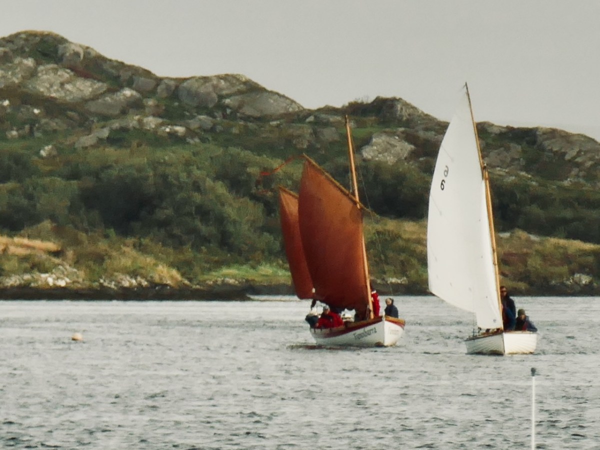
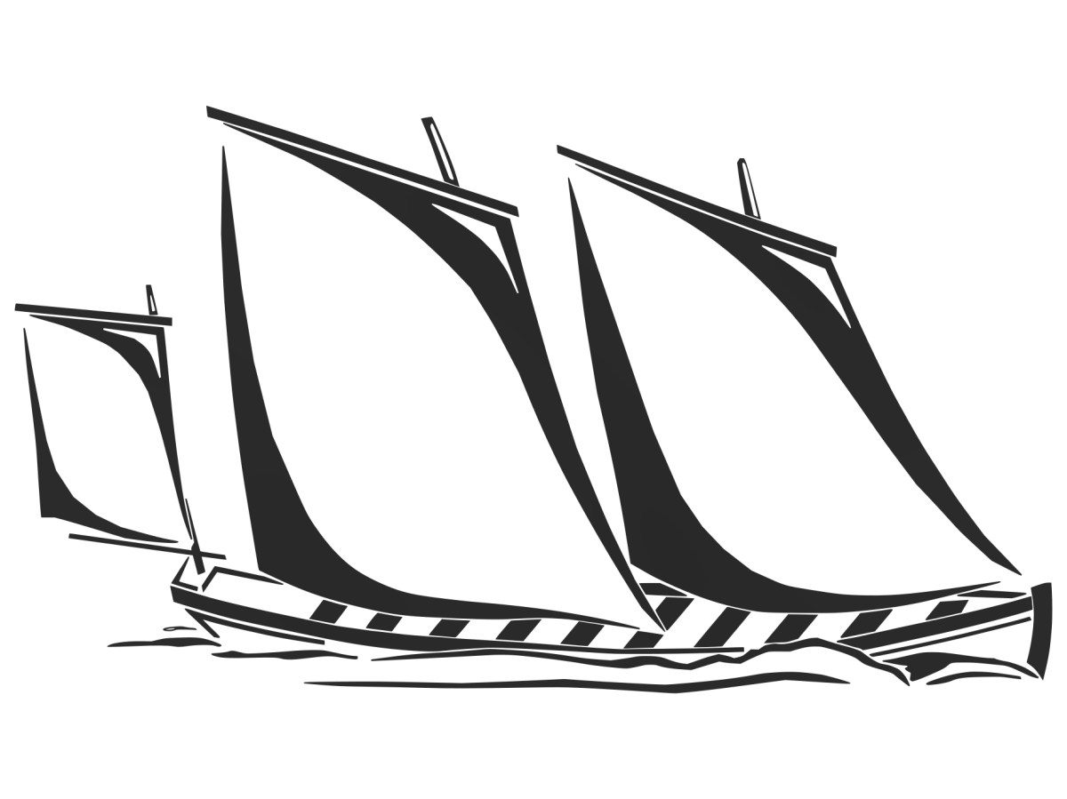
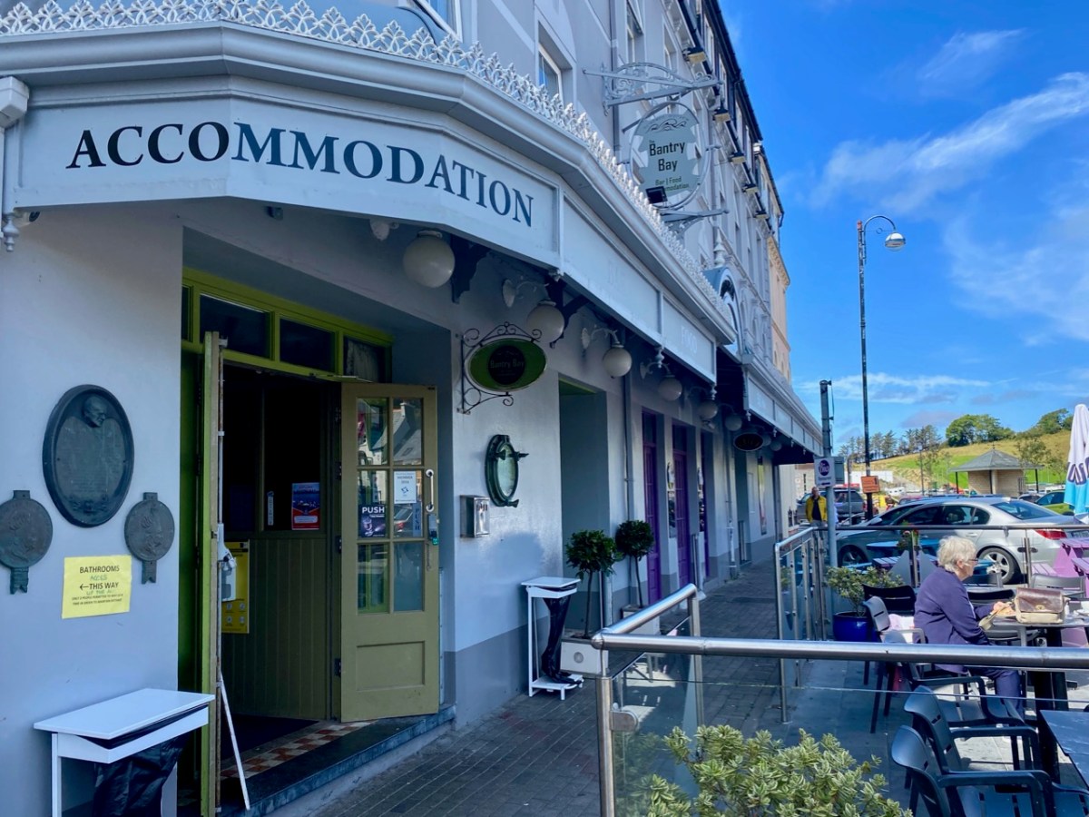
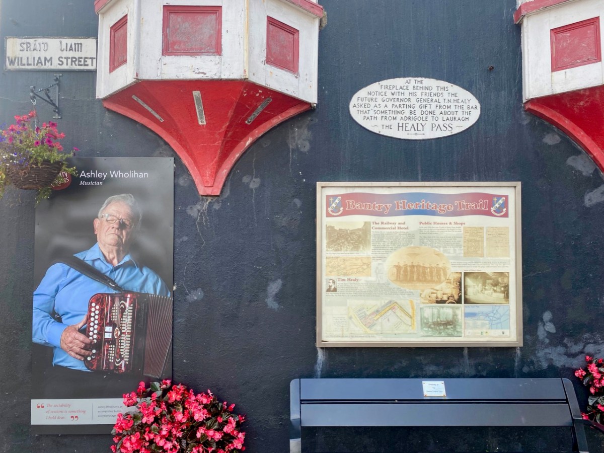
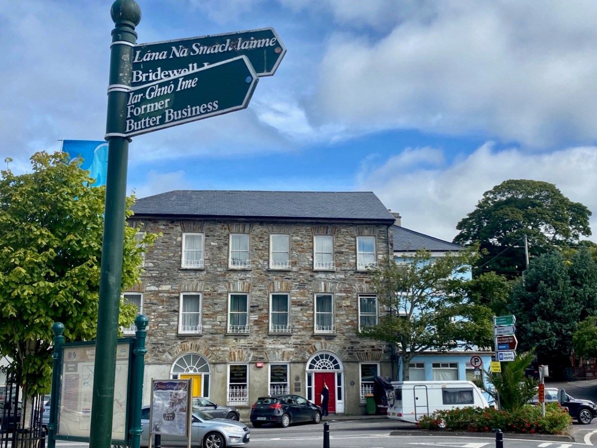
The importance of West Cork in world history was emphasised today at the Ballydehob Cruinniú na mBád (Meeting of the Boats). This annual event reminds us how busy our quay was back in the day when all the commerce of the village was based on the tidal waters. Finola wrote about the gathering in 2017. But today – 19 August 2023 – I had my eye out for a very particular vessel: Fionnbara.
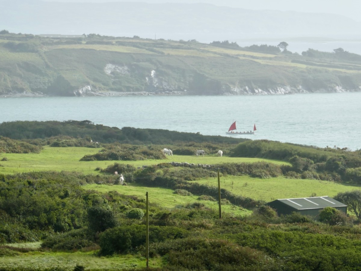
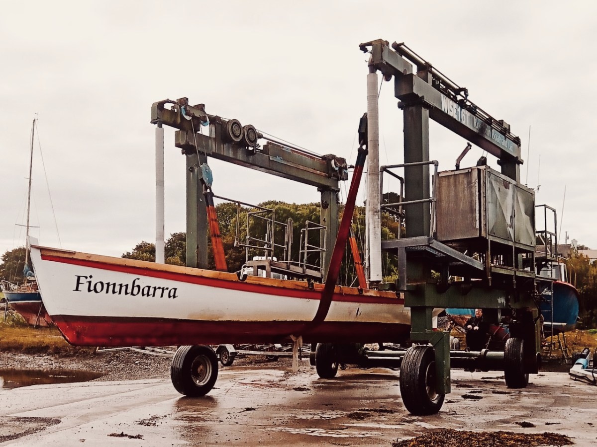
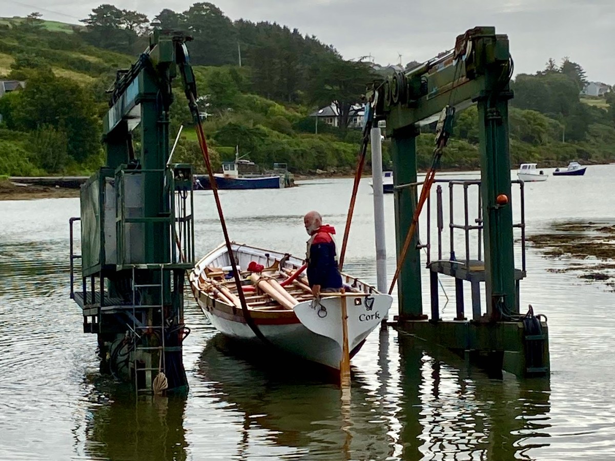
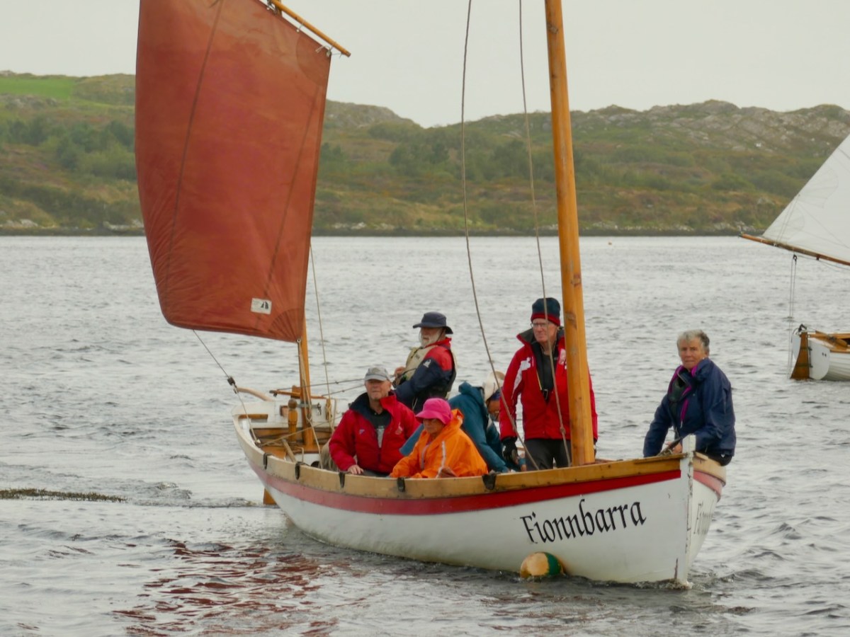
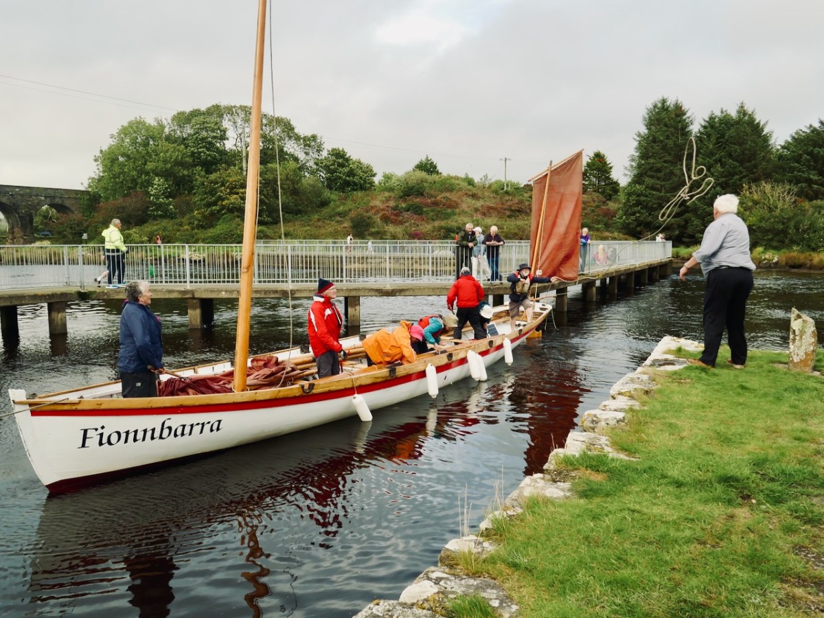
There she is – above – leaving Rossbrin Harbour today, bound for Ballydehob. And here she is being launched early this morning, using the boatyard’s lifting gear. Many thanks to Jack O’Keeffe – her Skipper – and Anne O’Keeffe for the great photos.
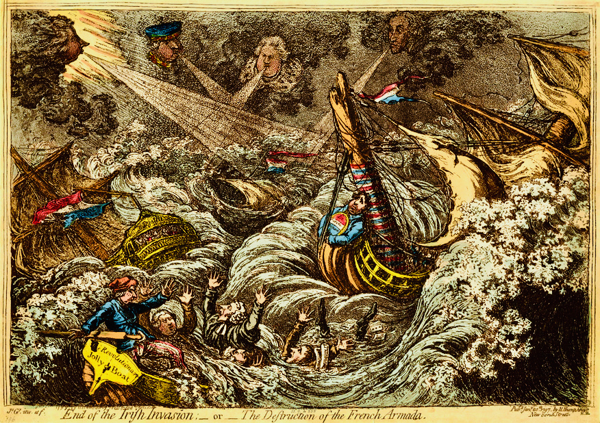
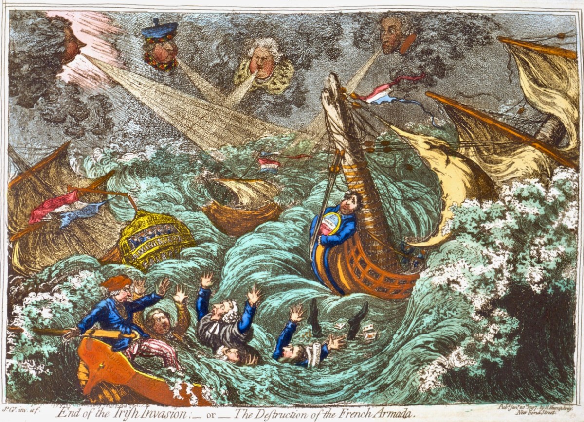
Above: ‘End of the Irish Invasion’ or ‘The Destruction of the French Armada’ by James Gilray 1797 (courtesy of the British Museum)
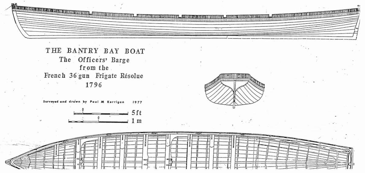
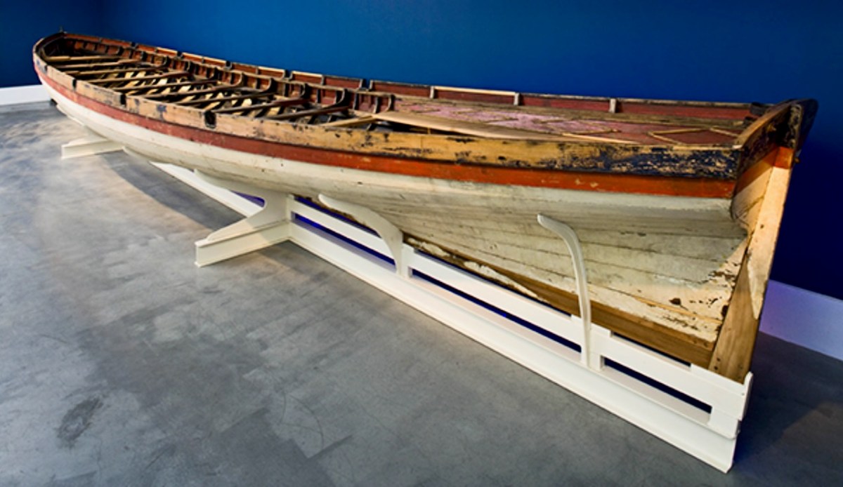
The boat is a replica – one of many around the world – of a craft which found its way to the shores of Bere Island – in West Cork – in 1796, after a disastrous escapade by the French navy, under the encouragement of Theobald Wolfe Tone of the Society of United Irishmen. A fleet of 43 vessels carrying 14,000 men headed for Bantry Bay intending to invade Ireland and declare it independent from Britain. Severe storms threw the ships off course and into disarray, and the opportunity was lost. During the chaos one of the French ships – La Résolue – lost her masts in a collision. Lt Proteau was sent in a ‘barge’ to find another ship to tow the frigate to safety, but instead he and his crew were driven ashore and captured. The ‘barge’ was taken as a prize of war and handed to the local Irish militia commander, Richard White of Bantry House. There it remained – gently rotting – for 148 years. In 1944 it was despatched to the National Maritime Museum in Dún Laoghaire and – after conservation – is now displayed at the Collins Barracks Museum. The ‘Bantry Bay Boat’, ‘Bantry Skiff’ or ‘Bantry Yole’, as the unusual craft is variously known, has attracted considerable attention and has inspired many boatbuilders to produce copies.
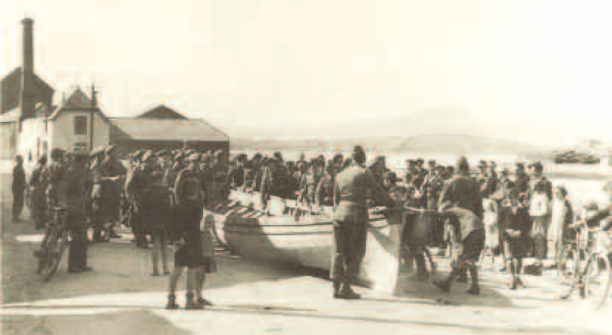
Below: upper – the Bantry Boat being transported from Bantry Railway Station to Dún Laoghaire in 1944; centre – plans of the original craft drawn by Paul Kerrington in 1977; lower – the original Bantry Bay Boat on display in the Collins Barracks Museum today (courtesy History Ireland – article by Lar Joye July/August 2018)
One of these copies is the Fionbarra, which arrived in Ballydehob today. The original was 11.64 metres long, 2.05 metres in beam, and a very fast boat. It was powered by ten oars or three sails, and could carry around ten passengers as well as the crew.
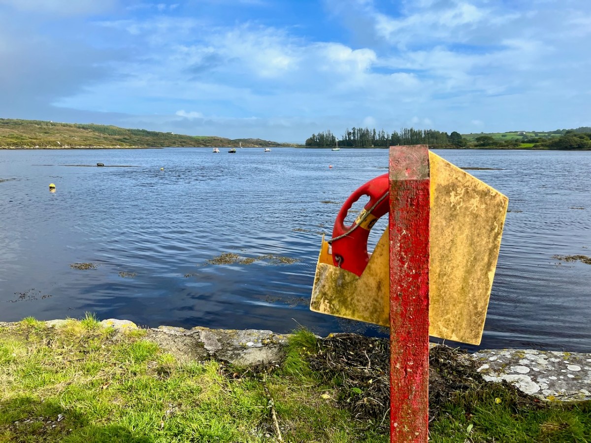
Ballydehob Bay today, 19th August 2023. The small boats are beginning to approach the old quay. With thanks to Finola for many of these photographs.
Building of the Fionbarra began in Waterford and was transferred to Meitheal Mara, a community boatbuilding venture based in Cork city. Construction was completed in 2008. We really appreciated the work of the team who transported her to West Cork and sailed her up the estuary today.
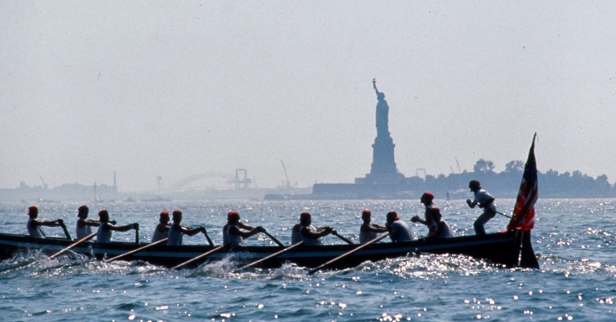
You may wonder why I have put in a header pic from across the Atlantic? This is to demonstrate the influence that the West Cork ‘Bantry Yole’ has had on the boating community all around the world. Atlantic Challenge International was founded in 1984 as a maritime training trust, and its activities are largely based on replicas of the 1796 Bantry craft. As a consequence there are relatives of the Fionbarra in many countries. I understand that there are currently at least 80 such replicas, spread over four continents, in the present day.
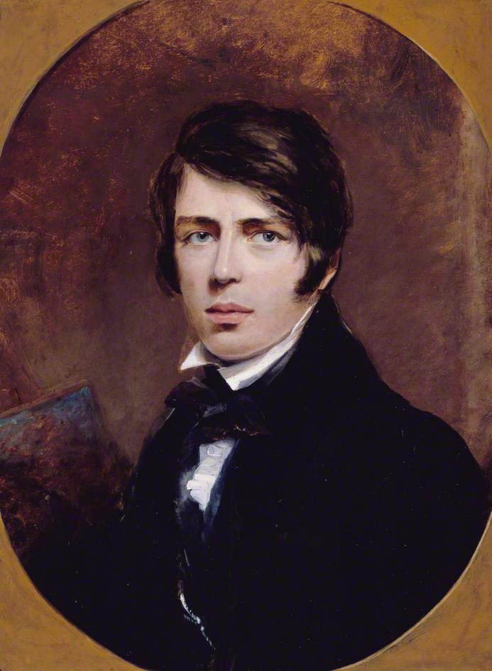
I’m fascinated by how artists captured Ireland through the centuries and have recently discovered a new one – Thomas Creswick. We mostly know Creswick’s Irish work through the engraving of his Irish landscapes for nineteenth century books on Ireland.
First – who was Thomas Creswick? He was born in Sheffield in 1811, but is always associated with the Birmingham School of painters. Victorian loved their romantic landscapes and Creswick was a favourite, thanks in large part to the innovation of engraving, through which paintings could be reproduced in black and white and mass-produced. His self portrait shows a darkly handsome young man, fashionably dressed and coiffed.
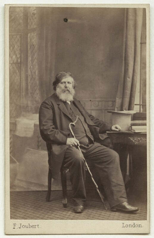
Here he is as an older man, in a photograph from the British National Portrait Gallery (used under license). He was painted at around this time by his friend William Powell Frith and the painting shows the same distinguished gentleman. However, the painting, on the Royal Academy website, is accompanied by a pen-portrait which is less complimentary than the painting.
William Powell Frith counted Creswick as one of his best friends, describing him as ‘good nature personified’. This tasteful portrait, composed in muted tones, certainly depicts a man of benevolent appearance and dignified bearing. However, this portrayal is at odds with many accounts of Creswick’s appearance and personality. Frith’s daughter recalled a ‘festive, rollicking and amusing’ man whose conversation was peppered with swearwords and who ‘was too fond of both food and drink to be always in the best of health’. Creswick’s larger-than-life character was not universally appreciated. Other landscape artists, in particular, accused him of exerting his influence amongst the Academicians to exclude his rivals from the institution. Creswick’s detractors made much of his unkempt appearance and reputed aversion to soap and water, nicknaming him ‘the big unwashed’.
Whatever about his personality, his skill as a painter was never in question, and drew high (and rare) praise from Ruskin for his attention to detail and his ability of draw directly ‘from nature’. The only other landscape artist Ruskin praised was Turner. Creswick did indeed draw from nature, doing many of his sketches and some finished paintings en plein air, a rare enough approach in those days.
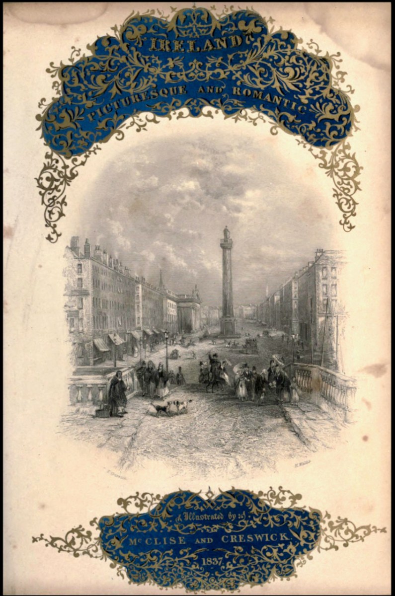
Although most of his paintings were of rocky glens and pastoral river scenes in England and Wales, he travelled to Ireland and visited many of the famous beauty spots then becoming favourites with British tourists. His illustrations (engravings of original paintings) can be found mainly in two volumes. The first is Picturesque Scenery in Ireland (no publication date) with all the illustrations by Creswick, and the accompanying text by “A Tourist”. The other is Ireland, Picturesque and Romantic, published in 1837/38 with text by Leith Richie. Both are available on the marvellous Archive.org. Some of the illustration are the same in both books and some are different.
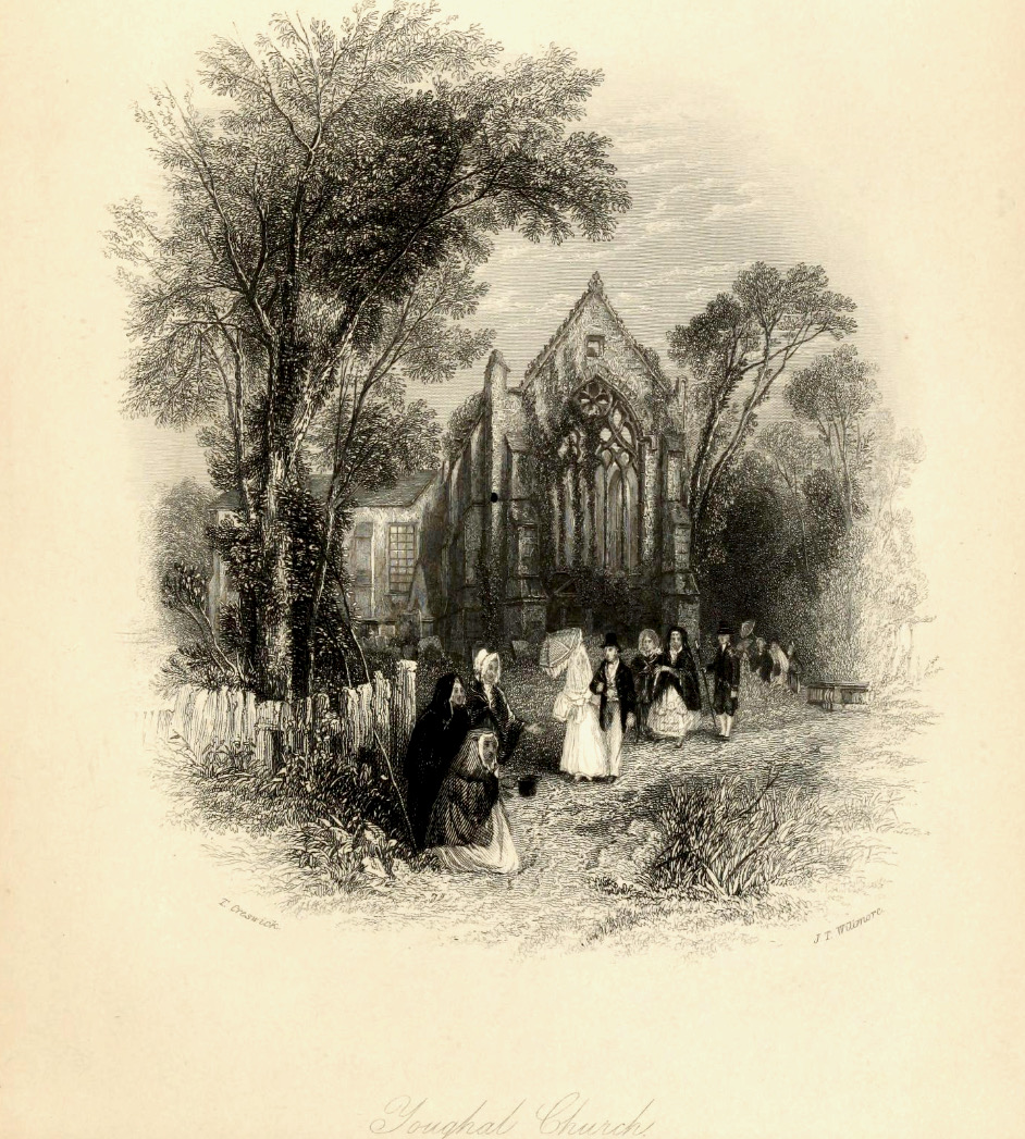
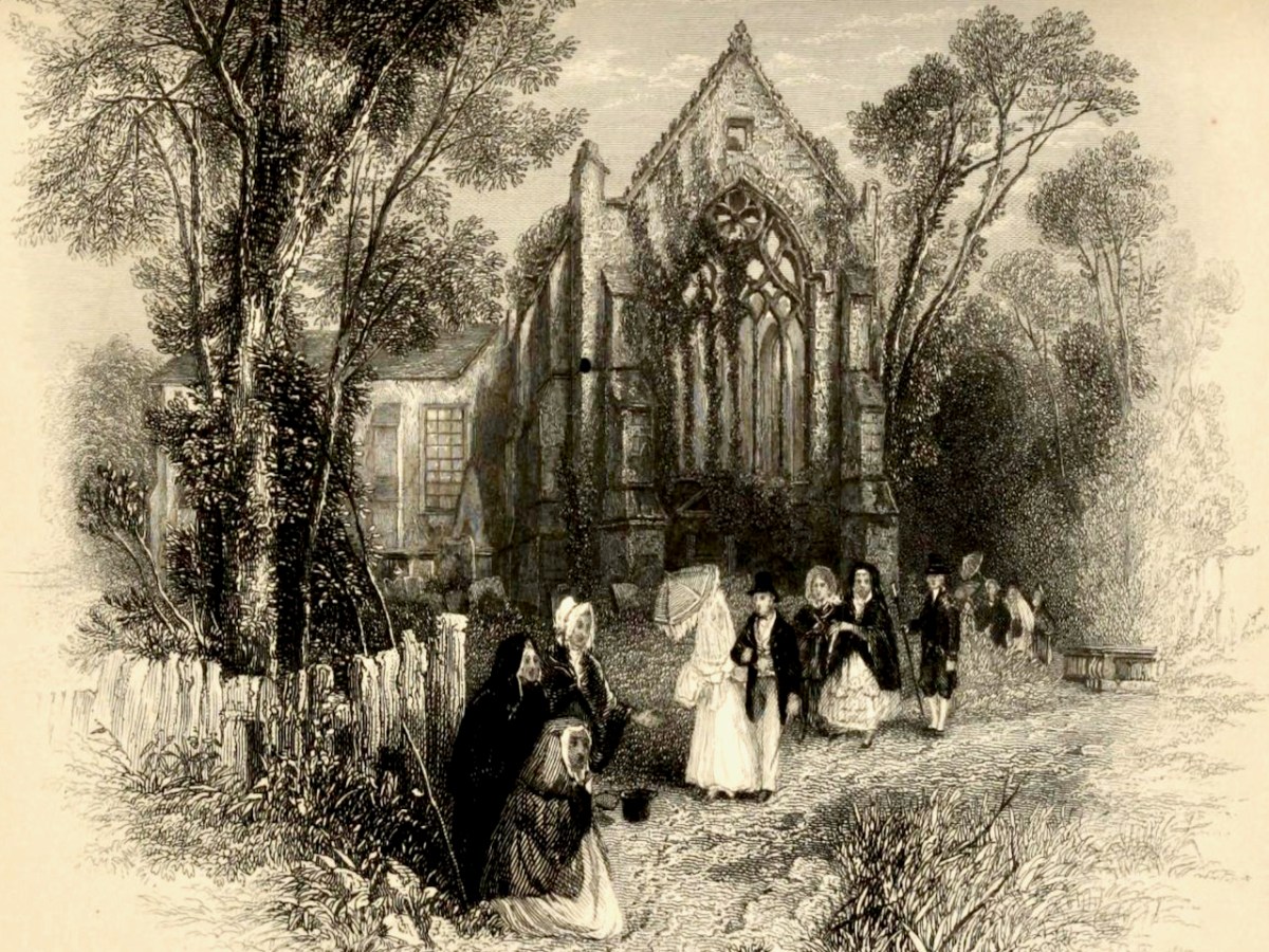
I’ve chosen to confine the illustrations I’m using for this post to Cork. Let’s start at the far east of the county and move west. So – first up is Youghal. Having been in Youghal recently for the excellent Youghal Celebrates History, which concentrated on St Mary’s Collegial Church and its 800 years of history, I loved Creswick’s depiction. He captures the roofless (now roofed) ruin, rendering the complex tracery of the tall window very accurately. His polite and well dressed ladies and gentlemen, visiting the romantic ruins, must run a gauntlet of begging women, one of who is wearing the Cork hooded cloak.
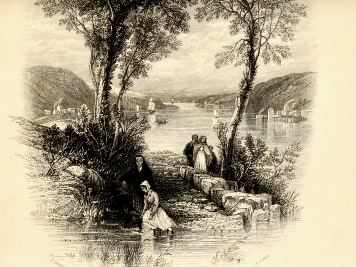
Moving westwards, we come to the ferry at Passage West – a journey Robert and I took only yesterday. For us it was a quick trip on the ultra-efficient car ferry, but Creswick shows an altogether more leisurely affair involving a rowing boat. The view of the boat is framed between trees. Figures in the foreground include a woman drawing water from the River Lee in a ewer – not something I’d want to do today.
The Passage Ferry Scene is a good example of the Picturesque Idiom, which had its conventions. According to Simon Cooke on The Victorian Web, artists such as Gainsborough and Constable
followed the compositional rules of the Picturesque and Creswick similarly adheres to its iconography. Drawing on the many examples of the type, he deploys a semiotic made up of trees (typically placed as framing devices), a well-defined foreground (usually populated with peasants or cattle), a stream, river or pathway, an architectural feature (castle, house, church), a large expanse of sky, and a prospect (often of mountains), or a vista reaching into the far distance.
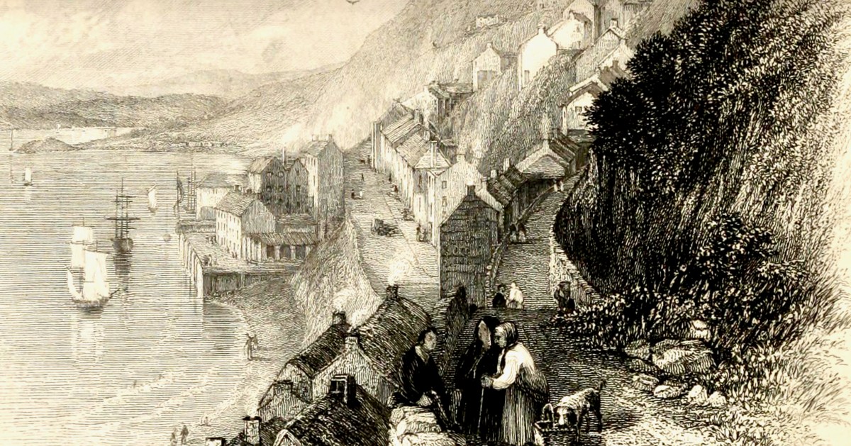
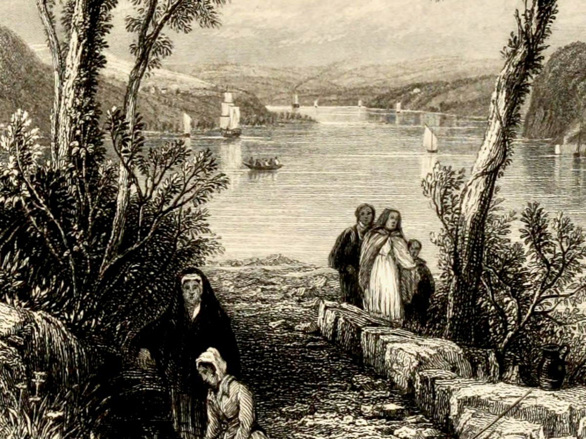
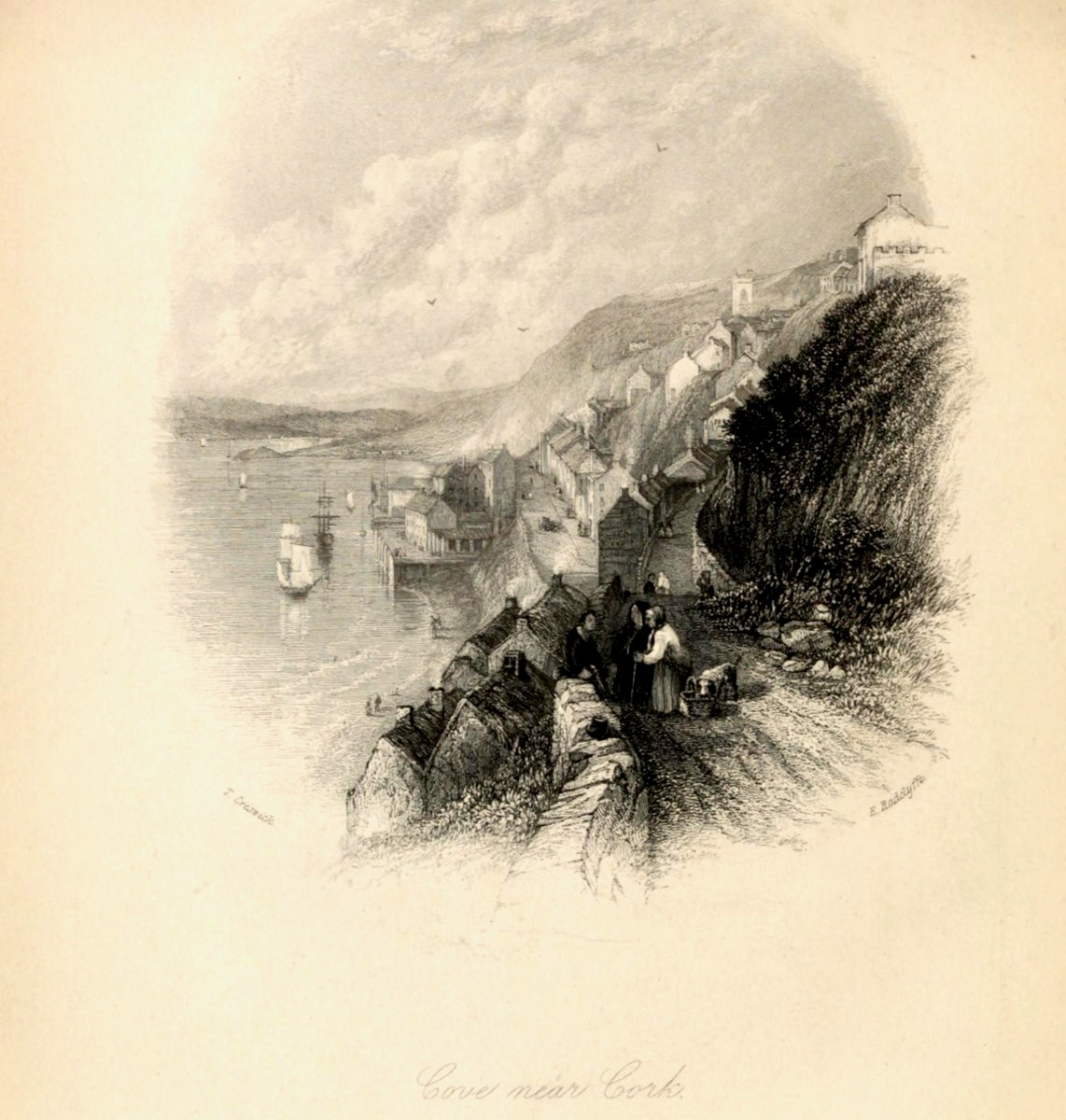
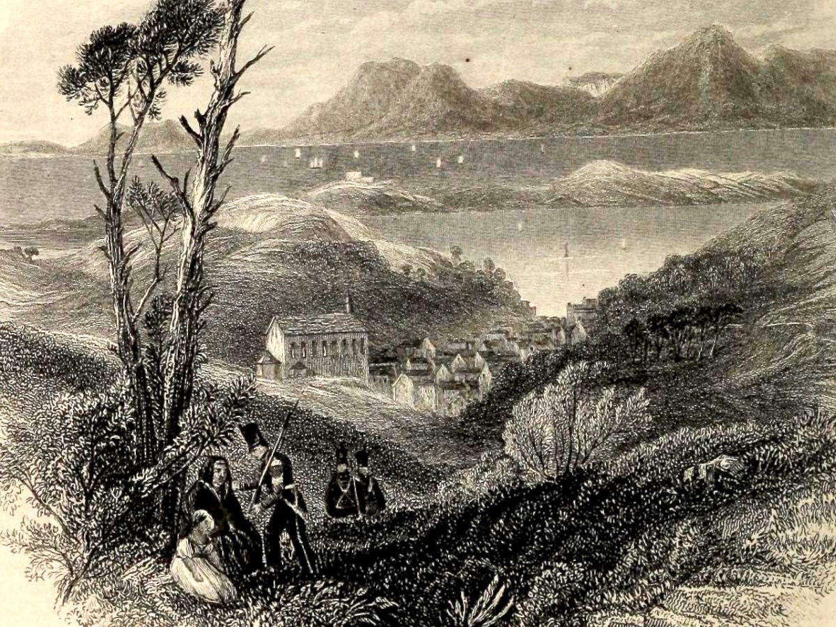
Next stop is Cobh (below, then called Cove, afterwards rechristened Queenstown, and finally reverting to Cobh). Creswick’s image is of an older town, before extensive docks were built, and captures the steepness of the roads and the precipitous way the houses cling to the hills.
Those steep narrow streets are still there, in Cobh. Below the seated figures is the area of fishermen’s cottages known as The Holy Ground. There’s no sign yet of the magnificent St Colman’s Cathedral, which didn’t get started until the 1860s. See the lead image in this post for a closer view of Cobh.
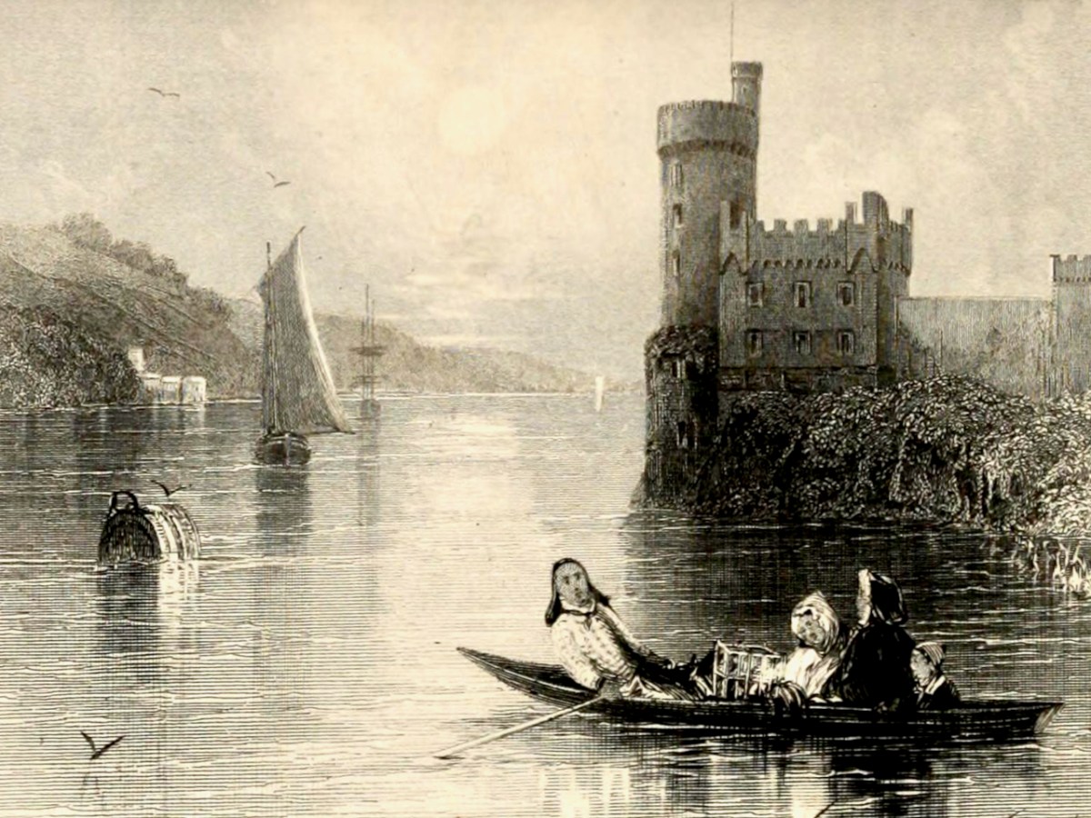
Blackrock Castle has to be one of the most painted pieces of scenery in Cork – so romantic, as it sits on its watery outcrop on a bend of the River Lee. In the foreground a family rows out to do what – set a lobster pot? – while a gaff-rigged sloop makes its way upriver.
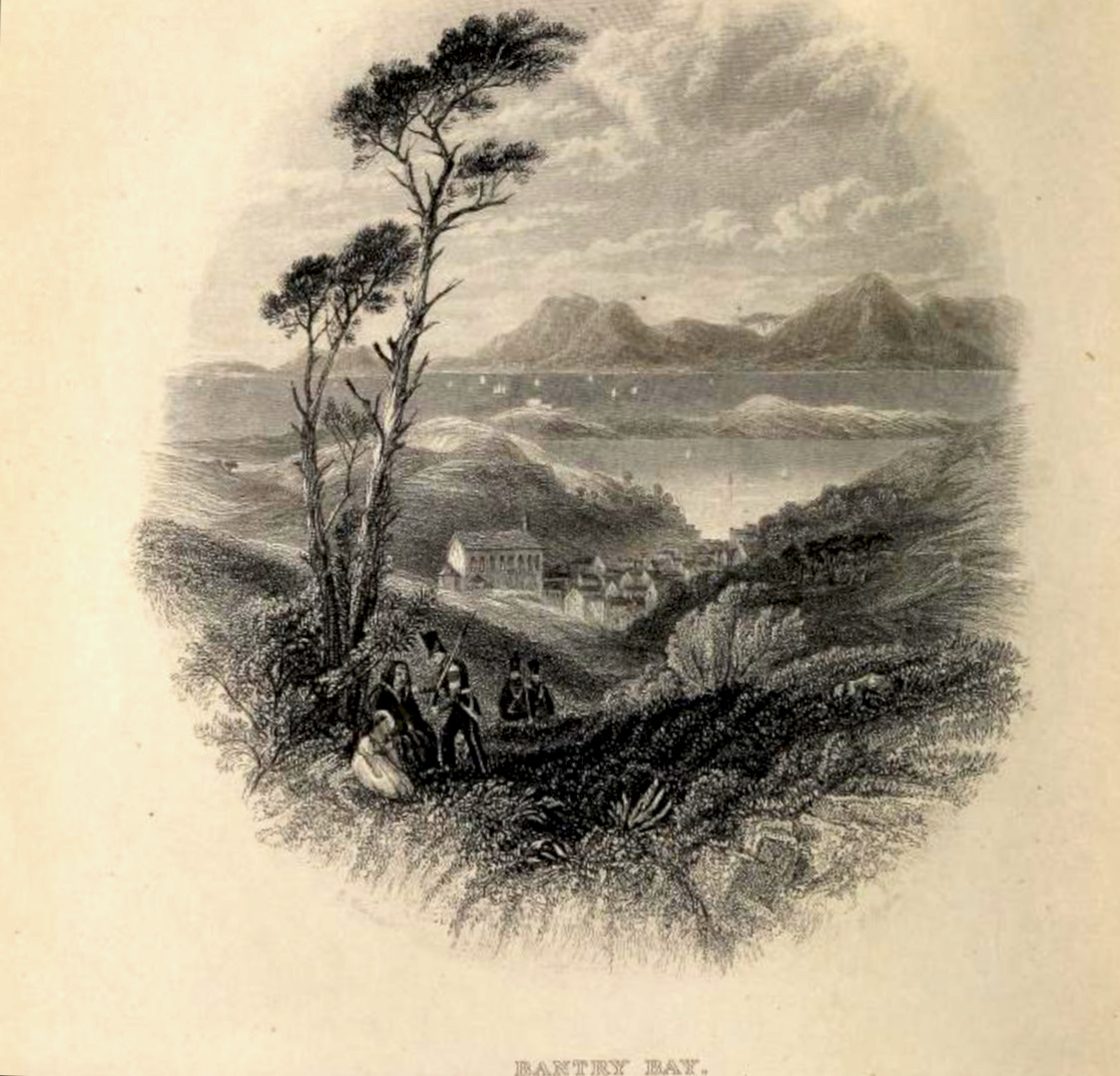
Our final scene is Bantry Bay. St Finbarr’s Church was built already in the 1820s, even before Catholic Emancipation, and sits proudly on an eminence above the town. In the foreground is an enigmatic scene in which a soldier (with other soldiers advancing up the hill) is grasping the shoulders of a woman, who sits with a young girl under a tree. Are we witnessing an arrest, or a compassionate gesture of assistance?
Bantry Bay is spread out beyond the town, which slopes down to the water. The Battery on Whiddy Island, long in ruins, is clearly visible. The mountains of the Beara rise in the background, including the Sugarloaf on the right.
There is a full-colour painting by Creswick of Glengarriff but it is not copyright-free. You can view it here. If you want to see more of his illustrations, take a look at the books on archive.org – Dublin and Wicklow are well-represented.
. . . The town is situated at the northern extremity of the bay to which it gives its name, in a small valley encircled by lofty mountains, which attracting the clouds in their passage over the Atlantic, involve it in almost continual rains. The streets are indifferently paved, and not lighted; the inhabitants are supplied with water from numerous springs. The approaches are steep and incommodious, and are lined with cabins of very inferior description. Little improvement has been made in the town, except by the erection of some very extensive stores by Mr O’Connell and Mr Corkery, merchants of the place, and the enlargement of the principal hotel, which now affords ample accommodation to the numerous tourists who, during the summer season, frequent the place on their way to Glengariff and the lakes . . .
Lewis Topographical Dictionary of Ireland 1837
. . . This bay was known to the ancients by the name of Inber Sceine. It is a noble sheet of water, landlocked by beautiful mountains. The scenery is picturesque, bold, and grand, and equals, if it yet not surpass, the best to be found in these kingdoms . . .
Early Irish History and Antiquities and the History of West Cork W O’Halloran 1916
Bantry . . . a miserable poor place, hardly worth the name of a town, consisting of seven or eight small houses, and some mean little cottages . . .
Jacobite army officer and author John Stevens, 1689
Well, here we have some contrasting descriptions of the town of Bantry, the earliest (above) dating from over 330 years ago! That one is a bit unfair, in truth, as it seems to be almost an ‘aside’ within Stevens’ ill-tempered account of his own involvement in the Williamite War (1689 – 1691). Bantry was a landing place for the Jacobite army which then marched through Cork and engaged in the Battles of the Boyne and Aughrim, and the Siege of Limerick (which is celebrated to this day in a traditional country dance!). None of this needs to detain us further from pursuing our contemporary account of Bantry town.
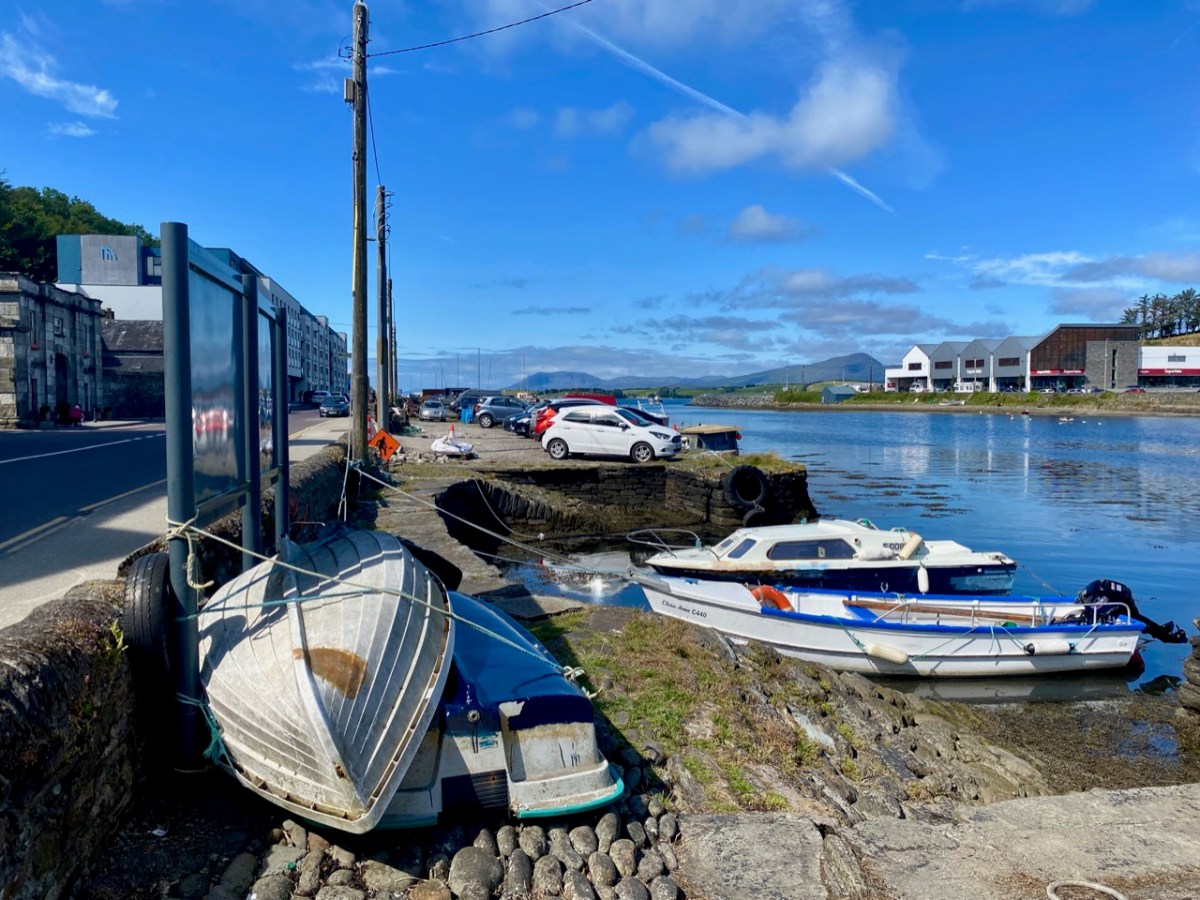
Bantry in the time of Covid . . . As with our exploration of Schull, the first in this series, we capture a moment in time: all the photographs are taken in one summer’s day, and show the norms of daily life. We deliberately did not choose Market Day (every Friday throughout the year), as on that day the population of the place appears to double in size. This is an average weekday and it is busy enough, with holiday makers swelling the ranks and helping to populate the many outdoor facilities.
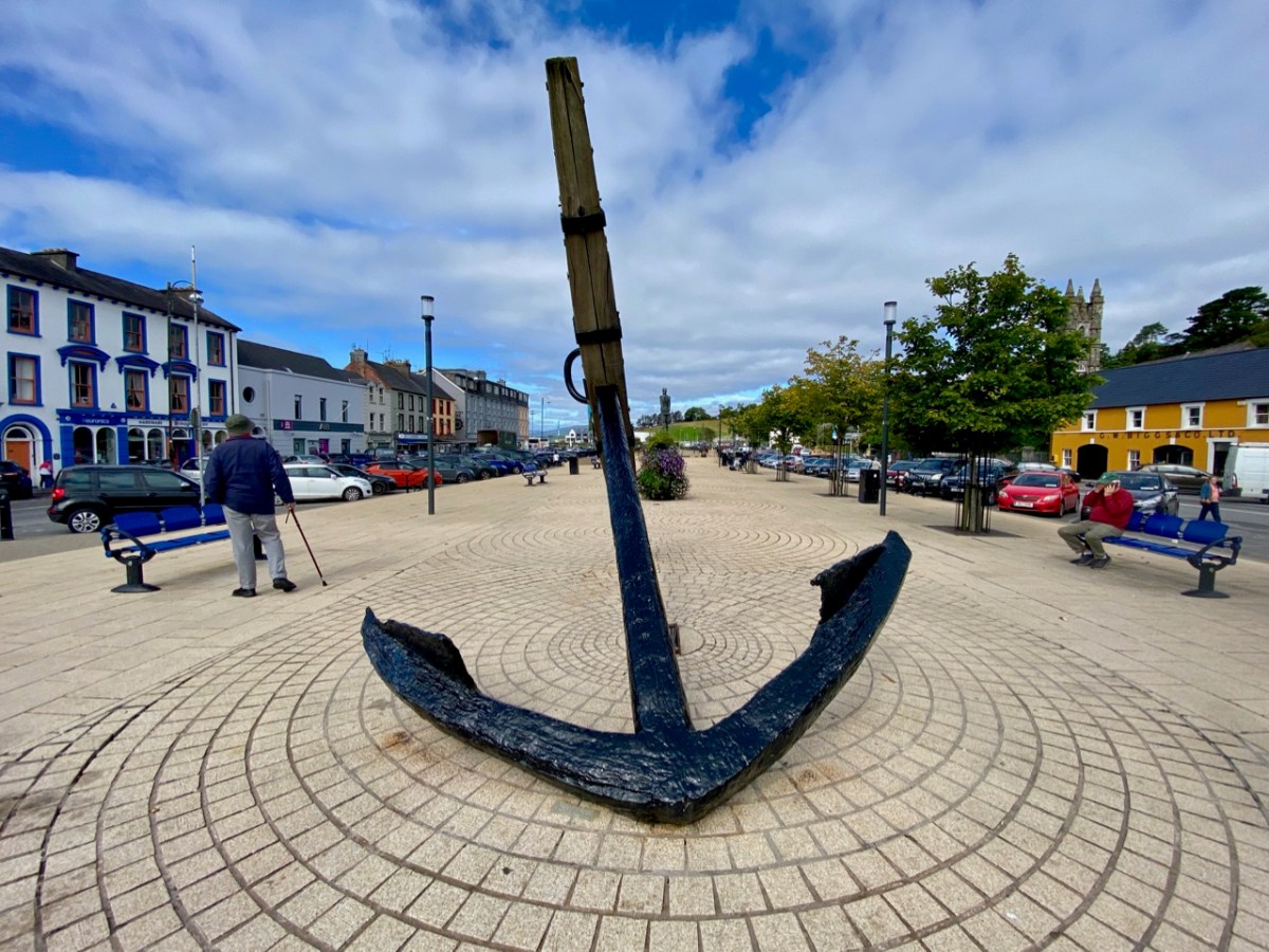
Bantry has made its mark in the history of Ireland’s independence. An attempted landing by the French Fleet in Bantry Bay on 22 December 1796 was partly precipitated by Theobald Wolfe Tone – one of the founding members of the United Irishmen. The mission was unsuccessful due to severe gales. A political cartoon of the time (below) satirises the venture:
. . . On the French expedition to Bantry Bay, at the end of 1796: Pitt, Dundas, Grenville, and Windham are the four winds which blow up the storm to destroy the invaders. FFox, as the carved figure at the head of the Revolution, is represented as influencing the United Irishmen. The crew of the jolly-boat are Sheridan, Liberty Hall, Erskine, M A Taylor, and Thelwall, who, it is insinuated, were all approvers, at least, of the Irish rebellion . . .
Historical and Descriptive Account of the Caricatures of James Gillray, 1851
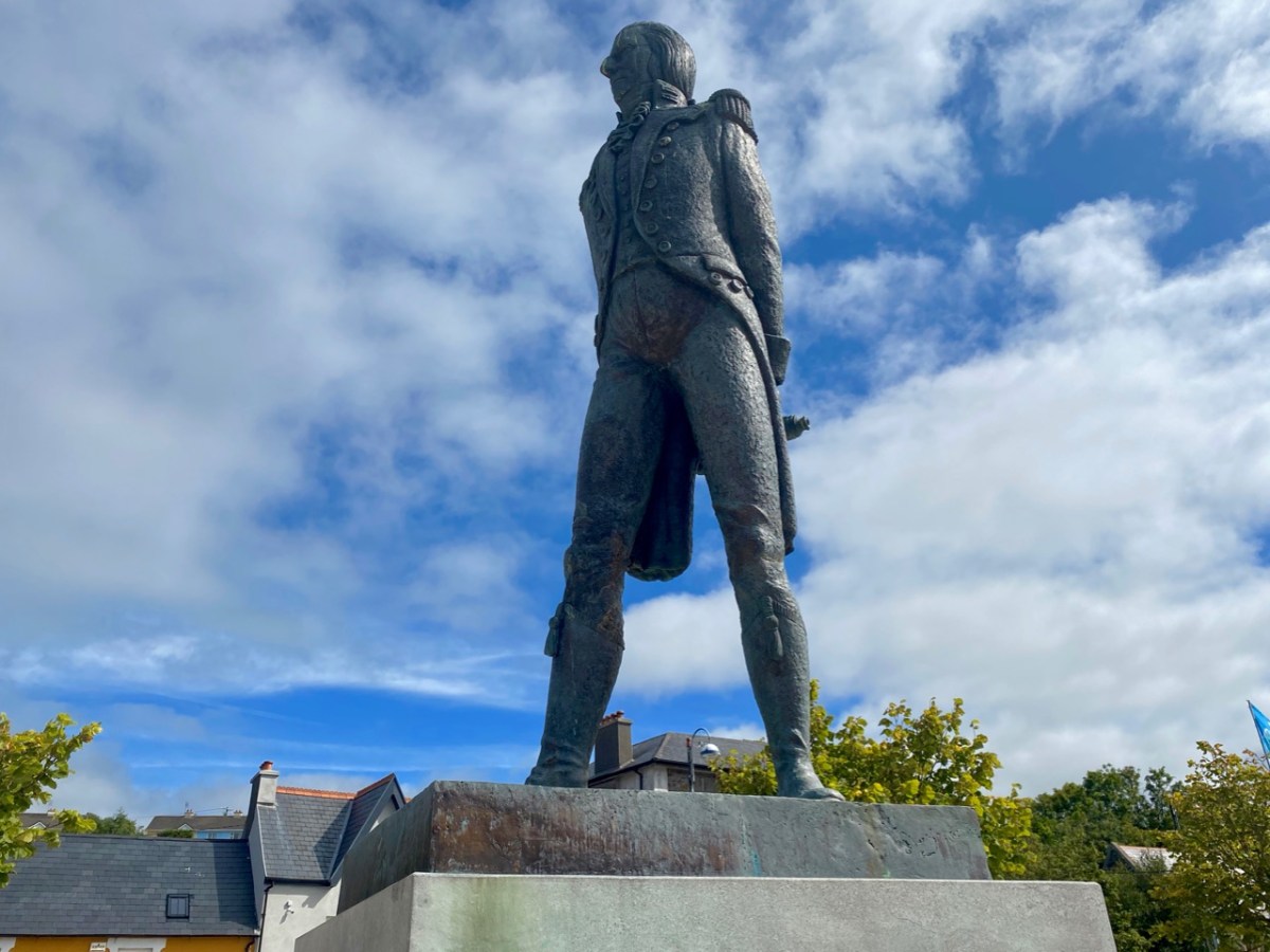
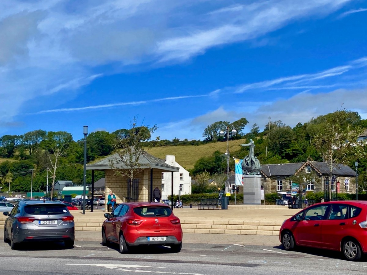
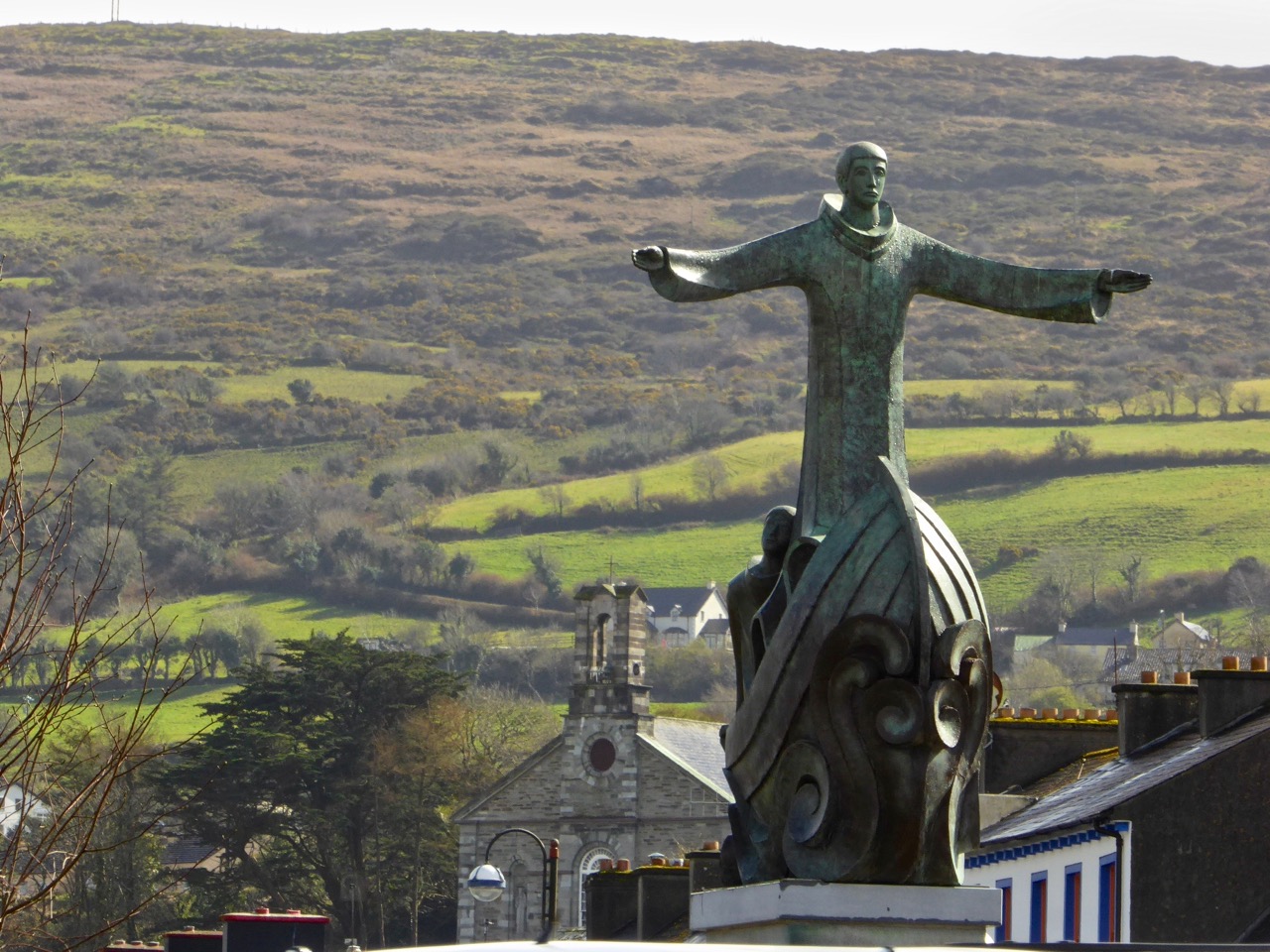
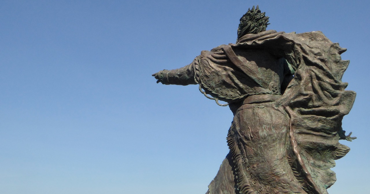
Wolfe Tone’s statue looks down over the square which bears his name in Bantry today: it was sculpted by Jeanne Rynhart in 2000. Close by is an anchor from the ‘French Armada’ found off Whiddy Island. The square was known formerly as Egerton Square – named after a descendant of the Earls of Bantry (have a look at this post). In 1899 the Irish Nationalist MP James Gilhooly oversaw the renaming. Also on the present-day square (much of which is on reclaimed land) is the notable statue of Saint Brendan by Imogen Stuart.
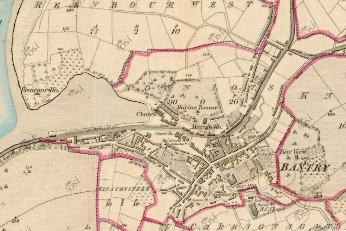
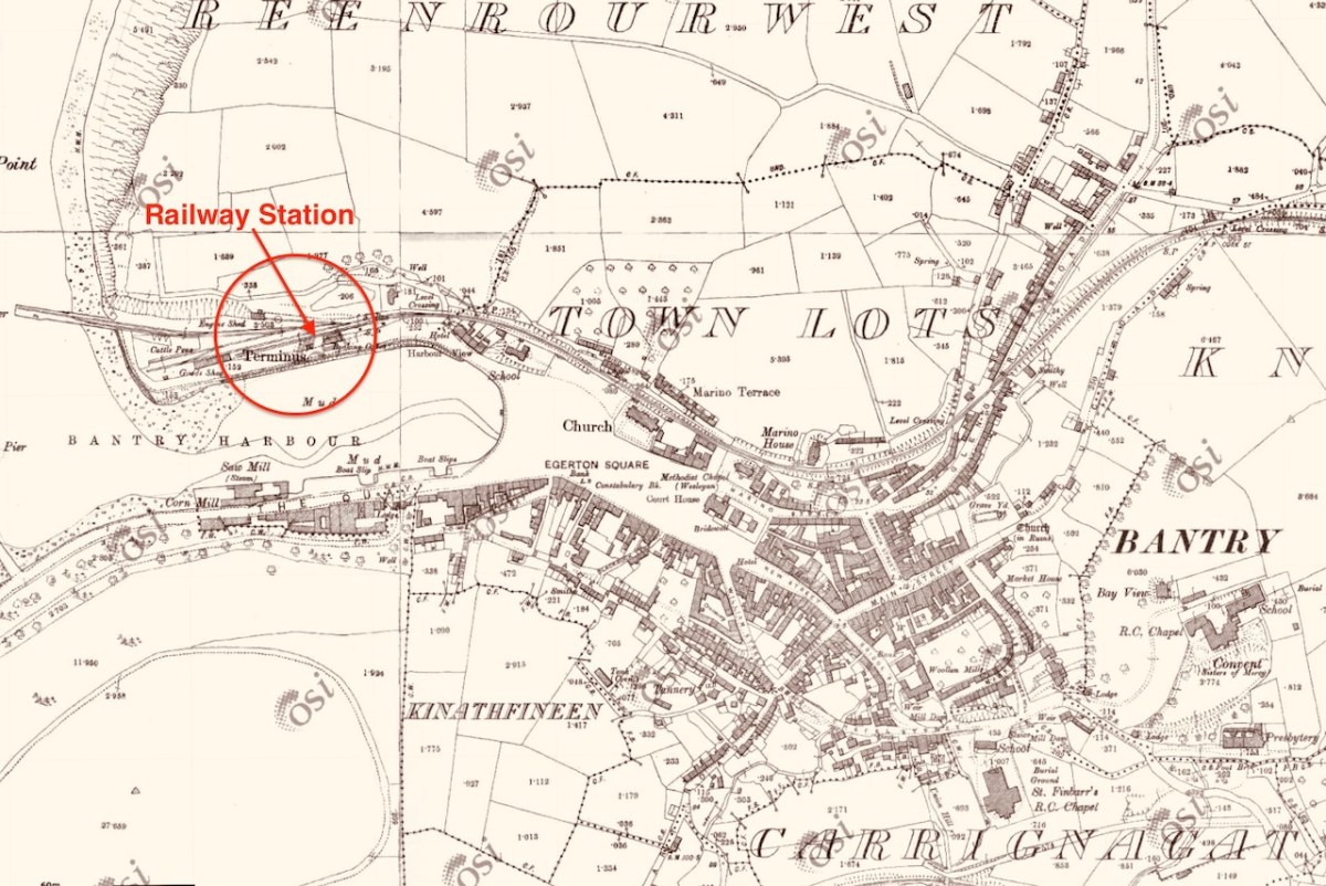
The aerial image, above, shows how the town has evolved along the original river valley. Comparing this view with the earliest 6″ OS map – dating from around 1840 (below – upper) – and the 25″ OS edition c1900 (below, lower), you can see clearly how the Square has encroached on the original natural harbour. You can also see that the terminus of the Cork, Bandon and South Coast Railway was carried on an extended pier to the west, enabling goods to be shipped in and out of the town. Interestingly, prior to the railway’s arrival in 1892, and continuing into the early 20th century, there was a regular steamship service from Bantry to Castletownbere on the Beara Peninsula. This also served Glengarriff and Adrigole.
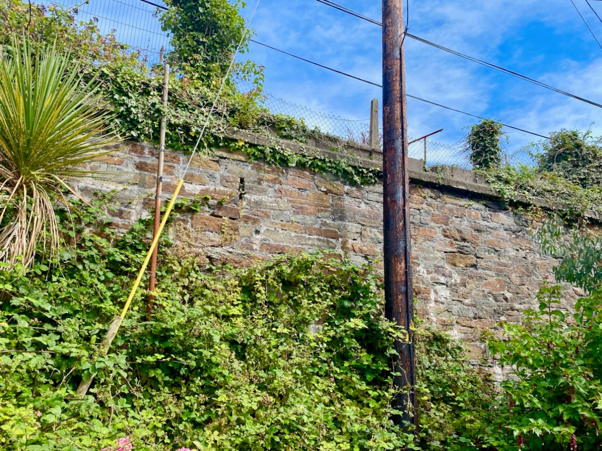
In spite of local opposition the railway was closed on 1 April 1961, and the station building was demolished. We do fortunately still have some vestiges of the line clearly visible in the town.
I have only touched on the briefest aspects of the history of this significant West Cork town. There is considerably more recorded in a recent opus compiled by distinguished historian and international scholar Colum Hourihane, who hales from Bantry. We were recently at the launch of his latest book Bantry Through the Centuries, Bantry Historical Press, 2021 and were treated to an illustrated talk, given by the author. Colum is at pains to point out that this is not a general history of Bantry, but that its core is the streets of the town – ” . . . It’s an effort to understand how the town developed over the centuries in relation to its people . . . “ The book is a first-class resource: a 490-page review of local lore and garnered knowledge illustrated with almost 140 additional pages of historic photographs. This must surely be the most comprehensive volume ever published on this town.
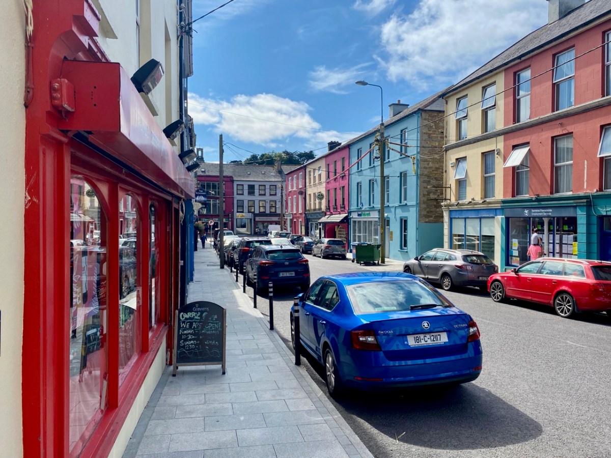
Let’s finish with some more of the photos taken on our day’s exploration: an attempt to capture the essence of this significant West Cork settlement. I hope it will encourage you to visit, if you don’t already know it.
You can read much more about Bantry in Roaringwater Journal. Here are just a few links:
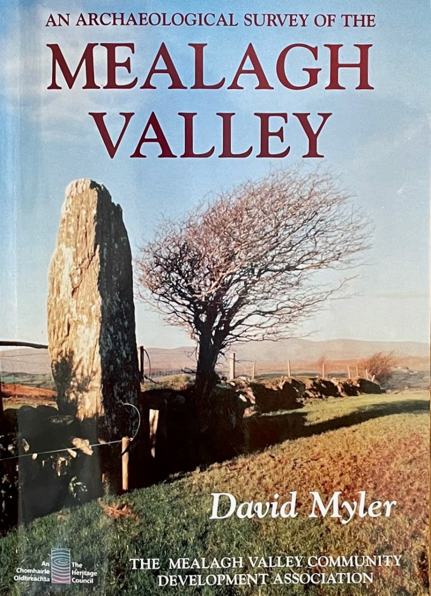
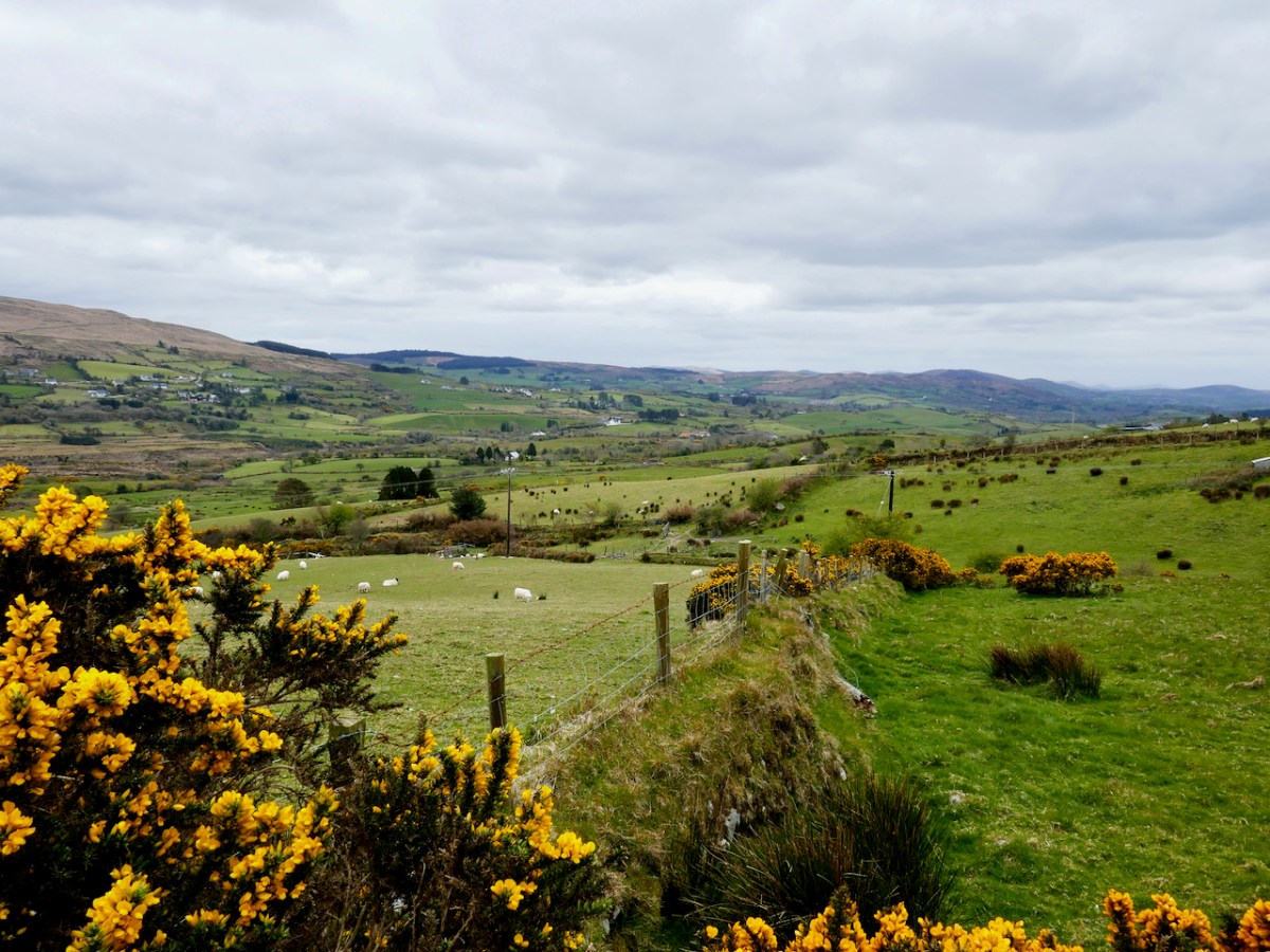
The Mealagh Valley (locals pronounce it Maylock) runs from Bantry Bay to the Maughanaclea (Maw-na-clay) hills and through this valley the Mealagh River flows from north east to south west. Along the valley are found numerous ancient monuments, evidence of occupation from the earliest times. David Myler, some years ago, with support from other local people, undertook to survey all the archaeological sites in the area and the result was this book. Sorry – it’s out of print and we are glad we managed to pick up a copy several years ago.
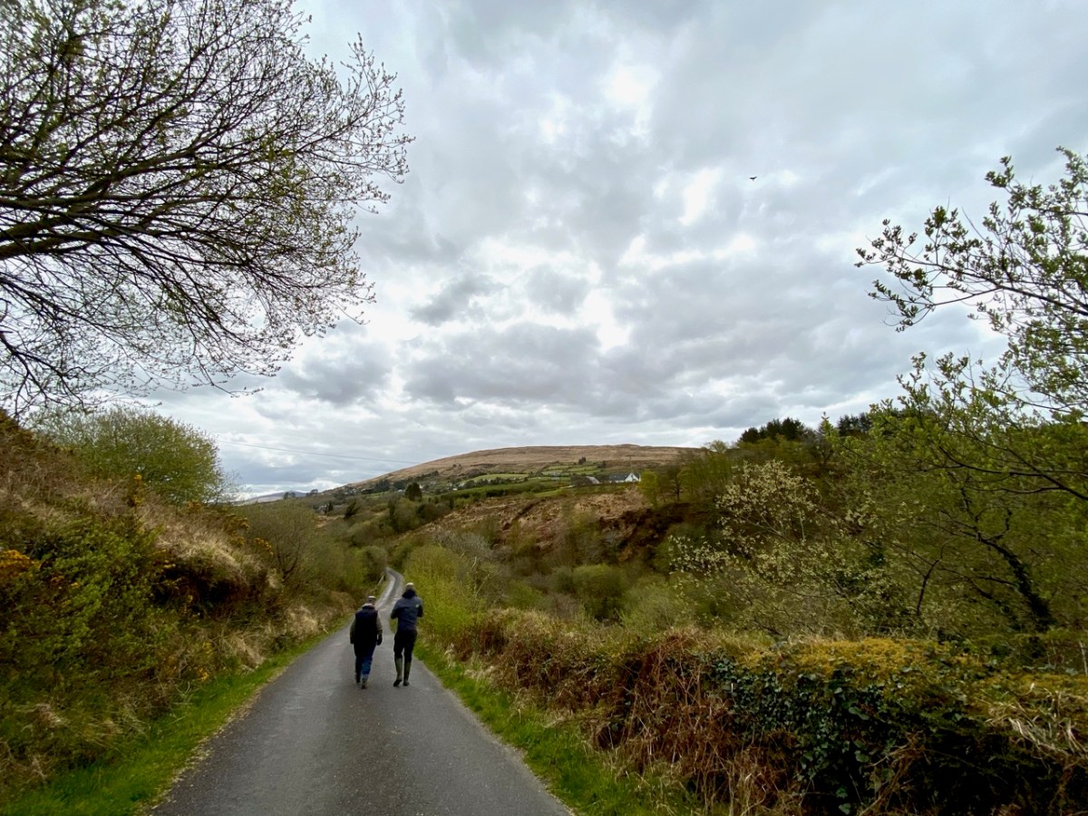
David and I have been in virtual touch for quite a while through social media, promising to meet up and explore when we got a chance – and that finally happened on Friday! Along the way we discovered family connections, so it was no wonder I felt an instant kinship when we met – we bonded over archaeology and shared family stories. David, a Dubliner originally, has been living here for decades and in that time has taken courses in archaeology and developed a passion for the heritage of this – his territory.
It was a joy to be taken on a field trip by the man who has, literally, written the book about the archaeology of the Mealagh Valley. It’s only the first of many, I hope, since we really only got to sample a few of the sites this time – although, as you will see, the places he took us were pretty spectacular!
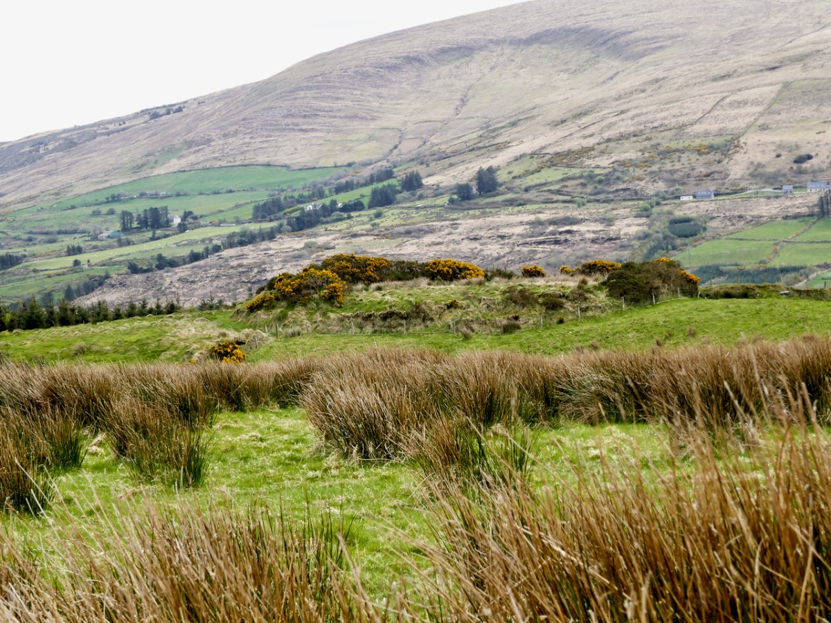
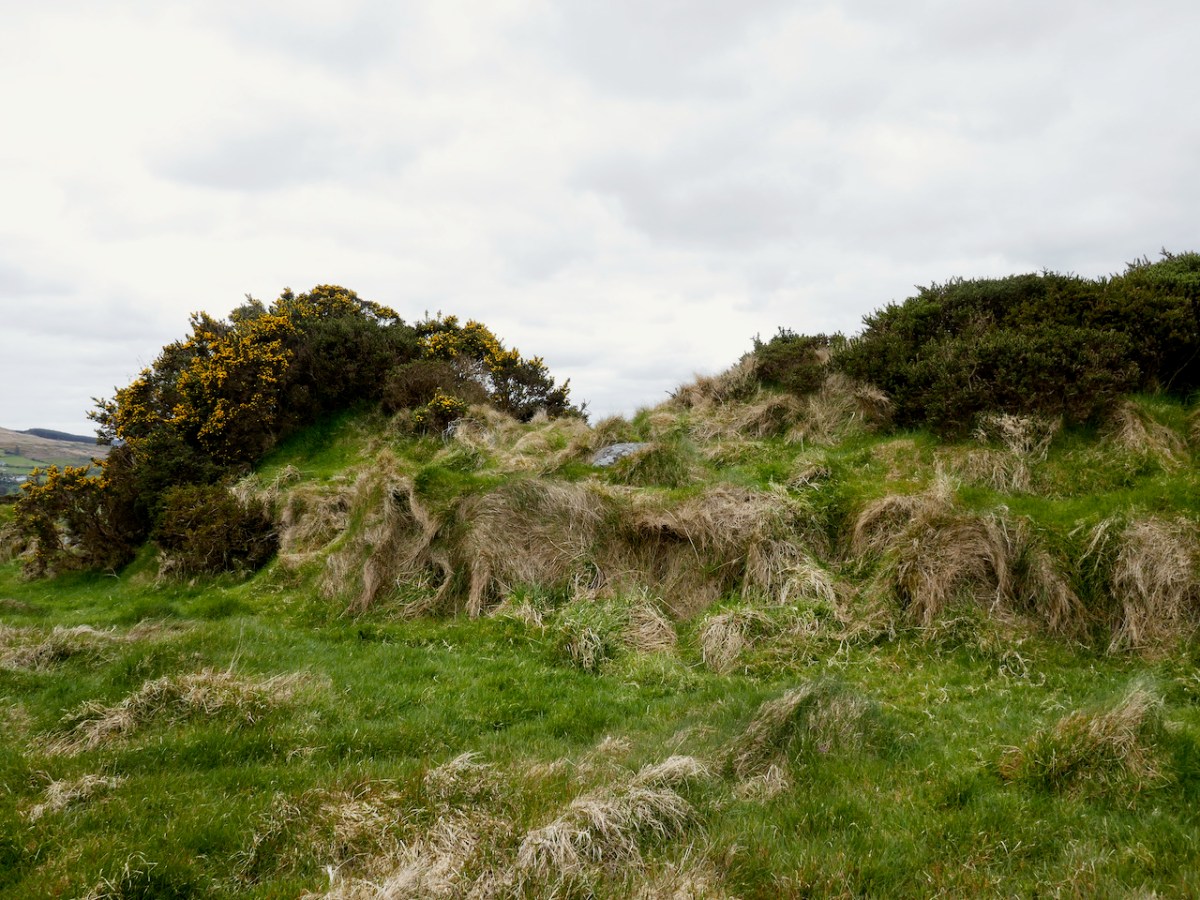
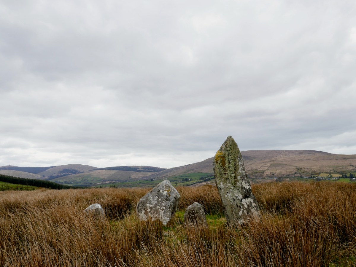
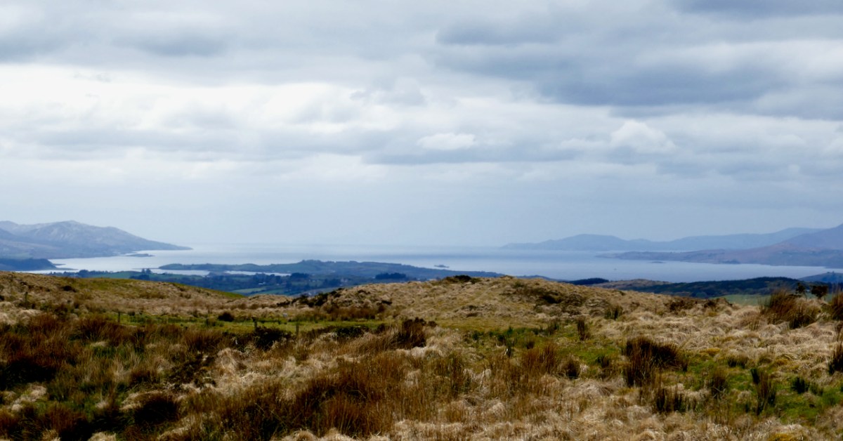
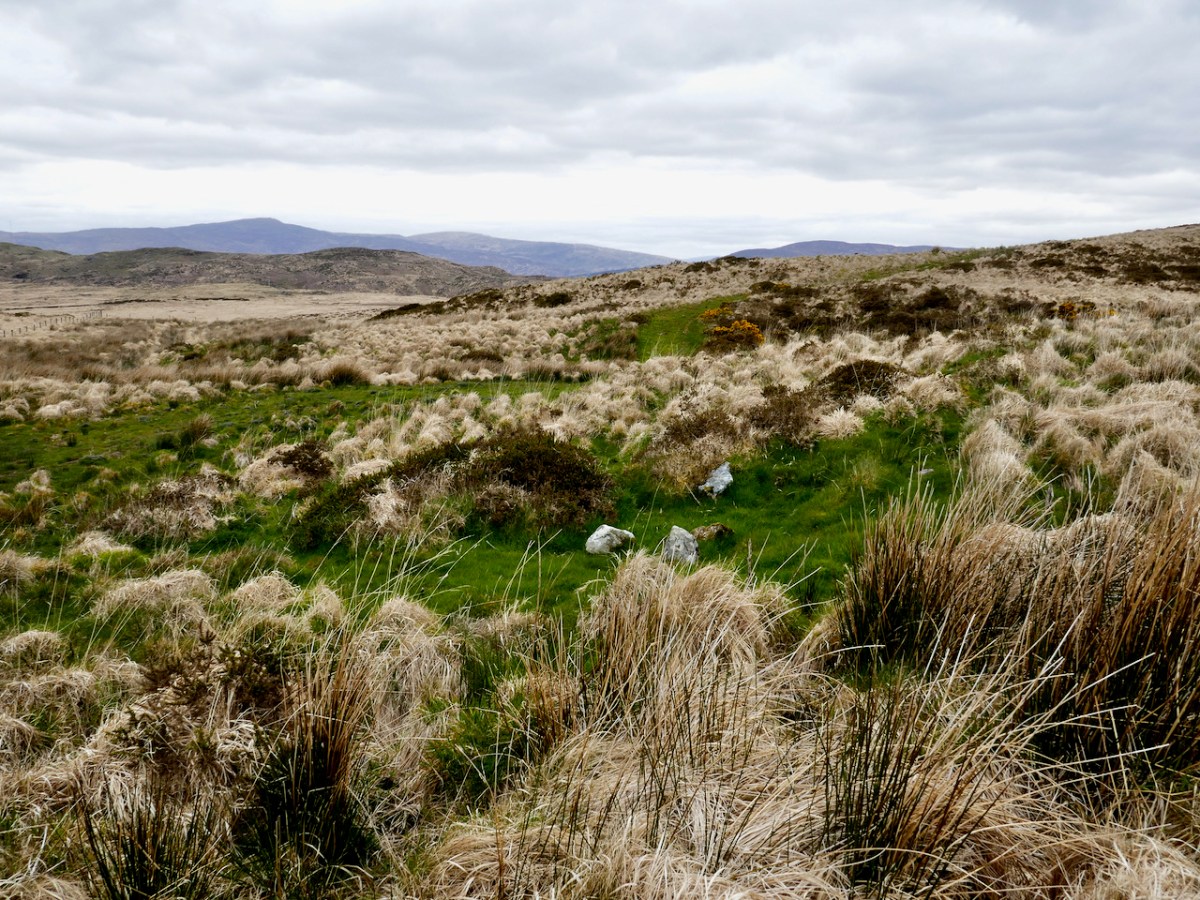
David had secured all the permissions we needed to visit the sites on private land. We started out in the townland of Ardrah (Árd Rath – high fort) with a ring fort (above) commanding panoramic views of the surrounding countryside. A ring fort (also called a rath, lios, dún, or cashel if made of stone) was the dwelling of a high-status individual in early medieval Ireland and examples like this probably date to 500 AD to 1,000 AD. The banks had traces of stone here and there so may well have been faced with stone, and the interior had been levelled.
There would have been a house and perhaps other buildings inside, and a wooden pallisade fence on top of the surrounding bank. There’s a good summary of what we know about ring forts in this engaging website about Irish mythology – I especially enjoy the writer’s comments on the use of ‘fairy fort’ to describe these structures.
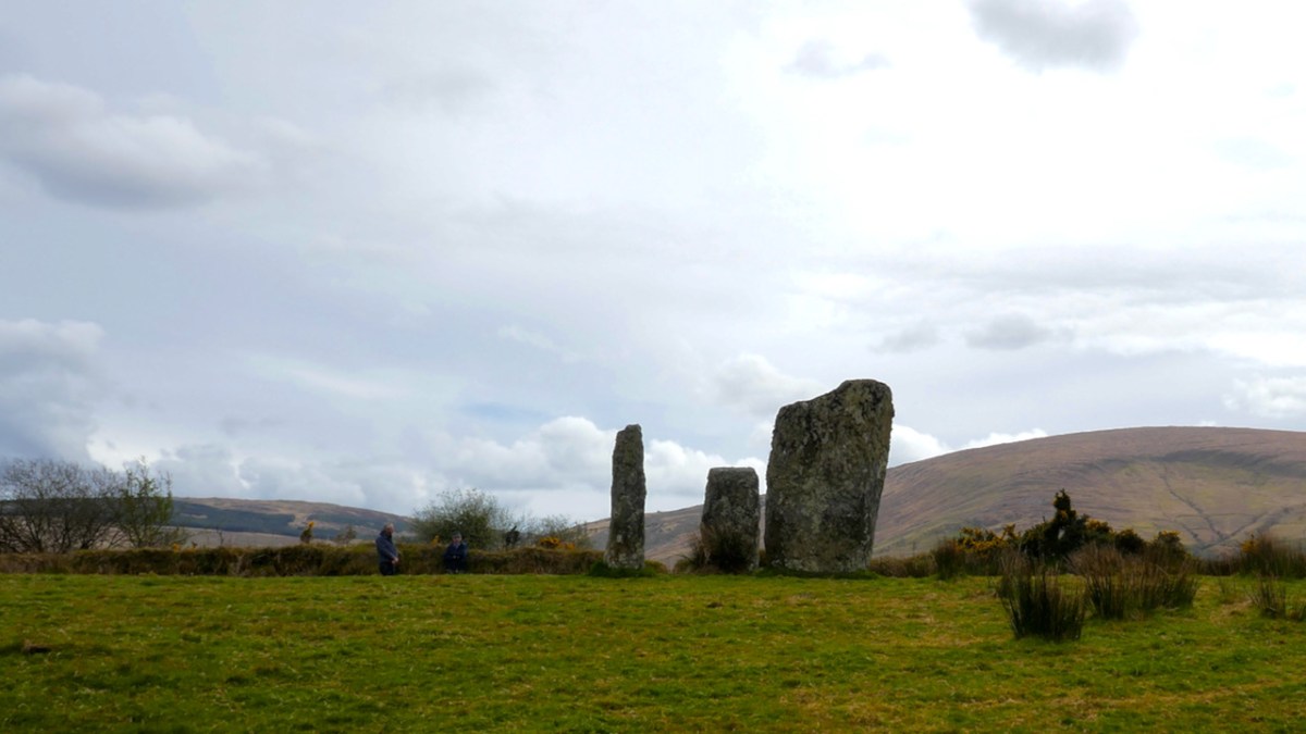
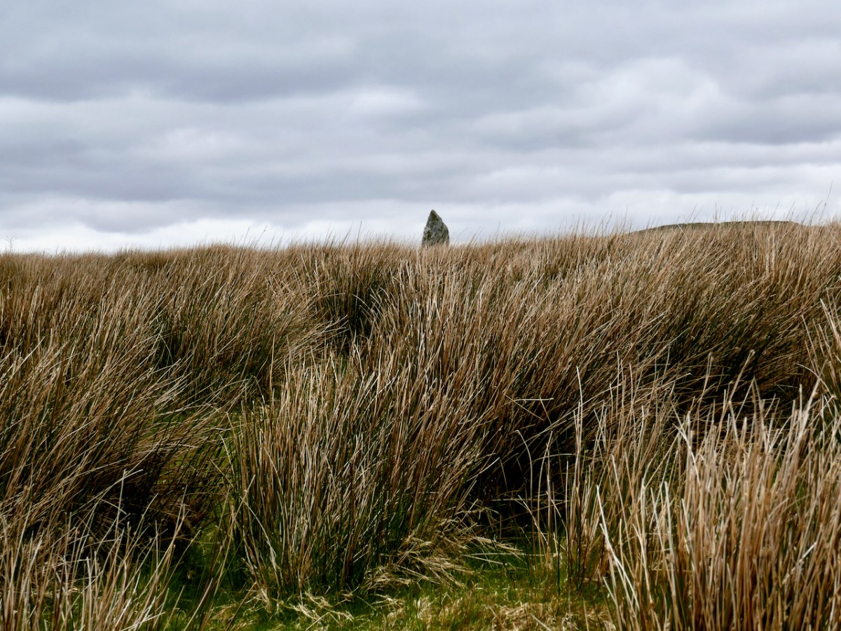
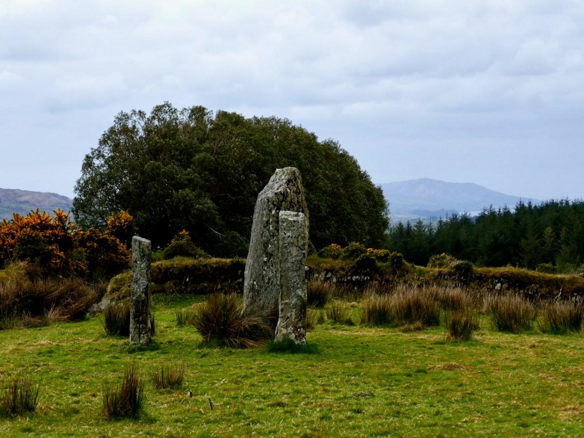
From there we climbed a couple of fences – the first of several fence-climbing incidents during the day and thanks to David for sacrificing his jacket to save us from the barbed wire – and trekked uphill. The monument started to reveal itself as we got higher – at first I thought it was a standing stone.
No – a stone pair?
What, there’s more?
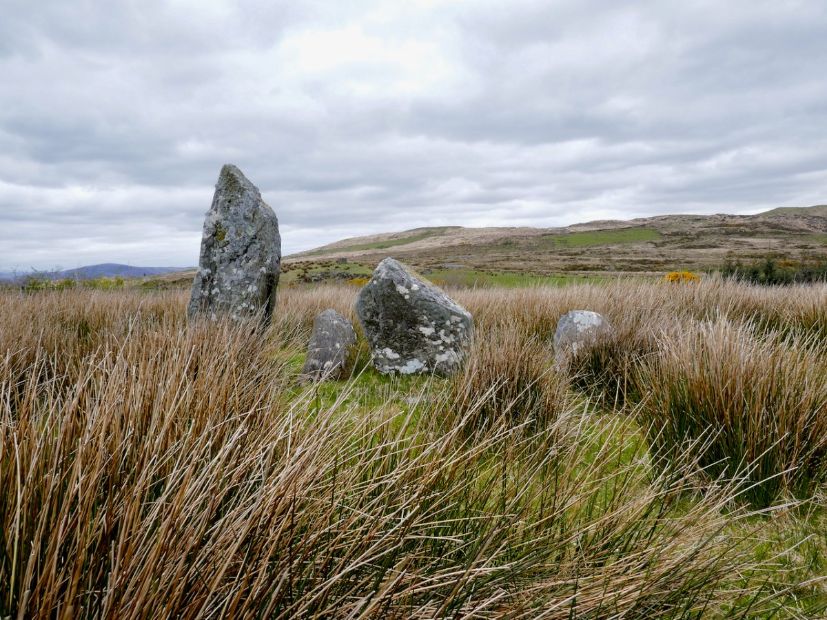
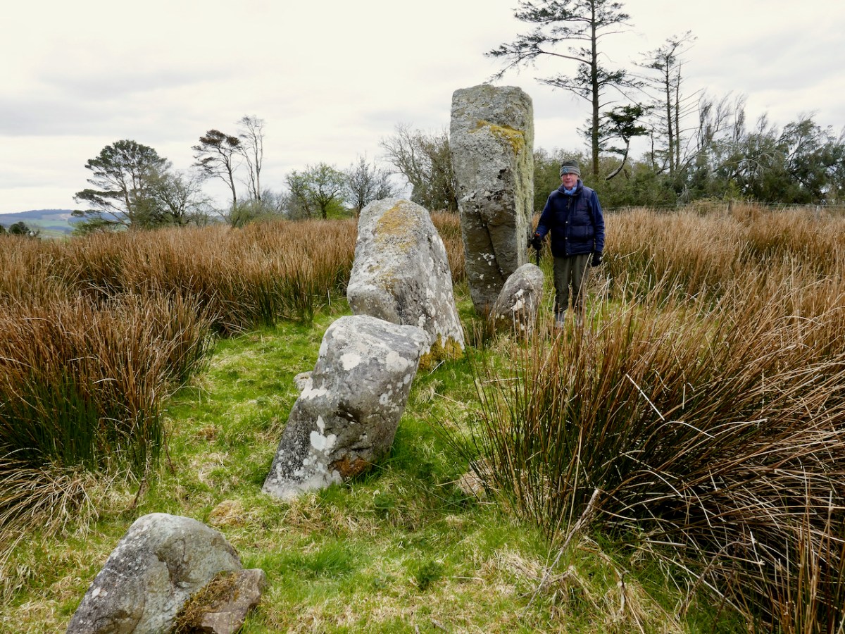
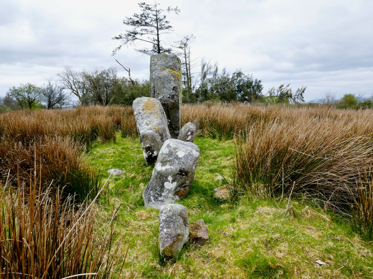
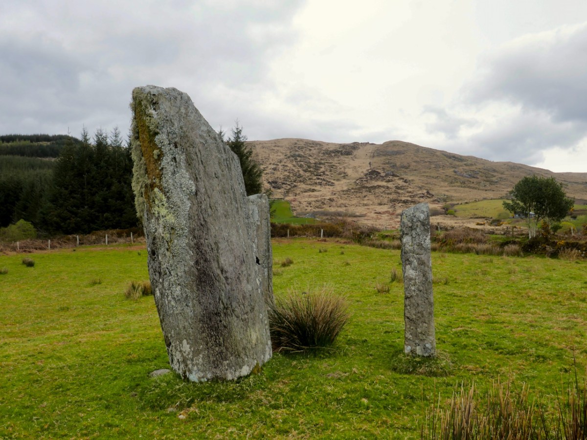
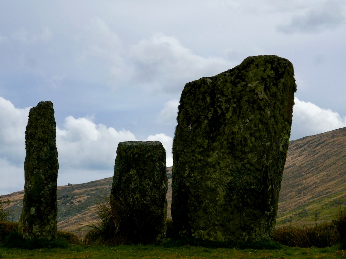
This is the Ardrah stone row, consisting of fours stones aligned ENE/WSW, a common alignment for stone pairs and rows. Take a quick trip over to Standing Stone Pairs: A Visit to Foherlagh for more about this kind of monument. You will see that this one is pretty typical – it has an orientation to the south west, consists of stones that could be interpreted as ‘male’ and ‘female’ and the stones rise in height towards the SW. The southernmost stone is enormous – Robert is providing the scale.
But wait, I hear you say – I see five stones, not four! And you are right. there are five stones, whereas originally there had been only four, and all the records state that this row consists of four stones. The photograph in David’s book, which dates to 1998, clearly shows four.
So – where did the fifth, and smallest, stone come from? It’s a head-scratcher and all we can do is point to the presence of the nearby fairy fort and speculate that the Other Crowd are messing with us.
And then it was on to the piece of prehistory that David discovered in the course of his survey. I should explain here that much of what the Mealagh Valley group was documenting was already known, since the whole county had been surveyed in the 1980s. But what the County Survey lists and what a local group like this looks at, will differ – for example, this group was interested in folklore and local stories about the monuments they visited and about items of interest beyond the remit of the county survey. Moreover, because they are local themselves, they are likely to be contacted if anyone spots an unusual rock or such like, and can be on the spot to examine new ‘finds’. Finally, a project like this generates appreciation and pride in, and a sense of ownership of, one’s heritage, and thus, hopefully, less likelihood of monuments being damaged.
David had been alerted by a farmer to a ‘funny pile of stones’ on the boundaries of the townlands of Ardrah and Gortnacowly (Gort na Camhlaigh – field of the ruins), an area that had been impacted by forestry activity. It’s quite high up and the views are immense. As we walked up, it sent shivers down our spines as David related how he hunted around for what had been described to him, almost giving up, and finally stumbling upon the mangled remains of what he instantly recognised as a Bronze Age wedge tomb.
A digger clearing out a drainage ditch had inflicted damage but most of the stones were still lying around. One side of the tomb, and the back stone, were in situ. That’s probably the capstone, or one of them, on the other side of the fence.
As an archaeologist, it’s actually quite rare in Ireland to discover a previously unrecorded monument – having done so once or twice I know what a thrill it is. David’s wedge tomb is a classic of its type – see my post Wedge Tombs: Last of the Megaliths for more about them. That’s David above, showing us how to make sense of the stones, both those in situ and those which have been disturbed. He was able to ascertain that the workings in the area had turned up quartz pebbles – a feature of several West Cork wedge tombs.
This one was, as expected, oriented towards the setting sun – but that doesn’t begin to describe the incredible sweep of the view from this point – the whole of Bantry Bay lay before us, with the Beara on one side and Sheep’s Head on the other.
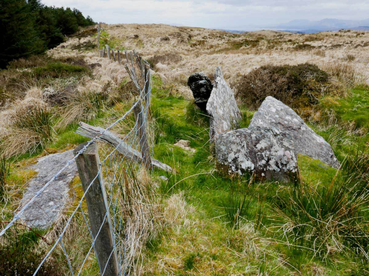
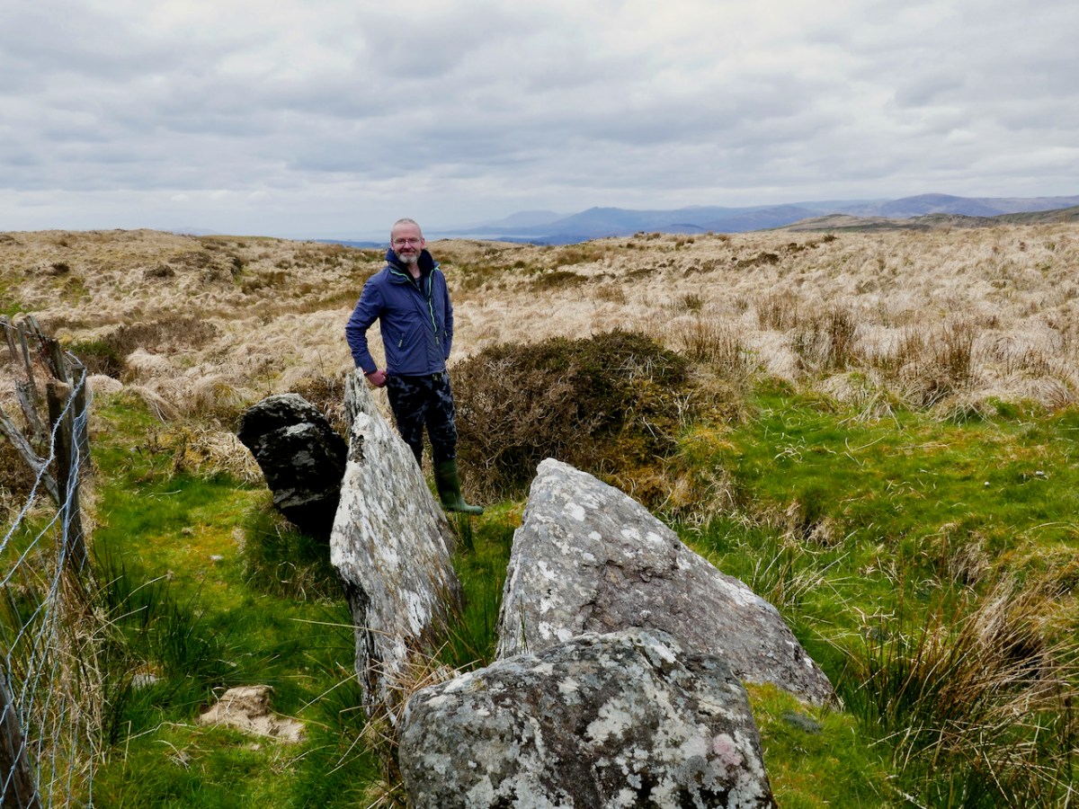
Our final visit of the day was to a type of monument I had never seen before – a ‘Four Poster’. That’s it, above, and note that there is a distant view of the sea, ten kilometres away, from it.
Only five four posters have been recorded in Ireland, one in Wexford, one in Kerry and the other four in West Cork. Here’s what the National Monuments site has to say about them: An arrangement of four upright stones standing at the corners of an irregular quadrilateral. The stones are usually graded in height with the tallest stone at either the south-west or north-east corner. Their closest counterparts are to be found in northern England and Scotland. These monuments are closely related to stone circles in date and function though they are much less numerous. These are dated to the Bronze Age (c. 2400-500 BC).
There are, in fact, only three stones remaining here. The largest stone is massive and of course there are all kind of alignment possibilities with arrangements like this. The closest counterpart to these four posters are to be found in Northern England and Scotland. There have been no excavations at four posters in Ireland but those few which have been dug in Britain yielded a Bronze Age range of dates.
We saw some other things along the way – a booley (above), a hedge school, a mass rock – and Robert wants to write in the future about one particular site, so I won’t deal with it here. The day was cold and crisp – but you hardly notice little things like freezing hands with a landscape like this to wander around in.
What a great day! Thank you, David, for being our tour guide and friend and we look forward to returning the favour soon.
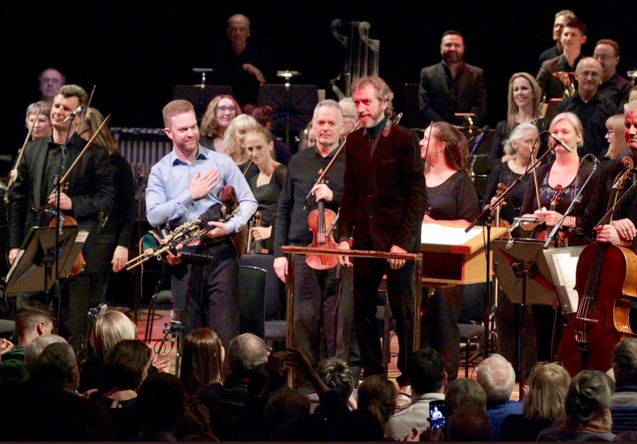
In March this year (2018) Liam O’Flynn passed away. He was a giant in Irish traditional music: a master of the Uilleann pipes – probably the most difficult instrument in the world to play – but also, surely, the most beautiful. We were fortunate to secure tickets for the Memorial Concert to Liam, held in Dublin’s National Concert Hall last Sunday. I would give anything to re-live that experience, as often as possible. We were overwhelmed by the insights which were presented by musicians who had worked with him – and dumbstruck by the astonishing and inspiring performance which took up the second half of the concert: The Brendan Voyage, composed in 1980 by Shaun Davey for the pipes and full orchestra, and written for – and with the collaboration of – Liam O’Flynn. In all, a most fitting tribute to a Maestro – pictured above in 2015 with the RTE Symphony Orchestra (courtesy RTE).
For anyone unfamiliar with this piece of music, here is the second movement – The Brendan Theme – from a live performance in Cork City Hall. It’s a good introduction to the (then) novel concept of combining the sounds of pipes and orchestra: the full suite (42 minutes) is available to stream, download, or as a CD. It’s a work with memorable tunes and expansive orchestration: it could only have been written in the twentieth century, yet it is thoroughly approachable and is sure to bring any audience to its feet at the end. As a former tuned percussionist, I envied the rousing finales given to the timpani and cymbal section!
You can’t beat the atmosphere of a sold-out live performance in a full-sized concert hall such as this one in Dublin. We were fortunate in being seated only a couple of metres back from – and with a full view of – the soloist who, for this occasion, was Mark Redmond, a young piper from Gorey who has already established his reputation as a top-class musician. It would be hard for anyone to have to follow in the footsteps of Liam O’Flynn, but the rapturous ovations given to Mark – and the fabulous RTE National Symphony Orchestra conducted with such panache by David Brophy – proved that the ancient tradition of Uilleann piping is being ably advanced by our upcoming generations. (Photo above of Mark, David and the Orchestra taking a bow last Sunday courtesy Mark Redmond via Twitter).
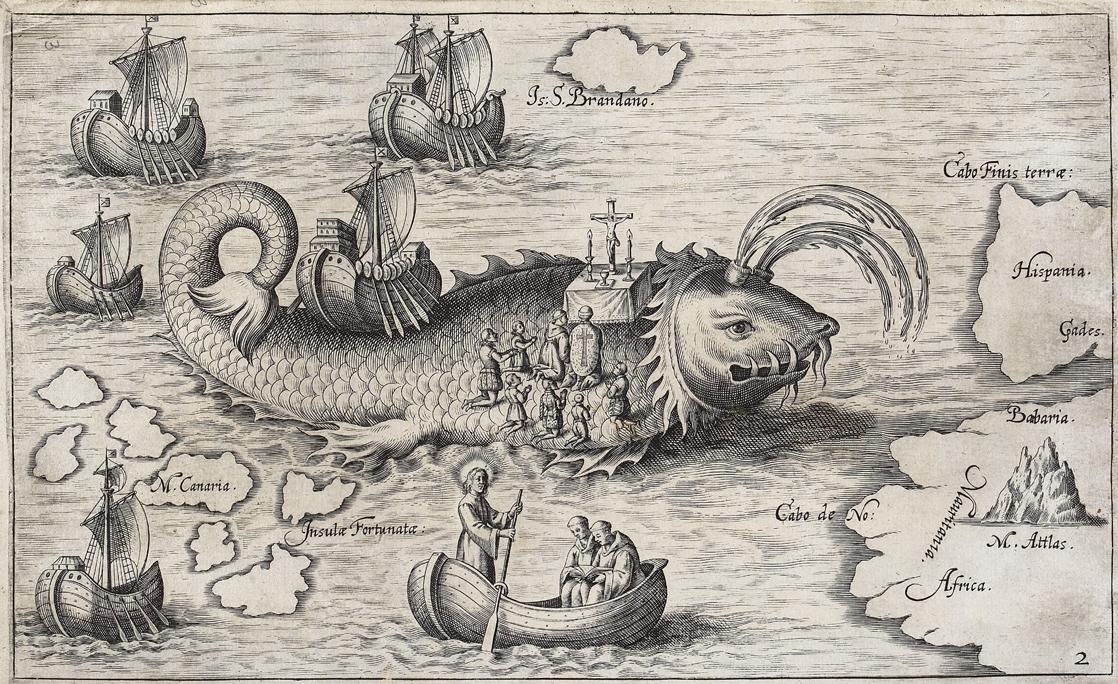
The piece of music is ‘a story within a story’ – it is inspired by Saint Brendan, born in Fenit, Kerry in AD 484 who, with a group of monks set off in the sixth century in search of The Blessed Isles (Paradise). Stories of their many adventures have been recorded and illustrated down the centuries – including the one above which shows the monks landing on an ‘island’ to celebrate mass: the island is actually a giant sea-monster named Jascon! Brendan and his companions crossed the Atlantic, arriving in what we today call Newfoundland – long before the exploits of Columbus. What’s more, they returned safely seven years later to tell the tale. Brendan The Navigator is buried outside the Cathedral of Clonfert, Co Galway, as we have noted in one of our previous posts. And here’s another post about him. But we must not forget that Brendan has West Cork connections too: an elegant modern statue of him is situated in Bantry, looking out over the Bay.
Shaun Davey’s composition, however, is more a response to a modern reconstruction of Saint Brendan’s travels, rather than the original stories. In 1976, explorer, historian and writer Tim Severin set out to test the historical truth behind the stories of Brendan, and built a replica of Brendan’s currach. According to Wikipedia . . . using traditional tools and methods, the 11m, two-masted boat was constructed from Irish ash and oak, hand-lashed together with nearly 3km of leather thong, wrapped with 49 traditionally tanned ox hides, and sealed with wool grease . . . Severin and his crew set sail from Fenit, Co Kerry, and reached the coast of Labrador a year later. Severin’s book describing the expedition, The Brendan Voyage, became an international best seller. Shaun Davey based his music on Severin’s accounts of the journey, and the Uilleann pipes are given the part of the boat itself – both boat and instrument rely heavily on leather. The Irish word Uilleann means ‘elbow’ and the driving force of the instrument is a leather bag which is kept under pressure using one elbow, and is fed from a bellows on the other; the hands and wrists are kept fully occupied playing chanter, drones and regulators. When I listen to this music, my ears hear the water flowing under the leather hull of Severin’s (and Brendan’s) fragile craft. Here’s a good example: the movement titled Water Under the Keel – describing the journey through the Minch channel between the Outer Hebrides and the west coast of Scotland:
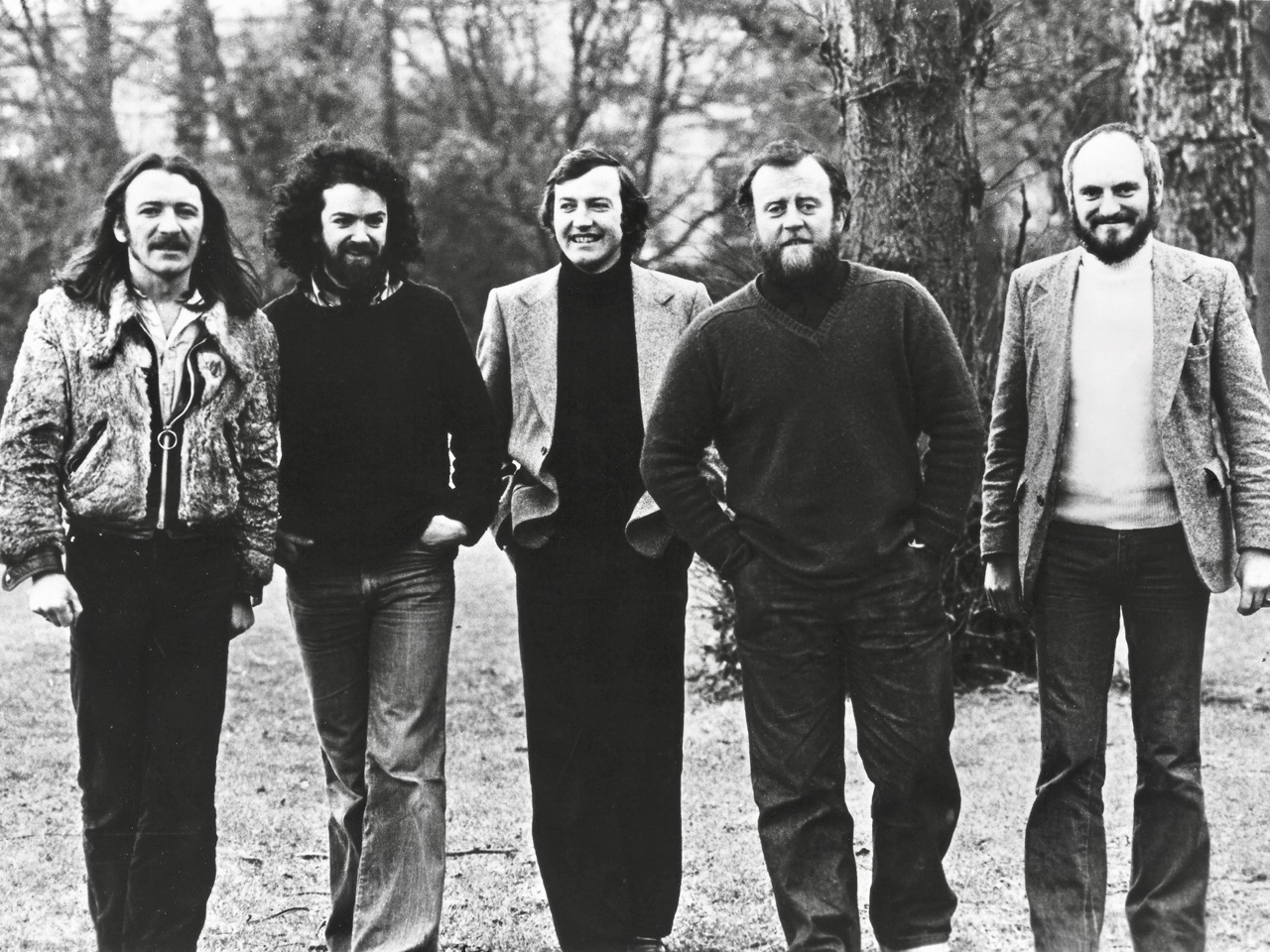
In 1972, Liam O’Flynn joined with Christy Moore, Dónal Lunny and Andy Irvine to found a seminal Irish traditional group – Planxty. Incarnations of that group – with additional players – have travelled the well-worn roads over the years, and on Sunday the remaining three original members, together with Matt Molloy, played for us – and brought on waves of nostalgia. The photo from the 70s, below (courtesy of Tara Music), shows them together: Liam O’Flynn is in the centre. Underneath is some footage from Planxty in their prime.
We were treated to other reminders of Liam’s achievements, including a performance of music he was commissioned to write for the inauguration of the Republic of Ireland’s 8th President, Mary McAleese on 11 November 1997. Here’s An Droichead (The Bridge) with Liam and guitarist Mark Knopfler: McAleese stated that the theme of her Presidency was ‘Building Bridges’.
It’s impossible to put into words the level of exhilaration we felt throughout the memorial concert last weekend. I hope that, at the very least, I may today have sparked some interest in the music of the Maestro, Liam O’Flynn (for those not already in the know) – and in the thrill of Shaun Davey’s mighty concert piece The Brendan Voyage. Here’s a last extract from that work, with Mark Redmond playing. It’s part of the climactic movement ‘Labrador’ – the pipes bring in a variation of the main theme to celebrate the boat’s arrival in the New World and the end of the voyage.
When I leave this world behind me To another I will go If there are no pipes in heaven I’ll be going down below
If friends in time be severed Someday we will meet again I’ll return to leave you never Be a piper to the end
This has been a day to die for Now the day has almost gone Up above a choir of seabirds Turns to face the setting sun
Now the evening dawn is calling And all the hills are burning red And before the night comes falling Clouds are lined with golden thread
We watched the fires together Shared our quarters for a while Walked the dusty roads together Came so many miles
This has been a day to die on Now the day is almost done Here the pipes will lay beside me Silent will the battle drum
If friends in time be severed Someday here we will meet again I return to leave you never Be a piper to the end
(Piper to the End – a song by Mark Knopfler)
Lastly, Saint Brendan the Navigator is celebrated in his birthplace of Fenit, Co Kerry where he looks out eternally over the ocean which he and his companions conquered in their small, hide covered curragh.
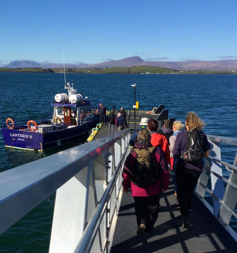
On a sunny Sunday in March, we were lucky to find out about a guided tour around Whiddy Island and enthusiastically signed up. Our guide, Tim O’Leary, runs the ferry to the island and its only pub, the Bank House. He is a native Islander and extremely knowledgeable about the island’s history, traditions, stories, flora and fauna.
Off to Whiddy Island on a beautiful day in March
It was a gorgeous day for a tramp – a good thing as it’s a six mile walk – and the weather allowed us to drink in the glorious views and to stand at various spots listening to Tim as he shared stories of life on the island.
Whiddy Island Graveyard
In the graveyard he told us about the island tradition of burial: a coffin has to be lifted from the boat at a particular quay and laid on a special coffin rock. From there it is shouldered uphill to the burial ground by four men of the same last name as the deceased. Nothing but human power can be used on the long uphill climb, or to dig the grave or conduct any part of the service. “We will carry this tradition on,” he said, “as long as we can.” The burial ground itself is part of an ancient ecclesiastical site and commands views across the island.
View out to Bantry Bay from the Island high point
We learned that many island families made a good living in times past from fishing and fish processing, and it still an important part of the economy, although now mussel beds have replaced fishing lines and ‘pilchard palaces.’
Tim shows us the ‘hairy rope’ used to grow mussels. Mussel beds ring the Island.
The land was famous for being fertile and one historical document talks about the earliest potatoes always being grown on Whiddy. All this activity supported up to 800 people but like many places in West Cork the population was decimated by the Great Famine. Now, fewer than 30 people live here year round.
The Island can no longer support a school
We walked up to the remains of O’Sullivan Beare’s castle, which functioned more as a prison than a dwelling as it housed those who needed to be ‘encouraged’ to pay the taxes he imposed for fishing rights. We explored the area that had once been a thriving American Air Force base for a brief period at the end of World War I – nothing remains except acres of concrete and memories of the vibrant life that the service personnel brought to this small community. Other defensive structures exist on the island too – several ‘batteries’ with huge guns were built after the French invasion of 1796 but alas they are too unsafe to visit.
O’Sullivan Beare’s stronghold
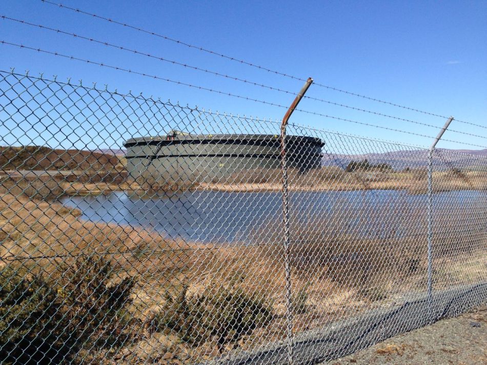
The west end of the island contains enormous tanks that now house the Irish national oil reserves. It was built as a Gulf Oil terminal in the late 60s and was the scene of a horrifying accident in 1979 when an explosion sank a French tanker, the Betelgeuse, and 50 people lost their lives. The enormous tanks, behind their barbed wire barriers, loom darkly against the landscape, a permanent reminder of this awful tragedy.
The oil tanks at the west end of the Island
Take the ferry across to Whiddy Island any time and hike around the hills and the beaches. But if you can, catch one of Tim’s guided walks, and finish with a well-deserved pint in the Bank House at the end of the day.
There’s nothing like a guided tour with Tim!
One thing, though…when Tim sat in this desk back in the day, his teacher forgot to teach him about distances. So just take it with a grain of salt when he tells you there’s “only another half mile to go.”
A note on the West Cork Speak Competition! Deadline extended to the end of next week. Only one entry so far, so don’t be shy and get those conversations in!
Welcome to the UCD Library Cultural Heritage Collections blog. Discover and explore the historical treasures housed within our Archives, Special Collections, National Folklore Collection and Digital Library