A Signal Success in Irish Engineering – Part 8: Brow Head

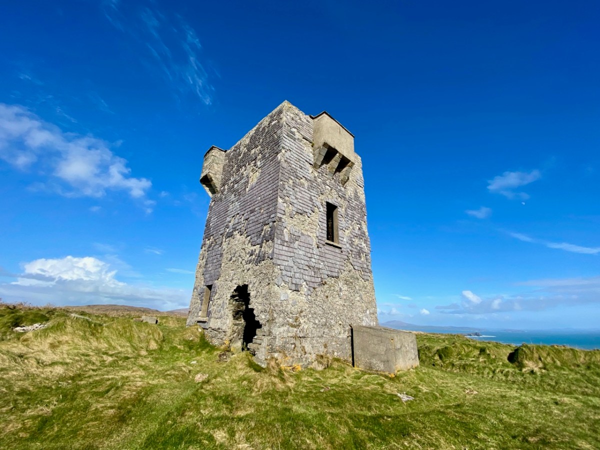
It’s surprising that it’s taken us eight episodes of this series to reach Brow Head, as it is one of the nearest to us, and one of the best preserved – albeit a ruin. It’s not far from the last one we explored: Cloghane, on Mizen Head. In fact, at 3.8km apart, these two towers are the closest of any in the whole system of signal towers around much of the coast of Ireland: 81 towers, each one generally in sight of two others.

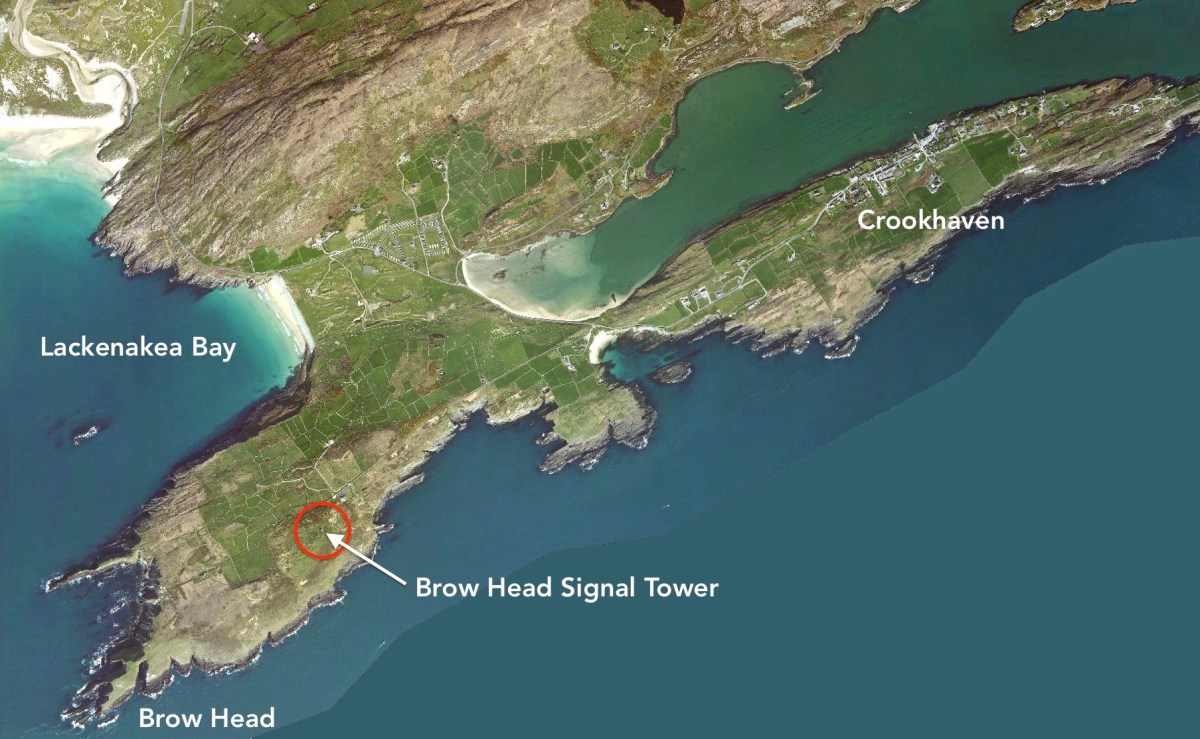
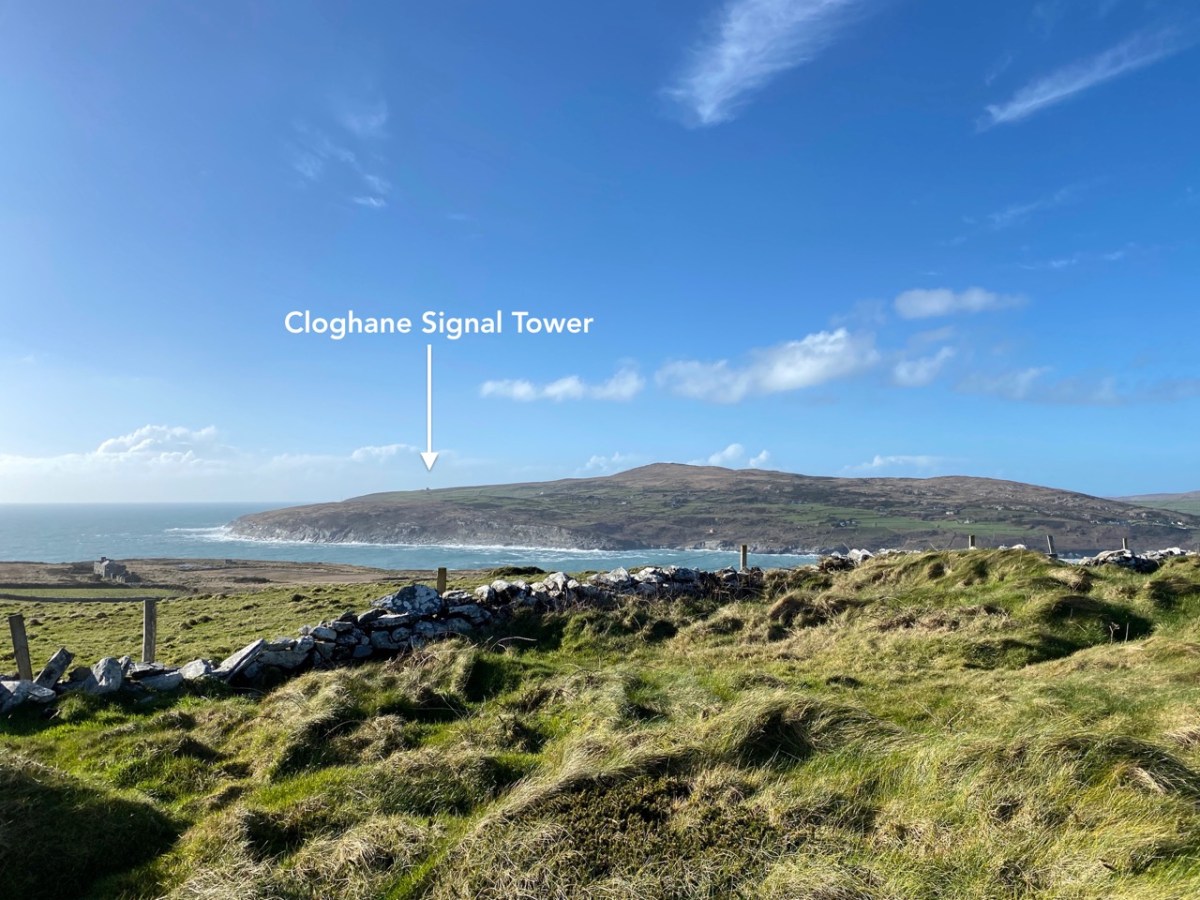
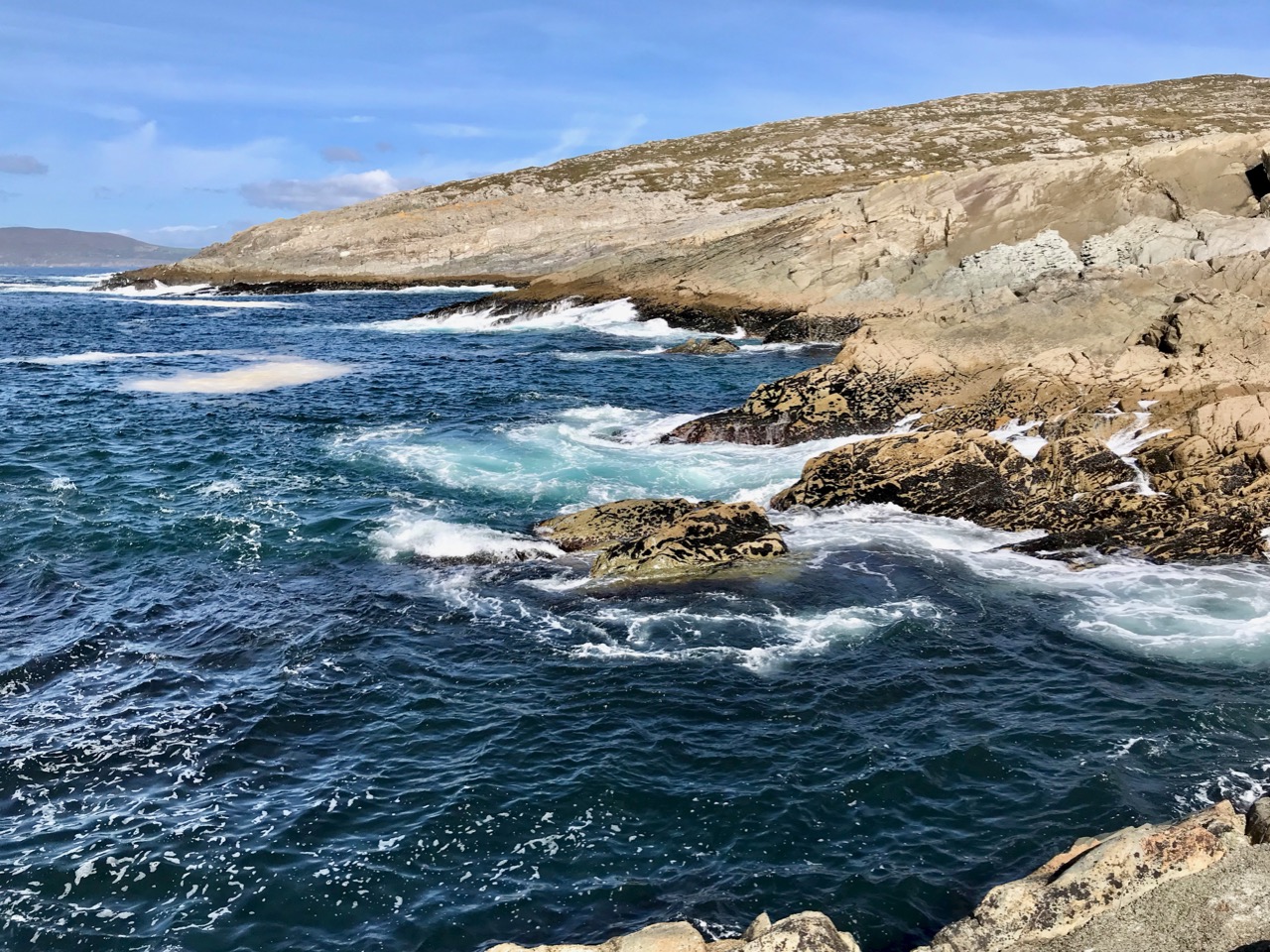
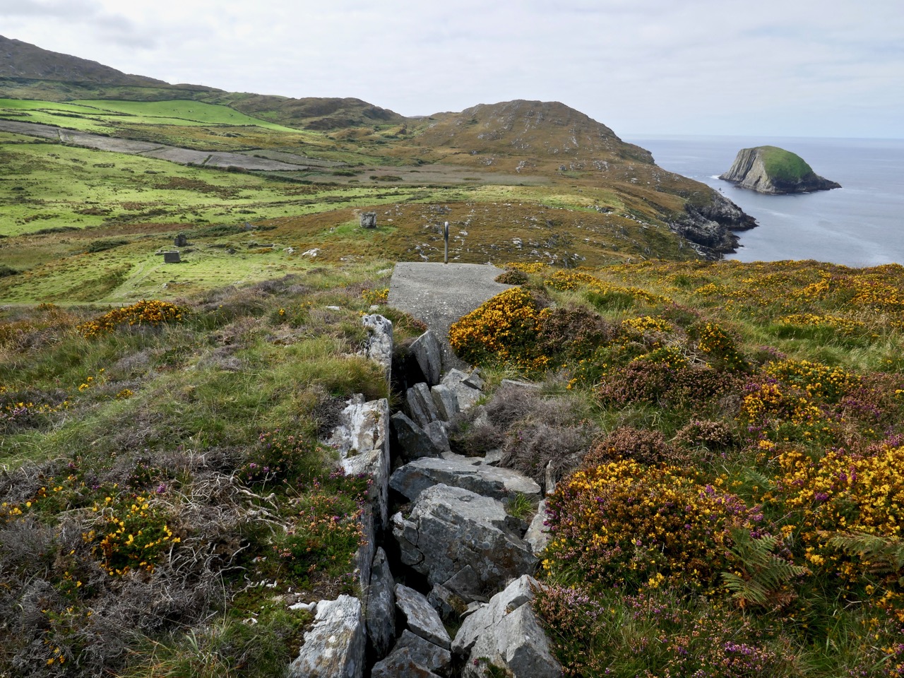
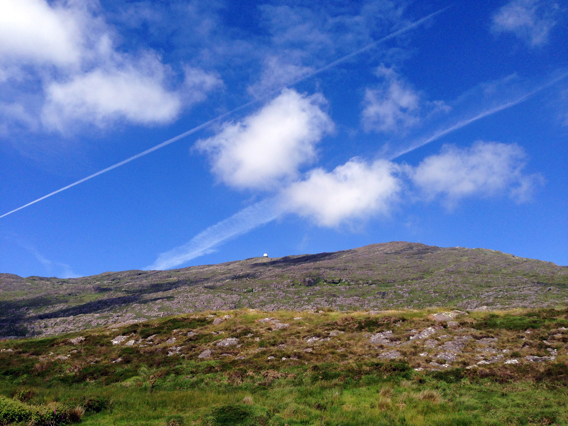
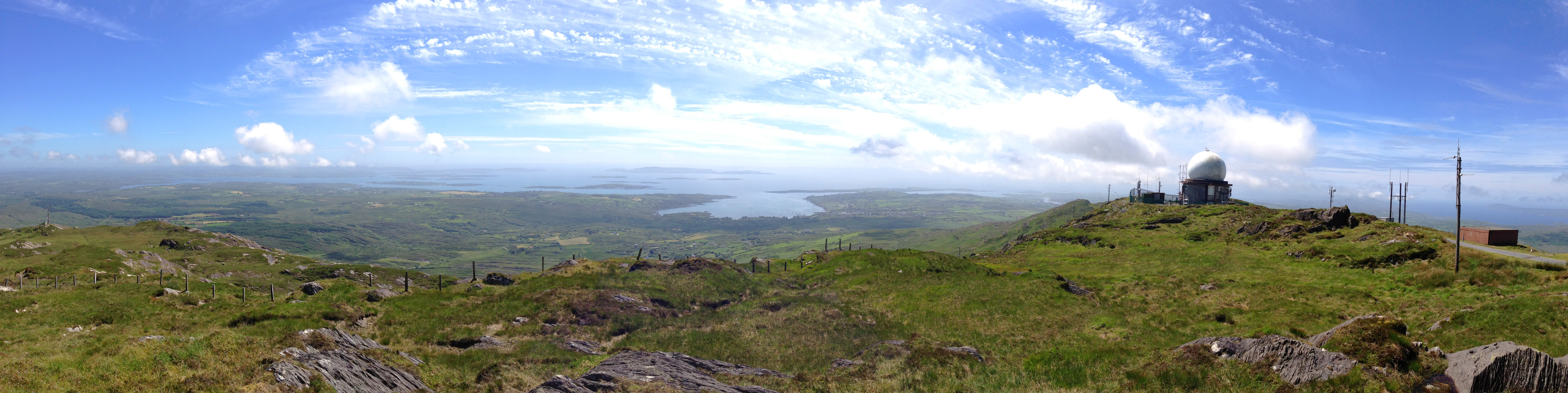
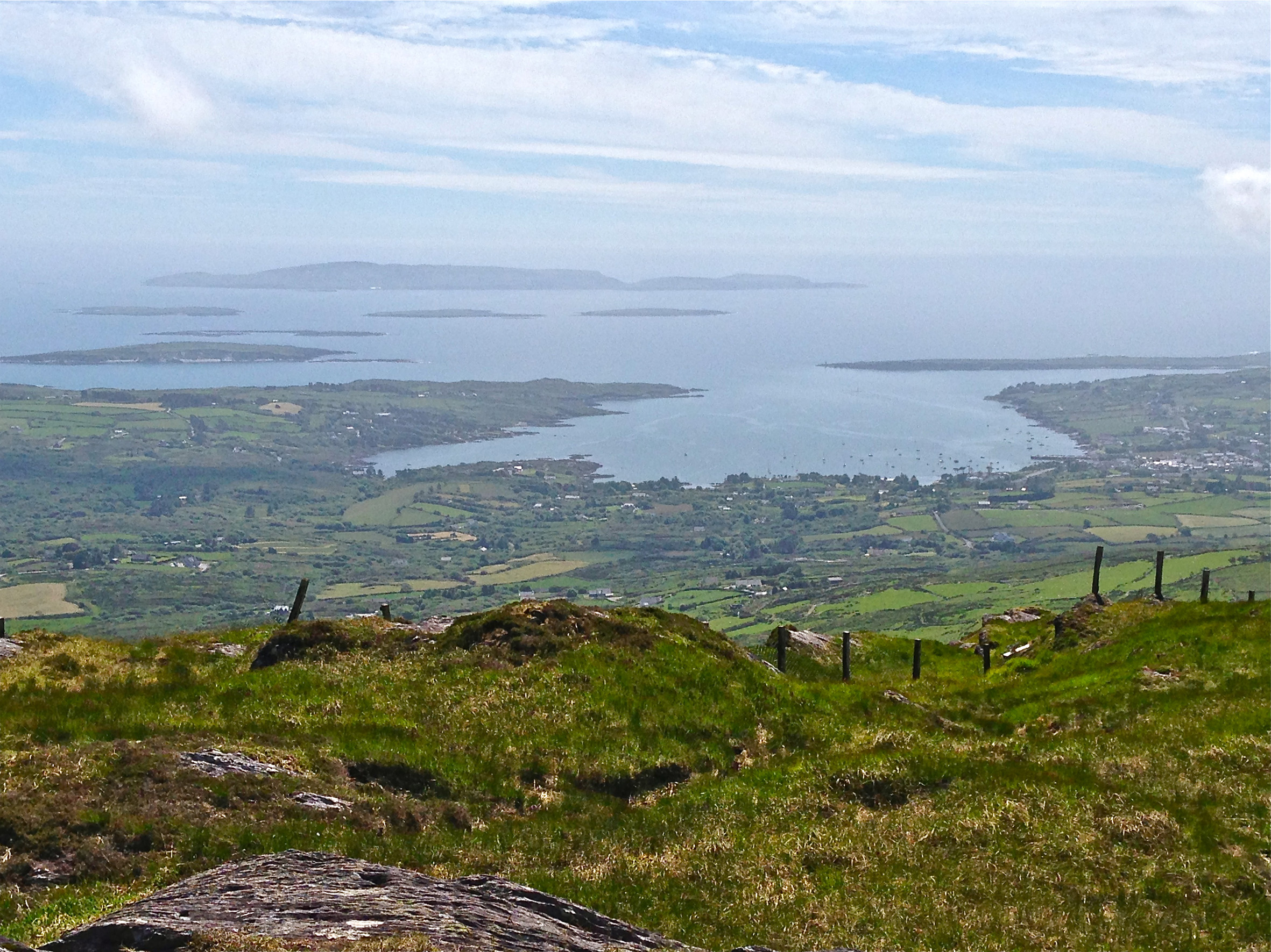
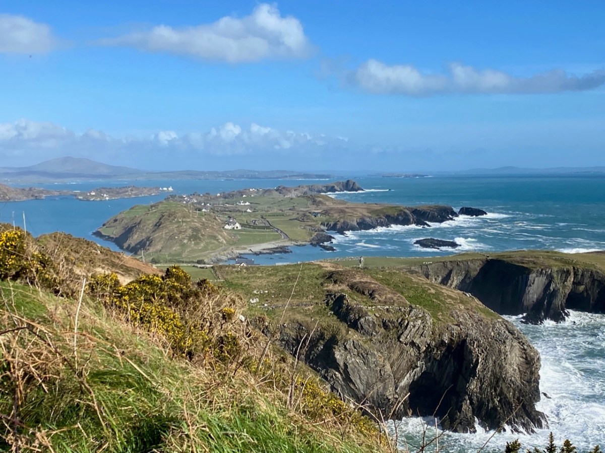
Above – views north-west across to Cloghane, Mizen Head, from Brow Head. The lower photo is taken with a long lens. Cloghane is 3.8km away from Brow Head: it doesn’t sound very far but, as you can see from the centre picture here, it’s remarkable that telescopes were good enough, in the early 19th century, to make out visual signals in any great detail. Weather conditions were obviously an important factor in this. Below, the tower at Knock, Lowertown, near Schull, is some 19km away to the east. When we visited the vestigial Ballyroon signal tower, on the Sheep’s Head to the north, we could also clearly see across to Brow Head – a distance of about 17km.

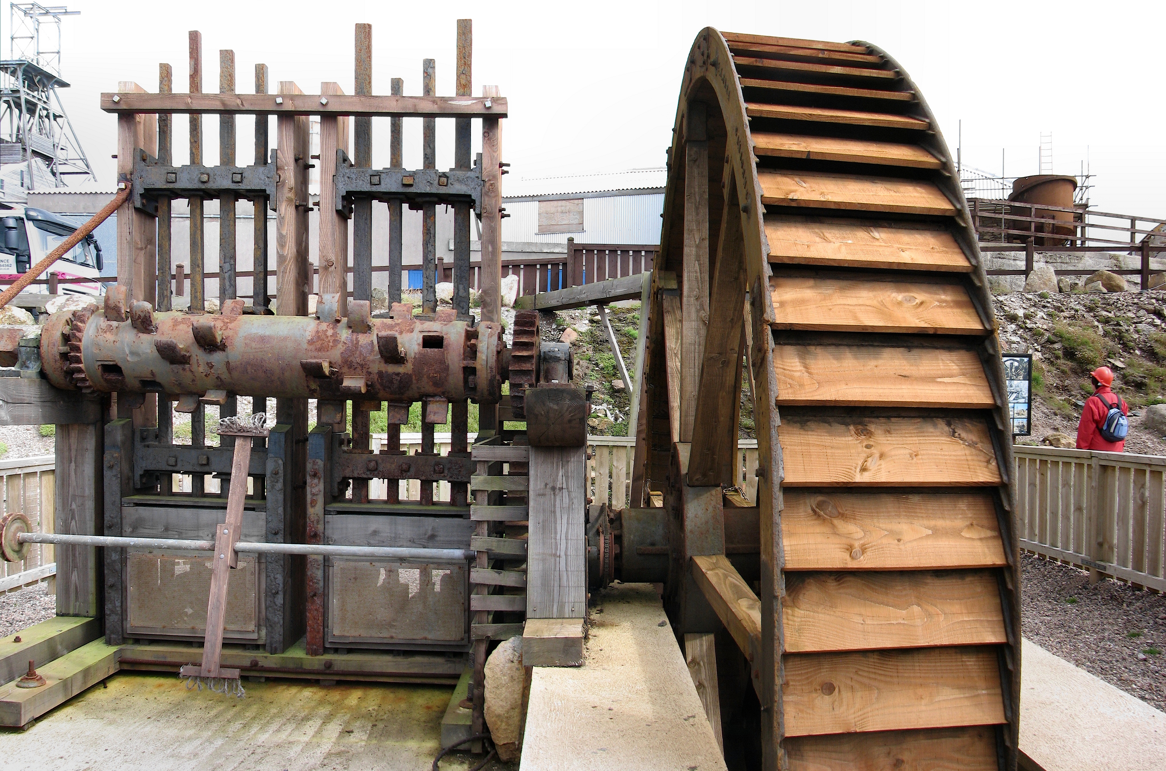
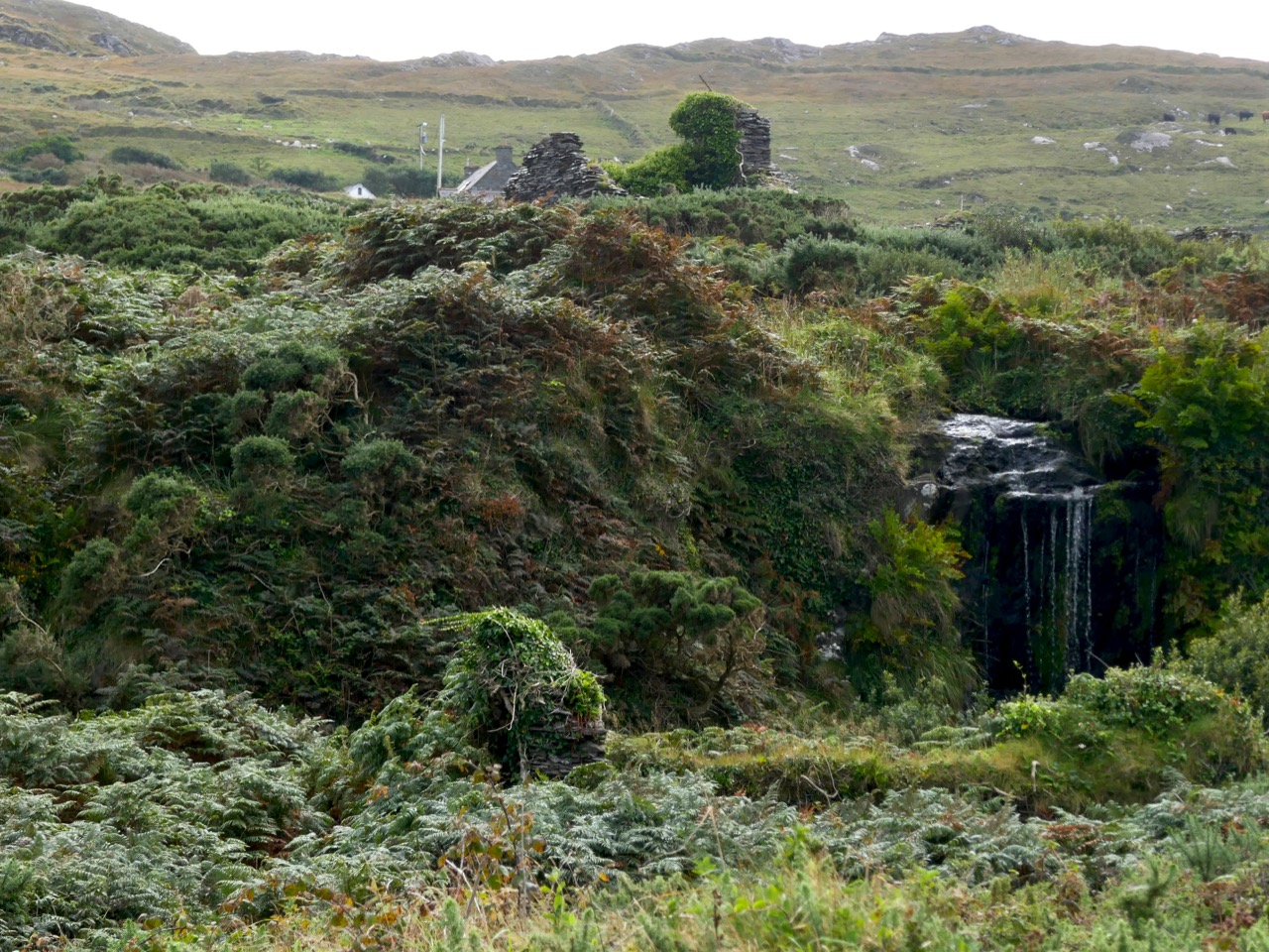
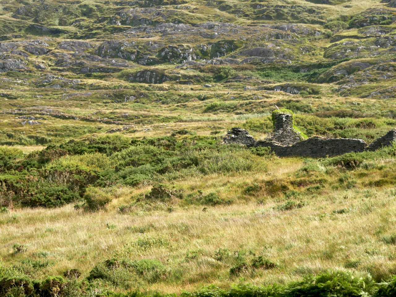
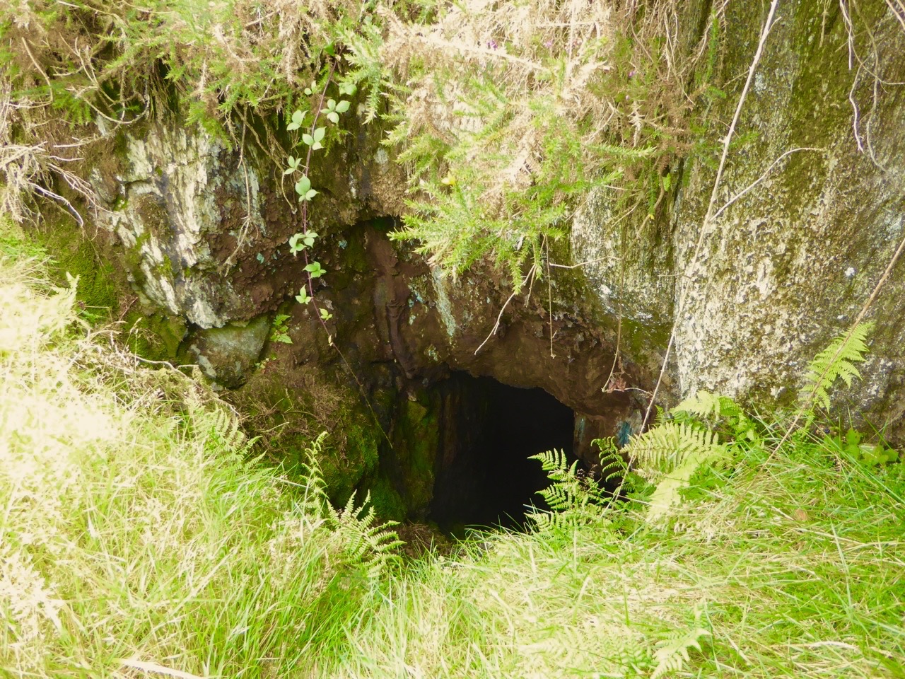
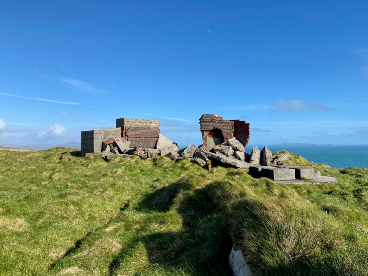
Brow Head – the headland itself – has been the subject of a previous post on Roaringwater Journal. It has a remarkably diverse history: not only is it the site of the Napoleonic-era signal tower, but of industrial and scientific activity. There are the substantial remains of a nineteenth century copper mine (photo above): I noted that the Mine Captain here was Hugh Harris from Cornwall – and wondered if he was a relation – until I read that he was dismissed as ...an incompetent authority…! Most interesting, perhaps, are the ruins of a signalling station set up by Guglielmo Marconi – established in 1901.

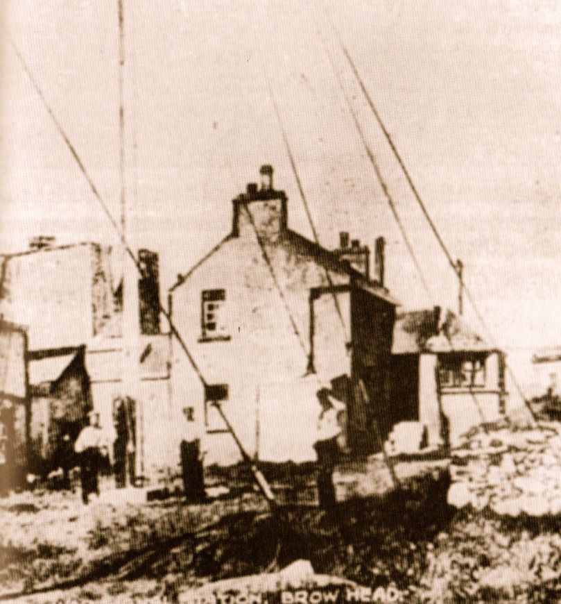
This photograph was taken in 1914. It shows the Marconi installation still in use: the signal tower is visible in the background, on the left. On the far right is a building which I take to be the electricity generating station, powering the telegraph. During the Emergency (1939 – 1945), a lookout emplacement was built to the south of the Marconi station: many of these were built around the coast, the majority sharing a site with a Napoleonic-era tower. Have a look here for more information on these comparatively recent structures.

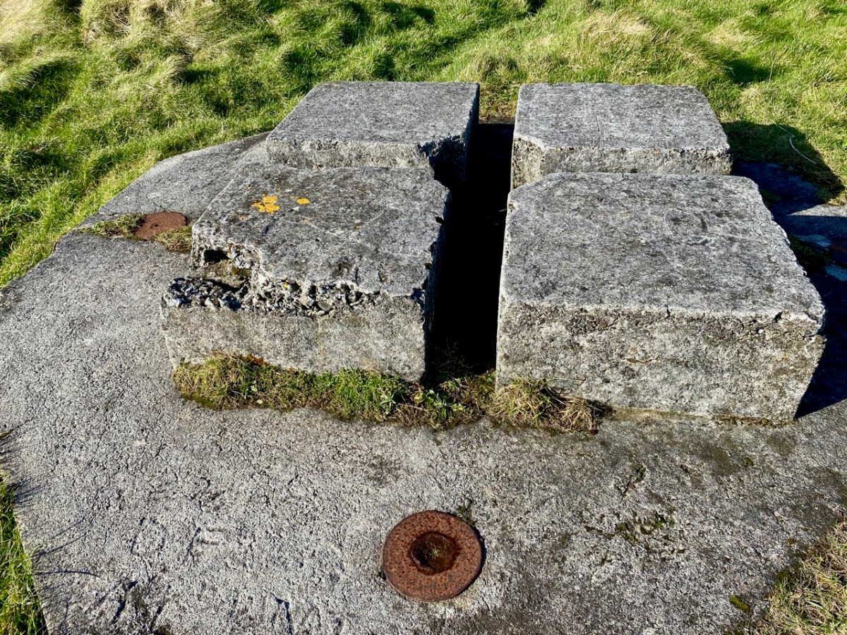
For this excellent drone picture of the Brow Head site, taken in 2017, I am most indebted to Jennifer & James Hamilton, mvdirona.com. Jennifer and James are intrepid adventurers, travelling around the world on their Nordhavn52 vessel. It’s well worth going to their website to see what they get up to: it makes our own travels in the West of Ireland seem a little humdrum… On the right of the photo is the 1804 signal tower; on the left is the Marconi station with – just in front of it – all that is left of the 1939-45 lookout post. On the right in the foreground is the generating station shown in the present day photo, below. Note, also, in all these images can be seen the four-block supporting base for the Marconi transmission mast.

What happened to these buildings? Here’s an account I received from a RWJ correspondent (very many thanks, Rachel), after I had published an earlier post on them in 2014 – it is based on contemporary newspaper articles during the Irish War of Independence:

. . . Brow Head was destroyed on the 21st August 1920 at 12:45 – 1am, having been raided less than 2 weeks earlier on the 9th August. All reports mention the use of fire; only some mention the use of bombs. Explosives had, however, been stolen during the earlier raid on Brow Head (they were used for fog-signalling). Due to delays in reporting, some articles suggest different dates for these events but I’m fairly sure the 9th and 21st of August are the correct ones. 9th August: Armed and masked men raid the station and take stores of explosives, ammunition, and rifles. There are conflicting reports over whether any wireless equipment was taken during this raid. 21st August: Reports that all buildings at Brow Head (war signal station, post office, coastguard) destroyed, either by fire, or fire and bombs depending on the article. Some reports say 40 men were involved, some 70, some 150, some 150-200. These men had masks and were armed with revolvers to cover the three or four guards, they were described as young and courteous. The raid is said to have taken 5 hours; all Post Office equipment was taken away, as well as other stores. Other wireless equipment was smashed. The raiders helped the guards move their furniture/belongings out before setting fire to the buildings . . .

Rachel Barrett

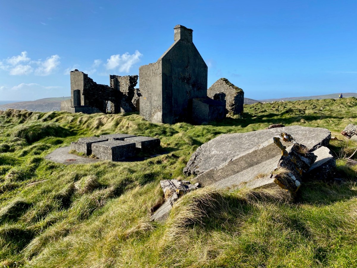
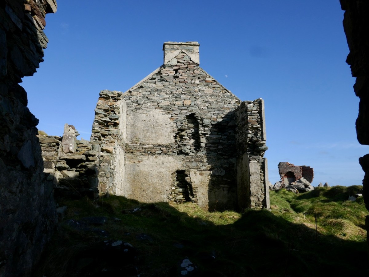
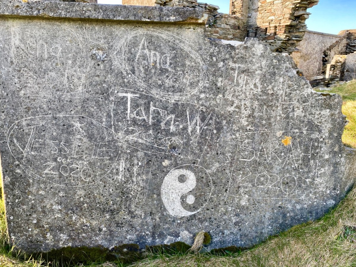
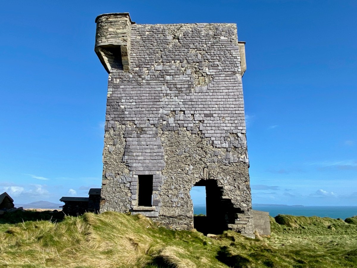
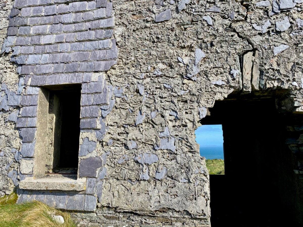
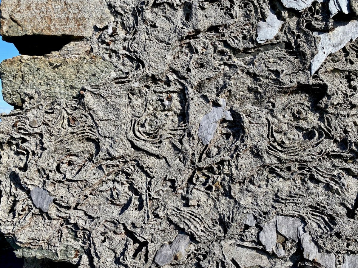
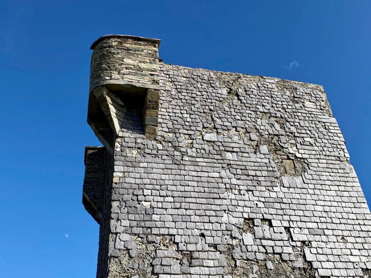
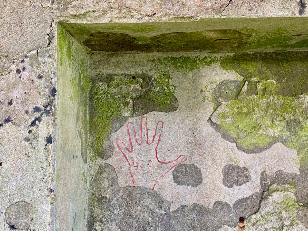
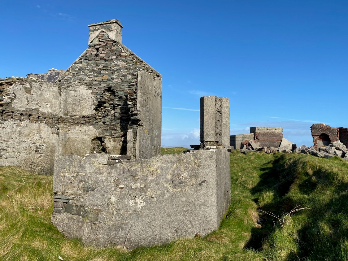
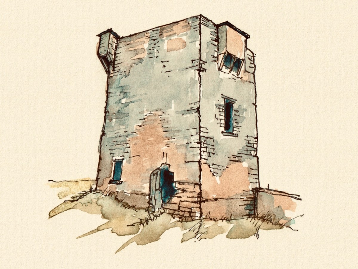
So far we haven’t said much about the 1804 signal tower itself. Although ruined, it is a good example, reasonably stable, and has survived two centuries of severe Atlantic gales remarkably well. All the elements are recognisable: projecting bartizans, slate hung external walls for improved weatherproofing, an intact roof and distinct internal features – and a little enigmatic graffitti. Compare all these with the other towers in our series so far (there are links at the end).

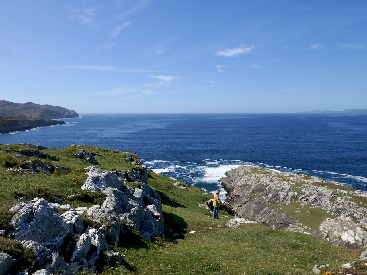
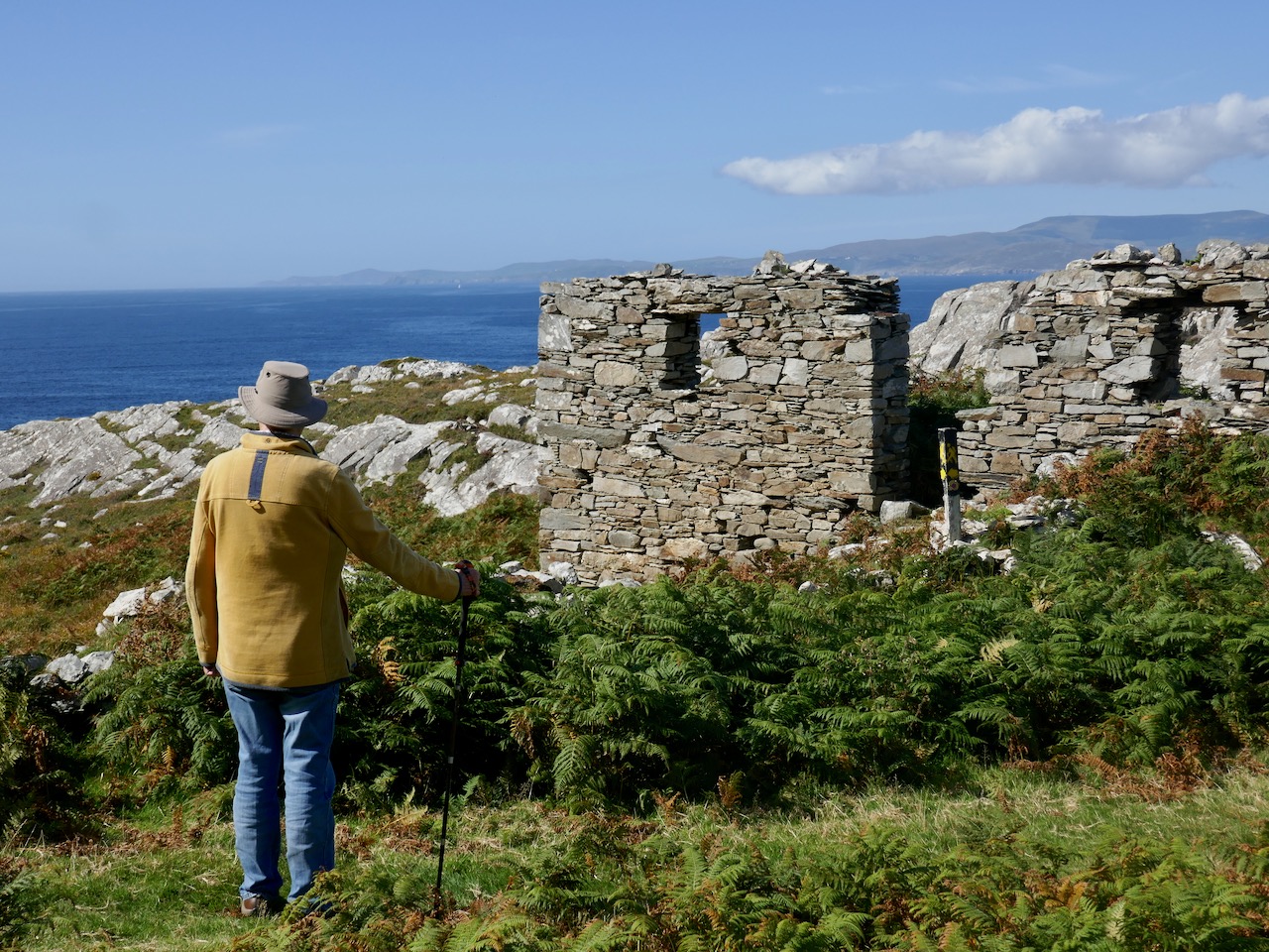
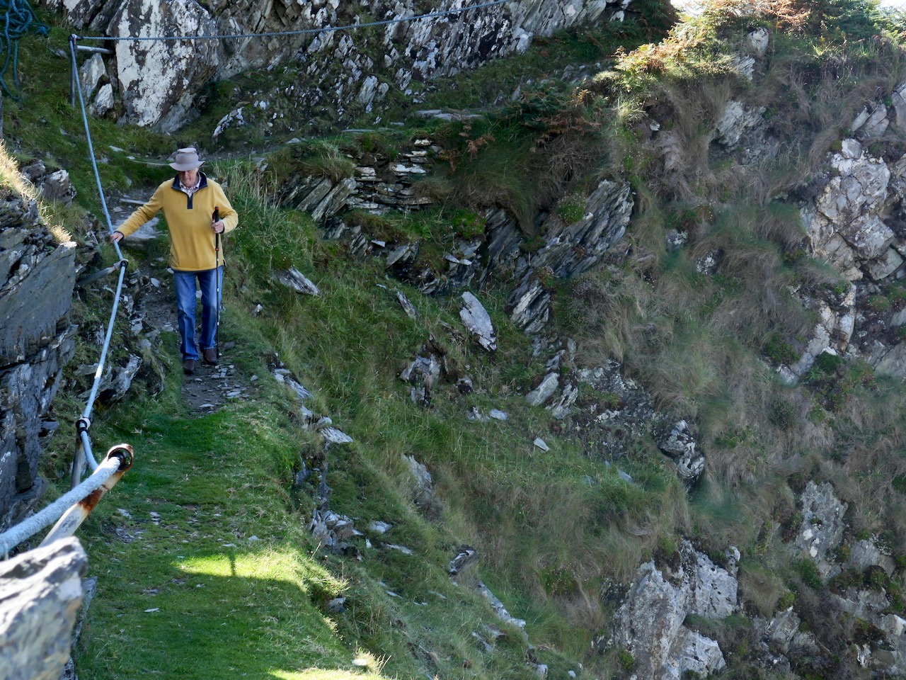
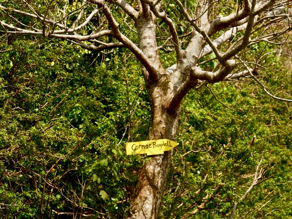
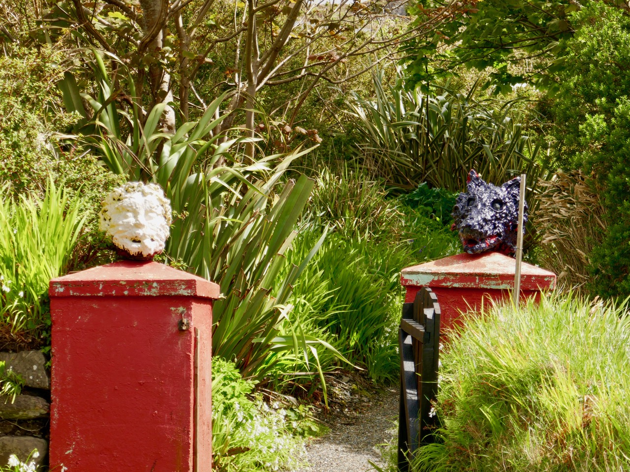
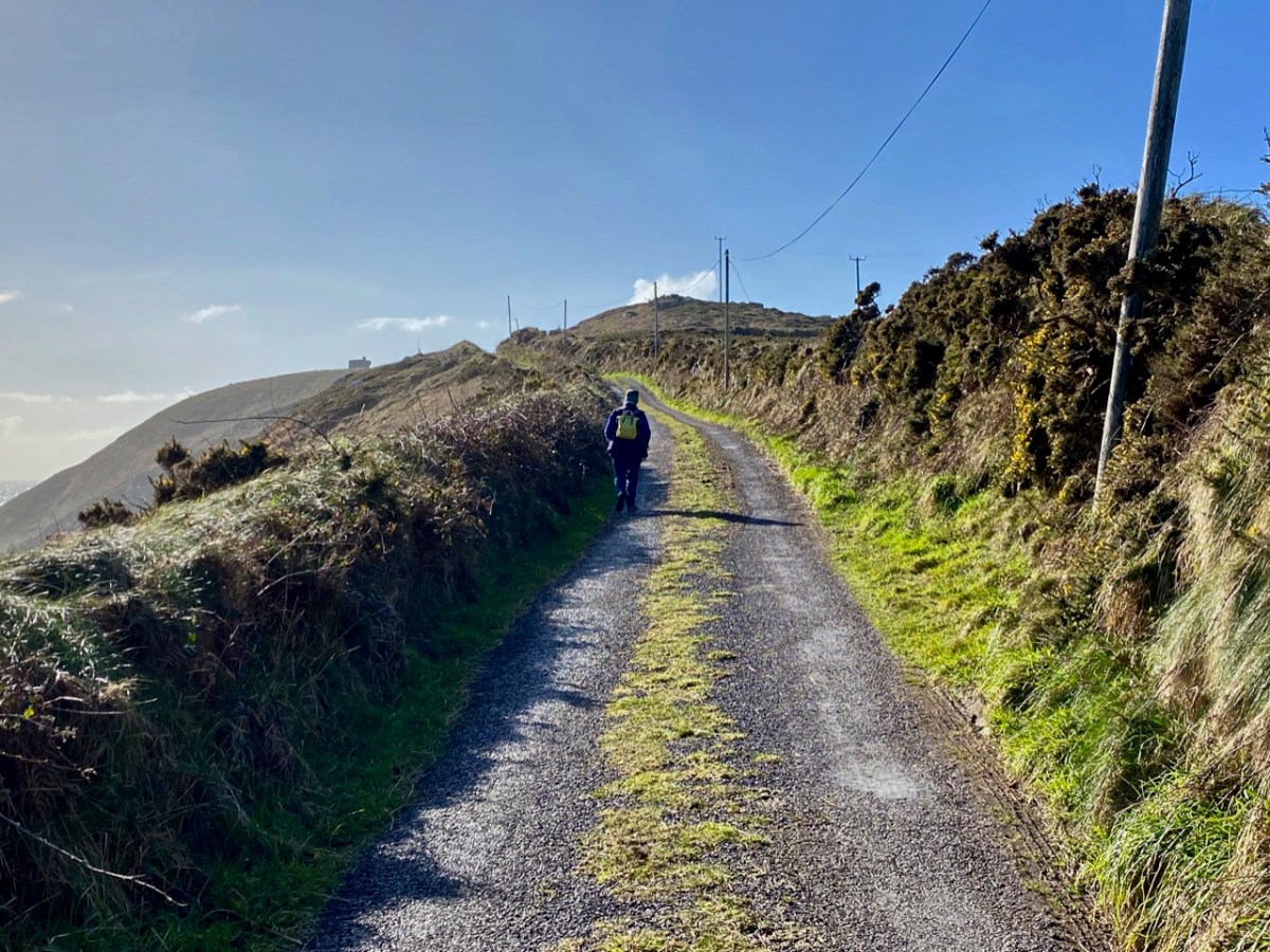
If you set out to visit the Brow Head site on a good day, you can’t do better than to park at Galley Cove – at the bottom of the long, steep access road (and beside the Marconi commemoration board and sculpture by Susan O’Toole) – and then walk up. You will enjoy continuously changing spectacular views in all directions, and you will begin to see the signal tower above you as you approach the brow of Brow Head.

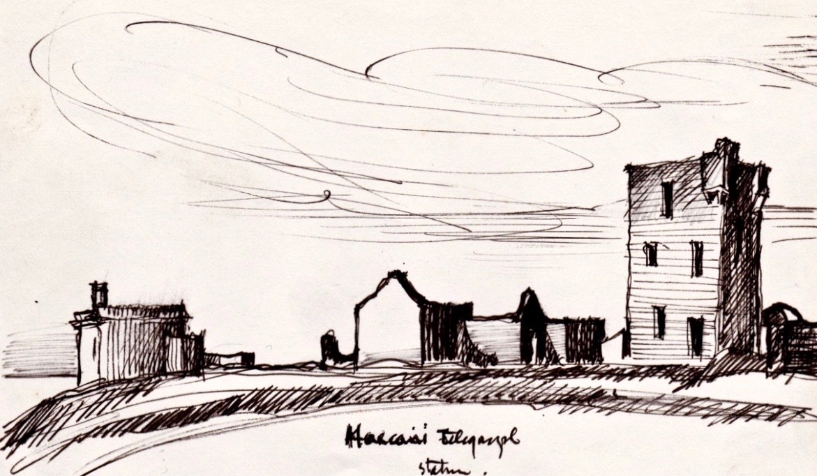
West Cork based artist Brian Lalor visited the Brow Head site with the Mizen Field Club in 1984. His sketch of the buildings is an interesting record as it appears to show, on the left, the 1939-45 lookout post intact (below). Very little remains now, 37 years later (lower). I wonder what led to this particular piece of destruction?

I’ll finish off with another sketch view of the Brow Head signal tower: this is by Peter Clarke, who runs the excellent Hikelines site. Many thanks, Peter.

The previous posts in this series can be found through these links:

Part 1: Kedge Point, Co Cork

Part 2: Ballyroon Mountain, Co Cork

Part 3: Old Head of Kinsale, Co Cork

Part 4: Robert’s Head, Co Cork

Part 5: Downeen, Co Cork

Part 6: Dunnycove

Part 7: Cloghane, Mizen Head

Mine Ghost

My name is Thomas – William Thomas. When I’m at the mines they call me Captain Thomas – because I’m in charge! I’m visiting some of my old ‘haunts’, and thought you might join me, to see what a working day was like in ‘ . . . one of the wildest districts in the United Kingdom . . . ‘ – Gortavallig, on Rinn Mhuintir Bháire. I know you call this place The Sheep’s Head now: that amuses me. I’m always trying to pick up on the Irish words – it’s such a poetic language. My grandfather was a natural Cornish speaker, but the language was gone by the time I was born – it’s only used by the Bards nowadays.

That’s my house – above – in the townland of Letter East. That’s where I stayed with my family when I was Captain at Gortavallig. It was rough going when I had to get to the mine – a solid hour’s trek across rough country, and the same back again. As part of the work that we did while developing this mine we built a good ten miles of road, which helped with communications in that untamed north-coast country.

Come with me now on the way that leads down, firstly, to the cove at Bunown in Eskraha townland: there’s a slipway there, and a house where my assistant Superintendent, Mister Bennett, lodges. It was once a coast-guard station. This cove has also been the scene of some tragedies in your own time. There was the writer, James Farrell, who drowned while fishing off the rocks there in 1979. He’s buried beyond by the church of St James in Durrus, looking out forever over Dunmanus Bay. The sea is a dangerous element: I know, because I’ve had to work with it. But it’s your friend, as well as your foe. If it wasn’t for the sea we would have no chance of transporting ore from the remoteness of Gortavallig.

The rocks at Bunown – on a good day! James Gordon Farrell is buried facing the water of Dunmanus Bay at St James’, Durrus

They say that, wherever you are in the world, if there’s a mine – or even a hole in the ground – you’ll find a Cornishman at the bottom of it! That’s because pulling the metal out of the ground – and from the cliffs – and even from under the sea – was our lifeblood in that far western peninsula. But the land was ravaged. This scene (below) is where I grew up and learned my trade: Dolcoath, near Camborne in Cornwall, in its heyday one of the busiest mining areas in the world. My father James was agent there and I enjoyed ‘ . . . a liberal education and had the very great advantage of being taught dialling and the whole routine of the profession by the most eminent miners of the day and worked for several years as a tributer – an admirable practical school . . . ‘

I was pleased to get away from the noise, the grime and the stench of that place when I was called to Ireland with my own family in 1845, firstly to Coosheen on the Mizen – where I revived an ailing venture by successfully rediscovering the copper-bearing lode. After that I came here to the Sheep’s Head where the surveyors, travelling on board small inshore vessels, could see promising ore-bearing strata on the cliff-faces which were being eroded on this coastline. My job was to work those veins – a gargantuan one bearing in mind the uncompromising nature of the landscape and the remoteness of the geography.

Looking back across silver waters as we walk together on the rough pathway to Gortavallig: nature has been tamed by the fields that go down to the coast west of Bunown, whereas the way to the east is across rough, wild country

If you follow this path with me you will have to have good shoes and a steady gait, and the will to clamber upwards and downwards on sometimes steep and rough rock faces. But you will be rewarded by the remarkable vistas and the untamed surroundings. Your only companions will be the choughs: these sleek red-billed birds are a comfort to me as they have always been a symbol of Cornwall, sharing pride of place on that county’s coat-of-arms, together with an image of the Cornish miner! Did you know that the chough is the embodiment of old King Arthur, who is ready to rise again and save our nations in times of trouble?

A chough espied on our walk to Gortavallig, and the Coat-of-Arms of Cornwall which is shared between bird, fisherman and miner

After a vigorous hour’s trekking over the rough terrain we will catch our first glimpse of the mining works at Gortavallig: a row of small stone cottages perched on the cliff-top. This is known today as the Cornish Village, although it wasn’t just Cornish mine-workers who lived here. Good, strong Irishmen came to the place and earned their keep, and everyone here had to pay rent for the single-roomed lodgings. If there had been windows on the seaward side of these dwellings they would have enjoyed magnificent views, but we were more concerned at keeping out the extremes of the weather, and the few small windows only faced inland. There was plenty of ocean to be seen while you were working your hearts out to extract the minerals!

‘Cornish’ cottages close by the mine workings at Gortavallig

Once we have passed by the cottages we find ourselves traversing a sheer cliff edge. Below us the sea roars, but it’s down there that we built two quays, one 73 feet long and 40 feet high, the other 92 feet long and 36 feet high and, at the base of the cliff, a dressing floor 180 feet long and 50 feet wide, while above it we put in a stone dam and sluice so that we could wash the ore. Water was such an important element to us: in Cornwall we used its power to turn wheels and drive machinery such as crushers. We were never short of it here in Ireland.

Hold on to that rope or you might go over the edge!

Now, of course, on an idyllic day of blue sky and sunshine, you couldn’t find a place more picturesque, peaceful and redolent of nature’s beauty, but imagine what it was like in my time when men, women (we called them Bal Maidens in Cornwall) and children laboured long hours to bring out the precious ore and break, dress and prepare it for market: there was always the movement of ropes and machinery as trucks were pushed out of the mine-galleries on the rail-way, and figures constantly toiled up and down the precipitous rough stepways to and from the quays so far below. Although built in as sheltered a position as possible, they were constantly battered by heavy swells and breakers. In fact, they have now disappeared altogether.

Finola braves the cliff edge to get a view of the site of the old quays below, accessed by the rough and steep stone lined path

If we go up to the hillside above the mine workings we can look out over the reservoir, and we can also see the fenced-off openings of shafts. Most of the engineering took place, of course, underground: hard work in restricted spaces. We did our best to ensure safety, but there were accidents.

A lot of people have said that our mine was a ‘failure’, but I wouldn’t necessarily share that view. In May 1847 I presented my first report to the directors of the company:

. . . We have set bounds to the Atlantic waves, for though they lash and foam sometimes over craggy rocks, our works have withstood the furious storms of two severe winters. A complete wilderness and barren cliff, which had been for past ages the undisturbed resort of the Eagle, the Hawk and Wild Sea Bird, has by our labours for the past 16 months been changed into a valley of native industry, giving employment, food, and comfort, to numbers of the hitherto starving, but peacable inhabitants. We have in the course of 16 months, with an average number of 24 miners, whose earnings ranged from 9 shillings to 12 shillings a week, explored 174 fathoms of ground. We have also employed about 26 surface men, at the rate of 10 pence and one shilling a day . . .

In May 1848 the SS William and Thomas collected 88 tons of copper ore from the quay of our mine at Gortavallig. It sold for £269 14s in Swansea. Yes – it was the only shipment that the mine ever exported, but it gave employment and food to families in one of the remotest areas of the West of Ireland during the ‘Great Hunger’. In my time at Rinn Mhuintir Bháire I was able to set up – at my own cost – the Coosheen Fishery Association over on the Mizen, which also helped with food production through those bad years. With my brothers Charles and Henry, and my son John, we helped to bring industry to the remote fastnesses of West Cork and Kerry – including the mine at Dhurode, on the Mizen. I feel satisfaction that our lives have benefited our neighbours here in these far western peninsulas which bear such a similarity to our own native Cornwall . . .  Now you will want to return to civilisation: thank you for your company and mind your step – I think I’ll rest a while here pondering on old times with my pipe and tobacco.

Captain William Thomas possibly in 1843 (left) and right, with one of his daughters in 1852. The latter photograph was taken by Hastings Moore in Ballydehob

From the Skibbereen Eagle, 7 June 1890:

Died, May 22nd at Coosheen, Schull, William Thomas, of Bolleevede, Camborne, Cornwall, aged 82 years, manager of mines in Cork and Kerry for nearly 50 years. He truly believed in Irish men and Irish mines. He wrote and spoke on their behalf to the utmost of his ability . . .

Two Mines Are Better Than One (Mizen Magic 16)

I was actually in search of a nineteenth century Protestant clergyman, not expecting to find this remote and beautiful valley. But Robert is also writing about nineteenth century mining today – hence my title.

Dhurode mine on the far north shore of the Mizen Peninsula was established by the Rev Robert Traill (above) in 1843. I’ve written about Traill in my series on Saints and Soupers. He featured largely in the episode on tithes, and again for his heroism at the height of the Famine. He deserves a post of his own and that will come. Besides everything else, he was obviously an entrepreneur. He joined forces with a navy man, Captain Forster, to establish in 1843 the Consolidated and West Carbery Company.

This is what you can see from the road: the powder house is silhouetted on the horizon. The ruined building in the foregound may relate to the water wheel and stamps

The Metal Mines of West Cork by Diane Hodnett is my chief source of information for a lot of what follows about the mine. It’s an outstanding book of scholarship and a, er, mine of information (sorry). She writes : In June of that year [1843], an adit had been started on the course of the lode, and driven over 180 feet, with a whim shaft sunk down to it. By June the following year, Dhurode Mine had sold 97 tons of copper ore at Swansea, and received £331 4s in payment.

There’s a great description of the mine from April 1846 in Diane Hodnett’s book. The potato blight had first hit the previous autumn, but most people had managed to make it through the winter and the full horror of Famine in the Mizen had still to dawn. A man called St Pierre Foley had visited the mine and this is what he saw:

Dhurode is about four miles NW of Crookhaven. It is situated on Dunmanus Bay, placed amphitheatrically like, and is now well studded with neat slated cottages, built for the use of miners employed in the works. The Manager is Henry Thomas. Ore: yellow copper pyrites and is variable in its assay. There is a good horse whim erected for drawing, water wheel and stamp heads with sufficient water power for crushing etc., the ores, and all the necessary offices, working shops and sheds, built around the mine in a very convenient and picturesque manner.

This is a photograph of a horse-powered whim, used for drawing up materials to the surface. This photo is from the Beamish Museum, County Durham, England, and used under the Creative Commons license

Some cargoes of ore have been shipped from this mine. New roads are being built through the mountainous district, which will assist considerably in facilitating the carriage of the ores to the safe and commodious harbours at and along the Crookhaven coast, beside expediting and ensuring regularity of shipment – a matter depending too much on certain states of weather, as regards the Dunmanus coasts.

The restored 19th century waterwheel and tin stamps at Geevor Tin Mine, Cornwall, England, used under the Creative Commons license

S0 – a promising start to this enterprise but by the autumn of 1846 it was becoming clear that the potato harvest had failed again and that West Cork was heading into a full-blown disaster. Robert Traill, as principal shareholder, could not invest time or money in the mine, being fully occupied with the calamity on his doorstep and his duties to the Schull Relief Committee and his own flock. The manager, Captain Henry Thomas (one of the famous Thomas brothers, Mine Captains all, who managed several mines in Ireland – see Robert’s post, Irish Poldarks) carried on until 1850, but admitted that very little was being done, given the state of the countryside.

The waterfall and the remains of the stamp house below it

There is little indication now of the ‘neat slate cottages’ not even as much as at the Gortavallig Mine about which Robert is writing today. At Gortavallig, they are known as the Cornish Miners’ Cottages, and it is likely that Cornish men were imported to work the Dhurode Mine too, although local people would have filled many of the positions, as they did at Gortavallig, including women and children.

This may have provided sufficient employment for some to enable them to survive the worst of the Great Hunger. It’s interesting to speculate here about those who worked at the Mine – Robert Traill was famously anti-Papist and until 1847 had, by his own confession, never been inside a Catholic house. There was a large population of poor Protestants on the Mizen – Traill had over 2,000 of them within his parish – many descended from linen weavers and flax growers brought in to service an industry that no longer flourished in West Cork. He may have seen a venture like this as not only having the potential to enrich him but also as a way of providing a living for many of his indigent parishioners.

Captain Henry Thomas

The mine revived in the 1850s under the management of yet another Thomas brother, Charles. For a while it seemed to be producing well, but letters flew back and forth (all faithfully recorded in Hodnett’s book) with accusations and counter-accusations of mismanagement and overspending on useless equipment. Things staggered on until 1863. As late as 1862 a report noted that gold had been found as well as copper and that there was on site a water wheel measuring 24 feet in diameter, and 4 feet wide, which was attached to stamps. There were dressing floors, a smith’s forge, a carpenter’s shop and a good residence for the agent, with 10 acres of ground for the mining work.

Upper: The ruins of a substantial house – perhaps the agent’s? Lower: The building remains in the foreground may date from the 1900-1906 phase

One final phase of mining came in 1900 and lasted until 1906. Some of the buildings may date from then, but there are no real records of the activity there during this period. Today, the place is home to a flock of placid sheep. If it was not for the abundant evidence of ruined buildings and cement-capped mine shafts it would be hard to imagine that such a remote, wild and beautiful place could have been the centre of a busy industrial complex.

Upper: one of the cement-capped shafts. Lower: The powder house

The most obvious structure is the round gunpowder magazine. Diane Hodnett reckons it was built to support the initial blasting of the lodes in the original adit, and that it bears a strong resemblance to the powder house at Crookhaven which dates from the 1830s. It was originally castellated, and is square inside, although round outside.

The waterwheel and stamps were powered by a quarried-out waterfall (above), which still provides a burbling backdrop to the walk down to the mine site. Partial walls of the stamp house still stand, covered with ivy. Pushing through the bracken to get to the waterfall was like entering an overgrown fairy glen.

From there we wandered down to the main site and the powder house, and then to the opencast workings. I’m not quite sure which period this belongs to or what they were looking for in this working. The rock face is heavily grained with quartz but also now with lichen, after so many years.

The real surprise for us came when we walked east from the mine site, along the side of a valley running up from the sea. We hadn’t expected the ruggedness, the colour and the contours of what turned out to be a very special, and quite hidden, part of our Mizen Peninsula.

With astounding views across to the Sheep’s Head and beyond to the Beara, and west to the inaccessible Bird Island, this was a very rewarding discovery indeed.

Just when you think you’re getting to know this incredibly peninsula, the Mizen, it will throw up another hidden wonder!

The Elemental World of Cormac Boydell

Perched on the very edge of Europe and facing into the Atlantic Ocean, the far west of Ireland is a terrifyingly beautiful place to set down your roots. Our own little spot, overlooking the comparatively calm reaches of Roaringwater Bay, faces into the winter gales and it’s a constant fight to keep the weather out: always a losing battle. But, could we live anywhere else? Certainly not. This week we met up with Cormac Boydell and Rachel Parry – two artists who live just about as far away as it is possible to be in wild West Cork. Like us, they battle with the elements; like us, they couldn’t envisage living anywhere else.

Cormac Boydell (header picture – in his studio) and Rachel Parry live on the edge of Ireland: their cottage and lush gardens feel as if they are carved out of the mountainside to seek maximum shelter from winter storms. They are well off the beaten track close to the end of the Beara Peninsula: the nearest settlement is Allihies (from the Irish Na hAilichí, meaning ‘the cliff fields) which was a centre for copper extraction in the Bronze Age and from the beginning of the Industrial Revolution when generations of Cornish Mine Captains came here to manage the mines, providing work for a substantial local population.

Connection with the landscape is something that’s inherent in the make-up of Cormac Boydell. It must be significant that he started out studying and working as a geologist – getting to know the physical fabric of the rocks and the earth around him – before setting out on a more creative path, working with those very elements to produce exuberantly robust ceramic sculptures which are unique and highly sought after.

Cormac’s tools are his hands. He works raw terracotta clay and crafts the shapes of his pieces without wheel or mould. He applies colours and – most importantly – textures into the surface, and firing provides the finishes – not always predictable. For him, this is all part of the living process. But that’s the physical process: into the whole equation, also, are his close observations of the environment around him – the geology, textures and colours of the rock surfaces from the natural and cultivated landscapes. He sees the way rocks break and how they weather – how time is an element in their metamorphoses. Somehow, into all this surveillance and appreciation of nature he also makes stories. He finds inspiration in ancient sagas, particularly those from Ireland, as we saw in the exhilarating work on the walls of his studio.

Cormac Boydell is one of the important group of artists who came and settled in West Cork during the second half of the last century – a group whose lives and work have yet to be properly celebrated. Like many others of this group he has stayed for life and contributed to raising the profile of art produced in Ireland. In a catalogue of work produced by West Cork artists and displayed both in Skibbereen and the Crawford Gallery in Cork 30 years ago – Living Landscape ’87 – he writes this of his own contribution to that exhibition:

. . . Landscape is not the first term I would apply to my work. However I always welcome challenge. Breaking new ground stimulates creativity where repetition kills it. Experimentation, welcoming both failures and success, working out beyond the boundaries of my vision… that’s the excitement of art making. Using rock and fired clay as elements of the landscape, “Earthbone” expresses the spirit from which the landscape is formed . . .

Alison Ospina wrote in 2011 in the introduction to her book West Cork Inspires:

. . . Hidden down the leafy lanes of West Cork I have found artists whose work is of the highest calibre and should be considered of national importance . . . I have selected people working in a variety of media whose work has had an impact on other craftspeople and has been influential in developing West Cork’s reputation for excellence and originality . . .

In her book she writes of Cormac Boydell:

. . . Cormac’s work is organic and elemental, the earth is its source. It resonates across millennia from when the bedrock of this country was being laid down and speaks of torsion and vortices, glacial drift and the alchemy of fire. It taps into the energies of nature, to which it is inextricably linked . . .

One of my favourite new pieces from Cormac Boydell is this large plaque inspired by the story of the Irish Saint Éinne (also known as Saint Enda): the patriarch of Irish monasticism. He is the brother of St Fanchea (see Finola’s post about Irish women saints) and was a warrior until Fanchea persuaded him to lay down his arms. He went to Aran in 484 and founded the first monastery there but the local chieftain Corbanus intervened. Éinne’s response was to banish all of Corbanus’s horses from the islands. This is the scene which Cormac has illustrated and it’s one of a recent series which is based on myths and legends.

You could own a piece by Cormac Boydell! This ceramic – based on a story from the Finn McCool cycle – has been purchased by Uillinn, the West Cork Arts Centre gallery in Skibbereen, and will be on display there from this week until the end of the Art & The Great Hunger Exhibition which runs from 20 July to 13 October. While the gallery is open you can purchase draw tickets at only 5 Euros each: the prize, which will be drawn on the last day of the exhibition, is the Boydell ceramic. What an opportunity – every ticket stands an equal chance of winning this unique work of art! And all your contributions will be supporting the activities of the Arts Centre.

With grateful thanks to Cormac and Rachel for allowing us a glimpse into their world

Irish Poldarks

black hole

Derrycarhoon Mine

Schools are back; fields are being cut; the shutters are going down on the holiday houses around the Cove. And – the good weather has arrived! Hot days and red sunsets: West Cork is the place to spend autumn…

Full Sky

Autumn comes to Rossbrin Cove

It was just such a golden autumnal-feeling day when our friend (and Fastnet Trails mastermind) Eugene McSweeney called us to see if we would like a trip out to the old metal mine north of Ballydehob, in the townland of Derrycarhoon. Of course we would! Local farmer William Swanton led the expedition: William’s family had connections with mining – he told us that his grandmother’s father had been a Captain of the mine.

William

William Swanton at the South Shaft, Derrycarhoon

You will know that we live in the townland of Cappaghglass, and this has a mining history, as does the neighbouring townland of Ballycummisk. Also, there are ancient mines on the slopes of Mount Gabriel, not far away, and more mining activity in other parts of the Mizen, Sheep’s Head and Beara Peninsulas.

Allihies19571957 scene at Allihies Mine, Beara Peninsula

hodnett bookWhile many aspects of the 19th century history of the old mine at Derrycarhoon have been well recorded (I am indebted to The Metal Mines of West Cork by Diane Hodnett, The Trevithick Society, 2012), the site itself had for some time been difficult to reach and interpret as it was in a dense forestry plantation established in the 1960s and 70s. Now, however, much of the matured forest has been cleared (albeit leaving a devastated landscape) and it is possible to piece together the layout of the workings. Please remember that the mine is on land managed by Coillte and is subject to Coillte’s policies on access – permission must be sought from the landowner before visiting; also, a guide is essential – there is very rough ground and open and unguarded shafts and trenches.

danger

What is so special about this mine is that it has apparently been exploited firstly in prehistoric times, and then again in historic times – prior to its most recent incarnation in the 19th century. Professor William O’Brien of UCC recognises ‘…the recently-adduced evidence for early medieval operations at this site, which is quite unique in the history of Irish metal mining…’ (A Primitive Mining Complex at Derrycarhoon, County Cork – Journal of Cork Historical and Archaeological Society vol 94). While other mines on the Mizen Peninsula have shown evidence of being worked initially in the Bronze Age and then subsequently in modern times, Derrycarhoon is the only one to date which can confidently claim to have also been in use in between those times.

finola at the shaft

interior

Intrepid Finola inspecting the deep shaft at Derrycarhoon, top, and her photo, below – note the copper staining

We have explored links between West Cork and Cornwall in previous blog posts (here, herehere and here). When it comes to metal mining anywhere in the world there’s usually a Cornishman involved and here is no exception to that rule. The mine agents – whose job it was to prospect and direct operations – were always known as ‘Captains’. A dynasty of Mine Captains was founded by Charles Thomas (1794-1868), a mining agent and share dealer in Camborne, Cornwall – responsible for the very successful development of the Dolcoath Mine in Camborne. Mineral rights here were established in 1588 and copper was being produced in some quantity by 1720. Thomas (who had started work in the seams of Dolcoath at the age of twelve) stepped in as Captain in 1844 after a period of considerable decline in metal production. Charles was a real-life Poldark – insisting that the apparently dwindling seams of copper be followed to the bitter or fruitful end – and his skills saw Dolcoath (known as the Queen of Mines) become the largest, deepest and most productive mine in Cornwall, with its principal shaft eventually reaching a depth of 3,300 feet (1,000 m) below the surface – and incidentally taking the miners between 2 to 3 hours to descend and ascend, significantly reducing their working shifts below ground. Thomas was succeeded at Dolcoath by his son Josiah and then his grandson Arthur, taking the mine well into the twentieth century. (Its successor, the South Crofty Mining Company went into administration in 2013).

Dolcoath 1893

Dolcoath, Cornwall – Queen of Mines – 1893

The point of this digression into Cornish mining history is simply that three more sons of Charles Thomas, Captain of Dolcoath, came to the west of Ireland in the mid nineteenth century and were instrumental in the development of many of the mining activities here, including those on the Mizen. The brothers, Charles, Henry and William arrived by 1841 with their own families – yet more sons – who proceeded to populate, at one period or another, the Captaincies of most of the West Cork activities, including our own Cappaghglass workings and the Derrycarhoon venture.

West Cork Mine Captains: Henry Thomas (left) with his niece and William Thomas (right) with his daughter

The modern age of mining commenced at Derrycarhoon in 1846, under the management of Captain Charles Thomas. Charles discovered no less than six old mines during his preliminary explorations, and recognised similarities between them and the shallow workings of medieval tinners which he knew from his childhood home on the moors of Bolenowe, near Camborne, where such workings were extensive and visible. That’s how we know that this mine had been active in those times. But also, as his brother Captain William records in an article dated 1853:

…In the Derrycarhoon Mountain some excavations have been found, which no doubt were made at a very remote period, as they are invariably designated by the country people ‘Danes’ or ‘Danish Works’, but whether these ancient works were carried on or not by the Danes is not easy to determine: it is, however, an historical fact that the Danes visited Ireland many hundreds of years ago…

1843 drawing danish implements

Nineteenth Century Archaeology: Excavated ‘Danish Implements’, 1843 – in fact these finds are likely to be Bronze Age or Iron Age – have a look at  Umha Aois, a Roaringwater Journal post about early metalworking

(Thomas 1853) …One of these singular excavations at Derrycarhoon was a few years ago cleared of water and rubbish; it was found to be 60 feet deep and about 120 feet in length… the lode or vein appears to have been literally pounded away by stone hammers, a great many of which were found in the old works and which were evidently brought from a considerable distance, there being no rock of the same character within some miles…

Hand-held stone maul used at Derrycarhoon in prehistoric times

We found evidence at Derrycarhoon of these stone tools, generally known as ‘cobble stone hammers’ and probably originating on the beaches below us: their presence almost certainly confirms that the earliest workings here were Bronze Age, as confirmed by Timberlake and Craddock in a paper of 2013: …The distribution of known occurrences of this type of cobble stone hammer at or near to mining sites in the British Isles correlates with some (but not all) of the areas of near-surface copper deposits, particularly along the west coast of Britain… Recent fieldwork suggests good survival of tools at mine sites, even where these have become dispersed as a result of redeposition by later mining… Hammer stones, or fragments of hammer stones, are more or less indestructible, surviving any amount of later reworking. In most cases the fragments of these tools never disperse far from source, even when redeposited several times. Experience has shown that if a range of these can be found, then the approximate site(s) of prehistoric mining can usually be identified…

derrycarhoon trumpet

Further intriguing finds were made at Derrycarhoon in the nineteenth century, including a ‘notched pole’, a ladder and a trumpet-like wooden tube 75cm in length. Whether these artefacts were medieval or earlier we do not know but, remarkably, the tube still exists and is kept in the spectacular Pitt-Rivers Museum in Oxford (why not here in Ireland?). I could only find a poor quality early photograph of this.

Pitt Rivers Museum, Oxford, UK

Pitt-Rivers Museum, Oxford – where the Derrycarhoon Trumpet (above) is stored

The topography at Derrycarhoon – which is reappearing now that the forestry plantation has been cleared – is very similar to the Bronze Age mining sites on Mount Gabriel: long, shallow trenches interspersed with pits and shafts. However, the superimposition of medieval and modern interventions clouds the issue. William Swanton pointed out to us a drainage adit driven horizontally for some distance through the bedrock. We assume this is probably the work of the Victorian speculators.

three figures

portal

Mine explorers (top) and portal (below)

Captain Charles Thomas evidently raised some 30 to 40 tons of ‘rich grey copper ore’ after the ‘old workings’ had been cleared during the 1850s. Derrycarhoon Mine was listed from 1862 to 1873 under the ownership of Swanton and Company but there is no record of any production at this time nor afterwards, although prospecting trials were made in 1912 by a John McArthur of Glasgow and again in 1965 by the Toronto Mining Company. We found part of a core sample on site, presumably dating from that trial. Then the trees took over…

Landscape of spoil: copper traces in the discarded rubble; baryte – and views west to other Mizen mining sites, Mount Gabriel and Mount Corrin

Today, the rough landscape is marked only by green-stained spoil heaps, earthwork undulations and a few recognisable pits and shafts. The litter includes traces of barytes, sometimes a by-product of copper production. If you are not interested in mines or the history of them you will be pretty unimpressed. But, as a microcosm of our own local history, we were fascinated by our exploration of Derrycarhoon and are very grateful to William and his ancestors (were they the Thomases – our own Irish Poldarks?).

Cornish Miners Window

Mount Gabriel

Trails over Mount Gabriel

Trails over Mount Gabriel

Only a few kilometres from Nead an Iolair – as the Crow flies – sits Mount Gabriel: at 407m elevation it’s the highest piece of land in West Cork. Cork mountains are dwarfed by those from Kerry: McGillycuddy’s Reeks has the highest peaks in Ireland, at over 1,000 metres. However, our own local mountain is nevertheless impressive and on a good, clear day provides a view not to be missed – to all points of the compass.

Looking west to the Mizen

Looking west to the Mizen

I spent a while researching why a mountain in the west of Ireland should be called Gabriel. There is no received opinion about this. I suppose there’s no reason why it shouldn’t be named after the Archangel himself: after all, we have Croagh Patrick (after St P) and Mount Brandon (after St Brendan) and many others: Ireland’s landscape is alive with place-names having religious connections, although such associations are likely to be fairly young. In Irish the mountain is Cnoc Osta – possibly ‘hill of the encampment’ – so there’s no clue there.

Roaringwater Bay

Roaringwater Bay

I did find this fascinating piece from the Church of Ireland Magazine, dated 1826 – written by John Abraham Jagoe, Vicar of Cape Clear …where I have no protestant parishioners… and Curate of Schull …where interspersed amongst moor and mountain, I have fifteen hundred Protestants, to visit and oversee… It’s well worth a verbatim extract:

‘…amidst these everlasting hills arose, in peculiar prominence, Mount Gabriel. Why, my lads, said I, is yonder mountain called such an outlandish name; one would think it was brought here by Oliver Cromwell, it has such an un-Irish – such a saxon name. O! says Pat, it is a pity that the blockhead is not here to tell the gentleman the story about this, for sure and certain such poor garcoons as the likes of us know little, and care not the tail of a herring for such old stories. And who, said I, is the blockhead? O, says my friend, the blockhead is an old man living up on the mountain, who, from his great memory, his knowledge of cures for cattle, charms against fairy-struck people, experience in bleeding, acquaintance with legends about the good people, the Milesians, and Fin McCoul, is called far and near, the blockhead.

My dear fellow, will you tomorrow bring me to that man; I would pilgrimage over all the hills in Cork and Kerry to get into chat with him: says I to myself, this is just the man that I want. Ah my good friend, do bring me to the blockhead to-morrow. Why yes to be sure, – but stay, can you speak Irish? Not a word, to my sorrow be it spoken. Well then go home first and learn Irish, for Thady Mahony can speak no other language. – Well boys, can none of you (as I cannot get it out of the blockhead) tell me about Mount Gabriel; O! yes, Sir, says Pat Hayes, my Godmother used to tell me it was called after the Angel Gabriel, who came, you know, from Heaven to deliver the happy message of mercy to the Virgin – ever blessed be her name. And so on his return, as he was flying back, he looked down upon Ireland, and as he knew that in time to come, this honest island would never part with the worship and duty it owes to the Mother of God, he resolved to take a peep at the happy land, that St Patrick was to bestow for ever on the Virgin. So down he came, and perched on the western peak of that mountain; the mark, they say, of his standing is there to this day, and his five toes are branded on the rock, as plain as if I clasped my four fingers and thumb upon a sod of drying turf; and just under the blessed mark, is a jewel of a lake, round as a turner’s bowl, alive with trout; and there are islands on it that float about up and down, east and north and south; but every Lady-day they come floating to the western point, and there they lie fixed under the crag that holds the track of the Angel’s foot…’

Hidden Glen Fuschia

Hidden Glen Fuschia

Well, there’s enough in those few lines to keep us going on field trips for some time to come! We did find, on the western slopes, a beautiful hidden valley holding the ruins of a one roomed cottage. I have convinced myself that this must have been the dwelling place of the blockhead Thady Mahony, who may once have been the keeper of all the secrets of the mountain. But we have yet to find the jewel of the lake with its trout and its miraculous floating islands, notwithstanding the Archangel’s footprint…

View from the summit

View from the summit

One other possibility for the name is a corruption of the Old Irish Gobhann – which means smith, as in a metal smith. Remember Saint Gobnaitt? She was the patron saint of ironworkers (blacksmiths) and her name is supposed to be rooted in Gobhann. There is also a Goibhniu in Irish mythology: he was the smith of the Tuatha De Danaan and forged their weapons for battle with the Formorians. So – Gobhann, Goibhniu, Gabriel…? Too much of a leap of faith? But it is known that Mount Gabriel was the site of extensive copper mining a few thousand years ago – remains of pits, shafts and spoil heaps can be seen:  so perhaps there just could be something more ancient inherent in the name.

golf ball

There is mythology attached to the Mountain: the Fastnet Rock was torn from the slopes and thrown into the sea by a giant; once we were searching for a piece of Rock Art within sight of the mountain and the landowner assured us that the carved stone had been thrown there by Finn MacCool (we didn’t find it).

giant stamp

The story about Mount Gabriel that most captures my imagination is the suggestion that the last Wolves in Ireland inhabited the rocky landscape there back in the eighteenth century (although it’s true that several other places make the same claim). Until that time Wolves were commonly seen in the wilder parts of the land and feature in local stories and folklore. Interestingly they were often portrayed in a positive way and were sometimes companions of the saints. There are very few records of Wolves having maimed or killed humans, yet in 1653 the Cromwellian government placed a bounty on them – 5 pounds for a male Wolf, and 6 pounds for a female: worthwhile prize money in those days. This encouraged professional hunters and, coupled with the dwindling forest habitats, the fate of the animal was sealed.

grey wolf

Mount Gabriel today is relatively benign, although it still has its remoter parts. The Irish Aviation Authority has kindly provided a road up to the summit, where sit the distinctive ‘golf ball’ radar domes and aerials of an Air Traffic Control installation. From these heights we can see Rossbrin Cove, Ballydehob, Schull and all the islands of Roaringwater Bay set out in a magnificent panorama – on a clear day.

iaa

Aerials and view to the north

Aerials and view to the north

Modern events have affected the mountain: a German plane crashed here in 1942, and in 1982 the Irish National Liberation Army bombed the radar station, believing that it was providing assistance to the North Atlantic Treaty Organisation, allegedly in violation of Irish neutrality.

IMG_3573

For us the mountain is a landmark and, like most of our view, its profile changes with the weather on a daily – perhaps hourly basis. As a repository of archaeology, human history, lore and nature Gabriel provides a rich resource.

Gabriel

Gabriel