Black and White on the Sheeps Head

Some days, especially in the winter, just feel like black and white days. The sky is grey, the sea is silver, the rocks are black – colour drains from the landscape as atmosphere and mood creep in.

Now that we are allowed a bit more freedom of movement and association, we headed over to the Sheep’s Head yesterday for a walk with Amanda and Peter. We did one of our all time favourites, the Farranamanagh Loop Walk, which takes in Farranamanagh Lake and the O’Daly Bardic School.

We stopped on the way to look at Rossmore Castle, near Durrus. This is a fairly vestigial, probably fifteenth or sixteenth century tower house, probably built by the O’Mahonys but taken over by the McCarthy’s at some point. Not only is there not much left standing, but what is there is covered in ivy, so it’s hard to make out a lot of features. One thing that has survived up to a couple of stories, though, is the stairwell, with a few treads of the original spiral staircase still hanging on. 

Then it was on to our rendezvous with Amanda and Peter and the walk. I’ve provided a map, which comes from the Sheep’s Head Way website. As always, for your companion on any of these walks, we recommend Amanda’s book, Walking the Sheep’s Head Way, now in its second edition. You can buy it in all the local bookshops or get it online.

We started the walk at Dromnea car park (P on the map) and crossed the road to the short walk up to the Well of the Poets (430) (you can read more about the well here, and see what I am writing about in full colour) and on down the old green road. We walked along the road until the spot indicated by the arrow, then down to the shore.

The ‘castle’ marked on this map, by the way, is practically invisible – nothing remains except some rubble. This road leads you past a quirky little small holding that is locally famous for its eggs and jams – and for its alpacas!

Although we saw the alpacas yesterday it was the donkeys that caught my eye. Donkeys, although they are actually not native to Ireland, seem like such iconic Irish animals, beloved of postcard makers, with panniers of turf on either side.

Photographing in black and white like this makes everything seem at once nostalgic and old, as if I had been transported back a hundred years. If you don’t squint too hard at the houses you can imagine them as simple whitewashed cottages with thatched roofs. You can, can’t you?

From 410 you walk along the lake shore to a clapper bridge across the stream that drains the lake into the sea, and then uphill and back towards the Bardic School.

One of the lovely things about this particular walk is that you are looking across at the Mizen Peninsula all the time and on a day like this the impression is of a series of hills receding into ever more misty contours. The effect is ethereal and mysterious – see my top two photos at the start of the post.

The lake itself is home to the sons of the King of Spain in the form of swans. You can read that story in Robert’s post from way back in 2012, Of Kings and Poets. That post will also serve as an introduction to the Bardic School and its most famous poet, Aenghus O’Daly, The Red Poet. He may have made his home in the ruined castle marked on the map – it was an O’Daly castle, their only one in this area, and an indication of the power and prestige that accrued to bards.

The ruins that are nowadays pointed out as the remains of the Bardic School may indeed have been part of it and it was certainly right in this area. The views from them are so magnificent that the poor apprentice poets had to be locked into darkened rooms so they could concentrate on composing their stanzas.

As we write, the vaccination program for Ireland is being put together by an expert panel. We feel hopeful that future Sheeps Head walks can resume their gentle, charming rhythm without the underlying low-level fear that accompanies us at the moment. We are moving from darkness to light.

Book of Lismore

This is a topical post, as only this week we heard the news that the Book of Lismore has been donated to University College, Cork to become the centrepiece of the library there. It will be accessible to students and will contribute to the knowledge and study of Gaelic manuscripts dating from the 15th century.

When we think of ancient Irish manuscripts we might visualise the Book of Kells, which is on display in Trinity College, Dublin. It’s remarkable to think that the Book of Lismore is over 500 years old, but that the Kells manuscript predates it by 600 years: it was created around 800AD. Here’s a scribe (from Finola’s window by George Walsh) who could be from any of those medieval periods when monks and lay brothers worked away in their scriptoriums making, copying and illuminating beautiful works which have become our most precious historical documents:

The Book of Lismore is written on vellum, and was compiled for Fínghin Mac Carthaigh, Lord of Carbery (1478–1505) and his wife Caitlín. It became known as Leabhar Mhic Cárthaigh Riabhaigh. It is entirely in Irish. What has really excited us is that, in introducing the installation of the book at Cork, UCC Professor of Modern Irish Pádraig Ó Macháin mentioned our own locality:

[The book] belongs to a period of creativity which was centred on the coastline of Cork. It is difficult to imagine those seats of learning and literature today when you look at the remote rural landscapes . . . In Rossbrin Castle – the O’Mahony stronghold – translations, treatise and journals were being made using contemporary European resources: it was a proto-university in pre-urban Ireland, paralleled by the vibrant poetic tradition of the O’Daly family in nearby Mhuintir Bháire [The Sheep’s Head] . . .

Pádraig Ó Macháin, 2020 (paraphrased)

Rossbrin (above) was only one of many castles occupied by the Gaelic nobility along the coastline here in the 15th century and beyond: this ties in with my post of last week when I explored a 1612 map and identified many centres of occupation and scholarship which surely made West Cork so vibrant and cosmopolitan in earlier times. Books are known to have originated here – including the first to be written in Ireland on paper – and some of them survive to this day.

All the page illustrations in this post come from the Book of Lismore. It has a complex history and is likely to be by many hands. One – Aonghus Ó Callanáin – is certainly identified within its pages, and another – a friar named O’Buagachain is suggested. Tradition has it originating from the lost Book of Monasterboice and associates it with Kilbrittain Castle, Cork – reportedly the oldest inhabited castle in Ireland, dating from as early as 1035 and possibly built by the O’Mahonys – but also with the Franciscan Friary at Timoleague.

Upper – Kilbrittain castle in the present day: the original building is a thousand years old. Lower – the Friary at Timoleague, a foundation attributed to the MacCarthys in 1240, and plundered in the 17th century

The book fell into the hands of Richard Boyle, First Earl of Cork, during the Irish civil war in June 1642 and ‘vanished’ until its rediscovery in Lismore Castle in 1814. Apparently it was walled up together with the Lismore Crozier. By then the castle was owned by the Cavendishes, Dukes of Devonshire. It is this family that has donated the book to Cork and the nation, through the Chatsworth Settlement Trust.

Upper – Lismore Castle by TS Roberts, Aquatint and etching 1795 print by Samuel Alken. LowerThe Book of Lismore and the Lismore Crozier celebrated in this Celtic Revival stained glass window of St Carthage in Lismore Cathedral. The window is by Watsons of Youghal, and you can read more about them in Finola’s post here

One further thought: today is ‘All Saint’s’ – November 1st. The contents of the Book of Lismore include a section on the lives of the Irish Saints: these lives were translated by Whitley Stokes in 1890 and are available to read online. Finola has used this source in her post about Saint Fanahan, or Fionnchú. We look down on Rossbrin Cove and the ruins of the medieval O’Mahony castle – sometimes described as the greatest centre of learning in Europe! We feel excitement and gratitude that here in West Cork we are linked to this treasure from that age, now in the responsible hands of UCC.

Through The Big Gap

It’s October: autumn light is playing on the skies and seas as we set out to cross the Sheep’s Head peninsula on a path which is new to us. The path traverses the backbone of this peninsula – a ridge which is virtually continuous from east to west – and runs from Rooska, a settlement beside Bantry Bay on the Northside, heading south for Coomkeen and then Durrus. Before we take to the hills, however, we need to prepare ourselves with some sublime scenery en-route, a little excursion into vernacular architecture, and an encounter with local expertise.

From upper – a Sheep’s Head pastoral, the view over Glanlough towards distant Beara; a perfect composition in tin and stone; a niche for offerings? Looking to the ridge – and The Big Gap – in the distance; Joe O’Driscoll with his architectural egg-box. Unfortunately the hens are not laying at the moment!

We are heading to the start of our climb and find a busy settlement, historically once a mining centre and now home to a major award winning seafood producer, bravely weathering the Covid storms. It’s worth a look at their colourful website! You might not expect to see such a venture on the wild and remote Sheep’s Head Northside, but it’s a great boost to a fragile local economy. We wish them well in surviving the Covid19 crisis. Parking up at Rooska, we get first sight of the zig-zagging route that will take us over towards Durrus, passing through The Big Gap at the summit of the hill.

Upper – looking north across Bantry Bay from the path; middle – from the south, the path descends through The Big Gap; lower – the path can be seen on the right cutting through the hills: the highest point is 200m above sea level

I tried in vain to find a name for the way we followed. I would like to have called this post The Mass Path, which is given to it on a modern guide, and it does seem probable to us that one purpose of the trackway would have been to take Northside dwellers over to the old Catholic church at Chapel Rock in Durrus, a distance of 7 kilometres (or four and a half miles in older times). There and back would have been a taxing walk for a Sunday morning on an empty stomach (you have to fast from midnight before taking communion)! However, we were told locally that our intended way will lead us through The Big Gap, hence my title.

This view over the Northside area of Rooska, above, shows several features and the beginning of the path over the mountain heading south. Notable is Killoveenoge Church, known as a ‘Chapel of Ease’ and said to have been built in the 1860s specifically for the English and Cornish miners who were working in the nearby silver and lead mines at the time. There are scant remains of these mines now, and the Church of Ireland building was closed in 1988 and converted to a studio.

Looking down on Killoveenoge Church from The Big Gap path, with Bantry Bay beyond

The townland name Killoveenoge translates as Church of the Young Women and the only explanation of this I could find suggests that the site was anciently a priory, sacked by the Vikings in 890AD. It is also said that some ruins of this are visible, but we failed to find them – nor any factual historic records. The Schedule of Monuments notes a circular burial ground in the west of the townland with early grave markers, but nothing more. Clearly folk memory transcends recorded history, and that is one of the attractions of Ireland – to us, at least.

Upper – The Sheep’s Head Way trails have a strict code, which benefits all users; middle – the ruins of a cottage almost lost in the furze. The mining records mention a ‘miner’s cottage’ still being visible: could this be it? Lower – gaining height as the path gets steeper: that’s Whiddy Island in the distance

The wider aerial view shows the full length of the old trackway as it crosses the mountain through The Big Gap. Just past the summit when heading south is another landmark, also holding a folk memory. Lough Na Fuilla translates as ‘Lake of the Blood’:

A reed-filled lake suddenly appears; so many different greens, so far from anywhere and the gentle murmuring of the reeds all combine to make a rather unsettling atmosphere . . . Maybe it’s knowing the name of the lough, Loch Na Fuilla, lough of the blood, that plays tricks on the mind. There is a story attached, of course. One extremely hot summer the cattle came down from the mountain in search of water. The lough was empty. Maddened with disappointment and thirst the cattle went berserk and attacked each other and many were killed.

Walking the Sheep’s Head Way – Amanda and peter Clarke – Wildways Press 2015
Lough Na Fuilla, and a nearby tarn on the east side of the trackway. The autumn colours are sublime

Neither the Lake of the Blood nor the nearby tarn are shown on the early OS maps. The few remaining mining records, however, mention that there was some prospecting activity up on the ridge: could this have relevance? And is this another reason for the existence of this path? We are impressed with the views from The Big Gap both north and south. We temporarily divert on to a stony sheep path to get even higher, and to find the best panoramas. From the ridge we also record the contrasting light and shadow effects from a constantly changing sky.

We pause to wonder whether a large rounded outcrop is the Eagle’s Rest which is mentioned by local historian Willie Dwyer, of Rooska:

The gap going through the mountain there, by Loch na Fuilla, the locals always called it, that’s the old people who are dead and gone now, used to call it “Barna Mhór” which means “The Big Gap”, and on the right-hand side (the north-west corner) before you come to the extreme top of the track, there’s a round bald rock which was known as “the Eagle’s Rest”. I don’t know how long the eagles have been gone out of this part of the country, but it must have been a long time ago. This is a tradition now, it has been passed down as tradition, how true or false it is, I can’t prove to you.

Willie Dwyer, Quoted by TOM WHITTY in ‘A guide to the Sheep’s Head way’ 2003

From The Big Gap it’s downhill all the way! As we walk south it’s the Mizen which is always on the horizon, across the waters of Dunmanus Bay.

As we approach the southern end of the trackway crossing the mountain, we look back up towards Barna Mhór – The Big Gap. It has been a most rewarding adventure for us, and one which we intend to repeat at other times of the year so that we can capture the effects of the changing seasons.

A Signal Success in Irish Engineering – Part 2: Ballyroon Mountain

Following on from last week’s account of Kedge Point signal tower, our second foray in search of Ireland’s coastal communication stations dating from the early years of the nineteenth century takes us to the Sheep’s Head Peninsula in West Cork. The waymarked trail that passes the now ruined Ballyroon Mountain signal tower is on the Sheep’s Head Way and is fully accessible from the parking area at Fáilte Faill Bheag (if walking from east to west), or from the Cupán Tae tea-room parking area at the very end of the road (if walking from west to east). Although there is very little of this signal tower left standing – it was largely destroyed by a storm in 1990 – the walk itself is a visually stimulating experience, not to be missed! As with the majority of the remaining signal station sites, the location here is on high ground with prominent panoramic views in all directions.

When walking the off-road Sheep’s Head Way trails, please remember that dogs are not allowed: this is one of the conditions that have been agreed with landowners when the trail routes were negotiated, so it must be respected by all users.

These two aerial images show the remote setting of this signal station. The site was developed a little over two hundred years ago, and one of the necessities was providing a firm trackway along which to bring building materials, and also to provide efficient access to and from the signal tower when in use. In the top image, also, you can make out a substantial walled field to the south of the tower: this would have been used to pen ponies or donkeys and – possibly – a goat for milk.

The track that served the signal station in its heyday has become the ‘green road’ that takes you there today. In bad weather it’s a bit wet underfoot in places, but otherwise it is a joy to walk and, on a good clear day, provides spectacular views in all directions. Look out for the other signal towers that can be seen from this site: Cloghane on Mizen Head, Mallavoge on Brow Head, Derrycreeveen on the Beara Peninsula, and Knock, which is an inland site near Lowertown, Schull.

In the upper picture here you are looking back towards the vestigial Ballyroon signal tower from the higher ground on the footpath from the Cupán Tae tea-room, while the lower picture shows the ‘pimple’ on the horizon which is the Cloghane signal tower at Mizen Head seen from Ballyroon.

The upper picture shows the Mallavoge signal tower at Brow Head (more about that site here), while the Knock signal tower is seen in the middle picture, which was taken close to the start of the Ballyroon Mountain trail. Both these photographs have the benefit of a modern zoom camera lens, but imagine how good the optics of the telescopes needed to be for those who manned the towers in the early 1800s. Not only did these silhouettes have to be clearly defined, but the flag and ball signals that were put up on the associated masts had to be readable. The lower picture looks north across Doo Lough towards Bere Island, where there were extensive fortifications in Napoleonic times, including a signal tower. Below is a photo of the Malin Head signal station, Co Donegal, dating from 1902 (National Library of Ireland Collection). There the station was kept in use for strategic purposes long after the Napoleonic era and became the site for one of Marconi’s telegraph stations. While the flags in this picture are not from the earlier times, it gives you some idea of what had to be picked out from a great distance. By eye, put the scale of the tower in this photo to the scale of the distant towers in the images  above: it’s hard to fathom how accuracy was possible yet messages were dispatched and received successfully. It evidently took about four minutes to put up a message on the mast: allowing for reading and deciphering, I would expect a message to be sent from Sheep’s Head to Cork via 11 towers in about an hour, or all the way to Dublin via 33 towers in three hours. This would depend on daylight and good visibility at all times.

The most comprehensive map of Ireland’s signal tower distrIbution that I have found so far is this one drawn for the authoritative book on the subject Billy Pitt had them built: Napoleonic towers in Ireland by Bill Clements, The Holliwell Press 2013. This clearly shows that invasion was expected to come from the west or south, rather than from the more naturally protected north-east coast.

The selection of photographs above shows the state of the ruined tower at Ballyroon Mountain today (2020). Although there’s not much of a structure left it’s still a poignant memorial to those who built and operated this and all the other links in the communication chain that substantially encircles the coastline of Ireland. It’s a legacy well worth celebrating, and we are fortunate in Cork County that we have so many examples of the building type, some of which, like this one, are accessible to visitors. We will be exploring more of them in due course. To neatly finish off this post, here is an exquisite drawing of the Ballyroon tower executed by our friend Peter Clarke who writes the Hikelines series. It’s a lovely sketch which, for me, captures the slightly edgy romanticism of this beguiling location. Thank you, Peter.

Next time: Signal Towers Part 3 – Walking into history!

Mizen Mountains 4 – Corrin

The world is in trouble – but in our tiny corner of it we find ourselves taking the time to get out into the open air, lapping up any chance of sunlight, and bracing ourselves against the bitter east winds that seem to prevail at the moment. Following last week’s escapades, when we discovered new territory just beyond the boundaries of the Mizen, we decided to take up the challenge of one of the most significant Mizen peaks – Mount Corrin.

Upper – the elevated boulder burial at Rathruane – probably Bronze Age – seems to echo the profile of Mount Corrin – a perfect peak – away to the west, while – lower – the same monument also stands in context with Mizen’s highest mountain – Gabriel – to the south

We have passed the spring equinox, and days are now longer than nights. It’s a good time to consider seriously exploring the high ridges again. Corrin – 284 metres – is not the highest summit on the Mizen, but its profile is one of the most distinctive as it rises from lower ground on all sides – a ‘proper’ mountain! in this respect it is  surpassed only by the Mizen giant – Mount Gabriel. We’ll tackle that one later on. We notice that Gabriel is always visible to us, from whatever elevated ground we traverse.

Last time we tackled Letterlicky, which is at the furthest edge of the eastern Mizen Ridge: today’s summit is on the west side of the same ridge  We have, of course, been to the top of Corrin before: Finola’s post of October 2015 describes previous expeditions. Then, the light was magnificent and the skies were clear blue – such a contrast to the beginning of this week, when the landscape has been pallid – all washed-out browns and yellows: spring  still hiding its face in West Cork.

Upper – approaching Corrin on a challenging day. Lower – on the ascent, good distant views can be got to Ballydehob Bay, in spite of poor weather

We were the only souls on the mountain: it’s a good way of being self-isolated. But any walk in a natural environment in these strange times is exhilarating. In fact, we made two journeys to Corrin in the week: the first had to be abandoned in haste when halfway up due to waterlogged footwear and a biting cold easterly.

Upper – on our first attempt on Corrin we got as far as this wilderness before turning back. Centre – park here for the Corrin trail! It’s well marked and accessible from the east side. Lower – a convenient seat for donning the right footwear! This is on our second attempt, in much improved conditions

Suddenly – on Friday – everything changed. Out of nowhere came a bright, clear and windless day. We hurried out to complete our journey to the summit, revelling in the light. It was as though, for the first time in the year, there was a sense of expectant renewal. When we arrived home, it was to discover that Ireland had been plunged into lockdown: we (the ‘elderly and vulnerable’) have to stay in our homes unless needs are urgent (food and medicine) although we are permitted to exercise close to home, always keeping a safe distance from others.

Upper – Finola looks back along the ridge towards our previous goals (Lisheennacreagh and Letterlicky). Centre – spectacular views of Gabriel and the Barnaclleeve Gap are had from Corrin. Lower – the track is well marked: we are approaching the summit cairn

There is history on this mountain. The summit is crowned by a significant cairn. If the peak is named from the cairn – which seems likely (West Cork folk would pronounce ‘cairn’ corrin), it must have had ancient roots going back through many generations. The National Monuments Record makes brief mention of it: Class: Cairn – unclassified – Townland: Coolcoulaghta, Derreennalomane – On top of  Mount Corrin, commanding view. Sub-circular cairn (H 0.7m; 13.6m E-W; 15m N-S); modern cairn built in centre (H 2.7m; circ. 10.9m). On the way up from the east side, the path passes directly over some large prostrate slabs which look very much like a broken wedge tomb. The NMR says only this: Megalithic structure. There are also, near the summit, three substantial stones in an alignment. The NMR is silent on these.

Upper and centre – a possible broken wedge tomb on the slopes of the mountain. Lower – a convincing three-stone alignment which doesn’t get a mention in the Scheduled Monuments Record

Duchas has a far more exciting mention of Mount Corrin, with this ‘True Old Story’ recorded in 1936 from Dreenlomane School:

A True Old Story

. . . About eighty years ago where there was no talk of anyone being able to fly there lived in Screathan Uí Laoghaire [Scrathanleary] a very clever man named Julian Camier. He had a house built, and quarried slate on the other side of Cnoc an Chairn at a place called Leaca Dhubh, and then he made a pair of wings. He told all the people that he would fly if each one of them brought a couple of slates home for him. When the day came crowds of people ascended on Mount Corrin to see him fly. He went on top of a high cliff and put on his wings but they failed to work when he spread them out and he jumped into the air and he fell off the cliff and hurt his leg. All the people took pity on him and each one brought a couple of slates down to his house so he got the slate brought home easy, and after that he was known as “Fly away Julian” . . . 


Patrick Donovan, Dreenlomane, Ballydehob, Skibbereen

Obtained from my father, Patrick Donovan 52 yrs

The Duchas Schools Folklore Collection also mentions folktales told about the mountain:

It is said that there is a chieftain buried under a heap of stones in Mount Corrin and there are other chieftains buried in Coolcoulachta . . .  There is a cairn on the top of ‘Corrin’ hill and it is said that a giant Mc Gun and his horse were buried there . . .

Upper – view from Corrin’s summit across the Sheeps Head Peninsula. Lower – descending from the peak

It would be wonderful to think that folk tales about ancient burials on the mountain top is a memory carried down through countless generations. Clearly this Mizen summit holds histories and mysteries. but, regardless of any lore that we might find in our researches, it’s one of the finest walks that you can take in this part of West Cork, with rewarding views over the whole peninsula.

From start to finish the round walk from the eastern access point to Mount Corrin summit and back involves an ascent of 120 metres and a distance of around 6km

Mine Ghost

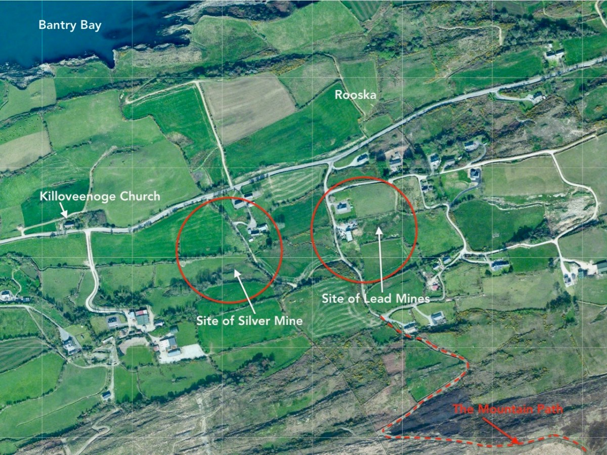
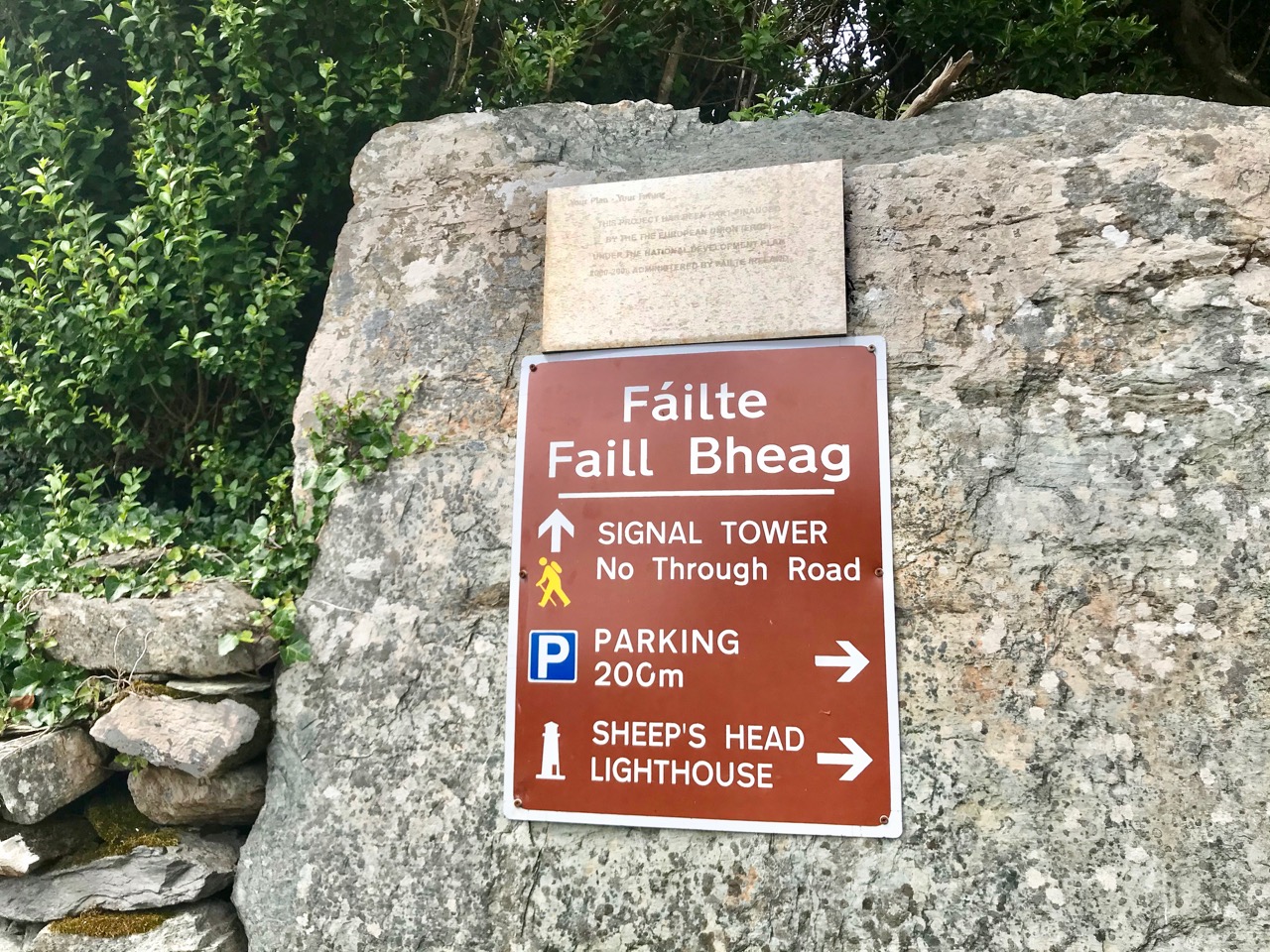
My name is Thomas – William Thomas. When I’m at the mines they call me Captain Thomas – because I’m in charge! I’m visiting some of my old ‘haunts’, and thought you might join me, to see what a working day was like in ‘ . . . one of the wildest districts in the United Kingdom . . . ‘ – Gortavallig, on Rinn Mhuintir Bháire. I know you call this place The Sheep’s Head now: that amuses me. I’m always trying to pick up on the Irish words – it’s such a poetic language. My grandfather was a natural Cornish speaker, but the language was gone by the time I was born – it’s only used by the Bards nowadays.

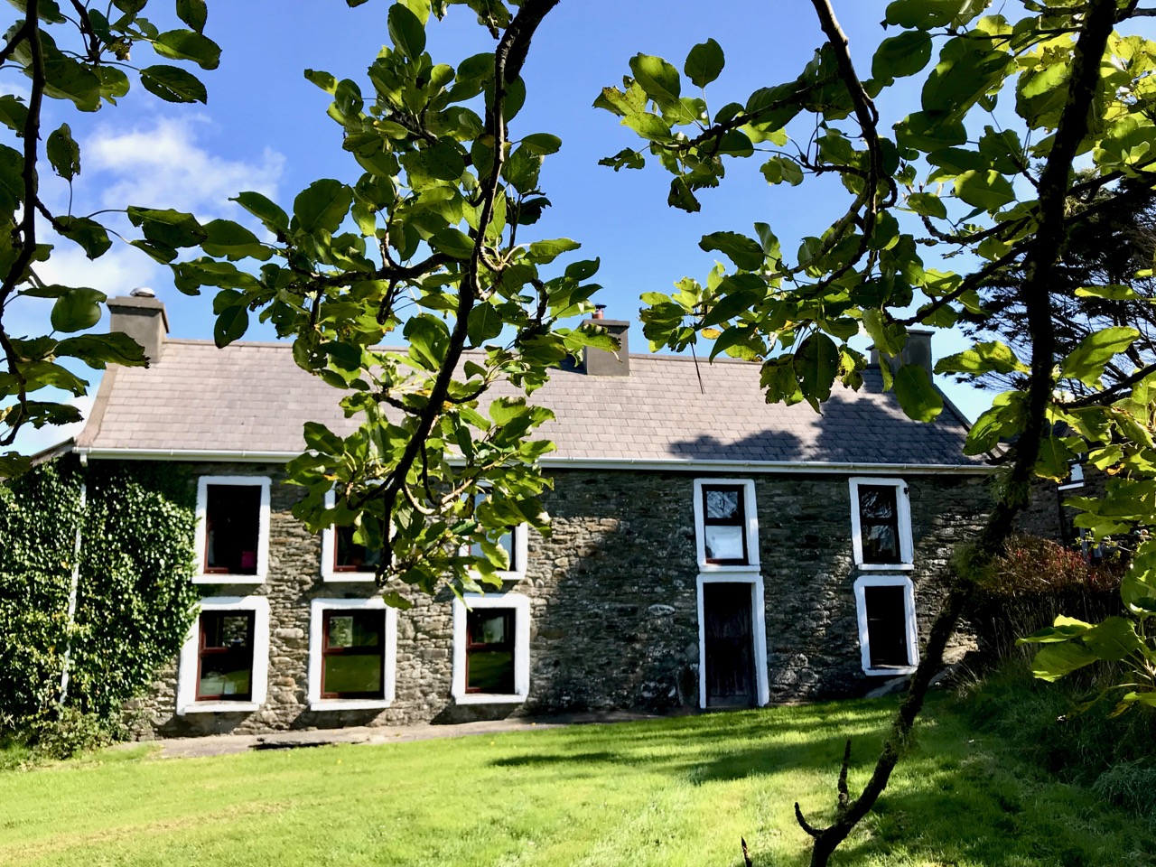
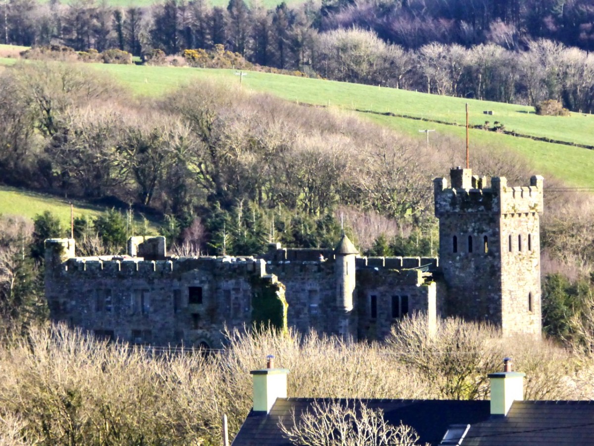
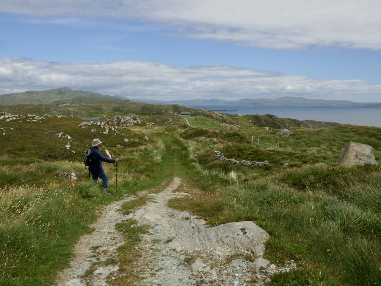
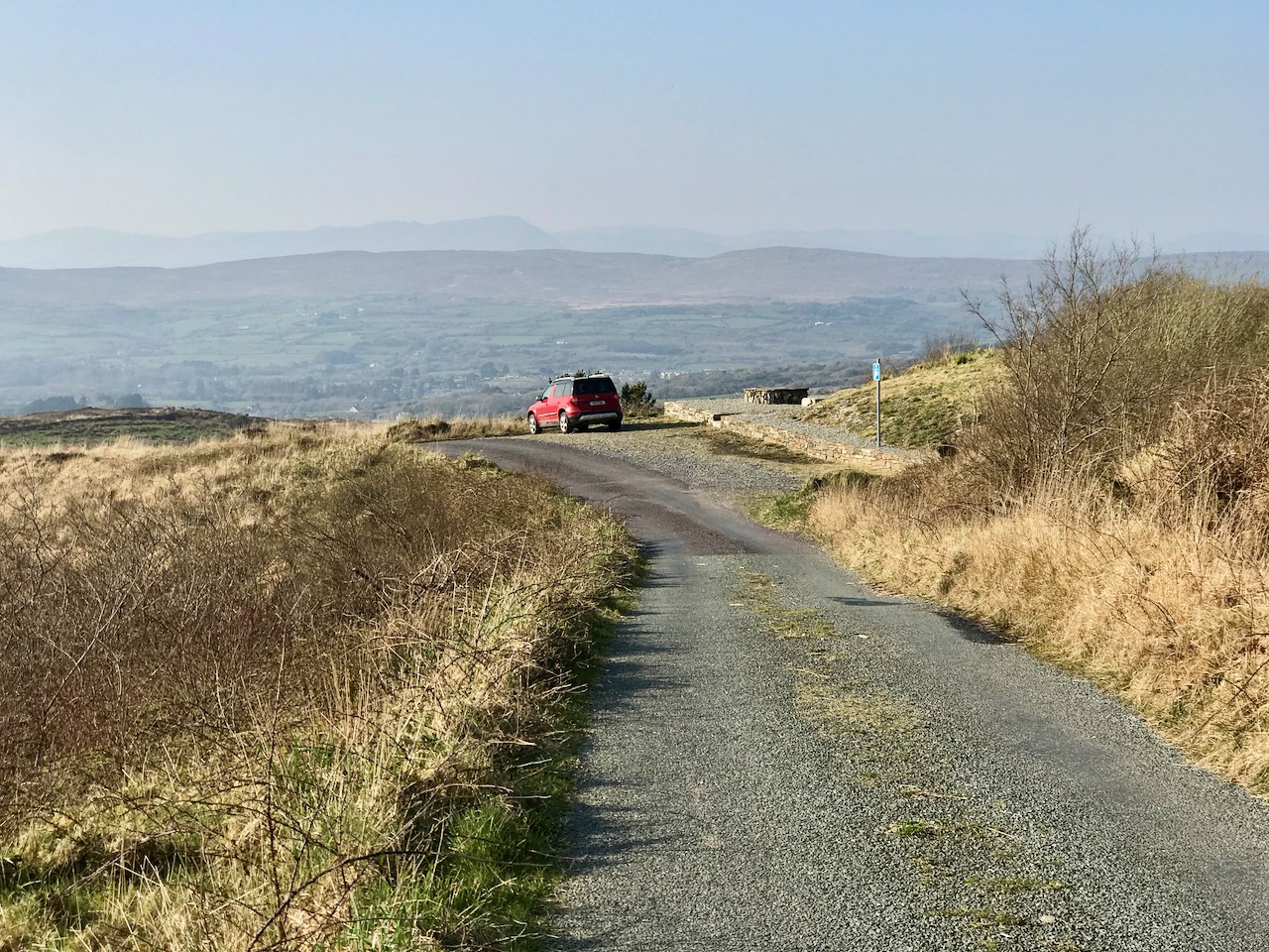
That’s my house – above – in the townland of Letter East. That’s where I stayed with my family when I was Captain at Gortavallig. It was rough going when I had to get to the mine – a solid hour’s trek across rough country, and the same back again. As part of the work that we did while developing this mine we built a good ten miles of road, which helped with communications in that untamed north-coast country.

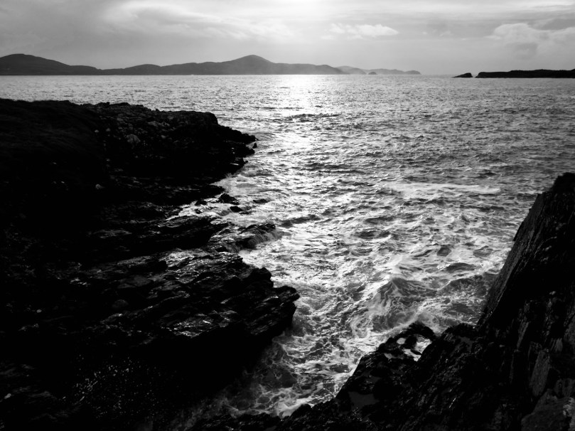
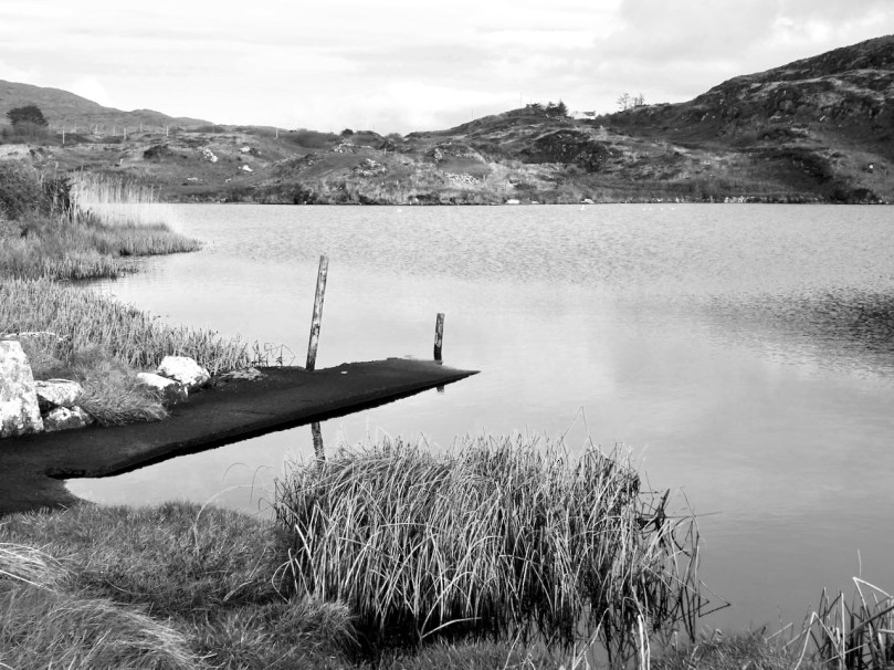
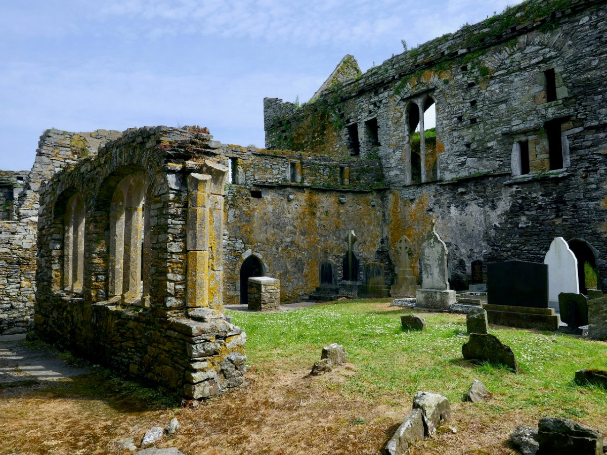
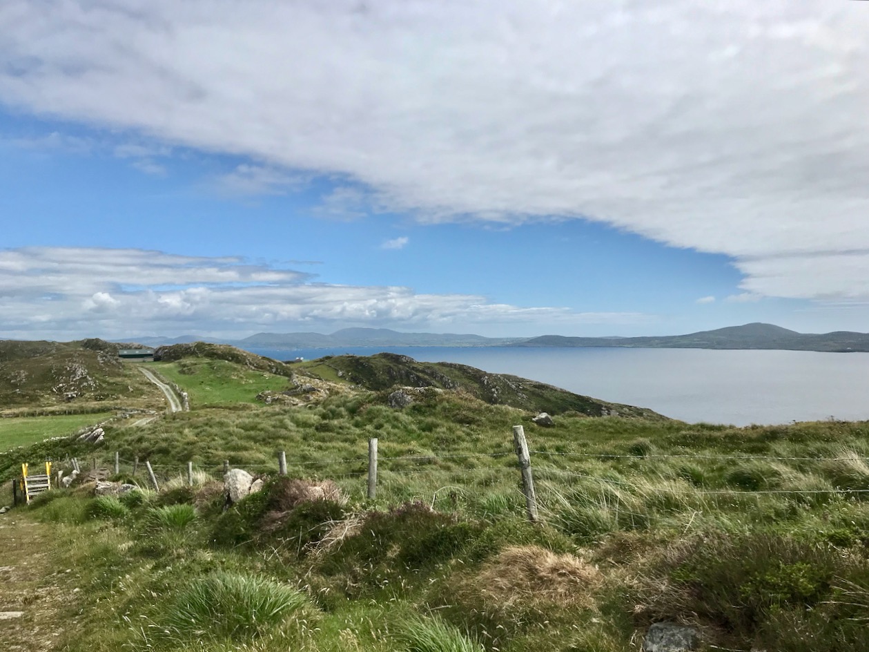
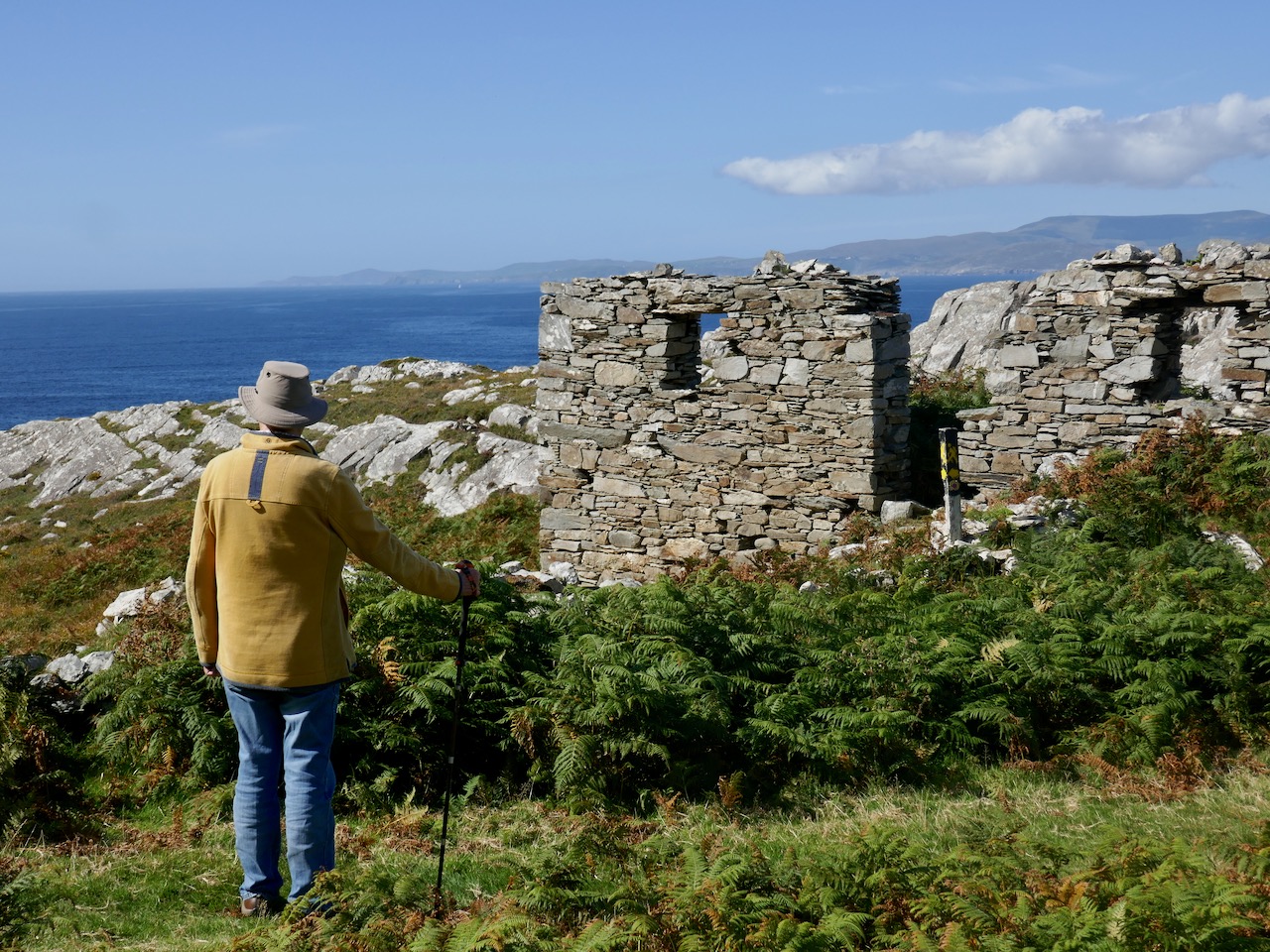
Come with me now on the way that leads down, firstly, to the cove at Bunown in Eskraha townland: there’s a slipway there, and a house where my assistant Superintendent, Mister Bennett, lodges. It was once a coast-guard station. This cove has also been the scene of some tragedies in your own time. There was the writer, James Farrell, who drowned while fishing off the rocks there in 1979. He’s buried beyond by the church of St James in Durrus, looking out forever over Dunmanus Bay. The sea is a dangerous element: I know, because I’ve had to work with it. But it’s your friend, as well as your foe. If it wasn’t for the sea we would have no chance of transporting ore from the remoteness of Gortavallig.

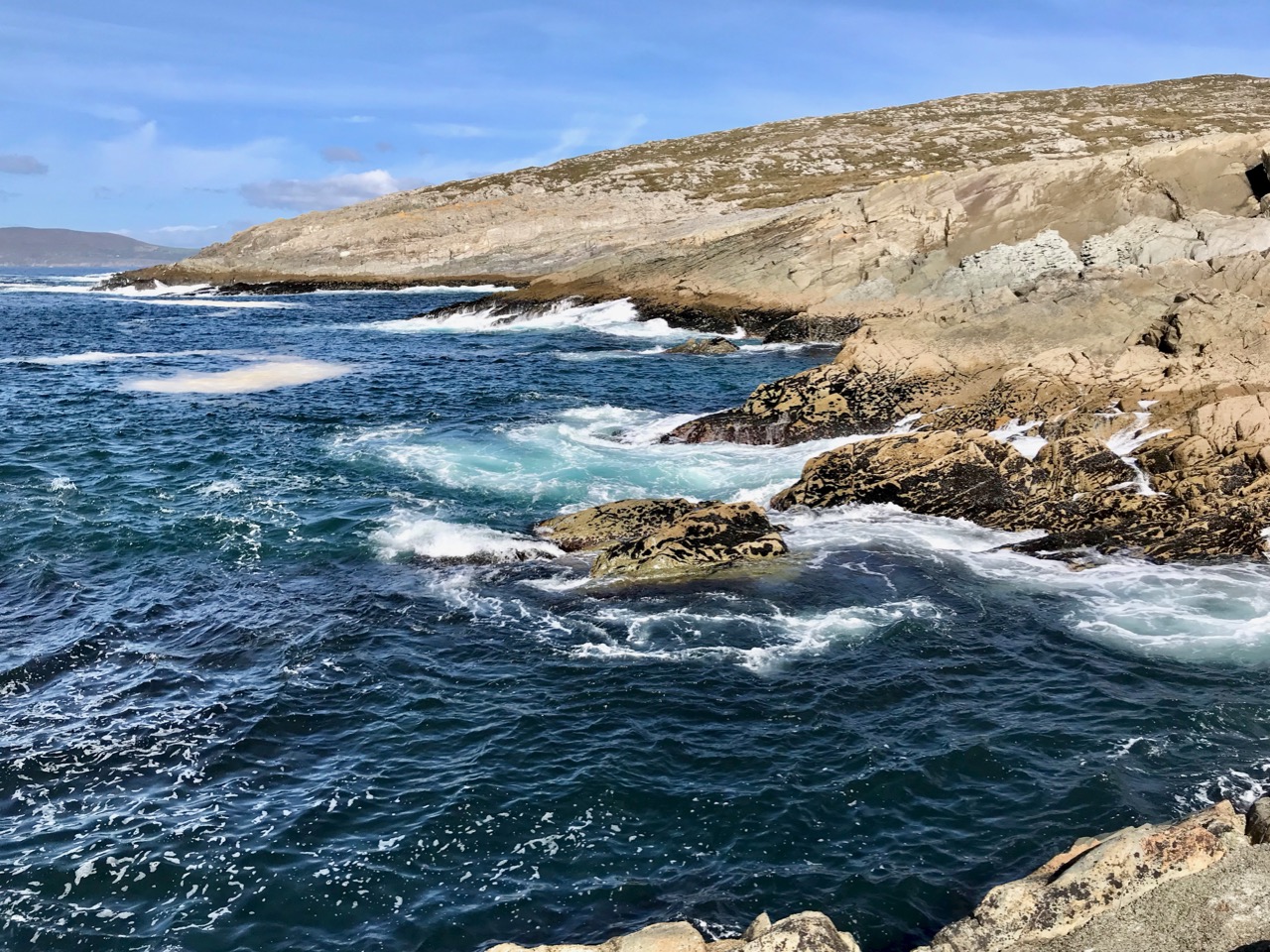
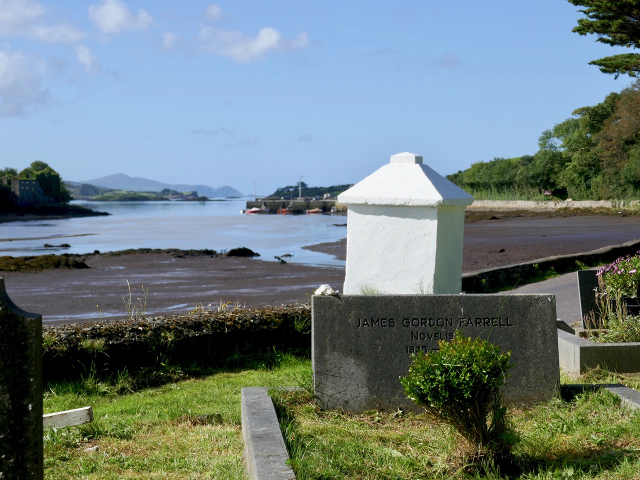
The rocks at Bunown – on a good day! James Gordon Farrell is buried facing the water of Dunmanus Bay at St James’, Durrus

They say that, wherever you are in the world, if there’s a mine – or even a hole in the ground – you’ll find a Cornishman at the bottom of it! That’s because pulling the metal out of the ground – and from the cliffs – and even from under the sea – was our lifeblood in that far western peninsula. But the land was ravaged. This scene (below) is where I grew up and learned my trade: Dolcoath, near Camborne in Cornwall, in its heyday one of the busiest mining areas in the world. My father James was agent there and I enjoyed ‘ . . . a liberal education and had the very great advantage of being taught dialling and the whole routine of the profession by the most eminent miners of the day and worked for several years as a tributer – an admirable practical school . . . ‘

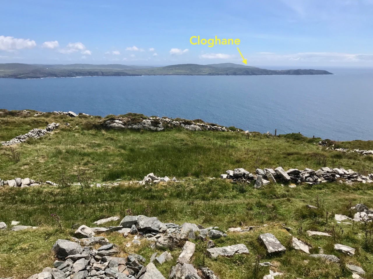
I was pleased to get away from the noise, the grime and the stench of that place when I was called to Ireland with my own family in 1845, firstly to Coosheen on the Mizen – where I revived an ailing venture by successfully rediscovering the copper-bearing lode. After that I came here to the Sheep’s Head where the surveyors, travelling on board small inshore vessels, could see promising ore-bearing strata on the cliff-faces which were being eroded on this coastline. My job was to work those veins – a gargantuan one bearing in mind the uncompromising nature of the landscape and the remoteness of the geography.

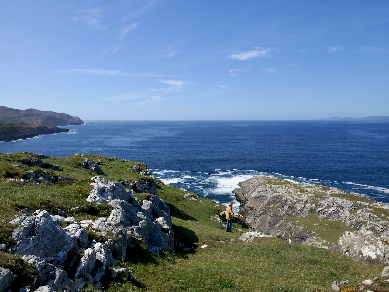
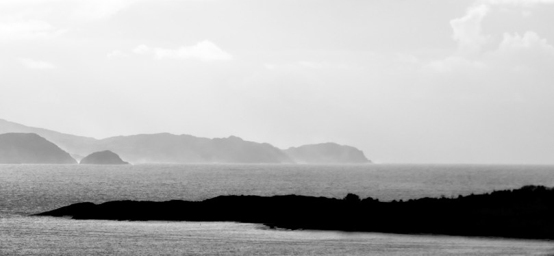
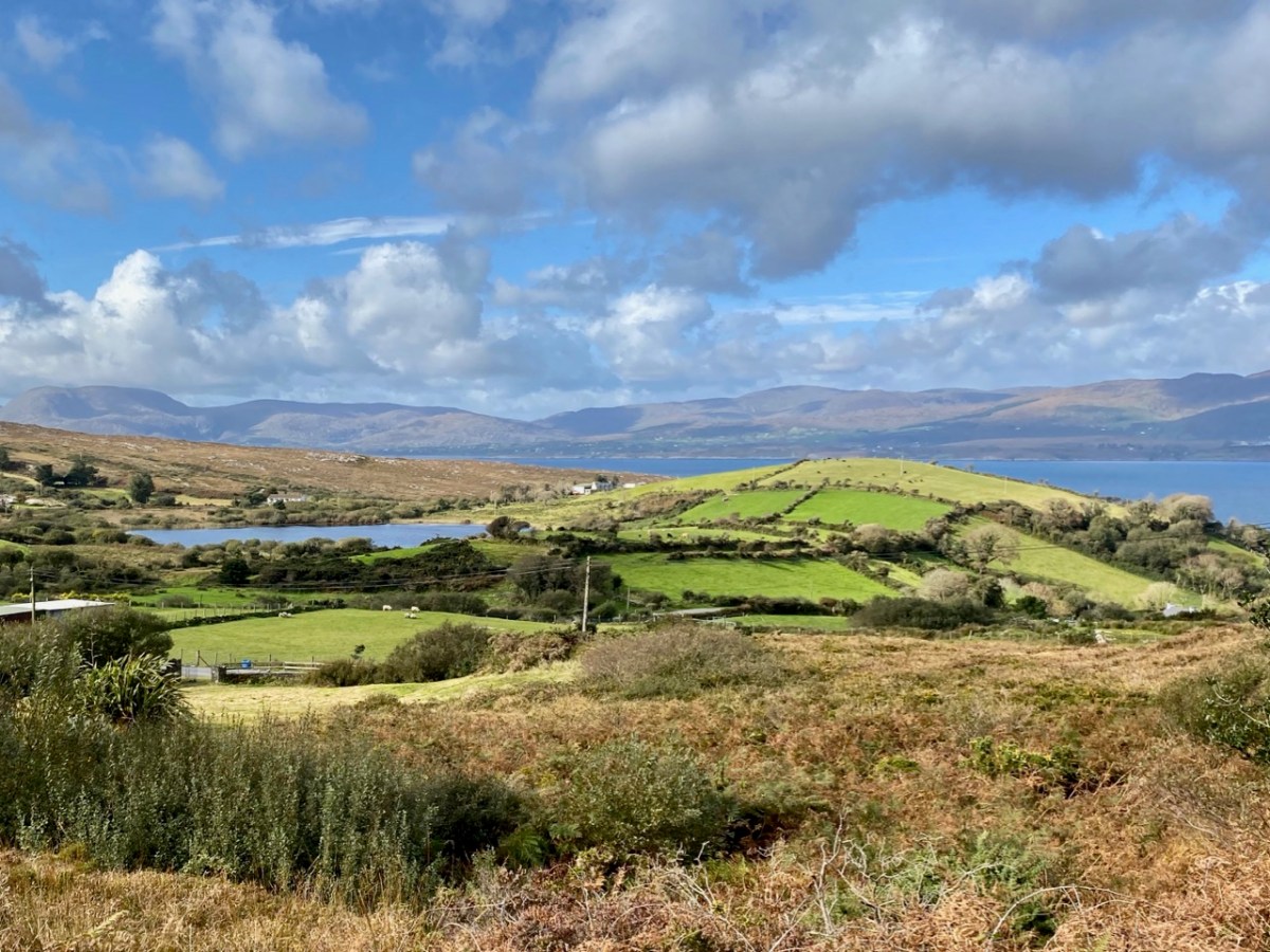
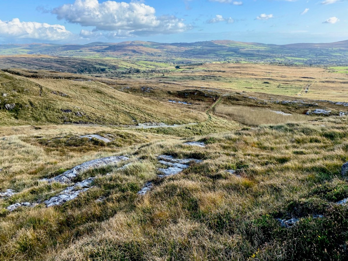
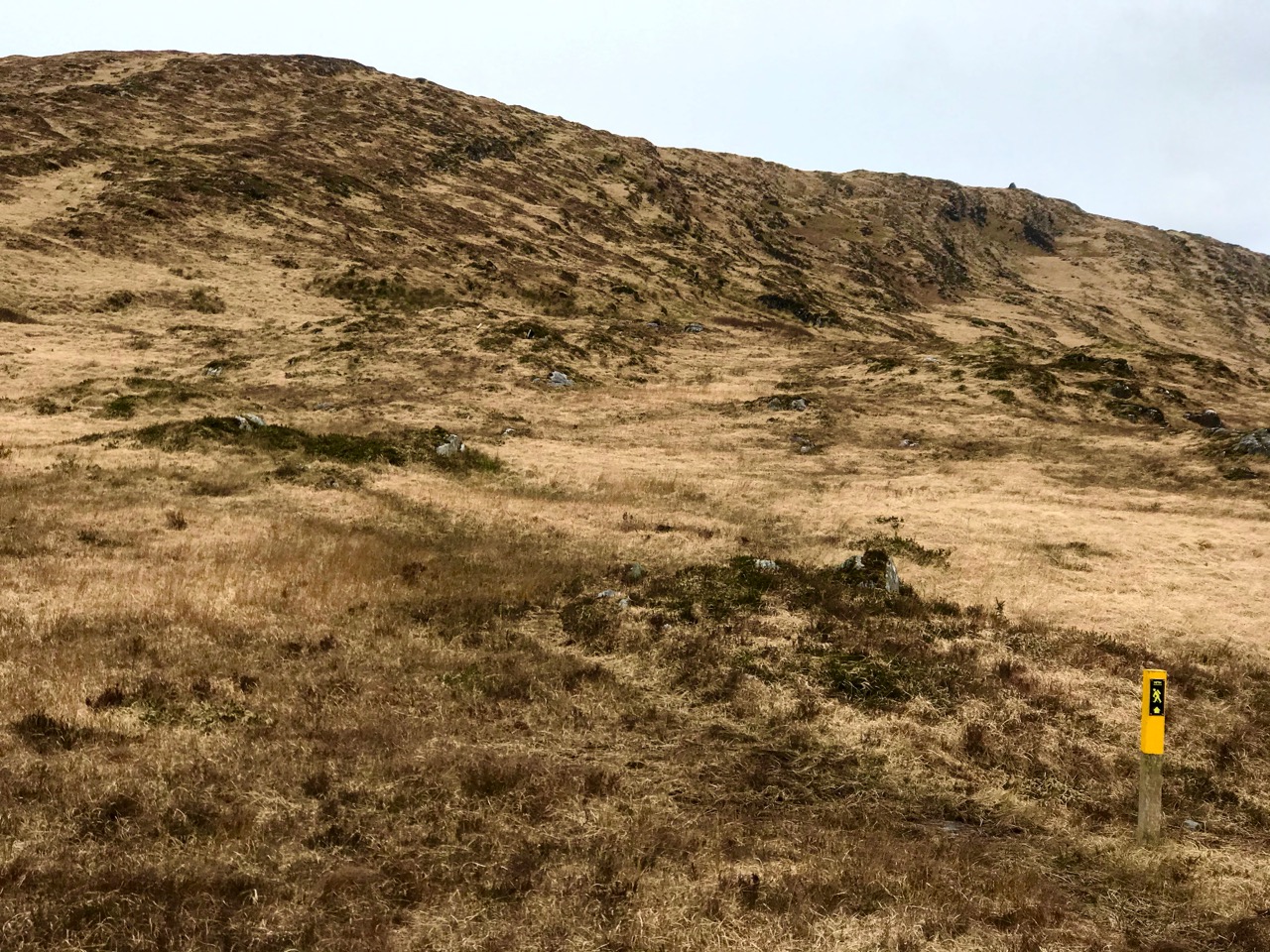
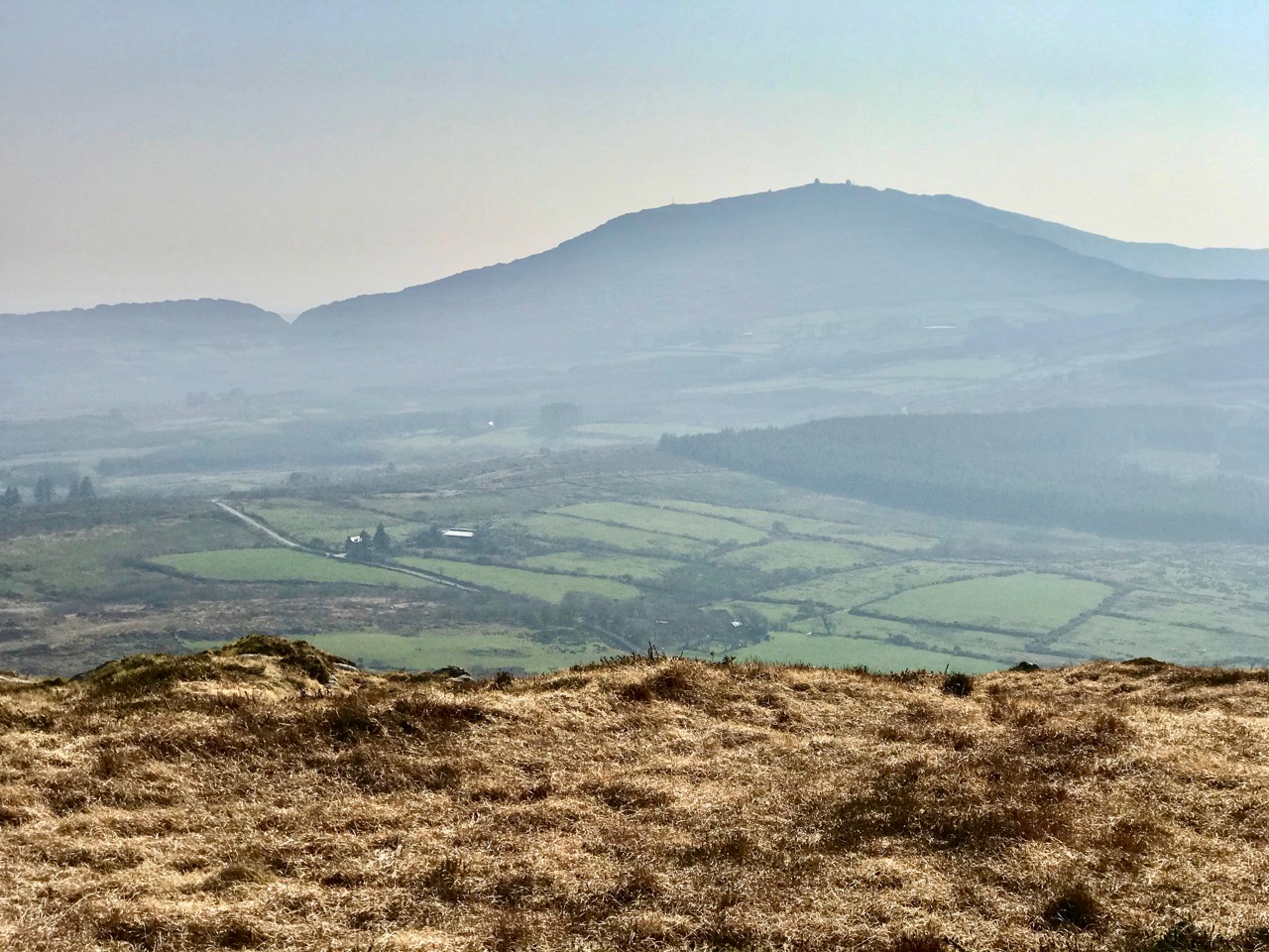
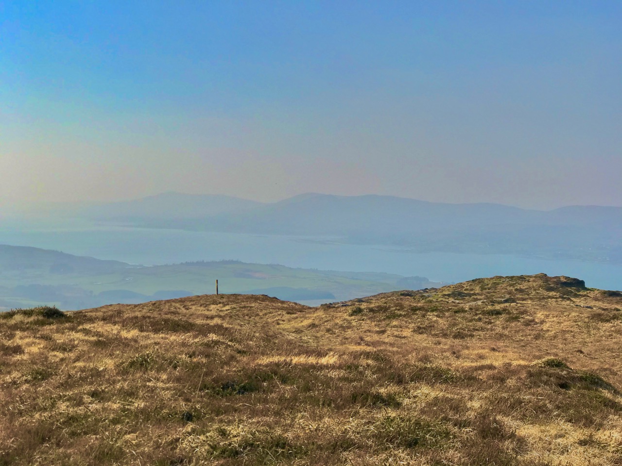
Looking back across silver waters as we walk together on the rough pathway to Gortavallig: nature has been tamed by the fields that go down to the coast west of Bunown, whereas the way to the east is across rough, wild country

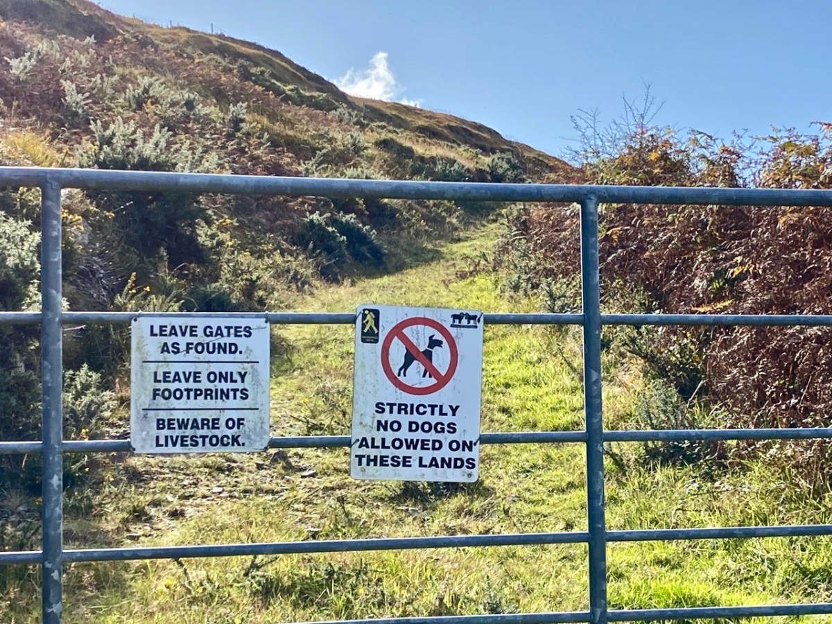
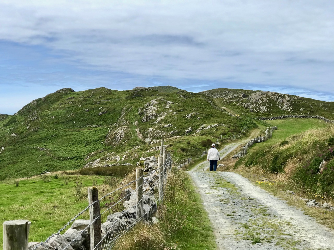
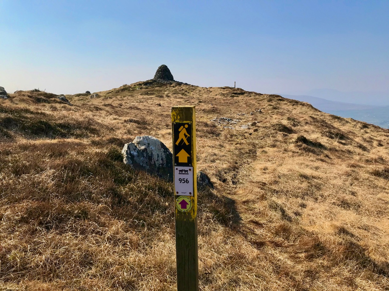
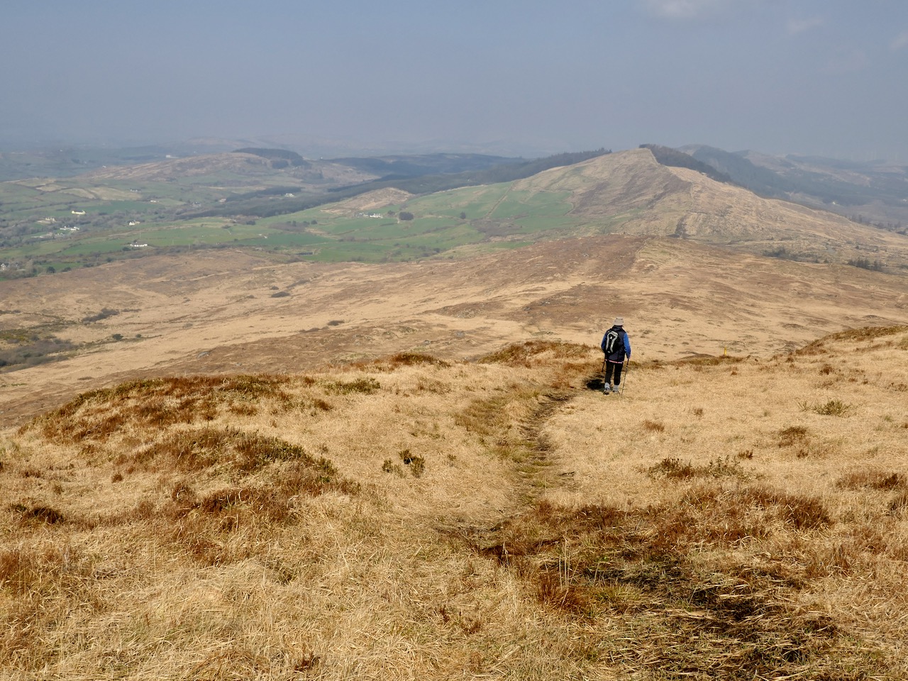
If you follow this path with me you will have to have good shoes and a steady gait, and the will to clamber upwards and downwards on sometimes steep and rough rock faces. But you will be rewarded by the remarkable vistas and the untamed surroundings. Your only companions will be the choughs: these sleek red-billed birds are a comfort to me as they have always been a symbol of Cornwall, sharing pride of place on that county’s coat-of-arms, together with an image of the Cornish miner! Did you know that the chough is the embodiment of old King Arthur, who is ready to rise again and save our nations in times of trouble?

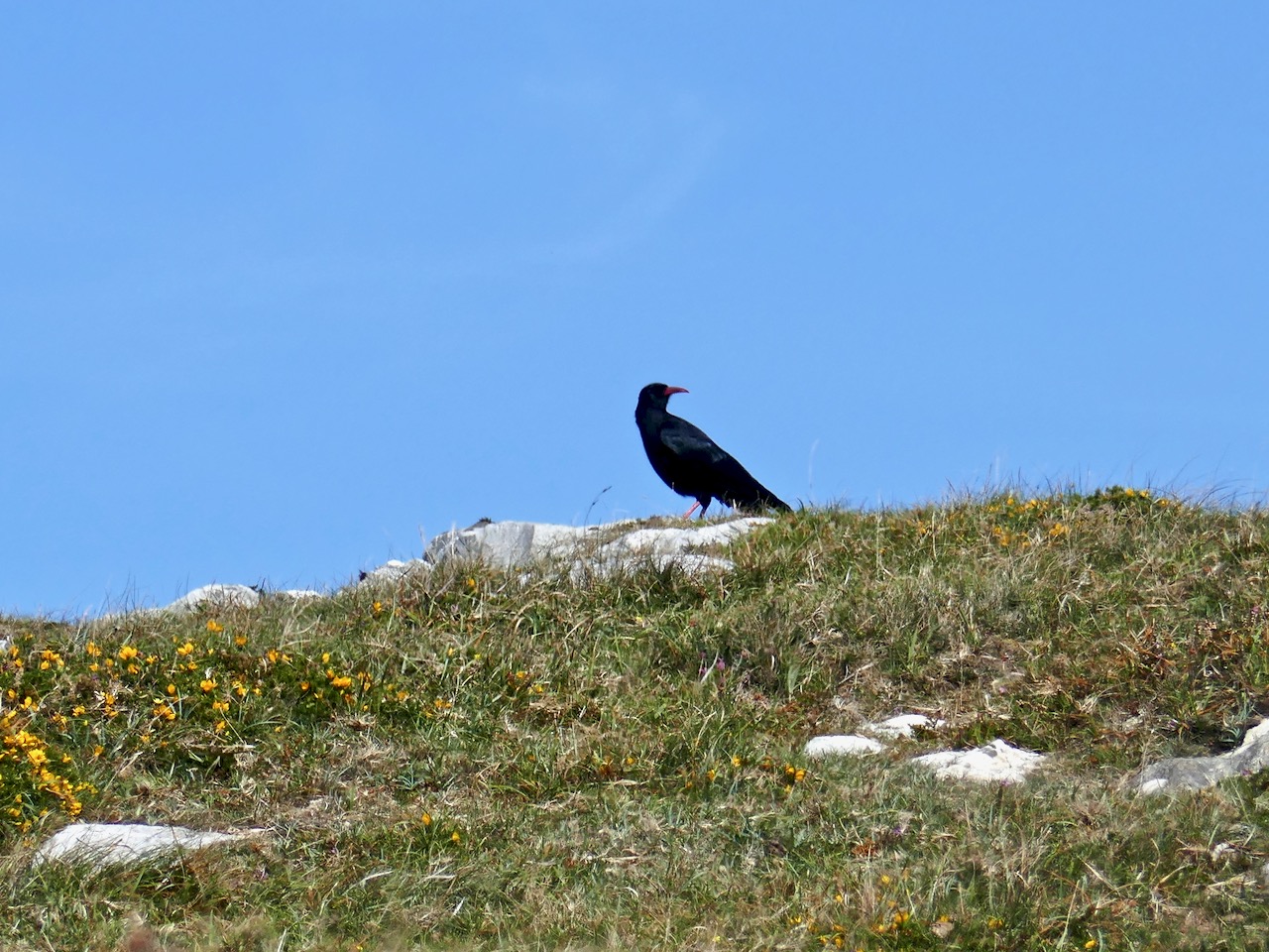
A chough espied on our walk to Gortavallig, and the Coat-of-Arms of Cornwall which is shared between bird, fisherman and miner

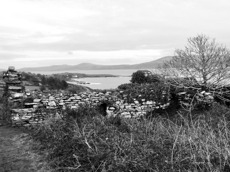
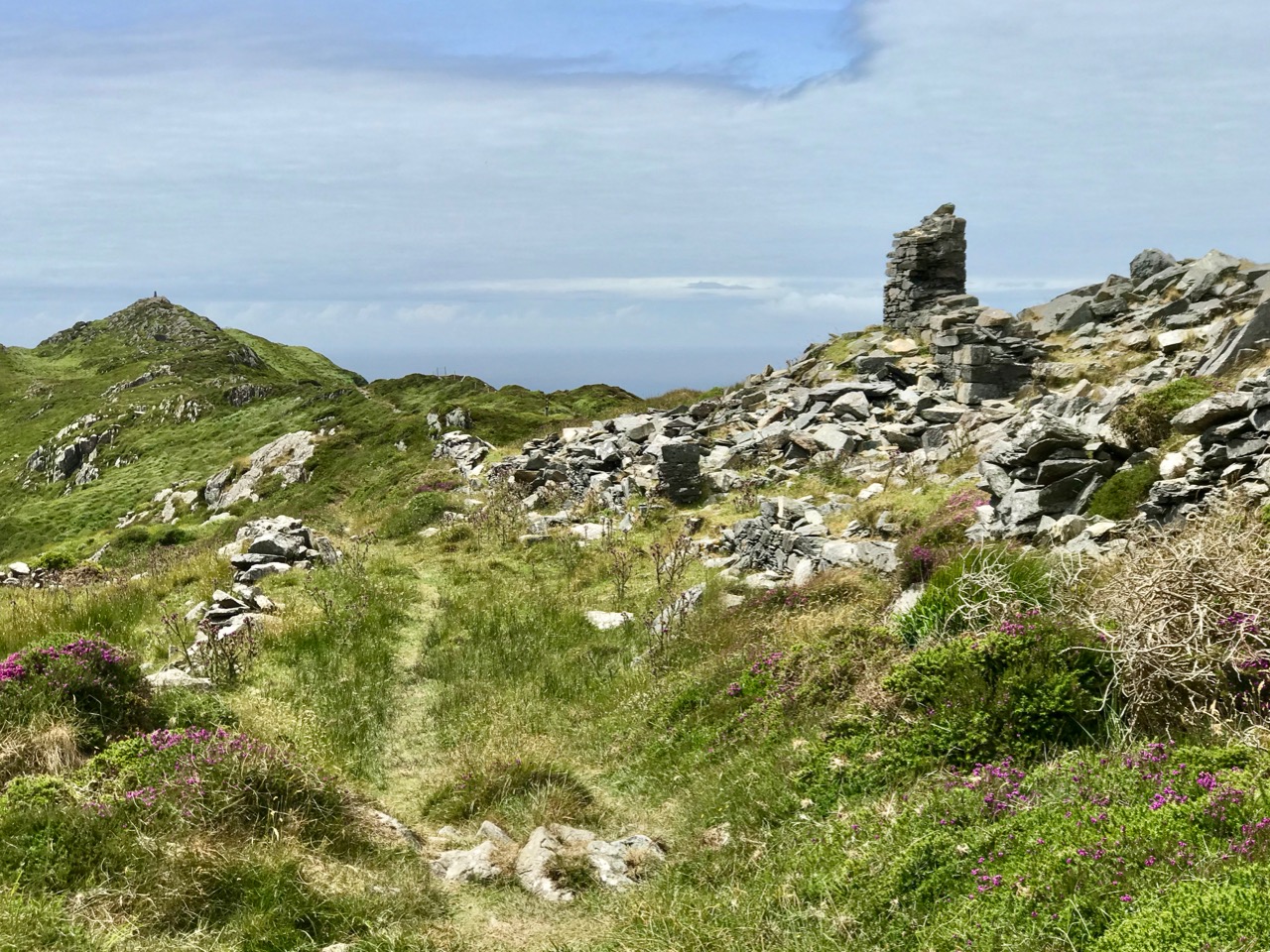
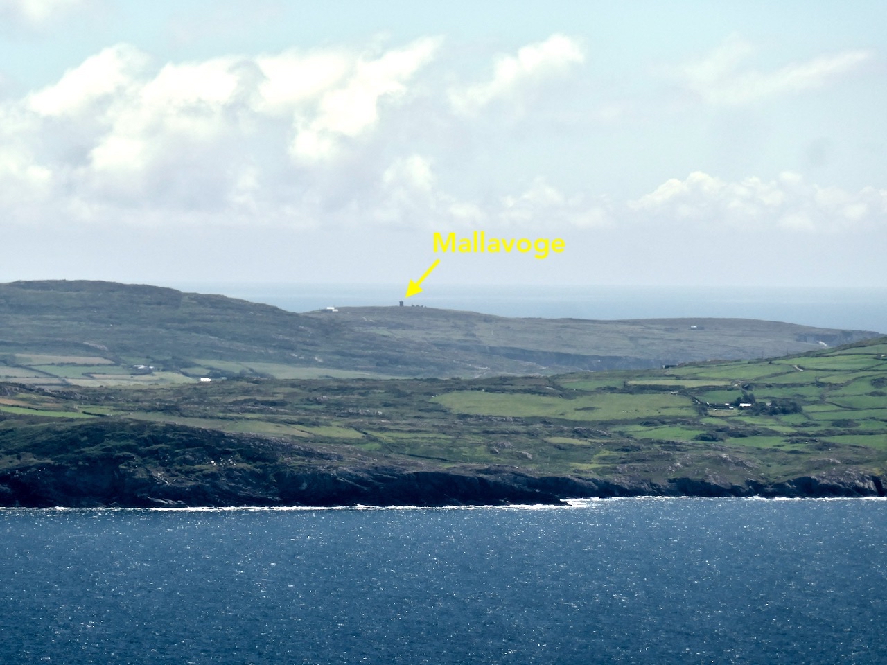
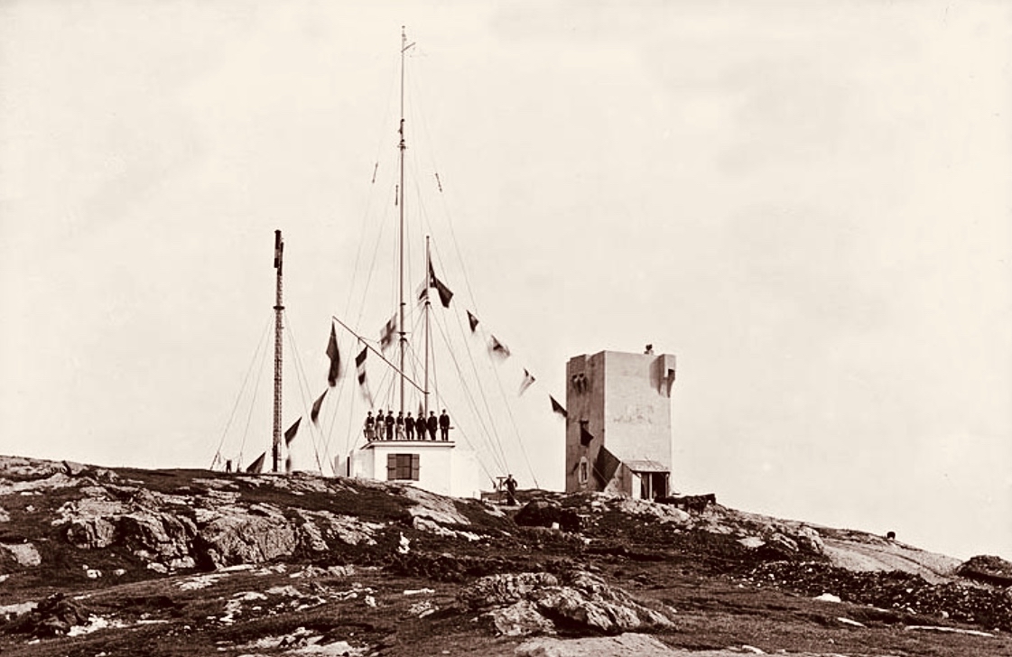
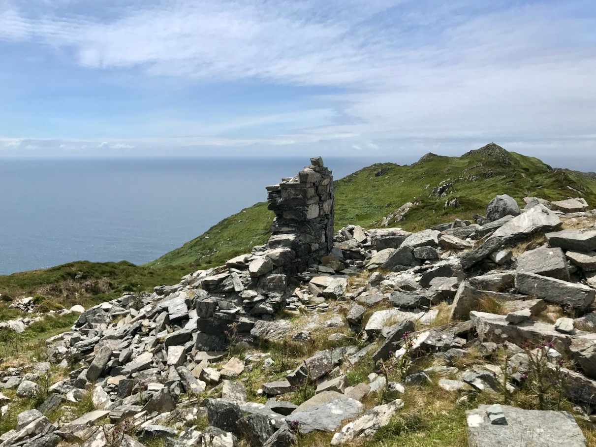
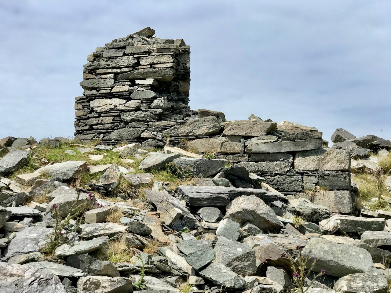
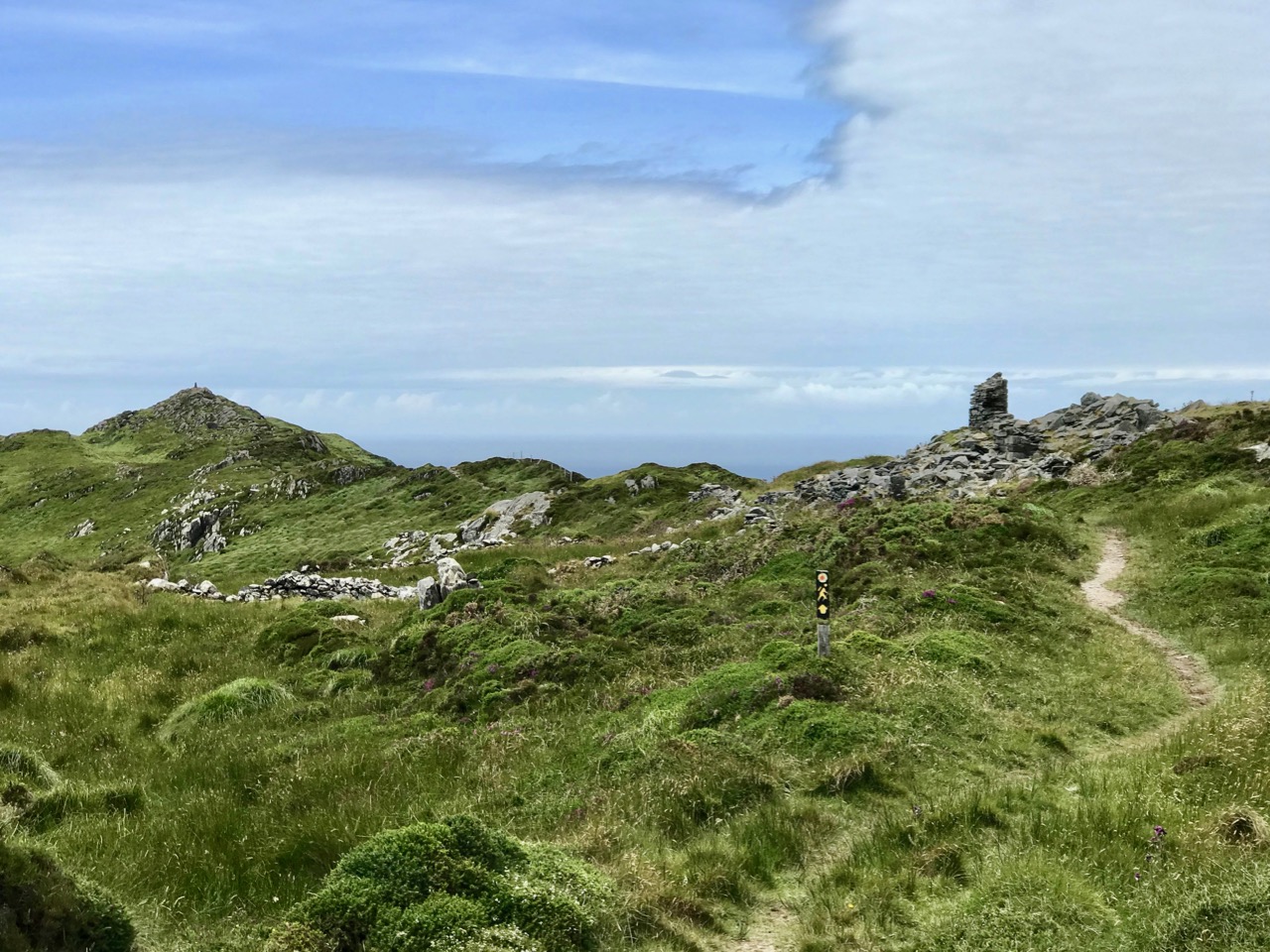
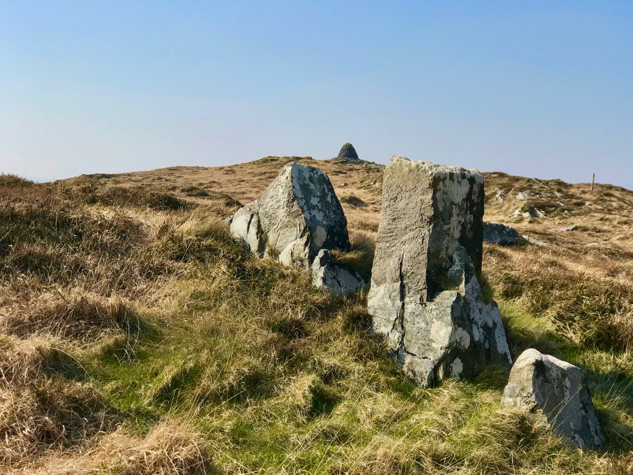
After a vigorous hour’s trekking over the rough terrain we will catch our first glimpse of the mining works at Gortavallig: a row of small stone cottages perched on the cliff-top. This is known today as the Cornish Village, although it wasn’t just Cornish mine-workers who lived here. Good, strong Irishmen came to the place and earned their keep, and everyone here had to pay rent for the single-roomed lodgings. If there had been windows on the seaward side of these dwellings they would have enjoyed magnificent views, but we were more concerned at keeping out the extremes of the weather, and the few small windows only faced inland. There was plenty of ocean to be seen while you were working your hearts out to extract the minerals!

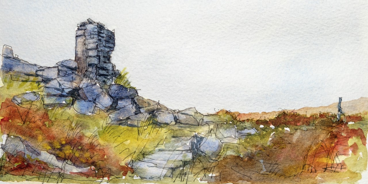
‘Cornish’ cottages close by the mine workings at Gortavallig

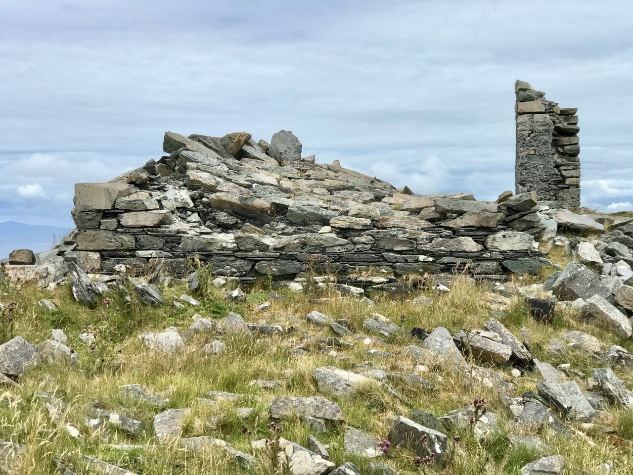
Once we have passed by the cottages we find ourselves traversing a sheer cliff edge. Below us the sea roars, but it’s down there that we built two quays, one 73 feet long and 40 feet high, the other 92 feet long and 36 feet high and, at the base of the cliff, a dressing floor 180 feet long and 50 feet wide, while above it we put in a stone dam and sluice so that we could wash the ore. Water was such an important element to us: in Cornwall we used its power to turn wheels and drive machinery such as crushers. We were never short of it here in Ireland.

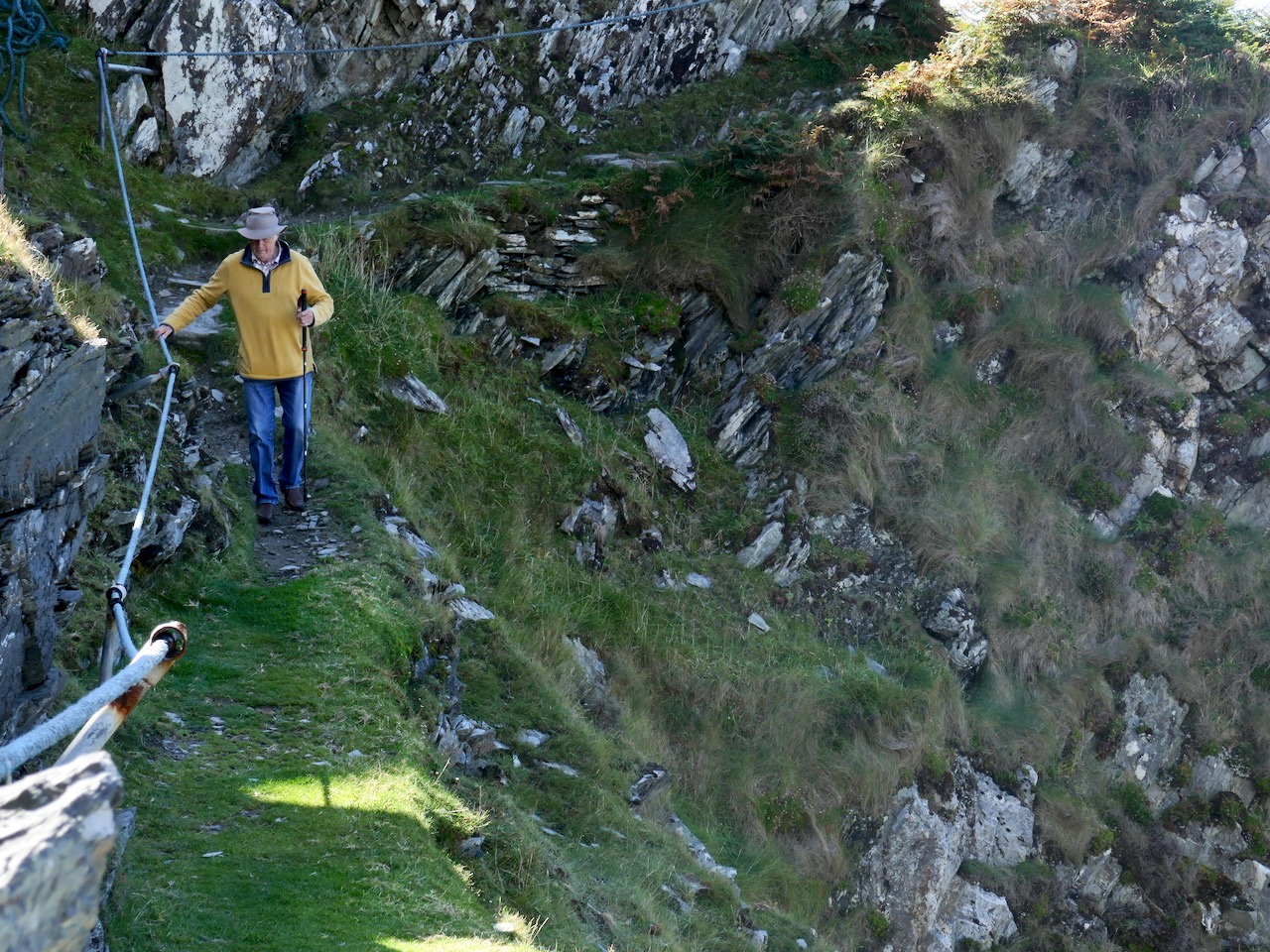
Hold on to that rope or you might go over the edge!

Now, of course, on an idyllic day of blue sky and sunshine, you couldn’t find a place more picturesque, peaceful and redolent of nature’s beauty, but imagine what it was like in my time when men, women (we called them Bal Maidens in Cornwall) and children laboured long hours to bring out the precious ore and break, dress and prepare it for market: there was always the movement of ropes and machinery as trucks were pushed out of the mine-galleries on the rail-way, and figures constantly toiled up and down the precipitous rough stepways to and from the quays so far below. Although built in as sheltered a position as possible, they were constantly battered by heavy swells and breakers. In fact, they have now disappeared altogether.

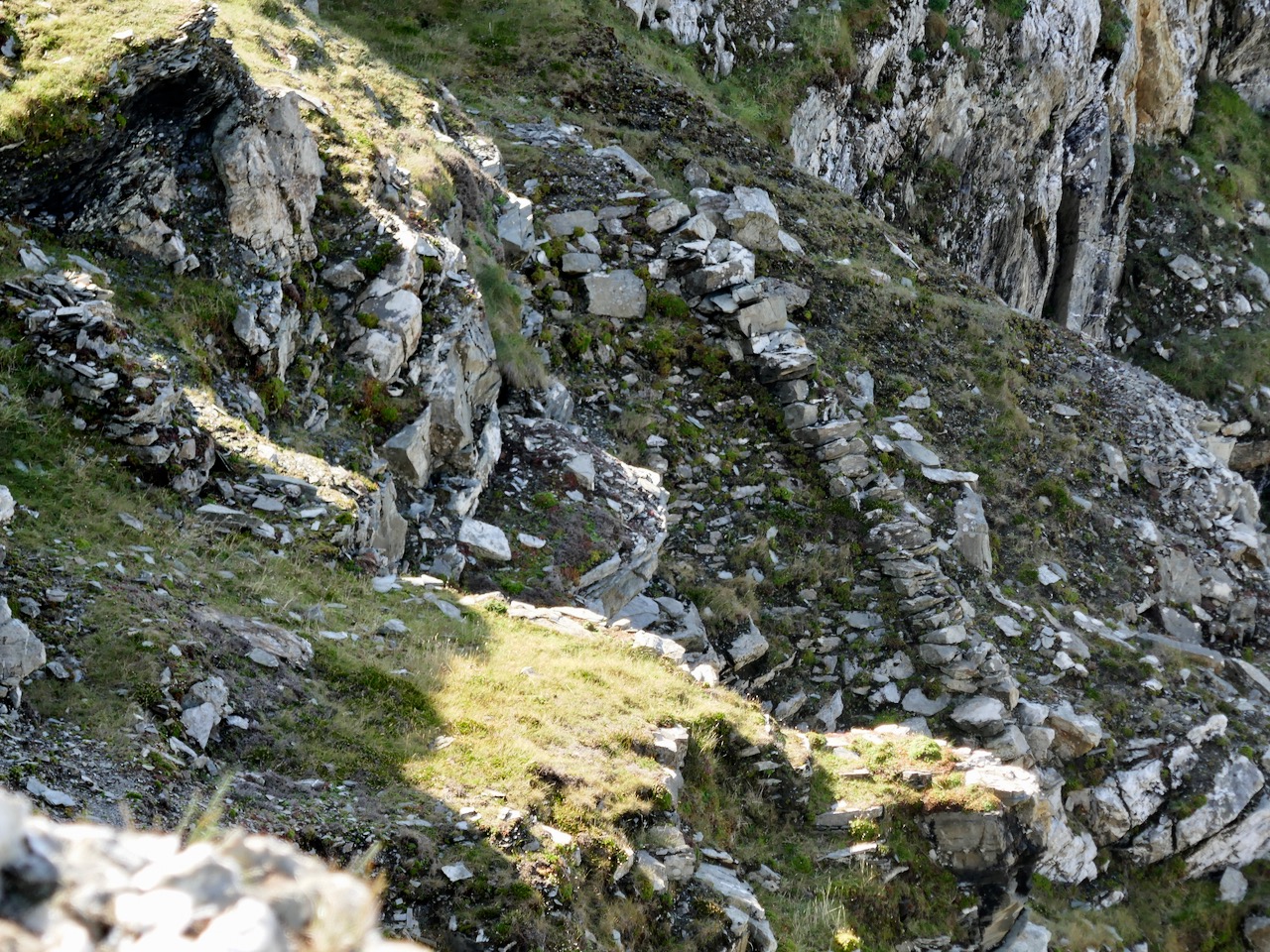
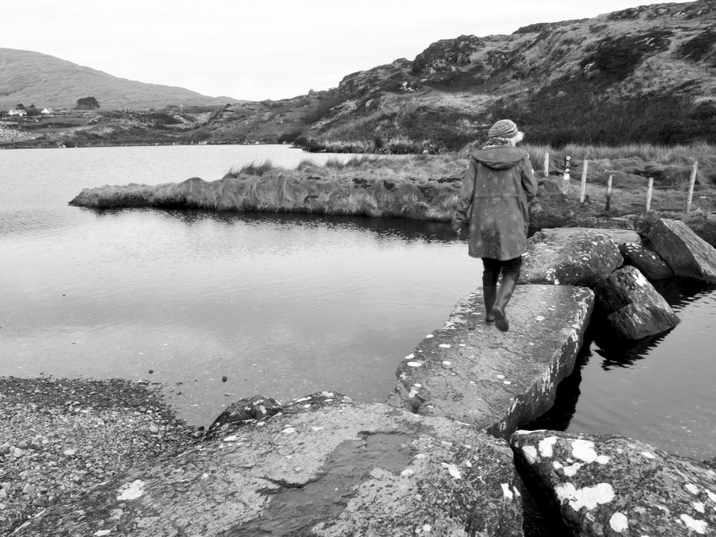
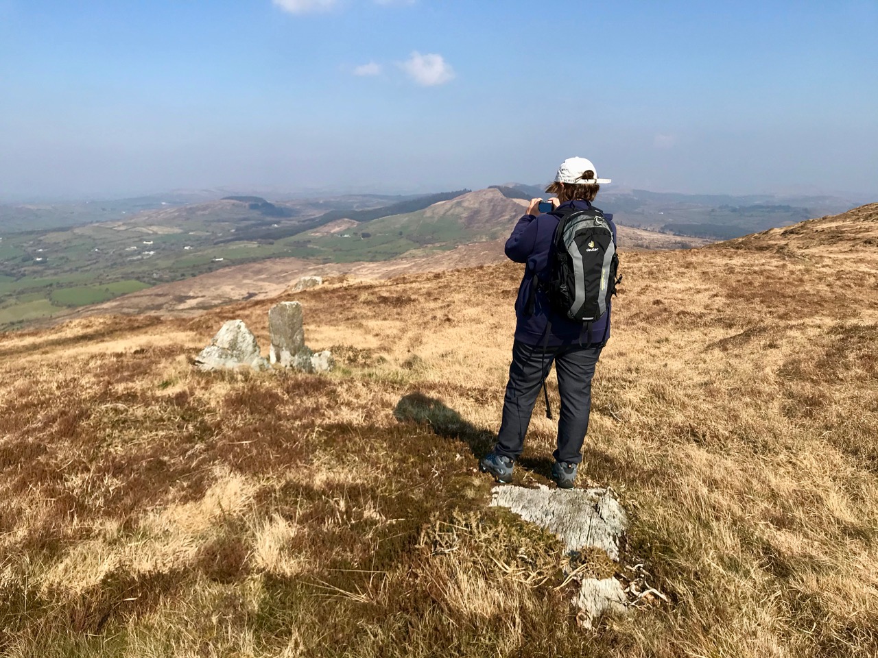
Finola braves the cliff edge to get a view of the site of the old quays below, accessed by the rough and steep stone lined path

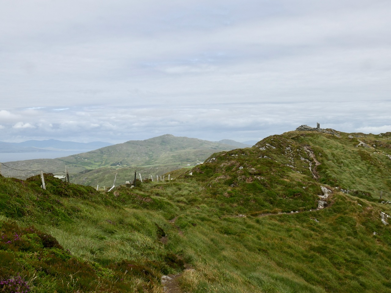
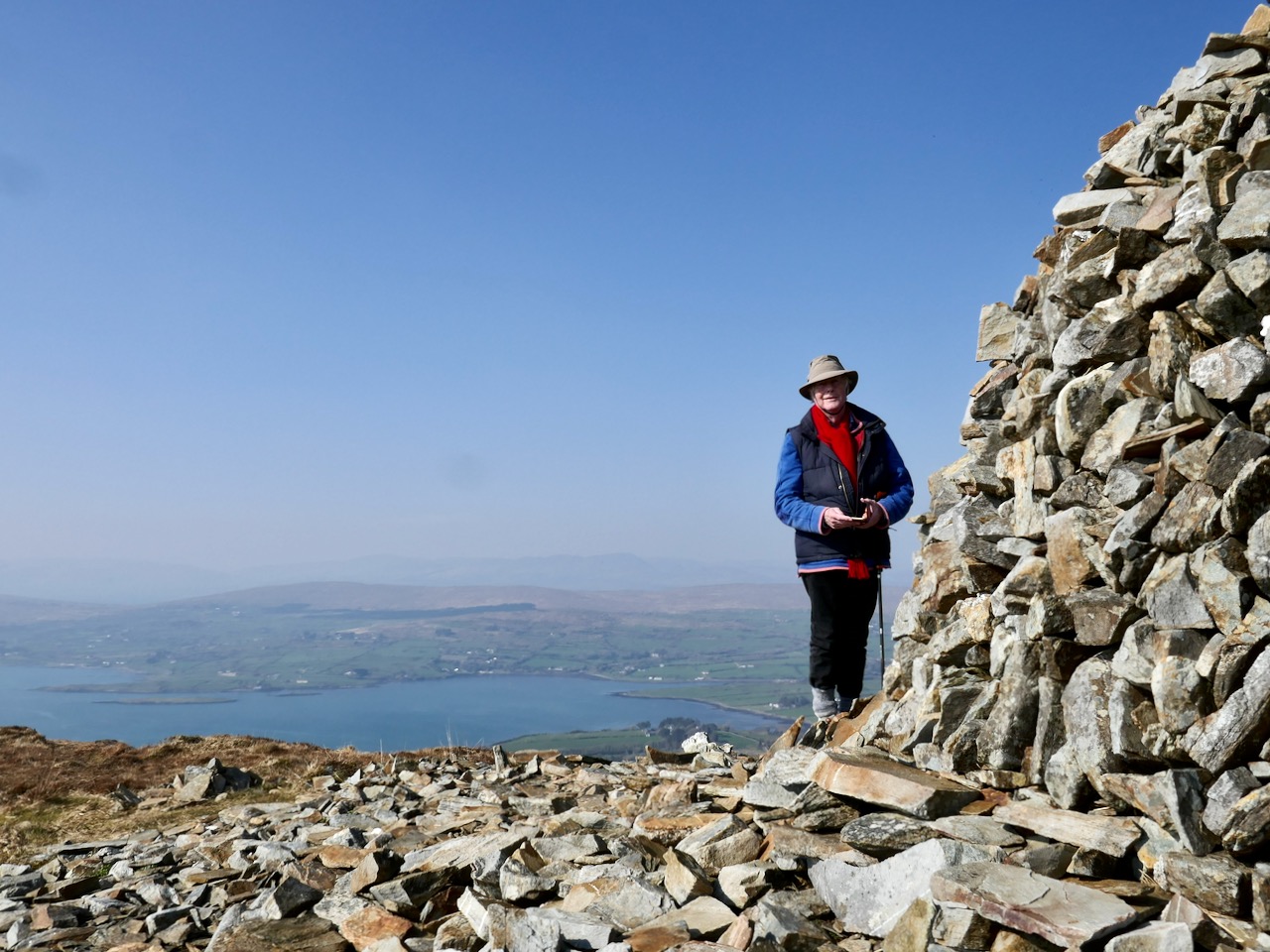
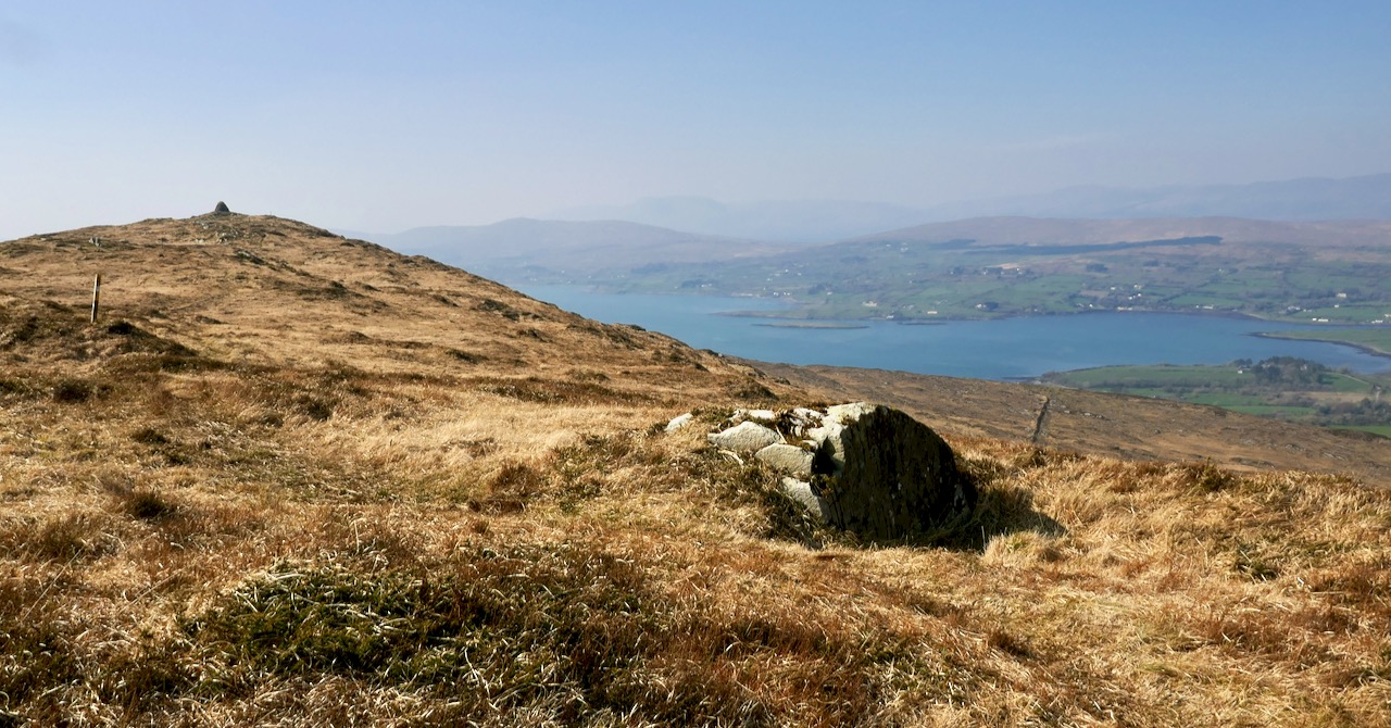
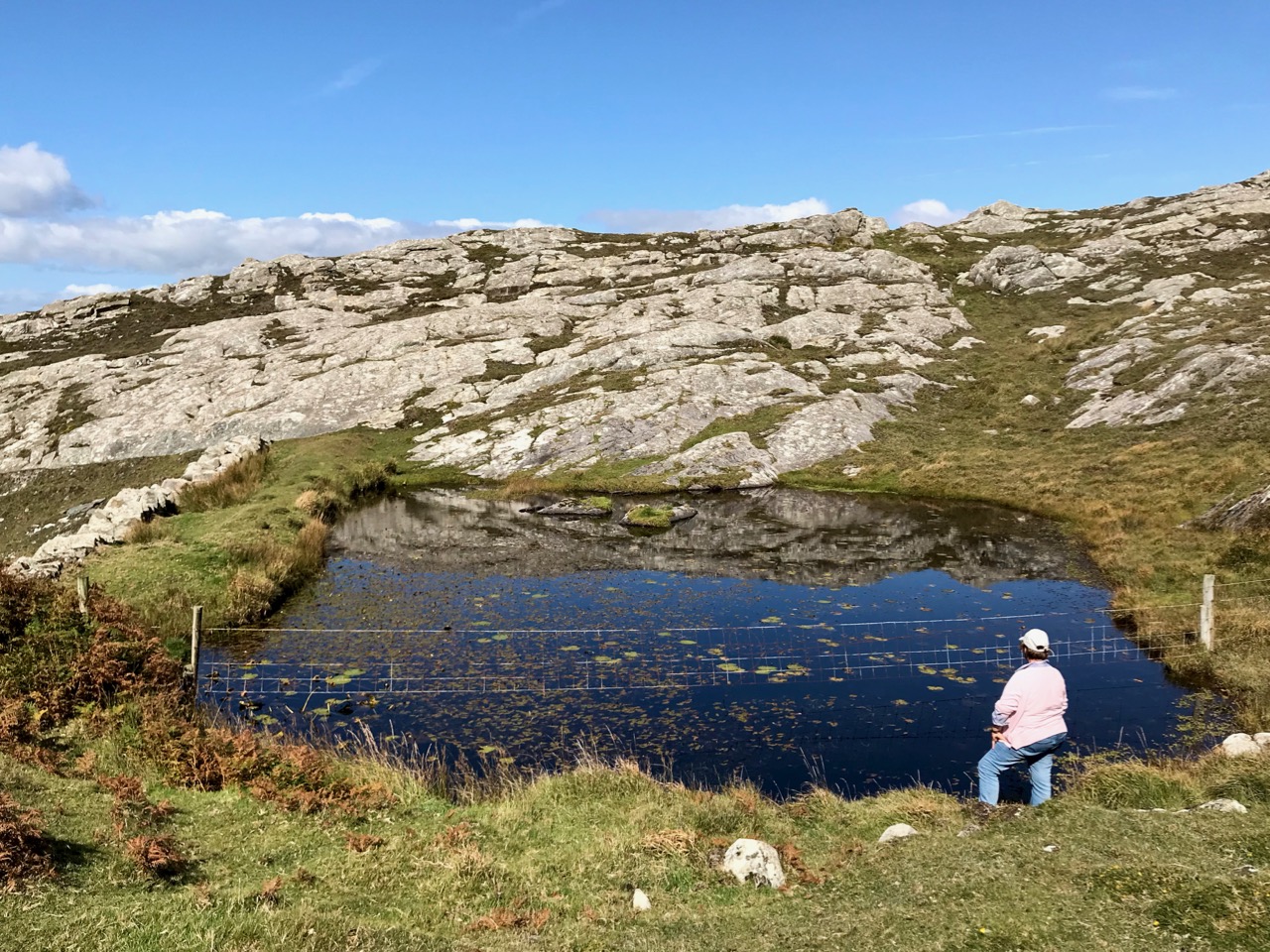
If we go up to the hillside above the mine workings we can look out over the reservoir, and we can also see the fenced-off openings of shafts. Most of the engineering took place, of course, underground: hard work in restricted spaces. We did our best to ensure safety, but there were accidents.

A lot of people have said that our mine was a ‘failure’, but I wouldn’t necessarily share that view. In May 1847 I presented my first report to the directors of the company:

. . . We have set bounds to the Atlantic waves, for though they lash and foam sometimes over craggy rocks, our works have withstood the furious storms of two severe winters. A complete wilderness and barren cliff, which had been for past ages the undisturbed resort of the Eagle, the Hawk and Wild Sea Bird, has by our labours for the past 16 months been changed into a valley of native industry, giving employment, food, and comfort, to numbers of the hitherto starving, but peacable inhabitants. We have in the course of 16 months, with an average number of 24 miners, whose earnings ranged from 9 shillings to 12 shillings a week, explored 174 fathoms of ground. We have also employed about 26 surface men, at the rate of 10 pence and one shilling a day . . .

In May 1848 the SS William and Thomas collected 88 tons of copper ore from the quay of our mine at Gortavallig. It sold for £269 14s in Swansea. Yes – it was the only shipment that the mine ever exported, but it gave employment and food to families in one of the remotest areas of the West of Ireland during the ‘Great Hunger’. In my time at Rinn Mhuintir Bháire I was able to set up – at my own cost – the Coosheen Fishery Association over on the Mizen, which also helped with food production through those bad years. With my brothers Charles and Henry, and my son John, we helped to bring industry to the remote fastnesses of West Cork and Kerry – including the mine at Dhurode, on the Mizen. I feel satisfaction that our lives have benefited our neighbours here in these far western peninsulas which bear such a similarity to our own native Cornwall . . .  Now you will want to return to civilisation: thank you for your company and mind your step – I think I’ll rest a while here pondering on old times with my pipe and tobacco.

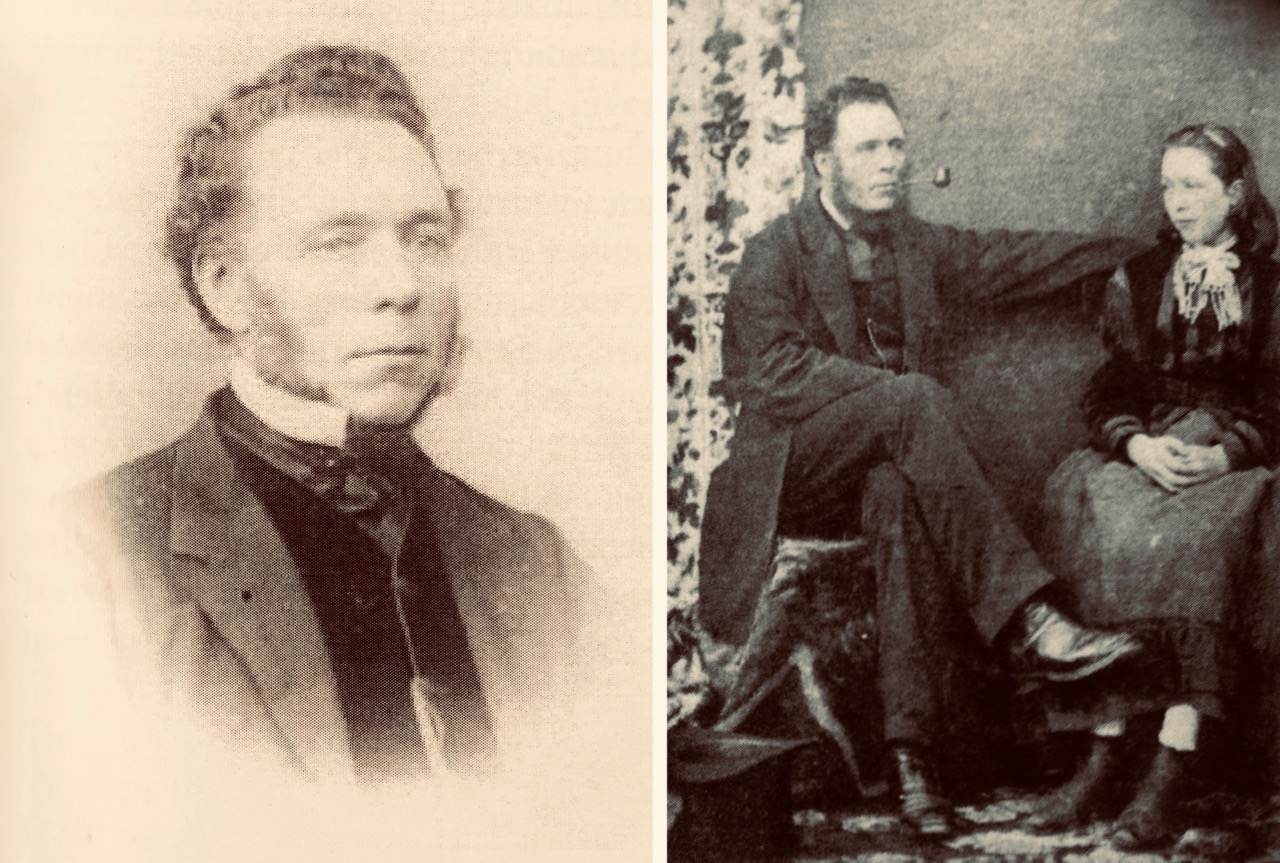
Captain William Thomas possibly in 1843 (left) and right, with one of his daughters in 1852. The latter photograph was taken by Hastings Moore in Ballydehob

From the Skibbereen Eagle, 7 June 1890:

Died, May 22nd at Coosheen, Schull, William Thomas, of Bolleevede, Camborne, Cornwall, aged 82 years, manager of mines in Cork and Kerry for nearly 50 years. He truly believed in Irish men and Irish mines. He wrote and spoke on their behalf to the utmost of his ability . . .