Durrus Delight: Carraig Abhainn Gardens


IMG_2657

This week we visited a tiny jewel of a garden. Tucked behind Wiseman’s general store in Durrus is a two and a half acre gem called Carraig Abhainn (Rocky River, pronounced KA-rig OW-in [OW to rhyme with now]). It’s been a labour of love for over 20 years – the work of Eugene and Hazel Wiseman. We were lucky to have a chat with Eugene while we were there.

There are no large signs out on the road pointing the way and little advertising in the local media, so this is not as well known as it deserves. You pop into Wiseman’s shop, pay €5, open the gate at the end of the building, and step into a small wonderland.

IMG_2691

 IMG_2734

The first thing you become aware of is water.  A mill stream forms one boundary of the garden, crossed by little bridges here and there. The Four Mile River forms another – and this stretch is truly magnificent. Clear and sparkling, it rushes and falls and leaps over the rocks that give the garden its name. The paths have been cleverly constructed so that as you stroll you encounter the river at different points.  Each point has a unique vista that encourages you to gaze, contemplate, photograph or just sit and listen.

IMG_2663

The daffodils were over when we went and some of the rhododendrons had faded too. Nevertheless, around every bend was a new feast for the eye and the camera, from the undergrowth of bluebells to the camellias, yellow irises and the climbing clematis. Exotic trees add variety of colour, texture and size – “I wonder what that is?” became our mantra. (For those who need an answer, the garden website provides a list of plants.)

A wonderfully idiosyncratic feature of this garden is the statuary – a unique blend of the classical and the quirky, perfectly placed to enhance a long path, mark a set of steps, or simply be discovered rounding a corner. Near the entrance is a mural, with Greek columns and a water garden and benches that invite you to enjoy this sunny spot.

IMG_2682

There’s a West Cork Garden Trail in the second half of June and Carraig Abhainn is one of the gardens featured on the trail. But don’t wait until then – if you are anywhere in the vicinity of Durrus drop by Wiseman’s and treat yourself to a quiet hour or two soaking up the beauty and tranquility of this charming oasis. Bring a latte and piece of cake from the excellent Gateway restaurant next door – that’s all you need to complete your little slice of heaven. 

IMG_2716

Mizen Magic 2: The North Side

A pet day on The Mizen

A pet day on The Mizen

We are once again being battered by Atlantic storms, but on a sparkling day earlier this week we drove, on a whim, to Durrus for breakfast. The day was so pure and sunny that it seemed a crime to go home again, so we set out to drive along the north side of the Mizen Peninsula.

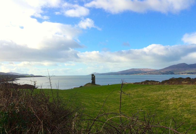
Dunbeacon Castle

Dunbeacon Castle

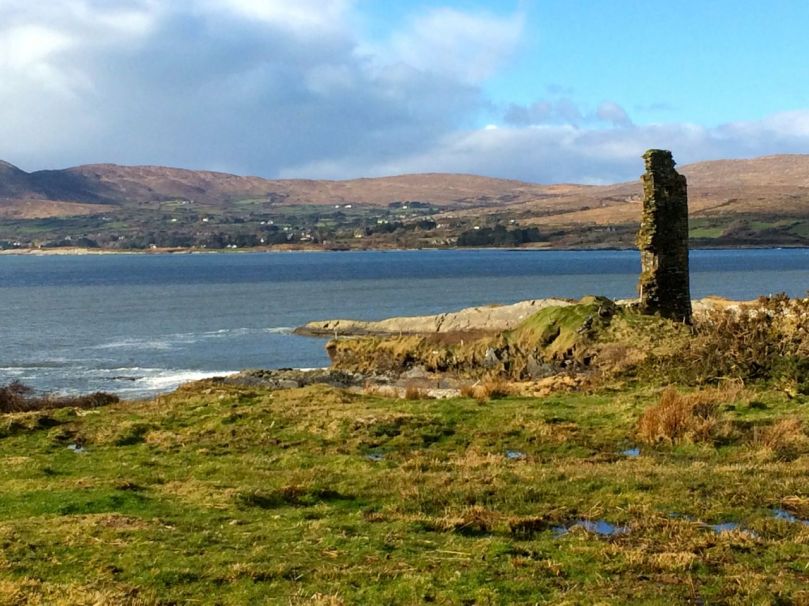
What a day! We rambled down to the shore to investigate the 15th Century Dunbeacon Castle. There’s nothing left except one tall wall, standing sentinel against the wind, facing down the length of Dunmanus Bay. Its commanding position would have given its builders, the O’Mahonys, a strategic advantage in protecting and controlling their territory from adventurers arriving from the Atlantic.

Not much left

Not much left

Further along we explored an abandoned cottage, and found one of the water pumps that were once ubiquitous in the irish countryside. We saw few other cars, but we weren’t alone – our movements were observed from above by interested parties.

Preserved. Observed.

Preserved, Observed

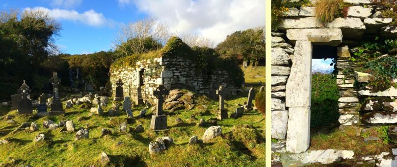
Heading towards Dunmanus Harbour we stopped to pay our respects at the little ruined church and graveyard, beautifully called in Irish Kilheangul – the Little Chuch of the Angel. This was a curious mixture of cillín and modern graveyard: rough unmarked stones stood shoulder to shoulder with more recent granite headstones and lovingly tended graves.

The Little Church of the Angel

The Little Church of the Angel

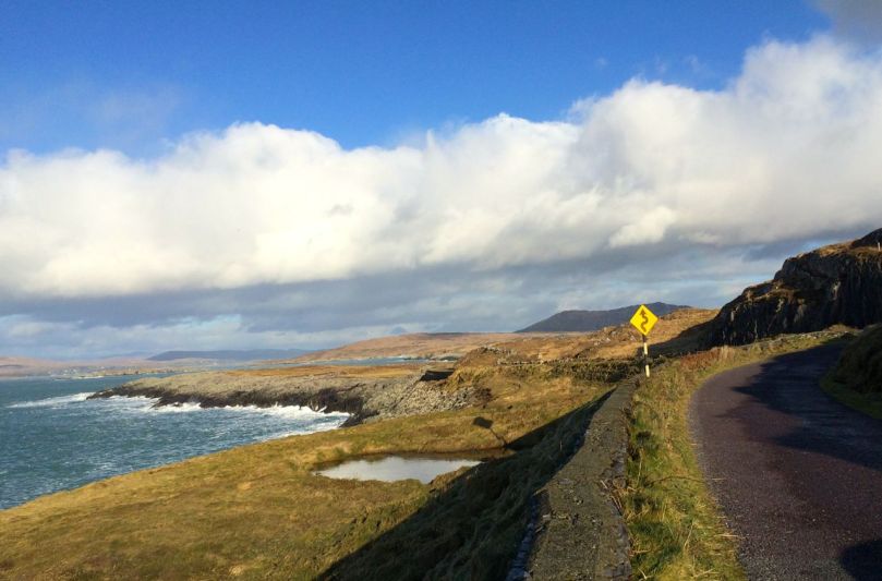
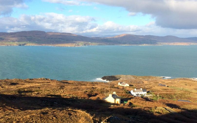
We headed west along the road that skirts the sea and eventually leads to Barley Cove. We are convinced that this is one of the most breathtaking drives in Ireland – and, in a land as scenic as this, that’s a tall order! To the east we looked back up Dunmanus Bay to the Kerry Mountains in the far distance.

Looking East up Dunmanus Bay

Looking East up Dunmanus Bay

To the north lay the Sheep’s Head and beyond it the looming presence of the Beara Peninsula.

Across to the Sheep's Head and Beara Peninsula

Across to the Sheep’s Head and Beara Peninsula

To the west, Knocknamadree (the Mountain of the Dogs) and the wild Atlantic.

Bird Island and the Atlantic beyond

Bird Island and the Atlantic beyond

Once home to hundreds of families, this is a depopulated area now. There are some small farms, but many of the houses are holiday homes, seldom used. Sobering, that such a wildly beautiful place is no longer economically viable to support a thriving community.

The North Side of the Mizen

Northside of the Mizen

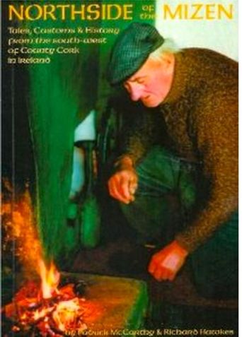
But thanks to the foresight and hard work of local writers, we can have a true appreciation of what life was like here. Northside of the Mizen has its own book! Recorded, edited and written by Patrick McCarthy and Richard Hawkins, and illustrated by Thelma Ede and with old photographs, it’s a charming, quirky compendium of character sketches, folktales, customs and traditions, poems and songs, and descriptions of country life. With chapters organised by month, it’s the kind of book you keep by the bedside and dip into when the spirit moves you. In January, for example, there’s a section on scoriachting, or visiting neighbours. It’s accompanied by a photo of a man and his jennet in somebody’s kitchen, with the caption Michael and Tom McCarthy out scoriachting. Once the neighbours arrived (but not on Saturday night as you would have to get ready for mass early the next morning) the night…

“…would start with games, blackguarding (horseplay) and sometimes dancing, then progress on to songs and poems. Storytelling was the preserve of an evening by the fire. With flames flickering and the wind and rain howling like the Banshee, the imagination of the storyteller and his forebears was let loose on a delighted and spellbound audience of children and adults alike. This, in turn, would lead to stories of a more superstitious nature, into a world of small folk, púcas (sprites), mermaids and of people’s misfortune when they interfered with the fairy ways.”

Look out for future posts about the Mizen – we’re only scratching the surface of this marvellous region of West Cork.

Where once were farms

Where once were farms

Mizen Magic

We’ve done several posts on the Sheep’s Head and the marked hiking trails that crisscross that peninsula. But we actually live on a different peninsula, The Mizen, and it is just as glorious and wild and beautiful.

Map of Mizen and Goleen

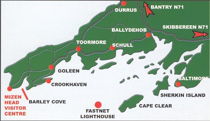
The road to the Mizen Head starts at Ballydehob, runs along the southern side of the peninsula through Schull and Toormore and on to Goleen and Crookhaven. At the far or western end are the beaches of Barley Cove and the Mizen Head Lighthouse and Visitor Centre. There are no villages on the northern side of the peninsula until you reach Durrus, which also marks the start of the Sheep’s Head Peninsula. It is bounded on the south by the waters and islands of Roaringwater Bay and on the north by Dunmanus Bay. The whole peninsula is rich in history and archaeology and we plan future posts about many aspects of life here.

For the moment, a flavour in photographs of what The Mizen landscape has in store for visitors.

Dunbeacon Stone Circle

Dunbeacon Stone Circle

Ballyrisode Beach

Ballyrisode Beach

Dunmanus Bay

Dunmanus Bay

Mizen Head

Mizen Head

Dunmanus Harbour

Dunmanus Harbour

Three Castle Head

Three Castle Head

Ból an bhóthair

bowling

A damp, grey, Sunday afternoon seemed as good a time as any to find out about a strong West Cork tradition – Road Bowling – the title of this post is the Irish for that. I had come across this ancient sport on a previous visit to Ireland and was intrigued. Friends enlightened me that it was a traditional local pastime which has spread to Armagh and, through emigration, to London and the United States – while other versions of the game exist in Holland and Germany. But the county of Cork – and particularly our western part of the county – is its true home.

bowling2A notable merit of the sport is that it requires absolutely minimal equipment and facilities: an iron ball (or ‘bullet’) weighing 800 grams and 18cm in circumference (note: Ireland is fully up to date with its metrification – miles and ounces have vanished along with the old Irish punt or pound) and about 4 kilometeres of public road. That’s all, apart from a stick of chalk. The road can be anywhere: it’s good if there are some hills and bends. Today I watched a game on the Road out of Durrus going towards Schull. It’s fairly well used (although, as this is Ireland and a Sunday, there’s probably one car passing through every five minutes), but the traffic always gives way to the bowlers.

The object is to throw the iron ball along the road. There are two players – or two teams – in each match, and the match involves one journey along the road in one direction, each player having his own ball. There’s usually another match when the crowd returns along the same route. The winning player or team is the one that reaches the end of the course with the fewest ‘throws’. To throw a player runs up to a chalk mark and, using an underarm swing, propels the ball as far as possible. Regardless of whether or not the ball has hit a wall or drain or whatever, the next chalk mark is made at the point that the ball has stopped moving. There are all sorts of techniques, but nothing – it seems – breaks any rules, unless the player’s foot steps over the chalk mark before the ball has left his hand. And I’m not sure whether anyone is actually watching out for that, as the whole crowd, including the players, spend the entire time engaged in conversation; although this is interspersed at times with shouts of encouragement – or perhaps discouragement, and loud comments on how poor that particular throw was. I was guided through the process by friendly members of the gathering (many of whom suggested that I should have a go myself) and they also assured me that an essential part of the fun was ‘money changing hands’ – a gamble on the match, or on individual throws. Everything seemed so chaotic and informal that I couldn’t work out how this all went on.

bowling3

I was interested to see a tuft of grass (a ‘sot’) pulled out of the hedgerow and placed on the road at the point which the thrower should aim for in order to get the best ‘line’. And I was told that a helper known as a ‘road shower’ advises the thrower as to the best trajectory. ‘Shower’ here rhymes with ‘blower’. And – I should have said at the outset – ‘bowl’ actually rhymes with ‘howl’. But the West Cork accents I heard this afternoon were so strong that I only picked up every third or fourth word…

I returned a little wiser about another ingredient of life in West Cork.

bowling8

Hiking the Sheep’s Head Way

In my first post I complained about the endless rain. Fact is, in the first two weeks of October we have had some great weather, including several days of glorious sunshine and NO RAIN. We are fortunate to be within half an hour of the Sheep’s Head Way, a world-class system of marked trails with mountain, coastal and valley hikes of varying lengths but uniformly breath-taking scenery. On back-to-back sunny days this week we undertook to hike parts of the ridge trail that runs along the spine of the peninsula.


Our first hike took off north of Durrus at Booltinagh Mountain and ran south along the ridge to a high point and over the top to the Barna Mor, or Big Gap – an old donkey trail across the peninsula. Although the trail is well marked and clear it is soggy: waterproof boots are essential along with layers for taking off and putting back on as you heat up, cool off, or see a shower sweeping in from the south west. Our views were north to Bantry Bay, all the way back to Glengarriff Harbour and over to the Beara Peninsula. On the other side across Dunmanus Bay lay the Mizen, bathed in sunshine. We shared the trail with sheep, but saw no other walkers.

The next day we ventured further west to Kilcrohane, turning north up a steep and winding road to Finn McCool’s seat, a natural saddle on the ridge. This being Ireland, the trailhead is marked by a marble Pieta, perhaps dating to the Marian year of 1954 that saw so many such monuments erected all over Ireland. Once again, we had the mountain to ourselves. Although it was a bright day, a howling wind blew up from the sea below. We leaned into it, and tramped on, to the Peakeen cairn. Along the way we stopped to examine the remains of what may be a Neolithic passage grave, occupying a commanding knoll along the ridge. How important would you have to be to have your tomb in such a place? Perhaps as important to the people who built this monument as the crucifixion images of the Pieta was to the local residents in 1950s West Cork.

The passage grave is on the first knoll on the left
We wondered why this incredible, wild resource that is the Sheep’s Head Way is not a National Park – even a World Heritage Site. Perhaps the answer is that as long as people respect it (and they do – we saw no litter or vandalism) and as long as access is freely given by landowners, there is no need to administer it as a park. The website for the Way indicates that it receives funding from both Ireland and Europe, but that The Sheep’s Head Way committee is a voluntary committee, consisting of landowners/farmers and other representatives from the local community. What a fantastic job they have done!