A Map of the County of Cork, Part 3

This is the last part (links to Parts 1 and 2 at the end of the post) and I will use it to look at where most people seemed to be living – along the River Lee and the Blackwater/Bride Rivers. Cork is shown, as we know it was and still is, on an island, as a substantial walled town with four towers. Two of the towers guard bridges and are ports of entry, and two guard inlets of the river. There’s a cross in the middle and five buildings outside the walls. 

The buildings to the left of the city (remember, that’s North) are labelled Mogelle, F:barro and M:nellan, while to the right (south) the upper building is unlabelled and the lower one is C:Tanboy?

To see what this is all about, let’s take a look at the earliest map of Cork City, which I showed you in my post Mapping West Cork, Part 2: John Speed. I reproduce that map here. It dates from 1611/12. As I said in the John Speed post, while Speed seems to have based his land maps on earlier work by Mercator . . .

. . . the city maps were all new and it seems that Speed, with one of his sons, actually travelled to the cities he includes in his atlas and paced out the distances, drawing the maps based on these calculations. They are a unique and invaluable record of a time when Ireland had walled cities, especially given that so few intact stretches of those walls remain.

And there is the Market Cross! While that is the only feature inside the city on our map, Speed’s is beautifully detailed, and he provides a key to all important buildings. There are many churches, only two of which, Christ Church and St Francis’s Church, are within the walls. Assuming that Finbarr’s church is labelled F:barro on our Map (although the brown rectangle looks more like a tower house) and St Barrie’s Church on Speed’s, it is shown in different places. St Augustine’s or St Stephen’s may be the uppermost building to the right of the city, but what is the brown pyramid-shaped blob labelled C:Tanboy? Perhaps a true Cork historian can help us out here and figure out what’s what.

Interestingly, there is no sign, on our map, of the large star-shaped fort that Speed labels The New Fort and that subsequently became known as Elizabeth Fort. It was started in 1601 by George Carew (the original owner of this map collection) built of earth, stone and timber.  This supports a pre-1600 date for this map. Elizabeth Fort is still very much part of the Cork landscape, with its massive walls still dominating the south side of the river (above).

As we progress west along the Lee, the land is shown as wooded and there are several establishments by the river and its tributaries. I recognise Kilcrea Castle and Abbey (given here as Kileroye), but I’m sure others, more familiar with this landscape than I am, can add more.

Cork Harbour, as might be expected, has many towers, the main one among them still standing is Barry’s Court (barris courte), soon (we hope) to be re-opened for visitors and also Belvelly (B:vyle), magnificently restored by a private owner. Corkbeg Island and Castle are shown, as well as several other castles on either side of the delta. Cloyne is of course indicated, as it was an important ecclesiastical centre.

Moving now to the Blackwater/Bride River system, we see perhaps as populous and encastellated an area as around Cork, especially along the two rivers, which were navigable for many miles inland. Youghal is shown as a walled town, guarding the mouth of the harbour but also a large commercial and trading centre.

We have written about Youghal before, and specifically about its well-preserved stretches of wall – an unusual feature of Irish towns as very few medieval walls have survived.

I am reproducing below the map from Pacata Hibernia I used in my Youghal’s Walls post. As with Cork, it can help us to understand a bit more about Youghal. Note, for example, the South Abbey clearly shown outside the walls on both maps.

Upriver is Strancally Castle – not the more modern manor house, but the original tower house of which only a vestige remains down by the river. Also easily discernible is Pilltown in modern-day Waterford and Inchiquin, a townland east of Youghal. Inchiquin Castle is now the ruins of a round Anglo-Norman masonry tower which went through tortuous changes of ownership but was eventually occupied by in the fabled  Countess of Desmond who in 1604 died at the age of 140 by falling out of an apple tree. The castle was then seized by Richard Boyle, Great Earl of Cork, who, along with Walter Raleigh, is closely associated with Youghal and the Blackwater River. The drawing of Inchiquin below is by James Healy from his marvellous book The Castles of County Cork.

Boyle’s Castle (it’s still there) was in Lismore, but at this point lesse more is shown as a church on the banks of the Blackwater, not the centre of power it became with Boyle’s ascendance.

Castles, towns and churches line the Bride and the Blackwater, showing how important these rivers were at a time when the best way to traverse the country was by water.

I’m going to leave it there, although I just might come back to this map at some point in the future because, well, it’s so darn interesting and it’s fun to try and puzzle out the names. I hope I have supported my thesis that this map must date to before 1600. It is most likely another of those made for the purposes of identifying property in order to confiscate and carve it up during the Plantation of Munster. Please do visit it for yourself and see what you can find – additions always welcome in the comments section below.

OK – one last image – the source of the Blackwater is shown in this one. What do we call these mountains now?

A Map of the County of Cork, Part 1

A Map of the County of Cork, Part 2

Evolving Cork – The Great Exhibitions

Here’s a fine view over the city of Cork, taken early one morning from the grounds of the Montenotte Hotel, on Middle Glanmire Rd. It reminded me that way back in 2016 I mentioned in Roaringwater Journal the fact that Cork City has over the years hosted a number of world-class fairs. The first was in the mid nineteenth century:

This engraving from the Illustrated London News shows the ‘Fine Arts Hall’ which was part of the Cork National Industrial Exhibition held in 1852:

. . . The site of the Cork Exhibition was the Corn Market, where ships carrying visitors and goods could dock and unload at the entrance gates. The old Corn Exchange building, lent for the occasion, formed one end of the structure, while a new mart served as a principal show room. This ran across the southern part of the old building, parallel to the quay, for 300 feet in length and 30 feet in breadth, giving the impression of a contemporary railway station, even to the strip of glass along the roof to admit daylight. By the opening day ad hoc extensions had been added which converted the original elongated T – shape into a cross, with covered galleries and passageways running from the central structure to an adjacent building used as a hall for banquets, balls and public lectures . . .

A C Davies – Irish Economic and Social History, Vol 2, 1975

. . . The exhibition remained open for three months, until 10 September. The opening ceremony had been performed by the Lord Lieutenant after a procession watched by the townspeople, ‘in all the pomp and circumstance of majesty, with waving banners, prancing horses, peals of artillery, and multitudinous shouts’. At first attendance was sparse. It rained steadily for the whole of the first week, but then the weather improved and the number of visitors increased. It amounted to about 140,000. Ten thousand free admissions were granted to children from over seventy schools in the area . . .

A C Davies – Irish Economic and Social History, Vol 2, 1975

When the 1852 exhibition closed, the people of Cork decided their city should have a venue suitable for the holding of public lectures, meetings and concerts. Within a few years the building above was constructed. Known as the The Athenaeum, it was designed by Sir john Benson, who had been responsible for the Great Hall of the Cork Exhibition. It is said that many of the materials which had been used in Benson’s exhibition hall were salvaged and re-used in The Athenaeum. The new building was renamed The Munster Hall in 1875 and then became the Cork Opera House in 1877. It survived until 1955, when it was destroyed by fire. The present Opera House, on the same site, was opened by President Eamon de Valera in 1965. It was extensively remodelled, with the glazed facade added, in 2000.

Half a century later Cork city embarked on another major ‘world fair’ class event. In 1902 the Lord Mayor of Cork, Edward Fitzgerald, presided over creating Cork International Exhibition, which ran from May to October. Reclaimed marshland beside the river at Mardyke was used for the site, which occupied an area of about 44 acres. Here are the ‘leading lights’ of the exhibition organisers, with Fitzgerald on the right:

This exhibition was considered such a success that it was repeated the following year – 1903 – and the site plan above bears this date. The artist’s aerial view of the site, below, gives a good impression of the extent of the grounds. Note the ‘switchback railway’ to the left: this was a precursor to roller-coaster fairground rides and was immensely popular…

…As was the ‘Water Chute’ from which it was unlikely that you would emerge dry!

Such attractions were very popular with the general public, but the exhibition had a more serious commercial side:

Several large exhibition halls and pavilions housed a range of industrial and agricultural exhibits from many countries including Canada, Turkey and China. There were displays of industrial and agricultural machinery as well as horticulture, fisheries, art, craft and ceramics . . . The Irish Department of Agricultural and Technical Instruction had a strong presence at The Exhibition with exhibits on dairying, cheese-making, cottage gardening, forestry, bee-keeping, poultry, fruit and vegetable drying and preserving . . .

National Museum of Ireland Collections & Research

Hadji Bey is a name that will be familiar to any Cork person with a sweet tooth! The true story goes that Armenian immigrants Harutun Batmazian and his wife Esther chose Cork as their new home during the early years of the 20th century, after escaping the persecution and violence against Armenian Christians taking place in the Ottoman Empire at the time. In 1902, the Batmazians participated in the Cork International Exhibition and introduced their Turkish Delight – a skill Harutun learned while studying in Istanbul – to the market. Although they spoke no English at the time, the city was to became their home and the popularity of their sweets – still made in Ireland today – is legendary. After their success at the Exhibition they opened a shop on MacCurtain Street: this survived for many decades.

Turkish Delight is just one success story from Cork’s International Exhibitions. The 1902 event attracted nearly two million visitors. Surely, it’s time for another one?

After all the clamour and excitement had died down the Exhibition buildings (below) were dismantled and auctioned off. In 1906 the park and Shrubberies House were taken over by Cork Corporation with the proviso that the Corporation would levy a rate of half penny in the pound for annual upkeep and maintenance.  A further proviso stipulated that the Shrubberies House would be used by the Corporation as a municipal museum. Today we can all enjoy enjoy Fitzgerald’s Park and the Cork Public Museum, where Finola and I put on an exhibition about Rock Art back in 2015.

If you want to know more, I thoroughly recommend this book, written by Daniel Breen (now Curator of the Cork Public Museum) and Tom Spalding, published by the Irish Academic Press.

CORKumnavigation

As of this week I hadn’t been in a canoe for, oh, about 25 years. That all changed on Thursday when my friend Jack O’Keeffe invited me along on a CORKumnavigation! I was a bit apprehensive but I needn’t have been – the trip was easy, my paddling skills were still intact and I felt very safe. Most of all, though, this was a terrific experience.

There are, in fact, very few cities in the world where you could do something like this. That’s because Cork was built on a marsh, with the the rivers that formed it gradually flowing around the reclaimed land, and joined to the land on either side by a series of bridges. The traces of that former city (above) are all still there, as both Brian Lalor and Eiléan Ni Chuilleanáin pointed out in this post and this one.

There are complications for anyone wanting to navigate this river using the two channels as seen in the map above – the flow of the river is one and the tide is the other. There’s a hydro-electric dam upstream at Inniscarra and it can control the release of water that raises or drops the level of the river. And then there’s the tide – since the river here is tidal the water level rises and falls on every tide.

Why is this important? Because there are weirs and bridges along the CORKumnavigation route. The water has to be high enough to cover the weirs (which are a real hazard to small craft) but at the same time low enough to allow passage under the bridges. There are windows of opportunity in which the tidal level is just right, and the Inniscarra Dam isn’t affecting the river unduly. Several years ago, under an initiative managed by Meitheal Mara, all the weirs and bridges were surveyed and measured and thus it is now possible to work out the times in each month when it is possible to travel safely around Cork by water.

Jack takes all this information, calculates optimum times for the voyage, and spreads the word when those windows open. And magically, people gather in an astonishing variety of small craft – curraghs, skiffs, one and two-person kayaks, canoes, paddleboards, inflatable sit-upons. My partner in the canoe was the genial Cathy Buchanan who is the Manager of Meitheal Mara and a former National Rowing Champion. We proved to be a wonderfully compatible team, able to keep the canoe going in the direction we wanted, and chatting companionably throughout (first photograph in the post).

On this occasion, the trip was anti-clockwise. We launched at Crosse’s Green, right by the new half-built convention centre and under the looming walls of the 17th century Elizabeth Fort, and paddled downstream, passing first under the South Gate Bridge, the site of one of Cork’s original historic bridges, and from there down to the docks, past City Hall and the mid-century building where my father worked in the 60s. In the photo above the paddlers are passing the intersection of the South Mall and the Grand Parade.

Once around the Port of Cork wedge, we started upstream along the quays – Merchant’s Quay, Patrick’s Quay, Camden Place and under all the patriotic bridges – Brian Boru, St Patrick, Michael Collins and Christy Ring (legendary hurler). There’s a new one, a pedestrian bridge (below), that finally breaks the macho bridge-naming stranglehold to honour Mary Elmes, the modest self-effacing Cork woman who worked heroically to save Jewish children in France and Spain during WWII. The bridge has become a favourite strolling and sitting place for Corkonians and visitors and we were greeted with waving and cheering as we passed underneath.

Viewed from the water, with the docks (below) behind us, the quays are very fine examples of Victorian Commerce, with the most imposing edifice of all being the neo-classical St Mary’s Church, a monument to the rising power of a Catholic middle-class. Rounding a bed you come to the Lee Maltings where UCC students, including me, played raquetball in the early 70s.

Once past the Maltings, everything changes. The river seems to slow, the headwind stops, greenery appears and you float past lovely old Edwardian houses with their gardens sloping down to the river on the right, while the landscaped lawns of Fitzgerald Park and the Mardyke sports grounds stretch along the left bank.

This brings us finally under the fabled Shaky Bridge and on to the portage, a rather grand name for the act of hauling our boats over the Split Weir and an opportunity for a rest and a drink.

Then came my favourite part of the whole trip, as this smaller, south stretch of river meanders through the treed banks along which you are hardly conscious that you are in a city. The noise falls aways, green branches arch down to the water, Water-crowfoot provides a sparkling carpet to paddle through, a duck family swims leisurely aside and overhead in the canopy of leaves birds are singing their hearts out. You could be deep in the country, totally unconscious of the urban life all around you, until you emerge once again beside the River Lee Hotel. It especially astounds me as I attended UCC for five years, often walking in and around this part of the campus but unaware of the green and beautiful waterway below.

From there it’s a short paddle to the pull-out, and you’re done. The whole thing took about two hours or a little more but it felt like longer, I think because we had experienced so much in that time. We were lucky with the weather, as it was a warm and sunny evening. We were expertly guided by Jack, who quietly and unflappably sorted out any issues as we went along. It was, in fact, ideal. It felt privileged, too, to be along with a small group on such a unique trip.

My heartfelt gratitude to Jack, and to all the people at Meitheal Mara who worked so hard to establish how this route could be safely undertaken. Given that there are so few cities where this is possible, this is a world-class experience and deserves to be far better known than it is.

A word about the photographs – although I had my camera with me, I took no photos of my own, and am therefore relying on images captured by other participants in this and previous CORKumnavigations – thank you so much to Fabian Murphy, Brice Pvllnd, Ivan Cruseido and especially to Jack.


William Burges and Saint Fin Barre’s

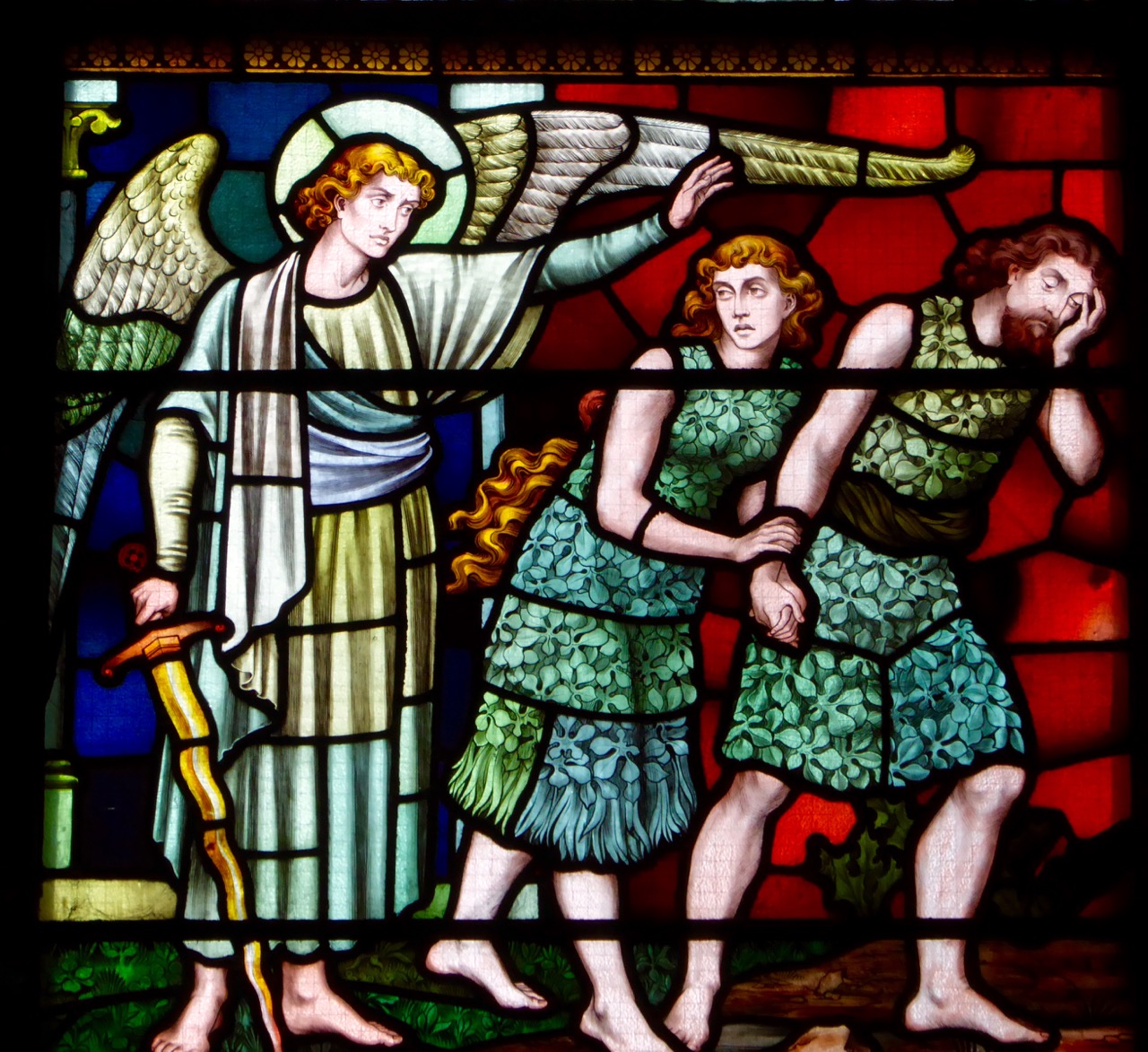
You may recall my delight in finding so much animal imagery in the Honan Chapel at UCC. In Cork City again this week we discovered another ‘menagerie’ – this time at the Cathedral of Saint Fin Barre. This Gothic Revival building is an architectural and artistic wonder – quite the most significant work that I have seen to date from the palette of English designer William Burges, who lived from 1827 to 1881. In fact it is an early work of his, resulting from an architectural competition which he won in 1863 (receiving a prize of £100). Unusually for an ambitious building such as a cathedral, it was finished in a relatively short time: the first services were held in 1870 – although completion of some of the detailed carving and decoration continued through to the twentieth century.

Everything in the cathedral was designed by William Burges: stained glass windows (74 of them, incorporating twice as many individual scenes); statuary (1,260 pieces of sculpture); brasswork, floor mosaics and wood carvings. Most striking for me is the complete coherence of the building: the genesis of the design work from a single mind – down to the very last constructed item – is visually obvious and I am, of course, professionally jealous that an architect was allowed to completely indulge himself to this level of detail, apparently without the intervention or censorship of clients, building inspectors or planning authorities! The cost of the building project overran its budget some tenfold…

Whole books could (and have been) written about this building and all its intricacies. In this short post I will concentrate mainly on the iconography, especially animal images, because it’s obvious that Burges shares my own enthusiasms for the natural world. There’s much more of this than I can illustrate here, and considerably more to the whole building that’s well worth seeing. I advise you to allow an afternoon – or a day – when you visit, if you want to really get to grips with everything.

A little about the man himself, although biographical information is scant: he was described during his lifetime as “short and fat” and “so near-sighted that he once mistook a Peacock for a man”. Lady Bute, wife of his greatest patron, wrote, “…Dear Burges, ugly Burges, who designed such lovely things – what a duck…” He was undoubtedly an eccentric, attending site meetings on occasion dressed as a medieval jester. Like many of his contemporaries he smoked opium (the overdoing of which is said to have contributed to his early death) and he was a friend of Oscar Wilde, James Whistler and – according to the architectural historian Joseph Mordaunt Crook – “the whole gamut of pre-Raphaelite London”.

Three views of the eccentric William Burges: portrait by Henry van der Weyde (left), dressed as a medieval jester (centre) and a caricature by Frederick Weekes (right)

Dante Gabriel Rossetti wrote a limerick on Burges’s childish nature:

There’s a babyish party called Burges,
Who from childhood hardly emerges.
If you hadn’t been told,
He’s disgracefully old,
You would offer a bull’s-eye to Burges.

It does appear that Burges was quite active in the world of London’s creatives in his day. Elected to the Institute of British Architects in 1860, in 1862 he was appointed to its Council and in 1863 was elected to the Foreign Architectural Book Society, the FABS, which comprised the RIBA elite and was limited to fifteen members. He became a member of the Atheneum Club in 1874, was a member of the Arts Club, the Medieval Society, the Hogarth Club, and was elected to the Royal Academy just before his death.

Paradise Lost

Poor William Burges received very little praise for his work, either in his own lifetime and for a long while afterwards. Gothic Revivalist architecture went out of fashion when the new century approached, and was often derided for its heaviness and over-elaboration. For a while Victorian art was under constant assault, critics writing of “the nineteenth century architectural tragedy”, ridiculing “the uncompromising ugliness” of the era’s buildings and attacking the “sadistic hatred of beauty” of its architects. In my own view they all failed to grasp the romance of the age, expressed so beautifully and particularly in the detailing of many of the buildings, among which the Cathedral of Saint Fin Barre stands supreme.

birdie 4


Cork’s Rebel Daughter

most dangerous

The Most Dangerous Woman in America

Mary Harris was born in Cork City in 1837. Like the lady herself, that’s a bit controversial: she claimed to have been born on 1st May 1830 – probably because that enabled her to celebrate her 100th birthday in 1930 – but also because the first day of May has always been associated with workers’ rights. She didn’t make a huge impact in Ireland, as she emigrated with her parents as a child. The first paragraph of her autobiography (published 1925 by C H Kerr + Co, Chicago) succinctly summarizes the early years of her life:

…I was born in the City of Cork, Ireland, in 1830. My people were poor. For generations they had fought for Ireland’s freedom. Many of my folks have died in that struggle. My father, Richard Harris, came to America in 1835, and as soon as he had become an American citizen he sent for his family. His work as a laborer with railway construction crews took him to Toronto, Canada. Here I was brought up but always as the child of an American citizen. Of that citizenship I have ever been proud…

Mary Harris – Mother Jones – remembered in Cork (left) and in the US (right)

Mary was a ferocious socialist – perhaps influenced initially by her husband George E Jones, a member of the Iron Molders Union in Memphis. She lost her husband and four young children to a yellow fever epidemic in 1867, and seemed to take the emerging Labor Movement as her family thereafter. She re-created herself as ‘Mother Jones’ and spent the rest of her life supporting the rights of workers in the railroad, steel, copper, brewing, textile, and mining industries. The five foot tall white-haired Irish lady participated in hundreds of strikes all over America, and attracted public attention by mobilising miners’ wives to march with brooms and mops in order to block strikebreakers from entering the mines.

Mother Jones meets President Coolidge in 1924 (Library of Congress)

Mother Jones meets President Coolidge in 1924 (Library of Congress)

Mother Jones helped found the US Social Democratic Party (1898) and the Industrial Workers of the World (1905); she published articles in the International Socialist Review, met and lobbied (and gained the respect of) several Presidents and spent time in jail. On one occasion when violence broke out during a mine strike in West Virginia, a state military court convicted her of conspiracy to commit murder.  Nationwide protest led the Governor to commute her twenty-year sentence.

Mother Jones in action in 1921

Mother Jones in action in 1921

Some quotations ascribed to Mother Jones:

A lady is the last thing on earth I want to be.  Capitalists sidetrack the women into clubs and make ladies of them

Pray for the dead and fight like hell for the living

My address is like my shoes. It travels with me. I abide where there is a fight against wrong

No matter what the fight, don’t be ladylike! God almighty made women and the Rockefeller gang of thieves made the ladies

I asked a man in prison once how he happened to be there and he said he had stolen a pair of shoes. I told him if he had stolen a railroad he would be a United States Senator

The employment of children is doing more to fill prisons, insane asylums, almshouses, reformatories, slums, and gin shops than all the efforts of reformers are doing to improve society

I’m not a humanitarian, I’m a hell-raiser

memorial

Strangely, Mary did not support the women’s suffrage movement in the United States: she considered it a middle class diversion taking the focus away from the fight against social injustice and basic universal rights for all workers. In her eighties she was still actively supporting strikes involving streetcar, garment and steel workers.

Mary Harris Jones died on November 30, 1930.  After being celebrated by a mass in Washington DC, she was buried at the Union Miners’ Cemetery in Illinois, next to victims of the Virden, Illinois mine riot of 1898.  Her funeral was attended by thousands of labour supporters, mine workers and other mourners.

Cork remembers this daughter of revolution: we found a commemorative plaque in the Shandon district, close to the old Butter Market – historically the city’s most notable industry. In the States her name lives on also: Mother Jones is an independent, non-profit making magazine and website reporting on politics, the environment, human rights, and culture ‘…that in its power and reach informs and inspires a more just and democratic world…’

MoJo – the liberal Mother Jones Magazine

Bravo, Mary Harris of Cork, for being so committed to the fight for the basic rights of humanity in general and the working population in particular. And watch out, capitalists and oppressors – as she is reported as saying frequently ‘…the kaisers of this country are next, I tell ye…’

motherjones1


The English Market

teeth

We’re both looking at markets this week: Finola is concentrating on the delights of our local Christmas community fairs, while I am looking at the ‘big market’ further afield.

moynihans

The Republic’s second largest city can trace its history back to a community of monks, scholars and scribes which St Finbarr established on the banks of the River Lee in the 6th century. The area was known as an Corcach Mór – ‘the Great Marsh’. This settlement became a notable centre of learning, giving rise to the phrase Ionad Bairre Sgoil na Mumhan – a motto adopted by the modern University College Cork as ‘Where Finbarr taught let Munster learn’.

Finola approves Walter's stall

Finola approves Walter’s ‘pop-up’ stall

First a town and then a city grew up around the marshes and in the 18th century large tracts of low lying land were drained and reclaimed, forming the area which is now the commercial centre of Cork, including Saint Patrick’s Street, the Grand Parade, Grattan Street and Cornmarket Street. In 1786 the Corporation of the City undertook to create here a new meat market ‘in the English style’. A grand opening took place on 1st August 1788. This was before the emerging United States of America had elected George Washington as its first President, and in the same year that Captain Arthur Philip’s First Fleet arrived in Botany Bay with its cargo of convicts – ‘The Founders of Australia’.

queen

ooysters

The English Market in Cork is an essential part of any visitor’s itinerary. Even the Queen went there for a look around during her Irish tour last year and reportedly was very impressed with it. We followed on last week, to visit the new Fresh from West Cork stall which has been set up over the Christmas period to sell the delicious produce which emanates from our small part of the world, and which has justly gained a country wide reputation. The stall is being ably run by Walter from Loughbeg Farm – just down the road from us, and it’s hoped that this trial period will result in Fresh from West Cork becoming a permanent fixture at the market.

loaves

cakes

shelves

cheese

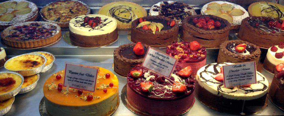
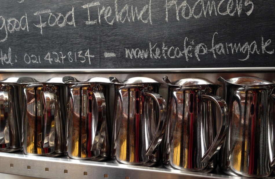
It’s no longer just a meat market – you can find every variety of good food there, as these pictures hopefully show, and an excellent cafe upstairs. If ever you are passing through, don’t forget to call in.

farmgate

jugs