The Castles of Ivaha: ‘Fragmentary Remains’

What can you say about a castle where only fragments remain of the original structure? Turns out – a surprising amount!

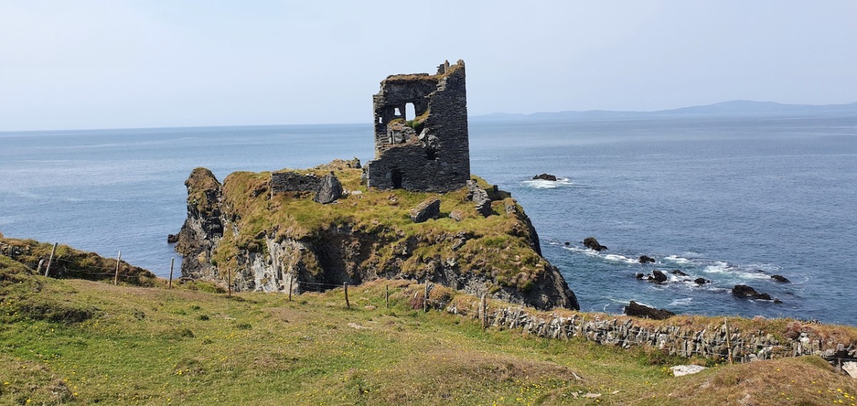
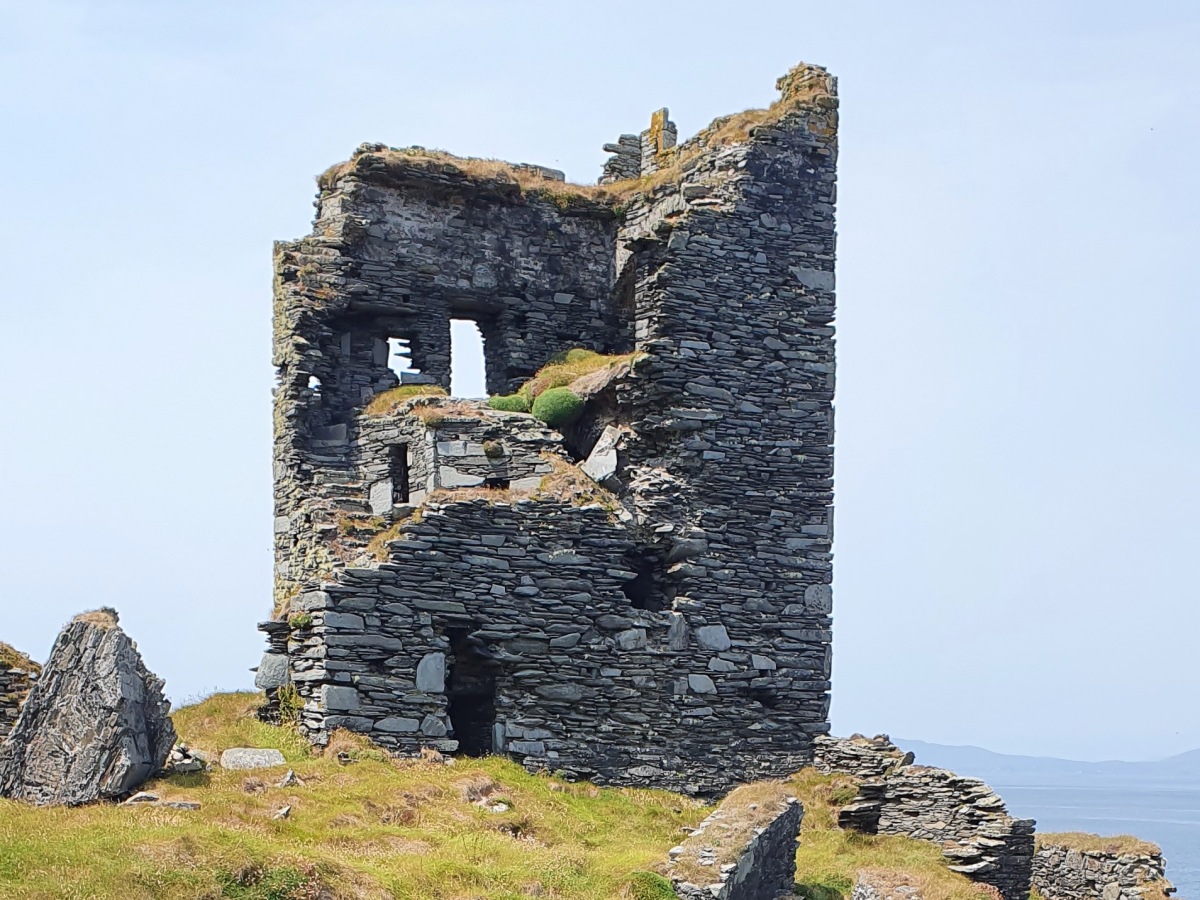
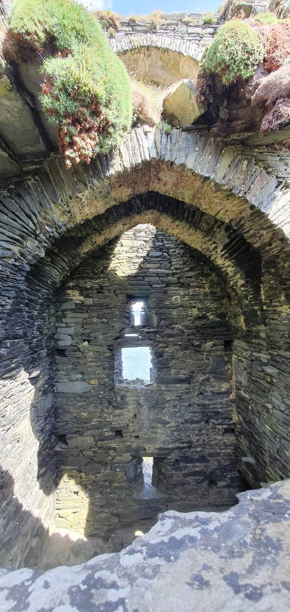
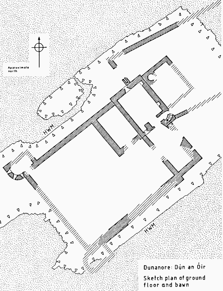
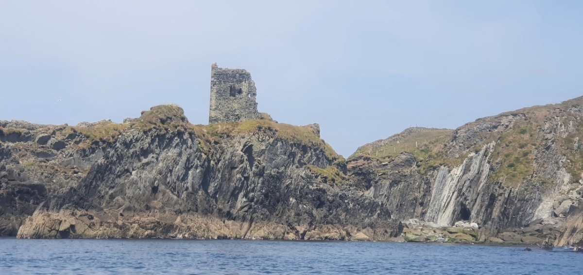
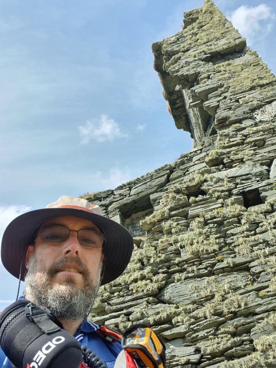
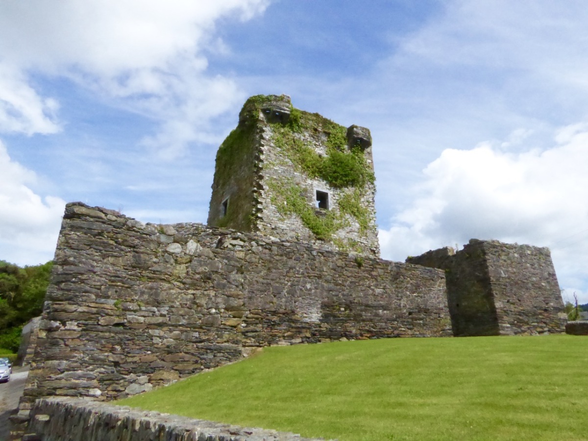
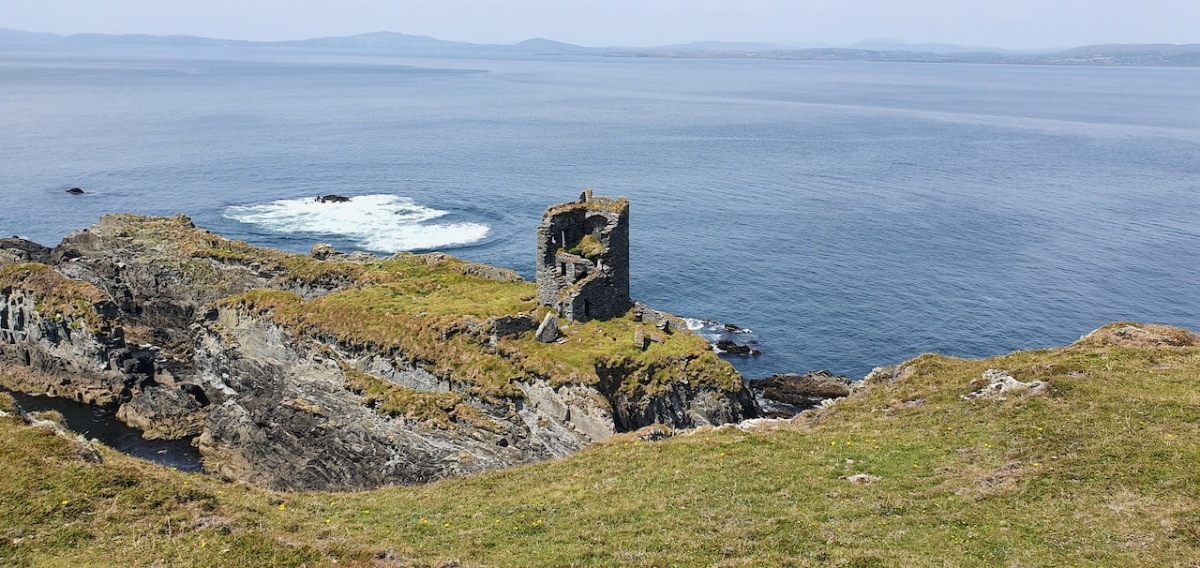
Fragmentary remains is the phrase used in the National Monuments record to describe the two castles which are the subject of this post – Dunbeacon and Castle Island. In each case only enough is still standing to confirm that it was indeed a medieval tower house. Fortunately, in the case of Dunbeacon, there is also historical evidence. 

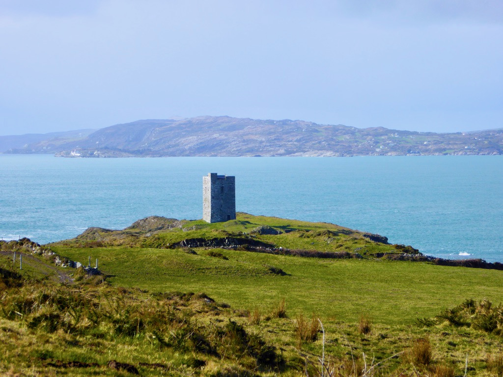
Let’s look at Castle Island first, and begin with the name. Samuel, in his thesis on The Tower Houses of West Cork, tells us that it was known locally as Castleduff, or Caisleán Dubh, the Black Castle. However, this was the name more commonly applied to Black Castle/Leamcon, so he says there might be some confusion there. There is no other name in the historical records – no mention, indeed, at all. Perhaps it was too insignificant to merit a mention – a fortified outpost rather than the high-status residence of one of the ruling O’Mahonys. 

We have noted with other of the O’Mahony castles that they were built on the site of a ring fort (Ardintenant) or a promontory fort (Dunlough). The National Monuments records notes a promontory fort at this site, although it is not obvious on the ground any more. There are, in fact several promontory forts noted on Castle Island, perhaps indicating that this was the preferred type of fortified dwelling here, since there are no ringforts.

Like all the O’Mahony castles, it was strategically sited – it was beside the waters that separates the island from the mainland, and within sight of two other castles – Rossbrin and Ardintenant. The three form a triangle that overlooked and guarded the sheltered waters of Castle Island Channel. But also, from the top of the castle, there would have been a clear view south across the low land in the centre of the island, out to Roaringwater Bay.

We know that these waters would have been crowded with Spanish, French, Portuguese and British fishing boats, coming in to salt their catches in the fish palaces along the coast and to replenish their supplies. For all of these services and for permission to fish around Roaringwater Bay they paid hefty fees to the O’Mahonys, who got fabulously wealthy as a result. 

The castle was much smaller than all the others. Samuel says, 

Working on the assumption that Castleduff was an RE tower house [i.e Raised entry], its smallness is striking. The surviving ‘end wall’ makes possible a reasonably accurate estimate of the plan’s original length. It is assumed that like its neighbours, its plan had a length-to-breadth ratio of 3:4 to 4:5; the ratios suggest a length of 7.96-7.46m (measures above the base-batter). The surviving north wall probably represents the full length of the ground-floor chamber.

Mark Wycliffe Samuel
the tower houses of west cork

The only surviving opening is a loop in one wall, and a row of corbels that would have supported the first floor is still visible. There is no trace of anything that might suggest a vault, so it is possible that this small tower was unvaulted – Samuel thinks that the walls are noticeably thinner than the other castles, implying that this was a much simpler and shorter tower.

Samuels concludes his study of this tower by saying:

The jetty is modern, but the beach that it is laid upon was the best natural landing point on the island, well sheltered from the Atlantic swell. The landing clearly determined the siting of the tower house and was an important resource to the family that built the tower house. It is tempting to see a direct continuity between the recent settlement and a settlement around the tower house. Only excavation could determine if this was the case.

Mark Wycliffe Samuel
the tower houses of west cork

Dunbeacon (images below) is even more vestigial than Castle Island, but fortunately we do have some historical evidence for it. The name could mean Fort of Beacan – where Beacan is the name of a chieftain. However, it could also mean The Fort of the Mushrooms – since the Irish word for mushroom is beacán. I like to think of the chieftain and his lady chowing down on a plate of eggs and mushrooms for breakfast.

As with Castle Island, there are signs that the castle was built within a former promontory fort, also underscored with the name Dún, which means fortress. A fosse, or ditch, cut through the rock, is all that remains of the fortifications of that promontory fort.

The majority of the O’Mahony tower houses in Ivagha were built by or for the sons of Conchobar Cabach. Dunbeacon castle was allegedly built by his brother Dohmnall. This seems to be a traditional rather than documented attribution. If it is assumed that Dohmnall was born c. 1400, he may have built the tower house at any date during his adult life (c.1420 to c.1470).

Mark Wycliffe Samuel
the tower houses of west cork

The siting is magnificent. From it, there is a clear view of the whole of Dunmanus Bay, right to the end of the Ivaha (Mizen) and Sheep’s Head Peninsulas. This, of course, also meant that it bore the responsibility, along with Dunmanus, of defending O’Mahony territory from attack or incursion on the north side of Ivaha. The pro-English Owen O’Sullivan of Beara, for example, is known to have conducted cattle raids on the lands surrounding Dunbeacon.

Samuel tells us that the chief of Dunbeacon, Domhnall O’Mahony, forfeited his lands as a result of his participation in the Desmond Rebellion, and it became a ruin – beautifully captured in Brian Lalor’s sketch, above.

The tower house and four ploughlands were confiscated, and passed into the possession of an English settler who probably built a timber house to the east. The O’Mahonys did not attempt to reconquer the lost part of their pobol; instead they contented themselves with attacking and burning the tower house, an event recorded in a letter written by an English judge in 1588. The tower house probably remained a ruin.

Mark Wycliffe Samuel
the tower houses of west cork

The O’Mahonys regained possession of their Dunbeacon lands but lost them again when they were granted to an English settler. See my post Planning a Plantation: Jobson’s 1589 Map of Munster Part 1 and Part 2 for how the land was mapped preparatory to the Plantation of Munster. As you can see above, Dunbeacon (or Donbeken) was clearly marked out for colonisation. William Hull came to own it at one point, and even the conniving ‘lawyer’ Walter Coppinger laid claim to it – as he did with much of the O’Mahony and O’Driscoll territory.

Although so little remains, Samuel’s careful analysis indicates that Dunbeacon was probably a typical raised entry tower house, with a vault supporting the third floor which held the principle private chamber. See my posts on Ardintenant  and Black Castle for what it may have looked like.

It’s hard to look at ‘fragmentary remains’ and think of them as vibrant centres of life. Yet, these two castles were once part of the mighty O’Mahony federation – a large network of connected families that ruled Ivaha and the surrounding seas. Sic Transit Gloria Mundi

Black Castle, or Leamcon

This is the fourth castle in my series The Castles of Ivaha, and the final one which is intact enough to be able to describe in detail (although I may have more to say about those which are more vestigial). Not just intact, though – Black Castle has been superbly stabilised and saved for future generations by its owner, Niall Hyde. 

Niall, by the way, thinks the the term Black Castle is more historically accurate. He points out that there is, in fact, in the townland of Leamcon, about 2km to the northeast, another ‘turret’ marked on the old OS maps, which is the remains of a castle built by the notorious Sir William Hull. Black Castle is in the townland of Castlepoint, and its name neatly distinguishes it from White Castle, AKA Ardintenant. Both were built by the O’Mahonys.

James Healy’s drawing of Black Castle from his wonderful book The Castles of County Cork, Mercier Press, 1988

As I said in my post on Ardintenant Conor Cabaicc succeeded his father in 1427 and remained Taoiseach for 46 years, embarking on an ambitious program of construction to provide castles for his sons and brothers. This included Black Castle, which he built for his second son, Finín Caol (pronounced Fineen Kale), or Finín the Slender. This means that Black Castle was built in the period before Conor Cabaicc (Conor the Talkative) died, in 1473. This accords well with its architectural details, which place it among the fifteenth century ‘raised entry’ castles, similar to Ardintenant, Dunmanus and Dunlough

The best source material for all the castles of Ivaha is the thesis The Tower Houses of West Cork by Mark Samuel. Here’s what Samuel says about the location of Black Castle, which he refers to throughout as Leamcon. Leamcon, by the way, means Hound’s Leap, which Samuel suggests may refer to a legend about the gully across which you must pass to get to the castle.

The western part of the Ivagha peninsula, the territory of O’Mahony Fionn, is now sparsely populated. Away from the formidable Mizen Head, the ice-sculpted land meets the sea with low, rocky cliffs. In this part of the Survey region, the strike of the rock is almost south-west/northeast, the layers being tipped close to the vertical, the shore tends to be sculpted into long peninsulas and islands running along the strike. Exposed to the Atlantic, it is a wild treeless shore. The fields once densely fanned prior to the famine, are now mostly given over to pasture. The tower house stands far from any road at the west end of a long narrow peninsula. Erosion has nearly severed the tip of the peninsula; only a precarious natural bridge, now reinforced with concrete, joins it to the mainland. The island is large, the ruins cover only a small fraction of its area. The tower house stands towards the island’s east end at its highest point. The promontory is for the most part gentle in relief, being covered by grass-grown ‘drift’ deposits.

THE TOWER HOUSES OF WEST CORK
MARK WYCLIFFE SAMUEL, 1998

When Niall bought the property the bridge consisted of a few planks. It must have been a hairy business getting across to it until he built the concrete walkway you see today. Niall and his family spent their summers at the castle – can you imagine, as a child, what it must have been like to have your own castle to play and live in? Magical! Although I do think about what it must have been like for Dorothy, who spent the weeks there with the children while Niall worked in Dublin. How did she manage to feed them and keep them safe? A heroine, indeed.

Like the others I have described in detail, Leamcon is a raised entry castle. To recap – the ground floor entry gave access to the ground floor, and possibly by means of a ladder to the second floor and mezzanine. The raised entry gave access to the second floor, and then, by means of a strait mural staircase, the the floors above the vault. Take a look at the cut-away diagram in Illustrating the Tower House: A Guest Blog to see what I am talking about here. Thus, the upper floors could only be accessed by one staircase, a defence feature, and being above the vault provided security from fire in the lower floors. Given that there were no fireplaces, and that braziers were lit in the middle of the floor, with smoke escaping however it could, this was probably a good idea.

Another defensive feature was the small opes, or windows, through which no attacker could climb and little light could penetrate

As regards defence, the castle was attacked by Carew’s forces after the Siege of Dunboy in 1602. According to Samuel:

Sir George Carew reported, on 13th July 1602, that his lieutenant, Captain Roger Harvy, had taken several castles strongly seated on rocks and necks of land. All were so ‘neere unto the sea where ships may safely ride, and fit places for an enemy to hold as, namely Leamcon, Donnegall’ and others. The decision was taken to burn these tower houses. Conor, the head of the sept, received quarter with his men and migrated to Spain immediately afterwards. He was subsequently pardoned but seems never to have returned.

THE TOWER HOUSES OF WEST CORK
MARK WYCLIFFE SAMUEL, 1998

Black Castle wasn’t burned and it subsequently was reclaimed for a time by the O’Mahonys, although the clan forfeited all or most of their lands after the rebellions of the 1640s, and the castle was abandoned from at least the 1690s. Such was the state of it when the O’Mahony Reunion took place here in 65 or 66.

All those years of neglect had resulted in a castle in a perilous state of dereliction and Niall and his builders set about stabilising it before they could make it habitable. The base batter – the broad foundation that give the walls a strong base – had first to be repaired. This called for great skill and the results are impressive. Niall has left a band of membrane to indicate where the old and new stone work meets.

The castle was built to align with the strike of the rock, a feature of most of the Ivaha tower houses. The strike is the compass direction in which the rock bed is running and for West Cork that is mainly in a northeast to south west direction. The builders chose a prominent and solid rocky platform, still easily discernible, and probably prepared it by digging away any soil and loose rock and may have laid down a layer of mortar to help bind the lowest slabs to the rock surface. 

At Black Castle, the quality of the masonry varies, leading me to think that not all stone masons were as skilled, or perhaps as careful, as others. See the variation in the image below. The quoins (corner stones) were made of fine-grained sandstone that can be freely dressed in any direction (called Freestone), while the stones used to dress the outer layer were carefully chosen (or deliberately shaped) to be smooth and even, lending a pleasingly sheer surface to the castle exterior, sometimes called  an “ashlar finish.”

The raised entry, in the case of Black Castle, is directly about the ground-level entry, similar to Ardintenant, but unlike Dunmanus where the entries are staggered. The entrance to the upper door would have been by means of a wooden staircase, possible from the small rocky knoll across from the entrance.

In his conversion of the castle to provide habitable space, Niall concentrated on the upper floors. There is a living room, kitchen dining area and bedrooms, along with a toilet and shower which are situated in the original garderobe space. 

By roofing and waterproofing the building, Niall has kept further deterioration at bay. It is a joyous thing to sit and look over the countryside with a cup of tea on hand, or to climb up to the wall walk and gaze over the wild and rugged peninsula, imagining Carew’s forces advancing across the sea.

Niall Hyde has managed, on a limited budget, to salvage Black Castle and indeed turn it into a space that his family enjoyed. We should all be grateful to him, and to others who have taken on such tasks with vision and courage. Without the Niall Hydes of this world, we would all be the poorer.

Planning a Plantation: Jobson’s 1589 Map of Munster Part 1

The sixteenth century was a desperate time in Munster. Two successive Desmond Rebellions (read about them here and here) had resulted in a devastated countryside where, according to the Annals of the Four Masters the lowing of a cow, or the whistle of the ploughboy, could scarcely be heard from Dunquinn to Cashel in Munster. The power of the FitzGeralds, Lords of Desmond, and their allies among the Gaelic chieftains, had been broken.

The Tudor government determined that what was needed was a complete colonising effort, that would bring the benefits of English civilisation to the lawless Irish. William Cecil, Lord Burleigh, set about planning the Plantation of Munster. 

In June 1584, a commission surveyed southwest Munster, mapping out the lands belonging to a swathe of Irish lords associated with the rebellion, which were then granted to a small group of wealthy English Undertakers.

John Dorney: The Munster Plantation and the MacCarthys, 1583-1597
Jobson’s dedication – to the Right Honourable the Lord Burleigh, Lord High Treasurer of England

What a project like this needed, of course, was an accurate map and they were hard to come by in medieval Ireland. Francis Jobson, a free-lance cartographer, set himself the task of producing such a map, and in 1589 he inscribed this one, The Province of Munster Map (the subject of this post), to Cecil. The original is in the library of Trinity College and I have been given permission to use it in our blog (see end of post for complete citation.)

Jobson’s signature

George Carew, one of the primary planters, the first President of Munster, was a man who asserted he had an ancestral claim to large chunks of Munster. To back up his various claims, he collected papers and maps in support of the colonising efforts, and these maps later found their way to Trinity College in Dublin, to form part of a collection called the Hardiman Atlas, after the nineteenth century librarian who recognised what they were and bound them together.

The Province of Munster Map is but one of this collection, now digitised and available for viewing in the Digital Repository of Ireland. And an excellent job they have done of it – the high-resolution image is so clear that it allows us to zoom in and see lots of detail. Here is the complete map.

The first thing that strikes the modern viewer is that Ireland is on its back – that is, instead of north being at the top, west is. This wasn’t unusual for the time. JH Andrews, one of Ireland’s foremost cartographic historians explains it thus, With east at the bottom, Dublin, the Englishman’s point of entry to Ireland, is the point on the map nearest him. To provide a more normal orientation, I have turned the map sideways, below, so you can assess how accurate it is.

The task facing Jobson was to provide as clear information as possible for the colonising effort. Any kinds of fortifications, where the Irish could defend their territory, were important, as were transportation corridors, by sea, river or land, as well as barriers to movement, such as mountains or dense forests. Control of the fisheries had generated great wealth for the Irish chieftains so it was important to have details of coastal areas. 

Speaking of Jobson’s Map of Ulster, Annaleigh Margey says

His maps are crucial to our understanding of England’s changing relationship with Ulster at the end of the sixteenth century. As the Nine Years’ War began, Jobson provided representations of the Gaelic lordships in Ulster, but also imposed England’s vision for the creation of a new county system onto the provincial landscape. In Jobson’s 1598 map, now at Trinity College, Dublin (p. 42), this framing of the new political geography is obvious. Throughout Ulster, the various Gaelic lordships are denoted by the lord’s name and a line defining their boundary. Settlements such as castles and churches that could be integrated into English settlement plans are displayed by small replicas in red across the map.

Annaleigh Margey: Visualising the Plantation:mapping the changing face of Ulster
History Ireland, Issue 6 (Nov/Dec 2009), Volume 17

She could well have been speaking of the Map of Munster. The principal families and their territories are all presented, as well as their main castles. While West Cork is not rendered accurately, we can see what Jobson felt was important to include. The O’Mahonys (Mahound) are there and the castles shown for them are Dunbeacon, Rossbrin and Ardintenant, which is labelled C o mahoun, as befits the castle of the Chief (see my post on Ardintenant here). The whole of Ivaha (now the Mizen Peninsula) is assigned to Mohon (spelling was approximate in these maps) and Crookhaven is indicated, probably because it is an excellent harbour.

The O’Driscolls are shown at Baltymore, with Castles also on Sherkin (Ineseyrkan) and Cape Clere. The Ilen River is shown as the Ellyn ff (ff or flu is often found on old maps to designate a river). Interestingly, the whole of the Sheep’s Head has no detail on it and only one word – Rymers. The O’Dalys were the traditional bards of several Irish families and they had their bardic school near Kilcrohane – they are The Rymers! The Abbey in Bantry is noted (in fact it was a Franciscan Friary) – and even Priest’s Leap is on this map. Once the only land route between Bantry and Kenmare, it is now a steep, treacherous and extremely scenic back road.

We have only just started looking at this map. The next post will continue the journey. Meanwhile – have a look yourself and see what you can see. I have lots of questions about it – for example, about the scale that Jobson uses (above) – I am hoping our readers might have some answers!

I am grateful indeed to Michelle Agar, Cataloguer, Digital Collections, at the Library of Trinity College Dublin, who gave permission to feature the map from the Hardiman collection in this blog. Also to the kind office of Dr Áine Madden, Communications and Engagement Coordinator with the Digital Repository of Ireland at the Royal Irish Academy. The complete citation for the map is as follows: Jobson, Francis, & Manuscripts & Archives Research Library, Trinity College Dublin. (2021) The Province of Munster, Digital Repository of Ireland [Distributor], Trinity College Dublin, the University of Dublin [Depositing Institution], https://doi.org/10.7486/DRI.rb69b272p

Ardintenant Castle

Home of the Taoiseach, or Head of the Clan, Ardintenant was one of the most important of the O’Mahony Castles of Ivaha (or what we now call The Mizen). Fortunately, it is relatively intact and we can observe and record much about it. The drawing above was done by James N Healy for his magnificent book on The Castles of County Cork. This post is another in my series on The Castles of Ivaha.

First the name – Ardintenant has been variously interpreted as coming from Árd an Tine (Ord on Tinneh, Height of the Fire), Árd an tSaighneáin (Ord on Tye-nawn Height of the Flash, or Beacon) or Árd an Tiarna (Ord on Teerna, Height of the High Chief). Any of these would be apt, since tower houses by the sea like this one (viewed from the sea, above) could be used as navigation beacons, possibly with a fire on the battlements. We also know that it was the residence of the head of the O’Mahony Clan, even though it was not the largest or most elaborate of the O’Mahony castles. Locally, it is also known as White Castle, which may refer to the white render that once made it stand out in the landscape (for more on render and castle colours, see the discussion on Kilcoe Castle). The photograph below demonstrates that it was prominent on the landscape and close to, although not right on, the sea.

It now stands in the middle of a working farm, surrounded by stone buildings that are picturesque and notable in their own right.

Ardintenant is typical of castles built during the 15th century by Irish clan chiefs – wealthy and powerful and anxious to assert their claims on land and sea.

Dermot Runtach (the Reliable) succeeded in I400; his life and the lives of his sons spanned the Fifteenth Century. He was celebrated as a ‘truly hospitable man, who never refused to give anything to anyone’ . . . The period of 1400 -1500 was the most peaceful and prosperous period in the history of the clan. The Ivagha peninsula was protected by the sea on three sides and the family became wealthy from the exaction of dues from the continental fishing fleets; trade also enriched them, causing long-standing enmity with the citizens of Cork. Tradition relates that the majority of the O’Mahony tower houses in Ivagha were built by or for the sons of Dermod Runtach. The date of Dermod Runtach’s death is recorded in the Annals of Loch Cé as 1427.


THE TOWER HOUSES OF WEST CORK
MARK WYCLIFFE SAMUEL, 1998

Dermot Runtach’s sons were the castle builders. Conor Cabaicc succeeded his father in 1427 and remained Taoiseach for 46 years, embarking on an ambitious program of construction to provide castles for his sons and brothers, beginning with Ardintenant. He died in 1473, by which time probably all of the castles of Ivaha were built and occupied by various members of his derbfine (extended family). Cabaicc means of the exactions (or forced tributes), although it is possible that Conor was more benignly known as Cabach – meaning talkative. His brother, Fineen, the Táiniste (heir-in-waiting) built Rossbrin Castle, about which Robert has written, and which is the castle in our view at Nead an Iolair. Rossbrin and the remains of a small tower on Castle Island are both visible from Ardintenant.

While there is evidence that other O’Mahony castles were built on pre-existing fortifications such as promontory forts (see Three Castle Head, for example) or ring forts, this is most visible at Ardintenant, where the ring fort can still be seen as a circular rampart around the tower house. You can make out part of it in the photo above. Another unusual feature is the survival of a single flanking tower, along the line of the ring fort and across from the tower house, although there may have been more than one originally, since the 1840s OS map shows what could be a second one – the leftmost building on the line of the ringfort below. Note that farm buildings also dot the site even at this early stage.

The possible second flanking tower had disappeared by the time the next series of maps were produced, around the 1890s. The farm buildings have changed as well.

In his marvellous paper on Ardintenant Castle in Mizen Journal 11, 2003, John Hawkes investigates the history and construction of the castle and provides elevation and plan drawings. I am grateful for his scholarship and thoroughness, which has informed the following description of what is left at this site, as well as provided illustrations.

The presence of the ringfort raises an intriguing prospect since it appears that instead of the usual rectangular bawn, surrounded by a stone wall (see the illustration in this post), we have a round bawn, with the stone wall built on top of the bank of the ringfort. Although that stone wall is not obvious now, it is noted in the description of the ring fort in the National Monuments survey. Thus, what we have here is a hybrid ring fort/tower house – a sensible adaptation of a pre-existing fortification and a continuation of the site as a high-ranking residence. The National Monuments survey also refers to an external fosse, although traces of it are hard to see on the ground. If it was originally a substantial ditch, another possibility is that the bank was surrounded by a moat. 

As with all of the O’Mahony Castles, Ardintenant is the type of tower house known as Raised Entry, that is, the ground floor door allows access to the public areas of the castle, while the door above it, originally accessed via a wooden stairway, gives on to a set of steps up to the private area.

The first two-and-a-mezzanine floors are covered by a vault. This set-up was partly defensive – the upper floors could only be accessed through this raised doorway and staircase – and partly for security, in that the vault was a barrier should a fire break out on the lower floors. The doorway to the left leads to a garderobe, while on the right are two deeply splayed window embrasures.

At Ardintenant, as with Dunmanus, the ground floor has been in use as a cow byre. It is normally impossible to access the upper floors, although those who have done so report that it is in good condition. That floor is reached by means of a mural staircase that rises from the raised entry.

A second staircase, in this case a spiral, gives access from the upper floor to the wall walk. This was not a castle built for comfort – in common with the other 15th century O’Mahony castle it had no fireplaces and very few windows.

Above the vault was what Hawkes calls the Great Hall. One large room, accessed via the mural staircase, the only notable feature of which is are deeply splayed window with seats in the embrasure. Picture the Lady of the house seated here, trying to catch whatever light she could as she bent over her handwork. 

In one corner of the Great Hall, the spiral staircase led up to the wall walk (what Hawkes calls the Allure). While nothing remains of these battlements now, we can assume that there was a walkway around the roof, perhaps with Irish crenellations and a sentry box.

The flanking tower (above) is covered in ivy, so it’s hard to make out details. It may have looked a bit like the one Westropp called The Turret, at Dunlough.

It’s much smaller than the castle, rectangular, and three stories high. The illustration above, by Jack Roberts, indicates the relative sizes. The way in was from the level of the curtain wall and each floor was connected by a ladder, except for the wall walk/allure, reached by a spiral stone stairs. 

Hawkes tells us that “its function appears to have been to accommodate hostages.” He bases that on the absence of a ground level entry (the current hole on the ground level having been broken through in more recent times), so that the ‘dungeon’ was accessed through a trap door from the room above, which in turn he calls a ‘detention room.’ See my post on Dunmanus for a discussion of possible functions for rooms like the ‘dungeon.’

Ardintenant is still standing and intact, but a lot of the base batter – the broad stone base that gives it its strength and stability – is missing and holes have been punched through the walls in the past.

Along with the other extant O’Mahony castles, its continued survival cannot be taken for granted. It’s a listed monument on private land, and Ireland’s complicated heritage laws means that it can’t be deliberately damaged, but conversely, there is no onus on the landowners to conserve it at their own expense. All fingers crossed that it remains standing for ages to come.

Brian Lalor’s sketch of Ardintenant Castle from 1987, from his field notebook

Dunmanus Castle 2: The Castle

Dunmanus Castle stands guard over a natural harbour on the north side of The Mizen Peninsula and is one of the largest of the still-standing Castles of Ivaha.

All of the O’Mahony castles (or tower houses as the archaeologists prefer to call them) were the raised entry type, where the door that gave access to the living quarters of the chief was on the first, rather than the ground floor. There is an entrance on the ground floor, but it allowed access only to the lowest level. While at some of the castles of Ivaha, the raised entry was immediately above the ground-floor entry, at Dunmanus, it is above and to the left of the ground-floor entry: this offset placement probably allowed easier access to the lower entrance.

Dunmanus is the only O’Mahony Castle (as far as we know – several have disappeared) to have an additional turret, this one located at the south west corner. In fact the only other castle like it in this part of West Cork is Kilcoe Castle – see my post about its Magnificent Reconstruction. Jeremy Irons’ restoration also allows us to see what Dunmanus Caste would have looked like in its heyday. 

After the false start at Knockeens (see Dunmanus Castle 1: The Cliff-Edge Fort) the tower house was constructed on the site of an earlier fortification probably called Dún Manus, or the Fort of Manus. It was built by Donagh Mór, a chief of the O’Mahony Fionn (the Fair-Haired) sept, sometime in the 15th century. Donagh Mór had been elected Táiniste (next in line to become Taoiseach, or Chief) but he had to wait over 40 years, until 1473, for his brother to die before he succeeded, and then he only lived two more years. This timeframe fits with the architecture of the castle, which is firmly fifteenth century gothic – the window style below is typical.

Like all the O’Mahonys at this time he was very wealthy, riches that came from his control of both the fisheries in Dunmanus Bay and the resources of the hinterland behind his castle. He could therefore afford to indulge his taste for a high-status residence. While the castle may not have been warm or bright (no fireplaces and small windows) it was certainly a statement in the landscape, designed to impress upon all who saw it that this was the centre of power in this part of the world.

The Castle originally had two floors (ground and first) and a mezzanine under a vault in the main tower. Above this was the principle chamber and above that were the roof and battlements. The floors of the turret (foreground, above) did not line up with the floors of the main tower, but were offset and reached by a series of stairs.

The ground floor was probably used for storage and perhaps public business. It had a wooden ceiling that formed the floor of the room above it (first floor). You can also see the corbels that supported the beams that formed the base for the floor, as well as the large sockets into which the beams were set. If this castle followed the pattern of others, there was no access from the ground floor to any floor above it – no stairway or ladder.

Still visible are the bar holes for the door as well as the spud stone and hanging eye – this was how the door was hung and how it turned. Can you make them out just to the left of the arch above – the spud stone is close to the ground and the hanging eye is level with the top of the arch.

The first floor was a more complex room and it had a mezzanine (you can see the corbels for it) under the vault. From the outside, a set of steps ascended to the raised entry and once you were at this door you could go straight ahead into the first floor room, or turn left and ascend a mural staircase to the floor above the vault. That staircase became spiral further up.

In this first floor room were two other doorways. The first (above), on the west side, was to a mural chamber that included the first floor garderobe or toilet (fifteenth century indoor plumbing!) – more on that later. The second (below) gave onto a short flight of steps leading downward to a vaulted chamber in the turret.* 

This chamber is one of the most interesting features of Dunmanus Castle, because in the floor is a hatch or trap-door which is the only access to yet another small, vaulted windowless cell below.

We know about this cell because there’s a hole in the wall that allows us to see into it – and even go into it. 

Once you’re inside, you realise that originally you would have been in the pitch black and that the only way in or out was the trapdoor in the ceiling. Was this a dungeon? An oubliette? It certainly could have functioned as such, and there are historic accounts of prisoners being confined in such spaces in Irish castles. 

But there are other possible explanations. Mark Samuels, in his Tower Houses of West Cork, speculates that this is in fact a cistern, fed from below, filled in over the years with debris so that it is now impossible to see how deep it went. There are identical features, he says, at Kilcoe and Monteen tower houses. It would have been a significant advantage, especially during a siege, to have a source for water.

However, the best evidence for the use of rooms like this comes from the excavations of Barryscourt Castle, near Carrigtwohill, east of Cork City. Here’s what the authors of this section of the report, Dave Pollock and Conleth Manning conclude about its function.

The ground floor, originally accessed only through a trapdoor in its vault, has in the past been regarded as a prison or dungeon. The more likely explanation is that it was a safe vault or basement strongroom, where cash and records were kept securely, and could be accessed with the aid of a ladder when required. The room above this, referred to variously in other cases as the accounting room or counting house, was where an officer of the Manor called the receiver or cofferer worked. He documented all produce and commodities coming into the castle and made payments as necessary. At Barryscourt this room was only accessible through a small external doorway . . . It is interesting that good examples of accounting rooms with basement strong rooms under them, accessed through trap doors, are found in some late 14th century great towers in England such as Bolton Castle and Warkworth Castle.


Barryscourt Castle Co Cork, Archaeology, History and Architecture, Dave Pollock, ED.
Published by the National Monuments Service, 2017,

There is, of course, no access nowadays to the upper floors of Dunmanus Castle, but we know that the top floor was the ‘solar’ – the largest and most commodious chamber reserved for the Chief and his family. It was also where he entertained, and there are accounts of the lavishness with which guests were received. Take a look at my post, Illustrating the Tower House: A Guest Blog (sort of) to see how the brilliant artist JG O’Donoghue, has managed to show us the internal layout of a tower house. Here is his image of the upper floors and wall walk.

From that chamber, a set of stair led up to the battlements, where a wall walk would have surrounded the pitched roof. The wall walk was protected by a set of stepped merlons and crenels in the style known as Irish Crenellations – Kilcoe gets these exactly right.

My final note is on the garderobe, or rather, garderobes, since there was one off the first floor and another at the level of the solar. The chute which served both of them, was divided down the middle by a set of perpendicular slabs set into the inner wall (above and below). 

When I photographed Dunmanus in 2016 these perpendicular slabs were in place. However, as you can see below, by five years later two of them have fallen.

While these particular slabs may not be integral to the cohesion of the building, every stone that falls or slips weakens the overall structure and is another step towards ruination. It would be very sad indeed if Dunmanus Castle is not here in its current state for future generations.

*I am grateful to a friend who shall remain nameless (but who is a relative of Spiderman) for the photographs of the turret room and staircase. Do not attempt to access these spaces.

Dunmanus Castle 1: The Cliff-Edge Fort

There is a strong local tradition on the Mizen, or Ivaha as I prefer to call it, that Dunmanus Castle is not the original. No – the first site for Donagh Mór O’Mahony’s Castle, the stories say, was in Knockeens, across Dunmanus Harbour from the present site. We set out to investigate.

This is the site, directly across the bay from Dunmanus Castle, and it’s what is labelled in the National Monuments records as a Cliff-Edge Fort. According to their definition that’s A penannular enclosure which utilises a cliff-edge to form one or more sides as an enclosing element. They date from the late Bronze Age up to the medieval period (c. 1800 BC – 16th century AD).

Perhaps the best known cliff-edge fort in Ireland is Dun Aonghasa on the Aran Islands (above) – it’s certainly the most spectacular. (Photo courtesy of Heritage Ireland) There are 20 examples of cliff-edge forts in Cork, of which only 6 are coastal, the rest are on ridges or steep slopes above rivers.

The problem is that some of these may genuinely be a specific type of fortification that uses the cliff-edge as an impregnable barrier – as promontory forts do, for example. Some of them, however, and this may apply to Knockeens, may have been circular ring forts, built on prominent locations to command views of land and sea, but which may have been eroded by sea-action until what is left is clinging on to the edge of a cliff. In the photo above, you can see the obvious erosion at Knockeens. Instead of a circular ring fort, what remains looks D-shaped.

In the 25″ OS map, done in the late 1800s, the site shows ‘Castle in Ruins’

There is plenty of evidence that the Irish clan chieftains built their castles on the sites of their former strongholds – ring forts, cashels and promontory forts (see my post on Three Castle Head, for example). If there was indeed a castle at Knockeens, there is not much evidence of it now, although there are tell-tale signs of some kind of masonry construction.

But whatever Knockeens was – a cliff-edge fort or a ring fort – it’s unusual and impressive. It consists now of a raised platform of earth, probably originally circular, and an outer wall (above). There may have been a radial wall once (see the map below), but it has been ploughed out and is no longer visible on the surface, although it shows up faintly in aerial photographs. There may have been a fosse, or ditch around the outer wall also – slight traces of this also remain.

The raised platform is an imposing spectacle. We approached it from the landward side and were unprepared for how tall it is. The interior sits high above the surrounding land – an extraordinary feat of engineering and one which could only be accomplished by a chieftain with the ability to command the labour of many people. 

If indeed most of it has been swept away by the sea, it is now, of course, only a portion of what it once was. It certainly accomplished several objectives: commanding the entrance to the sheltered harbour, allowing visibility up Dunmanus Bay, and being a dominating force on the landscape – in other words a high-status statement residence and fortification. 

The outer wall appears to have been stone-built or stone-lined (see image below), and it, or the raised platform may have had a palisade around the top – these were common in ring forts. 

Although we could not find a way to get at it from the stony beach below the cliff edge, we could just about make out, from Dunmanus Pier across the bay, a cross-section of stone wall where the platform meets the cliff. In one of the older maps, this is marked as a “Castle in Ruins” although all that is shown is a portion of wall. So there may well be a solid basis for the belief that this was the original site of Dunmanus Castle. 

Michael Healy tells it this way:

It is related locally that before he finally decided on Dunmanus as a site for his castle, Donagh Mór O’Mahony, early in the 15th century, had selected a site on the other side of the inlet and had set his men to work. While they were working a stranger came by and said that they should not build a castle in that place as the sea would come and wash it away. They did not see him again but the project was abandoned and Dunmanus was built on its present site.

The Castles of County Cork,

Michael J Carroll in repeats the assertion that this was intended as the site of the castle but introduces a nuance:

The workmen  noted, however, that the heavy winter seas rose up over the site. The project was abandoned and the stones removed for use in Dunmanus.

The Castles and Fortified Houses of West Cork,

I said at the beginning that there is a ‘strong local tradition’ that this was the original site. What we have learned to do in these cases is go to the Dúchas Folklore Collection, for the stories collected by schoolchildren in the 1930s – and there it was, written by an anonymous students in Kilcomane School (possibly Bridie Kennedy of Lissacaha). Here’s what she wrote:

When O’Mahoney was building his castles he had one for each of his sons. When he was building Dunmanus castle it was in the Knockeen’s side he laid the foundation. There is a part of it still remaining. It goes by the name of the old castle. A half fool one day was passing by and he saw them at work. He told O’Mahoney it was a foolish place to build a castle, that the swells of the ocean and the river from the mountain would eat the foundation from it.

O’Mahoney then asked him where would he build it and the fool showed him a rock at the opposite side of the river called the mount. Then O’Mahoney considered himself and found he had a mistake made, so he took the fool’s advice and built the biggest castle of all the rest on the mount.

https://www.duchas.ie/en/cbes/4921594/4882831/5147738

The sea stack above shows clear evidence of the amount of erosion that has happened over the centuries as well some kind of stone construction at the top level of the stack.

What are Amanda and Peter looking at? It’s a blow hole! Further evidence of how the sea can rage against this cliff.

So there you go – O’Mahony took the advice and built his castle where we see it today – the subject of a future post.

Please note that this site is on private land, used for cattle, and we were granted access by the kind permission of the owner. Our grateful thanks to him.