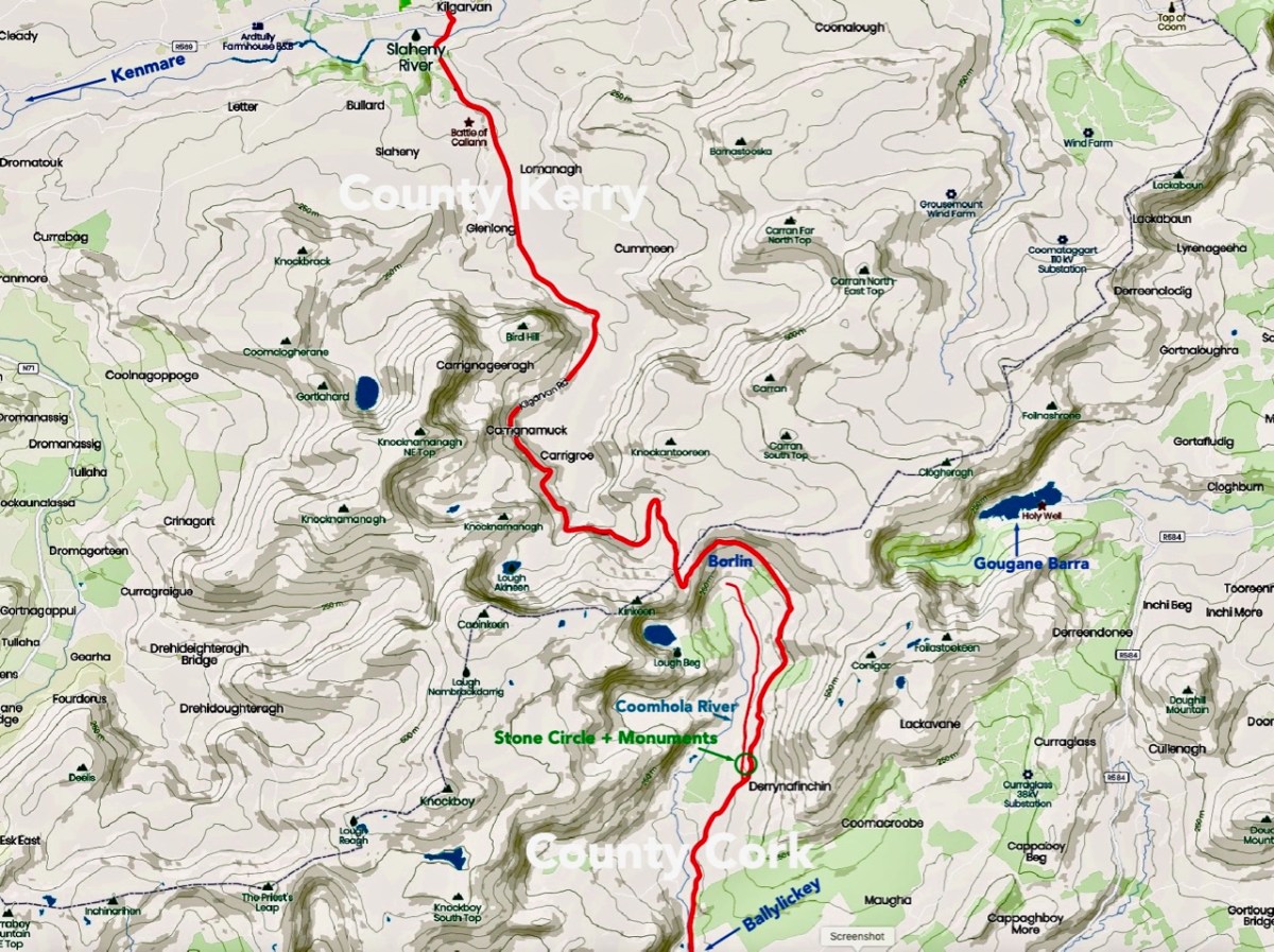
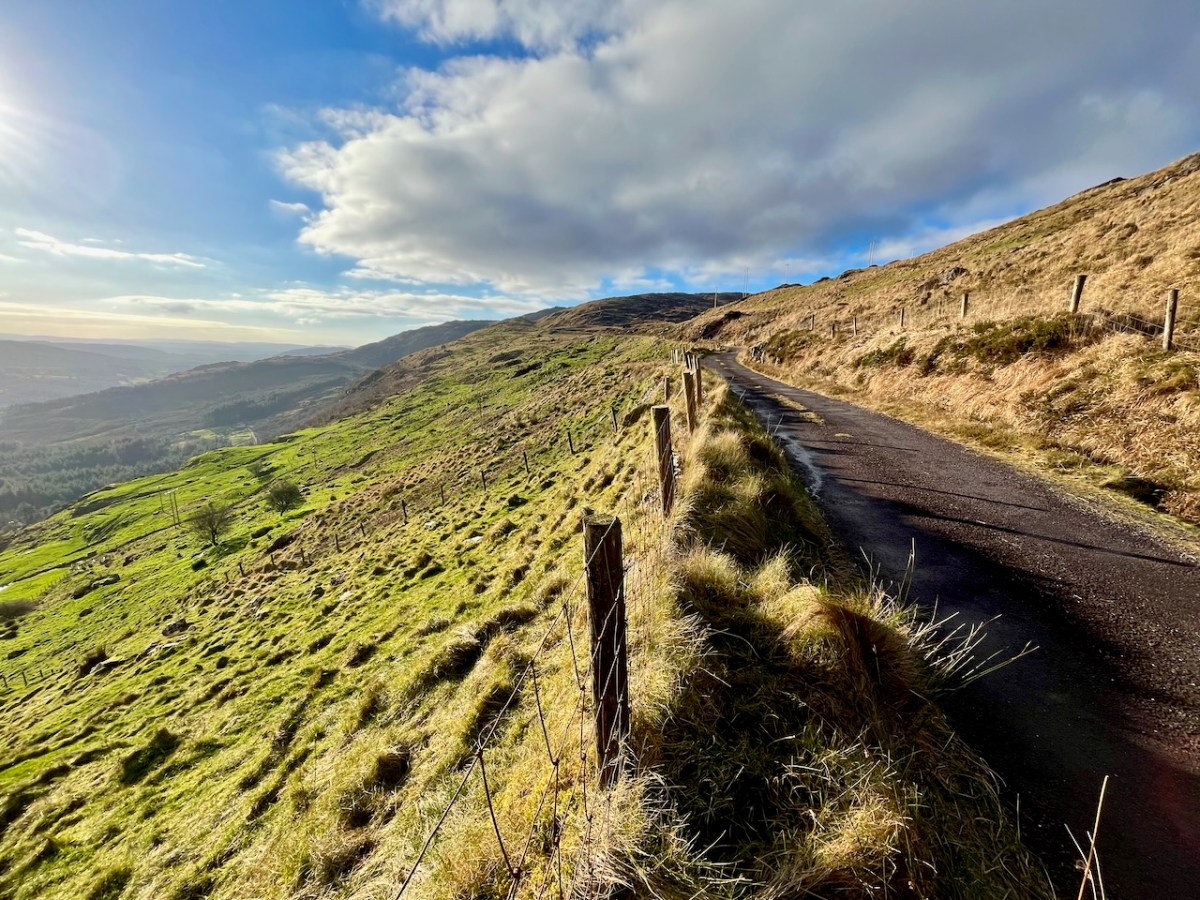
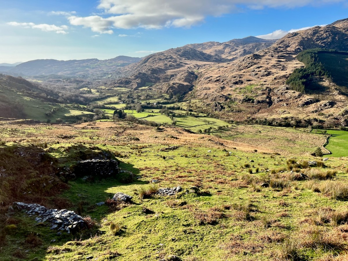
We have certainly travelled this route many times – it’s our favourite way of getting from Kenmare home to West Cork. Assuredly not a direct road, but spectacular – and you’ll hardly see a soul. Here’s a map – the road is in red:
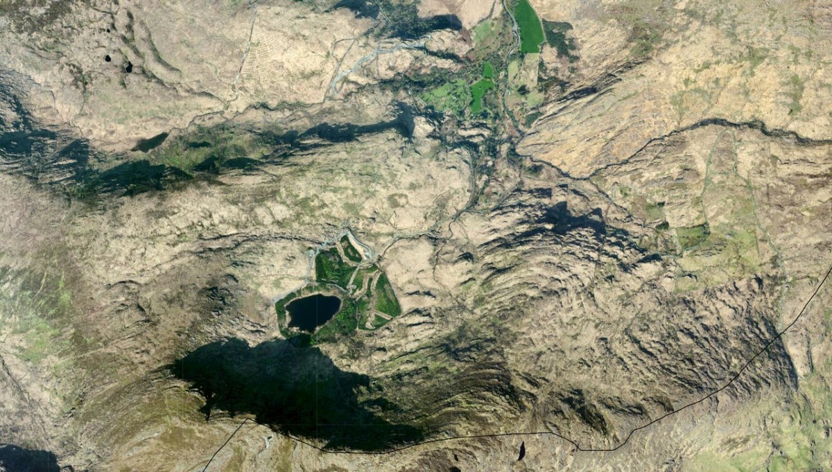
And here (below) – a sculptural abstract – is the nature of the terrain which the satellites spy on – looking straight down!
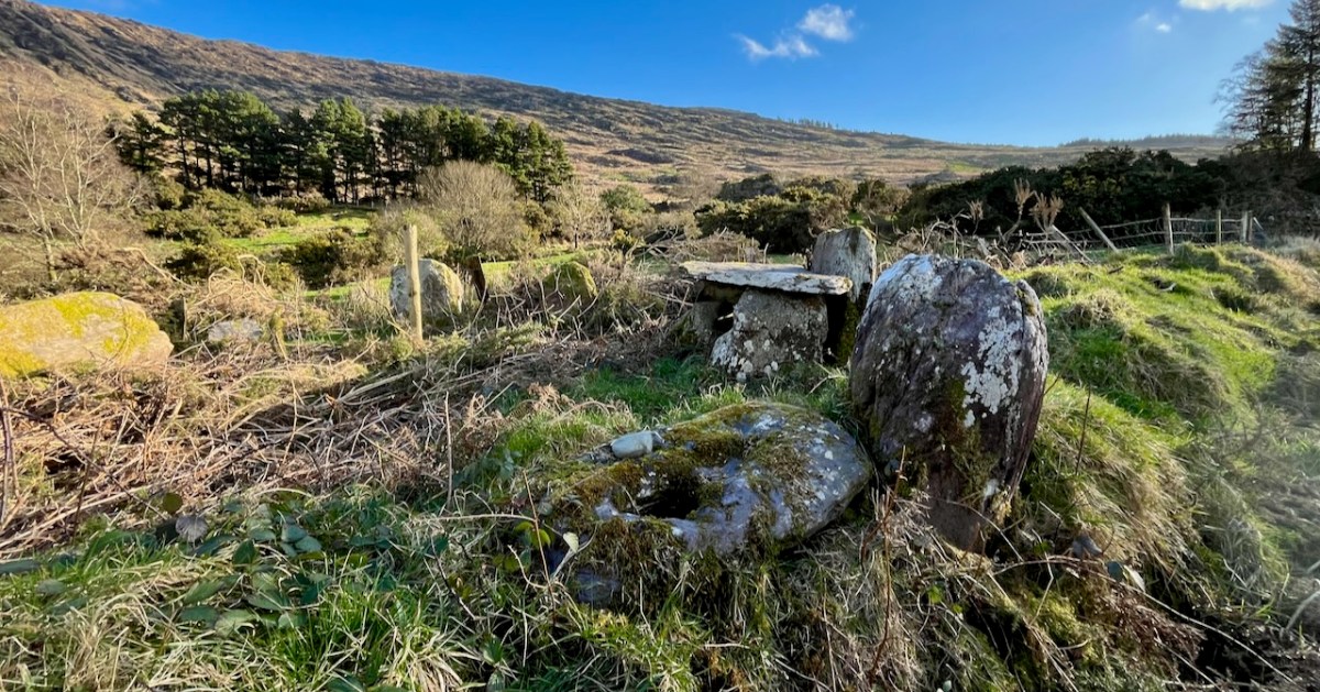
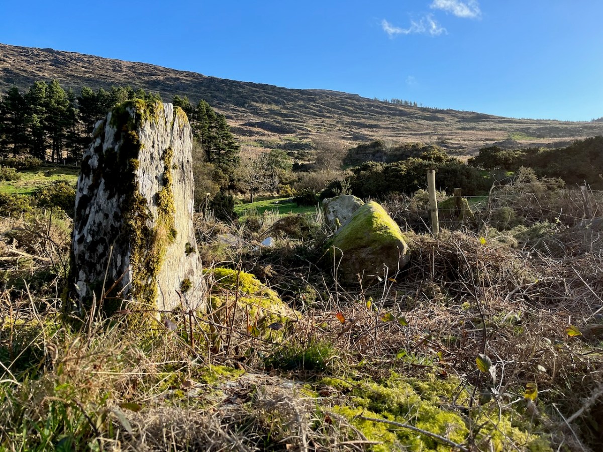
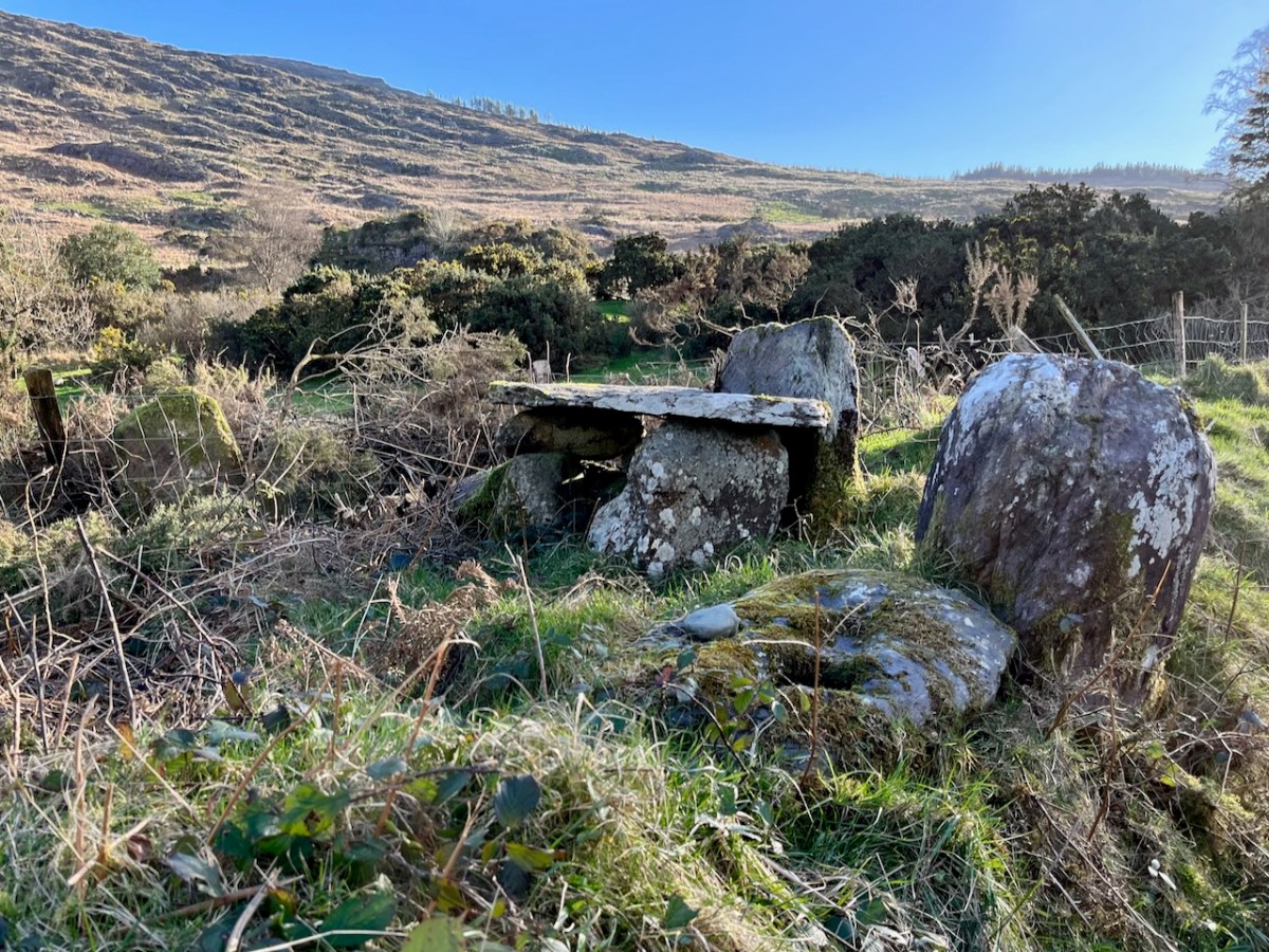
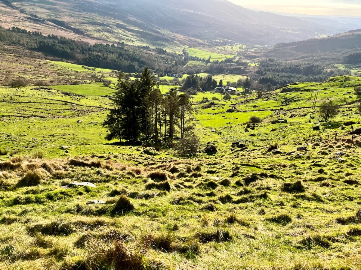
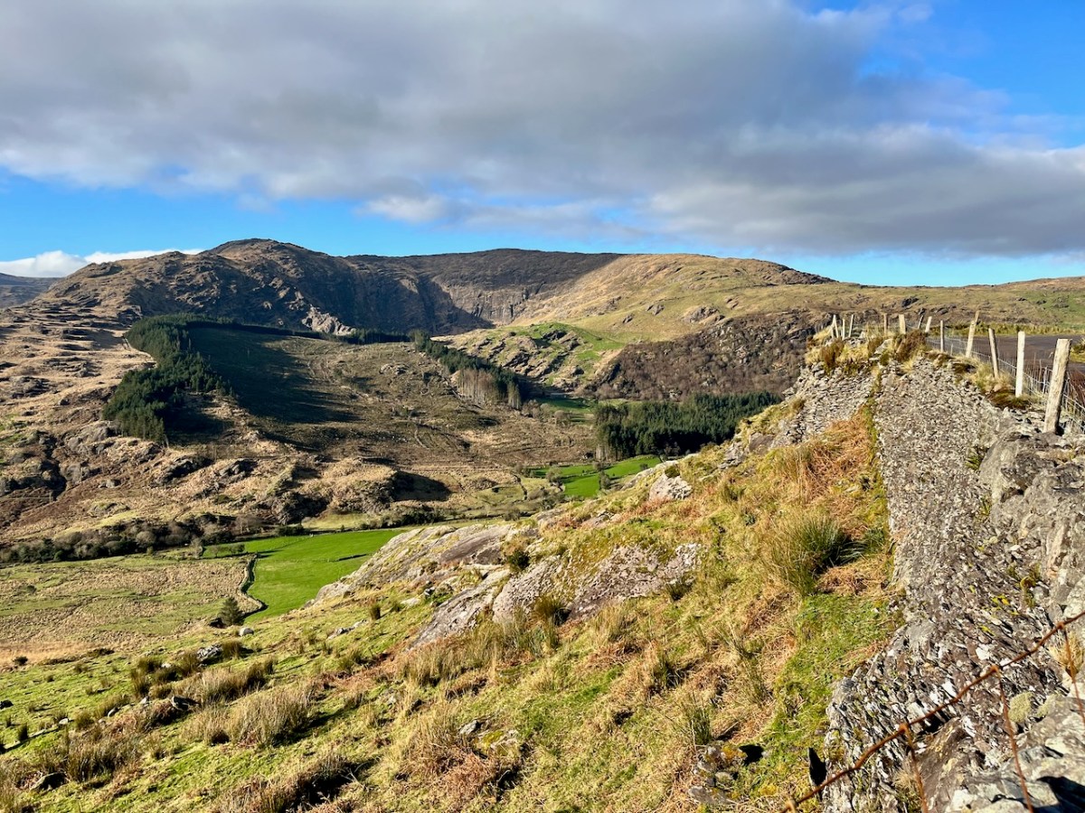
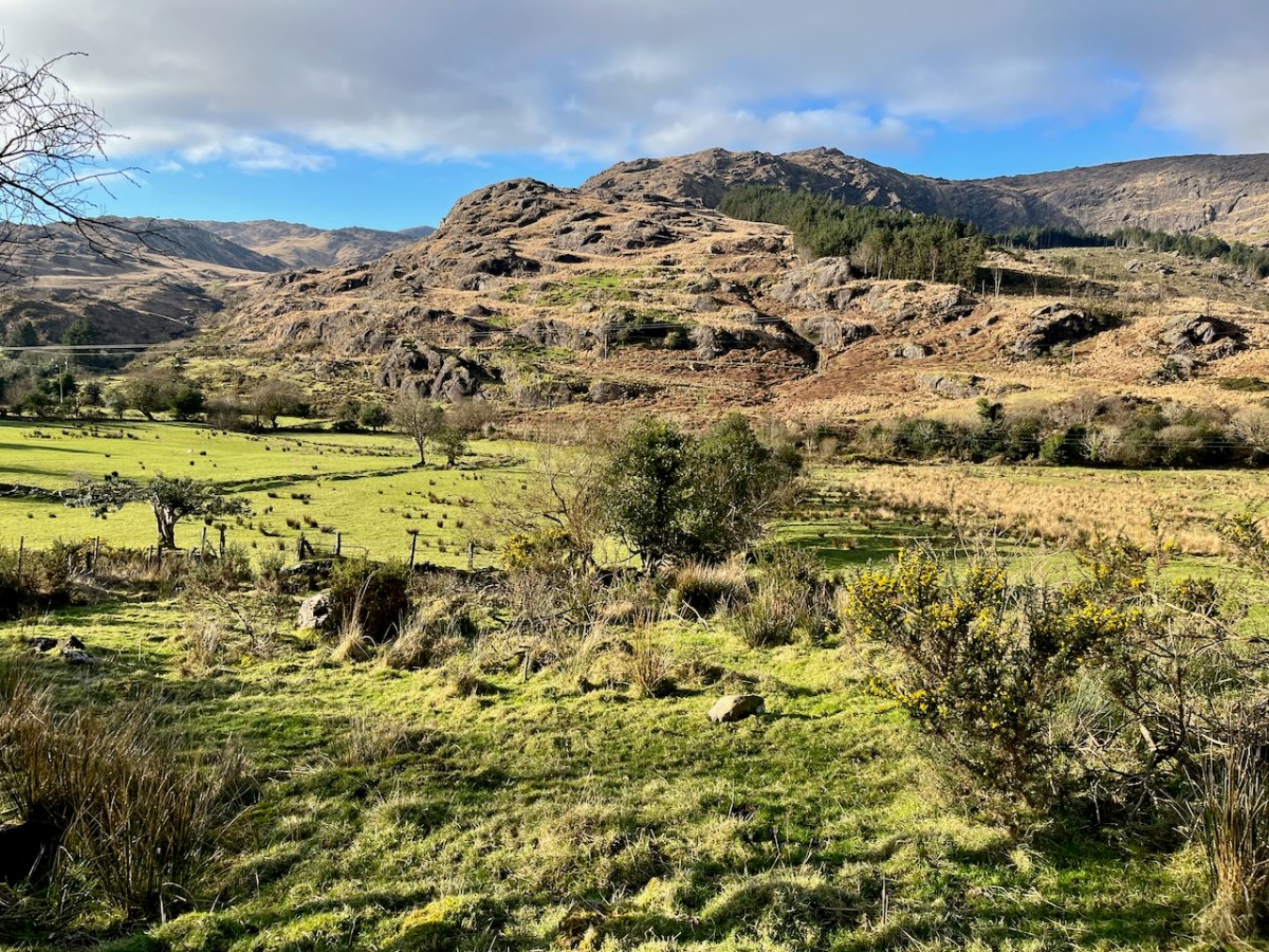
We passed over this high road that skirts the valley on an idyllic January day early in the new year (2024). For the first time, we also traversed the full length of the lane that goes into the heart of the vale, only serving scattered houses and farms. This goes by a complex stone circle and Mass Rock in the townland of Derrynafinchin – or Doire na Fuinseann. The group – also featured on the header – has been fully described by Amanda’s post Derrynafinchin: a bullaun, Mass rock & stone circle from a couple of years ago. Well worth a read!
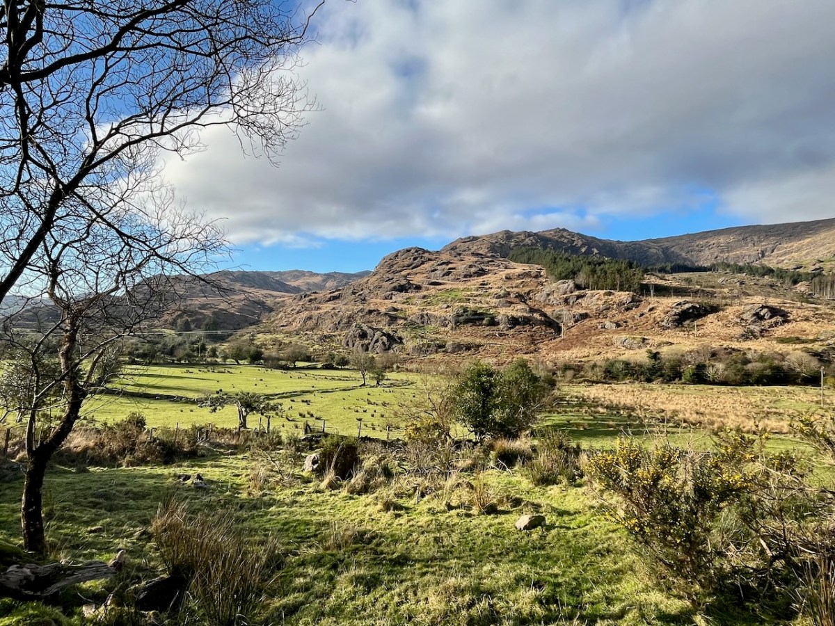
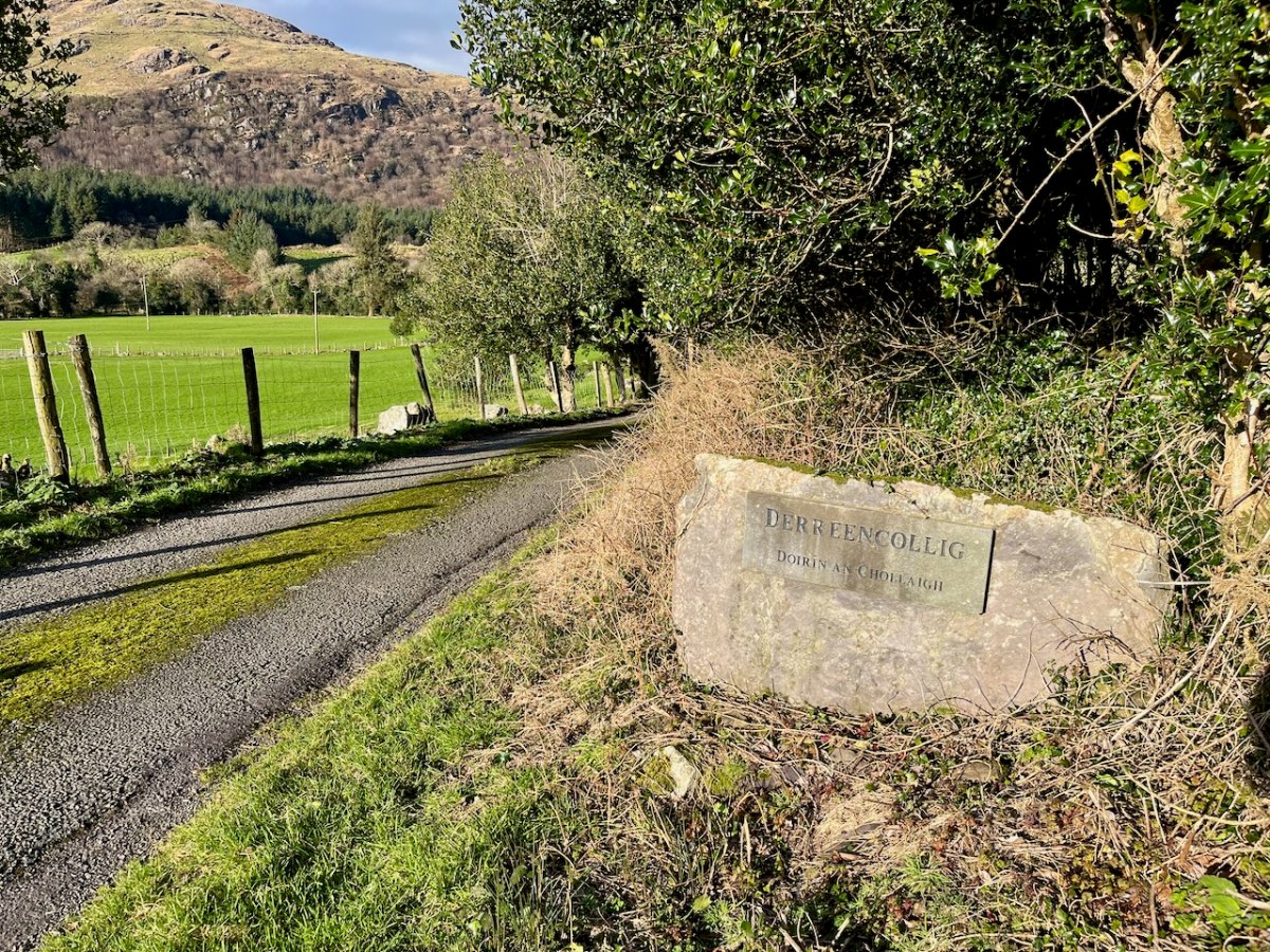
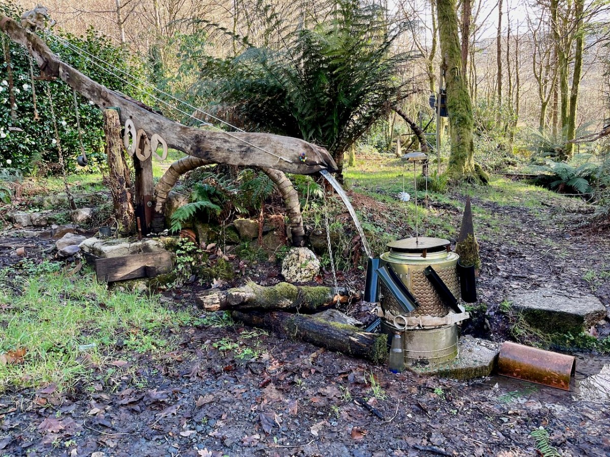
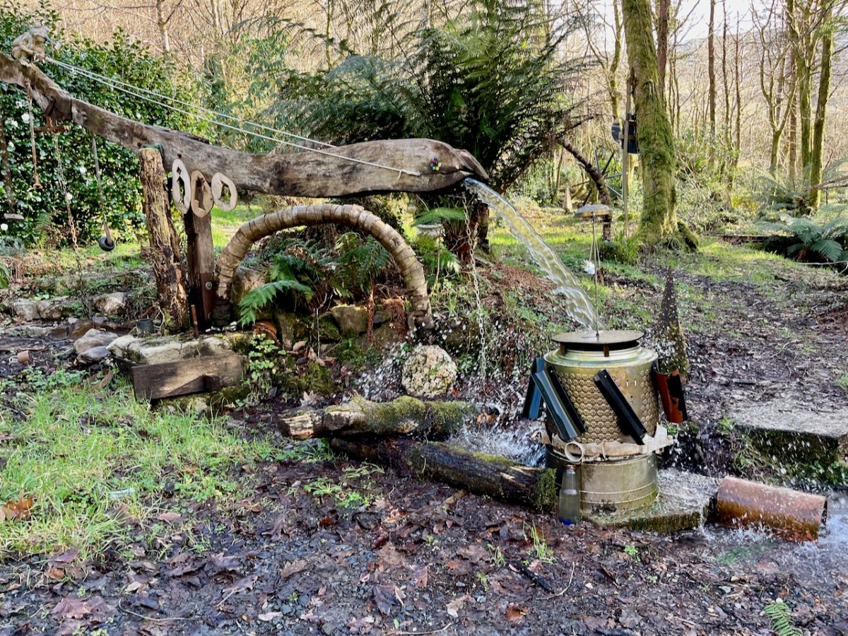
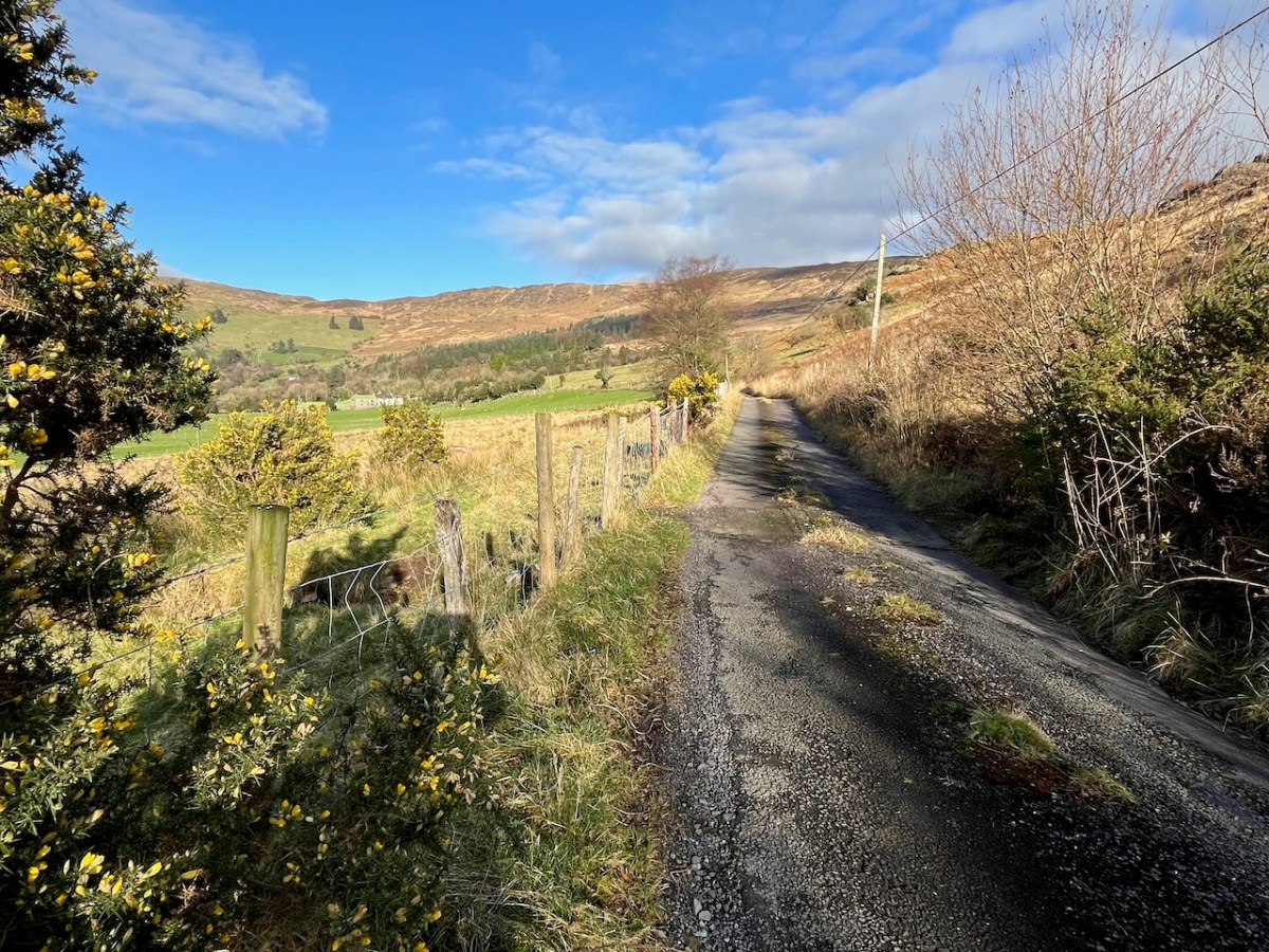
The little lane also passes into the townland of Derreencollig. We were intrigued by some kinetic sculptures we found beside the way: we did not come across the artist, nor anyone else on this part of the journey.
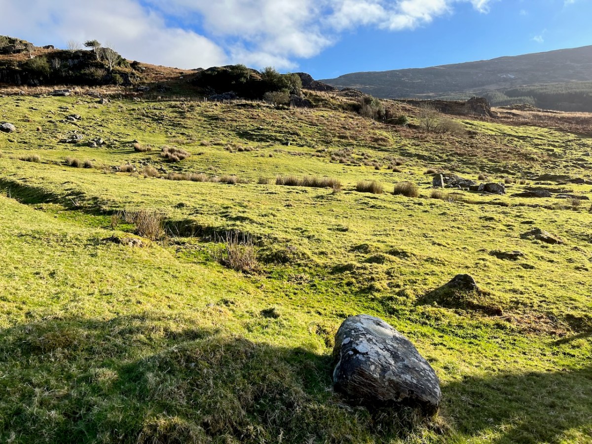
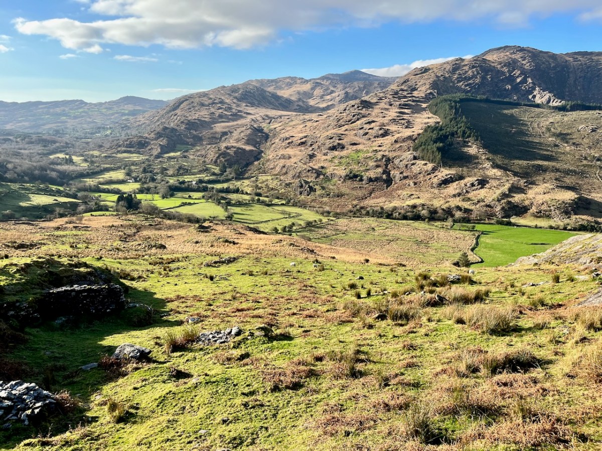
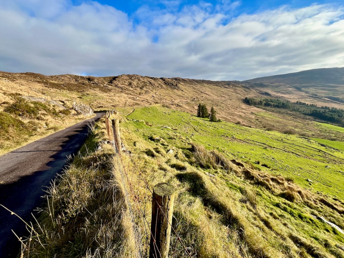
The views into this remote townland and its few habitations is seen from the minor road that follows the contour at high level, heading for Bantry.
If you find our minor roads tricky, then stick to the main ones. But, if you are not in a hurry, you couldn’t do better on a day of winter sunshine than to traverse the gentler, secret ways.
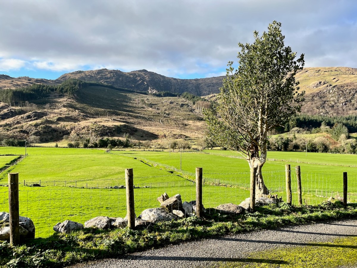
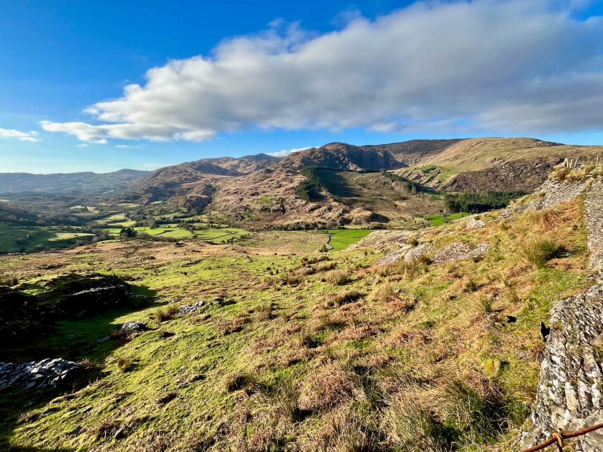
Description is hardly needed in this little topographical diversion. I’m not sure where else in the world you could find your senses as satiated as here in West Cork (and Kerry!). Travel on!
To my mind there’s no more satisfying way of journeying: keep to the crags and cornices of the high tracks.
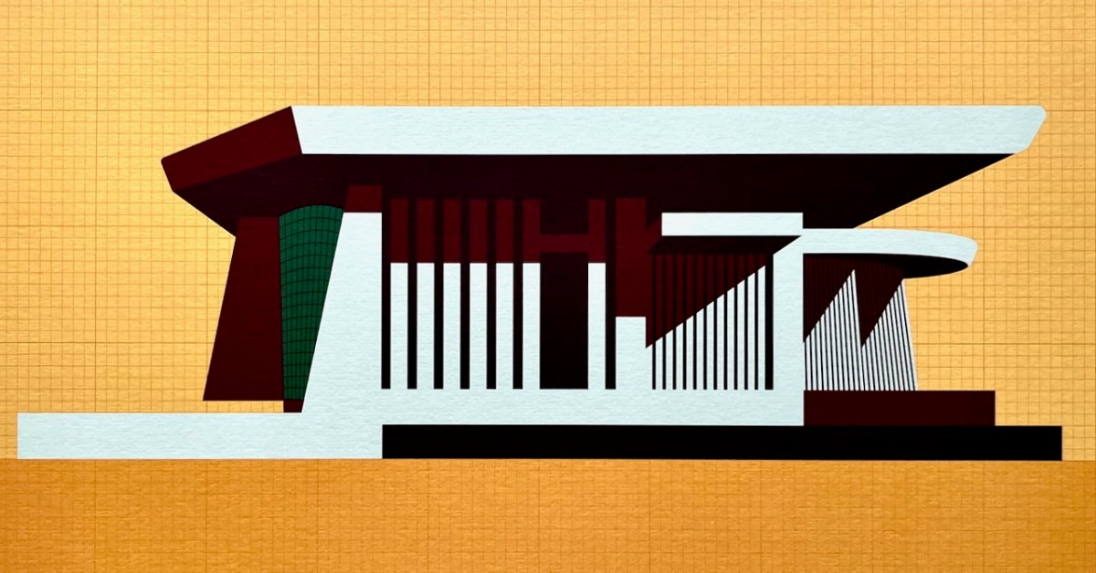
This is my favourite image of the year! I published a post about the architecture of Bantry Library, and it proved to be our most popular . . . This limited edition print, a collaboration between Dermot Harrington of Cook Architects and Robin Foley of Hurrah Hurrah is celebrating the upcoming 50th Anniversary of the completion of Bantry’s Library in 1974, and some refurbishment work is being undertaken for the occasion. For me, the print captures perfectly the iconic graphic of this most unorthodox design.
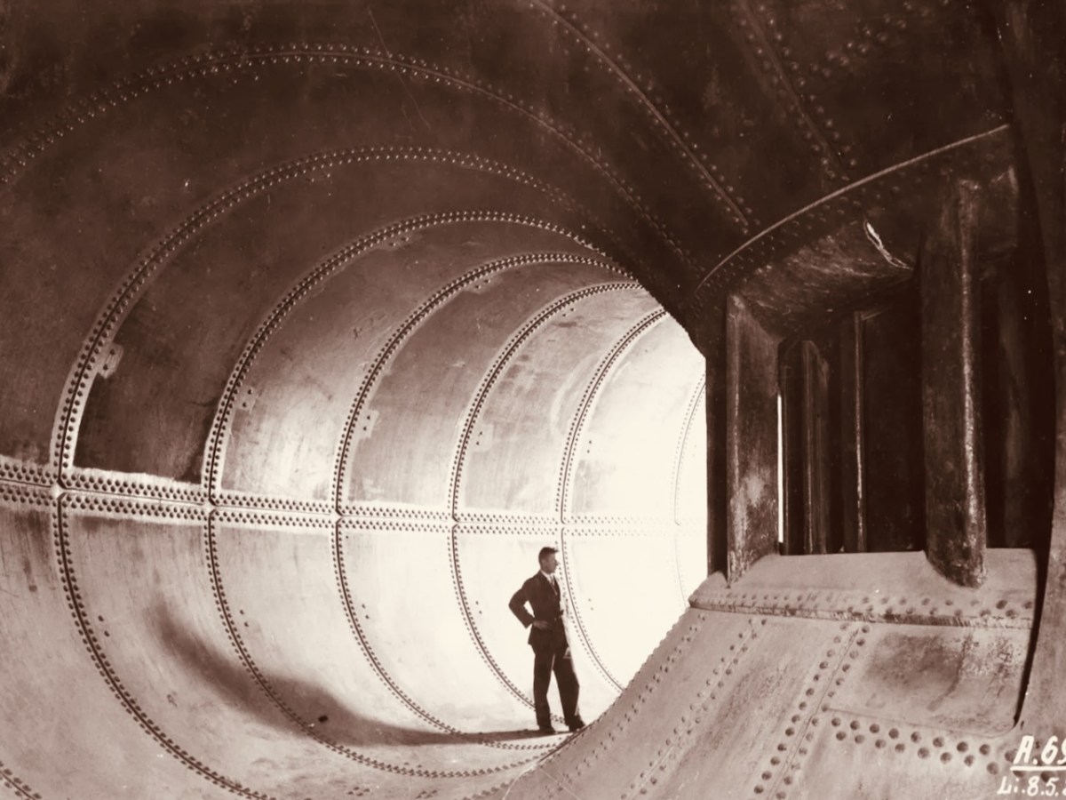
We both wrote 52 posts this year, each of around 1,000 words, and all fully illustrated. Above is a pic of one of the penstocks which brings the water into the turbine casings at Ardnacrusha Power Station (courtesy of ESB Archives). This incredible engineering feat – well ahead of its time – was constructed between 1925 and 1929, and was integral to the supply of electricity throughout Ireland’s young state by harnessing water power from The Shannon. West Cork benefitted from Rural Electrification, and I thoroughly enjoyed researching and writing a series of posts on the whole subject.
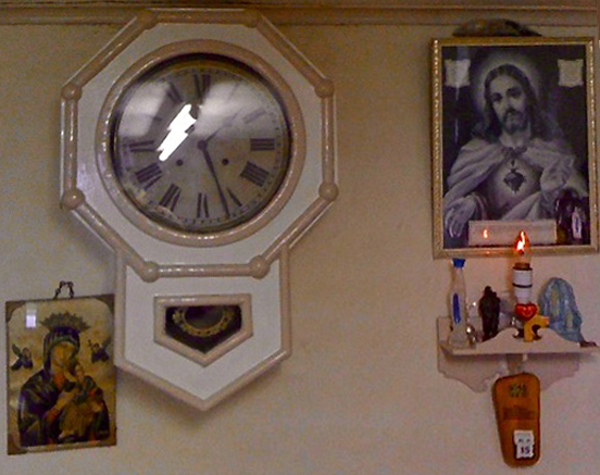
. . . Once a community was connected, or about to be connected, the ESB held public demonstrations of household appliances. These were then sold bringing electric irons, kettles, stoves to homes. The demonstration evening in Glenamaddy was held in January 1951. The handwritten report records that it took place “in the very fine Esker Ballroom”; these events were social occasions that brought communities together. The Glenamaddy evening “was attended by about 90, including 50 women. As is usual, the women appeared to be more keen than the men and more inclined to ask questions (and to argue). After the demonstration, a melodeon player turned up and an impromptu dance got under way” . . . Small towns and rural townlands became brighter and winters less harsh and Christmas more special as the fairy lights began to shine. It also gave rise to a rural Irish icon as every house had the Sacred Heart picture with the (electric) red lamp (below): many didn’t get a kettle and washing machine until later on . . .
Since 2018 our own Museum in Ballydehob has been showing exhibitions of the work of locally based artists. This year it was the turn of the Verlings – John and Noelle. John died, sadly, in 2009; Noelle is still alive and kicking and assisted Brian Lalor and myself in assembling an excellent collection of the work of these two creative residents of our village, assisted technically and ably by Stephen Canty. BAM is a really valuable resource in setting out the unique history of the artistic community here in West Cork from the 1950s onwards.
A wonderful photograph (courtesy Geoff Greenham with many thanks) of St Bridget’s Catholic Church in Ballydehob. The interior was reordered by John Verling.
. . . The gold fish hand drawn in the background of the altar and the depiction of one fish swimming against the shoal continues to evoke admiration from locals and visitors alike. He also designed the two ‘windswept thorn’ stained glass windows and etched the brass surround of the tabernacle. The Altar slab, composed of a vast monolith like the capstone of a dolmen, is a distinguished piece of sculpture and a tribute to his imaginative capacity . . .
. . . AS an inspector from the aeronautical section of the Department of Transport and Power arrived in Ballydehob to begin an investigation into Saturday night’s plane crash off the Cork coast, it was learned last night that the pilot of the Piper Cherokee almost lost his life in his efforts to save the other three men on board. Michael Murphy (23), of Mercier Park, Curragh Road, Cork, who was sitting next to the pilot, Eric Hutchins of Ballinlough, Cork, said that Mr Hutchins was concentrating so much on getting the plane down that he was knocked unconscious at impact. Mr Murphy, together with Noel O’Halloran, of St Luke’s, Cork, and James McGarry, of Monkstown, Co Cork, had been braced for the crash and scrambled free on to the wing. But then they found that they could not get out Mr Hutchins who was unconscious. Mr O’Halloran then went back into the rapidly sinking plane and between them they pulled Mr Hutchins free and threw him into the water. The three men then swam ashore taking 40 minutes to reach land at Fylemuck, as they had to support the injured man all the way . . .
IRISH PRESS, MONDAY 24 SEPTEMBER 1973
All four crew and passengers on the plane survived the ditching, but the aircraft itself (a photo taken in its good days, above) was a write-off. Those living locally who remembered the event gathered to mark it in Schull, on the anniversary.
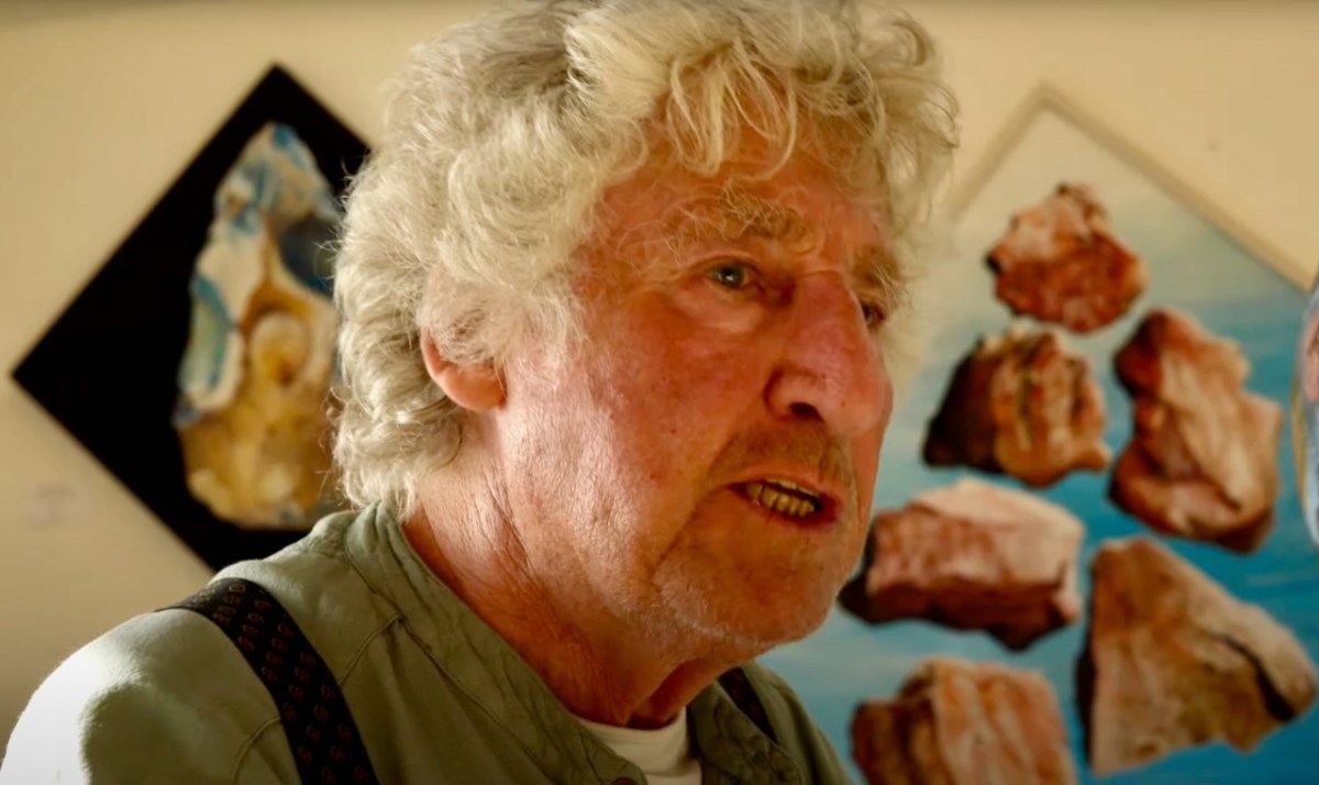
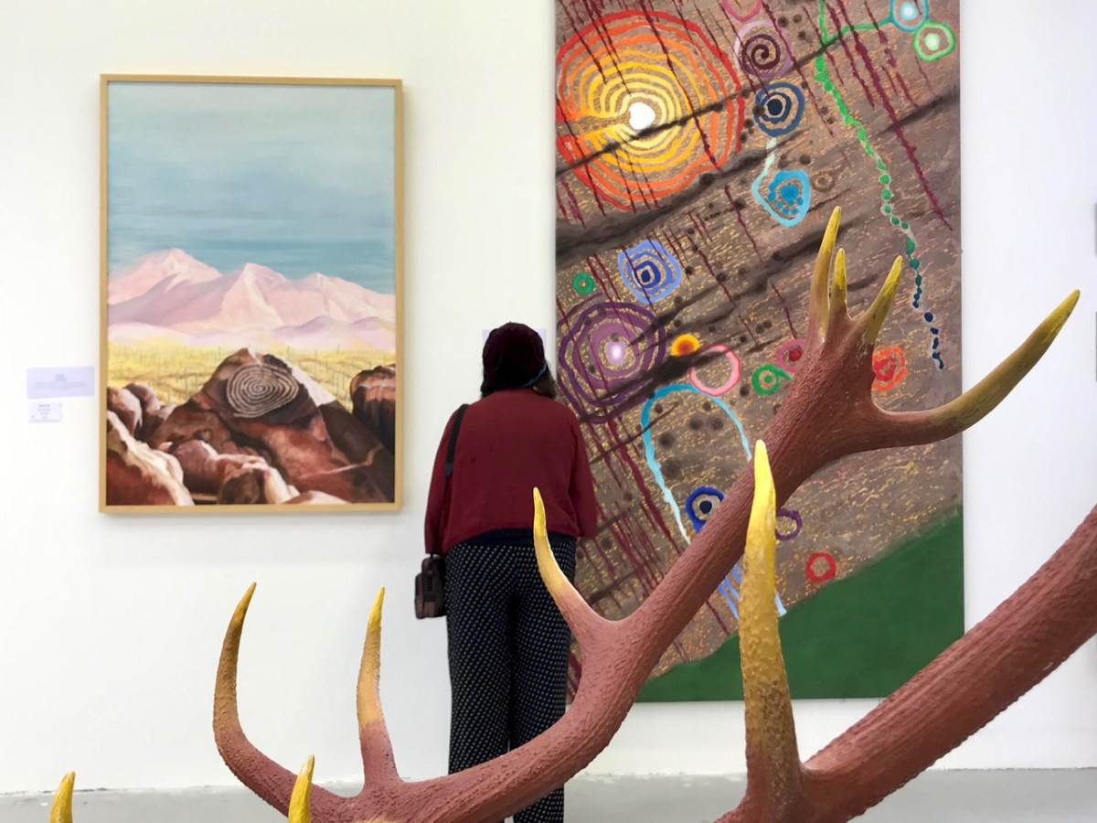
That’s Keith Payne, above. He’s one of the many artists who has lived in West Cork for a significant part of his life – at Leamcon, and he was deservedly given an exhibition in The Blue House Gallery, Schull, in September this year. He has always been fascinated by ‘early markings’, including Rock Art: he contributed dramatically to our own Rock Art exhibition at The Public Museum, Cork, in 2015.
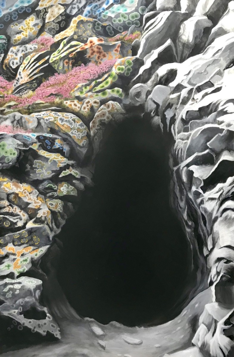
That’s a spectacular large canvas by Keith inspired by Rock Art at Derreenaclogh, West Cork (on the right, above). It’s from an earlier exhibition by Keith in County Clare in 2018, at the Burren College of Art Gallery in Ballyvaughan, Co Clare. The work below is titled Cave Entrance.
Throughout the year I continued to publish posts on some of my favourite subjects: Irish signs, advertising and curiosities. I’m always avidly collecting these, and will have some to show in 2024, for sure. In the meantime, let’s hope our general news becomes more positive as we move forward in this disorienting world of ours . . . Have a good new year, everyone!
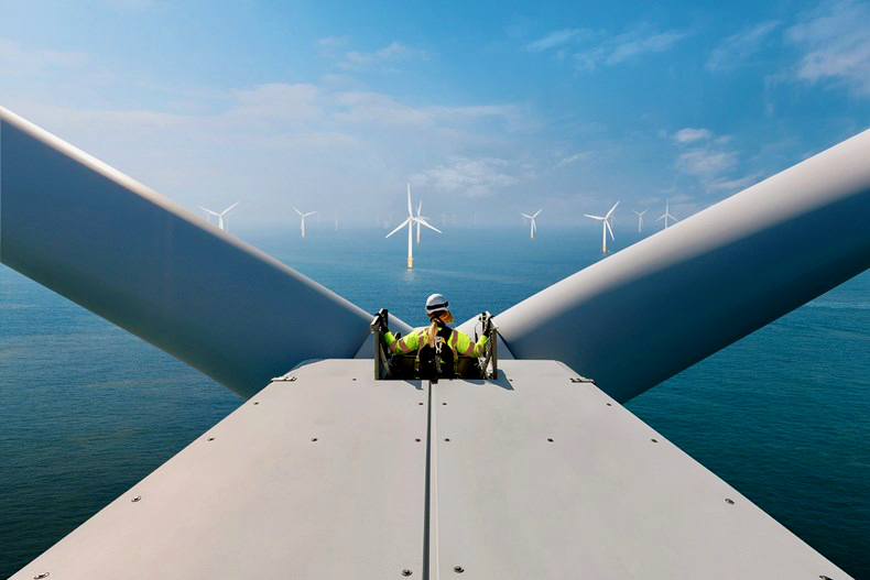
And here’s a little PS . . . Way back in January, before I had the idea to write about Rural Electrification in Ireland historically, I penned a post about how I saw Ireland very much at the forefront of harnessing wind power – all at sea. Here it is!
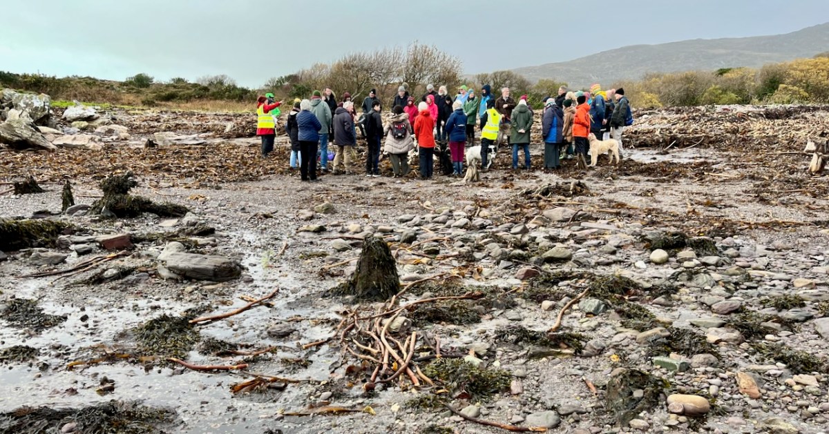
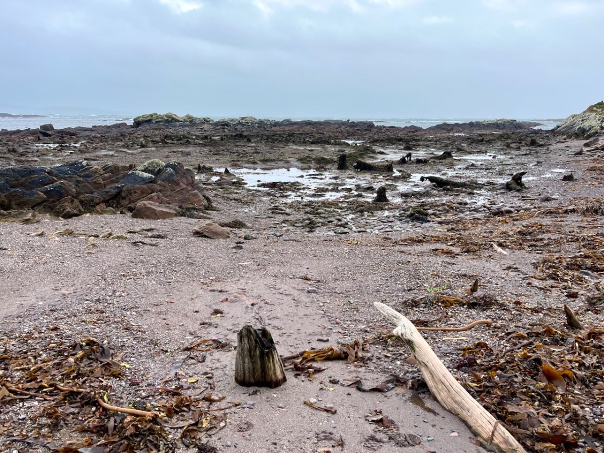
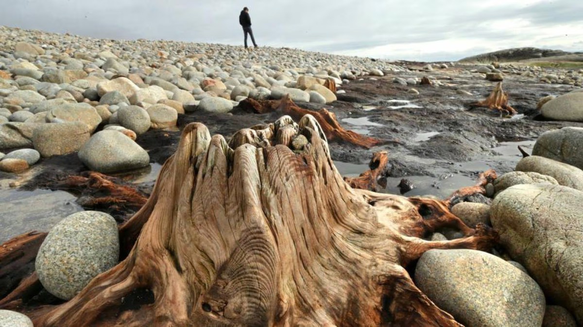
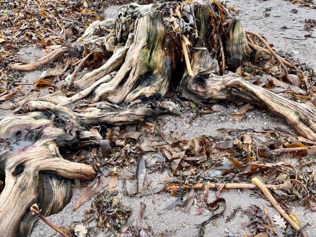
‘Drowned Landscapes’ – that’s an adequate enough description for us to look again at a subject which RWJ covered five years ago in this post: Tralong Bay, Co Cork – give it a read. I was reminded of the subject when we took part in an Archaeology Festival based in West Kerry just a week ago: Amanda’s current holy well blog describes the expeditions. One of the sites visited was Bunaneer Drowned Forest, where we saw stumps of trees on the beach there which were alive thousands of years ago. At low tide many tree remains become visible at Bunaneer, near Castlecove village on the south coast of Kerry’s Iveragh Peninsula. Our guides for this expedition were plant biologist Calum Sweeney and archaeologist Aoibheann Lambe.
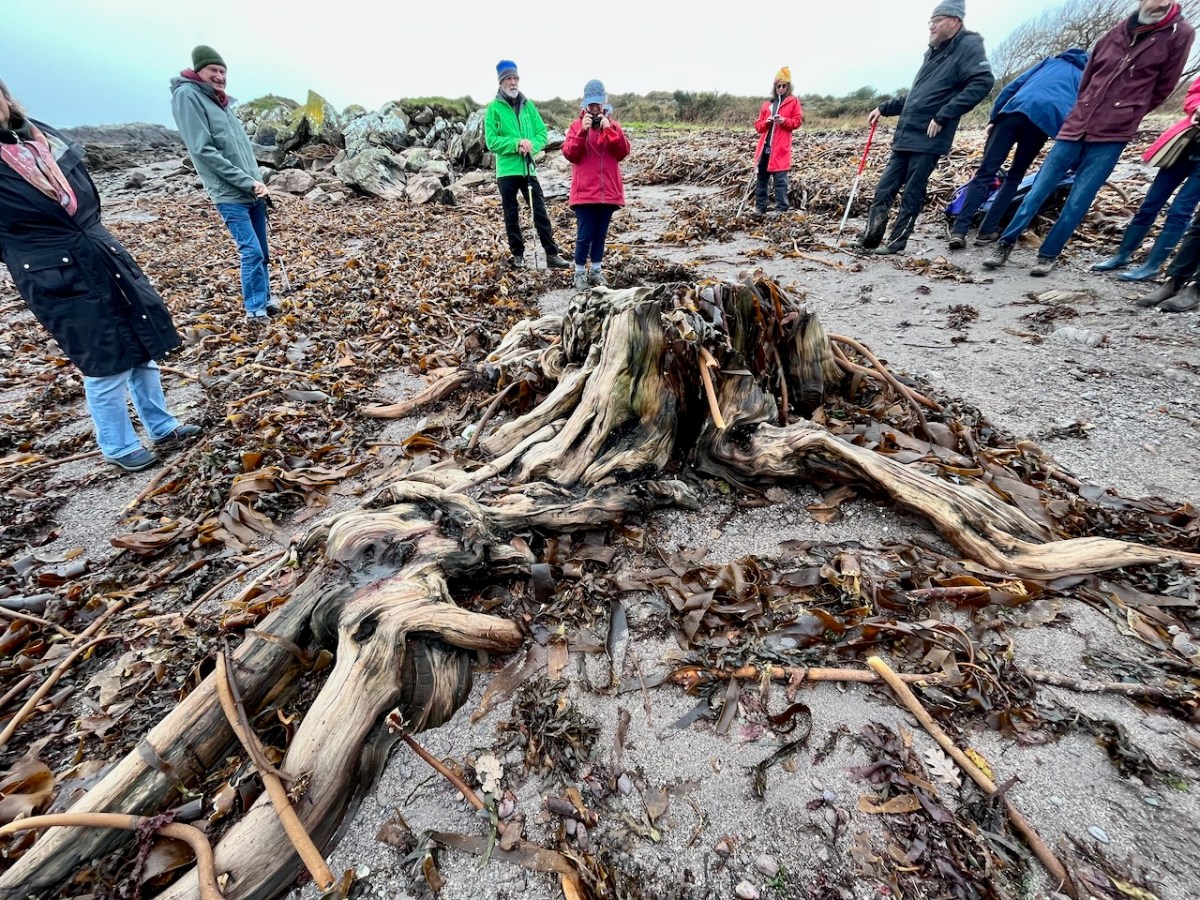
This large jumble of roots (above) is known as Goliath. All the remains here can be seen at regular low tides: at other similar sites elsewhere in Ireland, remains of ancient tree boles and roots are only revealed when tides are exceptionally low. I find it remarkable to be able to see and readily touch these archaic pieces of timber: we are communing with distant history!
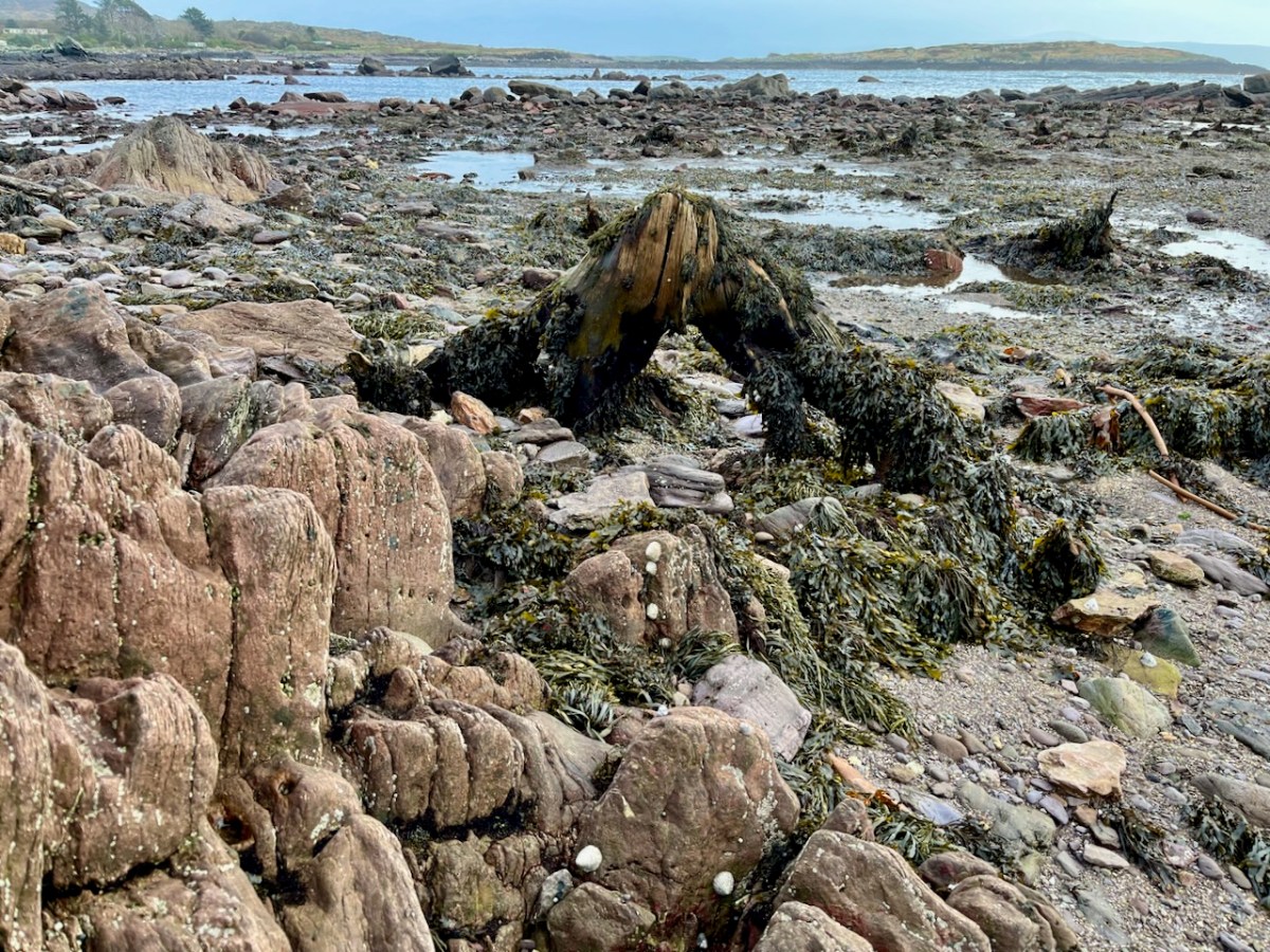
Carbon dating has shown that these remains were alive between three and a half and five millennia ago. This is evidence that sea levels were significantly lower then, and that the shore line was further out – perhaps 50 metres from where we see it today. We are constantly – and quite rightly – being warned about rising sea levels resulting from our changing climate in the long term: here we see clear verification that it’s a continuing – and now apparently accelerating – process.
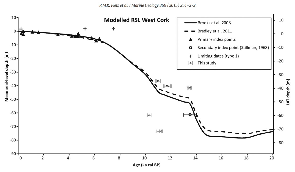
Our friends Robin and Sue Lewando were also on this expedition. Robin has a particular interest in sea-level changes in the Late Quaternary and subsequent eras, and he pointed me to a 2015 paper which explores the subject specifically in the Bantry Bay area of West Cork. That’s a good place to be looking at ancient history: remember the story of Cessair – Noah’s daughter-in-law – who came ashore at Donemark? You first read about it here! So this is a scientific diagram which sets out how sea-levels have been changing over time in our locality:
It’s an interesting comparison to take our horizons wider in our study of changing sea levels across the islands of Ireland. Over on the east coast – north of Bray, Co Wicklow – there is another substantial area where tree remains have been revealed at certain tidal conditions.
Above are the areas of beach between Bray and Killiney where ‘drowned forest’ remains have been observed. While at Youghal, Co Cork, further finds have occured:
This example catches our interest because the name of the settlement – Youghal – is derived from the Irish word ‘Eochaill’ meaning ‘Yew Woods’: they were evidently once common in the area, leading us to wonder whether the tree remains in this instance are of yew. In 2014 the following account of another ‘ancient drowned forest’ discovery appeared in the Irish Times (photograph courtesy of Joe O’Shaughnessy):
. . . Walking out on to the shoreline at low tide, geologist Prof Mike Williams points to the oak, pine and birch stumps and extensive root systems which were once part of woodlands populated by people, wolves and bears. These woodlands extended out into lagoons and marshlands that pre-dated the formation of Galway bay, Prof Williams says.
An extensive layer of peat also exposed at low tide in the same location in Spiddal was formed by organic debris which once carpeted the forest floor. The stumps at Spiddal are surrounded by root systems which are largely undisturbed. The carpet of peat is covered in strands of a reed called phragmites, which can tolerate semi- saline or brackish conditions.
“These trees are in their original growth position and hadn’t keeled over, which would suggest that they died quite quickly, perhaps in a quite rapid sea level rise,” Prof Williams adds. Up until 5,000 years ago Ireland experienced a series of rapid sea level rises, he says. During the mid-Holocene period, oak and pine forests were flooded along the western seaboard and recycled into peat deposits of up to two metres thick, which were then covered by sand.
Prof Williams estimates that sea level would have been at least five metres lower than present when the forests thrived, and traces of marine shell 50cm below the peat surface suggest the forest floor was affected by very occasional extreme wave events such as storm surges or tsunamis. He says most west coast sand-dune systems date to a “levelling” off period in sea level change about 5,000 years ago. Dunes in Doolin, Co Clare, are older still, having first formed around 6,500 years ago.
Prof Williams has located tree stumps in south Mayo and Clare, along with Galway, which have been carbon dated to between 5,200 and 7,400 years ago at the chrono centre at Queen’s University, Belfast. Some of the trees were nearly 100 years old when they perished . . .
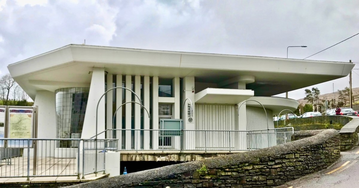
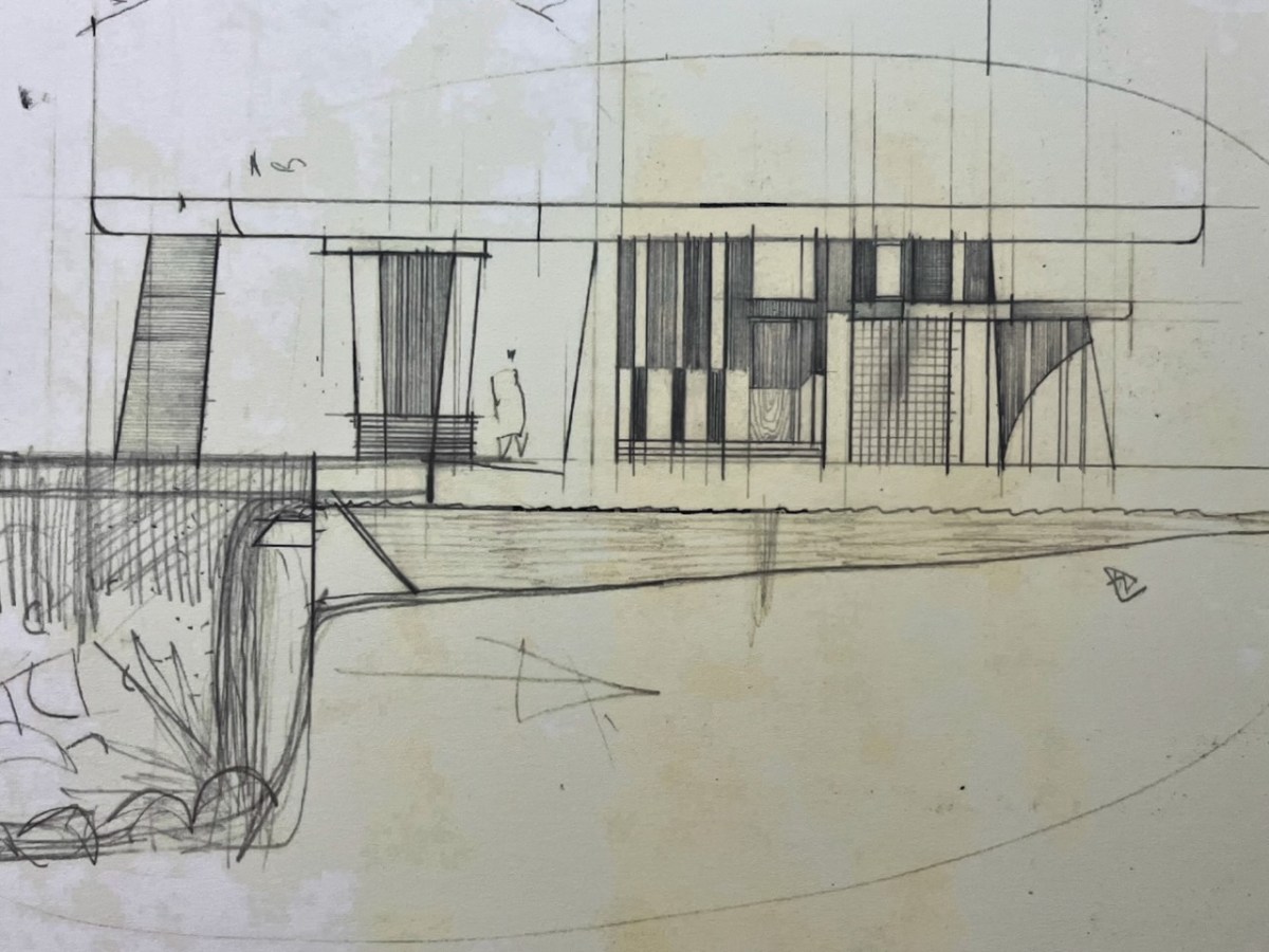
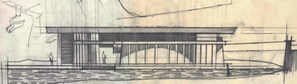
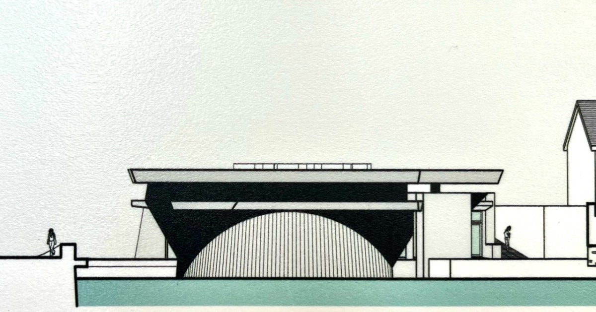
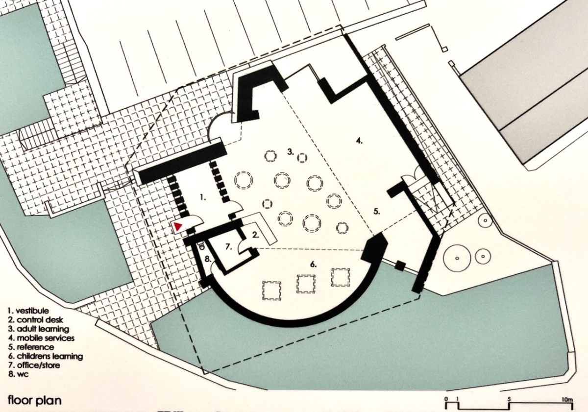
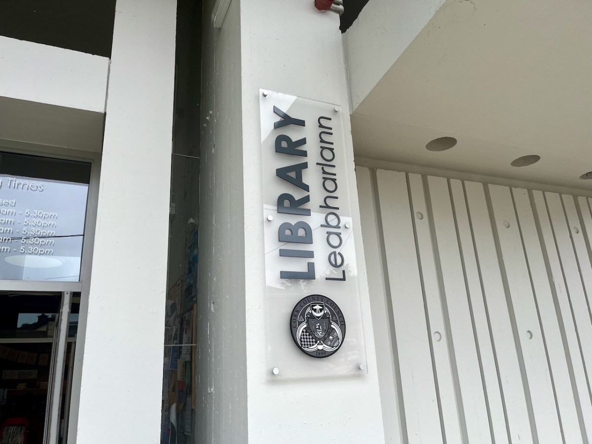
In last week’s post I described a unique type of boat that was connected with Bantry, here in West Cork. Today we are also focussed on Bantry, but this time on architecture: the Public Library, which is one of the most unusual and innovative buildings from twentieth century Ireland.
Here is the building as we see it today. The header is a limited edition print, a collaboration between Dermot Harrington of Cook Architects and Robin Foley of Hurrah Hurrah celebrating the upcoming 50th Anniversary of the completion of Bantry Library in 1974. For me, the print captures perfectly the iconic graphic of this most unorthodox design.
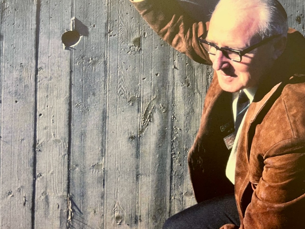
The Library was conceived by Patrick McSweeney (above) – Cork County Architect between 1953 and 1975. He deserves a post of his own one day, as he was responsible for some outstanding buildings in the county. Two of his assistants in the Architect’s Department at the time were Brian Lalor and John Verling. Both had a hand in the genesis of the Library. Interestingly for us, McSweeney, Lalor and Verling were all living around Ballydehob in those days – it was a swinging village!
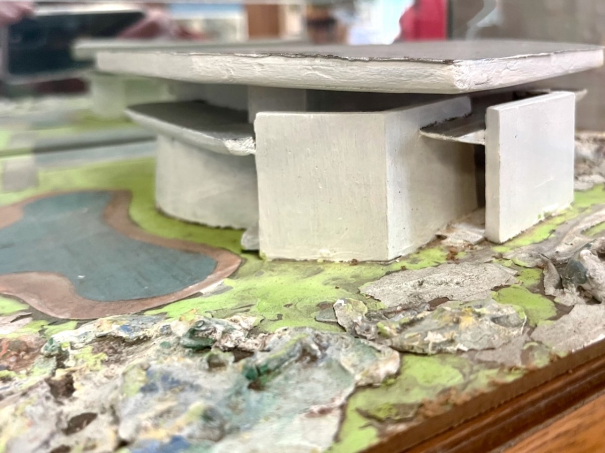
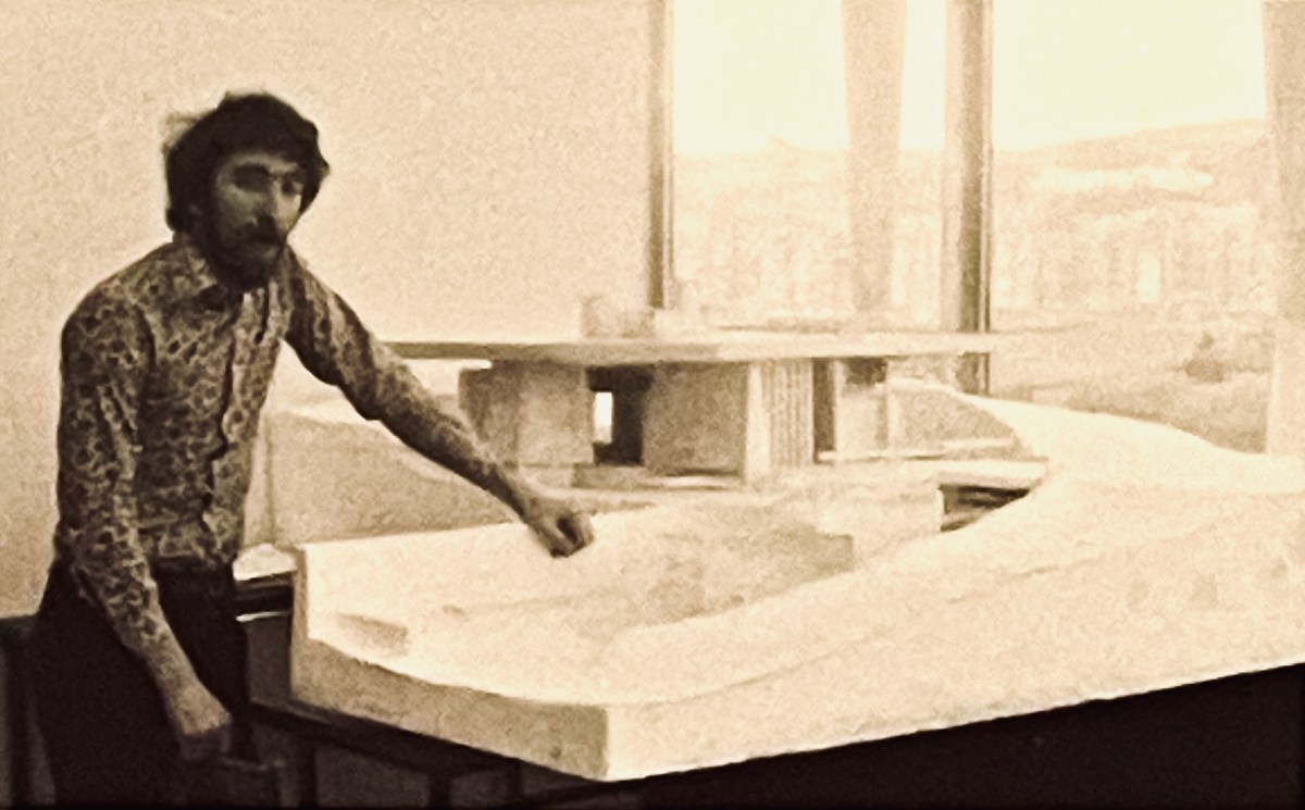
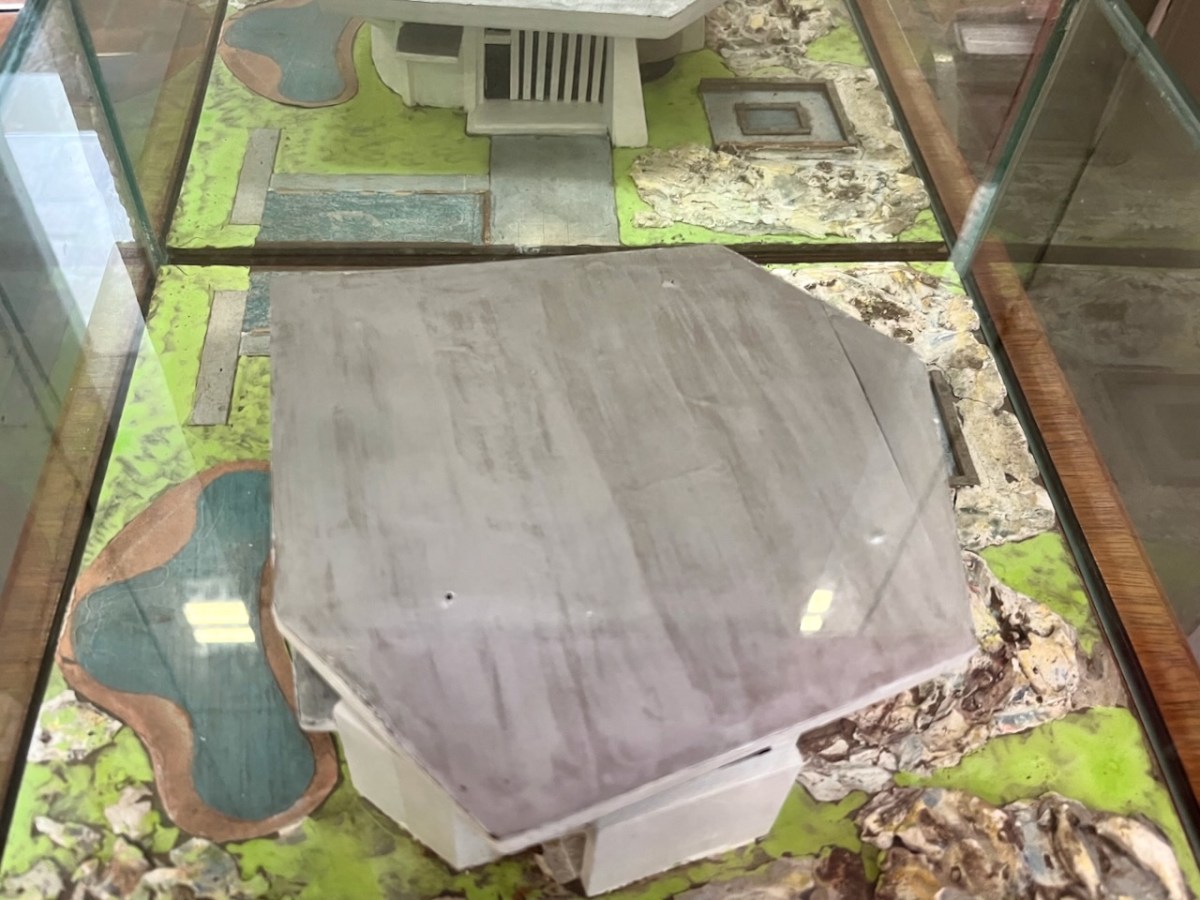
In the era before computers were universal in architects’ offices, everything was drawn by hand – or modelled. Brian recalls that Pat (McSweeney) called him into the office one day, handed him cardboard, tape and scissors, and instructed him to make a model of a building shaped like a Bronze Age dolmen. And he wanted it made in a hurry! It could well have been the one shown above – which still exists. Remarkably, although this model was made in the early 1960s, the building that resulted in the 1970s was very similar in form. Later, John Verling produced a balsa-wood model upon which the design production drawings were based:
That’s John Verling, above, with his model. He and his wife, Noelle, are the subjects of the current exhibition in the Ballydehob Arts Museum (click the link). Following are some of the design sketches carried out by Harry Wallace who was leading the team in County Hall, and detailed drawings of the building that eventually ensued.
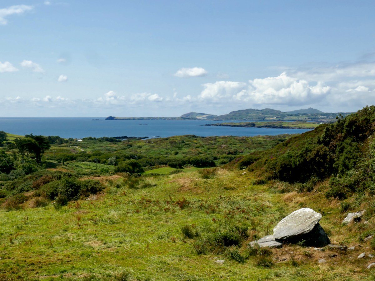
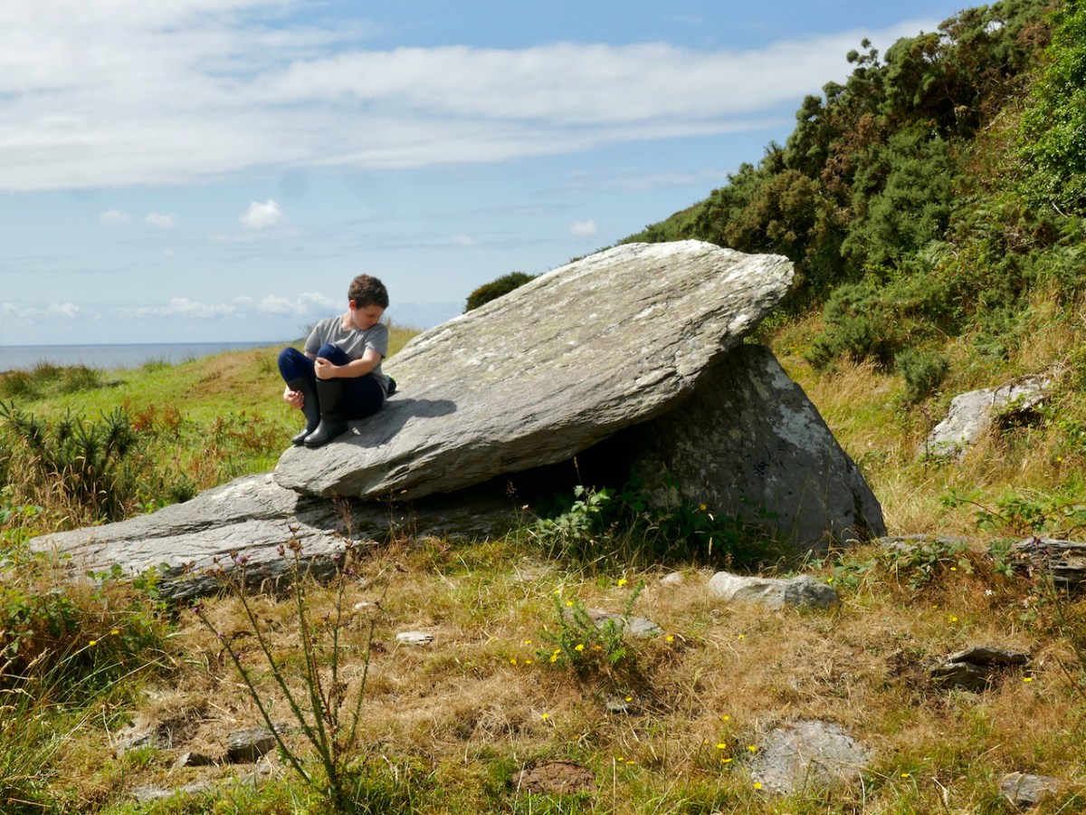
Let’s look a bit further at the early concept work, especially that first model. It’s said that McSweeney was inspired by a ‘Dolmen’. In fact we would today call that type of early megalithic structure a ‘Wedge Tomb’ or a ‘Portal Tomb’. At its simplest, this is a large flat stone slab (or slabs) supported on vertical stone slabs: it was probably a burial chamber, perhaps with its opening facing the sunset at a particular solar event. The closest such tomb structure to Ballydehob is the one featured in Finola’s post today. I wonder if Pat McSweeney was aware of this local one? He would have certainly been aware of the striking example at Altar, further west on the Mizen Pensinsula.
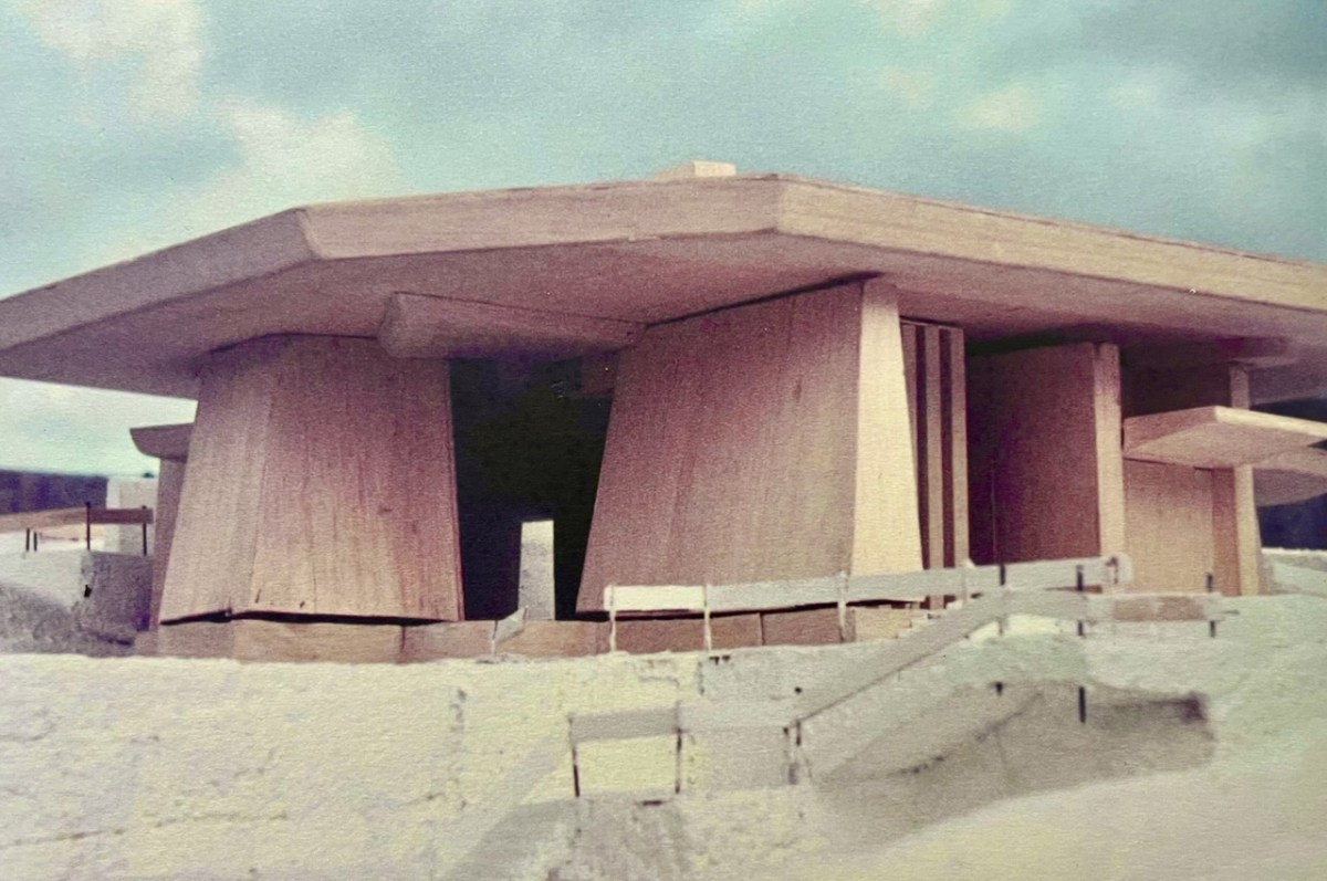
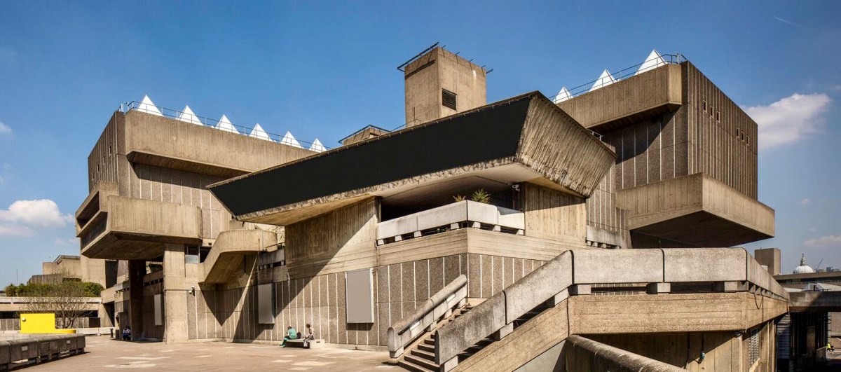
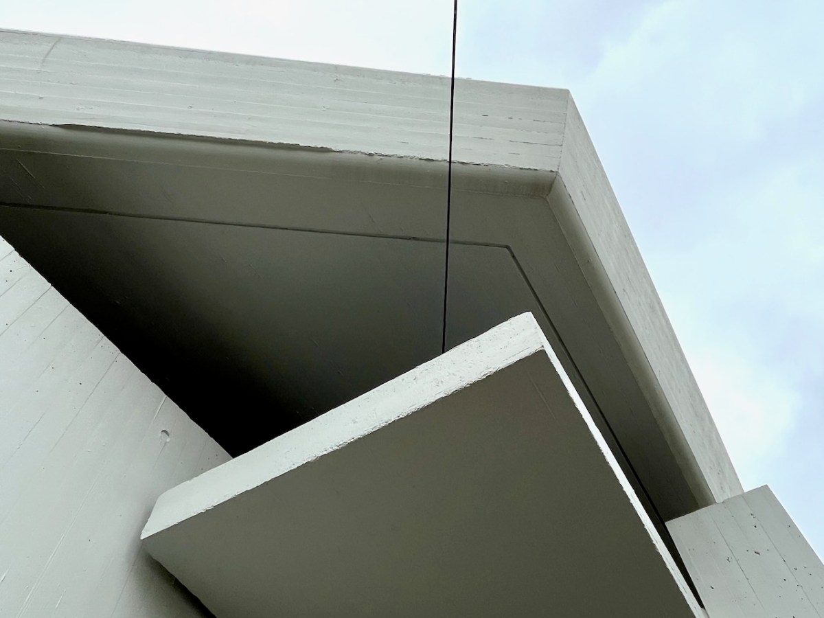
Returning to the twentieth century, and the Bantry Library project, construction posed many problems, using techniques which might have been considered at the leading edge of architecture in its time and place. Across the sea similar experiments were taking place. I was at the centre of them! I completed my architectural education in the late 1960s and went to work for the Greater London Council. I saw going up around me on the South Bank of the Thames a development which included the Hayward Gallery (below): its design (described as ‘brutalist’), earned it the nomination of the ugliest building in Britain when it opened!
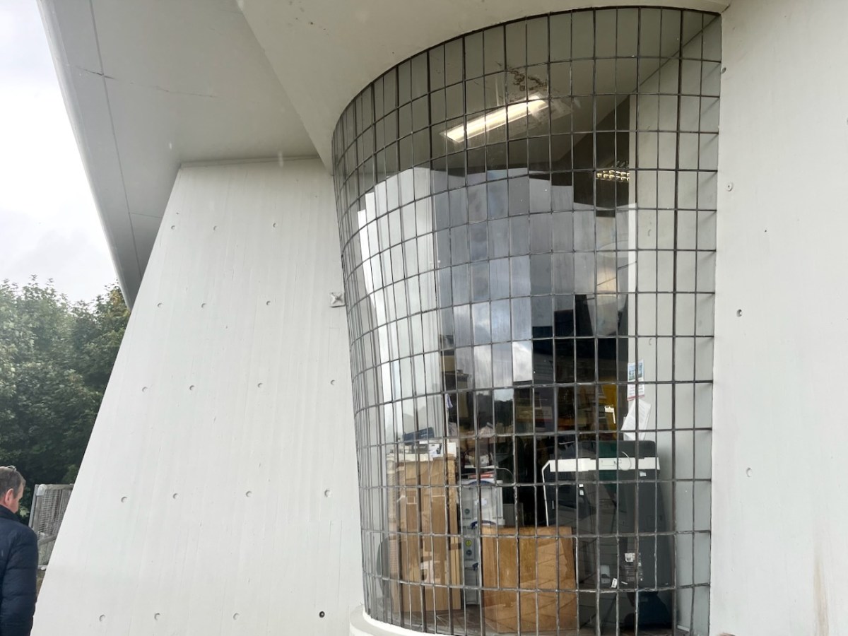
Larger in scale, this complex exhibits some of the features we see in Bantry: shutter-marked mass concrete, frameless glazing, bold overhanging roof planes… The Library roof cantilevers six metres in one part of the building.
The status of this building as an unique example of modernist architecture in Ireland has recently been recognised with a Heritage Council grant of over €250,000 to carry out refurbishments to some of the major elements.
. . . As Bantry Library approaches its 50th anniversary, we are committed to safeguarding this important building. As a protected structure within an Architectural Conservation Area, Cork County Council recognizes its responsibility to preserve and protect Bantry Library for future generations. The conservation works will take place during 2023, and we look forward to seeing the library restored to its former glory . . .
Tim Lucey, Chief Executive, Cork County Council
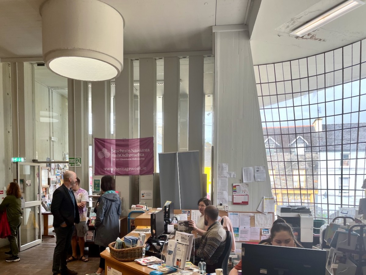
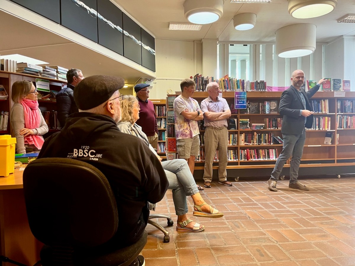
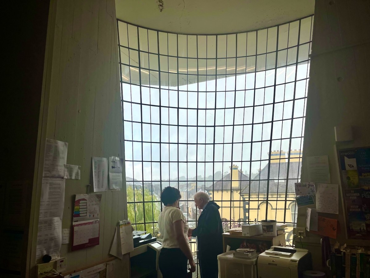
A Heritage Week talk was given by Dermot Harrington of Cook Architects at the Library (below). It was a most informative review of the building and its history.
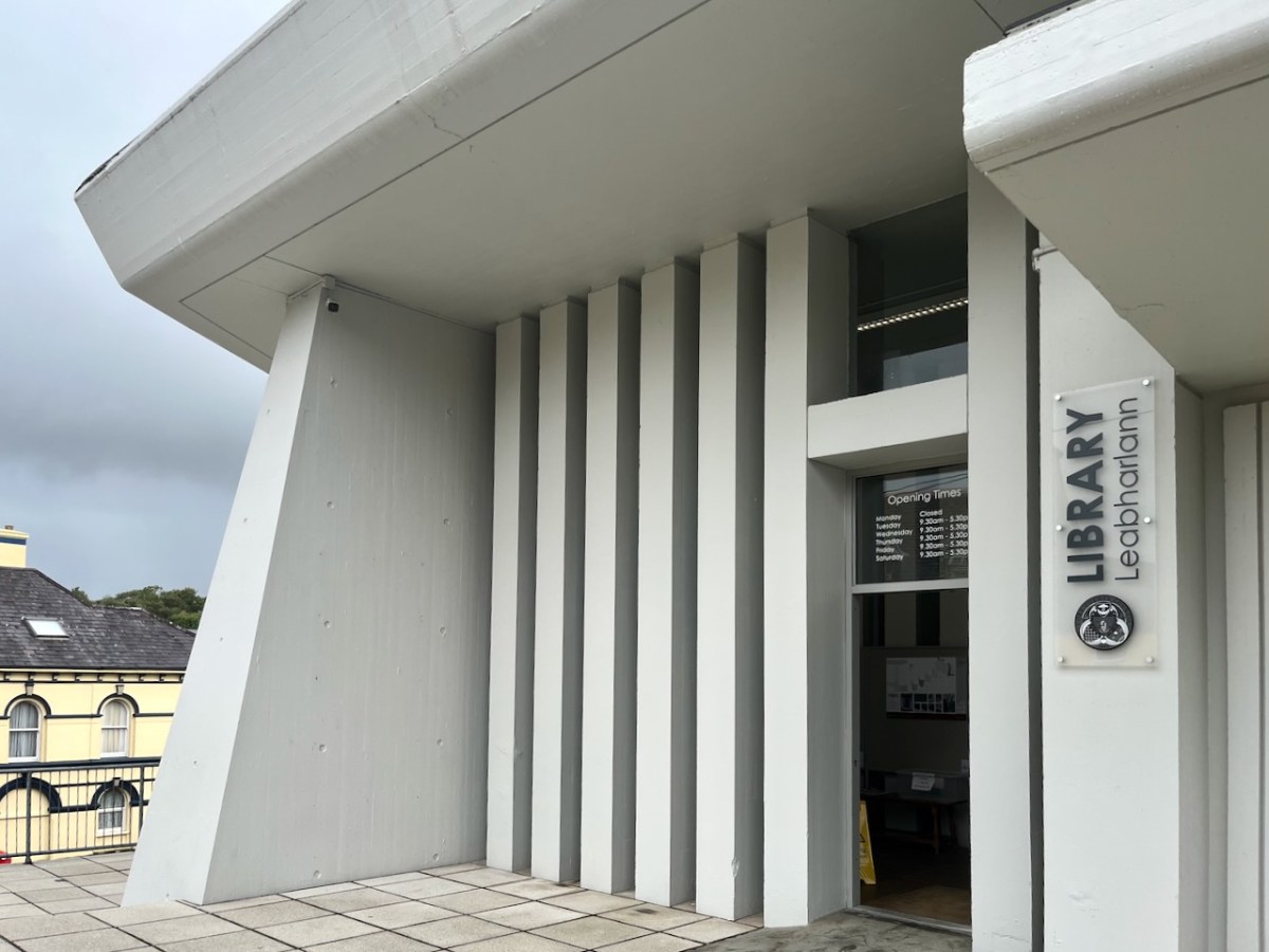
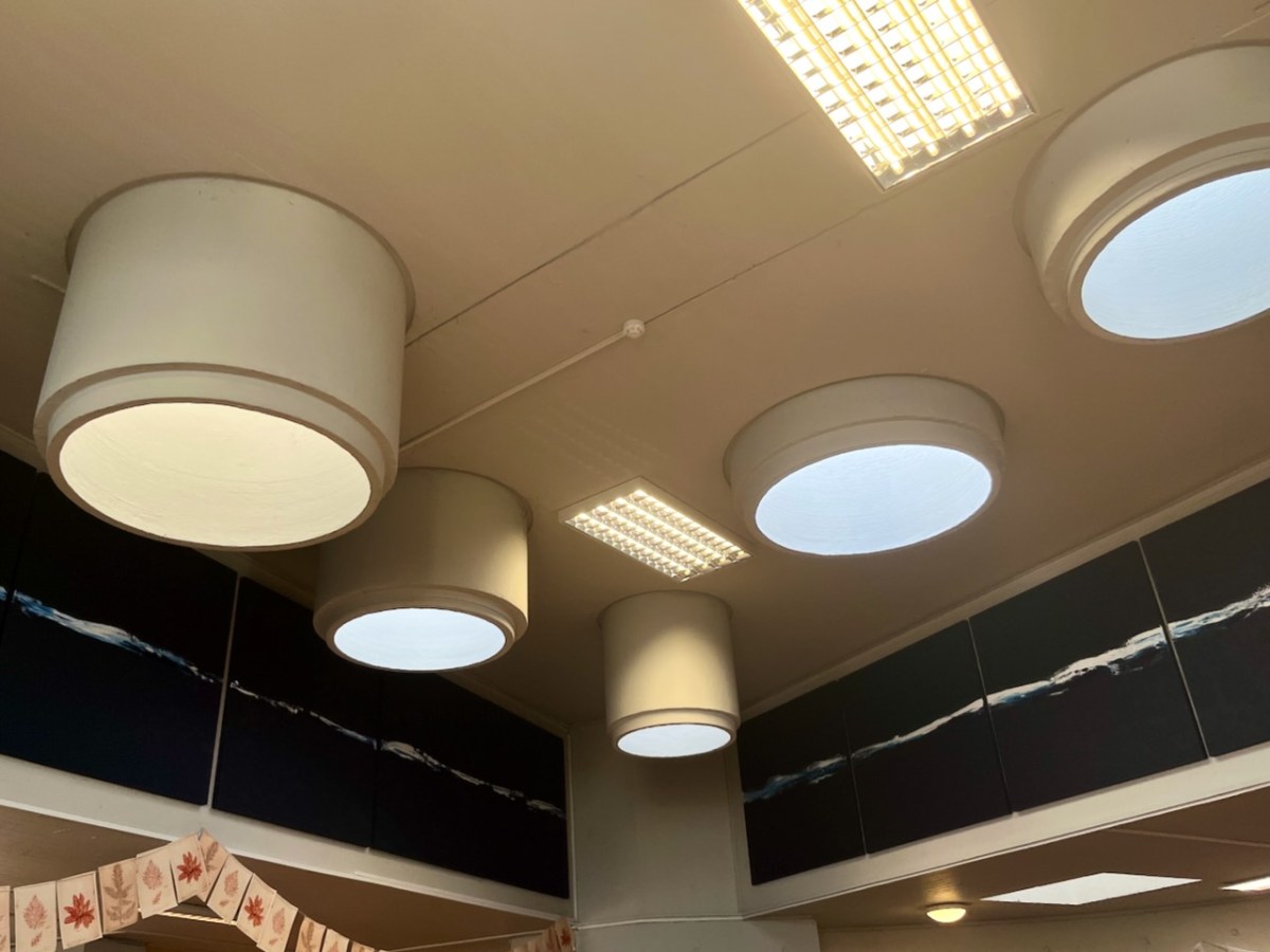
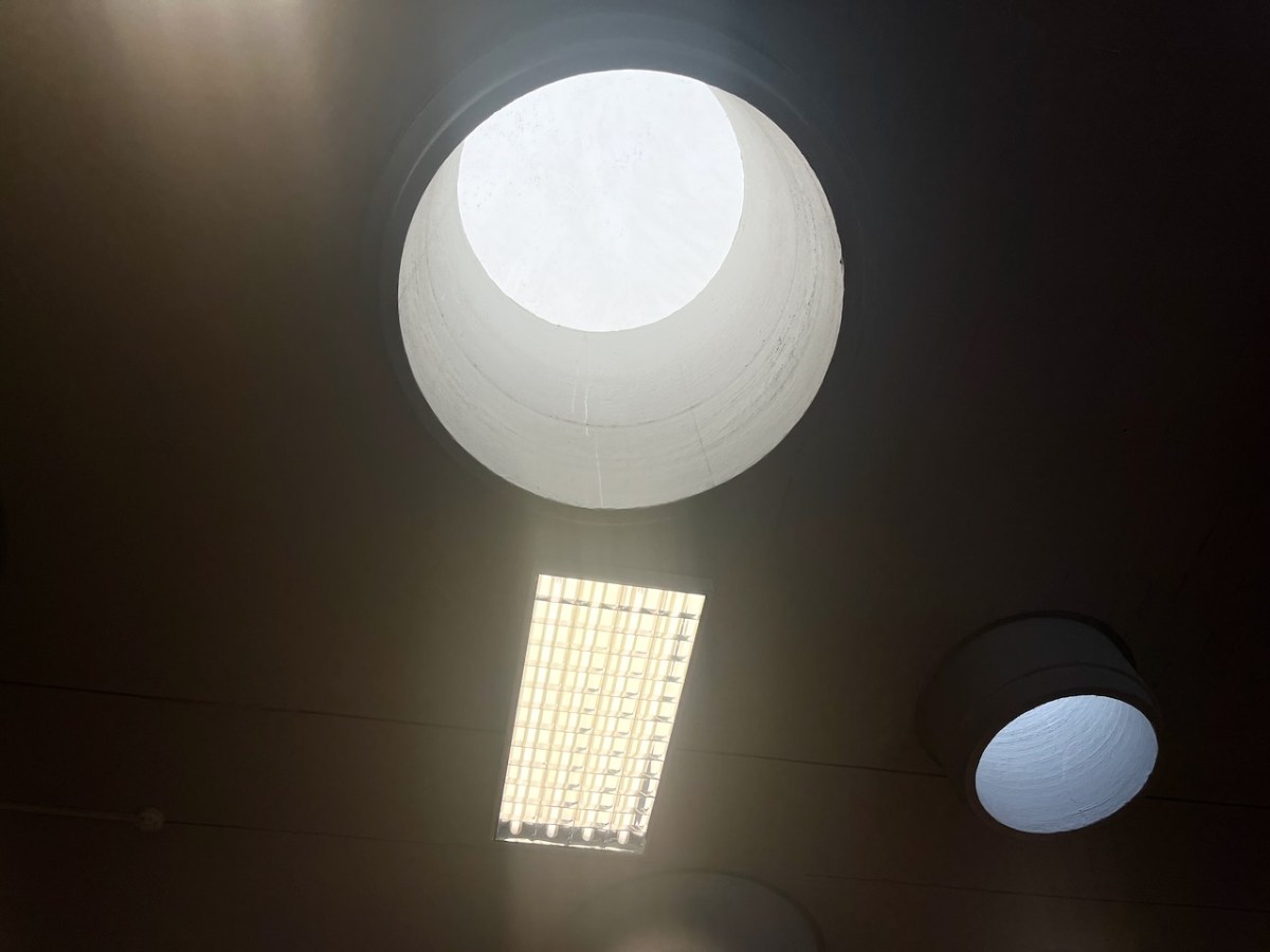
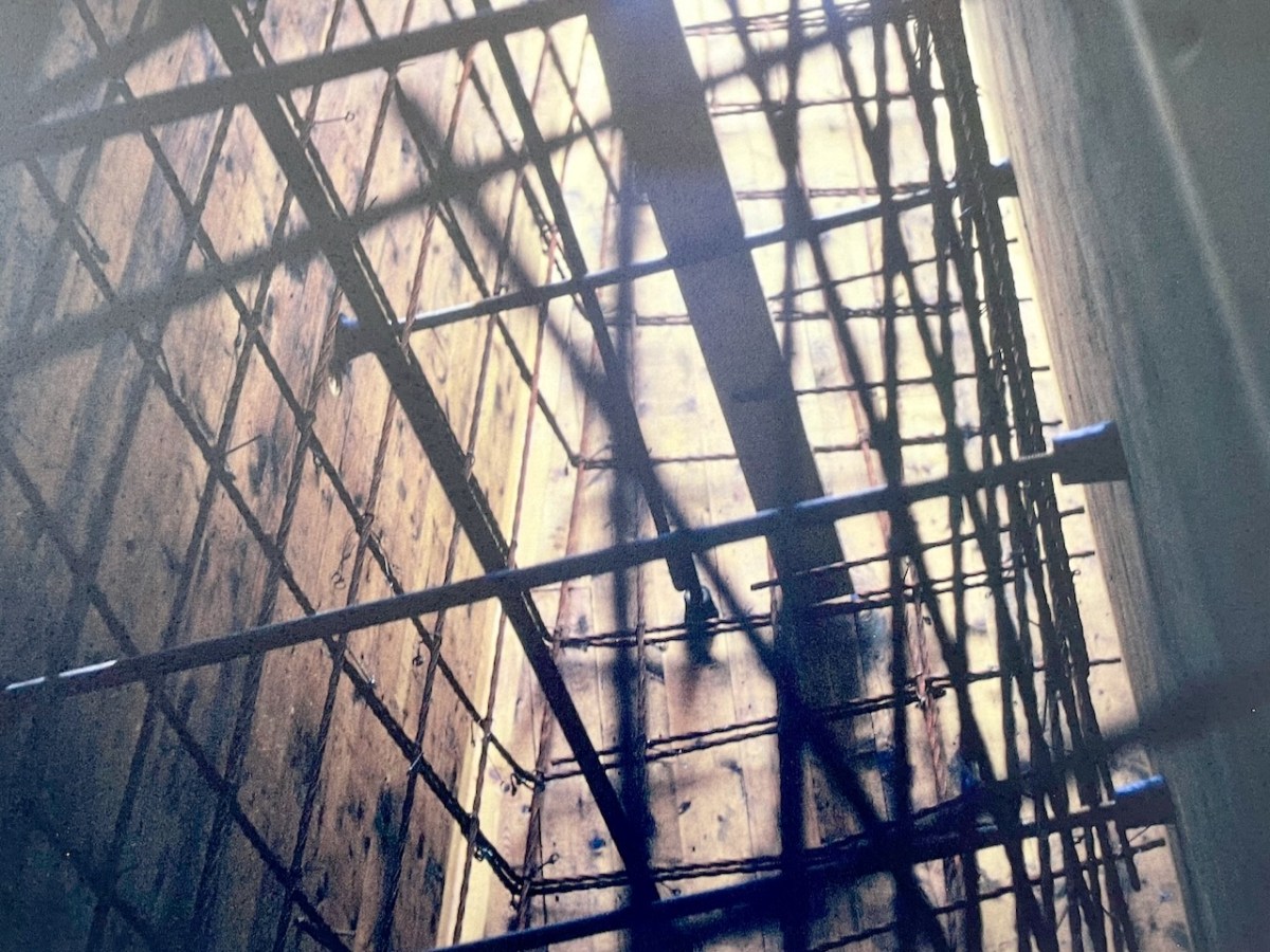
Most of the original features of the building have survived in reasonable order. I was impressed with the ‘pipe lights’ which draw daylight down into the centre of the main room:
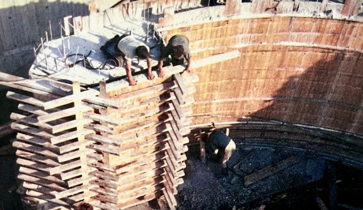
We also learned about the complexity of the building construction, and saw photographs of the steel reinforcement and board shuttering from fifty years ago:
Dermot Harrington pointed out that the building was effectively put together by only five men, under foreman Gerry O’Sullivan, who was just 27 years old. Neither he or any of the other crew had ever tackled anything like this before!
The Library is central to the life of the town, and still serves its original purpose. It’s eye-catching (perhaps sensational is a good word?) and very much alive and relevant. We look forward to the completion of the current works, and suitable festivities to mark the fiftieth birthday of this creative West Cork project.
Thank you to the Library for the information they provided and the display boards that are currently on show. Many of my illustrations are taken from these resources
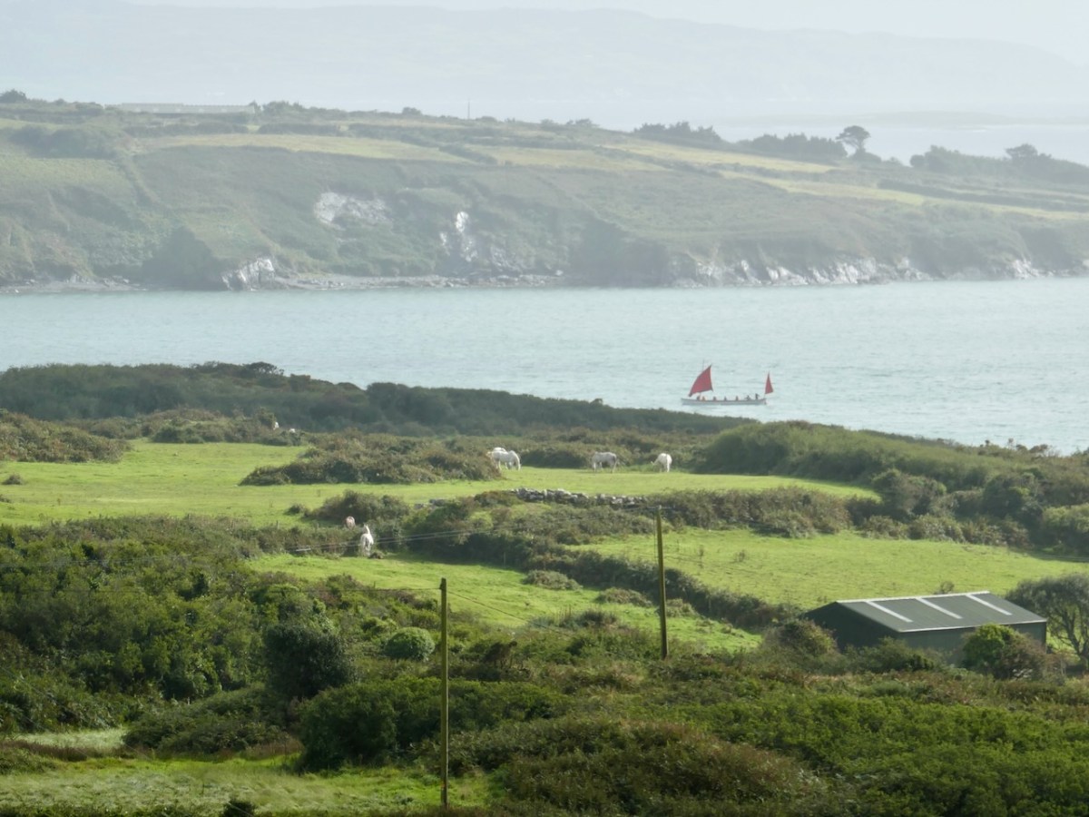
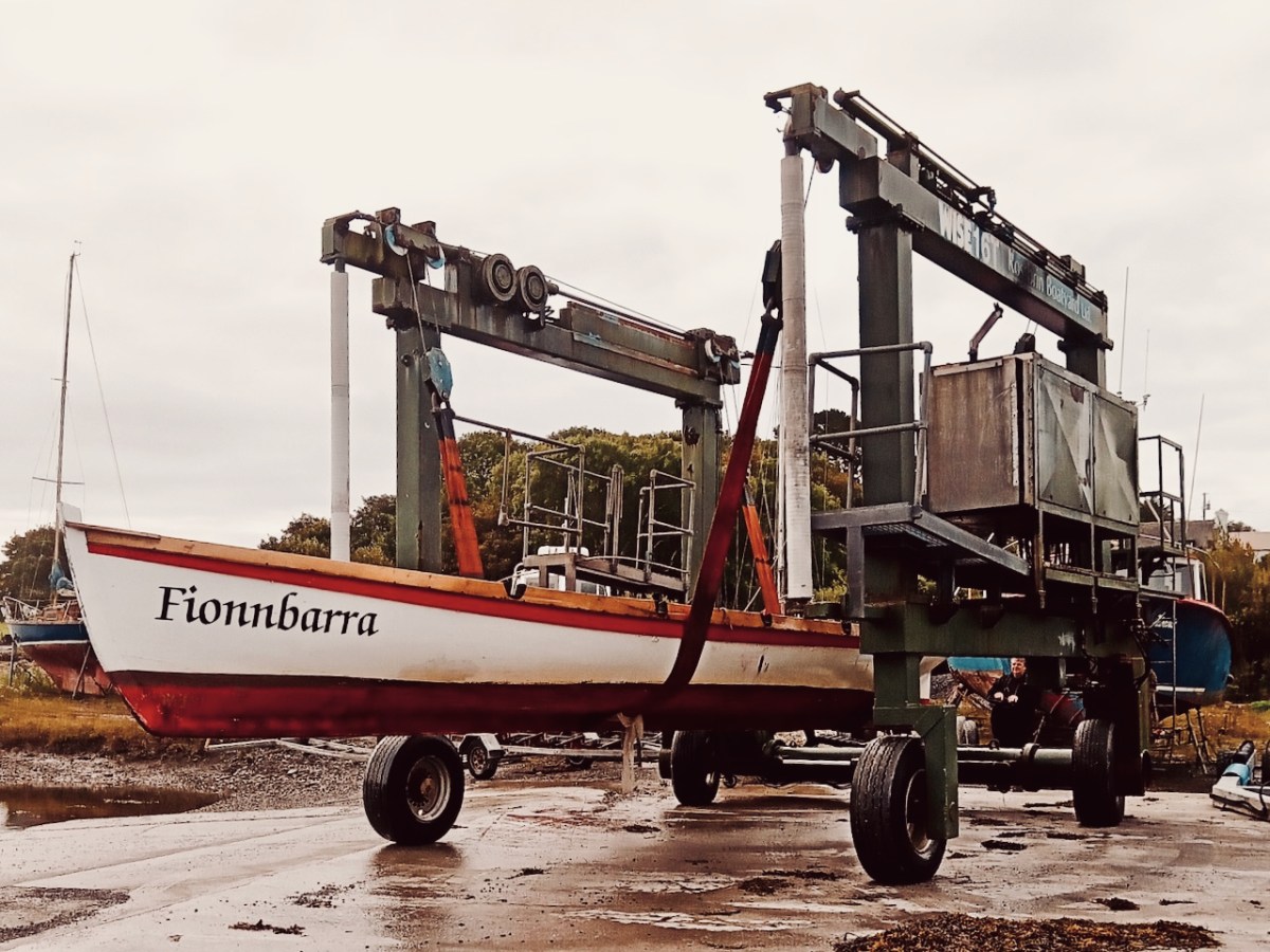
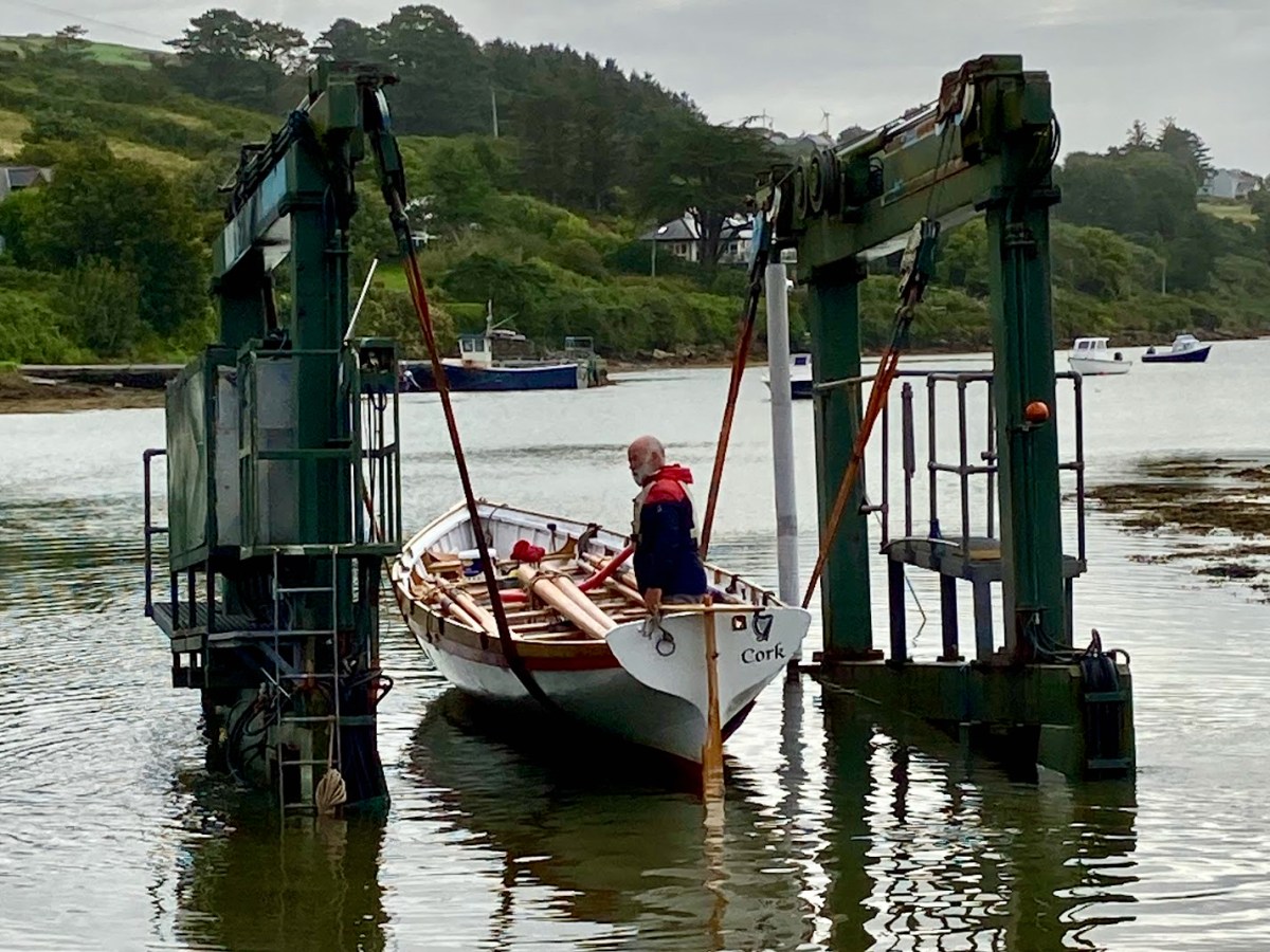
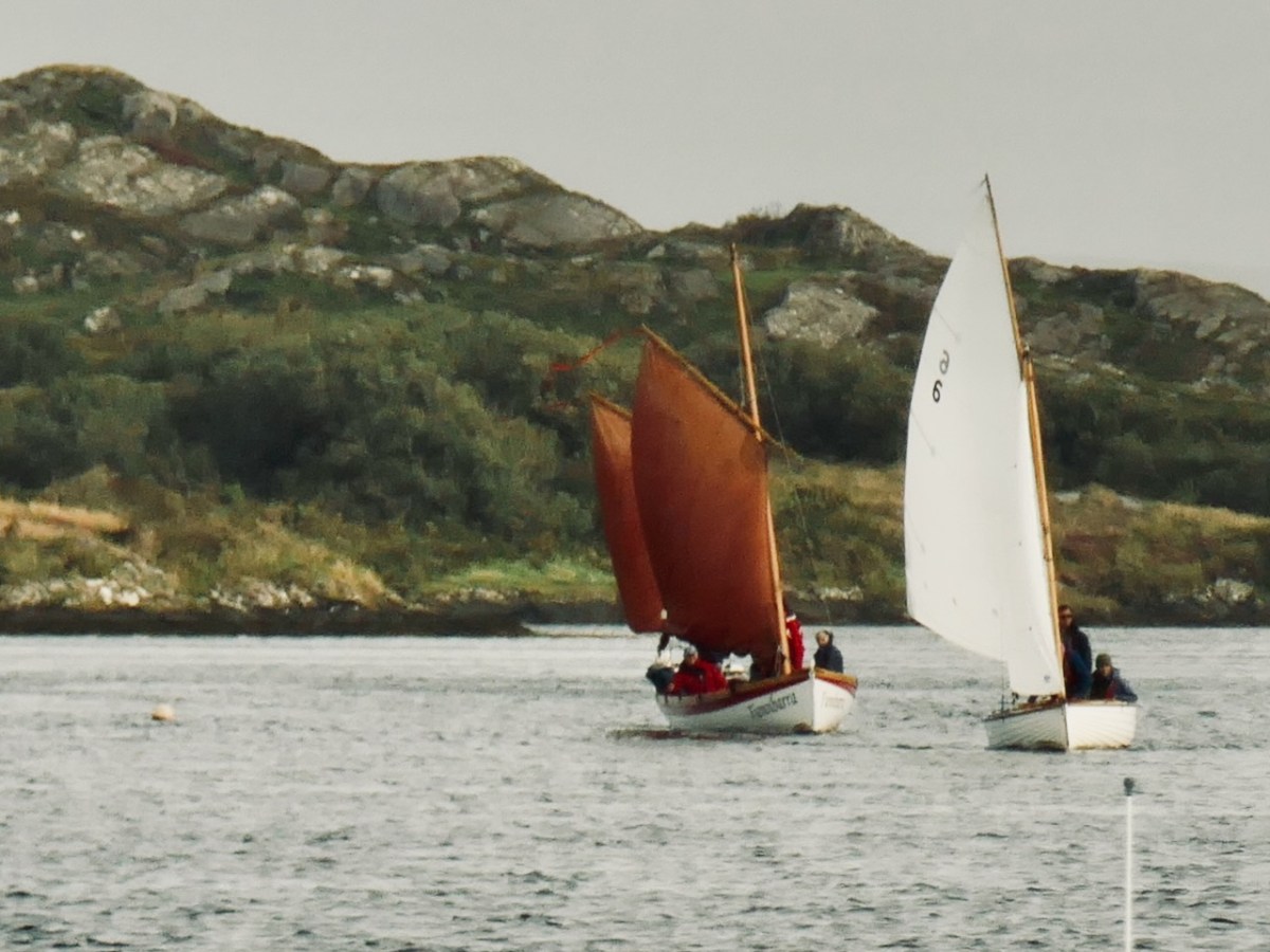
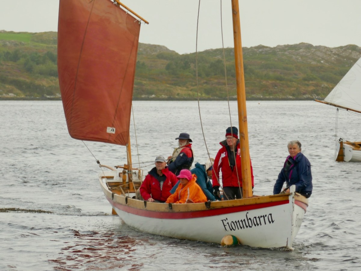
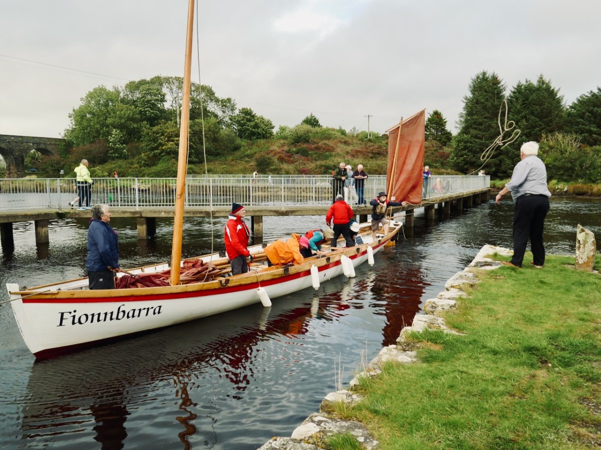
The importance of West Cork in world history was emphasised today at the Ballydehob Cruinniú na mBád (Meeting of the Boats). This annual event reminds us how busy our quay was back in the day when all the commerce of the village was based on the tidal waters. Finola wrote about the gathering in 2017. But today – 19 August 2023 – I had my eye out for a very particular vessel: Fionnbara.
There she is – above – leaving Rossbrin Harbour today, bound for Ballydehob. And here she is being launched early this morning, using the boatyard’s lifting gear. Many thanks to Jack O’Keeffe – her Skipper – and Anne O’Keeffe for the great photos.
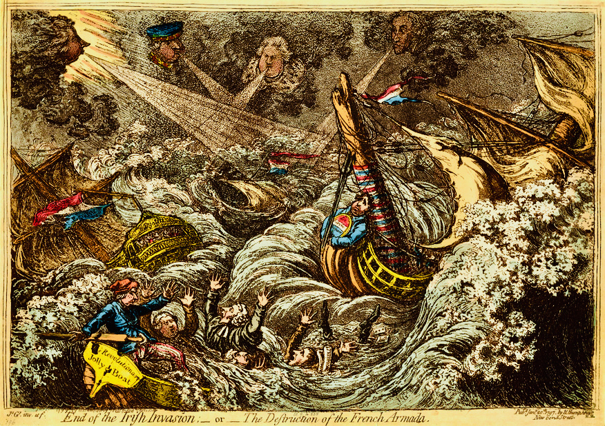
Above: ‘End of the Irish Invasion’ or ‘The Destruction of the French Armada’ by James Gilray 1797 (courtesy of the British Museum)
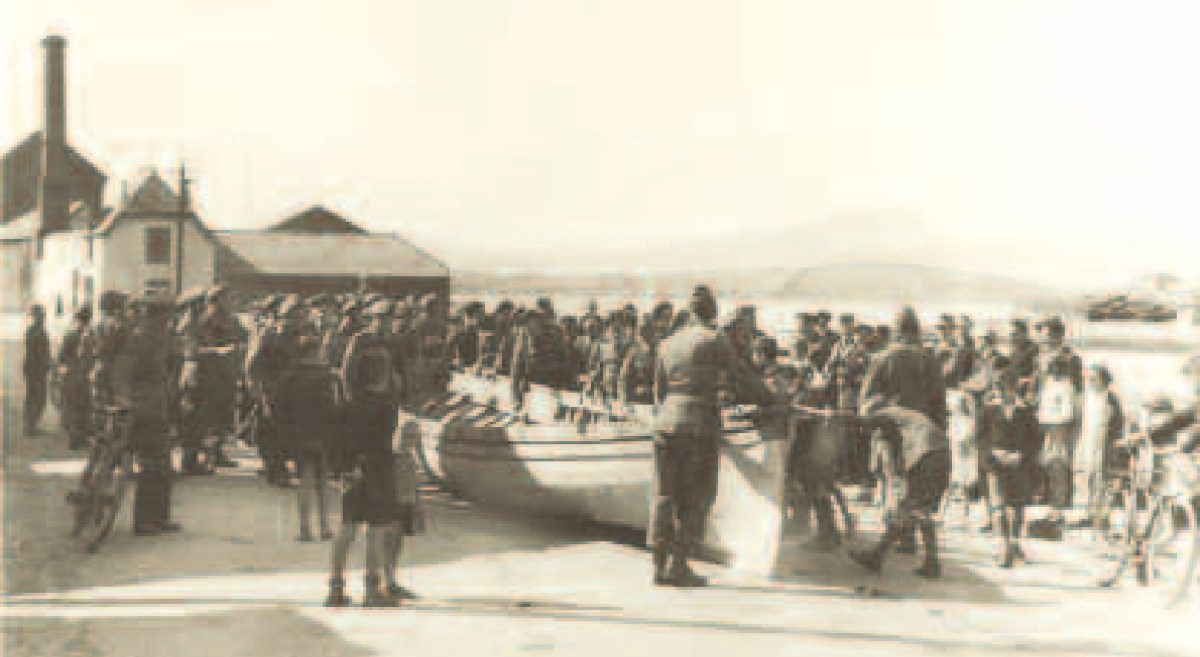
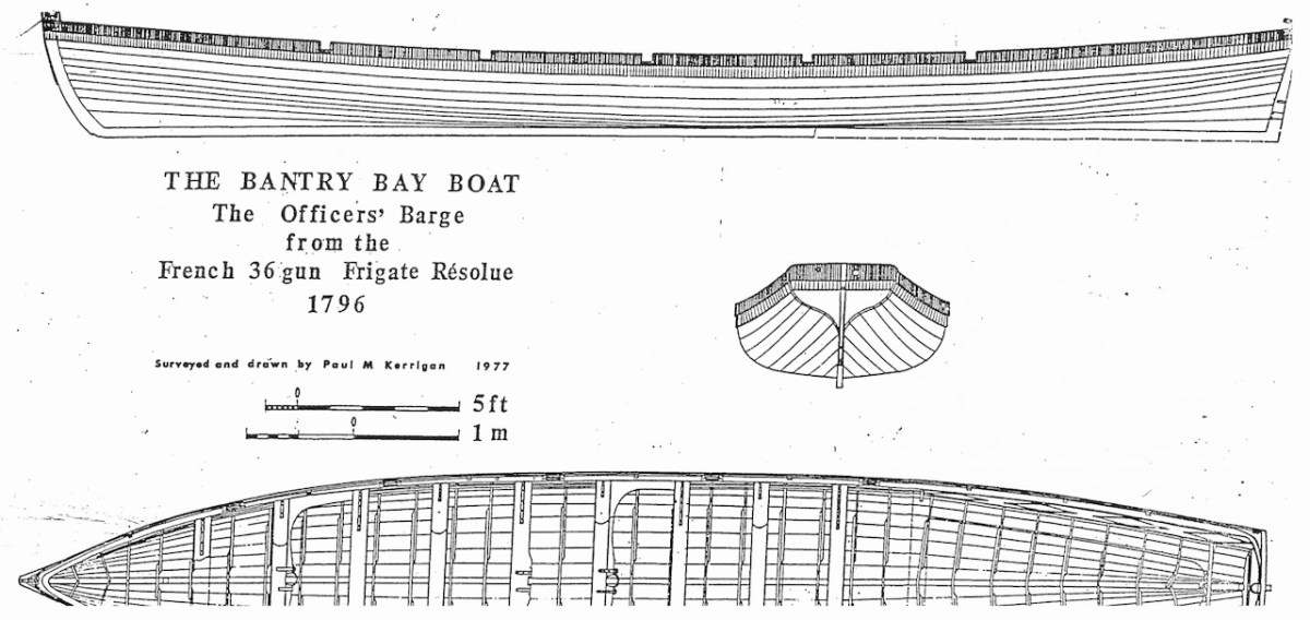
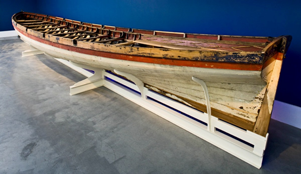
The boat is a replica – one of many around the world – of a craft which found its way to the shores of Bere Island – in West Cork – in 1796, after a disastrous escapade by the French navy, under the encouragement of Theobald Wolfe Tone of the Society of United Irishmen. A fleet of 43 vessels carrying 14,000 men headed for Bantry Bay intending to invade Ireland and declare it independent from Britain. Severe storms threw the ships off course and into disarray, and the opportunity was lost. During the chaos one of the French ships – La Résolue – lost her masts in a collision. Lt Proteau was sent in a ‘barge’ to find another ship to tow the frigate to safety, but instead he and his crew were driven ashore and captured. The ‘barge’ was taken as a prize of war and handed to the local Irish militia commander, Richard White of Bantry House. There it remained – gently rotting – for 148 years. In 1944 it was despatched to the National Maritime Museum in Dún Laoghaire and – after conservation – is now displayed at the Collins Barracks Museum. The ‘Bantry Bay Boat’, ‘Bantry Skiff’ or ‘Bantry Yole’, as the unusual craft is variously known, has attracted considerable attention and has inspired many boatbuilders to produce copies.
Below: upper – the Bantry Boat being transported from Bantry Railway Station to Dún Laoghaire in 1944; centre – plans of the original craft drawn by Paul Kerrington in 1977; lower – the original Bantry Bay Boat on display in the Collins Barracks Museum today (courtesy History Ireland – article by Lar Joye July/August 2018)
One of these copies is the Fionbarra, which arrived in Ballydehob today. The original was 11.64 metres long, 2.05 metres in beam, and a very fast boat. It was powered by ten oars or three sails, and could carry around ten passengers as well as the crew.
Ballydehob Bay today, 19th August 2023. The small boats are beginning to approach the old quay. With thanks to Finola for many of these photographs.
Building of the Fionbarra began in Waterford and was transferred to Meitheal Mara, a community boatbuilding venture based in Cork city. Construction was completed in 2008. We really appreciated the work of the team who transported her to West Cork and sailed her up the estuary today.
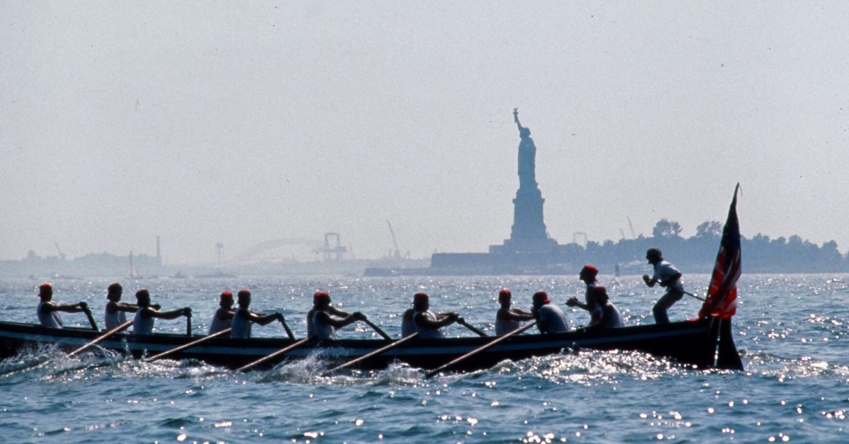
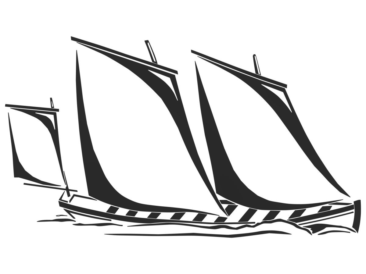
You may wonder why I have put in a header pic from across the Atlantic? This is to demonstrate the influence that the West Cork ‘Bantry Yole’ has had on the boating community all around the world. Atlantic Challenge International was founded in 1984 as a maritime training trust, and its activities are largely based on replicas of the 1796 Bantry craft. As a consequence there are relatives of the Fionbarra in many countries. I understand that there are currently at least 80 such replicas, spread over four continents, in the present day.
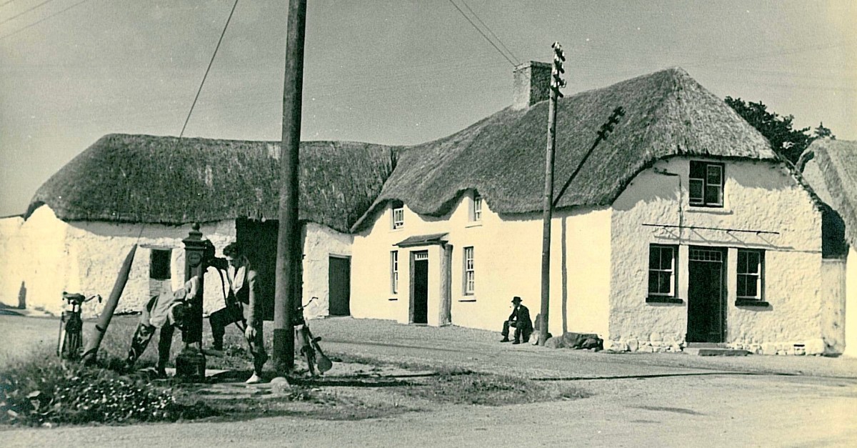
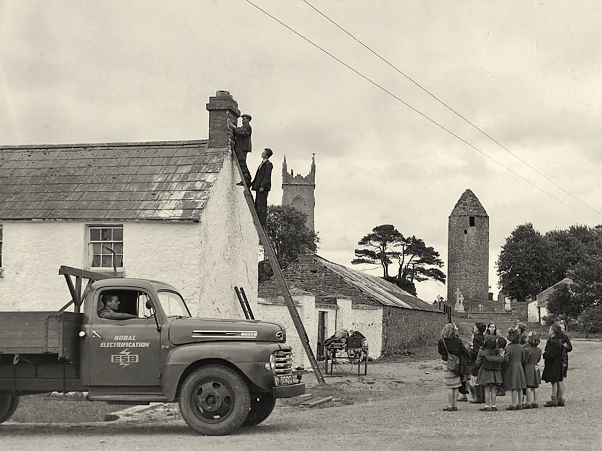
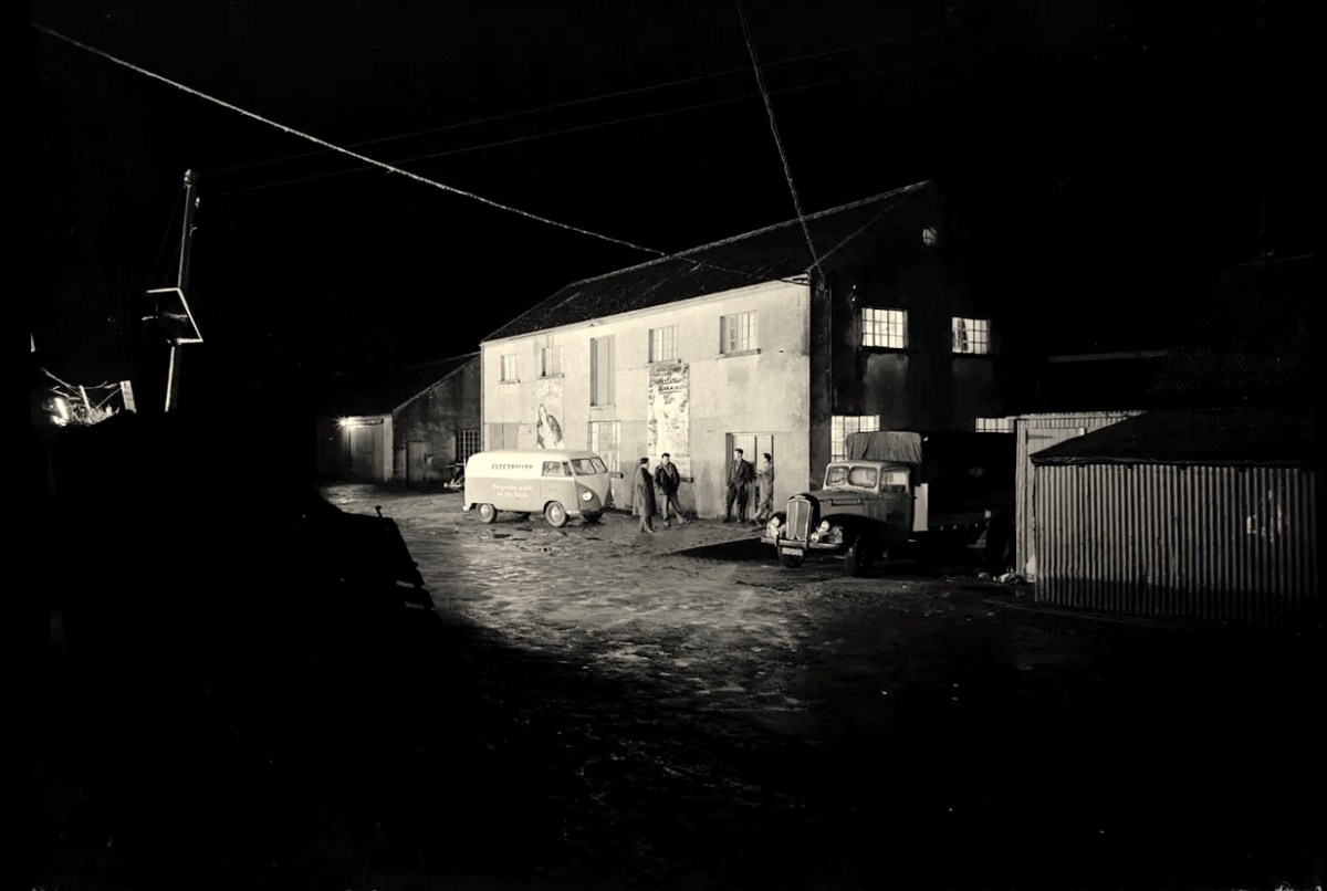
The traditional Irish village: Lusk, Co Dublin, in 1954 (photo from ESB Archives). Thatched buildings, the village pump, bicycles: a man sitting on the stone smoking his pipe. The intrusions are the poles and the overhead lines bringing the modern world into rural Ireland. Lusk was connected to the new grid close to the beginning of a project that spread out from the major conurbations from the late 1920s, taking some fifty years to embrace the whole state.
Rural Electrification arrives in Dromiskin, Co Louth, in 1949. Cork Electric Supply Co Ltd was in operation in Cork City before 1927. It supplied 4,225 homes and businesses in 1929, rising to 5,198 by March 1930, before being acquired by ESB in April 1930. Close neighbouring communities began to receive connections from 1930 onwards; Skibbereen and Bantry waited until 1937, while Schull and Ballydehob were without until works crept into furthest West Cork in 1952.
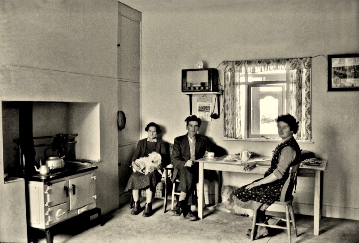
Above – family Life in 1950s rural Ireland (photo by Robert Cresswell). When I was a boy in 1950s England, I was probably fortunate to live in a house where electricity had been connected: my parents were quite progressive in that respect. I well remember the brown bakelite switches and plugs (two sizes: small and large). However, I often visited my Granma who lived in a house without any of it. It was a bit like the one above (which is in Kinvara). Gas globes hung from the ceilings: they had to be lit with tapers while pulling down on a lever. Cooking and heating came from a black coal range, and there was one cold tap in the scullery. There was no bathroom or shower, only a toilet outside in a shed. But there was a large wireless set – just like the one shown above. It was powered by an ‘accumulator’ which had to be taken to the shop up the road to be refilled with acid every few weeks. My Granma lived and died without ‘electrics’.
Above – Ballydehob before electrification. The ESB Archives are alive with colourful descriptions of the Rural Electrification works arriving here and in neighbour Schull. Reports from the on-site engineers are droll . . .
Schull Rural Area, April 1952 . . . Mr O’Driscoll opens his post-construction report in almost poetic terms and then to show that he is not bound to one form of art, proceeds to give us a word picture of the terrain in Schull, which is even more realistic than the deepest purples that Paul Henry ever used. We gather that pegging was, at times, a highly arduous and dangerous task and it would appear that among the wonders of the modern world, the greatest (in the view of the pegging team), was how this Area was ever selected for electrification . . .
ESB Archives
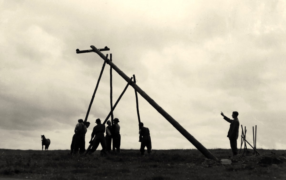
‘Pegging’ is a term in common use in the ESB Archives. It refers to the art of raising poles and stringing them with wires across the country. Evidently, the ‘landed gentry’ unkindly described them as “those beastly sticks”. Over 1 million poles were erected eventually, with 78,754km of wire used and a total of 2,280lbs of gelignite consumed during construction. The overall cost was some £36m (equivalent to €1.5bn today).
. . . We had very few wayleave difficulties. Sometimes an argument would develop with a local farmer whether the patch of grass where we put a peg was a field or not. If he convinced us it was a field, which he usually did by showing us the welts on his hand, we shifted the peg. It would seem too much like taking the bread from the mouth of a child to destroy his farm and livelihood by one pole . . .
ESB ARCHIVES
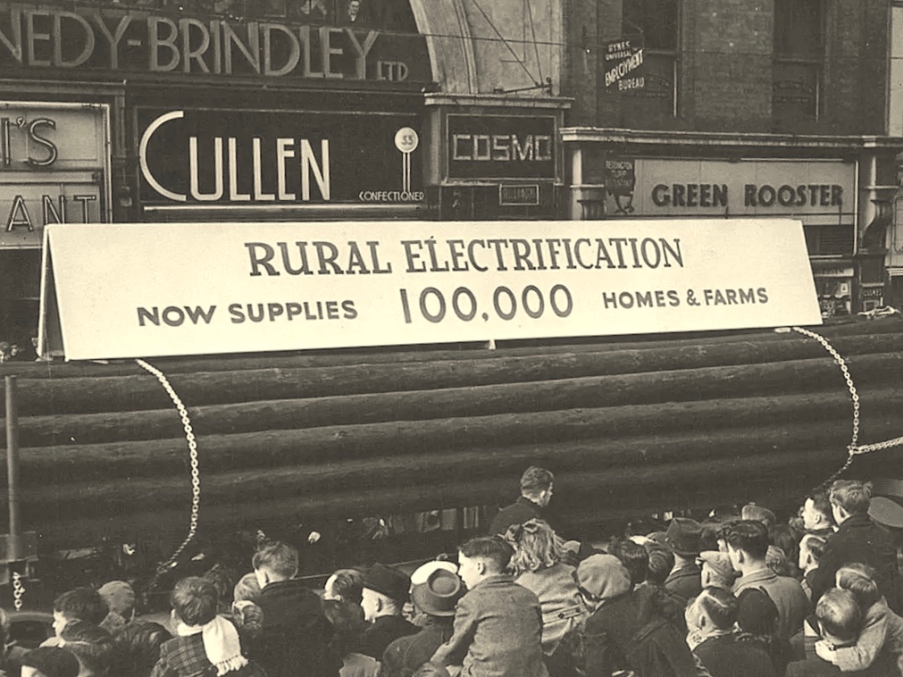
Above – Celebrations came with the connection of the 100,000th premises in 1954. Now we return to our own West Cork:
. . . It is interesting to note, and perhaps might be taken as a headline, that the early switch-in of the villages of Schull and Ballydehob (1952) had an excellent reaction on the more outlying areas and could not be denuded of all credit for the extra consumers eventually connected . . . There was an amusing revival of an ancient rivalry between the two villages. Ballydehob, looking with pride at their 100kVA transformer, were inclined to be scornful of Schull where a 50kVA transformer was erected; but the Schull people not to be out-done, countered by pointing out that there were many more poles in their “Town” than in Ballydehob “Village”. . . Only 8 houses remained to be wired when the gang left the area, 3 of these were parochial property and 4 were under the control of the Board of Works . . .
ESB ARCHIVes
The mention of “parochial property” in the paragraph above – from the ESB Archives – is of significance. The term would be applied to churches and schools, certainly. As outlined in last week’s post, Seán Keating was scornful of his view of the clergy position on Electrification: his Night’s Candles painting shows the priest still reading by the light of a candle while the world moves on around him. We can find differing views on the attitude of the Church.
. . . Throughout the length and breadth of Ireland politicians of all political shades lobbied the ESB for their area to be electrified. It wasn’t just politicians who tried to exert their influence: in July 1957, the parish priest of Ballycroy, County Mayo, wrote to the Rural Electrification Office. He said that his parishioners were anxious and that they believed he could influence decisions at the Dublin head office. “Sometimes people get an idea that the PP isn’t taking any interest in these matters. I need not add that I have a very deep enthusiasm for the light coming to Ballycroy” . . .
Above – celebration in Dublin St Patrick’s Day Parade 1954. Here in Ballydehob I was pleased to hear some reminiscence from retired schoolmaster Noel Coakley pertaining to the ‘parochial property’ which remained to be wired when the gangs left the area:
. . . Having had the luxury of the electric light when growing up in Bantry town in the 1940s and 50s, rural electrification was a subject of which I was blissfully unaware until my first teaching post, 60 years ago next month in Tragumna National School near Skibbereen. Though the building was wired for electricity and rural electrification had already arrived in the area, the school wasn’t connected to the grid. On checking the reason, the reply I received from the then School Manager, the local Parish Priest, was, ‘Why would a school need electricity?’ End of the matter! Indeed, I should have known better because my own alma mater, Bantry Boys’ NS which was on the Hospital Road, wasn’t even wired for electricity. In fact, it wasn’t connected until the autumn of 1970 during the 2 year experiment, 1969-71, on having Summer Time all year round. Back teaching in Bantry by then, teachers and pupils had to endure almost pitch dark classrooms for the first year of the trial. Coming to Ballydehob in February 1971 was going from darkness into light because the school here could even boast of having electric sockets into which we could plug new fangled machines like tape recorders, while Bantry Boys’ had only being upgraded to two 100w single bulbs per classroom. Regarding Rural Electrification in Ballydehob, I think the village was connected around 1954. I do recall that the area around the townland of Knockroe, bordered between Bantry Road and Skibbereen Road, didn’t get connected until the 1970s because the majority of residents refused connection when the rest of the district was being electrified . . .
Noel Coakley, Ballydehob – personal communication
Above – a network of ‘pegs’ crossing the north side of the Mizen today.
Once again, I am grateful to Michael Barry for pointing me in the direction of some of this information, and for switching on the lights for me in respect of the extensive ESB Archives. I also appreciate the contributions of Noel Coakley and Eugene McSweeney, Ballydehob. Are there any other stories out there? More to follow next week!
Welcome to the UCD Library Cultural Heritage Collections blog. Discover and explore the historical treasures housed within our Archives, Special Collections, National Folklore Collection and Digital Library