Art in the Bay

You’ll all know that Ballydehob is the true centre of art in West Cork. Our posts about the Ballydehob Arts Museum (BAM) set out the history of the community from the 1950s onwards. Artists settled in the environs – some camping out in the hills, and many of them remain connected with the area to this day. Local residents were at first amused – or bemused – by this ‘invasion’, but it soon became an accepted part of the character of the village.

Right at this moment, an innovative installation is in place on the water in Ballydehob, just above the 12 arch viaduct and by the road bridge that comes into the town from the east. This is where the two rivers meet, the Bawnknockane and Rathraune, giving the town its name: Béal Átha an Dá Chab, which literally means Mouth of the Two River Fords.

In summary, this art installation by Muireann Levis offers you a close experience of the water accompanied by a sensory soundtrack which is projected into the bay through a series of loudspeakers. The name of the project is Inbhear, which translates simply as Estuary. The way you experience the water is by climbing on board one of the ‘pedalo’ boats that were a common scene on the water here in Ballydehob back in the late 20th century. I remember seeing them on the estuary when I visited West Cork in that time, but they have not been in active use since then, so we were delighted to be among the first to experience their revival, a couple of days ago.

The pedalos have been kept safe and required only a little maintenance before coming back into service. Wouldn’t it be great to think that they might be brought out again on occasion? They are colourful and brimming with character. Have a look at these further examples from the historical archives of ‘pedal powered boats’; the first dates from 1930 in Stockholm, and the second is in Michigan, dated 1963.

Interestingly, the pedalos which we are seeing today were actually assembled in Ballydehob. They were made as part of a government employment scheme, and some were destined to be used in Barley Cove, with a small ‘fleet’ being set up in Ballydehob Bay. The latter deteriorated, but the Barley Cove boats have been stored well, and were recovered for this installation. So it’s a remote deja vu for these craft.

The meeting of the Bawnknockane and Rathraune rivers (above) creates an inner tidal pool – between the three-arched road bridge and the old railway viaduct, and this is where the installation has been set up.

. . . Working with field, hydro-phonic and electromagnetic recordings of the rivers and their many tributaries, Muireann invites us in to a relearning of her childhood environment, creating a piece that draws us closer to the everyday presence of water and elevates its endless subtleties . . . Inbhear, the Irish for “estuary”, finds meaning in its Old Irish roots where it translates to “a carrying in”. It offers a focal point for the carrying in and meeting of old and new identities, both social and environmental . . .

Inbhear event publicity

Finola shot these two videos while we were out on the water experiencing the event, and the soundtracks give an impression of what we could hear while we were afloat:

It may be too late for you to book this event: it’s only happening for a few days. Let’s hope that there’s a demand for a re-run in the near future: it’s such a celebration of so many aspects of Ballydehob, not least as a centre of pedalo boat production back in the day: who knew?

It’s very apt that I should be writing the post on this weekend, as we have just celebrated another Ballydehob event: the annual Cruinniú Bád (boat gathering) which happens at the quay around the highest tide of the summer:

With many thanks to Muireann Levis for inspiring the installation, and to Cormac Levis and William Swanton for information on the history of Ballydehob’s pedalo boats. We should also acknowledge the tireless endeavours of Eleanor Regan and the late Kevin Heaps who operated the pedalos getting on for forty years ago. William told me that Ballydehob Community Council has long been petitioning for the ‘Slob’ below the historic quay to be dredged to allow more boats to use that quay through the year. The sight of boats, small or large, on the water as visitors enter the village from the west would undoubtedly encourage enhanced footfall to the shops and hostelries of this remarkable community

West Cork Villages and Towns – Schull

What better time to visit Schull than during Calves Week? That’s a big sailing festival at the beginning of August every year, and you have to be a sailor to understand the nuances of its title. It’s held at the same time as the UK’s premier sailing event – Cowes Week, ‘…the world’s longest running sailing regatta…’ and is focussed around the three Calf Islands in Roaringwater Bay. So there you have it – Cowes and Calves! What it means, of course, is that the village of Schull is at its busiest and, since Covid has given a boost to outdoor socialising, the streets are crowded with visitors enjoying the shops, pavement cafés and galleries.

In this occasional series on the Towns and villages of West Cork we will take one community and try to discover why and how it has developed through history, and how it fares in the present day. A snapshot of the place will be presented – hopefully – in the best possible light (although this won’t always be on a sunny summer’s day!) From the aerial view above, you can see how Schull has been built up around its connection with the water. Schull Harbour is at the head of a long sheltered inlet, and the pier today is always busy with fishing and pleasure boats, ferries and yachts.

That’s the road to the pier, above, and it’s just a few steps from the village centre. If you are a visitor, you may have no idea that Ireland’s most south-westerly railway line once ran right on to this pier! The narrow gauge Schull, Ballydehob & Skibbereen Tramway and Light Railway was in service between 1886 and 1947, connecting these remoter parts of the county to Skibbereen and then, via the main line, Cork city. Although never considered a commercial success, it was a valuable element of infrastructure enabling local passengers to get to shops and markets, and fishermen to send their catches to distant merchants as hastily as possible (bearing in mind there was a speed limit of 15 miles per hour on most of this rural line). This photograph from the NLI Lawrence Collection (below) dates from the 1890s, and shows barrels of fish stacked up next to the railway track on Schull pier, awaiting despatch. They are likely to contain salted pilchards and herrings.

In all these pictures of the pier and pontoon areas above you can see the lively sailing activity in the background. Below are two extracts from early OS maps, one showing Schull and its location to some of the offshore islands, and the other showing the town centre, probably around 1890. It’s thought-provoking to see on the latter the various facilities which the town offered at that time, as well as the railway: Court House, Constabulary Barrack, Smiths, Schools, Hotel and Dispensary.

Note that on both the maps above, which date from more than a century ago, the settlement’s name is given as Skull: it still is on all OS Ireland maps up to the present time. Mostly today it’s known as Schull, or in Irish An Scoil, which translates as The School. Some of you may remember my posts earlier this year when I looked in to the possible origins of this village name – and the earliest ‘School’: a site described on Archaeology Ireland as a ‘possible early Christian settlement’:  . . . the ancient school of Sancta Maria de Scholia, ‘a place known in early times as a centre of learning’ . . . There’s a fair bit of local lore surrounding the subject, and you need to read Schull resident John D’Alton’s article on this to find an alternative view to the perhaps romanticised ideas of an ancient monastic site: I’m sitting on the fence!

Historic village – perhaps with medieval origins – to vibrant sailing centre and colourful streets in the 21st century. Schull has come a long way, and has far to go. Today the resident population numbers around 1,050: this is boosted substantially with the influx of summer visitors. It’s good to see long established names and new businesses on the streets, contributing to the colourful palette of the architecture. Great things are happening in the future: the old bank building (below) is to become a cinema and film centre: a focal point for the acclaimed annual Fastnet Film Festival.

Year round, Schull is worth exploring. Mount Gabriel, the area’s highest point, is above the village and offers superb vistas over the bay and islands. Finola has looked at the many legends associated with this peak and there is ancient history there, too: the remains of Bronze Age copper mines on its slopes. Good walks can be had on the high ground and on the coastal footpaths – see the Explore West Cork website.

Ballydehob and Boats

Two years ago Finola wrote about the Cruinniú na mBád (Boat Gathering) in Ballydehob. When I saw that Tidy Towns have erected some new information boards down by the quay – one dedicated to the history of the pier and its importance to the town in past times – I thought it was time to revisit the whole subject of Ballydehob and boats. By chance, our friend Jack suggested that Finola might like to travel with him in his Drascombe and sail up to the quay in this year’s gathering, so we have some ‘live’ coverage of the event from our on-board correspondent! I prefer to keep my feet dry, so watched the event from the vantage point of the 12-arch railway bridge.

Header – Finola took this pic from Jack’s Drascombe of one of the fleet heading for Ballydehob this weekend, rounding the point opposite Rincolisky Castle and negotiating the mussel ropes; above – the view from the 12-arch bridge, waiting for the boats to arrive at Ballydehob Quay

Ballydehob Tidy Towns has recently unveiled two new information boards close to the quay: one (below) is all about the railway line that connected Skibbereen, Ballydehob and Schull: I had a hand in that board! The other tells the history of the harbour itself and is full of information, collected by Cormac Levis, whose forebears worked many of the boats that traded into the town. Cormac initiated the Cruinniú na mBád in 2004 and it has been going ever since, barring the occasional cancellation due to atrocious weather conditions (which can happen, even here in serene West Cork).

The new information boards enlighten us on many aspects of Ballydehob history, particularly within the vicinity of the 12-arched bridge and the quay. The view above, from Cormac’s board, shows the harbour in the early 1900s and is reproduced courtesy of the Fergus O’Connor Collection and the National Library of Ireland. Note the higher section of buildings to the right of the main warehouse – they are no longer there; they are said to have once housed seven families

The pier at Ballydehob is often called ‘the sandboat quay’ as one of the main commodities to arrive in the town was sea-sand dredged from beaches nearby and on the islands. This was rich in nitrates and minerals and was valued as a fertilizer. However, sand was only one of the commodities that came to Ballydehob; the following is an extract from an excellent piece that Cormac Levis wrote in the (now sadly defunct) Mizen Archaeological and Historical Journal, back in 1996:

On market day, which was Thursday, a long line of small two-oar and four-oar boats would make their way up the channel, lug sails set if the wind was favourable. One by one they would approach the quay, bringing people from the Skeam Islands, Horse Island and Hare Island to do their marketing. Some would have eggs and butter to sell, some would have a plough or other farm implement for the smith to repair. Wrack timber would be brought to be cut into planks or corn to be milled. During the summer months the Hare Island boats would be occupied by women only, their menfolk having migrated en masse to fish lobsters east along the coast as far as Ballycotton. On the arrival of the first letter bearing the fruits of their husband’s labours, they would set out to buy two pigs at Ballydehob Fair. Quite often, if the wind wasn’t in their favour, they would row the full four miles to Ballydehob . . . The day of a cattle fair would occasionally see the arrival of the 39ft MV Mary Patricia with cattle from Old Court or Sherkin. The 20ft Barker, driven by a 6/7 Kelvin, would visit to load up with provisions for Burke’s shop on Hare Island. A rather melancholic sight that would be seen from time to time, was that of two oarsmen making their sad way down the channel returning to one of the islands with a coffin across the gunnels of their small boat . . .

From the 1996 Mizen Journal article by Cormac Levis: a photograph of one of the sandboats from 1936, and a diagram showing the hessian dredge that was used for collecting the sand

Cormac provides good information on the sandboats – this is a short extract:

When William T Young of Ballydehob purchased the stores and quay from Jane Swanton of Skibbereen in 1899, the property was described as the ‘old stores’ and ‘sand quay’, indicating that the practice of discharging sand there was well established by that time . . . In 1885 John Collins moved to Filenamuck. There in the early 1890s he built two boats for W T Young. These sister boats were the largest of the Ballydehob sand boats, capable of carrying a cargo of 8 tons 5 cwt and were typical of the Collins design. They had a 24ft keel, an overall length of 28ft, a beam of approximately 8ft 3ins and, when fully laden, a draught of approximately 4ft 6ins. They had a very shallow keel and, unladen, they had a draught of approximately 1ft 9ins . . . One of the two boats described above came to be known as the Conqueror and the other simply as Levis’s boat, after her skipper Charlie Levis.

The Sandboat Bar in Ballydehob is still owned and run by the Levis family

Today, the harbour of Ballydehob – while as picturesque as ever – is quiet, and seldom hosts anyone travelling by water. Ballydehob Bay itself is silted up and it’s only on the highest tides of the year – when the moon is full – that boats of any size can make the journey. So we salute the intrepid voyagers who, every year, keep up the memory of a thriving waterfront that was once the heart of the community. If, like me, you are nostalgically inclined – on the day of Cruinniú na mBád, as you stand looking for the flotilla coming in on the rising flood, close your eyes slightly and imagine that you hear the sound of the whistle as a little train clatters over the viaduct behind you . . .

Finola (see her post this week for more on what’s happening here) will assure you that it’s an exhilarating and moving experience approaching Ballydehob by water: I’ll close with some more of her pictures: there was a stiff breeze with high gusts coming in – I’m amazed she managed to keep her horizons horizontal!

A Change to The Fastnet Lighthouse

Way back in 2014 I wrote about An Carraig Aonair: The Fastnet Rock and I have decided to repost that today, but with some updated information and photographs, because of an upcoming change announced by Irish Lights. Depending on the story, this is either a relatively benign but majorly cost-saving switch to LED lighting, or a change we must be vigilant about to make sure the Fastnet is left “intact and unharmed”.

Irish Lights tells us that structural repairs. . .are necessary to ensure the metal lantern room is properly secured to the granite tower and modernisation of the light source to an energy efficient rotating LED lantern. When these works are completed the outward appearance of Fastnet will be unchanged. The work will improve our environmental impact by significantly reducing the need for diesel and generators and by removing all mercury from the station. The range of the light will reduce from 27 to 18 Nautical miles.

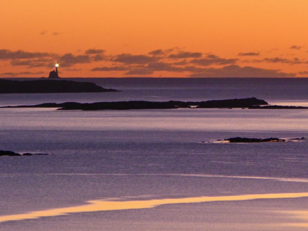
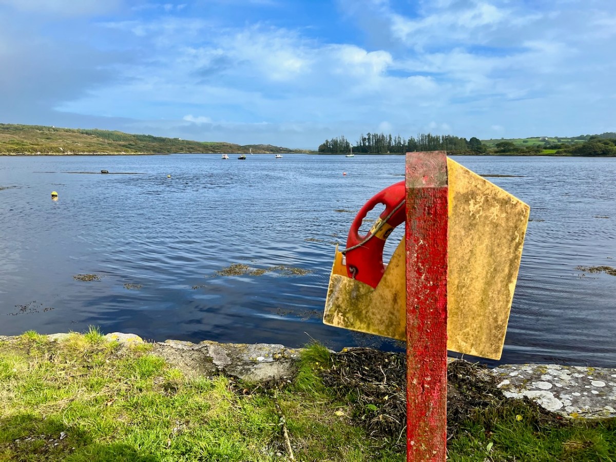
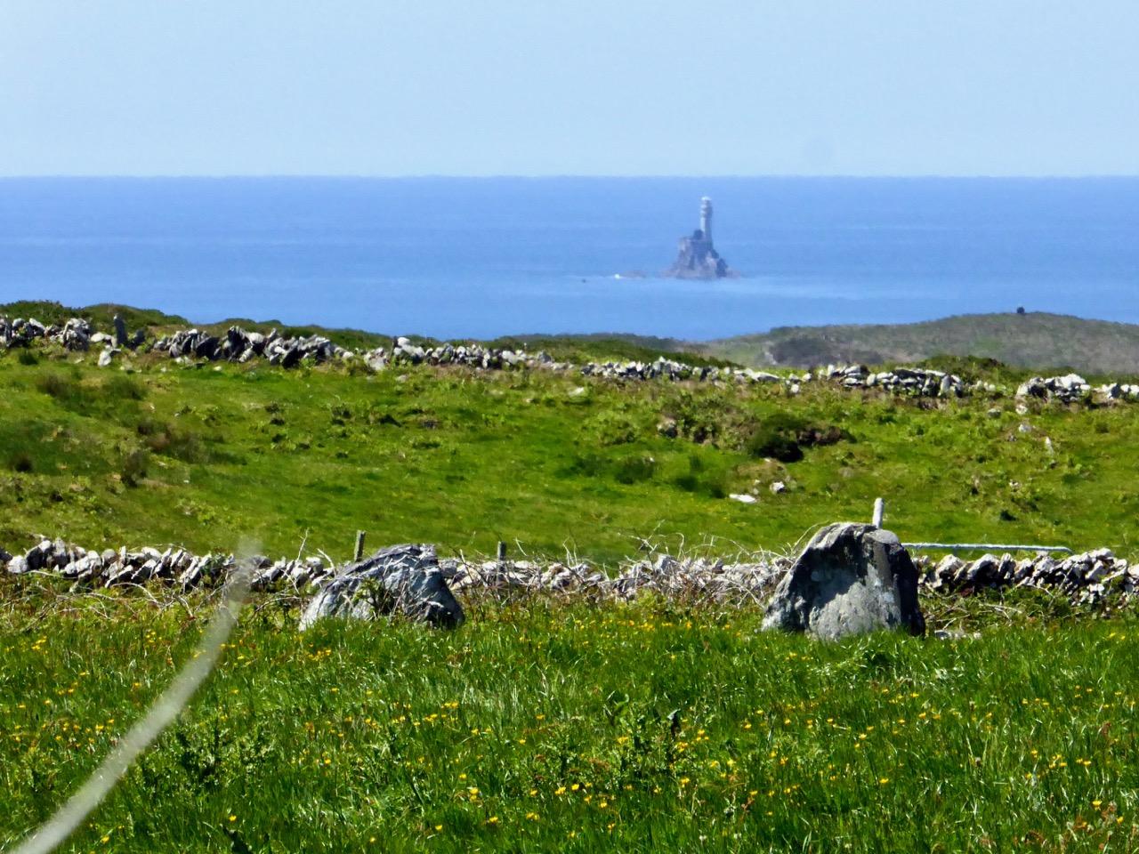
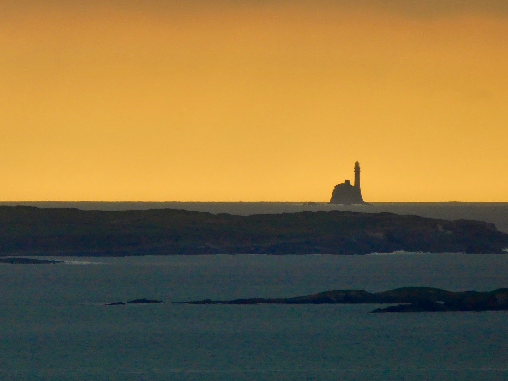
This photo was taken from our house, 12 miles (or 10.4 nautical miles) away

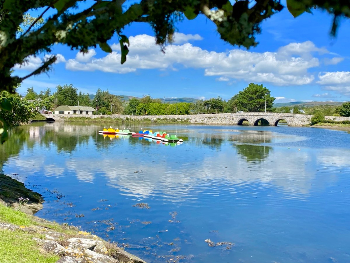
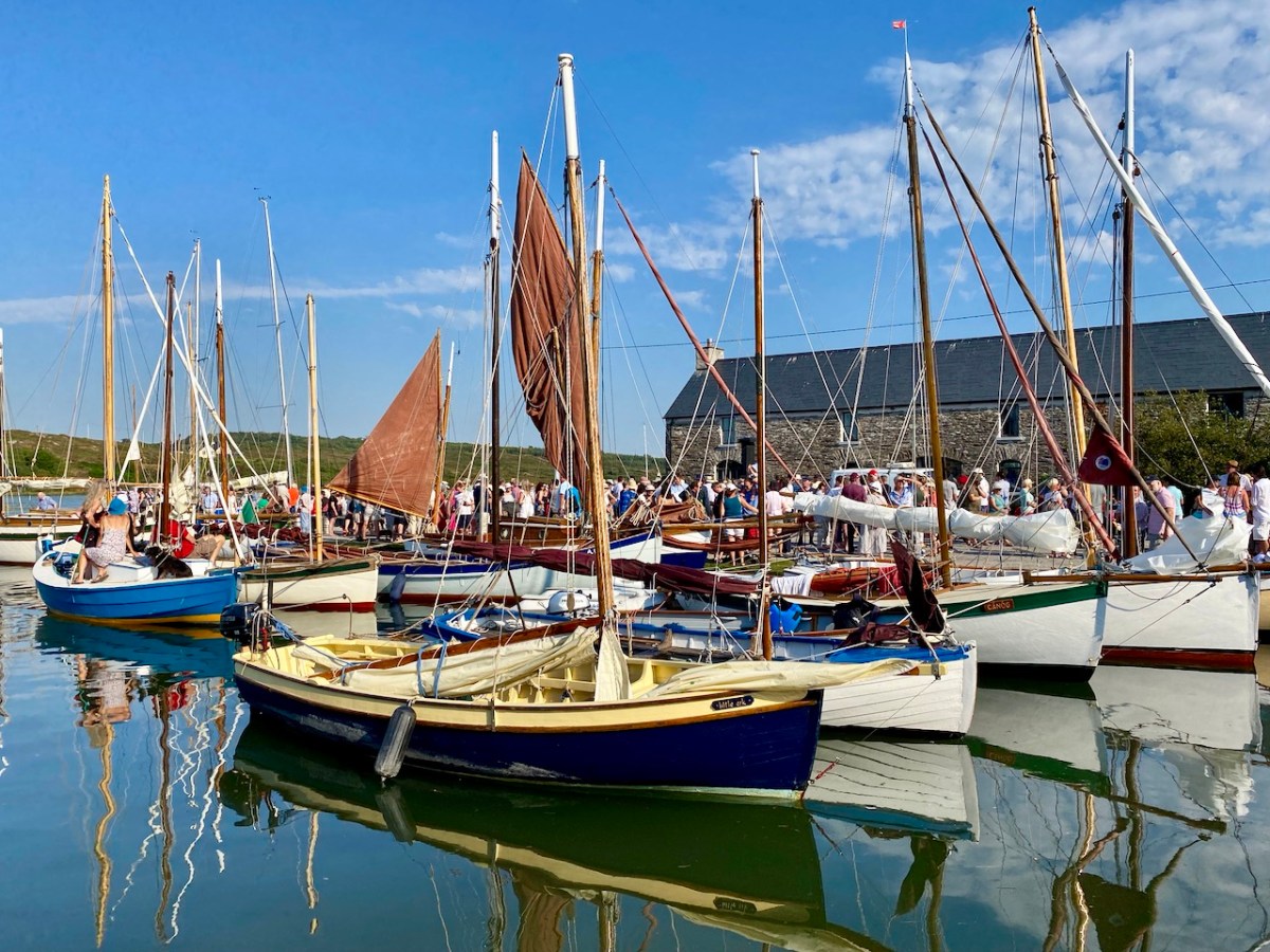
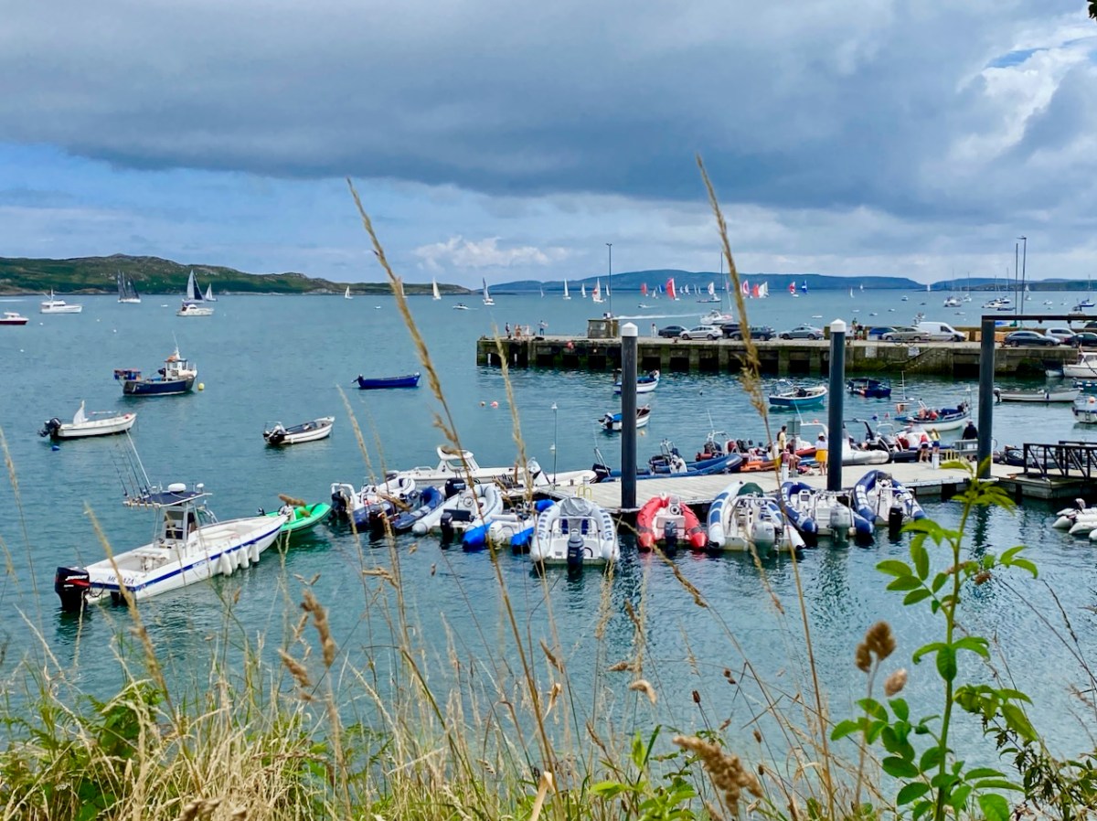
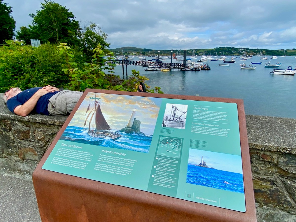
While this seems like a sensible and inevitable modernisation, with (according to this letter to the Irish Times) a very significant saving of €100,000 per year, those of us who live around Roaringwater Bay want more information: we want to be sure that the change does not negatively impact on the safety of our sailors and fisherfolk, and does not rob us of the iconic flash that is so much part of our lived experience in West Cork. There will be a meeting on Monday (March 5, 2018) at the Schull Sailing Club to discuss it all.

What follows now is the text of my post from June of 2014, lightly edited and with some newer photographs inserted.

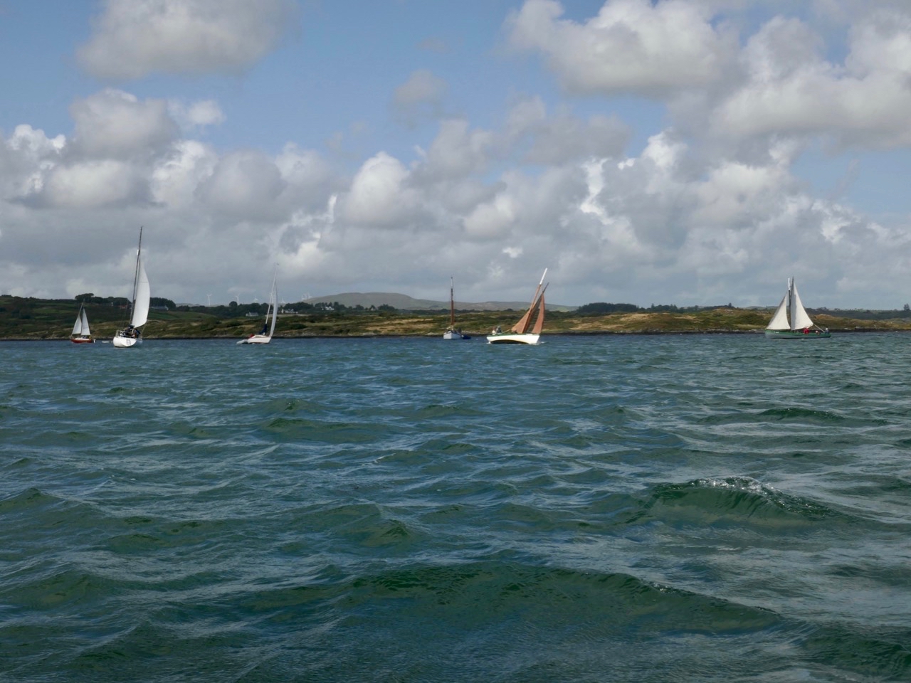
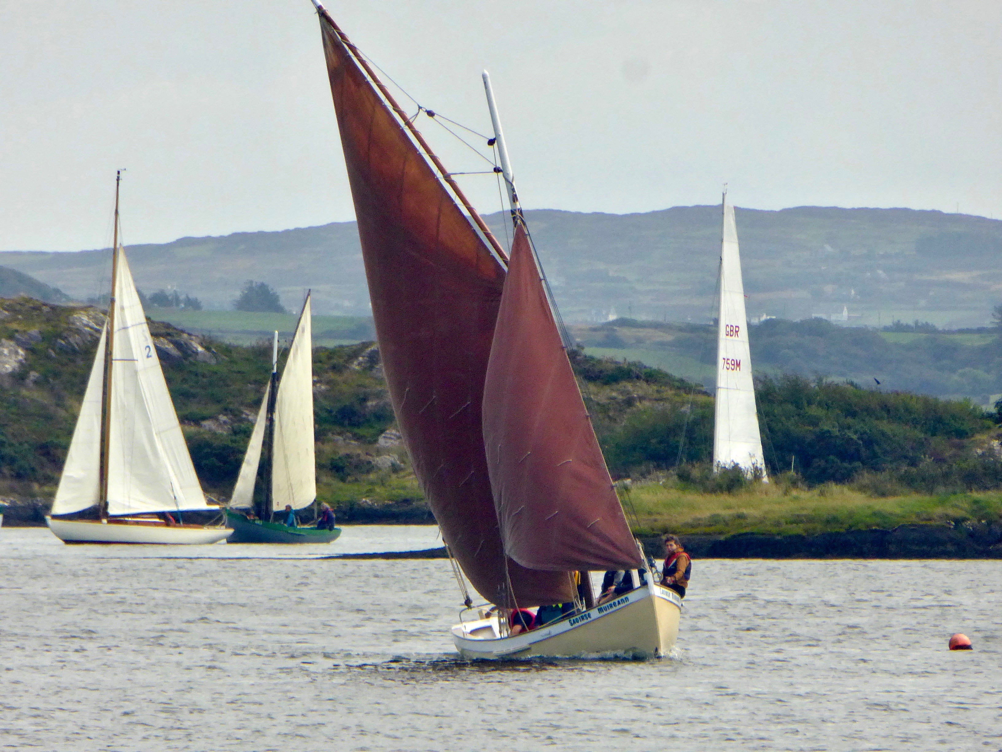
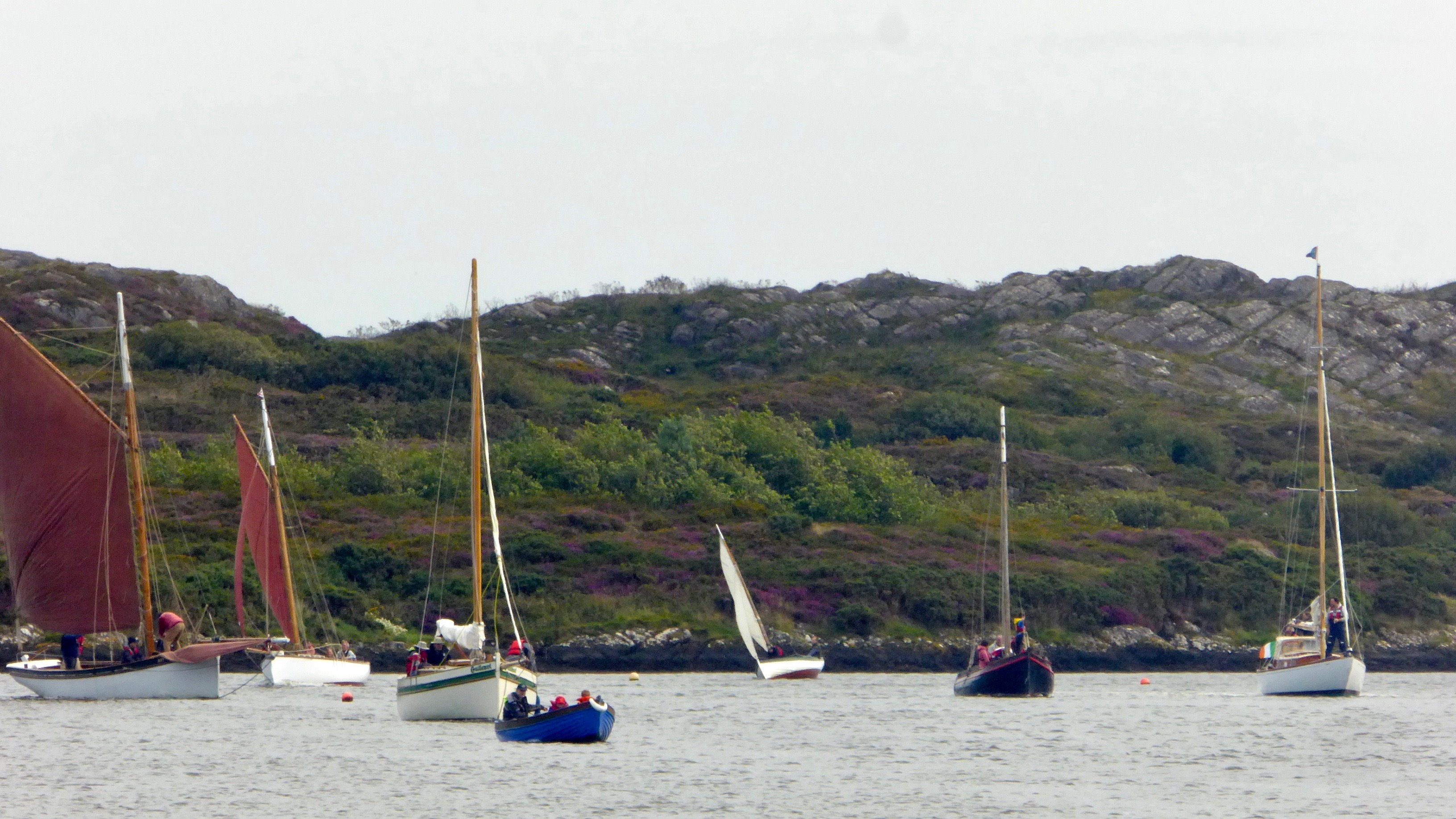
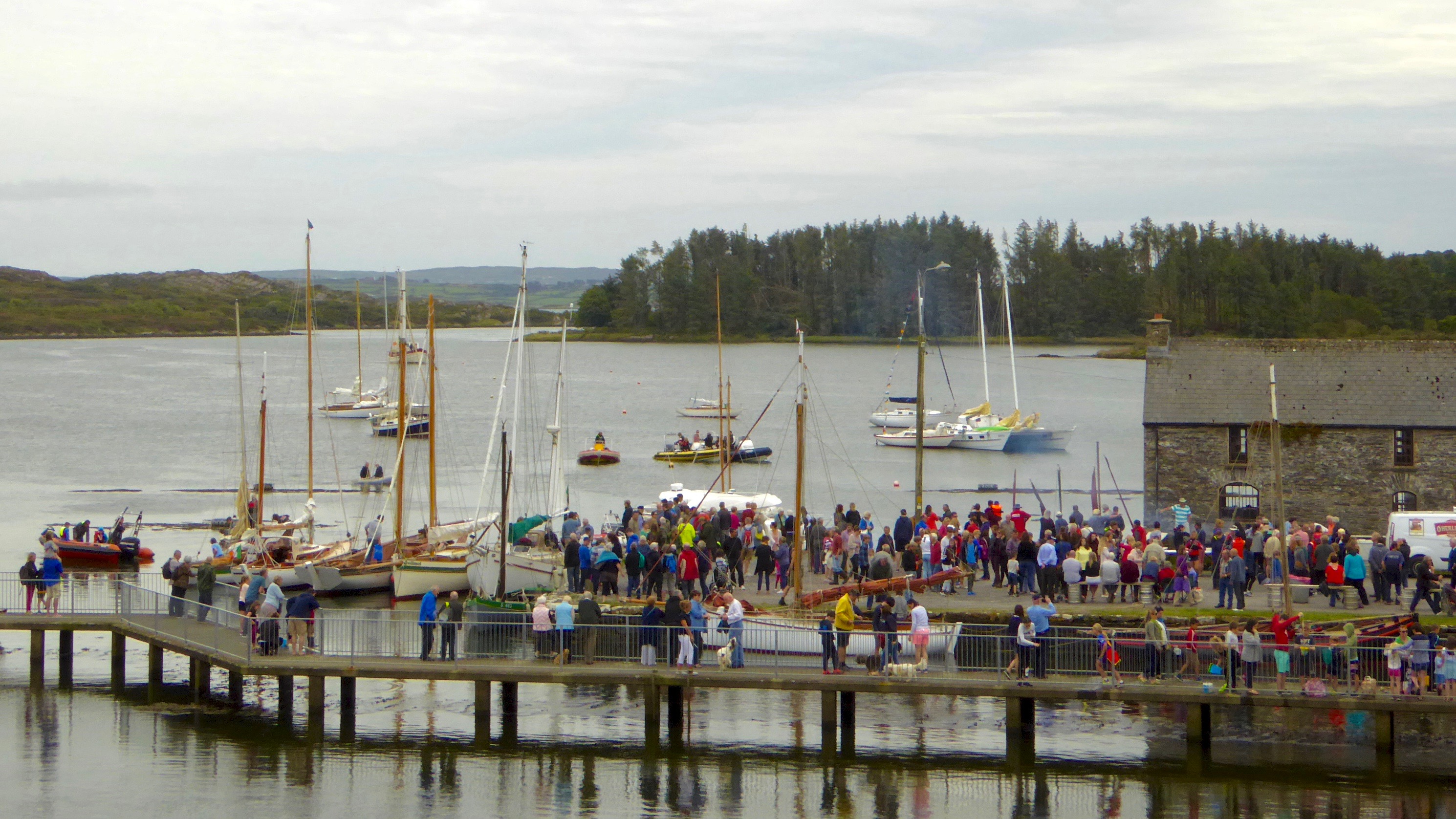
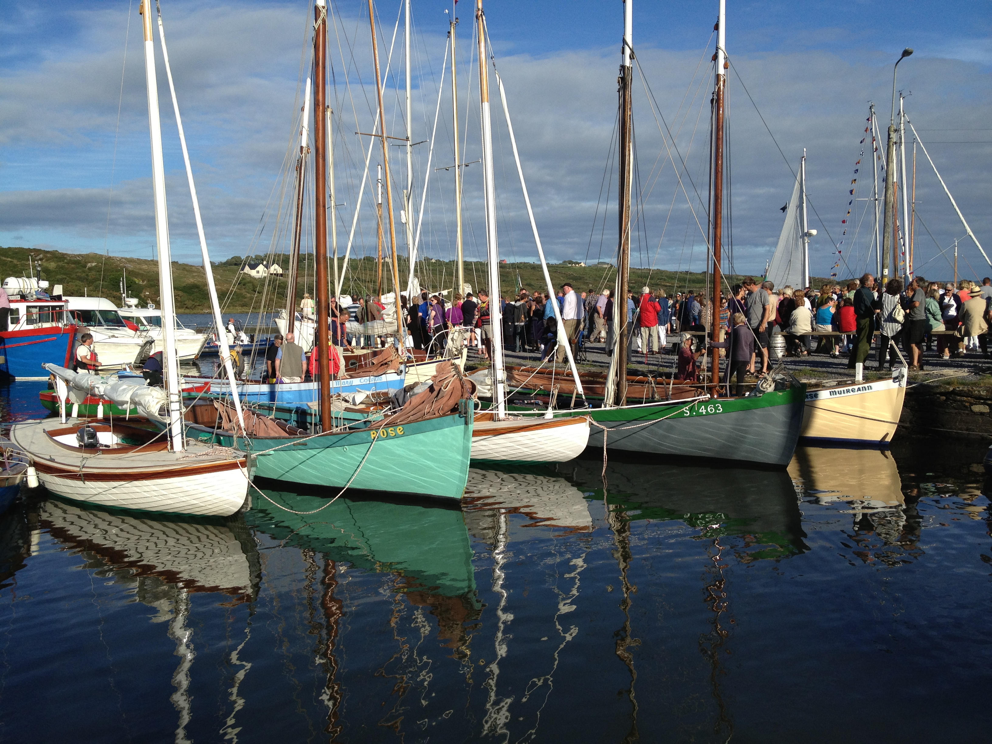
Robert has written about our field trip to Cape Clear Island and I can now reveal that the journey also included a thrilling sail around An Charraig Aonair (Karrig Ane-er, The Lone Rock) better known as the Fastnet Rock; or to thousands of emigrants for whom it was the last sight of their home country, Ireland’s Teardrop.

We had been looking forward with great anticipation to visiting the rock close up. We can see it from our home, a far away mystical crag abounding with lore and legend. We have been awestruck by the waves crashing over the lighthouse in winter storms and wondered at the lives of the lightkeepers who once manned that treacherous outpost. We watched through our telescope as enormous yachts rounded the rock in the biennial Fastnet Race last summer, following the progress of the race on a special iPhone app. I have written elsewhere about the awful tragedy of the 1979 race, in which Gerard Butler and his fellow lightkeepers on the Fastnet played a crucial role in monitoring the participating yachts in the mountainous sea conditions. 

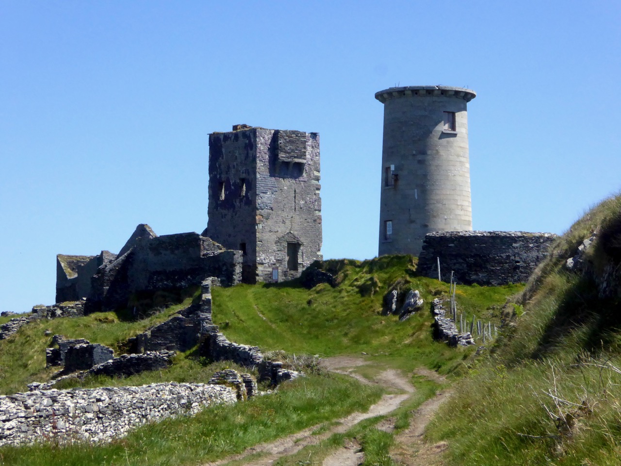
The signal station and the first lighthouse, on Cape Clear Island

The Fastnet was built to avoid such tragedies. Its first iteration was in 1818 as a lighthouse tower on a high point on nearby Cape Clear Island, beside the Napoleonic-era signal tower. However, the light was frequently obscured by fog and after the wreck of the Stephen Whitney in 1847 with 92 souls lost, it became clear that the best place for a lighthouse was on the Fastnet Rock. 

The great era of lighthouse building in Ireland got underway in the mid-nineteenth century. The engineering, design and construction expertise necessary to build lighthouses are impressive enough. Add to this the logistics of building on a tiny and inhospitable rock in a heaving sea on the edge of the Atlantic, and the sheer accomplishment of the objective is  staggering. The first attempt, started in 1849, was of steel and needed constant repair.

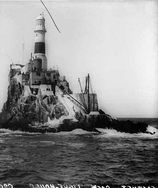
The first lighthouse on the rock – it was made of steel and didn’t last

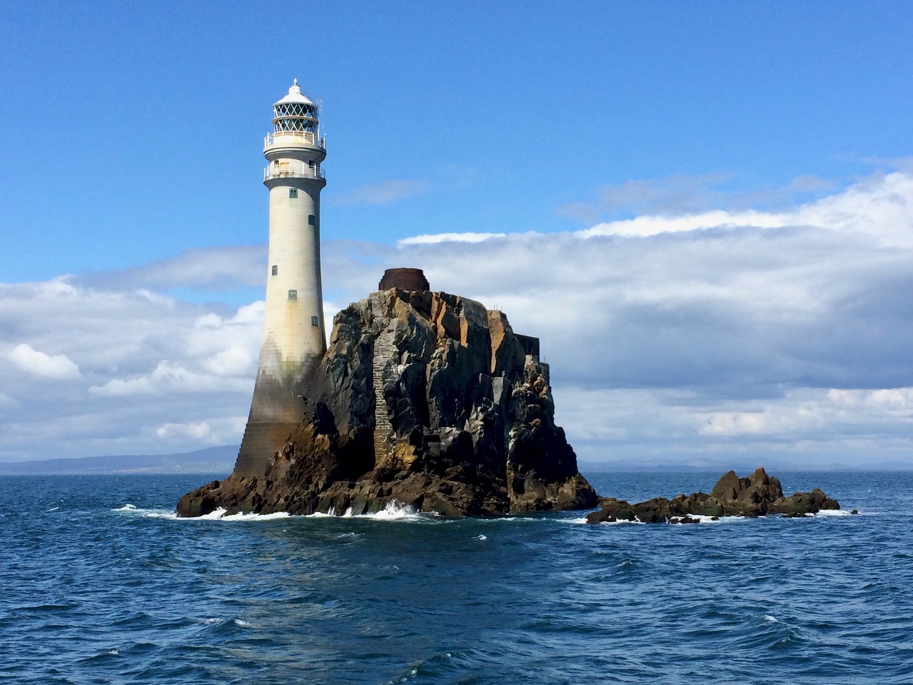
It was decided to replace it with a structure of Cornish granite and the current lighthouse first cast its beam over the waters in 1904. Eamon Lankford in his book Fastnet Rock: An Charraig Aonair describes the building process and provides old photographs illustrating how the granite blocks were ‘floated’ and hoisted on to the islet, having been first assembled and tested in Cornwall. The website Digital Irish Lighthouse Experience by Sandra Michler has an animated sequence showing how this was accomplished. it took eight years.

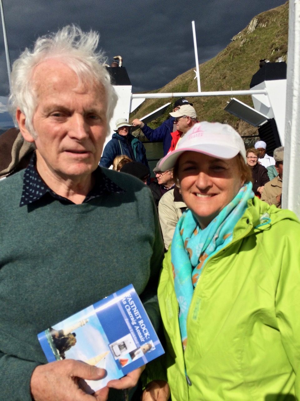
We were fortunate to have Eamon Lankford as one of our guides on our trip to the Fastnet

One of the best accounts of the building of the lighthouse was in a 2008 article in The Economist called Light on a Lonely Rock. The piece gives fascinating details into the dedications and hardships of the builders and calls the lighthouse “a monument of man’s gift to mankind.” I don’t know who wrote it, but it’s a terrific essay.

According to the Irish Lights website, Fastnet is the tallest and widest rock lighthouse tower in Ireland and Great Britain and was a monumental achievement when completed in 1904. Each of the granite stones of the tower is dovetailed into those around it, bonding the structure into a virtual monolith. This webpage also has several excellent photographs of the lighthouse from the air. What all photographs of the rock also reveal is that the lighthouse is a thing of beauty. Tall, slender and elegant and boasting two balconies, it personifies form and function in the most admirable fashion possible. (Take a look, for example, at Dennis Horgan’s website – he’s an acclaimed aerial photographer and his photograph of the lighthouse is probably the most iconic shot of them all.) Today the Fastnet is fully automated but in The Lightkeeper Gerard Butler describes what it was like to live on the rock in fair weather, when he fished and swam from the steps, and foul, when the seas crashed and roared over the lighthouse as it quivered and shook all night. 

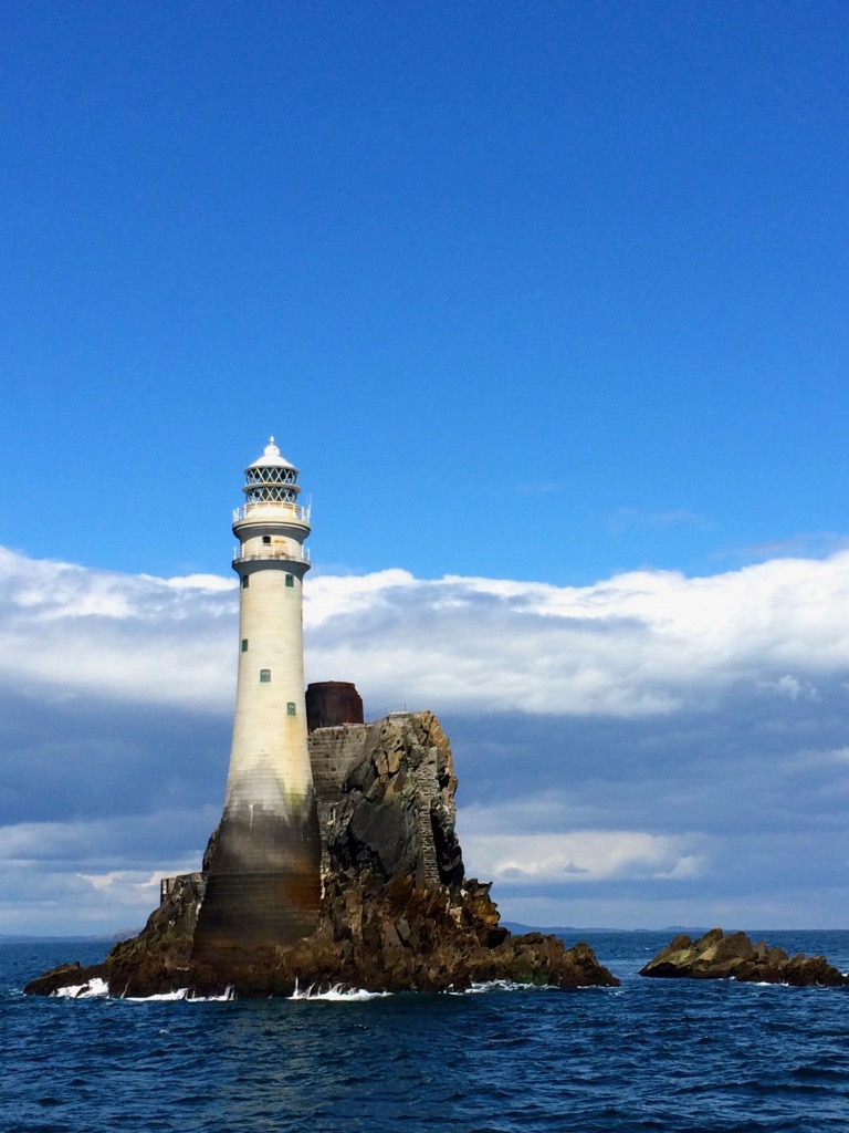
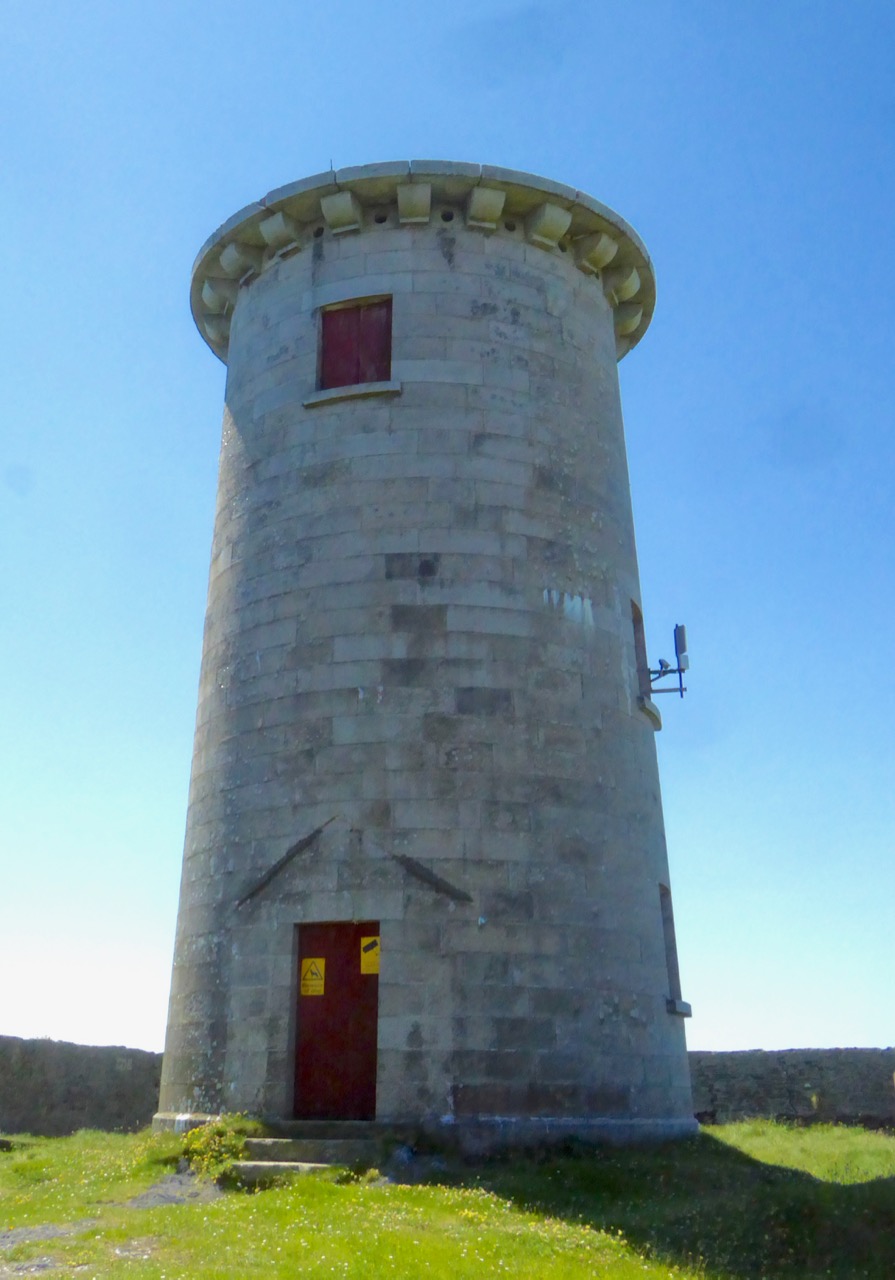
The lighthouse showing the full extent of the Cornish granite and the stub of the old steel tower

One of the stories we heard from Eamon concerned  a daring midnight raid on the lighthouse carried out by an IRA ‘Flying Column’ (experts in guerilla warfare) in 1921 during the Irish War of Independence. They were after the explosives used on the Fastnet to power the foghorn. [EDIT: I have some errors here – please see Finbarr O’Driscoll’s correct information about the raiding party in the comments section.] In researching this story further, I found an article in the 1999 Mizen Journal (no longer in print) by Frank Lannin, based on the eyewitness statement of Sean O’Driscoll.*

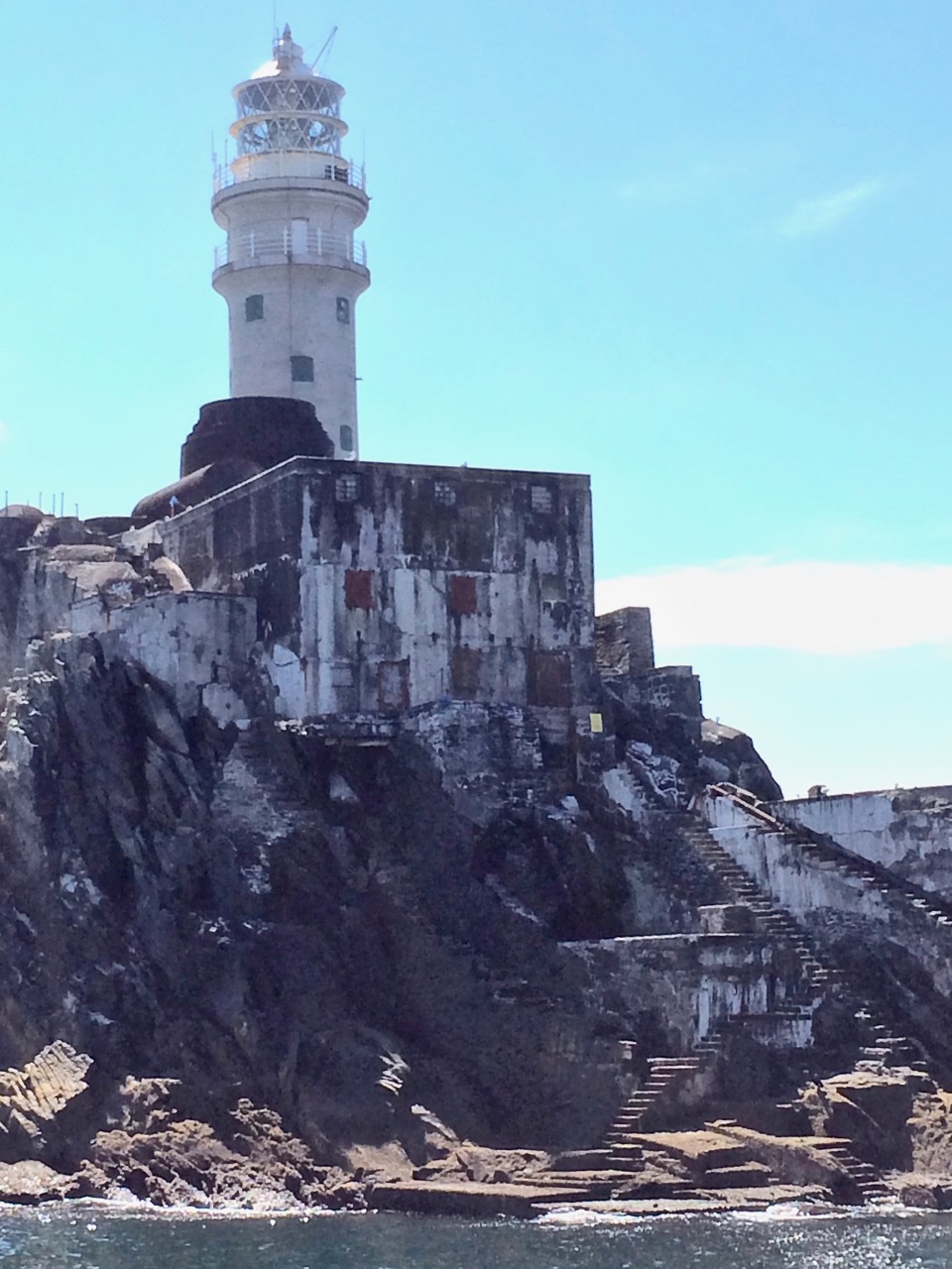
The Rock, showing the landing platform, steps and store

Here is part of Lannin’s account:

The breeze had freshened and caused the usual swell around the Rock and there was a rise and fall of several feet. The anchor was let out and the boat moved slowly to the landing place. Positioned on the bow was John O’Regan, a rope tied around his waist, a revolver in his pocket and balancing himself with the rise and fall of the boat. He would have to select the right moment to jump on the Rock and catch the iron ring which was fixed to the Rock. He knew where the ring was fixed, but to grasp it in total darkness was a feat that few would attempt. His vast experience as a seaman was now to be put to the test. As a wave was rising he jumped. It was a tense moment. As the wave covered him he grasped the ring with both hands. (It was an occasion for handclapping, but not tonight.) In seconds he had made the boat fast and the rest of the raiding party were landing on the platform. The huge steel door of the lighthouse was not locked. John was first up the spiral stairway leading to the room where the Lightkeeper was on duty. He put up no resistance and as a precaution the wireless was dismantled. Seventeen boxes of gun cotton and three boxes of detonators and primers were loaded on to the “Maire Cait” by means of the lighthouse derrick. in all, the spoils weighed but one ton. The daring mission was accomplished.

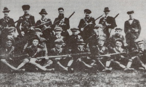
A Flying Column (this one from Tipperary)

The fog signal, together with the light, was an important aid to navigation for ocean going vessels. It was only in 2011 that the Fastnet foghorn was permanently discontinued, as modern navigation equipment rendered it unnecessary. All around the world people are missing the haunting sound of foghorns now, a sound so many of us grew up with. But at least we can see the light from Carraig Aonair every night and count its ‘character’ – one two three four FLASH…one two three four FLASH – and know that it’s doing its part to keep our mariners safe on the seas that roll outside Roaringwater Bay.

*See pages 18 to 20 of Sean O’Driscoll’s statement for his dramatic story of the raid.


Cruinniú na mBád – the Boat Gathering

It only happens once a year! During Ballydehob’s Summer Festival traditional sailing boats gather in Roaringwater Bay and when the tide is right they sail up the shallow waters of Ballydehob Bay to the quay.*

This is a tidal estuary and normally not deep enough to be a reliable port of call for boats, especially those with keels. But during the high summer tides the waters become navigable, provided you time it right, and Ballydehob breaks out the band, fires up the barbecue and invites all sailors to the quay for a gathering like no other.

The Cruinniú na mBád (pronounced krinoo nuh mawd) is part of the village Summer Festival so from year to year it’s a real community affair. The vintage cars and tractors (my goodness there’s a lot of them in West Cork) parade behind a marching band to kick off the week of festivities. The week is filled with music in the pubs, guided walks around the village, charade competitions, and an evening of street sports where we cheer on the youngsters in the madcap turnip race and a completely socially irresponsible event involving chugging beer and pushing a wheelbarrow with an occupant (only in Ireland!).

Turnip races down the main street and crab fishing at the quay

On the weekend the whole village takes to the Pier. The kids compete for medals in crab fishing, there’s a “world famous duck race” (I have no photographs as it’s been cancelled due to bad weather so often), there are fireworks (when it’s dry enough) from the Twelve Arch Bridge, and we await the arrival of the Old Boats.

This year’s entertainment was the fabulous East coast Jazz Band. We catch up on the chat, and look out for one of our popular locals sailing in

It’s an oddly emotional experience to see the boats appear, one by one, and round the bend into the last stretch to the quay. Emotional because this is essentially a re-enactment of what was commonplace in former days, when the quay at Ballydehob was a bustling hive of commerce. Bigger boats would anchor at the entrance to the Bay and lighters would haul the cargo to the quay.

Not all the boats are old – some have come just to be part of this unique gathering – but most are traditional and many of them have been lovingly restored. Some, like the Ette, have been rescued from extinction and reconstructed from crumbling derelicts by master boatbuilders Anke Eckardt and Rui Ferreira – check out their site for an illustrated guide to the slow and skilful processes involved.

Anke and Rui arrive in their Ette-class boat

At this year’s gathering Anke’s parent, Dietrich and Hildegard, our neighbours and friends, were there with their classic fishing boat, the Barracuda.

The whole Levis family sailed in on their beautiful Saoirse Muireann (seer-shuh mirren, Freedom of the Seas), a traditional Heir Island Lobster Boat. Cormac has written the book, literally, on these boats: Towelsail Yawls: The Lobsterboats of Heir Island and Roaringwater Bay. He started this gathering way back in 2004 and it’s been going strong ever since.

Saoirse Muireann coming in to dock. The term towel sail comes from the Irish word teabhal (pronounced towel) meaning shelter, as the sail could double as a kind of tent in wet weather.

Another traditional boat was An tIascaire (on tee-skirruh, The Fisherman), a traditional mackerel yawl. Like many boats in these parts, this one has benefitted from the extraordinary knowledge of the boatbuilders at Hegarty’s Boatyard at Oldcourt – regular readers will remember Robert’s post about this wonderful place.

It’s also lovely to see a Galway Hooker, An Faoileán (on fwale-awn, the Seagull), participating – their black hulls and red sails are instantly recognisable. This one has quite a history – and reading it educated me as to the difference between sails that are gaffe-rigged, versus a traditional Irish rigging known as pucán-rigged (puck-awn). Of course all you sailors know this already, right?

Our friend Jack O’Keefe organises a rally every couple of years for Drascombe Luggers and they joined the gathering en masse in 2014. Unlike 2013 it wasn’t the best of weather, but that did nothing to dampen the spirits of the sailors. It was lovely to be there on the dock to cheer them in.

The Drascombes raft up alongside. Jack O’Keefe and  keen sailor Sheena Jolley

It takes lots of sailing know-how to get up the Bay, but even more to manoeuvre into the tight spaces along the quay, or raft up alongside. By the time everyone’s there, they are rafted up four and five boats deep. 

Then it’s up on shore to partake of the music, the food and the friendly camaraderie that is so typical of both the boating community and the village of Ballydehob, until finally the word goes around that the ebb tide has started and it’s time to carefully push out and take to the seas again – until next year.

 I’ll finish with a video. Sit back and enjoy it, and think about the hundreds, no thousands, of years of history that is evoked by the sight of boats sailing up Ballydehob Bay.

*The photographs in this post are not all mine. Barney Whelan (friend and follower of Roaringwater Journal) was in one of the boats and sent me some taken on the water. Thank you, Barney! Some were shamelessly stolen from the Fastnet Trails Facebook Page, and are the work of the indefatigable Margaret McSweeney (great people shots – thank you, Margaret!). The video is by Tom Vaughan of Oakwood Aerial Photography – he makes West Cork look even more beautiful than it is (and that’s saying something) in his amazing drone footage. The rest of the photos are mine and were taken in 2013, ’14, ’16 and this year.