We have almost 30 posts titled Mizen Magic and over the next few weeks I want to highlight some of them – from castles to beaches, from archaeology to geology, from walks to folklore – the Mizen Peninsula is endlessly fascinating and scenic. Lets start with some archaeology.
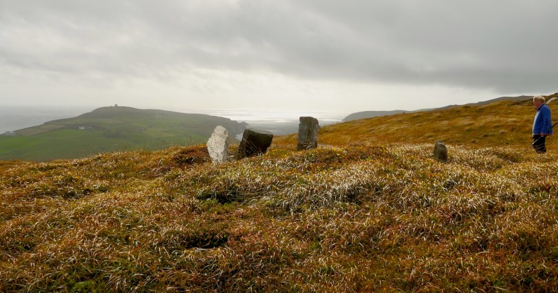
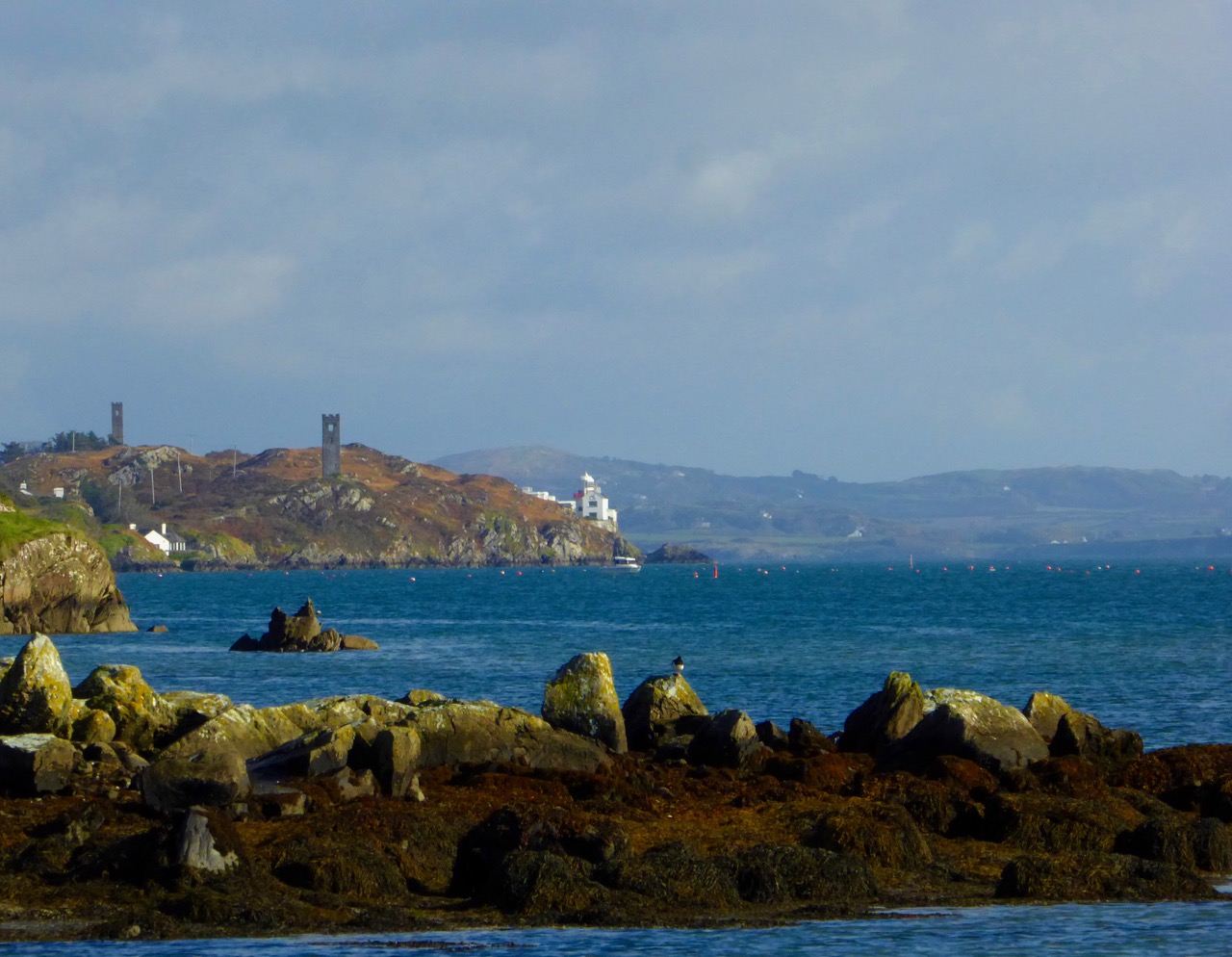
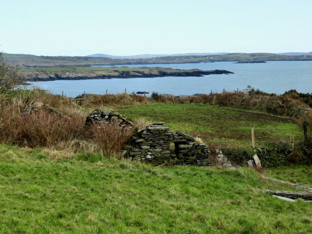
Dunbeacon is on the North side of the Peninsula, and home to both a stone circle and a vestigial O’Mahony castle. In Mizen Magic 7: Dunbeacon – History, Prehistory and Questions of Access we explored the trade off when access is provided to an ancient monument, but that aspect also severely impacts on the monument itself. The photo above is the before, while that below is the after.
There isn’t much left of the O’Mahony Castle in Dunbeacon, but what a location!
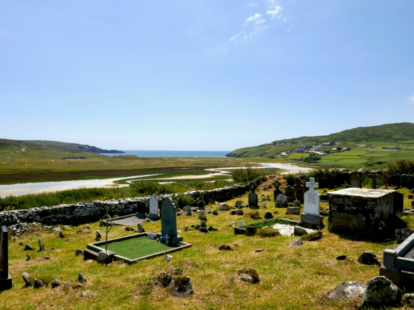
In Mizen Magic 14: Lissagriffin, we explored a little known townland close to Barley Cover. The ruined church may be far older than we think and there are hints in the landscape of long, long occupation.
Of this area I said There are parts of West Cork that seem to hold within them all the memories and markers of eons. There are four wedge tombs, a lake with an imprisoned demon of the pagan times, cupmarked stones, a standing stone and a possible ogham stone we could not locate. I am convinced that one of the wedge tombs may be an incorrectly identified passage grave.
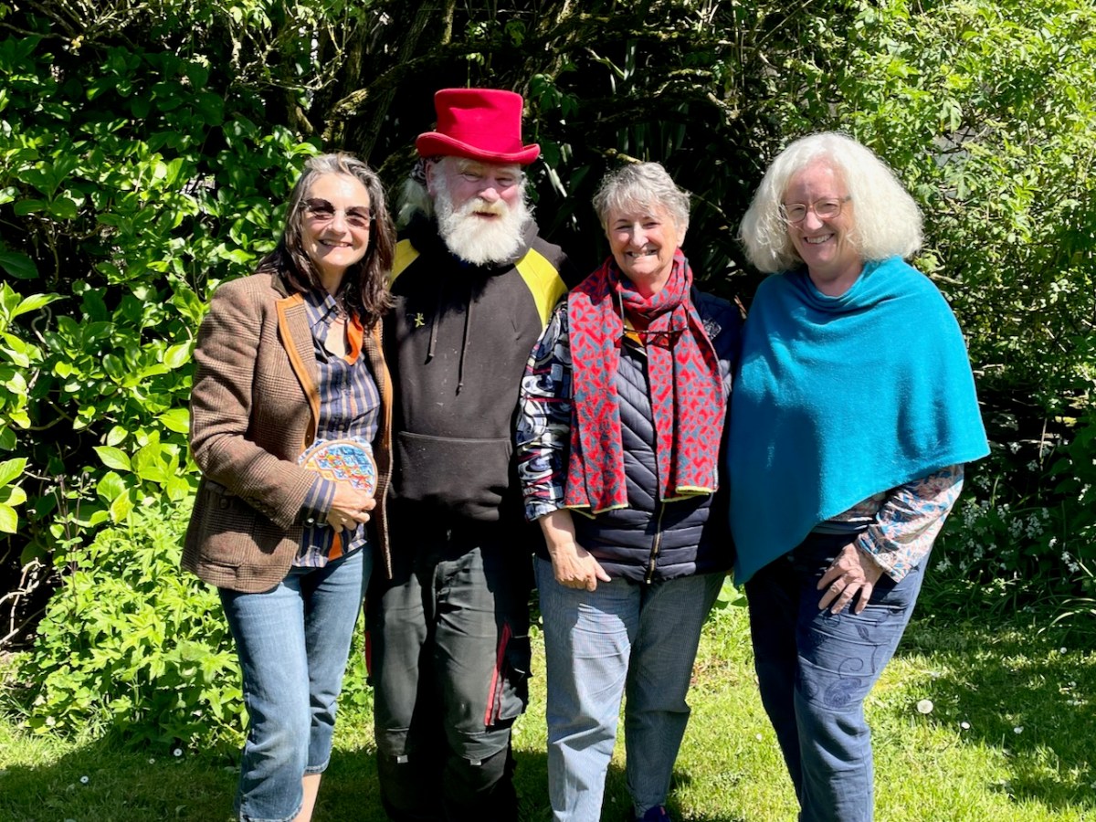
At the very far reaches of the Mizen, surrounded by townlands whose names all translate as variants on the theme of rocky fields, in a place with immense views, lies an oasis of creativity and charm: the home of Owen and Kate Kelly and their family.
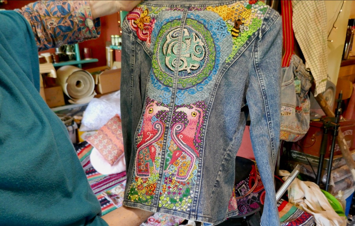
Three of us, Artist Christina, Blogger Finola, and Writer/Actor/Director Karen, fetched up there on a blue sky day this week, to visit Owen and see his craft. Owen is a stitcher, an embroiderer, a needleworker. He’s also a professional coach (international table tennis), a gardener and a conservationist. Nowadays, he, as a fifth-generation stitcher, makes his living crafting unique garments and decorative elements for high-end clothing.
It has all grown organically from his social media accounts on Facebook and Instagram and Bluesky. Somehow, the like-minded find each other and the army of admirers grows, and the orders start to arrive.
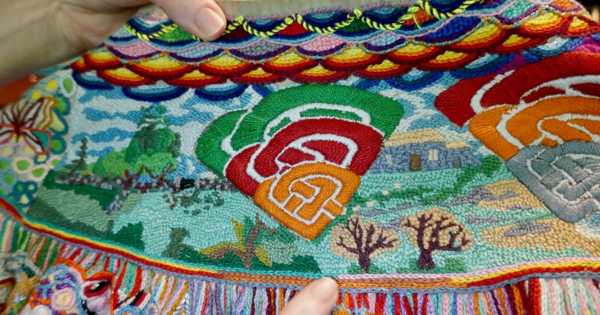
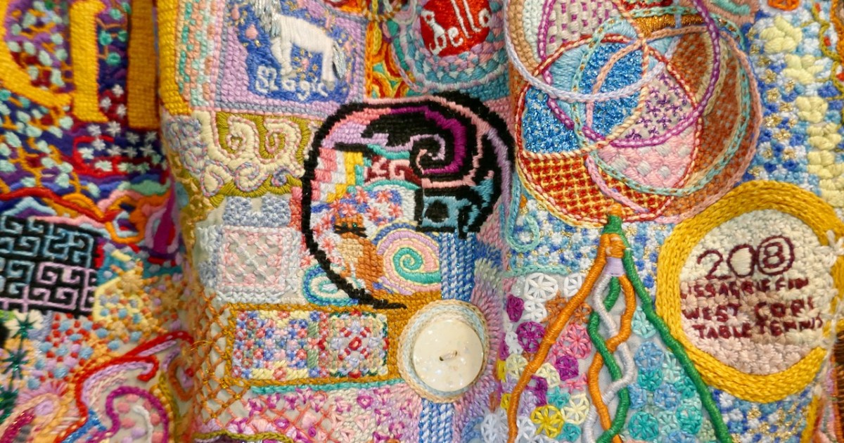
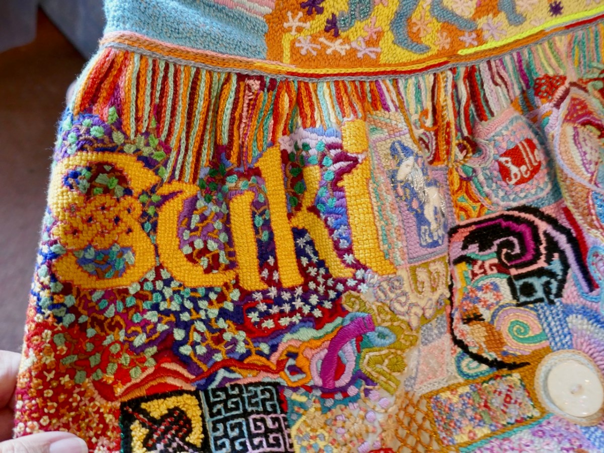
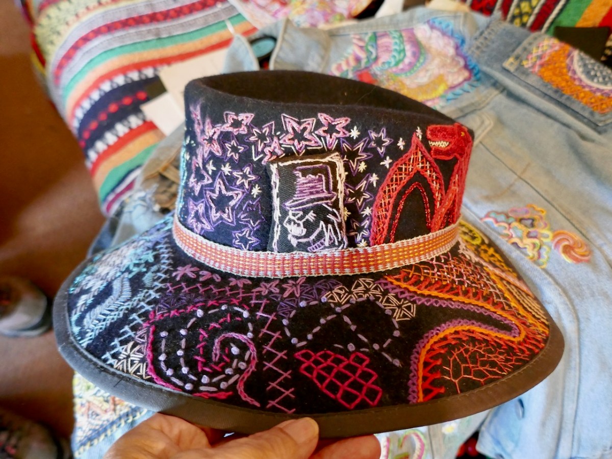
Owen doesn’t just decorate – he tells stories with every piece. The first thing he showed us was his memory skirt, full of his own history. That’s his trip to Glastonbury, here’s a particularly memorable table tennis tournament, the birth of a daughter, his grandmother’s favourite stitch in her favourite colour.
He thinks it’s finished and I certainly didn’t see any place to add more, but heck, you never know.
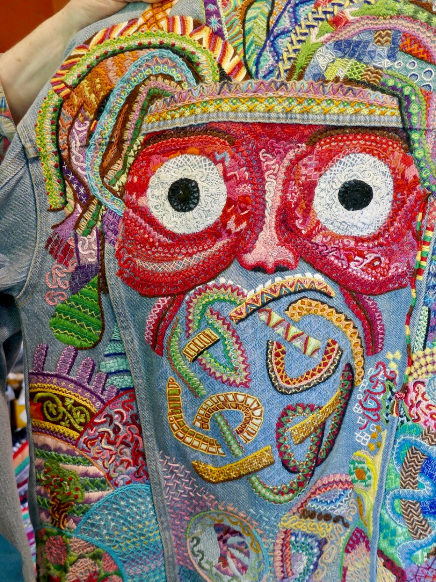
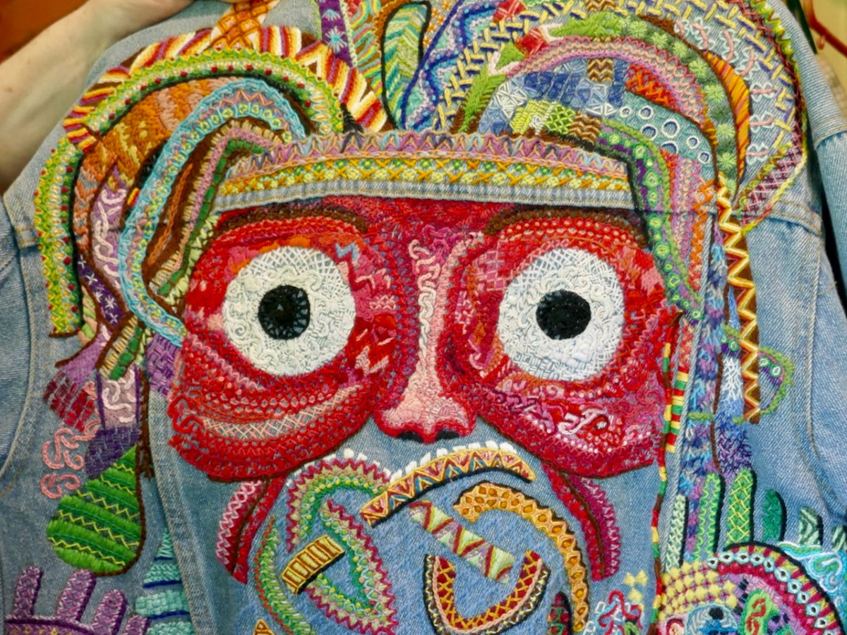
Here’s the back of a jacket that I assumed was an owl – but Owen was referencing the need for masking that so many people feel. That is, they cope with life by concealing their mental struggles, their ADHD or Autistic tendencies, in order to fit in. It’s exhausting, and his depiction is an act of masking in itself, since I jumped to the conclusion that this was a bird.
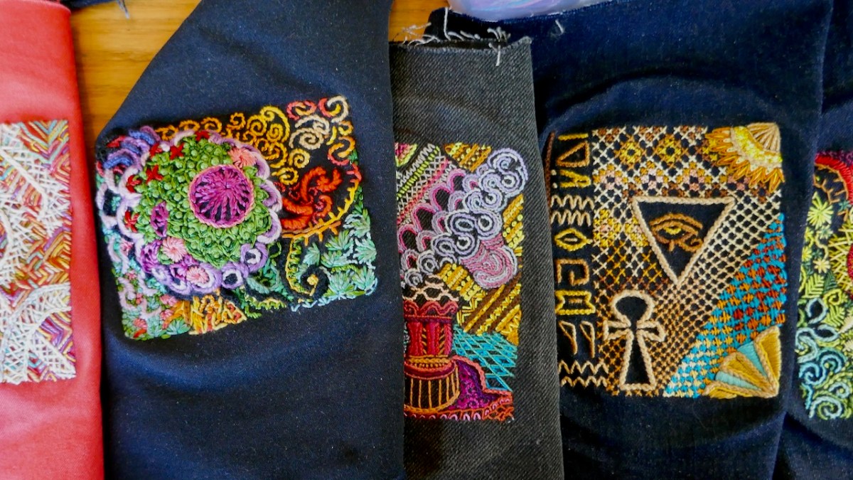
And the mask is a good piece to take a closer look at the sheer variety of individual stitching styles. I have a vague memory from school of learning blanket stitch, daisy chain, French something-or-other, but Owen must know hundreds of different stitch types. Zoom in!
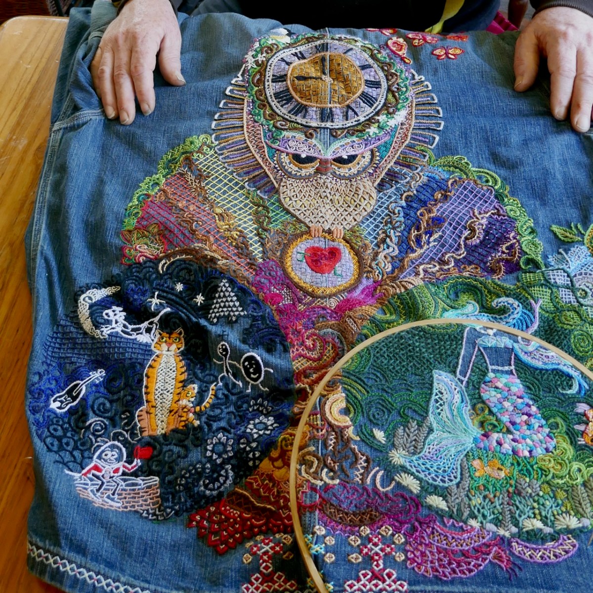
Owen walked us through the process of designing the back of a Ralph Lauren shirt for a client – sorry, that should be, for a friend. That’s what they all turn into. In this case he has already done pieces for other members of the family so he knows the children, the grandchildren, the stories, the likes, the hobbies, the icons they gravitate to.
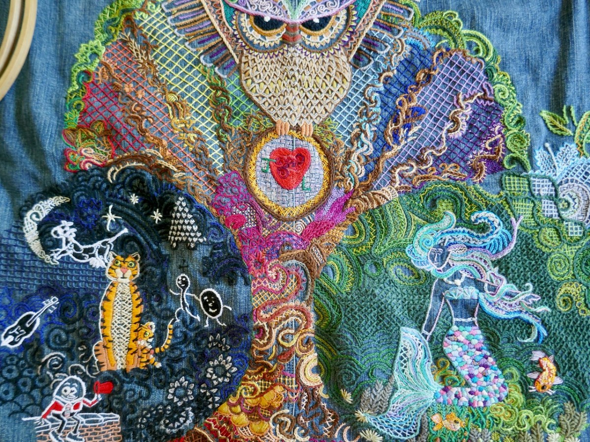
What fascinated me most is that he doesn’t start out (as left-brained me would do) with a plan – there is no sketch design, no chalk marks on fabric, no story board or end-goal. But in his head is the story he wants to tell. He calls this process ‘flow stitching.’
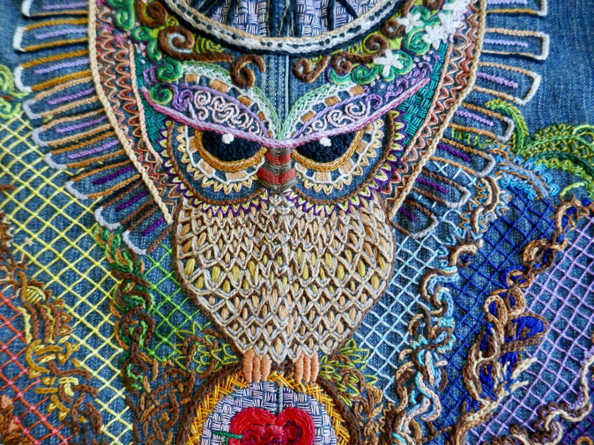
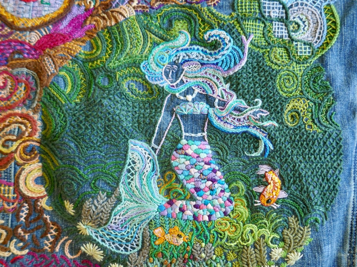
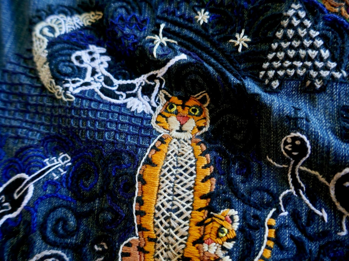
In this case the story is about a proud grandpa, so there’a grandfather clock and an owl for wisdom, and the heart that he and Grandma once carved on a tree. There’s a tree too, and a rainbow. And, can you see it? The overall shape is a Buddha.
The grandson is there, with the tiger, and the cow jumping over the moon and Humpty Dumpty waving Owen’s signature red hat. The granddaughter loves mermaids. And in between there are all kinds of little symbols and references, in all kinds of different stitches and colours. As I poured over it, all I could think of was – be still my heart – how I would love to be at the unveiling of this wonderful garment.
He learned his skills from his mother and grandmother and of course he got bullied in school but he persisted anyway. He’s heavily influenced by indigenous art, by Indian and Persian designs and by Celtic interlacing and illuminated manuscripts such as the Book of Kells.
He cites his remote location on the edge of the Atlantic as another influence – the colours, the wildness, tuning in to the natural world and the deep tradition of story telling and mythology.
Ongoing projects include his hoops – 6” rounds, each one telling a story, and his quilt pieces, which will (may?) eventually make up a whole quilt. He loves to play with symmetry – with half- or quarter-designs for example, that need to be matched with other halves or quarters to make a whole.
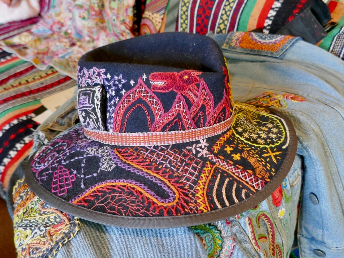
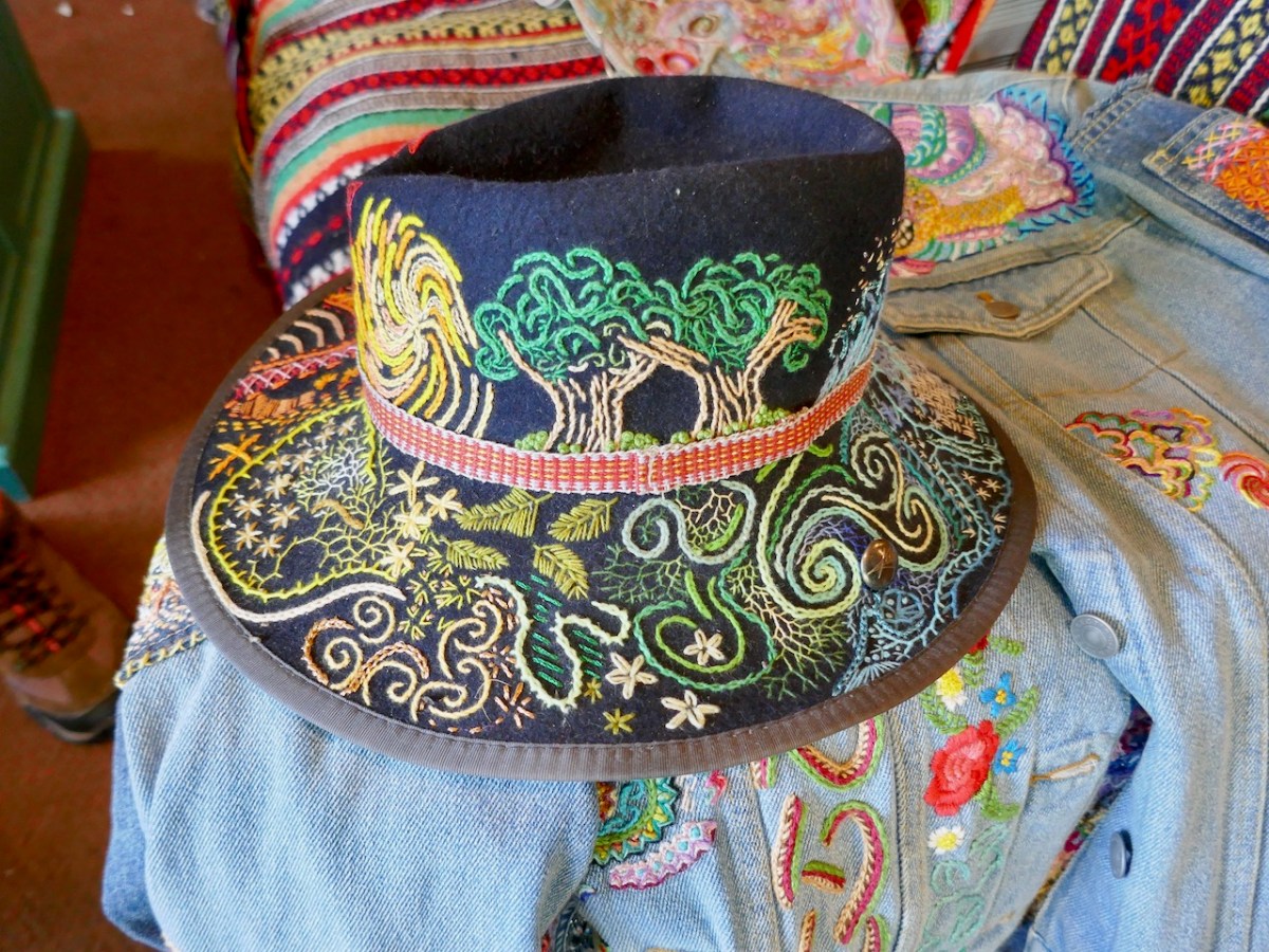
I’ll leave you with images of a hat – Owen is a hat man and his signature is a red hat. In fact when I met him recently he was wearing a red jacket, a red hat, and an amazing embroidered tie.
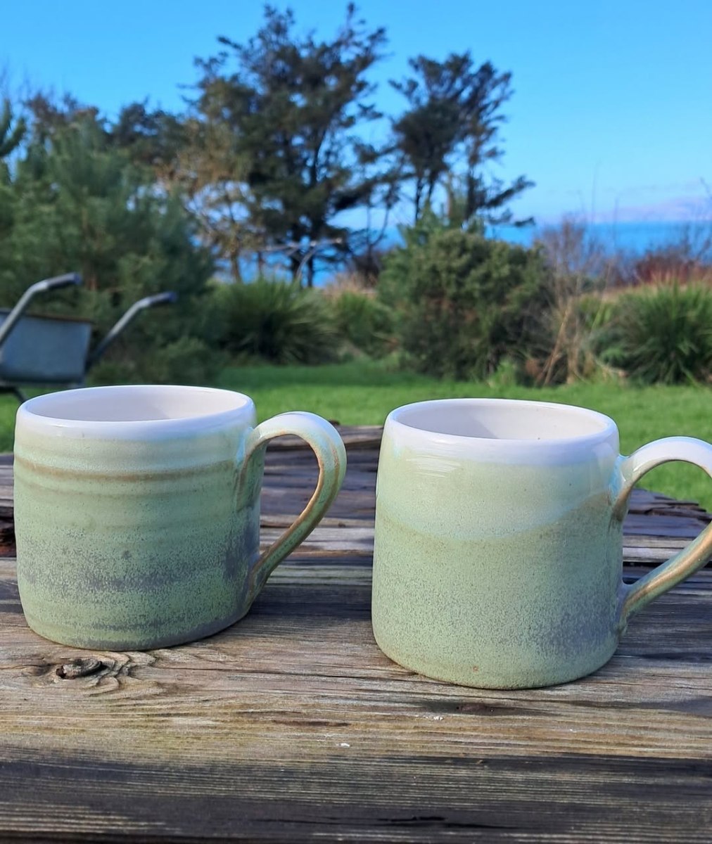
And I didn’t leave empty handed – I took away one of Kate’s lovely mugs. She’s been experimenting with a new green glaze and it’s gorgeous. I can report that coffee tastes really good from it too. That’s Kate’s own photograph, below. Her pottery is for sale at the Mizen Visitor’s Centre.
I’m reposting this, written six years ago, for the season that’s in it.
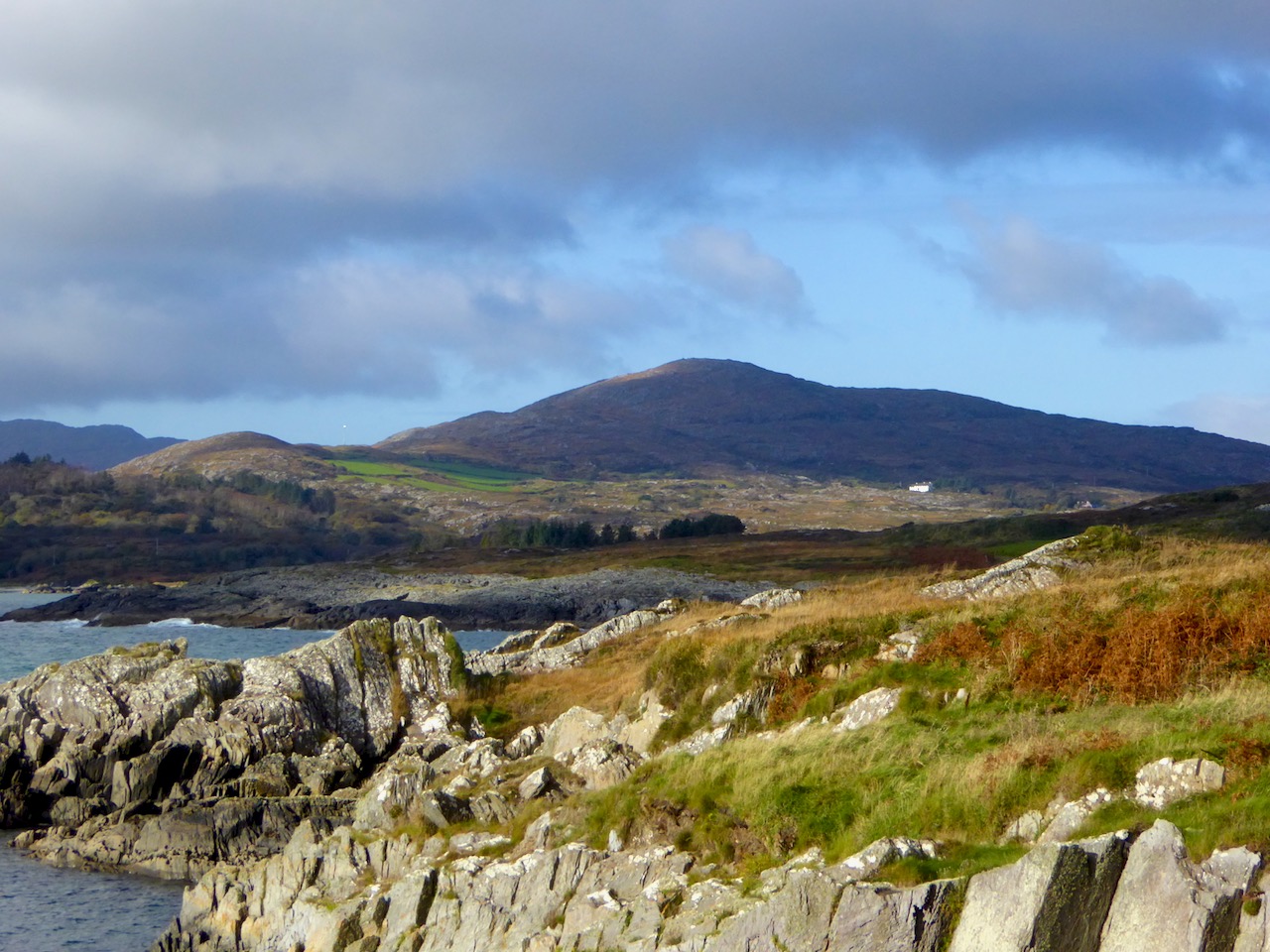
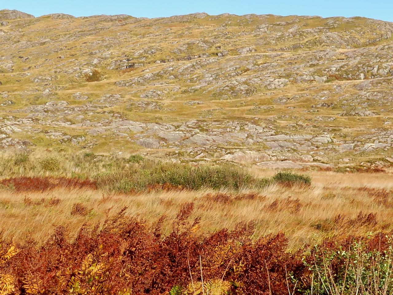
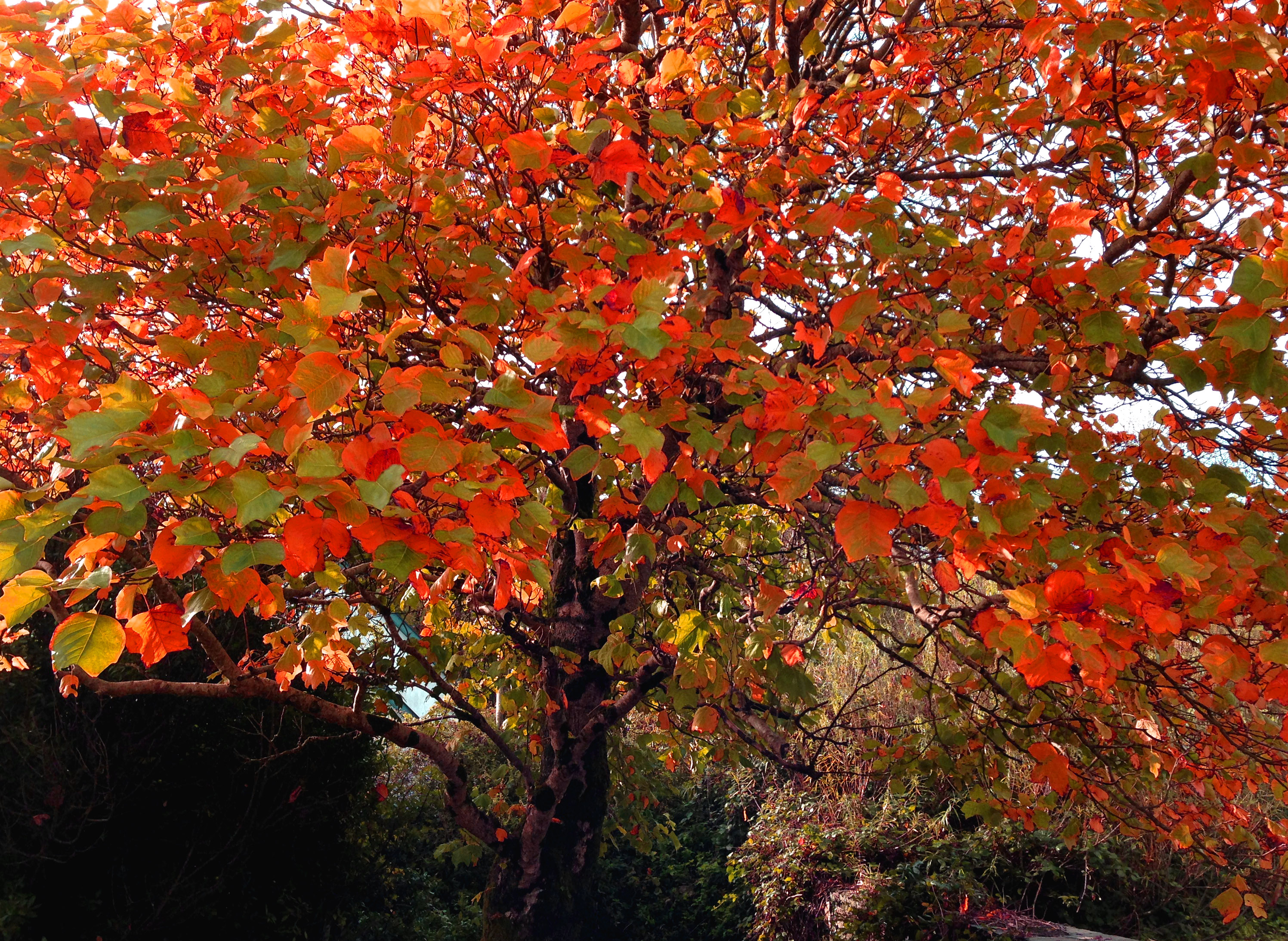
It’s not the trees that lend autumnal hues to the Mizen, as they do elsewhere. It’s the whole landscape – that combination of rock, heather, bracken, moor grass, brambles, filtered through the light and shade of our notoriously changeable climate – that creates the special colour palette we associate with autumn. It’s my favourite time of year.
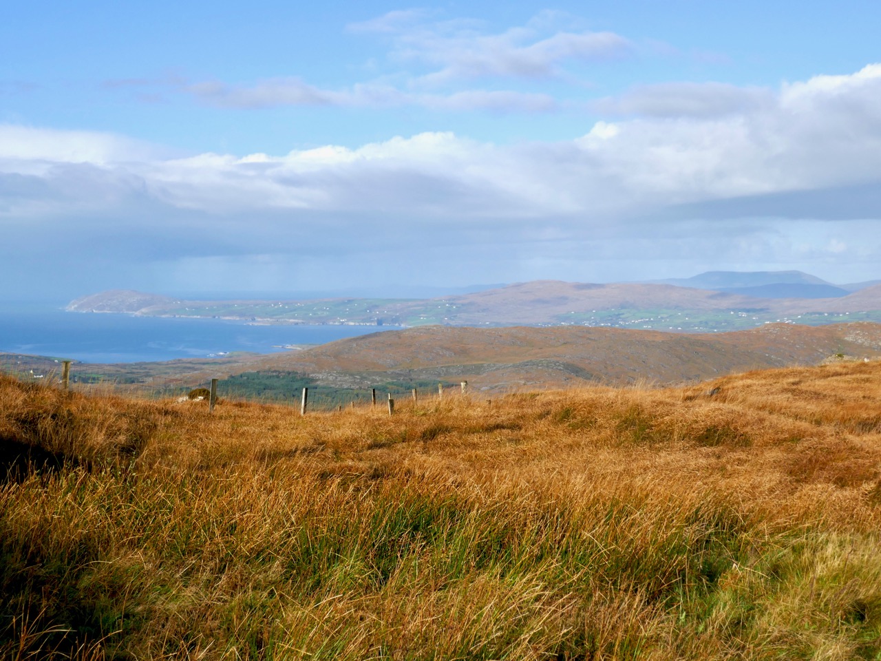
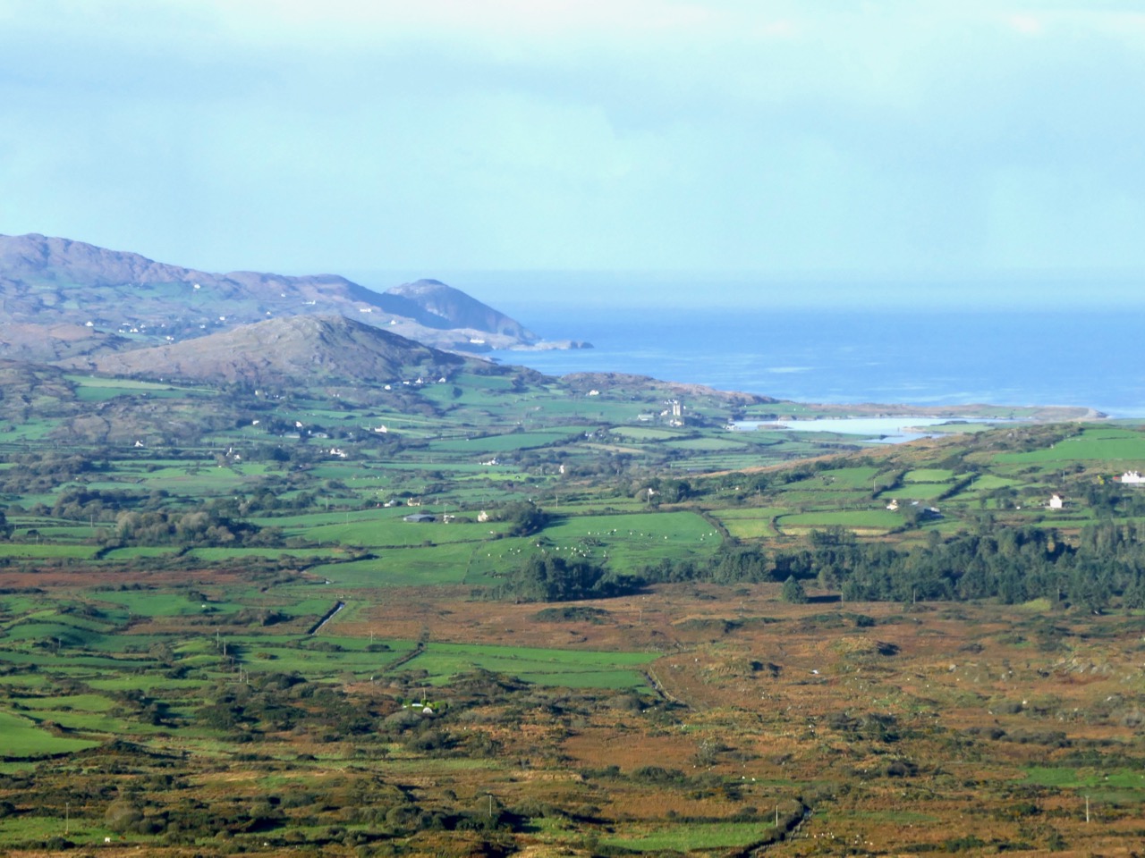
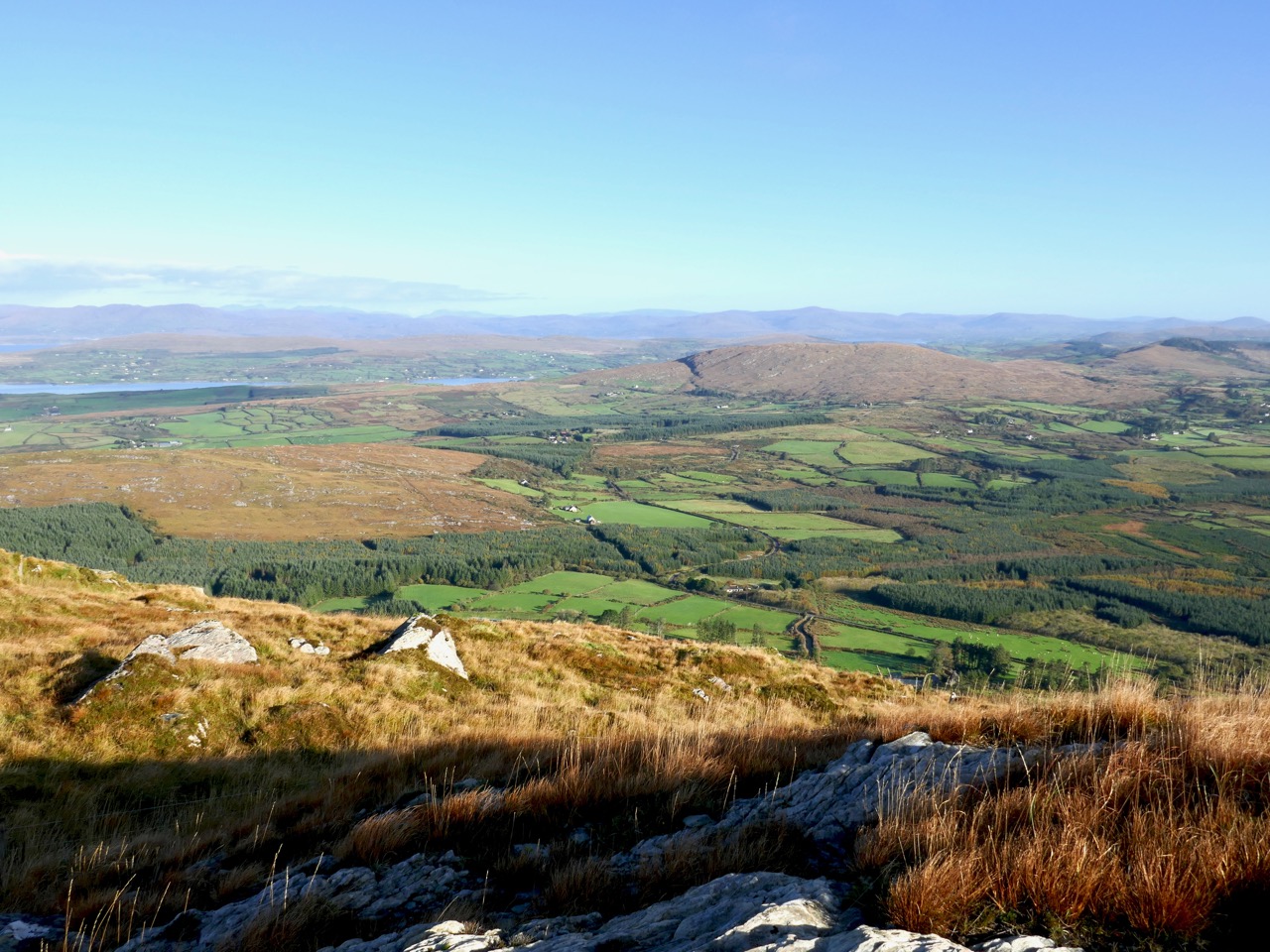
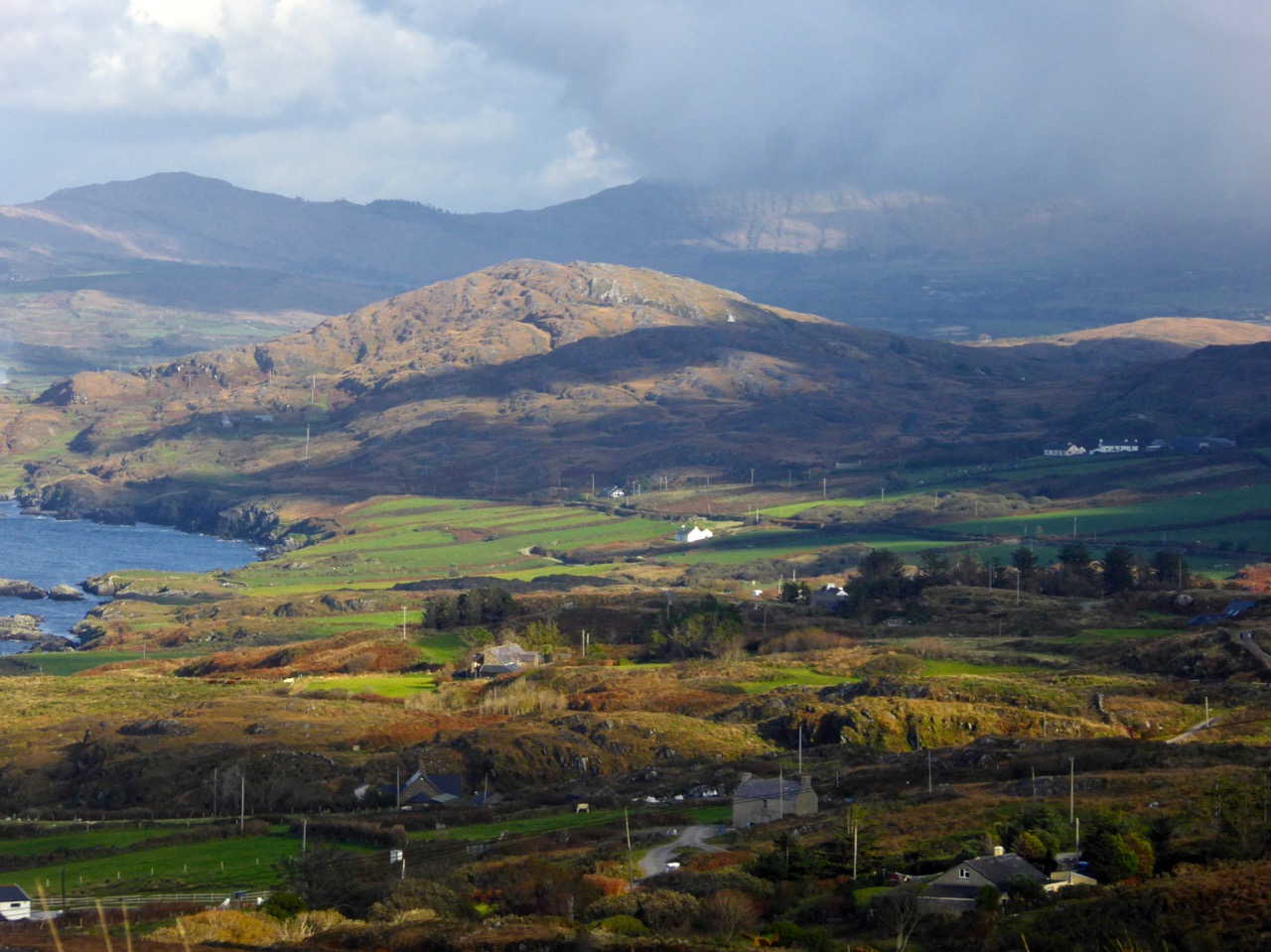
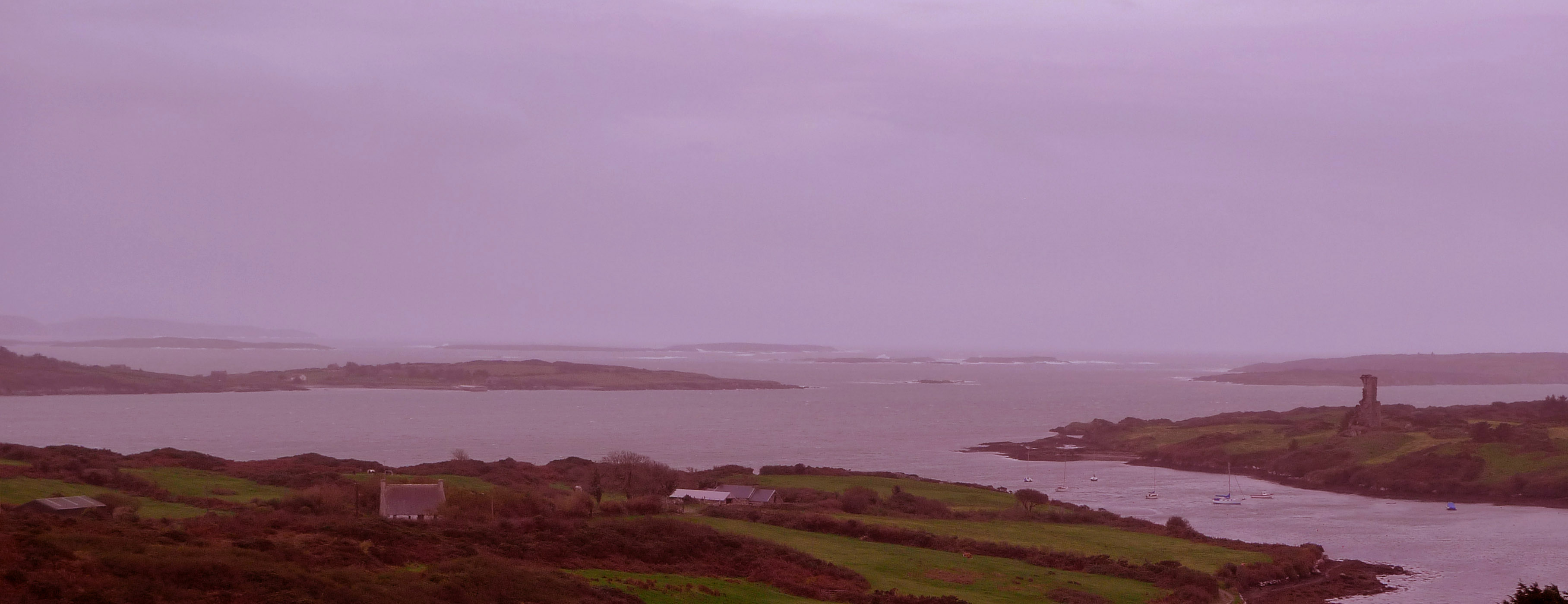
Today, early, we drove up Mount Gabriel and looked over the whole of the Mizen, back to Mount Corrin and Mount Kidd, and across to the Sheep’s Head, the Beara, and away to the mountains of Kerry.
Upper: looking down to Dunmanus Bay from Mount Gabriel; Lower: looking across to Mount Corrin
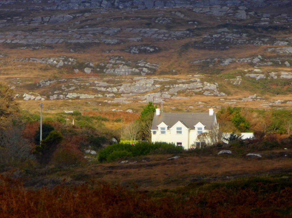
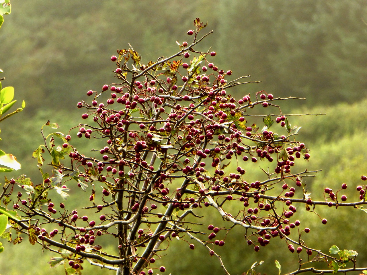
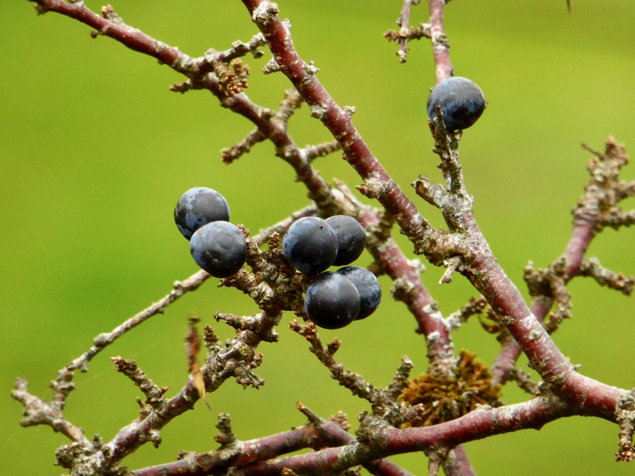
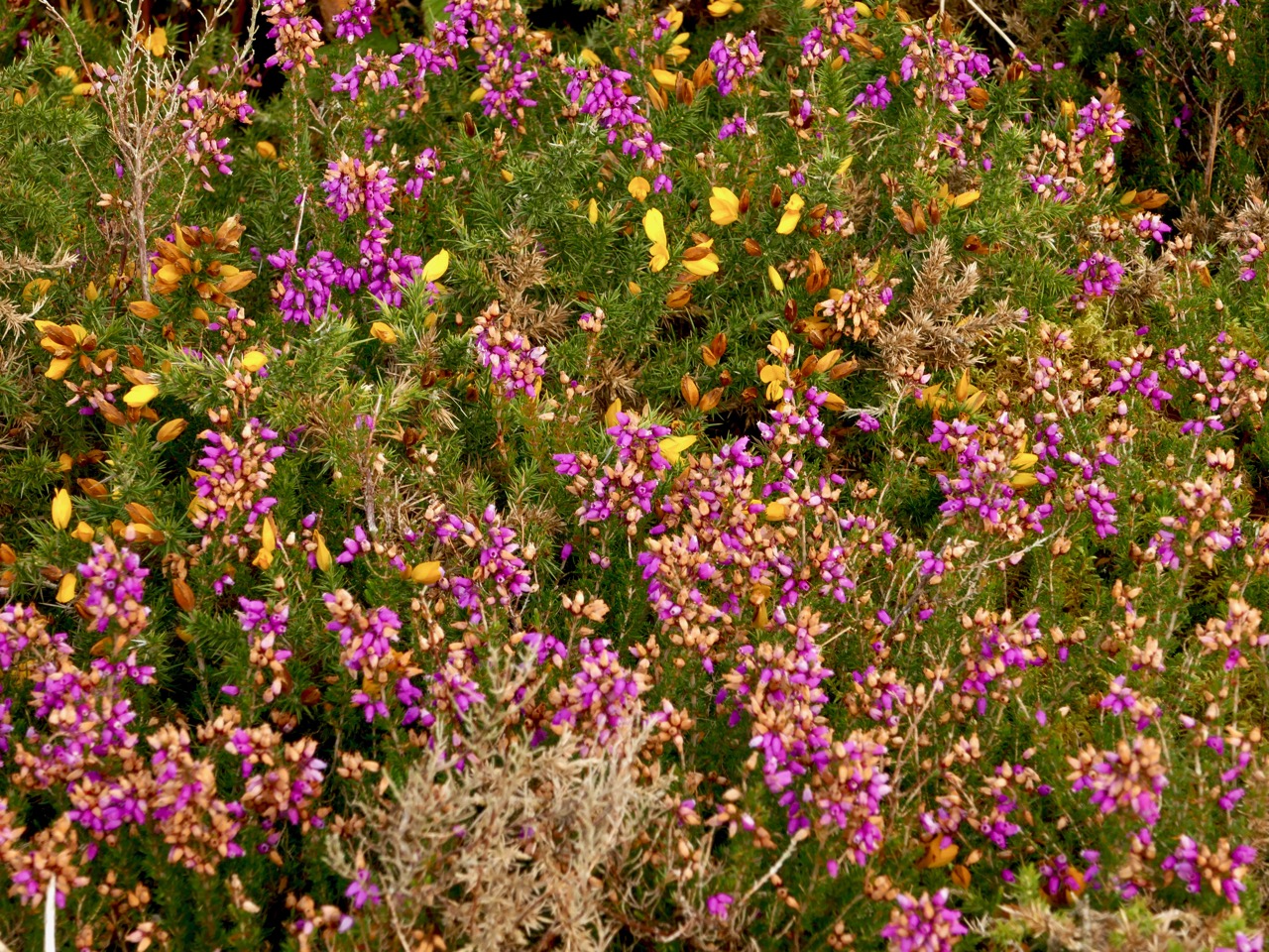
But every day brings changes. What trees we have are not yet bare. The thorns, blackthorn and whitethorn are loaded with berries. The heather is hanging on here and there, providing a wonderful contrast to the yellow gorse.
Haws, Sloes, Heather and Gorse
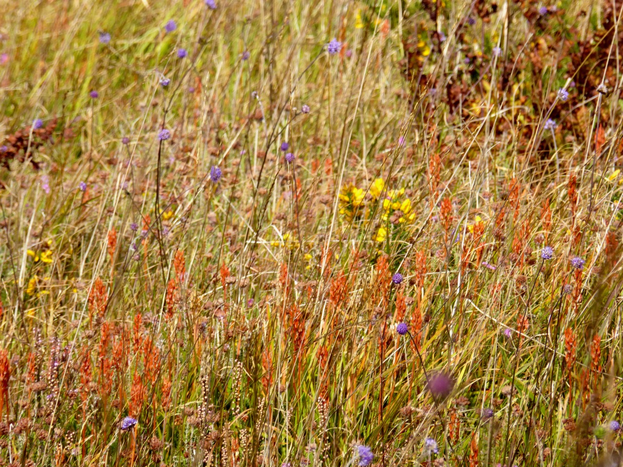
The bog asphodel is fading now, but earlier in the month it had reached its peak orange state and looked spectacular consorting with the other bog and mountain flowers that were still blooming.
Upper: Bog Asphodel, Gorse, Scabious; Lower: Cappaghglass Bog
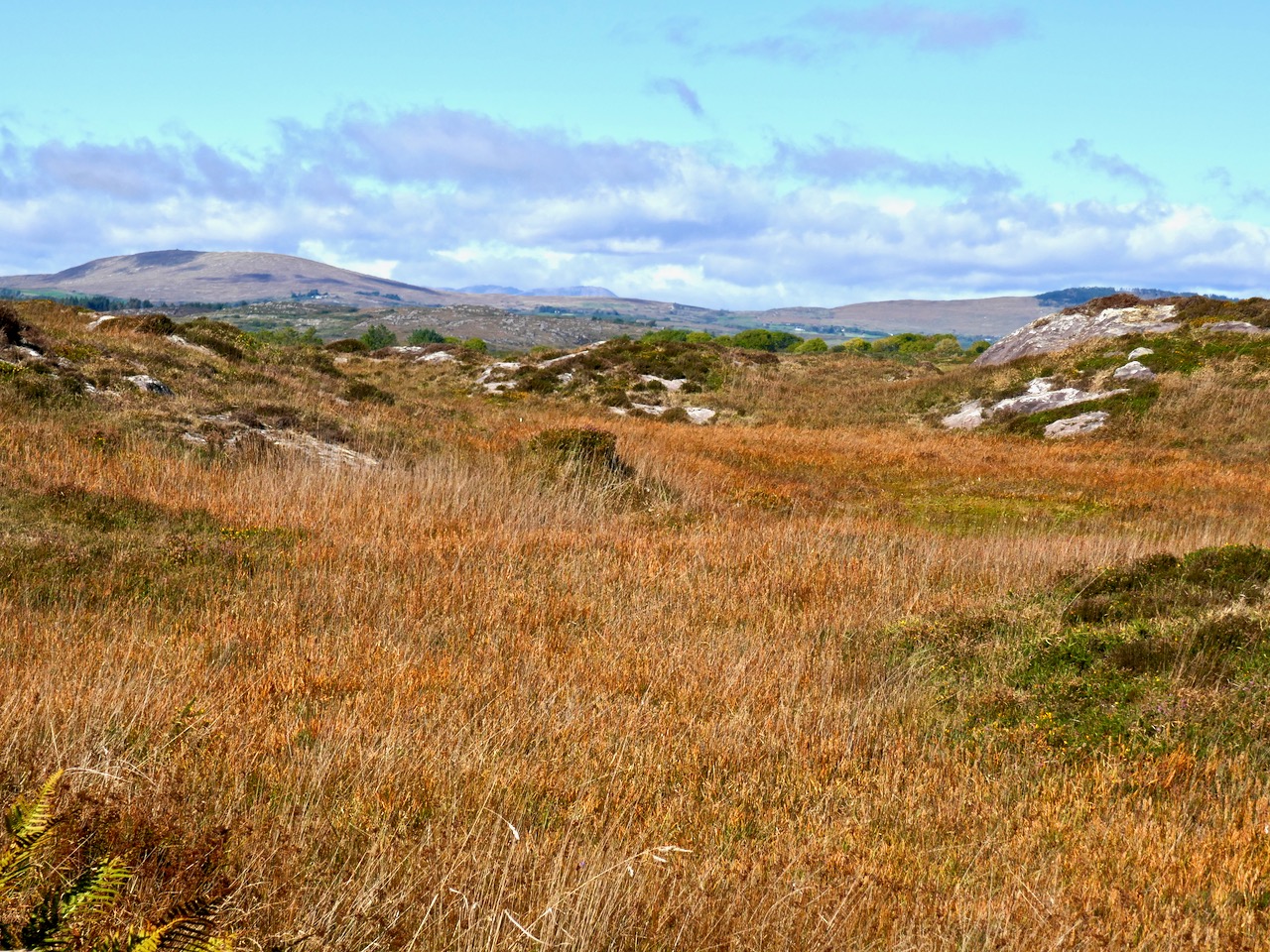
When you get a clear day, like today, there is nothing on earth like a walk on the West Cork hills, drinking in the colours and trying to store them in the memory. Or perhaps, in a blog!
Upper: Toormore; Lower: Derryconnell
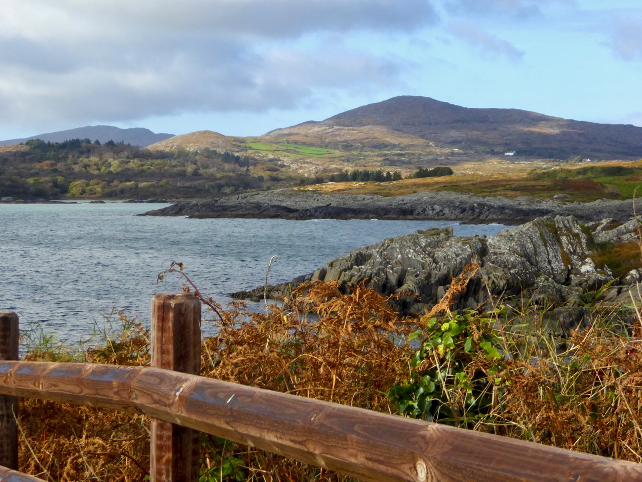
Upper: North Side of the Mizen; Lower: Crough Bay and Long Island
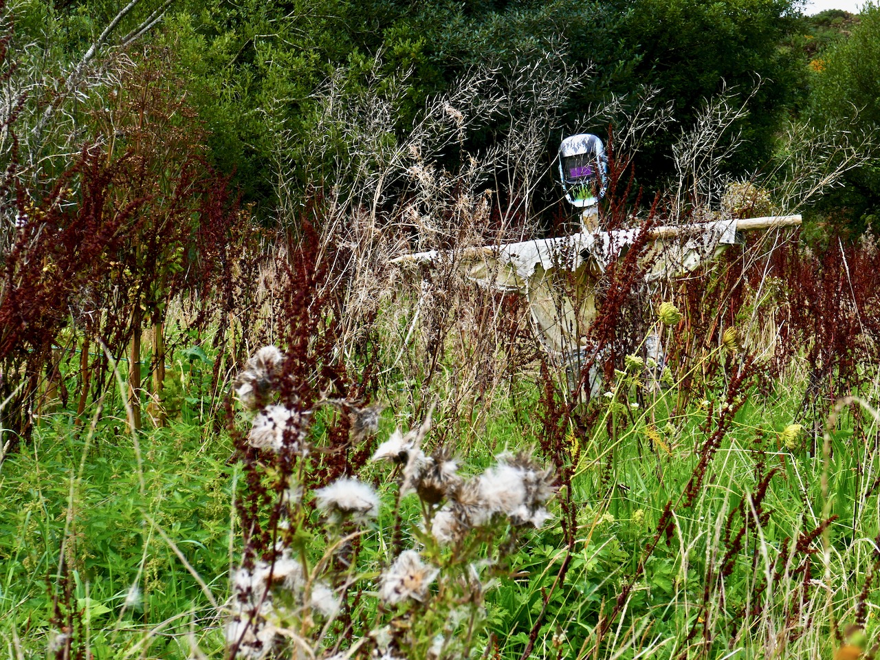
Scarecrow in an abandoned garden – quintessential autumn image!
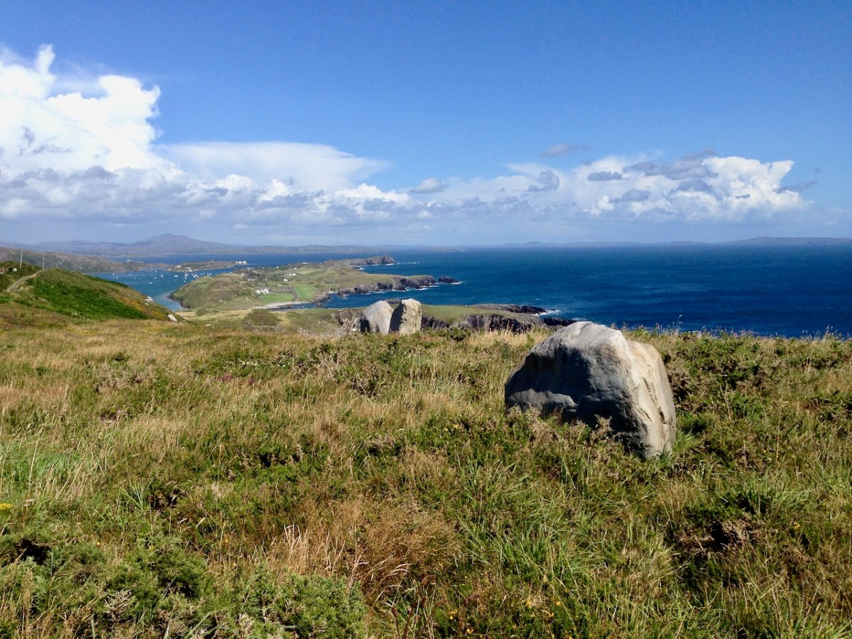
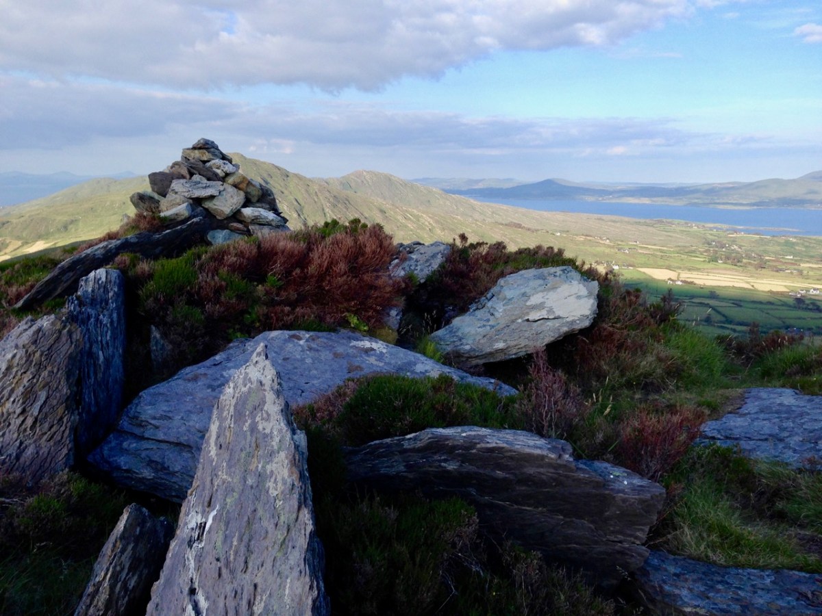
Here is a collection of photographs taken in West Cork from some of the high places: ridges, peaks, mountain paths. The pics were all taken around ten years ago, and haven’t been used in our blog posts previously. They serve to show stunning landscapes, of course, and hopefully illustrate the variety of the country which surrounds us here. The header is taken from the peak above Three Castle Head.
The upper pic is looking down on Bantry town from the high ground to the south, while the lower one reminds you of the evening view from Bantry at sea level.
If you leave your car at Galley Cove Beach and walk up the steep track towards Brow Head you will come across this enormous stone row – and you will look back to the peninsula of Crookhaven. Don’t be fooled by the stones: they have been placed on this site fairly recently. They are impressive, nevertheless.
And here is a closer view of Crookhaven.
While turning from this spot and looking west, you will see the end of the coastline at Brow Head. This stone is likely to be more anciently placed. In the distance is Mizen Head with its Napoleonic era signal tower at Cloghane.
Contrasting light effects seen on the footpath that follows the ridge on the Sheep’s Head Way. That’s the spit of land that runs from east to west between the Mizen Head and the Beara Peninsula. There are cairns on the summits, with the remains of a wedge tomb and a Marriage Stone to be seen along the way.
The view north from the heights of the Sheep’s Head takes in the Beara Peninsula and – seen above – the high point of Hungry Hill dominating the distant rugged landscape.
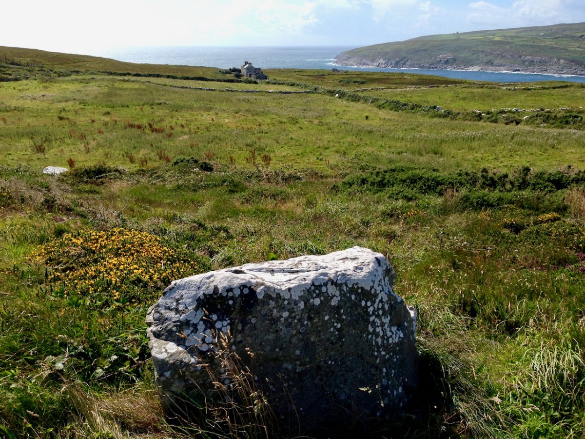
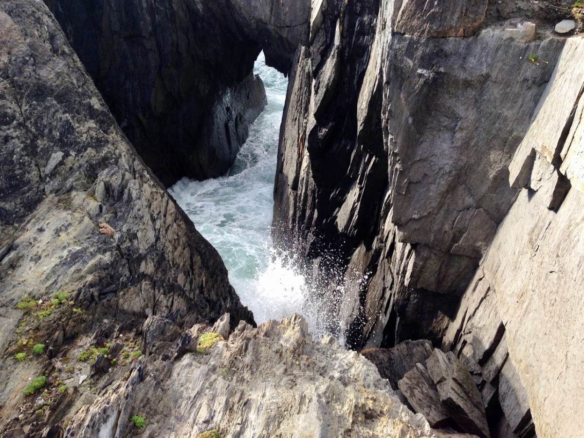
You are never far from the coastline in West Cork. Look out for wild seas constantly sculpting the rocks over millennia.
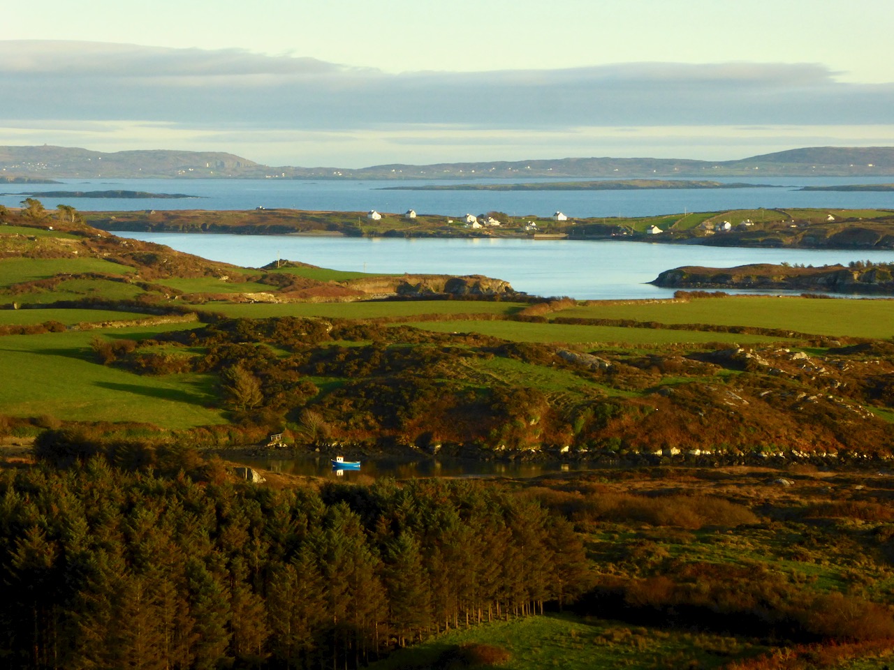
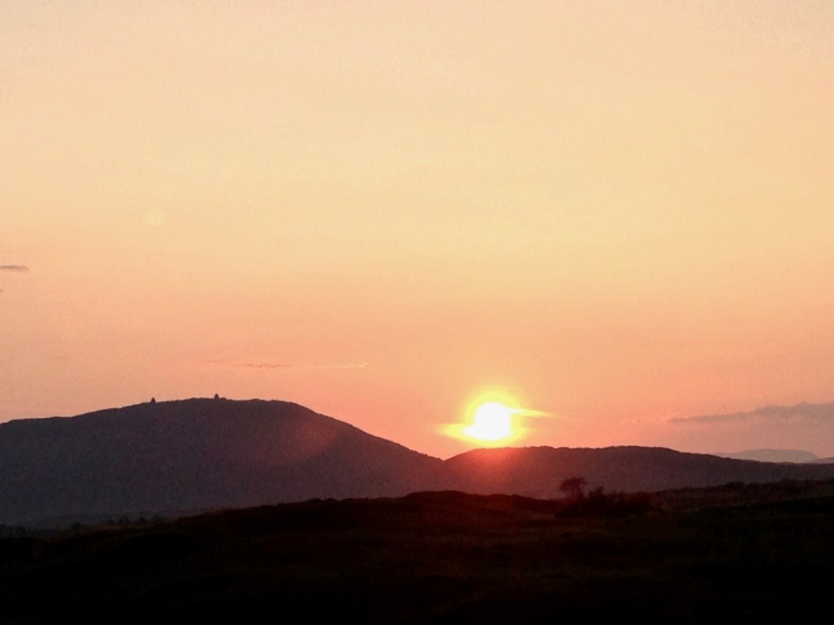
From our home in Cappaghglass we look out to our own ‘high place’ – Mount Gabriel. This enigmatic tract of land dominates the area and is imbued with legends and folklore. It is also one of the most atmospheric of our peaks at all times of the year.
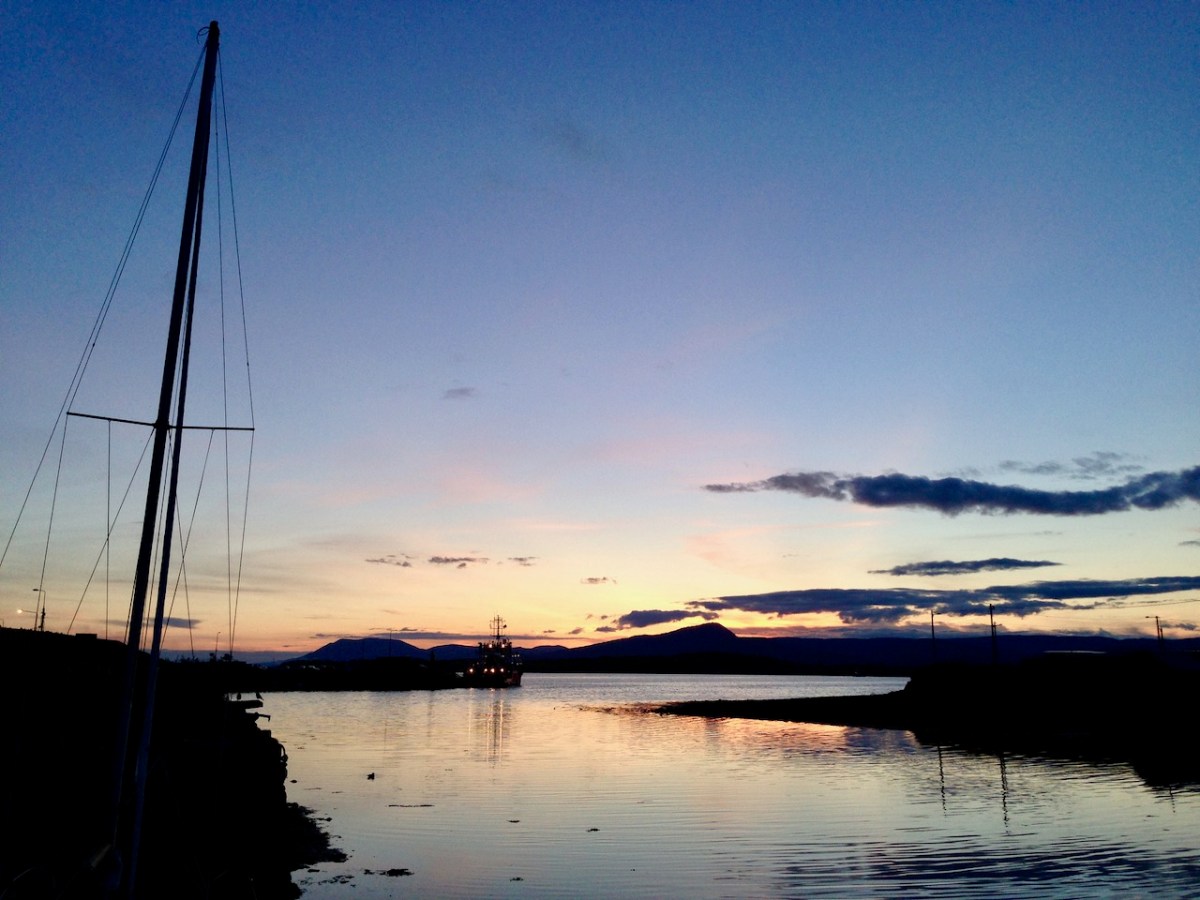
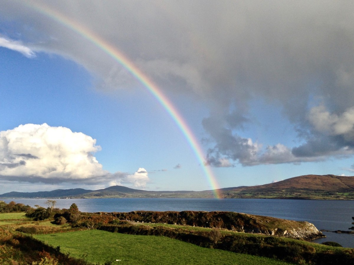
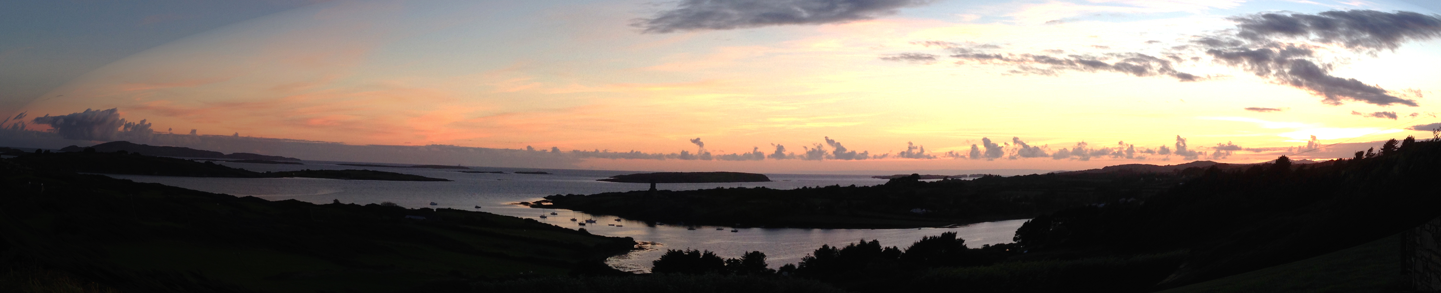
Another local view for us (above): we face out to Rossbrin Cove on the Mizen Peninsula. Finally, the celestial spectacle (below) finds its pot of gold on the shores of the Mizen.
This post was written in 2013 – nine years ago! It’s one of our West Cork blog posts from the earliest days . . .
Just as the leaves begin to turn, the gales have come to tear them away and send them flying all over the Bay. Autumn is bringing angry seas with wild white horses, while the trees on our exposed acre are bending sideways. I admire the small birds who manage to find their way to our bird-table in the face of it all: we have just been visited by a whole flock of ravenous Goldfinches who hang on to the wildly swaying feeders in a determined frenzy to fatten themselves up for the coming winter and squabble noisily with any Great-tits, Chaffinches or Robins who try to get in on the act.
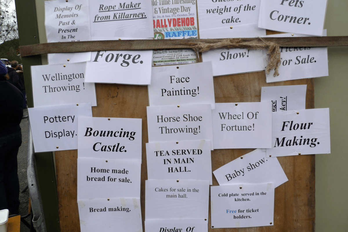
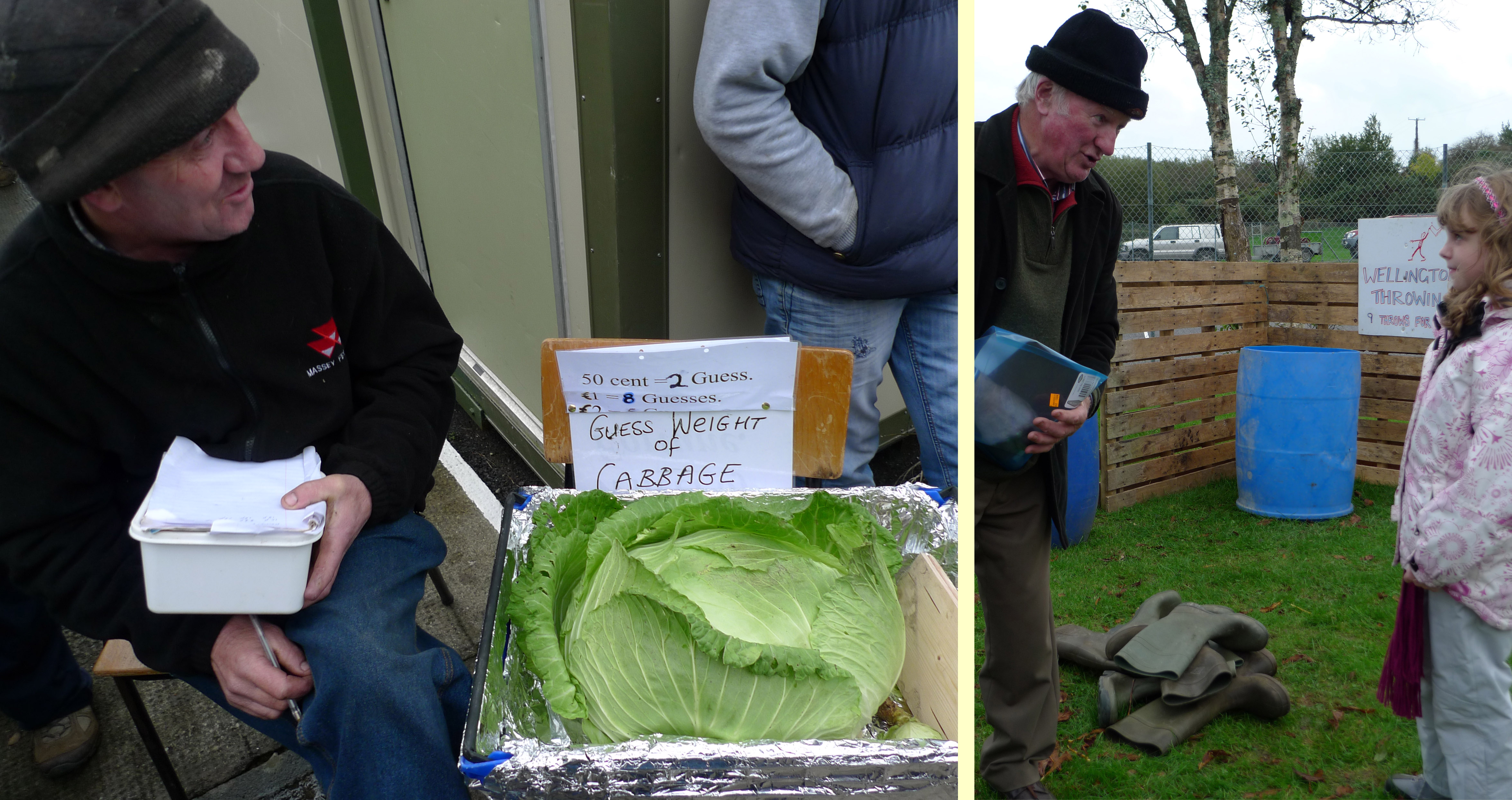
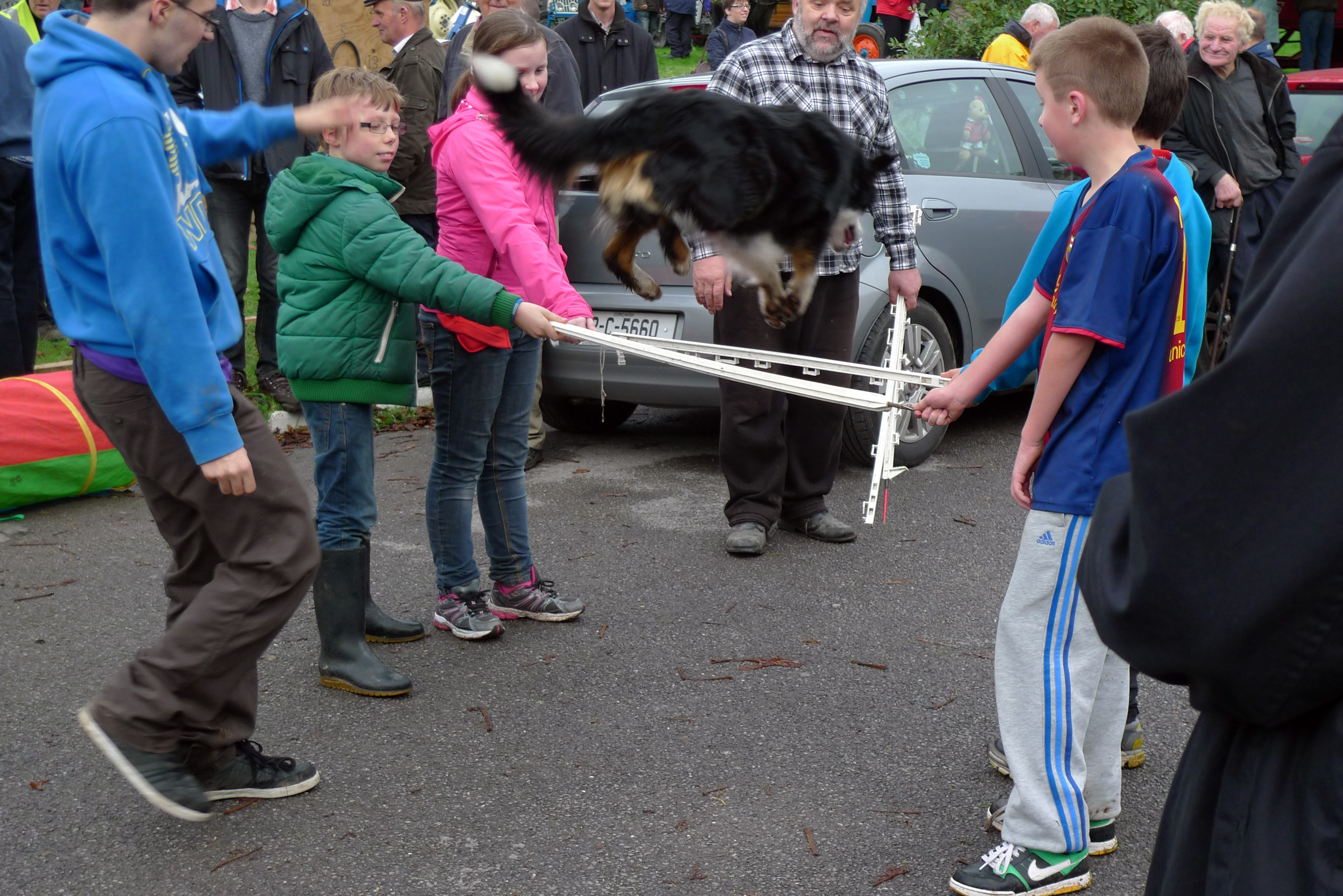
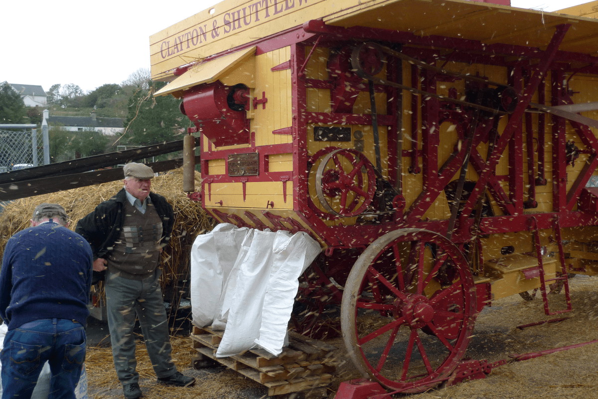
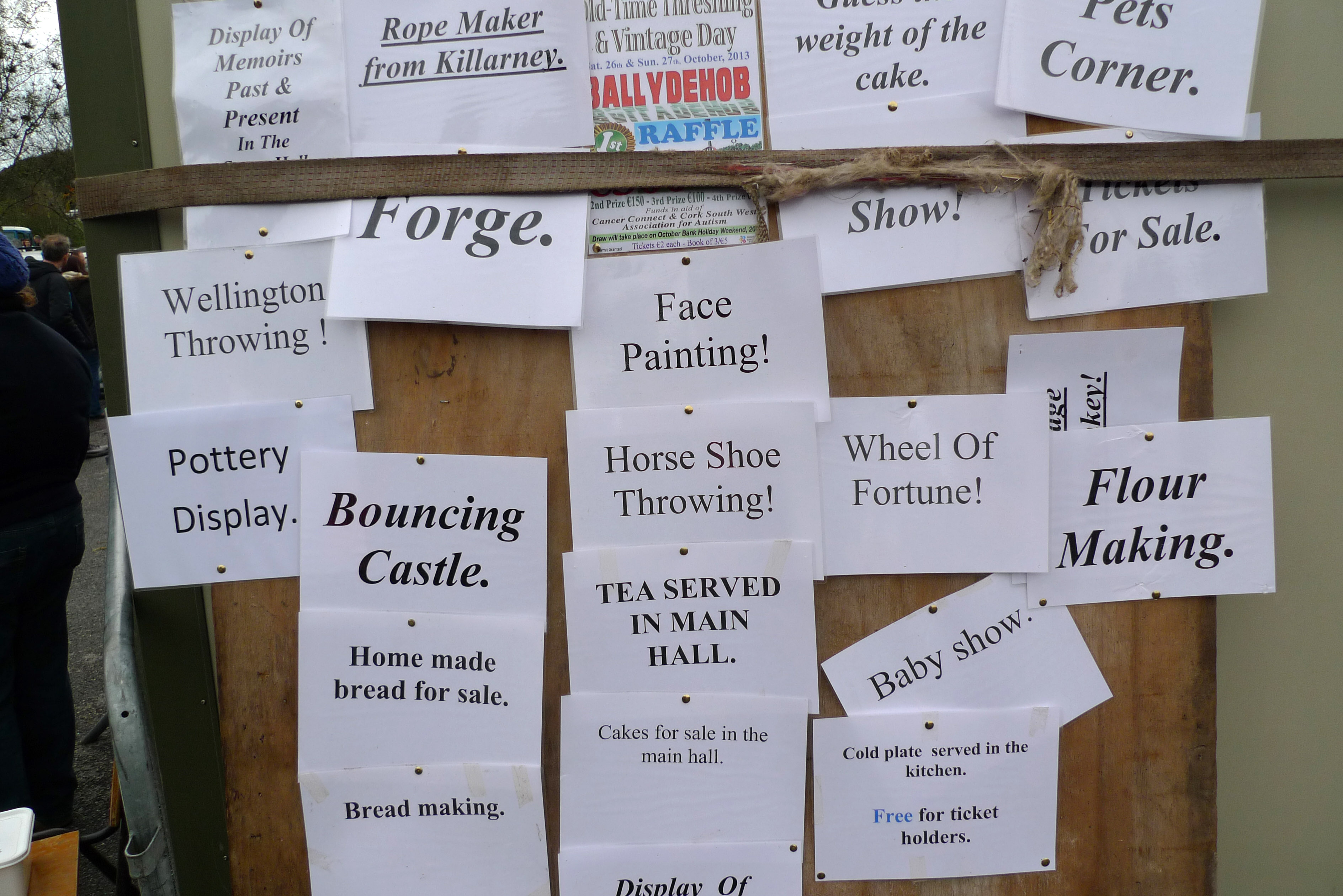
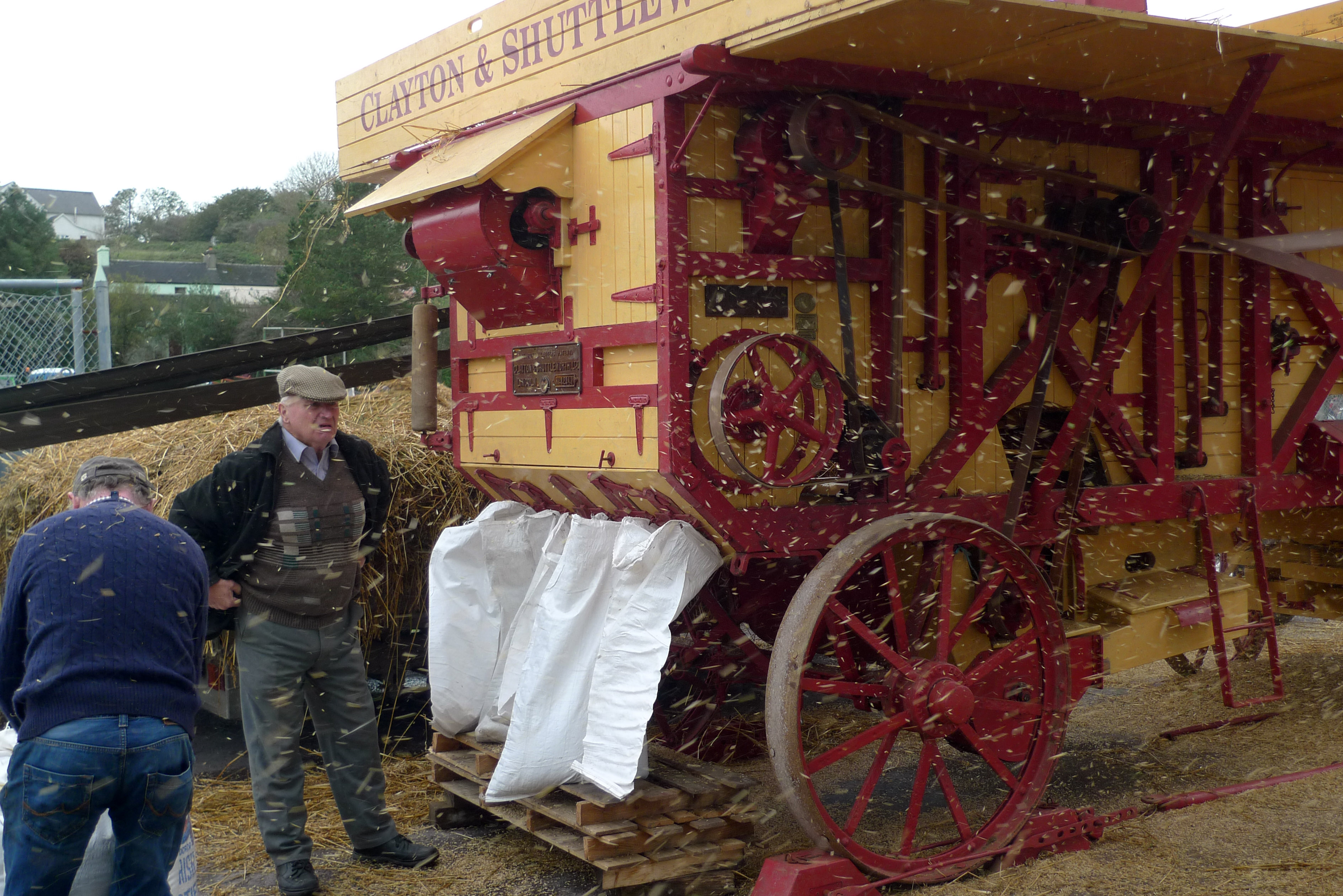
In Ballydehob (our local community) it’s time for the annual Thrashing. This event always takes place just before Hallowe’en, a festival which nowadays overlays the old Celtic Samhain (1 November) – when the souls of the departed are remembered. Here it’s a good time to bring in the threshing machine and lay up sacks of grain in the barn. It’s also a reason to hold a fair and show off vintage cars and tractors, to make butter, to watch performing dogs, to gamble on mouse racing – or just to chat over a cup of tea.
Byway in Ballydehob
Don’t miss it!
The Thrashing
Mouse Bookie
We look forward to the turning seasons: what we see from Nead an Iolair changes constantly, is never dull, and can’t be taken for granted. Skies can be steel grey – or still as gloriously blue as they were in the summer; and our sunsets can be even more beautiful.
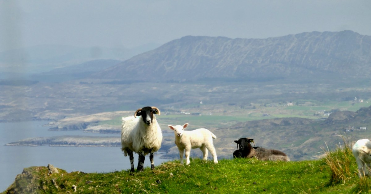
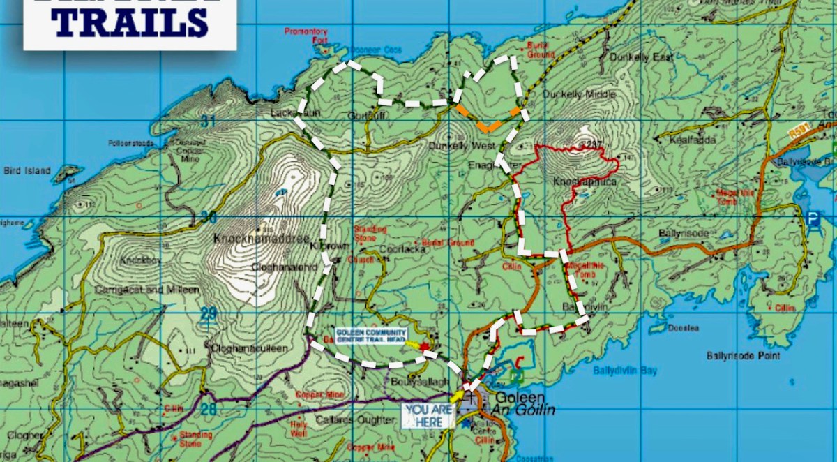
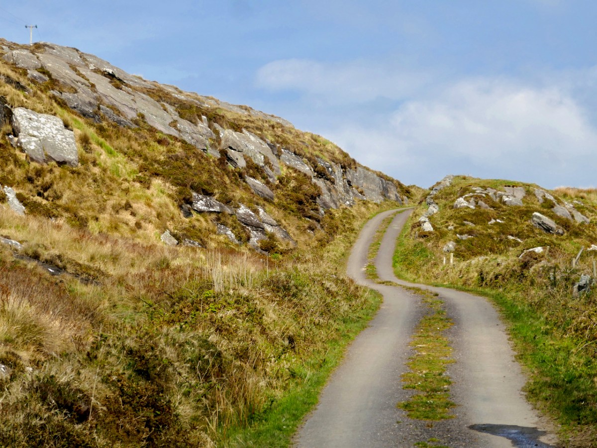
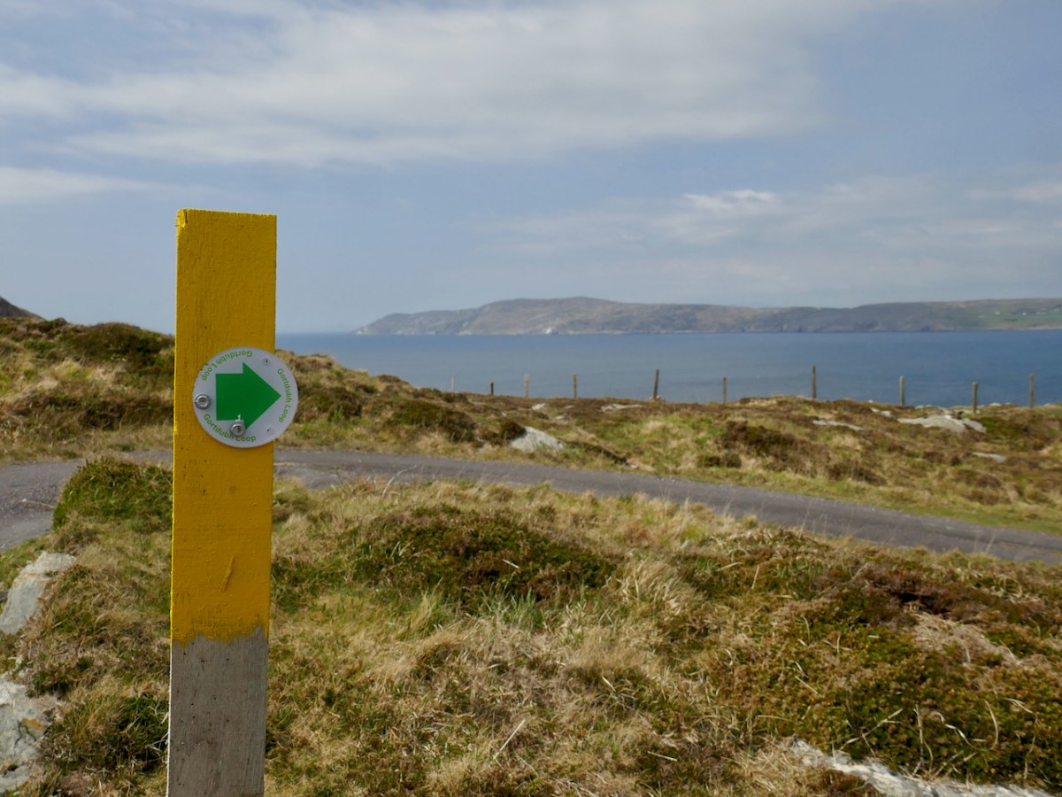
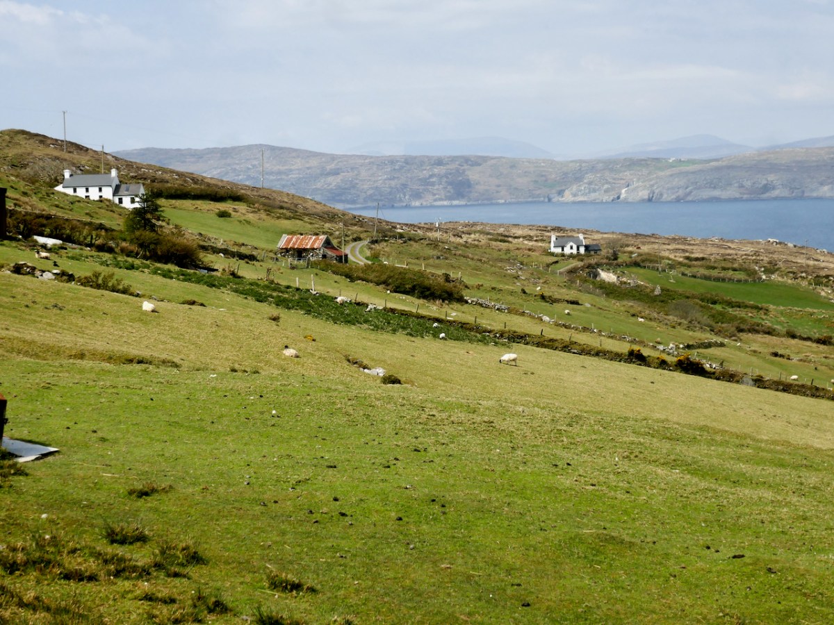
Ready for a longer walk? If yes – this one is 13.5km and has strenuous stretches. If not, don’t worry – there are lots of possibilities for doing parts of the walk, or for going with friends and leaving a car at strategic spots. We didn’t do it all at once, in case you get to thinking we are super-fit hikers. (The sad truth is we can’t be too far from a coffee shop.) As with all the Fastnet walks, keep dogs on leads – we did encounter both cattle and sheep on this walk, right on the road. There is a short stretch of ‘green road’ and although it’s well maintained, it might be muddy after rains, so good shoes are essential.
This loop takes you from Goleen on the south side of the Mizen right across the peninsula to the fabulously scenic north side. It skirts along the edges of the valley that runs between Knocknamaddree (Hill of the Dogs) to the west, and Knockaphuca (Hill of the Pooka, or Mischievous Spirit) to the east, rising to a maximum altitude of 180m (or about 600 feet). Most of the altitude is gained in the first half of the walk – so a packed lunch and water will be both welcome and needed if you’re doing the whole walk.
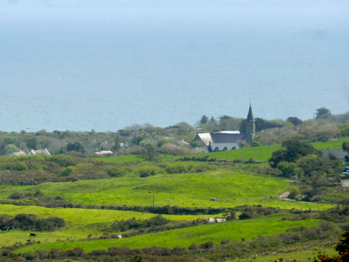
Set out from the Goleen Community Centre and the first part of the walk is shared with the Lissagriffin Loop – see our recent post on that walk. As you ascend, the views are immense – back to Goleen and across to Knockaphuca and Mount Gabriel beyond it.
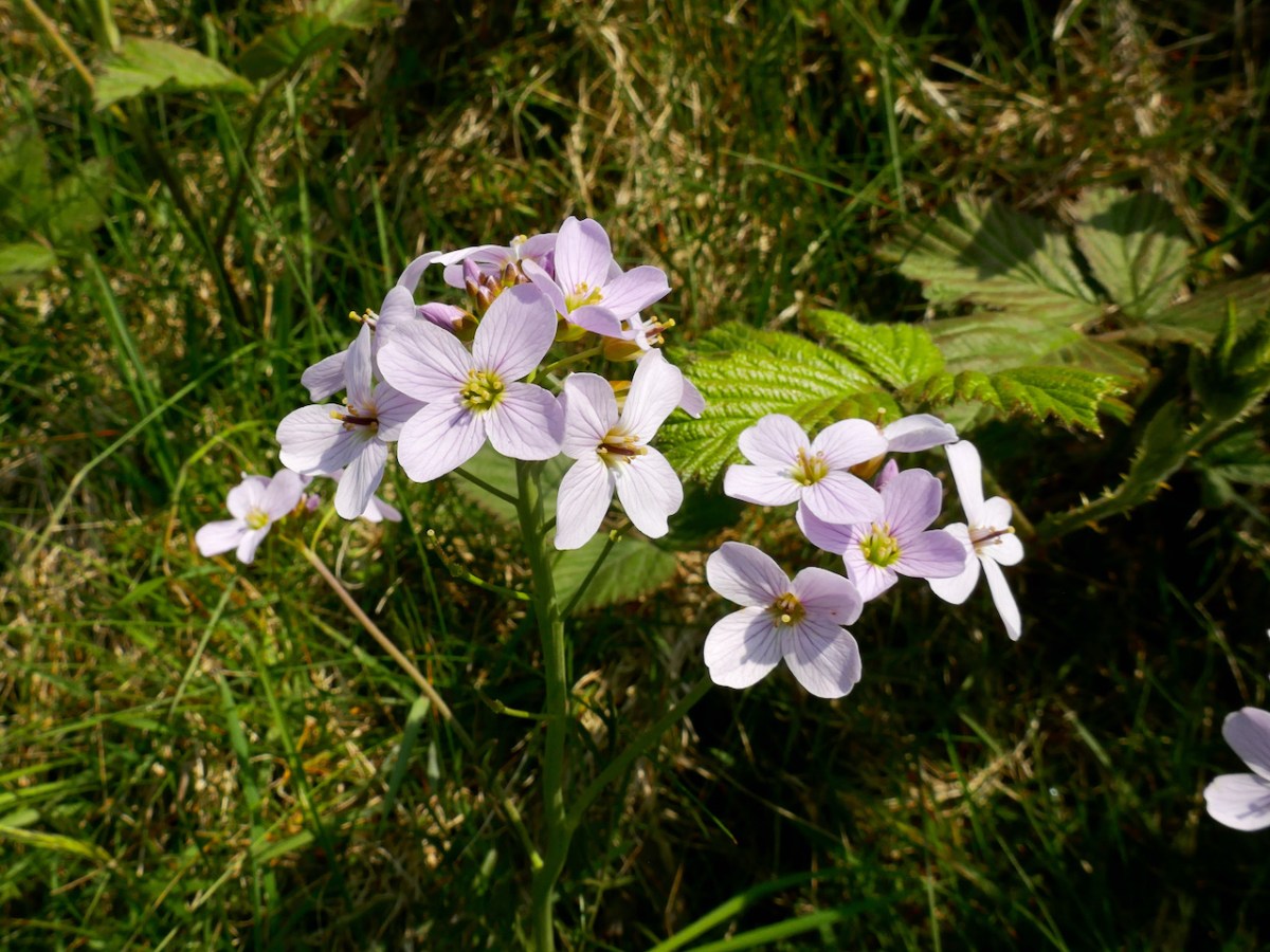
You’ll have to dig into your reserves of energy (or maybe have some chocolate) as you continue the climb. You are in true mountainy heathland now – look out for orchids in the spring and early summer, or Cuckooflower (below) in damp ditches.
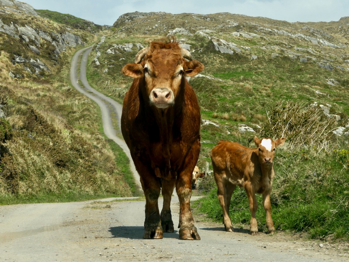
Watch out also for cattle on the road – we were startled by a line of plodding cattle coming towards us, and even more startled when we realised that one was a mighty fine bull. Fortunately, they turned into a field before we reached that spot, but there was no human around and the gates were open, so we can only assume we were simply in the wrong place at the wrong time as it is very unusual (although not unknown) to see cattle wandering like this.
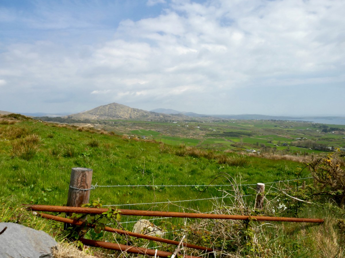
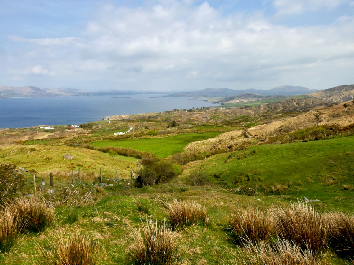
Coming over the top of the hill you have the whole of Dunmanus Bay in front of you and you can see clear up to the head of the bay, across to the Sheep’s Head, and to the Mountains of the Beara behind that. Have a nice sit down on some convenient boulder here – you deserve it – and just absorb that breathtaking sweep of land and sea.
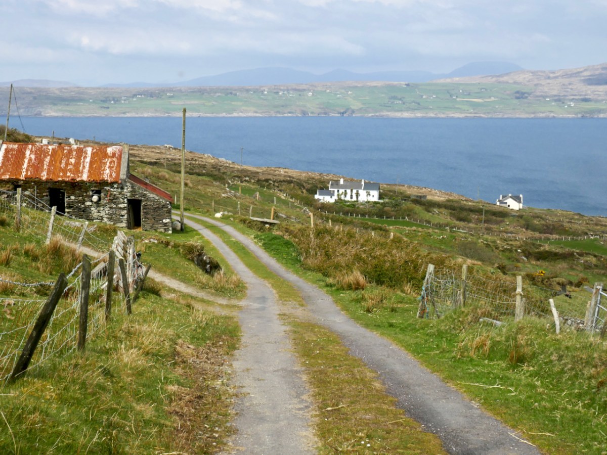
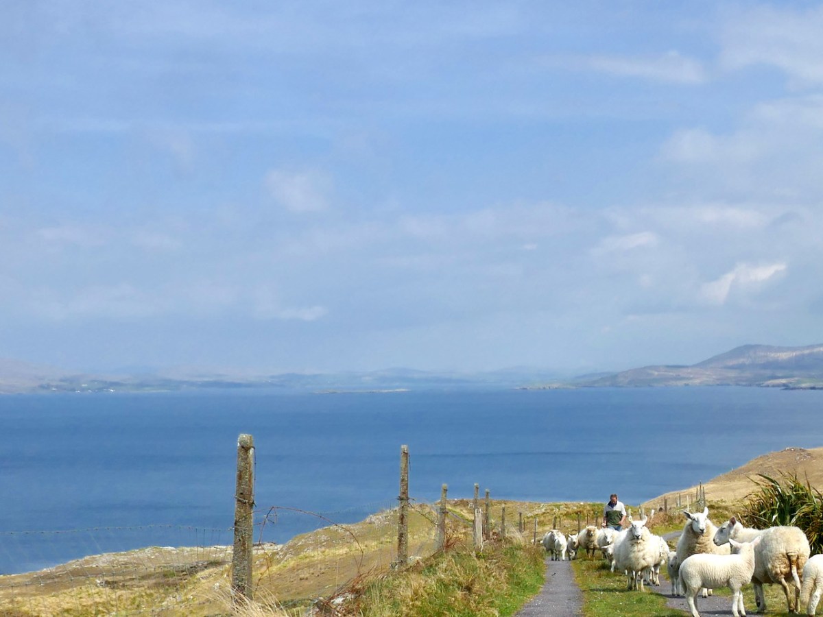
And talking of sea – you’re heading down now towards it, past picturesque stone farm buildings and beautifully renovated cottages until you arrive at Dooneen Coos (the Cove of the Little Fort). Along the way we ran into a shepherd moving his sheep up into higher ground, with the aid of the marvellously well-trained dogs that attend to their business but also like a good pat.
Dooneen Coos is a good spot for lunch – or even a swim if you’re that way inclined. it’s close to the peninsula we wrote about in our post Mizen Magic 23: Lackavaun and The Meallán so you can always take a side trip there if you wish. This might also be a good spot to leave a car if you’re not doing the whole loop on this occasion.
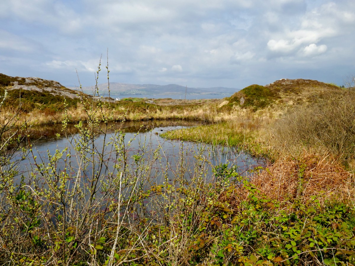
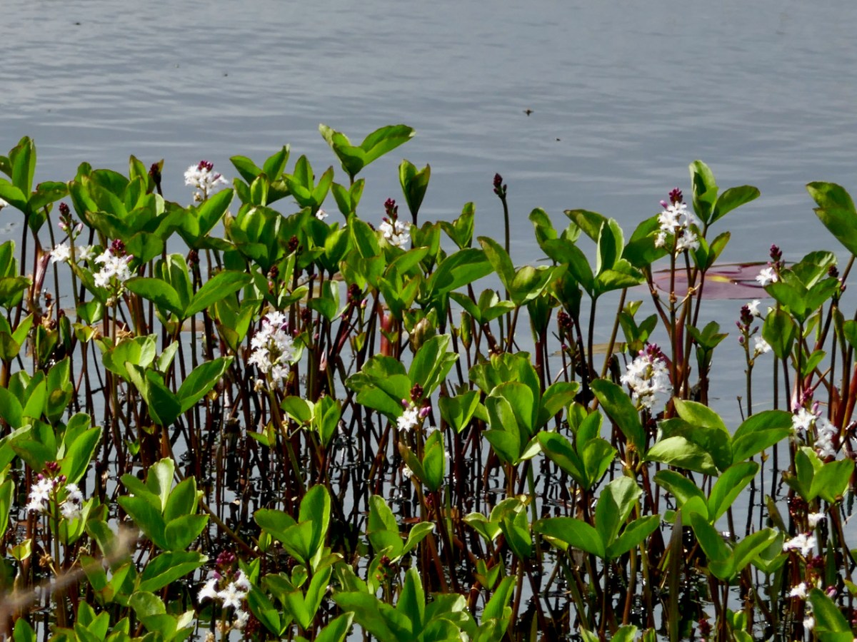
But if you’re carrying on, you’re now heading towards Dunkelly and the storied inlet known as Canty’s Cove. Read all about it here. Here, because we have been to Canty’s Cove lots, we took the short cut – marked in orange on the map. The compensation is that this stretch contains the remains of old ruined cabins and clacháns (hamlets) along the road, as well as a beautiful pond which, at the time of our visit was full of flowering Bogbean.
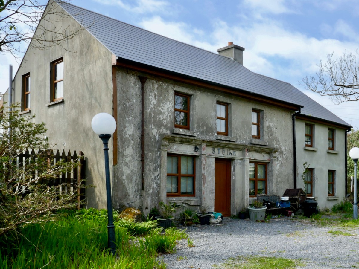
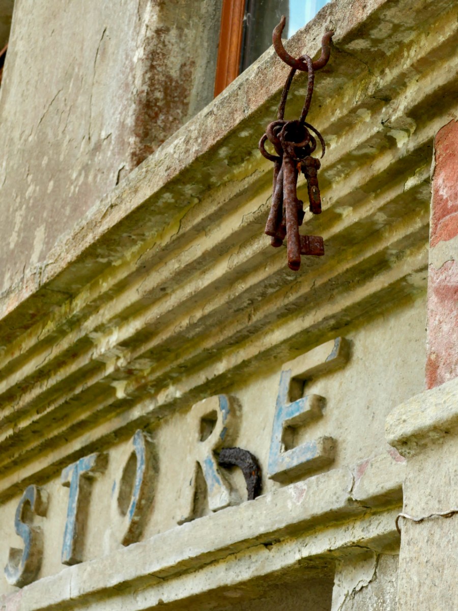
From Dunkelly the road turns back along the slopes of Knockaphuca and along the way there’s a bit of a surprise – an old store that once supplied necessities for the population of this area but which has not been viable for many years. No doubt local people have all kinds of memories and stories about this one. I was taken by the keys, still hanging above the door!
By now we were on the stretch of road that this loop shares with the Knockaphuca Walk and that’s a walk you HAVE to do, if you haven’t already. Possibly the jewel in the Fastnet Trails crown. Crossing the main Schull-Goleen road we head down to Ballydivlin.
Welcome to the UCD Library Cultural Heritage Collections blog. Discover and explore the historical treasures housed within our Archives, Special Collections, National Folklore Collection and Digital Library


