We have almost 30 posts titled Mizen Magic and over the next few weeks I want to highlight some of them – from castles to beaches, from archaeology to geology, from walks to folklore – the Mizen Peninsula is endlessly fascinating and scenic. Lets start with some archaeology.
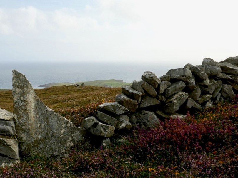
Dunbeacon is on the North side of the Peninsula, and home to both a stone circle and a vestigial O’Mahony castle. In Mizen Magic 7: Dunbeacon – History, Prehistory and Questions of Access we explored the trade off when access is provided to an ancient monument, but that aspect also severely impacts on the monument itself. The photo above is the before, while that below is the after.
There isn’t much left of the O’Mahony Castle in Dunbeacon, but what a location!
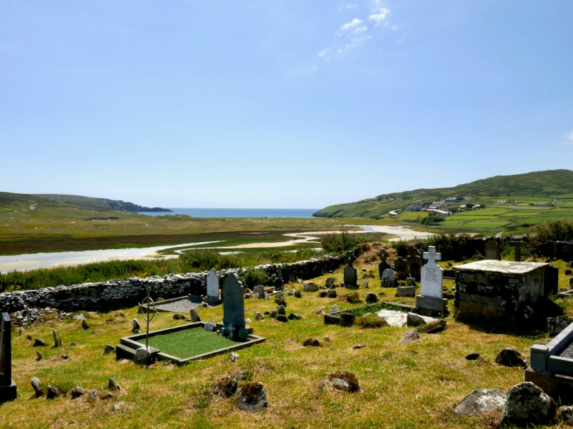
In Mizen Magic 14: Lissagriffin, we explored a little known townland close to Barley Cover. The ruined church may be far older than we think and there are hints in the landscape of long, long occupation.
Of this area I said There are parts of West Cork that seem to hold within them all the memories and markers of eons. There are four wedge tombs, a lake with an imprisoned demon of the pagan times, cupmarked stones, a standing stone and a possible ogham stone we could not locate. I am convinced that one of the wedge tombs may be an incorrectly identified passage grave.
Megalithic tombs (from ancient Greek mega – great, lithos – stone) dot the Irish countryside and date from the Neolithic period (4,000 to 2,500BC) and the Bronze Age (2,500 to 500BC). The practise of erecting large stone monuments would have entailed significant command of local resources and therefore indicates either a highly co-operative or a highly stratified society. The megaliths were built to last and indeed many have survived, although only a shadow of their original size.
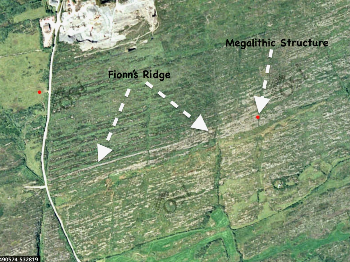
I’m going to start this new series with a curious construction labelled by the National Monuments survey as a ‘megalithic tomb- unclassified’. It’s in the townland of Gubbeen, near Schull, but only barely, as it’s almost on the boundary with the townland to the North, called Glan. What marks the townland boundary here is one of the things that makes this site so fascinating.
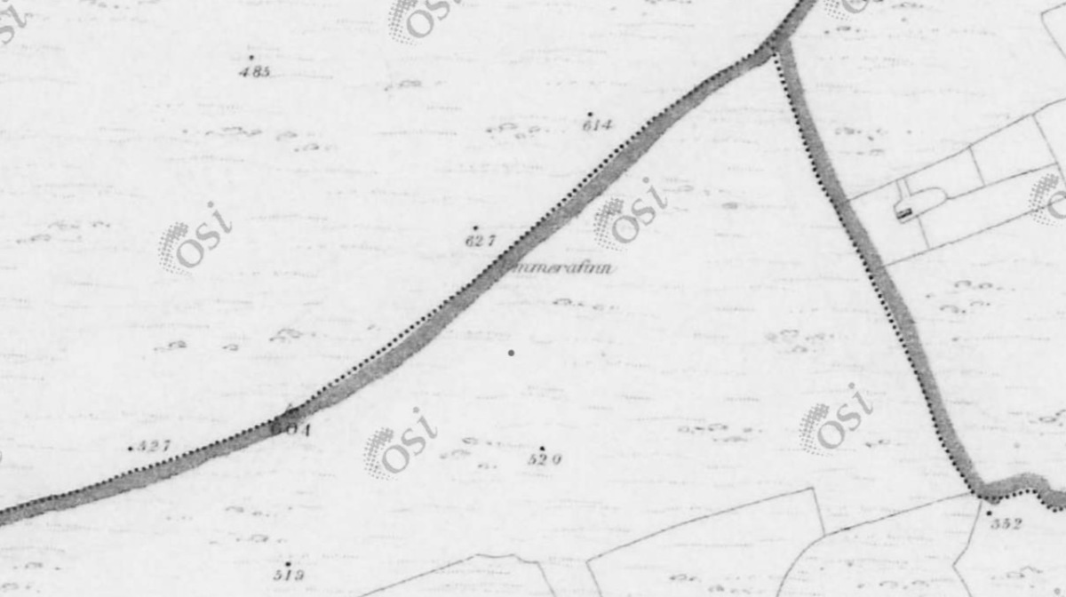
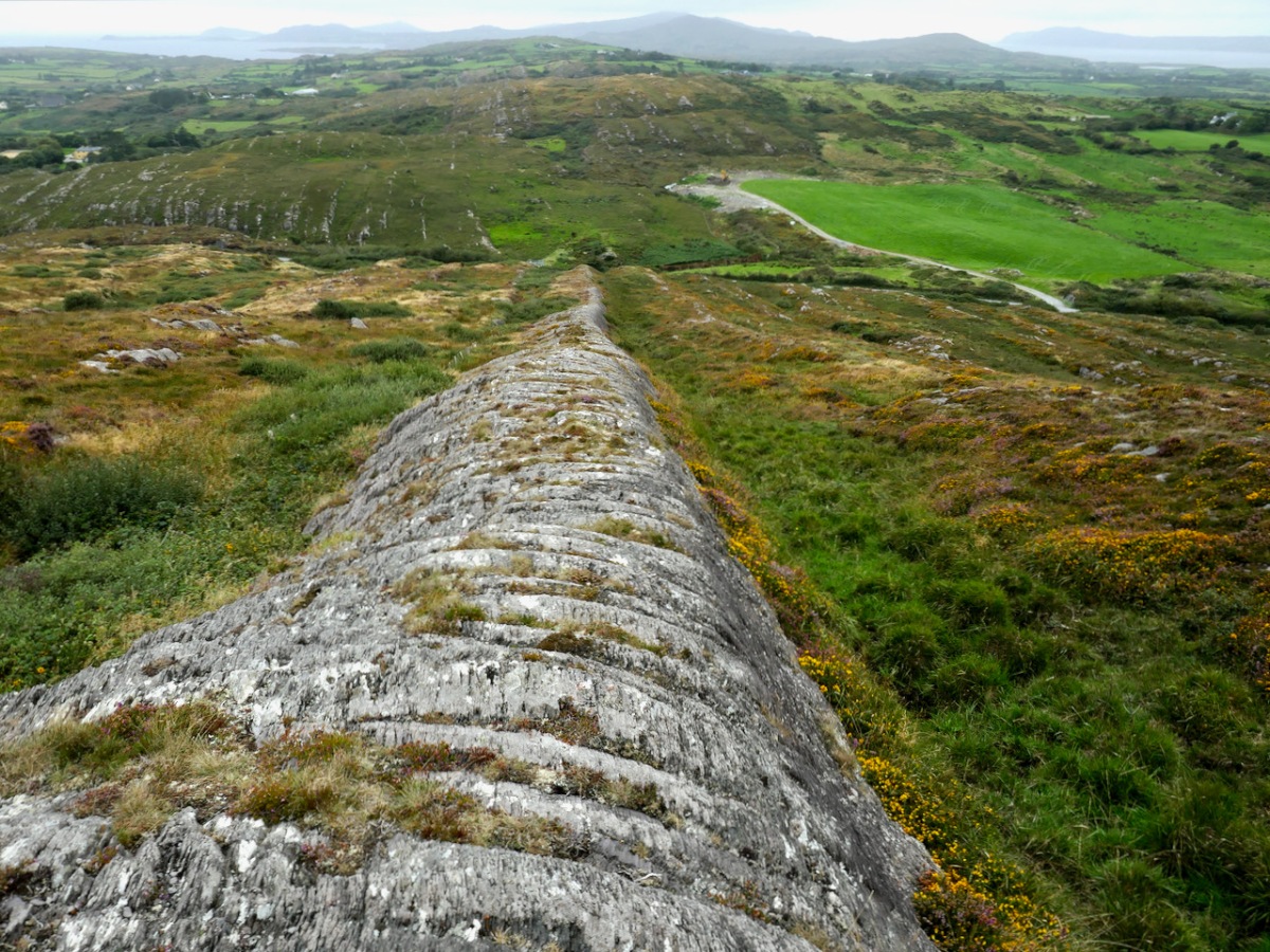
The boundary, instead of the usual stream or old road, is a striking landscape feature called locally Fionn’s Ridge. Originally, it was known as Ummerafinn, from iomaire, meaning a raised strip of earth, such as that made by a plough, and Finn, a common form of the Irish name Fionn, meaning fair-haired. It is marked thus on the Historic 6” Ordnance Survey map which was made in the 1840s – can you make it out, above?
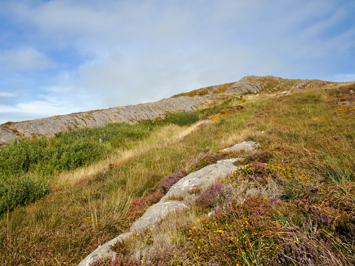
Fionn’s Ridge runs for half a kilometre from the road up to a rocky prominence that is part of Knocknageeha (Hill of the Winds), which in turn is part of the greater mass of Mount Gabriel. As you would expect from such a conspicuous landscape element, it is the subject of much folklore, some of which I detailed in the post Legends of Mount Gabriel: Fionn, Furrows and Fastnet. That post will tell you, if you don’t already know it, more about the legendary Fionn MacCumhaill.
However, when I wrote that post, I hadn’t actually identified Fionn’s Ridge properly. Now, I have not only seen it from several angles, but walked up and down it. The folklore says that Fionn MacCumhaill ploughed the furrow with two rams and a wooden plough and indeed what we see now does bear a resemblance, not to a furrow but to the raised rounded spine (on one side of the furrow) which results when a plough cuts and turns over earth.
The ridge leads almost straight up to the megalith. This is unlikely to be a coincidence – Neolithic people were as struck as we are by such strange phenomena in their surroundings. When they decided to build the structure at a spot right at the top of it, they may have been influenced by several factors. They may, for example, have used the ridge as a road or as a ceremonial processional route up to the megalith. It is ideal for such a purpose. Like us, they may have had folklore that spoke of a giant and his plough.
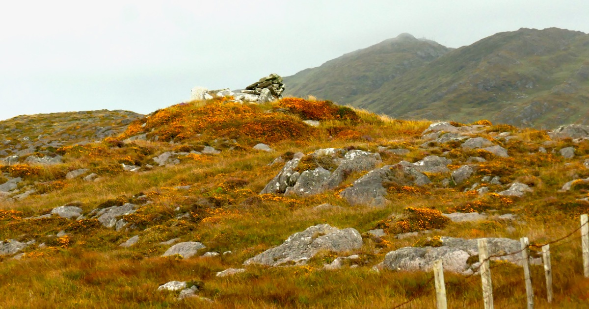
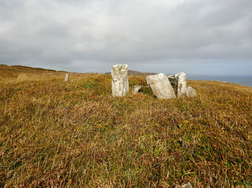
Let us turn now to the megalith. Here’s the National Monuments description: Ruined chamber (L 3.1m; Wth 2.2m at W end, c. 0.6m at E) aligned ENE-WSW, formed of inclined slabs. Structure incorporated in circular cairn. Traces of low dry-stone kerb survive at N, W and S.
The first thing we can say for certain is that is is not a wedge tomb. Take a look at my post Wedge Tombs: Last of the Megalithsfor a complete description of this type of monument, which belongs to the Bronze Age. Wedge tombs are the most common megaliths on the Mizen – there are 12 listed. Of these, I have stated my doubts about the Giant’s Grave in Arduslough, based on its hilltop setting and the traces of a mound delineated by kerbstones.
Here we have the same issue – the siting is not typical of wedge tombs, none of which, on the Mizen at least, are on hilltops (apart from Arduslough). Wedge tombs are oriented to the setting sun in the Western sky – that is, the tallest and broadest section, the entrance, is always to the west. In Gubbeen, it is clear that there is no opening to the west – instead what we see is the wall of a roundish chamber. It is impossible to make out exactly where the entrance was for certain, because of piled-up rocks, but it was at the eastern side, with an orientation towards the rising sun, and Mount Gabriel.
As noted by National Monuments, there are traces of a kerb, although it’s hard to be definitive about this. The collapsed pile of rocks as the eastern end may have been simply piled up there in modern times – but they may also be from a collapsed roof.
Where am I going with this? I posit that this may be, in fact, a passage grave. Several features (hilltop setting, sunrise orientation, internal chamber, kerb) set it more obviously in the passage grave tradition than in the wedge tomb tradition. There may be an archaeological bias against labelling such structures as passage tombs, since it has been considered that passage tomb distribution was in the northern half of the island.
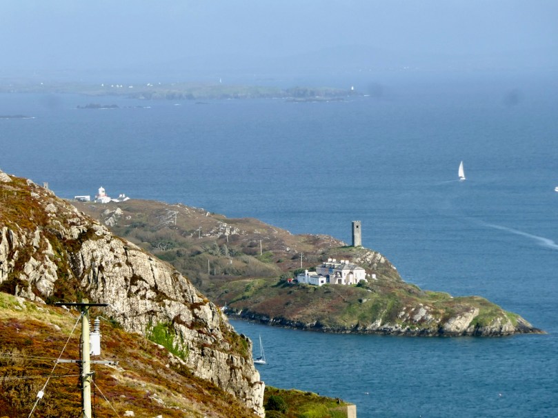
In fact, it is not unlike the passage tomb on Cape Clear, the position of which is clearly visible from this one – that’s it on the horizon, above. Inter-visibility is a feature of passage graves. There is also a similar anomalous megalithic structure on a high point on Sheep’s Head – also clearly visible.
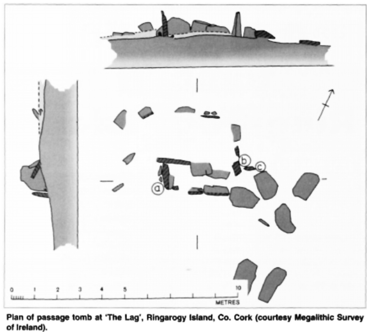
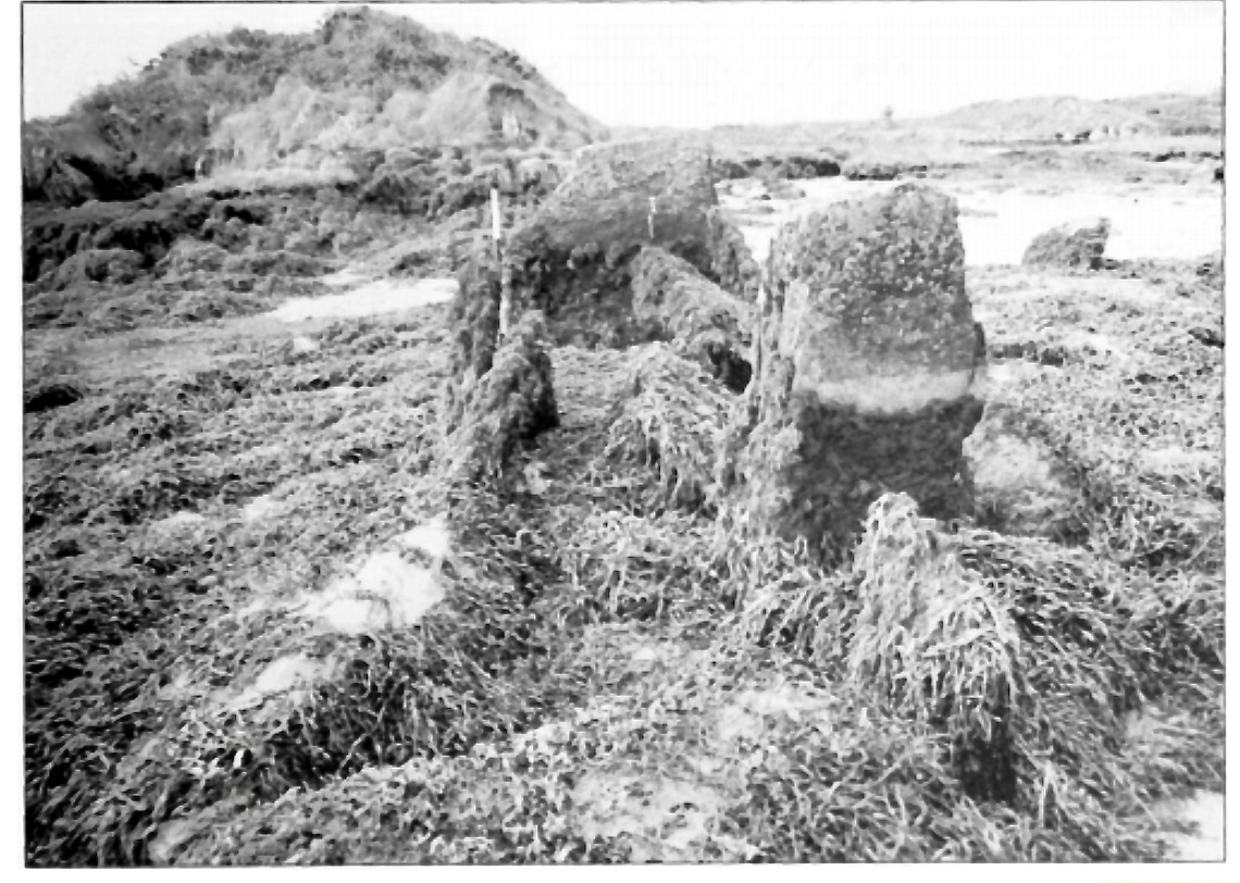
The other structure that has been identified as a passage tomb in this area is in The Lag, between Ringarogy Island and the mainland. Elizabeth Shee Twohig identified it, and placed it and Cape Clear within a group of ‘undifferentiated’ passage tombs (by which she means that there is no clear differentiation between the passage and the chamber as there is, for example in Newgrange) known from Waterford and South Tipperary. All except The Lag occupy high ground, although not summits. Above is her plan of the tomb and below is her photograph, both images from her article on The Lag in Archaeology Ireland Vol. 9, No. 4 (Winter, 1995), pp. 7-9, available here for those with a Jstor account.
So – in many ways, Gubbeen fits with what we know about the southern spread of a passage grave tradition. It’s time for a re-evaluation of passage graves in this part of Ireland. They may well turn out to be much more common than we have admitted hitherto.
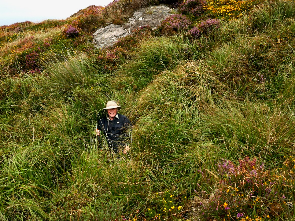
We have visited this site so you don’t have to. It’s private land and very difficult to access and there is no way onto Fionn’s Ridge from the road, despite the fact that it terminates close to the road. Our trek, taken with the permission of the landowner, who warned us, was quite hazardous – more than once we ended up falling through the bracken or caught on the wrong side of barbed wire.
If we ever find an easy way up, we will amend the post – meanwhile, we don’t recommend trying it yourself.
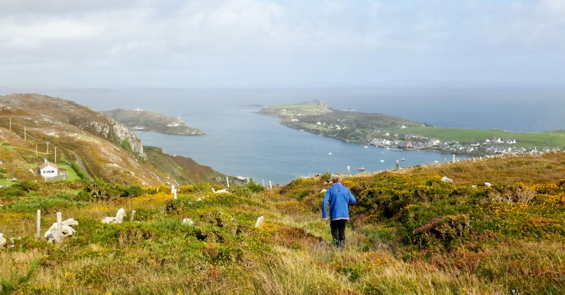
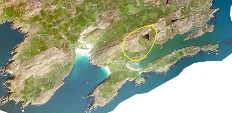
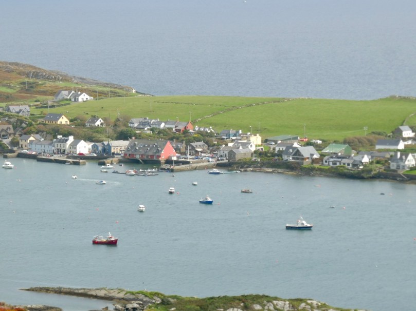
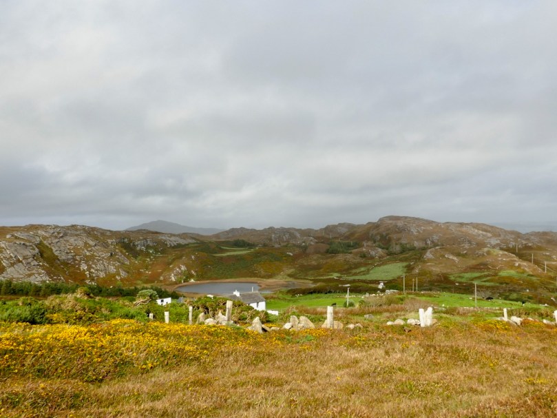
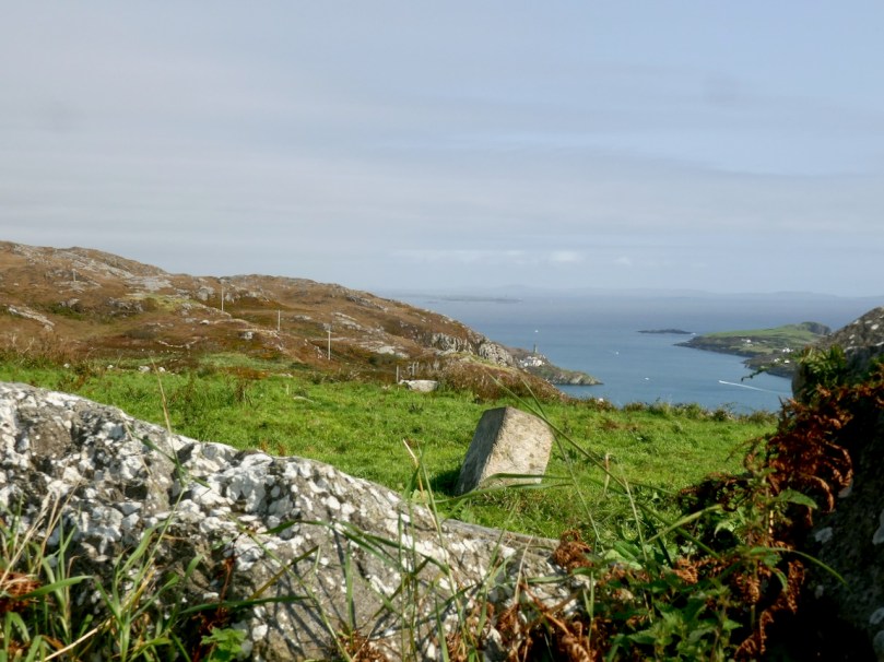
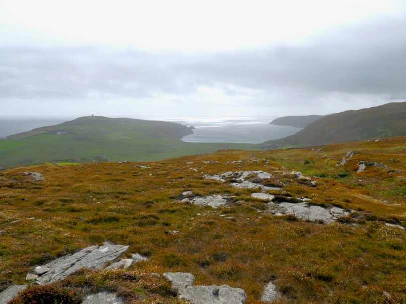
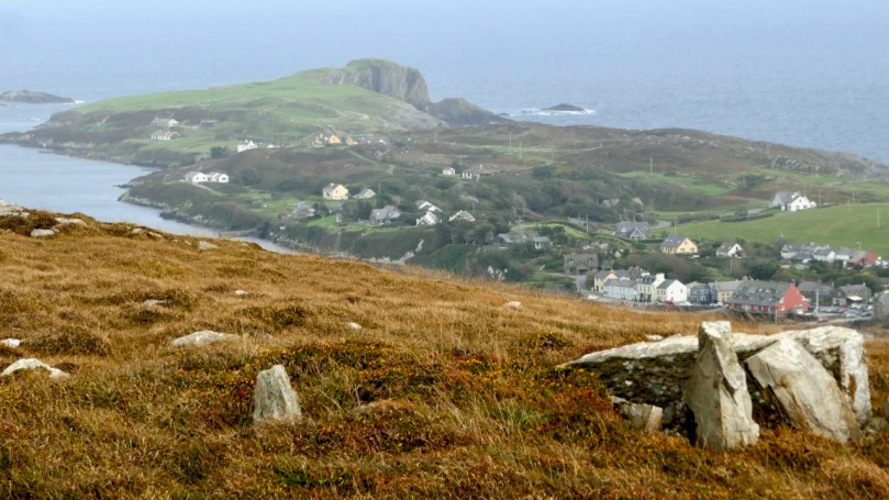
There are parts of West Cork that seem to hold within them all the memories and markers of eons. Such a place is Arduslough, on the high ground across from Crookhaven (below, map and photo) and west of Rock Island (above).
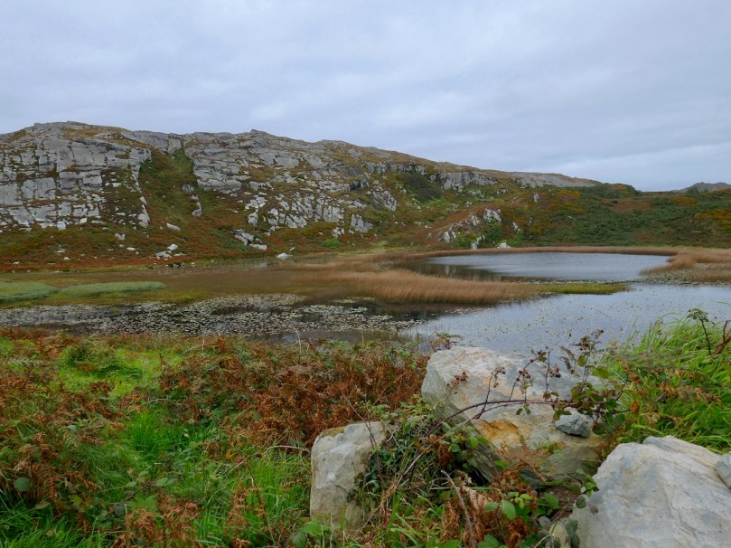
Technically, the places we explored are in three different townlands – Tooreen, Arduslough and Leenane, but mostly they fall within the boundaries of Arduslough. The name has been variously translated – Árd means high place and Lough means lake, both of which seem appropriate, but in fact the placename authority, Logainm, renders it as Árd na Saileach meaning High Place of the Sallies, or Willow Trees. Not much in the way of willows is obvious now, but the lake is certainly central to your view in the townland.
. . . an imprisoned demon of the pagan times. He is permitted to come to the surface every seven years on May morning and addresses St. Patrick, who is supposed to have banished him, in the following words “It is a long Monday, Patrick”. The demon does not speak in the English but in the vernacular. The long Monday refers to the day of General Judgement. Having expressed these words his chain is again tightened, and perforce he sinks to the bottom of the lake for another period of seven year His imprisonment will not expire till the last day.
We saw no sign of the demon and the lake looked remarkably untroubled, with its floating islands of water-lilies.
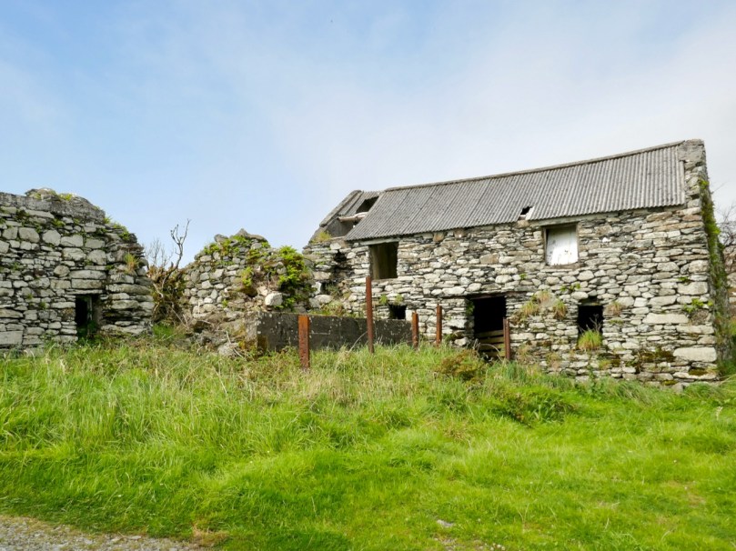
For a relatively small area, Arduslough abounds in archaeological monuments – there are four wedge tombs, three cupmarked stones, a standing stone and a piece described as either an Ogham Stone or Rock Scribings, depending on what you read. The remains of old cabins dot the landscape too, reminding us that this was a much more populous place before famine and emigration decimated the population.
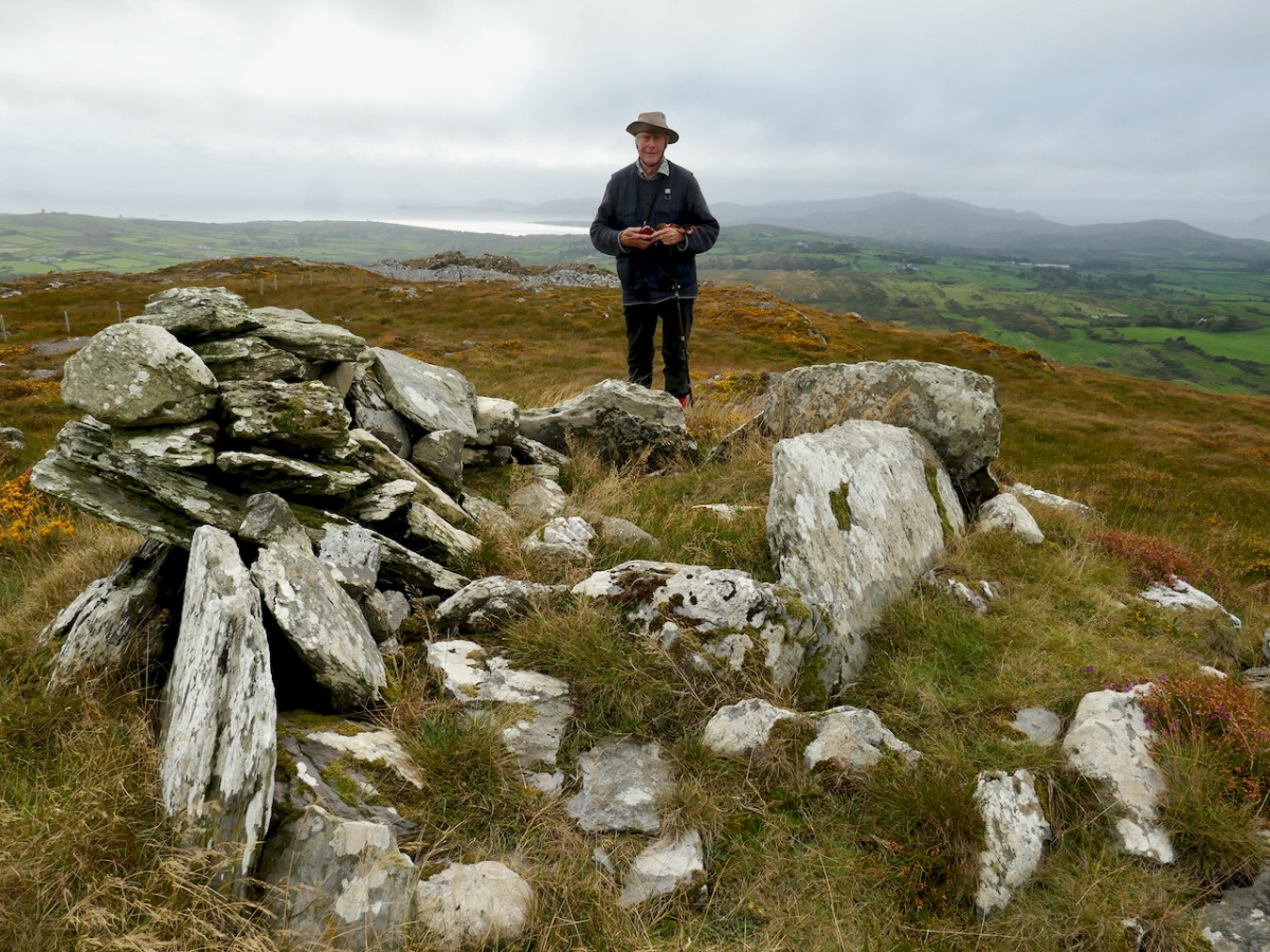
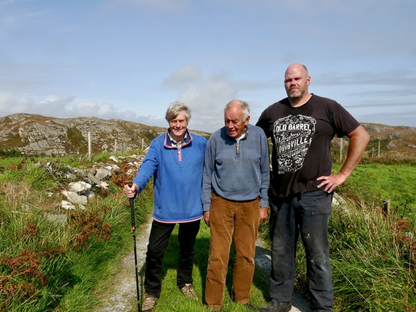
The standing stone, and Robert with Jim and Ciarán O’Meara
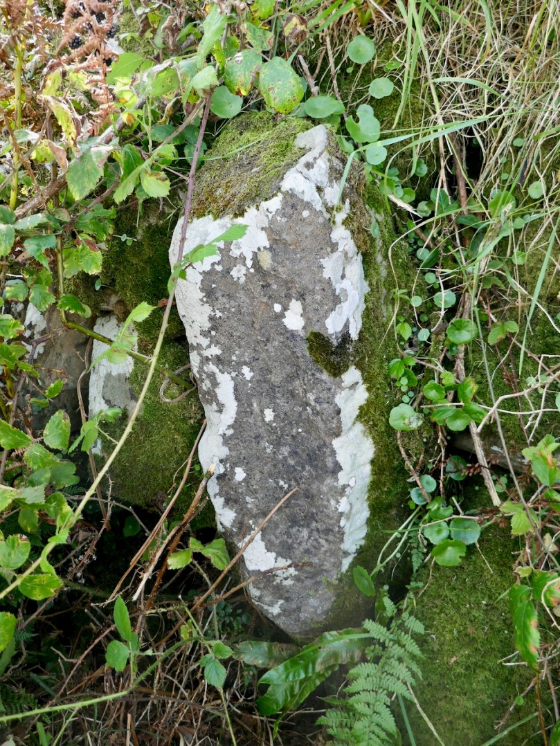
Arduslough is the home of esteemed local historian Jim O’Meara, who grewup in Goleen but spent most of his adult life teaching in Belfast. We met up with Jim and his son Ciarán, who very kindly offered to show us the Ogham stone. It was so well hidden under layers of brambles and bracken, and built into a field fence, we would never have found it on our own.
It is impossible to say if it is real, or even false Ogham, as it is heavily weathered and lichened, but if we turn again to the School’s Folklore Collection, we find this entertaining account of it:
There is a stone in Arduslough, a townland on the hill to the north of Crookhaven, on which are very old characters or ancient writing. It is very difficult to discern these markings now as the centuries during which they were exposed to the weather have obliterated them. The following story explains the origin of them.
In ancient times there lived in Toureen a man named Pilib. He informed on some party of Irish soldiers who were hiding in the heather there. The enemy came on them and burned the heather round them in which the soldiers perished. The stone was erected in this spot and the event was recorded on the stone. Years passed and the language underwent a change. In later years the people did not understand what was recorded on the stone, and went to the Parish priest asking him to interpret it. He translated it as follows – ‘that every sin will be forgiven but the sin of the informer Pilib an Fhraoich [Philip of the Heather].
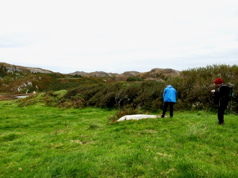
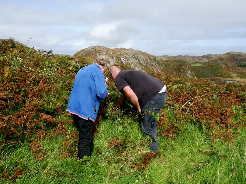
We had previously located one of the three cup-marked stones, including a visit a couple of days earlier with Aoibheann Lambe of Rock Art Kerry (below). Ciarán thought he might be able to find another one, but extensive searching and bracken-bashing failed to turn it up.
The folklore collection is full of references to mass rocks, druid’s altars, and giant’s graves, as you would expect from the number of Bronze Age wedge tombs recorded in this area. (For more on Wedge Tombs, see my post Wedge Tombs: Last of the Megaliths.) Two of them are situated on the slope above the lake (below) and we left them for another day. A third is hard to spot and indeed we didn’t.
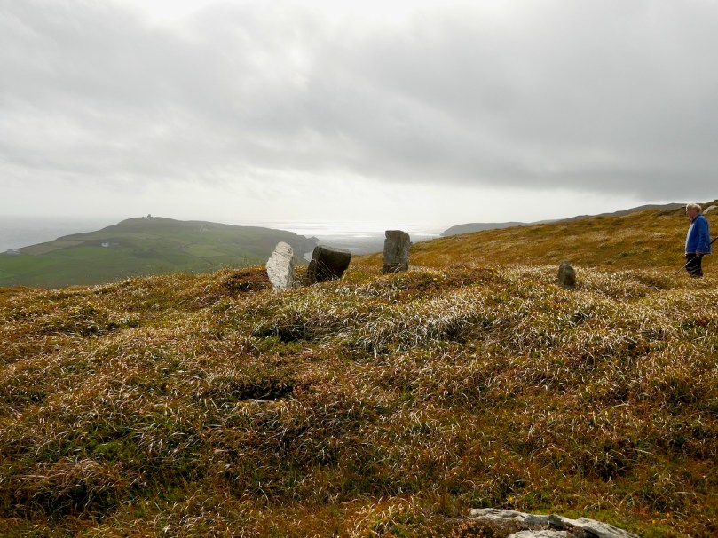
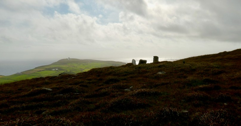
We headed up to the high ground west of the lake to find the one that local people still call the Giant’s Grave. What a spectacular setting this is! First of all, you are now on a plateau with panoramic views in all directions. West lie the two peninsulas of Brow Head and Mizen Head and the boundless sea beyond.
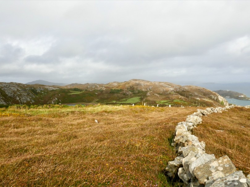
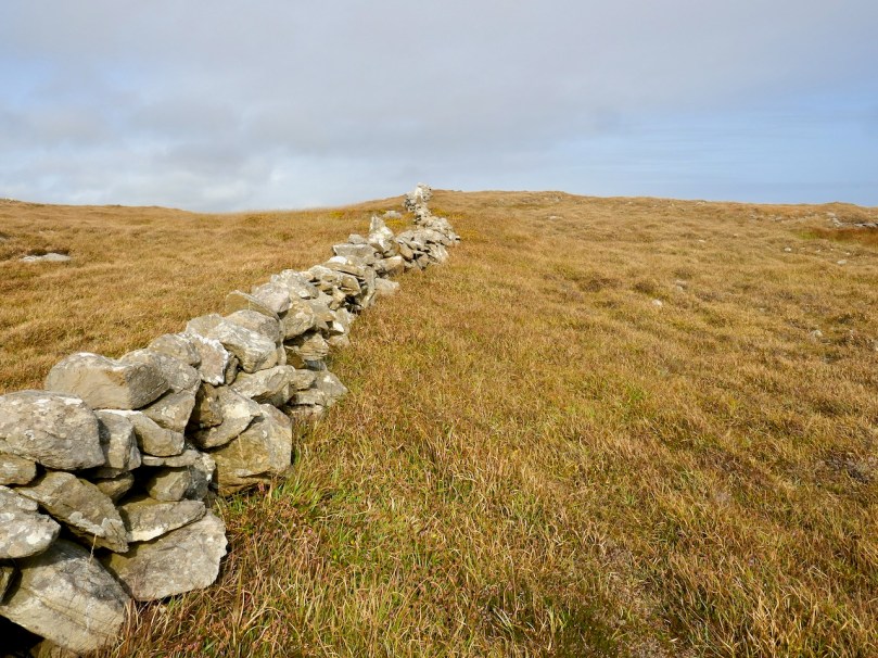
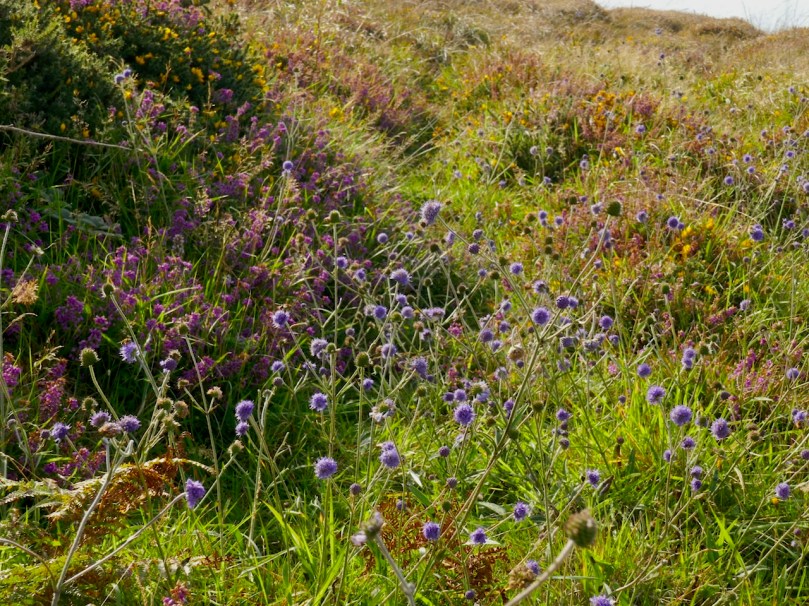
This is heathland, covered in heather and Western Gorse – a colour combination that has the power to stop you in your tracks – and traversed by old stone walls.
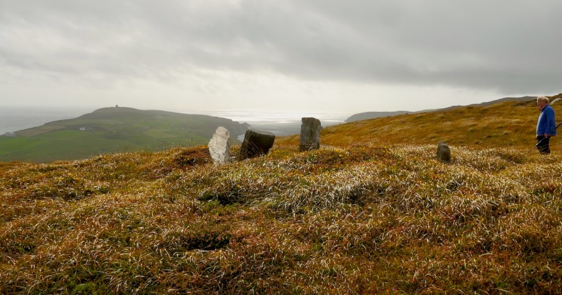
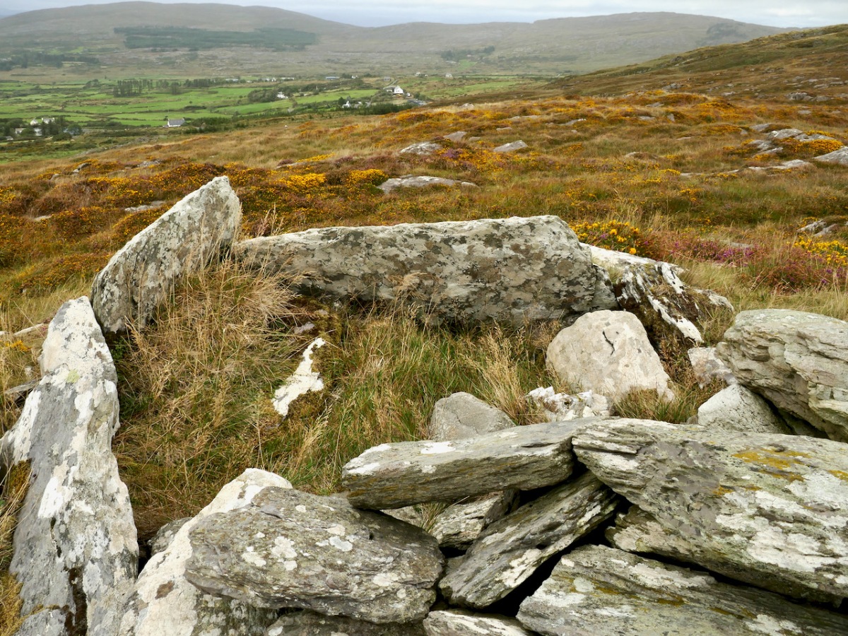
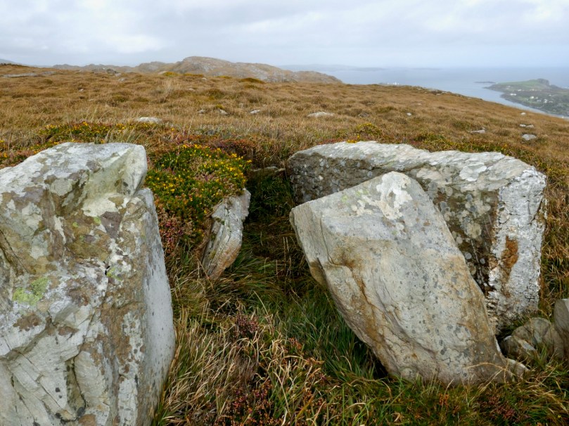
From this colourful bed the stones of the Giant’s Grave arose, pillars silhouetted against the sky. It’s actually in the townland of Leenane, just outside the boundary of Arduslough. When Ruaidhrí de Valera and Seán Ó’Núalláin conducted their Megalithic Survey in the 1970s they commented that the tomb was ‘fairly well preserved’ and‘commands a broad outlook to the south and east across the sea to Cape Clear and Roaringwater Bay.’ They interpreted what was there as a wedge tomb, although with some uncommon features.
First of all, they said the tomb was ‘incorporated’ within an oval mound. While mounds are known for wedge tombs, they are unusual and most of the Cork examples, included excavated ones, show no trace of a mound. Stones sticking up here and there, protruding from the mound, they interpreted as cairn stones.
Secondly they noted two tall stones on the north side of the tomb – one is still standing and clearly visible (above and below) – whose function was ‘uncertain.’
Two tall stones at the south west end (above) seemed like an ‘entrance feature.’ Our own readings at the site indicated that the orientation was to the setting sun at the winter solstice, a highly significant direction to where the sun sets into the sea.
So – an unusual wedge tomb. Elsewhere in their report de Valera and Ó’Núalláin state repeatedly that a hilltop setting and a rounded mound are consistent with passage graves. However, at the time no passage grave had been identified this far south and they were thought to have a more northerly distribution. Since then, two have been identified in County Cork – one at the highest point on Cape Clear, which is visible from this site, and one in an inter-tidal zone between Ringarogy Island and the mainland. Perhaps it is worth considering whether, rather than a wedge tomb, this site may be a passage grave, like the one that Robert writes about this week in Off the M8 – Knockroe Passage Tomb or ‘Giant’s Grave’.
Whatever we label it, this Giant’s Grave is a spectacular site. It’s not hard to imagine, up there, that Neolithic and Bronze Age farmers were just as awe-stricken as we were with the magnificence of the surroundings. Tending their herds, they marked the seasons with the great movements of the sun and moon, and commemorated their dead with enduring stone monuments. More recently, people invested the landscape with myth and stories. Walking the hilltops, you know you are in the footsteps of all who went before.
Welcome to the UCD Library Cultural Heritage Collections blog. Discover and explore the historical treasures housed within our Archives, Special Collections, National Folklore Collection and Digital Library