Mizen Megaliths 1: The ‘Unclassified’ Gubbeen Tomb and Fionn’s Ridge

Megalithic tombs (from ancient Greek mega – great, lithos – stone) dot the Irish countryside and date from the Neolithic period (4,000 to 2,500BC) and the Bronze Age (2,500 to 500BC). The practise of erecting large stone monuments would have entailed significant command of local resources and therefore indicates either a highly co-operative or a highly stratified society. The megaliths were built to last and indeed many have survived, although only a shadow of their original size. 

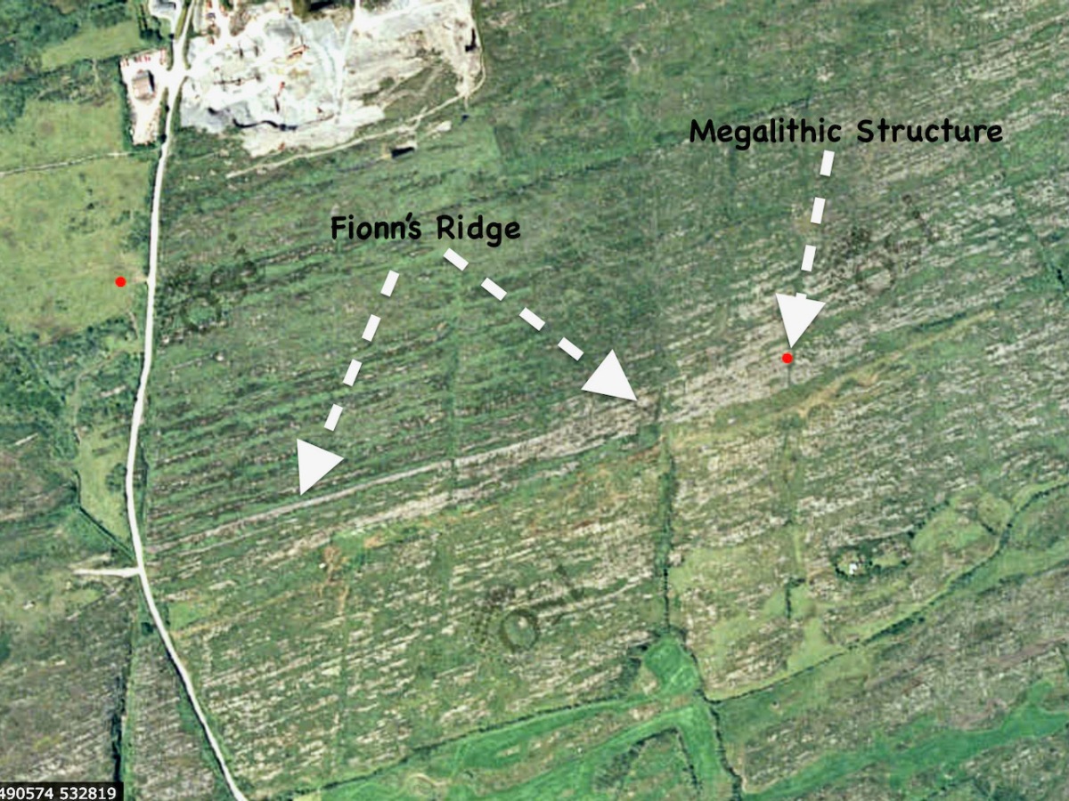
I’m going to start this new series with a curious construction labelled by the National Monuments survey as a ‘megalithic tomb- unclassified’. It’s in the townland of Gubbeen, near Schull, but only barely, as it’s almost on the boundary with the townland to the North, called Glan. What marks the townland boundary here is one of the things that makes this site so fascinating.

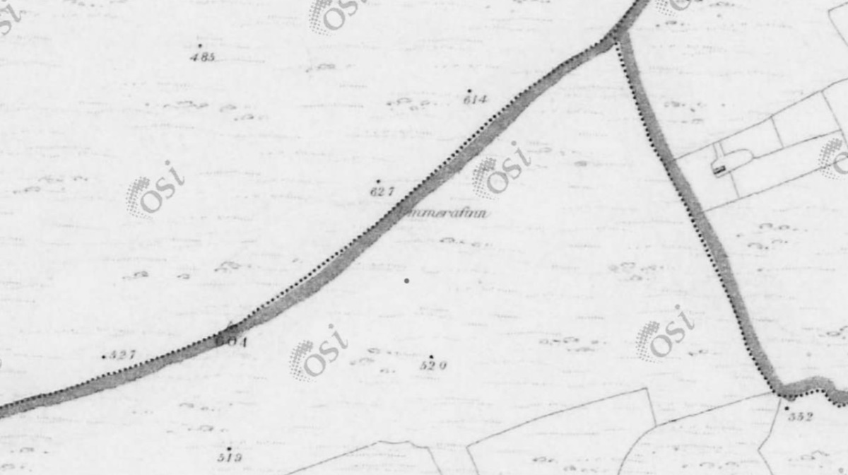
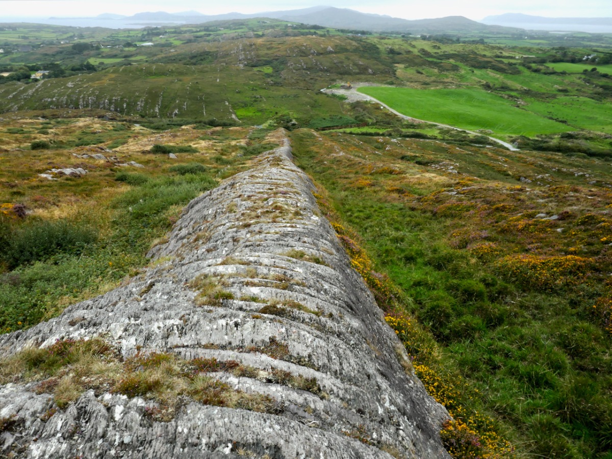
The boundary, instead of the usual stream or old road, is a striking landscape feature called locally Fionn’s Ridge. Originally, it was known as Ummerafinn, from iomaire, meaning a raised strip of earth, such as that made by a plough, and Finn, a common form of the Irish name Fionn, meaning fair-haired. It is marked thus on the Historic 6” Ordnance Survey map which was made in the 1840s – can you make it out, above?

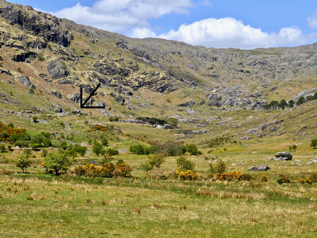
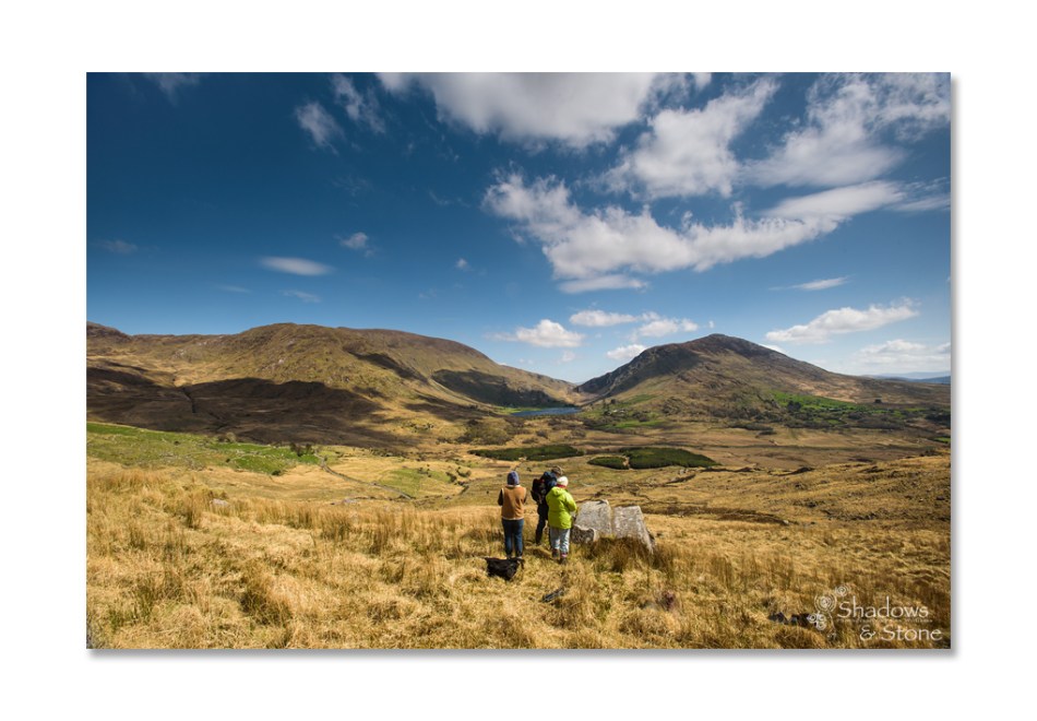
Fionn’s Ridge runs for half a kilometre from the road up to a rocky prominence that is part of Knocknageeha (Hill of the Winds), which in turn is part of the greater mass of Mount Gabriel. As you would expect from such a conspicuous landscape element, it is the subject of much folklore, some of which I detailed in the post Legends of Mount Gabriel: Fionn, Furrows and Fastnet. That post will tell you, if you don’t already know it, more about the legendary Fionn MacCumhaill.

However, when I wrote that post, I hadn’t actually identified Fionn’s Ridge properly. Now, I have not only seen it from several angles, but walked up and down it. The folklore says that Fionn MacCumhaill ploughed the furrow with two rams and a wooden plough and indeed what we see now does bear a resemblance, not to a furrow but to the raised rounded spine (on one side of the furrow) which results when a plough cuts and turns over earth.

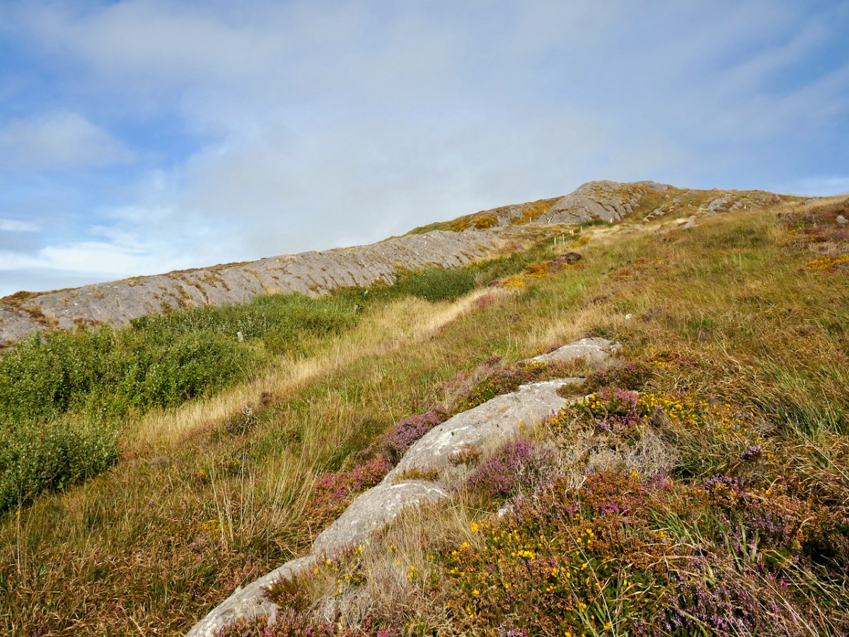
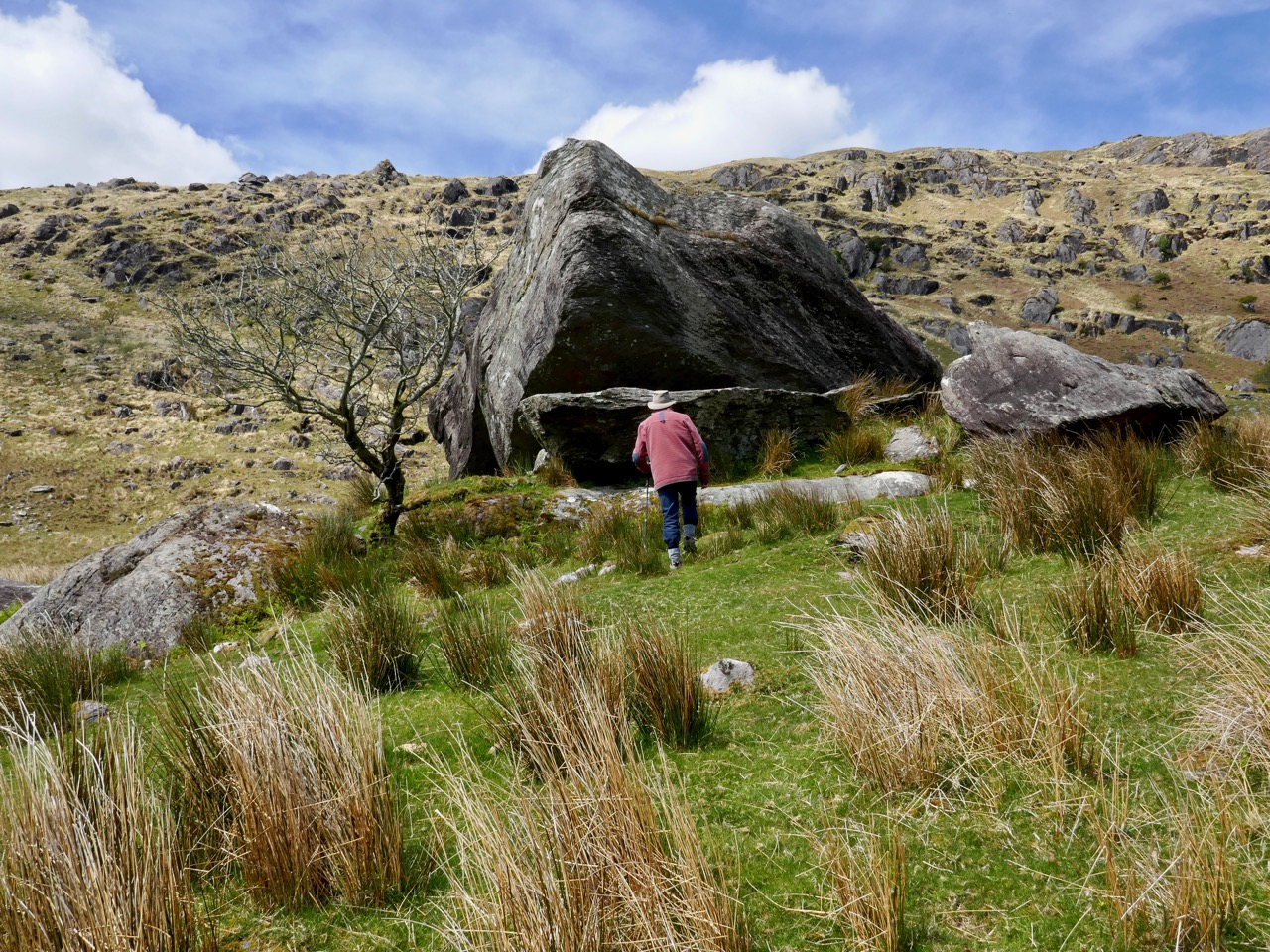
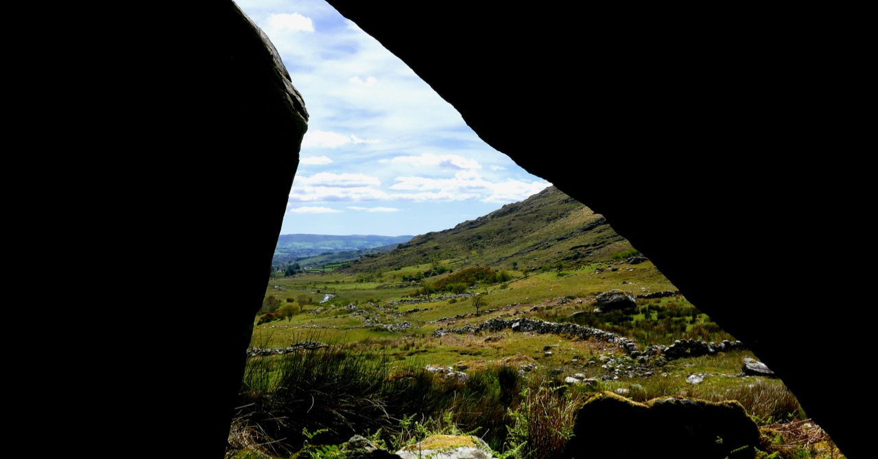
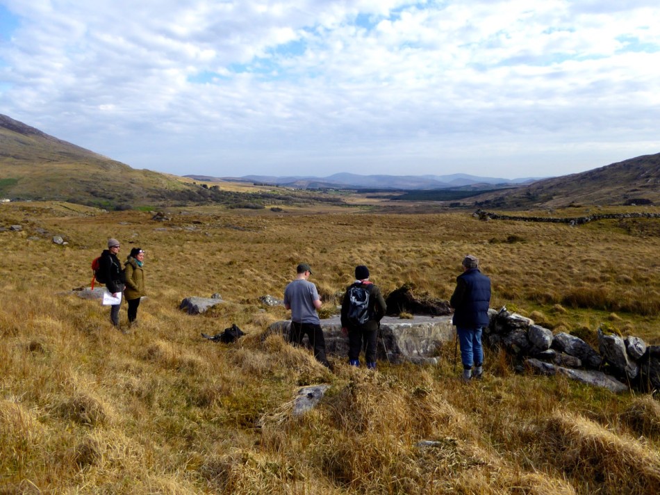
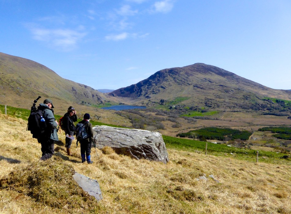
The ridge leads almost straight up to the megalith. This is unlikely to be a coincidence – Neolithic people were as struck as we are by such strange phenomena in their surroundings. When they decided to build the structure at a spot right at the top of it, they may have been influenced by several factors. They may, for example, have used the ridge as a road or as a ceremonial processional route up to the megalith. It is ideal for such a purpose. Like us, they may have had folklore that spoke of a giant and his plough.

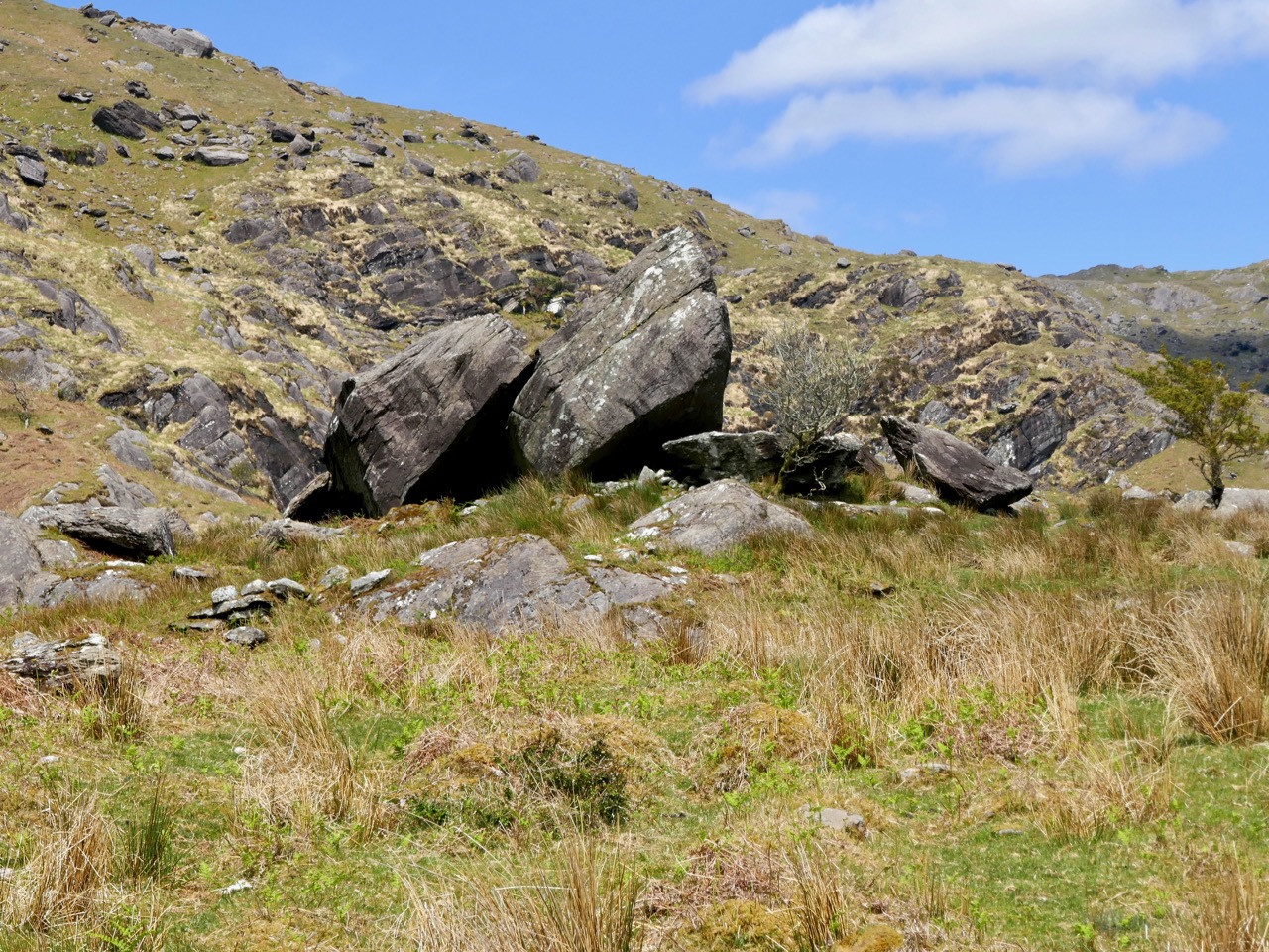
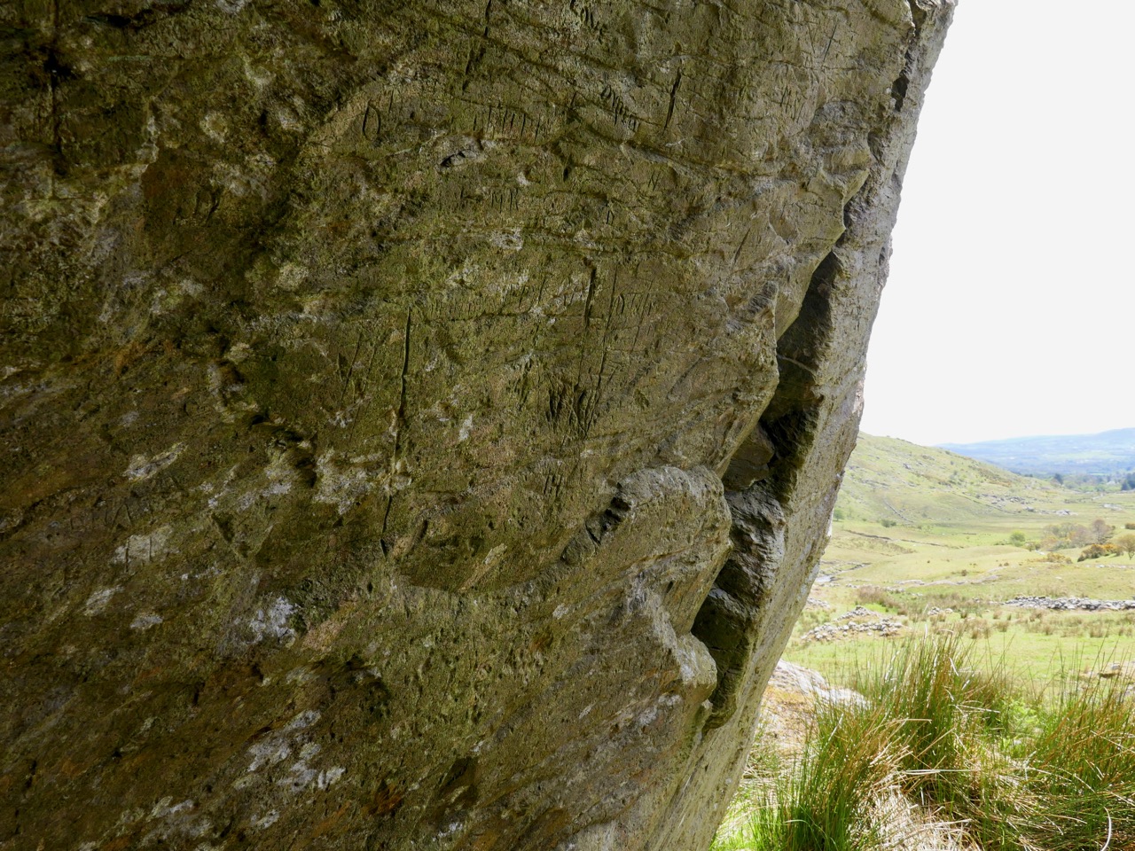
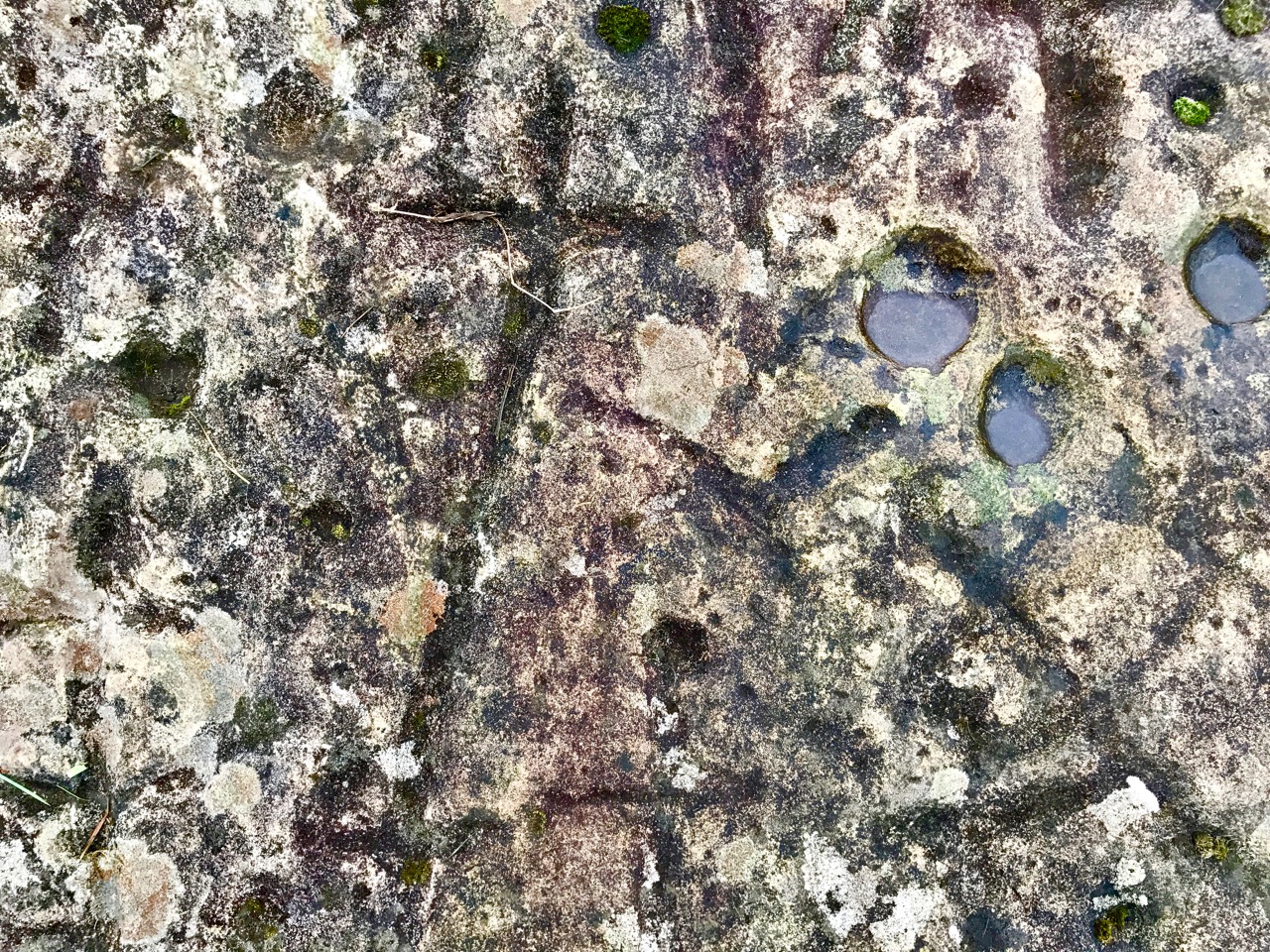
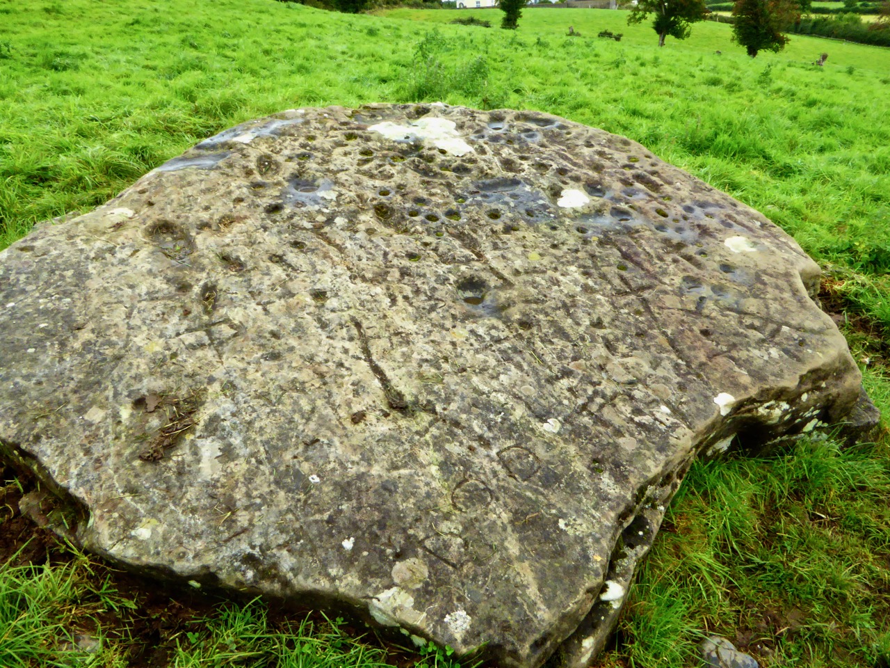
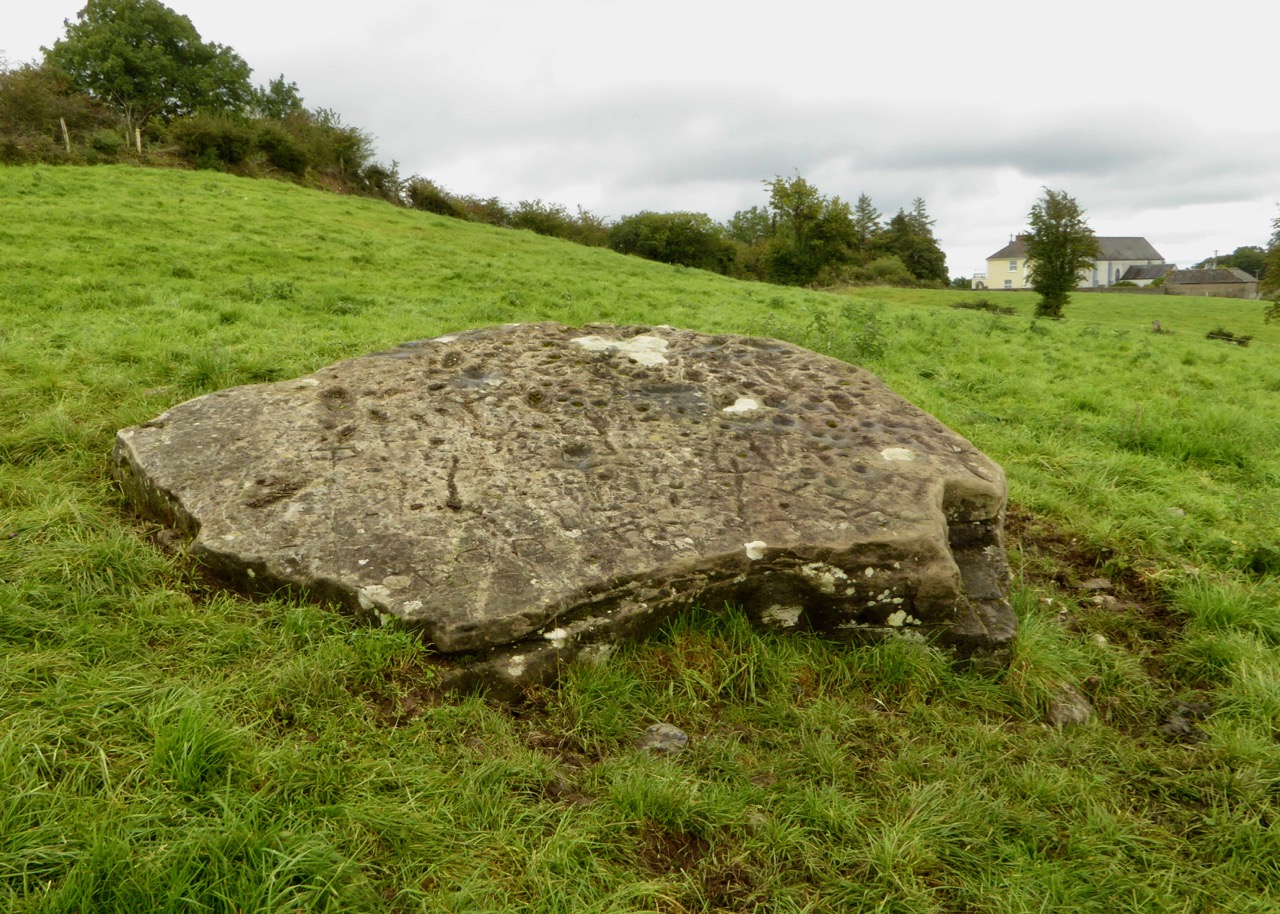
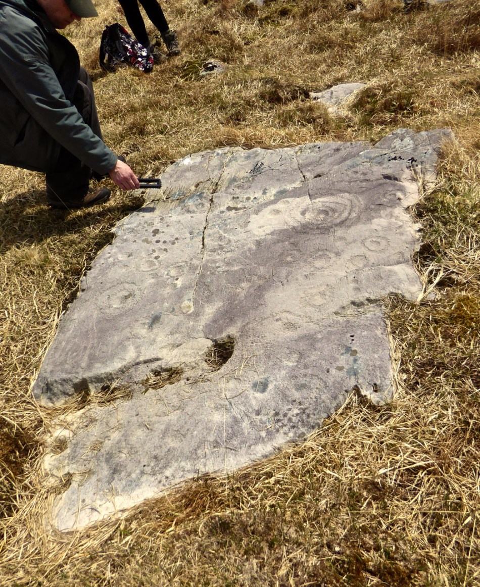
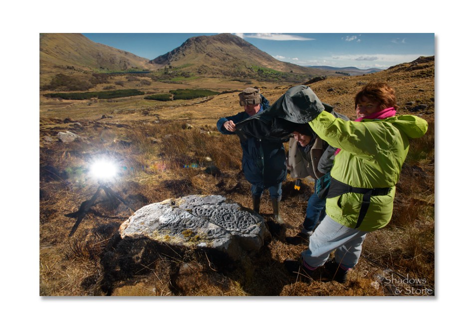
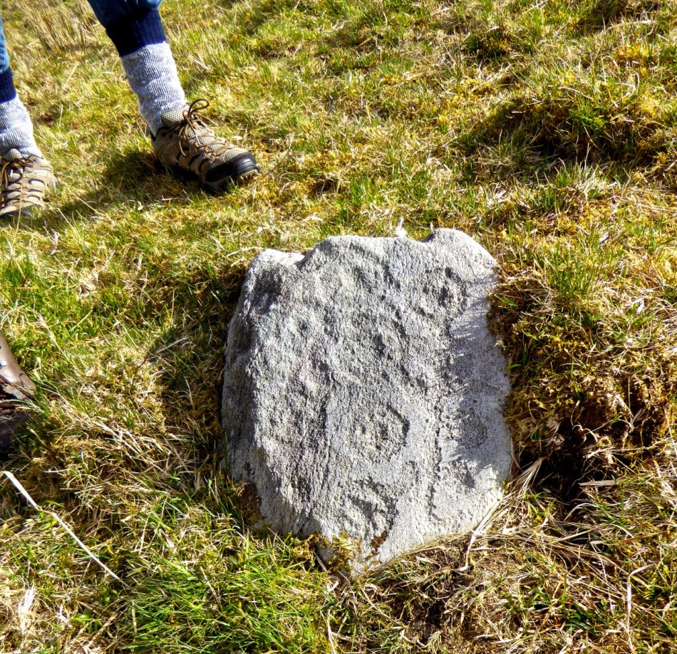
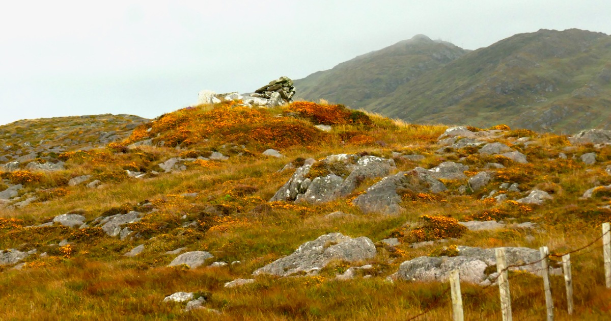
Let us turn now to the megalith. Here’s the National Monuments description: Ruined chamber (L 3.1m; Wth 2.2m at W end, c. 0.6m at E) aligned ENE-WSW, formed of inclined slabs. Structure incorporated in circular cairn. Traces of low dry-stone kerb survive at N, W and S.

The first thing we can say for certain is that is is not a wedge tomb. Take a look at my post Wedge Tombs: Last of the Megaliths for a complete description of this type of monument, which belongs to the Bronze Age. Wedge tombs are the most common megaliths on the Mizen – there are 12 listed. Of these, I have stated my doubts about the Giant’s Grave in Arduslough, based on its hilltop setting and the traces of a mound delineated by kerbstones.

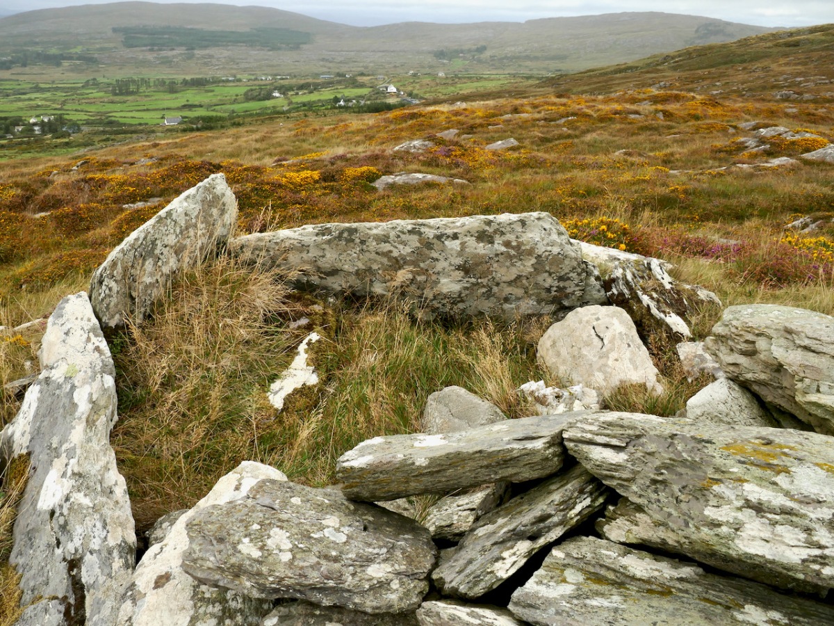
Here we have the same issue – the siting is not typical of wedge tombs, none of which, on the Mizen at least, are on hilltops (apart from Arduslough). Wedge tombs are oriented to the setting sun in the Western sky – that is, the tallest and broadest section, the entrance, is always to the west. In Gubbeen, it is clear that there is no opening to the west – instead what we see is the wall of a roundish chamber. It is impossible to make out exactly where the entrance was for certain, because of piled-up rocks, but it was at the eastern side, with an orientation towards the rising sun, and Mount Gabriel. 

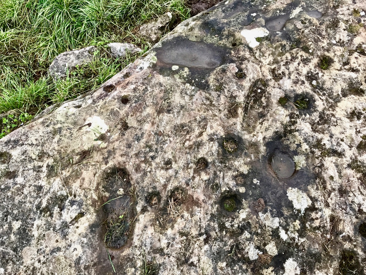
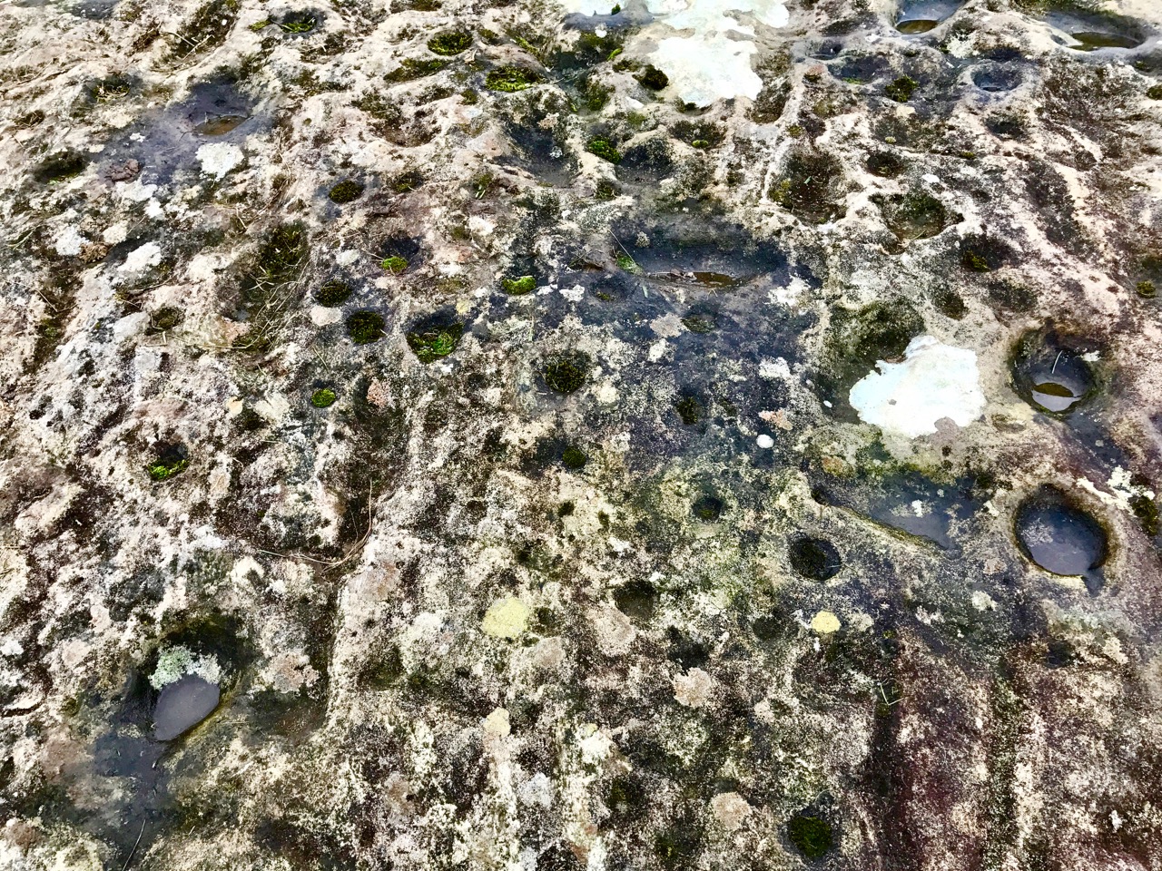
As noted by National Monuments, there are traces of a kerb, although it’s hard to be definitive about this. The collapsed pile of rocks as the eastern end may have been simply piled up there in modern times – but they may also be from a collapsed roof.

Where am I going with this? I posit that this may be, in fact, a passage grave. Several features (hilltop setting, sunrise orientation, internal chamber, kerb) set it more obviously in the passage grave tradition than in the wedge tomb tradition. There may be an archaeological bias against labelling such structures as passage tombs, since it has been considered that passage tomb distribution was in the northern half of the island. 

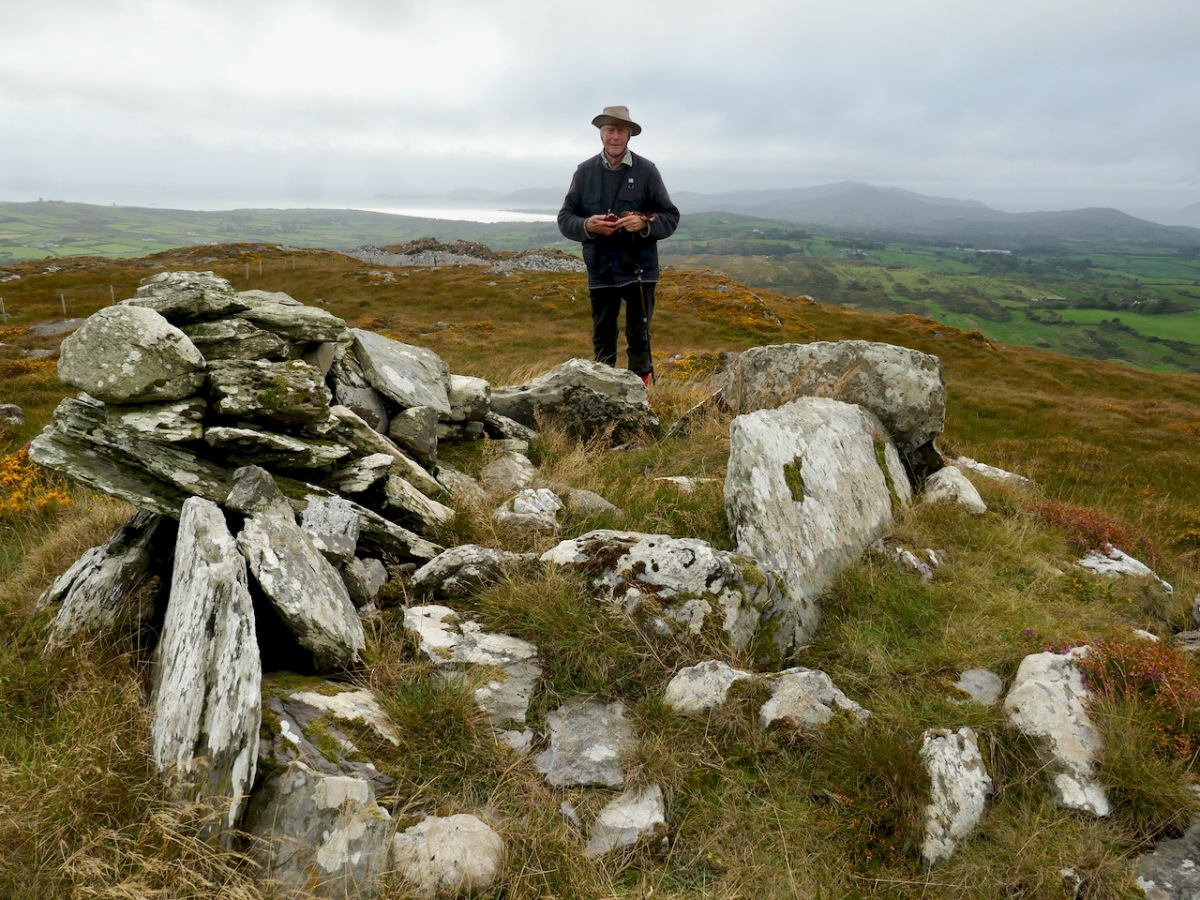
In fact, it is not unlike the passage tomb on Cape Clear, the position of which is clearly visible from this one – that’s it on the horizon, above. Inter-visibility is a feature of passage graves. There is also a similar anomalous megalithic structure on a high point on Sheep’s Head – also clearly visible. 

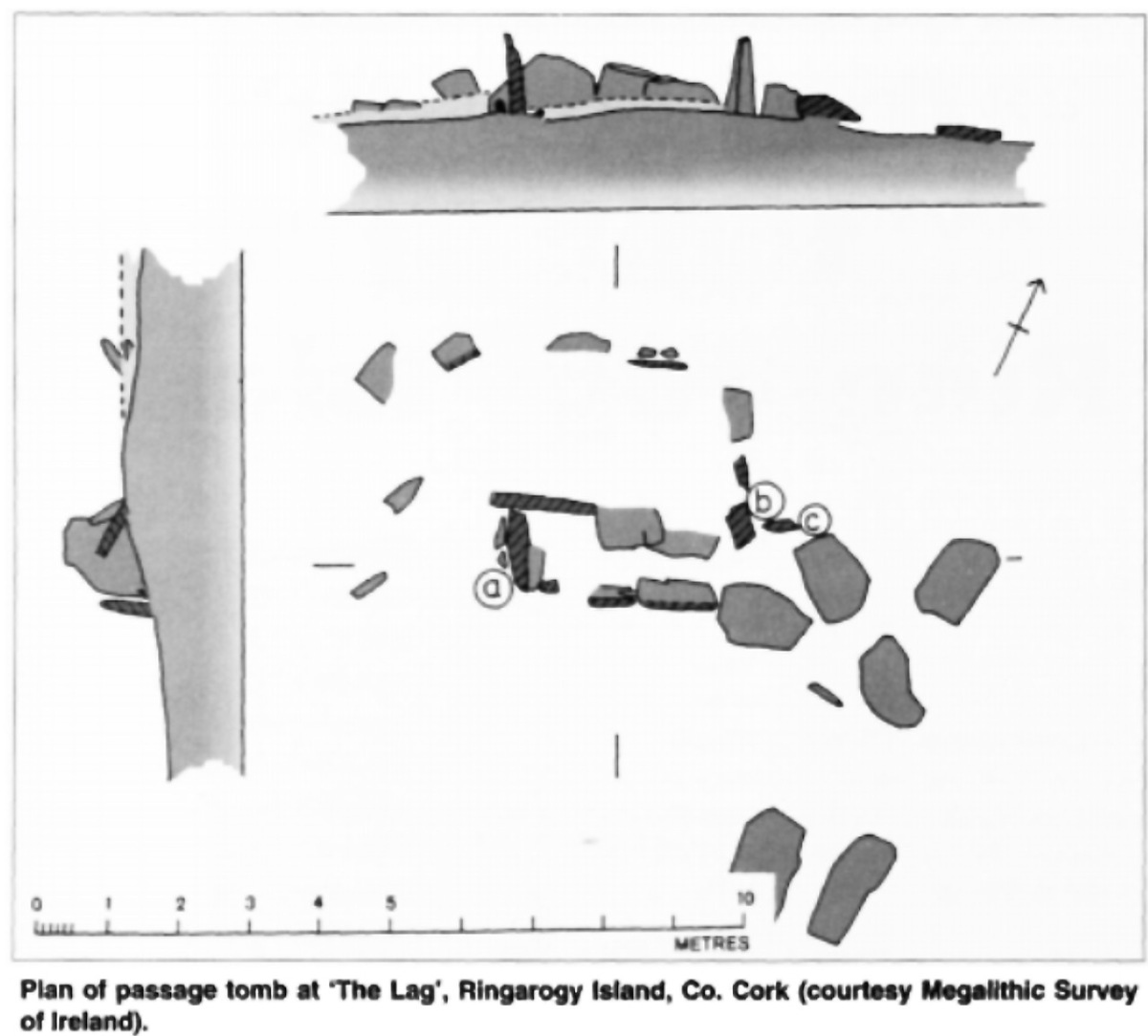
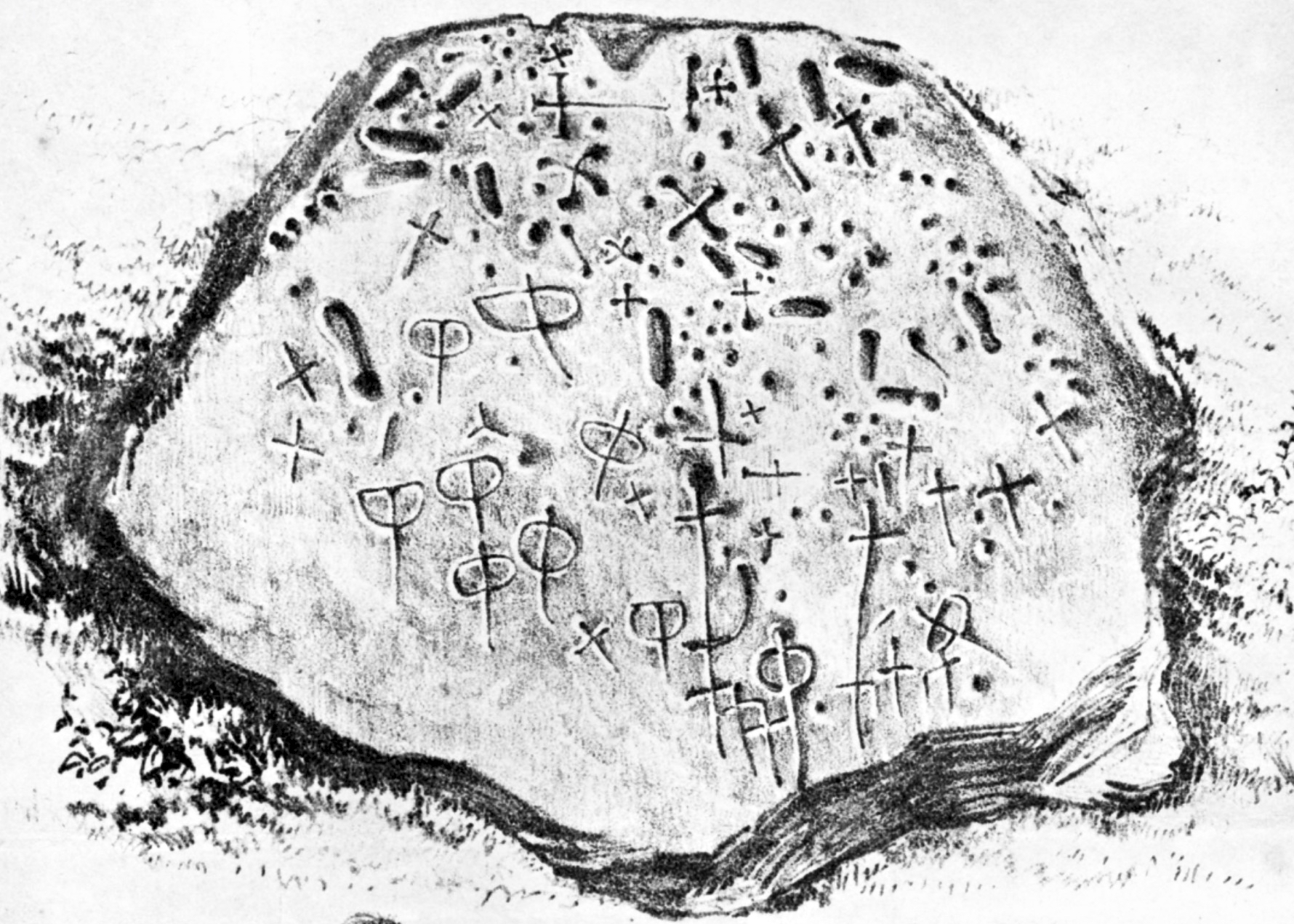
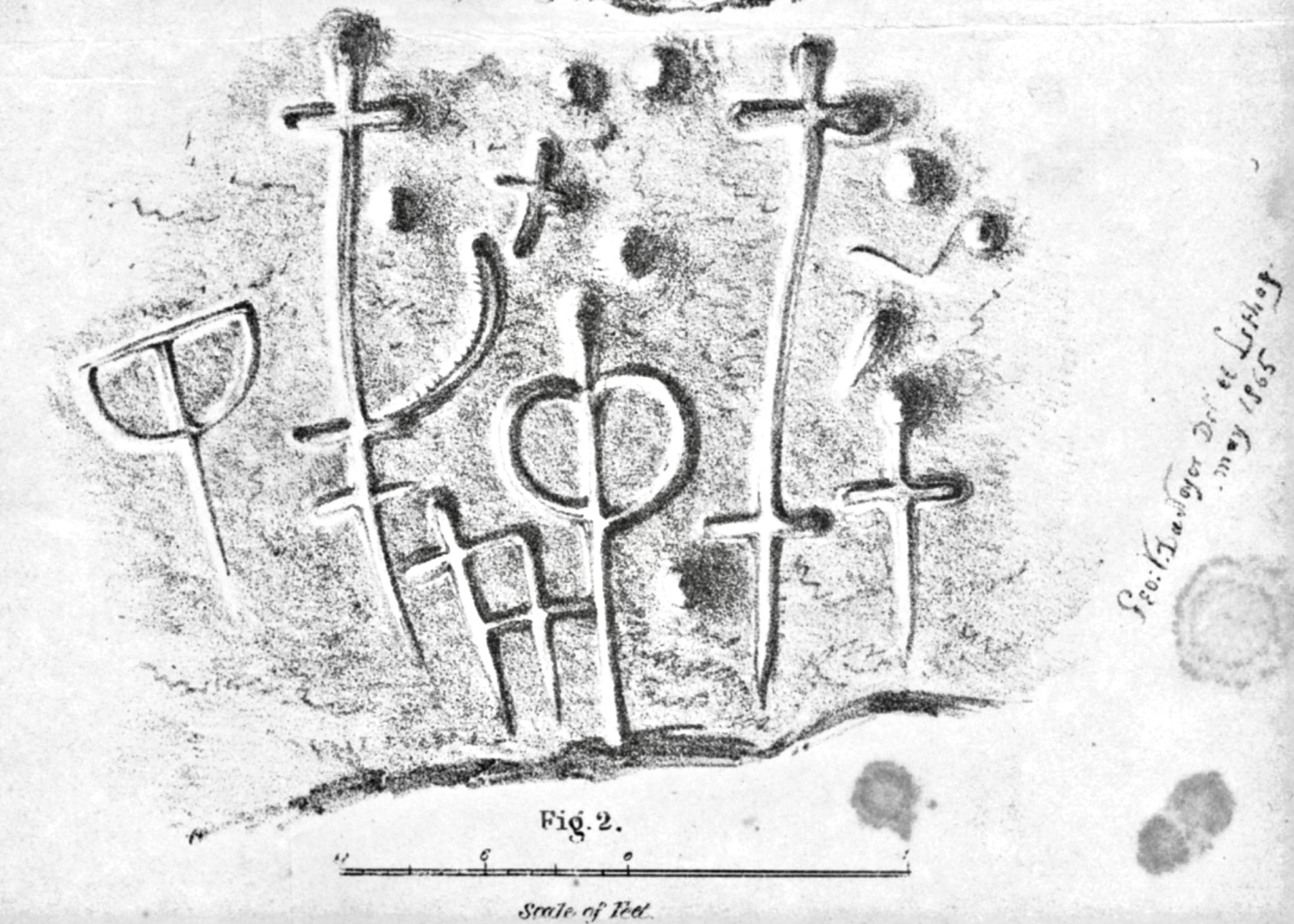
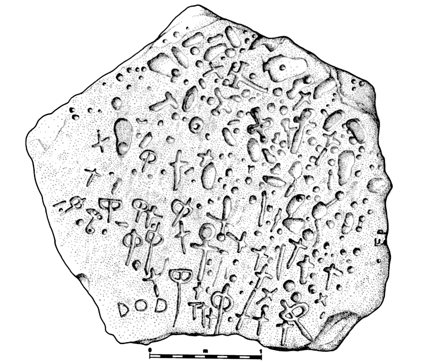
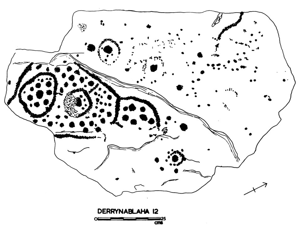
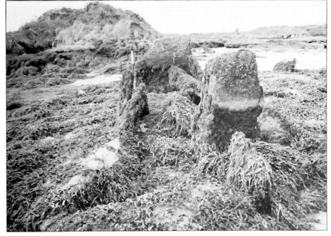
The other structure that has been identified as a passage tomb in this area is in The Lag, between Ringarogy Island and the mainland. Elizabeth Shee Twohig identified it, and placed it and Cape Clear within a group of ‘undifferentiated’ passage tombs (by which she means that there is no clear differentiation between the passage and the chamber as there is, for example in Newgrange) known from Waterford and South Tipperary. All except The Lag occupy high ground, although not summits. Above is her plan of the tomb and below is her photograph, both images from her article on The Lag in Archaeology Ireland Vol. 9, No. 4 (Winter, 1995), pp. 7-9, available here for those with a Jstor account.

So – in many ways, Gubbeen fits with what we know about the southern spread of a passage grave tradition. It’s time for a re-evaluation of passage graves in this part of Ireland. They may well turn out to be much more common than we have admitted hitherto.

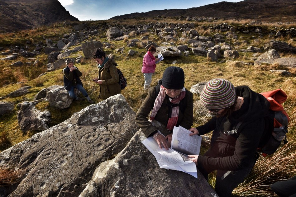
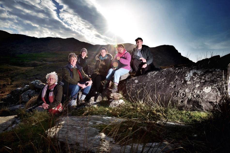
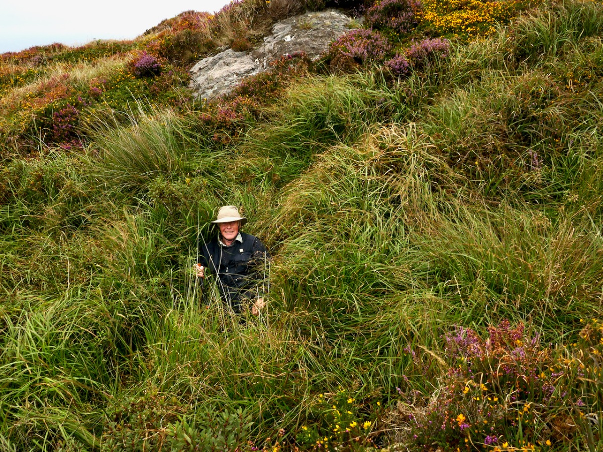
We have visited this site so you don’t have to. It’s private land and very difficult to access and there is no way onto Fionn’s Ridge from the road, despite the fact that it terminates close to the road. Our trek, taken with the permission of the landowner, who warned us, was quite hazardous – more than once we ended up falling through the bracken or caught on the wrong side of barbed wire.

If we ever find an easy way up, we will amend the post – meanwhile, we don’t recommend trying it yourself. 

Witches’ Marks and Lovelorn Shepherds: Inscribed Rock Art in a Remote Valley

One day in the summer of 1972 I set off on my Honda 50, backpack full of recording tools, to find a new and different example of rock art. This was not my usual prehistoric cup-and-ring carving, but inscribed or scratched markings in a ‘cave.’ When I returned yesterday, 47 years later, it was to a place even more remote and wildly beautiful than it had been in my memory. Read Robert’s post for a full account of our walk up the Valley of the Cooleenlemane River.

The site itself is arresting. Huge slabs lean against each other to form three shelters – nowadays harbouring sheep but in times past, perhaps humans. There is an account in the Halls’ Tour of Ireland of an encounter they had with a family living in this area in what looks remarkably like our destination.

The House of Rocks from Ireland, Its Scenery, Character, &c by Mr and Mrs S C Hall, page 149. Drawn by A Nicholl, engraved by Landells

The ‘caves’ are known locally as the Bealick – Pat Joe pronounced it The Bay Lick. Leach (pronounced lack) is the word for a flagstone or slab so this could be a reference to the enormous stones themselves, but baoleach (pronounced bway-lock) is also the Irish word for dangerous, which may refer to beliefs about the power of the place. The townland name, Cooleenlemane, could mean the Little Nook of the Rock Outcrop, or it could mean the Rock Outcrop at the Remote End (of the valley). Either way, it’s apt.

The arrow points to the Bealick: you can see it from a long way away as you walk up the valley

We’ve written many posts about rock art in this blog, but the closest we’ve come previously to dealing with Inscribed markings was Robert’s post on the Aultagh stone, which has been suggested as an Ogham (or fake-Ogham) stone. This one is very different.

This type of site has been described most comprehensively in Elizabeth Shee Twohig’s paper, An Enduring Tradition, Incised Rock Art in Ireland in the 2014 book From Megaliths to Metal: Essays in Honour of George Eogan. She coins the term COMBS, based on where these kinds of marks occur – Caves, Outcrops, Megaliths and Boulder-Shelters, and gives details on the ones that have been documented to date, including the list I included in my 1973 thesis.

I described and drew three of the sites then – Glanrastel, Kealanine and Cooleenlemane – and I hope to get back to the others also. Of the three, Cooleenlemane has the greatest range of markings. There are three caves here, but markings only in two, which I labelled the East and West Cave. The markings run the full gamut of Shee Twohig’s motif range. There are also initials and words and letters that do not form words but that seem to run together.

The East Cave has the widest range of markings

This is what I wrote in my 1973 thesis about how the carvings were made:

The three sites of Glanrastel, Kealanine and Cooleenlemane share an identical incising technique. The markings have a V-shaped cross-section with smooth faces. In the case of the lighter marks, this effect could have been achieved by scratching with a strong knife, and at Kealanine and Cooleenlemane this technique accounts for many of the initials and letters, and some of the straight strokes. The deeper strokes were probably made by reaming with the end of a pointed tool. This tool need not have been metal. Identical techniques of marking have been identified by Shee. . . from passage-graves, which she suggests were executed with the edge of a stone axe.

The West Cave has more words and letters

At the time, we had no idea how to interpret these kinds of markings. I did say in my thesis they were more likely to be historic rather than prehistoric, and pointed out the Christian nature of the many cross motifs. The initials and words are, of course, fully modern.

But in fact, incised markings such as these are known from many contexts, including prehistoric. They are widely distributed in southern Europe, where they may be associated with figurative carvings also. The 2014 Proceedings of the XVII UISPP World Congress was published as Post-Paleolithic Filiform Rock Art in Western Europe, filiform being the word chosen to describe incised rather than pecked rock art. A chart of what the authors call The Geometric Type (above) contain many motifs that would be at home in Cooleenlemane. Some of these may date from the Bronze Age or the iron Age.

Shee Twohig also points out the long and varied traditions of marks of the COMBS type, including Early Medieval inscribed crosses on rock outcrops, and thirteenth century mason’s marks. You may remember our post about Keith Payne’s exhibition, Early Marks: inspired by Genevieve von Petzinger’s book The First Signs, he depicted many such inscribed markings, including one from Blombos Cave in South Africa, reckoned to be 75,000 years old.

A recent discovery at Creswell Crags in Nottinghamshire generated excitement earlier this year and may hold the answer to the puzzle of what at least some of these marks are all about. Dubbed Witches’ Marks, they are believed to have been tokens to ward off evil spirits. According to this BBC piece Protection marks are most commonly found in medieval churches and houses, near the entrance points, particularly doorways, windows and fireplaces. They are also often found in caves and shelters, near the entrance.

I said some of those marks – The initials and words, to my mind are equally important as evidence of our enduring need to leave our, er, mark on the world. How many generations of DKs (Several Dinny Keohanes, apparently, lived around the valley) carved their initials and hoped to be remembered? And was someone in the West Cave, in the time honoured-tradition of the love-struck everywhere, trying to make a declaration while sheltering with his sheep against a spring gale?

In the inevitable way of such special places in Ireland, the Bealick eventually became known as a Mass Rock (see this post for an explanation and examples) and it is described thus in the National Monuments records (Monument number CO091-003). Indeed, it would have made an excellent location for a mass rock, remote and hidden in its lonely valley.

From this angle you can see the three caves. There are no markings in the closest one

Seeing it again after all these years, I was struck by wonder at how my 22 year-old self managed to find it (I suspect I would have applied to the nearest dwelling and been directed there after multiple cups of tea and slices of brown bread) and to draw it. It must have taken hours then, but the 20 minutes I spent stooped inside yesterday trying to get photographs just about crippled me. But mostly what I felt was gratitude – first for the privilege I had been granted all those years ago of doing something so exciting and important for my thesis, and second for the untouched and pristine nature of the Bealick and its setting.

(Thanks, Keith, for the inspiration for this shot)

The Significant Rock Art of Clonfinlough

Whenever we stray from our home territory of West Cork, we are always on the lookout for archaeological wonders. When we set our course for Clonmacnoise, in County Offaly, last week (I like the possible translation of the Irish Cluain Muccu Nóis: Meadow of the Pigs of Nós, but there is an alternative Cluain Mhic Nóis: Meadow of the Sons of Nós), we were looking for Ireland’s most important medieval monastic site, but we were diverted only a stone’s throw from our destination by a sign that we couldn’t ignore…

Tucked away to the south east of Clonmacnoise, on a by-road, sits an isolated church in front of which is a well defined and fenced pathway leading past the Priest’s house, through fields, over a stile and into a pasture where cows grazed and barely gave us a glance. There – open to the ravages of weather and cattle – is a large, earthfast slab of limestone bearing a remarkable array of markings.

Header – a detail from the stone’s crowded surface. Upper – the well-defined path leading from St Kieran’s Church to the stone (don’t confuse this St Kieran with the one from Cape Clear). Lower – the limestone slab situated beyond the stile

For Rock Art enthusiasts like us the stone was a wonderful find. The surface is teeming with rings, lines, shapes – and even lettering. In spite of the weathering, everything was deeply defined and easy to see. And the more we looked, the more we did see, and the more perplexed we became. I even noted footprints! Remember my search last week for the footprint left by Archangel Gabriel on his visit to his eponymous mountain in West Cork? Here I counted six, and my size nine feet fitted perfectly in them all.

Upper – two of the ‘footprints’ scattered on the stone’s marked surface. Lower – the stone in its landscape context: ‘footprints’ are also visible

When we returned from our visit to Offaly I was able to research the available information on the Clonfinlough Stone and was delighted to find a very comprehensive study of it written by Finola’s old friend and Rock Art expert from UCC, Elizabeth Shee Twohig. The piece – Context and Chronology of the Carved Stone at Clonfinlough, County Offaly – was published in 2002 in The Journal of The Royal Society of Antiquaries of Ireland, Volume 132 pp 99-113. It makes the most enlightening read, outlining the ways in which the stone was regarded and drawn by early antiquarians and then opening up discussion on how much of the stone’s markings might in fact be natural formations, or natural forms which have influenced and been enhanced by ‘artists’ working with motifs which have become familiar to Rock Art researchers today, including cupmarks.

Engravings by George Victor du Noyer illustrating a paper published by James Grave in 1865. Note the emphasis that du Noyer has placed on recognisable ‘Greek’ style lettering (termed phi by Shee Twohig)

Elizabeth Shee Twohig quotes theories by RAS Macalister which evolved between 1921 and 1949, and which include the idea that the phi markings represent ‘…a possible depiction of a battle between the ‘loop men’ and the ‘cross men’ and suggested that the cupmarks …may even indicate the number of severed heads!…’ In his 1928 book The Archaeology of Ireland Macalister (quoted by Shee Twohig) suggests ‘…the carvings as showing a battle or pre-battle scene, the medicine men having prepared for their occult purposes a picture of the consummation desired…’ while in 1949 he saw it as a sign-manual of a hostile expedition from Spain which sailed up the Shannon: ‘…the battlefield, printed with the footmarks of the flying foe, strewn with weapons cast away in their flight and with missile stones…’

These are but brief extracts from the Shee Twohig account and discussions, which are essential reading – not just for possible enlightenment on the markings on this stone, but also for a well defined background on how ideas about Rock Art generally have developed since the time of the earliest antiquarians.

Elizabeth Shee Twohig has amplified her study of the Clonfinlough Stone with the first truly accurate drawing of the markings on it (above). It is certainly interesting to compare this with the 1865 engravings by du Noyer

Elizabeth Shee Twohig brings in to her study the possible significance of the stone’s positioning close to the great monastic centre of Clonmacnoise, which in medieval times was the prime pilgrimage destination in Ireland. There is evidence that one of the paved pilgrim routes passed close by the Clonfinlough Stone. It is plausible, therefore, that at least some of the markings on this limestone slab could have dated from those times: Clonmacnoise was active between the 6th and 12th centuries.

Upper – the many enigmatic markings on the stone: natural limestone solution pits, Bronze Age Rock Art, crosses carved by or for medieval pilgrims? Lower – the stone is within sight of the present day church

A trawl through the folklore records proves fertile. One legend says that at certain times of the year a horseman manifests and gallops around the stone. Another has it that a local boy named Michael used to play at the rock and there met another boy who gave him a silver knife. His mother made him take the knife back and leave it on the stone, for she said the boy was a fairy trying to entice him away. It is also said that another Michael will find the knife, and when he does he will find two big pots of gold under the rocks. Whatever the truth is about the rock and its meaning, I am struck by the path we found coming from the little church which is in sight of the Clonfinlough Stone: could there be something pagan in that stone which required the church to be built there – or is it a mutual guardianship?

In the church at Clonfinlough is a curious series of Stations: this one showing the ’empty tomb’ can be seen as a rock supplanted by a cross…

Derrynablaha Expedition

Derrynablaha in all its glory

Derrynablaha in all its glory

It’s an almost entirely unknown national treasure – a valley of breathtaking grandeur dotted with the greatest concentration of prehistoric rock art in Ireland.

In Derreeny, Looking down the Kealduff Valley

In Derreeny, Looking down the Kealduff Valley

Derrynablaha (Little Oak Wood of the Flowers) is in Kerry, right in the heart of the Iveragh Peninsula (better known as the Ring of Kerry), on one of the few narrow roads that traverse the Peninsula. The rock art has been known for many years – the first paper about it appeared in the early 1960s, curiously, by an Italian rock art expert, Emmanuel Anati. The Cork husband/wife team of Michael and Claire O’Kelly traversed the valley, finding many new pieces and leaving extensive notes. Elizabeth Shee, the leading expert on passage grave art, added to the literature in the early 70s. In 1972 and 73 I (Finola Finlay) recorded and drew all the known examples, using the tracing techniques of the day. Blaze O’Connor and Avril Purcell both wrote about Derrynablaha in the early years of the 21st Century, relating the rock art to the landscape it occupied. Many more pieces came to light in the adjoining townland of Derreeny and were recorded by Ann O’Sullivan and John Sheehan in their Survey of the Iveragh Peninsula. Rose-Mary Cussen examined the art about five years ago, looking for patterns in the enigmatic carvings while other scholars have included Derrynablaha as part of a focus on Irish prehistory.  A few photographers have attempted to capture images of the art, but none more so than Ken Williams, of the outstanding Shadows and Stone website.

Robert, Clare, Finola, Elizabeth and Avril, checking the records and GPS readings. (Photo © Ken Williams)

Robert, Clare, Finola, Elizabeth and Avril, checking the records and GPS readings. (Photo © Ken Williams)

This weekend, several of these rock art enthusiasts and experts came together for a unique expedition to Derynablaha and Derreeny. Elizabeth Shee, myself, Avril Purcell, Rose-Mary Cussen, and Ken Williams took part, accompanied by Robert Harris (see his take on this special place) and Clare O’Sullivan, a UCC undergraduate. Our objective was to visit as many of the panels as possible and to assess what has changed in the landscape in the 65 years since it was first described in academic journals. (See the end of this page for links to other Rock Art topics we have  posted over the last couple of years.)

This one wasn't too hard to find

This one wasn’t too hard to spot

Finding the panels was the first challenge! We had all the information from the National Monuments records, including GPS locations for each rock. However, GPS readings can vary, and many of the ones we were using for Derrynablaha were from the early days of GPS and could be 30m out or even more. Apart from the small fields around the original farmhouse, this is a landscape of bog, gorse and tall grasses, of steep hillsides and tumbling streams, of numberless boulders and outcrops. It was, we think, populated by early herding agriculturalists in the Neolithic and Bronze Age periods. Historically, it supported a sizeable population in pre-Famine times (ruined cottages dot the land) and one sheep farm still operates now. Finding the rock art needle in the landscape haystack took time and patience, sharp eyes, and the good memories of those who had been there more recently than I. Where the GPS recording let us down we turned to the meticulous notes made by Claire O’Kelly: notes that said things like “keep the stream to your right and the large triangular rock in view and the rock is a short way below the wire fence.” These notes turned up trumps more than once.

The rock art is NOT on the large panel, but on the tiny stone by Robert's knee.

The rock art is NOT on the large panel, but on the tiny stone by Robert’s knee

In the end we located all but one panel of the ones we were tracking. The Derreeny rocks were easier to find as the GPS readings were more accurate. It was exhausting and exhilarating work and reminded us yet again how difficult this art can be to find and to see. While some panels were clear and sharp, others were weathered and lichened to the point of invisibility. For some, my drawings were needed to appreciate the full extent of the carvings. (I was feeling pretty pleased with myself about these drawings until we discovered one panel on Day 2 for which my drawing was mirror-imaged in my thesis. Fortunately, the Sullivan and Sheehan Survey had noted and corrected this in their work.)

Day 2 Crew: Ken, Rose-Mary, Finola, and Robert taking the photo.

Day 2 Crew: Ken, Rose-Mary, Finola, and Robert taking the photo

On day 2 the team consisted of Ken, Finola, Robert and Rose-Mary and we spent our time on the most southerly examples in Derrynablaha, especially the large tabular rock and its associated rosette stone. One of the most extensively carved pieces of rock art in Ireland, this iconic piece commands a panoramic view of the whole area, extending to Lough Brin to the east, the Ballaghbeama Gap to the north and to Kealduff River valley to the south. Leaning against it is a stone with a superb example of the rare “rosette” motif.

For really excellent images of this stone, view it on Ken’s Shadows and Stone site.

We also lingered over an unusual panel with multiple lines, cupmarks and rosettes: this one was so faint that Ken resorted to having us provide shade using his jacket and our bodies. The results he got, with his flash technology, revealed astonishing detail totally invisible to the naked eye.

How he got that high tech photo © Ken Williams

How he got that high tech photo  

My drawing, done over 40 years ago.

My drawing, done over 40 years ago

Our second objective was to assess the general ‘health’ of the rock art and its context. Mostly, we were encouraged: very little has changed in this valley over the years. It is remote and the land is marginal, suitable mainly as rough mountain pasture for sheep. The landowner knows about the rock art and is careful not to disturb or damage it.

 lDerrynablahaandscape - changed and unchanged. Note forestry activity.

Derrynablaha landscape – changed and unchanged: note forestry activity

However, two factors threaten the rock art even in this far-flung region. The first is forestry: a sizeable plantation occupies an area east of the road and at the south end of the townland. We didn’t have time to visit this area, but noted in the National Monuments records that two previously identified pieces of rock art are now within the forest boundaries and can no longer be found. The second factor is land-clearing for the purposes of improving the grazing fields. Farmers are encouraged to do this and there are grants available through European funds. We failed to find one piece that was located in such a cleared area, despite extensive searching over two days. Hopefully, this is a function of erroneous GPS readings and the rock still exists – but it is worrying.

Elizabeth, Robert, Avril, Clare, Finola and Ken. Day 1 Team by Derreeny rock art.

Elizabeth, Robert, Avril, Clare, Finola and Ken. Day 1 Team at Derreeny rock art  © Ken Williams

Derrynablaha and Derreeny have always been special places. We can only speculate on the meaning or meanings of the extraordinary numbers of carved rocks in this landscape. Were they familiar, even domestic, expressions of belief or supplication? Did they mark routeways through the mountainous territory or boundaries between clan lands? Were they, or some of them, hidden ritual sites known only to certain members of a priestly class? Did the carvings identify suitable spots for calendrical observations? Did they have altogether different functions that we have yet to comprehend? We may never know the full extent of the meaning of the rock art to those who carved them. Yet – we do know their meaning to us. As the largest body of this category of prehistoric site in Ireland, this collection constitutes a vital link to our most distant past.

Leaving Derrynablaha

Leaving Derrynablaha

Other Rock Art Posts in Roaringwater Journal

Rock Art Ramblings… away from home!

Our Rock Art Exhibition!

Rock Art in Danger

Rock Art

Equinox Adventure

Diving for Petroglyphs

The Stones Speak

Here Comes the Sun

Enigma

Tiny and perfect example of Derrynablaha rock art

Tiny and perfect example of Derrynablaha rock art