Calf Island Middle, Part 1

Last week I had the immense privilege of sailing to the Middle Calf with its owners, Cormac and Áine Crowley. This island is an outstanding example of what can happen when committed owners take on the task of restoring a habitat to what it should be. That habitat will occupy Part 2, but for this post I want to concentrate on the island and its story.
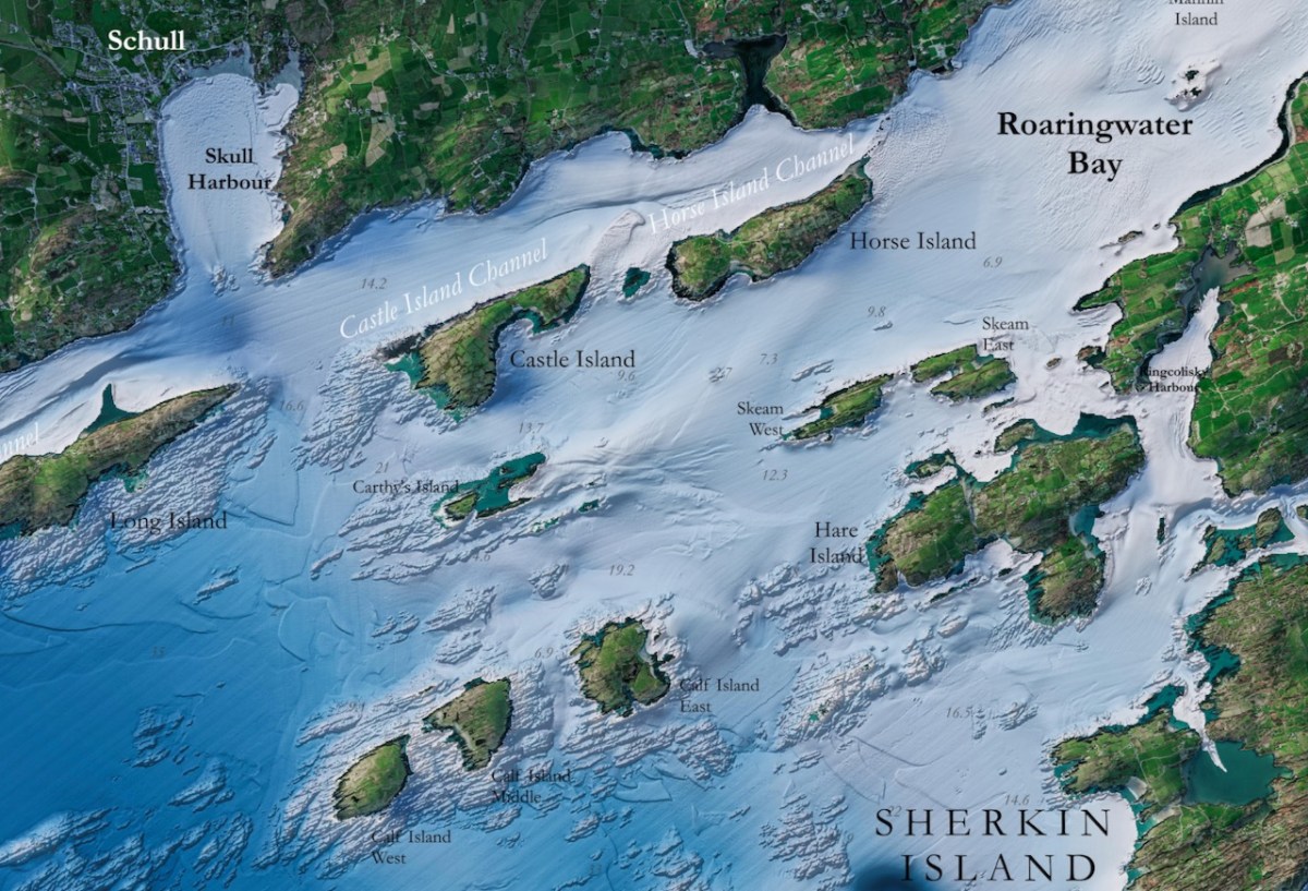
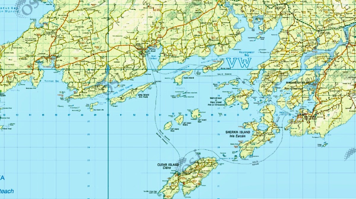
Infomar is a joint initiative of Geological Survey Ireland and the Marine Institute, established to publish detailed mappings of the sea bed and make the results freely available to all. Their map of Roaringwater Bay is spectacular, and it reveals the underlying geology of this part of the coast. The Calf islands are all that is left, along with Heir Island, of what was once a peninsula sticking out into the sea, just as the Mizen and Sheeps Head still do.
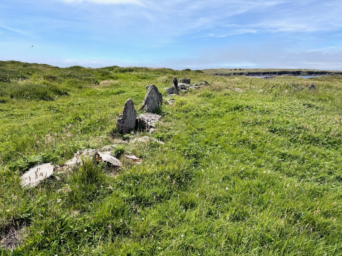
Middle Calf has probably been occupied since prehistoric times, situated in what was, for most of the last few millennia, an extraordinarily rich fishing ground. No prehistoric remains have been found on the islands, but some of the field fences may indeed be very old. 

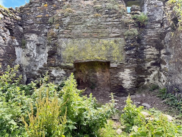
The only archaeological site identified in the Sites and Monuments Record is a small promontory fort – perhaps the cutest I have ever seen, above. For an explanation of promontory forts, see this post. Promontory forts are believed to be Iron Age (about 2000 years old) but some may be older, and some, we know, were occupied right into the medieval period. This one is so small it is hard to imagine how effective it would have been as a defence against attack, although of course it may have been larger originally.
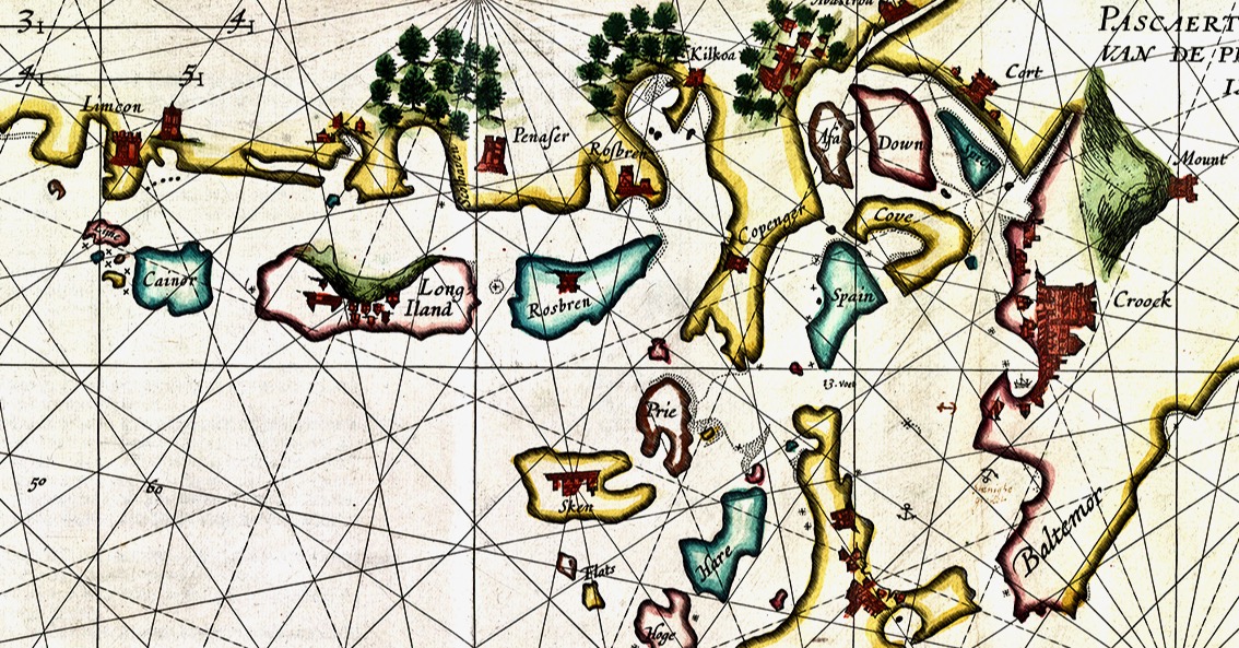
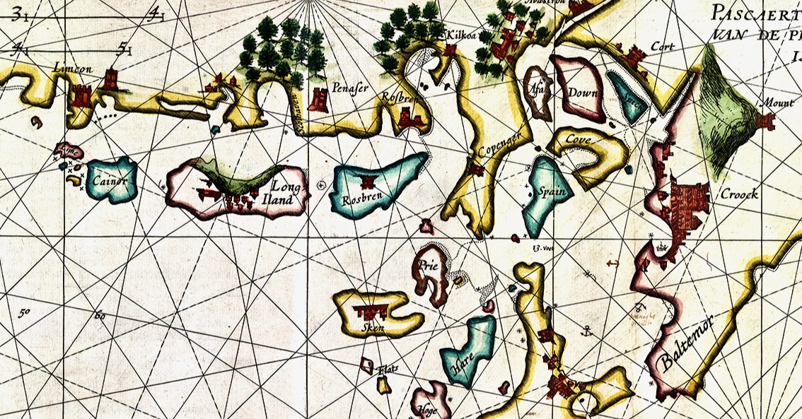
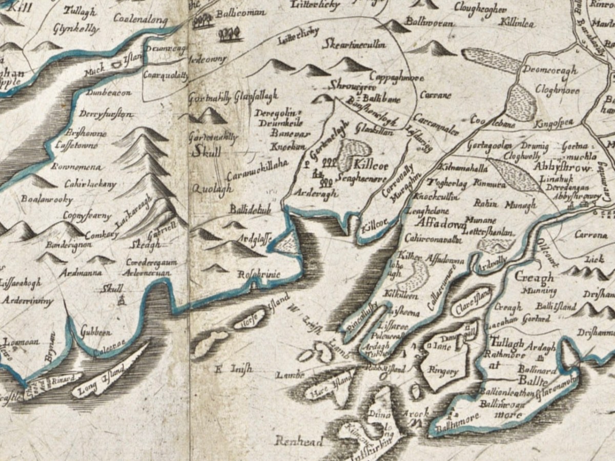
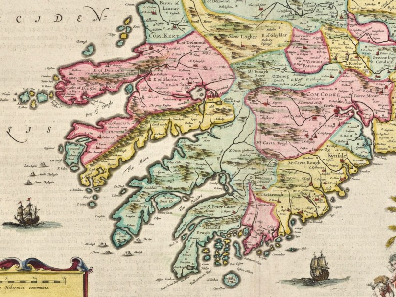
The Elizabethan mapmakers did not do a good job of drawing the three Calf Islands in any kind of distinct way – they either attached them to amorphous blobs (see this post on the 1560 map), or included them in a random scattering of islands (like Joan Blaeu’s Atlas map of 1655). Or this Dutch Pirate map (above), which gets some things right, but is quite higgledy piggledy.

But the Down Survey, completed in the 1650s post-Cromwell era, with the aim of identifying land to be confiscated for new settlers, was a quantum leap ahead in mapping in Ireland. Petty’s map of Schull civil parish (above and below) shows the Calf Islands, not perhaps as accurately as they should be, but clearly in their general location.
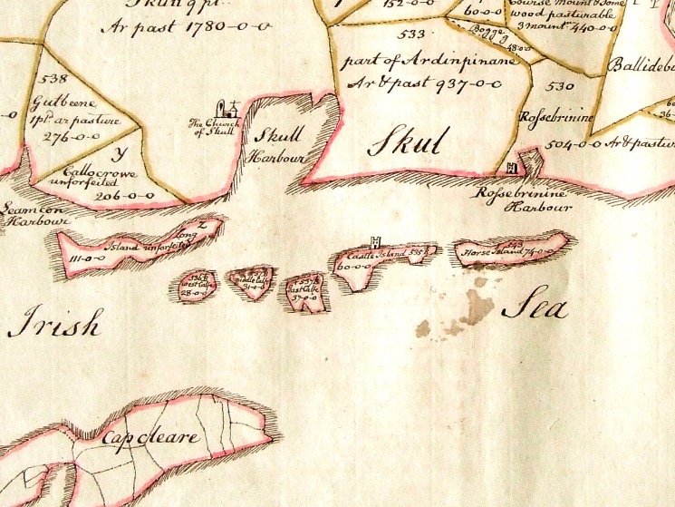
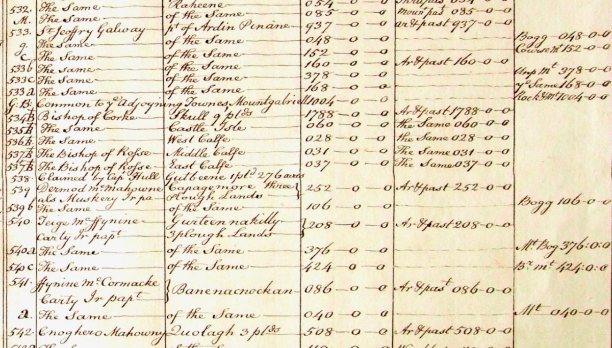
Not only that, but the Down Survey terrier (a description of parcels of land, their owners, and values) shows that the Calf Islands belonged to the Bishops of Cork (West Calf) and Ross (Middle and East). 
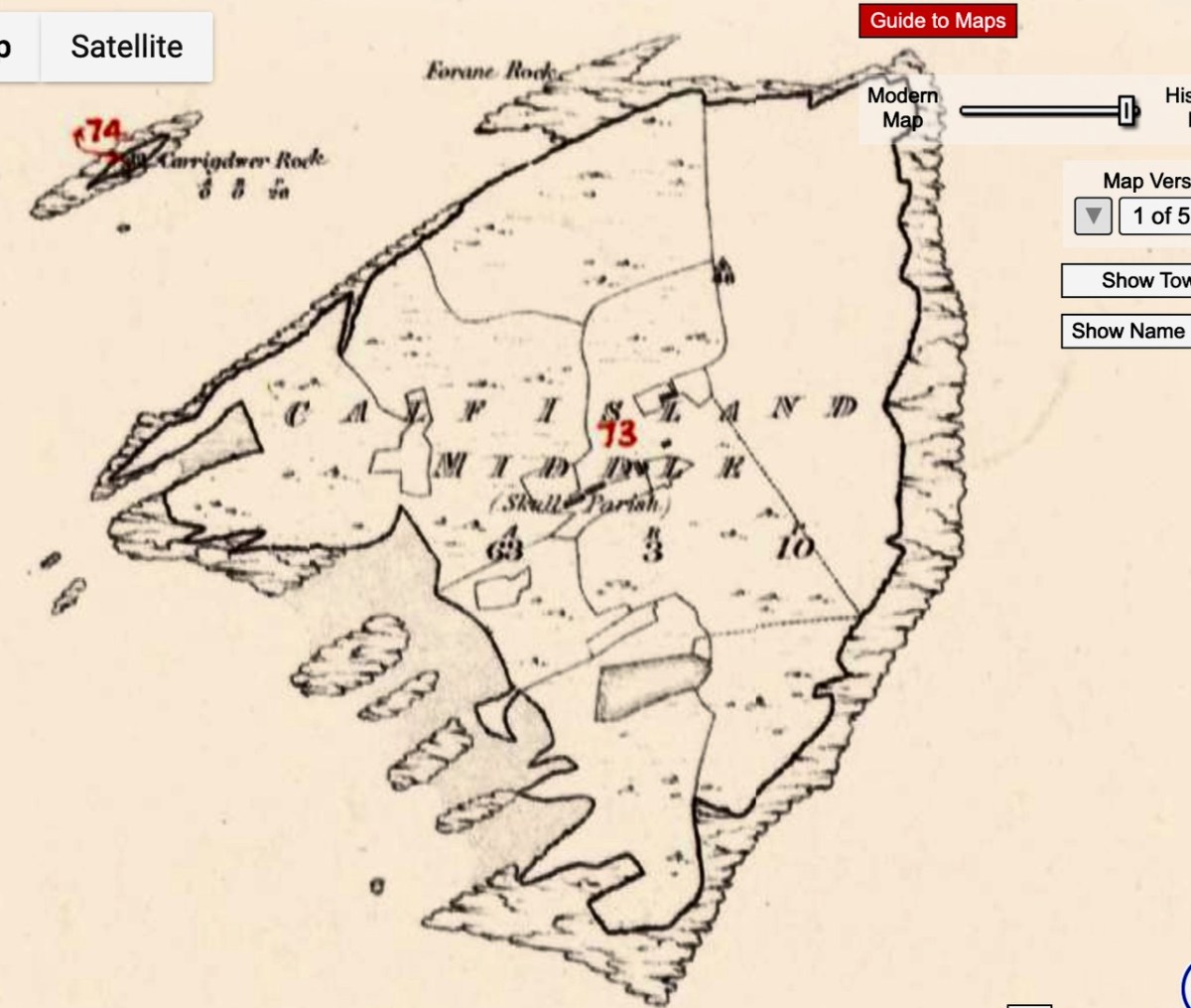
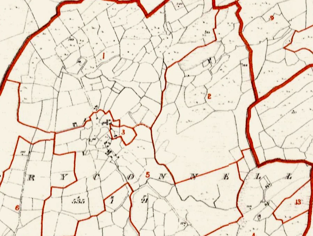
The next account we have is Griffith’s Valuation, the massive survey undertaken by Sir Richard Griffith just before the Famine. This is a much more accurate map, probably using the same advanced measuring techniques that the Ordnance Survey would employ starting around the same time. 

Griffith’s terrier shows four families occupying the Middle Calf – two Crowleys and two Scullys. The landlord was Daniel Welply, although Daniel Scully paid rent to Mary Scully. So Mary owned some of the island independently or she sub-let her rented land to her brother (or brother-in-law). 

Daniel Welply was from Skibbereen and a Catholic. He was secretary to the organisation formed to bring Daniel O’Connell to Skibbereen for a Monster Meeting. So, somewhere down through the centuries the land had passed from Church of Ireland ownership to the hands of a private, Catholic, landowner. That was still not common in the first part of the 19th century – Daniel Welply must have been an exceptional individual.
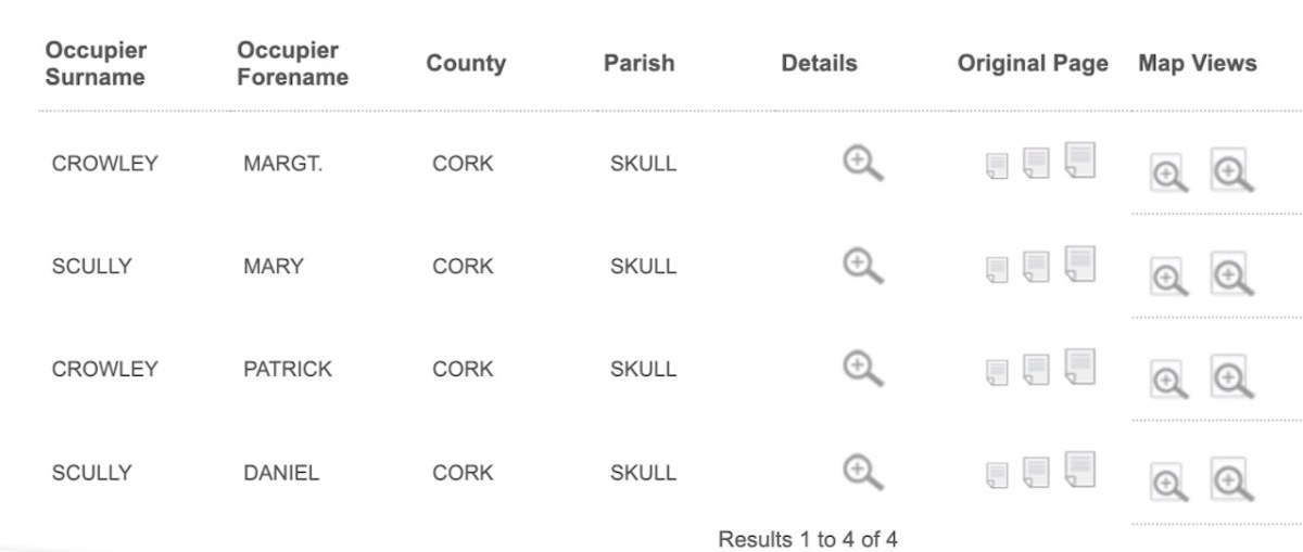
When Cormac Crowley’s father was a boy, those same four families – the Crowleys and the Scullys – lived and farmed in the Middle Calf, as they had done almost 100 years earlier. Cormac’s father was John Joseph – and you can find him here on the 1926 census.

Still to come in the family, in 1929, was the late Dan Crowley – I had the honour of meeting Dan, then aged 97, last year, in his Youghal care home. He told us about his life, and Sharon Whooley, who was there too, captured it for the Museum of Birds and Beasts. He and his family were the last to leave the island, in 1937.
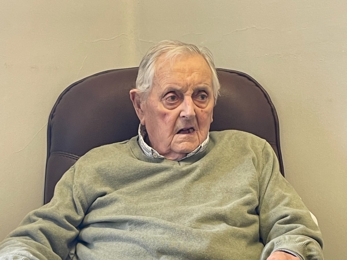
He had very specific memories – going for water, drawing sand up from the beach, thrashing with flails. His mother died and he was sent off to school on Cape Clear (he hated it) and then to Schull, where he was boarded out – I felt the sadness of that as he was telling us about it. His father, he said, in 1937, was glad to go at that stage, it was hard going. They were rough old days. I was eight years old then.

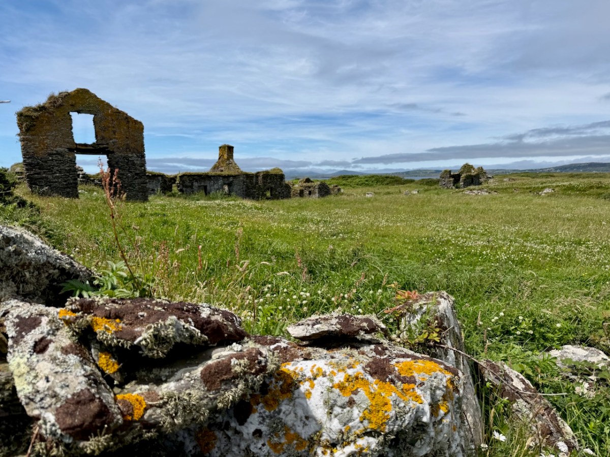
The ruins of the Crowley and Scully houses still stand on the Middle Calf – substantial houses grouped in a neighbourly way close together in the middle of the island – a hamlet, or chlachán

One of the houses consists mainly of a striking gable end, used as a landmark by sailors. Cormac explained to us that the rest of the building (it was a barn) had disappeared because it was made of wood. The wood came from a shipwreck, the Savonia. The other thing that came from the shipwreck was a cat, who made his way up to Cormac’s grandparent’s house and into their hearts.
I will leave it there for this week. Part 2 will look at how the Middle Calf Island is now, under the amazing stewardship of Cormac and Áine.
The 1811 Grand Jury Map of Cork by Neville Bath: Part 3, Sheeps Head, Beara and Bantry

I”m going to try to be slightly less detailed this time (I find that hard!) or we will never explore the rest of Cork. This post will concentrate on the area north of the Mizen – our two other peninsulas, Sheeps Head and Beara.

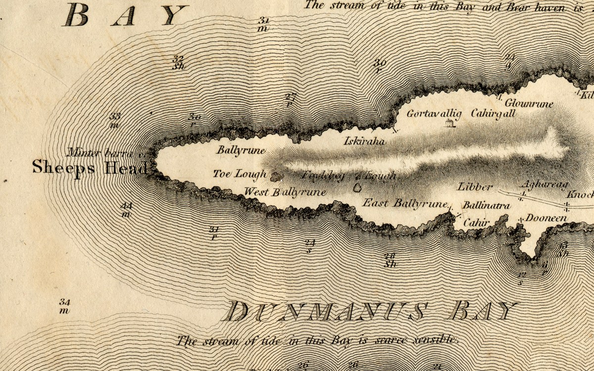
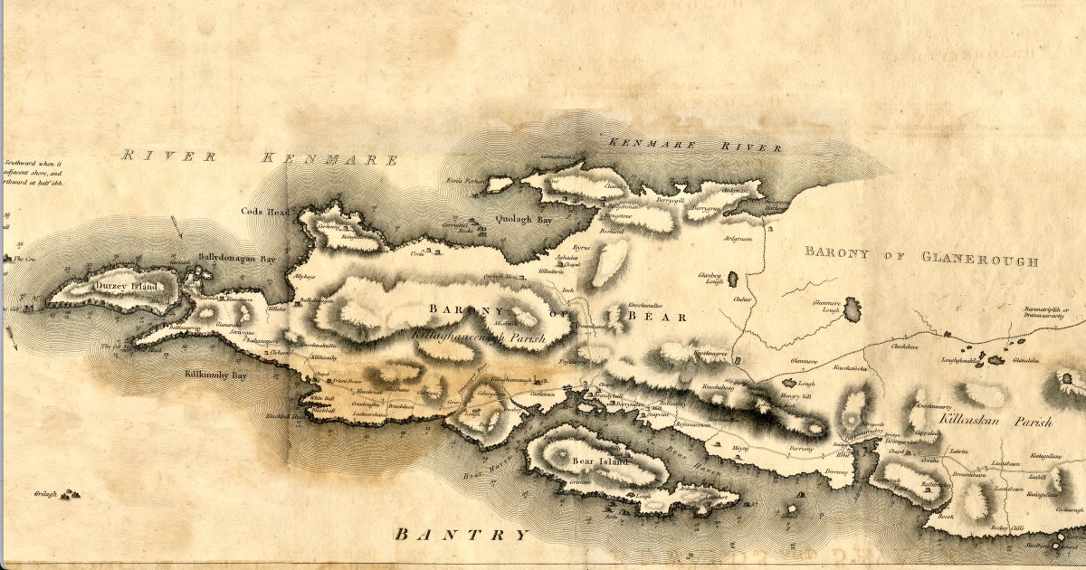
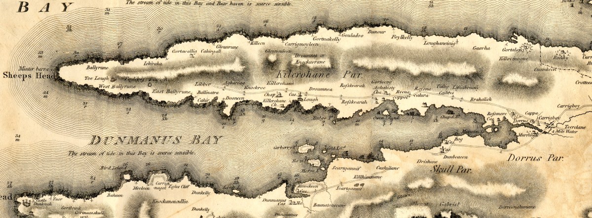
Sheeps Head (and it has an apostrophe in some maps and not in others, so I’m leaving it out) is given here as the head at the westernmost extent of the peninsula. But of course, we now call the whole Peninsula Sheeps Head. Or, if you prefer, by its Irish name of Muintir Bheara (Mweenter Varra) which means, confusingly, the people of Beara.

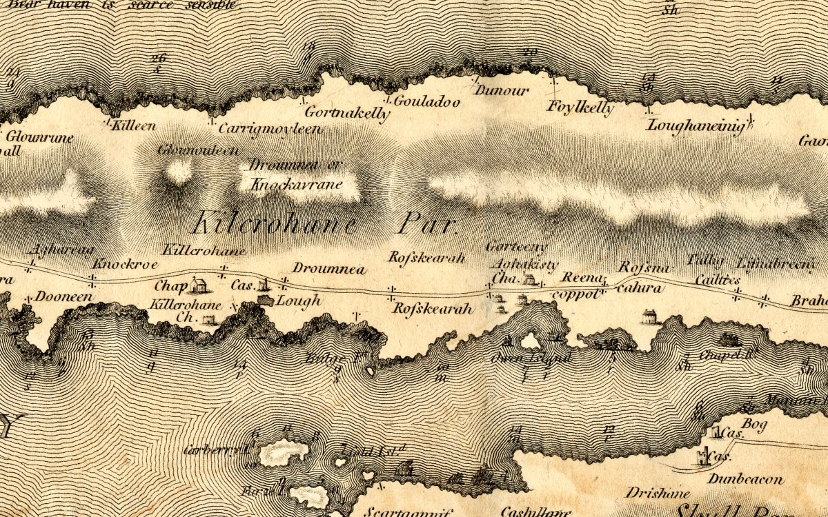
Besides a single house at Gortavallig, the only words on the east end of the map refer to placenames. The road does not extend beyond Dooneen. Nowadays, of course, this is a well-walked, prize winning set of trails that will bring you off road for the most part into wild and scenic country.

KIlcrohane and Ahakista have churches and chapels but no real communities in the 1790s. The castle near Kilcrohane is the vestigial one built by the O’Daly clan, the famous bards, at Lake Farranamanagh. There are no roads on the north side, and none crossing the Peninsular.

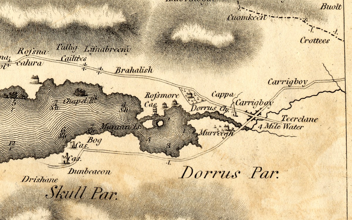
At the head of Dunmanus Bay is Durrus, shown as a community with a steepled church. The small treed estate is Durrus Court, where the 17th century manor house is still standing. The remains of Rossmore Castle can also still be seen. But here’s an interesting thing – there are not one but two castles shown at Dunbeacon! Very mysterious – there is certainly no sign of a second one now, and nothing in the archaeological record.

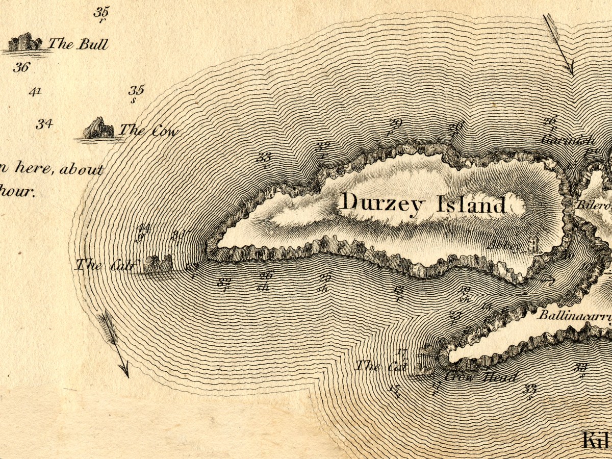
Let’s leap now, as Fionn MacCuamhaill might have done, to the next peninsular up – Beara. The full extent of it is shown in my lead photograph, and above is the eastern end and specifically Dursey Island. The Calf Rock is offshore, with the Cow further put and the storied and spectacular Bull Rock further out again. I do plan to visit it one day! Dursey is the only place in Ireland that you get to by cable car and has a tragic history. An Abbey is shown on the eastern shore. National Monuments tell us that “According to the soldier-writer and native of Dursey, Philip O’Sullivan-Beare, writing in 1621, it was a ‘monastery, built by Bonaventura, a Spanish Bishop, but dismantled by pirates'”.

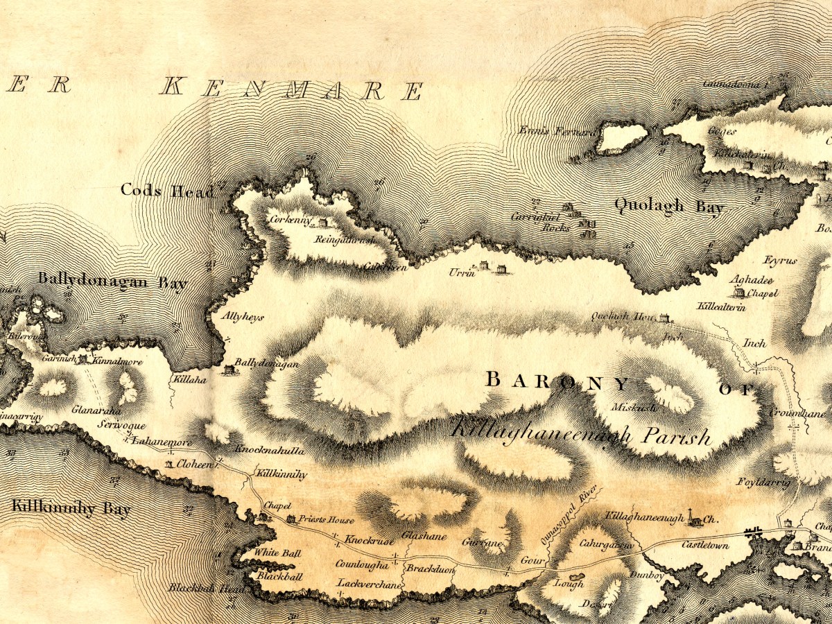
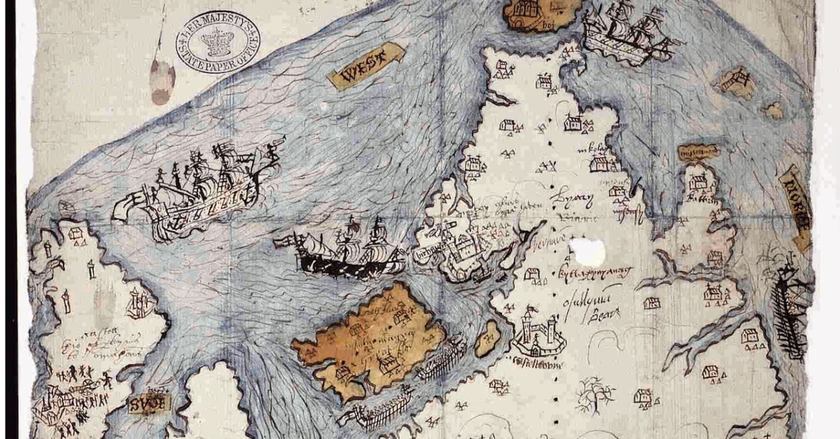
The western end of the Peninsula is mountainous. A road extend along the southern side but not the northern. This is one of the few places in Ireland we have a very old map to make comparisons. Take a look at my post Elizabethan Map of a Turbulent West Cork and Elizabethan Map of a Turbulent West Cork 2: The Story, for a lively take on mapping this part of Ireland 200 years earlier.

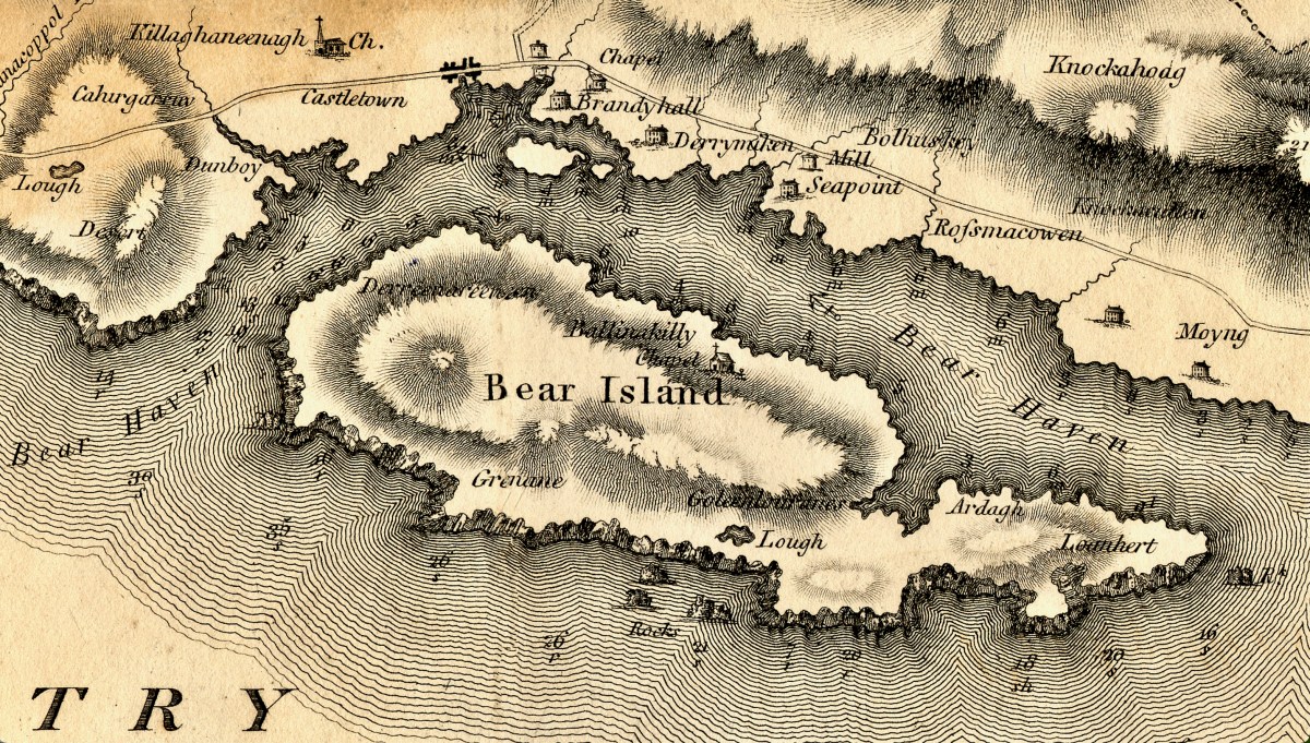
Bear Island is featureless apart from a chapel but Castletown (more properly known as Castletownbere or Castletown-Berehaven) is shown as having a town or village and several substanital houses, a mill, and a church with a steeple. Interestingly, the castle at Dunboy, the siege of which is chronicled in the older map, is not shown at all in this one.

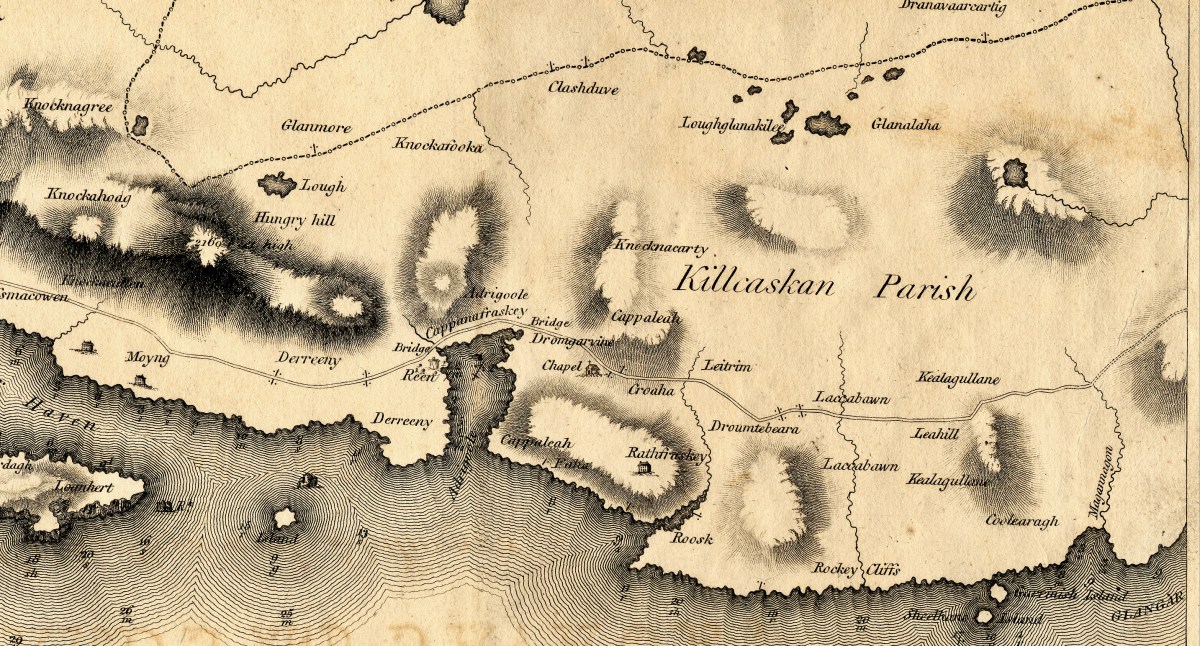
Moving eastward, very little human activity is noted on the map, but Hungry Hill is there and Adrigole Harbour. The dotted line marks the division between Cork and Kerry.

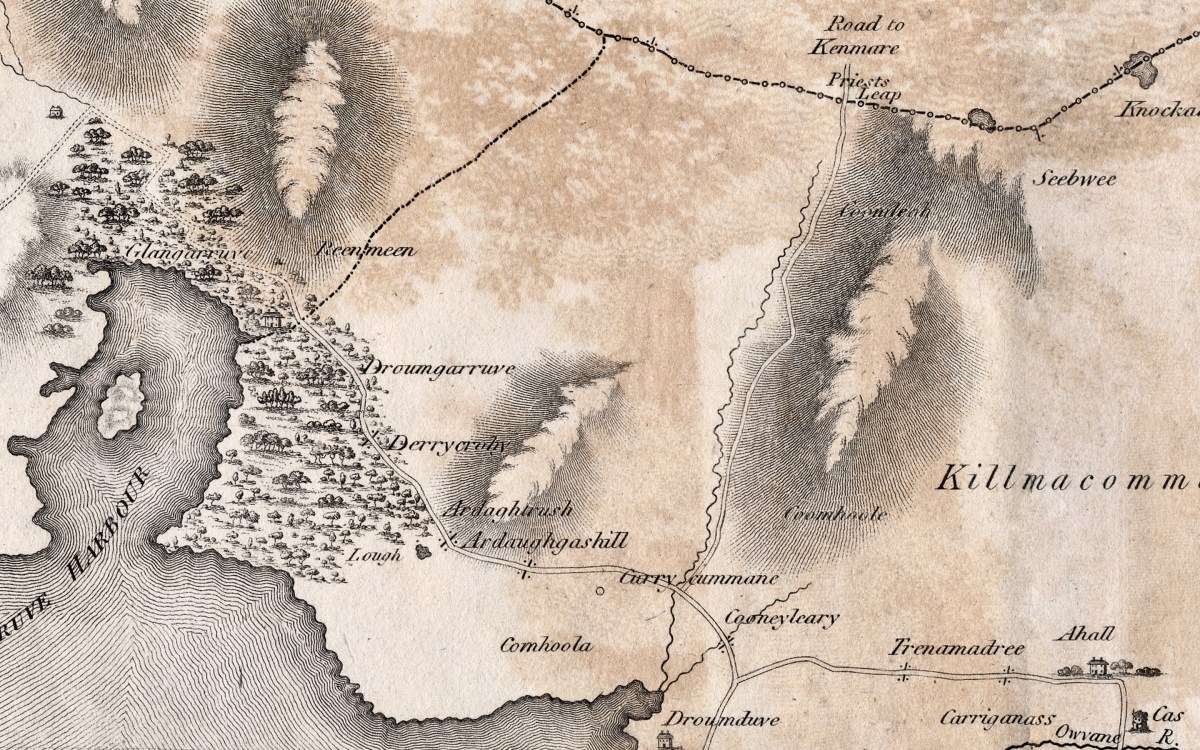
Then, there seems to be a bit missing – Glengarriff (or here, Glengarruv) Harbour is surrounded, then as now, by substantial forests. The only road to Kenmare at that time was the Priest’s Leap, even now a death-defying and vertiginous climb.

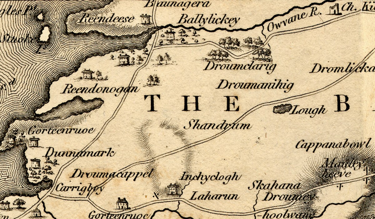
I’ve blown up the Ballylickey section as it holds particular interest for me – here depicted is the home of Ellen Hutchins! There’s a large house, surrounded by trees, on the banks of the Ouvane River. This is especially exciting as Ellen was living here at exactly that time! Born in 1785, she was botanising and making all kinds of discoveries until her untimely death at only 29 in 1815. After the sparsely annotated Peninsulas, it’s interesting to see more houses noted as we near Bantry.

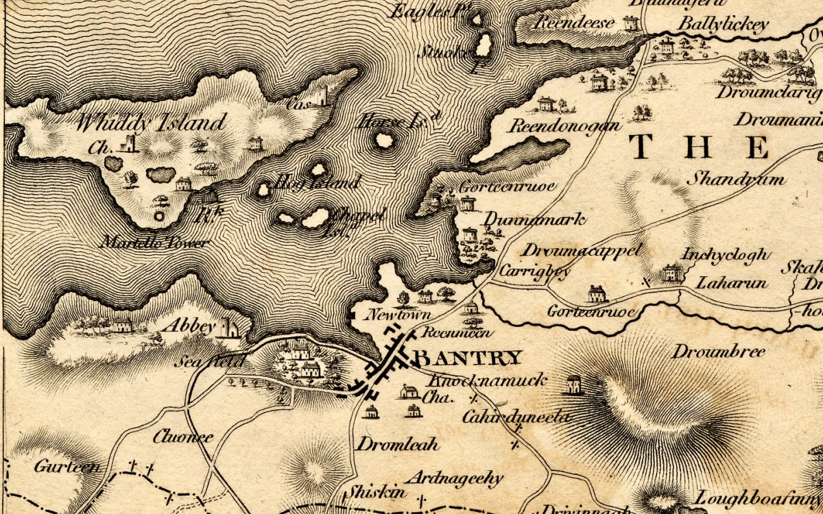
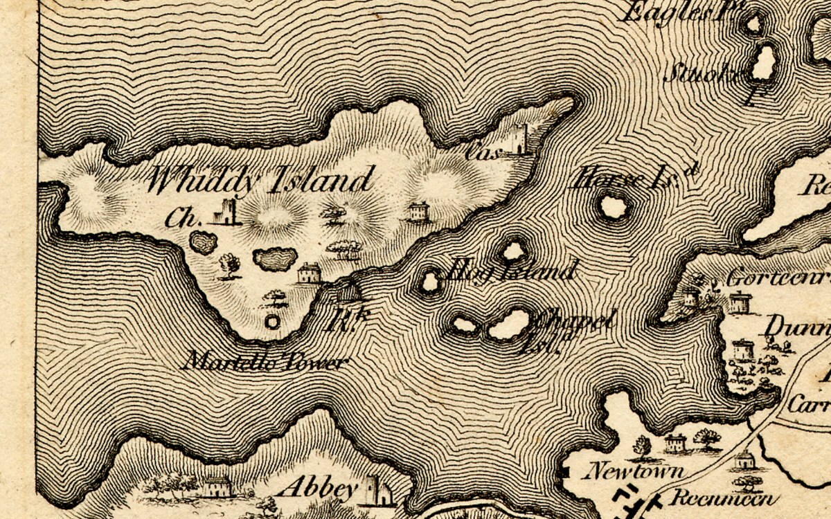
Bantry is shown as a large town – with Bantry House, built on the early 1700s, dominating the landscape just as it does today. The Abbey has disappeared (it was a Franciscan establishment) but has given its name to the Abbey Graveyard at the southern end of town. We’ll finish with Whiddy Island and a genuine mystery – note the Martello Tower (below). There were actually three circular fortifications constructed on Whiddy after the abortive invasion by the French in 1796. Known as the West, East and Centre Batteries (or ‘redoubts’); this is probably the Centre one. They were very solidly built and can still be seen.
We know this map was done in the 1790s, and these redoubts, like the Signal Towers dotted along the coast, were built to warn of another French incursion and to defend Bantry Bay. The signal towers were built around 1804 and abandoned by 1815 after the Battle of Waterloo. None of them is noted on the Bath map, consistent with our understanding that the Cork map was completed in the 1790s. Martello towers date to the same period – the first of them were built in 1804, mostly along the east coast. The only actual Martello tower in this area is on Garnish Island. It was built in 1804/5 and does not show up on the island in the Bath map – see Glengarriff Harbour, above. The Whiddy Batteries are shown on the National Monuments records as dating to 1804 to 1807. They are round – more like the shape of a martello than the tall rectangular signal towers that were built around West Cork. But was the term Martello common at this time? Might this be a later addition to the map? Although it was completed in the 1790s it was not published until 1811, allowing for the possibility of editing and changes. Anybody have any comments on this – it’s a head-scratcher!

The 1811 Grand Jury Map of Cork by Neville Bath: Part 2, The Islands of Roaringwater Bay

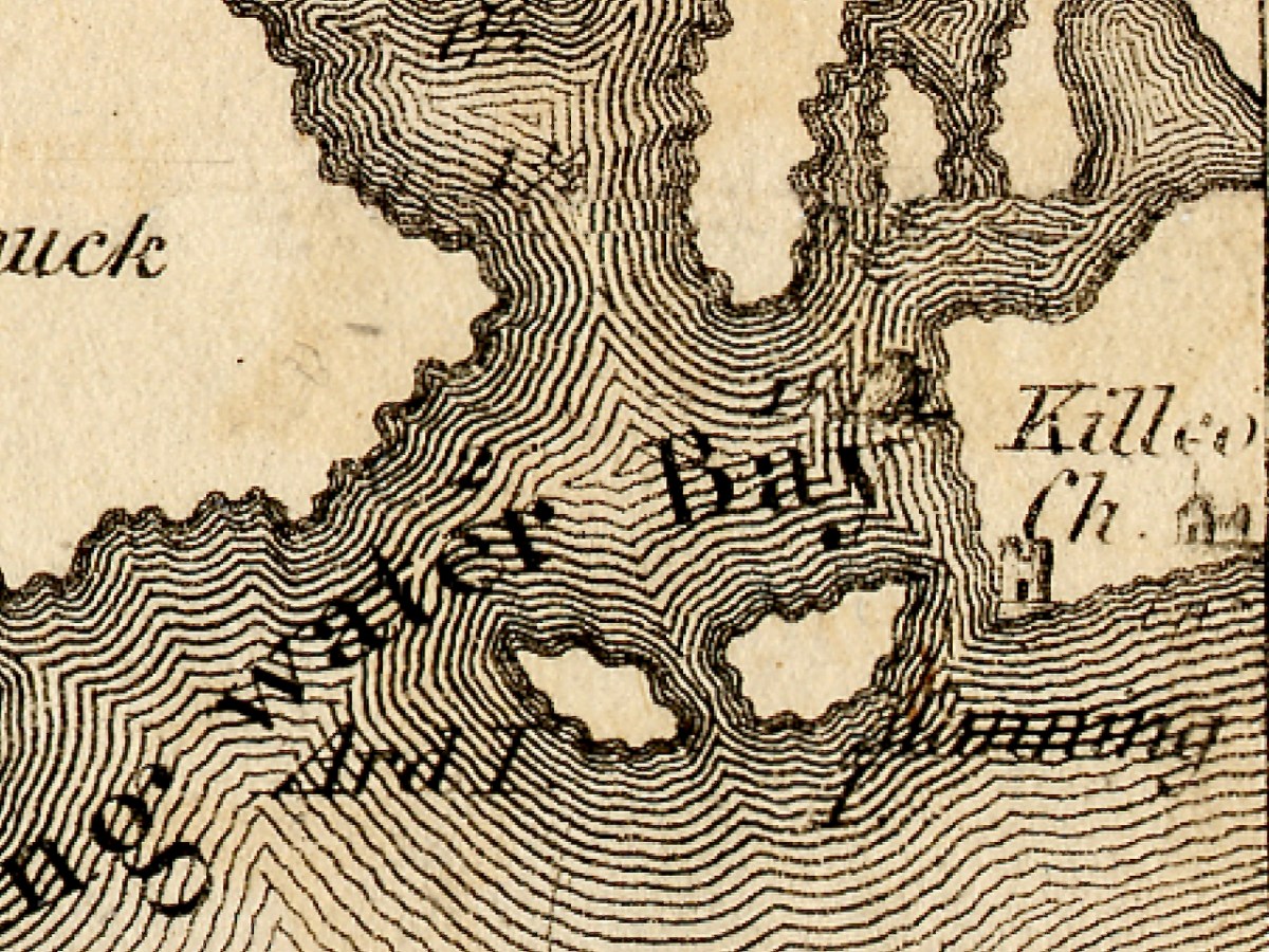
The first thing to say about this map is that on it the name Roaringwater Bay is assigned to a restricted area area eastwards from Horse Island, up to the entrance to Ballydehob Bay, and across to Skeaghanore, Kilcoe and Turk Head. This, in fact, is still how modern maps are labelled.

However, when you live here, you realise the term Roaringwater Bay is used to refer to the whole area that encompasses all the Islands, right out to Cape Clear. In Irish, Roaringwater Bay is called Lough Trasna, which simply means Lake ‘Across’ – a term which carries the implication of a body of water you have to cross over.

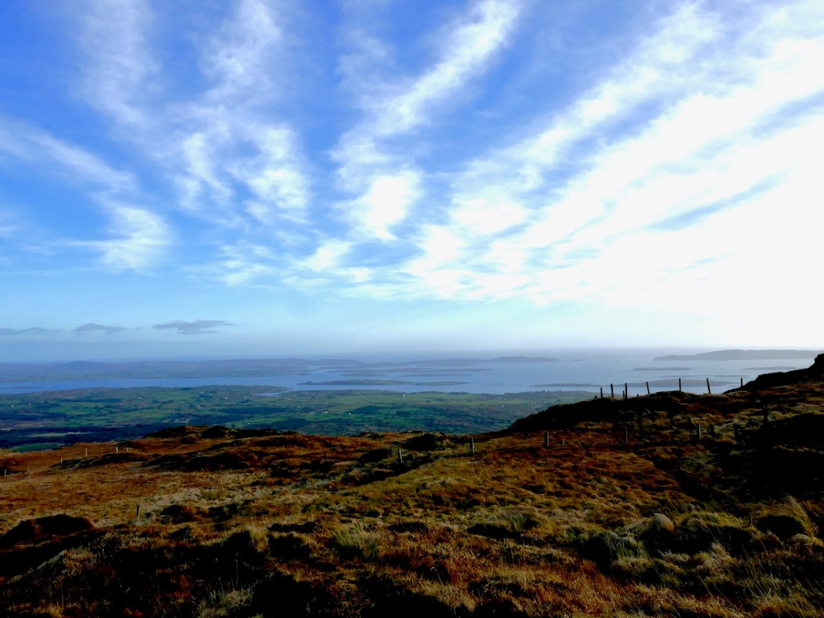
And how did it get the name Roaringwater – the official version is that it’s called after the Roaringwater River, which in turn gets it name from the way the water roars as it tumbles over rocks. But read my post from way back in 2014, The Roaring, and you will realise that there is a much more sensible explanation. So I will use the term Roaringwater Bay in this post as we use it every day around here – to include everything you see from the top of Mount Gabriel, looking south and east, as below. Before I move from the image above, however, let me point out Kilcoe Church, and Kilcoe Castle, both of which I have written about.

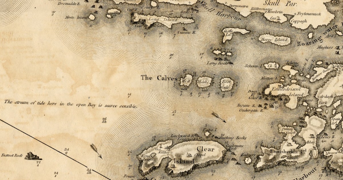
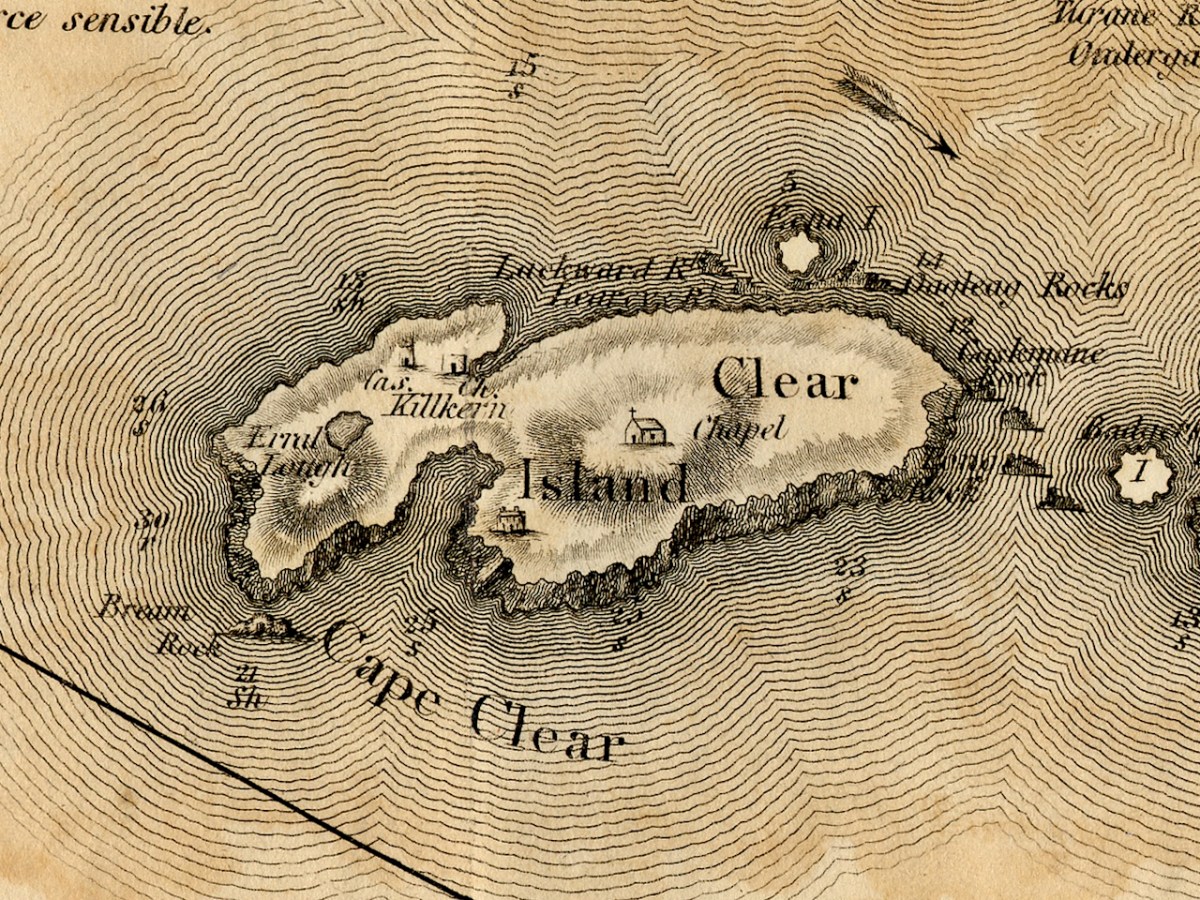
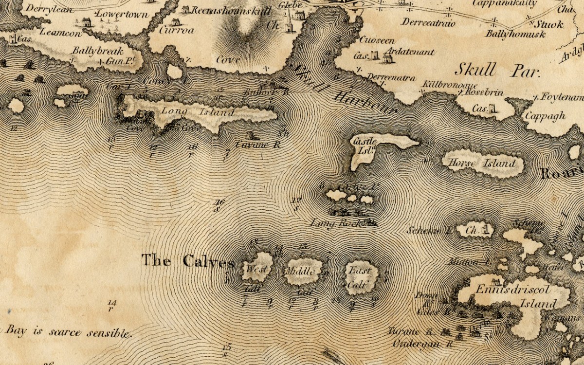
Let’s start with the biggest island – familiarly known locally as Cape Clear. Clear Island, as it is properly called (Oileán Cléire) and as it is labelled on this map, shows the name Cape Clear reserved for its southwestern tip.

Dún an Óir Castle (see this post, and this one) is clearly shown, as is St Kieran’s Church, which was a ruin even then. Intriguingly, there is a Catholic Chapel shown which must have been in place before the current church was built in 1839, approximately in the same area. Even more strange is a building shown as a ‘Gentleman’s Seat’ – that is, a Big House, on the south side of the Island. Can anyone help us with that this might have been?

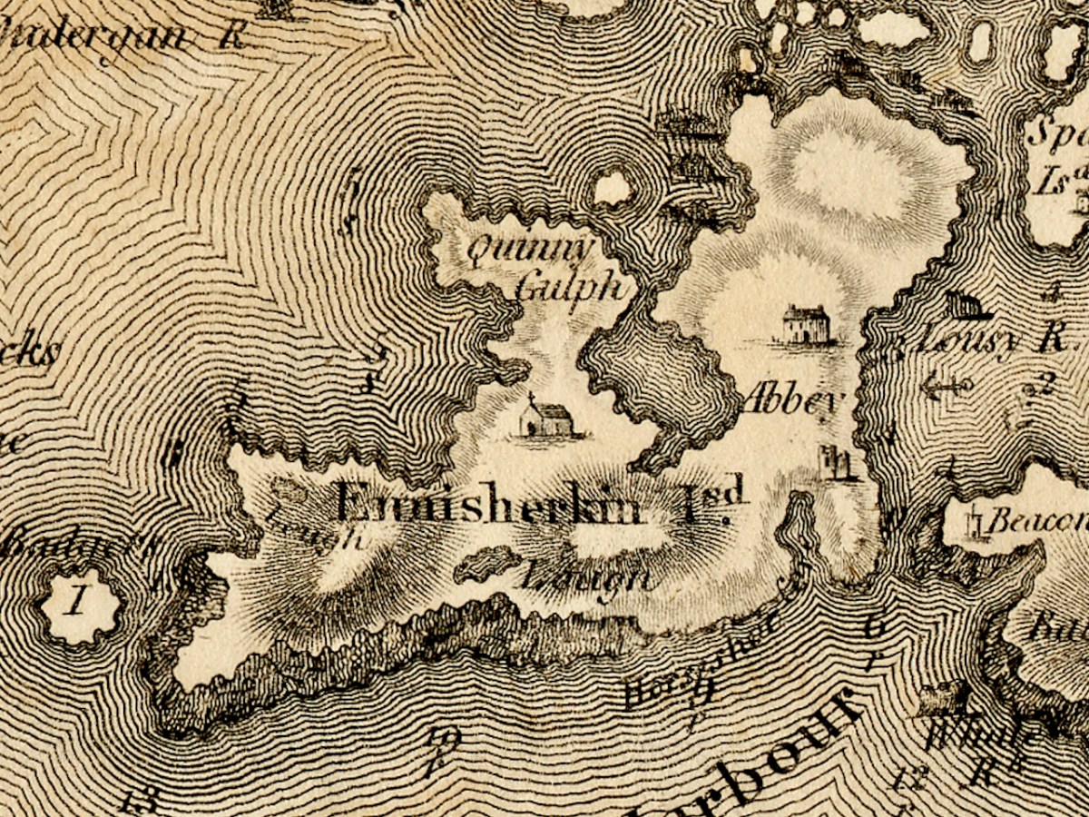
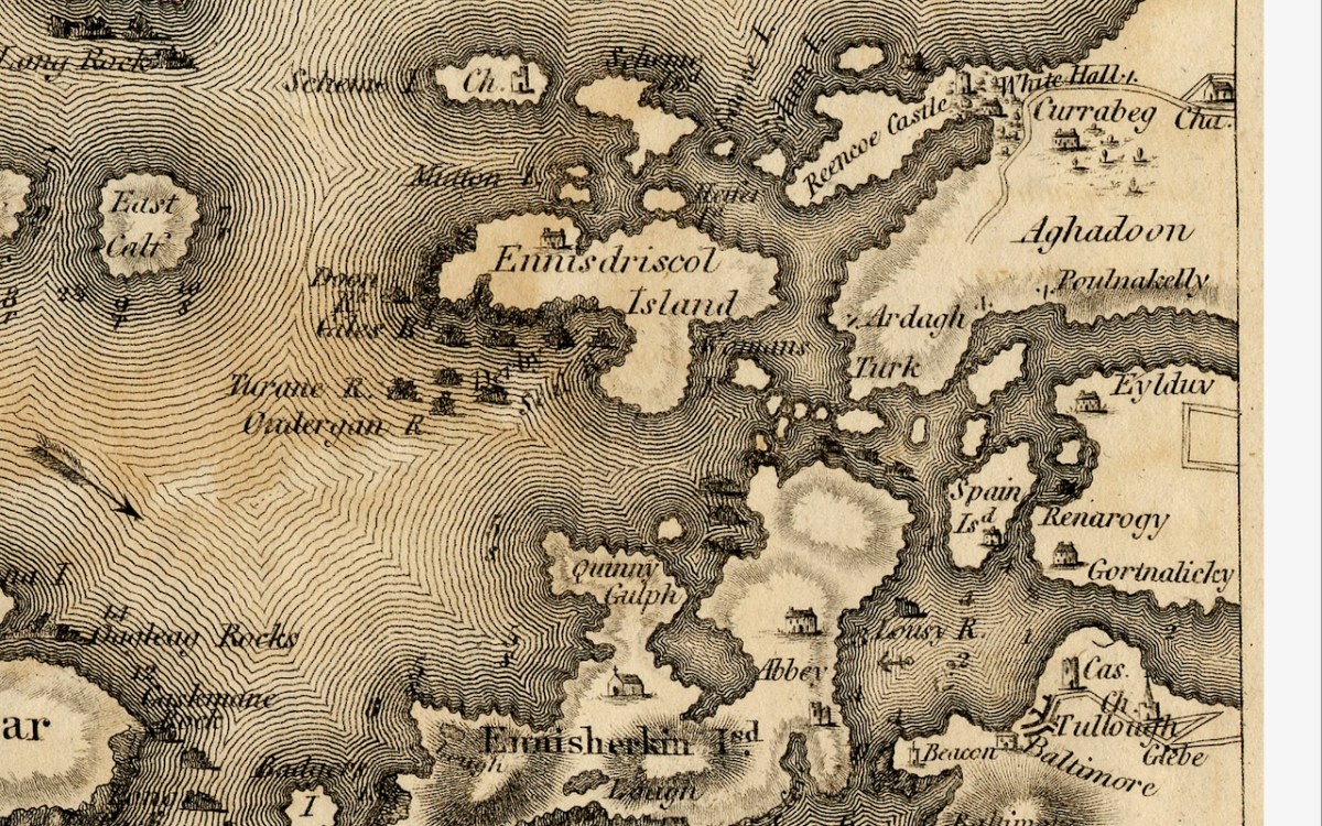
Sherkin Island is shown as Ennisherkin. This is from the Irish Inis Arcán, translating literally as Piglet Island, but likely from the Irish word for porpoise, which is muc mara, or sea-piglet. Anyone who has boated in the area will know how prevalent porpoises are in the seas around the islands. Once again, we have a catholic chapel, and of course the ruined Abbey and castle. Take a look at my post A Walk on Sherkin Island for a taste of what that’s all about. The term Quinny Gulph, by the way, must be Kinnish Harbour, the large bay in the centre of Sherkin. Once again, we have a ‘gentleman’s seat’ on Sherkin, and once again I am asking readers to identify this.

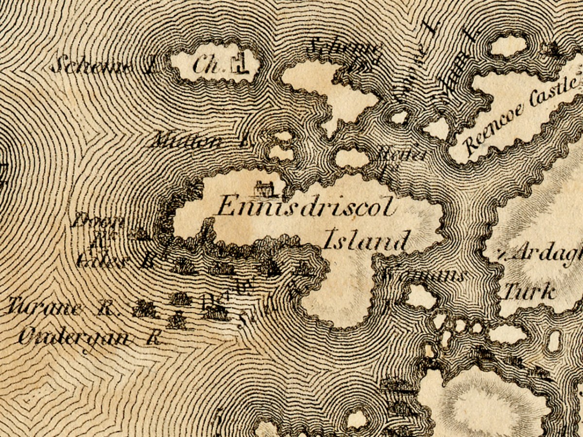
Ennisdriscol Island is of course now called Heir Island – the older name indicating that it was very much the domain of the O’Driscolls in the past. It’s curiously featureless on this map, apart from yet another large house. Right above it are the Skeams, East and West, or the Schemes, as Bath has it. West Skeam has a pre-Romanesque church on it which I have yet to explore – a new blog post one day! I’d better hurry – it’s in a perilous position on the edge of a cliff and much of it has already been swept away.

The Calves, now uninhabited, occupy the middle ground of Lough Trasna between the mainland and Cape Clear, while Long Island, Castle Island and Horse Island parallel the coast. Horse Island and Castle Island are each now owned by a single individual, while Long Island still has a resident population of several owners. The vestigial castle on Castle Island is not shown. To the east of Long Island is Goat Island and Goat Island Little – the cleft between them is actually much narrower than appears on Bath’s map and only navigable with care by kayak. It is home to a herd of feral goats.

And finally Spain Island, now called Spanish Island, and the western end of Ringarogy. Note that the only one of the small islands scattered between Sherkin, Turk Head and Heir Island that is named on this map, is Woman’s. In fact, there is a tiny rock in this area labelled on modern maps as Two Women’s Rock. The largest island in this group is actually called Sandy Island and the smaller ones are The Catalogues. Note also that the castle now called Rincolisky, is here labelled Reencoe. And let’s include Baltimore, with its castle and – the beacon!

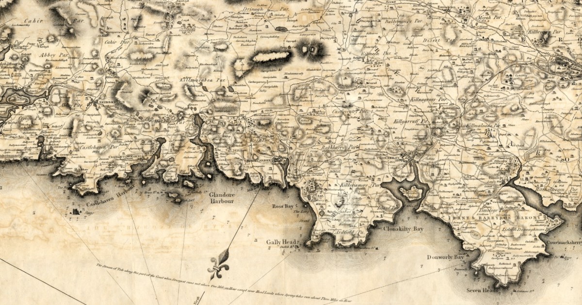
I know we have been a bit forensic about the area I call home – my next post will take a much broader look at West Cork. Here’s a sneak peak.

The 1811 Grand Jury Map of Cork by Neville Bath: Part 1, the Mizen

As readers know, I love old maps and there’s a map of Cork I haven’t written about yet. This is a truly beautiful piece of work, and a huge step forward on some of the older maps of Cork I have described – for the list, see my page The Magic of Old Maps. 

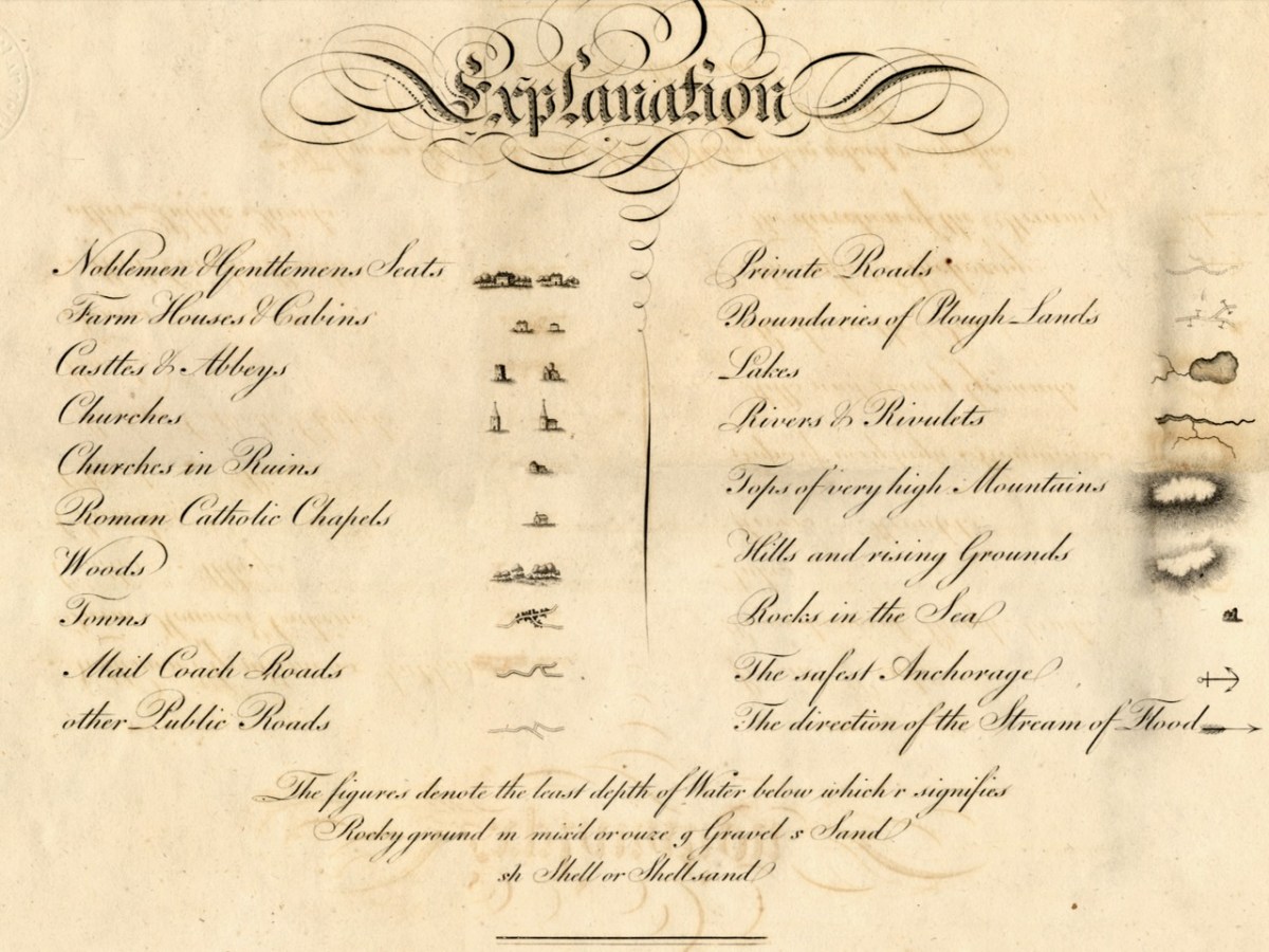
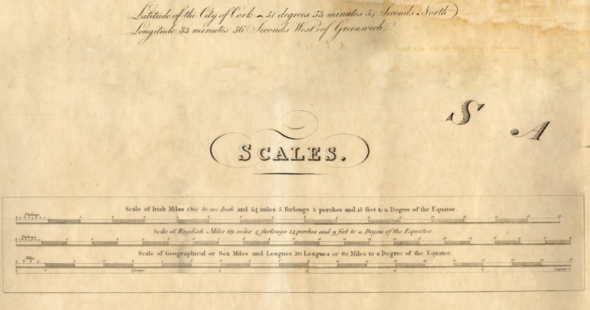
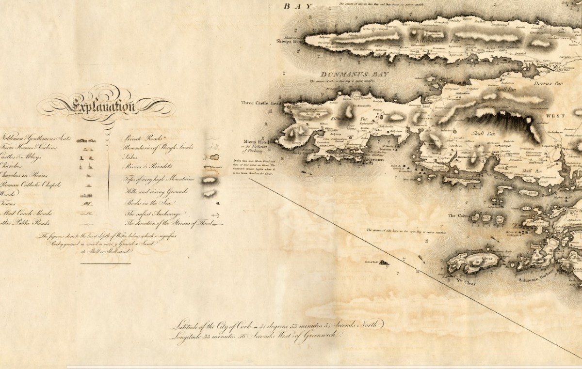
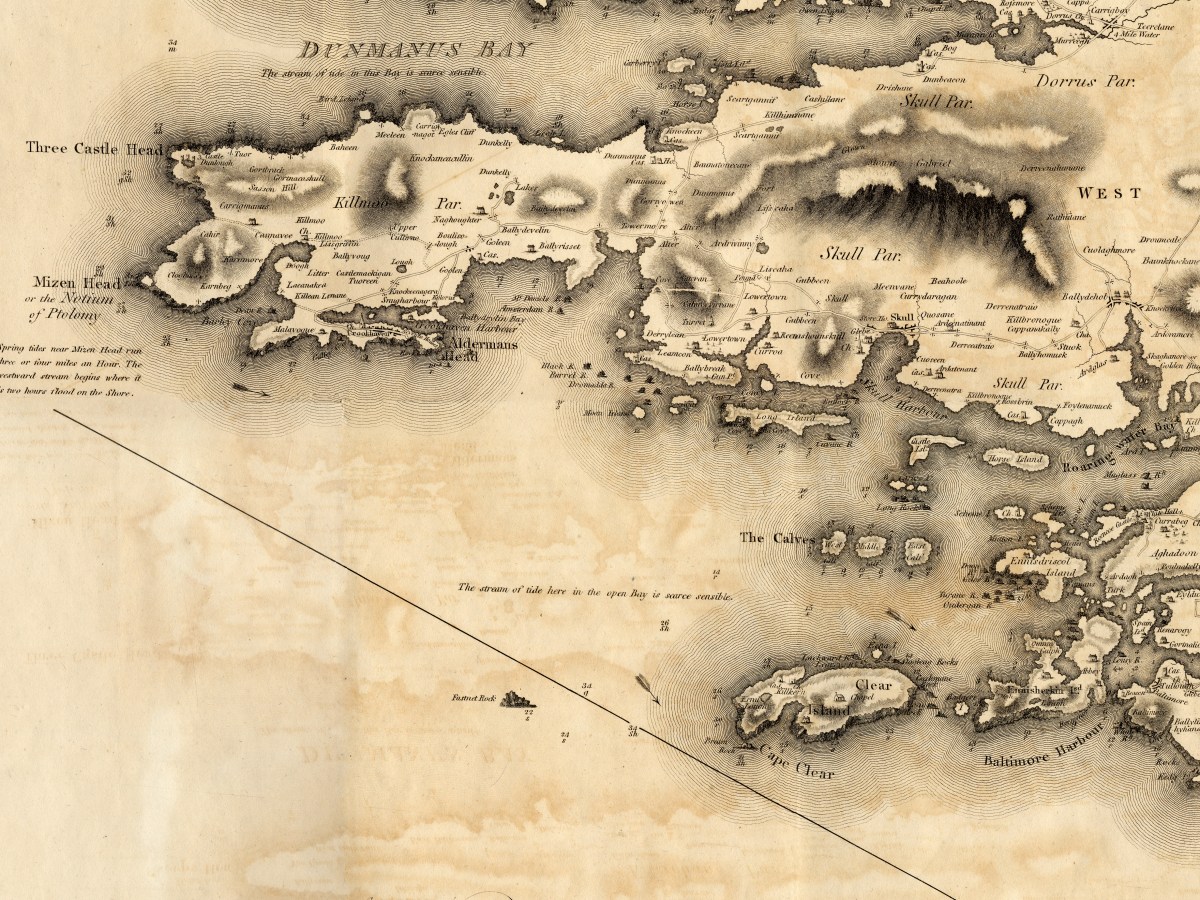
Since it will take me more than one post to talk about this county map properly, I will start today by concentrating on Map 4, and stick to the Mizen Peninsula. The map is in 6 parts and I am able to share it with you today through the generous assistance and permission of the Cork County Library. You can view their hi-res images here – they may be sharper than mine, as I do have to compress images for the blog.

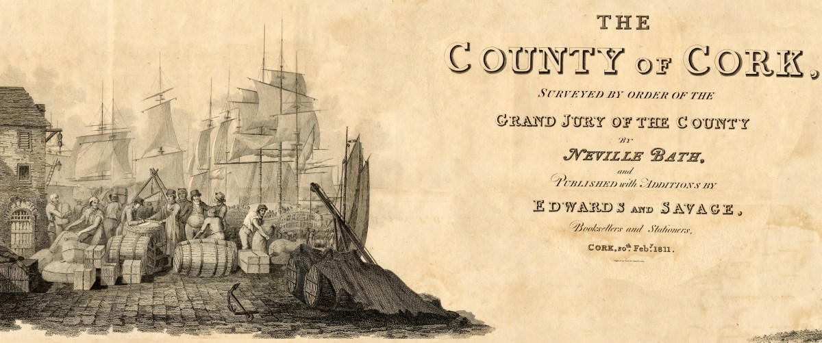
But first, some context… We assume that proper, professional mapping really got underway with the Ordnance Survey in the 1830s, but indeed there were competent cartographers in Ireland before then. Neville Bath was one. In an essay by J H Andrews (see reference in the final quote) he is described as English but spending his whole cartographic career in Ireland, starting off by drawing estate maps in Kerry. He finished a map of Cork City in 1788, so was well placed to be awarded the contract for the county map, when the Irish parliament allowed public money to be spent on producing Grand Jury barony maps as well as county maps, but only for official purposes and only in the form of manuscript ‘protractions.’ Bath tried to arrange for the manuscript protraction to be turned into a proper published map by selling subscriptions – that did not go well, and it wasn’t until 1811 that the map was finally published, engraved by the London firm of S J Neele, acknowledged as the finest artists in the Kingdom.

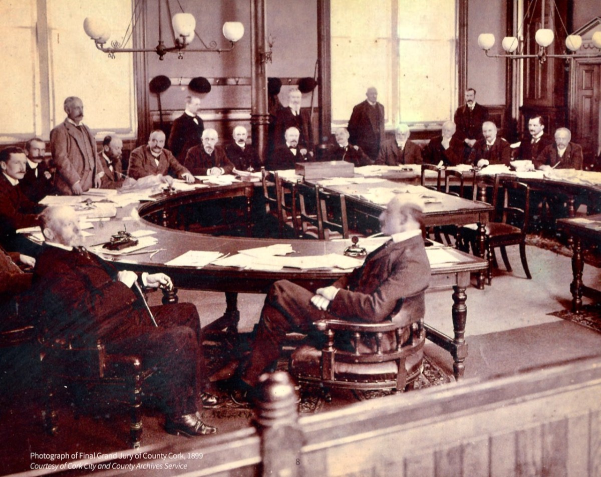
What was a Grand Jury and why were they commissioning maps? As the name suggests, Grand Juries were initially conceived as groups of 24 men (yes, only men) who wielded authority for the administration of the criminal justice system in Ireland. The exclusive domain of wealthy landlords, the Juries exerted enormous power over the whole population – a population with which they had little in common, including economic status but also language, religion and cultural affiliation.  Over time, the Grand Juries accumulated other responsibilities, for roads, bridges, hospitals, schools and tax collection.

Eventually, all those duties were taken over by other bodies – County Councils, the Poor Law Union, a proper legal system. Above is the final sitting of the Cork Grand Jury in 1899. But while it lasted it was already an archaic system, deeply unfair and rife with corruption. It also became highly competitive, with one Grand Jury after another building more and more elaborate courthouses*. The same thing happened with maps:


Almost inevitably, the maps enabled each grand jury to convey its own prestige to its neighbours, and the ‘Grand Jury map’ project took on an increasingly expensive and stunningly elaborate life of its own. William Larkin was the greatest exponent of the genre and produced maps for six out of the twenty-six counties that made it into print using the public purse. Larkin produced maps for Westmeath (1808), Meath (1817), Waterford (1818) and Galway, Leitrim and Sligo (1819). From 1784 grand juries were required to have their county map ‘put up, and kept constantly during the assizes in the grand jury room of said county’.

People, Place and Power: the Grand Jury System in ireland, Brian Gurrin with David Brown, Peter Crooks and Ciarán Wallace

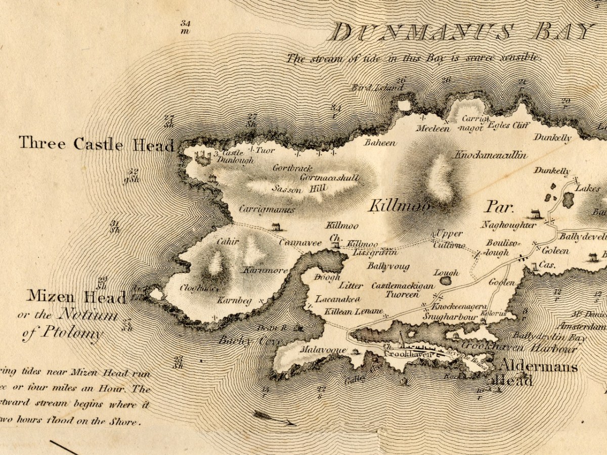
Let’s take a look at Neville Bath’s map now, working from west to east along the Mizen Peninsula. you will have your own favourite spots to check out – I am just going to point out a few of interest to me.

This map pre-dates Richard Griffiths road-building along the Mizen, but nevertheless it shows a road going all the way to Crookhaven. I love the little depiction of Dunlough/Three Castles, and also that a church is shown at Lissagriffin – we can see the ruins still. Alderman’s Head is called Streek Head on the early OS maps, while the rocks offshore at this point are called Alderman’s rocks. (Who was the Alderman, I wonder?)

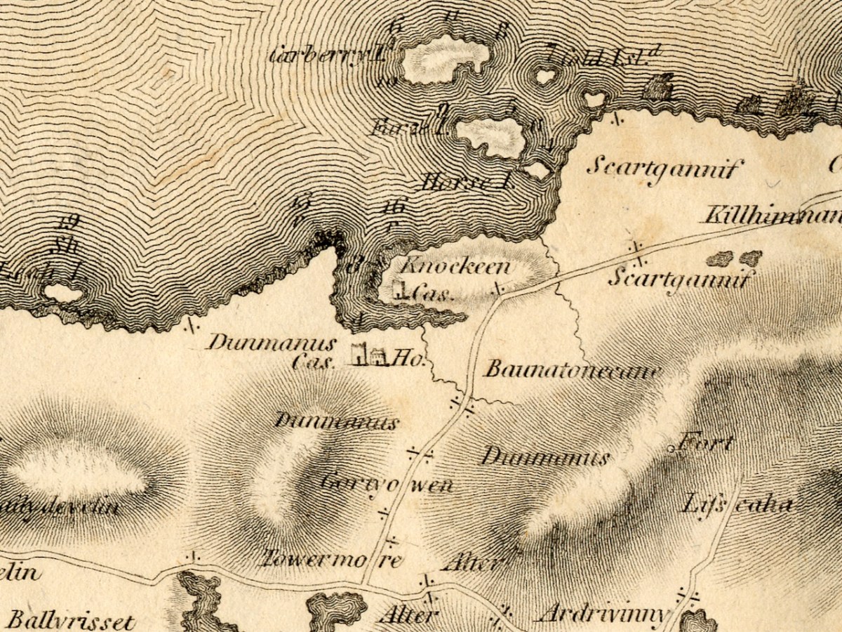
Before we move East to Schull, I just want to highlight Dunmanus. The ‘castle’ at Knockeens is clearly shown. As I discussed in my post Dunmanus Castle 1: The Cliff-Edge Fort, there is much much local folklore about this site. There may have been more to see when Bath was mapping this area.

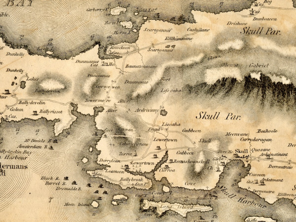
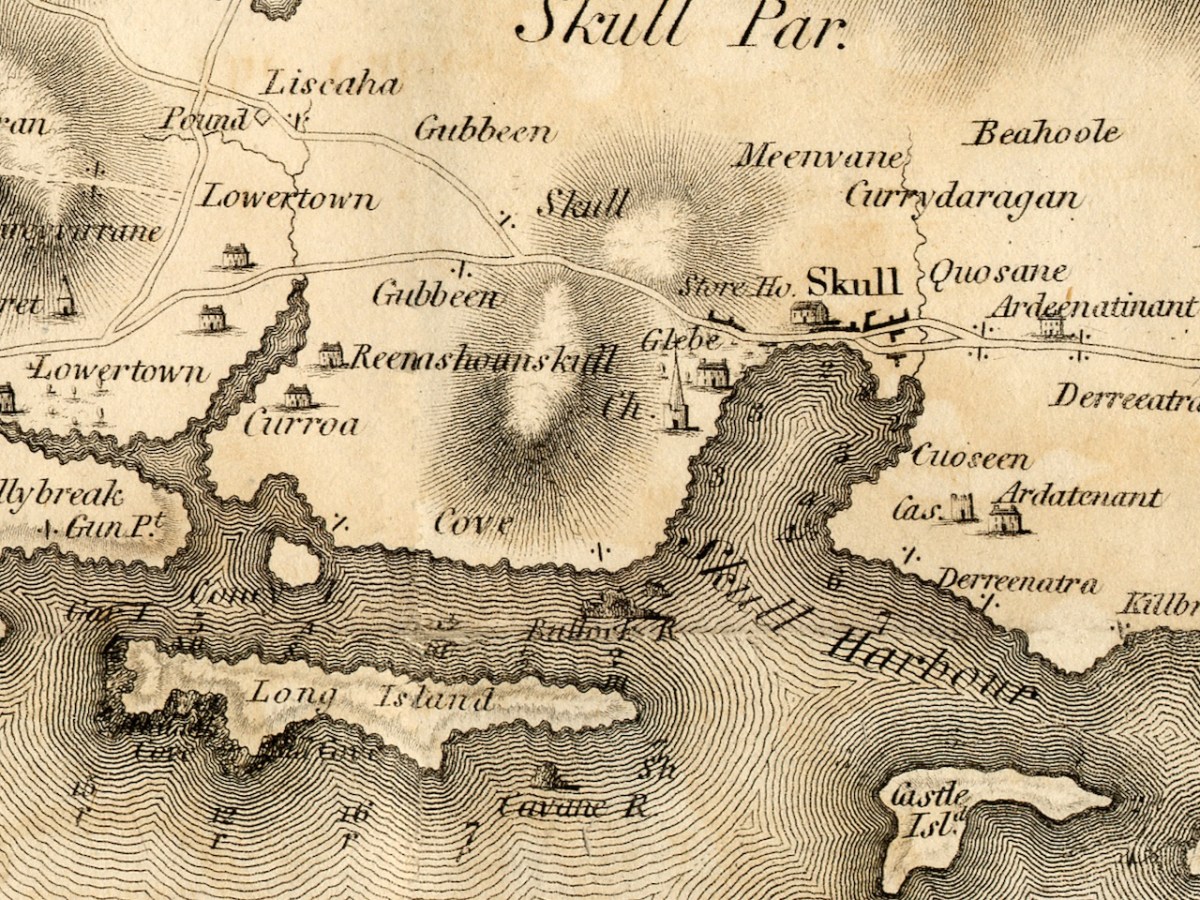
Moving towards Schull, I am intrigued by the noting of a ‘pound’, which does not occur on later maps. A pound was used to secure animals seized by the landlord’s agents for payment of rent. Note also the ‘Fort’ at the end of the Lisscaha road. While I haven’t written about this fort, I have visited it, and very impressive it is.

Schull is shown as a sizeable settlement, with a storehouse, Glebe, and Church – St Mary’s Church, now replaced by Trinity Church. A number of Gentlemen’s Seats are shown in the vicinity.

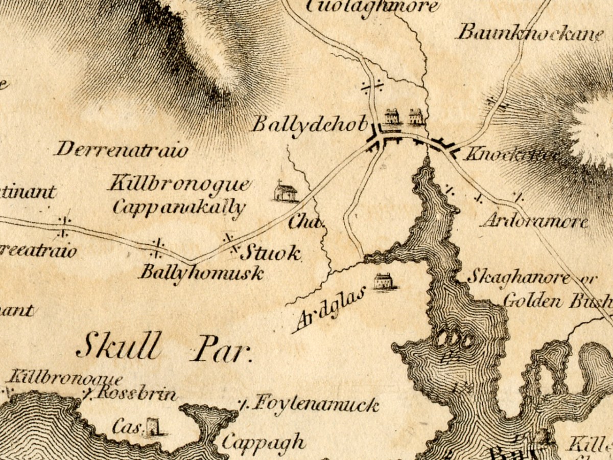
And finally we arrive at our own Ballydehob, shown as a town. Note the church to the south west of the town – I wonder if this is the church that once stood in Stouke Graveyard. It hadn’t occurred to me that Skeaghanore was the Irish for Golden Bush – there must be a story there! We will cover other parts of West Cork in subsequent posts. This map is an incredibly valuable resource dating as it does from well before the Ordnance Survey. We are lucky that it was published and copies saved. But what happened to Neville Bath? As JH Andrews tells us, Bath

may well have been dead by the time his work was officially published on 20 February 1811, and the map itself was only just in time. Irish cartography was about to pass into the hands of a new elite, engineers rather than land surveyors, whose most distinguished members were immigrants from Britain like Alexander Nimmo and William Bald. This later generation had a low opinion of Bath, and within fifteen years of his departure the counties of Limerick, Tipperary and Kilkenny had all decided to have his work done again. Not surprisingly, none of his manuscript county surveys appears to have been preserved. The map of Cork is available in a number of Irish libraries, however, and only awaits the judgement of the county’s own historians.


A Cork Cartographer’s Advertising Campaign by J H Andrews

Journal of the Cork Historical and Archaeological Soc, 1979

*See Richard Butler’s magisterial Building the Irish Courthouse and Prison 1750-1850

The Magic of Old Maps

We’ve done quite a few posts over the years about old maps – we are both fascinated by them. So I’ve decided to draw all those posts together into a new Menu Page, so you can easily find any post you’re interested in.

Several posts went into detail about maps from the Elizabethan period. The Elizabethans were map-makers and they had a special interest in drawing up maps of Ireland – to confiscate tracts of land from the rebellious Irish and assign them to colonisers. Jobson was the cartographer who mapped Munster: two posts detail the maps drawn up for that purpose.

There’s a mysterious map in the British Public Record office – nobody knows who did it, but it was obviously done in the period following the Battle of Kinsale in 1601. While some of the elements are obvious, others are not, and pouring over a map like this raises as many questions as it answers. I titled the two posts Elizabethan Map of a Turbulent West Cork.

Two posts, Mapping West Cork, drew on maps from the David Rumsay Map Collection – a man who has done the world a great service by collecting and digitising maps from all over the world. These are very early maps by famous cartographers Mercator (done in the late 1500s) and Blaeu (from his 1655 Atlas). I’ve updated this post recently.

John Speed’s map, dating to 1611, although largely based on Mercator’s work, is more detailed and adds all kinds of interesting details about people and cities.

Robert’s post Roaringwater Bay in 1612 is about the Dutch Pirate Map. As he says in his post:     The thing that sets the 1612 map apart, however, is that it was made in secret, and largely from surveys only carried out at sea. Also, it was specifically intended to enable a Dutch fleet to assail the pirate strongholds which became numerous around the area from Baltimore to Crookhaven, centred on Roaringwater Bay and ideal for forays into the wider Atlantic trade routes.

A series of three posts, all written by Robert, explored the world of the Down Survey – conducted by William Petty under the instructions of Oliver Cromwell, and like the Jobson maps, done for the purposes of assigning land to colonisers. 

After an introductory post, Robert went into details about West Cork and then, in a third post, looked at Kerry. He is planning more in this series.

Finally, there’s Griffith’s Valuation – a series of detailed maps done by Sir Richard Griffith in the 19th century for the purpose of putting values on every square perch of land. Robert wrote about Griffith in The Rocky Road to Nowhere, and I used the Valuation in my post What the Forest Was Hiding.

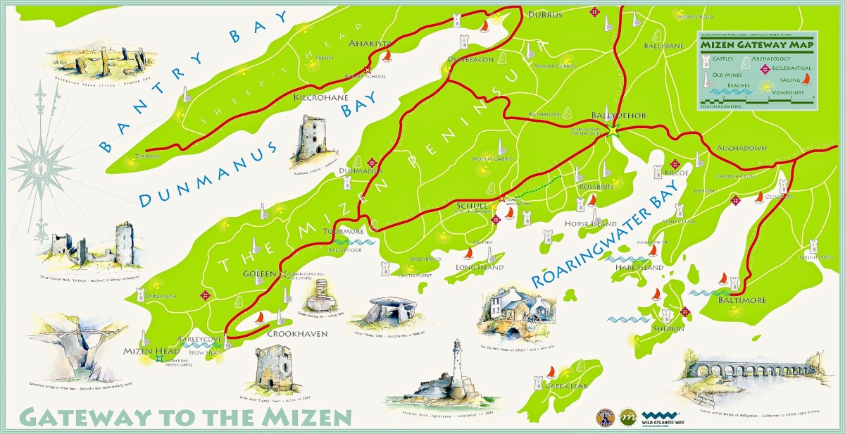
We will update The Magic of Old Maps page as we write any new posts. I am leaving you with a new map – it’s the joint work of Robert and Peter Clarke, and the original hangs in the Bank House, Ballydehob’s Tourist Information Centre.

If you want to browse the David Rumsey map collection for yourself, it’s here.

Mapping West Cork, Part 1, Updated

This post was originally published several years ago, but I have edited and updated it, so am giving it another airing.

Old maps are magical places to get lost in. Pouring over them, trying to identify what I know now, attempting to look at the territory with a seventeenth or eighteenth century mindset – well, several hours have gone by and I realise it’s dinner time. I’m going to share some of my favourites with you in a couple of posts. Mostly, the maps I am using are from the marvellous David Rumsey Map Collection where the maps are free to use for non-commercial use under the Creative Commons license. We are very grateful to you, David Rumsey – what a service to mankind!

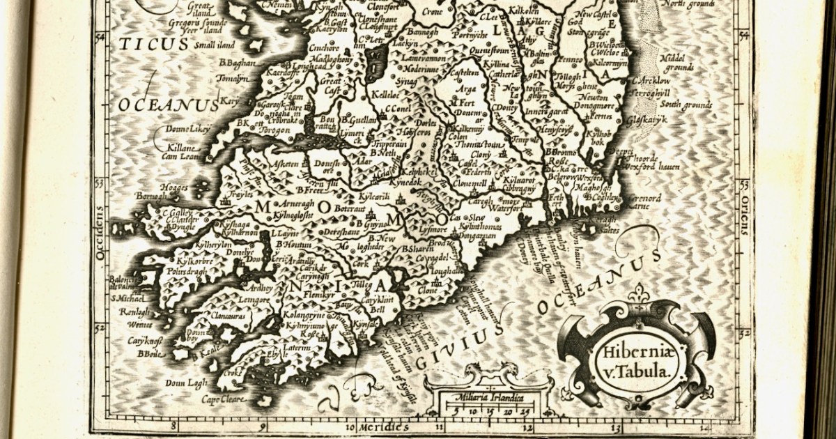
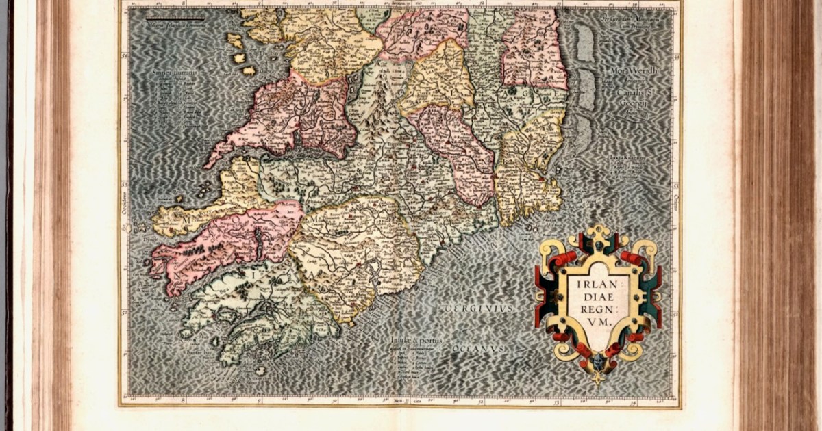
The first map here is by the famous Gerhard Mercator (1512-1594) and Iodocus Hondius (1563 to 1612) and it was published in an Atlas in 1607, after Mercator’s death. The map, therefore, predates the Atlas and was probably done in the late 1500s.

Who was Mercator? This is him, courtesy of Britannica, and his influence on mapmaking was incalculable – he really was the father of modern cartography.

In the 1500s, globe-making was a precise and difficult art. Mapmakers often etched their maps onto paper that they then painstakingly pasted onto paper mache spheres. Old maps had problems, however. Mapping a three-dimensional globe onto a two-dimensional map always involves some distortions, but early maps had serious issues for navigators. They were mostly elliptical and struggled to capture the curvature of the Earth for sailors who were plotting a course. Sailors using them were constantly twisting, curving, and recalculating to compensate for their maps’ deficiencies.

In 1569, Mercator developed a better, more accurate projection. Although the execution was difficult, the basic idea was simple: Imagine a globe with a paper cylinder wrapped around it — Mercator projected that globe onto the paper and then unwrapped it. He then expanded degrees of latitude as they approached the poles, which distorted land, but allowed the directions to be clearer.

https://www.vox.com/2015/3/5/8151303/gerardus-mercator-maps

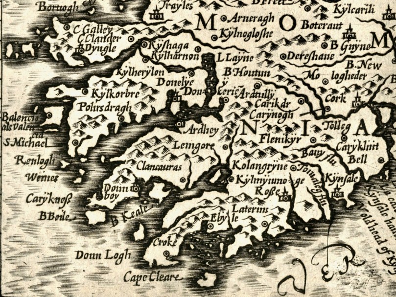
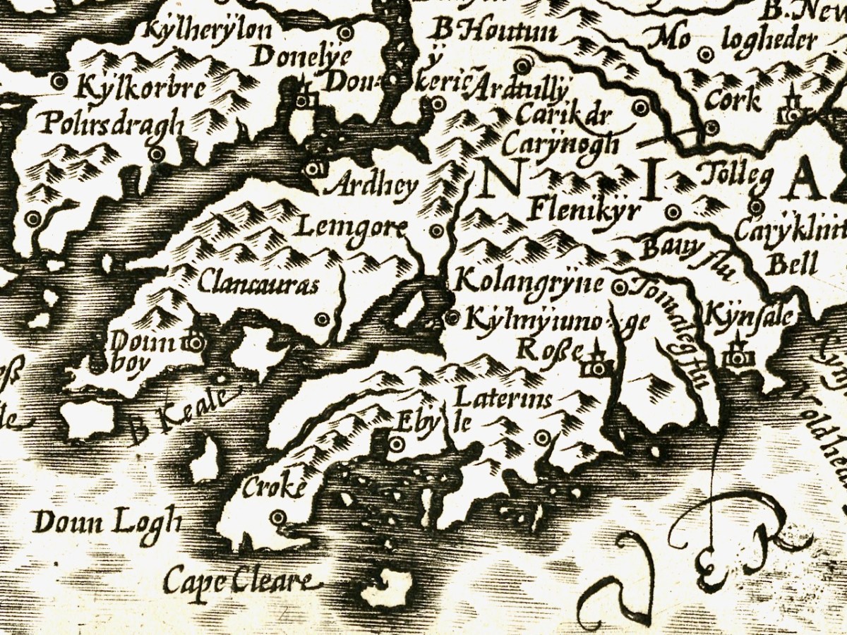
We can recognise some things in this map and not others. Croke is Crookhaven, Doun Logh is Dunlough (or Three Castle Head) and Doun boy is Dunboy Castle home of the O’Sullivan Beares. We can also see Roße – this is Rosscarbery, with the symbol of a church, and Kynsale. But after that I was stumped. However, one clever reader (thank you, Philippa Barry!), when I published this first, added Currently doing some reading on Bantry and O’Sullivan Bere, so getting familiar with placenames. In the first map Kylmyiunoge might be Kilmacomoge, Ardhey is Ardea Castle on the Kenmare River. Looks like Timeoleague is in there too.

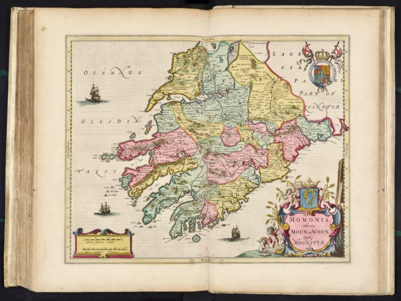
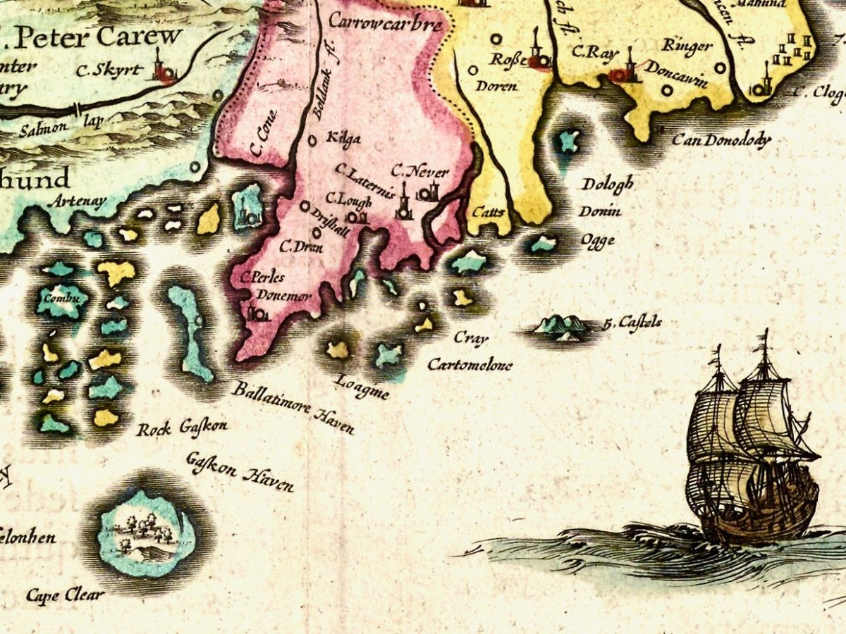
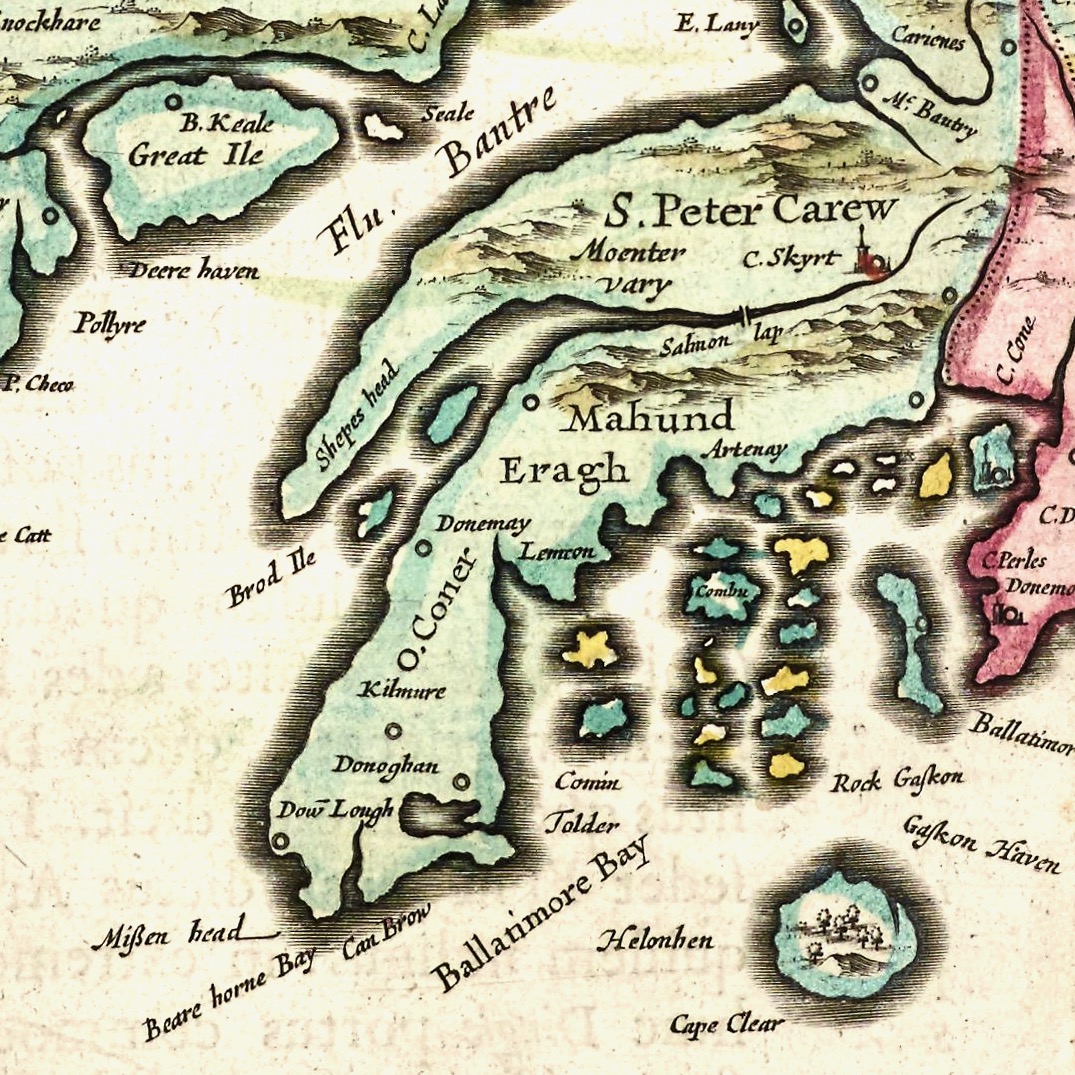
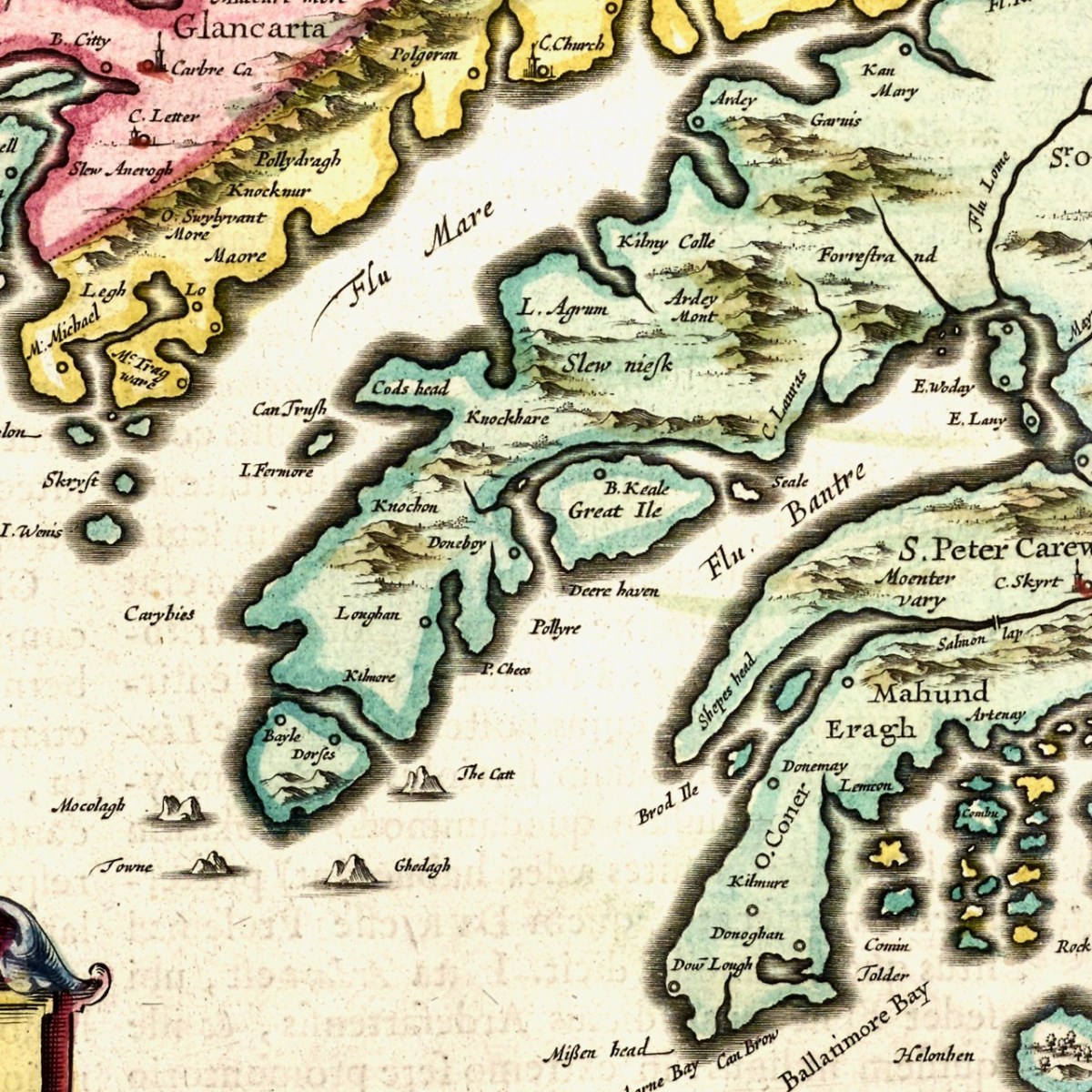
The second map is from 1655 and it’s from Joan Blaeu’s Atlas Major. Blaeu, a Dutch cartographer, lived from 1596 to 1673 and this map is from his Atlas Maior of 1665, considered one of the greatest achievements ever in Atlas publishing. It was also the most expensive book you could buy in the 17th century – worth a year’s wages for a skilled craftsman. The first thing we notice, of course, is that this version is in colour, but you could also buy an uncoloured version for a hundred guilders less. Given printing capabilities of the time, each copy must have been hand-coloured.

There is much more detail now, and more recognisable elements. It’s a wonderful record of what the major sites were then – sites which nowadays hardly exist, or exist as ruins. Let’s take it from east to west.

I recognise Dunowen and Dundeedy, and Ringer must mean the area now known as Ring. The letter C denoted a Castle (or Manor House) as in C Perles. or Castle of Pearls, which is Dun Na Séad (Fort of the Jewels), the O’Driscoll Castle at Baltimore. But what is C Ray? There was a tower house at Castlefreke built by Randal Oge Barry in 15th century, maybe that’s it? And, even more intriguingly, what is C Never?

Moving on to Roaringwater Bay and its hinterland, we find Artenay, now known as Ardintenant Castle, one of the ruins of what was once a string of O’Mahony Castles. Ardintenant was the home of the Taoiseach, or clan chief, which is why it would be marked on the map. Other O’Mahony Castles are Dunmanus (Donemay), Dunlough (Dow lough) and Leamcon. Territories of the McCarthy’s, the O’Donovans, Sir Peter Carew and O’Mahonys are given, but also an O’Coner clan, about whom I have no knowledge. The Sheep’s Head is divided into Moenter vary (Muinter Bhaire) at the north end and Shepes head at the south end. Mizen Head has already acquired its name, although I suspect Eragh is a form of Ivaha, the old name for the Mizen Peninsula. Could C Skyrt be Castle Donovan – no other castle is located in this general area?

Finally, on to Beara – we immediately recognise Bear Island, or the Great Island, as it was known historically, and Dunboy Castle, as well as Dursey Island. C Lauras, may be Lauragh, although Lauragh is on the north, not the south side of Beara. I need an expert here, to find other place names that equate to modern sites. So take a browse dear readers, and let me know what you find.

Mapping West Cork, Part 2: John Speed