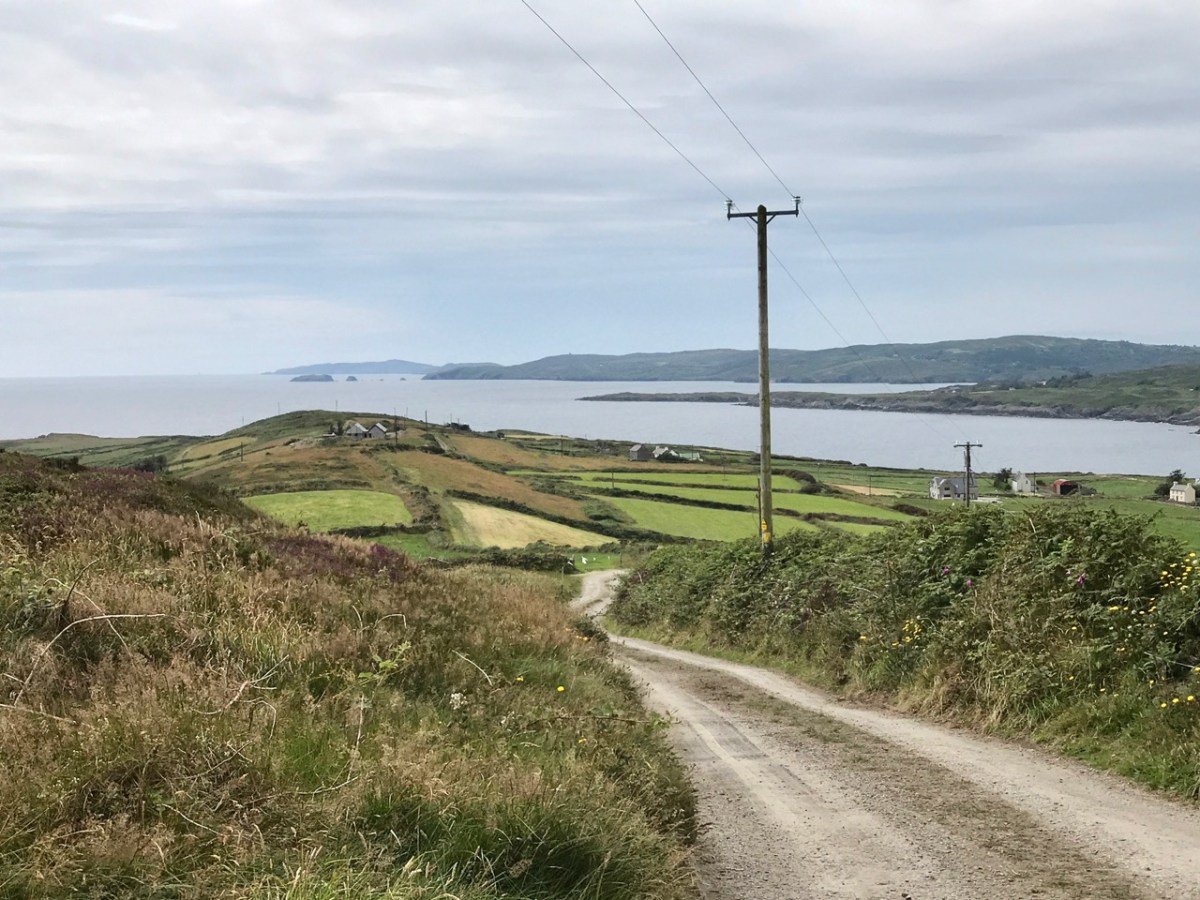
The series continues! In my previous posts on Napoleonic Signal Towers around the Irish coast (the posts are listed at the end of this one) I stated that 81 towers were built between 1803 and 1806, of which 20 were situated in the County of Cork. Today’s example is firmly within the chimerical district of West Cork. I use the word ‘chimerical’ in this sense: “. . . existing only as the product of unchecked imagination . . .” as there is actually geographically no such place as West Cork, even though we write about it all the time – and claim to live within it!
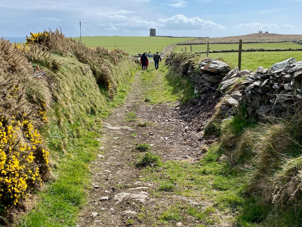
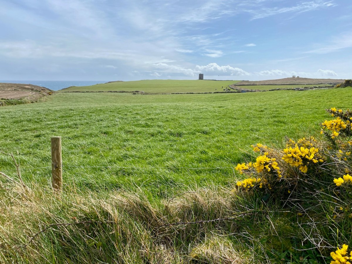
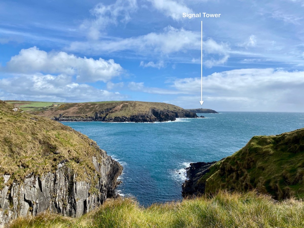
Today’s example has various names: Seven Heads (it’s sited on one of them); Leganagh (that’s the immediate locality) and Ballymacredmond, which is the townland name. It is also called Travarra on some maps and by local people: that is the name of a bay which is over a kilometre to the north-east (and refers to the Barry family who lived in the district). From this tower can be seen another to the west (Dunnycove or Galley Head – which I have written about here), and to the east the tower at The Old Head of Kinsale, here, which is in the present day the best standing example as it has been fully restored and is open to visitors as a historic structure.
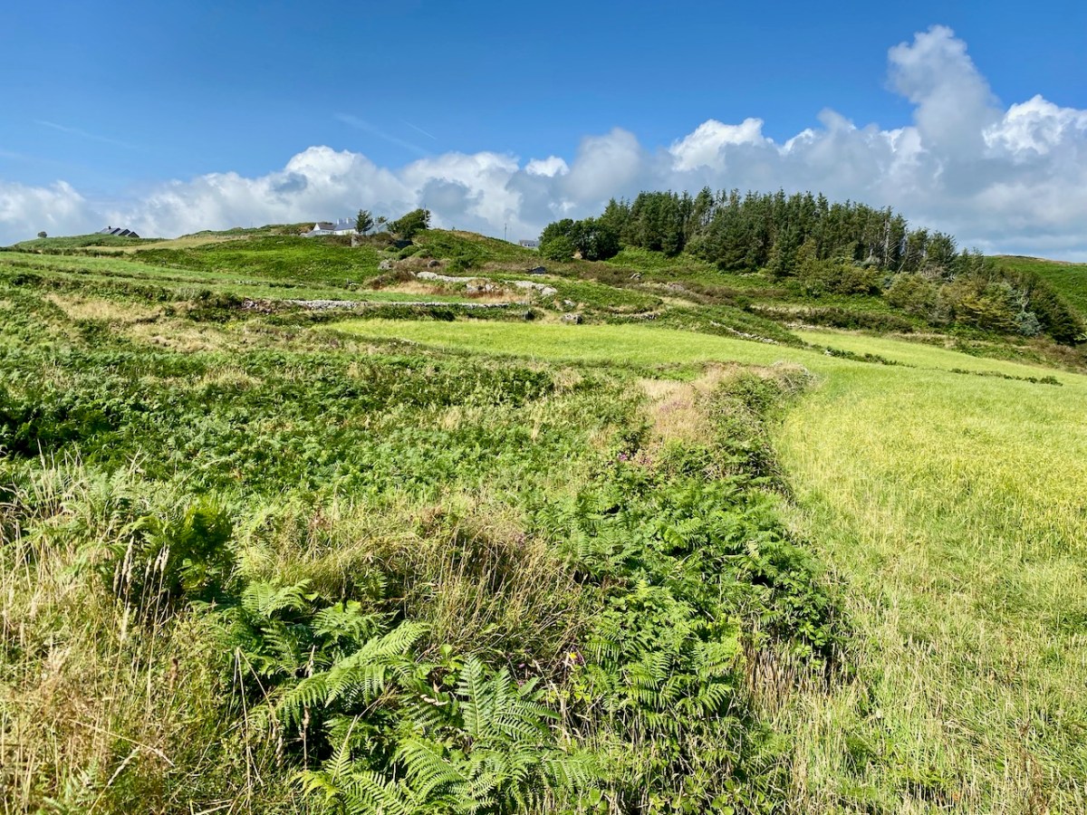
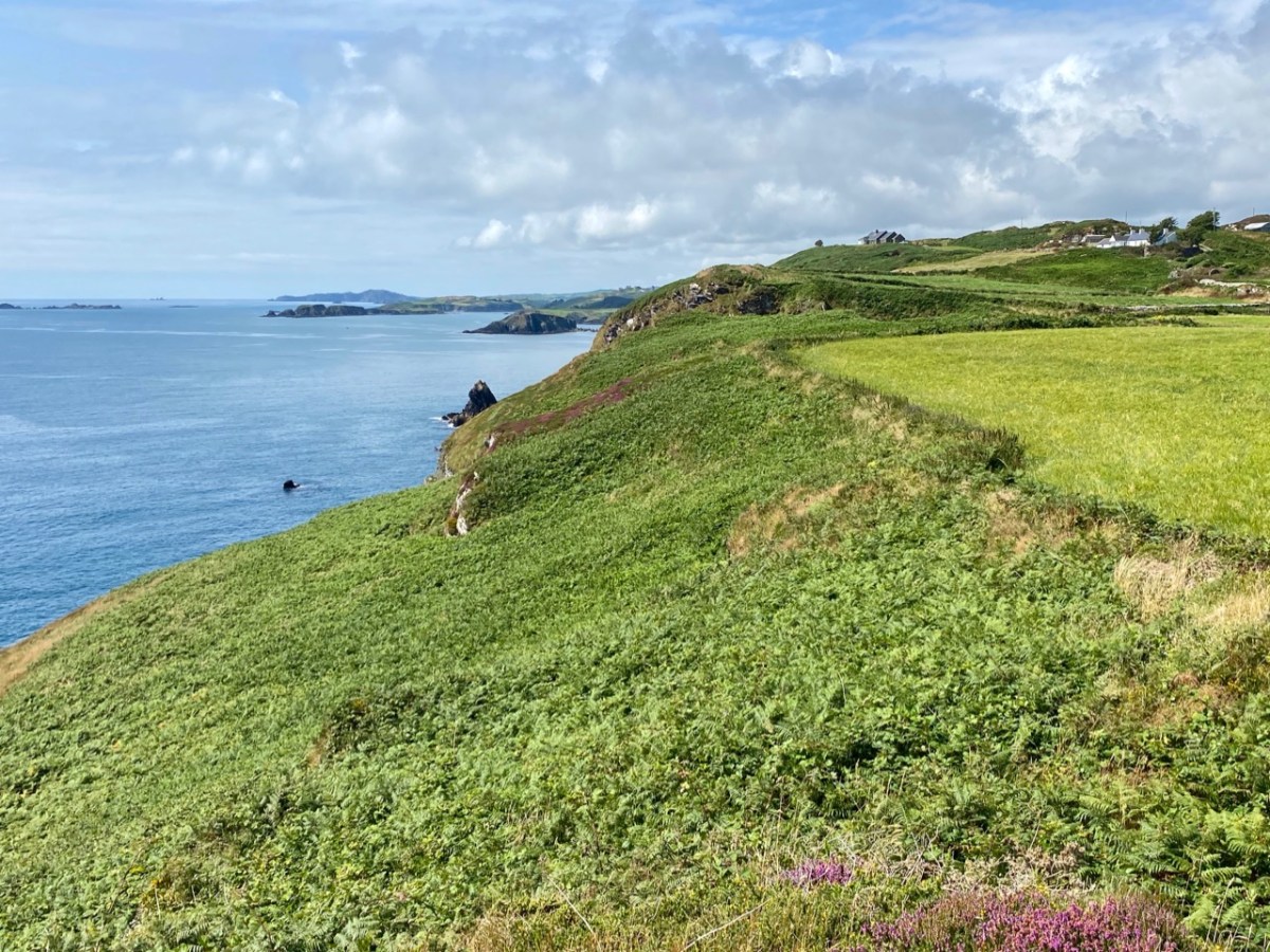
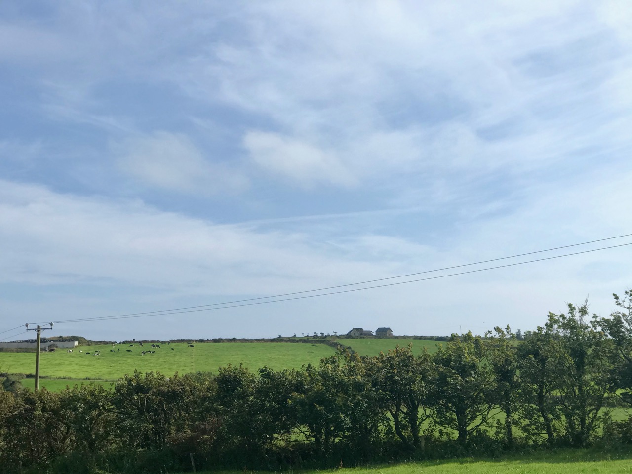
We also had bovine company (above)! This is a constant when you are walking in West Cork. As you can see, our day was mixed, with dark storm clouds and high winds interspersed with good spells of sunshine. The varying light enabled some dramatic photography:
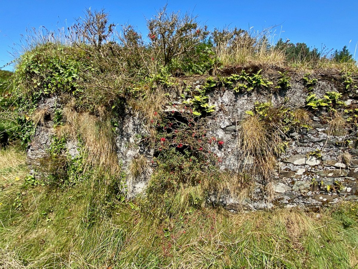
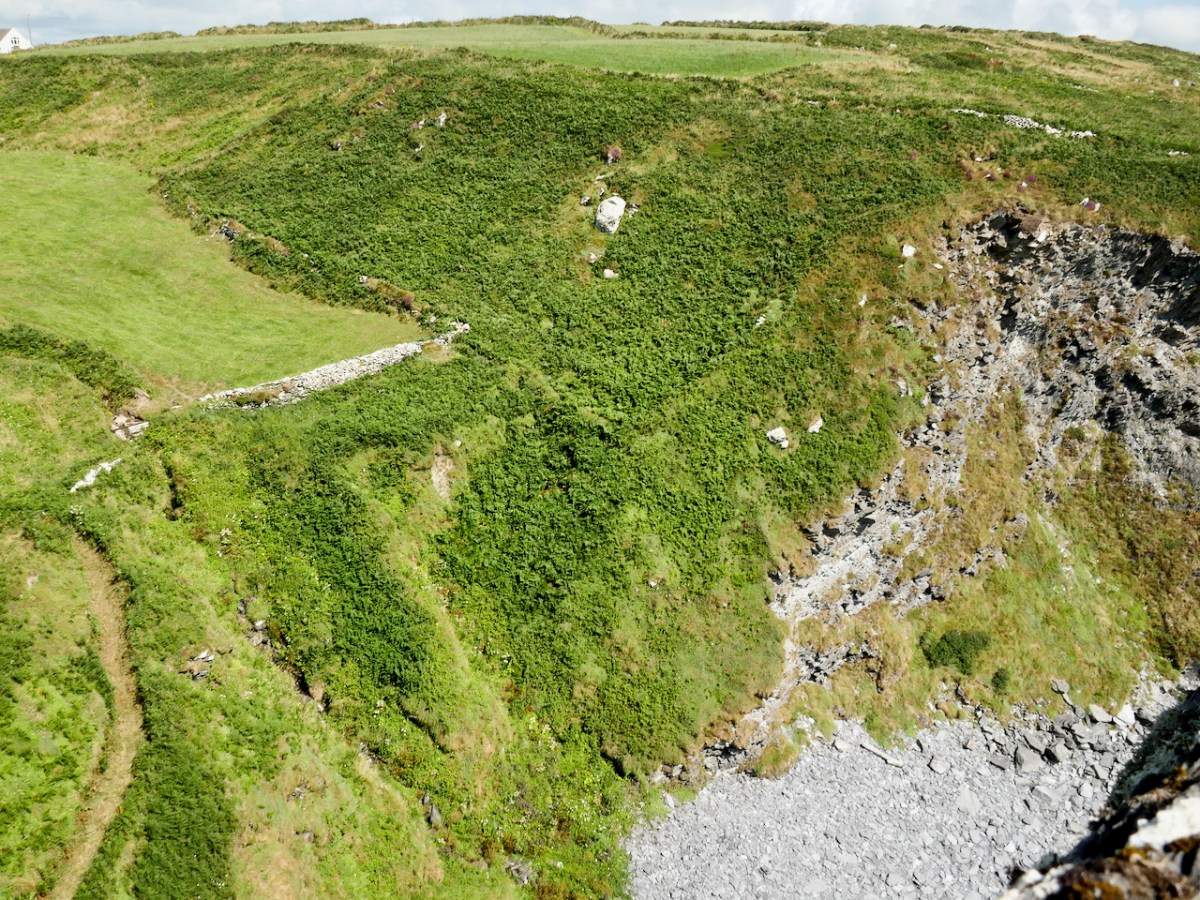
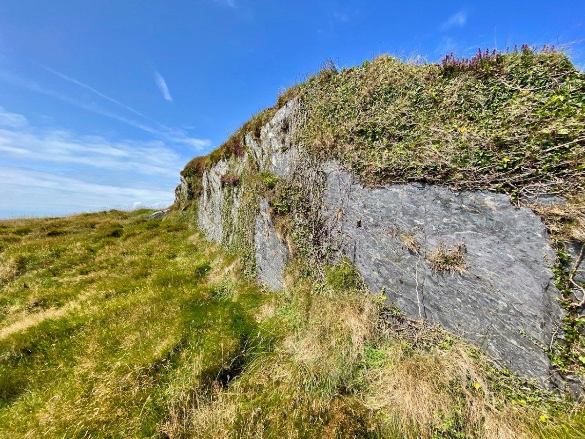
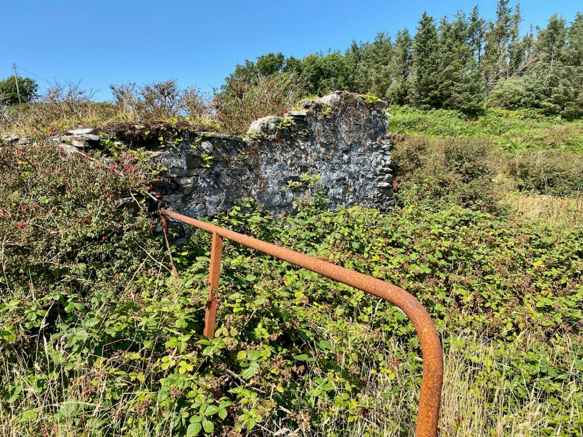
The defined trackway and various well-built stone walls – which I am assuming are contemporary with the tower – show what a significant undertaking this project was in the early years of the nineteenth century. One particular wall to the west of the tower is a noteworthy structure as it is high (between 1.5 and 2.5 metres in places) with some puzzling lintolled openings. The photograph below I have borrowed with thanks from Dominic Creedon as I was unable to get close due to very adverse weather.
You can make out this enigmatic wall on the Google Earth image, above. It is parallel with, and to the west of, the old access road, and forms the western boundary of three rectangular fields. I can find no information on this wall on any history or archaeology sites. I’m tentatively suggesting that it might have been constructed as part of the signal tower works to create a sheltered garden or external storage area: the towers accommodated crews on a rotating basis while in use, and the ‘garden’ – if that is what it was – could have provided a welcome source of fresh produce.
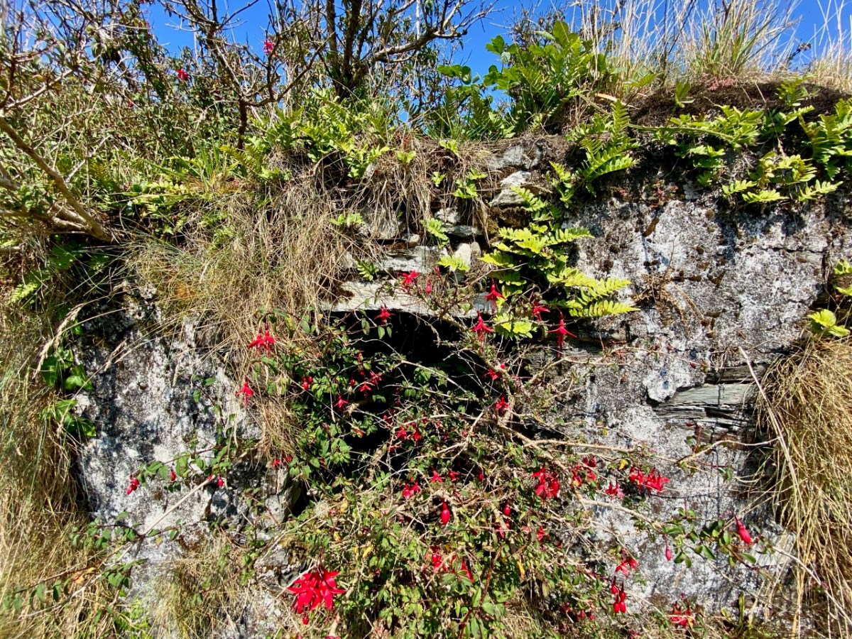
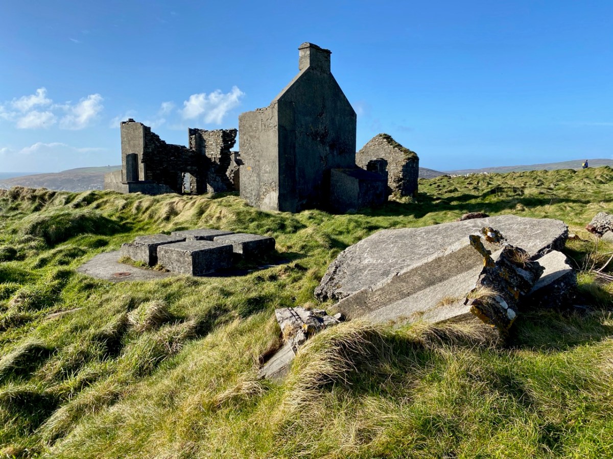
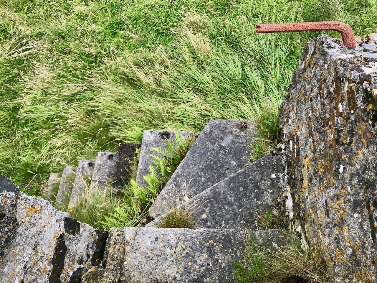
This remote site is also of interest as it has the ruins of two World War 2 Coastal Lookout Posts within a short distance of the Napoleonic-era Signal Tower. I haven’t been able to find out why two were needed here: I can only assume that the first did not prove to give sufficient surveillance. This twentieth century context and link is not unusual, as both lookout posts and signal towers effectively served the same purpose: to keep a watch out for enemy activity, and to alert the appropriate authorities if such activity was spotted. In reality, no such activity was ever reported during either conflict. Written records exist from all the WW2 LOPs (Lookout Posts). Here is an example page from the Seven Heads site, typical of all such records:
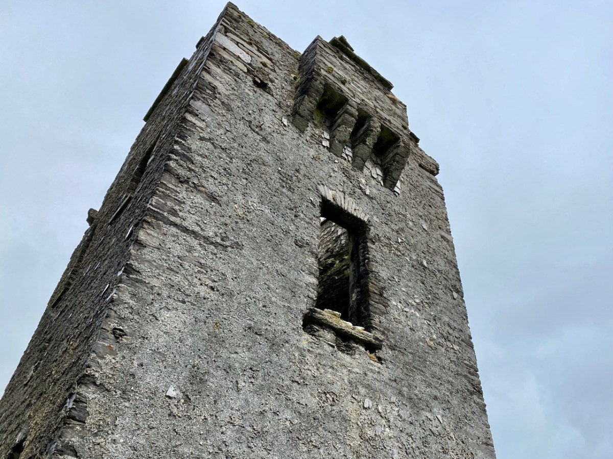
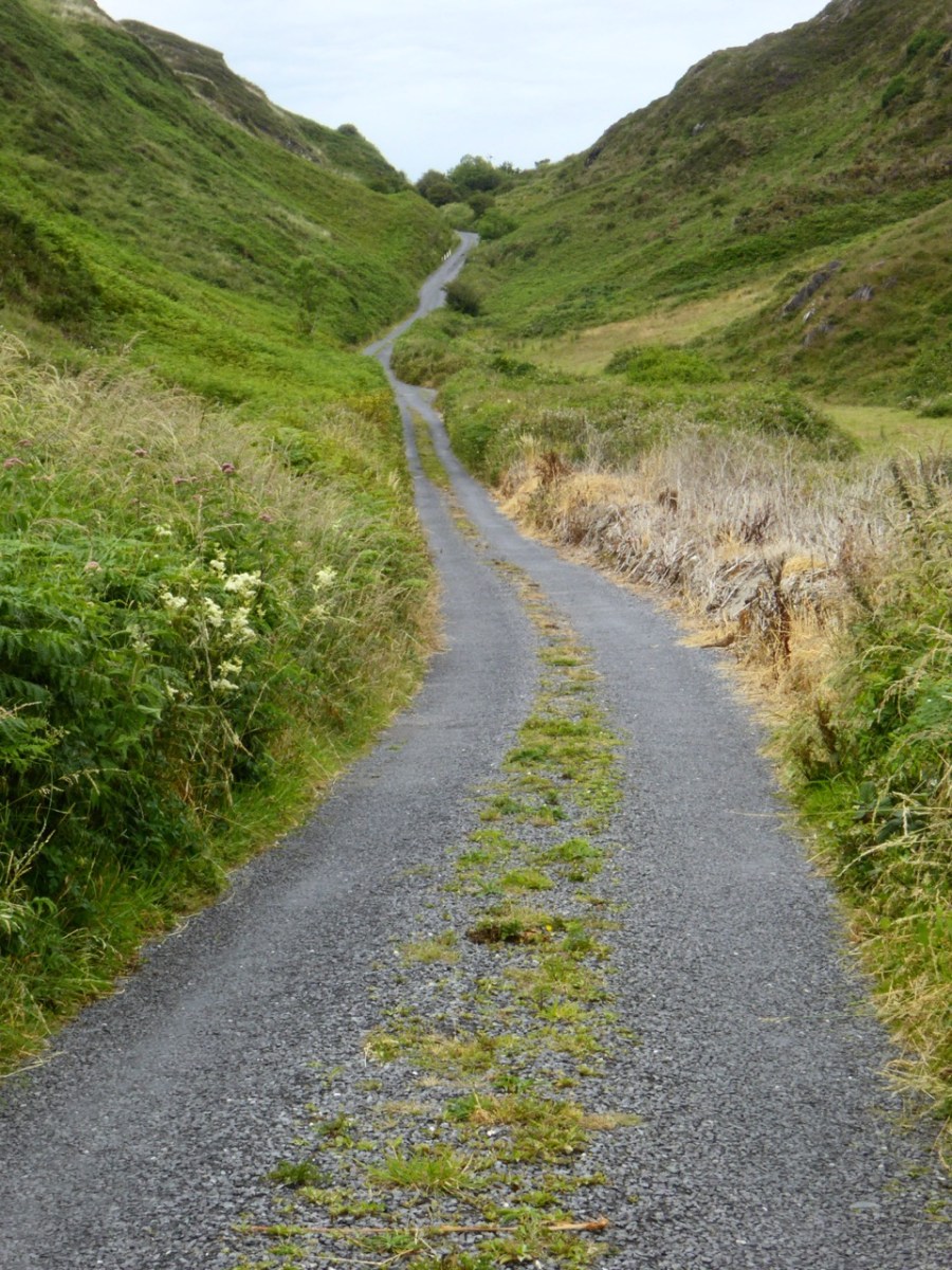
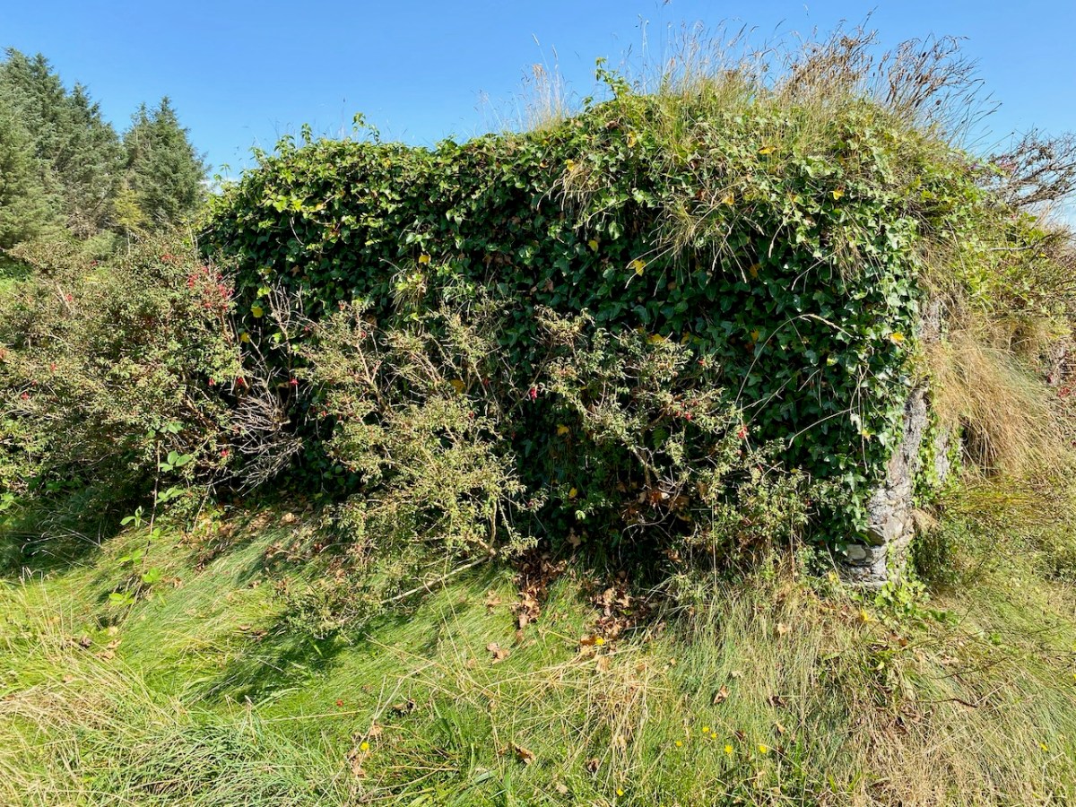
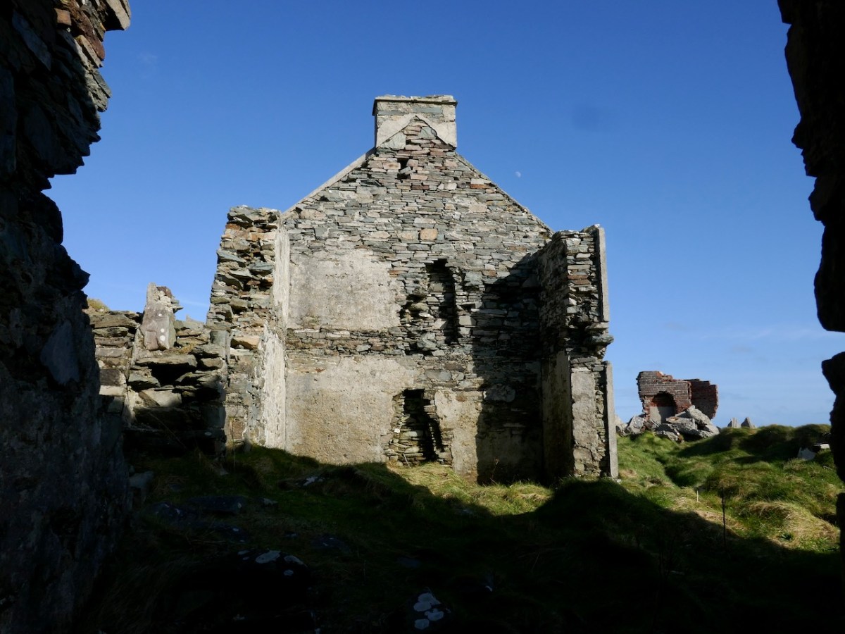
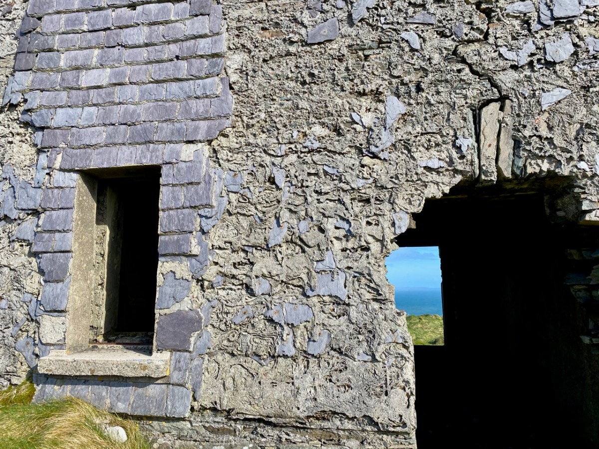
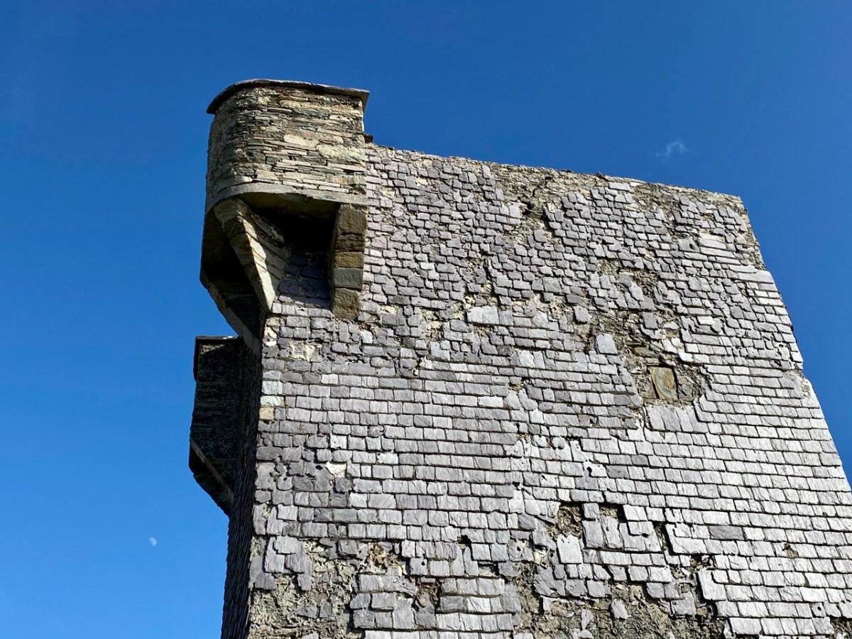
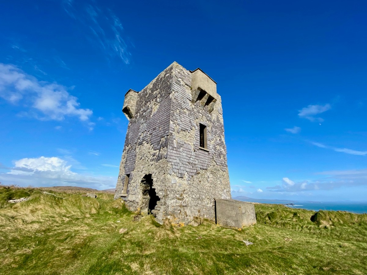
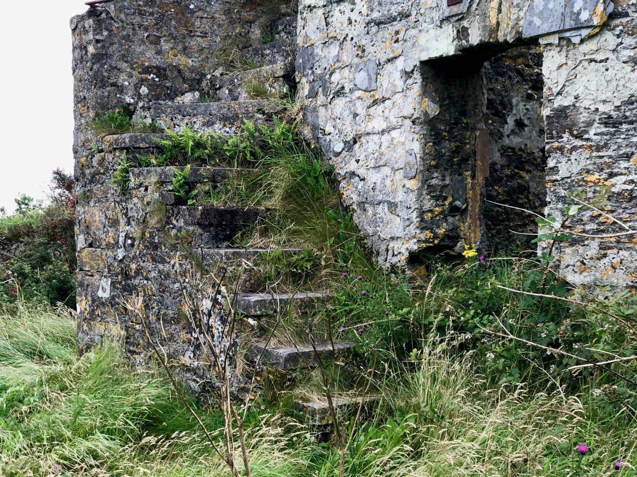
Above are various views of the Signal Tower: it is typical of such structures in general design and layout. Note the machicolation incorporated into the upper parapet: this is an echo of the design of medieval tower houses. The Seven Heads building is an open ruin and is slowly deteriorating. It is sure to crumble away over time. The Seven Heads Walking Trail takes you past the site.
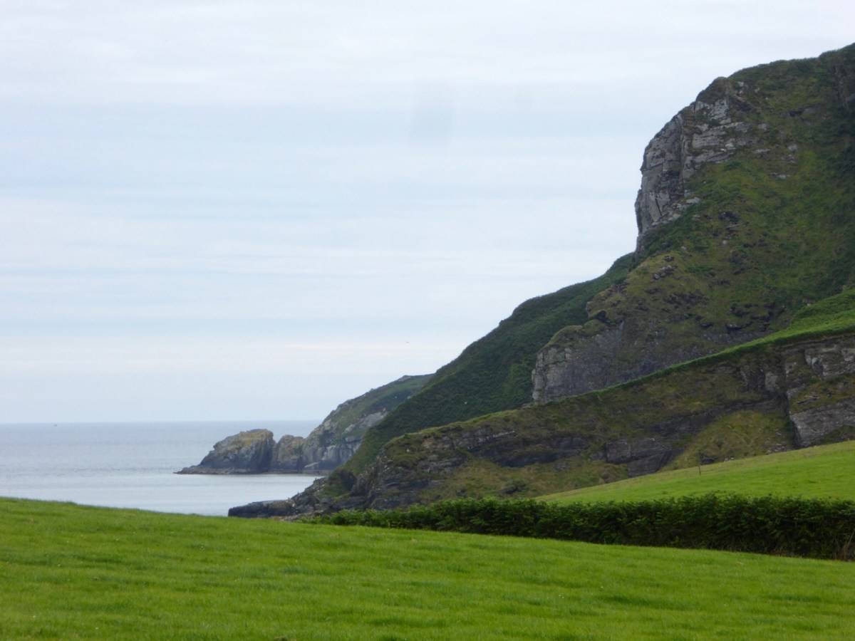
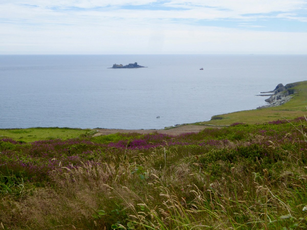
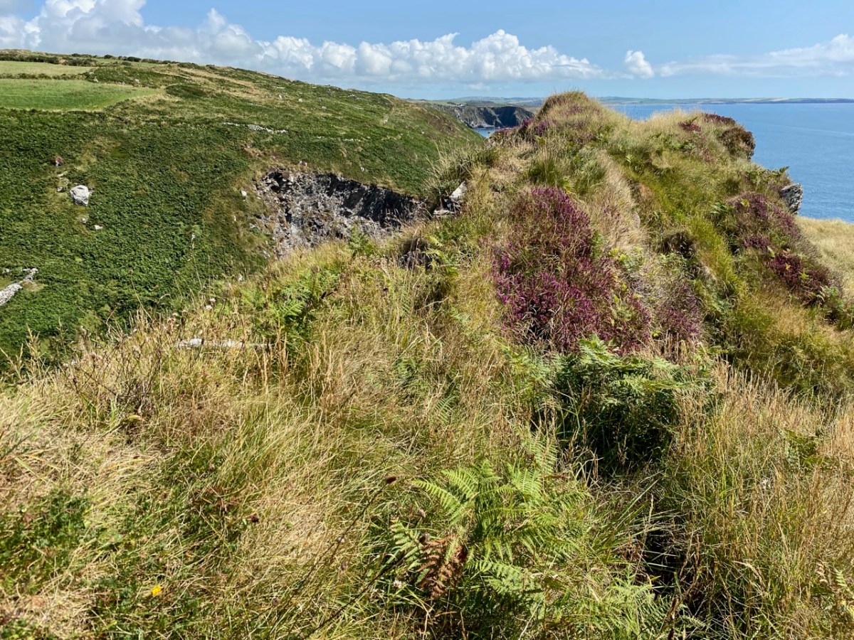
Tailpiece: the pic below is taken from the Dunworley promontory fort, looking towards Seven Heads, and the final pic shows the dramatic sky which enhanced our visit.
The previous posts in this series can be found through these links:
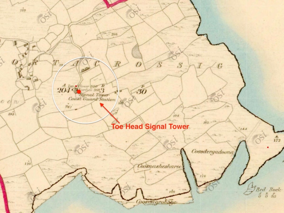
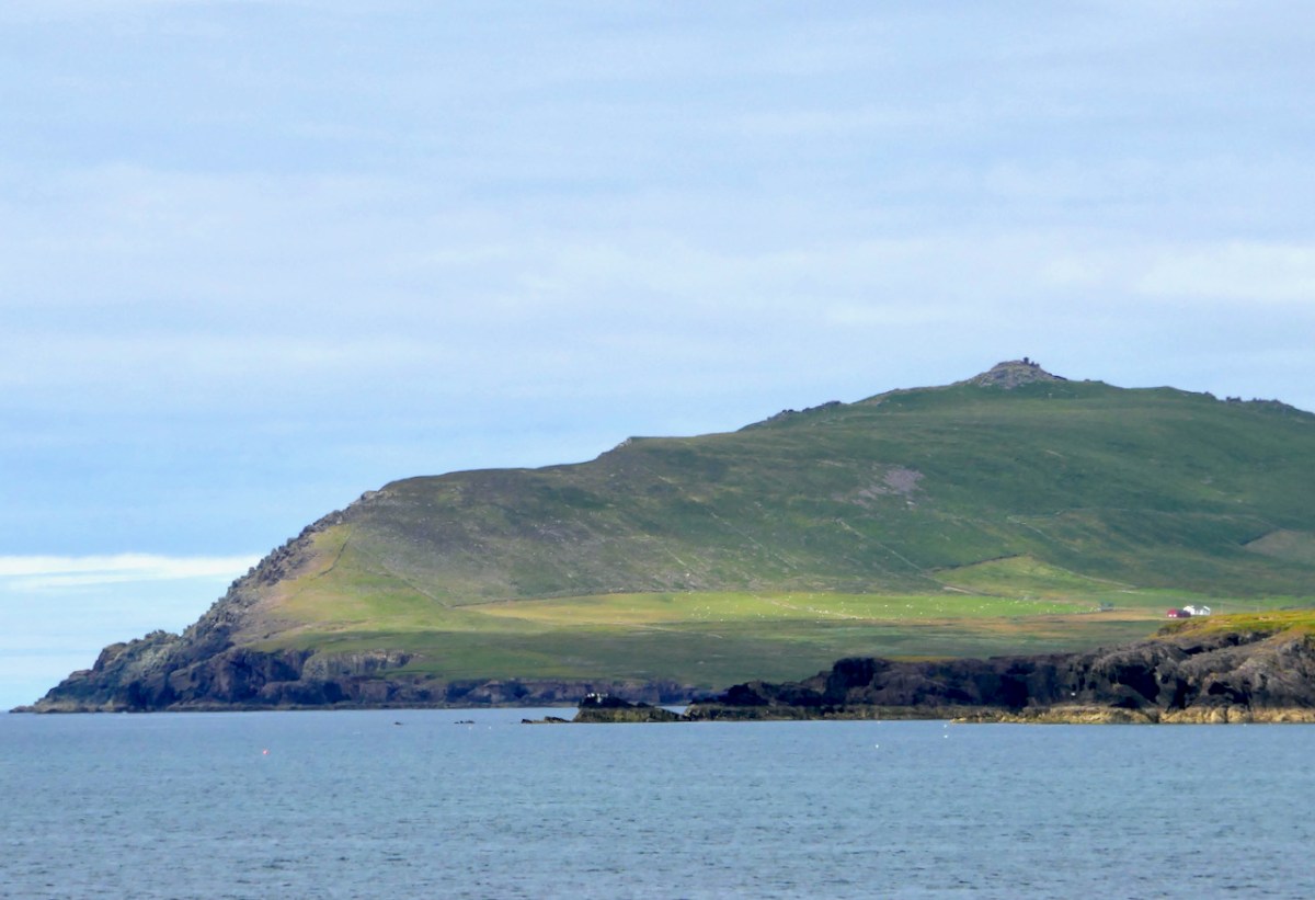
Here’s the latest episode in our series about Napoleonic-era signal towers in West Cork. There are links to the earlier posts at the bottom of this one. That’s Toe Head above – in the far distance, and that view is taken from the signal tower site at Kedge Point, Spain, to the east of Baltimore.
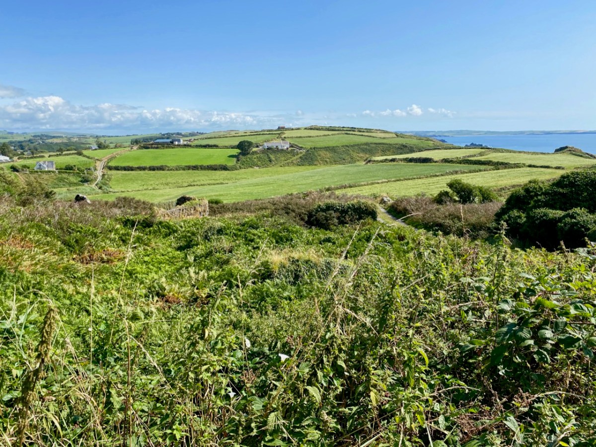
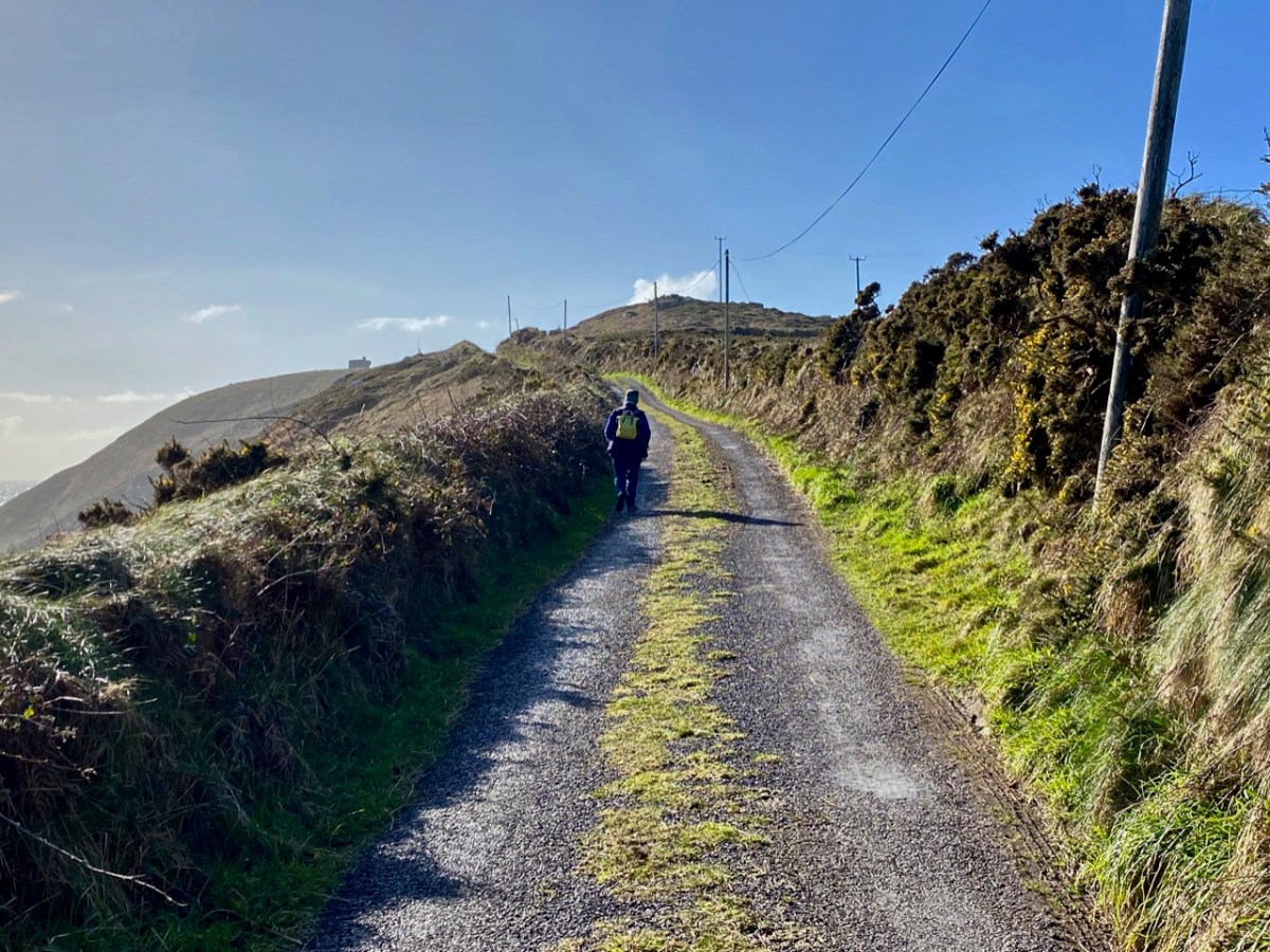
Toe Head itself is a spectacular setting in West Cork: the views, above, show the nature of the terrain, the boreens, and the seascape in the area. So far I have written accounts of nine signal towers: this is the tenth. I’d like to tell you how many of these structures are in West Cork, but that would mean that I would have to geographically define ‘West Cork’. I can’t do that, as there is officially no such area: we are all part of County Cork! All I can do is to let you know that there are nineteen signal tower sites located in the whole County. I have another nine to cover, after this one. But I assure you – Toe Head is definitely in our West Cork!!
Here’s the Toe Head tower – in a sea of black bales. If you have followed the series so far, you will have noticed that each tower is fairly basic, and generally offers the appearance of a medieval castle. But they were all built at the very beginning of the nineteenth century, to provide a system of surveillance and signalling around the coast of Ireland, from Malin Head in the north to Pigeon House Fort, Dalkey, on the east coast. Each signal tower is within view of one – or two – others, depending where it lies on the chain. In the first post in the series, here, I explain the logic and geometry of the project.
The 6″ Ordnance Survey map extract in the upper picture dates from 1842. By this time the use of the tower for signalling had ceased – the Napoleonic invasion threat lasted only through the first few years of the century: many towers became disused after this and some have vanished altogether, although many ruins do remain because of their remote locations. In the case of Toe Head, the building was adapted to incorporate a Coast Guard Station. I am assuming that, originally, the tower was a simple square structure , and the extension to the rear was added to provide additional accommodation for the Coast Guard service. The current aerial view shows newer farm buildings and an access road close by.
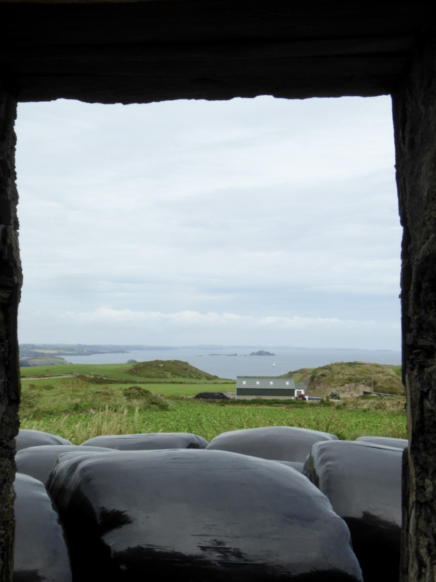
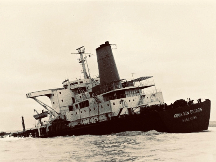
If you look at previous posts in this series, you will see that the Toe Head tower is architecturally simpler, with no bartizans or other ornamentation – it’s more like a small Anglican church tower than a ‘castle’. Like many others, it’s clear to see that this building was slate-hung: this form of weather-proofing was probably added at a later date – possibly when the Coast Guard service took it over. At the centre of the view from the window above you can see the Stag Rocks which in the 1980s became the graveyard of the 900ft long Kowloon Bridge, a bulk cargo carrier travelling from Quebec. The ship was disabled by a storm and then abandoned, drifting on to the Stags. A detailed account of the event was posted in the Irish Examiner 30 years later.
The abandoned Wreck of the Kowloon Bridge close by the Stags in November, 1986 (centre picture). The lower picture shows the wreck underwater today (courtesy Aquaventures.ie): she drifted out of control towards the rocks before running aground on the reef. The resulting fuel spill spread out over the Irish coastline causing extensive damage to local wildlife, and financial losses for the local fishing fleet. Apparently, no-one was ever held to account for the environmental disaster.
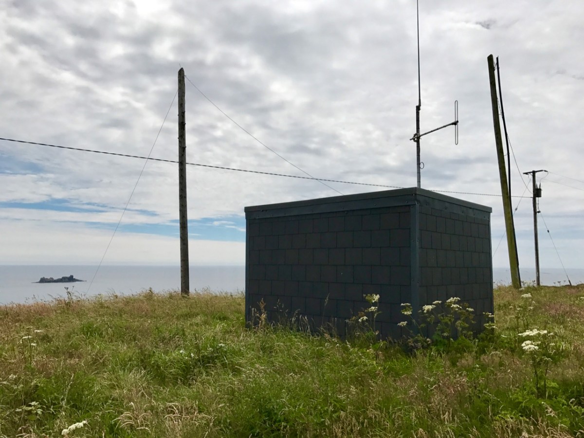
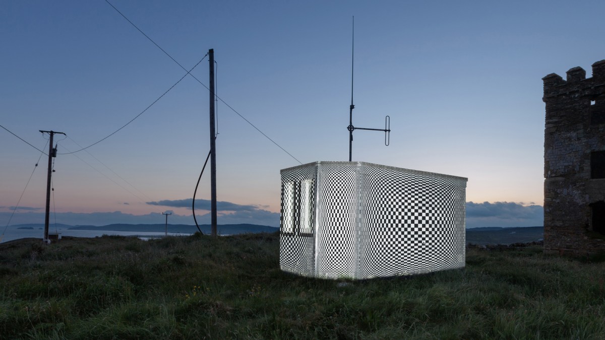
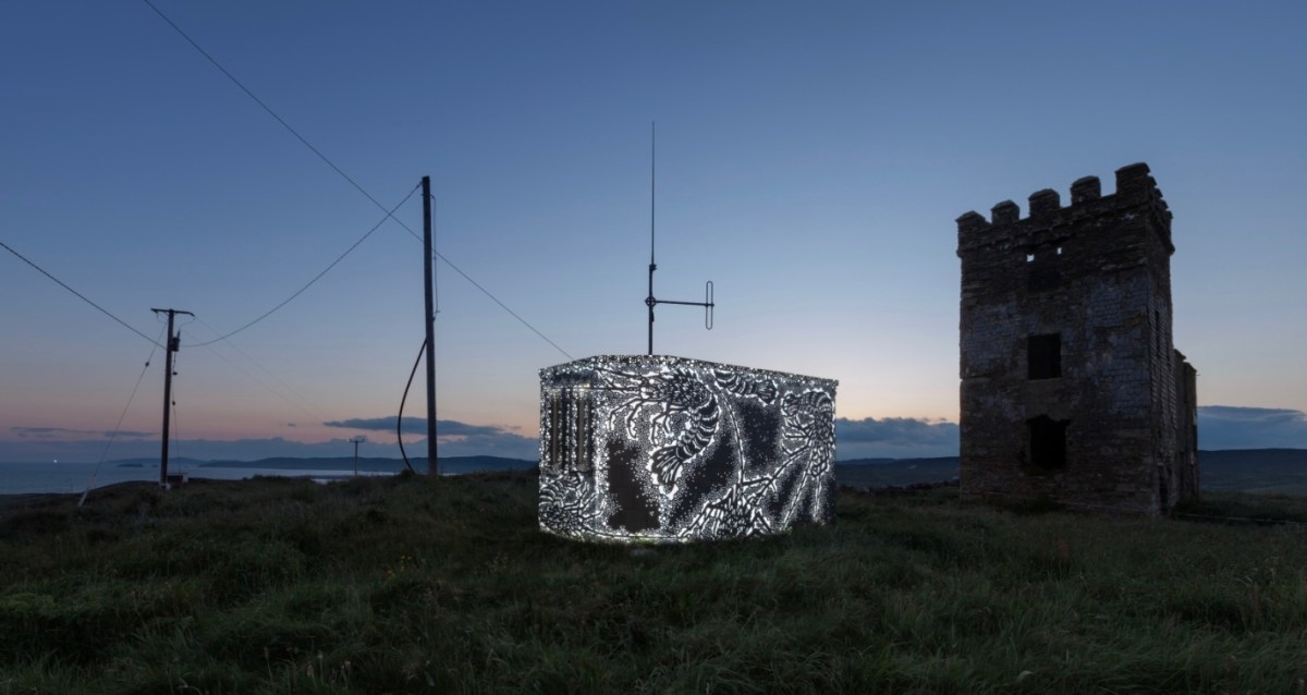
The Stag Rocks can be seen in my picture above, which shows the current incarnation of a World War II Lookout Post that was put in place close by the older signal tower in 1942. You can read more about these lookouts in this post: they were designed by Howard Cooke RIBA of the Irish Office of Public Works at the outbreak of that war (during which Ireland remained neutral). I mentioned in that same previous post an art installation project carried out in 2014 by Tim Schmelzer of Vienna. His work at Toe Head is particularly impressive, and here are some still shots to illustrate the nature of the artworks, which were created on-site using high-powered projection equipment.
The signal tower ruin today is gaunt and desolate. Nevertheless it’s an atmospheric place to visit. On the slopes below the building is an EIRE sign (officially number 28), also dating from the World War II years, when Irish neutrality had to be spelled out to the warring powers flying overhead. I came across an interesting comment from Anne Wilkinson in 2018, giving a slightly different take on the EIRE signs:
. . . These EIRE signs were also to alert German Pilots and crew who were conscientious objectors and who had overflown the UK, to ditch and parachute to safety. Many airmen lived at the Curragh Camp. They were allowed freedom during the day, eg. they often cycled the lanes and roads to enjoy the peace and quiet and then returned to the Curragh Camp for their curfew hour . . .
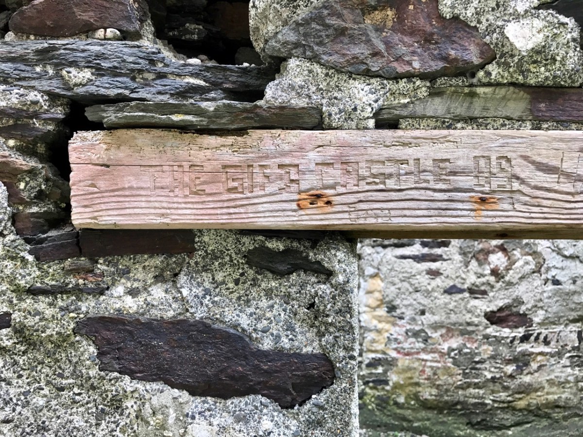
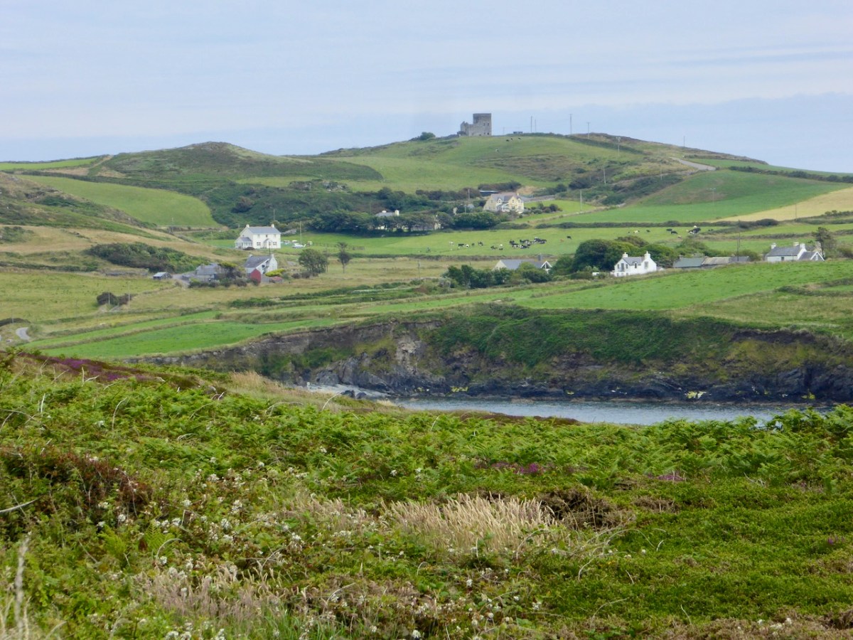
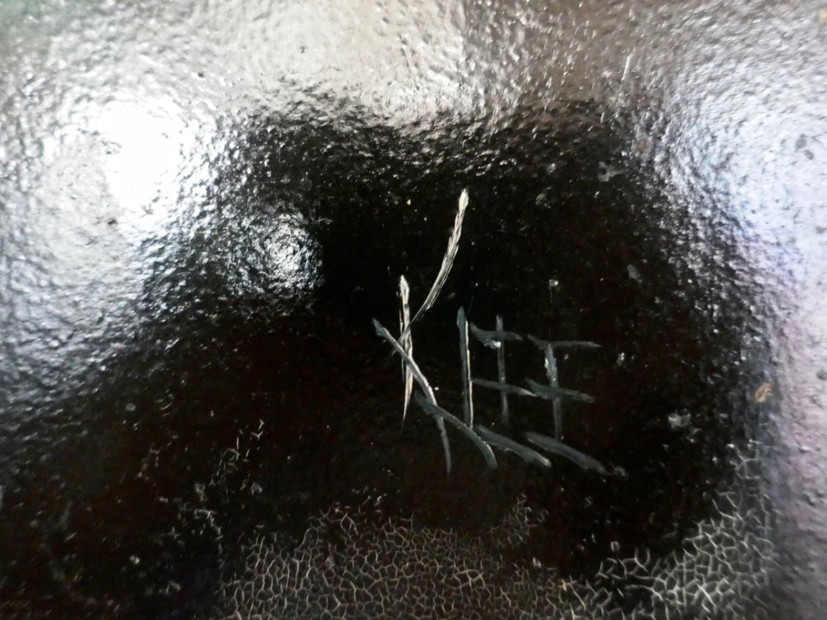
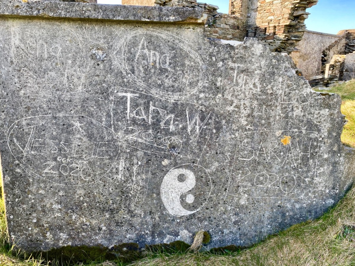
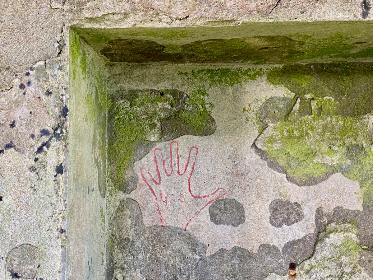
And here’s a little enigma to finish off the post (above). It’s graffiti carved on a timber lintel over one of the openings of the signal tower buildings. It’s probably quite recent – dating from ’89 or’99 – but what does it spell out? And why is it here? It’s tempting to say THE GIFT CASTLE but that ‘T‘ after the GIF doesn’t ring true . . . There’s a story there somewhere: perhaps one of our readers can give us a clue! Finally, here’s a distant view of the signal tower, looking across Toe Head.
The previous posts in this series can be found through these links:
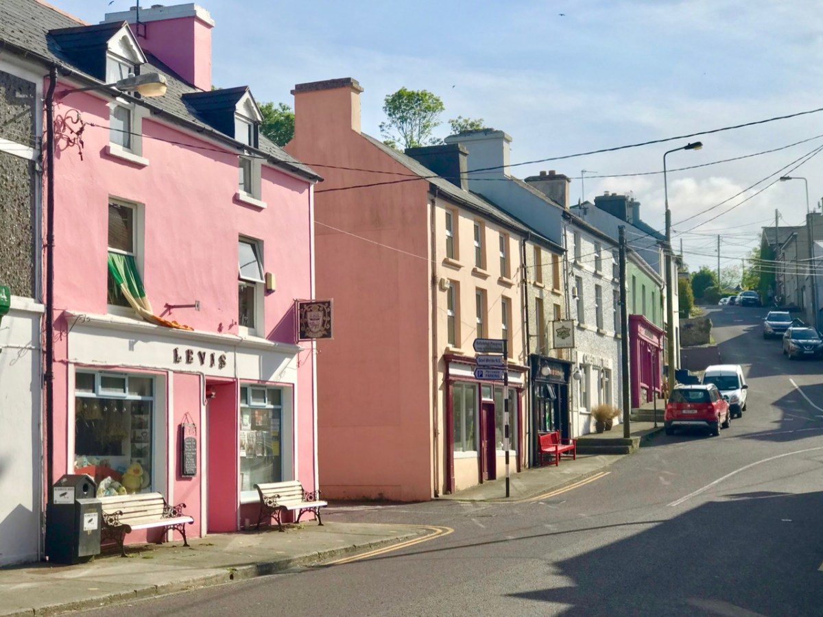
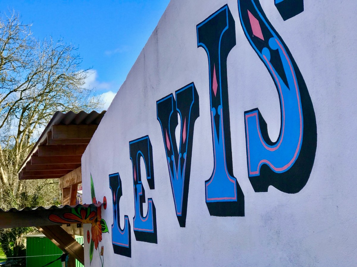
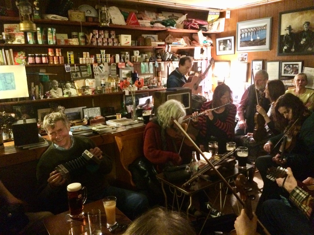
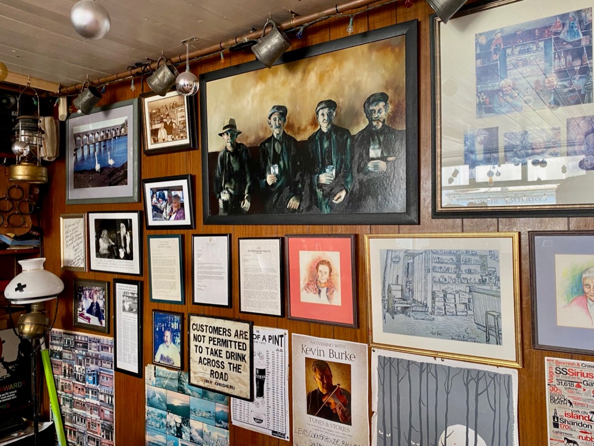
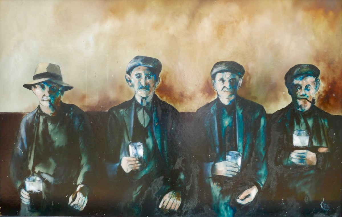
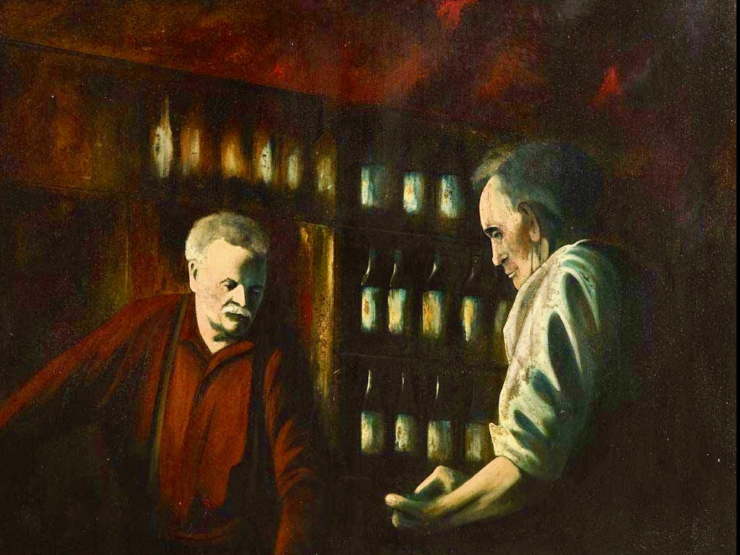
Today there is a story to tell, with lots of connections to the West of Ireland – and our own Ballydehob! That’s Levis’s Corner Bar, below, one of the village’s fine hostelries: try them all if you visit. Levis’s is known for its musical events but also for its traditional appearance inside. Look at the photo of the Irish music session (you’ll see me bottom left playing concertina) – that was taken a few years ago, before Covid; we are still waiting for those good times to return. On the wall behind the players you can catch a glimpse of a painting of men with pints and pipes.
There’s a better view of the painting, above. When I first saw it – very many years ago now – I knew immediately that it was based on a photograph that had been taken by Tómás Ó Muicheartaigh – an Irish cultural hero who spent most of his life documenting traditional life, mainly in the western counties. He lived through the founding of the Irish Free State and was an enthusiastic proponent of the Irish language. This sketch portrait of him is by Seán O’Sullivan, a friend and compatriot:
Way back in the 1970s my then wife and I ran a small bookshop in a Devon market town, specialising in folklore and traditional life. It had a substantial section on Ireland, and Irish culture. We stocked a recently-published volume (1970) celebrating the work of Ó Muicheartaigh, and I very soon had to sell myself a copy, as it is a superb record of mainly rural life in Ireland during the early twentieth century. I have it to this day – of course.
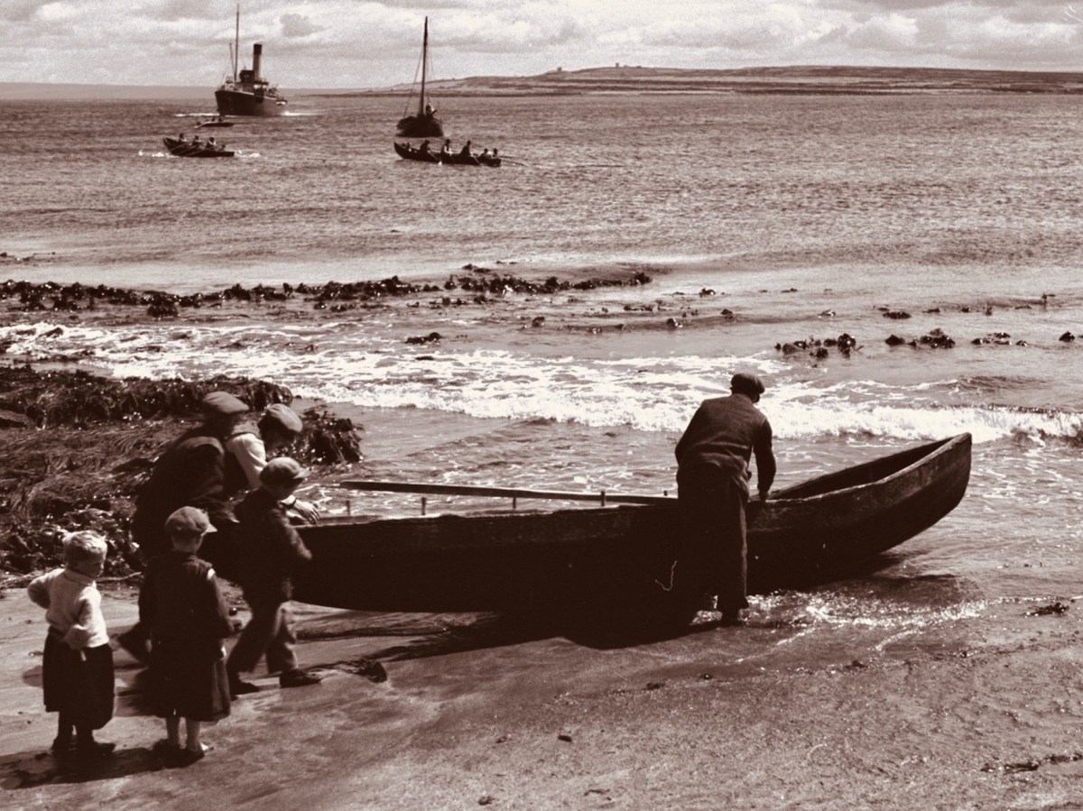
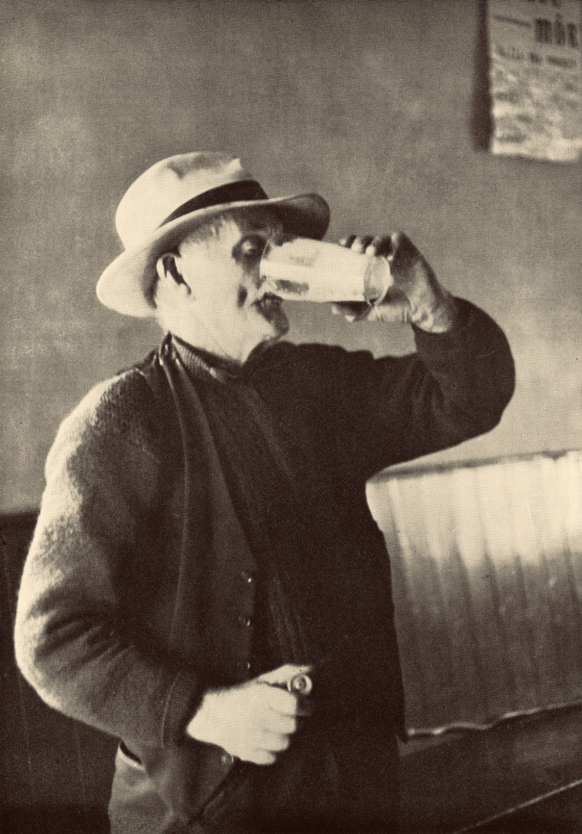
There is the photograph in the book, above. It is captioned Piontí Agus Píopaí – Pints and Pipes, hence the title of this post. Below it is a photograph of two Aran Island fishermen relaxing on the rocks while waiting for the weather to improve before they set out to sea. But there is more – a list of the photographs with some expanded captions at the end of the book. The whole book is written in Irish so I have recruited Finola’s help in providing a transcription for the Pints and Pipes – here it is, in the original and then translated:
Piontí Agus Píopaí
Ceathrar pinsinéirí ag baint spraoi as lá an phinsin le píopa agus le pionta Pórtair. B’fhéidir nach mbeadh pionta go hAoine arís acu. A saol ar fad tugtha ar an bhfarraige acu seo. Féach, cé gur istigh ón ngaoth agus ón aimsir atá an ceathrar go bhfuill an cobhar ar píopa gach duine acu. Is mar chosaint are an ngaoth a bhíodh an cobhar agus chun tobac a spáráil, ach ní bhainfí an cobhar anuas den phíopa instigh ná amuigh
Pints and Pipes
Four pensioners enjoying pension day with pipes and pints of porter. They might not have another pint until Friday. They’ve spent their whole lives on the sea. Look, even though the four of them are inside, away from the wind and the weather, the cover is still on each of their pipes. The covers are to protect the tobacco from the wind and to make it last longer and they aren’t taken off inside nor out
So, a fascinating piece of social history. Apart from conjecturing a date for the photo, I didn’t have much information to add when I first published it on Roaringwater Journal in February 2016. Because of the juxtaposition in the book, I guessed that the picture might have been taken around 1938, when Tómás is known to have visited and photographed the Aran Islands (and would have travelled through Kerry to get there). Here is one of his views of a Curragh being launched on Inis Meáin at this time (Dúchas):
I didn’t expect my story of Pints and Pipes to advance beyond this. But, last week, I received a message from a reader who had seen the photograph in Roaringwater Journal and was able to provide very significant additional information!
. . . My name is Joanne and I live in London. My dad found a photo on your website from a blog dated 14 Feb 2016 entitled Images – it is the Tomás Ó Muircheartaigh photograph of the 4 men drinking in a bar. My great-grandad is the man on the far left. It was great to find the photo as it is much better quality than the copy we have, unfortunately my nan had an original postcard but it was borrowed by a representative of Guinness many years ago and never returned!
Joanne, September 2021
Joanne has proved to be a wonderful contact, and I am so grateful to her for providing information and allowing me to use it here. In summary:
. . . My great-grandad’s name was Seán Mac Gearailt but he was known as Skip. He was from Baile Loisce in Kerry. The photo was taken in a bar which was then called Johnny Frank’s in Baile na nGall (Ballydavid) but I think is now called Tigh TP. I can see from the photos that have been digitalised Tomás Ó Muircheartaigh took a lot of photographs at Baile na nGall. Pints and Pipes isn’t in that digitalised collection . . .
. . . I gave my dad a call tonight and discussed the extract with him; he lived with his grandparents as a child in the late 1940’s/50’s and visited regularly so knows a lot about Skip. Dad remembers him collecting his pension on a Friday at Ballydavid and having a beer in Johnny Frank’s before going home to hand over the rest of the pension to his wife – so the extract in the book is correct on that. Skip was primarily a farmer but dad says he did go out fishing in a curragh at night. Dad remembers his nan being worried for him when he was out at sea. Dad doesn’t know the name of the other men in the photograph. Skip was friends with two Moriarty brothers (from Gallarus) – so dad thinks maybe the two men in the middle are them but he can’t know that for sure . . .
Joanne, September 2021
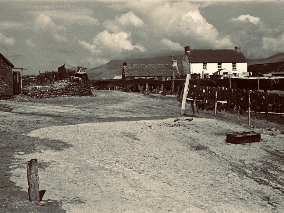
Wow! You can imagine how delighted I was to receive that information. But there’s more. I managed to find some early photos of Ballydavid (Baile na nGall in Irish), which is part of the Corca Dhuibhne Gaeltacht area. In fact we have been there – when we took the Irish language immersion course two years ago.
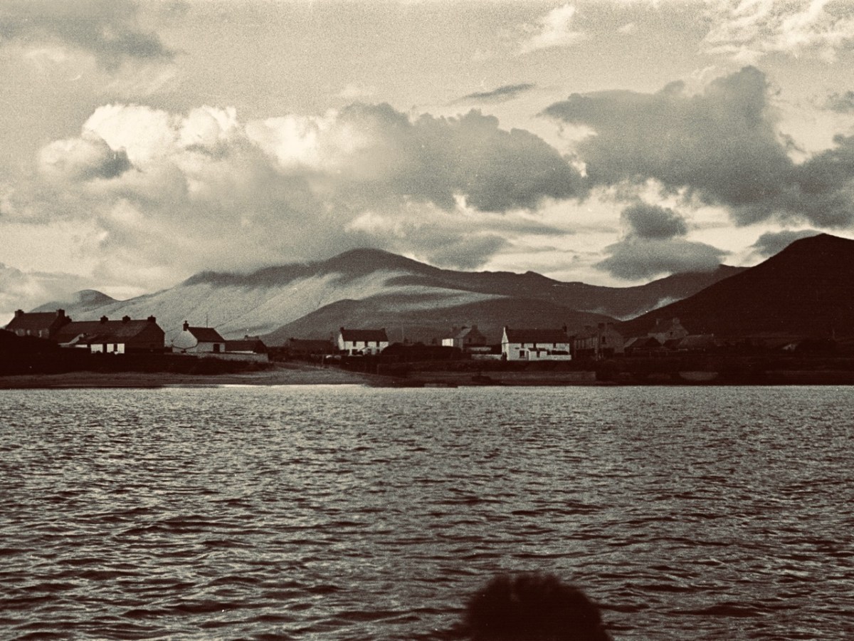
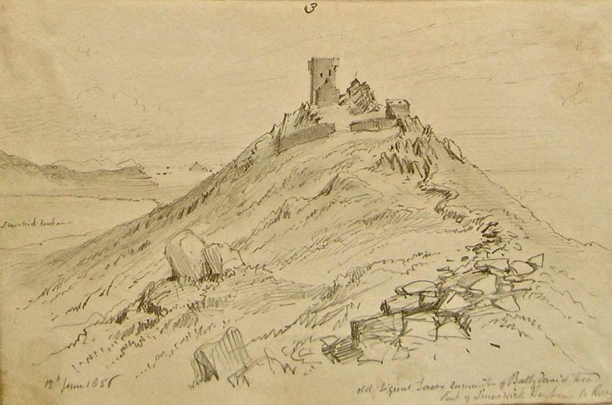
Regular readers will know my interest in the Napoleonic-era signal towers which dot the coast of Ireland, all built in the early years of the 19th century. There was one at Ballydavid Head, drawn (above) by George Victor Du Noyer as he passed by on one of his geological expeditions on 12 June 1856. We didn’t climb the Head when we visited, but we viewed it from a distance (below). The tower is now a ruin.
We have travelled far, far away from Ballydehob where, in some ways, the weaving of this tale began. We had better return. Here’s a reminder of that painted image of the ‘Pints and Pipes’ photograph in Levis’s Corner Bar. Compare it to the header photograph of this post.
It is so obviously based on the Tómás Ó Muicheartaigh portrait, yet there are some differences. The pipes of the two men in the middle are missing! I can’t tell you why this is the case, but I can tell you now who produced the painting, as I was given a valuable link by Joe O’Leary, landlord of Levis’s (which his been in his family for some generations – but that is another story). The painting has a signature:
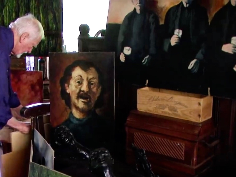
Paul Klee was, of course, a well known Swiss-born German artist who lived between 1879 and 1940: he had no connection whatsoever with Ireland! Nor did he have anything to do with this painting, which was in fact from the brush of Raymond Klee, born in Barry, South Wales, in 1925 but living out much of his later life in Bantry, West Cork, until his death there in 2013. During the 1950s and 60s he lived in the Montmatre artists’ quarter in Paris, and is said to have been a close friend of Pablo Picasso. There can be no doubt that the Levis’s painting is his work, as I came across a short video, taken late in his life, in his Ballylickey Gallery. I managed to ‘freeze’ the fast-moving film at this point:
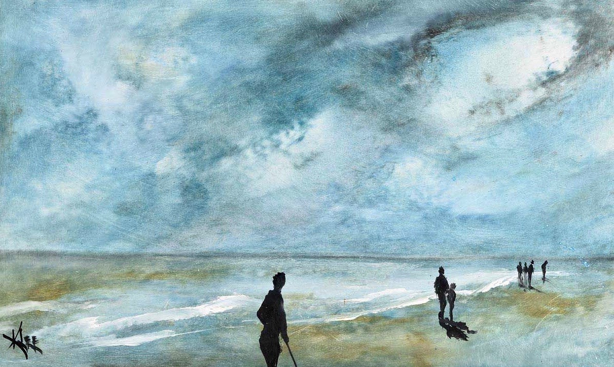
There, you can see the artist himself on the left, and over on the right is the partial image of a huge painting propped up: it’s another version of Pints and Pipes… I wonder what became of it? Or, indeed, of much of the large body of work which he left behind in Ballylickey? You will find examples on the internet, including several from the catalogues of art dealers. He doesn’t seem to have exhibited a particularly consistent style and – by repute – ‘churned out’ some of his works very quickly but – it has to be said – to a willing audience. During tours of the United States he would paint large canvases in front of a crowd – perhaps 200 spectators – and produce work which he immediately sold to the highest bidder in the room! I have selected a couple of images of paintings which might be of interest to my audience. The upper painting is titled The Local, while the lower one is Sky Over Inchydoney.
I must end my tale. Here is a little bonus, especially for my correspondent Joanne – and she won’t see this until she reads this post for the first time. We were leafing through the Tómás Ó Muicheartaigh book; it’s hard to put down – over 300 seminal photographs of Irish life. Finola’s eagle eye picked out one which I had never noticed before – and here it is: Seán Mac Gearailt, Joanne’s Great Grandfather, Skip. The caption underneath is apt. Many thanks, Joanne, for setting me on this journey…
GO mBEIRIMID BEO AR AN AM SEO ARÍS . . .
Thanks go to my very good friend Oliver Nares, who worked on the photographs of Pints and Pipes and Skip for me, and greatly improved their quality. Have look at his own site
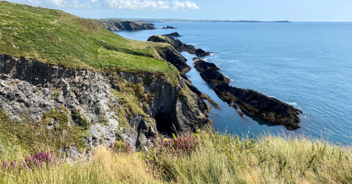
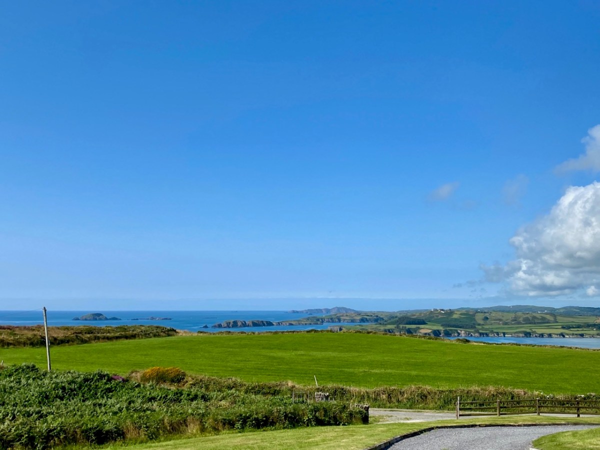
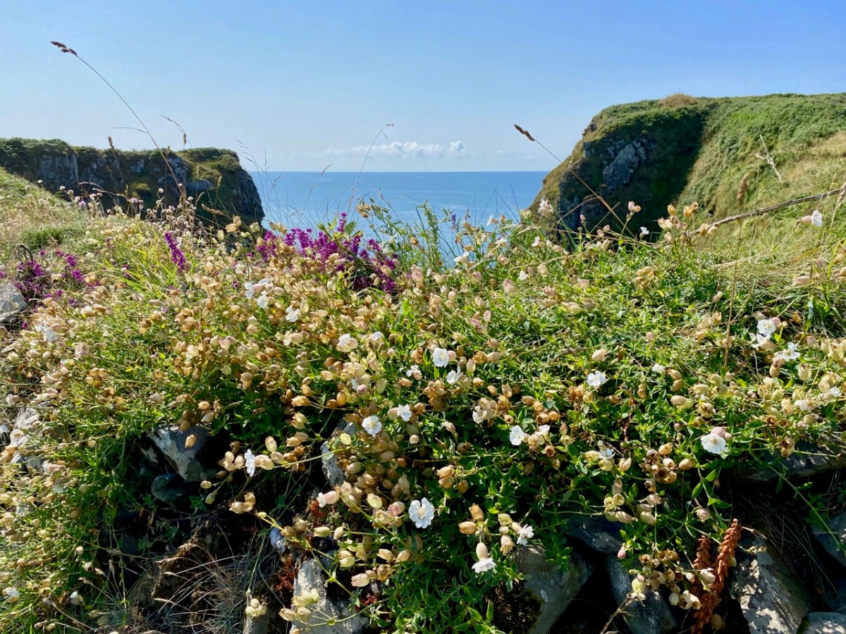
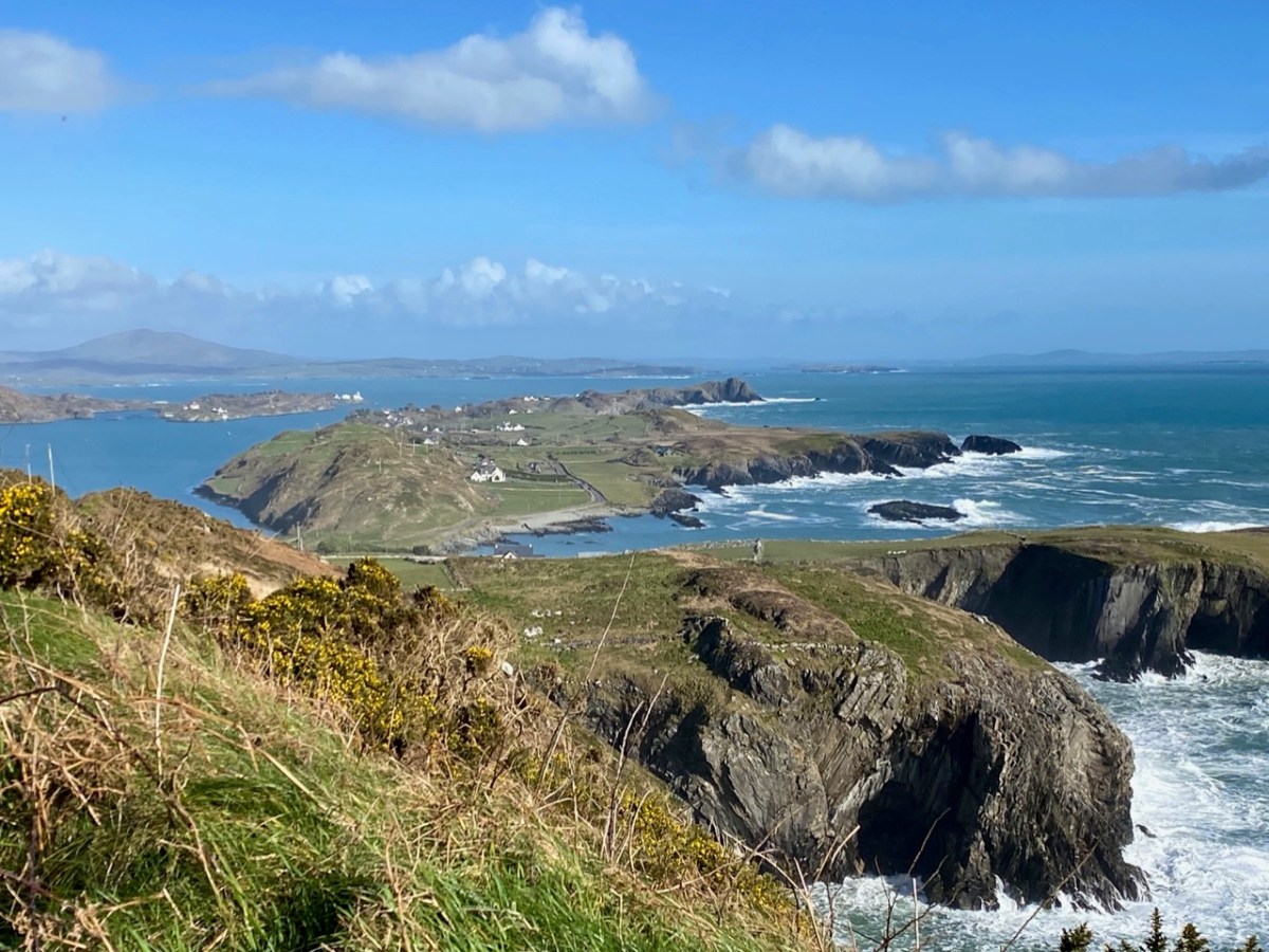
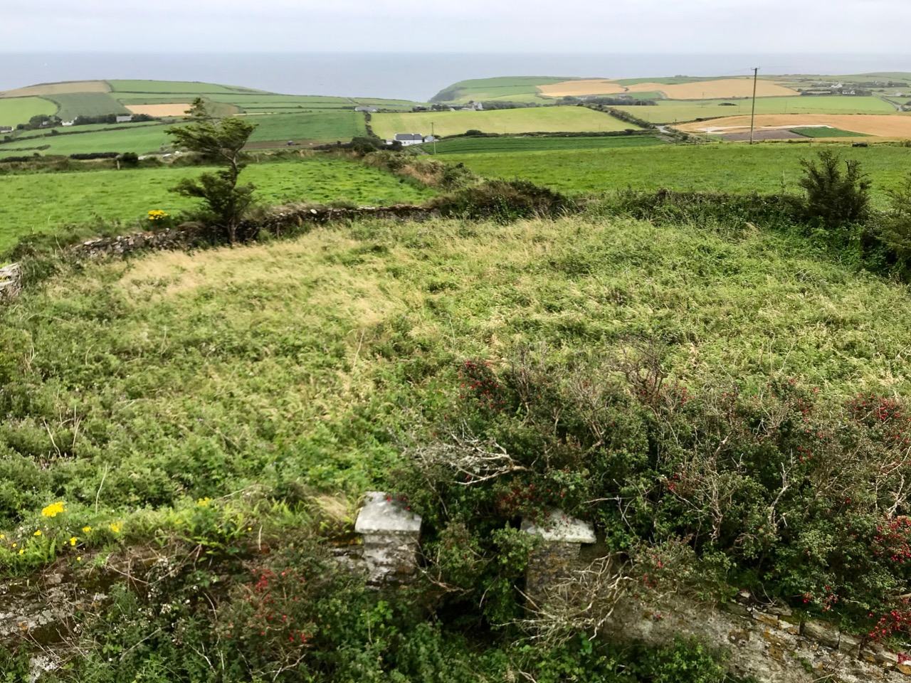
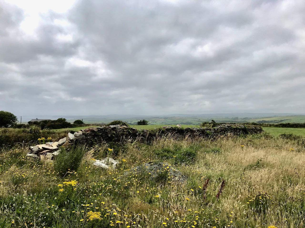
This is a bit of an epilogue to my Signal Success in Irish Engineering series (although that is not yet complete!). Here is the site of a Napoleonic-era Signal Tower in West Cork – but the tower itself has completely vanished! It’s no 28 on the map which accompanies Bill Clements’ book – Billy Pitt Had Them Built – Napoleonic Towers in Ireland (The Holliwell Press 2013) and it is given the name Glandore Head. We recently visited friends who have a house in the townland of Reenogrena, which is south-east of the village of Glandore and its extensive natural harbour. The topography of the area is soul-stirring – that’s probably an understatement: look at the view of the coastline there, above, and the distant views both west and east, below.
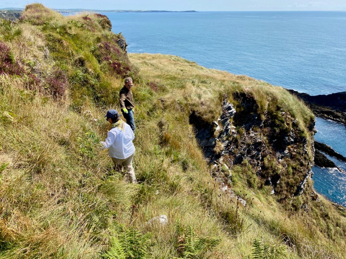
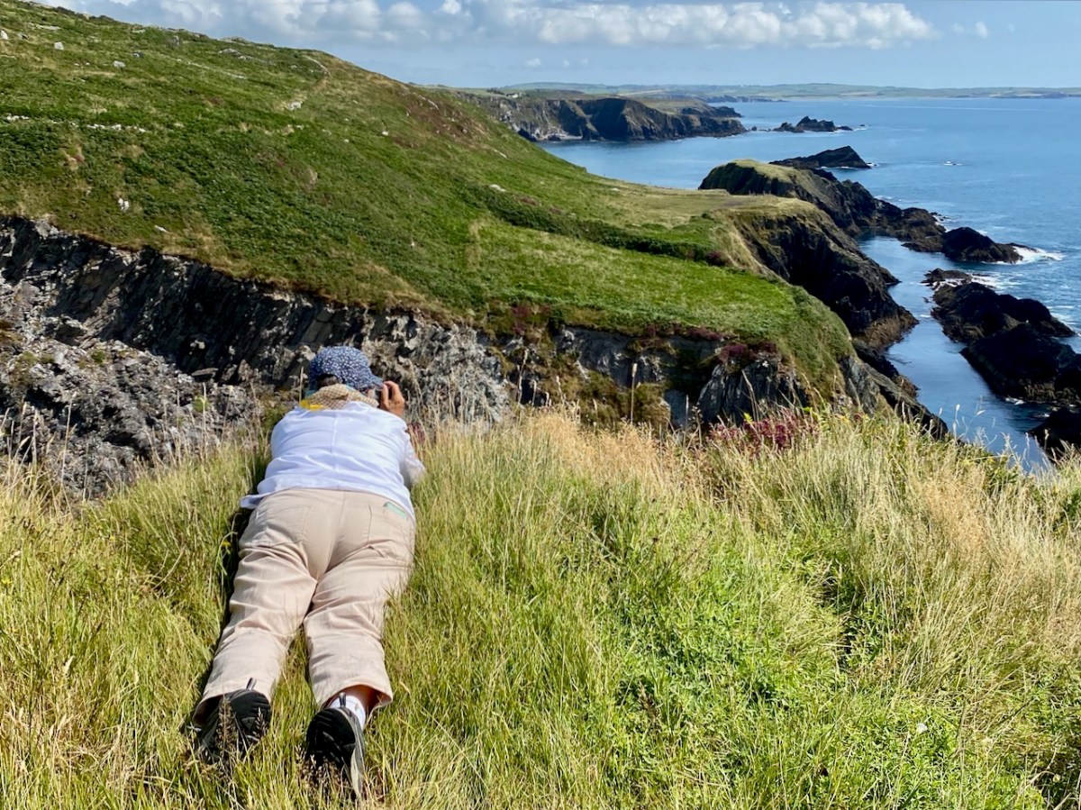
We were fortunate with the day we had. The benign weather gave us a possibly false sense of security as we explored a wild, riven coastline. We could well imagine how exposed we might feel there in one of West Cork’s severe storms: our climate-changing extremes are becoming ever more prevalent. But on this occasion we were confident enough to venture to the very edges of the land, always conscious that humans had settled in these remote places many generations before us.
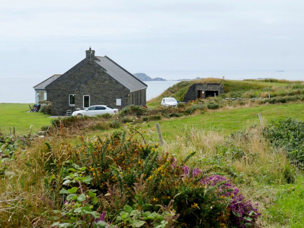
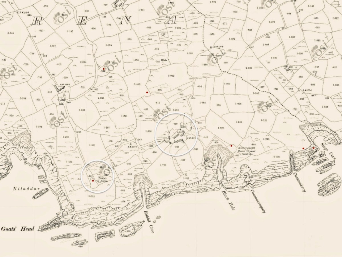
There is nothing left of the signal tower at Glandore Head, which would have been constructed between 1801 and 1804. The site has now been taken over by a recently built house which enjoys the excellent views in all directions. In the picture below it seems that the tower was located in the area of the earth-sheltered garage. We know more or less where it was because it appears on the earliest Ordnance Survey maps from around 1840. Even by then the structure itself had lost its original function, as the threat of Napoleonic invasion had passed, but it is labelled as a ‘Telegraph’. On the later 25″ map – dating from the late 1800s – the site is marked as ‘Tower in ruins’.
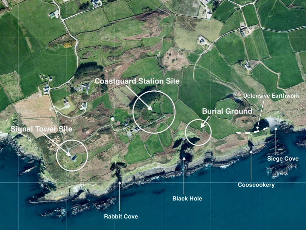
Centre – the earliest 6″ OS map; lower – the later – and far more detailed – 25″ OS map. It’s interesting to compare the two versions. The accuracy of the later map in terms of topographical detail and humanly constructed features – buildings, trackways etc is very noticeable. Below is the contemporary aerial view. 50 years separate the two OS maps, while the satellite image is 100 years later again.
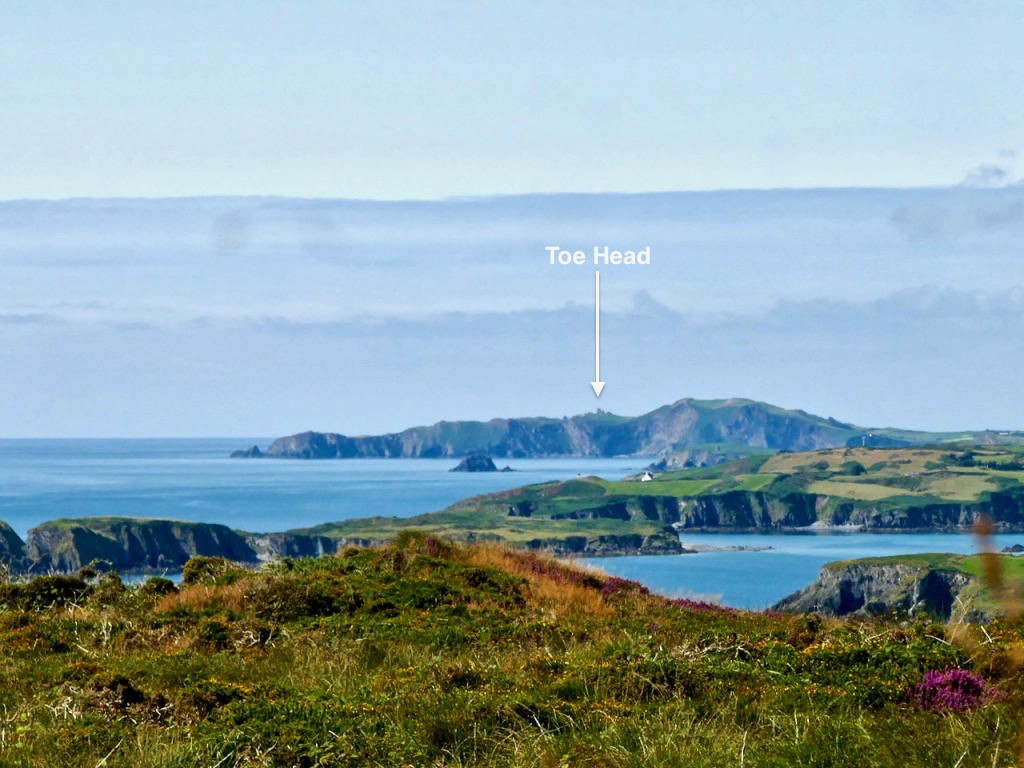
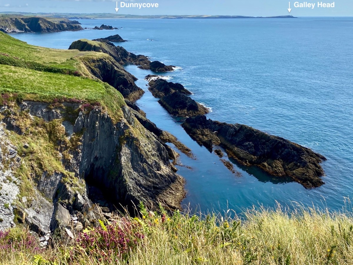
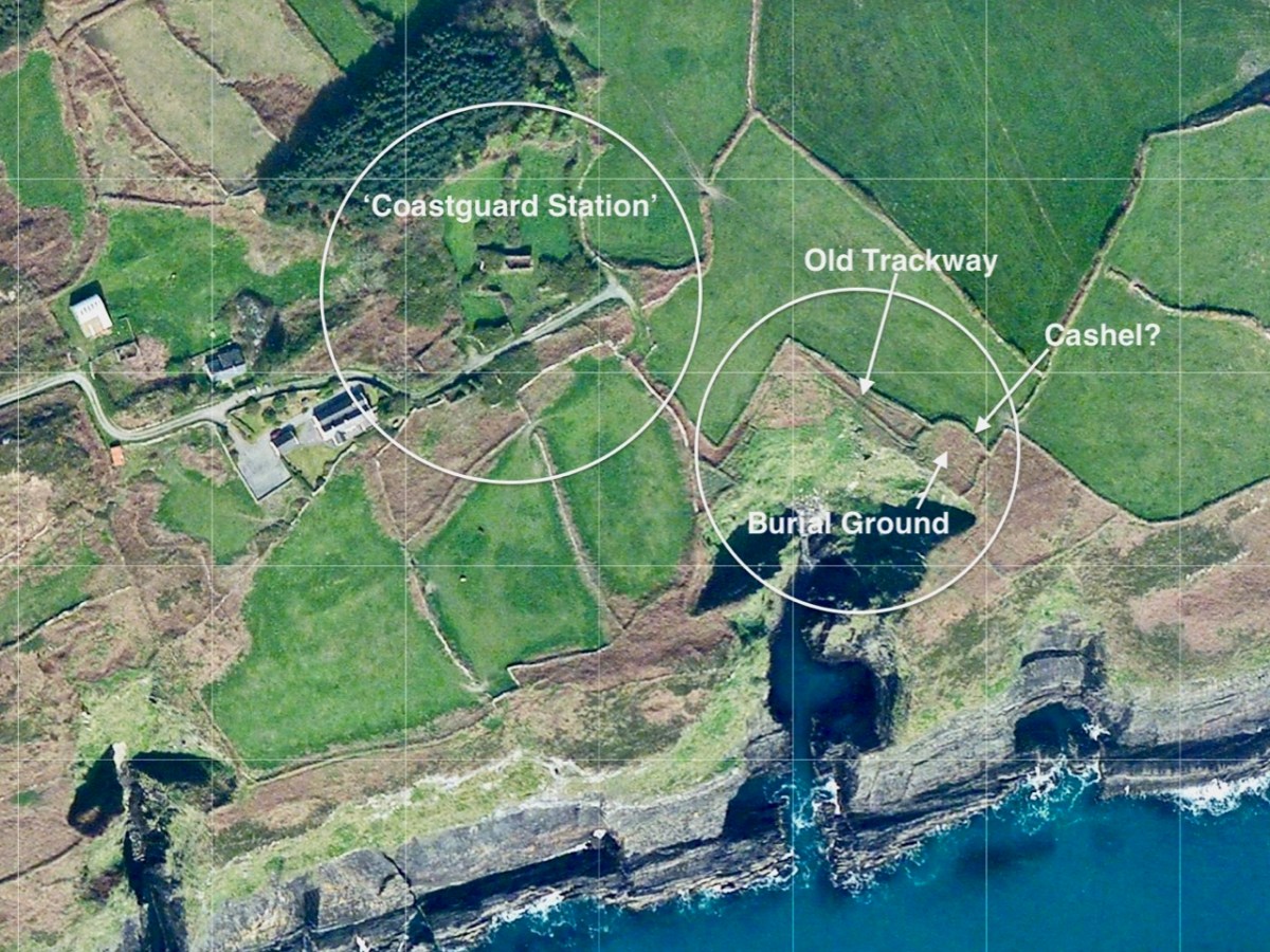
The reason why I like to examine and compare the mapped information is my interest in reading the history of a place through its landscape, and this particular vignette of West Cork is a prime example of the process. Firstly, the signal tower location was chosen because of visibility to other significant places on the coastline which are in view: the towers at Toe Head to the west and Galley Head (Dunnycove) to the east (below).
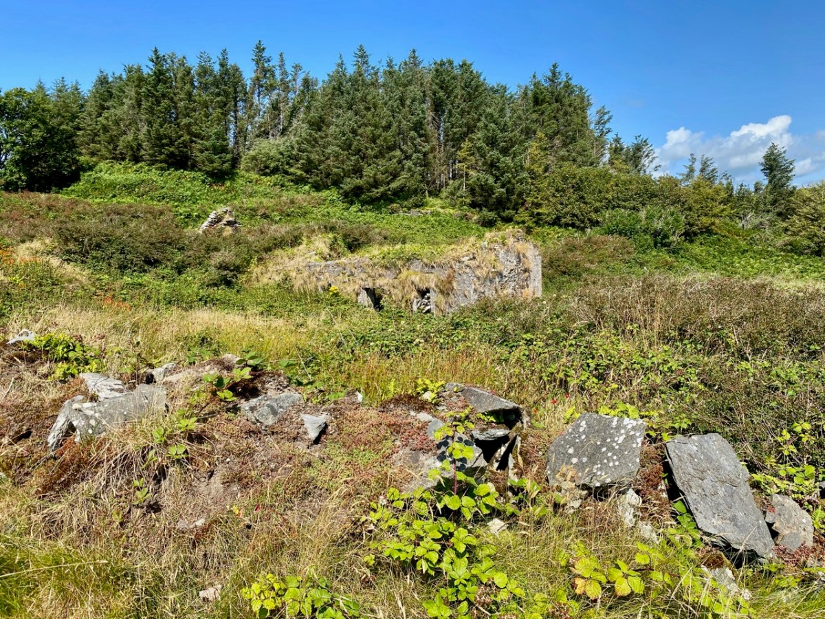
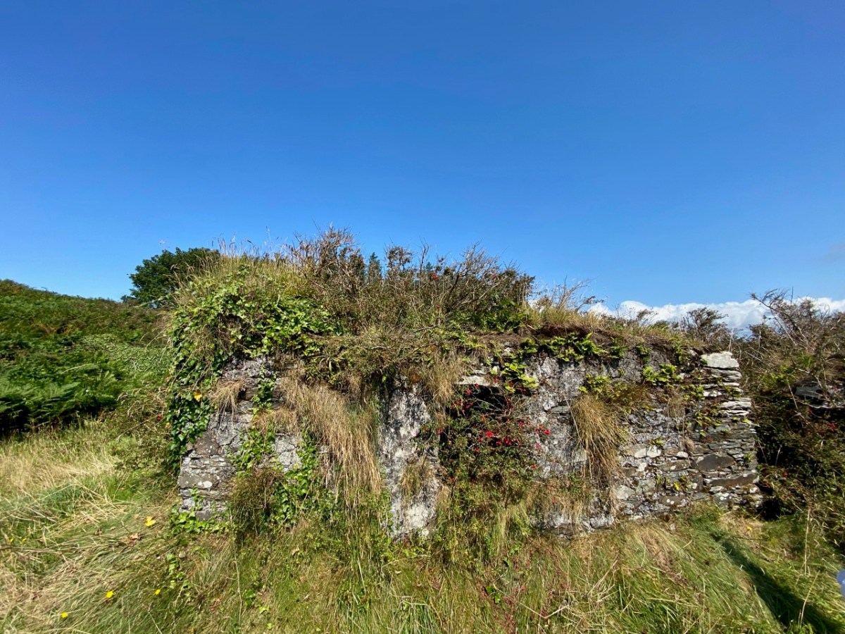
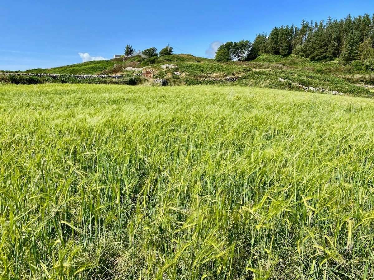
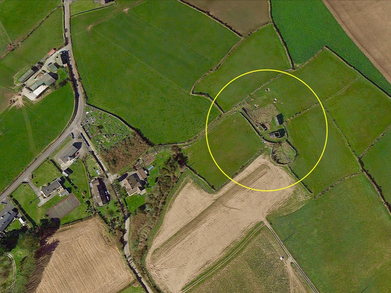
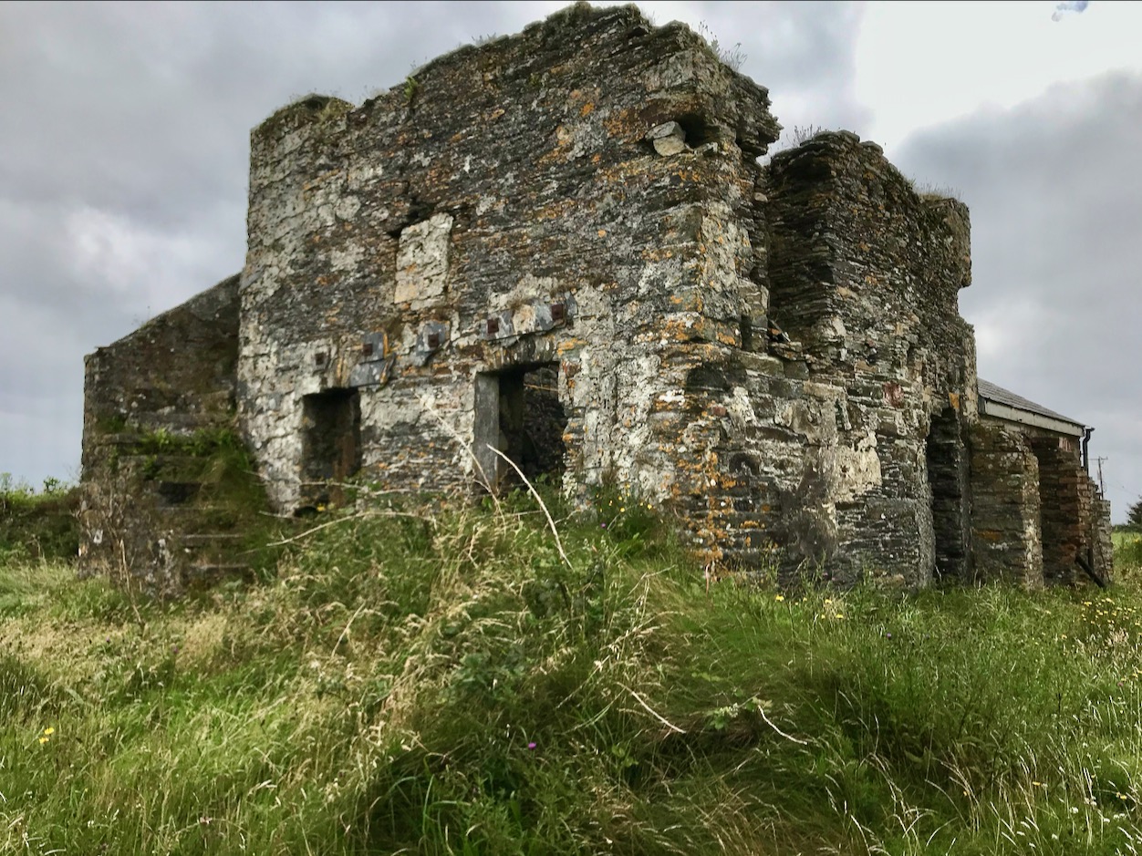
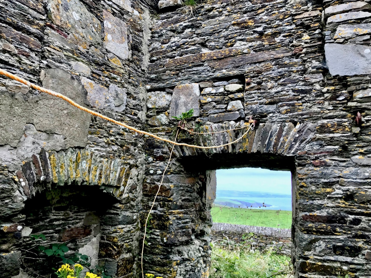
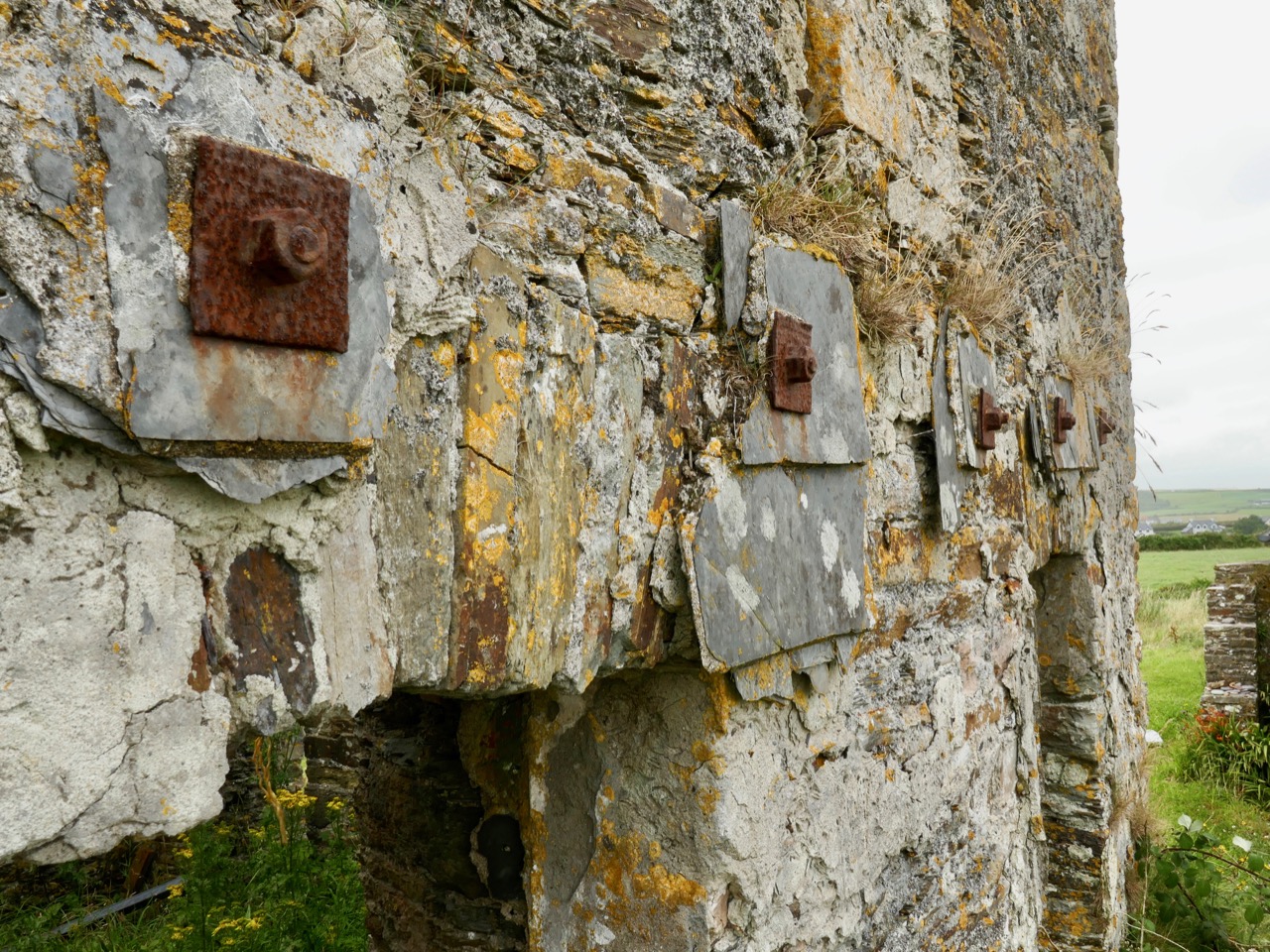
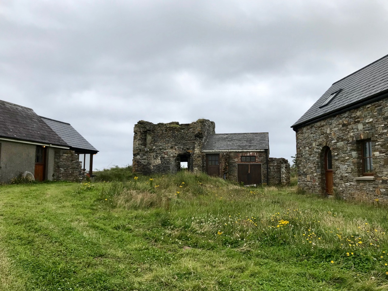
Next, look at the ‘Coastguard Station’ site. This is marked on the c1840 OS map, but not on the later 25″ map. But that later map does show a number of buildings on that site. As you can see from the aerial view, there are only the remnants of buildings now. Also the older map shows no roadway or track accessing the ‘Coastguard Station’ – it could only be reached by crossing fields. Here’s a closer look at this group of ruined buildings today, followed by some of our photos.
While it is likely that there are old coastguard buildings amongst these ruins, it seemed to us equally possible that we were also looking at the earlier remains of a settlement – cottages and cabins. Records of the area are scant. There’s nothing we found – apart from the OS maps – to give any further light on what we were scrutinising. Surprisingly, very little information is available on the early years of the Irish Coast Guard service, other than its establishment as the Water Guard, or ‘Preventative Boat Service’ in 1809, initially under Navy control but from 1822 part of the Board of Customs. From this we might assume that its purpose was to intercept smuggling operations, rather than to give any assistance to seafarers. Incidentally, it is important to note that in Ireland the name has always been two words: Coast Guard.
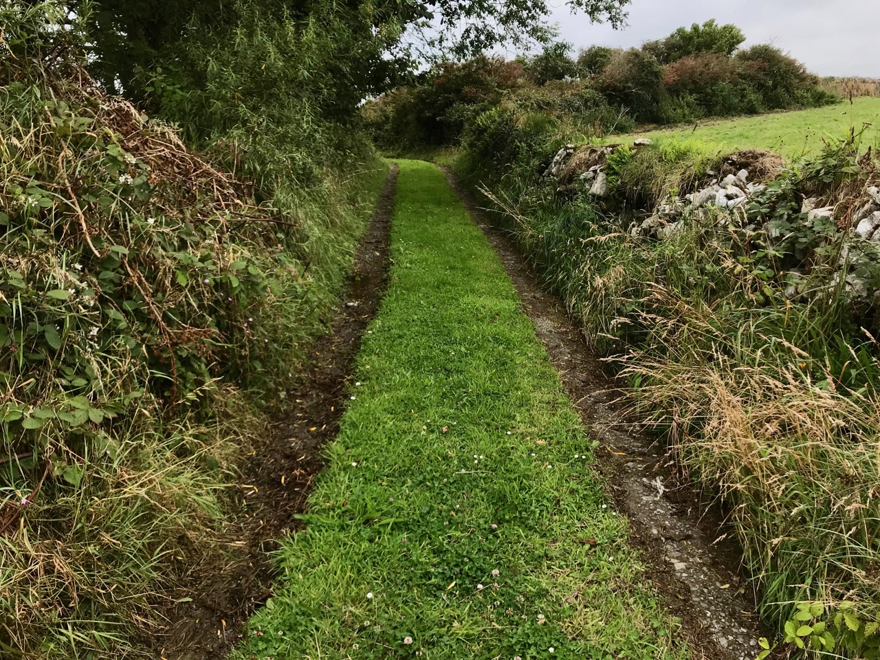
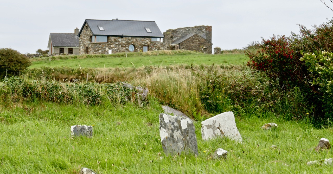
It’s easy to see that this hostile coastline – which would not be benign to small fishing boats – would nevertheless attract subversive landings. The only nearby access to the water is Siege Cove, to the east of the Coast Guard site. The upper photo depicts the curiously named Cooscookery inlet – not a good landing point, while the lower is Siege Cove – itself a difficult climb to the fields from sea level. The names of the topographical features would be a good study in themselves – and might reveal some hidden history: Coosnacragaty, Black Hole, Rabbit Cove, and Niladdar. The small burial ground is known as Kilcarrignagat (it means the ‘church at the rock of the cat’). That’s the overgrown trackway leading to it, below. It is of particular interest – partly because you wonder what communities it served, but also because it seems to have been established in a previously existing ring-fort or cashel.
Further yet to the east, and directly above Siege Cove, are the distinct remains of a defensive structure, partly taking in natural outcrops but also built up with stone. This is likely to be indications of the first habitation in this area – perhaps a thousand years ago. There seems to be at least one promontory fort here, and Finola will take up that subject in this locality in future posts (she has already tackled examples elsewhere). It seems to me that this whole coastal region would be worthy of a detailed archaeological study – UCC take note! Meanwhile, we can only express our gratitude to friends Michael and Jane for introducing us to the many wonders of their own territory.
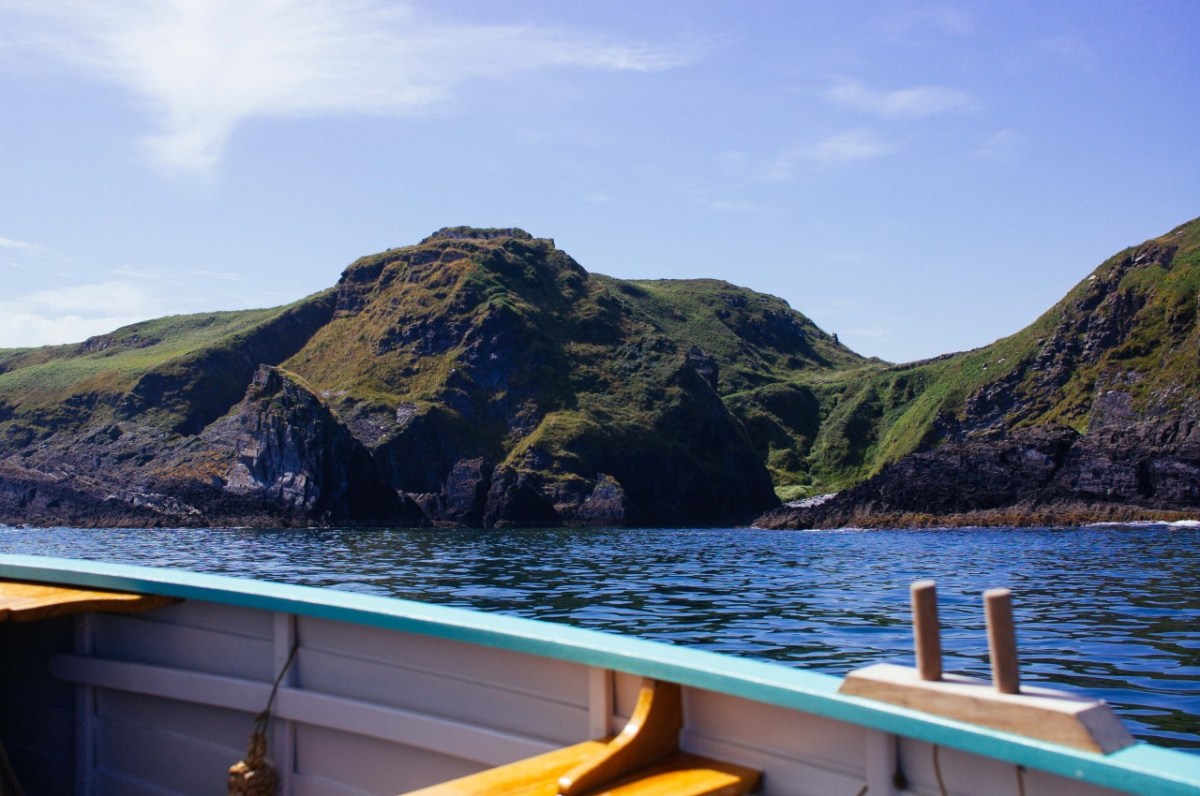
Addendum: After I had published this post I discovered an excellent photograph of Siege Cove and the coastline in this area taken from the sea. I cannot find a contact for the photographer. I do know his name is Tim, and that he publishes an occasional diary of his journeys in a boat (an Ilur based, I believe, In Glandore). I hope he won’t mind me publishing this and including a link to his website.
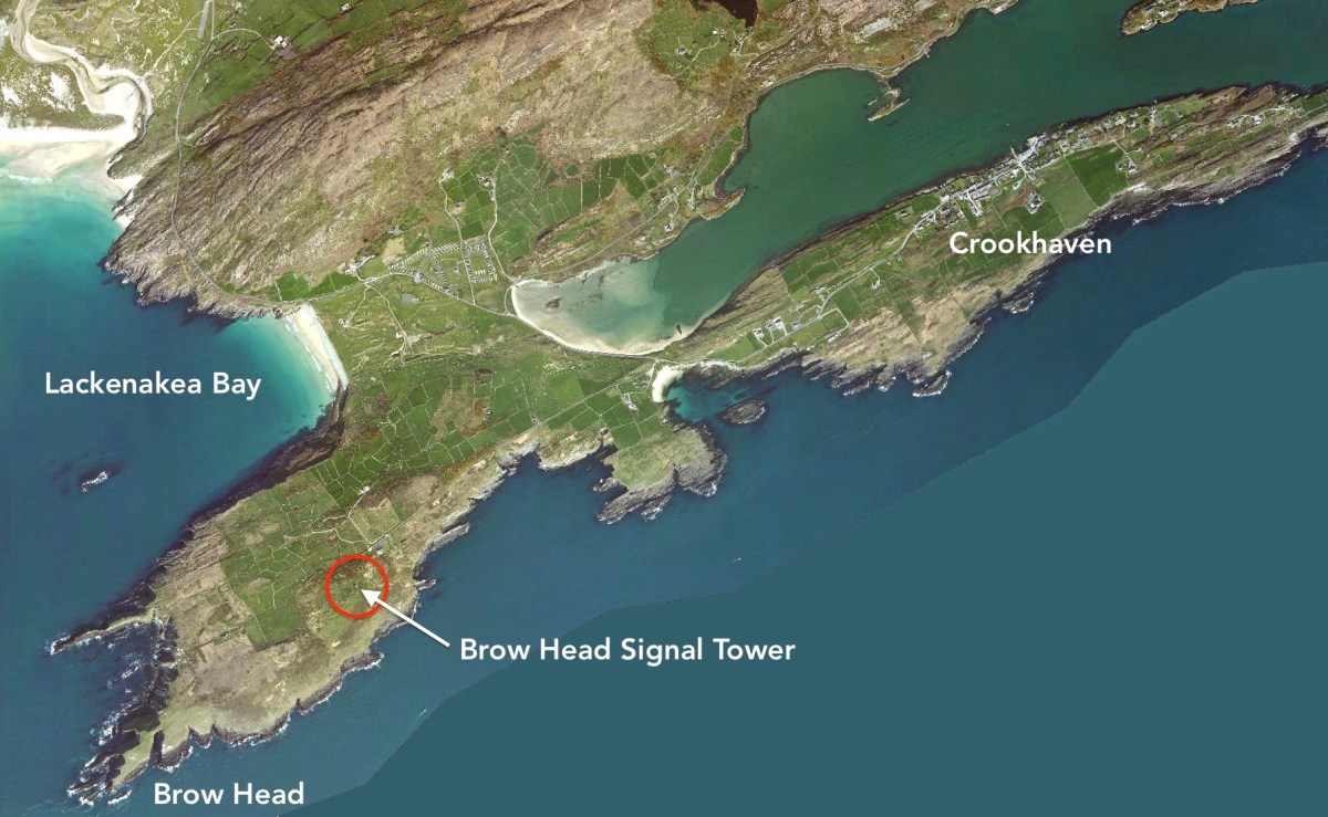
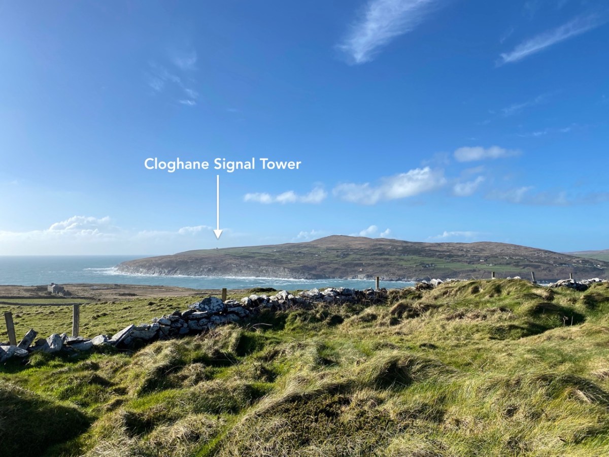
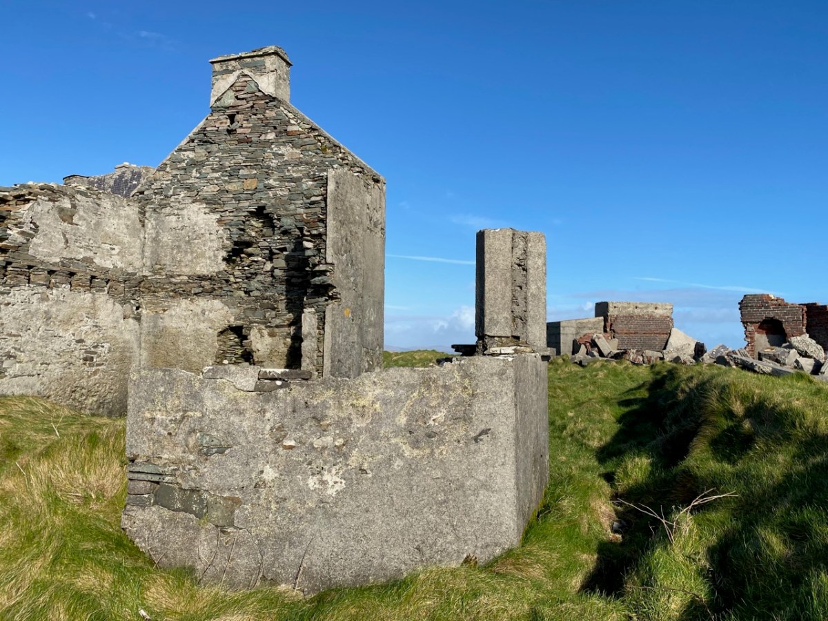
It’s surprising that it’s taken us eight episodes of this series to reach Brow Head, as it is one of the nearest to us, and one of the best preserved – albeit a ruin. It’s not far from the last one we explored: Cloghane, on Mizen Head. In fact, at 3.8km apart, these two towers are the closest of any in the whole system of signal towers around much of the coast of Ireland: 81 towers, each one generally in sight of two others.
Above – views north-west across to Cloghane, Mizen Head, from Brow Head. The lower photo is taken with a long lens. Cloghane is 3.8km away from Brow Head: it doesn’t sound very far but, as you can see from the centre picture here, it’s remarkable that telescopes were good enough, in the early 19th century, to make out visual signals in any great detail. Weather conditions were obviously an important factor in this. Below, the tower at Knock, Lowertown, near Schull, is some 19km away to the east. When we visited the vestigial Ballyroon signal tower, on the Sheep’s Head to the north, we could also clearly see across to Brow Head – a distance of about 17km.
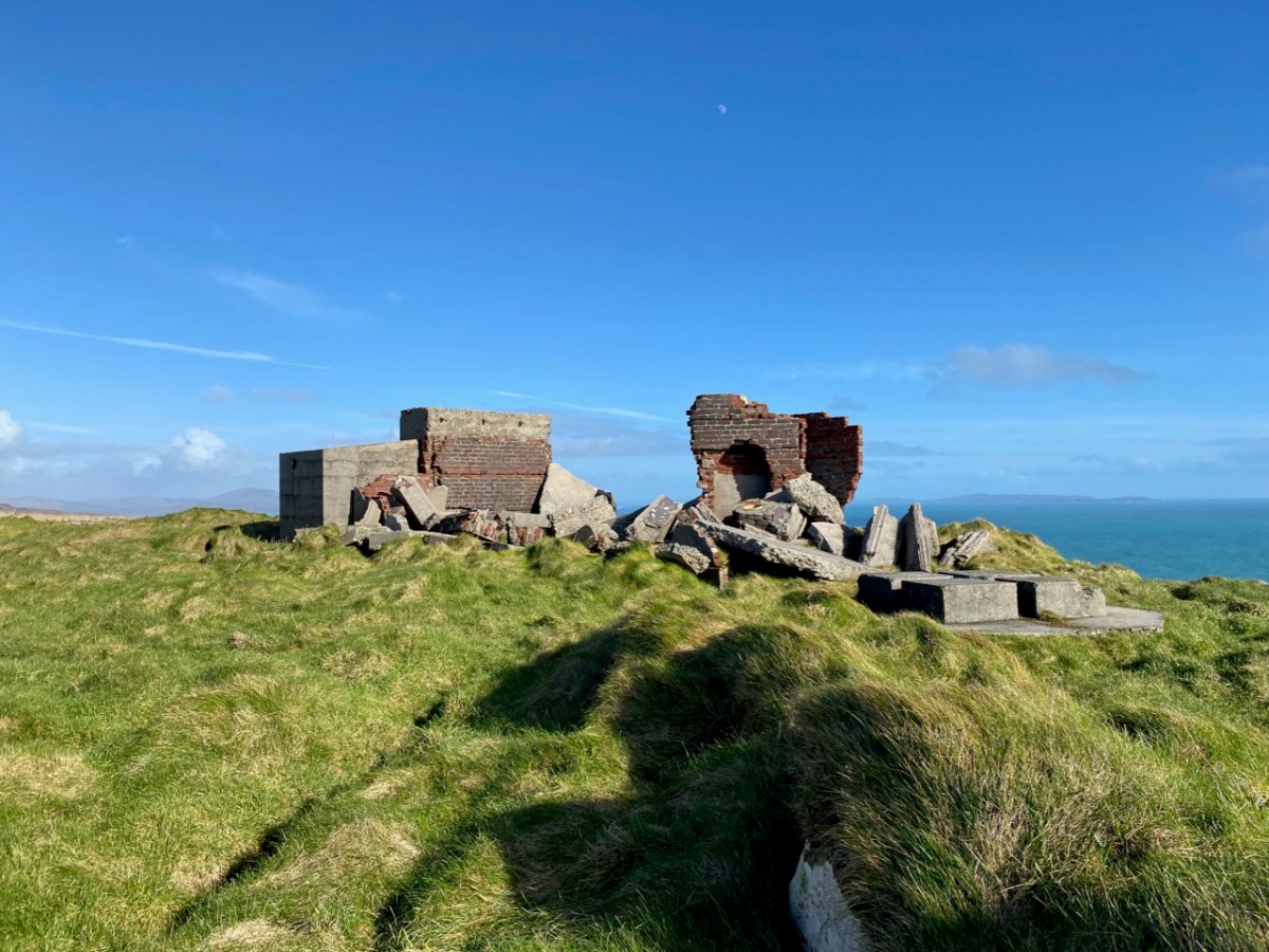
Brow Head – the headland itself – has been the subject of a previous post on Roaringwater Journal. It has a remarkably diverse history: not only is it the site of the Napoleonic-era signal tower, but of industrial and scientific activity. There are the substantial remains of a nineteenth century copper mine (photo above): I noted that the Mine Captain here was Hugh Harris from Cornwall – and wondered if he was a relation – until I read that he was dismissed as ...an incompetent authority…! Most interesting, perhaps, are the ruins of a signalling station set up by Guglielmo Marconi – established in 1901.
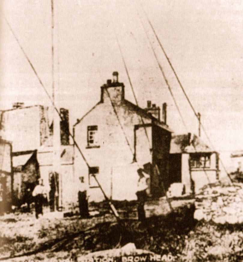
This photograph was taken in 1914. It shows the Marconi installation still in use: the signal tower is visible in the background, on the left. On the far right is a building which I take to be the electricity generating station, powering the telegraph. During the Emergency (1939 – 1945), a lookout emplacement was built to the south of the Marconi station: many of these were built around the coast, the majority sharing a site with a Napoleonic-era tower. Have a look here for more information on these comparatively recent structures.
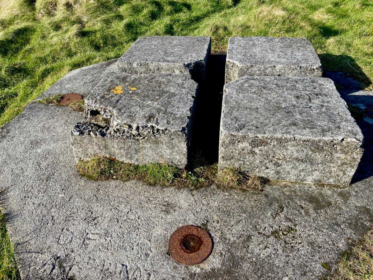
For this excellent drone picture of the Brow Head site, taken in 2017, I am most indebted to Jennifer & James Hamilton, mvdirona.com. Jennifer and James are intrepid adventurers, travelling around the world on their Nordhavn52 vessel. It’s well worth going to their website to see what they get up to: it makes our own travels in the West of Ireland seem a little humdrum… On the right of the photo is the 1804 signal tower; on the left is the Marconi station with – just in front of it – all that is left of the 1939-45 lookout post. On the right in the foreground is the generating station shown in the present day photo, below. Note, also, in all these images can be seen the four-block supporting base for the Marconi transmission mast.
What happened to these buildings? Here’s an account I received from a RWJ correspondent (very many thanks, Rachel), after I had published an earlier post on them in 2014 – it is based on contemporary newspaper articles during the Irish War of Independence:
. . . Brow Head was destroyed on the 21st August 1920 at 12:45 – 1am, having been raided less than 2 weeks earlier on the 9th August. All reports mention the use of fire; only some mention the use of bombs. Explosives had, however, been stolen during the earlier raid on Brow Head (they were used for fog-signalling). Due to delays in reporting, some articles suggest different dates for these events but I’m fairly sure the 9th and 21st of August are the correct ones. 9th August: Armed and masked men raid the station and take stores of explosives, ammunition, and rifles. There are conflicting reports over whether any wireless equipment was taken during this raid. 21st August: Reports that all buildings at Brow Head (war signal station, post office, coastguard) destroyed, either by fire, or fire and bombs depending on the article. Some reports say 40 men were involved, some 70, some 150, some 150-200. These men had masks and were armed with revolvers to cover the three or four guards, they were described as young and courteous. The raid is said to have taken 5 hours; all Post Office equipment was taken away, as well as other stores. Other wireless equipment was smashed. The raiders helped the guards move their furniture/belongings out before setting fire to the buildings . . .
Rachel Barrett
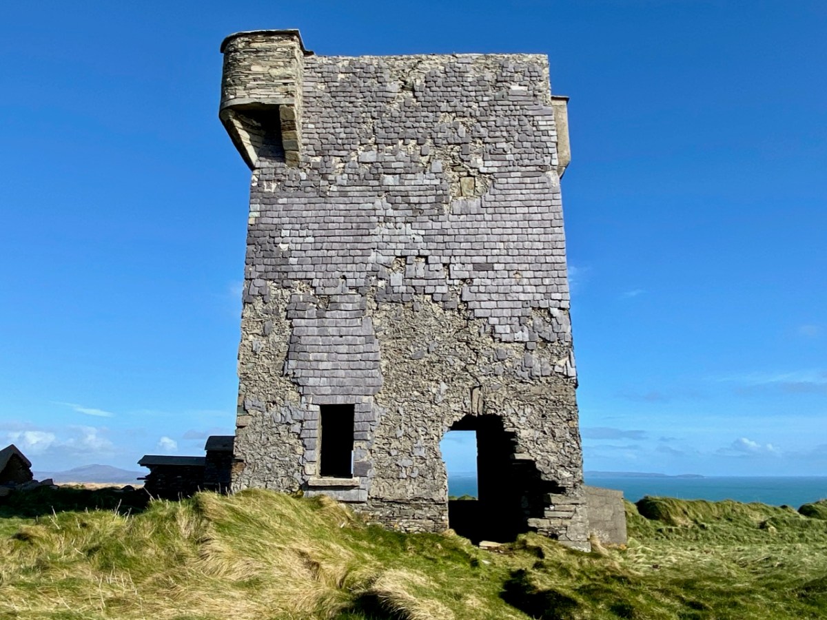
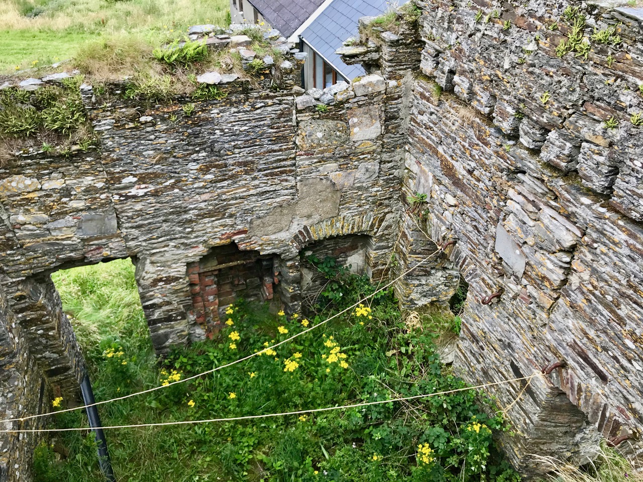
So far we haven’t said much about the 1804 signal tower itself. Although ruined, it is a good example, reasonably stable, and has survived two centuries of severe Atlantic gales remarkably well. All the elements are recognisable: projecting bartizans, slate hung external walls for improved weatherproofing, an intact roof and distinct internal features – and a little enigmatic graffitti. Compare all these with the other towers in our series so far (there are links at the end).
If you set out to visit the Brow Head site on a good day, you can’t do better than to park at Galley Cove – at the bottom of the long, steep access road (and beside the Marconi commemoration board and sculpture by Susan O’Toole) – and then walk up. You will enjoy continuously changing spectacular views in all directions, and you will begin to see the signal tower above you as you approach the brow of Brow Head.
West Cork based artist Brian Lalor visited the Brow Head site with the Mizen Field Club in 1984. His sketch of the buildings is an interesting record as it appears to show, on the left, the 1939-45 lookout post intact (below). Very little remains now, 37 years later (lower). I wonder what led to this particular piece of destruction?
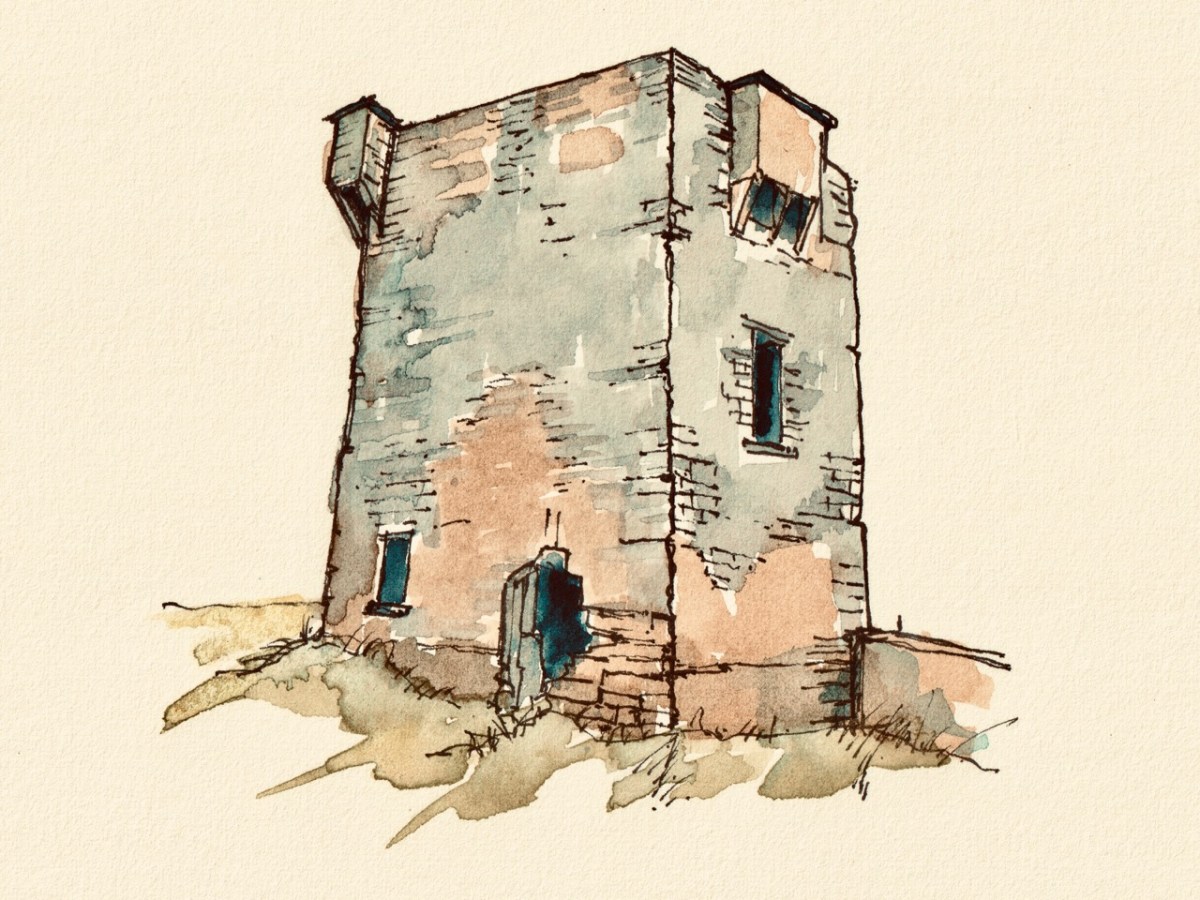
I’ll finish off with another sketch view of the Brow Head signal tower: this is by Peter Clarke, who runs the excellent Hikelines site. Many thanks, Peter.
The previous posts in this series can be found through these links:
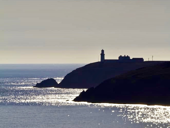
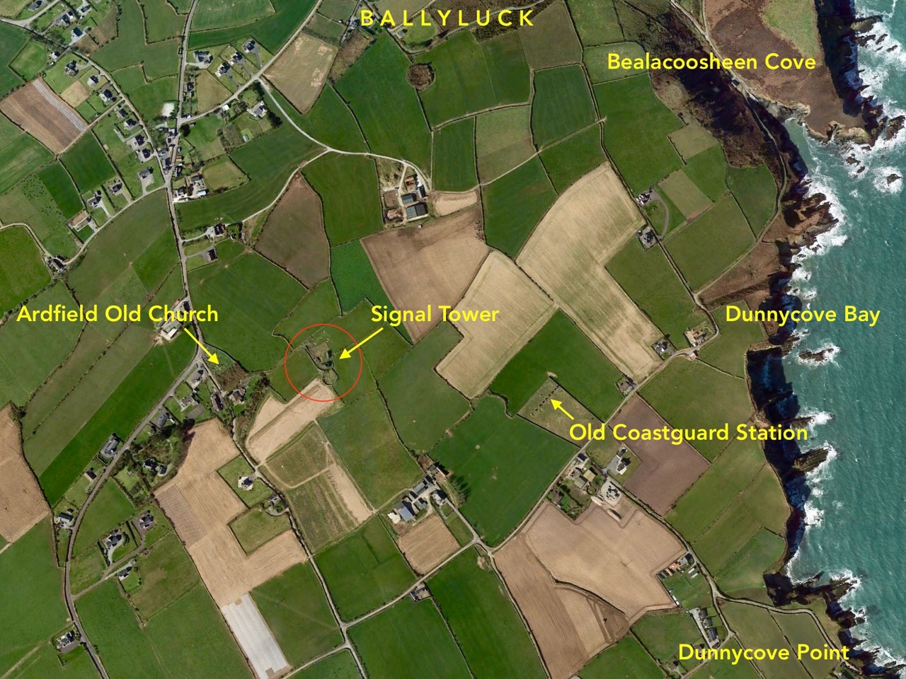
Galley Head, in West Cork, is one of those wild and exposed headlands where you get exceptional views in all directions. In our hunt for Napoleonic-era signal towers on the Irish coast you would fully expect to find one of the towers here – but no! A lighthouse and lightkeepers’ cottages – yes. These date from around 1875 but, in the early years of the nineteenth century, the strategically important signal tower was built inland, in the nearby townland of Dunnycove.
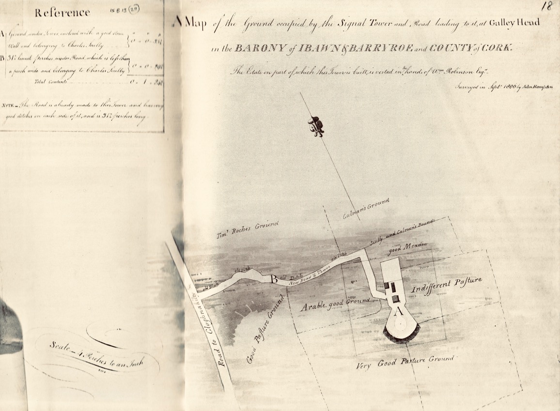
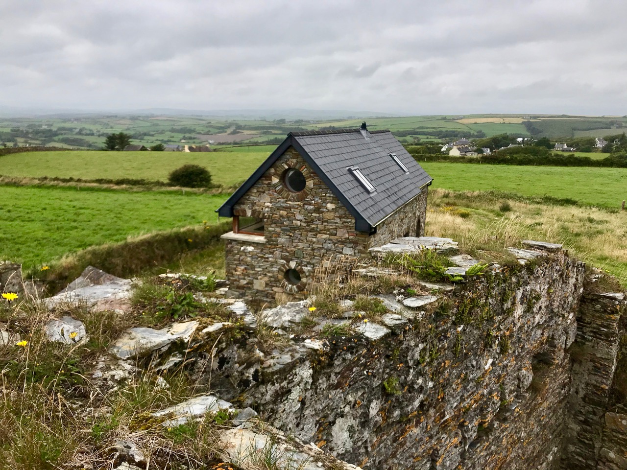
The header picture shows what remains of the tower itself today. This has in fact been adapted over the years, and the original building conformed to the square tower pattern that we have investigated elsewhere (a good example is at the old Head of Kinsale). The upper picture (above) shows the lighthouse at Galley Head seen from high ground to the east, while the lower picture is an aerial view of the Dunnycove signal tower site in its wider surroundings. Below is an 1806 map of the ‘. . . Ground occupied by the Signal Tower and Road leading to it at Galley Head . . .’ This tower is often referred to as the Galley Head Tower, even though it is some distance inland from the Head. But it is well placed to command views to the towers in the communication chain immediately to the west (Glandore) and east (Seven Heads).
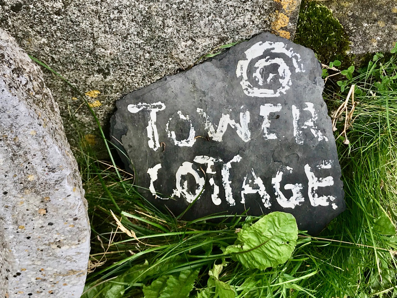
The curious profile of the site as marked out on this early map shows a segmental shaped area to the south of the tower. It is likely that this was where the signal mast itself was situated. I am intrigued by the descriptions of the surrounding land: ‘good Meadow’, ‘Indifferent Pasture’, ‘Very Good Pasture Ground’ and ‘Arable good Ground’. Also, on the left of the survey drawing appears to be a table of land values, and the statement that ‘The Road is already made to this Tower and has very good ditches on each side of it, and is 312 perches long’. The road is in good condition today, as the site has been developed with a cottage and modern studio:
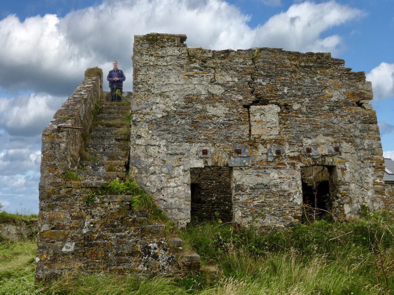
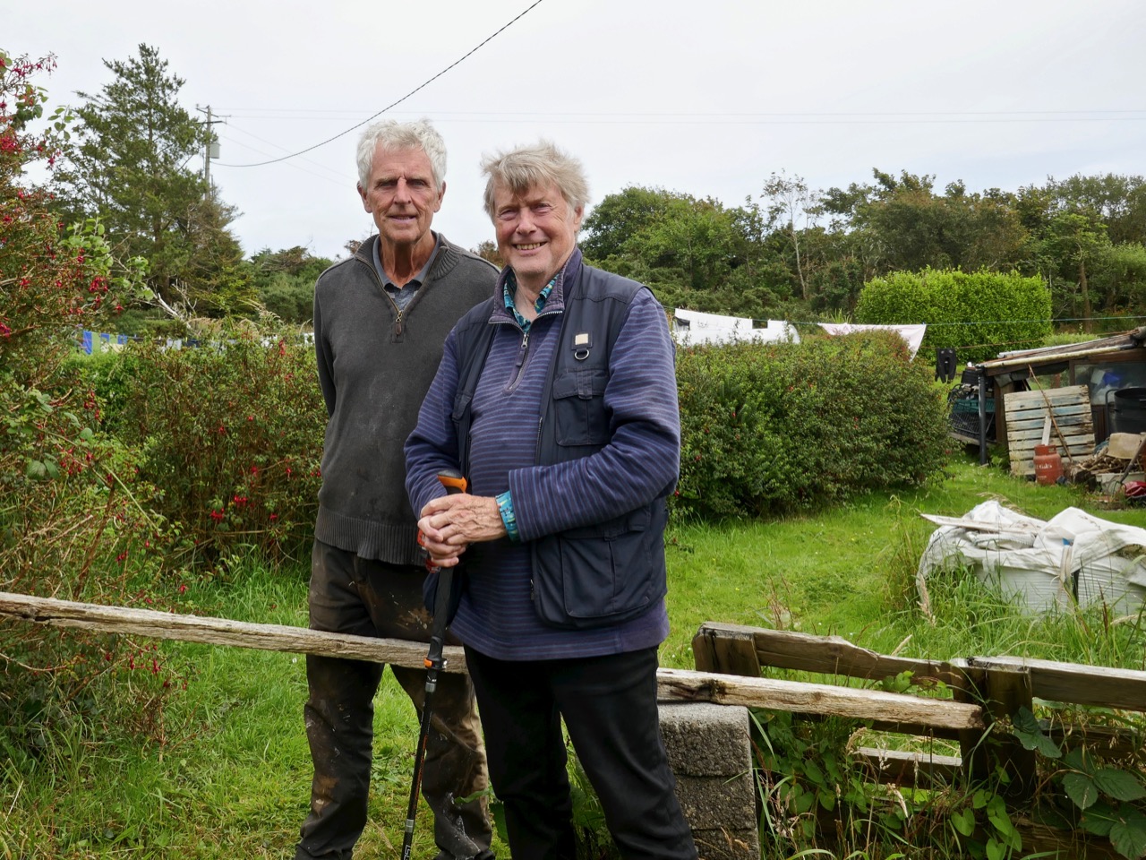
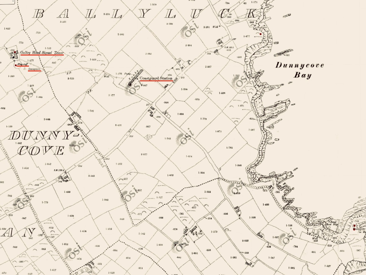
There’s nothing better than good local knowledge when you are trying to piece together a historic jigsaw puzzle. We were delighted to run into Billy Sheehan working in his neighbouring garden: it didn’t take long to establish that his own family had been involved in the signal tower site for generations, and had been connected to the local Coast Guard which had used the tower as a lookout point after the original building had fallen into disuse. Here’s Billy and myself, below. Under us is an extract from the 25″ Ordnance Survey map, drawn between 1888 and 1913. Note how on this map the signal tower site itself has changed since 1806, with many more buildings, a ‘flagstaff’ and a ‘semaphore’ indicated. These all undoubtedly date from the Coast Guard use of the site – you can also see the Coast Guard Station indicated below the tower: there are just a few masonry pillars left at that location today.
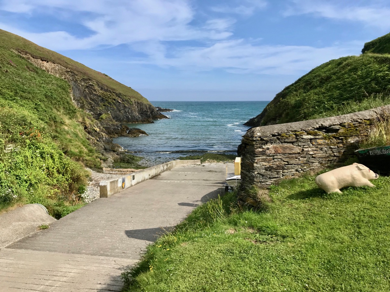
This is the ramp leading down to the water at Ballycusheen Strand, not far from Dunnycove. The pig is a well-known local landmark! I was interested to see the reference to ‘semaphore’ on the OS map, outside the original signal tower enclosure. This word recurs frequently in discussions about signal towers. Theoretically, any visual signalling system is an ‘optical semaphore’, but the term is likely to be more specific here and probably refers to an updated mechanical system rather than the ‘flag and ball’ method generally used in the early 19th century, when the signal stations were run by sailors or retired naval men who were well used to reading flag signals through high quality telescopes. There’s a volume to be written on how long-distance signalling evolved over many centuries – not just in Ireland but across Europe and beyond, beginning, perhaps, with The Scottish Parliament passing an Act in 1455 that said:
One bale, or faggot, shall be warning of the approach of the English. Two bales that they were actually coming and four bales, blazing side by side, shall note that the enemy is in great force.
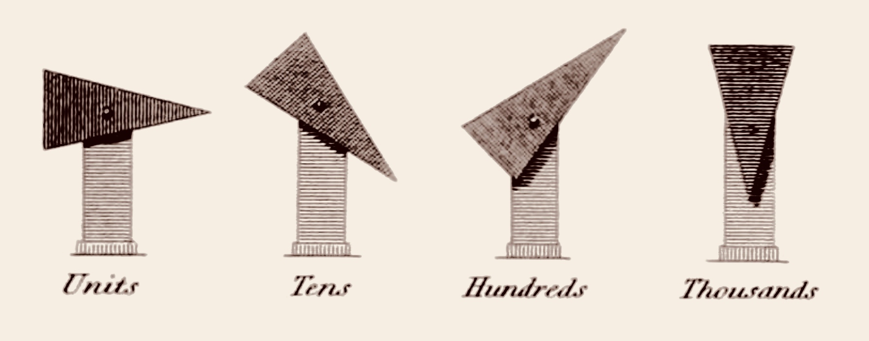
There is a record of Robert Hooke, ‘curator of experiments’ at the Royal Society, proposing a system that combined a telescope and signalling in 1684. One of the important names that surfaces here in Ireland is Richard Lovell Edgeworth (1744 – 1817). An inventor and writer, Edgeworth was the son of an Anglo-Irish landlord whose family gave their name to the town of Edgeworthstown, Co Longford; he studied at Trinity College, Dublin. In 1767 he placed a bet with his friend, the horse racing gambler Lord March, that he could transmit knowledge of the outcome of a race in just one hour. Using a network of signalling sections erected on high ground, the signal would be observed from one station to the next by means of a telescope. The signal itself consisted of a large pointer that could be placed into eight possible positions in 45 degree increments. A series of two such signals gave a total 64 code elements and a third signal took it up to 512.
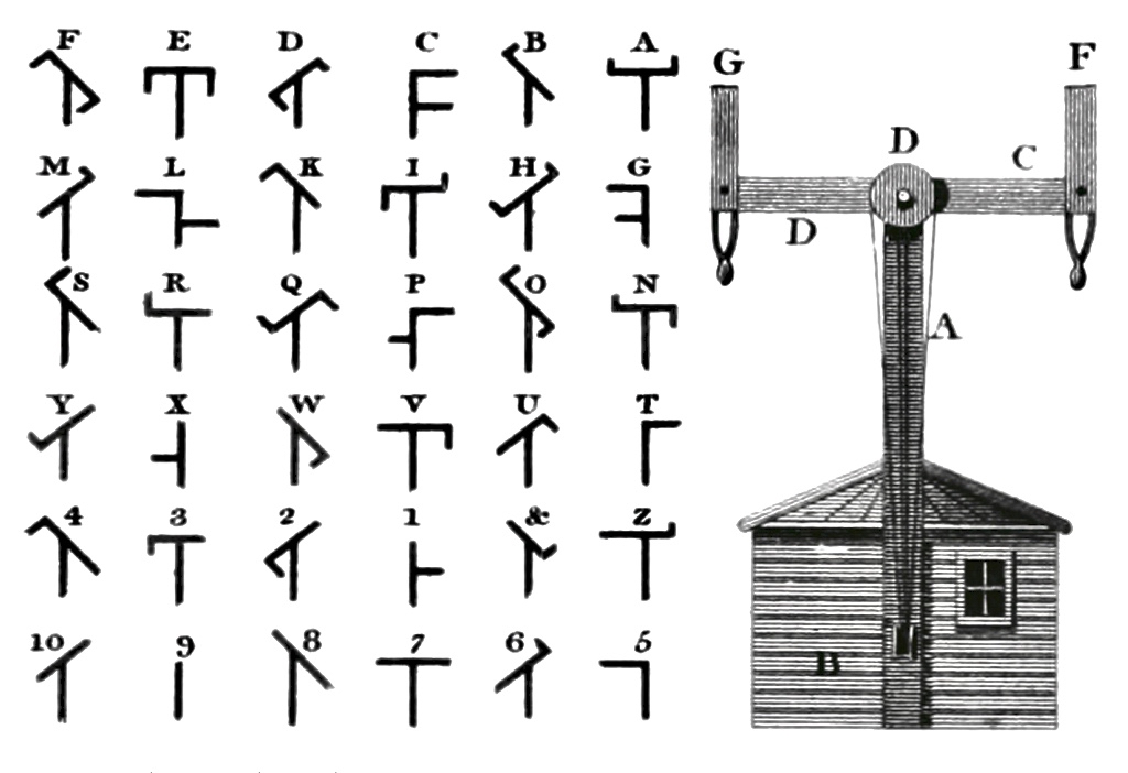
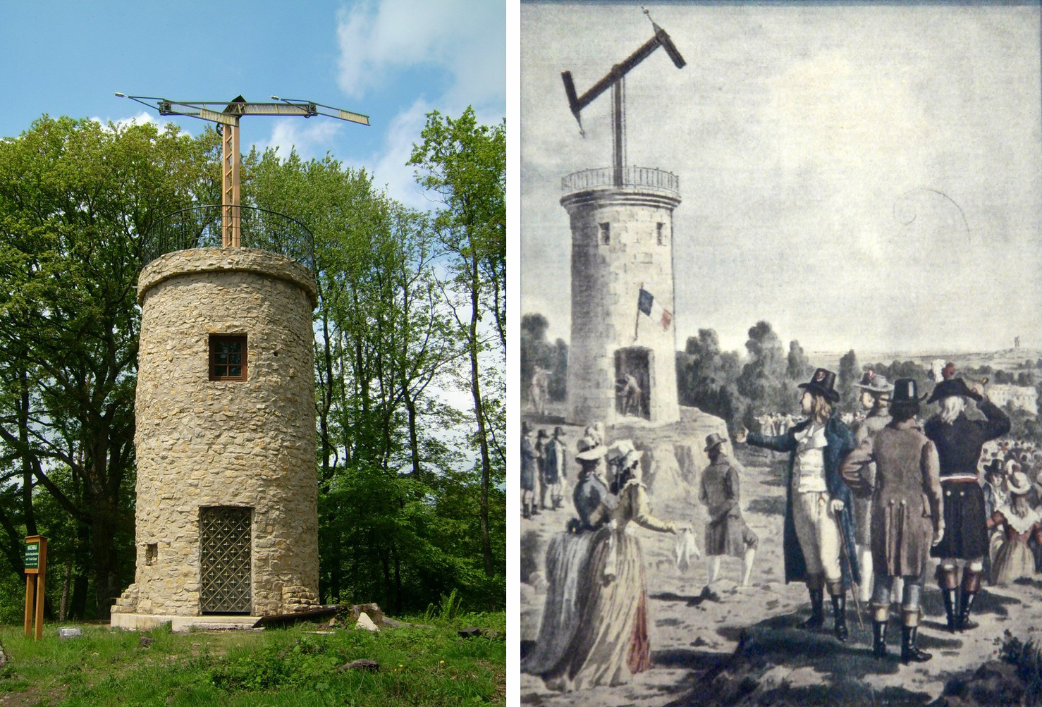
Edgeworth (perhaps best known for fathering the writer Maria Edgeworth (1768 – 1849) – one of his 22 children) termed his device a ‘Tellograph’. In November 1794 the most impressive demonstration of his invention used 30-foot-high Tellographs to communicate between Donaghadee, Ireland and Port Patrick, Scotland (about 40 miles). In France at the same time the Chappe brothers succeeded in covering that country with a network of 556 stations stretching a total distance of 4,800 kilometres (3,000 miles). Le système Chappe was used for military and national communications until the 1850s.
Le système Chappe (above). French technology is demonstrated in the 1790s – the very time the First French Republic was threatening the least defensible part of the British Isles – Ireland – and emphasised by the attempts of Wolfe Tone to land a French fleet in Bantry Bay in December 1796. That landing was a failure – due to atrocious weather – but it did, perhaps, wake the British authorities to the wisdom of guarding the Irish coastline. The signal tower system was a hastily devised result of this.
There’s a lot going on at the Dunnycove Signal Station site: the setting remains clearly laid out based on the 1806 plan, and the dominating view is due south. Parts of the original building remain although much has been altered including an external staircase and the surrounding structures.
The upper picture shows a distant view towards the signal station complex: it is on the highest point in the immediate landscape. Next is the view from the present top of the old tower, looking across the segment-shaped land which once held the signal mast and – later – the ‘semaphore’, most likely used to communicate with the Coast Guards below: beyond is the ocean. In 1837 Lewis’s Topographical Dictionary of Ireland had this to say about the area:
. . . In the R C divisions this parish is the head of a union or district, comprising the parishes of Ardfield and Rathbarry, in each of which is a chapel; that of Ardfield is a low, plain, but commodious edifice, situated on the commons. There are schools in which 140 boys and 170 girls are taught, also a school at Dunny Cove, a Sunday school under the superintendence of the vicar, and one or two hedge schools. The ruins of the old church are situated on the highest point of land in the parish; and near them is a building which during the war was used as a signal tower, but is now the residence of Lieut. Speck, who commands the coast-guard at Dunny Cove. Close to the Cove are the ruins of a castle . . .
It seems to me that this site, in particular, has so many stories to tell us. Not just about the one period in history that caused the building of the original tower, but also about how a community has developed and adapted around that building. After the close of the Napoleonic era, when the threat of invasion receded, the tower retained its significance as a high place from which observations can be made. The Water Guard (which became the Coast Guard) took it over and it has remained a dwelling place for families ever since. Billy Sheehan is testament to this ‘living’ history, and the old stonework survives to tell where meals were cooked – where sleeping, waking and working became the rhythm of life for generations on this West Cork hilltop.
Please note that Dunnycove Signal Station is a private property and permission to access it must be sought from the owner
The previous posts in this series can be found through these links:
Welcome to the UCD Library Cultural Heritage Collections blog. Discover and explore the historical treasures housed within our Archives, Special Collections, National Folklore Collection and Digital Library