A Signal Success in Irish Engineering – Part 10: Toe Head

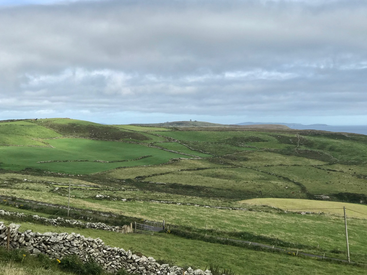
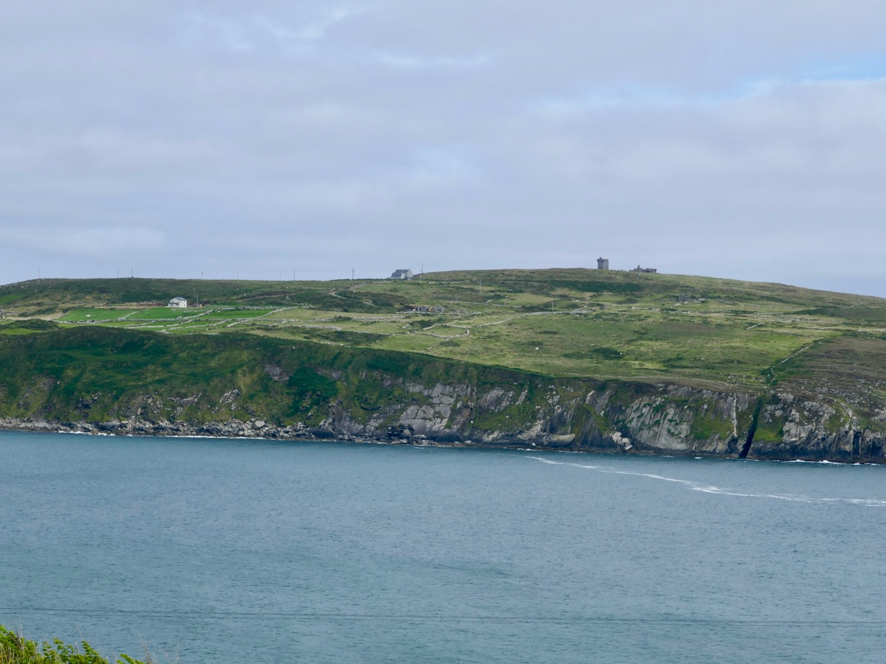
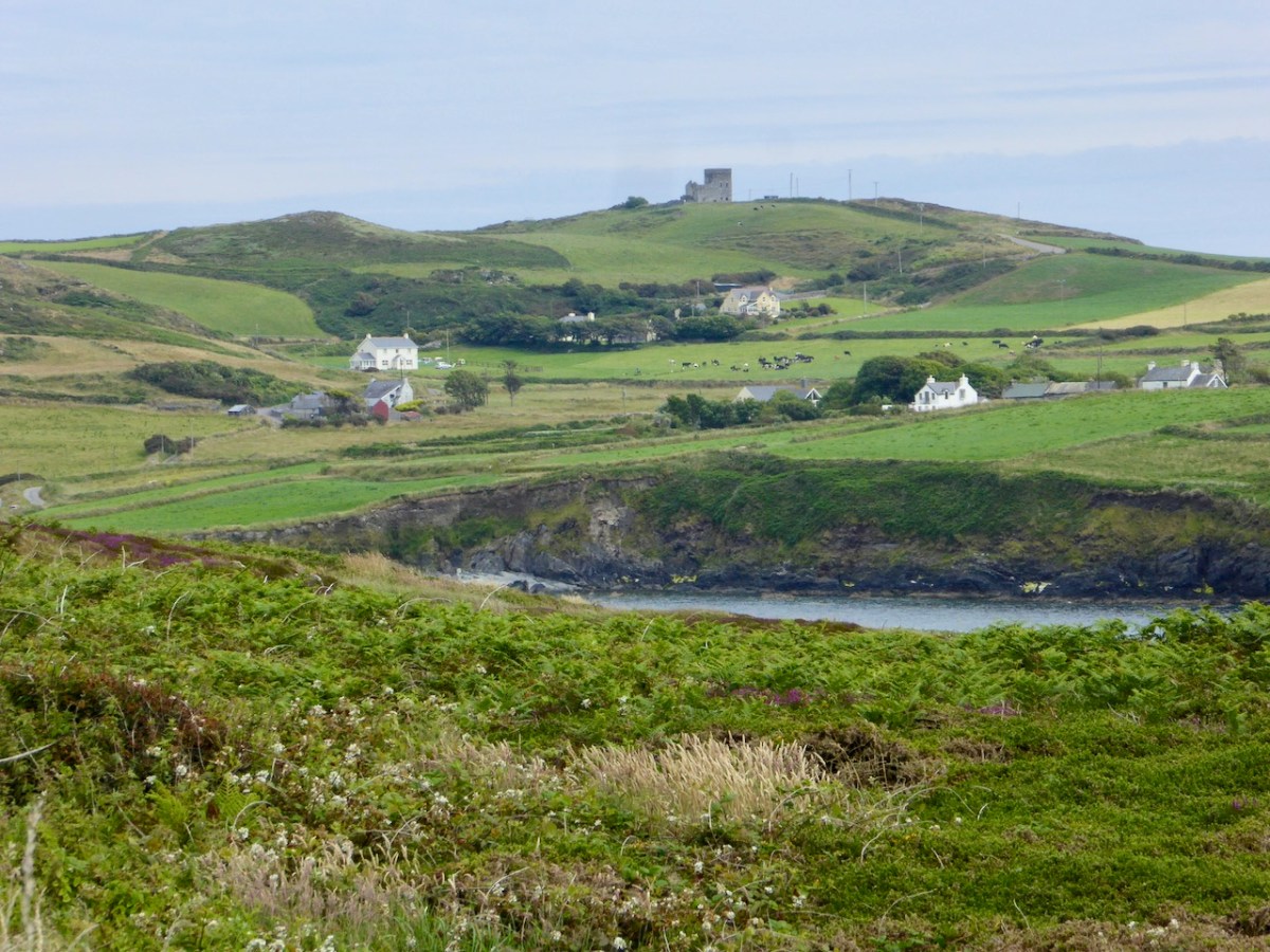
Here’s the latest episode in our series about Napoleonic-era signal towers in West Cork. There are links to the earlier posts at the bottom of this one. That’s Toe Head above – in the far distance, and that view is taken from the signal tower site at Kedge Point, Spain, to the east of Baltimore.

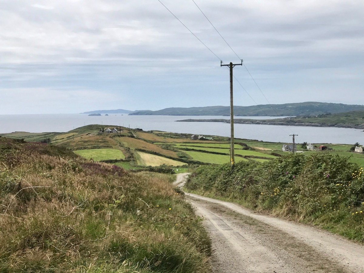
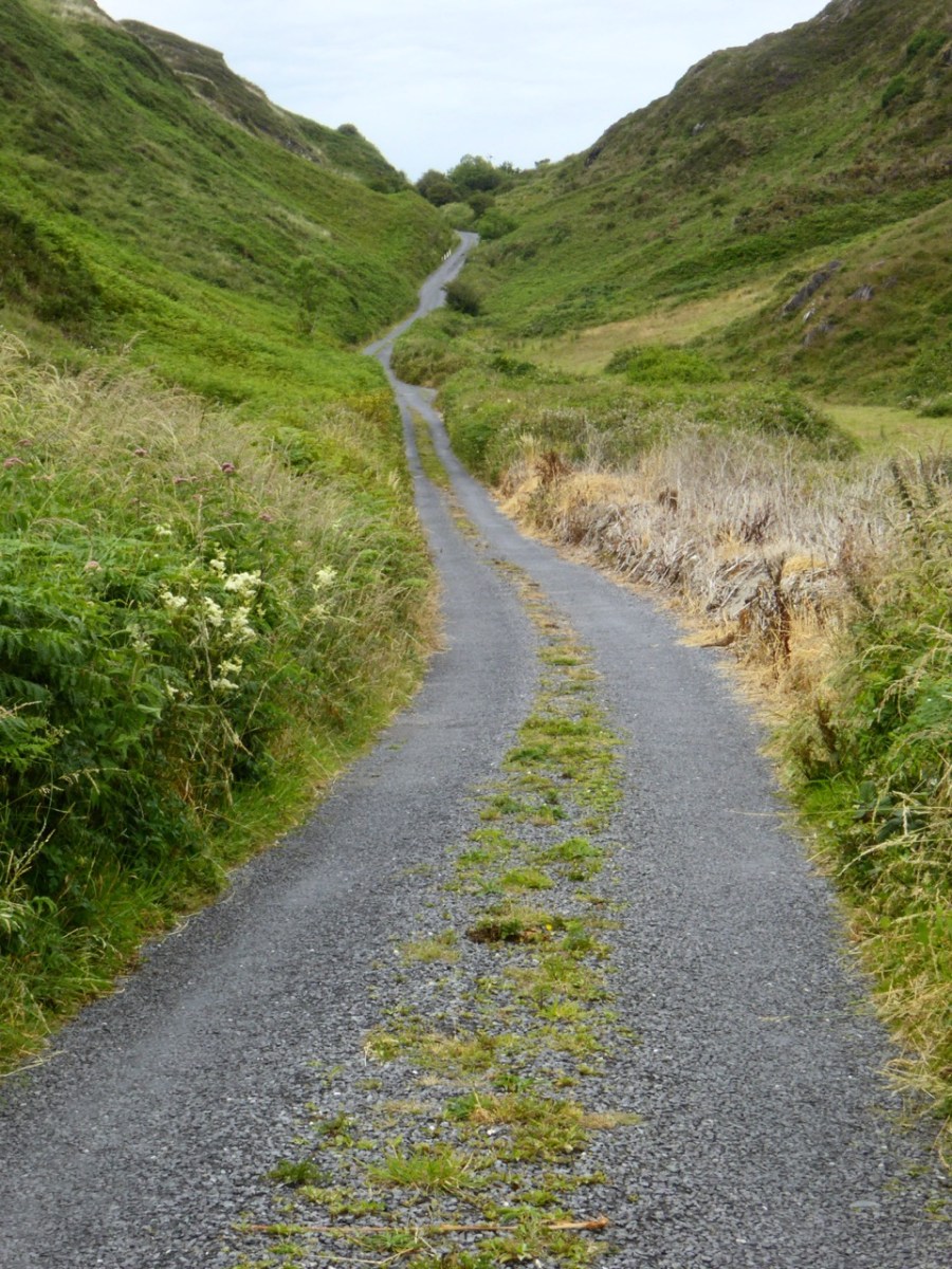
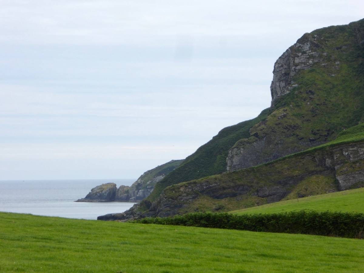
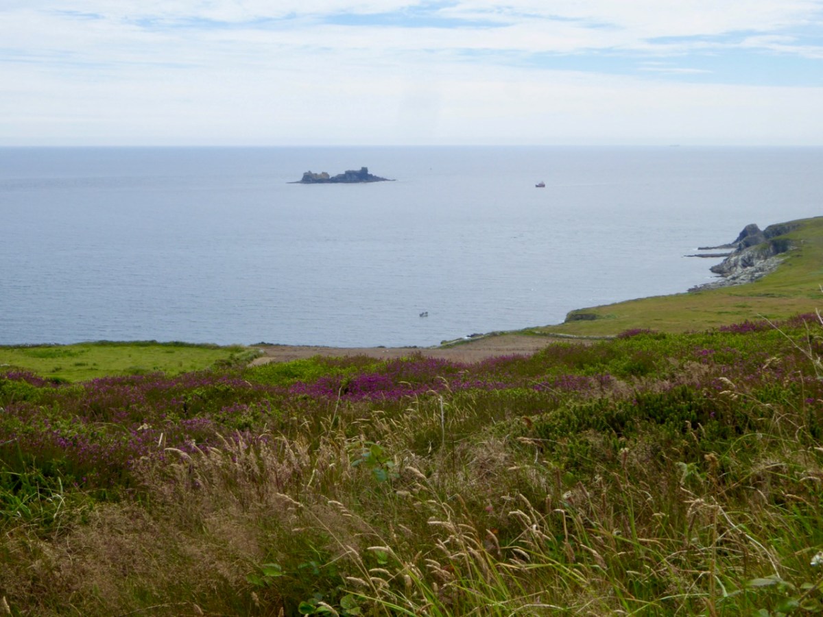
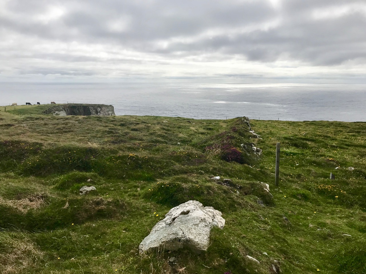
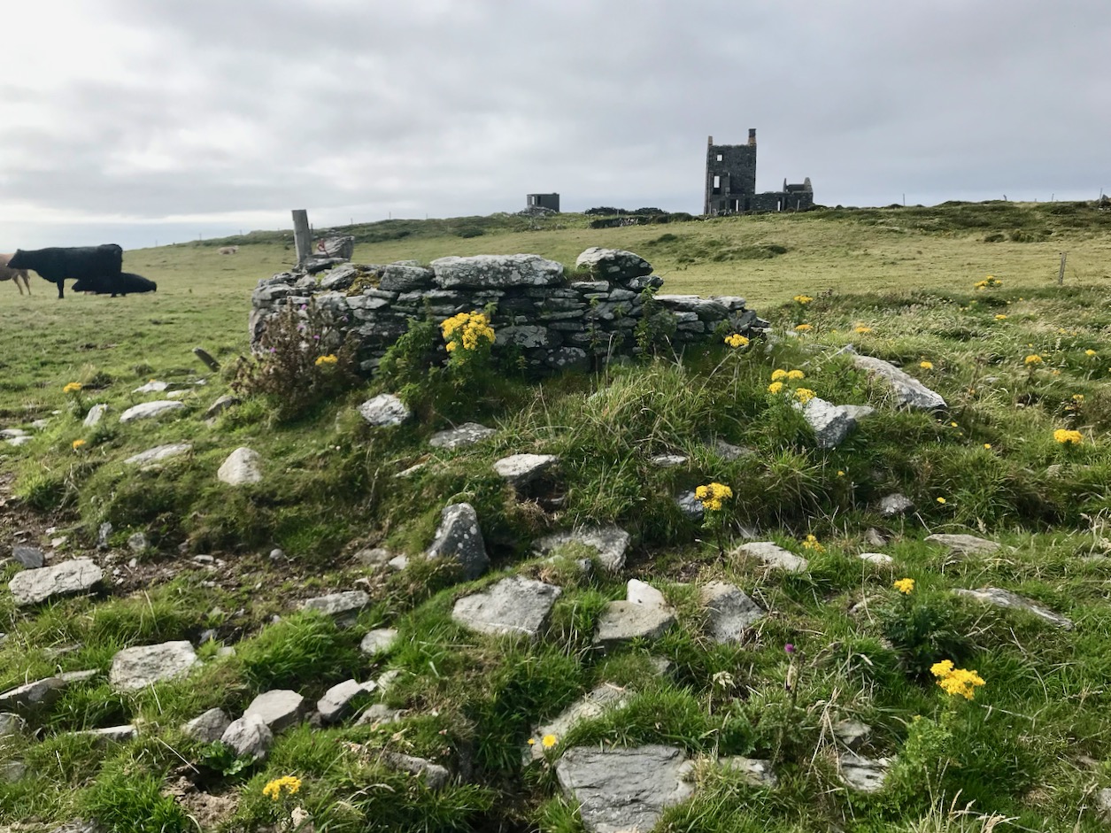
Toe Head itself is a spectacular setting in West Cork: the views, above, show the nature of the terrain, the boreens, and the seascape in the area. So far I have written accounts of nine signal towers: this is the tenth. I’d like to tell you how many of these structures are in West Cork, but that would mean that I would have to geographically define ‘West Cork’. I can’t do that, as there is officially no such area: we are all part of County Cork! All I can do is to let you know that there are nineteen signal tower sites located in the whole County. I have another nine to cover, after this one. But I assure you – Toe Head is definitely in our West Cork!!

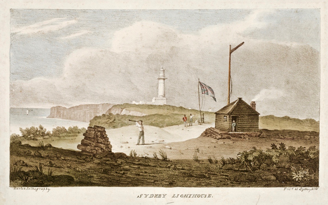
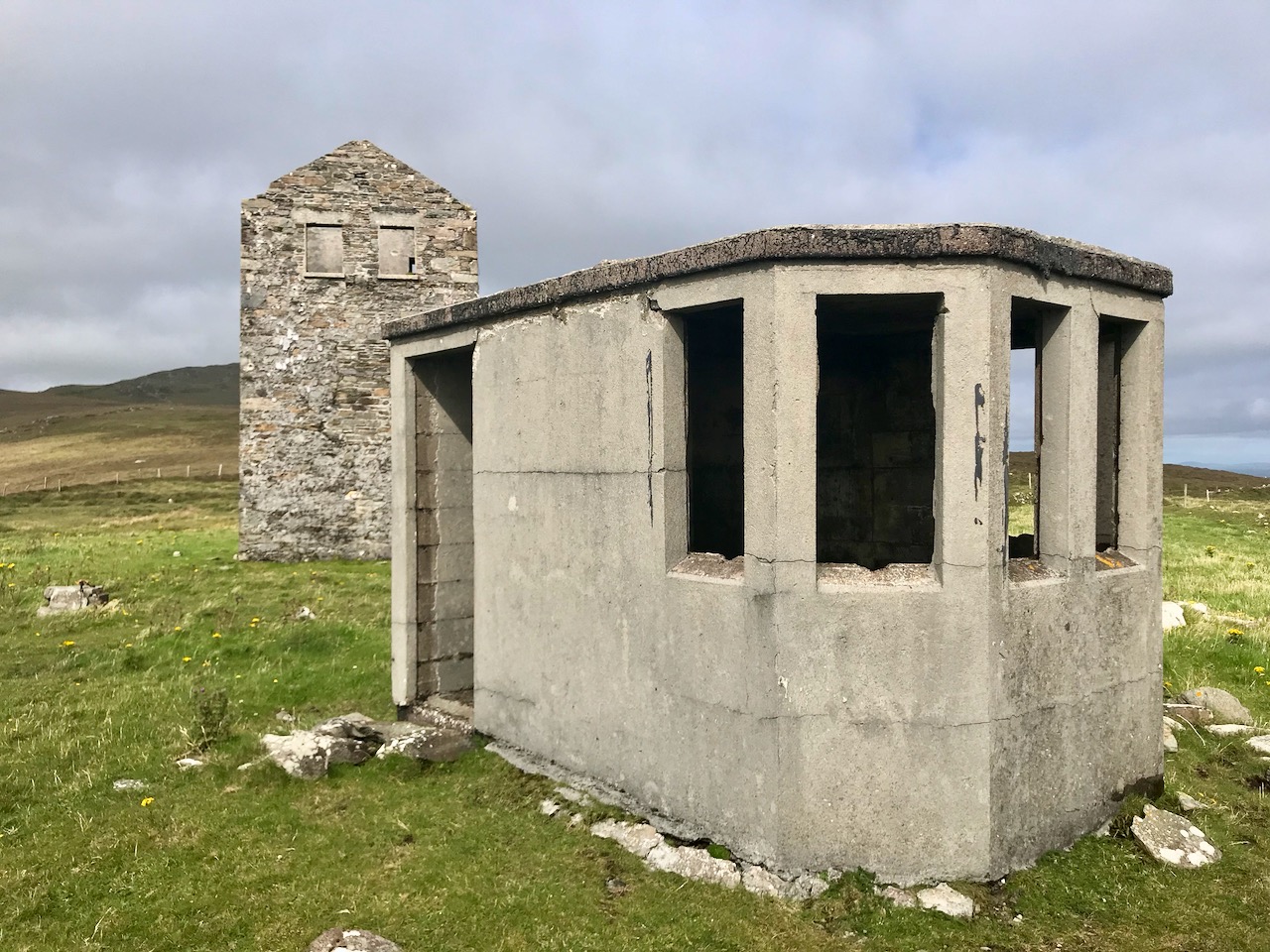
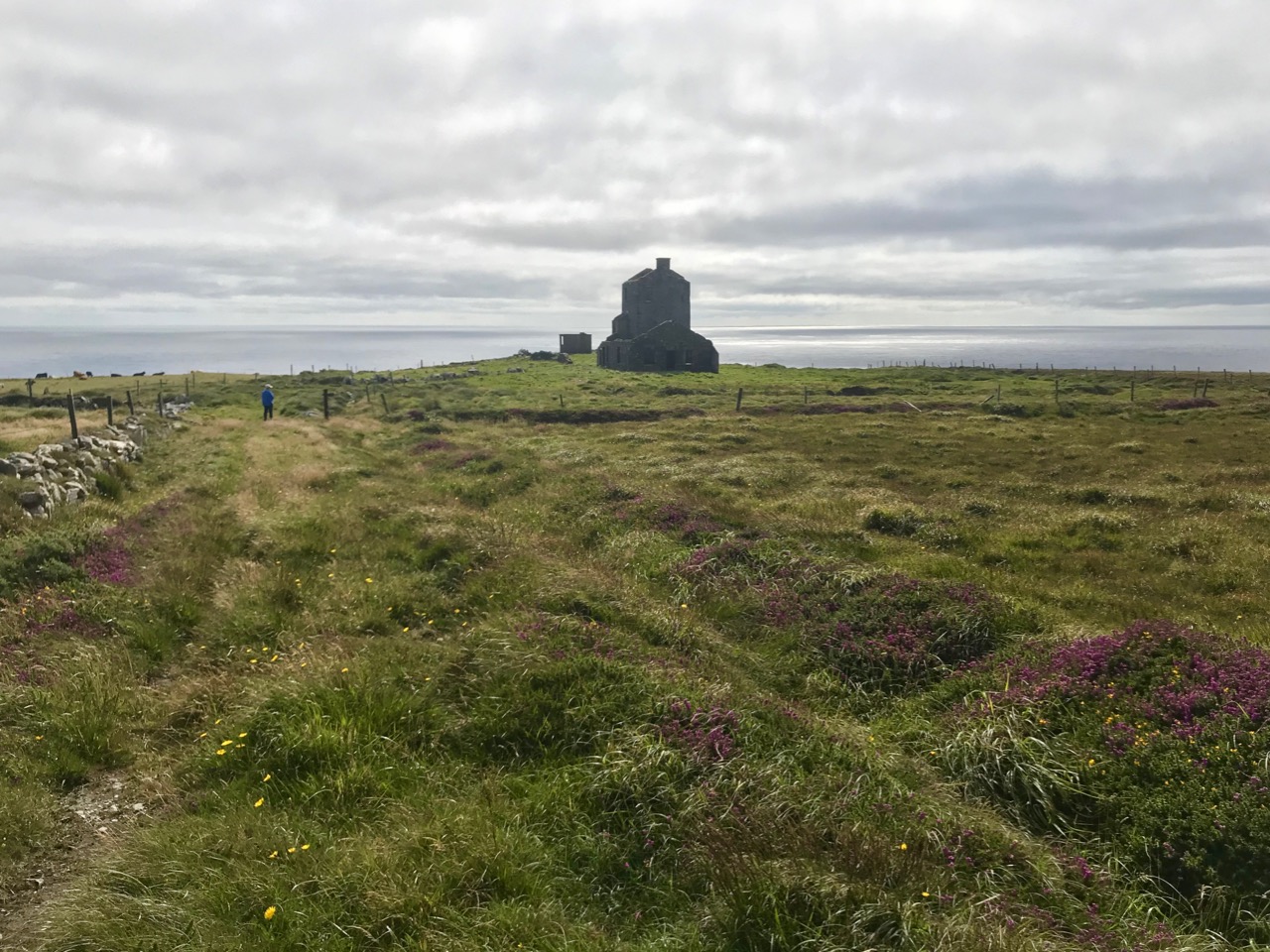
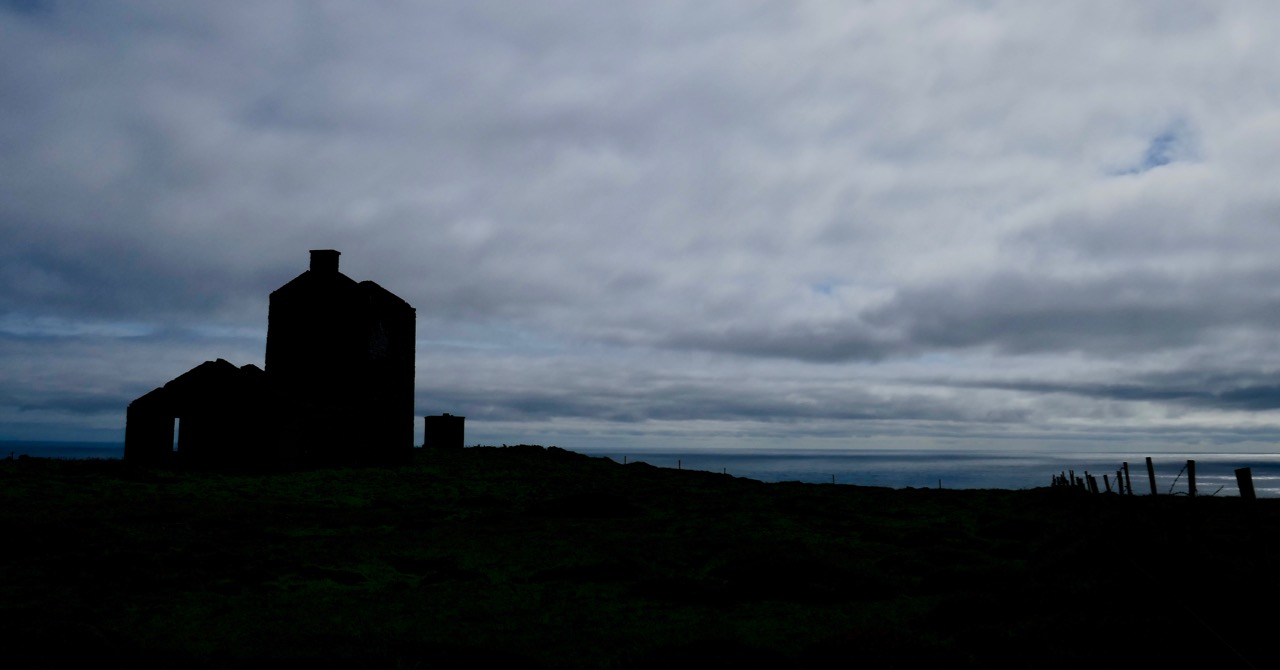
Here’s the Toe Head tower – in a sea of black bales. If you have followed the series so far, you will have noticed that each tower is fairly basic, and generally offers the appearance of a medieval castle. But they were all built at the very beginning of the nineteenth century, to provide a system of surveillance and signalling around the coast of Ireland, from Malin Head in the north to Pigeon House Fort, Dalkey, on the east coast. Each signal tower is within view of one – or two – others, depending where it lies on the chain. In the first post in the series, here, I explain the logic and geometry of the project.

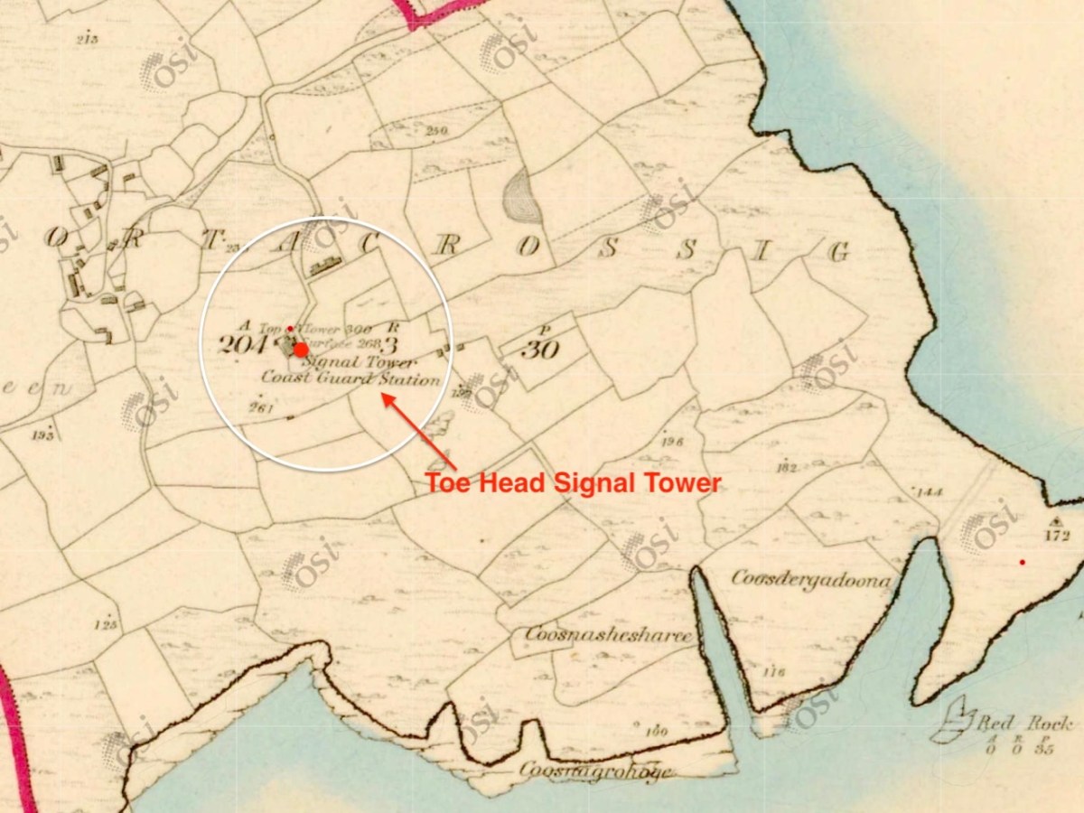
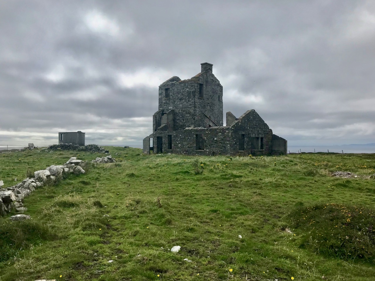
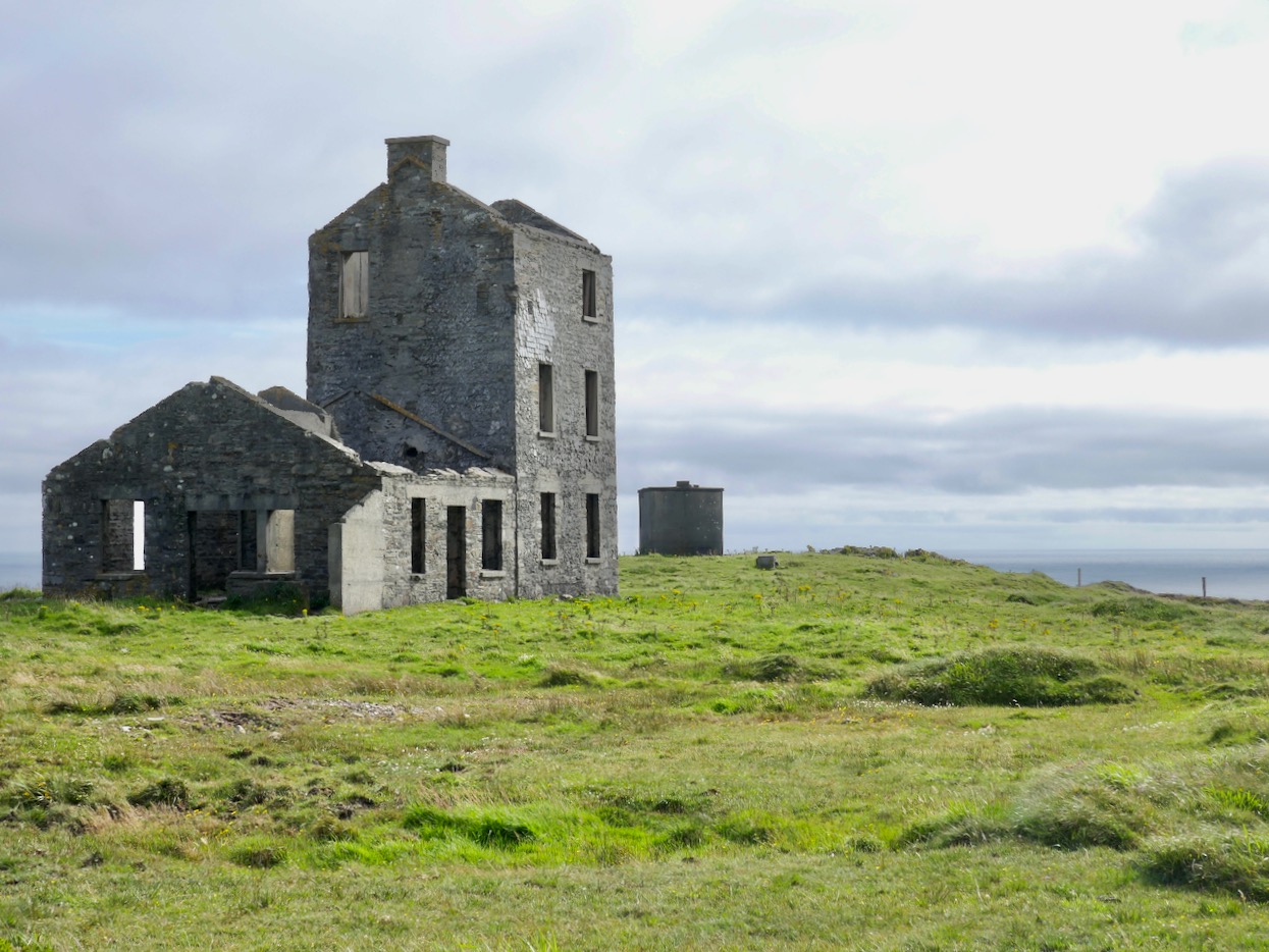
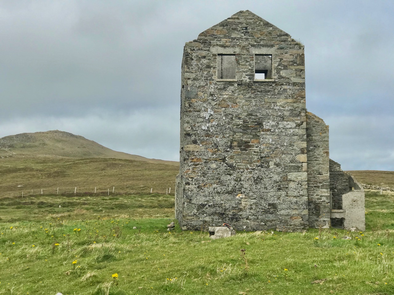
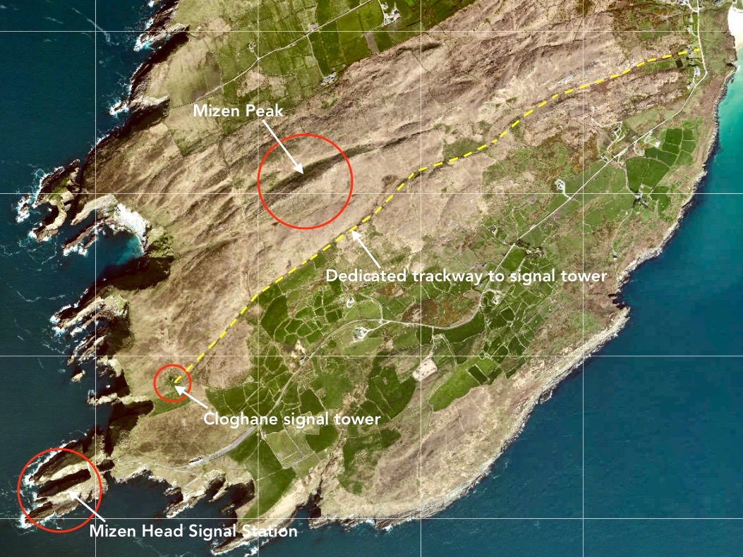
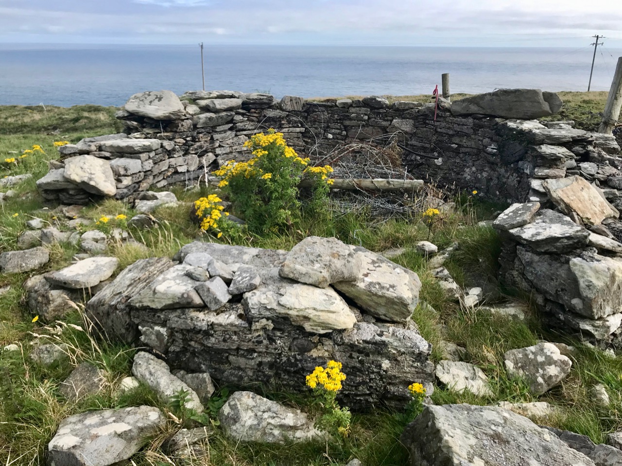
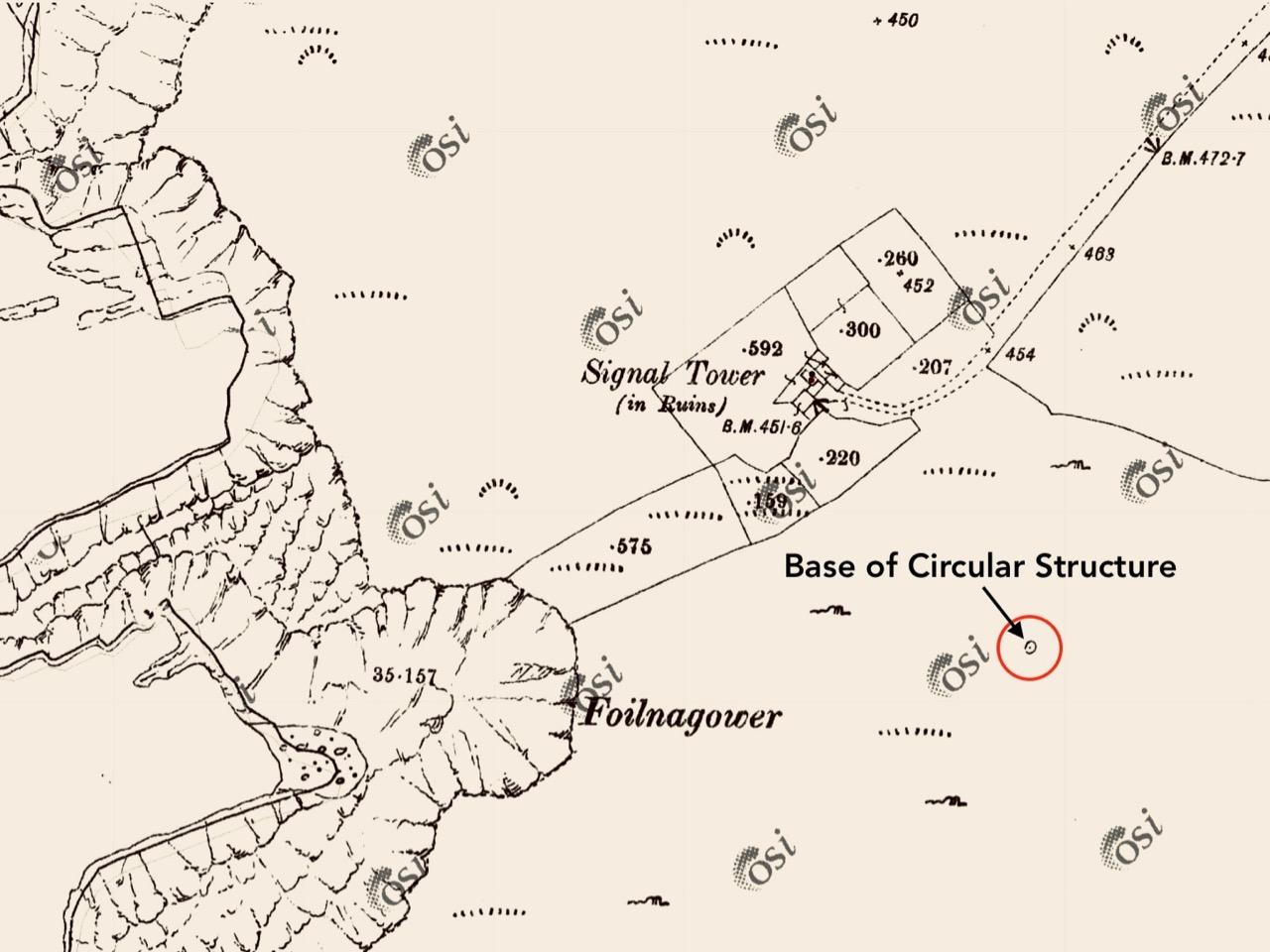
The 6″ Ordnance Survey map extract in the upper picture dates from 1842. By this time the use of the tower for signalling had ceased – the Napoleonic invasion threat lasted only through the first few years of the century: many towers became disused after this and some have vanished altogether, although many ruins do remain because of their remote locations. In the case of Toe Head, the building was adapted to incorporate a Coast Guard Station. I am assuming that, originally, the tower was a simple square structure , and the extension to the rear was added to provide additional accommodation for the Coast Guard service. The current aerial view shows newer farm buildings and an access road close by.

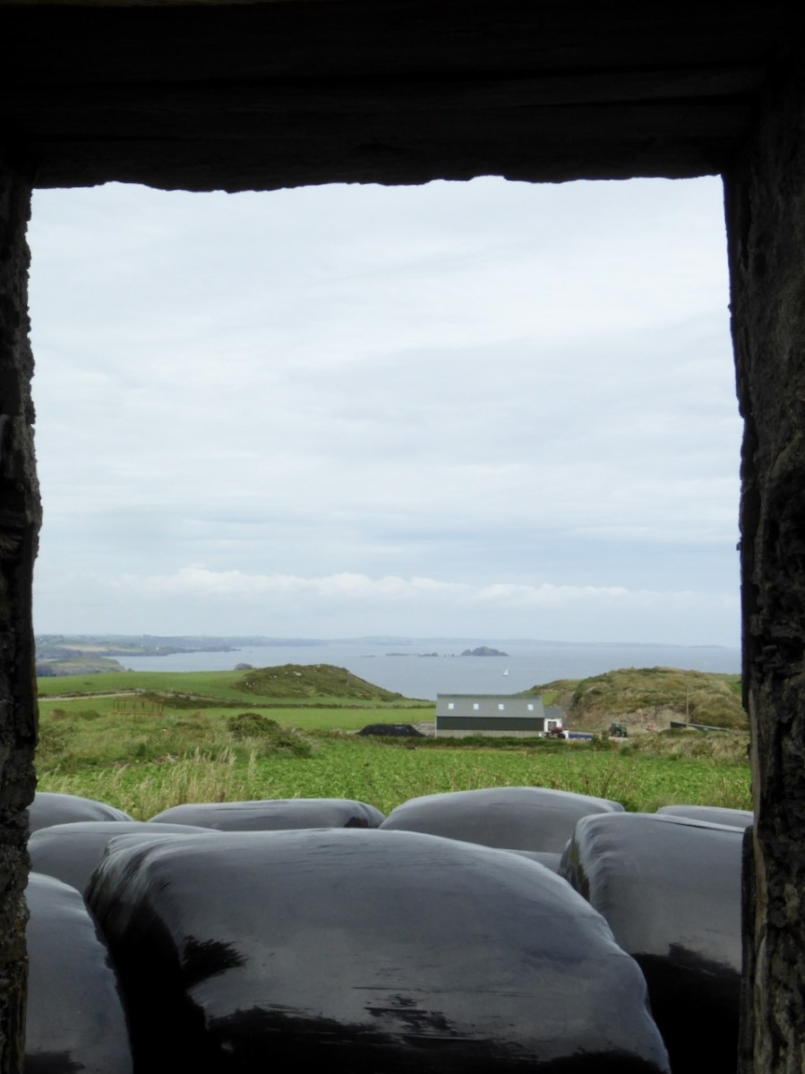
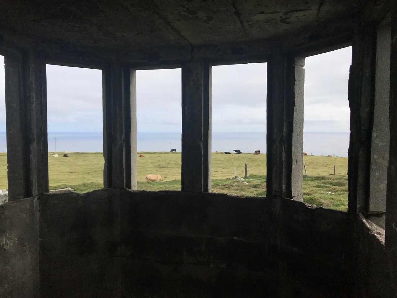
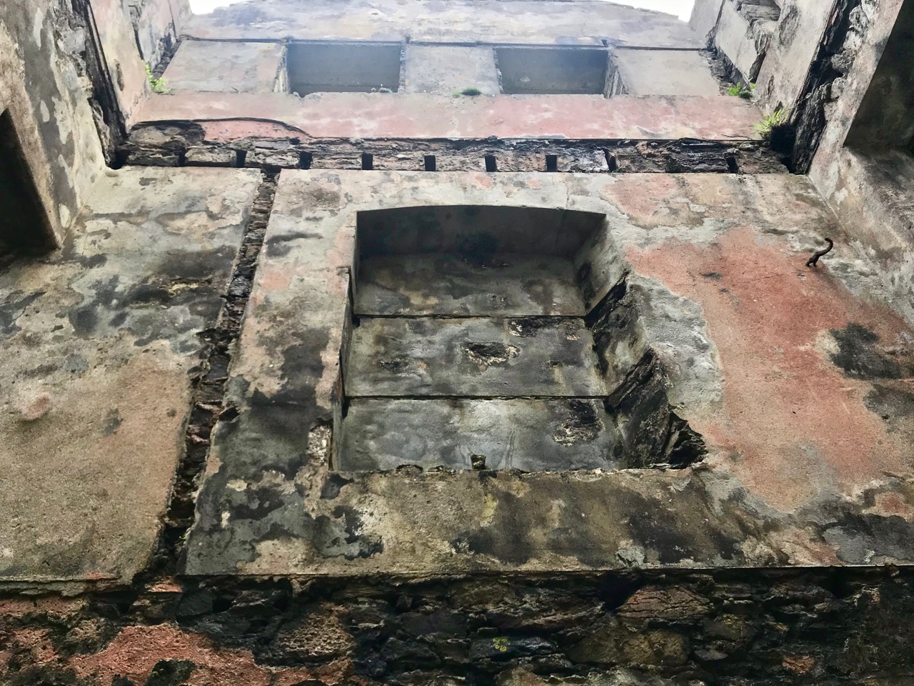
If you look at previous posts in this series, you will see that the Toe Head tower is architecturally simpler, with no bartizans or other ornamentation – it’s more like a small Anglican church tower than a ‘castle’. Like many others, it’s clear to see that this building was slate-hung: this form of weather-proofing was probably added at a later date – possibly when the Coast Guard service took it over. At the centre of the view from the window above you can see the Stag Rocks which in the 1980s became the graveyard of the 900ft long Kowloon Bridge, a bulk cargo carrier travelling from Quebec. The ship was disabled by a storm and then abandoned, drifting on to the Stags. A detailed account of the event was posted in the Irish Examiner 30 years later.

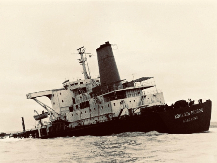
The abandoned Wreck of the Kowloon Bridge close by the Stags in November, 1986 (centre picture). The lower picture shows the wreck underwater today (courtesy Aquaventures.ie): she drifted out of control towards the rocks before running aground on the reef. The resulting fuel spill spread out over the Irish coastline causing extensive damage to local wildlife, and financial losses for the local fishing fleet. Apparently, no-one was ever held to account for the environmental disaster.

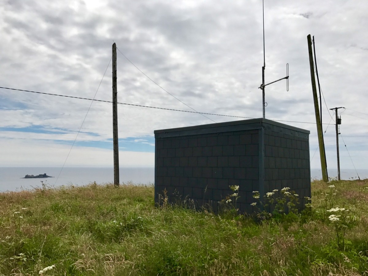
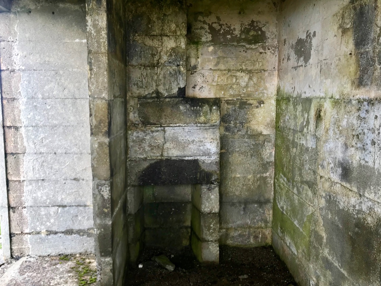
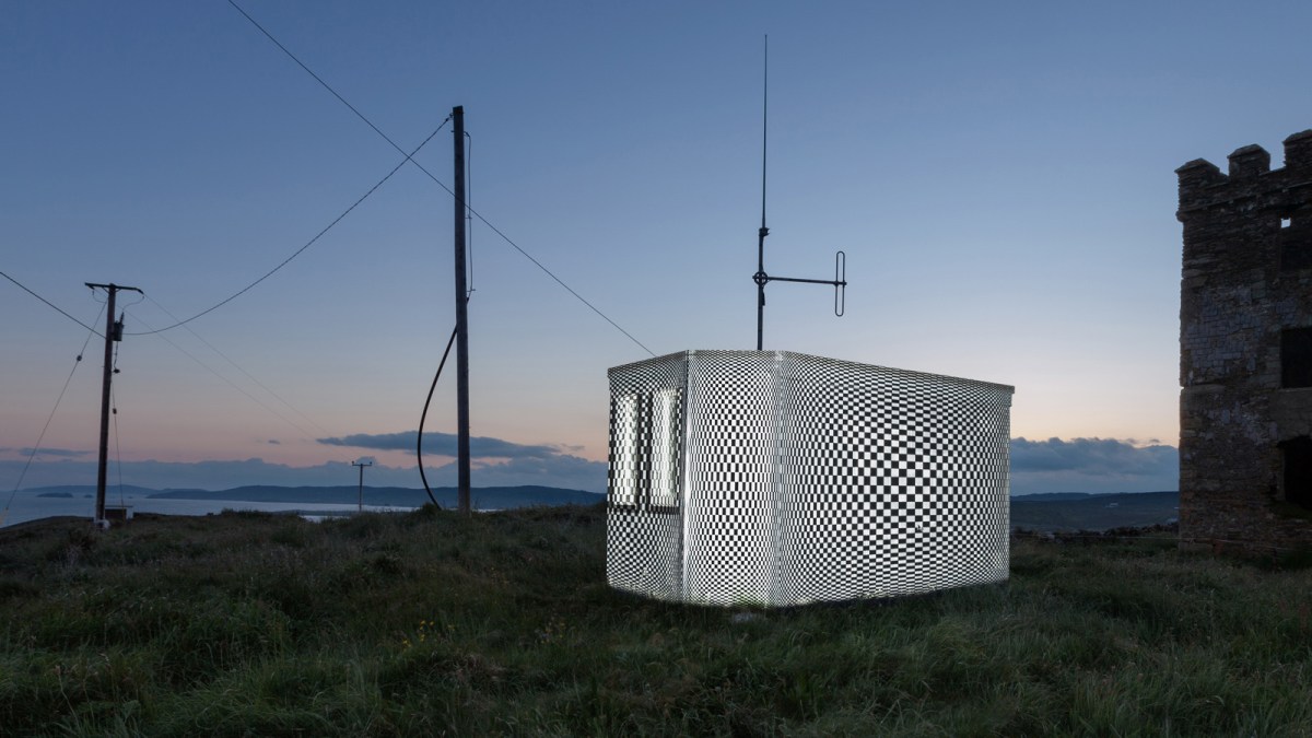
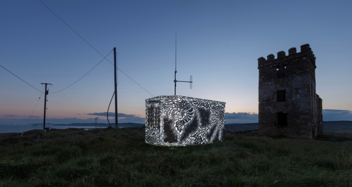
The Stag Rocks can be seen in my picture above, which shows the current incarnation of a World War II Lookout Post that was put in place close by the older signal tower in 1942. You can read more about these lookouts in this post: they were designed by Howard Cooke RIBA of the Irish Office of Public Works at the outbreak of that war (during which Ireland remained neutral). I mentioned in that same previous post an art installation project carried out in 2014 by Tim Schmelzer of Vienna. His work at Toe Head is particularly impressive, and here are some still shots to illustrate the nature of the artworks, which were created on-site using high-powered projection equipment.

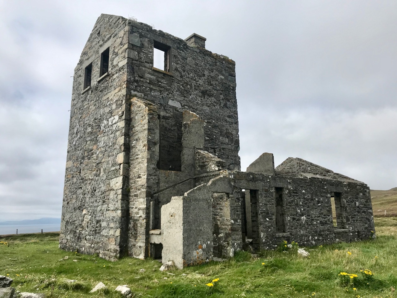
The signal tower ruin today is gaunt and desolate. Nevertheless it’s an atmospheric place to visit. On the slopes below the building is an EIRE sign (officially number 28), also dating from the World War II years, when Irish neutrality had to be spelled out to the warring powers flying overhead. I came across an interesting comment from Anne Wilkinson in 2018, giving a slightly different take on the EIRE signs:

. . . These EIRE signs were also to alert German Pilots and crew who were conscientious objectors and who had overflown the UK, to ditch and parachute to safety. Many airmen lived at the Curragh Camp. They were allowed freedom during the day, eg. they often cycled the lanes and roads to enjoy the peace and quiet and then returned to the Curragh Camp for their curfew hour . . .

http://eiremarkings.org/the-map/

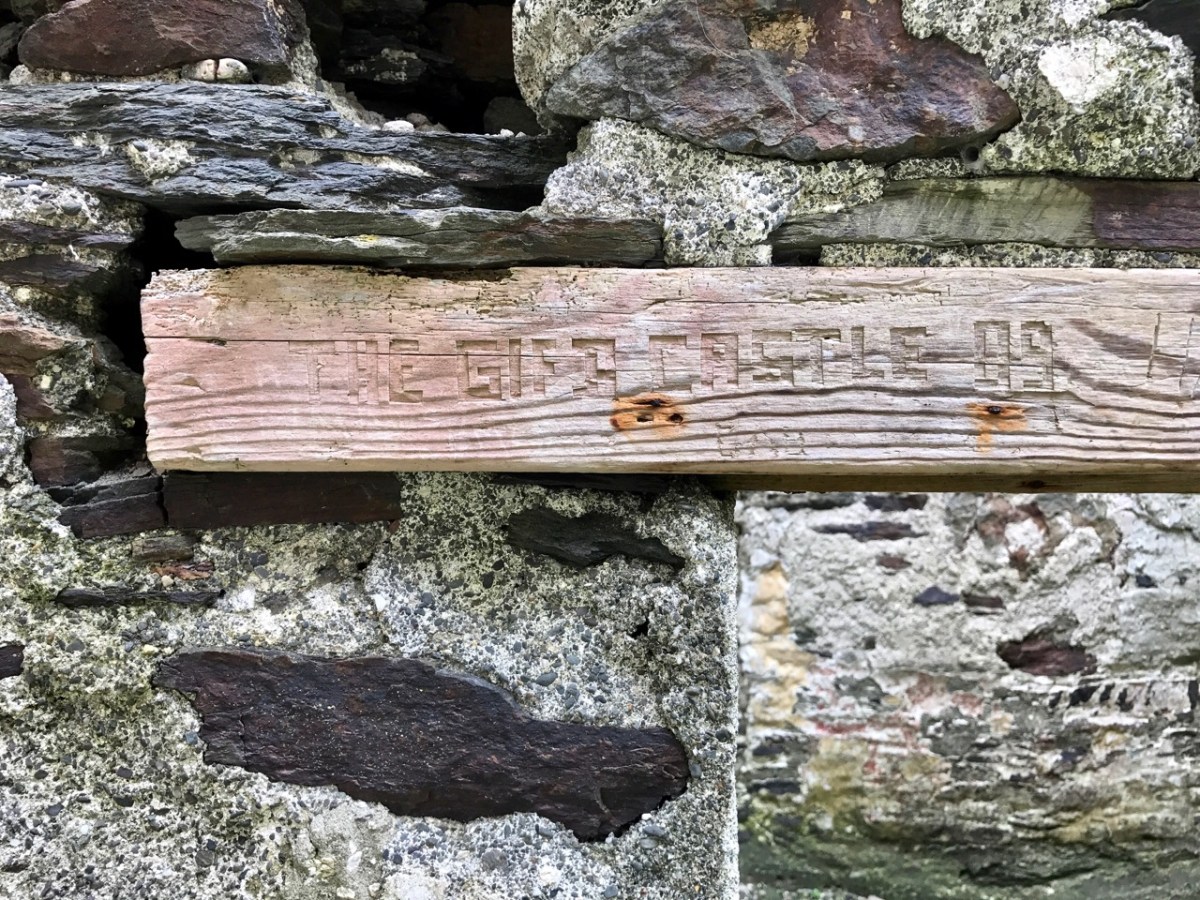
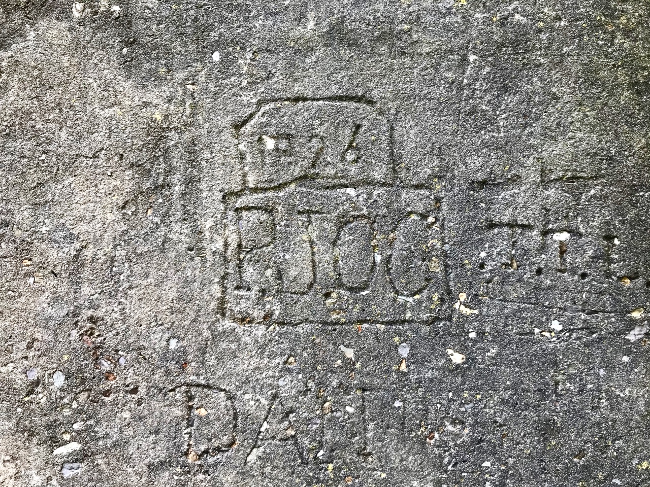
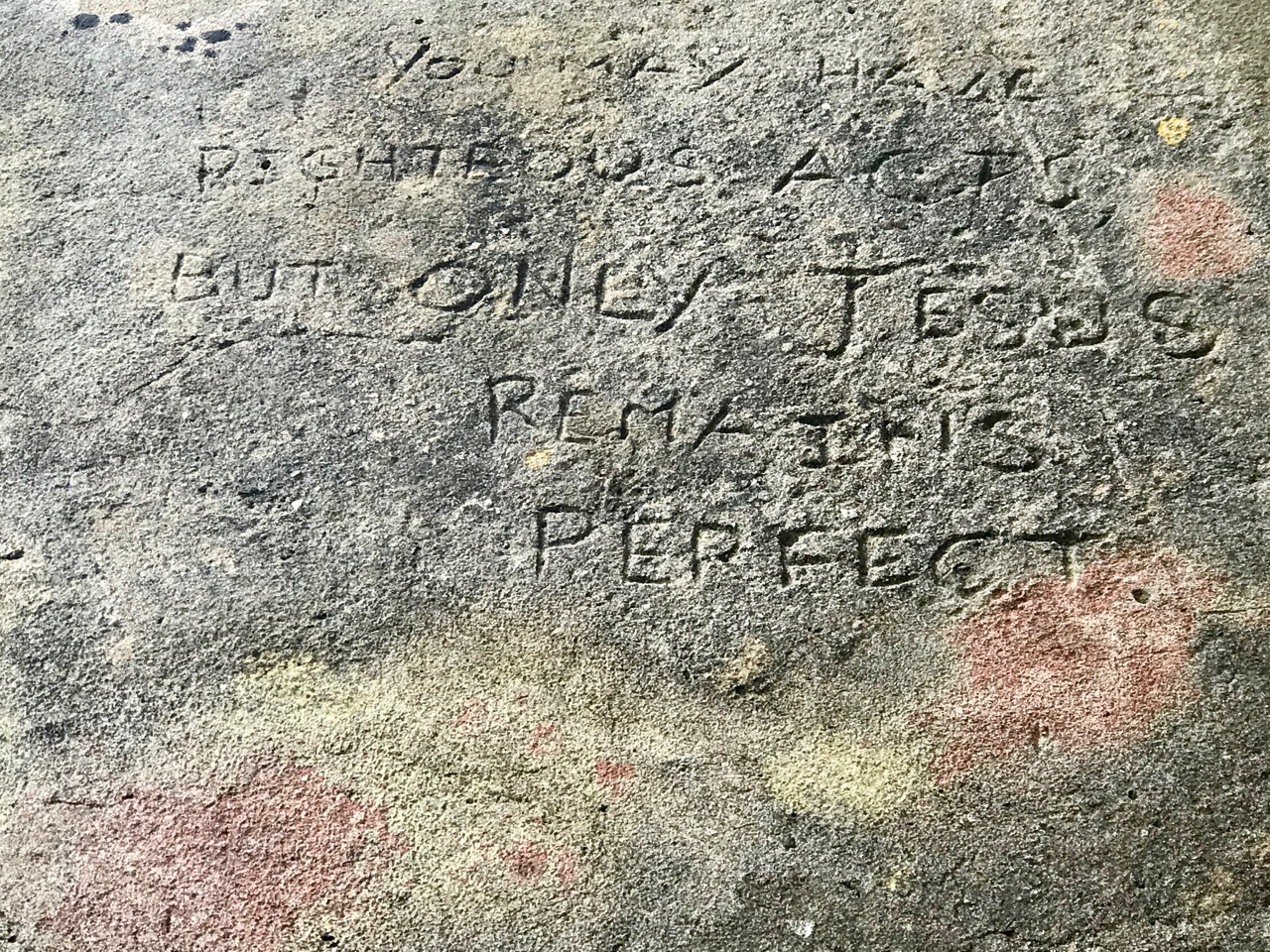
And here’s a little enigma to finish off the post (above). It’s graffiti carved on a timber lintel over one of the openings of the signal tower buildings. It’s probably quite recent – dating from ’89 or’99 – but what does it spell out? And why is it here? It’s tempting to say THE GIFT CASTLE but that ‘T‘ after the GIF doesn’t ring true . . . There’s a story there somewhere: perhaps one of our readers can give us a clue! Finally, here’s a distant view of the signal tower, looking across Toe Head.

The previous posts in this series can be found through these links:

Part 1: Kedge Point, Co Cork

Part 2: Ballyroon Mountain, Co Cork

Part 3: Old Head of Kinsale, Co Cork

Part 4: Robert’s Head, Co Cork

Part 5: Downeen, Co Cork

Part 6: Dunnycove

Part 7: Cloghane, Mizen Head

Part 8: Brow Head

Part 9: Glandore Head

A Signal Success in Irish Engineering – Part 7: Cloghane, Mizen Head

It’s a long way from West Cork, Ireland, to Sydney, Australia! And I’m not suggesting that signals could travel that far in the early 19th century . . . But I couldn’t resist putting up this engraving when I found it while researching signal towers generally as it is in fact an exemplary view with which to head up this – the seventh of our explorations into a fascinating subject. It has everything: the signal station itself, built on a prominent headland with a lighthouse nearby; a ‘telegraph’ mast and a flag mast for signalling; a man with a telescope looking out for a signal coming in – and a pile of logs with which to make a beacon fire to communicate urgently at night! The only difference, in fact, between the Irish stations and this ‘colonial’ one on the other side of the world is the building material. In Terra Australis (the name used for that continent until 1824, and meaning ‘southern land’) it was timber, whereas in Ireland the towers were of masonry and constructed with elements resembling medieval tower houses.

But it’s fair to say that today’s foray into the story of the Irish Napoleonic-era signal towers also has everything. Perched on Ireland’s most southwesterly point – Mizen Head in the townland of Cloghane – this site is one part of a craggy, indented promontory which is scattered with historical elements.

I have tried to illustrate a history time-line graphically by superimposing some of the significant sites on an aerial view (above – courtesy of mizenhead.ie), although even this does not tell the full story. Apart from an undated promontory fort in the north of the townland the signal towers are the earliest elements, specifically dating from 1804 and part of the network of 81 towers around the whole coast of Ireland which we have been charting in our posts. Interestingly, the two towers shown on the top of this view – at Cloghane and Brow Head – are the closest together of any around the coast, being only 3.8 km apart. The average distance between towers is 13.5 km, while the maximum distance is 36.9 km (between Ballydavid and Kerry Head in Co Kerry): we have not yet explored those sites. Here are two views from Cloghane across to the signal tower at Brow Head:

A feature at Cloghane which doesn’t show up on the aerial view is this Second World War lookout post, built close to the early signal tower around 1942. 83 of these structures were built by the Irish Defence Force to monitor activity at sea, many of them relating to Napoleonic-era sites for obvious reasons: these locations had already been selected for their inter-visibility and the panoramic views which they commanded. We have encountered these ‘Emergency-era’ posts previously at Kedge Point, Baltimore, and Ballyroon Mountain, Sheep’s Head (see the full list of links at the end of this post). We shouldn’t get diverted, but if you want to know more about these here is an excellent creative presentation on them carried out in 2014 by Tim Schmelzer of Vienna – particularly, I recommend that you view the first of the videos: it’s wonderful! The LOPs were designed by Howard Cooke RIBA of the Irish Office of Public Works in 1939 and I was fascinated to see that the design achieved recognition (‘posthumously’) from the National Inventory of Ireland Buildings Archive. The posts were cramped, damp and minimal, but apparently at least equipped with small fireplaces:

Mizen Head has drama: there is no land beyond this place until you reach America. And, if you are approaching Ireland from the south or west, Cloghane will be your first landfall. But it’s a dangerous coastline, particularly in stormy weather or at times of poor visibility. Hardly surprising, then, that a fog signal station was established on the furthest point in the early 20th century, under the jurisdiction of the Fastnet Rock Lighthouse. This was initially only a foghorn, powered by explosives: a light was not placed there until 1959.

That this signal tower is the virtually identical ‘twin’ of the one we explored at Robert’s Head must be significant, as both are unlike the general pattern we have seen elsewhere: a simple ‘defensible’ structure some 6m square with flat roof, parapets, machicolations and bartizans. My conclusion at Robert’s Head was that the tower had been substantially rebuilt to incorporate upgraded accommodation, perhaps for use by the Coast Guard which was formally established in 1822. Comparing it now with the Cloghane structure it seems more likely that these might both have originated as larger, better appointed buildings. I wonder if this could be because of the relative remoteness of both sites, which would not be easy to populate and service from any nearby community. It was a long trek to Cloghane: the original dedicated trackway, some 2.7 km long is still defined on the landscape, and passes under the 232m high Mizen Peak.

The signal tower at Cloghane is in reasonable condition considering its age and the long period of abandonment (many of the towers went out of use after 1812 although some – possibly including this one – were revived and adapted for use by the Coast Guard). Many visitors have left their marks over the years, and some of the graffiti is intriguing! There is also some vestige of the timber casement frame remaining in one of the window openings: surprising considering the level of exposure to severe storms at this remote site.


There’s a conundrum at this site that I want to share with you. A little distance to the south of the signal station building is a grouping of stones which are easy to miss at first glance, Have a closer look:

It’s the base of a circular building, or enclosure – a few metres in diameter. Archaeologists amongst you might think in terms of round towers but we can discount that in this desolate location. It does not seem to relate to the signal station buildings, either in terms of architecture (it gives the impression of being rougher and, perhaps, earlier) or usage. With regard to its age, it shows up as a feature on the early 6″ Ordnance Survey map:

What might it be? A mine chimney? But the Mizen Head Copper Mine was a long way from here (refer to the annotated aerial view). The size and shape resemble a gunpowder magazine which we came across at Dhurode Mine, on the north side of the peninsula. The only reason for having a gunpowder store at a signal station would be for a fog signal operated by explosives, as was the case at the Fog Signal Station lower down the Head, built in the early twentieth century. This is clearly much earlier. The dreamer in me pictures, rather, a hut lived in by a medieval hermit, supported by a local monastic settlement to keep beacons burning on Ireland’s headlands in perpetuity. Like the round towers, these were signals to travellers in ancient times that here might be found a haven. For seafarers, perhaps, this one signalled the gateway to a fertile land of enlightenment.

The previous posts in this series can be found through these links:

Part 1: Kedge Point, Co Cork

Part 2: Ballyroon Mountain, Co Cork

Part 3: Old Head of Kinsale, Co Cork

Part 4: Robert’s Head, Co Cork

Part 5: Downeen, Co Cork

Part 6: Dunnycove