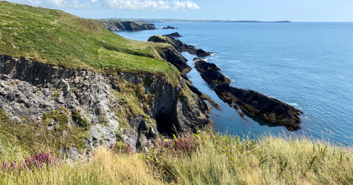
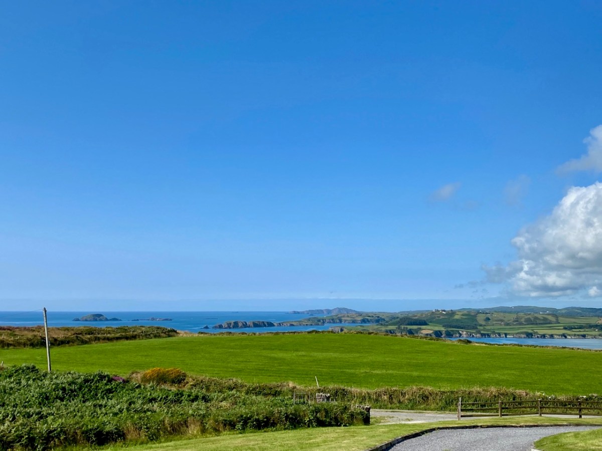
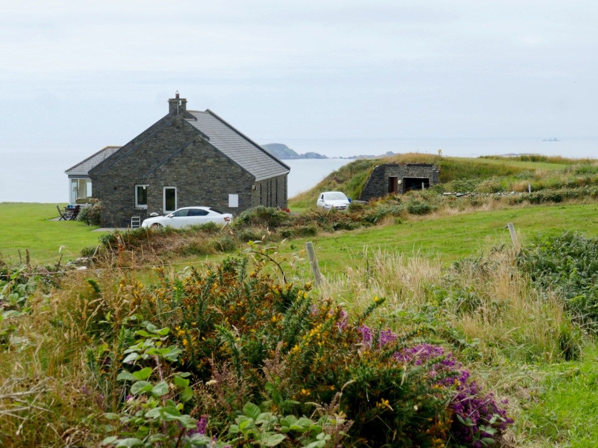
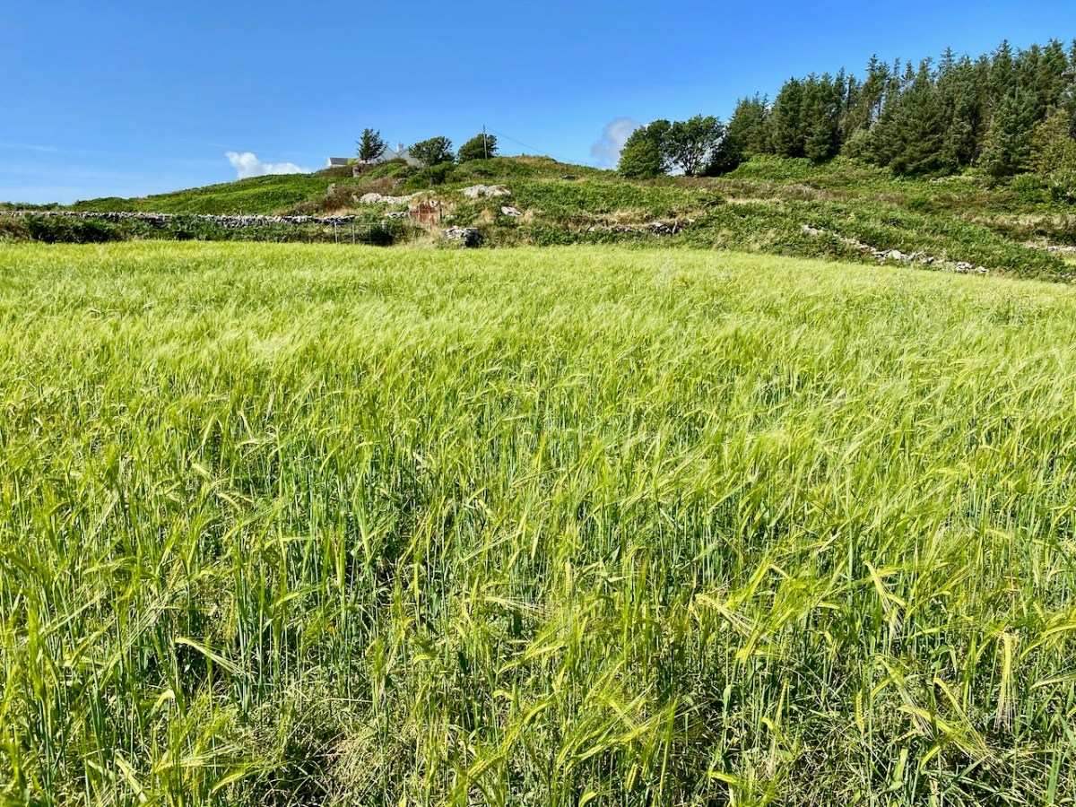
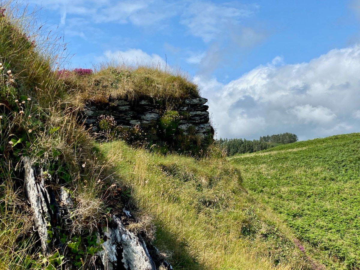
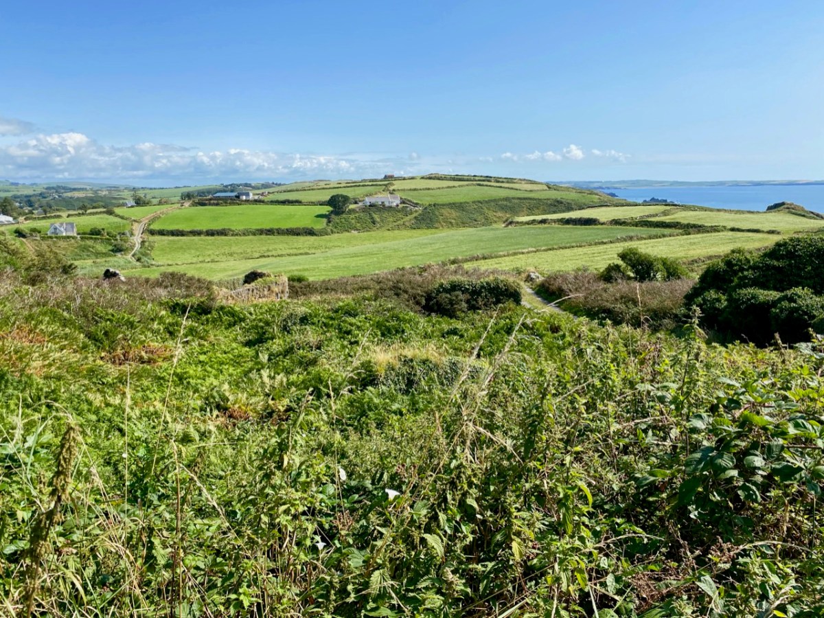
This is a bit of an epilogue to my Signal Success in Irish Engineering series (although that is not yet complete!). Here is the site of a Napoleonic-era Signal Tower in West Cork – but the tower itself has completely vanished! It’s no 28 on the map which accompanies Bill Clements’ book – Billy Pitt Had Them Built – Napoleonic Towers in Ireland (The Holliwell Press 2013) and it is given the name Glandore Head. We recently visited friends who have a house in the townland of Reenogrena, which is south-east of the village of Glandore and its extensive natural harbour. The topography of the area is soul-stirring – that’s probably an understatement: look at the view of the coastline there, above, and the distant views both west and east, below.

We were fortunate with the day we had. The benign weather gave us a possibly false sense of security as we explored a wild, riven coastline. We could well imagine how exposed we might feel there in one of West Cork’s severe storms: our climate-changing extremes are becoming ever more prevalent. But on this occasion we were confident enough to venture to the very edges of the land, always conscious that humans had settled in these remote places many generations before us.
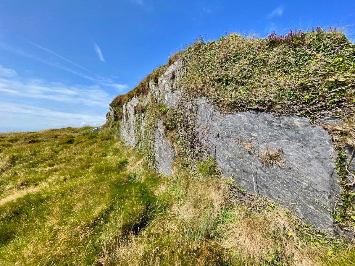
There is nothing left of the signal tower at Glandore Head, which would have been constructed between 1801 and 1804. The site has now been taken over by a recently built house which enjoys the excellent views in all directions. In the picture below it seems that the tower was located in the area of the earth-sheltered garage. We know more or less where it was because it appears on the earliest Ordnance Survey maps from around 1840. Even by then the structure itself had lost its original function, as the threat of Napoleonic invasion had passed, but it is labelled as a ‘Telegraph’. On the later 25″ map – dating from the late 1800s – the site is marked as ‘Tower in ruins’.

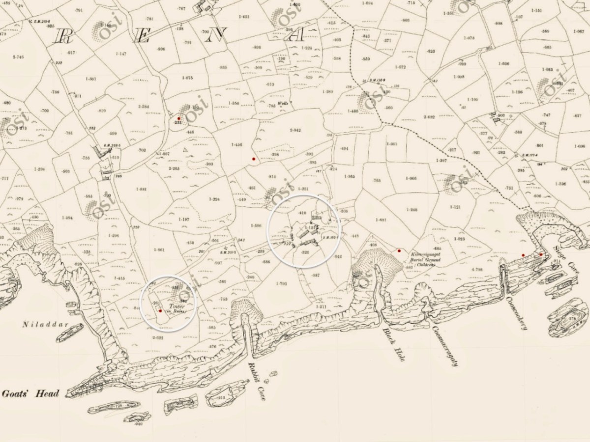
Centre – the earliest 6″ OS map; lower – the later – and far more detailed – 25″ OS map. It’s interesting to compare the two versions. The accuracy of the later map in terms of topographical detail and humanly constructed features – buildings, trackways etc is very noticeable. Below is the contemporary aerial view. 50 years separate the two OS maps, while the satellite image is 100 years later again.
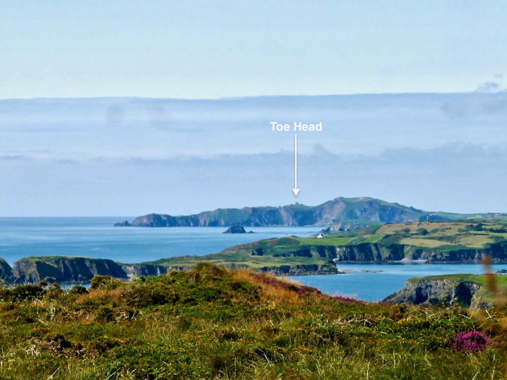
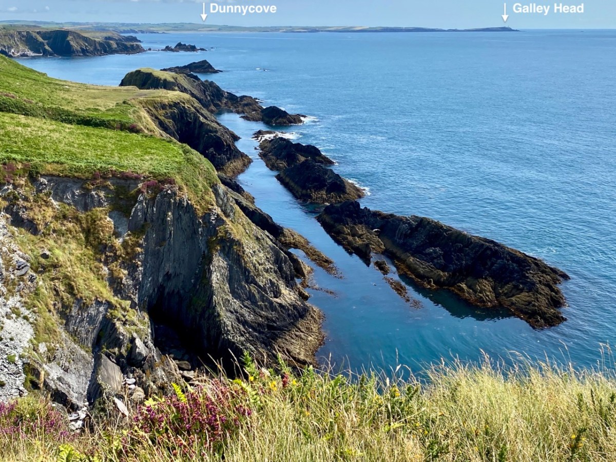
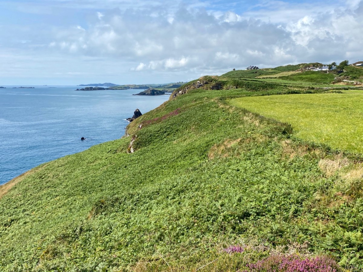
The reason why I like to examine and compare the mapped information is my interest in reading the history of a place through its landscape, and this particular vignette of West Cork is a prime example of the process. Firstly, the signal tower location was chosen because of visibility to other significant places on the coastline which are in view: the towers at Toe Head to the west and Galley Head (Dunnycove) to the east (below).
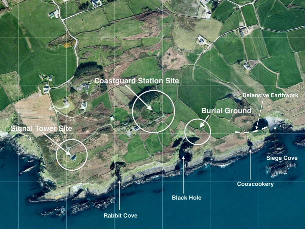
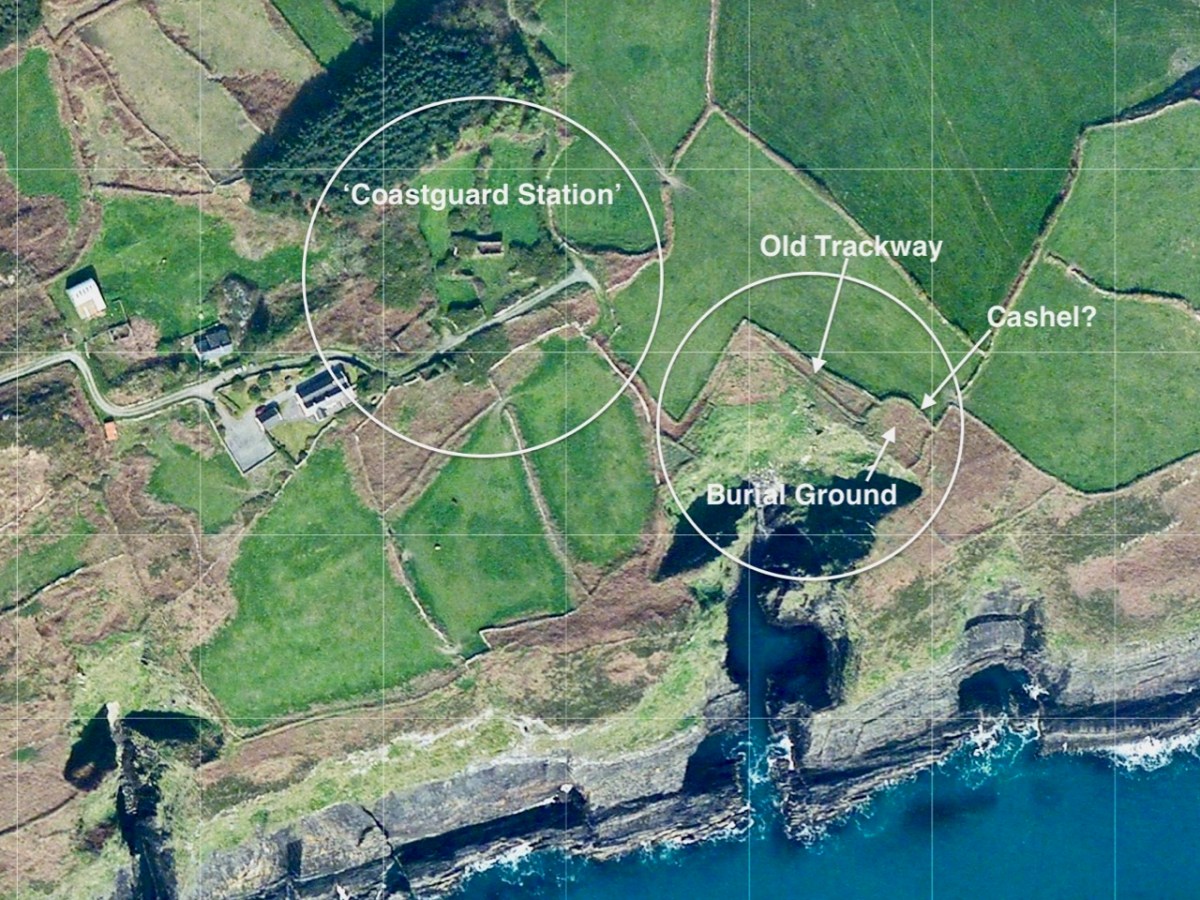
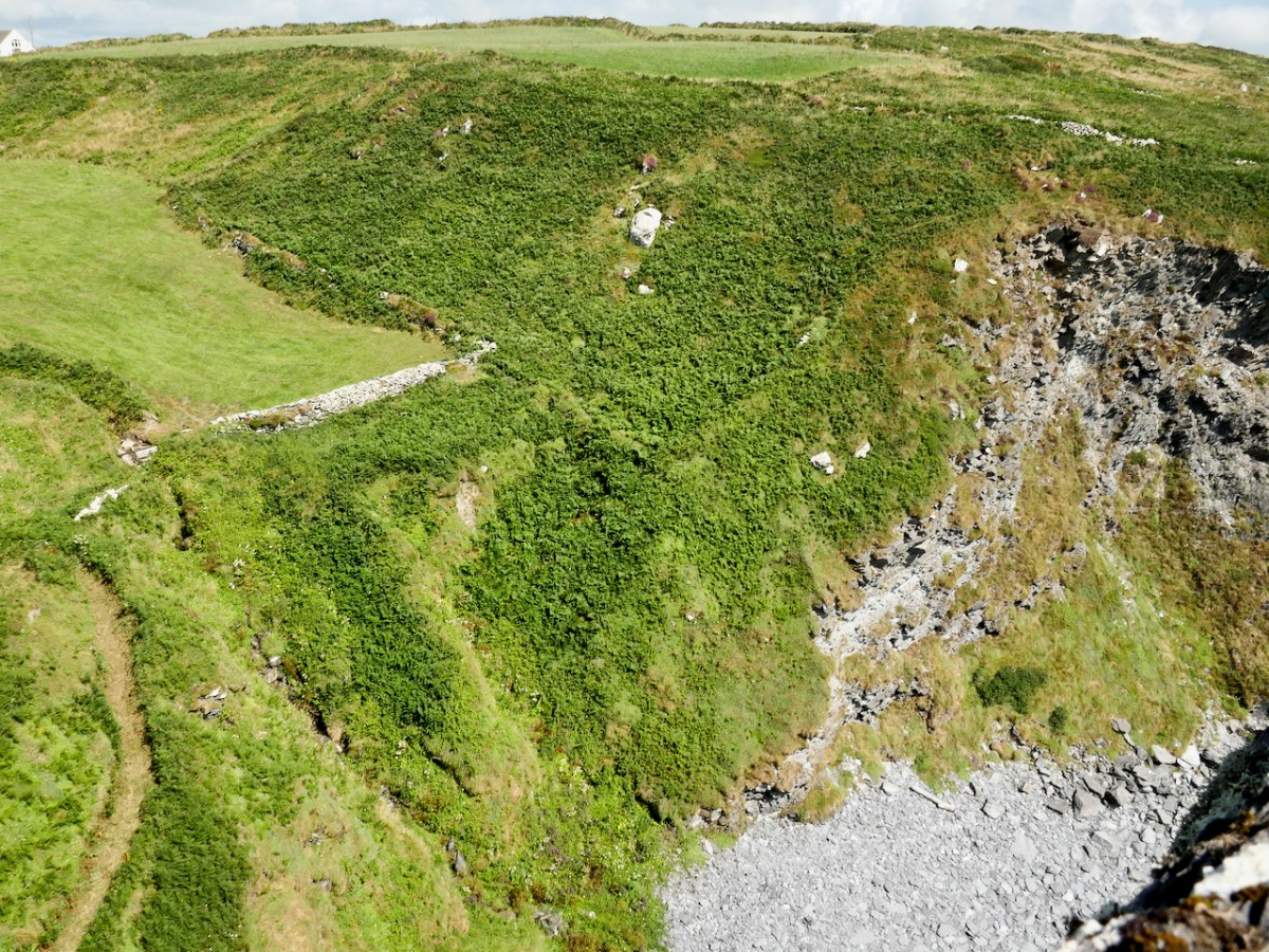
Next, look at the ‘Coastguard Station’ site. This is marked on the c1840 OS map, but not on the later 25″ map. But that later map does show a number of buildings on that site. As you can see from the aerial view, there are only the remnants of buildings now. Also the older map shows no roadway or track accessing the ‘Coastguard Station’ – it could only be reached by crossing fields. Here’s a closer look at this group of ruined buildings today, followed by some of our photos.
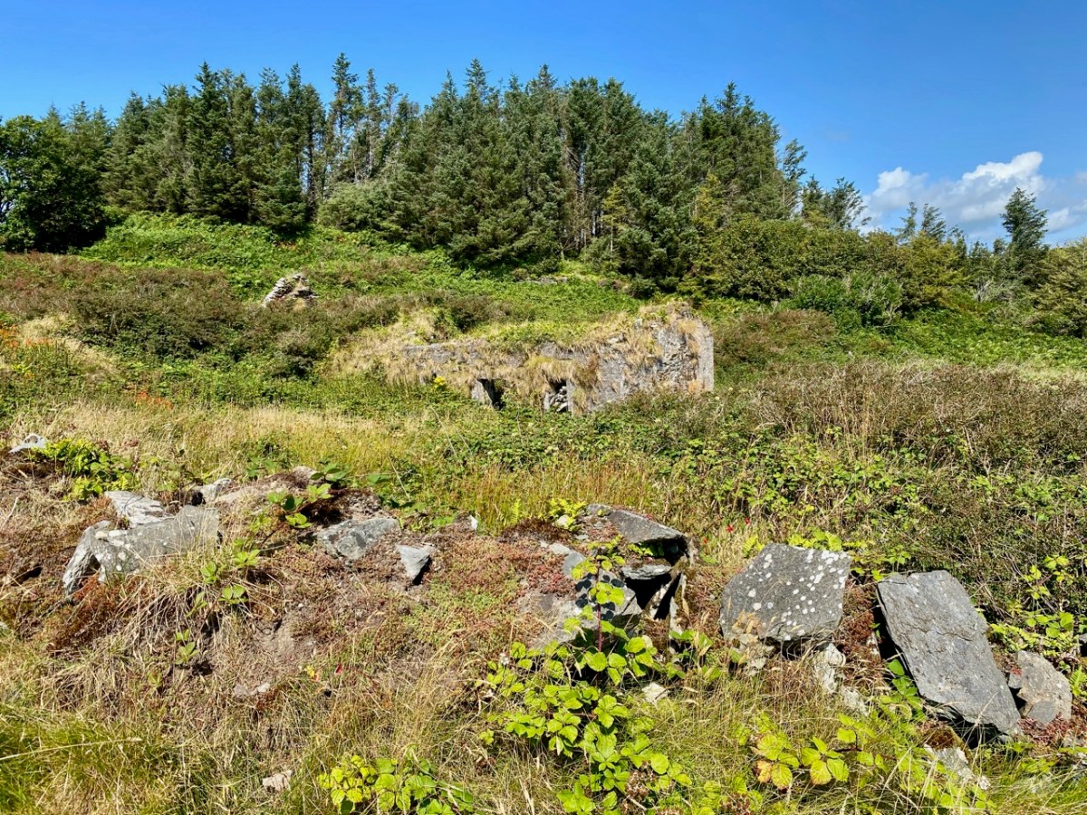
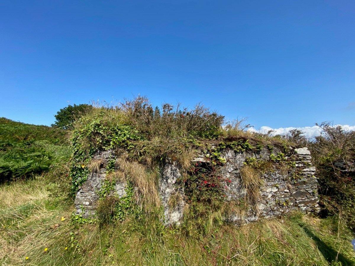
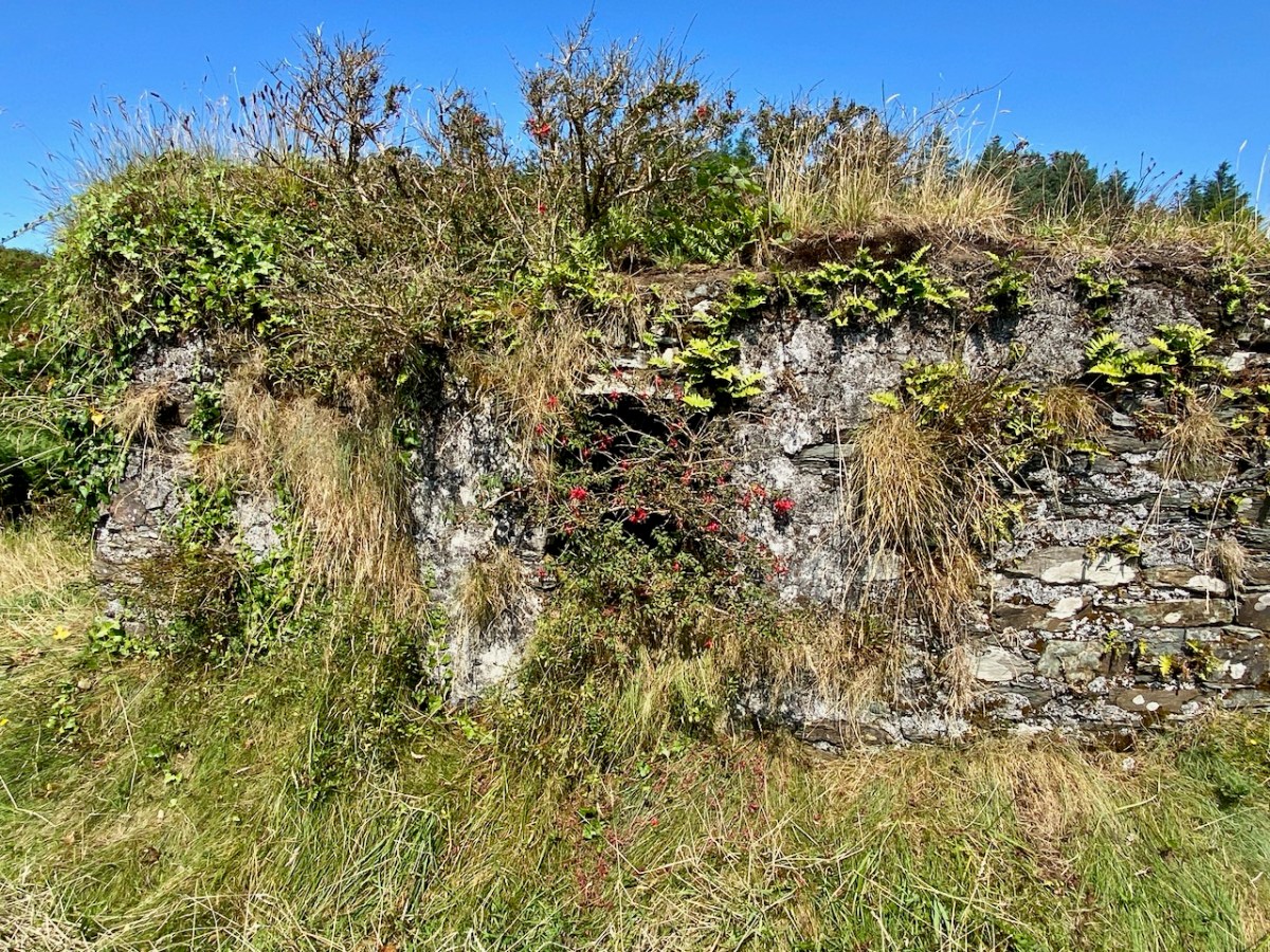
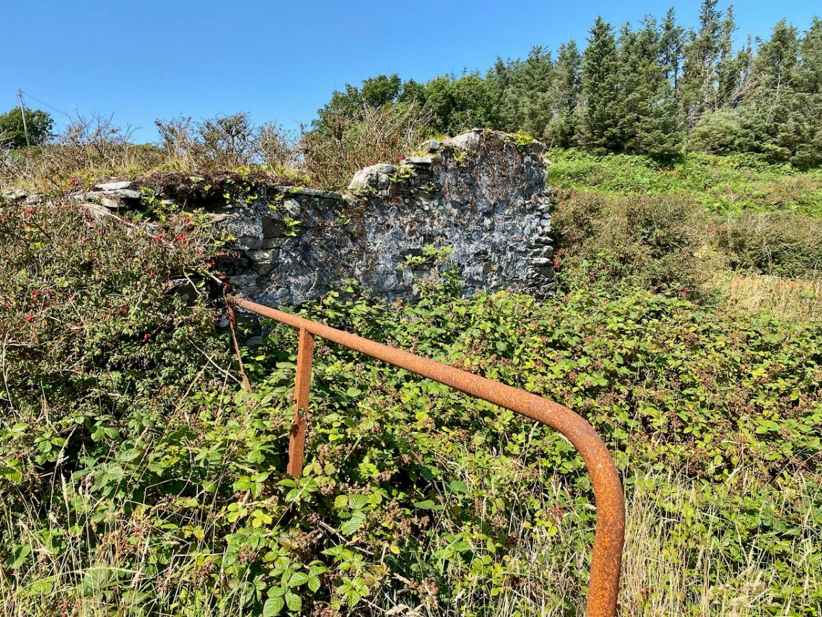
While it is likely that there are old coastguard buildings amongst these ruins, it seemed to us equally possible that we were also looking at the earlier remains of a settlement – cottages and cabins. Records of the area are scant. There’s nothing we found – apart from the OS maps – to give any further light on what we were scrutinising. Surprisingly, very little information is available on the early years of the Irish Coast Guard service, other than its establishment as the Water Guard, or ‘Preventative Boat Service’ in 1809, initially under Navy control but from 1822 part of the Board of Customs. From this we might assume that its purpose was to intercept smuggling operations, rather than to give any assistance to seafarers. Incidentally, it is important to note that in Ireland the name has always been two words: Coast Guard.

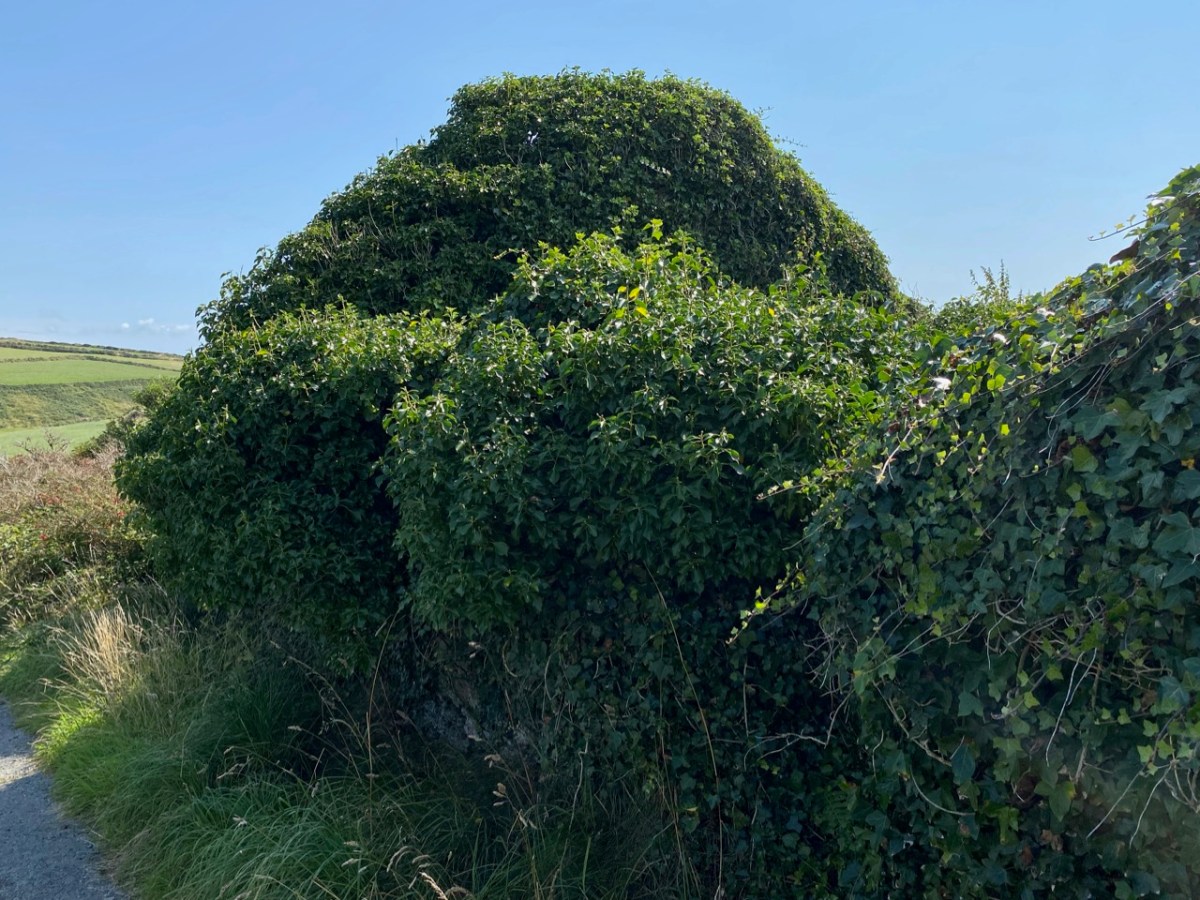
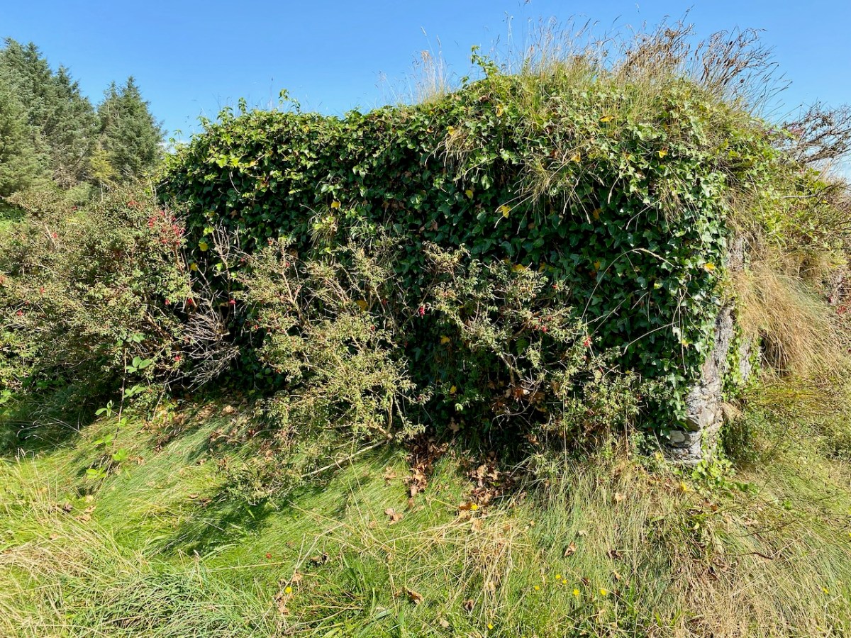
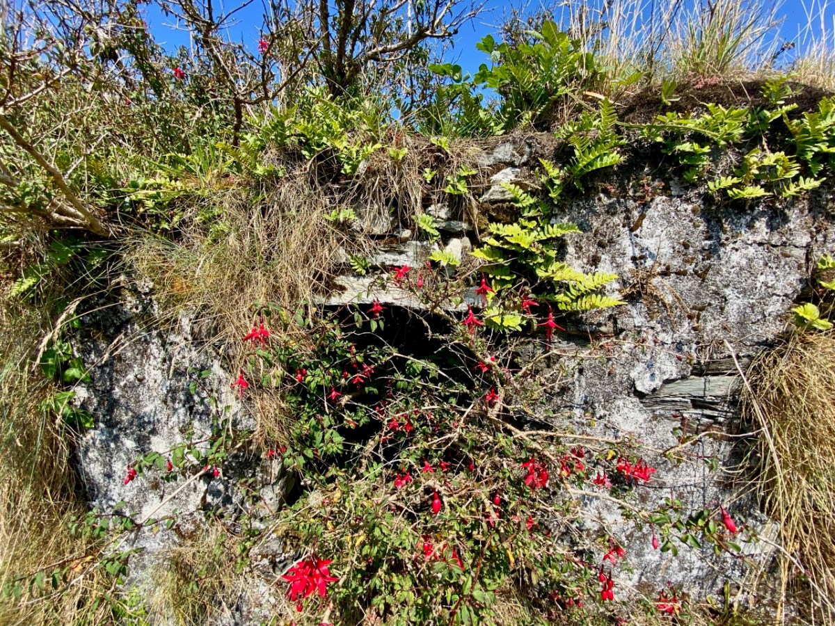
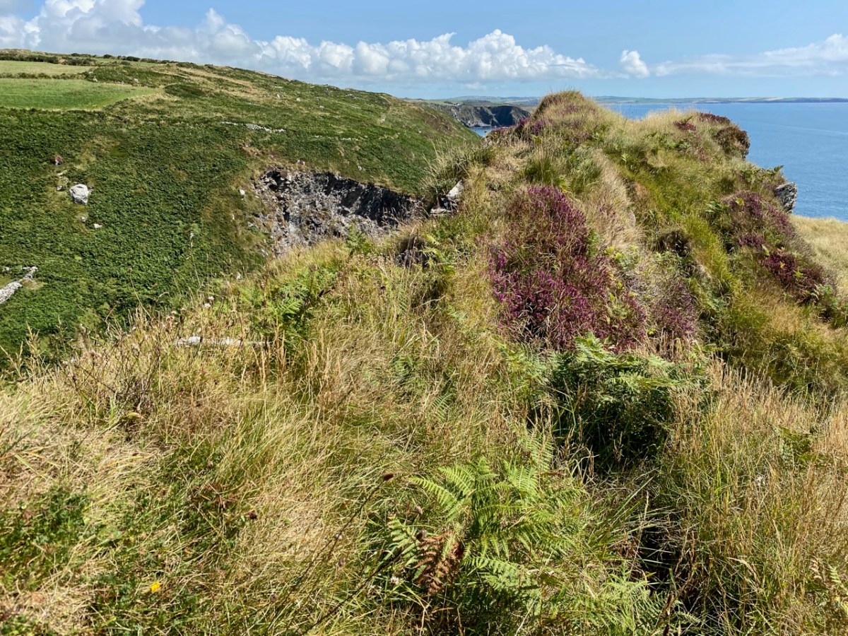
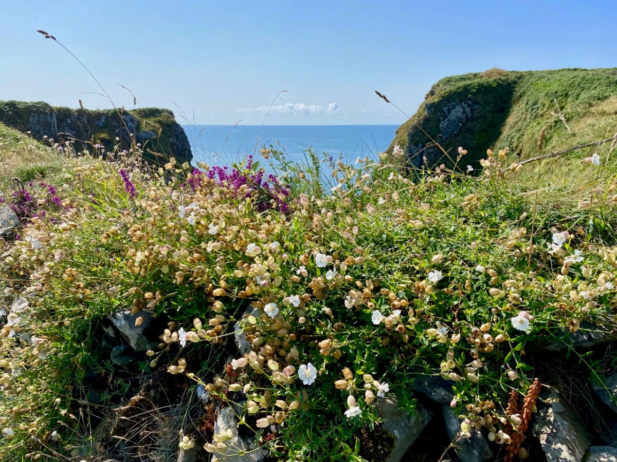
It’s easy to see that this hostile coastline – which would not be benign to small fishing boats – would nevertheless attract subversive landings. The only nearby access to the water is Siege Cove, to the east of the Coast Guard site. The upper photo depicts the curiously named Cooscookery inlet – not a good landing point, while the lower is Siege Cove – itself a difficult climb to the fields from sea level. The names of the topographical features would be a good study in themselves – and might reveal some hidden history: Coosnacragaty, Black Hole, Rabbit Cove, and Niladdar. The small burial ground is known as Kilcarrignagat (it means the ‘church at the rock of the cat’). That’s the overgrown trackway leading to it, below. It is of particular interest – partly because you wonder what communities it served, but also because it seems to have been established in a previously existing ring-fort or cashel.
Further yet to the east, and directly above Siege Cove, are the distinct remains of a defensive structure, partly taking in natural outcrops but also built up with stone. This is likely to be indications of the first habitation in this area – perhaps a thousand years ago. There seems to be at least one promontory fort here, and Finola will take up that subject in this locality in future posts (she has already tackled examples elsewhere). It seems to me that this whole coastal region would be worthy of a detailed archaeological study – UCC take note! Meanwhile, we can only express our gratitude to friends Michael and Jane for introducing us to the many wonders of their own territory.
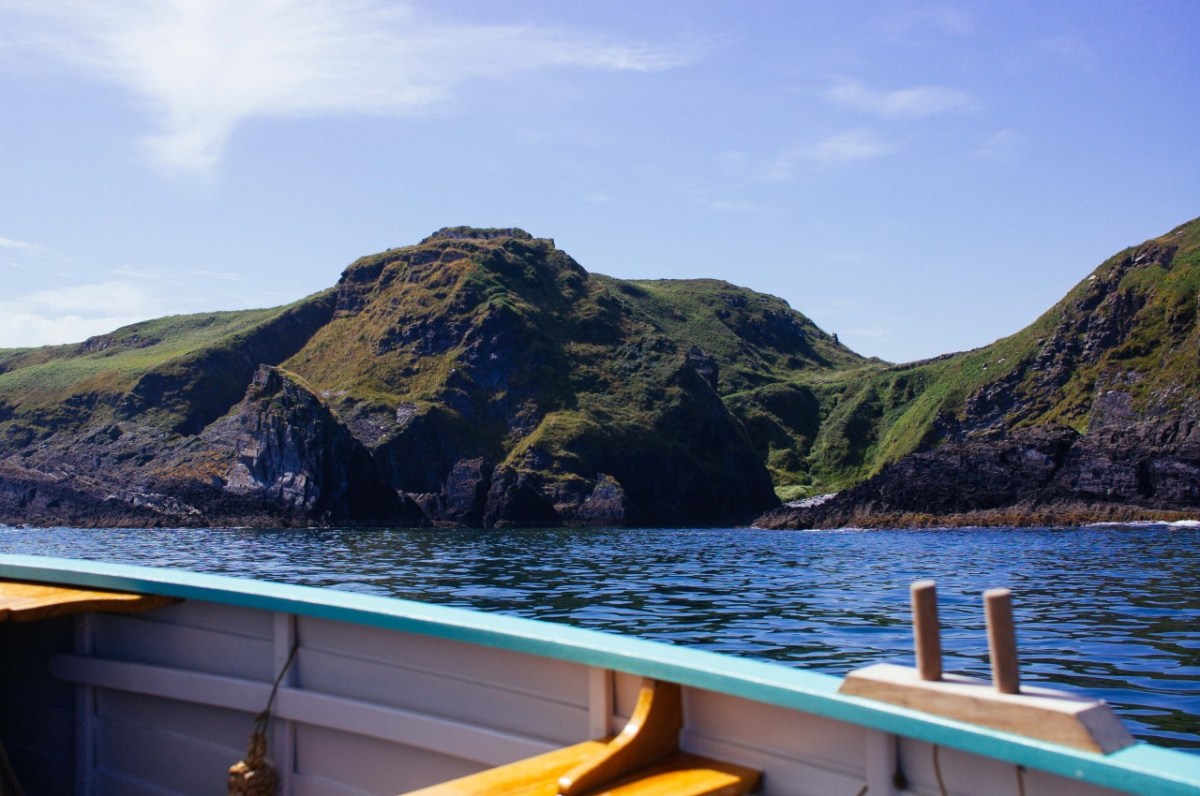
Addendum: After I had published this post I discovered an excellent photograph of Siege Cove and the coastline in this area taken from the sea. I cannot find a contact for the photographer. I do know his name is Tim, and that he publishes an occasional diary of his journeys in a boat (an Ilur based, I believe, In Glandore). I hope he won’t mind me publishing this and including a link to his website.
Discover more from Roaringwater Journal
Subscribe to get the latest posts sent to your email.

The houses aren’t that long abandoned. The last two residents (Kate & Ellen) lived out their days in our family home about ½ mile north of their home (cross country). We have a photo of them at their house in carraig na gcat as it’s locally known. As far as I remember they moved sometime in the 1950s.
The beach at siege cove is known as Cuan na Seasca (I may not have the exact spelling correct)
The coast guard station is still a bit of a mystery and may have predated even some of the residences.
LikeLike
Thanks for this additional information, Patrick. So good to get local knowledge.
LikeLike
Thank you Finola and Robert for such a wonderful source of interesting, knowledgeable and fascinating information, I have learnt so much. I was so very sad to hear about Robert, clearly a wonderful man.
LikeLike
Thanks so much, Pete.
LikeLike
Hi Patrick, I’m presuming you are local to Reenogreena and would have known my cousin Eileen Hayes. She was born in 1929 and grew up in the abandoned houses before moving to the top of the hill in 1938. I have what I believe is a photo of one of the old cottages marked on the back as “Danny and Kate Hayes House in 1961” (I’m not sure if 1961 is a guess or accurate). I’m wondering if this is the Kate you refer to? I would be very interested to see the photo of them at the Carraig-na-Gnat house. I also have various other old photos from the 1930’s onwards of the family and area and a few people I can’t name which maybe of interest to you. I wonder if you could possibly contact me? I’m not sure how to do that on this forum.
Pete Hayes
LikeLike
Absolutely no problem using my photos! Here are some more from when I landed at Siege Cove. https://ilur.tumblr.com/post/49035750413/it-was-a-northeasterly-breeze-today-went-out-for
Very interesting article. Looks like every landing place in west Cork had a coastguard station at one time! I remember visiting the old buildings 20 years ago and talking to Mrs Hayes in the last house on the left(I don’t know is she still living there). She could remember the lugsail yawls fishing out of siege cove from her childhood. I also heard somewhere that those buildings were still being lived in around 1900 or so. After the coastguards moved out the locals moved in perhaps?
LikeLiked by 1 person
Tim, thank you so much for getting in touch! And for providing that really pertinent further information. Yes, I wish we could ferret out all the stories that local people must have told – and perhaps still tell – about these places. Great to see the photos. It didn’t look to us that anyone uses the cove nowadays… We intend to revisit – and we will look out for Mrs Hayes.
LikeLike
H Tim, your photos are wonderful, I’ve not seen Seige Cove from the sea before. Mrs Hayes (Eileen) who you met was my first cousin once removed and the last Hayes to live permanently at Reenogreena (Carraig na Gcat), initially in the stone cottages (ruins) and then in 1938 into the present traditional cottage built by the Irish Land Commission. There are records of the Hayes family going back to 1816 at Reenogreena with my great-great-grandfather Denis T Hayes. Eileen sadly died in 2015 at the age of 85 but the cottage has remained in family ownership. In amongst old papers and photos at the cottage was a “Certificate of Registry of British Sea Fishing Boat” dated 1915 and written on a “waxed” paper detailing my great grandfather Jeremiah as owner and captain of a 27 foot Lugsail Yawl fishing boat. The Census’s of 1901 and 1911 detail many of the 100+ residents of Reenogreena as fishermen. I was told by a local historian that new fishing methods from the Isle of Man were introduced into Union Hall between 1910-20 with rendered the old boats and methods obsolete and marked the end of that part of Reenogreena as a community as people left. The Hayes were ultimately the only residents that remained although many Hayes had already emigrated. Eileen, her mother Julia and Uncle Jack remained to scratch out a living as farmers.
LikeLike
I know that my grandfather worked at Union Hall coast guard station. I would be greatly interested in more information Robert.
LikeLiked by 1 person
I am on the lookout for information about Coast Guards generally in West Cork. There’s surprisingly little on the internet. Perhaps some of the historical journals locally have articles…
LikeLike
What incredible scenery visited on a splendid day, and so full of history, plus some fascinating names – what an adventure.
LikeLiked by 1 person
Indeed, Amanda – we were surprised by how many ‘hidden’ secrets this place holds.
LikeLike