Keith Payne – Schull Exhibition!

West Cork artist Keith Payne is currently the subject of an exhibition in the Blue House Gallery, Schull. Get to see it if you can! We featured Keith on our Journal back in 2018, when he had an exhibition in the Burren College of Art Gallery in Ballyvaughan, Co Clare. But he also contributed some amazing work to our own Rock Art exhibition at the Cork Public Museum in 2015.

That’s Keith’s painting – based on the Rock Art at Derreenaclogh, close to where we live in West Cork – on the right, above. It was in the Clare exhibition and also our Cork Public Museum exhibition.

You have the opportunity to see the current show in Schull, as it’s on until Culture Night (Friday 22 September 2023). Early Marks is “…a study of the beginnings of art and the possible source of a prehistoric worldwide visual language…” That’s a huge subject, and Keith (below) tackles it with large, assured and spirited images.

. . . There is no Time associated with any of these works, as Time is a construct invented long after the images on exhibition. Hunter-Gatherers, the makers of Early Marks, lived in a visionary state now lost to western civilisation . . . The language of Early marks consists of imagery, symbols and patterns that have been left in the physical world but created in the ‘other world’ . . . Many of the forms are possible direct projections of electrical impulses from the brain seen during states of altered consciousness . . . ‘Entopic’ images that manifest as points of light in the absolute darkness of the mind in the cave . . .

Keith Payne – from the Exhibition Catalogue

Font Tray – part of a larger work titled The prehistoric development of visual language:

. . . Reading from left to right are the earliest images from South African caves then through Palaeolithic, Neolithic, to a column of Ogham which reads from bottom to top: “Visual Language” . . .

Keith Payne – from the Exhibition catalogue

Empty Quarter (above) – a geographical region in the southern part of Saudi Arabia: the largest continuous sand desert in the world. Now scarcely populated it was in prehistory more temperate and the petroglyphs represent fauna of the time. Keith has painted the images in different colours to indicate the different periods of engraving.

Kakapel (and detail), Chelelemuk Hills, Uganda (above). Keith has travelled across the world to find his inspiration: in this painting – set at the entry point to the spirits living within the rock – are three styles: geometric images by the Twa people, pygmy hunter gatherers; these are overpainted with cattle by later Pastoralists.. The final abstract and geometrical designs were added by the ancestors of the Iteso people who migrated from Uganda.

Lokori (above) – site of the Namoratunga rock art cemetery in Turkana Country of Kenya. Located on a basalt lava outcrop adjacent to the Kerio River.

Left side above: Paleolithic Images – found in paleolithic sites worldwide: Believed to be visual statements perceived during trance states. Right side: Entopic Images – produced in the visual cortex. Often geometric in form and linked to the nervous system, seen as a visual hallucination. Noted during altered states produced by the use of the entheogens and trance states, fasting and the total deprivation of all light.

Schull Blue House Gallery: Keith Payne’s Namoratunga Rain Man petroglyph on the left.

Teana Te Waipounamu, New Zealand

From Signs + Palette of Ice Age Europe: a possible Visual Language.

Waiting Room:

. . . Approaching the mystery of the sacred space one dwells, initially, in the First Chamber. Many caves of the Mid region of France are very deep with passages, rivers and massive chambers which stretch for miles. To enter is to commit to a journey into the Sepulchre. The first chamber is for adjusting to experience ahead, perhaps initiation into the mystery of total light deprivation with the sound of beaten lithophones and flutes, echoing through the darkness. Or the revelation of your totem in a state of trance, to then be led deeper to meet with the serpent force of the mountain and shown the way of the Shaman . . .

Keith Payne – From the Exhibition Catalogue

That’s me – at Keith’s Burren exhibition – awestruck by his Venus of Laussel.

Ronan Kelly discovered Keith Payne’s West Cork studio in this YouTube video

Evolving Cork – The Great Exhibitions

Here’s a fine view over the city of Cork, taken early one morning from the grounds of the Montenotte Hotel, on Middle Glanmire Rd. It reminded me that way back in 2016 I mentioned in Roaringwater Journal the fact that Cork City has over the years hosted a number of world-class fairs. The first was in the mid nineteenth century:

This engraving from the Illustrated London News shows the ‘Fine Arts Hall’ which was part of the Cork National Industrial Exhibition held in 1852:

. . . The site of the Cork Exhibition was the Corn Market, where ships carrying visitors and goods could dock and unload at the entrance gates. The old Corn Exchange building, lent for the occasion, formed one end of the structure, while a new mart served as a principal show room. This ran across the southern part of the old building, parallel to the quay, for 300 feet in length and 30 feet in breadth, giving the impression of a contemporary railway station, even to the strip of glass along the roof to admit daylight. By the opening day ad hoc extensions had been added which converted the original elongated T – shape into a cross, with covered galleries and passageways running from the central structure to an adjacent building used as a hall for banquets, balls and public lectures . . .

A C Davies – Irish Economic and Social History, Vol 2, 1975

. . . The exhibition remained open for three months, until 10 September. The opening ceremony had been performed by the Lord Lieutenant after a procession watched by the townspeople, ‘in all the pomp and circumstance of majesty, with waving banners, prancing horses, peals of artillery, and multitudinous shouts’. At first attendance was sparse. It rained steadily for the whole of the first week, but then the weather improved and the number of visitors increased. It amounted to about 140,000. Ten thousand free admissions were granted to children from over seventy schools in the area . . .

A C Davies – Irish Economic and Social History, Vol 2, 1975

When the 1852 exhibition closed, the people of Cork decided their city should have a venue suitable for the holding of public lectures, meetings and concerts. Within a few years the building above was constructed. Known as the The Athenaeum, it was designed by Sir john Benson, who had been responsible for the Great Hall of the Cork Exhibition. It is said that many of the materials which had been used in Benson’s exhibition hall were salvaged and re-used in The Athenaeum. The new building was renamed The Munster Hall in 1875 and then became the Cork Opera House in 1877. It survived until 1955, when it was destroyed by fire. The present Opera House, on the same site, was opened by President Eamon de Valera in 1965. It was extensively remodelled, with the glazed facade added, in 2000.

Half a century later Cork city embarked on another major ‘world fair’ class event. In 1902 the Lord Mayor of Cork, Edward Fitzgerald, presided over creating Cork International Exhibition, which ran from May to October. Reclaimed marshland beside the river at Mardyke was used for the site, which occupied an area of about 44 acres. Here are the ‘leading lights’ of the exhibition organisers, with Fitzgerald on the right:

This exhibition was considered such a success that it was repeated the following year – 1903 – and the site plan above bears this date. The artist’s aerial view of the site, below, gives a good impression of the extent of the grounds. Note the ‘switchback railway’ to the left: this was a precursor to roller-coaster fairground rides and was immensely popular…

…As was the ‘Water Chute’ from which it was unlikely that you would emerge dry!

Such attractions were very popular with the general public, but the exhibition had a more serious commercial side:

Several large exhibition halls and pavilions housed a range of industrial and agricultural exhibits from many countries including Canada, Turkey and China. There were displays of industrial and agricultural machinery as well as horticulture, fisheries, art, craft and ceramics . . . The Irish Department of Agricultural and Technical Instruction had a strong presence at The Exhibition with exhibits on dairying, cheese-making, cottage gardening, forestry, bee-keeping, poultry, fruit and vegetable drying and preserving . . .

National Museum of Ireland Collections & Research

Hadji Bey is a name that will be familiar to any Cork person with a sweet tooth! The true story goes that Armenian immigrants Harutun Batmazian and his wife Esther chose Cork as their new home during the early years of the 20th century, after escaping the persecution and violence against Armenian Christians taking place in the Ottoman Empire at the time. In 1902, the Batmazians participated in the Cork International Exhibition and introduced their Turkish Delight – a skill Harutun learned while studying in Istanbul – to the market. Although they spoke no English at the time, the city was to became their home and the popularity of their sweets – still made in Ireland today – is legendary. After their success at the Exhibition they opened a shop on MacCurtain Street: this survived for many decades.

Turkish Delight is just one success story from Cork’s International Exhibitions. The 1902 event attracted nearly two million visitors. Surely, it’s time for another one?

After all the clamour and excitement had died down the Exhibition buildings (below) were dismantled and auctioned off. In 1906 the park and Shrubberies House were taken over by Cork Corporation with the proviso that the Corporation would levy a rate of half penny in the pound for annual upkeep and maintenance.  A further proviso stipulated that the Shrubberies House would be used by the Corporation as a municipal museum. Today we can all enjoy enjoy Fitzgerald’s Park and the Cork Public Museum, where Finola and I put on an exhibition about Rock Art back in 2015.

If you want to know more, I thoroughly recommend this book, written by Daniel Breen (now Curator of the Cork Public Museum) and Tom Spalding, published by the Irish Academic Press.

Eleventh Hour

I write this at 11am on the 11th November 2018 – exactly 100 years since the ending of The Great War. I have been aware of the significance of this moment of remembrance since my childhood: wherever we were at the eleventh hour of the eleventh day of the eleventh month, we had to stop what we were doing and be silent for two minutes. This – and the horrors of war – have been in my psyche forever.

Growing up in Britain there was always that awareness of the two world wars, and the losses and sacrifices that they caused: every town and village has its war memorial, giving the names of those who died. That first – Great – war also affected Ireland but, until quite recently, it seems those Irish people who died because of it have received scant commemoration. But – as always in Ireland – once you begin to turn over the stones you do find the history; today’s post looks at just a few examples of memories and commemorations of the 1914 – 1918 conflict.

Firstly, the poetry. Yeats wrote of war poets – “We have no gift to set a statesman right.” I think he was wrong – poets and artists are probably most able to express emotions about war and its outrages in ways that others can approach and embrace. Francis Ledwidge, although an ardent Irish nationalist, states that he . . . joined the British Army because she stood between Ireland and an enemy common to our civilization and I would not have her say that she defended us while we did nothing at home but pass resolutions . . . Only a poet, surely, could describe an army as feminine. Ledwidge gave his life in pursuit of the cause: he was blown to pieces at Ypres on 31 July 1917. A year previously his friend, Irish patriot (and poet) Thomas MacDonagh, was executed (for his part in the 1916 rising) by soldiers in the same uniform that Ledwidge was wearing. The irony is only compounded by the fact that the poet’s Lament for Thomas MacDonagh can be seen now as Ledwidge writing on his own fate:

He shall not hear the bittern cry
in the wild sky, where he is lain,
Nor voices of the sweeter birds
Above the wailing of the rain
  
Nor shall he know when the loud March blows
Thro’ slanting snows her fanfare shrill,
Blowing to flame the golden cup
Of many an upset daffodil.
  
But when the dark cow leaves the moor
And pastures poor with greedy weeds
Perhaps he’ll hear her low at morn
Lifting her horn in pleasant meads.

Last week saw the opening of a new exhibition at the Cork Public Museum – Cork 1918: Victory, Virus and Votes. There are photographs, posters and artefacts – all very well displayed – telling the story of the involvement of people from Cork in the Great War, the political fallout from the War and the aftermath of the world wide Spanish Flu epidemic which claimed millions of victims. It’s a must-see exhibition and congratulations are due to Dan Breen and his dedicated team at the museum for bringing it to fruition at this appropriate time. The images above and below are from the new exhibition.

Today Finola is thinking about her grandfather – Sgt William Owen Roberts – who served in the Welsh Fusiliers and had a distinguished military career which included the Boer War and the Chinese Boxer War. He served in the Great War and was captured and interned in Germany and Holland. He contracted and died of the Spanish Flu on 15th November, 1918 – just a few days after the end of the conflict – at the age of 39. His grave is in The Hague.

There can be only a few families not affected by the wars of the twentieth century. My own Uncle Jack died in a prison camp in the 1940s, while my mother’s mother was a victim of the flu epidemic, dying in 1918 and effectively orphaning my mother (aged four) and her three siblings, as their father was away serving in the army.

Tucked away in burial grounds around Ireland are the graves of those who died in Europe between 1914 and 1918 in that awful war – and of those who died subsequently as a result of injuries and mental stress arising from the war. We mark them out on our travels around the country. The graves – erected by the Commonwealth War Graves Commission – are of a distinctive uniform design, originated by the architect Edwin Lutyens (who also designed the great Thiepval Memorial in France, the largest Commonwealth memorial to the missing in the world, inscribed with over 72,000 names). The sheer magnitude of that number – people of whom no trace is left other than a name carved on stone – is bewildering. The image below of Thiepval is courtesy of the CWGC.

Ireland does now have its own dedicated national war memorial to commemorate the Irish men and women who died during the First World War. The idea was first mooted in 1919 but took years to gestate. Lutyens was commissioned to design formal gardens in Islandbridge, Co Dublin, in the early 1930s, and construction work was largely completed in 1937, following by the establishment of trees and landscaping, an essential element of the design. The 1939 – 45 war in Europe delayed the opening of the memorial, which languished and suffered from decay and neglect for years after that. It wasn’t until 10th December, 1980 – following restoration by the Office of Public Works – that the Irish National War Memorial Gardens were formally dedicated, and they are now maintained to a high standard. As a point of interest, the gardens include classical pavilions – ‘Bookrooms’ – designed to house the memorial record illustrated by Harry Clarke and inscribed with the names of the 49,400 Irish soldiers lost during the Great War. The image of the memorial gardens below is by Diego Lopez Sebastian. The ‘tailpiece’ is a Harry Clarke Illustration from Ireland’s Memorial Records.

For us, perhaps it’s those tucked-away and often forgotten graves in the corners of Irish cemeteries that are the most poignant. We know that each one tells a story: we can’t know that story – but hopefully there is always somebody who does know – and who passes on the memories to future generations.

Above: two tucked-away West Cork war graves. The left-hand picture has an example, lower left, and is at Abbeymahon Graveyard, Courtmacsherry. On the right is an example at the ancient burial ground of Castlehaven.

Boyle’s Bealtaine: Rock Art, Ancient Festivals, and Archaeoastronomy

Bealtaine is one of the great ancient festival days, the one that heralds the beginning of the season of fertility in crops and animals. It marks the mid-point between the spring equinox and the summer solstice, making it a cross-quarter day, and this year it fell on May the 5th. For the non-Irish speakers out there, it’s not pronounced bell-tane, but byowl (to rhyme with owl, the bird) – tinnuh – Byowltinnuh. If you’re really keen on getting it right, you can listen to it here.

Things did not look promising as we arrived at the Giant’s Grave – cloud and fog

We devoted two posts recently to the subject of Boyle Somerville. The first was a post about his life and his pioneering work on what is now called archaeoastronomy, but which he called the new science of Orientation. The second was about a site that was close to his home in Castletownshend, Knockdrum Fort. In Boyle’s own article on Knockdrum (available online with a JStor subscription), he notes a particular orientation between two fallen galláns (or standing stones) on a slight prominence in the grounds of Drishane House, to Knockdrum Fort itself at sunset on Bealtaine in 1930.

Standing behind the Giant’s Grave, Knockdrum Fort is clearly visible on the horizon

On that day, he states, he stood on the fallen galláns and watched the sun set directly over Knockdrum Fort. Yesterday, we did the same thing. It was a nerve-wracking business as not only cloud cover but a constant drifting fog obscured the hills and we were not hopeful that we would be able to see anything at all. But Boyle was up there, looking down on us, and at the last minute the clouds parted and there was the sun, exactly where he said it would be, angling slowly down to the fort.

The sun lights up the Giant’s Grave, making the cupmarks on its surface more visible

Watching this descent was a real highlight of my life here in West Cork. First of all, it felt really special to be on the same spot as Boyle Somerville, 88 years later to the day, and verifying his sighting by recording the phenomenon with photographs and video. If anyone else has done it in the intervening years, we can find no record of it, but would love to hear about it.

Secondly, this is essentially a rock art story, rather than a stone fort story. As Boyle himself pointed out, the stone fort at Knockdrum is but one piece of evidence of a long and continuous use of this commanding site. There are two carved stones at Knockdrum, one outside the fort with cup-and-ring type carvings, and a cup-marked stone currently lying within it. Look back at Robert’s post to see photographs and drawings of these two stones. These examples of rock art are likely the oldest artefacts on the site, dating to between four and five thousand years ago. There is also a cross-inscribed slab, possibly indicating an Early Medieval use of the site for ecclesiastical purposes. The stone fort itself may have been a relatively recent period of occupation, marking it as the fortified residence of a high-status individual about a thousand years ago. Boyle felt it may even have been used for look-out and defensive purposes in the seventeenth century.


Robert’s 2014 drawing of the surface of the Giant’s Grave capstone with 17 cupmarks

But the fallen galláns, known locally as the Giant’s Grave, also have cupmarks, tying them to the rock art tradition. The upper surface of the top slab has 17 cupmarks. Boyle counted 19 and the National Monuments record has it as 12, showing how difficult it can be to accurately identify man-made marks on a rough and heavily-lichened surface.

The Giant’s Grave, or fallen galláns, from the west side

While Boyle described this monument as two fallen galláns, it is unclear whether the placement of the two stones, one on top of the other, is accidental or deliberate. If deliberate, then this may be another type of megalithic structure, perhaps similar to a boulder burial (or clochtogle, as he preferred to call them). The orientation, then, as observed by Boyle in 1930 and by us in 2018, is from this probably Late Neolithic or Bronze Age structure to the place where other other pieces of rock art originally stood. Intervisibility, or the visibility of one piece of rock art from another, is well established in the Irish rock art literature. While we have written before (see here and here) about orientation from a piece of rock art to horizon markers, we have never before recorded a specific orientation, involving a solar event on a calendrical day, between rock art sites. So, this is a first for us, and may be a first for Ireland.

This is the Gortbrack stone, on its stand in the Stone Corridor at University College, Cork (UCC). It came from the townland next to Knockdrum Fort

In fact, it is easy to forget that three other examples of rock art come from adjoining townlands because they are no longer in situ: one is in the grounds of Drishane House and two are in Cork City. Six pieces of rock art less than 3 kilometres apart make for a ‘concentration.’

Above, the rock art currently in the grounds of Drishane House, but originally from Farrandeligeen

The Drishane House stone came from Farrandeligeen, immediately west of Drishane townland. In the field notes kept by Boyle, and discovered by Dr Elizabeth Shee, he notes that the stone was originally built into the wall of an outhouse. . . but was brought to Drishane House by Colonel Somerville in about 1880, for safe keeping.

This is one side of the Bluid Stone (both sides are covered in cupmarks), which is housed at the Cork Public Museum

The other two pieces are from the townlands of Gortbrack, immediately to the west of Farrandau (the townland in which Knockdrum Fort is situated) and Bluid (either East or West) which is to the west of Gortbrack. Gortbrack is in the Stone Corridor at University College Cork, and the Bluid stone (an unusual two-sided example) is at the Cork Public Museum. Both had been in the possession of Boyle Somerville, and were presented to UCC after his death. They had been brought to him by local farmers who knew of his interest in such things. We can only lament that of the six separate examples of rock art known from this immediate vicinity, we can be reasonably confident that only one, the Giant’s Grave, is in its exact original location. Neither of the two pieces at Knockdrum Fort are precisely where they were found, but at least they do not seem to have been moved more than a few metres from their original situations.

There is scope for much more investigation of this intriguing group – we shall call it the ‘Boyle Somerville Rock Art Concentration’. But for now, let us once more raise a toast to Boyle, pioneering archaeoastronomer of West Cork.  His legacy lives on.

Cape Clear: The Stone That Moved

along the road
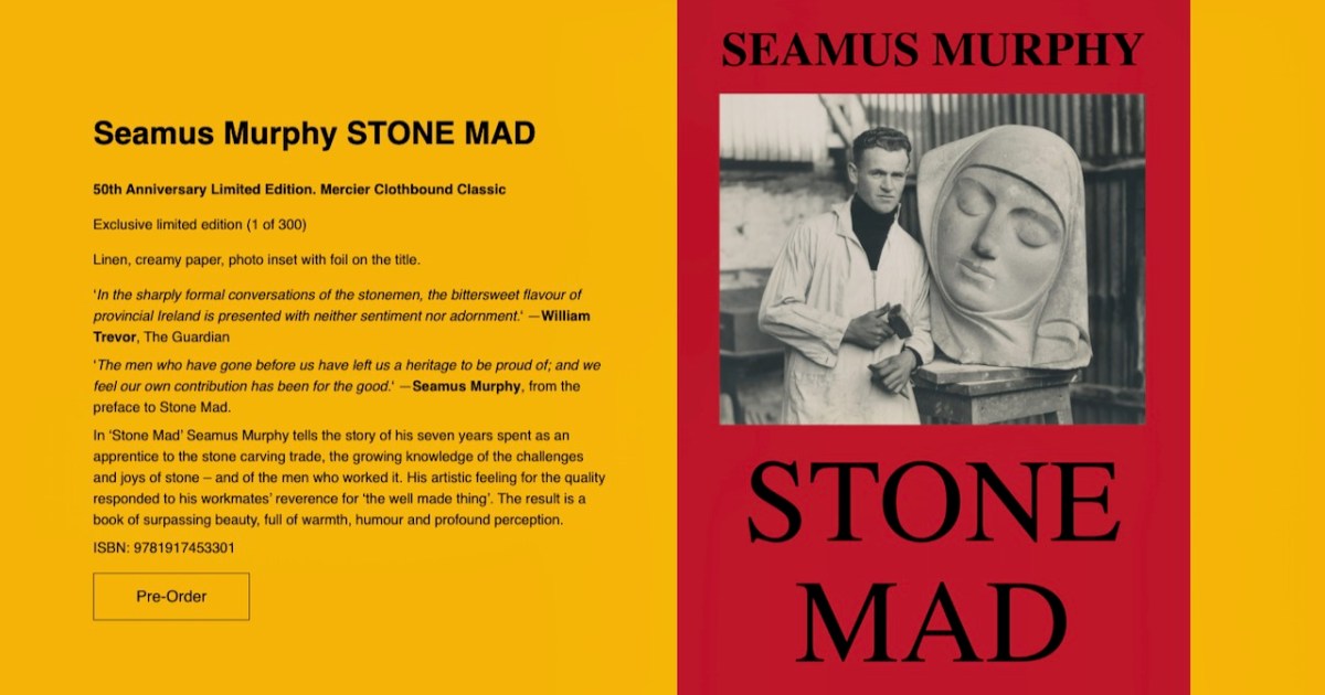
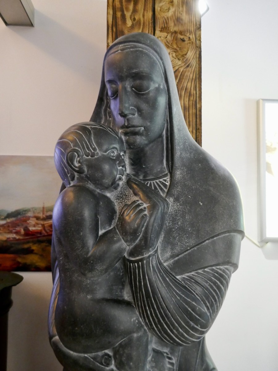
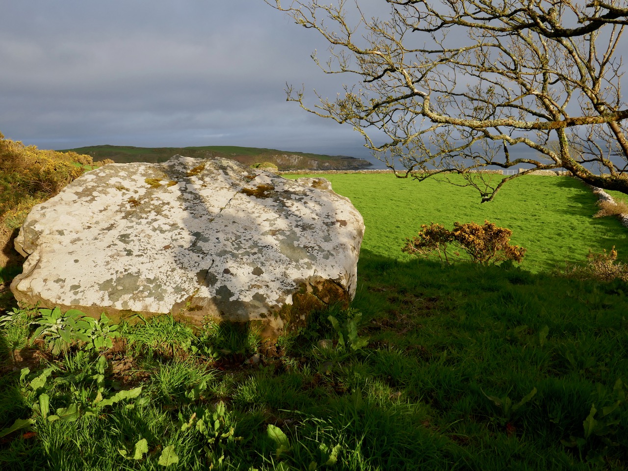
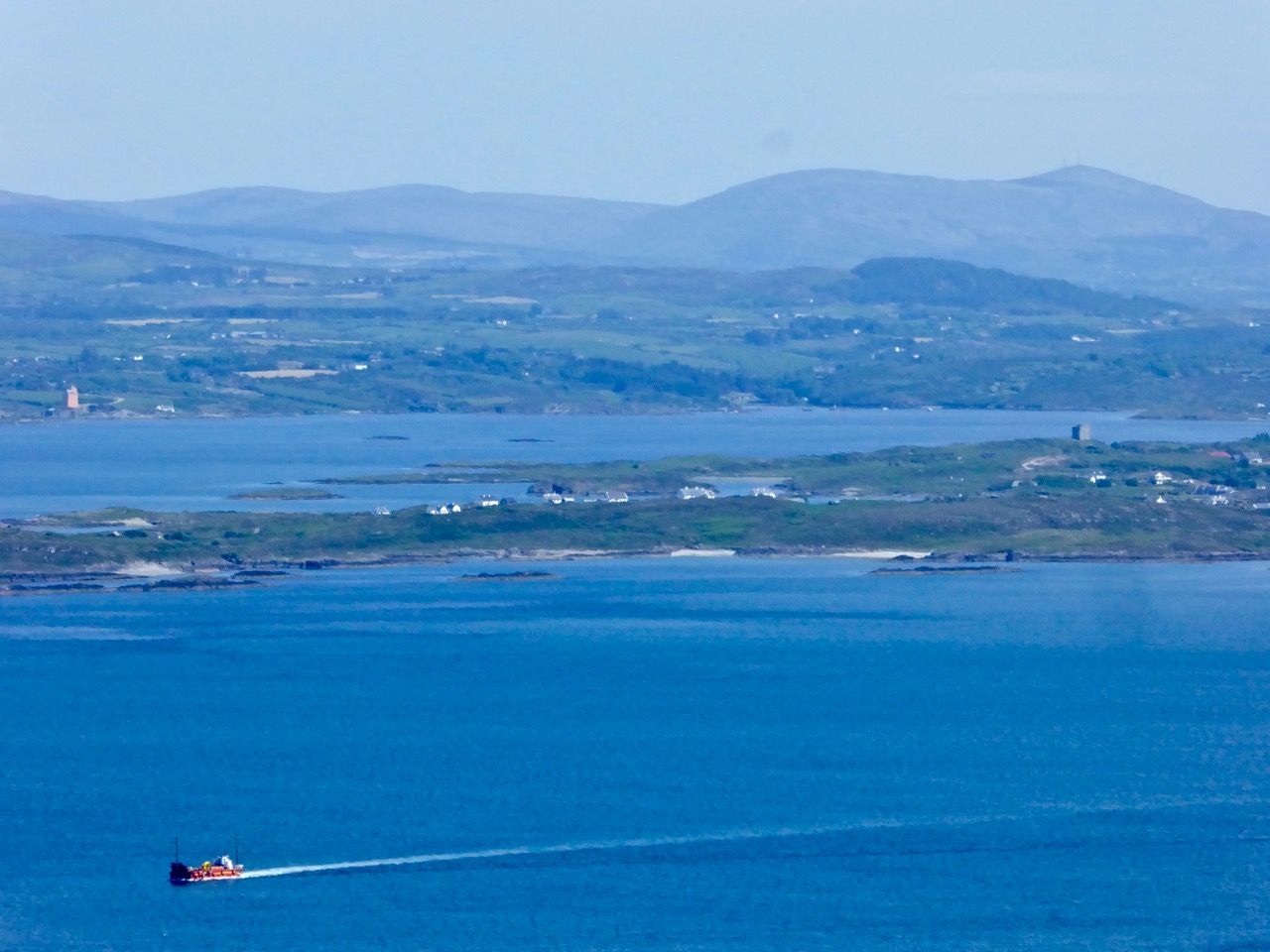
The enigma begins around 1874, on Cape Clear – the southernmost piece of inhabited soil on the islands of Ireland. Land here is hard won, and the stony fields are laboriously cleared using human power and – most likely – donkey power to improve prospects for grazing and tillage. In this year a narrow field in the townland of Croha West is being improved: the farm belongs to Tom Shipsey. His men – Dónal O Síocháin and Conchúr O Ríogáin – turn up a stone with strange markings on it, reportedly together with ‘shards of old incised pottery’, although these latter have never been traced.

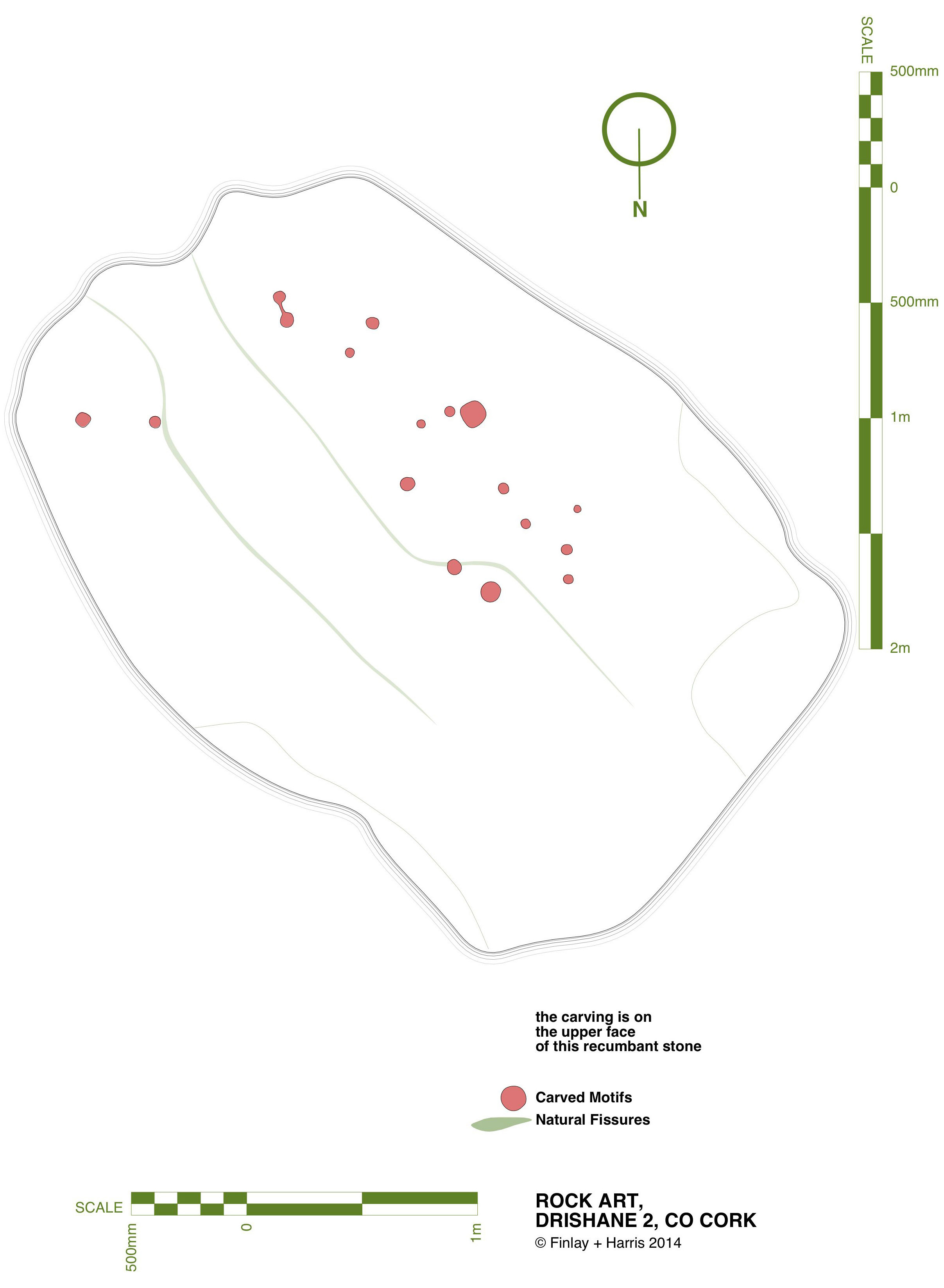
Header: looking towards the townland of Croha West, where Thomas Shipsey and his men discovered the travelling stone. Above left – records from the Shipsey family dating back to the 1800s. Above right – possibly the earliest drawing of the Cape Clear Inscribed Stone, included in Michael J O’Kelly’s article of 1949  in the Cork Historical and Archaeological Society Journal

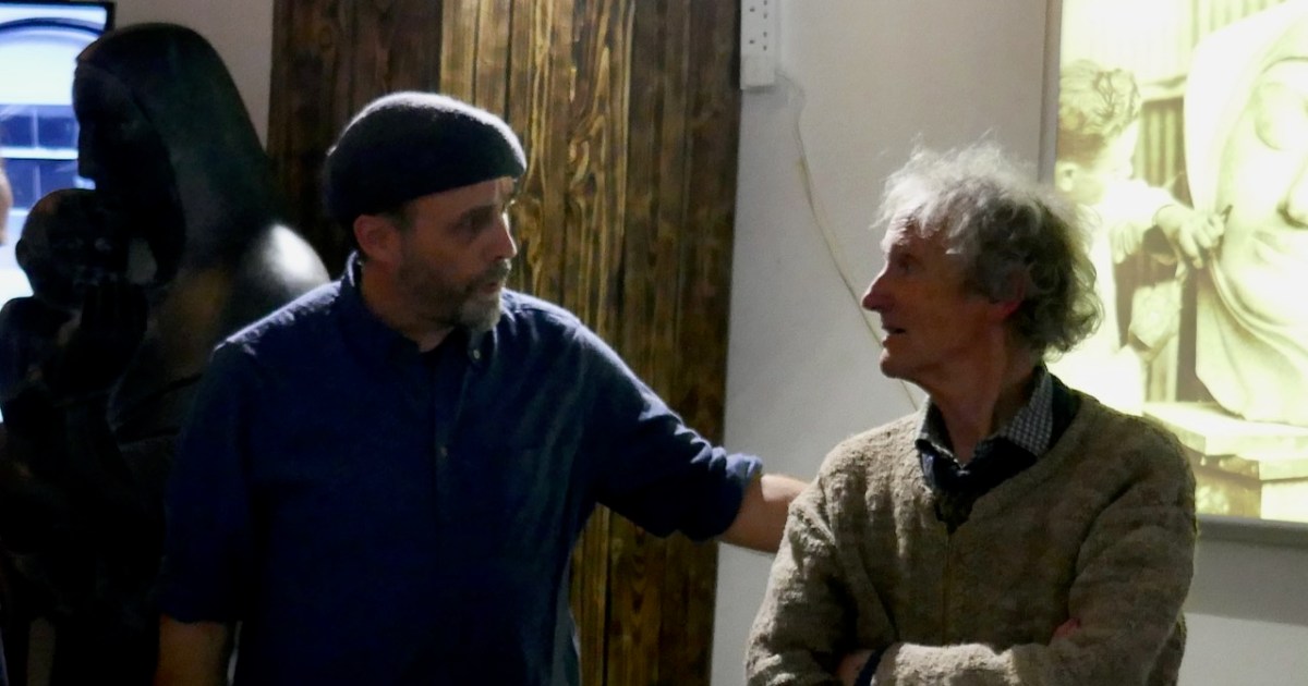
At this time the Curate on Cape is Revd John O’Leary. We might reasonably assume that he takes an interest in the stone and has it set up somewhere to show off its curious and undoubtedly historic decoration. We do know for sure that, when he leaves Cape Clear in 1877 to take up the curacy of neighbouring Sherkin Island, the stone goes with him and becomes a feature in his garden there. It does not, however, accompany him to Clonakilty whence he is transferred to become Parish Priest and Monsignor in 1881: instead it languishes on Sherkin, benignly fading into the undergrowth. Years later – in 1945 – the stone is ‘accidentally rediscovered’ by the then incumbent, Rev Fr E Lambe. Presumably recognising its probable significance he has it shipped off to University College Cork where it is received by Professor Seán P Ó Ríordáin.

Cork Exhibition

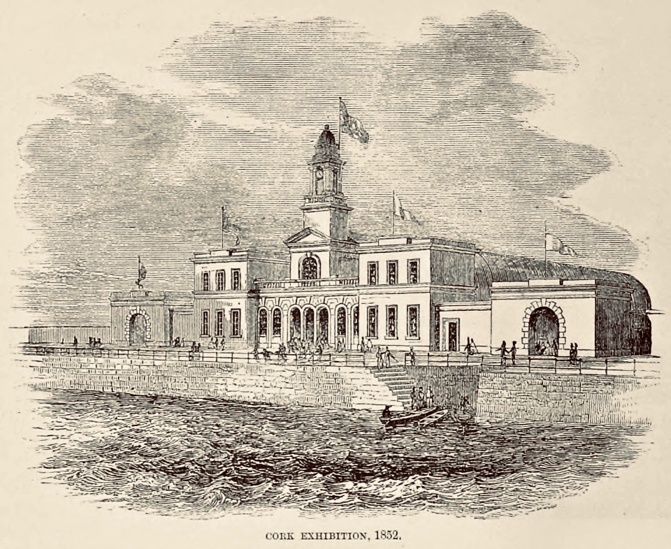
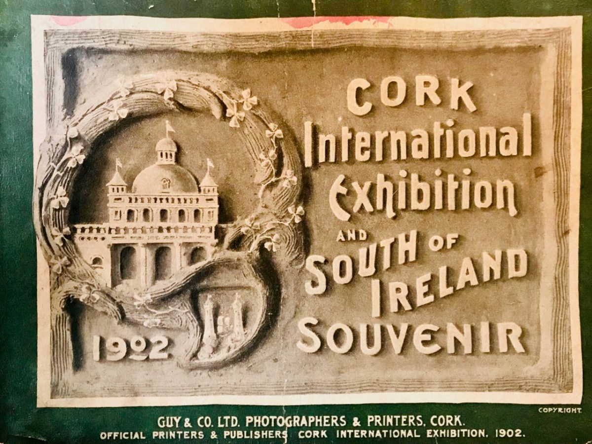
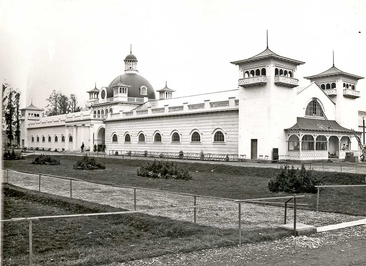
1902 World’s Fair, Cork – now Fitzgerald’s Park and the setting for Cork Public Museum

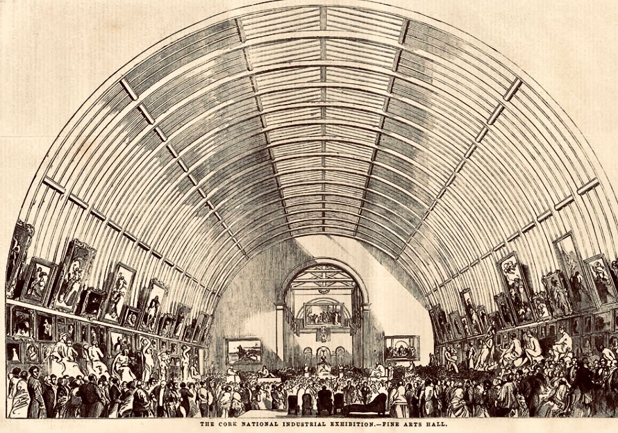
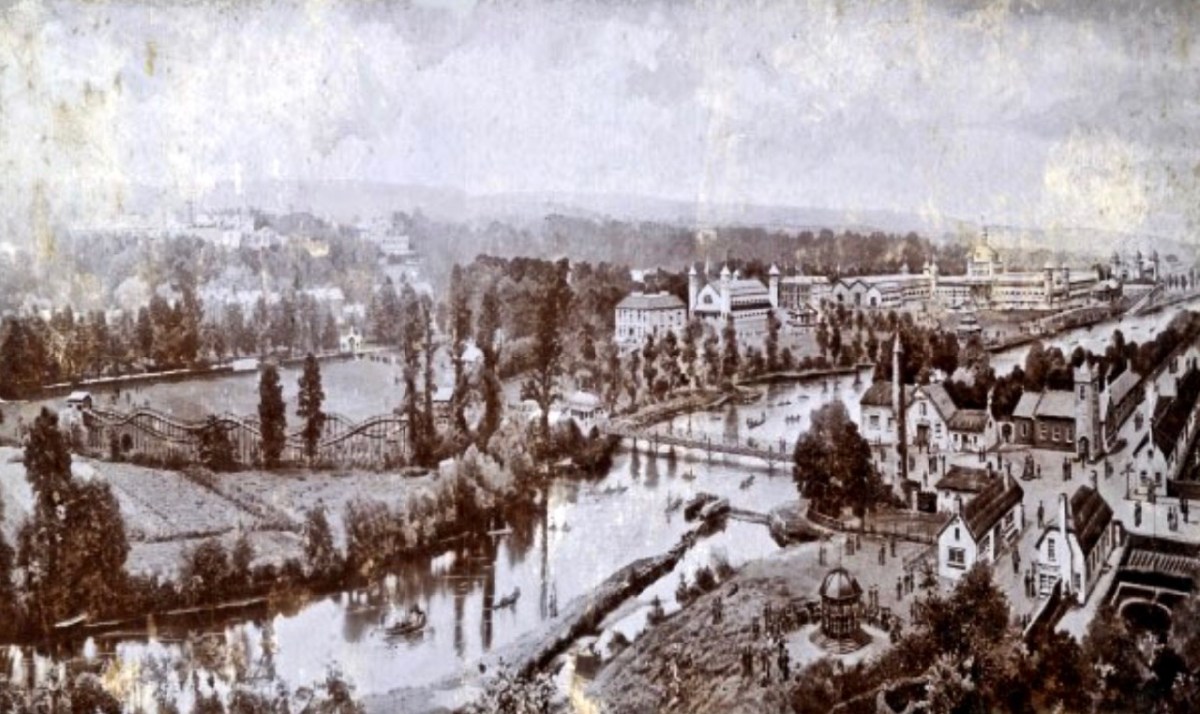
Close to the University grounds in Cork is a residence built by Charles Beamish in 1845 at the cost of £4,000 on land purchased from the Duke of Devonshire. Beamish has the grounds laid out with a variety of shrubs and trees, and due to their density the grounds become known as The Strawberries and the house as The Shrubbery. In 1901 the house and grounds are taken over by Incorporated Cork International Association and used as the venue for the great World’s Fair of 1902. Following this the grounds – now known as Fitzgerald’s Park – are donated to Cork Corporation for recreational use by the public. Eventually The Shrubbery is converted into Cork’s Public Museum which opens in April 1945, under the auspices of UCC: the first Curator is Michael J O’Kelly. The Cape Clear Inscribed Stone completes its travels (for now) and is on permanent display in the Museum.

View from sea

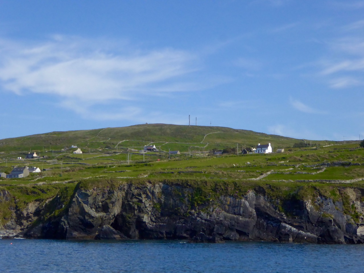
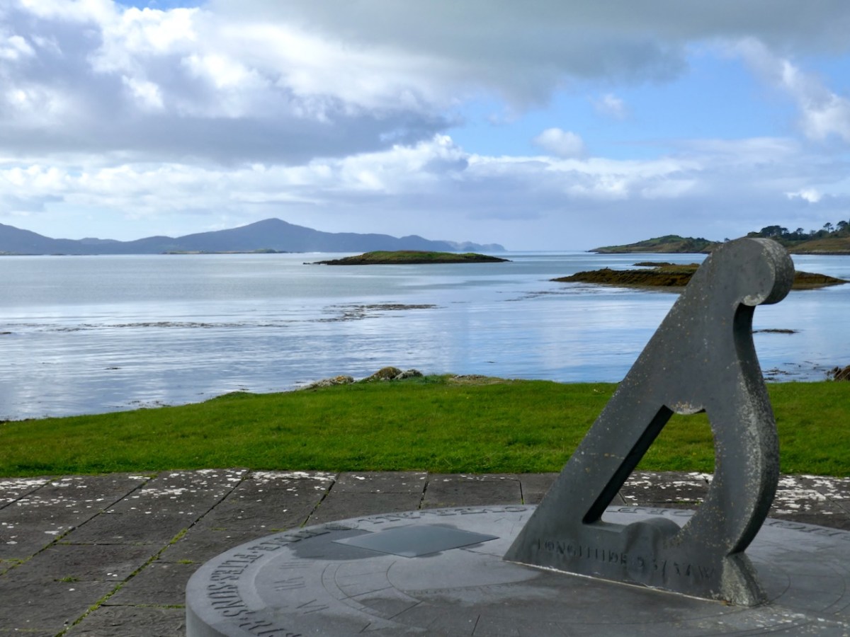
The highest point on Cape Clear is Quarantine Hill – the trig point can be seen as a ‘pimple’ in this photograph, taken from the north side of the island

There’s a prequel to this story of the travelling stone. We have seen that it was unearthed on Farmer Shipsey’s land in 1874. Apparently this isn’t where it started out. O’Kelly (who became head of the Archaeology Department at UCC in 1946) wrote a monograph on the stone for the Cork Historical and Archaeological Society in 1949 (volume 54 pages 8 – 10):

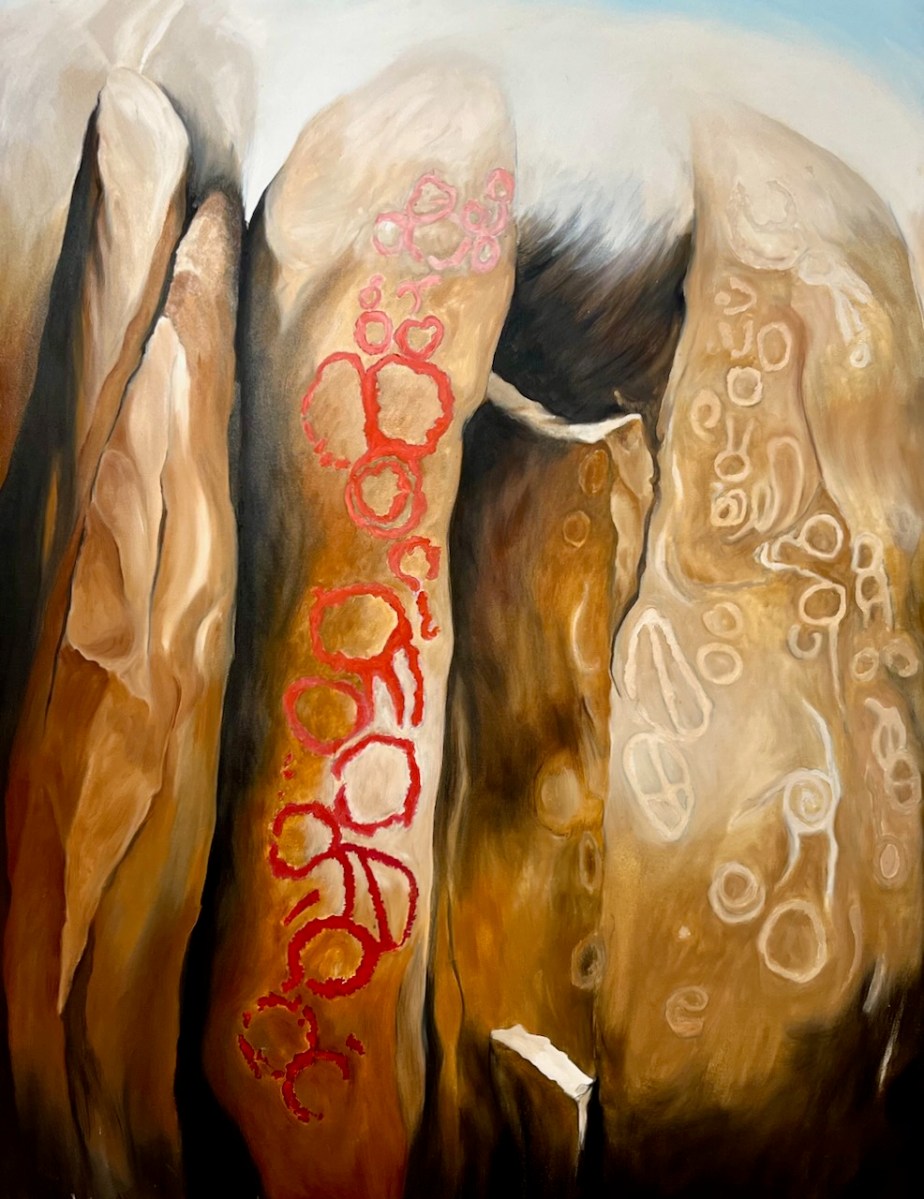
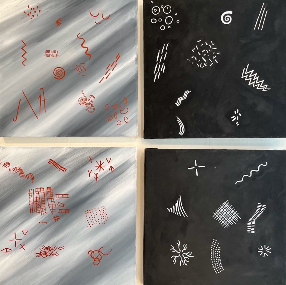
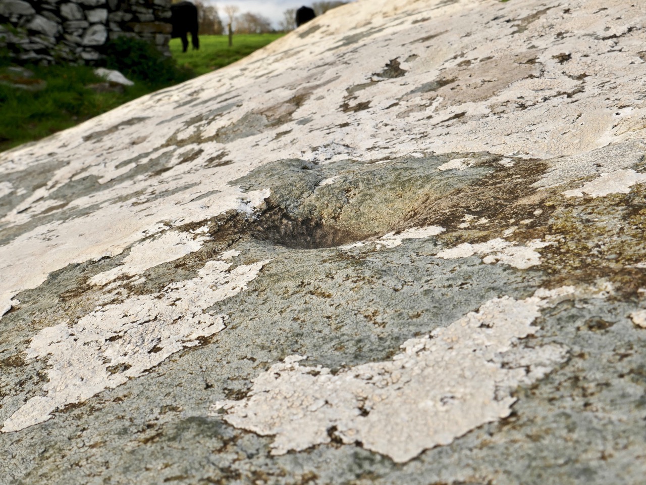
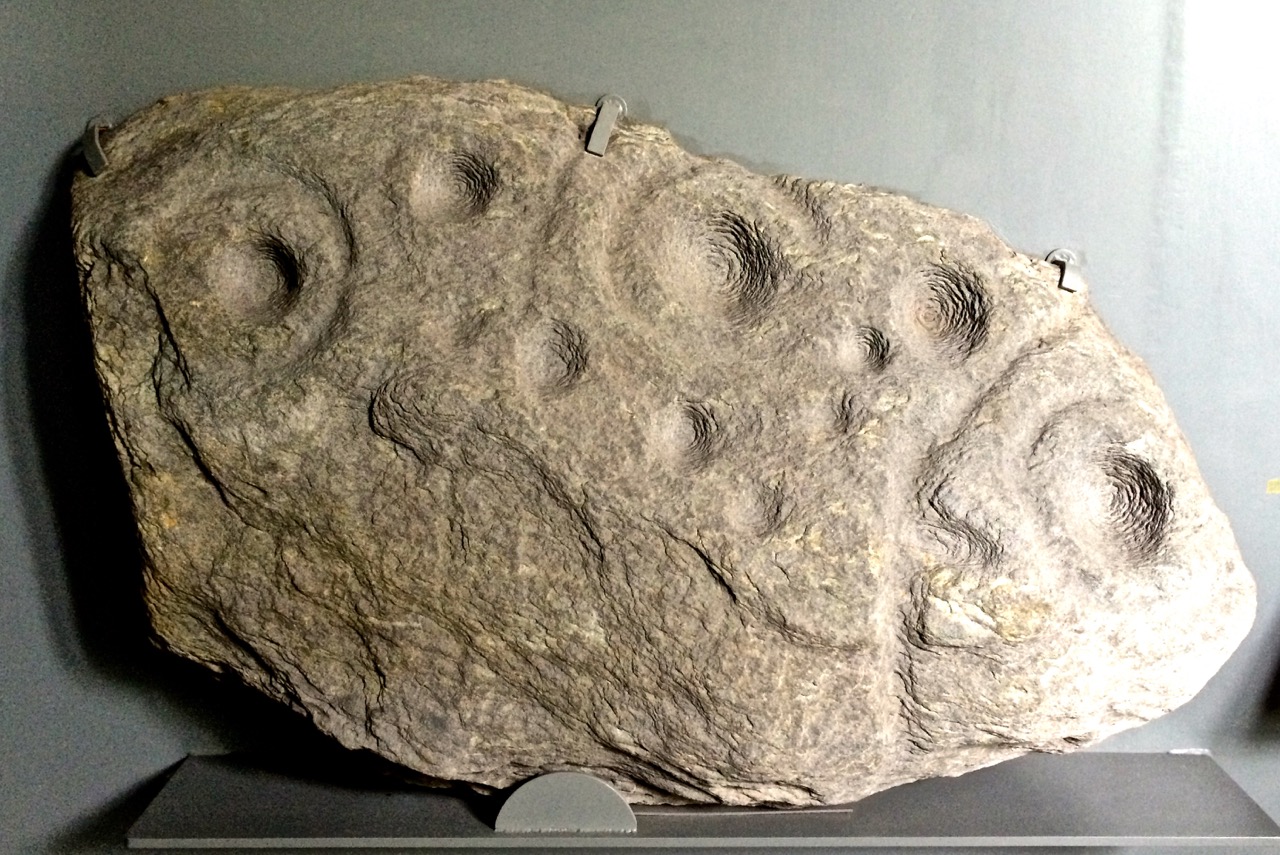
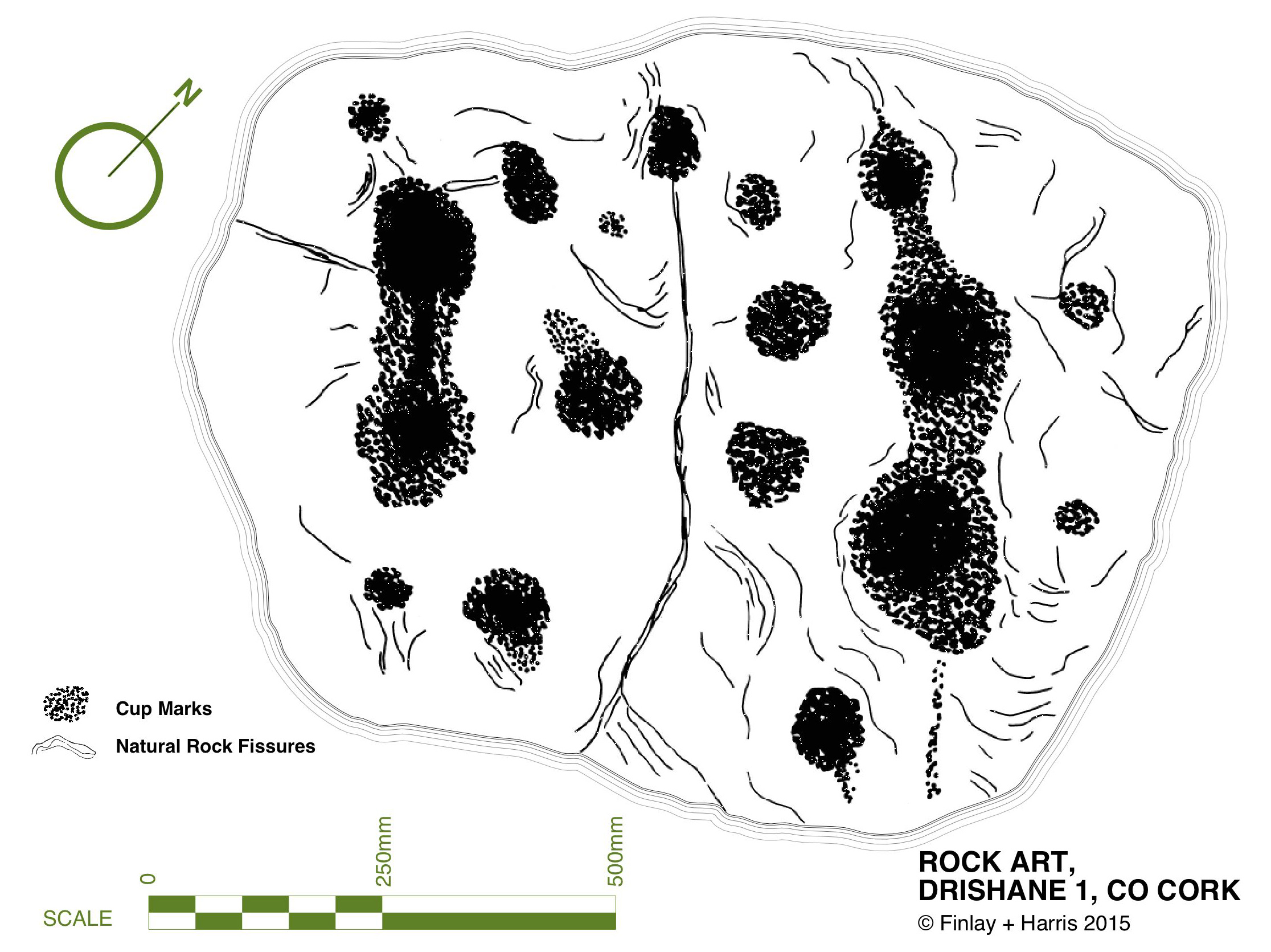
…The motifs clearly belong to the passage-grave group of carvings and can be paralleled at Newgrange, Bryn Celli Du [Wales], Gavr’ Inis [Brittany] and elsewhere. The stone is therefore an important discovery and because of this, the lack of information about the nature of the site on which it was found is all the more disappointing. At this stage only a few vague traditions concerning its finding could be gleaned in the district. The statement of one old man that ‘a mound of stones was being cleared from a field’ may possibly indicate a cairn and if such were the case, the decorated stone may have formed part of an underlying tomb chamber. There is also some reason to think that fragments of pottery were found, though none has survived. This may be a further hint that the stone was associated with a burial. With reserve, it might therefore be assumed that the structure, whatever its exact nature, was erected by a group of passage-grave folk who either by accident or design came to land on this island off the coast of Cork…

This little narrative sowed the seed that the stone might be connected to a passage grave. If so, this would probably date the carving to some five thousand years ago. But, surely, there should be some trace of the passage grave itself if this is the case? No such traces could be found in the townland of Croha West.

View from PG

looking north
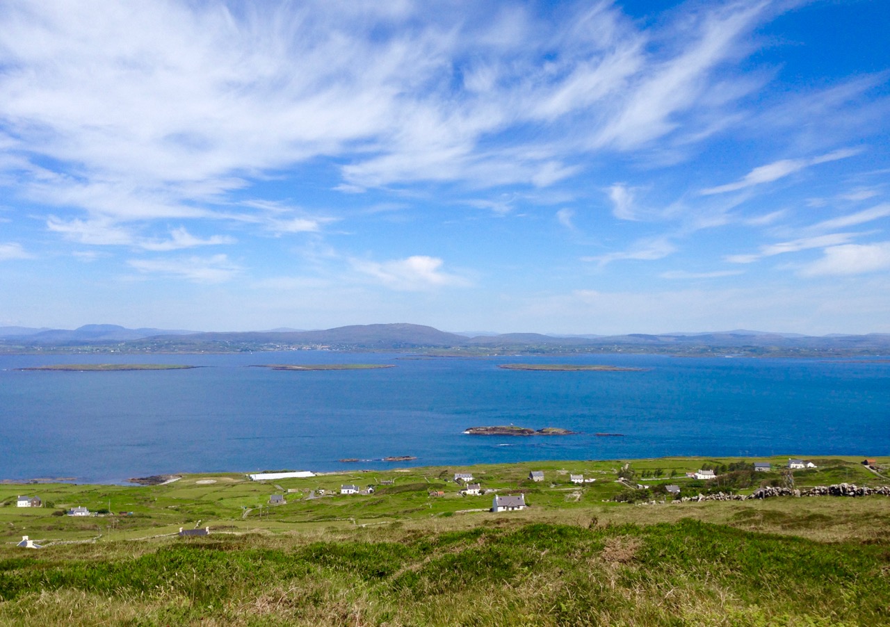
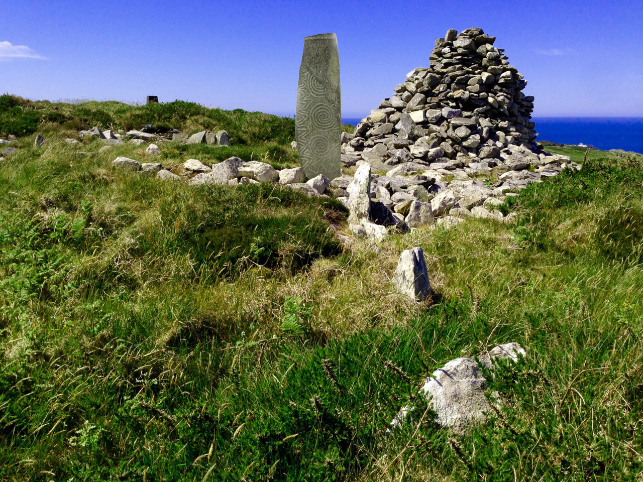
Spectacular views from the prehistoric site on Cape Clear, both looking north towards the mainland

We move forward to 1984 when four archaeologists (Barra O Donnabhain, Mary O’Donnell, Jerry O’Sullivan and Paddy O’Leary) explored the wider area and discovered, on the very summit of the island, the ruins of a prehistoric structure. This site, 533 feet above sea level, is in the townland of Killickaforavane and is known locally as Quarantine Hill. At this time the island was investigating the possibility of producing electricity by wind power: hitherto electricity to some properties was provided by a diesel generating system which had been in place only since 1969. The obvious efficient place for wind generation was the highest point and plans were laid for setting up two SMA Regelsystem Gmbh 33w turbines (which began operation in 1987). In preparation for this installation an archaeological survey of the immediate area was carried out by Prof Peter Woodman and Dr Elizabeth Shee. Paddy O’Leary and Lee Snodgrass were also present at that time. The collective view seemed to indicate that the structure could, indeed, have been a small passage grave.

chamber closer

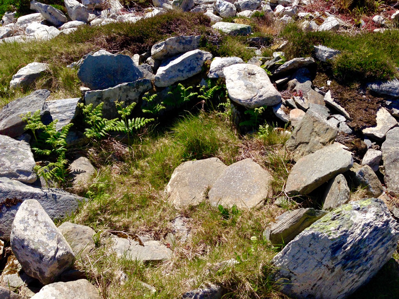
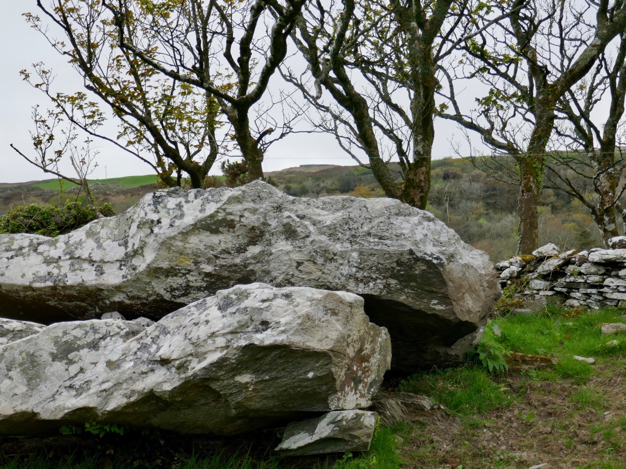
Probably the chamber of a 5,000 year old passage grave, Killickaforavane, Cape Clear

The wind turbines were sited a little distance from the prehistoric remains and have themselves become archaeology of a more industrial nature. While in use they generated 90% of the island’s demand during favourable winds (force 3+). The corrosive effects of the Atlantic climate – in particular the wild south-westerly gales – rendered the mechanisms beyond repair after some ten years; a submarine cable bringing electricity from the mainland (8 miles away) arrived in about 1995. For a short time the systems operated in tandem and produced sufficient power to feed back to Ireland’s National Grid. According to a letter to the Irish Times by Séamus Ó Drisceoil, who was manager of the island Co-op at the time of the installation …the Cape Clear system is credited with providing the first concrete evidence for the viability of wind energy in Ireland…

Tomorrow’s archaeology: the pioneering – but now defunct – wind generating system on Quarantine Hill, overlooking the passage grave site

Once the concept of the island supporting a five thousand year old passage grave on its summit has been digested, then the question has to be asked – did the Cape Clear stone now in the Cork Public Museum originate at this site? It was found a good half mile away, in a different townland – but this might suggest that an earlier antiquarian (or interested observer) discovered it on the hill and had it moved to Croha West for safekeeping, display, or even because it was thought it might have some value. No-one on the island seems to have any knowledge of this distant event. As O’Kelly says – it’s disappointing that there is no ‘story’: one might almost expect a tale of the person moving one of the ‘old stones’ having met with an unfortunate fate because of interference with the domain of The Other Crowd

the way through

Kerb and passage

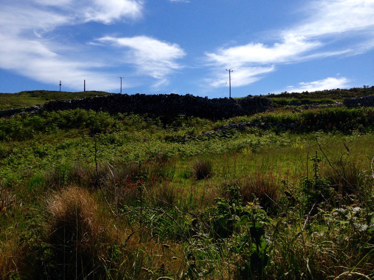
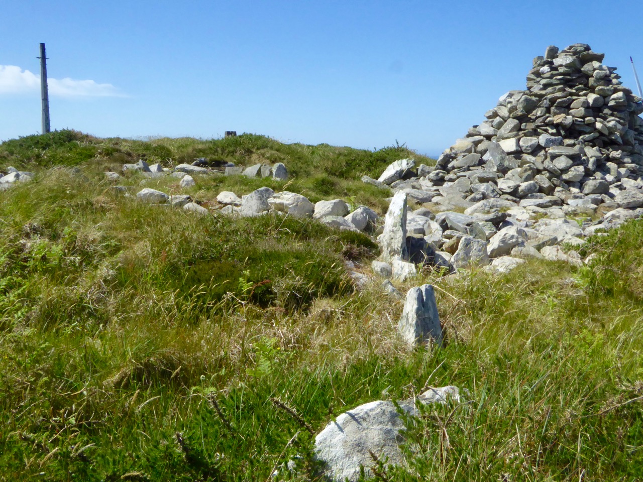
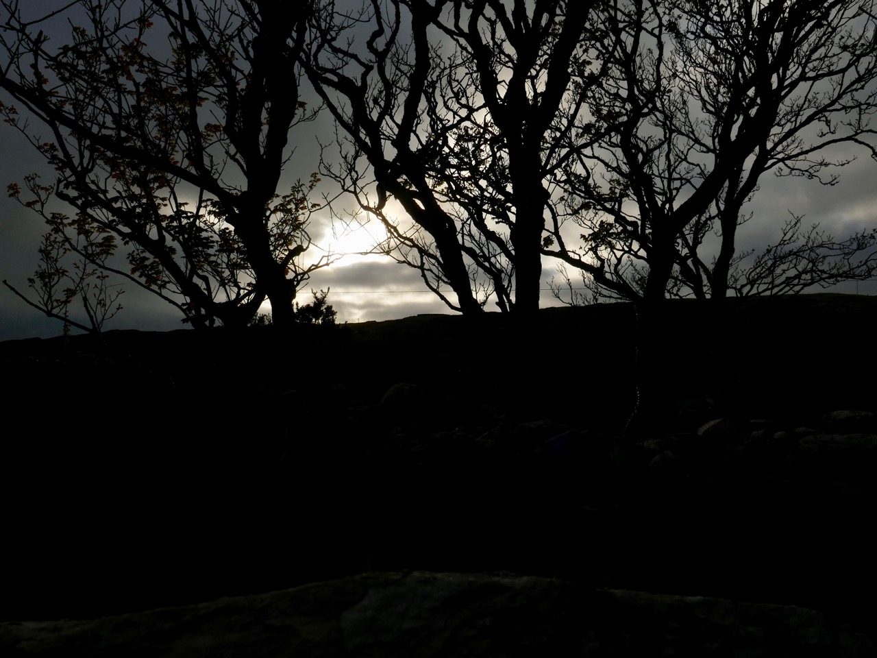
Top: looking towards the summit of Quarantine Hill – there is no clear path up there, and the traveller can be waylaid by gorse and brambles… Below: the prehistoric site – we are probably looking at the orthostats of a passage, which has a summer solstice orientation, and a kerbstone. On the right is a modern cairn while to the left in the background is the remains of one of the turbine towers

There is, surely, a strong likelihood that the Cape Clear Inscribed Stone did originate in the hilltop passage tomb, in which case we have completed the tale of its travels, up to the present day. The tomb is in ruins, although enough remains to show its shape and probable orientation. Paddy O’Leary tells the story of his investigations with Lee Snodgrass in an article for Mizen Journal, Volume 2, 1994:

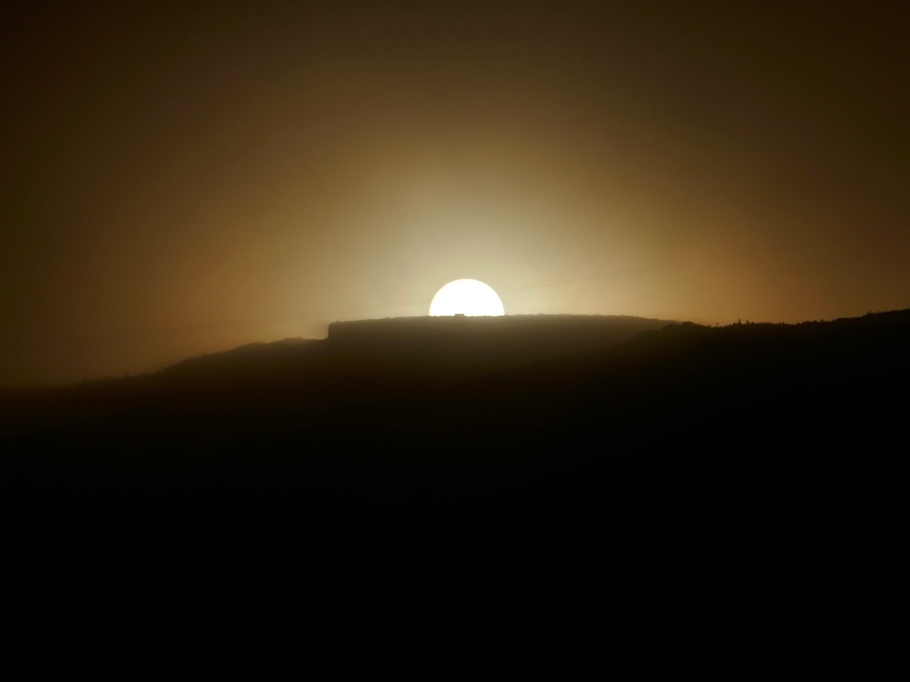
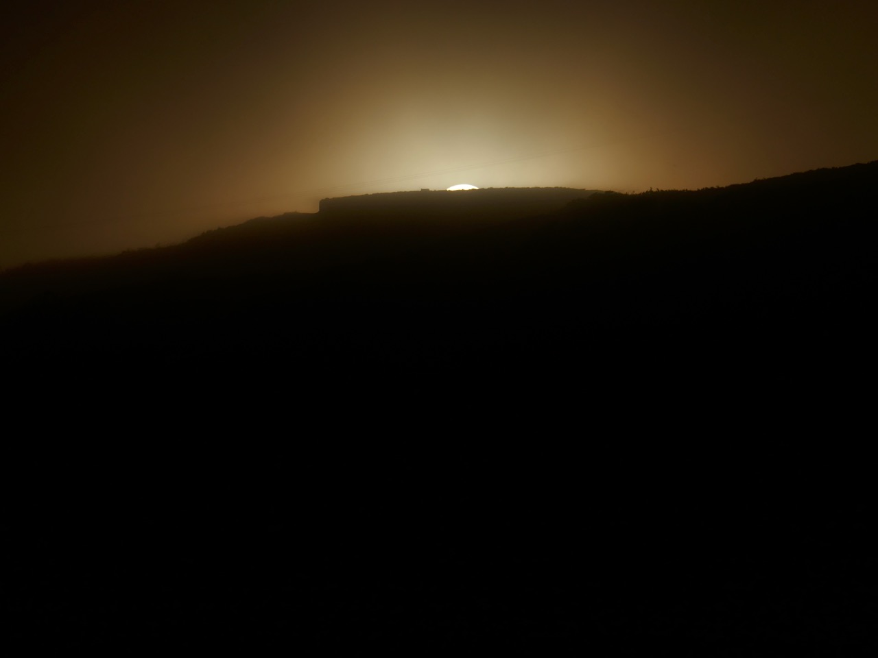
…We were convinced that it was a passage tomb and that it was orientated on the rising sun of the summer solstice… We planned a two night vigil for June 1993 and were buoyed up by a good weather forecast. Saturday afternoon was sunny and we transported our equipment direct to the top of Quarantine Hill from the boat. We set up our cameras and, taking advantage of the sunny weather, took photographs, especially during the late evening, when there was a lovely sky. On Sunday morning June 20th we rose shortly after 4am to prepare for dawn. It was very cold but the sky was clear. A dull grey cloud began to show to the northeast, we set our cameras and waited for the sun. Shortly after 5am it peeped above the horizon, nestling in the gap between Carrigfada and the hill to its north… Gradually it rose in a 40 degree angle, flooding the sky with first light and mirroring its golden red orb in the brightening sea… A perfect sunrise perfectly recorded. The warmth was now penetrating almost numb fingers and feet. The line of the orientation was exactly as expected, directly along the supposed line of the passage, into the centre of the chamber… The most southerly point of Ireland had its passage tomb, with a summer solstice sunrise orientation; a nice counterpoint to the Newgrange winter solstice sunrise…

cairn and view

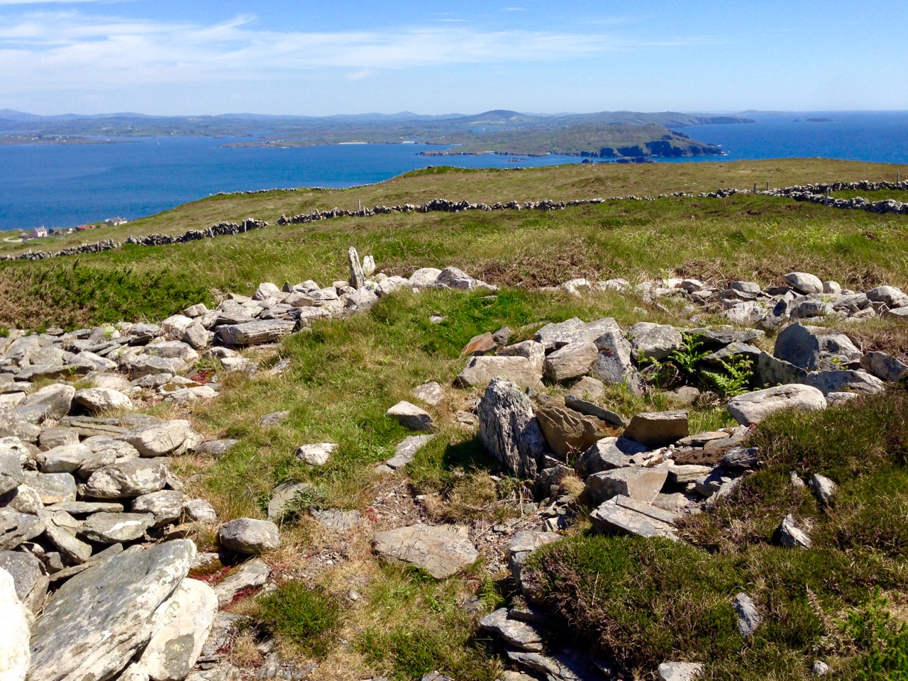
Quarantine Hill, Killickaforavane townland, Cape Clear. The view looking east – towards the summer solstice sunrise – from the prehistoric site on the summit

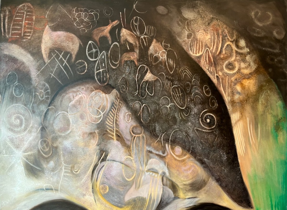
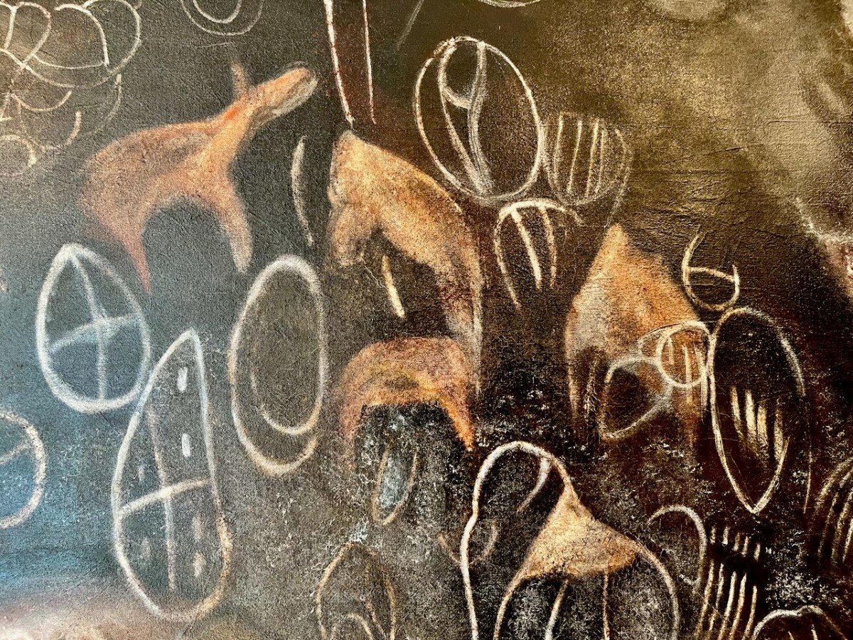
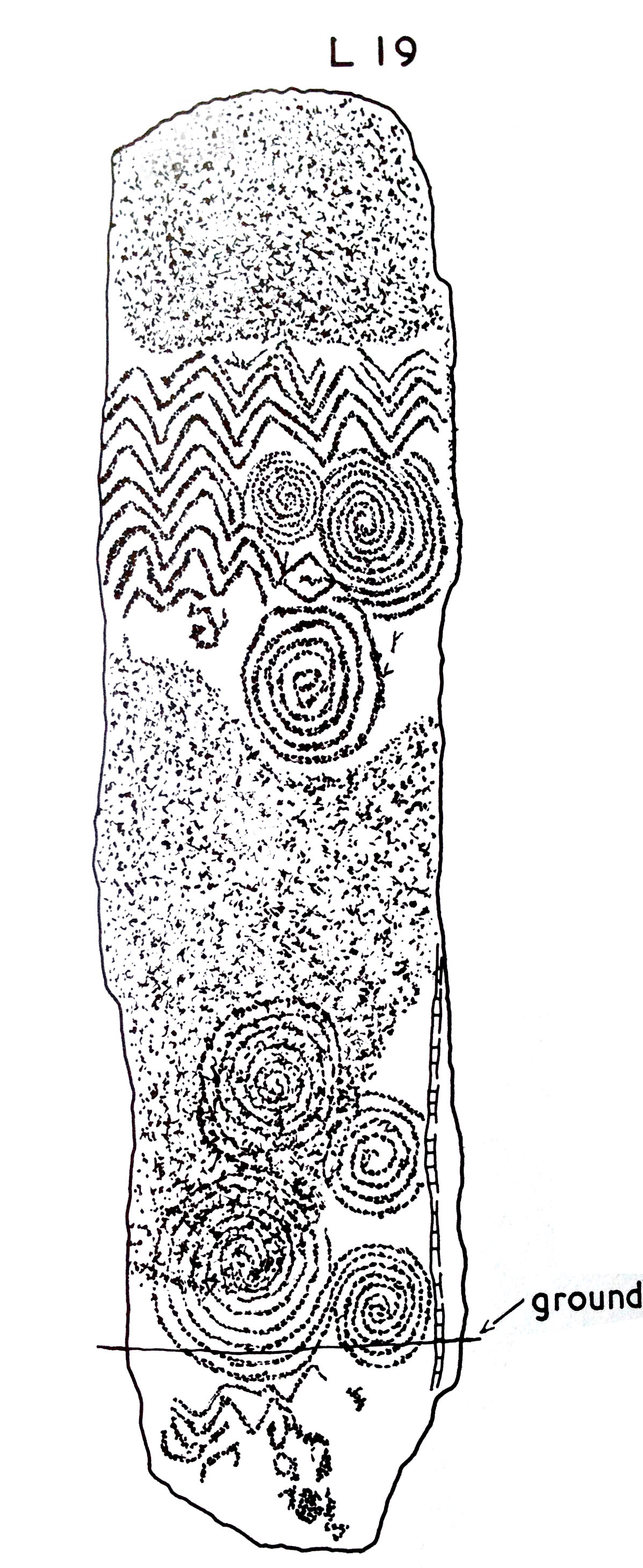
If the inscribed stone was, indeed, incorporated into the Cape Clear passage tomb, where might it have been placed? There are parallels in its design with some of the lintel stones at Fourknocks, but also I am drawn to similarities with stone L19 from Claire O’Kelly’s Corpus of decorated stones included in Michael J O’Kelly’s Newgrange – Archaeology, Art and Legend (Thames + Hudson, London 1982). This one is a standing stone – perhaps our well travelled stone was standing also.

Newgrange

Newgrange entrance stone

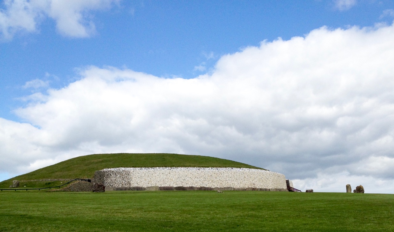
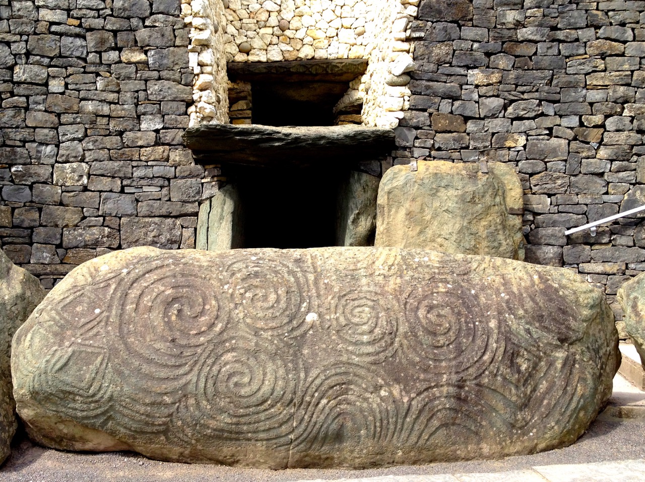
Iconic passage tomb in Meath, Ireland – one of the greatest monuments to the Neolithic people in the world: the top picture shows the east face of the great mound as reconstructed by Michael O’Kelly using the white quartz stones which were revealed during the excavations (Finola took part in these digs!); the lower picture shows the entrance stone to Newgrange – the Cape Clear inscribed stone must be related to this type of prehistoric art, although situated a very long way away…

Here’s a suggestion – probably considered heretical in some quarters: why don’t we complete the travels of the Cape Clear Inscribed Stone by taking it out of the Cork Public Museum and (with some suitable ceremony) transporting it back across the sea to Cape Clear and setting it back up there for all time? For me, museums – while obviously providing safe keeping – sometimes lack the reality of true context… Alright then, if that is considered as inconceivable an idea as I suspect it would be, let’s make a very good replica and send it up to the top of Quarantine Hill. At the same time we could re-establish a pathway to attract people up there: our own pilgrimage to this very special site involved making heavy way through gorse and brambles.

looking towards west

Below: Newgrange Stone L19 from Claire O’Kelly’s Corpus of decorated stones included in Michael J O’Kelly’s 1982 book on Newgrange

claire stone

With acknowledgements and thanks to those quoted above and the following sources, which have enabled me to pull together the story of this site: Paddy O’Leary and Lee Snodgrass (Mizen Journal Vol 2 1994 and personal communication), Michael J O’Kelly (Cork Historical and Archaeological Society Vol 54 1949), Chuck Kruger (Skibbereen and District Historical Society Journal Vol 6 2010)

Launched!

A joint post by Finola and Robert

Mingling

Hallowe’en (All Hallows – Samhain) was the perfect day to launch our Prehistoric Rock Art Exhibition at the Cork Public Museum. As Finola said in her remarks at the opening, it’s a time when the veil between two worlds is at its thinnest: in this case, it’s the veil between an ancient time and the present day. We hope the exhibition emphasises the work of our distant ancestors who have inscribed the landscape and given us the enigma that is Rock Art.

Blank Canvass

Almost there
Before the Exhibition – Robert contemplates the blank canvas (top) and installation work in progress (below)

As our regular readers will know, the exhibition has been a very successful collaborative effort: Finola and Robert (providing drawings, explanations and the overall design); Keith Payne, a West Cork painter whose work is inspired by ancient art; Ken Williams, the excellent photographer of megaliths and monuments; the staff of Cork Public Museum, including intern Clare Busher O’Sullivan who came up with the idea and Dan Breen, Assistant Curator and his team, who made sure it all happened.

The Team

The Core Team: Clare Busher O’Sullivan, Ken Williams, Keith Payne, Finola Finlay, Robert Harris and Dan Breen

After some intensive days, on site and off, it has all come together and was launched yesterday. It was a grand launch: Firstly, William O’Brien – Professor of Archaeology at UCC – outlined a history of rock art studies and research which started back in the nineteenth century. He mentioned a predecessor in the department – Professor Michael J O’Kelly – who was born exactly 100 years ago and is best known for his excavations and restoration work at Newgrange, the Boyne Valley passage tomb: Finola worked on those excavations and it was Professor O’Kelly who suggested that she should carry out the research on rock art in Cork and Kerry which led to her Master’s thesis on the subject in 1973 – and, 42 years later, to the undertaking of this exhibition.

Professor Michael J O’Kelly (left) was renowned for his work at Newgrange (right)

Next up was Finola, who told us more about her expeditions back in the early 1970s. In those days when the boreens of rural Ireland were mostly populated by donkey carts her own travel was by means of her brother’s Honda 50 motorcycle, and we pictured her loaded down with compass, tapes, chains, chalk and tracing paper – a recording methodology now completely out of favour. But the result was a set of beautiful monochrome illustrations that form the core of the exhibition.

Coomasaharn

Rock Art: a detail of the picking technique (top left), and Finola’s drawings from 1973

In our modern days non-invasive recording methods have to be used: Ken Williams has developed a very effective method of photography using slave flash units to provide low angle lighting over the carved rocks, which brings the maximum level of detail out of the panels. The exhibition contains many fine examples of Ken’s work in this field.

Ken Williams in action: at the Bohonagh stone circle (left) and in the Derrynablaha townland, Kerry (right)

Finola also talked about Keith Payne’s work. He produces large and visually striking paintings based on particular rock art motifs. Two of these artworks are in the exhibition and will inevitably draw the eye, providing a good and colourful counterpart to Finola’s drawings.

Keith Payne at the hanging (left) and at the launch, in front of the remarkable Derreennaclogh stone (right)

The official launch was in the capable hands of Ann Lynch, now Chief Archaeologist at the Irish National Monuments Office. Ann and Finola were fellow students at UCC. Ann outlined the work of her department in recording Ireland’s monuments – and the difficulties involved in pursuing the preservation and protection of these monuments, including Rock Art – before formally declaring the exhibition open.

Ann declares it open

Ann Lynch, Chief Archaeologist at the National Monuments Office, declares the Exhibition open

Noteworthy exhibits include one piece of Rock Art – the Bluid Stone from County Cork – which is in the safe keeping of the Museum, and will remain on permanent display after the exhibition closes at the end of February next year. The Museum also houses an example of passage grave art from Cape Clear island (prominent in our own view from Nead an Iolair).

Tired

Fine Detail: the Bluid Stone under close inspection

Other exhibits include Ken’s superb photo of the iconic stone at Derrynablaha, Co Kerry, in its panoramic setting of a Neolithic landscape. This occupies the whole of the end wall – and is simply beautiful.

Gazing

Visitors are surprised to see much of the floorspace taken up with a 70% life-sized image of the stone at Derreennaclogh: some hesitate to walk over it, but the printing is on hard-wearing vinyl, so feel free. The idea is to give you the feel of what it’s like to discover and explore the Rock Art out in the field. We have to mention how impressed we have been with the printing work carried out by Hacketts of Cork in the preparation of the exhibition – in particular, we were fascinated to watch the professionalism of their installation of the large items.

Yes – that floor can be walked on!

The timescale is set admirably by Alex Lee’s ‘Neolithic Settlement’ on the approach to the exhibition room. It’s well worth studying closely all the artefacts set out in this, and imagining what life must have been like for our artist ancestors in Ireland four or five thousand years ago.

Alex

Alex Lee at work on the Neolithic Settlement

We were delighted by how many of our friends from West Cork and beyond attended the opening, and gave us positive feedback. If you go during the next four months, please sign the visitors’ book. We are so grateful to our friends Amanda and Peter Clarke for being so supportive throughout – and for taking most of these photographs of the event: very many thanks.

Earnest discussions (left) and one of Ken’s superb photographs (right)

Our own day was rounded off by a visit to the Shandon Dragon festival, which processed through the centre of Cork in the evening – another unmissable event which reminds us of ancient times and long-held beliefs…

Shandon Dragon

Hallowe’en: The Shandon Dragon Procession makes its way through Cork City