Beranger’s West Cork?

Who was Gabriel Beranger and why was his work so important? And why have I added a question mark? All will be revealed.

Timoleague Castle, abbey and town, co[unty] of Cork (RIA MS 3 C 30/68)

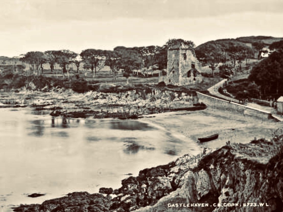
While we have several Beranger watercolours of Cork subjects, only two, Timoleague (above) and Castlehaven, are from West Cork*. They are the earliest painted depictions of each place, and as such represent incredibly significant records. Each one dates between 1770 and 1799. The description of the watercolour above says: A scenic view of Timoleague Castle, abbey, surrounding town and river [Argideen] Co. Cork. Two men, hauling a boat along the bay are depicted in the foreground of drawing.
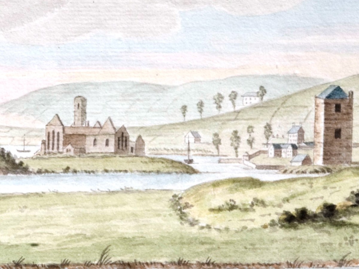
The Abbey (actually a Franciscan Friary) is easily recognisable, but the castle is nowadays hidden behind other buildings. There is no real sign of a ‘town.’
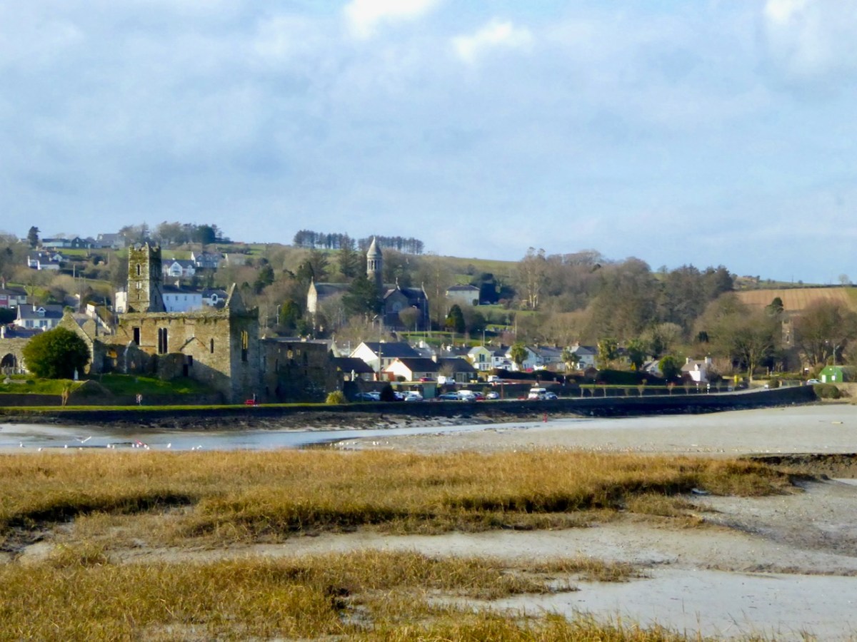
Here’s what it looks like nowadays.

There’s a second drawing of Timoleague, this time done from a different perspective and focussing on the Castle, which is surrounded by an extensive bawn wall.

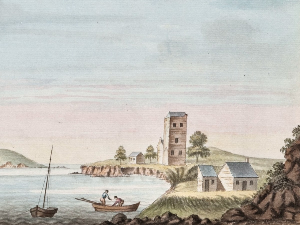
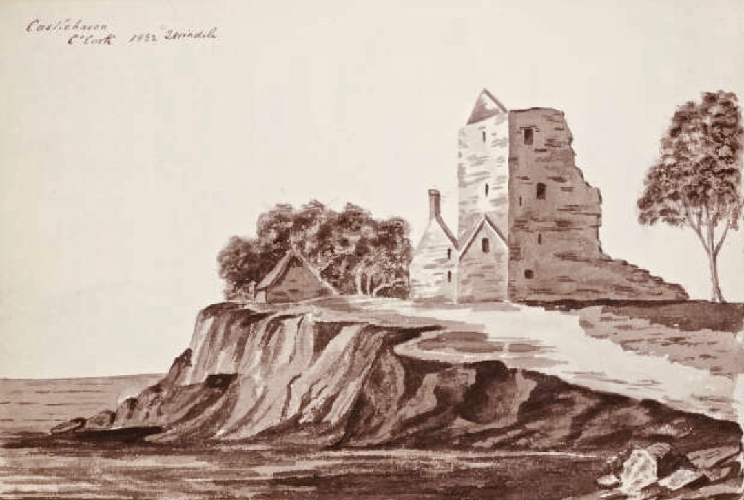
Now on to the watercolour of Castlehaven. It’s beautiful, I think. Importantly, it shows the tower house as complete, whereas it is nowadays only a stub, covered in ivy and brambles.
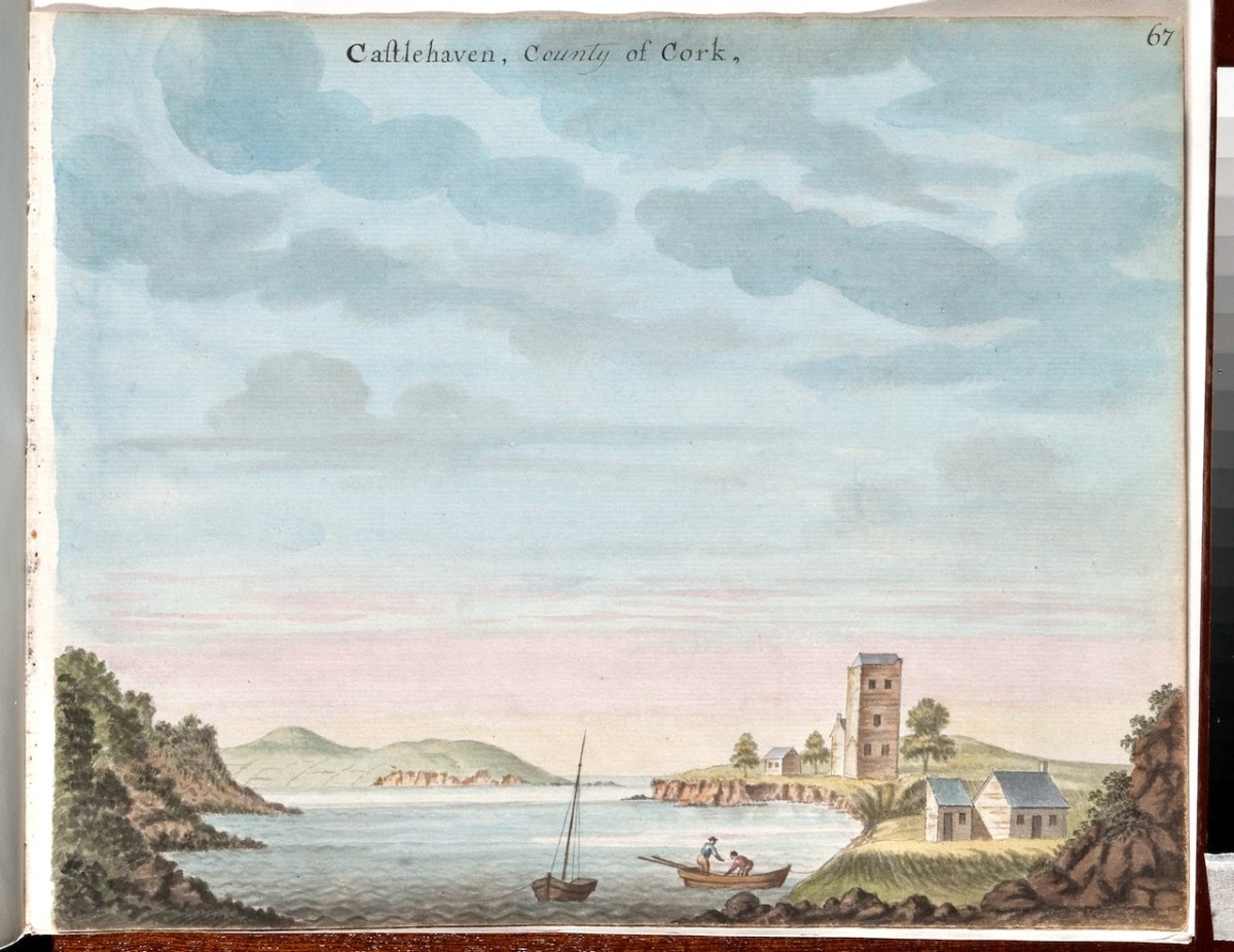
The church in Castlehaven graveyard is shown as a house rather than a church. The small addition to the left end of it may have been, according to Conor O’Buachaille of Gormú, a guardhouse, a feature of graveyards from the grave-robbing era.
Gabriel Beranger , born in around 1729, was from a Dutch Huguenot background, but settled in Ireland in his early 20s. He was a printer and watercolourist who spent a lot of time travelling around Ireland and recording what he saw – often landscapes, but particularly anything of antiquarian interest. Wealthy patrons employed him for that purpose, since antiquarian pursuits were popular among the gentry. Helpfully, he kept notes along the way in a journal. The journal, Beranger’s sketchbooks and some of the watercolours came into the possession of Sir William Wilde about a hundred years after Beranger’s death, and we are indebted to Wilde for most of what we now know about the artist. Wilde wrote a series of posts based on this material for the The Journal of the Royal Historical and Archaeological Association of Ireland, now the Royal Society of Antiquaries of Ireland. Wilde took up a lot of space with his own theories about the antiquities themselves (he didn’t believe that round towers could have been bell towers, for example) but did manage to squeeze in some biographical and professional data about Beranger.
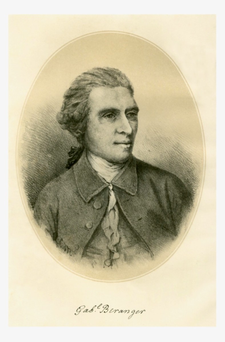
The good old Dutchman was spare in person, of middle height, his natural hair powdered and gathered into a queue; he had a sharp, well-cut brow and good bushy eyebrows, divided by the special artistic indentation; a clear, observant, square-ended nose, that sniffed humbug and took in fun; clear, quick, brown eyes; a well-cut, playful, dramatic mouth, eloquent and witty; not a powerful, but a chin quite congruous with the face. Well shaven, no shirt to be seen, but his neck surrounded with a voluminous neckcloth, fringed at the ends, a drab, rather Quaker-cut coat and vest for household purposes, and when out on sketching excursions he had on a long scarlet frock coat, yellow breeches, top boots, a three-cocked hat, and held in his hand a tall staff and a measuring tape. Like Woverman’s white horse or Petrie’s red woman, he frequently introduced himself in this remarkable but at the time not uncommon costume into his pictures. He was a keen observer of nature, men, and manners, and appeared to relish Irish fun, as indeed his dramatic cast of countenance, shown in the very good crayon drawing made by himself when about middle life, would indicate, and of which an admirable lithograph is appended to this biography.


Memoir of Gabriel Beranger, and His Labours in the Cause of Irish Art, Literature, and Antiquities,
from 1760 to 1780, with Illustrations
W. R. Wilde
The Journal of the Royal Historical and Archaeological Association of Ireland, Fourth Series, Vol. 1, No. 1 (1870),
https://www.jstor.org/stable/25506575

Of his art, this is what Wilde has to say:

He was a most painstaking artist, and a faithful delineator of antiquarian remains. He is said to have been self-taught, and this may account for the hardness of some of his drawings; yet no one of his time could draw an old castle, a cromlech, or a round tower better ; but his extended landscapes were not good, and more resemble plans than pictures. He particularly failed in trees and green fields. Had his observations and descriptions, and his drawings of Irish scenery and antiquities, been published eighty or ninety years ago, they would have caused archaeological study to progress in this country, and perhaps forestalled the opinions of subsequent writers.

Ditto

Then comes the part that is most pertinent to West Cork:

To each volume there is, at the commencement, a copious Alphabetical Index, followed by an ” Advertisement,” stating that ” the castles which com pose this collection I designed on the spot, except the following, which were communicated to me by various gentle men here undernamed, whose kindness I acknowledge with thanks,” &c. From this it would appear that besides his own drawings he obtained, with a view to publication, several others which I am inclined to think he copied with his own hand for the purposes of his work. Among the names of persons who contributed sketches, we find that of Colonel Charles Vallancey as the most conspicuous.

Ditto

Wilde (below, as a young man) died before he could finish his series on Beranger and the last piece was written by Lady Wilde, who occupied most of it with a paean of praise to her husband. William and Jane were at the forefront of the literary of antiquarian movements of their day, and are also, of course, remembered as the parents of Oscar.

There is, as it turns out, no record of Beranger having been in West Cork, although we know he took extended painting trips to several counties – including Wicklow (see my post Antiquarians loved Glendalough) and Sligo (Robert’s Discovering Carrowmore). What we are sure about is that General Charles Vallancey was here, first to manage the defence of southwest Ireland against the threat of French invasion, and then to make a series of grand plans to link West Cork to the rest of Ireland and to the world! I hope to write more of this in a future post.
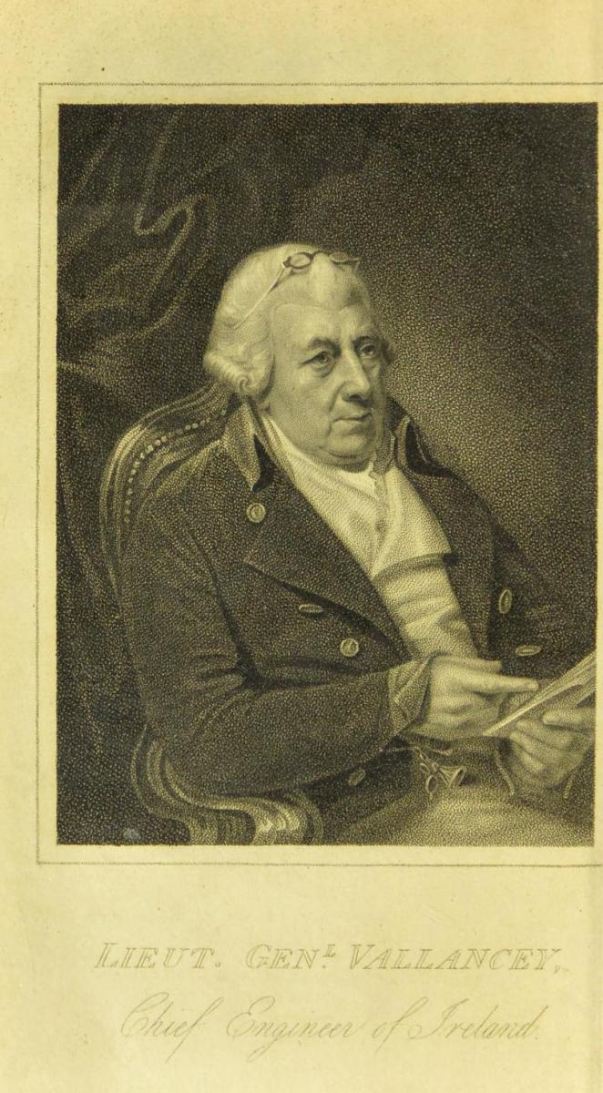
So – whose West Cork is this – Beranger’s or Vallancey? The answer is – both. In the Digital Repository, both are acknowledged as originators. Vallancey was a man of enormous energy and drive. He wrote several volumes of his Collectanea de rebus hibernicis, (available at the Internet Archive) and required illustrations for them – hence his patronage of Beranger, and others. The illustration above is from one of his Collectanea and so he must have wished himself to be depicted this way, as benign and intellectual. Love those little glasses! He was a scholar of Irish – one of the first to raise its profile as an ancient and beautiful language – and an antiquarian of the fanciful sort – forever banging on about druids and Chaldeans and coming up with far-fetched theories. Unfortunately, we don’t have Vallancey’s originals, so we can’t compare the accuracy of the drawings. While we know that Beranger’s reputation was for painstaking exactness, we don’t have the same information about Vallancey’s. To me, comparing it to places Beranger drew on the spot, the rendition of the castles looks a little approximate, especially the fenestration. Nevertheless, as illustrations of two places in eighteenth century West Cork, these watercolours are priceless.
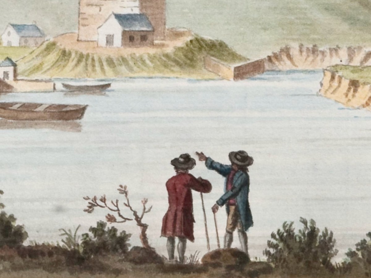
One last detail and quote. Wilde was able to describe Beranger’s dress – that’s because he often put himself in the frame, to add human scale and interest. In his lively piece Beranger’s painted people – himself and others, Peter Harbison gives several examples. But we have our own, from the Timoleague Castle painting. There he is, in his long scarlet frock coat, yellow breeches, top boots, a three-cocked hat, and held in his hand a tall staff and a measuring tape. (Well, more or less.)

Do you know Timoleague and/or Castlehaven well? Can you add to the commentary on those painting? I’d love to have any comments you might have.
*I am grateful to the Digital Repository of Ireland, under whose Creative Commons License I have used these illustrations. See here for more of their Beranger collection.

Honouring St Barrahane

It’s December 3rd (yesterday) – St Barrahane’s feast day, that is. He’s one of our local saints and not a lot is known about him. There are other St Barrahanes – or St Bearchán as it’s more commonly spelled – a whole raft of them, in fact from around the country. But this one belongs to Castlehaven.

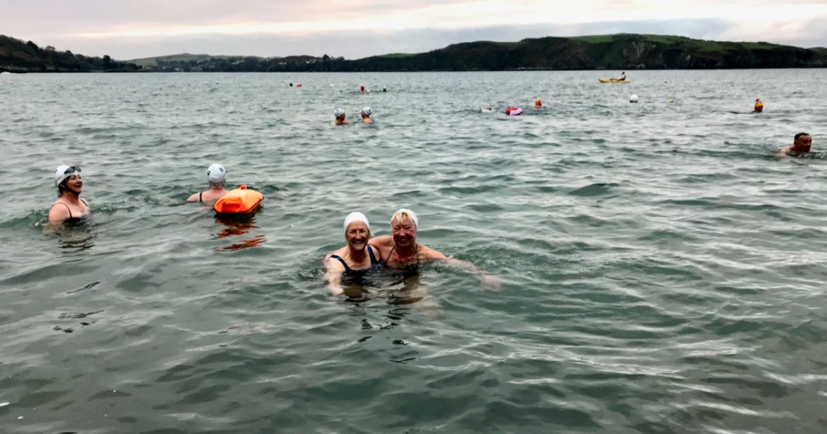
Now, I am not normally given to honouring saints’ feast days, but there are exceptions. St Patrick’s, after all, is a national holiday, and St Brigid’s soon will be, so it would be rude not to. St John’s Eve is big in Cork and this year I did the rounds in my local graveyard – see this post for my lovely experience. That’s Castlehaven graveyard, below, right on the sea – the sea that Amanda and I are bobbing around in, in the lead photograph.

You remember Conor Buckley and his adventure and outdoors company, Gormú? To jog your memory, take a look at Castlehaven and Myross Placenames Project and Accessible August. He’s an all-round dynamo, whose idea of fun is to take people swimming at dawn in the middle of winter. But on this occasion, there was heritage to back him up – a local custom of going to St Barrahane’s well to get water on Dec 3rd, as a cure, but also as a talisman against any kind of accident at sea. Important, in this maritime location.

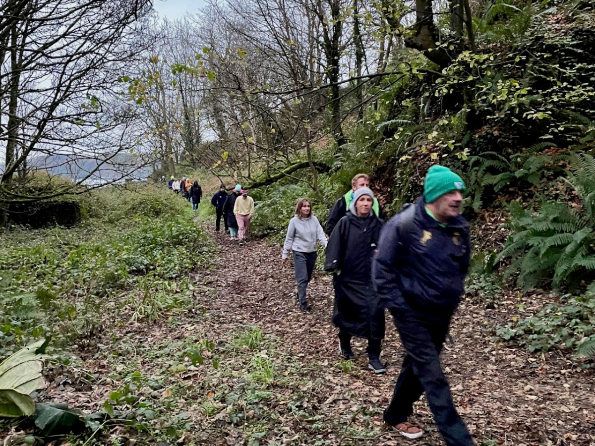
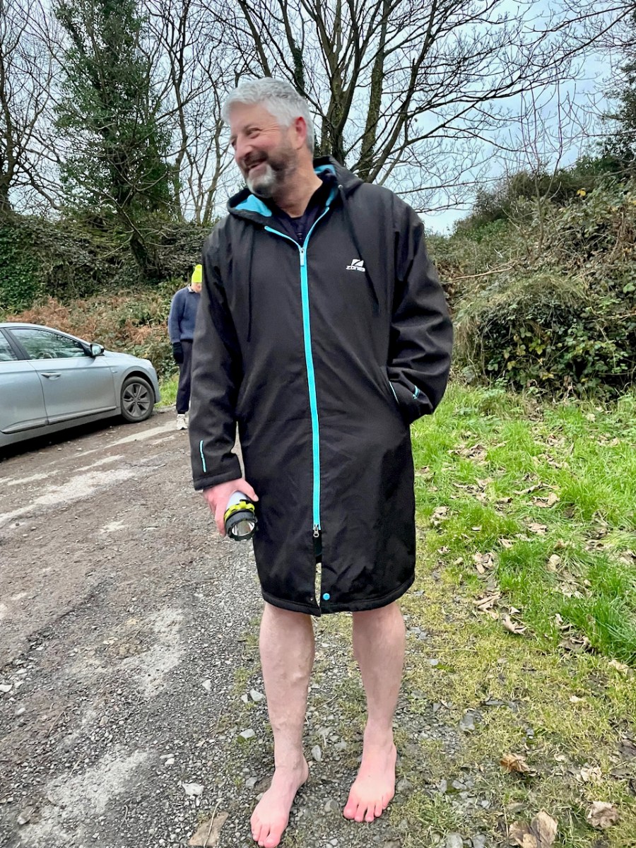
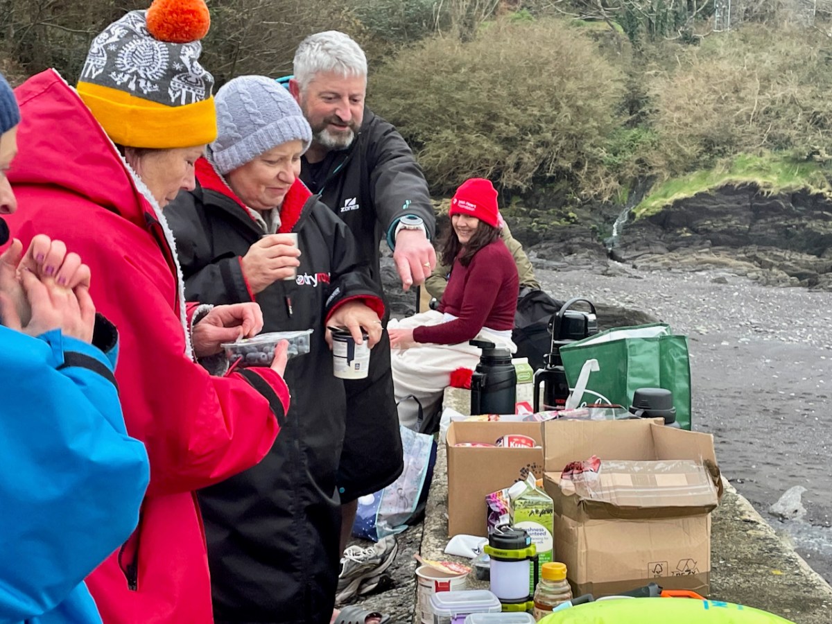
We gathered at the top of the road at dawn and walked down to the sea. Conor invited us to go barefoot as the original pilgrims would have done, and there were actually a few takers.

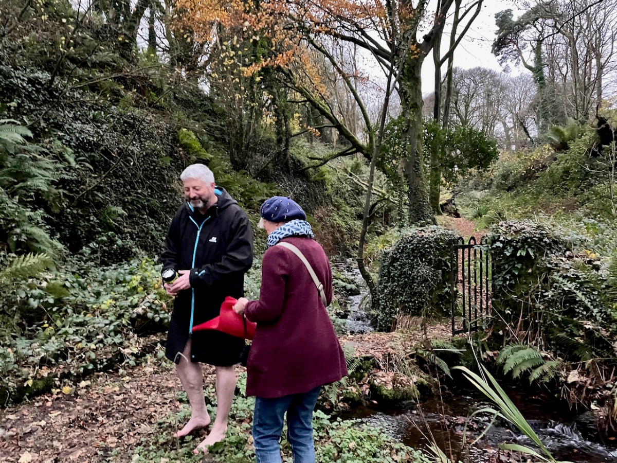
Then up to the holy well – about 20 of us. Conor told us about the traditions associated with this particular well, and asked Amanda to speak about wells in general. Declaring that she “has done more for holy wells than anyone else in Ireland” he then invited her to be first to the well – being first was also particularly auspicious in the local folklore.

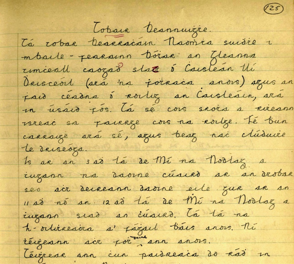
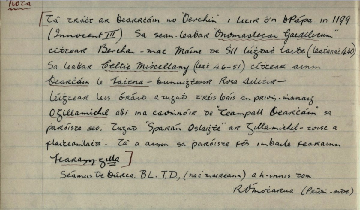
The well contains a sacred eel (to see it brought good luck forever) and a cure for fevers that lasted all year. People would visit at any time, but particularly on Dec 3rd to collect water and take a bottle home with them. By the 1930s, when this account (below, in Irish) from Dooneen School was given in the Dúchas Schools Collection, only a few people were still coming. The onus on the pilgrim was relatively light – just a few Hail Mary’s and the Sign of the Cross and then you could drink the water. Some people left rags or a coin.

After the student’s writing is a Nóta, written  by the headmaster, R Ó’Motharua. 

The information for the Nóta came from James Burke, a noted local historian, TD (member of the Dail, or Irish Pariament) and Editor of the Southern Star.* He took a scholarly interest in local saints, of whom Barrahane was a prime example. Here is my translation (corrections welcome).

There is mention of Bearrcháin or “Berchin” in a Papal letter in 1199 (Innocent III). In the manuscript “Onomastecan Gaedilicum” one sees Berchan – son of Máine of the Race of Lúghdach Maidhe (Page 440). In the book Celtic Miscellany (page 46-51) one sees the name of Bearcháin with Fachtna – the founder of Rosscarbery – he was reading with him an oration that was given after the death of the Abbot O’Gillamichil who was the patron of Teampall Bearcháin [St Bearcháin’s Church] in this parish. They called Gillamichil “Open Purse” – because of his generosity. His name is still in the parish in the townland of Farranagilla [meaning Gilla’s Land].


https://www.duchas.ie/en/cbes/4798763/4796172

Farranagilla, by the way, is a townland halfway between Castletownshend and Skibbereen. This accords with other information I have from James Burke about St Barrahane. In a letter to Edith Somerville of February 1917 he says:

When we come to Saint Barrahane (Irish Bearćán) we are in more shadowy ground. 

There was a great St Bearchan a noted prophet of Cluain Sosta in Hy Failghe of whom there is much (exhaustive) knowledge but I have elsewhere tried to prove that the patron of Castlehaven parish was a native of West Cork and is identified with the Bearchan  mentioned in the genealogy of Corca Laidhe but he is only a name. He certainly was the patron of Castlehaven which as early as 1199 and no doubt much earlier was called Glenbarrahane. 

From a letter in the Somerville archives, Drishane House. Quoted with permission**

James Burke had originally set out this information in his paper for the Cork Historical and Archaeological Society of 1905 on Castlehaven and its Neighbourhood, pointing out that the original name for Castlehaven Parish was Glenbarrahane, after its patron saint. In his magisterial work, A Dictionary of Irish Saints (Four Courts Press, 2011, p96),  Pádraig O’Ríain agrees with the notion that the saint belonged to the Corca Laighde family, despite some misgivings. He also adds local tradition maintains that Bearchán came from Spain.

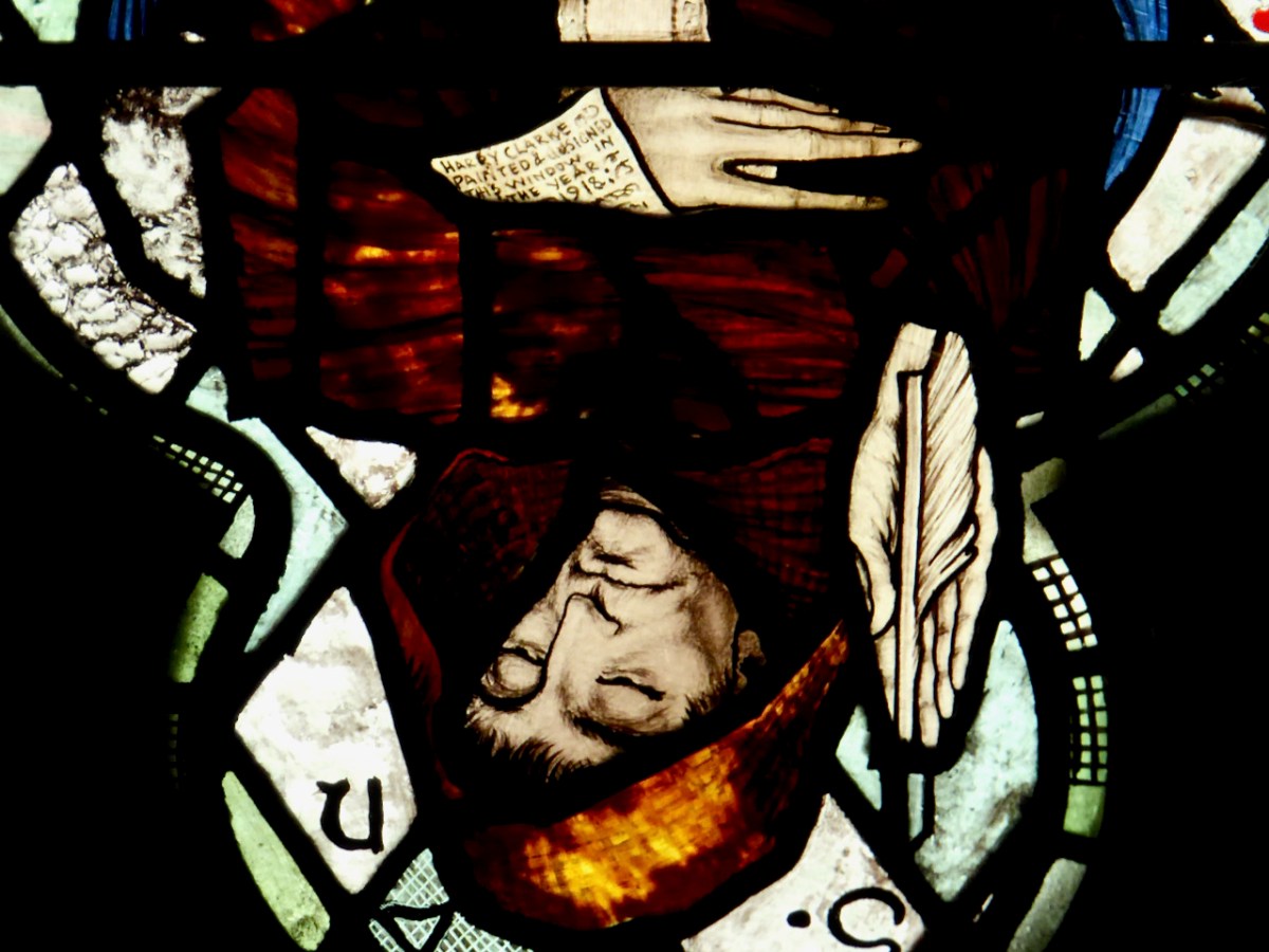
Why was James Burke writing about St Barrahane to Edith Somerville? She was researching appropriate saints for the window she and her family had commissioned from Harry Clarke (of which more in a future post). A lack of information didn’t stop Harry Clarke from imagining what Bearchán might have looked like. In his Nativity window in St Barrahane’s Church of Ireland, he gives full reign to his imaginative vision and depicts him as a monk.

He gets the full Harry treatment – large eyes, a face full of wisdom and compassion, long tapered fingers. He is writing on an extended scroll – and the scroll hides a surprise, only visible in close-up and upside down.

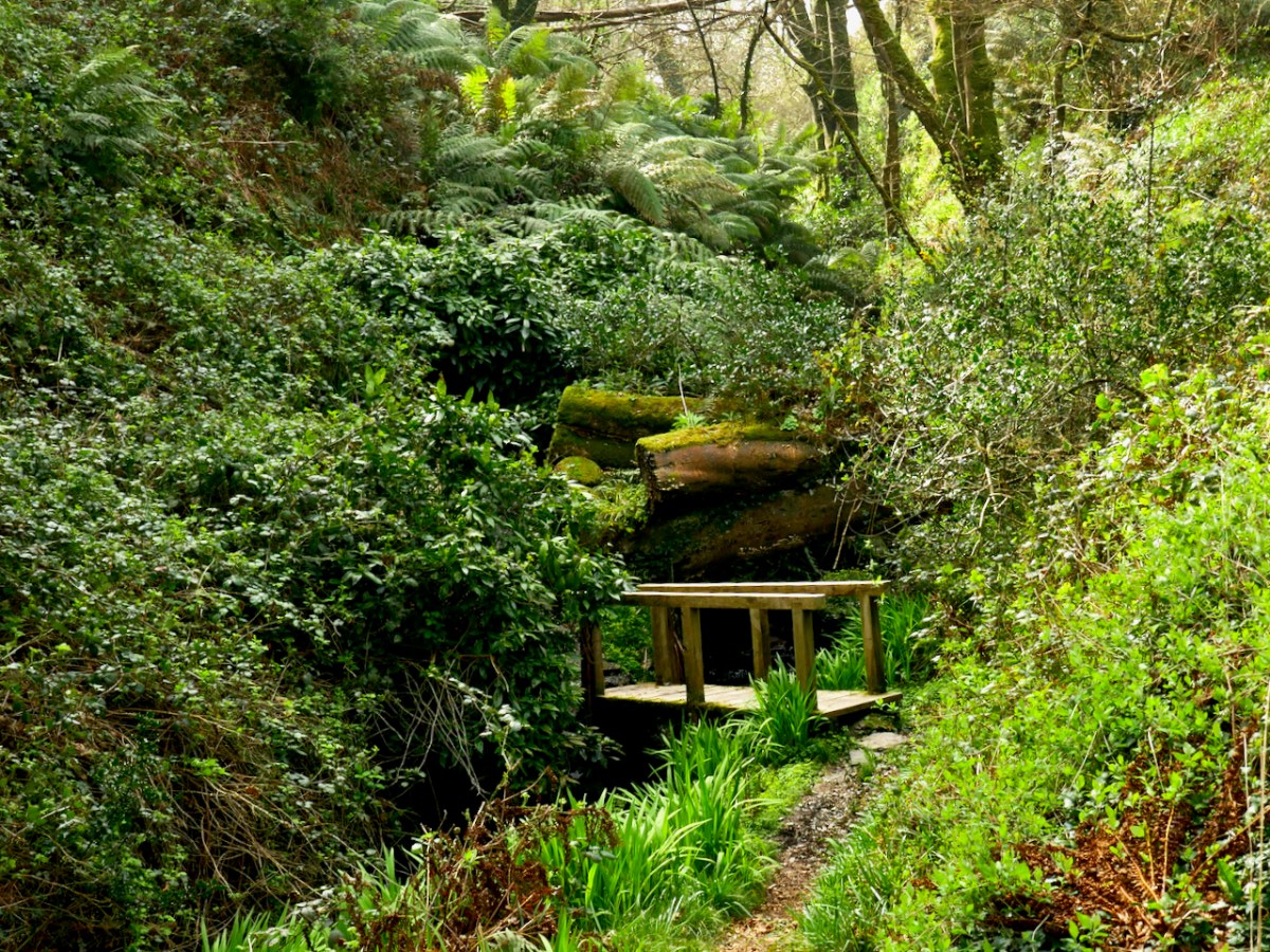
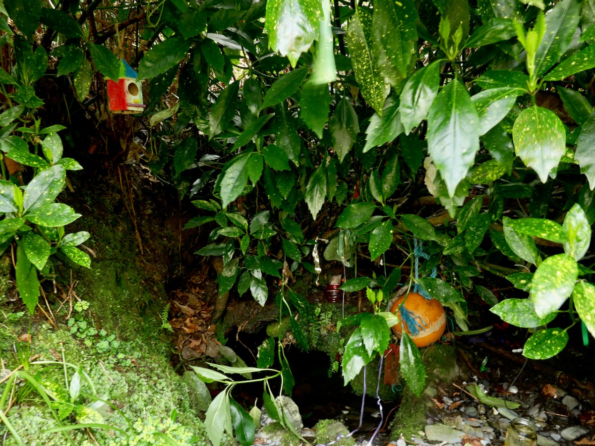
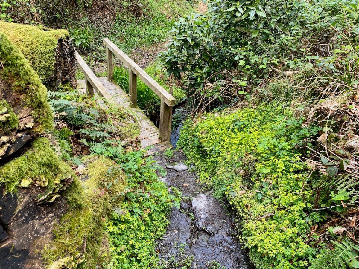
The well itself is a little beauty – half hidden in the undergrowth and accessed by a wooden bridge. It is festooned with fishing floats – fisherman left them here to protect them at sea – rags, and rosaries. The water is fresh and clear.

In fact, the water from this well is used to baptise infants in both the Catholic and Protestant churches of Castlehaven Parish! 

So there you have it – what we know about St Barrahane and the traditions that surround him. We collected a jug of the water from the well for anyone who wanted to fill a bottle. As Joey in Friends used to say – Could I be wearing any more clothes?

But, this being Gormú, there was more to the day – the visit to the Holy Well was to be followed by a swim! Yikes! Amanda and I egged each other on during the week (I will if you will)) and finally decided it had to be done. And guess what – it wasn’t that bad! In fact, the water felt if anything slightly warmer than the surrounding air. In case anyone thinks I am virtue-signalling here (Look at me, swimming in December!) we didn’t stay in long, and there was a lot of shrieking involved. Some of the real swimmers emerged half an hour later.

There was an immense sense of camaraderie as we chowed down on our hot porridge and tea afterwards. Vincent O’Neill presented Amanda and me with the latest issue of the Castlehaven & Myross History Society Journal.

It is a great thing that Conor and other local historians have taken on the task of re-activating this pilgrimage and it felt wonderful to be a part of it. 

*For more on James Burke, see A Tale of Two Editors: the Lives and Words of James Burke and Patrick Sheehy, in the Skibbereen Historical Journal, Vol 16, 2020, by Alan McCarthy
**With thanks to The Somerville Archives and Tom Somerville for permission to quote from the James Burke letter.

Castlehaven and Myross Placenames Project

The preservation of placenames has become urgent in Ireland, as the keepers of the memory are getting older, and taking all their knowledge with them to the grave.
One group in Castlehaven and Myross has embarked on a fascinating project to try to rescue their local placenames before it’s too late, and are succeeding magnificently. In their undertaking, they are providing a model to any other community that wants to follow their lead. We met with Conor Buckley and Annette Glanton (above) as well as Vincent O’Neill recently to learn what this project is all about.

Annette showed us her work, which centres on Carrigillihy, near Union Hall. Her main informant was her father, who has an intimate knowledge of every inch of the area. Working with him, she has labelled fields, inlets, islands, cliffs and streams. The result is a detailed map of names – some in English, such as Badger’s Hole, but most in Irish, such as Faill na Cág (pronounced file na cawg – I will give approximate pronunciations in brackets after Irish words from here on), the Cliff of the Jackdaws. I am showing just a small portion of her maps, above. 
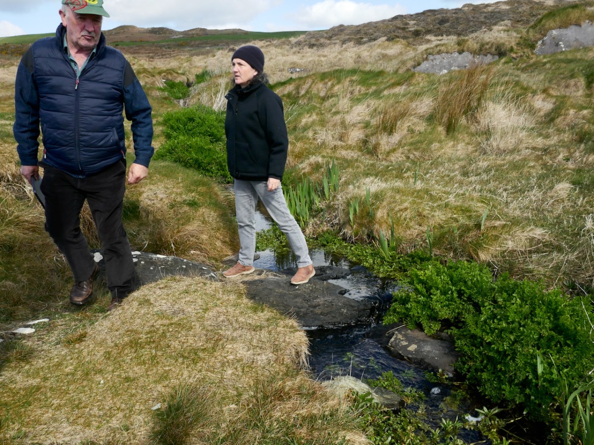
Conor then took us on a walk across the heath, to a vantage point where he could point out many of the surrounding features and name them. We crossed two streams on the way, and he told us each one was a townland boundary. We started in Castlehaven townland, crossed a stream into Glasheenaulin, and from there walked to Ballycahane, crossing the Glasheenaulin stream as we did so. Since a ‘glas’ is a rivulet, a glasheen is a small rivulet or stream, and aulin is an anglicised version of álainn, which means beautiful – so, we crossed the beautiful little stream, and indeed it was.

The historic map of the area, above, shows the townland boundaries in red. The middle boundary is marked by the Glasheenaulin, below, being crossed by Vincent and Annette.
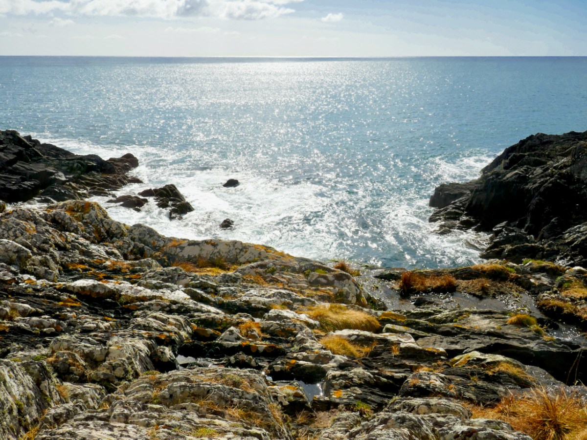
From our vantage point Conor pointed down to where the sea came boiling in over the rocks – perhaps because of this effect, this small inlet was called Poll a’ Choire (powl (rhymes with the bird, owl) a Quirrah), or the hole of the cauldron. However, he showed us that within all the roiling water and rocks was another, smaller hole, which filled and emptied with water, and told us that there was a possibility that the name might be Poll na Caora (powl na kay-ra) or Sheep’s Hole, since it may have functioned as a sheep-washing station! Welcome to the intricacies of figuring out Irish placenames!
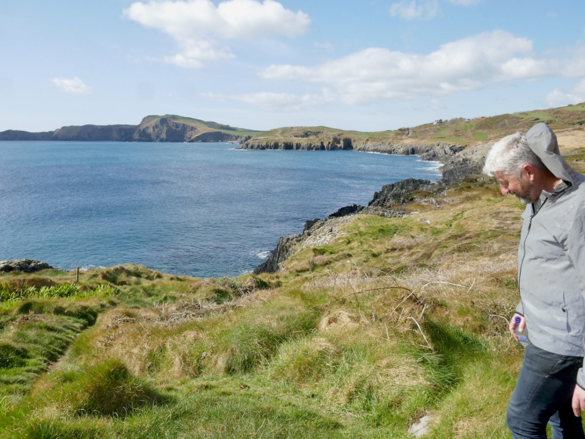
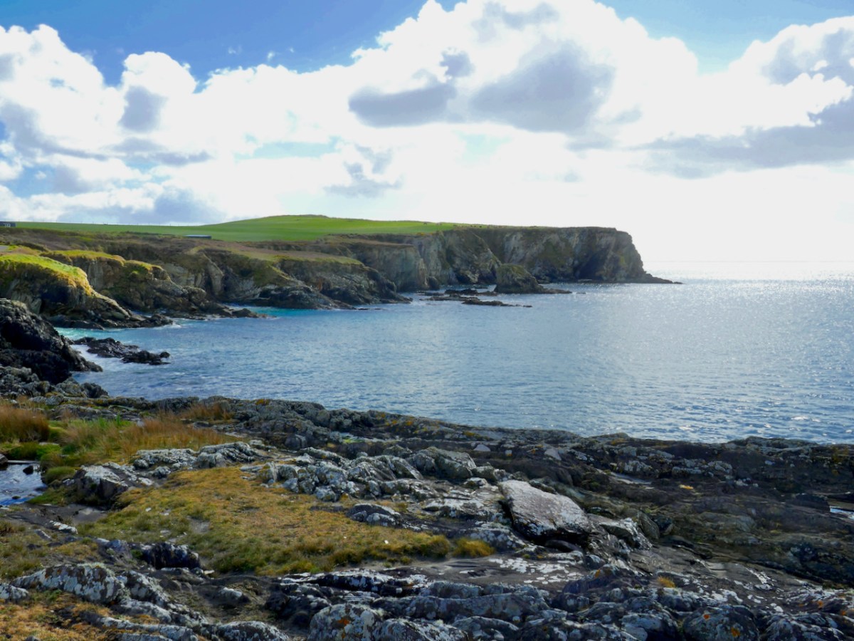
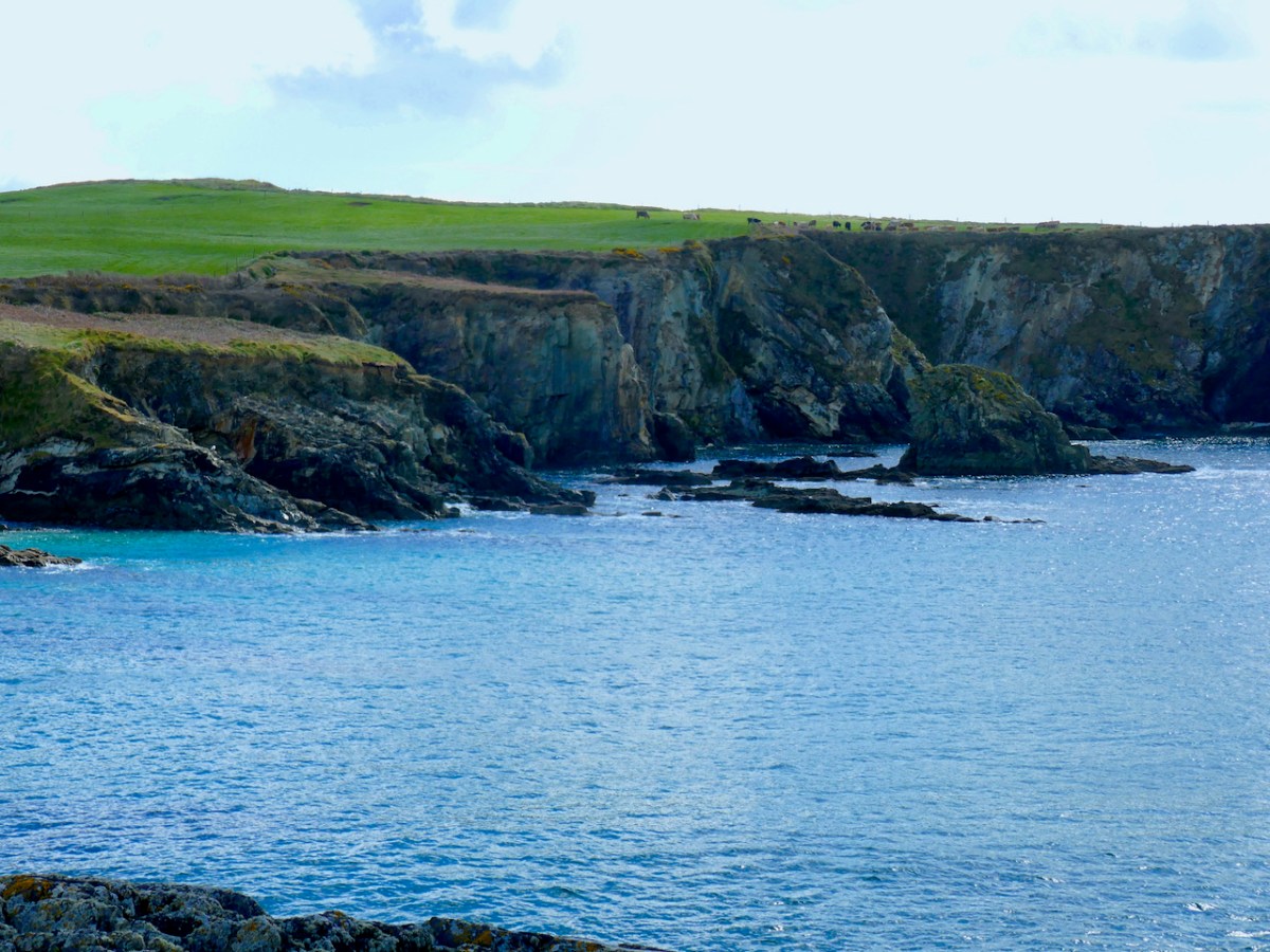
From the same spot we had a good view of the coast west and east. To the west is the unmistakeable mass of Toe Head – a promontory that has a distinctive rise (see the first and last photos in this post). On the near side is a hill which locals traditionally call Beann tSidháin (which they pronounce Been te Sheedawn), or peak of the fairy mound. A place with a name that included references to the Sí was a place to be treated with respect and caution – the Other Crowd was not always benevolent.

When I asked if it was possible that this might have been séideán (shay-dawn), meaning place of gusty winds, Conor gave me an insight into the depth of research that he and his advisory group undertake. He responded with several references to dictionaries, placename tomes – and a manuscript from the 1660s! I can just imagine the meetings of this group as they ponder of the possible variations and come to a conclusion – as Conor said to me, ‘it’s as much an art as a science.’

A lot of Toe Head itself has had names assigned, and I was intrigued by the name given to the piece of rock that has in the distant past, sliced off from the mainland (above). Locals call it the Sciollán (skull-awn), which means a seed potato – or maybe the piece of a potato that you can plant as long as it has an eye in it. Once you know that, you can’t unsee the nobbly bit of potato.

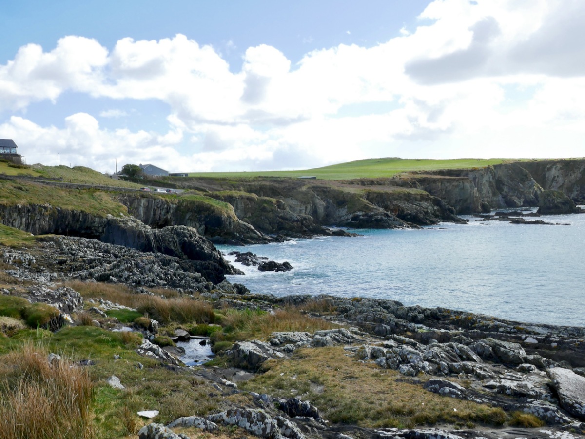
We will head east now, to the series of tiny inlets that indent the eastern side of Sandy Cove. Each one has a name, beginning with cuas – a cuas (koo-us) is a small inlet or cove although it seems to be used particularly in Cork and Kerry. To name each one makes total sense of course – if you were telling a neighbour which cuas you left pots in, or where you were going to dig sand, you all had a shared knowledge of the store of names.

Going from left to right along the bank you have:

Cuas a Chúir – this might be Inlet of the sea foam (cúr) or inlet of the tower (thúir). There is no tower here now, but Sandycove was once called Torbay, so maybe…

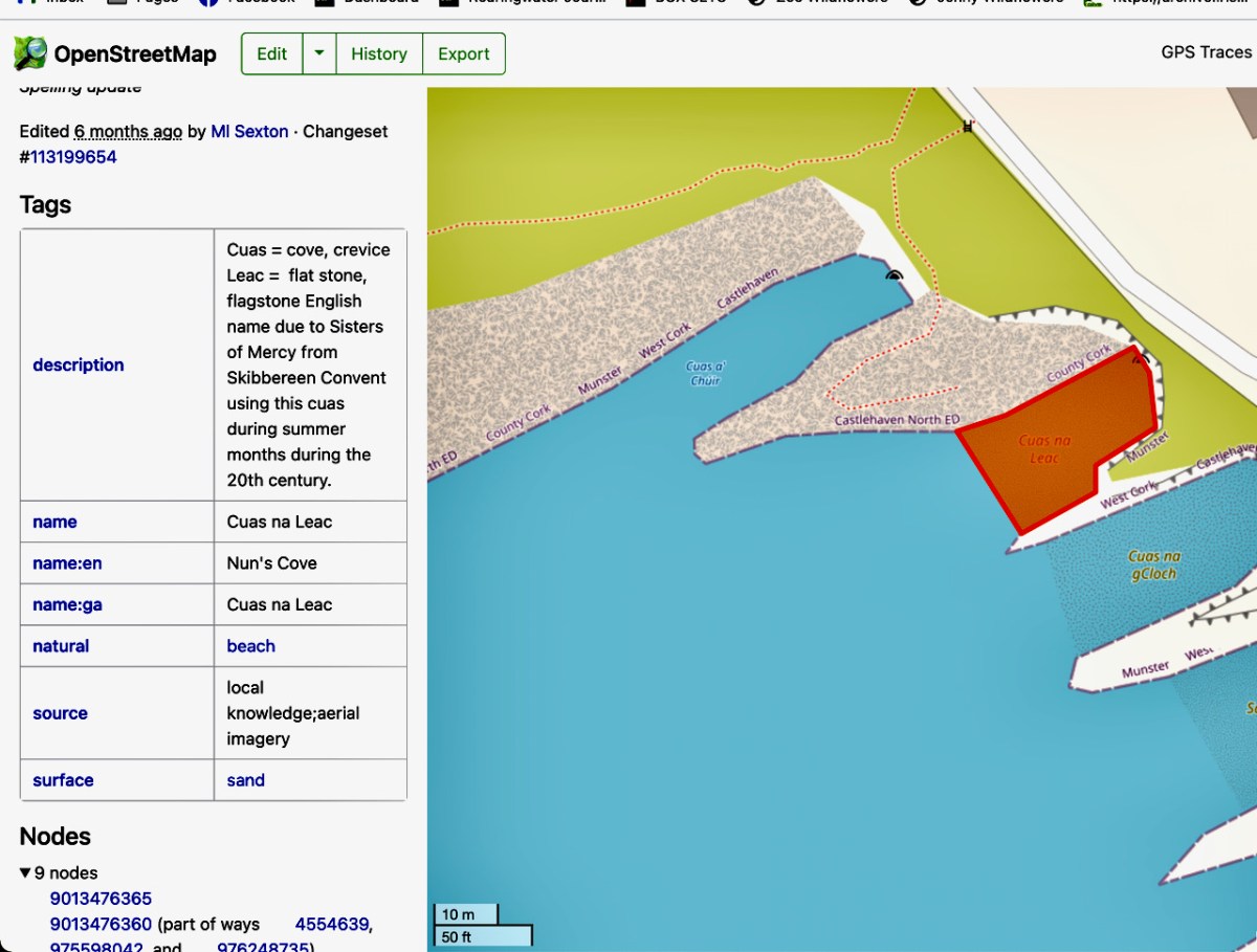
Cuas na Leac – a leac (lack) is a flat stone or flagstone. This cuas has an alternative English name – Nun’s Cove. Apparently it was the one used by nuns from the Skibbereen convent to swim in.

Cuas na gCloch – cloch (cluck) is a rock – hence, rocky inlet.

Sandy Cove – this is a preferred swimming spot for locals and visitors

Cuas na nGabhar. Lots of scope here! A gabhar (gower) is a goat, but apparently it’s also the name for a certain type of pollock, known as a scad. [Just to complicate things, it can also be a little white horse, and therefore white-crested waves. Gabhra Lír, for example, means the little white horses of Lír, who was the king of the world under the sea in Irish mythology. Whew! – But that’s just my own musings]

Cuas an Tairbh – tairbh (tarriv) is the irish word for bull, and the rock just off this point is the Bull Rock. It probably has the shape of a bull from some angles.

Cuas Móire – móire (moy-ra) is an adjective usually applied to a place that experiences great gusts of wind or rolling seas. Apt! But this could also simply be Cuas Mór (more), meaning Big Cuas, since it is the biggest one.

Just before the Cuas Móire theres a significant cliff labeled The Pulley (about where the cattle is in the photo below) and here’s the story about that name. On top of the cliff was a pole with a bar attached – the bar, with a pulley at the end of it, could swing out over the cliff. A long rope threaded through the pulley was controlled by a patient horse which was lead away from and toward the cliff, thus raising and lowering the rope. At the end of the rope was a large basket. A man climbed into the basket and was lowered to the bottom of the cliff at low tide. There he set about harvesting kelp with a tool that cut it off above the roots. As he gathered armfuls, he filled up the basket which was raised up to the field and piled onto a cart. He continued to do this until the tide came up to his neck, whereupon he jumped into the basket and was the last load to be pulled up.

Almost unbelievable, isn’t it? The hardship and courage of that – it was done all year round! Yet, as Vincent and Conor explained to us, sand and seaweed were the only fertilisers available to people and gathering both was an important part of the yearly round of labour needed to grow food. Both were also taxed by local landlords, so they were a commodity over which landowners exercised control. The National Museum has a good piece on seaweed harvesting, with photographs showing how it was done – no cliffs, alas. Another piece on RTE from 1962 shows hand harvesting in Clare.

You will have noted that all of these placenames are now on maps, which I have used in my illustrations. The site is https://www.openstreetmap.org/ and Conor, Vincent and their team are using it to record these names for posterity. Anyone can do this, but, as they pointed out to us, it’s best done in an informed way, since labelling a place with a modern name (e.g. Danny’s fishing cove) can perpetuate new, personal or inaccurate names. The team has annotated many of the placenames with additional information – such as about the possible names for Cuas a’ Chúir, above, and Cuas na Leac, below.

I have only given you a tiny look at what the Castlehaven and Myross Placenames team is doing – their work is extensive and ongoing. And it’s important – these are among the oldest ‘transparent’ placenames in Europe. As Conor explained to me placenames start out as transparent – people name what they see in front of them. But over time, the names become opaque, mostly due to a change in the dominant culture – a new language wreaks havoc with pronunciation of ‘foreign-sounding’ words. However, the names around West Cork, as long as there is someone who still remembers them, are as ancient as it gets. Hydronyms (place names associated with water) survive better than toponyms (land-based) possibly because they were a shared resource.

The team are happy to share their expertise and would love to encourage other groups to undertake similar projects in their own locality. You can get in touch with them by emailing castlehavenhistory@gmail.com or through their Facebook page https://www.facebook.com/castlehavenhistory/

Castlehaven – The Haven

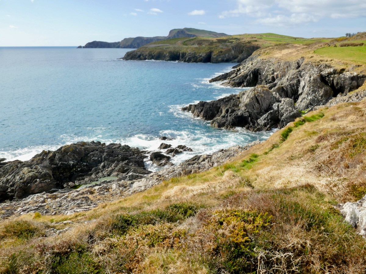
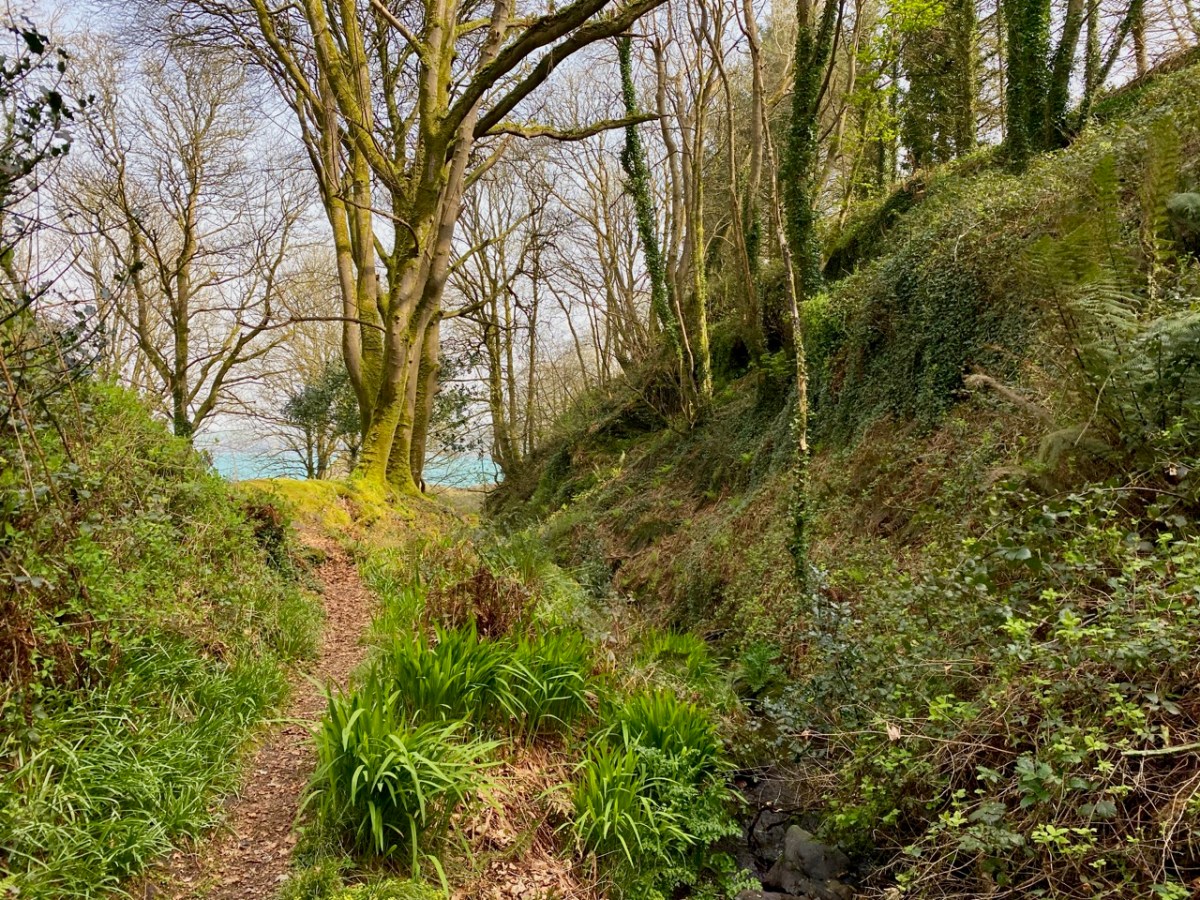
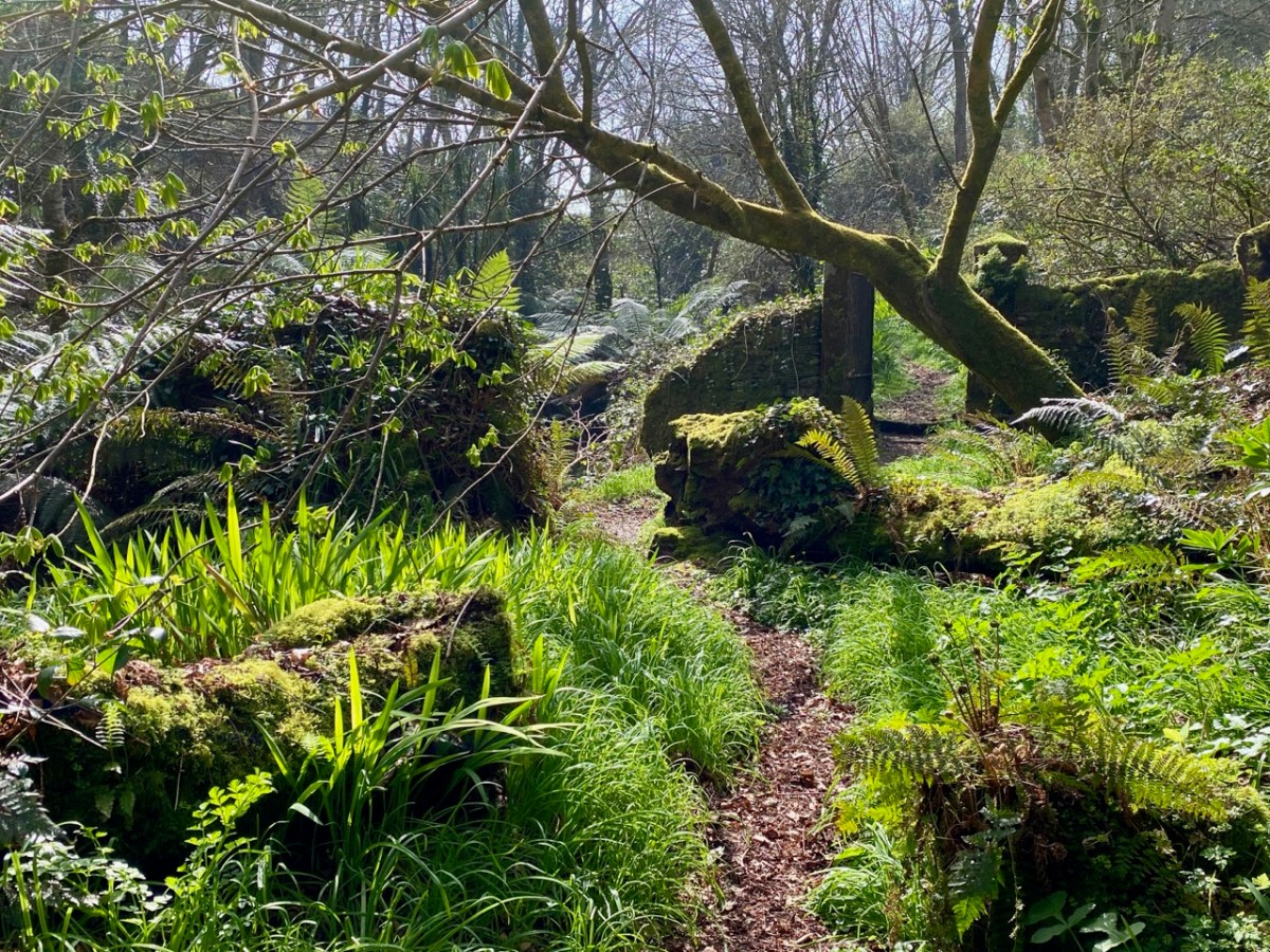
The word ‘haven’ is said to have a Norse origin: hǫfn. This translates simply as ‘harbour’. Does this mean that the Vikings visited West Cork and gave Castlehaven its name? Dictionary definitions include ‘a safe haven in times of trouble’ – refuge, retreat, shelter, sanctuary, asylum . . . The word conjures up something a little magical, and our exploration last week of the secretive valley that leads inland from Castlehaven – at the southern end of a significant West Cork cove – was certainly an enchanting experience. We traversed it on the greenest of days at the arrival of spring:

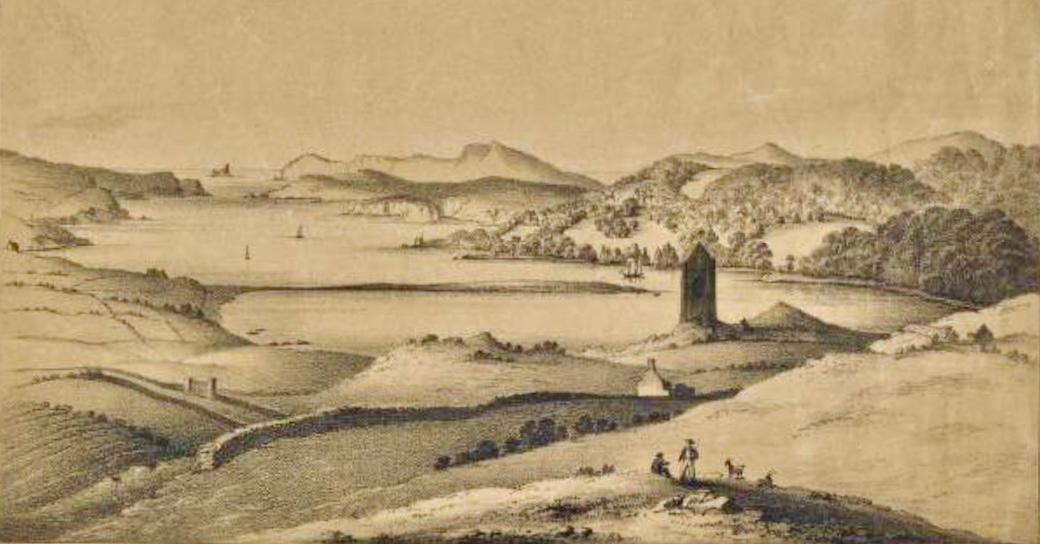
The header is a nineteenth century engraving, and shows a possibly idealised view looking across The Haven, towards the open waters of the Atlantic. In the foreground is the castle of Raheen, or Rathin. Castlehaven itself is at the far end, and the old tower house there – now all but vanished into the lush undergrowth – was strategically important, particularly during the Nine Years’ War between Gaelic Irish lords and the English. Spain also took an opportunistic interest in intervening in matters between Ireland and England. There are many accounts of the skirmish that occurred here on 6 December 1601, all of them varying to such a degree that we can have no real idea, even, of who was victorious! I like this version, penned by a contributor to the Duchas Schools Folklore Collection. It’s part of an extensive essay about the history of the area, which we will revisit in due course:

. . . Beside the Cemetery at Castlehaven stood, about ten years ago, the ruins of Castlehaven Castle, described by Don O’Sullivan in connection with the war of O’Neill & O’Donnell. “Porto Castello”, as it is called by O’Sullivan, played a very important part in connection with the Battle of Kinsale. Both O’Sullivan & Carew give accounts of a battle fought in the harbour, and while the former claims that Admiral Levison and his ships were driven off with loss of some vessels at the harbour’s mouth, Carew claims victory for the British fleet. Local tradition says that inside Reen Point, on the eastern side of the harbour lies a Spanish Vessel laden with gold, but that misfortune is sure to follow anyone who seeks the treasure. Castlehaven Castle was fortified by a combined garrison of Spanish and Irish and withstood the assault of Admiral Levison of the British fleet. The ruins of this castle were in a fair state of preservation about fifteen years ago, but the lower portion of the wall showed signs of weakness, and the great pity was, that nothing was done to prevent the collapse of the entire ruin a few years later. It is ‘said’ that stones had been removed for road metalling many years ago and this vandalism could certainly bring about the unfortunate collapse which only left only a confused pile of stones . . .


Seán Ó Donnabháin – Teacher, Baile an Chaisleáin School, Castletownshend 1936
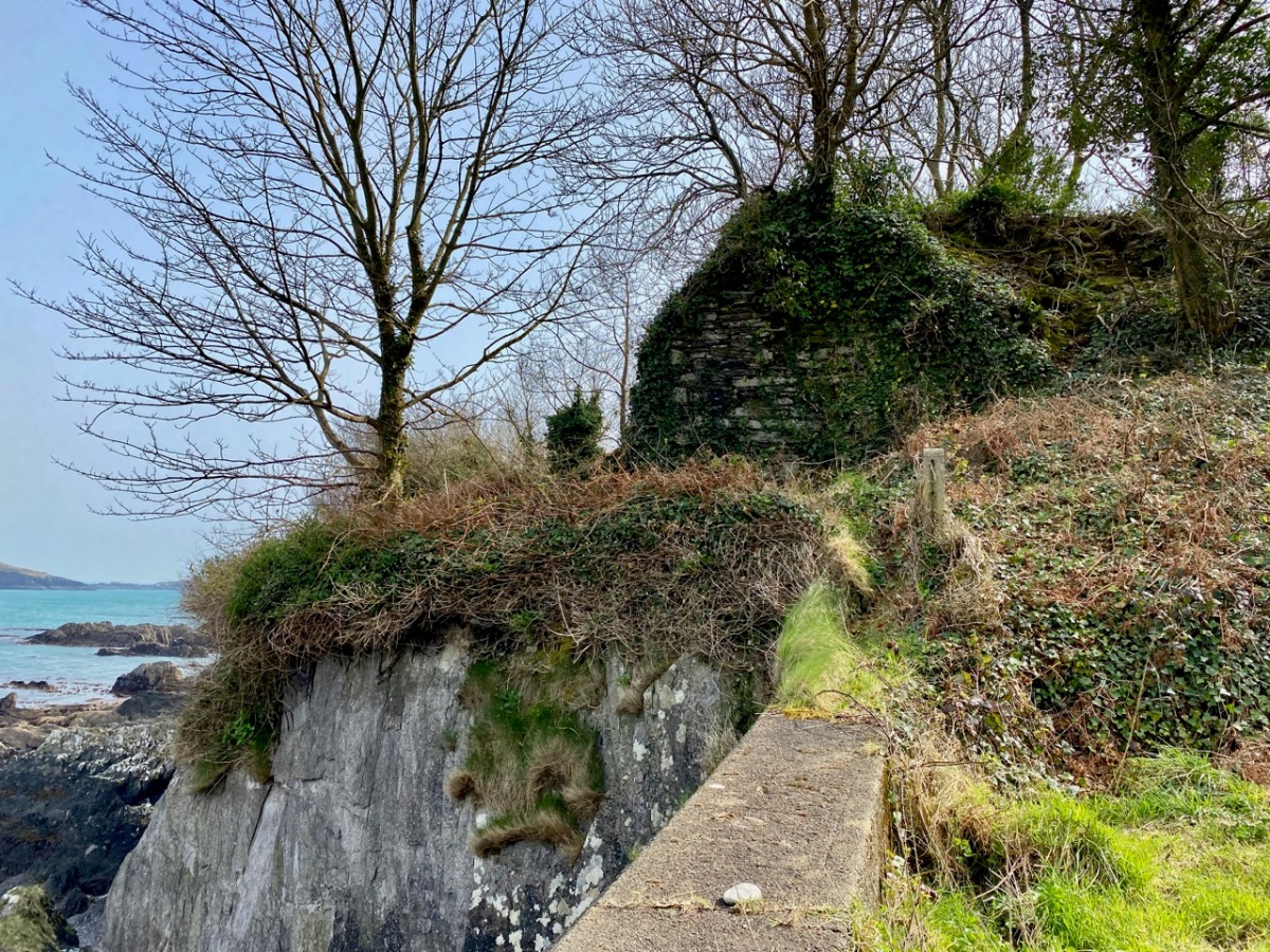
Upper – a view of the now-vanished tower of Glenbarrahane Castle at the entrance to the Haven by Cork antiquarian John Windele, 1801 – 1865 (courtesy National Library of Ireland) and lower – the vestigial stone walls that remain today beside the grey sands of Castlehaven

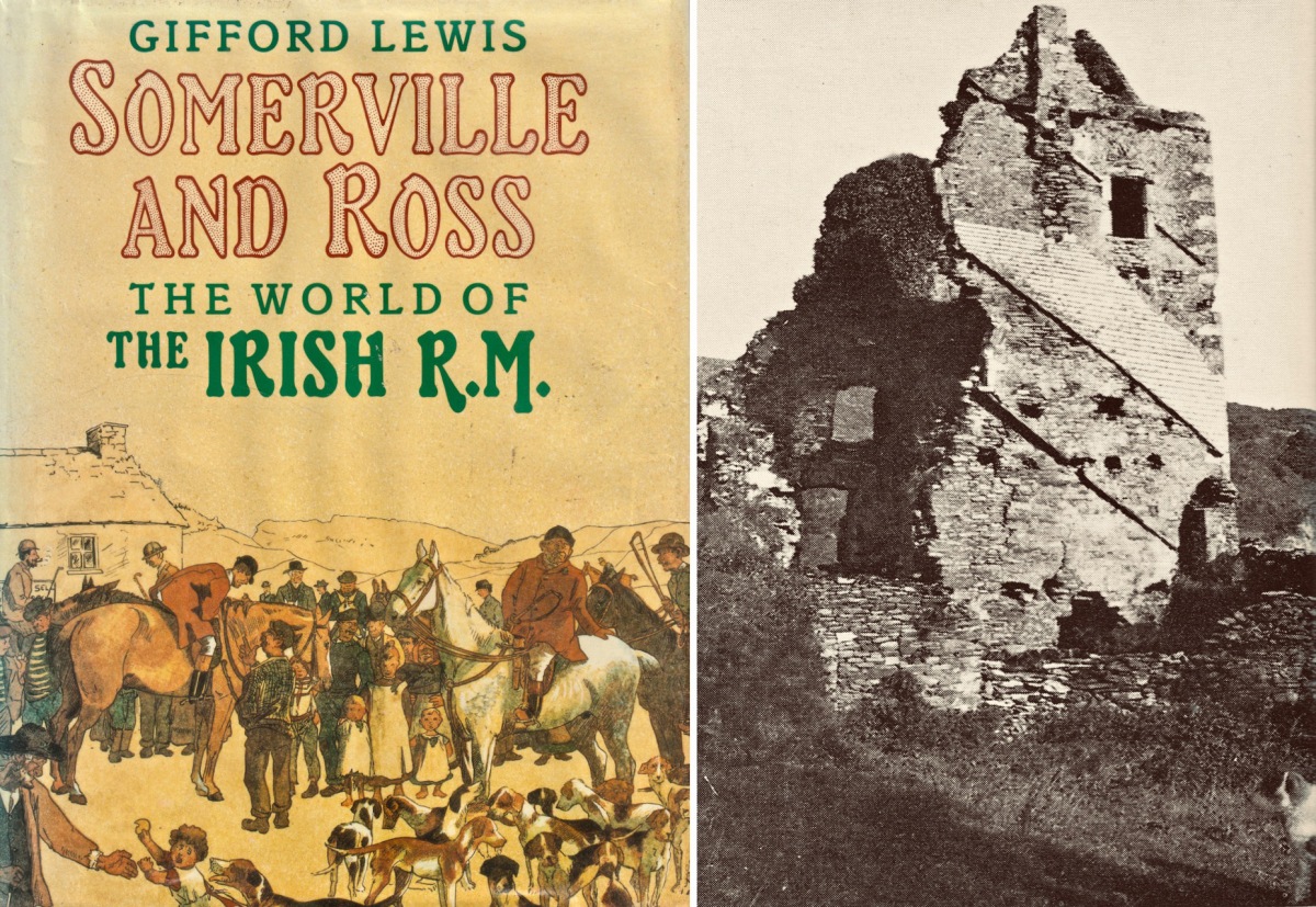
Among our inherited collection of West Cork books in the library at Nead an Iolair is this volume by Gifford Lewis, published in 1985 by Penguin Viking. Ostensibly relating to the writings of Somerville and Ross, it is illustrated with a well-researched collection of old photographs which include some of the castle at The Haven still standing.

This photograph (above) is particularly valuable. It is also from the Gifford Lewis book and is captioned as follows:

. . . A very early plate by Sir Joscelyn Coghill (c. 1865) showing the old Castlehaven church and above it the Castle in which the Reverend Robert Morrit lived, and before him the Reverend Thomas Somerville. The Tithe War had its effect. Eventually, the Tithe Commission Act of 1838 moved the burden of supporting the Protestant clergy from the peasants to the landowners. The Catholic/Protestant confrontation in Ireland came with the influx of Elizabethan English, the first after the Reformation of the English Church. Those who came to Ireland as Protestants were much less likely to be assimilated than those who came before the Reformation, like the Martins. The ousting of the topmost layer of native Catholic society by a new Protestant one is audible in the list of Rectors of Castlehaven church from 1403 to 1640: O’Driscoll, O’Callaghan, O’Driscoll, Cormac/Basse, Pratt, Stukely . . .

Gifford lewis, Somerville and Ross – The World of the Irish R.M. 1985

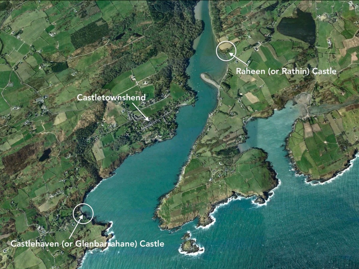
The aerial view shows the inlet of Castle Haven guarded by its O’Driscoll castle at the southern end. In the upper reaches of The Haven is a further castle, properly known as Raheen (or Rathin), sited above the natural spit of The League: the juxtaposition of castle and land-spit was probably deliberate, to create a defensive barrier against any invaders infiltrating the upper waters of The Haven. The mid-19th century 6″ Cassini OS map (above) shows the location in detail. James N Healy (The Castles of County Cork, Mercier Press, 1988) well describes its situation: “. . . It is a remarkable sight, tall and dignified in its quiet isolation . . .” and attributes it to the O’Donovan family, associated with Castle Donovan on the Ilen River – which we visited recently. Raheen was attacked from the water by Cromwell’s army in 1649 and remarkably survives in that breached condition today.

The coloured postcard above is based on a view probably taken around the turn of the 19th and 20th centuries. The viewpoint is identical with that in the header engraving, and The League can be clearly seen in both representations. Because the whole inlet is known as Castlehaven, we have to be careful when reading references or captions, as the two castles – which I always endeavour to refer to by their original names (Glenbarrahane and Rathin) are often both known as Castlehaven Castle. And, of course, we also have the castle at Castletownshend itself to further confuse the issue, although the structure there now is relatively late (the present building dates mainly from the 19th century, although an earlier Bryans Fort on the same site was probably 17th century).

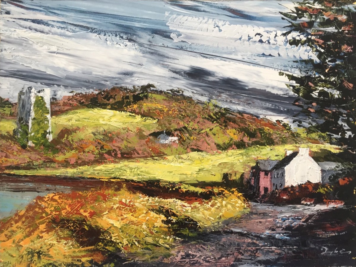
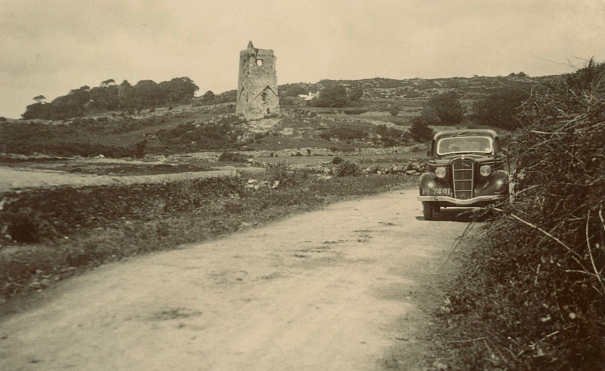
Here is a very fine painted view of Rathin Castle by contemporary West Cork artist Donagh Carey (thank you, Donagh!) You can find his works here: we are pleased to have some of them hanging at Nead at Iolair. I can’t resist including this photograph taken in the 1930s (below) – from the Adrian Healy postcard collection – showing Rathin, with the added bonus of a 1936 Ford 10 in the foreground!

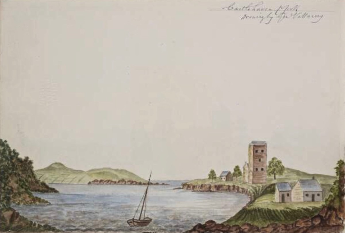
This view (above) is an enigma. It is referred to as ‘Castlehaven Castle’ and is a pen-and-watercolour drawing by Charles Vallancey (1721 – 1812). If the written caption is ‘Castlehaven Mouth’, then it must be Glenbarrahane (although the foreground topography should surely have shown the old church and graveyard?); if it is fact ‘Castlehaven North’, then it would more likely be Rathin – and it is certainly visually closer to this castle. However, then the mouth of the Haven is not in the right place at all. Vallancey was a British military surveyor who had been sent to Ireland in the mid 18th century: he became fascinated with the country and its topography and settled here as a self-styled historian and antiquarian. An extract of his work follows, from a report on West Cork:

. . . There was only one road between Cork and Bantry; you may now proceed by eight carriage roads beside several horse tracks branching off from these great roads; from Bantry the country is mountainous and from the high road has the appearance of being barren and very thinly populated; yet the valleys abound with corn and potatoes and the mountains are covered with black cattle. In 1760, twenty years ago it was so thinly inhabited an army of 10,000 men could not possible have found subsistence between Bantry and Bandon. The face of the country now wears a different aspect: the sides of the hill are under the plough, the verges of the bogs are reclaimed and the southern coast from Skibbereen to Bandon is one continued garden of grain and potatoes except the barren pinnacles of some hills and the boggy hollows between which are preserved for fuel . . .

Charles vallancey – A Report on West Cork, 1778, British Library

Vallancey was noted for obtaining the Great Book of Lecan (Leabhar Mór Leacáin), a medieval manuscript written between 1397 and 1418 in Castle Forbes, Lecan, Co Sligo. He passed it on to the Royal Irish Academy, where it resides today. Sadly, his work apparently only garnered the poorest of appraisals – as an example, here is the 19th century Quarterly Review:

. . . General Vallancey, though a man of learning, wrote more nonsense than any man of his time, and has unfortunately been the occasion of much more than he wrote . . .

The Quarterly review, London, John Murray

In my Extreme Green post I promised a ‘salacious scandal’ associated with Castlehaven. Alas – we have this week run out of time and space . . . Keep watching!

Extreme Green – Castlehaven

There are many places in West Cork that deserve more than one visit. Our enforced confinement close to home focusses us on that thought. March went out like a lamb and – on the first day of April – we went off to enjoy the stirrings of spring in one of our favourite spots: Castlehaven.

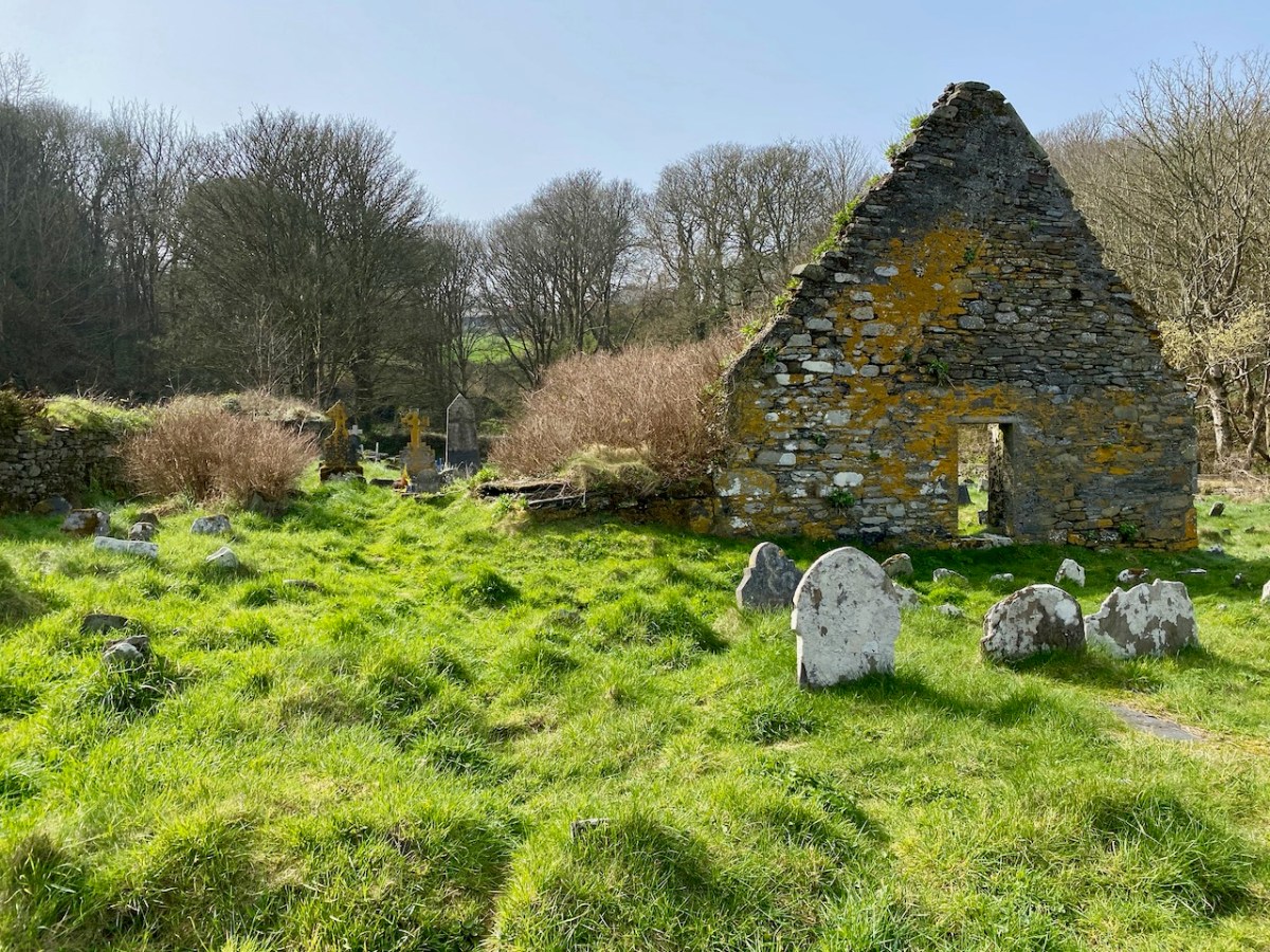
Here’s that spot seen from above. It’s accessed from a boreen that goes nowhere else, and is to the south west of Drishane, just outside Castletownshend. In the view you can see the little cove and an old burial ground which surrounds the ruin of the original church of St Barrahane, probably built on medieval foundations but disused by the 1600s. This benign place has bathed in some momentous historical events but is now forever peaceful and seems far removed from our material world.

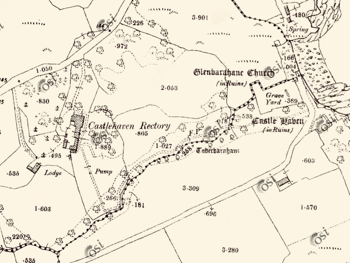
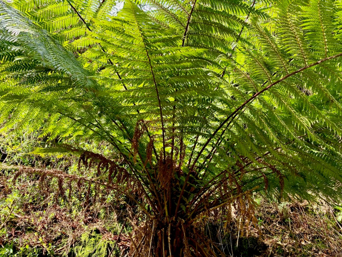
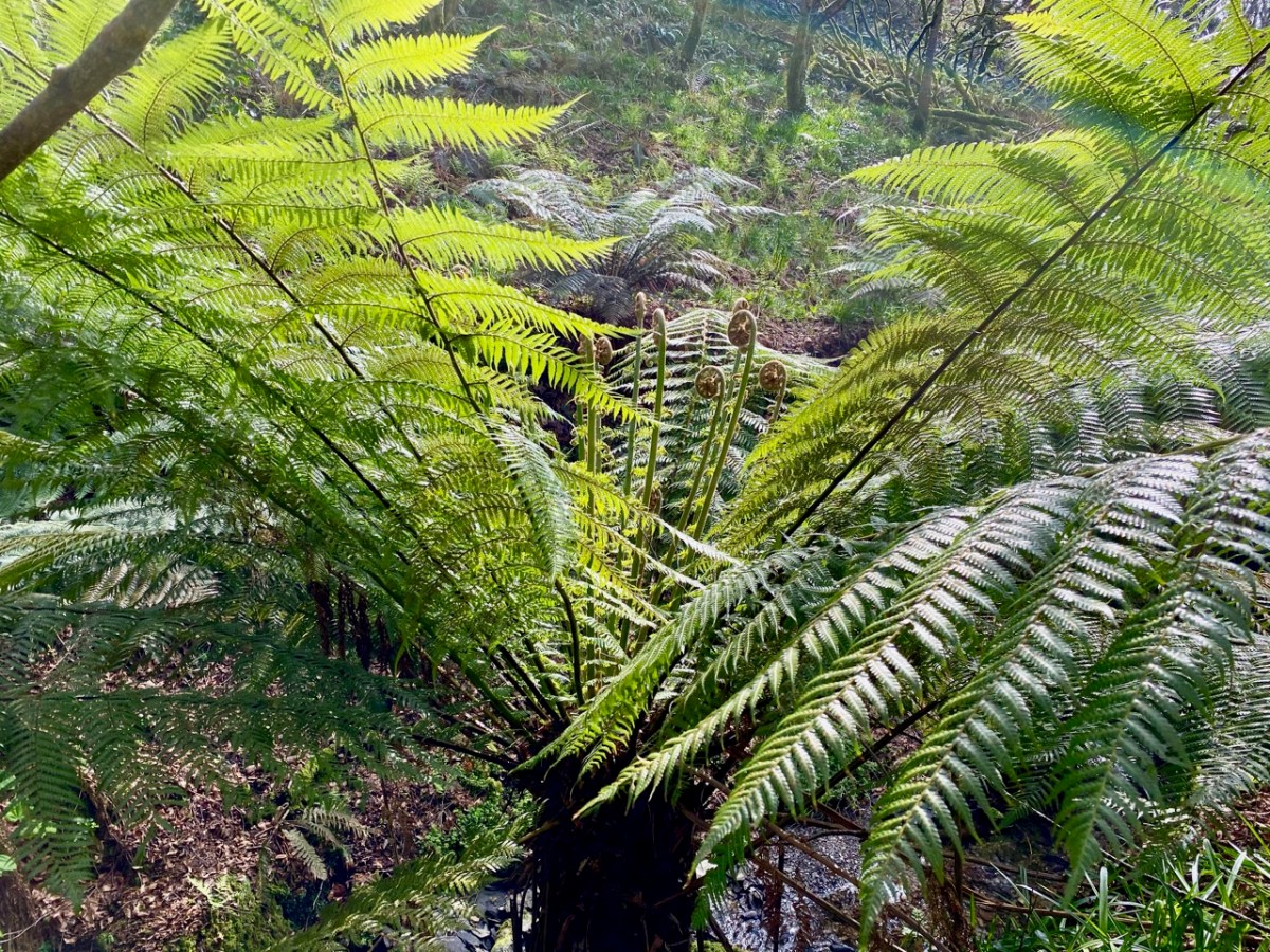
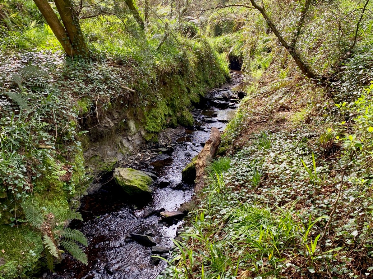
The 25″ OS map – dating from the late nineteenth century – marks the main features of Castlehaven: the ‘Grave Yard’, Rectory (based on an older house) and ‘Toberbarahane’ – a holy well. One of our favourite walks begins just to the south of the graveyard and wends its way up to the well, – and beyond – following a small stream which has ferociously gouged a channel through the rock formations in ancient glacial times. Today I can only describe the experience as ‘Extreme Green’ because our eyes are drawn to a riot of spring growth and exotic flora. In fact, Finola described it as a rainforest path when we first visited a few years ago.

The Holy Well is still revered, evidently, especially by sailors who need protection while at sea. The saint was known as Bearchán, and most likely came from the Corca Laoighde family  (the Annals describe the O’Driscolls as kings of the Corca Laoighde in the twelfth century), although we can find very little of his life. According to Pádraig Ó Riain’s A Dictionary of Irish Saints, Bearchán’s pattern day is not known, but Amanda gives it as 3rd December in Holy Wells of Cork & Kerry, something which she must have gleaned from local knowledge.

The Holy Well is easy to find and involves crossing a stout timber bridge to the left of the path. On our previous visit, three years ago, a tree had fallen across the path and the bridge was damaged, but this has now been put right.

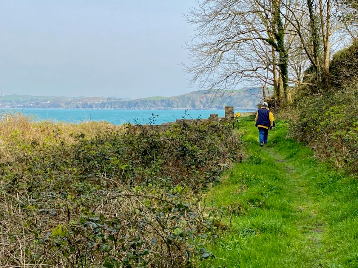
Finola is coming back along the holy well path, and the bay of Castlehaven is immediately beyond her. The colour of the sea is stunning azure at this time of the year. Just beyond the gate, and sited right above the strand, is all that is left of Castle Haven, a strategic tower house which saw action on 6 December 1601, during the Nine Years’ War between Gaelic Irish lords and the English. The O’Driscolls, who held the castle then, had welcomed in a small convoy of Spanish munition ships. The commander of the English naval forces based at Kinsale, Admiral Leveson, was ordered to “. . . seeke the Spanish fleete at Castlehaven, to take them if he could, or otherwise to distresse them as much as he might . . .” I’ll leave the rest of this story as a cliff-hanger, to be completed in a future post, but we will return to the castle which gave Castlehaven its name.

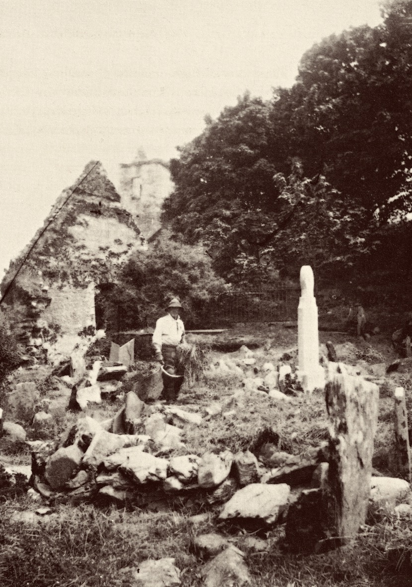
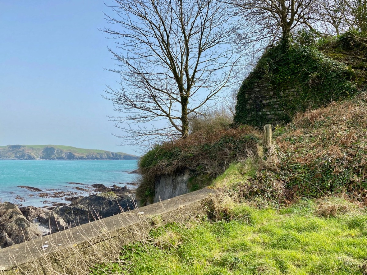
The old photograph dates from the late 1800s and is from the Lawrence Collection, courtesy of the National Library of Ireland. My photo shows all that remains of the castle today: a section of stone walling close to the cliff face. Its downfall occurred in 1926 and we know this because:

. . . Edith Somerville recorded that while taking a walk on 26 February 1926 she heard a loud rumble and in looking towards the direction of the old tower found that it had collapsed. Nowadays only a mere stump remains, and that covered with briars and weeds. The castle stood on the side of the harbour of Castlehaven, to the immediate south of the stony grey beach, and the decayed church, graveyard and holy well of St Barrahane, the local patron saint who gives his name to the nearby glen and castle. The castle and haven was known as Cuan-an-Chaisleán to the Irish, as Castlehaven to the English, and El Puerto Castello to the Spanish, but they all mean the same thing . . .

The Castles of County Cork by James N Healey, The Mercier Press, 1988

In the next post I’ll be telling you more about the pivotal sea-battle at Castlehaven between the Irish – Spanish alliance and the English forces; and setting out a case of mistaken identity. We will also be exploring another Castlehaven Castle, and looking into a salacious scandal that led to a beheading or two in 1631. There’s much to look forward to…!

Whale Watching in West Cork

To celebrate the lifting of travel restrictions within Cork county, I did something I have been meaning to do for years – I went whale watching! Thank you to my good friend Susan Byron of Ireland’s Hidden Gems for the recommendation of where to go and who to go with.

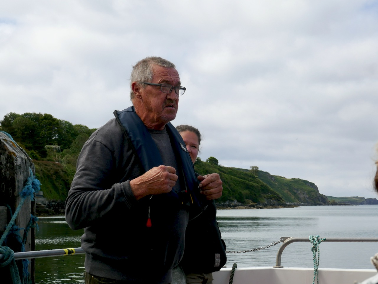
Colin Barnes (below), of Cork Whale Watch (and see their Facebook Page here) has been doing this for years and knows every large animal in these waters. For him, this is a personal passion, an academic study, and a mission to show us that we have, in our own backyard, a world-class whale watching experience.

I have been whale watching several times in Canada so I know that there is never a guarantee that you will see anything. I’ve always been impressed by the people who run these experiences, at how knowledgeable they are and how they seem to love these enormous animals. Colin fits that description to a T. From the website:

Colin Barnes has worked closely with the Irish Whale and Dolphin Group (IWDG) since 2000, and continues to assist with their scientific work. His knowledge and experience was instrumental in helping the IWDG develop their recommendations for responsible whale watching and marine eco-tourism in Ireland. Colin submits details of all cetacean and basking sharks sightings to the IWDG’s sighting scheme. He is the co-author of “Photo-identification of fin and humpback whales off the south coast of Ireland” and a number of other peer reviewed publications.

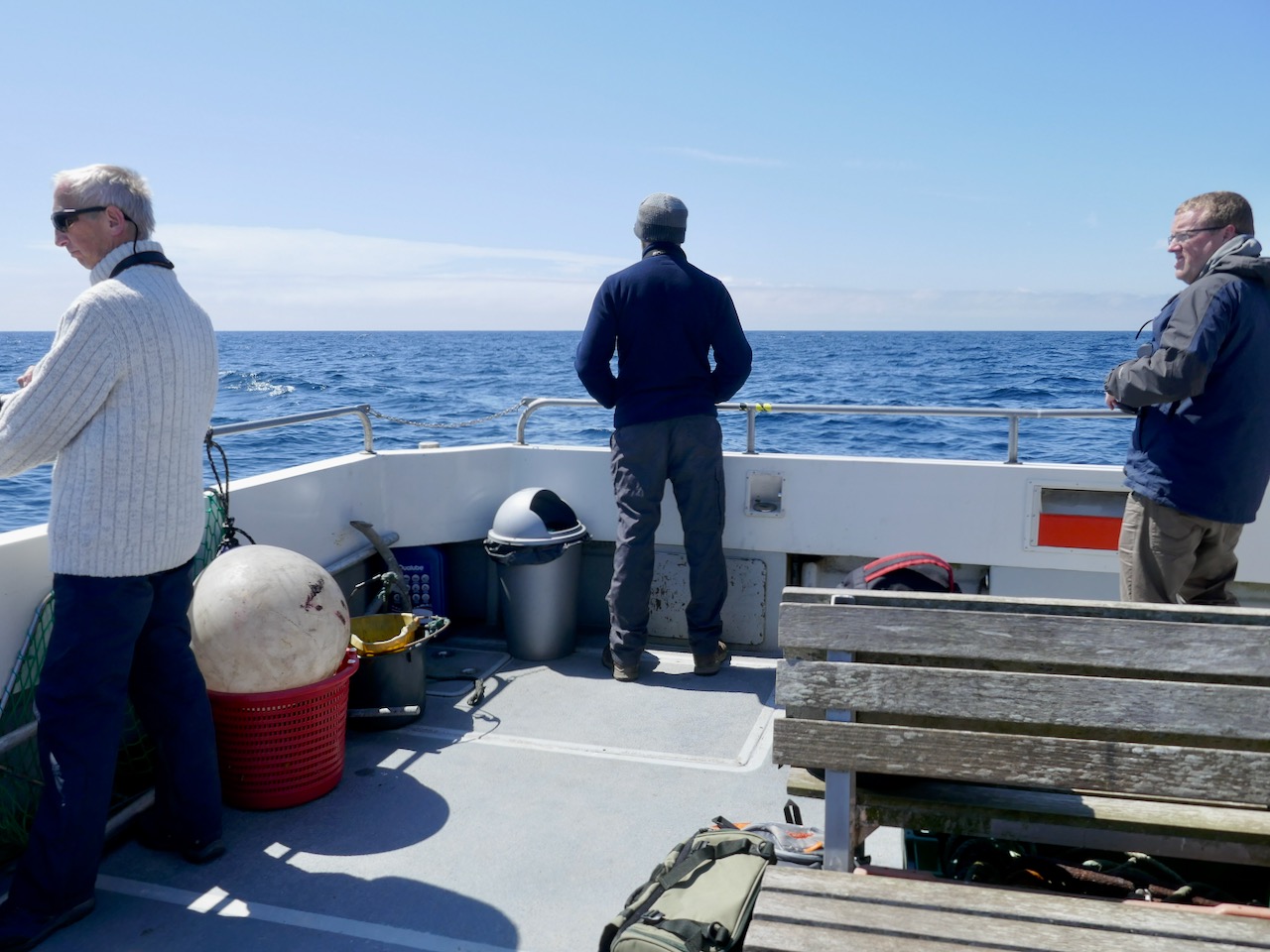
Socially distancing on board – lots of hand sanitiser in use as well

I knew that it was possible to identify Orcas in Canada by their dorsal fin patterns, but on this trip I learned that this was also the practise with Humpback Whales, except in this case the pattern scientists rely upon is that on the tail fluke. Colin was hoping for a sight of a humpback that had been hanging around off Castlehaven, as well as some Minke Whales and lots of dolphin.

The dolphins happened almost immediately we left the harbour and what a joy this was! They stayed with us almost the whole way out and back, riding the bow wave, leaping and dancing along beside us, at incredible speeds. It was mesmerising and I felt like I had a permanent smile on my face. They seem to do it for the sheer fun of it!

These are the Short-beaked Common Dolphins and they are the most frequently sighted in these waters. Worryingly, there has been a huge increase in the last few years of the number of strandings of this species and nobody yet knows what has caused this.

Passing Horse Island with its Circular tower. Although this is classed as a belvedere on the National Monumnets site, local tradition has it that it was built by a Somerville to guide his merchant ships into harbour. That’s the Toe Head Napoleonic-era signal tower in the background

I’m not great at doing videos but one of my fellow passengers, Denis O’Regan, had an underwater camera with him on a long pole and he has posted footage on his Vimeo channel. Take a look here to see how he captured some of the magic that we saw last Monday. Thank you, Denis!

A great shout went up when the first blow was spotted – it was a Humpback, just starting a dive. They dive for several minutes and you don’t know where they will come up again. But it wasn’t too far away and when it surfaced it stayed for a while, allowing us several looks at that giant shape curving through the water.

A passenger the previous day, John Holden, had posted incredible photos on Facebook of the same whale lunge-feeding  – take a look at these amazing images here and here. Thank you, John, for sharing these incredible photographs so freely. I have followed your page now, and hugely admire your highly skilled photography of the natural world.

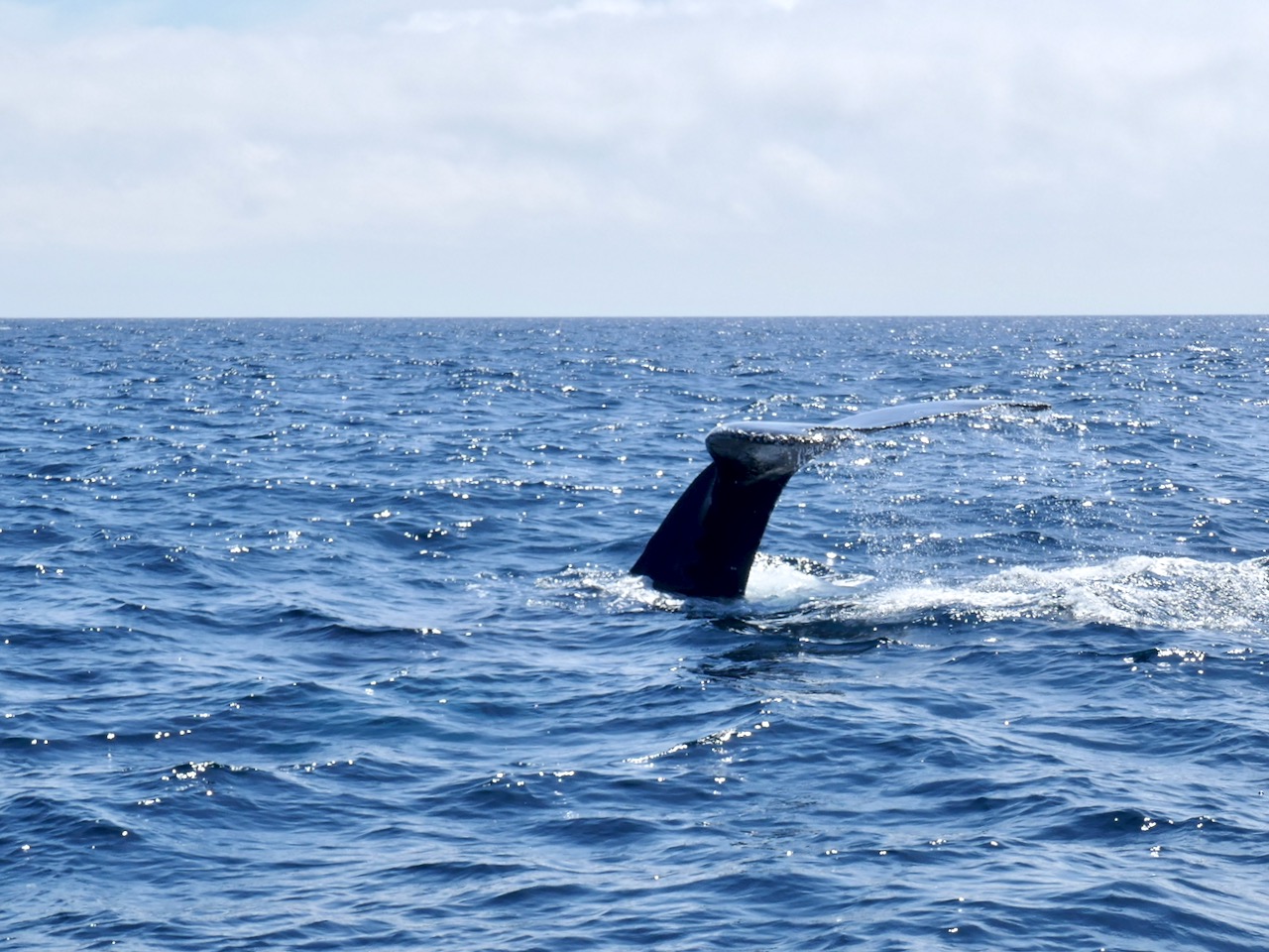
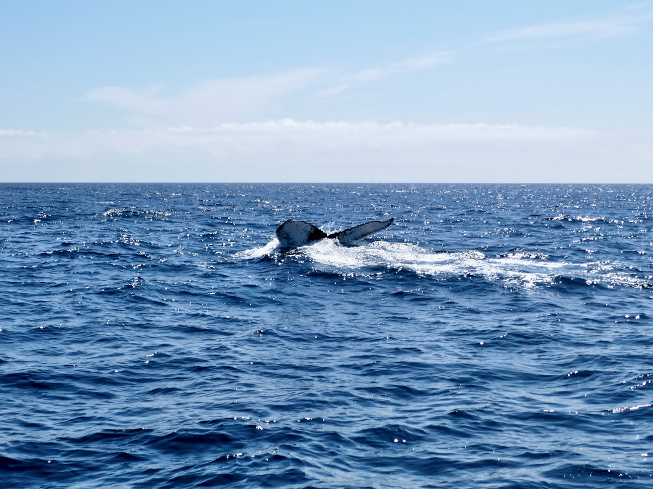
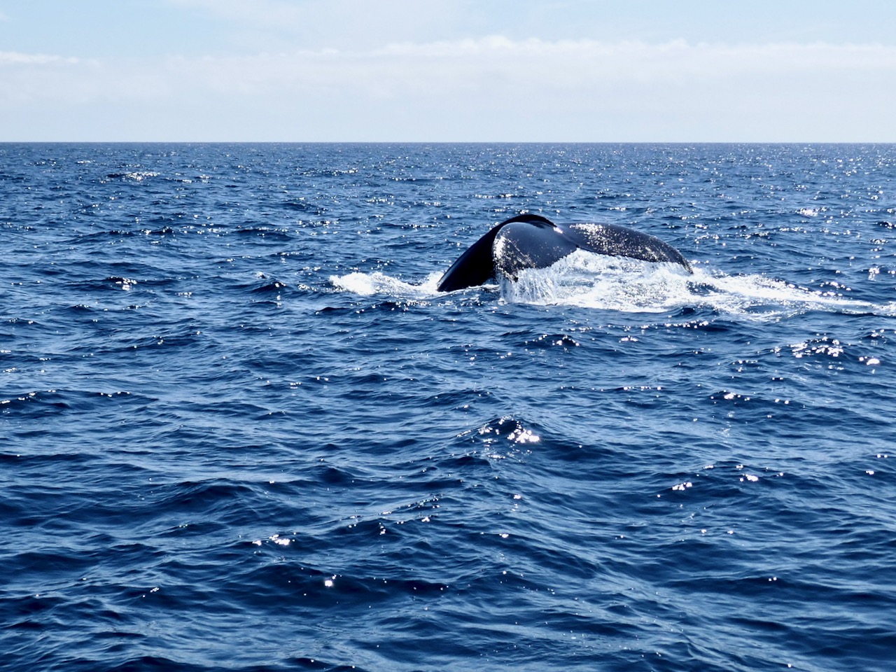
Back to my own efforts. Photography was difficult – the boat is heaving and the animals are moving fast. I did manage to capture a photo of the tail fluke (below), though, and later found out that I had a match – it was #HBIRL43, the same whale that had been feeding in this area for a few days. The ID is courtesy of the marvellous Irish Whale and Dolphin Group – a one stop shop for everything you want to know, and Dedicated to the conservation and better understanding of whales, dolphins and porpoises in Irish waters.

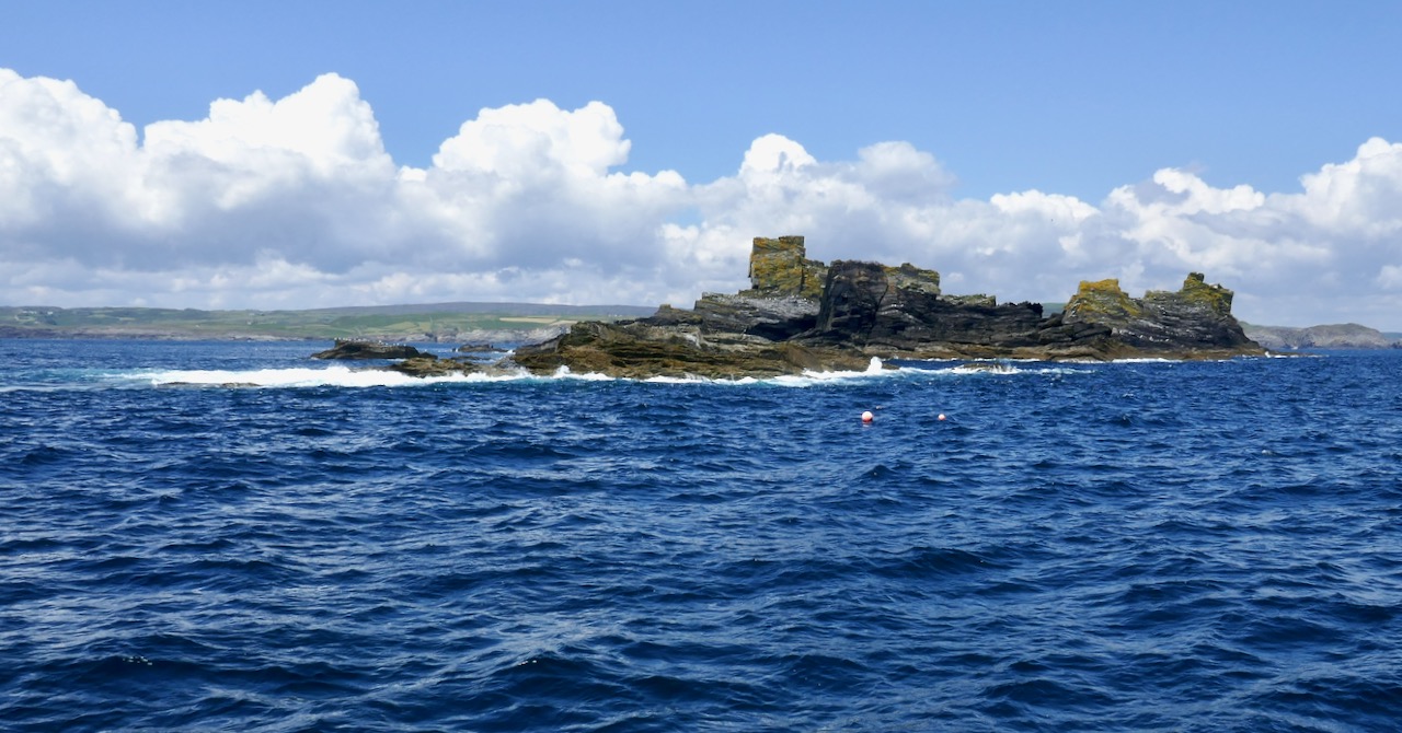
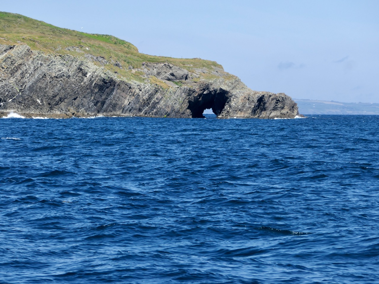
We sighted some Minke Whales but they were moving too fast to pose for their photos. On the return trip, Colin gave us a sightseeing tour of the islands and rocks at the mouth of the Haven, with their bird and seal populations.

Atlantic Sea Kayaking operates from the same pier at Reen that Cork Whale Watch does and this is their paddling ground. I had a magical night tour with them on Lough Hyne a few years ago, and I can see that I now need to do some daylight padding around these rocks and caves.

Thank you, Colin Barnes and Cork Whale Watch for a marvellous experience. I don’t know what took me so long!