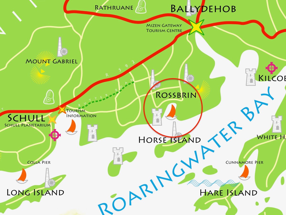
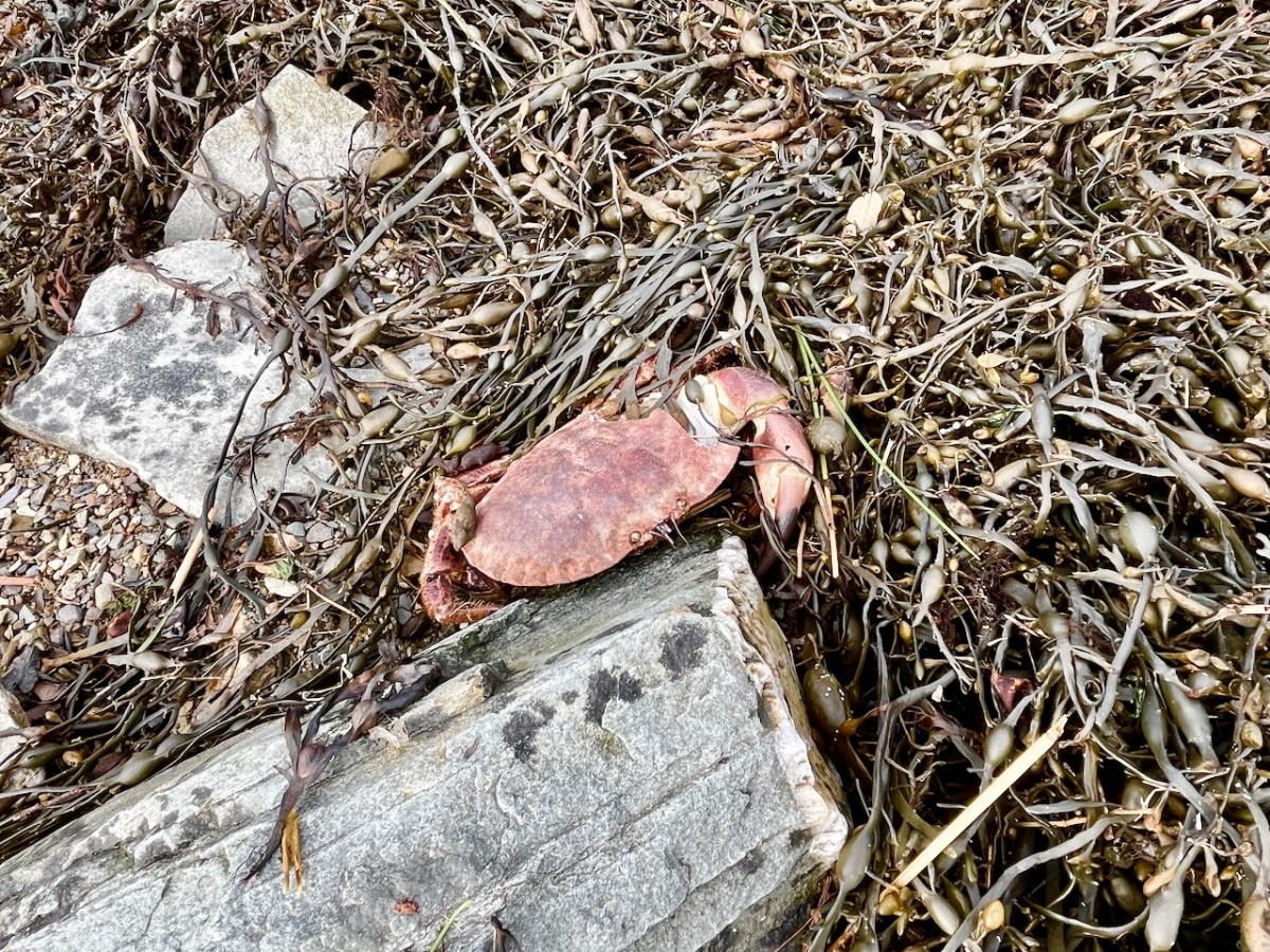
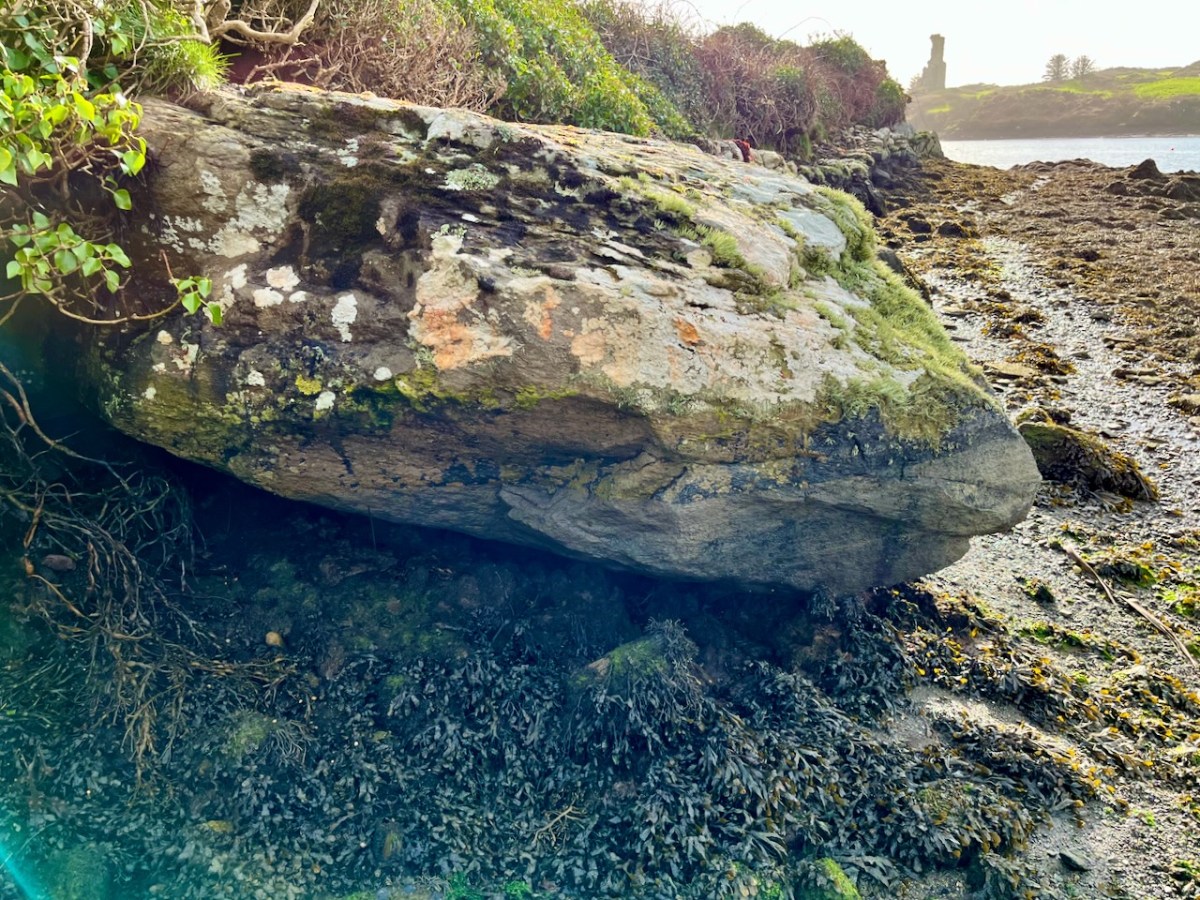
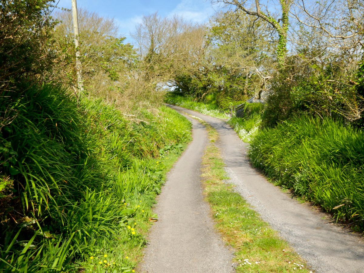
The weather so far this year is breaking records for coldness, wetness and evapotranspiration – while Earth as a whole continues to get warmer. In simple terms that means it’s not pleasant to wander too far from home. I decided to walk down to the shoreline of Rossbrin Cove – all of ten minutes – and see what the winter storms may have washed up: often an interesting diversion.
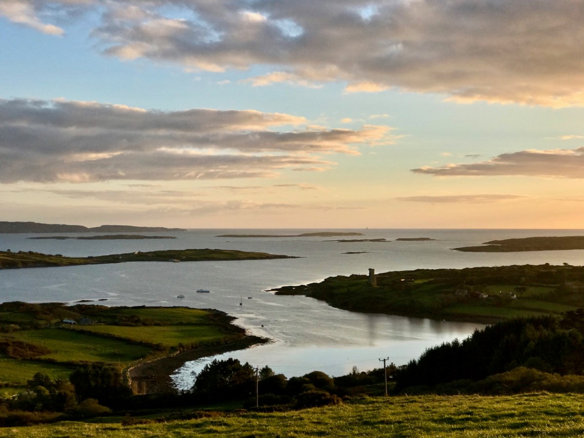
Above: looking down on Rossbrin Cove with some of the islands of Roaringwater Bay beyond. It is a natural harbour, and there is a thriving boatyard at the western end of it. The difference between low and high tides is around 2.5 metres on average, and much of the inlet dries out when it is at an extreme low. I timed my walk to arrive when the tide was fully down, as I wanted to explore the exposed mud-flats, with hopes of finding intriguing detritus.
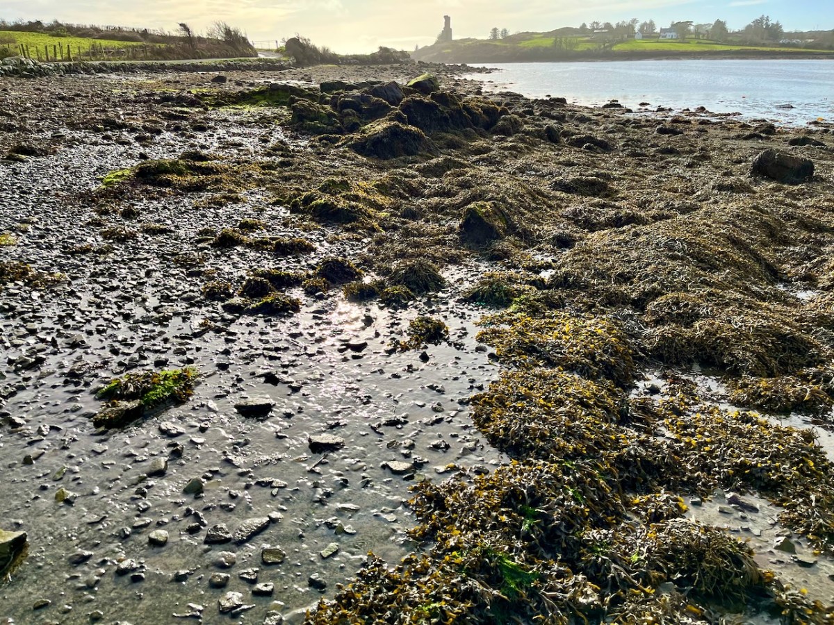
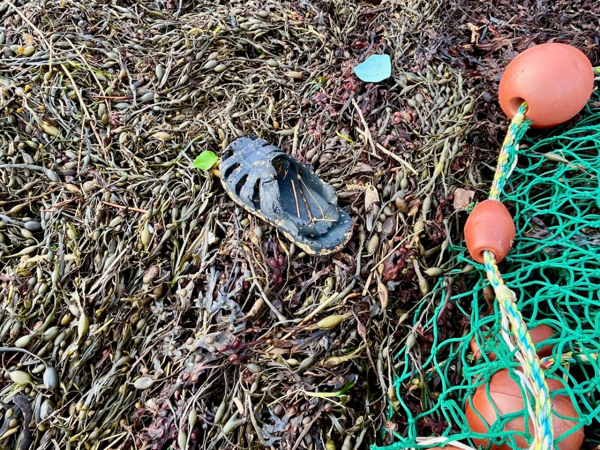
Not an inspiring start! In fact, as I continued my review, I noted that there was very little other than the natural environment – weather-worn boulders, skeletal shells and masses of seaweed – to disturb the order of things in Rossbrin on this February day. If our harsh storms had been of some positive effect it was perhaps to flush out any washed-up debris that might have accumulated in the winter – being now past St Brigid’s Day I consider it appropriate to call the season spring.
No matter that the exploration was superficially disappointing, the magic of this little bit of West Cork soon took over, and my mind was filled with the enormity of its history. There was a university here in medieval times: manuscripts were written here in the castle that has become a crumbling pile. Ravens and seabirds now rule over the stronghold. I walked on.
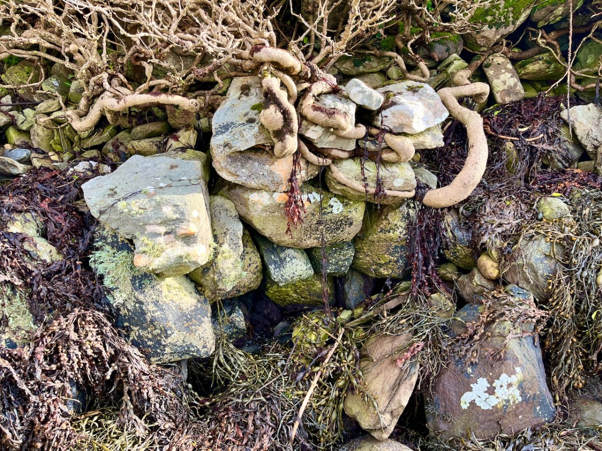
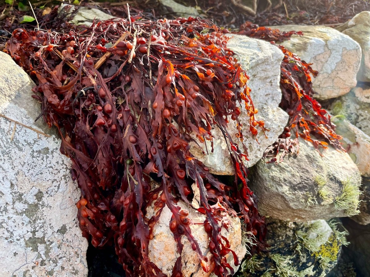
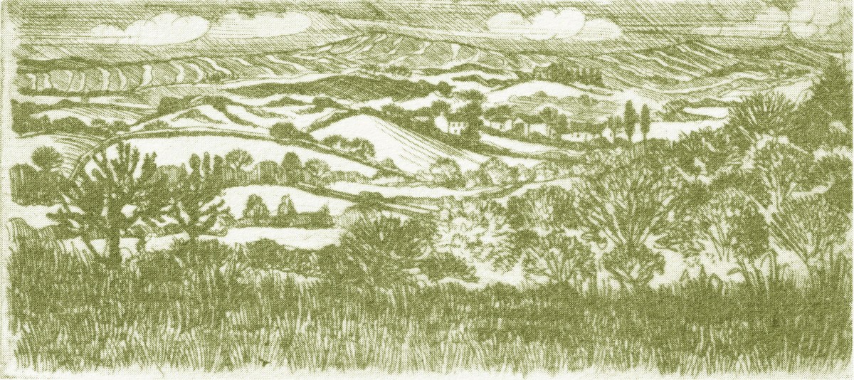
The margins of the cove are lined with ancient banks. At every turn there is a composition which a maestro could frame: I make do with a camera. Rossbrin inspired our artist friend Peter Clarke . . . Thank you, Peter!
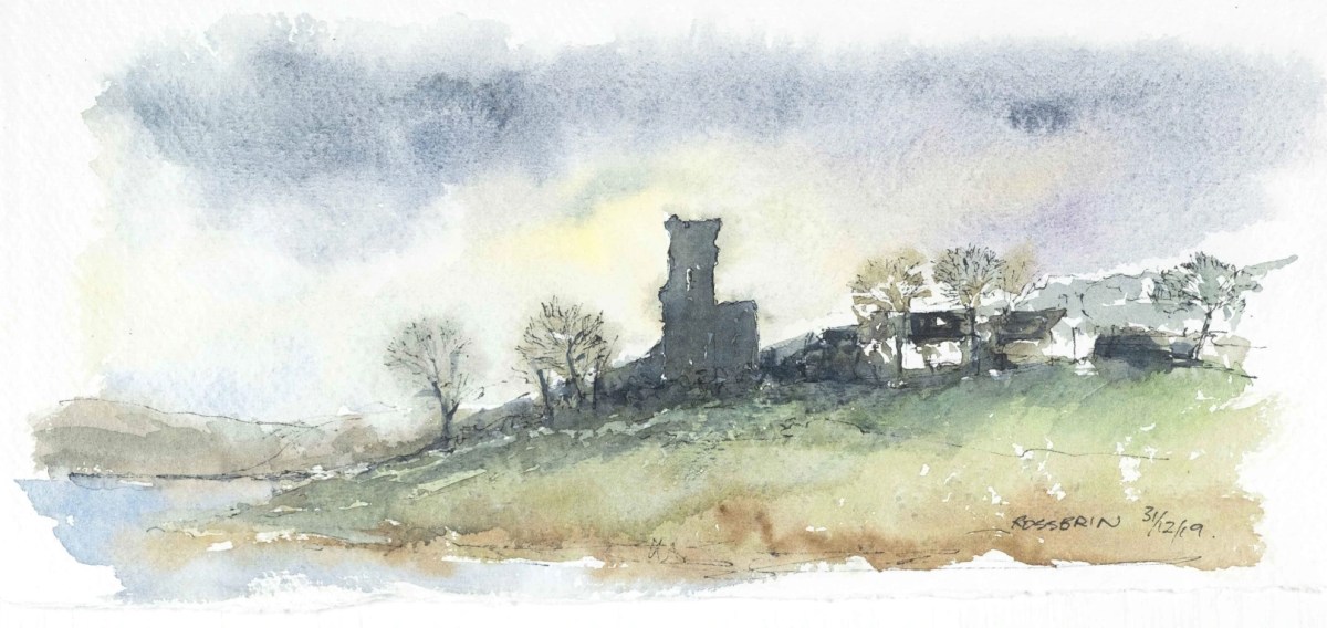
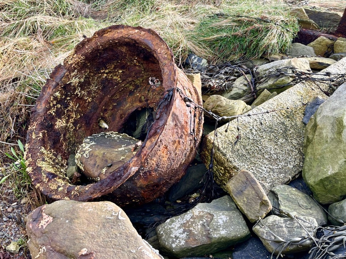
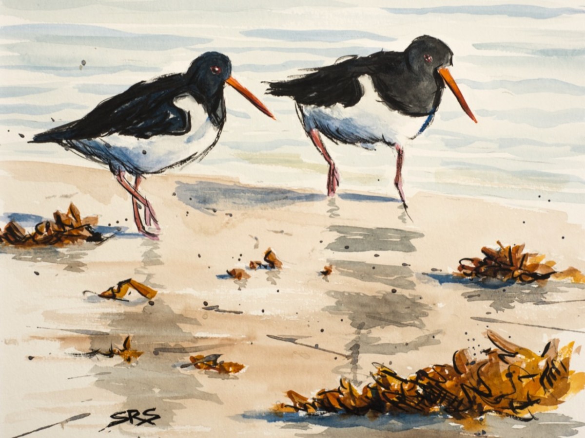
Evidence of more recent history: possibly a pot which was used in the process of tarring a clinker boat hull. No doubt vessels were built on these shores – and used to make basic livings. There is still fishing activity in and around the cove; mussel beds thrive in Roaringwater Bay; seaweed collection happens also. In summer months the deeper waters of Rossbrin are occupied by leisure orientated sailing craft. I enjoy the calm days of winter when there is hardly anything on the water. I watched a small flock of oystercatchers scurrying and foraging with their brilliant beaks, and then I turned for home.
The Rossbrin oystercatchers were uncooperative, and wouldn’t let me photograph them. Instead I have imported this wonderfully atmospheric painting by Cornish based artist Steve Sherris. Thank you, Steve
We have posted extensively about Rossbrin Cove, its history and its people. Have a look at these:
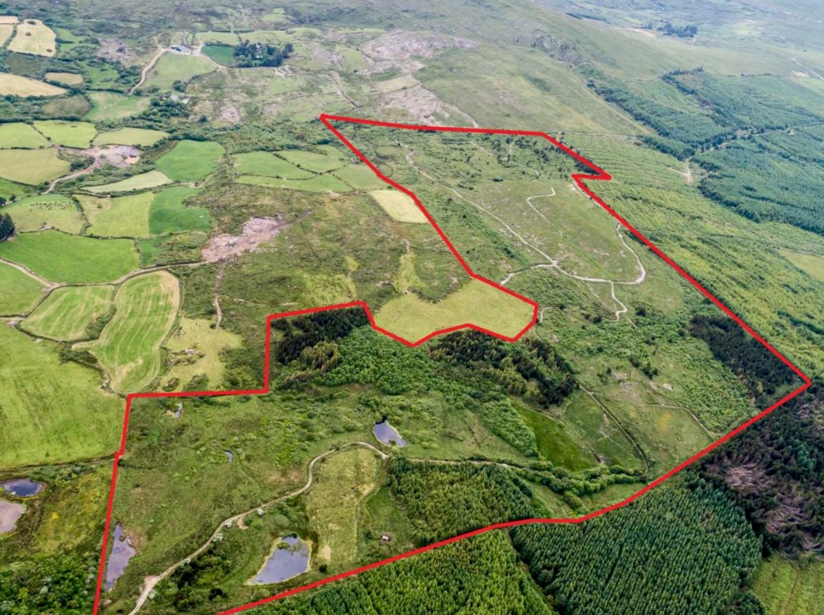
We spent a day on ‘The Mountain’. It’s a West Cork location, not too far away from us. The land has a history that touches on many of our interests covered here in Roaringwater Journal – and some of the West Cork people we have written about over the years – so it’s pretty special. We were delighted to be welcomed to it by its present owner, Oliver Farrell: that’s himself, in the pic below. You have met him before, here. Thank you, Oliver, for allowing us to experience this special site, and for letting us put out this post about it.
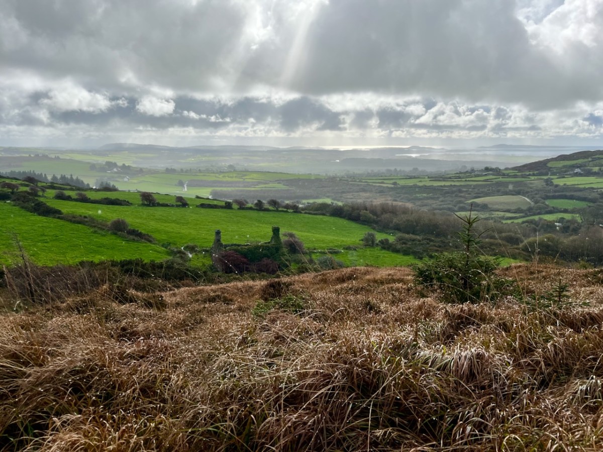
Previously, the 70 acre ‘Mountain’ site was owned by the Wrights – Lynne and Ian (above): you saw them in the 2022 Ballydehob Arts Museum exhibition, here. When they purchased it – in 1997 – it was rough pasture and bog. They aimed to develop an environmentally and economically sustainable forest using existing grants, and successfully challenged the decision of the Forest Service (through the EU) to only grant aid the planting of alien conifers. They set about transforming it: they had a vision of a ‘pure’ West Cork landscape supporting an ecosystem of native species. Now – many years later – it’s possible to see that the Wrights’ vision was fully justified – and realised. Today Oliver is undertaking essential maintenance work, and is committed to expanding on the inherent sustainable qualities that the site embodies. In fact, ‘The Mountain’ is largely in excellent environmental order.
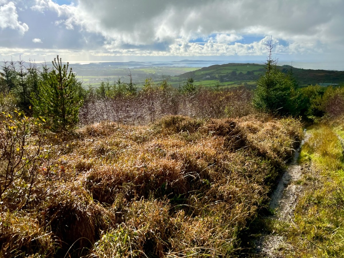
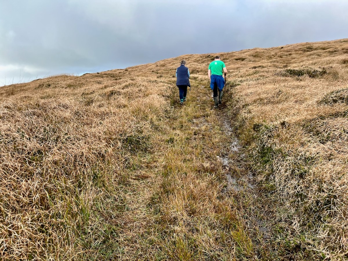
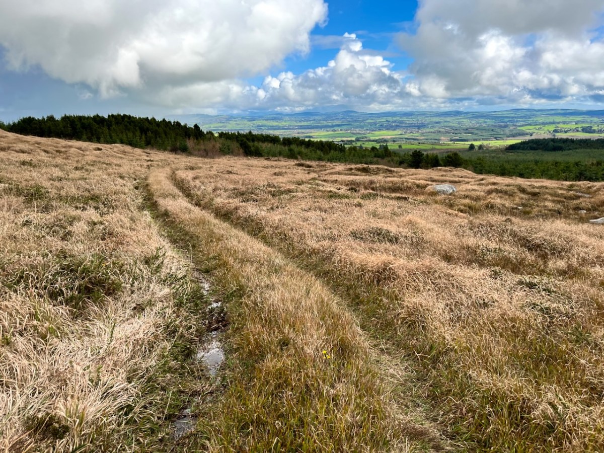
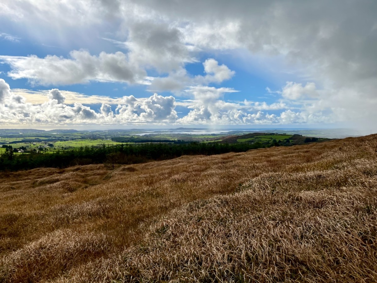
Interestingly, Ian told us that when they made the decision to buy the site they had only seen it under cloud: the spectacular view wasn’t revealed until later on. We were fortunate on the day of our visit to see the full panorama of Roaringwater Bay stretched out before us.
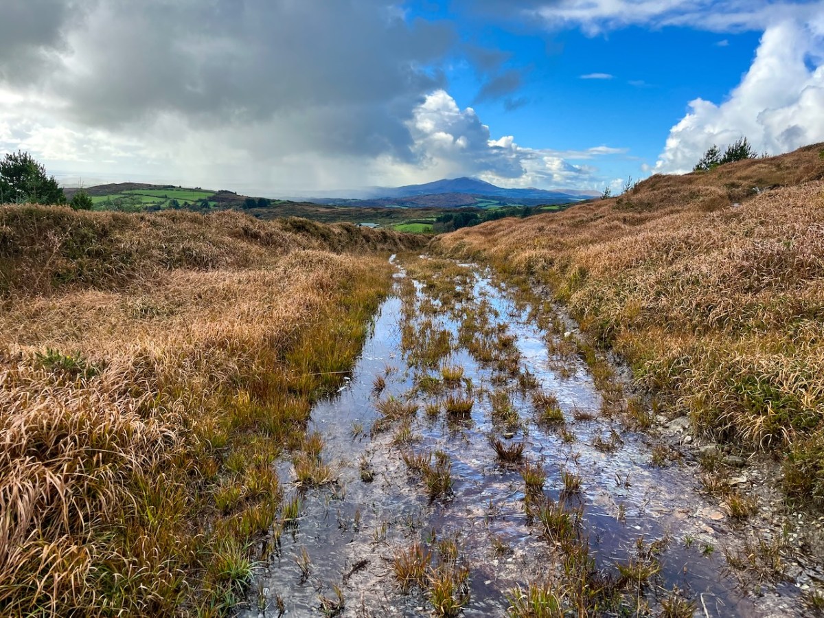
This dramatic view towards Mount Gabriel is a reward for climbing ‘The Mountain’. The ground was waterlogged on the day of our visit as this autumn has been a time of relentless rainfall, but always interspersed with brief dry patches: it’s great to be out to catch these. Springs rise on the high ground here, and I’m working out that they either feed the Roaringwater River – the water that gives its name to the whole Bay and islands that are central to our view from up here in Nead an Iolair, or another of the many streams that drain the West Cork hills below us.
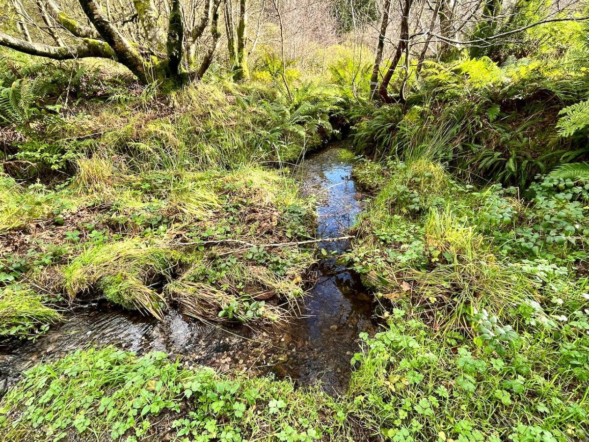
Oliver stands above one of the spring outlets that form the infant waterway (top), while the stream matures as it flows on down through his land (lower). Below – Oliver and Finola inspect one of the lakes which has been created within the site.
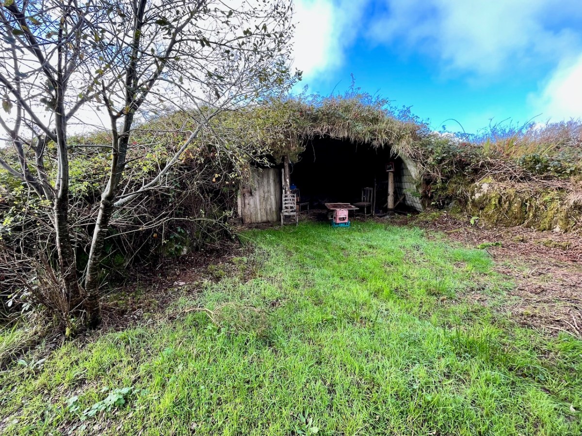
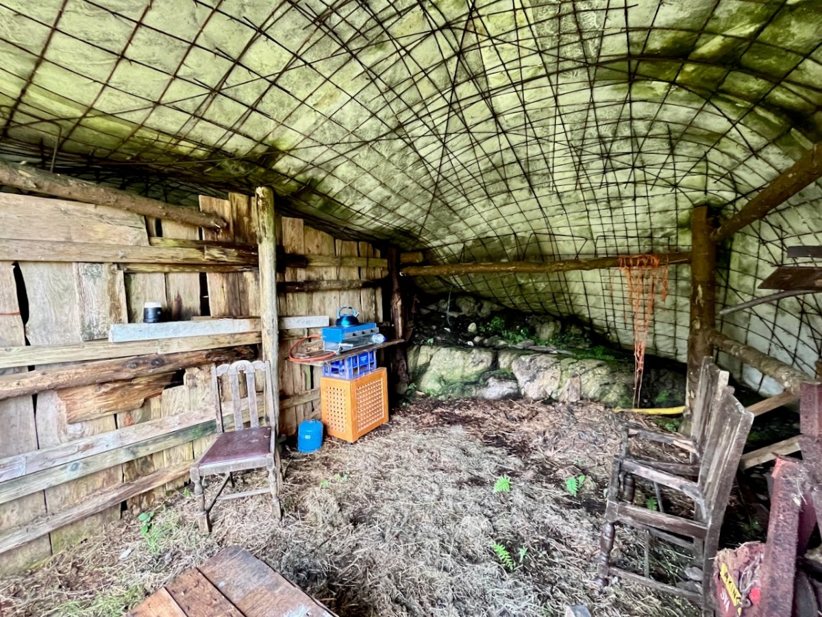
At one stage in his life Ian researched, developed and introduced the building of low–tech ferro–cement boats as a cottage industry on Lake Malawi to help address the problem of unsustainable fishing practices there. At the ‘Mountain’ site he experimented with ferro-cement as a material for establishing a well blended-in shelter and store.
Straddling two townlands, ‘The Mountain’ is an impressive example of how an area of West Cork wilderness has been perfectly moulded into its natural setting. It is an out of the ordinary place which demands exploration.
I’ll be visiting the site, and writing about it more in the future. Oliver will be keen to allow access: keep watching this space.
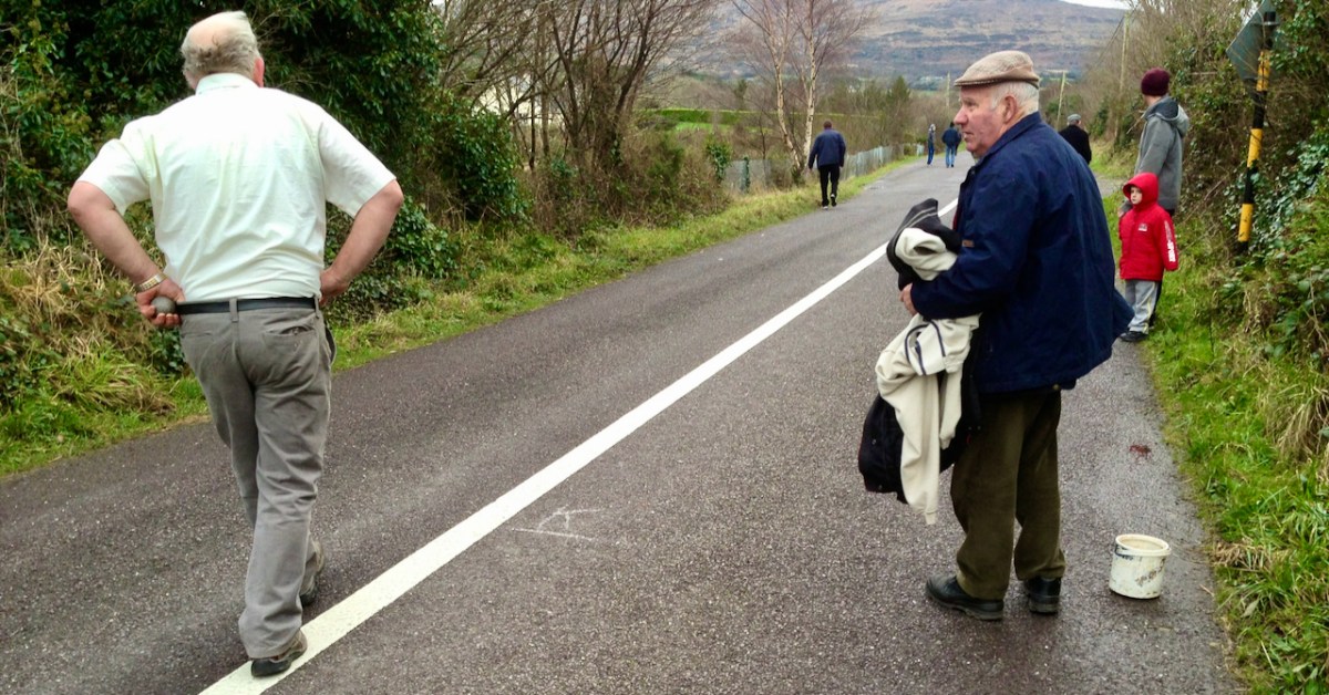
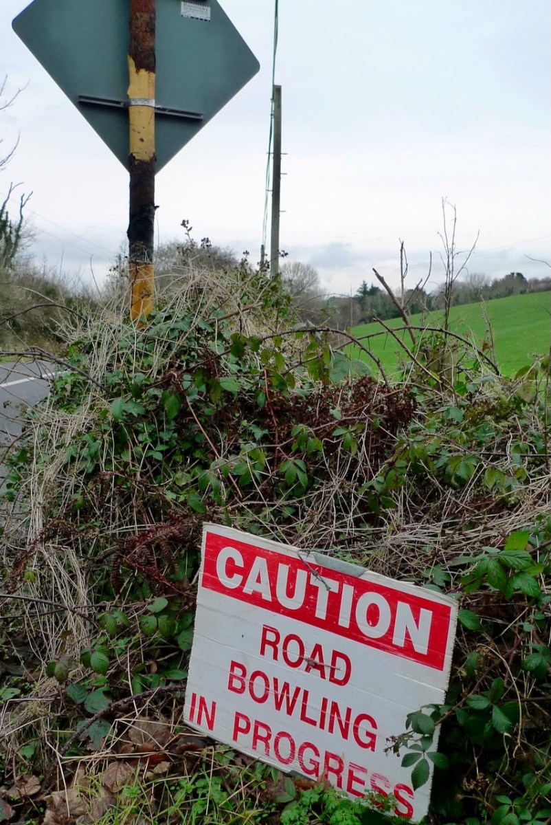
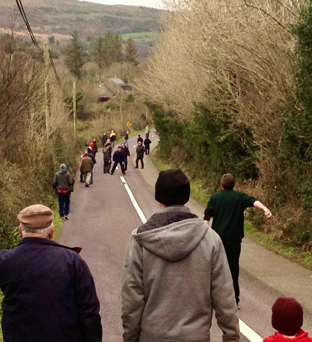
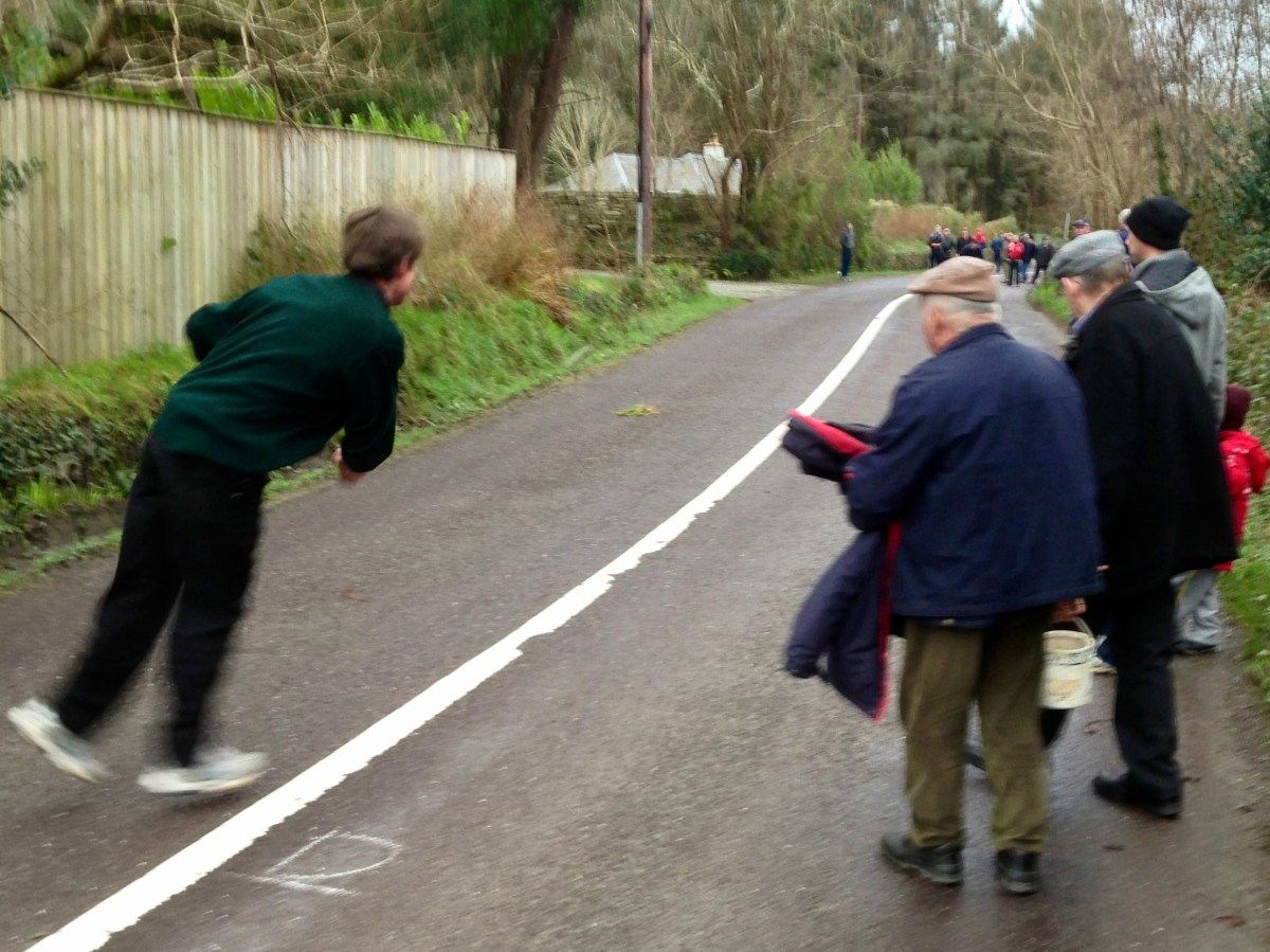
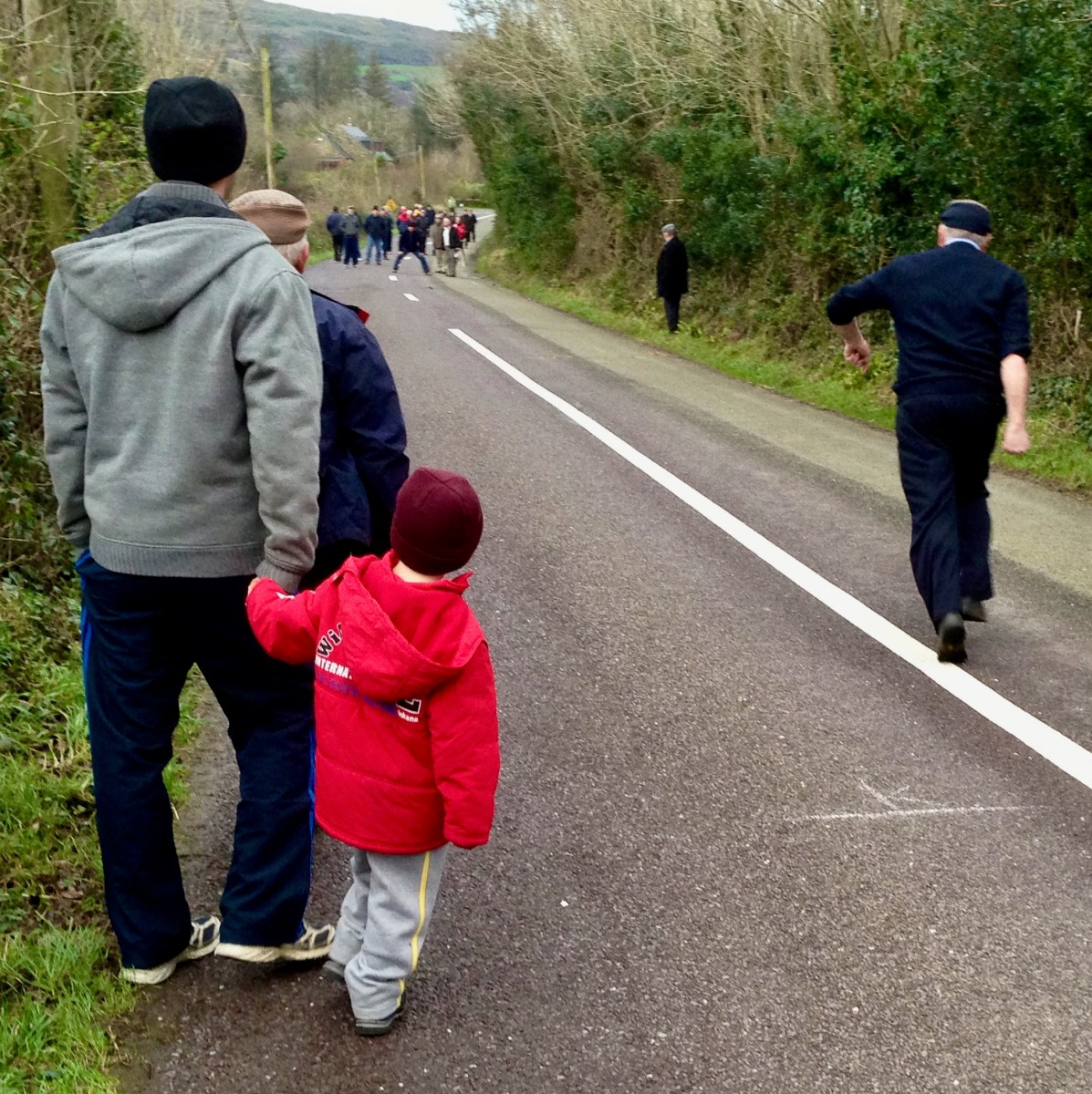
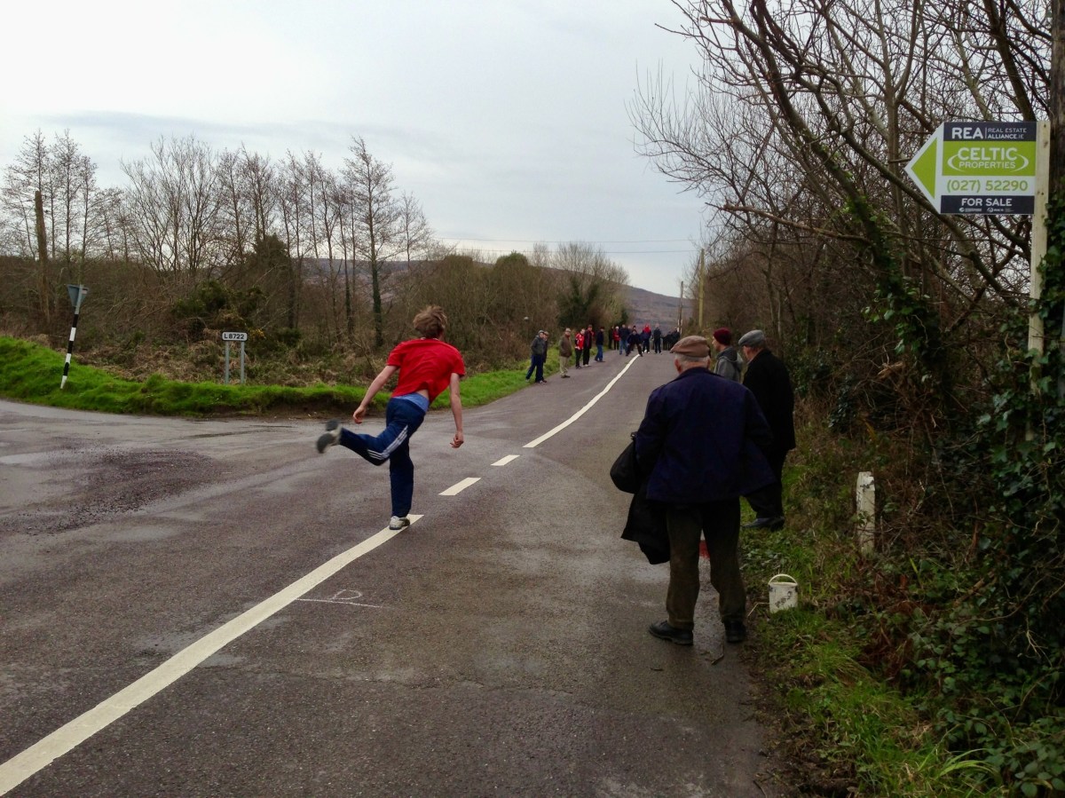
There’s a man about to ‘loft’ a bowling ball. Pronounce it Bowling, to rhyme with ‘growling’: in the Irish language it’s Ból an bhóthair – I’ve also seen the term Long Bullets used. This is a match we watched close to home – here in West Cork – all of ten years ago. It’s amazing we haven’t visited the subject again until now. In fact, it’s quite a secretive sport: if you put yourself ‘in the know’ you will be aware when it’s happening. Otherwise it’s something which you may pass by chance on any of the myriad by-roads of our county – and others.
The sport is played mainly in the Counties of Cork and Armagh, although it may be encountered elsewhere in Ireland – in England, The Netherlands, Germany and – nowadays – in many of the United States. But you won’t find it on any Olympic Games timetable, and I’m not sure that it is ever televised: that would be a strange programme, as it’s challenging to follow and involves walks of many kilometres through tangled lanes and byways. Also, I don’t know whether any traffic laws are bent or broken in its pursuit.
Certainly, it has produced its champions.
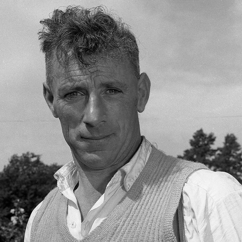
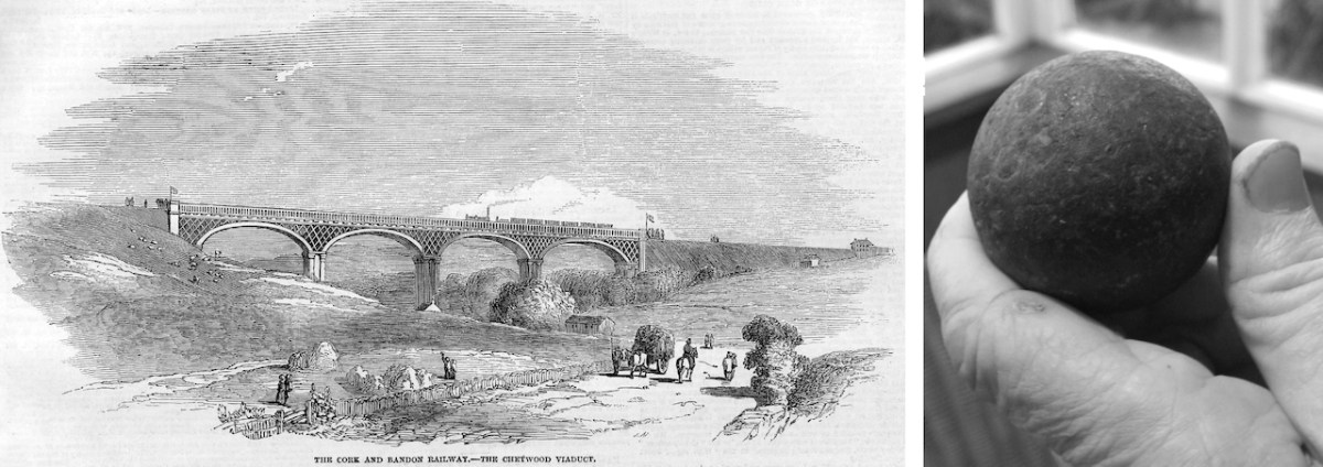
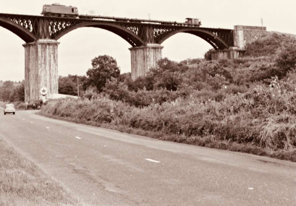
Here’s one: Mick Barry. The photo is likely to date from around 1955. Mick was All-Ireland Champion on eight occasions between 1965 and 1975. He lived a long life – 1919 to 2014. But he is best-known for having established a record – on St Patrick’s Day 1955 – for lofting a bowl onto the 100 ft high parapet of the Chetwynd Railway Viaduct just outside Cork.
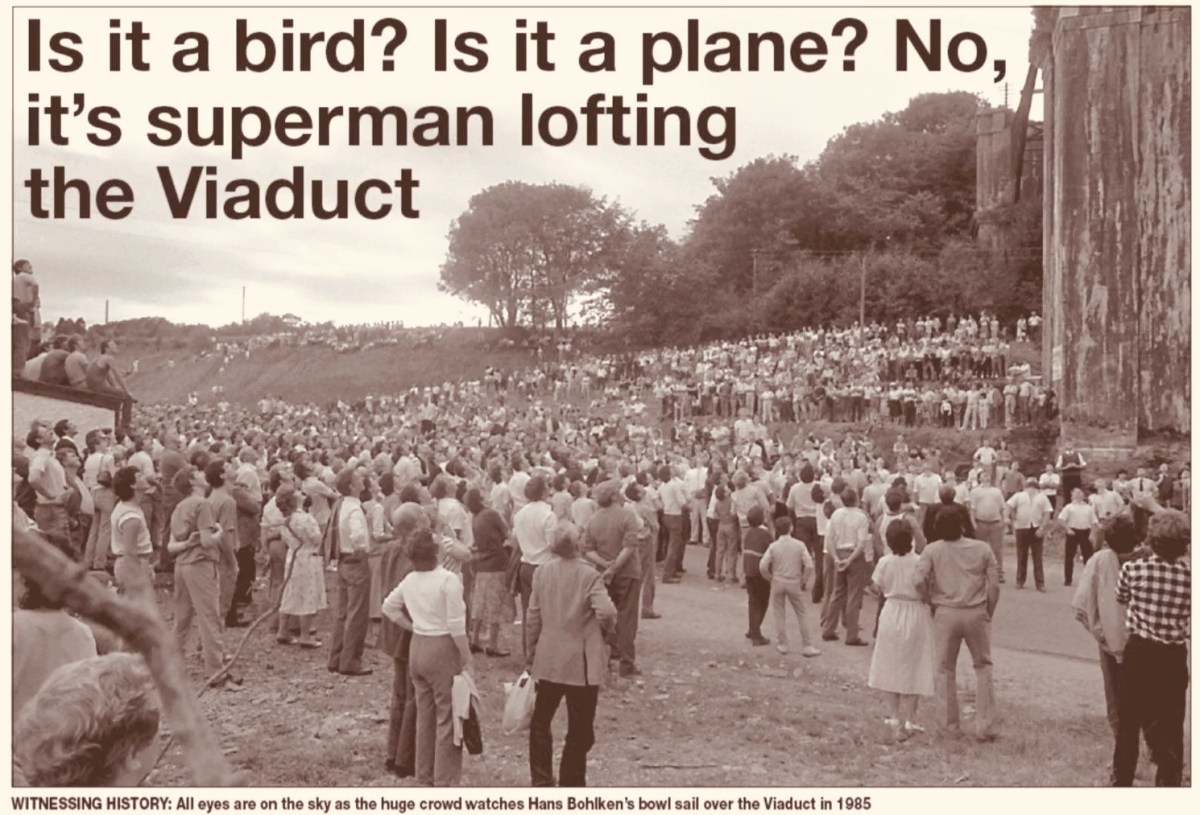
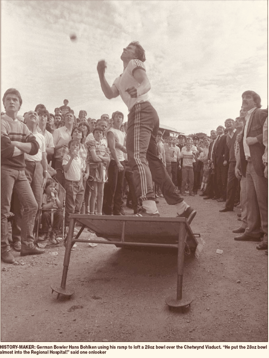
Above – the Chetwynd Viaduct in the 1960s, – after the line was closed, carrying a maintenance train, and – above that – a somewhat fanciful print of the same structure dating from a century before, together with the lead ball used by Barry. The same venue was the scene of another bowling spectacle thirty years later. In 1985 10,000 people showed up to watch a young German named Hans Bohlken loft a 28oz Road Bowl over the viaduct, using a portable ramp to improve his throw (images courtesy Cork Echo):
. . . In Irish road bowling the small iron and steel cannonball called a bowl is hurled down a 1 to 2-mile country lane. Throws can roll 250 or even 300 yards. Similar to golf, the player with the fewest throws to the finish line wins. Excitement builds as two evenly skilled players match each other shot for shot for more than a mile. Often, these memorable matches, called scores, are decided by only a few feet or inches’ distance past the finish line, both players with the same number of throws. The twists and turns of a narrow country lane, as well as the tilt of the road surface (the pitch and camber), provide a rich playing field for strategy and can spark spirited debate among the thrower, his coach and full-throated spectators . . .
WVROADBOWLING.COM
Finola drew my attention to a poem written by folk-poet Liam McGrath, who grew up in Skeaghanore, not far from us here in Nead an Iolair – and therefore as local a ‘folk’ as you could ever find. His work has been collected, but never widely published. Here is his commentary on the ancient pastime of Road Bowling:
Please dear Lord, forgive us all, for that boyish little sin, When we dashed out from the Rosary, before that last Amen. Could we only turn back the clock, to re-live those days of Yore, In the Summer twilight of a Sunday ‘eve, to throw just one more score.
*
So clearly now each face I see, as we pass Jer Coughlan’s gate, As the ladies from Ballydehob walked by, looking charming and sedate. The finishing line was at Stouke cross, then a score the other way. To stroll the streets of Ballydehob, our young hearts bright and gay.
*
When’re the twilight lingered on, we had many a thrilling score ’Til the last throw was decided, near Will Regan’s of Clashmore, Sometimes we changed the venue, our choice, the old Church road. But the skill and thrill remained unchanged, it was the bowler’s code.
*
A penny, tossed high in the air, a bowler called the toss. The first bowl flew from the bowler’s hand, in a score to Raheen Cross. From Bantry Cross to Skehanore, was also a favourite distance. Such happy lads in the good old days, when nothing seemed a nuisance.
*
St Peter and St Patrick, went out for a little walk. “What’s that iron ball, asked Peter, and who is that happy mob?” “They are throwing a score, said Patrick, and they’re all from Ballydehob.”
*
I must conclude this little poem, ‘cause I know it’s getting late, Only time for a score up Bantry Road, to Charlie Daly’s gate. Just lofted that turn, near Berry’s house, and my wrist is feeling sore, So I’ll down this pen, may we meet again, to throw just one more score . . .
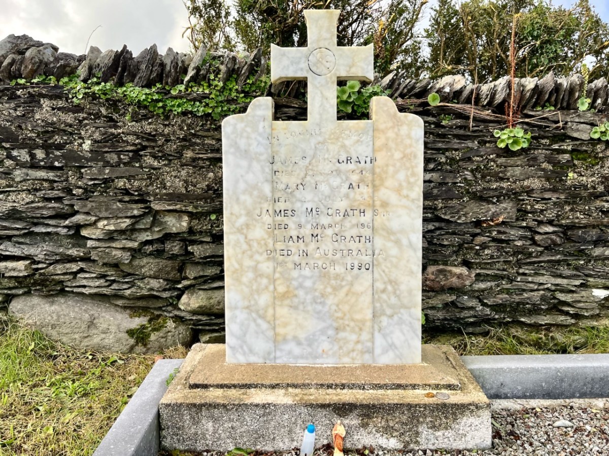
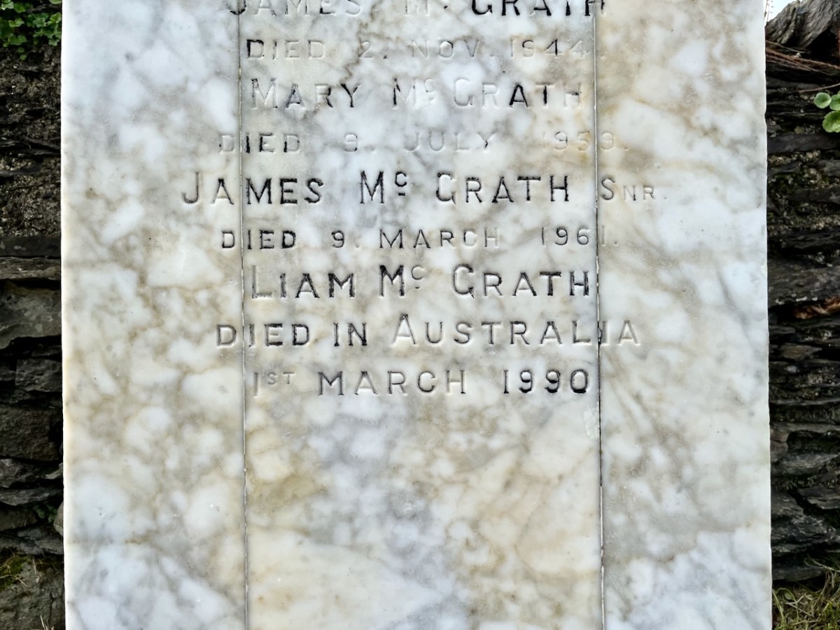
LIAM MCGRATH – Died in Australia – 1990
(Above) The McGrath grave in Stouke graveyard, in the next townland above our home. Liam died in Australia and his ashes are interred here.
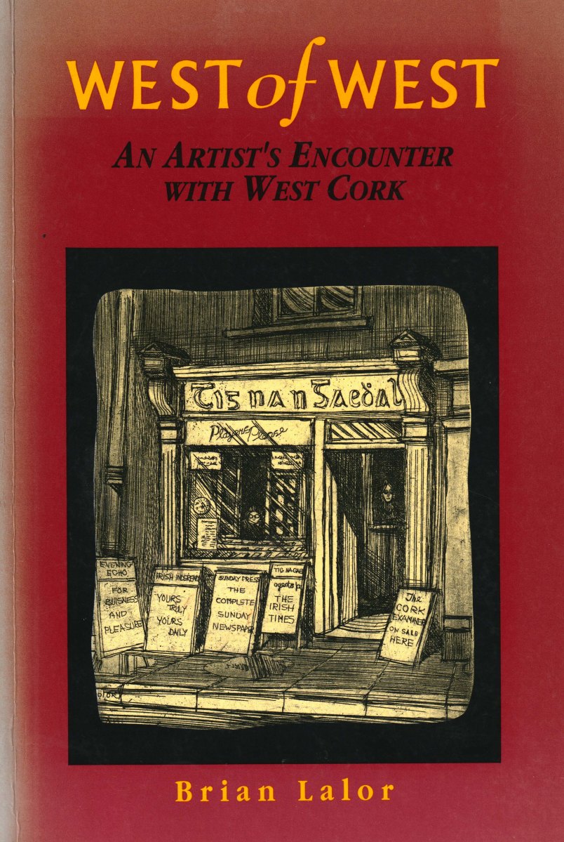
Perhaps this book review is a little late arriving? The book was – after all – published by Brandon of Dingle in 1990: thirty two years ago! The artist, and I, were in our forties then. But – don’t hesitate – although it’s out of print you can find copies readily available on many booksellers’ websites. You can spend a Euro (the postage will cost four times that!) or many Euros: but it’s well worth whatever you have to pay.
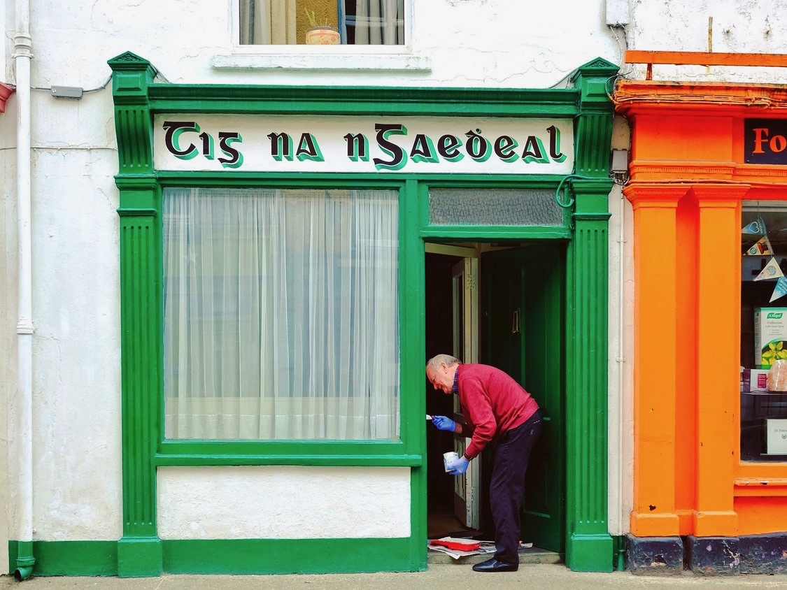
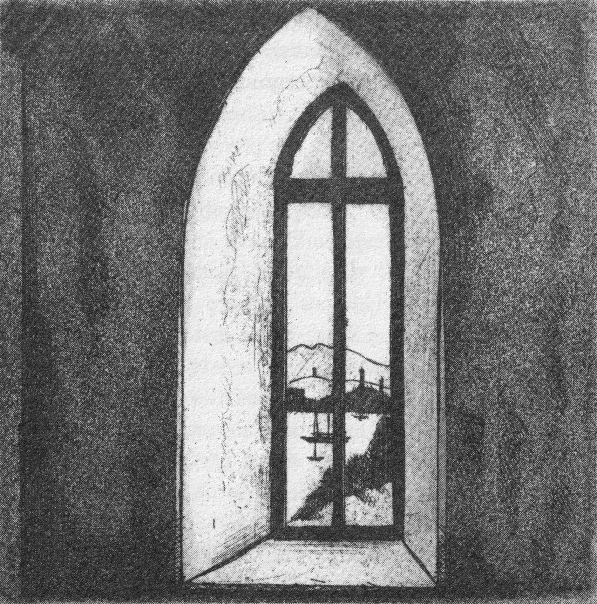
Here it is: a modestly sized paperback volume. But it punches well above its weight. It is beautifully written, and exquisitely illustrated. For everyone who is interested in West Cork, Ireland or the art of engraving it’s a must for your bookshelves. And, historically, it’s fascinating: the cover picture, above, shows Tig na nGaedheal (locally known as Brendan’s) – once described as ‘the greatest and most famous sweet shop ever in Skibbereen’. Sadly, Martha Houlihan, who ran it with her husband Brendan, passed away a little while ago and the shop is no longer trading. It’s still a significant feature in the town streetscape (below). Note the figures looking out of the door and window in Brian’s etching – a typical humorous touch.
The book includes nigh on a hundred of Brian’s engravings. This is only a fraction of the huge body of work he has created in his lifetime to date, and he’s never idle. It’s good to know that Uillinn – the West Cork Arts Centre gallery – has a retrospective of Brian’s work in the pipeline. It will be impossible to show more than a fraction of the art he has produced so far, but we certainly look forward to experiencing that selection.
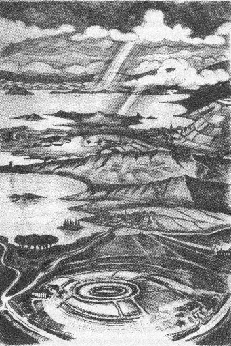
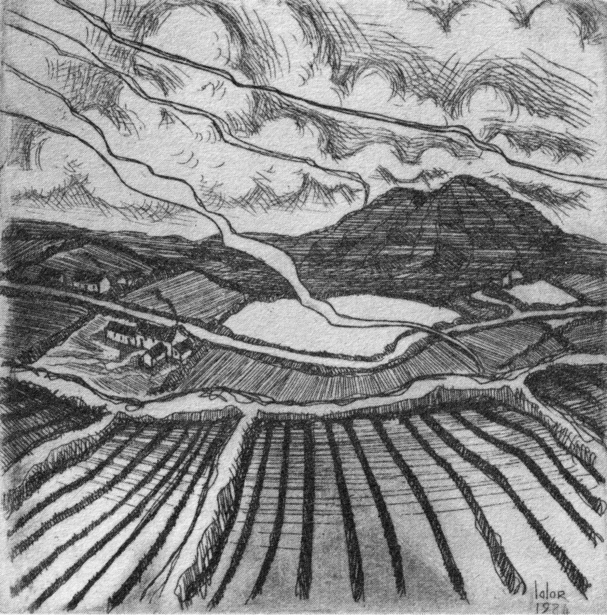
What I personally enjoy about Brian’s works in this book is the atmospherics that they create. Take, for example, The Dark Edge of Europe, above. The breadth of its content is overwhelming: it’s the landscape of West Cork summed up in gradations of grey, with coastline, lanes, settlements, hills and distant mountains, focussed on a foreground which features an ancient hill-fort. A tale of occupation and morphology: an eternal human story. The illustrations in the book are accompanied and amplified by wonderfully crafted written descriptions.
. . . Defining the high spots in the ribs of land, and distributed with apparent regularity all over this landscape, were lush green rings. Single, and occasionally double or triple concentric rings of grassy banks, these features resembled a giant’s game of quoits, forgotten and left to decorate the landscape. The gargantuan quoits are of course the ring forts or fairy rings of the Irish countryside, and outlined the forms taken by the rural farmsteads and dwellings from pre-Christian times down to the sixteenth century. Each ring represented an earthen rampart on high ground, with perhaps a dry moat or further rampart encircling some wattle huts. Simple and utilitarian, this form of dwelling satisfied the political and practical exigencies of the day – or aeon, for that matter. Rural life was lived in the midst of the land, without congregating in towns or villages . . .
The Land of Heart’s Desire: West of West, Brian lalor
Mount Gabriel dominates much of the landscape in our part of West Cork. Brian’s view, above, is titled Mount Gabriel Gorse Fires. The artist ‘discovered’ remote West Cork back in the 1970s. In the book he describes the journey:
. . . The road wound away into the distance, a ribbon of reflected light, and the weaving shapes of the blackthorns threw a black Gothic tracery across the landscape. The immediate surrounding had a silvery sharpness, the precision of a lunar landscape; brightly outlined walls enclosed pools of darkness. We were no longer at the door to West Cork but in its very interior. We had arrived . . .
Well Met By Moonlight: West of West, Brian Lalor
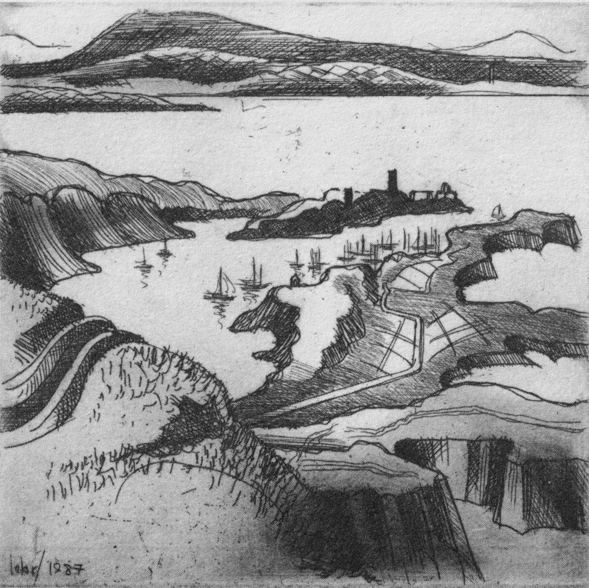
Essential to the intimate knowledge of West Cork’s landscape is the sea – and the coastline which encompasses it. This view is titled Rock Island & Crookhaven. Brian enhances the rendering with a description:
. . . From the heights of Brow Head the outline of Rock Island at the mouth of the harbour resembles a partially submerged submarine, its twin customs-observation buildings the conning towers of this strange naval mammoth. An ill-assorted collection of buildings adhere like barnacles to the back of this submarine: the roofless lighthouse barracks, a defunct fish factory and an abandoned, rambling Victorian mansion suggest an unfavourable location. Wedged in the little cove in front of the mansion is the hulk of an old wooden trawler. A graveyard of vanished days and forgotten hopes . . .
Coastline: West of West, Brian Lalor
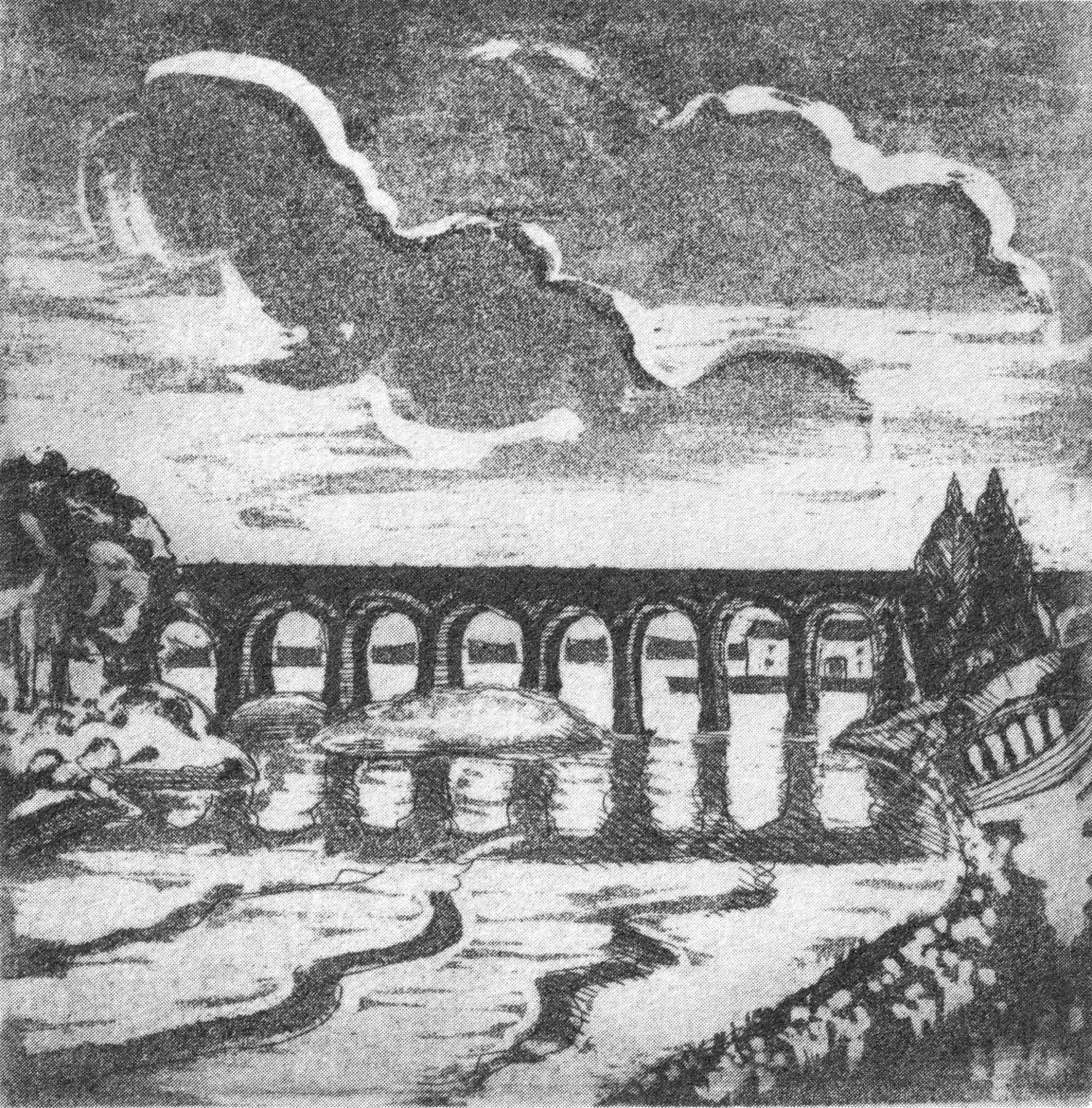
Ballydehob’s 12-arch bridge – or railway viaduct – must be one of the most profusely illustrated and photographed features of West Cork. The Schull, Ballydehob and Skibbereen tramway was a significant piece of transport infrastructure that ran from 1886 until 1947. It’s a fascinating piece of Victorian engineering, the first 3ft gauge railway line to be built in Ireland. Everything about it was eccentric: here’s one of my RWJ posts setting out the history of the line. Brian has a little anecdote well worth the recounting:
. . . As it is one of the most pleasing architectural features of the local landscape, I drew the Twelve Arch Bridge on many occasions and it reappears in a variety of forms amongst these etchings. One village magnate commissioned me to do a large picture of this monument for his new house. The price was agreed and the picture eventually produced. I had chosen an angle which showed the bridge emerging as it does from thickets of brambles and conifers on either side of the water. Delicate fronds of foliage wound in the foreground of the picture and the subject itself basked in the distance, looking solid and ancient. I was quite pleased with the results. When I presented it to my patron he gazed at it in silence for a long time. Then with a large and calloused hand he ran his index finger across the view a number of times, shaking his head slowly as he did so. ‘No. no good at all, It won’t do,’ he muttered more to himself than me. He had been counting the arches. In my enthusiasm for the atmosphere of the piece the accurately rendered number of the arches had become obscured, those on the extreme edges becoming partially lost in the undergrowth. The commission was rejected. If you are paying for twelve arches you don’t want to be short-changed with ten and two halves!
Coastline: West of West, Brian Lalor
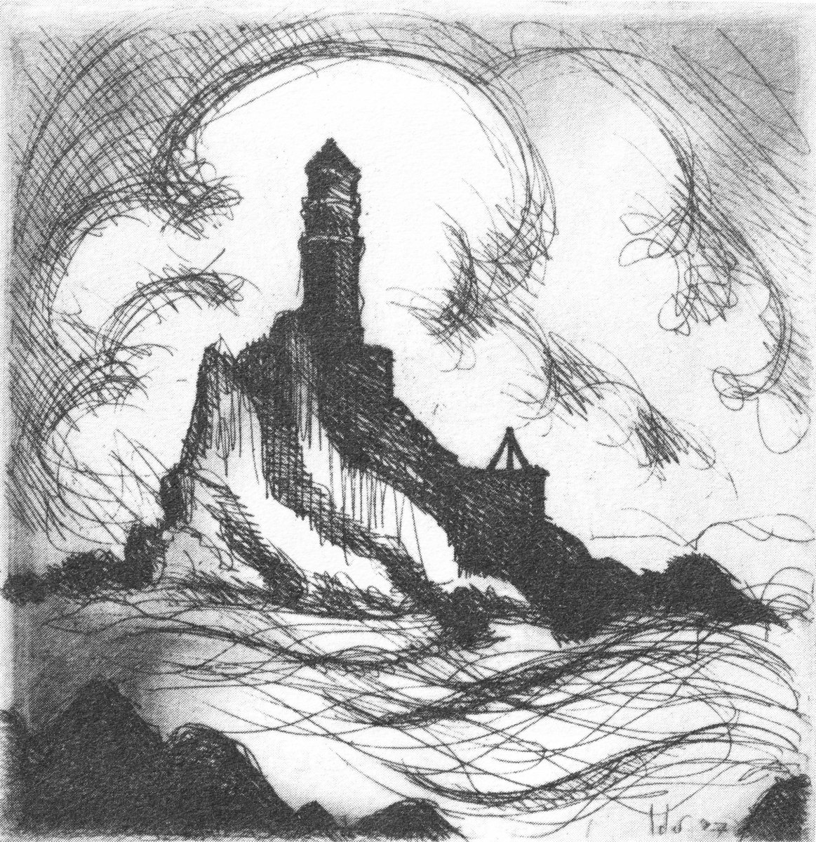
Fastnet. An iconic silhouette – perhaps a fish-eye view? The lighthouse is a ubiquitous element of structure which can be seen from all the waters and islands of Roaring Water Bay. Brian’s words:
. . . Roaring Water Bay encompasses an area of about a hundred square miles of water between Baltimore in the east and Crookhaven in the west. The tortuous coastline of the bay, as of much of the rest of West Cork, is punctuated by small coves, each with an old stone pier or miniature harbour. Up to the mid-nineteenth century these were the arteries of communication and trade and a wide array of lighters, barges, rowboats and yawls plied the coast, ferrying freight around the rim of the land rather than through it. Never far from the safety of land, they darted from port to port with the assurance of safe harbours at frequent intervals to reduce the threat from treacherous seas. Today, however, only the yachtsman holds this perspective on the land; it is a medieval cartographer’s view of the world: good on outlines, vague concerning the interior . . .
Coastline: West of West, Brian Lalor
The eye of the artist searches out ways to tell a story or unfold a scene in graphic simplicity. This is St Brendan Crookhaven: a simple church that is dear to the hearts of mariners, and has long been so.
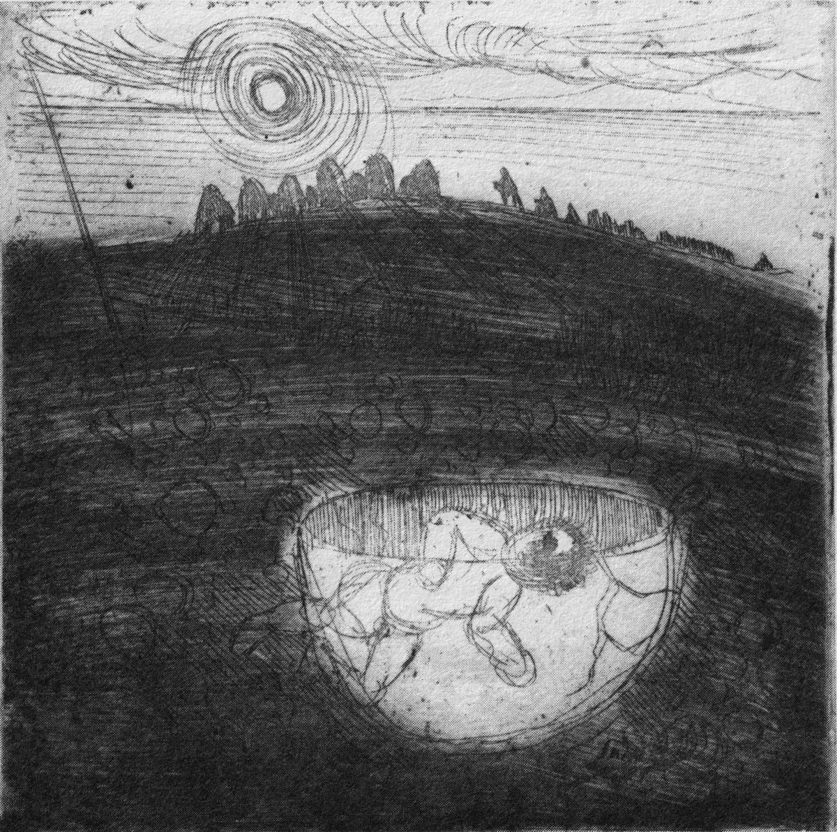
Stone Circle and Child Sacrifice is a thought-provoking piece. These ancient sites date back thousands of years: there are many here, beyond the West. We wonder at them, and can only guess at the significance they had to their constructors.
. . . The Landscape of the mind, which co-exists, interlocks and overlaps with the geographer’s vision, is an intangible, ephemeral thing. You may encounter it unexpectedly on a moonlit night or on some deserted headland, or perhaps in the dim light of a public bar. In this part of the world, soaked in memories and half-memories of the past, much is implied rather than stated. Like the collective unconscious, the landscape, too, is composed of a multitude of intertwining details. This collection of etchings of West Cork is concerned with those details: with small corners of towns and villages, with oddly-shaped fields and erratic skylines. Each etching is a vignette of landscape, architecture or environment. The pictures are organized around a number of themes yet the material as a whole has such an overall unity that what illustrates one section also has relevance for another. The point which they make is a collective one . . .
WELL MET BY MOONLIGHT: WEST OF WEST, BRIAN LALOR
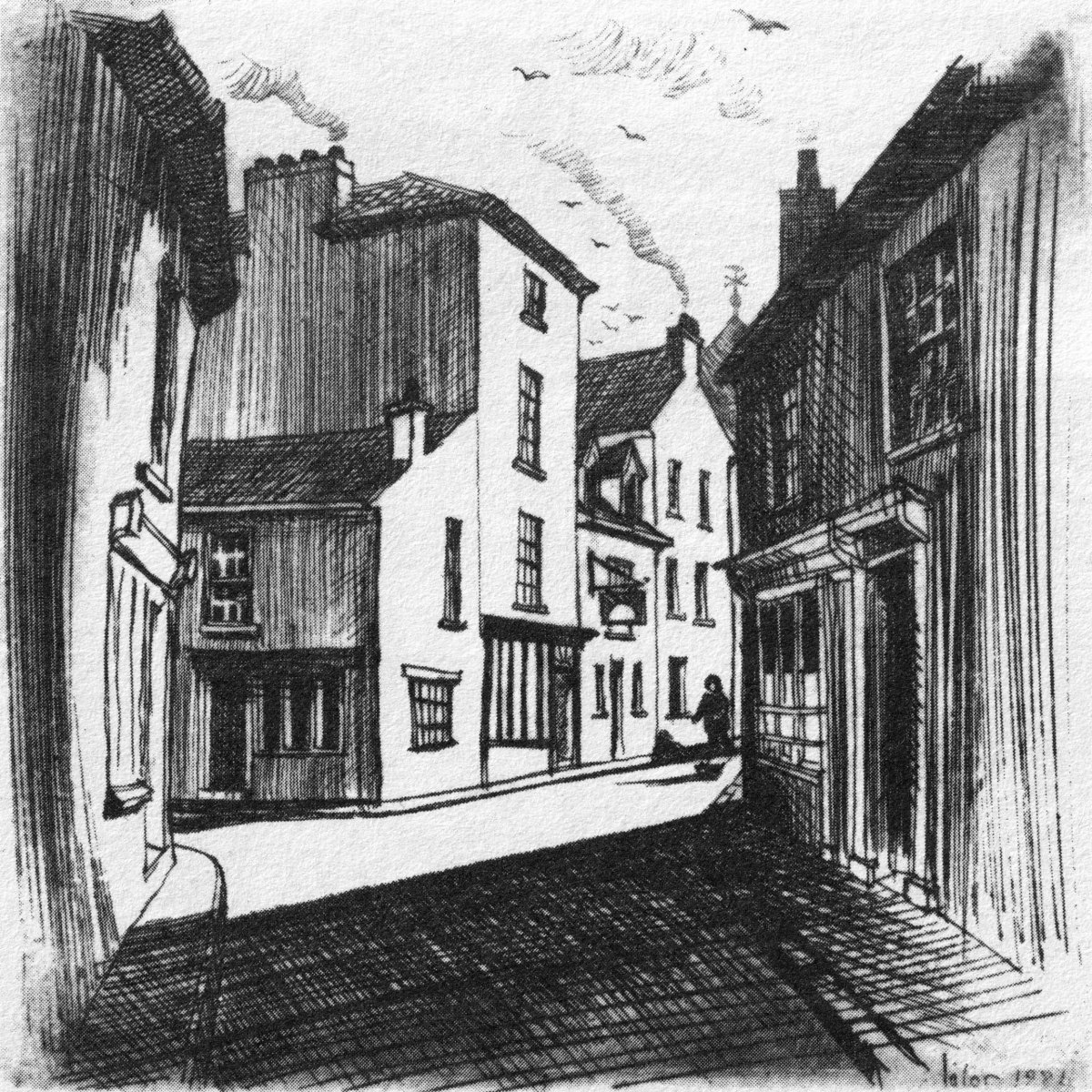
Brian’s book is as much about the human side of West Cork as it is about the natural or supernatural. He illustrates towns – Kinsale, above – and the landscape. For me, this is a very significant little volume: the travels described within it echo my own journeying through this most special of places. Thank you, Brian, for so vividly enhancing my appreciation of West Cork.
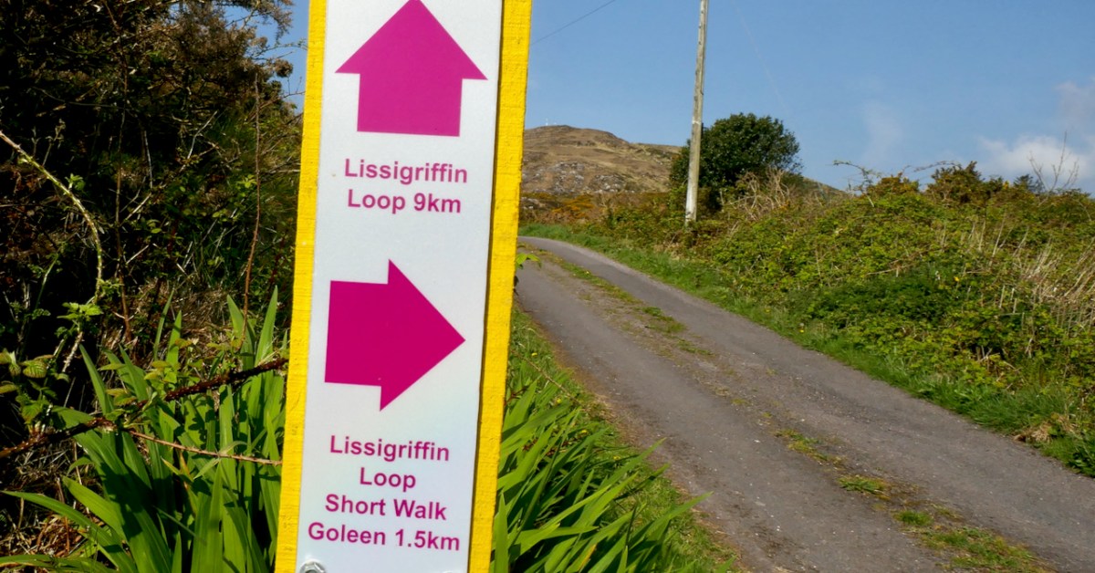
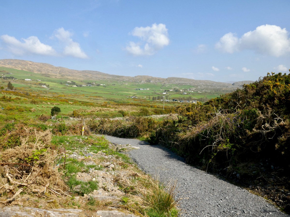
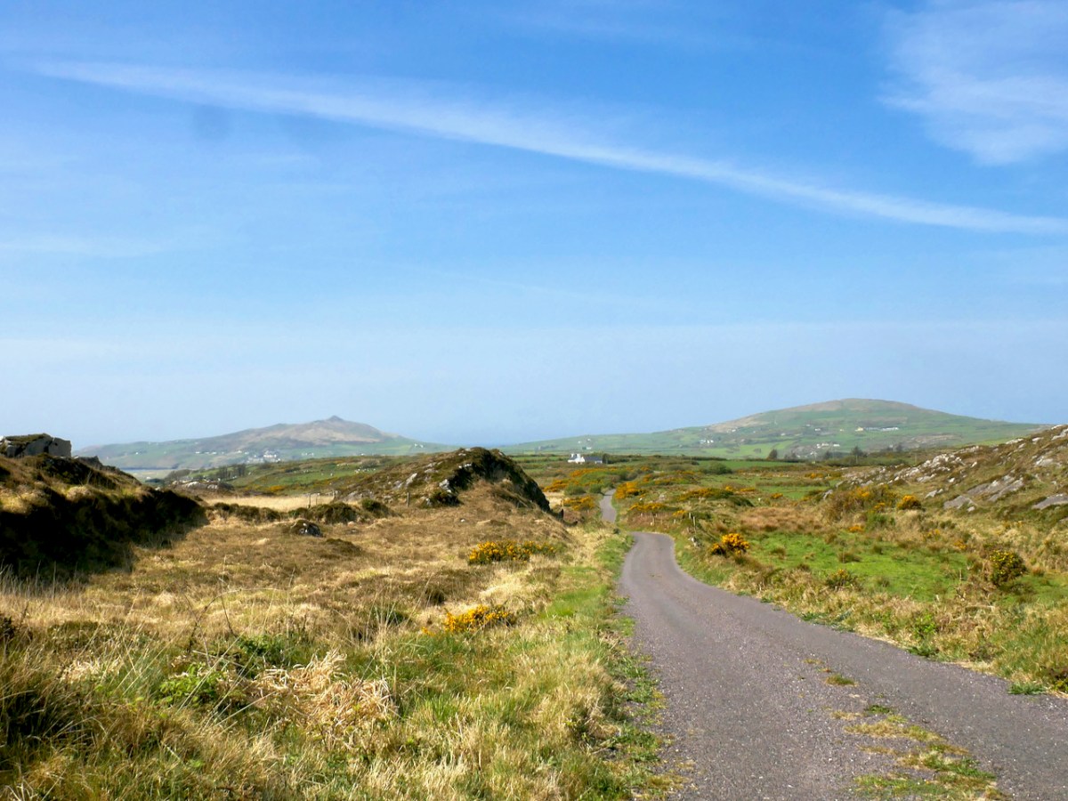
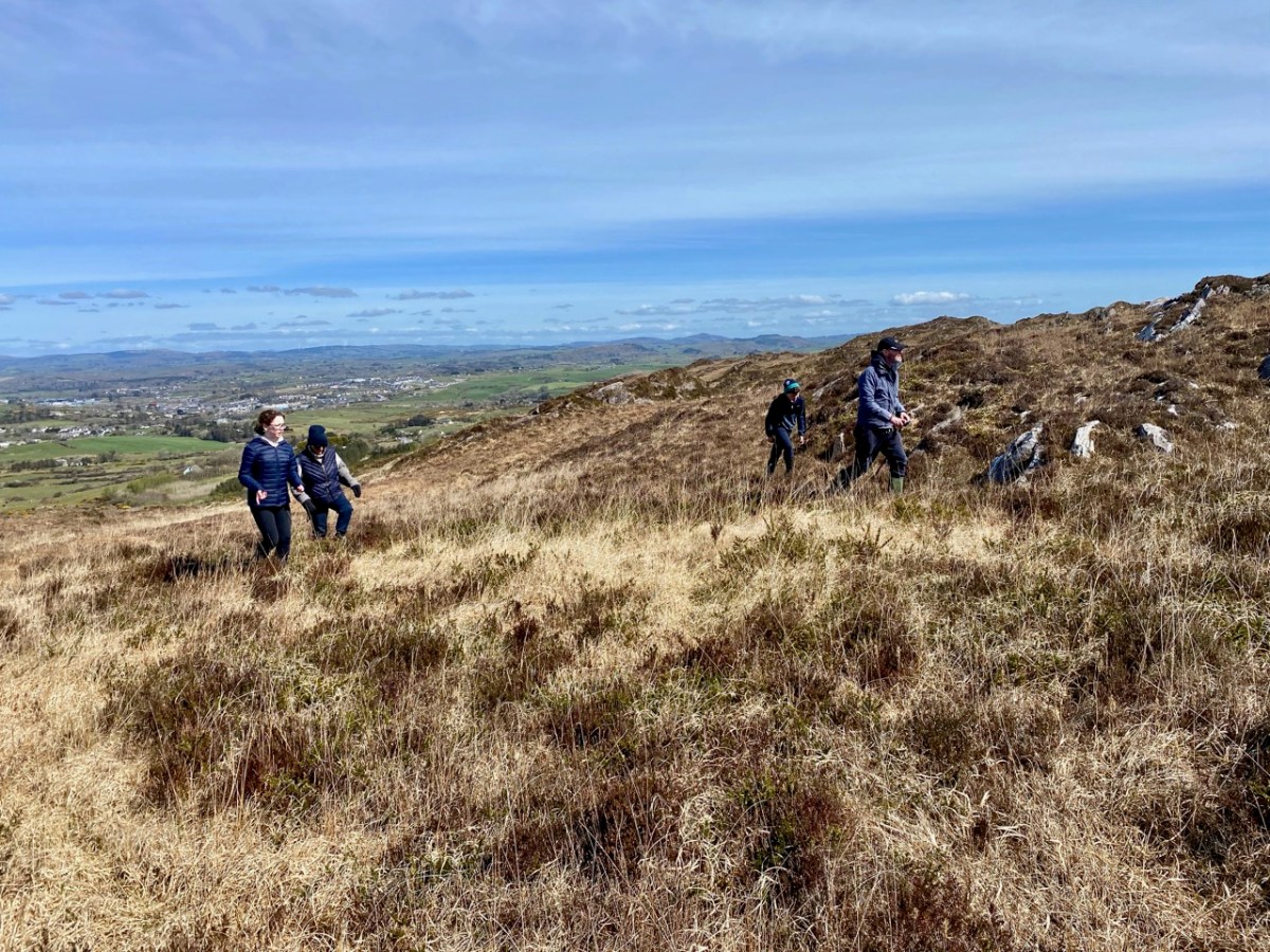
The energetic Fastnet Trails team is marching westward along the Mizen, developing new trails. They do this on a purely volunteer basis and we are all the beneficiaries – so a huge thank you to them! Work on their website is ongoing, and it should be up and running soon. This week we explored one of their recent additions – the Lissagriffin Loop. I have written a previous LIssagriffin post in the Mizen Magic series (number 14), but that one was mainly about the medieval church and the graveyard around it, as well as the history and archaeology in its vicinity.
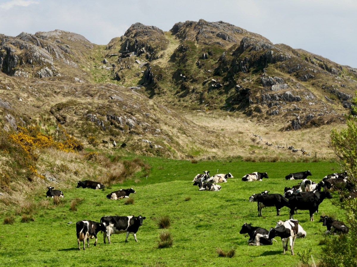
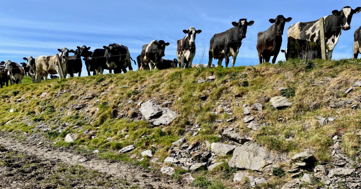
This walk starts and ends in Goleen and is a 10k walk with lots of ups and downs. You’re climbing100m (about 320’) on the first half of the loop and 120m (about 400’) on the second half, so this is a good workout. As with any of these walks, it’s possible to do stretches of them by leaving a car at one point and walking back and forth, or go with friends and leave a car at either end. Wear good shoes and bring water and snacks. It’s all on quiet back roads, so the dog is welcome too, but use the lead if you encounter cattle or sheep (we met both). And there are a couple of surprises along the way.
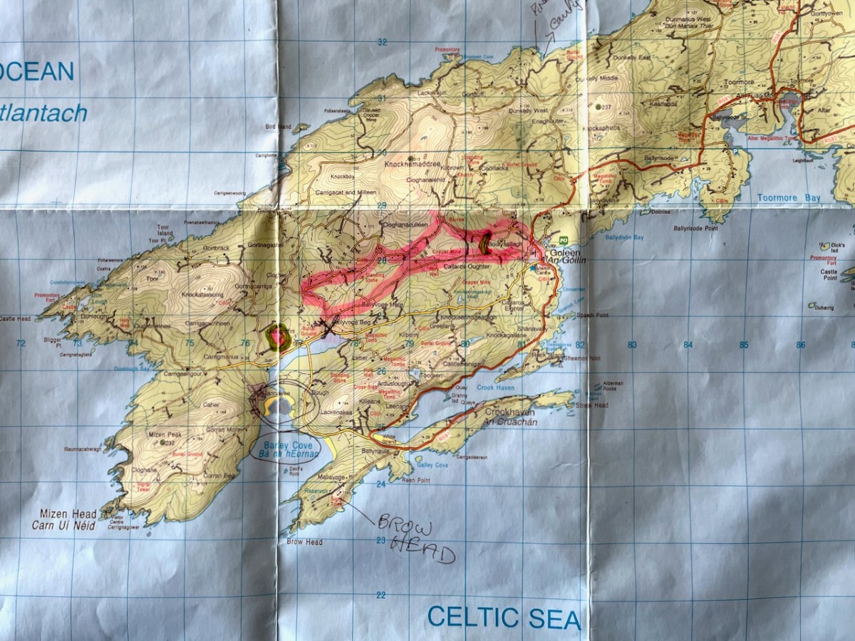
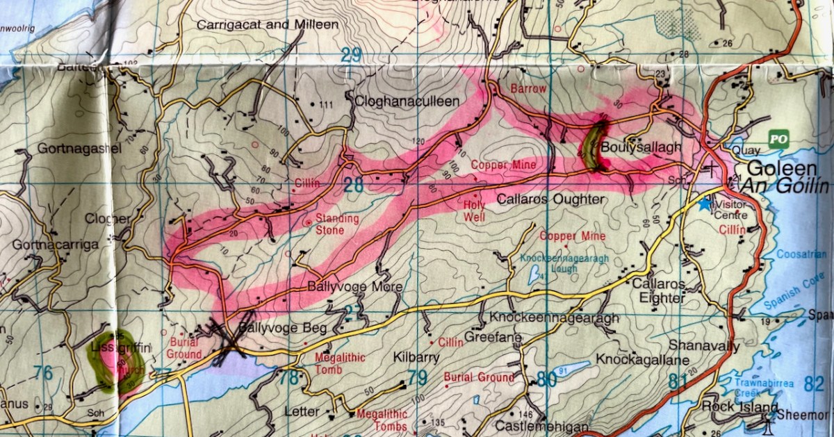
I’ve included a map (above) to show you where you are on the Mizen Peninsula, and a close-up (below) to show the route you’re following. The pink blob within the green circle at the lower left is Lissagriffin Medieval Church in case you have the inclination for a little side trip.
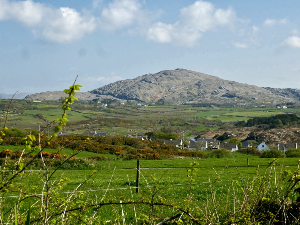
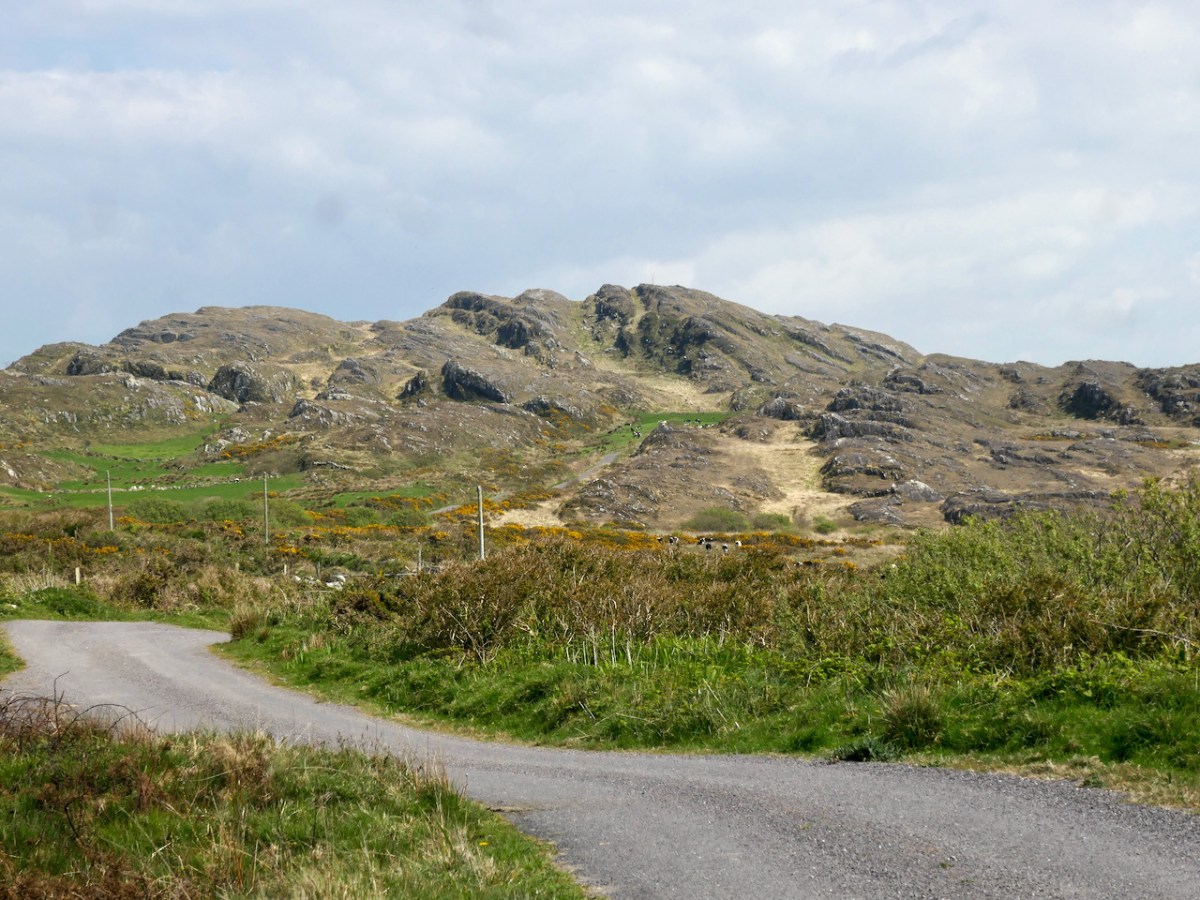
Walk up to Goleen Catholic Church, take a sharp right and you’re on your way. This first part will involve some huffing and puffing, but you’re on a country boreen fringed with wildflowers (wild garlic at this time of year) and with expansive views back to the sea and across a valley to Knockaphuca Mountain (another brilliant trail!) and to Mount Gabriel beyond.
If you don’t have the time or inclination for a long walk, look out for a sign to the shortcut. It’s the curved green line on the lower of the two maps above. It will bring you back to the village, initially via a well-maintained gravel path (below), and then by road, for a 2km walk in all.
If you decide to carry on, it’s uphill now for quite a stretch, but the views across to Knocknamadree and to Knockaphuca are worth the effort. Later in the year, the route will be dripping with Fuchsia and Montbretia, but right now the Navelwort is starting to sprout and stitchwort is rampant.
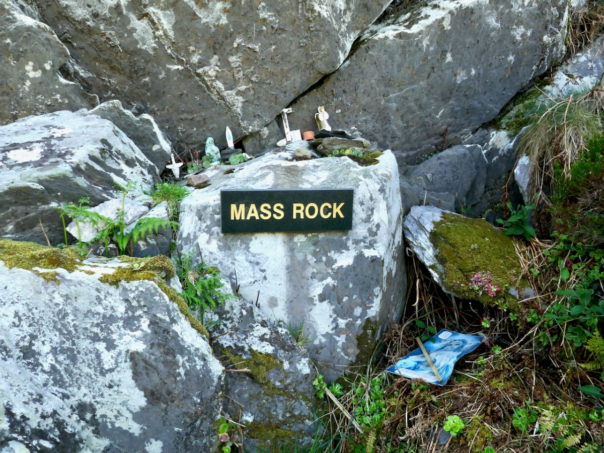
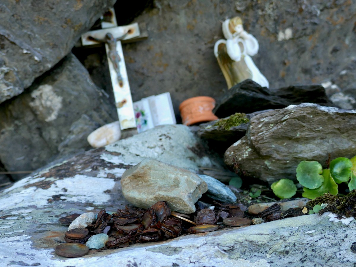
This one still lives in folk memory, and is still visited, by the evidence of various offerings left on the ledge. Some of the coins are so old they are peeling apart, while others look of more recent vintage.
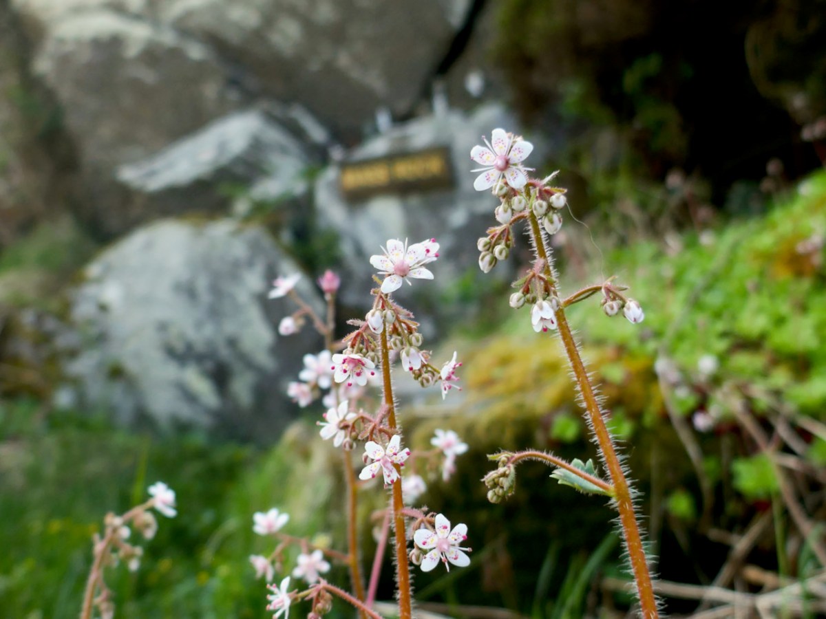
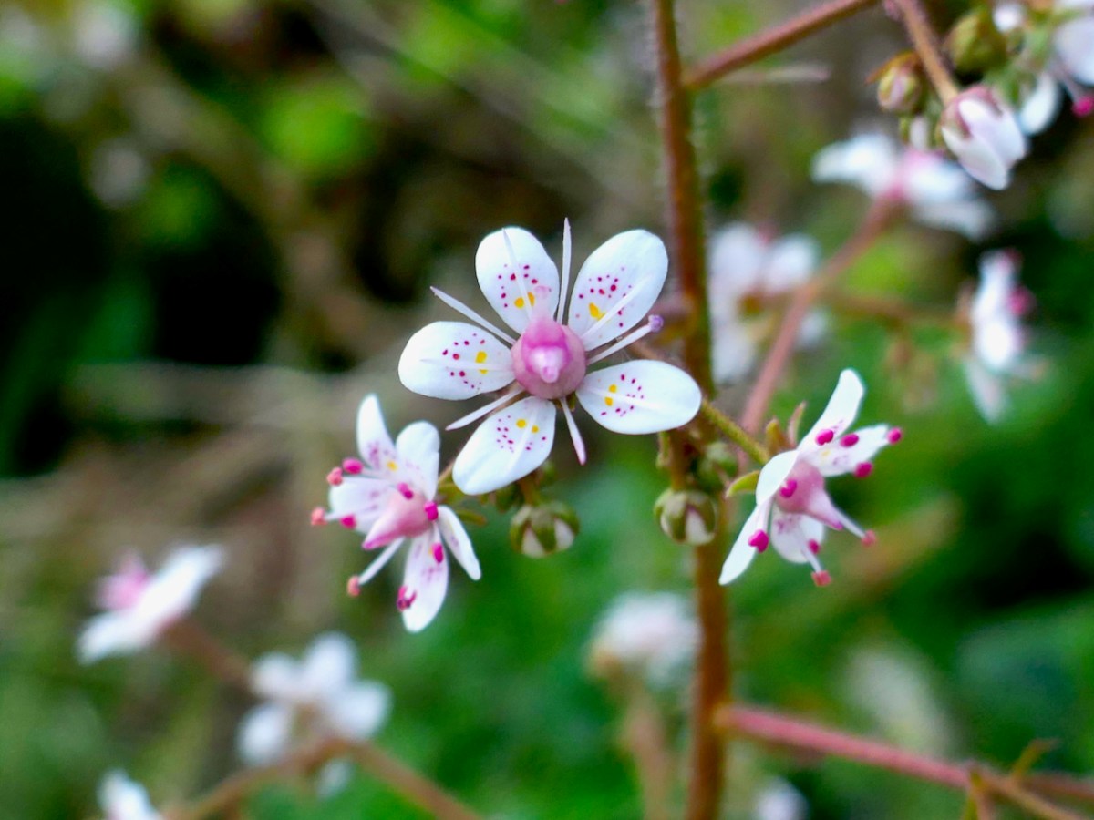
St Patrick’s Cabbage Is just starting to bloom. This is a native plant and part of a curious set known as the Lusitanian Flora which only occur in southwestern and western Ireland and in the Iberian Peninsula.
This one rewards a close look – the flowers are white but the petals have pink and yellow dots and the anthers are a startling deep rose colour. A domestic hybrid known as London Pride is grown in many gardens.
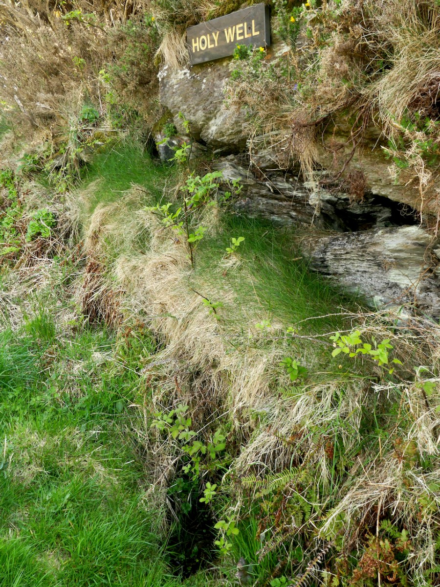
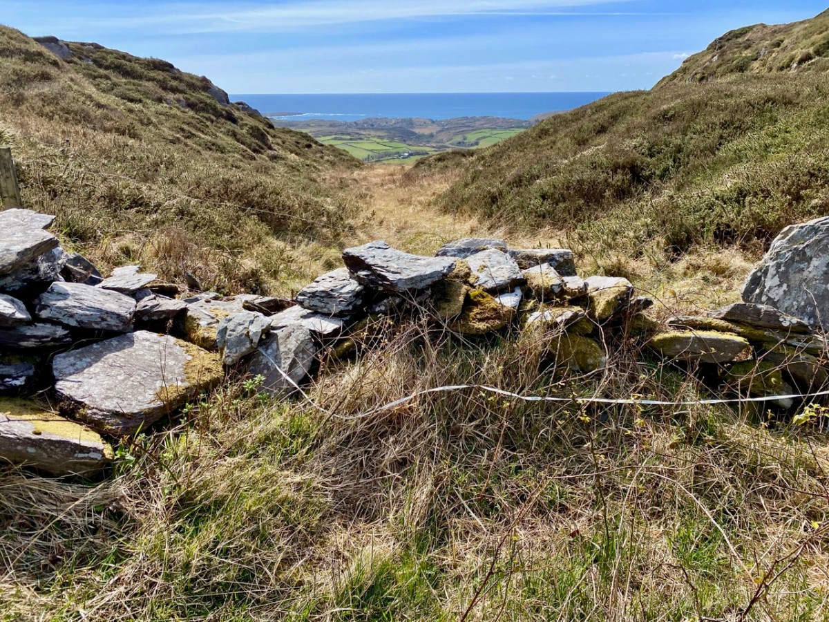
The second surprise is a holy well, just a little further along. It’s not a very impressive sight – looks like a ditch, in fact, although there’s a bit more going on under all that grass and brambles. The location is marked but there are no indications that anyone has visited in many years. No offerings here, no cups or rag trees, no statues or prayer cards. But nothing deters Amanda, and she has written about the well here, including the fact that its name is Tobairin a ‘Bhothair – small well of the road – and that it was once revered.
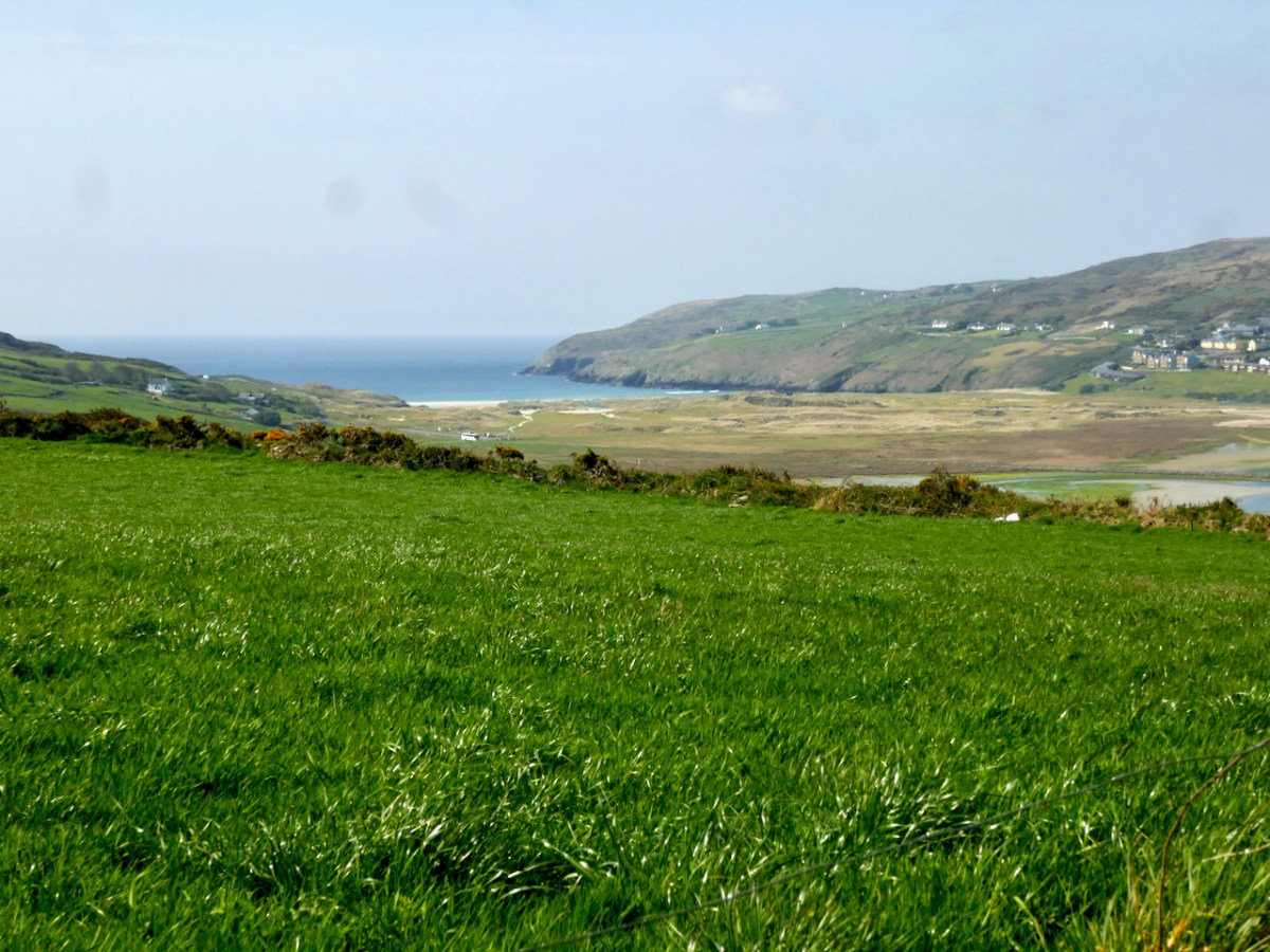
From the holy well keep going westwards and the reward is an immense view to the end of the Peninsula and the Mizen Peak (below). It’s a gentle downhill all the way until you get close to the main Goleen – Crookhaven road.
At this point, nobody could blame you for retreating to the snug at O’Sullivan’s Bar in Crookhaven for a pint coffee and a crab sandwich, but of course you are only half way through the walk if you want to do the full loop. So turn right and then right again, and start climbing as the road heads back to Goleen over the hills and away from Barley Cove (below)
The views don’t really start until you’re quite high up, but the road is peaceful and rural – a good time for contemplation, perhaps.
Once you’re on the downhill stretch you are facing east and once again have those glorious views across to Knockaphuca, with Mount Gabriel behind.
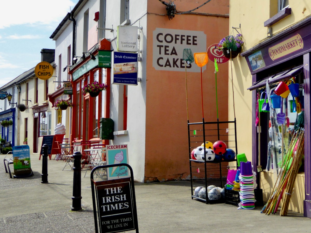
And when you hit Goleen – go on, you deserve it, have some ice cream!
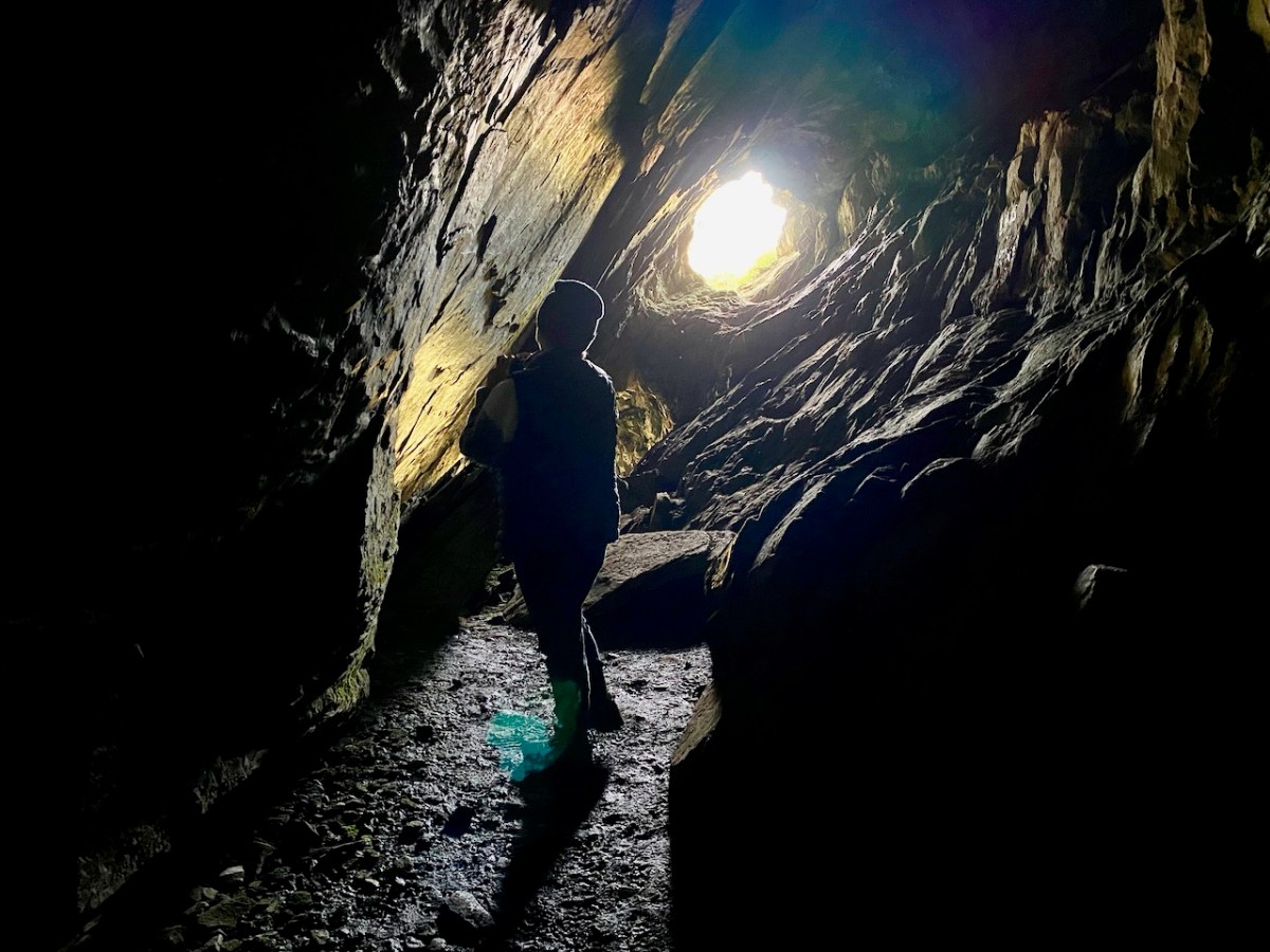
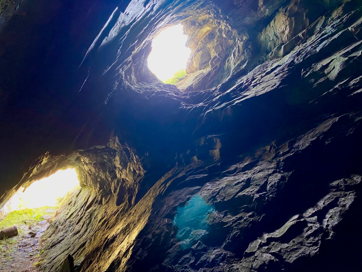
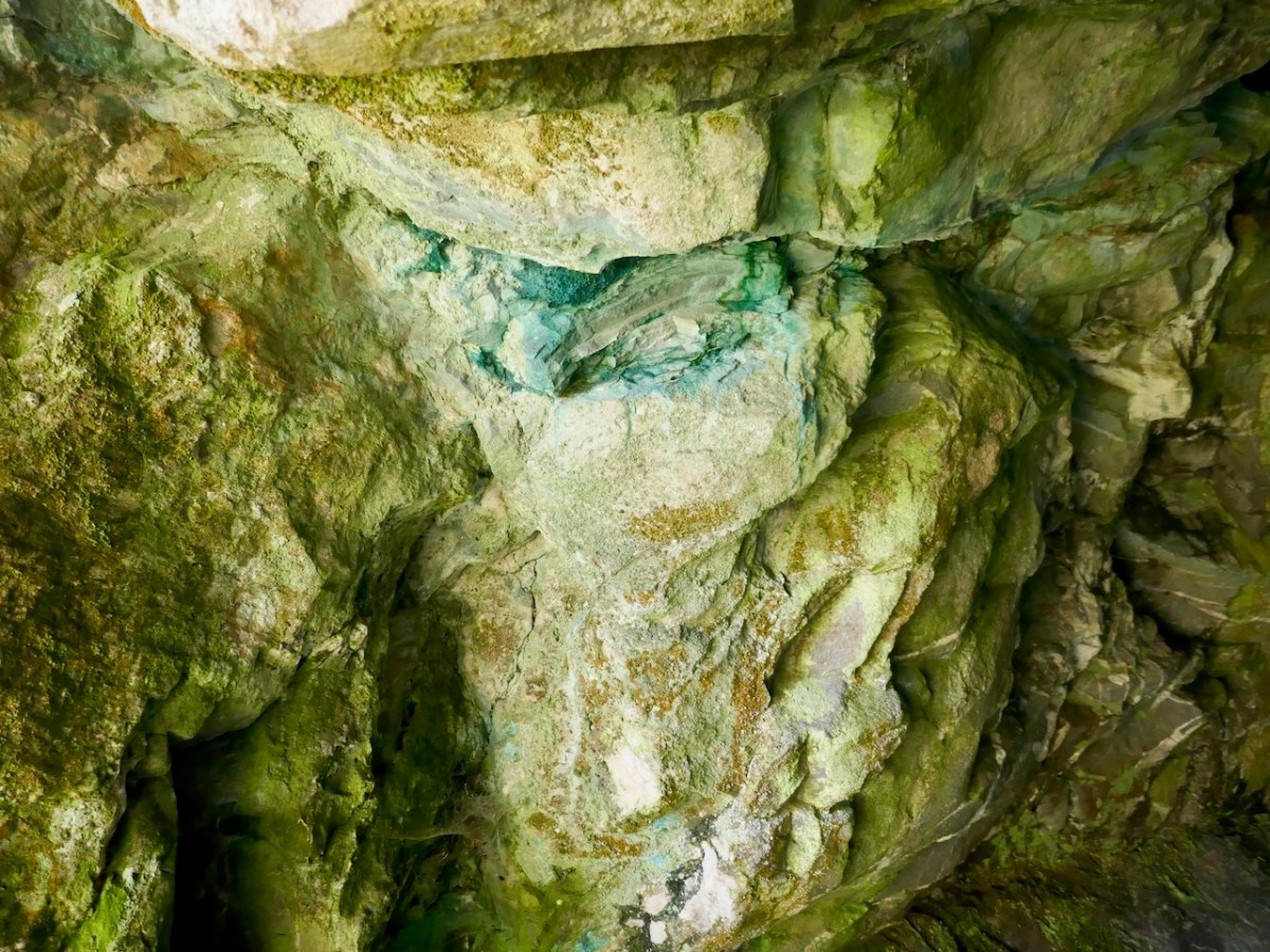
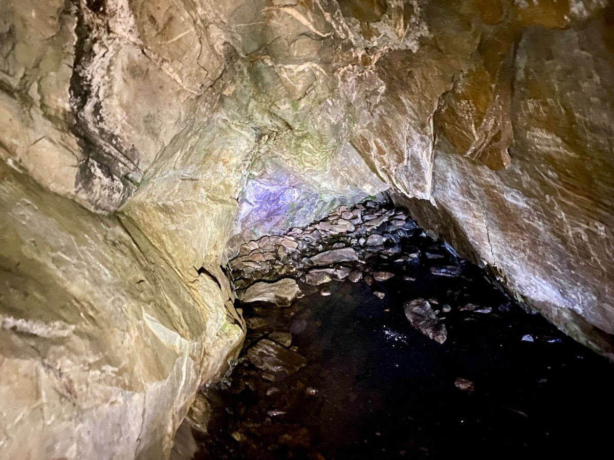
. . . Description: Listed as an ‘ancient copper mine’ in the RMP (1998). Located in rough hill pasture on the W side of a deep wide ravine running N-S across the hill. A natural cave with two E-facing entrances extends c. 35m W into the hill. The height varies from c. 1m to c. 4m and jagged rocks protrude from the roof. Loose stones are scattered on the uneven floor. While there are traces of green malachite copper staining in a few places there is no evidence to indicate prehistoric mining. The material in the spoil mound outside the lower entrance suggests some unsuccessful 19th century exploration for copper may have been carried out here. The evidence is not sufficient to warrant accepting this as the location of an archaeological monument . . .
archaeology.ie Compiled by: Connie Murphy
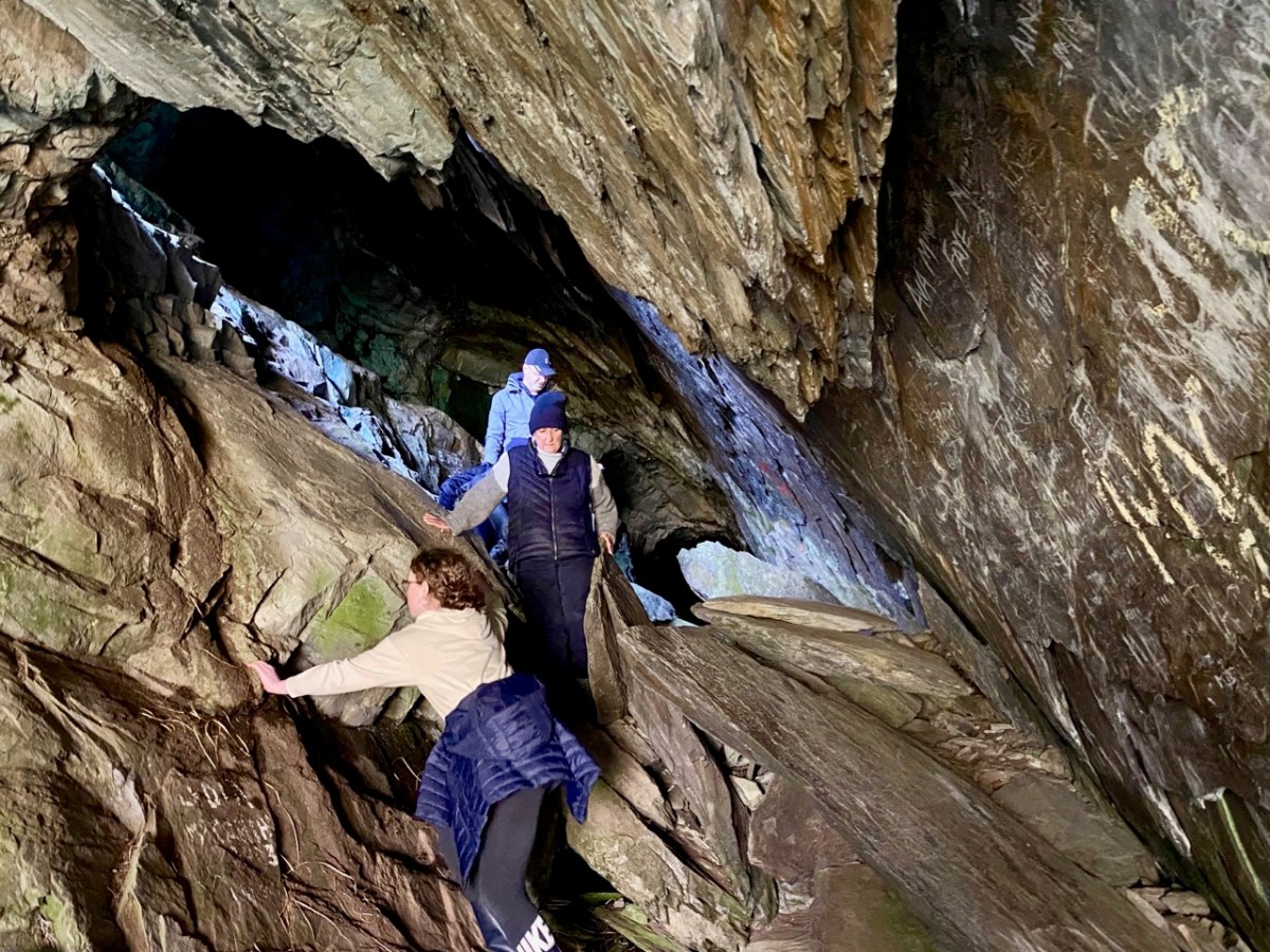
This now ‘redundant’ entry in the official records seemed to imply that the ‘ancient’ mine wasn’t there at all – it was just a cave. But the records also make no mention of any sort of inscription on the cave walls: perhaps, if there were scribings, they were considered ‘modern graffiti’ and of no historic interest. We set out to solve the mystery, accompanied by our intrepid friends David Myler and his children. David has written about the site on his own Facebook page.
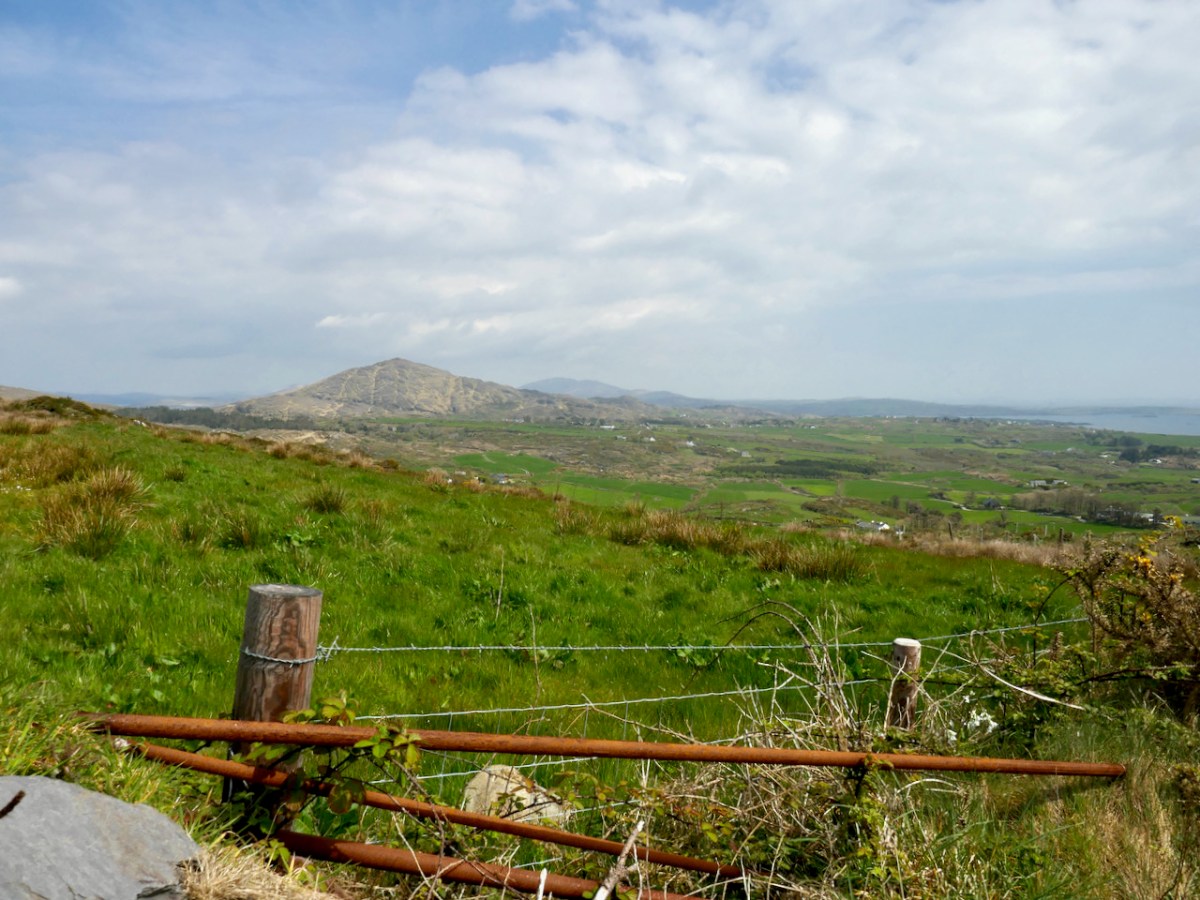
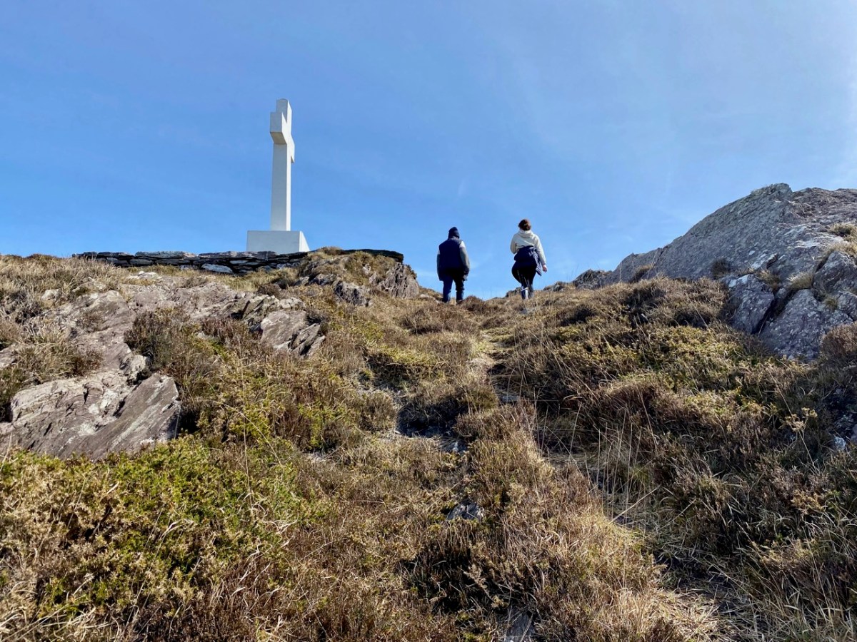
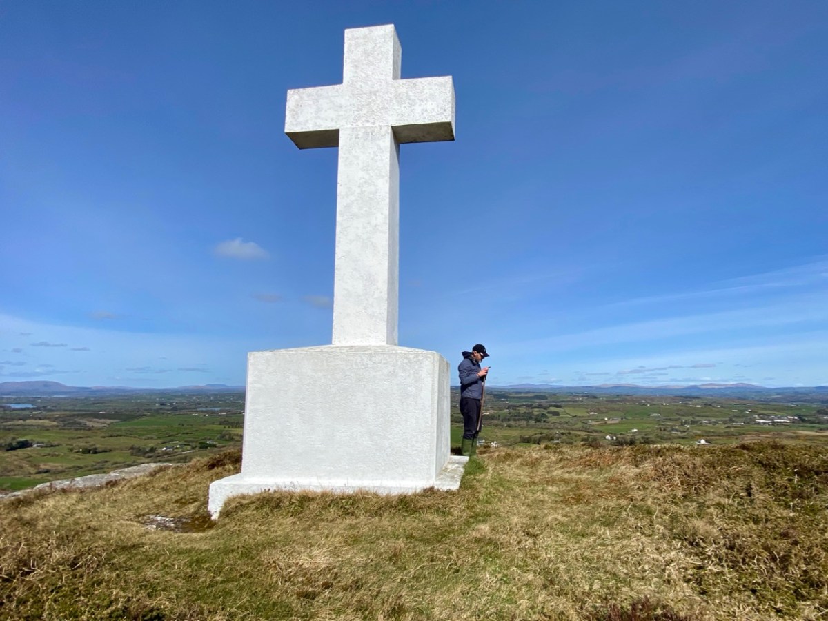
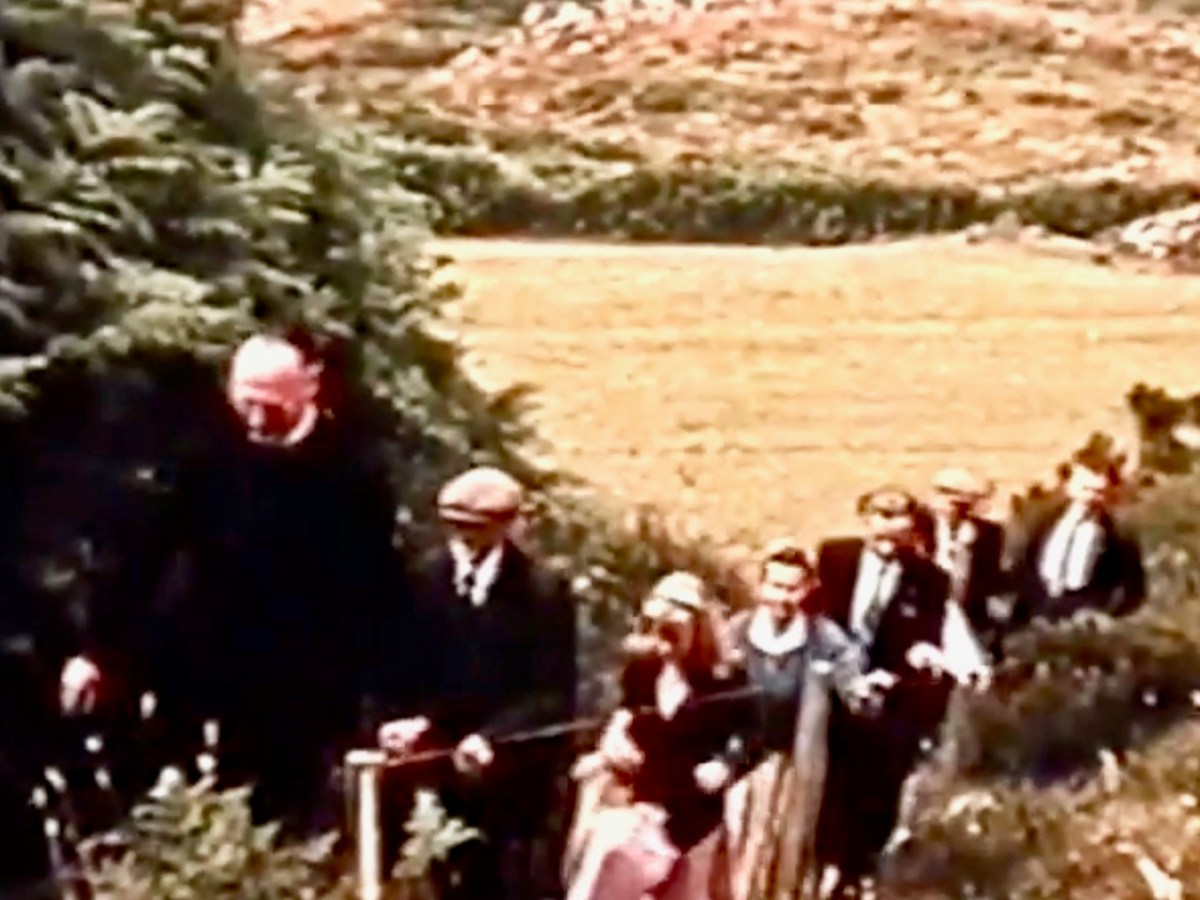
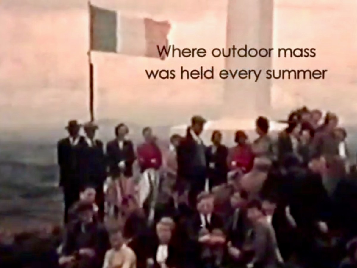
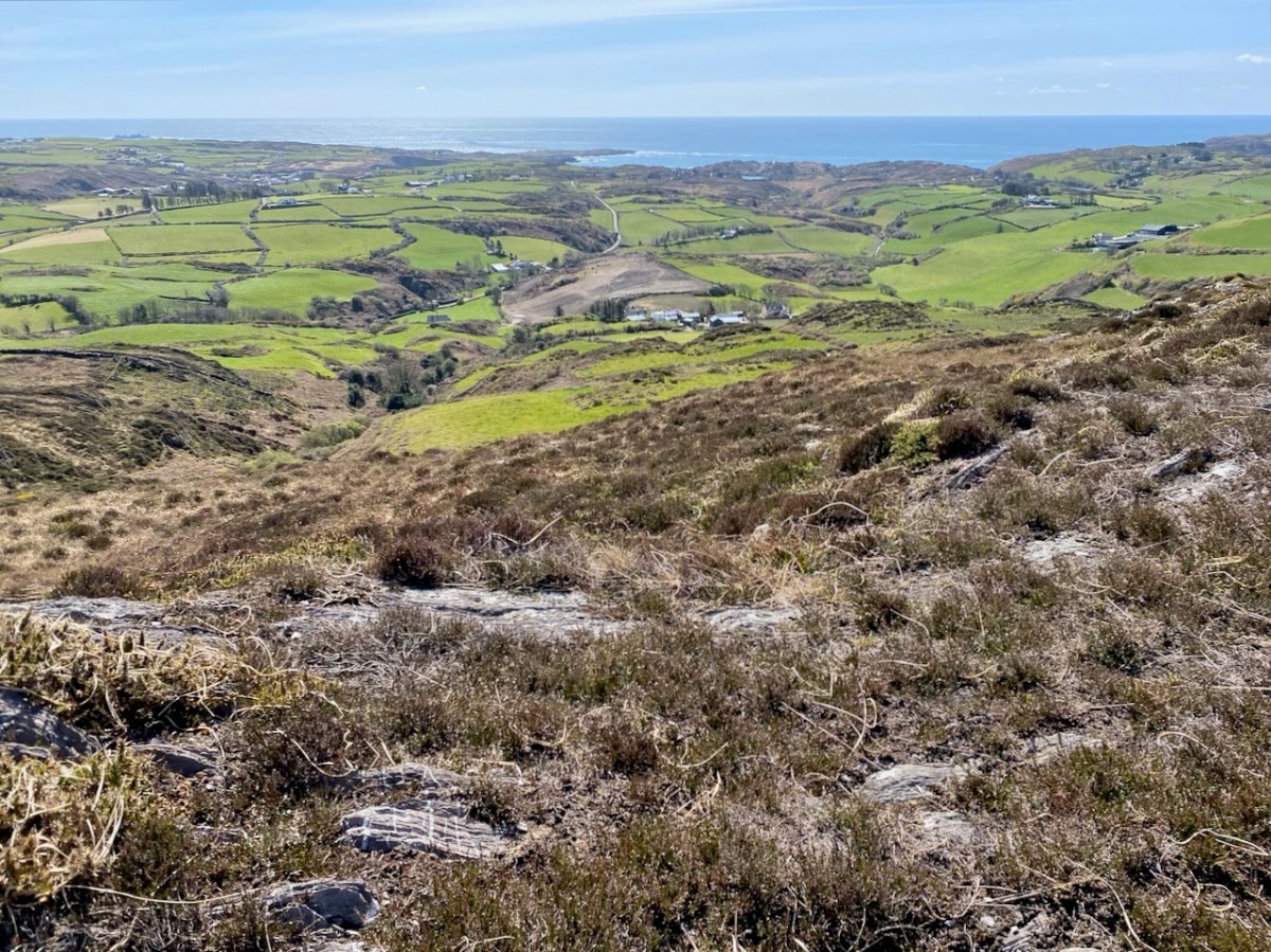
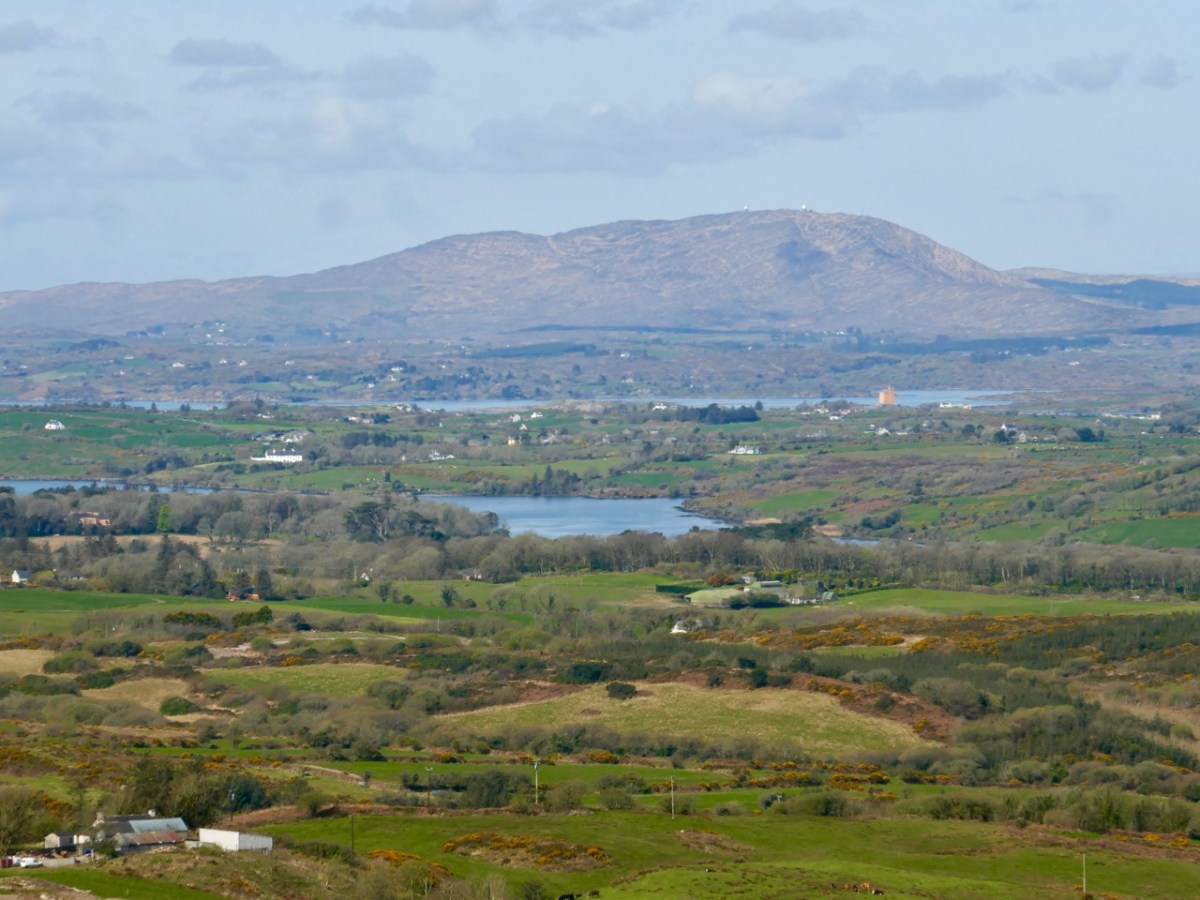
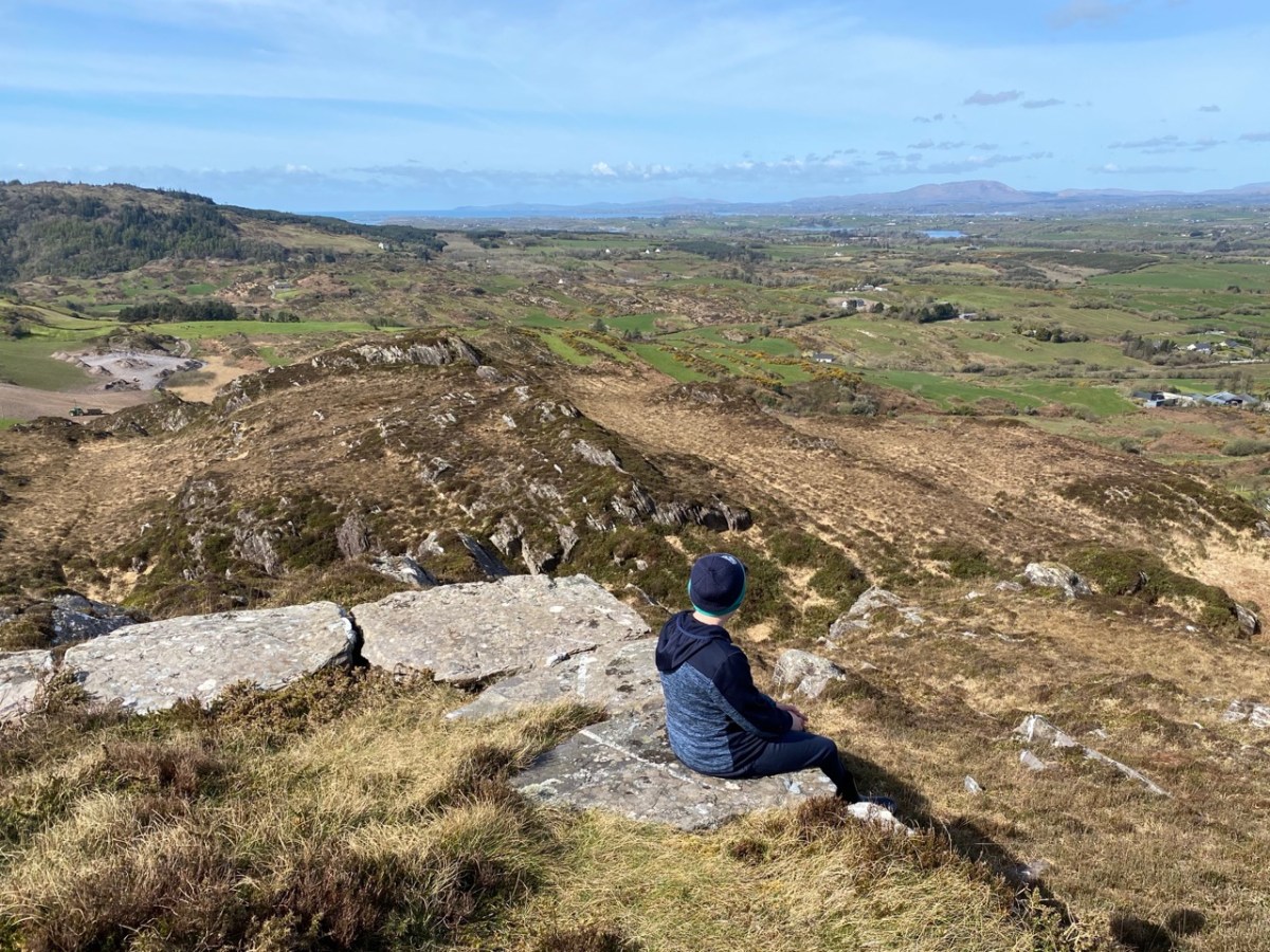
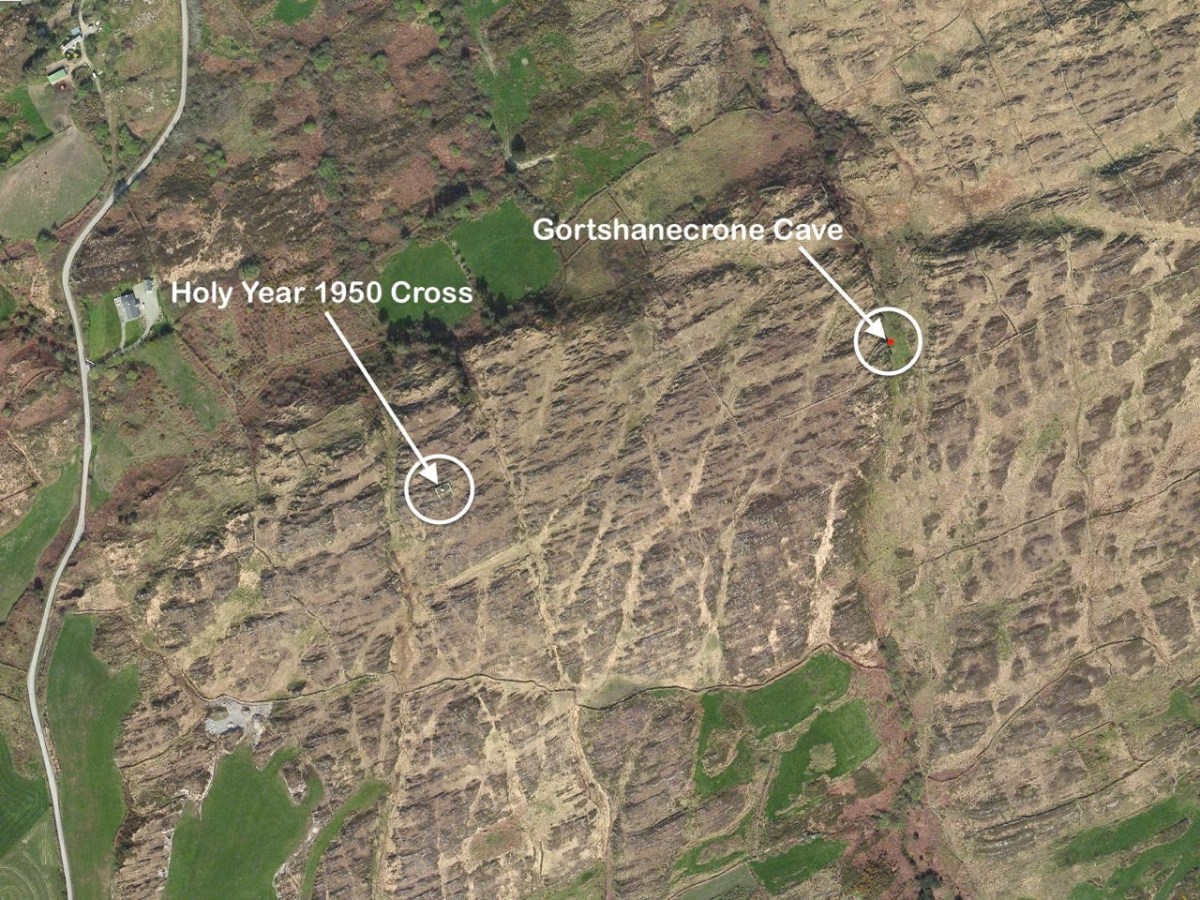
En route was another – much younger – piece of local history that we had long wanted to visit: an enormous white cross set up on top of Coom Hill to commemorate the Holy Year of 1950. Once visited on Corpus Christie day every year by a procession which started in Skibbereen, it remains an important local landmark and is situated with dramatic views in all directions.
The two screenshots above are from a film taken in the 1960s, showing the procession to the cross. You can watch the full film online here. Below are some of the views which can be seen from the top of the hill.
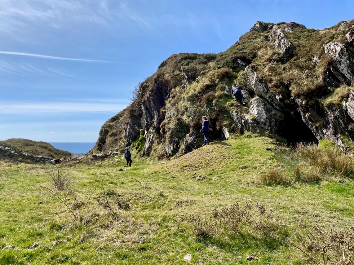
The cross – and the views – were only tasters for the adventures we had in store. Justin had researched the location of the ‘cave’ and his instructions unerringly led us across country towards a gulley – a substantial gash in the landscape running north to south, where the high land dropped away: tucked in just below us we found our goal.
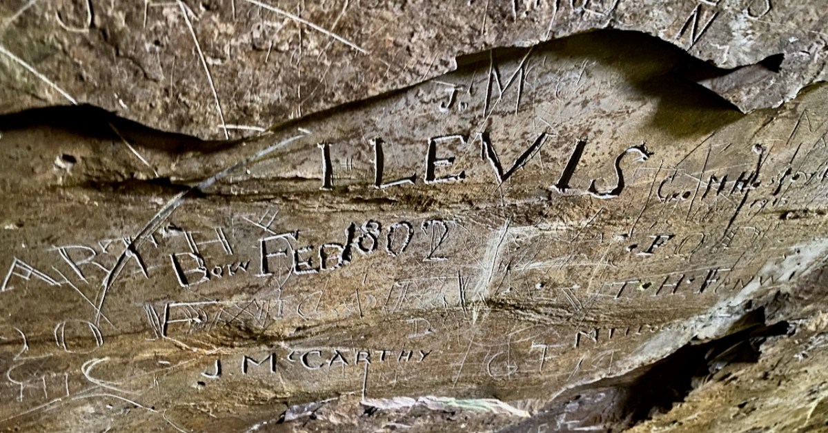
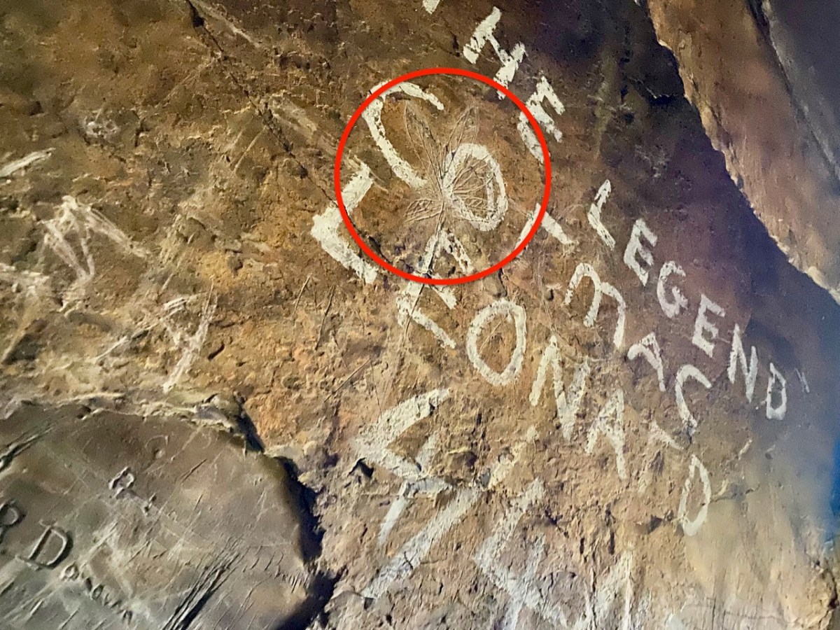
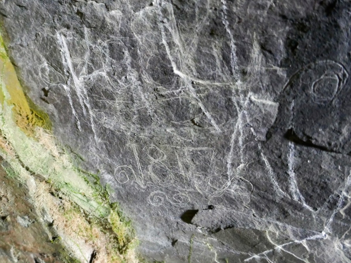
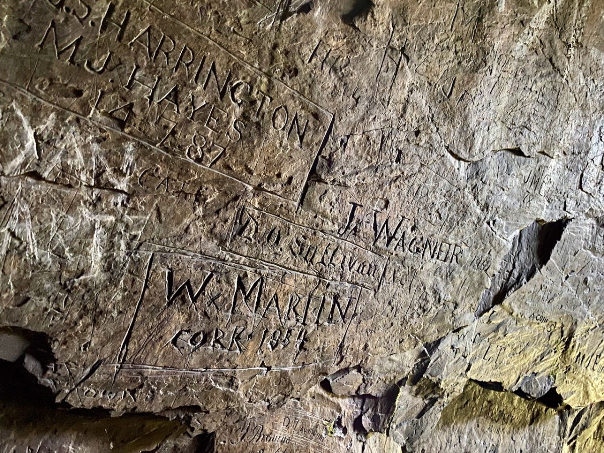
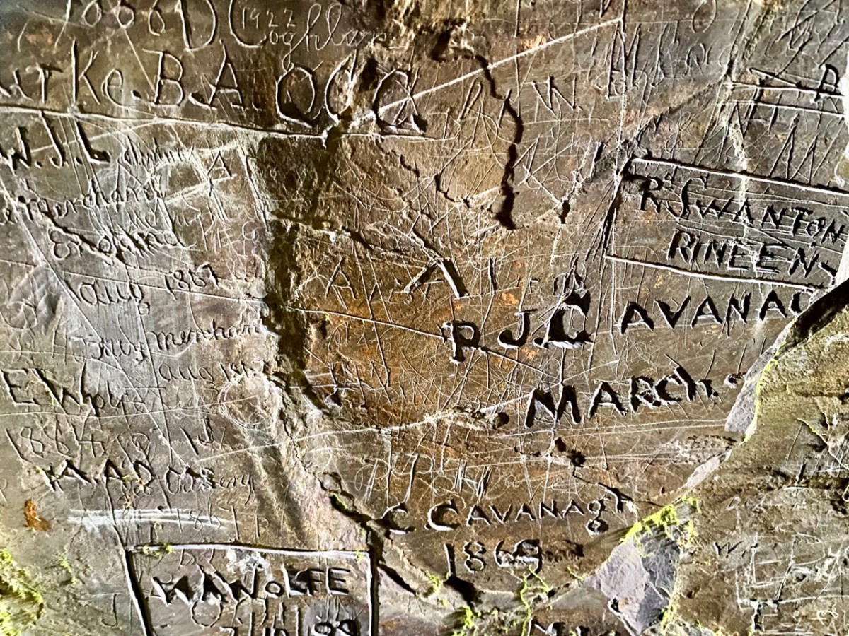
The cave has two entrances – higher and lower – and the rock faces within certainly look as though they had been worked in places. This could be from the “. . . unsuccessful 19th century exploration for copper. . .” mentioned in the archaeological record. But the exposed stone is covered in scratchings: names, words, dates from all periods – recognisably going back as far as the 1700s. There are also a few images, such as this group of leaves which has been partly obscured by modern-day painted lettering: – and note the harp in the top left of the next pic down:
We had been surprised that we could not find any written description of the graffiti which – although not ‘ancient’ – has to be of interest, as it is a record of marks made by people through many centuries. In our recent census (2022) we have all been asked to contribute to a ‘time capsule’ – our words will be sealed up ready for opening by future generations a hundred years from now. (Some of these words have been published on the internet. My favourite is the simple and poignant: “Is there anybody there…?”). This cave is a comparable ‘time capsule’ but perhaps less embracing of contemporary life.
Centre, above: the copper staining, which is mentioned in the redundant archaeological record. Above is the far end of the cave, with some interesting lighting effects. The pic below gives an impression of the scale of the interior.
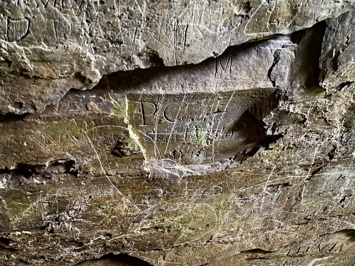
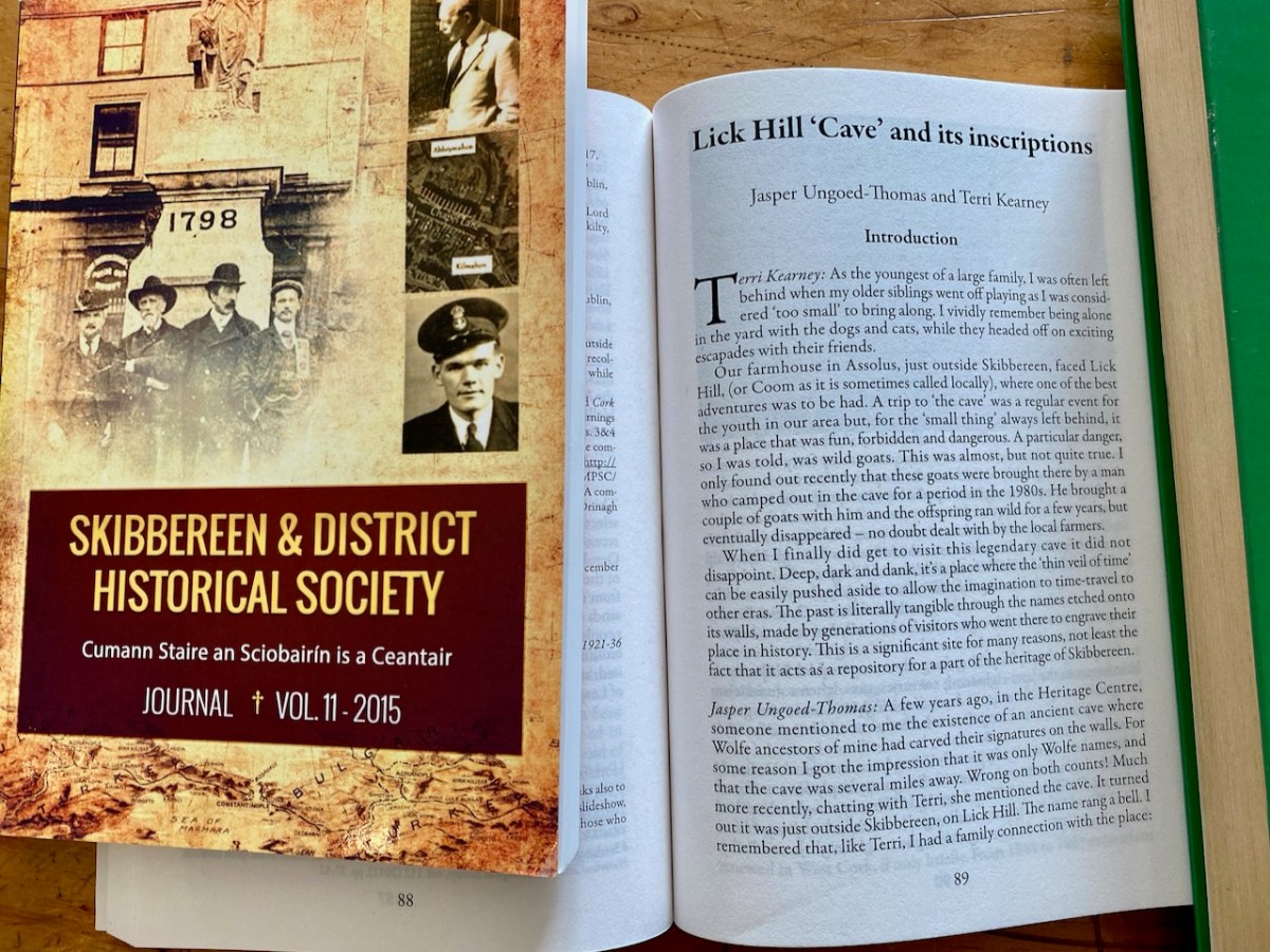
Before writing this post I made a few more enquiries, and discovered that the rock scribings had been thoroughly researched and written up in an article in Volume 10 of the Skibbereen & District Historical Society Journal, dating from 2014. The reason I had not previously discovered this was that the writers chose the local name of Lick Hill, rather than Coom Hill or the townland name (Gortshanecrone). Local knowledge is everything!
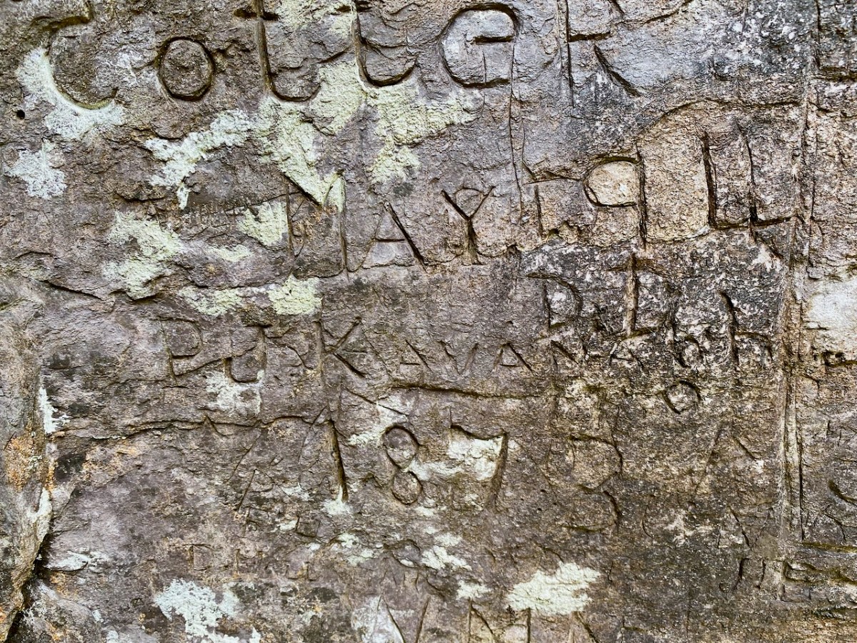
The excellent article is written by Jasper Ungoed-Thomas (whose ancestors – Wolfes – had carved their names on these walls) and Terri Kearney, who has been the Manager of the Skibbereen Heritage Centre since it opened in 2000. The Journal article is as comprehensive as you could ever need, with a full list of the names inscribed on the cave walls, together with information on those named where it is known. As an example, J Cotter, 1790 has the following entry:
. . . Cork Anglo-Protestant family, dating back to at least seventeenth century. Edward Cotter RIC during War of Independence. A Catholic branch existed by twentieth century. Edward Cotter was section commander of Bantry IRA . . .
Skibbereen and District Historical Society Journal , Volume 10 2014
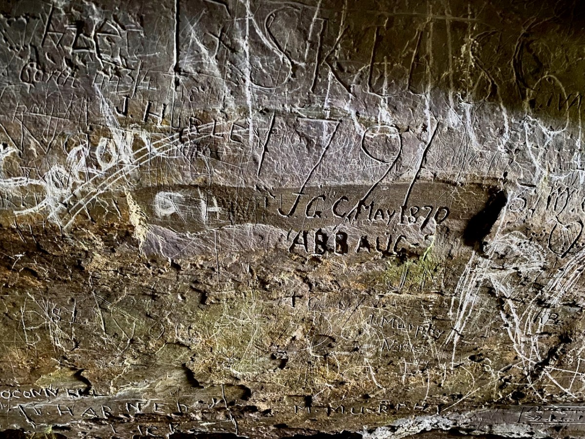
The same Journal article describes well the techniques which have been employed in many of the scribings:
. . . The nature of the rock face, with its hard surface, inevitably influenced the quality of the inscriptions. From the late eighteenth century until the later twentieth century, those who wished to leave a record of their visit had little option but to carve their graffiti. It is quite easy to scratch a name, but the outcome is often difficult, if not impossible, to understand. Results which are usually, but by no mean always, easy to read can be achieved by cutting, probably with a knife. But almost certainly the fairly few very clear inscriptions were done with a sharp chisel. Presumably some visitors came prepared to inscribe their names, since proper carving is not easy; it demands time, application and skill . . .
Skibbereen and District Historical Society Journal , Volume 10 2014
Wolfe and Cotter names are seen in the examples above. Having visited the cave we perhaps thought our adventures were over for the day. However, getting back to where we had parked our cars was hazardous, as we opted to follow what seemed to be an easier route (I have to confess it was my suggestion!).
It proved to be a long and tedious trek. The terrain was uncertain and we had to negotiate bogs and steep, uneven surfaces where there were no visible footholds. When we wearily made it to a boreen, we found we still had far to go. A lesson learned: always go back the way you came – you know you will arrive! In spite of the strains, we had a great day out, and broadened our knowledge of local West Cork history. Don’t forget – as always – seek the permission (and advice) of landowners before you embark on any such exploration. And don’t unduly disturb the local residents!
Welcome to the UCD Library Cultural Heritage Collections blog. Discover and explore the historical treasures housed within our Archives, Special Collections, National Folklore Collection and Digital Library