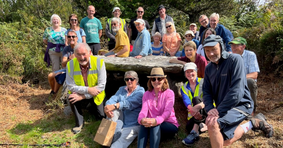
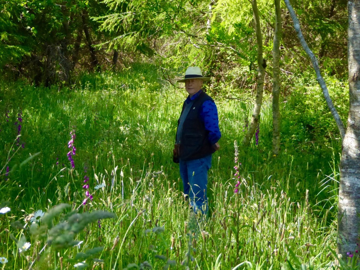
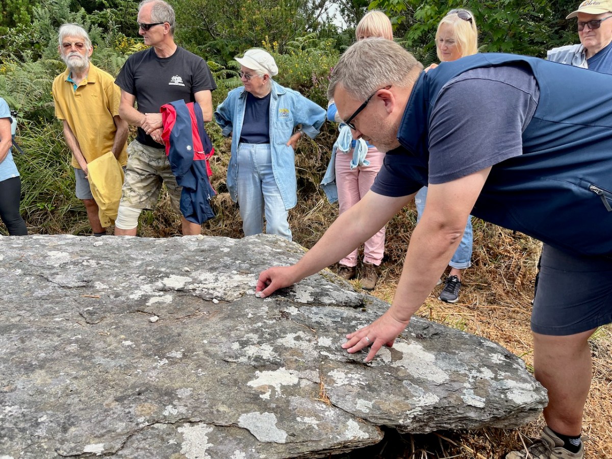
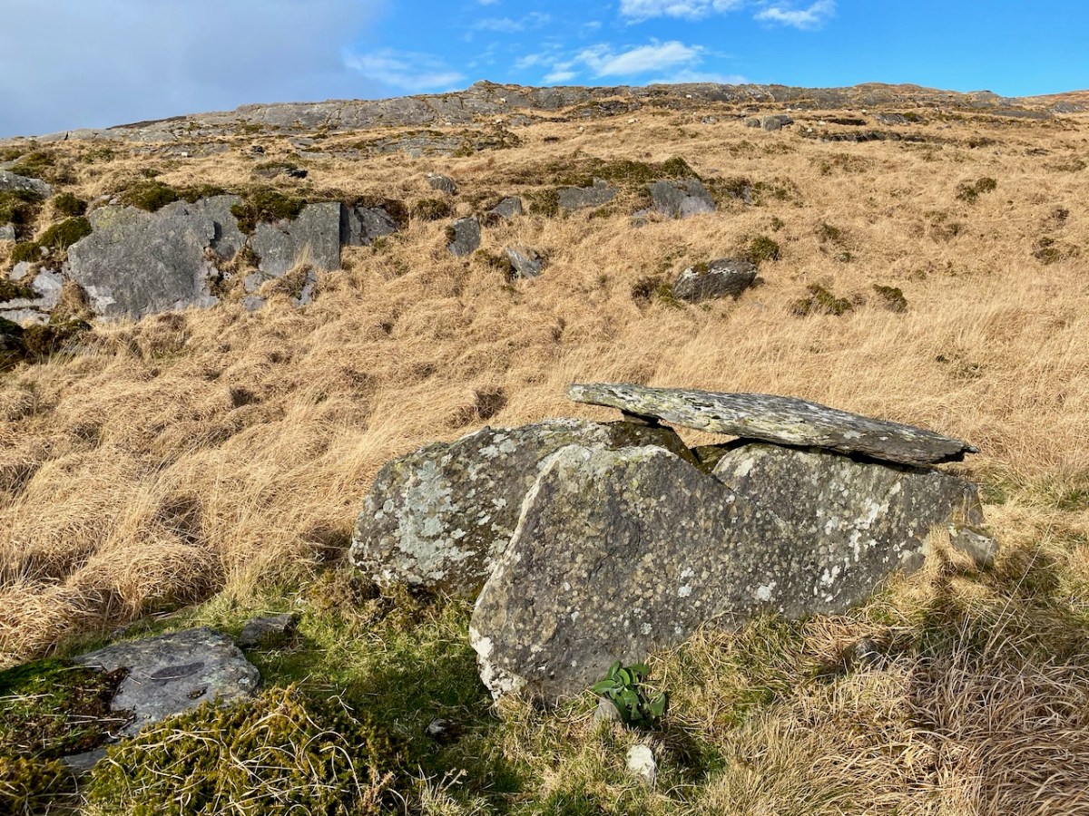
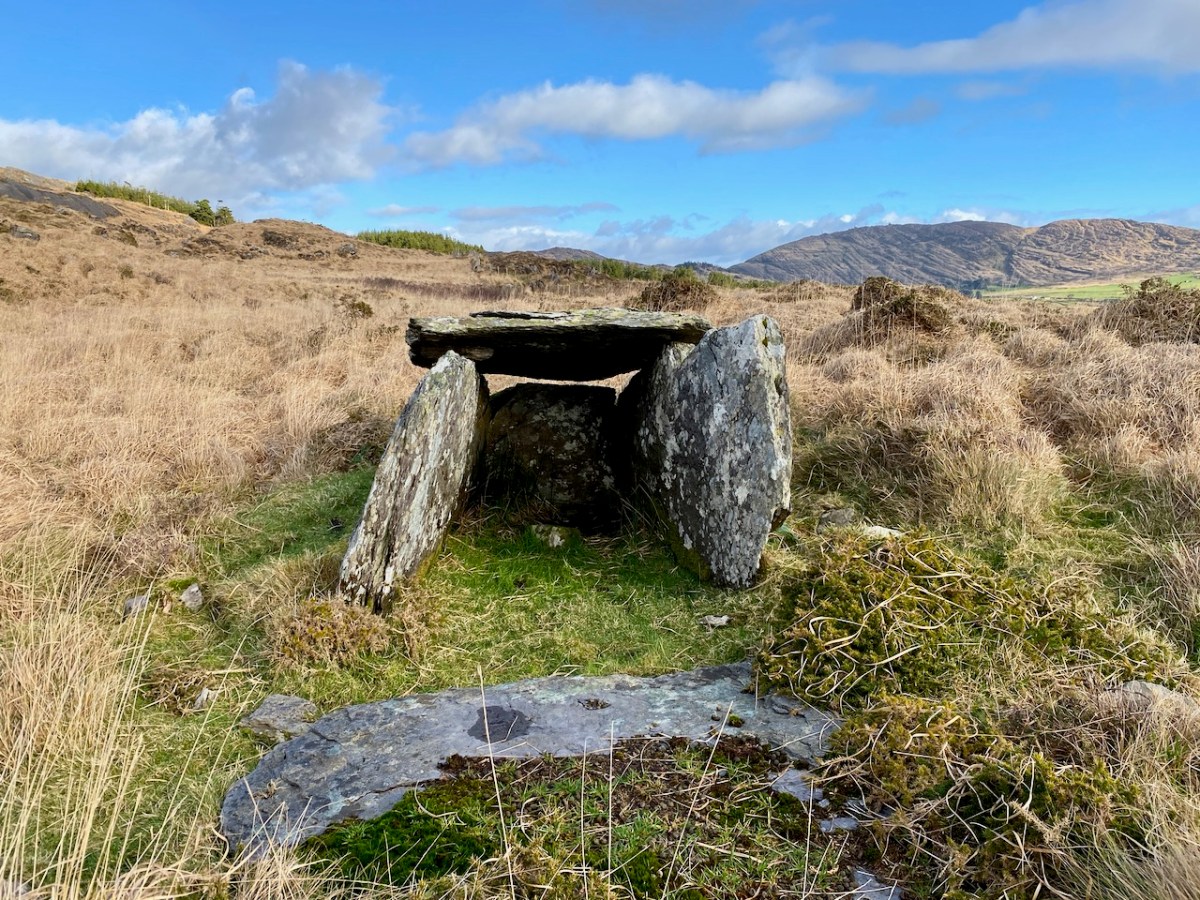
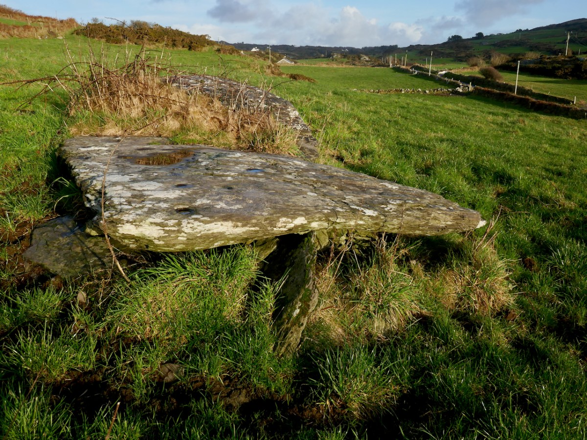
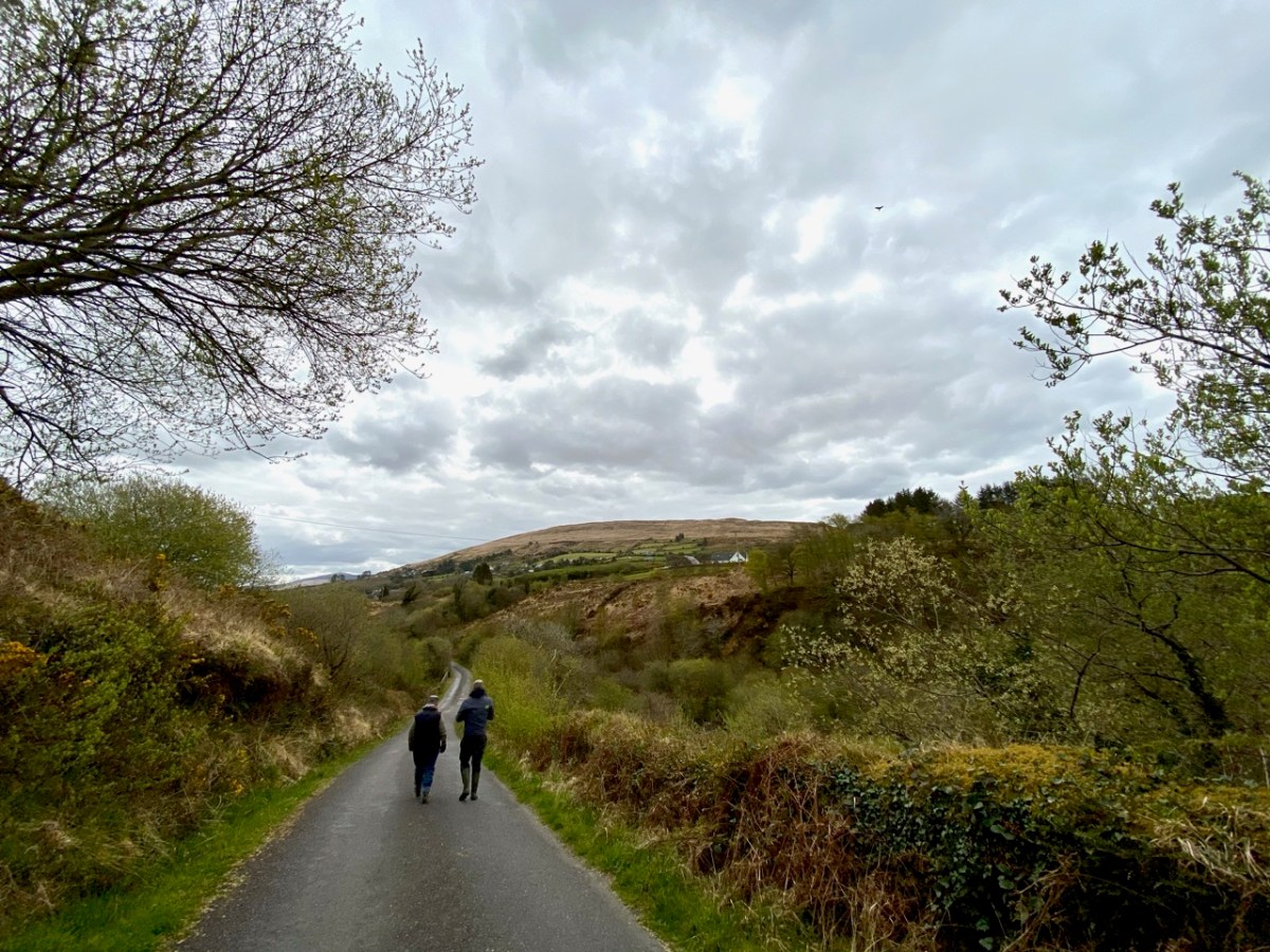
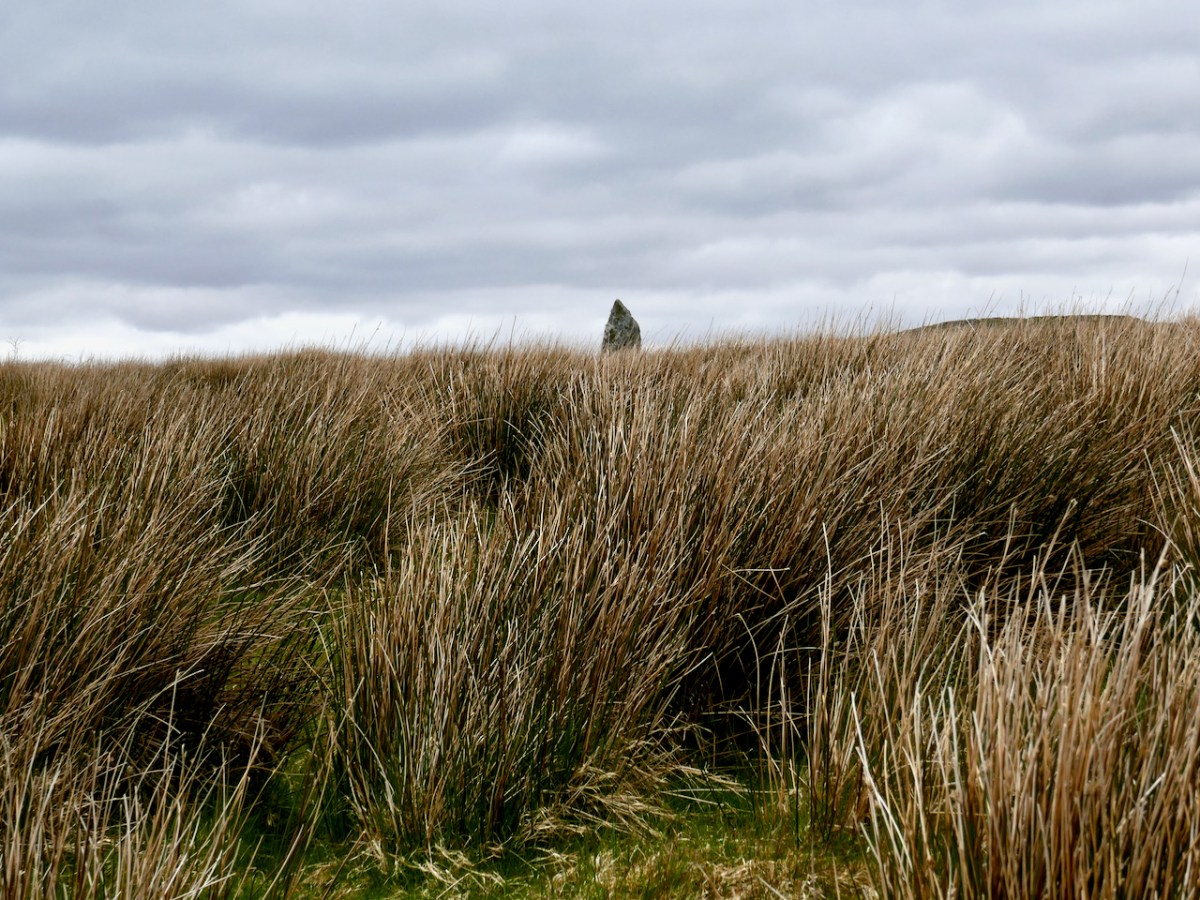
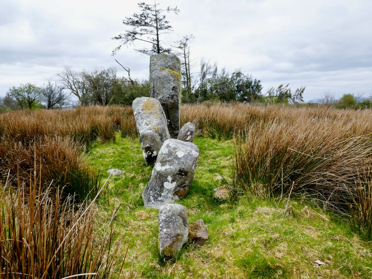
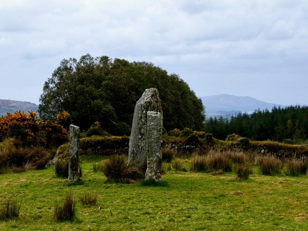
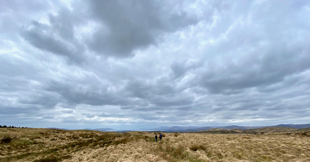
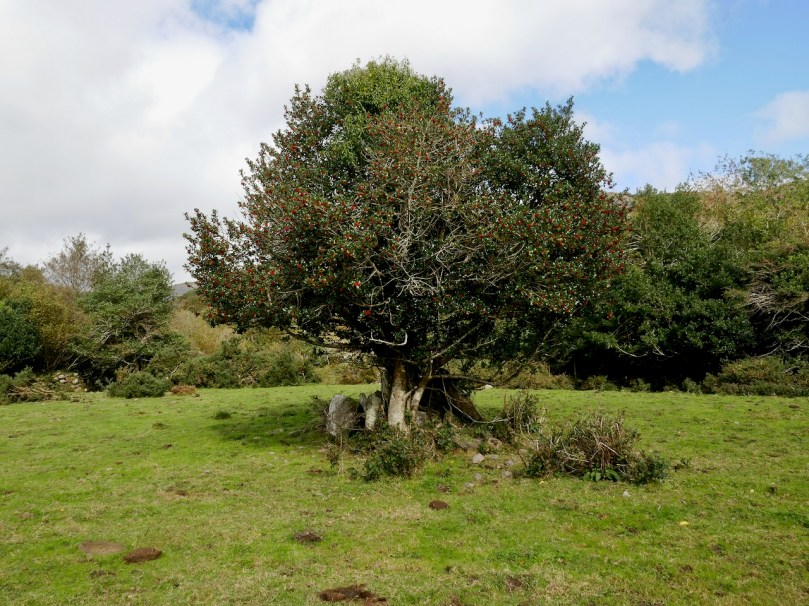
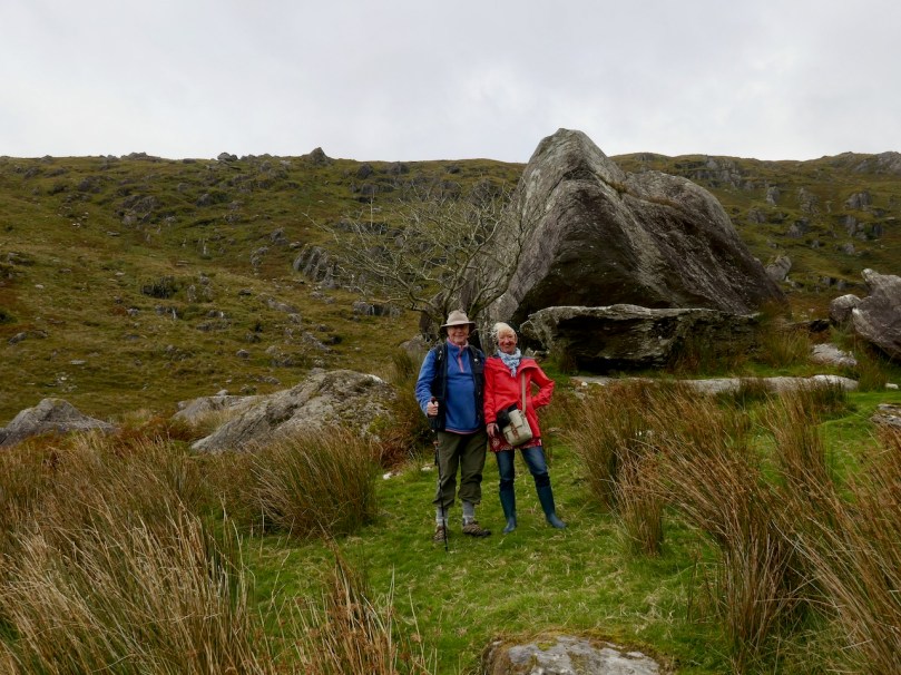
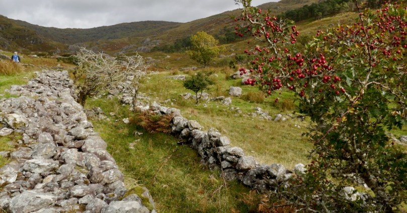
During the Ballydehob Summer Festival this year the organisers scheduled a Walk to the Wedge Tomb. A lovely group signed up and we made our way up the newly-cleared path.
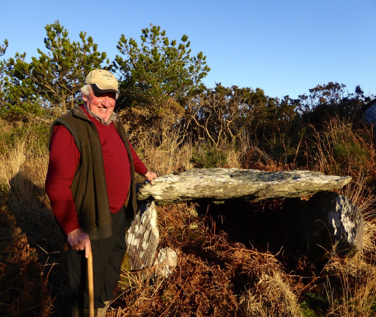
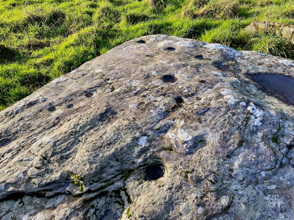
This wedge tomb, in the townland of Kilbronogue, is close to where we live. We were introduced to it way back in 2015 by the owner of the land, Stevie Lynch – see this post for an account of that meeting, and for more about wedge tombs in general. At that time, Stevie also brought us to a previously-unrecorded cupmarked stone on his land (below), which we subsequently submitted to the National Monuments records.
Stevie’s attitude to the monuments on his land was exemplary. He promised that no harm would ever come to them while he was alive. “These ancient monuments don’t belong to me,” he told us, “they belong to everyone.” In that instant he became our Heritage Hero, and we loved seeing him at the Ballydehob Talks at the Vaults, which dealt with all aspects of local heritage.
Sadly, Stevie passed away earlier this year. So this Walk to the Wedge Tomb was an opportunity for all of us to honour the memory of the man who had treasured this megalith and designed a path to it for everyone.
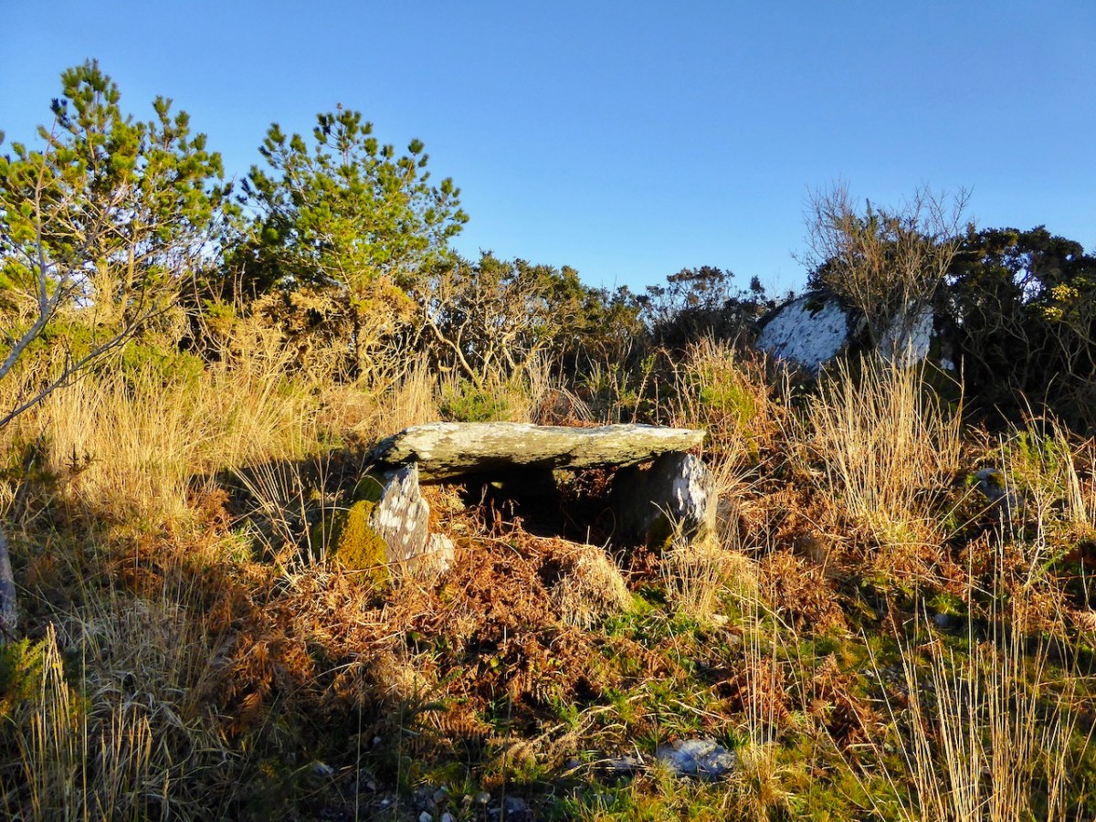
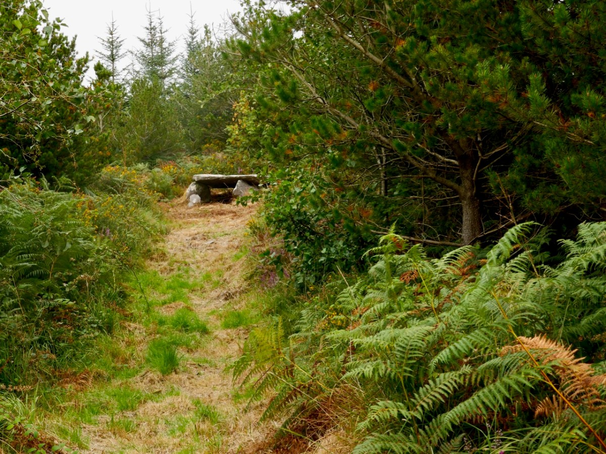
The walk up through Stevie’s plantation of native trees is beautiful. It can get quite overgrown in the summer (above), which only enhances the atmosphere, and it’s actually quite awe-inspiring to emerge at the top to the site of the tomb, sitting in a small glade.
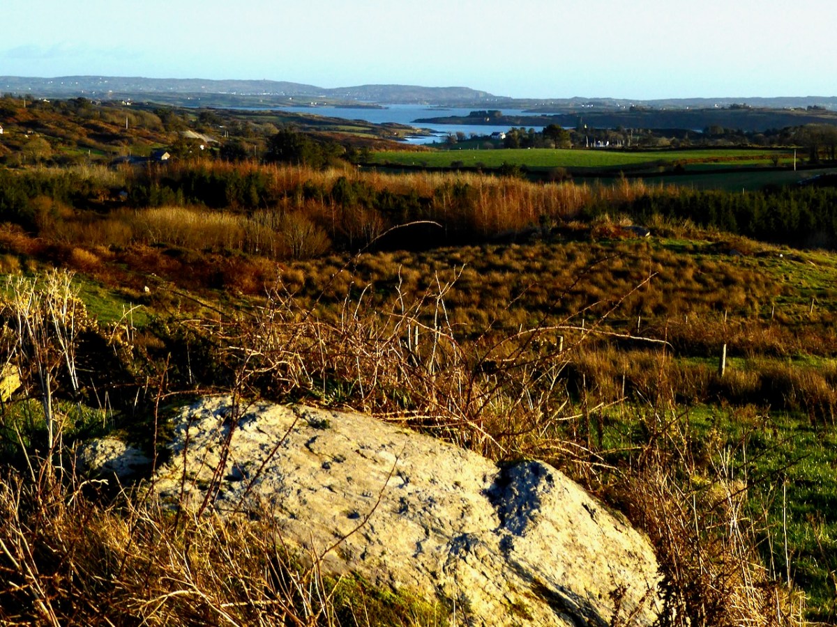
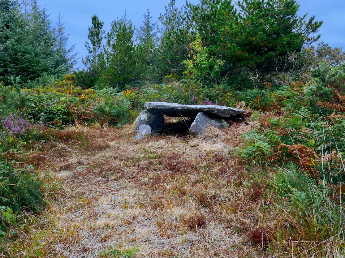
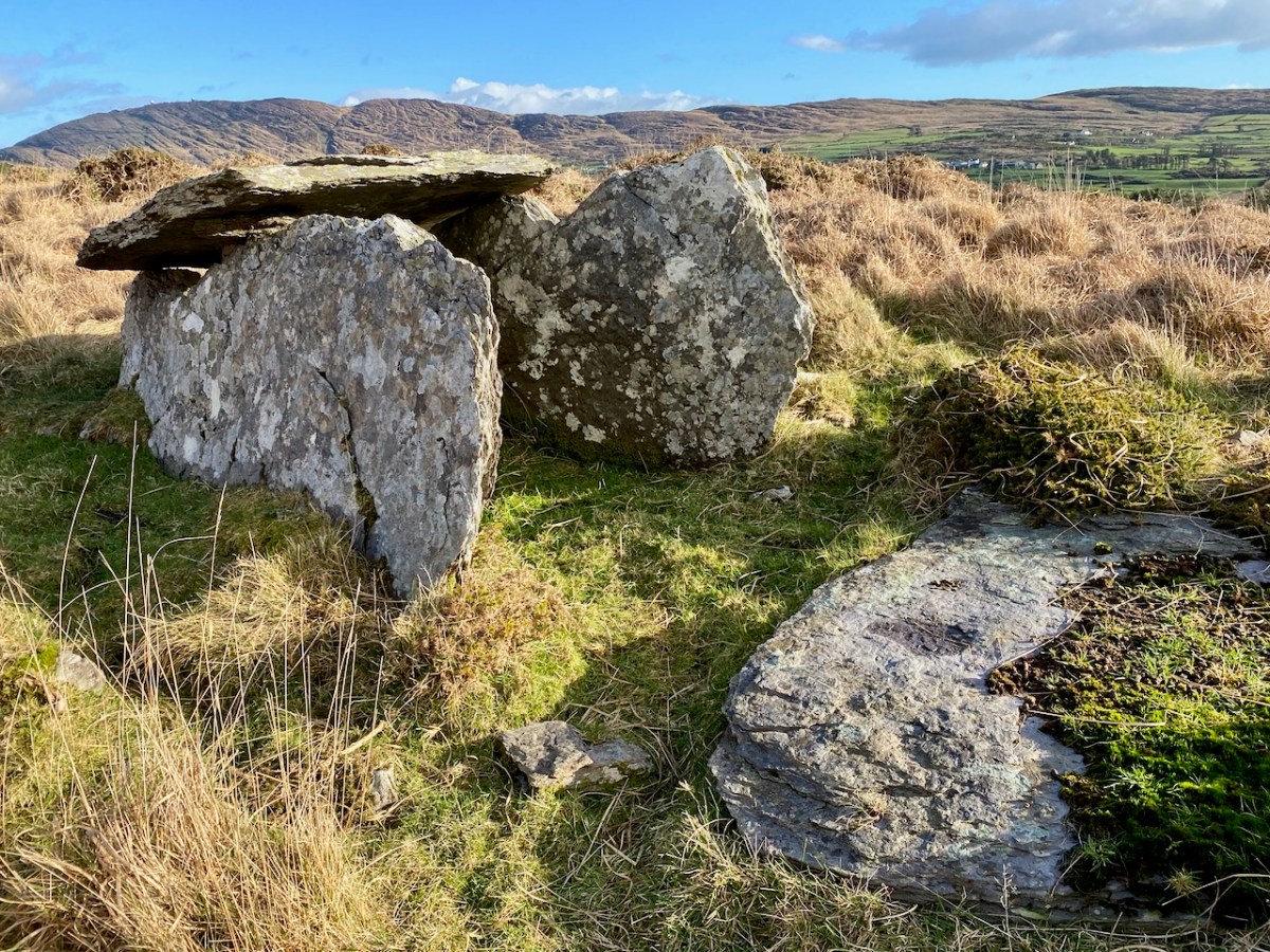
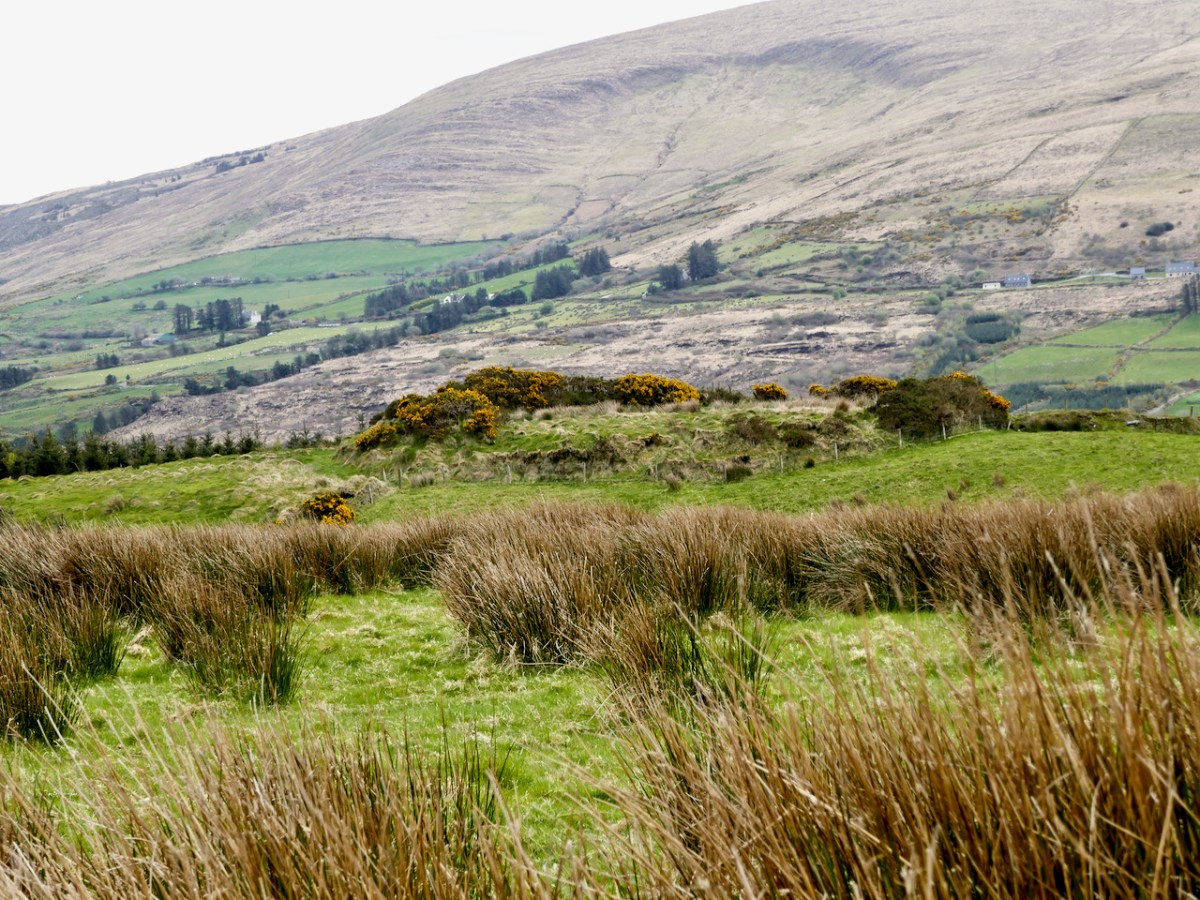
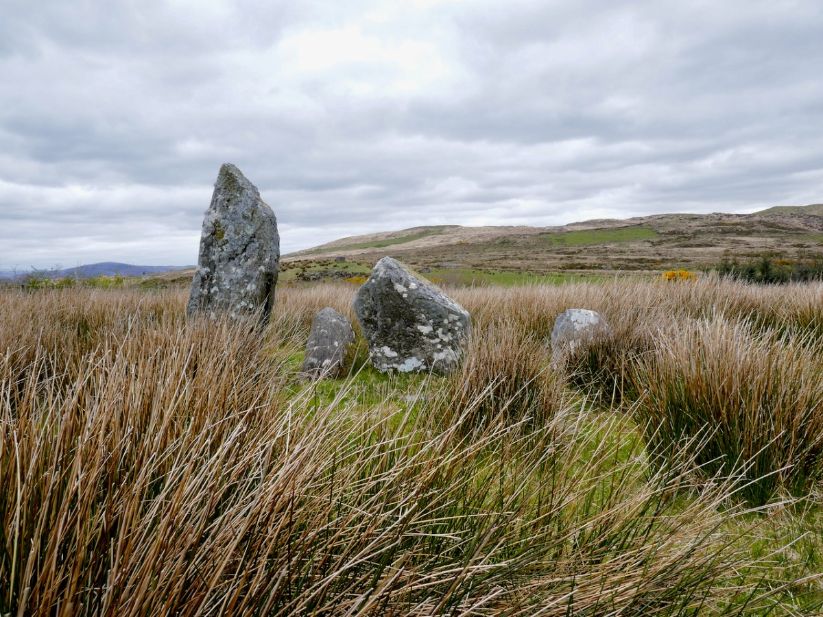
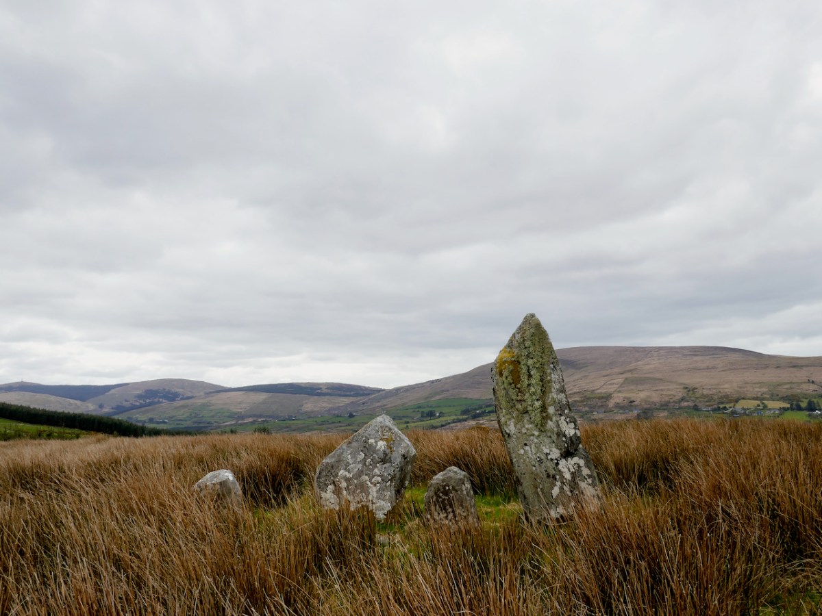
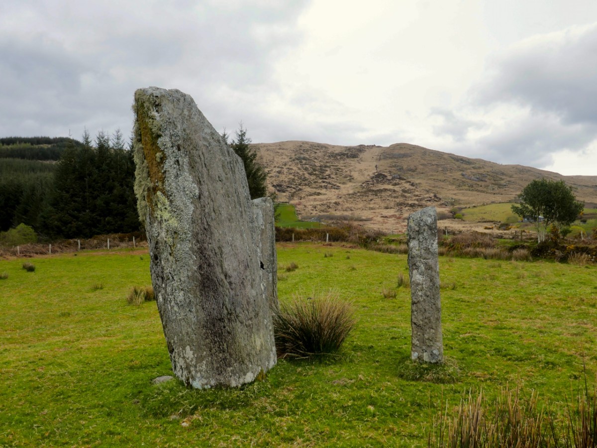
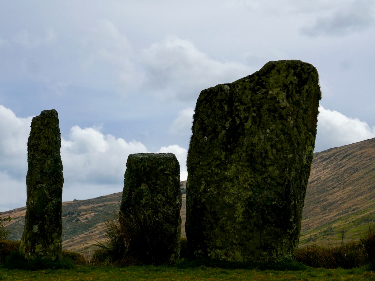
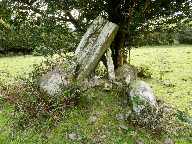
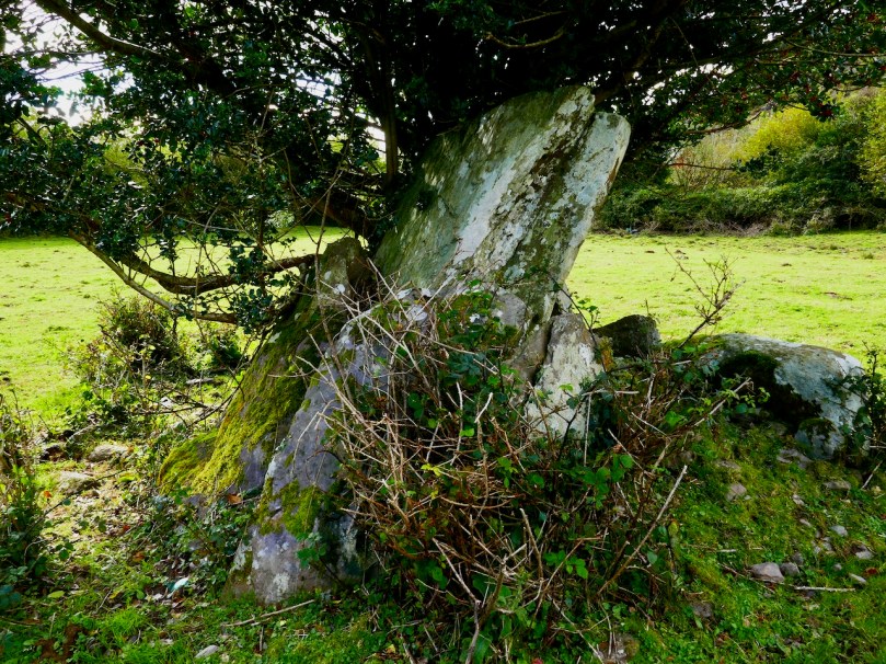
Kilbronogue is a classic wedge tomb, higher and broader at the opening, west, end, and oriented to the west. Some trees have come down, I think, in the last few years, because now there is a clear view to Mount Gabriel from the tomb. I suspect that there is also a view down the Peninsula to the Mizen Peak, although I can’t verify that due to the trees that surround it.
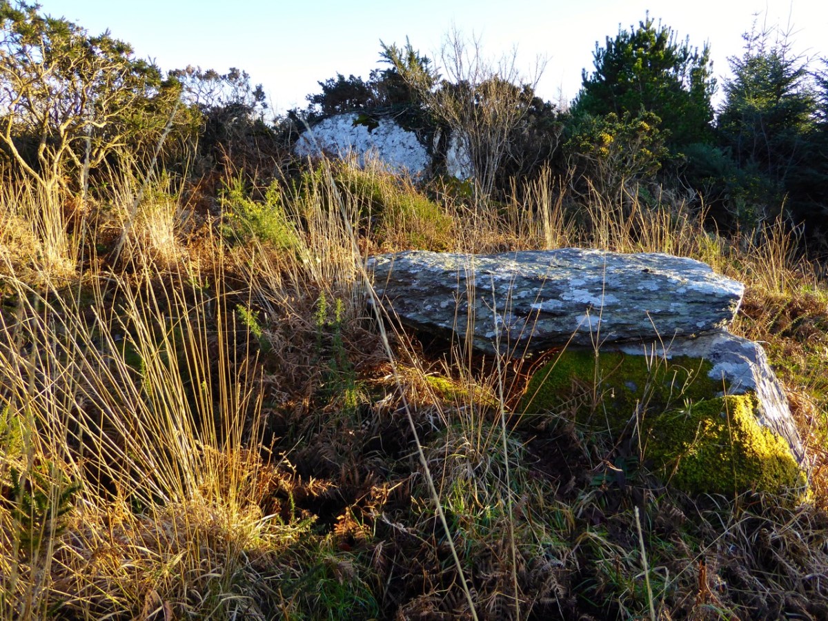
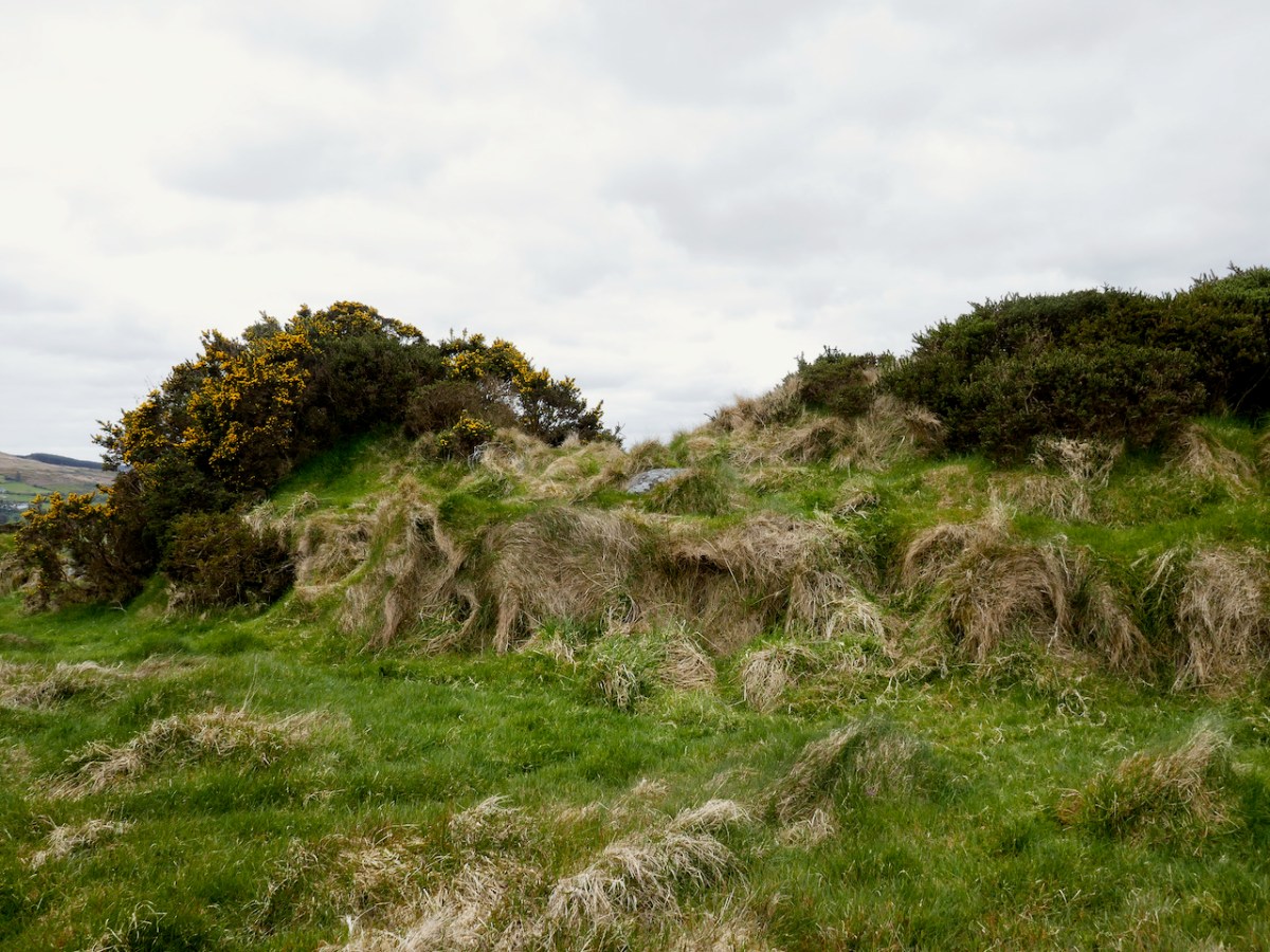
There’s a rock outcrop right behind the tomb (above) and it was probably the source of the stones that built it. Wedges are small megaliths and we can imagine them as the work of a local community or even family group.
The burial rite was cremation, and they generally date to the Early Bronze Age, the time when Mount Gabriel was a source of copper for these early metal workers and farmers.
There is some folklore about it – here’s an extract from the Schools’ Folklore Collection:
There is a Dolmon also in Kielbronogue in a hill which belongs to John ORegan. There is a very big stone on top of three other stones. It weighs one ton. It is said that men lifted it. Some people say that Mass has been celebrated there, and others say a great chieftain of old was buried there.
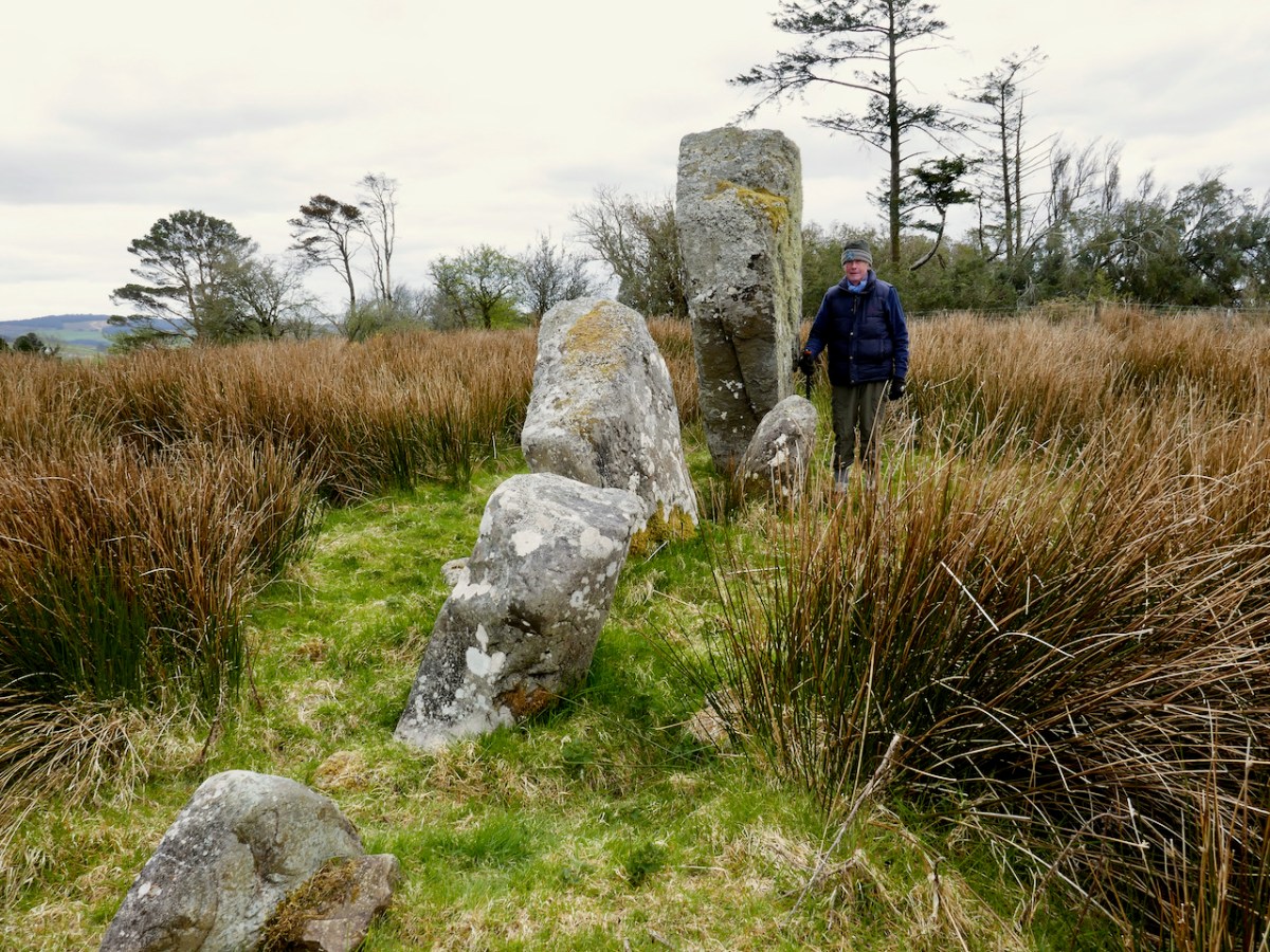
One of the findings at wedge tomb excavations is that white quartz often features as votive offerings, sometimes in the tomb and often in front of it. We had brought along a bag of white quartz pebbles, and each of us laid a pebble on the tomb as our own small thank you to Stevie, our Heritage Hero.
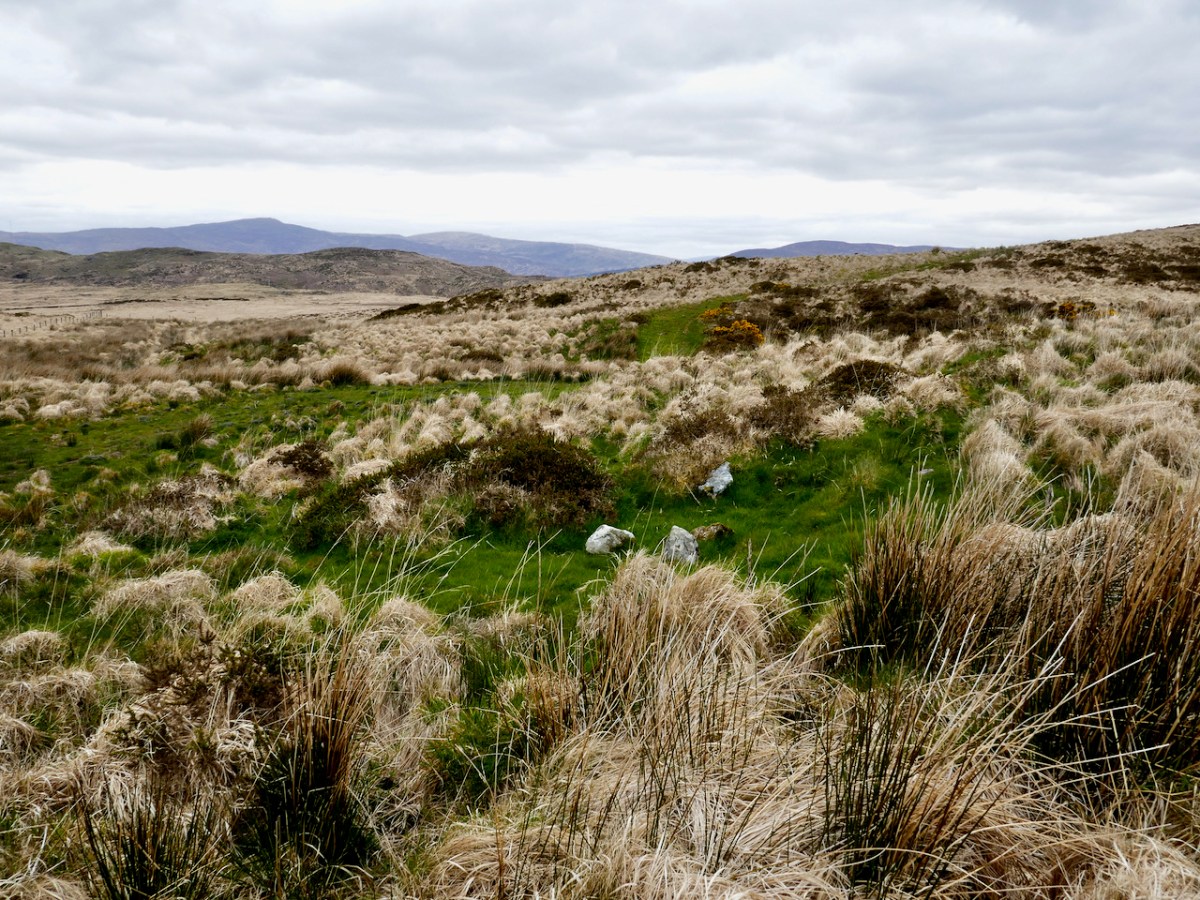
There are twelve wedge tombs on the Mizen, three of which are still on our list to visit. I have written about several of them in many posts, but specifically about the wedge tombs at Cappaghnacallee and Ballydivlin, and at Ballyvogebeg, while Robert has written about the most famous of our prehistoric Mizen Monuments, Altar Wedge Tomb. For a general overview of Wedge Tombs, see Wedge Tombs: Last of the Megaliths.
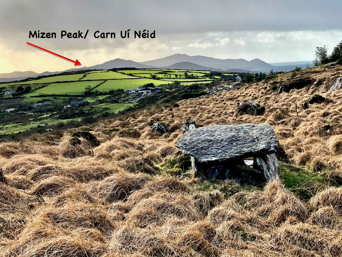
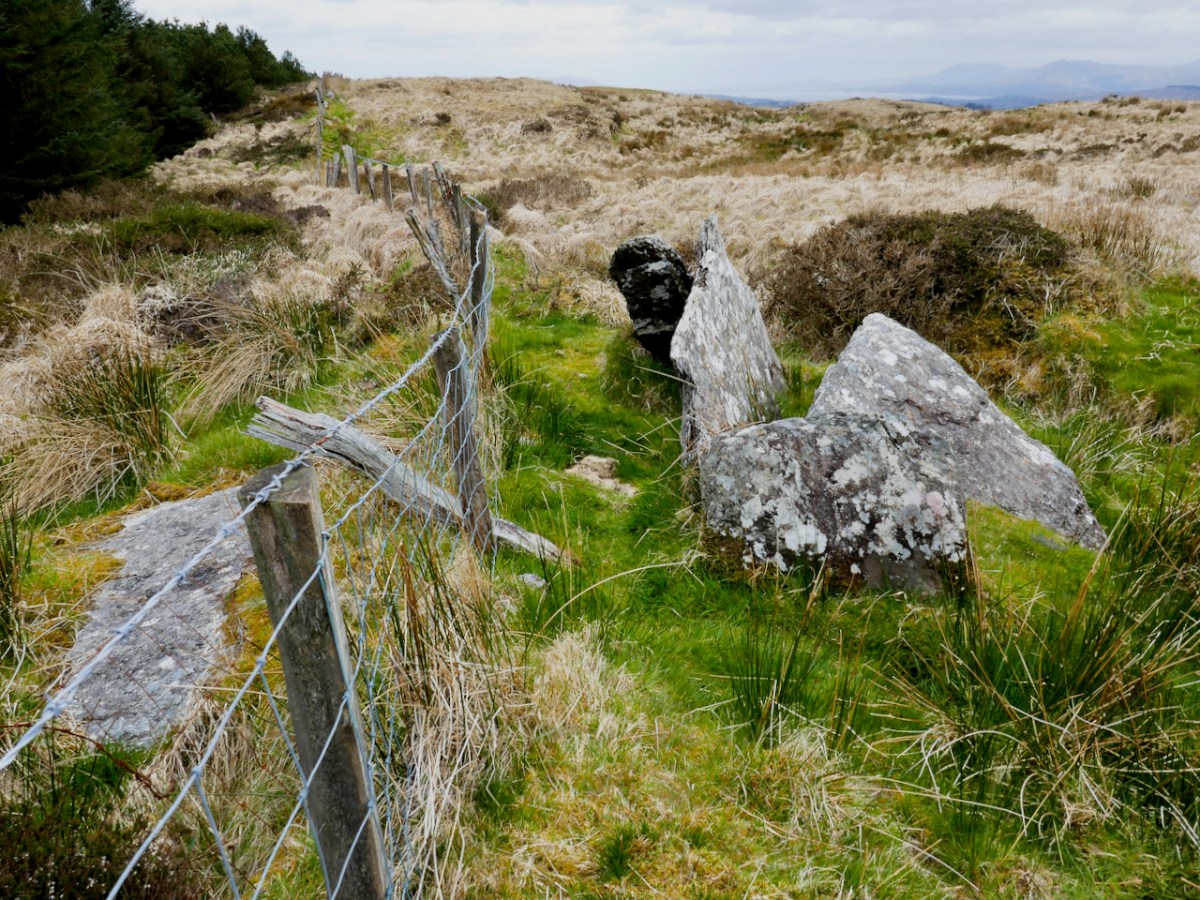
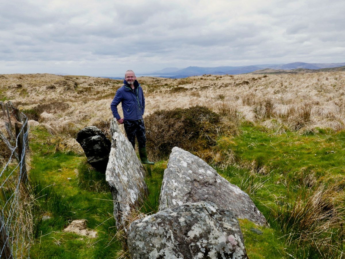
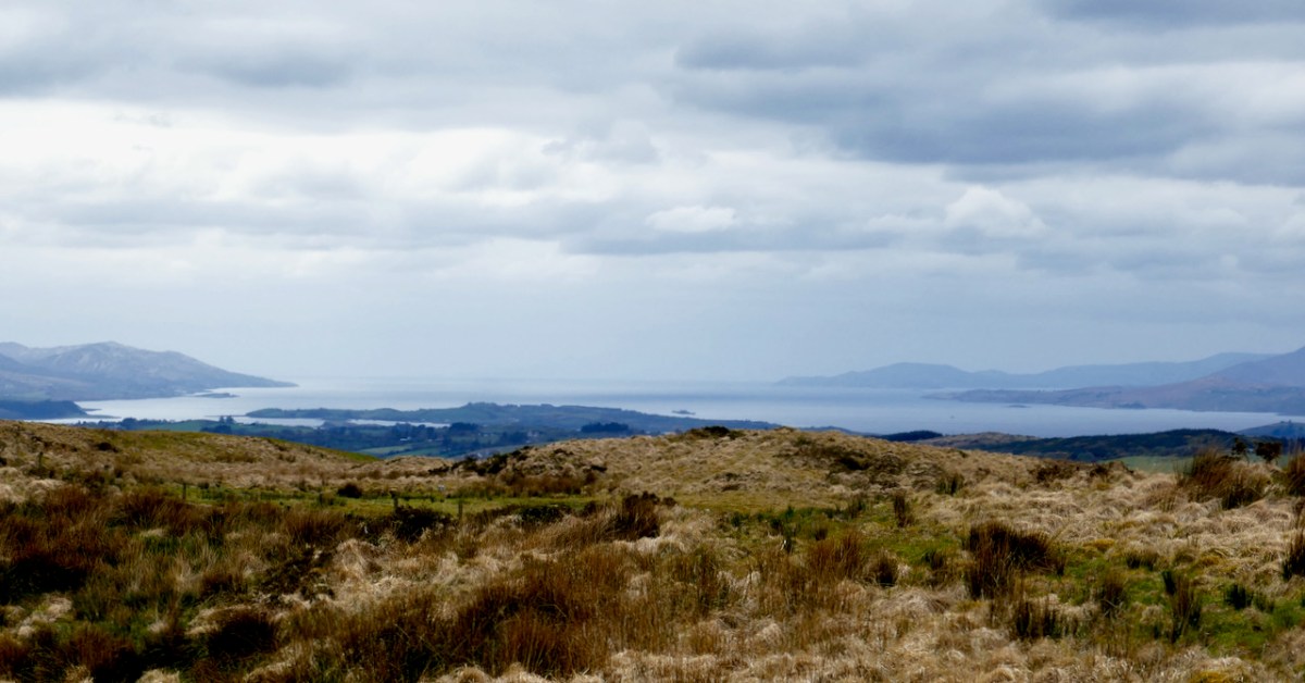
Today’s choice is a beautiful little example in the townland of Ratooragh, which is on the slopes of Ratooragh Mountain, north of Mount Gabriel. The location is fairly typical – on rising ground with good views in several directions.
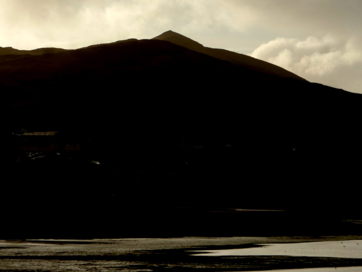
And of course, as all well-behaved wedge tombs are, it is oriented to the west. Like Altar and Ballyvogebeg, it has Mizen Peak in its view, despite the fact that it’s a long way away and is not the most obvious point on the horizon. Perhaps, like those, it’s related to the Handsome Bres.
In the National Monuments description this tomb (CO139-024—-) is described thus:
Chamber (L 2.2m; Wth 1.3m at W end, 0.85m at E) open to SW, covered to E by single roofstone. N and S sides each formed of one slab decreasing in height from W-E; inset backstone at E end, backed to E by parallel slab of equal width and height. Small buttress-stone stands at E end S side; prostrate slab to W of chamber may be displaced roofstone. Traces of mound to N of chamber.
In actuality, the ground is so tufty that it’s not possible to make out any traces of a mound. But the tomb itself is relatively intact, and immediately recognisable, with its sloping roof slab and the sidestones that are taller at the west end. There were two roof slabs, but one has fallen and is in the grass in front of the tomb.
Although off the beaten track, this one was not hard to find in the end, but took a little searching as it’s not exactly where it is shown on the National Monuments map. If you decide to go looking for it yourself, go a bit further than you think you should.
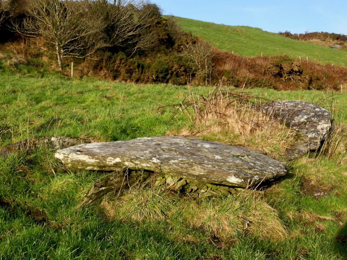
We had, unknowingly, driven past this wedge tomb many times. It’s located on rising ground overlooking the Barley Cove wetlands, in the townland of Ballyvogebeg. The townland name (according to logainm.ie) translates as the Little Place of the O’Buadhaighs, a very scattered clan sometimes translated as Bogue, or Bowe.
The wedge tomb here was formally recorded by archaeologists de Valera and Ó Nualláin in their Survey of the Megalithic Tombs of Ireland in the early 1980s. They provided the scale drawing, below.
It was next surveyed by the Cork Archaeological Survey Team in the early 90s. Oddly, neither of these reports contain any reference to one of the most striking aspect of this megalithic tomb – the cupmarks on the capstones.
The next person to record it was Jack Roberts for his Antiquities of West Cork series, and his drawing clearly shows the cupmarks.
If you are new to this series on Mizen Megaliths, or to megaliths in general, you can catch up with a quick read of my post Wedge Tombs: Last of the Megaliths. This wedge tomb, Ballyvogebeg, fits the pattern, although its ruinous state doesn’t allow us to observe much detail. The side stones have collapsed under the weight of the two large capstones, although you can still see them underneath, leaning at a perilous angle.
De Valera and Ó Nualláin noted that there was no indication of a surrounding mound, which seems to be typical of West Cork wedge tombs. It likely dates to the Copper or Bronze Age, making it around 4,000 years old.
Cupmarks are normally found on open air rocks and boulders, not associated with any monuments and are the most frequent element or motif in Rock Art. However, they are found occasionally on Wedge Tombs and Boulder Burials, so while their occurrence on the Ballyvogebeg wedge tombs is uncommon, it is by no means unique. Intriguing, though! If the tomb had been covered by a mound, they would not have been visible, leading to the conclusion that it was the act of carving them that was important.
Like all of our West Cork wedges, it is oriented towards the west and the setting sun – that is the ‘entrance’ or tallest and widest end, faces the west. The most striking feature of the view is the pyramid-shaped Mizen Peak. What gives the Mizen Peak its distinctive point is a small cairn on its summit.
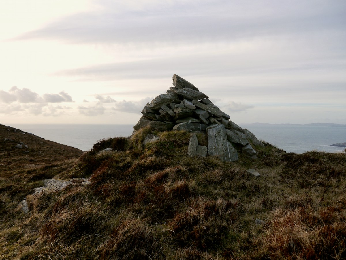
I haven’t yet been up to this cairn, although I am hoping to get there one of these days. So I am relying on the generosity of our friend Michael Mitchell, of theWalking to the Stones Facebook Page, for the photograph below. Like us, he has been struck by the fact that Mizen Peak seems to be visible from many sites, saying, It’s obviously a very important hill. It seems to be a focus for various megaliths, even some that are not on the Mizen peninsula itself. Michael points out that the cairn does not have the appearance of being ancient but more like a marker cairn.
Curiouser and curiouser, because there is very ancient folklore indeed about this cairn, which, in fact, gives its Irish name to Mizen Head – Carn Uí Néid, or the The Cairn of the Grandson of Néid. Which grandson are we talking about here? Néid had a son, Elathen, who in turn had five sons – the Daghda, Oghma, Bres, Alloth and Delbaeth – all of them figure prominently in Irish Mythology as members of the Thuatha Dé Danann.
Bres is the grandson in question, but Bres was his nickname. He was really Eochaid bres – that is Eochaid the Handsome, because everything comely and handsome that is seen in Ireland, ’tis to Bres it is likened. I am getting my information here from a piece written by J. F. L. in the Journal of the Cork Historical and Archaeological Society of 1912 (available online).
The Dinnshenchas of Carn Uí Néid has been translated by Dr Whitley Stokes
Bres, son of Elathan, died there; ’tis he that in the reign of Nechtan Fairhand. . .King of Munster, demanded from every rooftree in Ireland a hundred men’s drink of a hornless dun cow, or of the milk of a cow of some other single colour. So Munster kine were singed by Nechtan with a fire of fern, and then they were smeared with a porridge of the ashes of flaxseed, so that they became dark brown. . . And they also formed three hundred cows of wood, with dark brown pails on their forks in lieu of the udders. These pails were dipped in bog stuff. Then Bres came to inspect the manner of these cattle, and so that they might be milked in his presence . . . All the bog stuff they had was squeezed out as if it was milk. The Irish were under a geis to come thither at the same time, and Bres was under a geis to drink what should be milked there. So three hundred bucketsful of red bog stuff are milked for him and he drinks it all.
JCHAS Notes and Queries Carn Uí Néid, by J. F. L. 1912, Vol 18, 96, Ps 211-213
Of course it’s a huge and unreliable leap from mythology to a wedge tomb, but I can’t help thinking how great it would be if the Ballyvoguebeg wedge tomb was indeed the tomb of Bres, brother of the Daghda, handsome King of Munster, dead from a surfeit of bog stuff.
Megalithic tombs (from ancient Greek mega – great, lithos – stone) dot the Irish countryside and date from the Neolithic period (4,000 to 2,500BC) and the Bronze Age (2,500 to 500BC). The practise of erecting large stone monuments would have entailed significant command of local resources and therefore indicates either a highly co-operative or a highly stratified society. The megaliths were built to last and indeed many have survived, although only a shadow of their original size.
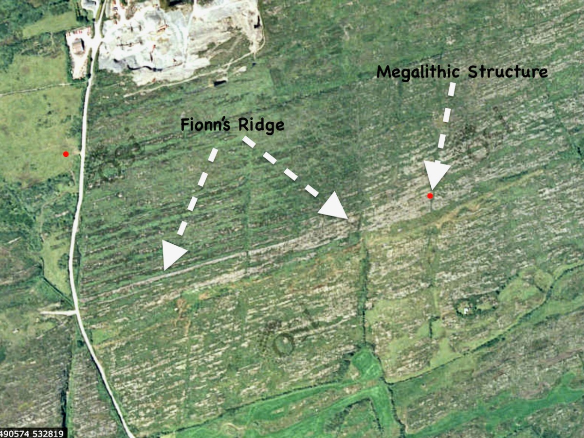
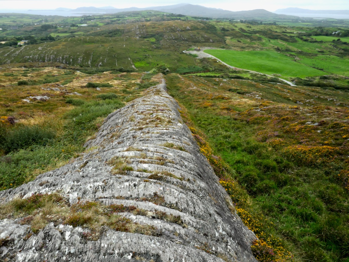
I’m going to start this new series with a curious construction labelled by the National Monuments survey as a ‘megalithic tomb- unclassified’. It’s in the townland of Gubbeen, near Schull, but only barely, as it’s almost on the boundary with the townland to the North, called Glan. What marks the townland boundary here is one of the things that makes this site so fascinating.
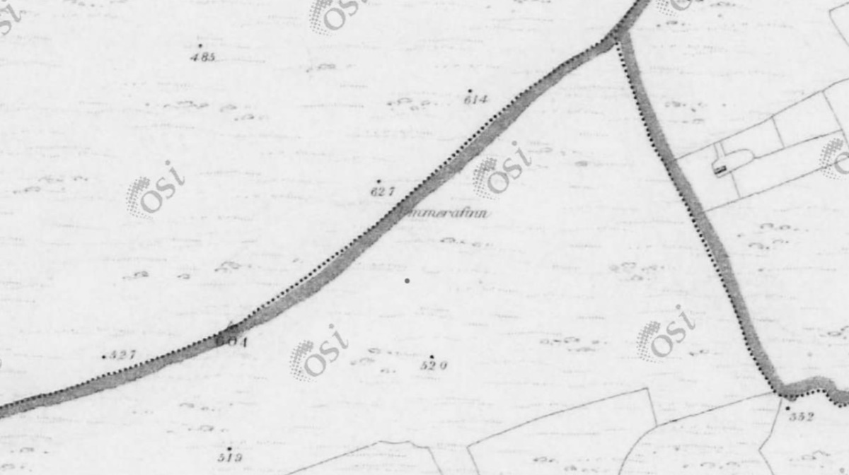
The boundary, instead of the usual stream or old road, is a striking landscape feature called locally Fionn’s Ridge. Originally, it was known as Ummerafinn, from iomaire, meaning a raised strip of earth, such as that made by a plough, and Finn, a common form of the Irish name Fionn, meaning fair-haired. It is marked thus on the Historic 6” Ordnance Survey map which was made in the 1840s – can you make it out, above?
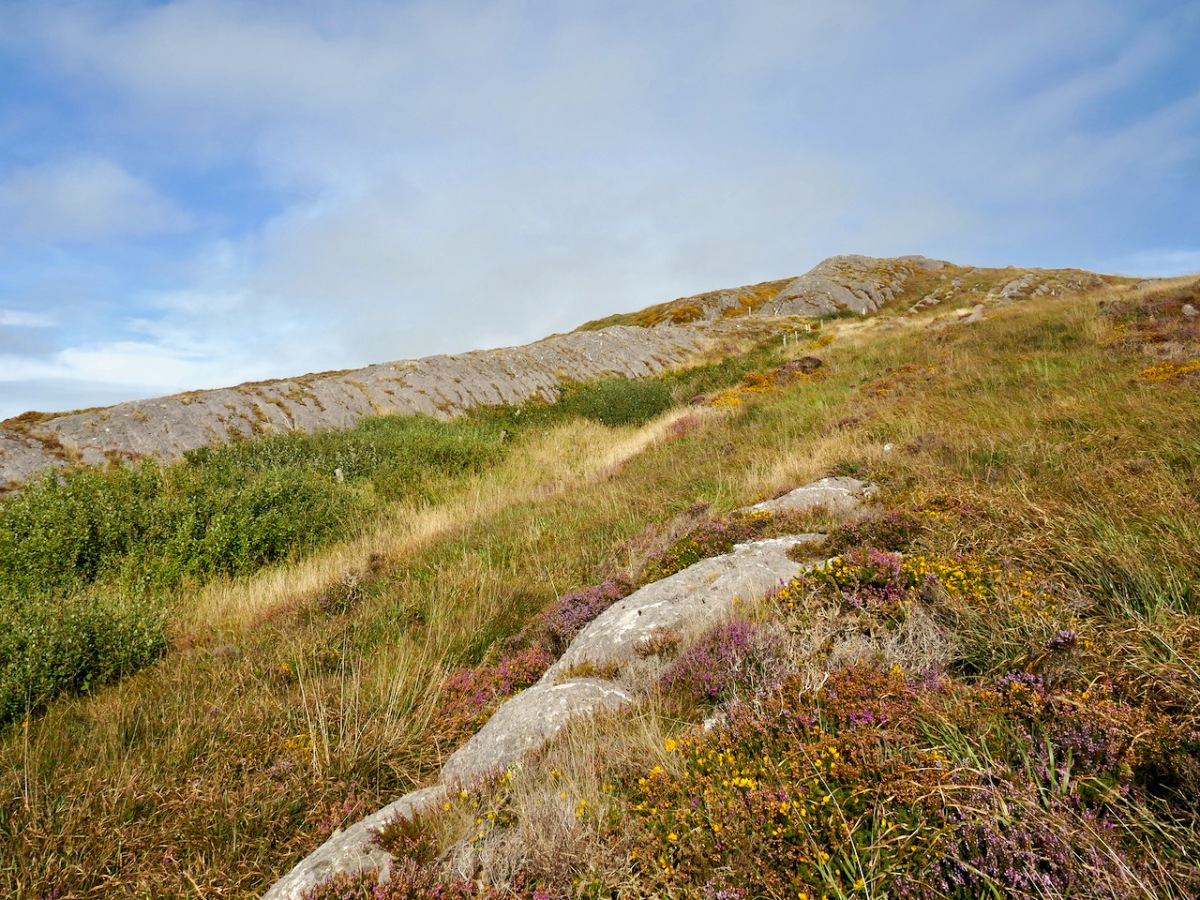
Fionn’s Ridge runs for half a kilometre from the road up to a rocky prominence that is part of Knocknageeha (Hill of the Winds), which in turn is part of the greater mass of Mount Gabriel. As you would expect from such a conspicuous landscape element, it is the subject of much folklore, some of which I detailed in the post Legends of Mount Gabriel: Fionn, Furrows and Fastnet. That post will tell you, if you don’t already know it, more about the legendary Fionn MacCumhaill.
However, when I wrote that post, I hadn’t actually identified Fionn’s Ridge properly. Now, I have not only seen it from several angles, but walked up and down it. The folklore says that Fionn MacCumhaill ploughed the furrow with two rams and a wooden plough and indeed what we see now does bear a resemblance, not to a furrow but to the raised rounded spine (on one side of the furrow) which results when a plough cuts and turns over earth.
The ridge leads almost straight up to the megalith. This is unlikely to be a coincidence – Neolithic people were as struck as we are by such strange phenomena in their surroundings. When they decided to build the structure at a spot right at the top of it, they may have been influenced by several factors. They may, for example, have used the ridge as a road or as a ceremonial processional route up to the megalith. It is ideal for such a purpose. Like us, they may have had folklore that spoke of a giant and his plough.
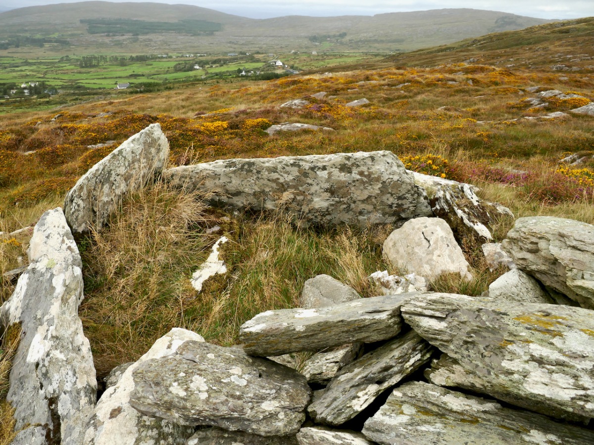
Let us turn now to the megalith. Here’s the National Monuments description: Ruined chamber (L 3.1m; Wth 2.2m at W end, c. 0.6m at E) aligned ENE-WSW, formed of inclined slabs. Structure incorporated in circular cairn. Traces of low dry-stone kerb survive at N, W and S.
The first thing we can say for certain is that is is not a wedge tomb. Take a look at my post Wedge Tombs: Last of the Megalithsfor a complete description of this type of monument, which belongs to the Bronze Age. Wedge tombs are the most common megaliths on the Mizen – there are 12 listed. Of these, I have stated my doubts about the Giant’s Grave in Arduslough, based on its hilltop setting and the traces of a mound delineated by kerbstones.
Here we have the same issue – the siting is not typical of wedge tombs, none of which, on the Mizen at least, are on hilltops (apart from Arduslough). Wedge tombs are oriented to the setting sun in the Western sky – that is, the tallest and broadest section, the entrance, is always to the west. In Gubbeen, it is clear that there is no opening to the west – instead what we see is the wall of a roundish chamber. It is impossible to make out exactly where the entrance was for certain, because of piled-up rocks, but it was at the eastern side, with an orientation towards the rising sun, and Mount Gabriel.
As noted by National Monuments, there are traces of a kerb, although it’s hard to be definitive about this. The collapsed pile of rocks as the eastern end may have been simply piled up there in modern times – but they may also be from a collapsed roof.
Where am I going with this? I posit that this may be, in fact, a passage grave. Several features (hilltop setting, sunrise orientation, internal chamber, kerb) set it more obviously in the passage grave tradition than in the wedge tomb tradition. There may be an archaeological bias against labelling such structures as passage tombs, since it has been considered that passage tomb distribution was in the northern half of the island.
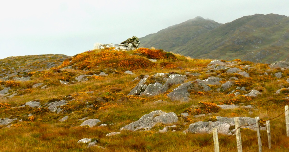
In fact, it is not unlike the passage tomb on Cape Clear, the position of which is clearly visible from this one – that’s it on the horizon, above. Inter-visibility is a feature of passage graves. There is also a similar anomalous megalithic structure on a high point on Sheep’s Head – also clearly visible.
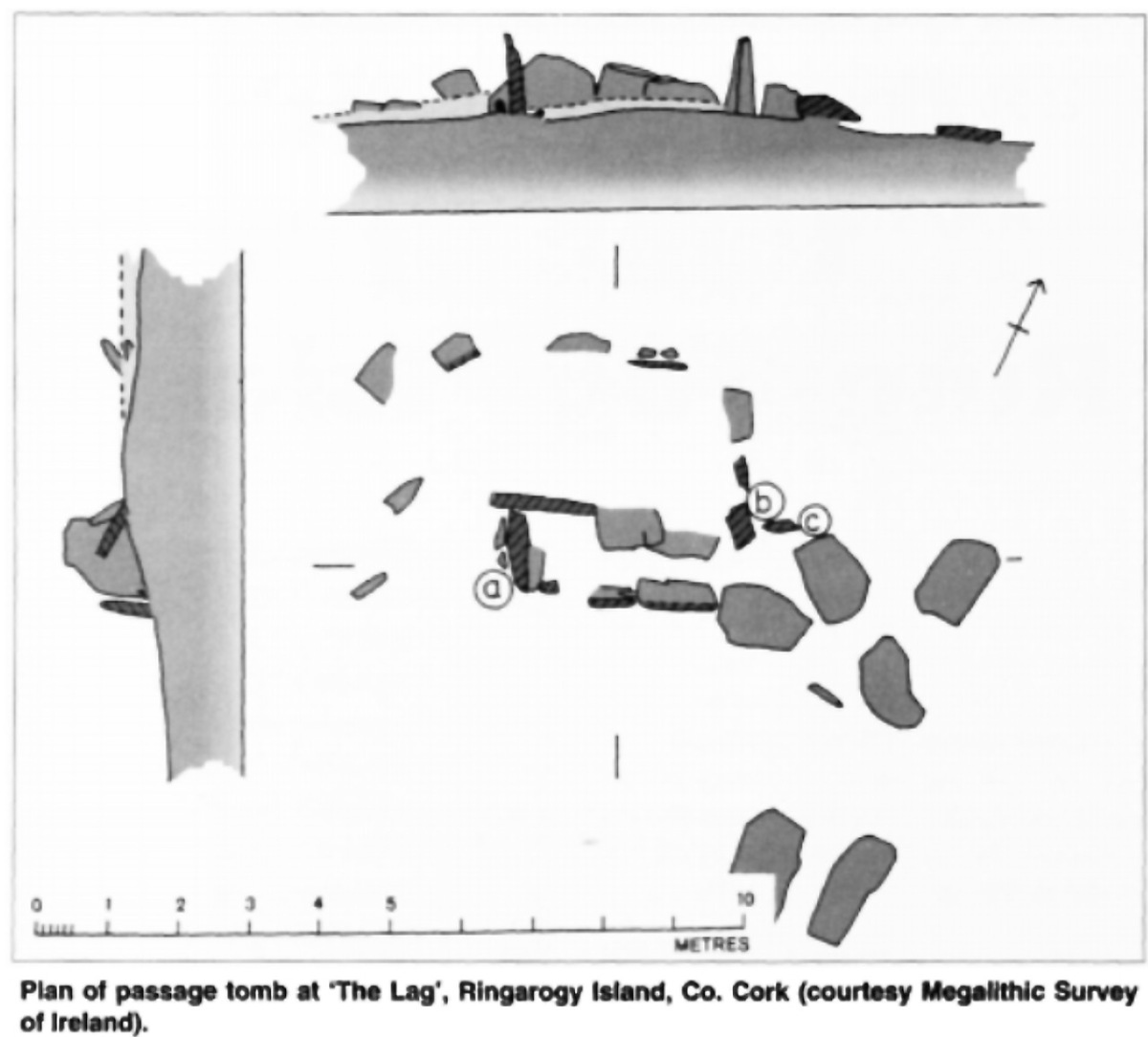
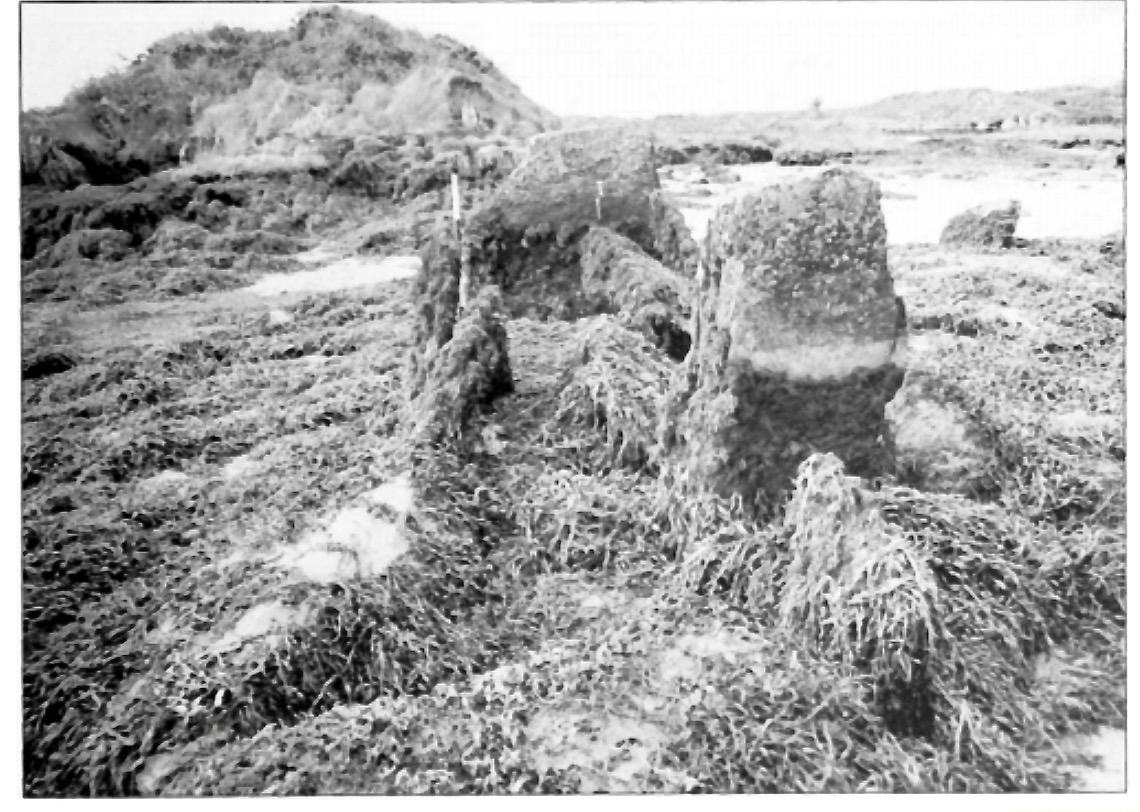
The other structure that has been identified as a passage tomb in this area is in The Lag, between Ringarogy Island and the mainland. Elizabeth Shee Twohig identified it, and placed it and Cape Clear within a group of ‘undifferentiated’ passage tombs (by which she means that there is no clear differentiation between the passage and the chamber as there is, for example in Newgrange) known from Waterford and South Tipperary. All except The Lag occupy high ground, although not summits. Above is her plan of the tomb and below is her photograph, both images from her article on The Lag in Archaeology Ireland Vol. 9, No. 4 (Winter, 1995), pp. 7-9, available here for those with a Jstor account.
So – in many ways, Gubbeen fits with what we know about the southern spread of a passage grave tradition. It’s time for a re-evaluation of passage graves in this part of Ireland. They may well turn out to be much more common than we have admitted hitherto.
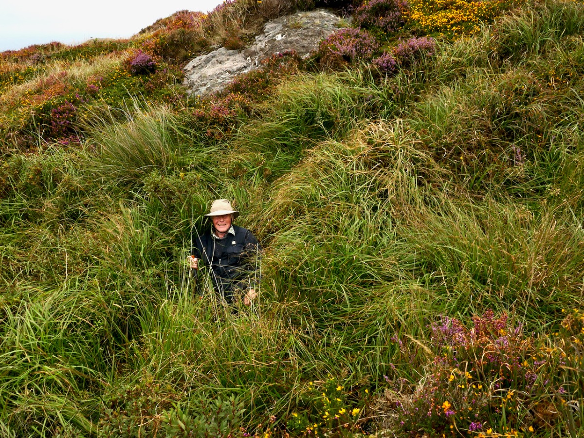
We have visited this site so you don’t have to. It’s private land and very difficult to access and there is no way onto Fionn’s Ridge from the road, despite the fact that it terminates close to the road. Our trek, taken with the permission of the landowner, who warned us, was quite hazardous – more than once we ended up falling through the bracken or caught on the wrong side of barbed wire.
If we ever find an easy way up, we will amend the post – meanwhile, we don’t recommend trying it yourself.
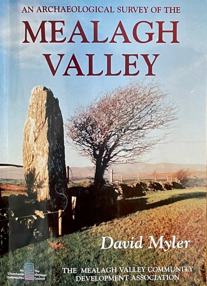
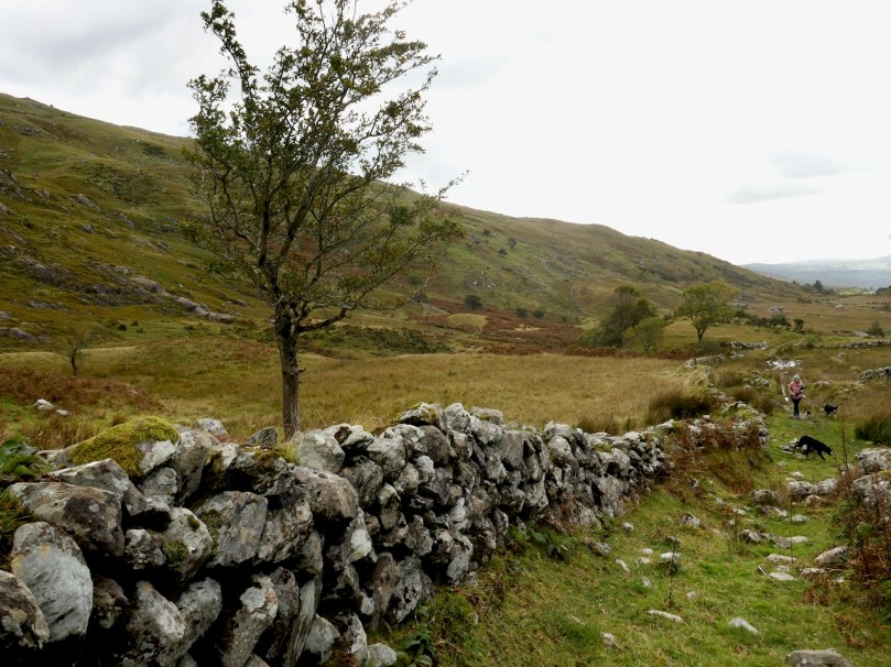
The Mealagh Valley (locals pronounce it Maylock) runs from Bantry Bay to the Maughanaclea (Maw-na-clay) hills and through this valley the Mealagh River flows from north east to south west. Along the valley are found numerous ancient monuments, evidence of occupation from the earliest times. David Myler, some years ago, with support from other local people, undertook to survey all the archaeological sites in the area and the result was this book. Sorry – it’s out of print and we are glad we managed to pick up a copy several years ago.
David and I have been in virtual touch for quite a while through social media, promising to meet up and explore when we got a chance – and that finally happened on Friday! Along the way we discovered family connections, so it was no wonder I felt an instant kinship when we met – we bonded over archaeology and shared family stories. David, a Dubliner originally, has been living here for decades and in that time has taken courses in archaeology and developed a passion for the heritage of this – his territory.
It was a joy to be taken on a field trip by the man who has, literally, written the book about the archaeology of the Mealagh Valley. It’s only the first of many, I hope, since we really only got to sample a few of the sites this time – although, as you will see, the places he took us were pretty spectacular!
David had secured all the permissions we needed to visit the sites on private land. We started out in the townland of Ardrah (Árd Rath – high fort) with a ring fort (above) commanding panoramic views of the surrounding countryside. A ring fort (also called a rath, lios, dún, or cashel if made of stone) was the dwelling of a high-status individual in early medieval Ireland and examples like this probably date to 500 AD to 1,000 AD. The banks had traces of stone here and there so may well have been faced with stone, and the interior had been levelled.
There would have been a house and perhaps other buildings inside, and a wooden pallisade fence on top of the surrounding bank. There’s a good summary of what we know about ring forts in this engaging website about Irish mythology – I especially enjoy the writer’s comments on the use of ‘fairy fort’ to describe these structures.
From there we climbed a couple of fences – the first of several fence-climbing incidents during the day and thanks to David for sacrificing his jacket to save us from the barbed wire – and trekked uphill. The monument started to reveal itself as we got higher – at first I thought it was a standing stone.
No – a stone pair?
What, there’s more?
This is the Ardrah stone row, consisting of fours stones aligned ENE/WSW, a common alignment for stone pairs and rows. Take a quick trip over to Standing Stone Pairs: A Visit to Foherlagh for more about this kind of monument. You will see that this one is pretty typical – it has an orientation to the south west, consists of stones that could be interpreted as ‘male’ and ‘female’ and the stones rise in height towards the SW. The southernmost stone is enormous – Robert is providing the scale.
But wait, I hear you say – I see five stones, not four! And you are right. there are five stones, whereas originally there had been only four, and all the records state that this row consists of four stones. The photograph in David’s book, which dates to 1998, clearly shows four.
So – where did the fifth, and smallest, stone come from? It’s a head-scratcher and all we can do is point to the presence of the nearby fairy fort and speculate that the Other Crowd are messing with us.
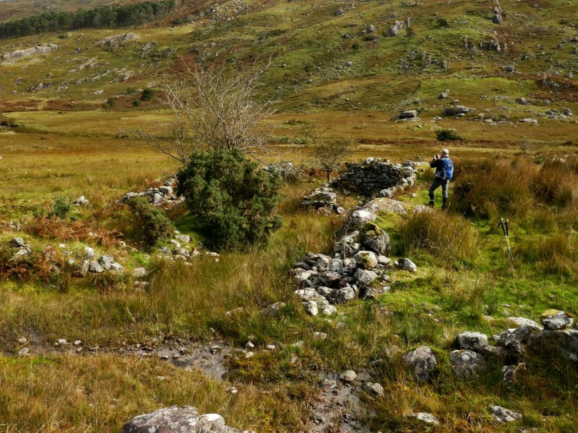
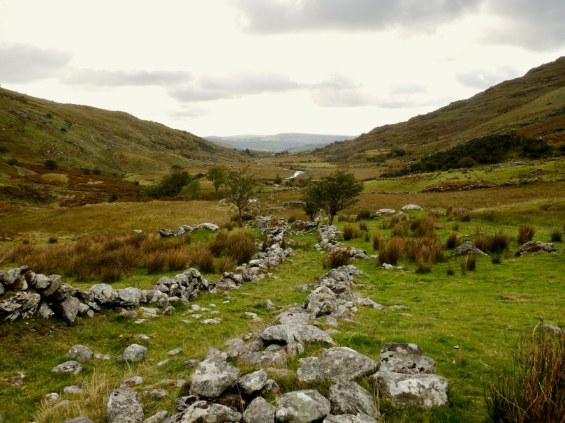
And then it was on to the piece of prehistory that David discovered in the course of his survey. I should explain here that much of what the Mealagh Valley group was documenting was already known, since the whole county had been surveyed in the 1980s. But what the County Survey lists and what a local group like this looks at, will differ – for example, this group was interested in folklore and local stories about the monuments they visited and about items of interest beyond the remit of the county survey. Moreover, because they are local themselves, they are likely to be contacted if anyone spots an unusual rock or such like, and can be on the spot to examine new ‘finds’. Finally, a project like this generates appreciation and pride in, and a sense of ownership of, one’s heritage, and thus, hopefully, less likelihood of monuments being damaged.
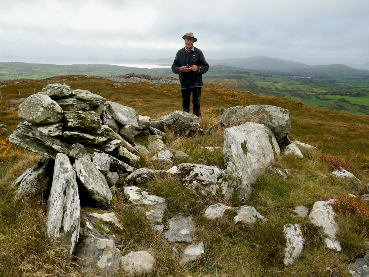
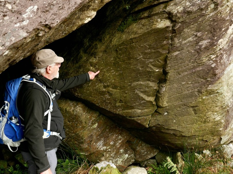
David had been alerted by a farmer to a ‘funny pile of stones’ on the boundaries of the townlands of Ardrah and Gortnacowly (Gort na Camhlaigh – field of the ruins), an area that had been impacted by forestry activity. It’s quite high up and the views are immense. As we walked up, it sent shivers down our spines as David related how he hunted around for what had been described to him, almost giving up, and finally stumbling upon the mangled remains of what he instantly recognised as a Bronze Age wedge tomb.
A digger clearing out a drainage ditch had inflicted damage but most of the stones were still lying around. One side of the tomb, and the back stone, were in situ. That’s probably the capstone, or one of them, on the other side of the fence.
As an archaeologist, it’s actually quite rare in Ireland to discover a previously unrecorded monument – having done so once or twice I know what a thrill it is. David’s wedge tomb is a classic of its type – see my post Wedge Tombs: Last of the Megaliths for more about them. That’s David above, showing us how to make sense of the stones, both those in situ and those which have been disturbed. He was able to ascertain that the workings in the area had turned up quartz pebbles – a feature of several West Cork wedge tombs.
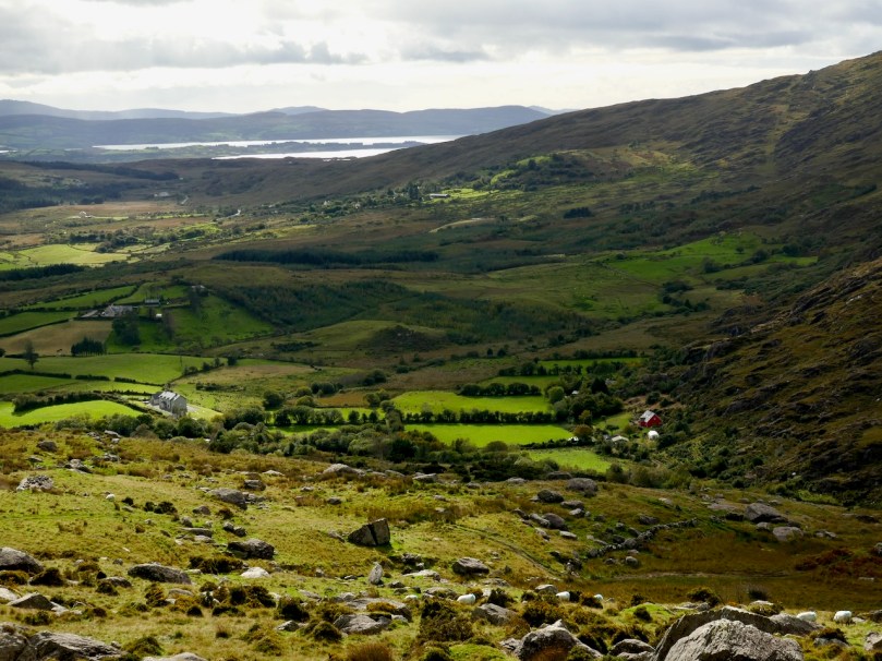
This one was, as expected, oriented towards the setting sun – but that doesn’t begin to describe the incredible sweep of the view from this point – the whole of Bantry Bay lay before us, with the Beara on one side and Sheep’s Head on the other.
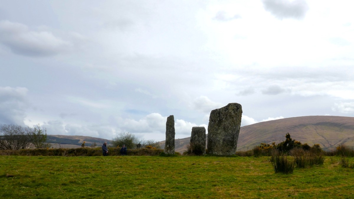
Our final visit of the day was to a type of monument I had never seen before – a ‘Four Poster’. That’s it, above, and note that there is a distant view of the sea, ten kilometres away, from it.
Only five four posters have been recorded in Ireland, one in Wexford, one in Kerry and the other four in West Cork. Here’s what the National Monuments site has to say about them: An arrangement of four upright stones standing at the corners of an irregular quadrilateral. The stones are usually graded in height with the tallest stone at either the south-west or north-east corner. Their closest counterparts are to be found in northern England and Scotland. These monuments are closely related to stone circles in date and function though they are much less numerous. These are dated to the Bronze Age (c. 2400-500 BC).
There are, in fact, only three stones remaining here. The largest stone is massive and of course there are all kind of alignment possibilities with arrangements like this. The closest counterpart to these four posters are to be found in Northern England and Scotland. There have been no excavations at four posters in Ireland but those few which have been dug in Britain yielded a Bronze Age range of dates.
We saw some other things along the way – a booley (above), a hedge school, a mass rock – and Robert wants to write in the future about one particular site, so I won’t deal with it here. The day was cold and crisp – but you hardly notice little things like freezing hands with a landscape like this to wander around in.
What a great day! Thank you, David, for being our tour guide and friend and we look forward to returning the favour soon.
Yesterday we went back to the Bealick – back to the valley of Cooleenlemane that so entranced Robert and me that both of us wrote about the experience last year. I concentrated on the Bealick (pronounced Bay-lick) – the ‘caves’ containing ancient rock scribings and my post was called Witches’ Marks and Lovelorn Shepherds: Inscribed Rock Art in a Remote Valley. Robert wrote about the valley itself, through geological and historical time in his post, Cooleenlemane – A Walk Into History. What more could we have to say about this impossibly beautiful place? Lots, it turns out.
The red house at the bottom right marks our starting off point. In the distance is Bantry Bay and Whiddy Island
We took the walk in the company of our favourite travelling companions, Peter (of the Hikelines Blog) and Amanda (Holy Wells of Cork and Kerry). We had been missing them badly as they had been in New Zealand when the pandemic struck, unable to get home for six months. It felt really good to be out and about with them again.
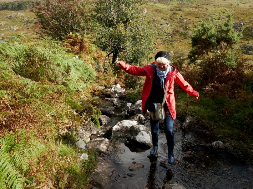
Amanda fords one of the many streams (it was a wet walk!) and Peter points out some of the scribings in the Bealick
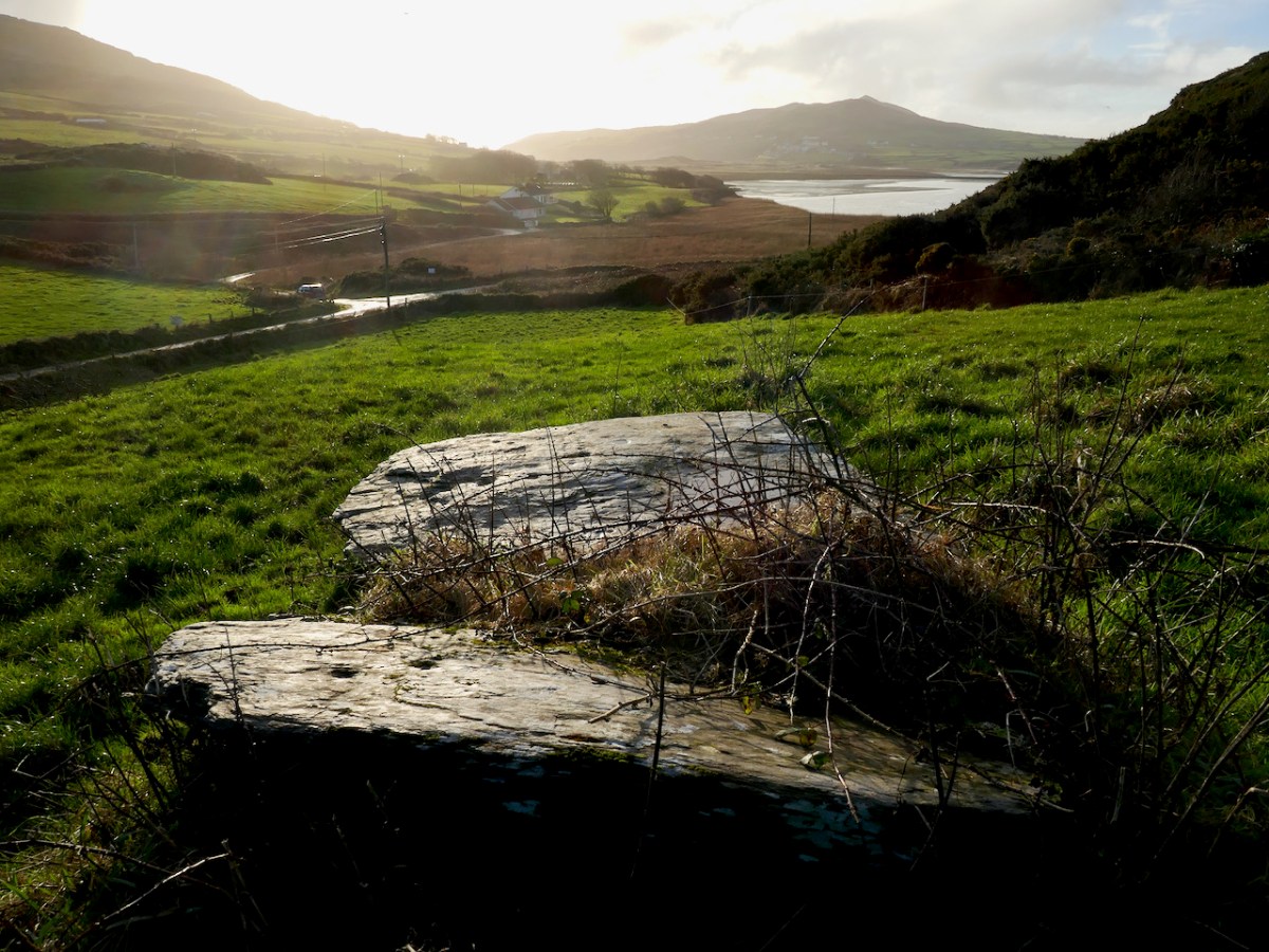
Apart from the jaw-dropping scenery and the sheer pleasure of a hike into a relatively untouched valley, this time I found myself drawn to the evidence of occupation over time, starting in the Bronze Age. At the entrance to the valley and right beside a ford across the river stands what is described in the National Monuments inventory as a ‘Megalithic Structure. . .the exact nature of which is unknown.”
It’s in the middle of a small clearing, with a Hawthorn tree growing out of it – altogether a magical sight. It could be what remains of a wedge tomb – see my post Wedge Tombs: Last of the Megaliths to learn more about this type of monument.
I wondered how ancient the ford might be. For most of the length of the Cooleenlemane River as it runs down the valley it is easy to cross with the help of a stone or two, but in this spot it widens. Although no longer in use now, this type of crossing place is often of considerable antiquity – indeed one of the most common place names in Ireland contain the word áth (pronounced awe) which means ‘ford.’
Leaving the megalith, we followed the course of the stream up the valley, mostly trying to select higher and slightly dryer ground, and trying not to get too distracted by the oh-so-photographical scenery all around us. Ruins of small stone cottages dotted the landscape, and a tiny cart track runs the length of the valley almost to the Bealick.
The National Monuments inventory also lists a cashel, two enclosures, and two hut sites in the valley. We passed the Cashel half way between Furze Hill and the Bealick, although we actually obtained the best views of it from the Priests Leap Road afterwards.
The upper photograph shows Furze Hill, the dark patch on the left, and the Bealick just above the bend in the river. The cashel is half way between them. The lower photograph is a closer look at the cashel
Cashels are ring forts made of stone rather than earthen banks. They are considered to be the farmhouse enclosures of high-status individuals (you can see an exceptionally good example at Knockdrum – see Robert’s post Knockdrum Stone Fort to understand how they functioned). This one is clear but very ruined, circular in plan, about 17m across.
It probably dates either to the late Iron Age or the Early Medieval Period – anywhere in the first millennium AD. Like other cashels, it has clear sight-lines down the valley and was built to be visible and a statement of status and power.
We didn’t hike up to the enclosures or hut sites further up the valley – a walk for another day. I think Peter (above) is already plotting his course up there. The most southerly of the enclosures sounds interesting, with an entrance marked by upright stones and a levelled interior. There is no way of knowing how old these are, of course, but taken with the megalithic structure and the cashel, they do indicate that this valley has been lived in and worked for thousands of years.
And then there’s the Bealick itself – the three ‘caves’ formed by massive rocks leaning against each other, two of which contain the rock scribings. In the way of such unique places they become special features of the landscape and take on a mantle of history. In this case, the Bealick was a Mass Rock, a home, a sheep-shelter, and a mysterious repository of enigmatic markings.
On our walk yesterday we became aware that we were not the only ones in the valley. Along came Mary, with four very well-behaved dogs, on the look-out, she told us, for her brother’s cattle.
From the top: a field enclosed with stone walls runs up the steep slope; lazy beds in an old field; a ruined cottage surrounded by tiny haggards (a haggard is a small enclosure beside a house)
She explained that the land was commonage and that it hadn’t been lived in, in living memory – probably abandoned not long after the Famine, she thought. She pointed out locations of what she called ‘cowlocks’ or small homestead here and there, with their associated potato patches recognisable by the lazy bed ridges still visible in the small fields. She told us the prominent knoll we had passed was called Furze Hill.
She pointed to a cliff above the Bealick (both images above) and named it as `Carrignasprogue’. A direct transliteration from Irish, this is Carraig na Spioróg, or Rock of the Sparrowhawks. It’s a particularly dangerous place for sheep, she said, as they tend to get trapped at the bottom of the sheer part and have to be rescued. Every field, every bend on the river and every prominent rock would have had its own name, enabling those who lived in the valley to know exactly what part was being referred to.
Nowadays, several families share the valley, grazing sheep and cattle in it and for the most part leaving them to their own devices. The grazing has kept the valley relatively clear – we saw little evidence of overgrowth of gorse or bracken and none of the rhododendron invasions that plague the Killarney National Park not so far away. One hesitates to use the word pristine nowadays, but the sense I have is of a remote place that hasn’t changed much in hundreds of years. Long may it remain so.
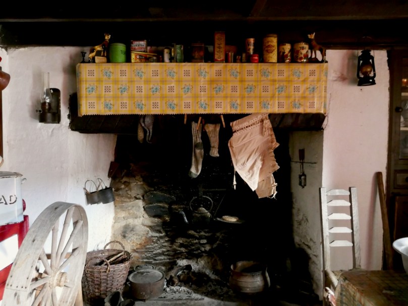
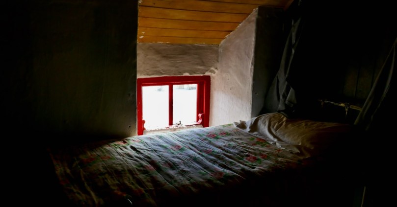
We drove home a circuitous route, up over the Priests Leap Road into Kerry and back over the Caha Pass into Cork. We were delighted to find Molly Gallivan’s open and serving tea and scones. There’s a tiny cottage attached, reconstructed in the style of the traditional Irish farmhouse and I was especially struck by this bedroom – it could have been in one of those tiny Cowlocks we passed by in the valley earlier.
Welcome to the UCD Library Cultural Heritage Collections blog. Discover and explore the historical treasures housed within our Archives, Special Collections, National Folklore Collection and Digital Library