A Holy Place of the Druids: A Stone Circle Mystery

A painting by Edith Somerville* is the subject of this week’s detective story – we know it is a West Cork stone circle – but which one? [See the end of the post for the proper citation for the painting.] In a recent piece in the Irish Arts Review, Michael Waldron, Curator of Collections & Special Projects at the Crawford, wrote about Edith Somerville as a painter. We are so used to thinking of her as a writer, especially in her collaboration with her cousin, Violet Martin, (they wrote as Somerville and Ross), that we forgot that she was also an accomplished artist (and a Master of the Foxhounds, as in this portrait).

She had trained in Dusseldorf and Paris. The DIB entry says 

In the second half of the 1880s she was active as a professional illustrator for the Lady’s Pictorial and the Graphic, later illustrating some of her own prose and that written in collaboration. She had exhibitions at the Goupil Gallery in London (1920), Walker’s Gallery, London (1923, 1927), and the Ackermann Galleries, New York (1929).

Edith’s favourite brother was Boyle, about whom I have written here and here. Boyle had gone to sea at the early age of 13, eventually rising up to become a Vice-Admiral. He had, in retirement, come back to live in Castletownshend in 1924.

He was an experienced surveyor and had become fascinated by archaeology, and particularly the investigations of the astronomer, Norman Lockyer, who had established the solar orientation of several ancient monuments around the world and had shown that the stone circles of Scotland were oriented towards celestial events such as solstices or towards bright stars. These stone circles were very similar to West Cork stone circles, in that they had recumbents and portals, establishing the alignment of the circle. Boyle had done the first accurate survey of the Callanish Stone Circle (below)*, before he turned his attention to West Cork.

Edith accompanied Boyle on many of their expeditions, as she had when they were children. While he was busy with his chains and theodolites, she set up her easel and sketched or painted. One of the paintings she produced was titled A Holy Place of the Druids or Grave of a Chieftain. This painting, which Michael used in his article for the Irish Arts Review, is in the possession of the Crawford Art Gallery, and I have been given permission to reproduce it for this blog post. It is my lead image, and below is a detail showing her signature.

In chatting with Michael about his article, I discovered that the monument she had painted had not been identified. Some were convinced it was Drombeg Stone Circle, while others thought it might be the one in Reenascreena. I was pretty sure I knew which one it was, but told him I wanted to visit the site to be sure to be sure, before I committed myself.  

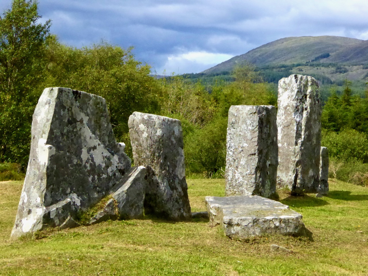
The site I had in mind was Bohonagh (above), one of the stone circles Boyle surveyed for his paper Five Stone Circles, in the 1930 edition of the Journal of the Cork Historical and Archaeological Society. The thing is, it doesn’t look now the way it did when Edith painted it, so unless you knew why this was, you were unlikely to see it as the subject of her painting. Here is Boyle’s plan of the monument as he surveyed it.

And here is the photograph that accompanies that article taken from behind the recumbent, looking towards the portals. Both the plan and the photograph show 6 erect stones.

Bohonagh Stone Circle was excavated by Edward Fahy in 1959. The report of his excavation was published as A Stone Circle Hut and Dolmen at Bohonagh, Co. Cork, in 1961, in the same journal in which Boyle had described the monument 30 years before. In that report, Fahy describes how he re-erected three orthostats for which the evidence was clear, in the form of the stones themselves, now fallen forwards, and their sockets (the cross-hatched stones in the plan below). So now, instead of six orthostats, as depicted in Boyle’s photograph, there are 9 tall stones. 

He also, as he had at Drombeg, placed shorter ‘marker stones’ to indicated the positions of missing orthostats. Although he did not document it in the text of his report, we can see the marker stones clearly in his photograph below. The Bohonagh Stone Circle, therefore, now has the full complement of all 13 of its stones, with no signage at the site to help the visitor identify the differences between all those standing stones. 

A few weeks ago I went out there with my friend Adrienne to see if we could clarify the situation. Using both Boyle and Fahy’s site surveys, Fahy’s report, and our own observations regarding the marker stones, we made a short video.

Note the height of the bracken – it made photographing the circle impossible and I wished I had brought a machete.

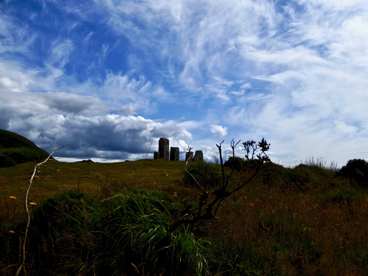
Next we stumbled around the site outside the circle, beating our way through the bracken, until we located the exact spot where Edith had sat to paint the scene. Remind yourself of the painting and then watch this short video.

Note particularly how accurately she captured not just the stone circle but also the surrounding landscape. 

So we have identified Edith’s Holy Place of the Druids. And perhaps, despite this being a cringe-y title, it’s not all that far off the truth. There is some evidence at Drombeg and at Bohonagh that the site was used for ritual purposes and that implies a priestly class. Edith used the word Druid, not unusual for her time, although that idea that Druids built stone circles is really an 18th century invention. 

We know the word originally from classical writers: Caesar for example used it to describe learned men encountered through the Roman conquests who functioned as priests and judges. ‘Druid’ was revived in the 18th century by antiquarians: William Stukeley popularised it when he proposed that Stonehenge and Avebury were the religious products of an early ‘Celtic’ Druid culture. They were druidic temples, he said, and even though he was wrong (being out by a couple of thousand years), so persuasive was he that the romantic idea of druids has persisted ever since in the popular imagination. Our old friend Vallancey was also fond of druids.

Spectators gather at Stonehenge to watch a group of Druids carry out the Dawn Ceremony on the summer solstice, or longest day of the year, © 1956 Getty

So there was Boyle with his instruments, his rigorous measurements and his archaeological knowledge, using evidence-based methodology to come to conclusions about solar alignments. And there was Edith with her paints and her canvas, painting what she saw, but labelling it as the work of a putative priestly class. What is amazing, actually, is that none of that interfered with her ability to produce on canvas a hyper-accurate treatment of the Bohonagh Stone circle as it was before her eyes. And perhaps her second title, Grave of a Chieftain, is a more prescient one, since Fahy did find cremated bone in a pit within the stone circle.

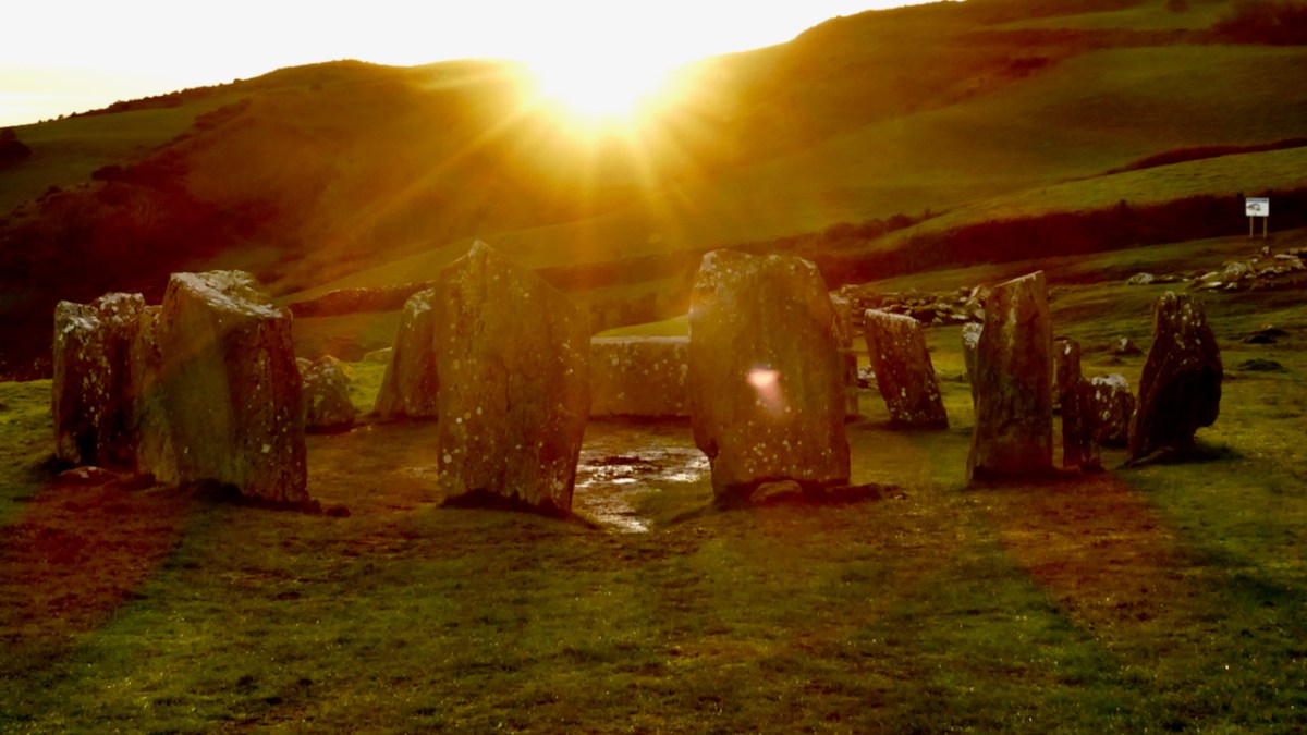
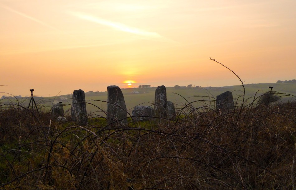
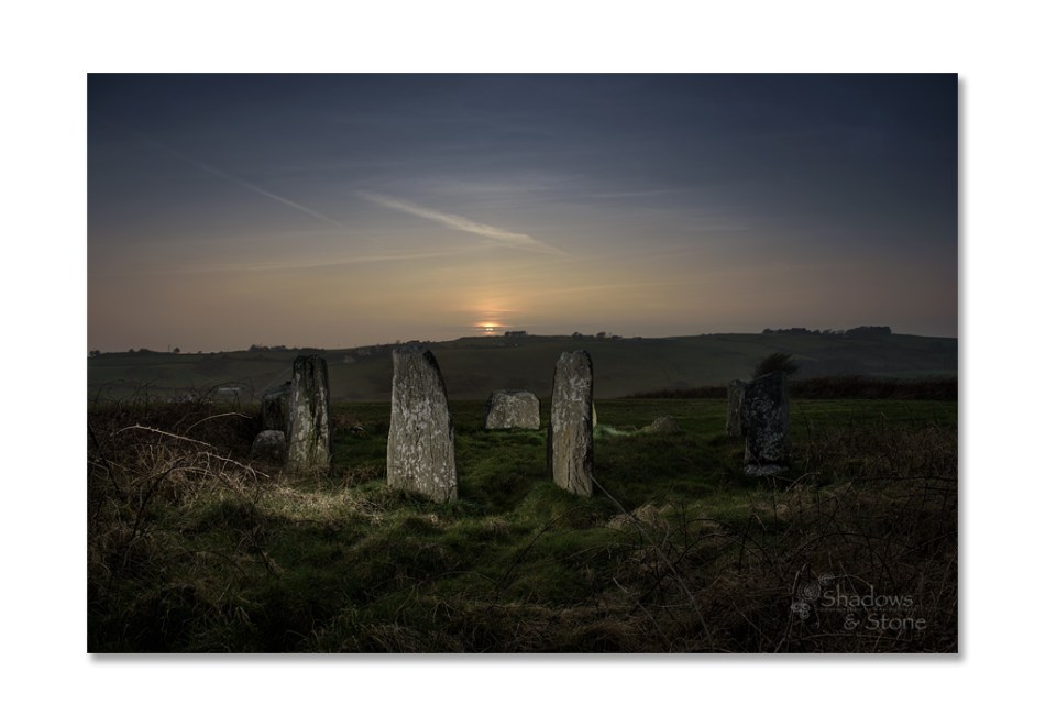
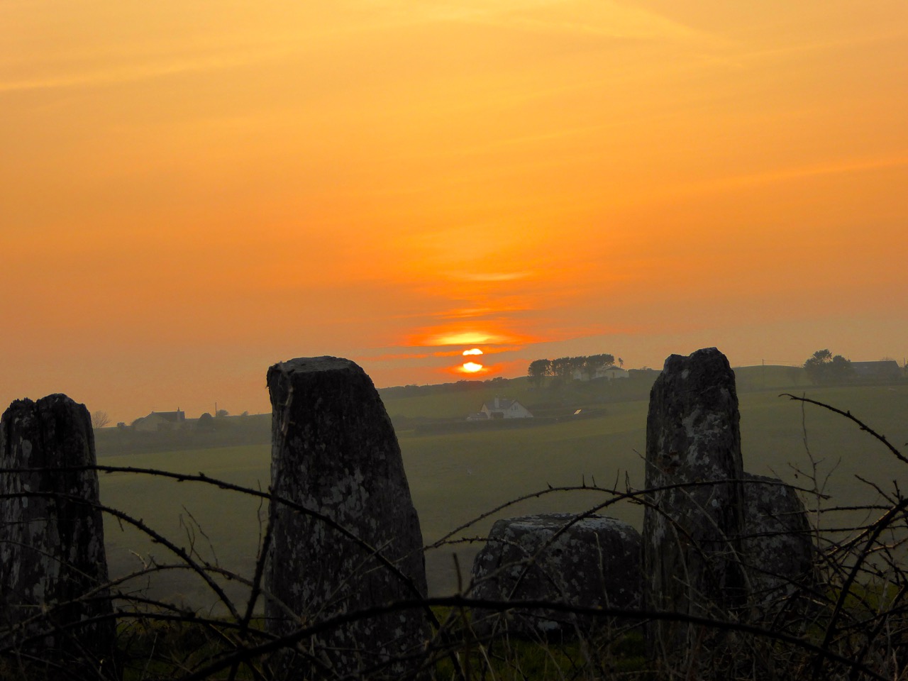
Both Boyle and Fahy identified Bohonagh as an equinoctial circle – that is, on the spring and autumn equinoxes, if you stand between the portals you will see the sun set over the recumbent – just like at Drombeg except that Drombeg is a winter solstice alignment. Several years ago, we met with Ken Williams of Shadows and Stone at Bohonagh to photograph that phenomenon. Here is his photograph, from our original post and used with permission. 

Many thanks to Michael Waldron, Angela Fahy, Billy O’Brien, Adrienne Harrington, Ken Williams, and to Nigel and Claire Vickery, on whose land Bohonagh stands.
*Edith Œ. Somerville, A Holy Place of the Druids or Grave of a Chieftain, undated. Collection Crawford Art Gallery, Cork
**The copyright on the image of Callanish is owned by Tom Richardson and is licensed for reuse under the Creative Commons Attribution-ShareAlike 2.0 license.

Equinox!

Ken Williams - capturing the moment

We’ve just passed the Equinox – one of the two moments in the year when day and night are of equal length. This happens once in the spring and once in the autumn. This year that moment was March 20th at 9:01AM, but it can fall between the 19th and the 21st, depending on the year. The autumn equinox this year falls on Sept 22, but it can range from the 21st to the 24th.

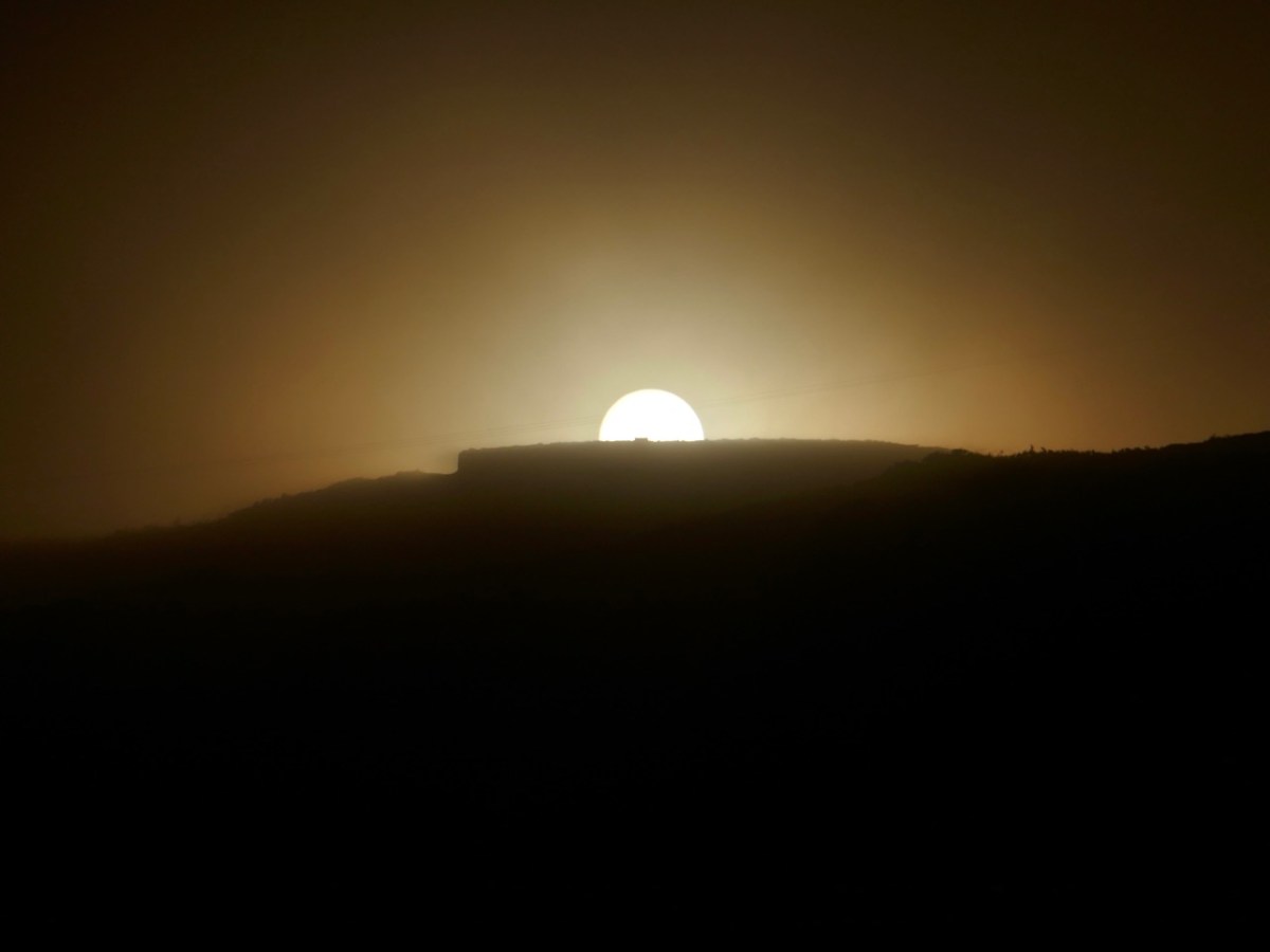
Prehistoric monuments in West Cork often have an orientation – the most famous of course is Drombeg stone circle (above in 2020). It’s a multiple stone, ‘axial’ circle, with two portal stone opposite a recumbent stone. On the winter solstice (this year on Dec 21st) the sun sets behind the recumbent, diametrically across from the portal stones (this is the ‘axis’). Attending this event is always great fun as well as an opportunity to join in a celebration that is thousands of years old.

There is a rhythm to the year provided by these four solar events – the longest day (summer solstice), the shortest day (winter solstice) and the equal-length days (equinoxes). Add to that the cross-quarter days – the points half way between the solstices and equinoxes, and we have a natural calendar of eight divisions.

The cross-quarter days, by the way, are the ones that track most closely to the great ancient Festivals in Ireland of Imbolc, Bealtaine, Luanasa and Samhain. Although nowadays these tend to be celebrated on the 1st day of February, May, August and November, in fact the dates would have varied and in 2025, the accurate dates for the cross quarter days are Feb 3, May 5, Aug 7 and Nov 7. This is important to know as various solar events happen on cross-quarter days, and if you want to see them, you have to turn up on the right day! See this post on Boyle’s Bealtaine for a good example of this – the photo above was taken on May 5, 2018.

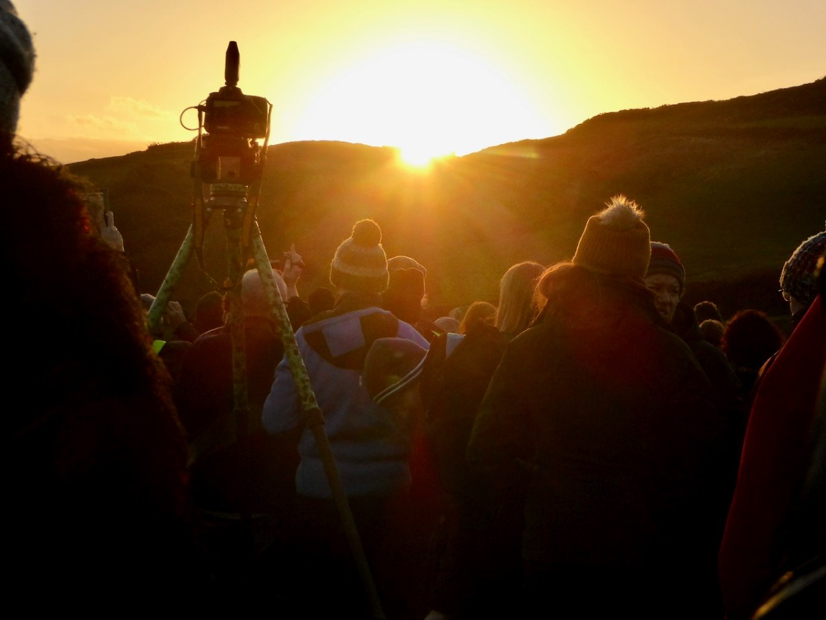
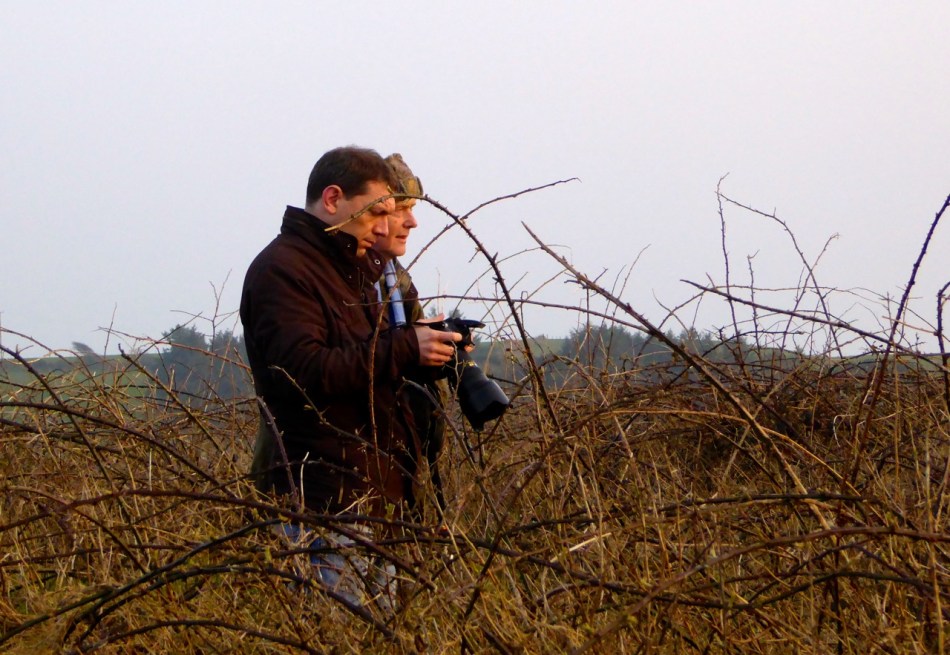
Ken and Robert: getting ready for sunset at Bohonagh

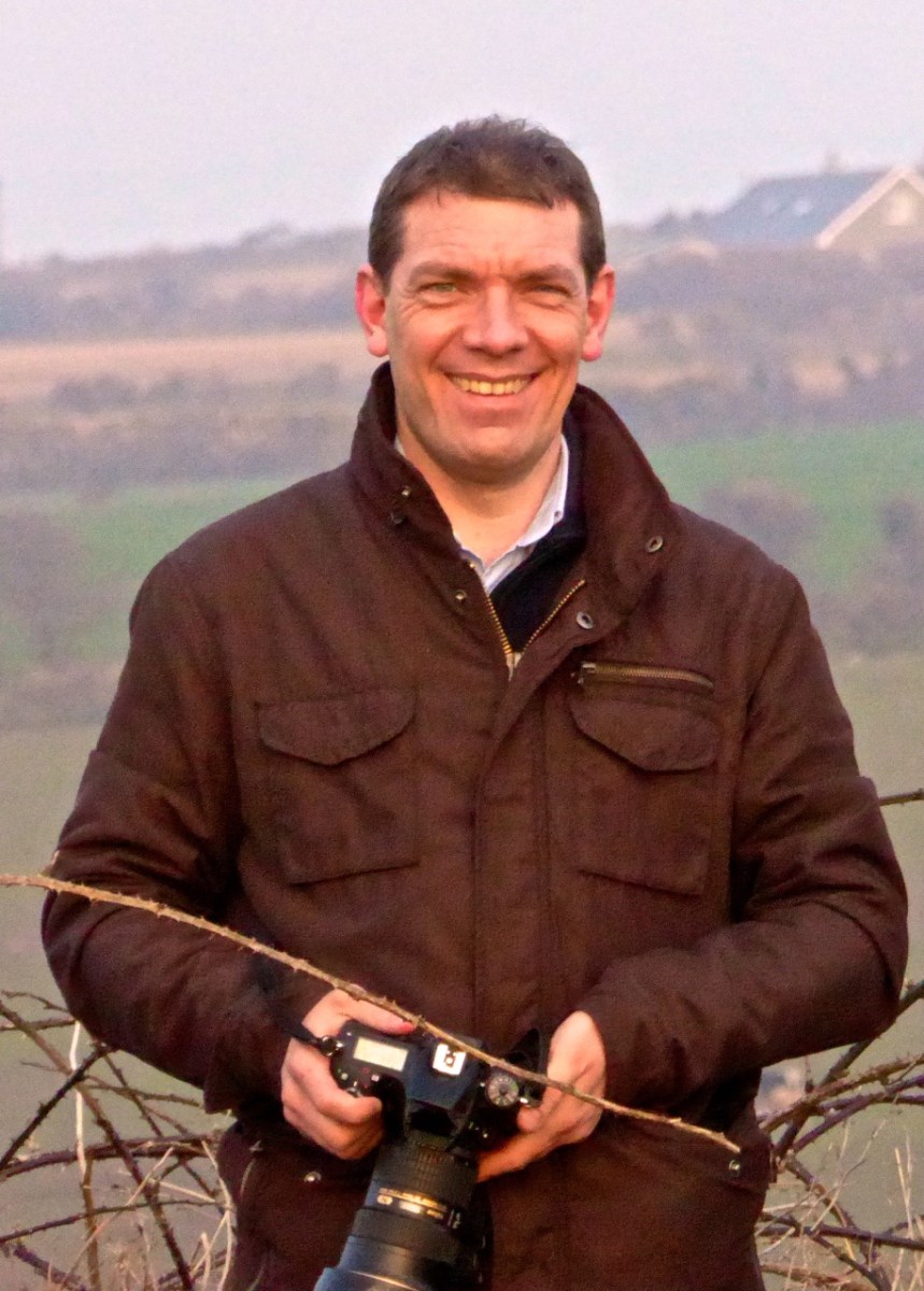
A few years ago, we met up with Ken Williams of Shadows and Stone, to photograph the equinoctial sunset at Bohonagh Stone Circle, near Rosscarbery. Ken is the undisputed master of prehistoric photography in Ireland. His website contains high-quality images of many different kinds of monuments, he supplies photographs for all the best publications, and he was our partner in the Rock Art Exhibitions we mounted in the Cork Public Museum and in Schull.

flashes strategically deployed

Ken’s work on rock art is astounding. We know first hand how difficult it is to get good photographs of the carvings. Many of them are covered in lichen, obscuring all the detail, and can really only be discerned in long slanting light, such as at sunrise or sunset. Ken uses both natural and artificial lighting to capture his excellent images and when we first met first we asked him how he packed all those lights up to the remote locations in which a lot of rock art is found. He grinned and opened his backpack. “This is my equipment,” he said, “It’s all I use.” Essentially his gear consists of a camera, flashes, and tripods – strategically deployed in the photograph above. If you want to see the difference between what Ken captures and what us ordinary mortals manage to do, take a look at the first two images in the post Revealing Rock Art.

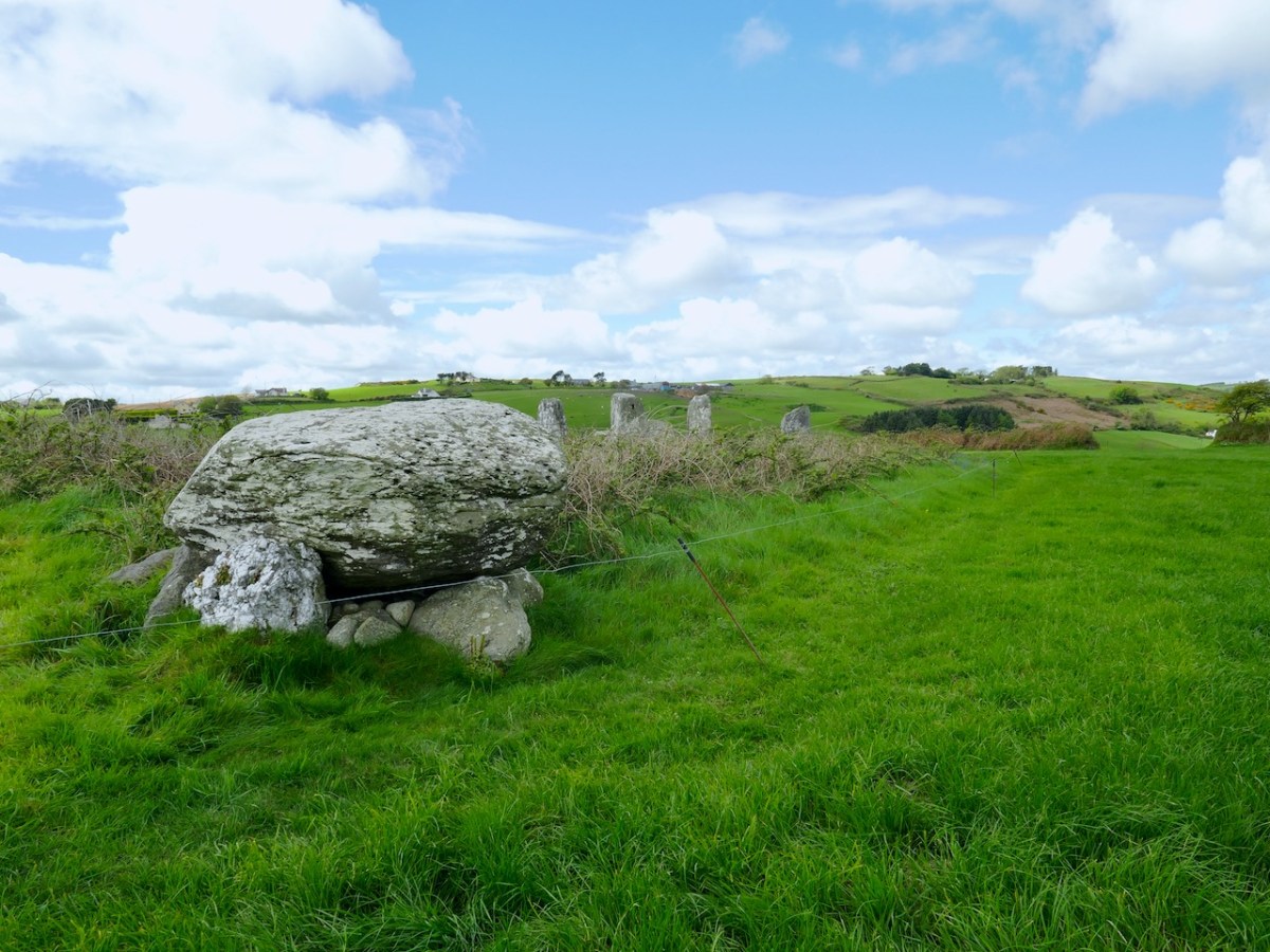
it was a beautiful evening – perfect conditions to see the sun sink behind the recumbent stone. Bohonagh (above) is a complex site. Not only do we have a stone circle, there is also a boulder burial, featuring a rather spectacular quartz supporting stone and cupmarks on the upper surface of the boulder, as well as a cupmarked stone hidden in the undergrowth between the boulder burial and the stone circle. It’s been excavated.*

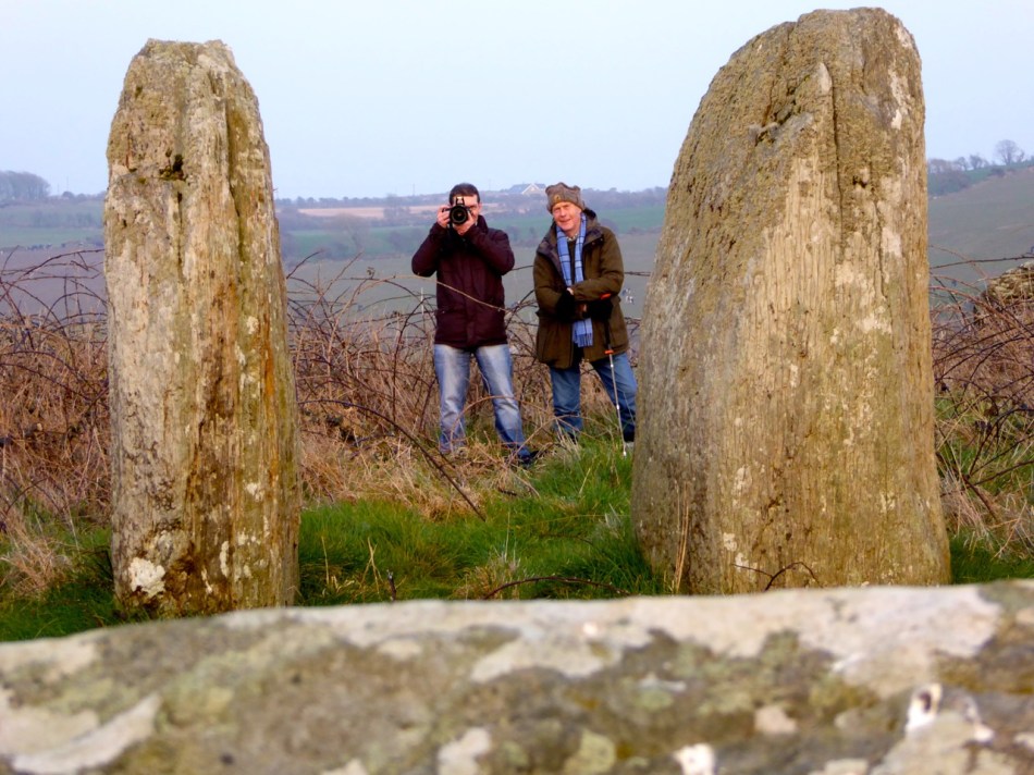
Looking over the recumbent

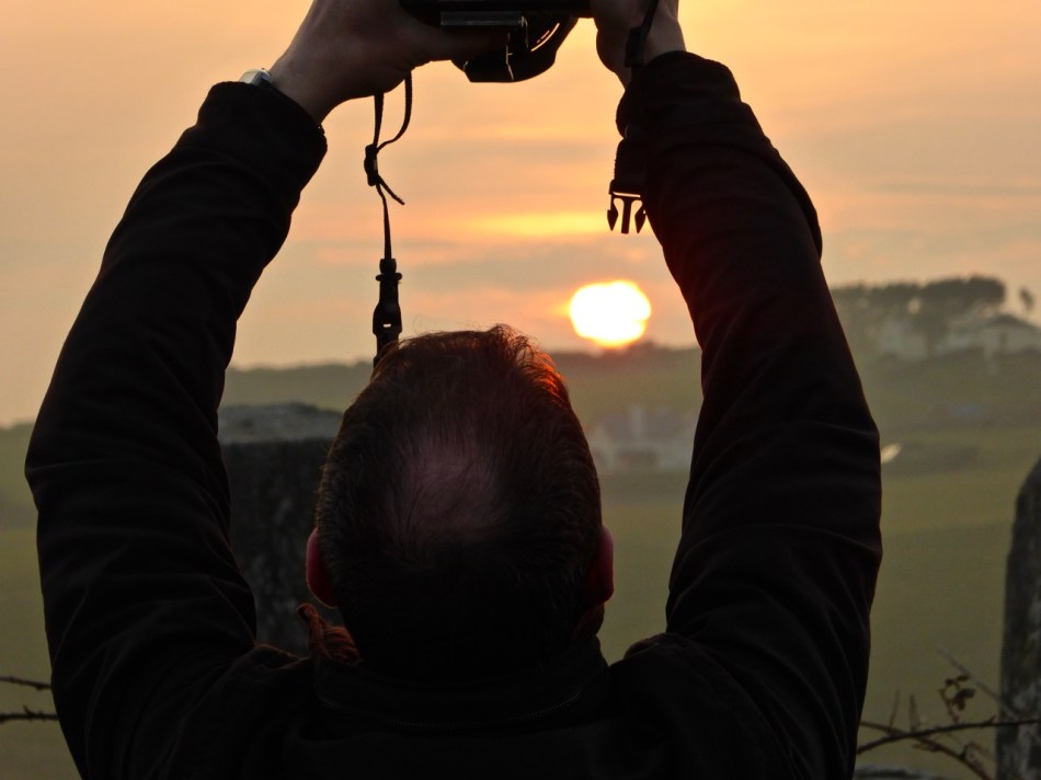
It was a treat to see a master photographer at work and to have Ken explain how he gets those amazing shots. From previous attempts, I knew how difficult it was to portray a scene when you’re aiming directly into the glare of the setting sun. This time I concentrated on capturing the photographer at work. Ken, meanwhile, worked his usual magic – and here’s the result, included with his permission. Not only can you see everything, including the still blue sky, but his picture captures the mysterious ambiance of the setting and the occasion.
BohonaghEquinox15-12

Our thanks to Ken for an inspirational photo shoot.

Thanks, Ken!

* A stone circle, hut and dolmen at Bohonagh, Co. Cork, by EM Fahy, 1961

Rock Art and Winter Light at Derrynablaha

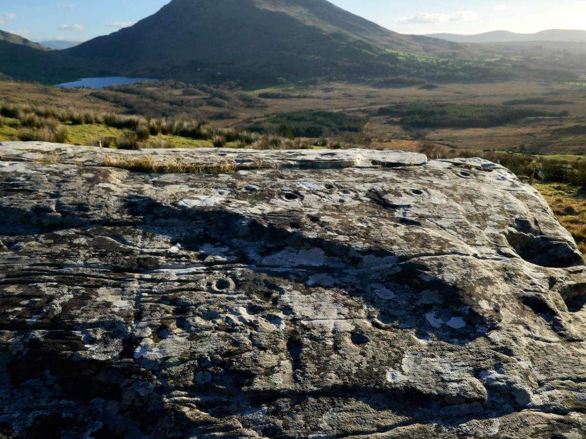
Rock art can be astounding or underwhelming. What makes it one or the other is light.

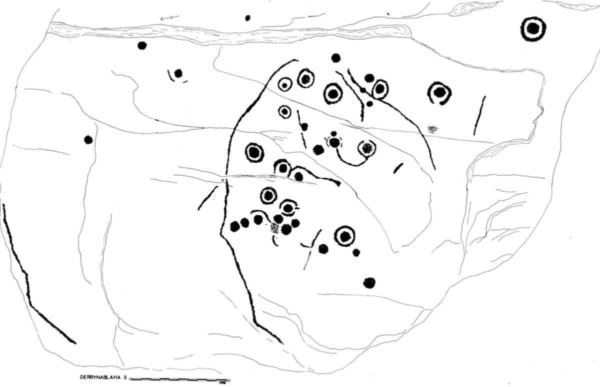
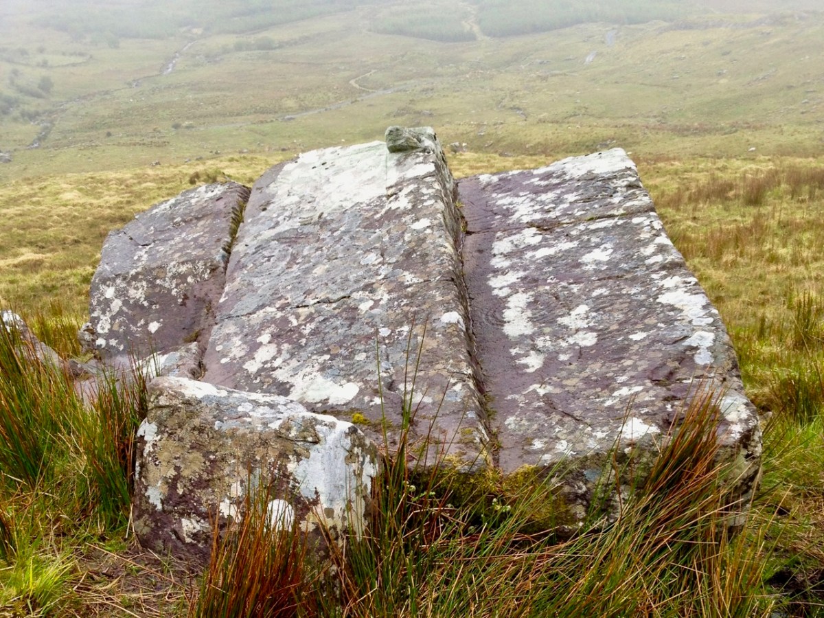
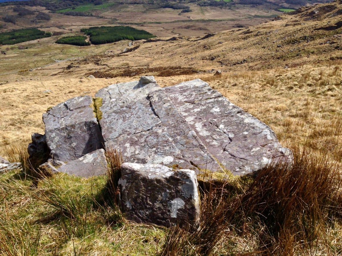
This is the rock I labelled Derrynablaha 3. My 1973 drawing of it is below. From it, there’s a clear view across to Lough Brin to the east, and all the way down the Kealduff River.

Irish prehistoric rock art likely dates from the Neolithic, about 5,000 years ago. We’ve written extensively about rock art (and indeed about Derrynablaha) – see all our posts on this special menu page. There are significant concentrations in Kerry, including 49 pieces identified so far in the adjoining townlands of Derrynablaha and Derreeny, in the middle of the Iveragh Peninsula. To get there, turn north from the Blackwater Bridge and head for the Ballaghbeama Gap.

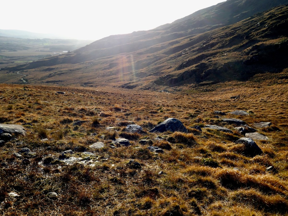
If you go on a grey day with no shadows (all too common in our part of the world), or even when the sun is high in the heavens, you might see nothing at all. You might walk right by a piece of rock art without realising it was there. We visited Derrynablaha this week and were very lucky to hit it just right.

By ‘just right’ I mean that we had a sunny day, not a cloud to be seen, and because it’s winter and we got there earlyish in the morning the sun was low in the sky. That kind of low, raking light creates the best possible natural conditions for viewing rock art, as demonstrated in this post – Aoibheann Lambe’s excellent capture shows how to do it. There are other ways to do it, of course – you can use strategically placed coordinated flashes – something Ken Williams is rightly famous for. You can go at night with strong lights, or you can use photogrammetry to produce a 3D image. But for a truly immersive experience, seeing it on a day like we had is an experience that is hard to beat.

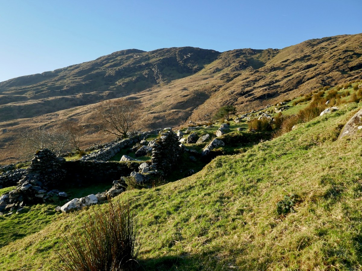
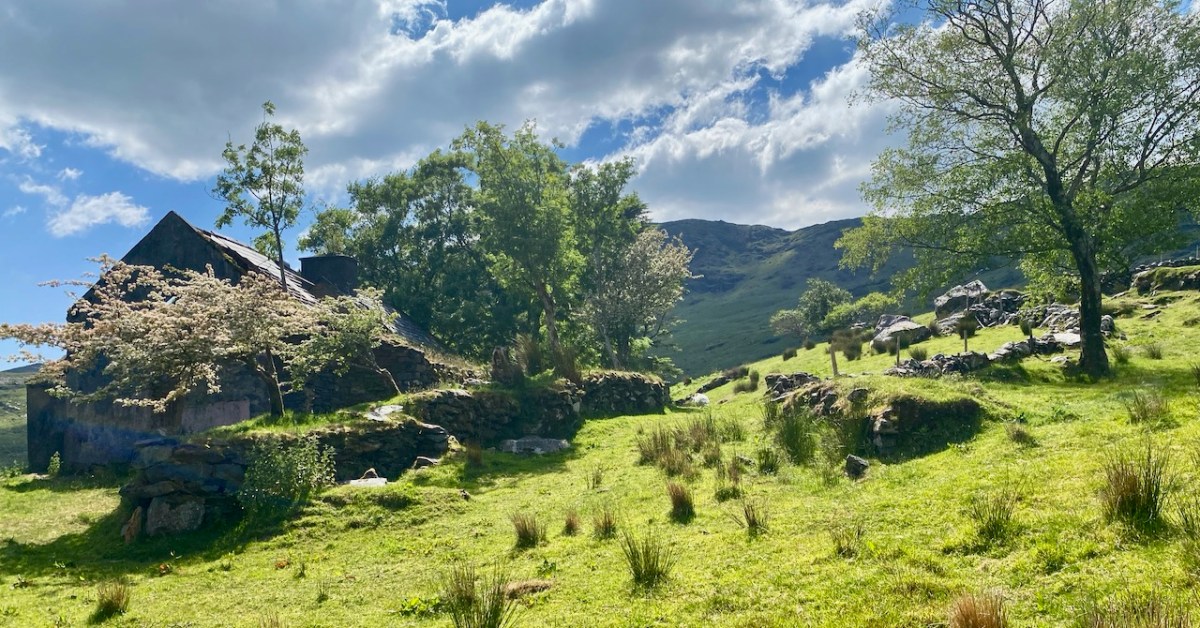
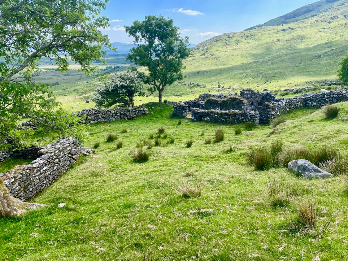
I spent time recording all the known Derrynablaha rock art when I was doing my thesis in archaeology at UCC in 1972. The carvings had been discovered by the landowner, Daniel O’Sullivan, who wrote to the Department of Archaeology in 1962. His brother, John, still lived on the farm when I was doing my fieldwork, in the farmhouse that is now a ruin (above) but which still holds happy memories for me. The remains of a more ancient settlement are also clearly visible (below).

They were visited by the Italian archaeologist Emmanuel Anati the following year, 1963, at Prof O’Kelly’s suggestion and it was Anati who first wrote about this site. Anati, by the way, went on to found a centre for rock art research at Val Camonica in Italy, and as far as I can tell is still alive and active, in his 90s. He recorded 15 panels.

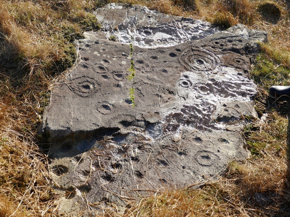
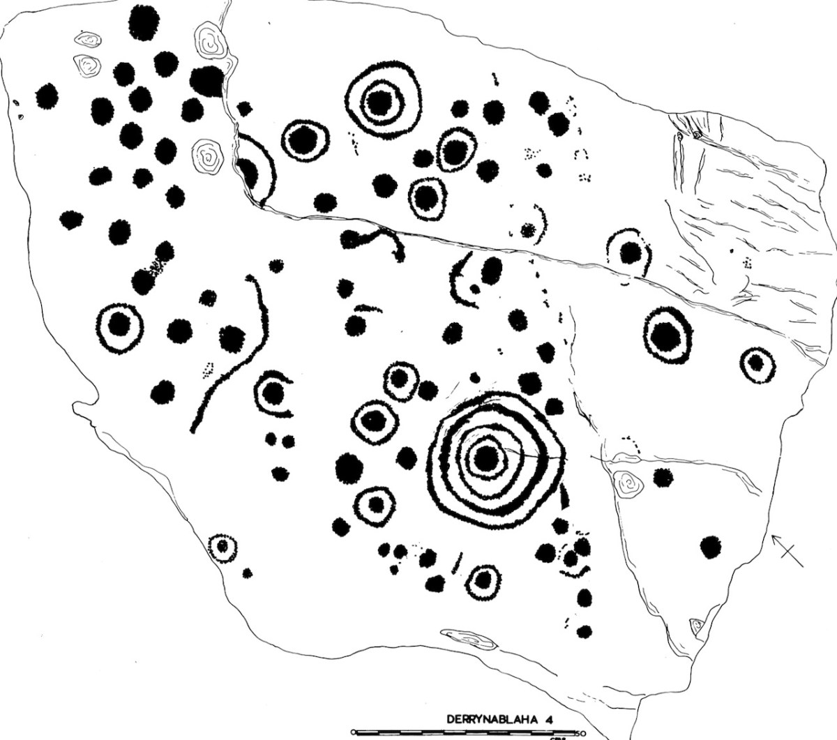
This is my Derrynablaha 4

Subsequent expeditions from UCC, and my own explorations, resulted in a grand total of 23 examples being included in my thesis. By the time of the Kerry Archaeological survey in the 1980s there were 26 pieces identified, and more have been found since then – there are now 29 known panels of rock art in Derrynablaha and a further 20 in Derreeny.

A detail from Derrynablaha 4 clearly showing individual pick marks. The decoration was picked on using stone-on-stone percussion. You can also see how ice can settle on the surface and over time cause cracking damage. My drawing of this stone is below

They are very hard to find unless you know exactly where to go, and I was very lucky indeed to have the expert guidance of Google. Yes – there is a Google Map devoted to Irish rock art! It’s the brainchild of Caimin O’Brien of the National Monuments Service and with it on your phone it’s possible to tramp over the hillsides and locate each piece. We are supremely grateful to Caimin for the work he has done on this, and we only wish all National Monuments could get the same treatment!

Even with this amazing resource, this is not an easy field trip. The ground is steep, rough and wet, and there are barbed wire fences to find a way around. It’s an active sheep pasture, so it’s important to be mindful that you are on private property and be respectful of all farm boundaries. 

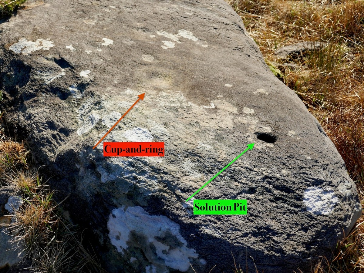
This is a good example of rock art that could be easily overlooked. A very faint cup-and-ring can be seen in good light conditions. The obvious hole, however, is not a cupmark but a naturally occurring solution pit

Because we only had half a day, we confined our walk to the area around the old farmhouse and the hillside to the west of it, and managed to visit 8 panels. Even in the perfect lighting conditions we had, not all are easy to see, as they have been exposed for thousands of years and have worn away. But, for the most part, once we had found the rock, we could see the carvings clearly. 

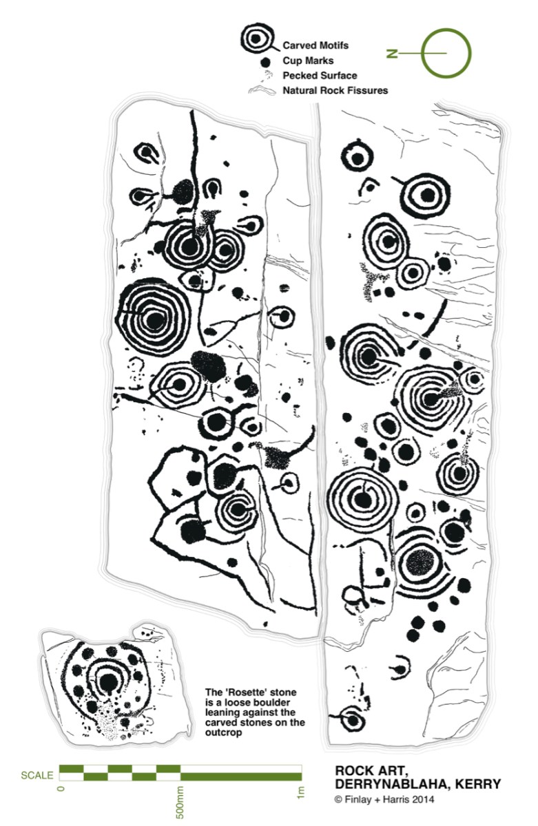
All the panels we viewed had cupmarks and cup-and-ring marks, as well as some pecked lines meandering across the surface. We don’t know what the significance of these motifs are, although theories abound. There are other motifs at Derrynablaha too, all falling within the repertoire of classic rock art. 

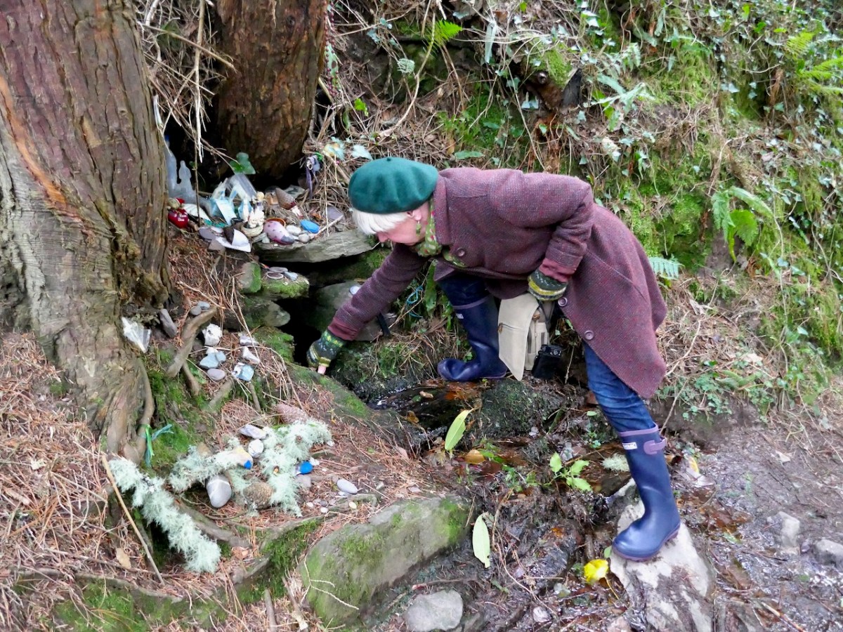
Our companions on this day, as on so many of our adventures, were Amanda and Peter of Holy Wells of Cork and Kerry. And of course several holy wells were on the agenda too, including this one near Kenmare. Take a look at Amanda’s brief write up on her Facebook page, or keep an eye on her excellent blog for more about our finds on this trip.

We’ve written about Derrynablaha so many times now – why do I know this won’t be the last time?

Derrynablaha and its Rock Art

A bit of a nostalgia trip for Finola and me this week: we spent a couple of days in Kerry and dropped in to Derrynablaha – the iconic valley which has some of Ireland’s most notable Rock Art. These stones were carved on natural rocks on the hillsides many thousands of years ago. To this day, we don’t know what they signify.

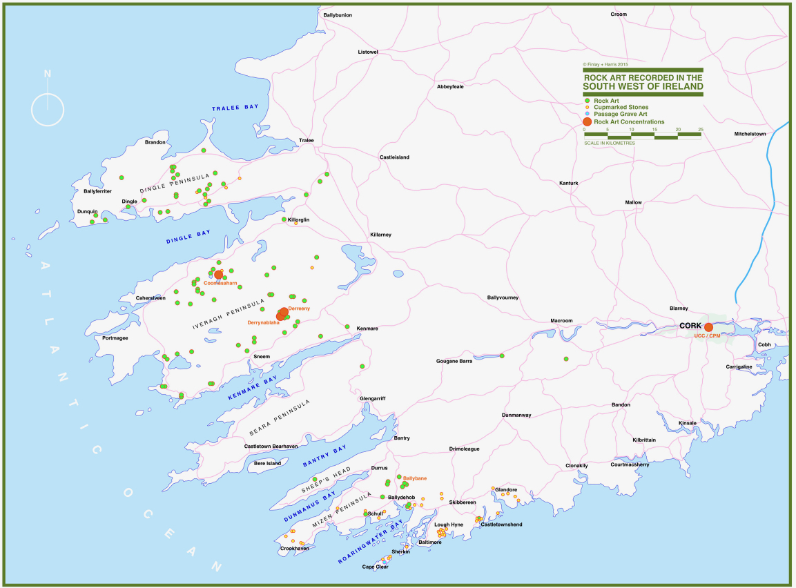
Some years ago, Finola and I organised exhibitions showing examples of Rock Art – many taken from Finola’s 1973 University of Cork thesis. The map above was drawn for the exhibitions: you can find Derrynablaha in the centre of the Iveragh Peninsula, left of centre. Below is a rendering of Finola’s thesis drawing showing – arguably – the most significant piece of Rock Art on this island:

Here’s a photo of these rocks which I took on my first visit to this valley, in 2012. It was a dull day! The next photo was taken on a better day three years later. This shows how weather conditions can affect the way that Rock Art motifs are seen:

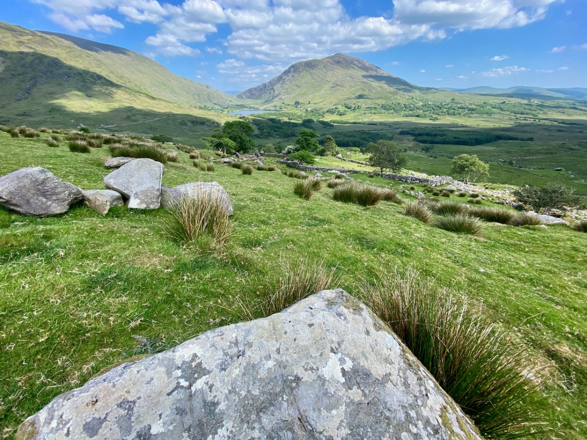
On our most recent visit – last week – we didn’t have time to scale the steep hillside to view this rock formation, but we enjoyed just taking in the stunning landscapes of the townland.

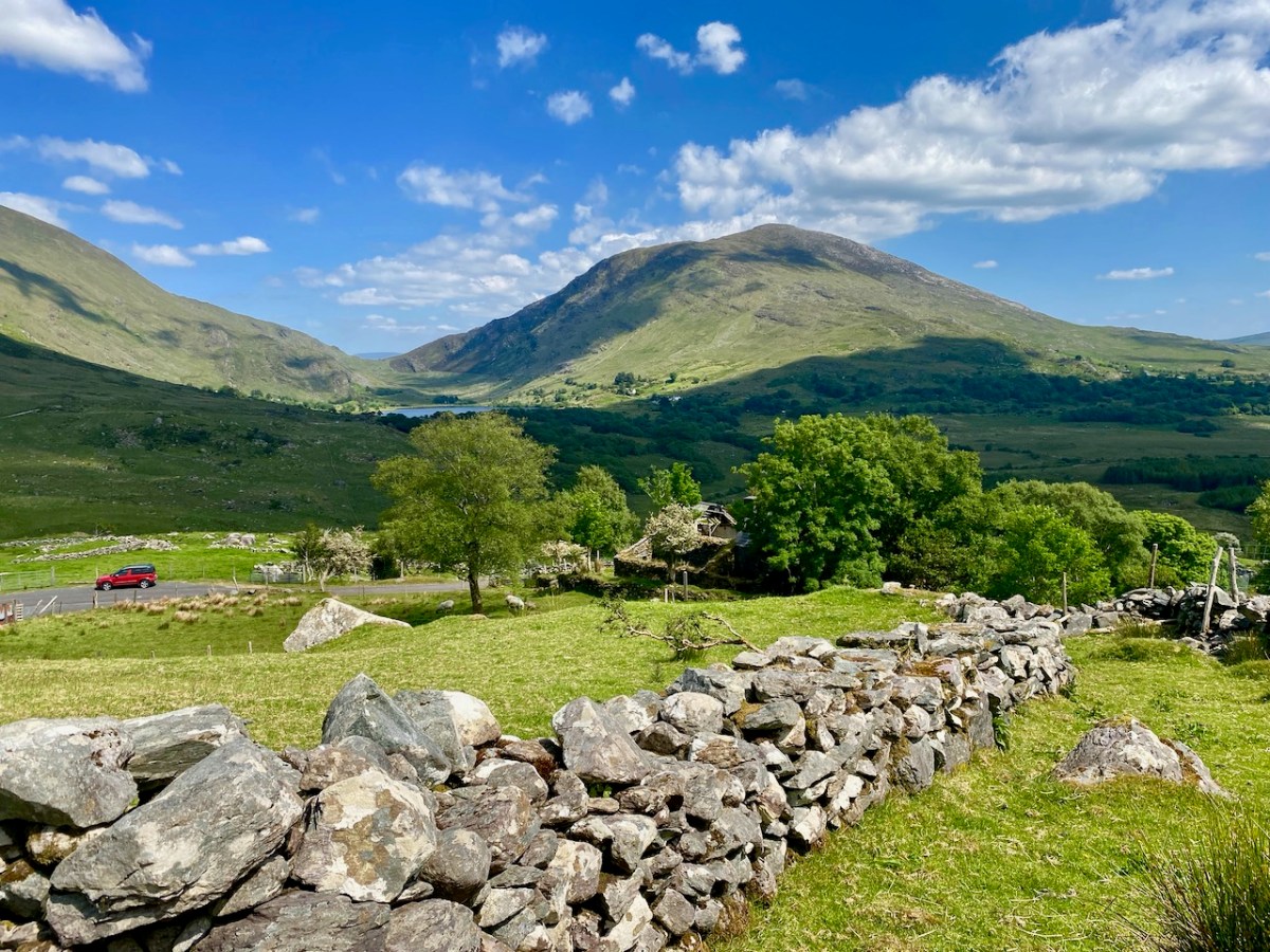
Above, and in the header picture, you can see the ruin of the cottage, which was once the only dwelling in this valley. It was still lived in when Finola visited to carry out her survey of the Rock Art in 1972 – fifty years ago. Then it was occupied by John O’Sullivan and his sister, May. John’s brother – Daniel – discovered much of the Rock Art in the surrounding landscape and reported this in the 1960s to Michael Joseph O’Kelly, then Professor of archaeology at UCC, and his wife Claire. Subsequently the O’Kellys made some expeditions to Derrynablaha, as did the Italian rock art expert, Emannuel Anati. Daniel had died prior to Finola’s visits and she recalls that the remaining family were excellent stewards of the Rock Art, ensuring that it was preserved and not damaged. She has ‘hazy memories’ of being brought into the house and given cups of tea and brown bread.

After we had published earlier posts about Derrynablaha, Finola was contacted by Faith Rose – the great niece of the O’Sullivans who lived in this cottage in 1969: Faith had visited the valley in that year. She recalls:

. . . I remember their bedroom was downstairs, the staircase to the upstairs being unsafe. There were none of the usual services in the house. There was an old fashioned fireplace where you could cook with a settle at the side. I seem to remember being told it had been built under some government scheme and the original stone farmhouse was to be seen slowly returning to nature close by. I wonder if you recall any of this. My great aunt and uncle were shy people who extended us the best hospitality. To my sister and I it was a magical place, but the hardness of their lives there was clear . . .

Faith Rose 2021

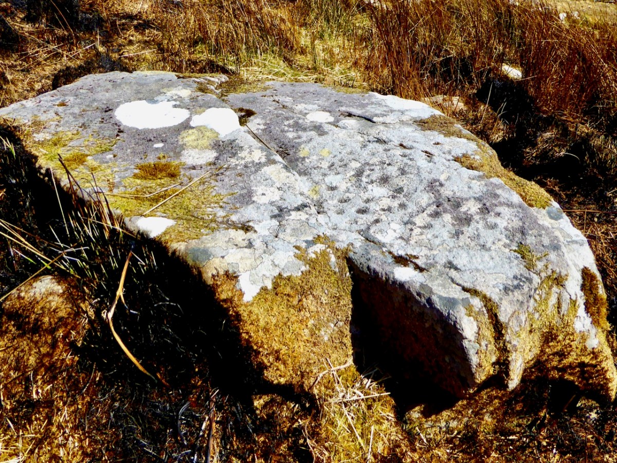
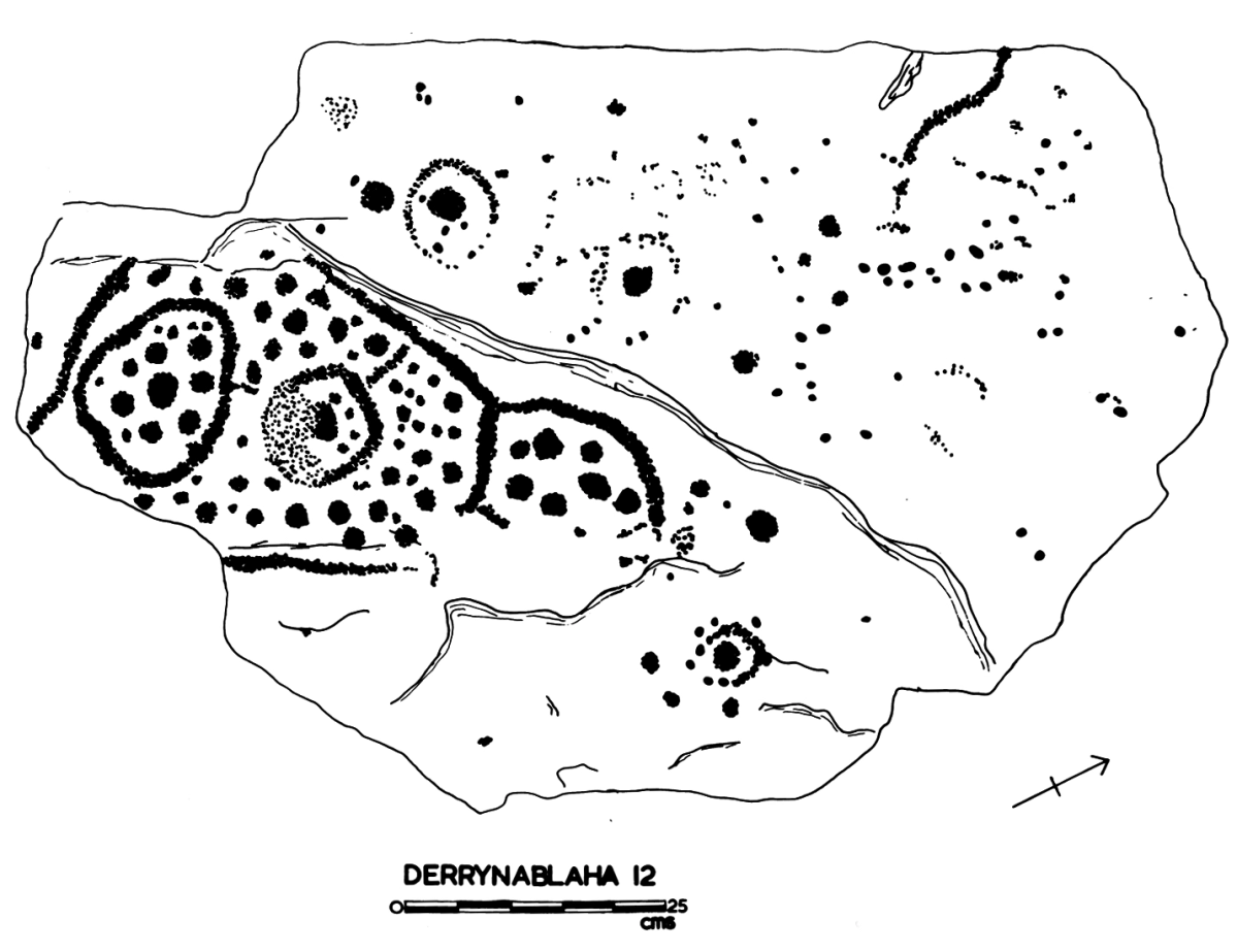
There are the ruins of several other buildings set within this landscape, indicating that the settlement was once significantly more populated in earlier times. Now it is wildly lonely, but impressively beautiful. When Finola carried out her surveys, she recorded 23 pieces of Rock Art. Today it is recognised that there are 26 known examples, with a further 7 stones in the adjacent townland of Derreeny. Long term readers of this Journal may recall that we visited the townland in April of 2015 – together with a small group of enthusiasts – to seek out all the known examples. At that time Ken Williams was using techniques he had developed to photograph the carvings in fine detail. These employed several portable light sources. The following sequence shows one of the rocks (number 12) taken without lighting; Finola’s drawing traced in 1972; then Ken’s technique in action and his results, which are remarkable:

Once again you are reading about the Rock Art at Derrynablaha! There have been several posts on this subject over the years, but we make no apologies: we never tire of the beautiful landscapes of Kerry – and we have seen it in all weathers. It would be good if we could be closer to solving the meanings of these rock carvings; this is unlikely to happen. Over the last 300 years since the phenomenon was first recorded in Ireland (and Britain, and many other places in Europe and the world) there have been varying theories – dozens – put forward for its existence: none of them is conclusive. Think on . . .

Grange – Ireland’s Largest Stone Circle

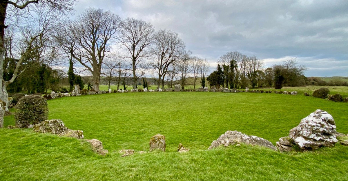
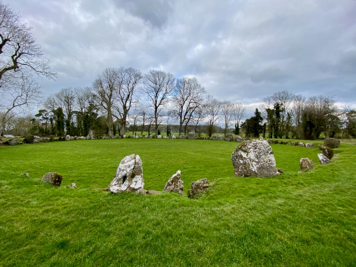
If you are travelling through County Limerick, you shouldn’t miss a visit to Ireland’s largest stone circle: Grange, near the Lough Gur complex. There are 113 stones in this circle today, generally standing close by each other (‘contiguous’) and thus unlike the majority of the circle monuments in Ireland, where individual stones are separated.

The great circular arena which these stones define is also on a platform raised (in the present day) about 600mm above the surrounding land. Excavations which took place between 1939 and 1954 (S P Ó Ríordáin 1951) and subsequent radiocarbon dating indicate a construction date just short of 3,000 BC, which makes the circle one of the oldest in Ireland.

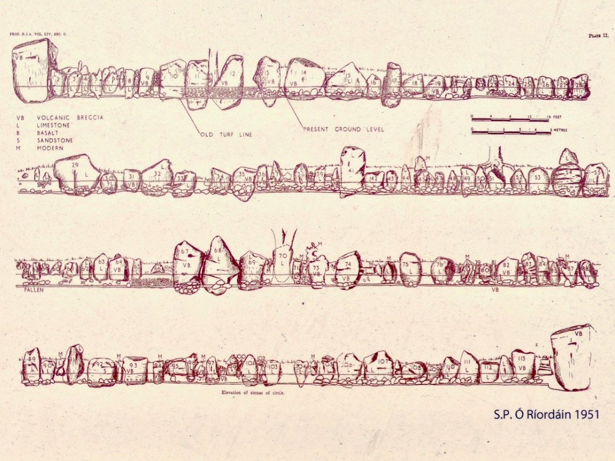
The internal diameter of this circle (a ring drawn around the inner faces of the stones) measures approximately 45.5 metres. Here is Ó Ríordáin’s drawings of the elevations of the stones:

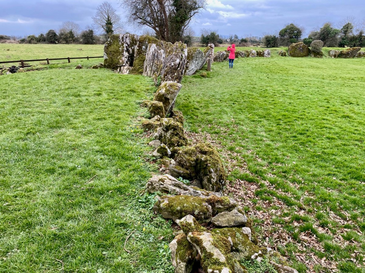
Finola bravely stands against the largest stone in the circle, which is traditionally named Rannach Crom Dubh. The meaning is not clear; Crom suggests ‘bent, crooked, or stooped’, while Dubh means ‘black or dark one’. Rannach can mean ‘open-handed’, which could imply a trading connection. This stone is said to weigh over 40 tonnes and was brought to this spot from three kilometres away. Interestingly, some say that this stone marks the ceremonial entrance into the circle and is aligned with the sunrise on the 1st of August, known as Lughnasadh, the day that marks the beginning of the harvest in Ireland. In fact, there are many orientations that can be given to this circle. This article by Ken Williams explores some possibilities here.

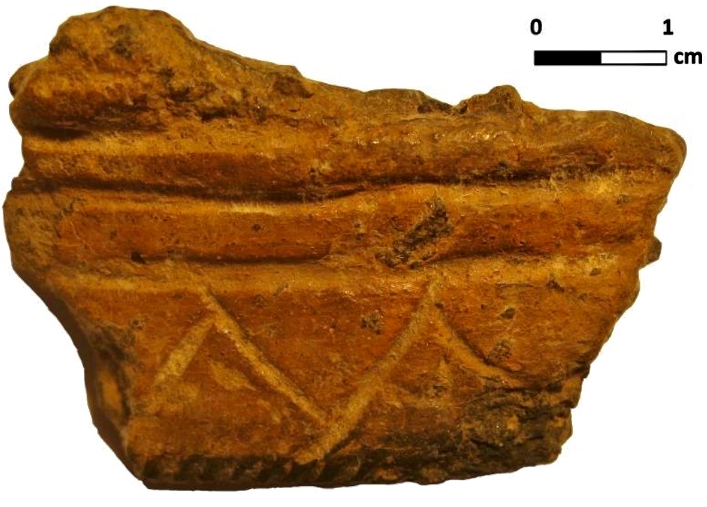
This Beaker pottery sherd was found and recorded by Ó Ríordáin. It is one of a great number of such remains to be found at the site. One commentator made the suggestion that . . . The breaking of Beaker pots against the standing stones seems to have been part of a ceremony . . . Can we trace the more modern tradition of breaking wine glasses after a toast to such an early origin? It’s said to bring luck and happiness in some cultures. This would, of course, imply that the great circle was a celebratory feasting site.

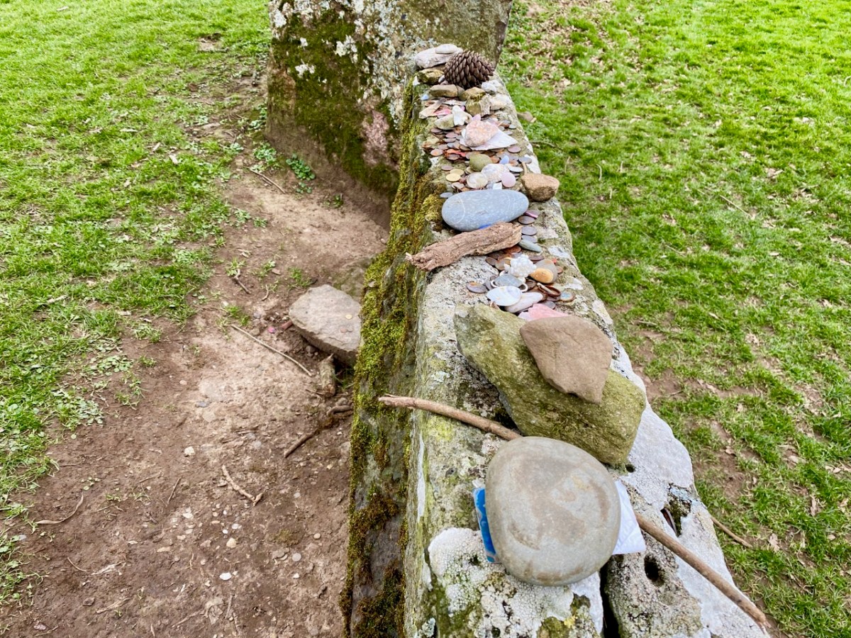
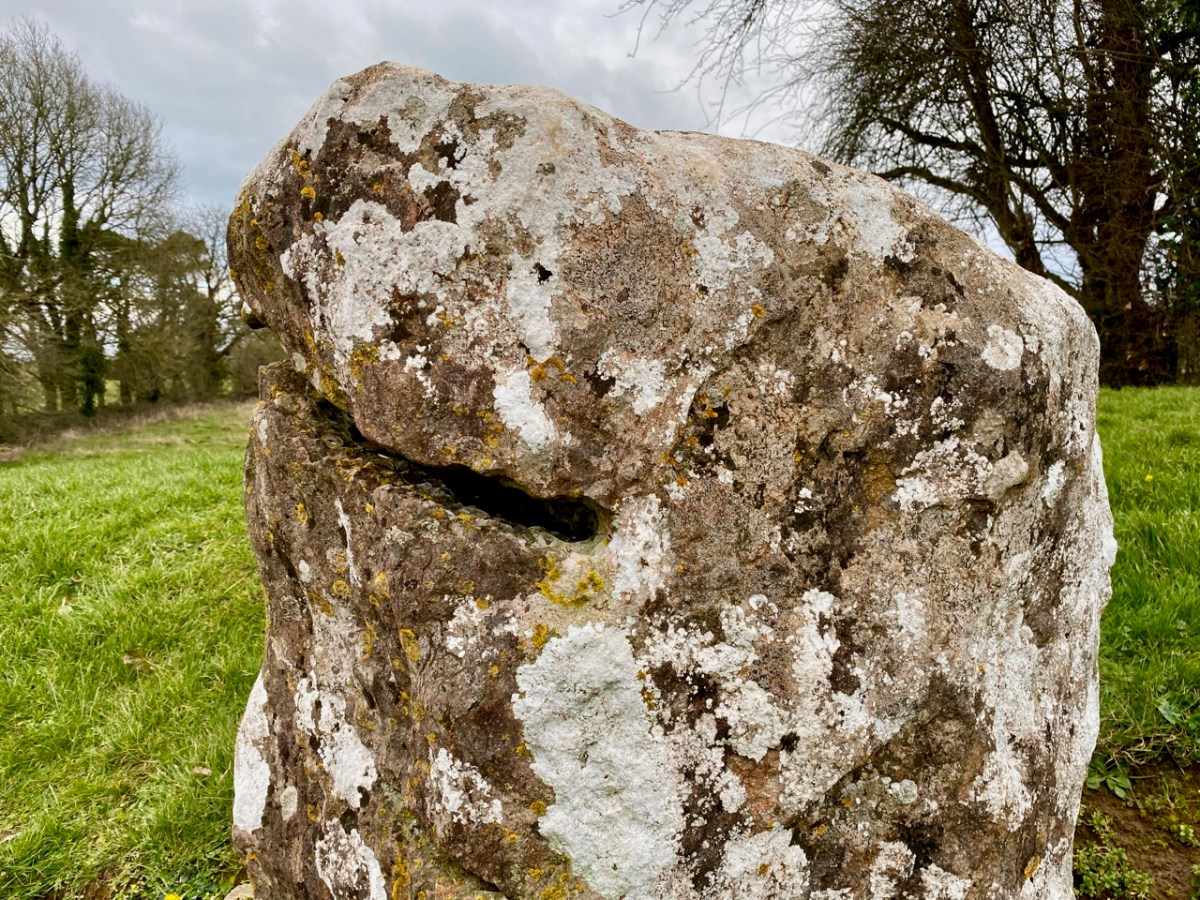
There is evidence today that visitors feel compelled to leave offerings at the site: coins, small stones, beads, and other ephemera. The examples above are adjacent to Rannach Crom Dubh, while below is one of the standing stones in the circle that appears to have been deliberately cut, or slotted, at some time in its history. Today, coins are deposited within this slot.

My own feeling about this site is that it is an arena where people gathered to feast and celebrate. An ancient ‘circus’ perhaps? Ken Williams analyses the possibilities of archeo-astronomical alignments in his article, mentioning our West Cork friend Vice-Admiral Boyle Somerville, whose detailed work we have investigated, here.

The features of this site are fascinating and provide much food for thought, especially when seen through the eyes of archaeologists. Of course, we want to know who conceived this monument, and who was in charge of the human power and organisation that was required to erect it. There won’t be a simple answer to this: it’s likely that many generations were responsible and that there were numerous incarnations over time. That’s what is so fascinating about ancient history: if only we had a time machine!

There are traces of other, smaller, stone circles close by this one, but I was intrigued to read in one of the accounts of this site that there was previously a further – even larger – circle nearby, and this has vanished altogether. I have to ask: how could such a massive structure disappear completely? Legend gives us an answer: it was supposedly stolen by Merlin and brought over to England to create Stonehenge!

West Cork Obscura – Finola’s Picks

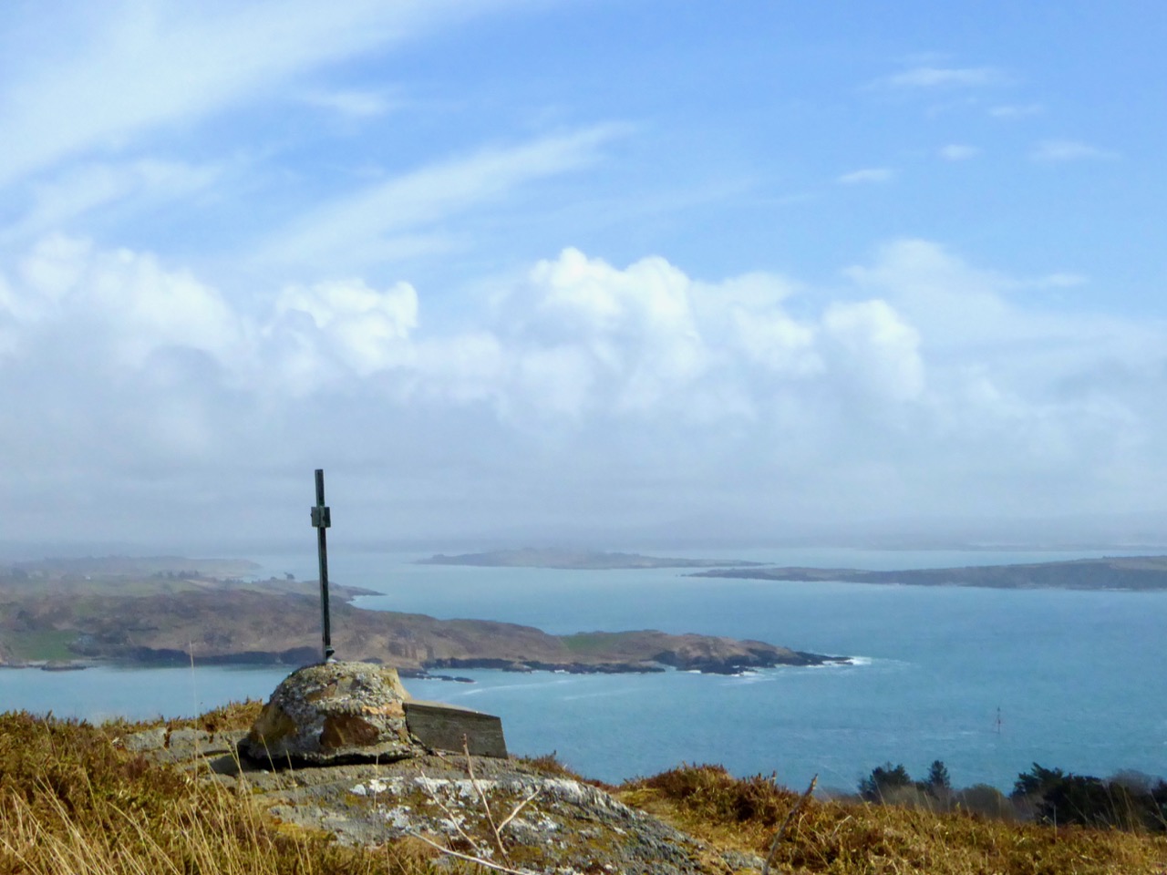
The popular Atlas Obscura defines itself as the definitive guide to off-the-beaten-track and little known wondrous places. So we’ve captured that idea and, as our Christmas present to our readers, bring you our own carefully-curated, slightly eccentric, Roaringwater Journal Guide to West Cork’s Hidden Wonders. Robert’s selection is here. No well-know tourist spots for these posts! No car parks and visitor centres! You may need wellies for some, a good map for others, and, although all are accessible, some may require permission.Each place I recommend will link to a blog post with more information. As an example, Sailor’s Hill, just outside Schull (above) is an easy walk and look what you get at the top! 
This is the view from Brow Head, looking back towards Crookhaven, and Mount Gabriel in the distance. Brow Head is much less visited than Mizen Head, but just as spectacular

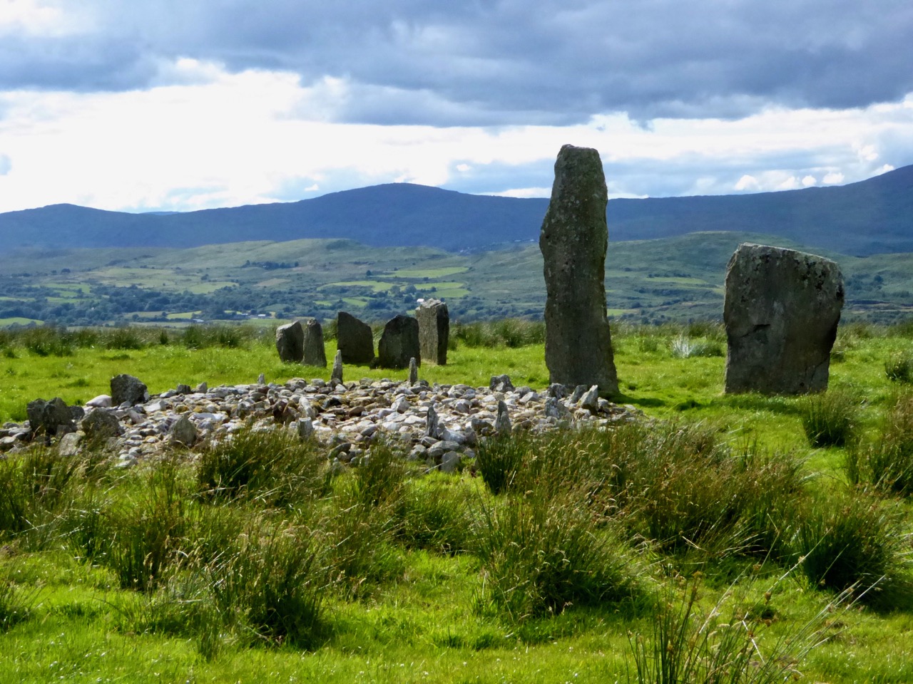
I’m going to start with some archaeology and a couple of spectacular sites. The first is the Kealkill Stone Circle – but this isn’t just a stone circle, it’s a complex of monuments that includes a five-stone circle, a radial cairn (very rare in this part of the world) and two enormous standing stones. The views are immense in every direction, and the site is easy to find.

We all know about Drombeg – and we love it when the sun goes down at the midwinter solstice, and even when it doesn’t. But fewer people know about another stone circle, equally spectacular, with a spring equinox orientation. It’s called Bohonagh and it’s quite a complex. First of all, there’s a boulder burial, with quartz support stones and cupmarks on the boulder. Then there’s a cupmarked stone, partly hidden in the brambles between the boulder burial and the stone circle. Finally, there’s the circle itself, almost complete, with views in all directions.
Equinox sunset at Bohonagh

We were lucky to have a session there one equinox, and another one with Ken Williams of Shadows and Stone. For access, park just off the main road, across from the salmon coloured house 4.5km east of Rosscarbery and walk up the farm road to the barns and from there to the top of the hill. This is a working farm – please close all gates and be respectful of animals!

Maughnasilly Stone Row broods on the hilltop

A stone row to round out the archaeology sites – this one is at Maughnasilly and I chose it because it’s been excavated, so there’s an informative sign, access is easy and it’s a beautiful, atmospheric site, overlooking a small lake. The row has been calculated to have both lunar and solar alignments.

And from the ground…

A couple of churches now, beginning with the Church of Ireland Church of the Ascension in Timoleague. This is one of those places that is dripping with unexpected stories. As soon as you go through the door your jaw will drop – the whole church, floor to ceiling, is covered in mosaic, partly paid for by an Indian Maharajah. Read the story here and here – and look carefully at the stained glass windows, some of them are among the oldest stained glass we have in Ireland. The key used to be at the grocery store on the main street, but I’m not sure where it is now, so you may have to ask around. Let us know if you find out.

The interior of the church, and one of the beautiful Clayton and Bell windows

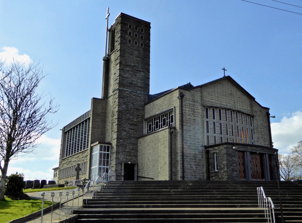
You may wonder at my next choice – it’s not everyone’s cup of tea – but the modernist church in Drimoleague is the work of Frank Murphy, the architect hailed as Cork’s ‘Unsung Hero of Modernism’.

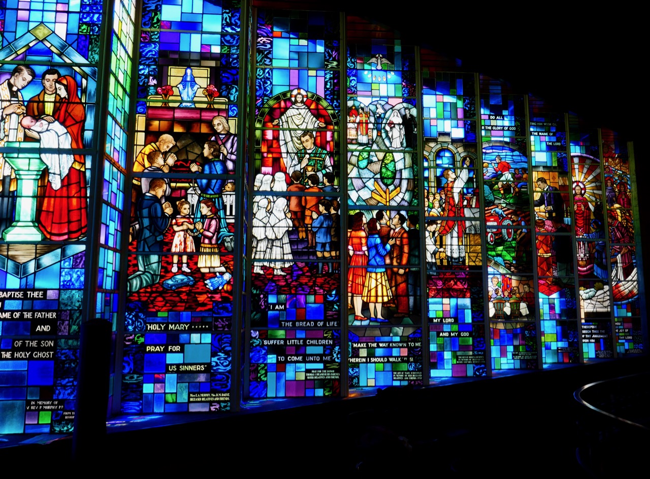
I love the spare minimalist space, very rare in West Cork, but it’s the stained glass windows that drew my attention. It’s not that they are particularly beautiful or skilfully done: they’re by the Harry Clarke Studios long after Harry himself had died. It’s that they fascinate me as a social document – they are, in fact, a prescription for how to live your life as an Irish Catholic in the 1950s. As such, they will resonate with anyone of my vintage. Research by the brilliant young scholar, Richard Butler, has revealed that the design was practically dictated by Archbishop Lucey, still a name to invoke an image of the all-powerful churchman of the 20th century.

And a final church, but this one strictly for the windows. (No – not St Barrahanes in Castletownsend for the Harry Clarkes – everyone knows about them already, and this is a selection of lesser-known wonders.) Do NOT go through Eyeries, on the Beara Peninsula, without stepping into the little church of St Kentigern. Here is where we were first introduced to the work of the stained glass artist, George Walsh.

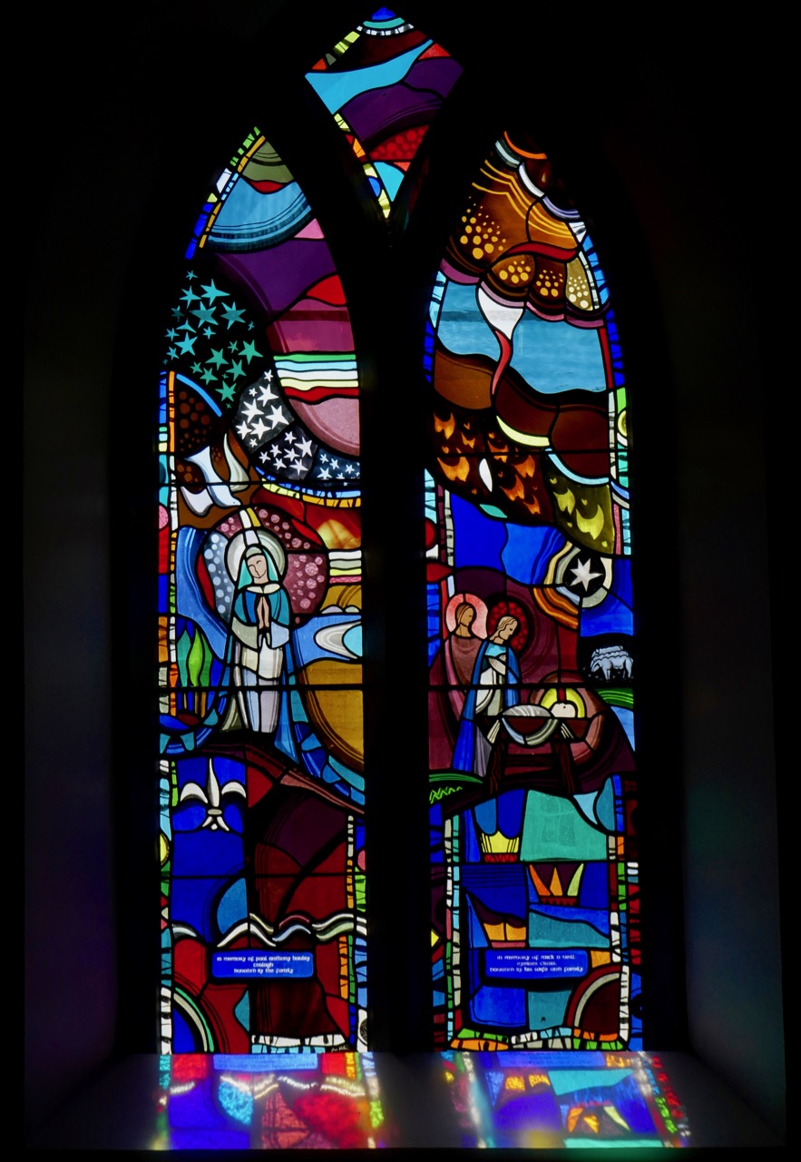
The Annunciation and Nativity window

When Robert wrote his original post, we couldn’t find out much information on George Walsh, but now he has become a friend and I have written about his work for the next issue of the Irish Arts Review (due out in March, 2019) and spent many happy hours photographing his windows and his artwork around Ireland. It’s bold, graphic, modern and incredibly colourful, and the windows in Eyeries, along with the religious themes, tell the story of Ireland and the Beara through time.

Some places to visit now for a good walk or a swim. First, one of my favourite walks is to hike up to Brow Head, at the end of the Mizen Peninsula (you can drive up too, but pray you don’t meet a tractor coming down) and then walk out to the end of the Head (see the second photo on the post for the view from the top of the road). Stop first to explore the ruins of the old Marconi Station – there’s also a Napoleonic-era  signal station and a WW2 Lookout Post. Then wander through the heather and the low-growing gorse until you get to the part where the sea is crashing below, with vertiginous drops off either side. I will leave it to you how far you go from there!

Brow Head showing the signal station and Marconi station silhouetted against the evening sky

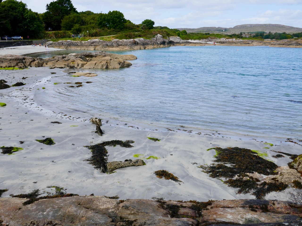
Although Barley Cove is well known, Mizen locals love Ballyrisode Beach for a swim or a lounge in the sun. White sand, sheltered bays, and water warmed by running over the shallow bay. The final little beach holds a secret – a Bronze Age Fulacht Fia or Water-Boiling Site, that Robert and I recorded for National Monuments this summer. It was an exciting find, hiding in plain sight. The beach has an association with pirates too!

Ballyrisode Beach – yes, the water really is this colour. The three sided rectangular stone thing is the fulacht fia

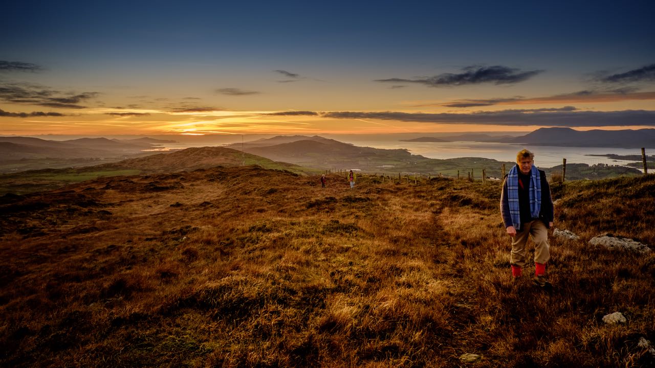
The final choice for a walk is Queen Maev’s tomb, a short hike up from Vaughan’s Pass car park, up behind Bantry. For this photograph I am indebted to Peter Clarke, of the wonderful Hikelines blog. He and Amanda (with whom we have explored SO many holy wells)  were our companions that day. When you reach the top there is a small wedge-tomb, but this is one place where the journey is the real story, with the Mizen, the Sheep’s Head and the Beara all spread out before you.

Photograph © Peter Clarke

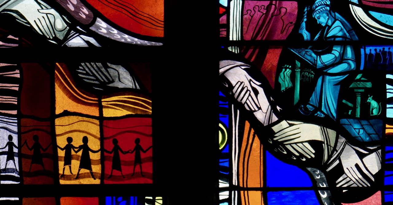
I leave you with a detail from the George Walsh windows in Eyeries, together with the poem the scene is based on, Pangur Bán, written in the 9th century by an Irish  monk labouring away in a scriptorium in Europe. Here is the poem read, at a memorial service for Seamus Heaney, first in the original Old Irish and then in Heaney’s translation.

Merry Christmas from us! If you live here, get out and about this year to some of our picks, and if you don’t, come see us soon!