West Cork Obscura – Finola’s Picks

The popular Atlas Obscura defines itself as the definitive guide to off-the-beaten-track and little known wondrous places. So we’ve captured that idea and, as our Christmas present to our readers, bring you our own carefully-curated, slightly eccentric, Roaringwater Journal Guide to West Cork’s Hidden Wonders. Robert’s selection is here. No well-know tourist spots for these posts! No car parks and visitor centres! You may need wellies for some, a good map for others, and, although all are accessible, some may require permission.Each place I recommend will link to a blog post with more information. As an example, Sailor’s Hill, just outside Schull (above) is an easy walk and look what you get at the top! 

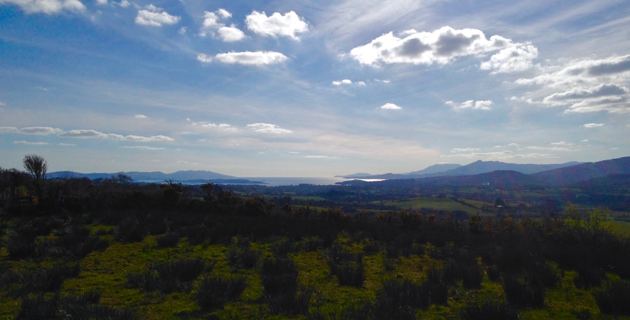
This is the view from Brow Head, looking back towards Crookhaven, and Mount Gabriel in the distance. Brow Head is much less visited than Mizen Head, but just as spectacular

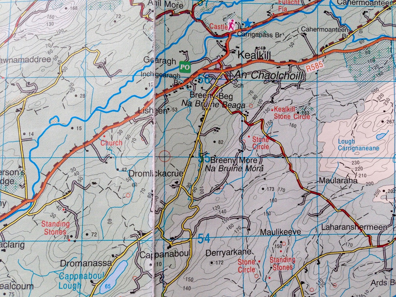
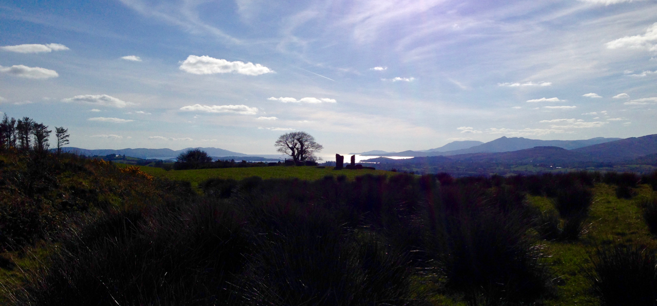
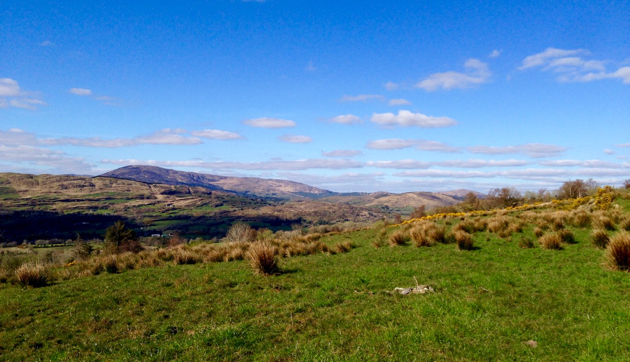
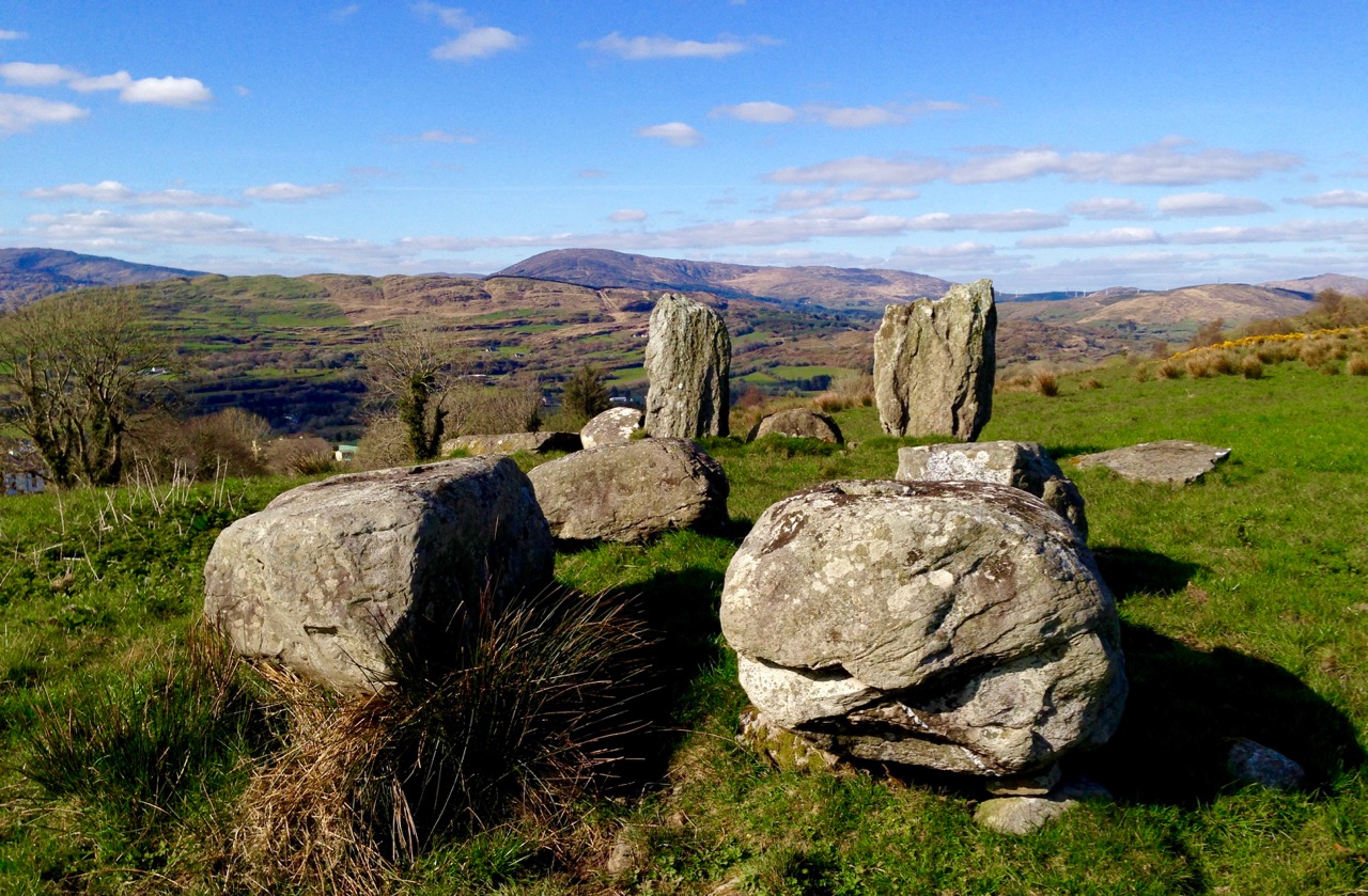
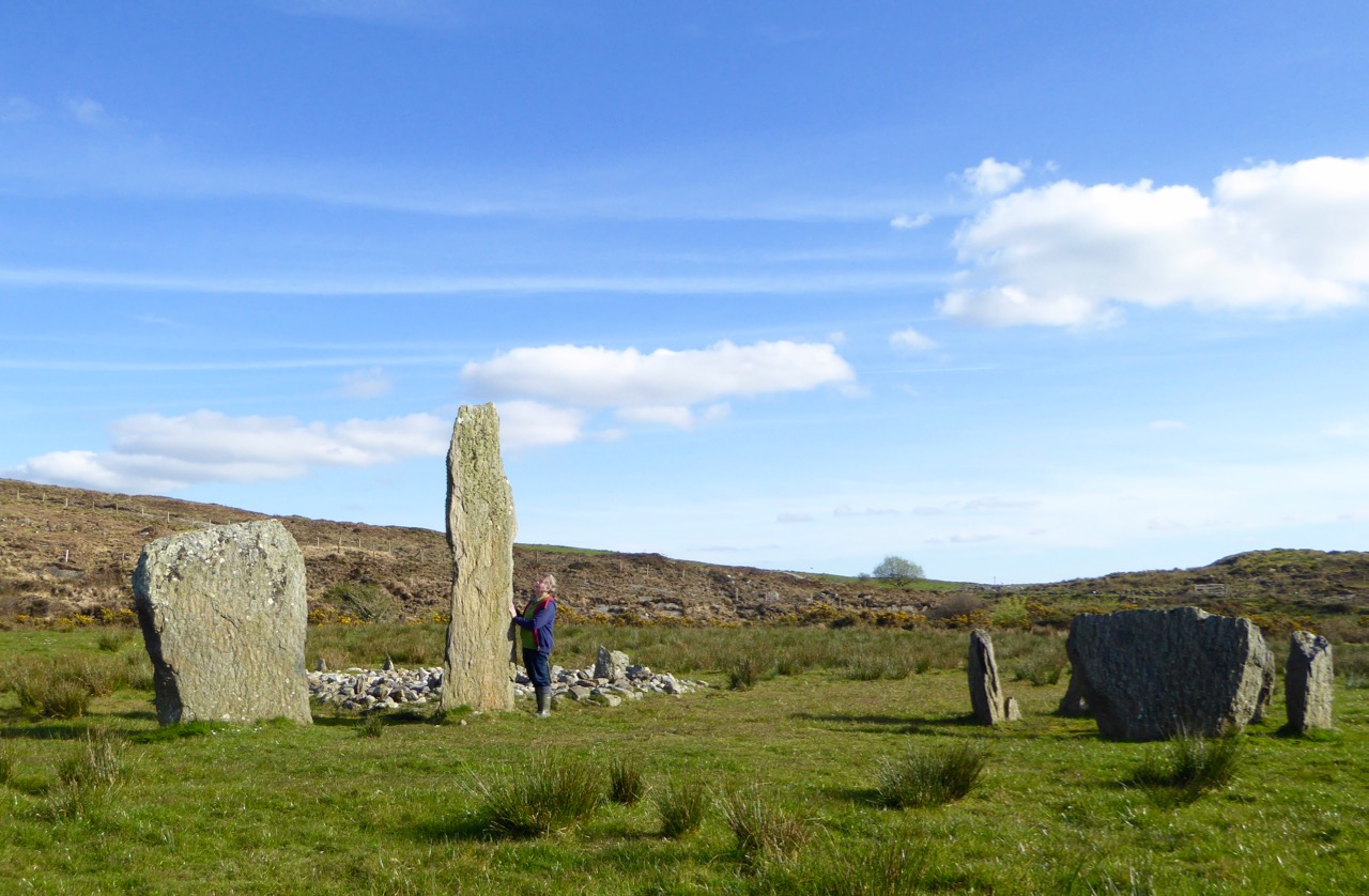
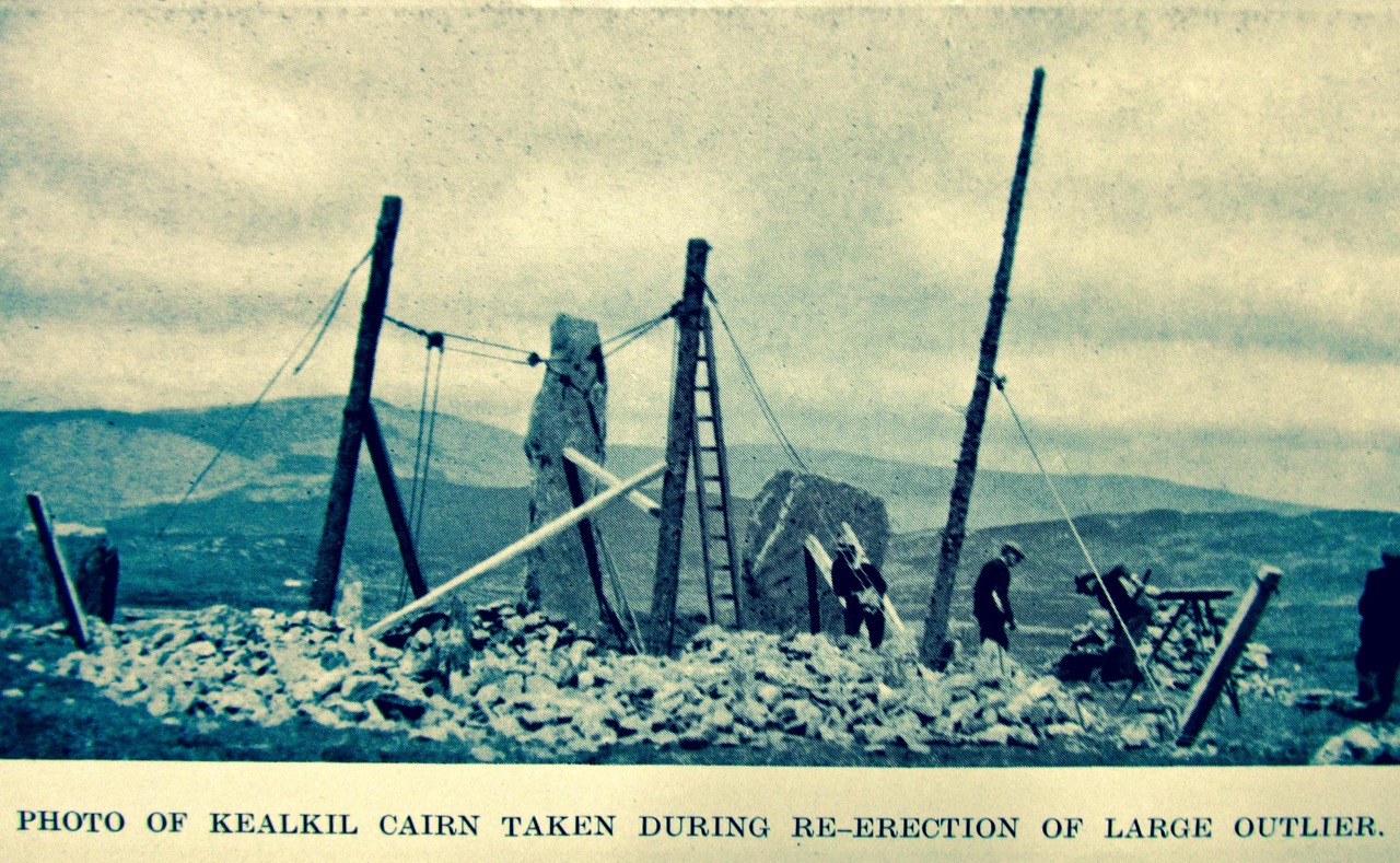
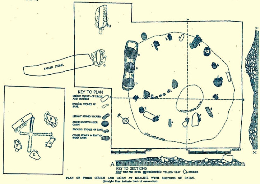
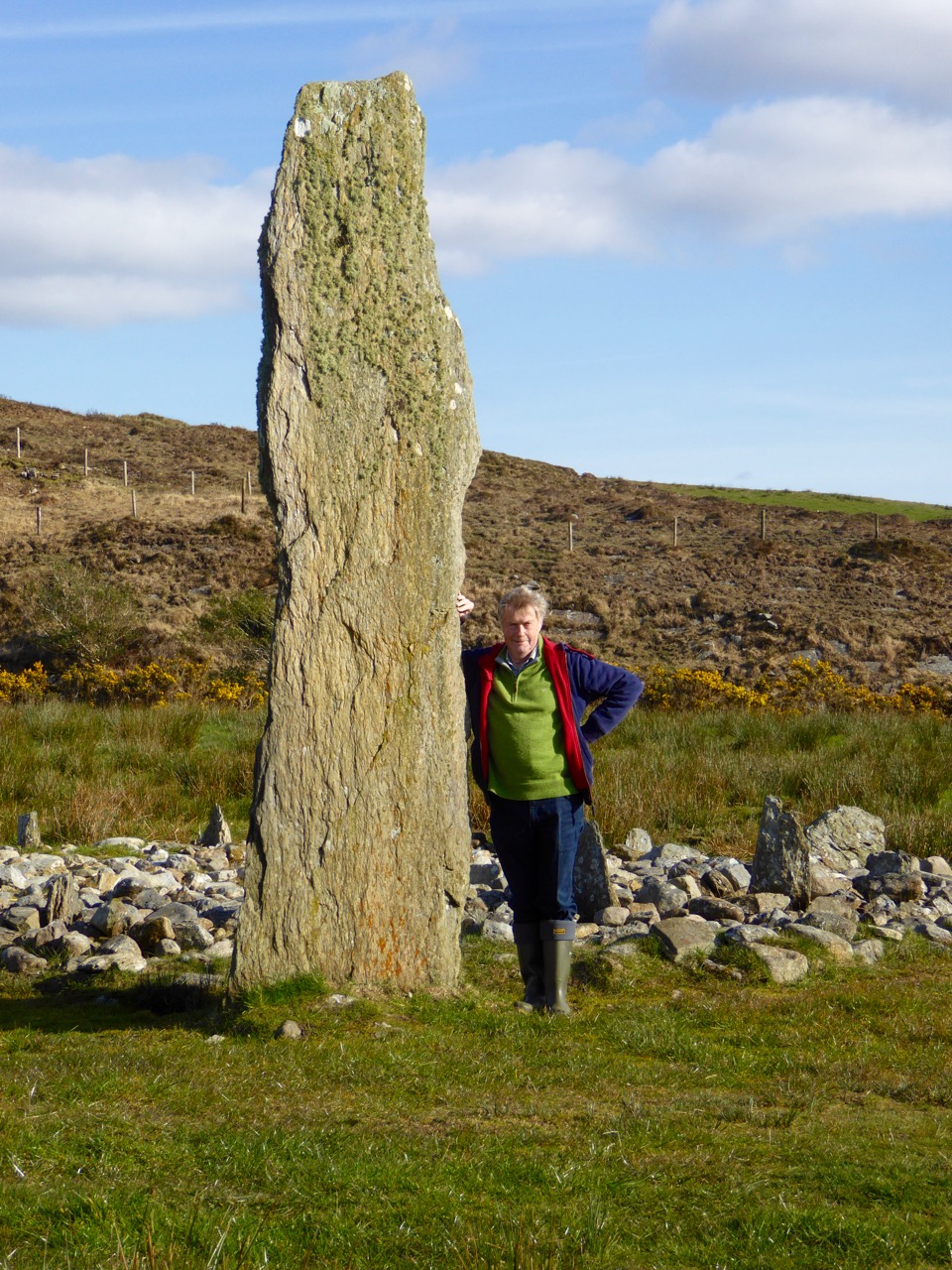
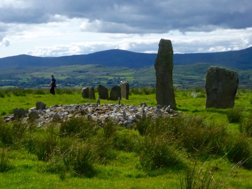
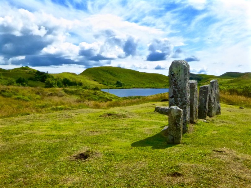
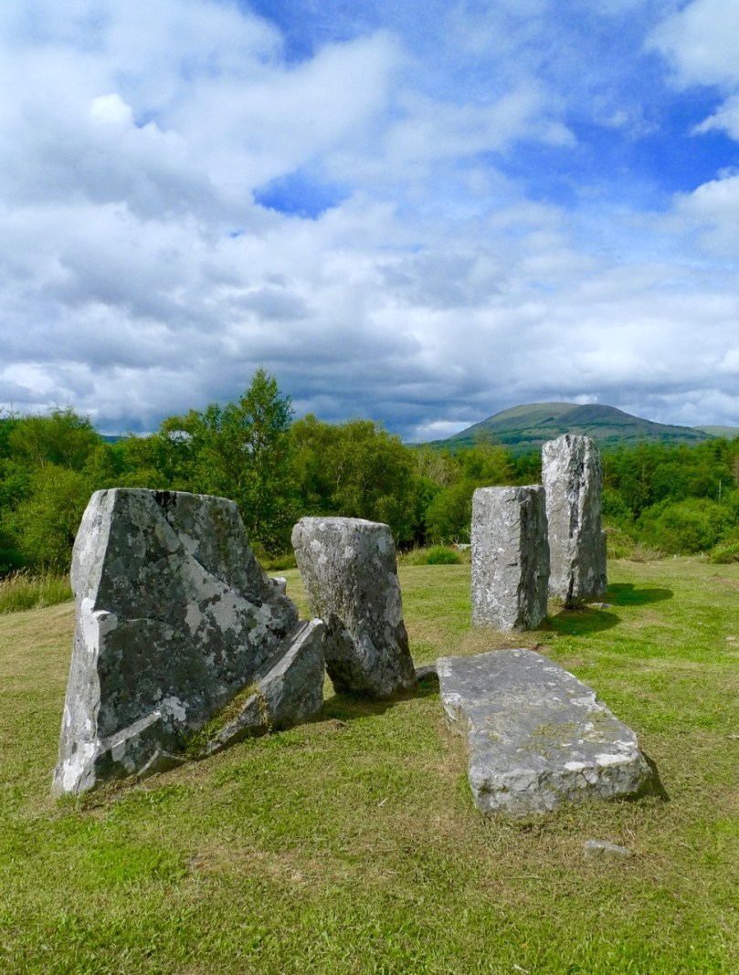
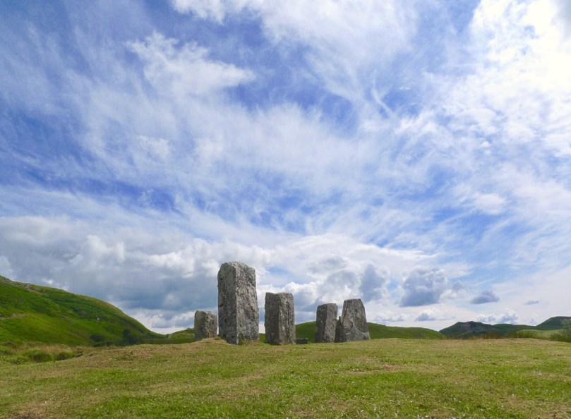
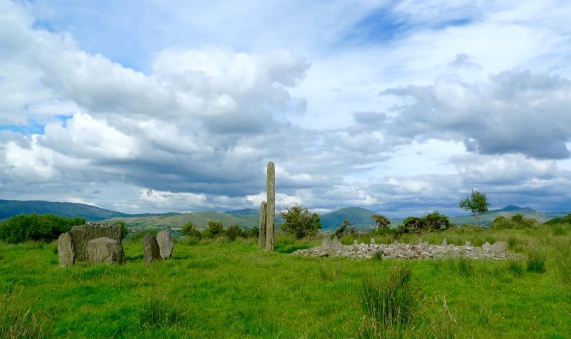
I’m going to start with some archaeology and a couple of spectacular sites. The first is the Kealkill Stone Circle – but this isn’t just a stone circle, it’s a complex of monuments that includes a five-stone circle, a radial cairn (very rare in this part of the world) and two enormous standing stones. The views are immense in every direction, and the site is easy to find.

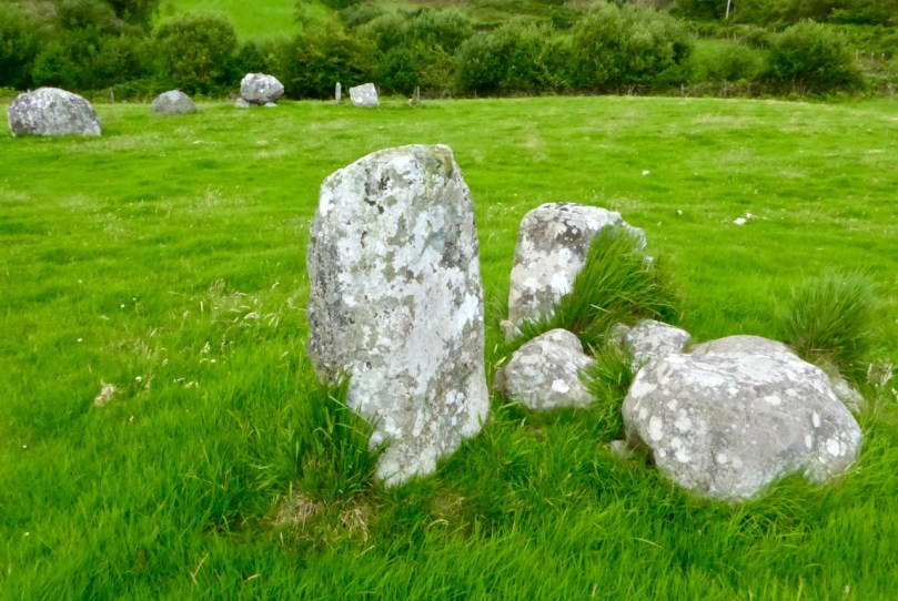
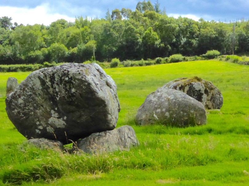
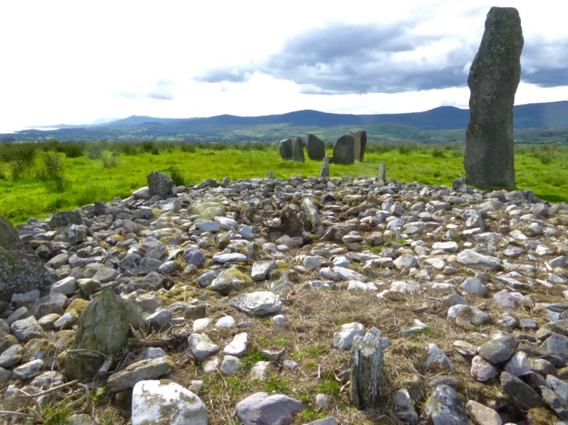
We all know about Drombeg – and we love it when the sun goes down at the midwinter solstice, and even when it doesn’t. But fewer people know about another stone circle, equally spectacular, with a spring equinox orientation. It’s called Bohonagh and it’s quite a complex. First of all, there’s a boulder burial, with quartz support stones and cupmarks on the boulder. Then there’s a cupmarked stone, partly hidden in the brambles between the boulder burial and the stone circle. Finally, there’s the circle itself, almost complete, with views in all directions.

Equinox sunset at Bohonagh

We were lucky to have a session there one equinox, and another one with Ken Williams of Shadows and Stone. For access, park just off the main road, across from the salmon coloured house 4.5km east of Rosscarbery and walk up the farm road to the barns and from there to the top of the hill. This is a working farm – please close all gates and be respectful of animals!

Maughnasilly Stone Row broods on the hilltop

A stone row to round out the archaeology sites – this one is at Maughnasilly and I chose it because it’s been excavated, so there’s an informative sign, access is easy and it’s a beautiful, atmospheric site, overlooking a small lake. The row has been calculated to have both lunar and solar alignments.

And from the ground…

A couple of churches now, beginning with the Church of Ireland Church of the Ascension in Timoleague. This is one of those places that is dripping with unexpected stories. As soon as you go through the door your jaw will drop – the whole church, floor to ceiling, is covered in mosaic, partly paid for by an Indian Maharajah. Read the story here and here – and look carefully at the stained glass windows, some of them are among the oldest stained glass we have in Ireland. The key used to be at the grocery store on the main street, but I’m not sure where it is now, so you may have to ask around. Let us know if you find out.

The interior of the church, and one of the beautiful Clayton and Bell windows

You may wonder at my next choice – it’s not everyone’s cup of tea – but the modernist church in Drimoleague is the work of Frank Murphy, the architect hailed as Cork’s ‘Unsung Hero of Modernism’.

I love the spare minimalist space, very rare in West Cork, but it’s the stained glass windows that drew my attention. It’s not that they are particularly beautiful or skilfully done: they’re by the Harry Clarke Studios long after Harry himself had died. It’s that they fascinate me as a social document – they are, in fact, a prescription for how to live your life as an Irish Catholic in the 1950s. As such, they will resonate with anyone of my vintage. Research by the brilliant young scholar, Richard Butler, has revealed that the design was practically dictated by Archbishop Lucey, still a name to invoke an image of the all-powerful churchman of the 20th century.

And a final church, but this one strictly for the windows. (No – not St Barrahanes in Castletownsend for the Harry Clarkes – everyone knows about them already, and this is a selection of lesser-known wonders.) Do NOT go through Eyeries, on the Beara Peninsula, without stepping into the little church of St Kentigern. Here is where we were first introduced to the work of the stained glass artist, George Walsh.

The Annunciation and Nativity window

When Robert wrote his original post, we couldn’t find out much information on George Walsh, but now he has become a friend and I have written about his work for the next issue of the Irish Arts Review (due out in March, 2019) and spent many happy hours photographing his windows and his artwork around Ireland. It’s bold, graphic, modern and incredibly colourful, and the windows in Eyeries, along with the religious themes, tell the story of Ireland and the Beara through time.

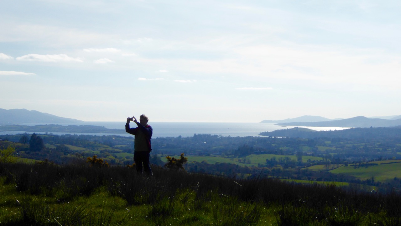
Some places to visit now for a good walk or a swim. First, one of my favourite walks is to hike up to Brow Head, at the end of the Mizen Peninsula (you can drive up too, but pray you don’t meet a tractor coming down) and then walk out to the end of the Head (see the second photo on the post for the view from the top of the road). Stop first to explore the ruins of the old Marconi Station – there’s also a Napoleonic-era  signal station and a WW2 Lookout Post. Then wander through the heather and the low-growing gorse until you get to the part where the sea is crashing below, with vertiginous drops off either side. I will leave it to you how far you go from there!

Brow Head showing the signal station and Marconi station silhouetted against the evening sky

Although Barley Cove is well known, Mizen locals love Ballyrisode Beach for a swim or a lounge in the sun. White sand, sheltered bays, and water warmed by running over the shallow bay. The final little beach holds a secret – a Bronze Age Fulacht Fia or Water-Boiling Site, that Robert and I recorded for National Monuments this summer. It was an exciting find, hiding in plain sight. The beach has an association with pirates too!

Ballyrisode Beach – yes, the water really is this colour. The three sided rectangular stone thing is the fulacht fia

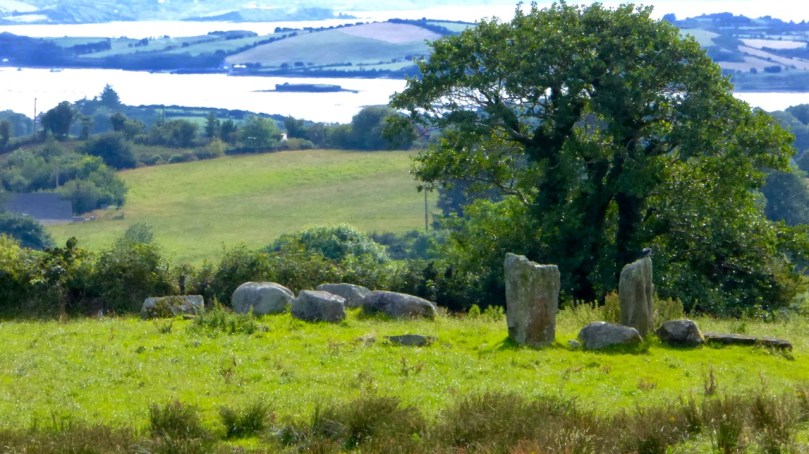
The final choice for a walk is Queen Maev’s tomb, a short hike up from Vaughan’s Pass car park, up behind Bantry. For this photograph I am indebted to Peter Clarke, of the wonderful Hikelines blog. He and Amanda (with whom we have explored SO many holy wells)  were our companions that day. When you reach the top there is a small wedge-tomb, but this is one place where the journey is the real story, with the Mizen, the Sheep’s Head and the Beara all spread out before you.

Photograph © Peter Clarke

I leave you with a detail from the George Walsh windows in Eyeries, together with the poem the scene is based on, Pangur Bán, written in the 9th century by an Irish  monk labouring away in a scriptorium in Europe. Here is the poem read, at a memorial service for Seamus Heaney, first in the original Old Irish and then in Heaney’s translation.

Merry Christmas from us! If you live here, get out and about this year to some of our picks, and if you don’t, come see us soon!

Family-Friendly Archaeology Day in West Cork (Updated)

This is an update of a post originally published a while back. I’ve added a holy well (to finish your day off right) and some new photographs, and deleted some out-of-date information. I’ve also provided a list of informative posts about the monuments you’ll be seeing at the end.

West Cork is loaded with prehistoric monuments but many are on private land or inaccessible. So we’ve planned a day for you in which you can have a Grand Day Out and a tour through some of the best West Cork archaeology sites. Load the kids into the car, stick Discovery Map 85 in your pocket (or print out the one we’ve provided in this post), bring boots or wellies, and off you go! By the way, we advise leaving the dog at home when on a field trip like this, since you will be visiting private farm land which will likely have cattle on it.

Our starting point is Ballylicky – here’s your opportunity to pick up a picnic at the marvellous Manning’s Emporium, while you fuel up with a pre-trip latte. Ready now? First stop is Mill Little.

1 Mill Little Complex

From Ballylicky, head west along the scenic seaside road towards Glengarriff for a couple of kilometres and take the first turn right at Snave. You’ll be following the Coomhola Rive as it tumbles down between high hills. Once you’ve crossed Snave Bridge continue for a about a km, take the second left and then immediately right. One km on, take a left and then the next right. Park along here and the Mill Little complex is in a field on the left.

This is a complicated site, comprising a stone pair (don’t be confused by the other stones around the pair, which have been piled here), three boulder burials, and a small five-stone circle. All these monuments probably date from around the same time – the Bronze Age, about three to four thousand years ago. A particular feature of West Cork archaeology is that boulder burials, standing stones (single, in pairs, or in rows) and stone circles are often found together. Stone circles and stone rows are oriented towards significant solar events, such as the rising solstice sun or the setting sun at an equinox. In the Mill Little stone circle the alignment over the recumbent is NE/SW. At a site like this, it is possible that all the features formed a large observational arena, with the stone row, boulder burial and stone circle providing multiple alignment possibilities and marking both solar and lunar events.

The boulder burial nearest the stone circle is the most classic in appearance – a large glacial erratic sitting on top of three support stones. Excavations at boulder burials in West Cork, however, haven’t really yielded evidence of actual burials – perhaps the term is a misnomer!

2 Carriganass Castle

Retrace your steps back towards Ballylicky and take the road to Kealkill – or try an overland route using the map. At Kealkill take the last fork signposted to Gougane Barra and you will see Carriganass Castle almost right away.

Carriganass is an excellent example of the medieval tower house – take a look at the posts linked below (at the end) for more about these structures in West Cork. There’s easy parking around the back and lots of explanatory signs around the castle. This is a good place for a picnic, or you can wait until after you’ve been to Maughanasilly, since you come back this way. If it’s a hot day, such as we’re experiencing right now in West Cork, the kids will enjoy a dip in the river here.

3 Maughanasilly Stone Row

Continue past the back of the castle. At the first junction take the left fork and continue until you see a small lake on your left. Shortly after you will come to a cross roads. Turn right and park – the stone row is in the field on your right.

This is a good example of a multiple stone row: it occupies a very dramatic setting on a knoll overlooking the lake. There’s a helpful explanatory sign.. Note that, instead of being straight, the stones form a slight arc. This is deliberate, as is the placement of the stone lying flat on the ground According to one expert, this stone is placed so that anyone walking up to it and standing with toes touching its edge is looking straight at the equinox. This stone row also appears to have been an important one for lunar observations. It takes the moon over 18 years to complete its cycle and from this site observations of the lunar maximums (the most extreme northerly and southerly moonrises) were likely made.

Ponder on the sophistication of our Bronze-Age ancestors. Much of the knowledge they built up so that they could keep track of time and seasons had to be re-learned by later people.

4 Kealkill Stone Circle

Back you go to Carriganass (picnic now, if you haven’t done so already) and on to the village of Kealkill – a pretty and well-kept village (and home to a famous St. Patrick’s Day parade). The stone circle is signposted from the village – just follow the steep and winding road that runs up from the church. After a sharp bend to the right, take the first left turn. There’s enough room to park at a small pull-out. The walk across the field to the circle is often muddy and squelchy so make sure to wear your boots here.

This is yet another complicated site. There is a standing stone pair, a five-stone circle and a radial cairn. But perhaps the first thing you will notice is the spectacular view. From this spot you can see all the way down the spine of both the Sheep’s Head and the Beara Peninsula to the South-West, and across the valley to the Shehy Range to the North and East.

One of the stone pair is over 4m high. But it’s broken – and may originally have stood over 6m high.  Imagine the difficulty of erecting this!

The radial cairn is a mysterious monument – nobody is quite sure of its function – and relatively rare. Once again, it is often found in conjunction with other monuments – stone alignments or stone circles. This one was excavated, but nothing conclusive was found to help determine its function. Note the small upright projecting stones that look like the face of a clock among the cairn stones.

5 Breeny More, Ring Fort, Boulder Burials and Stone Circle

This is almost directly south of the Kealkill circle and on the other side of the road. Go back down the hill towards the village of Kealkill, take the first left and it’s around the first bend. There’s a ring fort (Early Medieval farmhouse enclosure, perhaps 1000 years old) right inside the gate. This is a farm field so check there are  no animals or machinery working before venturing across and up it. There’s a multiple stone circle here, with four boulder burials within it. There’s not much left of the stone circle, but the portal stones and recumbent remain, so the alignment can be discerned. The boulder burials are laid out in square formation in the centre – a very unusual occurrence, since boulder burials are normally outside the circle.

The site is on a natural ridge, with similar panoramic views to the Kealkill Stone Circle. One writer has speculated that if trees were removed it would be possible to see the tall standing stone at Kealkill from this site.

6 Kealkill Holy Well

What’s a field trip without a holy well? This one is wonderful. Park at the graveyard about a km from Kealkill on the road towards Ballylicky and walk up through it, then follow the path across a small field to the Marian statue. The holy well is behind the shrine. Known locally as Tobairín Mhuire (Mary’s Little Well), mass was traditionally celebrated here on August 15th. If you’d like to learn more about holy wells, or visit some other West Cork examples, have a good browse around Holy Wells of Cork – it’s the go-to website on this subject (see list below).

Here’s more information about the kinds of monuments you’ll be visiting:

Stone Circles: Ancient Calendars

Standing Stones and Rows: Monoliths, Mysteries and Marriages

Holy Wells: Holy Wells of Cork

Boulder Burials: Boulder Burials: A Misnamed Monument?

Castles: Several posts about tower houses

We hope you enjoy your day! Let us know how you get on.

Boulder Burials: a Misnamed Monument?

Rathruane Boulder Burial

The term boulder burial was coined in the 1970s by Sean O’Nualláin, an archaeologist with the Ordnance Survey, to describe a class of monument that was quite prevalent in the south west, consisting of a single large boulder sitting on three or four support stones. The support stones lift the boulder off the ground and provide a small chamber-like area under the stone. Previously, this type of monument was known as a dolmen, a boulder dolmen or a cromlech, but O’Nualláin was convinced that the main purpose of these boulders was to mark a burial.

Lisheen Cromlechs by Jack Roberts

Illustrations from Jack Robert’s book Exploring West Cork

He based this belief partly on his extensive experience with other megalithic monuments, but also on the findings of the excavation of the Bohonagh complex, where Fahy found fragments of cremated bone in a pit under the boulder.

Bohonagh Boulder Burial
The Bohonagh complex includes a multiple-stone circle, a boulder burial and a cup-marked stone. A standing stone stood close by but has disappeared. Note the quartz support stone

However, William O’Brien excavated three boulder burials in the late 1980s and found no evidence of burials. In his book, Iverni, he comments in an understated way, “The absence of human remains at Cooradarrigan and Ballycommane does pose some questions as to their use.” His findings dated the sites to the Middle Bronze Age, between 3000 and 3,500 years ago.

Lisheen Lower boulder Burial

A boulder burial from Lisheen Lower

What is unquestioned, though, is that they are predominantly found in the south west, especially in Cork, and that, while most occur alone, they are often found in groups, and/or in association with stone circles or standing stones.

rathruane boulder

This one is at Rathruane More, close to a significant rock art site and with views of Mount Gabriel and Mount Corrin

A boulder burial is a striking and unmistakable sight. Often situated on a high point or ridge it can be seen silhouetted against the sky – a large glacial erratic standing proud in the landscape. There are lots of examples around us here and most of them command extensive and often panoramic views. These are monuments that were built to be seen and to see from.

dunmanus boulder burial

An exception to the high ground location is found at Dunmanus on the north side of the Mizen Peninsula. This boulder-burial is so low-lying, in fact, that one can only reach it at low tide

Ballycommane Bouder Burial quartz

Ballycommane – the boulder is of white quartz

William O’Brien has pointed out that quartz is a feature of West Cork prehistoric sites and this is particularly evident in the case of boulder-burials. At Bohonagh, for example, some of the support stones are of gleaming white quartz, while at Ballycommane, Cooradarrigan and Cullomane the boulder itself is quartz. The sun was low in the sky when we visited Ballycommane and the sight of the quartz boulder gently gleaming was truly memorable.

Mill Little Complex 2

The Mill Little complex

Boulder burials often occur in groups and in association with other monuments. Mill Little is a good example of this: three boulder burials are in a line with a standing stone pair at one end and a five-stone circle at the other. See our post Family-Friendly Archaeology Day for more photos of the Mill Little Complex.

Cullomane boulder burial

This photograph shows the Cullomane boulder burial in the foreground, and a ‘penitential station’, in the background. This ‘station’ was part of a pilgrim round that involved prayer and penance – see Holy Wells of Cork for more detail on this site

At the Cullomane site, east of Bantry, the quartz boulder is surrounded by a variety of other monuments: a small stone circle, an ‘anomolous’ group of stone, a stone row, and standing stones all lie within a few fields of each other. Intriguingly, this site has seen continued ritual use through the millennia – there are also ring forts, burial grounds, a holy well and a ‘penitential station’ within the same small area.

Ballycommane boulder burial and standing stone pair

The Ballycommane boulder is in close proximity to a standing stone pair

Breeny More 4

At Breeny More, near Kealkill, four boulder burials in a square pattern lie inside what remains of a large multiple-stone circle. This is an awe-inspiring site – you feel you are on top of the world with mountains all around and stunning views out to the end of the Beara and Sheep’s Head Peninsulas. See Robert’s post Walking the Past for a sense of what this site offers.

Kenmare Stone Circle and boulder burial

The Kenmare stone circle, above, has a boulder burial in the middle of it, while the Gorteanish stone circle on the Sheep’s Head, below, has at least one and possibly two boulder burials

Gorteanish

So – if they weren’t tombs, or weren’t solely tombs – what was the purpose of these striking boulders? Their association with stone circles and rows provide evidence that they fit the calendrical pattern that we find in so many monuments of this era. Mike Wilson, the archeo-astronomer of the Mega-What site, has surveyed many of the West Cork boulder burials and has this to say: This survey shows that boulder-monuments were functional objects marking astronomically important places in the landscape. They cannot generally define an azimuth as accurately as a stone row or circle but capstone shape and orientation are usually significant, helping to indicate directions of interest.

Breeny More

At Breeny More the square layout of the four boulder burials within the stone circle provide many possible alignments

In several of the boulder burials we have observed, capstone shape and direction certainly seem to be a deliberate feature of the monument.

Rathruane boulder Burial Orientation

Robert checks the orientation of the long axis of the capstone at Rathruane More

But perhaps the best example we have of how a boulder burial can have an orientation was drawn to our attention by local historian Brigid O’Brien – and she even sent us the evidence! If you stand at Bawngare, your attention is immediately drawn to the spectacular views to the west and north west – views that include Mount Gabriel, Mount Corrin and between them, faraway Hungry Hill on the Beara Peninsula, as well as the Sea in Roaringwater Bay. Interestingly, one of the support stones has several small shallow cupmarks (cupmarks are found on the capstones of several boulder burials).

Barngare Boulder Burial and view

The view west from Bawngare boulder burial

However the capstone with its distinctive long furrow holds the real secret, and Brigid’s persistence in braving the cold to visit at exactly the right time has unlocked that secret for us now.

Bawngare boulder burial general

From the other side the long furrow can be seen running the length of the capstone

Brigid visited it last year at the winter solstice and took this photograph of the setting sun. It seems the capstone was deliberately positioned to mark this alignment.

Bawngare boulder burial winter solstice sunset

Brigid’s photograph, taken on December 21st, 2015

Perhaps it’s time to go back to calling them something other than burials – I rather fancy the old term boulder dolmens. What do you think?

Walking the Past

Robert taking a picture

How fortunate are we? We are free to spend our days wandering the world’s most beautiful landscapes, here in Ireland: landscapes which have changed relatively little over the last five thousand years. They have changed, of course, but the human hand has had less impact in this country than in many other developed nations, especially in these wilder parts. That is why we relish our explorations: we are walking the past.

breeny landscape

Top picture: Robert taking in the setting of the monuments at the Kealkill complex. Above: the view towards Kealkill village from Breeny More

Every expedition requires a little pre-planning. This week we were keen to catch up with a group of monuments known as ‘boulder burials’. Finola tells me that, when she was first studying archaeology, they were known as ‘boulder dolmens’: I prefer that term – perhaps because it has a touch of the antiquarian about it – and, in any case, the use of the word burials implies a definitive function which has not been universally borne out with the examples that have been excavated. But I will leave Finola to delve into the specifics of that subject in her post Boulder Burials: a Misnamed Monument?

workspace

Blogging in progress: prequel to an expedition…

First, we look to the available information: William O’Brien’s Iverni – A Prehistory of Cork (The Collins Press 2012) is an essential primer on the pre-Christian era in this corner of Ireland since the first human foot was set on its shores. Then there are maps to be consulted: the Ordnance Survey Office was created in 1824 to carry out a survey of the whole island for land taxation purposes. The original survey at a scale of 6 inches to 1 mile was completed in 1846 and Ireland thus became the first country in the world to be entirely mapped at such a detailed scale. From the outset, known historic sites and monuments were recorded and the present Discovery Series at 1:50,000 scale provides a wealth of information to the fingertips of historians and adventurers.

kealkill OS map

One of our bibles: the Discovery Series of the 1:50,000 Ordnance Survey maps – well used and well worn! The monument sites are marked in red

Before setting out we usually consult with the Archaeological Survey Database of the National Monuments Service: this gives us the fine detail on where to find recorded historic sites. Yet in the end the most valuable information often comes from knocking on doors. Farming families here often go back through many generations and local knowledge is always passed down through them. It’s here that you sometimes pick up the ‘stories’ that are associated with ancient sites – for me, these are just as interesting as any formal records.

Breeny More landscape

View to Bantry Bay across the Breeny More archaeological site

This week our travels brought us to the Breeny More and Kealkill complexes, high up in the hills above Bantry, heading towards the wonderfully named Cnoic na Seithe – the Mountains of the Spirits. This was on a perfect spring day: the views all the way down the bay with the Beara on one side and the Sheep’s Head on the other can only be described as spectacular.

kealkill landscape

view west

Two views from the Kealkill complex

It can’t be accidental, surely, that these ancient sites occur in places like this, that make the senses reel? In many cases there are long views in all directions, often taking in prominent horizons, hilltops, the sea, inlets and islands. ‘As far as the eye can see’ is an expression that truly comes into its own: these vistas must have had special meanings to the ancestors who were here in the Neolithic and Bronze ages. Were they trying to define it in some way by building such impressive large-scale structures, most likely for some ceremonial purpose? It was certainly not construction work which could have been undertaken lightly or frivolously. Here’s O’Brien in Sacred Ground, Megalithic Tombs in Coastal South-West Ireland (NUI Galway 1999):

…Antiquarian interest in Ireland dates from the visit of Edward Lhuyd at the end of the 17th century and was encouraged by the discovery of great megalithic centres like the Boyne Valley in Co Meath and Carrowmore in Co Sligo. The early antiquarians were to link these ‘Giants Graves’ to invaders or colonists from the East, to Scandinavian incursions and eventually to the events and characters of early Irish literature…

boulder cluster

The Breeny More complex:  no less than four boulder burials, a multiple stone circle and a (much later) ring fort, all on one superbly located site

Robert Kealkill Complex

A cause for wonder: the tall standing stone at the Kealkill complex. A stone circle lies to the west while a radial cairn is behind (to the south of) the stone pair

So, it’s Finn McCool and the Tuatha de Danaan that we have to look to, perhaps, for explanations as to why we find these incursions on our natural landscape standing as solidly and unchangingly as they did a few millennia ago. Perhaps not quite unchangingly, in fact: archaeologists have had a hand in the present day appearance of some of them. In the photo above you can see me wondering at the 4.6 metre high megalith which is part of the Kealkill complex. When the site was explored by Sean P O’Ríordáin in 1938 that stone had broken off and had fallen: O’Ríordáin re-erected the remaining part of the menhir. The original would have been at least a metre higher than what we see today.

kealkill excavation report

kealkill diagram

From O’Ríordáin’s published report of the excavation of the Kealkill complex: top, the taller standing stone being re-erected and, below, a survey diagram of the findings. From the Journal of The Cork Historical Archaeological Society, Volume XLIV ,1939

The Breeny More site and the Kealkill complex are near neighbours. Both contain various artefacts: standing stones, stone circles and boulder burials. Kealkill also has a radial cairn. Both are set against a background of moorland, mountain and bay. Kealkill is easily accessible although boggy.

Most sites are on private land and permission should always be sought to visit, unless it is obvious that access is welcomed, as here at Kealkill

Our second archaeological adventure this week was also boulder burial orientated. This was close to home in the townlands of Rathruane, Lisheen Lower and Bawngare. Again, Finola has detailed the findings in her post, but I was struck at each of these sites that the their settings, too, were on high ground with excellent distant views. In each case, mountains were prominent. I couldn’t help thinking that the boulders could have been placed where they are specifically because of the visibility to the various peaks. Might it even be that territories were marked out by these huge stones? Boundaries have always been important to human strategies: we have been identifying and ‘naming’ the land before records began to be written. Field names, townland names, parishes, baronies… A whole lot more to be researched, visited and recorded. Our long walk through Ireland’s past has barely begun!

Robert at Kealkill

Family-Friendly Archaeology

Dramatic Skies over Maughanasilly Stone Row

Dramatic Skies over Maughanasilly Stone Row

West Cork is crammed with prehistoric monuments but many are not really accessible for all family members because of the terrain. Others are on private land where the landowner is reluctant to grant permission, or where frisky bullocks make traversing a field a bit risky. So we’ve done some homework on easy-to-reach sites and planned a route for you in which you can have a) a Grand Day Out and b) a tour through some of the best West Cork Bronze Age sites and one Medieval Castle.

The Kealkill complex: one of the sites you'll visit today

The Kealkill complex: one of the sites you’ll visit today

Load the kids and Grandma into the car, stick Discovery Map 85 in your pocket (or use the one we’ve provided in this post), wear boots or wellies, and off you go! By the way, we strongly advise leaving the dog at home when on a field trip like this. If you must bring him, please keep him on a leash, since you will be on private farmland at each site except Carriganass.

This slideshow requires JavaScript.

Oh – and the frisky cattle? Keep an eye out – they weren’t around when we did our reconnaisance but you never know when that can change. These two photos are by Amanda Clarke, used with permission.

Kealkill Monuments

Our starting point is Ballylicky – here’s your opportunity to pick up a picnic at the marvellous Manning’s Emporium. And if you like your day today, consider signing up for one of their Culture Kitchen tours – an innovative mix of history, prehistory and artisan food that will lead you still further into the prehistoric (and culinary) hinterland of West Cork.

Mill Little Group of Munuments

Mill Little Group of Monuments

1. Mill Little Complex

From Ballylicky, head west along the scenic seaside road towards Glengarriff for a couple of kilometres and take the first turn right at Snave. You’ll be following the Coomhola Rive as it tumbles down between high hills. Once you’ve crossed Snave Bridge continue for about a km, take the second left and then immediately right. One km on, take a left and then the next right. Park along here and the Mill Little complex is in a field on the left.

Stone Pair

Stone Pair

This is a complicated site, comprising a stone pair (don’t be confused by the other stones around the pair, which have been piled here), three boulder burials, and a small five-stone circle. All these monuments probably date from around the same time – the Bronze Age, about three to four thousand years ago. A particular feature of West Cork archaeology is that boulder burials, standing stones (single, in pairs, or in rows) and stone circles are often found together. Stone circles and stone rows are oriented towards significant solar events, such as the rising solstice sun or the setting sun at an equinox. At a site like this, it is possible that all the features formed a large observational arena, with the stone row, boulder burial and stone circle providing multiple alignment possibilities and marking both solar and lunar events.

Boulder burial showing support stones. Five-stone circle in the background

Boulder burial showing support stones. Five-stone circle in the background

The boulder burial nearest the stone circle is the most classic in appearance – a large glacial erratic sitting on top of three support stones. Excavations at boulder burials in West Cork, however, haven’t really yielded evidence of actual burials – perhaps the term is a misnomer!

Three boulder burials at Mill Little

Three boulder burials at Mill Little

2. Carriganass Castle

Retrace your steps back towards Ballylicky and take the road to Kealkill – or try an overland route using the map. At Kealkill take the left fork signposted to Gougane Barra and you will see Carriganass Castle almost right away.

Carriganass Castle

Carriganass is an excellent example of the medieval tower house – take a look at this post for more about these structures in West Cork. There’s easy parking around the back and lots of explanatory signs around the castle. This is a good place for a picnic, or you can wait until after you’ve been to Maughanasilly, since you will come back this way. If it’s a hot day (don’t laugh – it can happen!) the kids will enjoy a dip in the river here. There are also some looped walks starting from here – mark them for a future expore.

3. Maughanasilly Stone Row

Continue past the back of the castle. At the first junction take the left fork and continue until you see a small lake on your left. Shortly after you will come to a cross roads. Turn right and park – the stone row is in the field on your right.

Maughanasilly Stone row. Note the row forms a slight arc

Maughanasilly Stone row. Note the row forms a slight arc

This is a good example of a multiple stone row and occupies a very dramatic setting on a knoll overlooking the lake. Note that, instead of being straight, the stones form a slight arc. This is deliberate, as is the placement of the stone lying flat on the ground. According to one expert, this stone “is placed so that anyone walking up to it and standing with toes touching its edge is looking straight at the equinox.” This stone row also appears to have been an important one for lunar observations. It takes the moon over 18 years to complete its cycle and from this site observations of the lunar maximums (the most extreme northerly and southerly moonrises) were likely made.

The stone row with recumbent stone

The stone row with recumbent stone

Ponder on the sophistication of our Bronze-Age ancestors: much of the knowledge they built up so that they could keep track of time and seasons had to be re-learned by later people.

Maughanasilly Stone row  - a lunar observatory?

Maughanasilly Stone row – a lunar observatory?

4. Kealkill Stone Circle

Back you go to Carriganass (picnic now, if you haven’t done so already) and on to the village of Kealkill – a pretty and well-kept village (and home to a famous St Patrick’s Day parade). The stone circle is signposted from the village – just follow the steep and winding road that runs up from the church. After a sharp bend to the right, take the first left turn. There’s enough room to park at a small pull-out. The walk across the field to the circle is invariably muddy and squelchy so make sure to wear your boots here.

Kealkill standing stone pair, stone circle and radial cairn

Kealkill standing stone pair, stone circle and radial cairn

This is yet another complicated site. There is a standing stone pair, a five-stone circle and a radial cairn. But perhaps the first thing you will notice is the spectacular view. From this spot you can see all the way down the spine of both the Sheep’s Head and the Beara Peninsula to the South-West, and across the valley to the Shehy Range to the North and East.

From the Kealkill Site

From the Kealkill Site

One of the stone pair is over 4m high. But it’s broken – and may originally have stood over 6m high.  Imagine the difficulty of erecting this!

The first thing you notice - that standing stone!

The first thing you notice – that standing stone!

The radial cairn is a mysterious monument – nobody is quite sure of its function – and relatively rare. Once again, these cairns are often found in conjunction with other monuments – stone alignments or stone circles. This one was excavated, but nothing conclusive was found to help determine its function. Note the small upright projecting stones that look like the face of a clock among the cairn stones.

Kealkill radial cairn

Kealkill radial cairn

5. Breeny More Stone Circle and Boulder Burials

This is just a little way up from the Kealkill circle and on the other side of the road. We haven’t had time to visit it properly yet, so my photograph was taken from near the road. There’s a multiple stone circle here, with four boulder burials within it. There’s not much left of the stone circle, but the portal stones and recumbent remain, so the alignment can be discerned. The boulder burials are laid out in square formation in the centre – a very unusual occurrence, since boulder burials are normally outside the circle. The site is on a natural ridge, with similar spectacular views to the Kealkill Stone Circle. One writer has speculated that if trees were removed it would be possible to see the tall standing stone at Kealkill from this site.

Breeny More complex from the road

Breeny More complex from the road

We hope you enjoy your day! Let us know how you got on.