The Centre of Ireland

We have written previously about the sacred site reputed to be the “Centre of Ireland”. In other words the midpoint of the country: that’s the whole of the island of course – the division into Ireland and Northern Ireland is an artificial designation barely a century old. It’s a many-centuries-old tradition that the Hill of Uisneach, in Co Westmeath, is regarded as the geographical centre of this whole island and has been regarded as a major ritual site for the assembly of the ruling families and debate on the lore of the land.

We visited the hill in October 2016, while preparations were being made to celebrate autumn festivities there. In the picture above, you can see the Godess Eriu being decorated. It was she who gave Ireland its name – Eire. Before you read on about Uisneach’s other claim to fame, have a look at my post from six years ago, here. My friend Michael read this post and sent me a fascinating article on the subject of ‘the geographical centre of Ireland‘. Please read it – and, if you understand the technicalities of the process, please let me know!

. . . The calculation to find the exact geographic centre of Ireland was carried out by OSi using the most up-to-date, openly available geospatial data and widely used geographic information system (GIS) technology.  Specifically, OSi used Esri’s Mean Centre Point tool in ArcMap and features data for the Republic of Ireland from its own open-source data set, OSi Admin Areas Ungeneralised, as well as an openly available OSNI Largescale County Boundaries data set from Land & Property Services of Northern Ireland (LPS). The Northern Ireland features were reprojected from an Irish National Grid coordinate system to line up with the OSi features for the republic of Ireland (ITM), enabling the datasets to be processed together.  In just a few short minutes, the coordinates 633015.166477, 744493.046768 were revealed, providing one scientific answer to an age-old question . . .

Ordnance Survey of Ireland Data February 25th 2022

To get to the salient point, the Ordnance Survey of Ireland is rejecting tradition in favour of science! They claim the true centre of this island is a little distance from Uisneach:

. . . According to a new calculation from Ordnance Survey Ireland (OSi), the centre of the island of Ireland actually lies at the Irish Transverse Mercator (ITM) coordinates 633015.166477, 744493.046768, near the community of Castletown Geoghegan, between the towns of Athlone and Mullingar.  This scientifically-calculated centre point is situated, as the crow flies, approximately 31km east of the Hill of Berries, 35km east-south-east of the townland of Carnagh East and a mere 5km south-east of the Hill of Uisneach, Loughnavalley, Co. Westmeath . . .

Ordnance Survey of Ireland Data February 25th 2022

Whilst acknowledging that ” . . . Over time, new data, advancing technologies and new techniques could generate different versions of the truth . . .” the Ordnance Survey throws out a challenge to tradition. I’m throwing that challenge right back!

If I was going to set out to find the geographical centre of Ireland, I would take a large map and pin it up on the wall:

Then I would throw a dart at it – aiming for the middle! I’d get somewhere near, for sure. In fact, there’s a little red dot on this map – just under Mullingar: this is where Uisneach is located. But, if you want something more technical, might you work out a centre based on distances from the extremities? Here are some possibilities:

However, this map does rather show up the inadequacies of this methodology! So, what does Uisneach have to recommend it – and justify the long-held tradition? Well, it does have a large rock, known as ‘The Cat’s Stone’ . . .

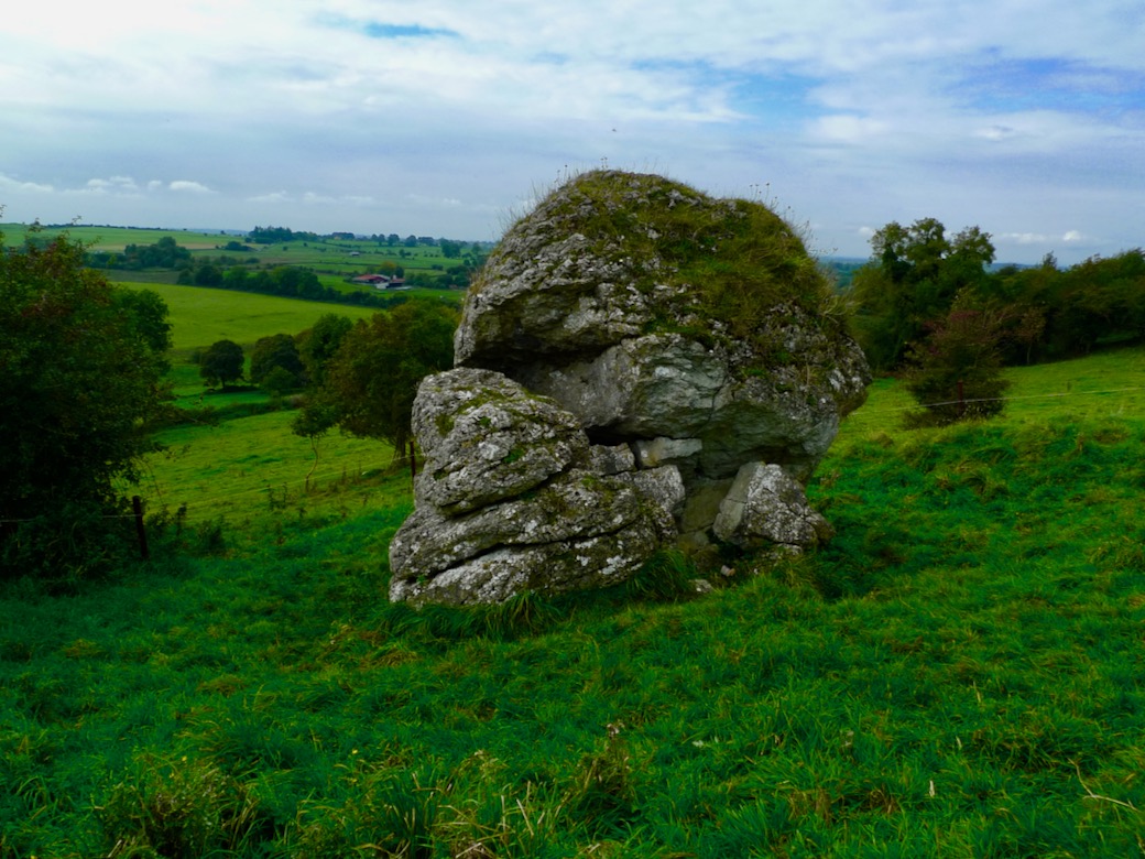
This enormous erratic is also known as ‘The Navel’, which is quite a clue as far as I’m concerned. so, how might our ancestors have come to this conclusion – by maps?

This is known as Ptolemy’s Map of Ireland. It is often said to date from 140AD, but is in fact a Greek copy dating from around 1400AD. Ptolemy did produce maps: he didn’t visit the distant locations, but based his projections on information recorded by sailors who explored the corners of the world.

This map of the British Isles has a similar heritage. Again, you could throw a dart at the centre of Ireland on either of these maps and get pretty close to Uisneach!

This map is somewhat later (1325) and is far more accurate. It’s interesting to me that it shows the fabled islands of Brasil and Demar, mentioned in accounts of St Brendan’s sixth century voyage. We can also wonder at the fact that the only place marked on the south western part of Ireland here is Dorsie (Dursey). But none of these early maps – while fascinating – can support the observation that anyone living in those days could calculate the ‘centre’ of Ireland by looking on a map!

Examining the area around Uisneach on the earliest Ordnance Survey maps (above) gives an idea of the earthworks which were considered important to record in the area. I’m wondering what the ‘cave’ is that’s indicated lower right in the top extract?

Interestingly, in the UK, the village of Meriden is traditionally said to mark the centre of England. But the UK Ordnance Survey has also challenged this.

Preparing for the autumn ceremony at Uisneach Hill, above. We can ponder and argue on the claims to be able to locate the centre of an island (and it’s certainly fascinating to do so) but – while thanking my friend Michael for stimulating this thought process – perhaps the UK Ordnance Survey should be given the final word here:

. . . The truth is, that there can be no absolute centre for a three dimensional land mass sitting on the surface of a sphere and surrounded by the ebb and flow of sea water. If you consider the movement of tides on a beach, the shape of the object will change on a constant basis. Another contributing factor is how far you consider the coast to stretch up river estuaries. Different projections, scales and methods of calculation will all produce different results . . .

Ordnance Survey UK 2014

Mizen Mountains 1 – the Hill of the Foxes

The first day of October seemed ripe for starting a new project. It was also a beautiful, rich, blustery autumnal day – ideal for heading to the remotest uplands. I have always been drawn to high places: there’s something romantic about seeing the coastal landscape laid out below your eyes, especially in these western wildernesses where bare rock, gorse and heather intertwine with history: ancient farmsteads, ruined cottages and impossibly isolated forgotten quays, seemingly abandoned along our most rugged shores.

Header – Toor Island just off the mainland close to the west end of the Mizen Peninsula: the high ground beyond is the peak of Knockatassonig. Above – it’s a most remote and wild place for a pier, but Toor Quay is still accessible from a winding, overgrown footpath and 107 concrete steps: today it’s only the occasional haunt of anglers

This project – Mizen Mountains – sets out to explore all the peaks on our westernmost peninsula. Are they mountains? It all depends on the context, and your perspective. Mizen’s loftiest outcrop – Gabriel – is 400 metres above sea level. Quite modest (Kerry’s MacGillycuddy’s Reeks claim the country’s highest summit, Carrauntoohil, at 1,038 metres), yet when you do look down on the spine of our peninsula from above, it’s all rocky crags and ridges pushing upwards towards the heavens, while at the edges the mountains fall precipitously towards the sea. It’s great, dramatic country, calling out for exploration – and there’s nothing we like better than finding new ways to discover this land and all its stories.

The view to the western end of the Mizen Peninsula, seen from the slopes of Mount Gabriel. The Sheep’s Head is across to the right

50 years ago the writer, Peter Somerville Large, set out to travel the western peninsulas of Ireland on a rusty bicycle purchased for the purpose in Skibbereen. I like the introduction he gives to his book The Coast of West Cork, first published in 1972, and still in print – it serves my own project well:

. . . I set out into the country. The sun had filtered through after rain, making the tarmac steam with moisture and sending up towering clouds off the mountains into the sky. Cattle stood motionless in the boggy fields and water dripped from the leafless sycamores . . . I travelled along the coast of West Cork, through Carbery, from Clonakilty to Roaringwater Bay with its fringe of islands and castles, and north to Bantry and the Beare peninsula. Much of the land near the coast consists of bog and mountain with headlands like lines of slanting spears thrust into the Atlantic. But there are parts that are sheltered, with a tropical lushness that is partly ascribed to the benign influence of the Gulf Stream. Ruins are soon covered with thick ivy and it takes only a few trees or slips of fuchsia to make a protective wall. Some valleys and hillsides have pockets of moss-covered oak-trees which are survivors of the ancient forest that covered the country three hundred years ago . . . From Goleen the old road wound high over a ridge before dropping down to Crookhaven. Almost all the land was rocky around Knocknamadree; The quilted shadows of clouds passed along the high ground over to the sea . . .

Satellite view of the rocky landscape towards the western edge of the Mizen: Knockatasonnig is a barren peak

I have set the bar at the 200 metre contour line – anything above that is, for me, a mountain! So I will be traversing the terrain in search of all the eminences above this elevation on the Mizen, looking specifically at topography and any traceable history and folklore specific to these ‘mountains’. But I will also be talking about our journeys to these destinations: you know how fond we are of getting ‘off the beaten track’. Every new exploration is invariably a revelation! This time around, we are going west – almost as far as is possible on this peninsula – to the townland of Knockatassonig, which peaks at 204 metres.

Top – the 25″ Ordnance Survey map, locating Toor Quay and Knockatassonig. Lower – the earlier 6″ map outlining the townlands

Knockatassonig is a curiosity. It’s a townland which doesn’t seem to have any habitation – and possibly never did. The 6″ map, above, was originally surveyed in 1846 and is valuable in outlining the townland boundaries at that time. It may be that in pre-famine times there were dwellings in the area: Ireland was much more heavily populated in those days, even in places like this which seem so remote today. But sometimes the townland names are particularly useful to us because they can tell us something of the history, which would have been passed on aurally through the generations until the maps were made.

Upper – detail from the 25″ map, showing the ‘Boat Slip’ at Toor. The map was presumably surveyed before the present pier was made; the slip has been cut into the solid rock and launching boats there must have been a treacherous business. Lower – today, a steep, narrow boreen can be negotiated as far as the Stop sign! An overgrown footpath goes on down to the sea and quay. The mountains seen over the water are on the Sheep’s Head

So far we haven’t talked much about the ‘Mountain’ of Knockatassonig. This summit is very visible, but virtually inaccessible at this time of the year due to bracken and spiky fences. It can just be seen on the left in the header picture: that’s taken from the footpath which goes down to Toor Quay. Like most of the Mizen peaks, Knockatassonig commands good distant views. It should be more approachable in the winter months. Although it’s hard to get to, it can be seen from several places on the Mizen, including Dunlough. The photo below shows the peak on the horizon beyond the ruins of Three Castle Head:

Here’s a view of Knockatassonig summit seen from the south-west side, taken from the small road that goes down towards Toor.  The view below shows the complex profile of the summit seen from the north

In looking at the peaks of the Mizen I intend to explore and uncover – where possible – any extant memories of stories or local lore relating to them. As far as Knockatassonig goes, I have found nothing recorded, other than the name, which is shared with the townland. So what does it mean? Well, it’s not clear, but the logainm website suggests ‘The hill of the Englishman’, and compares this name to the entry for Corr na Seirseanach in Co Monaghan ‘The round hill of the Englishmen’ or ‘The round hill of the mercenaries or hired soldiers’. Well – that’s a surprise . . . and a bit hard to reconcile with the unpopulated landscape we see today in this part of West Cork. The Monaghan version of the name can be supported by political events dating from the early 1300s: it’s hard to relate these to any activities we are aware of on the Mizen, but Irish history is a complex thing – as are place-names. When Finola heard the name she thought it meant ‘The hill of the foxes’: a direct translation into the Irish of that would be Knock an tSionnaigh. Townland names were often written down in Anglicised form by surveyors whose ears may not have been attuned to the Irish nuances. I’m voting with Finola on this one: there’s sure to be a good few foxes in that landscape!

Here’s an earlier source of information on Irish names: the Down Survey. Undertaken between the years 1656 and1658, the Down Survey of Ireland is the first ever detailed land survey on a national scale anywhere in the world. It sought to measure all the land to be forfeited by the Catholic Irish in order to facilitate its redistribution to merchant adventurers and English soldiers. The extract above details the Parish of Kilmoe at the end of the Peninsula: note Three Castle Head depicted at the far left. The survey does not give modern townland names but we can work out where the Knockatassonig peak would be – in the section labelled Unforfeited Lands belonging to the Earle of Corke and Coghlane protestants  In which case, of course, not only the present day townland of Knockatassonig but all those around it could reasonably be termed ‘ . . . of the Englishman . . .’ Food for thought?

Below – peaks of the Mizen: many will be the subjects of future posts

Walking the Past

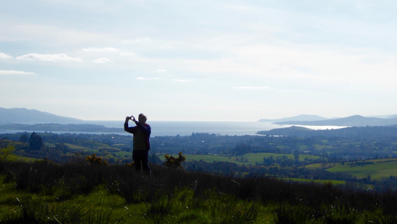
Robert taking a picture

How fortunate are we? We are free to spend our days wandering the world’s most beautiful landscapes, here in Ireland: landscapes which have changed relatively little over the last five thousand years. They have changed, of course, but the human hand has had less impact in this country than in many other developed nations, especially in these wilder parts. That is why we relish our explorations: we are walking the past.

breeny landscape

Top picture: Robert taking in the setting of the monuments at the Kealkill complex. Above: the view towards Kealkill village from Breeny More

Every expedition requires a little pre-planning. This week we were keen to catch up with a group of monuments known as ‘boulder burials’. Finola tells me that, when she was first studying archaeology, they were known as ‘boulder dolmens’: I prefer that term – perhaps because it has a touch of the antiquarian about it – and, in any case, the use of the word burials implies a definitive function which has not been universally borne out with the examples that have been excavated. But I will leave Finola to delve into the specifics of that subject in her post Boulder Burials: a Misnamed Monument?

workspace

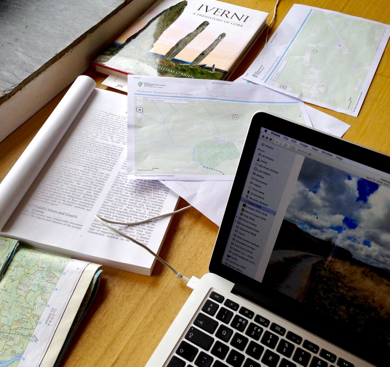
Blogging in progress: prequel to an expedition…

First, we look to the available information: William O’Brien’s Iverni – A Prehistory of Cork (The Collins Press 2012) is an essential primer on the pre-Christian era in this corner of Ireland since the first human foot was set on its shores. Then there are maps to be consulted: the Ordnance Survey Office was created in 1824 to carry out a survey of the whole island for land taxation purposes. The original survey at a scale of 6 inches to 1 mile was completed in 1846 and Ireland thus became the first country in the world to be entirely mapped at such a detailed scale. From the outset, known historic sites and monuments were recorded and the present Discovery Series at 1:50,000 scale provides a wealth of information to the fingertips of historians and adventurers.

kealkill OS map

One of our bibles: the Discovery Series of the 1:50,000 Ordnance Survey maps – well used and well worn! The monument sites are marked in red

Before setting out we usually consult with the Archaeological Survey Database of the National Monuments Service: this gives us the fine detail on where to find recorded historic sites. Yet in the end the most valuable information often comes from knocking on doors. Farming families here often go back through many generations and local knowledge is always passed down through them. It’s here that you sometimes pick up the ‘stories’ that are associated with ancient sites – for me, these are just as interesting as any formal records.

Breeny More landscape

View to Bantry Bay across the Breeny More archaeological site

This week our travels brought us to the Breeny More and Kealkill complexes, high up in the hills above Bantry, heading towards the wonderfully named Cnoic na Seithe – the Mountains of the Spirits. This was on a perfect spring day: the views all the way down the bay with the Beara on one side and the Sheep’s Head on the other can only be described as spectacular.

kealkill landscape

view west

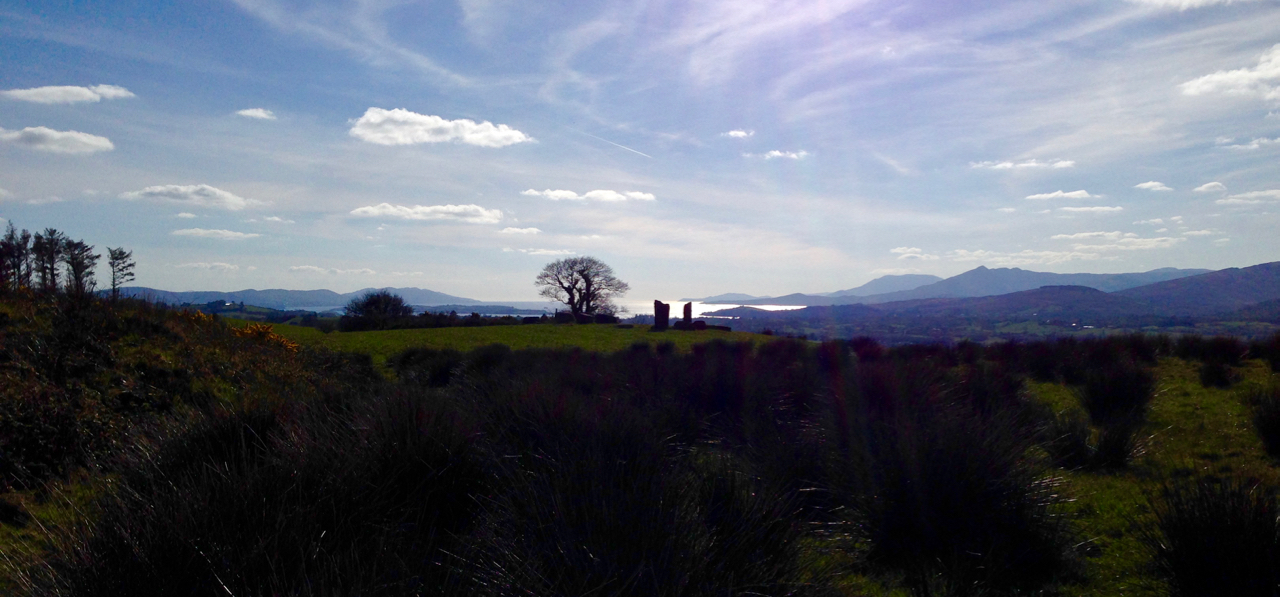
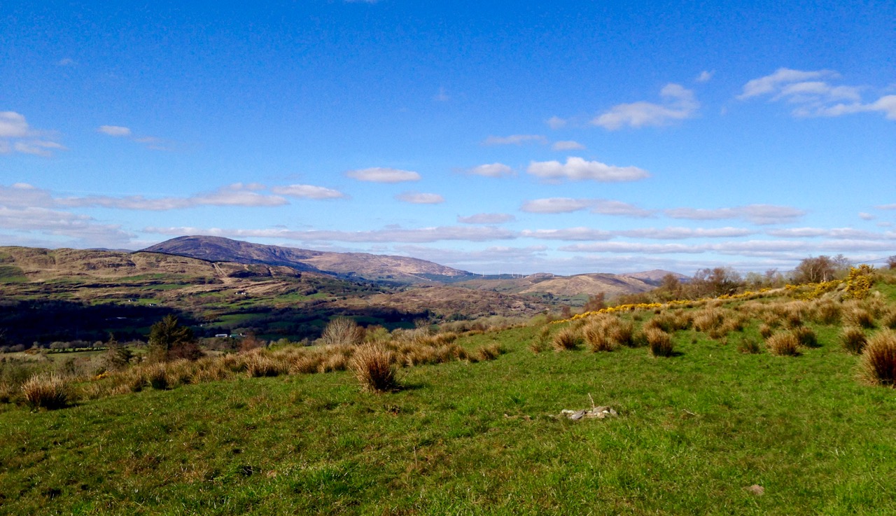
Two views from the Kealkill complex

It can’t be accidental, surely, that these ancient sites occur in places like this, that make the senses reel? In many cases there are long views in all directions, often taking in prominent horizons, hilltops, the sea, inlets and islands. ‘As far as the eye can see’ is an expression that truly comes into its own: these vistas must have had special meanings to the ancestors who were here in the Neolithic and Bronze ages. Were they trying to define it in some way by building such impressive large-scale structures, most likely for some ceremonial purpose? It was certainly not construction work which could have been undertaken lightly or frivolously. Here’s O’Brien in Sacred Ground, Megalithic Tombs in Coastal South-West Ireland (NUI Galway 1999):

…Antiquarian interest in Ireland dates from the visit of Edward Lhuyd at the end of the 17th century and was encouraged by the discovery of great megalithic centres like the Boyne Valley in Co Meath and Carrowmore in Co Sligo. The early antiquarians were to link these ‘Giants Graves’ to invaders or colonists from the East, to Scandinavian incursions and eventually to the events and characters of early Irish literature…

boulder cluster

The Breeny More complex:  no less than four boulder burials, a multiple stone circle and a (much later) ring fort, all on one superbly located site

Robert Kealkill Complex

A cause for wonder: the tall standing stone at the Kealkill complex. A stone circle lies to the west while a radial cairn is behind (to the south of) the stone pair

So, it’s Finn McCool and the Tuatha de Danaan that we have to look to, perhaps, for explanations as to why we find these incursions on our natural landscape standing as solidly and unchangingly as they did a few millennia ago. Perhaps not quite unchangingly, in fact: archaeologists have had a hand in the present day appearance of some of them. In the photo above you can see me wondering at the 4.6 metre high megalith which is part of the Kealkill complex. When the site was explored by Sean P O’Ríordáin in 1938 that stone had broken off and had fallen: O’Ríordáin re-erected the remaining part of the menhir. The original would have been at least a metre higher than what we see today.

kealkill excavation report

kealkill diagram

From O’Ríordáin’s published report of the excavation of the Kealkill complex: top, the taller standing stone being re-erected and, below, a survey diagram of the findings. From the Journal of The Cork Historical Archaeological Society, Volume XLIV ,1939

The Breeny More site and the Kealkill complex are near neighbours. Both contain various artefacts: standing stones, stone circles and boulder burials. Kealkill also has a radial cairn. Both are set against a background of moorland, mountain and bay. Kealkill is easily accessible although boggy.

Most sites are on private land and permission should always be sought to visit, unless it is obvious that access is welcomed, as here at Kealkill

Our second archaeological adventure this week was also boulder burial orientated. This was close to home in the townlands of Rathruane, Lisheen Lower and Bawngare. Again, Finola has detailed the findings in her post, but I was struck at each of these sites that the their settings, too, were on high ground with excellent distant views. In each case, mountains were prominent. I couldn’t help thinking that the boulders could have been placed where they are specifically because of the visibility to the various peaks. Might it even be that territories were marked out by these huge stones? Boundaries have always been important to human strategies: we have been identifying and ‘naming’ the land before records began to be written. Field names, townland names, parishes, baronies… A whole lot more to be researched, visited and recorded. Our long walk through Ireland’s past has barely begun!

Robert at Kealkill