Boulder Burials: a Misnamed Monument?

Rathruane Boulder Burial

The term boulder burial was coined in the 1970s by Sean O’Nualláin, an archaeologist with the Ordnance Survey, to describe a class of monument that was quite prevalent in the south west, consisting of a single large boulder sitting on three or four support stones. The support stones lift the boulder off the ground and provide a small chamber-like area under the stone. Previously, this type of monument was known as a dolmen, a boulder dolmen or a cromlech, but O’Nualláin was convinced that the main purpose of these boulders was to mark a burial.

Lisheen Cromlechs by Jack Roberts

Illustrations from Jack Robert’s book Exploring West Cork

He based this belief partly on his extensive experience with other megalithic monuments, but also on the findings of the excavation of the Bohonagh complex, where Fahy found fragments of cremated bone in a pit under the boulder.

Bohonagh Boulder Burial
The Bohonagh complex includes a multiple-stone circle, a boulder burial and a cup-marked stone. A standing stone stood close by but has disappeared. Note the quartz support stone

However, William O’Brien excavated three boulder burials in the late 1980s and found no evidence of burials. In his book, Iverni, he comments in an understated way, “The absence of human remains at Cooradarrigan and Ballycommane does pose some questions as to their use.” His findings dated the sites to the Middle Bronze Age, between 3000 and 3,500 years ago.

Lisheen Lower boulder Burial

A boulder burial from Lisheen Lower

What is unquestioned, though, is that they are predominantly found in the south west, especially in Cork, and that, while most occur alone, they are often found in groups, and/or in association with stone circles or standing stones.

rathruane boulder

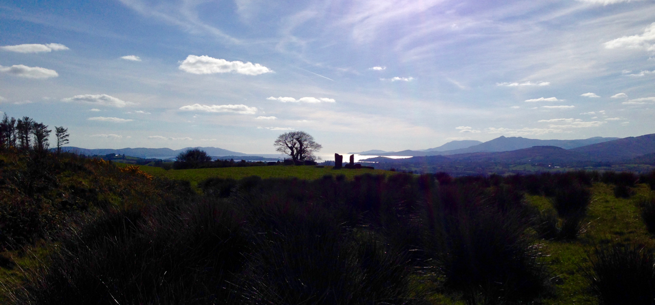
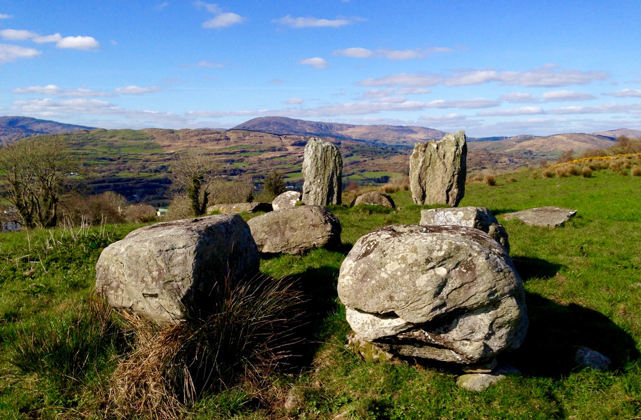
This one is at Rathruane More, close to a significant rock art site and with views of Mount Gabriel and Mount Corrin

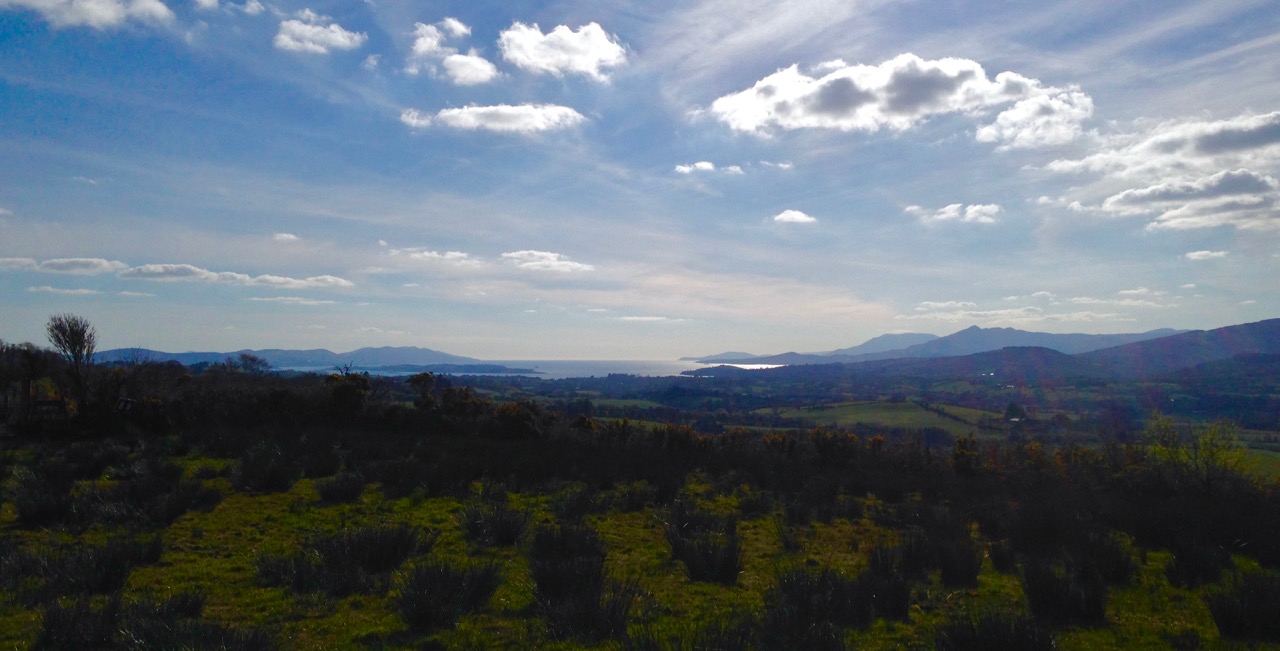
A boulder burial is a striking and unmistakable sight. Often situated on a high point or ridge it can be seen silhouetted against the sky – a large glacial erratic standing proud in the landscape. There are lots of examples around us here and most of them command extensive and often panoramic views. These are monuments that were built to be seen and to see from.

dunmanus boulder burial

An exception to the high ground location is found at Dunmanus on the north side of the Mizen Peninsula. This boulder-burial is so low-lying, in fact, that one can only reach it at low tide

Ballycommane Bouder Burial quartz

Ballycommane – the boulder is of white quartz

William O’Brien has pointed out that quartz is a feature of West Cork prehistoric sites and this is particularly evident in the case of boulder-burials. At Bohonagh, for example, some of the support stones are of gleaming white quartz, while at Ballycommane, Cooradarrigan and Cullomane the boulder itself is quartz. The sun was low in the sky when we visited Ballycommane and the sight of the quartz boulder gently gleaming was truly memorable.

Mill Little Complex 2

The Mill Little complex

Boulder burials often occur in groups and in association with other monuments. Mill Little is a good example of this: three boulder burials are in a line with a standing stone pair at one end and a five-stone circle at the other. See our post Family-Friendly Archaeology Day for more photos of the Mill Little Complex.

Cullomane boulder burial

This photograph shows the Cullomane boulder burial in the foreground, and a ‘penitential station’, in the background. This ‘station’ was part of a pilgrim round that involved prayer and penance – see Holy Wells of Cork for more detail on this site

At the Cullomane site, east of Bantry, the quartz boulder is surrounded by a variety of other monuments: a small stone circle, an ‘anomolous’ group of stone, a stone row, and standing stones all lie within a few fields of each other. Intriguingly, this site has seen continued ritual use through the millennia – there are also ring forts, burial grounds, a holy well and a ‘penitential station’ within the same small area.

Ballycommane boulder burial and standing stone pair

The Ballycommane boulder is in close proximity to a standing stone pair

Breeny More 4

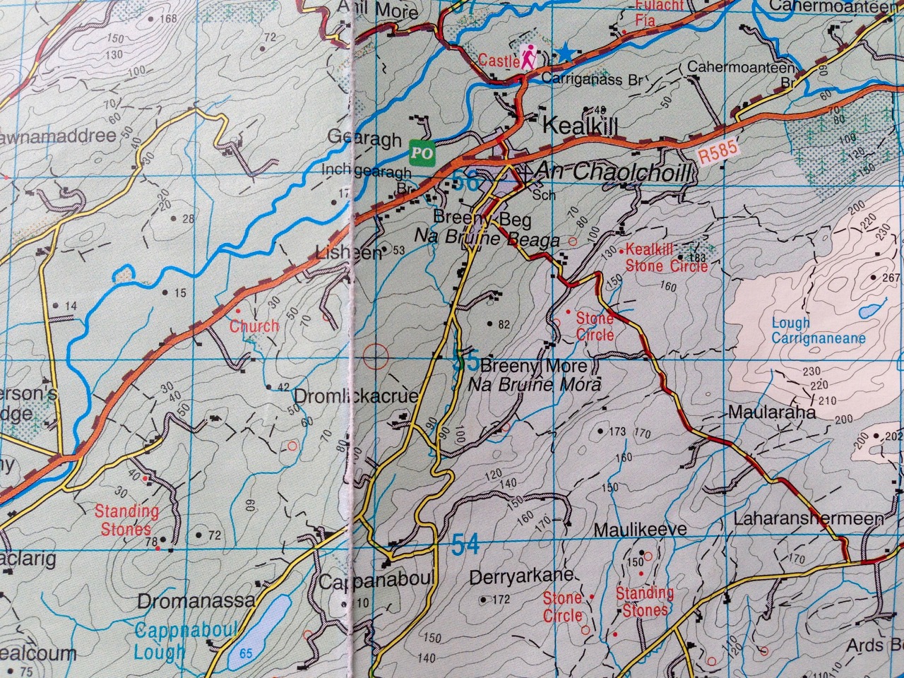
At Breeny More, near Kealkill, four boulder burials in a square pattern lie inside what remains of a large multiple-stone circle. This is an awe-inspiring site – you feel you are on top of the world with mountains all around and stunning views out to the end of the Beara and Sheep’s Head Peninsulas. See Robert’s post Walking the Past for a sense of what this site offers.

Kenmare Stone Circle and boulder burial

The Kenmare stone circle, above, has a boulder burial in the middle of it, while the Gorteanish stone circle on the Sheep’s Head, below, has at least one and possibly two boulder burials

Gorteanish

So – if they weren’t tombs, or weren’t solely tombs – what was the purpose of these striking boulders? Their association with stone circles and rows provide evidence that they fit the calendrical pattern that we find in so many monuments of this era. Mike Wilson, the archeo-astronomer of the Mega-What site, has surveyed many of the West Cork boulder burials and has this to say: This survey shows that boulder-monuments were functional objects marking astronomically important places in the landscape. They cannot generally define an azimuth as accurately as a stone row or circle but capstone shape and orientation are usually significant, helping to indicate directions of interest.

Breeny More

At Breeny More the square layout of the four boulder burials within the stone circle provide many possible alignments

In several of the boulder burials we have observed, capstone shape and direction certainly seem to be a deliberate feature of the monument.

Rathruane boulder Burial Orientation

Robert checks the orientation of the long axis of the capstone at Rathruane More

But perhaps the best example we have of how a boulder burial can have an orientation was drawn to our attention by local historian Brigid O’Brien – and she even sent us the evidence! If you stand at Bawngare, your attention is immediately drawn to the spectacular views to the west and north west – views that include Mount Gabriel, Mount Corrin and between them, faraway Hungry Hill on the Beara Peninsula, as well as the Sea in Roaringwater Bay. Interestingly, one of the support stones has several small shallow cupmarks (cupmarks are found on the capstones of several boulder burials).

Barngare Boulder Burial and view

The view west from Bawngare boulder burial

However the capstone with its distinctive long furrow holds the real secret, and Brigid’s persistence in braving the cold to visit at exactly the right time has unlocked that secret for us now.

Bawngare boulder burial general

From the other side the long furrow can be seen running the length of the capstone

Brigid visited it last year at the winter solstice and took this photograph of the setting sun. It seems the capstone was deliberately positioned to mark this alignment.

Bawngare boulder burial winter solstice sunset

Brigid’s photograph, taken on December 21st, 2015

Perhaps it’s time to go back to calling them something other than burials – I rather fancy the old term boulder dolmens. What do you think?

Walking the Past

Robert taking a picture

How fortunate are we? We are free to spend our days wandering the world’s most beautiful landscapes, here in Ireland: landscapes which have changed relatively little over the last five thousand years. They have changed, of course, but the human hand has had less impact in this country than in many other developed nations, especially in these wilder parts. That is why we relish our explorations: we are walking the past.

breeny landscape

Top picture: Robert taking in the setting of the monuments at the Kealkill complex. Above: the view towards Kealkill village from Breeny More

Every expedition requires a little pre-planning. This week we were keen to catch up with a group of monuments known as ‘boulder burials’. Finola tells me that, when she was first studying archaeology, they were known as ‘boulder dolmens’: I prefer that term – perhaps because it has a touch of the antiquarian about it – and, in any case, the use of the word burials implies a definitive function which has not been universally borne out with the examples that have been excavated. But I will leave Finola to delve into the specifics of that subject in her post Boulder Burials: a Misnamed Monument?

workspace

Blogging in progress: prequel to an expedition…

First, we look to the available information: William O’Brien’s Iverni – A Prehistory of Cork (The Collins Press 2012) is an essential primer on the pre-Christian era in this corner of Ireland since the first human foot was set on its shores. Then there are maps to be consulted: the Ordnance Survey Office was created in 1824 to carry out a survey of the whole island for land taxation purposes. The original survey at a scale of 6 inches to 1 mile was completed in 1846 and Ireland thus became the first country in the world to be entirely mapped at such a detailed scale. From the outset, known historic sites and monuments were recorded and the present Discovery Series at 1:50,000 scale provides a wealth of information to the fingertips of historians and adventurers.

kealkill OS map

One of our bibles: the Discovery Series of the 1:50,000 Ordnance Survey maps – well used and well worn! The monument sites are marked in red

Before setting out we usually consult with the Archaeological Survey Database of the National Monuments Service: this gives us the fine detail on where to find recorded historic sites. Yet in the end the most valuable information often comes from knocking on doors. Farming families here often go back through many generations and local knowledge is always passed down through them. It’s here that you sometimes pick up the ‘stories’ that are associated with ancient sites – for me, these are just as interesting as any formal records.

Breeny More landscape

View to Bantry Bay across the Breeny More archaeological site

This week our travels brought us to the Breeny More and Kealkill complexes, high up in the hills above Bantry, heading towards the wonderfully named Cnoic na Seithe – the Mountains of the Spirits. This was on a perfect spring day: the views all the way down the bay with the Beara on one side and the Sheep’s Head on the other can only be described as spectacular.

kealkill landscape

view west

Two views from the Kealkill complex

It can’t be accidental, surely, that these ancient sites occur in places like this, that make the senses reel? In many cases there are long views in all directions, often taking in prominent horizons, hilltops, the sea, inlets and islands. ‘As far as the eye can see’ is an expression that truly comes into its own: these vistas must have had special meanings to the ancestors who were here in the Neolithic and Bronze ages. Were they trying to define it in some way by building such impressive large-scale structures, most likely for some ceremonial purpose? It was certainly not construction work which could have been undertaken lightly or frivolously. Here’s O’Brien in Sacred Ground, Megalithic Tombs in Coastal South-West Ireland (NUI Galway 1999):

…Antiquarian interest in Ireland dates from the visit of Edward Lhuyd at the end of the 17th century and was encouraged by the discovery of great megalithic centres like the Boyne Valley in Co Meath and Carrowmore in Co Sligo. The early antiquarians were to link these ‘Giants Graves’ to invaders or colonists from the East, to Scandinavian incursions and eventually to the events and characters of early Irish literature…

boulder cluster

The Breeny More complex:  no less than four boulder burials, a multiple stone circle and a (much later) ring fort, all on one superbly located site

Robert Kealkill Complex

A cause for wonder: the tall standing stone at the Kealkill complex. A stone circle lies to the west while a radial cairn is behind (to the south of) the stone pair

So, it’s Finn McCool and the Tuatha de Danaan that we have to look to, perhaps, for explanations as to why we find these incursions on our natural landscape standing as solidly and unchangingly as they did a few millennia ago. Perhaps not quite unchangingly, in fact: archaeologists have had a hand in the present day appearance of some of them. In the photo above you can see me wondering at the 4.6 metre high megalith which is part of the Kealkill complex. When the site was explored by Sean P O’Ríordáin in 1938 that stone had broken off and had fallen: O’Ríordáin re-erected the remaining part of the menhir. The original would have been at least a metre higher than what we see today.

kealkill excavation report

kealkill diagram

From O’Ríordáin’s published report of the excavation of the Kealkill complex: top, the taller standing stone being re-erected and, below, a survey diagram of the findings. From the Journal of The Cork Historical Archaeological Society, Volume XLIV ,1939

The Breeny More site and the Kealkill complex are near neighbours. Both contain various artefacts: standing stones, stone circles and boulder burials. Kealkill also has a radial cairn. Both are set against a background of moorland, mountain and bay. Kealkill is easily accessible although boggy.

Most sites are on private land and permission should always be sought to visit, unless it is obvious that access is welcomed, as here at Kealkill

Our second archaeological adventure this week was also boulder burial orientated. This was close to home in the townlands of Rathruane, Lisheen Lower and Bawngare. Again, Finola has detailed the findings in her post, but I was struck at each of these sites that the their settings, too, were on high ground with excellent distant views. In each case, mountains were prominent. I couldn’t help thinking that the boulders could have been placed where they are specifically because of the visibility to the various peaks. Might it even be that territories were marked out by these huge stones? Boundaries have always been important to human strategies: we have been identifying and ‘naming’ the land before records began to be written. Field names, townland names, parishes, baronies… A whole lot more to be researched, visited and recorded. Our long walk through Ireland’s past has barely begun!

Robert at Kealkill

Wedge Tombs: Last of the Megaliths

Altar Wedge Tomb on The Mizen Peninsula

Altar Wedge Tomb on The Mizen Peninsula

In Ireland, the tradition of building megalithic (mega=large, lithos=stone) structures that included chambers to house the dead (such as the Boyne Valley Passage Grave complex, or the Court Tomb of Creevykeel) belongs to the Neolithic period, which ended around 2500 BC. About this time, a new style emerged of stone ‘galleries’, oriented towards the setting sun. Their distinctive shape – narrower and shorter at the eastern end – gives them their common name, wedge tombs. This tradition appears to have flourished for about 500 years.

Altar, side view

Altar, side view

In other areas of Ireland wedge tombs were often covered by a mound, but there is little evidence for this in West Cork. The closest parallel to wedge tombs outside of Ireland are in Brittany where allées couvertes date from this period. They are associated in some parts of Ireland (although once again not in West Cork) with Beaker pottery, a distinctive kind of vessel widely distributed across Western Europe. This was a time in which the population was expanding, farming practices were intensifying and a brand new technology was being introduced – it was the dawn of the Copper Age. Thus, we can speculate that wedge tombs mark the confluence of two forces: the new continental technologies of pottery and metalworking and the indigenous tradition of erecting megalithic chambered tombs.

Wedge tombs occur mostly in the western half of Ireland, including many in County Clare such as the Parknabinnia tomb pictured below.

 The largest wedge tomb in Ireland is near Fermoy, north of Cork City. It is typical of many Irish wedge tombs in featuring double walling, evidence of a surrounding cairn, and a sealed end chamber. Interestingly its name, Labbacallee, means the Hag’s Bed – the hag, or wise woman crops up frequently in Irish mythology.

In contrast to Labbacallee, wedge tombs in West Cork are generally smaller and simpler, comprising only one chamber and lacking a covering cairn. However, the distinctive wedge shape is preserved along with one other defining feature: wedge tombs are invariably oriented towards the setting sun. The funerary rite was that of cremation. Votive offerings of white quartz pebbles and small deposits of metal have been found in excavations.

Toormore wedge tomb,  now in someone's garden

Toormore wedge tomb, now in someone’s garden

Prof William O’Brien has excavated wedge tombs in West Cork and studied them, and the culture in which they were built, extensively. Here’s what he has to say, in his book, Iverni, about the society that produced them:

Whereas monuments like Newgrange could only have been built with a large organised input of labour over a long period, the building of wedge tombs was undertaken by small kin groups…This was a small scale society, comprised of local, clan-like groupings…The tomb was a type of shrine, sanctified by an association with ancestors and used for periodic offering and sacrifice to supernatural powers.

A striking aspect of Neolithic, Chalcolithic (Copper Age) and Bronze Age monuments in West Cork is their consistent orientation towards solar events such as sunrise and sunsets on the equinoxes, solstices and cross-quarter days (see our post on Bohonagh stone circle, for example). In this regard, wedge tombs are remarkably consistent in being oriented towards the West. Here’s O’Brien again:

Wedge tombs served as funnel-shaped openings to the Otherworld, facing the descending or setting sun to emphasise the symbolic dualism of light/life and darkness/death.

Toormore, side view

Toormore, side view

Looking for a wedge tomb closer to home, we set out yesterday to find the nearby Kilbronogue site, using the information from the National Monuments Service as a guide. We have found in the past that the mapping of sites is not always accurate and after an hour or two of tramping through a large and very muddy area with a helpful neighbour and his son we had to admit defeat – either the map was wrong, or the monument had disappeared in the recent fieldwork by a digger. Desperately hoping it was the former and not the latter, we found out who owned the land and went to call on him today. Stephen Lynch turned out to be a friendly, cheerful and very knowledgeable organic farmer – he assured us that the tomb would never be damaged in any way and not to worry, he would take us to it. Whew! Half an hour later we were trudging up a path that Stephen had had cut through his ash plantation – on we went and suddenly there it was in front of us – a classic wedge tomb, oriented to the west, built with large slabs that may have been cut from the rock face behind it.

Kilbronogue wedge tomb with its guardian, Stephen Lynch

Kilbronogue wedge tomb with its guardian, Stephen Lynch

Stephen told us the tomb had been used as a mass rock in penal times and that the Protestant farmers who owned all the farms that bordered on the rock had cooperated in allowing the masses to take place – an indication, Stephen said, of the long tradition of friendship between Catholic and Protestant farming families in this area. As with the Altar wedge tomb, also used as a mass rock, we marvelled at how a sacred site, built at least four thousand years ago, would retain its aura of veneration over the millennia, to be used again for religious purposes in the historic period.

Kilbronogue, side view

Kilbronogue, side view

Perhaps the most spectacularly situated wedge tomb we have been to is high on a hill overlooking Bantry. This one is known as Queen Medb’s Tomb and from it there are expansive views of the Beara, Sheep’s Head and Mizen Peninsulas. Climb up to it on a clear day, as the sun is sinking into the sea: in the presence of such awe-inspiring scenery you will find yourself contemplating how the mysteries and the wonders of Irish history and prehistory are written on its landscape.

Queen Medb's Tomb

Queen Medb’s Tomb

Were You at the Rock?

Mass rock along the Beara Way (see the look out above)

Mass rock along the Beara Way (see the lookout above)

An raibh tú ag an gCarraig? / Were You at the Rock?

nó a’ bhfaca tú féin mó grá / Or did you yourself see my love,

nó a’ bhfaca tú gile, / Or did you see a brightness,

finne agus scéimh na mná? / The fairness and the beauty of the woman?

This beautiful song speaks to a revered tradition in Irish history and folk custom – the mass rock. During the period of the Penal Laws (late 17th and first half of 18th Century) when the practice of Catholicism was outlawed, parishioners would gather at a secret location to attend mass. The priest travelled from community to community in disguise, a lookout was posted, and mass was celebrated on a lonely rock far from the reach of the law. The song encodes the message that the people still find ways to attend mass, despite the harsh prohibition against it.

Mass rocks are often in remote locations

Mass rocks are often in remote locations

Dr. Hilary Bishop, in her excellent website Find a Mass Rock says, “As locations of a distinctively Catholic faith, Mass Rocks are important religious and historical monuments that provide a tangible and experiential link to Irish heritage and tradition.” She also points out that, because of the imperative for secrecy, mass rocks are difficult to find. We certainly experienced this when we set out for a day of mass rock hunting recently. Working from a list generated from the National Monuments Service database we spent a day on the Sheep’s Head and the Mizen and had trouble finding all the rocks on the list. One, if it was still there, had disappeared under impenetrable layers of gorse. A second rock was last recorded in the 1980s: residents were no longer familiar with it.

Beach Holy Well and mass rock

Beach holy well and mass rock

Knowledge of mass rocks has passed down from generation to generation. In the deep countryside, the sites maintain a mystique and a sense of the sacred. Last year we wrote about the mass rock and holy well at Beach, where Mary conjured up a blanket of fog to confuse the English soldiers and allow the priest to escape. At Beach and at our first stop, the mass rock at Glanalin on the Sheep’s Head Way, mass is still celebrated occasionally.

The Glanalin rock, and the one we visited on the Beara Peninsula, are good examples of the remote locations typical of many mass rocks, high on a hillside or hidden in an isolated valley. You can picture the procession of worshippers, in ones and twos, slipping silently through the bracken, pausing to make sure they are not being watched, climbing higher, following an overgrown trail, arriving at the meeting place where the hushed crowd awaits the arrival of the priest.

Beara mass rock

Beara mass rock

One of the rocks we found looked for all the world like a fallen standing stone – and that’s probably what it was. (I wonder if I should go to confession, though – I’m sure that sitting on a mass rock would qualify as at least a venial sin.)

Fallen standing stone?  Mass rock? Both?

Fallen standing stone? Mass rock? Both?

A mass rock that is easily visited is the one at Cononagh Village, right at the side of the main road into West Cork, the N71. This site is beautifully maintained – Cononagh is obviously proud of its heritage: signage and flowers invite the passerby to take a closer look.

Another easily accessible site is Altar, at Toormore. This is a wedge tomb, probably over 4,000 years old and excavated in 1989. It remained in use through the Bronze Age and into the Iron Age. Dr. William O’Brien, in his book on the archaeology of County Cork, Iverni, says of this site: “…over time this tomb came to be regarded as a sacred place, housing important ancestral remains in what was a type of community shrine.” How fitting, then, that the flat capstone of the Altar wedge tomb became, in the Penal Days, a mass rock. And how intriguing to think of the continuation of this sacred space over the course of thousands of years.

Altar Wedge Tomb, later used as a mass rock

Altar Wedge Tomb, later used as a mass rock