Rathgall Hillfort

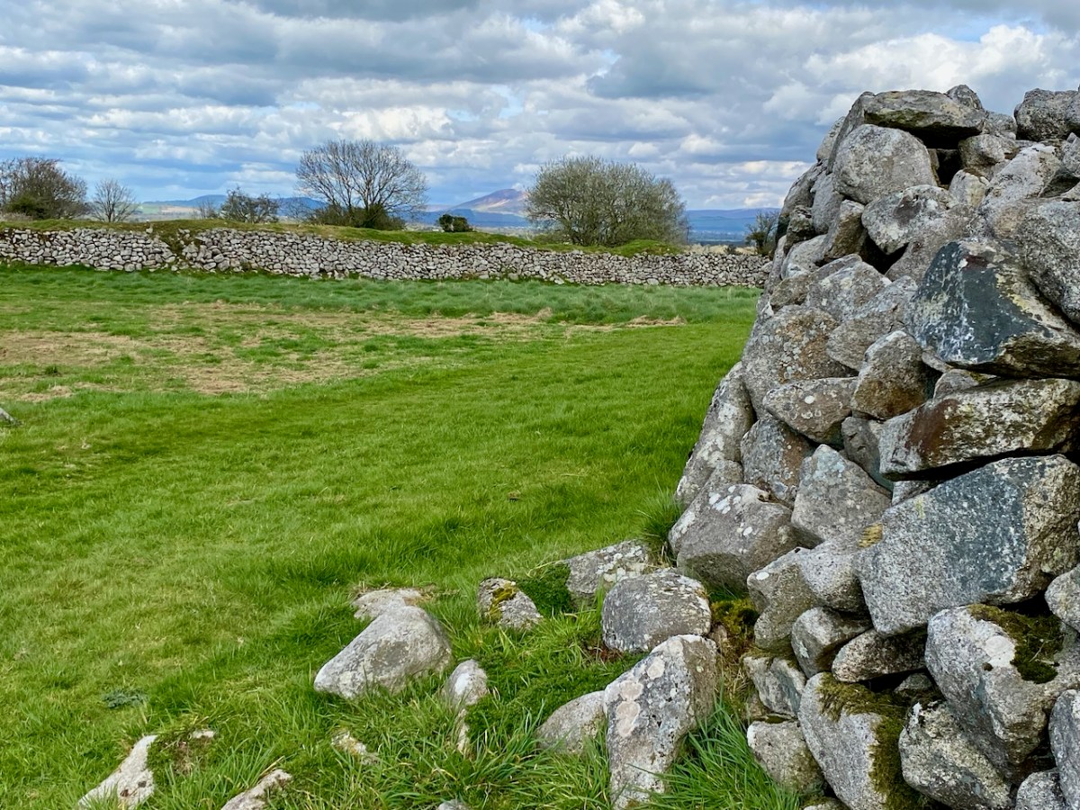
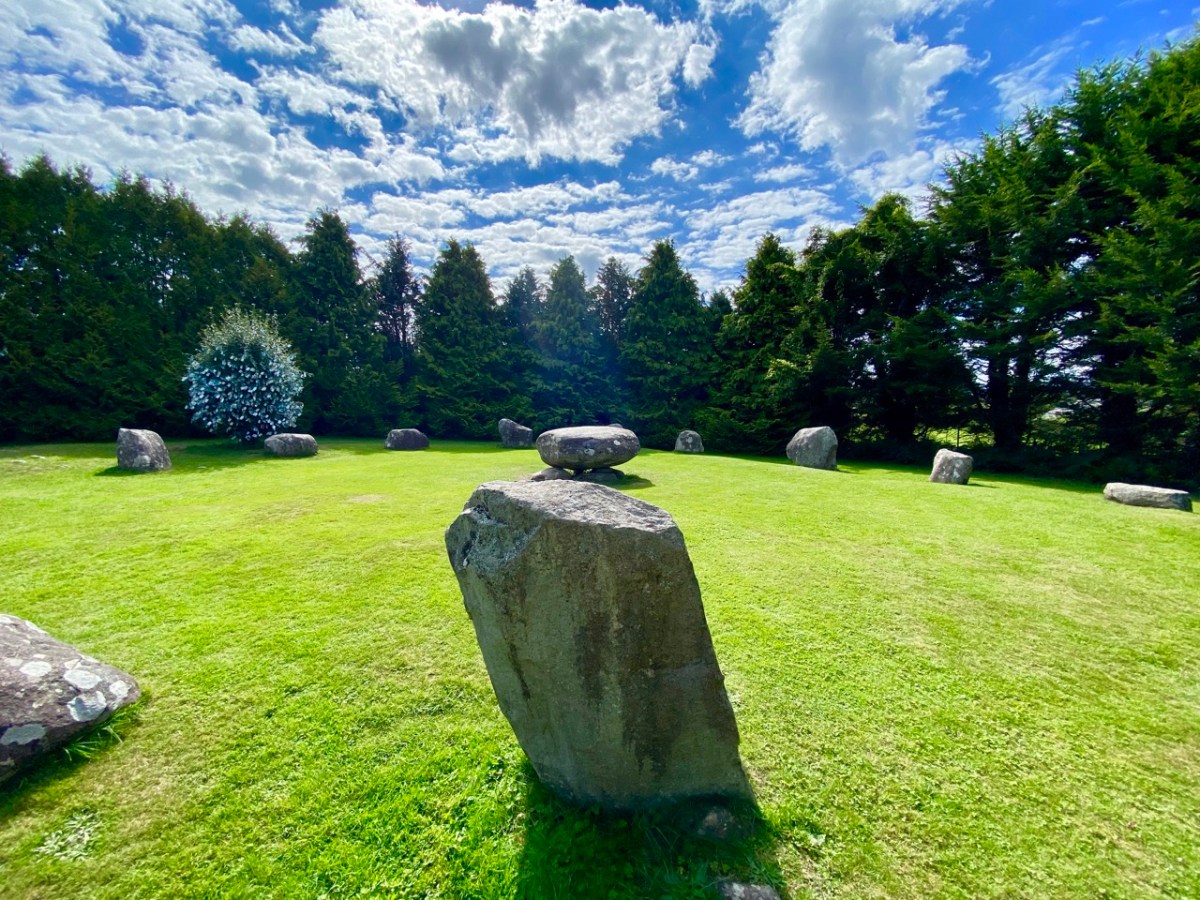
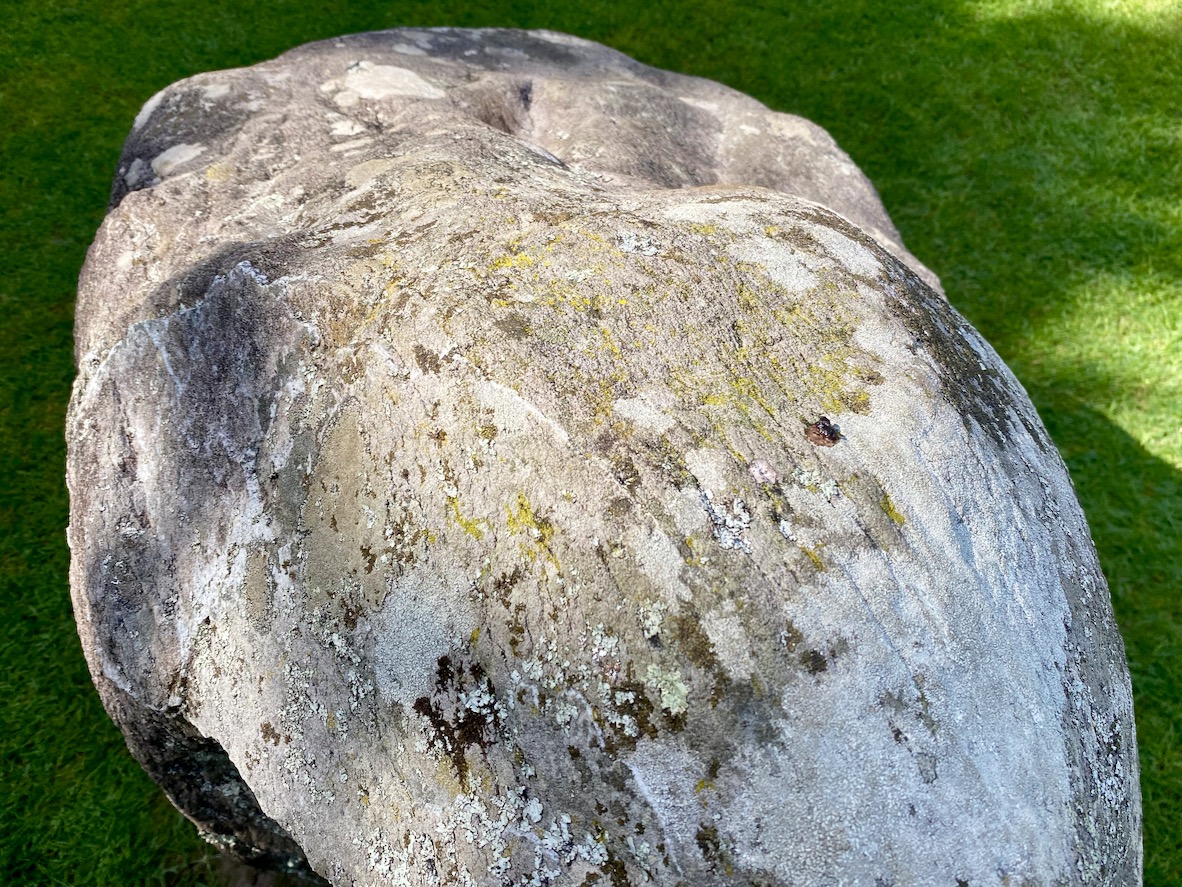
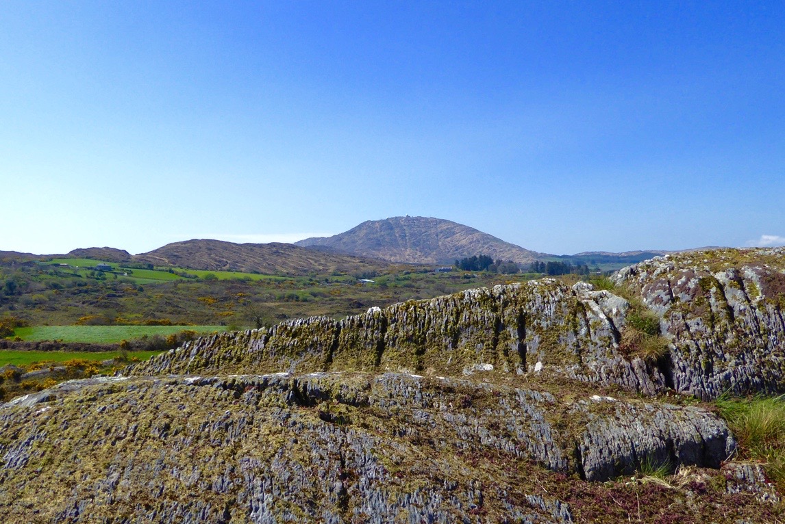
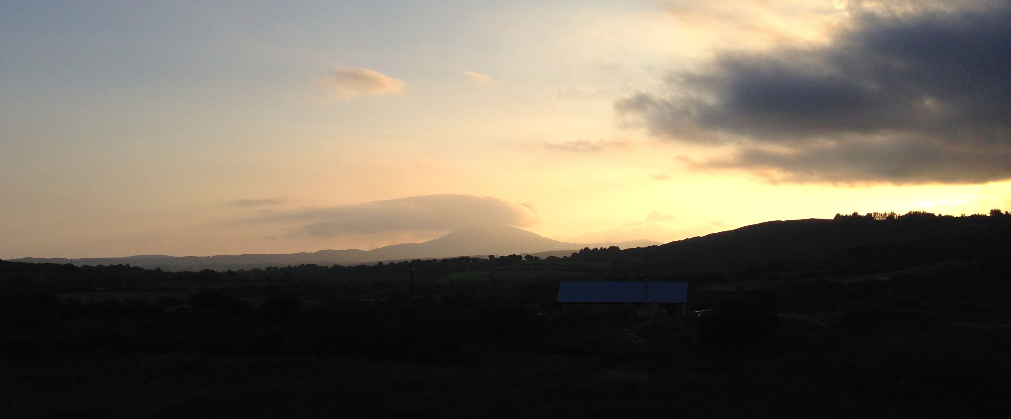
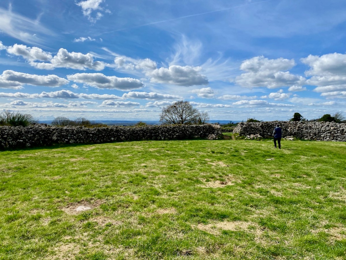
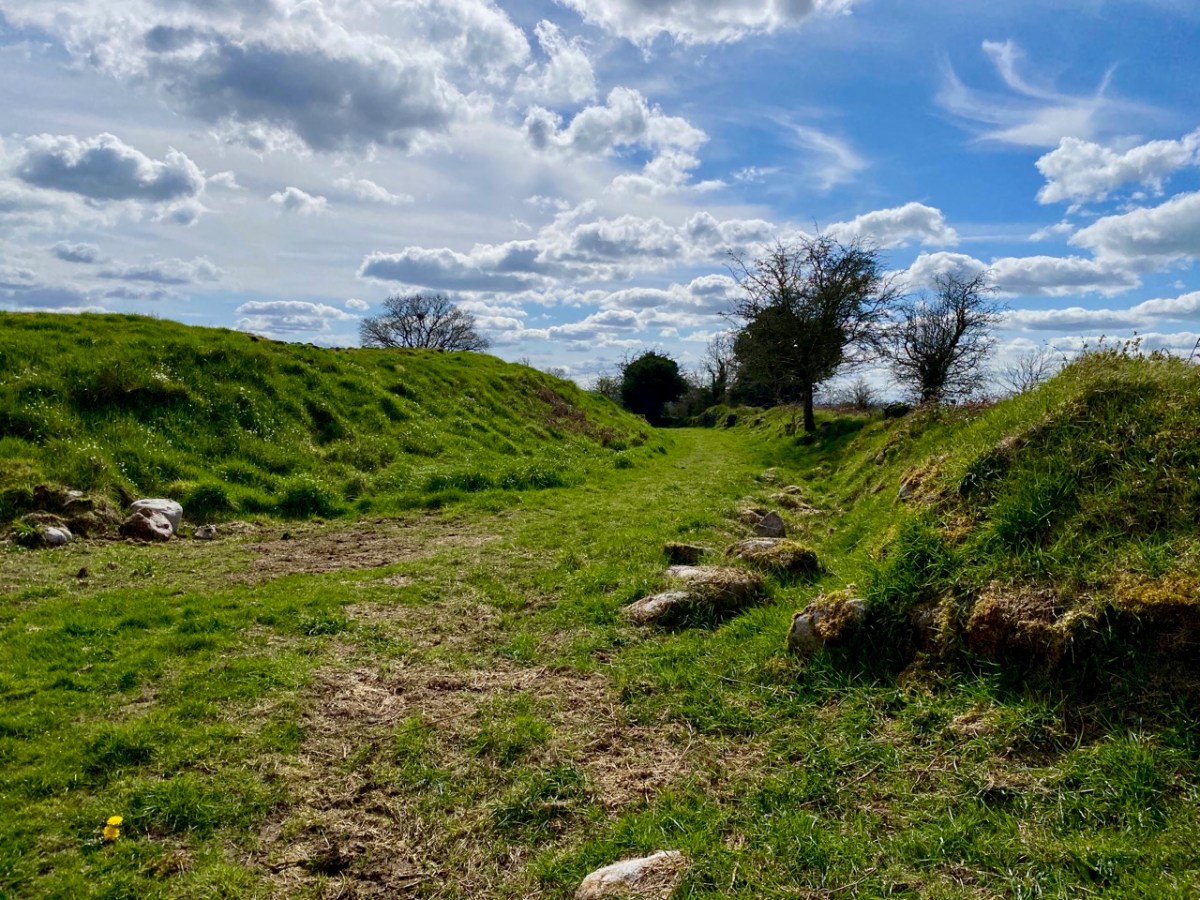
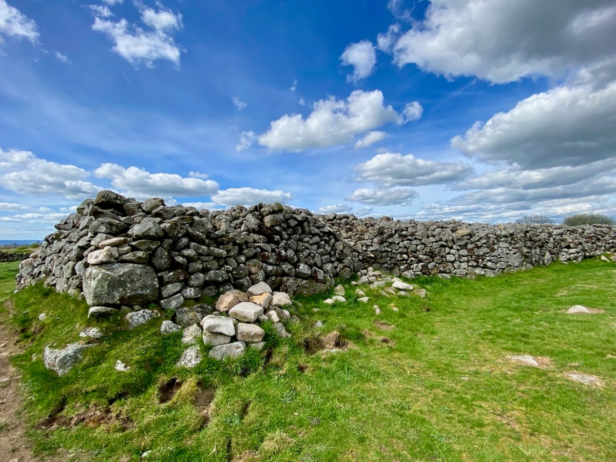
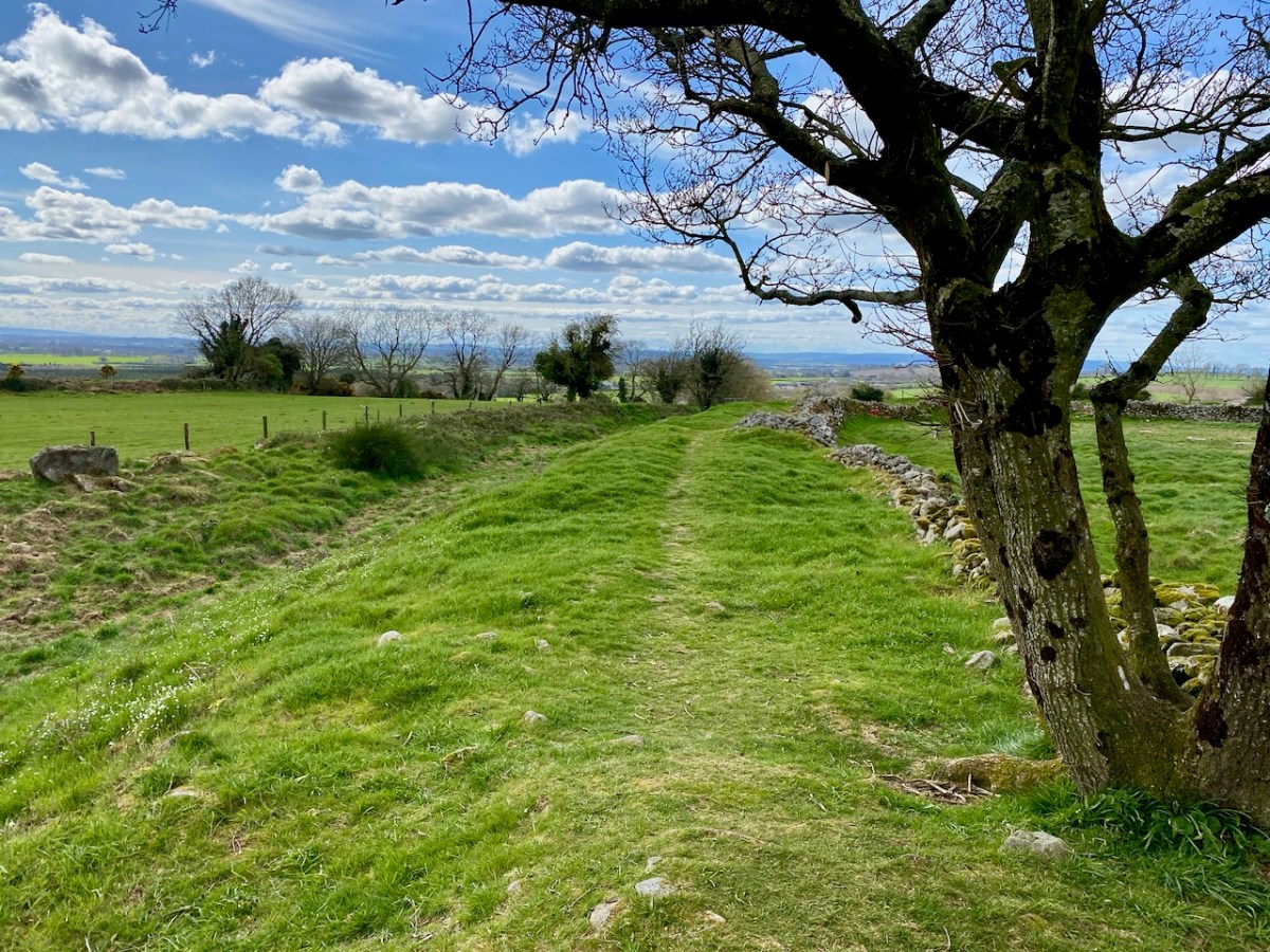
Our journeys in search of important Irish archaeology can take us a long way from home. Today’s subject – the impressive Rathgall Hillfort – is located in County Wicklow, on the east side of the island. But it is well worth a long journey: its size is impressive – it occupies an 18 acre site. And the history of the place goes as far back as the Neolithic age. We visited on a brisk spring day, when the clouds were determined to contribute to our appreciation of this monument.

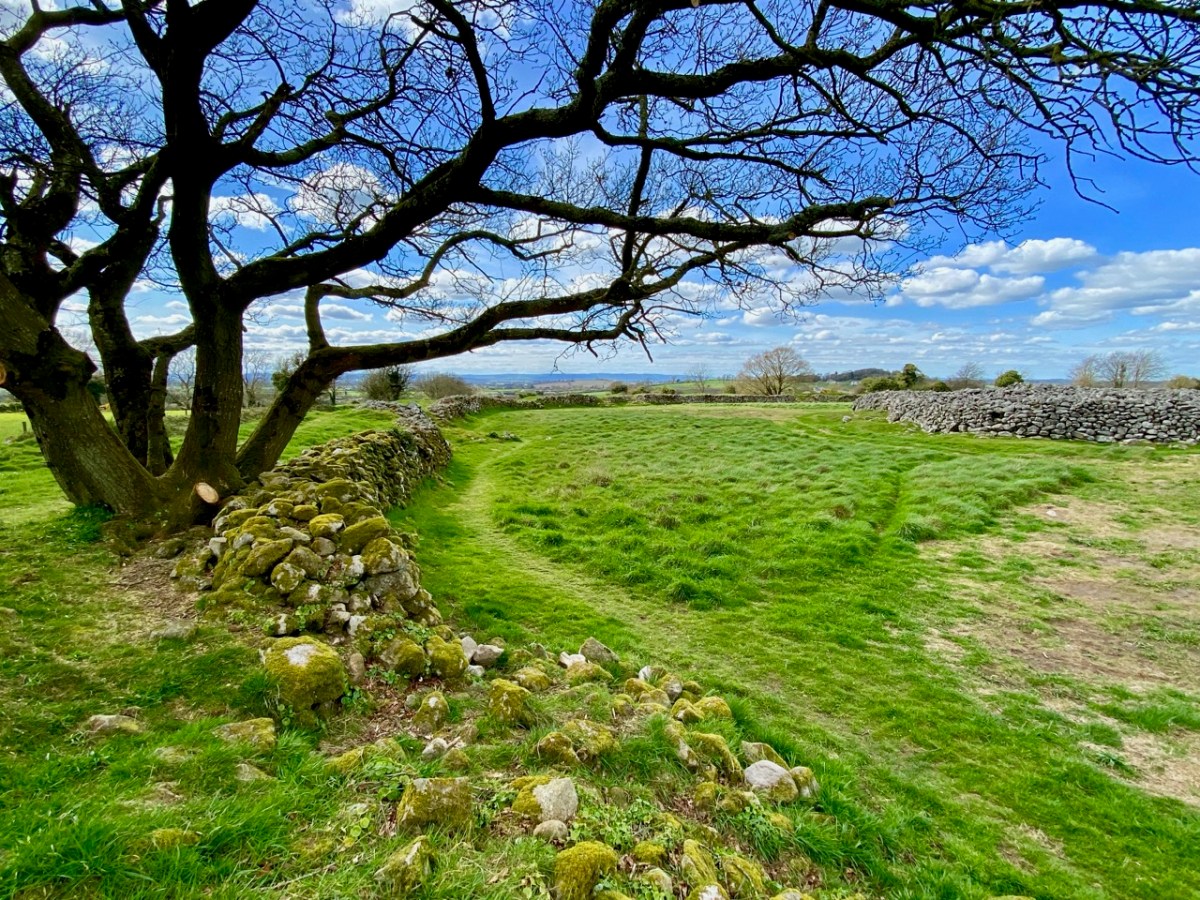
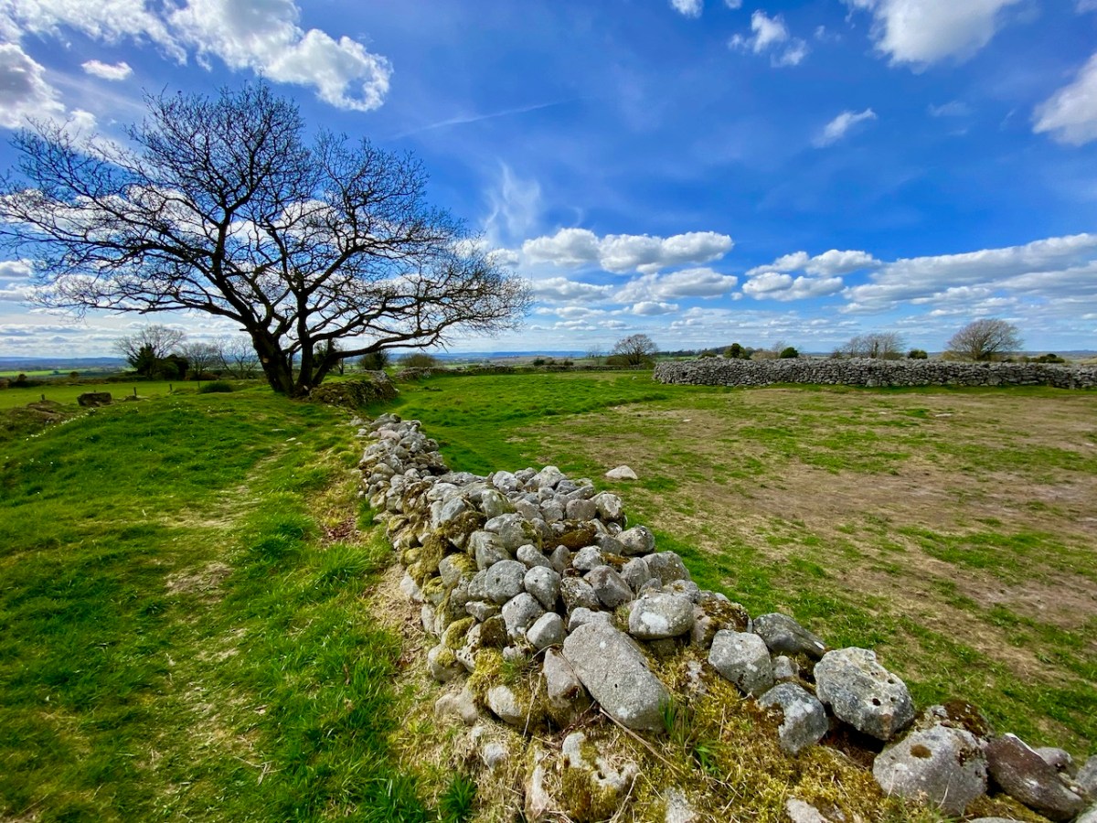
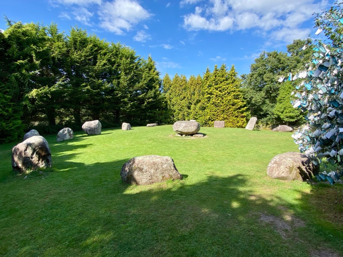
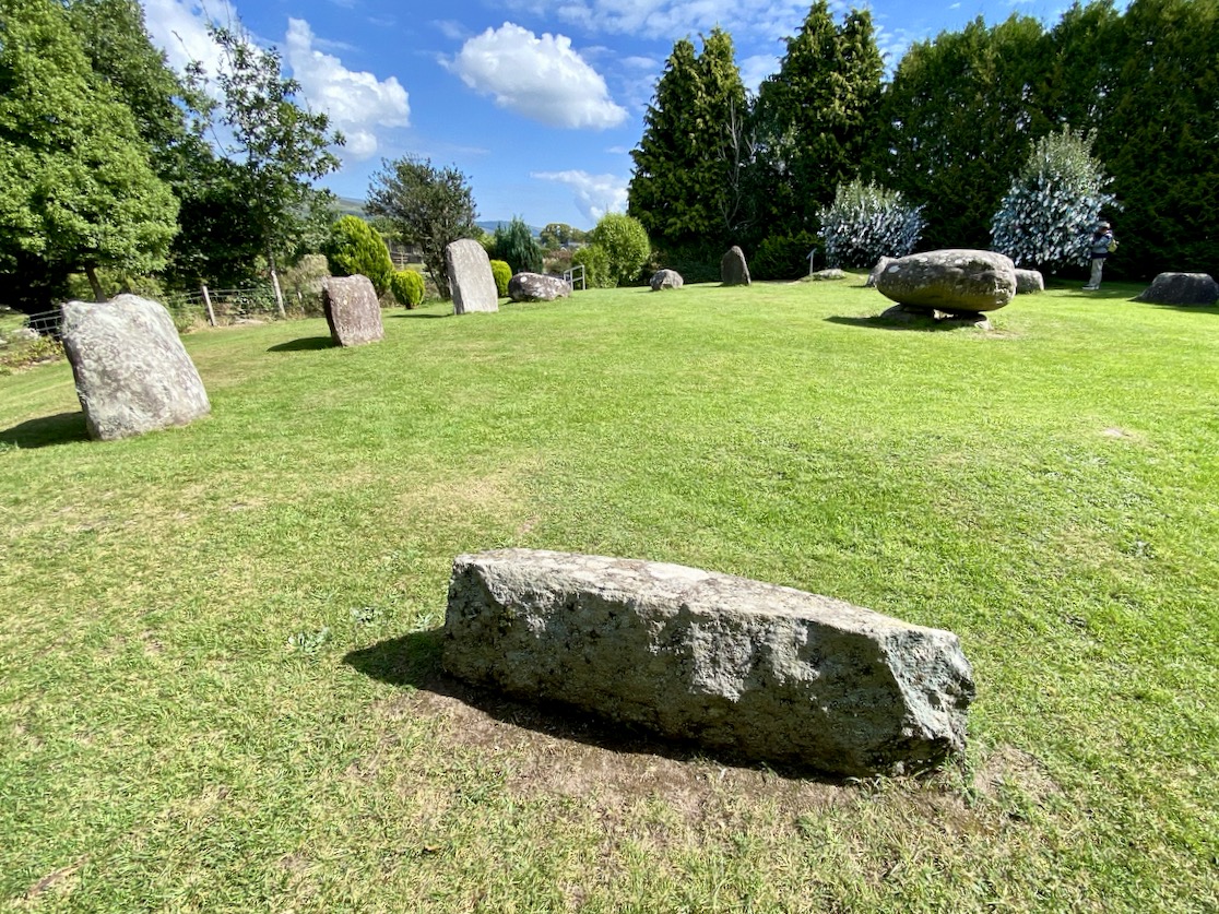
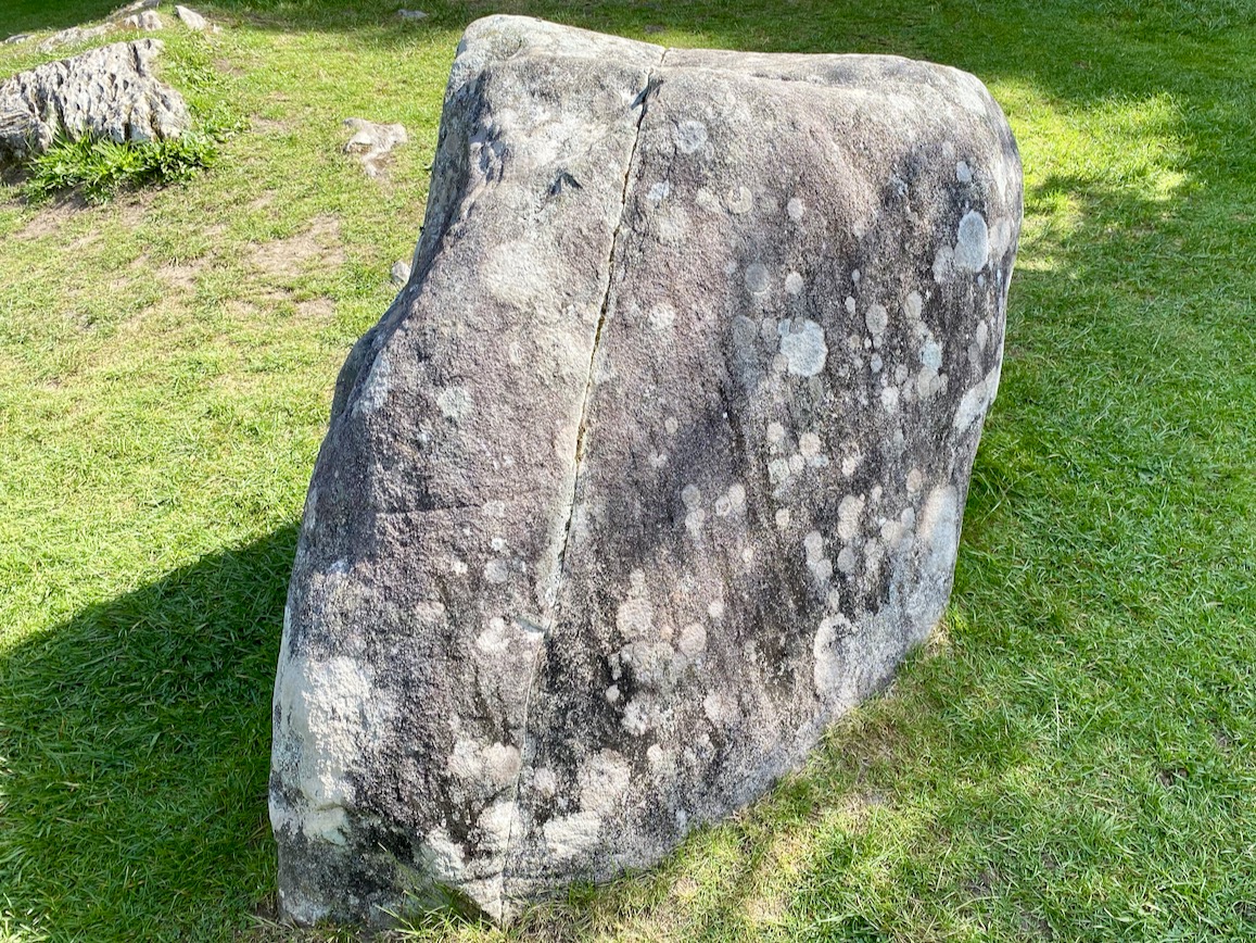
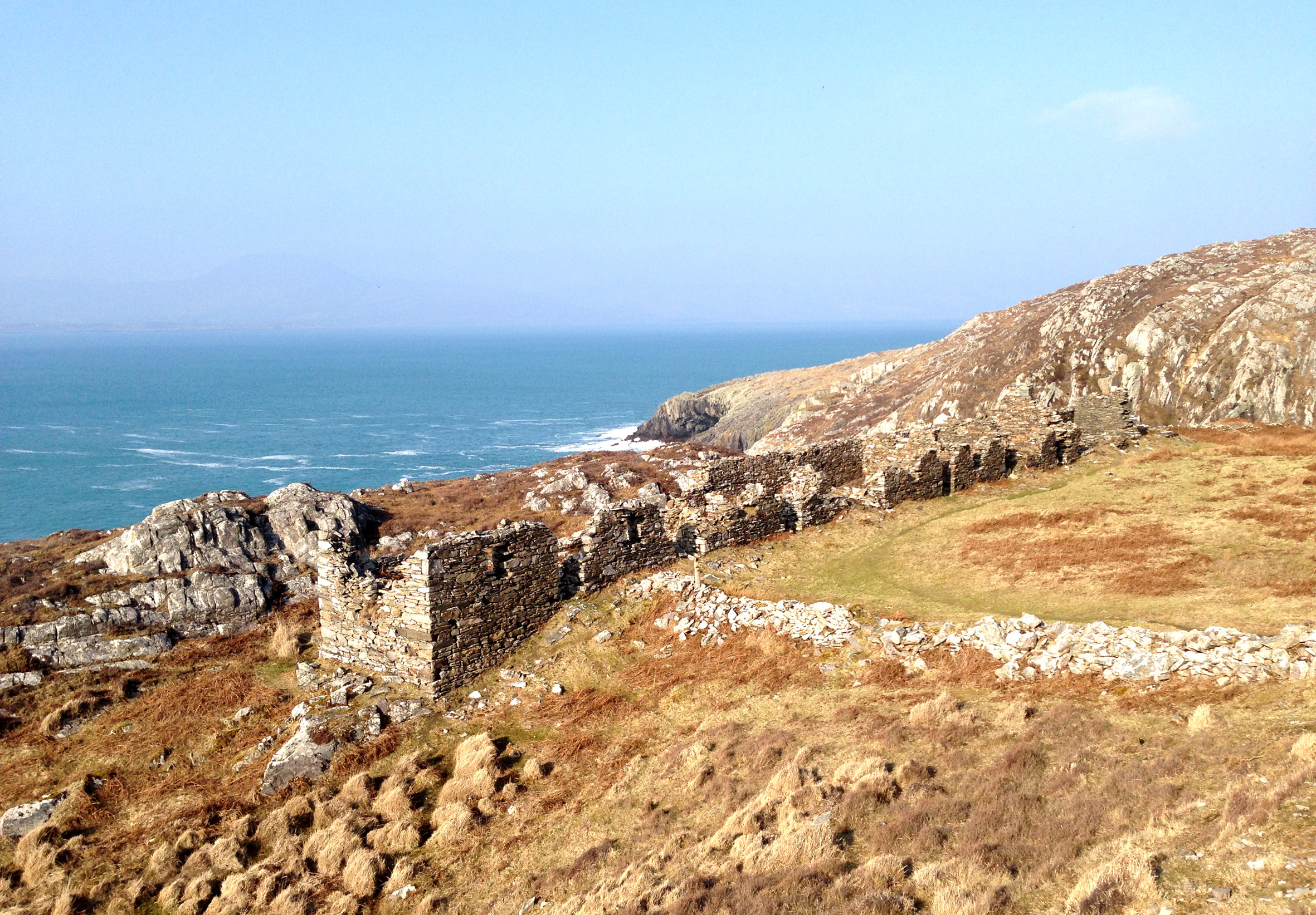
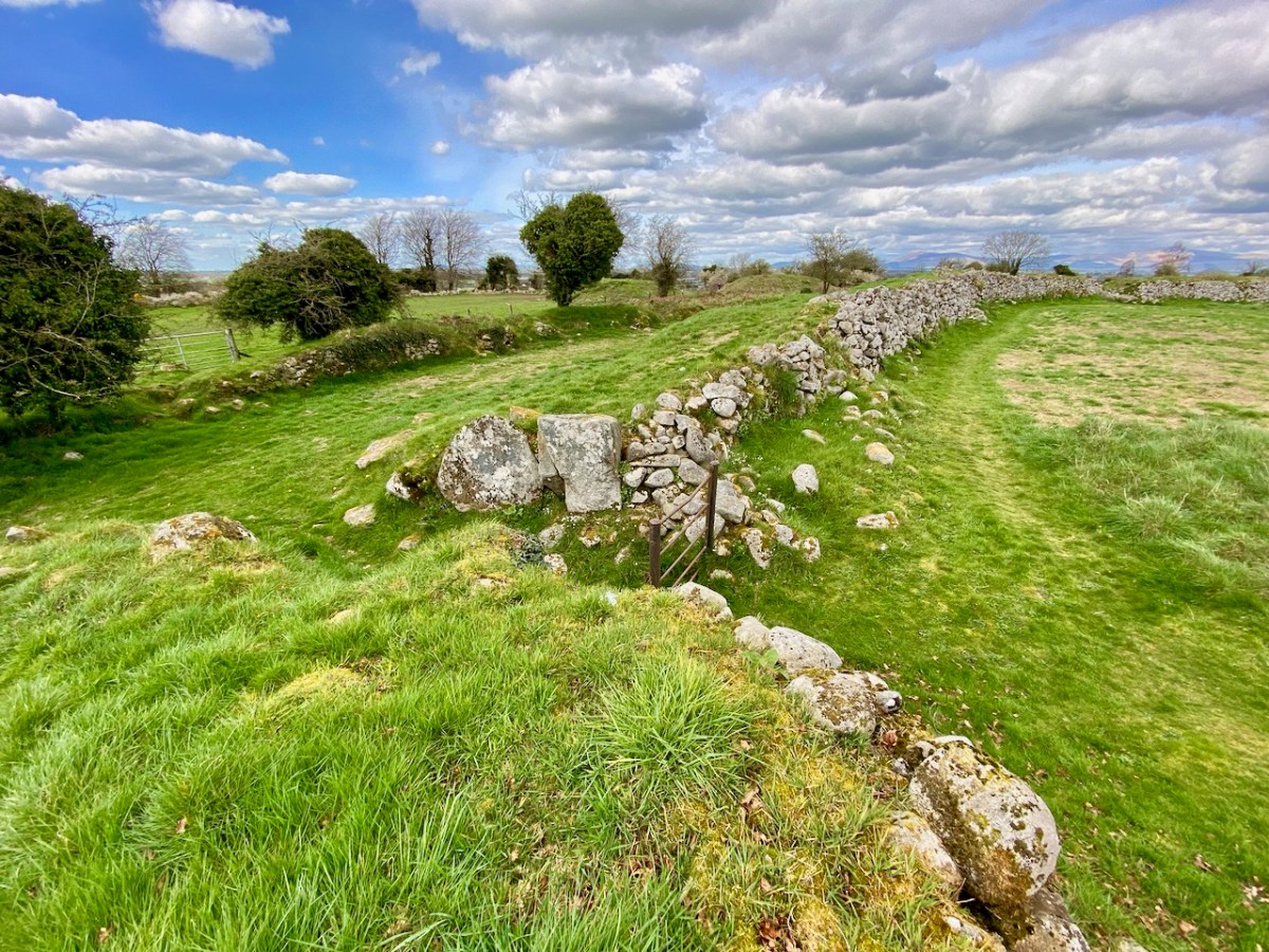
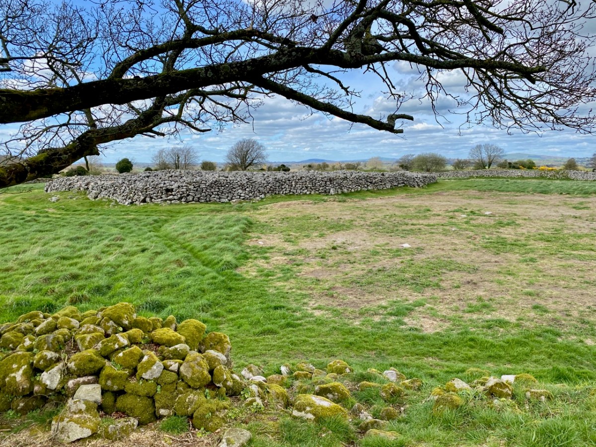
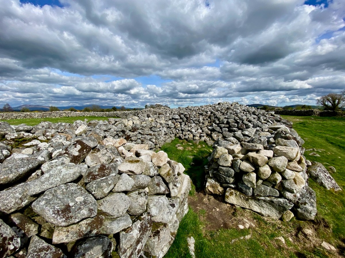
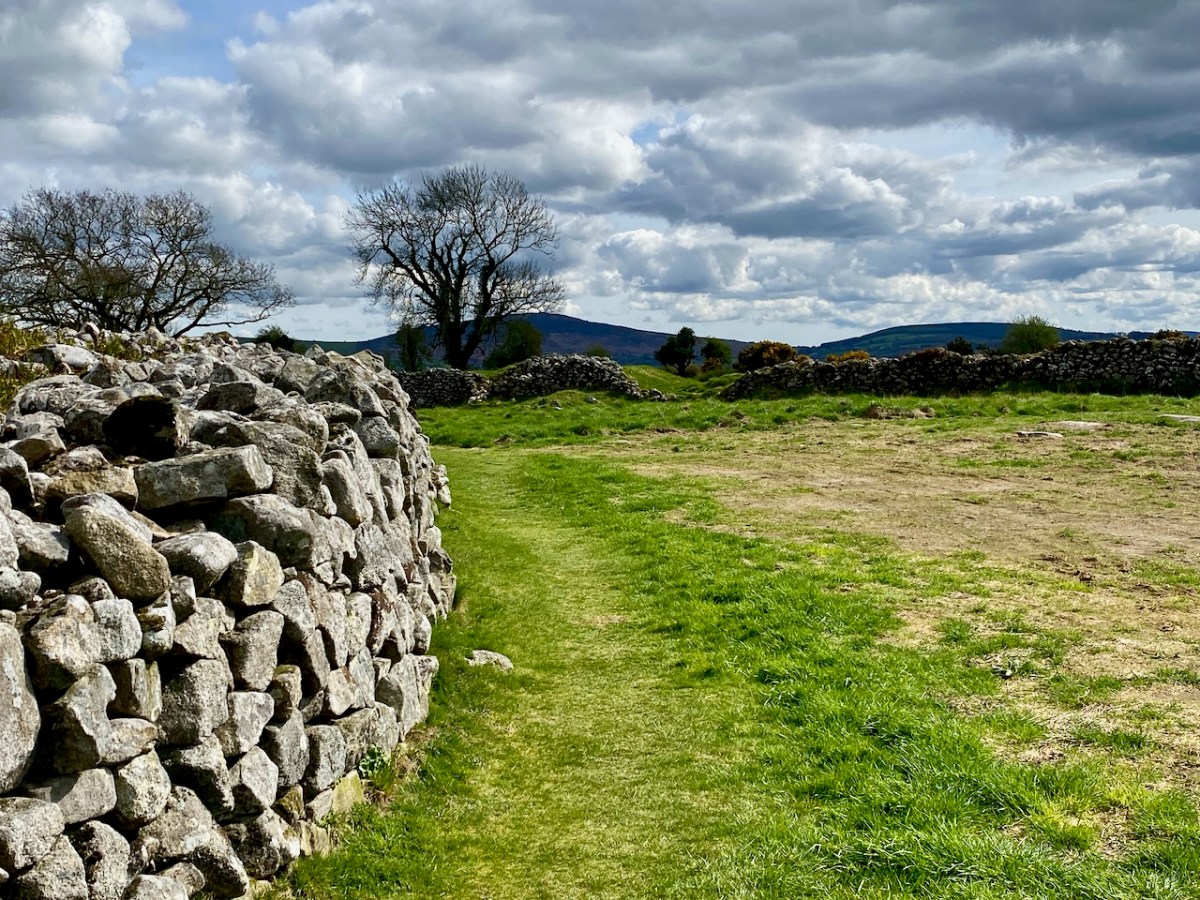
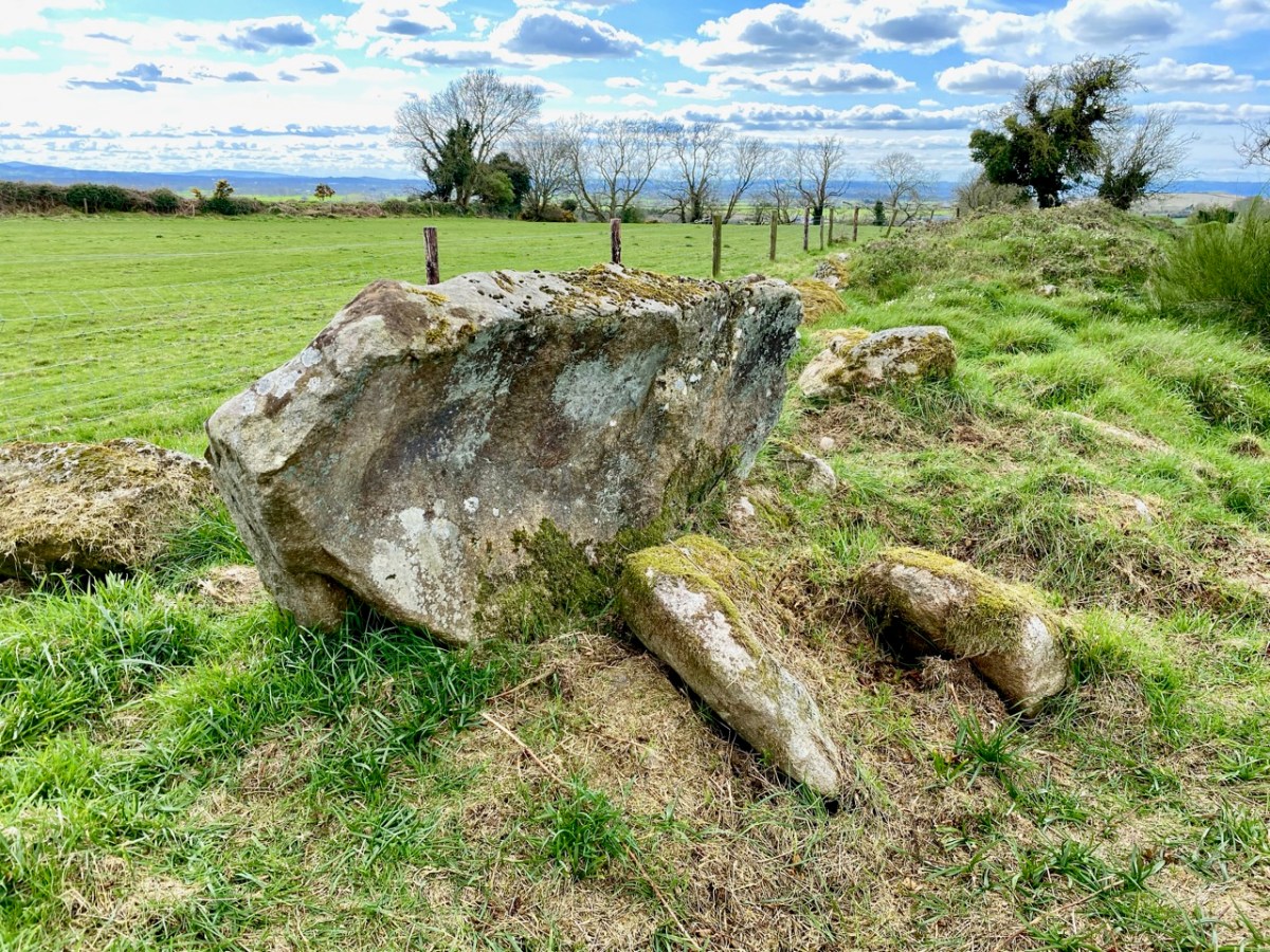
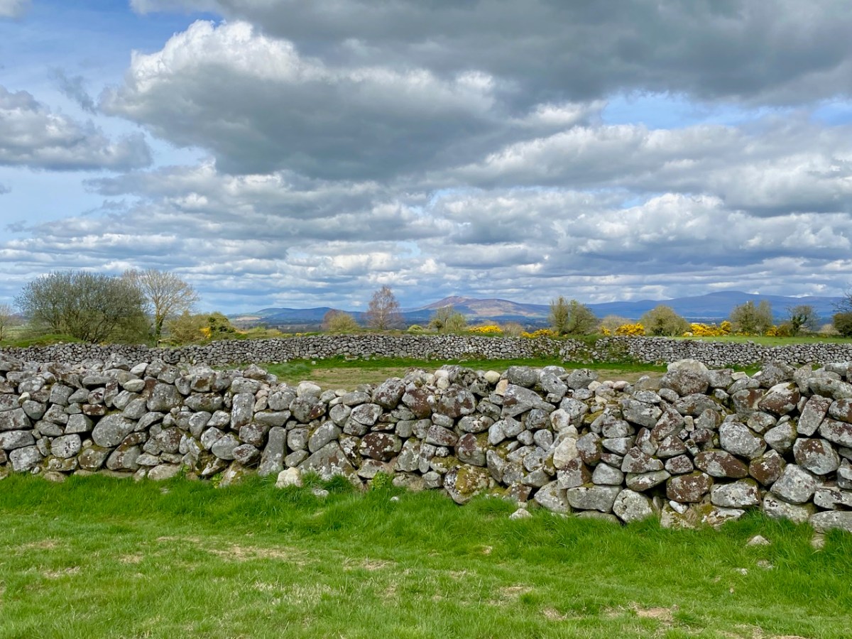
The size and longevity of this hillfort push it into a rare category. The substantial central rampart of stone walling is medieval, but the outer rings of stone and earth appear to have considerably earlier dates.

. . . Rathgall was a site of quite exceptional importance in the centuries spanning the birth of Christ, an importance that was clearly pan-European. The variety of structural information that the excavation yielded is unprecedented in the Bronze Age and the extraordinary concentration of artifactual evidence from the site has not been matched elsewhere in the country. Rathgall opens a wide range of questions concerning, not merely the nature of the Ireland’s later Bronze Age, but also the role of the hillfort in contemporary cultural developments . . .

Professor Barry Rafferty 2004

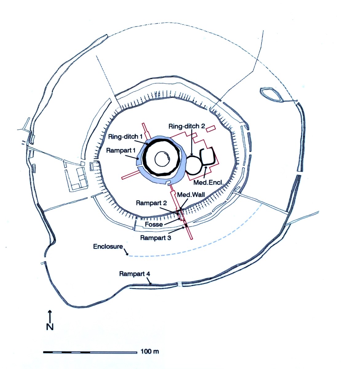
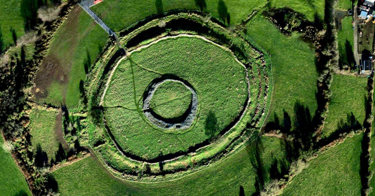
Plan of the hillfort and surrounding earthworks taken from the site notice board. Red lines indicate the site excavations. This board states that:

. . . Rathgall Hillfort is a hilltop settlement enclosed and defended by four concentric ramparts which can be dated to the early and middle Neolithic period . . . The outer three ramparts are stone and earthen banks and are likely to be prehistoric in date. Within the central enclosure there is evidence of metalworking, a cemetery and a round house; all dating to the Late Bronze Age . . .

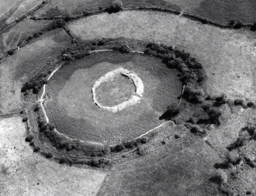
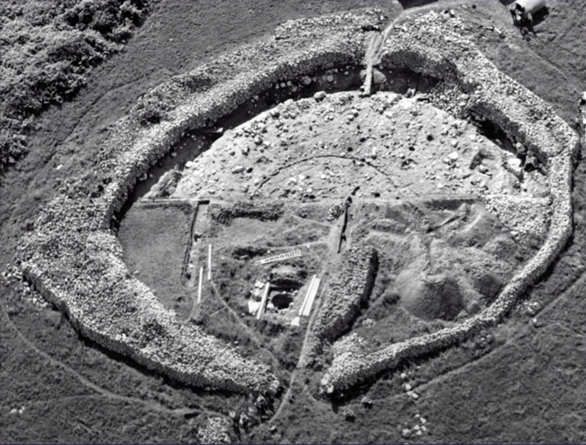
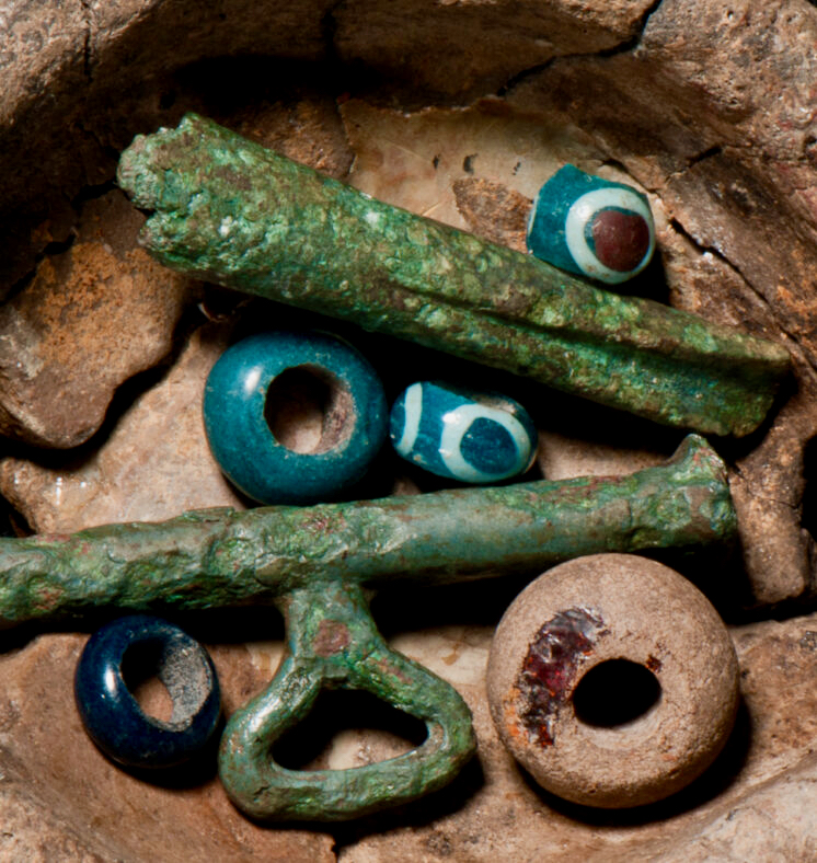
The two photographs above are taken from the time of archaeological investigations which commenced in 1969. The results of those excavations, which covered a number of years, have yet to be formally published. [Late edit: Elizabeth Shee has informed us that the findings will be published this summer by Wordwell, through the work of Katherina Becker of UCC. Many thanks, Elizabeth, we will look our for that]. The investigations found evidence that this was the site of an important and busy Bronze Age factory for metalworking (axe and spearheads, swords) and for pottery, jewellery and glass beads. In total over 50,000 pottery fragments were found, as well as 3,000 bronze and gold artefacts.

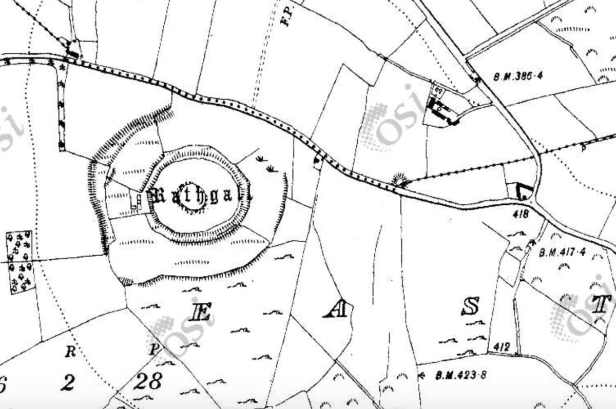
Rathgall from the early OS map. The importance of the site was realised and kept in use by successive generations.

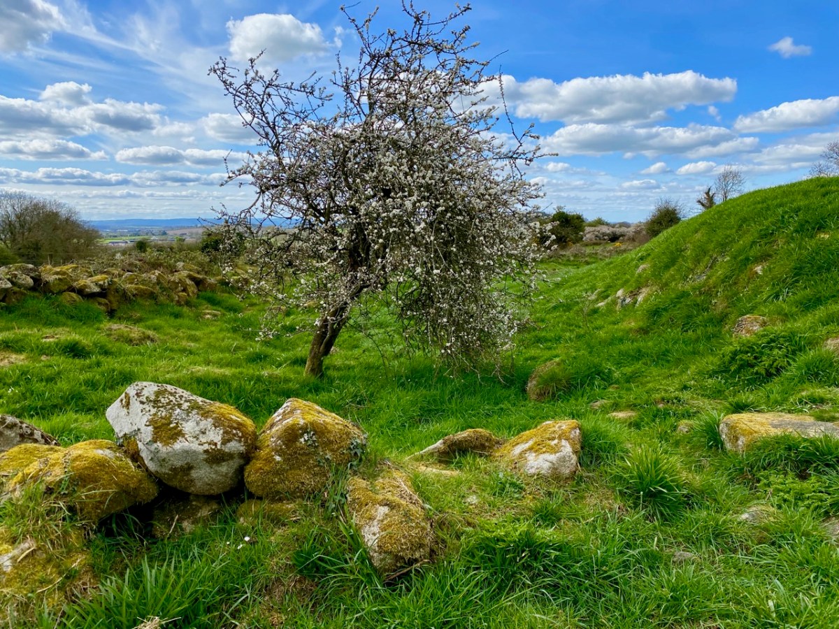
Our knowledge of the societies that centred their life on settlements such as these in Ireland is sparse: here, and elsewhere, we are left with evidence of their stone structures (which will outlast us) but also intriguing finds – the following quotations summarize some of Professor Rafferty’s work here (courtesy of Rath Community Group and The Heritage Council):

1969 – 1971 . . . It took over 3 years to dig out the entire 15 metre wide section of the inner circle. Within an hour of starting work, he [Professor Rafferty] had located pottery pieces. Over 10,000 finds were from the inner circle; glass objects, clay moulds, stone and gold objects. Post holes indicate that there was a small house-like structure within the circle. The ditches were filled in with black material among the stones. An oval pit was discovered near the centre of the house. It had a carefully placed large boulder on top of black material almost covering the pit. The pit had been back filled in with yellow clay around the boulder. When the black clay was taken out, they found a small gold-plated copper ring, 1 cm wide approx, embedded in burnt baby’s bones. They came to the conclusion that this was a ritual burial pit . . .

1972 – 1973 . . . They moved to the southern slope of outside of the inner circle and were getting 400 finds per day. Prof Rafferty got down to prehistoric levels after 1 foot in some places. This area was “jampacked with artefacts, glass, gold, animal bones, pottery and basket remains.” Rabbits had done a lot of damage and stones were removed by people over the years. They found hundreds of clay mould fragments embedded in a black clay-like substance. Clay moulds are always broken when found as they could only be used once. The moulds were made for swords or whatever was needed: copper was poured in and in order to get out the sword etc, the mould had to be broken. He found a smaller crucible with traces of lead in it, parts of blades of swords or rapiers, spearheads, cauldron legs but not the cauldron . . .

1974 . . . In Bronze age times people were buried crouched down in a foetal position and put in a clay pot. The remains of a female and child were discovered in such a clay pot at Rathgall, buried in a pit underneath large slab stones. Eighty eight glass beads were uncovered, which is the largest quantity found in any Bronze Age site in Ireland. These beads are 1 – 3 cm wide, mostly circular in shape, blue-green in colour and with a hole in them. This collection is unprecedented in the late Bronze Age of Ireland and is also one of the largest from a single site as yet discovered in Western Europe (Rafferty and Henderson 1987). Prof Rafferty found a 2cm twisted gold cylinder with its ends finely hammered and a dark green glass bead mounted in the middle, 2 – 3cm wide. Tiny delicate loops of gold were attached to each end. This is an object of great beauty and advanced technological expertise. He also found a metal disc with mercury gilding on it. Mercury gilding was used to stick gold to bronze. He got this piece analysed by the British museum and the piece was dated back to 1000 BC. Before it was analysed, the Irish professionals were uninclined to believe that this came from Ireland as nowhere in the world had mercury gilding been found that dated back further than 400 BC. Prof Rafferty felt that this emphasised the exceptional importance of the Rathgall site . . .

While visiting this site I was reminded of an adventure we had last summer in Northern Ireland. You’ll find it here. There we discovered The Giant’s Ring: that earthwork struck us as ‘gigantic’. But it only occupies an area of 2.8 hectares. Our latest exploration is over 7 hectares! That makes it Cyclopean, surely! While this Co Wicklow site has been examined by archaeologists, we certainly don’t yet have all the answers as to why it existed, nor do we know everything we would like to about those who built it. We just can’t help expressing a sense of wonder at this – and other – artefacts which have made their marks on our landscapes. We are grateful to those who have explored and labelled these sites, and also to those who make sure they are conserved for our future generations, who might find more answers than we do as to their origins.

Kenmare Stone Circle

The significant stone circle at Kenmare is an unusual monument in several respects. It is said to be the largest stone circle in the south west of Ireland, oval in shape and measuring 17.4 x 15.8m. It seems intact: I found no record of any intervention or ‘improvement’ to the circle, which consists of an oval ring of 15 stones with a central ‘boulder burial’. Although situated very close to the main streets of this Kerry town, it has often been described as ‘hard to find’. I can remedy that – here’s a present-day location map:

The site is just a few minutes’ walk from the centre of Kenmare and now has its own dedicated car park beside it. The circle is very ‘tidy’ and well looked after. A nominal entrance fee is requested, the funds being put towards the maintenance of the area.

While the circle is fairly well enclosed nowadays by a ring of tall trees, the vista would previously have been more open with extensive views. Quarrying has taken place in the vicinity in past years. Here is the historic 6″ OS map showing the site as it was around the late nineteenth century.

The archaeology.ie Historic Environment Viewer gives a brief, sober description of the site:

. . . In level pasture, on the SW outskirts of Kenmare town. A subcircular area (17m E-W; 15m N-S) is enclosed by fifteen stones (L 0.8-1.6m; T 0.2-0.7m; H 0.3-1.2m), two of which are prostrate. The axial stone is the lowest and is a regular flat-topped slab contrasting with most of the other stones, which with one or two exceptions, are of boulder type. A boulder-burial (KE093-032002-) occupies the centre of the stone circle. (Ó Nualláin 1984a, 26, no. 41) . . .

Archaeology.ie KE093-032001

I was disappointed in my search for an antiquarian’s account of this circle: Ó Nualláin (quoted above) and others have included it in general lists of such monuments. I was hoping for some speculation on its significant size, and on the large central boulder, itself a slightly unusual feature within a stone circle.

Finola has comprehensively speculated on boulder burials, however, in her Roaringwater Journal post from a few years ago. (She has also written on stone circles generally here). The Kenmare example is visually very much in line with the overall archaeology.ie Monument Class description:

. . . Boulder Burial – A large boulder or capstone of megalithic proportions, resting on a number of supporting stones, usually three or four in number, which, in most cases, do not form a recognisable chamber structure. Excavations suggest a Bronze Age date for this burial monument (c. 2400-500 BC) . . .

Archaeology.IE Monument Classification

Finola has pointed out, however, that there is no conclusive evidence for assuming that these ‘boulder burials’ are – well – principally burials.

. . . William O’Brien [Professor of Archaeology UCC] excavated three boulder burials in the late 1980s and found no evidence of burials. In his book, Iverni, he comments in an understated way, “The absence of human remains at Cooradarrigan and Ballycommane does pose some questions as to their use.” His findings dated the sites to the Middle Bronze Age, between 3000 and 3,500 years ago . . .

Finola Finlay, Roaringwater Journal

So, should we perhaps call them ‘elevated stones’? Visually, they are certainly always striking. This one at Kenmare is said to weigh around 7 tons. Bearing in mind the stones in this circle are likely to originate some few miles distant, we can imagine the efforts required to assemble them. O’Brien dates the boulder burials he studied to 1000 or 1500 BC. This would tie in with the general thinking that stone circles were Bronze Age also.

The two drawings above are from Jack Roberts. On his survey (top) I have superimposed an oval template which confirms the suggestion that the Kenmare ‘circle’ is egg-shaped. In the lower sketch view – probably dating from the 1980s – the stones appear to be out in the open, free from the present-day tree shielding.

While it is generally implied that all the stones in this monument were placed at the same time, there is always the possibility that there might have been an evolution in its construction. By that I mean that we could speculate that the ‘boulder burial’ stone was placed first and the circle came afterwards – perhaps to enhance its setting. Or vice versa.

This photograph clearly shows the recumbent stone. Many of the circles in south west Ireland are known as axial circles, where a ‘recumbent’ stone (seemingly placed on its long edge) may provide a horizon viewing point when observed from a ‘portal’ of two stones at the opposite side. The orientation axis created by this observation is usually from north east towards south west (as is the case here). Where a stone circle has a clear horizon (such as Drombeg, in West Cork) it has been noted that this alignment faces the setting sun at midsummer solstice.

As you can see from these close studies of some of the individual stones (above) there are quite significant differences in their shape and character within the circle. It has been suggested (elsewhere) that the shapes and the relative placing of the stones is significant. ‘Male’ and ‘female’ stones have been suggested – but this is yet more speculation.

As far as we can see there are no ancient markings on the stones at Kenmare (except for a possible single cup-mark on the upper surface of the boulder burial), but I am fascinated by the lichen shapes and textures on one particular stone (above). This is ‘nature’s art’, of course.

It’s impossible to ignore the two ‘fairy’ hawthorn trees that have been established within the vicinity of the stones. In my opinion it was an inspiration to exploit the idea of visitors purchasing ‘message cards’ from the site kiosk and writing down their own thoughts and personal wishes, which are then tied on to the branches. That’s Finola, above, being affected by the rainbow fairy vibes. She has written her own post today specifically on this aspect of the place. My favourite message is this one, below:

Ways West!

Many of you will know that I was a frequent traveller between Cornwall and West Cork from the 1990s and onwards – until I happily met with Finola and we came and settled permanently here in Nead an Iolair just a few years ago. We have never looked back! But I have often wondered about the various ways in which that journey was made – not just in the last century, but three or four thousand years ago… For we do know that tin mined in Cornwall was brought across to the west of Ireland then, in order to manufacture Bronze – the ‘supermetal’ of those advanced times: it symbolized strength and gave wealth and status.

MV Julia, the car ferry which plied between Cork and Swansea: top picture – in her heyday, when she operated throughout the year. Above – Julia leaving Cork in 2012 after the closure of the Fastnet Line. Her name was changed to Wind Perfection and she became a floating dormitory for workers on the offshore wind farms in the North Sea

Not only tin was brought from Cornwall. A study carried out in 2015 by universities in Southampton and Bristol – (using laser ablation mass spectrometry) – concluded that many of the gold artefacts in the National Museum of Ireland and dating from the Bronze Age were manufactured from gold imported from Cornwall – even though there were rich supplies of gold being extracted in Ireland. Author Chris Standish suggests: 

…It is probable that an ‘exotic’ origin was cherished as a key property of gold and was an important reason behind why it was imported for production…

Gold artefacts from Ireland: left – Tyrone Lunula, early Bronze Age; right – Gleninsheen gold gorget, late Bronze Age (photos courtesy National Museum of Ireland)

I would really like to know what type of boat was used all that time ago to bring that precious metal across the Irish Sea. Some have suggested that it would have been a forerunner of the currach – implying a small hide-covered boat. But metal was heavy – even if it was smelted into ingots before the journey: something larger than a currach must surely have been needed. My own not-too-distant memories of having survived a night crossing in the MV Julia, from Swansea to Cork, in a Force 9 storm – with the thudding of huge waves against the steel hull and ominous creakings and crashings coming from the car decks below – lead me to think that any craft that had to traverse those seas in all weathers had to be substantial and sturdy.

A traditional currach in Dingle, Co Kerry – without its covering skin of hide or canvas

I began to research types of craft that were used in the Bronze Age: examples have been found, some preserved underwater or in bogs. These included ‘log boats’ such as the 14 metre long Lurgan Canoe in the National Museum, which doesn’t seem ideally suited to cargo carrying – especially on open sea. The most likely candidate comes from the Mediterranean: the Uluburun Shipwreck, found underwater in Turkey in 1982.

The Uluburun was a cargo boat: we know this because much of its load was intact when the wreck was found. Amazingly, archeologists were able to pinpoint its route: the ship set sail from either a Cypriot or Syro-Palestinian port and was probably heading for a Mycenaean palace on mainland Greece. It was wrecked in the late 14th century BC. The boat was constructed of cedar planks with morticed and tenoned joints and carried a huge cargo: 500 copper ingots; one ton of tin (which when alloyed with the copper would make around 11 tons of bronze); around 150 Canaanite jars, some filled with glass beads, many others with olives and some with an ancient form of turpentine; 175 glass ingots; African blackwood (ebony); ivory; tortoise-shells; ostrich eggs; Cypriot pottery and oil-lamps; a trumpet; quartz, gold, faience, amber, weapons, tools, pan-balance weights and a gold scarab… The list goes on.

Underwater archaeology: it took ten years to excavate and recover the cargo of the Uluburun vessel

This was in the Mediterranean, not in the Irish Sea. But it’s perfectly possible that the marine technology of those times extended to the northern outposts of Bronze Age Europe. We have to be very clear in our minds that we are looking at a sophisticated society capable of metallurgy, communication and long-distance travel.

Coming back to my own journeys from Cornwall to Ireland, I mourn the passing of the Swansea Cork Ferry, in those days by far the best way to get me and my car to the west of Ireland: I have good memories of arriving in the Lee estuary at daybreak and, excited to be here, watching the sun rise as we sailed up through Cobh to Ringaskiddy. On other journeys I also came over by air: there was a wonderful flight in a small aircraft from Exeter going to Cork. The homespun Devon airport in those days was unsophisticated: on one occasion I lined up to have my luggage checked by security and was asked to take my concertina (a constant travelling companion) out of its case for inspection. I was then asked to play it – in front of the queue – and everything stopped so that the serenade could be heard! It was a small aeroplane – about a dozen seats in the cabin, with the pilot up front – no partition. As he started the engines his broad Cork accent came over the speakers: “…let’s see if we can get this thing off the ground…” He succeeded and – once in the air and cruising at a lowish altitude – got out packs of sandwiches and passed them around. I thoroughly enjoyed watching the outline of Cornwall (exactly as it’s shown in the atlas!) passing below us, to be replaced shortly by the distinctive – and similar – geography of south-west Ireland, soon followed by a sketchy and invariably bumpy landing on Cork’s runaway – especially in any sort of stiff breeze.

Air Lingus Regional flights – operated by Stobart Air – now directly connect Cornwall with Cork. Photo – Trevor Hannant

It’s exciting that – just in time for Uillinn’s West meets West exhibition of Cornish artists, there is finally a direct link from within Cornwall to Cork! A new Air Lingus Regional flight – operated by Stobart Air started operating this month and it’s already popular: extra flights have been added to the planned timetable to cater for higher than expected demand. These flights leave from Newquay Airport and are very reasonably priced. I wish them every success… Back in the day, my journey from Newlyn to Skibbereen via the ferry took all day and a night: the new flight barely takes an hour.

Depart here for West Cork! Newquay Airport, in Cornwall

When the Swansea to Cork ferry stopped running the West of Ireland felt the loss: tourism numbers dropped significantly and businesses which relied on visitors suffered. Things have improved since then, particularly with the Wild Atlantic Way initiative. Hopefully the new air link will lead to increased business between the two western outposts of Britain and Ireland, hearkening back to historical times when close links were first forged. Meanwhile, please don’t forget to come along to West meets West and see the work of contemporary artists from Cornwall. The artists (some of whom will have flown over on the Newquay service!) will be speaking about their work at 12 noon on Saturday 3 June, and I will be giving a gallery talk on Saturday 10 June – also at 12 noon – about the many historic links between Cornwall and the West of Ireland. West meets West – the work of contemporary Cornish artists, at Uillinn, Skibbereen, from 3 June to 8 July. Opening at 6pm on Friday 2 June.

Travelling from Cornwall to Cork: Off to Skibbereen – painted by Newlyn Artist  (and Irishman) Stanhope Alexander Forbes in 1901

Umha Aois

spearhead

There’s a magic to the working of metal: you can pick this up when you are doing it, or when you are watching others do it. It could be the arcane transformation of rough nuggets of ore, first into liquid and then into beautiful solid objects that inspires that impression – or perhaps it’s because the senses are battered by the fierce heat, the molten rivulets, the streaming sparks, the incessant hammering, the sheer excitement… It’s no wonder that our ancestors embraced the emerging technologies hundreds of generation ago, and created spectacular objects which, today, we place in our museums and venerate.

sparking

Umha Aois are artists and sculptors working as ‘experimental archaeologists’ who have been in Skibbereen this week as part of the Skibberen Arts Festival. They use Bronze Age metal working techniques to produce replicas of ancient tools, weapons and musical instruments and also contemporary art objects. We went to their workshops set up in the grounds of Liss Ard House and met Holger Lönze – a locally based sculptor – James Hayes from Bray and their colleagues who are researching and using stone and clay moulds, ‘lost wax’ processes and charcoal pit-furnaces.

Robert holding a recently cast bronze bell, while Finola tries out an adze

It’s very appropriate that we should be looking at Bronze Age metalwork in our own corner of West Cork as we are in the shadow of Mount Gabriel, site of substantial copper mine workings probably dating from some three and a half thousand years ago. A number of Bronze Age mines have been found on the Mizen Peninsula: it must have been a significant local activity and source of trade. It has of course continued almost up to the present day; our own townland of Cappaghglass saw considerable copper extraction during the nineteenth century.

copper mountain

Copper Mountain – on Mount Gabriel can be found the sites of 32 separate workings dating from 1700 – 1400 BC, but there is no evidence of smelting or metalworking in the same vicinity: perhaps the ‘magic’ of the process required it to be carried out in more secret places?

Back to the Umha Aois project (it’s pronounced oowah eesh and means Bronze Age): we saw pieces in various stages of production, including axe heads, adze heads and spear heads, cast from stone moulds. They are elegant objects, especially when they have been polished to a gleaming finish.

axe heads

Bronze axe head, showing the mould used to cast it

The group was using pit furnaces which they had constructed on site. These consisted of basin shaped depressions in the ground lined with clay, and pipework of clay running from two sets of bellows. The clay pits were filled with charcoal and fired to a high temperature to convert the ore in the crucibles to a molten state.

empty furnace

Top – the principle components of a Bronze Age pit furnace; below left – crucible being heated; below right – the bellows in action

In another shelter we were also shown the ‘lost wax’ process: small objects were shaped in wax and then encased in clay. The wax was melted, leaving a mould in the clay cavity which was then filled with molten metal. Once hardened, the clay moulds are broken apart; the copper or bronze objects are then finished and polished. Here is a BBC video that demonstrates these techniques. There are incredible examples of this type of worked metal in the National Museum in Dublin, including some in gold – thousands of years old and yet so elegant and sophisticated.

melting out the waxClay moulds used in the ‘lost wax’ process

Holger has also made a Bronze Age musical instrument, which he demonstrated for us. The pattern is based on ‘trumpets’ which have been found in Europe, the finest being the Loughnashade trumpet, discovered during drainage works at the site of a former lake in County Armagh. Holger’s trumpet is a bronze cast: some finds have been made from curved and rivetted sheets of bronze. Here is a link to a recording of the sound made by a similar reconstructed instrument.

Holger Lönze conjuring up ancient music!

By exploring techniques, lifestyles and behaviour of our forebears through practical application, experimental archaeologists such as Umha Aois help us to understand that people who lived in the Bronze Age were not intellectually ‘primitive’ as was once thought; they have passed down to us their own aesthetic appreciation of art, music and their highly developed knowledge of sciences that enabled them to construct the complex megalithic monuments – and enigmatic Rock Art – which are yet beyond our own understanding.

Experimental archaeology in the walled garden at Liss Ard

Our ancestors left behind rugged stone monuments, landscapes which have shaped the pattern of our countryside, and sublimely beautiful objects: magic to our eyes and senses.

This Bronze Age gold disc – now in the National Museum, Dublin – was found at Sparrograda, Ballydehob:

sparrograda disc

Equinox Adventure

equinox

September 21st – the Autumn Equinox. Day and night are exactly the same length. This event must have some significance for any society which watches the sky. We can never know for sure, but it does seem possible that the enigmatic stone structures we find out in the remote landscapes of Ireland: megaliths, circles, stone rows and – dear to us – Rock Art, could have been inspired by celestial observations.

the rock

Bronze Age carvings at Derreenaclogh

Finola put up a post on the Spring Equinox at Bohonagh, and we have written about the Spring Cross Quarter (Imbolc). We are fortunate that today’s weather has been idyllic – cloudless and with a clarity of light – so we headed out to Derreenaclogh to watch the sun setting. We have studied this rock in depth, throughout the year and in all conditions. Our work has produced a detailed measured drawing of the intricate markings on the surface, carved by our ancestors perhaps three or four thousand years ago.

During our many visits we have noted – but perhaps neglected – the other carved rock at Derreenaclogh, which is situated only a few metres to the east. This has suffered considerable weathering and surface erosion which the first rock escaped, somehow or other, by being preserved for years – centuries – perhaps millennia – under a covering of soil and furze. Nevertheless, today the very faint markings seemed to be more alive – as if the low sunlight on this evening was exactly right for observation. We could see marks on this surface we had never made out before. Derreenaclogh Number 2 deserves a detailed study of its own – something else to keep us busy for a while!

Heavily weathered motifs on Derreenaclogh 2

Heavily weathered motifs on Derreenaclogh 2

The sun duly sank below a hill – not a particularly significant part of the horizon. Mount Gabriel, meanwhile, further to the south, gathered some rather spectacular clouds around itself: it could be that this landscape profile is a sunset marker at another calendar point. We did see that the ‘ray’ on the large motif with eight concentric circles seemed to be aligned with the setting sun – could that have been important?

It was such a beautiful evening that wherever that sun had landed, or whatever alignments may or may not be visible, we would have been perfectly happy. As we made our way back to Nead an Iolair we said to ourselves – again – that this West Cork scenery is unbeatable: we are so fortunate to be immersed in it.

Mt Gabriel


Copper Country

Sheep's Head Copper Mine: Cornish mineworkers' cottages

Gortavallig Copper Mine, Sheep’s Head: Cornish mineworkers’ cottages

We live in the townland of Cappaghglass. I would love to say that the name derives from the metal that makes up much of its geology – copper, but Finola tells me that way of looking at it comes from my English accent: the Irish word for copper is Copair, while Cappa actually means meadow. Glas or glass means green so – prosaically speaking – we live in ‘Green Meadow’. However, as in so many cases, the history of this little bit of Ireland is writ clearly on the landscape and Cappaghglass is very much ‘copper country’.

Stub of 9th century Irish round tower? - No: 19th century copper mine workings in Cappaghglass. In front is the head of a shaft, behind is the remains of the mine chimney that fell in 2002; to the right are the old mine cottages

Stub of 9th century Irish round tower? – No: 19th century copper mine workings in Cappaghglass. In front is the head of a shaft, behind is the remains of the mine chimney that fell in 2002; to the right are the old mine cottages

Our own house, Nead an Iolair, is built on territory that was once owned by a nineteenth century copper mine, and legend has it that our Calor gas tank is placed over an old mine shaft! We look out to Horse Island – one of Carbery’s Hundred Islands in Roaringwater Bay: it once supported a copper mine of the same period. Look at the photograph of the number of workers employed there at this time. Now there are merely a few holiday homes on the island.

Mineworkers on Horse Island: 19th century

Mineworkers on Horse Island: 19th century

Among the quiet fields and peaceful boreens our townland is strewn with evidence of the industry that once was here: old spoil heaps, barbed-wire protected shafts, supports for overhead ropeways and the base of a famous local landmark: the 20m tall Cappagh Mine chimney which came down in a lightning strike in 2002 which also severely damaged the Mine Captain’s House adjacent to it. Mining here commenced in 1820 and works ceased in 1874. Its best years were the decade 1863 to 1873, when 877 tons of bornite copper ore were produced.

cappamap2

Cappagh Mine: cross section, mine chimney (pre 2002) and our own mine shaft!

Cappagh Mine: cross section, mine chimney (pre 2002) and our own mine shaft!

***

We went off to the Sheep’s Head last week – in idyllic weather – and were shown the Copper Trail by friends Peter and Amanda. It feels so remote out there, yet the place was a hive of industry when mining was at its height during the Victorian age. I was fascinated by the row of Cornish miners’ cottages there, and the similarity between this site and the cliff-edge setting of some of the mines in West Cornwall, Botallack in particular. When exploring these pieces of industrial archaeology in Cornwall I was always struck by the incongruity of the incredibly beauty of the places – set against the blue background of the Atlantic – with the hardship and danger of the working conditions that must have prevailed. Here in West Cork, as there in Cornwall, shafts and galleries extended out under the sea bed and the men toiled away in cramped and perilous conditions with the sound of the booming waters above them, while on the surface women (bal maidens) and children worked equally hard preparing the ore for crushing and smelting.

botallack

Botallack Tin Mine, West Cornwall - romantic site now, but less benign in earlier days

Botallack Tin Mine, West Cornwall – a romantic site now, but less benign in earlier days

Far longer ago than the nineteenth century, West Cork was being worked for copper ore. On the steep sides of our local Mount Gabriel there is evidence of copper mining dating back 3500 years to the Bronze Age. UCC Professor of Archaeology William O’Brien carried out research and excavations during the 1980s and traced a number of mine workings from this time. The extraction was a well organised process: a supply of  good roundwood had to be stockpiled and fires were lit against the rock face where traces of ore were apparent. A hot fire was kept burning for several hours followed by dousing in cold water (of which a good supply was also needed), causing the rock surface to fracture, and this disturbed face was hacked off with stone mauls allowing the accumulation of small quantities of  malachite. Constant working on good seams led to excavation into the mountain side, and some shafts have been found extending to several metres. Water ingress was a problem and it seems likely that a system of bailing or pumping was necessary. Eventually the drowned shafts were abandoned and, over time, they became filled with a type of blanket bog. This helped to preserve some of the wooden implements used and – presumably – discarded in them: hammer handles, wedges, picks and shovels as well as planks and ladders; also pine chips apparently used for illumination.

Bronze Age industrial landscape

Copper Country: Mount Gabriel – once the haunt of Wolves and miners

There’s a whole lot more to be said – about why metal was so important in the Bronze Age (wealth, in one word) and the whole context of distribution, trade and the technology of bronze itself: bronze production is only possible by combining copper ore with tin, and this was not available locally. In all probability our Cornish and Iberian cousins were making contact with Ireland’s metallurgists thousands of years ago. Interesting that the Rock Art we find in these same hillsides – and which could date from the same period – also has parallels in Britain, Brittany and Iberia.

Bronze Age industrial landscape?

Bronze Age industrial landscape?