I’ve been stricken with Covid, so the post I was planning to write – about my visit to the amazing Derry Duff Farm will have to wait a week. And no – I haven’t forgotten I need to get back to the Skeams and St Brandanus! Instead I bring you one of Robert’s posts from a few years ago in which he leads us along some of the smallest roads you can encounter in West Cork. I’ve swapped in a few photos.
Small Roads
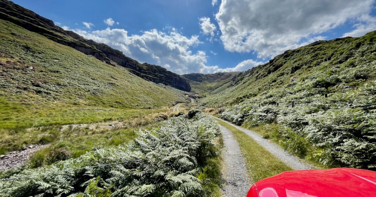
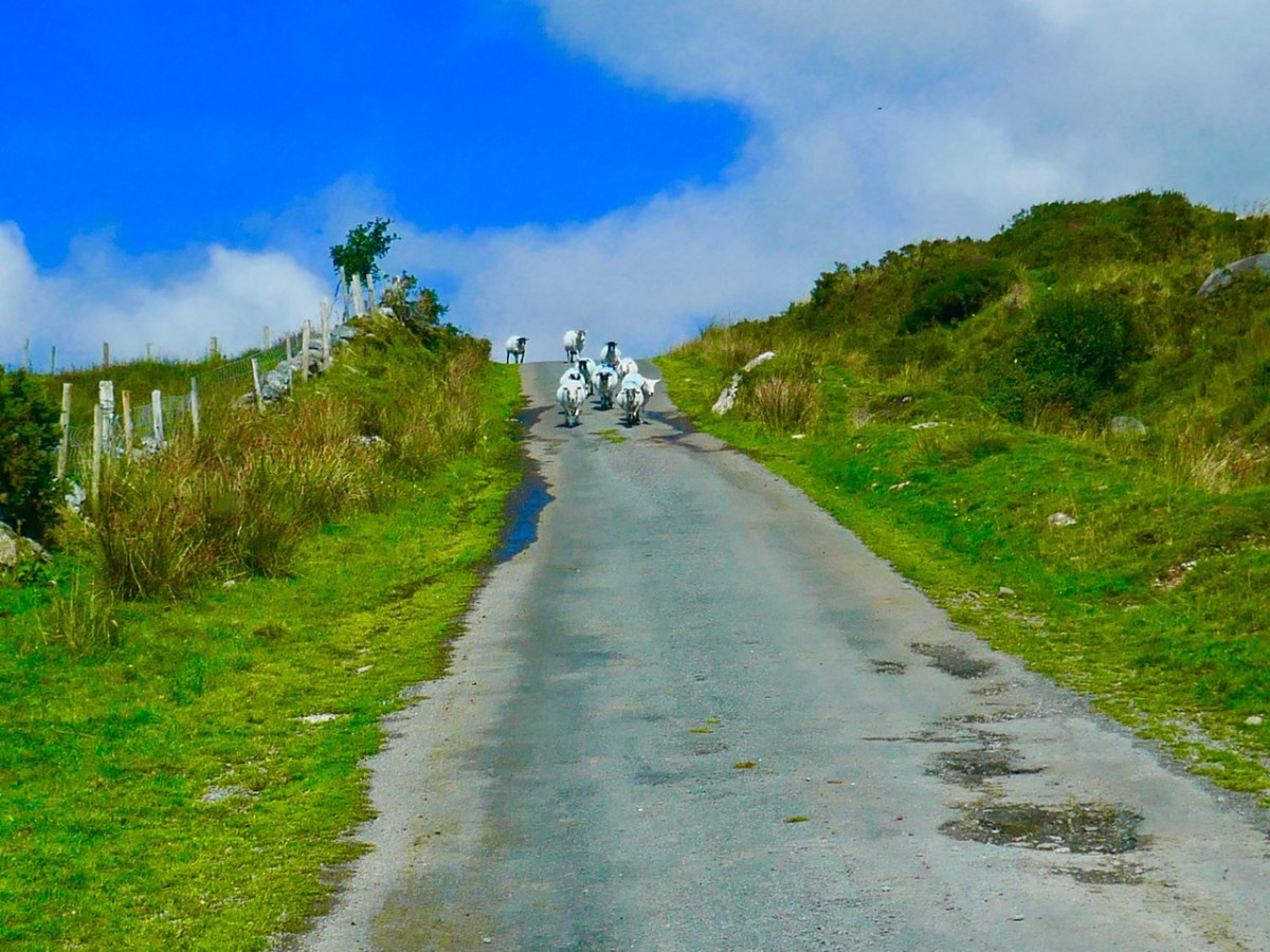
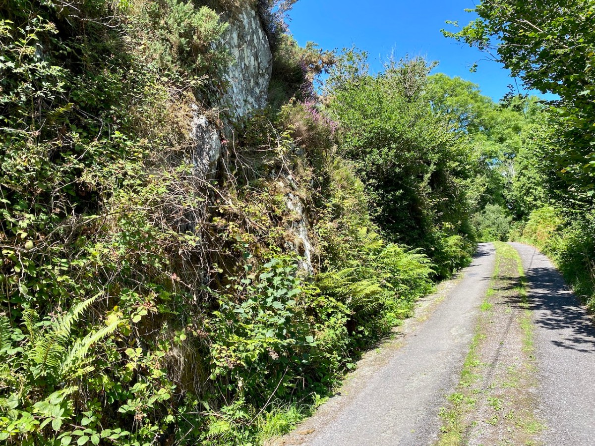
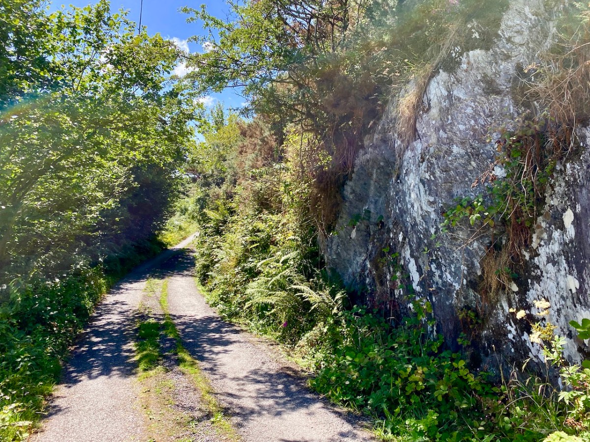
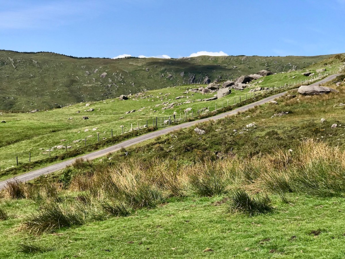
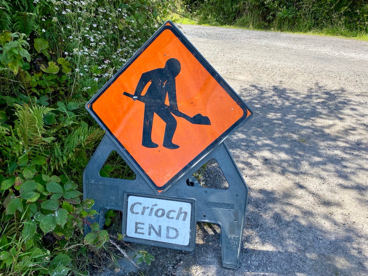
Road repairs in rural Ireland peak in the summer months. Favourable weather is responsible. Always be ready for holdups and diversions. ‘Boreens’ – narrow roads in country areas – are often unable to take the machines required to cut edges, fill potholes and restore surfaces while letting traffic through at the same time. In the worst cases, alternative routes can add many kilometres to a journey. So, when setting out, always leave yourselves plenty of time.
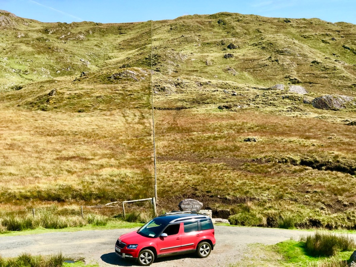
Here’s our Yeti straddling the border between Cork and Kerry on the Priest’s Leap road. That’s one of our favourites: the scenery is outstanding, but there can be problems if you meet someone coming the other way. In fact, that difficulty is present on very many of our local byways: hone your reversing skills!
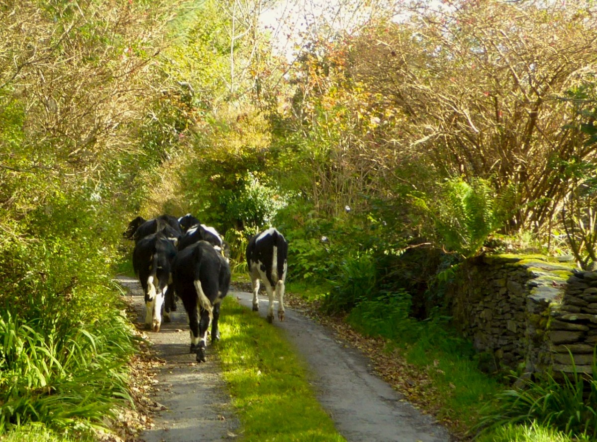
It’s not always other vehicles you have to watch out for . . .
A rural road can be a challenge: never be in a hurry. You just have to go with the flow, even if that means reversing for half a mile. In that situation, of course, the main difficulty is making the decision as to who will have to reverse: you, or the vehicle coming the other way. If that oncoming vehicle is a large tractor and trailer, you may not have much choice.
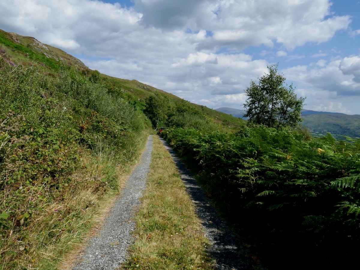
Yes, there are still a few roads around in very out-of-the-way places which are not surfaced as you might expect. They fit well into their rural surroundings!
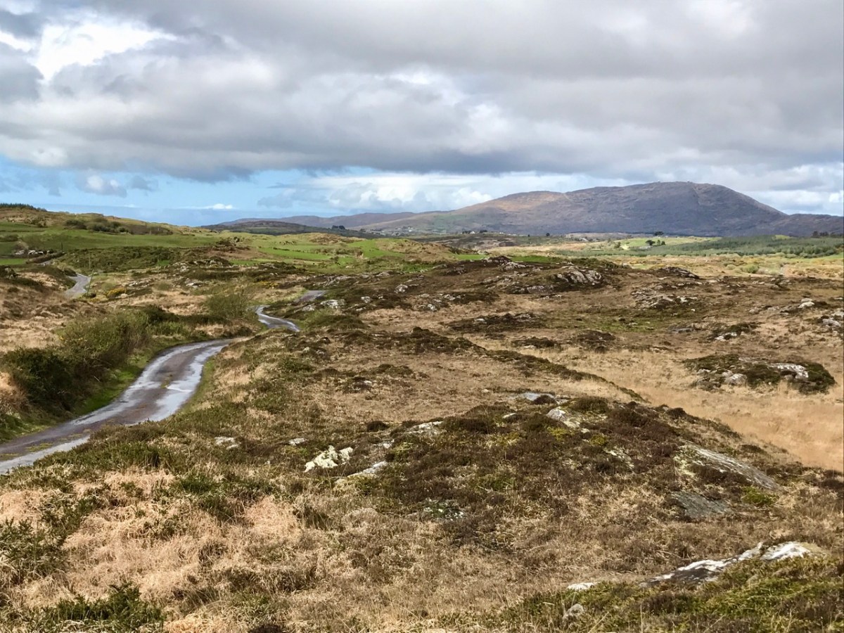
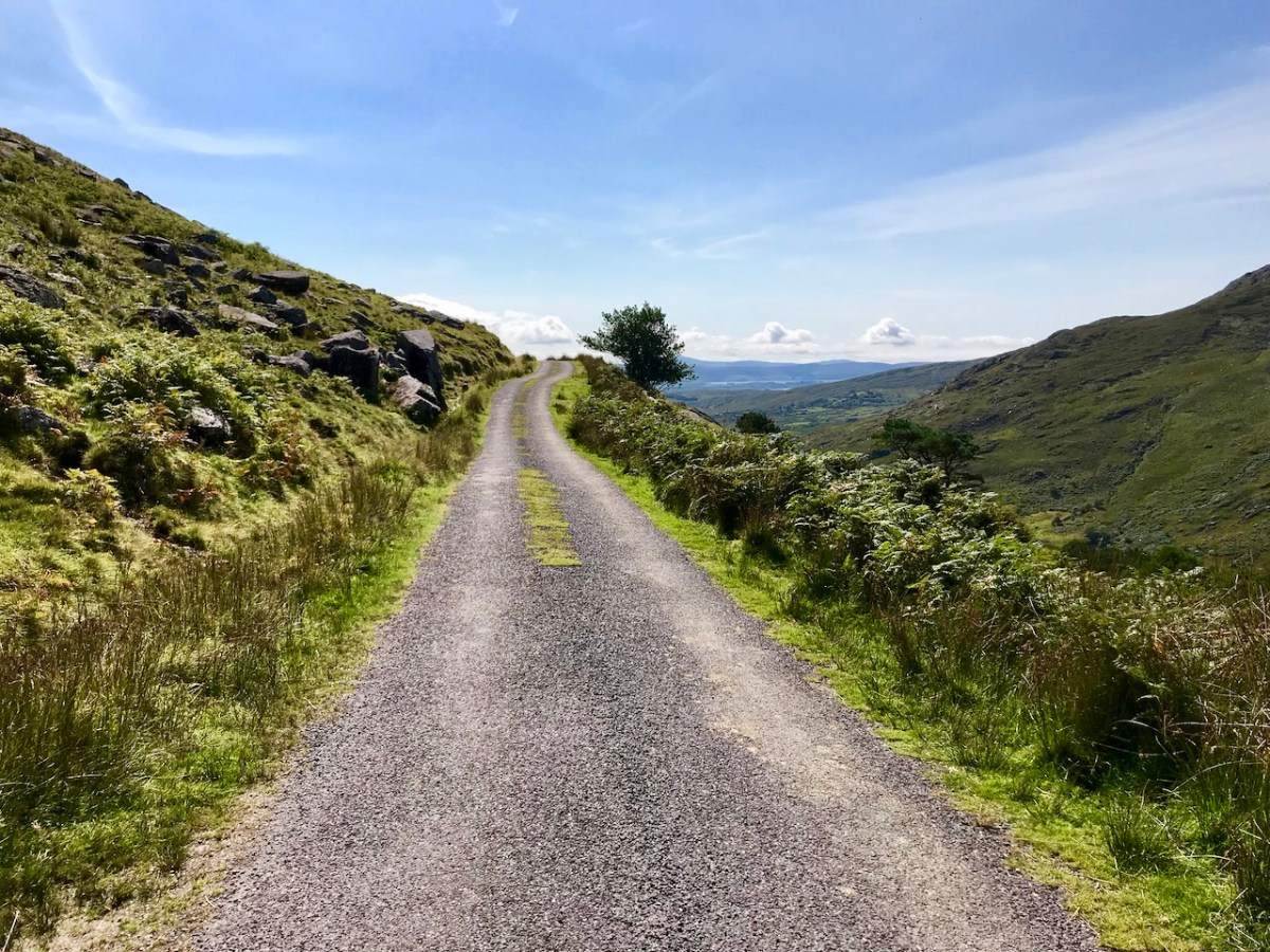
Take care not to get lost . . . Some of these boreens are not even marked on the map!
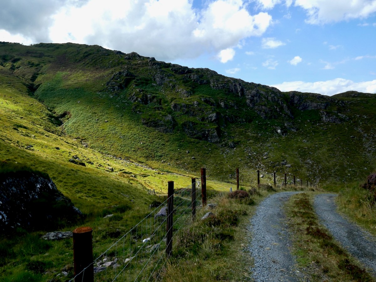
Give a thought to those who built these byways: quite a lot of engineering has been involved in carving through rocks to create a more or less level route.
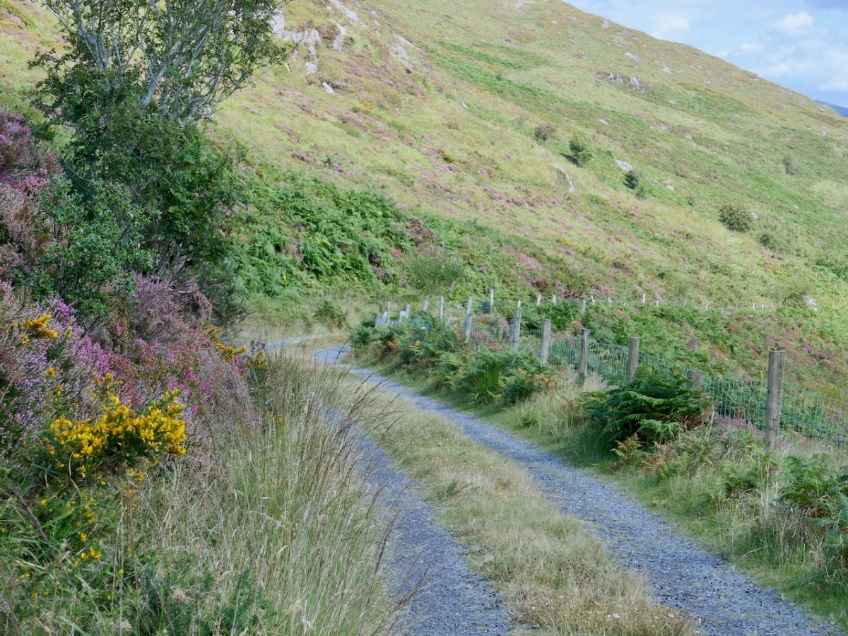
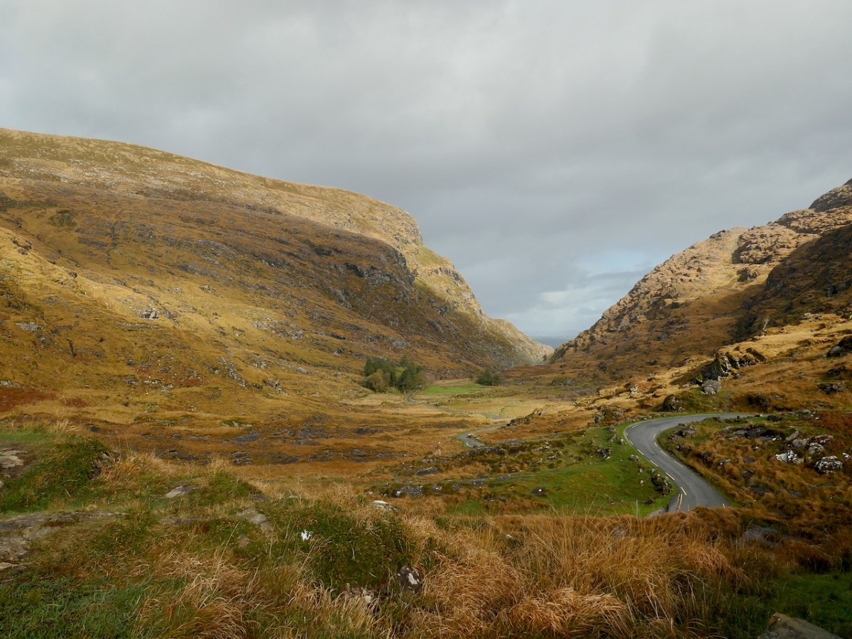
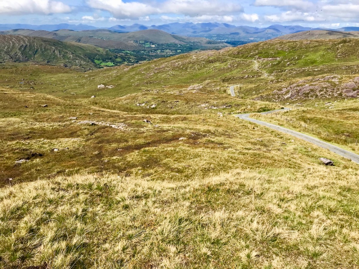
Some roads lead to a dead end. I prefer those that fly high – over the mountain passes; the scenery never disappoints.
. . . The Road goes ever on and on Down from the door where it began. Now far ahead the Road has gone, And I must follow, if I can, Pursuing it with eager feet, Until it joins some larger way Where many paths and errands meet. And whither then? I cannot say . . .
from ‘the old Walking Song’ by J R R Tolkein
There’s always a reward to be had for travelling uphill: it’s the view from the top!
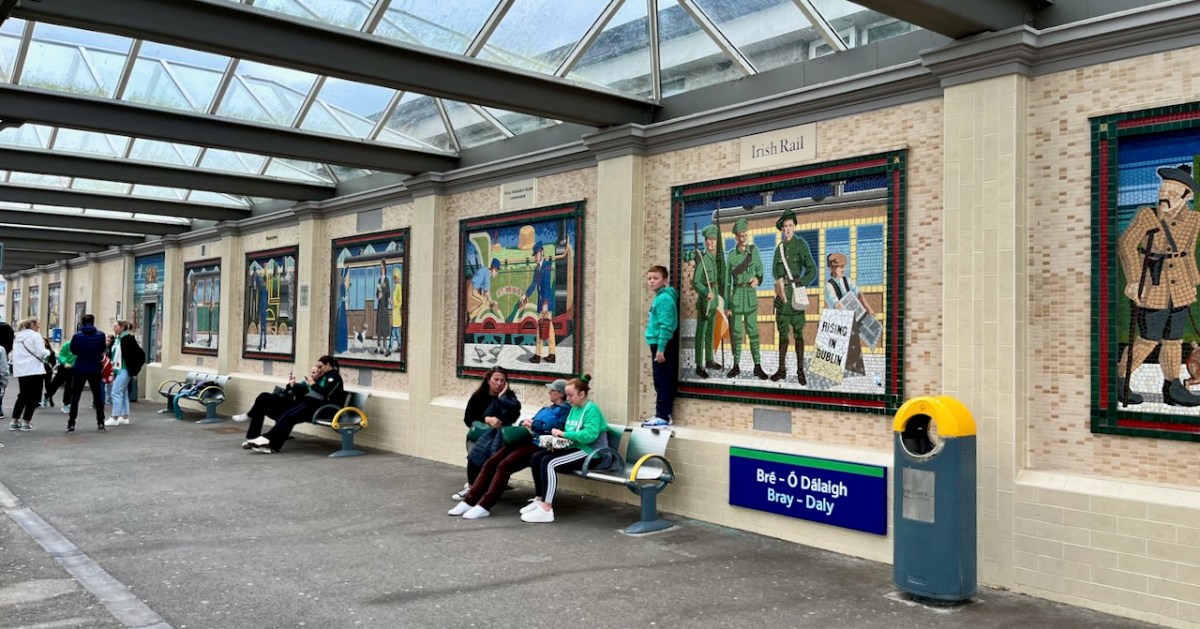
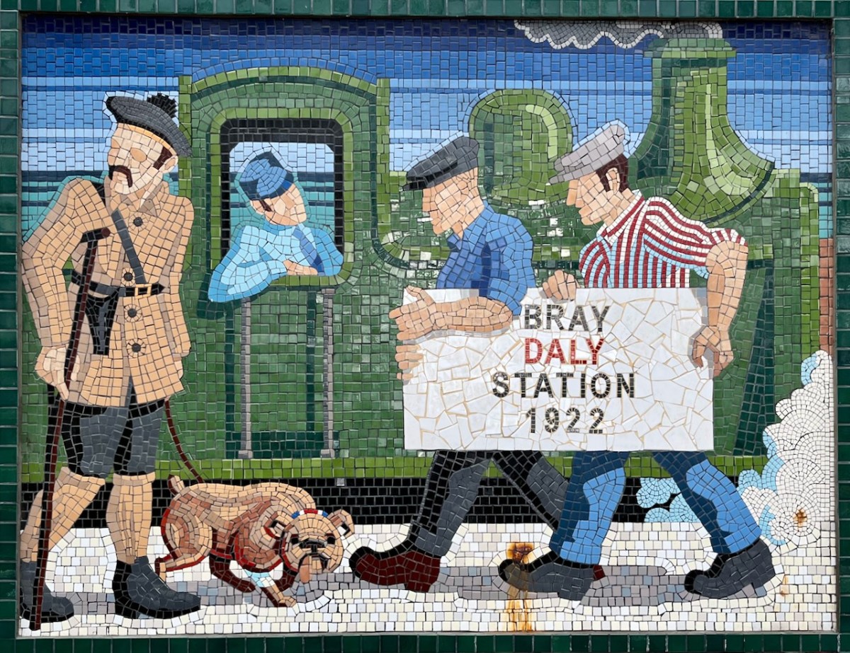
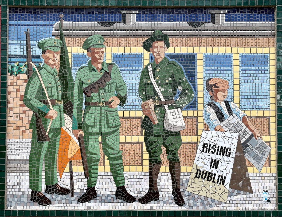
Regular readers will know that I am always on the lookout, in Ireland, for signs of all kinds. They may be humorous, informative or historical – like the one above. This is on the railway station in Bray, County Wicklow. Back in 1987 a competition to design painted murals to enhance the station platforms was won by Jay Roche and John Carter, who produced 19 panels to illustrate the railway through its history.
As you can see from this picture of Bray Station taken yesterday, the panels certainly brighten up this much-used civic concourse.
. . . Each panel is like a window into the past that tells a story about the people, dress or time of the mural. One mural signifying the 1920s, makes reference to a man in a Black and Tan uniform. On the website Mural to Mosaic, which chronicles the progress of the project, the artists state they are trying to show that dramatic events were unfolding around that significant time in Irish history . . .
The Daily Edge Newsletter 2012
You’ll have noticed that the panels are now made of mosaic. The painted originals suffered from wear and deterioration and the same artists, assisted by Anthony Kelly and Eileen Maguire, have in recent times transformed all of them into the new medium. I think the result of the earlier concept and its newer manifestation are excellent, and provide a great visual diversion for anyone waiting for a train or a Dart (Dublin Area Rapid Transport). In fact, it’s worth missing a train in order to fully appreciate the artwork!
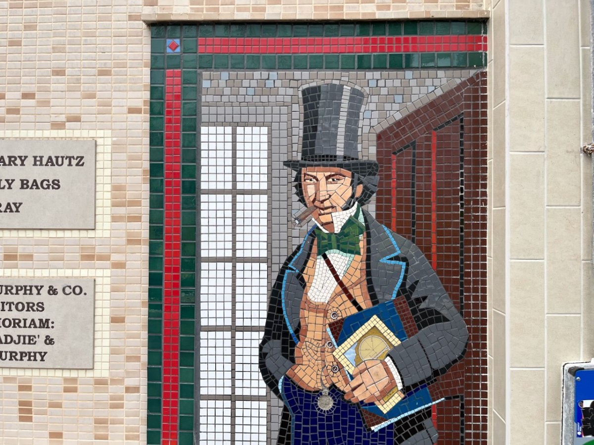
Isambard Kingdon Brunel is the engineer credited with planning the line which, in 1844, was intended to be ‘broad gauge’ all the way to Rosslare. Here he is in a Bray station mosaic, above. I’ll return to this railway in a future post as the full story of it is well worth the telling – even though it’s not West Cork (which, of course had its own interesting railway line).
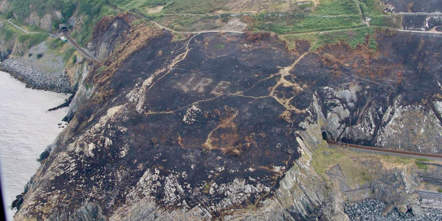
Before leaving behind the railway, here’s a photo of Bray Head (courtesy of Irish Defence Forces) taken after a gorse fire in the summer of 2018. As well as the Bray to Greystones line you can see the outline of the EIRE sign that was put there in ‘the Emergency’: one of over 80 such signs dotted along the coast, it was a warning to aircraft of all persuasions that they were flying over neutral Ireland.
. . . The ‘Éire’ signs were erected around the Irish coastline from the summer of 1943 onwards, a period when overflights of Irish territory and forced landings of belligerent aircraft (mainly Allied) had increased dramatically. In keeping with the De Valera* government’s policy of discreetly co-operating with the Allies, Allied air crews who landed in Ireland were assumed to be ‘non-operational’, and therefore were not detained (a fact that the Germans noted with displeasure). It made more sense to all concerned, however, if such forced landings could be avoided and so the ‘Éire’ signs were erected to ensure that pilots knew that they were flying over Irish territory . . .
Royal Irish Academy Newsletter
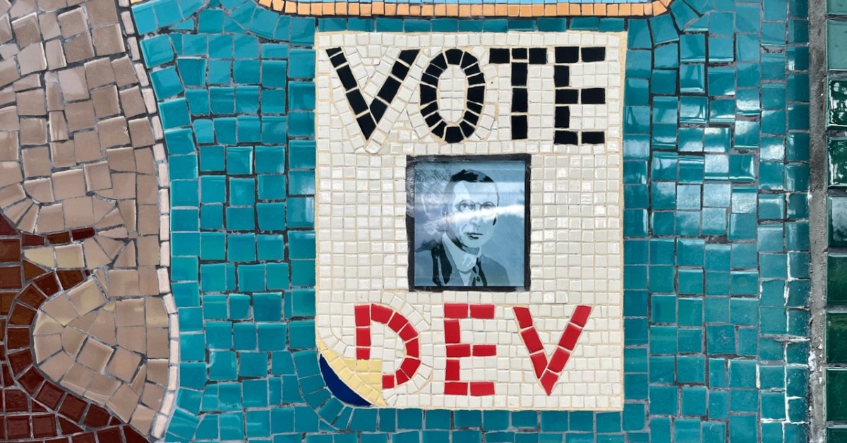
*See our header pic for another reference to Dev!
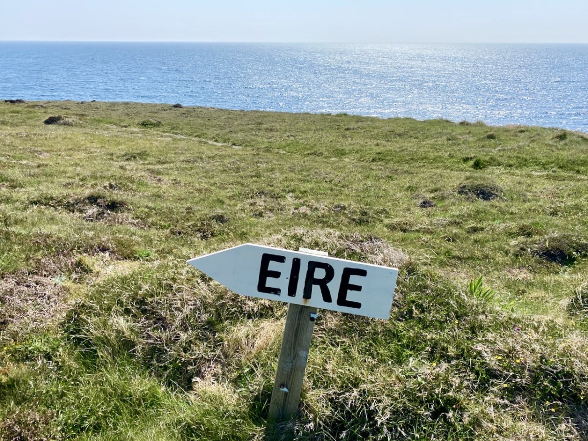
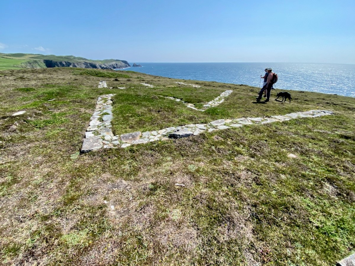
The EIRE sign above is very clearly delineated: it’s on the cliffs at Toe Head, in ‘our’ County Cork.
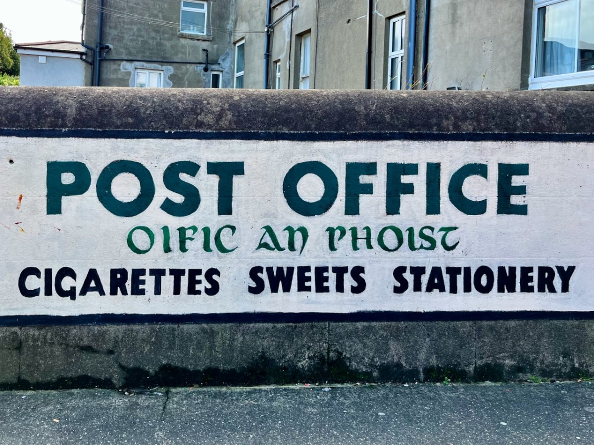
This Post Office sign has been kept intact, probably for reasons of nostalgia. I’d doubt there are many today who would proudly proclaim that the sale of cigarettes is one of their mainstays.
(Above) – I couldn’t resist the enigma of this signwriting . . .
. . . But I think the one above leaves us in no doubt who it speaks to.
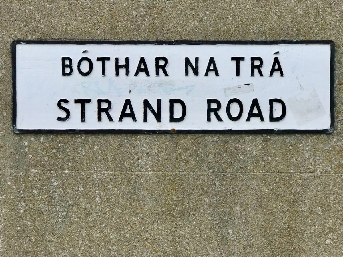
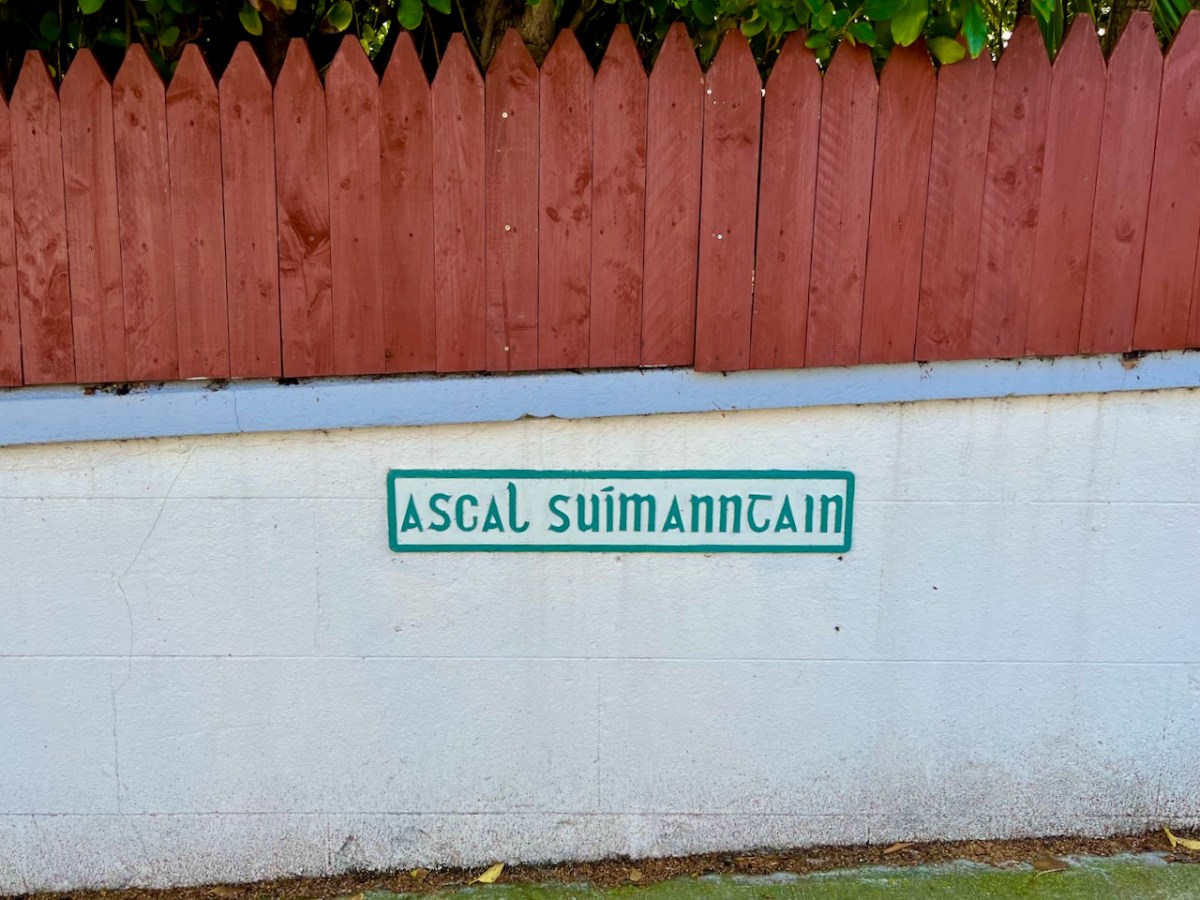
I’d like to understand the meaning of this Irish road name: one AI translator told me it is ‘thought position’, another ‘location avenue’ . . .
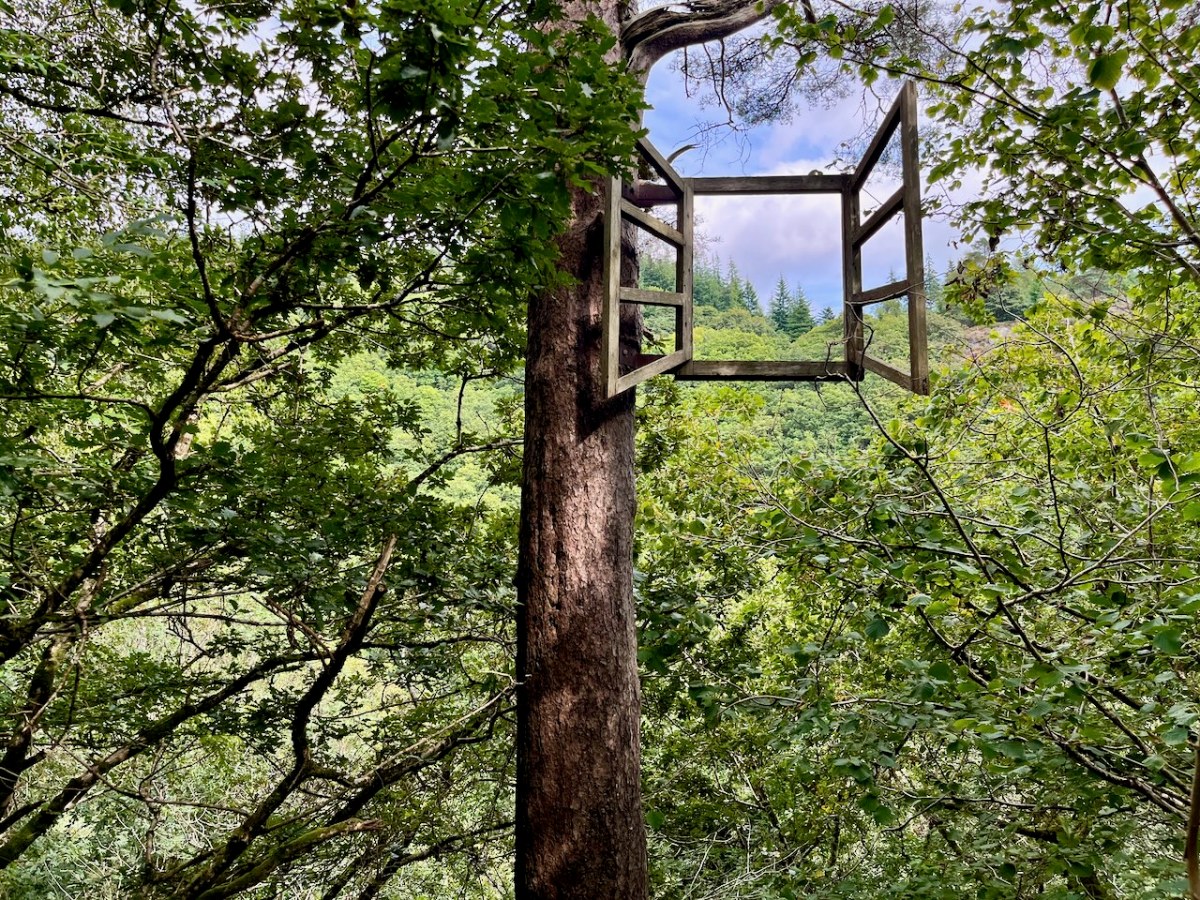
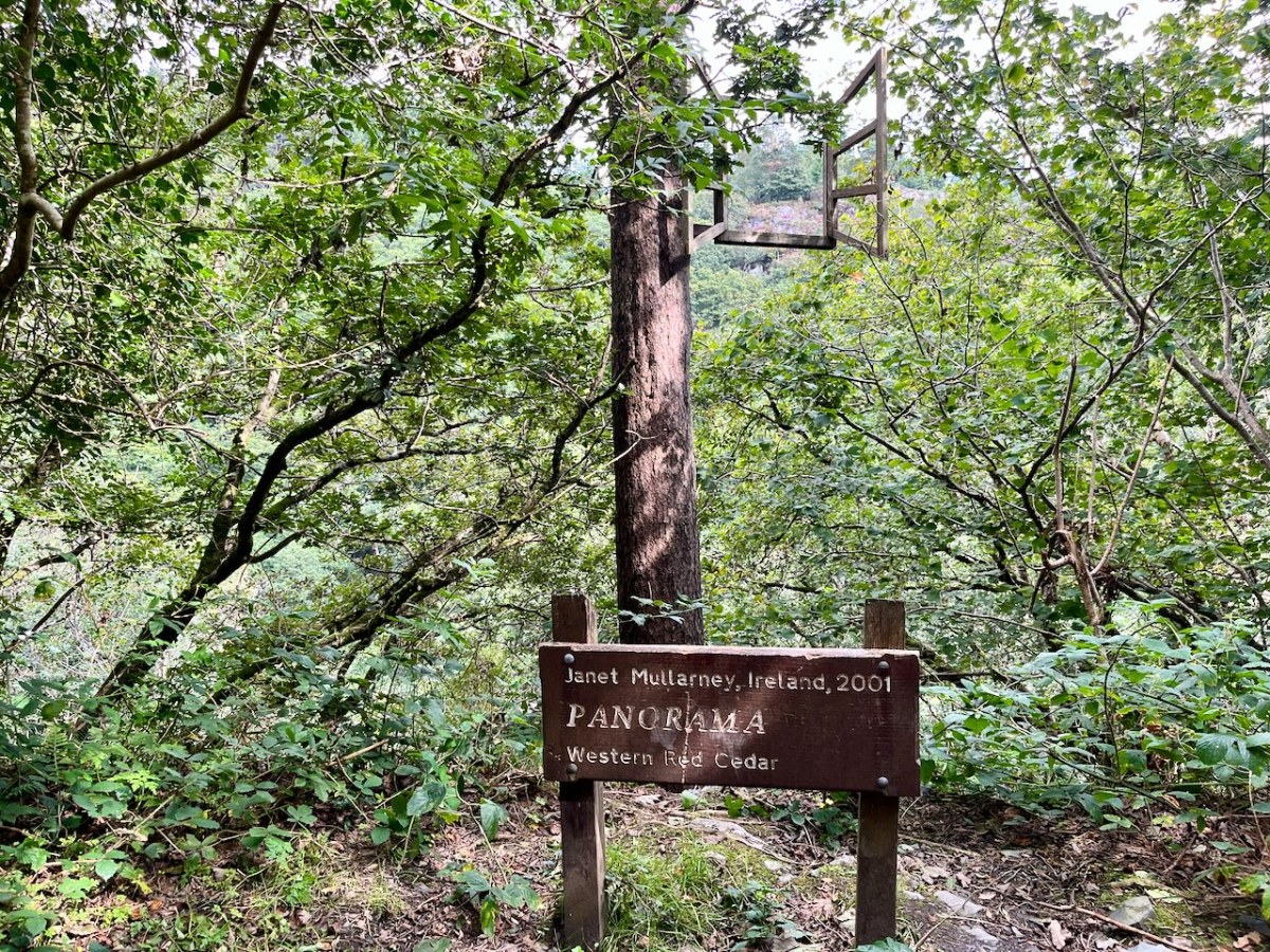
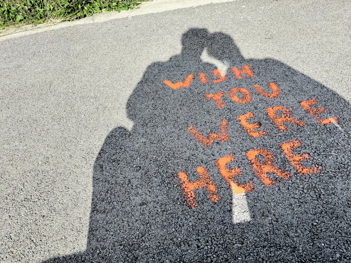
No comment on the two signs above. The following, however, provokes some questions – a window on someone’s world?
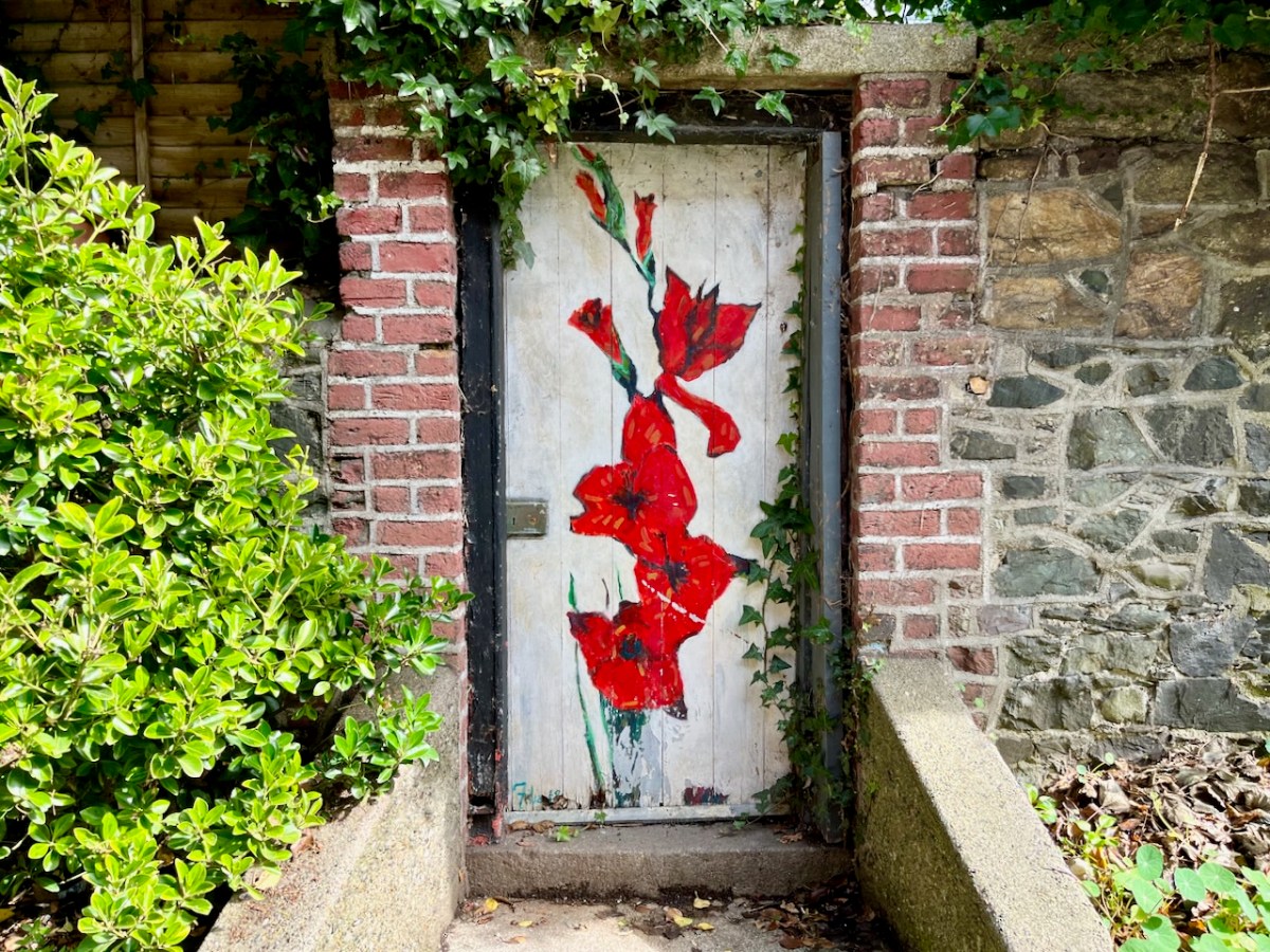
What world does this gate open up to?
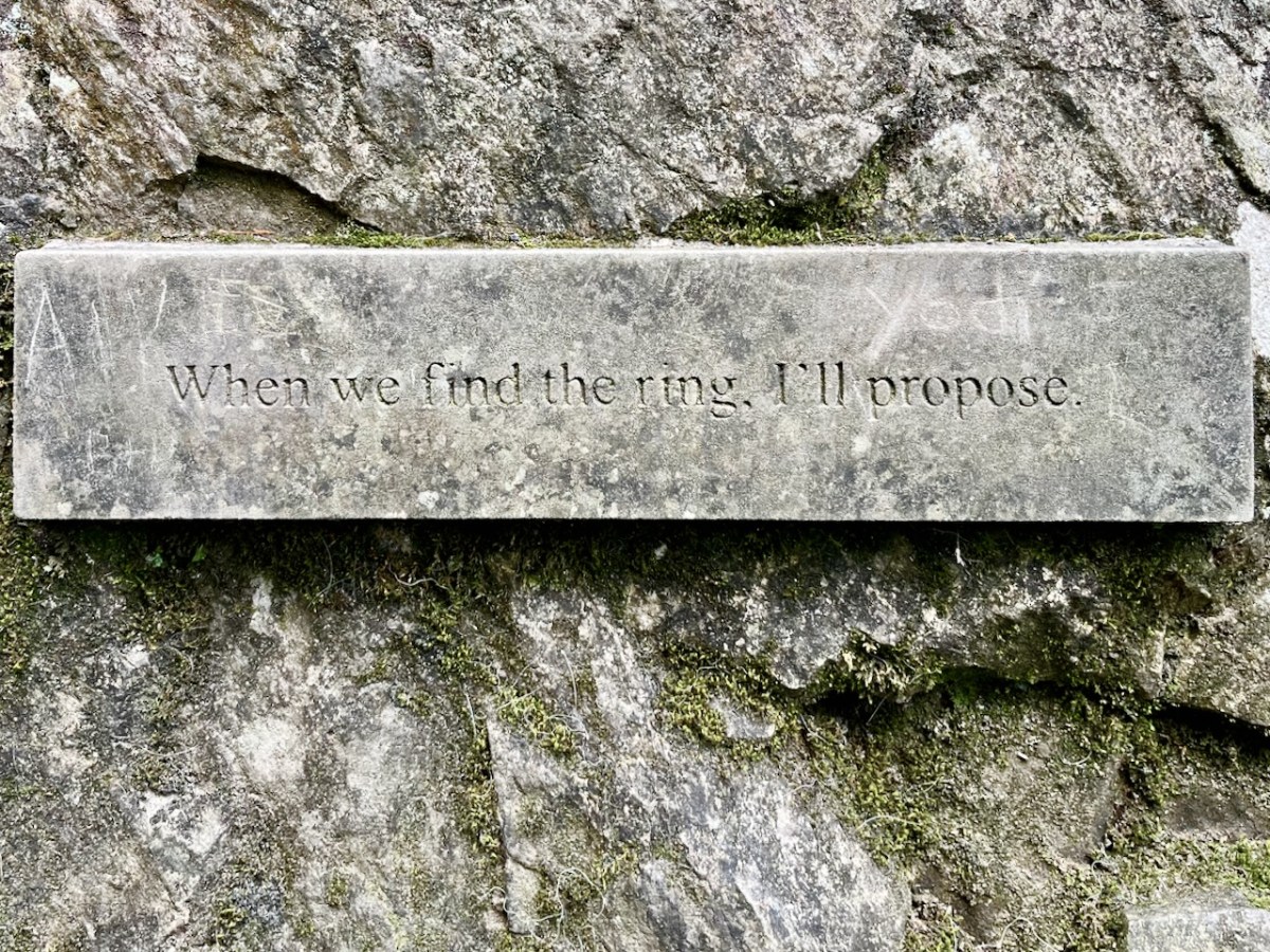
Promises, promises . . . But I think they found it:
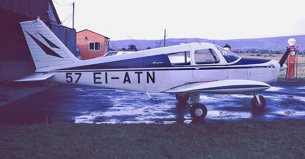
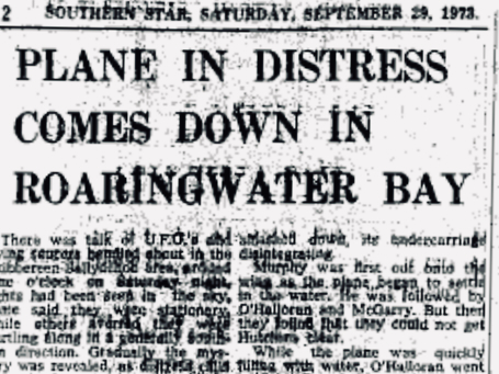
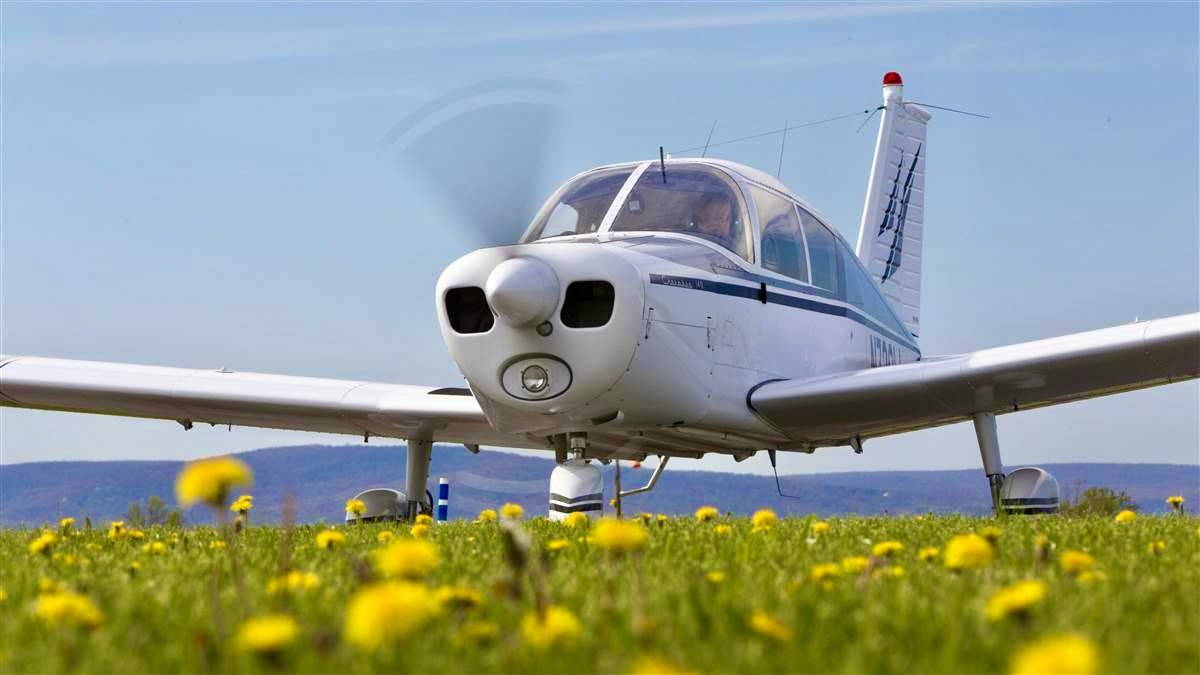
This Piper Cherokee plane set out on a flight from Luton in the UK to Cork exactly 50 years ago but didn’t make it! Instead it ended up in the waters of Roaringwater Bay just a few minutes away from where we live today. The pilot and all three passengers survived . . . It’s all part of the boundless jigsaw puzzle which is West Cork’s history. As you know, we love to discover the whole caboodle.
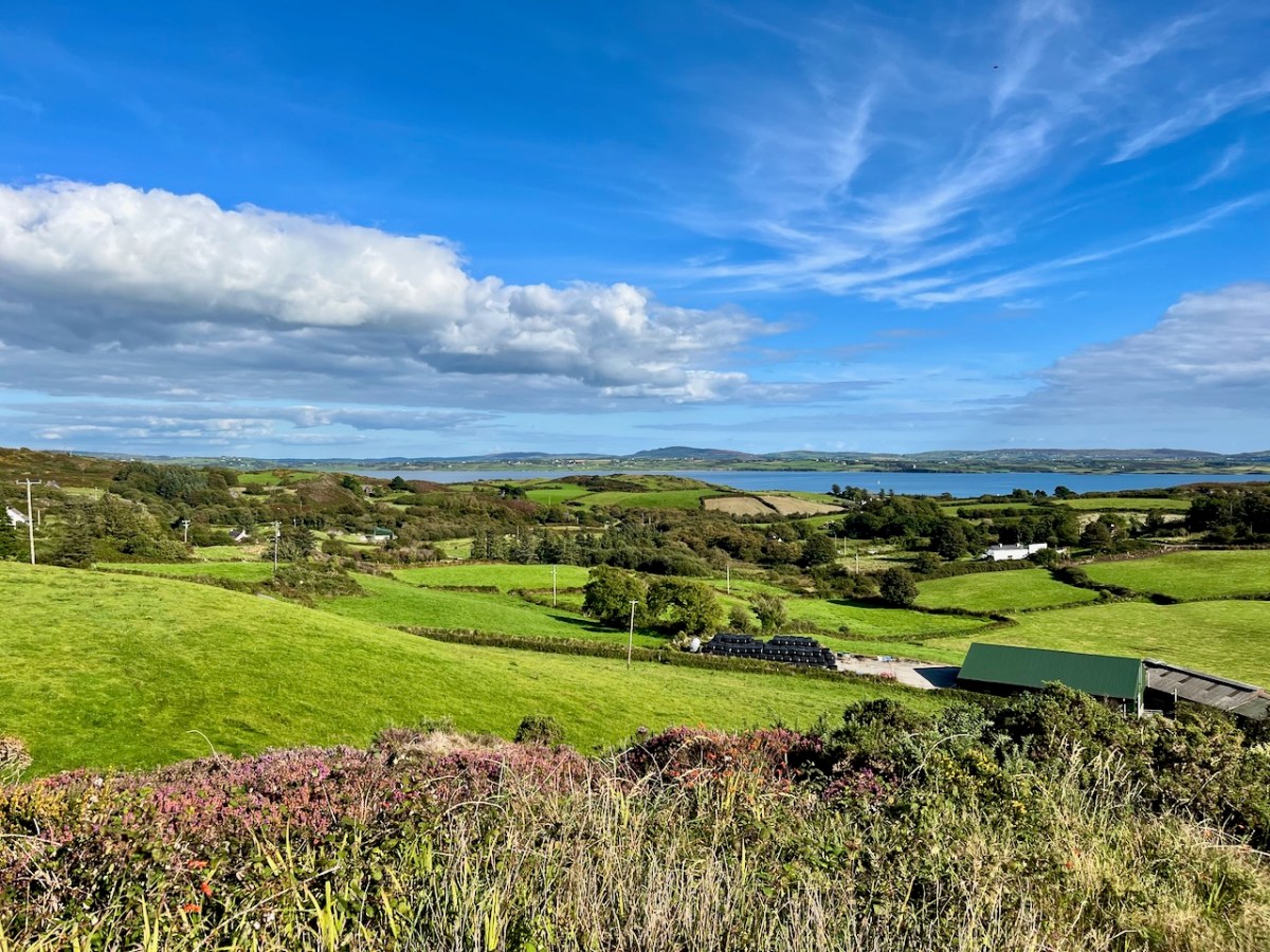
Here’s the view from just beside our house (Nead an Iolair) in the townland of Cappaghglass, looking across to the bay at Foilnamuck: a beautiful sunny day in September. Undulating country . . . Now, picture yourself piloting a small plane, lost, running out of fuel – darkness has come on – and you know you can’t get to any airport. You are going to have to ditch the plane. You can make out below you land and sea – a whole lot of islands. What do you do? You head for a stretch of sheltered water to cushion the inevitable blow.
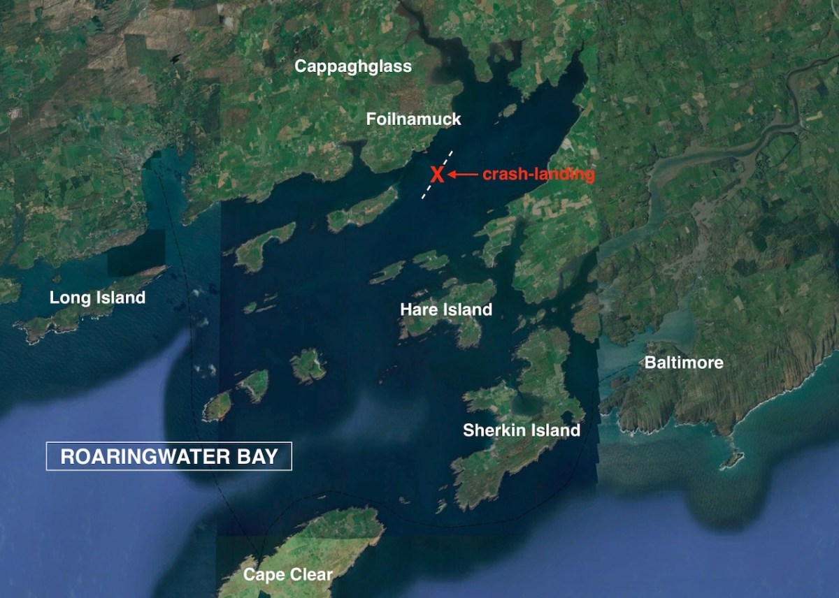
This Google Earth image shows – roughly – the site of the crash-landing that did occur on the night of 22 September 1973. In the coming days it was all over the papers. Thanks to Irish Newspaper Archives for the cuttings I have used.
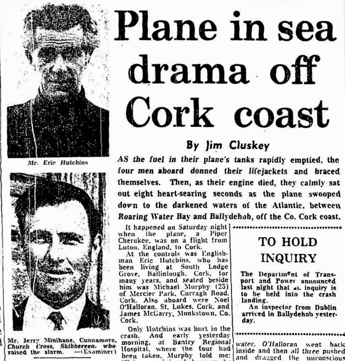
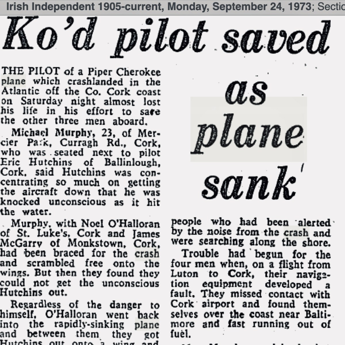
. . . AS an inspector from the aeronautical section of the Department of Transport and Power arrived in Ballydehob to begin an investigation into Saturday night’s plane crash off the Cork coast, it was learned last night that the pilot of the Piper Cherokee almost lost his life in his efforts to save the other three men on board. Michael Murphy (23), of Mercier Park, Curragh Road, Cork, who was sitting next to the pilot, Eric Hutchins of Ballinlough, Cork, said that Mr Hutchins was concentrating so much on getting the plane down that he was knocked unconscious at impact. Mr Murphy, together with Noel O’Halloran, of St Luke’s, Cork, and James McGarry, of Monkstown, Co Cork, had been braced for the crash and scrambled free on to the wing. But then they found that they could not get out Mr Hutchins who was unconscious. Mr O’Halloran then went back into the rapidly sinking plane and between them they pulled Mr Hutchins free and threw him into the water. The three men then swam ashore taking 40 minutes to reach land at Fylemuck, as they had to support the injured man all the way . . .
Irish Press, Monday 24 September 1973
. . . Only Hutchins was hurt in the crash. And early yesterday morning, at Bantry Regional Hospital, where the four had been taken, Murphy told me: “Eric was injured because he was concentrating completely on getting the plane down. It is entirely due to his skill that we are all alive.” But Hutchins came close to paying dearly for his dedication, for he was knocked unconscious by the impact as the plane smashed down, spewing its undercarriage across the waters.
Murphy was first out onto the wing as the plane began to settle in the water. He was followed by O’Halloran and McGarry. But then they found that they could not manoeuvre the slumped Hutchins clear.
Regardless of the fact that the plane was quickly filling with water. O’Halloran went back inside and then all three pushed and dragged the unconscious man out on the wing and threw him in the water, with his lifejacket still not inflating.
With the plane tilting dangerously. O’Halloran dived under the wing and reached Hutchins. He was joined by the other two and, as the plane sank, they struck out for the shore. They reached it at Fylemuck after 40 weary minutes, still supporting the injured man between them . . .
(With Original Cutting, Above) From Irish Examiner, Monday 24 September 1973
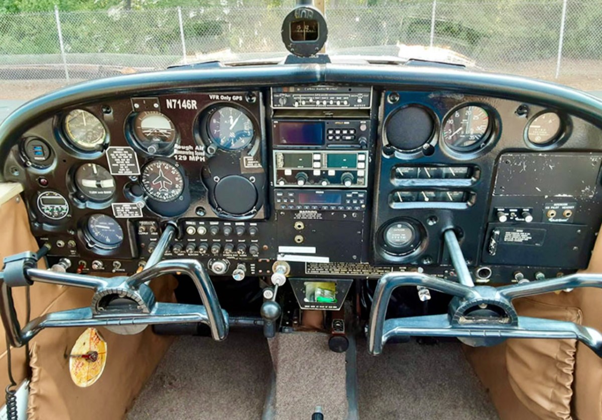
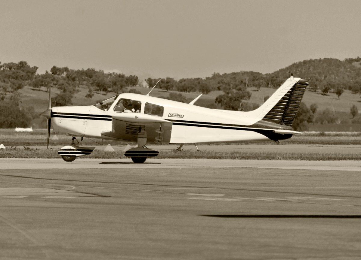
A Piper Cherokee in good times (top) with a view from the pilot’s seat (above – images courtsey AOPA). The plane has been in continuous production since 1961 and has included two, four and six seater versions. It was produced as a light affordable aircraft designed for flight training, air taxi and personal use. The 140 model piloted by Eric Hutchins on that fateful night in 1973 had an aluminium alloy semi-monocoque fuselage construction with a 150 horsepower four-cylinder engine. The standard fuel tank capacity was 136 litres, with an additional reserve of 54 litres. This was enough to cover the flight plan on that crucial day in 1973: the starting point was Luton, Bedfordshire, England, and the destination was Cork Airport, Ireland: a distance of 550km. In good conditions, with a direct flight (although in this case mainly against the prevailing wind) the plane was capable of covering over 900 km with a full tank. Things went awry when the plane’s navigation system failed during the flight. The group realised they were off-track, and they missed the Cork target, continuing westwards.
. . . Trouble had begun for the four men when, on a flight from Luton to Cork, their navigation equipment developed a fault. They missed contact with Cork airport and found themselves over the coast near Baltimore and fast running out of fuel. Mr. Murphy explained that coming down on land was out of the question because it was impossible to see the fields, adding “Eric picked an ideal place with calm water. None of us panicked, but took what precautions we could” . . .
IRISH Independent, September 24 1973
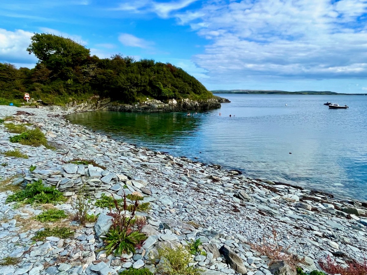
(Above) Calm water at Audley Cove, close to the crash-landing site. The water is exceptionally clear here. The four men were experienced flyers: they all belonged to an aero club and had received training in how to handle an emergency. They were also strong swimmers. They knew the drill regarding crash-landing on to water, and the actual experience would have been strictly routine, except that the pilot – Eric – was knocked unconscious during the impact. While still in the air they were sending out distress messages on the radio. The Piper Cherokee distress call was picked up by an Aer Lingus flight from London to Cork. The Marine Rescue Coordination Centre at Shannon was alerted immediately and a full-scale rescue operation was mounted, with helicopters and boats, including the lifeboat from Baltimore, under coxswain Christy Collins.
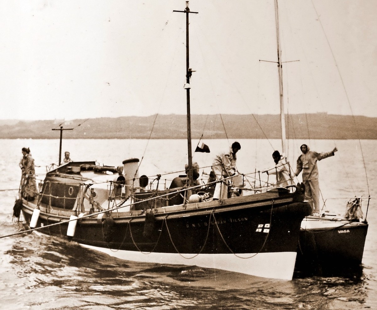
The Baltimore Lifeboat “Sarah Tilson” pictured (above – courtesy Cork Examiner Archives) in August 1973 rescuing the yacht Vaga close to Baltimore Pier. The 46ft 9in Watson class lifeboat was stationed at Baltimore between 1950 and 1978. She was launched on service 70 times and saved 21 lives. In fact her services were not needed on the night of the crash as the four men came to shore safely. The lights from the stricken plane had been seen locally and reported. The Ballydehob Garda – Paddy Curran – arrived in his Zephyr car and with the help of local neighbours was able to assist the men, who were taken to the hospital in Bantry, where Dr Larry O’Connor attended the injured pilot. Noel O’Halloran – who has given me much of this information (and the photo of the plane on the header) – told me that when the distress call was picked up it was initially thought that a large aircraft had come down, and an alert was sent out to all doctors and nurses in West Cork to attend at Schull to help with the envisaged emergency.
Two of the men – Michael Murphy and Noel O’Halloran are alive and well today – and I gather there will be a get-together for them in due course to mark the fiftieth anniversary. No doubt many stories will be shared. The pilot, Eric Hutchins, died a few years ago at the age of 84. He had been a professional flying tutor but, after the accident, retired and became a highly respected driving instructor. Michael and Noel lost touch with James McGarry and have recently discovered that he also died a while ago.
A vintage Cherokee (courtesy of Plane & Pilot Magazine)
What happened to the plane? She came to rest in approximately 7m of clear water, fairly close to the coast. On the Monday following – 24 September – she was dragged ashore. Following this, accounts are reminiscent of olden times when wrecked ships were scavenged: some locals dragged the plane on to the beach and began to dismantle it. The engine – a Rolls Royce – was pulled out using a mechanical excavator: it ended up at the Garda Barracks in Bantry. But it was too late to save the plane or the engine. When a machine has been immersed in salt water it needs to be immediately rescued and meticulously cleaned out if it is to be salvaged: unfortunately, this was not done.
I have no doubt that there are people living locally who remember all this. I was fascinated to learn about it, and that is all due to the worthy efforts of Noel O’Harrollan, who contacted Roaringwater Journal. Many thanks, Noel
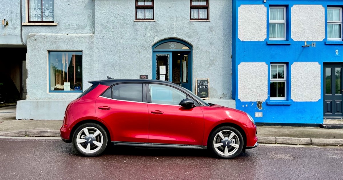
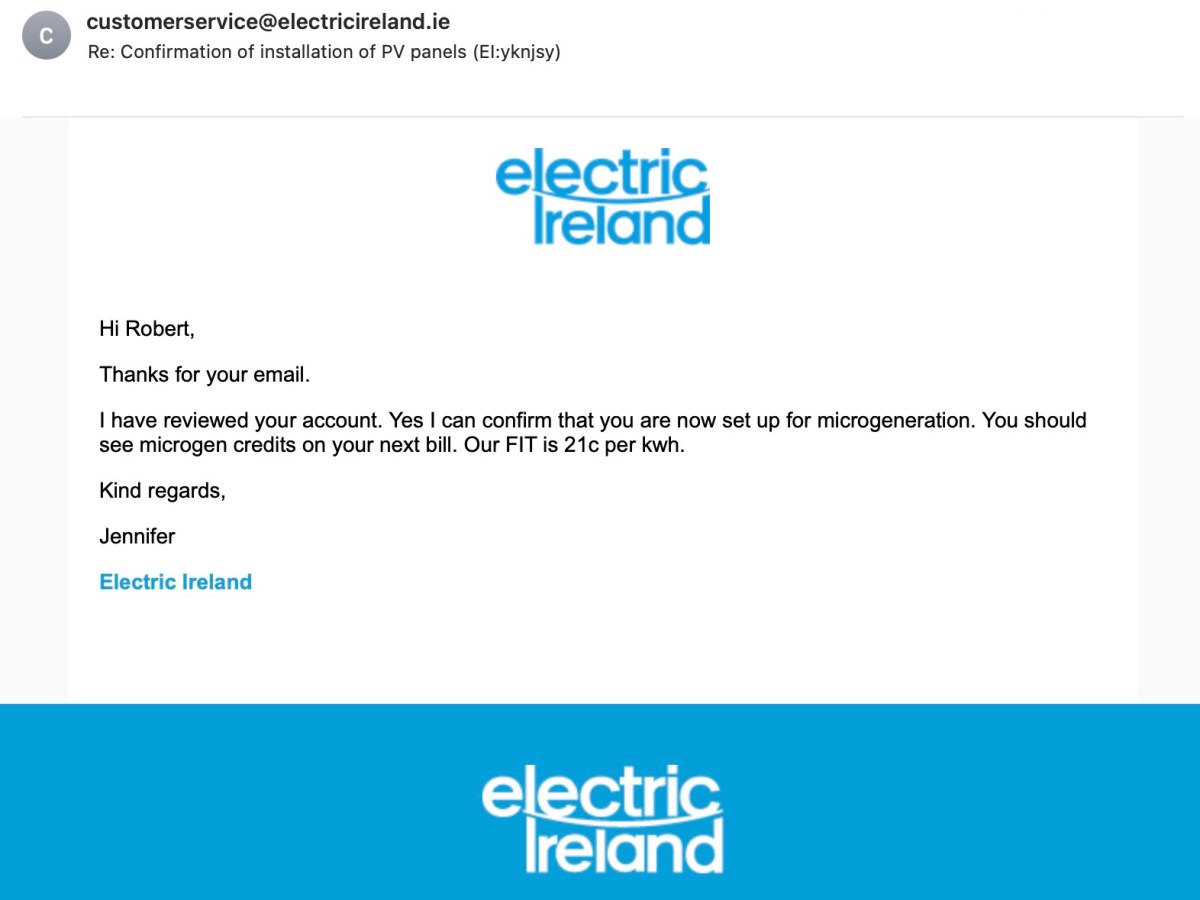
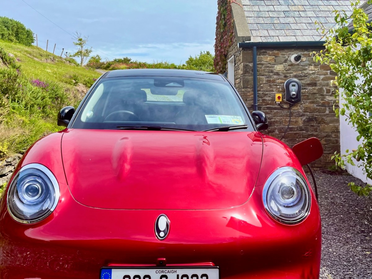
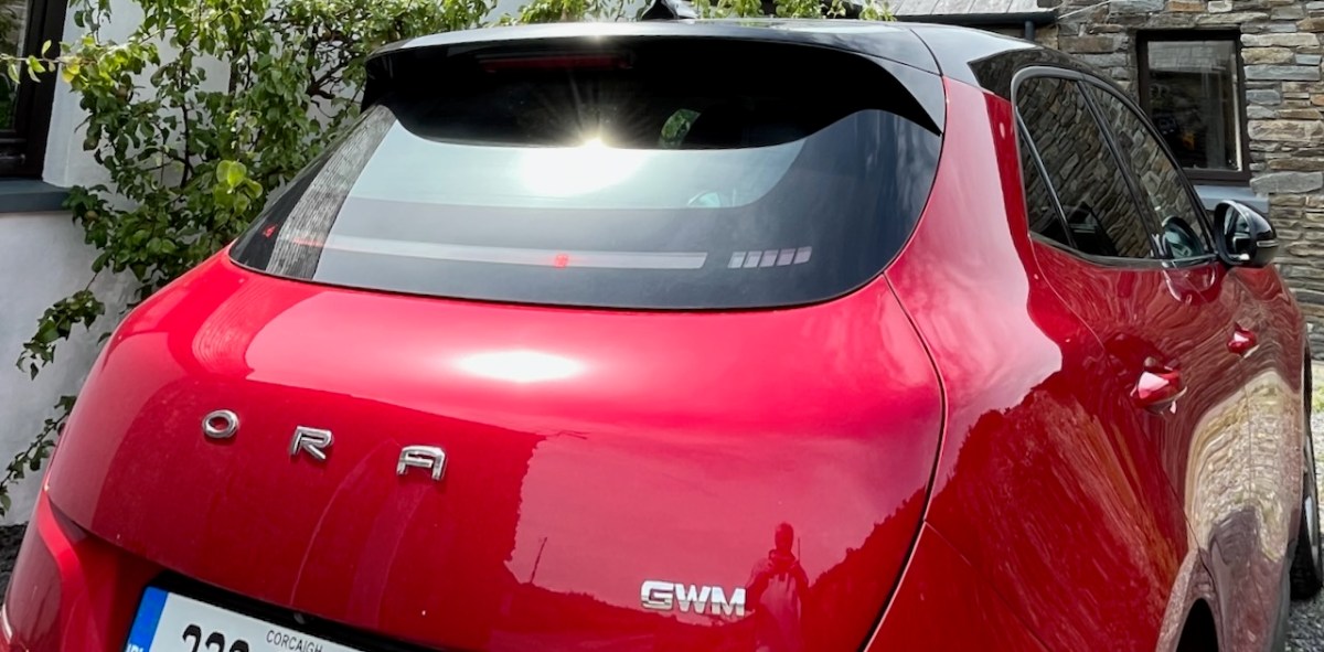
That’s our new car, sitting in Ballydehob a day or two ago. It’s given me the chance to revisit my posts about the history of Rural Electrification in Ireland – and to bring the subject right up to date! The word Microgeneration is new to my vocabulary. Here’s where I first saw it:
What that means is that our supplier – Electric Ireland – is paying us! We are contributing to electricity generation here in West Cork because we have tapped in to the sunshine!
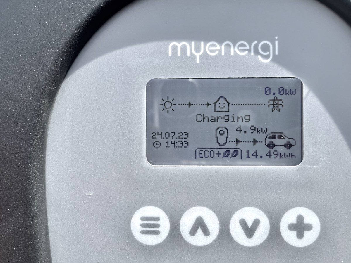
Since we collected our Ora Funky Cat from Blackwater Motors in Cork, two weeks ago, all our fuel costs have been free! As you can see from the display on our car charger, every watt is coming from solar gain, and feeding into the Funky Cat’s battery. If we get the timing right, we will never have to pay fuel costs again, unless we travel away from home.
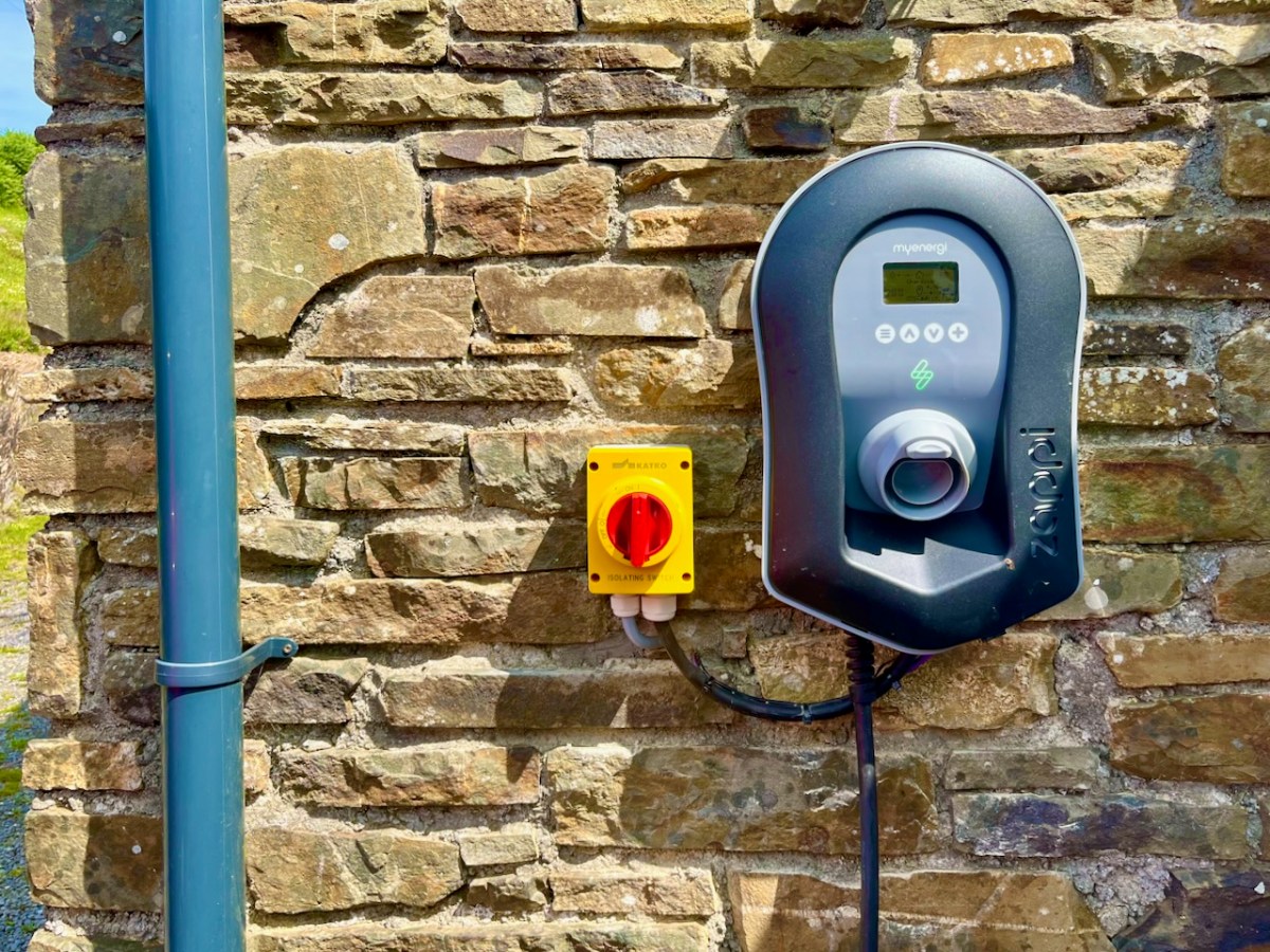
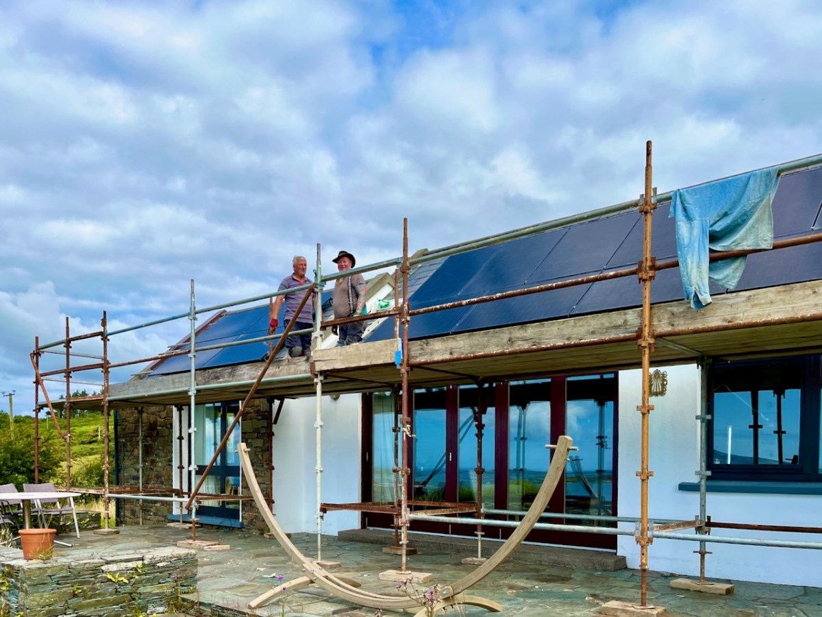
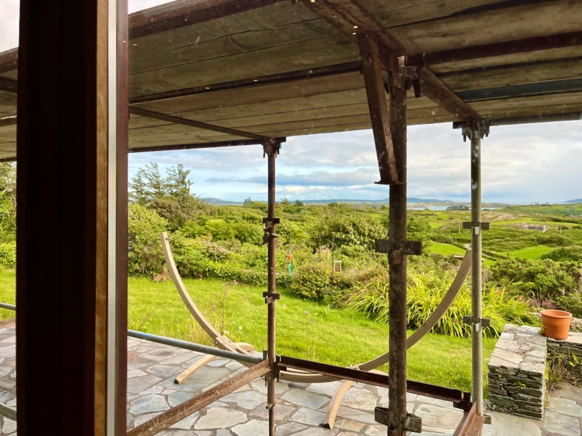
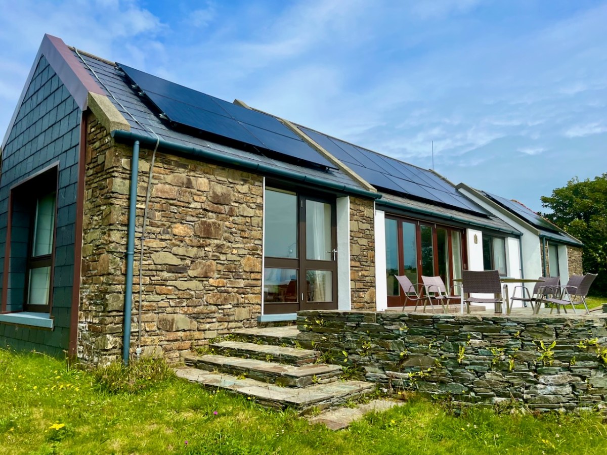
That’s our Zappi car charger, above. We made the decision to install photovoltaic (PV) panels on the roof of our house. We face south – looking out over Roaringwater Bay – in a location that’s ideal for harvesting solar energy.
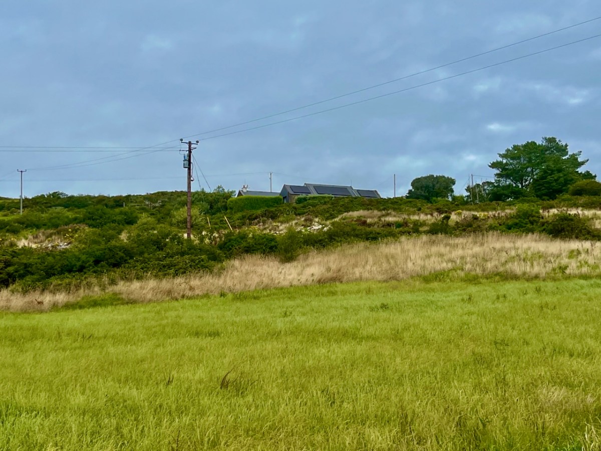
Our house from the fields below: you can see a few stages of rural electrification in this picture, conventional supply posts and wires, and the new panels on our roof. (Below) Fergus and Kevin are well on with the installation:
It’s been well worth the disruption, which was actually shortlived – and everyone who worked on it was cheerful. Why wouldn’t they be? They were bringing the most up-to-date electric technology to our doorstep. We are now being credited for anything we generate that goes into the grid (that’s the default mode). But we are going to use our own power as much as possible in Nead an Iolair. We have had a battery fitted, and a diverter which powers another circuit if there’s anything to spare once we’ve charged the car.
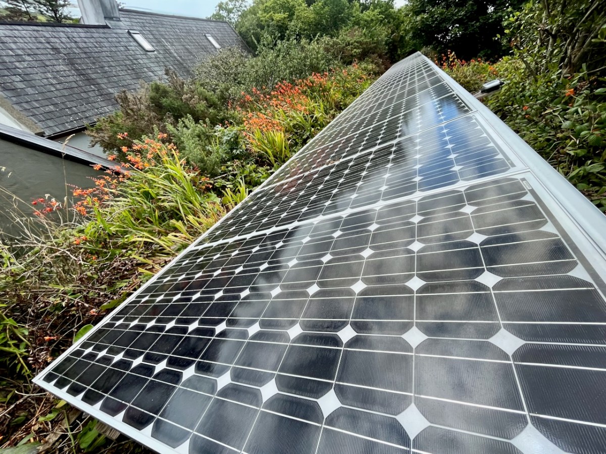
We are fortunate in that our house has extensive south-facing roof slopes – ideal for the installation of eighteen PV panels (above). Properties which don’t have roofs facing the right way can consider panels mounted on freestanding frames. Here’s one set up by neighbours of ours:
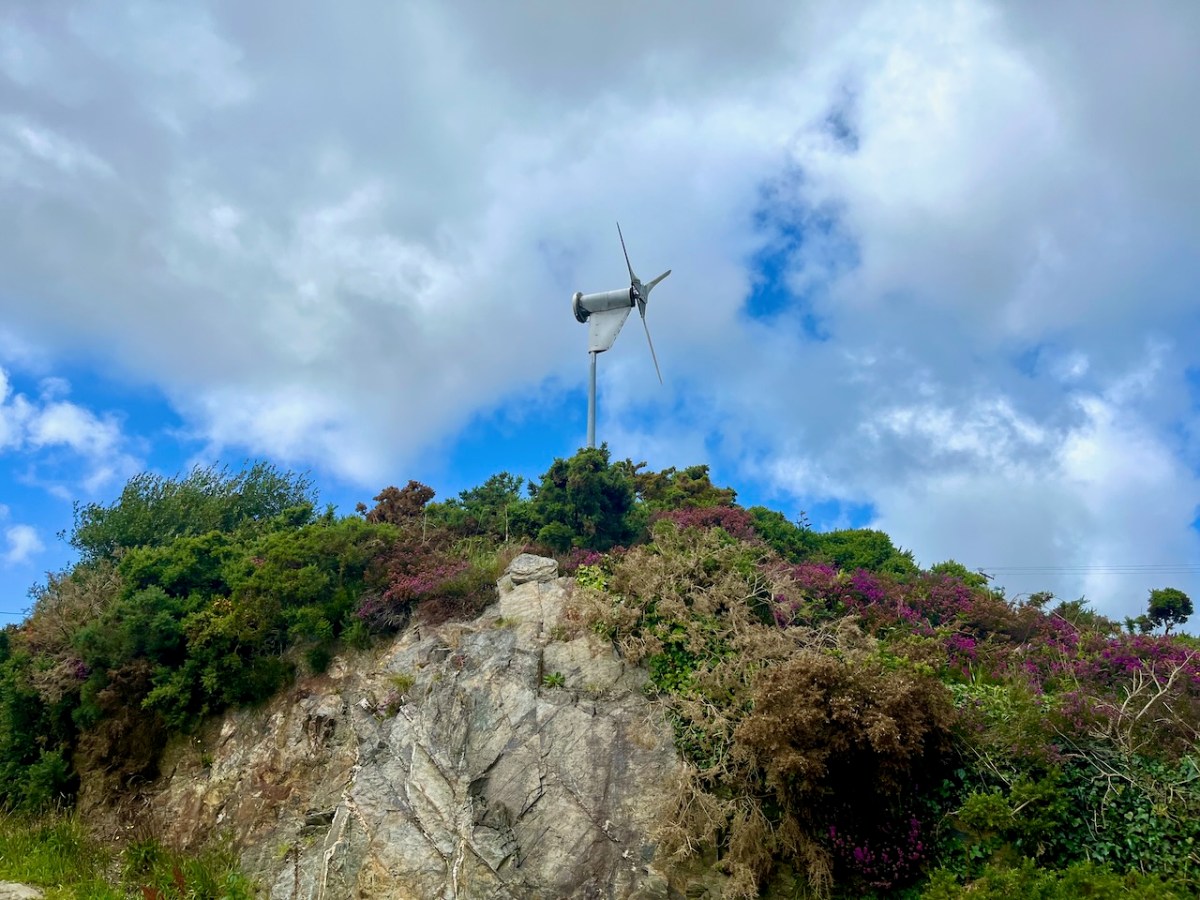
The same neighbours have also been tapping into wind energy for many years (above). They are significant contributors to ‘rural electrification’ here in West Cork!
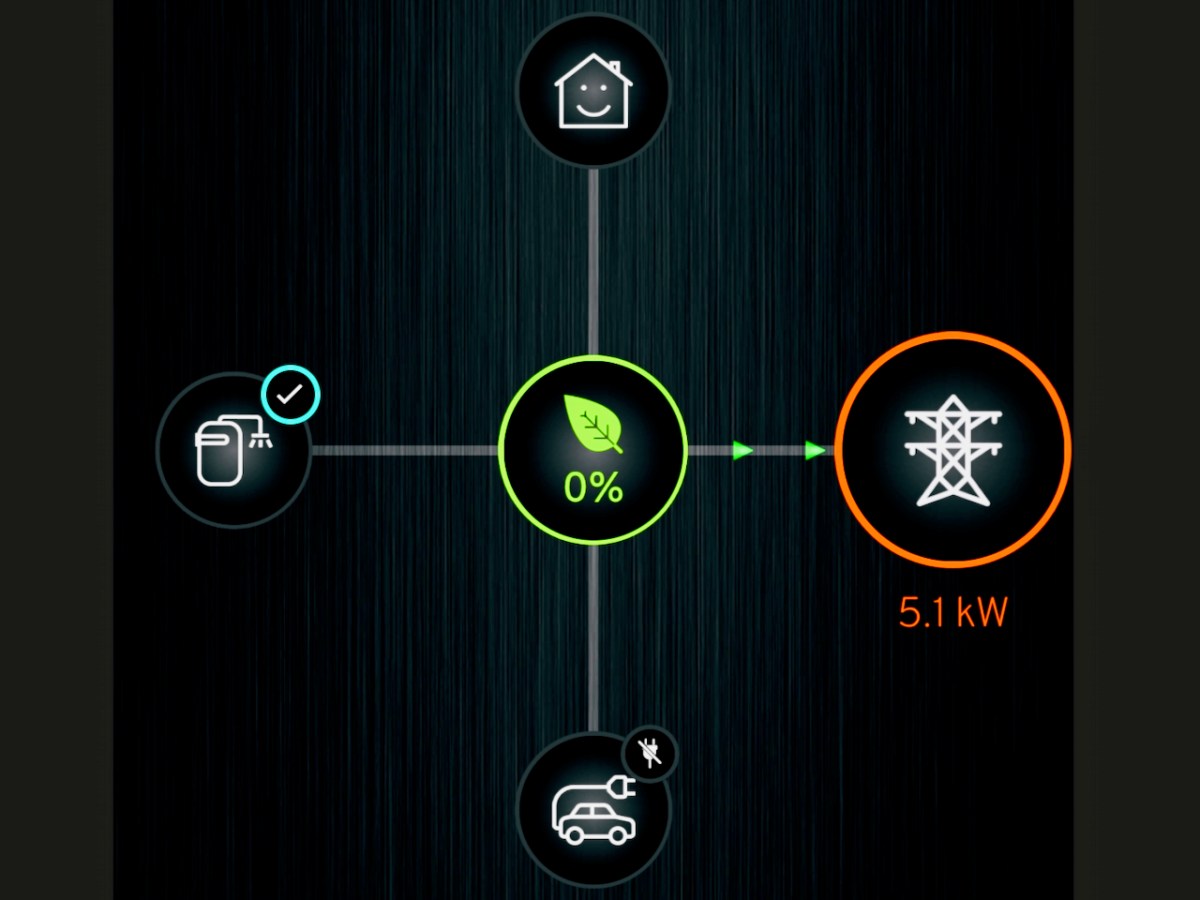
There’s a phone app for everything! Mine is telling me how our system is performing. It’s Saturday afternoon and the day is relatively dull. There is no sun shining on the panels, but the solar gain from the overcast sky is still generating (or ‘microgenerating’ as the ESB would have it). The battery in the system (on the left) is full, the car (bottom image) is unplugged. The PV (centre) is pushing 5.1kW into the grid! No wonder our ‘house’ is smiling.
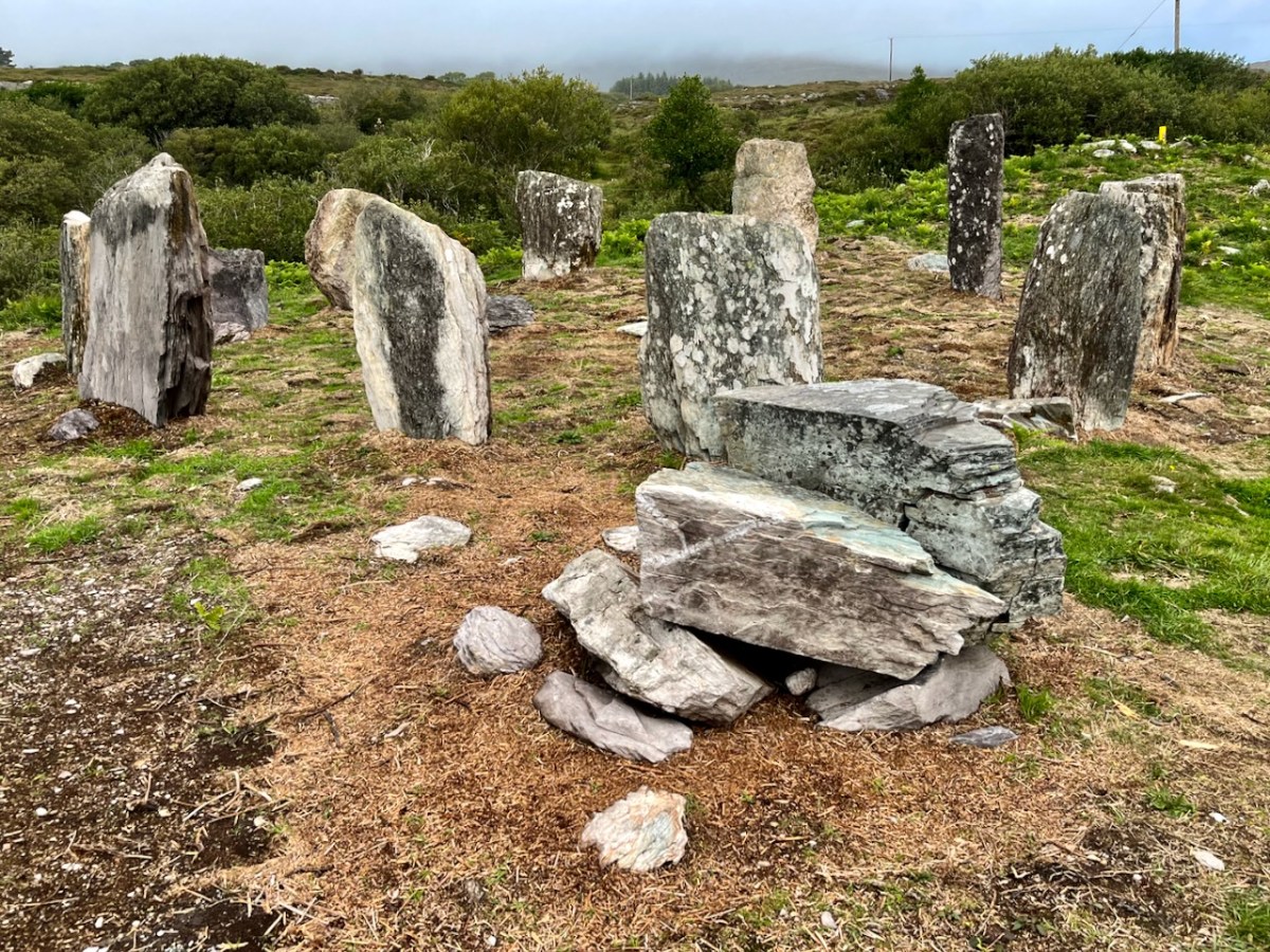
Finally, this week – in our electric car – we visited the impressive re-erected Gorteanish stone circle near Ahakista on the Sheep’s Head. I wonder: could this have been a forward-looking experiment by Bronze Age West Cork dwellers into harvesting solar energy?
Thinking of a carbon emission reduced future yourself? It would be worth speaking to our contractor: https://www.toolenpv.ie/
And, if you like the look of the Funky Cat, don’t forget to connect with Blackwater Motors, our Cork dealer. Incidentally, if you are wondering about the name, Great Wall Motors (GWM) is one of the largest car manufacturers in China, where cats are considered lucky: all GWM Ora products have ‘Cat’ in the name. Examples – Good Cat, Ballet Cat, Lighting Cat, Grand Cat… And Funky, of course!
Further information on the Electrification of Ireland can be found in these posts:
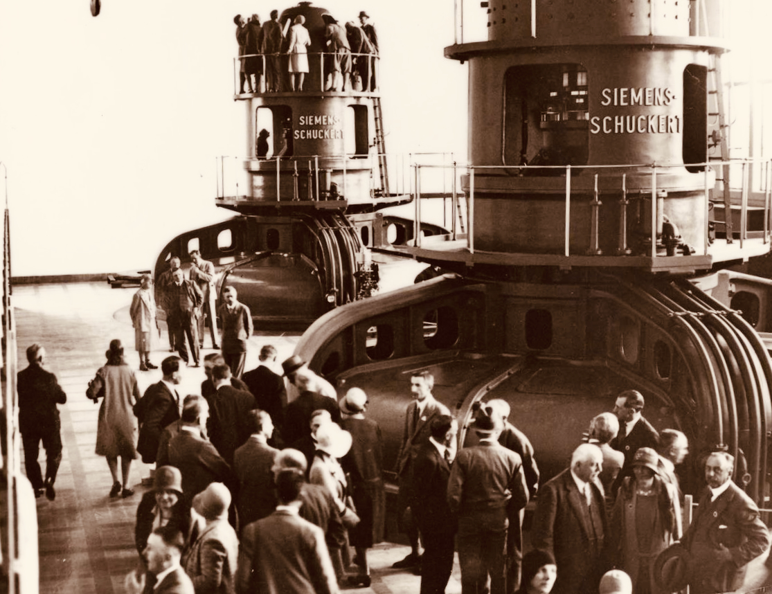
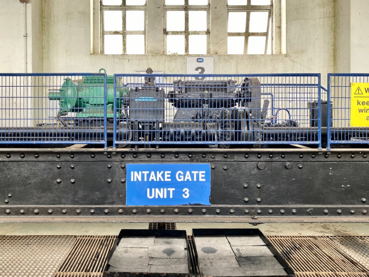
As a finale to this little series on Ireland’s Electrification Ventures back in the 20th century, I’m taking you on a tour of Ardnacrusha. This generating station – powered entirely by water from the River Shannon – was the largest in the world when it was built by Siemens, between 1925 and 1929. Siemens AG is the foremost industrial manufacturing company in Europe, and its Irish connections began in 1874, when Siemens laid the first direct electrical cable across the Atlantic, linking Ballinskelligs Bay on Ireland’s west coast to North America. The pioneering continued, in 1883, when the company built one of the world’s first electric railways, linking Portrush and Bushmills in Co Antrim. After Ardnacrusha, Siemens became responsible for many of Ireland’s landmark achievements, including the ESB’s first pumped storage power plant at Turlough Hill; the DART rapid transport network; the baggage handling systems for Dublin Airport’s Terminal 2; and – in 2016 – the orders for Galway Wind Park – then the largest in Ireland.
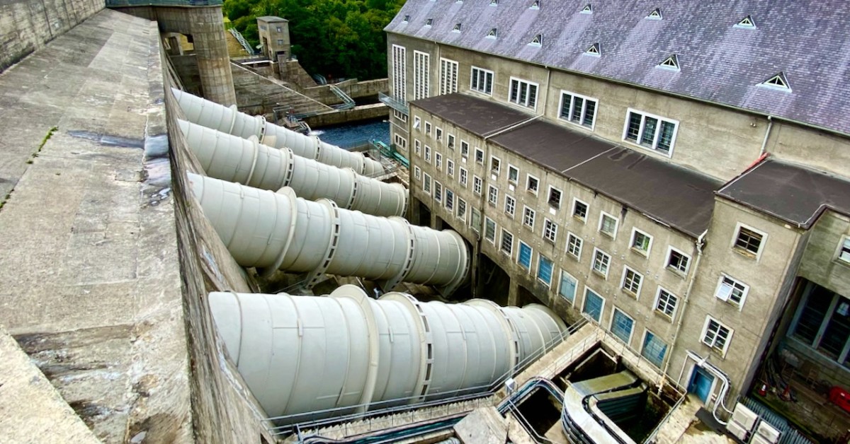
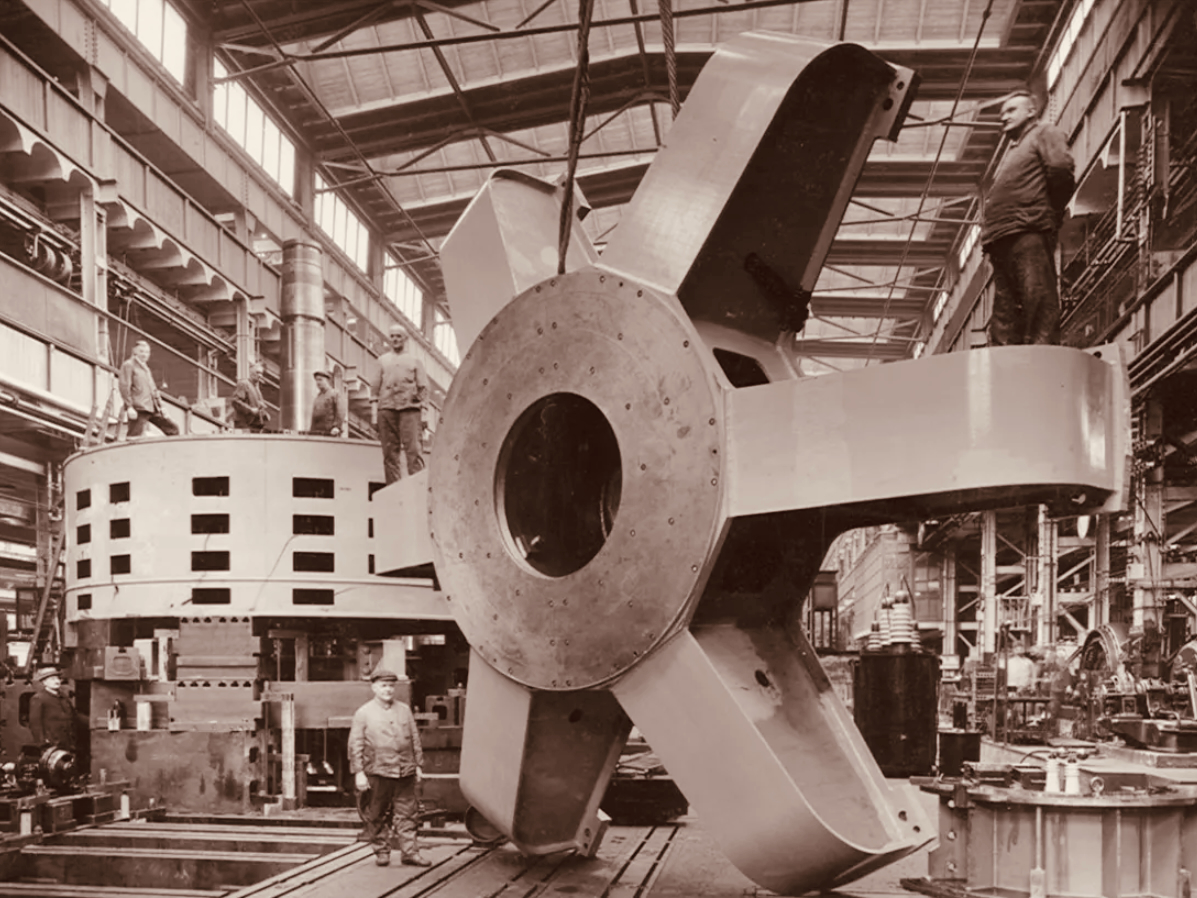
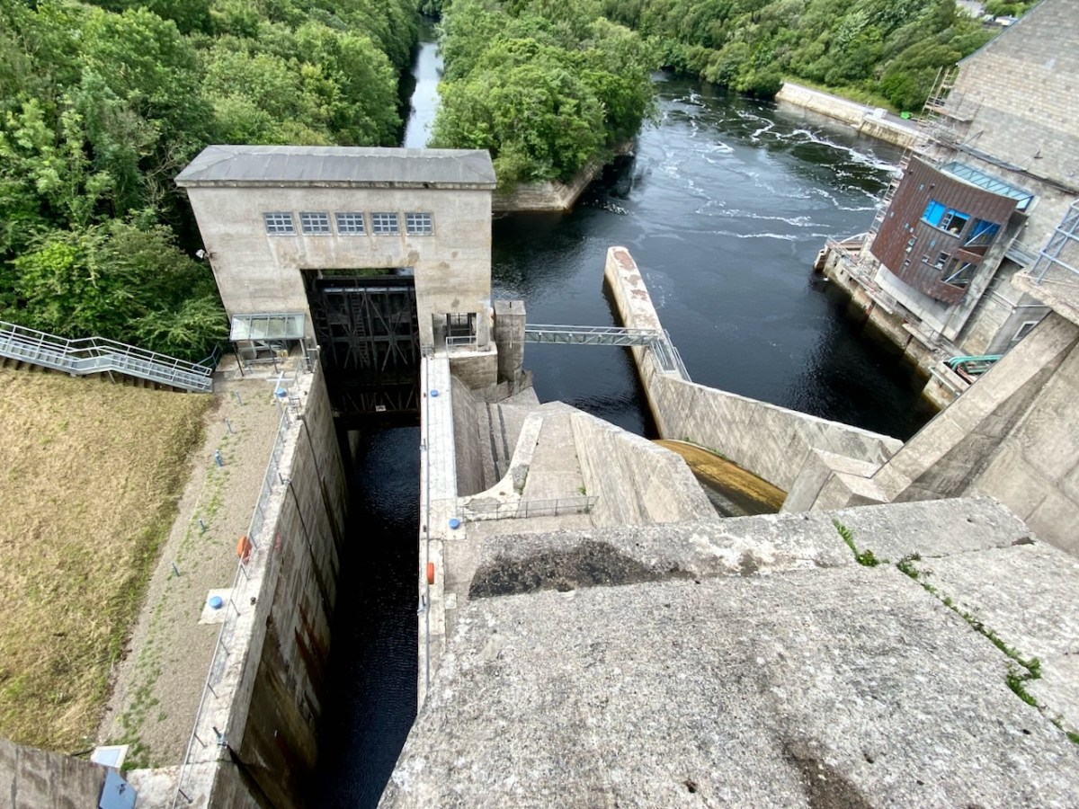
The header pic shows one of the three vertical-shaft Francis turbo-generator units after construction. These were joined by one vertical-shaft Kaplan turbo-generator unit between 1933 and 1934. Above is one of the penstocks which brings the water into the turbine casings.
. . . The construction of the Shannon Scheme was a mammoth undertaking for a country the size of Ireland, especially when the State was barely three years old. The project cost £5.2 million, about 20% of the Government’s revenue budget in 1925 . . .
ESB DOCUMENTS
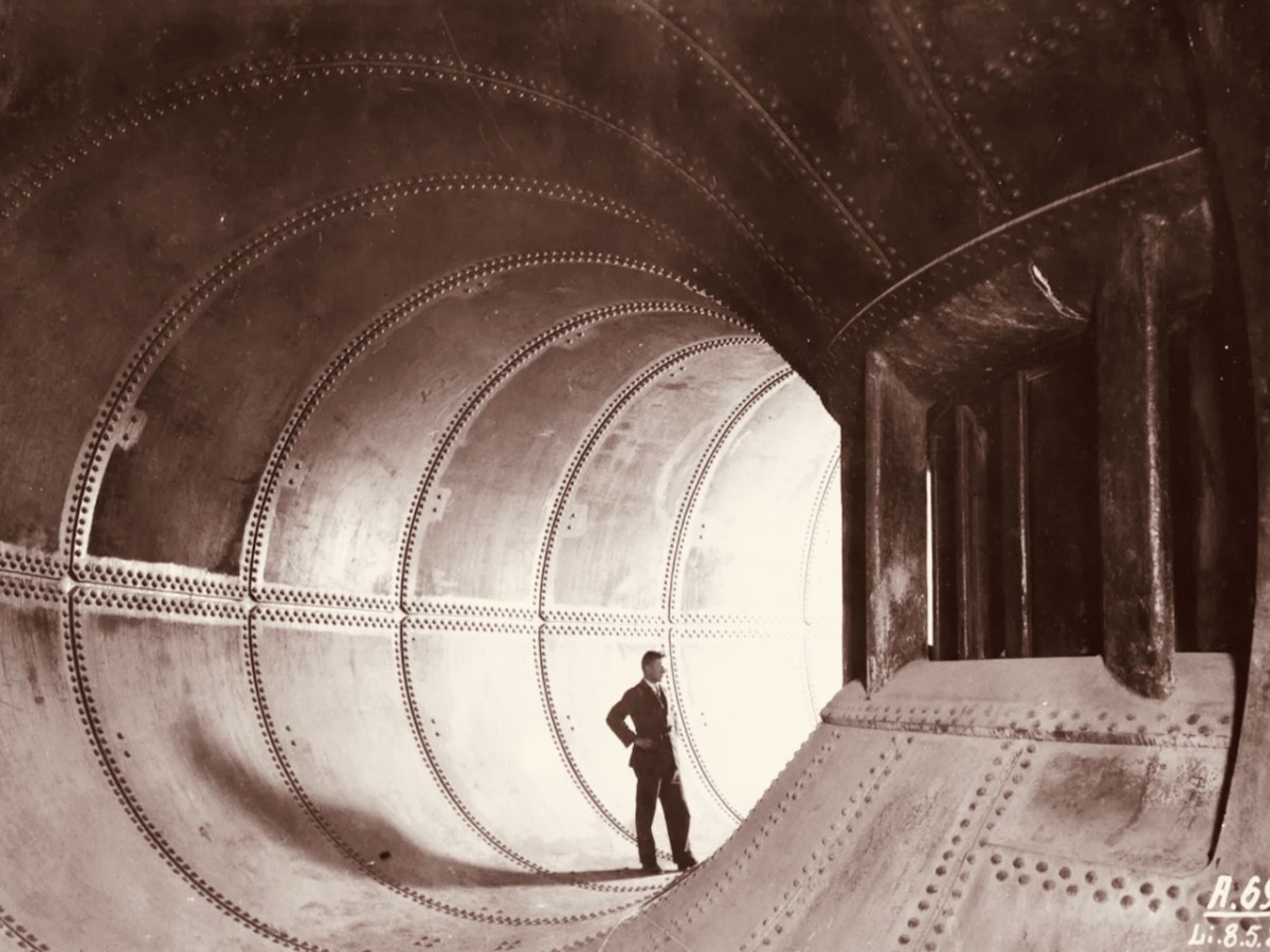
Visitors to Ardnacrusha in the turbine house on opening day, 22 July 1929 (ESB Archives). Below – a part of one generator awaiting installation (ESB Archives).
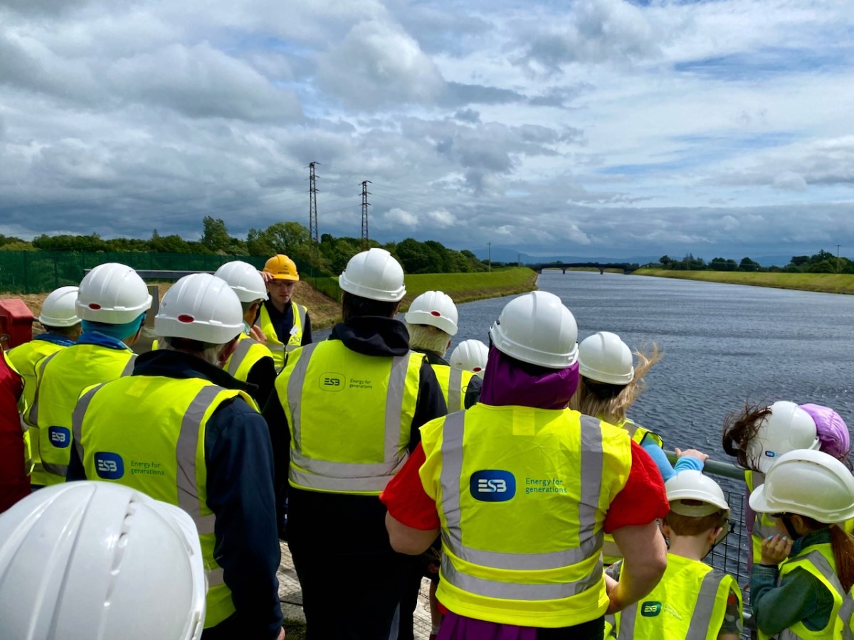
We joined a group visiting the generating station in early July. It was a great and satisfying experience! Safety was the top principle, but we got to see all the features of the whole set-up. If you want to go, book in advance – it’s free – and fascinating (if, like me, you are moved by engineering and history).
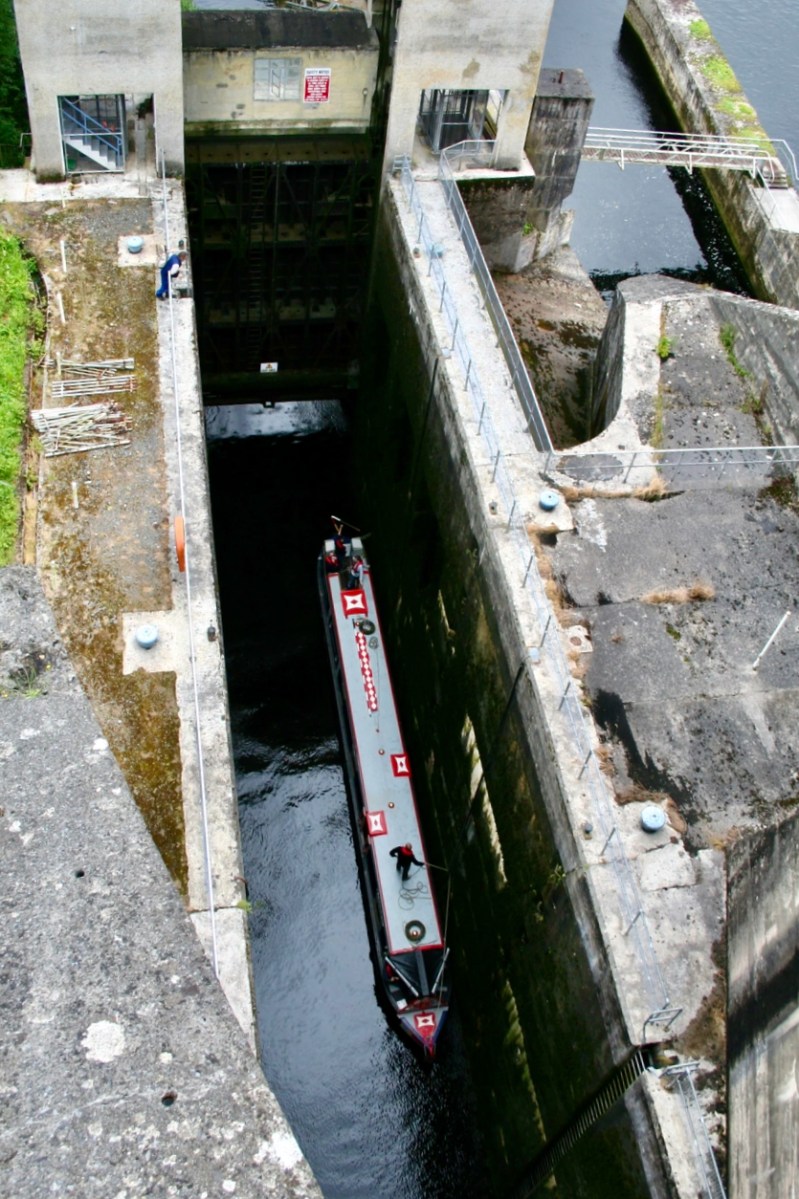
The pound lock at Ardnacrusha: it provides navigation for boats through the dam. At a drop of 100ft – 30 metres – it’s the deepest lock in the whole of Britain and Ireland. Following is a pic of a traditional British narrow-boat – NB Earnest – traversing the lock (Irish Waterways History).
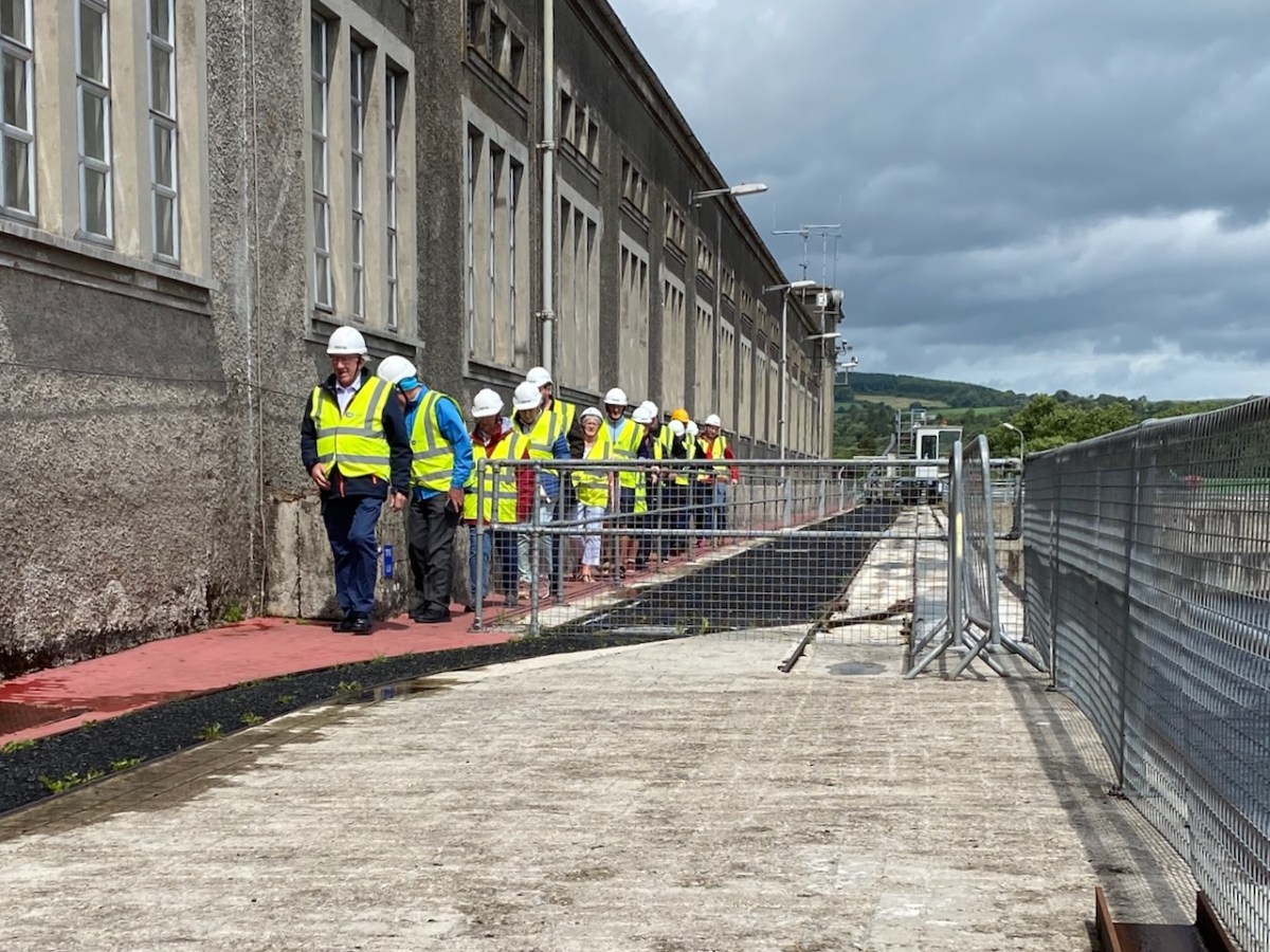
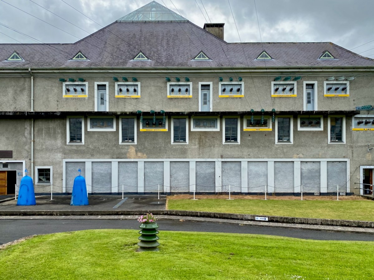
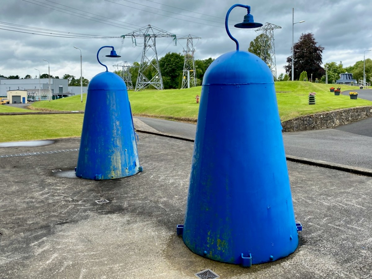
The main building at Ardnacrusha has a definite sense of ‘Bavarian Character’ to it – probably because of its German roots. I wonder if that’s the reason it escaped being bombed in World War II? Concerns were definitely expressed that this could have happened, and steps were taken to mitigate any possible damage. I was particularly impressed by these one-person air-raid shelters, which have been preserved because of their historical interest:
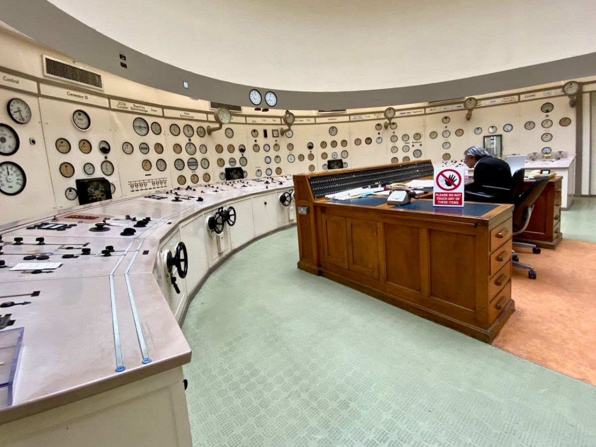
Here’s the ‘back end’ of the main building block, showing the position of the canal lock but also the new architectural-award winning control room – copper sheet clad – which has taken the place of the original room and desk, which have nevertheless been preserved as a piece of history:
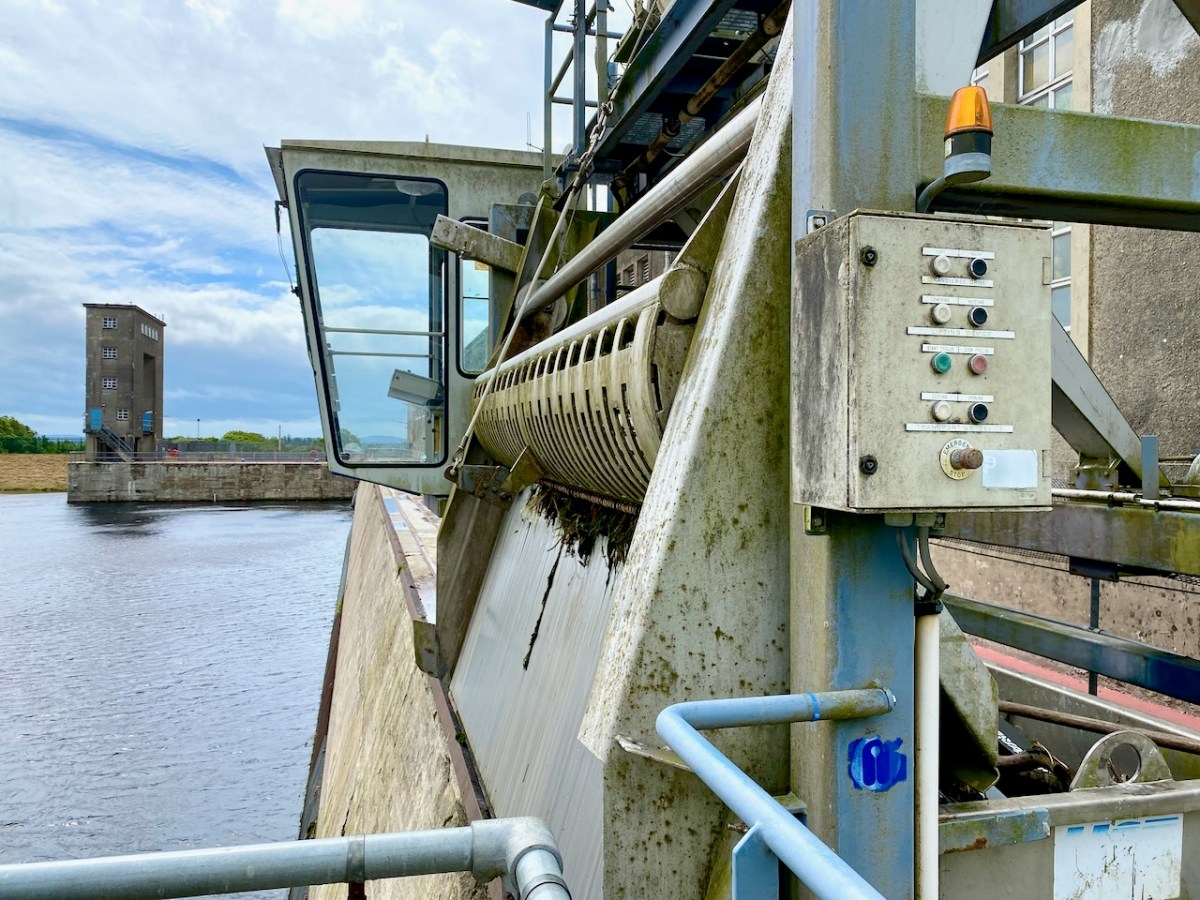
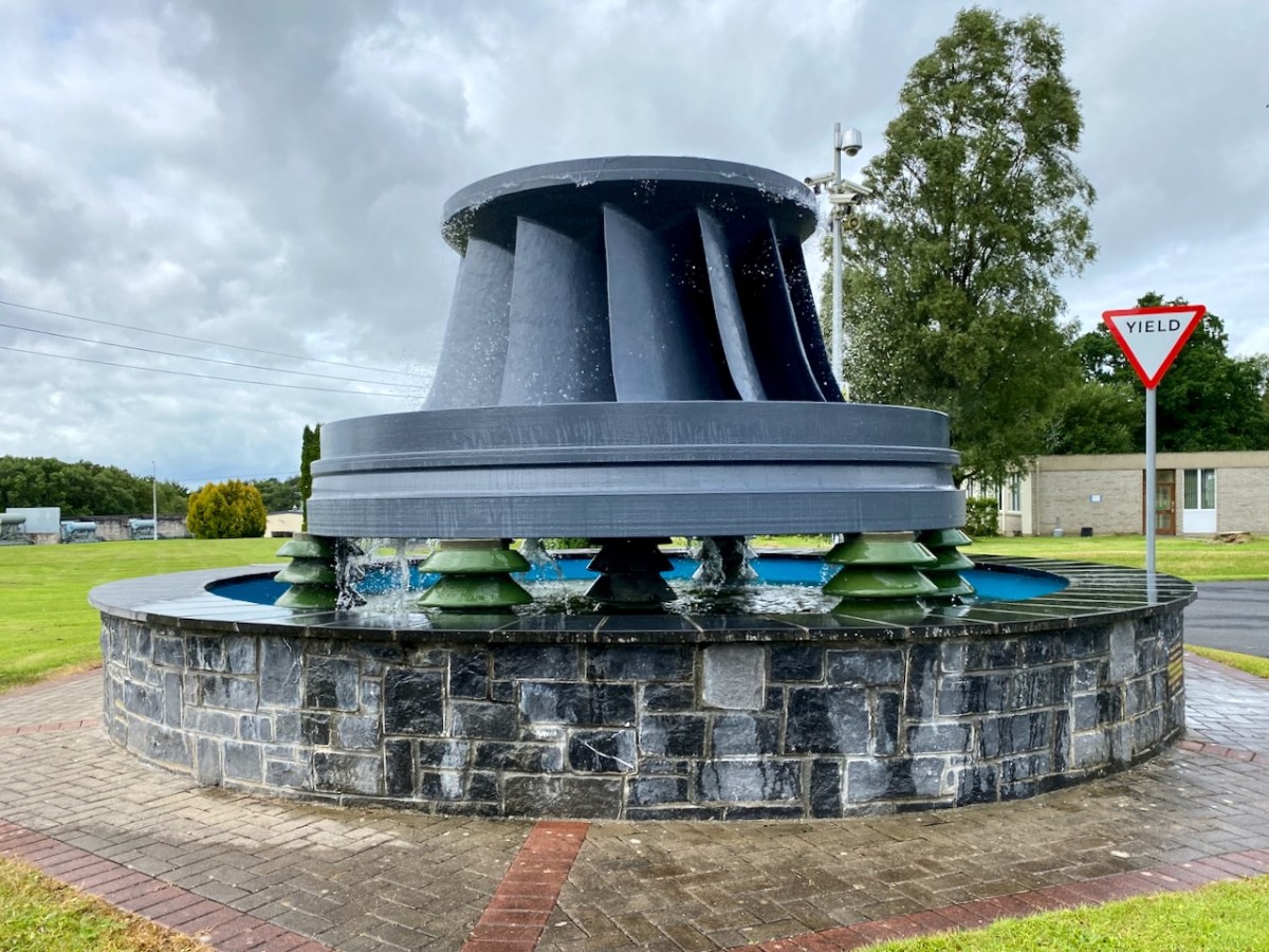
The machine above cleans the weir intake grills leading to the turbines. Everything here has its historical aspects emphasised, where relevant. The wondrous machine above is in full working order to this day, cleaning the intake grids on the weirs coming in from the main dam. A replaced turbine impeller is used as a decorative fountain feature beside the driveway into the station:
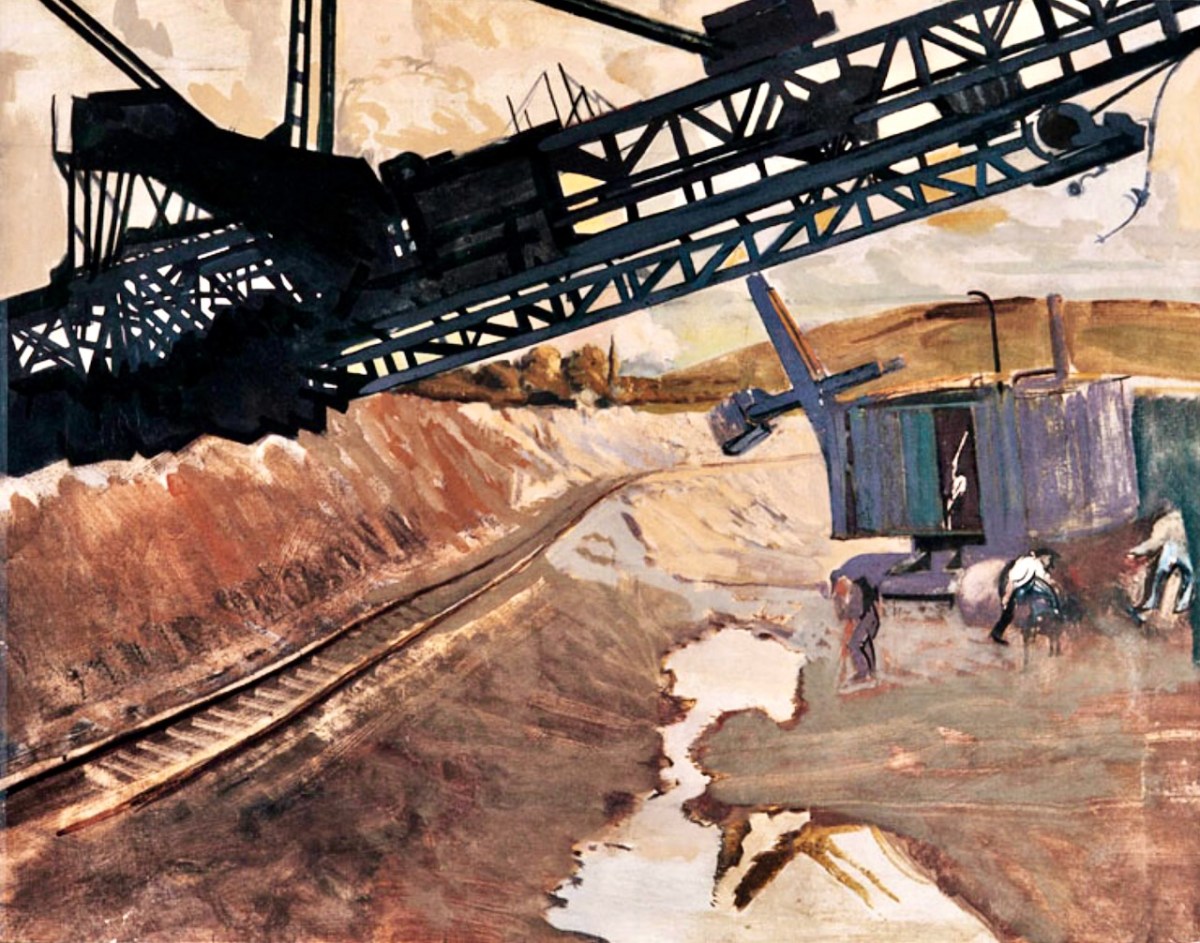
In a previous post, I mentioned that the artist Seán Keating was so impressed by the project that he painted a series of canvases during the construction process. The majority of these originals are now on display in the power station offices – accessible on the tour.
I once again express my thanks to Michael Barry for setting me on this rewarding path. I understand he is giving electrification and Ardnacrusha due mention in his forthcoming book A Nation is Born.
Further information on the Electrification of Ireland can be found in these posts:
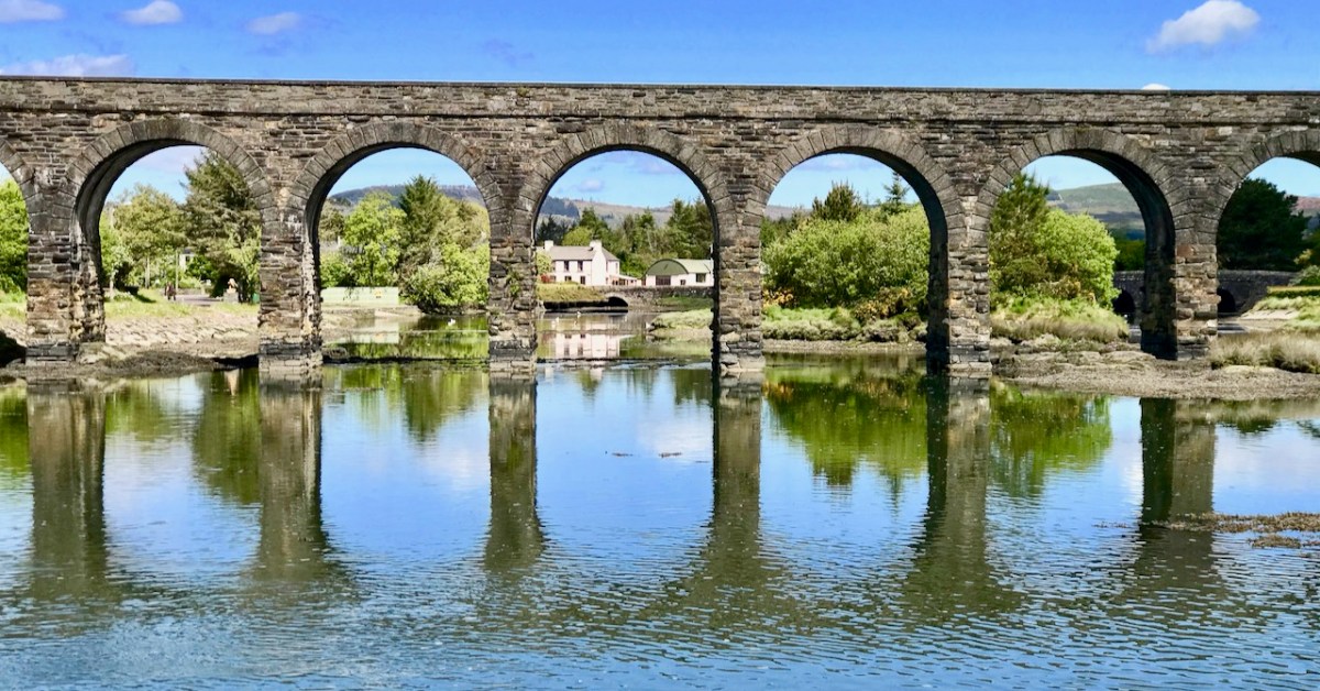
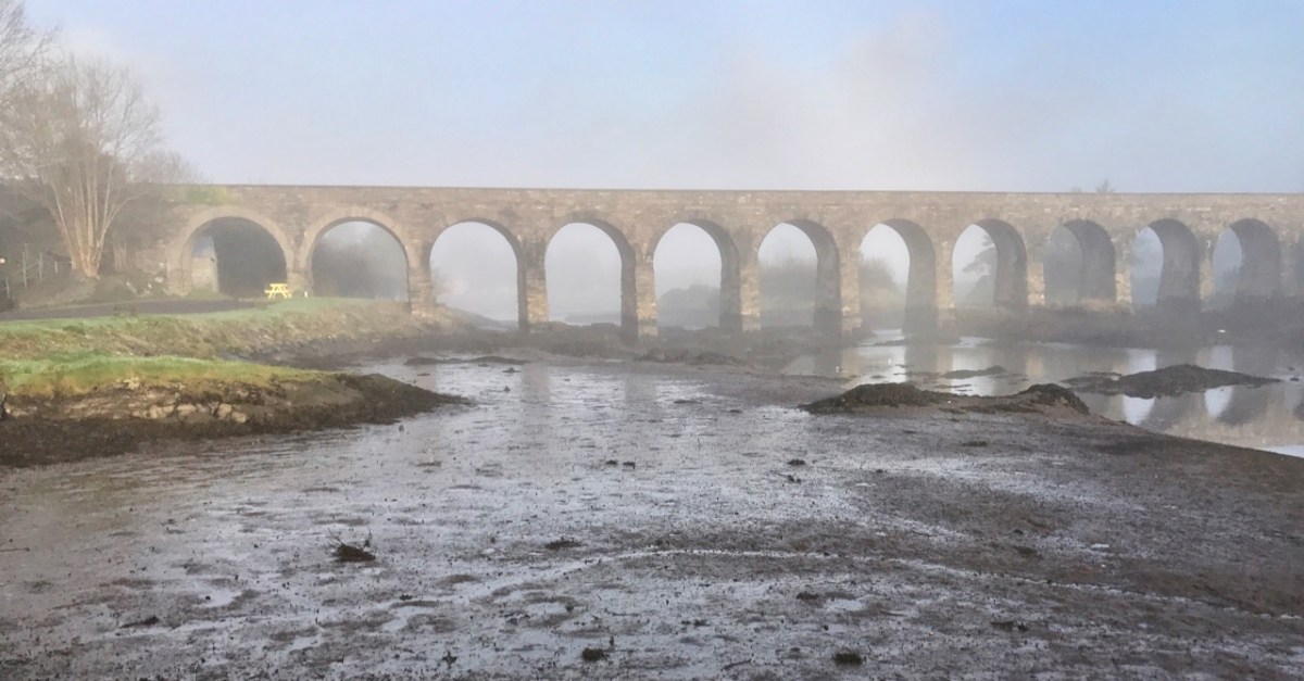
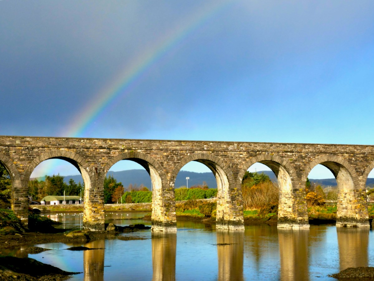
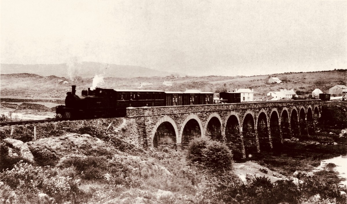
Last week’s post The Twelve Arches of Ballydehob proved a most popular subject. Ballydehob’s railway viaduct – dating from the late nineteenth century can’t be ignored. It was fairly easy to put together another dozen pics of the structure, making a good Christmas Day theme to take your minds off turkey and stuffing!
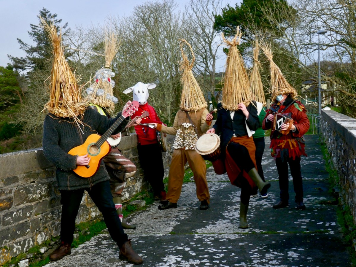
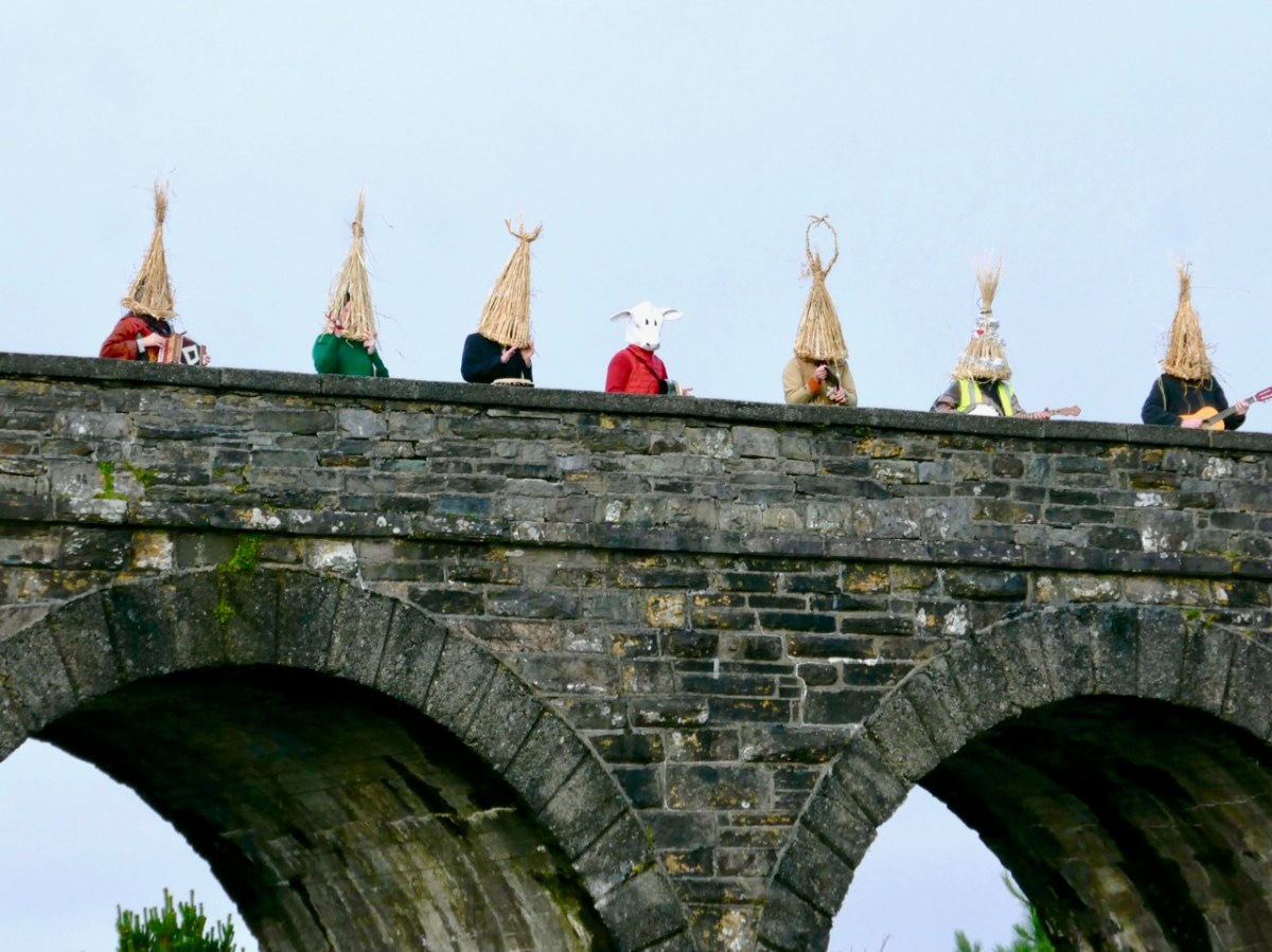
As we have lived not too far from the viaduct over the last ten years, we have seen it – and photographed it – in many of its moods. And it’s a constant backdrop, of course, to life in our West Cork village. Below – here it is, supporting a very ancient tradition, on St Stephen’s Day (that’s me on the right!):
“No Wrens Were Harmed in the Making of this Post!” That was the title of my RWJ article on the Wren Day festivities in Ballydehob in 2019 – pre-Covid. It was great to be out and about in the village, echoing a custom which has been passed from generation to generation. When I grew up in England I joined in the Mummers’ tradition there: I followed it for much of a lifetime, and even now can recite the whole play without a prompt… “Here comes I, Bold Trim Tram: Left hand, press gang – press all you bold fellows to sea…”
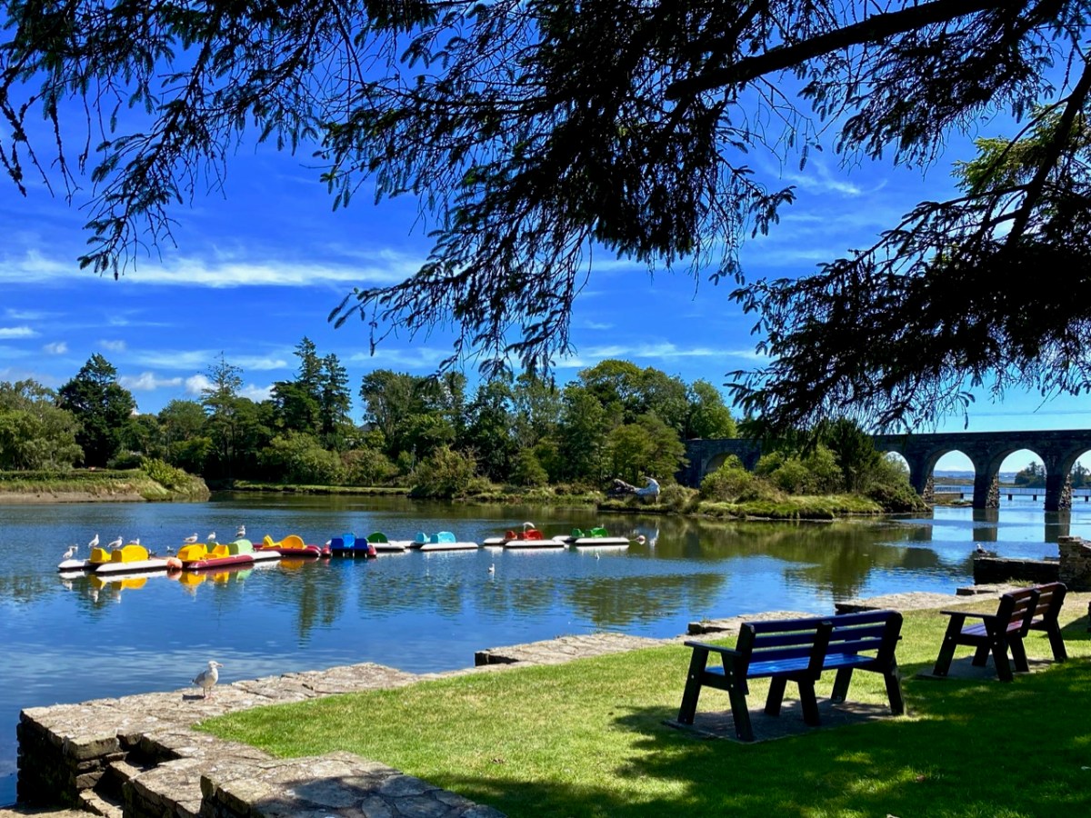
Something else which could do with a revival is the Pedalo tradition. Pedalos were brought out of storage for an unique occasion in the summer – a project named Inbhear, an art installation by Muireann Levis. Here is own my post about it.
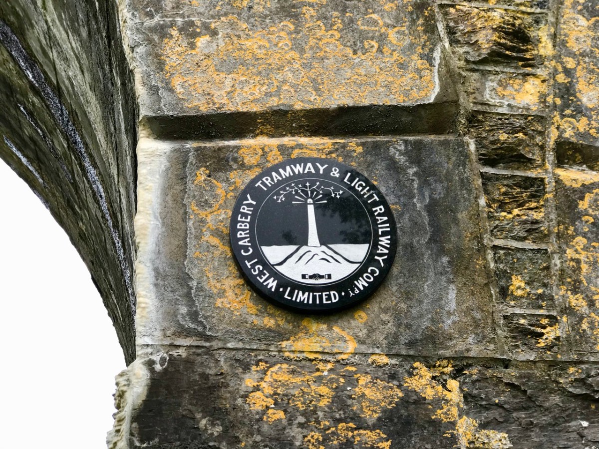
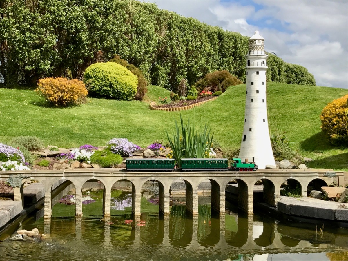
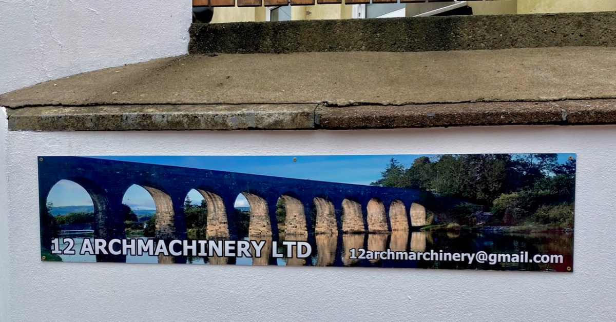
I was pleased to have this photo of the viaduct in my collection. If the scale looks a little wobbly it could be because this – and the train – are models sited at the West Cork Model Railway Village at Clonakilty. Below – a local company, in Ballydehob, has chosen to use the bridge in its title.
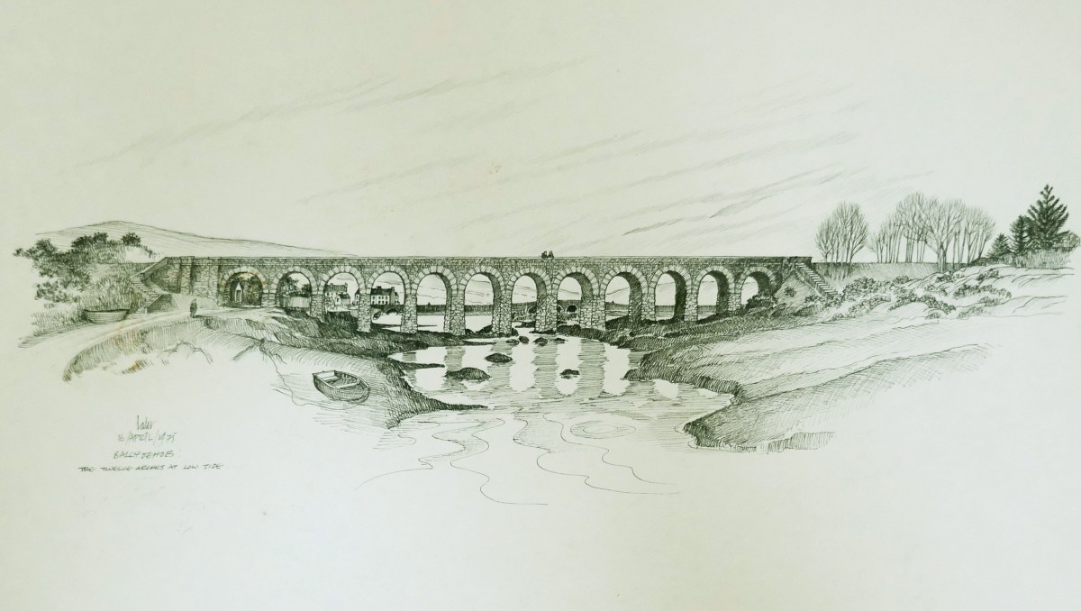
We showed you some of Brian Lalor’s work last week. Here’s another of his drawings. It is dated 1975: he tells me he has plenty more viaduct pics if I write another post in the future.
Atmospherics a-plenty: we have them all the time in Ballydehob. We do live in one of this world’s most inspiring places… Have a very good and atmospheric Christmas, everyone! And – safe journeying if you are out and about.
Welcome to the UCD Library Cultural Heritage Collections blog. Discover and explore the historical treasures housed within our Archives, Special Collections, National Folklore Collection and Digital Library