Kenmare Stone Circle

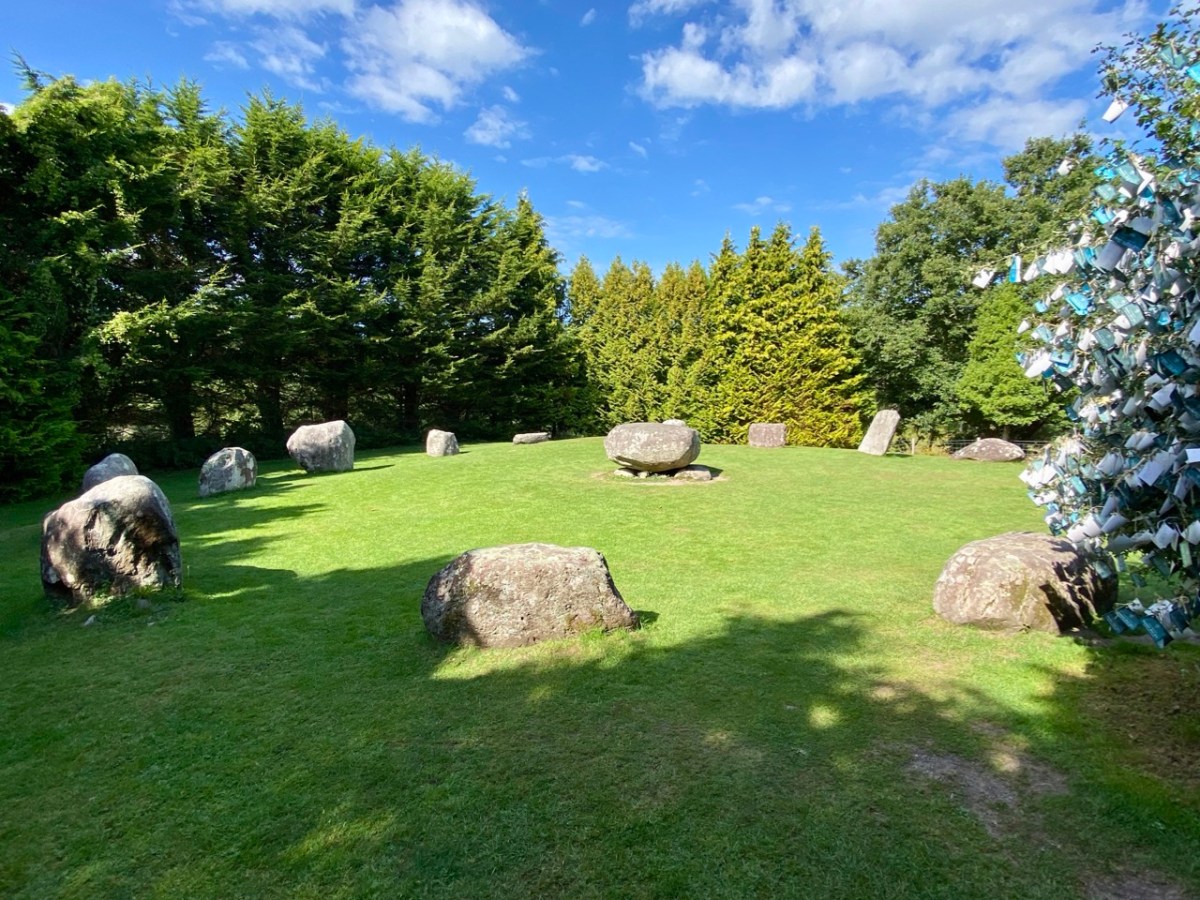
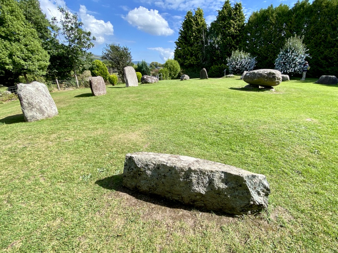
The significant stone circle at Kenmare is an unusual monument in several respects. It is said to be the largest stone circle in the south west of Ireland, oval in shape and measuring 17.4 x 15.8m. It seems intact: I found no record of any intervention or ‘improvement’ to the circle, which consists of an oval ring of 15 stones with a central ‘boulder burial’. Although situated very close to the main streets of this Kerry town, it has often been described as ‘hard to find’. I can remedy that – here’s a present-day location map:

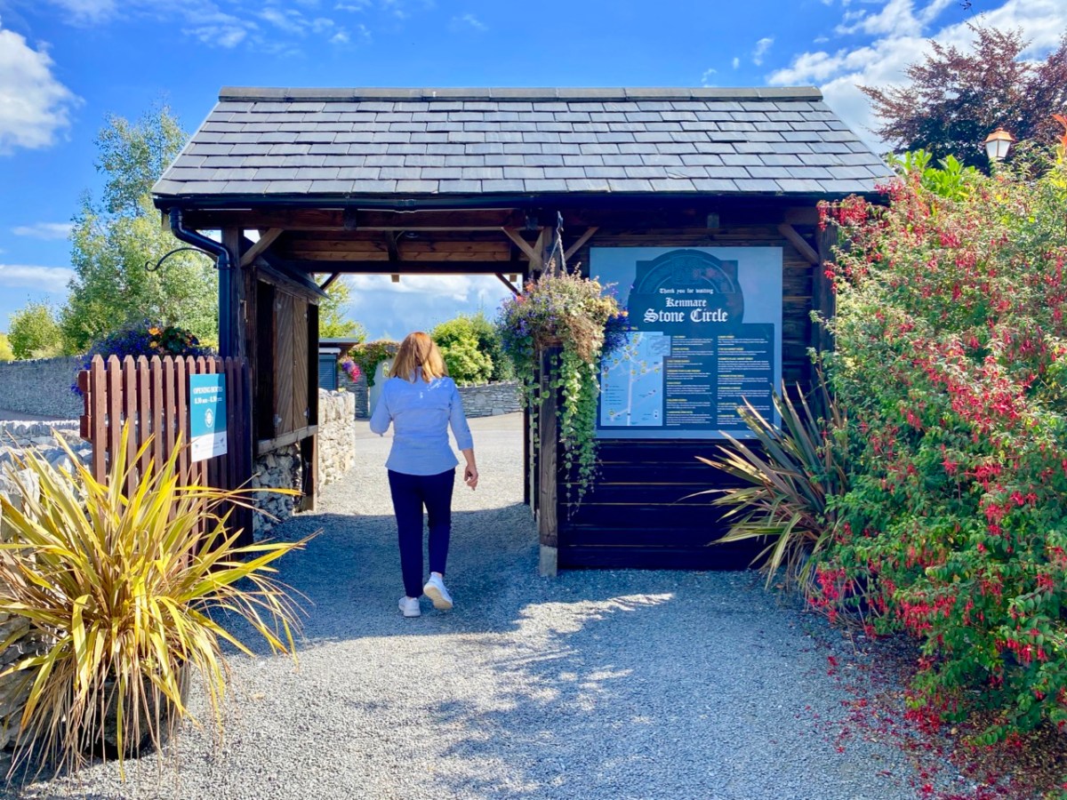
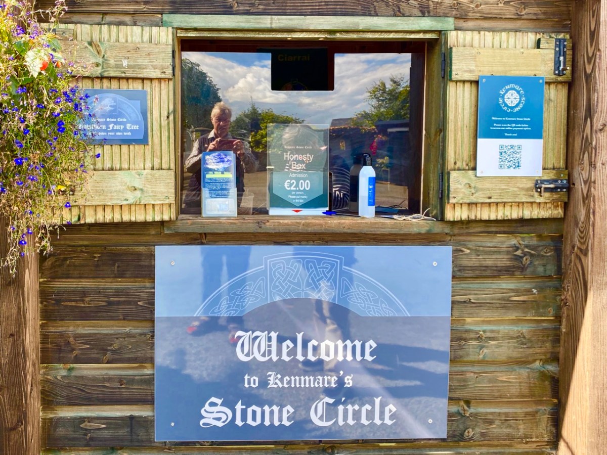
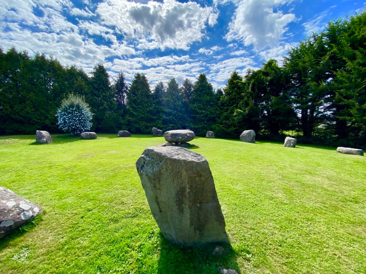
The site is just a few minutes’ walk from the centre of Kenmare and now has its own dedicated car park beside it. The circle is very ‘tidy’ and well looked after. A nominal entrance fee is requested, the funds being put towards the maintenance of the area.

While the circle is fairly well enclosed nowadays by a ring of tall trees, the vista would previously have been more open with extensive views. Quarrying has taken place in the vicinity in past years. Here is the historic 6″ OS map showing the site as it was around the late nineteenth century.

The archaeology.ie Historic Environment Viewer gives a brief, sober description of the site:

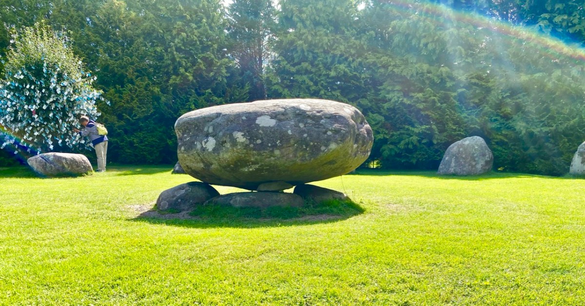
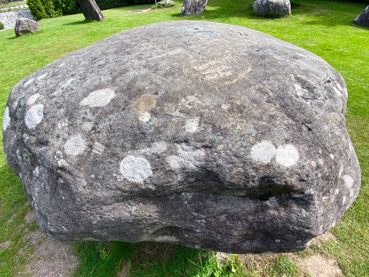
. . . In level pasture, on the SW outskirts of Kenmare town. A subcircular area (17m E-W; 15m N-S) is enclosed by fifteen stones (L 0.8-1.6m; T 0.2-0.7m; H 0.3-1.2m), two of which are prostrate. The axial stone is the lowest and is a regular flat-topped slab contrasting with most of the other stones, which with one or two exceptions, are of boulder type. A boulder-burial (KE093-032002-) occupies the centre of the stone circle. (Ó Nualláin 1984a, 26, no. 41) . . .

Archaeology.ie KE093-032001

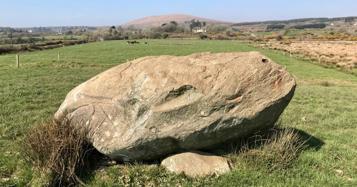
I was disappointed in my search for an antiquarian’s account of this circle: Ó Nualláin (quoted above) and others have included it in general lists of such monuments. I was hoping for some speculation on its significant size, and on the large central boulder, itself a slightly unusual feature within a stone circle.

Finola has comprehensively speculated on boulder burials, however, in her Roaringwater Journal post from a few years ago. (She has also written on stone circles generally here). The Kenmare example is visually very much in line with the overall archaeology.ie Monument Class description:

. . . Boulder Burial – A large boulder or capstone of megalithic proportions, resting on a number of supporting stones, usually three or four in number, which, in most cases, do not form a recognisable chamber structure. Excavations suggest a Bronze Age date for this burial monument (c. 2400-500 BC) . . .

Archaeology.IE Monument Classification

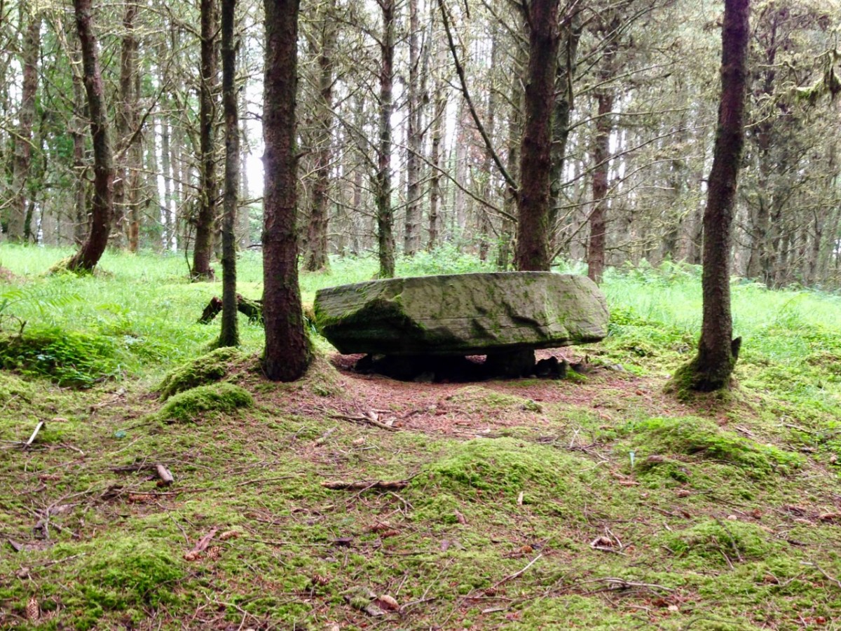
Finola has pointed out, however, that there is no conclusive evidence for assuming that these ‘boulder burials’ are – well – principally burials.

. . . William O’Brien [Professor of Archaeology UCC] excavated three boulder burials in the late 1980s and found no evidence of burials. In his book, Iverni, he comments in an understated way, “The absence of human remains at Cooradarrigan and Ballycommane does pose some questions as to their use.” His findings dated the sites to the Middle Bronze Age, between 3000 and 3,500 years ago . . .

Finola Finlay, Roaringwater Journal

So, should we perhaps call them ‘elevated stones’? Visually, they are certainly always striking. This one at Kenmare is said to weigh around 7 tons. Bearing in mind the stones in this circle are likely to originate some few miles distant, we can imagine the efforts required to assemble them. O’Brien dates the boulder burials he studied to 1000 or 1500 BC. This would tie in with the general thinking that stone circles were Bronze Age also.

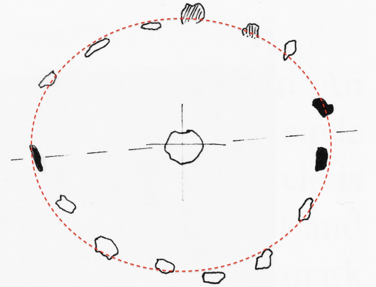
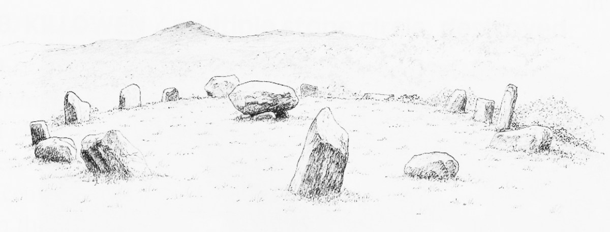
The two drawings above are from Jack Roberts. On his survey (top) I have superimposed an oval template which confirms the suggestion that the Kenmare ‘circle’ is egg-shaped. In the lower sketch view – probably dating from the 1980s – the stones appear to be out in the open, free from the present-day tree shielding.

While it is generally implied that all the stones in this monument were placed at the same time, there is always the possibility that there might have been an evolution in its construction. By that I mean that we could speculate that the ‘boulder burial’ stone was placed first and the circle came afterwards – perhaps to enhance its setting. Or vice versa.

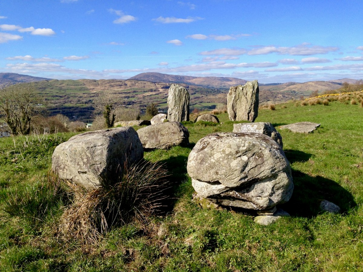
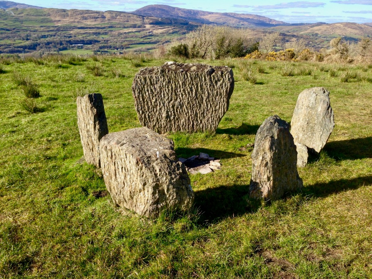
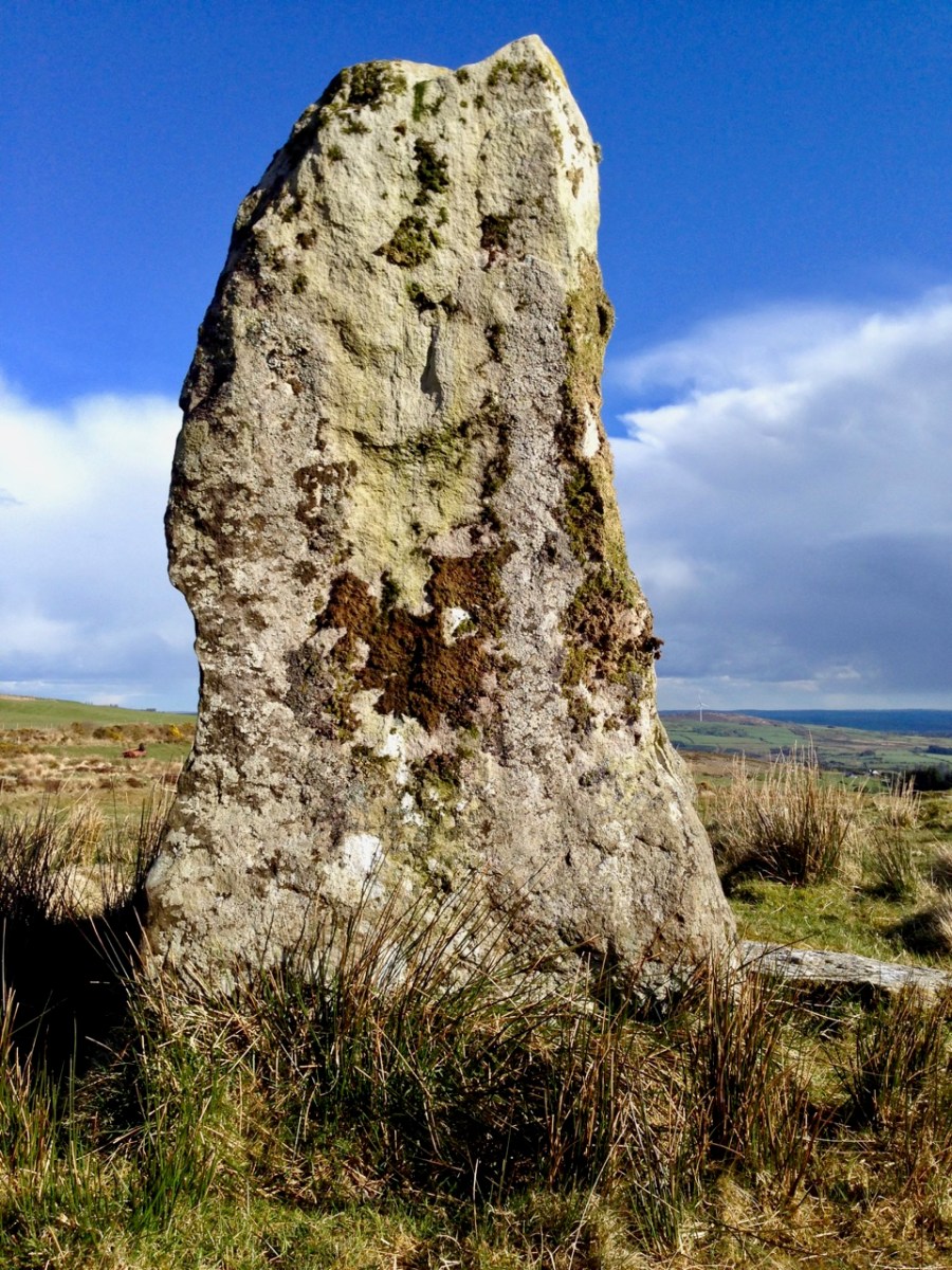
This photograph clearly shows the recumbent stone. Many of the circles in south west Ireland are known as axial circles, where a ‘recumbent’ stone (seemingly placed on its long edge) may provide a horizon viewing point when observed from a ‘portal’ of two stones at the opposite side. The orientation axis created by this observation is usually from north east towards south west (as is the case here). Where a stone circle has a clear horizon (such as Drombeg, in West Cork) it has been noted that this alignment faces the setting sun at midsummer solstice.

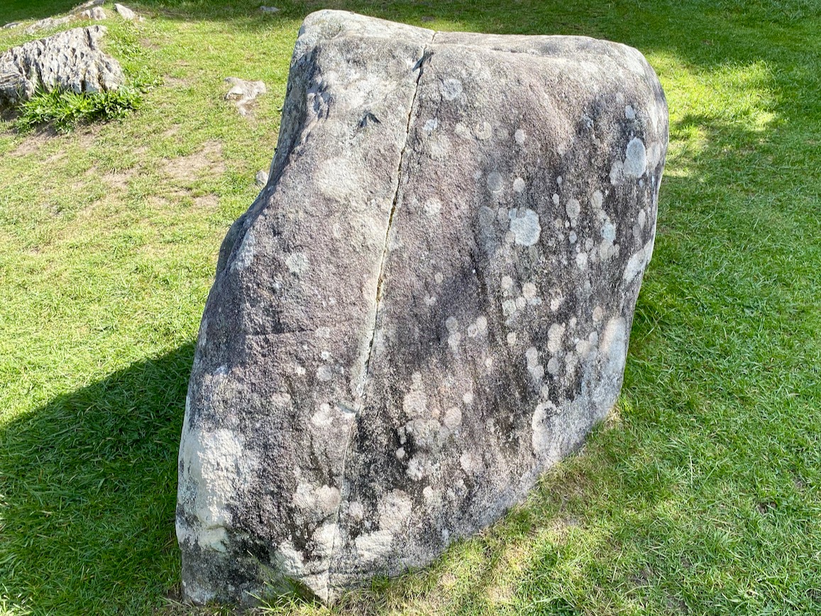
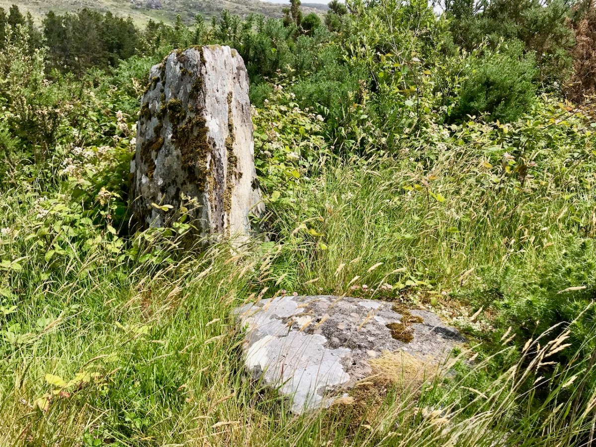
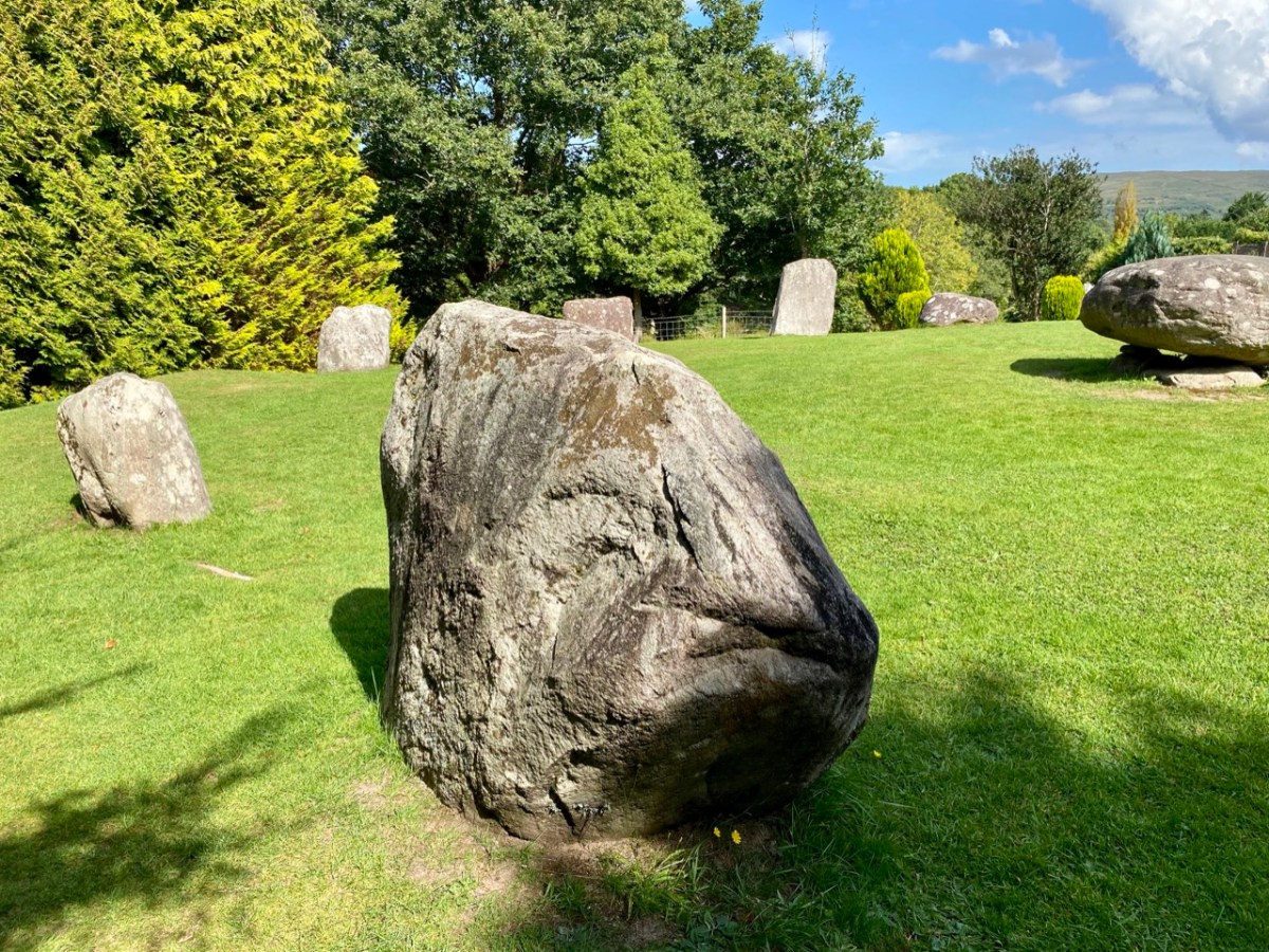
As you can see from these close studies of some of the individual stones (above) there are quite significant differences in their shape and character within the circle. It has been suggested (elsewhere) that the shapes and the relative placing of the stones is significant. ‘Male’ and ‘female’ stones have been suggested – but this is yet more speculation.

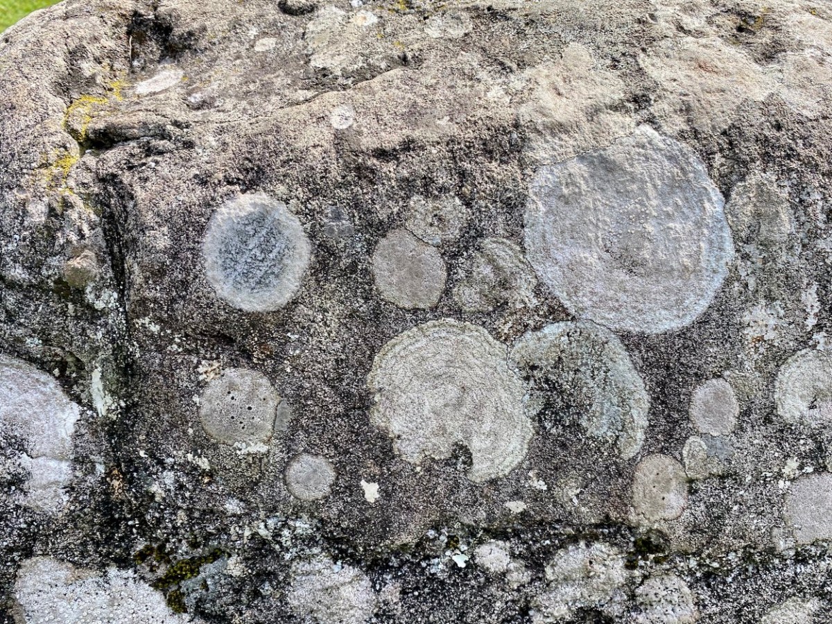
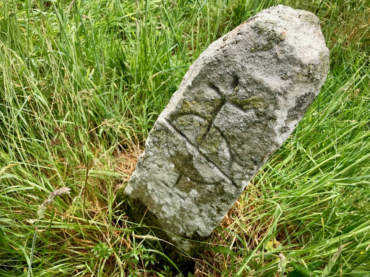
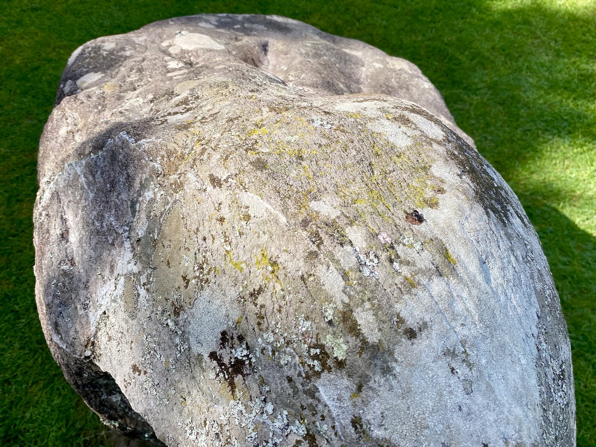
As far as we can see there are no ancient markings on the stones at Kenmare (except for a possible single cup-mark on the upper surface of the boulder burial), but I am fascinated by the lichen shapes and textures on one particular stone (above). This is ‘nature’s art’, of course.

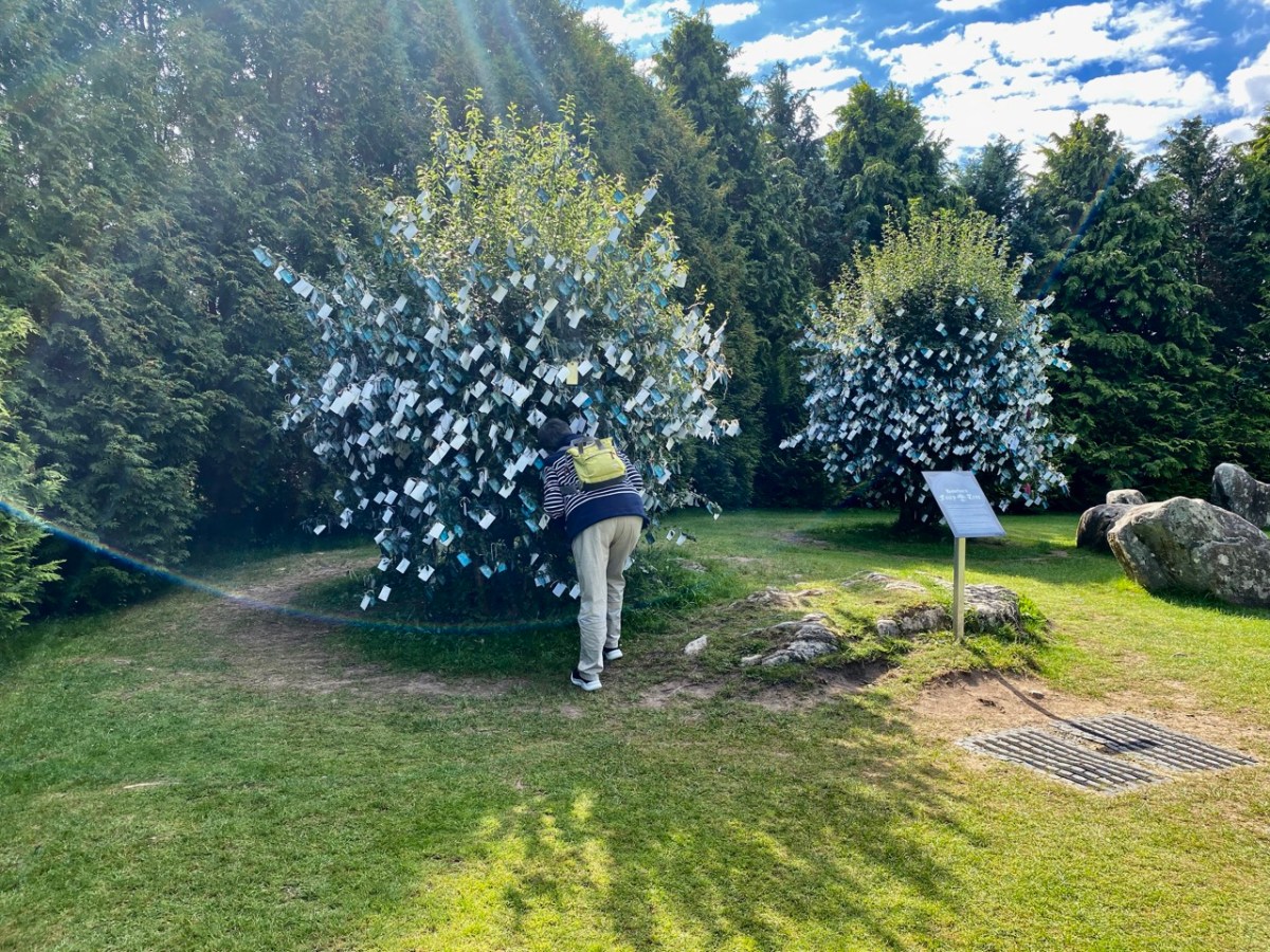
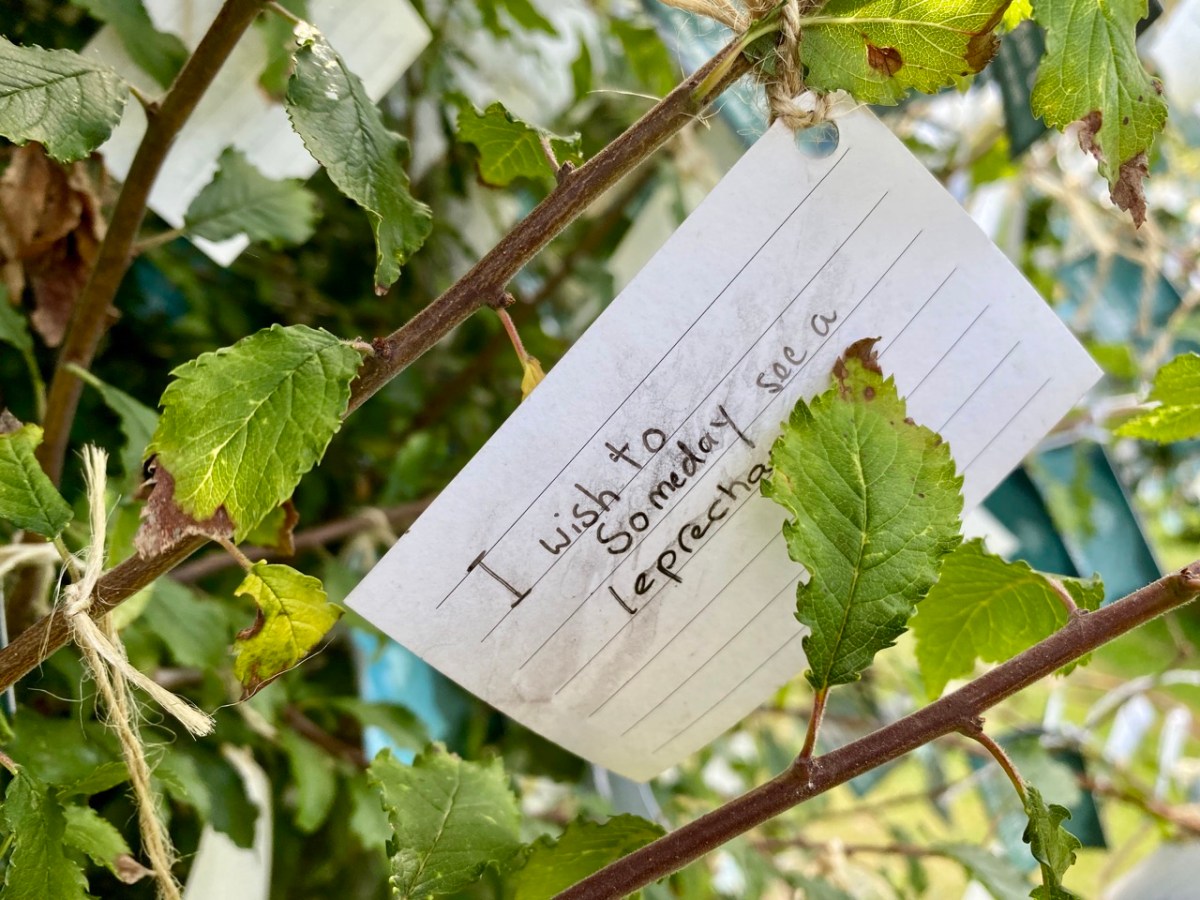
It’s impossible to ignore the two ‘fairy’ hawthorn trees that have been established within the vicinity of the stones. In my opinion it was an inspiration to exploit the idea of visitors purchasing ‘message cards’ from the site kiosk and writing down their own thoughts and personal wishes, which are then tied on to the branches. That’s Finola, above, being affected by the rainbow fairy vibes. She has written her own post today specifically on this aspect of the place. My favourite message is this one, below:

Stones Alone

Over the years we have written a lot about stone. That’s not surprising, because our interests in Irish archaeology involve stones: standing stones, stone circles, rock art, gravestones . . . It’s what the surviving history of our earliest dwellers on this island is all about. So I thought it would be a good idea to sift through our Roaringwater Journal photographic library – which goes back a decade – and turn up some pictures and stories which I have never used before: all of them involving stones. That header pic, above, is a boulder burial at Rathruane, just outside our West Cork village of Ballydehob.

Here’s another boulder burial, a long way away in Co Cavan, now surrounded by trees which are probably relatively recent. Finola wrote about this monument type six years ago, and pointed out that they are not well named: when examined archaeologically, very few of these stones have been associated with buried human remains. They are said to have been positioned between 1,500 and 1,000 years BC, a time we refer to as the ‘Bronze Age’. So, by then, humans were already aware of the use of metal for tools, weapons and decorative adornments. But imagine the time before that – when people only had natural materials to hand – wood, vegetation and, of course – if you wanted to create something permanent – stone: we call these times Neolithic – and generally that covers the period of habitation of Ireland from 6,000 BC onwards.

Here is another West Cork site: Breeny More, to the north of Bantry. There’s a whole lot of stones here including, unusually, four ‘boulder burials’ arranged in a square. There are also further stones in this grouping which were once part of a stone circle. The site is magnificently located, with distant views west across to Bantry Bay (below).

We are all familiar with groups of stones arranged in a circle. Here is the ‘stone circle’ at Ardgroom, County Cork: it’s on the Beara Peninsula. As with the Boulder Burials, these monument types are generally thought to date from the Bronze Age.

These modestly sized ‘five stone’ stone circles are also in County Cork. The National monuments Survey of Ireland lists 53 ‘five stone’ circles in the county, while a further 41 ‘multiple stone’ circles are noted. There are also some anomalies which defy definition, such as ‘The Fingers’ at Knockdrum, West Cork, just outside Castletownshend:

This appears to have been, originally, an alignment of five tall standing stones. One has fallen and broken, while the fifth is now missing. It is reasonable to assume, from the number of stone ‘monuments’ all around us in West Cork (and in many other parts of Ireland), that these sites were of great significance to the populations who constructed them. But we don’t know for sure why they are there – although theories abound.

I am fascinated by the number of single standing stones we come across in our travels. It’s impossible to say how many there are in Ireland – probably thousands. And they can range in size from the large stones – above – in West Cork, to individual examples in moorland or fields, or on roadsides – below.

The Irish word ‘carn’ means a heap or pile of stones, Cairn monuments are mounds of stones, often marking the summit of a significant hill or mountain. They may or may not be ancient, and we have seen them change significantly over time. On Mount Corrin, not far from us in West Cork, there were two cairns only a few years ago. Now there is a single, significant cairn (top pic below): this implies a deliberate ‘re-ordering’ of what was there before. Regardless of their history, they can be visually impressive.

The centre pic above is a small cairn on a Sheep’s Head summit, while the enormous one above is in The Burren, County Clare. The Burren is an extraordinary landscape of exposed limestone. The limestone formed as sediments in a tropical sea which covered most of Ireland approximately 350 million years ago. Today, the Burren supports a remarkable assortment of wild flowers: over 70% of Ireland’s species of flowers are found there, among the ubiquitous stone surfaces.

Ever since humans set foot on Irish soil, they have embraced the stones – both for practical uses such as shelter or enclosure, but also as a means of marking and communicating. Readers will be familiar with our particular interests in Prehistoric Rock Art:

This is an important example of Ireland’s Rock Art, from West Cork, perhaps dating from 5,000 years ago: it was discovered in comparatively recent times. The painting is by Keith Payne, and is an interpretation of this same rock outcrop. We have no evidence that the carvings were ever coloured – or pigmented.

Today we are very familiar with the use of stone as a building material: this practice is likely to have been current since very early times. In Ireland we have many examples of ancient – but undateable – stone buildings. The ‘Oratory’ at Gallurus is a good example of a built enclosure (walls and roof) made entirely from stone. A present day view of it, top, shows this remarkably preserved structure; archaeologists and historians have long debated its age and likely use. The print above dates from 1756.

Over the centuries, crafstpeople (like Séamus Murphy – see last week’s post) have used stone as a medium for memorials – the message is likely to survive beyond lifetimes. If only we knew what some of the messages should spell out to us! Our last – striking – image is from Fourknocks – a decorated chambered cairn within the Boyne Valley complex which we visited in 2016. This carved decoration was probably made 5,000 years ago: we can only wonder at its meaning and its authors . . .

Midsummer Maunderings…

Beautiful Cappaghglass

Beautiful Cappaghglass

…or Life Seen Through a Lens… Things found, places visited, mainly in the environs of West Cork, often just a few steps from Nead an Iolair, although one or two are from further afield. We have been away in Tipperary this week, so these posts are ‘ones we have prepared earlier’.

A reminder of Megaloceros - the extinct Irish Elk

A reminder of Megaloceros – the extinct Irish Elk, at Ballymaloe

curraghs

Currachs at Baltimore

Shelly Beach - our local secret

Shelly Beach – our local secret

Hugo helps himself!

Hugo helps himself!

guiness

Maestros Matt Cranitch and Jackie Daly playing in Ballydehob

Maestros Matt Cranitch and Jackie Daly playing in Rosie’s

An ordinary day in Ballydehob - with seanchaí Eddie Lenihan

An ordinary day in Ballydehob – with Seanchaí Eddie Lenihan

Ferdia - our garden companion

Ferdia – our garden companion

Dawn Moon over Rossbrin Castle

Dawn Moon over Rossbrin Castle

***

By the way… Dictionary definition of Maunder: to move or act in a dreamy, idle or thoughtful manner. Synonyms: wander, drift, meander, amble, dawdle, potter, straggle… Finola has only ever heard the word used in Ireland.

thady's

Thady’s window on the World

Ghosts of the Past

An abandoned village slowly returns to the bog

An abandoned village slowly returns to the bog

Amanda, Bardic School

Amanda, Bardic School

Amanda and Peter Clarke were our hosts yesterday for a Sheep’s Head Day. They know the peninsula intimately and were able to take us to places we would never have found on our own. They also love it: they have made their lives in Ahakista in a beautiful old farmhouse with a productive garden, and between them manage several projects that are great local resources.

We have written about the Sheep’s Head Peninsula in previous posts. It’s a wild and beautiful place, criss-crossed by a network of world-class marked trails, and full of prehistoric and historic sites. Part of our tour took in the Bardic School, about which Robert wrote in his Kings and Poets piece. But mostly what we saw was new to us: an impressive stone circle and a stone alignment, a lonely and moving famine graveyard, the remains of a pre-famine village, and finally a holy well and mass rock site.

The stone circle is probably the recumbent type, in which two tall portal stone stand opposite a stone with its longest axis parallel to the earth. The sightline from the portals over the recumbent stone is often focused on a solstice sunrise. Stone alignments in this area tend to be three to five stones in a row and may also be part of the solar and lunar observatory system that is characteristic of many Neolithic and Bronze Age monuments.

2013-03-02 11.04.30

Ireland before 1845 had a population of 8 million people. Over a million died of starvation and disease and another million emigrated in the period of the Great Famine, from 1845 to 1852. West Cork was one of the epicentres of the disaster. It is still alive in the folk memory of the people and we saw two graphic reminders of it on our tour. The first was the Roskerig burial ground. Although stones were scattered around the graveyard, not a single inscription was visible, as if it had been hastily used in a chaotic time and then forgotten. The second reminder was the remains of a long-abandoned village, now slowly returning to the bog.

2013-03-02 11.23.39

The holy well and mass rock are dedicated to Mary and are adorned with multiple images of her. The well is still in use and credited with miracle cures. The mass rock, where a crowd would gather outdoors in the days of the Penal Laws that outlawed Catholicism, to hear mass, is well preserved. When the Redcoats got wind that a mass was in progress and came to arrest the priest, Mary threw up a thick mist around the area to confuse the soldiers and allow the priest to escape. In acknowledgement, we deposited our coins in the well and said a prayer for something close to our hearts.

well