Stones Alone

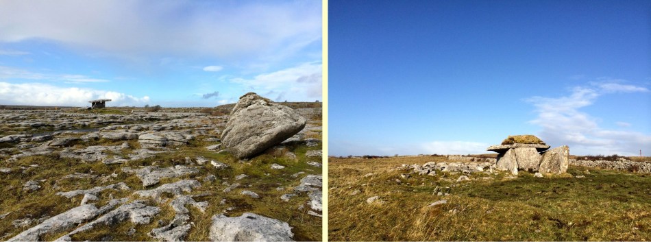
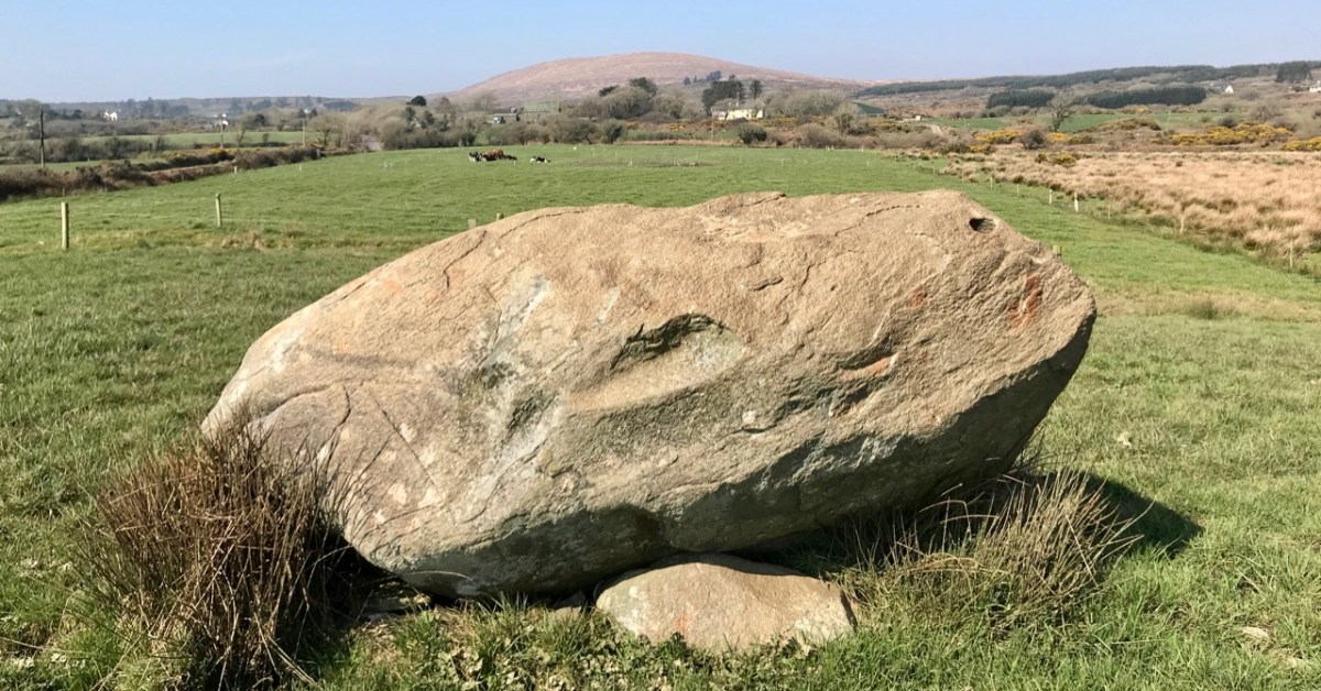
Over the years we have written a lot about stone. That’s not surprising, because our interests in Irish archaeology involve stones: standing stones, stone circles, rock art, gravestones . . . It’s what the surviving history of our earliest dwellers on this island is all about. So I thought it would be a good idea to sift through our Roaringwater Journal photographic library – which goes back a decade – and turn up some pictures and stories which I have never used before: all of them involving stones. That header pic, above, is a boulder burial at Rathruane, just outside our West Cork village of Ballydehob.

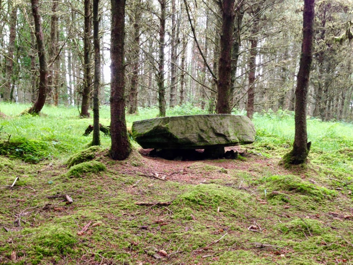
Here’s another boulder burial, a long way away in Co Cavan, now surrounded by trees which are probably relatively recent. Finola wrote about this monument type six years ago, and pointed out that they are not well named: when examined archaeologically, very few of these stones have been associated with buried human remains. They are said to have been positioned between 1,500 and 1,000 years BC, a time we refer to as the ‘Bronze Age’. So, by then, humans were already aware of the use of metal for tools, weapons and decorative adornments. But imagine the time before that – when people only had natural materials to hand – wood, vegetation and, of course – if you wanted to create something permanent – stone: we call these times Neolithic – and generally that covers the period of habitation of Ireland from 6,000 BC onwards.

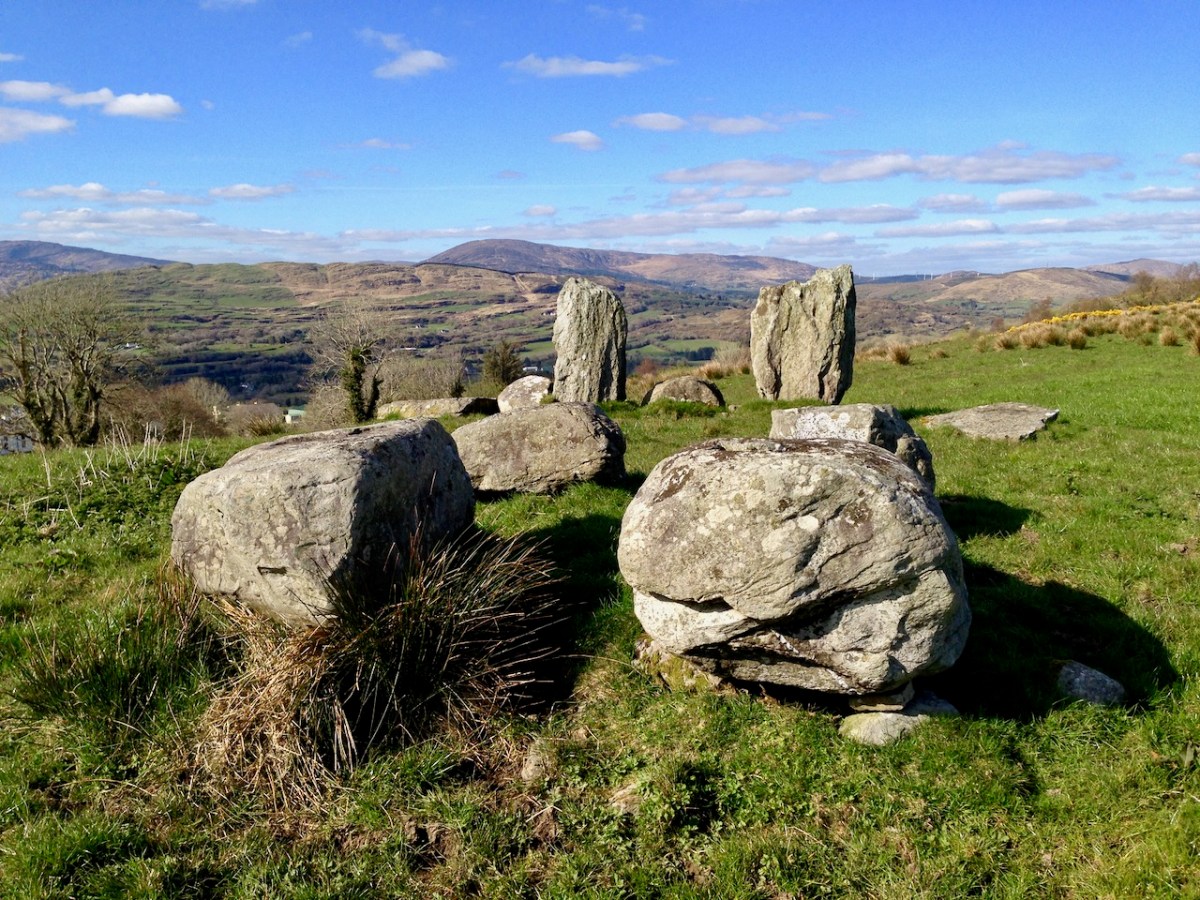
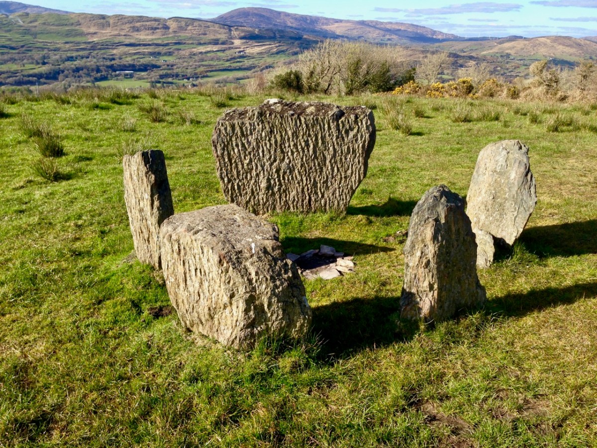
Here is another West Cork site: Breeny More, to the north of Bantry. There’s a whole lot of stones here including, unusually, four ‘boulder burials’ arranged in a square. There are also further stones in this grouping which were once part of a stone circle. The site is magnificently located, with distant views west across to Bantry Bay (below).

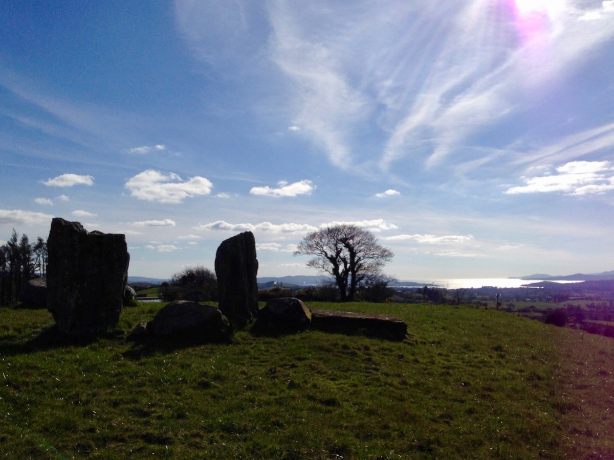
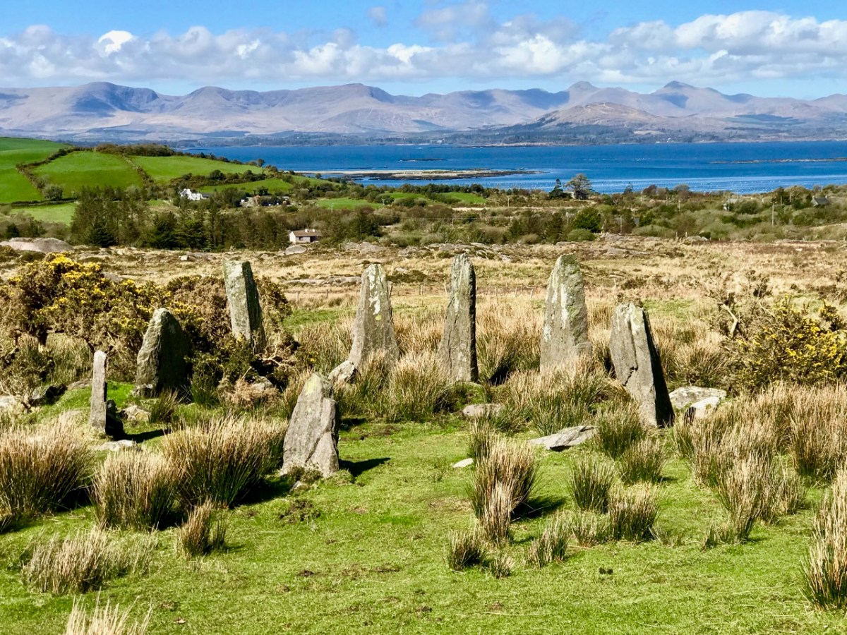
We are all familiar with groups of stones arranged in a circle. Here is the ‘stone circle’ at Ardgroom, County Cork: it’s on the Beara Peninsula. As with the Boulder Burials, these monument types are generally thought to date from the Bronze Age.

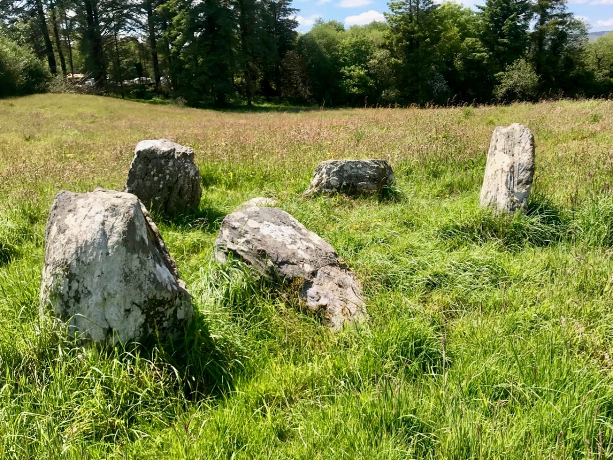
These modestly sized ‘five stone’ stone circles are also in County Cork. The National monuments Survey of Ireland lists 53 ‘five stone’ circles in the county, while a further 41 ‘multiple stone’ circles are noted. There are also some anomalies which defy definition, such as ‘The Fingers’ at Knockdrum, West Cork, just outside Castletownshend:

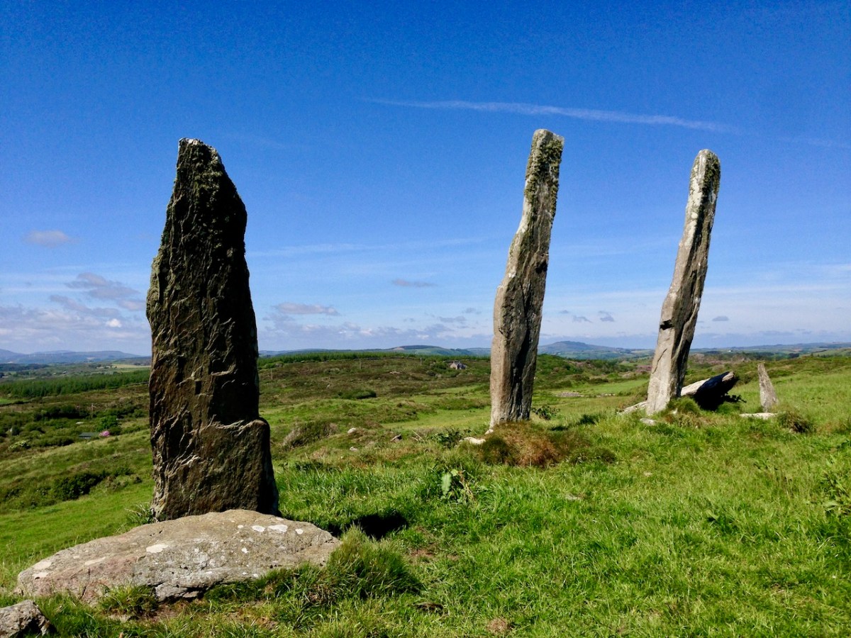
This appears to have been, originally, an alignment of five tall standing stones. One has fallen and broken, while the fifth is now missing. It is reasonable to assume, from the number of stone ‘monuments’ all around us in West Cork (and in many other parts of Ireland), that these sites were of great significance to the populations who constructed them. But we don’t know for sure why they are there – although theories abound.

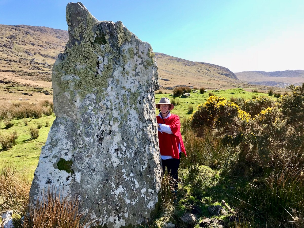
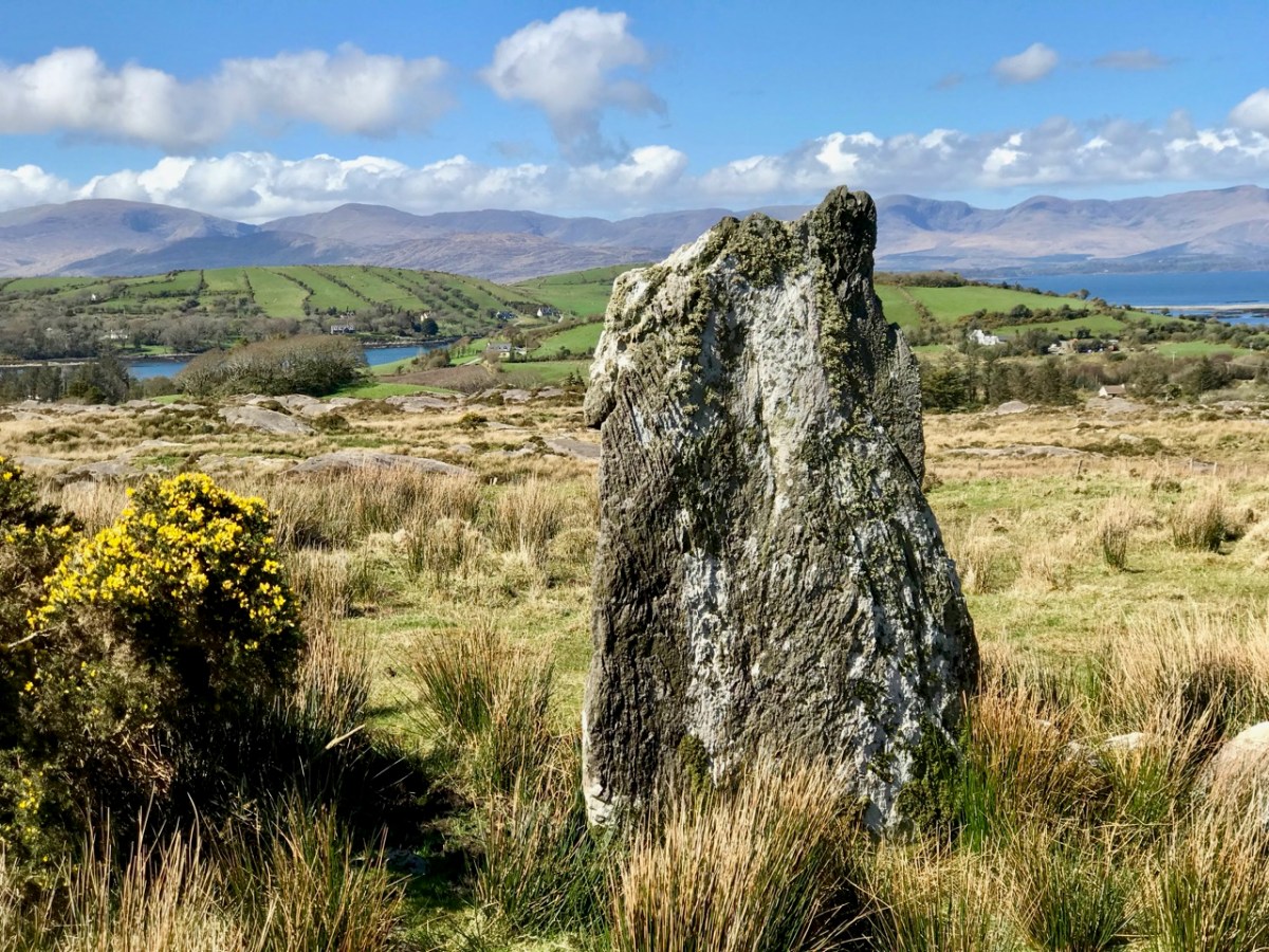
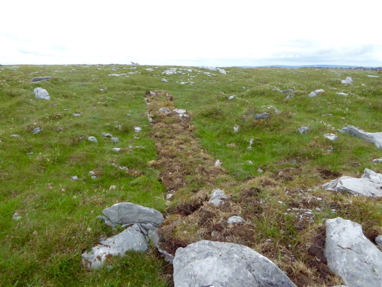
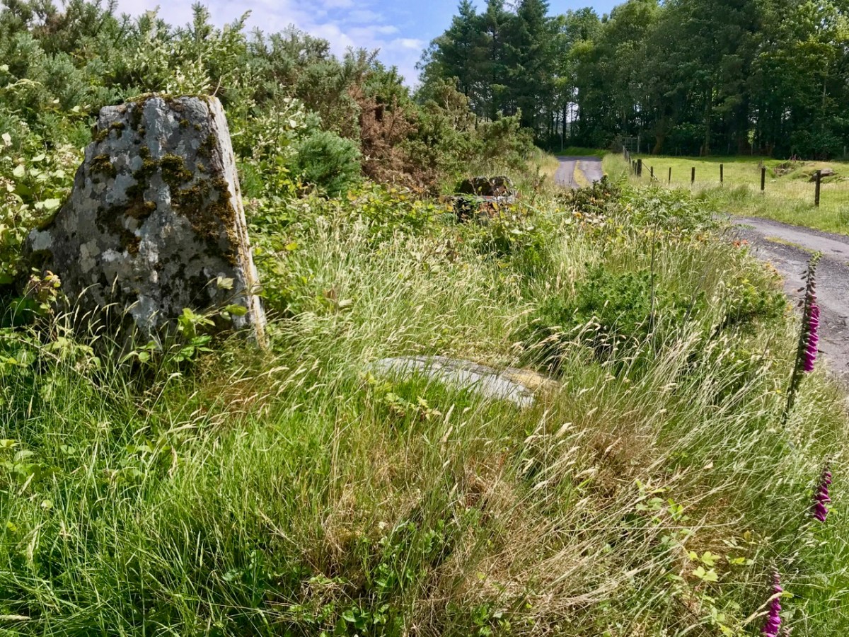
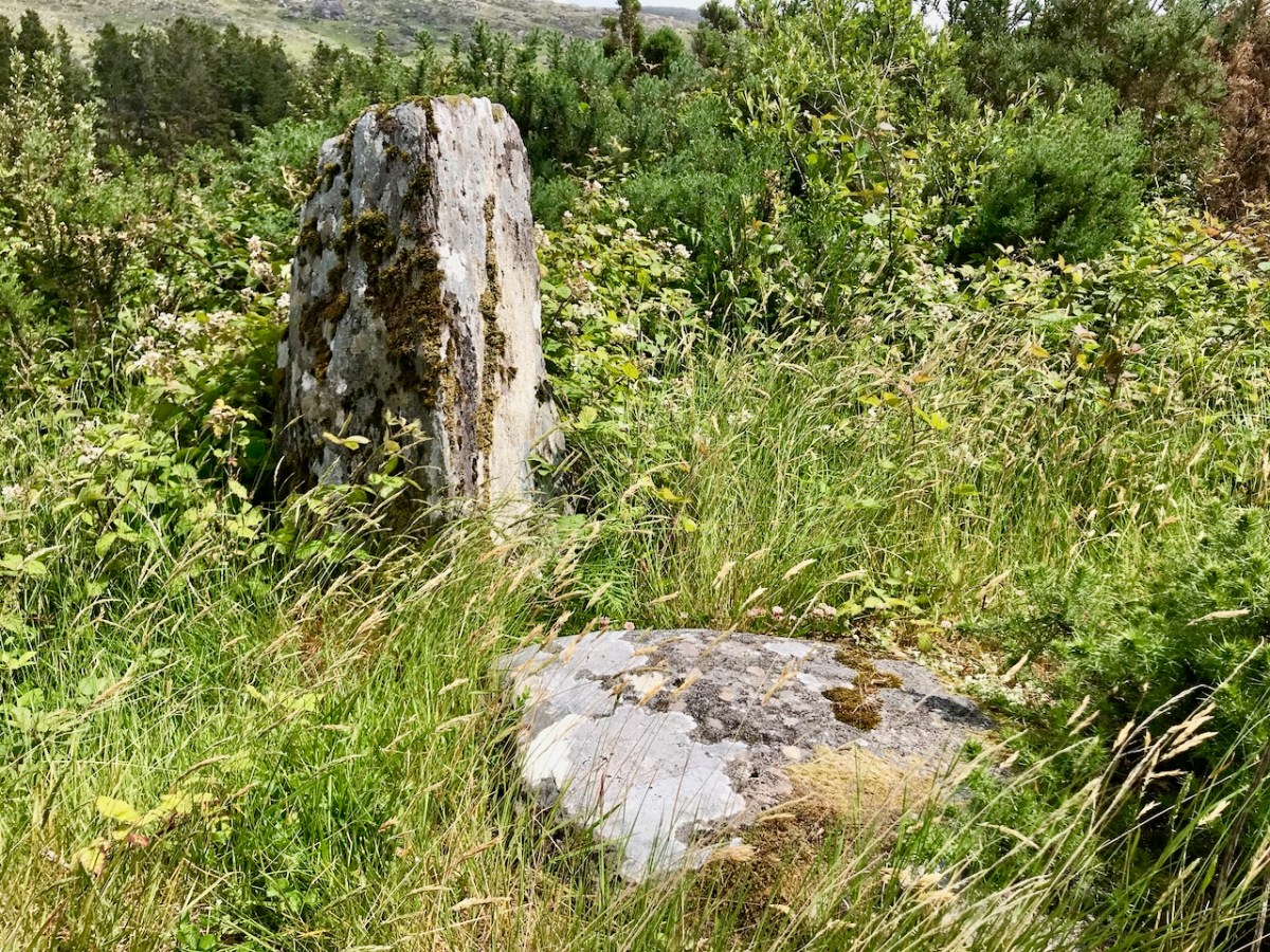
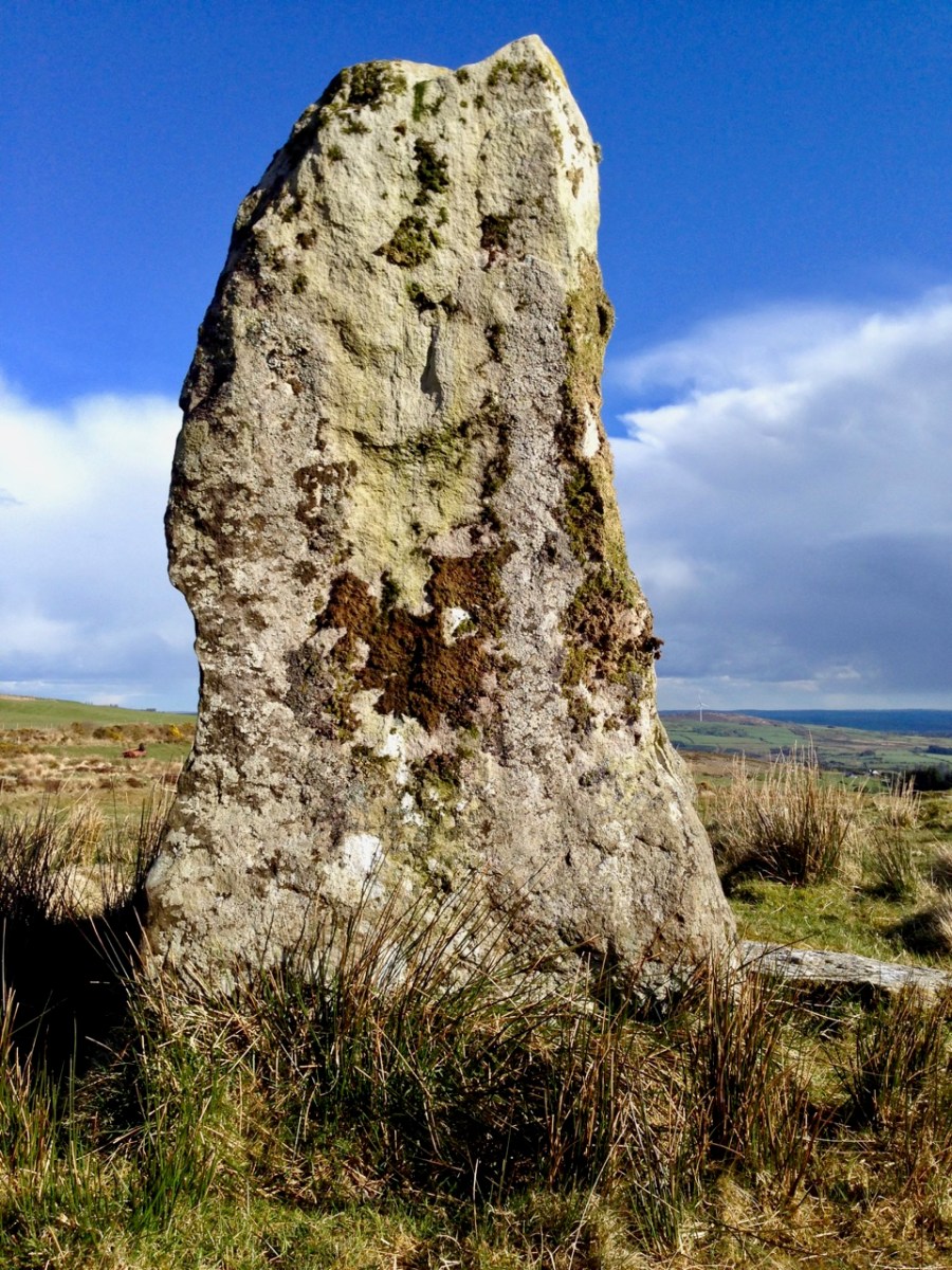
I am fascinated by the number of single standing stones we come across in our travels. It’s impossible to say how many there are in Ireland – probably thousands. And they can range in size from the large stones – above – in West Cork, to individual examples in moorland or fields, or on roadsides – below.

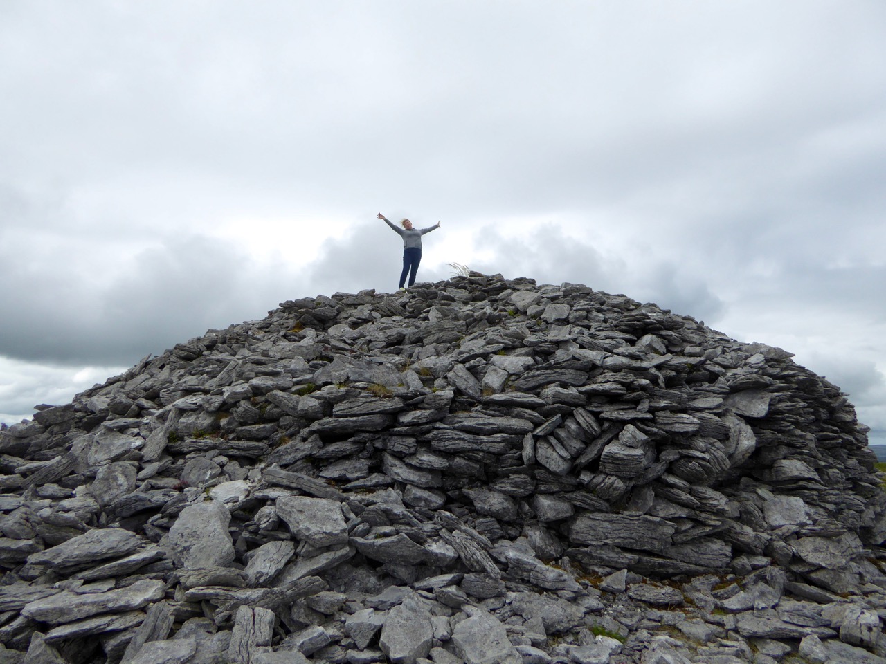
The Irish word ‘carn’ means a heap or pile of stones, Cairn monuments are mounds of stones, often marking the summit of a significant hill or mountain. They may or may not be ancient, and we have seen them change significantly over time. On Mount Corrin, not far from us in West Cork, there were two cairns only a few years ago. Now there is a single, significant cairn (top pic below): this implies a deliberate ‘re-ordering’ of what was there before. Regardless of their history, they can be visually impressive.

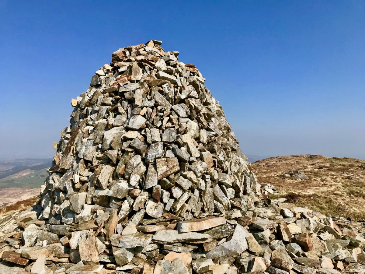
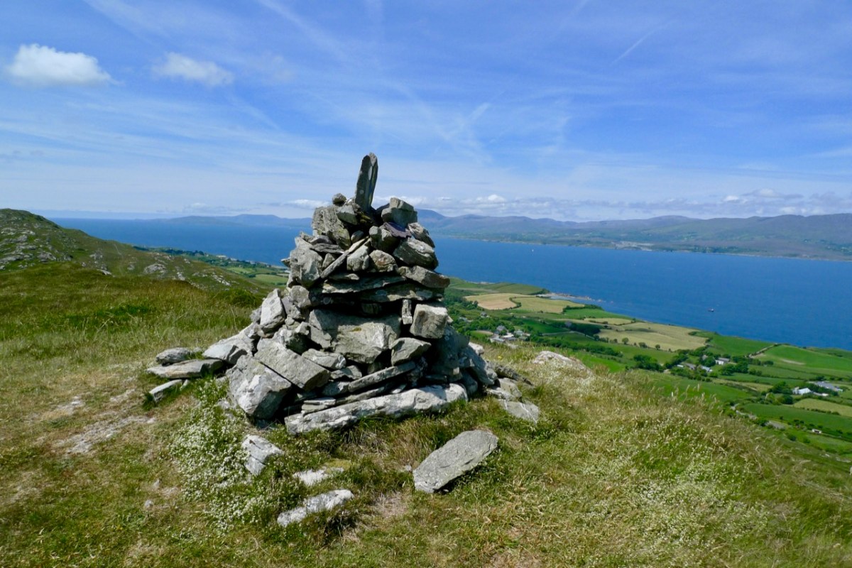
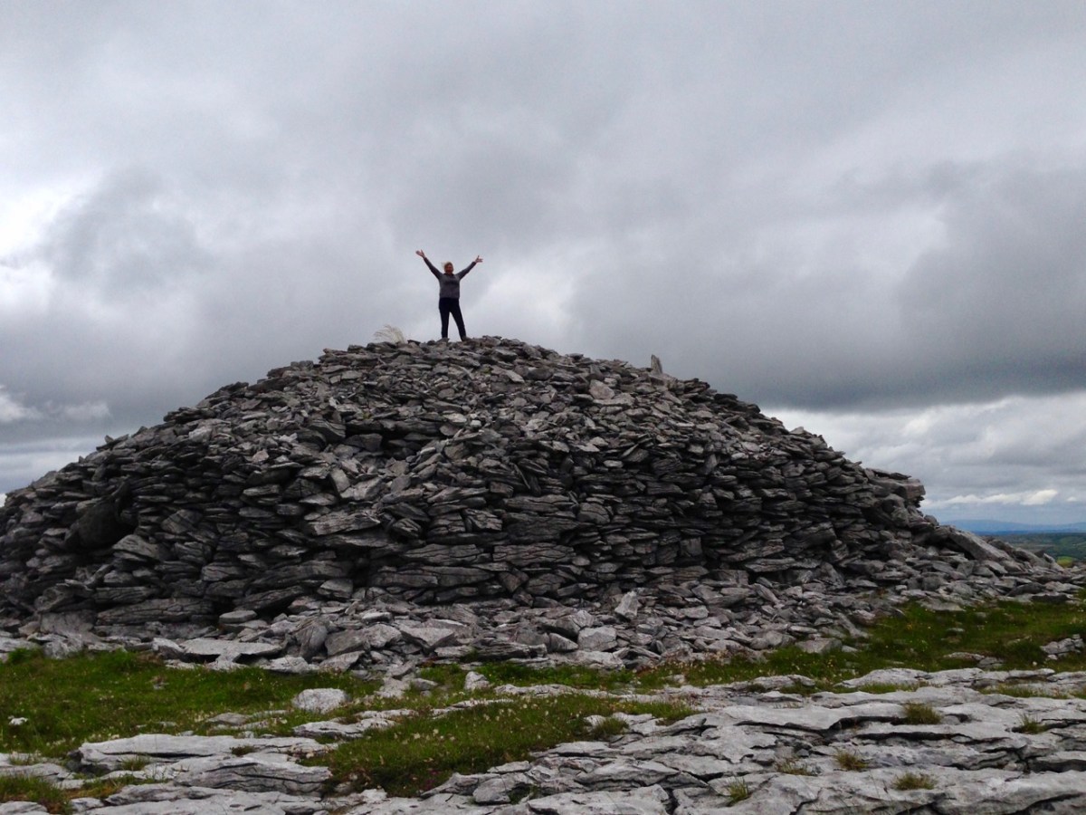
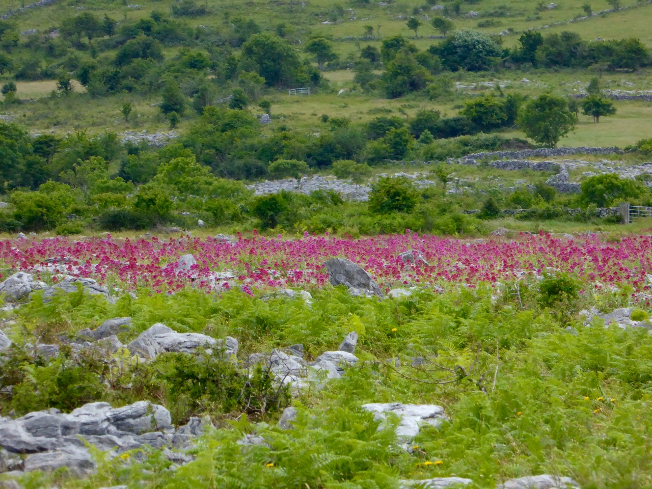
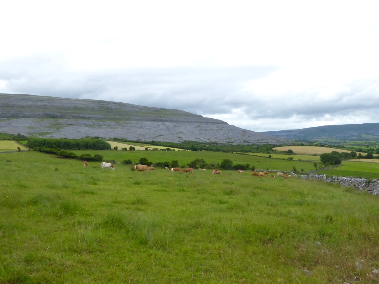
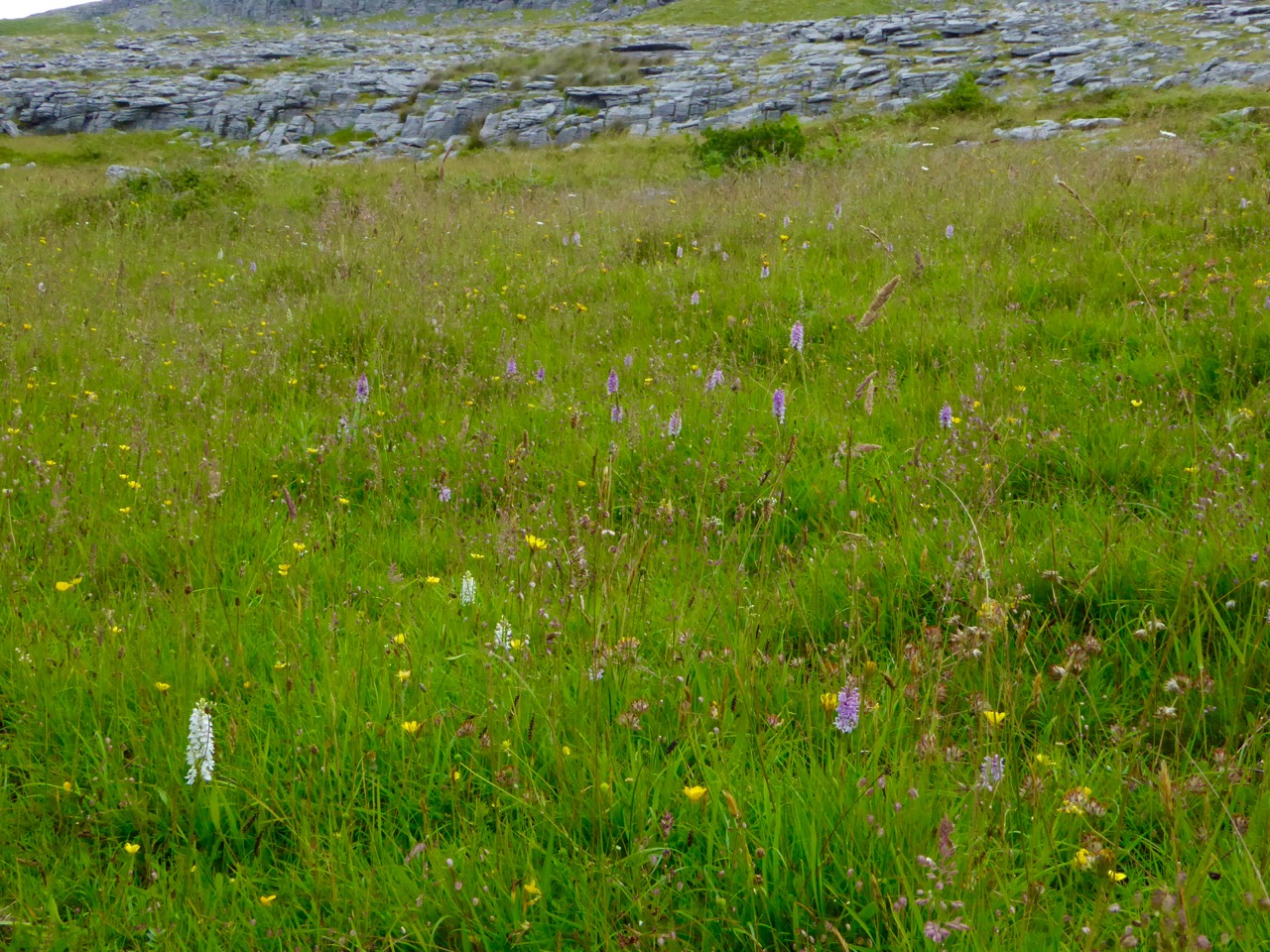
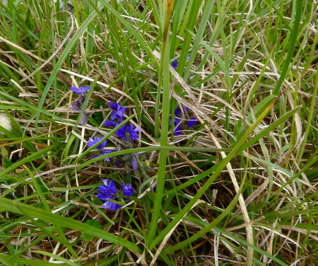
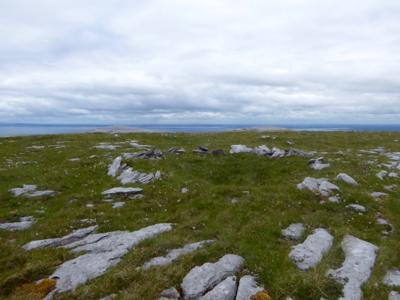
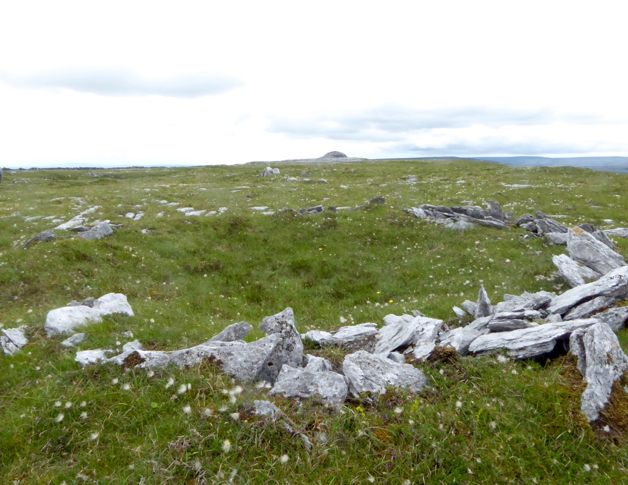
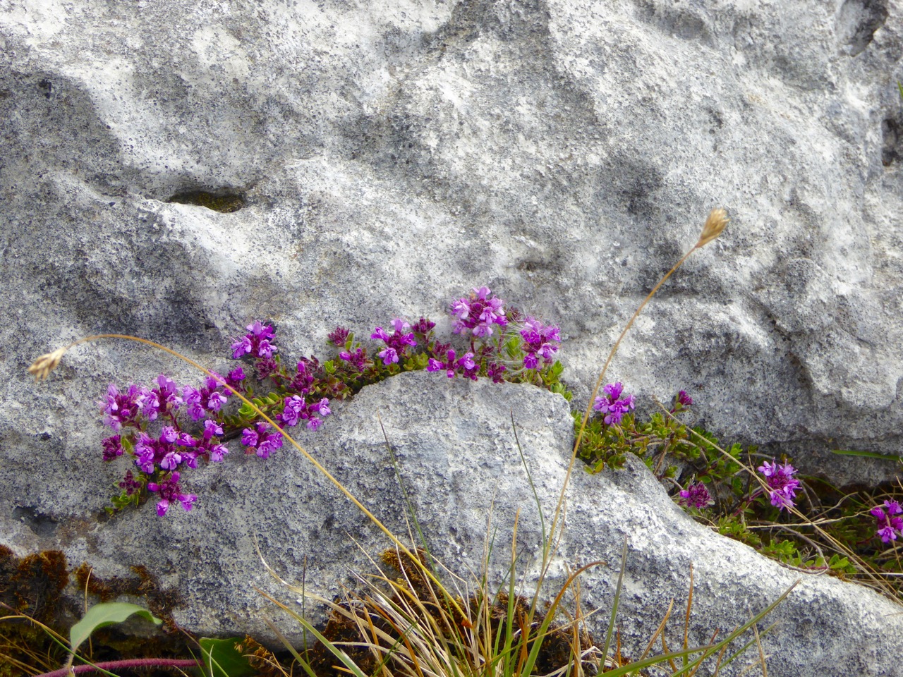
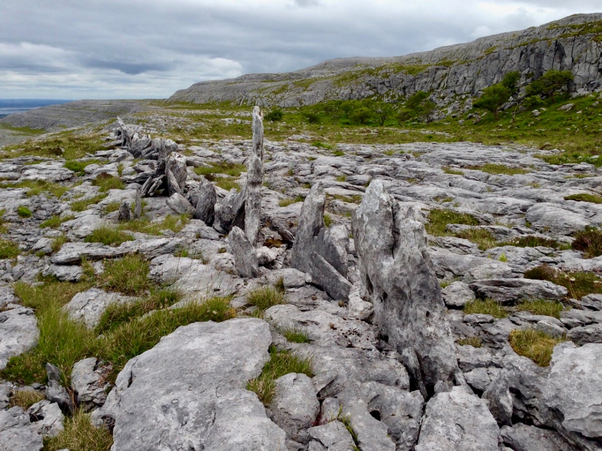
The centre pic above is a small cairn on a Sheep’s Head summit, while the enormous one above is in The Burren, County Clare. The Burren is an extraordinary landscape of exposed limestone. The limestone formed as sediments in a tropical sea which covered most of Ireland approximately 350 million years ago. Today, the Burren supports a remarkable assortment of wild flowers: over 70% of Ireland’s species of flowers are found there, among the ubiquitous stone surfaces.

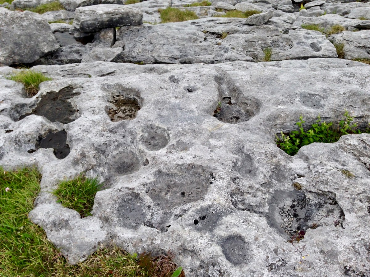
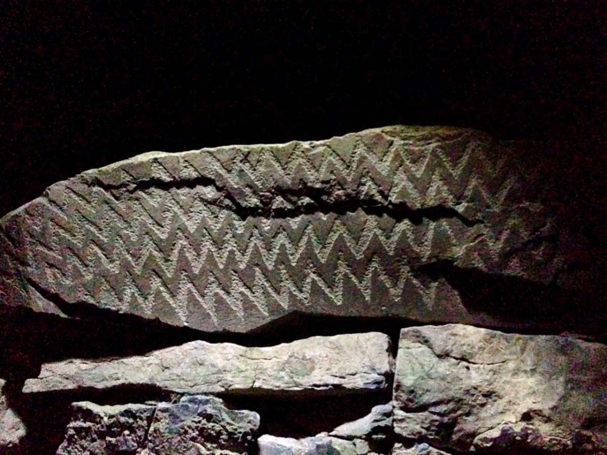
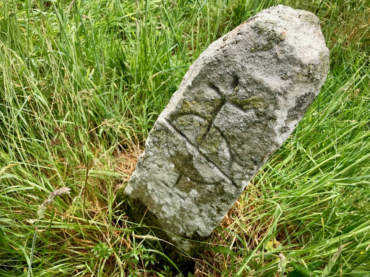
Ever since humans set foot on Irish soil, they have embraced the stones – both for practical uses such as shelter or enclosure, but also as a means of marking and communicating. Readers will be familiar with our particular interests in Prehistoric Rock Art:

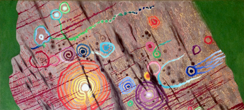
This is an important example of Ireland’s Rock Art, from West Cork, perhaps dating from 5,000 years ago: it was discovered in comparatively recent times. The painting is by Keith Payne, and is an interpretation of this same rock outcrop. We have no evidence that the carvings were ever coloured – or pigmented.

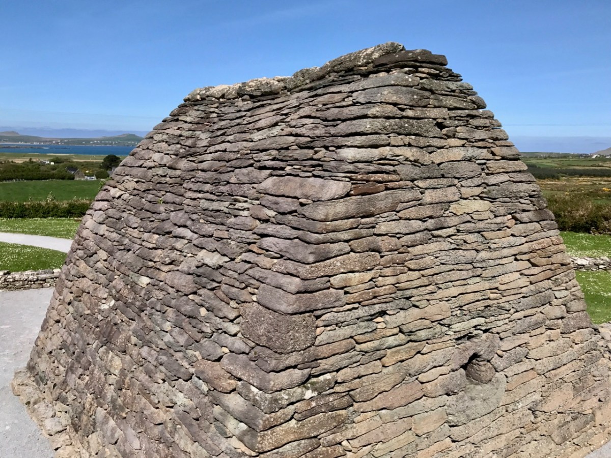
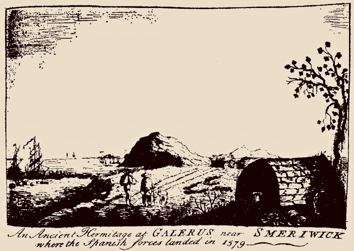
Today we are very familiar with the use of stone as a building material: this practice is likely to have been current since very early times. In Ireland we have many examples of ancient – but undateable – stone buildings. The ‘Oratory’ at Gallurus is a good example of a built enclosure (walls and roof) made entirely from stone. A present day view of it, top, shows this remarkably preserved structure; archaeologists and historians have long debated its age and likely use. The print above dates from 1756.

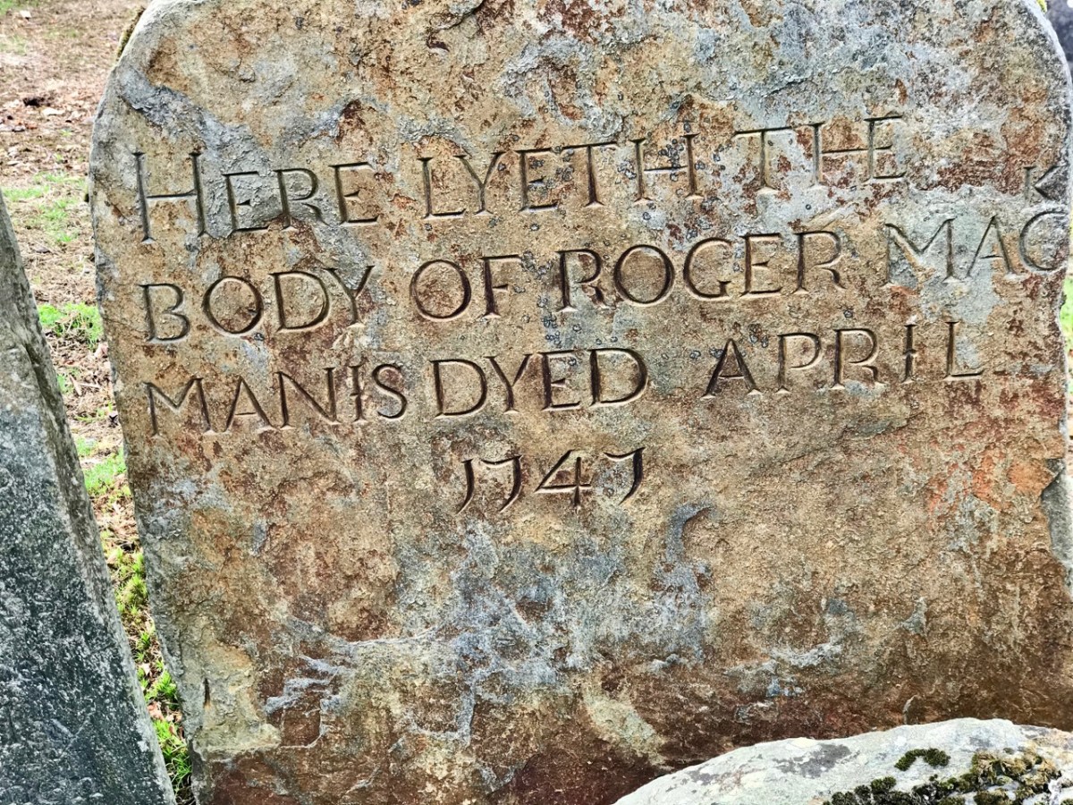
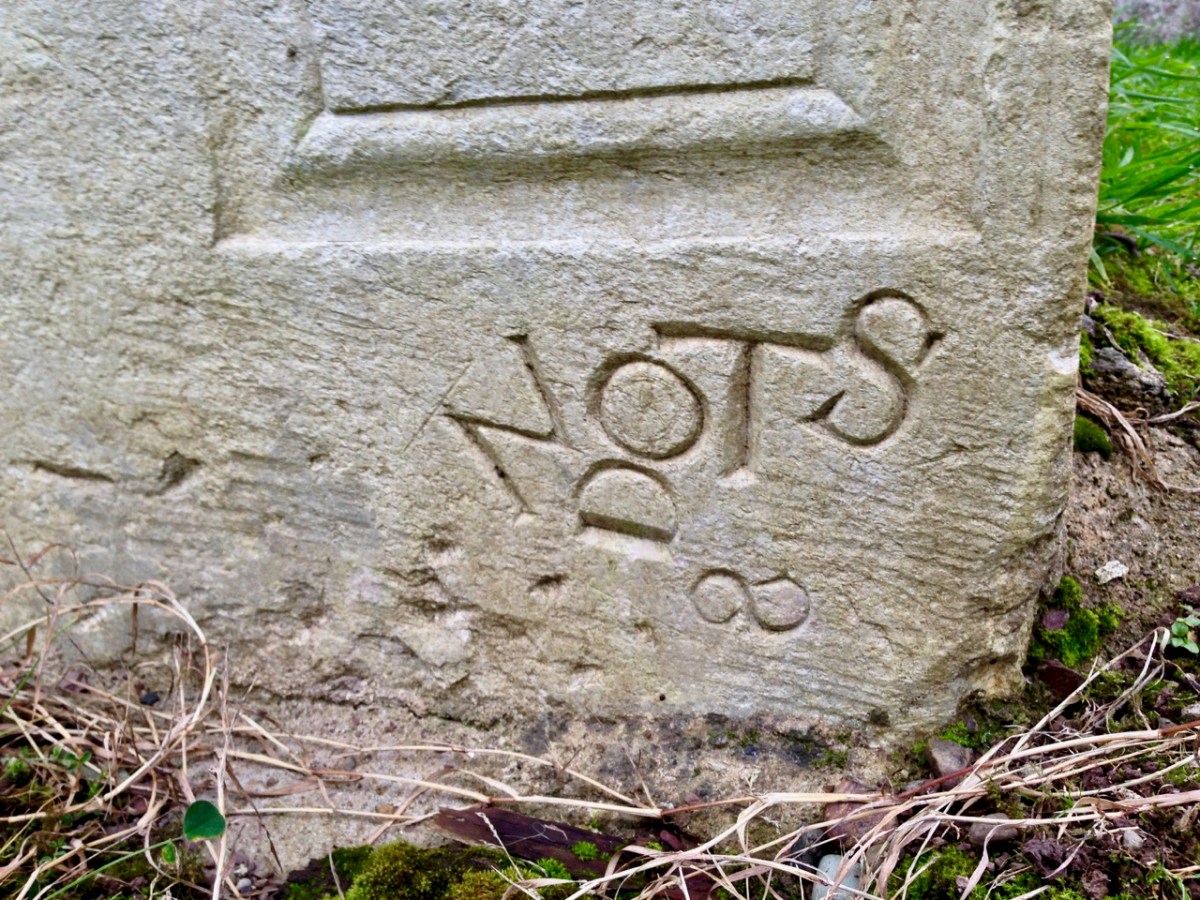
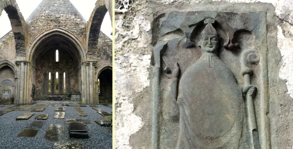
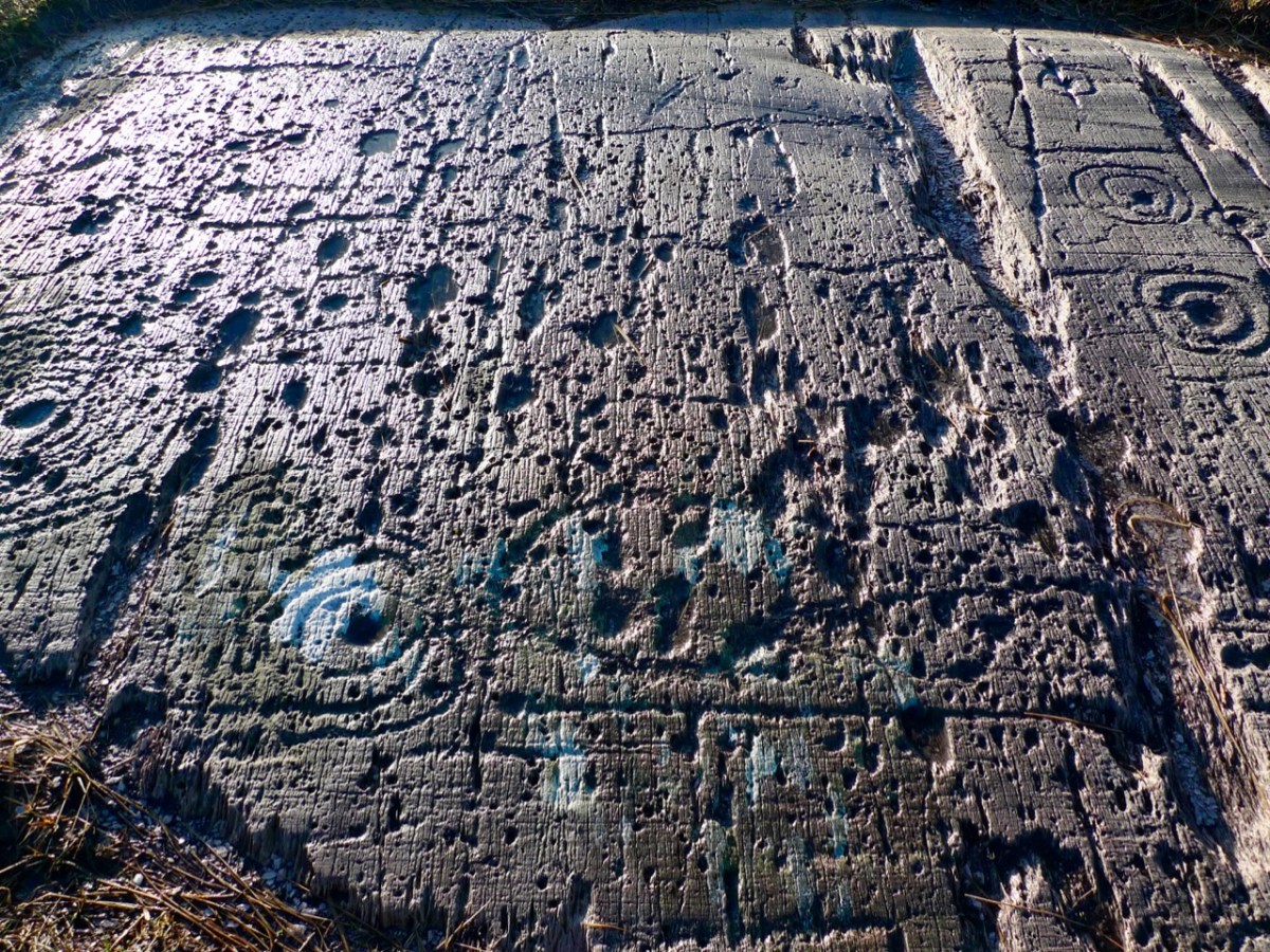
Over the centuries, crafstpeople (like Séamus Murphy – see last week’s post) have used stone as a medium for memorials – the message is likely to survive beyond lifetimes. If only we knew what some of the messages should spell out to us! Our last – striking – image is from Fourknocks – a decorated chambered cairn within the Boyne Valley complex which we visited in 2016. This carved decoration was probably made 5,000 years ago: we can only wonder at its meaning and its authors . . .

Susan’s Burren

Valerian

Valerian provides a carpet of red in a Burren field

We want ‘A Susan Day’, we told her – and what a day we got! Readers may remember our visit (Showing off West Cork) from Susan Byron of Ireland’s Hidden Gems. We’ve been planning a return visit ever since, so that Susan could show us HER Burren. 

Fields of Stone

I’ve written about the Burren before – the unique karst limestone landscape full of heritage and wildflowers in West Clare. But this time we had the benefit of Susan’s intimate knowledge of the place – she lives there and has been exploring it for years. Since we only had one full day, she planned an outing that covered everything we love about this part of Ireland – you’ll see what I mean.

DESTINATION
Our destination: Turlough Hill

Leaving the car in a convenient spot, we set off up a long green road, Susan pointing out the wildflowers as we walked, here and throughout the day. We stopped at numerous places to admire features in the landscape: Corcomroe Abbey, for example, lay below us in all its medieval glory.

Corcomroe

Corcomroe – a wonderful site to visit if you’re in this area

Our first real stop was St Colman’s Holy Well. It’s a beauty, with all the remote wildness that lends such atmosphere to these ancient sacred spots. One of our blogging heroes, Ali Isaac of the wonderfully researched and entertaining site Aliisaacstoryteller had visited this same route a couple of weeks earlier. We were walking in her footsteps, although in reverse. She tells of her journey here and has extensive details about the holy well and St Colman here.

St Colman's well

St Colman's Well 2

Robert and Susan at Colman’s Well and a peek into the interior of the well

Ali had walked through the Burren in time to see the last of the electric blue Gentians that grow here and in the Alps. They were gone by the time we got there, but we were not disappointed in the wildflowers, which were everywhere underfoot in the most prodigal abundance.

Carpet of Orchids

Bloody Cranesbill, left, and a white orchid

Brilliant magenta Bloody Cranesbill jostled with delicate Orchids and tiny yellow Potentilla (or Cinquefoil), while Wild Thyme scented the air. One field was awash in Valerian. A rare Lesser Butterfly Orchid was spotted in the long grass and lovely Burnet Roses in a hedge.

Clockwise from top left: Burnet Rose, Lesser Butterfly Orchid, Mountain Avens and Spotted Orchid

Milkworth

Milkworth lurking in the grasses

Hiking up Turlough Hill was an excellent opportunity to see how the Burren is laid out. From below, it looks like bare rock, but as you ascend, you realise that the hills are stepped in a series of terraces, the evidence of retreating beach levels after the ice age. These terraces provide important forage for sheep and cattle, who, in turn, help in the regeneration of the plant life. The going isn’t easy – we didn’t stick to any defined path but simply clambered up the steep slopes. The flat parts had been deeply rutted by cattle hoofs – we had to be vigilant to prevent stumbles and ankle injuries.

Turlough Terraces

But the rewards were enormous – ever-increasing panoramas of North Clare, across Galway Bay and south into the hinterland.

Cattle enclosure?

We had an objective in mind. At the top of Turlough Hill, and most visible in arial photographs, is a prehistoric ‘village’ of over 150 hut sites and some larger enclosures. On the summit is an enormous cairn.

Turlough Hill

Turlough Hill 2

Hut site and cairn

From the top: An aerial image of the hut circles and cairn (look closely!)  from the National Monuments Service, a hut circle looking north to the sea, a hut circle looking towards the cairn

This mysterious site has been the subject of an initial investigation to establish the extent of it. The report had this to say:

Even though the hut sites, in a morphological sense, are domestic in character, it is very hard to see their role and function as primarily domestic, considering their location on this inaccessible and exposed hilltop. The activity that required the building of about 150 hut sites on this inaccessible and extremely windy summit, consisting mainly of bare bedrock, was most likely of a strong social and/or ritual character, with few direct links to secular way of life.

Susan on Cairn

This will give you a sense of how huge the cairn is

Earlier this year, Dr Stefan Bergh of UCG conducted a preliminary excavation within the hut-site concentration. You can read about that in this Irish Times piece. We saw the neatly back-filled trench, and look forward to his results.

Trench

Coming down, as all hikers know, is often more difficult than going up – the knees certainly protest! In this case, some chunks of it were accomplished by dint of sliding down on my butt and picking the thorns out afterwards. Oh – and the tick! Do check yourself after all walks in long grass where cattle and sheep have been grazing.

From the Cairn

The view from the cairn

We ended up at an early medieval site that quickly banished all thoughts of aching muscles – Oughtmama, of the Seven Churches. Meaning The Breast of the High Pass, there are actually only three churches at Oughtmama, but they pre-date the 12th century Cistercian foundation at Corcomroe, and as such they are excellent examples of early monastic structures in the Romanesque tradition.

Oughtmama Churches

There are several examples of churches built with ‘cyclopean’ masonry in Clare, and here at Oughtmama you can see the huge stones used in the courses of the outer walls that give it this name. Associated with St Colman (of the Holy Well) these churches probably fell into decline after Corcomroe was completed.

We hiked back to the car in the soft afternoon sunlight. It’s hard to believe that one day could be so packed with experiences. Thank you, Susan, for sharing YOUR Burren with us. We’ll be back – we’ll let you know when to put the kettle on again.

Wild Thyme

Wild Mountain Thyme

Up the Airy Mountain…

Shadow and light

…down the rushy glen – we daren’t go a-hunting for fear of little men! We were hunting mountains last week when we travelled up the west coast of Ireland with a visiting friend – finding some of the best scenery this country has to offer.

Connemara 2

If you look down on the island from above (as in this view from NASA, below) the lie of the land is very clear: the high points are all around the perimeters, yellow and brown in colour, with lower green plains in the centre.

nasa imageIf you lived in a country like Canada, then Ireland’s mountains should seem like mere gentle slopes. Our highest peak is not too far from us, up in Kerry, Carrauntoohil (Irish: Corrán Tuathail – this could mean Tuathal’s sickle or fang, Tuathal having been a common Irish name in medieval times) and this is only 1038 metres to the summit. However, the overriding characteristic of Irish mountains is that they often sweep steeply down to the sea or to a lough and are therefore visually spectacular in their settings.

We live in the far south-west: our mountains form the backbone of each of the peninsulas: The Mizen, Sheep’s Head, Beara, Iveragh and Dingle, largely Old Red Sandstone with some Carboniferous Limestone north of Killarney. Our travels took us up to Clare – very distinctive exposed limestone ‘pavements’ and mountain tops – and then to the complexities of granite, schists and gneisses found in the district of Connemara.

Connemara 3

Connemara fence

The four pictures above show the elements of the landscape in Connemara, Co Galway: quiet boreens, reflective water and dramatic mountains

The Irish landscape -and, particularly, her mountains – has long been the inspiration for artists and poets. The work of Paul Henry (1877 – 1958) is sparse and flat, yet expertly captures the character of the high lands of the west. It has been used over and over again in tourist advertising campaigns.

Paul Henry’s work was part of popular culture during his lifetime (above): now his art is very collectible and can be found in international galleries (below)

Killary Harbour

Killary Harbour, Connemara (above) and in Paul Henry’s landscape (above left) is said to be Ireland’s only true fjord (a flooded valley cut by glacial erosion which outlets to the sea): in the foreground are mussel ropes

irish mountain postcard

We stayed in the Lough Inagh Lodge – a comfortable hotel with great character and superb views to the mountains. There I was pleased to discover two original oil paintings by Leon O’Kennedy (1900 – 1979), a little known artist  who travelled mainly in the west of Ireland and, evidently, sold his work by knocking on doors. The hotel’s paintings might have arrived in this way as they depict local views: the prism shaped peat stacks are still very much in evidence in Connemara.

O Kennedy 1

O Kennedy 2

Connemara (which derives from Conmhaicne Mara meaning: descendants of Con Mhac, of the sea) is partly in County Galway and partly in County Mayo, in the province of Connacht. We were there only two days and barely did it justice. We intend to return and get to know it more intimately. In terms of our tour of Ireland’s mountainous districts it was the icing on the cake, but that in no way lessens the particular beauty of the other places we encountered – the strangely haunting limestone heights of Clare and the perennial grandeur of Killarney: all are experiences not to be missed.

rainbow over burren

Killarney

Limestone landscape in the Burren, Clare (top) and the lakes of Killarney, Kerry (above)

Fairy Tree

…By the craggy hillside,

Through the mosses bare,

They have planted thorn-trees,

For pleasure here and there.

Is any man so daring

As dig them up in spite,

He shall find their sharpest thorns

In his bed at night.

Up the airy mountain,

Down the rushy glen,

We daren’t go a-hunting

For fear of little men.

Wee folk, good folk,

Trooping all together;

Green jacket, red cap,

And white owl’s feather!

from The Fairies by William Allingham

A Week in Clare

Even on a cloudy day, the Lakes of Killarney are breathtaking

Even on a cloudy day, the Lakes of Killarney are breathtaking

From West Cork, the whole of the southwest of Ireland is within easy reach. Killarney is an hour and half straight north, through magnificent mountain scenery. Another hour brings you to Tarbert, on the banks of the Shannon Estuary. Take the ferry across to Killimer, and you’re in County Clare. For the trip last week, our lodging was a beautiful holiday home in Liscannor, owned by a generous friend. It’s about half way up the County, right beside the famous Cliffs of Moher – an ideal base for exploring Clare.

Anchor Inn, Liscannor. Best food in Clare!

Anchor Inn, Liscannor. Best food in Clare! This is the bar/grocery section.

While Robert attended the annual Noel Hill Concertina School I became a tourist. Clare is an astoundingly fertile area for geography, history, archaeology and culture and a wonderful place to spend time exploring with a map and guide book. I highly recommend The Burren and the Aran Islands: Exploring the Archaeology, by Carleton Jones – one of the best guides of its kind I have ever used. I was also lucky to have met a new friend online recently, Susan Byron, and in Clare I met her in person. The brains behind Ireland’s Hidden Gems, she gave me all kinds of great advice, along with lashings of tea and apple pie, about how to spend my time here.

Burren Landscape

Burren Landscape

For this visit, I confined my travels more or less to the area known as The Burren, which occupies the northern third of the county. It is a striking landscape of bare limestone hills – a karst formation full of caves and limestone ‘pavements’ and home to many species of rare and colourful wildflowers. No flowers yet – it’s still too cold. Too cold for other tourists too, so I had most places to myself. It rained and it hailed and the winds blew mightily, but in between the sun shone enough to imagine it was really spring. And if I got too cold, well, I retreated to the nearest friendly pub with a roaring fire and a pot of tea.

Eugene's Pub in Ennistymon/old ad in Valughan's in Kilfenora

Eugene’s Pub in Ennistymon/old ad in Vaughan’s in Kilfenora

The photographs I have chosen are a small selection of the sites I visited. One of the most iconic of all irish prehistoric sites is Poulnabrone portal tomb (what used to be called a dolmen). I don’t think it’s possible to take a bad photograph of it. Not too far away is Parknabinnia wedge tomb, another example of a neolithic stone monument. In researching this one on the internet I came across a recording on the excellent Voices From the Dawn site of an interview with 88 year old Paul Keane. Mr Keane’s story, familiar to us all over Ireland, illustrates how the beliefs of country people have kept these sites safe from depredation over many centuries.

Poulnabrone and Parknabinnia

Poulnabrone and Parknabinnia

Medieval ruins abound in Clare. I went twice to Corcomroe to admire the stonework, to Dysert O’Dea (one of the most impressive Hiberno-Romanesque doorways I have ever seen, ruined abbey, round tower, an unusual high cross and 15th century castle) and Kilfenora, where the crosses are stored in the ruined church under a glass roof.

Corcomroe Abbey. 13th Century Cistercian Monastery

Corcomroe Abbey, 13th Century Cistercian Monastery

I also took in, although I have not illustrated, a church in Killinaboys with a sheelenagig (more on sheelanagigs in an upcoming post) and one in Noughaval to view the ‘cyclopean’ masonry. I spent a fruitless couple of hours, as the light was fading, trying to find a way to visit a particular stone cashel but had to give up – there’s lots to see but not everything is signposted, close to a road, or down a grassy boreen.

Dysert O'Dea and Kilfenora

Dysert O’Dea and Kilfenora

Robert has written about the incredible music scene we were part of in Clare, something that is also accessible to anyone who visits. The wonders of Ireland- no matter where you go, there’s so much to do and see! If you’re coming, try to fit in some time in Clare.

Finally – a piece of whimsy. Indulge me….

First century BC Chinese head from the Terracotta Warriers; 12th Century Irish head from the Dysert O’Dea Romanesque doorway; 21st Century American head from Wrestlemania.

Just sayin’…

Dysert Fu1