Mizen Magic 9: Rossbrin to Schull

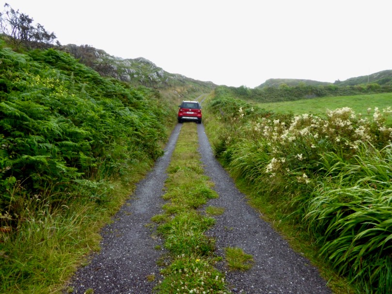
There’s a main road between Ballydehob and Schull, and then there’s a back road – a road that meanders through farmland and down half-forgotten boreens, a road lined with wildflowers and dotted with the remains of past history, a road that looks over once-inhabited islands. South of this road lies Mizen Magic 9.

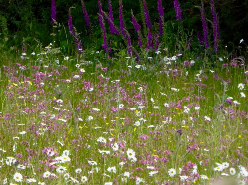
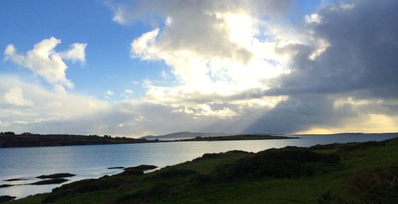
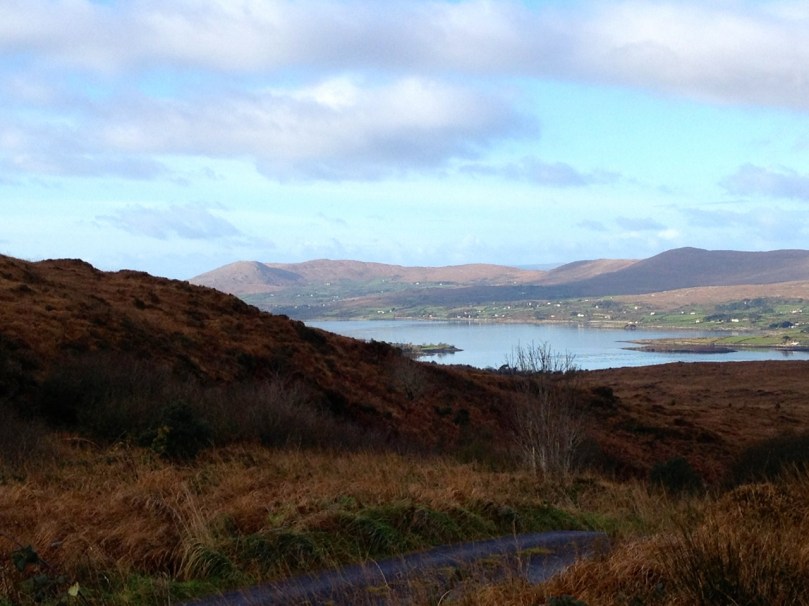
Along the back road in early summer

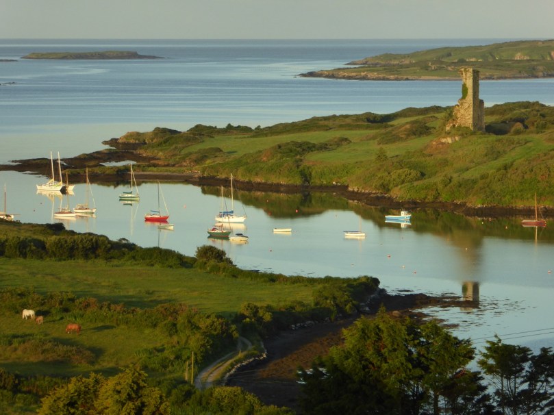
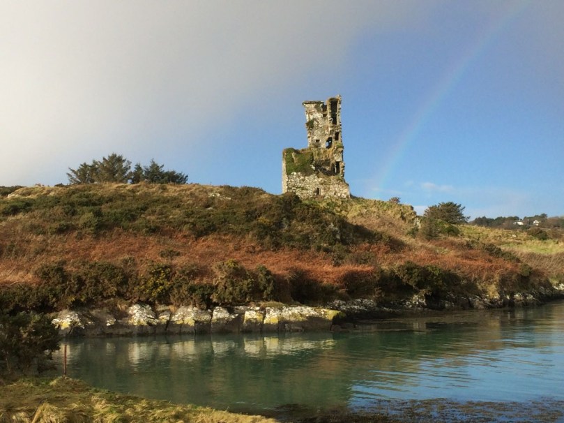
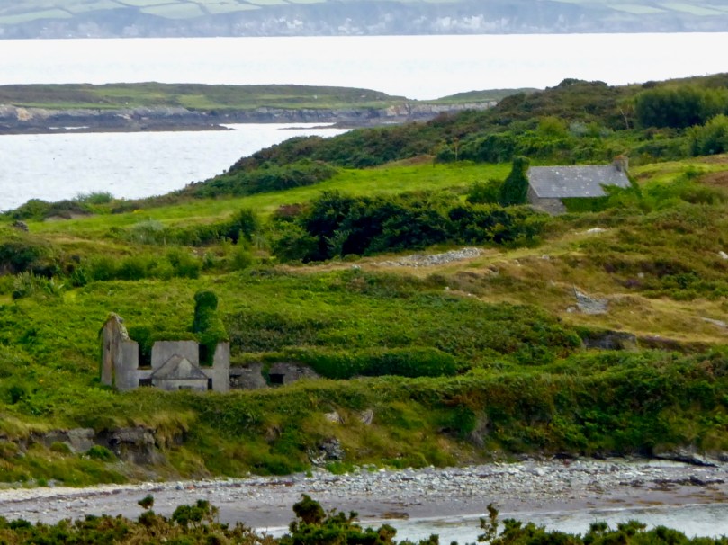
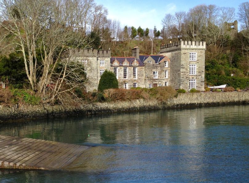
We’ll start at Rossbrin Cove – a place that Robert has written about over and over, like any writer with his own ‘territory.’ This was the home, in the 15th century, of Fineen O’Mahony, the Scholar Prince of Rossbrin.

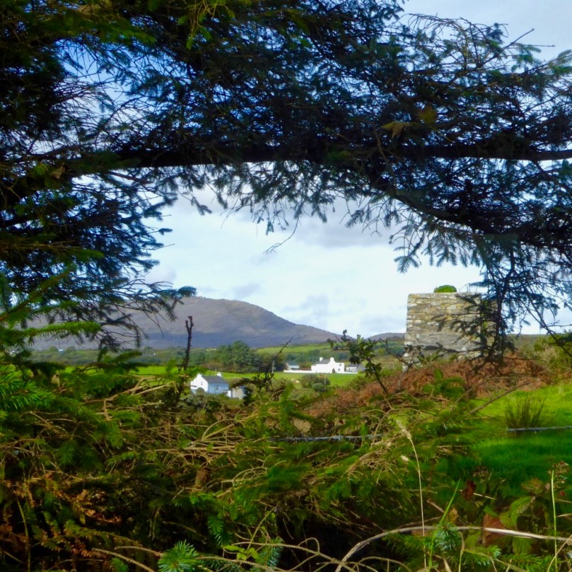
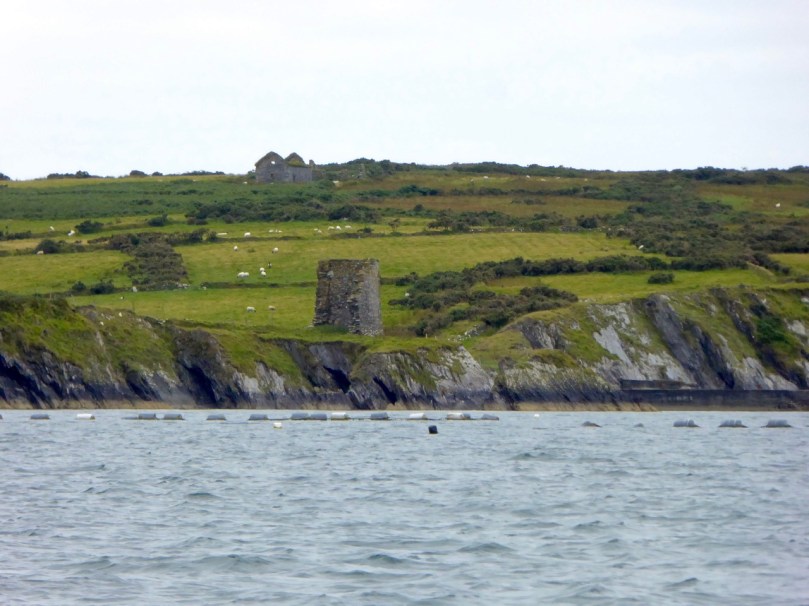
Looking down now on what’s left of his castle, it’s hard to imagine that this was a place teeming with life and learning – a mini-university where scribes and poets and translators transcribed to vellum (and to paper – a first in Ireland) psalters, medical tracts and even the travels of Sir John Mandeville. The castle has been in ruins since the 1600s, and we live in fear that the next storm will bring the last of it down.

Rossbrin Castle from the sea

The road runs through the townlands of Rossbrin, Ballycummisk, Kilbronogue, Derreennatra and Coosheen. Ballycummisk has a wedge tomb from the Bronze Age and a ring fort from the Early Medieval period – just to remind you that you are far from the first to want to settle in this place. In more recent times, and like Horse Island, it was once the centre of a thriving mining industry, but a spoil heap and stone pillars are all that remain.

Large ring fort, and the remains of mining activity, in Ballycummisk

Two islands dominate the views of Roaringwater Bay along this road. The first is Horse Island, owned now by one family, with its industrial past a distant memory. There have been various plans for Horse Island in recent years – a resort, a distillery – but so far it has resisted development.

Horse Island Miners in 1898 and the ruins of miners’ dwellings

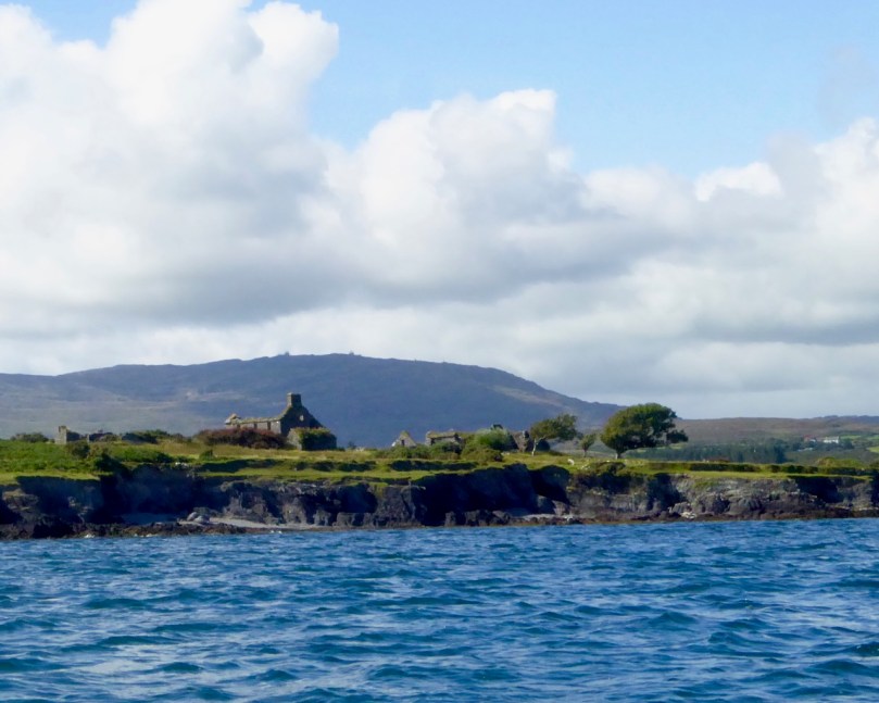
The other is Castle Island, home to yet another vestigial O’Mahony Castle – one of a string along the coastline, all within sight of each other and sited strategically to control the waters of Roaringwater Bay and their abundant resources.

There’s not much left of the castle on Castle Island

The O’Mahonys became fabulously wealthy in their day, charging for access to fishing and fish processing facilities and for supplies and fresh water. They also forged strong alliances with the Spanish and French fishermen and visitors who plied those waters – a friendship that was to cause great concern to the English crown and that was to spell, in part, their eventual downfall.

Ruined farm houses on Castle Island. The photograph was taken from a boat – that’s Mount Gabriel in the background

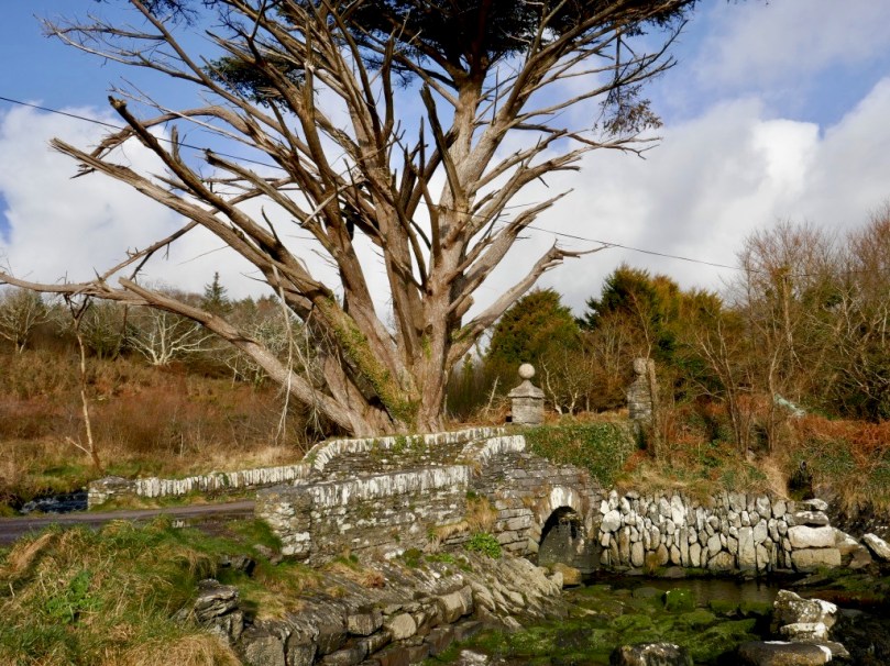
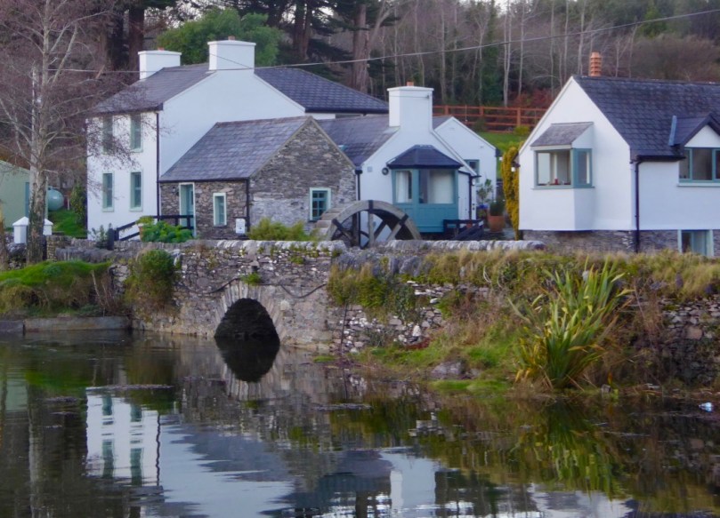
The closest spot to Castle Island (also uninhabited) is the beautiful little pier at Derreennatra. There is a large house up behind the pier, now inaccessible but once run as a guest house and famous for its hospitality. A curious bridge once gave access to the demesne and it remains a striking landscape feature, with its pillars and giant Macrocarpa tree.

Derreennatra Bridge

Continuing towards Schull we come to the last of the O’Mahony castles and the best preserved in this area. This is Ardintenant (probably Árd an Tinnean – Height of the Beacon – possibly referring to a function of the castle to alert others to the presence of foreign vessels) and it was the home of the Taoiseach, or Chief, of this O’Mahony sept.

Two ‘beacons,’ ancient and modern – Ardintenant or White Castle below and above it the signal stations on Mount Gabriel

The castle, or tower house, still has a discernible bawn with stretches of the wall and a corner tower still standing. If you want to learn more about our West Cork tower houses, see the posts When is a Castle..?; Illustrating the Tower House; and Tower House Tutorial, Part 1 and Part 2.

Ardintenant is also known as White Castle, a reference to the fact that it was once lime-washed and stood out (like a beacon!) to be visible for miles around. It appears to have been built on top of an earlier large ring-fort which in its own day was the Taoiseach’s residence before the fashion for tower house building.

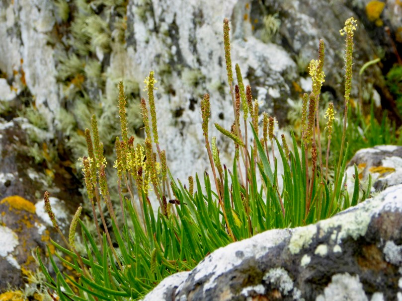
Sea Plantain at Coosheen

From Ardintenant we head south to Coosheen, a picturesque pebble beach known only to locals. It’s one of my favourite places to go to look for marine-adapted wildflowers. On a rainy day last August I saw Sea-kale, Sea-holly, Sea Plantain and Thrift, and drove back on a boreen lined with Meadowsweet and Wood Sage and past a standing stone whose purpose has been long-forgotten but that continues its vigil through the centuries.

Our final spot in Coosheen is Sheena Jolley’s mill house, now the gallery of this award-winning wildlife photographer. She has restored it beautifully and the gardens are a work-in-progress that manage to capitalise on, rather than overwhelm, the mill stream and the rocky site. This is also the starting point for the Butter Road walk – but that deserves a new post one of these days, a post in the Mizen Magic series. We have written one but it was a long time ago.

Take a walk, or a drive, down any part of this road – do it in summer when the boreens are heady with wildflowers, or do it in winter when the colours of the countryside are at their most vivid. Heck, do it any time!


Copper Country

Sheep's Head Copper Mine: Cornish mineworkers' cottages

Gortavallig Copper Mine, Sheep’s Head: Cornish mineworkers’ cottages

We live in the townland of Cappaghglass. I would love to say that the name derives from the metal that makes up much of its geology – copper, but Finola tells me that way of looking at it comes from my English accent: the Irish word for copper is Copair, while Cappa actually means meadow. Glas or glass means green so – prosaically speaking – we live in ‘Green Meadow’. However, as in so many cases, the history of this little bit of Ireland is writ clearly on the landscape and Cappaghglass is very much ‘copper country’.

Stub of 9th century Irish round tower? - No: 19th century copper mine workings in Cappaghglass. In front is the head of a shaft, behind is the remains of the mine chimney that fell in 2002; to the right are the old mine cottages

Stub of 9th century Irish round tower? – No: 19th century copper mine workings in Cappaghglass. In front is the head of a shaft, behind is the remains of the mine chimney that fell in 2002; to the right are the old mine cottages

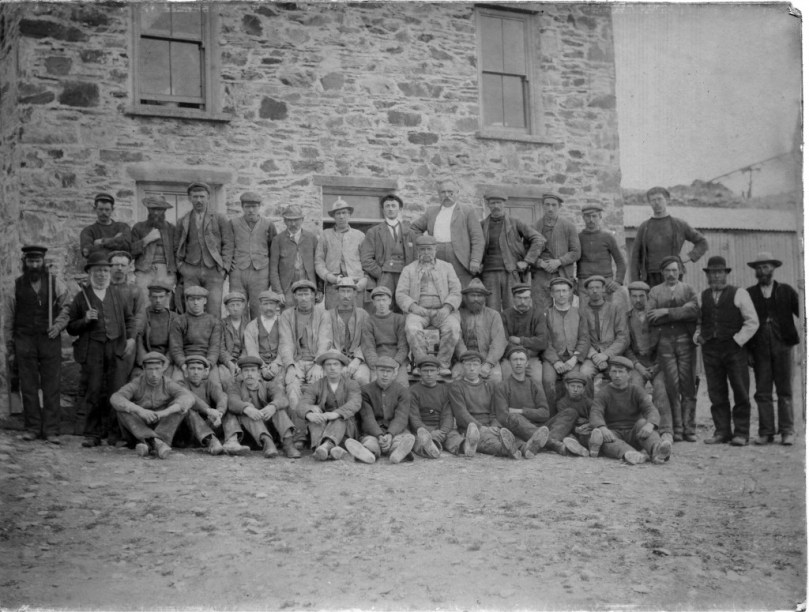
Our own house, Nead an Iolair, is built on territory that was once owned by a nineteenth century copper mine, and legend has it that our Calor gas tank is placed over an old mine shaft! We look out to Horse Island – one of Carbery’s Hundred Islands in Roaringwater Bay: it once supported a copper mine of the same period. Look at the photograph of the number of workers employed there at this time. Now there are merely a few holiday homes on the island.

Mineworkers on Horse Island: 19th century

Mineworkers on Horse Island: 19th century

Among the quiet fields and peaceful boreens our townland is strewn with evidence of the industry that once was here: old spoil heaps, barbed-wire protected shafts, supports for overhead ropeways and the base of a famous local landmark: the 20m tall Cappagh Mine chimney which came down in a lightning strike in 2002 which also severely damaged the Mine Captain’s House adjacent to it. Mining here commenced in 1820 and works ceased in 1874. Its best years were the decade 1863 to 1873, when 877 tons of bornite copper ore were produced.

cappamap2

Cappagh Mine: cross section, mine chimney (pre 2002) and our own mine shaft!

Cappagh Mine: cross section, mine chimney (pre 2002) and our own mine shaft!

***

We went off to the Sheep’s Head last week – in idyllic weather – and were shown the Copper Trail by friends Peter and Amanda. It feels so remote out there, yet the place was a hive of industry when mining was at its height during the Victorian age. I was fascinated by the row of Cornish miners’ cottages there, and the similarity between this site and the cliff-edge setting of some of the mines in West Cornwall, Botallack in particular. When exploring these pieces of industrial archaeology in Cornwall I was always struck by the incongruity of the incredibly beauty of the places – set against the blue background of the Atlantic – with the hardship and danger of the working conditions that must have prevailed. Here in West Cork, as there in Cornwall, shafts and galleries extended out under the sea bed and the men toiled away in cramped and perilous conditions with the sound of the booming waters above them, while on the surface women (bal maidens) and children worked equally hard preparing the ore for crushing and smelting.

botallack

Botallack Tin Mine, West Cornwall - romantic site now, but less benign in earlier days

Botallack Tin Mine, West Cornwall – a romantic site now, but less benign in earlier days

Far longer ago than the nineteenth century, West Cork was being worked for copper ore. On the steep sides of our local Mount Gabriel there is evidence of copper mining dating back 3500 years to the Bronze Age. UCC Professor of Archaeology William O’Brien carried out research and excavations during the 1980s and traced a number of mine workings from this time. The extraction was a well organised process: a supply of  good roundwood had to be stockpiled and fires were lit against the rock face where traces of ore were apparent. A hot fire was kept burning for several hours followed by dousing in cold water (of which a good supply was also needed), causing the rock surface to fracture, and this disturbed face was hacked off with stone mauls allowing the accumulation of small quantities of  malachite. Constant working on good seams led to excavation into the mountain side, and some shafts have been found extending to several metres. Water ingress was a problem and it seems likely that a system of bailing or pumping was necessary. Eventually the drowned shafts were abandoned and, over time, they became filled with a type of blanket bog. This helped to preserve some of the wooden implements used and – presumably – discarded in them: hammer handles, wedges, picks and shovels as well as planks and ladders; also pine chips apparently used for illumination.

Bronze Age industrial landscape

Copper Country: Mount Gabriel – once the haunt of Wolves and miners

There’s a whole lot more to be said – about why metal was so important in the Bronze Age (wealth, in one word) and the whole context of distribution, trade and the technology of bronze itself: bronze production is only possible by combining copper ore with tin, and this was not available locally. In all probability our Cornish and Iberian cousins were making contact with Ireland’s metallurgists thousands of years ago. Interesting that the Rock Art we find in these same hillsides – and which could date from the same period – also has parallels in Britain, Brittany and Iberia.

Bronze Age industrial landscape?

Bronze Age industrial landscape?

The Coast of West Cork

Coast of West Cork cover

Every personal library in West Cork, maybe in Ireland, has a copy of the book The Coast of West Cork by Peter Somerville-Large. First published in 1972, it is a classic of travel writing – amusing, learned, thoughtful – that still holds up as a fascinating portrayal of this part of the world. The photograph above is of the front cover of the book, signed by the author, that I brought with me to Canada when I emigrated in 1974. Forty years later, I am living on the very spot where this photograph was taken! It took me a while to figure this out, as the picture is actually reversed.

Peter Somerville-Large, now in his 80s, is still writing. He is connected to the old Castletownshend families (Edith Somerville was a relation and he mentions Townsend aunts) and was already very familiar with West Cork when he set out to tour it by bicycle in the spring of 1970. He takes every road, every byway and boreen, and describes in detail the scenery, the characters and the conditions along the way.

Grand road for cycling!

Grand road for cycling!

Far more than a travel diary, this is a comprehensive account of West Cork. Somerville-Large’s erudition is impressive. Either before or after his journey he spent many hours in the National Library, researching the history, folklore, archaeology and literature of the area and he weaves this knowledge seamlessly into his narrative. Because of his own personal background, he is able to include stories and anecdotes from the Big Houses of the gentry. A great aunt

“…remembered going down to a cellar which was filled with swords used to arm the tenants during the time of the Whiteboys and also with empty stone wine jars which had carried wine smuggled in from France. From this cellar there was believed to be a passage underground to the O’Driscoll Castle of Rincolisky, whose truncated remains are to be found in a neighbouring field…An earlier Townsend sent his…page down the passage to see if it was clear. The boy was never seen again.”

Castletownsend Castle

Castletownshend Castle

His affection for the place leads him to mourn the loss of population from the Islands of Roaringwater Bay.

“One by one the small islands became deserted…Only a few years ago I visited Horse Island, just opposite Ballydehob. The last people there, an elderly couple, were living all alone. It was summer, and the old man was sitting in a chair outside his house, his feet in a basin of water. His wife, behind him, fed hens. Next year, they were gone. The house, still intact and comfortable, stood empty, the linoleum in place, last year’s calendar on the wall. Down by the pier a plough had been thrown into the water where it looked like a gesture of despair.”

Looking across to Horse Island

Looking across to Horse Island

He documents the importance of the creamery in the social life of the townlands, the old occupations of fishing and mining and the loss of such sources of income, the string of castles that dot the coast and the great irish families that built them, the “brash new bungalows” springing up around the scenic areas, the awful legacy of the famine, and the sheer beauty of the scenery. He is conscious of a way of life passing. Going out of his way to visit a sweathouse (a feature of the Irish countryside in times past) he ends up in the O’Sullivan’s kitchen, drinking whiskey and eating biscuits.

“Mrs. Sullivan told me that the valley was once thickly populated, and when she was a girl there had been sixty children at the school that closed last year. The way of life had gone with it…Once it had been a great place to live in, her husband said. There were monthly fairs at Ballydehob and Schull, and he had walked all the way to Bantry with the cattle and all the way back again.”

Deserted cottage

Deserted cottage

The parts I have quoted deal with the area around where we live, but the bicycle trip stretches from Clonakilty to the Beara Peninsula. Describing West Cork as it was in 1970, it is now an important historical document in its own right, alongside such accounts as Thackery’s Irish Sketchbook of 1879, or the Pacata Hibernia of 1633. Mostly, however, it is a charming, engaging and fascinating depiction of a special place.

Over the hill to Durrus

Over the hill to Durrus