The Stone Circles of West Cork: An Introduction

Southwest Munster, and West Cork in particular, is home to the greatest concentration in Ireland of stone circles. There are two main kinds recorded in the National Monuments website, each making up about half the total number of circles – the multiple-stone circle and the five-stone circle. (There are also a small number of enigmatic monuments called ‘four posters’ which share some features with stone circles, but I will write about them some other time.) 

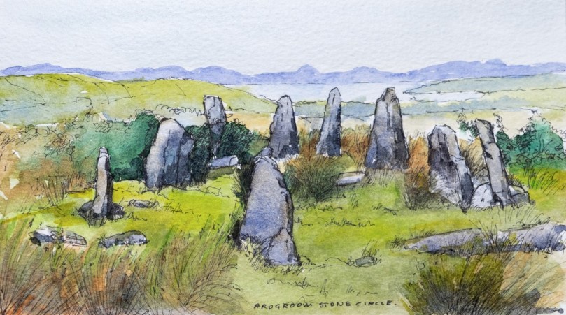
Peter Clarke’s illustration of the Ardgroom Stone Circle on the Beara, from his online journal, Hikelines

The division based on the number of stones is somewhat arbitrary, since both share most other features. Both have uneven numbers of stones – five in the case of the five-stone circle, and seven or more (up to 19) in the multiple-stone circles.

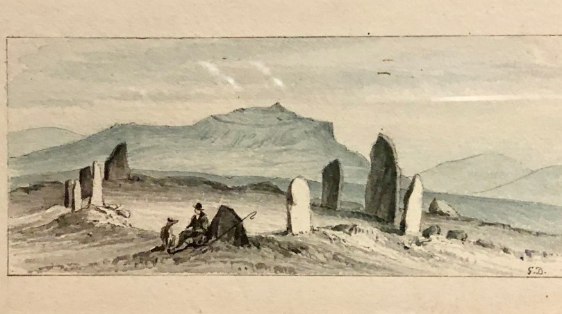
Our old friend Du Noyer loved to illustrate antiquities. We’re  not quite sure which stone circle this one is**

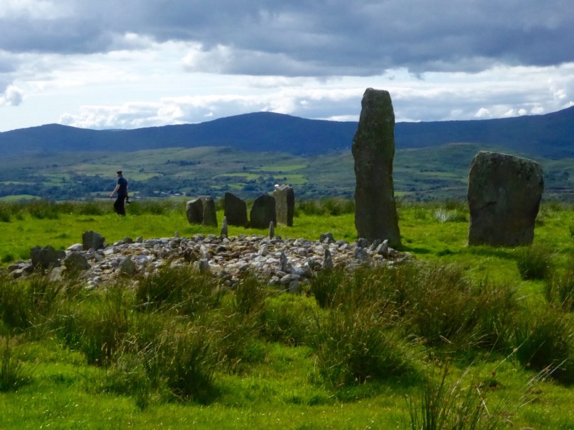
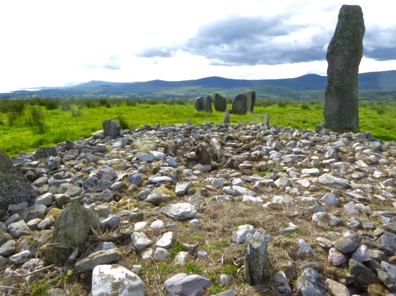
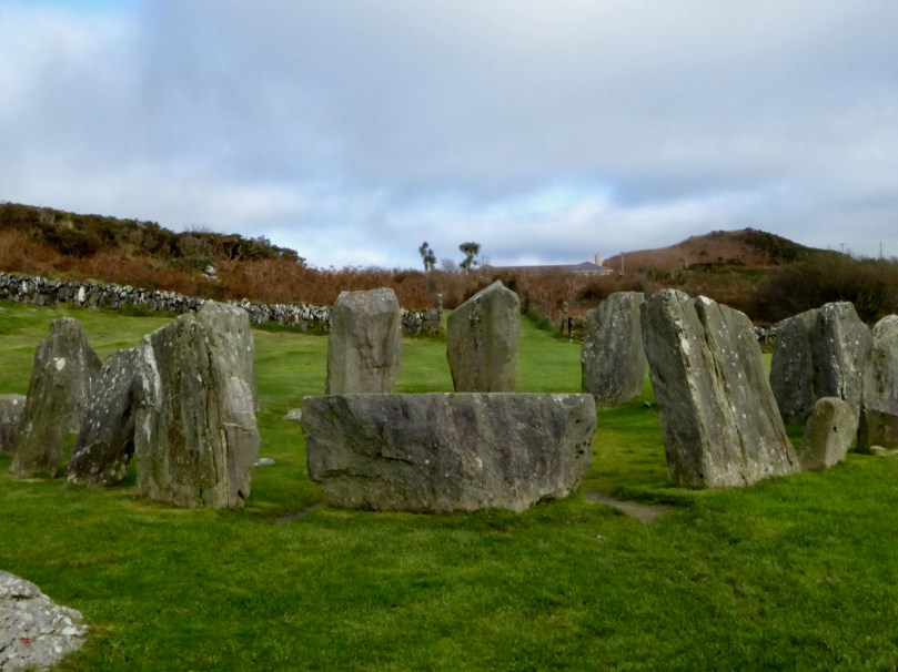
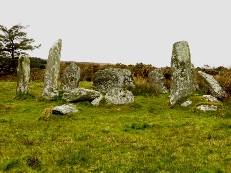
Both types are axial or recumbent stone circles. The name recumbent comes from the lowest stone in the circle, the only stone set on its side, with its long axis parallel to the ground. All the other stones are set upright and they often increase in size from the recumbent to the portal stones. The portals appear to form an entrance into the circles and are sometimes set end-on to the circle. An axis drawn from the point between the portals to the middle of the recumbent bisects the circle – hence the name axial stone circle. All these features can be seen in the photograph of Drombeg Stone Circle (below).

While the multiple-stones circles appear roughly circular, they may have been laid out using more complicated geometry than the string-marking-out-a-circle technique. Some are more elliptical than truly circular. The five-stone circles, given the dominance of the recumbent, are actually D-shaped.

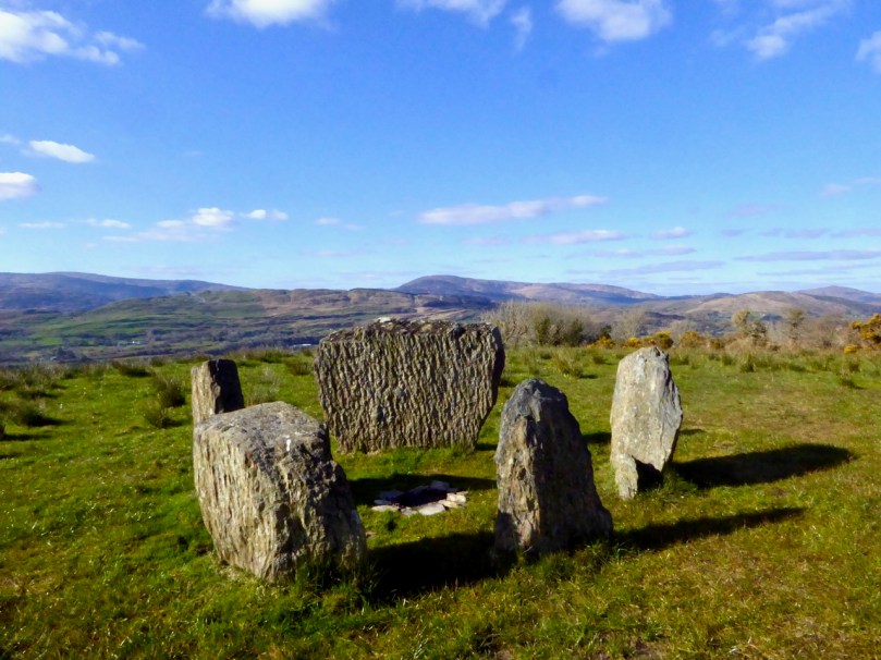
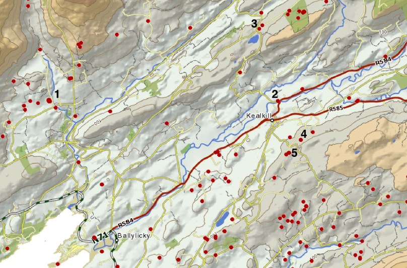
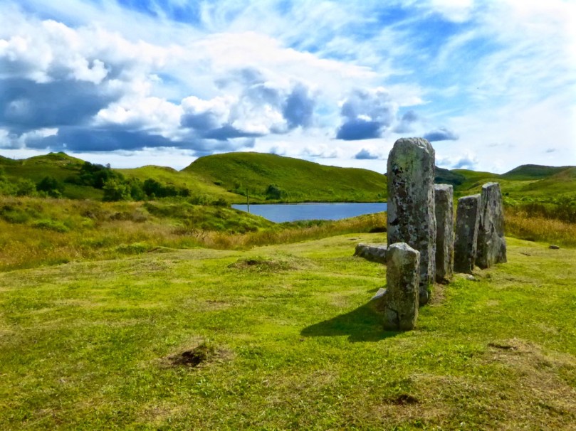
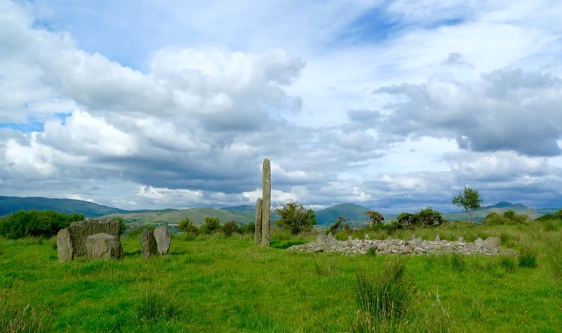
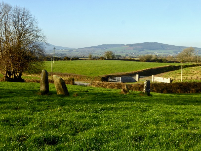
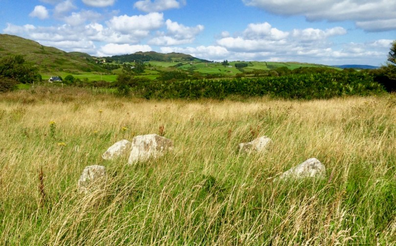
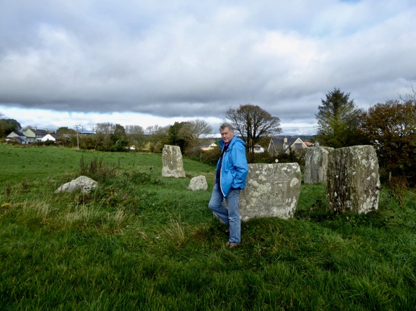
The five-stone circle which is part of the Kealkill complex

Many of our stone circles have disappeared over time, with only folkloric memory indicating that here was once a circle of stones. Some have lost stones over time, while in others uprights have collapsed. Whole monuments have vanished into forests or dense undergrowth. Even where we still have partial circles it can be difficult to make out which are the portals and which the recumbent.

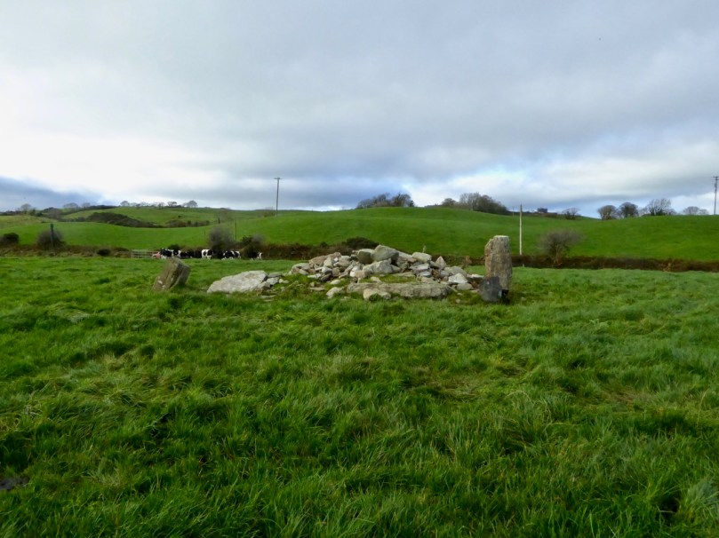
Upper: Labbamolaga – we think this was a stone circle but so few stones remain that it’s hard to be definitive. Lower: This sad little heap of stones is all that remains of the Ahagilla Stone Circle. The recumbent is to the left and a portal to the right.

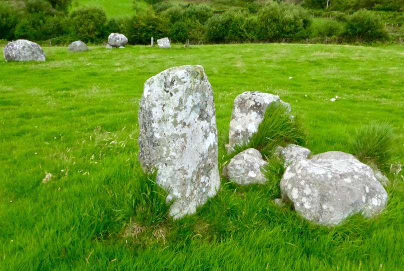
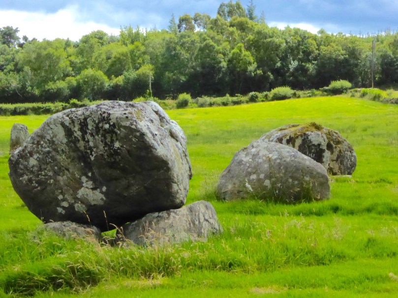
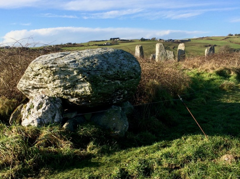
The circles are constructed from local stone and in some cases it is easy to see where they have been quarried from nearby rock outcrops. There is no evidence of the builders transporting the stones from elsewhere, with the exception, perhaps of the quartz blocks which are found occasionally either as uprights or associated with the circle inside or outside it. Although quartz is found in abundance in West Cork a large block of it may have been especially prized and reserved for such a situation.

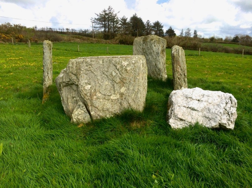
This sizeable quartz block lies beside the Lettergorman Five-Stone Circle

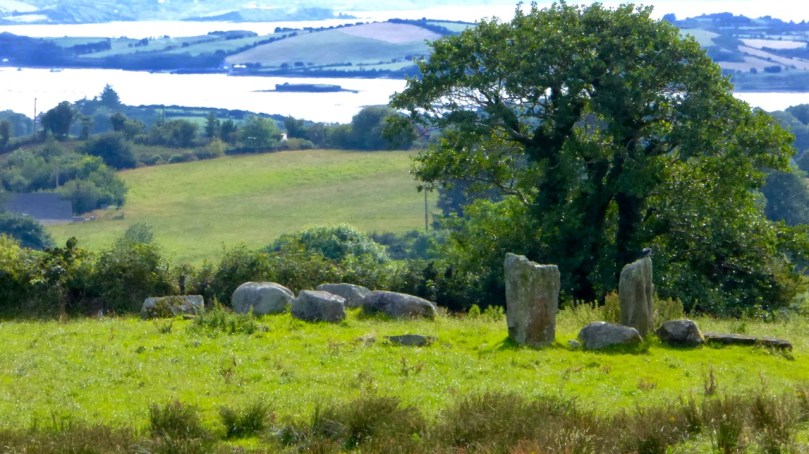
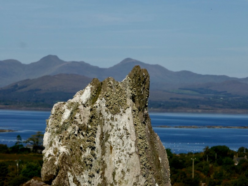
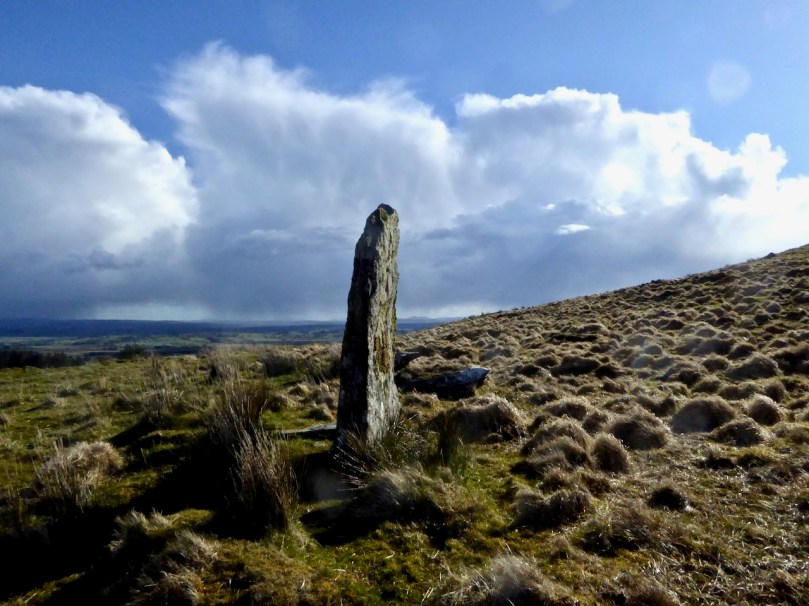
The circles were carefully and deliberately constructed: Fahy’s excavations at Drombeg and Reenascreena shows that the ground was levelled.  Stones were, it seems, selected for shape as well as size. The recumbent is usually flat on top, which may indicate the side closest to the parent rock from which it was split. Some may well have been deliberately shaped by knocking or splitting off sections – we often notice, for example, how well certain uprights mirror the landscape behind them, like the one at Ardgroom, below.

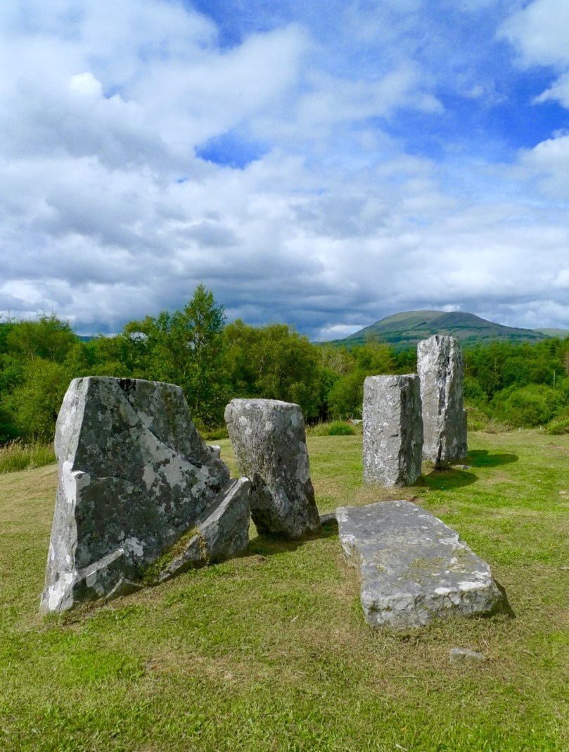
Stone circles are often associated with other monuments, most commonly boulder burials and standing stones, and at least two have radial stone cairns beside them. Some of the standing stones appear to function as outliers to the circle, extending alignments towards solar or lunar orientations (more of that next time).

Upper: This boulder burial is part of a complex of monuments at Bohonagh which also includes a stone circle (visible behind the boulder burial), a cupmarked stone and a standing stone which is no longer to be found. Lower: A standing stone pair (one fallen) at Knocknakilla with (behind it) a five-stone circle (recently fallen over) and a  radial stone cairn – of all the elements of this complex only this standing stone is really visible in the landscape

West Cork stone circles, from the sparse excavation evidence, date from the middle to late Bronze Age (about 1500 to 600BC). They are commonly found on elevated ground with a clear and expansive view southwards, but stretching from the northeast to the southwest – that portion of the sky in which both the sun and the moon rise and set.

This tiny monument is a five-stone circle at Inchybegga. When the grass grows tall enough you can’t see it at all

Our stone circles have always fascinated antiquarians, happy to label them ‘druidic temples’ or make outlandish claims about their construction by visiting Egyptians. Some of the older illustration owe more to the imagination than to accurate depictions.

Templebryan Stone Circle as it actually is (lower) and as depicted by the antiquarian, Clayton, in 1742 (upper). The illustration for Clayton, done by Ann la Bush, shows the fashionable preoccupation at the time for Egyptian-type obelisks. Nevertheless it is important in that it shows that there were more stones in the circle than there are now. Note the central block of quartz

In more recent times, they have been the subject of a great deal of new-age speculation about long-distance ley lines, mystical ‘energies,’ extra-terrestrial builders, associations with pagan goddess cults and the like. As an archaeologist, I think this is a pity, in the sense that these stone circles are fascinating enough as they are – they embody so much that we need to understand about the scientific knowledge, advanced construction technology, and social organisation of the builders. The belief systems that underlie their reasons for constructing these monuments are equally important and more difficult to discern after the passage of millennia, but should be based on close and serious study of the monuments themselves.

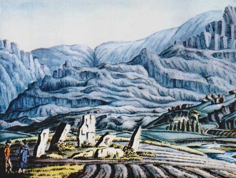
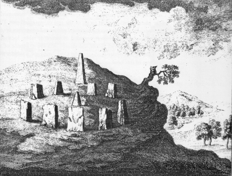
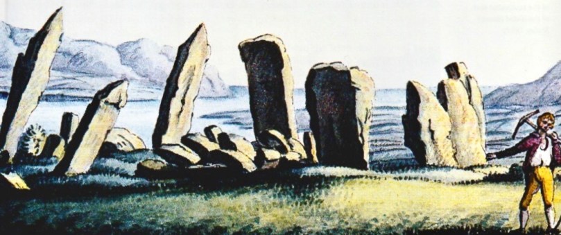
Above is the Derreenataggart Stone Circle on the Beara, and below is a much more romantic and monumental rendering of it from Francis Grose’s Antiquities of Ireland (1790s), illustrated by Daniel Grose. My lead image is also a Daniel Grose illustration, this time of a stone circle that once stood on the slopes of Hungry Hill, but which has since disappeared*

The next post in this series will be about the multiple-stone circles.

*The two illustrations by Daniel Gross are from Daniel Grose (c.1766-1838). The Antiquities of Ireland, a supplement to Francis Grose, by Roger Stalley, Irish Architectural Archive 1991
**I now know that this is almost certainly not a West Cork example but Boleycarrigeen in Wicklow (thanks to Ken Williams for the ID)

Standing Stone Pairs: A Visit to Foherlagh

An unexpected delight – a trip on a Sunny October afternoon to visit a very fine standing stone pair in Foherlagh, just north of Kilcoe Church and School on the N71, between Skibbereen and Ballydehob.

The trip was suggested by Amanda who was, of course, looking for a holy well, said to be associated with a mass rock. All of these – the standing stone pair, the holy well and the mass rock – were grouped in one place so we had to undertake this expedition! Thus we found ourselves knocking on the door of the genial farmer, Dennis Minihane, who donned wellies right away and took us up the hill behind his house.

The view from the top of the hill

We had no idea what would greet us, but as we ascended it dawned on us that the views were pretty spectacular. The standing stone pair came into view, and it was obvious they were enormous. When we reached the top we were greeting by a complete 360 degree panorama – south to the islands of Roaringwater Bay, west to Mount Gabriel, east to Baltimore and north to the hinterland. Kilcoe Castle glowed gently in the foreground, while far away we recognised the distinctive pyramid shape of the Mizen peak at the end of the Peninsula.

Looking toward the end of the Mizen Peninsula

Standing stone rows and pairs are a phenomenon of south west Ireland, and this part of West Cork has many examples. While there are about seventy rows of three to five stones (such as the Fingers at Garranes near Castletownsend, or the Maughnasilly row), there are over a hundred stone pairs, of which Foherlagh is a particularly fine example. Invariably their long axis (that is, standing at one end  and looking along the row or pair) is oriented northeast/southwest. Typically the stones are graded in height, with the taller stone (or tallest, in the case of a stone row) at the southwest end.

Garranes stone row, known as The Fingers, near Castletownshend

Sometimes stone pairs are associated with other monuments. We’ve visited, for example, the Kealkill complex, where a stone pair is associated with a five-stone circle and a radial cairn. There’s also the Coolcoulaghta pair, from which the Dunbeacon stone circle is clearly visible.

Upper: The Kealkill complex of monuments; Lower: the Coolcoulaghta standing stone pair (and the most unsympathetically situated electricity pole in Ireland) from which the Dunbeacon stone circle (now sadly coralled by a wooden fence) can be seen

In Foherlagh, however, there are no other prehistoric monuments apart from a single standing stone a few fields away. What there is, is a pointed outcrop which local tradition has identified as a mass rock – see our post Were You at the Rock? for more on this type of monument. The mass rock had a scoop-out in it that may have functioned as a wart well. Amanda was pleased to find this and no doubt will do her usual thorough write-up on Holy Wells of Cork.

The standing stone pair is clearly oriented northeast/southwest. Depending on where you stand, the axis may point to the Mizen Peak (as does the Altar Wedge Tomb further down the Peninsula) or to Mount Gabriel (as do most of the examples of rock art we have examined in this region). Wherever the line points, it is clear that the expansive views are to the south west.

In his examination of stone rows and pairs*, Seán Ó’Nualláin says “The stone rows and pairs then, like the stone circles, are built so that their long axes indicate a general alignment on the sector of the heavens in which the sun roses and sets, and both series tend to group in a position indicating a winter rather than a summer position for the sun.” He might have added that this is also true for the sector in which the moon rises and sets – Maughnasilly row, for example is associated with lunar, rather than solar, orientations.

Maughnasilly stone row on a dramatic day

Ó’Nualláin, based on excavated examples and clear associations, gives a likely Late Neolithic to Early Bronze Age date for stone pairs and rows. That would mean they were erected 3,000 to 5,000 years ago.

Jack Robert’s‘ drawing of the Foherlagh pair, from Exploring West Cork

But what was their function? Perhaps they were yet another element of the calendrical systems that seem to have been a vital part of this early agricultural society. They may also have been used as territory or routeway markers, or as memorial stones for individuals. Some archaeologists have suggested an anthropomorphic element, in that some pairs may represent male and female figures. The pair at Foherlagh were certainly chosen to be very different in shape, although I am left wondering which –  the tall more rounded one or the shorter very square one – might be the more female or masculine figure.

Thank you to Amanda and Peter for suggesting the expedition, Carol for providing the oohs and aahs of a first-time visitor to Ireland, and Dennis for so generously sharing his land and his stories with us.

Amanda and Carol provide scale

Seán Ó’Nualláin, Stone Rows of the South of Ireland, in Proceedings of the Royal Irish AcademyVol. 88C (1988), pp. 179-256. Available on jstor.org

Family-Friendly Archaeology Day in West Cork (Updated)

This is an update of a post originally published a while back. I’ve added a holy well (to finish your day off right) and some new photographs, and deleted some out-of-date information. I’ve also provided a list of informative posts about the monuments you’ll be seeing at the end.

West Cork is loaded with prehistoric monuments but many are on private land or inaccessible. So we’ve planned a day for you in which you can have a Grand Day Out and a tour through some of the best West Cork archaeology sites. Load the kids into the car, stick Discovery Map 85 in your pocket (or print out the one we’ve provided in this post), bring boots or wellies, and off you go! By the way, we advise leaving the dog at home when on a field trip like this, since you will be visiting private farm land which will likely have cattle on it.

Our starting point is Ballylicky – here’s your opportunity to pick up a picnic at the marvellous Manning’s Emporium, while you fuel up with a pre-trip latte. Ready now? First stop is Mill Little.

1 Mill Little Complex

From Ballylicky, head west along the scenic seaside road towards Glengarriff for a couple of kilometres and take the first turn right at Snave. You’ll be following the Coomhola Rive as it tumbles down between high hills. Once you’ve crossed Snave Bridge continue for a about a km, take the second left and then immediately right. One km on, take a left and then the next right. Park along here and the Mill Little complex is in a field on the left.

This is a complicated site, comprising a stone pair (don’t be confused by the other stones around the pair, which have been piled here), three boulder burials, and a small five-stone circle. All these monuments probably date from around the same time – the Bronze Age, about three to four thousand years ago. A particular feature of West Cork archaeology is that boulder burials, standing stones (single, in pairs, or in rows) and stone circles are often found together. Stone circles and stone rows are oriented towards significant solar events, such as the rising solstice sun or the setting sun at an equinox. In the Mill Little stone circle the alignment over the recumbent is NE/SW. At a site like this, it is possible that all the features formed a large observational arena, with the stone row, boulder burial and stone circle providing multiple alignment possibilities and marking both solar and lunar events.

The boulder burial nearest the stone circle is the most classic in appearance – a large glacial erratic sitting on top of three support stones. Excavations at boulder burials in West Cork, however, haven’t really yielded evidence of actual burials – perhaps the term is a misnomer!

2 Carriganass Castle

Retrace your steps back towards Ballylicky and take the road to Kealkill – or try an overland route using the map. At Kealkill take the last fork signposted to Gougane Barra and you will see Carriganass Castle almost right away.

Carriganass is an excellent example of the medieval tower house – take a look at the posts linked below (at the end) for more about these structures in West Cork. There’s easy parking around the back and lots of explanatory signs around the castle. This is a good place for a picnic, or you can wait until after you’ve been to Maughanasilly, since you come back this way. If it’s a hot day, such as we’re experiencing right now in West Cork, the kids will enjoy a dip in the river here.

3 Maughanasilly Stone Row

Continue past the back of the castle. At the first junction take the left fork and continue until you see a small lake on your left. Shortly after you will come to a cross roads. Turn right and park – the stone row is in the field on your right.

This is a good example of a multiple stone row: it occupies a very dramatic setting on a knoll overlooking the lake. There’s a helpful explanatory sign.. Note that, instead of being straight, the stones form a slight arc. This is deliberate, as is the placement of the stone lying flat on the ground According to one expert, this stone is placed so that anyone walking up to it and standing with toes touching its edge is looking straight at the equinox. This stone row also appears to have been an important one for lunar observations. It takes the moon over 18 years to complete its cycle and from this site observations of the lunar maximums (the most extreme northerly and southerly moonrises) were likely made.

Ponder on the sophistication of our Bronze-Age ancestors. Much of the knowledge they built up so that they could keep track of time and seasons had to be re-learned by later people.

4 Kealkill Stone Circle

Back you go to Carriganass (picnic now, if you haven’t done so already) and on to the village of Kealkill – a pretty and well-kept village (and home to a famous St. Patrick’s Day parade). The stone circle is signposted from the village – just follow the steep and winding road that runs up from the church. After a sharp bend to the right, take the first left turn. There’s enough room to park at a small pull-out. The walk across the field to the circle is often muddy and squelchy so make sure to wear your boots here.

This is yet another complicated site. There is a standing stone pair, a five-stone circle and a radial cairn. But perhaps the first thing you will notice is the spectacular view. From this spot you can see all the way down the spine of both the Sheep’s Head and the Beara Peninsula to the South-West, and across the valley to the Shehy Range to the North and East.

One of the stone pair is over 4m high. But it’s broken – and may originally have stood over 6m high.  Imagine the difficulty of erecting this!

The radial cairn is a mysterious monument – nobody is quite sure of its function – and relatively rare. Once again, it is often found in conjunction with other monuments – stone alignments or stone circles. This one was excavated, but nothing conclusive was found to help determine its function. Note the small upright projecting stones that look like the face of a clock among the cairn stones.

5 Breeny More, Ring Fort, Boulder Burials and Stone Circle

This is almost directly south of the Kealkill circle and on the other side of the road. Go back down the hill towards the village of Kealkill, take the first left and it’s around the first bend. There’s a ring fort (Early Medieval farmhouse enclosure, perhaps 1000 years old) right inside the gate. This is a farm field so check there are  no animals or machinery working before venturing across and up it. There’s a multiple stone circle here, with four boulder burials within it. There’s not much left of the stone circle, but the portal stones and recumbent remain, so the alignment can be discerned. The boulder burials are laid out in square formation in the centre – a very unusual occurrence, since boulder burials are normally outside the circle.

The site is on a natural ridge, with similar panoramic views to the Kealkill Stone Circle. One writer has speculated that if trees were removed it would be possible to see the tall standing stone at Kealkill from this site.

6 Kealkill Holy Well

What’s a field trip without a holy well? This one is wonderful. Park at the graveyard about a km from Kealkill on the road towards Ballylicky and walk up through it, then follow the path across a small field to the Marian statue. The holy well is behind the shrine. Known locally as Tobairín Mhuire (Mary’s Little Well), mass was traditionally celebrated here on August 15th. If you’d like to learn more about holy wells, or visit some other West Cork examples, have a good browse around Holy Wells of Cork – it’s the go-to website on this subject (see list below).

Here’s more information about the kinds of monuments you’ll be visiting:

Stone Circles: Ancient Calendars

Standing Stones and Rows: Monoliths, Mysteries and Marriages

Holy Wells: Holy Wells of Cork

Boulder Burials: Boulder Burials: A Misnamed Monument?

Castles: Several posts about tower houses

We hope you enjoy your day! Let us know how you get on.

West Cork in Photographs – Your Favourites, Part 1

Navigating Mizen Head

A fishing boat navigates the rocks of Mizen Head

Our Roaringwater Journal Facebook Page features lots of our photographs of West Cork – two or three every week – and we know by the views and the ‘likes’ the ones that capture your imagination. It’s become a tradition here with us at the end of the year to go through them all and show you the top choices. Think of it as our Christmas present to you, our wonderful readers – nothing to read, just images of our gorgeous part of the world to drool over. Of course, we have our own favourites too, even if they didn’t get as many likes as others did, so we sneaked a few of those in here two. This is the first of two posts – the next one in a few days.

Sheeps Head November Day

Sheep’s Head

Chough by the Gate

Chough in the rain

Fastnet in the sunset

Fastnet Lighthouse at sunset

2 0f the 12

Two of the arches of Ballydehob’s famous Twelve Arch Bridge

Roaringwater Bay from Sailors' Hill

Roaringwater Bay from Sailor’s Hill above Schull

Gougane Oratory 2

Gougane Barra in the autumn

To the Mass Rock, Sheeps Head

Walking to the Mass Rock, Sheep’s Head

Kealkill 2

The archaeological complex at Kealkill – a five stone circle, a standing stone pair and a radial cairn

Rossbrin Dawn

Rossbrin Cove dawn

The next batch (Part 2) is now up. Enjoy!

Anomalies

The cairn

What’s an archaeological anomaly? When the National Monuments Survey was being undertaken, some stone structures didn’t quite fit the description of a particular class of monument. They may have been ancient – but how ancient, and what exactly were they? The term chosen for such mysterious piles  was ‘anomalous stone group’. Here’s the definition: A group of stones, usually standing, which cannot be classified as any other known archaeological monument type on present evidence. They may be all that remains or is visible of a partially destroyed or obscured archaeological monument which may date to any period from prehistory onwards.

cupmarked rocks?

Just a leaning rock?

But it’s not the only term used for uncertain monuments: enclosure is a vague term that can mean a multitude of things, and an ‘unclassified cairn‘ can be defined simply as a heap or pile of stones. In the last few months our explorations of the Sheep’s Head have turned up several anomalies. The only thing they all have in common is their spectacular siting, leading to an ultra-rewarding field trip.

Heading towards the cairn

Hiking to the cairn

Perhaps the most magnificently situated of all is the unclassified cairn on the mountain ridge above Kilcrohane. It’s right on the way-marked Sheep’s Head Way, so it’s easy to find. While it’s described as a cairn in the National Monuments inventory, it could be as humble an object as a turf storage platform or as wonderful as a passage grave. We’ve been to it several times and always puzzled over it, but on our last visit we were alerted to a new element by Amanda and Peter.

Amanda investigates

The ‘new element’ – you have to really look!

A couple of stones had shifted, possibly in storms, and we could now delve deeper into the pile of rocks and see that one of them had a large circular opening in it. Very strange – I had never seen anything like it – and very intriguing.

Curious ‘holed stone’ at the bottom of the cairn

We noted that the highest point on Cape Clear was visible across the water, the hill on which a ‘real’ passage grave sits. Only excavation is likely to reveal the exact nature of this anomaly.

What's the orientation?

This one is called an ‘anomalous stone group’

Not too far away, in the same townland but on lower ground, is an anomalous stone group. This is a strange one indeed because half of it looks for all the world like a stone circle – identical to the numerous recumbent or axial circles that dot West Cork. The other half? It’s the rock face that the stones obviously came from.

Is it a stone circe?

Could swear that’s a classic recumbent, but where’s the other half of the circle?

It’s like a work in progress. If it is a stone circle, the builders decided that half a one would do the job just fine. Indeed the owner of the land has noted several significant  sunset alignments.

possible alignments

There seem to be several alignments – this one to the Beara Peninsula

But when I asked for comments on an archaeological social network site the general consensus seemed to be that it was unlikely to be a stone circle, since the stone face obscured half the horizon. But that same stone face would have provided shelter, so the speculation in the discussion centred on this being a hut site, with only some of the stones of the outside wall remaining.

radial cairn?

This area of rough ground to the right of Robert, Peter and Amanda is labelled an ‘Enclosure’

The third site we’ve explored is described as an enclosure. The description of the site states: A circular area (diam. 10.5m) is defined by the remains of a stone wall (T 1.3m; H 0.5m) displaying traces of an inner and outer row of large stones with a fill of smaller stones. A stone slab (H 1.15m; L 0.5m; T 0.4m) narrowing as it rises stands on the external perimeter at E. There is also a standing stone a few meters to the south.

inner row?

Difficult to make out what’s here, but it seems like there’s a lot going on

This could be a radial cairn – take a look at the one at Kealkill to see what we mean. But equally, the description hints, it may have to do with field clearance. It’s almost impossible to tell a lot from the general jumble of stones and the furze and brambles that grow all over the site. Once again, however, we were rewarded with panoramic views to the Beara Peninsula. Another one where only an excavation will reveal the truth.

View east from the enclosure

And these views of the farms to the east, lit by a shaft of slanting sun

Finally, we trekked out on the Lighthouse Loop Walk at the very end of the peninsula in search of possible cupmarks, discovered by Peter and Amanda’s son.

Lighthouse trail, looking back

On the lighthouse loop trail, looking back

The cupmarks turned out, we’re pretty sure, to be natural solution pits. There were lots of them, of varying sizes, and some could only be viewed by lying on your back.

The pitted boulders

The ‘cupmarks’ are on the underside of the leaning rock

Instructive, though, as we have certainly seen cupmarked stones that don’t look a whole lot different than these ones – there’s a type of shaley sandstone in West Cork that laminates in a very similar manner when carved.

Solution pits

pits all aroundSolution pits – and modern graffiti 

In West Cork, monuments that don’t fit into satisfying categories abound – and it’s just as much fun exploring them as it is the ‘normal’ type!

tough to take

This kind of field trip is tough to take!

Family-Friendly Archaeology

Dramatic Skies over Maughanasilly Stone Row

Dramatic Skies over Maughanasilly Stone Row

West Cork is crammed with prehistoric monuments but many are not really accessible for all family members because of the terrain. Others are on private land where the landowner is reluctant to grant permission, or where frisky bullocks make traversing a field a bit risky. So we’ve done some homework on easy-to-reach sites and planned a route for you in which you can have a) a Grand Day Out and b) a tour through some of the best West Cork Bronze Age sites and one Medieval Castle.

The Kealkill complex: one of the sites you'll visit today

The Kealkill complex: one of the sites you’ll visit today

Load the kids and Grandma into the car, stick Discovery Map 85 in your pocket (or use the one we’ve provided in this post), wear boots or wellies, and off you go! By the way, we strongly advise leaving the dog at home when on a field trip like this. If you must bring him, please keep him on a leash, since you will be on private farmland at each site except Carriganass.

This slideshow requires JavaScript.

Oh – and the frisky cattle? Keep an eye out – they weren’t around when we did our reconnaisance but you never know when that can change. These two photos are by Amanda Clarke, used with permission.

Kealkill Monuments

Our starting point is Ballylicky – here’s your opportunity to pick up a picnic at the marvellous Manning’s Emporium. And if you like your day today, consider signing up for one of their Culture Kitchen tours – an innovative mix of history, prehistory and artisan food that will lead you still further into the prehistoric (and culinary) hinterland of West Cork.

Mill Little Group of Munuments

Mill Little Group of Monuments

1. Mill Little Complex

From Ballylicky, head west along the scenic seaside road towards Glengarriff for a couple of kilometres and take the first turn right at Snave. You’ll be following the Coomhola Rive as it tumbles down between high hills. Once you’ve crossed Snave Bridge continue for about a km, take the second left and then immediately right. One km on, take a left and then the next right. Park along here and the Mill Little complex is in a field on the left.

Stone Pair

Stone Pair

This is a complicated site, comprising a stone pair (don’t be confused by the other stones around the pair, which have been piled here), three boulder burials, and a small five-stone circle. All these monuments probably date from around the same time – the Bronze Age, about three to four thousand years ago. A particular feature of West Cork archaeology is that boulder burials, standing stones (single, in pairs, or in rows) and stone circles are often found together. Stone circles and stone rows are oriented towards significant solar events, such as the rising solstice sun or the setting sun at an equinox. At a site like this, it is possible that all the features formed a large observational arena, with the stone row, boulder burial and stone circle providing multiple alignment possibilities and marking both solar and lunar events.

Boulder burial showing support stones. Five-stone circle in the background

Boulder burial showing support stones. Five-stone circle in the background

The boulder burial nearest the stone circle is the most classic in appearance – a large glacial erratic sitting on top of three support stones. Excavations at boulder burials in West Cork, however, haven’t really yielded evidence of actual burials – perhaps the term is a misnomer!

Three boulder burials at Mill Little

Three boulder burials at Mill Little

2. Carriganass Castle

Retrace your steps back towards Ballylicky and take the road to Kealkill – or try an overland route using the map. At Kealkill take the left fork signposted to Gougane Barra and you will see Carriganass Castle almost right away.

Carriganass Castle

Carriganass is an excellent example of the medieval tower house – take a look at this post for more about these structures in West Cork. There’s easy parking around the back and lots of explanatory signs around the castle. This is a good place for a picnic, or you can wait until after you’ve been to Maughanasilly, since you will come back this way. If it’s a hot day (don’t laugh – it can happen!) the kids will enjoy a dip in the river here. There are also some looped walks starting from here – mark them for a future expore.

3. Maughanasilly Stone Row

Continue past the back of the castle. At the first junction take the left fork and continue until you see a small lake on your left. Shortly after you will come to a cross roads. Turn right and park – the stone row is in the field on your right.

Maughanasilly Stone row. Note the row forms a slight arc

Maughanasilly Stone row. Note the row forms a slight arc

This is a good example of a multiple stone row and occupies a very dramatic setting on a knoll overlooking the lake. Note that, instead of being straight, the stones form a slight arc. This is deliberate, as is the placement of the stone lying flat on the ground. According to one expert, this stone “is placed so that anyone walking up to it and standing with toes touching its edge is looking straight at the equinox.” This stone row also appears to have been an important one for lunar observations. It takes the moon over 18 years to complete its cycle and from this site observations of the lunar maximums (the most extreme northerly and southerly moonrises) were likely made.

The stone row with recumbent stone

The stone row with recumbent stone

Ponder on the sophistication of our Bronze-Age ancestors: much of the knowledge they built up so that they could keep track of time and seasons had to be re-learned by later people.

Maughanasilly Stone row  - a lunar observatory?

Maughanasilly Stone row – a lunar observatory?

4. Kealkill Stone Circle

Back you go to Carriganass (picnic now, if you haven’t done so already) and on to the village of Kealkill – a pretty and well-kept village (and home to a famous St Patrick’s Day parade). The stone circle is signposted from the village – just follow the steep and winding road that runs up from the church. After a sharp bend to the right, take the first left turn. There’s enough room to park at a small pull-out. The walk across the field to the circle is invariably muddy and squelchy so make sure to wear your boots here.

Kealkill standing stone pair, stone circle and radial cairn

Kealkill standing stone pair, stone circle and radial cairn

This is yet another complicated site. There is a standing stone pair, a five-stone circle and a radial cairn. But perhaps the first thing you will notice is the spectacular view. From this spot you can see all the way down the spine of both the Sheep’s Head and the Beara Peninsula to the South-West, and across the valley to the Shehy Range to the North and East.

From the Kealkill Site

From the Kealkill Site

One of the stone pair is over 4m high. But it’s broken – and may originally have stood over 6m high.  Imagine the difficulty of erecting this!

The first thing you notice - that standing stone!

The first thing you notice – that standing stone!

The radial cairn is a mysterious monument – nobody is quite sure of its function – and relatively rare. Once again, these cairns are often found in conjunction with other monuments – stone alignments or stone circles. This one was excavated, but nothing conclusive was found to help determine its function. Note the small upright projecting stones that look like the face of a clock among the cairn stones.

Kealkill radial cairn

Kealkill radial cairn

5. Breeny More Stone Circle and Boulder Burials

This is just a little way up from the Kealkill circle and on the other side of the road. We haven’t had time to visit it properly yet, so my photograph was taken from near the road. There’s a multiple stone circle here, with four boulder burials within it. There’s not much left of the stone circle, but the portal stones and recumbent remain, so the alignment can be discerned. The boulder burials are laid out in square formation in the centre – a very unusual occurrence, since boulder burials are normally outside the circle. The site is on a natural ridge, with similar spectacular views to the Kealkill Stone Circle. One writer has speculated that if trees were removed it would be possible to see the tall standing stone at Kealkill from this site.

Breeny More complex from the road

Breeny More complex from the road

We hope you enjoy your day! Let us know how you got on.