The Stone Circles of West Cork: Multiple Stone Circles

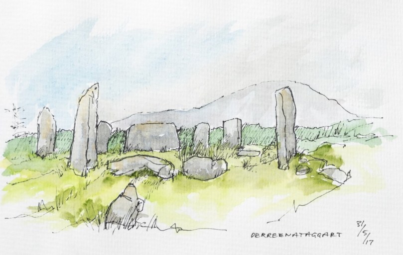
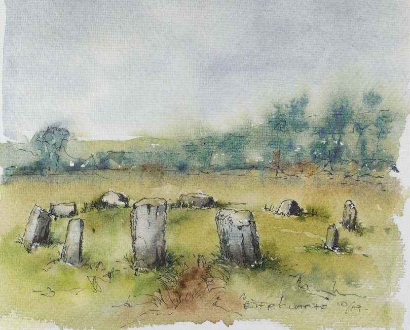
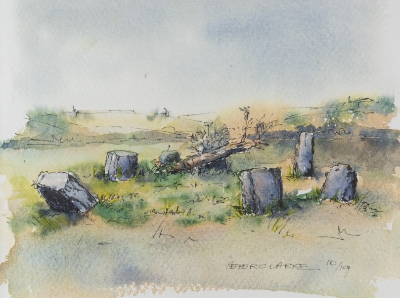
West Cork is home to a great concentration of prehistoric stone circles. While all of them share certain characteristics, there is a clear division between those containing only five stones and the multiples stone circles that contain seven or more, such as the Derreenataggart stone circle on the Beara, sketched by Peter Clarke, above. This post is about the multiple stone circles – I am leaving the five stone circles until next time. If you haven’t yet read The Stone Circles of West Cork: An Introduction, you might like to do that now before reading further.

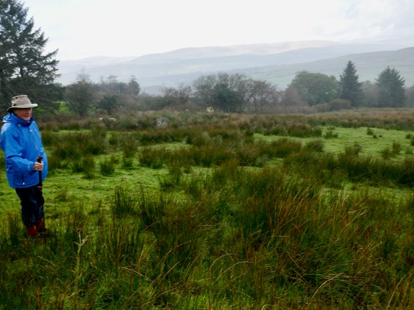
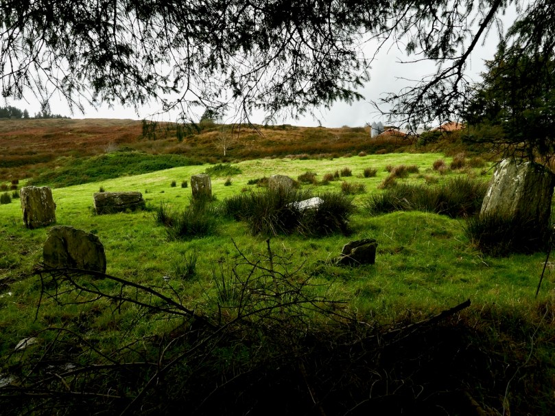
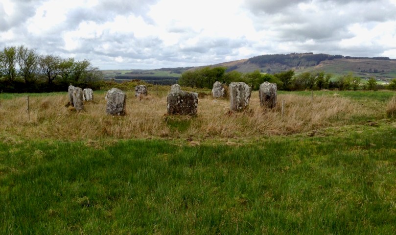
Although we love getting out in the field and visiting ancient monuments, such as this stone circle at Maughnaclea, we have to confess that the sun doesn’t always shine

Although this post covers some of the same ground as the Introduction, my aim here is to concentrate on the larger circles and show you what they actually look like on the ground*. An online search for ‘West Cork Stone Circles’ will bring you to many pages of information about Drombeg but precious little else. Drombeg is a marvellous site and its excavation yielded much-needed information about stone circles, but it’s only one site – the one with the signposts and car park.

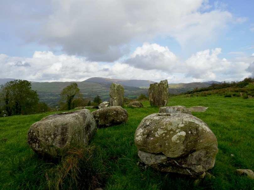
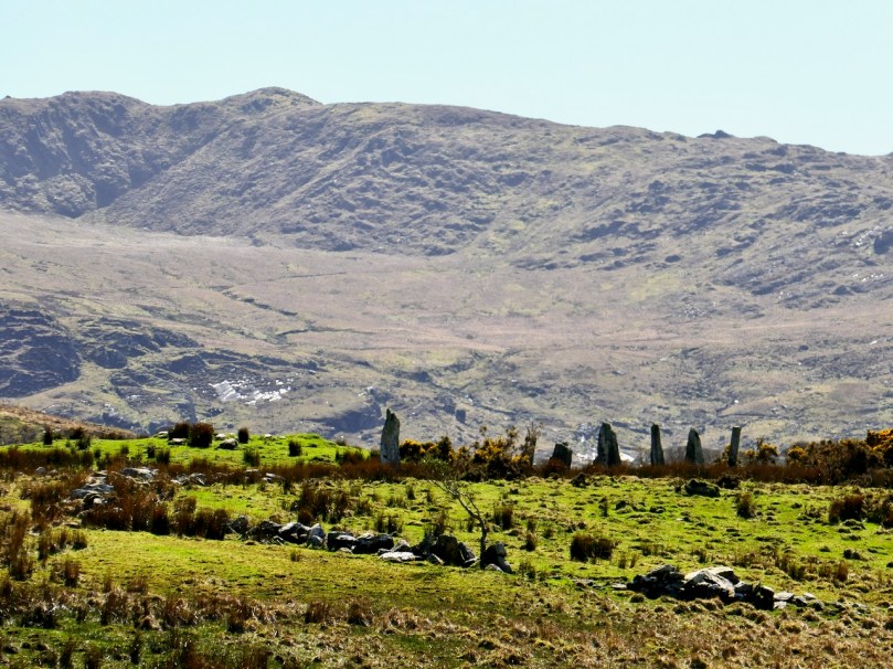
How about this one, for example, at Cappanaboule – it’s a bit of a hike and there’s no car park – but what a place!

Multiple stone circles in West Cork all fall under the heading of recumbent or axial circles, in which two portal stones (usually the tallest in the circle) stand opposite a recumbent and the line that passes through the portals and over the recumbent is considered to be the axis of the circles. However, within this predominant design, there are variations in how the builders decided to construct their circles.

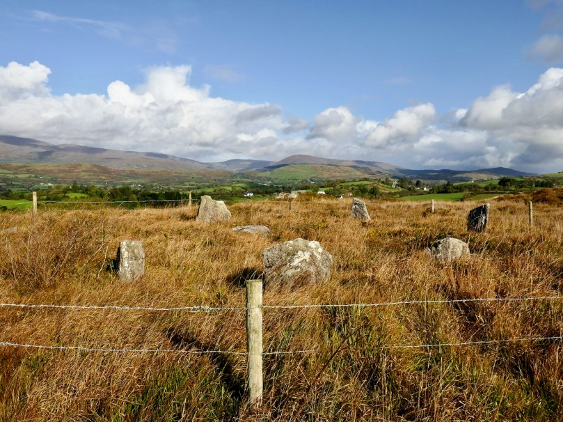
A closer look at the Cappanaboule stone circle: ten of the original thirteen stones are still there and there’s a boulder burial in the middle

The most noticeable variation, of course, is the size of the circle and the number of stones it contains, from seven to an estimated nineteen. We don’t know why the builders made these choices, although as with most construction, size can be equated with wealth: building a stone circle was an arduous undertaking necessitating the ability to commandeer a significant labour force. Perhaps also a larger circle with more stones permitted finer gradations of alignments, if this was the purpose of the circle, or more expansive ceremonials within the boundary of the circle.

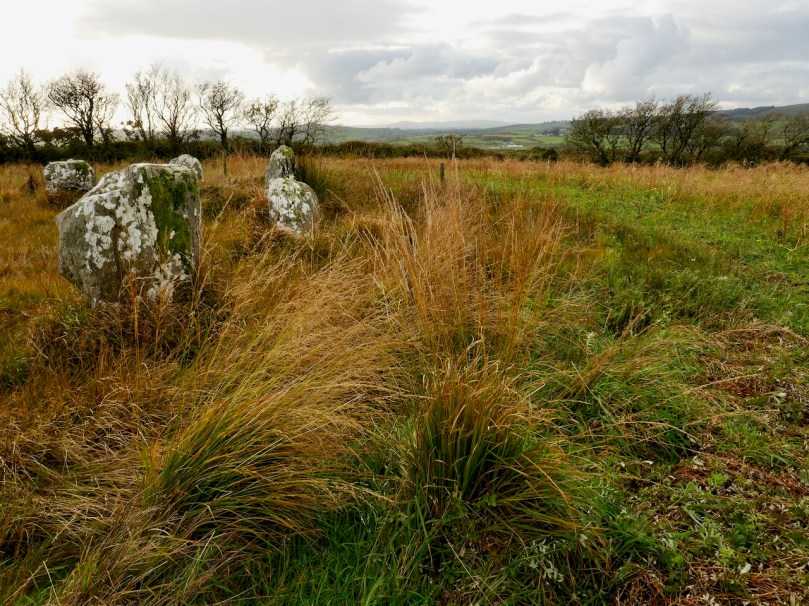
This is Gorteanish stone circle on the Sheep’s Head, only discovered in the 1990s when the Sheep’s Head Way trail was being cut. It’s hard to see what’s here because it’s so overgrown but it probably included 11 stones, four of which are still standing and two possible boulder burials, one inside and one outside the circle

The portals are normally the tallest stones in the circle but occasionally they are also set radially, or edge-on, to give the impression of a natural entrance.

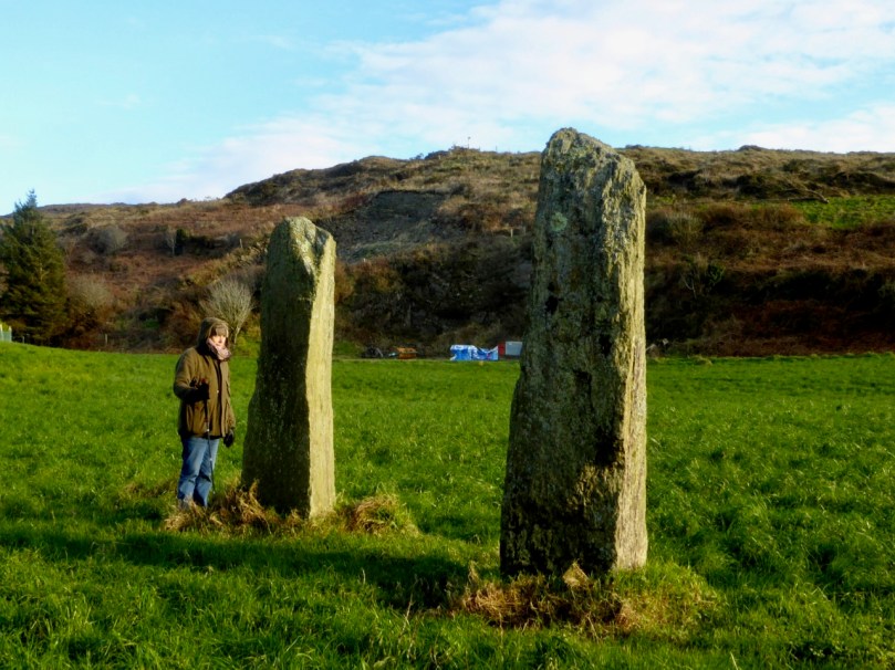
This is one of the two stone circles in the townland of Knocks. It illustrates well the portal stones being radially set and being the tallest stones in the circle. In my photograph you are looking across the recumbent to the portals and in Peter’s sketch you are doing the opposite

In only three cases an extra pair of stones helps to emphasise the entry point by creating a short passage. One example of this is Carrigagrenane, which is also one of the largest circles at nineteen stones.

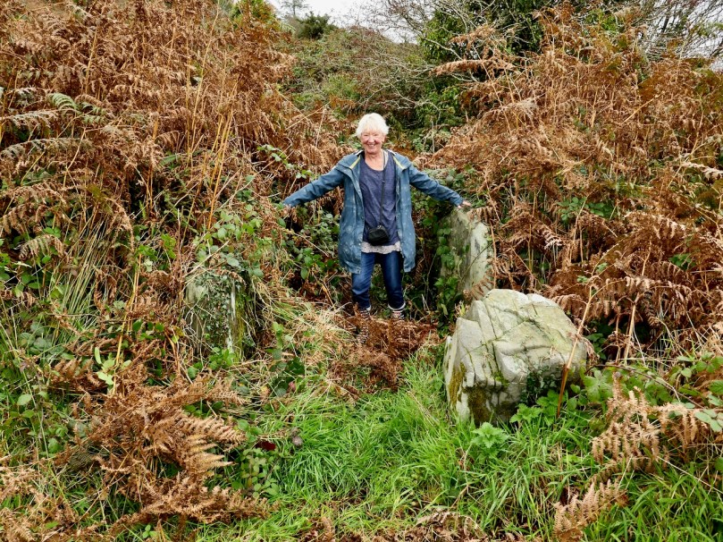
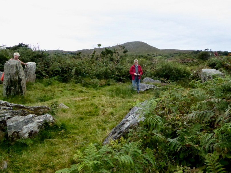
Carrigagrenane stone circle has double portals, creating a funnel or passage into the circle. This site is very overgrown and hard to locate so a lot of bracken-bashing was necessary to get this shot. Amanda is standing between the two outer portals

Conversely, the recumbent or axial stone is normally the lowest stone in the circle and the broadest (since it is set with its long axis parallel to the ground) but even here variation occurs. The axial stone at Ardgroom Outward, for example, is a pillar stone. Indeed, it can sometimes be difficult to decide where the axis line of the circle runs, if stones have fallen or are missing.

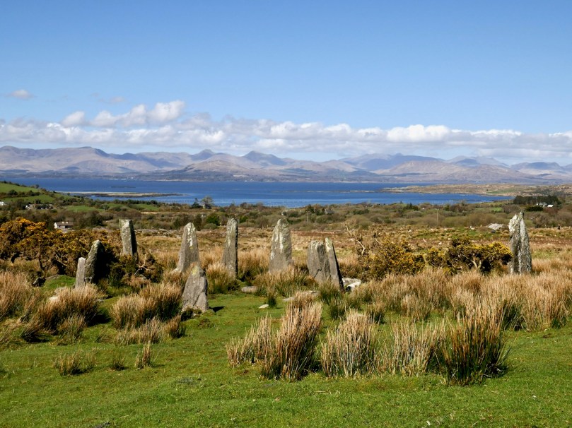
Ardgroom Outward stone circle, on the Beara is spectacularly sited. The axial stone, along with all the others in the circle, is a pillar stone rather than a recumbent. Note also the large monolith outside the circle to the right. The natural view-lines are to the north

Monoliths (single standing stones or blocks set on the ground) are present at some sites, either inside or outside the circle (as at Ardgroom Outward, above). Where they are inside they are placed off-centre. Where they are outside, they can be close to the circle or some way off but visible from it. These are usually called outliers.

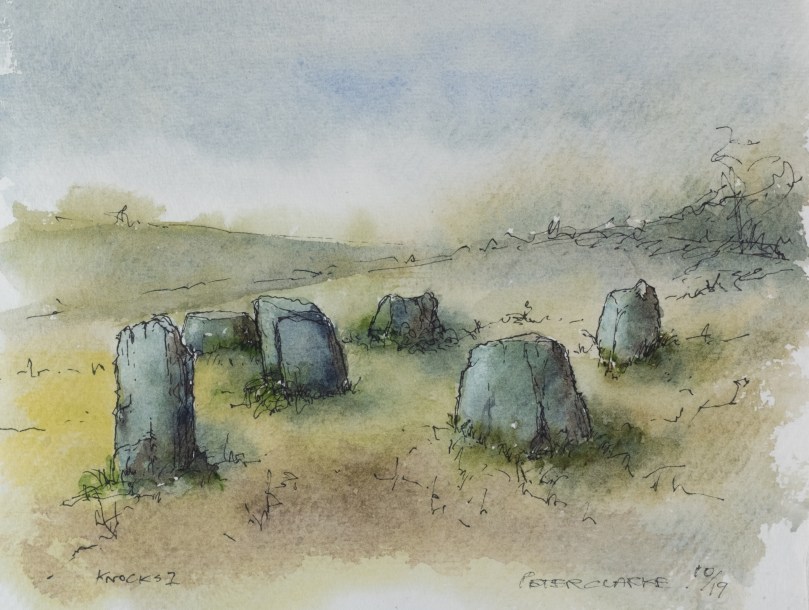
This is the second stone circle in the townland of Knocks, the more southerly of the two. My photograph illustrates the line of sight over the recumbent, across a slightly off-centre monolith, to a radially set portal. Peter’s sketch illustrates the whole circle

Quartz is a stone of choice for some of these monoliths but it is interesting that quartz is never in use as a circle orthostat. 

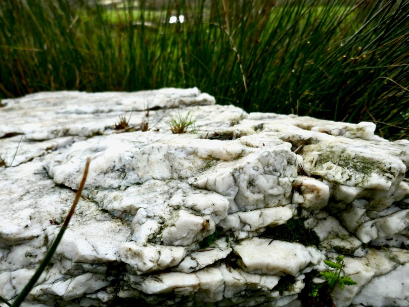
The stone circle at Maulatanvally includes a large quartz conglomerate block within the circle. I was struck by how it was gleaming on a dull day

Standing stone pairs can also function as outliers to a multiple stone circle. At Dunbeacon this outlier pair is almost half a kilometre from the circle across the valley, but each is clearly visible from the other. Originally a third standing stone also stood within 50 metres of the standing stone pair, but it has now disappeared.

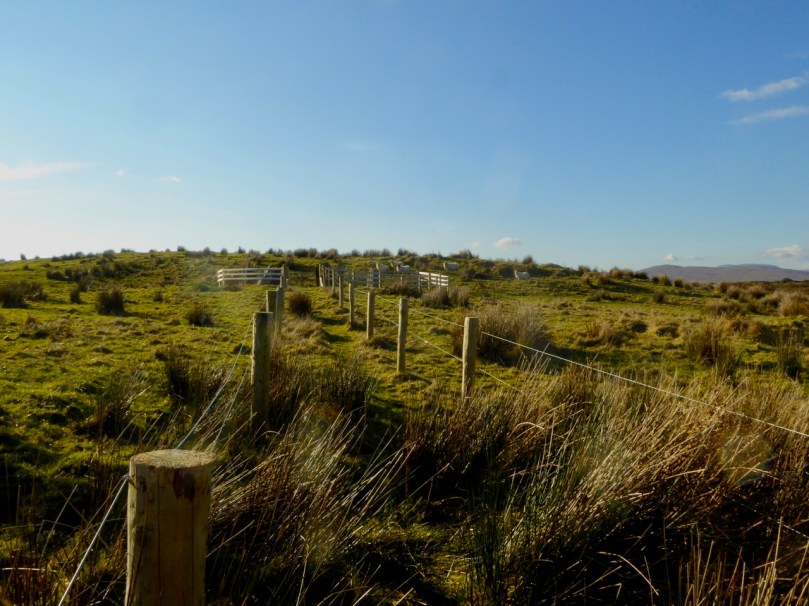
Dunbeacon stone circle, recently corralled inside a wooden fence. The natural view-line from this circle is to Mount Corrin to the east, rather than the south or west. The standing stone pair in Coolcoulaghta are located in front of the furthest house to the left in the photograph.

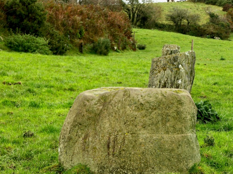
Another association is with boulder burials, sometimes found outside the circle, as in Bohonagh (see An Introduction) where the boulder burial capstone is quartz and contains cupmarks. At Ballyvacky (below) a boulder burial stands about 50 metres from the circle and a standing stone once stood beside it.

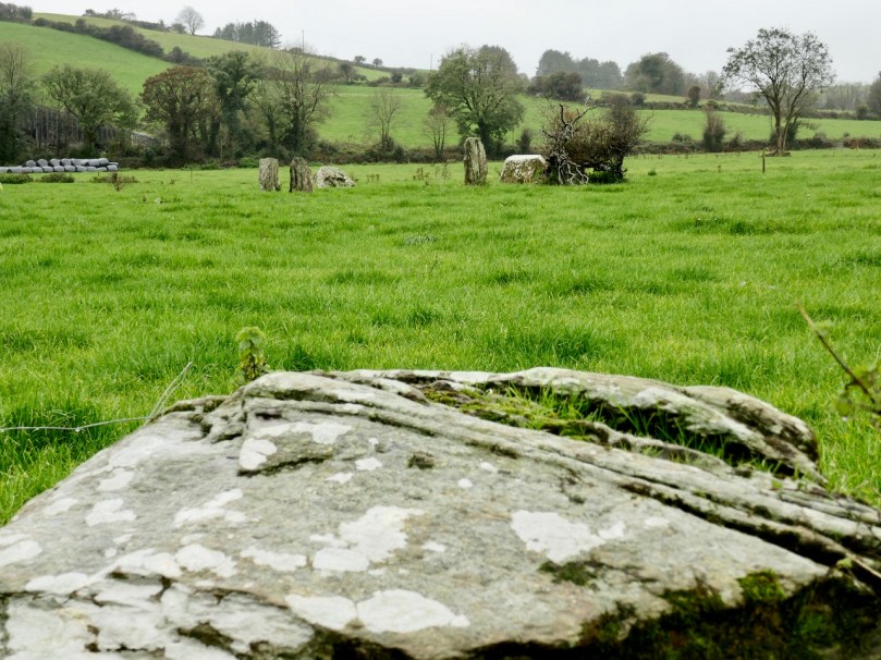
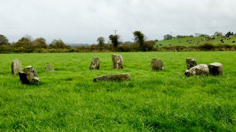
My photograph is taken from the Ballyvacky boulder burial, looking across to the stone circle. Peter’s sketch shows what is still standing – seven of the original nine stones. You can see that the remaining portal is radially set and that the recumbent is the largest stone in the circle

Boulder burials, as we have seen, are also found inside the circle: one of the most spectacular examples of this is at Breeny More (below) where a group of four boulder burial are set in a square within a large circle from which most of the stones are missing.

Finally, occasional stone circles will be surrounded by a fosse or shallow ditch. The most striking example is at Reenascreena, below.

Visiting stone circles, I am struck by features which appear to be similar at all or most of the sites. Many are situated on elevated sites with expansive views to the south and west. While this has been well documented by archaeologists, it’s one thing to read about it and yet another to visit several circles on one day and find yourself expecting a certain set of circumstances as you tune in to patterns in the sites themselves. What the orientation descriptions don’t mention, for example, is that the choice of location often features rising ground behind the circles which obscures the horizon to the north.

The rising ground behind Dunbeacon stone circle cuts off the view of Dunmanus Bay and concentrates the view-lines towards the east and south-east

Occasionally the higher ground obscuring the horizon is not to the north at all, but to the south or south-west – confounding our expectations that the obvious view-lines will be to the south and west. Cappanaboule is strikingly situated thus, as is Ardgroom Outward.

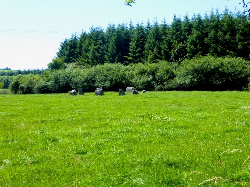
And then we have examples in fairly flat country with no really obvious view-lines. This can be complicated by surrounding forestry, as at Knockaneirk (above) where, if there was an obvious orientation over the recumbent it has long been hidden by tall tree.

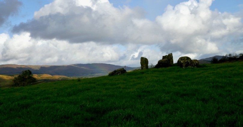
Ardgroom Outward stone circle is dramatically silhouetted against the mountains of the Beara peninsula as you walk up the track towards it

Next time I will write about the five stone circles – there are as many of them as there are the multiple stone circles and while they share most of the same features they have their own special character.

*Most of these photographs (like the one of Breeny More, above) were taken last year or in previous year, and many of them in the company of Amanda (Holy Wells of Cork and Kerry) and Peter (Hikelines) Clarke. I am indebted to Peter for the sketches. Not being able to get out into the field to visit and photograph more circles has been frustrated this year by Covid19 travel restrictions, so I have decided to go ahead and use what I have, rather than wait to add to my collection. 

Standing Stone Pairs: A Visit to Foherlagh

An unexpected delight – a trip on a Sunny October afternoon to visit a very fine standing stone pair in Foherlagh, just north of Kilcoe Church and School on the N71, between Skibbereen and Ballydehob.

The trip was suggested by Amanda who was, of course, looking for a holy well, said to be associated with a mass rock. All of these – the standing stone pair, the holy well and the mass rock – were grouped in one place so we had to undertake this expedition! Thus we found ourselves knocking on the door of the genial farmer, Dennis Minihane, who donned wellies right away and took us up the hill behind his house.

The view from the top of the hill

We had no idea what would greet us, but as we ascended it dawned on us that the views were pretty spectacular. The standing stone pair came into view, and it was obvious they were enormous. When we reached the top we were greeting by a complete 360 degree panorama – south to the islands of Roaringwater Bay, west to Mount Gabriel, east to Baltimore and north to the hinterland. Kilcoe Castle glowed gently in the foreground, while far away we recognised the distinctive pyramid shape of the Mizen peak at the end of the Peninsula.

Looking toward the end of the Mizen Peninsula

Standing stone rows and pairs are a phenomenon of south west Ireland, and this part of West Cork has many examples. While there are about seventy rows of three to five stones (such as the Fingers at Garranes near Castletownsend, or the Maughnasilly row), there are over a hundred stone pairs, of which Foherlagh is a particularly fine example. Invariably their long axis (that is, standing at one end  and looking along the row or pair) is oriented northeast/southwest. Typically the stones are graded in height, with the taller stone (or tallest, in the case of a stone row) at the southwest end.

Garranes stone row, known as The Fingers, near Castletownshend

Sometimes stone pairs are associated with other monuments. We’ve visited, for example, the Kealkill complex, where a stone pair is associated with a five-stone circle and a radial cairn. There’s also the Coolcoulaghta pair, from which the Dunbeacon stone circle is clearly visible.

Upper: The Kealkill complex of monuments; Lower: the Coolcoulaghta standing stone pair (and the most unsympathetically situated electricity pole in Ireland) from which the Dunbeacon stone circle (now sadly coralled by a wooden fence) can be seen

In Foherlagh, however, there are no other prehistoric monuments apart from a single standing stone a few fields away. What there is, is a pointed outcrop which local tradition has identified as a mass rock – see our post Were You at the Rock? for more on this type of monument. The mass rock had a scoop-out in it that may have functioned as a wart well. Amanda was pleased to find this and no doubt will do her usual thorough write-up on Holy Wells of Cork.

The standing stone pair is clearly oriented northeast/southwest. Depending on where you stand, the axis may point to the Mizen Peak (as does the Altar Wedge Tomb further down the Peninsula) or to Mount Gabriel (as do most of the examples of rock art we have examined in this region). Wherever the line points, it is clear that the expansive views are to the south west.

In his examination of stone rows and pairs*, Seán Ó’Nualláin says “The stone rows and pairs then, like the stone circles, are built so that their long axes indicate a general alignment on the sector of the heavens in which the sun roses and sets, and both series tend to group in a position indicating a winter rather than a summer position for the sun.” He might have added that this is also true for the sector in which the moon rises and sets – Maughnasilly row, for example is associated with lunar, rather than solar, orientations.

Maughnasilly stone row on a dramatic day

Ó’Nualláin, based on excavated examples and clear associations, gives a likely Late Neolithic to Early Bronze Age date for stone pairs and rows. That would mean they were erected 3,000 to 5,000 years ago.

Jack Robert’s‘ drawing of the Foherlagh pair, from Exploring West Cork

But what was their function? Perhaps they were yet another element of the calendrical systems that seem to have been a vital part of this early agricultural society. They may also have been used as territory or routeway markers, or as memorial stones for individuals. Some archaeologists have suggested an anthropomorphic element, in that some pairs may represent male and female figures. The pair at Foherlagh were certainly chosen to be very different in shape, although I am left wondering which –  the tall more rounded one or the shorter very square one – might be the more female or masculine figure.

Thank you to Amanda and Peter for suggesting the expedition, Carol for providing the oohs and aahs of a first-time visitor to Ireland, and Dennis for so generously sharing his land and his stories with us.

Amanda and Carol provide scale

Seán Ó’Nualláin, Stone Rows of the South of Ireland, in Proceedings of the Royal Irish AcademyVol. 88C (1988), pp. 179-256. Available on jstor.org

Mizen Magic 7: Dunbeacon – History, Prehistory and Questions of Access

A cold and clear January day is just the ticket for a trip to the Northside of the Mizen. While Robert writes about the life of Northsiders, I want to look specifically at the area known as Dunbeacon. On rising ground that ascends to Mount Corrin and overlooks Dunmanus Bay West of Durrus, Dunbeacon offers spectacular views and lots to explore.

Looking across to The Sheep’s Head at the head of Dunmanus Bay, near Durrus

In the last few years the Sheep’s Head Way has expanded into parts of the Mizen Peninsula. This is a very welcome move and the SHW committee is to be commended on taking this initiative. Today we followed part of this new trail through Dunbeacon townland and were rewarded with glimpses of the past, lovely vistas, Caribbean blue seas – and biting cold!

This section of the trail runs along a scenic boreen

Dunbeacon is synonymous with the Stone Circle that carries its name. Robert and I have visited it on a couple of occasions in the past. We have knocked on the farmhouse door for permission to cross the land to get to it and never found anyone home. We proceeded anyway, albeit slightly nervously as it was an obvious trespass on a working farm. The stone circle is sited on a small plateau with views east and south to Mount Corrin and Mount Gabriel, although rising ground to the northwest obscures Dunmanus Bay.

Mount Corrin: a large cairn on top can be seen from many miles away. We have walked up to this cairn – see our account of it here

The circle is incomplete so it is difficult to know exactly how the builders intended its orientation as the portal stones and recumbent are missing. It may have had a central monolith. (For a complete explanation of Stone Circles see our post Ancient Calendars.) However, the clear view to the east and south horizons are design features that link it to sunrise and moonrise at certain times of year.

This photograph of Dunbeacon Stone Circle, and the one that heads up this post, were taken before the access trail (described below) was built 

Intriguingly, Michael Wilson, of the Mega-What Website, says that practically the stone circle is really half a monument: what it takes to complete it for calendrical purposes are two other elements across the valley in Coolcoulaghta, a standing stone (now gone, but its position is known) and a standing stone pair.

The Coolcoulaghta standing stone pair, with Robert for scale. These stones were knocked down in the past but re-erected following a local outcry. Access and parking are now provided

Having studied the area carefully, Mike saysThis site [the standing stone] combines with the Stone Circle 400m away at Dunbeacon to enable observations of the lunar nodal cycle in all four quadrants as well as giving complete all year round solar coverage. It thus seems likely that the Standing Stone was an original outlier to the Stone Circle and that the Stone Pair was added later, probably by a different group of people, in such a way as to make a minor technical improvement.

It’s further than it looks in this picture, but there is a clear view to the stone circle from the standing stone pair. In between is the most annoyingly positioned electricity pole in Ireland

As part of the development of the new walking route, the SHW group has negotiated access to the Stone Circle, and has, in fact, built a fenced trail across the fields and up to the circle. This, of course, is excellent in that it finally provides open access to this wonderful site. There is, however, a problem: the stone circle is now surrounded by a wooden fence on all sides that severely impacts on the appearance and atmosphere of the site. While it will keep cattle away from the stones (cattle can do a lot of damage to sites like this) and provide a safe zone for walkers if there are animals in the field, it has become impossible to relate to the site in the same way as we used to.

The last section of the fenced trail. The fence around the stone circle can be clearly seen now

The author of the Facebook Page Walking to the Stones expressed himself thus when he saw the new enclosure: “The wire fenced avenue turns into a wooden fenced coral. The stones, imprisoned in a begrudgingly small pen. The wildness has gone, the mystery has gone. You might just as well be standing in a sterile museum environment. What have they done?” His comments generated a chorus of agreement.

Indeed, it is hard not to look in dismay at a fence like this. It makes taking photographs of the whole circle well-nigh impossible. It creates an overwhelming visual barrier between the circle and its surroundings. As an erstwhile archaeologist, I also have to wonder what was disturbed as the post holes were dug. And yet, all of this was done with the best of intentions, and it has succeeded in providing public access to the site. I would be interested in our readers’ thoughts.

It is quite difficult now to get a photograph of the entire circle. This one is partial, and shows a clear sightline to Mount Gabriel

Before we leave Dunbeacon, I can’t resist a quick trip down to what’s left of Dunbeacon Castle. One of a string of O’Mahony Castles on the Mizen, this tower house once guarded the head of Dunmanus Bay. Its siting is strategic – no ship was going to penetrate to the head of this bay without being in clear view of this stronghold. The O’Mahonys controlled fishing and trade in this area from the 12th to the 16th centuries and became fabulously wealthy in the process.

What’s left of Dunbeacon Castle

This castle would once have been the dwelling place and administrative centre of a powerful chief. He would have hosted banquets where his poets and musicians entertained the guests with stories and song. Alas, after the Battle of Kinsale all the O’Mahony tower houses in this area were taken by the British and many that were left standing were dealt a final blow by Cromwell’s cannon.

Not much left – but what an incredible position!

The centuries pass. The old Mount Corrin mines are no more. The sizeable population sustained by potatoes was devastated by the Famine. Now the land is grazed by cattle and sheep and a few farm houses dot the landscape. It is a peaceful and beautiful place. Do the walk – you will be in the footsteps of farmers and chieftains, of herders and megalith builders and astronomers, of miners and fisherfolk who have called this place home for thousands of years.

Monoliths, Mysteries and Marriages

"The Fingers" on the skyline

‘The Fingers’ on the skyline

All across West Cork – in the middle of pastureland, in isolated bogs, on the tops of mountains – you see standing stones. Mostly single but also found in pairs, or rows of three or more, they are as ubiquitous as they are mysterious. A scan of the Ordnance Survey map of the valleys running eastwards from Bantry, just north of us, shows a great proliferation of standing stones, and we have been tempted into the field often to hunt for them. We usually find them, but even when we don’t the search brings us into magnificent countryside.

Standing Stone Country

Standing stone country, east of Bantry Bay

The most numerous are, of course, single standing stones. The practice of erecting monoliths dates from the Neolithic and many of the stones we see may indeed be as old as that, or Bronze Age. Some may be medieval or more recent still – local people occasionally have memories of a grandfather placing a stone to act as a cattle scratching post.

Bishop's Luck Stone - wonder what's under this one?

Bishop’s Luck Stone – wonder what’s under this one?

If the stone has rock art on its surface, as is the case with the Burgatia stone near Rosscarbery, for example, we can safely conclude that it’s probably Bronze Age. Ogham incisions, or an inscribed cross will assist with an Early Medieval date. But the vast majority are unmarked and their functions may have varied. Some excavated examples have yielded evidence of burials at the base, and some seem to mark boundaries or entrances to mountain routeways.

Stone pairs and stone rows often occur in close proximity to other Bronze Age monuments such as stone circles and boulder burials. Some are further away from the monument but clearly visible from it.

Like the stone circles, the pair or row has an alignment – generally northeast/southwest, and a further alignment is formed from the two to the boulder burial or stone circle.

Irish folklore is rife with stories about standing stones. Many were said to have been hurled there from a nearby mountain by Finn McCool. Kevin Dannaher in his book Irish Customs and Beliefs relates several instances of petrification. Here’s an example:

…our early saints are…credited with passing fits of choler during which several miscreants were rendered harmless…When St Fiachna discovered that a dairy woman was stealing his butter he did not hesitate to loose a mighty curse against her, which turned not only herself, but her dairy and all her utensils as well, into stone. In proof of which they are still plain to be seen close to the saint’s church at Teampal Fiachna, a few miles south east of Kenmare.

The Three Fingers at Gurranes, near Castletownshend, probably once a row of five or six stones

The Three Fingers at Gurranes, near Castletownshend, probably once a row of five or six stones

One kind of standing stone is particularly intriguing – the holed stone. Tradition has it that these are marriage stones: the couple would join hands through the hole to exchange vows. 

*Both holed stone photographs are by Amanda Clarke

Ancient Calendars

One of West Cork's ancient calendars

One of West Cork’s ancient calendars

We’ve been catching up on our rock art project this week and it’s brought us out into the field. On Saturday the weather was spectacular – crisp, but with a totally blue sky and vibrant colours. See Amanda’s photo of the day here. We spent most of the day just east of Rosscarbery, a picturesque settlement above the water at Rosscarbery Bay, where the birdlife viewing is always a delight.

One of the sites we visited was Bohonagh. Not only does it boast cupmarked stones, but a very fine boulder burial and a stone circle.

Bohonagh Stone Circle

Bohonagh Stone Circle

West Cork is particularly rich in 3000 year old Bronze Age stone circles and most of them are of the ‘axial’ or ‘recumbent’ type. This means that the circle is laid out on an axis that is oriented in a particular direction. On one side of the circle is a stone laid longways – the recumbent stone. Across from the recumbent are the portals: two tall stones that appear to create a doorway into the circle. Sometimes the stones rise in height from the recumbent to the portals, and the portal stones may be set ‘end-on’ to the circle. There are always, therefore, an uneven number of stones – up to 17 have been recorded, although many circles are incomplete, with fallen or missing stones. The purpose of the axis was to provide a line of sight on a sunrise or sunset (and perhaps even moonrise and moonset) at important calendrical points such as solstices and equinoxes.

The portal stones at Bohonagh

The portal stones at Bohonagh

Bohonagh quartz

Quartz at Bohonagh

A feature of these circles is that many of them include quartz rocks: sometimes as one of the circle stones, sometimes as an additional rock in the interior or exterior of the circle, and sometimes on a nearby monument such as a boulder burial. At Bohonagh there were several quartz rocks, including one lying outside the circle and two supporting the boulder burial. In one case, at Ballycommane, we have seen an enormous quartz rock function as the capstone of a boulder burial – quite awe-inspiring in its visual impact. Interestingly, this same phenomenon occurs in a stone circle in Cornwall – Boscawen-Un in the West Penwith Peninsula, not that far from West Cork! As we watched the quartz under the boulder burial glisten in the sun (impossible to capture on a photograph) we knew it had to be seen as a very special stone to the builders of these circles.

Brooding stones at Dunbeacon

Brooding stones at Dunbeacon

Stone circles often command sweeping views of the surrounding countryside. This makes them well worth visiting, even if a goodly hike is involved. Because they are invariably located on private land, it is good practice to try to track down the landowner and request permission, and of course to always close gates and observe good field etiquette on a visit. Don’t be surprised to find that many are no longer intact: the centuries have taken their toll and many of the stones have fallen or disappeared over time. On the upside, this adds to the romantic wildness of the scene.

Gorteanish Stone Circle, re-discovered in the laying out of  the Sheep's Head Way

Gorteanish Stone Circle, re-discovered in the laying out of the Sheep’s Head Way

One of the most famous of the West Cork stone circles is Drombeg, near Glandore. Here, people gather on the winter and summer solstices to witness sunrise and sunset.

Drombeg on a wet day

Drombeg on a wet day

At Bohonagh, the alignment is to the spring equinox sunrise and sunset, due east and west. We plan to be there!