Burgatia – and Rock Carvings

If you can stretch your memories, think back. We started to write Roaringwater Journal in October 2012. At that time we had just settled in West Cork, and we were anxious to revisit the work which Finola had carried out between 1971 and 1973, when she was studying Archaeology at the University of Cork. For her final thesis subject, she specialised in surveying and recording the Rock Art of West Cork and Kerry.

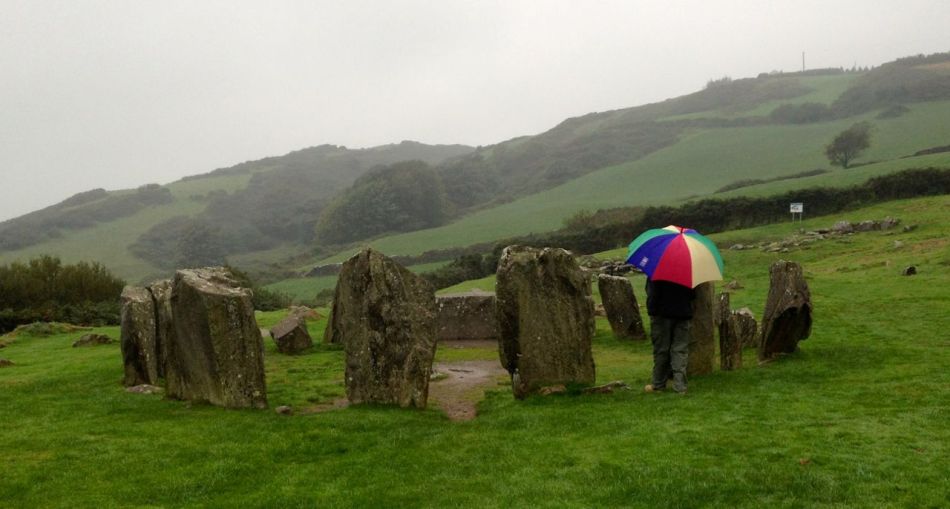
Finola has her thesis, above, and is turning to the page which shows the drawing she made from Burgatia, which is a townland outside Rosscarbery, in West Cork. When Finola was researching, there was only the one standing stone in Burgatia listed as bearing the cup marks and circles of Rock Art. Since the 1970s, however, a further stone has been identified with this feature. It is a standing stone just to the right of the N71 as that road rises from the Causeway as you travel East from Rosscarbery. In Finola’s day, this rock was only identified as a ‘standing stone’. The header picture to this post shows the stone.

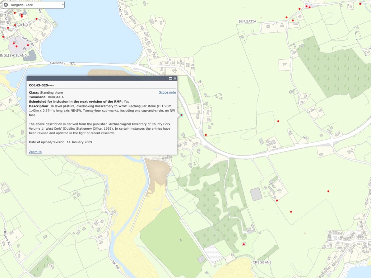
These two extracts from the present day OS map show the entries given for each of these stones – stone 1 at the top and stone 2 below. The current edition of the map now indicates that stone 2 has significant Rock Art on the west-facing elevation. The Archaeological Inventory has been revised and updated twice since Finola’s survey – in 1992 and 2009. One of these revisions has added the information that “…the stone has twenty-four cup marks, including one cup-and-circle, on NW face…”

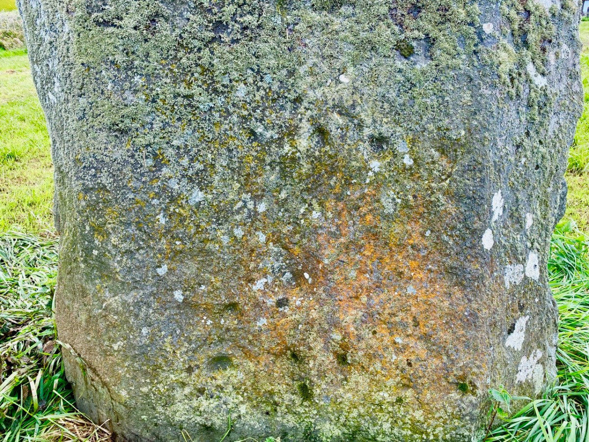
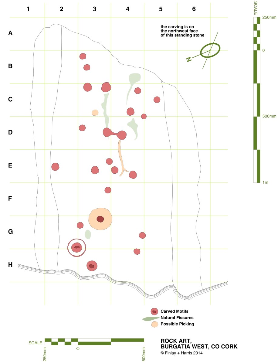
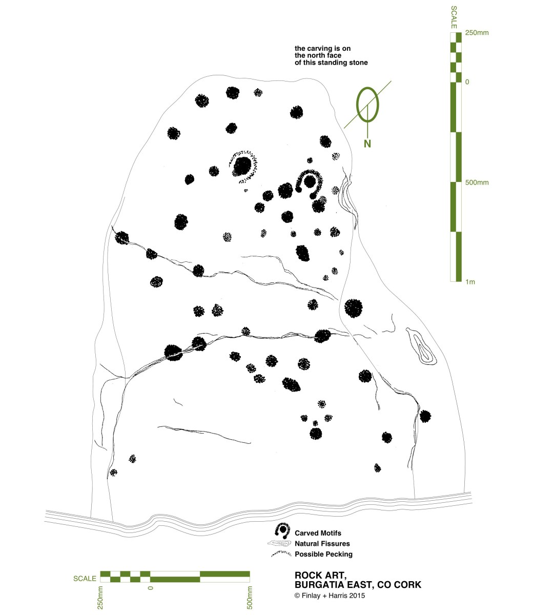
Here is that NW face, photographed this month – May 2023. Many of the cup marks show up well. Back in 2014 we decided that we would fully measure the marked surface of this rock, in order to add to the inventory created by Finola in her University days. Here is my own 2014 drawing:

In the lower picture, I have adapted the same drawing to overlay it on a photograph taken as part of the survey. That was in 2014. Now – nine years later – I believe I have discovered an additional cup mark! Have a look at this close-up of the lower part of the stone:

Comparisons between the two photographs (2023) and the one taken in 2014 (below) show that the level of the ground has apparently lowered in nine years, exposing the additional marking. As the field is cultivated, it is quite possible that there has been some movement of the ground in relation to the rock foundation.

Above – Burgatia 2, January 2014. Note the cup-and-ring mark, and the higher ground level.

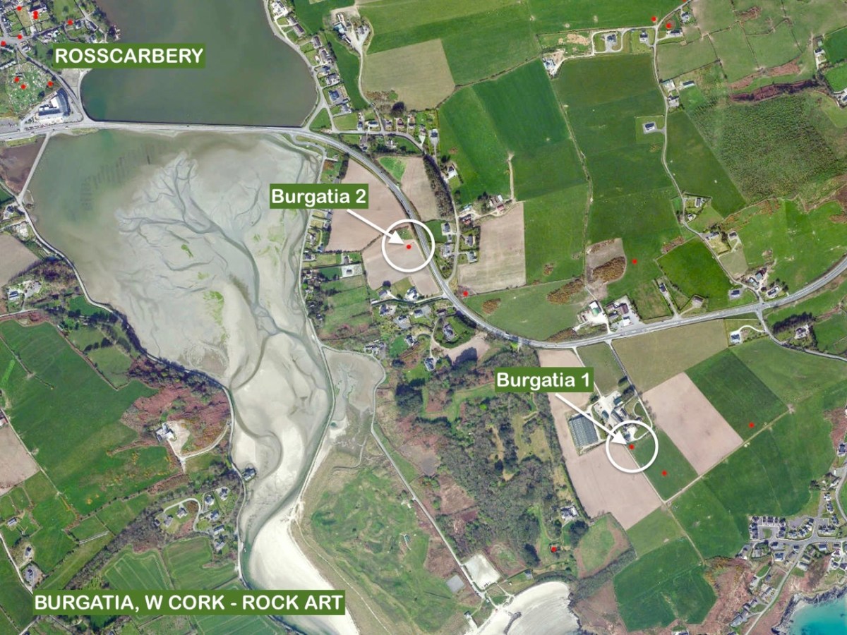
The aerial view, above, shows the relationship between Burgatia 2 and Burgatia 1. As we were revisiting, we also called to have a look at the latter. Here is Finola’s drawing from 1973 – the one that appeared in her thesis:

Here’s Finola at Burgatia 1 earlier this month (thanks to Amanda for this):

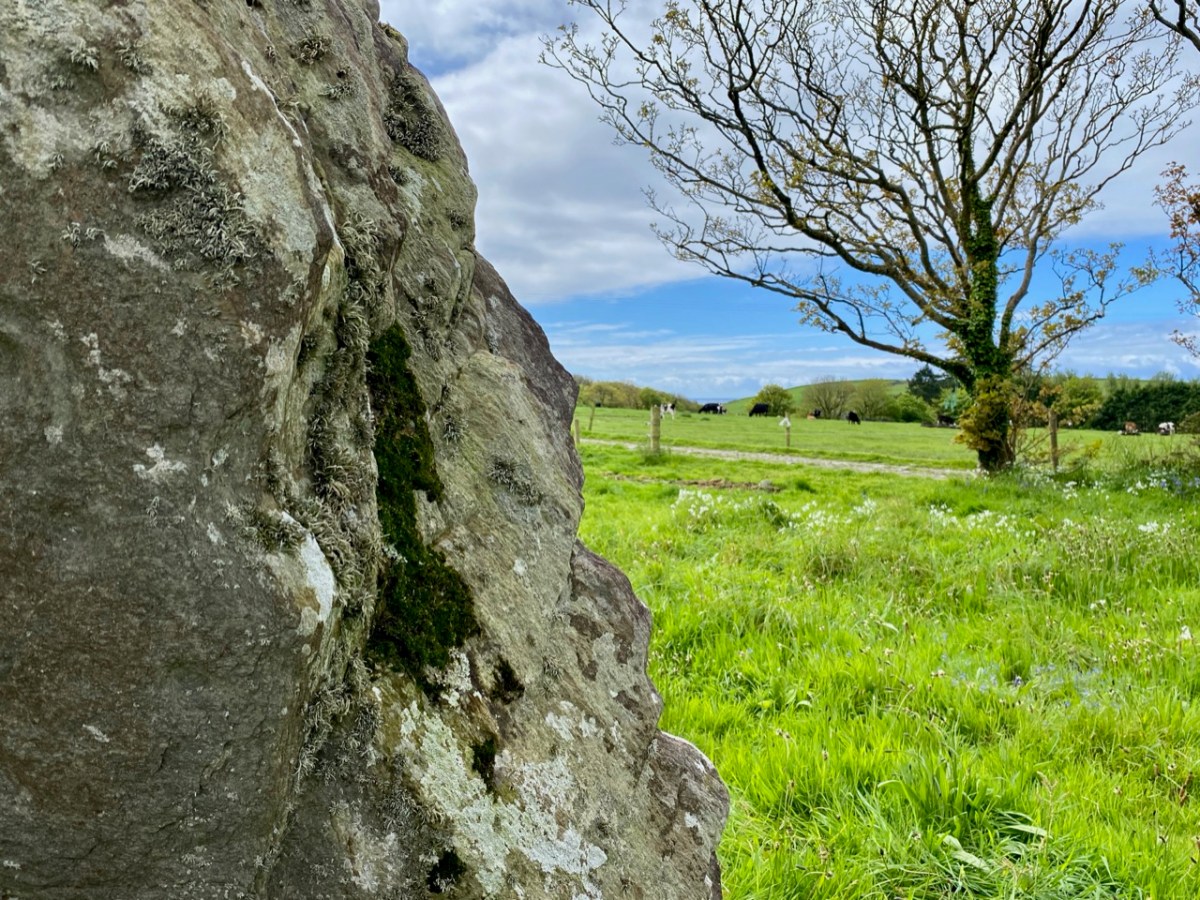
And the view west from the rock, from which you can glimpse the sea (also this month). See below for the same view in 2014:

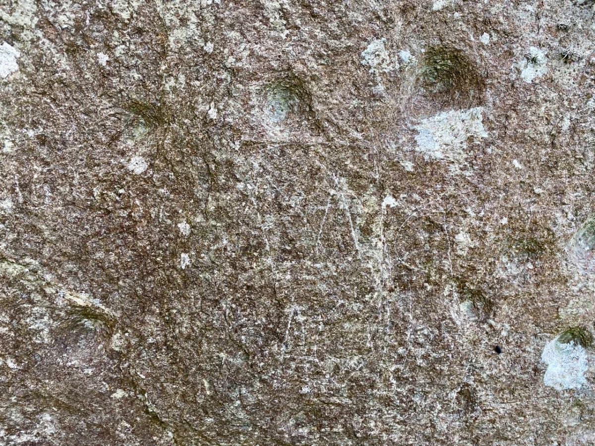
Burgatia 1 seen this month: note the graffiti. We don’t recall having seen this before. Please note this stone is on private land, and permission must always be obtained from the owners (who live in the adjacent house) before accessing it. Here’s the stone in context, showing its southwest facing face which – in this case – has no markings. No one can tell the full history of any of the archaeology discussed today. There are some theories that the standing stones may once have been lying down, and the carvings were made on their (then) upper faces. They were then, possibly, erected to make more significant monuments – one with its cup marks facing one way, and the other facing the opposite way (as it happens).

I’ll finish with this extract from the earliest 6″ Ordnance Survey marked up map. I’m interested to see that here Burgatia 2 is shown in a field boundary:

Equinox at Bohonagh

Sunset over the recumbent, Spring Equinox 2014

Sunset over the recumbent, Spring Equinox 2014

We don’t normally post midweek, so this is a special edition, coming to you courtesy of the spring equinox. In my post Ancient Calendars, I explained about the orientation of the stone circles of West Cork. Bohonagh, just outside Rosscarbery, is oriented east-west. On the spring equinox, if you stand behind the recumbent, you will see the sun rise between the portal stones. If you stand behind the portal stones you will see the sun set behind the recumbent.

Around here, there is no guarantee that sunrise or sunset will be visible, due to the variable weather conditions, so you have to watch the forecast carefully. This week, sunshine was forecast only for Tuesday the 18th, so that is the day these photographs were taken. Curiously, this is also the day, according to my calendar, when sunset and sunrise divide the day into two equal halves. The official equinox, however, happens today: March 20th 2014.

Equinoctial sky

Equinoctial sky

The top photograph shows the moment when the sun set across the valley, sinking down directly above the recumbent as seen from between the portal stones. The second photo is taken from further down the hill, after the sun had disappeared. Silhouetted are the stone circle, especially the tall portal stones, and to the left, the boulder burial. Finally, I have included an image showing the east-west oriention.

east-west orientation

east-west orientation

We felt very privileged to be witnessing this event, thousands of years after the builders had planned it. With us earler in the day were Amanda and Peter, and you can see Amanda’s description of the site here.

Ancient Calendars

One of West Cork's ancient calendars

One of West Cork’s ancient calendars

We’ve been catching up on our rock art project this week and it’s brought us out into the field. On Saturday the weather was spectacular – crisp, but with a totally blue sky and vibrant colours. See Amanda’s photo of the day here. We spent most of the day just east of Rosscarbery, a picturesque settlement above the water at Rosscarbery Bay, where the birdlife viewing is always a delight.

One of the sites we visited was Bohonagh. Not only does it boast cupmarked stones, but a very fine boulder burial and a stone circle.

Bohonagh Stone Circle

Bohonagh Stone Circle

West Cork is particularly rich in 3000 year old Bronze Age stone circles and most of them are of the ‘axial’ or ‘recumbent’ type. This means that the circle is laid out on an axis that is oriented in a particular direction. On one side of the circle is a stone laid longways – the recumbent stone. Across from the recumbent are the portals: two tall stones that appear to create a doorway into the circle. Sometimes the stones rise in height from the recumbent to the portals, and the portal stones may be set ‘end-on’ to the circle. There are always, therefore, an uneven number of stones – up to 17 have been recorded, although many circles are incomplete, with fallen or missing stones. The purpose of the axis was to provide a line of sight on a sunrise or sunset (and perhaps even moonrise and moonset) at important calendrical points such as solstices and equinoxes.

The portal stones at Bohonagh

The portal stones at Bohonagh

Bohonagh quartz

Quartz at Bohonagh

A feature of these circles is that many of them include quartz rocks: sometimes as one of the circle stones, sometimes as an additional rock in the interior or exterior of the circle, and sometimes on a nearby monument such as a boulder burial. At Bohonagh there were several quartz rocks, including one lying outside the circle and two supporting the boulder burial. In one case, at Ballycommane, we have seen an enormous quartz rock function as the capstone of a boulder burial – quite awe-inspiring in its visual impact. Interestingly, this same phenomenon occurs in a stone circle in Cornwall – Boscawen-Un in the West Penwith Peninsula, not that far from West Cork! As we watched the quartz under the boulder burial glisten in the sun (impossible to capture on a photograph) we knew it had to be seen as a very special stone to the builders of these circles.

Brooding stones at Dunbeacon

Brooding stones at Dunbeacon

Stone circles often command sweeping views of the surrounding countryside. This makes them well worth visiting, even if a goodly hike is involved. Because they are invariably located on private land, it is good practice to try to track down the landowner and request permission, and of course to always close gates and observe good field etiquette on a visit. Don’t be surprised to find that many are no longer intact: the centuries have taken their toll and many of the stones have fallen or disappeared over time. On the upside, this adds to the romantic wildness of the scene.

Gorteanish Stone Circle, re-discovered in the laying out of  the Sheep's Head Way

Gorteanish Stone Circle, re-discovered in the laying out of the Sheep’s Head Way

One of the most famous of the West Cork stone circles is Drombeg, near Glandore. Here, people gather on the winter and summer solstices to witness sunrise and sunset.

Drombeg on a wet day

Drombeg on a wet day

At Bohonagh, the alignment is to the spring equinox sunrise and sunset, due east and west. We plan to be there!