
If you can stretch your memories, think back. We started to write Roaringwater Journal in October 2012. At that time we had just settled in West Cork, and we were anxious to revisit the work which Finola had carried out between 1971 and 1973, when she was studying Archaeology at the University of Cork. For her final thesis subject, she specialised in surveying and recording the Rock Art of West Cork and Kerry.

Finola has her thesis, above, and is turning to the page which shows the drawing she made from Burgatia, which is a townland outside Rosscarbery, in West Cork. When Finola was researching, there was only the one standing stone in Burgatia listed as bearing the cup marks and circles of Rock Art. Since the 1970s, however, a further stone has been identified with this feature. It is a standing stone just to the right of the N71 as that road rises from the Causeway as you travel East from Rosscarbery. In Finola’s day, this rock was only identified as a ‘standing stone’. The header picture to this post shows the stone.

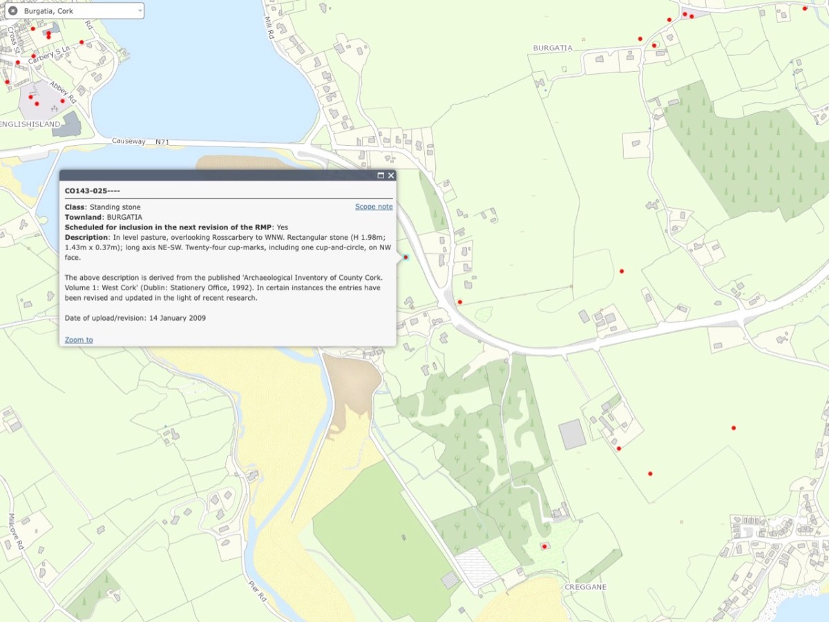
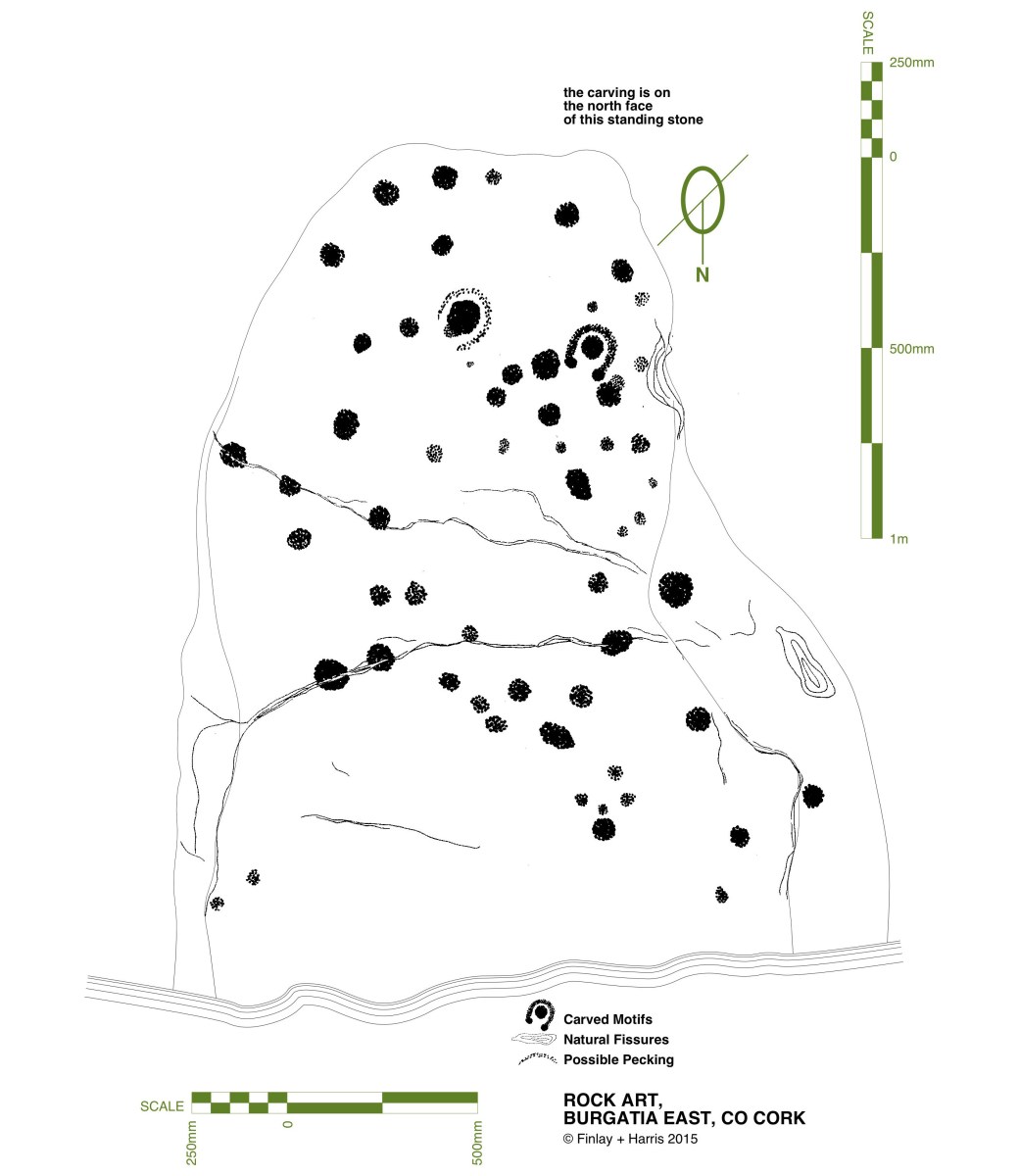
These two extracts from the present day OS map show the entries given for each of these stones – stone 1 at the top and stone 2 below. The current edition of the map now indicates that stone 2 has significant Rock Art on the west-facing elevation. The Archaeological Inventory has been revised and updated twice since Finola’s survey – in 1992 and 2009. One of these revisions has added the information that “…the stone has twenty-four cup marks, including one cup-and-circle, on NW face…”
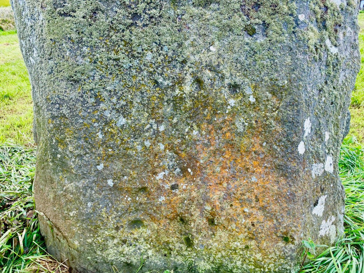
Here is that NW face, photographed this month – May 2023. Many of the cup marks show up well. Back in 2014 we decided that we would fully measure the marked surface of this rock, in order to add to the inventory created by Finola in her University days. Here is my own 2014 drawing:
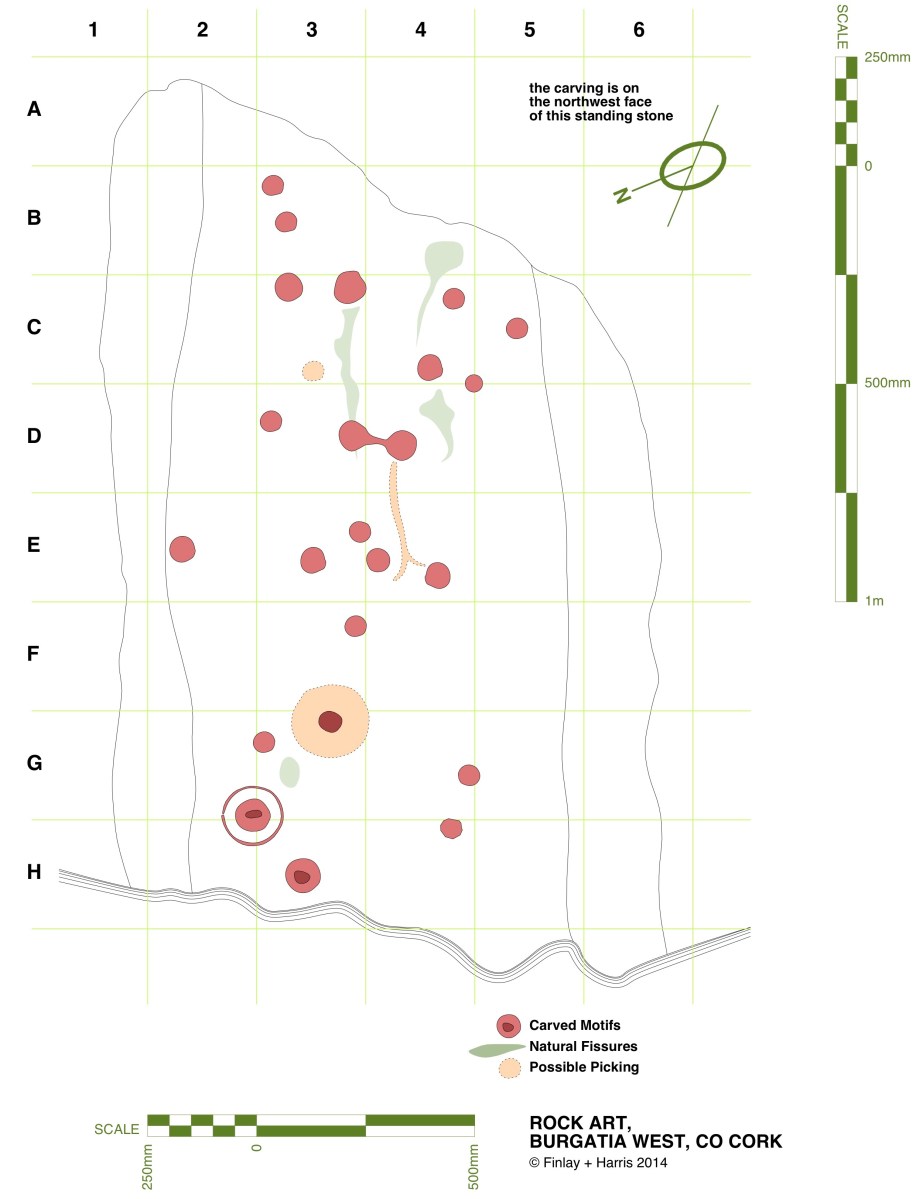

In the lower picture, I have adapted the same drawing to overlay it on a photograph taken as part of the survey. That was in 2014. Now – nine years later – I believe I have discovered an additional cup mark! Have a look at this close-up of the lower part of the stone:


Comparisons between the two photographs (2023) and the one taken in 2014 (below) show that the level of the ground has apparently lowered in nine years, exposing the additional marking. As the field is cultivated, it is quite possible that there has been some movement of the ground in relation to the rock foundation.

Above – Burgatia 2, January 2014. Note the cup-and-ring mark, and the higher ground level.
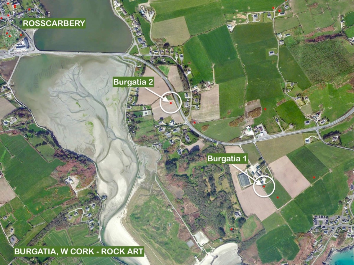
The aerial view, above, shows the relationship between Burgatia 2 and Burgatia 1. As we were revisiting, we also called to have a look at the latter. Here is Finola’s drawing from 1973 – the one that appeared in her thesis:
Here’s Finola at Burgatia 1 earlier this month (thanks to Amanda for this):

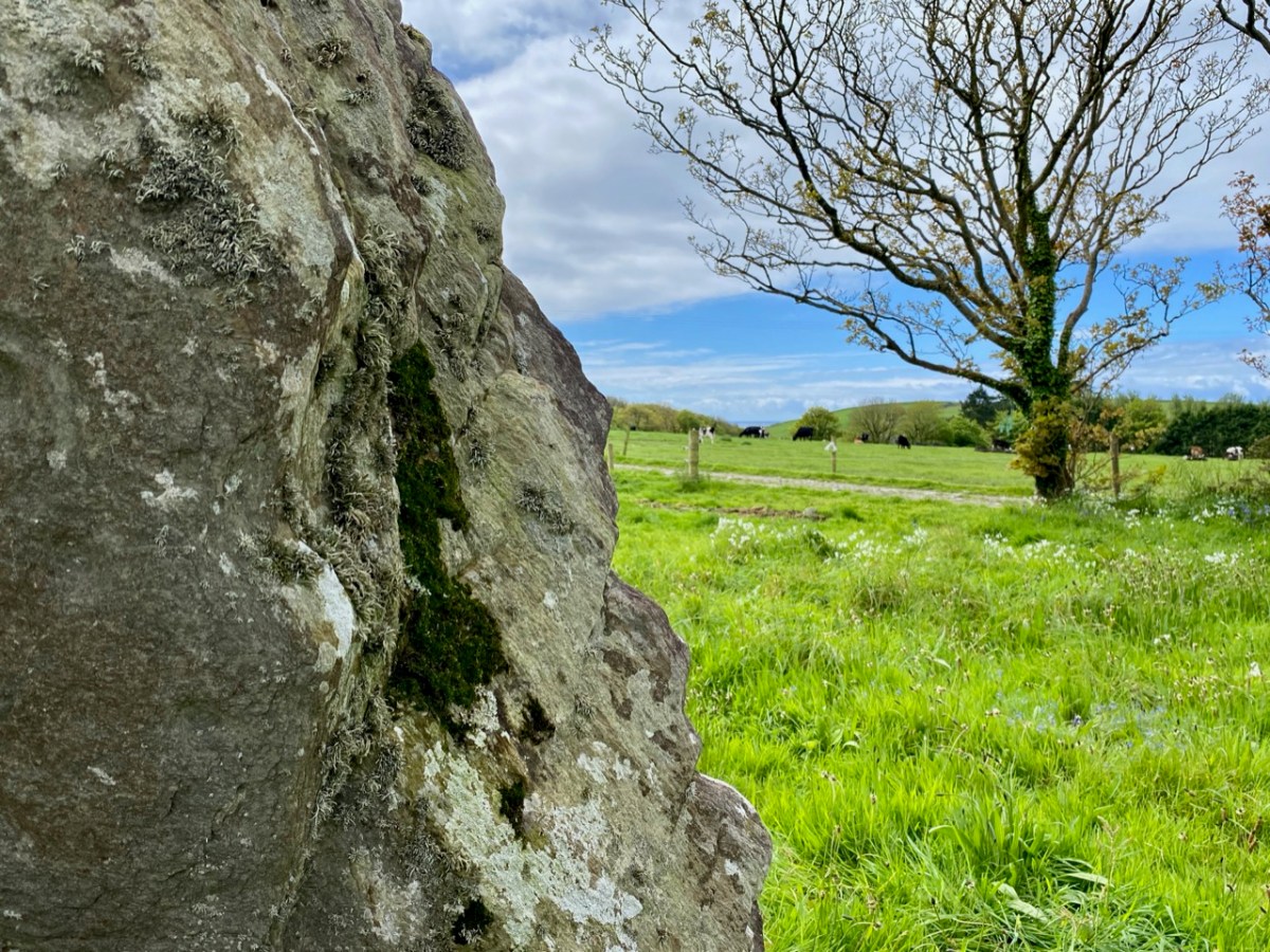
And the view west from the rock, from which you can glimpse the sea (also this month). See below for the same view in 2014:

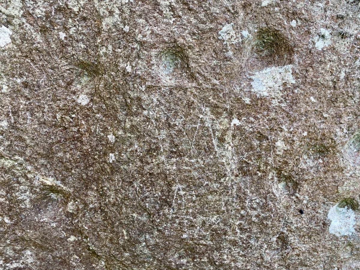
Burgatia 1 seen this month: note the graffiti. We don’t recall having seen this before. Please note this stone is on private land, and permission must always be obtained from the owners (who live in the adjacent house) before accessing it. Here’s the stone in context, showing its southwest facing face which – in this case – has no markings. No one can tell the full history of any of the archaeology discussed today. There are some theories that the standing stones may once have been lying down, and the carvings were made on their (then) upper faces. They were then, possibly, erected to make more significant monuments – one with its cup marks facing one way, and the other facing the opposite way (as it happens).

I’ll finish with this extract from the earliest 6″ Ordnance Survey marked up map. I’m interested to see that here Burgatia 2 is shown in a field boundary:

Discover more from Roaringwater Journal
Subscribe to get the latest posts sent to your email.

I’ll think about that too. Looked up Sweeney in All Ireland Surnames by Sean de Bhulbh and it appears he thinks they (Sweeney) were Scottish Gallowglasses, and that could be Pictish to go with the pictures on the rocks. Picts sure got around.
LikeLike
The placename gets a mention in local folklore collection as being ‘danish’, coming from ‘Búrgeish’- the home of Suibhnes (Sweeneys)
LikeLiked by 1 person
David – that’s something I haven’t come across before. Good work – many thanks.
LikeLike
Two mighty and intriguing stones, just standing there enigmatically. Thanks goodness you and Finola are constantly updating your records.
LikeLiked by 1 person
Amanda – yes, revisiting is a worthwhile exercise!
LikeLike
Great recording of this rock art Robert. Awful to see recent graffiti.
LikeLiked by 1 person
Thank you, Con. It might have been there some time, but we don’t recall it from earlier visits.
LikeLike
Hi Robert and Finola. Betty Lou and I have stopped there at the little park right at the bend of N71 to do some bird watching but didn’t know about these stones. Thanks for the article.
We haven’t been to Ireland since before Covid but hope to get there next year.
Betty Lou and David Chaika
North Carolina USA
LikeLiked by 1 person
Hope you manage it, David.
LikeLike
Have you a good translation/ meaning of the townland name Burgatia? https://www.logainm.ie/en/9138 tells me it tranlates as An Bhuirgéiseach, a corruption of Burgage. I don’t think that would be correct. I have been struggling with Geashill als. Gaillseach and it seems to translate as the sidhe of the English or Pict woman (in Co. Offaly). I have a wild guess Buratia may be something similar?
Janet
LikeLiked by 1 person
Janet – please see Dave Myler’s comment here: seems reasonable to me!
LikeLike