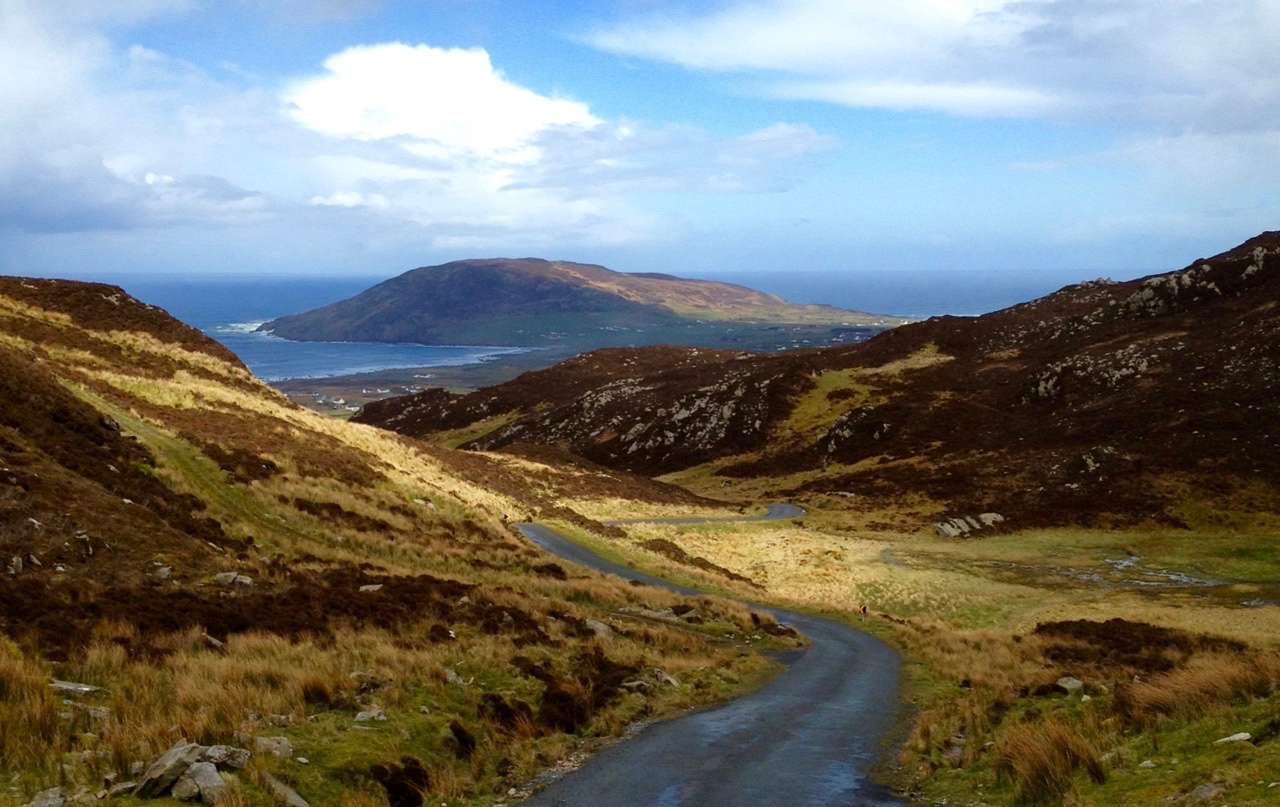
Here is a collection of photographs taken in West Cork from some of the high places: ridges, peaks, mountain paths. The pics were all taken around ten years ago, and haven’t been used in our blog posts previously. They serve to show stunning landscapes, of course, and hopefully illustrate the variety of the country which surrounds us here. The header is taken from the peak above Three Castle Head.
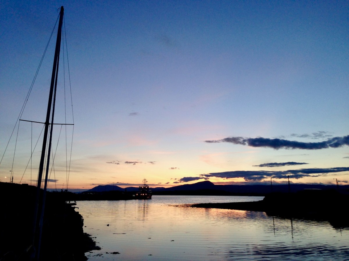
The upper pic is looking down on Bantry town from the high ground to the south, while the lower one reminds you of the evening view from Bantry at sea level.
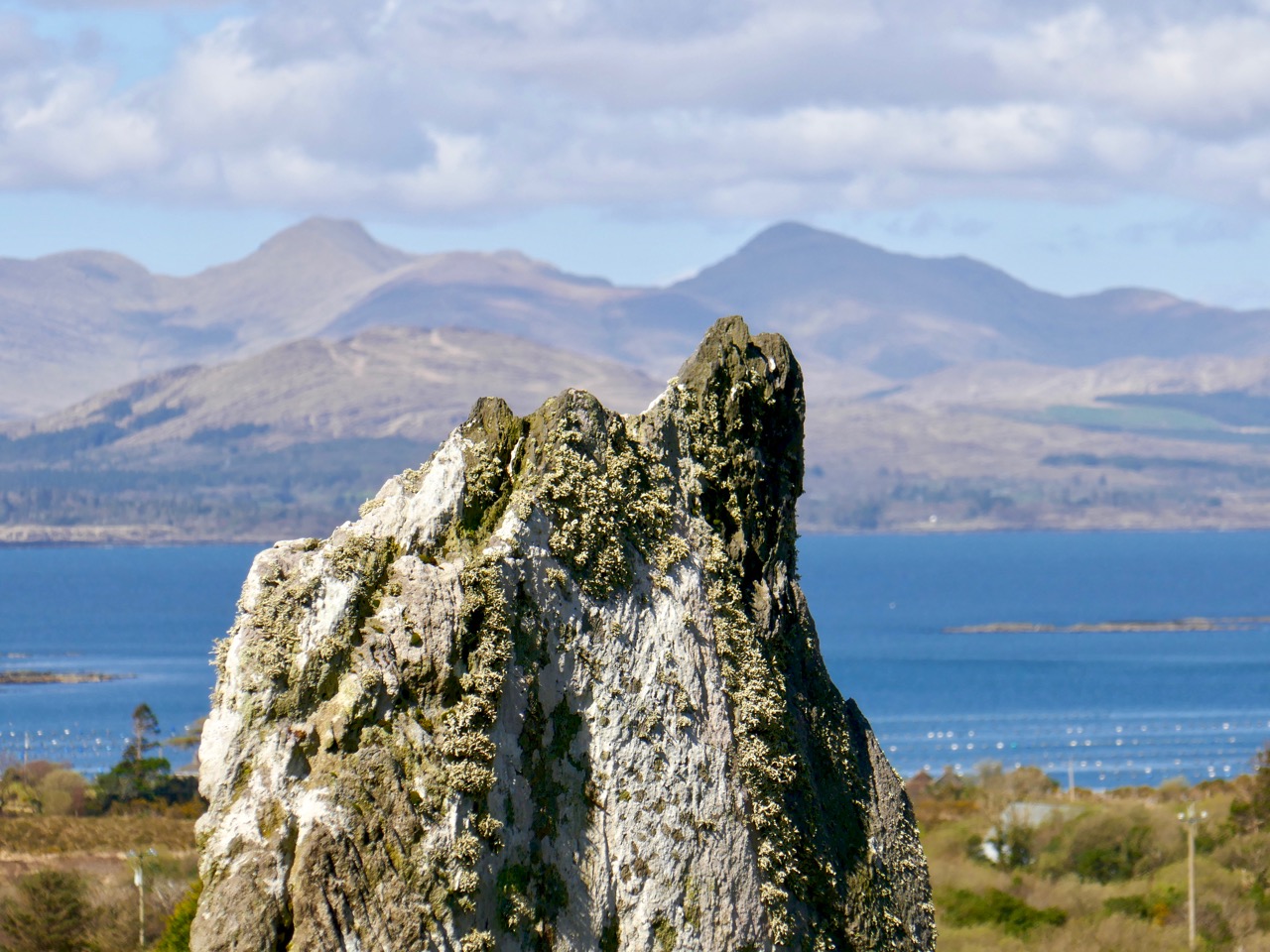
If you leave your car at Galley Cove Beach and walk up the steep track towards Brow Head you will come across this enormous stone row – and you will look back to the peninsula of Crookhaven. Don’t be fooled by the stones: they have been placed on this site fairly recently. They are impressive, nevertheless.
And here is a closer view of Crookhaven.
While turning from this spot and looking west, you will see the end of the coastline at Brow Head. This stone is likely to be more anciently placed. In the distance is Mizen Head with its Napoleonic era signal tower at Cloghane.
Contrasting light effects seen on the footpath that follows the ridge on the Sheep’s Head Way. That’s the spit of land that runs from east to west between the Mizen Head and the Beara Peninsula. There are cairns on the summits, with the remains of a wedge tomb and a Marriage Stone to be seen along the way.
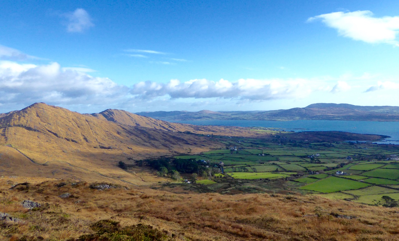
The view north from the heights of the Sheep’s Head takes in the Beara Peninsula and – seen above – the high point of Hungry Hill dominating the distant rugged landscape.
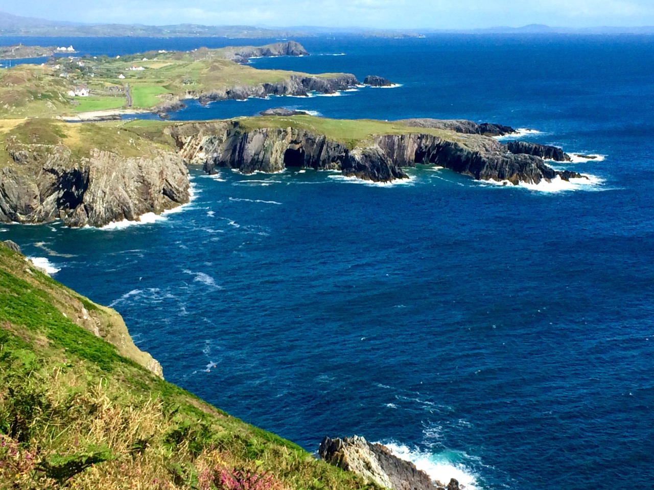
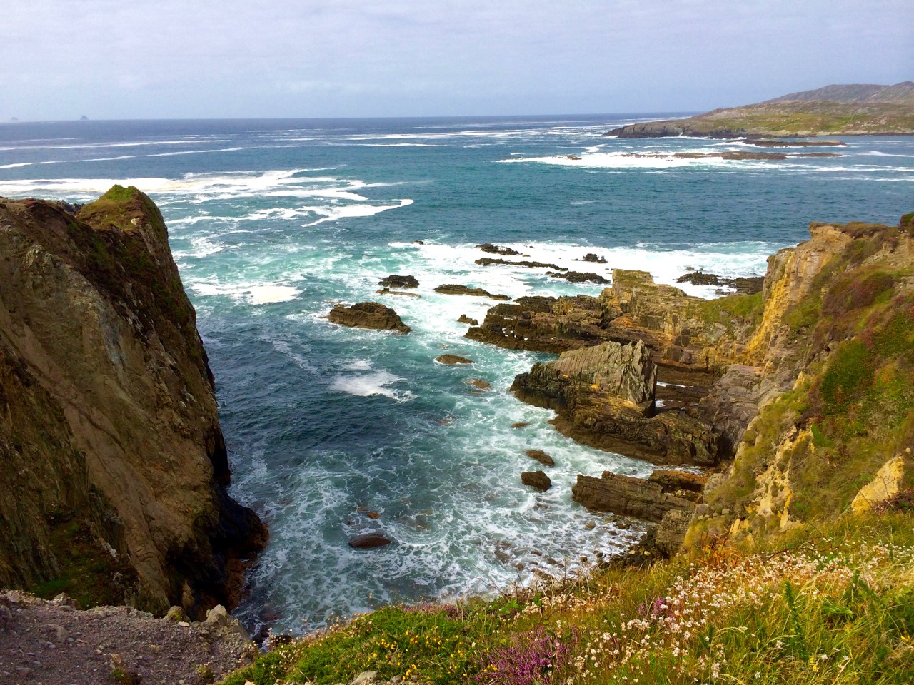
You are never far from the coastline in West Cork. Look out for wild seas constantly sculpting the rocks over millennia.
From our home in Cappaghglass we look out to our own ‘high place’ – Mount Gabriel. This enigmatic tract of land dominates the area and is imbued with legends and folklore. It is also one of the most atmospheric of our peaks at all times of the year.
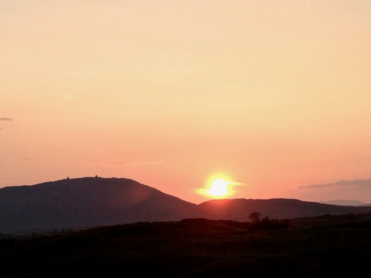
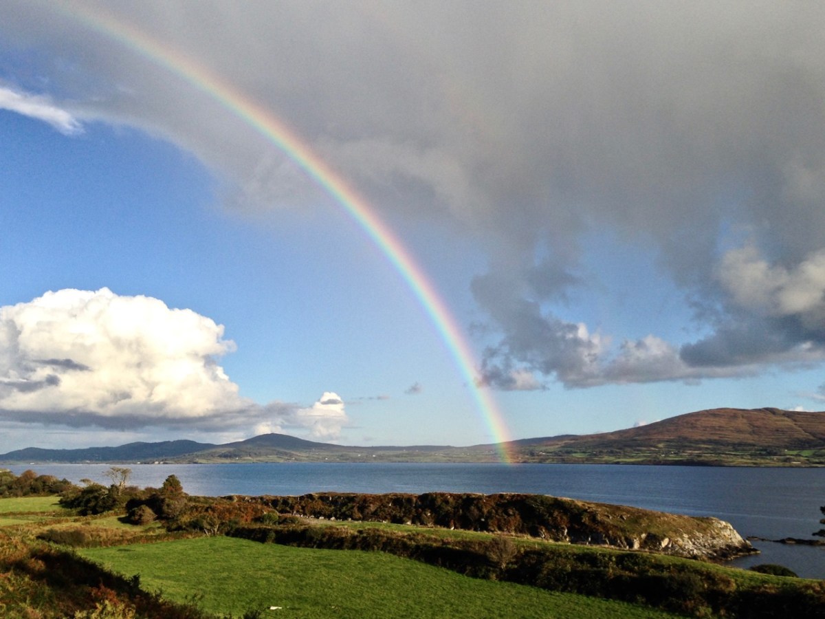
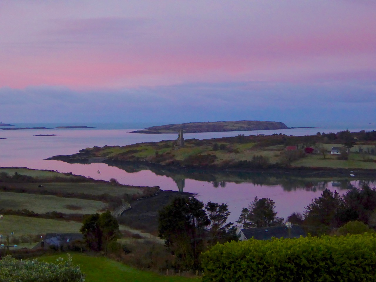
Another local view for us (above): we face out to Rossbrin Cove on the Mizen Peninsula. Finally, the celestial spectacle (below) finds its pot of gold on the shores of the Mizen.
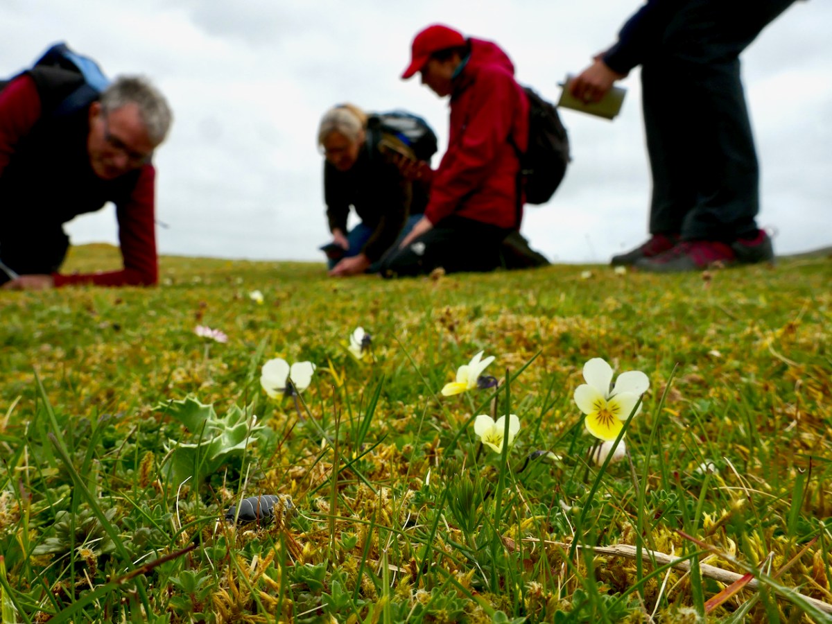
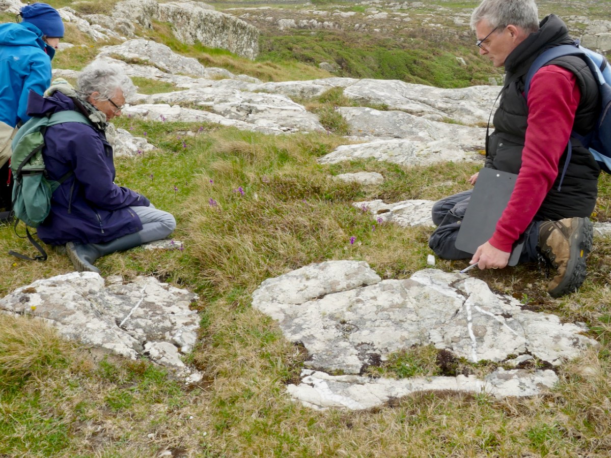
For a wildflower enthusiast there is nothing better than a day spent with like-minded folk looking for interesting plants under the leadership of a true expert.
At this time of year the buttercups all over the dunes are actually Bulbous Buttercups – if you look under the flower head you will see that the sepals turn down away from the petals
I had the immense privilege of being included in a Rare Plant Monitoring Workshop on Friday the 13th – which also happened to be the day that Biodiversity Week kicked off in Ireland. As you probably all know by now, Nature is in crisis all across the world, and although we may be surrounded by lush hills and boreens in West Cork, there are ominous signs that all is not well with our natural world here as elsewhere. Fewer than ten percent of our native species in Ireland have been assessed for their conservations status – but of those that have been, one fifth (yes – one-fifth!) are at risk of extinction.
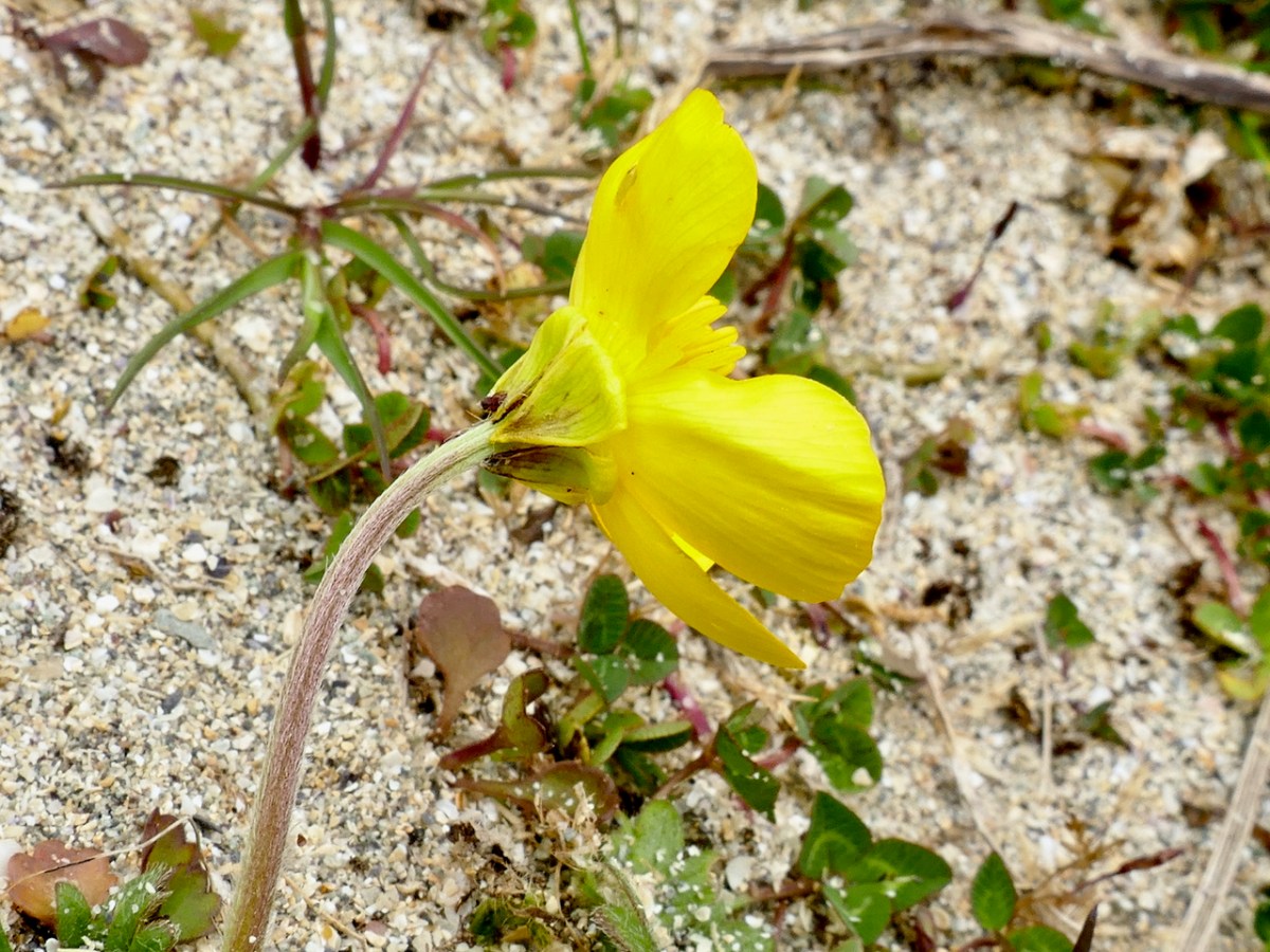
Sand Pansy – gorgeous little violas found on the dunes
That’s why counting plants is important – each one is part of the complex web of biodiversity that contribute to the health of our environment and the loss of even one can have knock-on effects on a whole cascade of others. I already monitor two rare plants for the National Biodiversity Data Centre (NBDC), Vervaine and Calamint, so I have an insight into the kinds of threats rare plants can face, from mowing to herbicides to change of land use – all of those have happened to the small populations I monitor.
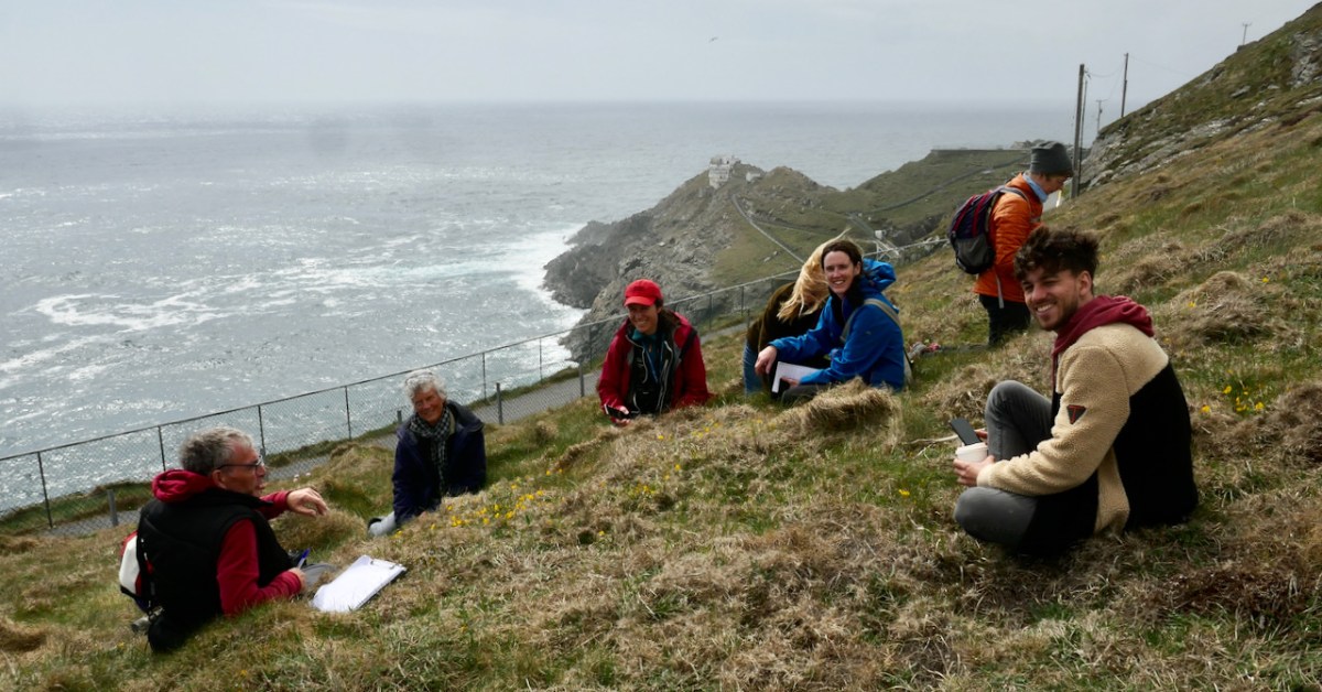
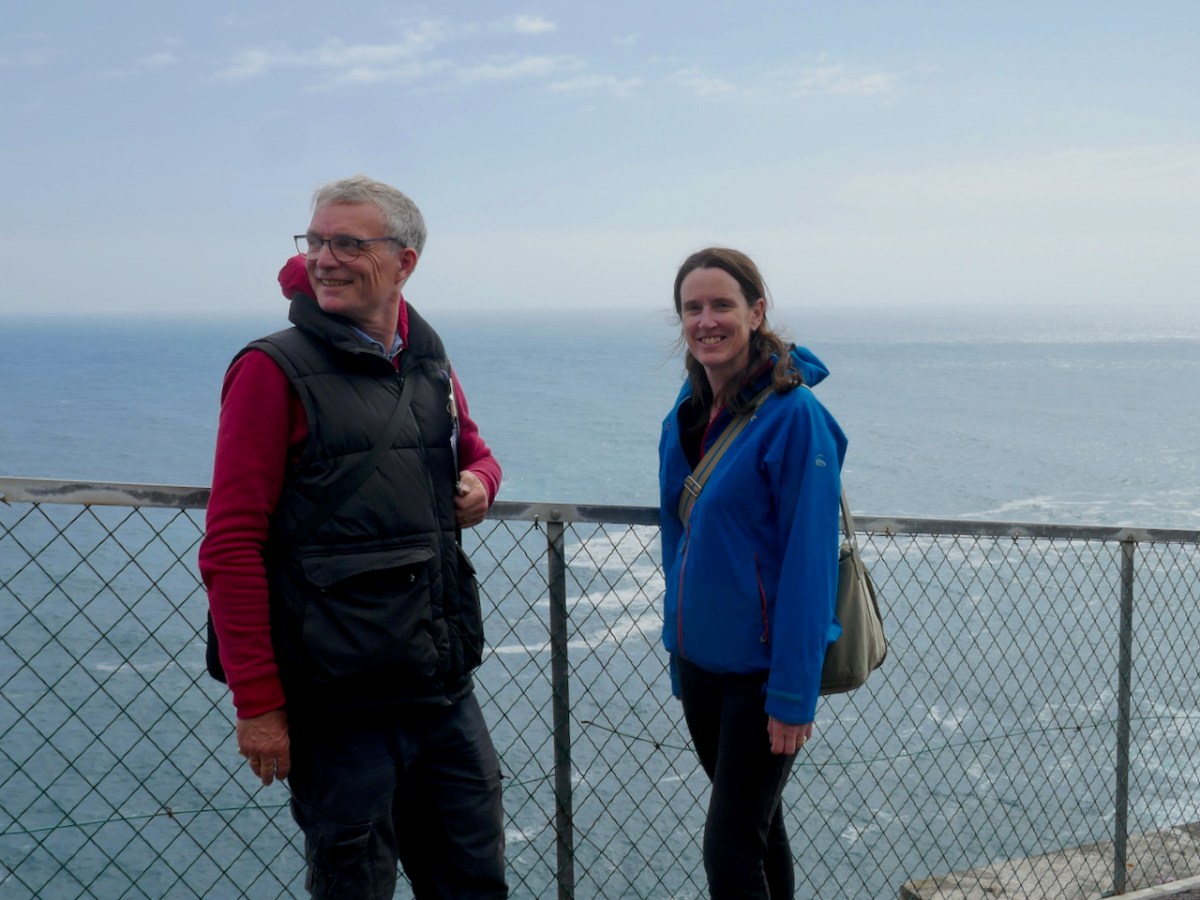
The location for this workshop was Barley Cove and Mizen Head. Having rendezvoused with Botanist Paul Green and NBDC Scientist Úna FitzPatrick (above, at Mizen Head) we set out across the dunes. I had met Paul before and so I knew that he is unfailingly generous about sharing his immense knowledge. Throughout the day we stopped frequently to exclaim over a plant that one or another of us spotted (like the Bulbous Buttercup) on the dunes or the rocks, and Paul always took the time to stop and educate us about each one.
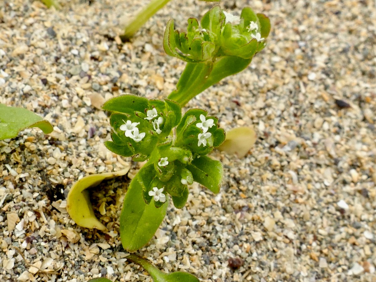
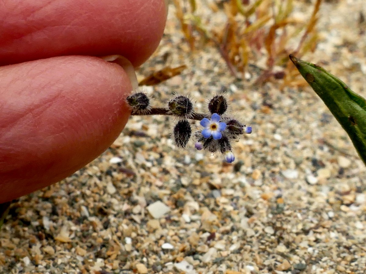
Thus, along the way, I was introduced to several plants that were entirely new to me. Despite the fact that I have been to Barley Cove on numerous occasions, many of them spent lying in the grass on the dunes (see this post and the wildflower slideshow within it, for example), I had never seen Common Cornsalad (above) nor Early Forget-me-not (below) before Friday.
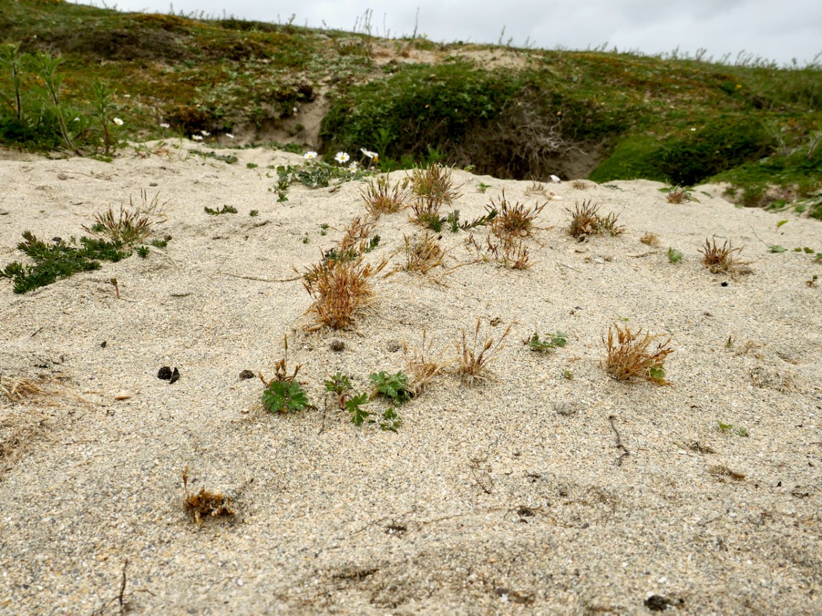
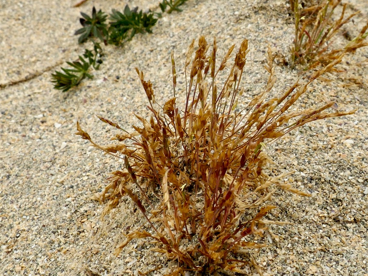
As our first rare plant, we were in search of Early Sand-grass, the kind of undistinguished little plant that you would walk over unthinkingly, but which is so rare that it only occurs here and in the Bull Island Nature Reserve in Dublin. That’s the distribution map below, courtesy of the BSBI.
Paul found it and we collectively traced its extent across the dunes. This is an area with much rabbit activity and Paul speculated that the bare patches of sand created by the busy bunnies was what had encourage or allowed the Sand-grass to colonise this area. It’s a complex issue – those Barley Cove Bunnies can be destructive to the dunes in some ways, but here we have an instance where their presence has been beneficial – one of those complex interactions that are so hard to predict.
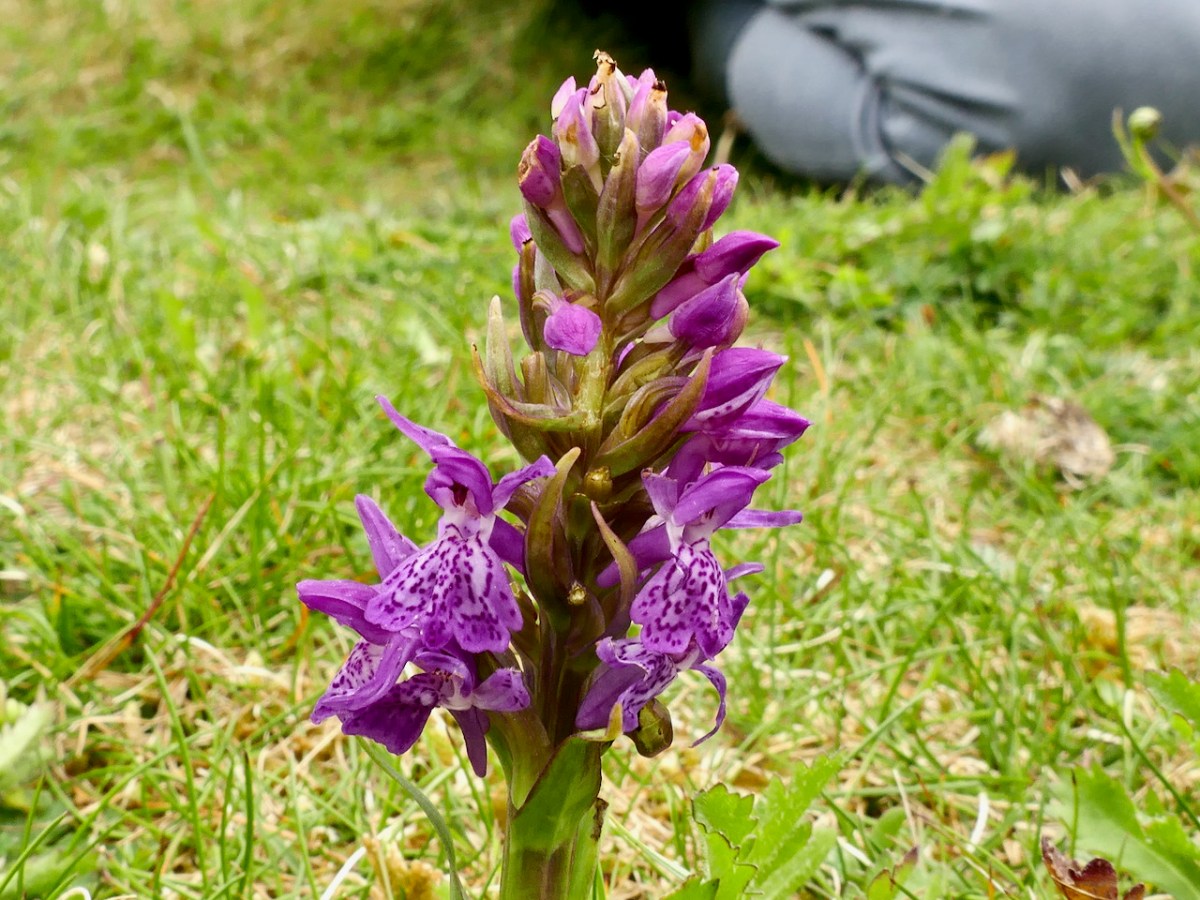
Our next target was an orchid – the Green-winged Orchid. But, on the way, we found another Orchid – the Irish Marsh Orchid (below). It was beautiful and bold and instantly visible in the short grass on the dunes.
In contrast, we almost tripped over the Green-winged Orchid, which upon first glance looked spindly and unremarkable. This is one you have to get close to – can you see them in the grass, below?
Here’s what Zoe Devlin has to say about this flower:
Surely the most exquisite wild orchid in Ireland. . . Green-winged Orchid is a small, erect plant which grows to about 30cm tall in grassland and meadows where grazing occurs. It bears flowers, well separated, in short spikes and these flowers appear in several colours – from snow-white through pink and magenta to deep purple. The three sepals are purple-veined with strong, green lines and these sepals form a hood over a broad, downward folded lower lip which is three-lobed and heavily spotted at its white centre. There is also a stout, slightly-curved spur. These incredible flowers bloom from mid-April to mid-June. The leaves are shiny green, unspotted with the upper leaves sheathing the stem and the lower leaves forming a rosette.
Can you see all that in these photos? I’m not sure you can, which is one of the things that makes wildflower identification interesting – especially with a family like the orchids where there are quite a few that look similar until you really examine them.
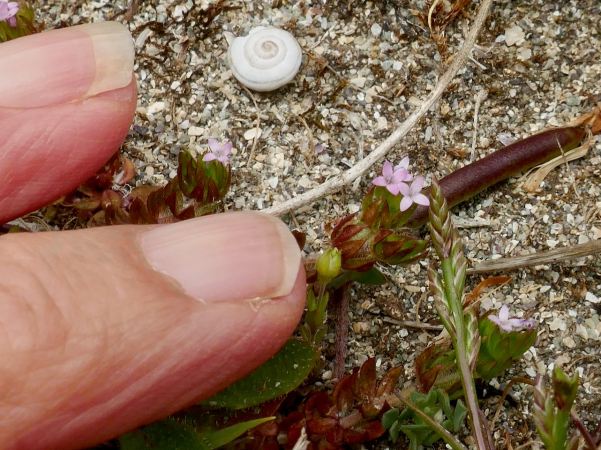
There were more plants on the dunes – I was amazed to find Field Madder (above), which I always assumed was a plant of arable ground. One of the things we had to get used to was how tiny many of the plants on the dunes were compared to those that grow in less challenging environments – like miniature versions of themselves.
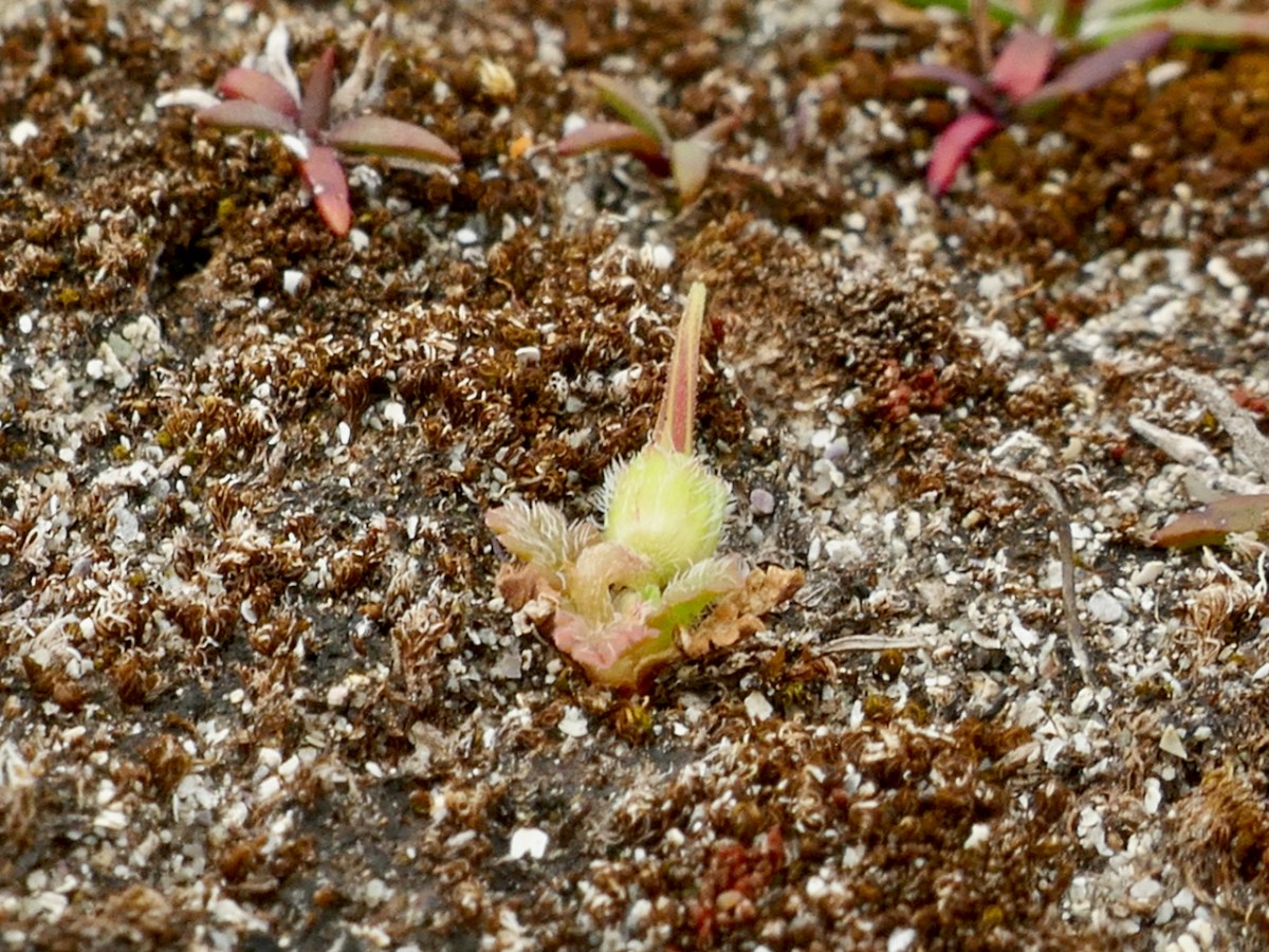
Then there was one of our target species, the Sea Stork’s-bill (above) – really, a flower that only its mother could love, but very rare in Ireland and therefore one of the plants that enable us to chart the conservation of its habitat.
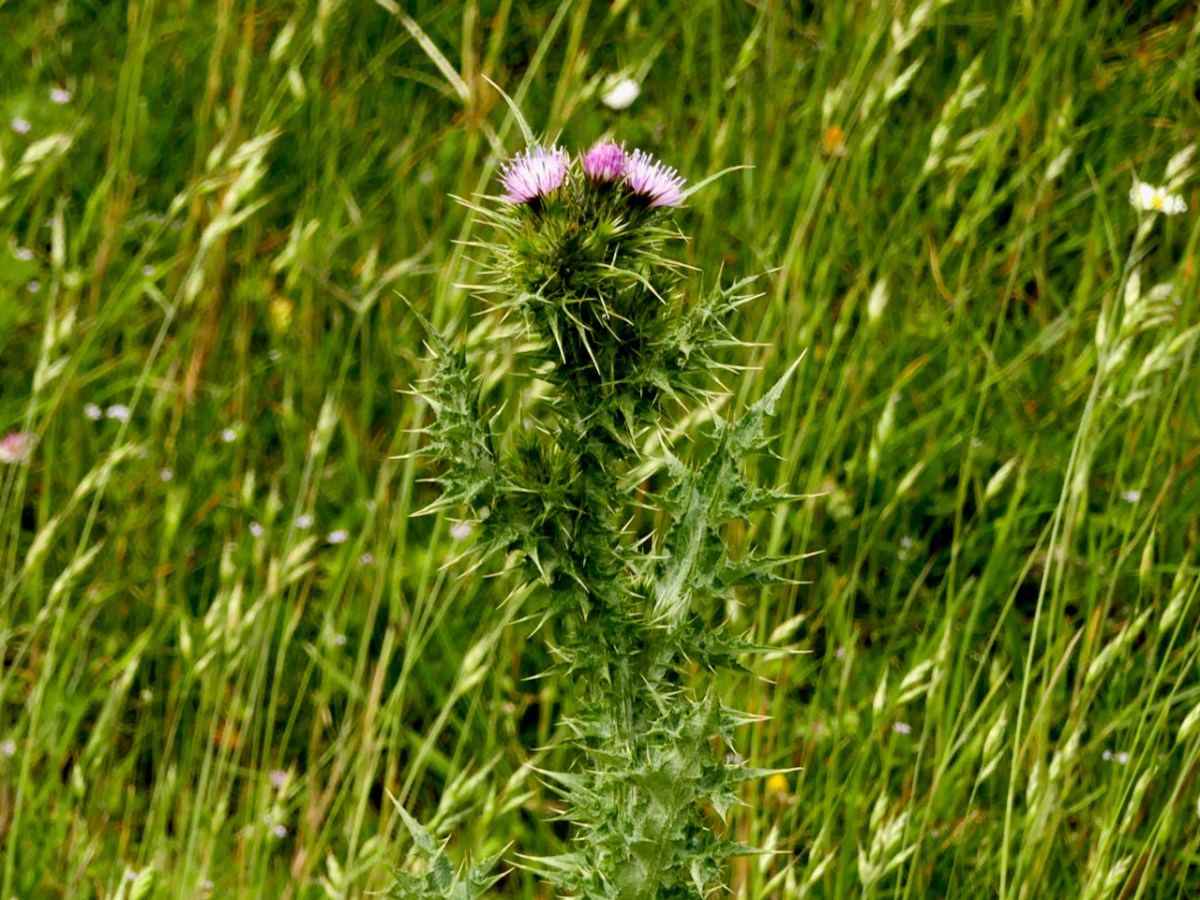
We drove from Barley Cove around to the Holiday Park but were unable to do a count of the Slender Thistle. The land was being grazed by sheep and every access was blocked (above). So we contented ourselves with noting that currently it appears to be abundant, if very localised. I managed a distant shot of this fine head (below) showing the pink flowers but also how spiny it is.
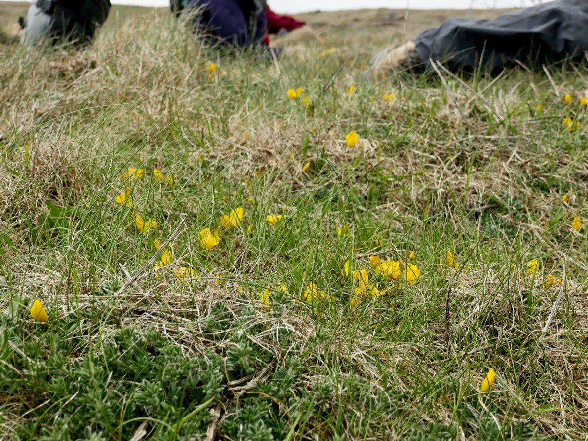
Our final stop was Mizen Head, one of the very few places in Ireland (see map below and the Broom below that) where you can find Prostrate Broom (try saying that fast). This was another exercise in a different kind of counting, since the plant is on sea cliffs and behind fences at the Visitor Centre, so it has to be identified at a distance and the count is an educated estimate. Add in the fact that there are two other yellow flowers gaily blooming around it (Kidney Vetch and Bird’s-foot Trefoil) and you get an idea of the challenge involved.
I have taken on the task of the Early Sea-Grass count. It may bloom as early as February or March, so I’ve made a calendar note to head out to the Dunes next year at that time. Another one of the participants, Damaris, and I will work together on our counts – it’s always more fun if you have a companion and probably more accurate too.
Thank you, Úna and Paul, for such a profoundly educational experience, that also managed to be great fun.
Photographs are vital to this blog, so we are always out and about with our cameras. This is a personal selection of images that pleased us in 2018. Some of these photographs have appeared in our posts, and some on our Facebook pages, but several are appearing here for the first time. Some of them remind us of places we’ve stumbled across, like the one above. It’s a room in the 15th century Castle Salem, all done up for a movie – a wildly romantic one, I bet.
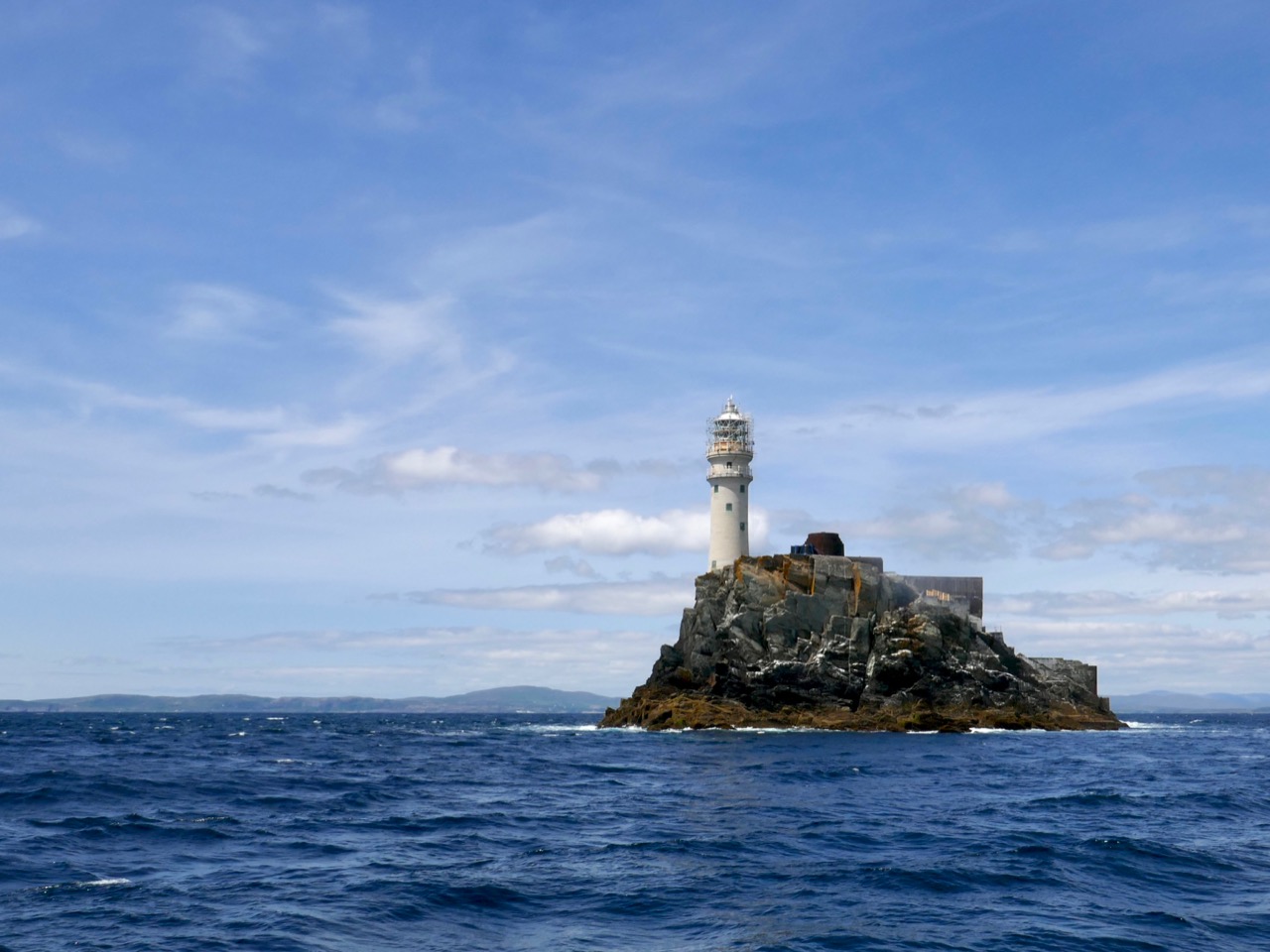
From there to the iconic Fastnet Rock Lighthouse. They changed the bulb this year, to LED. We can still see the light at night, but it doesn’t sweep across the sky like it used to. On this trip, mostly photographed by my nephew, Hugo, the scaffolding was still up for the renovations.
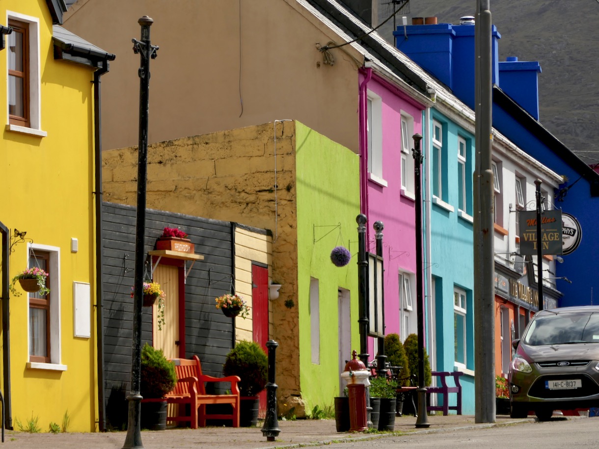
We love the Beara and try to get over there as often as possible. It’s famous for its colourful villages – this one is Ardgroom. And not too far away is a wonderful stone circle – Robert mentioned it in last week’s post. This photograph is of the outlier and shows how it seems to mirror the shape of the landscape on the Iveragh Peninsula.
Coming back, or going, our route always takes us over the incredible Healy Pass. I’ve chosen the photograph below because the remoteness of the little farms take my breath away.
But if you look closely, this photograph also shows the old field patterns from tiny holdings long ago, including the lazy beds – ridges left from cultivating potatoes by hand.
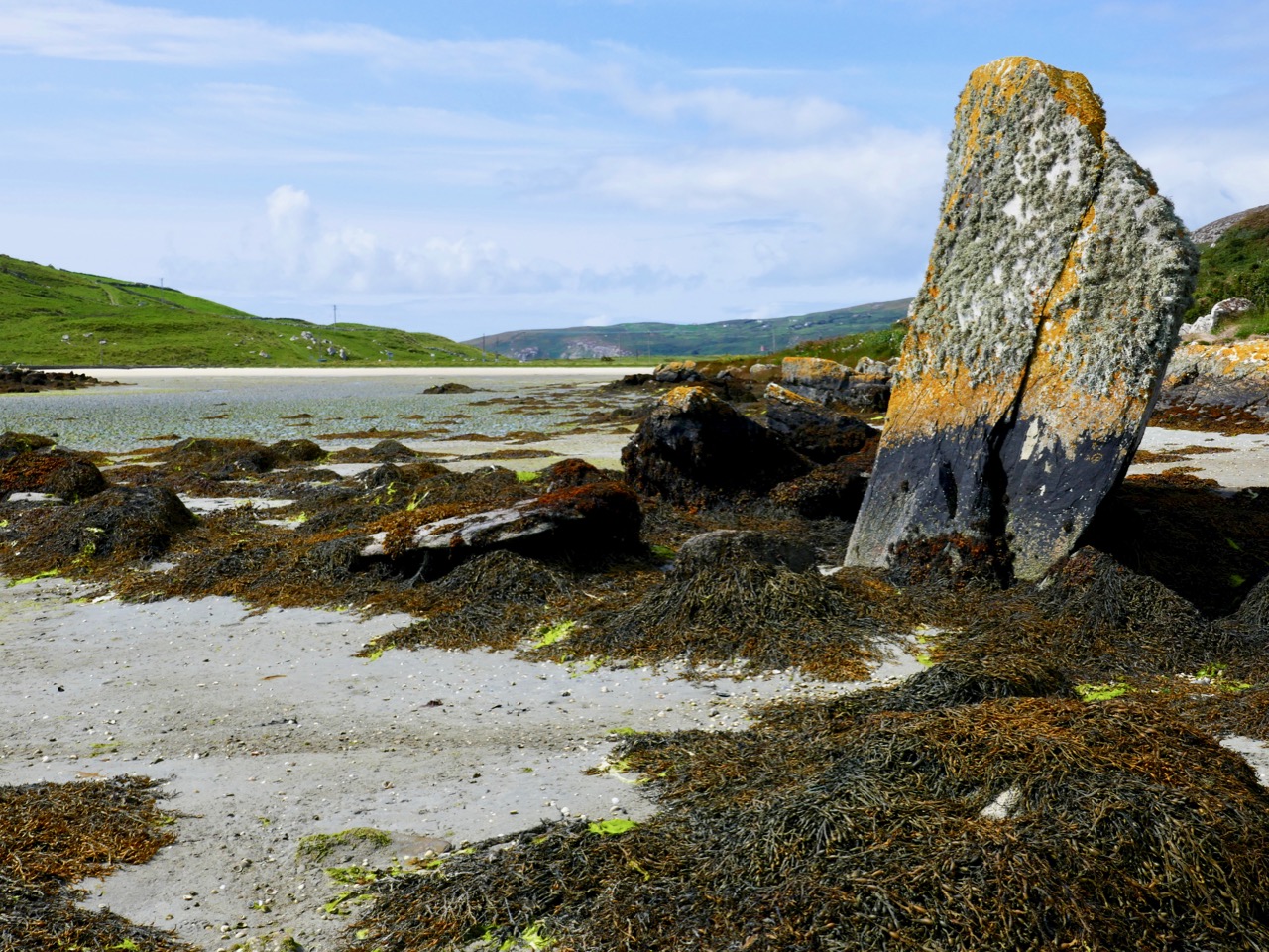
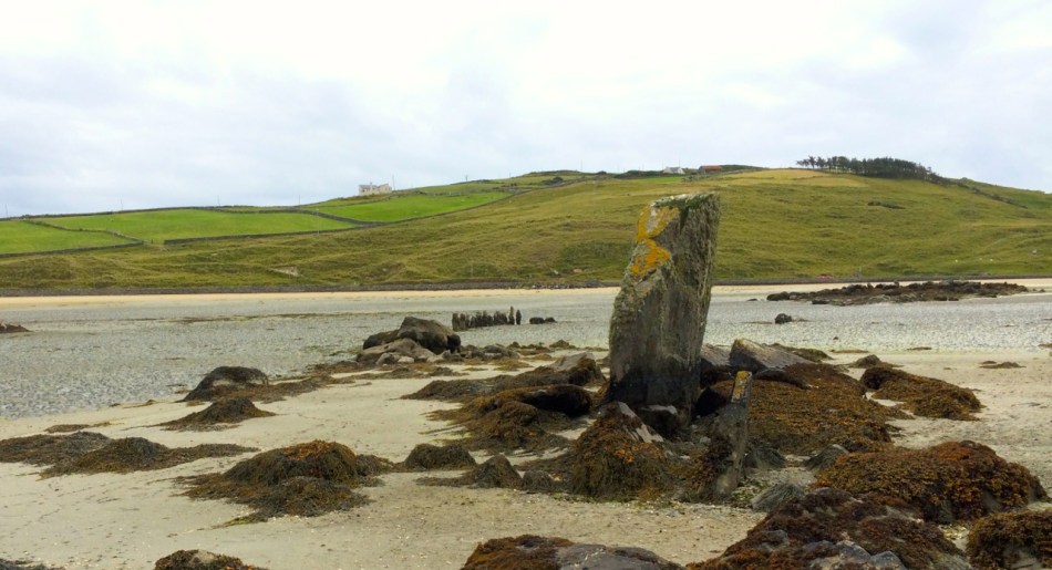
Our own Mizen Peninsula is fertile ground for exploration. This enormous standing stone, for example, can be seen in Crookhaven Bay. But even though it seems to be set in the sand deliberately, some authorities feel it is a natural feature. There’s what looks like an old stone field fence nearby, and lots of archaeology in the area.
We’re looking down on that area from this vantage point (above), and across to Brow Head, always great for a wander – we included it in our West Cork Obscura list.
We love to bring our visitors out to the Mizen Head Visitor Centre too. It’s a wonderful experience, with dramatic scenery and vertiginous cliffs. There are lots of remnants still to remind us of the active past of this lighthouse and signal station, including this derelict, if picturesque, shed.
Of course, the weather isn’t always wonderful, even if it seems that way in a set of carefully-chosen images. But even when it’s wild, it’s worth taking the camera along – the photograph above was taken at the Altar in Toormore on a stormy day.
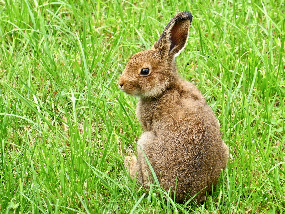
Robert, as our readers know by now, is a hare fanatic, and one of the highlights of his year (next to becoming a citizen!) was when little Berehert, a young hare, showed up on our lawn and hung around for a few days.
Meanwhile, nothing makes Finola happier than to wander around among the wildflowers. She runs a Facebook page on the Wildflowers of West Cork – so pop over there any time to see the amazing range of flowers that we get to enjoy here.
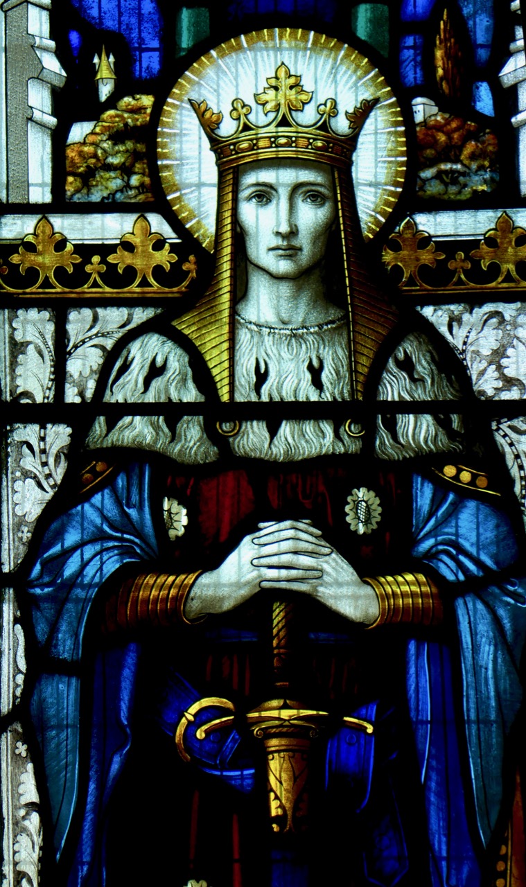
The other thing she loves is to drop into churches to study the stained glass. We’ve written about the fabulous George Walsh windows in Eyeries before, but there are lots of surprises wherever you go. She was quite taken with a wonderful three-light war memorial window in St Peter and Paul Church of Ireland in Bandon. Above is King David from that window, by the firm of Clayton and Bell. Gorgeous, isn’t it?
From March to October West Cork hosts a huge number of festivals. Everybody goes to everything – from the Ballydehob Jazz Festival (above), to events celebrating country and traditional music, history, wooden boats, the arts, short films, knitting (really), stone carving, food and more.
Our own view is a never-ending source of delight. This is sunset over the Goat Islands, Greater and Lesser, which lie west of Long Island. There’s a cleft down the middle, which is dangerous to try to navigate, and no place to land. As a result the islands are quite wild, with a herd of feral goats. For us, they have an air of profound mystery.
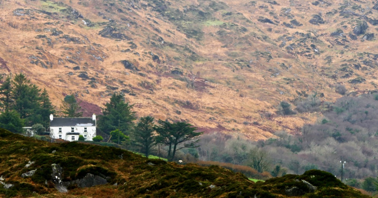
Our final photograph was taken yesterday – a traditional farmhouse on the slopes of Mount Gabriel. Lots more West Cork scenes in the months to come!
Our Roaringwater Journal Facebook Page features lots of our photographs of West Cork – two or three every week – and we know by the views and the ‘likes’ the ones that capture your imagination. It’s become a tradition here with us at the end of the year to go through them all and show you the top choices. Think of it as our Christmas present to you, our wonderful readers – nothing to read, just images of our gorgeous part of the world to drool over. Of course, we have our own favourites too, even if they didn’t get as many likes as others did, so we sneaked a few of those in here two. This is the first of two posts – the next one in a few days.
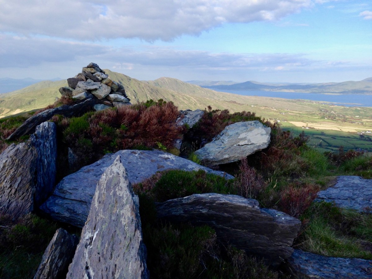
Sheep’s Head
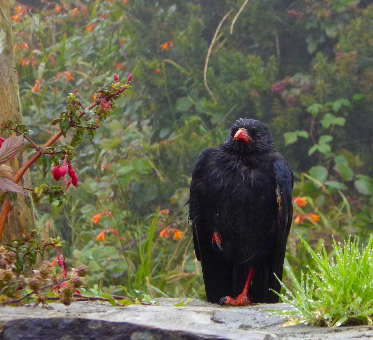
Chough in the rain
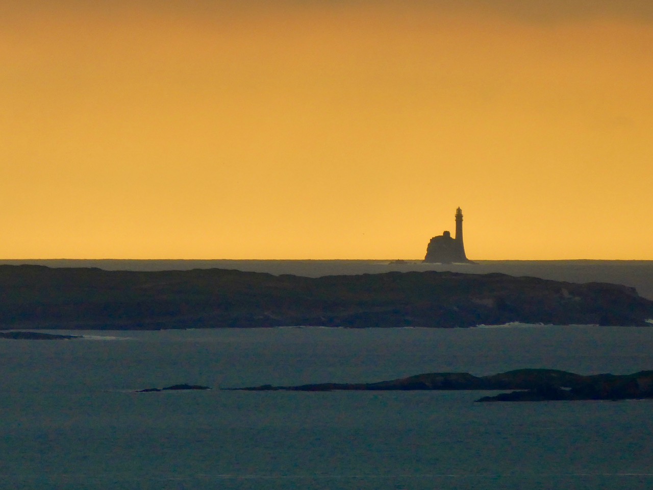
Fastnet Lighthouse at sunset
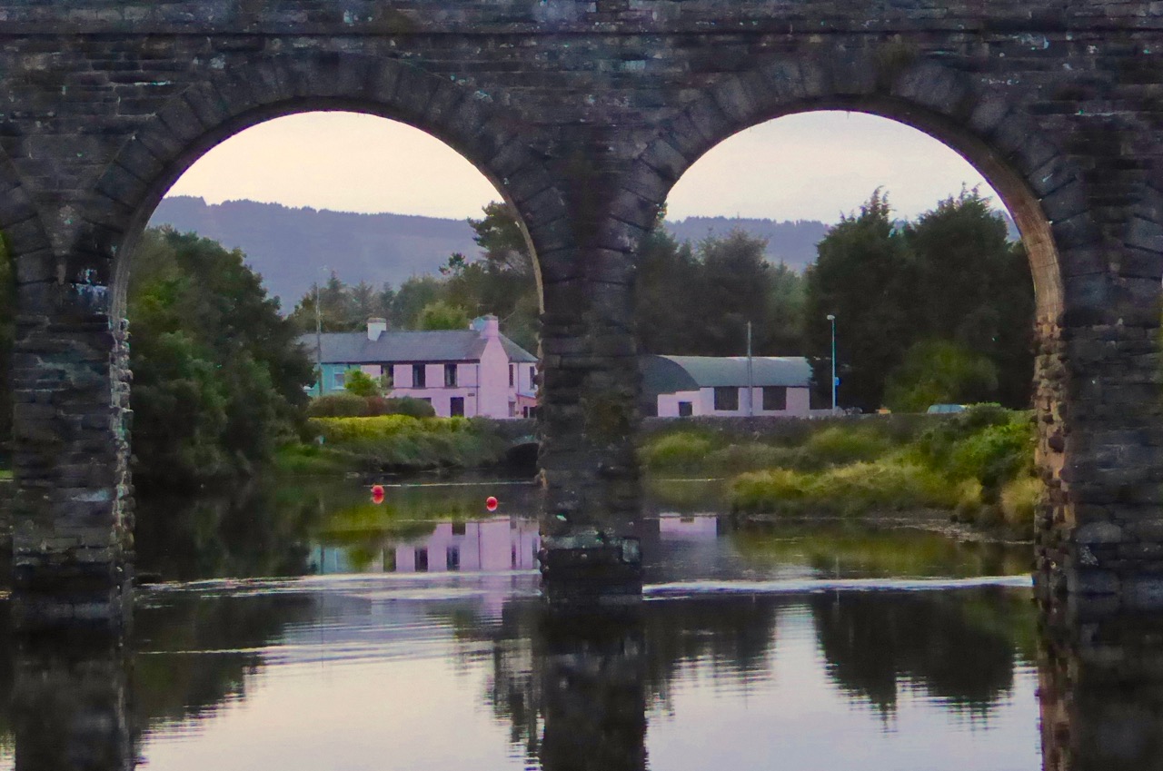
Two of the arches of Ballydehob’s famous Twelve Arch Bridge
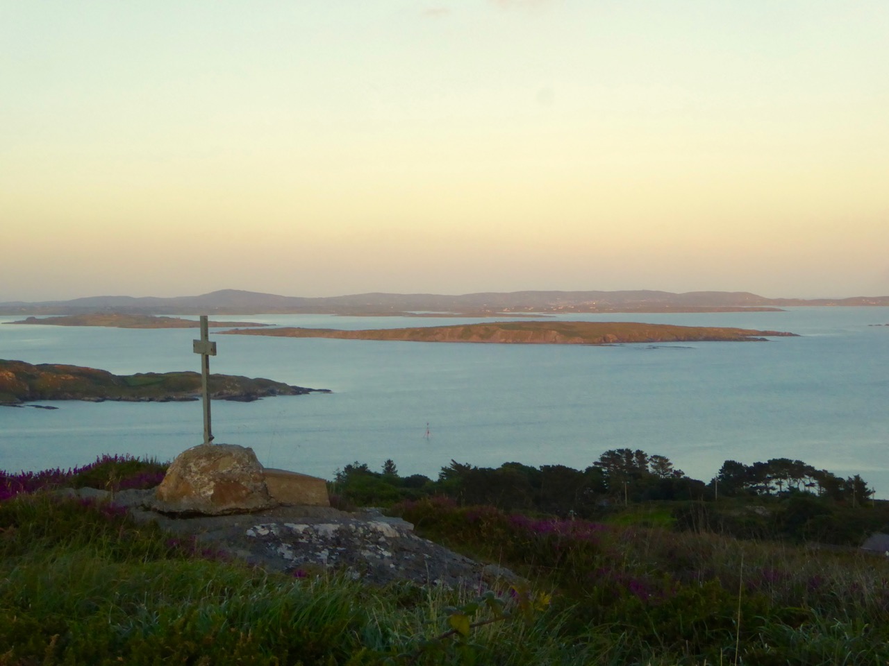
Roaringwater Bay from Sailor’s Hill above Schull
Gougane Barra in the autumn
Walking to the Mass Rock, Sheep’s Head
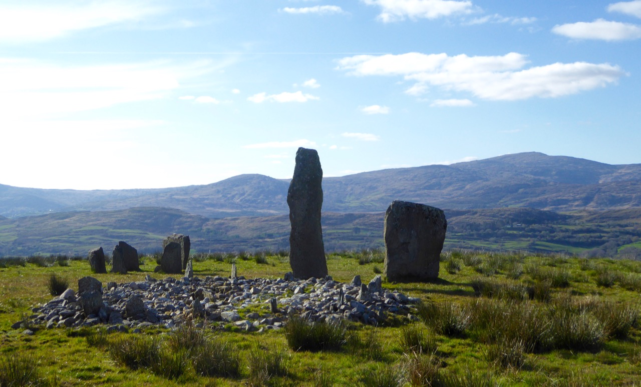
The archaeological complex at Kealkill – a five stone circle, a standing stone pair and a radial cairn
When St Brendan of Clonfert set out to discover America in 512 he and his fellow monks had to face the enormity of the Atlantic Ocean in tiny boats built out of wood and oxhides, sealed with animal fat. Up here in Nead an Iolair our view out to the islands of Roaringwater Bay and beyond is dominated by that same ocean and – sometimes – we feel just as small. This year the winter gales have started early, and spates of fierce westerlies have been throwing the Atlantic straight at our windows. The tiles rattle alarmingly while we are tucked up in bed at night. At these times I think of the Saint and what he had to face. But, like Brendan, we always survive the storms, and often wake up in the morning to a calm, clear day – except that you can hear the constant ‘roaring’ of the open sea out over the bay.
On their way to the New World – Saint Brendan and his companions take advantage of a passing Atlantic denizen to celebrate Mass…
The Atlantic has shaped Ireland. The sea is omnipresent: poets have written about it, storytellers have woven tales around it, and composers have tried to capture its spirit in music. Here’s a small section from the impressive ‘Brendan Voyage’ written by Shaun Davey for orchestra and Uillinn pipes – it’s the haunting second movement, played by Liam O’Flynn with the Irish National Youth Orchestra, at a performance in Cork City Hall. It makes me think of the wonderful sunrise on that calm day after the storm…
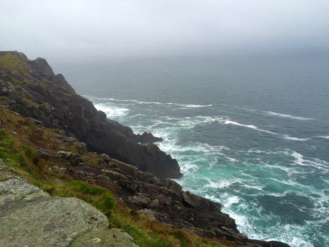
Our own Atlantic: telescopic view of a storm battering Long Island, taken from our garden at Nead an Iolair (top), Brow Head, near Crookhaven (centre), and the impressive land and seascape at Mizen Head – Ireland’s most south-westerly point (lower picture). At the head of this page you can see the huge rollers that come into Dingle Bay, Co Kerry
Dogger, Rockall, Malin, Irish Sea: Green, swift upsurges, North Atlantic flux Conjured by that strong gale-warning voice, Collapse into a sibilant penumbra. Midnight and closedown. Sirens of the tundra, Of eel-road, seal-road, keel-road, whale-road, raise Their wind-compounded keen behind the baize And drive the trawlers to the lee of Wicklow. L’Etoile, Le Guillemot, La Belle Hélène Nursed their bright names this morning in the bay That toiled like mortar. It was marvellous And actual, I said out loud, “A haven,” The word deepening, clearing, like the sky Elsewhere on Minches, Cromarty, The Faroes.
Glanmore Sonnets VII, taken from Field Work by Seamus Heaney, published by Faber and Faber Ltd
Seamus Heaney was deeply affected by the seascape of his native Ireland. Anyone who works on or beside the sea is aware of the resonant names from the Shipping Forecasts, and the poet has used those names here to introduce his word-picture of the elemental Atlantic.
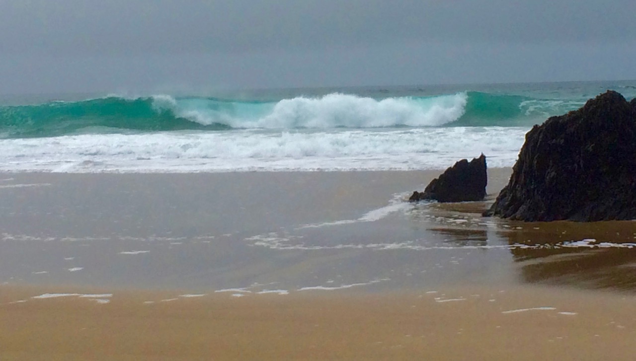
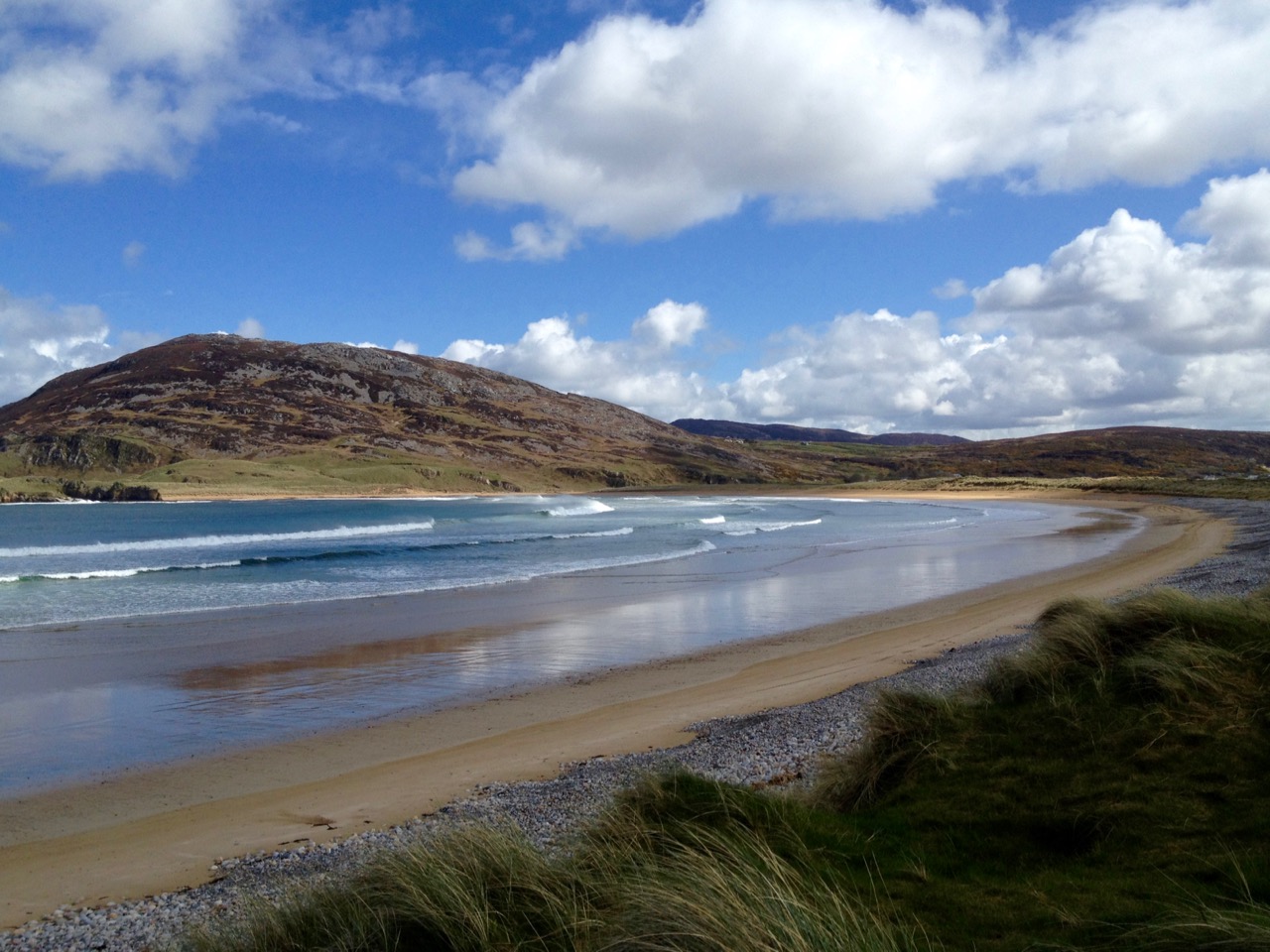
Atlantic contrasts from Mizen to Malin: near Malin Head – Ireland’s most northerly point (top), off the Beara (centre) and a beach in Donegal (lower)
A later traveller over the Atlantic waters was Chistopher Columbus in the 15th century. On the way he looked out for St Brendan’s Isle, a spectral island situated in the North Atlantic somewhere off the coast of Africa. It appeared on numerous maps in Columbus’ time, often referred to as La isla de Samborombón. The first mention of the island was in the ninth-century Latin text Navigatio Sancti Brendani Abatis (Voyage of Saint Brendan the Abbot), from whence it became firmly implanted into Irish mythology. St Brendan took a little party of monks to the island to say Mass: when they returned after a few days to the rest of the flotilla, they were told that they had been away for a year! The phantom island was seen on and off by mariners for years until in 1723 a priest performed the rite of exorcism towards it during one of its apparitions behind low cloud… You can see St Brendan’s Isle for yourselves, above the wonderful giant fish in the second picture down.
Dingle peninsula (top), and Coast Road in Donegal (lower)
I was pleased to find this Irish Times video made by Peter Cox when he was fundraising for his book Atlantic Light: spectacular photographs of the coastline on Ireland’s Wild Atlantic Way. The excellent aerial views in this film are all taken by a drone… Look out for places you will have seen in our blogs!
We are privileged that the Atlantic Ocean is the abiding but ever-changing feature in our daily lives. It must affect us in unknown ways: I do know that, wherever I go in this world, I will – like Saint Brendan – always be drawn back here to our wonderful safe haven…
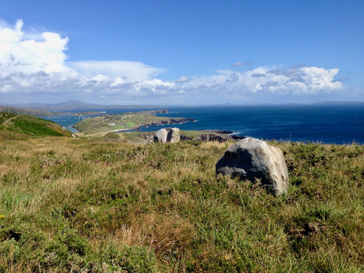
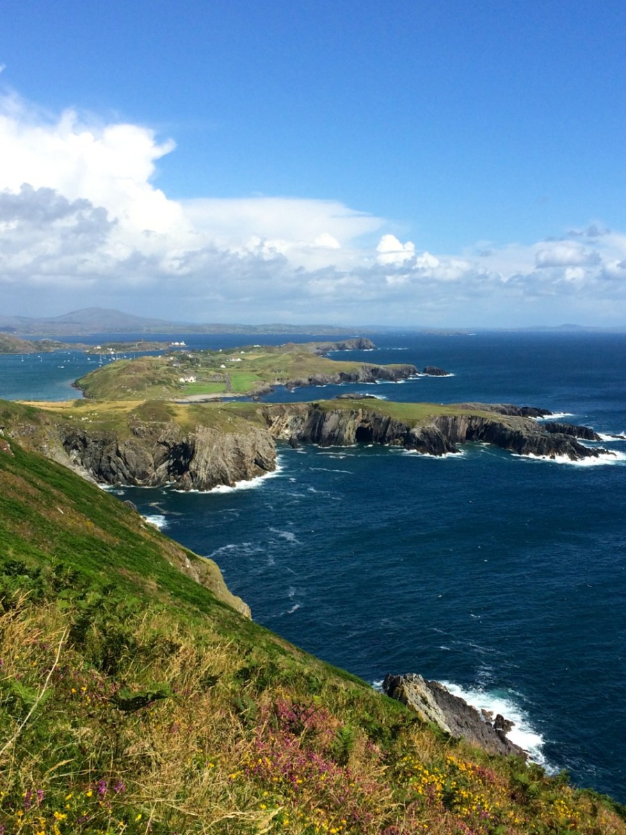
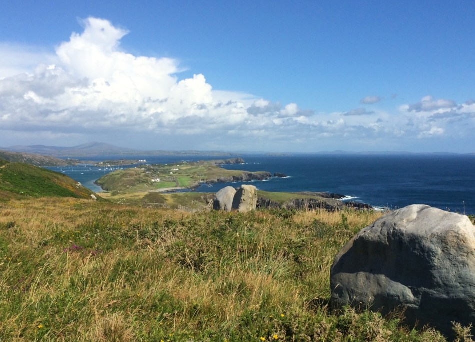
Contrary to popular belief, Mizen Head is not the most southerly point on the Irish mainland – that distinction actually belongs to Brow Head, just to the east. Brow Head doesn’t have the same profile as Mizen Head: many people have never heard of it. But it’s magnificent, steeped in history, wonderfully scenic and best of all, totally walkable.
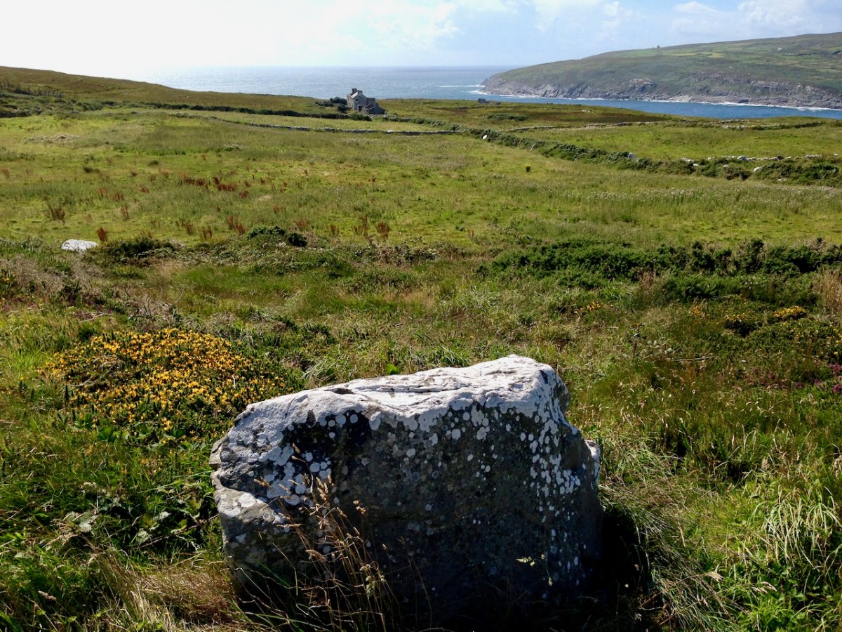
Possible prehistoric standing stone and field boundary, visible at low tide
You arrive at Brow Head by driving west from Schull out towards Crookhaven. If the water is low in the Haven you may spy the remains of ancient field boundaries, covered at high tide.
Galley Cove
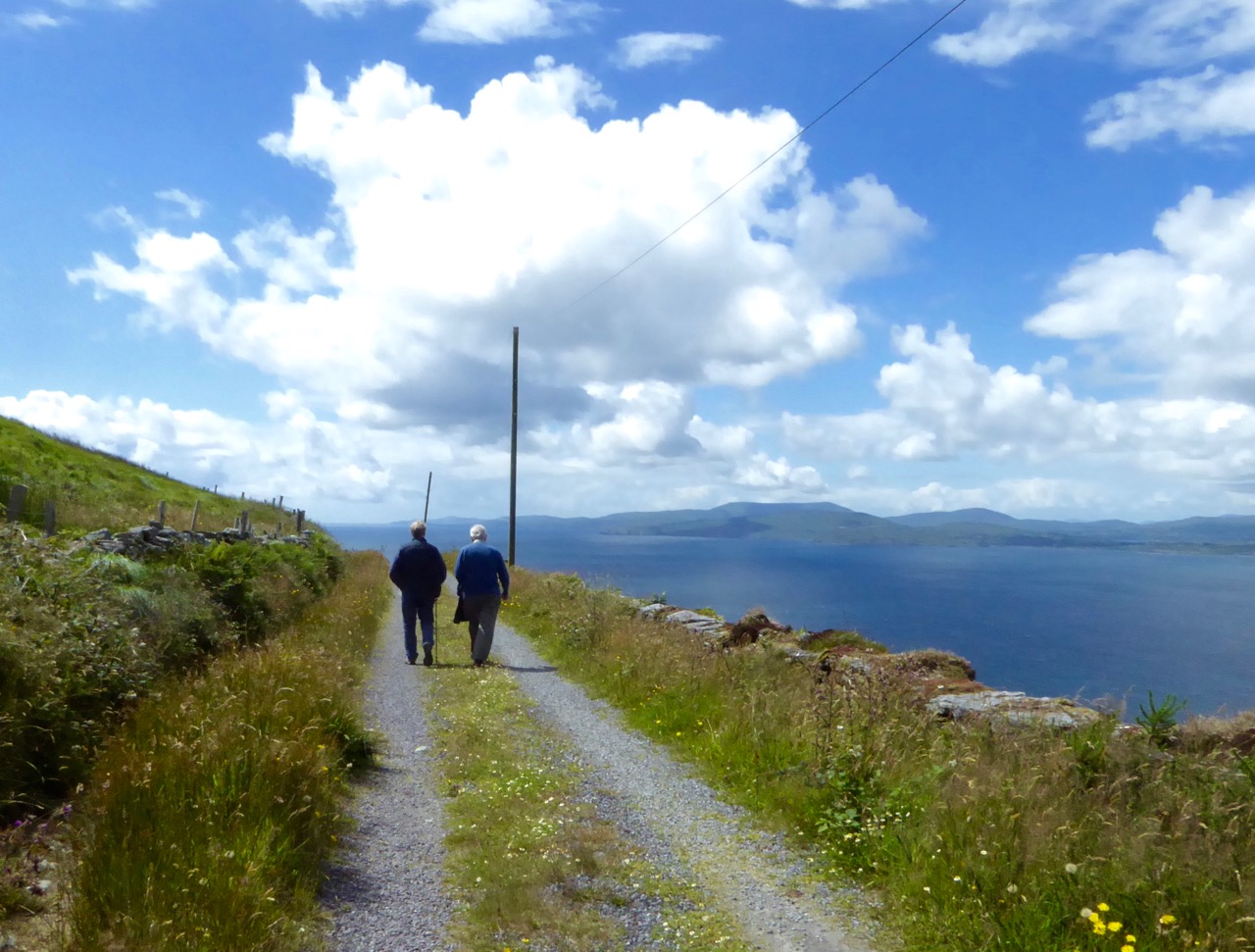
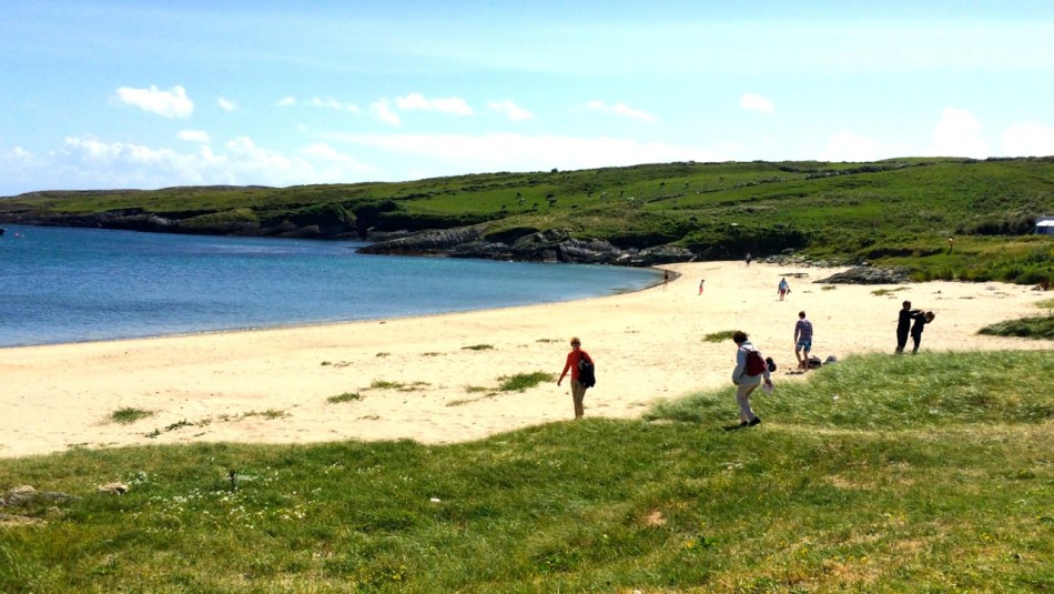
The starting point is Galley Cove – a smaller and quieter beach than the popular Barley Cove a little further west, but featuring the same white sand and inviting Caribbean-blue water. You can leave the car here and proceed on foot uphill if you’re feeling in the need of an aerobic workout. Or you can drive up the narrow road, but be warned: if you meet a car coming down you may have to reverse a considerable distance. There is parking for three or four cars at the top of the hill.
Recently-erected standing stones
The first thing you’ll notice, in front of the lone house at the top of the hill, is an impressive row of standing stones, aligned to point back down the Mizen Peninsula. These are recent additions to the landscape, testament to the enduring tradition of erecting such stones in this part of the world.
Signal tower and Marconi station
All around the blooming heather
Along the trail
Towards Barley Cove
Scramble up through the heather to the remains of the Napoleonic-era signal tower and the Marconi Telegraph Station – see Robert’s post for more about Marconi and early wireless telegraph in West Cork. From here there are panoramic views east to Crookhaven and down the Mizen Peninsula, west to Mizen Head, North to Barley Cove andsoutheast to the Fastnet Rock.
Mine Captain’s house
Old mine shafts
Follow the path now south west to the tip of the Head. This was a copper mining area in the nineteenth Century and you can still see the ruins of the Mine Captain’s house, miners’ dwellings and fenced off mine shafts. Abandoned cottages litter the north-facing slopes, with small overgrown fields defined by stone walls.
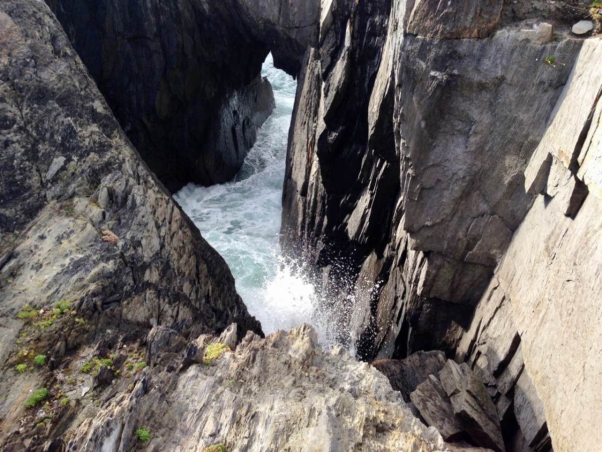
Pounding sea
Cliff edge
Near the tip of the Head you must cross a narrow causeway with steep cliffs on either side. This part is not for the faint of heart (or small children, perhaps) especially on a windy day. Find a sheltered spot at the end and sit a while. You may see gannets diving here, or dolphins in the waters below, and you will certainly be aware of the power of the pounding waves.
Next parish – America!
Before you leave, make sure that you make a wish – after all, this is a special place, and special places in Ireland have their own magic.
Welcome to the UCD Library Cultural Heritage Collections blog. Discover and explore the historical treasures housed within our Archives, Special Collections, National Folklore Collection and Digital Library