Derrynablaha and its Rock Art

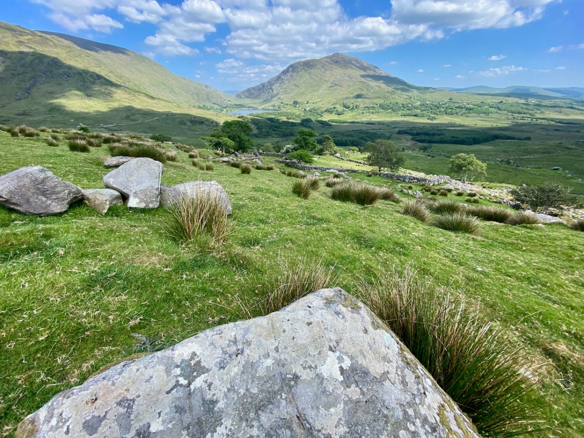
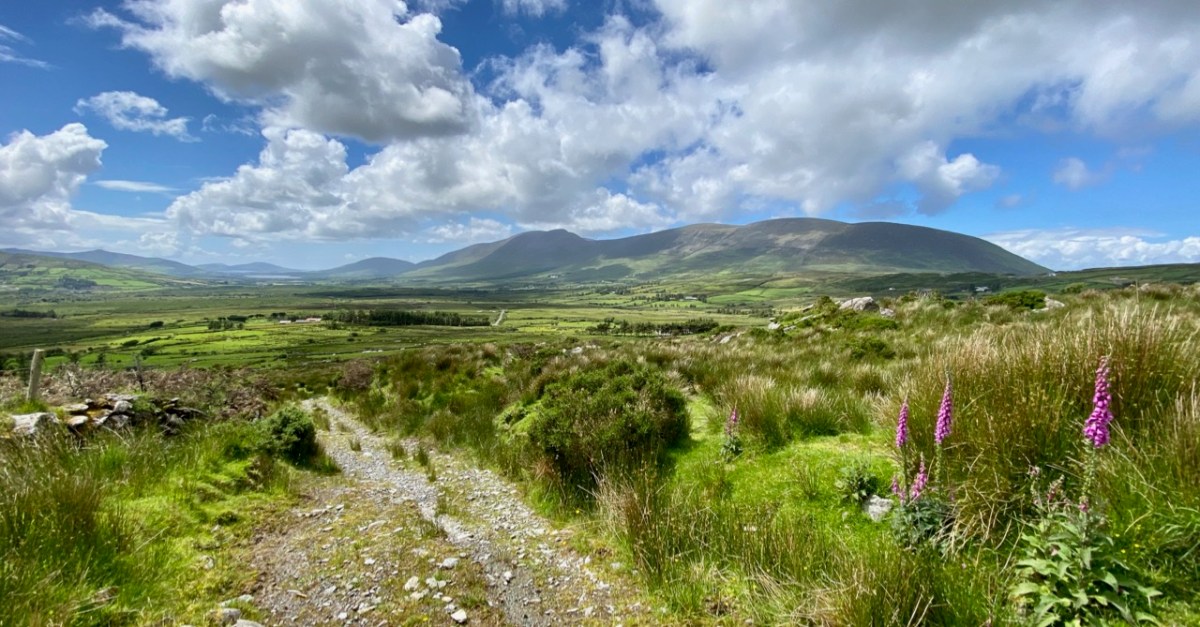
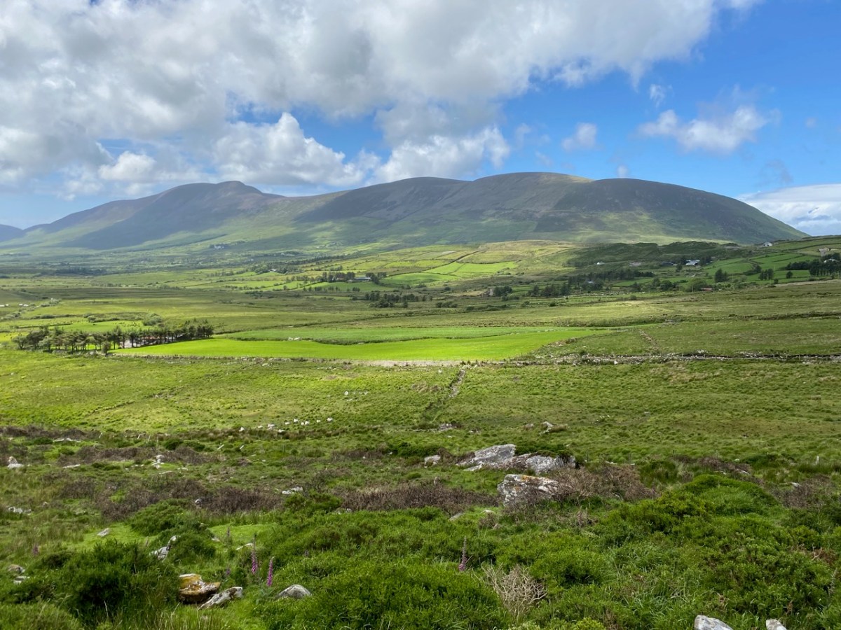
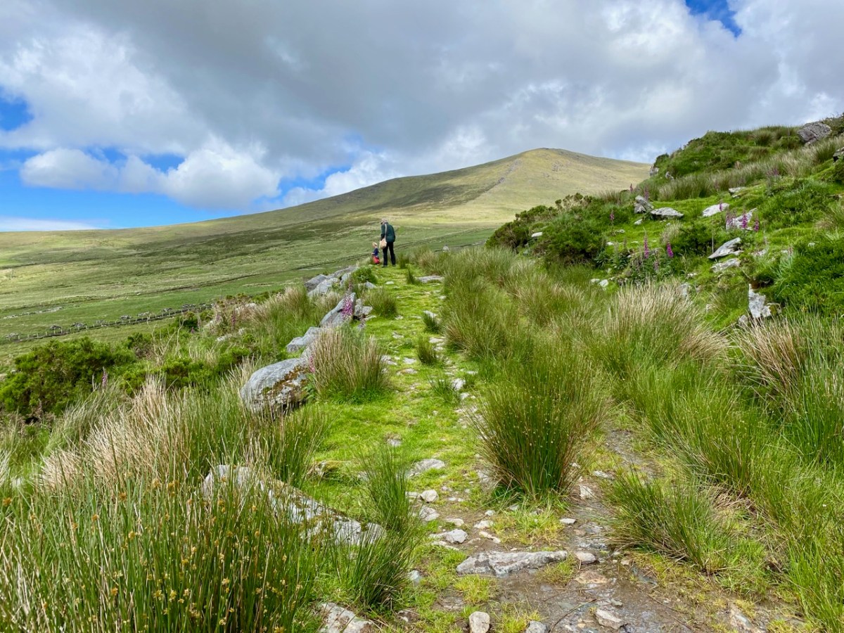
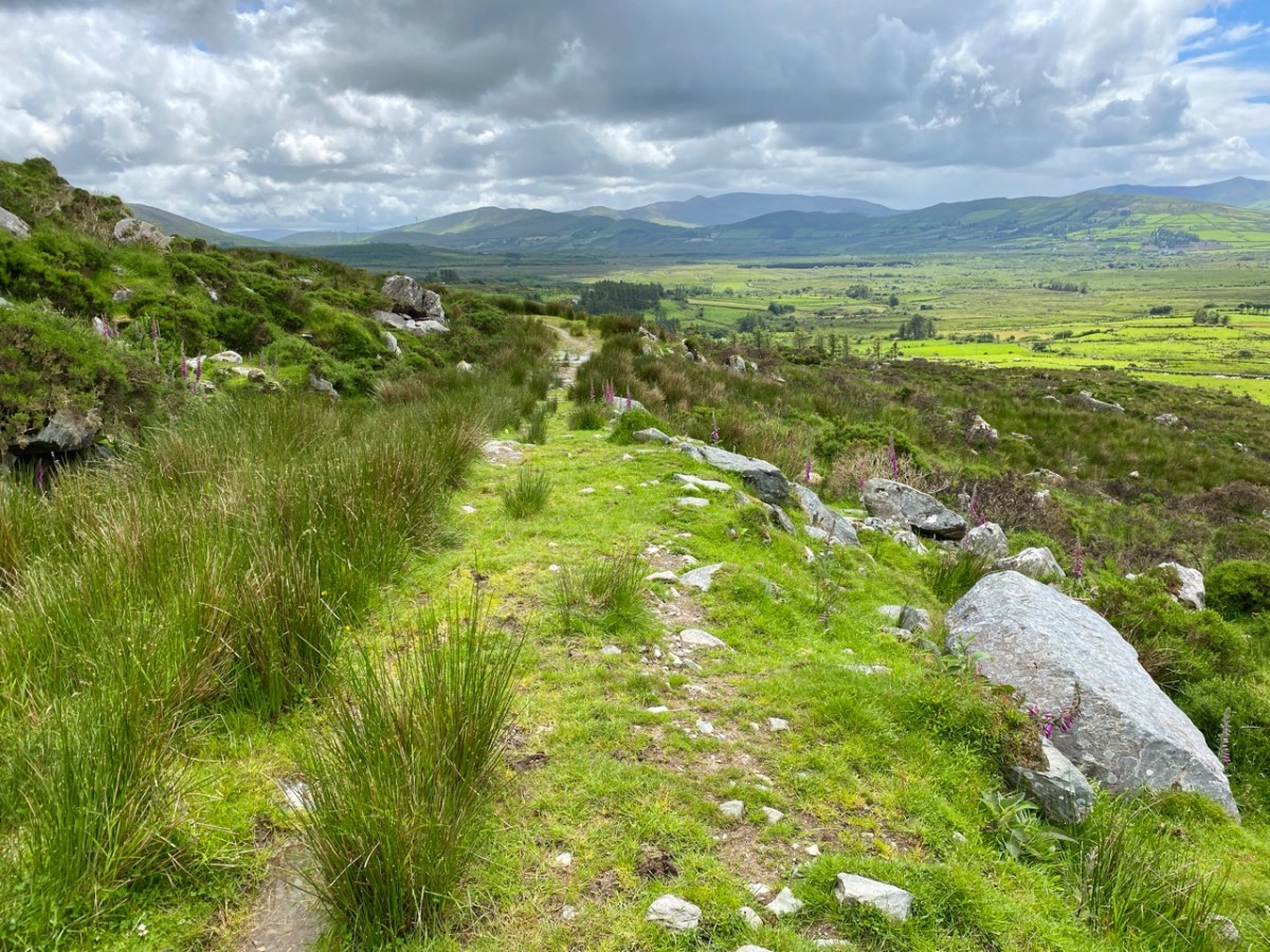
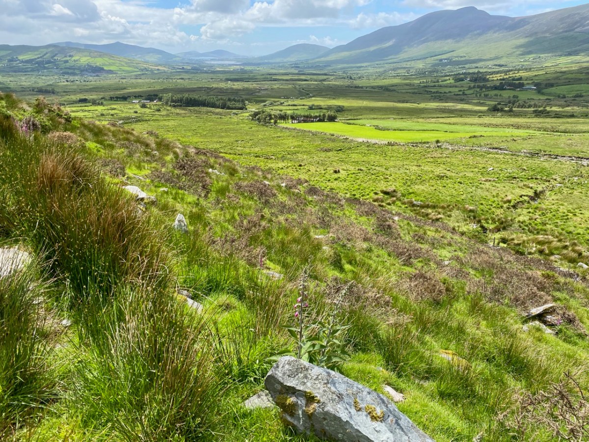
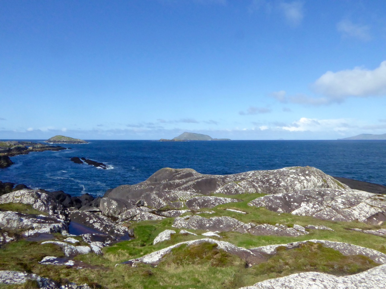
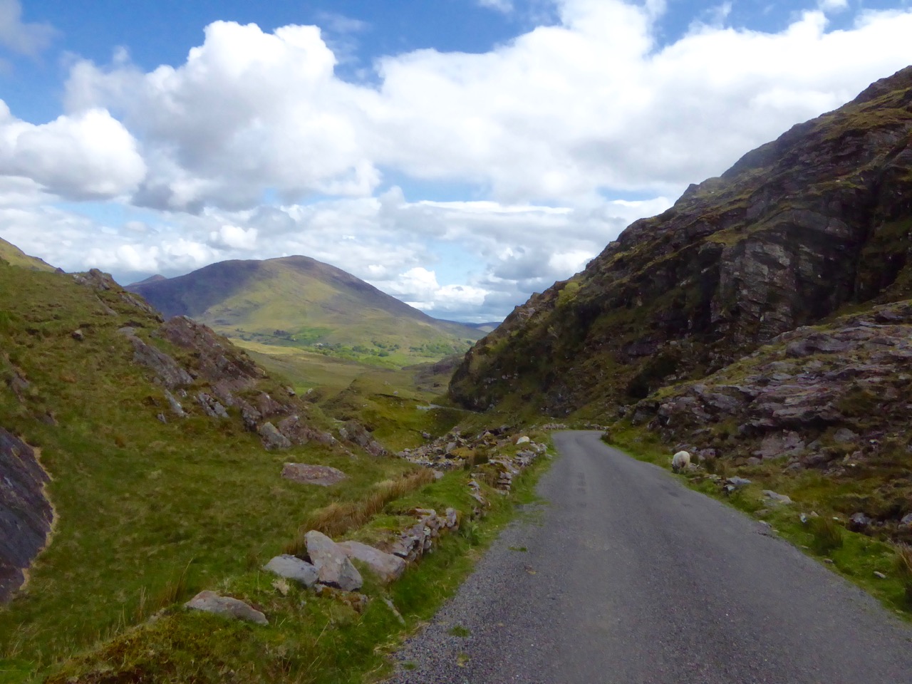
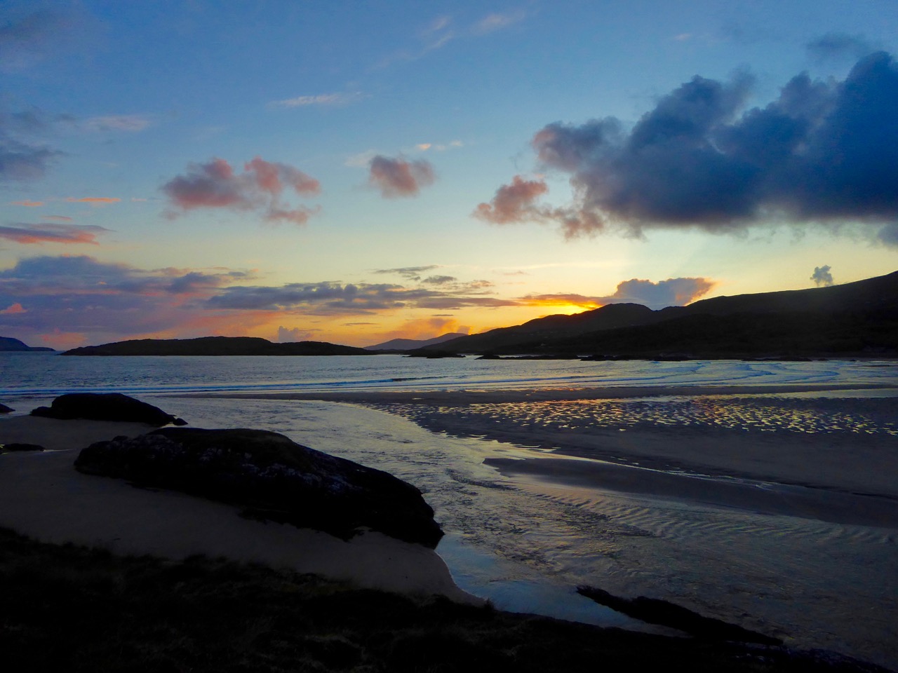
A bit of a nostalgia trip for Finola and me this week: we spent a couple of days in Kerry and dropped in to Derrynablaha – the iconic valley which has some of Ireland’s most notable Rock Art. These stones were carved on natural rocks on the hillsides many thousands of years ago. To this day, we don’t know what they signify.

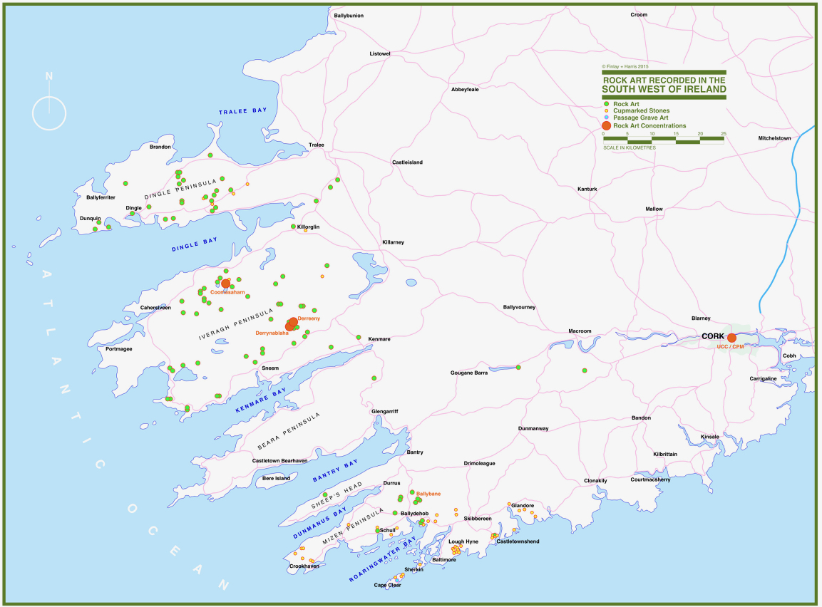
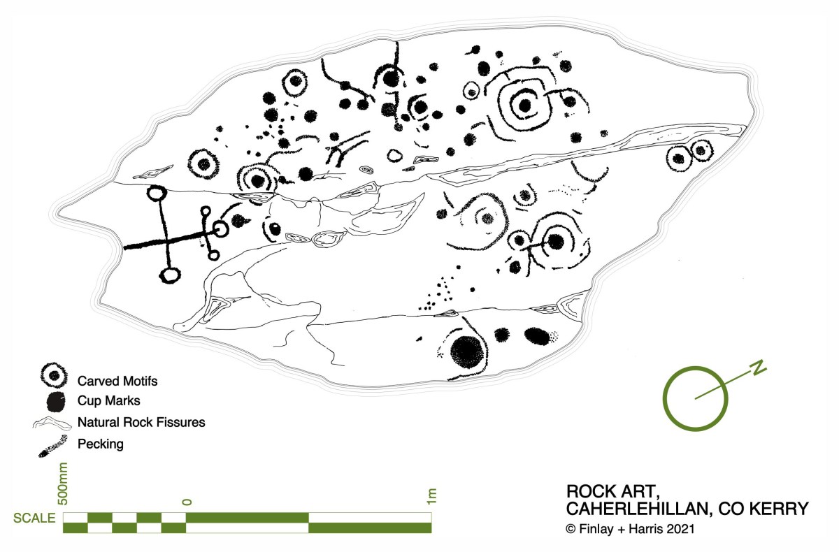
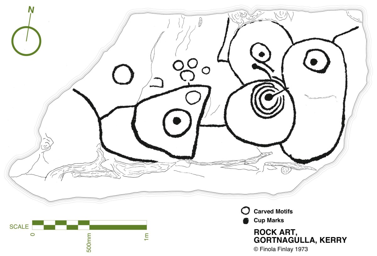
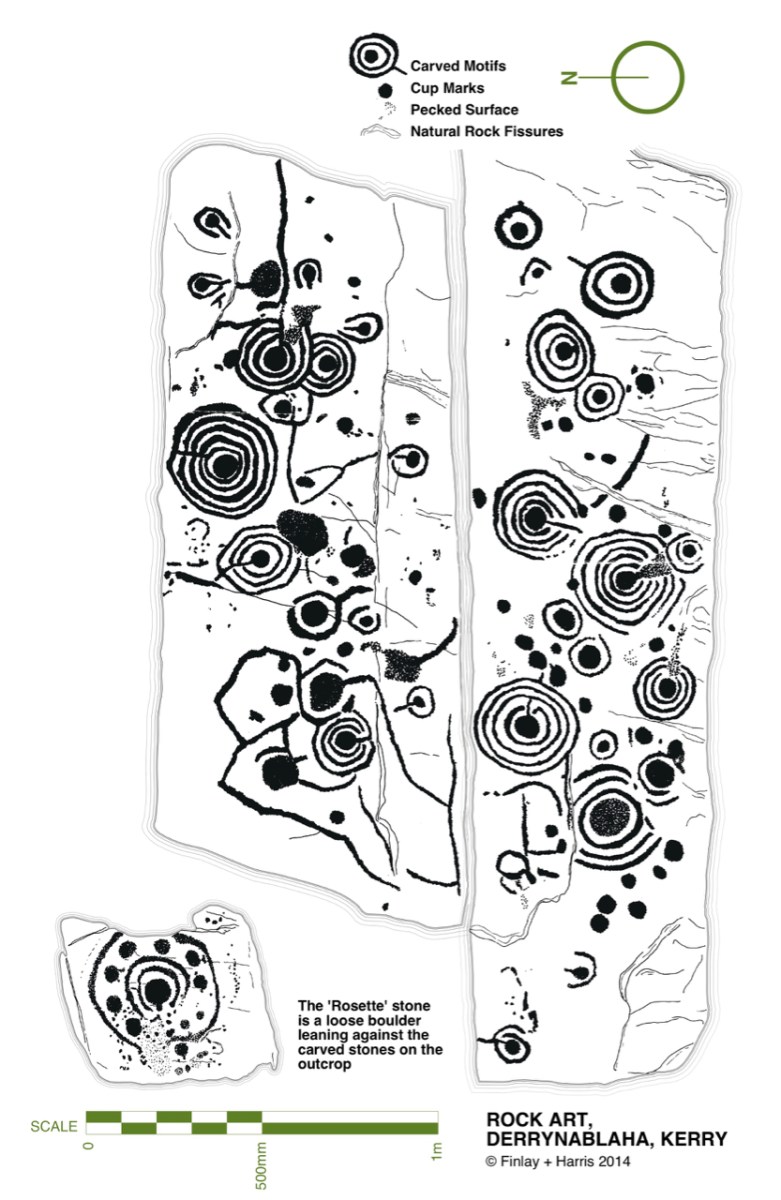
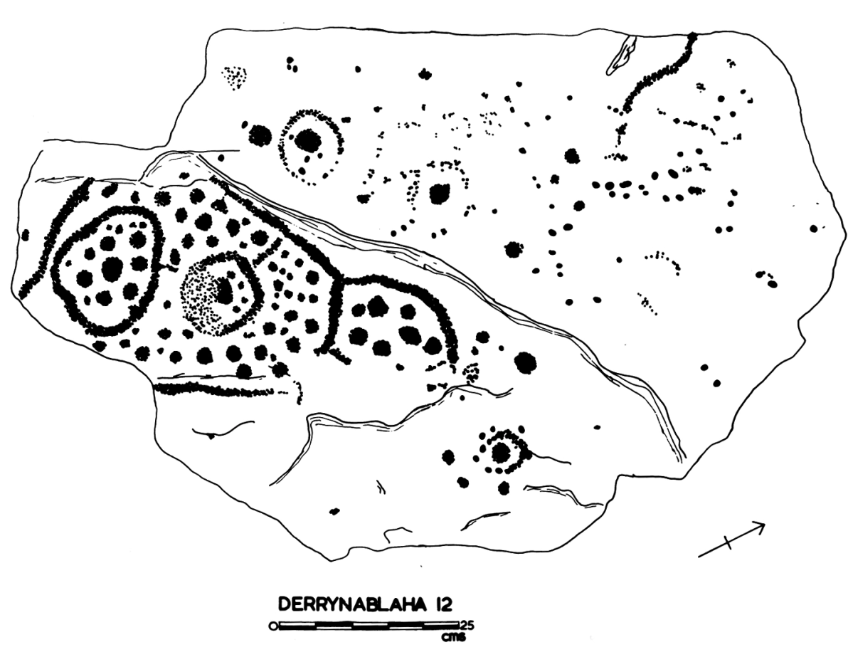
Some years ago, Finola and I organised exhibitions showing examples of Rock Art – many taken from Finola’s 1973 University of Cork thesis. The map above was drawn for the exhibitions: you can find Derrynablaha in the centre of the Iveragh Peninsula, left of centre. Below is a rendering of Finola’s thesis drawing showing – arguably – the most significant piece of Rock Art on this island:

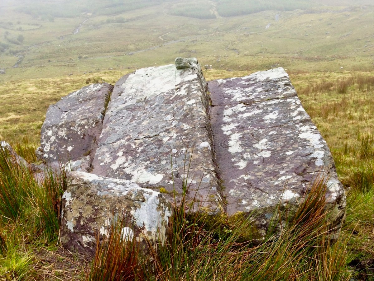
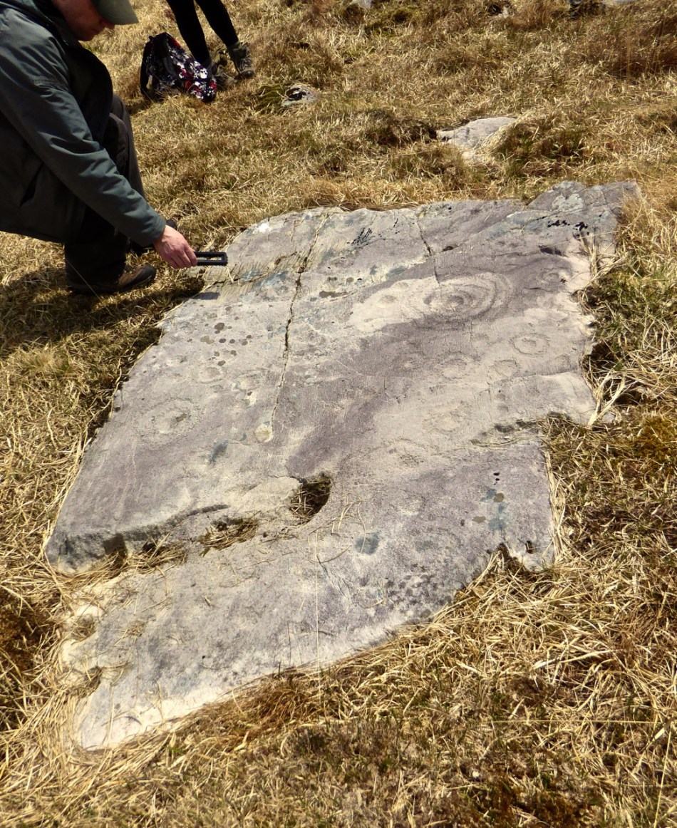
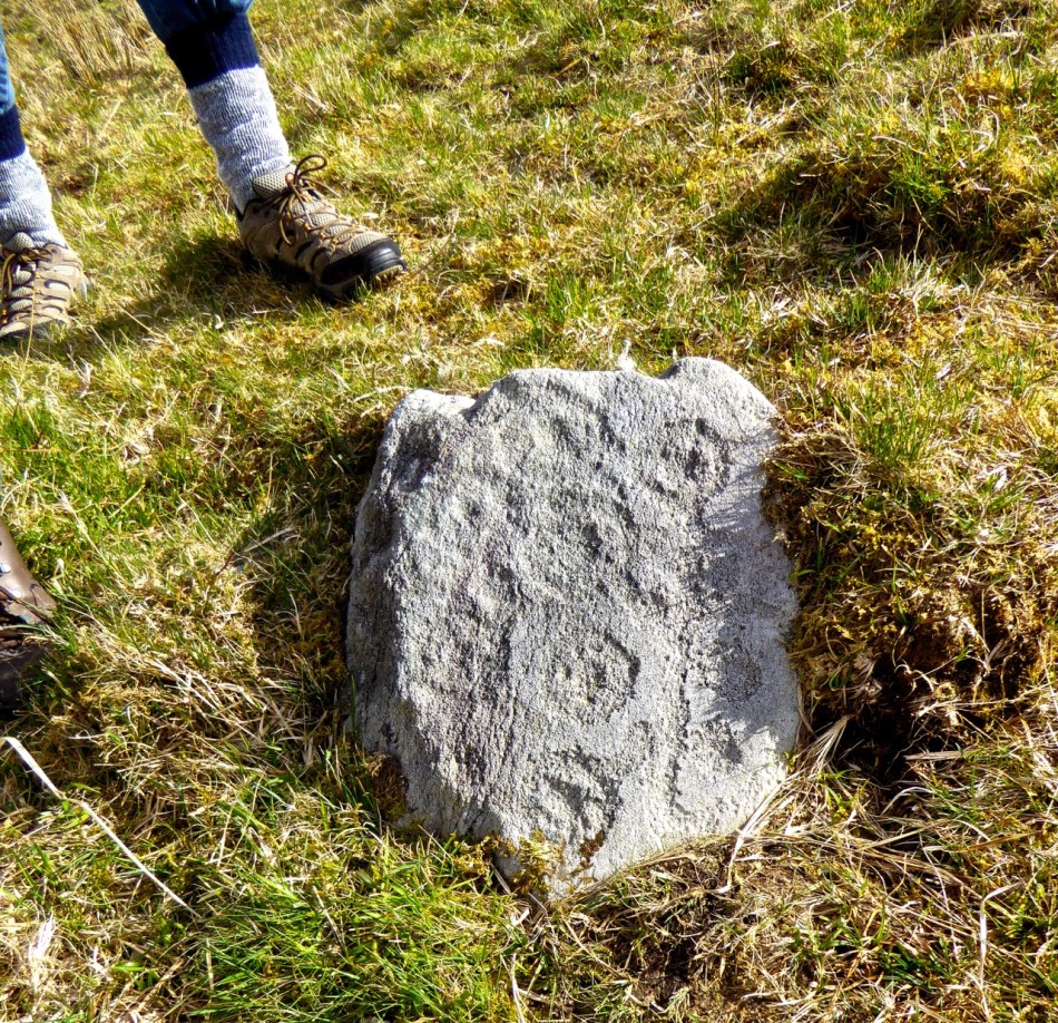
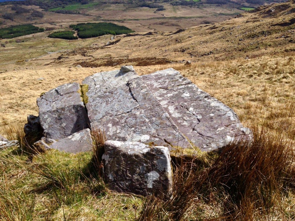
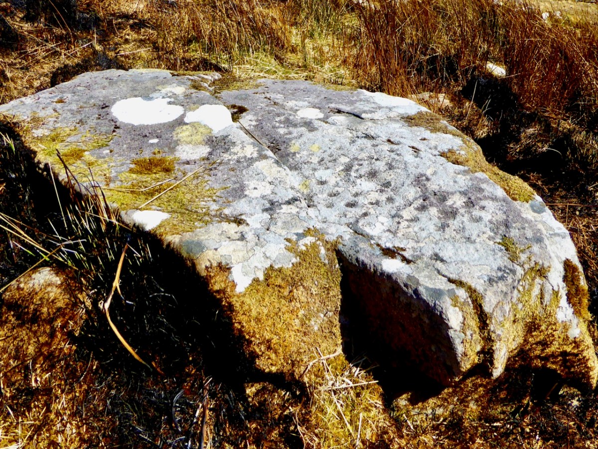
Here’s a photo of these rocks which I took on my first visit to this valley, in 2012. It was a dull day! The next photo was taken on a better day three years later. This shows how weather conditions can affect the way that Rock Art motifs are seen:

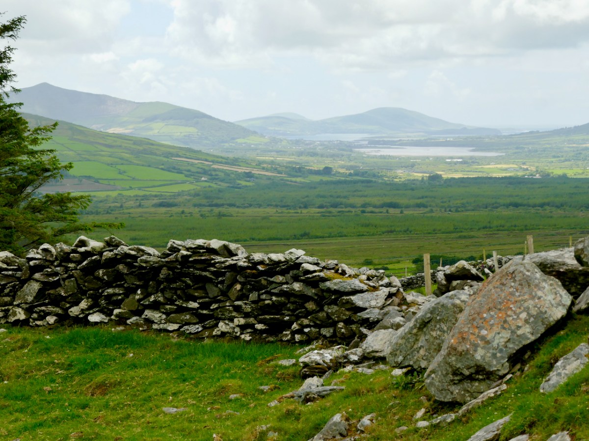
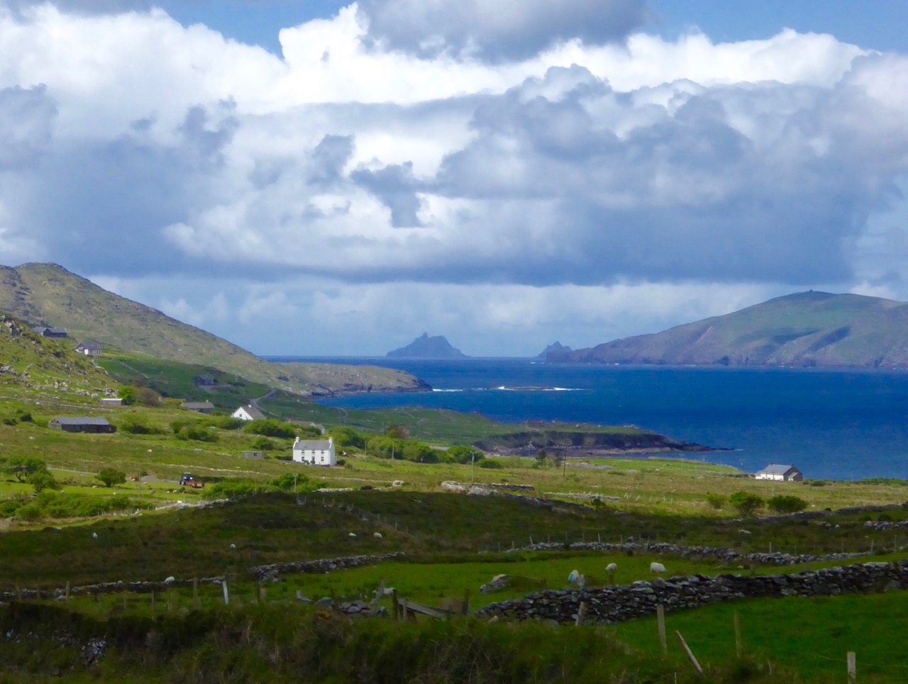
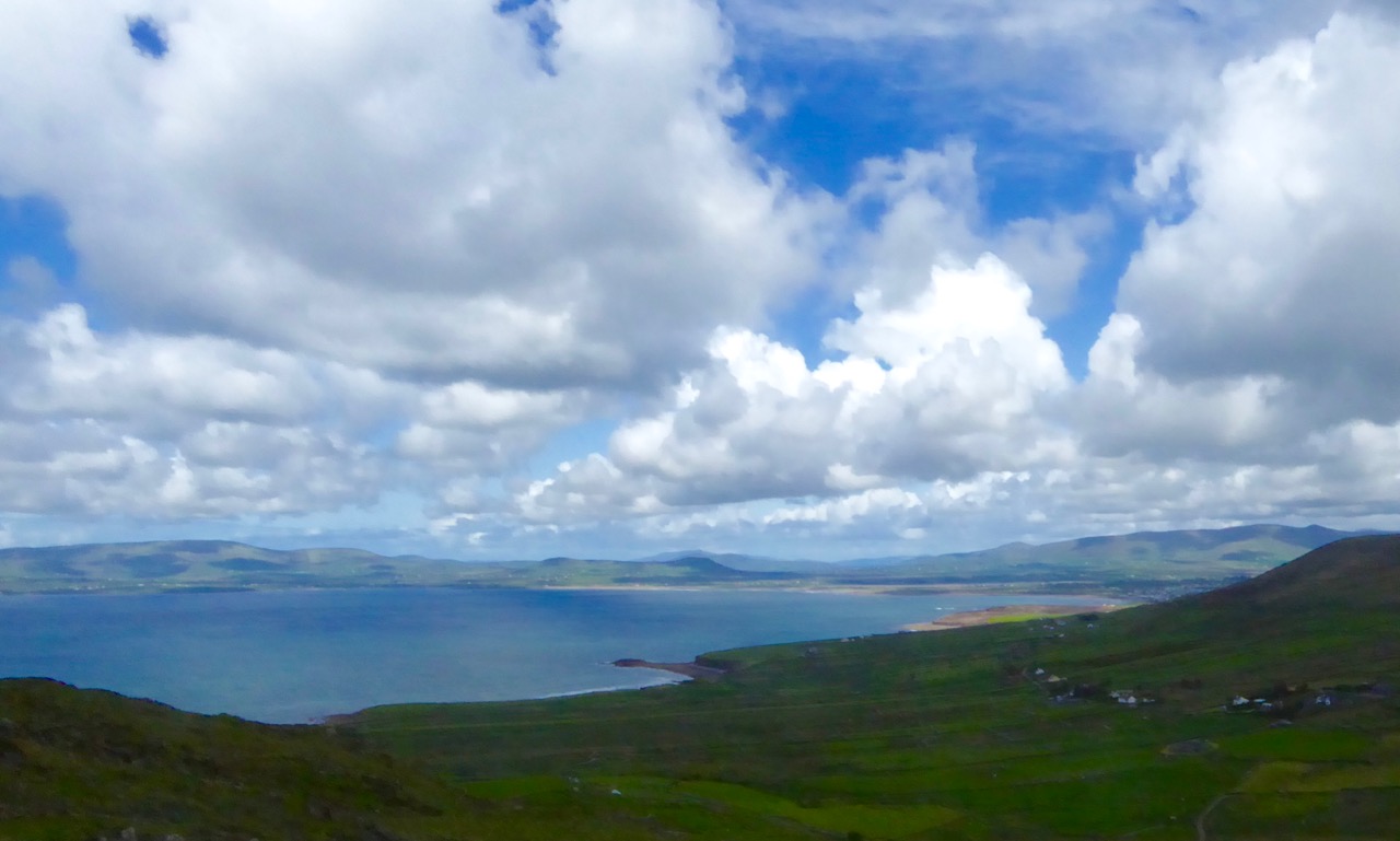
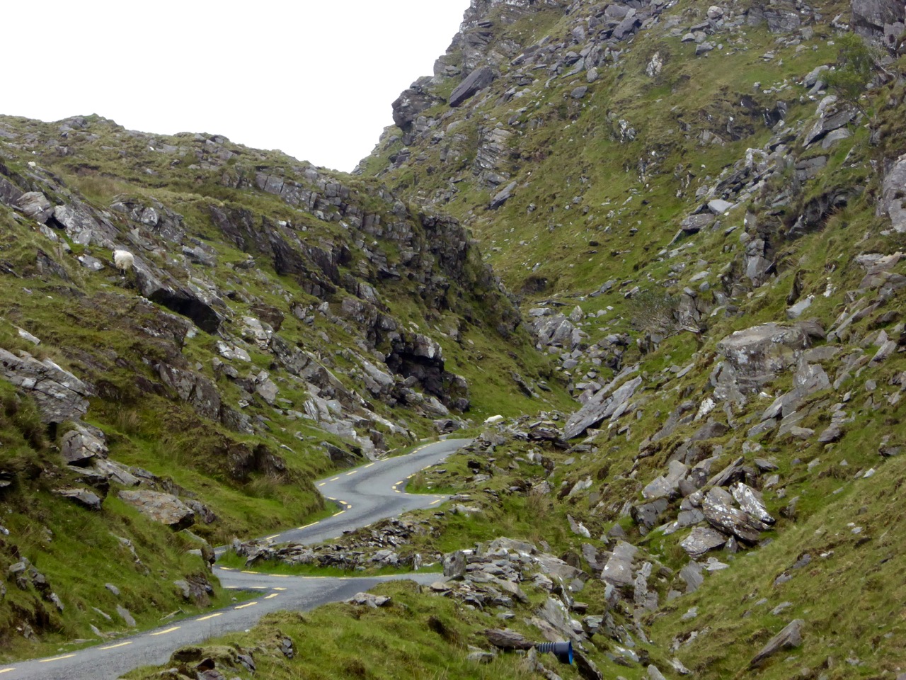
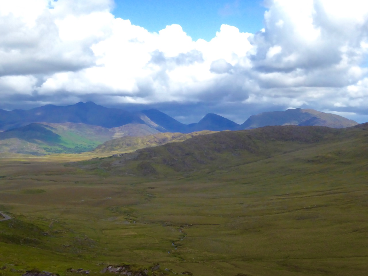
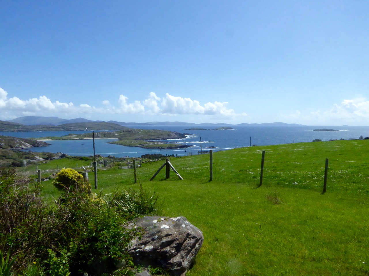
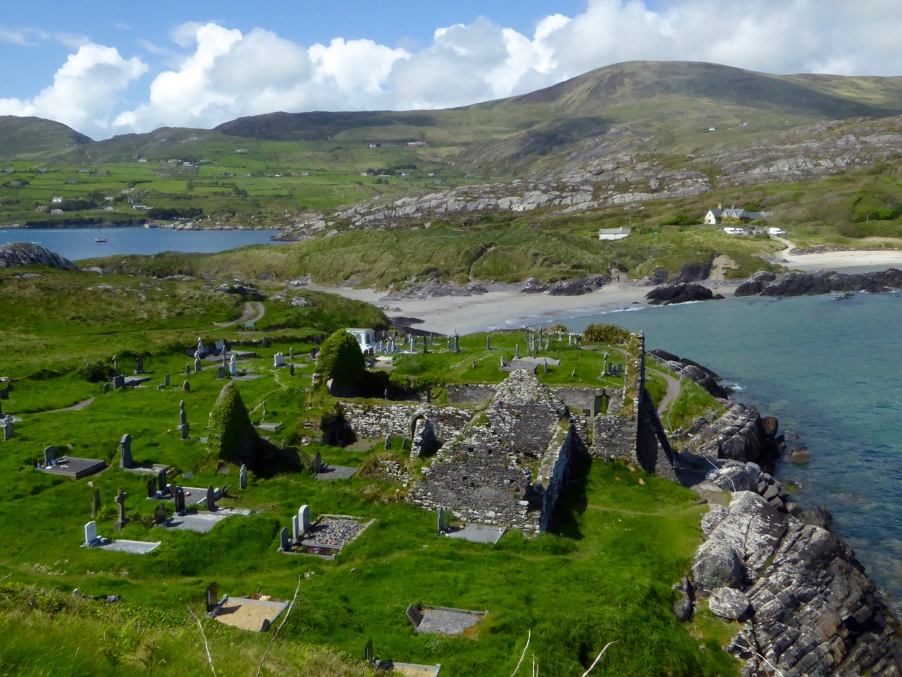
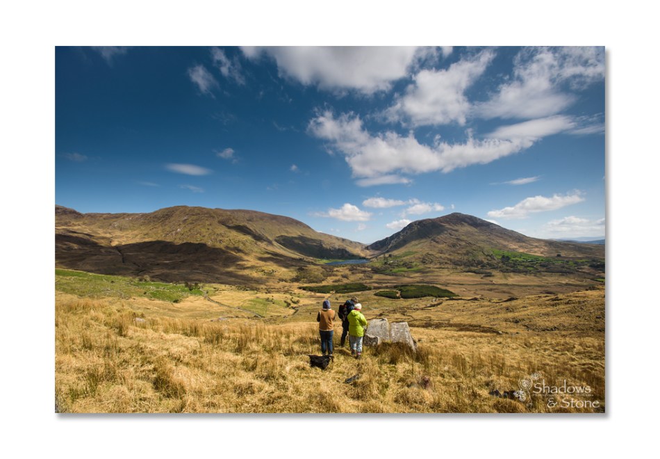
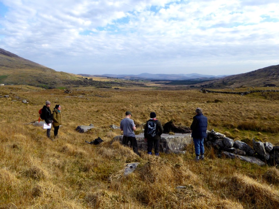
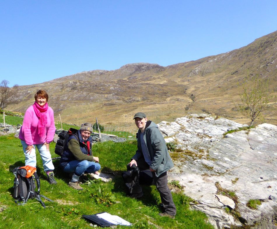
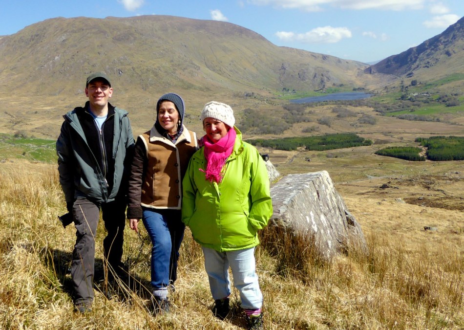
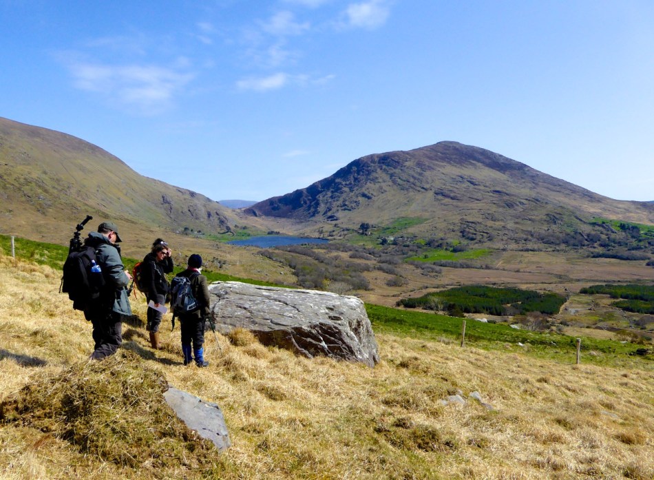
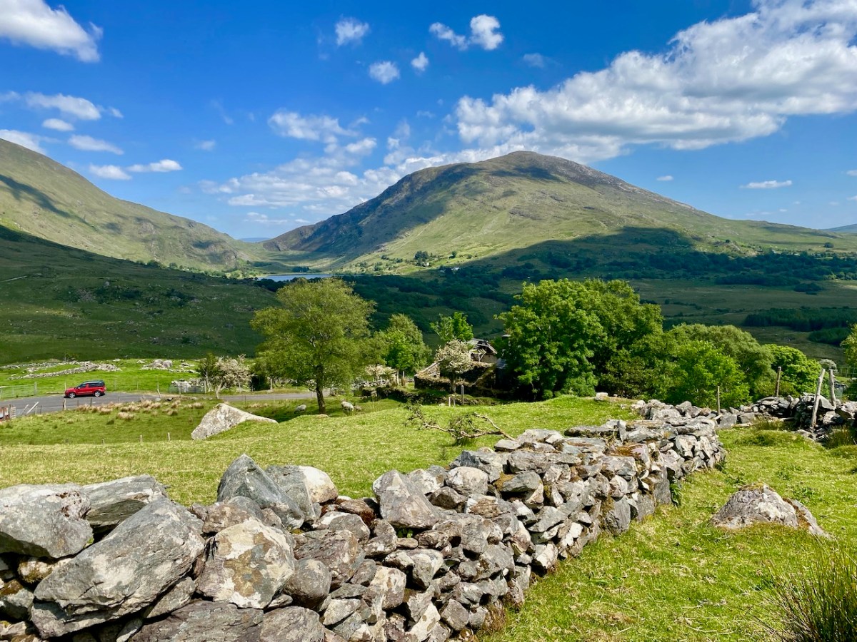
On our most recent visit – last week – we didn’t have time to scale the steep hillside to view this rock formation, but we enjoyed just taking in the stunning landscapes of the townland.

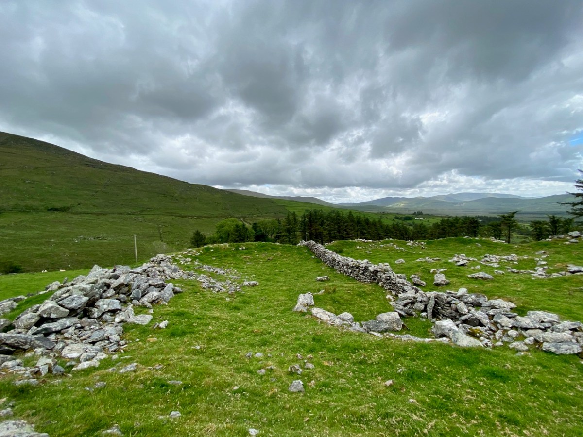
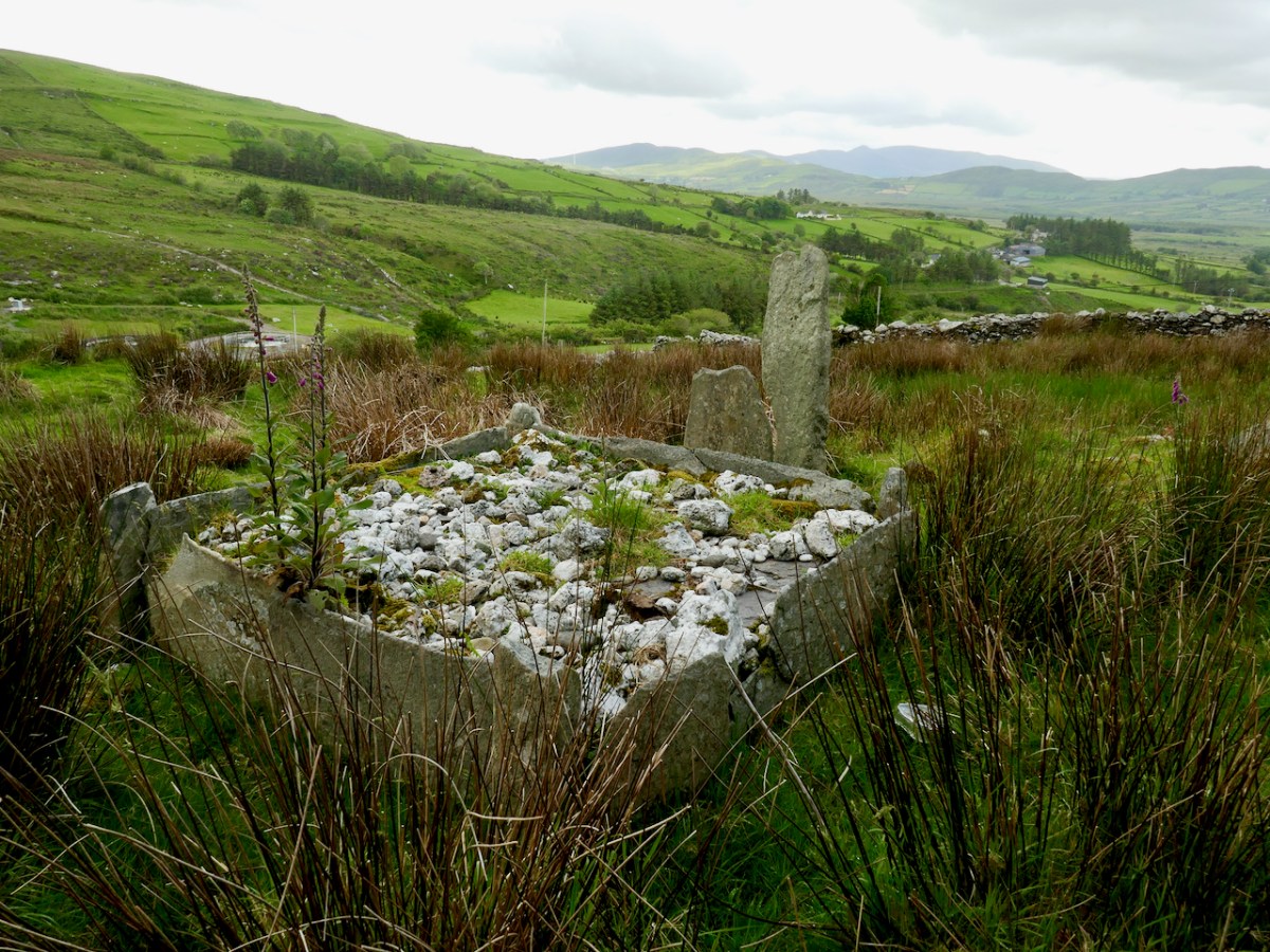
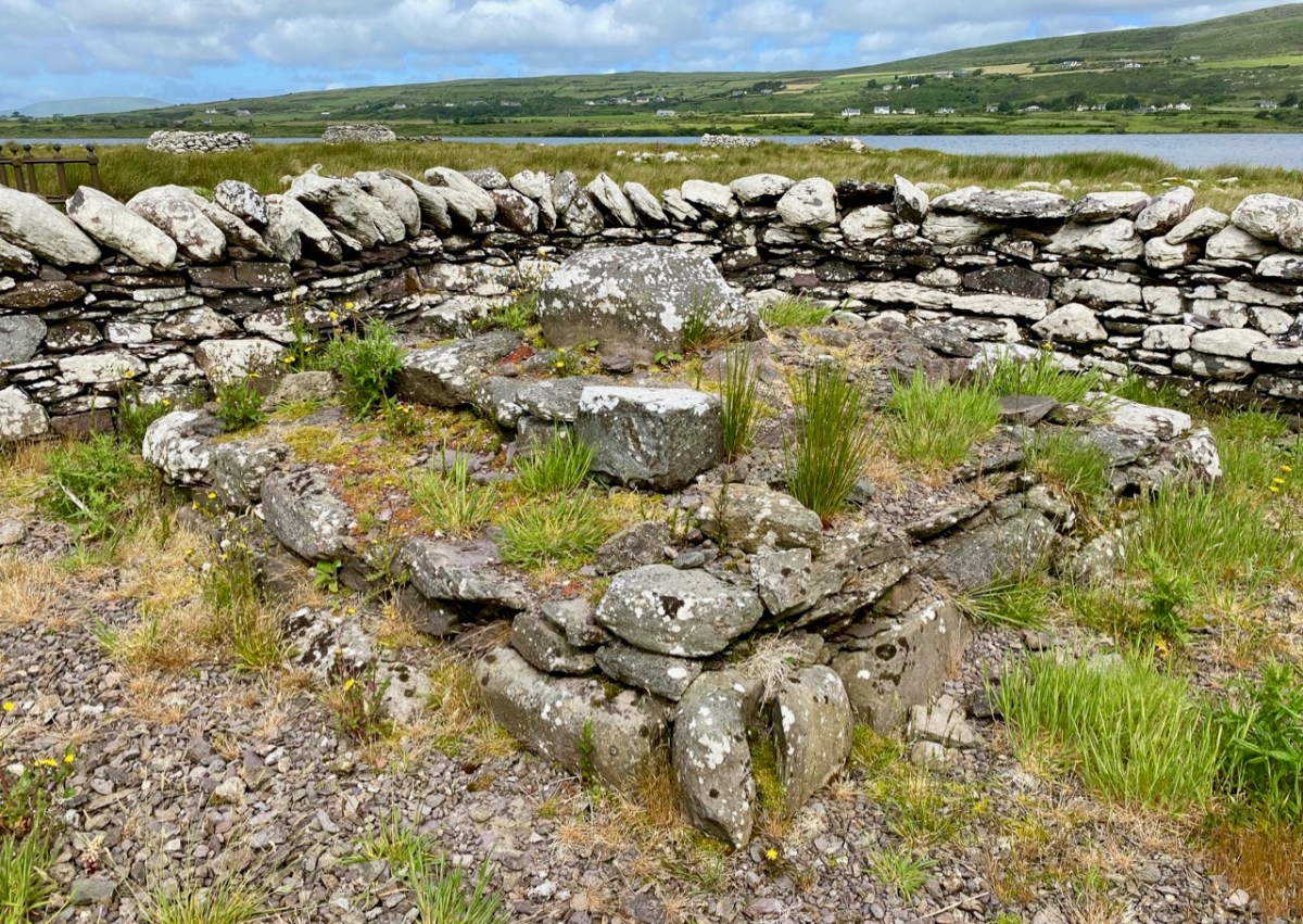
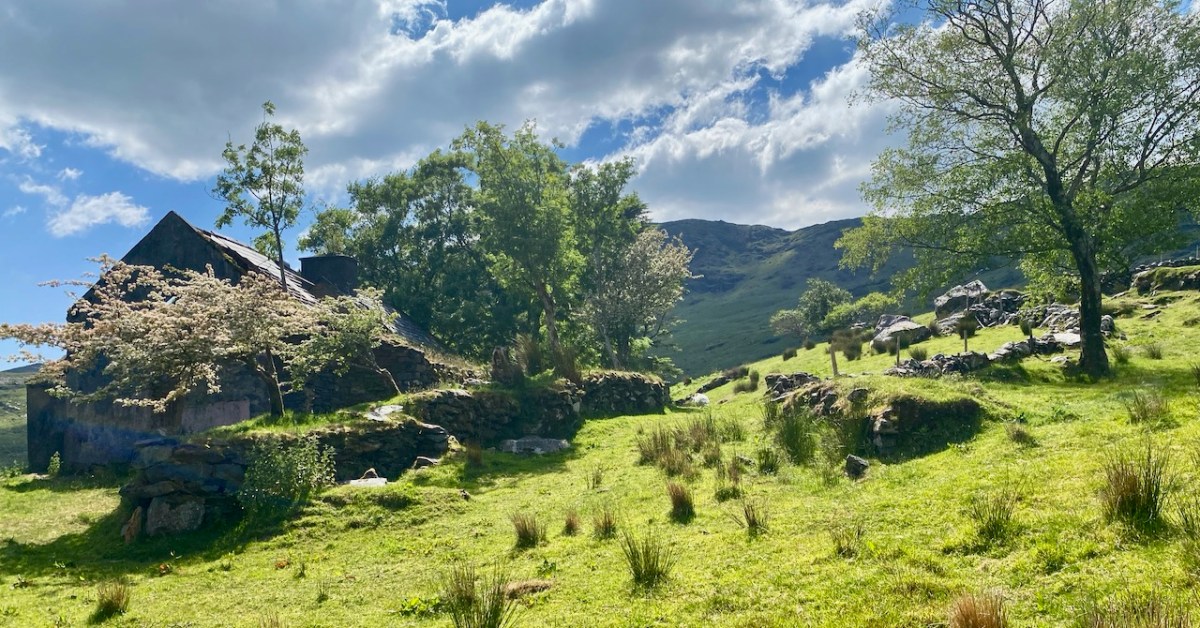
Above, and in the header picture, you can see the ruin of the cottage, which was once the only dwelling in this valley. It was still lived in when Finola visited to carry out her survey of the Rock Art in 1972 – fifty years ago. Then it was occupied by John O’Sullivan and his sister, May. John’s brother – Daniel – discovered much of the Rock Art in the surrounding landscape and reported this in the 1960s to Michael Joseph O’Kelly, then Professor of archaeology at UCC, and his wife Claire. Subsequently the O’Kellys made some expeditions to Derrynablaha, as did the Italian rock art expert, Emannuel Anati. Daniel had died prior to Finola’s visits and she recalls that the remaining family were excellent stewards of the Rock Art, ensuring that it was preserved and not damaged. She has ‘hazy memories’ of being brought into the house and given cups of tea and brown bread.

After we had published earlier posts about Derrynablaha, Finola was contacted by Faith Rose – the great niece of the O’Sullivans who lived in this cottage in 1969: Faith had visited the valley in that year. She recalls:

. . . I remember their bedroom was downstairs, the staircase to the upstairs being unsafe. There were none of the usual services in the house. There was an old fashioned fireplace where you could cook with a settle at the side. I seem to remember being told it had been built under some government scheme and the original stone farmhouse was to be seen slowly returning to nature close by. I wonder if you recall any of this. My great aunt and uncle were shy people who extended us the best hospitality. To my sister and I it was a magical place, but the hardness of their lives there was clear . . .

Faith Rose 2021

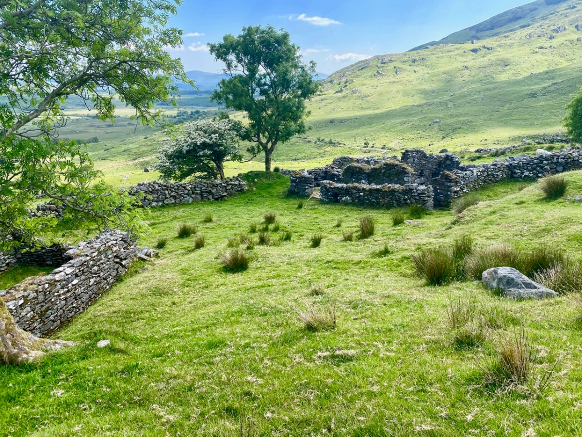
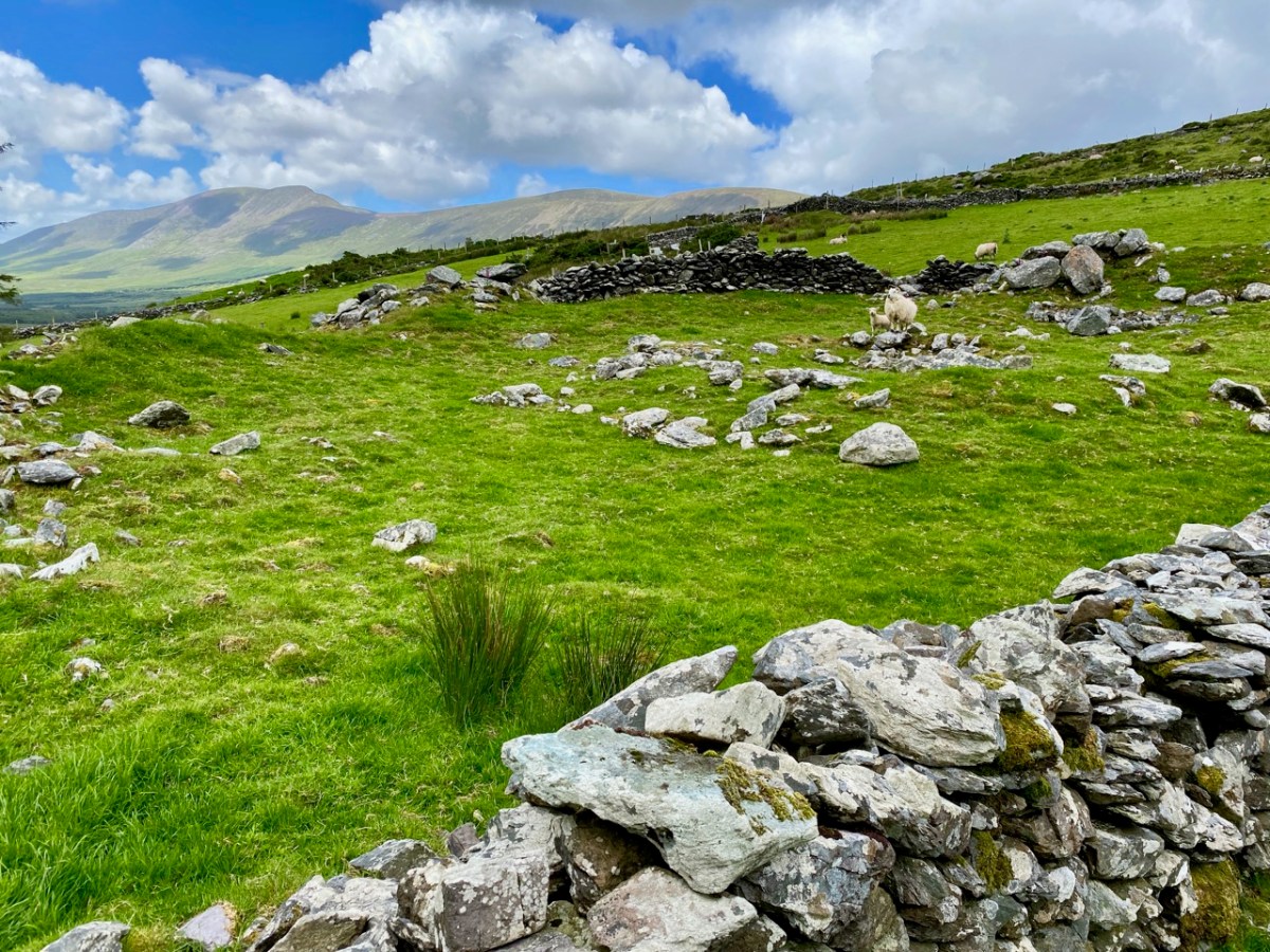
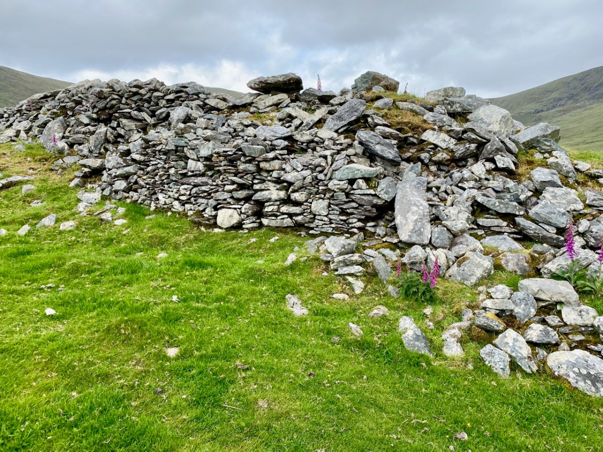
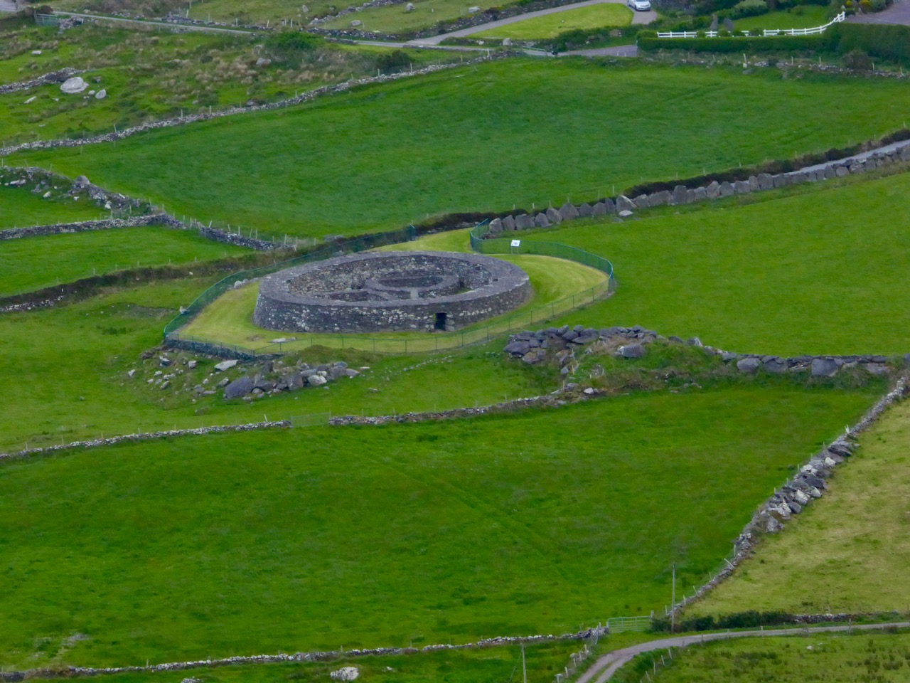
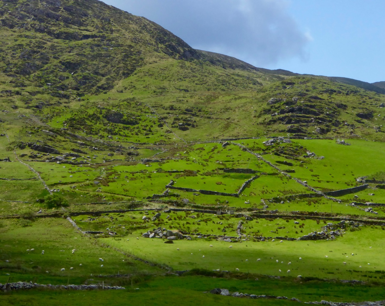
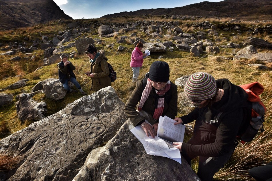
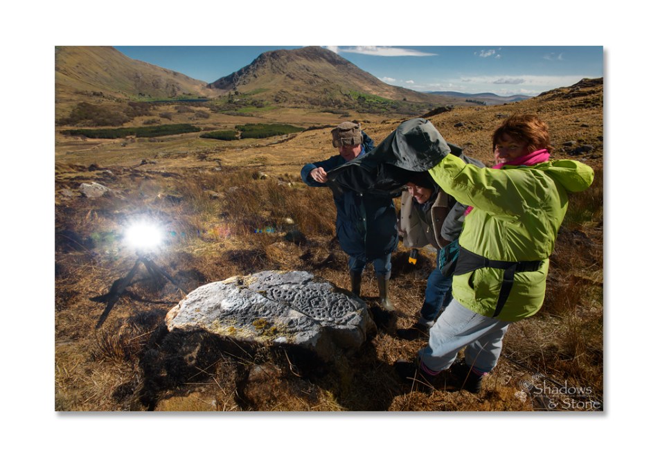
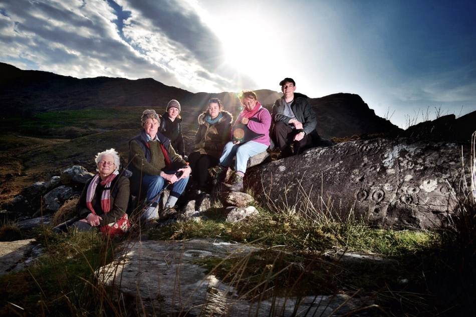
There are the ruins of several other buildings set within this landscape, indicating that the settlement was once significantly more populated in earlier times. Now it is wildly lonely, but impressively beautiful. When Finola carried out her surveys, she recorded 23 pieces of Rock Art. Today it is recognised that there are 26 known examples, with a further 7 stones in the adjacent townland of Derreeny. Long term readers of this Journal may recall that we visited the townland in April of 2015 – together with a small group of enthusiasts – to seek out all the known examples. At that time Ken Williams was using techniques he had developed to photograph the carvings in fine detail. These employed several portable light sources. The following sequence shows one of the rocks (number 12) taken without lighting; Finola’s drawing traced in 1972; then Ken’s technique in action and his results, which are remarkable:

Once again you are reading about the Rock Art at Derrynablaha! There have been several posts on this subject over the years, but we make no apologies: we never tire of the beautiful landscapes of Kerry – and we have seen it in all weathers. It would be good if we could be closer to solving the meanings of these rock carvings; this is unlikely to happen. Over the last 300 years since the phenomenon was first recorded in Ireland (and Britain, and many other places in Europe and the world) there have been varying theories – dozens – put forward for its existence: none of them is conclusive. Think on . . .

Caherlehillan

The Iveragh is the largest of the Atlantic peninsulas of Ireland: it is, perhaps, also the most romantically named. In Irish it is Uíbh Ráthach – ‘descendants of Ráthach‘. But we don’t know who Ráthach might have been: a Gaelic chieftain, a notable family – ancient inhabitants lost even to legend? Certainly this terrain is amongst the wildest and most beautiful in this green island. Today we are focussing on just one Kerry townland which encompasses a deep vein of history stretching back to prehistoric times.

The townland of Caherlehillan is defined by mountains. To the north is Knocknadobar (header and above), to the east Mullaghnarakill, and to the south Caunoge. The Fertha River flows down from Coomacarrea and creates a long, fertile valley floor which opens to Valencia Harbour at Cahersiveen.

It would be reasonable to assume that the river valley would have supported communities in ancient times, and the recorded archaeology of the area confirms this. The earliest antiquities include a Bronze Age stone row and – possibly Neolithic – Rock Art, explored and recorded by Finola fifty years ago: an eager student travelling alone through the wildernesses on a borrowed Honda 50!

Upper picture – stone row in Caherlehillan townland; lower – Finola’s drawing of Rock Art made in 1973 for her UCC thesis. Note the cruciform motif at the southern end of this large sandstone boulder: it is probable that this carving dates from a later period, and may have indicated its use as a Mass Rock in penal times. However, the ‘Patriarchal Cross’ format is unusual in this context, and warrants further study. Since Finola travelled those boreens, many more examples of Rock Art have been revealed in the area and are now identified on the Sites and Monuments records. On our visit to Caherlehillan we searched the hillsides in vain for some of these more recently discovered panels (below).

This further representation of Rock Art (above), also recorded by Finola, lies on the borders of the townlands of Caherlehillan and Gortnagulla: the motifs are quite unusual.

The central feature of Caherlehillan is the Caher (above), which gives the townland its name. The suffix ‘lehillan’ is probably from the Irish Leith-Uilleann, meaning half-angle, or elbow. There is a sharp bend in the Fertha River below the settlement, and it is most likely that this natural feature gave rise to the nomenclature. A Caher (Irish Cathair) is a stone fort, and is distinguished from a typical earthen rath, or ring-fort, by its size and construction. Forts, whether stone or earthen, were the dwelling places and shelters of people who lived in the first millennium in Ireland. Generally, stone-built forts were larger than earthen examples and are likely to have been inhabited by higher status families or communities. They would have been impressive structures and good views over the surrounding landscape was a requisite. Interestingly, the word Cathair is also given the meaning ‘city’ – ‘monastic city and settlement’ – and ‘Paradise’ (Teannglann). All of these could be relevant, as close to this Caher is an early ecclesiastical settlement.

This picture shows the spectacular setting of the Caher; the previous views show the extent of the enclosing stonework. Today it is a desolate place: many of the walls have been partially dismantled for use elsewhere, and the only close habitation is a single farm dwelling just below the fort. In this remote yet beautiful site it is hard to imagine the activity that was focussed here a thousand years ago.

Just to the west of the lone farmhouse is a small enclosure, bounded by stone walls. It would be easy to overlook this, but for one feature which stands out (above). It catches the eye because it is so unusual: a square box structure with stone sides and corner posts, and two upright engraved cross-slabs facing down the valley. Quartz rocks form a raised bed within the square. Around this ‘box’ are a number of low, unshaped stones set in the ground. This was long thought to have been just a children’s burial ground – a Ciilín or Ceallúnach, but we now know that this was a later use. Between 1994 and 2004 the site was substantially investigated and excavated by students from University College Cork’s Department of Archaeology under the direction of John Sheehan, with remarkable results.

. . . Recent excavations at the early medieval ecclesiastical site at Caherlehillan, Co Kerry, have resulted in the discovery of important information on its initial development and structure. The ritual core of the site, consisting of a church, cemetery and shrine (which probably originated as a ‘special’ or founder’s grave), dates to what is probably the formative phase of Christianity in the south-west of Ireland. The picture emerges of a site that was conceived and built as a coherent entity in accordance with a clear conceptual template . . .

John Sheehan, A Peacock’s Tail: Excavations at Caherlehillan, Ivereagh, 2009

These two illustrations are from the Sheehan / UCC Excavation summary. The photograph is a good representation of the two upright cross-slabs, while the illustration shows two fragments which were found during excavation. Both show the same motif displayed on the smaller slab, yet each representation is to a different scale. This motif therefore occurs three times at this site.

This is the plan that was made at the commencement of excavation, showing the ecclesiastical site at Caherlehillan. The south-eastern boundary is a built-up stone retaining wall (shown on the photograph below), and the indicated embankment above the later roadway implies that this site was originally circular in form (courtesy John Sheehan). Carbon dating of excavated materials suggest a date of mid-5th to early 6th centuries for the earliest activity on the site, while activity appears to have ceased beyond the 8th century. Most importantly, the excavations revealed – to the north-east of the ‘shrine’ – the foundations of a timber church dating from the 5th century – possibly the earliest church remains ever found in Ireland.

The photograph above is from Church Island on Lough Currane, Co Kerry, a site which we visited recently. It shows the shrine of Saint Fionán Cam, who was the founder of that ecclesiastical settlement. The island foundation was set up in the sixth century, and the name of the holy man and his exploits are recorded for us to observe today. Sheehan suggests that the ‘box’ at the Caherlehillan site is also a founder’s shrine, but we have no record of who this ‘saint’ or holy man was. Four hundred years of occupation of the site have, apparently, left him without a name, either through inscription, implication or oral tradition.

The upper picture shows a detail of the carving on the smaller cross slab at Caherlehillan. Sheehan (and others) suggest that the bird representation is in fact a peacock, which features frequently in early Christian art. This is because the wonderful plumage of the bird is entirely renewed every year, through moulting, and this symbolizes the underlying Christian theme of death and resurrection. The relief carving (above) from Northern Italy is dated to the 8th century and shows two confronted peacocks, ” . . .symbols of paradise and immortality in early Christian and Byzantine art . . . “. Sheehan in fact goes further, suggesting that the symbols on the shrine stones at Caherlehillan show a direct link with early Christian influences from the Mediterranean, something that is borne out by ceramic fragments also recovered from his excavations. These are of of ‘Bii type’, a form of pottery of north-eastern Mediterranean origin that may be firmly dated to the period between the late 5th and mid-6th centuries.

So there we have it: a small, remote settlement in a wild Kerry mountainside that has given up its ancient secrets to us. Dwellers there left us enigmatic Rock Art, possibly 5,000 years ago. Their descendants populated the fertile valley, farming the land and building here a prestigious stone fort, while nearby – and contemporary with that fort – was established perhaps the very earliest Christian foundation in Ireland! Today the place is sparse and rugged but, in keeping with Ireland’s spirit, breathing with an almost remembered past.

The researches and writings of John Sheehan, lecturer in Archaeology at University College Cork have been invaluable in formulating this post.

Into the Kingdom

To the Skelligs

The Kingdom? No, we didn’t go to Britain – we went to Kerry. It’s always been called the Kingdom, possibly based on ancient Irish precedents, although other theories abound. Many people think it’s because of the sheer magnificence of the scenery, and I wouldn’t disagree.

Ballinskelligs Bay

Ballinskelligs Bay. The first photograph is also Ballinskelligs Bay, with a glimpse of the famous Skelligs Islands in the background – subject of a future post, we hope!

Our journey took us on the Ring of Kerry, along the south side of the Iveragh Peninsula, by the sea. This is prime tourist territory – bus after bus passed us and every lay-by was thronged with camera-wielding tourists, including us. We came back through the middle of the peninsula, through deep valleys and high mountain passes.

To Ballaghbeama

Not for the tour busses!

These are not roads that busses can manoeuvre through, so we had it mostly to ourselves, the locals, and a few tourists armed with small cars and good maps. I love this Iveragh backcountry. It’s where I spent my student days, conducting my research. I even recognised the place where I crashed my Honda 50 into a bog.

Ballaghasheen Pass

Although it seems totally mountainous, vast sheltered valleys occupy some of the hinterland of the Iveragh Peninsula  

We visited two stone forts, the mighty Staigue and the lesser-known Loher, and of course some rock art. Staigue Fort is generally reckoned to be Iron Age (about 250AD), while Loher, although very similar, was built later, around the 9th Century.

Staigue Interior and outlook

Loher Stone Fort
Staigue Fort (upper), at the head of a long valley, commands views to the sea. Loher is also strategically sited with extensive views all around.

We toured Daniel O’Connell’s House at Derrynane and took the Nature Trail walk along the dunes, using the app developed by local man Vincent Hyland.

Shoreline walk

Wild flowers a-plenty on the dunes at Derrynane. Top: Sea Pinks and Sea Sandwort. Bottom: Pyramidal Orchid and Kidney Vetch

We searched in vain for the holy well devoted to Saint Crohane, patron saint of Caherdaniel – we’ll have to go back with Amanda to help us find it.

Across to the Beara

We didn’t find St Crohane’s well but when we finished our search, in twilight, this is what was waiting for us. The mountain range in the background is the Beara Peninsula in Cork

In fact, the primary purpose of our trip was to re-connect with cousins that I haven’t seen for about 45 years. The last time I saw Annie and her siblings they were kids, and we were all piled on to a donkey and cart in a vain attempt to get from Lamb’s Head to Staigue Fort. It’s a long story, but suffice it to say that the donkey came out the winner. Most of the family still live around Caherdaniel, in jaw- dropping surroundings, and we were accommodated and hosted with true Kerry hospitality.

The view from Annie's

Top: The view from Annie’s house, across to Lamb’s Head where the family grew up

Along the way we saw a house shaped like a ship (Robert has more – much more – about this!), had our first experience of bottle-feeding a lamb, and we watched Rex the sheepdog gently herd a flock of chickens into their pen for the night. We visited my cousin Betty’s grave – she died a few months ago, the heart of the family, much mourned. It was, we hope, the first of many visits, back and forth.

Abbey Island

Abbey Island, Betty’s last resting place, must be one of Ireland’s most beautiful graveyards. To access it, you must walk across the sand and keep an eye out for high tides. The original monastic site was founded by St Finian in the sixth Century, although the ruined church, Ahamore Abbey, probably dates from the 10th Century.

This post is to give you a flavour for our neighbouring county and to show you why it is justly famous for its history and archaeology, but most of all for what is surely some of the most spectacular scenery in the world.

Lamb's Head to Scariff and Deenish IslandsScarrif and Deenish are the two islands out from Derrynane Bay. Uninhabited for 40 years, they are the site of salmon farms now. We walked down Lamb’s Head to get a better view of them.

Tiny green fields

As in West Cork, everywhere in Kerry you can see the traces of tiny settlements. Abandoned long ago, possibly after the famine, each field may have provided enough potatoes for one family. Now only the sheep graze peacefully.

Ballaghbeama Gap

We headed home through the Ballaghbeama Gap. On the south side is Ireland’s greatest concentration of prehistoric rock art. We wrote about this in our post Derrynablaha Expedition.

Down from Ballaghbeama

Heading down towards Derrynablaha and home

Derrynane Sunset

It was hard to leave Derrynane!

Derrynablaha Expedition

Derrynablaha in all its glory

Derrynablaha in all its glory

It’s an almost entirely unknown national treasure – a valley of breathtaking grandeur dotted with the greatest concentration of prehistoric rock art in Ireland.

In Derreeny, Looking down the Kealduff Valley

In Derreeny, Looking down the Kealduff Valley

Derrynablaha (Little Oak Wood of the Flowers) is in Kerry, right in the heart of the Iveragh Peninsula (better known as the Ring of Kerry), on one of the few narrow roads that traverse the Peninsula. The rock art has been known for many years – the first paper about it appeared in the early 1960s, curiously, by an Italian rock art expert, Emmanuel Anati. The Cork husband/wife team of Michael and Claire O’Kelly traversed the valley, finding many new pieces and leaving extensive notes. Elizabeth Shee, the leading expert on passage grave art, added to the literature in the early 70s. In 1972 and 73 I (Finola Finlay) recorded and drew all the known examples, using the tracing techniques of the day. Blaze O’Connor and Avril Purcell both wrote about Derrynablaha in the early years of the 21st Century, relating the rock art to the landscape it occupied. Many more pieces came to light in the adjoining townland of Derreeny and were recorded by Ann O’Sullivan and John Sheehan in their Survey of the Iveragh Peninsula. Rose-Mary Cussen examined the art about five years ago, looking for patterns in the enigmatic carvings while other scholars have included Derrynablaha as part of a focus on Irish prehistory.  A few photographers have attempted to capture images of the art, but none more so than Ken Williams, of the outstanding Shadows and Stone website.

Robert, Clare, Finola, Elizabeth and Avril, checking the records and GPS readings. (Photo © Ken Williams)

Robert, Clare, Finola, Elizabeth and Avril, checking the records and GPS readings. (Photo © Ken Williams)

This weekend, several of these rock art enthusiasts and experts came together for a unique expedition to Derynablaha and Derreeny. Elizabeth Shee, myself, Avril Purcell, Rose-Mary Cussen, and Ken Williams took part, accompanied by Robert Harris (see his take on this special place) and Clare O’Sullivan, a UCC undergraduate. Our objective was to visit as many of the panels as possible and to assess what has changed in the landscape in the 65 years since it was first described in academic journals. (See the end of this page for links to other Rock Art topics we have  posted over the last couple of years.)

This one wasn't too hard to find

This one wasn’t too hard to spot

Finding the panels was the first challenge! We had all the information from the National Monuments records, including GPS locations for each rock. However, GPS readings can vary, and many of the ones we were using for Derrynablaha were from the early days of GPS and could be 30m out or even more. Apart from the small fields around the original farmhouse, this is a landscape of bog, gorse and tall grasses, of steep hillsides and tumbling streams, of numberless boulders and outcrops. It was, we think, populated by early herding agriculturalists in the Neolithic and Bronze Age periods. Historically, it supported a sizeable population in pre-Famine times (ruined cottages dot the land) and one sheep farm still operates now. Finding the rock art needle in the landscape haystack took time and patience, sharp eyes, and the good memories of those who had been there more recently than I. Where the GPS recording let us down we turned to the meticulous notes made by Claire O’Kelly: notes that said things like “keep the stream to your right and the large triangular rock in view and the rock is a short way below the wire fence.” These notes turned up trumps more than once.

The rock art is NOT on the large panel, but on the tiny stone by Robert's knee.

The rock art is NOT on the large panel, but on the tiny stone by Robert’s knee

In the end we located all but one panel of the ones we were tracking. The Derreeny rocks were easier to find as the GPS readings were more accurate. It was exhausting and exhilarating work and reminded us yet again how difficult this art can be to find and to see. While some panels were clear and sharp, others were weathered and lichened to the point of invisibility. For some, my drawings were needed to appreciate the full extent of the carvings. (I was feeling pretty pleased with myself about these drawings until we discovered one panel on Day 2 for which my drawing was mirror-imaged in my thesis. Fortunately, the Sullivan and Sheehan Survey had noted and corrected this in their work.)

Day 2 Crew: Ken, Rose-Mary, Finola, and Robert taking the photo.

Day 2 Crew: Ken, Rose-Mary, Finola, and Robert taking the photo

On day 2 the team consisted of Ken, Finola, Robert and Rose-Mary and we spent our time on the most southerly examples in Derrynablaha, especially the large tabular rock and its associated rosette stone. One of the most extensively carved pieces of rock art in Ireland, this iconic piece commands a panoramic view of the whole area, extending to Lough Brin to the east, the Ballaghbeama Gap to the north and to Kealduff River valley to the south. Leaning against it is a stone with a superb example of the rare “rosette” motif.

For really excellent images of this stone, view it on Ken’s Shadows and Stone site.

We also lingered over an unusual panel with multiple lines, cupmarks and rosettes: this one was so faint that Ken resorted to having us provide shade using his jacket and our bodies. The results he got, with his flash technology, revealed astonishing detail totally invisible to the naked eye.

How he got that high tech photo © Ken Williams

How he got that high tech photo  

My drawing, done over 40 years ago.

My drawing, done over 40 years ago

Our second objective was to assess the general ‘health’ of the rock art and its context. Mostly, we were encouraged: very little has changed in this valley over the years. It is remote and the land is marginal, suitable mainly as rough mountain pasture for sheep. The landowner knows about the rock art and is careful not to disturb or damage it.

 lDerrynablahaandscape - changed and unchanged. Note forestry activity.

Derrynablaha landscape – changed and unchanged: note forestry activity

However, two factors threaten the rock art even in this far-flung region. The first is forestry: a sizeable plantation occupies an area east of the road and at the south end of the townland. We didn’t have time to visit this area, but noted in the National Monuments records that two previously identified pieces of rock art are now within the forest boundaries and can no longer be found. The second factor is land-clearing for the purposes of improving the grazing fields. Farmers are encouraged to do this and there are grants available through European funds. We failed to find one piece that was located in such a cleared area, despite extensive searching over two days. Hopefully, this is a function of erroneous GPS readings and the rock still exists – but it is worrying.

Elizabeth, Robert, Avril, Clare, Finola and Ken. Day 1 Team by Derreeny rock art.

Elizabeth, Robert, Avril, Clare, Finola and Ken. Day 1 Team at Derreeny rock art  © Ken Williams

Derrynablaha and Derreeny have always been special places. We can only speculate on the meaning or meanings of the extraordinary numbers of carved rocks in this landscape. Were they familiar, even domestic, expressions of belief or supplication? Did they mark routeways through the mountainous territory or boundaries between clan lands? Were they, or some of them, hidden ritual sites known only to certain members of a priestly class? Did the carvings identify suitable spots for calendrical observations? Did they have altogether different functions that we have yet to comprehend? We may never know the full extent of the meaning of the rock art to those who carved them. Yet – we do know their meaning to us. As the largest body of this category of prehistoric site in Ireland, this collection constitutes a vital link to our most distant past.

Leaving Derrynablaha

Leaving Derrynablaha

Other Rock Art Posts in Roaringwater Journal

Rock Art Ramblings… away from home!

Our Rock Art Exhibition!

Rock Art in Danger

Rock Art

Equinox Adventure

Diving for Petroglyphs

The Stones Speak

Here Comes the Sun

Enigma

Tiny and perfect example of Derrynablaha rock art

Tiny and perfect example of Derrynablaha rock art