Mizen Magic 25: Gortduv Loop (Fastnet Trails)

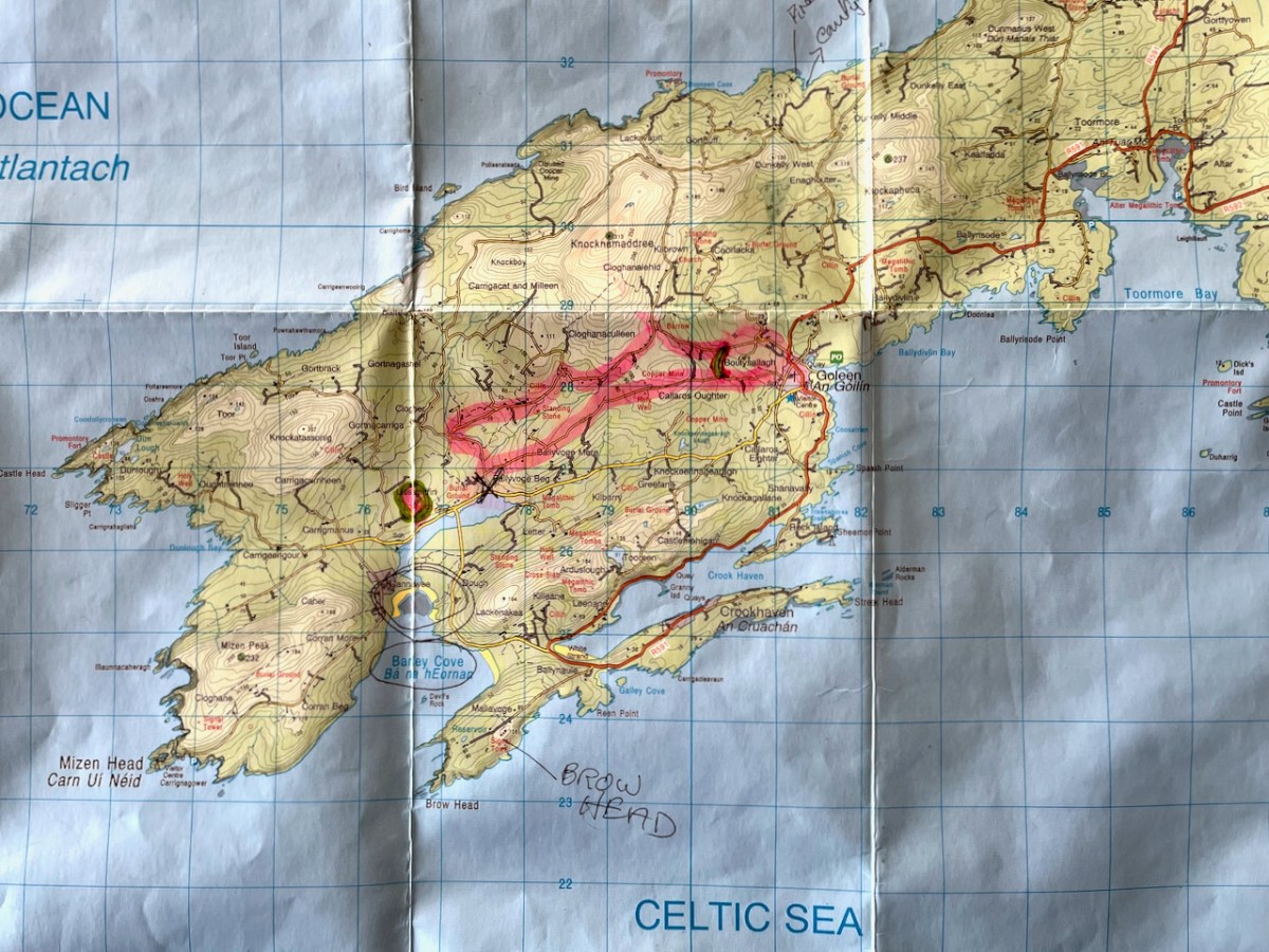
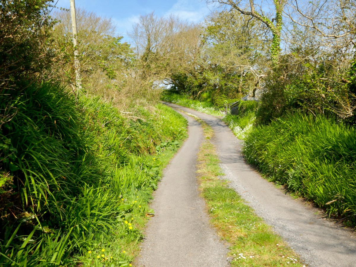
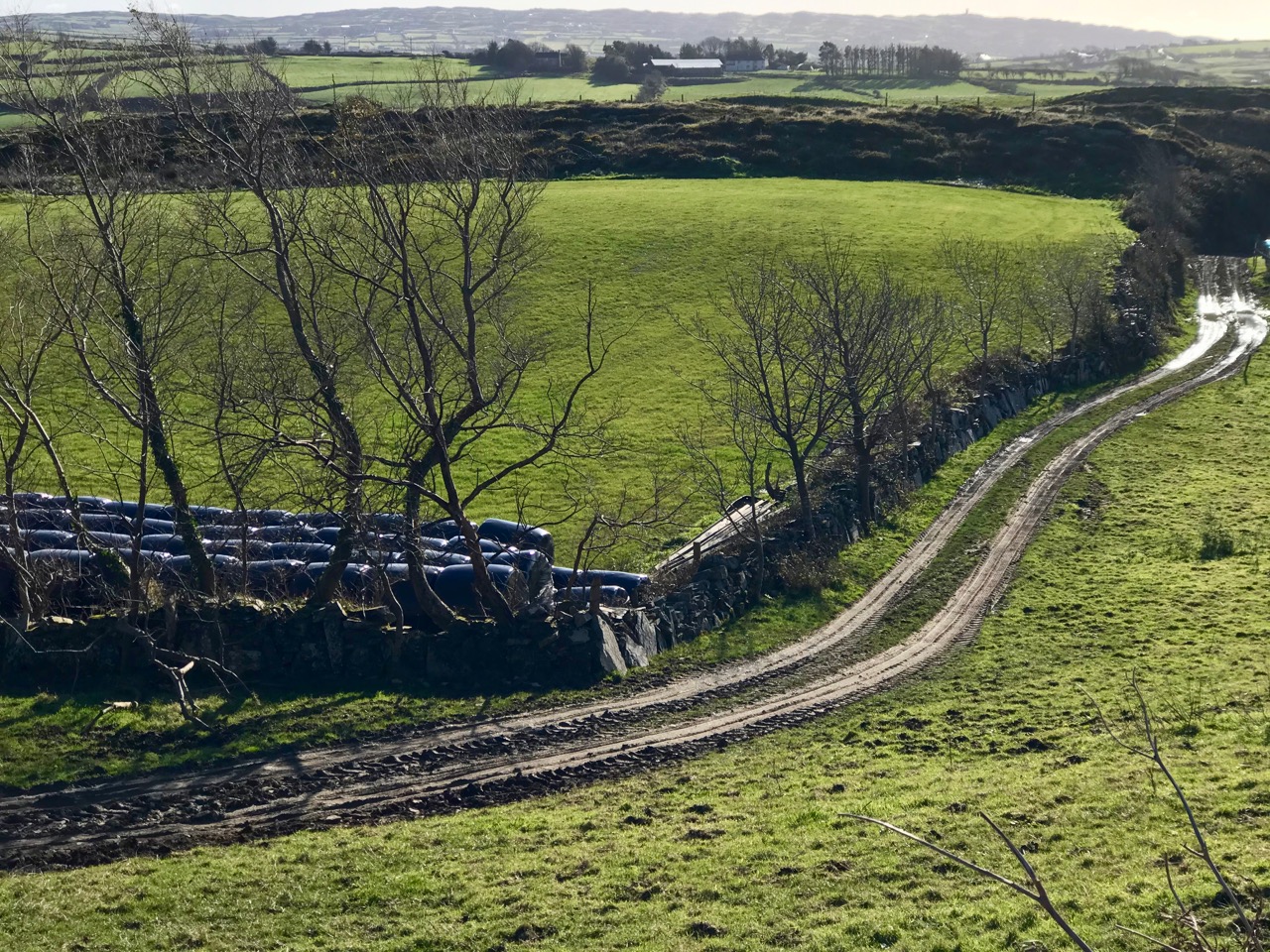
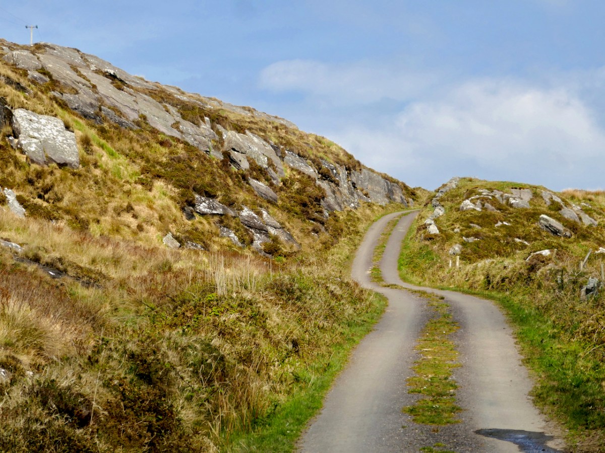
Ready for a longer walk? If yes – this one is 13.5km and has strenuous stretches. If not, don’t worry – there are lots of possibilities for doing parts of the walk, or for going with friends and leaving a car at strategic spots. We didn’t do it all at once, in case you get to thinking we are super-fit hikers. (The sad truth is we can’t be too far from a coffee shop.) As with all the Fastnet walks, keep dogs on leads – we did encounter both cattle and sheep on this walk, right on the road. There is a short stretch of ‘green road’ and although it’s well maintained, it might be muddy after rains, so good shoes are essential.

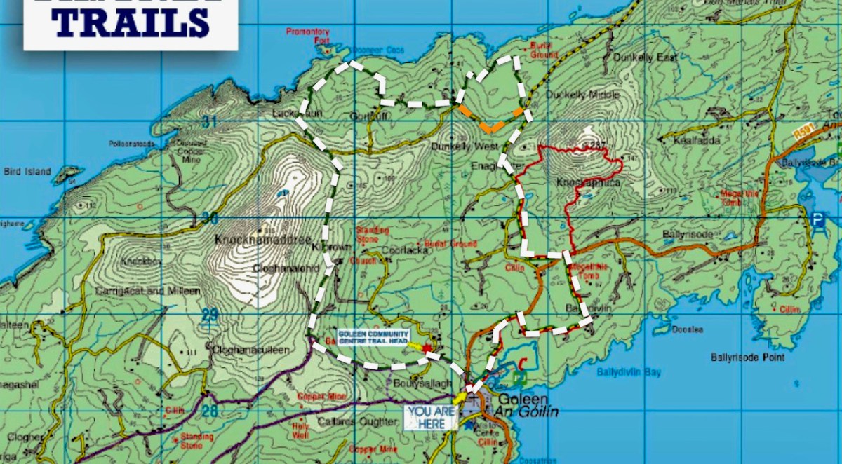
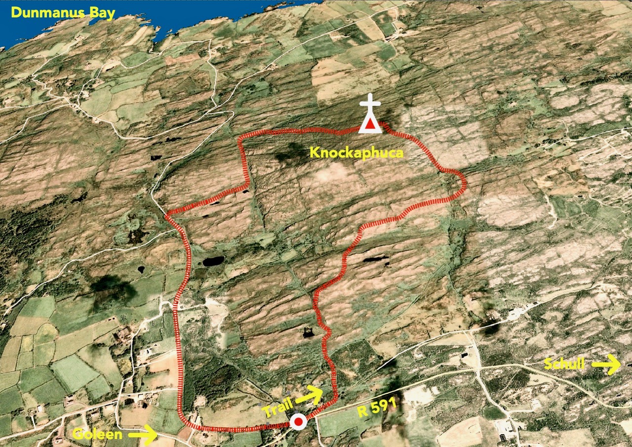
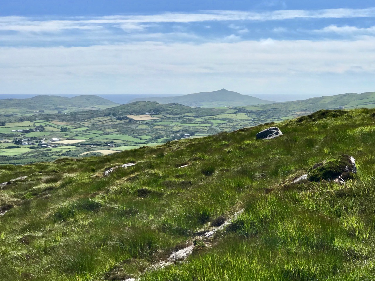
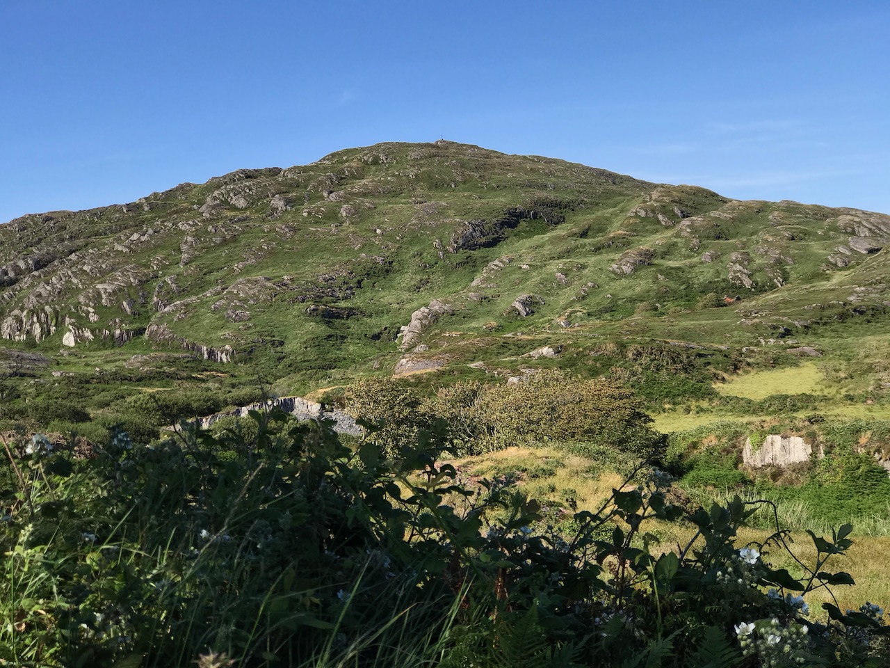
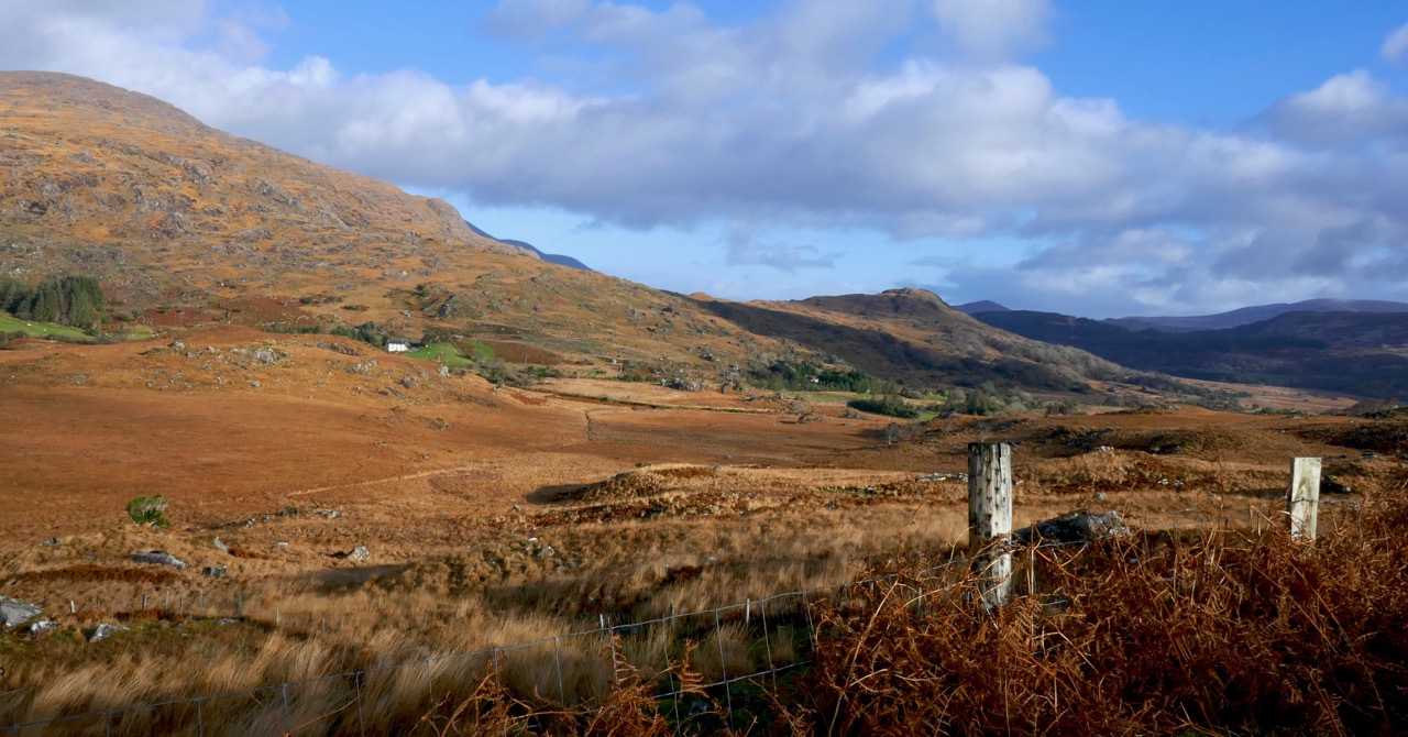
This loop takes you from Goleen on the south side of the Mizen right across the peninsula to the fabulously scenic north side. It skirts along the edges of the valley that runs between Knocknamaddree (Hill of the Dogs) to the west, and Knockaphuca (Hill of the Pooka, or Mischievous Spirit) to the east, rising to a maximum altitude of 180m (or about 600 feet). Most of the altitude is gained in the first half of the walk – so a packed lunch and water will be both welcome and needed if you’re doing the whole walk.

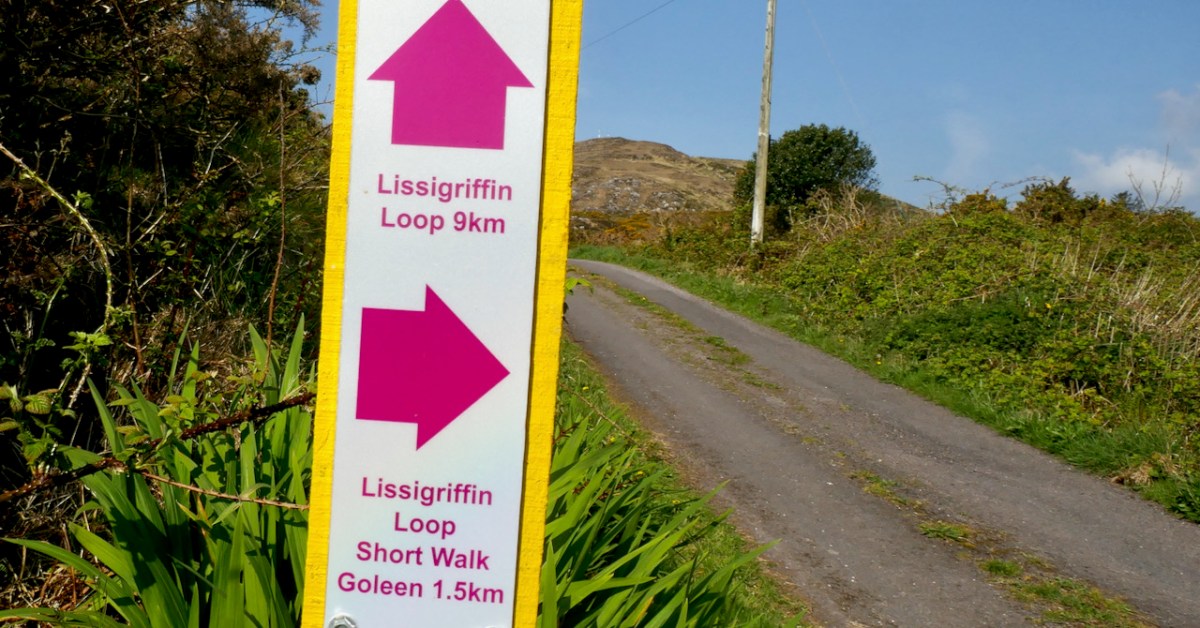
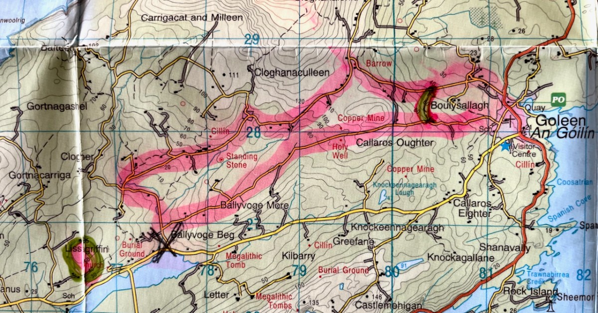
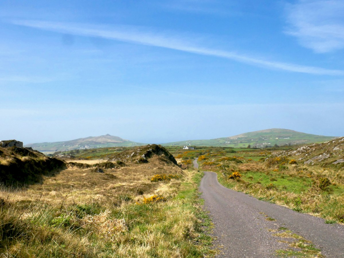
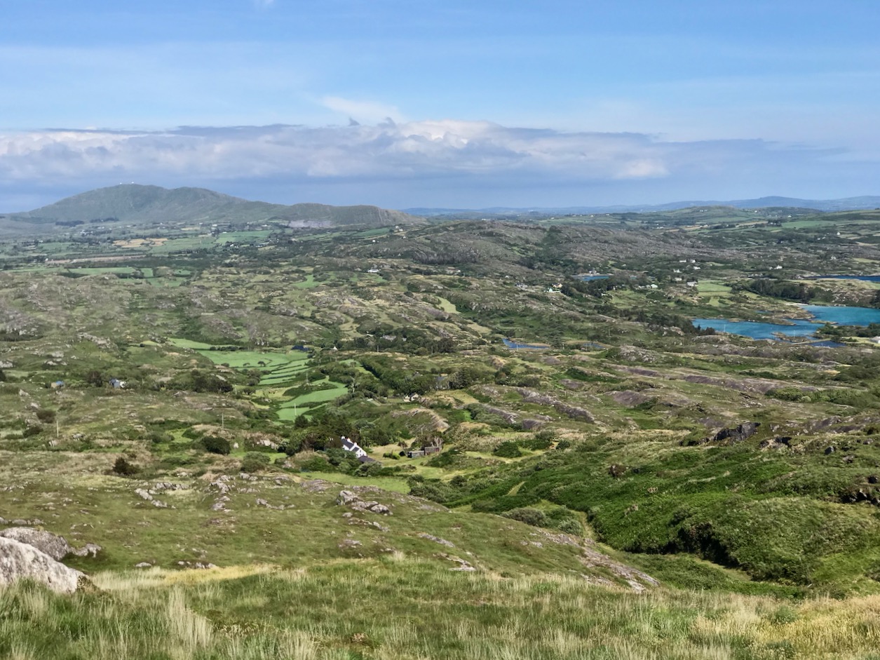
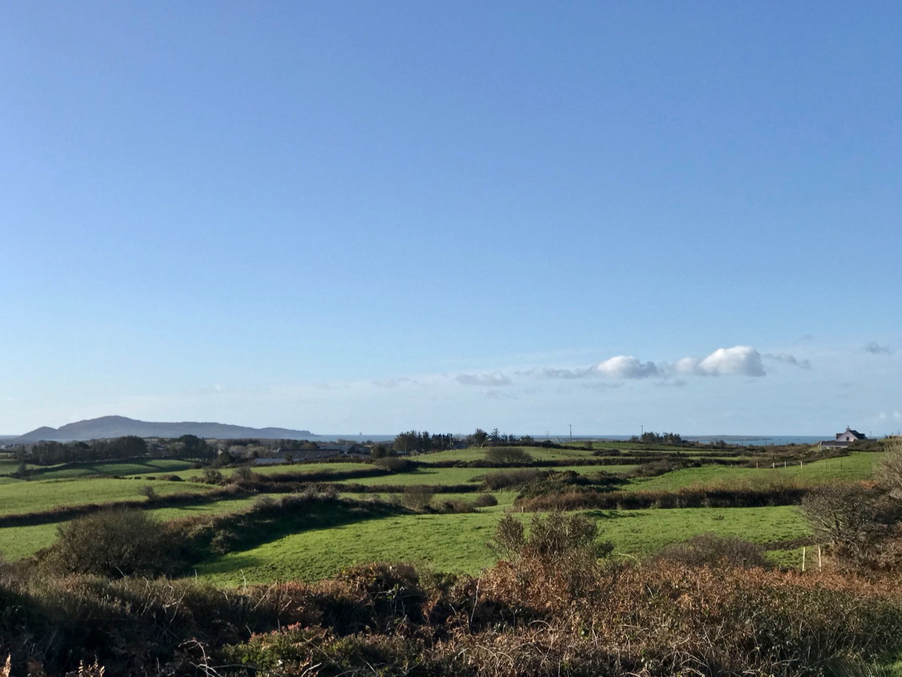
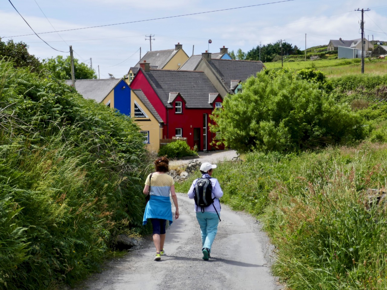
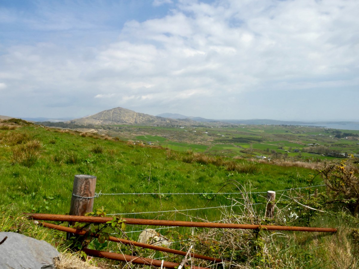
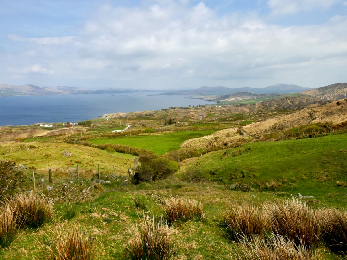
Set out from the Goleen Community Centre and the first part of the walk is shared with the Lissagriffin Loop – see our recent post on that walk. As you ascend, the views are immense – back to Goleen and across to Knockaphuca and Mount Gabriel beyond it.

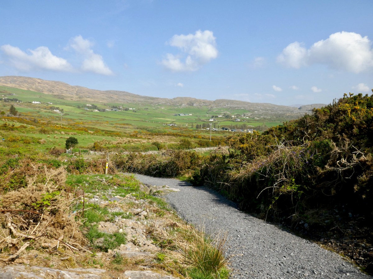
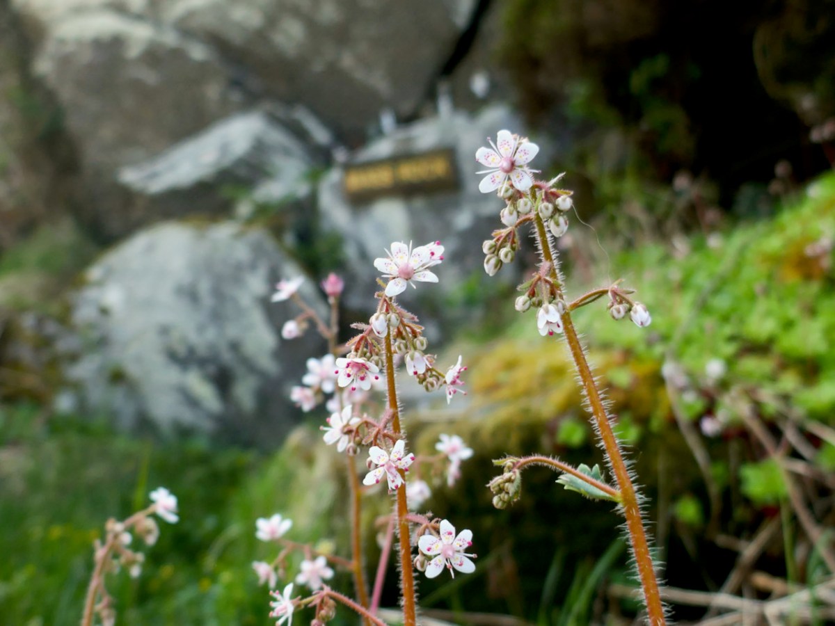
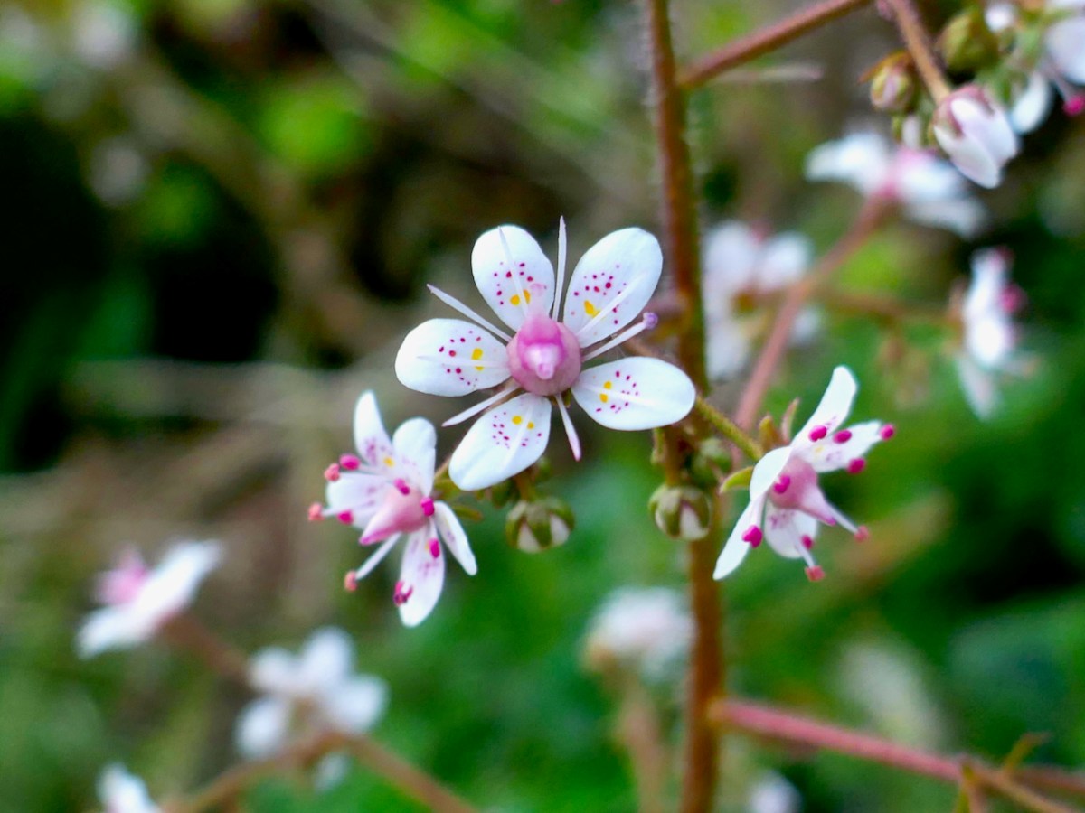
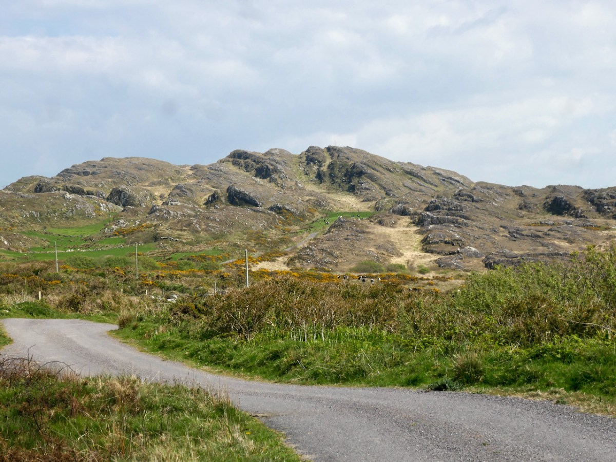
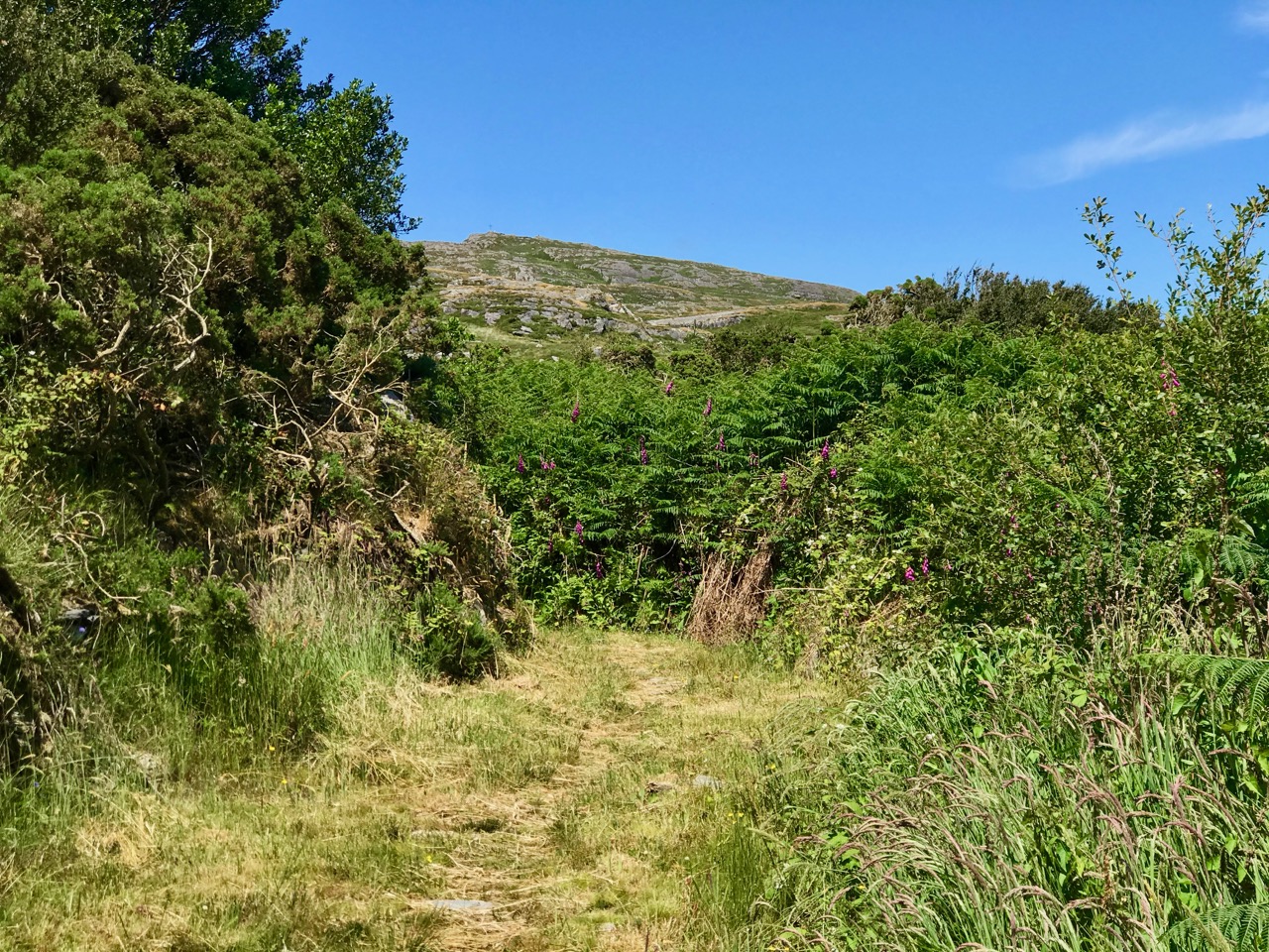
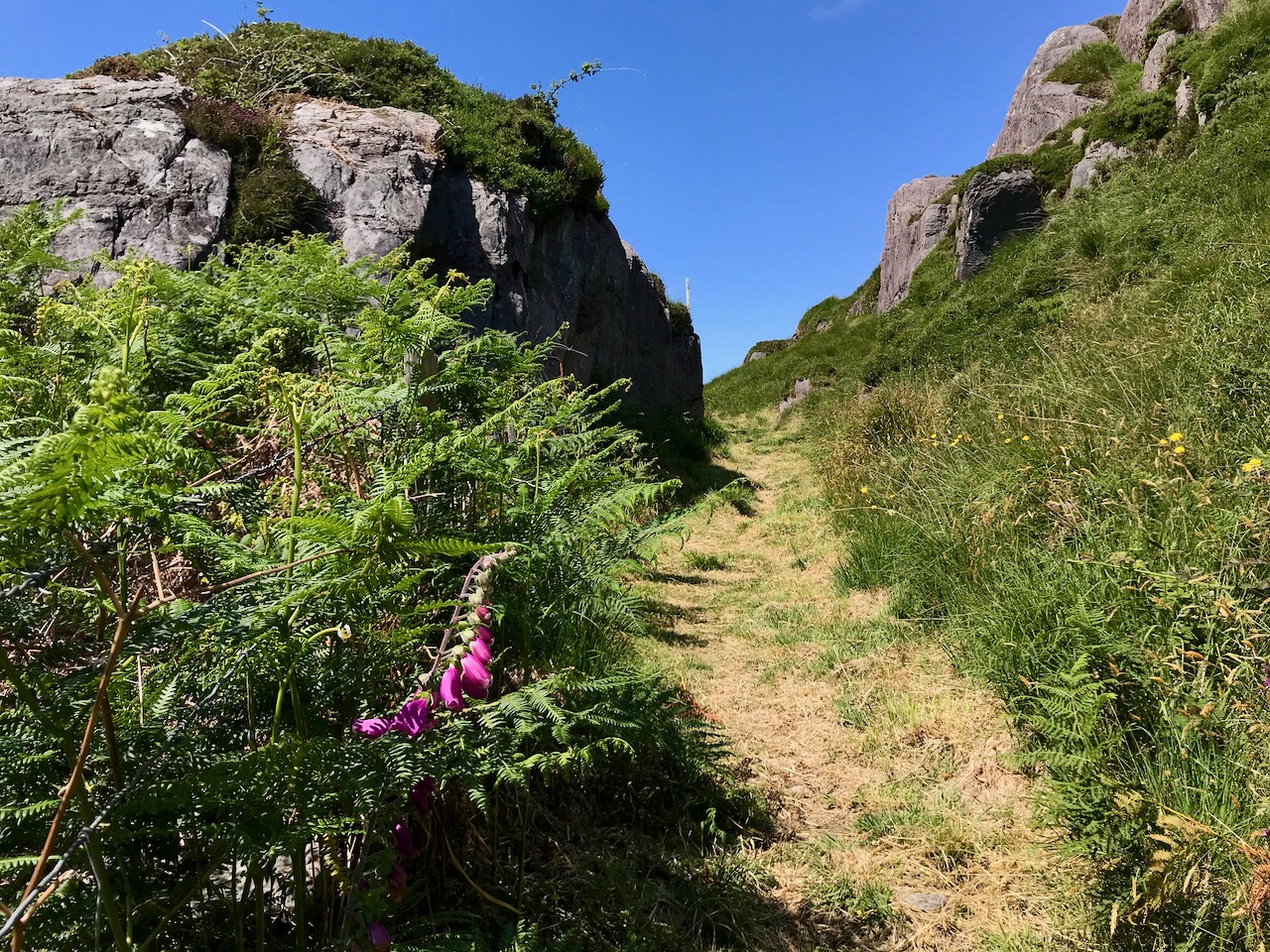
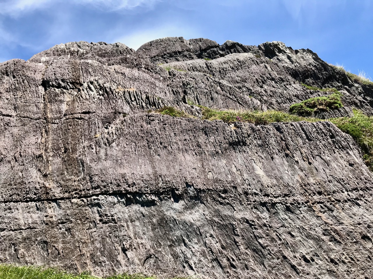
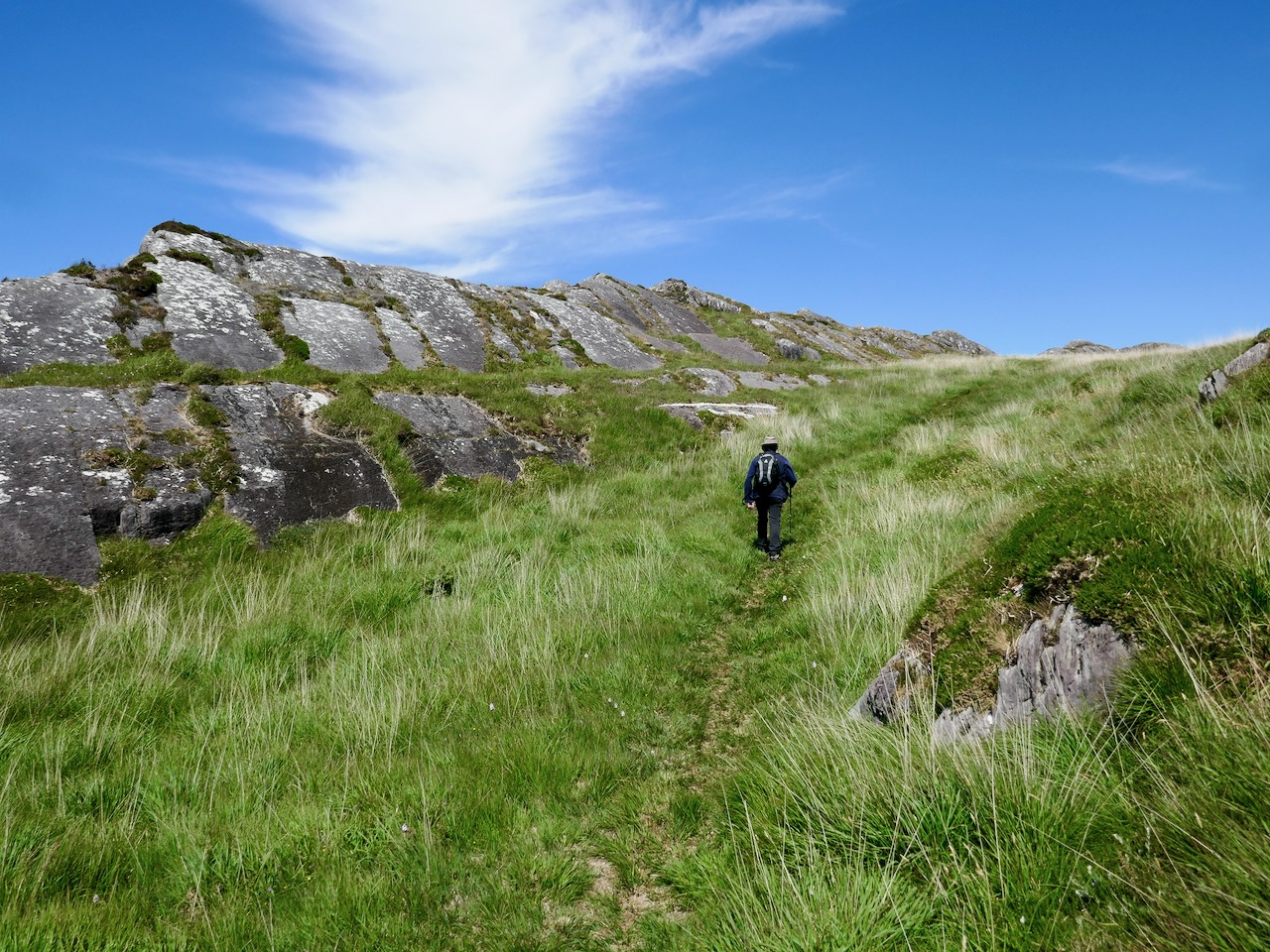
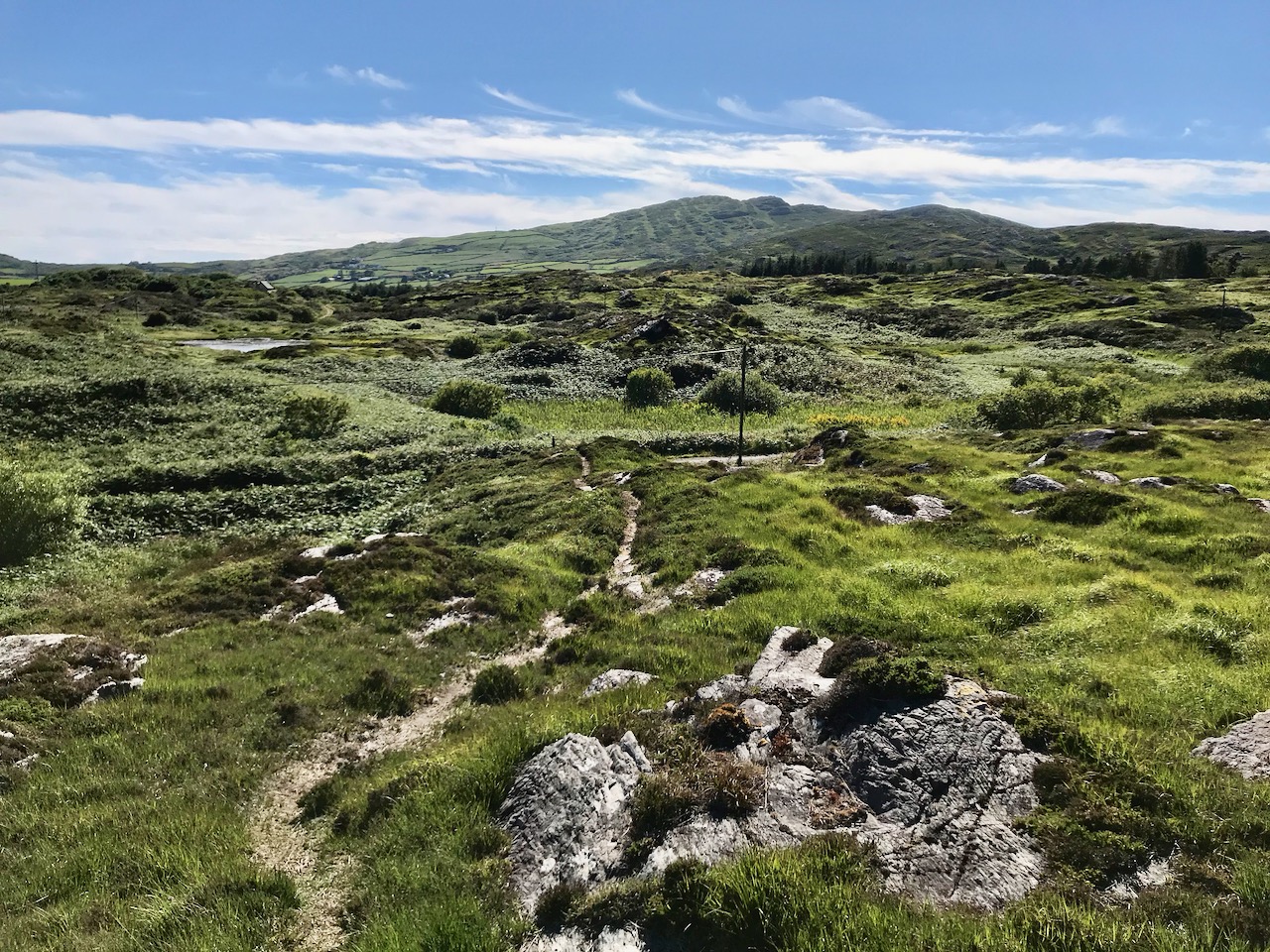
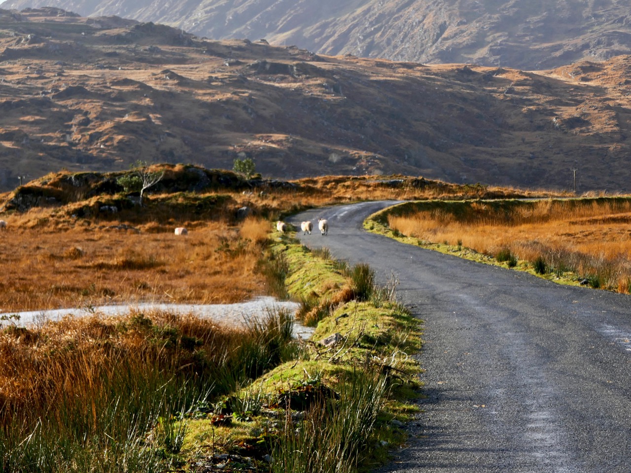
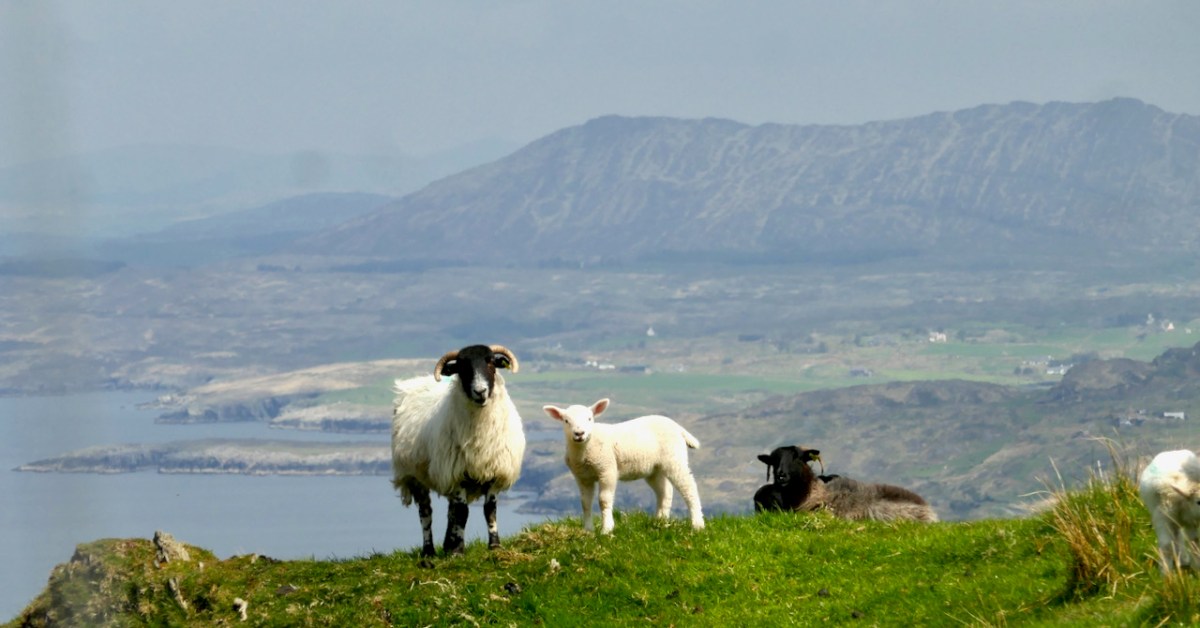
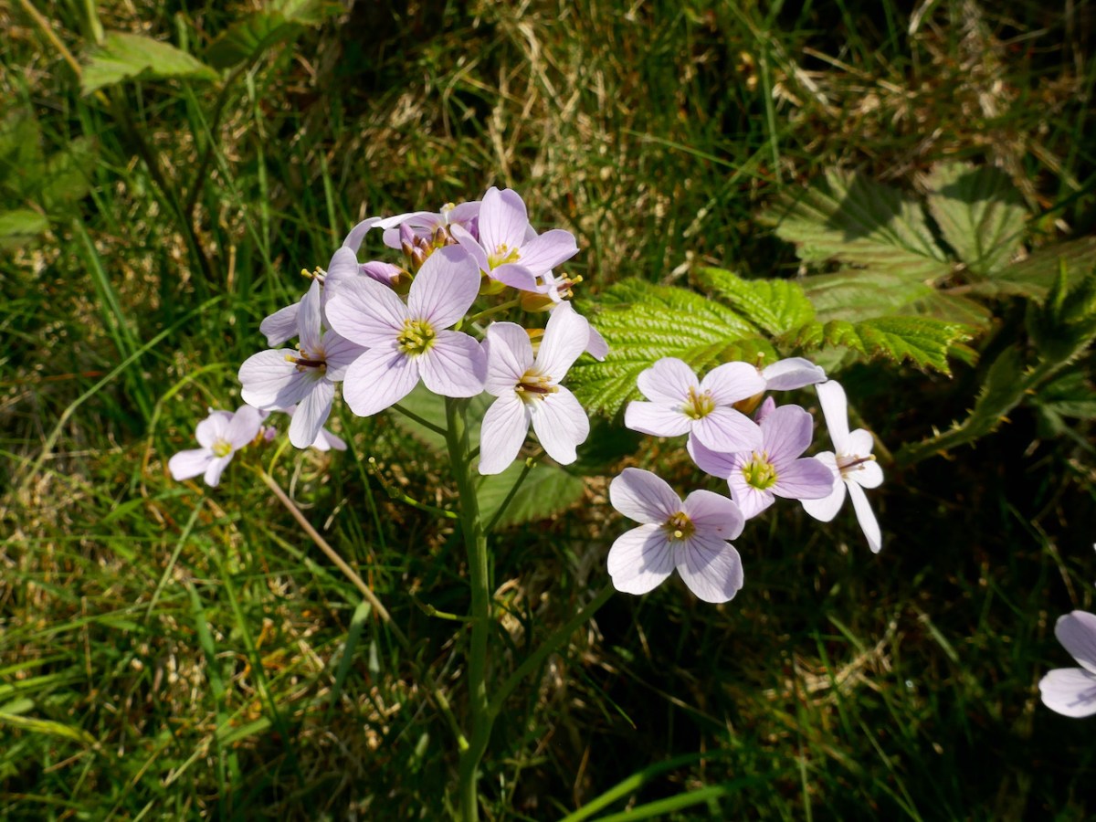
You’ll have to dig into your reserves of energy (or maybe have some chocolate) as you continue the climb. You are in true mountainy heathland now – look out for orchids in the spring and early summer, or Cuckooflower (below) in damp ditches.

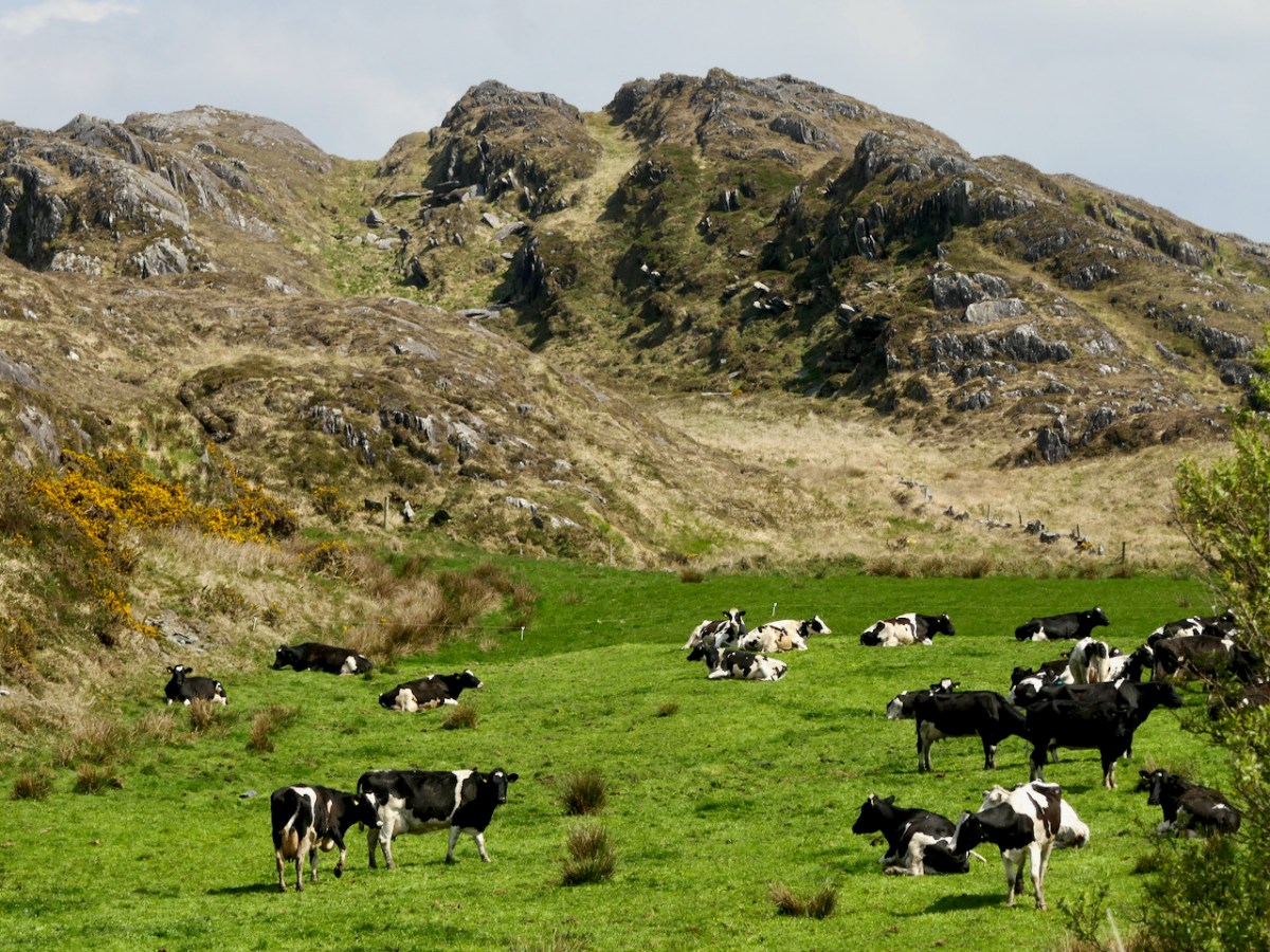
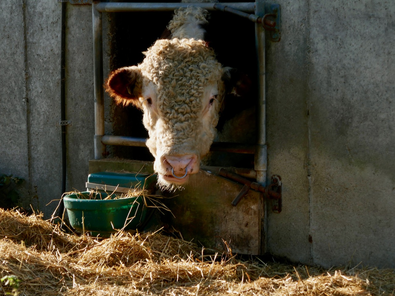
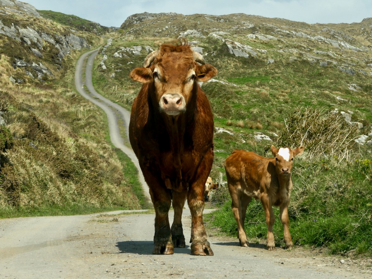
Watch out also for cattle on the road – we were startled by a line of plodding cattle coming towards us, and even more startled when we realised that one was a mighty fine bull. Fortunately, they turned into a field before we reached that spot, but there was no human around and the gates were open, so we can only assume we were simply in the wrong place at the wrong time as it is very unusual (although not unknown) to see cattle wandering like this.

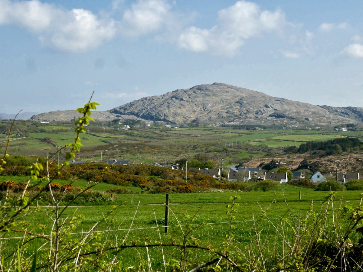
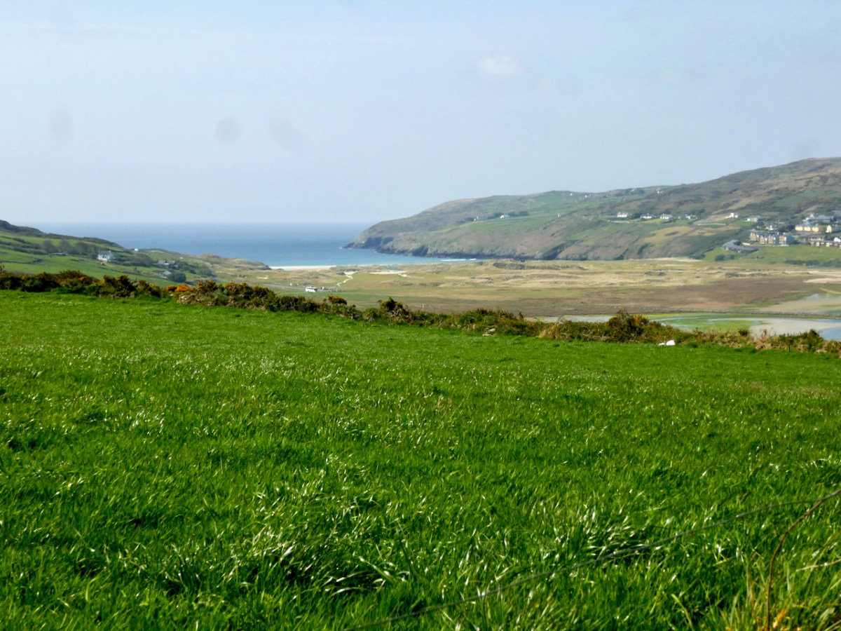
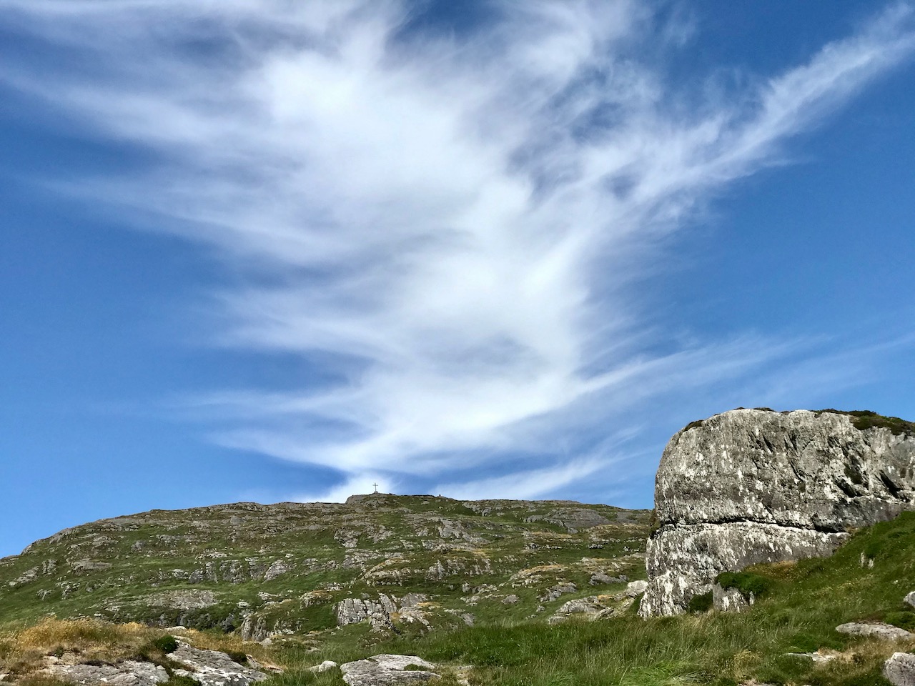
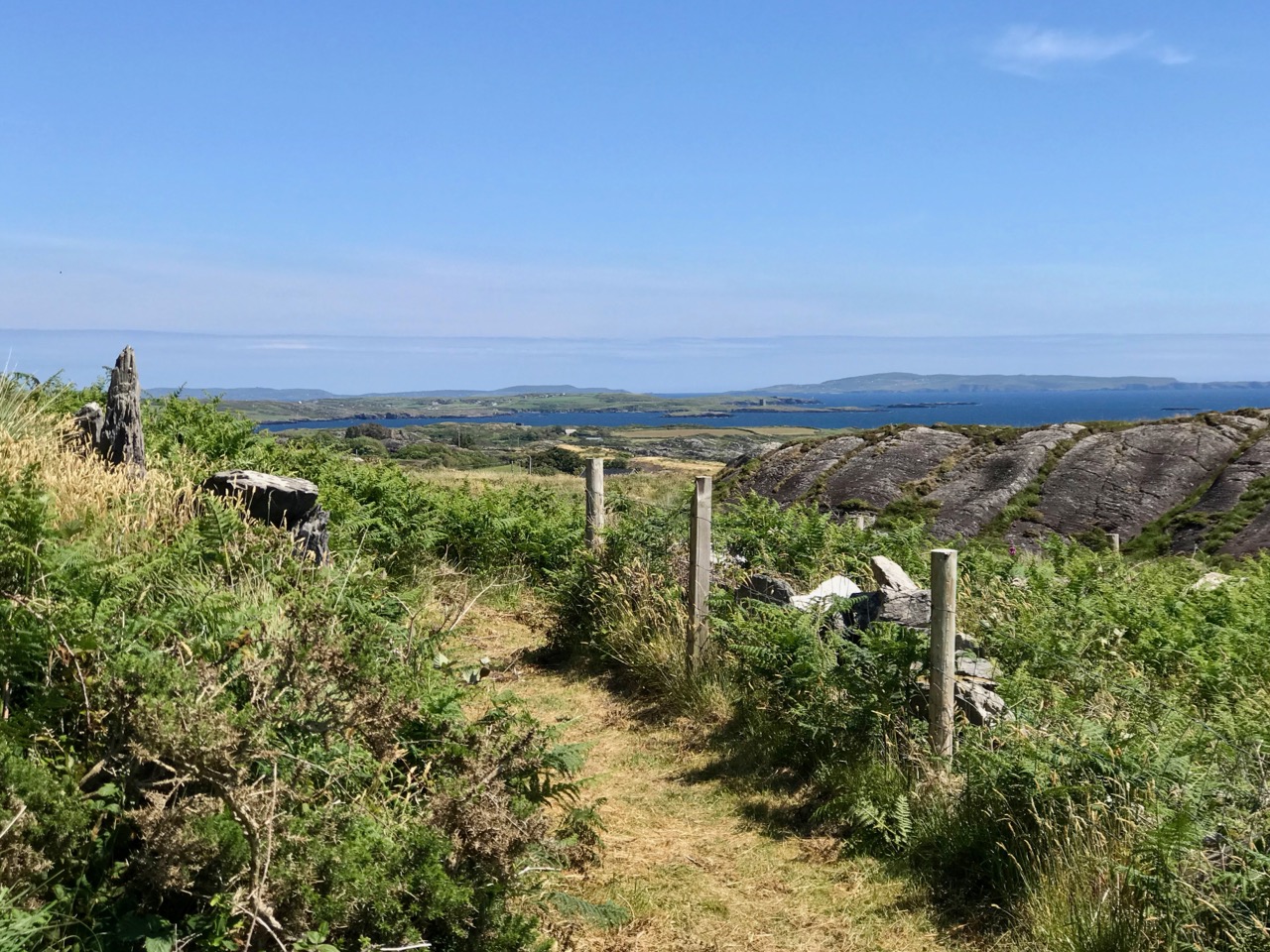
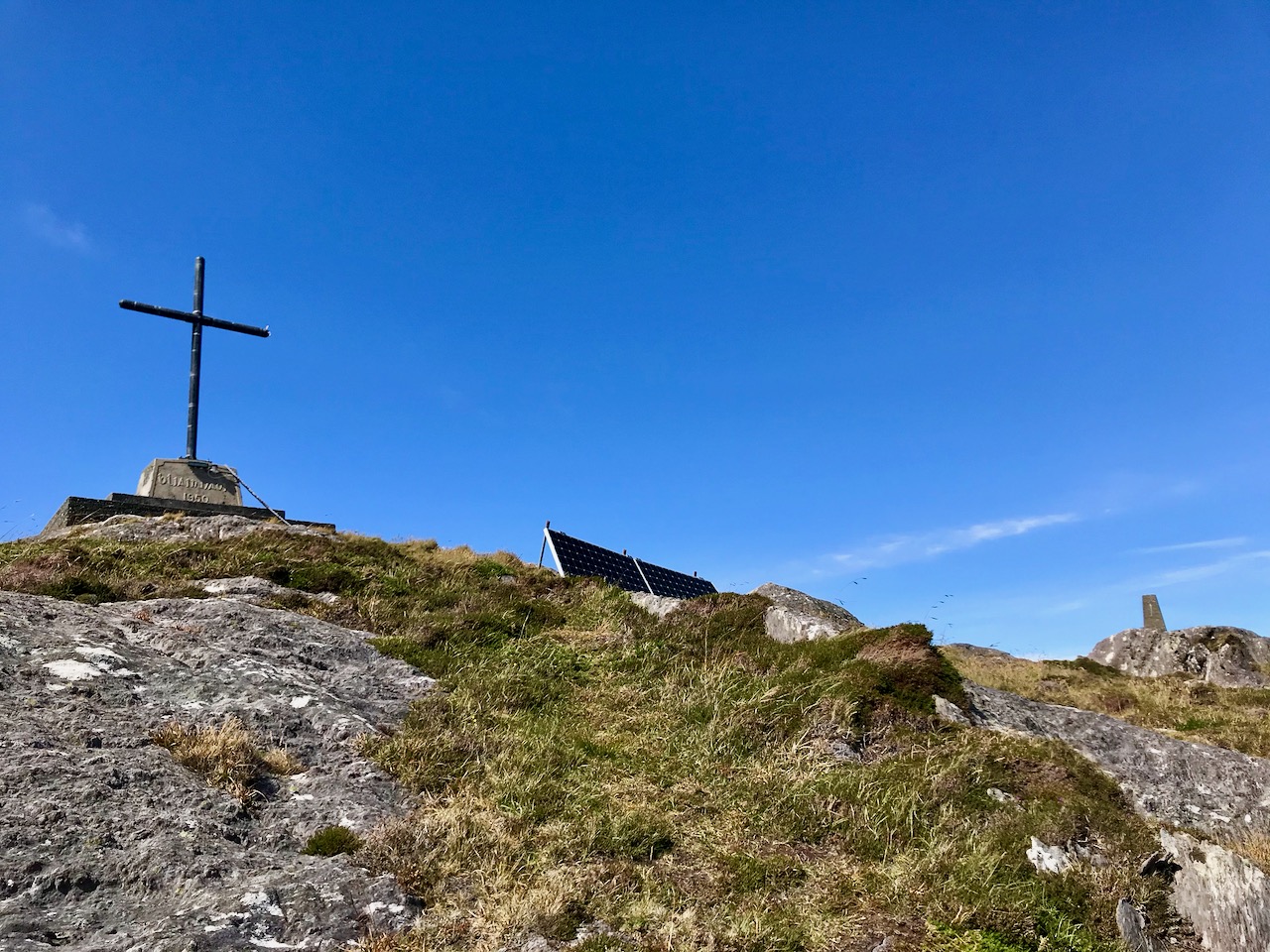
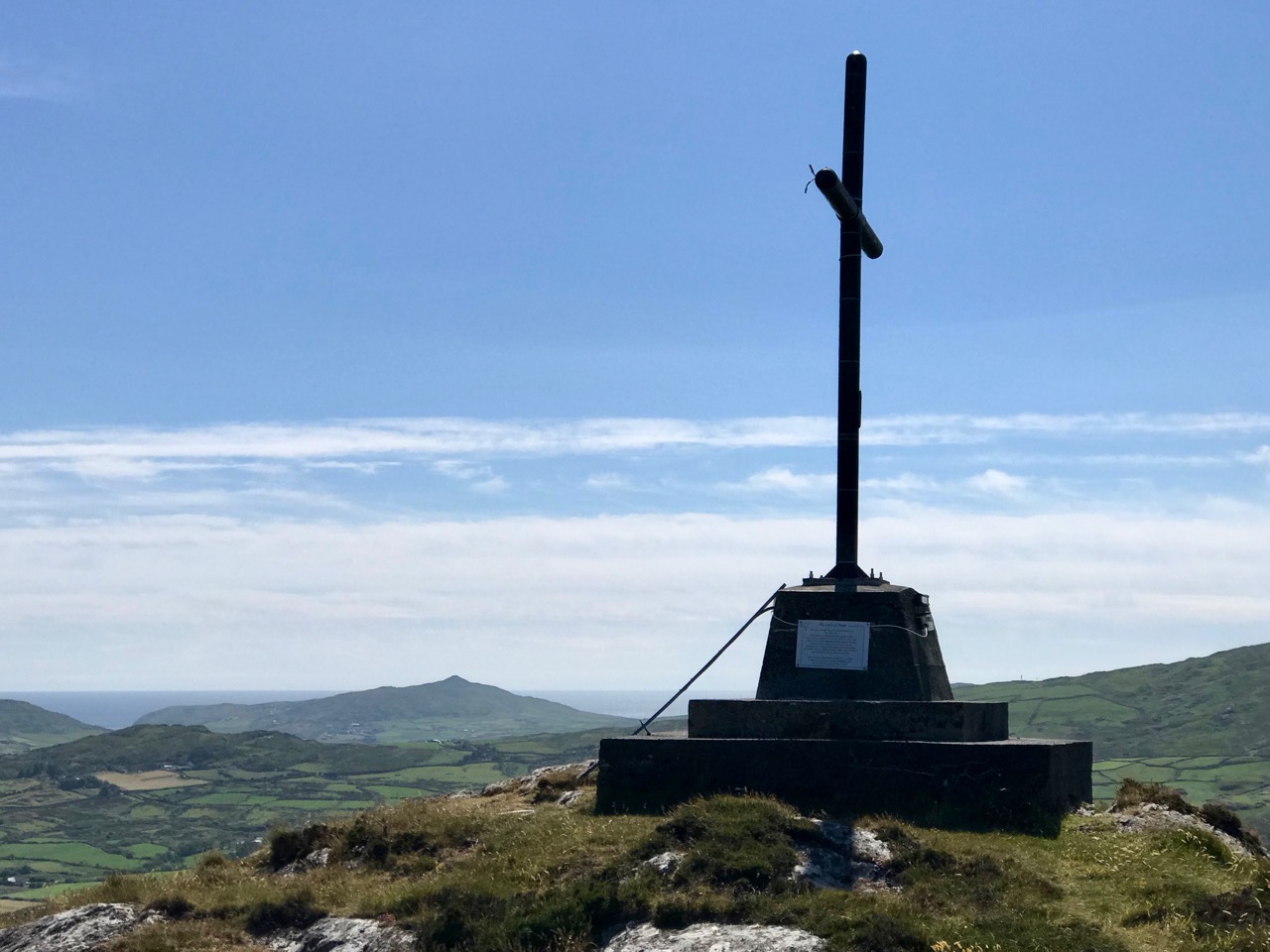
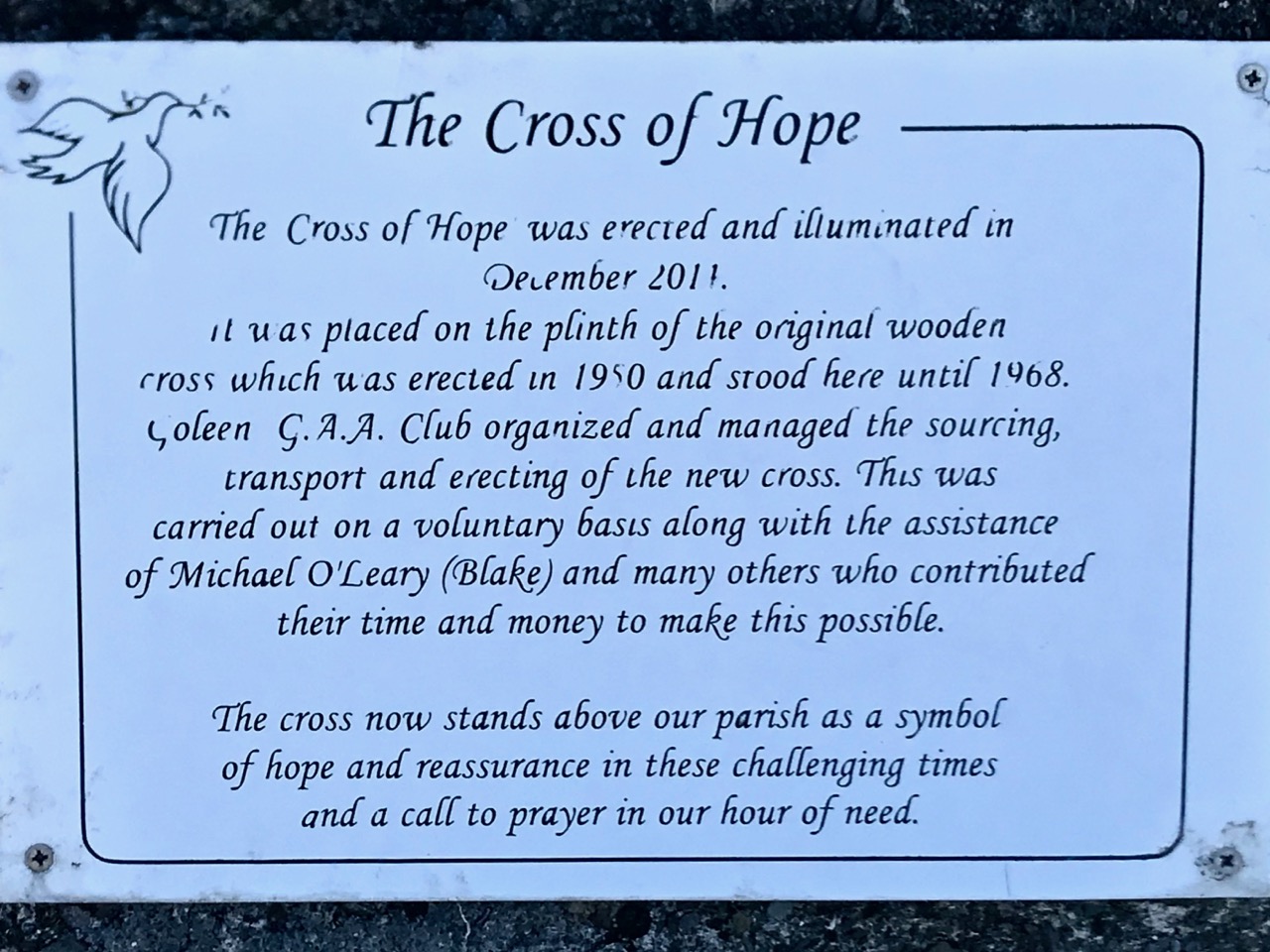
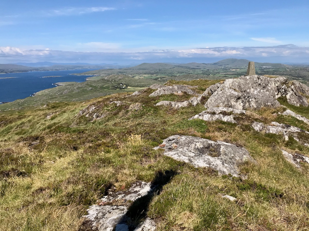
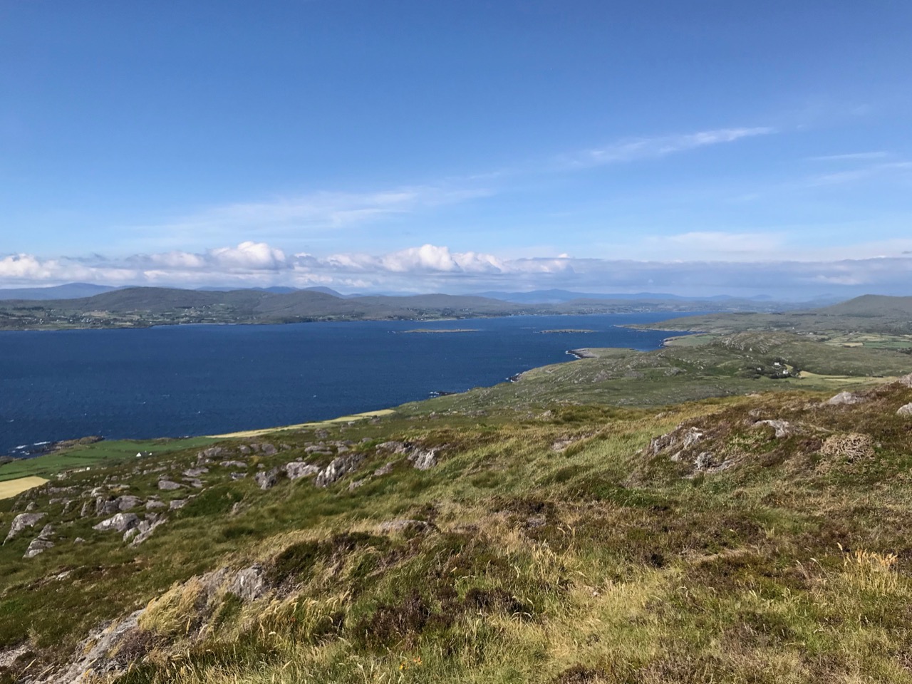
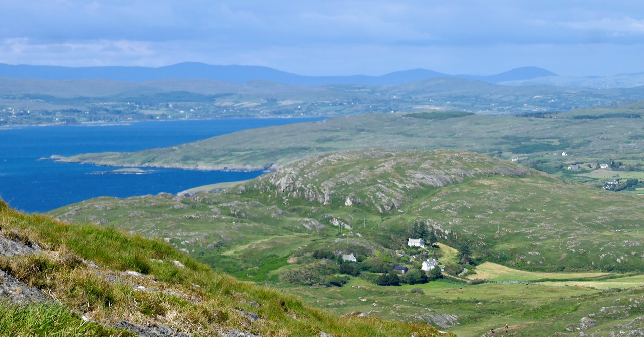
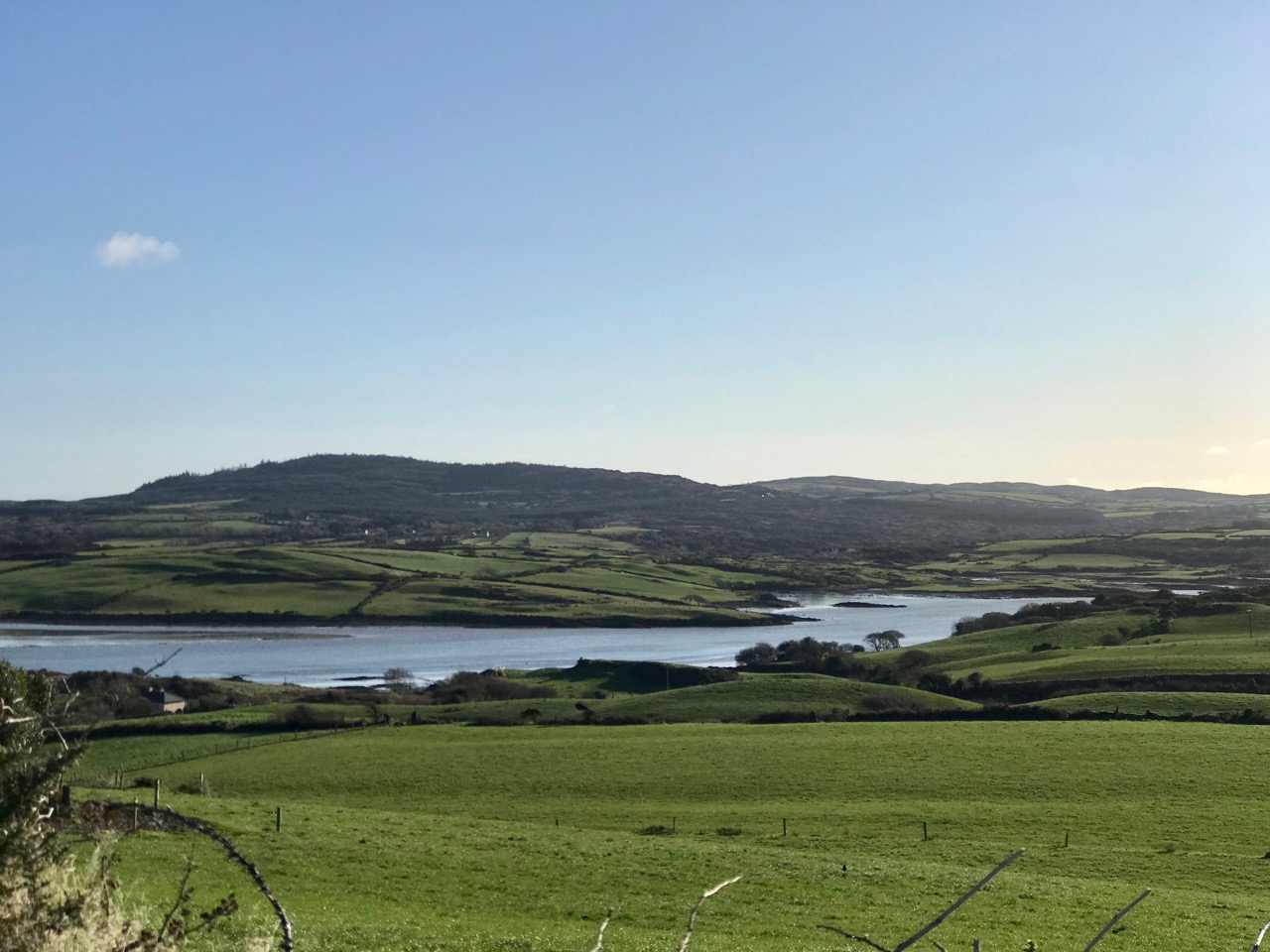
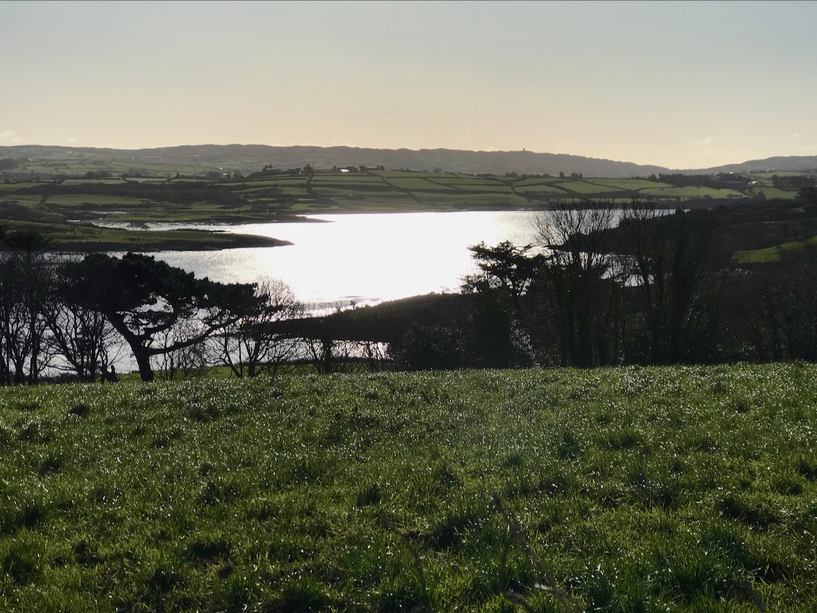
Coming over the top of the hill you have the whole of Dunmanus Bay in front of you and you can see clear up to the head of the bay, across to the Sheep’s Head, and to the Mountains of the Beara behind that. Have a nice sit down on some convenient boulder here – you deserve it – and just absorb that breathtaking sweep of land and sea.

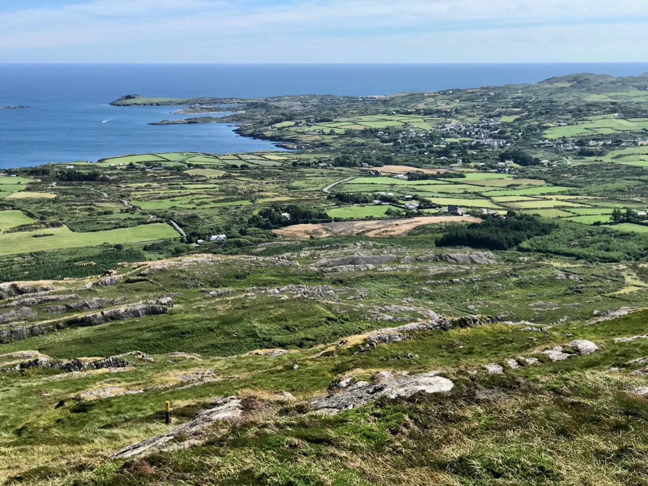
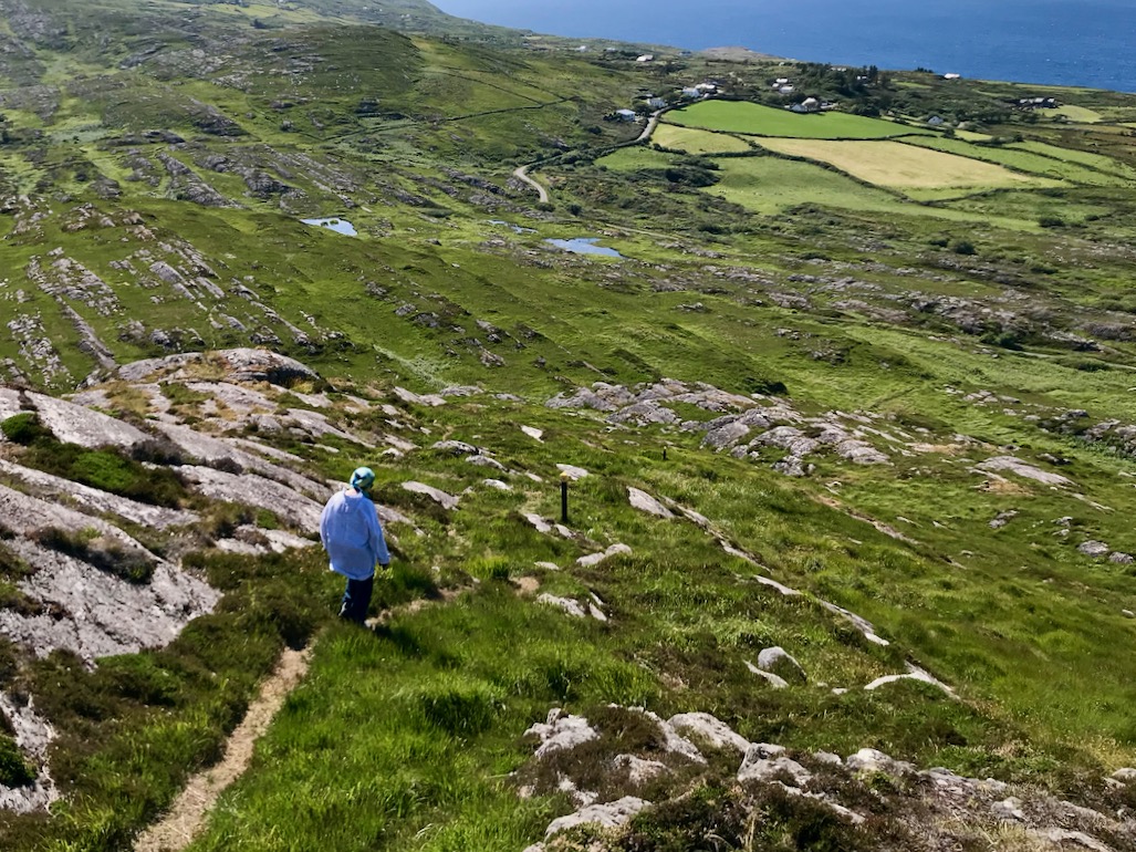
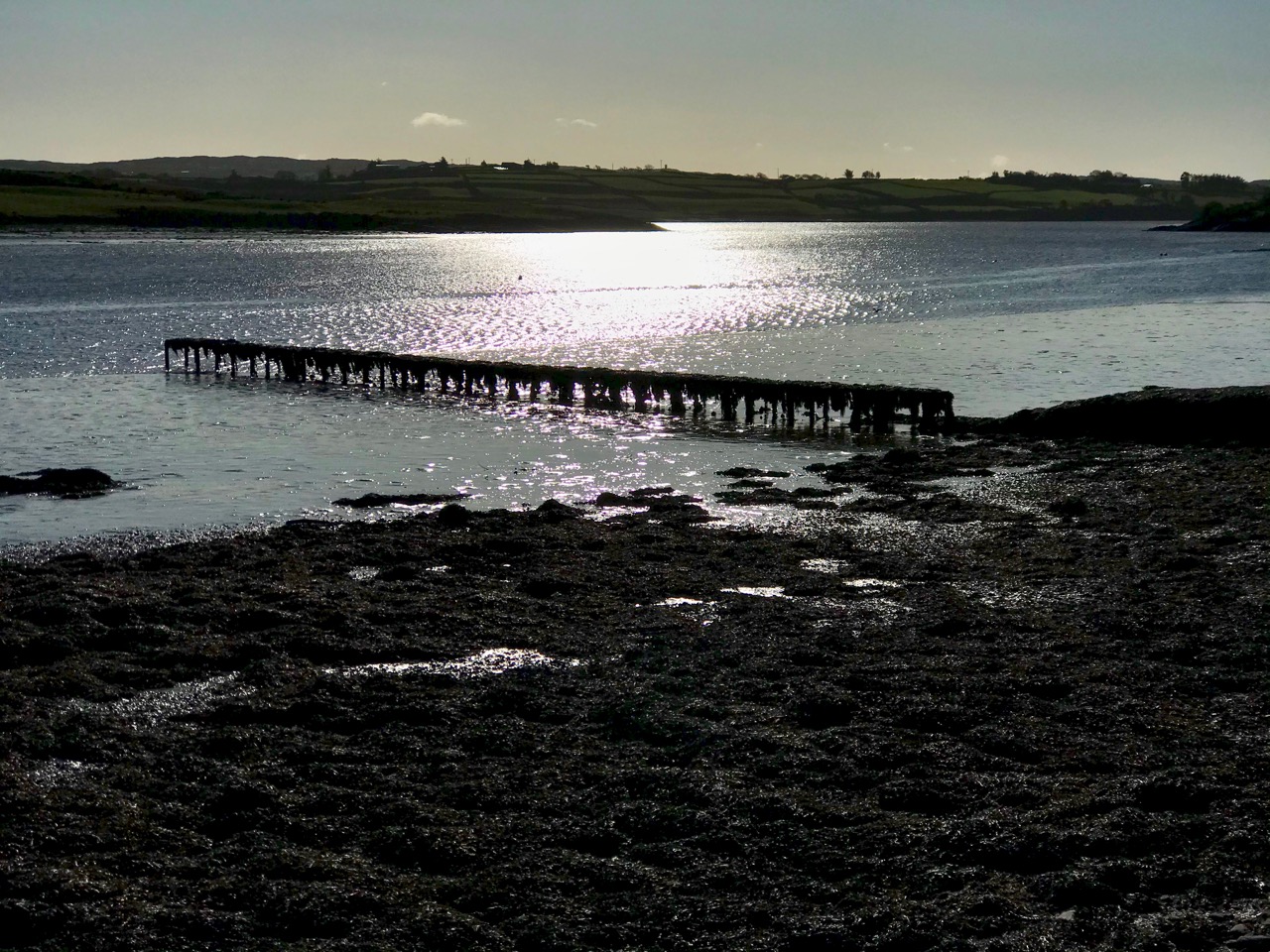
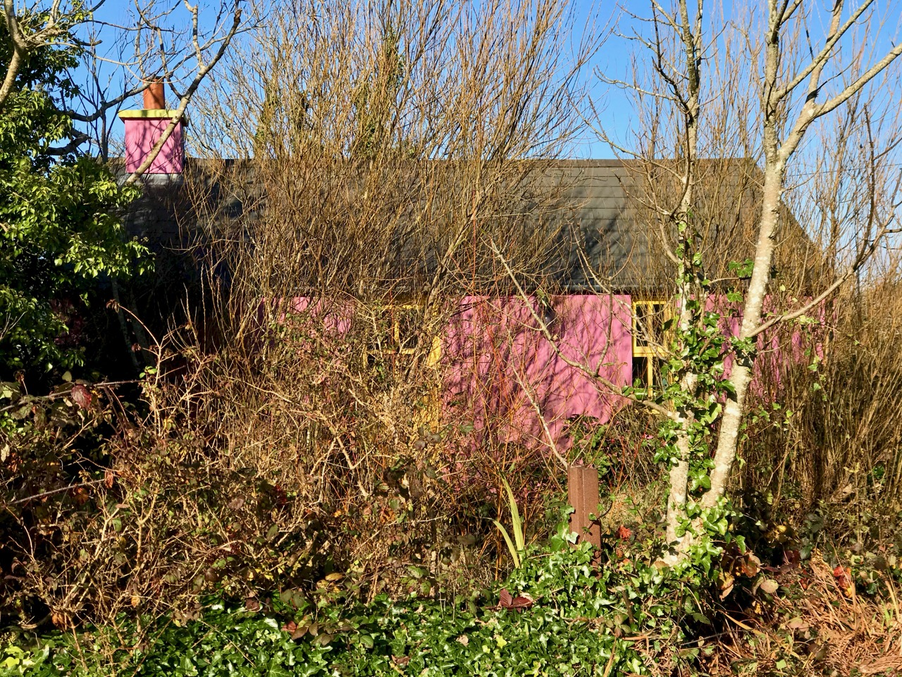
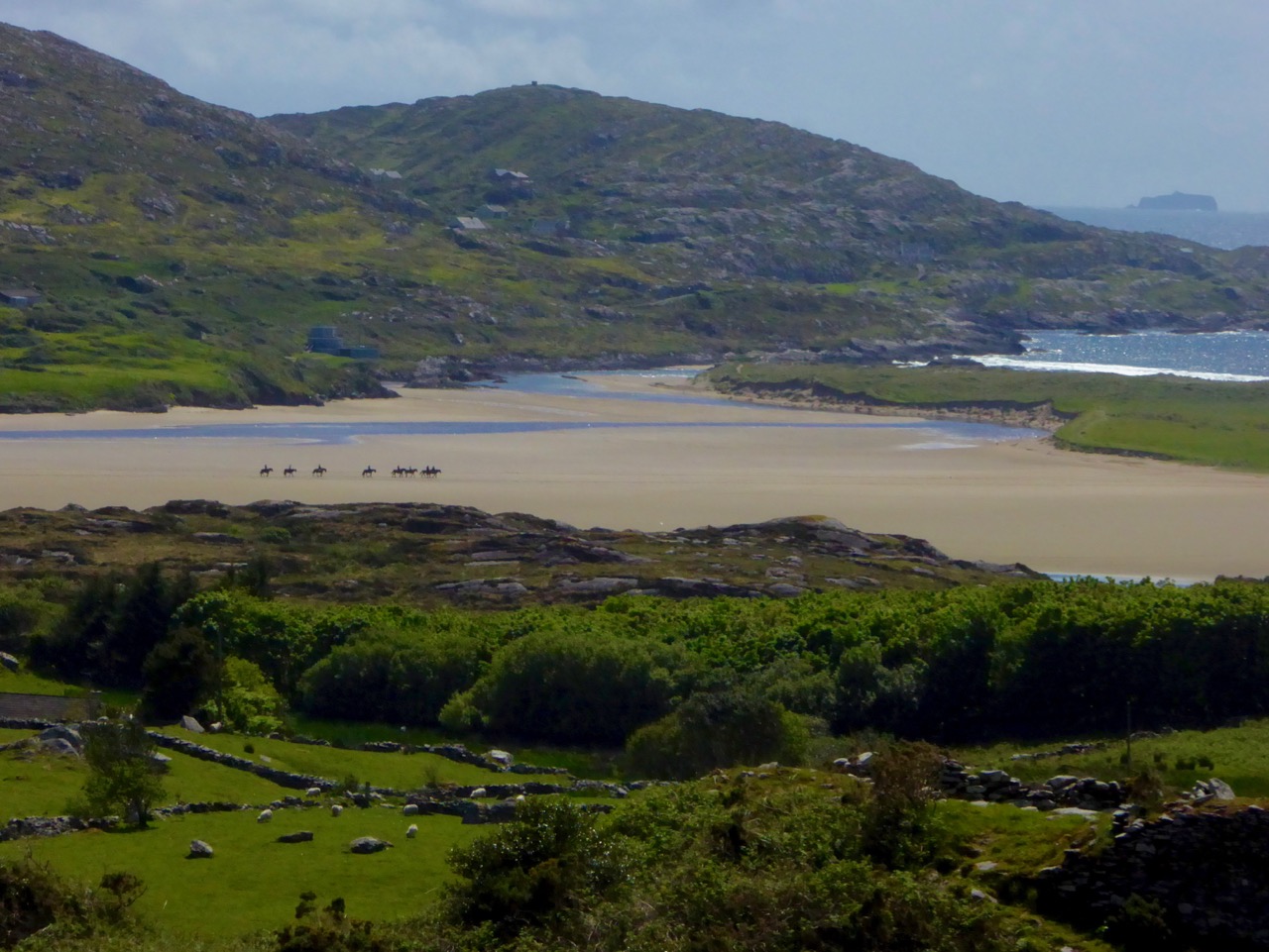
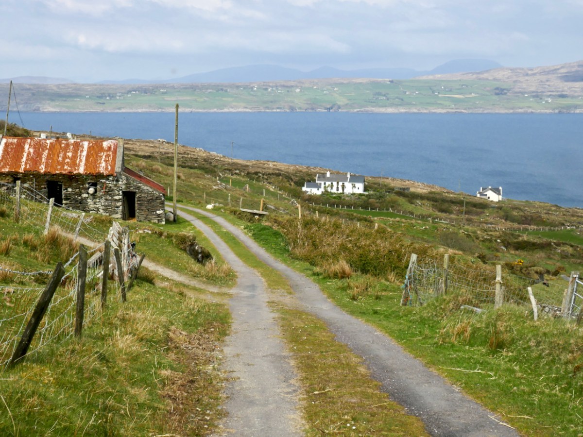
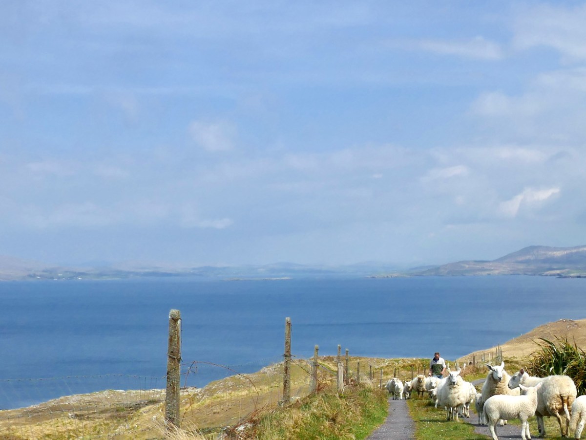
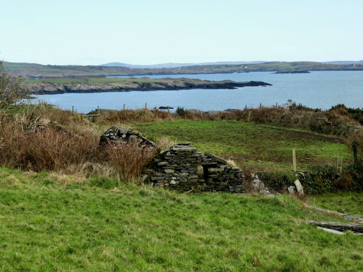
And talking of sea – you’re heading down now towards it, past picturesque stone farm buildings and beautifully renovated cottages until you arrive at Dooneen Coos (the Cove of the Little Fort). Along the way we ran into a shepherd moving his sheep up into higher ground, with the aid of the marvellously well-trained dogs that attend to their business but also like a good pat.

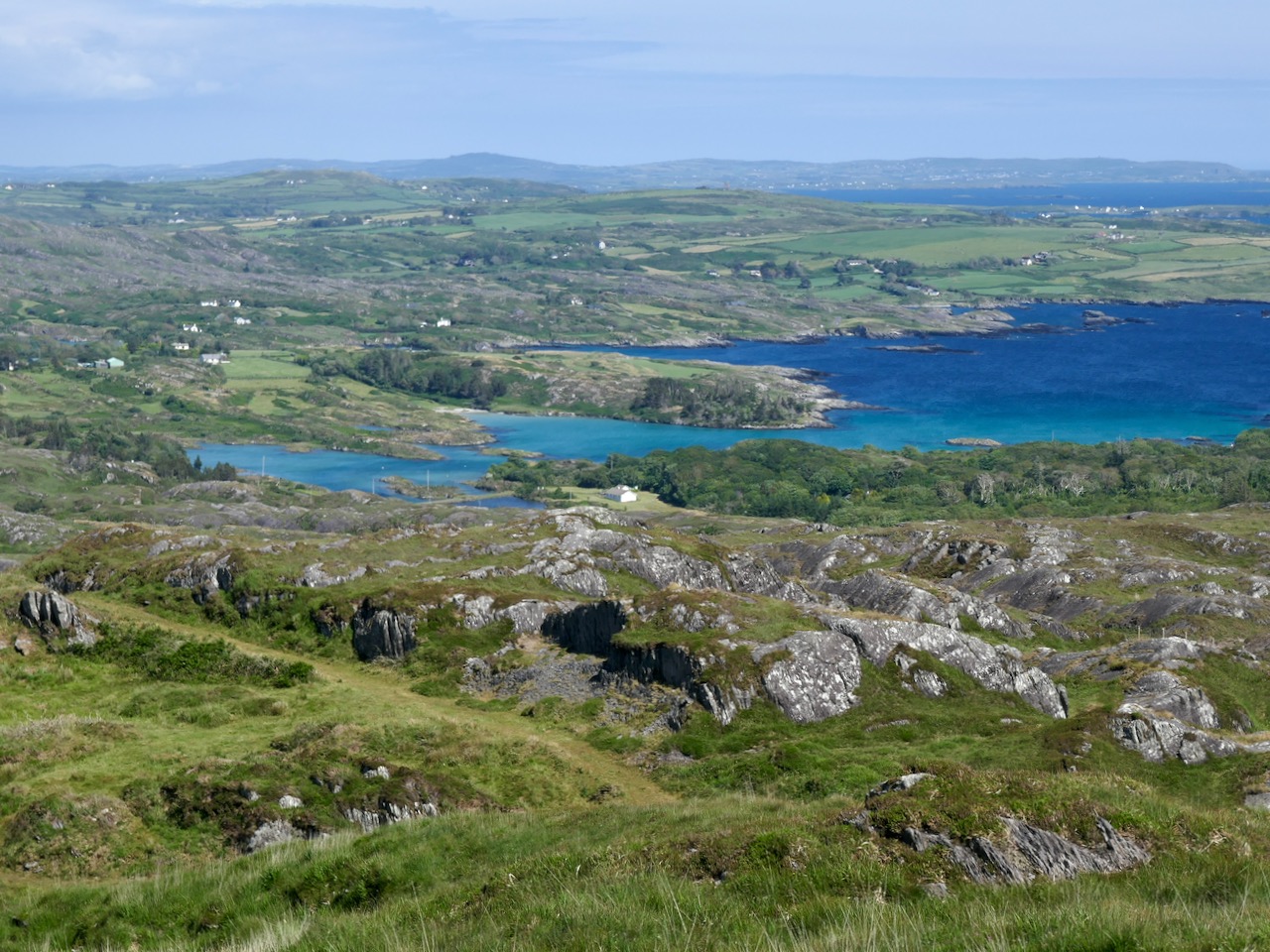
Dooneen Coos is a good spot for lunch – or even a swim if you’re that way inclined. it’s close to the peninsula we wrote about in our post Mizen Magic 23: Lackavaun and The Meallán so you can always take a side trip there if you wish. This might also be a good spot to leave a car if you’re not doing the whole loop on this occasion.

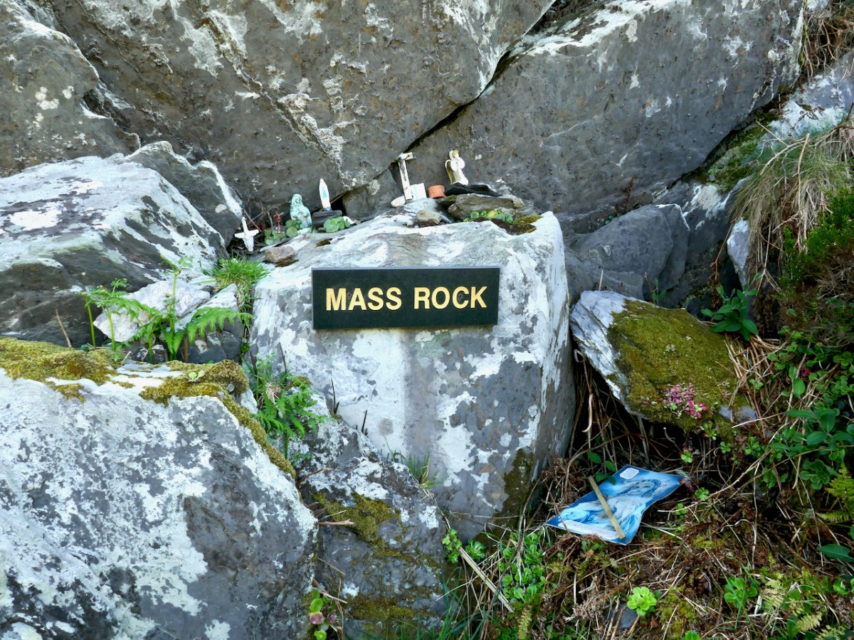
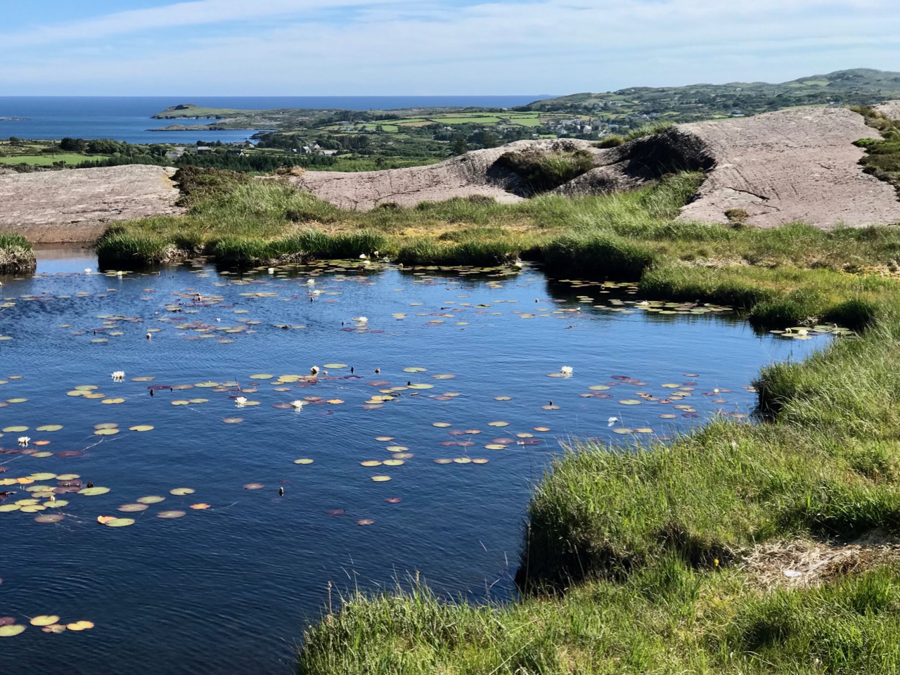
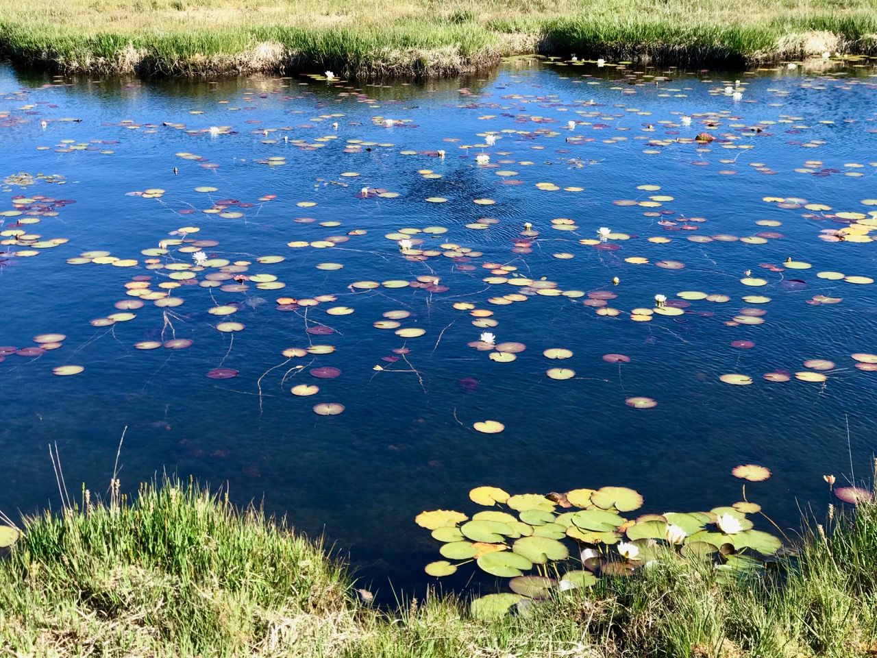
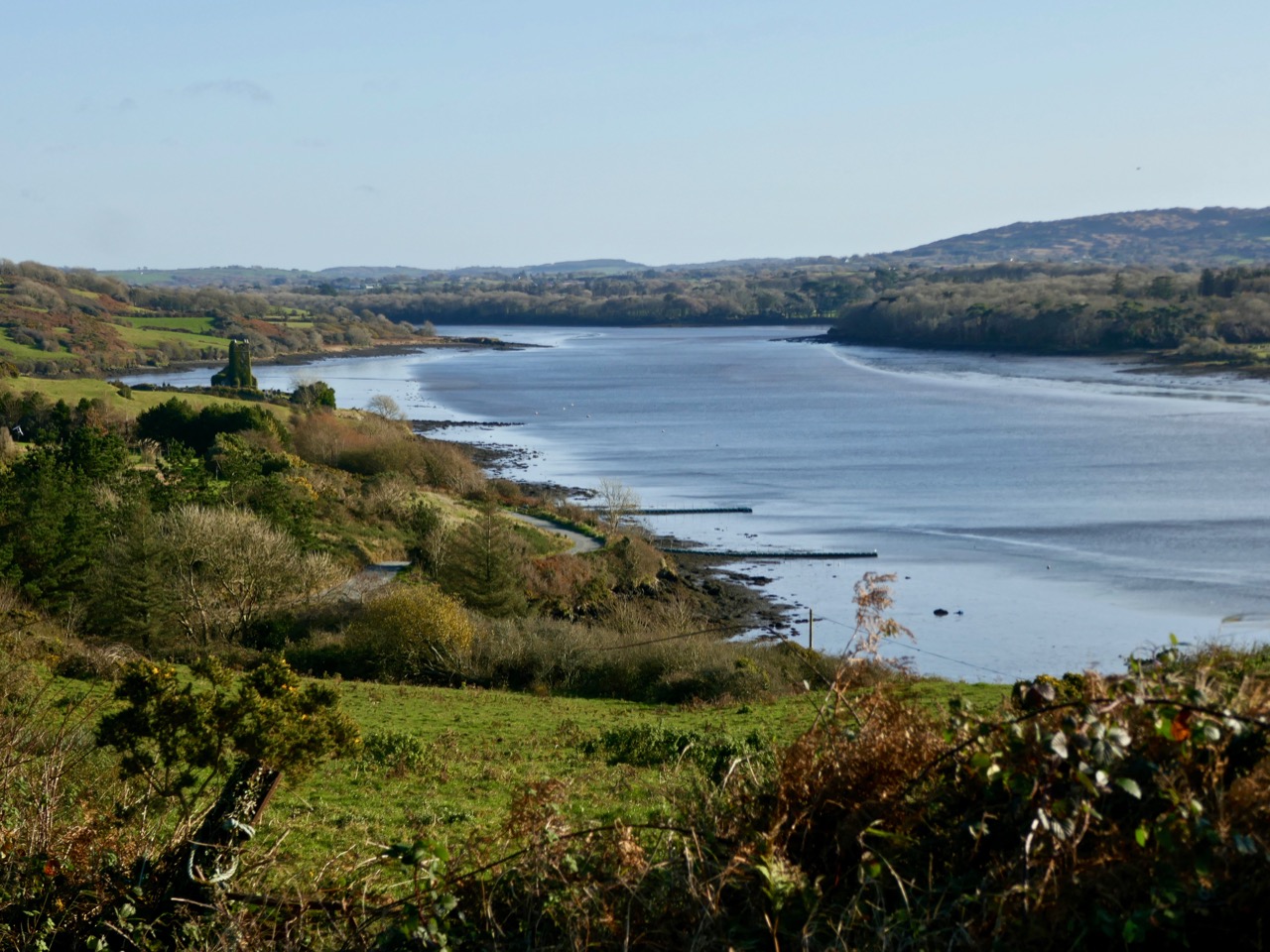
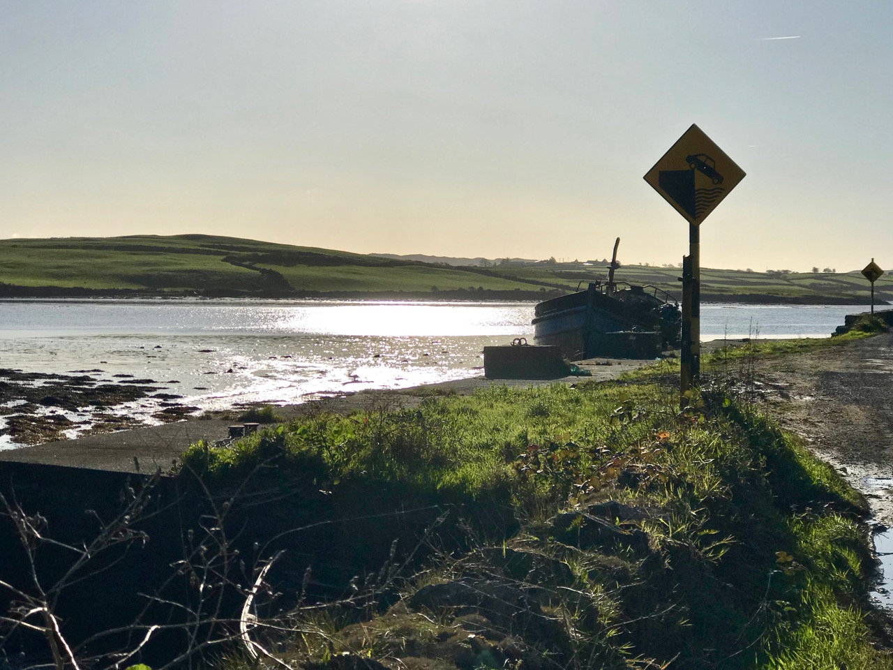
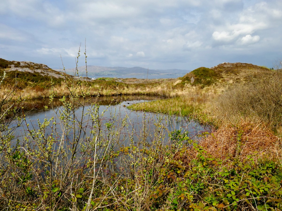
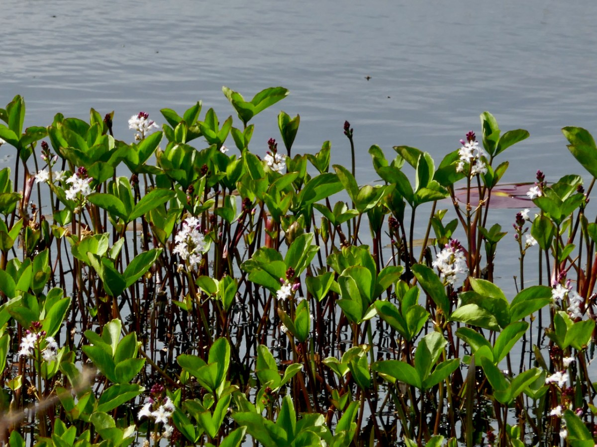
But if you’re carrying on, you’re now heading towards Dunkelly and the storied inlet known as Canty’s Cove. Read all about it here. Here, because we have been to Canty’s Cove lots, we took the short cut – marked in orange on the map. The compensation is that this stretch contains the remains of old ruined cabins and clacháns (hamlets) along the road, as well as a beautiful pond which, at the time of our visit was full of flowering Bogbean. 

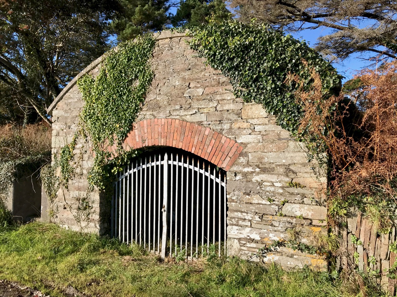
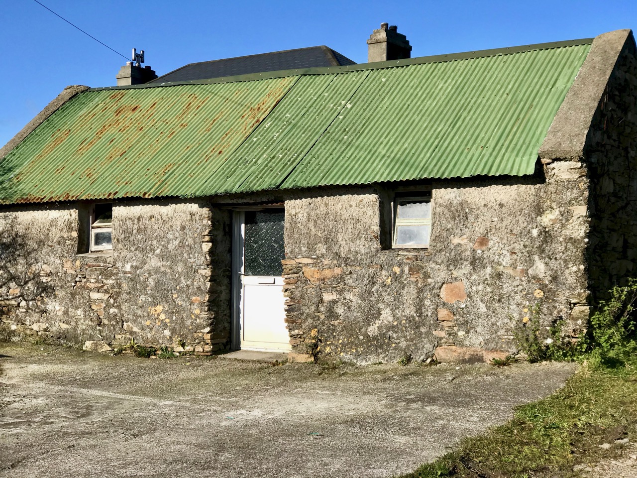
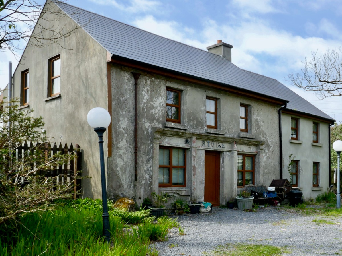
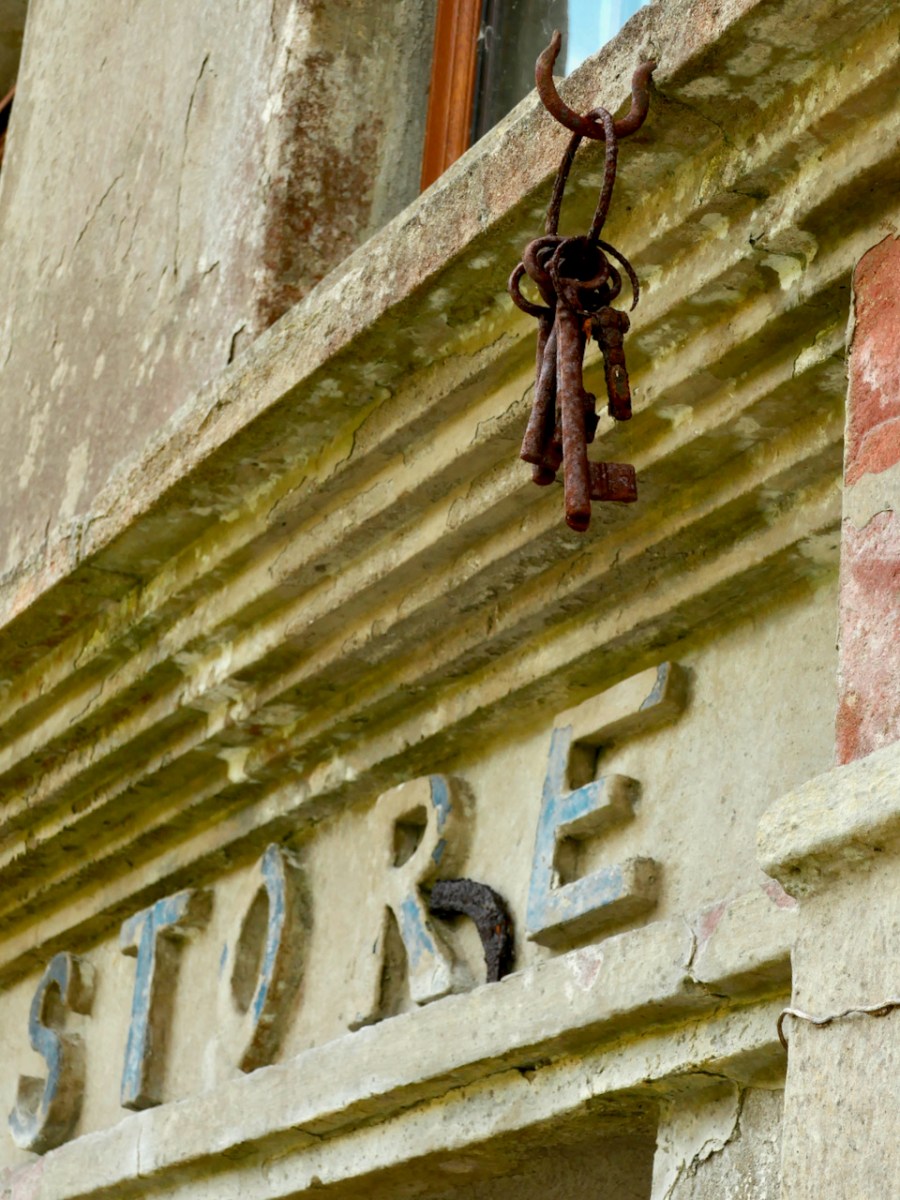
From Dunkelly the road turns back along the slopes of Knockaphuca  and along the way there’s a  bit of a surprise – an old store that once supplied necessities for the population of this area but which has not been viable for many years. No doubt local people have all kinds of memories and stories about this one. I was taken by the keys, still hanging above the door!

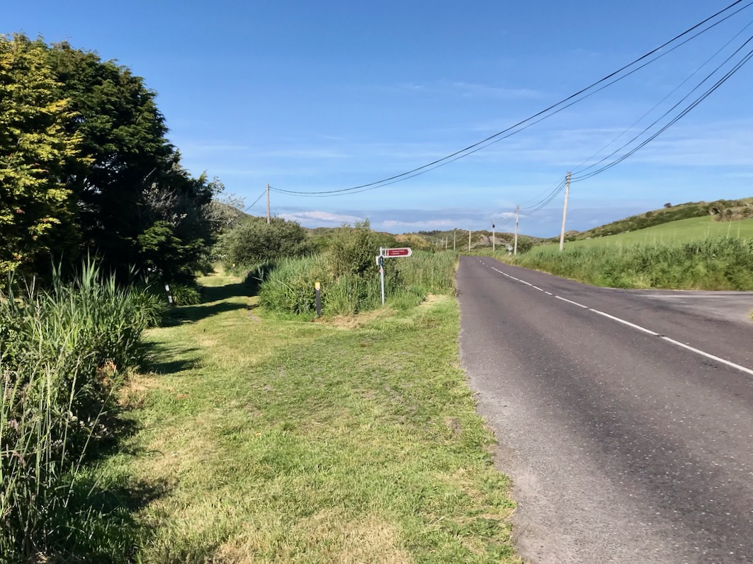
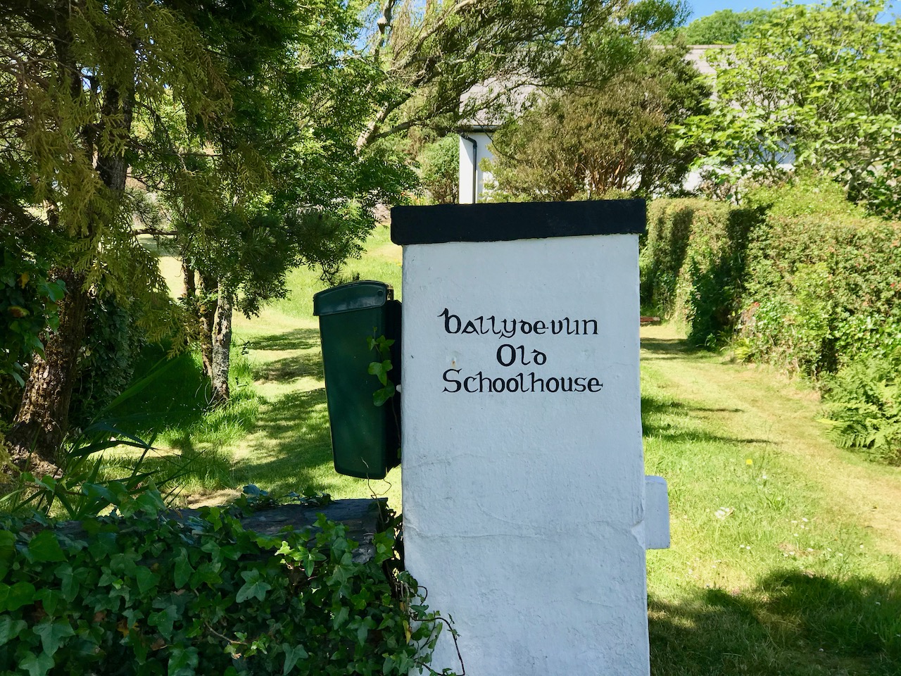
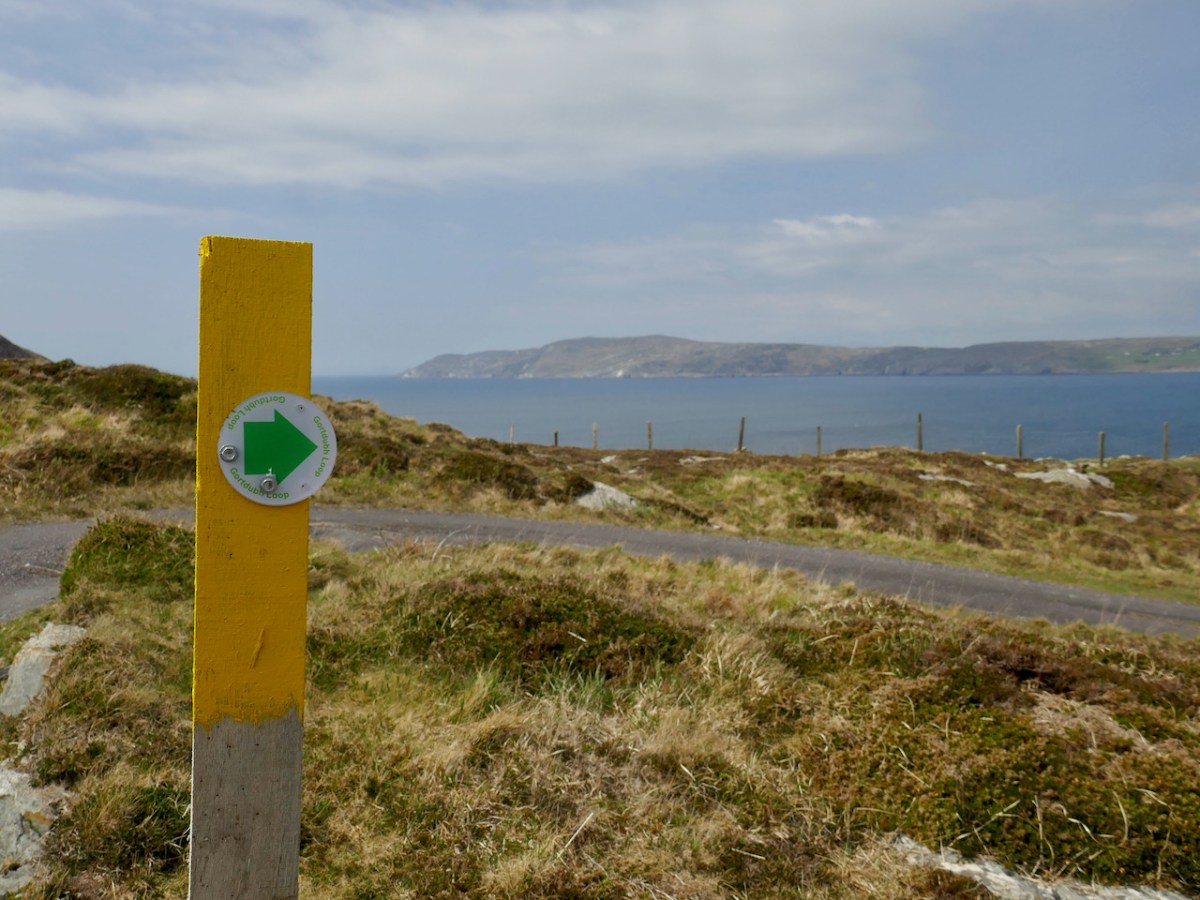
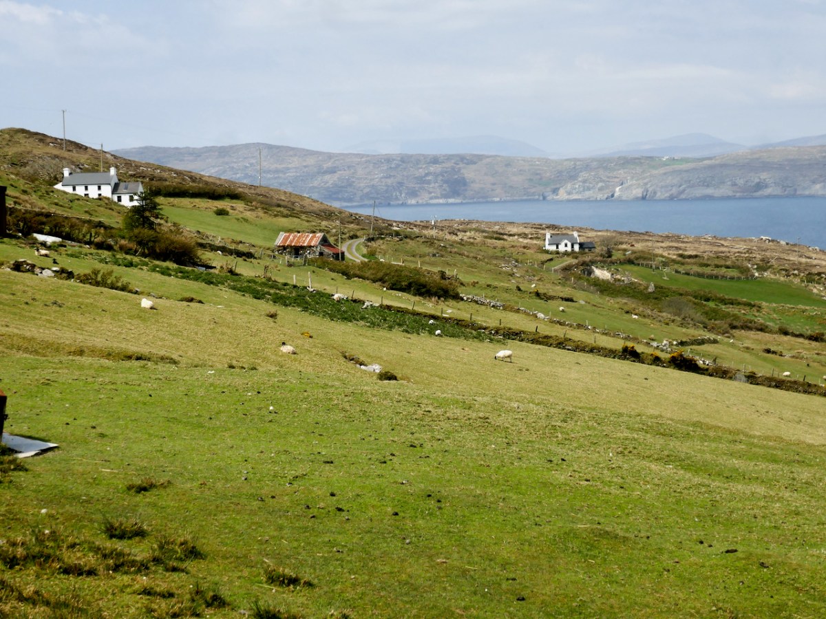
By now we were on the stretch of road that this loop shares with the Knockaphuca Walk and that’s a walk you HAVE to do, if you haven’t already. Possibly the jewel in the Fastnet Trails crown. Crossing the main Schull-Goleen road we head down to Ballydivlin. 

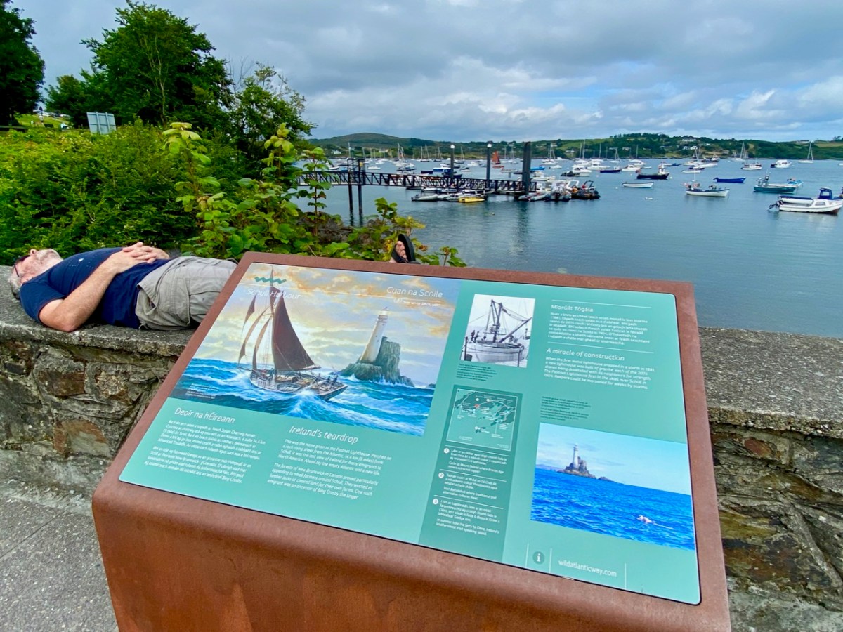
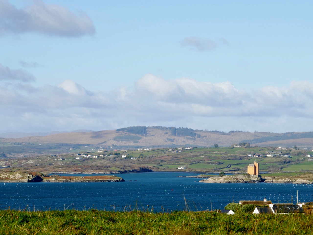
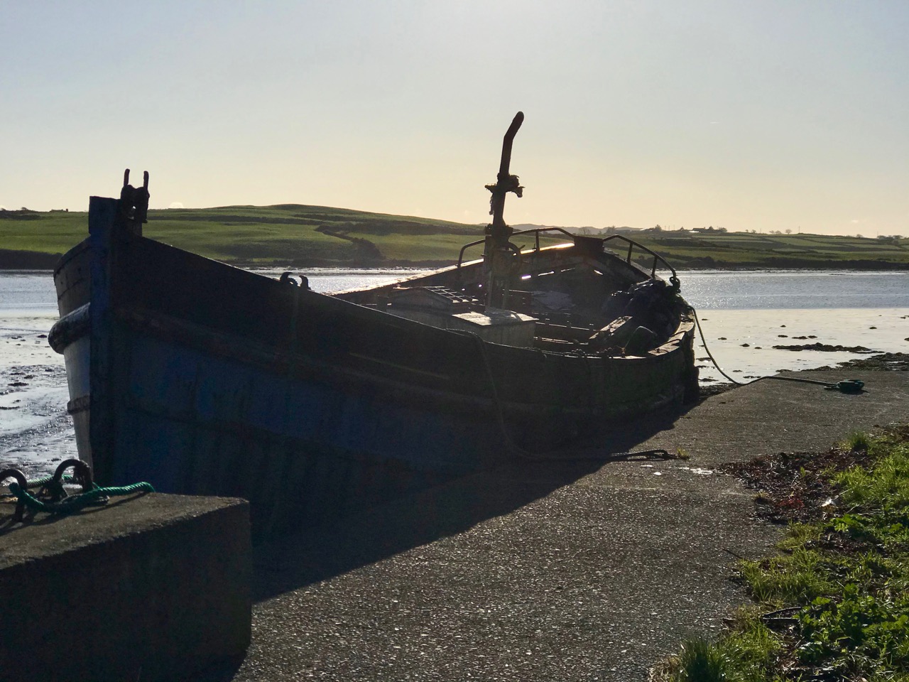
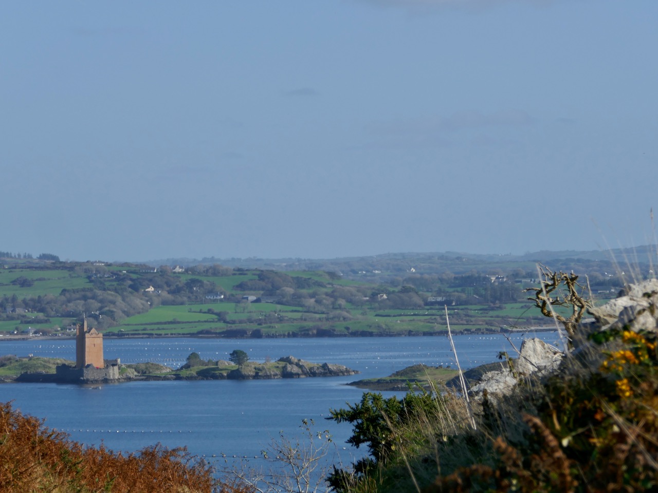
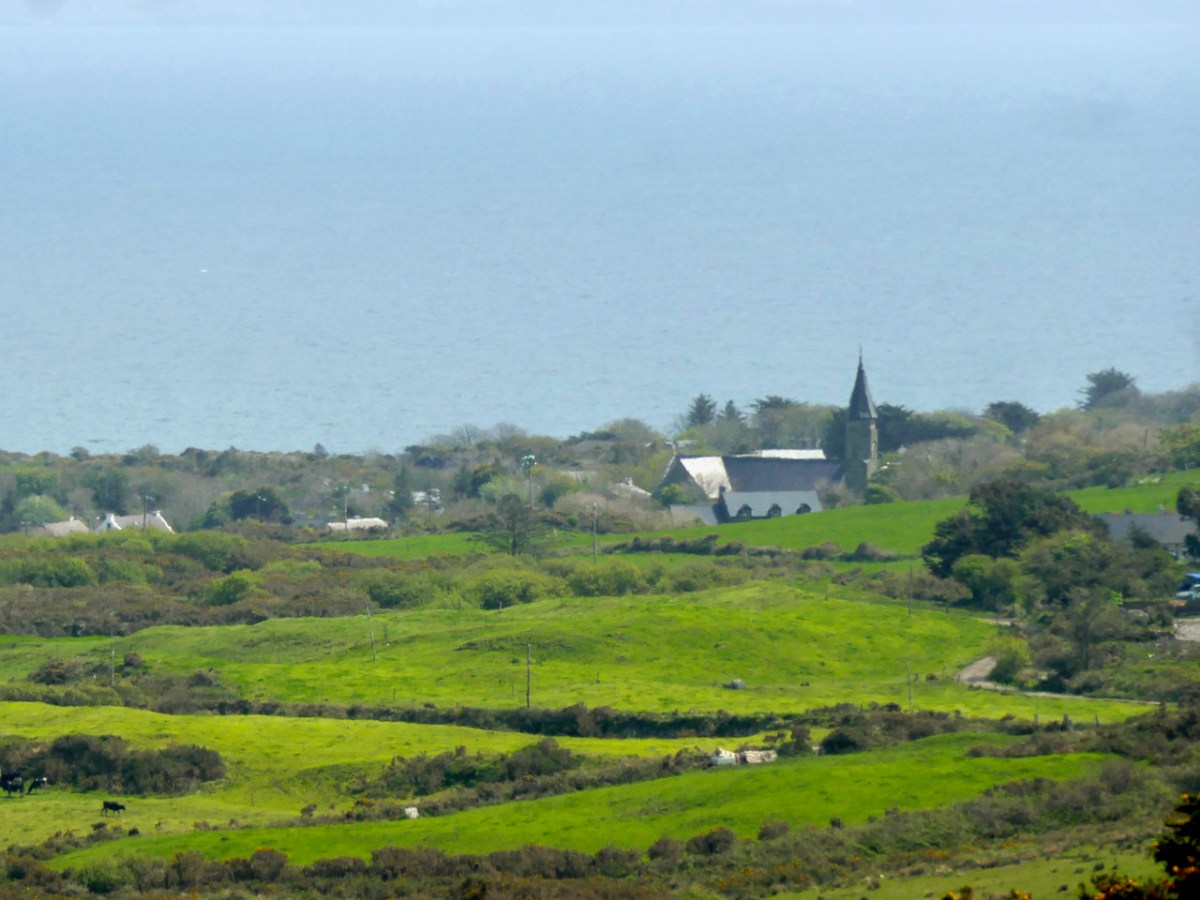
We’re at the sea again now, back on the south side of the peninsula, looking across to Castlepoint (and Leamcon Castle) and out to the Fastnet Rock with its iconic lighthouse

It’s been a long haul but SO worth it – wouldn’t you agree?

The Fastnet Trails website is coming soon. We will update this post with that link once it’s finalised and active.

Mizen Magic 24: Lissagriffin Loop (Fastnet Trails)

The energetic Fastnet Trails team is marching westward along the Mizen, developing new trails. They do this on a purely volunteer basis and we are all the beneficiaries – so a huge thank you to them! Work on their website is ongoing, and it should be up and running soon. This week we explored one of their recent additions – the Lissagriffin Loop. I have written a previous LIssagriffin post in the Mizen Magic series (number 14), but that one was mainly about the medieval church and the graveyard around it, as well as the history and archaeology in its vicinity. 

This walk starts and ends in Goleen and is a 10k walk with lots of ups and downs. You’re climbing100m (about 320’) on the first half of the loop and 120m (about 400’) on the second half, so this is a good workout. As with any of these walks, it’s possible to do stretches of them by leaving a car at one point and walking back and forth, or go with friends and leave a car at either end. Wear good shoes and bring water and snacks. It’s all on quiet back roads, so the dog is welcome too, but use the lead if you encounter cattle or sheep (we met both). And there are a couple of surprises along the way.

I’ve included a map (above) to show you where you are on the Mizen Peninsula, and a close-up (below) to show the route you’re following. The pink blob within the green circle at the lower left is Lissagriffin Medieval Church in case you have the inclination for a little side trip.

Walk up to Goleen Catholic Church, take a sharp right and you’re on your way. This first part will involve some huffing and puffing, but you’re on a country boreen fringed with wildflowers (wild garlic at this time of year) and with expansive views back to the sea and across a valley to Knockaphuca Mountain (another brilliant trail!) and to Mount Gabriel beyond.

If you don’t have the time or inclination for a long walk, look out for a sign to the shortcut. It’s the curved green line on the lower of the two maps above. It will bring you back to the village, initially via a well-maintained gravel path (below), and then by road, for a 2km walk in all. 

If you decide to carry on, it’s uphill now for quite a stretch, but the views across to Knocknamadree and to Knockaphuca are worth the effort. Later in the year, the route will be dripping with Fuchsia and Montbretia, but right now the Navelwort is starting to sprout and stitchwort is rampant. 

Once you’re up the hill the road levels out, the going is easy, and the views are now to the sea on your left and towards the distant Mizen Peak. And here’s the first surprise for you – a mass rock. Mass rocks, of course, were used in Penal times, when the saying of mass was outlawed and people met with their priest in faraway locations.

This one still lives in folk memory, and is still visited, by the evidence of various offerings left on the ledge. Some of the coins are so old they are peeling apart, while others look of more recent vintage.

St Patrick’s Cabbage Is just starting to bloom. This is a native plant and part of a curious set known as the Lusitanian Flora which only occur in southwestern and western Ireland and in the Iberian Peninsula.

This one rewards a close look – the flowers are white but the petals have pink and yellow dots and the anthers are a startling deep rose colour. A domestic hybrid known as London Pride is grown in many gardens.

The second surprise is a holy well, just a little further along. It’s not a very impressive sight – looks like a ditch, in fact, although there’s a bit more going on under all that grass and brambles. The location is marked but there are no indications that anyone has visited in many years. No offerings here, no cups or rag trees, no statues or prayer cards. But nothing deters Amanda, and she has written about the well here, including the fact that its name is Tobairin a ‘Bhothair – small well of the road – and that it was once revered.

From the holy well keep going westwards and the reward is an immense view to the end of the Peninsula and the Mizen Peak (below). It’s a gentle downhill all the way until you get close to the main Goleen – Crookhaven road.

At this point, nobody could blame you for retreating to the snug at O’Sullivan’s Bar in Crookhaven for a pint coffee and a crab sandwich, but of course you are only half way through the walk if you want to do the full loop. So turn right and then right again, and start climbing as the road heads back to Goleen over the hills and away from Barley Cove (below)

The views don’t really start until you’re quite high up, but the road is peaceful and rural – a good time for contemplation, perhaps.

Once you’re on the downhill stretch you are facing east and once again have those glorious views across to Knockaphuca, with Mount Gabriel behind.

And when you hit Goleen – go on, you deserve it, have some ice cream!

West Cork Villages and Towns – Schull

What better time to visit Schull than during Calves Week? That’s a big sailing festival at the beginning of August every year, and you have to be a sailor to understand the nuances of its title. It’s held at the same time as the UK’s premier sailing event – Cowes Week, ‘…the world’s longest running sailing regatta…’ and is focussed around the three Calf Islands in Roaringwater Bay. So there you have it – Cowes and Calves! What it means, of course, is that the village of Schull is at its busiest and, since Covid has given a boost to outdoor socialising, the streets are crowded with visitors enjoying the shops, pavement cafés and galleries.

In this occasional series on the Towns and villages of West Cork we will take one community and try to discover why and how it has developed through history, and how it fares in the present day. A snapshot of the place will be presented – hopefully – in the best possible light (although this won’t always be on a sunny summer’s day!) From the aerial view above, you can see how Schull has been built up around its connection with the water. Schull Harbour is at the head of a long sheltered inlet, and the pier today is always busy with fishing and pleasure boats, ferries and yachts.

That’s the road to the pier, above, and it’s just a few steps from the village centre. If you are a visitor, you may have no idea that Ireland’s most south-westerly railway line once ran right on to this pier! The narrow gauge Schull, Ballydehob & Skibbereen Tramway and Light Railway was in service between 1886 and 1947, connecting these remoter parts of the county to Skibbereen and then, via the main line, Cork city. Although never considered a commercial success, it was a valuable element of infrastructure enabling local passengers to get to shops and markets, and fishermen to send their catches to distant merchants as hastily as possible (bearing in mind there was a speed limit of 15 miles per hour on most of this rural line). This photograph from the NLI Lawrence Collection (below) dates from the 1890s, and shows barrels of fish stacked up next to the railway track on Schull pier, awaiting despatch. They are likely to contain salted pilchards and herrings.

In all these pictures of the pier and pontoon areas above you can see the lively sailing activity in the background. Below are two extracts from early OS maps, one showing Schull and its location to some of the offshore islands, and the other showing the town centre, probably around 1890. It’s thought-provoking to see on the latter the various facilities which the town offered at that time, as well as the railway: Court House, Constabulary Barrack, Smiths, Schools, Hotel and Dispensary.

Note that on both the maps above, which date from more than a century ago, the settlement’s name is given as Skull: it still is on all OS Ireland maps up to the present time. Mostly today it’s known as Schull, or in Irish An Scoil, which translates as The School. Some of you may remember my posts earlier this year when I looked in to the possible origins of this village name – and the earliest ‘School’: a site described on Archaeology Ireland as a ‘possible early Christian settlement’:  . . . the ancient school of Sancta Maria de Scholia, ‘a place known in early times as a centre of learning’ . . . There’s a fair bit of local lore surrounding the subject, and you need to read Schull resident John D’Alton’s article on this to find an alternative view to the perhaps romanticised ideas of an ancient monastic site: I’m sitting on the fence!

Historic village – perhaps with medieval origins – to vibrant sailing centre and colourful streets in the 21st century. Schull has come a long way, and has far to go. Today the resident population numbers around 1,050: this is boosted substantially with the influx of summer visitors. It’s good to see long established names and new businesses on the streets, contributing to the colourful palette of the architecture. Great things are happening in the future: the old bank building (below) is to become a cinema and film centre: a focal point for the acclaimed annual Fastnet Film Festival.

Year round, Schull is worth exploring. Mount Gabriel, the area’s highest point, is above the village and offers superb vistas over the bay and islands. Finola has looked at the many legends associated with this peak and there is ancient history there, too: the remains of Bronze Age copper mines on its slopes. Good walks can be had on the high ground and on the coastal footpaths – see the Explore West Cork website.

Mizen Mountains 5 – Knockaphuca

Perhaps one of the most satisfying mountains on the Mizen, the 237m high Knockaphuca provides a well maintained waymarked trail best tackled as it is laid out – in a counter clockwise direction. You will go up the east side and down the steep west face. If you are lucky with the weather, as we were just before the longest day, you will have an experience which is hard to rival in this corner of Ireland. The loop walk is one of the latest sections of the Fastnet Trails which have been established to the west of Schull during 2019. All credit is due to the team which has so successfully organised and laid out these trails: this has involved much behind-the-scenes hard work.

In fact the full Knockaphucka Loop trail starts in Goleen, and is 10km long. We joined it as it leaves the R591 road north of the village (upper picture – the route goes off to the left). The map above has the mountain section (which we followed) superimposed on the Google Earth contour information. The section we walked is 6.6km long, and climbs about 200 metres.

One of the first landmarks on the way is right at the point where the marked track to the mountain leaves the main road: Ballydevlin Old School House (above). There is another ‘Ballydevlin Old School’ nearer to Goleen; presumably one was the National School (established c1831) and the other may have been a denominational Church of Ireland school. This peculiar Irish duality still exists today in many places.

Once on the marked track you are in a paradise! An ancient green road takes you part-way up the mountain, passing through small gorges which must have been cut out long ago: even if you are not a geologist you can’t help being impressed by the rock formations – they could be works of art.

After a while the path turns to the east and follows narrow, grassy glens bordered by majestic, serpent-like outcrops. It’s here that the views begin to open out, particularly to the south. Always you think that there couldn’t be a finer prospect over the Mizen and across the islands of Roaringwater Bay, and always – as you climb higher – you are surprised by the next, which is even better.

Twists and turns take you more steeply across the contours and swing round towards the summit. Only then is the full picture revealed: the whole landscape set out below you – every rift, valley and glacial glen with the higher land beyond culminating in the crests of Gabriel, 407m high, to the east, and the ‘little’ Mizen Peak, 232m high, to the west.

You won’t get lost as you head for the summit: this mountain had a distinctive cross placed at its highest point in the Holy Year of 1950, which reportedly fell in 1968, leaving the inscribed concrete plinth intact. The photo below shows the plinth in 2006 – courtesy Richard Webb. A new cross was installed in 2011 by a community effort led by the local GAA: this is now visible from much of the trail. The plaque mentions ‘…these challenging times…’, referring to the financial crash that hit Ireland so badly around that time. Illumination of the cross today is provided by photo-voltaic cells.

When you get to the top – pause… Now is the opportunity to appreciate the spectacular views in every direction. On our outing the south wind had been building up all day and was at its strongest in the late afternoon, when we gained the summit. It was pretty hard to remain upright! In fact, I wondered if we were being given a message by the resident Púca whose domain this is, after all?

The path down descends quite steeply: make sure you are well shod and vigilant. But you are in for further treats: the marked way passes by some peaty mountain tarns which are exquisite in their pristine beauty. Finola was in her element finding undisturbed native species such as water-lilies and sundews.

The mountain trail section ends on the small boreen running to the west of Knockaphuca, but the waymarkers will lead you back to the starting point, and there are still views up to the summit to enjoy, along with some landscape features on the way to continue to stimulate the senses.

What more could anyone want from a day’s outing in West Cork? Well – a bit of local history, perhaps. I searched for stories about the hill, particularly about the Púca – but only turned up this one told by Jerry McCarthy and included in Northside of the Mizen, the invaluable collection of Tales, Customs and History produced by Patrick McCarthy and Richard Hawkes in 1999:

The Púca of Knocnaphuca


The old people would feed the Púca of Knocnaphuca on ‘Snap-apple Night’, or indeed, whenever one had call to travel up the hill. It was the wise person that fed the Púca the night before going up. Milk and cake would be put on a plate and left outside the house and by the next morning the food had always gone!


The Púca of Knocnaphuca was half horse and half human. One late Snap-apple Night there was a young lad out walking the road when he heard a strange, sweet music coming from the hill. He went up and saw the Púca playing on a whistle. As soon as the lad had put eyes on it, it stopped playing and caught him. Away the Púca went to the top of the hill, where a crack opened up in the rock. In they went. They were twisting and turning down through tunnels until they entered a chamber full of gold. “Now,” said the Púca, “you are mine!”…


The next morning the boy was found on the road by the Long Bog. His hair had turned white and he could not speak a word ever after.

Thank you to our artist friend Hammond Journeaux of Ballydehob for this wonderful drawing of ‘Pooka’, included in The Little People of Ireland by Aine Connor, illustrated by Hammond, The Somerville Press, 2008. Púca in Ireland has counterparts in Cornwall (Bucca), Wales (Pwca), The Channel Islands (Pouque) and Brittany (Pouquelée). A shape-shifter (Flan O’Brien’s character from At Swim-Two-Birds, the Pooka MacPhellimey, changes his appearance by smoking from a magic pipe), the Púca most often appears in Ireland as a fine black stallion with red eyes. If you meet him, you have to mount him and he will take you on a journey far across the sea. It will seem to you as though you had been away for only a few hours, but the world will have moved on several weeks, perhaps months, during your absence. We saw no trace of the creature in June but, perhaps, if we climbed this mountain in the November Dark, we would have more chance of an encounter.

Walking West Cork – Another of the Fastnet Trails

We’re well into November, yet clear, dry days abound and we are drawn out into the lanes of West Cork. There are so many to choose from, and all are quiet, although we will always find someone to share a chat along the way. Yesterday we donned our boots and followed another of the Fastnet Trails – the Ilen River Loop. In fact, the boots were unnecessary as the whole route is on virtually deserted paved roads. If that sounds unexciting, let me tell you it isn’t: wherever you go in West Cork you won’t be short of sweeping green landscapes, broad views – mostly over mountain or water – and fragments of engrossing history jumping out to meet you.

We started at the Lisheen trail head and covered the 8 kilometers in a bit over two hours. This did include some dawdling and chatting: in Ireland the latter is unavoidable, and applies to everyone you meet. With us were friends Amanda and Peter, and you’ll find Peter’s Hikelines account of the expedition here: his watercolour illustrations can only be described as ‘exquisite’.

Look carefully (above) at the line of sea on the horizon: just visible is the unmistakeable silhouette of the Fastnet Lighthouse, justifying this route as a part of the Fastnet Trails network. It’s a wonderful asset for locals and visitors. You could simply drive along these routes, of course, but you just won’t get to see the details and appreciate the beauty. On foot you can pause at every turn and on every brow to properly take in the delectable countryside. And the network of trails is expanding – new routes are being developed at the west end of the Mizen: here’s another of Peter’s posts.

There are views to the north as well, looking into Ballydehob Bay which Jeremy Irons’ ochre coloured Kilcoe Castle dominates. Above the water can be seen the islands of Roaringwater Bay and the ridges of the Mizen and Sheep’s Head, and even the high peaks of the Beara Peninsula beyond. But we must focus on the subject of this trail, which is the broad estuary of the Ilen River as it winds inland, feeding into the woods and pastures of West Cork, narrowing but remaining tidal right up to Skibbereen: schooners used once to berth on the five quays serving that town.

All along the coastline and river estuaries in West Cork are reminders of how important transport by water once was. Dozens of quays are still here, in good working order – there was a drive to revive and restore the more significant ones some years back. Also there are traces of more ancient ones which are slowly decaying into nature. All were put there to serve the isolated rural communities in the days when boreens were only narrow tracks, often impassable in the winter months. But on these western peninsulas no-one is more than a few miles from navigable water – and those quays were an invaluable asset.

Our route passed right beside the Glebe Quay, where we came across the hull of an old fishing boat and – by chance – one of its former owners! Here we are, ‘at the chat’, above. This became a long ‘chat’ – as I was most intrigued to find out why this large vessel was sitting here in a deteriorating state – but we had to cut it short in the end as we were getting cold standing still! Our informant was Mike Williams, who Finola and I have met before: he lives on the shore of the Ilen River and has been involved in boats and boatbuilding for much of his life. He bought this former herring ring-netter some years ago with the intention of restoring her, but sold the vessel on to another enthusiast. The project did not succeed, however, and now the boat is on its way to the marine scrap yard – a sad but inevitable fate for many retired wooden craft.

I did a bit of internet delving and was pleased to turn up some historical information on this boat, which Mike told us was named Ribhinn Bhan. Ribhinn comes from the old Irish word rhigan meaning ‘maiden’, while bhan in Irish means ‘white’. This vessel started life with the name Ribhinn Donn – ‘brown-haired maiden’, and was built in Scotland by Nobles of Girvan in 1966. She was first registered in Scalpay Isle – Sgalpaigh na Hearadh in Gaelic, one of the Outer Hebrides, close to Harris – and carried the number SY 371. She was renamed in 1973 and reregistered as B23 in 1989. She arrived in Tarbert, Co Kerry, Ireland in 2004, and Mike bought her in 2006. I’m including these two not-so-good quality photos of Ribhinn Bhan, which I traced, for historical interest: the first is the vessel in Tarbert, and the second  follows her to West Cork; she is on the right, here, in the boatyard at Oldcourt, on the Ilen River, in 2007.

Moving on from the Ribhinn Bhan our path followed the line of the estuary, rising up to higher ground before turning back towards the trail head at Lisheen. There were many more sweeping views to be enjoyed, and the delight of being immersed in the simple ambience of rural life in West Cork, with all its unremarkable yet irresistibly attractive details. 

We passed the quite remote but still running Minihan’s Bar – an ideal refreshment point on summer evenings – but not open for us on this November afternoon. The also remote seeming Saint Comghall’s Church, built in 1832, marked the return to the trail head and the end of our walk. It was a most satisfying expedition on a remarkably golden late autumnal day.

Up-to-date information on all the Fastnet Trails – including this one – can be found on this website. Our Roaringwater Journal has also written up a few more of them. Give them a try, if you haven’t already done so . . . Enjoy!

New Year Resolutions 2019

Note of explanation from Finola and Robert: the Blog has taken on a mind of its own and decided he needs to make some resolutions for 2019.  He has asked us, his slaves faithful staff, to record these, as a means of keeping him accountable. Ours not to question why, ours but to do or die, so here goes, in his own words. . .

The Black Valley, Kerry

1. Spend more time in Kerry

It’s only next door, after all, and it’s in Finola’s blood, since her grandmother came from Killarney and she still has lots of lovely family there. So I’m determined they will take me there on outings a bit more often this year. There’s an ulterior motive too – you, my faithful readers, know that I often cosy up to that cheerful little Bloguette Holy Wells of Cork: she’s running out of wells in Cork but is enthusiastic about the idea that we can go jaunting off together on Kerry adventures.

2. Incorporate more music

I have to let you in on a secret – Robert is forever promising to learn new tunes for me, but then he comes up with all kinds of excuses why he’s not getting on with it. He’s too busy, it’s too hard, it’s not in the right key, blah, blah, blah. He’s finally sort-of learned this one, after weeks. We live in the heart of Irish traditional music – come on, people!

Staff member Robert trying to get it right – it’s called Pearl O’Shaughnessy’s Barn Dance, learned from Clare concertina player Mary MacNamara

3. Get on with that Saints and Soupers story

Honestly, that Finola, she leads us deep into this fascinating study of whether or not that Fisher guy was a saint or a souper, and then she goes off on one of her tangents about stained glass or wildflowers or whatever. I’m dying to know what happens next, so I’m going to have to lean on her to put the nose to the grindstone and get back to all those Protestants and Catholics and the actual famine part.

Michael the Archangel fights the devil – a powerful good versus evil metaphor in Altar Church

4. Get out to the Islands

It’s called Carberry’s Hundred Isles, for goodness sake – we can see them from the house (like Sarah Palin and Russia). Time to travel to more of them and get to know them. 

South Harbour on Cape Clear

I’ve been polishing up my Irish (or Blirish, as we Blogs like to say) and I need the practice, so Cape Clear needs to be on the agenda. I hear they have a good Blirish program out there, so ar aghaigh linn!

Staff member Finola and her sister on Cape Clear this summer

5. Finish the Fastnet Trail walks

This is a bit of a hangover resolution from previous years when I vowed to do all the Fastnet trails, but got a bit distracted with other walks and other projects. Besides, they’re adding to them all the time so if I don’t get off my desk and get out there soon the job will just get bigger and bigger.

Kilcoe Castle can be seen from several of the Fastnet Trails

6. Find more places to have breakfast

My staff loves going out for breakfast and I must say I am very partial to a nice plate of avocado toast and smoked salmon, with a good pot of tea to wash it down (although those two insist on lattés). They took me to the Box of Frogs in Bantry recently, and despite my misgivings about the name (I had a bad experience with a toad once) I had to admit the food was excellent. But, like all the humans I meet recently, I’ve been toying with the idea of eating less meat so I will persuade them to go to Antiquity Bookshop Café in Skibbereen for their tasty vegan food more often. BUT. . . see next resolution

Nicola surrounded by her stock in trade in Antiquity, West Cork’s first vegan café

7. Read the books!

The staff keep bringing more books (especially from Antiquity) into the house and they pile up beside me, making me feel guilty that I’m not keeping up. They built a new set of shelves and they are already filled. Honestly, in this day and age, you’d think someone would have invented some kind of scanner-to-brain technology so that Blogs like me wouldn’t have to work so hard.

Just one shelf – yikes!

I have more, but the experts say not to make too many. Right, friends – a little encouragement and I’m sure I will be fine, despite all the malingering and complaining of my staff. Onwards and upwards into 2019!