Yeats’ Day

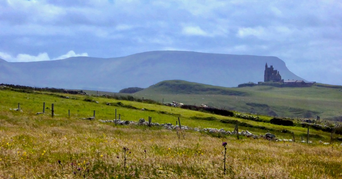
Yeats country – Benbulben and Classiebawn Castle (above). Finola took this fine view seven years ago, when we set out to visit the haunts of William Butler Yeats. We have to turn to Yeats now, as it’s exactly one hundred years since he was awarded the Nobel Prize for Literature – in December, 1923. I have carried a place in my heart for Yeats, ever since I was at Primary School on the Hampshire/Surrey borders, not far from Thomas Hardy’s Wessex. Yeats and Hardy were rivals for the coveted award – the final vote in 1923 was between the two of them: in the end, only two Nobel committee members voted for Hardy, and Yeats achieved the prize. The Guardian newspaper said that “…Mr Yeats is to be congratulated, almost without reserve, on lifting this substantial stake. He is a poet of real greatness; prose, too, he can write like an angel…”, however then arguing that Thomas Hardy would have been a worthier recipient of the award!
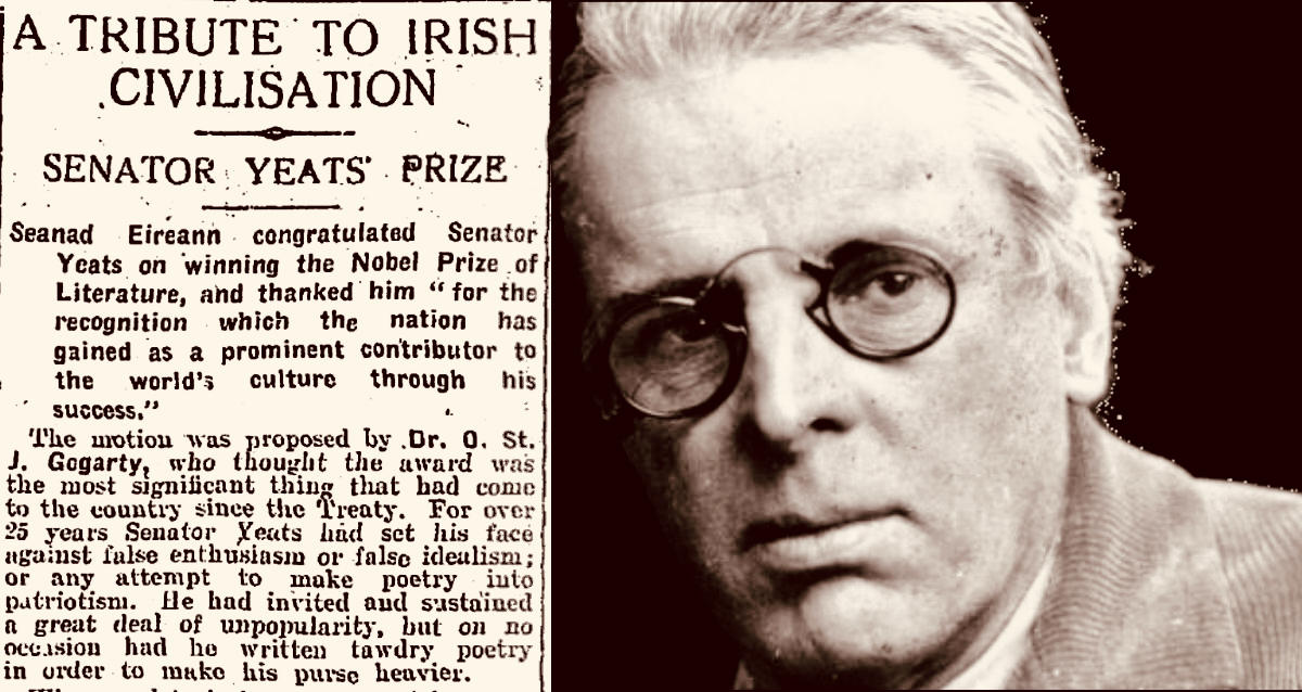
The Irish press congratulates Yeats on his achievement (above – Irish Independent 29.11.1923). My schoolboy encounter with the poet must have been when I was around ten years old and we were tasked to learn The Lake Isle of Inisfree. I can still recite it, word for word, to this day, sixty seven years later. But it was far more than mere words for me, then. Our teacher – Mr Sharpe – was careful to explain that this man was cooped up in the city of London – on its “pavements grey” and was yearning for the countryside he loved:

I will arise and go now, and go to Innisfree,
And a small cabin build there, of clay and wattles made;
Nine bean-rows will I have there, a hive for the honey-bee,
And live alone in the bee-loud glade.

And I shall have some peace there, for peace comes dropping slow,
Dropping from the veils of the morning to where the cricket sings;
There midnight’s all a glimmer, and noon a purple glow,
And evening full of the linnet’s wings.

I will arise and go now, for always night and day
I hear lake water lapping with low sounds by the shore;
While I stand on the roadway, or on the pavements grey,
I hear it in the deep heart’s core.
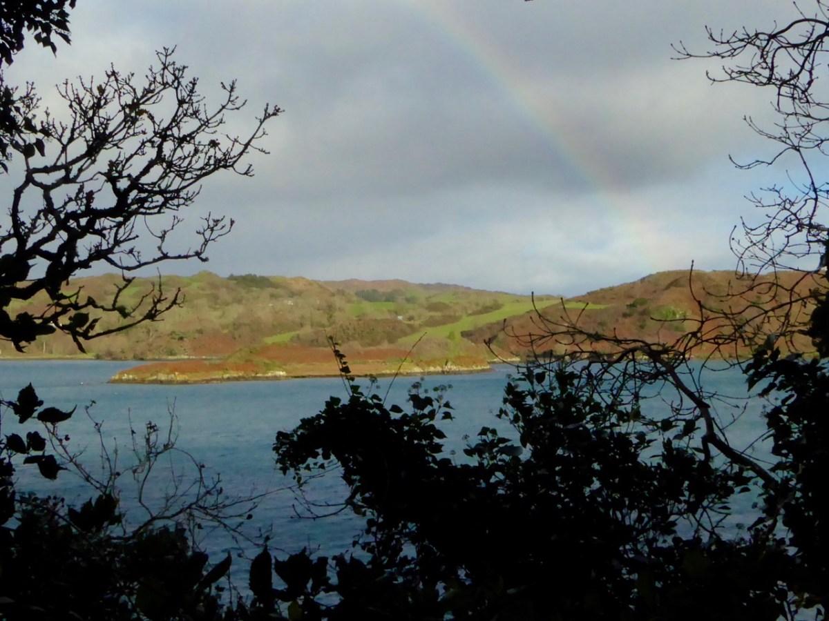
Inisfree serves the poet’s romantic dreams of a remote idyllic landscape far away from the noisy metropolis. It does exist as a place – on Lough Gill in Co Sligo: Yeats spent childhood summers nearby. Interestingly, I searched the internet for pics of the island, and the above came up. It’s from a Roaringwater Journal Post which I wrote in 2016. And it’s not Inisfree, but another ‘lake island’ – just outside Skibbereen, in West Cork – Cloghan Castle Island on Lough Hyne: there’s a holy well nearby, and an 8th century church dedicated to St Brigid – but all that is another story. The diversion just serves to warn against trusting what you find online!
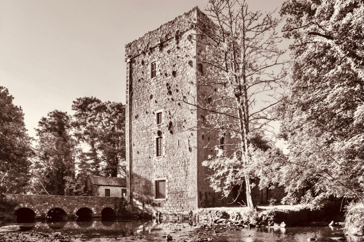
Thoor Ballylee Tower, Co Galway (above) – this 14th century tower house was described by Seamus Heaney, another Irish Nobel Literature prize winner, as The most important building in Ireland, because of its associations with Yeats, who spent many summers there with his family.

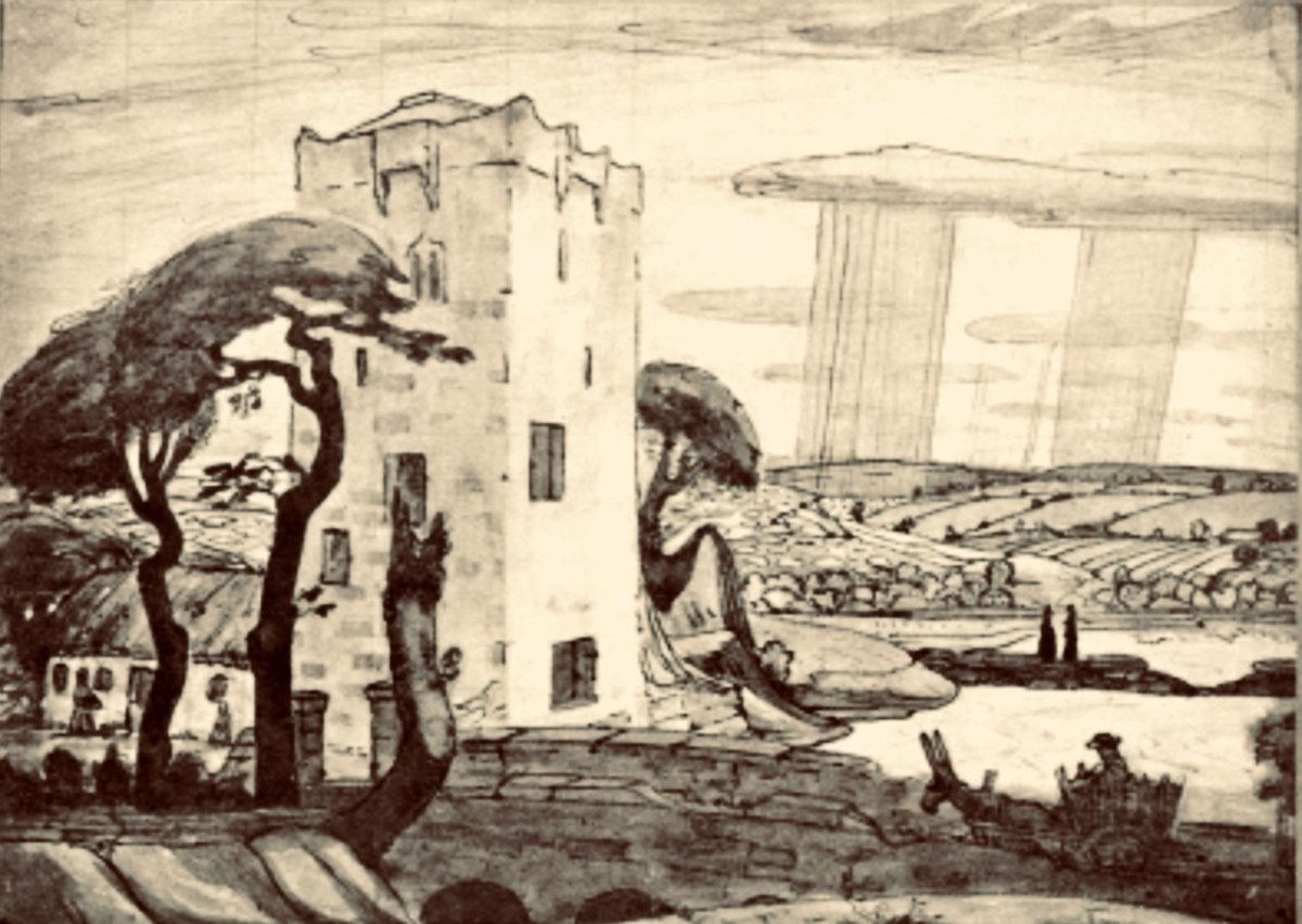
Here is the finely crafted cover of The Tower: a book of poems by W B Yeats, published in 1928 (courtesy Yeats Thoor Ballylee Society). The Tower was Yeats’s first major collection as Nobel Laureate after receiving the Nobel Prize in 1923. It is considered to be one of the poet’s most influential volumes and was well received by the public. (Below) a 1917 drawing by Robert Gregory – son of Isabella Augusta (Lady) Gregory and Sir William Gregory of Coole Park, Co Galway – of The Tower (courtesy Yeats Thoor Ballylee Society).
Going back to my early school years: I was an incurable romantic, and a daydreamer. I paid enough attention to lessons to get by, but my heart lay outside the school gates. Just minutes away were hop-fields and, beyond those, pastures, woodlands, streams – idyllic places where I loved to wander. I could completely relate to Yeat’s desire to be far away from the city, and that’s why his poem appealed to me. I knew very little about Ireland, and had no idea that was where I would one day make my home. I am here now, sitting at my desk, with the hills and oceans of Yeats’ own country beyond.
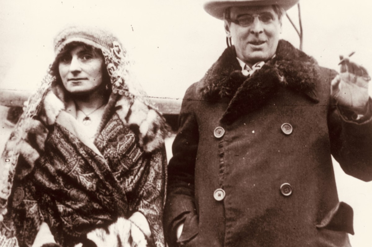
W B Yeats and his wife George Hyde-Lees heard the news that the Nobel Prize had been awarded to him on 14 November, 1923. The photograph above (courtesy Irish Independent) is said to be taken on that day. It’s also said that they celebrated by cooking sausages! The Irish Independent records: “Irish poet and senator, William Butler Yeats created history when he was awarded the Nobel Prize in Literature, the first Irish citizen to achieve such an accolade. The prize was awarded to Yeats ‘for his always inspired poetry, which in a highly artistic form gives expression to the spirit of a whole nation’.”
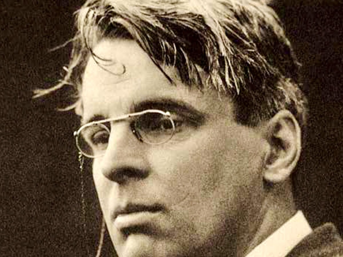
Somewhat surprised by the award, Yeats would later write in his (unpublished) autobiography: “Early in November (1923) a journalist called to show me a printed paragraph saying that the Nobel Prize would probably be conferred upon Herr Mann, the distinguished novelist, or upon myself, I did not know that the Swedish Academy had ever heard my name.” The news of the award was widely praised in Ireland with members of Dáil Éireann proudly announcing that it had placed Ireland on the international stage. It was a sentiment reiterated by the laureate himself, who at the awards ceremony claimed that the Nobel Prize was less for himself than for his country and called it Europe’s welcome to the Free State. In his presentation speech, Per Hallstrom, then chairman of the academy’s Nobel Committee, praised the poet’s ability to ‘follow the spirit that early appointed him the interpreter of his country, a country that had long waited for someone to bestow on it a voice’.

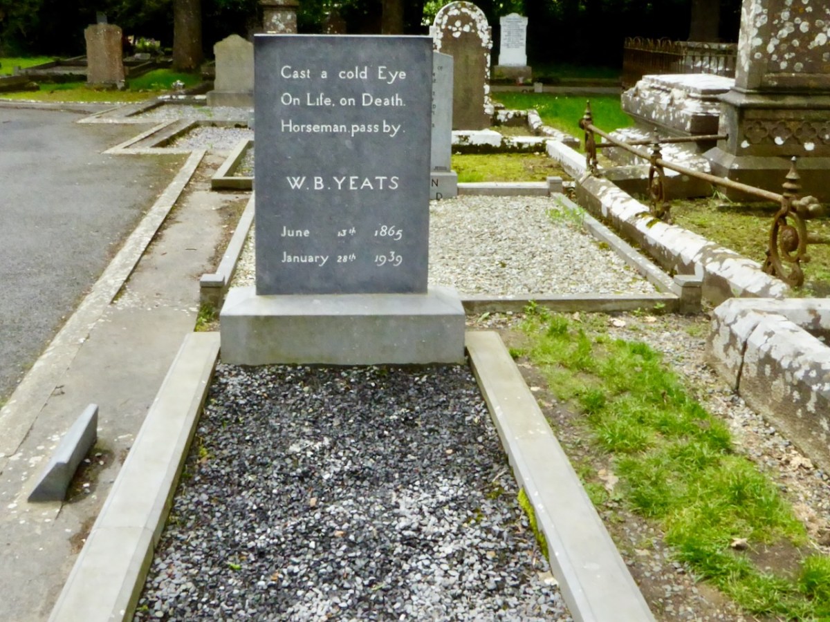
A portrait of Yeats painted by Augustus John OM RA in 1930 (courtesy Sothebys – private collection). Before Yeats passed away he requested that his final resting place be in Sligo. He died in Menton, France in 1939 aged 73 and was buried there. His wish was fulfilled in 1948 when his body was exhumed and buried in St Columba’s Church, Drumcliff. His headstone reads:
Exploring Ancient Drowned Landscapes

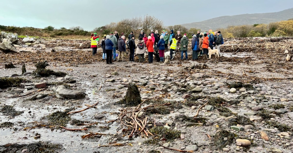
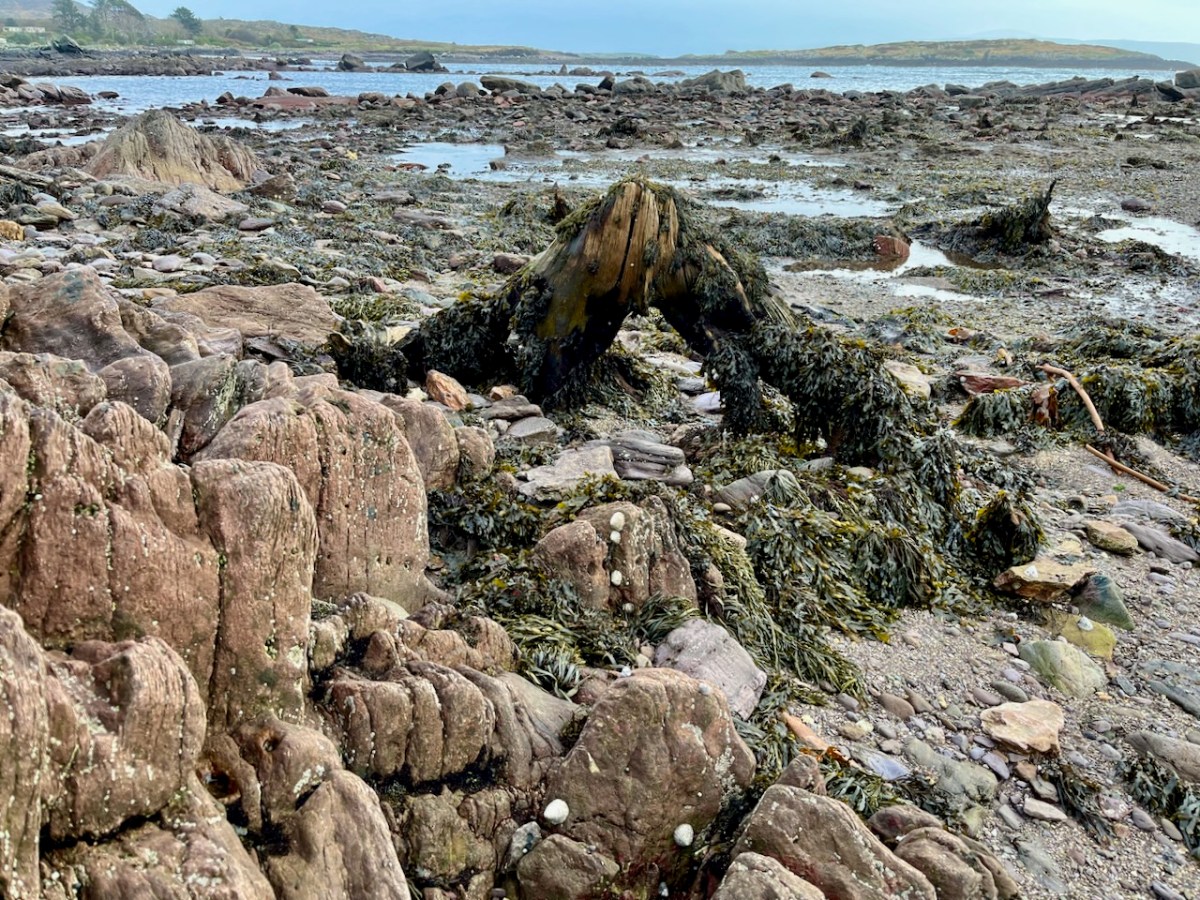
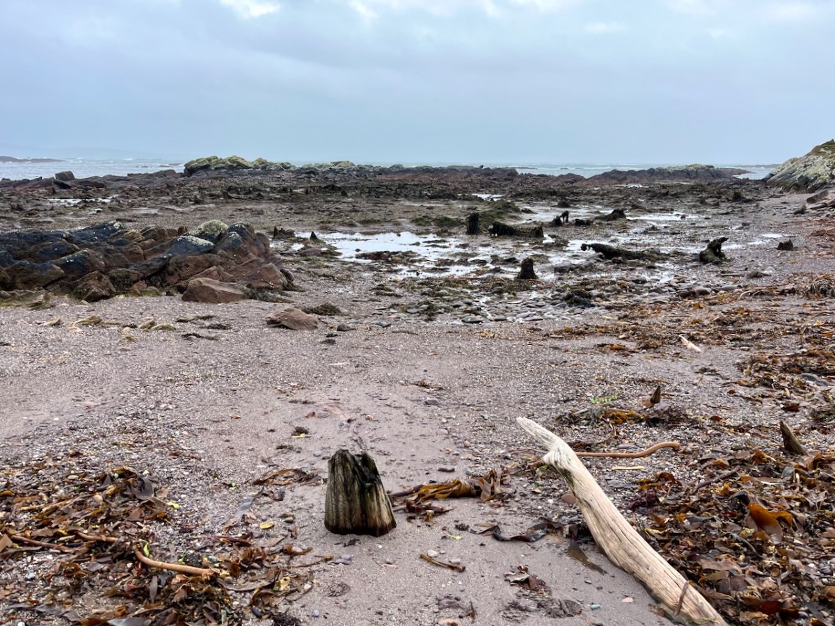
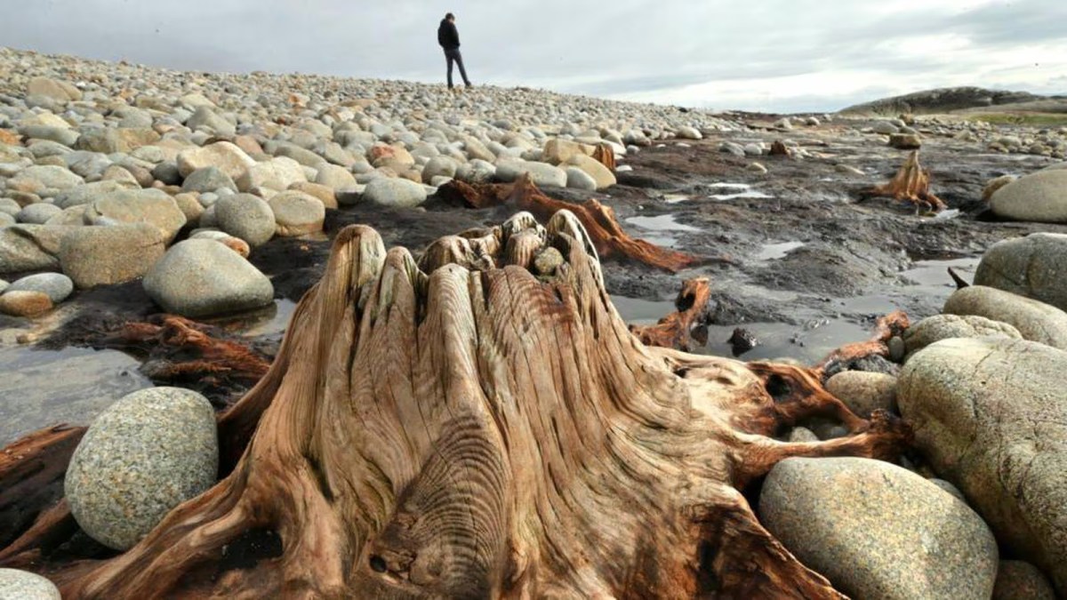
‘Drowned Landscapes’ – that’s an adequate enough description for us to look again at a subject which RWJ covered five years ago in this post: Tralong Bay, Co Cork – give it a read. I was reminded of the subject when we took part in an Archaeology Festival based in West Kerry just a week ago: Amanda’s current holy well blog describes the expeditions. One of the sites visited was Bunaneer Drowned Forest, where we saw stumps of trees on the beach there which were alive thousands of years ago. At low tide many tree remains become visible at Bunaneer, near Castlecove village on the south coast of Kerry’s Iveragh Peninsula. Our guides for this expedition were plant biologist Calum Sweeney and archaeologist Aoibheann Lambe.

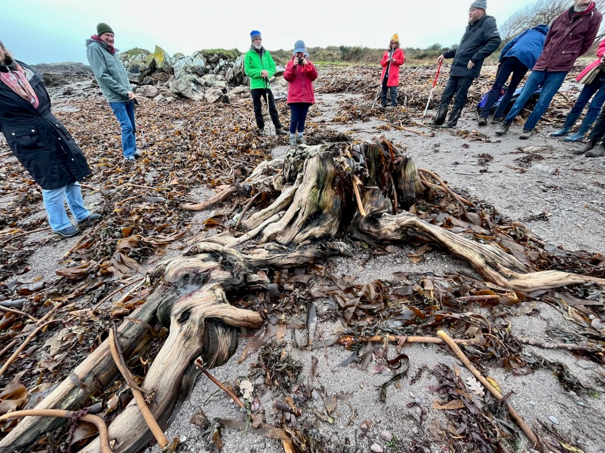
This large jumble of roots (above) is known as Goliath. All the remains here can be seen at regular low tides: at other similar sites elsewhere in Ireland, remains of ancient tree boles and roots are only revealed when tides are exceptionally low. I find it remarkable to be able to see and readily touch these archaic pieces of timber: we are communing with distant history!
Carbon dating has shown that these remains were alive between three and a half and five millennia ago. This is evidence that sea levels were significantly lower then, and that the shore line was further out – perhaps 50 metres from where we see it today. We are constantly – and quite rightly – being warned about rising sea levels resulting from our changing climate in the long term: here we see clear verification that it’s a continuing – and now apparently accelerating – process.

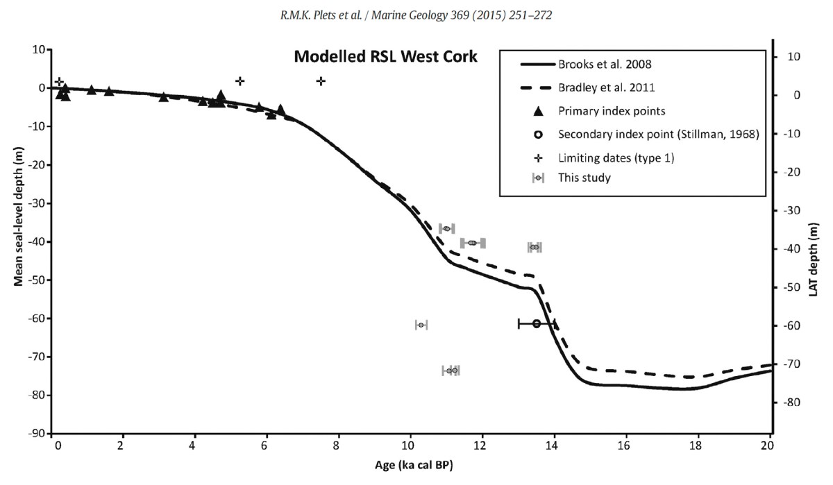
Our friends Robin and Sue Lewando were also on this expedition. Robin has a particular interest in sea-level changes in the Late Quaternary and subsequent eras, and he pointed me to a 2015 paper which explores the subject specifically in the Bantry Bay area of West Cork. That’s a good place to be looking at ancient history: remember the story of Cessair – Noah’s daughter-in-law – who came ashore at Donemark? You first read about it here! So this is a scientific diagram which sets out how sea-levels have been changing over time in our locality:

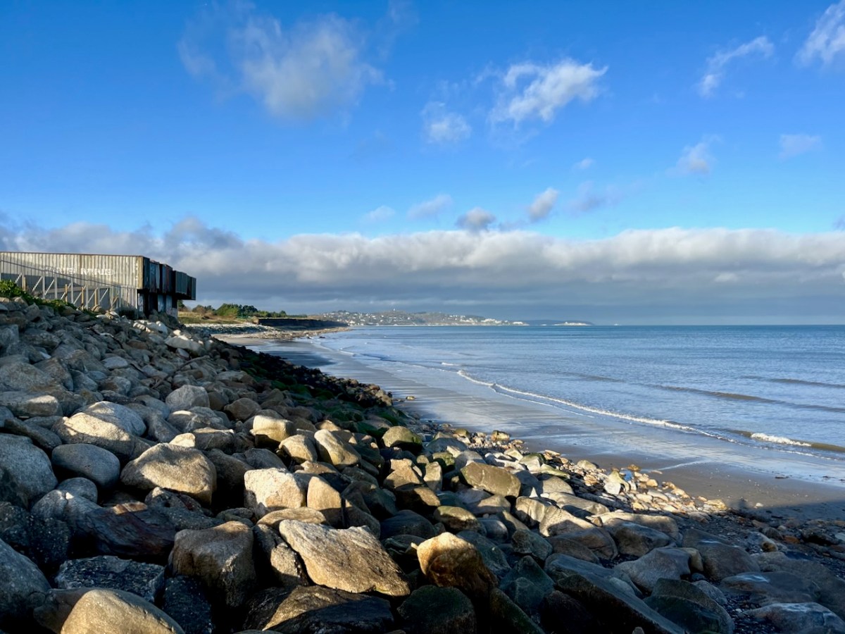
It’s an interesting comparison to take our horizons wider in our study of changing sea levels across the islands of Ireland. Over on the east coast – north of Bray, Co Wicklow – there is another substantial area where tree remains have been revealed at certain tidal conditions.

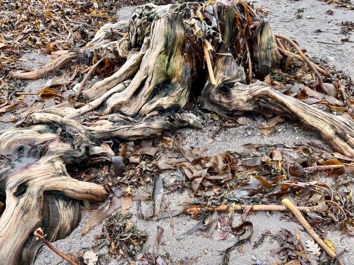
Above are the areas of beach between Bray and Killiney where ‘drowned forest’ remains have been observed. While at Youghal, Co Cork, further finds have occured:

This example catches our interest because the name of the settlement – Youghal – is derived from the Irish word ‘Eochaill’ meaning ‘Yew Woods’: they were evidently once common in the area, leading us to wonder whether the tree remains in this instance are of yew. In 2014 the following account of another ‘ancient drowned forest’ discovery appeared in the Irish Times (photograph courtesy of Joe O’Shaughnessy):

. . . Walking out on to the shoreline at low tide, geologist Prof Mike Williams points to the oak, pine and birch stumps and extensive root systems which were once part of woodlands populated by people, wolves and bears. These woodlands extended out into lagoons and marshlands that pre-dated the formation of Galway bay, Prof Williams says.

An extensive layer of peat also exposed at low tide in the same location in Spiddal was formed by organic debris which once carpeted the forest floor. The stumps at Spiddal are surrounded by root systems which are largely undisturbed. The carpet of peat is covered in strands of a reed called phragmites, which can tolerate semi- saline or brackish conditions.

“These trees are in their original growth position and hadn’t keeled over, which would suggest that they died quite quickly, perhaps in a quite rapid sea level rise,” Prof Williams adds. Up until 5,000 years ago Ireland experienced a series of rapid sea level rises, he says. During the mid-Holocene period, oak and pine forests were flooded along the western seaboard and recycled into peat deposits of up to two metres thick, which were then covered by sand.

Prof Williams estimates that sea level would have been at least five metres lower than present when the forests thrived, and traces of marine shell 50cm below the peat surface suggest the forest floor was affected by very occasional extreme wave events such as storm surges or tsunamis. He says most west coast sand-dune systems date to a “levelling” off period in sea level change about 5,000 years ago. Dunes in Doolin, Co Clare, are older still, having first formed around 6,500 years ago.

Prof Williams has located tree stumps in south Mayo and Clare, along with Galway, which have been carbon dated to between 5,200 and 7,400 years ago at the chrono centre at Queen’s University, Belfast. Some of the trees were nearly 100 years old when they perished . . .

Lorna Siggins
Irish Times 07/03/2014

Goliath, West Kerry, November 2023

Back to Clonfert

Clonfert is only a couple of counties over from us: we just have to skip through a bit of Cork and Tipperary and there we are in Galway – a tiny corner of it that is shaped by the River Shannon. So, on a Thursday afternoon at the beginning of June, we found ourselves tripping along dead straight boreens – narrow for the most part – taking us through lush dairy lands – on a quest to revisit Clonfert’s medieval Cathedral, and its associations with one of Ireland’s most famous saints: Brendan the Navigator.

As we approached the little settlement of Clonfert, our empty road ahead was interrupted by a small white car, which seemed to travel erratically from one side of the lane to the other, and our arrival made little difference to its progress. As we got near, we realised that there was a wiry Jack Russell ambling along the road in front of the car: it was clear that the terrier was having its daily walk, with the owner driving along protectively behind it, regardless of where its fancy might take it. Ah, sure – we were in no hurry, so we joined the procession and waited as the dog sniffed and shuffled its way back home: eventually, dog, car and owner vanished through a gate, and we had the road to ourselves once again . . . This is life in Ireland, and it’s good!

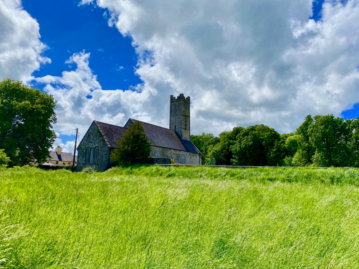
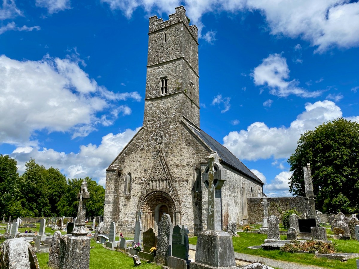
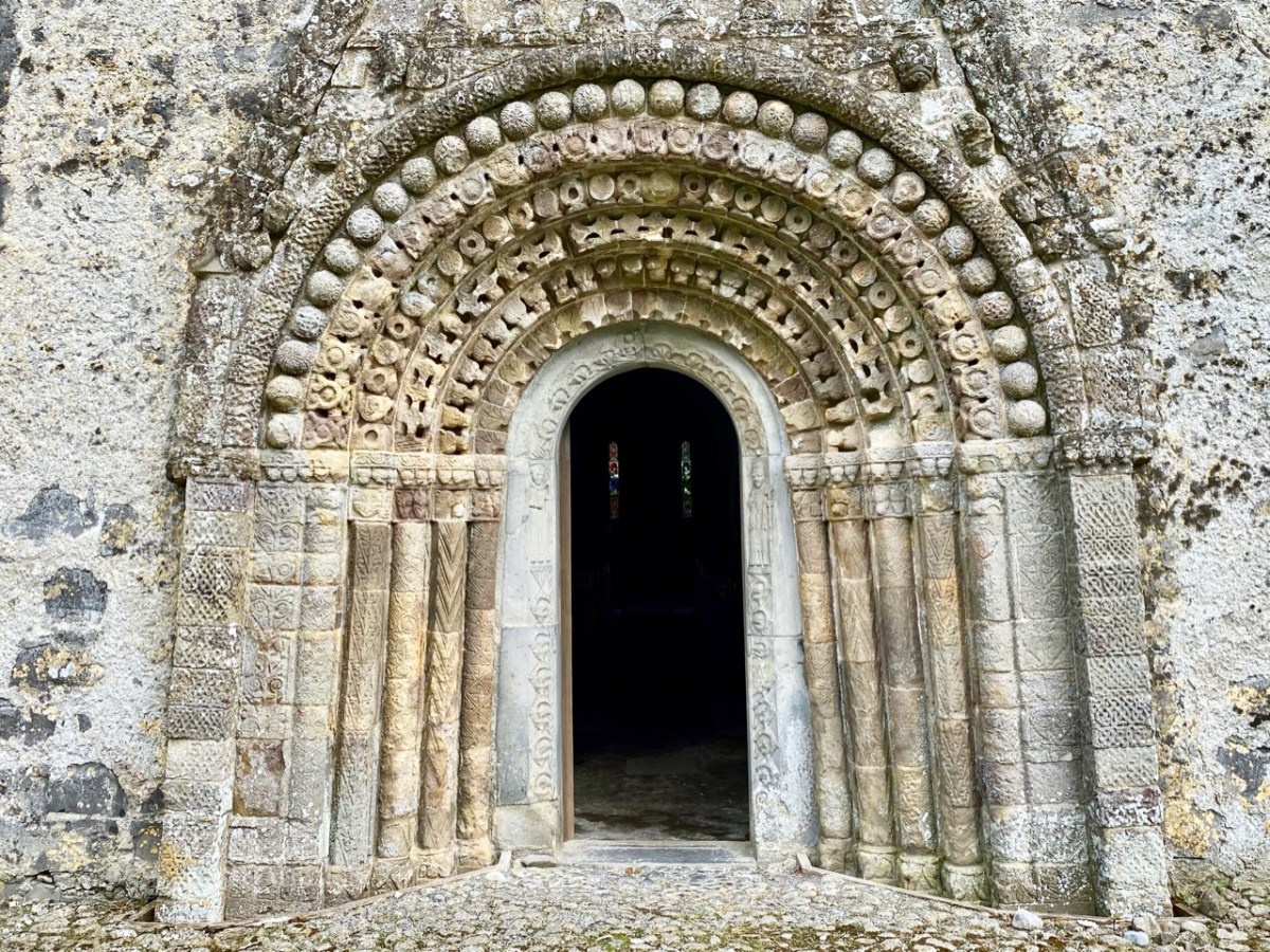
Clonfert’s grandly styled ‘Cathedral’ is so important historically, yet it could hardly be more remotely situated. From the east (upper picture above) it looks like many another Church of Ireland building, maybe not worth a second glance – unless, like us, you can’t resist examining every unturned stone because there is invariably something unexpected to be found under it. Just turn the corner and have a look at the west entrance door:

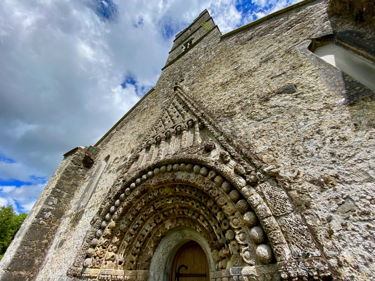
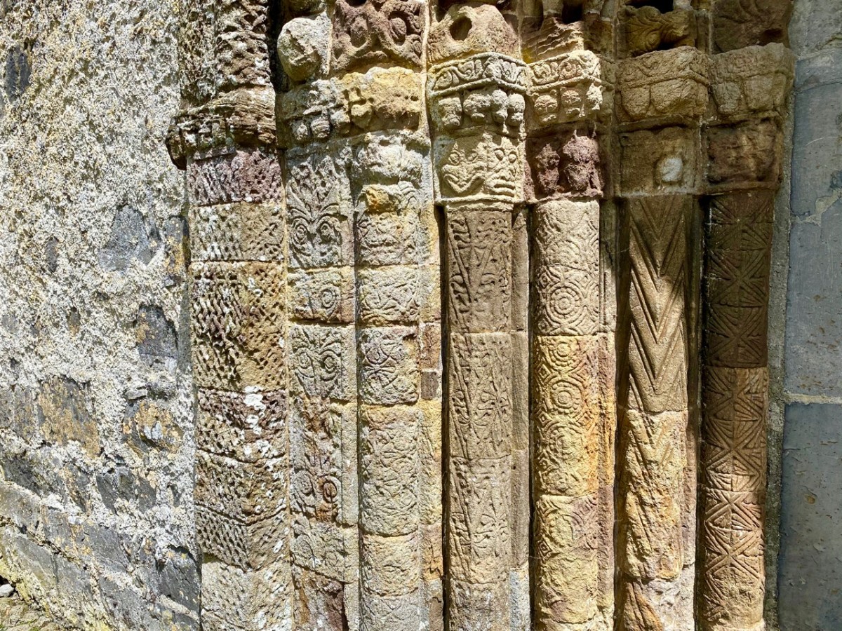
That doorway, with its exquisite decoration dating probably from the 12th century, has been described as ‘the supreme expression of Romanesque decoration in Ireland’. The carvings, although suffering from hundreds of years of wear and tear from the Irish elements, still display an extraordinary richness and variety: we can only wonder at the inspiration, skill and knowledge of the carver, who must have been deeply immersed in both lore and craft. Tadhg O’Keeffe, current Professor of Archaeology at University College Dublin, suggests a date of c1180 for this doorway. Records state that the church was burnt during a Viking raid in 1179, the same year in which a synod was held there by St Laurence O’Toole; installation of this imposing entrance may be connected with these events. Finola’s post today also explores Romanesque carvings not too far away, at Clonmacnoise. She has also written on Clonfert’s architecture in her Irish Romanesque series.

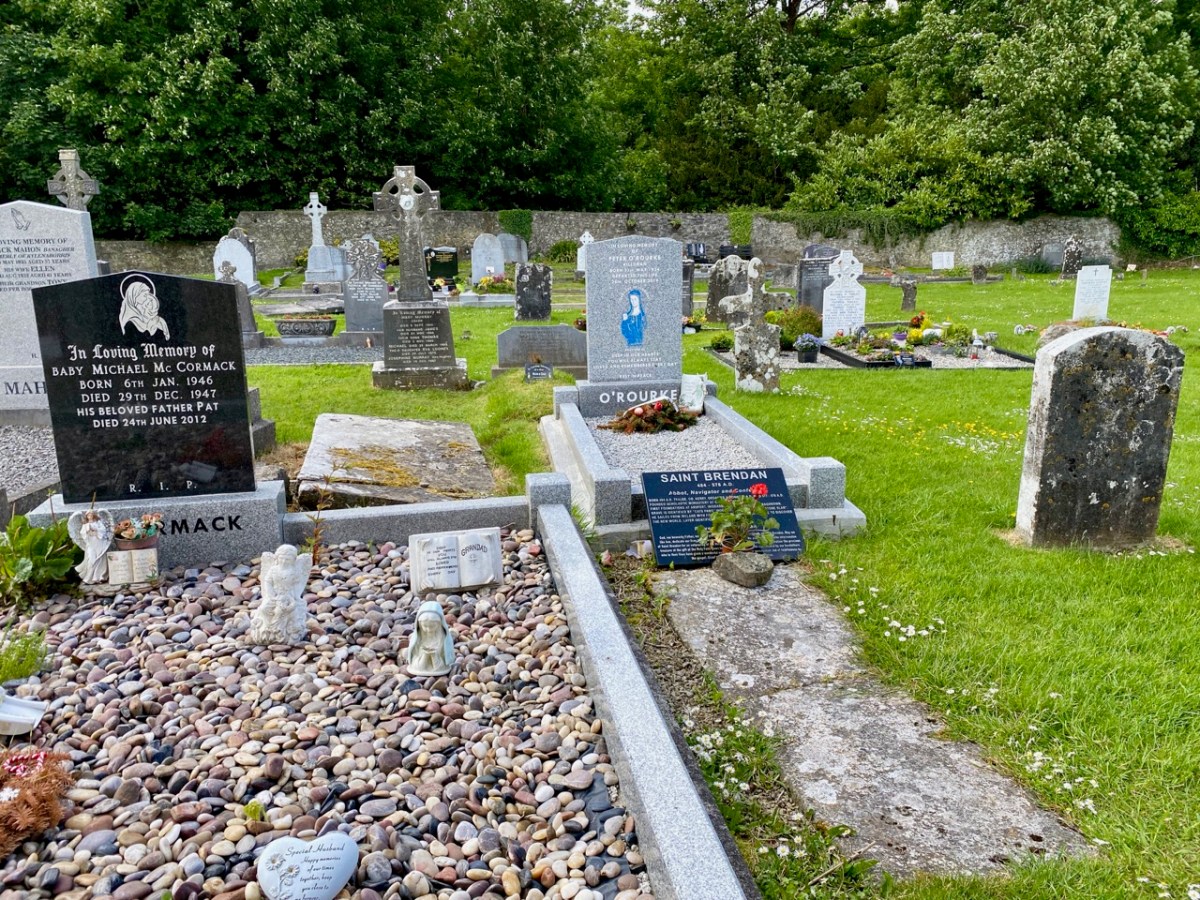
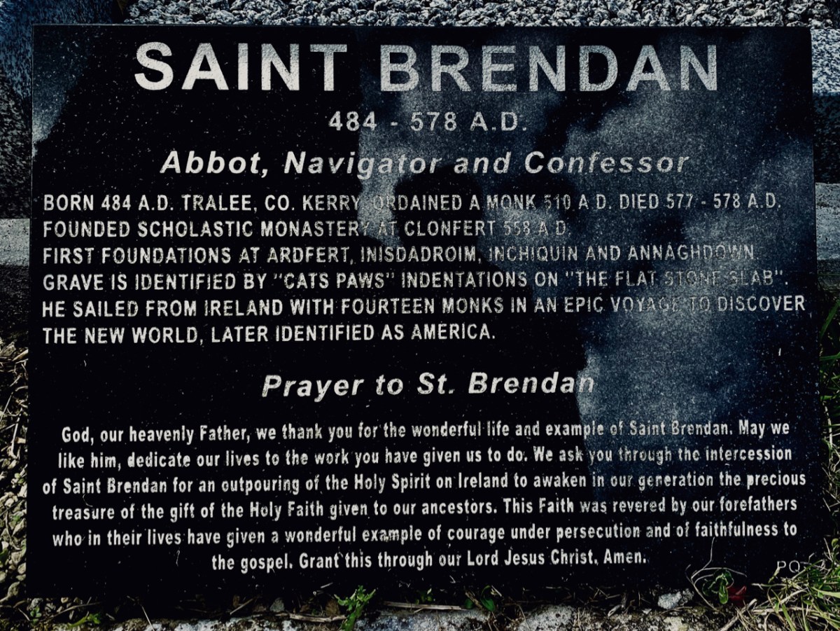
St Brendan lived from 484 to 577. We saw his birthplace in Fenit, Co Kerry, a few years ago. He founded many monasteries in Ireland but arranged for his body to be taken secretly to Clonfert Cathedral for burial as he didn’t want his remains to be disinterred by relic hunters. His grave is a stone slab just outside the great west door. On it are said to be the marks of cats’ paws – interestingly linked, according to folklore, with the many carvings of cats’ heads on the doorway arches.

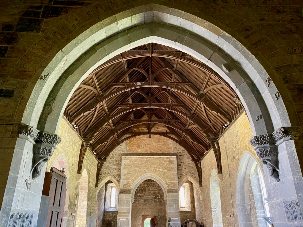
When we first visited Clonfert, many years ago, the cathedral itself was closed and we went away with the impression that we had seen all the wonders that the place had to offer by our explorations of the outside of the building and its setting. We were wrong: on this occasion the door was unlocked and there were unexpected treats hidden for us in the interior.

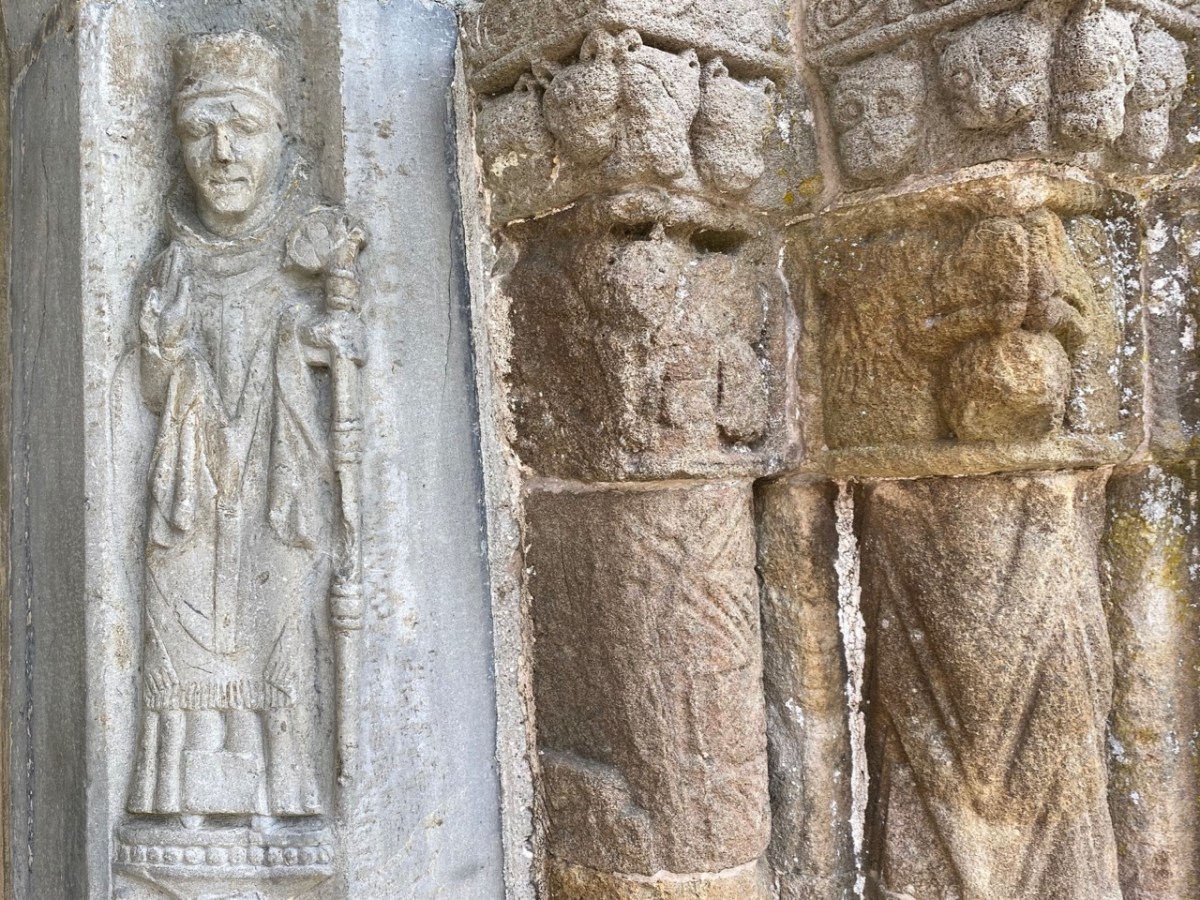
Further carvings decorate the church walls: they vary in date and style, but all are fascinating. Here is a selection – notice the seemingly random arrangement of heads and animal features on the great 15th century chancel arch, above.

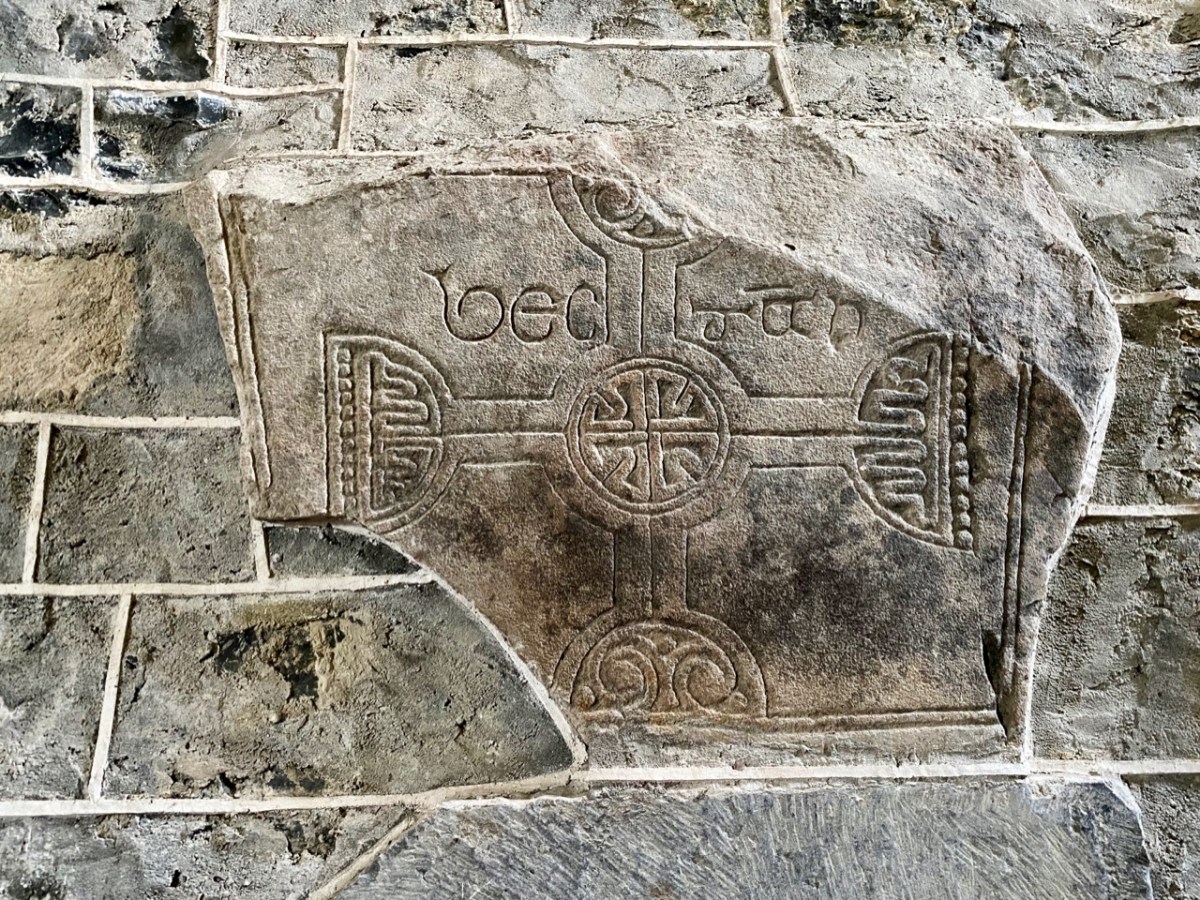
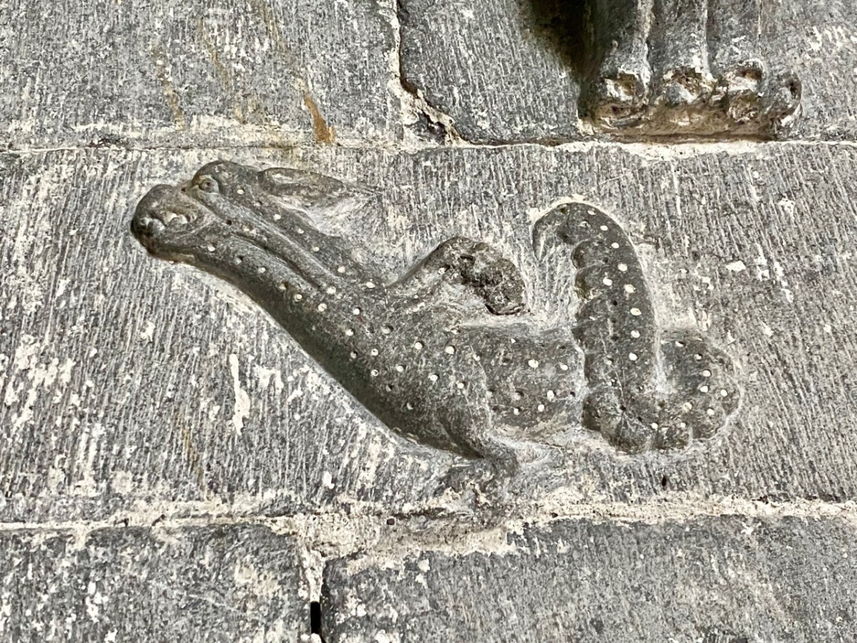
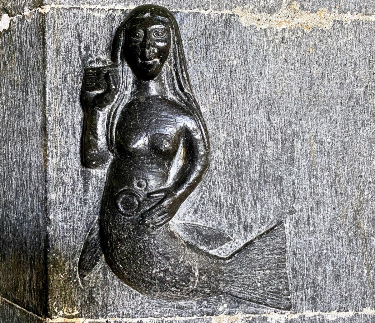
Angels, cross-slabs, a wyvern and, astonishingly, this fine mermaid complete with comb and mirror. I have found very little information to identify why these various carvings are found here in the Cathedral, apart from general legends which suggests links with Saint Brendan.

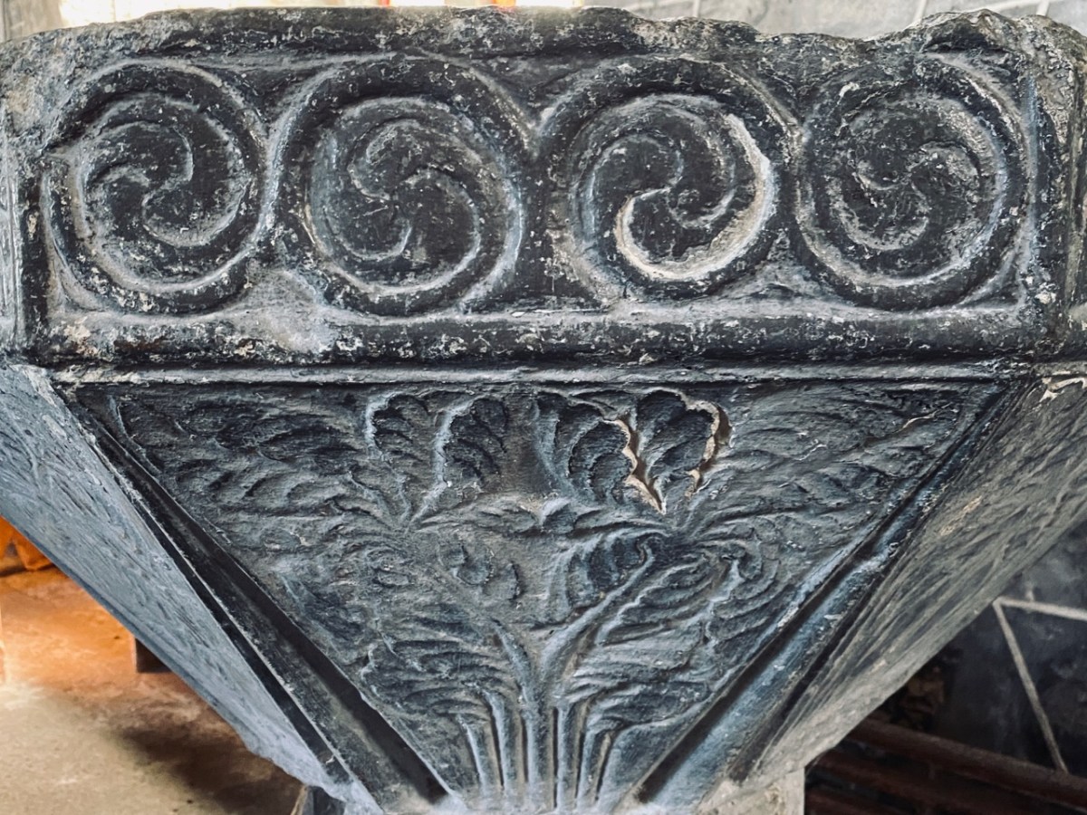
The carved stone head was found ‘in the ceiling’ when restoration work was carried out in 1985. It is said to date from around 1500, while the ancient and beautiful font is attributed to the thirteenth century. We could linger and feast on further treasures inside the church, but we need to look at the surroundings, which reveal yet more history.

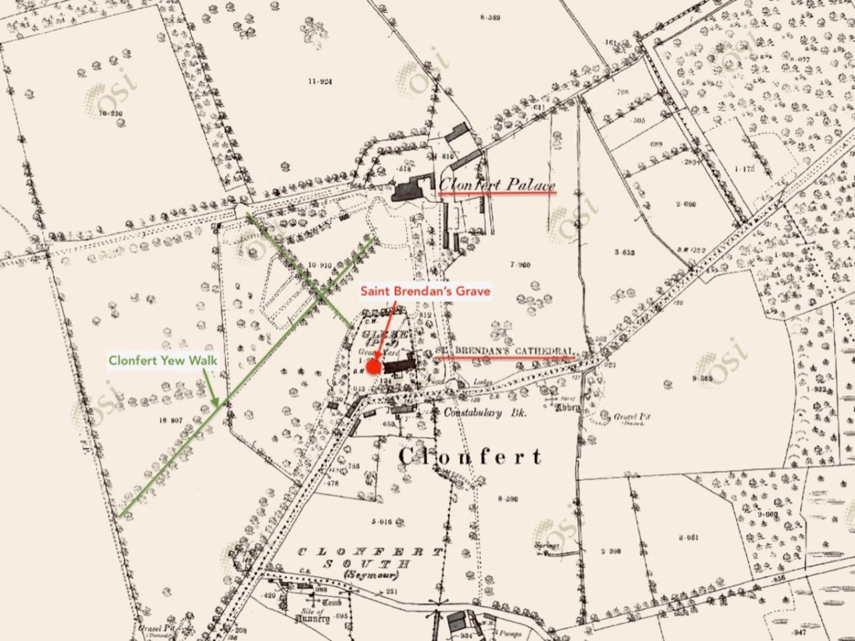
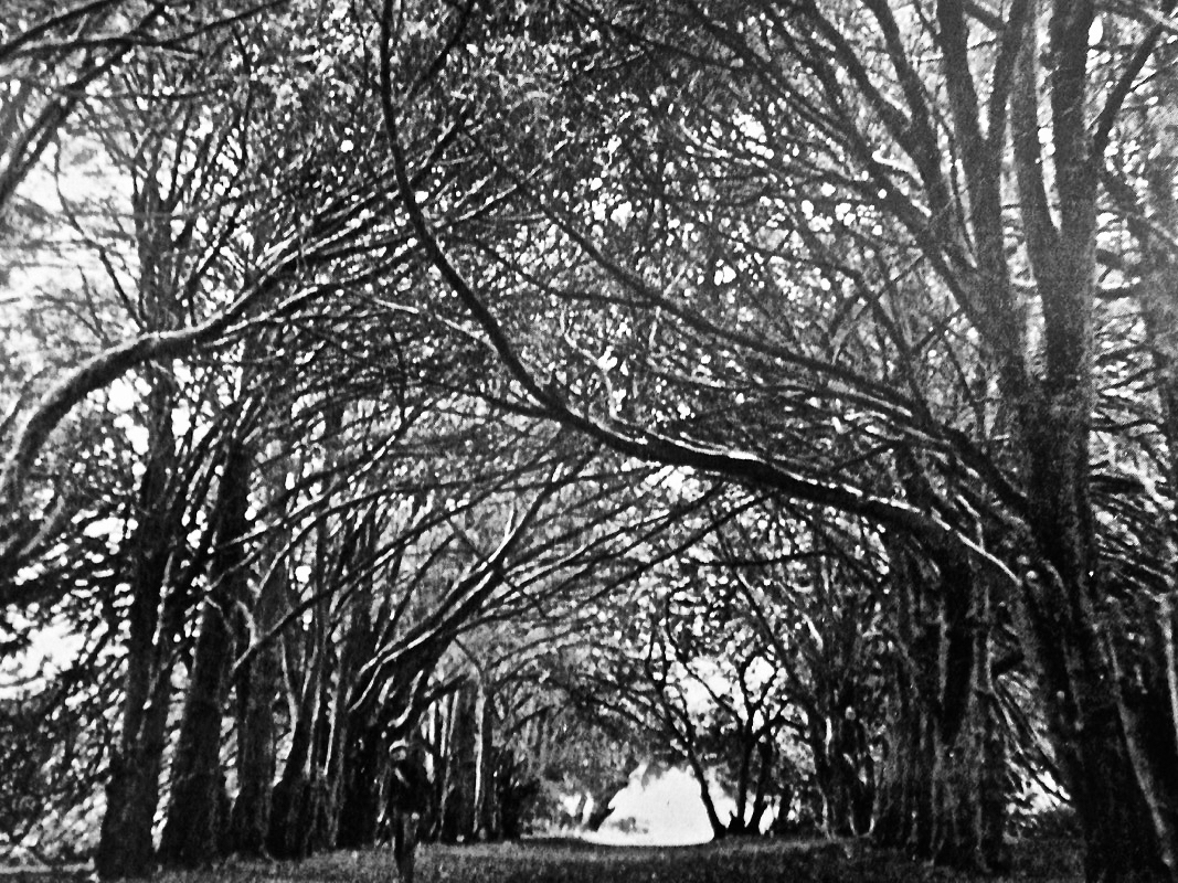
This extract from the 25″ OS map – late nineteenth century – shows the cathedral and some of the landscape features associated with it. We came here a few years ago, when we were researching Ireland’s waterways, following in the footsteps of English writer L T C Rolt. In his book ‘Green & Silver’ we read of his admiration for Saint Brendan, and his determination to find the grave at Clonfert, which he did in 1946. His book is illustrated with photographs taken by his wife Angela, and the one picture from Clonfert which is used in the book is this one of the ‘Yew Walk’ which was laid out as part of the gardens of the Bishop’s Palace, which you can see marked on the map.

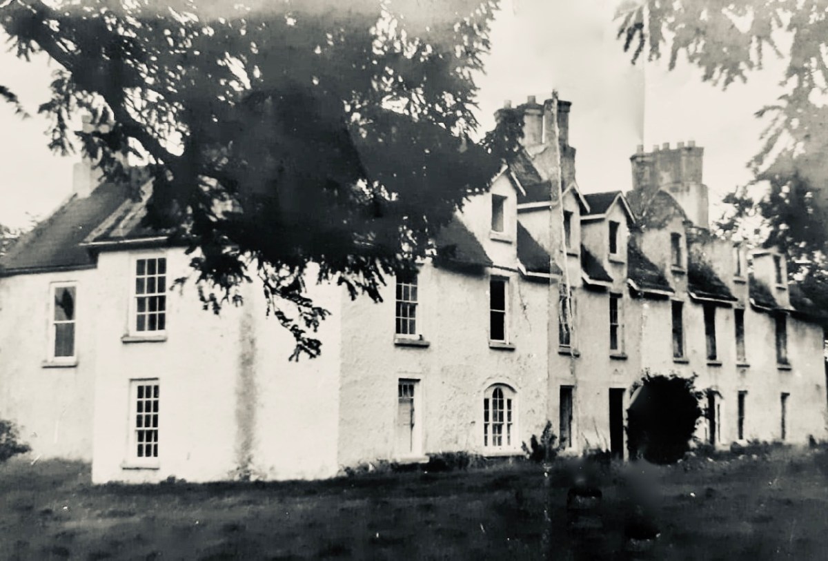
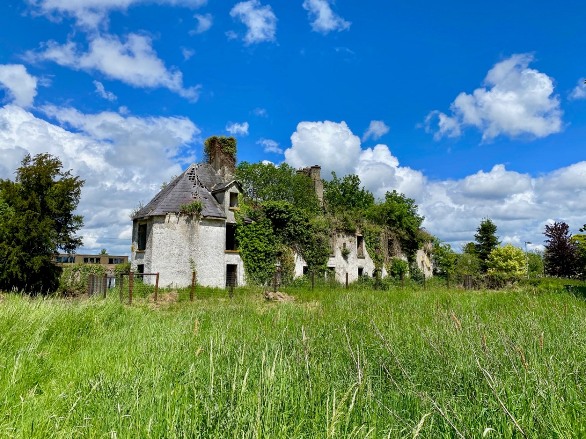
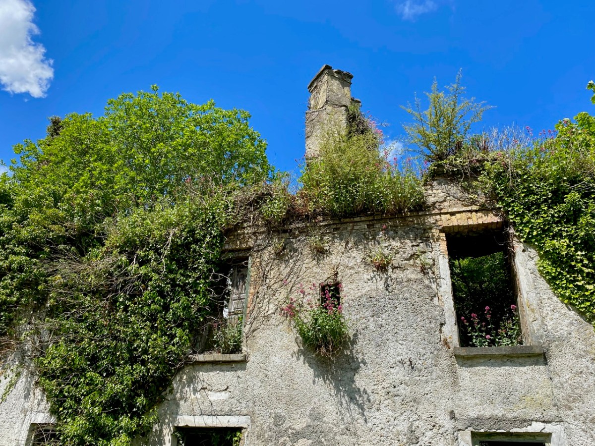
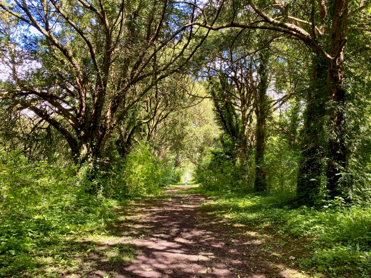
Our own photo of the Yew Walk at Clonfert was taken a few days ago. You can see that it survives, although neglected today. Some of the yew trees are said to be up to 500 years old. From the map you can also see that the Yew Walk connected the Cathedral to the 16th century ‘Clonfert Palace’, and was set out as an ornamental cruciform route, suggesting the path that might have been taken by the monks a thousand years ago. When we explored previously, we discovered the ruins of the Palace at the end of the Yew Walk, and wondered why it has been left in this state (since 1954, as we subsequently learned). The answer to that is fascinating, and I urge you to read my full account from that first visit, here. Below is a photo dating from c1950, showing the Palace at that time (with thanks to Dr Christy Cunniffe). My own photos from this week’s visit follow.

Clonfert might have been a very different place today if Queen Elizabeth had been listened to:

 . . . We are desirous that a college should be erected in the nature of a university in some convenient place in Irelande, for instruction and education of youth in learning. And we conceive the town of Clonfert within the province of Connaught to be aptlie seated both for helth and comodity of ryver Shenen running by it . . .

Queen Elizabeth, Letter to the Bishop Of Clonfert, 1579

The Queen’s advice was not taken up, and Trinity College Dublin was established instead – in 1592 – becoming Ireland’s first University.

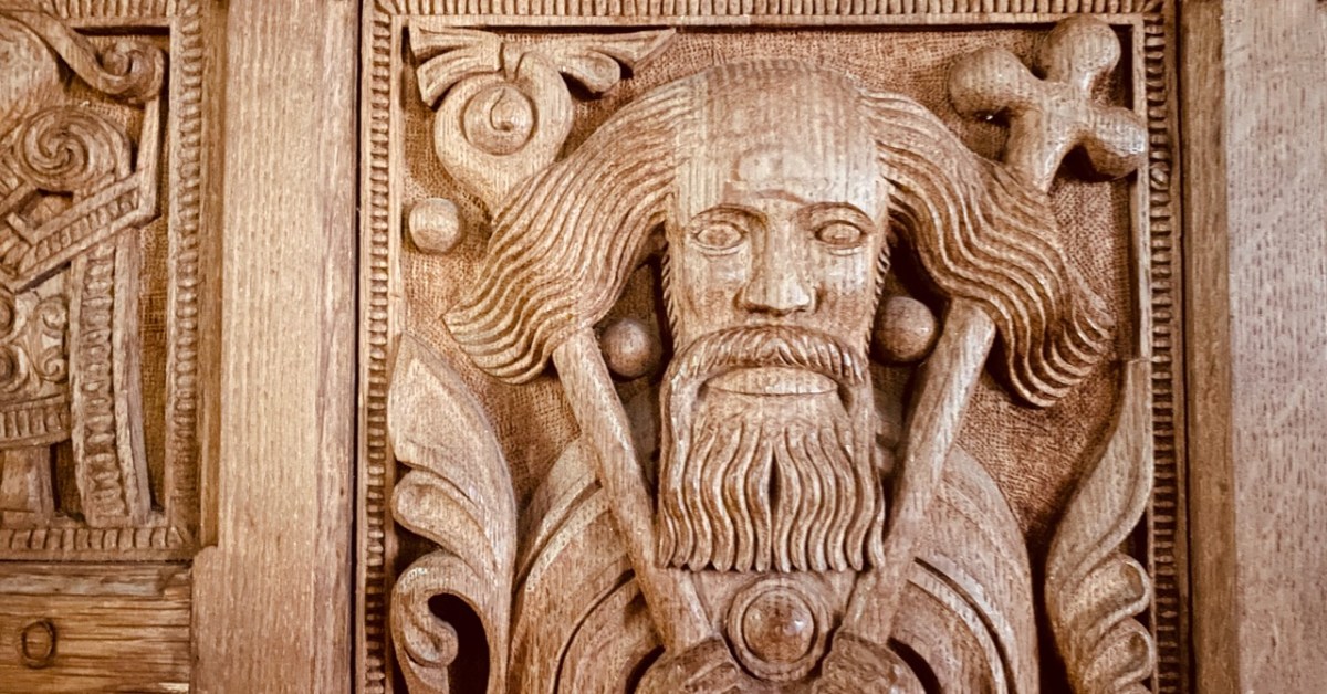
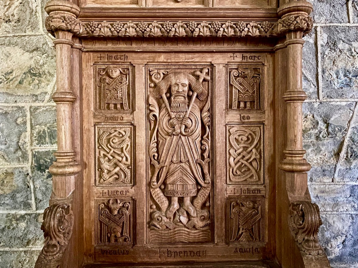
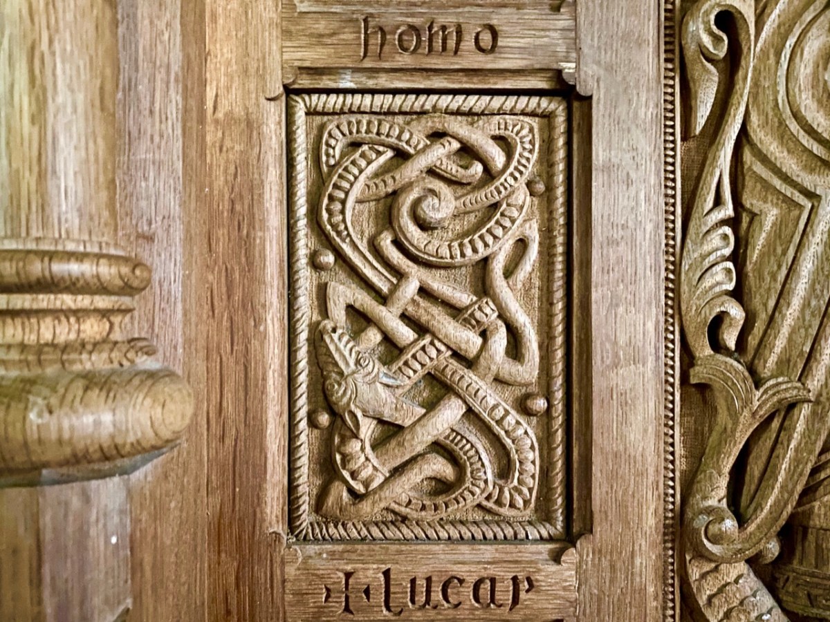
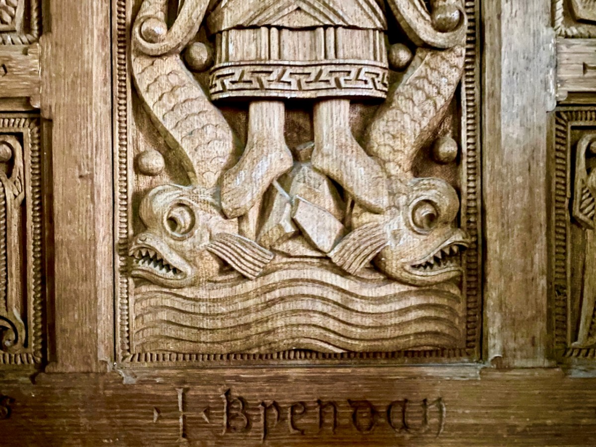
The site at Clonfert is so interesting – and covers so many periods in Ireland’s history – right up to the 20th century. It was well worth revisiting – and will merit further visits in the future, too. I’ll leave you with one aspect that probably impressed us most this time around. It’s the Bishop’s Throne which is hidden in the shadows of the Cathedral chancel. Carved from oak, most likely in the 19th century, it is a wonderful representation of Saint Brendan himself, surrounded by the Four Evangelists, crafted in the style of the Book of Kells. Look at him, also, on the header. Here is the Irish saint who set sail out on a voyage into the unknown – seeking Paradise – and discovered the World!

Ireland in the 1950s – Through the Lens of Robert Cresswell

This post complements last week’s overview of the work of Dorothea Lange, who spent several weeks in County Clare in 1954, documenting the rural way of life she observed there in over 2,400 monochrome photographs. That’s a monumental collection which can only be fully accessed by visiting the Oakland Museum of California. We are fortunate to have a book of some of her Irish work – Dorothea Lange’s Ireland – published by Eliott & Clark, Washington, 1996 and a current exhibition which includes some of her images at Dublin’s Museum of Decorative Arts & History, Collins Barracks. That same exhibition features the work of two further documentary photographers, one of whom is our subject today: Robert Cresswell (below):

The Paris-based American anthropologist Robert Cresswell (1922-2016) remained on in France after WWII, having served in the US army there for four years. Following the completion of his studies in anthropology in Paris, he arrived in Ireland in 1955 with the ambition of carrying out an anthropological analysis of an Irish rural community. Taking the advice of the Irish Folklore Commission he chose Kinvara, County Galway. The small rural town of Kinvara and its agricultural hinterland would become the base for his study, published in 1969 as ‘Une Communauté Rurale de l’Irlande’ . . .

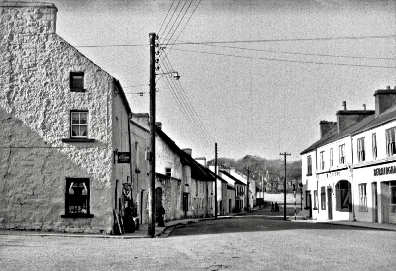
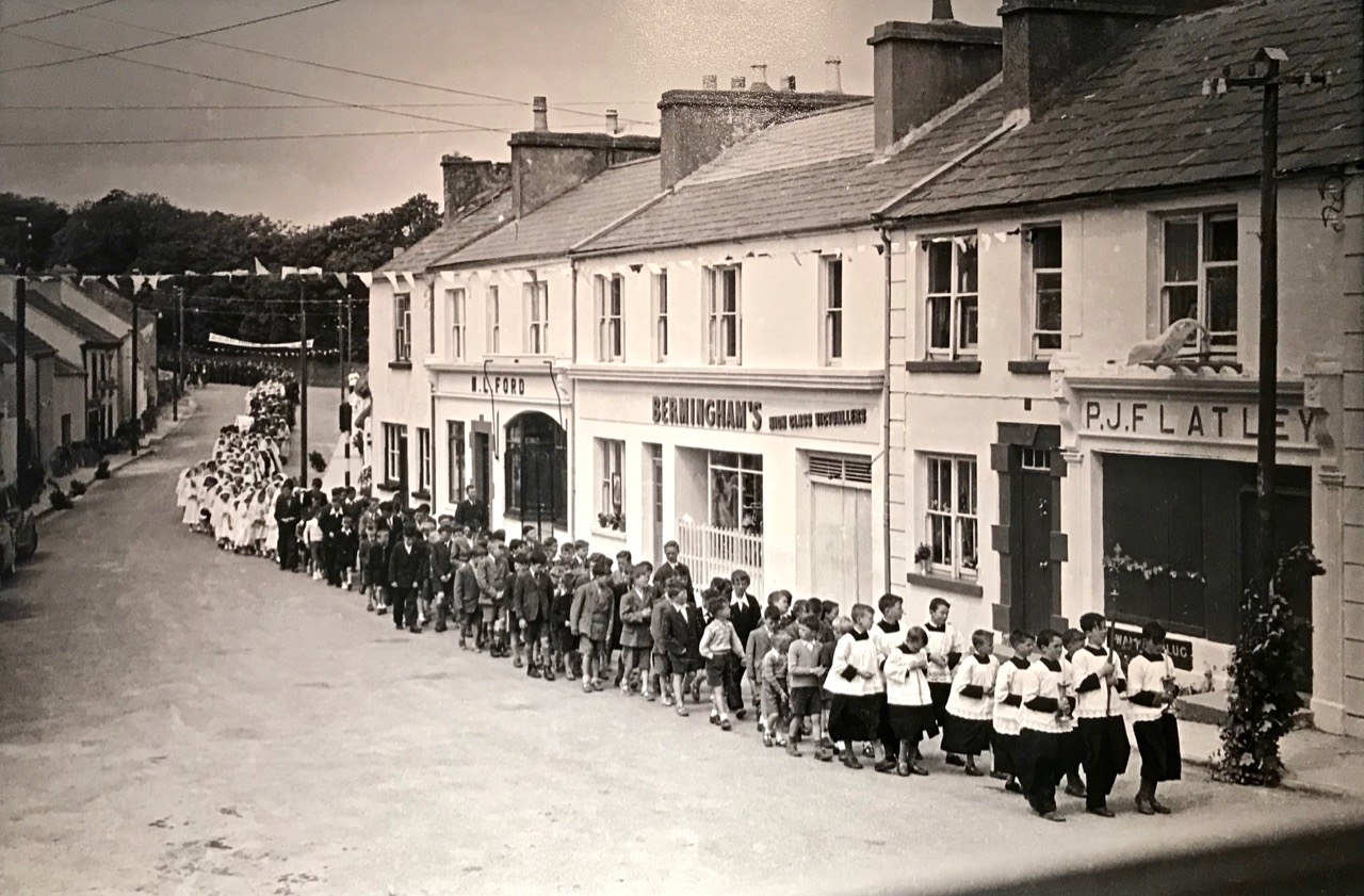
Header – Kinvara on Fair Day, 1955 by Robert Cresswell. Above – Kinvara, Co Galway, streetscape; compare these to Dorothea Lange’s views of Ennis and Tulla, Co Clare (in last week’s post), taken in the same period

While the photographic essays by Dorothea Lange and Robert Cresswell bear close comparison – and how hugely interesting it is for us to see Irish rural life through those lenses nearly 70 years ago – it’s fascinating to consider that both came from very different backgrounds and disciplines, but were equally absorbed by the iconic images each of them was capturing – giving us a visual ‘time capsule’ of Ireland as it was apparent a few generations ago.

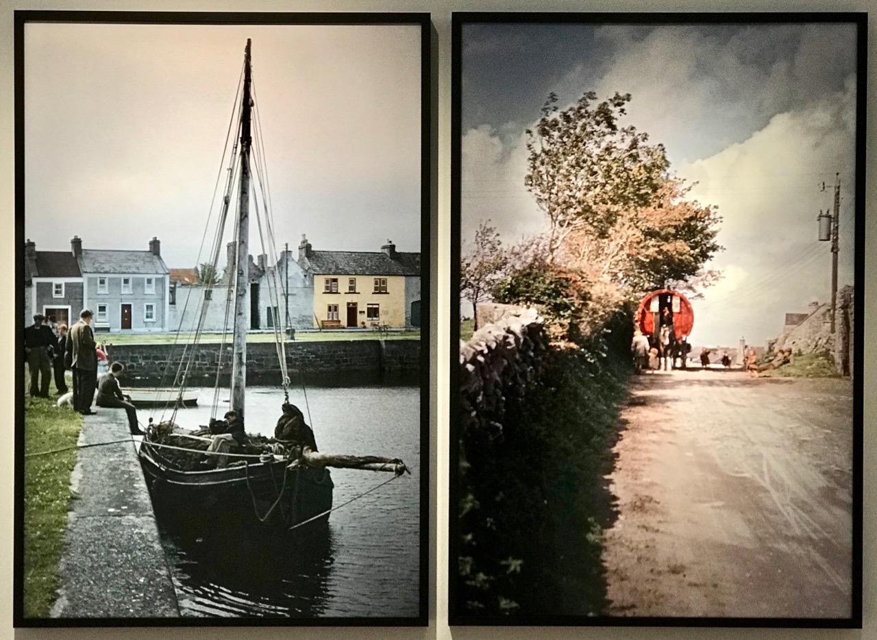
Above – examples from the Dublin exhibition showing the work of Cresswell taken from his colour slides

Robert Cresswell was a pioneer in some respects, in that he used Kodachrome film to produce colour slides, in the days when monochrome documentary photography was the norm. Some professional photographers could not cope with the idea of using colour, partly because they considered the images were not realistic. Ansell Adams felt that ‘. . . color could be distracting, and could therefore divert the artist’s attention away from creating a photograph to its full potential . . .’ while Henri Cartier-Bresson famously uttered his opinion that ‘. . . color is bullshit . . .’ – which was all he ever said about it, allegedly! My own (humble) opinion is that there is something about monochrome photographs which seems to draw the eye and enhance the atmosphere, particularly with historic images. I can’t explain this – there is no logic: it’s just a personal response which I am always aware of.

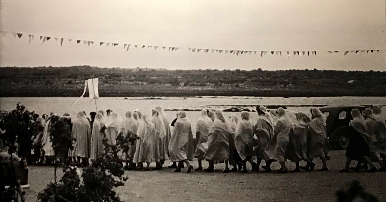
Above – monochrome Kinvara: the Forge, and Corpus Christie procession

Robert Cresswell lived in the Kinvara community for fifteen months between 1955 and 1956, returning for short periods in 1957 and 1958. The quotations in this post are from the exhibition text panels:

Capturing more than five hundred images . . . Cresswell photographed the people of Kinvara, their countryside, their work on sea, shore and land, the daily lives, religious processions, and fairs and markets. Documenting the changes that were occurring in the shift from a traditional farming community to a wider market-led economy, he was motivated to emphasise a community in transition over one operating in the continuity or stagnation of tradition. His photographs generally portray a well-functioning society, but his interpretation of emigration as the ultimate destructive agent in community and country profoundly influenced his understanding of rural life in a small community in 1950s Ireland . . . The population of the parish of Kinvara sustained a net loss of 80% between 1841 and 1956 . . .

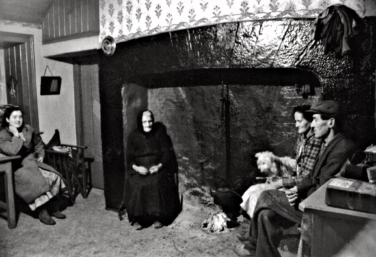
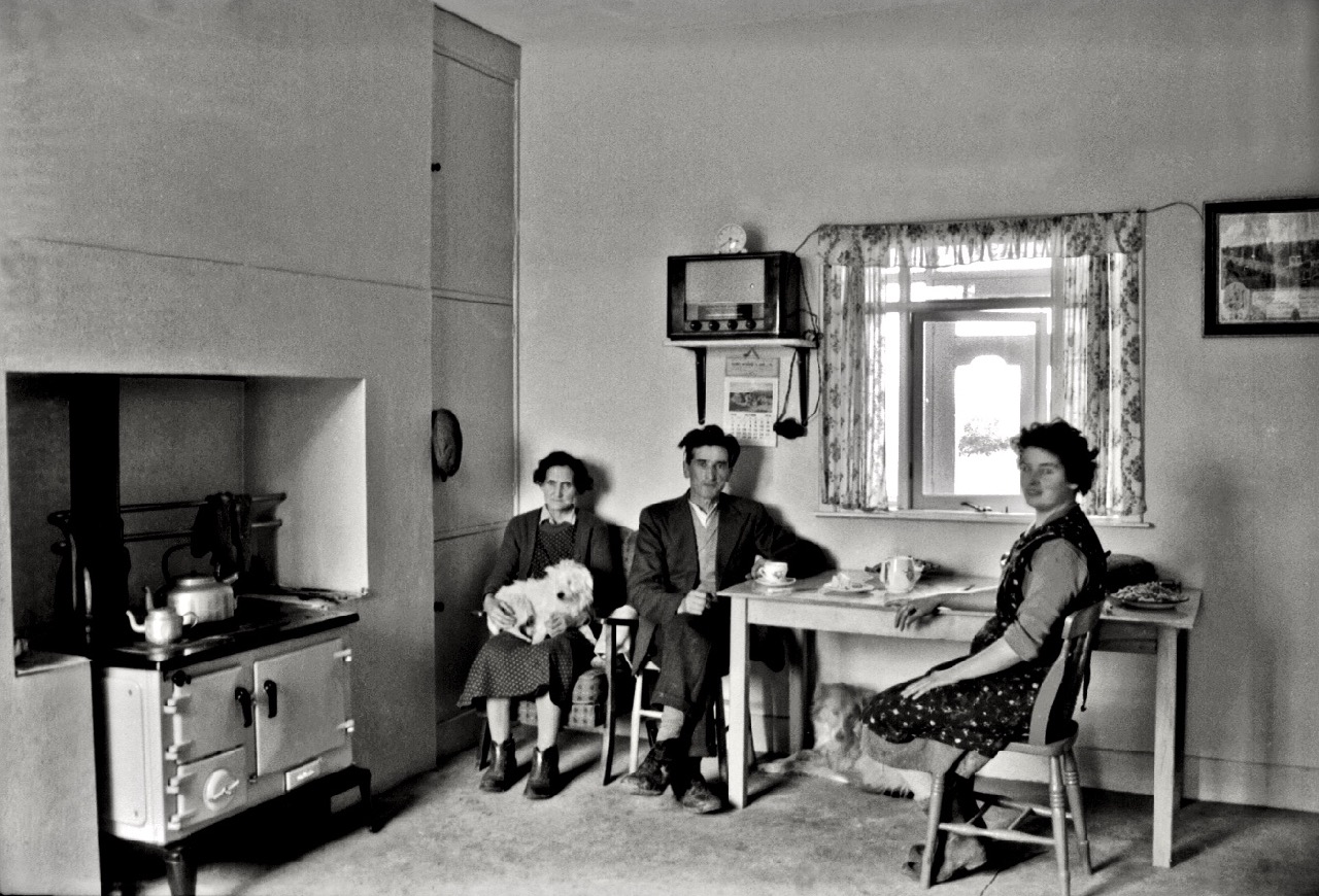
Above: a community in transition – contrasting pictures of family life in Kinvara recorded by Cresswell in the mid 1950s

Tempting though it is to show you much more of Cresswell’s work here, I really want you to go and see for yourselves. The exhibition at Collins Barracks, Dublin continues until April this year, and is well worth making the effort to visit. Robert Cresswell lived a long life; in 2010, then aged 88, he donated his entire collection of documentary photographs and cine film of Kinvara to the Irish nation. He waived his own copyright to this unique work in favour of all persons who wish to use any of it for educational or heritage purposes (but not for commercial gain without prior permission). Copyright now rests with Kinvara Community Council, who have published an excellent website here. I have used a small number of images from the collection to supplement those we found at the exhibition, in order to give you a fair cross-section of the entirety of Cresswell’s opus.

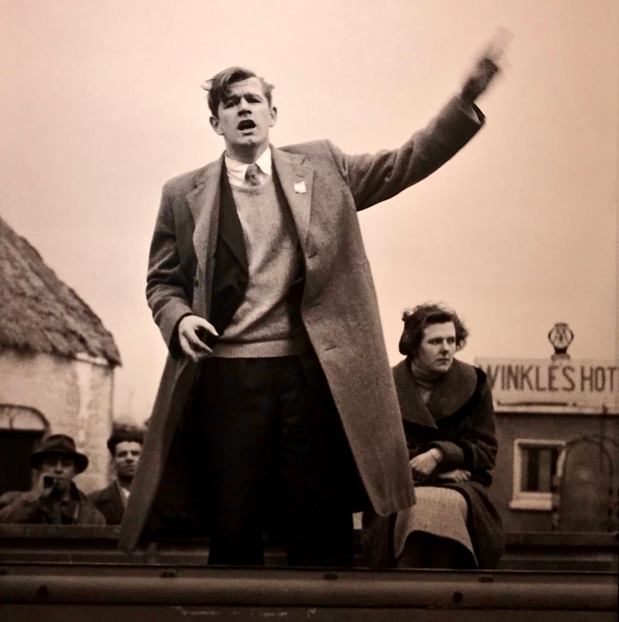
In a mirror of present-day events in Ireland, here’s a shot by Cresswell of the Sinn Fein candidate Murchadh Mac Ualtair canvassing in Kinvara for the 1957 General Election with Peggy Linnane. In that election Fianna Fáil, under Éamon de Valera, took 78 seats with 48.3% of first preference votes, and Sinn Féin took 4 seats with 5.3% of first preference votes. In our 2020 election, just passed, Sinn Féin, under Mary-Lou McDonald, took 37 seats with 24.5% of first preference votes in a thoroughly divided result, leaving us all in a bit of a dilemma! But I digress . . .

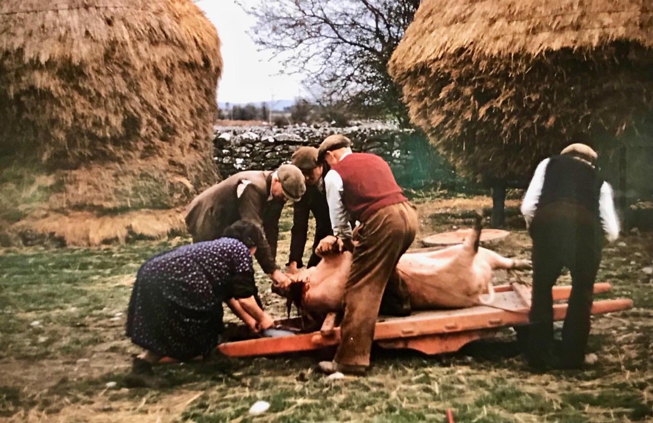
Another of Cresswell’s colour images, showing the killing of the pig – a family affair

There is one more photographer in this exhibition, who I will feature in a future post – watch this space! One last image from Robert Cresswell, possibly another view of the Corpus Christie parade: